WCCLRMA. Revenue Assessment for Area TRZ. Loop 20 Preliminary Tax HNTB. WEBB COt: ~ - TY - CITY OF LAREDO REGIONAL MOBILITY A"LTHORITY.
|
|
|
- Owen Gallagher
- 5 years ago
- Views:
Transcription

1 WCCLRMA WEBB COt: ~ - TY - CTY OF LAREDO REGONAL MOBLTY A"LTHORTY Loop 20 Prelmnary Tax Revenue Assessment for Area TRZ June 18, 2018 HNTB
. For that goal, WC-CL RMA has commssoned TXP to develop a prelmnary tax revenue assessment for an Area Transportaton Renvestment Zone (TRZ).")
2 The Webb County Cty of Laredo Regonal Moblty Authorty (WC-CL RMA) s vgorously nvestgatng methods of fundng for the upgrade of Loop 20 South (Cuatro Ventos) from US 59 to the new proposed Port of Entry (Brdge 5). For that goal, WC-CL RMA has commssoned TXP to develop a prelmnary tax revenue assessment for an Area Transportaton Renvestment Zone (TRZ). 2 HNTB ~
3 A muncpalty desgnates a contguous geographc area as the boundary of the TRZ and captures the ncrease n tax revenues resultng from growth spurred by a desgnated project(s). All or a porton of the future captured revenues can be used n connecton wth project fundng- growth helps to pay for tself. s NOT a tax ncrease 3 HNTB
4 Purpose of a TRZ s to: - Promote publc safety - Facltate the mprovement, development, or redevelopment of property - Facltate the movement of traffc - Enhance a muncpaltes ablty to sponsor a transportaton project. A muncpalty must make fndngs that: - the area wthn the TRZ s unproductve and underdeveloped - Creaton of a TRZ wll further "Purpose of a TRZ" as lsted above. 4 HNTB

5 - ~ a. a. < Creaton oftrz Tme Termnaton oftrz 5 HNTB
6 TXP study focused on the followng major tasks: Economc & Real Estate Assessment of the Loop 20 Area 2. Collect and Analyze Webb County Apprasal Dstrct Data Establsh a Loop 20 TRZ Prelmnary Tax Revenue Forecast 4. Create 30 Year Tax Revenue Forecast 6 HNTB
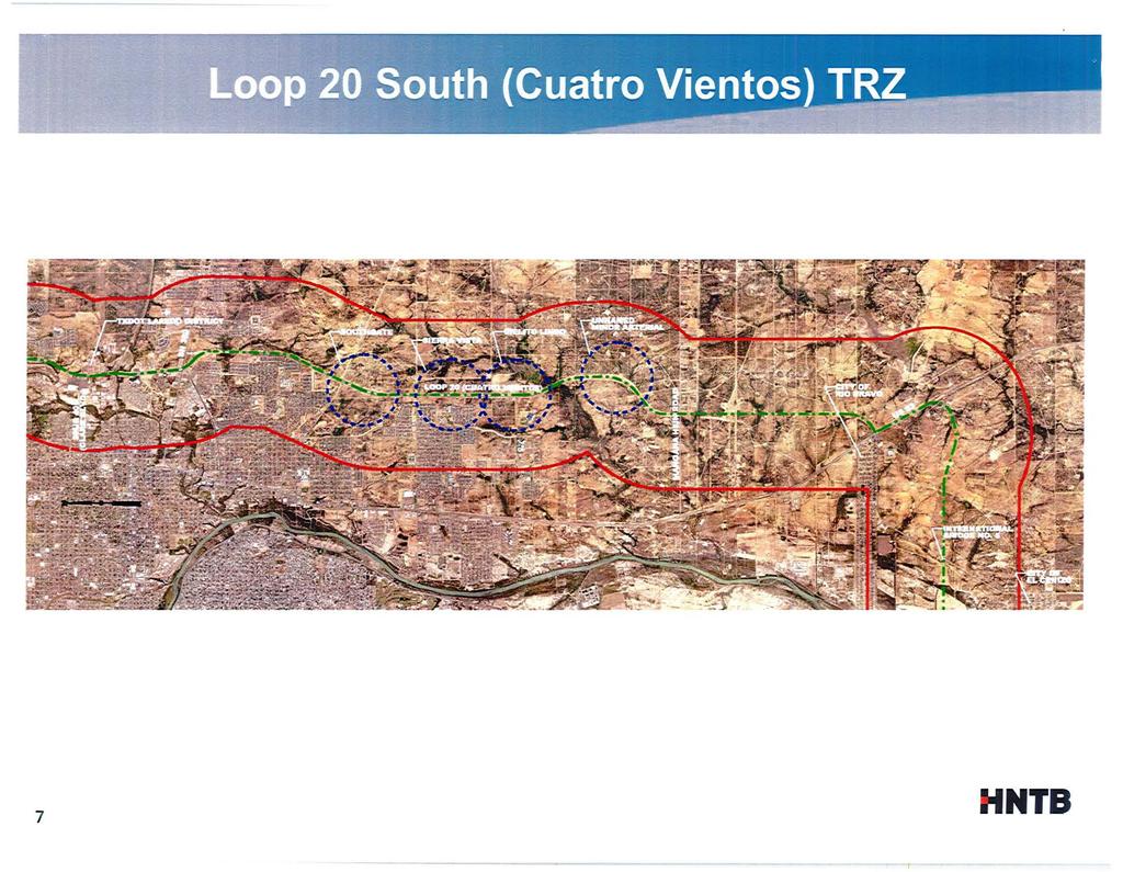
7 7 HNTB
8 -..,.r4"'_,_, Nu.. vc. L=" ""oo,~ - -~ - F,.. h 1.,,,,,,..,.,,,P... ~ ~... ~ 8 u r--n,,.. 1" : Laredo C1ty L1m1ts - US 83 to Brdge #5 US 83 to Brdge 1-Mle Buffer - US59toUS83 US 59 to US 83 1-Mle Buffer Esr. HERE. Delorme. Mapmylndaa. C OpenStreetMap contnbutors. and the GS user communty
9 .. Flood Zones.,... _ 1..,.,,: Laredo Cty Lmts - US 83 to Brdge #5 US 83 to Brdge 1-Mle Buffer - US59toUS83 US 59 to US 83 1-Mle Buffer 9 Esr. HERE. DeLorme. Mapmylnda. C Op en:strj@j~ e.. GS user communjty

10 ! ' -...,. ~ Laredo Cty Lmts - US 83 to Brdge #5 - US59toUS83 10 Esr, HERE. Delorme, Mapmylnda, C OpenStreetMap contrbutors, and the GS user
11 N upvo L;:uF- rto.l.lrorj\.ll'tfo... Y\..,,..,..,,#....,.. # # -~- # ; ; ' H.lt r_...~ "!.-- ~~ '" ~-, ' ~...,._..,.,,: Laredo Cty Lmts - US 83 to Brdge #5 - US 59 to US Esr. HERE. DeLorme. Mapmylnclla. C OpenStreetMap contrbutors. and the GS user communty
12 ... w, t"!n\.l (\o".;,.,._.,""""'1"' # ' l ~ #' #',,..., r: '::V...,...,,._ '.. ;!,- ~ ~ Laredo Cty Lmts - US 83 to Brdge #5 - US 59 to US 83 c=j Master Plans 12 Esr, HERE. DeLorme. Mapmylnda. ~ OpenStreetMap contrbutors. and the GS user communty

13 Pr-old.lt1 t-' lt.f.'~.. ";.V ;,_.. -: 1!....._... ~ Laredo Cty Lmts New Resdental Permt Actvty - US 83 to Brdge #5 - US59toUS83 13 Esr. HERE. DeLorme. Mapmylnd1a. Q OpenStreetMap contrbutors. and the GS user communty
14 , ~~.. lu:::v, : ~ '!.-.. #' # ',#- - - tow. P.t -."'.rt" J Laredo Cty Lmts - US 83 to Brdge #5 - US 59toUS 83 Net Household Change 2018 to Esr. HERE. Delorme. Mapmylnda. ~ OpenStreetMap contrbulors. and the GS user communty
15 l.lf'm.'w'ht)f_,... ~~ t... t ' ~! ; ;.-. _.l ""'"' llff' ;.,,., Laredo Cty Lmts - US 83 to Brdge #5 - US59toUS83 Net Employment Change 2018 to [ Esr. HERE, DeLorme. Mapmylndoa, e OpenStreetMap contrbutors. and the GS user

16 Based on the geometry of the TRZ, the followng tems were taken nto account: Porton of the TRZ East of the Loop 20 ROW Corrdor s outsde the Cty Lmts. The area s generally resdental development and vacant long trangular tracts. Based on dscussons wth the Land Owners, the projected future development wll be smlar. A potental lmtng nfrastructure ssue dscussed n the southern and southeastern porton of the study area s the lack of current waste water nfrastructure whch lmts development. Currently, Loop 20 termnates at Mangana-Hen Road. n addton, a potental Loop 20 TRZ would nclude the area west of Loop 20 from US 83 to the proposed Brdge #5. TXP assumed ths new brdge crossng would not open for 10 years and the Loop 20 would be extended South of Mangana-Hen Road. 16 HNTB.

17 TRZ Revenue projected for 30 years Because the Cty of Laredo stll needs to provde basc servces to resdents and busnesses, assumed a maxmum future ncrement of 50%. Assumed that the area East of Loop 20 would be annexed by the Cty of Laredo. Assumed that the utlty nfrastructure (water and sewer) South of the Las Lomas ntersecton would be mplemented to contnue to spur development along the Corrdor. 17 HNTB

18 Scenaro 1 s based the most recent fve-year pattern of resdental buldng permts wthn the TRZ buffer area to project household growth. TXP held the countywde rato of populaton to employment constant for 30 years. Scenaro 2 combnes the Laredo MPO TAZ forecast data wth estmated home value based on stakeholder feedback. The consensus was south Laredo would begn attractng a more expensve housng product than n the past. Ths scenaro assumes a new home s taxed at $125,000 ($2017). Scenaro 3 uses the Laredo MPO TAZ forecast, but the startng resdental value for new unts s based on the exstng 2017 average value of roughly $100,000 for the buffer area (house plus land). Ths reflects uncertanty over how many moble home unts wll be attracted to ths area and the tax law about whether or not the moble home s treated as real or personal property. 18 HNTB

19 TRZ Allocaton ($ Mllons) Scenaro 1 10% 20% 30% 40% 50% Total $26.7 $53.4 $80.1 $106.8 $133.5 NPV@ 5% $9.6 $19.1 $28.7 $38.3 $47.8 Scenaro 2 10% 20% 30% 40% 50% Total $48.9 $97.9 $146.8 $195.7 $244.6 NPV@ 5% $17.3 $34.6 $51.9 $69.1 $86.4 Scenaro 3 10% 20% 30% 40% SO% Total $42.0 $84.0 $125.9 $167.9 $209.9 NPV@ 5% $14.8 $29.6 $44.4 $59.2 $
20 Total Project Cost for the Fve Overpasses and the Southern Extenson of Cuatro Ventos to the new Brdge No. 5 s approxmately $200 mllon. Over the next 30 years, a Loop 20 South TRZ could generate between $133.5 mllon and $244.6 mllon n nomnal ncremental tax revenue assumng a 50 percent allocaton to the TRZ. Usng a 5.0 percent dscount rate, the hypothetcal TRZ could generate between $47.8 mllon and $86.4 mllon (Net Present Value). 20 HNTB.

21 21 The Loop 20 mprovement projects are a crtcal component of the Cty of Laredo's overall transportaton system. The project would provde mproved access to thousands of acres of undeveloped land between US 59 and US 83. The Loop 20 project would support a catalytc Brdge #5 that could transform ths porton of Webb County. f the Cty of Laredo decdes to move forward wth a TRZ, the followng are the next steps: ~ Refne the TRZ boundary to exclude exstng developed propertes n the north and northwestern porton of the study area. ~ Consder extendng the TRZ boundary east along State Hghway 359 to take advantage of pendng projects that would access and utlze Loop 20 mprovements. ~ Collaborate wth landowners on annexaton wthn the study area so as to capture the ncrement from new development pror to constructon begnnng. ~ Recalculate the TRZ ncrement value based on the above and move forward wth mplementaton HNTB
22 QUESTONS? 22 HNTB.