Coastal Resilience Study. City of Lynn, MA May 31, 2016
|
|
|
- Audrey Blankenship
- 5 years ago
- Views:
Transcription


1 Coastal Resilience Study City of Lynn, MA May 31, 2016
2 Presenters Frank Ricciardi, P.E. Weston & Sampson Project Manager Erin Healy Anchor QEA Project Manager Robert Almy Weston & Sampson Technical Leader Mark Mahoney Anchor QEA Senior Ocean Engineer
3 Coastal Resilience Study Adaptation Strategies for Critical Infrastructure Infrastructure Vulnerability and Risk Assessment Coastal Protection and Vulnerabilities Adaptation Strategies Working Group Meeting Public Meeting #3 May 31


4 VULNERABILITY AND RISK ASSESSMENT SUMMARY Sea Level Rise Source: NOAA Storm Surge Source: Multiple lines of evidence based on comparison of SLOSH model results to FEMA mapping and other analyses
5 Consequence Environmental Contamination Ecosystems Community Health & Safety Services Utilities Transportation Cultural Resources Economic Commerce Costs to repair and replace damage
6 Public Facilities at Risk Coastal Protection Transportation Energy and Utilities Drainage and Sewer Medical Facility
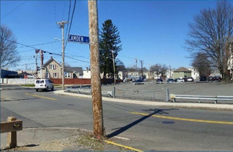
7 Facilities with Highest Risk Coastal Protection Measures Seawall at Riley Way Ext. Drainage and Sewer Camden Street Sewer Lift Station Blossom Street Sewer Lift Station Reed Street Sewer Lift Station Hanson Street Sewer Lift Station Health care Habit Management Center DCR Skating Rink Transportation Gear Plant Heliport Critical Intersections Lynnway and Commercial Nahant Circle Lynnway and Blossom Lynnway and Broad Summer and River (Camden)


8 Adaptation

9 Coastal Protection
10 Seawall at Riley Way Extension Protects landfill and waste water treatment plant Seawall is damaged and non-functioning Erosion assessment: Scenario: 100-year storm, high SLR 2041 and 2066 Wave heights 4 to 5 feet for a 100-year storm Estimated erosion: 7.1 feet (2041) and 17.6 feet (2066)


11 New commercial or public development Commercial or public development Space is available between infrastructure and the high tide line Green design including natural coastal protection elements Provides recreational space Living with Water concept Coastal Solutions

12 Commercial Development with limited space between the high tide line and infrastructure Hard coastal protection Habitat provided in subtidal shelf seaward of the hard structure Deployable seawall would be deployed prior to extreme storms, and allows the permanent hard structure to be low enough to allow an ocean view Coastal Solutions


13 Existing Residential Coastal Protection Lower cost solutions for existing residential areas Minimal space between high tide line and structures Deployable seawall would be deployed prior to extreme storms, and allows the permanent hard structure to be low enough to allow an ocean view Habitat enhancement on vegetated rock revetment Raising house freeboard improves resiliency Coastal Solutions
14 Transportation Critical Intersection Nahant Circle Lynnway and Blossom Emergency Transportation Heliport

15 Transportation

16 Nahant Circle Adaptation Options: Extend seawall Extend dune system from the south; improve drainage along road Transportation
 STORMWATER INFILTRATION & RETENTION (Accommodation) ELEVATION (Retreat) EMERGENCY PLANS (Programmatic) Roadways")
17 ADAPTATION STRATEGIES DEPLOYABLE FLOOD WALLS BETWEEN LYNNWAY AND WATERFRONT (Protection) PERMANENT FLOOD BARRIERS BETWEEN LYNNWAY AND WATERFRONT (Protection) STORMWATER INFILTRATION & RETENTION (Accommodation) ELEVATION (Retreat) EMERGENCY PLANS (Programmatic) Roadways Adaptation
18 Drainage and Sewer Sewer Lift Stations (inundation) Camden Street, Reed Street Storm drain Facilities (change in gradient) Lynnway/Harbor area Western Avenue area

19 ADAPTATION STRATEGIES WET FLOODPROOFING (Accommodation) DRY FLOODPROOFING (Protection) ELEVATION (Retreat) PERMANENT FLOOD BARRIERS (Protection) REDUNDANCY (Programmatic) STUDIES (Programmatic) WETFLOOD PROOFING prevents or provides resistance to damage from flooding while allowing floodwaters to enter the structure or area. STUDIES: A comprehensive capacity study should be performed that evaluates methods for source control, management of inflow/infiltration, and opportunities for green infrastructure. Lift Station Adaptation Alternatives
20 Medical Facility Habit Management Facility Access Damage to building Protection Sandbags and flood walls Retreat Relocate/elevation Programmatic Emergency plan
 DRY FLOODPROOFING (Protection) ELEVATION (Retreat) EMERGENCY PLANS (Programmatic) Buildings")
21 ADAPTATION STRATEGIES SANDBAGS or DEPLOYABLE FLOOD WALLS (Protection) PERMANENT FLOOD BARRIERS (Protection) DRY FLOODPROOFING (Protection) ELEVATION (Retreat) EMERGENCY PLANS (Programmatic) Buildings Adaptation
22 Programmatic Adaptation Policies, Plan and Regulations Zoning changes to recognize risk Open space to accommodate/direct water Design standards to reduce damage Planning for effective emergency response Consider during Normal Planning Process

23 The Community s Input is Essential Time for Your Input