COUNTY-INITIATED TEXT AND MAP AMENDMENT PA / ORDINANCE PROCESS IMPROVEMENTS COMPREHENSIVE PLAN
|
|
|
- Nigel Owens
- 5 years ago
- Views:
Transcription
1 PA-17-08/ORD COUNTY-INITIATED TEXT AND MAP AMENDMENT PROCESS IMROVEMENTS COMPREHENSIVE PLAN P.C. 05/10/2018 COUNTY-INITIATED TEXT AND MAP AMENDMENT PA / ORDINANCE PROCESS IMPROVEMENTS COMPREHENSIVE PLAN AN ORDINANCE OF THE BOARD OF COUNTY COMMISSIONERS OF MANATEE COUNTY, FLORIDA, REGARDING COMPREHENSIVE PLANNING, AMENDING MANATEE COUNTY ORDINANCE NO , AS AMENDED, THE MANATEE COUNTY COMPREHENSIVE PLAN; PROVIDING FOR PURPOSE AND INTENT; PROVIDING FINDINGS; AMENDING FUTURE LAND USE MAPS AND FUTURE LAND USE MAPS SERIES BY ADDING LAND USE CONCEPT MAP M ATTACHED AS EXHIBIT A ; AMENDING INTRODUCTION TO REVISE SECTION C.2.3 PLAN AMENDMENTS, DELETING SECTION C.2.5. PLAN VARIANCE; ADDING SECTION C.3. PLAN MONITORING, EVALUATION AND APPRAISAL (MOVED FROM MONITORING ELEMENT AND REVISED), DELETING SECTION D.1 LOCAL GOVERNMENT DEVELOPMENT AGREEMENTS, RELOCATING SECTION D.2 NON-LOCAL STANDARDS AND REGULATIONS TO SECTION C M., REVISING SECTION D PUBLIC PARTICIPATION AS DESCRIBED IN EXHIBIT B, AMENDING DEFINTIONS BY ADDING NEW DEFINITIONS, REVISING OR DELETING EXISTING DEFINITIONS AS DESCRIBED IN EXHIBIT C ; PROVIDING FOR THE FOLLOWING TEXT AMENDMENTS TO THE FUTURE LAND USE ELEMENT: AMENDING OBJECTIVE 2.1.2, POLICY , AND TABLE 2-1 SUMMARY OF FUTURE LAND USE CLASSIFICATION SYSTEM, PART I: FUTURE LAND USE DISTRICTS; AMENDING CERTAIN GOALS, OBJECTIVES, AND POLICIES WITHIN APPLICABLE FUTURE LAND USE CATEGORIES; AMENDING CERTAIN GOALS, OBJECTIVES, AND POLICIES WITHIN APPLICABLE FUTURE LAND USE OVERLAY DISTRICTS; AMENDING GOAL 2.3 BY AMENDING CERTAIN APPLICABLE POLICIES; AMENDING GOAL 2.5 BY AMENDING CERTAIN APPLICABLE OBJECTIVES AND POLICIES; AMENDING GOAL 2.6 BY AMENDING CERTAIN APPLICABLE POLICIES; AMENDING GOAL 2.9 BY AMENDING CERTAIN APPLICABLE POLICIES; AMENDING GOAL 2.10 BY AMENDING CERTAIN APPLICABLE POLICIES; AMENDING CONSERVATION ELEMENT BY UPDATING DEPARTMENT NAMES, IMPLEMENTATION MECHANISMS AND PROCESSES; AMENDING COASTAL ELEMENT BY UPDATING DEPARTMENT NAMES, IMPLEMENTATION MECHANISMS AND PROCESSES; AMENDING TRANSPORTATION ELEMENT BY REVISING POLICIES AND , DELETING POLICIES AND IN THEIR ENTIRETY, BY UPDATING DEPARTMENT NAMES, IMPLEMENTATION MECHANISMS AND PROCESSES; AMENDING HOUSING ELEMENT BY REVISING POLICY (DENSITY BONUS SYSTEM), ADDING POLICY (VERTICAL MIX OF USES), UPDATING DEPARTMENT NAMES, IMPLEMENTATION MECHANISMS AND PROCESSES; AMENDING WASTEWATER SUB-ELEMENT BY REVISING POLICIES AND , BY UPDATING DEPARTMENT NAMES, IMPLEMENTATION MECHANISMS AND 1
2 PA-17-08/ORD COUNTY-INITIATED TEXT AND MAP AMENDMENT PROCESS IMROVEMENTS COMPREHENSIVE PLAN PROCESSES; AMENDING DRAINAGE AND GROUNDWATER SUB-ELEMENT BY UPDATING DEPARTMENT NAMES, IMPLEMENTATION MECHANISMS AND PROCESSES; AMENDING CAPITAL IMPROVEMENTS ELEMENT BY REVISING OBJECTIVE AND POLICY BY CHANGING THE TERMINOLOGY COASTAL STORM VULNERABILITY AREA TO COASTAL HIGH HAZARD; DELETING THE MONITORING ELEMENT IN ITS ENTIRETY; AMENDING PROVISIONS OF THE COMPREHENSIVE PLAN TO PRESERVE INTERNAL CONSISTENCY; PROVIDING FOR SEVERABILITY AND PROVIDING FOR AN EFFECTIVE DATE. P.C.: 05/10/2018 B.O.C.C.: 06/07/2018 Transmittal B.O.C.C: xx/xx/2018 Adoption Type of Amendment: County-initiated Text and Map Amendment to the Comprehensive Plan. RECOMMENDED MOTION: Based upon the evidence presented, comments made at the public hearing, the technical support documents and finding the request to be consistent with the Community Planning Act, as codified in applicable portions of Chapter 163, Part II, Florida Statutes, and the Manatee County Comprehensive Plan, I move to recommend Transmittal of PA-17-08, as recommended by staff. 2
3 PA-17-08/ORD COUNTY-INITIATED TEXT AND MAP AMENDMENT PROCESS IMROVEMENTS COMPREHENSIVE PLAN PLAN AMENDMENT SUMMARY SHEET Name: County Initiated Text and Map Amendment Process Improvements File Number: PA-17-08/Ordinance TYPE: RECOMMENDATION: Text and Map Amendment Staff recommends Transmittal of the Text and Map Amendment SUMMARY: Manatee County continues its efforts to make the community more sustainable by discouraging sprawl and instead encouraging a more compact transit-oriented development pattern in areas where the infrastructure can support it. The proposed Comprehensive Plan amendments are intended to improve opportunities already afforded by the Plan to provide support services in close proximity to residential areas allowing people to meet their daily needs without a car or with shorter trips, and to encourage the provision of affordable housing particularly in close proximity to jobs created at the nodes. The amendments are intended to ensure the Plan provides enough direction but the implementation is addressed in the Land Development Regulations. BACKGROUND: On June 9, 2015 the Board of County Commission approved Ordinance 15-17, providing for an Amended and Restated Land Development Code (LDC). The Amended and Restated Code was the end result of a major housecleaning, primarily targeted at reorganizing and better clarifying the language and regulations in the LDC. This reorganization of the LDC was just the first phase in improving the County s land development regulations. In 2016, the Board completed a second phase of Land Development Code improvements by approving Ordinances and 16-24, which also required amendments to the Comprehensive Plan (Plan) (Ord and 16-23), to improve opportunities for infill, redevelopment and development within identified Urban Corridors in the Urban Core area of the County. These Urban Corridors include portions of the Tamiami Trail, 15th Street East, 53rd Ave/SR 70, Cortez Road, Manatee Avenue, and 1st Street within the Urban Service Area of the County. In December 2016, a third phase of Plan and LDC improvements was kicked-off to redress issues related to the implementation of the Plan through the Land Development Code and Zoning Map. The Comprehensive Plan, which was adopted in 1989, contains very detailed policies that functioned almost like land development regulations instead of general direction, and established a system of reviews to ensure that development would not have a negative effect on the surrounding uses, the environment or public facilities and services. The reviews included the Special Approval process and mandatory Planned Development rezoning for certain activities. The main reason for the additional reviews was to address the absence at that time of land development regulations that would ensure adequate development practices. Over the last three decades, the LDC evolved and today includes detailed development regulations addressing most of those issues, eliminating the need for the Special Approval reviews and some of the mandates to rezone to Planned Development. The Commercial Locational Criteria (CLC) was another process established in 1989 which allowed the designation of nodes of land for commercial uses to serve surrounding residential neighborhoods. As part of the scope of this third phase, the CLC system is undergoing an update 3
4 PA-17-08/ORD COUNTY-INITIATED TEXT AND MAP AMENDMENT PROCESS IMROVEMENTS COMPREHENSIVE PLAN to encourage the development of compact, higher density affordable housing in conjunction with the permitted neighborhood commercial uses. As the Plan and LDC were reviewed to address the issues noted above, other amendments were considered during this phase, include adjusting development densities and intensities, which will ensure the county offers opportunities for more compact development, affordable housing options, and services near residential communities. Following the adoption of the Plan amendments, the land development code amendments will be presented to complete the phase. PURPOSE OF PROPOSED AMENDMENTS There is currently a disconnect between the County s current Comprehensive Plan and Land Development Code making the implementation of the Plan difficult and complicated. The purpose of the Plan and LDC amendments is to: Facilitate implementation of the Comprehensive Plan through the Land Development Code and Zoning Map; Update the plan to acknowledge that since it was adopted in 1989, numerous provisions have been adopted in the LDC to address protection of the environment and established neighborhoods; Improve the development review process by minimizing directives in the Plan that make the process unnecessarily difficult; Concentrate growth in nodes and encourage the provision of mixed-uses that include commercial uses serving surrounding neighborhoods and the community in general, and the provision of affordable housing near transit stops, employment and services. The cost of housing has increased and affordable opportunities for new residents and younger professionals are lacking. Activity nodes will help make the transition area more sustainable by providing a mix of uses serving the surrounding communities and reducing trip distances. The proposed amendments will facilitate the development of the nodes, but change is not expected to happen overnight. It is necessary, however, to create this type of flexibility in the land development regulations in these areas to help initiate the transformation of the suburban areas of the County into more sustainable places. PREVIOUS STUDIES AND VISIONING Since 2000, Manatee County has conducted several public visioning and planning exercises. The outcome of these have stressed the need to control sprawl and provide better infill, development and redevelopment opportunities in the County. Comprehensive Plan & Evaluation & Appraisal Reports The Comprehensive Plan and Future Land Use Map serve as the vision documents for growth and land use in unincorporated Manatee County. Established by requirement of the 1985 Growth Management Act, those documents as well as the Land Development Code and Zoning Map, generally provide a suburban based growth plan for unincorporated Manatee County. When the Comprehensive Plan was adopted in 1989, the County was divided into several areas based on existing conditions and expected growth: Urban Core, Developing Urban Core, Future Development, and Rural Area. Those areas need to be updated to reflect three decades of growth. 4
5 PA-17-08/ORD COUNTY-INITIATED TEXT AND MAP AMENDMENT PROCESS IMROVEMENTS COMPREHENSIVE PLAN A new vision map (Land Use Concept) is proposed to be adopted into the Future Land Use Map Series. This map recognizes that a part of the Developing Urban Core has been mostly developed and is now proposed to be called Urban, and a good portion of the Future Development Area has already started developing and will now be called the Transition Area. This Transitioning Area has been developing mainly with suburban, single family home subdivisions. The 1989 Plan established a system that developers could use to provide the much needed neighborhood and community-serving commercial uses, depending on the location of the node. Each case is currently reviewed through a public hearing process to ensure the node will be consistent and compatible with the surrounding area. Policy states, Limit the location of all new commercial development to well-defined nodes, or compact groupings, to: - provide a reasonable compromise of predictable, yet flexible, commercial locations for all residents and business interests in Manatee County. - increase safety and maintain the vehicular capacity of public roads by discouraging linear "strip" commercial development and the multiple access points which are likely to accompany such linear commercial development. - facilitate compliance with the commercial project access criteria contained in Objective maximize the accessibility and viability of commercial development by using location and grouping to maximize the number of trips to the commercial site. - establish conveniently located commercial uses for residents of Manatee County. The intent of the CLC system is still valid thirty years later, but the implementation needed to be improved. Relying on Planned Development rezoning to allow such needed commercial services has resulted in a multitude of site-specific approvals that take away from enforcing straight forward land development regulations. Almost half of the urban area of the County is currently zoned PD. This set of amendments intend to make the provision of activity nodes more accessible. The 1989 Comprehensive Plan also recognized the need to incentivize affordable housing (for various income levels) through density bonuses and other incentives. The system, however, required those projects to go through the Planned Development rezoning process, adding unnecessary time, effort and cost to such approvals. The proposed amendments are also intended to simplify that program. Manatee Community Character & Compatibility Study (2005) The Manatee Council of Governments sponsored this study to ensure that the community develops in a compatible manner across governmental jurisdictions. The goal of the study was to create a framework to ensure that new development was more compatible with existing development or land-use codes in adjacent jurisdictions. It focused on future building heights, waterfronts, activity centers, long-range transportation, and overall community character. The study provided insight as to what the community s desires were with regard to development and redevelopment. The study was adopted into the County s Comprehensive Plan and recommendations are generally reflected in the proposed amendments. OneBay (2007; ) A consortium of Tampa Bay regional organizations initiated this study to promote a regional approach to growth management as an antidote to suburban sprawl, to preserve scarce resources, and to promote economic development. The study s recommendations largely echo those of previous studies: support development patterns that seamlessly integrate with 5
6 PA-17-08/ORD COUNTY-INITIATED TEXT AND MAP AMENDMENT PROCESS IMROVEMENTS COMPREHENSIVE PLAN transportation systems, including rapid transit, bike lanes, sidewalks and shuttles; higher-density, mixed-use projects clustered around employment centers and/or transit stations; development that enhances open space and promotes green objectives. It recommended mixed uses, focused on multi-modal transportation, expanded non-residential development opportunities at nodes, open space planning, sustainable development, and respecting the character of existing neighborhoods. OneBay had numerous large scale citizen input workshops and an online comment system. How Will We Grow? Report & Urban Land Institute Panel Report for Manatee County The How Will We Grow? Report provided an introspective look, not only at development review, land use and infrastructure planning, but also considered three alternatives to growth and weighed their impacts. A panel from the Urban Land Institute (ULI) reviewed the report and presented its findings to the Board in In June 2013, the Board gave direction to move forward with various changes consistent with a hybrid of Alternative 2, which includes changes to the land development regulations to better facilitate development and redevelopment along the urban corridors in SW County, and Alternative 3, which focuses on concentrating growth within activity centers to provide closer support services for existing and lower density single-use residential communities. The How Will We Grow? Report notes that to facilitate Alternative 3, the following would need to be addressed: Eliminate Comprehensive Plan barriers to achieving greater densities to increase infrastructure efficiencies. Consider amendments to Future Land Use Categories at nodes to allow Retail Office Residential or Mixed Use Community categories to permit more intense development to better serve surrounding area with services. Remove barriers to mixed use, along with a mixture of building types, supported by pedestrian-friendly, walkable communities along transit routes. Consider greater building heights consistent with the activity centers map. Better clarify mixed uses and allow them consistent with above. Consider resort hotel development to expand economic development opportunities. Consider incentives for redevelopment of mobile home parks due to issues associated with crime, living conditions and storm resiliency. Take into consideration Coastal High Hazard Area, Coastal Evacuation Area and Sea-Level Rise planning with decision making. Consider adoption of Port Encouragement Zone philosophy to commercial corridors, major intersections and interstate interchanges. Sarasota-Manatee Metropolitan Planning Organization Long Range Transportation Plan The Sarasota-Manatee Metropolitan Planning Organization s (MPO) 2040 Long Range Transportation Plan (LRTP) was adopted in December Per federal requirements, the MPO must develop and update its LRTP, which identifies and assesses infrastructure improvements to the transportation network for a minimum of 20 years. The plan utilizes population and employment forecasts for the county to the year 2040 as inputs for the regional travel demand model to determine future improvements to the transportation network. Key components of the plan are its regional transit oriented development and land use vision. The LRTP identifies core transit areas/corridors and support areas based on a number of variables including measures of physical form, such as land use diversity, density/intensity, pedestrian conditions; and demographic factors (age and income). 6
7 PA-17-08/ORD COUNTY-INITIATED TEXT AND MAP AMENDMENT PROCESS IMROVEMENTS COMPREHENSIVE PLAN The proposed Plan and LDC changes will potentially increase densities and intensities at major transportation nodes which will help to strengthen and foster investments in transit. The LRTP identifies necessary changes to zoning and land development regulations along key corridors as follows: Residential densities >15 dwelling units per acre. Mix of uses to include residential density and employment. Include higher intensities and mix of uses near transit stations. Reduce block size and encourage or require road connections as well as sidewalk and bike connections throughout the area. The proposed amendments are consistent with the vision and direction of the MPO s 2040 LRTP for Manatee County. PROPOSED PLAN AMENDMENTS: The following sections contain a general description of the amendments by element. Ordinance Exhibits A through L include a list of the proposed changes to each element/chapter of the Plan. The proposed text amendments are provided and shown in strike-through and underline format. GENERALLY Changes made to all chapters include the following: 1. Referring to the Department Director whenever the Plan mentions a specific county department, and eliminating directives for specific departments to coordinate with other departments. 2. Deleting references to Special Approval or changing it to refer to other type of review. FUTURE LAND USE MAP SERIES Adopt a new Land Use Concept Map, previously addressed in the Technical Support Document of the Plan (see Ordinance Exhibit M). INTRODUCTION 1. Updated sections containing the procedures for amending the Comprehensive Plan to reflect current Statute requirements and County practices. 2. Included a short section on the need to monitor and evaluate the Plan on a regular basis. 3. Deleted section on Plan variances as they are not allowed. Any deviation from the Plan requires a plan amendment. 4. Deleted Development Agreement section as it is outdated and the requirements are found in the Florida Statutes. DEFINITIONS Added new definitions for clarification purposes, deleted definitions of terms not used in the Plan, rewrote several definitions for clarification purposes, and renamed a term for ease of 7
8 PA-17-08/ORD COUNTY-INITIATED TEXT AND MAP AMENDMENT PROCESS IMROVEMENTS COMPREHENSIVE PLAN implementation. FUTURE LAND USE ELEMENT The Future Land Use Element was amended to achieve the following objectives: Facilitate the provision of affordable housing; Facilitate and encourage the provision of activity nodes (with mixed commercial and residential uses at various scales depending on the location of the node) within residential future land use categories to serve the surrounding areas. The activity node principle has been in the plan since 1989 as the Commercial Locational Criteria, but the implementation of such program has been difficult. Emphasize that the CLC system is intended to limit the size of commercial development in residential future land use categories (FLUCs), not necessarily in commercial FLUCs. Eliminate references to the Special Approval process and instead note a different approval or eliminate the requirement if the County already has adequate provisions in the Plan and LDC to address the issue. Diminished reliance on rezoning to Planned Development by eliminating some provisions where PD is required. PD will still be a voluntary process and will still be required for development in the P/SP, AT and FIG categories and for development not meeting the Entranceways standards. Continue encouraging cluster development but providing a clear method to achieve it. Revised the language of the future land use classification policies to eliminate detailed lists of uses and development standards, and rely more on the provisions of the land development code. The following list details the major changes to the Future Land Use Element. 1. Modified Objective 2.1.2, Geographic Extent of Future Development, to refer to a new vision map for the county. 2. Revised Policy , which allowed clustering east of the Future Development Boundary Line through Special Approval, to allow cluster development subject to future land use category restrictions and standards to be adopted in the LDC. 3. Revised Table 2-1 as follows: a. Added a column to state the purpose of each category; b. Changed the list of potential uses to a more generalized list; c. Deleted a reference to Sec , which refers to care takers residences, visitor information centers, and environmental education facilities, from the Commercial Size limitation column as it is not relevant; d. Applied the affordable housing bonus densities (and in some cases adjusted to a higher level) to the entire County, instead of the Urban Infill and Redevelopment Area; e. Deleted the maximum intensity allowed for mini-warehouses, and instead applied that intensity to all non-residential development in those categories (RES-3 through RES-16 and UF-3); f. Increased the maximum development intensity permitted in OL, OM, ROR and IH; 8
9 PA-17-08/ORD COUNTY-INITIATED TEXT AND MAP AMENDMENT PROCESS IMROVEMENTS COMPREHENSIVE PLAN g. Offered higher density and intensity for activity nodes, approved in conjunction with the Commercial Locational Criteria, to encourage the provision of mixed-use developments, and affordable housing; h. Deleted the reference to Commercial Size Limitation for the ROR category as the FLUC is intended mainly to accommodate commercial development. The FLUC s floor area ratio and zoning provisions limit the size of uses within ROR; i. Changed the maximum size of commercial allowed in RES-1 and RES-3 from Medium to Small ; j. Deleted reference to Small commercial development in OL as commercial is not allowed in that category and office is already allowed by right; k. Establish a line describing the purpose of the MU-C category. 4. Change the Map Symbol for the Florida International Gateway Overlay from NCG to FIG. 5. Reflected the changes to Table 2-1 in Policies through Deleted requirements for Special Approval whenever the development exceeds a density or intensity that is still within the range of the FLUC (e.g. developments exceeding a density of 4.5 upa in RES-6). 7. Deleted requirements for Special Approval for mixed-use or specific uses within a FLUC. The County will rely on zoning provisions to ensure appropriateness of specific uses. 8. Moved policies relative to the location of new RES-9, RES-12, RES-16 and OM along collectors, and ROR and MU along arterials, to the applicable FLUC objective so they are easier to find. 9. Eliminated requirement for Special Approval for developments within a Watershed Overlay, or adjacent to a perennial lake or stream. There are already adequate standards in the LDC for development in these areas. References to obtaining Board approval for a modification based on overriding public interest will still be reviewed by the Board. 10. Added policy prohibiting the siting of new acute care medical facilities within the Coastal Evacuation Area. This prohibition is currently in the Land Development Code but needs to also be mentioned in the FLUE. 11. The requirement for Special Approval for projects in the FIG overlay was changed to Planned Development instead, as that has been the practice and there is no need for two approvals. 12. Eliminated the language that allows a 50% density credit for relocated or disturbed wetlands as it has not been implemented in the past. 13. Eliminate requirement for Planned Development whenever mitigation techniques are used to achieve compatibility between uses. 14. Deleted policy prohibiting the location of attached dwellings in neighborhoods consisting of detached units. This policy discourages diverse neighborhoods. 15. Deleted the Regional Activity Center Future Land Use category (Policy ) and objective (2.6.6) and associated policies as none have been established in Manatee County and the intent of the RAC has already been achieved through other methods (Urban Corridors, SWTIF). 16. Deleted policy regarding the redevelopment of existing conforming lots in the Ag/R FLUC. The policy is not necessary as lots of record are already addressed in the LDC. 9
10 PA-17-08/ORD COUNTY-INITIATED TEXT AND MAP AMENDMENT PROCESS IMROVEMENTS COMPREHENSIVE PLAN 17. Deleted policy allowing reductions in street pavement and ROW widths. Not needed. 18. Eliminated requirement for Special Approval for commercial locational criteria developments that exceed a certain size. The zoning dimensional standards and density/intensity caps will address location and compatibility of commercial uses in residential categories. CONSERVATION Amended policy to note that developments adjacent to perennial lakes or streams need to meet code (instead of go through special approval). Any requests for deviations from the regulations would still be reviewed by the Board. COASTAL MANAGEMENT Changed language assigning the Planning Department to require the complete or partial preservation of native vegetative communities in proposed projects, to state that those developments shall meet code. Provisions have already been established in the LDC. TRAFFIC SUB-ELEMENT 1. Clarified the process of updating the Existing Roadway functional Classification Map through administrative approval. 2. Deleted a policy that required Special Approval when alternative scenarios for project access yield substantially different impacts. 3. Changed Special Approval to Administrative Approval for cases where cross-access between adjacent properties is not feasible. 4. Deleted policy requiring location of Special Approval projects for increased density/intensity along arterials. 5. Eliminated addendum which prohibited the location of Commercial Locational Criteria project along certain roadways. HOUSING 1. Eliminated requirement to process a rezoning to PD for affordable housing projects utilizing a density bonus system. The LDC already contains standards to ensure such projects do not have a negative impact on the surrounding uses. 2. Added fast-tracking of permitting procedures to the incentives listed in Policy Amended Policy to note that a density bonus shall be offered for affordable housing, but referred to the Future Land Use Element for maximum bonuses, and LDC for implementation. WASTEWATER TREATMENT Allow an administrative waiver for not connecting to the central sewer system if the site is not within the availability area, has 50 residential lots or 5 non-residential lots or less, ensures the septic tanks are setback at least 400 feet from an Outstanding Florida Water body and 200 from a jurisdictional wetland; and is not in a flood-prone area. 10
11 PA-17-08/ORD COUNTY-INITIATED TEXT AND MAP AMENDMENT PROCESS IMROVEMENTS COMPREHENSIVE PLAN DRAINAGE Changed language requiring Special Approval for alterations to natural drainage features, to state that the Board may allow such alterations only based on a finding of overriding public interest. COASTAL MANAGEMENT Changed Coastal Storm Vulnerability Area to Coastal High Hazard Area. MONITORING Deleted entire element and instead added a short section to the Introduction chapter addressing Plan monitoring, evaluation and updates. CONSISTENCY WITH THE COMPREHENSIVE PLAN JUSTIFICATION FOR PLAN AMENDMENTS According to the Comprehensive Plan, Introduction, Section C.2.3.2, amendment of any part of the Comprehensive Plan shall be considered a major policy decision by the Board of County Commissioners. Section C.2.3.2, also states that justification for an amendment to the Comprehensive Plan may require a change in circumstances be demonstrated, or an error, inconsistency, or oversight. In addition, Section C.2.3.3, of the Comprehensive Plan states that the Board of County Commissioners shall amend the Comprehensive Plan only upon finding that the goal, objective, policy, or map sought to be amended is no longer in the best interest of the public. As discussed above, the proposed amendments are in the best interest of the public as they are intended to facilitate the implementation of the Plan through the land development regulations and zoning map as originally intended, and to accommodate changing conditions. Growth has occurred in a more suburban fashion than intended; housing costs are rising; development review practices have become overly complicated, time consuming and expensive; and most of all, development regulations have already been incorporated in the LDC making numerous provisions in the Plan redundant. The new Land Use Concept Map proposed to be incorporated into the Plan depicts the future vision for growth in the County. While there was such a map in a previous version of the Technical Support Documentation, it needed to be updated and included it the adopted portion of the Plan. The amendments related to activity centers and affordable housing address changes in preferences, current and expected shortages of affordable (attainable) housing, and trip lengths. The area shown on the Land Use Concept Map as Transition has been developing with a majority of low density residential developments. The commercial node option has been in place since 1989, but not many have been created, mainly because of the difficulty of getting such developments approved. The proposed amendments will create a system to facilitate such nodes in the appropriate places to serve the neighborhoods in the Transition area. Legislative Policy Decision Amendments to the Comprehensive Plan are a legislative policy decision of the Board of County Commissioners. The Board shall determine whether the Proposed Text and Map Amendments are in the best interest of the public considering: Are the proposed Map and Text Amendments compatible with the development trends in the area of consideration? 11
12 PA-17-08/ORD COUNTY-INITIATED TEXT AND MAP AMENDMENT PROCESS IMROVEMENTS COMPREHENSIVE PLAN Are the proposed Map and Text Amendments compatible with surrounding uses and densities or intensities? As stated above, the changes proposed will improve the development review process, address expected shortages of affordable housing, clarify provisions already in place, resolve inconsistencies between elements or between the Plan and the LDC, and update policies that have already been implemented in the Land Development Code. Collectively, the proposed amendments to the Comprehensive Plan will help to streamline and clarify existing objectives, goals, and policies. Therefore, the amendments can be found to be in the best interest of the public. Consistency with Current Goals, Objectives and Policies The proposed plan amendments are consistent with the following cited objectives and policies of the Comprehensive Plan. GOAL 2.1. A distribution of land uses throughout unincorporated Manatee County which limit urban sprawl, providing a predictable and functional urban form, encouraging development and redevelopment in existing urban core area, allowing public facilities and services to be provided in a relatively cost efficient manner. Objective Objective Policy Objective Policy: Policy: Objective Mapping Methodology for the Future Land Use Map: Follow a mapping methodology limiting urban sprawl which recognizes existing development; projected growth areas; projected population and employment growth; and a possible development density and intensity less than the maximum specified on the Future Land Use Map.(see also all policies under Objective 2.6.1) Revitalization of the Urban Core Area: Limit urban sprawl through the infill and redevelopment of residential and non-residential uses into the urban core area thereby encouraging the continued vitality and economic prosperity of these areas. Consider the establishment of floor area ratios that would permit multi-story mixed-use development in the urban area. Economic Activity Areas. Encourage development of mixed use areas to strengthen and diversify the economy of Manatee County. MU: Establish the Mixed-Use future land use category as follows: Intent: To identify, textually in the Comprehensive Plan's goals, objectives, and policies, or graphically on the Future Land Map, areas which are established as major centers of suburban/urban activity and are limited to areas with a high level of public facility availability along functionally classified roadways. Also, to provide incentives for, encourage, or require the horizontal or vertical integration of various residential and non-residential uses within these areas, achieving internal trip capture, and the development of a high quality environment for living, working, or visiting. Map Series: Provide the Future Land Use Map Series in a manner and scale which will permit its use as an information planning resource, a planning tool, and a regulatory device. Objective Regulatory/Incentive Mechanisms: Maintain land development regulations which regulate and provide incentives for new development and redevelopment to achieve comprehensive plan objectives. 12
13 PA-17-08/ORD COUNTY-INITIATED TEXT AND MAP AMENDMENT PROCESS IMROVEMENTS COMPREHENSIVE PLAN Objective Objective Policy GOAL 6.1 Objective Policy Objective Policy Incentives: Periodically review land development regulations and strategies to ensure incentives for reduction of inconsistent land uses and incentives for redevelopment and renewal of blighted areas are effective. Locational Criteria and Development Standards. Consistency of all commercial uses approved with required locational criteria and development standards. Limit the location of all new commercial development to well-defined nodes, or compact groupings, to: Provide a reasonable compromise of predictable, yet flexible, commercial locations for all residents and business interests in Manatee County. Increase safety and maintain the vehicular capacity of public roads by discouraging linear "strip" commercial development and the multiple access points which are likely to accompany such linear commercial development. Facilitate compliance with the commercial project access criteria contained in Objective Maximize the accessibility and viability of commercial development by using location and grouping to maximize the number of trips to the commercial site. Establish conveniently located commercial uses for residents of Manatee County. A County with a Variety of Housing Opportunities for All Manatee County Residents, Recognizing that Affordable Living Requires Affordable Housing, Near Employment, Shopping, Services and Alternative Transportation, with an Emphasis on the Needs of the Financially Disadvantaged, and the Special Needs Populations. Private Sector Delivery. Maintain a flexible regulatory process which assist the private sector in the delivery of a variety of housing products. Permit a variety of appropriate dwelling unit types and sizes in all residential future land use categories, subject to compliance with other goals, objectives, and policies of this Comprehensive Plan. Affordable Housing. Continue to develop and implement programs to meet affordable housing needs. Encourage the development of a variety of dwelling units of varying cost or rent within a single development. SUMMARY Positive Aspects The amendments will incentivize compact urban development in nodes, the provision of affordable housing of different types (single family and multi-family); and the provision of support uses near residential developments, affording convenience and shorter trip distances. 13
14 PA-17-08/ORD COUNTY-INITIATED TEXT AND MAP AMENDMENT PROCESS IMROVEMENTS COMPREHENSIVE PLAN The proposed development intensity increases will allow more compact, urban, mixed-use development, which provides for internal trip capture and the reduction in vehicle miles traveled (VMT). Encouraging high intensity mixed-use nodes will discourage strip, isolated, or ribbon type commercial development. The elimination of the Special Approval process and the elimination of mandatory Planned Development rezoning for certain activities will simplify the development review process. Maximizing use of existing infrastructure by increasing density, intensity and clustering. The rewording of the Future Land Use Category policies will make the Plan the big picture, vision level document it is supposed to be and allow the County to rely on the Land Development Code for addressing appropriateness of uses and compatibility with surrounding areas. Negative Aspects The potential of increased traffic on existing constrained roadway system associated with potentially more residential units. Mitigating Factors Consistent with the vision of the Comprehensive Plan, 2040 MPO LRTP, How Will We Grow?, and the Urban Land Institute Report for Manatee County, the area is intended to contain a concentration of higher density and intensity uses that support each other and reduce VMT. There is an intensive grid roadway system, a network of existing public infrastructure, libraries, transit and other existing County services that are ready to serve sites utilizing the new levels of development. The growth in this area is not going to occur overnight Manatee County continues to grow in population. However, the Future Land Use Map has little to no effect on attracting additional residents beyond what is already projected. On average, approximately 1,800 new dwelling units are constructed in unincorporated county per year. Providing an opportunity for these new dwelling units to be located in an area more efficient to serve is more beneficial to the taxpayers than continued suburban sprawl. However, it will take many years before the urban corridors see overall intensification of development. The County will have an opportunity to review the progress and impacts of the proposed amendments. Staff recommends the Amendments be transmitted to the State. THE PROPOSED COMPREHENSIVE PLAN AMENDMENTS ARE SHOWN IN STRIKE- THROUGH AND UNDERLINE FORMAT IN THE ATTACHED ORDINANCE. Attachments 1. Comprehensive Plan Consistency with Florida Statutes 2. Impact Analysis Report 3. Ordinance in strike-thru/underline with Exhibits A through M 4. Newspaper Advertising 14
15 PA-17-08/ORD COUNTY-INITIATED TEXT AND MAP AMENDMENT PROCESS IMROVEMENTS COMPREHENSIVE PLAN 5. Agency Comments 6. Public Comment 15
16 ATTACHMENT 1 CONSISTENCY OF THE LOCAL COMPREHENSIVE PLAN AMENDMENT WITH FLORIDA STATUTES PA-17-08/ORD The proposed amendment is consistent with Chapter 163, Part II, Florida Statutes Process for adoption of comprehensive plan or plan amendment states in compliance means consistent with the requirements of ss , , , , and Required and optional elements of comprehensive plan; studies and surveys This plan amendment request maintains the structure of the Comprehensive Plan Coastal Management This plan amendment request maintains the structure of the Comprehensive Plan Concurrency This plan amendment request maintains the structure of the Comprehensive Plan Evaluation and appraisal of comprehensive plan The county has determined there is no need to amend the Comprehensive Plan through the Evaluation and Appraisal process (December 2013) Sector plans There are no sector plans established at this time Rural Land Stewardship areas There are no Rural Land Stewardship areas established at this time. All State goals and policies taken from Section , Florida Statutes. The proposed amendment is consistent with the following goals and policies of the State Comprehensive Plan: (15), (16), (17) (b)2., (20), (21), (25)(b)4. A1-1
17 ATTACHMENT 2 Impact Analysis Report Name: Plan Process Improvements (Ord ) Applicant: Manatee County Case Number: PA Request: To amend the future land use element to increase the maximum density allowed in ROR and MU to encourage the provision of multi-family and vertical mixed-use developments; increase the development intensity in IH for consistency with IL; increase the maximum permitted intensity in UF-3, RES-3 through RES-16, OL, OM, and ROR to allow more urban/less suburbantype development; increase the maximum density allowed in the RES-3, RES-6, RES-9, RES-12, RES-16 OL, ROR, and MU through a bonus system intended to encourage the provision of affordable housing in the Urban Core; increase the maximum density allowed in UF-3, RES-6, RES-9, RES-12, RES-16 at activity nodes approved through the commercial locational criteria; increase the maximum permitted intensity in RES-1, UF-3, RES-6 through RES-16 at activity nodes approved through the commercial locational criteria; and reduce the size of commercial development allowed through the commercial locational criteria in RES-1 and RES-3. Location: Countywide. Type: Large Scale Amendment/Expedited State Review (ESR) Recommendation: Transmittal INTRODUCTION Manatee County continues its efforts to make the community more sustainable by discouraging sprawl and instead encouraging a more compact transit-oriented development pattern in areas where the infrastructure can support it. The proposed Comprehensive Plan amendments are intended to improve opportunities already afforded by the Plan to provide support services in close proximity to residential areas allowing people to meet their daily needs without a car or with shorter trips, and to encourage the provision of affordable housing particularly in close proximity to jobs created at the nodes. The amendments are intended to ensure the Plan provides enough direction but the implementation is addressed in the Land Development Regulations. This report analyzes the impact of the proposed changes on current and projected public services and infrastructure. COMPREHENSIVE PLAN The Comprehensive Plan (Plan) and Future Land Use Map (FLUM) serve as the vision documents for unincorporated Manatee County. The current Plan, FLUM, Land Development Code (LDC) and Official Zoning Map generally provide a suburban based growth plan for unincorporated Manatee County with provisions for primarily single-use, low density and low intensity of uses in high growth areas. The County recently made some changes to the Plan and LDC to ensure more urban infill and redevelopment can occur in the Urban Core. The proposed amendments (Ord ) are intended to address the areas outside the core with a strategy that encourages compact, mixed-use at activity nodes that will be identified on a case by case basis, through the current commercial locational criteria program, which already allows commercial uses at certain nodes. Attachment 2, Impact Analysis Report A2-1
18 PREVIOUS STUDIES Since 2000, Manatee County has conducted several public visioning and planning exercises. They include How Will We Grow? Report & Urban Land Institute Panel Report for Manatee County, Manatee Community Character & Compatibility Study (2005), and OneBay (2007; ). The outcome of these have stressed the need to control sprawl and provide better infill, development and redevelopment opportunities in the County (see staff report for a brief summary of each study and recommendations). SARASOTA-MANATEE MPO The Sarasota-Manatee Metropolitan Planning Organization s (MPO) 2040 Long Range Transportation Plan (LRTP), which was adopted in December 2015, identifies and assesses infrastructure improvements to the transportation network for a minimum of 20 years. The plan utilizes population and employment forecasts for the county to the year 2040 as inputs for the regional travel demand model to determine future improvements to the transportation network. Key components of the plan are its regional transit oriented development and land use vision. The proposed amendments are consistent with the vision and direction of the MPO s 2040 LRTP for Manatee County. PROPOSED AMENDMENTS The proposed amendments are intended to address the following: Adjust density and intensity levels for some future land use categories to encourage a more urban form of development; Facilitate the development of compact, mixed-use activity nodes at major intersections; and Facilitate the provision of affordable housing. Assessment of Densities and Intensities As part of the review of the Plan to identify improvements in the provision of activity nodes and affordable housing, the current density and intensity levels of the various future land use categories were assessed. The base densities seem to be working well, with the exception of the Residential/Retail/Office (ROR) and Mixed-Use (MU) categories (Map 1). These two categories are supposed to accommodate a mix of residential and non-residential uses, but allow densities of up to 9 units per acre. The proposed amendments would increase the densities allowed to 16 and 12 respectively. The higher densities could afford the opportunity to accommodate some affordable/attainable (workforce) housing near employment and services. While the maximum densities did not require major adjustments, the maximum development intensity allowed in the various future land use categories are very suburban in nature. All the residential categories have a cap of 0.23 FAR, but allow 0.35 for mini-warehouses. The amendments propose to preserve the 0.23 FAR in the ER and RES-1 categories, but increase it to 0.35 for all non-residential uses within the residential categories. The FARs in residential categories are intended to apply to support services such as churches, day care centers, schools and similar uses. The non-residential future land use categories allow similarly low development intensities. The amendments will allow slight increases in the Office Low (OL), Office Medium (OM), ROR and Industrial Heavy (IH). The IH category is intended to accommodate a range of heavy and light industrial, heavy commercial and other employment-oriented uses, and also to accommodate small commercial uses to serve the needs of workers in, or visitors to, or residents nearby, any area designated under this category. In comparison, the Industrial Light category allows an FAR of 0.75 and Attachment 2, Impact Analysis Report A2-2
19 Industrial Urban allows 1.5. The Mixed-Use category has been implemented through Planned Development zoning. The County intends to facilitate the implementation through standard zoning districts, so that PD is not the only option. In setting up new zoning districts for that purpose, it was noticed that the current allowable density (9 units per acre) should be increased. The new density will be 12 units per acre, and 30 if the development includes mixed-use. The ROR future land use category has traditionally been implemented as a mainly commercial land use designation. Very few developments have been built that include a mix of residential and non-residential uses. The Urban Corridors project, adopted in 2016, introduced some changes to allow and encourage mixed-use developments along the urban corridors. This set of amendments will go a step further to increase the maximum allowable density from 9 to 16, and to 32 for mixeduse developments. The concept of increasing densities and intensities is typically equated to burdening roads, schools and other infrastructure. The main purpose of the plan amendments being considered is to entice the development of a mix of uses at nodes and corridors, which will translate into reducing vehicle miles traveled as people start using other modes of transportation. More intense development is expected to start happening, but not at the same rate that a DRI or master planned development would. It will be a slow process before the County starts seeing the effects of the changes. Table 1 shows the effect of such density and intensity increases in the holding capacity of the Future Land Use Map. Activity Nodes/Commercial Locational Criteria The county has been relying on the Commercial Locational Criteria to encourage the development of commercial nodes, at neighborhood, community or regional level at appropriate locations within residentially designated nodes, but limits them to commercial use and a suburban design. The proposed amendments will reduce the allowable size of commercial nodes in RES-1 and RES-3 (from Medium to Small), but allow slightly higher development intensity. The proposed changes will also allow residential development in conjunction with the allowed commercial use, to create more sustainable nodes and encourage the provision of higher density affordable/ attainable homes at the nodes, which have access to major routes and transit. The current Plan relies on PD rezoning in order to implement these activity nodes. The proposed amendments will allow the nodes to be established through rezoning to conventional zoning districts instead (with PD still offered as an option). The amendments will also allow higher development intensity at the nodes, to encourage a more urban form and closer proximity between uses. The county currently allows a 0.23 FAR at nodes, which is the same FAR that is allowed for other uses permitted in the residential future land use categories. As noted in the previous section, those development intensities will be increased to 0.35 overall. In addition to that minor increase, the proposed amendments will offer additional intensity for development at activity nodes. The maximum permitted will be 0.5 FAR in Urban Fringe-3 (UF-3), and 1.0 FAR in RES-6 through RES-16. While the CLC has been silent about the introduction of residential uses in activity nodes, the current densities permitted would make it difficult to introduce mixed-use at these nodes. For that reason, the proposed amendments open up the possibility of incorporating multi-family at the nodes, but only as a component of a mixed-use development. Activity Nodes are required to meet the Commercial Locational Criteria, which is established in Objective and described in the Land Use Operative Provisions of the Comprehensive Plan. The CLC requires these nodes to be rezoned to Planned Development, so the decision to establish each node is considered and approved on a case-by-case basis. The proposed amendments will allow the rezoning to a conventional zoning district instead, but the locational Attachment 2, Impact Analysis Report A2-3
20 criteria will still be applied and the case-by-case decision will still be maintained. Not every intersection of collectors/arterials will be designated as an activity node. For this reason, it is difficult to predict how many sites will take advantage of this program and therefore, difficult to measure the impacts on public facilities and services. Taking advantage of the CLC, which is allowing the creation of nodes along transportation corridors, the proposed amendments aim at encouraging the provision of mixed-use, not just commercial use within those nodes. This technique would not only facilitate the development of much needed commercial services within reasonable distances from homes, but also opportunities for affordable homes within those nodes. Affordable/Attainable Housing The County made a great effort in making the urban corridors in the Urban Core a focus for the provision of mixed-use development and affordable housing. But not everybody wants to live in the same part of the County, and not everybody wants to live in multi-family developments. The County wants to ensure there is a diverse inventory of homes affordable to all segments of the population, not just low and very-low income residents. The current plan allows density bonuses for affordable housing as follows: An increase of density to the density of the next future land use category (e.g. a density of 6 units per acre would be allowed in a RES-3 category). This bonus can be applied anywhere in the County. An additional density bonus for affordable housing in the Urban Core area. For a development to utilize that bonus, it needs to meet certain location and compatibility criteria spelled out in the LDC, needs to include an agreement to keep the homes affordable, and needs to go through Planned Development. The proposed amendments are intended to improve the current system by continuing the countywide program but to be more specific on the levels of density that may be achieved, and to extend the coverage of the density bonus from the Urban Infill Redevelopment Area to the entire County (see Fig. 1). Attachment 2, Impact Analysis Report A2-4

21 Figure 1. Urban Infill Redevelopment Area The implementation of the affordable housing bonus system will rely on the private sector taking advantage of the bonus system. It is difficult to predict how many acres will be dedicated to affordable housing and how many units will be built utilizing the increased densities. For this reason, it is to measure the impacts of the changes on public facilities and services. IMPACT ON PUBLIC UTILITIES AND SERVICES The following sections show a comparison of the amount of development that could potentially be built in the County based on current densities and intensities, and compare that to the maximum development potential that could be seen if every site were redeveloped using the new standards. The calculations were done for the changes that will be applicable to all sites within a specific land use category. The changes that apply to activity nodes are not possible to quantify, as each node will be reviewed individually to determine if it is in the right location based on transportation, land use and public infrastructure. Holding Capacity: The purpose of calculating the holding capacity of an area is to determine the maximum potential development that could be accommodated so that the jurisdiction can plan for the provision of public infrastructure and services to accommodate such growth. Most plan amendment applications involve a change in future land use category to accommodate a new development. The proposed amendments, however, do not involve phasing, a timeline, or specific development programs. The County s purpose in adopting the proposed amendments is to entice the provision of affordable housing and activity centers where needed, but understands that the market will dictate when those activities will occur, and it is evident that it will not occur as fast as a master planned development. The impact analysis exercise, therefore, is not as accurate or specific as it would be if there was a specific development proposal involved. Attachment 2, Impact Analysis Report A2-5
22 Affordable Housing Bonuses: It is difficult to predict how many sites will utilize the proposed density bonus. The criteria for the approval of such increase include proximity to public transportation and infrastructure level of service. The County will have a method to ensure public facilities and infrastructure will be available prior to approving a development at the increased density. Therefore, the increase in dwelling units has not been included in the holding capacity calculations below. Activity Nodes: Not every intersection in the County will have an activity node. It is difficult to predict how many will. Each activity node will be reviewed through the rezoning process (to PD or a standard zoning district). At that time, the County will be able to assess the appropriateness of the request. Therefore, the increase in dwelling units has not been included in the holding capacity calculations below. Density Increase in ROR and MU: The increase permitted for mixed-use has not been included in the holding capacity calculations, but the straight increase has. Development Intensity Increases: The increase has been included in the holding capacity calculations. Table 1a shows maximum holding capacity based on the adopted future land use map/element. It assumes that all sites would be redeveloped to maximize their yield. A density/intensity factor was applied to account for the fact that not all sites could or would redevelop at the maximum development potential for many reasons, including existing physical constraints, the provision of surface parking open space and other amenities that reduce the potential for development. Table 1b shows the holding capacity based on the proposed densities and intensities. A density/intensity factor was once again applied to reflect the fact that redevelopment will not happen as fast as the county wishes it would, that not all sites will be able to get to the maximum density and intensity offered (the county is adopting standards to ensure compatibility with adjacent single-family zoned sites, which would restrict their maximum yield), and other factors that typically reduce the utilization of a site. The ROR and MU categories will be instrumental in creating the mix of uses (vertical and horizontal mix). For the purpose of this analysis, it is assumed that the split of uses will be about half multi-family residential and half non-residential. Based on the density and intensity increases, the county may experience an increase of 1,824 dwelling units and 34.9 M square feet of non-residential development if all vacant lands develop at the maximum density/intensity allowed. Attachment 2, Impact Analysis Report A2-6
23 Table 1a. Holding Capacity Based on Adopted Future Land Use Categories FLUC Dev. Acres Densit y Intensit y Dens/In t Factor Resi d Shar e Retai l Shar e Offic e Shar e Industri al Share Resid Units Retail Sq. Ft. Office Sq. Ft. Industri al Sq. Ft. Total Sq. Ft. RES-1 5, ,075 2,148, ,148,574 RES-3 2, ,419 1,128, ,128,262 UF-3 28,67 24,417, ,459 12,208, ,625,911 RES-6 6, ,625 2,691, ,691,414 RES-9 2, , , ,292 RES , ,884 RES , , ,594 OL , ,110 OM ROR 1, ,072 11,799,644 3,630, ,665 16,337,969 IH ,052,670 2,785, ,359 12,534,466 MU 3, ,971 93,454,052 28,755,09 7,188,77 129,397,91 TOTA L 51, , ,540, ,749, ,792, ,082,39 3 Attachment 2, Impact Analysis Report A2-7
24 Table 1b. Holding Capacity Based on Proposed Future Land Use Categories FLUC Dev. Acres Densit y Intensit y Dens/In t Factor Resid. Share Retai l Shar e Offic e Shar e Industri al Share Resid Units Retail Sq. Ft. Office Sq. Ft. Industri al Sq. Ft. Total Sq. Ft. RES-1 5, ,075 2,148, ,148,574 RES-3 2, ,419 1,716, ,716,920 UF-3 28,67 37,156, ,459 18,578, ,735,081 RES-6 6, ,625 4,095, ,095,630 RES-9 2, ,434 1,376, ,376,096 RES , ,432 RES , , ,631 OL , ,168 OM ROR 1, ,905 16,856,634 5,186,657 1,296, ,339,955 IH ,579,005 4,178,155 1,044, ,801,700 MU 3, ,961 93,454,052 28,755,09 7,188,77 129,397,91 TOTA 51,20 L 3 Yellow highlight shows proposed density or intensity increase 136, ,019, ,521, ,529, ,071,10 6 Attachment 2, Impact Analysis Report A2-8
25 Transportation: While the additional amount of development would translate into more traffic in the area, it is important to emphasize that the amendments are intended to result in a more sustainable mix of uses near transit. It is expected that car trips will decrease as people are able to walk, bike or take the bus to nearby destinations. Table 2a shows an increase of approximately 21,618 additional PM Peak Hour Trips for the proposed amendments, which will be distributed across the entire County. See Background section above where the Sarasota-Manatee MPO plans are discussed. Table 2a. Trip Generation Phase Daily Trip Ends Total PM Peak Trips Inbound Trips Outbound Trips Existing 1,570, ,830 73, ,047 Future 1,671, ,449 79, ,414 Difference From Existing 101,291 21,618 5,252 16,367 Public transit is provided by the Manatee County Area Transit System. Map 2 shows the numerous routes that cover the County. Improvements will be needed in the future to promote a more efficient service (better headways, additional bus stop infrastructure). These adjustments will be made as the ridership levels go up. Table 2b shows the additional transit miles that, in theory, would be necessary based on the increase in residential units and non-residential development. Table 2b. Transit Demand Units PPH Rate Estimated Demand (Miles) Current Plan 134, ,935,185 Proposed Amendments 136, ,975,040 Change 1, ,855 Potable Water, Sanitary Sewer and Solid Waste: Tables 3a and b show the water, sewer and solid waste service demand based on the two scenarios mentioned before. One of the many reasons why the County wants to encourage affordable housing near transit and nodes, and attract mixed-use development to nodes is to take advantage of the existing infrastructure network. The extension of infrastructure to suburban development patterns is not only expensive but inefficient. The tables below show that, if all sites were to redevelop overnight (without bonuses), they would increase the water demand by 4.5 MGD, sewer treatment by 3.8 MGD, and solid waste by 312 cubic yards per day. Attachment 2, Impact Analysis Report A2-9
26 Table 3a. Water and Sewer Demand Based on Adopted Future Land Use Categories Solid Waste FLUC Dev. Acres Resid. Units PP H Resid Capita Non-Res Sq. Ft. GPD Water GPD Sewer CY/DA Y RES-1 5,046 4, ,224 2,148,574 1,052,382 1,009, RES-3 2,650 6, ,257 1,128,262 1,387,101 1,364, UF-3 28, , , ,625,911 17,939, ,207,02 7 1,087 RES-6 6,321 30, ,874 2,691,414 6,294,756 6,240, RES-9 2,124 15, , ,292 3,118,218 3,100, RES ,884 22,258 22,160 1 RES , , , , , OL ,110 24,037 20,815 2 OM ROR 1,401 1, ,215 16,337,969 2,169,523 1,842, IH ,534,466 1,504,136 1,253, MU 129,397,91 16,107,01 13,519,05 3,883 2, , ,112 TOTAL 51, , , ,082, ,440, ,398,46 1 3,195 Table 3b. Water and Sewer Demand Based on Proposed Amendments FLUC Acres Resid. Units PP H Resid. Capita Non-Res Sq. Ft. GPD Water GPD Sewer Solid Waste CY/DA Y RES-1 5,046 4, ,224 2,148,574 1,052,382 1,009, RES-3 2,650 6, ,257 1,716,920 1,457,740 1,423, UF-3 28, , , ,735,081 20,232, ,117,94 5 1,246 RES-6 6,321 30, ,874 4,095,630 6,463,262 6,381, RES-9 2,124 15, ,303 1,376,096 3,174,834 3,147, RES ,432 22,564 22,415 1 RES , , , , , OL ,168 34,124 29,220 2 OM ROR 1,401 1, ,715 23,339,955 3,172,291 2,705, IH ,801,700 2,256,204 1,880, MU 129,397,91 16,300,09 13,712,13 3,883 3, , ,123 TOTA L 51, , , ,071, ,994, ,252,94 9 3,507 Attachment 2, Impact Analysis Report A2-10
27 Table 3c shows the available and remaining facility capacity for solid waste, waste water and potable water treatment with the proposed amendments. Table 3c. Available Facility Capacity, Solid Waste, Waste Water and Potable Water Potable Waste Water Solid Capacity Water SW Plant SE Plant N Plant Waste Permitted Capacity 52,850,000 15,000,000 11,000,000 7,500,000 32,636,600 Average Daily -37,830,000-11,530,000-6,600,000-3,599,000-18,811,193 15,020,000 3,470,000 4,400,000 3,901,000 13,825,407 Reserved -5,288,825-1,401,914-2,490,643-1,954,487-4,675 Available Capacity 9,731,175 2,068,086 1,909,357 1,946,513 13,820,732 Schools: The County is served by 4 School Service Areas (SSA). SSA-1 is north of the river, SSAs 3 and 4 are west of I-75, and SSA 2 is east of the interstate (see Map 3). The proposed increase in densities and intensities will result in more multifamily development, single family homes, and duplex development. Tables 4a and 4b show the increases in student generation for the adopted and proposed FLUM. Table 4b shows that if the county develops at the maximum densities allowed, approximately 34,386 total students will be generated (17,234 elementary, 7,950 middle, and 9,652 high), which is 467 more students than the adopted FLUM. The current future land use map has the potential to generate demand for new elementary schools, middle schools, and new high schools. This amendment increases the potential demand for more student stations by a fractional amount (1.3%). District-wide there is 16% available capacity across all school levels which covers the fractional increase in potential demand. The School District staff has commented on the proposed amendments and noted the following: Schools have been planned based on the existing regulations and the allowable gross densities. There appears to be a major change in direction to allow densities to increase in some situations in the RES-3, RES-6, RES-9, RES-12, RES-16, UF-3, OL, ROR, MU and possibly other FLUC's. This can create significant issues for school concurrency in developed areas where schools are already built and there is little or no opportunity to expand existing schools and/or property is not available to build new schools. Increasing density has benefits but in some instances it may overburden the schools. If the County implements such policies the Board should be aware that there may be failures in LOS and that the only way for a project to proceed would be through proportionate share mitigation. As noted previously, the density increases for ROR and MU will not have a significant impact on school capacity as they will only add 1,824 dwelling units and intended to encourage multi-family. The other changes in density related to affordable housing and activity nodes will be reviewed on a case-by-case basis, ensuring that they can only be approved if there is adequate capacity of public services, which include schools. Attachment 2, Impact Analysis Report A2-11
28 Table 4a. School Demand Based on Adopted Future Land Use Categories Max. Dev. Elementary Middle High Potentia Student Student l Rate s Rate s Rate Residentia l Type Single Family Student s Total Student s 94, , , ,709 25,666 Duplex 13, , ,325 Other (MF) 26, , ,378 TOTAL 134,309 17,003 7,844 9,522 34,370 Table 4b. School Demand Based on Proposed Amendments Max. Dev. Residentia l Type Potentia l Rate Student s Rate Student s Single ,293 Family Duplex 13, Elementary Middle High Rate Student s Total Student s 2 11, , ,814 26, , , Other (MF) 27, , ,438 TOTAL 136,133 17,234 7,950 9,652 34,836 Attachment 2, Impact Analysis Report A2-12
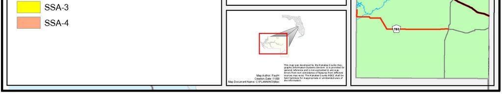
29 Table 4c. School Capacity Availabl e Availabl e Availabl e Availabl e SSA Capacity LOS Capacity LOS Capacity LOS Capacity LOS Elementary SSA 1 (277) (244) % % % % SSA 2 1,608 72% 1,645 71% 1,940 68% 2,130 66% SSA % % % % SSA % 51 99% 50 99% 46 99% Middle SSA % % % % SSA % % 1,312 62% 1,337 62% SSA 3 (133) (136) (138) (138) % % % % SSA % % % % High School SSA % 94 96% 2,143 48% 2,087 49% SSA 2 (1,434) (1,338) (1,280) (1,151) % % % % SSA % % % % SSA 4 1,376 70% 1,408 69% 1,428 69% 1,408 69% District Wide 3,771 92% 3,461 92% 7,564 85% 7,804 84% Parks: Table 5 shows the increase in park demand based on the maximum development potential. Table 5. Park Land (Acres) Demand Based on Adopted Future Land Use Categories and Amendments Units PPH Local Parks District Parks Regional Parks LOS 10, , ,000 Current Plan 134, Proposed Amendments 136, Natural Features: The County has extensive policies and regulations to protect the Coastal High Hazard Area and the Coastal Evacuation Area, Watershed Districts and wetlands. As development plans are submitted for approval, they will be reviewed against the Comprehensive Plan and Land Development Code for compliance with environmental regulations. Permits may also be required from other agencies (i.e., SWFWMD, FDEP, USACOE, FDOT, etc.). Urban Development Considerations: Attachment 2, Impact Analysis Report A2-13
30 The proposed amendments are intended to reduce suburban sprawl by: Discouraging leap frog development by concentrating high densities and intensities in nodes that will serve surrounding residential neighborhoods. Ensuring the availability of urban infrastructure and services prior to allowing development. Allowing and encouraging the provision of support uses and employment opportunities in close proximity to residential. Encouraging higher densities and intensities near transit. Eliminating radial, strip, isolated, or ribbon development patterns emanating from existing urban development. Maximizing the use of existing adjacent infrastructure, and future infrastructure. Relating new development to existing and proposed development. Timing of potential development and compatibility to adjacent uses. Encouraging an attractive and functional mix of uses and retaining significant amounts of functional urban open space. The purpose of encouraging the development of activity nodes is to provide a Live, Work, and Play community with a mix of uses including residential, commercial, and office with the design being focused on people, not cars. This will limit leapfrog development, urban sprawl and eliminate radial, strip, isolated or ribbon development patterns. It will take time to fully realize the potential development permitted by the proposed amendments. It is necessary, however, to make this type of density and intensity available at this time to initiate the transformation of the County into a more sustainable community. Impact on Population Projections and Housing Needs: Population projections for Manatee County by BEBR range from 469,800 (low) and 568,500 (high) for 2040, which will vary depending on the economy and other factors. The proposed amendments will have a minor impact on population growth. CONCLUSION The proposed amendments increasing densities in the ROR and MU future land use categories will have minimal direct impact on public utilities and services. Similarly, the proposed development intensity increases in the RES, OL, OH, ROR, and IH categories are not substantial enough to reflect deficits in public utilities and services. The changes related to affordable housing bonuses and activity nodes will continue to be reviewed/approved on a case-by-case basis, ensuring that the impact on public utilities and services is analyzed and addressed at the time of application. Attachment 2, Impact Analysis Report A2-14


31 Map 1. ROR and MU Future Land Use Categories Attachment 2, Impact Analysis Report A2-15


32 Map 2. Transit Routes Attachment 2, Impact Analysis Report A2-16


33 Map 3. School Service Areas Attachment 2, Impact Analysis Report A2-17