Appendix E I-73 North Noise Report
|
|
|
- Hilda Stewart
- 5 years ago
- Views:
Transcription
1 Appendix E I-73 North Noise Report

2 NOISE IMPACT ASSESSMENT I-73 North Section: From Future I-74 in Richmond County, NC to I-95 in Dillon County, SC (Conceptual Design) SCDOT PIN No.: RD01 NCDOT TIP No.: R-3421 Prepared For: South Carolina Department of Transportation Prepared By: Michael Baker International, LLC 700 Huger Street Columbia, SC November, 2016
3 EXECUTIVE SUMMARY In compliance with Title 23 of the Code of Federal Regulations, Part 772 (23 CFR Part 772), the following noise assessment has been prepared and will be provided by South Carolina Department of Transportation (SCDOT) to local officials in an attempt to prevent future impacts from traffic noise. The proposed project is located on new alignment from the I-74/NC 38 interchange area (Richmond County, North Carolina) to I-95 in Dillon County, South Carolina. The proposed improvement would create a new 4-lane interstate highway (2-12 lanes with inside and outside shoulders and a grass median). This is the northern section of a two-part analysis with a southern section that is proposed to run from I-95 at the north section interchange, then traverse south to SC 22 near the Myrtle Beach area. The total north section project road length is just under 40 miles (approximately), with approximately 5 miles of I-73 being in North Carolina. Please note that this analysis was performed with a conceptual design for reevaluation purposes. At this time, there has been no topographic elevation survey. The conceptual design was based off of USGS topo which is only good for 10 foot intervals in most places in South Carolina. The North Carolina section has more detailed contouring and it was applied where applicable. Nonetheless, the cut and fill slopes can change dramatically once the actual elevation data is obtained and may cause some shifts in the final design alignment to avoid impacts. There will also be a value engineering review after the revisions for final design and, subsequently, the design can change again as necessary. The TNM2.5 Noise Model was used to analyze the existing condition and the 2040 design year No-build and Build Alternative based on traffic data provided by CDM Smith and SCDOT. Much of the project area is rural/undeveloped and has no appreciable roadway traffic. In these areas, field measurements were performed to establish a sound level baseline for which to compare possible sound level increases as a result of the proposed action. The modeling results indicated that 26 receivers (all residential) would approach or exceed the noise abatement criteria (NAC) and/or meet or exceed the substantial increase criteria for the 2040 design year Build Alternative. (SCDOT and North Carolina Department of Transportation (NCDOT) criteria.) Noise abatement was therefore considered for the proposed project. As a result of the analysis, there were no feasible and reasonable solutions to mitigate for the noise according to SCDOT or NCDOT noise policy. The primary reason for the lack of mitigation to be forwarded to the construction phase is the sparsity of development throughout the entire rural project corridor. Essentially, there were not enough potentially benefited homes to meet the SCDOT noise reduction design goal and/or the SCDOT criteria for cost reasonableness. In North Carolina, square footage criteria per benefited receiver was used as per NCDOT policy. Again, please note that this analysis was performed with a conceptual design for reevaluation purposes. It is expected that if this section of I-73 were moved forward, then a formal preliminary and (possibly) final design analysis would be performed at those times.
4 TABLE OF CONTENTS I. INTRODUCTION AND PROJECT DESCRIPTION... 1 A. Proposed Project Description, Existing Facility and Purposes and Need... 1 B. Existing Land Uses... 1 II. ANALYSIS METHODOLOGY... 4 A. Model Used and Assumptions... 4 B. Traffic Data... 4 C. Receiver Locations... 4 D. Field Measurements... 4 E. Model Validation... 5 III. TRAFFIC NOISE IMPACTS... 7 A. Modeled and/or Measured Existing Year Noise Levels... 8 B. Modeled Design Year (Future 2040) No-Build Alternative Noise Levels... 8 C. Modeled Design Year (Future 2040) Build Alternative Noise Levels... 8 IV. FEASIBLE AND REASONABLE CONSIDERATION OF ABATEMENT...37 North Carolina...37 A. Acquisition of Rights-of-Way...37 B. Traffic Management...37 C. Alteration of Horizontal and Vertical Alignments...37 D. Acquisition of real property or interests therein (predominantly unimproved property) to serve as a buffer zone to preempt development...38 E. Noise insulation of public use or nonprofit institutional structures...38 F. Noise Barriers...38 South Carolina...42 A. Acquisition of Rights-of-Way...42 B. Traffic Management...42 C. Alteration of Horizontal and Vertical Alignments...42 D. Acquisition of real property or interests therein (predominantly unimproved property) to serve as a buffer zone to preempt development...42 E. Noise insulation of public use or nonprofit institutional structures...42 F. Noise Barriers...42 V. FINDINGS AND RECOMMENDATIONS...47 VI. CONSTRUCTION NOISE...48 A. Construction Noise - South Carolina...48 B. Construction Noise - North Carolina...49 VII. COORDINATION WITH LOCAL OFFICIALS...52
5 A. Noise Compatible Land Use South Carolina...52 B. Noise Compatible Land Use North Carolina...52 LIST OF TABLES Table 1 - Ambient Noise Field Measurements... 5 Table 2 - Comparison of Measured Leq to Modeled Leq for TNM2.5 Model Validation... 6 Table 3-23 CFR 772 (Table 1) Noise Abatement Criteria (NAC)... 7 Table 4 - I-73 New Alignment Reevaluation Existing and Design Year Sound Levels... 9 Table 5 - Leq Noise Level (dba) at 50 Feet for Construction Equipment...49 Table 6 NC Construction Equipment Typical Noise Level Emissions...51 Table 7 - Contour Distances (dba) for I LIST OF FIGURES Figure 1 - I-73: I-74 to I-95 - Proposed Cross Section... 2 Figure 2 - I-73: I-74 to I-95 - Project Location... 3 Figure 3 - I-73: I-74 to I-95 - Impacted Noise Receiver Locations...12 Appendix A Appendix B Appendix C Appendix D APPENDICES Traffic Data Field Data Measurement Sheets TNM Inputs/Outputs (provided on CD to SCDOT) Feasible and Reasonable Worksheets
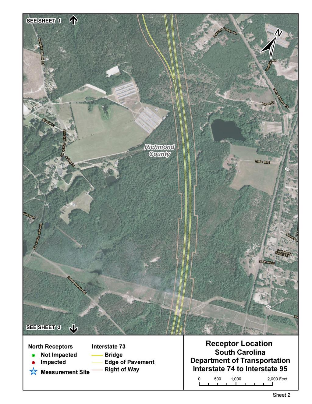
6 I. INTRODUCTION AND PROJECT DESCRIPTION In compliance with Title 23 of the Code of Federal Regulations, Part 772 (23 CFR Part 772), the following noise assessment has been prepared and will be provided by SCDOT to local officials in an attempt to prevent future impacts from traffic noise. The current SCDOT Traffic Noise Abatement Policy (Policy) was followed to analyze the potential noise impacts and mitigation as necessary. It has been consolidated, where appropriate and/or applicable, to reduce the number of pages. A. Proposed Project Description, Existing Facility and Purposes and Need The proposed project is located on new alignment from the I-74/NC 38 interchange area (Richmond County, North Carolina) to I-95 in Dillon County, South Carolina. The proposed improvement would create a new 4-lane interstate highway (2-12 lanes with inside and outside shoulders and a grass median as shown in Figure 1). This is the northern section of a two-part analysis with a southern section that is proposed to run from I-95 at the north section interchange, then traverse south to SC 22 near the Myrtle Beach area. The total north section project road length is just under 40 miles (approximately), with approximately 5 miles of I-73 constructed in North Carolina as shown in Figure 2. Please note that this analysis was performed with a conceptual design for reevaluation purposes. At this time, there has been no topographic elevation survey. The conceptual design was based off of USGS topo which is only good for 10 foot intervals in most places in South Carolina. The North Carolina section has more detailed contouring and it was applied where applicable. Nonetheless, the cut and fill slopes can change dramatically once the actual elevation data is obtained and may cause some shifts in the final design alignment to avoid impacts. There will also be a value engineering review after the revisions for final design and, subsequently, the design can change again as necessary. The posted speed limit is expected to be 70 miles per hour (mph). The estimated average annual daily traffic (AADT) volume is expected to range from approximately 27,100 to 31,100 vehicles per day (vpd) for the Build Alternative. As a new alignment highway, there are no existing and design year no-build volumes. B. Existing Land Uses Land use adjacent to the highway is predominantly comprised of rural open land, farmland and industrial use. There is a scattering of residential units located throughout the project area. There are no places of worship, schools or parks in the project area. There are a few NAC Category F land uses in the project area (industrial/commercial-retail). These land uses were not analyzed since they do not have a sound level impact criteria. 1

7 Figure 1 - I-73: I-74 to I-95 - Proposed Cross Section 2

8 Figure 2 - I-73: I-74 to I-95 - Project Location 3
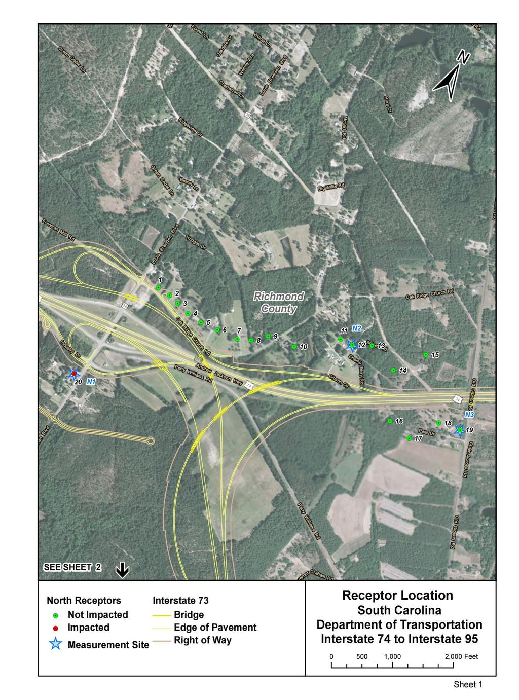
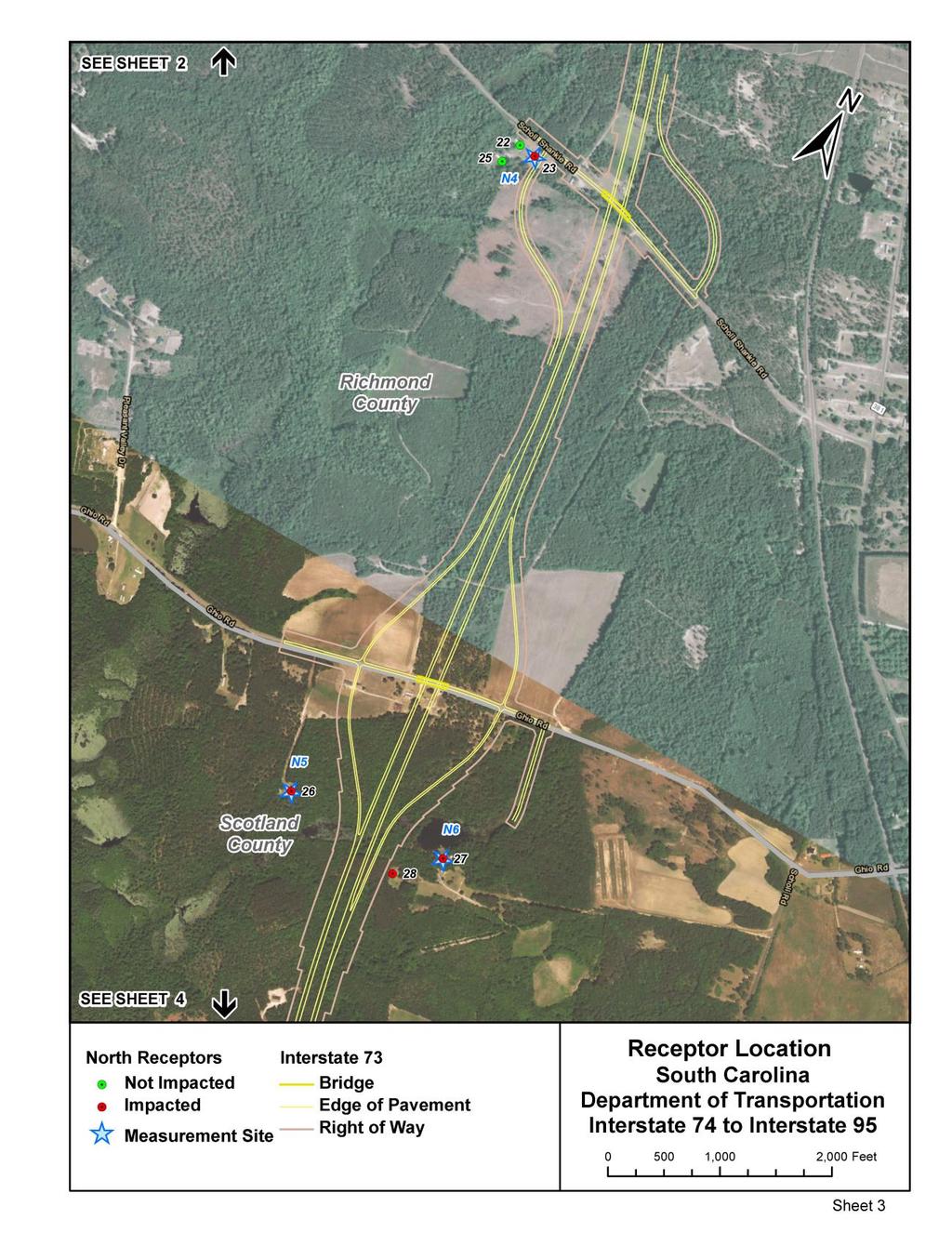
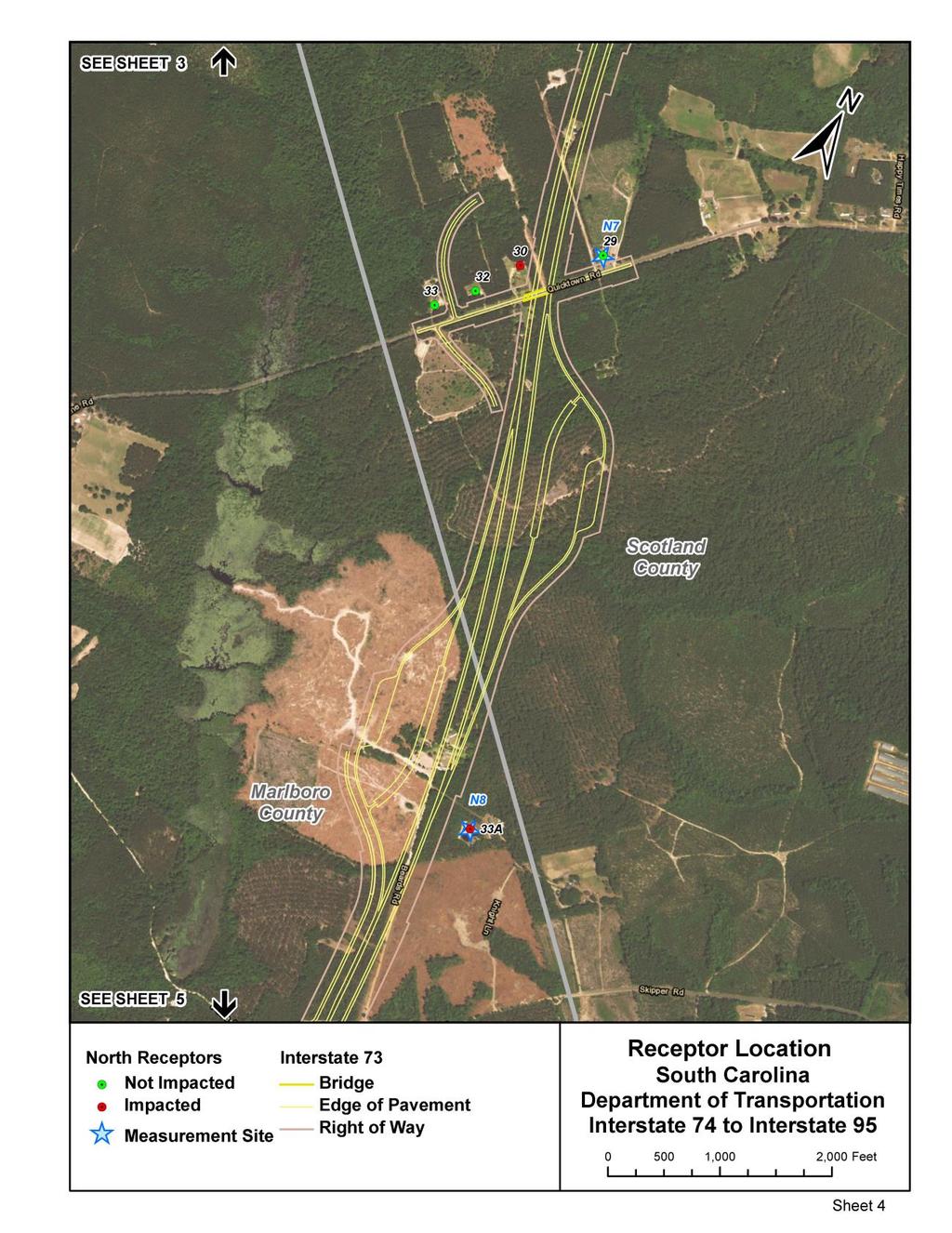
9 II. ANALYSIS METHODOLOGY A. Model Used and Assumptions The Federal Highway Administration (FHWA) Traffic Noise Model (TNM 2.5) was used to derive existing and future noise levels. The environmental traffic data used was developed, updated and approved by SCDOT. Applicable model features, such as building structure inputs, the multi-use trail and concrete traffic barriers (jersey barriers) were added to the analysis to provide accurate sound level reduction results. B. Traffic Data The traffic data (and design files) for the proposed project were provided by CDM Smith on behalf of SCDOT, including the estimated AADT, Design Hourly Volume (DHV) and fleet mix percentages for the existing year and the design year 2040 (shown in Appendix A). Ten percent of the AADT was used to approximate the DHV. For the Build Alternative and depending on the specific I-73 link, percent of the DHV was automobiles, pickup trucks and SUV s. The percent of medium duty trucks of the DHV was assumed to be 5-6 and the percent of heavy duty trucks was assumed to range from Appendix A identifies the fleet mix for each specific link. A speed limit of 70 miles per hour (mph) was used for I-73, I-74 and I-95. Cross-street and ramps speeds were modeled at 45 mph. In addition, an assumption of a 50/50 directional split was used for all scenarios, and 12-foot wide travel lane widths were used, plus inside and outside shoulders. C. Receiver Locations Sensitive receivers and/or land use types were first identified using aerial photography and street level views from then field verified. Exterior usage receiver categories that are potentially impacted by the proposed project include residential, which fall under the FHWA-developed Noise Abatement Criteria (NAC) category B. NAC F land uses do not have a sound level criteria and are not studied for noise impacts. These uses include agriculture, airports, bus yards, emergency services, industrial, logging, maintenance facilities, manufacturing, mining, rail yards, commercial retail establishments, shipyards, utilities (water resources, water treatment, electrical), and warehouses. D. Field Measurements Ambient noise field measurements were taken at twenty-one different locations in the project corridor near the proposed I-73 alignment. These were performed in accordance with the FHWA publication Measurement of Highway-related Noise. Noise measurements were taken during the weekday period between 9/26/2016 and 9/28/2016, and also between 10/25/2016 and 10/26/2016 during the AM and/or PM peak traffic periods, though some rural sites with no regular traffic were measured outside of these periods to establish baseline. Vehicles were counted and the type of vehicle was noted during the field measurements. Please note that many of the noise sensitive receivers are located in areas where there is little or no highway traffic as the proposed alignment location was developed to avoid developed areas. In addition, the meteorological conditions, local features (trees, nearby buildings, etc,) were noted for each site. Table 1 summarizes the information for the ambient noise field measurements. Figure 3 (shown later in the report) shows the measurement sites and Appendix B contains the field measurement data sheets. 4
10 Site Time Period Table 1 - Ambient Noise Field Measurements Hourly Traffic Based on Concurrent Traffic Counts North (or West) bound Lane South (or East) bound Lane Autos MT HT Autos MT HT Measured Leq N1 3:46-4:26 PM N2 4:32-4:52 PM N3 5:06-5:26 PM N4 5:40-6:07 PM N5 6:15-6:35 PM N6 6:50-7:10 PM N7 7:25-7:45 PM N8 8:53-9:08 AM N9 8:21-8:36 AM N10 7:49-8:04 AM N11 7:18-7:33 AM N12 (N13) 10:21-10:36 AM N13 (N14) 9:25-9:45 AM N14 (N15) 4:10-4:25 PM N15 (N16) 4:46-5:01 PM N16 (N18) 5:46-6:01 PM N17 (N19) 6:46-7:01 AM N18 (N20) 7:08-7:23 AM SOURCE: Michael Baker International, September and October, *Measurement sites were renumbered as a result of property owner refusal of entry and/or property site field views that were discovered to be industrial or maintenance land uses with no residence. Original site numbers are in parenthesis to match the field sheets and figures. NOTES: MT = Medium Trucks HT = Heavy Trucks Meteorological conditions: dry, 70-80s temperatures, light or zero-wind conditions. E. Model Validation Using the ambient noise field measurements shown in Table 1, the TNM2.5 model was validated per the requirements in 23 CFR (d)(2). Table 2 compares the measured Leq versus modeled Leq for the sites during the measurement period. Based on SCDOT Policy, if the measured and modeled Leq are within 3 dba, the model is validated. Based on NCDOT Policy, if the measured and modeled Leq are within 1.7 dba, the model is validated. Table 2 shows that the difference between the modeled and measured Leq was 3.0 dba 1.7 dba at the respective state sites; therefore, the model is validated. 5
11 Table 2 - Comparison of Measured Leq to Modeled Leq for TNM2.5 Model Validation Site State Time Period Measured Leq Modeled Leq Difference a N1 NC 3:46-4:26 PM N2 NC 4:32-4:52 PM 48.8 N/A N/A N3 NC 5:06-5:26 PM N4 NC 5:40-6:07 PM N5 NC 6:15-6:35 PM N6 NC 6:50-7:10 PM 39.8 N/A N/A N7 NC 7:25-7:45 PM N8 SC 8:53-9:08 AM 44.9 N/A N/A N9 SC 8:21-8:36 AM N10 SC 7:49-8:04 AM N11 SC 7:18-7:33 AM N12 (N13) SC 10:21-10:36 AM 44.6 N/A N/A N13 (N14) SC 9:25-9:45 AM N14 (N15) SC 4:10-4:25 PM N15 (N16) SC 4:46-5:01 PM 42.3 N/A N/A N16 (N18) SC 5:46-6:01 PM N17 (N19) SC 6:46-7:01 AM 45.7 N/A N/A N18 (N20) SC 7:08-7:23 AM 45.6 N/A N/A SOURCE: Michael Baker International, September and October, *Measurement sites were renumbered as noted in Table 1. Original site numbers are in parenthesis to match the field sheets and figures. a Difference = Measured Leq minus Modeled Leq. NCDOT difference criteria is 1.7 dba; SCDOT difference criteria is 3.0 dba. Note1: Many receiver sites near the proposed I-73 highway are located in rural areas where there is little traffic volume. 6
12 III. TRAFFIC NOISE IMPACTS The FHWA has developed noise abatement criteria and procedures in 23 CFR Part 772, as shown in Table 3, that states that traffic noise impacts occur when either: 1) the predicted traffic noise levels approach or exceed the FHWA Noise Abatement Criteria (NAC) for the applicable activity category shown below; or, 2) the predicted traffic noise levels substantially exceed the existing noise levels by 15 dba. Activity Category Table 3-23 CFR 772 (Table 1) Noise Abatement Criteria (NAC) Evaluation L eq (h) \1,2\ L 10 (h) \1,2\ Description of Activity Category Location A Exterior B \3\ Exterior Residential. C \3\ Exterior D Interior E \3\ Exterior F Lands on which serenity and quiet are of extraordinary significance and serve an important public need and where the preservation of those qualities is essential if the area is to continue to serve its intended purpose. Active sport areas, amphitheaters, auditoriums, campgrounds, cemeteries, day care centers, hospitals, libraries, medical facilities, parks, picnic areas, places of worship, playgrounds, public meeting rooms, public or nonprofit institutional structures, radio studios, recording studios, recreation areas, Section 4(f) sites, schools, television studios, trails, and trail crossings. Auditoriums, day care centers, hospitals, libraries, medical facilities, places of worship, public meeting rooms, public or nonprofit institutional structures, radio studios, recording studios, schools, and television studios. Hotels, motels, offices, restaurants/bars, and other developed lands, properties or activities not included in A-D or F. Agriculture, airports, bus yards, emergency services, industrial, logging, maintenance facilities, manufacturing, mining, rail yards, retail facilities, shipyards, utilities (water resources, water treatment, electrical), and warehousing. G Undeveloped lands that are not permitted. SOURCE: 23 CFR Part 772 \1\ Either Leq(h) or L10(h) (but not both) may be used on a project. \2\ The Leq(h) and L10(h) Activity Criteria values are for impact determination only, and are not design standards for noise abatement measures. \3\ Includes undeveloped lands permitted for this activity category. 7
13 The modeled and/or measured results for the existing condition, and the 2040 design year Nobuild and Build Alternatives can be found in Table 4 and shown in Figure 3. A total of 26 receivers would have an NAC impact and/or substantial increase impact for the 2040 Build Alternative. A CD with the TNM input and output files (as indicated in Appendix C) has been submitted to SCDOT for their review and records. Many of the receivers in the project corridor are located in areas where there is little or zero traffic. In order to establish an existing baseline for determining potential substantial increase criteria, the greater of the sound levels either measured or modeled (if there were any available traffic volumes) was used as the existing condition sound level. A. Modeled and/or Measured Existing Year Noise Levels In the existing condition, there are zero (0) receivers that would have noise levels that approach or exceed the NAC criteria for its respective land use. B. Modeled Design Year (Future 2040) No-Build Alternative Noise Levels The sound levels are predicted to increase by 0.3 dba, on average, over the existing condition as a result of the predicted traffic growth in the project area between 2010 and There are zero (0) receivers that would have noise levels that approach or exceed the NAC criteria for its respective land use. C. Modeled Design Year (Future 2040) Build Alternative Noise Levels The noise levels for the 2040 Build Alternative are predicted to increase by 10.2 dba on average over the existing condition, and by 9.9 dba on average over the 2040 No-build Alternative. With the 2040 Build Alternative, the noise levels are predicted to approach or exceed the NAC criteria and/or meet or exceed the substantial increase criteria for 26 receivers. These receivers are all residential land uses. 8
14 Table 4 - I-73 New Alignment Reevaluation Existing and Design Year Sound Levels RECEPTOR NUMBER 2040 NO- EXISTING BUILD 2040 BUILD INCREASE OVER EXISTING NAC IMPACT? SUBSTANTIAL INCREASE IMPACT? N N 66 Residential N N 66 Residential N N 66 Residential N N 66 Residential N N 66 Residential N N 66 Residential N N 66 Residential N N 66 Residential N N 66 Residential N N 66 Residential N N 66 Residential N N 66 Residential N N 66 Residential N N 66 Residential N N 66 Residential N N 66 Residential N N 66 Residential N N 66 Residential N N 66 Residential Y N 66 Residential N N 66 Residential N Y 66 Residential N N 66 Residential N Y 66 Residential N Y 66 Residential N Y 66 Residential N N 66 Residential Y Y 66 Residential N N 66 Residential N N 66 Residential 33A N Y 66 Residential N N 66 Residential N Y 66 Residential N N 66 Residential N N 66 Residential N Y 66 Residential N Y 66 Residential Bold Red-shaded values indicate sound levels that either approach, meet or exceed the NAC or meet or exceed the substantial increase over existing criteria. NAC LAND USE Green Shaded site numbers are indicative of sites in North Carolina. North Carolina has a graduated scale for determining substantial increase impacts based on how high or low the existing sound levels are. 9
15 Table 4 - I-73 New Alignment Reevaluation Existing and Design Year Sound Levels RECEPTOR NUMBER 2040 NO- EXISTING BUILD 2040 BUILD INCREASE OVER EXISTING NAC IMPACT? SUBSTANTIAL INCREASE IMPACT? Bold Red-shaded values indicate sound levels that either approach, meet or exceed the NAC or meet or exceed the substantial increase over existing criteria. NAC LAND USE N N 66 Residential N N 66 Residential N N 66 Residential N Y 66 Residential Y Y 66 Residential N Y 66 Residential N N 66 Residential N N 66 Residential N Y 66 Residential Y Y 66 Residential Y Y 66 Residential Y Y 66 Residential N Y 66 Residential N Y 66 Residential N N 66 Residential N N 66 Residential Y Y 66 Residential N N 66 Residential N N 66 Residential N N 66 Residential N N 66 Residential N N 66 Residential N N 66 Residential N N 66 Residential N Y 66 Residential N Y 66 Residential N N 66 Residential N N 66 Residential N N 66 Residential N N 66 Residential N N 66 Residential N N 66 Residential N N 66 Residential N N 66 Residential N N 66 Residential 10
16 Table 4 - I-73 New Alignment Reevaluation Existing and Design Year Sound Levels RECEPTOR NUMBER 2040 NO- EXISTING BUILD 2040 BUILD INCREASE OVER EXISTING NAC IMPACT? SUBSTANTIAL INCREASE IMPACT? Bold Red-shaded values indicate sound levels that either approach, meet or exceed the NAC or meet or exceed the substantial increase over existing criteria. NAC LAND USE N N 66 Residential Y Y 66 Residential N N 66 Residential N N 66 Residential N N 66 Residential N N 66 Residential N N 66 Residential N N 66 Residential N Y 66 Residential N N 66 Residential N N 66 Residential N N 66 Residential N N 66 Residential N N 66 Residential N N 66 Residential N N 66 Residential N N 66 Residential Y Y 66 Residential N Y 66 Residential N N 66 Residential Source: Michael Baker International, Inc. 11

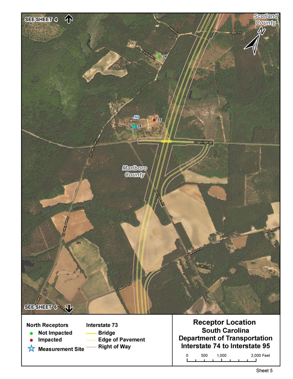
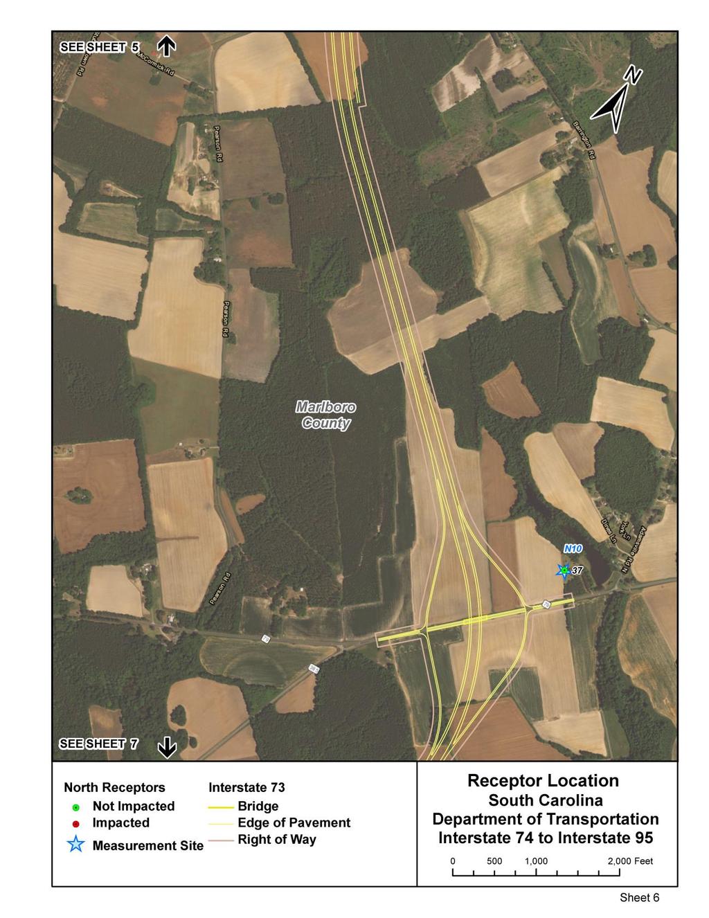
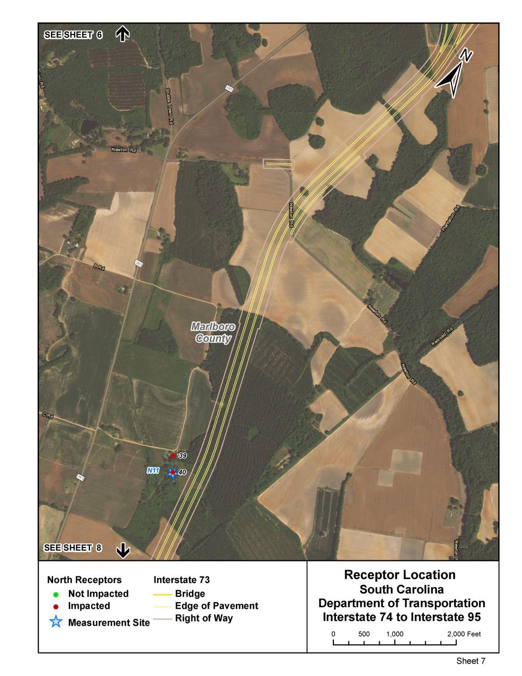
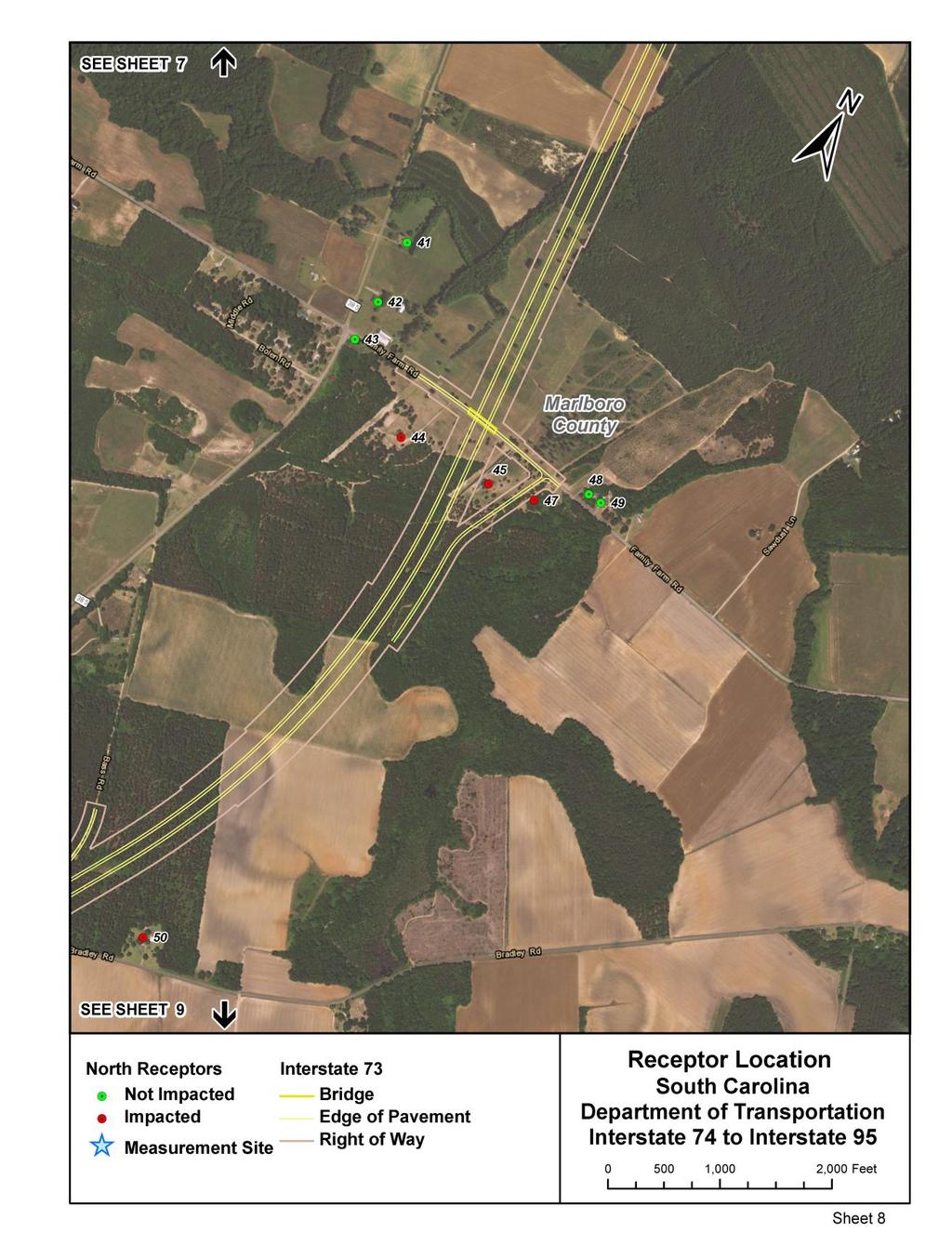
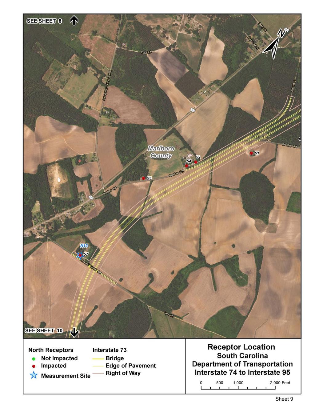
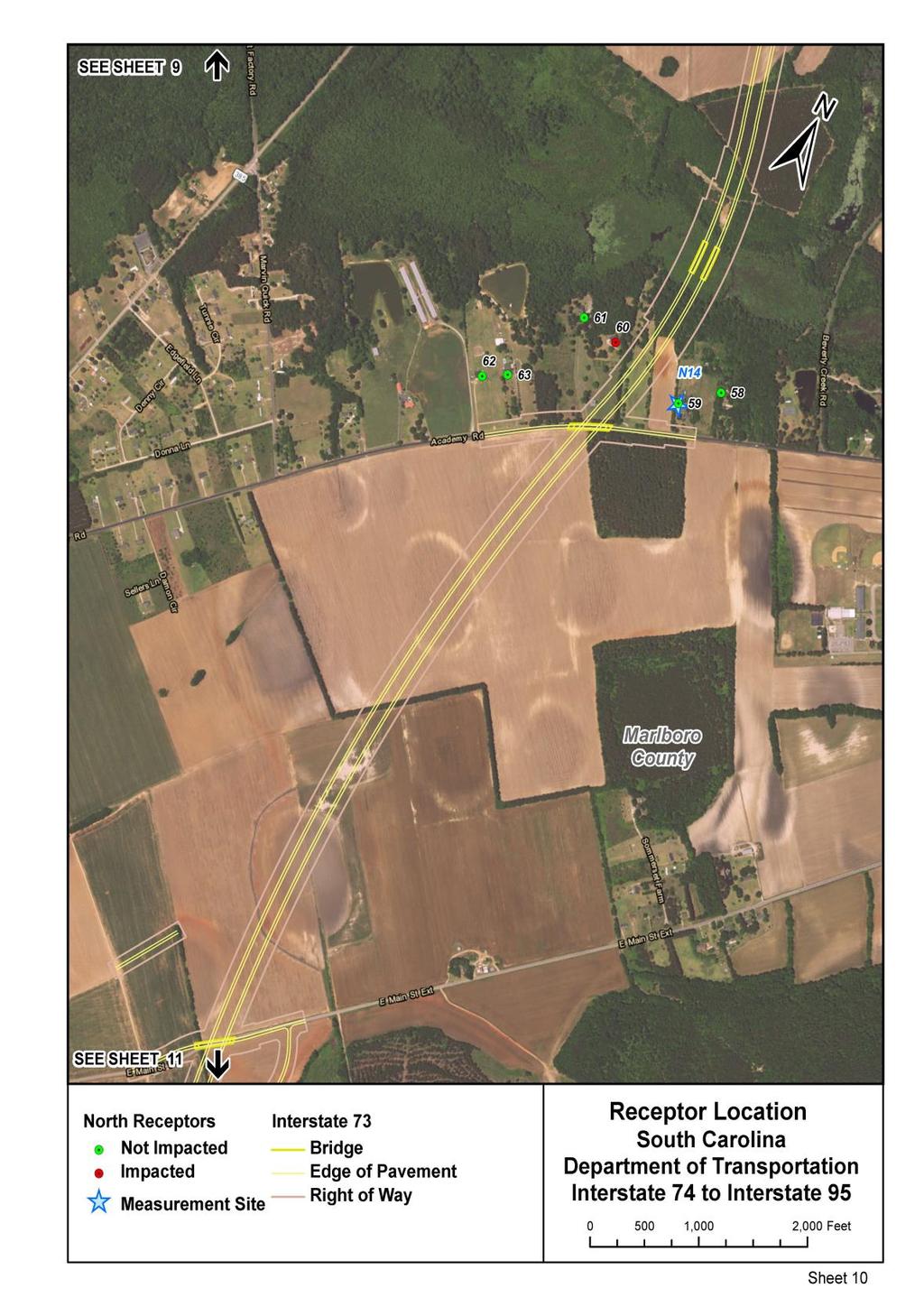
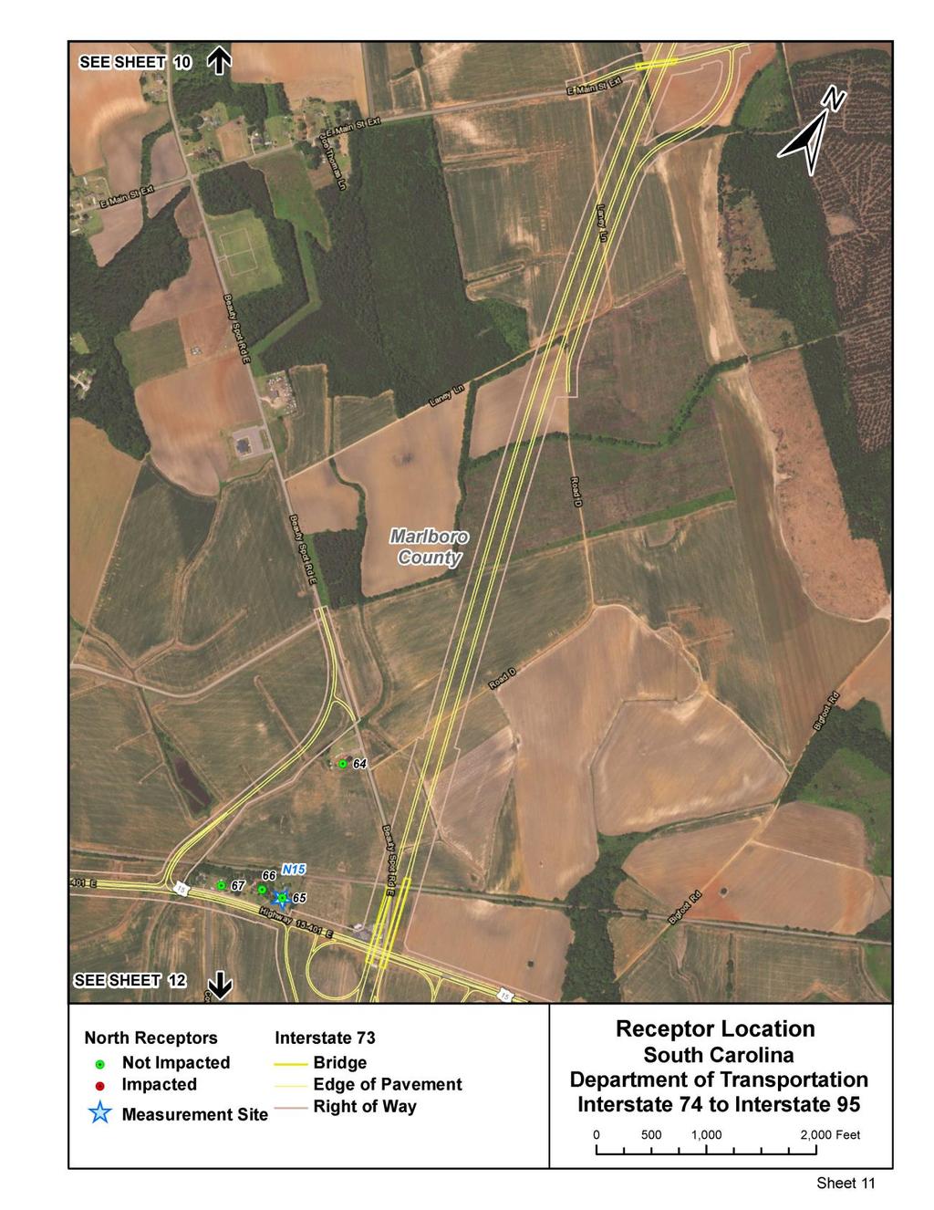
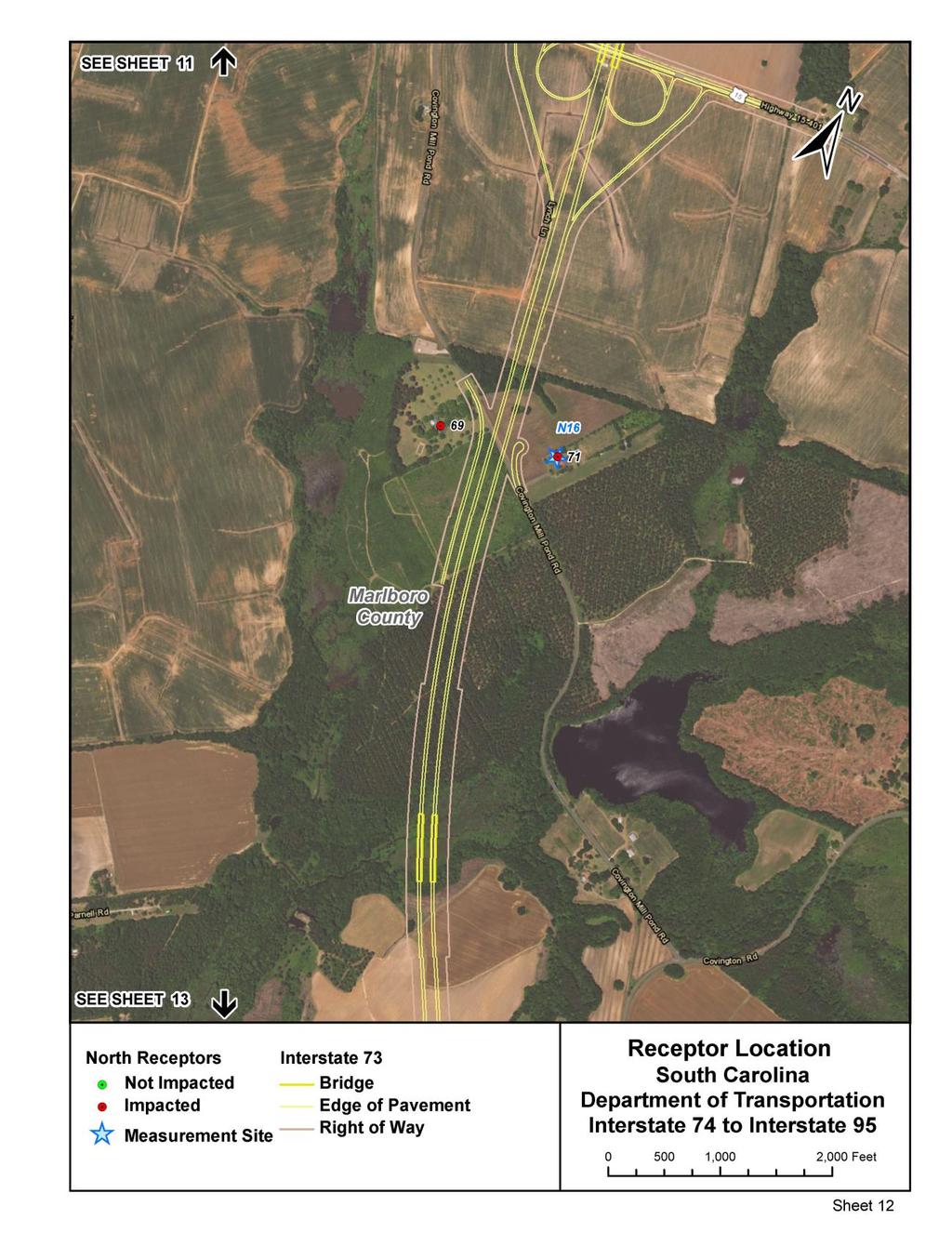
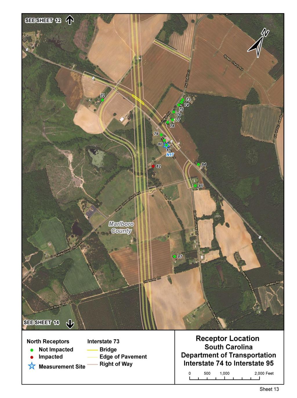
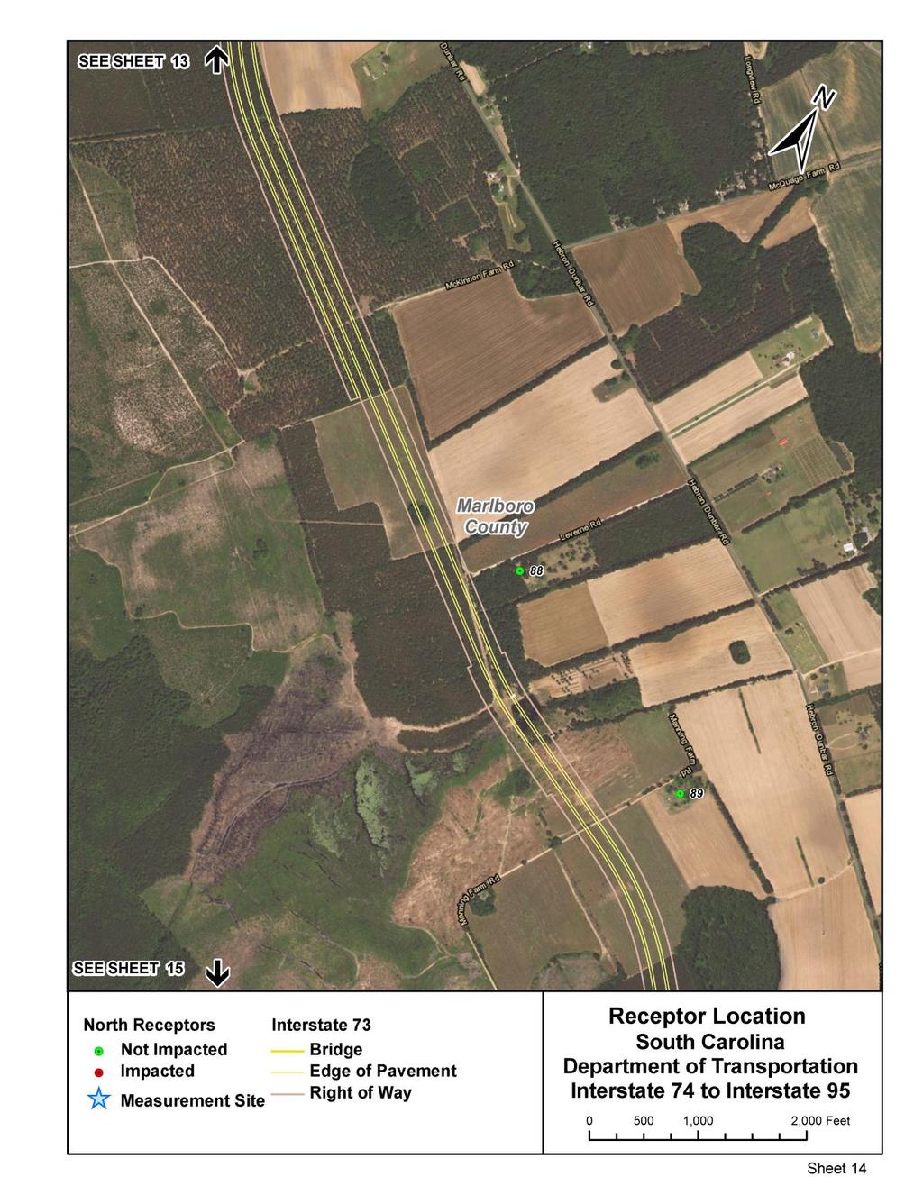
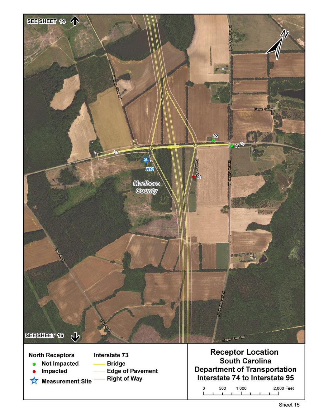
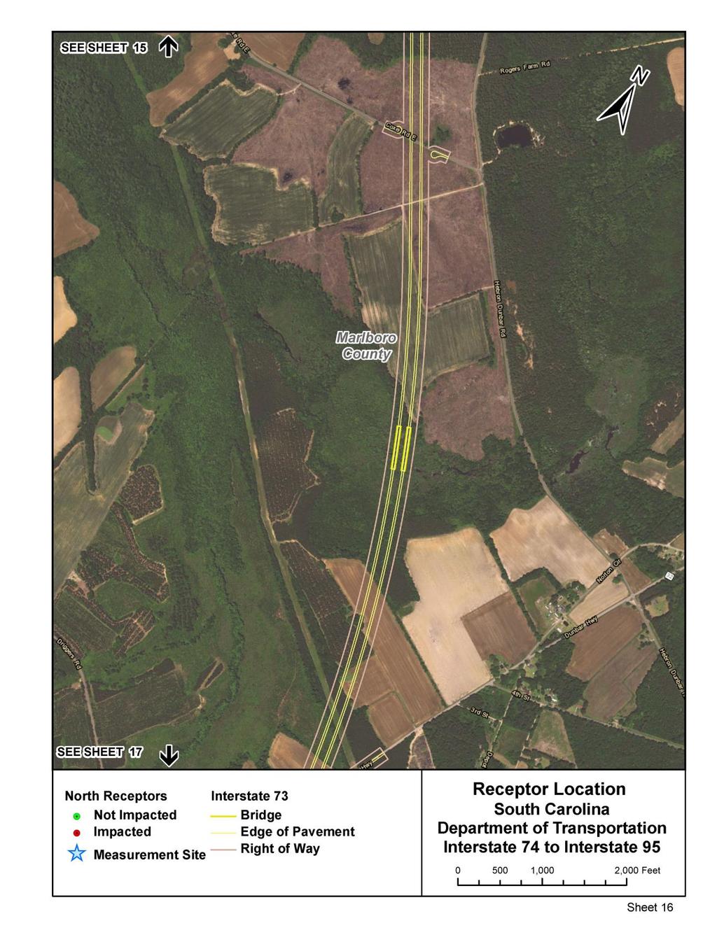
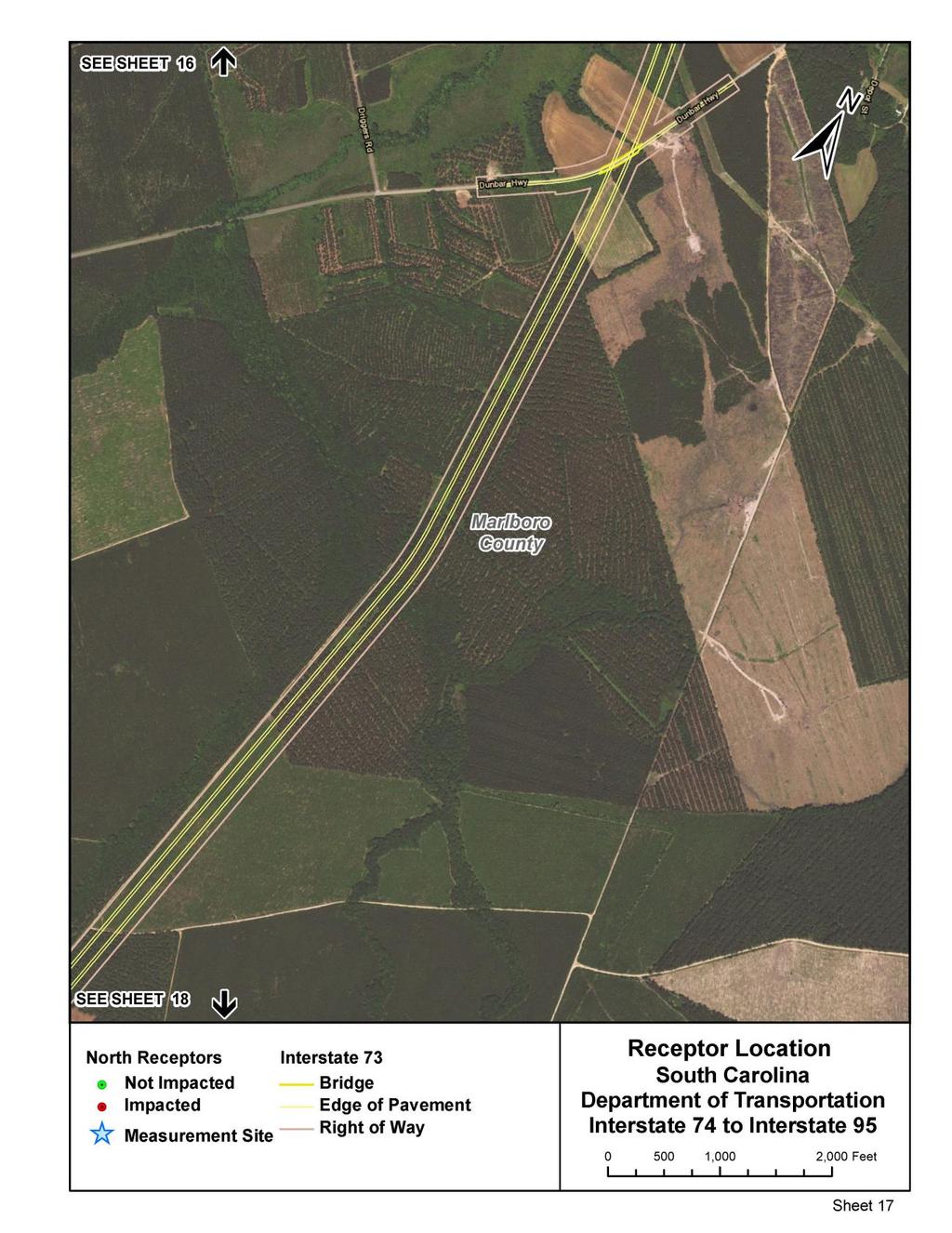
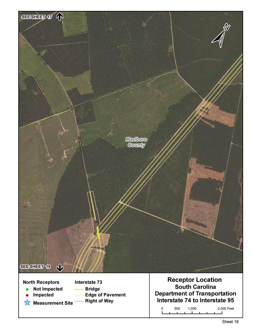
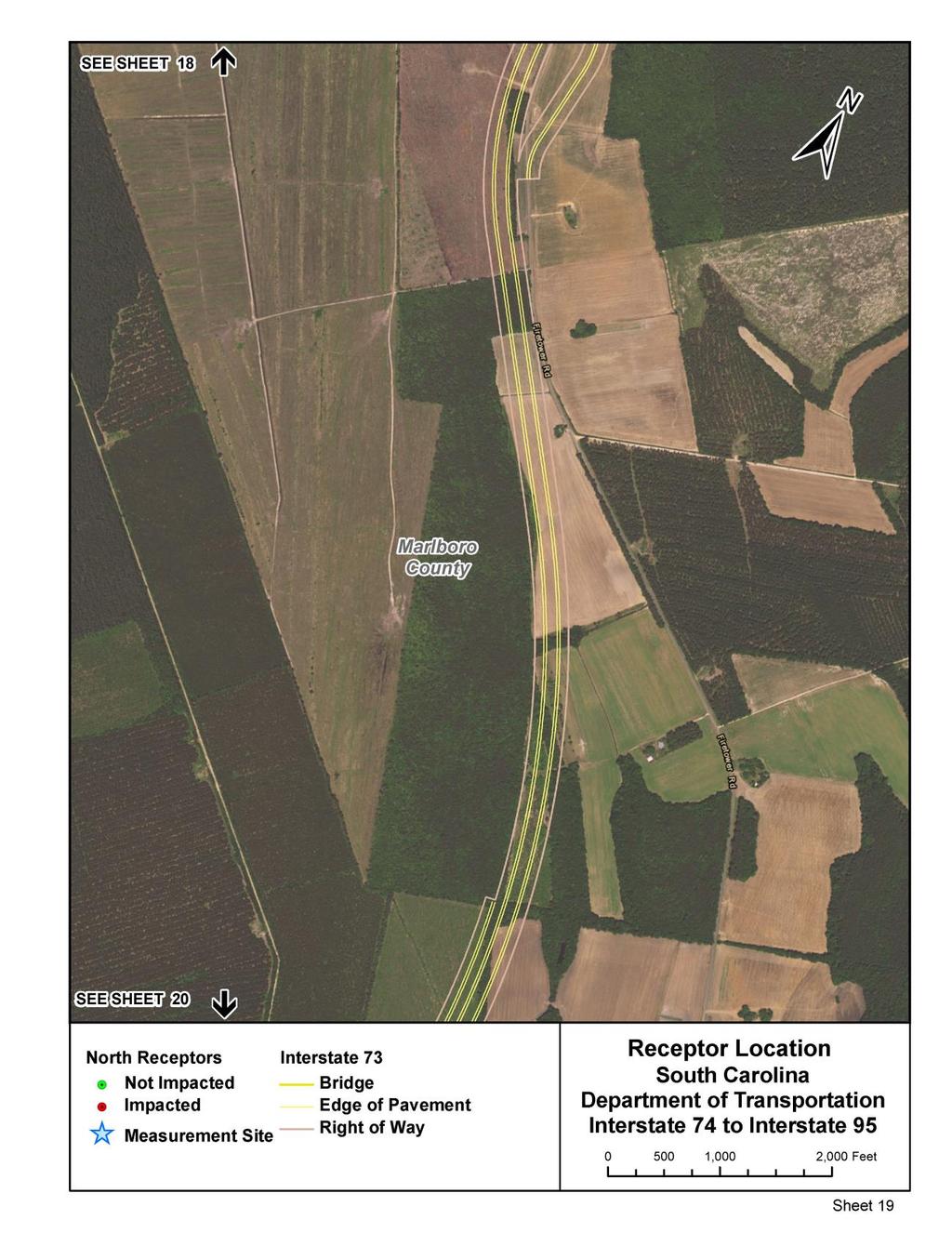
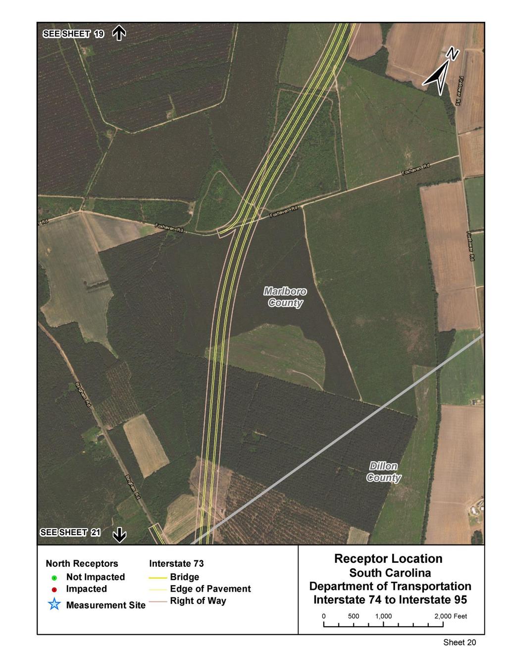
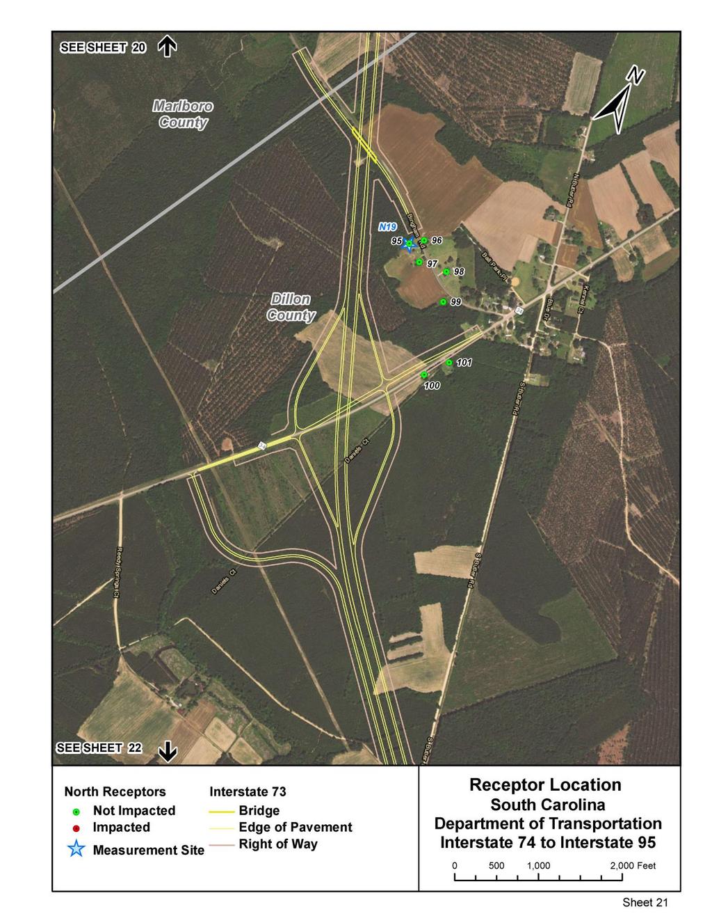
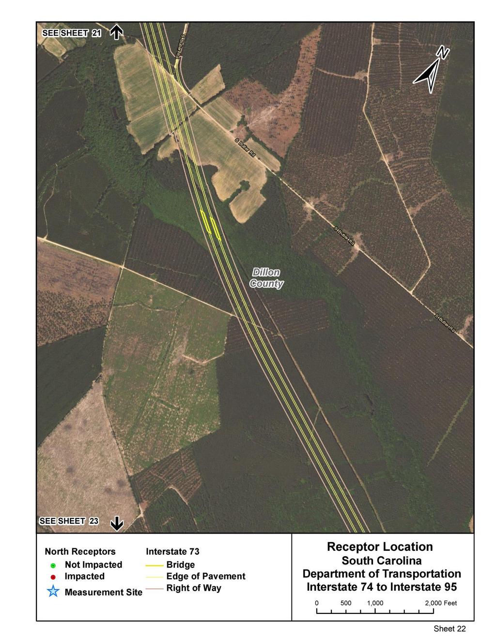
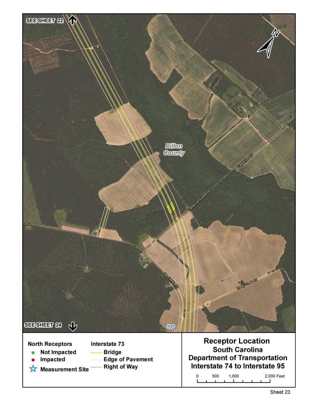
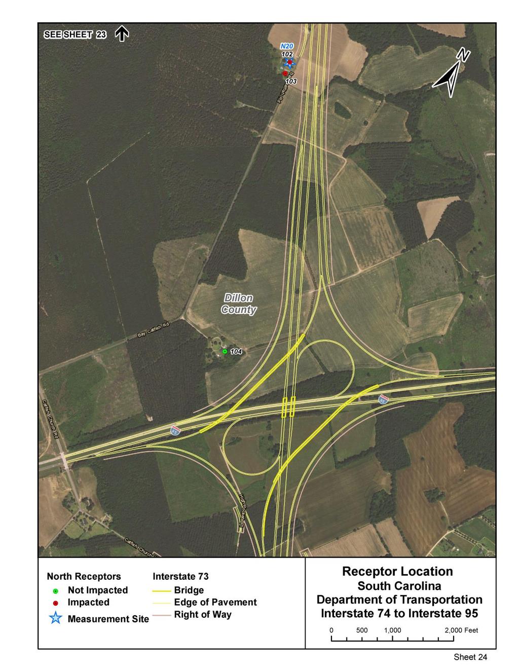
17 Figure 3 - I-73: I-74 to I-95 - Impacted Noise Receiver Locations 12
18 13
19 14
20 15
21 16
22 17
23 18
24 19
25 20
26 21
27 22
28 23
29 24
30 25
31 26
32 27
33 28
34 29
35 30
36 31
37 32
38 33
39 34
40 35
41 36
42 IV. FEASIBLE AND REASONABLE CONSIDERATION OF ABATEMENT North Carolina Approximately 5 miles of the proposed I-73 is located in North Carolina at its northern terminus with I-74. As a result, the NCDOT impact criteria as well as the feasibility and reasonableness criteria was applied to predicted impacted receivers. NCDOT applies the same absolute NAC approach criteria as SCDOT (66 dba approach criteria for residential land uses, for example). The NCDOT Substantial Increases Noise Impact Criteria is different than SCDOT s 15 dba (or greater) criteria over existing conditions, however. NCDOT uses a graduated increase impact scale based on the existing sound levels as shown below. This criteria was applied in Table 4 for NC receivers NCDOT Substantial Increase Noise Impact Criteria Hourly Equivalent A-Weighted Sound Level (decibels (db(a)) Existing Noise Level 1 (Leq(h)) Predicted Design Year Noise Level Increase 2 (Leq(h)) 50 or less 15 or more or more or more or more or more 55 or more 10 or more 1 Loudest hourly equivalent noise level from the combination of natural and mechanical sources and human activity usually present in a particular area. 2 Predicted hourly equivalent Design Year traffic noise level minus existing noise level. In accordance with 23 CFR (c), the following measures were considered and evaluated as a means to reduce or eliminate the traffic noise impacts: A. Acquisition of Rights-of-Way The acquisition of rights-of-way to mitigate the noise levels at the affected site would result in disruptive relocations. B. Traffic Management Measures such as exclusive lane designations and signing for prohibition of certain vehicle type would prevent the project from serving its intended purpose, such as moving people, goods and services. C. Alteration of Horizontal and Vertical Alignments Alignment modifications as a means of noise abatement would result in disruptive relocations for this project and would not be cost effective, but could be revisited during final design. 37
43 D. Acquisition of real property or interests therein (predominantly unimproved property) to serve as a buffer zone to preempt development Adequate property is not available to create an effective buffer zone between the proposed roadway and the impacted receivers. E. Noise insulation of public use or nonprofit institutional structures No public use or nonprofit institutional structures would be impacted by the proposed project. F. Noise Barriers Among the most common noise barriers are earthen berms and freestanding walls. The optimum situation for the use of free-standing noise barriers is when a dense concentration of impacted receivers lies directly adjacent to and parallel with the highway right-of-way. In these instances, one barrier can protect many people at a relatively low cost per impacted site. For this study, an earthen berm was ruled out since there is not enough room for proper sloping. Drainage and safety line-of-sight may also be an issue. Based on the need for a barrier to be continuous and to protect a dense concentration of receivers, it is typically not considered reasonable to provide abatement for single impacted receivers or on non-controlled access facilities where access and safety requirements would impact the barrier placement. The proposed I-73 highway is a controlled facility. When traffic noise impacts are identified and noise abatement is warranted, noise abatement measures shall be considered and evaluated for feasibility and reasonableness. All of the following conditions must be met in order for noise abatement to be justified and incorporated into project design, as applicable. Failure to achieve any single element of feasibility or reasonableness will result in the noise abatement measure being deemed not feasible or not reasonable, whichever applies. 1. Feasibility: a. Any receiver that receives a minimum noise level reduction of 5 dba due to noise abatement measures shall be considered a benefited receiver. Noise reduction of five db(a) must be achieved for at least one impacted receiver. b. Engineering feasibility of the noise abatement measure(s) shall consider adverse impacts created by or upon property access, drainage, topography, utilities, safety, and maintenance requirements. 2. Reasonableness: The combination of social, economic, and environmental factors considered in the evaluation of a noise abatement measure must include: a. A noise reduction design goal of at least 7 dba must be evaluated for all front row receivers. At least one benefited front row receiver must achieve the noise reduction design goal of 7 dba to indicate the noise abatement measure effectively reduces traffic noise. 38
44 b. The maximum allowable base quantity of noise walls and/or earthen berms per benefited receiver shall not exceed 2,500 ft 2 and 7,000 yd 3, respectively. Additionally, an incremental increase of 35 ft 2 for noise walls and 100 yd 3 for earthen berms shall be added to the base quantity per the average increase in dba between existing and predicted exterior noise levels of all impacted receivers within each noise sensitive area, which is defined as a group of receivers that are exposed to similar noise sources. A base dollar value of $37,500 plus an incremental increase of $525 (as defined above) shall be used to determine reasonableness of buffer zones and noise insulation. c. Viewpoints of the property owners and residents of all benefited receivers shall be solicited. One owner ballot and one resident ballot shall be solicited for each benefited receiver. Points per ballot shall be distributed in the following weighted manner: 3 points/ballot for benefited front row property owners 1 point/ballot for all other benefited property owners 1 point/ballot vote for all residents 2. Other Considerations: Prior to CE approval or issuance of a FONSI or ROD, NCDOT shall identify in environmental documents: a. Noise abatement measures that are feasible and reasonable, b. Noise impacts for which no abatement appears to be feasible and reasonable; c. Locations where noise impacts will occur, where noise abatement is feasible and reasonable, and the locations that have no feasible and reasonable abatement. d. Whether it is "likely" or "unlikely" that noise abatement measures will be installed for each noise sensitive area identified. "Likely" does not mean a firm commitment. The final decision on the installation of the abatement measures shall be made upon completion of the project design, the public involvement process, concurrence with the NCDOT Policy, and FHWA approval. Barrier 1NC - R20 (NC 38-Louis Breedon Boulevard): Feasibility: Acoustic Feasibility: NCDOT noise policy states that any receiver that receives a minimum noise level reduction of 5 dba due to noise abatement measures shall be considered a benefited receiver. Noise reduction of 5 dba must be achieved for at least one impacted receiver. This was not achieved for the 1 receiver as the maximum predicted reduction was 2 dba. This does not meet the NCDOT criteria. Engineering Feasibility: R20 has direct access to NC 38, a significant traffic noise contributor to the total sound level environment Reasonableness: The reasonableness analysis is not applicable since the noise reduction feasibility criteria was not met. No further analysis is required. 39
45 Conclusion: Based on the above results, this abatement feature is not feasible. Barrier 2NC - R23 (Scholl Shankle Rd): Feasibility: Acoustic Feasibility: NCDOT noise policy states that any receiver that receives a minimum noise level reduction of 5 dba due to noise abatement measures shall be considered a benefited receiver. Noise reduction of 5 dba must be achieved for at least one impacted receiver. This minimum was not achieved and therefore does not meet the NCDOT criteria. Engineering Feasibility: Since the acoustic feasibility requirement was not met, then the engineering feasibility criteria is not applicable. Reasonableness: Noise Reduction Design Goal: Since the feasibility requirement was not met, then the reasonableness criteria is not applicable. Square-foot Allowance Since the feasibility requirement was not met, then the reasonableness criteria is not applicable. Public Viewpoints: Since the feasibility requirement was not met, then the reasonableness criteria is not applicable. Conclusion: Based on the above results, this abatement feature is neither feasible nor reasonable. Barrier 3NC - R26 (Ghio Road): Feasibility: Acoustic Feasibility: NCDOT noise policy states that any receiver that receives a minimum noise level reduction of 5 dba due to noise abatement measures shall be considered a benefited receiver. Noise reduction of 5 dba must be achieved for at least one impacted receiver. This minimum was achieved and therefore meets the NCDOT criteria. Engineering Feasibility: No known issues at this time. Reasonableness: Noise Reduction Design Goal: NCDOT noise policy states that at least 7 dba must be achieved for 1 first-row receiver. This was achieved and meets the NCDOT criteria. Square-foot Allowance: An optimized sound barrier with a total area of 57,017 square feet is predicted to benefit 1 receiver. The 57,017 square feet per benefit is more than the maximum allowable 3,130 square feet per benefit (2,500 + (35 x 18 dba average increase)). The analyzed feature does not meet the NCDOT criteria. Public Viewpoints: The public involvement process is not applicable since the analyzed feature does not meet the NCDOT noise policy criteria. 40
46 Conclusion: Based on the above results, this abatement feature is feasible but not reasonable. Barrier 4NC - R27, 28 (Ghio Road): Feasibility: Acoustic Feasibility: NCDOT noise policy states that any receiver that receives a minimum noise level reduction of 5 dba due to noise abatement measures shall be considered a benefited receiver. Noise reduction of 5 dba must be achieved for at least one impacted receiver. This minimum was achieved and therefore meets the NCDOT criteria. Engineering Feasibility: No known issues at this time. Reasonableness: Noise Reduction Design Goal: NCDOT noise policy states that at least 7 dba must be achieved for 1 first-row receiver. This was achieved and meets the NCDOT criteria. Square-foot Allowance: An optimized sound barrier with a total area of 25,173 square feet is predicted to benefit 2 receivers. The 12,586 square feet per benefit is more than the maximum allowable 3,323 square feet per benefit (2,500 + (35 x 23.5 dba average increase)). The analyzed feature does not meet the NCDOT criteria. Public Viewpoints: The public involvement process is not applicable since the analyzed feature does not meet the NCDOT noise policy criteria. Conclusion: Based on the above results, this abatement feature is feasible but not reasonable. Barrier 5NC R30 (Quicktown Road): Feasibility: Acoustic Feasibility: NCDOT noise policy states that any receiver that receives a minimum noise level reduction of 5 dba due to noise abatement measures shall be considered a benefited receiver. Noise reduction of 5 dba must be achieved for at least one impacted receiver. This minimum was achieved and therefore meets the NCDOT criteria. Engineering Feasibility: This barrier was modeled traversing under the Quicktown Road overpass. If this barrier were to be carried forward, then it could possibly be constructed into the overpass s retaining wall and/or conceivably be considered as two separate barriers that would likely not meet the feasibility and/or reasonableness requirements. No other known issues at this time. Reasonableness: Noise Reduction Design Goal: NCDOT noise policy states that at least 7 dba must be achieved for 1 first-row receiver. This was achieved and meets the NCDOT criteria. Square-foot Allowance: An optimized sound barrier with a total area of 9,652 square feet is predicted to benefit 1 receiver. The 9,652 square feet per benefit is more than 41
47 South Carolina the maximum allowable 3,270 square feet per benefit (2,500 + (35 x 22 dba average increase)). The analyzed feature does not meet the NCDOT criteria. Public Viewpoints: The public involvement process is not applicable since the analyzed feature does not meet the NCDOT noise policy criteria. Conclusion: Based on the above results, this abatement feature is feasible but not reasonable. Since there are receivers that would be impacted by noise from the Design Year Build Alternative in South Carolina, then abatement measures were considered for the proposed project. When considering noise abatement measures, primary consideration shall be given to exterior areas where frequent human use occurs. Since South Carolina is not part of the FHWA-approved Quiet Pavement Pilot Program, the use of quieter pavements was not considered as an abatement measure for the proposed project. In addition, the planting of vegetation or landscaping was also not considered as a potential abatement measure, since it is not an acceptable Federal-aid noise abatement measure due to the fact that only dense stands of evergreen vegetation planted 100 feet deep will reduce noise levels. In accordance with 23 CFR (c), the following measures were considered and evaluated as a means to reduce or eliminate the traffic noise impacts: A. Acquisition of Rights-of-Way The acquisition of rights-of-way to mitigate the noise levels at the affected site would result in disruptive relocations. B. Traffic Management Measures such as exclusive lane designations and signing for prohibition of certain vehicle type would prevent the project from serving its intended purpose, such as moving people, goods and services. C. Alteration of Horizontal and Vertical Alignments Alignment modifications as a means of noise abatement would result in disruptive relocations for this project and would not be cost effective, but could be revisited during final design. D. Acquisition of real property or interests therein (predominantly unimproved property) to serve as a buffer zone to preempt development Adequate property is not available to create an effective buffer zone between the proposed roadway and the impacted receivers. E. Noise insulation of public use or nonprofit institutional structures No public use or nonprofit institutional structures would be impacted by the proposed project. F. Noise Barriers Among the most common noise barriers are earthen berms and freestanding walls. The optimum situation for the use of free-standing noise barriers is when a dense concentration of impacted receivers lies directly adjacent to and parallel with the highway 42
48 right-of-way. In these instances, one barrier can protect many people at a relatively low cost per impacted site. For this study, an earthen berm was ruled out since there is not enough room for proper sloping. Drainage and safety line-of-sight may also be an issue. Based on the need for a barrier to be continuous and to protect a dense concentration of receivers, it is typically not considered reasonable to provide abatement for single impacted receivers or on non-controlled access facilities where access and safety requirements would impact the barrier placement. The proposed I-73 highway is a controlled facility. When considering abatement, the SCDOT Noise Policy Guidelines state that noise abatement measures must be both feasible and reasonable. The feasibility and reasonableness of a noise barrier is determined by the following factors for Feasibility and Reasonableness. 1. Feasibility: a. Acoustic Feasibility - It is SCDOT s policy that a noise reduction of at least 5 dba must be achieved for at least 75 percent of impacted receivers for the noise abatement measure to be acoustically feasible. b. Engineering Feasibility - Feasibility also includes engineering considerations. The ability to achieve noise reduction may be limited by engineering considerations such as the topographical features of the area, safety, drainage, utilities, maintenance and access. In addition, due to constructability constraints, the height of the noise abatement measure cannot exceed 25 feet. 2. Reasonableness: There are three mandatory reasonable factors that must be met for a noise abatement measure to be considered reasonable. The three mandatory reasonable factors must collectively be achieved in order for a noise abatement measure to be deemed reasonable. Failure to achieve any one of the reasonable factors will result in the noise abatement measure being deemed not reasonable. Completion of a Feasibility and Reasonableness Worksheet is required for inclusion in the noise analysis report. a. Noise Reduction Design Goal - It is SCDOT s policy that a noise reduction of at least 8 dba must be achieved for 80% of those receivers determined to be in the first two building rows and considered benefited. Please note that the first two building rows will only be applicable if they are within 500 feet from the edge of pavement noise source. b. Cost Effectiveness - The allowable cost of the abatement will be based on $35.00 per square foot. This allowable cost is based on actual construction costs on recent SCDOT projects. This construction cost will be divided by the number of benefited receivers. If the cost per benefited receiver is less than $30,000 then the barrier is determined to be cost effective. This allowable cost will be reanalyzed every 5 years. During the detailed noise abatement evaluation, a more project-specific construction cost should be applied at a cost per square foot basis. The estimation will take into consideration the cost of the actual noise barrier, required hydrology, additional rightof-way, and other aspects associated with the noise barrier construction. 43
49 c. Viewpoints of the Property Owners and Residents of the Benefited Receivers SCDOT shall solicit the viewpoints of all of the benefited receivers and document a decision on either desiring or not desiring the noise abatement measure. The viewpoints will be solicited as part of the public involvement process through a voting procedure if a barrier is proposed. The method of obtaining the votes shall be determined on a project-by-project basis, but may include flyers, door-to-door surveys, a public meeting, or a mailing. The voting ballot will explain that the noise abatement shall be constructed unless a majority (greater than 50% of the benefited receivers) of votes not desiring noise abatement is received. For non-owner occupied benefited receivers, both the property owner and the renter may vote on whether the noise abatement is desired. One owner ballot and one resident ballot shall be solicited for each benefited receiver. Home owner associations or local governments cannot be given authority over the desirability for abatement. The viewpoints of the abatement must be solicited from the property owners and tenants. Note: Barriers numbered 2SC (R39/40), 4SC (R44), 4ASC (R45), 5 (R47), 6 (R50), 7SC (R51), 8SC (R52/R54), 9SC (R55), 10 (R57), 11 (R60), 12 (R69), 13 (R71), 14 (R82), 15 (R93) and 16SC (R102/103) are not included in the mitigation analysis since the receivers impacted in those locations included isolated receivers with either one or two receivers which were globally addressed (Barrier 1SC or Barrier 3SC analysis discussion, as applicable) and analyzed to reduce the report size by deleting the repetitive analysis and conclusions for isolated one and two receiver sites. The barrier numbers were not renumbered to maintain continuity with the already completed SCDOT Feasible and Reasonable Worksheets. Barrier 1SC R33A (Beards Road): this is a single isolated receiver. Typically, a single isolated receiver will likely meet the feasibility requirement, but not the cost reasonableness requirement. In order to avoid numerous single isolated receiver analyses, this barrier was modeled as an example run for other isolated receivers as identified in the Conclusion paragraph of this barrier analysis. Feasibility: Acoustic Feasibility: SCDOT noise policy states that a noise reduction of at least 5 dba must be achieved for 75 percent of the impacted receivers. This was achieved for 1 of the 1 impacted receivers (100%). This meets the SCDOT allowable percentage (75%) per impacted receiver. Engineering Feasibility: No known issues at this time. Reasonableness: Noise Reduction Design Goal: SCDOT noise policy states that at least 8 dba must be achieved for 80 percent of the benefited receivers. There was 1 of the 1 benefited receiver that achieved the 8 dba reduction (100%). This meets the SCDOT allowable percentage (80%) of the benefitted receivers. 44
50 Cost Effectiveness: The analyzed feature was deemed not to be reasonable as the estimated cost per benefited receiver exceeded the SCDOT allowable cost ($30,000) per benefitted receiver. (~$1,526,120 / 1 benefited receiver = $1,526,120). Public Viewpoints: The public involvement process is not applicable since the analyzed feature does not meet the SCDOT noise policy criteria. Conclusion: Based on the above results, this abatement feature is feasible but not reasonable. This analysis is also applicable to single isolated receptors R44, R47, R50, R51, R55, R57, R60, R68, R71, R82 and R93. Barrier 3SC R35 (Old Wire Road East): this is an isolated impacted receiver with a nearby non-impacted receiver located farther from the proposed highway. Typically, two isolated receivers may meet the feasibility requirement, but not the cost reasonableness requirement. In order to avoid numerous isolated receiver analyses, this barrier was modeled as an example run for other isolated receivers as will be identified later in this section. Feasibility: Acoustic Feasibility: SCDOT noise policy states that a noise reduction of at least 5 dba must be achieved for 75 percent of the impacted receivers. This was achieved for 2 of the 2 impacted receivers (100%). This meets the SCDOT allowable percentage (75%) per impacted receiver. Engineering Feasibility: No known issues at this time. Reasonableness: Noise Reduction Design Goal: SCDOT noise policy states that at least 8 dba must be achieved for 80 percent of the benefited receivers. There were 1 of the 2 benefited receivers that achieved the 8 dba reduction (50%). This did not meet the SCDOT allowable percentage (80%) of the benefitted receivers, even at the maximum 25 foot SCDOT barrier height. Cost Effectiveness: The cost effectiveness analysis is not applicable since the noise reduction design goal was not met. Conclusion: Based on the above results, this abatement feature is feasible but not reasonable. This analysis is also applicable to two isolated receptor conditions (with one or two impacts) near receptors R39/R40, R52/R54, R69/R70 and R102/R
51 Overall, as a result of the mitigation analysis, there were no feasible and reasonable solutions to mitigate for the noise according to the SCDOT noise policy. Therefore, there are no analyzed noise barriers that are proposed to be carried forward to the construction phase. The primary reason for the lack of mitigation to be forwarded to the construction phase is the sparsity of development throughout the entire rural project corridor. Essentially, there were not enough potentially benefited homes to meet the SCDOT noise reduction design goal and/or the SCDOT criteria for cost reasonableness. Consequently, there are no figures included to show proposed noise barriers to be carried forward and there are no tables showing insertion losses for impacted receivers. Appendix D shows the Feasibility and Reasonableness Worksheets. The TNM models (submitted to SCDOT on CD) include the barrier analyses that were used to determine feasibility and reasonableness. Overall, as a result of the mitigation analysis, there were no feasible and reasonable solutions to mitigate for the noise according to the NCDOT noise policy. Therefore, there are no analyzed noise barriers that are proposed to be carried forward to the construction phase. The primary reason for the lack of mitigation to be forwarded to the construction phase is the sparsity of development throughout the entire rural project corridor. Essentially, there were not enough potentially benefited homes to meet the NCDOT noise reduction design goal and/or the NCDOT criteria for reasonableness. Consequently, there are no figures included to show proposed noise barriers to be carried forward and there are no tables showing insertion losses for impacted receivers. Appendix D shows the NCDOT Feasibility and Reasonableness Worksheets. The TNM models (submitted to NCDOT on CD through SCDOT) include the barrier analyses that were used to determine feasibility and reasonableness. Please note that this analysis was performed with a conceptual design for reevaluation purposes. At this time, there has been no topographic elevation survey. The conceptual design was based off of USGS topo which is only good for 10 foot intervals in most places in South Carolina. The North Carolina section has more detailed contouring and it was applied where applicable. Nonetheless, the cut and fill slopes can change dramatically once the actual elevation data is obtained and may cause some shifts in the final design alignment to avoid impacts. There will also be a value engineering review after the revisions for final design and, subsequently, the design can change again as necessary. 46