Sustainable Disaster Recovery Within a Dynamic Watershed: A Colorado Flooding Case Study
|
|
|
- Beverley Cameron
- 5 years ago
- Views:
Transcription


1 Sustainable Disaster Recovery Within a Dynamic Watershed: A Colorado Flooding Case Study Jeff Brislawn, AMEC Environment and Infrastructure ASFPM Annual Conference 2014
2 Presentation Outline The event of Sept 11-15, 2013 and resulting impacts and challenges facing the community Leveraging Recovery Resources and fast tracking the recovery smartly! Floodplain recovery mapping in a dynamic environment Community engagement Stream restoration design and implementation 2

3 Jamestown Overview Located in Boulder County, Colorado about 12 miles northwest of the City of Boulder Population of approximately 300 people Gold discovered near James Creek in the 1870s Several abandoned mines in the area with renewed interest in mining in the past few years Incorporated into Boulder County in 1883 Homes built up around the narrow valleys of James and Little James Creeks during the mining period, and many homes are still next to the creeks and in the floodplain 3


4 4
5 Flood History June 1894 A flood caused by heavy rains and snowmelt roared down James Creek and washed away much of the low-lying area of the town. The flood ruined houses and roads, and isolated the Town for a week. August 8, 1913 A rain storm caused a flood which damaged all wood bridges and residential properties primarily near the stream. All wagon and footbridges were destroyed, and it took two weeks to open the road to traffic. August 1955 A brief cloudburst, lasting approximately 30 minutes, damaged four bridge and culvert crossings and deposited several inches of mud in local residences Flood May 4, 1969 Three days of heavy rain and snow resulted in a flood in Jamestown. The creeks left their banks, destroying buildings and damaging a water main. The flood isolated the Town until May 8. September 11-13, 2013 Sustained heavy rains (14 inches in 48 hours) and post-wildfire conditions led to massive flooding and debris flows. 5

6 Recipe for a Disaster Sept 2013 Thanks to Nolan Doesken, Colorado Climate Center 6

7 Thanks to Nolan Doesken, Colorado Climate Center 7
8 Events of September Heavy rains for a week wreck havoc Debris flow on Howlett s gulch hits town patriarch s home on Sept 12 resulting in fatality Damage resulted in 17 homes destroyed 21 damaged 10 other (at risk but not directly damaged) Water distribution system inoperable Fire Hall inoperable Three bridges washed out 2 side streets became stream beds 8


9 Flood and Debris Flow Impacts 9


10 Flood and Debris Flow Impacts 10


11 Flood and Debris Flow Aftermath 11


12 Flood and Debris Flow Aftermath 12


13 Flood and Debris Flow Aftermath 13


14 Town Evacuation 14

15 Damaged Property Overview 15


16 Damage Analysis - 15 damaged homes were in the FEMA floodplain - 19 damaged homes damaged were not in the FEMA floodplain 16
17 Lingering Concerns in 2014 Above average snowpack (134% of median in the South Platte Basin on April 1) Damaged watersheds (flood and fire) Saturated and unstable soils and gulches Looming El Niño with potential for heavy rains Wildfire risk Town financial viability loss of population and tax base associated with buyouts 17
18 Leveraging Recovery Resources - Quickly Building Moratorium goes into effect till Jan 23rd COEM and CWCB fund Watershed Master Planning for recovery flood mapping AMEC under contract in late November NRCS Emergency Watershed Protection Planning funds for exigent repairs CWCB funds Programmatic Environmental Assessment for FEMA/AMEC product FEMA Public Assistance funding for infrastructure repairs FEMA HMGP for buyouts 18
19 Other Recovery Resources EPA Tasked by FEMA to provide emergency channel stabilization Volunteer disaster relief orgs Community Planning Assistance DOLA Division of Local Government Planning Assistance Pro bono legal and land use planning expertise American Planning Association and Urban Lands Institute FEMA Long Term Recovery staff AMEC- hazard mitigation, floodplain management, adaptation 19

20 NRCS Emergency Watershed Protection - Emergency Stream Stabilization - Program to protect existing private properties and infrastructure against spring runoff - 10 properties identified as exigent or at imminent risk to erosion/flood - Limited Measures -NRCS Design Standards - 25 Year Discharge - Accelerated Schedule 20
21 Recovery Phases and Timelines Conceptual Technical Construction 11/5 1/21 2/28 5/20 Stream Corridor Master Plan EWP Engineering EWP Construction and Infrastructure Repair Planning Historical Flood Analysis Analysis of Current Alignment Property Assessments Engineered Design for Exigent Properties Programmatic Environmental Assessment Implementation of protective measures Final Floodplain Regulations Road, Bridge, Water systems Post-Flood Floodplain Elevation Planned Floodplain Elevation Final Floodplain Elevation Lift Building Permit Moratorium LOMR Submitted 21


 Implement EWP")


22 Provisional Flood Mapping Timeline Oct-Nov Dec-Jan Feb-Mar Analysis of Stream Alignment Post-Flood Post-EPA Current Private Property Owner Input Interviews/Survey Field Visits Follow Ups Deliverables Stream Corridor Master Plan (SCMP) Implement EWP Design CONSTRUCTION Data Collection Flood History GIS and LiDAR Analysis Field Surveying Computer Modeling Updated Flood Extent Required by FEMA Basis for FIRM 22
23 Acknowledgements Mayor Tara Schoedinger Volunteer Steering Committee Mark Williams Floodplain Manager AMEC Staff Len Wright, project manager for SCMP Graeme Aggett, geomorphologist Luke Swan, geomorphologist Hanna Sloan Hillary King Mack Chambers Page Weil Joel McGuire Michael Rafferty Jim Allen Ray Hamilton Justin Wierema Eric Pilger Brad Chamberlin Gabriel Burgess Marco Aieta Ben Harding 23

24 Remapping Challenges - Channel Migration Blue Pre flood alignment Red Post Flood Alignment 24
25 Existing FIRM and X-Sections 25
26 Reference Sections 26

27 Study Reaches 27


28 Field Data Collection Survey Investigations Flood Indicators 28


29 LiDAR Enabled Densification 29


30 Use Geo-RAS to fine tune the hydraulic model 30

31 Provisional Flood Hazard Map Overview

32 Provisional Flood Hazard Delineation 32

33 Provisional Flood Hazard Delineation
; choices to reduce risk Regulatory and Provisional Map - Understand Audience - Adaptive Strategy - Flexibility")
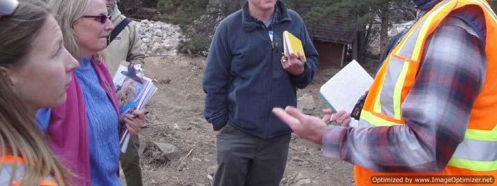
34 Community Engagement Was Key - Transparent process; ongoing communication Large community meetings to small groups Surveys; individual property maps - Risk education (collective and individual); choices to reduce risk Regulatory and Provisional Map - Understand Audience - Adaptive Strategy - Flexibility 34

35 Community Involvement Site Assessments Input from Affected Tours and Meetings 35


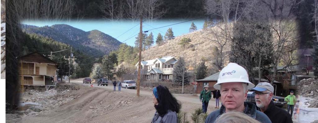

36 Community Involvement 36
37 Clearwater vs Debris Flows Homes Outside Floodplain Areas of New Scour Areas of New Scour 100-year Flood Surface FEMA Assumption Material Built Up During Event Normal Water Level Higher Flood Surface Channel Moves to New Location Due to Scour Avulsed Bank Water Surface Raises Due to Material Aggradation Channel Shape and Location Changes Due to Avulsion 37
 Elevation (ft) 6870 6860 6850 6840 6830 6820 6810 6800 Cross Sections From Here Looking")
38 Complex Channel Changes Downstream Orange =Scour Green = Deposition Pre-Flood Channel Post-Flood Channel Post FIRM Home not damaged Elevation (ft) Cross Sections From Here Looking Upstream: Sec James Horizontal Distance (ft) Elevation (ft) Cross Sections From Here Looking Upstream: Sec 15 DS Town Horizontal Distance (ft) Pre Flood Post Flood Pre Flood Post Flood 38


39 Erosion Hazard Zone Concepts 39
40 Programmatic Environmental Assessment (PEA) 2013 Sandy Recovery Improvement Act: established a new approach to the Federal Environmental and Historic Preservation (EHP) process called the Unified Federal Review Process Improves coordination and consistency of Federal EHP reviews for disaster recovery projects The PEA identifies possible environmental issues and related mitigation measures associated with the Town s recovery and hazard mitigation actions. Agency reviews have resulted in minimal impacts thus far Will benefit Jamestown s recovery process by expediting disaster recovery project review and implementation 40

41 Stable Channel Design 41

42

43 Implementation of Channel Design 43


44 Implementation of Channel Design 44


45 Implementation of Channel Design 45


46 Implementation of Channel Design 46


47 Implementation of Channel Design 47


48 Implementation of Channel Design 48
49 Lessons Learned Provisional flood hazard mapping key to basing redevelopment decisions Traditional floodplain maps don t account for debris and channel migration Fast tracking the recovery can be done smartly! Community buy-in critical during the process Town is better prepared for 2014 spring runoff and future floods Still a long way to go: Road, bridge and water infrastructure repairs by August. 49

50 Questions? Jamestown Flood Relief e-to-jamestown/ Jeff Brislawn, MS, CFM 50