Legal Description Part of the Southwest Quarter of the Southeast Quarter of Section 17, Decoria Township
|
|
|
- Ellen Hamilton
- 5 years ago
- Views:
Transcription
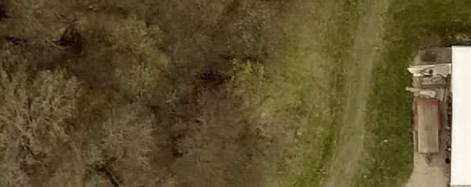
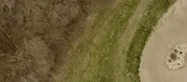
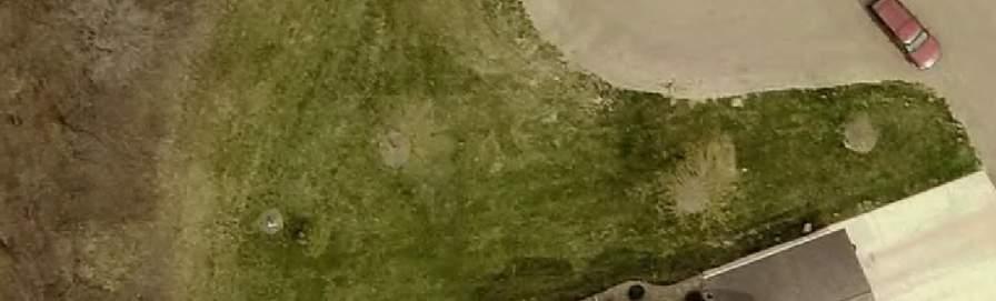
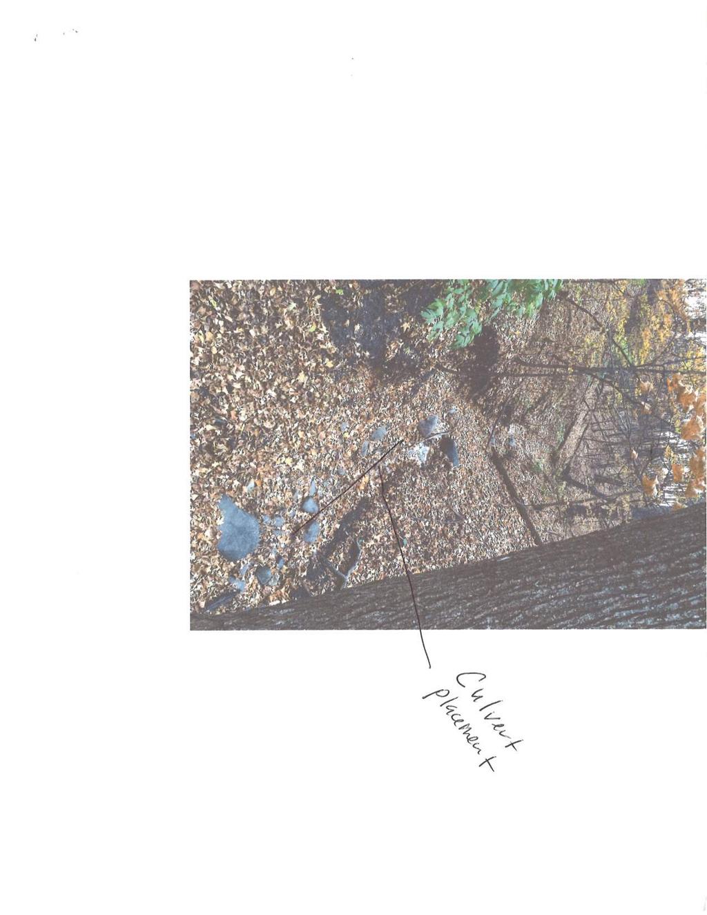
1 PC Eric & Rande Baker Cut/Fill in Bluff Impact Zone CUP 12/07/2016 Applicants Eric & Rande Baker th Avenue Mankato, MN Request Request for review and approval of a Conditional Use Permit for the movement or placement of more than 50 yards of material within the Bluff Impact Zone to repair a section of failing bluff leading into a ravine system. The property is zoned Agricultural and is located in part of the Southwest Quarter of the Southeast Quarter of Section 17, Decoria Township. Legal Description Part of the Southwest Quarter of the Southeast Quarter of Section 17, Decoria Township Zoning The property is zoned Agricultural General Site Description and Project Proposal The entire property consists of acres and includes a single-family dwelling with an attached garage and a detached accessory structure. Also located on the property is a steep slope which meets the County s definition of a bluff. Connected to this bluff is a large, wooded ravine system. The applicant is proposing to place a culvert and approximately 240 cubic yards of quality clay in an expanding washout area. The goal of the project is to safely move any surface water from the top of the hill, to the bottom of the hill without allowing erosion to continue. In addition to the proposed culvert and clay, the applicant proposes to install rip rap around the pipe and plant vegetation and trees to had stability to the bluff. At the bottom of the bluff, the applicant is proposing to install rock as an energy dissipation measure to further guard against erosion. See Attachment A-2b Project Outcome If approved, the Conditional Use Permit will allow the applicant to move and place more than 50 cubic yards of material within a Bluff Impact Zone for the purpose of repairing a hillside washout area. Land Use Plan The County s Land Use Plan lists the protection of environmentally sensitive areas such as bluffs and wooded areas as one of its goals. For this reason, this request does not conflict with the Blue Earth County Land Use Plan. Access There is no change in access being proposed. Access to the property will continue to be to and from 578 th Avenue, a township road. 1
2 PC Eric & Rande Baker Cut/Fill in Bluff Impact Zone CUP 12/07/2016 Existing Land Uses within ¼ Mile North: 181 st Lane, five residential dwellings, cropland and 182 nd Lane South: Cropland, a wooded ravine system, three residential dwellings and 178 th Lane East: CSAH 8, cropland and one residential dwelling West: A wooded ravine system, cropland, two residential dwellings and cropland NATURAL RESOURCES INFORMATION Topography The entire property is fairly flat except for the southwestern corner which contains a steep slope which meets the County s definition of a bluff. See Attachment A-4 Floodplain The nearest mapped FEMA floodplain area is approximately 1,700 feet to the west of the property. See Attachment A-5 Shoreland The nearest Shoreland Overlay District is approximately 1,500 feet to the west of the property. See Attachment A-6 Township Review In an dated November 7, 2016, Valerie Levos, Clerk for Decoria Township stated that Mr. Baker had attended the November Township meeting to discuss his proposal. The Township discussed the proposal and voted to approve the request as long as it met the guidelines of Blue Earth County Planning and Zoning. Environmental Health Review See Attachment A-7 Applicable Sections of the Zoning Ordinance Sec Planning Commission (f) Findings required 1. Enumeration. The Planning Commission shall not forward a recommendation of approval of a conditional use permit unless they find the following facts at the hearing where the applicant shall present a statement and evidence in such form as the Planning Agency may require: a. That the proposed use conforms with the county land use plan. b. The demonstrated need for the proposed use. c. That the proposed use will not degrade the water quality of the county. d. That the proposed use will not adversely increase the quantity of water runoff. e. That soil conditions are adequate to accommodate the proposed use. 2
3 PC Eric & Rande Baker Cut/Fill in Bluff Impact Zone CUP 12/07/2016 f. That the proposed use does not create a potential pollution hazard. g. That adequate utility, access roads, drainage and other necessary facilities have been or are being provided. h. That adequate measures have been or will be taken to provide sufficient off-street parking and loading space to serve the proposed use. i. That facilities are provided to eliminate any traffic congestion or traffic hazard which may result from the proposed use. j. That the conditional use will not be injurious to the use and enjoyment of other property in the immediate vicinity for the purposes already permitted. k. That the establishment of the conditional use will not impede the normal and orderly development and improvement of surrounding vacant property for predominant uses in the area. l. That adequate measures have been or will be taken to prevent or control offensive odor, fumes, dust, noise and vibration, so that none of these will constitute a nuisance, and to control lighted signs and other lights in such a manner that no disturbance to neighboring properties will result. m. That the density of proposed residential development is not greater than the density of the surrounding neighborhood or not greater than the density indicated by the applicable zoning district. n. That the intensity of proposed commercial or industrial development is not greater than the intensity of the surrounding uses or not greater than the intensity characteristic of the applicable zoning district. o. That site specific conditions and such other conditions are established as required for the protection of the public's health, safety, morals and general welfare. Sec Erosion Control (c) Development of bluff zones and steep slopes 3. Filling or cutting activity in any bluff zone shall be considered a conditional use. In no case shall cutting or filling be allowed for the purpose of establishing a site for the erection of a structure. (e) Exposed Slopes 1. No exposed slope should be steeper in grade than three (3) feet horizontal to one (1) foot vertical. 3
4 PC Eric & Rande Baker Cut/Fill in Bluff Impact Zone CUP 12/07/ At the foot of each exposed slope, a channel and berm should be constructed to control runoff. The channelized water should be diverted to a sedimentation basin before being allowed to enter the natural drainage system. 3. Along the top of each exposed slope, a berm should be constructed to prevent runoff from flowing over the edge of the slope. Where runoff collecting behind such berm cannot be diverted elsewhere and must be directed down slope, appropriate measures shall be taken to prevent erosion. Such measures should consist of either an asphalt paved flow apron and drop chute laid down the slope or a flexible slope drain. At the base of the slope drain or flow apron, an energy dissipater should be installed to prevent erosion at the discharge end. Where appropriate, the county may require a drop structure be constructed to Soil and Water Conservation District standards. 4. Exposed slopes shall be protected by whatever means will effectively prevent erosion considering the degree of slope, soils material and expected length of exposure. Slope protection shall consist of mulch, sheets of plastic, burlap or jute netting, sod blanket, erosion mat, fast growing grasses or temporary seeding of annual grasses. Mulch consists of hay, straw, wood chips, corn stalks, bark or other protective material. Mulch should be anchored to slopes with liquid asphalt, stakes and netting, or worked into the soil to provide additional slope stability. 5. Control measures, other than those specifically stated in this subsection, may be used in place of such measures if they will as effectively protect exposed slopes. Proposed Findings of Fact Staff believes the request will meet the following standards required for the granting of a conditional use permit: 1. That the proposed use conforms with the county land use plan. The County s Land Use Plan lists the protection of environmentally sensitive areas such as bluffs and wooded areas as one of its goals. For this reason, this request does not conflict with the Blue Earth County Land Use Plan. 2. The demonstrated need for the proposed use. Staff has visited the site and has seen the erosion area in the proposal. There is no doubt that this area needs to be addressed in order to protect the bluff. Therefore, the need for the proposed use has been demonstrated. 3. That the proposed use will not degrade the water quality of the county. By filling in the wash out area and properly managing the runoff, the proposed use should reduce the addition of soil particles to the stormwater of this property. Therefore, this use will not degrade the water quality of the county. 4
5 PC Eric & Rande Baker Cut/Fill in Bluff Impact Zone CUP 12/07/ That the proposed use will not adversely increase the quantity of water runoff. Filling in a washout area on a bluff and adding infrastructure to better manage the stormwater runoff in that area should not increase the quantity of water runoff. 5. That soil conditions are adequate to accommodate the proposed use. According to the County s Soil Map, the soil in the area of the proposed project is Storden complex, very steep. The soil type is further characterized as well drained and not hydric. The conditions appear to adequately accommodate the proposed use. 6. That the proposed use does not create a potential pollution hazard. The proposed use will allow for the stormwater runoff to be better managed in this area and should reduce the amount of soil particles in the water. Therefore, this proposal should not create a pollution hazard. 7. That adequate utility, access roads, drainage and other necessary facilities have been or are being provided. The ravine system downslope of the project appears to be large enough to handle the property runoff while providing adequate area for infiltration of stormwater. Therefore, the necessary facilities appear to be provided for this project. 8. That adequate measures have been or will be taken to provide sufficient off-street parking and loading space to serve the proposed use. This standard does not apply to the proposed project. 9. That facilities are provided to eliminate any traffic congestion or traffic hazard which may result from the proposed use. This standard does not apply to the proposed project. 10. That the conditional use will not be injurious to the use and enjoyment of other property in the immediate vicinity for the purposes already permitted. The filling in of a washout area and the addition of stormwater runoff management infrastructure should not be injurious to the use and enjoyment of other property in the immediate vicinity. 11. That the establishment of the conditional use will not impede the normal and orderly development and improvement of surrounding vacant property for predominant uses in the area. The filling in of a washout area and the addition of stormwater runoff management infrastructure should not impede the normal and orderly development of surrounding vacant property for predominant uses in the area. 5
6 PC Eric & Rande Baker Cut/Fill in Bluff Impact Zone CUP 12/07/ That adequate measures have been or will be taken to prevent or control offensive odor, fumes, dust, noise and vibration, so that none of these will constitute a nuisance, and to control lighted signs and other lights in such a manner that no disturbance to neighboring properties will result. This standard does not apply to the proposed project. 13. That the density of proposed residential development is not greater than the density of the surrounding neighborhood or not greater than the density indicated by the applicable zoning district. This standard does not apply to the proposed project. 14. That the intensity of proposed commercial or industrial development is not greater than the intensity of the surrounding uses or not greater than the intensity characteristic of the applicable zoning district. This standard does not apply to the proposed project. 15. That site specific conditions and such other conditions are established as required for the protection of the public's health, safety, morals and general welfare. This standard has been addressed in the Recommendations section of this report. Recommendations Staff recommends APPROVAL of the Conditional Use Permit for the movement or placement of more than 50 cubic yards of material within a Bluff Impact Zone contingent upon the following conditions: 1. Prior to the commencement of the project, adequate erosion control shall be installed. The erosion control must be entrenched and maintained throughout the duration of the project until vegetation can be established. 2. If found in the surrounding area, no wetlands can be negatively impacted by this project. 3. Sediment control, such as a straw blanket, should be used on bare slopes until vegetation is established. Attachments A-1 General Location Map A-2a Site Map A-2b Project Location Map A-3 Project Proposal A-4 Topography Map A-5 Floodplain Map A-6 Shoreland Overlay Map A-7 Environmental Health Review 6
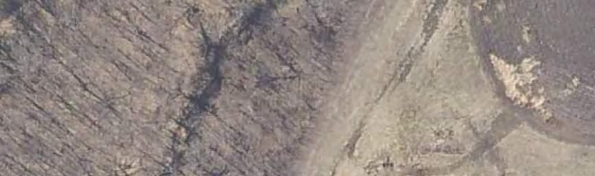
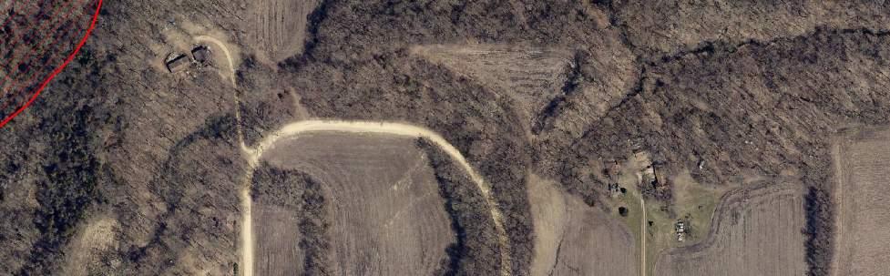
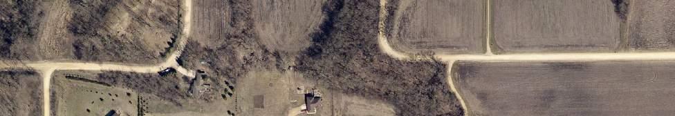
7 General Location Map Attachment A-1 Attachment A-1 General Location Map Site of the Proposal


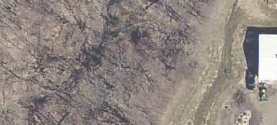
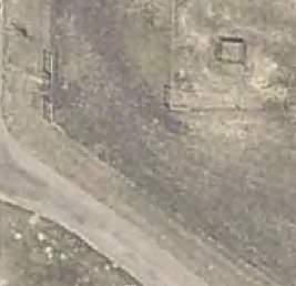
8 Site Map Attachment A-2a 181st Ln EF 8 576th Ave Permitted Accessory Structure Permitted Residential Structure ,040 Feet

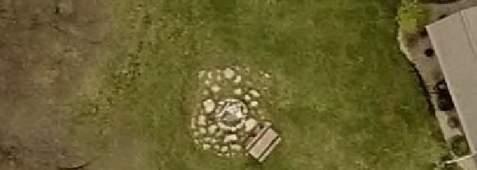
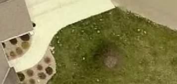
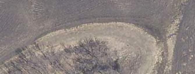
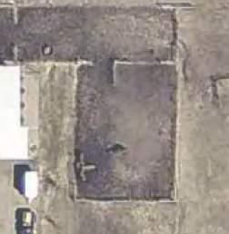
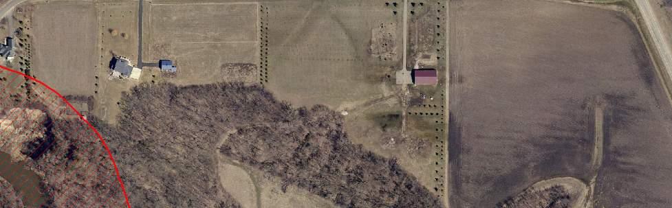
9 Project Location Map Attachment A-2b Location of the Proposed Fill Project Feet
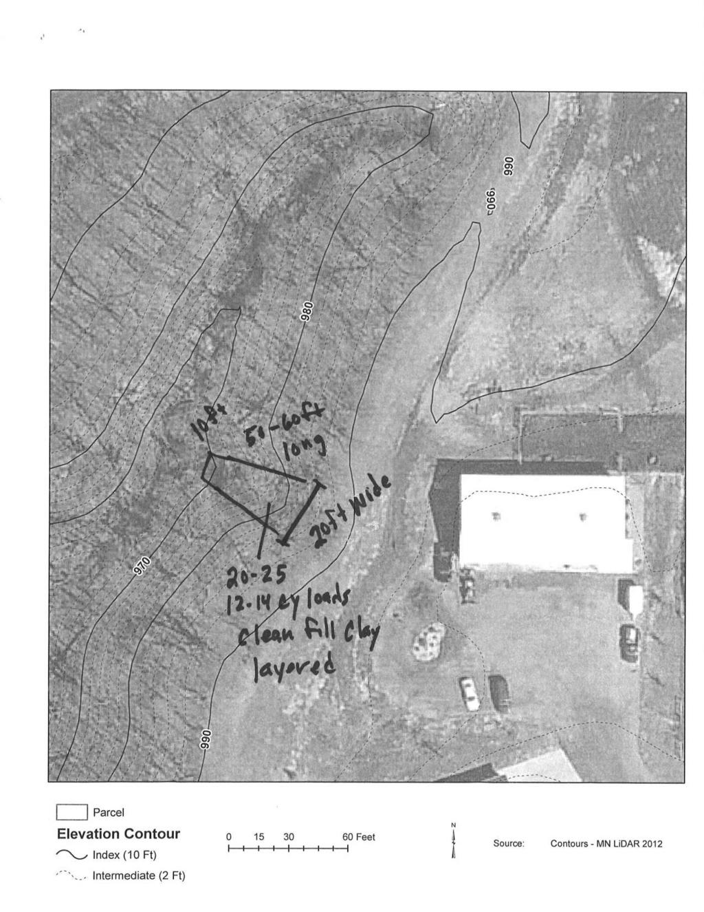
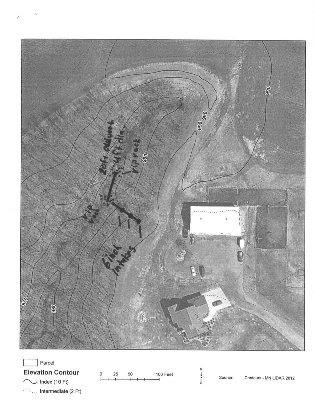
10 Eric Baker Project Proposal Attachment A th Ave. Mankato, MN Seeking a conditional use permit to fill in a washout in a bluff zone. In 2002 I worked with Soil and Water to fix one of 2 washouts. There is no funding to finish the 2 nd. I will fund the repair on my own. Permission is needed to work in a bluff zone. The washout in question is not active #2, the water was diverted to the 1 st washout and rip rap and berm were added to control erosion. I seek County approval to place a culvert and 20 loads (approximately 240 cubic yards) of quality clay in the washout, pipe any surface water from the top in piping buried down to the bottom, place rip rap around pipe and plant vegetation and trees. 1. Remove loose soil 2. Prepare a base with quality clay 3. Compact clay using a layering technique to create a more stable grade 4. Lay pipe to carry surface water that may flow down the bank, this pipe will have 2 other inlets down the bank to reduce overland flow 5. Cover pipe with quality clay 6. Place rip rap around 3 inlets and around culvert openings 7. Place culvert in ravine channel to protect the bank cover with clay 8. Plant vegetation, mainly trees because of the shade, but I will also plant grasses for erosion 9. Until grade becomes established I will use water filter strips to minimize sediment flowing into water 10. Place rock at the base of tile discharge
11
12
13
14
15
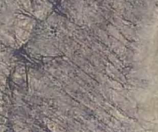
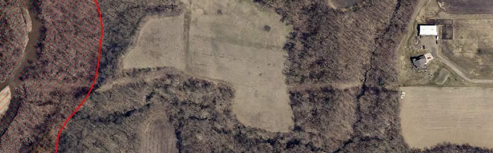
16 Topography Map Attachment A Parcel Elevation Contour Index (10 Ft) Feet ³ Source: Contours - MN LiDAR 2012 Intermediate (2 Ft)

 Special Flood Hazard Area")
 Zone AE - Floodway Zone AE -")

17 Floodplain Map Attachment A-5 April 20, 2011 Draft Data Preliminary Flood Insurance Rate Map EF 8 576th Ave 181st Ln C o b b 851 R i v e r Zone AE Floodway 1,719 ft (approximately) Special Flood Hazard Area (1% Chance Flood) Feet ³ Base Flood Elevation (FT) Zone AE - Floodway Zone AE - Floodfringe Zone A - No Base Flood Elevations Other Flood Areas 0.2 % Chance Annual Flood Hazard Area Protected By Levee


18 Shoreland Overlay Map Attachment A-6 EF 8 576th Ave 181st Ln C o b b R i v e r 1,536 ft (approximately) 178th Ln
19 Environmental Health Review Attachment A-7