Section 1 - Introduction
|
|
|
- Julius Hubbard
- 5 years ago
- Views:
Transcription

1 Section 1 - Introduction
2 Algar Lake SAGD Project Section 1 Project Introduction TABLE OF CONTENTS 1. PROJECT INTRODUCTION PROJECT BACKGROUND PROJECT PROPONENT PROJECT OVERVIEW PROJECT NEED PROJECT REGULATORY APPROVAL PROCESS Application Approvals Additional Approvals Associated with the Application APPLICATION GUIDE AND DESCRIPTION REGIONAL SETTING DEVELOPMENT SCHEDULE... 6 List of Tables Table SAGD Project Components... 3 Table Associated Facilities... 3 List of Figures Figure Figure Figure Figure Figure Project Location Grizzly Oil Sands Leases and Regional Development Development Plan Topography Stage 1 Project Schedule March 2010 Section 1-i
3 Grizzly Algar Lake SAGD Project Section 1 Project Introduction 1. PROJECT INTRODUCTION 1.1 PROJECT BACKGROUND Grizzly Oil Sands (Grizzly) plans to develop a project to extract bitumen from their leases located approximately 45 km southwest of Fort McMurray in north-eastern Alberta (Figure 1.1.1). The Algar Lake SAGD Project (the Project) will be located on Grizzly s oil sands lease (OSL) # located approximately 10 km west of Highway 63 within Township 85, Range 12-W4M (Figure 1.1.2). The Project is expected to produce 1800 m 3 /day (11,300 bopd) of bitumen per day for 20 to 30 years. For the purpose of this application Grizzly has identified a Project Area and Resource Development Area (RDA). The Project Area is the resource area required to supply the bitumen required for the life of the project and encompasses 21 sections of land. The RDA is the resource area required to supply bitumen for the initial stages of development and sufficient exploration has been conducted to define the resource. The Project Area and RDA are shown on Figure and are as follows: Project Area: - Sections 2 to 4; 9 to 11; 13 to 17; 20 to 29; Township 85, Range 12, W4M. Resource Development Area (RDA) - Section 10; N½ 11; 14; LSDs 1 to 3, 6 to 11, 14 to 6-15; E½ 16, SE,, Township 85, Range 12, W4M. Grizzly has defined the location of the well pads required for the first stage of development. Future well pad locations will be determined based on the results of future exploration activities and performance of wells from the first stage of development. The central processing facilities will be developed in two phases, each of 900 m3/d capacity to be developed two years apart. Stage 1 consists of two plant phases and four well pads. 1.2 PROJECT PROPONENT Grizzly is a privately owned company with offices in Calgary and Oklahoma City, formed in September of 2006 for the acquisition, exploration and development of bitumen production using thermal technologies. The company has assembled a diverse portfolio of Alberta oil sand leases within the Athabasca and Peace River oil sand areas. The Algar Lake SAGD Project was chosen for the initial project development due to its clean pay interval and proximity to existing infrastructure. The name and address of the applicant for the Project is: Grizzly Oil Sands Life Plaza 410, 7 7 Ave. SW Calgary AB T2P 3P8 March 2010 Section 1-1
4 Grizzly Algar Lake SAGD Project Section 1 Project Introduction Correspondence concerning this application should be directed to the above address to the attention of: Name: Ms. Camille Musters Phone: (403) cmusters@grizzlyoilsands.com 1.3 PROJECT OVERVIEW The Algar Lake SAGD Project is located west of Highway 63 in Sections 10, 11, 14 and 15, Township 85, Range 12, West of the 4 th Meridian (Figure 1.3.1). The Project will use proven steam assisted gravity drainage (SAGD) technology to recover bitumen from bitumen resource located approximately 250 metres below the surface. The first Stage of development will include two modular CPFs each with a design capacity of 900 m 3 /d and four well pads each consisting of ten well pairs. Initial development will consist of one modular CPF, 10 well pairs on one well pad plus associated roads and pipelines. The second modular CPF and additional well pads will be constructed at a later date. At the CPF, the bitumen and water are separated. The water is recycled for steam generation and the bitumen is prepared for shipment to market via trucks or pipeline. Dilution of the bitumen with condensate or synthetic crude will be required. Over the life of the project, there will be approximately 80 to 100 well pairs drilled from 8 10 well pads to recover in excess of 14 million m 3 of bitumen. The production life for each individual well pair is estimated to be approximately 5 to 7 years. As the individual well pair production declines, additional well pairs will be drilled throughout the life of the project to maintain production. Details of the development plan are provided in Section 2 Project Description. The workforce needed to operate the Project is estimated to be 20 to 30 people. Grizzly proposes to fly some of its operational employees into the Fort McMurray airport, where they will be picked up and transported to the site. Once on site, the workforce will be housed in a permanent operations camp constructed for the Algar Lake Project. Some of the workforce will live in Ft. McMurray and commute to the site each day. For Stage 1 of development, the SAGD Project will create a total surface disturbance of approximately 43.2 ha (Table 1.3.1, Figure 1.3.1). Grizzly is only applying for Stage 1 of development at this time. The estimated total bitumen to be recovered for Stage 1 ranges from 4 to 5 million m 3 (25 to 31 million barrels). March 2010 Section 1-2
5 Grizzly Algar Lake SAGD Project Section 1 Project Introduction Table SAGD Project Components Area Area (ha) Plant Site 10.8 Pad A 3.5 Pad B 3.6 Pad C 3.6 Pad D 3.6 Borrow Pit S Access 2.0 Camp 1.1 Pipeline 3.7 Total 43.2 The Project is located approximately 10 km west of Highway 63 and will require supporting infrastructure including an access road and associated borrow pits, water line, gas line and water source wells. These associated facilities are anticipated to disturb an additional 75.8 ha of land (Table 1.3.2, Figure 1.3.1). Grizzly will continue to work with Alberta Sustainable Resource Development to ensure the location of these facilities fits within their land management goals and objectives. Table Associated Facilities Area Area (ha) Access Road 40.2 Borrow Pit A1 1.0 Borrow Pit A2 1.0 Borrow Pit A3 1.0 Borrow Pit A4 1.0 Borrow Pit A5 1.0 Borrow Pit A6 1.0 Gas line 5.3 Waterline.0 WSW 2.3 Total 75.8 Since 2007, Grizzly has had an ongoing dialogue with local and regional stakeholders with respect to the environment and social aspects of SAGD development in the Algar Lake Area. This document comprises the application for approval of the Algar Lake SAGD Project and meets provincial requirements under the Oil Sands Conservation Act, the Environmental Protection and Enhancement Act and the Water Act. March 2010 Section 1-3
6 Grizzly Algar Lake SAGD Project Section 1 Project Introduction 1.4 PROJECT NEED Oil industry projections show that conventional crude production opportunities are declining. As such, the requirement for additional heavy oil production will increase to fill the gap. The Algar Lake SAGD Project will recover bitumen from the McMurray formation of the Athabasca oil sands deposit utilizing the in-situ SAGD process. The oil sands resource in the Grizzly Project Area will be sufficient to produce 11,300 bopd for 20 to 30 years. The Project will be a positive addition to the Alberta economy, both during construction and operations. Some of the Project highlights are as follows: the total project construction costs for the first Stage of the project will be approximately $300 million; the project will contribute an estimated $500 million in taxes and $315 million in royalties to the Federal, Provincial and Municipal governments; the project will employ a full time work force of people; and during construction, the project will employ an average work force of approximately 100 people. 1.5 PROJECT REGULATORY APPROVAL PROCESS Procedures for regulatory approval of oil sands developments in Alberta are determined by the Oil Sands Conservation Act and the Alberta Environmental Protection and Enhancement Act. Key agencies involved in the coordination of the review of the Algar Lake SAGD Project are the Alberta Energy Resources Conservation Board (ERCB), and Alberta Environment (AENV) Application Approvals This application is an integrated submission to the ERCB and AENV. Grizzly is seeking approval for the following: ERCB Approval Oil Sands scheme approval to construct and operate the Algar Lake SAGD Project pursuant to Sections 10 and 11 of the Oil Sands Conservation Act and Sections 3 and of the Oil Sands Conservation Regulation; and Approval to construct and operate a distribution and gathering pipeline system within the project development area pursuant to Part 4 of the Pipeline Act. AENV Approval Approval, pursuant to Part 2, Division 2 and Section 66 of the Alberta Environmental Protection and Enhancement Act, to construct and operate the project including facilities to recover and treat bitumen and processed water; Approval, pursuant to Part 2, Division 2 and Section 66 of the Alberta Environmental Enhancement and Protection Act, to construct and operate the cogeneration facility; March 2010 Section 1-4
7 Grizzly Algar Lake SAGD Project Section 1 Project Introduction Conservation and reclamation approval, as required under the Conservation and Reclamation Regulations, to develop, operate and reclaim the various components of the Project; and. Water diversion licence for the water supply pursuant to Part 4 of the Water Act Additional Approvals Associated with the Application Grizzly will file separate applications for those parts of the project that are legislated under various other statutes. Provincial application and approval requirements applicable to the project which will be submitted under separate cover are: Surface rights requirements pursuant to the Public Lands Act; Site surface disturbance clearance pursuant to the Historical Resources Act; Production and injection well drilling licenses issued pursuant to the Oil and Gas Conservation Act; Installation of a natural gas pipeline from third party facility to the CPF, pursuant to the Pipeline Act; Development Permit issued pursuant to the Municipal Government Act, from the Regional Municipality of Wood Buffalo for construction and operation of the Project and related infrastructure; Cogeneration facility approval as per Part 2 Section 11 of the Hydro and Electric Energy Act to be filed with the Alberta Utilities Commission; and Electrical power interconnections issued pursuant to the Electrical Utilities Act. 1.6 APPLICATION GUIDE AND DESCRIPTION The application for approval to the ERCB and AENV has been integrated in accordance with ERCB and AENV guidelines to facilitate an efficient review of the application by the regulatory review agencies and the public. EPEA application requirements as described in the Activities Designation Regulation are discussed in Section 5.0. This application for the Algar Lake SAGD Project is presented in one volume that consists of the following components: Section 1 Project Introduction; Section 2 Project Description; Section 3 Public Consultation; Section 4 Environmental and Social Information; Section 5 EPEA Application; Section 6 Water Act Application; Appendix 1 Project Team; Appendix 2 Glossary and Acronyms; Appendix 3 References; Appendix 4 Well Summary Report March 2010 Section 1-5
8 Grizzly Algar Lake SAGD Project Section 1 Project Introduction Appendix 5 Caprock Evaluation and Reservoir Simulation Study; Appendix 6 Public Consultation; Consultant Report #1 Air Quality; Consultant Report #2 Conservation & Reclamation Plan; Consultant Report #3 Aquatic Resources; Consultant Report #4 Groundwater; Consultant Report #5 Historical Resources; Consultant Report #6 Hydrology; Consultant Report #7 Noise; Consultant Report #8 Soils; Consultant Report #9 Vegetation; and Consultant Report #10 Wildlife. 1.7 REGIONAL SETTING The Algar Lake SAGD Project is located in Township 85, Range 12, West of the 4th Meridian approximately 45 km southwest of Fort McMurray. The Project is located west of Highway 63 approximately 10 km north of the existing JACOS Hangingstone SAGD project. The project is located in the Central Mixedwood Natural Subregion of the Boreal Forest Natural Region. The project area is predominantly lowland vegetation consisting of treed bogs and shrubby bogs. Upland vegetation is predominantly low-bush cranberry dominated by black spruce. Poor and rich fens are also common in the area. The Project Area is located entirely within the Horse River watershed and is bisected by Little Horse Creek. 1.8 DEVELOPMENT SCHEDULE Following approval, it is anticipated that procurement and civil work for the Project will commence in the second quarter of Major facility construction is planned to begin in the third quarter of 2011 and will continue until the plant is commissioned in the fourth quarter of Well site drilling operations will start in the third quarter of The development schedule for the project is provided in Figure March 2010 Section 1-6
 Ft.")
 Cheecham T 84 63 RM OF WOOD BUFFALO 881 ) Quigley T 83 T 82 T 81 ) Mariana Lake T 80 Chard )")

9 MacKa Mildred Lake ) Tar Island ) I T 93 T 92 Ft. McMurray Area Enlarged T 91 Edmonton T 90 Calgary Medicine Hat Athabasca River ) Ft. McMurray 69 Clearwater River Christina River T 89 T 88 Lethbridge T 87 Algar Lake SAGD Project ) Anzac T 86 T 85 Hangingstone ) Cheecham T RM OF WOOD BUFFALO 881 ) Quigley T 83 T 82 T 81 ) Mariana Lake T 80 Chard ) T 79 ) Pelican Portage R 17 R 16 R 15 R 14 R 13 R 12 R 11 R 10 R 9 R 8 R 7 R 5 W4M Legend SAGD Project Footprint Project Area PROJECT: Resource Development Area First Nations Land Algar Lake SAGD Project TITLE: DRAWN: PS FIGURE: Kilometres Project Location CHECKED: KY DATE: Jan 25/10 PROJECT:
10 Petro-Canada Dover Syncrude Mildred Lake Petro-Canada MacKay River Ma ck ay River ) Tar Island ) Suncor Voyageur Suncor Voyageur South Mildred Lake Suncor Millennium/Steepbank I T 93 T 92 Ft. McMurray Area Enlarged Petro-Canada Lewis T 91 Edmonton E-T Energy Ltd. T 90 Calgary Medicine Hat Athabasca River Ft. McMurray 69 Clearwater River Christina River T 89 T 88 Lethbridge T 87 ) Anzac T 86 Algar Lake SAGD Project OPTI/Nexen Long Lake T 85 JACOS Hangingstone Petro-Canada Meadow Creek OPTI/Nexen Long Lake South ) Cheecham T 84 ConocoPhillips Surmont 881 T 83 Connacher Great Divide 63 Connacher Algar ) Quigley T 82 RM OF WOOD BUFFALO T 81 ) Mariana Lake T 80 Chard ) T 79 ) Pelican Portage R 17 R 16 R 15 R 14 R 13 R 12 R 11 R 10 R 9 R 8 R 7 R 5 W4M Legend Oil Sands Facility First Nations Land PROJECT: Algar Lake SAGD Project TITLE: DRAWN: PS/SL FIGURE: Kilometres Project Location CHECKED: KY DATE: Feb /10 PROJECT:
11 T 86 I T Little Horse C reek R 13 R 12 R 12 R 11 R 11 R 10 W4M Horse C reek T T 84 Dawes Lake JACOS Hangingstone Commercial Horse River Legend PROJECT: Project Area Resource Development Area SAGD Project Footprint Other Grizzly OSL Oil Sands Facility REF: Grizzly Block - Dec -09.dwg (Challenger); NHC, Road (Unimproved) Existing Pipeline Existing Powerline Streams with Defined Channels Kilometres TITLE: Algar Lake SAGD Project Grizzly Oil Sands Leases and Regional Development DRAWN: SL/PS CHECKED: KY DATE: Feb 2/10 PROJECT: FIGURE: 1.1.2


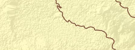


12 Main Menu Main TOC R 12 R 11 W4M H o r se Cr ee 495 k Little Horse Creek I T 85 tle L it T 84 H or se Cree k Water Source Wells PROJECT: Legend SAGD Project Footprint Project Area Algar Lake SAGD Project Topography (masl) High : 560 Gravel Road Streams with Defined Channels TITLE: Low : Metres REF: Grizzly Block - Dec -09.dwg (Challenger); NHC, Topography DRAWN: SL CHECKED: KY DATE: Jan 25/10 PROJECT: FIGURE: 1.3.2


13 Main TOC I Little Horse Creek R 12 R 11 W4M Main Menu T 85 tle L it T 84 Hor s Pad C 31 e Water Source Wells Pad D 19 Road C reek 30 Access Road 20 Pad B Road Gasline Borrow Pit Pipeline Borrow Pit Road Waterline Pad A Access Road Plant Site Road Camp Legend Access Road Pipeline Project Area Borrow Pit Plant Site Gravel Road Camp Road Streams with Defined Channels Gasline Water Source Well Well Pad Waterline REF: Grizzly Block - Dec -09.dwg (Challenger); NHC, PROJECT: Algar Lake SAGD Project TITLE: Metres 400 Development Plan DRAWN: PS CHECKED: KY DATE: Jan /10 PROJECT: FIGURE: 1.3.1
14 Reservoir Evaluation Q1 Q2 Q3 Q4 Q1 Q2 Q3 Q4 Q1 Q2 Q3 Q4 Q1 Q2 Q3 Q4 Q1 Q2 Q3 Q4 Public Consutation Map Document: (K:\Active Projects 2007\Projects to \ Grizzly SAGD\Application Figures\Fig Project Stage 1 Schedule.mxd) 02/09/ :48:27 AM REF: Grizzly, 2008 Environmental Assesment Regulatory Review Facilities Design Module 1 Facilities Construction Module 1 Well Pad Construction Module 1 Start-up Module 1 Facilities Design Module 2 Facilities Construction module 2 Well Pad Construction Module 2 Start-up Module 2 PROJECT: TITLE: Algar Lake SAGD Project DRAWN: CHECKED: Stage 1 Project Schedule Sep 2/08 DATE: PROJECT: FIGURE: 1.8.1