Sandy Wyman Rangeland Management Specialist National Riparian Service Team SRM, Feb. 6, 2013
|
|
|
- Arabella West
- 5 years ago
- Views:
Transcription

1 Assessing Proper Functioning Condition (PFC) of Lentic Areas Sandy Wyman Rangeland Management Specialist National Riparian Service Team SRM, Feb. 6, 2013

2 TR
3 What is PFC? How well physical processes are functioning. A state: of resiliency that allows lentic wetland areas to remain stable in the face of disturbances (e.g. wind/wave actions, overland flow events) that allows an area to produce desired values (e.g. waterfowl habitat)
.")
4 Riparian Proper Functioning Condition (PFC) Term PFC is used in two ways: Condition Description: An on-the-ground condition of riparian-wetland areas determined by completing the PFC assessment process. This results in describing the functionality of a system (PFC, FAR, or NF). Qualitative Method for assessing the physical function of riparian-wetland areas (which may include using quantitative data to validate checklist items).

5 As a condition description, PFC describes: How well the physical processes are working How well the riparian-wetland area will hold together during wind & wave actions or overland flow The system s ability to maintain and produce both physical and biological values

6 As an assessment - PFC Is a qualitative procedure based on quantitative science Provides a consistent approach for considering hydrology, vegetation, and soil attributes and processes in a synthesized manner to determine the health of the site.

7 The PFC assessment is: Intended to be performed by a trained and experienced ID team
8 Using PFC Assessments PFC is an appropriate starting point for determining and prioritizing the type and location of necessary quantitative inventory or monitoring. PFC condition correlates to resiliency with respect to desired values.

9 Attributes & Processes Vary by wetland type Vary site to site Vegetation Soils Hydrology
10 Attributes and Processes Erosion/Deposition Shoreline stability Depositional features Soils Soil type Distribution of Aerobic/Anearobic soils Annual pattern of soil/water states Ponding frequency and duration Restrictive materials Water Quality Temperature ph Dissolved solids Dissolved oxygen Toxic material Biotic Community Aquatic Plants Recruitment/ Reproduction Nutrient enrichment
11 Attributes and Processes Hydrogeomorphic Ground-water Discharge Recharge Flood modification Inundation Depth Duration Frequency Semi-permanently flooded Shoreline Shape Vegetation Community types Community type distribution Density Cover Community dynamics and succession Recruitment/ Reproduction Root characteristic Survival

12 Condition Description Communication Provide a general/broad scale assessment of the condition of riparian/wetland areas Coarse filter used to prioritize management, restoration & monitoring efforts What PFC does
13 DEFINITION: Proper Functioning Condition (PFC) Adequate vegetation, landform or woody debris present to: -Dissipate Energy (wind, wave, and overland flow) -Filters Sediment -Improve Flood-water Retention -Develop Root Masses -Restrict Water Percolation -Develop Diverse Ponding Characteristics -Support Greater Biodiversity
14 PFC CONDITION YIELDS Reduced erosion Improved water quality Floodplain development Ground-water recharge Stabilized islands and shoreline features Fish & wildlife habitat
15 DEFINITIONS: Functional - At Risk (FAR) Riparian-wetland areas that are in functional condition but have an existing soil, water, or vegetation attribute that makes them susceptible to degradation.
16 DEFINITION: Non-functioning (NF) Riparian-wetland areas that clearly are not providing adequate vegetation, landform, or woody debris to dissipate energy associated with flow events, and thus are not reducing erosion, improving water quality, etc.

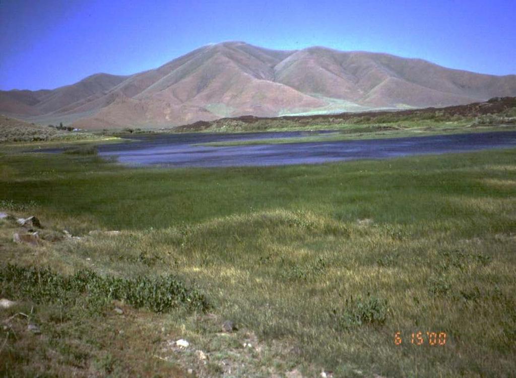
17 HYDROLOGY
18 1. Riparian-wetland area is saturated at or near the surface or inundated in relatively frequent events Purpose: Document that inundation or saturation is: Long enough Frequent enough To maintain wetland characteristics

19 Frequent saturation? Yes, watermark coincides with vegetation
20 2. Fluctuation of water levels is not excessive Purpose: To determine if water level changes are within limits that will sustain the riparian-wetland vegetation


21 Fluctuation not excessive? Yes, although vegetation is not obvious, natural fluctuation is high and site is at potential Fluctuation not excessive? Yes, vegetation is keeping up with seasonal fluctuation yes
22 3. Riparian-wetland area is enlarging or has reached potential extent Purpose: To determine if riparian area is: Degrading (filling with sediment or lowering of water table water marks are below potential extent) Recovering Recovered


23 Wetland enlarging or achieved potential extent? No, rabbitbrush and sagebrush encroaching (use soil indicators to evaluate potential extent) Wetland plants replacing upland species as water table rises - beaver
24 4. Upland watershed is not contributing to riparian-wetland degradation Purpose: To determine if there has been a change in water or sediment being delivered to the riparian-wetland area Is the change causing degradation? Indirect (watershed) impacts include altered hydrology, increased pollutants and sediment loadings, and buffer encroachment


25 Upland watershed not contributing? No Upland watershed not contributing? Yes, no sediment plume in delta
26 5. Water quality is sufficient to support riparian-wetland plants Purpose: To determine if water quality is being maintained Allowing the sites to produce the kind of vegetation necessary to function properly For example lack of hydric macrophytes and dominance of algae indicating nutrient enrichment

 Point or non")

27 Water quality is sufficient to support riparianwetland plants (is not modified by pollutants) Point or non point source Foul odors Lack Plant Diversity Algal blooms
28 6. Natural surface and subsurface flow patterns are not altered by disturbance (i.e., hoof action, dams, dikes, trails, roads, rills, gullies, drilling activities Purpose: To determine if surface or subsurface flow patterns are being maintained


29 Flow patterns are not altered by disturbance? No, ruts cross pothole or hummocks Flow patterns are not altered by disturbance Yes
30 7. Structure accommodates safe passage of flows (e.g., no headcut affecting the dam or spillway Purpose: To determine if the outlet structure provides safe passage for water


31 No headcut affecting the dam or spillway? No If the structure is stable and accommodating flows? Yes
32 8. There is a diverse age-class distribution of riparian-wetland vegetation (recruitment for maintenance/recovery) Purpose: Determine if sufficient age classes are present to indicate recruitment is occurring Does not mean all age-classes are present Usually two age classes are sufficient

33 Young shrubs Mature shrubs

34 Is there a diverse age class of riparian-wetland vegetation? NO
35 9. There is diverse composition of riparianwetland vegetation (for maintenance/recovery) Purpose: Determine if sufficient plant species are present for maintenance or recovery Documents the existence of the appropriate plants Does not indicate whether there is enough of the plants Usually 2 or more species are sufficient
 Red osier dogwood Alder Bulrush Sedge")
36 9. There is diverse composition of riparian-wetland vegetation (for maintenance/recovery) Red osier dogwood Alder Bulrush Sedge Cattails
37 10. Species present indicate maintenance of riparian-wetland soil moisture characteristics Purpose: Indicate the presence of a shallow water table It does not ask if there is enough plants Only that the plants that are there indicate the maintenance of riparian-wetland moisture conditions


38 Yes Do species present indicate maintenance of riparian-wetland soil moisture characteristics? No
39 11: Vegetation is composed of those plants or plant communities that have root masses capable of withstanding wind events, wave flow events, overland flows (e.g., storm events, snowmelt) Purpose: Shorelines (e.g.,open water areas) and soil surface (e.g., springs, seeps, wet meadows have the right plants or plant communities in place. Only asks if the right species are present, NOT if they are in sufficient amounts (but more than scattered plants).
40

41 12: Riparian-wetland plants exhibit high vigor Purpose: Determine if riparian-wetland plants are healthy and robust with appropriate reproduction Or stressed and weakened with little or no reproduction
42 12: Riparian-wetland plants exhibit high vigor Low vigor can be illustrated by: Color (chlorosis) Necrosis (tissue degeneration) Wilting Relative size, production or reproduction
43 13: Adequate riparian-wetland vegetative cover is present to protect shoreline/soil surface and dissipate energy during high wind and wave events or overland flows. Purpose: To determine if there is a sufficient amount of riparian wetland vegetation to dissipate energy from high wind/wave events or high overland flow III 44

44 13: Adequate riparian-wetland vegetative cover Three-square bulrush Softstem bulrush

45 13: Adequate riparian-wetland vegetative cover III 46
46 14: Frost or abnormal hydrologic heaving is not present Purpose Determine whether frost or hydrologic heaving is at a normal or aggravated rate


47 No excess hummocking note vertical sides to hummocks. No for area on left and yes for the area on right. 48 III
48 15: Favorable microsite condition (i.e., woody material, water temperature, etc.) is maintained by adjacent type characteristics Purpose Determine if microsite conditions are necessary for proper functioning, and if so, whether adjacent site characteristics are maintaining those conditions

49 No due to removal of adjacent trees by fire.

50 Erosion/Deposition
51 16: Accumulation of chemicals affecting plant productivity/composition is not apparent Purpose: Determine if the vegetation is being affected by chemicals in the system Accumulation of some chemicals can adversely affect vegetation


52 Iron precipitate in the meadow as a result of early thaw.
53 17: Saturation of soils (i.e., ponding, flooding frequency, and duration is sufficient to compose and maintain hydric soils Purpose: Determine if there is sufficient water available to create or maintain hydric soil characteristics Flooding frequency and duration Ponding Ground water saturation
54 Wetland Characteristics (Soils) Soils Anaerobic soils No oxygen Reducing Soils Oxidation of metals

55 Soils indicating seasonal saturation Gley soils exhibit a greenish-bluegrey soil color due to anoxic wetland conditions.
56 18: Underlying geologic structure/soil material/permafrost is capable of restricting water percolation Purpose: Determine whether the underlying material is being maintained Restrict water flow
57 19: Riparian-wetland is in balance with water and sediment being supplied by the watershed (i.e., no excessive erosion or deposition Determine if water and sediment are being supplied to the area at a natural rate or are to much or to little


58
 are adequate to dissipate wind and")
59 20: Islands and shoreline characteristics (i.e., rocks, coarse and/or large woody material) are adequate to dissipate wind and wave event energies Purpose: To address those systems that do not require vegetation
60 Summary Determination Functional Rating Proper Functioning Condition Functional --At Risk Remarks: Nonfunctional Unknown Strong Weak Trend for Functional--At Risk Remarks: Upward Downward Not Apparent
61 Standard Checklist Are factors contributing to unacceptable conditions outside the manager s control? Yes No If yes, what are those factors? Dewatering Mining Activities Dredging Activities Watershed conditions Road encroachment Other (specify) Remarks: