The RI River and Stream Continuity Project. Follow Up Meeting. April 18, 2007
|
|
|
- Ashlynn Waters
- 5 years ago
- Views:
Transcription

1 The RI River and Stream Continuity Project Follow Up Meeting April 18, 2007


2 Project Partners
3 Purpose of the Meeting To present methods to evaluate culverts as potential barriers. To demonstrate how data collection of stream crossings can be performed by different watershed groups. To obtain feedback from other groups, organizations, and individuals on the project. To identify other partners interested in making this a statewide effort.


4 Dams Photo by Lawson Cary

5 Over 500 dams

6 Over 4300 road and stream crossings
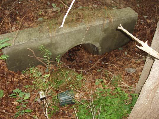
7 Photos by Lawson Cary Sub-standard Culverts
8 Impacts Habitat loss and degradation Alteration of ecological processes Road kill leading to population losses Population fragmentation and isolation Reduced access to vital habitats Disruption of processes that maintain regional populations
9 Population Fragmentation and Isolation Barriers to movement subdivide or isolate populations Smaller and more isolated populations are more vulnerable to: extinction due to chance events genetic changes
10 Courtesy of Scott Jackson
11 Fish and Wildlife Habitat Courtesy of Scott Jackson
12 Courtesy of Scott Jackson
13 Courtesy of Scott Jackson
14 Courtesy of Scott Jackson
15 Courtesy of Scott Jackson


16 Photos by Lawson Cary Sub-standard Culverts
17 Culvert Problems Inlet or outlet drop Physical barriers Debris accumulation Excessive velocities Absence of bank edge areas Flow contraction (turbulence) Insufficient water depth Discontinuity of channel substrate


18 Inlet Drop Photos courtesy of Scott Jackson


19 Outlet Perch Photos courtesy of Scott Jackson


20 Flow Contraction Photos courtesy of Scott Jackson


21 Tailwater Armoring Photos courtesy of Scott Jackson


22 Affected Species: Anadromous American shad Atlantic salmon Blueback herring


23 Affected Species: Freshwater Brook trout White Sucker out.jpg e/white_sucker.jpg


24 Wood turtle Affected Species Freshwater mussels Freshwater crayfish 2-lined salamander


25 We don t do outlet perches!! Photo by Lawson Cary

26
27 Purpose of Pilot Project Upper and Lower Wood Rivers To respond to a conservation need identified by local partners. To identify potential barriers to fish passage in the Upper and Lower Wood River watersheds. To utilize local volunteer groups and organizations to locate potential restoration projects.
28 Study Site Location

29 Methods Geographic Information Systems (GIS) analyses for both the Upper and Lower Wood River Watersheds Data on roads and streams obtained from RIGIS

30 Methods: Data Collection Road Characteristics Travel lanes Shoulder/breakdown lanes Road surface Steep embankments Retaining walls Jersey barriers Fencing Photo by Lawson Cary

31 Methods: Data Collection Crossing/Stream Characteristics Crossing type Culvert condition Presence of fish Flow conditions Culvert problems present Tailwater armoring Tailwater scour pool Physical barriers Culvert embedded Crossing substrate Water depth Water velocity Crossing span Minimum structure height at low water Photo by Lawson Cary
32 Data Entry

33 Data Output
34 Severe Barriers Moderate Barriers Minor Barriers Crossing Standards Meets General Standards Meets Optimum Standards


35 Severe Barriers Phillips Brook and Plain Meetinghouse Road Phillips Brook and Narrow Lane Wood River and Arcadia Road Unnamed Brook and Hudson Pond Road Photos by Lawson Cary


36 Moderate Barriers Unnamed Brook and Hazard Road Breakheart Brook and Plain Meetinghouse Road Roaring Brook and Summit Road Unnamed Brook and Ten Rod Road Photos by Lawson Cary


37 Minor Barriers Breakheart Brook and Austin Farm Road Unnamed Brook and Nooseneck Hill Road Parris Brook and Ten Rod Road Baker Brook and Arcadia Road Photos by Lawson Cary


38 Meets General Standards Flat River and Austin Farm Road Wood River and Skunk Hill Road Photos by Lawson Cary

39 Meets Optimum Standards Unnamed Brook and Matteson Road in the URI Alton Jones Campus Photo by Lawson Cary


40 Meets Optimum Standards Washington State s/images/alderculvert2.jpg Michigan State es/manisteeriver-mini.jpg
41 Results: Wood River Watershed 175 crossings in the Upper Wood River Watershed have been field checked for the 167 miles of streams 116 crossings in the Lower Wood River Watershed have been field checked for the 101 miles of streams Total for the Wood River Watershed: 291 crossings 268 miles of streams
42 Results: Upper Wood River Watershed 138 identified as actual road and stream crossings 62 Severe Barriers 53 Moderate Barriers 19 Minor Barriers 3 Meets General Standards 1 Meets Optimum Standards

43 Upper Wood River Watershed Severe Barriers Dams
44 Results: Lower Wood River Watershed 92 identified as actual road and stream crossings 45 Severe Barriers 29 Moderate Barriers 17 Minor Barriers 1 Meets General Standards 0 Meets Optimum Standards

45 Lower Wood River Watershed Severe Barriers Dams
46 Prioritizing Crossing Restoration Distance/length of stream US and DS from crossing Presence of RTE species Presence of multiple aquatic species Watershed size Size and type of road Landowner willingness Opinions, suggestions, and comments from experts
47 Distance/length of Stream US and DS from Crossing Assumptions: Included Perennial and Intermittent streams in the analysis (so amount of stream is being over-estimated estimated for fish habitat). Fish are able to pass through the moderate barriers. All dams are considered severe barriers.

48 Upstream Habitats Photo by Lawson Cary Over 1.5 miles of stream re-connected

49 Downstream Habitats Photo by Lawson Cary 12 miles of stream re-connected

50 Total Habitat Re-opened: 17 Miles!!!! Wow!!
51 Prioritizing SB Crossings in Upper Wood River 1. Preliminary focus was on state lands and town roads within the watershed. 2. Preliminary focus was on fish bearing streams or streams which may contain fish 62 SB crossings reduced to 10 crossings containing fish 20 crossings possibly containing fish


52 SB Crossings: Non-fish bearing streams Photos by Lawson Cary
53 Prioritizing SB Crossings in Upper Wood River 3. Minimum US and DS mileage > 0.5 miles.???? 30 SB crossings reduced to 12 crossings identified as potential restoration projects Field inspection of these sites conducted in November 2006

54 USDA-NRCS approach is to re-connect: - greatest mileage of stream corridor - acreage of wetlands associated with the stream systems.
55 Project Outreach Took results from the analysis and conducted outreach Mailed information packets to 4 towns where the 12 crossings were located Packets included data on the Stream Continuity Project and specific stream crossings within the towns USDA-NRCS WHIP Program information and application Worked with towns to apply for WHIP grants


56 Potential WHIP Projects Received 3 applications for USDA-NRCS WHIP grants Ranking in progress Photos by Lawson Cary

57 Project Implementation Since Oct Completing Lower Wood River analysis Writing 2 areawide conservation plans: Upper and Lower Wood River Convening another partners meeting in mid- April 2007 Fish sampling on potential WHIP projects Photo by Lawson Cary

58 Fish Sampling: April 6, 2007 Photos by Lawson Cary
 Over 100 hours from other partners ( NRCS, RC&D, WPWA,")
59 Hours Spent on Project Over 670 volunteer hours from TU- Narragansett Chapter Over 1,000 intern hours from USDA-NRCS (May 2006-present) Over 100 hours from other partners ( NRCS, RC&D, WPWA, )
60 Project Alternatives Alt. 1: Continue in Queens River Watershed Alt. 2: Expand Program Statewide Form an advisory committee Involve other agencies/organizations Housing of project Funding of project
61 Project Management: What s s Involved.. Database management and entering data into UMass system Volunteer training and coordination Outreach Clearing house for crossing photos and paper documents Development of areawide conservation plans
62 Conclusions UMass model is transferable to other watersheds Volunteers are a viable and crucial component to the project Project is an example of habitat restoration being implemented on the ground
63 Additional Information
64 Interested in Becoming a Volunteer? Please Contact: Chris Modisette, RC&D Coordinator, USDA-NRCS chris.modisette@ri.usda.gov Michael Merrill, District Conservationist, USDA-NRCS michael.merrill@ri.usda.gov


65 With Thanks TU Volunteers: Lawson Cary Al Jaffa Burt Strom Denise Poyer Scott Jackson Marie-Françoise Walk

66 Thank you! May I answer any questions?
67 Next Steps Are there any additional factors we should be considering when prioritizing and ranking the stream crossings? Who is interested in partnering in this project? What resources can your organization provide? Where do we go next?