Lower River and Inner Harbor of the Sheboygan River
|
|
|
- June Allison
- 5 years ago
- Views:
Transcription

1 Final Focused Feasibility Study Report Lower River and Inner Harbor of the Sheboygan River Sheboygan River Area of Concern Sheboygan, Wisconsin WA No. 123-RICO-1507 / Contract No. EP-S Prepared for February 2012
2 Executive Summary This focused feasibility study (FS) report presents the remedial action objectives (RAOs), technology screening, and alternatives development and evaluation completed for a specific reach of the Sheboygan River and Inner Harbor Area of Concern (AOC), in Sheboygan, Wisconsin. The objective of the FS is to develop a list of remedial alternatives for the Sheboygan Lower River and Inner Harbor site such that the U.S. Environmental Protection Agency Great Lakes National Program Office (USEPA GLNPO), in consultation with the Wisconsin Department of Natural Resources (WDNR), City of Sheboygan, and Sheboygan County, can select a remedial action to eliminate, reduce, or control risks to human health and the environment and move forward with delisting beneficial use impairments (BUIs) in the Sheboygan River AOC. Sediment RAOs were developed for the media of concern to protect human health and the environment based on the nature and extent of the contamination, resources that are currently and potentially threatened, potential to meet or contribute to delisting criteria, and potential for human and environmental exposure as determined by the human health and ecological exposure and toxicity evaluations. A model was used to run various sediment removal scenarios using isosurface concentrations for the contaminants of concern, polychlorinated biphenyls (PCBs) and polynuclear aromatic hydrocarbons (PAHs). The scenario chosen by the project stakeholders as providing the most benefit for the available funding was model scenario 10: Removal of sediment with concentrations greater than 1 milligram per kilogram (mg/kg) total PCBs and 18 mg/kg total PAHs to elevation (-10 feet low water datum [LWD]), sediment below elevation with concentrations greater than 5 mg/kg total PCBs to any elevation, sediment with concentrations of total PAHs greater than 18 mg/kg from 500 feet upstream and 1,000 feet downstream of Boat Island to any elevation, and remaining sediment within the 60-foot-wide channel to elevation (-8 feet LWD) from Pennsylvania Avenue Bridge up to the 14th Street Bridge. Consistent with the RAOs, remedial technologies and process options were identified and screened. Remedial technologies and process options that remained following screening were assembled into a range of alternatives. Based on available staging/processing areas, observations from the two 2011 Sheboygan River sediment cleanup projects, professional judgment, and the remaining remedial technologies and process options available after completion of the screening, the following three alternatives were assembled and then evaluated against six criteria: Alternative 1 No Action Alternative 2 Mechanical Dredging Alternative 3 Combination of Mechanical Dredging and Cover Each alternative, with the exception of Alternative 1 (No Action) which is a mandatory alternative by regulation to establish baseline, passes criteria evaluation. Alternative 3 (Combination of Mechanical Dredging and Cover) ranks highest in comparison to other alternatives for long-term benefits because placement of a cover material will result in a lower surface-weighted average concentration (SWAC) for total PCBs. The benefits of this alternative support the overall protection of human health and the environment, faster removal of BUIs within the Sheboygan River and Inner Harbor AOC, and eventual delisting of the AOC. In addition, Alternative 3 is most beneficial in minimizing residual risk and the transport of contaminated sediment downstream. ES MKE III
3 Contents Executive Summary... iii Acronyms and Abbreviations... vii 1. Introduction Purpose Report Organization Project Background Applicable Regulatory Requirements and Remedial Action Objectives Applicable Regulatory Requirements Chemical-specific Requirements Action-specific Requirements Location-specific Requirements Remedial Action Objectives, Preliminary Removal Levels, and Cleanup Goals Remedial Action Objectives Cleanup Goals MVS Model Removal Scenario Runs Removal Level Identification and Screening of Technologies No Action Monitored Natural Recovery Monitoring Institutional Controls Sediment Removal Hydraulic Dredging Mechanical Dredging Material Handling and Processing Dewatering of Sediment Water Treatment and Discharge Offsite Disposal Subtitle D Solid Waste Landfill TSCA Landfill Containment Alternative Descriptions Introduction Alternative 1 No Action Alternative 2 Mechanical Dredging Dredging Dewatering/Drying and Water Treatment Offsite Disposal Alternative 3 Combination of Mechanical Dredging and Cover Detailed Analysis of Alternatives Introduction Evaluation Criteria Evaluation and Identification of Permits and Permit Needs Short- and Long-term Effectiveness in Protecting Human Health and the Environment ES MKE V
4 SHEBOYGAN LOWER RIVER AND INNER HARBOR FINAL FOCUSED FEASIBILITY STUDY REPORT Engineering Implementability, Reliability, Constructability, and Cost General Ability to Meet Great Lakes Legacy Act Remedial Objectives General Ability to Address BUIs State and Community Acceptance Detailed Analysis of Alternatives Cover Placement References Appendixes A B C D Tables Surface-weighted Average Concentration Scenarios Scenario 10 Sediment Modeling Shoreside Sites Evaluation Memorandum and Table Detailed Cost Estimates (bound separately) 1 Model Scenario Volumes for GLLA Project Upstream of 8th Street Bridge 2 Remedial Technologies Screening Summary 3 Developed Remedial Alternatives Summary 4 Detailed Evaluation of Remedial Alternatives Figures 1 Sheboygan Lower River and Inner Harbor Site Map 2 PAH Removal to Full Depth Area (Scenarios 7-10) VI ES MKE
5 Acronyms and Abbreviations AOC BSAF BUI CFR COC CWA FS GL GLLA GLNPO GPS HDPE LDR LWD µg/l mg/kg MGP MNR MVS NAPL NDPES NRT PAH PCB ppm PRS RAO RATM RBC RCRA SHPO SOW SWAC TSCA USACE USEPA WA WDNR WEPA WPDES WPSC yd 3 Area of Concern biota-to-sediment accumulation factor beneficial use impairment Code of Federal Regulations contaminant of concern Clean Water Act feasibility study Uniform Great Lakes Fish Consumption Advisory Great Lakes Legacy Act Great Lakes National Program Office global positioning system high-density polyethylene land disposal restriction low water datum microgram per liter milligram per kilogram manufactured gas plant monitored natural recovery Mining Visualization System nonaqueous phase liquid National Pollutant Discharge Elimination System Natural Resources Technology polynuclear aromatic hydrocarbon polychlorinated biphenyl parts per million Pollution Risk Services remedial action objective remedial alternatives technical memorandum risk-based concentration Resource Conservation and Recovery Act State Historic Preservation Officer statement of work surface weighted average concentration Toxic Substances Control Act U.S. Army Corps of Engineers U.S. Environmental Protection Agency work assignment Wisconsin Department of Natural Resources Wisconsin Environmental Policy Act Wisconsin Pollutant Discharge Elimination System Wisconsin Public Service Corporation cubic yards ES MKE VII
6 SECTION 1 Introduction 1.1 Purpose This focused feasibility study (FS) report presents the RAOs, results of the technology screening, alternatives development and evaluation completed for contaminated sediment remediation at the Sheboygan Lower River and Inner Harbor site from 0.25 mile upstream of the 14th Street Bridge to the 8th Street Bridge, Sheboygan River AOC, in Sheboygan, Wisconsin. It is being submitted pursuant to the U.S. Environmental Protection Agency (USEPA) Statement of Work (SOW) dated March 15, The work is being conducted in accordance with Work Assignment (WA) No. 123-RICO-1507 under Contract No. EP-S The objective of the focused FS is to develop a list of remedial alternatives for the Great Lakes Legacy Act (GLLA) project within the Sheboygan Lower River and Inner Harbor Site such that USEPA Great Lakes National Program Office (GLNPO) in consultation with the WDNR, City of Sheboygan, and Sheboygan County can select a remedial action to eliminate, reduce, or control risks to human health and the environment and alleviate the AOC beneficial use impairments (BUIs) 1.2 Report Organization This document consists of the following five sections: Section 1 provides an introduction and summarizes background information, such as site physical description and nature and extent of contamination. Section 2 identifies applicable regulatory requirements and discusses the development of the RAOs, and includes the use of a model to run various removal scenarios. Section 3 contains information about the general response actions that address the RAOs and introduces the identification and screening of the technology types and process options. Remedial technologies are screened to focus the detailed analysis on only those technologies most applicable to the site. Section 4 summarizes the development of the alternatives. Section 5 presents the evaluation of the alternatives individually and to one another with respect to six criteria. Section 6 consists of references. 1.3 Project Background The Lower River and Inner Harbor segments of the Sheboygan River are within the Sheboygan River AOC in Sheboygan, Wisconsin. Historical waste practices associated with the former Tecumseh Plant in Sheboygan Falls and the former Wisconsin Public Service Corporation (WPSC) Campmarina Manufactured Gas Plant (MGP) Site in Sheboygan have resulted in sediment contaminated with PCBs (Tecumseh) and PAHs (WPSC) in the Sheboygan River. Sediment characterization and remediation associated with the Sheboygan River Superfund Site has been progressing in phases, as performed by Pollution Risk Services (PRS) through a liability transfer agreement with Tecumseh, since PRS is expected to remove approximately 50,000 cubic yards of PCB-contaminated sediment from the Lower River and Inner Harbor in 2011 and through mid WPSC is expected to remove approximately 27,000 cubic yards of PAH and nonaqueous phase liquid (NAPL)-contaminated sediment and shoreline from the Campmarina Site in The Superfund program projects focus on addressing human and ecological risk threats. PCB- and PAHcontaminated sediment will remain in the Sheboygan River following removal of material required by the Superfund authority. However, the sediment contamination also affects several BUIs in the Sheboygan River AOC, ES MKE 1-1
7 SHEBOYGAN LOWER RIVER AND INNER HARBOR FINAL FOCUSED FEASIBILITY STUDY REPORT including restrictions on fish and wildlife consumption, degradation of benthos, and restrictions on dredging activities. Under the auspices of the Great Lakes Restoration Initiative, GLNPO s goal is to take action that leads to delisting BUIs. Specifically, this FS focuses on sediment remaining in place following PRS and Campmarina actions from a stretch of the Sheboygan River extending from 0.25 mile upstream of the 14th Street Bridge to the 8th Street Bridge (Figure 1). Sediment below the 8th Street Bridge to the end of the Inner Harbor is under consideration for a U.S. Army Corps of Engineers (USACE) strategic dredging project. A remedial investigation conducted in (CH2M HILL 2011) augmented existing characterization data collected by PRS and Natural Resources Technology (NRT) for WPSC, particularly the vertical extent of contamination. For more details on site background, history, or remedial investigation results, reference the final RI report (CH2M HILL 2011). A Mining Visualization System (MVS) three-dimensional model was constructed with sediment thickness and analytical data to visualize the contamination and calculate sediment volumes. The model was used in the focused FS process to determine preliminary removal volumes for various remedial scenarios. 1-2 ES MKE
8 SECTION 2 Applicable Regulatory Requirements and Remedial Action Objectives 2.1 Applicable Regulatory Requirements Applicable regulatory requirements were evaluated with respect to risk exposure pathways and receptors. The primary pathway of concern is human health with respect to ingestion of fish tissue. Other human receptor exposure pathways include dermal and ingestion through incidental contact with PCB-contaminated sediment. Standards also were evaluated with respect to federal and state permitting requirements for implementing remedial operations at the site. Applicable regulatory requirements identified to address these considerations and establish RAOs were grouped into three types: chemical-specific, location-specific, and action-specific and are discussed below Chemical-specific Requirements Chemical-specific requirements include laws and requirements that establish health- or risk-based numerical values or methodologies for environmental contaminant concentrations or discharge Resource Conservation and Recovery Act Sediment to be excavated and disposed offsite should be classified according to its Resource Conservation and Recovery Act (RCRA) status to determine whether RCRA requirements apply. RCRA is not a requirement for contaminated sediment if the sediment is remediated under the Clean Water Act (CWA) Section 404. RCRA specifically excludes sediment managed under a Section 404 permit as follows: 40 CFR 261(g). Dredged material that is not a hazardous waste. Dredged material that is subject to the requirements of a permit that has been issued under 404 of the Federal Water Pollution Control Act (33 U.S.C. 1344) or Section 103 of the Marine Protection, Research, and Sanctuaries Act of 1972 (33 U.S.C. 1413) is not a hazardous waste. Land disposal restrictions (LDRs) apply to hazardous wastes that are intended for land disposal. Because the sediment is not hazardous waste, LDRs do not apply and are not requirements for the sediment Clean Water Act The CWA provides regulations for the discharge of pollutants into the waters of the United States. It required USEPA to set water quality standards for all contaminants in surface waters and that permits are obtained for discharge of pollutants from a point source into navigable waters. A federal program called the Great Lakes Water Quality Initiative began in 1989 to develop uniform water quality criteria for the Great Lakes Basin and resulted in the publication of criteria and methodologies for developing water quality criteria. These criteria were promulgated in the Great Lakes Critical Programs Act of 1990 and are incorporated in 40 Code of Federal Regulations (CFR) Part 132. WDNR holds effluent permitting authority in Wisconsin and has set a Wisconsin Pollutant Discharge Elimination System (WPDES) monthly average limit for total PCBs of 0.8 microgram per liter (µg/l) for the Campmarina Former MGP Site and nondetectable for the PRS Sheboygan River Superfund Site. WPDES permit criteria also have been established for six individual PAH constituents (WPDES Permit No. WI ). Discharge values similar to these values are expected under a WPDES permit for this project Action-specific Requirements Action-specific requirements are requirements that define acceptable treatment and disposal procedures. They generally set performance, design, or other similar action-specific controls or restrictions on particular kinds of activities related to managing hazardous substances or pollutants. These requirements are triggered by the remedial activities selected to accomplish a remedy. Since there are usually several alternative actions for any ES MKE 2-1
9 SHEBOYGAN LOWER RIVER AND INNER HARBOR FINAL FOCUSED FEASIBILITY STUDY REPORT remedial site, different requirements may apply. The action-specific requirements do not solely determine the remedial alternative, but can indicate how or to what level treatment or cleanup will be achieved Toxic Substances Control Act TSCA regulates the remediation of soil contaminated with PCBs under 40 CFR (a) (self-implementing onsite cleanup and disposal of PCB remediation waste); however, the section specifically excludes remediation of sediment from the self-implementing rules. As a result, the TSCA self-implementing rules are not requirements for the Sheboygan Lower River and Inner Harbor Site. TSCA will have an effect on this project as it will control where sediment can be disposed. TSCA requires sediment contaminated with PCBs at concentrations of 50 mg/kg or greater to be disposed of at either a hazardous waste landfill permitted under RCRA that is specifically authorized to accept materials with this level of PCBs, or a chemical waste landfill permitted under TSCA. Currently, it is estimated that 13,000 cubic yards of sediment exceed 50 mg/kg in sediment under consideration for the GLLA project within the Sheboygan Lower River and Inner Harbor Site. Therefore, the chemical waste landfill requirements under 40 CFR need to be met for excavated sediment with an in situ total PCB concentration at 50 mg/kg or above. For sediment with an in situ total PCB concentration below 50 mg/kg, an approved Subtitle D landfill or permitted confined disposal facility (CDF) are acceptable disposal options. Confined disposal facilities were eliminated from consideration during the FS. GLNPO and the USEPA Region 5 TSCA Remedial Program are operating under a draft Memorandum of Understanding on TSCA approvals for dredging and disposal of sediment containing PCBs for projects conducted under GLLA. A Risk-Based Disposal Approval application/memorandum for review by the TSCA Remedial Program is being prepared by WDNR. The memorandum presents the risk evaluation to define PCB risk-based concentrations for sediment for the Sheboygan River AOC that are protective of human health and the environment and are consistent with a risk-based cleanup approach as required by the TSCA Mega Rule (40 CFR [c]). The ultimate goal for the risk-based concentrations calculation for sediment is to provide a range of target sediment cleanup levels for the Sheboygan River that will achieve the RAOs of protecting human and ecological health and that will satisfy the TSCA risk-based cleanup requirements Clean Water Act Contaminated sediment is addressed under 40 CFR (b)(3), Performance-based cleanup. This section specifically requires that sediment dredged or excavated from waters of the United States, including wetlands, be managed in accordance with a permit issued by USACE under Section 404 of the CWA. It requires USEPA to set water quality standards for all contaminants in surface waters, and requires that permits be obtained for discharging pollutants from a point source into navigable waters such as the Sheboygan River. The CWA also regulates dredged and fill discharges. The CWA also will regulate discharges of water from the project, including treated contact water, dewatering, and stormwater as delegated by USEPA to WDNR WDNR Chapter 30 Permit (Section 401 Water Quality Certification) The WDNR Chapter 30 permit covers removal of materials from the bed of a river or wetlands and the placement of structures (such as fill material, steel sheet pilings, and coffer dams) on the bed of a river or wetlands. This permit complies with Wisconsin state statutes , 30.20, and 30.12(1) as well as Section 401 of the CWA. The Chapter 30 permitting also refers to NR 347 for sediment sampling and analysis, monitoring and disposal criteria for dredging projects, and NR 27, NR29, and State Statute for endangered and threatened species WDNR NR 216 Permit The WDNR NR 216 permit addresses requirements for construction site stormwater runoff under the WPDES Wisconsin Environmental Policy Act The WDNR NR 150 requirements for environmental review will have to be met for the dredging activities conducted by this project. The Wisconsin Environmental Policy Act (WEPA) process is expected to result in an environmental assessment document summarizing the environmental impacts of the project. 2-2 ES MKE
10 2.1.3 Location-specific Requirements 2. APPLICABLE REGULATORY REQUIREMENTS AND REMEDIAL ACTION OBJECTIVES Location-specific requirements relate to the geographical position of the site. State and federal laws and regulations that apply to the protection of wetlands, construction in floodplains, and protection of endangered species in streams or rivers are examples of location-specific requirements. The location-specific requirements for the GLLA project within the Sheboygan Lower River and Inner Harbor Site are the following: Fish and Wildlife Coordination Act Enacted to protect fish and wildlife when actions result in the control or structural modification of a natural stream or body of water. The statute requires that any action taken involve consideration of the effect that water-related projects would have on fish and wildlife, and that preventative actions are made to prevent loss or damage to these resources. River and Harbors Act Section 10, administered by USACE as part of a Section 404 permit, prohibits the creation of obstructions to the capacity of, or excavation or fill within the limits of, the navigable waters of the United States. Typical requirements of dredging permits include measures to minimize resuspension of sediment and erosion of sediment and stream banks during excavation. In Wisconsin, WDNR coordinates obtaining USACE approval (St. Paul District) as part of the Chapter 30 process. WDNR NR 116 Floodplain Management The WDNR floodplain regulations apply to the site for any change in floodplain water surface elevation. The floodplain management review will be incorporated into the WDNR Chapter 30 permitting process if the selected remedy alters the floodplain or if installation of structures such as mooring piles and temporary dams could alter flood elevations. WDNR Natural Heritage Inventory WDNR requires a review of state listed threatened, endangered, or species of concern for projects that require a Chapter 30 permit. Section 106 Cultural Resources Review The State Historic Preservation Officer (SHPO) requires a review of procedures for preserving scientific, historical, and archaeological data that might be destroyed through alteration of terrain as a result of a federal construction project or a federally licensed activity or program. If scientific, historical, or archaeological artifacts are discovered at the Sheboygan Lower River and Inner Harbor site, work that could impact discovered artifacts will be halted pending completion of any data recovery and preservation activities required pursuant to the National Historic Preservation Act. Coordination with SHPO is ongoing. Endangered Species Act of 1973 Requires federal agencies ensure that any action authorized, funded, or carried out by the agency is not likely to jeopardize the continued existence of any threatened or endangered species (for example, piping plover) and will not destroy or adversely modify critical habitat. Notice to Mariners Once the final dredging schedule is determined, a Notice to Mariners will be issued through the U. S. Coast Guard. The dredging contractor will coordinate with the U. S. Coast Guard once the dredging contract is awarded. Local Ordinances These would address local city and county permitting requirements for heavy equipment operation, construction traffic, noise, operational hours, and other environmental controls during performance of remedial operations. The City of Sheboygan has a noise ordinance that restricts construction working hours from 7 a.m. to 11 p.m.; however, a variance has been obtained from the City Council for the GLNPO project. 2.2 Remedial Action Objectives, Preliminary Removal Levels, and Cleanup Goals RAOs are requirements that remedial alternatives should achieve to provide adequate protection of human health and the environment, make improvements to the AOC such that BUIs can be lifted, while also meeting requirements or complying with permits. General remedial objectives relate to specific contaminated media such as sediment, potential exposure routes, and identification of target cleanup goals and the removal levels necessary to meet the cleanup goals. This analysis is focused on contaminated sediment at the Sheboygan Lower River and Inner Harbor site. ES MKE 2-3
11 SHEBOYGAN LOWER RIVER AND INNER HARBOR FINAL FOCUSED FEASIBILITY STUDY REPORT Remedial Action Objectives The following RAOs were established for assessing remedial alternatives: Support removal of BUIs within the Sheboygan River AOC Fish and wildlife consumption advisories Degradation of benthos Restrictions on dredging Degradation of fish and wildlife habitat Minimize potential human health and environmental risks associated with remedial activities, to the extent practical Upon completion of remedial activities, improve habitat of the site through restoration efforts (this is a separate project under the direction of WDNR and is not discussed further in this report) Cleanup Goals The two BUIs in the Sheboygan River that most directly affect setting numeric cleanup goals are restrictions on fish consumption (PCBs) and degradation of benthos (PAHs). For PCBs, a bioaccumulative contaminant, the cleanup goal (CUG) was based on how the PCBs in sediment move up the food chain into fish, where humans and various ecological receptors (for example, mink), can be exposed when they consume the contaminated fish. For PAHs, a CUG was selected to be protective of direct toxicity to benthic organisms. Two PCB CUGs were chosen, one for the short term that can be technically achieved following remediation, and a long term CUG that represents what the site-wide goal should be to meet AOC goals. Note that because the PCB CUGs are based on reducing concentrations in fish, the CUGs represent the sediment Surface Weighted Average Concentration (SWAC), or the average contaminant concentrations to which the fish can be exposed. The CUGs do not represent a removal level or dredge cut level. USEPA risk assessment methodology was used to calculate target fish tissue concentrations considered to be protective of human health. Both cancer and non-cancer endpoints were considered as well as two types of exposure scenarios (average and reasonable maximum exposure). For ecological receptors, target fish tissue concentrations were calculated to be protective of the fish themselves, as well as fish-eating wildlife, mink, and the belted kingfisher. Target sediment concentrations for PCBs were calculated from the target fish tissue concentrations and biota-sediment-accumulation factors (BSAFs). The BSAFs were either calculated from sitespecific data or taken from the literature. A range of target sediment concentrations were calculated to capture varying exposure potential, toxicity of PCBs and uncertainty in the risk estimates. A short-term and long-term CUG was selected based on the range of target sediment concentrations (USEPA 2011). A short-term CUG of 0.5 mg/kg total PCBs is proposed. If a post-remediation SWAC of 0.5 ppm total PCBs is achieved adverse effects to ecological receptors is not expected and human health will be protected under average consumption scenarios (USEPA 2011). A long-term CUG of 0.1 mg/kg total PCBs is proposed. For the long-term CUG, the BUI for restrictions on fish and wildlife consumption was considered. For delisting and BUI removal, a tributary should at least meet the open lake fish consumption guidelines. If a long-term SWAC of 0.1 ppm is achieved, the open lake consumption guidelines should be met (USEPA 2011). Sediment CUGs for total PAHs are based on the benthic toxicity sampling and risk assessment conducted at the Campmarina Site by NRT and Exponent (NRT 2009) for WPSC. A removal limit of 18 mg/kg has been chosen MVS Model Removal Scenario Runs MVS Modeling The physical and chemical site characterization data were evaluated and input into a 3D model. The 3D interpolation method was used to visualize the total PCB and PAH distributions within the sediment and evaluate 2-4 ES MKE
12 2. APPLICABLE REGULATORY REQUIREMENTS AND REMEDIAL ACTION OBJECTIVES concentration data in relation to the PRS and Campmarina remedial actions. The computer application MVS v9.22 by CTECH was used to present and interpolate total PCB and PAH concentration data. The interpolated model data was used to assist in determining extent of removal for the remedial design. The data sets, procedures, and analyses associated with the MVS modeling effort are described in detail in the remedial investigation report (CH2M HILL 2011) MVS Results The MVS 3D model was used to produce estimated dredge removal quantities and extents within the project area (0.25 mile upstream of the 14th Street Bridge to the 8th Street Bridge) using several analytical isosurfaces and geologic surfaces developed from the total PCB and PAH model results, as well as bathymetric and sediment thickness data. A 60-foot-wide channel to facilitate boat and barge traffic between Pennsylvania Avenue and 14th Street bridges was also incorporated into the model scenarios. A description of the each model scenario is as follows: Scenario 1: Removal of sediment with concentrations greater than 1 mg/kg total PCBs to any elevation, sediment with concentrations greater than 18 mg/kg total PAHs to any elevation, and to elevation 568.0, which is -10 feet low water datum (LWD) within the 60-foot-wide channel up to the 14th Street Bridge. Scenario 2: Removal of sediment with concentrations greater than 1 mg/kg total PCBs to any elevation, and sediment with concentrations greater than 45 mg/kg total PAHs to any elevation, and remaining sediment within the 60-foot-wide channel to elevation (-10 feet LWD) up to the 14th Street Bridge. Scenario 3: Removal of sediment with concentrations greater than 1 mg/kg total PCBs to any elevation, sediment with concentrations greater than 18 mg/kg total PAHs to elevation (-10 feet LWD), sediment with concentrations greater than 45 mg/kg total PAHs below elevation 568.0, and remaining sediment within the 60-foot-wide channel to elevation (-10 feet LWD) up to the 14th Street Bridge. Scenario 4: Removal of sediment with concentrations greater than 3 mg/kg total PCBs to any elevation, sediment with concentrations greater than 18 mg/kg total PAHs to elevation (-10 feet LWD), sediment with concentrations greater than 45 mg/kg total PAHs below elevation 568.0, and remaining sediment within the 60-foot-wide channel to elevation (-10 feet LWD) up to the 14th Street Bridge. Scenario 5: Removal of sediment with concentrations greater than 5 mg/kg total PCBs to any elevation, sediment with concentrations greater than 18 mg/kg total PAHs to elevation (-10 feet LWD), sediment with concentrations greater than 45 mg/kg total PAHs below elevation 568.0, and remaining sediment within the 60-foot-wide channel to elevation (-10 feet LWD) up to the 14th Street Bridge. Scenario 6: Removal of sediment with concentrations greater than 1 mg/kg total PCBs, sediment with concentrations greater than 18 mg/kg total PAHs to elevation (-10 feet LWD), sediment with TSCA-level PCBS to any elevation, and remaining sediment within the 60-foot-wide channel to elevation (-10 feet LWD) up to the 14th Street Bridge. Scenario 7: Removal of sediment with concentrations greater than 1 mg/kg total PCBs, 18 mg/kg total PAHs to elevation (-10 feet LWD), sediment with total PCB concentrations greater than 26 mg/kg to any elevation, total PAHs greater than 45 mg/kg 500 feet upstream and 1,000 feet downstream of Boat Island (Figure 2), and remaining sediment within the 60-foot-wide channel to elevation (-10 feet LWD) up to the 14th Street Bridge. Scenario 8: Removal of sediment with concentrations greater than 1 mg/kg total PCBs and 18 mg/kg total PAHs to elevation (-10 feet LWD), sediment below elevation with concentrations greater than 10 mg/kg total PCBs to any elevation, removal of sediment with concentrations of total PAHs greater than 45 mg/kg from 500 feet upstream and 1,000 feet downstream of Boat Island to any elevation, and remaining sediment within the 60-foot-wide channel to elevation (-10 feet LWD) up to the 14th Street Bridge. Scenario 9: Removal of sediment with concentrations greater than 1 mg/kg total PCBs and 18 mg/kg total PAHs to elevation (-10 feet LWD), sediment below elevation with concentrations greater than 5 mg/kg total PCBs to any elevation, removal of sediment with concentrations of total PAHs greater than ES MKE 2-5
13 SHEBOYGAN LOWER RIVER AND INNER HARBOR FINAL FOCUSED FEASIBILITY STUDY REPORT 45 mg/kg from 500 feet upstream and 1,000 feet downstream of Boat Island to any elevation, and remaining sediment within the 60-foot-wide channel to elevation (-10 feet LWD) up to the 14th Street Bridge. Scenario 10: Removal of sediment with concentrations greater than 1 mg/kg total PCBs and 18 mg/kg total PAHs to elevation (-10 feet LWD), sediment below elevation with concentrations greater than 5 mg/kg total PCBs to any elevation, sediment with concentrations of total PAHs greater than 18 mg/kg from 500 feet upstream and 1,000 feet downstream of Boat Island to any elevation, and remaining sediment within the 60-foot-wide channel to elevation (-8 feet LWD) up to the 14th Street Bridge. SWACs were calculated for several of these scenarios, and are reported in a memorandum in Appendix A. GLLA project post-dredge SWACs ranged from 2.03 to 3.99 mg/kg for total PCBs and 28 to 118 mg/kg for total PAHs. Model neatline sediment volumes were estimated with overburden and 10-foot setbacks from shorelines, but do not account for setbacks from critical structures (such as docks and sheet piling), dredging side slopes, or dredging over allowance. Setback distances from the shoreline and critical structures for stability purposes will be refined during the remedial design, but at this time, a standard 10-foot setback was applied to illustrate the volume represented by setbacks. Scenario volumes ranged from 224,300 to 114,200 cubic yards (yd 3 ). An estimated reduction of 25,900 to 12,000 yd 3 from the neatline model bank-to-bank estimated volumes is attributed to the implemented 10-foot shoreline setback (Table 1). Scenario 10 accounts for approximately 183,500 yd 3 of non-tsca sediments and 12,800 yd 3 of TSCA sediment for a total of 196,300 total yd 3. Based on the model scenario runs and the post-dredge SWAC estimates, natural sedimentation of clean material covering the dredged area over time or applying a post-dredge residual cover over portions of the remedial area will likely be required to meet both the short-term and long-term CUGs Removal Level The scenario chosen by the project stakeholders as providing the most benefit for the available funding was model scenario 10. Graphical output from the MVS modeling is included in Appendix B. 2-6 ES MKE
14 2. APPLICABLE REGULATORY REQUIREMENTS AND REMEDIAL ACTION OBJECTIVES TABLE 1 Model Scenario Volumes for GLLA Project Upstream of 8th Street Bridge Sheboygan Lower River and Inner Harbor Site, Sheboygan River, WI Scenario Description * 10 >1 mg/kg total PCB >18 mg/kg total PAH >1 mg/kg total PCB >45 mg/kg total PAH >1 mg/kg total PCB 18 mg/kg total PAH > Elev ft < 45 mg/kg total PAH >3 mg/kg total PCB 18 mg/kg total PAH > Elev ft < 45 mg/kg total PAH >5 mg/kg total PCB 18 mg/kg total PAH > Elev ft < 45 mg/kg total PAH >1 mg/kg total PCB & > 18 mg/kg total PAH to Elev ft All TSCA removed >1 mg/kg total PCB & >18 mg/kg total PAH > Elev ft >26 mg/kg total PCB any elev >45 mg/kg total PAH Boat Island any elev >1 mg/kg total PCB & > 18 mg/kg total PAH > Elev ft >10 mg/kg total PCB any elev >45 mg/kg total PAH Boat Island any elev >1 mg/kg total PCB & > 18 mg/kg total PAH > Elev ft >5 mg/kg total PCB any elev >45 mg/kg total PAH Boat Island any elev >1 mg/kg total PCB & > 18 mg/kg total PAH > Elev ft >5 mg/kg total PCB any elev >18 mg/kg total PAH Boat Island any elev GLNPO Subtotal from NRT & PRS neatline (yd 3 ) PRS and NRT over allowance & side slope (yd 3 ) 10 ft Shoreline Offset (yd 3 ) 60 ft Channel (yd 3 ) GLNPO Total (yd 3 ) 270,756-25,293-25,920 4, , ,109-25,293-25,440 4, , ,866-25,293-25,440 4, , ,579-25,293-24,000 4, , ,690-25,293-23,520 4, , ,795-25,293-12,000 4, , ,476-25,293-14,400 4, , ,999-25,293-17,760 4, , ,343-25,293-18,720 4, , ,997-25,293-19,200 3, ,339 Notes: 1. Scenarios 1-9 incorporate a 60-foot-wide channel to -10 feet LWD for boat and barge traffic from Pennsylvania Avenue Bridge to the 14th Street Bridge. 2. Scenario 10 incorporates a 60-foot-wide channel to -10 feet LWD from 8th Street Bridge to Roy's Outboard Marine and -8 LWD from ROM to 14th Street Bridge ft Setback Volume = Linear shoreline distance (12,960) offset (10) avg dredge cut of env portion ( ) ES MKE 2-7
15 SECTION 3 Identification and Screening of Technologies Section 3 describes the identification and screening of available remedial technologies and process options based on the remedial objectives applicable to Sheboygan Lower River and Inner Harbor Site identified in Section 2. The first step in the process is to identify general remedial alternatives that can meet the RAOs. Remedial technology alternatives are broad categories that alone or in conjunction with other alternatives can be used to meet the site remedial objectives. Within each remedial alternative, technologies and their associated process options were identified. For each remedial alternative, several remedial technologies may exist, each of which may be subdivided according to process options for screening purposes. Those technologies and process options identified for screening are presented in Table 2. The process options were combined into complete alternatives in Section 4. Some of the process options such as institutional controls, effectiveness monitoring, and monitored natural recovery (MNR) could apply to all alternatives, except the no action alternative, for some aspect of the project. General remedial alternatives that may be applicable to the project include the following: No action Sediment removal (dredging, dewatering, and offsite disposal) Hydraulic dredging with geotextile tube dewatering Mechanical dredging with stabilization-enhanced gravimetric drying Combination of sediment removal and cover/cap The screening process of remedial alternatives is based on the following criteria: Technical and logistical feasibility (implementability) Environmental risk (effectiveness) Relative cost Specific considerations for each of these criteria consist of the following: Effectiveness: Key considerations include (1) the extent the remedial option would be protective of human health and the environment and in meeting BUIs; (2) the level of treatment/removal that could be achieved; and (3) the extent to which the remedial option has been demonstrated at other similar sites. Protection of human health and the environment refers to both the construction and implementation (short-term) and operation and maintenance (long-term) considerations for reducing the toxicity and mobility or meeting BUIs. Level of treatment/removal refers to the degree to which the technology reduces contaminant mass. Implementability: Implementability refers to the feasibility and/or availability of a given process remedial option for the site. Feasibility is further delineated based on technical and/or administrative considerations. Technical feasibility refers to the ability of the remedial option to adequately treat/remove the constituents of concern given site-specific conditions. Certain options may be able to address the constituents but cannot be implemented because of such factors as space limitations and unacceptable subsurface conditions. Administrative feasibility refers to the ability of the remedial option to meet such factors as local and state permitting requirements and regulatory reviews for approval. Availability refers to such factors as the geographic location of the site and the extent to which the remedial option is commercially available. Relative Costs: For comparative purposes, the initial screening table presents relative differentials in cost magnitude (low, moderate, and high) taking into consideration anticipated capital and operation and maintenance costs for each technology. As such, cost considerations are provided for general assessment and were not used singly as a screening tool unless substantial cost differentials were identified that would immediately preclude the technology from further consideration. ES MKE 3-1
16 SHEBOYGAN LOWER RIVER AND INNER HARBOR FINAL FOCUSED FEASIBILITY STUDY REPORT TABLE 2 Remedial Technologies Screening Summary Sheboygan Lower River and Inner Harbor Site, Sheboygan, Wisconsin Remedial Technologies No Action None Process Options Natural Recovery Monitored Natural Recovery Routine Monitoring Sampling and Analysis Institutional Controls Fish Consumption Advisories Descriptions No further actions to address contaminated sediment. Allow naturally occurring physical, chemical, and biological processes to reduce the bioavailability and/or toxicity of PCBs and PAHs to acceptable levels. Scour during high-flow events and subsequent burial of contaminated sediment by cleaner sediment is occurring in the Lower River and Inner Harbor as evidenced by the remedial investigation findings. May be applicable to sediment in areas along the shoreline and structures where existing sediment cannot be disturbed because of stability concerns. Routine long-term sampling and analysis of sediment, fish, and possibly benthic organisms at selected locations to record site conditions and contamination levels. Advisories are currently implemented. Use of fish consumption advisories should be limited. Screening Criteria Effectiveness Implementability Relative Cost Some natural attenuation will occur as PCBs and PAHs slowly biodegrade over time and sediment are redistributed and buried. Some natural attenuation will occur as PCBs and PAHs slowly biodegrade over time and sediment are redistributed and buried or covered by clean sediment. Contaminated sediment could be susceptible to resuspension and could be spread to relatively clean downstream areas and Lake Michigan under continuous changes of hydrodynamic conditions. Does not address dredging restriction BUI. Not effective in reducing concentrations or controlling exposure but can be used in conjunction with other technologies to allow monitoring of effectiveness. Can be effective. Some citizens may ignore advisories. Not effective in isolating the COCs from ecological receptors. Does not address fish consumption BUI. Screening Comment None. None Required for comparison. Easily implementable. Requires periodic sediment sampling and coordination. May also require institutional controls. Low Retained for further evaluation. Easily implementable. Low Retained for further evaluation. This technology includes monitoring the natural decline in PCB and PAH concentrations or monitoring the effectiveness of remedial technologies. Easily implementable. Already in place. Low Retained for further evaluation. 3-2 ES MKE
17 3. IDENTIFICATION AND SCREENING OF TECHNOLOGIES TABLE 2 Remedial Technologies Screening Summary Sheboygan Lower River and Inner Harbor Site, Sheboygan, Wisconsin Remedial Technologies Sediment Removal Process Options Mechanical Dredging Hydraulic Dredging Descriptions An environmental clamshell bucket operating from a floating barge is used to remove the sediment from the river bottom or up to the specified dredge cut elevation. The mechanically dredged sediment is then loaded into the water tight scow barges and transported to the docking platform and offloaded onto the dewatering pad. The clamshell bucket location is controlled by GPS-integrated software for real time position. Hydraulic dredge is used to remove the sediment from the river bottom or from a specified dredge cut elevation. The hydraulically dredged sediment is conveyed/pumped through a dredge pipeline with or without the help of a booster pump into geotextile tubes for dewatering. The cutterhead location is controlled by GPS-integrated software for real time position. Screening Criteria Effectiveness Implementability Relative Cost Effective. Sediment contaminated with PCBs and PAHs is removed from the river, eliminating the direct contact human exposure and the fish/benthic community exposure and the potential long-term contamination source. Will release suspended solids during the dredging activities, but can be minimized using engineering controls which can provide long-term effectiveness in controlling contaminated sediment from suspending in the water column. May disrupt the fish/benthic community initially, but provides cleaner substrate. Effective. Sediment contaminated with PCBs and PAHs is removed from the river eliminating the direct contact human exposure and the fish/benthic community exposure. May release suspended solids during the dredging activities, but can be minimized using engineering controls which can provide long term effectiveness in controlling contaminated sediment from suspending in the water column. May disrupt the fish/benthic community initially, but provides cleaner substrate Easily implementable but requires permits. Limitations may include availability of staging areas and transportation of dredged sediment by barges, affecting the waterway traffic and requires coordination with the waterway users. The presence of huge debris and bedrock makes the process difficult. Implementable but requires Permits. Requires large staging areas and extended dewatering durations. The dredged sediment can be easily transported through a pipeline up to the dewatering pad without affecting the waterway traffic and requires less coordination with waterway users. Limitations may include availability of staging areas, monitoring the pipeline for leaks and management of the excess water from the dredged sediment. Debris can negatively impact production. Moderate to High Moderate to High Screening Comment Retained for further evaluation. Not retained due to lack of staging area of sufficient size for geotextile tube dewatering. Based on project requirements to dredge and dewater approximately 200,000 cubic yards in 6 months a staging area of about 9 acres would be required. The owner of the one potentially suitable property was not open to leasing the property. ES MKE 3-3
18 SHEBOYGAN LOWER RIVER AND INNER HARBOR FINAL FOCUSED FEASIBILITY STUDY REPORT TABLE 2 Remedial Technologies Screening Summary Sheboygan Lower River and Inner Harbor Site, Sheboygan, Wisconsin Remedial Technologies Process Options Material Handling and Processing Dewatering Mechanical Dredging Dewatering Hydraulic Dredging Descriptions Mechanically dredged sediment is offloaded onto a dewatering pad for dewatering by gravity and then the gravity drained excess water from sediment is collected in a sump before pumping it for chemical treatment. The dewatered sediment is then mixed with a suitable reagent for stabilization before offsite disposal. Hydraulically dredged sediment is dewatered by pumping the dredged slurry directly into the geotextile tubes stacked on the dewatering pad and pumping the filtered out excess water to the onsite water treatment system. The dewatered sediment in the geotextile tubes will be stabilized and disposed offsite. Screening Criteria Effectiveness Implementability Relative Cost Effective. Requires pilot testing for selecting the suitable stabilization reagent. After dewatering and stabilization, sediment can be easily loaded into trucks for offsite disposal. Effective. Controlled water flow from the geotextile tubes into the water treatment system. Requires preconditioning of the dredge slurry prior to pumping into the geotextile tubes. Requires pilot testing for selecting the suitable stabilization reagent. After dewatering and stabilization, sediment can be easily loaded into trucks for offsite disposal. Easily implementable. Limitations may include the location of the staging area/dewatering pad from the dredge point and the barge traffic. Easily implementable. Limitations include the requirement of large staging areas for the geotextile tubes and longer durations for the dewatering process to complete. This may require institutional controls during the dewatering period. Also requires constant monitoring of dredge slurry conveyance pipelines for leaks. Moderate Moderate Screening Comment Retained for further evaluation. Not retained because of lack of staging area of sufficient size for geotextile tube dewatering. Based on project requirements to dredge and dewater approximately 200,000 cubic yards in 6 months a staging area of about 9 acres would be required. The owner of the one potentially suitable property was not open to leasing the property. 3-4 ES MKE
19 3. IDENTIFICATION AND SCREENING OF TECHNOLOGIES TABLE 2 Remedial Technologies Screening Summary Sheboygan Lower River and Inner Harbor Site, Sheboygan, Wisconsin Remedial Technologies Offsite Disposal Process Options Water Treatment and Discharge Mechanical Dredging Water Treatment and Discharge Hydraulic Dredging TSCA Landfill Descriptions Excess water from the mechanically dredged sediment collected in the sump and the free water collected in the watertight scow barge is pumped into an onsite water treatment system to treat and remove contaminants before discharging it back into the Sheboygan River. The residual solids from the treatment system are disposed offsite in an approved landfill. The excess water filtering out from the geotextile tubes is directly pumped into an onsite water treatment system for treatment. It is then physically and chemically treated to remove contaminants before discharging it back into the Sheboygan River. Dewatered sediment with total PCB concentrations greater than 50 mg/kg is permanently disposed of in a licensed TSCA-approved facility. Screening Criteria Effectiveness Implementability Relative Cost Effective. Dependent on the discharge criteria and the efficiency of the treatment processes. Removes contaminants and turbidity before discharging into the river. An effluent monitoring system is required to monitor the discharge concentrations. May require additional holding tanks as contingency. Effective. Dependent on the discharge criteria and the efficiency of the treatment processes. Removes contaminants and turbidity before discharging into the river. An effluent monitoring system is required to monitor the discharge concentrations. May require additional holding tanks as contingency. Effective. The engineering controls implemented in the landfill reduce the risk of direct exposure of contaminated sediment. May result in low short-term exposure risk to the operators. Easily implementable. Discharge permits are easily obtainable. Requires staging area for the construction of the water treatment system. Limitations may include availability of large staging areas for the water treatment plant, geotextile tube staging areas, and obtaining permits for onsite chemical storage. Construction of large water treatment systems, which includes preconditioning of dredged slurry is expensive and requires complex operation. Out-of-state landfills are relatively close and approved for disposal of greater than 50 mg/kg total PCB-contaminated sediment. Moderate High Moderate to High Screening Comment Retained for further evaluation. Not retained because of lack of staging area of sufficient size for geotextile tube dewatering and onsite water treatment plant. Based on project requirements to dredge and dewater approximately 200,000 cubic yards in 6 months a staging area of about 9 acres would be required. The owner of the one potentially suitable property was not open to leasing the property. Retained for further evaluation. ES MKE 3-5
20 SHEBOYGAN LOWER RIVER AND INNER HARBOR FINAL FOCUSED FEASIBILITY STUDY REPORT TABLE 2 Remedial Technologies Screening Summary Sheboygan Lower River and Inner Harbor Site, Sheboygan, Wisconsin Remedial Technologies Containment Process Options Subtitle D Solid Waste Landfill Residual Management Cover Descriptions Dewatered sediment with total PCB concentrations less than 50 mg/kg is permanently disposed in non-tsca landfill approved for special waste disposal of non-tsca PCB sediment and PAHcontaminated sediment. After sediment removal, a 6-inch cover layer of clean sand is placed over the residual material to reduce the contaminant concentrations to which biota are exposed. The clean cover layer is not a cap because the clean cover is intended to mix with the dredge residuals and dilute the concentration, not to encapsulate the underlying sediment. Placement of a cover layer can effectively reduce the post-dredge SWAC to the desired level in areas where sufficient contaminant mass has been removed. Screening Criteria Effectiveness Implementability Relative Cost Effective. The engineering controls implemented in the landfill reduce the risk of direct exposure of contaminated sediment. May result in low short-term exposure risk to the operators. Can effectively reduce the residual contaminant concentrations or post-dredge SWAC, to the desired level in areas where contaminated sediment has been removed. Provides cleaner surface for the biota and may replenish the benthic community sooner. Local landfills within the Sheboygan area are approved for special waste disposal of the less than 50 mg/kg total PCB- and PAH-contaminated sediment. Easily implementable. Needs oversight to confirm the required thickness of clean cover material is placed. Insufficient material may be ineffective. Moderate Low to Moderate Screening Comment Retained for further evaluation. Retained for further evaluation. 3-6 ES MKE
21 3. IDENTIFICATION AND SCREENING OF TECHNOLOGIES TABLE 2 Remedial Technologies Screening Summary Sheboygan Lower River and Inner Harbor Site, Sheboygan, Wisconsin Remedial Technologies Process Options Descriptions Screening Criteria Effectiveness Implementability Relative Cost Screening Comment Partial Isolation Cap Place one or more layers of clean material over the surface of partially dredged sediment to isolate the remaining contaminated sediment left in place and reduce the amount of contaminant flux to environment. This layer of clean material acts as an isolation cap over the contaminated sediment left in place and provides long-term risk reduction to human and ecological receptors. Can be effective if cap remains in place. This method isolates the contaminants from human and ecological receptors. This also controls the contaminated sediment from resuspending into the water column. Regular cap inspection and maintenance is required for eroded or disturbed areas. Since this technique is combined with partial sediment removal, the river bottom elevation will be maintained at navigable elevations and also the flooding potential is not increased. This also provides new surface for the benthic organisms. Can be effective if the armored cap remains in place. Not effective if the channel is navigationally active. Regular cap inspection and maintenance is required for eroded or disturbed areas. The armor cap dimensions and materials should be carefully designed to avoid river scouring effects. Easily implementable but requires permits. Requires coordination with the sediment dredging part of the project. May be challenging with high river currents and may disrupt the waterway users. May require some additional institutional controls. Low to Moderate Retained for further evaluation. Armor Cap Place one or more layers of riprap over contaminated sediment in areas along the shoreline where existing sediment cannot be disturbed and/or also requires additional reinforcement to stabilize/restore the shoreline. This does not require the removal of contaminated sediment and still provides long-term risk reduction to human and ecological receptors. COC contaminant of concern GPS global positioning system mg/kg milligram per kilogram PAH polynuclear aromatic hydrocarbon PCB polychlorinated biphenyl SWAC surface weighted average concentration TSCA Toxic Substances Control Act Implementable with limitations and requires permits. May disrupt the existing docks and waterway users. May disturb the stability of the existing shoreline structures. High potential for river scouring. Also requires staging areas closer to the remedial location. Moderate Not retained for further evaluation because of effectiveness, implementability and cost considerations. ES MKE 3-7
22 SHEBOYGAN LOWER RIVER AND INNER HARBOR DRAFT FOCUSED FEASIBILITY STUDY REPORT For each remedial alternative (except the no action alternative), remedial technologies and associated process options considered to be potentially appropriate and effective for contaminated sediment within the Sheboygan Lower River and Inner Harbor site were identified based on professional experience, published sources, computer databases, and other documentation and resources. Technologies and process options that are screened out based on the defined criteria listed above are highlighted. 3.1 No Action Under a no action alternative, no remedial response is performed. This alternative is typically used as a baseline to which other remedial options are compared. A no action alternative may be appropriate where current site conditions present little or no human health or environmental risk. The no action alternative is retained for the purpose of comparison with other remedial options. 3.2 Monitored Natural Recovery MNR involves the reliance upon naturally occurring physical, chemical, and biological processes to reduce the bioavailability and/or toxicity of contaminants to acceptable levels. For example, exposure levels are reduced by a decrease in contaminant concentration levels in the near-surface sediment zone through burial or mixing-in-place with cleaner sediment. Contaminated sediment located in depositional areas can gradually be buried by cleaner sediment. This alternative can be implemented only after all significant continuing sources of contaminants to the system have been eliminated. Typically, MNR is required to occur within a set amount of time. A remedial alternative that involves MNR will require a comprehensive long-term monitoring program to verify such processes are taking place and that anticipated human health and environmental risk reductions are being achieved. MNR is appropriate at sediment sites with the following conditions: Sources are controlled. Short-term human health and environmental risks are low and/or declining. Natural recovery processes have a high degree of certainty to continue. Institutional controls effectively restrict human exposure. The sediment bed is stable and likely to remain stable. Sediment excavation could cause significant resuspension and recontamination downstream. Space limitations preclude ex situ remedial options and are not considered cost-effective relative to the risk reduction achieved. MNR is used in combination with other approaches. 3.3 Monitoring Monitoring can be implemented in combination with any remedial technology as an early warning of the need for additional remedial action or to monitor the effectiveness of a completed remedial action. Monitoring may include sampling and analysis of sediment, soil, groundwater, surface water, groundwater/surface water interface, fish tissue, toxicity tests, and/or bioaccumulation tests. A sampling plan is developed in accordance with the final remedial alternative selected to ensure that remedial objectives are met. Regardless of the technologies or combination of technologies selected for implementation at the Sheboygan Lower River and Inner Harbor site, post-remedial action effectiveness monitoring likely will be required. Additionally, both the Sheboygan River Superfund Site and the Campmarina Superfund Site may be obligated to conduct long-term monitoring; any post-remediation monitoring plans for the Sheboygan River should be coordinated with existing baseline and post-remedy monitoring plans. 3-8 ES MKE
23 3.4 Institutional Controls 3. IDENTIFICATION AND SCREENING OF TECHNOLOGIES Institutional controls are administrative and/or legal restrictions placed on uses of a property or waterway (for example, deed restrictions, and access restrictions). Institutional controls also can take the form of issuance of public health advisories (for example, fish consumption advisories). Deed and access restrictions can be established for a contaminated property to limit its future use. Similarly, public waterways can be regulated by establishing recreational use limitations, such as swimming bans and no wake zones to minimize the potential for sediment disturbance. However, implementing these restrictions will create a negative public perception and furthermore do not assist in removing BUIs; hence, they are not retained for further evaluation. Currently, the City of Sheboygan ordinances limit boat speed to prevent shoreline erosion, as well as disallow anchor dragging (City of Sheboygan Ordinances Sections and ). Fish consumption advisories are intended to provide guidelines to members of the public who may eat fish with elevated contamination levels. Since these advisories currently are in use and reductions in fish tissue PCB concentrations post-remediation would be expected to be a long-term process, this option will be kept for incorporation into alternatives. 3.5 Sediment Removal Removing contaminated sediment offers the advantage of contaminant mass reduction in the aquatic environment and can reduce the bioaccumulation of PCBs in fish. Sediment removal can be performed through several different methods. Sediment can be mechanically dredged by an environmental clamshell bucket and transported to the staging area by barges. Sediment removal also can be achieved by using a cutter head hydraulic dredge, which can convey the dredged sediment directly into the dewatering/staging area Hydraulic Dredging If the sediment removal option with hydraulic dredging method is undertaken, a 10- or 12-inch cutter head hydraulic dredge would likely be used to dredge the sediment down to the specified elevations. The hydraulic dredge s cutter head is connected to a high-density polyethylene (HDPE) dredge pipeline, and the dredged sediment is conveyed directly to the dewatering area with or without the help of booster pumps depending upon the sediment characteristics. The dredge pipeline can be submerged in the water and can surface at the shoreline of the dewatering pad, avoiding disruption to the waterways. The hydraulic dredge cutter head is controlled by the operator using the global positioning system (GPS) equipment with integrated software that allows the cutterhead position to be monitored in real time. Turbidity control, such as a silt or bubble curtain, may be required to prevent suspended sediment from migrating outside of the project site Mechanical Dredging If the sediment removal option with mechanical dredging is undertaken, an environmental clamshell bucket, with smooth cut surface and no teeth will be used to dredge the sediment down to the specified dredge elevations. The clamshell bucket can either be operated by a crane or cable positioned on the barge. The bucket is controlled by the operator using GPS equipment with integrated software that allows the bucket s position to be monitored in real time. The dredged sediment is then loaded into the watertight scow barges and transported to the dewatering pad, where it is offloaded for dewatering and disposal. The excess water retained in the scow barges is directly pumped to the temporary onsite water treatment system. Turbidity control, such as a silt or bubble curtain, may be required to prevent suspended sediment from migrating outside of the project site. 3.6 Material Handling and Processing Dewatering of Sediment A common method of dewatering hydraulically dredged sediment is using geotextile tubes, which retain the dredged material inside the tube but allow the entrained water to pass through the tube. Dewatering with ES MKE 3-9
24 SHEBOYGAN LOWER RIVER AND INNER HARBOR FINAL FOCUSED FEASIBILITY STUDY REPORT geotextile tubes requires significantly more shoreline laydown area than mechanically dredging, and available dewatering/staging area space can often be a limiting factor in determining what type of dredging will be conducted at a site. An evaluation of potential staging/dewatering locations along the Sheboygan River was conducted. Nine potential sites were visited, and a preliminary evaluation and prioritization was prepared (Appendix C). One property was identified as suitable for a hydraulic dredging staging/dewatering area, but the property owner was not interested in leasing the property. Due to the lack of a suitably sized staging/dewatering area, hydraulic dredged was screened out as a viable process option for this project. Two parcels were found that are suitable for mechanically dredging staging/dewatering areas. Discussions are in progress with both property owners, and design-level calculations are in progress to determine if both sides will be required to handle the project volume in the necessary timeframe. In general, the free water on top of the sediment will be pumped directly from the water tight scow barges to the temporary onsite water treatment system. After free water is pumped out, a suitable reagent will be mixed in with the sediment. Possible means to mix the drying agent include a pugmill. Reagent will continue to be mixed in until the sediment meets the requirements of the disposal facility. Pilot treatability tests will be conducted to choose the most suitable reagent and ratio needed. Mixed sediment may be moved by conveyor belt to a drying pad for stacking and further natural drying until ready for loading into a truck. Stabilized sediment will be directly loaded into the trucks and will be covered with a retractable tarp, and the exterior of the truck will be washed with a pressure washer to remove visible sediment and soil. Once truck washing is completed and the waste manifest paperwork is completed, the truck will depart the site and transport the sediment to an approved offsite landfill Water Treatment and Discharge Water generated during the dredging and dewatering activities will be treated onsite by the temporary water treatment system. Treatment at one or each dewatering site will be considered during the design. The water will be treated to remove the contaminants of concern and suspended solids to meet the water quality discharge requirement levels set by WDNR. Once the effluent water meets the discharge criteria, it will be discharged back into the Sheboygan River. The solids generated during this process will be disposed offsite along with the solid waste. A WPDES wastewater discharge permit will be required for this process. 3.7 Offsite Disposal If remedial action involving sediment removal and dewatering is undertaken, sediment will need to be transported to the final disposal location by truck once it is removed. Two types of disposal facilities are presented below and could be used in combination depending on the contamination level of the removed sediment Subtitle D Solid Waste Landfill Contaminated materials from the Sheboygan Lower River and Inner Harbor site could be trucked to an offsite Subtitle D landfill for disposal. Previous sampling and analysis has shown approximately 180,000 cubic yards of contaminated sediment volume at the site is between 1 and 50 mg/kg and therefore is not classified as a TSCA material and can be disposed at specially licensed landfills in Wisconsin, with an additional 50,000 yd 3 of PAH and construction-related dredging material. Multiple landfills may be used to process the volume of dewatered sediment without causing issues with the landfill operations (that is, delivery of sediment at a pace in which the landfill can effectively mix the sediment into the municipal waste) TSCA Landfill Based on prior sampling and analysis, it is estimated that approximately 13,000 yd 3 of the sediment volume targeted for removal would classify as TSCA material being above 50 mg/kg total PCB and require disposal at a TSCA landfill. There are no TSCA landfills in Wisconsin. Therefore, transportation and disposal of this sediment to an out-of-state landfill is required ES MKE
25 3.8 Containment 3. IDENTIFICATION AND SCREENING OF TECHNOLOGIES Two specific technologies are considered under this remedial alternative: residual management cover and isolation cap after partial dredging of contaminated sediment. Residual management covers or sand covers are terms used to describe a thin layer of clean material (usually a few inches to half a foot) placed over dredging residuals. Residuals are contaminated sediment remaining in or adjacent to the dredging footprint after completion of the dredging operation, broadly grouped into the following two categories: Undisturbed residuals or also commonly termed undredged inventory that have been uncovered by dredging not fully removed resulting from characterization or dredging inaccuracies or the presence of debris or structures. Generated residuals defined as sediment dislodged, but not removed, by dredging which falls back, spills, sloughs, or settles in or near the dredging footprint and forms a new sediment layer. The residual thin-layer cover provides short-term isolation and long-term reduction in surficial contamination. The cover layer of clean sand will be placed over the residual material to reduce the contaminant concentrations to which biota are exposed. The clean cover layer is not a cap because the clean cover is intended to mix with the dredge residuals, not encapsulate the underlying sediment. Placement of a cover layer can effectively reduce the residual contaminant concentrations to the desired level in areas where sufficient contaminant mass has been removed. The thickness of the cover layer is based on that required to achieve the desired SWAC in surface sediment upon completion of the dredging activities and cover layer placement. The clean material used to cover the residuals does not need to be sand; in fact, other materials with the potential to reduce the bioavailability of the contaminants (such as clay and organics) may be preferable (USACE 2008). Isolation capping of sediment after partial dredging involves subaqueous placement of a layer of clean material over contaminated sediment to physically isolate the contaminated sediment, impede contaminant flux to the environment, and/or stabilize contaminated sediment to prevent transport and redeposition elsewhere. Capping has been implemented at numerous sites. Developing a complete in situ capping remedial alternative involves the following steps: Defining project objectives and performance standards Characterizing the physical, chemical, and biological properties of the sediment, both laterally and vertically Characterizing hydrodynamic conditions of the Sheboygan Lower River and Inner Harbor site, which includes bathymetry, currents, depths, waterway uses, and geotechnical conditions such as layer stratification and physical properties of foundation layers Determining the feasibility of capping the partially dredged sediment, which may apply to some portions of the site and not other areas Designing the cap, considering types and thickness of materials Determining appropriate equipment and methods for placement of the cap materials Determining methods to verify that the final cap design meets the standards and objectives Developing a suitable long-term monitoring and management program, allowing for maintenance and repair Feasibility of isolation capping is dependent upon characteristics of contaminants, physical and hydrological site conditions, and current and anticipated future uses of the waterway. Contaminant transport through the cap is dictated by contaminant type (for example, organic or inorganic), diffusivity, and adsorption potential on the cap material. Capping is more appropriate for contaminated sediment located in areas with low erosion potential, low surface water velocities, and less groundwater seepage. ES MKE 3-11
26 SHEBOYGAN LOWER RIVER AND INNER HARBOR FINAL FOCUSED FEASIBILITY STUDY REPORT Little upward transport of PCBs would be expected through a cap because they are highly adsorptive. Consideration should be given to existing and future uses of the waterway, such as recreation, navigation, or use as a water source that may preclude the implementation of an isolation cap. Sediment disturbance and resuspension/mixing should be minimized when choosing placement methods and materials for capping. Delivery method selection also incorporates the relative importance of cap thickness consistency and the water depth at the capping site, which could limit delivery options if water depth is shallow. To maintain the navigational water depth requirements, removal of sediment at least equal to the thickness of the capping materials applied would need to take place. Failure to maintain current elevations and grades within the river channel and associated floodplain could result in flooding of properties upstream of the project because of the additional volume of capping materials within the project site. Containment with a partial isolation cap may be an appropriate technology for one or more areas within Sheboygan Lower River and Inner Harbor site and therefore will be evaluated further ES MKE
27 SECTION 4 Alternative Descriptions 4.1 Introduction The remedial technologies and process options that remained after screening were assembled into a range of alternatives that address the RAOs for the site. The specific details of the remedial technologies presented in each alternative are intended to serve as representative examples for use in estimating an order-of-magnitude cost. Other viable options within the same remedial technology that achieve the same objectives may be evaluated during remedial design activities for the site. This section provides a detailed description of each proposed remedial alternative. Some technologies are common to several alternatives, so they are only described once. Each of the technologies remaining after the technology screening was incorporated into at least one of the alternatives. Table 3 provides a summary of the developed remedial alternatives. TABLE 3 Developed Remedial Alternatives Summary Sheboygan Lower River and Inner Harbor Site, Sheboygan River and Inner Harbor AOC Remedial Technologies Process Options Alternative 1: No Action Alternative 2: Mechanical Dredging Alternative 3: Combination of Mechanical Dredging and Cover No Action None X Natural Recovery Monitored Natural Recovery X Routine Monitoring Sampling and Analysis X X Institutional Controls Fish Consumption Advisories X X Sediment Removal Mechanical Dredging X X Material Handling and Processing Dewatering Mechanical Dredging X X Water Treatment and Discharge Mechanical Dredging X X Sediment Disposal RCRA Subtitle D Landfill X X Toxic Substances Control Act (TSCA) Landfill X X Containment Residual Management Cover X 4.2 Alternative 1 No Action A no action alternative typically is included in the assembly of alternatives for comparison purposes. Under Alternative 1, there would be no additional remedial actions conducted in this river reach to remove PCBs and PAHs or assist meeting BUIs delisting criteria. This alternative does not provide any specific response actions for environmental monitoring, controlling the migration of contaminants, or mitigating their concentrations. Fish consumption advisories would remain in place, as well as dredging restrictions. 4.3 Alternative 2 Mechanical Dredging Alternative 2 includes excavation of sediment as defined in Scenario 10 in Section 2, which summarizes the goals to remove sediment with total PCB concentrations equal to or greater than 1 mg/kg and total PAHs greater than 18 mg/kg above the elevation of NAVD88 (which equates to 10 feet below Low Water Datum of NAVD88). Below elevation 568.0, sediments will be removed to any elevation with concentrations greater than ES MKE 4-1
28 SHEBOYGAN LOWER RIVER AND INNER HARBOR FINAL FOCUSED FEASIBILITY STUDY REPORT 5 mg/kg total PCBs and with concentrations of total PAHs greater than 18 mg/kg around the Boat Island area. Additionally, a 60-foot-wide channel to elevation (-8 feet LWD) will be dredged to facilitate boat and barge traffic between Pennsylvania Avenue and 14th Street bridges. The estimated volume of sediment for excavation and removal is 196,300 yd 3. This volume will be refined further during the design process as constructible dredge prisms are developed Dredging Dredging of the sediment would be completed using mechanical methods, including backhoes and cranes on floating barges with environmental and clamshell buckets to remove the sediment. The dredge material would be placed in a barge and transported to a shoreside dewatering pad. Containment within the project area would be necessary to prevent the downstream migration of sediment during excavation outside of the project area. A pre-dredge survey would be completed prior to excavation to establish a baseline for measuring removal quantities. Surveys would be conducted periodically during the work to verify that the target excavation elevations are being attained and for payment purposes. Post-dredging sediment verification sampling would be performed. Air monitoring would be performed during activities that have the potential to generate emissions or odor, such as during sediment handling and processing if reagents that may create dust are used (for example, calcimet) or if the sediments have an objectionable odor while drying on the dewatering pad. Turbidity control, such as a silt or bubble curtain, would be used to prevent suspended sediment from migrating outside of the project site Dewatering/Drying and Water Treatment Dredged sediment would require further drying at the time of excavation to meet transport and landfill requirements. The sediment would be mechanically mixed with a drying agent on a dewatering pad or in the barge. The size and quantity of the dewatering/drying pads would depend on several factors that include the volume of sediment to be removed, rate of removal versus rate of loading and transport to offsite landfills, required frequency of waste confirmation sampling, ability to access shoreside sites from all areas of the river requiring dredging, and overall project schedule. Based on these criteria, two dewatering/drying pads and two water treatment systems are included in the cost estimate. Water that may require treatment would be generated from the following sources: Dewatering pad drainage from sediment Decontamination water Precipitation on the dewatering pad The components needed to treat the collected water before discharge would be determined during the detailed design. However, to evaluate cost and comparison to other alternatives, it is assumed that the water treatment system would be sized for 100 gallons per minute and include a geotextile tube in a dewatering box, mixing frac tank, an oil/water separator, inclined plate clarifier, sand filters, bag filters, a granular activated carbon (GAC) treatment system, an effluent holding tank, and a discharge pump. The geotextile tube effluent would be pumped to the mixing frac tank for storage and solids removal. Effluent from the frac tank would be pumped through the oil/water separator, inclined plate clarifier, sand filters, bag filters for additional solids removal, and through GAC vessels for final treatment. An effluent holding tank for sampling before discharge into the river will be included. Regular sampling would be conducted to verify that the requirements for discharge to the Sheboygan River are met Offsite Disposal Covered trucks would be used to transport stabilized dredge material offsite, and tires and truck exteriors would be decontaminated after loading and before leaving the site. The sediment excavated under this alternative would be disposed of at a multiple facilities licensed to accept TSCA and non-tsca waste. Transporting the sediments by truck from the dewatering/drying pad to the landfill would cause an increase in heavy truck traffic along the haul route(s). After completing the project, the pad materials would be transported by truck to an 4-2 ES MKE
29 4. ALTERNATIVE DESCRIPTIONS offsite landfill for disposal and the dewatering site would be restored to pre-project conditions. The pad materials would be characterized for disposal before transportation. 4.4 Alternative 3 Combination of Mechanical Dredging and Cover This alternative is the same as Alternative 2 with the addition of a cover placed in areas of the river bottom where sediment removal is not possible because of dredge-cut side slopes and offsets from critical structures and contaminants are left exposed. For example if dredging exposes contaminated sediment that cannot be further removed due to slope stability concerns along shorelines or critical structures, a cover would be place to lower the availability and surface concentration of the contamination. A cover may also be employed to assist in meeting SWAC goals. Post-dredging sediment confirmation sampling results will dictate where cover is placed. The cover would be constructed of a layer of sand or larger particles possibly between 6 and 24 inches thick. A cover is anticipated along the western side of the river, within the historic navigation dredging channel. At this time for the purposes of estimating costs the total cover volume is anticipated to be 27,000 cubic yards. Cover placement will not exceed the existing sediment elevations so there will not be a net increase in cross sectional flow area of the river. Therefore, cover placement will not negatively impact flooding potential and conveyance within the river. The cover would be designed in accordance with state and federal floodplain regulations. In addition, measures would be taken to avoid impact to any threatened and endangered species according to state guidelines. Though the potential for sediment erosion because of propeller wash is low, a potential for erosion from storm events does exist. The location and gradation of the cover will be evaluated during detailed design to minimize the potential for the cover to be eroded by river flow rates. Placement methods for the cover would minimize disturbance to the sediment and reduce sediment resuspension, but containment would be necessary to prevent downstream migration of residual contaminated sediment during cover placement. Selection of the delivery method would involve considering the relative importance of cover thickness consistency and the water depth, which will limit delivery options. Cover placement would be completed by casting or directly placing the sand on the river bottom. The cover would reduce the surface concentration of the contamination and its bioavailability. ES MKE 4-3
30 SECTION 5 Detailed Analysis of Alternatives 5.1 Introduction The detailed analysis provides the relevant information required for comparing the remedial alternatives for the site. The detailed analysis of alternatives evaluates each individual alternative against six evaluation criteria. The detailed evaluation is presented in Table 4 and follows the alternatives as structured in the text. 5.2 Evaluation Criteria Each alternative was evaluated by using six criteria. These criteria were established to provide grounds for comparison of the relative performance of the alternatives and to identify their advantages and disadvantages. This approach is intended to provide sufficient information for adequately comparing the alternatives and selecting the most appropriate alternative for implementation at the site as a remedial action. The evaluation criteria include the following: Evaluation and identification of permits and permit needs for the remedial alternatives. Short- and long-term effectiveness and permanence of the alternatives in protecting human health and the environment. Engineering implementability, reliability, constructability, and cost. General ability to meet GLLA remedial objectives. General ability to address BUIs. State and community acceptance based on general input from community meetings. The criteria are briefly described below Evaluation and Identification of Permits and Permit Needs Compliance with applicable federal, state, and local regulations is one of the statutory requirements of remedy selection. Applicable federal, state, and local regulations are cleanup standards, standards of control, and other substantive environmental statutes or regulations. Applicable requirements address a hazardous substance, pollutant, contaminant, remedial action, location, or other circumstances at a site. Relevant and appropriate requirements are those that while not applicable, address problems or situations sufficiently similar to those encountered at the site. The assessment with respect to this criterion describes how the alternative complies with applicable federal, state, and local regulations or presents the rationale for waiving an applicable federal, state, and local regulations Short- and Long-term Effectiveness in Protecting Human Health and the Environment This criterion reflects the emphasis on implementing remedies that will ensure protection of human health and the environment in the long term as well as in the short term. A remedy is protective if it adequately eliminates, reduces, or controls current and potential risks posed by the site through each exposure pathway. The assessment of alternatives with respect to this criterion includes the evaluation of the risks at a site during the construction and implementation of a remedy (short term) and after completing a remedial action or enacting a no action alternative (long term). Short-term criteria include protection of workers during the remedial action, protection of community during the remedial action, and environmental impacts of the remedial action. Long-term criteria include time until RAOs are achieved (including supporting removal of BUIs in the Sheboygan River AOC), magnitude of residual risks, adequacy and reliability of controls, and minimization of transport of contaminated sediment downstream. ES MKE 5-1
31 SHEBOYGAN LOWER RIVER AND INNER HARBOR FINAL FOCUSED FEASIBILITY STUDY REPORT Engineering Implementability, Reliability, Constructability, and Cost This criterion addresses the availability of the goods and services needed for its implementation, the reliability of the action, and the ease of constructing the remedial action. Cost encompasses engineering, and construction) costs incurred during project implementation. These estimated costs are expected to provide an accuracy of plus 50 percent to minus 30 percent. The cost estimates for each alternative is included in Appendix D. The cost estimates presented for each alternative have been developed strictly for comparing the alternatives. The final costs of the project and the resulting feasibility will depend on actual labor and material costs, competitive market conditions, actual site conditions, final project scope, the implementation schedule, and other variables; therefore, final project costs will vary from the cost estimates. Because of these factors, project feasibility and funding needs must be reviewed carefully before specific financial decisions are made or project budgets are established to help ensure proper project evaluation and adequate funding. The cost estimates are order-of-magnitude estimates with an intended accuracy range of plus 50 to minus 30 percent. The range applies only to the alternatives as they are described and does not account for changes in the scope of the alternatives. Selection of specific technologies or processes to configure remedial alternatives is intended not to limit flexibility during remedial design, but to provide a basis for preparing cost estimates. The specific details of remedial actions and cost estimates would be refined during the final design General Ability to Meet Great Lakes Legacy Act Remedial Objectives This criterion will evaluate the alternatives against the following remedial objectives: Short- and long-term reductions in sediment transport and exposure to contaminants of concern Improvement in biota and biological communities (such as fish, benthos, and birds) Short- and long-term reductions in contaminants of concern in biota Reductions in sediment-related toxicity Improvement in habitat quality Remediation of sediment contamination on a volume, area, and/or mass basis General Ability to Address BUIs This criterion will evaluate the alternatives for their remediation of restrictions on fish and wildlife consumption, degradation of benthos, fish tumors and deformities, bird and animal deformities and reproductive problems, loss of fish and wildlife habitat, and restrictions on dredging State and Community Acceptance This criterion will evaluate the alternatives for their acceptance from the state and local community. 5.3 Detailed Analysis of Alternatives The following alternatives were developed and described in Section 4: Alternative 1 No Action Alternative 2 Mechanical Dredging Alternative 3 Combination of Mechanical Dredging and Cover These alternatives were evaluated in detail using the six evaluation criteria described above. The detailed evaluations for these alternatives are summarized in Table ES MKE
32 5. DETAILED ANALYSIS OF ALTERNATIVES TABLE 4 Detailed Evaluation of Remedial Alternatives Sheboygan Lower River and Inner Harbor Site, Sheboygan River AOC Criterion Alternative 1 No Action 1. Permitting No remedial action; therefore, not applicable. Alternative 2 Mechanical Dredging Multiple permits would be required. Compliance would be met without significant exceptions. Alternative 3 Combination of Mechanical Dredging and Cover Multiple permits would be required. Compliance would be met without significant exceptions. 2. Short- and Long-term Effectiveness in Protecting Human Health and the Environment (a) Overall protection of human health and the environment RAOs to reduce the potential ingestion of PCBs through fish tissue and potential for dermal contact or ingestion of PCB-contaminated sediment not likely to be met within a reasonable timeframe. Removal of contaminated sediments reduces the PCBs that bioaccumulate in fish, reduces the potential of direct toxicity of PAHs to benthos, and reduces potential for dermal contact or ingestion of PCB/PAHcontaminated sediment. Offsite disposal of contaminated sediment is protective of human health and the environment. Removal and covering of contaminated sediments reduces the PCBs that bioaccumulate in fish and reduces potential for dermal contact or ingestion of PCB/PAH-contaminated sediment. Offsite disposal of contaminated sediment is protective of human health and the environment. (b) Protection of workers during remedial action No remedial action; therefore, not applicable. Excavation of sediment may result in potential exposure of workers via direct contact. Proper health and safety procedures such as use of appropriate PPE, truck decontamination, and air monitoring procedures can reduce impacts to workers. Placement of cover to follow appropriate construction procedures for safety. Excavation of sediment may result in potential exposure of workers via direct contact. Proper health and safety procedures such as use of appropriate personal protective equipment (PPE), truck decontamination, and air monitoring procedures can reduce impacts to workers. (c) Protection of community during remedial action No remedial action; therefore, not applicable. Dust emissions can be controlled with air monitoring and engineering methods to protect the community. Decontamination of trucks used to transport contaminated materials prevents the spread of contamination along haul routes. Dust emissions can be controlled with air monitoring and engineering methods to protect the community. Decontamination of trucks used to transport contaminated materials prevents the spread of contamination along haul routes. (d) Environmental impacts of remedial action No remedial action; therefore, not applicable. Impacts from excavation because of disturbance of habitats. Impacts from excavation because of disturbance of habitats. Cover delivery methods can disturb and resuspend contaminated sediment. Without removal of contaminated sediment thickness equal to cover thickness, placement may increase flooding. ES MKE 5-3
33 SHEBOYGAN LOWER RIVER AND INNER HARBOR FINAL FOCUSED FEASIBILITY STUDY REPORT TABLE 4 Detailed Evaluation of Remedial Alternatives Sheboygan Lower River and Inner Harbor Site, Sheboygan River AOC Criterion (e) Achievement of RAOs Including delisting BUIs Alternative 1 No Action Alternative 2 Mechanical Dredging Alternative 3 Combination of Mechanical Dredging and Cover (e)(1) Support removal of BUIs within the Sheboygan River AOC Does not support removal of BUIs. Supports removal of BUIs except if residual contamination remains due to site conditions not allowing dredging of all contamination. See criterion 5. Supports removal of BUIs more quickly than Alternative 2. See criterion 5. (e)(2) Minimize potential human health and environmental risks associated with remedial activities to the extent practical No remedial action; therefore, not applicable. Excavation, handling, and transport of contaminated sediments create potential risk to human health. Moderate potential risk to environment from earthwork and habitat disturbance. Excavation, handling, and transport of contaminated sediments create potential risk to human health. Moderate potential risk to environment from earthwork and habitat disturbance. (f) Magnitude of residual risks Unchanged from existing conditions. Low residual risks except in areas where dredging extents expose contamination that cannot be removed due to shoreline stability (does not change magnitude of contaminated sediment at depth). Very low residual risks, including in areas with residual contamination due to cover thickness. Does not change magnitude of contaminated sediment at depth. (g) Adequacy and reliability of controls Fish consumption advisories and warnings regarding dermal contact or ingestion of PCB-contaminated sediment can reduce, but not eliminate risks. Not applicable. Limited control over disturbance of cover by humans or the environment. (h) Minimization of transport of contaminated sediments downstream Unchanged from existing conditions. Transport minimized due to excavation but contamination exposed and not dredged due to side slopes and shoreline offsets potentially available for transport. Transport minimized with excavation and cover over-exposed residual contamination. 3. Engineering Implementability, Reliability, Constructability, and Cost (a) Availability of services and materials No impediments. No impediments. Methods of cover placement limited in shallow water depth. (b) Reliability No impediments. No impediments. Placement of cover material influenced by river currents and water depth. Location of cover placement influenced by scour and geomorphology of river. 5-4 ES MKE
34 5. DETAILED ANALYSIS OF ALTERNATIVES TABLE 4 Detailed Evaluation of Remedial Alternatives Sheboygan Lower River and Inner Harbor Site, Sheboygan River AOC Criterion Alternative 1 No Action Alternative 2 Mechanical Dredging Alternative 3 Combination of Mechanical Dredging and Cover (c) Constructability No impediments. No impediments. Difficult in areas of shallow water depth. Limited methods of installation. Difficult to achieve consistent thickness of cover in deeper conditions. (d) Cost See Appendix D. See Appendix D. See Appendix D. 4. General Ability to Meet Great Lakes Legacy Act Remedial Objectives (a) Short- and long-term reductions in sediment transport and exposure to contaminants of concern Unchanged from existing conditions. Decrease in sediment transport due to increased cross-sectional area of dredged channel. Less short-term sediment transport to downstream Lake Michigan due to sediment removal. Decrease in sediment transport due to increased cross-sectional area of dredged channel. Less shortterm sediment transport to downstream Lake Michigan due to sediment removal. Cover depth insignificant to sediment transport. Eliminates exposure in areas where sediment removed. Short-term exposure may increase in areas where residual contamination remains due to site conditions restricting dredging. Improvement in long-term exposure with expected natural sedimentation. Eliminates exposure in areas where sediment removed. Short-term exposure will decrease with cover placement on residual contamination. Improvement in long-term exposure with cover placement and expected natural sedimentation. (b) Improvement in biota and biological communities Unchanged from existing conditions. Temporary impact from dredging but longterm positive impact. Temporary impact from dredging and cover placement but long-term positive impact. (c) Short- and long-term reduction of contaminant in biota Unchanged from existing conditions. Supportive of remedial objective. Supportive of remedial objective. (d) Reduction in sediment-related toxicity Unchanged from existing conditions. Supportive of remedial objective. Supportive of remedial objective. (e) Improvement in habitat quality Unchanged from existing conditions. Temporary impact due to dredging. Temporary impact due to dredging and cover placement. (f) Remediation on a volume, area, and/or mass bases Unchanged from existing conditions. Supportive of remedial objective. Supportive of remedial objective. ES MKE 5-5
35 SHEBOYGAN LOWER RIVER AND INNER HARBOR FINAL FOCUSED FEASIBILITY STUDY REPORT TABLE 4 Detailed Evaluation of Remedial Alternatives Sheboygan Lower River and Inner Harbor Site, Sheboygan River AOC Criterion 5. General Ability to Address BUIs Alternative 1 No Action Alternative 2 Mechanical Dredging Alternative 3 Combination of Mechanical Dredging and Cover (a) Restrictions on fish and wildlife consumption Unchanged from existing conditions. Supportive of addressing BUI. Supportive of addressing BUI. (b) Degradation of benthos Unchanged from existing conditions. Temporary degradation of benthos due to dredging. Temporary degradation of benthos due to dredging and cover placement. (c) Fish tumors and deformities Unchanged from existing conditions. Supportive of addressing BUI. Supportive of addressing BUI. (d) Bird and animal deformities and reproductive problems Unchanged from existing conditions. Supportive of addressing BUI. Supportive of addressing BUI. (e) Loss of fish and wildlife habitat Unchanged from existing conditions. Temporary loss of fish habitat due to dredging. (f) Restrictions on dredging Unchanged from existing conditions. Restrictions on dredging if residual contamination remains due to site conditions not allowing dredging of all contamination. Temporary loss of fish habitat due to dredging and cover placement. Restrictions on dredging if residual contamination remains due to site conditions not allowing dredging of all contamination. 6. State and Community Acceptance Unfavorable public acceptance. Favorable public acceptance. Favorable public acceptance. Summary Least supportive of evaluation criteria and does not achieve project objectives. Supportive of evaluation criteria within physical constraints of project site. Most supportive of evaluation criteria within physical constraints of project site. 5-6 ES MKE
36 5. DETAILED ANALYSIS OF ALTERNATIVES Cover Placement The cover material included in Alternative 3 would be placed on the excavation surface in instances where post dredging confirmation sampling yields residual surface total PCB and total PAH concentrations in excess of cleanup goals. Where confirmation sampling shows that residual concentrations are less, no cover placement is expected. However, it is expected that residual contamination will remain due to physical site conditions that limit the extent of dredging. These site conditions include offsets from the existing natural shoreline, docks, engineered shorelines, and other shoreline structures. In addition to the offsets, minimum side slopes ranging between 3:1 (horizontal:vertical) to 4:1 further limit the ability of the dredging to remove contamination within the areas between the shoreline and the dredge extents. A management plan will be developed during the design to identify the specific locations, cover material type, and depth of cover placement. In areas where cover material is placed, a maximum side slope of 4:1 would be used to help minimize the cover material from sloughing. Cover materials such as sand generally cannot remain in-place on side slopes steeper than 4:1. The type and thickness of cover material will depend on the residual contamination concentration and the location of the proposed cover. For example, a low residual contamination concentration on a flat side slope in an area where scour is not expected, a 6-inch sand cover may be appropriate. In contrast, in areas with higher levels of residual concentration and greater scour potential, a thicker and heavier cover may be appropriate (for example, 12 inches of gravel). The cover is not intended to be a cap, but the cover is also not intended to mobilize during low energy flow conditions. The type, thickness and extent of the cover material will be determined during detailed design, and may include multiple cover materials and thicknesses for the potentially varying site conditions. ES MKE 5-7
37 SECTION 6 References Baird & Associates Sediment Transport Modeling Sheboygan River. Report submitted to the U.S. Army Corps of Engineers Detroit District. 169 pp. CH2M HILL Final Remediation Investigation Report, Lower River and Inner Harbor of the Sheboygan River, Sheboygan, Wisconsin. June. Natural Resources Technology, Inc. (NRT) River Operable Unit Remedial Investigation Report Revision 1, Former Manufactured Gas Plant, Sheboygan-Campmarina. July 21. U.S. Army Corps of Engineers (USACE) Technical Guidelines for Environmental Dredging of Contaminated Sediments. ERDC/EL TR September U.S. Environmental Protection Agency (USEPA) Sediment cleanup goals recommendations for the Sheboygan Great Lakes Legacy Act Project. August 8. ES MKE 6-1
38 Figures

39 LEGEND Campmarina Emergency Response Sediment Removal Area PRS Dredging Area Former Location of Campmarina MGP Facility Campmarina Emergency Response Removal Area End of Inner Harbor Boat Island Pennsylvania Avenue Bridge Start of Inner Harbor PRS Dewatering Location 8th Street Bridge 500 1,000 DRAFT $0 Feet Figure 1 Site Map Lower River and Inner Harbor Sheboygan River, Wisconsin \\LAKEFRONT\PROJ\EPA\406504SHEBOYGAN\REPORTS\2010SHEBOYGANRIVERREMEDIALINVESTIGATION\MAPFILES\FIGURE 01 - SITE MAP.MXD JHANSEN1 4/18/ :07:32


 Lower River and")


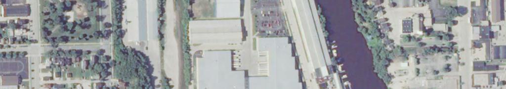
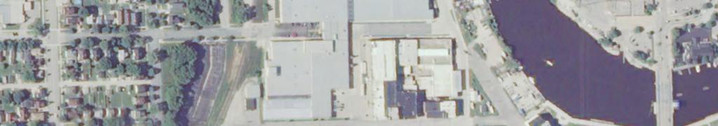
40 Pennsylvania Ave. Bridge Legend 60-Foot Channel PAH Removal to Full Depth Area Feet Figure 2 PAH Removal to Full Dredge Depth Area (Scenarios 7-10) Lower River and Inner Harbor Sheboygan River, WI E:\EPA\406504SHEBOYGAN\REPORTS\2010SHEBOYGANRIVERREMEDIALINVESTIGATION\MAPFILES\2012\PAHREMOVAL\FIGURE 02 - PAH REMOVAL TO FULL DEPTH AREA(SCENARIO 7-10).MXD JHANSEN1 1/13/2012 3:00:29 PM
41 Appendix A Surface Weighted Average Concentration Scenarios
42 TECHNICAL MEMORANDUM Surface-weighted Average Concentration Calculation Methodology PREPARED FOR: PREPARED BY: COPIES: Heather Williams/USEPA-GLNPO Amy Mucha/USEPA-GLNPO Adrienne Korpela/CH2M HILL Huck Raddemann/CH2M HILL Frank Dillon/CH2M HILL Shaun Roark/CH2M HILL Gina Bayer/CH2M HILL Project file DATE: October 5, 2011 PROJECT NUMBER: RS.01 Introduction This memorandum summarizes the process and calculations used to determine the SWAC values representative of existing and post-dredging scenarios in the Sheboygan River Area of Concern, specifically, the Lower River reach from ¼-mile upstream of the 14th Street Bridge to the end of the Lower River and the Inner Harbor reach from Pennsylvania Avenue Bridge to the 8th Street Bridge. The basis of the SWAC approach is that the exposure domain for receptors is broader than the small areas represented by individual samples, so an average concentration of the exposure domain should be calculated and used. Pre-dredge SWAC The following steps were used to develop the SWAC for pre-remediation conditions of the river. 1. Where A i is the estimated area of river to be assigned to each sample location. The area was determined based on polygonal declustering. The method divides the total area of influence into polygons (one for each core location), with the polygon area representing the relative weighting of that sample. The polygons of influence, or Thiessen polygons, were delineated within a geographic information system computer application, such that a polygon contains the area that is closer to a given sample point than to any other sample point. Cw i = Conc x A i 2. After defining the Thiessen polygons and surface sediment (0 to 0.5 foot or a grab sample) concentrations for each sediment sample location, the weighted concentration for each polygon (Cwi) was calculated by multiplying the concentration (Conc) by the area (Ai). 3. The products of the surface sediment concentrations and surface areas of each polygon were summed and the total divided by the total surface area to get a surface-weighted average concentration (SWAC), or: n Cw i SWAC = i = 1 A ES MKE 1
43 SURFACE-WEIGHTED AVERAGE CONCENTRATION CALCULATION METHODOLOGY The above SWAC calculations and the values for polychlorinated biphenyls (PCBs) and total organic carbon (TOC) in the pre-remediation sediment surface are presented in Tables 1A and 1B. The pre-remediation Thiessen polygon grids for the PCB SWAC calculations are presented in Figure 1. The calculated pre-remediation PCB SWAC value is 4.17 milligrams per kilogram (mg/kg). The SWAC value for TOC was calculated from 142 surface locations. The TOC SWAC value is 24,454 mg/kg and the average concentration is 29,078 mg/kg. The surface PCB concentrations were normalized to the surface TOC SWAC concentration. The normalized PCB SWAC value is mg/kg of TOC. Post-dredge SWAC A series of post-dredge SWACs were calculated based on the following removal scenarios: Post Comprehensive Environmental Response, Compensation, and Liability Act (CERCLA) and Emergency Removal Post-CERCLA and Emergency Removal and 1 part per million (ppm) PCB Removal Pos-CERLA, Emergency Removal, and a Great Lakes National Program Office (GLNPO) 1-ppm PCB removal and 45-ppm polynuclear aromatic hydrocarbon (PAH) to any depth removal (MVS Model Scenario #2) Post-CERCLA, Emergency Removal, GLNPO 1-ppm PCB to any depth, 18-ppm PAH to feet above mean sea level (amsl) North American Vertical Datum of 1988 (NAVD88) (-10.5 Low Water Datum [LWD]) and 45-ppm PAH below feet amsl NAVD88 (Mining Visualization System [MVS] Model Scenario #3) Post-CERCLA, Emergency Removal, GLNPO 1-ppm PCB, 18-ppm PAH to feet amsl NAVD88 (-10.5 LWD), and 5-ppm PCB below feet amsl NAVD88, and 18-ppm PAH below feet amsl NAVD88 to any depth from 500 feet upstream and 1,000 feet downstream of Boat Island (MVS Model Scenario #10) The estimated post-dredge SWACs were calculated using the same process as the pre-dredge SWAC. However, the surface sediment concentration differs in that the generated dredge residual is estimated to account for 50 percent of the surface concentration, approximately 3 inches. The concentration of the generated residual was calculated by averaging the concentrations of the sediment samples above the dredge cut neatline. Sample results from sediments removed per CERCLA and Emergency Removal dredge cut neatlines were not used in the generated residual calculation for GLNPO dredge cut scenarios because of the timing of the removal actions. The SWAC values and calculations are presented in Tables 2 through 11. The concentration used to calculate the SWAC is comprised of the concentration of the generated residual layer (top 3 inches) and the post-dredge surficial sediment concentration at the specified dredge cut depths (bottom 3 inches). When the specified neatline dredge cut depth was below the bottom of the deepest sample interval at a given location, the location was removed from the SWAC calculation, and as a result, decreased the number of polygons. With each consecutive removal scenario, the number of locations used to calculate the SWAC is reduced, thereby increasing the representative area of the remaining locations. When a location is removed, the area of the surrounding locations is increased and the weight of those locations concentrations on the overall SWAC is also increased. When comparing the PCB SWAC at 1ppm PCB vs 1ppm PCB & 45 ppm PAH, as the overall PCB concentrations decrease the PCB SWAC value increases. This is due to the reduction of polygons from 205 to 164 and the concentration distribution of the altered polygons. The post-dredge Thiessen polygon grids for the SWAC calculations are presented in Figures 2 through 11. The post-dredge SWAC values are based on the modeled neatline dredge cut depth. The calculated SWAC values and number of polygons are summarized in the following table. 2 ES MKE
44 SURFACE-WEIGHTED AVERAGE CONCENTRATION CALCULATION METHODOLOGY Post-Dredge Scenario PCB SWAC (mg/kg) Normalize d PCB SWAC* (mg/kg OC) Number of PCB Polygon s PAH SWAC (mg/kg) Number of PAH Polygons Pre-remediation Surface Post-CERCLA and Emergency Removal Post-CERCLA and Emergency Removal, and 1-ppm PCB Removal MVS Model Scenario 2: Post-CERCLA and Emergency Removal, and 1-ppm PCB and 45-ppm PAH MVS Model Scenario 3: Post-CERCLA and Emergency Removal, and 1-ppm PCB to any depth and 18-ppm PAH > (-10.5 LWD) < 45-ppm PAH MVS Model Scenario 10: Post-CERCLA and Emergency Removal, and 1-ppm PCB and 18-ppm PAH > (-10.5 LWD) < 5-ppm PCB, and 18-ppm PAH near Boat Island *PCBs normalized to TOC SWAC fraction of mg/kg OC = milligrams per kilogram of organic carbon LWD = Low Water Datum (578.0 Lake Michigan) ES MKE 3
45 Appendix A, Attachment 1 Figures
46 Legend Thiessen Polygons Total PCB Concentration < > 50 $ Feet DRAFT Figure 1 - PCB SWAC Pre-Remediation Sediment Surface Sheboygan, WI E:\EPA\406504SHEBOYGAN\REPORTS\2010SHEBOYGANRIVERREMEDIALINVESTIGATION\MAPFILES\2011\SWAC_FIGURES_080111\FIGURE 01 - PCB SWAC - PRE-REMEDIATION.MXD JHANSEN1 8/1/2011 9:11:08 AM
47 Legend Thiessen Polygons Total PCB Concentration (ppm) < > 50 $ Feet DRAFT Figure 2 - PCB SWAC Post-CERCLA and Emergency Removal Sheboygan, WI E:\EPA\406504SHEBOYGAN\REPORTS\2010SHEBOYGANRIVERREMEDIALINVESTIGATION\MAPFILES\2011\SWAC_FIGURES_080111\FIGURE 02 - PCB SWAC - POST-CERCLA AND EMERGENCY REMOVAL.MXD JHANSEN1 8/1/ :46:43 AM
48 Legend Thiessen Polygons Total PCB Concentration (ppm) < > Feet DRAFT Figure Post C Sheboygan, WI S E:\EPA\406504SHEBOYGAN\REPORTS\2010SHEBOYGANRIVERREMEDIALINVESTIGATION\MAPFILES\2011\SWACS_072611\POST PRS NRT 1PCB PCB SWAC.MXD JHANSEN1 7/26/ :54:48 PM
49 Legend Thiessen Polygons Total PCB Concentration < > Feet DRAFT Figure Post-CERCLA, Emergency Removal, GLNPO 1ppm PCB and 45ppm PAH MVS Model Scenario #2 Sheboygan, WI E:\EPA\406504SHEBOYGAN\REPORTS\2010SHEBOYGANRIVERREMEDIALINVESTIGATION\MAPFILES\2011\SWACS_072611\POST PRS NRT 1PCB45PAH PCB SWAC.MXD JHANSEN1 7/26/ :33:25 PM
50 Legend Thiessen Polygons Total PCB Concentration < > Feet DRAFT Figure 5 - PCB SWAC Post-CERCLA, Emergency Removal, GLNPO 1ppm PCB, and 18ppm PAH > (-10 LWD) < 45ppm PAH; Scenario #3 Sheboygan, WI E:\EPA\406504SHEBOYGAN\REPORTS\2010SHEBOYGANRIVERREMEDIALINVESTIGATION\MAPFILES\2011\SWACS_072611\POSTPRSNRT1PCB18-45@10 PCB-SWAC.MXD JHANSEN1 7/26/ :30:00 PM
51 Legend Thiessen Polygons Total PAH Concentration (ppm) < > 129 $ Feet DRAFT Figure 6 PAH SWAC Post-CERCLA and Emergency Removal Sheboygan, WI E:\EPA\406504SHEBOYGAN\REPORTS\2010SHEBOYGANRIVERREMEDIALINVESTIGATION\MAPFILES\2011\SWAC_FIGURES_080111\FIGURE 06 PAH SWAC - POST-CERCLA AND EMERGENCY REMOVAL.MXD JHANSEN1 8/1/ :04:57 AM
52 Legend Thiessen Polygons Total PAH Concentration (ppm) < > 129 $ Feet DRAFT Figure 7 PAH SWAC Post-CERCLA, Emergency Removal, and GLNPO 1ppm PCB Sheboygan, WI E:\EPA\406504SHEBOYGAN\REPORTS\2010SHEBOYGANRIVERREMEDIALINVESTIGATION\MAPFILES\2011\SWAC_FIGURES_080111\FIGURE 07 PAH SWAC - POST-CERCLA, EMERGENCY REMOVAL, AND GLNPO 1PPM PCB.MXD JHANSEN1 8/1/ :31:35 AM
53 Legend Thiessen Polygons Total PAH Concentration (ppm) < > Feet DRAFT Figure 8 - PAH SWAC Post-CERCLA, Emergency Removal, GLNPO 1ppm PCB and 45ppm PAH MVS Model Scenario #2 Sheboygan, WI E:\EPA\406504SHEBOYGAN\REPORTS\2010SHEBOYGANRIVERREMEDIALINVESTIGATION\MAPFILES\2011\SWACS_072611\POST PRS NRT 1PCB 45PAH.MXD JHANSEN1 7/26/ :50:39 PM
54 Legend Thiessen Polygons Total PAH Concentration (ppm) < > Feet DRAFT Figure 9 - PAH SWAC Post-CERCLA, Emergency Removal, GLNPO 1ppm PCB, and 18ppm PAH > (-10 LWD) < 45ppm PAH; Scenario #3 Sheboygan, WI E:\EPA\406504SHEBOYGAN\REPORTS\2010SHEBOYGANRIVERREMEDIALINVESTIGATION\MAPFILES\2011\SWACS_072611\POST PRS NRT 1PCB 18-45@10PAH.MXD JHANSEN1 7/26/ :47:47 PM
55 Legend Thiessen Polygons Total PCB Concentration (ppm) < > 50 $ Feet E:\EPA\406504SHEBOYGAN\REPORTS\2010SHEBOYGANRIVERREMEDIALINVESTIGATION\MAPFILES\2011\SWACS_092111\FIGURE 10 - PCB SWAC - SCENARIO 10.MXD JHANSEN1 9/23/2011 5:13:13 PM DRAFT Figure 10 PCB SWAC Post-CERCLA, Emergency Removal, GLNPO 1ppm PCB & 18ppm PAH > > 18ppm PAH near Boat Island and 5ppm PCB everywhere Sheboygan, WI
56 Legend Thiessen Polygons Total PAH Concentration (ppm) < > 129 $ Feet DRAFT Figure 11 PAH SWAC Post-CERCLA, Emergency Removal, GLNPO 1ppm PCB & 18ppm PAH > > 18ppm PAH near Boat Island and 5ppm PCB everywhere Sheboygan, WI E:\EPA\406504SHEBOYGAN\REPORTS\2010SHEBOYGANRIVERREMEDIALINVESTIGATION\MAPFILES\2011\SWACS_092111\FIGURE 11 - PAH SWAC - SCENARIO 10.MXD JHANSEN1 9/23/2011 5:15:40 PM
57 Appendix A, Attachment 2 Tables
58 TABLE 1A - PCB SWAC Data Pre-Remediation Sediment Surface, Sheboygan River Sample_ID Total_PCB Area Total_PCB*Area TOC SWAC PCB_Normalized PCB_Normal*Area BKG ' BKG ' PRS111-0'/1' PRS113-0'/1' PRS113E-0'/1' PRS114-0'/1' PRS115-0'/1' PRS116-0'/1' PRS117-0'/1' PRS117E-0'/1' PRS118-0'/1' PRS118A-0'/0.5' PRS118B-0'/0.5' PRS118C-0'/0.5' PRS118D-0'/0.5' PRS118E-0'/0.5' PRS119-0'/1' PRS119E-0'/1' PRS120-0'/1' PRS121-0'/1' PRS121E-0'/1' PRS122-0'/1' PRS123-0'/1' PRS123E-0'/1' PRS124-0'/1' PRS125-0'/1' PRS126-0'/1' PRS127-0'/1' PRS127E-0'/1' PRS128-0'/1' PRS129-0'/1' PRS130-0'/1' PRS131-0'/1' PRS131E-0'/1' PRS132-0'/1' PRS133-0'/1' PRS133E-0'/1' PRS134-0'/1' PRS135-0'/1' PRS135E-0'/1' PRS136-0'/1' PRS137-0'/1' PRS137A-0'/0.5' PRS137B-0'/0.5' PRS137C-0'/0.5' PRS137D-0'/0.5' PRS137E-0'/0.5' PRS138-0'/1' PRS139-0'/1' PRS139E-0'/1' PRS140-0'/1' PRS141-0'/1' PRS141E-0'/1' PRS142-0'/1' PRS143-0'/1' PRS143A Page 1 of 10
59 TABLE 1A - PCB SWAC Data Pre-Remediation Sediment Surface, Sheboygan River Sample_ID Total_PCB Area Total_PCB*Area TOC SWAC PCB_Normalized PCB_Normal*Area PRS143B PRS143C PRS143D PRS143E PRS144-0'/1' PRS145-0'/1' PRS145E-0'/1' PRS146-0'/1' PRS147-0'/1' PRS147E-0'/1' PRS148-0'/1' PRS149-0'/1' PRS149E-0'/1' PRS150-0'/1' PRS151-0'/1' PRS151A PRS151B PRS151C PRS151D PRS151E PRS152-0'/1' PRS153-0'/1' PRS153A PRS153B PRS153C PRS153D PRS153E PRS154-0'/1' PRS155-0'/1' PRS155A PRS155B PRS155C PRS155D PRS155E PRS156-0'/1' PRS157-0'/1' PRS157A-0'/0.5' PRS157B-0'/0.5' PRS157C-0'/0.5' PRS157D-0'/0.5' PRS157E-0'/0.5' PRS158-0'/1' PRS159-0'/1' PRS159A PRS159B PRS159C PRS159D PRS159E PRS160-0'/1' PRS161-0'/1' PRS161A PRS161B PRS161C PRS161D PRS161E PRS162-0'/1' Page 2 of 10
60 TABLE 1A - PCB SWAC Data Pre-Remediation Sediment Surface, Sheboygan River Sample_ID Total_PCB Area Total_PCB*Area TOC SWAC PCB_Normalized PCB_Normal*Area PRS163-0'/1' PRS164-0'/1' PRS165-0'/1' PRS166-0'/1' PRS167-0'/1' PRS167A PRS167B PRS167C PRS167D PRS167E PRS168-0'/1' PRS169-0'/1' PRS170-0'/1' PRS171-0'/1' PRS172-0'/1' PRS173-0'/1' PRS174-0'/1' PRS175-0'/1' PRS176-0'/1' PRS177-0'/1' PRS178-0'/1' PRS179-0'/1' PRS179A PRS179B PRS179C PRS179D PRS179E PRS180-0'/1' PRS181-0'/1' PRS182-0'/1' PRS182E-0'/1' PRS183-0'/1' PRS184-0'/1' PRS184E-0'/1' PRS185-0'/1' PRS186-0'/1' PRS187-0'/1' PRS188-0'/1' PRS189-0'/1' PRS189A PRS189B PRS189C PRS189D PRS189E PRS190-0'/1' PRS191-0'/1' PRS192-0'/1' PRS193-0'/1' PRS193A PRS193B PRS193C PRS193D PRS193E PRS194-0'/1' PRS194A PRS194B Page 3 of 10
61 TABLE 1A - PCB SWAC Data Pre-Remediation Sediment Surface, Sheboygan River Sample_ID Total_PCB Area Total_PCB*Area TOC SWAC PCB_Normalized PCB_Normal*Area PRS194C PRS194D PRS194E PRS195-0'/1' PRS196-0'/1' PRS197-0'/1' PRS198-0'/1' PRS198A PRS198B PRS198C PRS198D PRS198E PRS199-0'/1' PRS199A PRS199B PRS199C PRS199D PRS199E PRS200-0'/1' PRS201-0'/1' PRS202-0'/1' PRS203-0'/1' PRS203A PRS203B PRS203C PRS203D PRS203E PRS204-0'/1' PRS204A PRS204B PRS204C PRS204D PRS204E PRS205-0'/1' PRS205A PRS205B PRS205C PRS205D PRS205E PRS206-0'/1' PRS207-0'/1' PRS208-0'/1' PRS208A PRS208B PRS208C PRS208D PRS208E PRS209-0'/1' PRS210-0'/1' PRS211-0'/1' PRS211A PRS211B PRS211C PRS211D PRS211E PRS212-0'/1' Page 4 of 10
62 TABLE 1A - PCB SWAC Data Pre-Remediation Sediment Surface, Sheboygan River Sample_ID Total_PCB Area Total_PCB*Area TOC SWAC PCB_Normalized PCB_Normal*Area PRS213-0'/1' PRS214-0'/1' PRS215-0'/1' PRS215A PRS215B PRS215C PRS215D PRS215E PRS216-0'/1' PRS216A PRS216B PRS216C PRS216D PRS216E PRS217-0'/1' PRS218-0'/1' PRS218A PRS218B PRS218C PRS218D PRS218E PRS219-0'/1' PRS219A PRS219B PRS219C PRS219D PRS219E PRS220-0'/1' PRS221-0'/1' PRS222-0'/1' PRS222A PRS222B PRS222C PRS222D PRS222E PRS223-0'/1' PRS224-0'/1' PRS224A PRS224B PRS224C PRS224D PRS224E PRS225-0'/1' PRS225A PRS225B PRS225C PRS225D PRS225E PRS226-0'/1' PRS226A PRS226B PRS226C PRS226D PRS226E PRS227-0'/1' PRS228-0'/1' Page 5 of 10
63 TABLE 1A - PCB SWAC Data Pre-Remediation Sediment Surface, Sheboygan River Sample_ID Total_PCB Area Total_PCB*Area TOC SWAC PCB_Normalized PCB_Normal*Area PRS229-0'/1' PRS230-0'/1' PRS230A PRS230B PRS230C PRS230D PRS230E PRS231-0'/1' PRS232-0'/1' PRS232A PRS232B PRS232C PRS232D PRS232E PRS233-0'/1' PRS234-0'/1' PRS235-0'/1' PRS235B PRS235C PRS235D PRS235E PRS236-0'/1' PRS236A PRS236B PRS236C PRS236D PRS236E PRS237-0'/1' PRS238-0'/1' PRS239-0'/1' PRS240-0'/1' PRS241-0'/1' PRS242-0'/1' PRS243-0'/1' PRS244-0'/1' PRS245-0'/1' PRS246-0'/1' PRS248-0'/1' PRS249-0'/1' PRS250-0'/1' PRS250A PRS250B PRS250C PRS250D PRS250E PRS251-0'/1' PRS252-0'/1' PRS252A PRS252B PRS252C PRS252D PRS252E PRS253-0'/1' PRS254-0'/1' PRS255-0'/1' PRS256-0'/1' Page 6 of 10
64 TABLE 1A - PCB SWAC Data Pre-Remediation Sediment Surface, Sheboygan River Sample_ID Total_PCB Area Total_PCB*Area TOC SWAC PCB_Normalized PCB_Normal*Area PRS258-0'/1' PRS260-0'/1' PRS262-0'/1' PRS264-0'/1' PRS266-0'/1' PRS269-0'/1' PRS270-0'/1' PRS271-0'/1' PRS272-0'/1' PRS274-0'/1' PRS275-0'/1' PRS275C PRS276-0'/1' PRS277-0'/1' PRS278-0'/1' PRS279-0'/1' PRS280-0'/1' PRS281-0'/1' PRS282-0'/1' PRS283-0'/1' PRS283A PRS283B PRS283C PRS283D PRS283E PRS284-0'/1' PRS285-0'/1' PRS285A PRS285B PRS285C PRS285D PRS285E PRS287-0'/1' PRS289-0'/1' PRS290-0'/1' PRS291-0'/1' PRS292-0'/1' PRS294-0'/1' PRS295-0'/1' PRS296-0'/1' PRS297-0'/1' PRS297A PRS297B PRS297C PRS297D PRS297E PRS298-0'/1' PRS299-0'/1' PRS301-0'/1' PRS301A PRS301C PRS301D PRS302-0'/1' PRS303-0'/1' PRS303A PRS303B Page 7 of 10
65 TABLE 1A - PCB SWAC Data Pre-Remediation Sediment Surface, Sheboygan River Sample_ID Total_PCB Area Total_PCB*Area TOC SWAC PCB_Normalized PCB_Normal*Area PRS303C PRS303D PRS303E PRS305-0'/1' PRS306-0'/1' PRS307-0'/1' PRS308-0'/1' PRS309-0'/1' PRS309A PRS309B PRS309C PRS309D PRS311-0'/1' PRS311A PRS311B PRS311D PRS311E PRS313-0'/1' PRS315-0'/1' PRS315A PRS315B PRS315C PRS315D PRS315E PRS317-0'/1' SD / SD / SD / SD / SD / SD / SD / SD / SD / SD / SD / SD / SD / SD / SD / SD / SD / SD / SD / SD / SD / SD / SD / SD / SD / SD / SD / SD / SD / SD / SD / Page 8 of 10
66 TABLE 1A - PCB SWAC Data Pre-Remediation Sediment Surface, Sheboygan River Sample_ID Total_PCB Area Total_PCB*Area TOC SWAC PCB_Normalized PCB_Normal*Area SD / SD / SD / SD / SD / SD / SD / SD / SD / SD / SD / SD / SD / SD / SD / SD / SD / SD / SD / SD / SD / SD / SD / SD / SD / SD / SD / SD / SD / SD / SD / SD / SD / SD / SD / SD / SD / SD / SD / SD / SD / SD / SD / SD / T01A 0-0.5' T02C 0-0.5' T03B 0-0.5' T04A 0-0.6' T05C ' T07B 0-0.5' T08E 0-0.6' T10A 0-0.5' T11D 0-0.8' T12A 0-0.5' T13A 0-0.5' T14B 0-0.6' Page 9 of 10
67 TABLE 1A - PCB SWAC Data Pre-Remediation Sediment Surface, Sheboygan River Sample_ID Total_PCB Area Total_PCB*Area TOC SWAC PCB_Normalized PCB_Normal*Area T15C 0-0.5' T16B 0-0.5' T17C 0-0.5' T18C 0-0.7' SUM = SWAC = 4.17 Normalized PCB SWAC = Page 10 of 10
68 TABLE 1B - TOC SWAC Data Pre-Remediation Sediment Surface, Sheboygan River Sample ID TOC_Result Area Area*TOC_Result BKG BKG BKG BKG SD SD SD SD SD SD SD SD SD SD SD SD SD SD SD SD SD SD SD SD SD SD SD SD SD SD SD SD SD SD SD SD SD SD SD SD SD SD SD SD SD SD SD SD SD SD SD SD SD SD SD SD Page 1 of 3
69 TABLE 1B - TOC SWAC Data Pre-Remediation Sediment Surface, Sheboygan River Sample ID TOC_Result Area Area*TOC_Result SD SD SD SD SD SD SD SD SD SD SD SD SD SD SD SD SD SD SD SD SD T01A T01B T01C T02A T02B T02C T03A T03B T03C T04A T04B T04C T04D T05A T05B T05C T05D T05E T06A T06B T06C T07A T07B T07C T08A T08B T08C T08D T08D T08E T09A T09B T09C T09D T10A Page 2 of 3
70 TABLE 1B - TOC SWAC Data Pre-Remediation Sediment Surface, Sheboygan River Sample ID TOC_Result Area Area*TOC_Result T10B T10C T10D T11A T11B T11C T11D T11E T12A T12B T12C T12D T13A T13B T13C T14A T14B T14C T15A T15B T15C T16A T16B T16C T17A T17B T17C T18A T18B T18C SUM = 1,630, ,881,325, TOC (mg/kg) Fraction of TOC TOC SWAC = 24, TOC Mean = 29, Page 3 of 3
71 TABLE 2 - PCB SWAC Data Post-CERCLA and Emergency Removal; Sheboygan River Location_ID Total_PCB Area Total_PCB*Area TOC SWAC PCB_Normalized PCB_Normal*Area BKG BKG PRS PRS PRS113E PRS PRS PRS PRS PRS117E PRS118A PRS118B PRS118C PRS118E PRS PRS119E PRS PRS PRS121E PRS PRS PRS123E PRS PRS PRS PRS PRS127E PRS PRS PRS PRS PRS133E PRS PRS PRS135E PRS PRS PRS137B PRS137C PRS137E PRS PRS139E PRS PRS PRS141E PRS PRS PRS143A PRS143B PRS143C PRS143D PRS143E PRS PRS PRS145E PRS Page 1 of 8
72 TABLE 2 - PCB SWAC Data Post-CERCLA and Emergency Removal; Sheboygan River Location_ID Total_PCB Area Total_PCB*Area TOC SWAC PCB_Normalized PCB_Normal*Area PRS PRS147E PRS PRS PRS149E PRS PRS151B PRS151C PRS PRS153A PRS153B PRS153C PRS153D PRS153E PRS PRS155A PRS155B PRS155D PRS155E PRS PRS157E PRS PRS PRS159A PRS159C PRS159D PRS159E PRS PRS161A PRS161B PRS161C PRS161D PRS161E PRS PRS PRS PRS167A PRS167B PRS167C PRS167E PRS PRS PRS PRS PRS PRS PRS PRS PRS PRS179A PRS179B PRS179C PRS179D PRS179E PRS PRS Page 2 of 8
73 TABLE 2 - PCB SWAC Data Post-CERCLA and Emergency Removal; Sheboygan River Location_ID Total_PCB Area Total_PCB*Area TOC SWAC PCB_Normalized PCB_Normal*Area PRS184E PRS PRS PRS PRS PRS PRS189A PRS189B PRS189D PRS PRS PRS PRS193A PRS193C PRS PRS194A PRS194B PRS194D PRS194E PRS PRS PRS198A PRS198B PRS198C PRS198D PRS199B PRS199E PRS PRS PRS PRS PRS203A PRS203C PRS203D PRS204A PRS204B PRS204D PRS204E PRS205A PRS205B PRS205C PRS205D PRS PRS PRS208A PRS208B PRS208C PRS208E PRS PRS PRS211A PRS211D PRS211E PRS PRS PRS Page 3 of 8
74 TABLE 2 - PCB SWAC Data Post-CERCLA and Emergency Removal; Sheboygan River Location_ID Total_PCB Area Total_PCB*Area TOC SWAC PCB_Normalized PCB_Normal*Area PRS215A PRS215C PRS215D PRS216A PRS216B PRS216C PRS216D PRS216E PRS PRS218A PRS218B PRS218C PRS218D PRS218E PRS219A PRS219C PRS219D PRS PRS PRS PRS222A PRS222C PRS222E PRS PRS PRS224A PRS224C PRS224D PRS224E PRS PRS225B PRS225C PRS225E PRS226B PRS226C PRS226D PRS PRS PRS230A PRS230C PRS230D PRS232A PRS232B PRS232C PRS232D PRS232E PRS PRS PRS235B PRS235C PRS235D PRS235E PRS PRS236A PRS236C PRS236D Page 4 of 8
75 TABLE 2 - PCB SWAC Data Post-CERCLA and Emergency Removal; Sheboygan River Location_ID Total_PCB Area Total_PCB*Area TOC SWAC PCB_Normalized PCB_Normal*Area PRS236E PRS PRS PRS PRS PRS PRS PRS PRS PRS PRS PRS PRS PRS250B PRS250D PRS250E PRS PRS PRS252A PRS252B PRS252C PRS252D PRS252E PRS PRS PRS PRS PRS PRS PRS PRS PRS PRS PRS PRS PRS PRS PRS PRS275C PRS PRS PRS PRS PRS PRS PRS283A PRS283B PRS283C PRS283D PRS283E PRS PRS285B PRS285C PRS285D PRS285E PRS Page 5 of 8
76 TABLE 2 - PCB SWAC Data Post-CERCLA and Emergency Removal; Sheboygan River Location_ID Total_PCB Area Total_PCB*Area TOC SWAC PCB_Normalized PCB_Normal*Area PRS PRS PRS PRS PRS PRS PRS PRS PRS297A PRS297B PRS297D PRS297E PRS PRS PRS PRS301A PRS301C PRS301D PRS PRS PRS303A PRS303B PRS303C PRS303D PRS303E PRS PRS PRS PRS PRS PRS309A PRS309B PRS309C PRS309D PRS PRS311A PRS311D PRS311E PRS PRS315C PRS315D PRS315E PRS SD SD SD SD SD SD SD SD SD SD SD SD SD Page 6 of 8
77 TABLE 2 - PCB SWAC Data Post-CERCLA and Emergency Removal; Sheboygan River Location_ID Total_PCB Area Total_PCB*Area TOC SWAC PCB_Normalized PCB_Normal*Area SD SD SD SD SD SD SD SD SD SD SD SD SD SD SD SD SD SD SD SD SD SD SD SD SD SD SD SD SD SD SD SD SD SD SD SD SD SD SD SD SD SD SD SD SD SD SD SD SD SD SD SD SD SD SD SD Page 7 of 8
78 TABLE 2 - PCB SWAC Data Post-CERCLA and Emergency Removal; Sheboygan River Location_ID Total_PCB Area Total_PCB*Area TOC SWAC PCB_Normalized PCB_Normal*Area SD SD SD SD SD SD T01A T02A T02C T03B T04A T04B T05A T05C T07B T08E T10A T10C T11A T11D T12A T12B T12C T13A T14B T15C T16B T17C T18C SUM = SWAC = 4.26 Normalized PCB SWAC = Page 8 of 8
79 TABLE 3 - PCB SWAC Data Post-CERCLA, Emergency Removal, and 1ppm PCB; Sheboygan River Location_ID Total_PCB Area Total_PCB*Area TOC SWAC PCB_Normalized PCB_Normal*Area PRS117E PRS119E PRS121E PRS123E PRS PRS135E PRS137C PRS137E PRS139E PRS PRS141E PRS143B PRS143C PRS143E PRS149E PRS155B PRS167B PRS167C PRS167E PRS PRS179A PRS179B PRS179C PRS PRS PRS PRS PRS193A PRS193C PRS194B PRS194D PRS199B PRS PRS PRS204A PRS204B PRS204E PRS205C PRS208C PRS208E PRS PRS215A PRS215C PRS216E PRS218A PRS218E PRS219A PRS PRS PRS222A PRS222E PRS PRS224A PRS224C PRS PRS225C Page 1 of 4
80 TABLE 3 - PCB SWAC Data Post-CERCLA, Emergency Removal, and 1ppm PCB; Sheboygan River Location_ID Total_PCB Area Total_PCB*Area TOC SWAC PCB_Normalized PCB_Normal*Area PRS225E PRS226C PRS PRS230C PRS232A PRS PRS235B PRS235E PRS236A PRS236C PRS PRS PRS PRS PRS PRS PRS PRS PRS PRS PRS PRS250B PRS250D PRS250E PRS PRS PRS252A PRS252B PRS252C PRS252D PRS PRS PRS PRS PRS PRS PRS PRS PRS PRS PRS PRS PRS PRS PRS PRS PRS PRS PRS285B PRS285D PRS PRS PRS PRS PRS PRS Page 2 of 4
81 TABLE 3 - PCB SWAC Data Post-CERCLA, Emergency Removal, and 1ppm PCB; Sheboygan River Location_ID Total_PCB Area Total_PCB*Area TOC SWAC PCB_Normalized PCB_Normal*Area PRS PRS PRS PRS297A PRS297B PRS297D PRS297E PRS PRS PRS PRS301A PRS301C PRS301D PRS PRS PRS303A PRS303B PRS303C PRS303E PRS PRS PRS PRS PRS309A PRS309B PRS309C PRS309D PRS PRS311A PRS315D PRS315E PRS SD SD SD SD SD SD SD SD SD SD SD SD SD SD SD SD SD SD SD SD SD SD SD SD Page 3 of 4
82 TABLE 3 - PCB SWAC Data Post-CERCLA, Emergency Removal, and 1ppm PCB; Sheboygan River Location_ID Total_PCB Area Total_PCB*Area TOC SWAC PCB_Normalized PCB_Normal*Area SD SD SD SD SD SD SD SD SD SD SD SD SD SD SD SD SD SD SD SD SD SD SD SD SD SD T01A T02C T03B T04A T04B T05A T08C T10A T11D T12B T12C SUM = SWAC = 2.81 Normalized PCB SWAC = Page 4 of 4
83 TABLE 4 - PCB SWAC Data Post-CERCLA, Emergency Removal, 1ppm PCB, and 45ppm PAH; Scenario #2; Sheboygan River Location_ID Total_PCB Area Total_PCB*Area TOC SWAC PCB_Normalized PCB_Normal*Area PRS117E PRS119E PRS121E PRS123E PRS PRS137C PRS139E PRS PRS141E PRS143B PRS143C PRS143E PRS149E PRS155B PRS167B PRS167C PRS167E PRS179B PRS PRS PRS204A PRS204B PRS204E PRS208C PRS208E PRS216E PRS218A PRS218E PRS PRS222A PRS224A PRS224C PRS226C PRS230C PRS232A PRS PRS235B PRS235E PRS236A PRS236C PRS PRS PRS PRS PRS PRS PRS PRS PRS PRS PRS250B PRS250D PRS250E PRS PRS PRS252A Page 1 of 3
84 TABLE 4 - PCB SWAC Data Post-CERCLA, Emergency Removal, 1ppm PCB, and 45ppm PAH; Scenario #2; Sheboygan River Location_ID Total_PCB Area Total_PCB*Area TOC SWAC PCB_Normalized PCB_Normal*Area PRS252B PRS252C PRS252D PRS PRS PRS PRS PRS PRS PRS PRS PRS PRS PRS PRS PRS PRS PRS PRS PRS PRS PRS285B PRS285D PRS PRS PRS PRS PRS PRS PRS PRS PRS PRS297A PRS297B PRS297D PRS297E PRS PRS PRS PRS301A PRS301C PRS301D PRS PRS PRS303A PRS303B PRS303C PRS303E PRS PRS PRS PRS PRS309A PRS309B PRS309C PRS309D Page 2 of 3
85 TABLE 4 - PCB SWAC Data Post-CERCLA, Emergency Removal, 1ppm PCB, and 45ppm PAH; Scenario #2; Sheboygan River Location_ID Total_PCB Area Total_PCB*Area TOC SWAC PCB_Normalized PCB_Normal*Area PRS PRS311A PRS315D PRS315E PRS SD SD SD SD SD SD SD SD SD SD SD SD SD SD SD SD SD SD SD SD SD SD SD SD SD SD SD SD SD SD SD SD SD SD SD SD SD SD SD SD SD T01A T02C T04A T05A T08C T10A SUM = SWAC = 3.99 Normalized PCB SWAC = Page 3 of 3
86 TABLE 5 - PCB SWAC Data Post-CERCLA, Emergengy Removal, 1ppm PCB, 18ppm PAH > (-10 LWD) < 45ppm PAH; Scenario #3; Sheboygan River Location_ID Total_PCB Area Total_PCB*Area TOC SWAC PCB_Normalized PCB_Normal*Area PRS121E PRS PRS139E PRS143E PRS208C PRS208E PRS218A PRS PRS224A PRS224C PRS226C PRS230C PRS235B PRS235E PRS PRS PRS PRS PRS PRS250D PRS PRS252D PRS PRS PRS PRS PRS PRS PRS PRS PRS PRS PRS PRS PRS PRS PRS285B PRS285D PRS PRS PRS PRS PRS PRS PRS PRS PRS PRS297A PRS297B PRS297D PRS297E PRS PRS PRS PRS301A PRS301C Page 1 of 3
87 TABLE 5 - PCB SWAC Data Post-CERCLA, Emergengy Removal, 1ppm PCB, 18ppm PAH > (-10 LWD) < 45ppm PAH; Scenario #3; Sheboygan River Location_ID Total_PCB Area Total_PCB*Area TOC SWAC PCB_Normalized PCB_Normal*Area PRS301D PRS PRS PRS303A PRS303B PRS303C PRS303E PRS PRS PRS PRS PRS309A PRS309B PRS309C PRS309D PRS PRS311A PRS315D PRS315E PRS SD SD SD SD SD SD SD SD SD SD SD SD SD SD SD SD SD SD SD SD SD SD SD SD SD SD SD SD SD SD SD SD SD T01A T02C T04A Page 2 of 3
88 TABLE 5 - PCB SWAC Data Post-CERCLA, Emergengy Removal, 1ppm PCB, 18ppm PAH > (-10 LWD) < 45ppm PAH; Scenario #3; Sheboygan River Location_ID Total_PCB Area Total_PCB*Area TOC SWAC PCB_Normalized PCB_Normal*Area T08C T10A SUM = SWAC = 3.18 Normalized PCB SWAC = Page 3 of 3
89 TABLE 6 - PAH SWAC Data Post-CERCLA and Emergency Removal; Sheboygan River Location_ID Total_PAH Area Total_PAH*Area BKG BKG BKG BKG PRS PRS PRS PRS PRS PRS PRS PRS PRS PRS PRS PRS PRS PRS SD SD SD SD SD SD SD SD SD SD SD SD SD SD SD SD SD SD SD SD SD SD SD SD SD SD SD SD SD SD SD SD SD SD SD SD SD SD Page 1 of 3
90 TABLE 6 - PAH SWAC Data Post-CERCLA and Emergency Removal; Sheboygan River Location_ID Total_PAH Area Total_PAH*Area SD SD SD SD SD SD SD SD SD SD SD SD SD SD SD SD SD SD SD SD SD SD SD SD SD SD SD SD SD SD SD SD SD SD SD SD SD T01A T01B T01C T02A T02B T02C T03A T03B T03C T04A T04B T04C T05A T05B T05C T05E T06B T06C T07A Page 2 of 3
91 TABLE 6 - PAH SWAC Data Post-CERCLA and Emergency Removal; Sheboygan River Location_ID Total_PAH Area Total_PAH*Area T07B T07C T08A T08C T08D T08D T08E T09A T09B T09C T09D T10A T10C T10D T11A T11C T11D T11E T12A T12B T12C T12D T13A T13B T13C T14A T14B T14C T15B T15C T16A T16B T16C T17B T17C T18A T18B T18C SUM = SWAC= Page 3 of 3
92 TABLE 7 - PAH SWAC Data Post-CERCLA, Emergency Removal, and 1ppm PCB; Sheboygan River Location_ID Total_PAH Area Total_PAH*Area BKG PRS PRS SD SD SD SD SD SD SD SD SD SD SD SD SD SD SD SD SD SD SD SD SD SD SD SD SD SD SD SD SD SD SD SD SD SD SD SD SD SD SD SD SD SD SD SD SD SD SD SD SD SD T01A T01B T01C Page 1 of 2
93 TABLE 7 - PAH SWAC Data Post-CERCLA, Emergency Removal, and 1ppm PCB; Sheboygan River Location_ID Total_PAH Area Total_PAH*Area T02A T02C T03A T03B T03C T04A T04B T04C T05A T05B T05E T07A T07B T08A T08C T08D T09A T09C T09D T10A T10C T11A T11C T11D T11E T12B T12C T15B SUM = SWAC = Page 2 of 2
94 TABLE 8 - PAH SWAC Data Post-CERCLA, Emergency Removal, 1ppm PCB, and 45ppm PAH; Scenario #2; Sheboygan River Location_ID Total_PAH Area Total_PAH*Area BKG PRS PRS SD SD SD SD SD SD SD SD SD SD SD SD SD SD SD SD SD SD SD SD SD SD SD SD SD SD SD SD SD SD SD SD SD SD SD SD SD SD SD SD SD T01A T01B T01C T02A T02C T03A T03C T04A T04B T04C T05A T05B Page 1 of 2
95 TABLE 8 - PAH SWAC Data Post-CERCLA, Emergency Removal, 1ppm PCB, and 45ppm PAH; Scenario #2; Sheboygan River Location_ID Total_PAH Area Total_PAH*Area T05E T07A T07B T08A T08C T08D T09A T09C T09D T10A T10C T11A T11C T11E T12C T15B SUM = SWAC = Page 2 of 2
96 TABLE 9 - PAH SWAC Data Post-CERCLA, Emergengy Removal, 1ppm PCB, 18ppm PAH > (-10 LWD) < 45ppm PAH; Scenario #3; Sheboygan River Location_ID Total_PAH Area Total_PAH*Area PRS SD SD SD SD SD SD SD SD SD SD SD SD SD SD SD SD SD SD SD SD SD SD SD SD SD SD SD SD SD SD SD SD SD T01A T02A T02C T03A T04A T04B T04C T05A T05B T05E T07A T07B T08A T08C T08D T09A T09D T10A T10C T11A T11C T12C T15B SUM = SWAC = Page 1 of 1
97 TABLE 10 - PCB SWAC Data Post-CERCLA, Emergengy Removal, 1ppm PCB, 18ppm PAH > (-10 LWD) < 5ppm PCB, and 18ppm PAH near Boat Island; Scenario #10 Sheboygan River Location_ID Total_PCB Area Total_PCB*Area TOC SWAC PCB_Normalized PCB_Normal*Area PRS121E PRS139E PRS141E PRS143B PRS143E PRS167E PRS PRS204B PRS204E PRS208E PRS216E PRS218E PRS PRS224A PRS224C PRS226C PRS230C PRS232A PRS PRS235B PRS235E PRS236A PRS236C PRS PRS PRS PRS PRS PRS PRS250B PRS250D PRS PRS252A PRS252B PRS252C PRS252D PRS PRS PRS PRS PRS PRS PRS PRS PRS PRS PRS285B PRS285D PRS PRS PRS PRS PRS PRS PRS Page 1 of 3
98 TABLE 10 - PCB SWAC Data Post-CERCLA, Emergengy Removal, 1ppm PCB, 18ppm PAH > (-10 LWD) < 5ppm PCB, and 18ppm PAH near Boat Island; Scenario #10 Sheboygan River Location_ID Total_PCB Area Total_PCB*Area TOC SWAC PCB_Normalized PCB_Normal*Area PRS297A PRS297B PRS297D PRS297E PRS PRS PRS PRS301A PRS301C PRS301D PRS PRS PRS303A PRS303B PRS303C PRS PRS PRS PRS PRS309A PRS309B PRS309C PRS309D PRS PRS315D PRS315E PRS SD SD SD SD SD SD SD SD SD SD SD SD SD SD SD SD SD SD SD SD SD SD SD SD SD SD SD SD Page 2 of 3
99 TABLE 10 - PCB SWAC Data Post-CERCLA, Emergengy Removal, 1ppm PCB, 18ppm PAH > (-10 LWD) < 5ppm PCB, and 18ppm PAH near Boat Island; Scenario #10 Sheboygan River Location_ID Total_PCB Area Total_PCB*Area TOC SWAC PCB_Normalized PCB_Normal*Area SD SD SD SD SD SD SD SD SD SD T02C T04A T05A T08C T09C T10A SUM = SWAC = 2.98 Normalized PCB SWAC = Page 3 of 3
100 TABLE 11 - PAH SWAC Data Post-CERCLA, Emergengy Removal, 1ppm PCB, 18ppm PAH > (-10 LWD) < 5ppm PCB, and 18ppm PAH near Boat Island; Scenario #10 Sheboygan River Location_ID Total_PAH Area Total_PAH*Area BKG PRS PRS SD SD SD SD SD SD SD SD SD SD SD SD SD SD SD SD SD SD SD SD SD SD SD SD SD SD SD SD SD SD SD SD SD SD SD SD SD SD SD T01C T02A T02C T03A T03C T04B T04C T05A T05B T07B T08A T08C T09C Page 1 of 2
101 TABLE 11 - PAH SWAC Data Post-CERCLA, Emergengy Removal, 1ppm PCB, 18ppm PAH > (-10 LWD) < 5ppm PCB, and 18ppm PAH near Boat Island; Scenario #10 Sheboygan River Location_ID Total_PAH Area Total_PAH*Area T09D T10A T10C T11C T12C SUM = SWAC = Page 2 of 2
102 Appendix B Scenario 10 Sediment Modeling


103 APPENDIX B Scenario 10 Sediment Modeling Full Iso Full Plan B-1
104 APPENDIX B SCENARIO 10 SEDIMENT MODELING PAH 1 PAH 2 B-2


105 APPENDIX B SCENARIO 10 SEDIMENT MODELING PAH 3 PAH 4 B-3

106 APPENDIX B SCENARIO 10 SEDIMENT MODELING PCB 1 PCB 2 B-4


107 APPENDIX B SCENARIO 10 SEDIMENT MODELING PCB 3 PCB 4 B-5


108 APPENDIX B SCENARIO 10 SEDIMENT MODELING TSCA Iso TSCA Plan B-6


109 APPENDIX B SCENARIO 10 SEDIMENT MODELING TSCA 1 TSCA 2 B-7


110 APPENDIX B SCENARIO 10 SEDIMENT MODELING TSCA 3 TSCA 4 B-8