Coastal Risks, Realities and Resilience:
|
|
|
- Solomon Wheeler
- 5 years ago
- Views:
Transcription

1 CAPE COASTAL CONFERENCE 2017 Coastal Risks, Realities and Resilience: Understanding What s At Stake and Planning for the Future Erika Lentz, U.S. Geological Survey
2 Key Points By 2100, the Northeastern U.S. is most likely to see sea levels rise between 2 to 4.5 feet. Worst case scenarios are much higher (11 feet). All projections mean sea-level rise rates will be higher and faster than the past 2000 years. The coastal landscape varies, and so does the response to climate drivers. Effective adaptation to future coastal change will require a variety of approaches to coastal management. Uncertainty doesn t mean we can t act.


3 Rate of SLR (mm/yr) Sea-level rise rates have varied since the Last Glacial Maximum mwp-ia mwp-ib Global delta initiation (Stanley and Warne, 1994) U.S. Atlantic, U.K. wetland initiation; barrier island stability (Shennan and Horton, 2002; Engelhart et al., 2009) Thousands of 14 C years before present (SLR rate based on Fairbanks, 1989; ice extent from Dyke, 2004)
4 Rate of SLR (mm/yr) The future will not look like our recent past Sweet et al., 2017 Projections (Rahmstorf, 2007) Geologic past (Fairbanks, 1989; Horton et al. 2009) Instrumental record (Church and White, 2006) Years before present


5 Sweet et al., 2017 Sweet et al., 2017 Sea-level rise is already affecting us Sweet et al., 2017 King Tide in Boston, October 2016 Photo Credit: Jean Nagy

6 Land water storage changes Ocean currents change Land can rise or sink Warm water expands Ice melts into the ocean (IPCC, 2001)


7 Predicting future sea level requires considering: global regional and local factors.
 Earth")


 (Eric Steig)")
8 PAST GLOBAL (Illinois Geological Survey) Earth is still undergoing isostatic adjustment from deglaciation FUTURE Loss of the West Antarctic Ice Sheet can cause up to 25% more SLR on the U.S. coast. (Horton et al., 2009) (Eric Steig) (Bamber et al., 2009)

9 NOAA, 2017 Changes in sea level rise rates from REGIONAL Changes in circulation and ocean warming can increase sea level by tens of centimeters, for example in the northeastern U.S. Relative sea-level rise over last 30 years

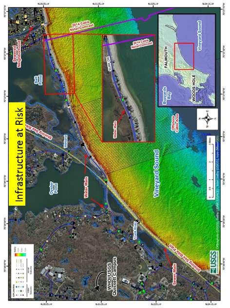
10 LOCAL present Features across the coastal landscape are a product of geology, ecology, sediment supply, waves, tides, storms, and human influence possible future Coastal change will be variable.
 Sediment deficit or surplus")
11 Timescales matter Short-term Variance (hours to decade) Storm impact/recovery Annual cycles El Niño Long-term Trend (decades to centuries) Sediment deficit or surplus Sea-level rise


12 Sandy NOAA 2012 The strongest hurricanes are anticipated to become both more frequent and more intense in the future, with more precipitation. Scituate 2013 Photo: Steven Senne NOAA 2017 Katia Irma Jose

13 Successive hurricane impacts on Dauphin Island, AL


14 Coastal change impacts: A multivariate problem with uncertainties everywhere Driving Forces Groundwater Impact Wetland Loss Habitat Loss Climate Change & Sea Level Rise Physical & Biological Processes Coastal Erosion Potential Impacts Management Decisions Initial Conditions Inundation Safety

15 Timing matters Decisions are being made Now (both short- and long-term) Regardless of whether information and understanding is adequate (Savonis, 2011)

16
17

18 Informing Decisions in a Changing Climate National Research Council (2009) The end of Climate Stationarity requires that organizations and individuals alter their standard practices and decision routines to take climate change into account. Scientific priorities and practices need to change so that the scientific community can provide better support to decision makers in managing emerging climate risks. Decision makers must expect to be surprised because of the nature of climate change and the incompleteness of scientific understanding of its consequences. An uncertainty management framework should be used because of the inadequacies of predictive capability.
19 Bayesian Networks: An Example Knowns Less Well-Known Probability of Outcome Weather Day of Week Accident Time of Year Construction Delays Commuting Time to Boston About an hour More than an hour More than 2 hours


20 Modeling Coastal Response to Sea-Level Rise Probability of Outcome Knowns + Less Well Known

21 We can start to anticipate where change is most likely Probability of coastal erosion >1 m/yr Uncertainty map can be used to identify where better information is needed Areas of low confidence require better input data better understanding of processes Can use this map to focus research resources

 during Nor easter https://marine.usgs.")
22 Likelihood of Storm Impacts Waves/surge higher than base of dune lead to erosion Waves/surge overtop dune crest, moving sand landward Mean water levels are higher than dune crest, submerging beach system Probability of Collision, Overwash, and Inundation (landward-seaward bands) during Nor easter


23 Risk-based framing for decision-making What is most likely to happen? (e.g., with future climate) AND How bad could things get? (e.g., as a result of uncertainty in climate sensitivity and the climate system response). Adaptive Management Process Approaches to Decision Making Willams et al., 2009


24 Structured decision making: Defining shared goals and a common vision + Sustain services and infrastructure Ensure persistence of habitats and iconic landscapes Coastal land availability vs. land loss Actions: Manage differently, adapt existing structures, acquire new or existing land Ted Blanco Charlie Flagg
25 Summary The coastal landscape is variable in both configuration and response to change We know a lot about where and when the coast will change, and we need to know more Rates of sea-level rise and magnitudes poorly constrained Uncertain where and when storms will hit Human action is difficult to predict There will be major changes to the coast, ecosystems, and resources We can prepare using both uncertainty and knowledge Adaptive management and scenario planning will allow for planning flexibility and vision Understanding your risk tolerance can help frame decision-making
26

27 Visualizing the coastal response to sea-level rise (DRAFT not for citation; Lentz et al., in development)

28 Inundation Model vs. Coastal Response Outcomes 75 W 70 W 45 N Where Prob. AE < 0 Where prob. CR < N 70% of area likely submerged 2% of area likely inundated 40 N 40 N Prime Hook NWR 91% of area likely submerged 51% of area likely inundated 75 W (Lentz et al., 2016)


29 Dynamic equilibrium of marshes and beaches (Cahoon et al., 2009) Location and shape of the beach Sediment supply Wave energy Relative sealevel change Photo: NY Times,2012