John Simkins, FHWA Mack Frost, FHWA Jim Utterback, VDOT Jim Long, VDOT Janet Hedrick, VDOT Scott Smizik, VDOT
|
|
|
- Nora Hart
- 5 years ago
- Views:
Transcription


1


2
3 Ms. Irene Rico Federal Highway Administration May 8, 2015 Page 3 cc: John Simkins, FHWA Mack Frost, FHWA Jim Utterback, VDOT Jim Long, VDOT Janet Hedrick, VDOT Scott Smizik, VDOT Attachments 1) Description of the Proposed Section 2) Issues Evaluation Checklist 3) Indirect and Cumulative Effects Analysis 4) Relevant Communication Following the FEIS 5) Figures
4 Ms. Irene Rico Federal Highway Administration May 8, 2015 Page 4 Page intentionally left blank
5 Ms. Irene Rico Federal Highway Administration May 8, 2015 Page 5 Attachment 1: Description of the Proposed Section This proposed section is approximately seven miles long, with the termini located east of Exit 247 (Yorktown Road/Route 238) in the east and west of Exit 242 (Marquis Parkway/State Highway 199) in the west. Exits 247, 243, and 242 exist along the proposed section. modifications to these interchanges are proposed. This section also meets the definition of an operationally independent section. As noted in the FEIS and defined in FHWA guidance Operational Independence and n-concurrent Construction 2, an operationally independent section can be built and function as a viable transportation facility even if the rest of the work described in the FEIS is never built. The proposed improvements would add one (1) additional general purpose lane eastbound and one (1) additional general purpose lane westbound to I-64. This would achieve the full build condition recommended in the FEIS. These recommendations are based on analysis included in the Traffic Technical Report associated with the FEIS, which found the need for one additional lane to initiate at Exit 247 and extend beyond Exit 242. This section would contribute to this defined need by adding the required capacity within the limits of the section before transitioning transition back into existing mainline conditions. To further fulfill the definition of an operationally independent section, the environmental commitments made in the FEIS, specifically those documented in Appendix L, would be adhered to for this section. VDOT proposes to generally widen the interstate to the inside median. Widening to the inside of the median was selected for the proposed section based on the following: Reduces property impacts; and, Reduces impacts to natural and cultural resources. In some locations; however, it may be necessary to widen to the outside. This would be done to provide room in the median for necessary stormwater management features and avoid any property impacts to Naval Weapons Station Yorktown. The outside widening would not impact Naval Weapons Station Yorktown property. 2 m.
6 Ms. Irene Rico Federal Highway Administration May 8, 2015 Page 6 The Hampton Roads Transportation Planning Organization (HRTPO) and Hampton Roads Transportation Accountability Commission (HRTAC) have taken the following actions to include this proposed section in the appropriate planning documents: 1) June 20, 2013 HRTPO passed a resolution endorsing six-lane options to provide immediate congestion relief between Exit 255 (Jefferson Avenue) and Exit 242 (Humelsine Parkway). 2) October 17, 2013 HRTPO identified nine priority projects for funding. This listing included a section from Exit 255 to Exit 250 and a second section from Exit 250 to Exit ) September 18, 2014 HRTPO included the proposed section in the 2034 Long-Range Transportation Plan 4) April 16, 2015 HRTPO voted to modify its 2034 Long-Range Transportation Plan (LRTP) to meet fiscal constraint requirements. The proposed section was already included in the LRTP. 5) April 16, 2015 HRTAC approved $6 million for the next subsequent phase of the project. 6) On May 6, 2015 the HRTPO Transportation Technical Advisory Committee recommended that the HRTPO board amend the Hampton Roads Fiscal Year Transportation Improvement Program to include the $6 million to fund the next subsequent phase. The HRTPO Board is expected to approve this amendment in its May 2015 meeting.
7 Ms. Irene Rico Federal Highway Administration May 8, 2015 Page 7 Attachment 2: Issues Evaluation Checklist Have the Impacts Issue/Resource New Information? 3 Method of Review Changed? Transportation Traffic Volumes/Patterns/Time Transportation Plan Yes Yes N/A N/A Review of previous NEPA documentation and planning corridor drawings for the proposed section. Land Use Conversion Yes N/A Review of previous NEPA documentation, aerial photo mapping, planning corridor drawings for the proposed section, and City of Newport News Comprehensive Plan. Socioeconomics and Land Use Comment Implementation of the proposed section would improve traffic conditions to Level of Service C and would contribute to the purpose and need of the FEIS. More detailed traffic analysis would be developed as part of the final design to confirm LOS C would be achieved. See Attachment 1 for updates to transportation planning documents. Land use has not changed within the study area that extends 500 feet from existing pavement. Land use within Newport News that surrounds the eastern end of the proposed section is currently vacant or dedicated open space. In the middle of the proposed section, land use within James City County consists of residential and industrial uses. At the far western end of the proposed section, land use within York County consists of vacant land and some limited conservation areas. Naval Weapons Station Yorktown also abuts the proposed section in York and James City counties. Development Yes N/A new developments have occurred along the proposed section since the completion of the FEIS. Zoning along much of the proposed section limits future development. In addition. State Route 143 (Merrimac Trail/Jefferson Avenue) runs parallel to the interstate, limiting the amount of developable land immediately adjacent to the proposed section. Consistent with Area s Comprehensive Plan Yes N/A Review of previous NEPA documentation and planning corridor drawings for the proposed section. The James City County Comprehensive Plan (2009), the York County Comprehensive Plan, Charting the Course to 2035 (2013), and the City of Newport News Comprehensive Plan, Framework for the Future 2020, acknowledge congestion, failing conditions, and/or the need for the widening of Intestate 64. ne of these plans have been updated since the publication of the FEIS. 3 New information consists of data that was not included in the FEIS. This may include new information or the presentation of data for the proposed section that was not discussed in the FEIS.
8 Ms. Irene Rico Federal Highway Administration May 8, 2015 Page 8 Issue/Resource New Information? 3 Method of Review Populations Yes N/A Review of previous NEPA documentation and planning corridor drawings for the proposed section. Emergency Services Yes N/A Review of previous NEPA documentation and planning corridor drawings for the proposed section. Have the Impacts Changed? Comment The 2010 Census documented a population of 180,719 for the City of Newport News. The census tract that the proposed section passes through is one of the highest populated tracts in the city (3,339). In James City County, the 2010 population was 67,009. The census tract that the proposed section passes through is the least populated census tract within the FEIS study area for the county (1,458). Finally, the Census documented a 2010 population of 434,972 in York County. The census tract that the proposed section passes through is one of the least populated census tracts within the FEIS study area for the county (703). See Attachment 3 for more details on populations. There are no emergency service facilities located within the 500 foot planning corridor considered in the FEIS. As projected in the FEIS, improvements to the proposed section could assist in improving response times for emergency services.
9 Ms. Irene Rico Federal Highway Administration May 8, 2015 Page 9 Issue/Resource New Information? 3 Method of Review Potential Relocations Yes N/A Review of previous NEPA documentation and planning corridor drawings for the proposed section. Have the Impacts Changed? Yes Impacts in the FEIS were defined for the length of the corridor. For this Request, VDOT has focused on those properties identified in the FEIS that are located within the proposed section. Comment The FEIS reported 214 residential, 80 business, and 11 rural impacted parcels for the preferred alternative. This assumed widening to the outside. By widening to the inside, these figures were reduced to 212 residential, 80 business, and 11 rural impacted parcels. Within the proposed section, the FEIS identified one rural parcel (a VDOT storage facility), seven residential parcels, and six business parcels that could be impacted by the proposed section. These impacts are conservative and anticipated to change upon the development of detailed project design. If project design advances, and the rightof-way impacts are better understood, VDOT will develop a detailed relocation plan for all displaced residents, businesses, and non-profit organizations. The acquisition of property and any necessary relocations will be conducted in accordance with all applicable federal laws, regulations and requirements, including but not limited to 23 CFR 710, the Uniform Relocation Assistance and Real Property Acquisition Policies Act of 1970 as amended and its implementing regulations found in 49 CFR 24. All persons displaced on federally-assisted projects will be treated fairly, consistently, and equitably so that they do not experience disproportionate effects as a result of projects that are designed for the benefit of the public as a whole. VDOT will provide relocation resources to all residences, businesses, and non-profit organizations potentially impacted by the proposed improvement without discrimination in accordance with current VDOT Right-of-Way Manual procedures
10 Ms. Irene Rico Federal Highway Administration May 8, 2015 Page 10 Issue/Resource New Information? 3 Method of Review Environmental Justice Yes N/A Review of previous Populations NEPA documentation and planning corridor drawings for the proposed section. Farmlands Yes N/A Review of previous NEPA documentation and planning corridor drawings for the proposed section. Energy Yes N/A Review of previous NEPA documentation and planning corridor drawings for the proposed section. Have the Impacts Changed? Energy Air Quality Air Quality Criteria Yes N/A Review of previous NEPA documentation and planning corridor drawings for the proposed section. Comment The proposed section passes through or is adjacent to census tracts with environmental justice populations that are higher than that of the surrounding jurisdiction. As noted in the FEIS, the proposed general purpose lanes would be constructed along an existing corridor and, as such, improvements are not expected to have a disproportionately high and adverse effect on minority or low-income populations. The additional lanes would be constructed in the median, thereby minimizing any impacts on Environmental Justice populations as compared to constructing lanes on the outside of the existing roadway. The potential property impacts described above, as well as the construction impacts discussed later in this attachment, would impact environmental justice populations. These impacts would not be disproportionately high or represent adverse effects to minority and low-income populations. See Attachment 3 for additional information on environmental justice populations. An estimated 5.30 acres of Prime Farmland and 4.15 acres of Farmland of Statewide Importance exist within the area of potential right of way for the proposed section. Final impacts to these resources would be determined through final design. As stated in the FEIS, traffic volumes and capacity are projected to result in increased traffic on I-64. However, much of that is expected to be traffic that would still exist under the -Build conditions because traffic would use other roads to avoid a severely congested I-64. The total amount of vehicles, and vehicle-miles traveled, in the region would not substantially change. In addition, the capacity of I-64 would be improved. Therefore, there would be less idling and/or reduced speeds for drivers on I-64, which in turn would result in less fuel being burned during their trip as compared to the -Build conditions. There have been no changes to air quality criteria since the publication of the FEIS.
11 Ms. Irene Rico Federal Highway Administration May 8, 2015 Page 11 Issue/Resource New Information? 3 Method of Review Conformity Yes N/A Review of regional financially constrained long-range transportation plans. Air Quality Impacts Yes N/A Review of previous NEPA documentation and planning corridor drawings for the proposed section. Regional Compliance with the PM Standards Regional Compliance with the Ozone Standards Yes N/A Review of previous NEPA documentation and planning corridor drawings for the proposed section. Yes N/A Review of previous NEPA documentation and planning corridor drawings for the proposed section. Air Toxic Analysis Yes N/A Review of previous NEPA documentation and planning corridor drawings for the proposed section. ise Criteria Existing ise Conditions ise Impacts Yes N/A Yes N/A Review of previous NEPA documentation and planning corridor drawings for the proposed section. Have the Impacts Changed? Yes regulations have been modified since the publication of the FEIS. Comment The region is in attainment of the national ambient air quality standards (NAAQS) for all criteria pollutants. Transportation conformity requirements therefore do not apply. Effective April 6, 2015, with the revocation (80 FR 12264) by EPA of the 1997 national ambient air quality standards (NAAQS) for ozone, the region is in attainment of the NAAQS for all criteria pollutants. Transportation conformity requirements, which previously applied for the region as it was in maintenance for the 1997 ozone standard, no longer apply. The study area is located in Attainment Area for PM 10 and PM 2.5 NAAQS. ise Yes Impacts in the FEIS were defined for the length of the corridor. For this Request, VDOT has focused on those properties identified in the FEIS that are located within the proposed section. The study area is located in an Attainment Area for ozone. The results of the analysis completed for the FEIS are consistent with the national mobile source air toxics (MSAT) emission trends as predicted by MOBILE6.2 from The results of the analysis indicate that no meaningful increases in MSAT have been identified and are not expected to cause an adverse effect on the human environment. Individual receptor sites that exceeded the ise Abatement Criteria (NAC) were documented in the FEIS and are assumed to remain the same for the purposes of this Request. The FEIS identified a total of 11 residences and one golf course that would be impacted in the proposed section by the maximum decibel level that would be produced at the design year (2040). The analysis identified feasible and reasonable barriers that would mitigate a high percentage of these impacts. These mitigation measures would be further analyzed and incorporated into the final design of the proposed section, as appropriate.
12 Ms. Irene Rico Federal Highway Administration May 8, 2015 Page 12 Issue/Resource New Information? 3 Method of Review Have the Impacts Changed? Natural Resources Wildlife and Wildlife Habitat Yes N/A Review of previous Yes Impacts in the NEPA documentation FEIS were defined and planning corridor for the length of the drawings for the corridor. For this proposed section. Request, VDOT has focused on those properties identified in the FEIS that are located within the proposed section. Threatened and Endangered Species and Critical Habitat Yes N/A Review of previous NEPA documentation, planning corridor drawings for the proposed section, and online review of U.S. Fish and Wildlife Service (USFWS) Information, Planning, and Consultation (IPaC) system. Comment As reported in the FEIS, the proposed section consists of widening along an existing corridor in a developed area. Therefore, the proposed activities would not affect any substantial forest resource and impacts to terrestrial habitat would be limited to the displacement of small sections of remaining, often disjunct, non-contiguous tracts of forests within the existing median of I-64. The existing interstate highway poses a barrier to wildlife movements that would not be substantially altered. The extension of culverts could lead to the direct loss of fish and macroinvertebrates within the construction zone and would permanently alter the available habitat in the impacted areas. However, these areas would likely be colonized again, following the construction activities. To meet the commitments outlined in Appendix L of the FEIS, the USFWS IPaC was consulted to document any threatened or endangered species along the proposed section. As illustrated in Attachment 4, the small whorled pogonia (Isotria medeoloides) may occur along the proposed section. A small whorled pogonia habitat assessment was conducted as part of the FEIS; however, the assessment did not address the proposed section. The FEIS committed VDOT and FHWA to a pedestrian survey of all forested areas within the project corridor, prior to design/ construction, to identify suitable habitat and to determine presence or absence of small whorled pogonia. Such a survey would be conducted during the design phase to facilitate agency coordination, permitting, and design. Wildlife and Waterfowl Refuges Yes N/A Review of previous NEPA documentation and planning corridor drawings for the proposed section. In addition, the northern long-eared bat (Myotis septentrionalis) may occur along the corridor. This species may become federally listed in Federal wildlife refuges exist within the bounds of Naval Weapons Station Yorktown to the north of the proposed section. These properties would not be impacted by the proposed section.
13 Ms. Irene Rico Federal Highway Administration May 8, 2015 Page 13 Issue/Resource New Information? 3 Method of Review Surface Waters Yes N/A Review of previous NEPA documentation and planning corridor drawings for the proposed section. Have the Impacts Changed? Yes Comment The proposed section is located in the Lower James River basin. The existing interstate includes three water crossings within this section: King Creek/Whiteman Swamp, Skiffes Creek, and Blows Mill Run. The first is located at the western terminus. Skiffes Creek and Blows Mill Run flow south of the interstate into Skiffes Creek Reservoir. The reservoir is located south of the interstate corridor. As stated in the FEIS, impacts to this resource would be similar to all downstream impacts. These impacts would be reduced and/or avoided through the implementation of required erosion and sediment control structures and stormwater management best management practices. Public Water Supply Yes N/A Yes Impacts in the FEIS were defined for the length of the corridor. For this Request, VDOT has focused on those properties identified in the FEIS that are located within the proposed section. Submerged Aquatic Vegetation Yes N/A Review of previous NEPA documentation and VIMS interactive SAV map Floodplains Yes N/A Review of previous NEPA documentation and planning corridor drawings for the proposed section. The proposed section crosses Skiffes Creek which flows into the Skiffes Creek Reservoir. The reservoir is a drinking water source for the City of Newport News. As stated in the FEIS, impacts to this resource would be similar to all downstream impacts. These impacts would be reduced and/or avoided through the implementation of required erosion and sediment control structures and stormwater management best management practices. There is no submerged aquatic vegetation within the proposed section. The FEIS identified 100-year floodplains adjacent to the western terminus of the proposed section.
14 Ms. Irene Rico Federal Highway Administration May 8, 2015 Page 14 Issue/Resource New Information? 3 Method of Review Have the Impacts Changed? Wetlands Yes N/A Review of previous Yes Impacts in the NEPA documentation FEIS were defined and planning corridor for the length of the drawings for the corridor. For this proposed section. Request, VDOT has focused on those properties identified in the FEIS that are located within the proposed section. Visual Quality Visual and Aesthetics Yes N/A Review of previous Yes Impacts in the NEPA documentation FEIS were defined and planning corridor for the length of the drawings for the corridor. For this proposed section. Request, VDOT has focused on those properties identified in the FEIS that are located within the proposed section. Architectural Resources Yes N/A Review of previous NEPA documentation and planning corridor drawings for the proposed section. Historic Properties Comment Within the proposed section, current estimates suggest the potential for 958 linear feet of stream impacts and 1.18 acres of palustrine forested wetland impacts. Implementation of the proposed section would include basic improvements along an existing interstate highway functioning at capacity. As documented in the FEIS, the visual effects are expected to be minimal. The view of the interstate and from the interstate would not be dramatically altered since viewers already see the existing interstate. The introduction of new sound barriers could alter some views and widening to the median would result in the partial removal of established stands of trees. The Battle of Williamsburg (DHR ; VA010) occupies much of the land surrounding the western terminus of the proposed section. As documented in the FEIS, the Virginia Department of Historic Resources (DHR) has concurred that there would be no adverse effect to this resource under the Preferred Alternative. On vember 20, 2013, FHWA, DHR, the National Park Service, and VDOT executed a Section 106 Programmatic Agreement (PA) regarding the I-64 Peninsula Study corridor. The PA acknowledges special conditions that must be taken to account for two resources associated with the Battle of Williamsburg: Redoubt 8 and Redoubt 9. The conditions included in the PA would be followed in the planning, design, and construction of the proposed section.
15 Ms. Irene Rico Federal Highway Administration May 8, 2015 Page 15 Issue/Resource New Information? 3 Method of Review Archaeological Resources Yes N/A Review of previous NEPA documentation and planning corridor drawings for the proposed section. Have the Impacts Changed? Section 4(f) Resources Section 4(f) Yes N/A Review of previous NEPA documentation and planning corridor drawings for the proposed section. Comment The PA acknowledges that studies and consultation with the SHPO have been completed for buildings, structures, nonarchaeological districts, and objects meeting the criteria for listing on the NHPR; however, to address outstanding issues associated with archaeological resources, the PA sets forth a process whereby survey, assessment, and possible treatment of areas within the corridor would occur. VDOT is currently conducting an archaeological investigation of the land contained within the proposed section. DHR has concurred that any archaeological sites that may be present within the proposed section would be important chiefly for the information they contain. Therefore, pursuant to 23 CFR (b), the archaeological sites would not be Section 4(f) resources. The City of Newport News Park borders the eastern edge of the proposed section. In the DEIS, the site was identified as a 4(f) resource. Between the publication of the DEIS and FEIS, the City of Newport News concurred that the impact to the park would be de minimis and this finding was documented in the FEIS. On January 30, 2015, the city again concurred that the impact would be de minimis (Attachment 4). Contaminated Sites Hazardous Waste Sites Yes N/A Review of previous NEPA documentation and planning corridor drawings for the proposed section. Indirect & Cumulative Impacts Socioeconomic Impacts Yes N/A See Attachment 3 Natural Resource Impacts Yes N/A See Attachment 3. The Battle of Williamsburg is adjacent to the proposed section. As documented in the FEIS, DHR concurred that the improvements would have no adverse effect to this resource. DHR also concurred with the potential de minimis finding under Section 4(f). DHR confirmed its position that the impact would be de minimis on March 27, Naval Weapons Station Yorktown is identified in the FEIS as a Site of Potential Concern. Naval Weapons Station Yorktown is adjacent to the proposed section.
16 Ms. Irene Rico Federal Highway Administration May 8, 2015 Page 16 Issue/Resource New Information? 3 Method of Review Have the Impacts Changed? Construction Impacts Construction & Operations Yes N/A Review of previous Employment NEPA documentation and planning corridor drawings for the proposed section. Air Quality Yes N/A Review of previous NEPA documentation and planning corridor drawings for the proposed section. ise Yes N/A Review of previous NEPA documentation and planning corridor drawings for the proposed section. Water Quality Yes N/A Review of previous NEPA documentation and planning corridor drawings for the proposed section. Maintenance & Control of Traffic Yes N/A Review of previous NEPA documentation and planning corridor drawings for the proposed section. Health & Safety Yes N/A Review of previous NEPA documentation and planning corridor drawings for the proposed section. Pollution Control Yes N/A Review of previous NEPA documentation and planning corridor drawings for the proposed section. Comment The Hampton Roads Transportation Planning Organization has programmed $213.6 million dollars into its constrained longrange transportation plan for the proposed section. This level of investment is anticipated to have measurable benefit to construction and operations employment. The FEIS provides specific guidance to help minimize potential construction-related air quality and this guidance will be adhered to for the implementation of the proposed section. The FEIS provides specific guidance to help minimize potential construction-related noise and this guidance will be adhered to for the implementation of the proposed section. The FEIS provides specific guidance to help minimize potential construction-related water quality and this guidance will be adhered to for the implementation of the proposed section. The FEIS provides specific discussions of maintenance of traffic, include a maintenance of traffic plan, public communications plan, and transportation operations plan. This guidance will be adhered to for the implementation of the proposed section. The FEIS recommends that the maintenance of traffic plan be designed to provide for the health and safety of the public and construction workers. Appendix H of the FEIS documents VDOT s commitments to pollution control.
17 Ms. Irene Rico Federal Highway Administration May 8, 2015 Page 17 Issue/Resource New Information? 3 Method of Review Have the Impacts Changed? Permits Section 404 Permits Yes N/A Review of previous NEPA documentation and planning corridor drawings for the proposed section. Section 10 Permits Yes N/A Review of previous NEPA documentation and planning corridor drawings for the proposed section. Virginia Water Protection Yes N/A Review of previous Permit NEPA documentation and planning corridor drawings for the proposed section. Subaqueous Bed Permit Yes N/A Review of previous NEPA documentation and planning corridor drawings for the proposed section. Coast Guard Permit Yes N/A Review of previous NEPA documentation and planning corridor drawings for the Coastal Barriers & Coastal Zone proposed section. Yes N/A Review of previous NEPA documentation and DEQ web site. Comment The FEIS suggests these permits may be required and this assumption remains valid for the proposed section. Permits would be obtained during the final design process. There is reasonable assurance that the Section 404 permit will be obtained based on 1) the U.S. Army Corps of Engineers supporting Alternative 1 in their comments on the FEIS, and 2) their lack of objections at the February 12, 2014 partnering meeting. According to Virginia Department of Game and Inland Fisheries mapping, there are no navigable waters within or immediately adjacent to the proposed section Therefore, Section 10 and/or Coast Guard permits are not anticipated. The proposed section is located within the Virginia Coastal Zone. As stated in the FEIS, compliance with coastal zone requirements would be accomplished through the Joint Permit Application process.
18 Ms. Irene Rico Federal Highway Administration May 8, 2015 Page 18 Issue/Resource New Information? 3 Method of Review Have the Impacts Changed? Comment Mitigation Measures Relocations Yes N/A Review of previous NEPA documentation and planning corridor drawings for the proposed section. As discussed above, the FEIS identified one rural parcel (a VDOT storage facility), seven residential parcels, and six business parcels that could be impacted by the proposed section. All relocations and real property acquisition would be in accordance with the Uniform Relocation Assistance and Real Property Acquisition Policies Act of 1970, as amended. Displaced property owners would be provided relocation assistance advisory services together with the assurance of the availability of decent, safe, and sanitary housing. Relocation resources would be made available to all who are displaced Farmlands Yes N/A Review of previous NEPA documentation and planning corridor drawings for the proposed section. ise Yes N/A Review of previous NEPA documentation and planning corridor drawings for the Threatened & Endangered Species proposed section. Yes N/A Review of previous NEPA documentation, planning drawings for the proposed section, and online review of USFWS IPaC system. Floodplains Yes N/A Review of previous NEPA documentation and planning corridor drawings for the proposed section. without discrimination. An estimated 5.30 acres of Prime Farmland and 4.15 acres of Farmland of Statewide Importance exist within the area of potential right of way for the proposed section. The FEIS identified feasible and reasonable barriers that would mitigate a high percentage of the predicted noise impacts. The noise analysis is considered preliminary, and mitigation decisions will be reconsidered in the design phase when better geometric data becomes available. Based on current site conditions and project plans, coordination with the U.S. Fish and Wildlife Service would be required to determine if habitat surveys were required for the small whorled pogonia and/or the northern long-eared bat The FEIS identified 100-year floodplains adjacent to the western terminus of the proposed section.
19 Ms. Irene Rico Federal Highway Administration May 8, 2015 Page 19 Issue/Resource New Information? 3 Method of Review Wetlands Yes N/A Review of previous NEPA documentation and planning corridor drawings for the proposed section. Water Quality Yes N/A Review of previous NEPA documentation and planning corridor drawings for the proposed section. Aquatic Resources Yes N/A Review of previous NEPA documentation and planning corridor drawings for the proposed section. Historic Properties Yes N/A Review of previous NEPA documentation and planning corridor drawings for the proposed section. Have the Impacts Changed? Comment Wetland permits and mitigation are anticipated. The mitigation measures for stream and wetland impacts would be determined as part of the permitting process during final design in consultation with the regulatory agencies. The current compensatory mitigation to impact ratios for non-tidal forested, scrub-shrub and emergent wetlands are 2:1, 1.5:1 and 1:1, respectively. The typical compensatory mitigation to impact ratio for tidal emergent wetlands is 2:1. Stormwater management facilities will be designed in accordance with specifications set forth in Section 3.14 of the Virginia Erosion and Sediment Control Handbook (1992) and VDOT's Annual Erosion and Sediment Control and Stormwater Management Standards and Specifications, as approved by VDCR. Wetland permits and mitigation are anticipated. The mitigation measures for stream and wetland impacts would be determined as part of the permitting process during final design in consultation with the regulatory agencies. The current compensatory mitigation to impact ratios for non-tidal forested, scrub-shrub and emergent wetlands are 2:1, 1.5:1 and 1:1, respectively. The typical compensatory mitigation to impact ratio for tidal emergent wetlands is 2:1. VDOT will minimize effects to aquatic resources by following Best Management Practices (BMPs) and implementing appropriate erosion and sediment control practices in accordance with VDOT s Road and Bridge Specifications, state, and local regulations. The executed Programmatic Agreement for this study provides agreed upon levels of mitigation.
20 Ms. Irene Rico Federal Highway Administration May 8, 2015 Page 20 Issue/Resource New Information? 3 Method of Review Hazardous Waste Sites Yes N/A Review of previous NEPA documentation and planning corridor drawings for the proposed section. Have the Impacts Changed? Comment Any additional hazardous materials discovered during construction of the proposed section or during demolition of existing structures will be removed and disposed of in compliance with all applicable federal, state, and local regulations. All necessary remediation would be conducted in compliance with applicable federal, state, and local environmental laws and would be coordinated with the EPA, the DEQ, and other federal or state agencies as necessary. Maintenance & Control of Traffic Yes N/A Review of previous NEPA documentation and planning corridor drawings for the proposed section. The selection of mitigation measures for specific sites would include avoidance and/or minimization of impacts through redesign or alignment shift, and remediation/closure by responsible parties prior to state acquisition of contaminated properties. Maintenance of traffic along the interstate and existing secondary routes is a part of final design and will be duly considered by VDOT. Pollution Control Yes N/A Review of previous NEPA documentation and planning corridor drawings for the proposed section. Appendix H of the FEIS documents VDOT s commitments to pollution control.
21 Ms. Irene Rico Federal Highway Administration May 8, 2015 Page 21 Attachment 3: Indirect and Cumulative Effects Analysis Appendix L of the FEIS includes a commitment to review and update the systematic process utilized to analyze indirect and cumulative effects in the Final Environmental Impact Statement (FEIS). This attachment to the Request is designed to satisfy this commitment. Indirect Effect Analysis The indirect effect analysis was conducted in accordance with the Desk Reference for Estimating the Indirect Effects of Proposed Transportation Projects, (National Cooperative Highway Research Program (NCHRP), Report 466, 2002). This report specifies an eight-step process for determining indirect effects and used as a guide to assess the potential for indirect effects for this Request. The eight steps followed are: 1) Initial Scoping 2) Identify Study Area Direction and Goals 3) Inventory table Features 4) Identify Impact-Causing Activities 5) Identify Potentially Significant Indirect Effects for Analysis 6) Analyze Indirect Effects 7) Evaluate Analysis Results These steps, and the actions taken to fulfill these requirements, are described below. 1) Initial Scoping The first step in the indirect effects analysis includes the initial scoping activities and the identification of the study area in order to set the stage for the remaining steps. An extensive scoping process was undertaken at the onset of the EIS. Given the limited time that has passed since the publication of the FEIS, and the fact that the proposed section is within the corridor of the Preferred Alternative in the FEIS, no formal scoping was necessary for this Request. As part of the scoping process for the EIS, the study areas for each resource/feature were proposed in order to analyze a full range of potential direct and also indirect effects. Descriptions of the scoping process and the scoping meetings that were held with the resource and regulatory agencies along with the public can be found in the FEIS. In addition, in accordance with the FEIS Coordination Plan, participating agencies were given the opportunity to comment on the impact methodologies during the scoping process and none of them submitted any comments on the indirect or cumulative effect analysis impact methodologies. Socioeconomic study areas were established to analyze neighborhoods and community facilities; environmental justice; displacements and relocations; economic activity; land use; and parks, recreation areas and open space within the proposed section. The socioeconomic study area for this Request is made up of the three census tracts that border the proposed section. Multiple resource boundaries were reviewed to assess the effects the proposed section would have on natural and physical resources. Based on readily available data from federal, state and local sources, the resources were analyzed to determine the potential for indirect effects created by the proposed section. The resources include: Waters of the United States including wetlands; surface and groundwater supply; floodplains, threatened and endangered species; wildlife and habitat; historic properties; and Section 4(f) resources. The study area for indirect effects to these resources also extends beyond the direct impact study area, in order to identify impacts occurring downstream from the proposed section.
22 Ms. Irene Rico Federal Highway Administration May 8, 2015 Page 22 2) Identify Study Area Direction and Goals This second step in the indirect effects analysis focuses on assembling information regarding general trends and goals within the study area. The trends and goals in question are independent of the proposed transportation project and typically concern social, economic, ecological, and/or growth-related issues. According to the NCHRP Report 466, evidence indicates that transportation investments result in major land use changes only in the presence of other factors. These factors include supportive local land use policies, local development incentives, availability of developable land, and a good investment climate. An understanding, therefore, of community goals, combined with a thorough knowledge of demographic, economic, social, and ecological trends is essential in understanding the dynamics of project-influenced changes in development location. Later in the process, it will be important to compare study area goals with potential impacts. Conflict between impacts and goals is a key determinant of impact significance and an indicator of effects that merit further analysis. The following sections describe the proposed section, along with the existing and planned land use in the immediate areas in order to provide insight as to the direction and goals for the area. a. Proposed Section The proposed section is approximately seven miles with the termini located east of Exit 247 (Yorktown Road/Route 238) in the east and west of Exit 242 (Marquis Parkway/State Highway 199) in the west. Exits 247, 243, and 242 exist along the proposed section. modifications to these interchanges are proposed (Attachment 1). In addition to possessing logical termini, this section also meets the definition of an operationally independent section. As noted in the FEIS and defined in FHWA guidance Operational Independence and n-concurrent Construction 4, an operationally independent section can be built and function as a viable transportation facility even if the rest of the work described in the FEIS is never built. The proposed improvements would add one (1) additional general purpose lane eastbound and one (1) additional general purpose lane westbound to I-64. As documented in the FEIS, this is the recommended full build condition for the proposed section (Attachment 5). These recommendations are based on analysis included in the FEIS Traffic Technical Report. To further fulfill the definition of an operationally independent section, the environmental commitments made in the FEIS, specifically those documented in Appendix L, would be adhered to for this section. b. Demographics Due to changes in Census boundaries in the last couple of decades, information is unavailable to provide a detailed history of population in the socioeconomic study area Table 1 provides a summary of the historic population changes in the socioeconomic study area and the surrounding area. Between 1990 and 2010, the City of Newport News population increased by approximately 7%, while James City County and York County populations increased by approximately 92% and 54%, respectively. This trend reveals that the rural areas are growing more quickly than the urban areas, which are already more densely developed. The estimated population growth illustrated in Table 2 further supports this finding. 4
23 Ms. Irene Rico Federal Highway Administration May 8, 2015 Page 23 Table 1: Historic Population Trends, Area Percent Change from 1990 to 2010 (%) James City County 34,859 48,102 67, City of Newport News 170, , , York County 42,422 56,297 65, Socioeconomic Study Area N/A N/A 9,518 N/A Virginia 6,187,358 7,079,030 8,001, United States 248,709, ,421, ,745, Table 2: Projected Population, Area Percent Change from 2010 to 2030 (%) James City County 67,009 82, , York County 65,464 76,376 86, City of Newport News Socioeconomic Study Area 180, , , ,518 11,105* 12,624* 32.6 Virginia 8,001,024 7,079,030 9,825, United States 308,745, ,421, ,584, * Extrapolated from York County data by using same percent change between each decade. York County data was used as it represents the median data set for the three localities.
24 Ms. Irene Rico Federal Highway Administration May 8, 2015 Page 24 c. Employment The main industries in socioeconomic study area are listed in Table 3. Area James City County City of Newport News York County Table 3: Major Employers Employers Busch Entertainment Corp., Williamsburg James City County Public Schools, James City County, Eastern State Hospital rthrop Grumman Shipbuilding, Inc., Riverside Regional Medical Center, Newport News Public Schools, U.S. Department of Defense, Canon, Ferguson Enterprises Inc. York County Schools, York County, Wal-Mart, U.S. Department of Defense The U.S. Department of Defense and Busch Entertainment Corp. both have properties adjacent to the proposed section. d. Land Use Patterns and Plans Land use within the socioeconomic study area is dictated by the respective locality s comprehensive plan. These plans are discussed below. James City County The James City 2009 Comprehensive Plan includes the 2009 Comprehensive Map which illustrates existing land use within the study area. Land use includes low and moderate density residential development, limited and general industry, and Federal land associated with naval weapons station. There is some land designated for open space that exists away from the proposed section, along the James River. City of Newport News The City of Newport News Comprehensive Plan, Framework for the Future 2030, breaks down existing land use by type. The land use adjacent to the proposed section is classified as residential and commercial, with small areas of planned open space. York County The York County Comprehensive Plan identifies land uses within the study area. The designated land uses include low density residential, high density residential, economic opportunity/commercial, and general industrial. e. Environmental Regulations There are many federal regulations intended to protect, enhance, and/or rehabilitate the natural and human environments. A number of the most pertinent regulations are summarized below. Section 404, Clean Water Act: Section 404 regulates the discharge of dredged, excavated, or fill material in wetlands, streams, rivers, and other U.S. waters. The United States Army Corps of Engineers is the federal agency authorized to issue Section 404 Permits for certain activities conducted in wetlands or other U.S. waters. The proposed section will most likely require a Section 404 permit. This permit would require the discussion of the measures employed throughout planning and design in order to avoid/minimize effects to
25 Ms. Irene Rico Federal Highway Administration May 8, 2015 Page 25 Waters of the U.S. The Section 404 permit application also could include a compensatory mitigation proposal, which outlines the plan to provide compensation to offset permanent losses of Waters of the U.S. Coastal Zone Management Act: This act preserves, protects, develops, and (where possible) restores and enhances resources of the coastal zone. It is applicable to all projects significantly affecting areas under the control of the State Coastal Zone Management Agency for which a plan is approved. Projects must comply with federal consistency regulations, management measures, and the appropriate approved state plan for Coastal Zone Management Programs. The proposed section is located within the Coastal Zone. Safe Drinking Water Act: Ensures public health and welfare through safe drinking water. The Safe Drinking Water Act regulates actions which may have a significant impact on an aquifer or wellhead protection area which is the sole or principal drinking water. National Historic Preservation Act: Section 106 of the National Historic Preservation Act requires federal agencies to consider the effects of their actions on districts, sites, buildings, structures, and objects significant in American architecture, archeology, and culture. It also requires that the Advisory Council on Historic Preservation be given an opportunity to comment. State The Commonwealth of Virginia has a series of environmental plans that are implemented at both the state and local levels. These include: Waste Management: The Division of Land Protection and Revitalization (DLPR) is responsible for implementing the Virginia Waste Management Act, as well as meeting Virginia s Resource Conservation and Recovery Act (RCRA) and Comprehensive Environmental Response, Compensation, and Liability Act (CERCLA) obligations as mandated by federal policy. Under these directives, the DLPR regulates solid and hazardous waste; oversees cleanup of contaminated sites; facilitates revitalization of environmentally distressed properties; monitors groundwater resources; conducts inspections of aboveground and underground storage tank systems; etc. Air Pollution: The Department of Environmental Quality s Air Division oversees implementation of the Virginia Air Pollution Control Law, as well as ensuring federal obligations of the Clean Air Act are met. These two regulations ensure that projects conform to state and federal requirements, covering things such as industrial facilities and mobile sources (vehicle emissions). Stormwater Management: Virginia s Stormwater Management Program requires that erosion and sediment control, as well as stormwater, be controlled during land disturbing activities and that appropriate permits be acquired. While the State provides oversight, erosion and sediment control permits are typically administered by the local municipality, and stormwater permits are administered by the Virginia Department of Environmental Quality. 3) Inventory table Features The environmental screening conducted as part of this Request can be used as a tool to identify notable features, or specific valued, vulnerable, or unique elements of the environment. The study area contains notable human and natural environment features that were inventoried and described in more detail in the FEIS. The objective of this step of the process is to identify specific environmental issues within the indirect effects analysis study area against which the proposed section may be assessed. The following sections discuss the notable features that were identified as part of this Request.
26 Ms. Irene Rico Federal Highway Administration May 8, 2015 Page 26 a. Socioeconomics and Land Use Neighborhoods and Community Facilities Neighborhoods occur in various locations within the socioeconomic study area. The FEIS did not document any community facilities within the socioeconomic study area for the proposed section. Environmental Justice Based on 2010 Census data, all three of the census tracts in the socioeconomic study area have a minority population of 29% or greater 5. ne of the census tracts within the study area had a median household income below the U.S. Department of Health and Human Services poverty guidelines for 2013 ($23,550). b. Natural Resources Waters of the United States, Including Wetlands The FEIS Natural Resources Technical Memorandum is the source of information for the natural resources identified in this Request. The proposed section is located in the Lower James River basin. The existing interstate includes three water crossings within this section: King Creek/Whiteman Swamp, Skiffes Creek, and Blows Mill Run. The first crossing is located at the western terminus. Skiffes Creek and Blows Mill Run flow south of the interstate into Skiffes Creek Reservoir. The reservoir is located south of the interstate corridor. A number of wetlands and non-tidal and tidal surface water systems (including both wetlands and stream channels) are located along the study area, as well. Additional detail on these resources is provided in Attachment 2 of this Request. Water Quality There are no impaired waters or fish consumption advisories in place within the study area. Floodplains The FEIS identified 100-year floodplains adjacent to the western terminus of the proposed section. Threatened and Endangered Species To meet the future commitments outlined in Appendix L of the FEIS, the USFWS IPaC was consulted to document any threatened or endangered species along the proposed section. As illustrated in Attachment 4, the small whorled pogonia (Isotria medeoloides) may occur along the proposed section. A habitat assessment was conducted as part of the FEIS; however, the assessment did not address this portion of the corridor. In addition, the northern long-eared bat (Myotis septentrionalis) may occur along the corridor. This species may become federally listed in c. Section 4(f) Resources The City of Newport News Park borders the eastern edge of the proposed section. As documented in the FEIS, the City of Newport News concurred with a potential de minimis finding under Section 4(f) for potential impacts to the park. On January 30, 2015, the city reconfirmed this concurrence related to the proposed section. The Battle of Williamsburg is adjacent to the proposed section. As documented in the FEIS, DHR concurred that the improvements would have no adverse effect to this resource. DHR also concurred with the potential de minimis finding under Section 4(f) Census data indicates that 29% of Virginia s population identifies as minority
27 Ms. Irene Rico Federal Highway Administration May 8, 2015 Page 27 On vember 20, 2013, FHWA, DHR, the National Park Service, and VDOT executed a Section 106 Programmatic Agreement (PA) regarding the I-64 Peninsula Study corridor. The PA acknowledges special conditions that must be taken to account for two resources associated with the Battle of Williamsburg: Redoubt 8 and Redoubt 9. The conditions included in the PA would be followed in the planning, design, and construction of the proposed section. 4) Identify Impact Causing Activities Steps 2 and 3 of the indirect effects analysis focus on the identification of trends, goals, and notable features. The next steps involve identification and assessment of impacts that may come into conflict with these goals and features. Gaining an understanding of project design features and the range of impacts they may cause is the first step toward the identification of indirect effects. Project impact-causing activities are relevant to two of the three types of indirect effects identified in the Desk Reference for Estimating the Indirect Effects of Proposed Transportation Projects, (NCHRP, Report 466, 2002): 1. Encroachment-Alteration Effects Effects that alter the behavior and functioning of the physical environment are related to project design features but are indirect in nature because they can be separated from the project in time or distance. 2. Access-Alteration Effects (Project-Influenced Effect) Changes in traffic patterns and the alteration of accessibility attributable to the design of the project can influence the location of residential and commercial growth in the study area. Induced growth-related effects, the third type of indirect effect, are attributable to induced growth itself not project design features. An assessment of known project design features and their impact-causing activities has been included in Table 4; additional features and activities may be identified and refined during final design. The terms included in these columns come from similar listings in the Desk Reference for Estimating the Indirect Effects of Proposed Transportation Projects, (NCHRP, Report 466, 2002). Impact-Causing Activities* Modification of Regime Table 4: Impact-Causing Activities and Design Features Present? Design Features* (Yes// If Yes, General Types of Impacts Unknown) Introduction of Exotic Flora Modification of Habitat Alteration of Ground Cover Alteration of Groundwater Hydrology Yes Groundcover within the proposed section, including the areas within the interchange improvements, would be removed to accommodate the construction of the proposed section. The precise areas and limits of removal would be determined in the final design phase of the proposed section
28 Ms. Irene Rico Federal Highway Administration May 8, 2015 Page 28 Impact-Causing Activities* Table 4: Impact-Causing Activities and Design Features Present? Design Features* (Yes// Unknown) Alteration of Drainage River Control and Flow Modification Channelization ise and Vibration Yes Yes Yes If Yes, General Types of Impacts Additional impervious areas would be created due to the additional roadway/shoulder area and drainage patterns may be altered but would be designed in accordance with VDOT s Road and Bridge Specifications and VDOT s Erosion and Sediment Control Plan Channelization of water resources may be necessary to accommodate the proposed section construction and would be designed in accordance with VDOT s Road and Bridge Specifications; mitigation would be approved by the resource and regulatory permitting agencies ise levels would be altered along proposed section and interchange areas as a result of new roadway and future traffic volumes. ise assessment was conducted and preliminary abatement measures were evaluated as part of the EIS. A more detailed evaluation would be completed during final design in accordance with VDOT s Highway Traffic ise Impact Analysis Guidance Manual Land Transformation and Construction New or Expanded Transportation Facility Service or Support Sites and Buildings New or Expanded Service or Frontage Roads Ancillary Transmission Lines, Pipelines and Corridors Barriers, Including Fencing Channel Dredging and Straightening Channel Revetments Canals Bulkheads or Seawalls Yes Yes The widening of the I-64 mainline would be designed in accordance with VDOT s Road and Bridge Specifications Barriers and fencing such as limited access fencing and noise abatement barriers would be placed where necessary and would not limit or interfere with the safety of the traveling public
29 Ms. Irene Rico Federal Highway Administration May 8, 2015 Page 29 Impact-Causing Activities* Table 4: Impact-Causing Activities and Design Features Present? Design Features* (Yes// If Yes, General Types of Impacts Unknown) Cut and fill activities would occur along the proposed section and interchange areas as a result of new roadway. A more detailed evaluation would be completed during final design in accordance with Cut and Fill Yes VDOT s Road and Bridge Specifications and VDOT s Erosion and Sediment Control Plan Resource Extraction Surface Excavation Subsurface Excavation Yes Yes Dredging Processing Product Storage Land Alteration Resource Renewal Changes in Traffic (including adjoining facilities) Erosion Control and Terracing Mine Sealing and Waste Control Landscaping Wetland or Open Water Fill and Drainage Harbor Dredging Reforestation Groundwater Recharge Waste Recycling Site Remediation Railroad Transit (Bus) Transit (Fixed Guideway) Automobile Yes Yes Yes Yes Excavations would be conducted in accordance with VDOT s Road and Bridge Specifications Excavations would be conducted in accordance with VDOT s Road and Bridge Specifications Erosion control would be designed in accordance with VDOT s Road and Bridge Specifications and VDOT s Erosion and Sediment Control Plan Landscaping would be designed and implemented in accordance with VDOT s Road and Bridge Specification and would serve to reduce runoff and improve aesthetics along the proposed section. Wetland impacts would occur as a result of proposed section construction within the proposed section and interchange areas. Impacts would be avoided and minimized during the final design phase. Mitigation would be approved by the resource and regulatory permitting agencies. As an existing interstate highway, automobile travel would continue within the proposed section. The proposed section would result in improved travel times and automobile movements within the I-64 mainline and at the interchanges
30 Ms. Irene Rico Federal Highway Administration May 8, 2015 Page 30 Impact-Causing Activities* Table 4: Impact-Causing Activities and Design Features Present? Design Features* (Yes// If Yes, General Types of Impacts Unknown) As an existing interstate highway, truck travel would continue within the proposed section. The Trucking Yes proposed section would result in improved travel times and truck movements within the I-64 mainline and at the interchanges Aircraft River and Canal Traffic Pleasure Boating Communication Operational or Service Charge Waste Emplacement and Treatment Chemical Treatment Access Alteration Landfill Emplacement of Spoil and Overburden Underground Storage Sanitary Waste Discharge Septic Tanks Stack and Exhaust Emission Fertilization Chemical Deicing Chemical Soil Stabilization Weed Control Pest Control New or Expanded Access to Activity Center Yes Yes Yes Yes In cut and fill areas with borrow and spoil, there may be changes to the existing topography and natural environment, which would be assessed during the permitting process Proper Erosion and Sediment Controls would be utilized in accordance with VDOT s Road and Bridge Specifications in order to minimize runoff of chemicals Proper Erosion and Sediment Controls would be utilized in accordance with VDOT s Road and Bridge Specifications in order to minimize runoff of chemicals Proper weed control measures would be utilized in accordance with VDOT s Road and Bridge Specifications in order to minimize runoff of chemicals
31 Ms. Irene Rico Federal Highway Administration May 8, 2015 Page 31 Impact-Causing Activities* Table 4: Impact-Causing Activities and Design Features Present? Design Features* (Yes// If Yes, General Types of Impacts Unknown) New or Expanded Access to Undeveloped Land Alter Travel Circulation Patterns Alter Travel Times between Major Trip Productions and Attractions Alter Travel Costs between Major Trip Productions and Attractions Yes Yes Improved travel times would benefit the region and the economy by encouraging travel and tourism Improved travel times would decrease the travel costs, therefore benefiting the region and the economy by encouraging travel and tourism 5) Identify Potentially Significant Indirect Effects for Analysis The objective of this step is to compare the list of project impact-causing actions with the lists of goals and notable features to explore potential cause-effect relationships and establish which effects are potentially significant and merit subsequent detailed analysis (or, conversely, which effects are not potentially significant and require no further assessment). The following describes the potential indirect effects of the implementation of the proposed section on the notable resources/features identified through the previous steps of this analysis. a. Socioeconomics and Land Use The proposed section would increase traffic volumes on I-64 due to the increased capacity within the proposed section. The proposed section would achieve the full build condition recommended in the FEIS and is anticipated to improve traffic conditions to Level of Service C (Attachment 2). Because additional lanes generally would be constructed in the existing median and no new interchanges are proposed as part of the proposed section, improvements are unlikely to induce development. These findings were supported by communication with the localities (Attachment 4). York County noted that they already have developments in place that would occur with or without the proposed transportation improvements. The improvements, however, would facilitate these planned developments. The City of Newport News has similar forecasts, while James City County and the City of Williamsburg did not identify any indirect growth or development that would occur as a result of the implementation of the proposed section. Neighborhoods and Community Facilities Indirect effects on neighborhoods and community facilities are often seen when a project makes important community resources, such as grocery stores, social facilities, schools, or places of worship, less accessible. In this case, the proposed section would be confined to the median of an existing interstate and not physically impact existing interchanges. As noted in the Attachment 4, the City of Newport News and York County agreed with the findings of the FEIS that improvements to the interstate could reduce regional traffic on local roads. James City County and the City of Williamsburg noted that increased traffic on Route 199 could be anticipated during the construction of the proposed section. This could have an indirect impact on local neighborhoods and community facilities; however, these same impacts are anticipated as traffic volumes continue to grow on the local road network.
32 Ms. Irene Rico Federal Highway Administration May 8, 2015 Page 32 Neighborhoods and neighborhood leaders have been and would continue to be provided with opportunities to review and comment on study and design material. FHWA and VDOT held numerous meetings and comment periods throughout the development of the FEIS. Several of these events were held in close proximity to the proposed section. Table 5 lists these opportunities. ne of the comments received during these events expressed concern over neighborhood and community facilities within or adjacent to the proposed section. As noted in Attachment 4, VDOT will continue to coordinate with the City of Newport News, James City County, the City of Williamsburg, and York County. Table 5: Public Involvement Opportunities in Proximity to the Proposed section Citizen Information Meeting March 23, 2011 Citizen Information Meeting April 25, 2012 Location Public Hearing December 11, 2012 Location Public Hearing December 12, 2012 Design Public Hearing April 30, 2015 City Center Conference Room 700 Town Center Drive Newport News City Center Conference Room 700 Town Center Drive Newport News Bruton High School 185 East Rochambeau Drive Williamsburg, VA City Center Conference Room 700 Town Center Drive Newport News Double Tree Hotel 50 Kingsmill Road Williamsburg, VA Environmental Justice Because the proposed section occurs on an existing interstate and does not include any interchange improvements, existing minority or low-income populations would not be disproportionately impacted by the proposed section. By widening to the inside of the existing median, impacts are further reduced. The minority populations adjacent to the proposed section were provided opportunities to review and comment on study and design material. Table 5 lists the dates and locations of these opportunities. The location of these meetings was selected, in part, due to the public transportation options that could meet the needs of low-income populations. ne of the comments received during these events expressed concern over environmental justice populations within or adjacent to the proposed section. As noted in Attachment 4, VDOT and the localities will remain in close communication to ensure unanticipated impacts to communities are avoided. b. Natural Resources Waters of the United States, Including Wetlands Because the Request proposes the widening of an existing interstate, it is anticipated that the proposed section would impact Waters of the United States, including wetlands. Total direct impacts are estimated in Attachment 2 of this Request. Most of the systems being impacted have already been altered and affected by the original construction of the interstate and surrounding development.
33 Ms. Irene Rico Federal Highway Administration May 8, 2015 Page 33 As noted in Appendix H of the FEIS, VDOT is committed to meeting stormwater management requirements along the proposed section. By meeting these requirements, indirect impacts to wetlands outside of the area of direct impact should be beneficial, through the reduction in stormwater volume and pollutant loads. Because the proposed section would include widening of existing bridges over wetlands and streams, indirect effects due to shading are possible. While it is possible that the original construction of I-64 years ago may have disrupted hydrology of wetlands and stream systems, it is unlikely that further disruptions in the hydrology of these systems would occur. Water Quality Implementation of the proposed section would result in increased impervious surface and subsequent stormwater runoff. However, a number of Stormwater Management (SWM) facilities would be included in the design and VDOT would perform downstream channel improvements to meet the technical criteria Part IIB of the current Virginia Stormwater Management Program Regulations (Section 4VAC et. seq.). The water quality requirements would be addressed by the proposed SWM facilities and offsite nutrient credit purchases. A large portion of the water quantity (channel and flood protection) requirements would be addressed by the SWM facilities (i.e. controlled SWM areas). The remaining uncontrolled areas flowing directly into the existing receiving channels will be analyzed for downstream erosion and improvements would be made accordingly. All new and existing pervious and/or impervious areas draining into or through the study area would need to meet the Part IIB requirements. In its letter dated January 28, 2015, the City of Newport News stated that the proposed section would improve access to the Newport News Waterworks facilities and the proposed stormwater management facilities would provide greater protection to the reservoir than the current system of ditches. For these reasons, it is anticipated that indirect effects to surface and groundwater resources would be minimal. Floodplains Impacts to floodplains could come through the widening of the interstate over these resources. The use of appropriate bridging over these resources would avoid indirect effects to downstream resources during flood events and would not result in the loss of any floodplain resources upstream or downstream of the required crossings. Threatened and Endangered Species As noted previously, the small whorled pogonia (Isotria medeoloides) and the northern long-eared bat (Myotis septentrionalis) may occur along the proposed section. Future coordination with USFWS would be required to determine if these species are present and if they could be impacted by the proposed section. c. Section 4(f) Resources The City of Newport News Park borders the eastern edge of the proposed section. In the DEIS, the site was identified as a 4(f) resource. Between the publication of the DEIS and FEIS, the City of Newport News concurred that the impact to the park would be de minimis and this finding was documented in the FEIS. On January 30, 2015, the city again concurred that the impact would be de minimis (Attachment 4). As part of the FEIS, the Virginia Department of Historic Resources (DHR) concurred that roadway improvements would have no adverse effect to the Battle of Williamsburg. DHR also concurred with the potential de minimis finding for this resource under Section 4(f).
34 Ms. Irene Rico Federal Highway Administration May 8, 2015 Page 34 d. Summary As presented in the analysis completed for Step 5, the proposed section is not expected to make more than minor changes or alterations in the behavior and function of the affected environment caused by proposed section encroachment or induced growth. The proposed section should experience some growth and development in the study time frame with or without the proposed section, as evidenced by population and employment projections; however, this growth would be consistent with local comprehensive plans. Additionally, only minor changes to traffic patterns and accessibility are anticipated, as I-64 is an existing corridor, no new interchanges are proposed as part of the proposed section and any improvements to I-64 would be largely within the existing right of way. The indirect effects of the proposed section to natural resources, specifically Waters of the United States, including wetlands and water quality would not be significant. These resources are regulated under permits and/or approval processes by state and federal agencies, therefore limiting the potential for any indirect effects to be allowed to occur without requiring coordination of any impacts or required mitigation to resources. In addition, direct and indirect impacts on resources protected by other environmental laws (e.g., Waters of the United States) would be further assessed and mitigated in the future final design and permitting stages. Overall, based on this analysis, the indirect effects are not considered potentially significant. 6) Analyze Indirect Effects The objective of this step is to analyze potentially significant effects identified in Step 5 by determining magnitude, probability of occurrence, timing and duration, and degree to which the effect can be controlled or mitigated. As noted in Step 5, no potentially significant effects were identified for the proposed section. twithstanding, qualitative techniques were employed to estimate the magnitude of the effects identified in Step 5 and describe future conditions with and without the proposed transportation improvement. Descriptions of future conditions are included in Step 5. As previously described in Step 5, the potential for growth and land use changes as a result of the proposed section was analyzed. The proposed section is urban or suburban in nature, and the proposed section is not likely to cause a substantial change in type or intensity of land use. The proposed section should experience growth and development in the study time frame with or without the proposed section, as evidenced by population and employment projections; however, this growth would be consistent with the local comprehensive plan. The implementation of the proposed section is not likely to influence if growth would occur in the I-64 corridor. As described in Step 5, the indirect effects to natural resources, specifically Waters of the United States, including wetlands; water quality; floodplains; and threatened and endangered species would not be significant. These resources are regulated under permits and/or approval processes by state and federal agencies, therefore limiting the potential for any indirect effects to be allowed to occur without requiring coordination of any impacts or required mitigation to resources. In addition to the socioeconomic and natural resources, indirect impacts also were considered for Section 4(f) resources. As a result of the Section 4(f) analysis and coordination with the officials with jurisdiction, de minimis impact findings are likely for the two resources within the proposed section, indicating that the magnitude of the impact would be minimal on each of these resources (Attachment 2).
35 Ms. Irene Rico Federal Highway Administration May 8, 2015 Page 35 7) Evaluate Analysis Results Assessing the magnitude of indirect effects, which was the goal of the previous two steps, involved making several types of assumptions regarding the nature of the impact-causing activities, the nature of the causeeffect relationships, and how the environment would be affected by the impacts. The objective of Step 7 is to evaluate the potential for uncertainty in these assumptions in order to better understand the indirect effects. However, since no potentially significant indirect effects were anticipated in Step 6, according to NCHRP Report 466, it is not necessary to apply more detailed sensitivity or risk analysis techniques suggested for Step 7, even if detailed techniques have been used in other steps in the analysis. The key criteria in assessing the need for detailed evaluation are (1) whether the analysts or stakeholders believe that there is any level of uncertainty regarding the underlying assumptions used to estimate the indirect effects, and (2) whether changes in the underlying assumptions can be expected to result in significant changes in the findings. Based on this analysis, there is minimal uncertainty regarding the assumptions made, and the likelihood of variation in the assumptions is unlikely to significantly alter the findings. However, direct and indirect impacts on resources protected by other environmental laws (e.g., Waters of the United States) would be further assessed and mitigated in the future final design and permitting stages of the proposed section. 8) Assess Consequences and Develop Mitigation The purpose of estimating indirect effects of proposed transportation projects is to contribute to the body of information that will support a decision about whether to proceed with the plan or project, as proposed; to formulate a revised plan or project; or to otherwise mitigate adverse indirect effects associated with the proposed plan or project. The objective of this step is to assess the consequences of the analyzed indirect effects in the context of the full range of effects and to develop strategies to address unacceptable indirect effects. As demonstrated in the FEIS and attachments to this Request, there has been no substantial controversy identified over the proposed section or its impacts. potentially significant indirect effects were identified and no indirect effects have been determined to be unacceptable to the agencies or the public. However, direct and indirect impacts on resources protected by other environmental laws would be further assessed and mitigated in the future final design and permitting stages of the proposed section. Cumulative Effect Analysis In accordance with Council on Environmental Quality (CEQ) regulations, cumulative impact is defined as the impact on the environment which results from the incremental impact of the action when added to other past, present, and reasonably foreseeable future actions regardless of what agency (Federal or non-federal) or person undertakes such other actions. Cumulative impacts can result from individually minor but collectively significant actions taking place over a period of time (40 CFR ). A cumulative impact includes the total effect on a natural resource, ecosystem, or human community due to past, present, and future activities or actions of Federal, non-federal, public, and private entities. Cumulative impacts may also include the effects of natural processes and events, depending on the specific resource in question. Cumulative impacts include the total of all impacts to a particular resource that have occurred, are occurring, and would likely occur as a result of any action or influence, including the direct and reasonably foreseeable indirect impacts of a Federal activity. Accordingly, there may be different cumulative impacts on different environmental resources. However, not all of the resources directly impacted by a project will require a cumulative impact analysis. The resources subject to a cumulative impact assessment are determined on a case-by-case basis.
36 Ms. Irene Rico Federal Highway Administration May 8, 2015 Page 36 Methodology In determining cumulative effects for this Request, the analysis followed the five-part evaluation process outlined in Fritiofson v. Alexander, 772 F.2d 1225 (5th Cir. 1985), as described in FHWA s Guidance: Questions and Answers Regarding the Consideration of Indirect and Cumulative Impacts in the NEPA Process ( 1. What is the geographic area affected by the project? 2. What are the resources affected by the project? 3. What are the other past, present, and reasonably foreseeable actions that have impacted these resources? 4. What were those impacts? 5. What is the overall impact on these various resources from the accumulation of the actions? Each of these parts of the evaluation process is outlined below. 1) Geographic Area The geographic limits for the cumulative effects analysis were determined to go beyond those used for the direct impact analysis (See Attachment 5). Therefore, the geographic limits for the analysis for cumulative effects reach beyond the defined study area. Multiple boundaries such as political/geographic boundaries (i.e., planning corridor districts and census tracts or block groups) were reviewed to determine the appropriate areas for the cumulative effects analysis. Study area boundaries for each resource were individually determined based on study requirements and available data. The study areas for the resources and socioeconomic features as well as the temporal boundaries for the timeframe of the cumulative impact analysis are described below. Resources Study Areas Multiple resource boundaries were reviewed to assess the effects of each resource for the proposed section. Based on readily available data from federal, state and local sources, the resources were mapped using GIS mapping techniques, and analyzed to determine the potential for cumulative effects created by the proposed section. Socioeconomic Study Area Socioeconomic study areas were established to analyze neighborhoods and community facilities; environmental justice; displacements and relocations; economic activity; land use; and parks, recreation areas and open space within proposed section. The socioeconomic study area for this proposed section is made up of the three census tracts that border the proposed section. Timeframe for Analysis The analysis of cumulative effects must consider past, present, and reasonably foreseeable future actions. The temporal boundary used for the time frame for this cumulative effects assessment spans from the 1960s, when construction of I-64 within the study corridor began, to 2040 which is the modeled design year for the FEIS. 2) Affected Resources During the indirect effects analysis, an inventory and assessment of notable features and/or resources was performed. These resources were reviewed for potential cumulative effects. Existing conditions information for these resources is contained under Step 3 of the pervious section of this attachment. Other affected
37 Ms. Irene Rico Federal Highway Administration May 8, 2015 Page 37 resources that were not notable and therefore were not included in the cumulative effects analysis can be found described in the FEIS and associated technical documents. 3) Past, Present, and Reasonably Foreseeable Actions As discussed under Step 4 of the previous section, there are a number of development activities and actions that have occurred and/or are planned to occur that could contribute to cumulative effects on resources affected by the proposed section. In addition to those previously mentioned a number of others are described below. Past Actions Traditional development patterns have generally followed a relatively sprawling land use pattern. Lowdensity residential uses have developed in isolation from employment centers and shopping centers. Office parks, shopping centers, apartments and single-family subdivisions generally creep further and further from urban areas into the more suburban or rural areas of the corridor. In addition to general growth patterns, several past transportation improvement projects have occurred within the vicinity of the proposed section. These projects have occurred since the construction of I-64 was initiated in the early 1960s, including: Construction of Interstate 64 (1960s) Major bridge reconstruction at Route 143 (Jefferson Avenue) near Exit 247 (1981) A Major Investment Study (June 1999), Widening projects (various projects between 1979 and 2006), Interchange upgrades (various projects between 1981 and 2001), A contraflow lane reversal system from Interstate 295 (I-295) to Route 60 east of the Hampton Roads Bridge Tunnel (2006). In addition to these transportation studies, several other notable developments have shaped the region surrounding the proposed section. In 1918, the Navy acquired the land that would become Yorktown Naval Weapons Station. This development shaped local residential development and employment. Following the transfer of local property to the Navy, Colonial National Historical Park was established in the 1930s. The Colonial Parkway was constructed in segments in the 1930s and 1950s. These developments further shaped land use, employment, tourism, and travel in the region. Although Colonial National Historical Park and the portion of the Colonial Parkway that passes beneath the interstate are located west of the proposed section, traffic levels on the Colonial Parkway have been shown to be influenced by congestion on the interstate. The final notable development that is proximal to the proposed section was Busch Gardens. Busch Gardens opened in 1975, less than a decade after the interstate was completed. While Busch Gardens is located just west of the western terminus of the proposed section, the proposed section provides access to Busch Gardens via Exit 242. The development and growth of Busch Gardens has served as a major source of employment and as a tourist destination adjacent to the proposed section. Present and Reasonably Foreseeable Future Activities and Actions The City of Newport News Comprehensive Plan states that less than 9% of its land area was vacant in the year Therefore, future development will rely on redevelopment of existing parcels. This goal is highlighted by the City s planned regional, community, and employment centers which are to be developed in existing commercial or industrial areas. These areas are designed to revitalize the city, bring in new jobs,
38 Ms. Irene Rico Federal Highway Administration May 8, 2015 Page 38 and improve the quality of life. The portion of the City that surrounds the eastern terminus has been identified for future residential development. In its Comprehensive Plan, York County estimates that 17% of the county land is vacant. While the Comprehensive Plan includes direction for future growth to occur along previous developed corridors/parcels, such as Route 17, there also is direction for future development to occur on previous undeveloped lands. Several of these areas are located adjacent to Exit 242 at the western terminus of the proposed section. Google Earth images illustrate that since the publication of the Comprehensive Plan in 2005, a number of these parcels already have been developed. There appears, however, to be space for additional growth and/or infill development within the area surrounding the western terminus. The James City County Comprehensive Plan identifies at least 19,200 parcels that are available for development. This includes vacant lots and undeveloped residential parcels. The lands adjacent to the proposed section have been identified as capable of supporting future residential growth, as well as some light industry. This potential growth is limited to the southern side of the interstate, as the northern portion is part of Naval Weapons Station Yorktown. A review of current Google Earth images suggests that while some of this planned development has occurred, there is the potential for additional growth and/or infill development. In addition to this general focus on future development, Table 6 lists the reasonably foreseeable projects through the FEIS design year 2040 planning horizon. Although most of the projects listed in the table below are outside the study area for the proposed section, they were identified in the FEIS as contributing to regional traffic and transportation conditions that may affect the proposed section. Table 6: Reasonably Foreseeable Future Projects within the Project Study Area Project Name Approximate Location Project Description Widen the interstate by adding an additional lane in each Interstate 64 Peninsula Study direction. Widening would Exit 255 to Exit 247 Segment I occur to the median and would not achieve the full build prescribed in the FEIS. Skiffes Creek Connector Exit 247; James City County Hampton Roads Bridge- Tunnel Patriot s Crossing/Third Crossing Skiffes Creek Connector Exit 247; James City County Hampton Roads Harbor Hampton Roads Harbor Skiffes Creek Connector Exit 247; James City County Improvements to existing bridge-tunnel New bridge-tunnel Improvements to existing Midtown/Downtown Tunnel Hampton Roads Harbor bridge-tunnel rfolk International Ongoing expansions and Hampton Roads Harbor Terminals improvements Craney Island Eastward Expansion of the dredged City of Portsmouth Expansion material placement area Craney Island Marine Construction of a new port Hampton Roads Harbor Terminal terminal Craney Island Road and Rail City of Portsmouth Multimodal link to provide road
39 Ms. Irene Rico Federal Highway Administration May 8, 2015 Page 39 Table 6: Reasonably Foreseeable Future Projects within the Project Study Area Project Name Approximate Location Project Description Connector and rail access to the marine terminal US 460 Corridor Improvements CSX Peninsula Line Richmond-Hampton Roads Passenger Rail Southeast High Speed Rail Southeastern Virginia between Petersburg and Chesapeake Hampton Roads Peninsula Area From Richmond through Petersburg to rfolk Washington, DC to Charlotte, NC Proposed toll road paralleling existing US 460 Addition of a second track New rail service New rail line with connections in Richmond 4) Impacts The potential cumulative impacts that would result through the implementation of the proposed section are described in the following paragraphs. Socioeconomic and Land Use Transportation projects affect existing and future land use in several ways. These include directly converting land from its existing use to transportation use, limiting or precluding planned future developments from occurring, and indirectly inducing unplanned development as well as supporting and enhancing planned development. However, because the proposed section would involve acquiring right of way along an existing interstate corridor, would focus improvements within the existing median, and would not involve any interchange modifications; these usual impacts would be limited. While the proposed section may result in conversion of land use and potential displacements, the proposed section is anticipated to have an overall positive impact on the regional economy by improving mobility. These findings were supported by communication with the City of Newport News and York County. James City County and the City of Williamsburg do not foresee any impact on economic development or induced growth (Attachment 4). Neighborhoods and Community Facilities Since the proposed improvements would be focused within the existing interstate median, substantial impacts to existing neighborhoods and community facilities are not anticipated. Property impacts reported in the FEIS would be reduced, as widening would occur on the inside of the median. The estimates included in the FEIS are conservative estimates and the actual calculation of relocations is expected to decrease as the proposed section final design is developed and more detailed roadway right of way requirements are determined. In examining the cumulative effects of the proposed section with past, present and reasonably foreseeable future actions, it was determined that as a result of these federal and state regulations, along with local planning efforts, a substantial contribution of effects from the proposed section to neighborhoods and community facilities is not anticipated.
40 Ms. Irene Rico Federal Highway Administration May 8, 2015 Page 40 Environmental Justice Based on 2010 Census data, all three of the census tracts in the socioeconomic study area have a minority population of 29% 6 or greater. ne of the census tracts within the study area had a median household income below the U.S. Department of Health and Human Services poverty guidelines for 2013 ($23,550). As stated previously, minority and low-income populations are often identified in close proximity to major road networks. There are several studies and/or construction projects occurring along I-64 in the region that would have the potential to impact these populations. However, because I-64 is an existing transportation facility, the individual populations do not bear a disproportionate burden from these projects, including the proposed section. In examining the cumulative effects of the proposed section with past, present and reasonably foreseeable future actions, it was determined that there would be no disproportionately high or adverse effects to minority and low-income populations as a result of the proposed section.. Natural Resources Waters of the United States, Including Wetlands As identified FEIS, many of the systems have been heavily manipulated through past ditching or filling activities associated with the road development and previous transportation improvements. Despite the high degree of previous disturbance, these systems may still provide ecological functions such as wildlife habitat, flood control and water quality benefits such as nutrient uptake and sediment trapping. Federal and state regulations and permit requirements would reduce impacts to these resources and provide for appropriate mitigation. The proposed section also would include stormwater management and erosion and sediment control features that are consistent with current regulations. These standards exceed those that were in place when the existing interstate highway was constructed. Therefore, by reducing the stormwater volume and pollutant load, these projects would have beneficial cumulative effects on Waters of the United States. In examining the cumulative effects of the proposed section with past, present and reasonably foreseeable future actions, it was determined that these federal and state regulations and the permitting process would limit temporary and permanent effects to jurisdictional wetland and stream systems within the study area, and thus a substantial contribution to effects on from the proposed section on Waters of the United States is not anticipated. Water Quality Cumulative impacts to water quality are as described in the previous section. Floodplains There are 100-year floodplains located around the western terminus of the proposed section. By confining the majority of the widening to the existing median, impacts would be limited. Unavoidable impacts to floodplains would occur to previously disturbed resources. The limited nature of the potential impacts would not measurably affect the previously disturbed floodplains. In examining the cumulative effects of the proposed section with past, present and reasonably foreseeable future actions, it was determined that a substantial contribution of effects from the proposed section to floodplains is not anticipated. Threatened and Endangered Species As noted previously, the small whorled pogonia (Isotria medeoloides) and the northern long-eared bat (Myotis septentrionalis) may occur along the proposed section. Future coordination with USFWS would be required to determine if these species are present and if they could be impacted by the proposed section Census data indicates that 29% of Virginia s population identifies as minority
41 Ms. Irene Rico Federal Highway Administration May 8, 2015 Page 41 Section 4(f) Resources The City of Newport News Park borders the eastern edge of the proposed section. In the DEIS, the site was identified as a 4(f) resource. Between the publication of the DEIS and FEIS, the City of Newport News concurred that the impact to the park would be de minimis and this finding was documented in the FEIS. On January 30, 2015, the city again concurred that the impact would be de minimis (Attachment 4). The Battle of Williamsburg falls within the study area for the proposed section. As part of the FEIS, DHR concurred that roadway improvements would have no adverse effect on the Battle of Williamsburg. Cumulative effects are part of the overall assessment of effects under Section 106. In examining the cumulative effects of the proposed section with past, present and reasonably foreseeable future actions, it was determined that substantial cumulative effects to Section 4(f) resources are not anticipated. 5) Overall Impact The purpose of this cumulative analysis was to assess substantial effects on resources within the study area that result from past, present, and reasonably foreseeable future projects, in addition to the proposed section. Overall, implementation of the proposed section is not expected to substantially alter development patterns within the proposed section and is not anticipated to substantially contribute to the cumulative impacts of resources evaluated as part of this study.
42 Ms. Irene Rico Federal Highway Administration May 8, 2015 Page 42 Page intentionally left blank
43 Ms. Irene Rico Federal Highway Administration May 8, 2015 Attachment 4: Relevant Communication Following the FEIS
44 Ms. Irene Rico Federal Highway Administration May 8, 2015 Page intentionally left blank
45 AGENDA ITEM #7: FY TIP AMENDMENT: I-64 PENINSULA WIDENING SEGMENT 2 During its meeting on April 16, 2015, the Hampton Roads Transportation Accountability Commission (HRTAC) passed a resolution (attached) to enter into an Interim Project Agreement with VDOT for Preliminary Engineering (PE) work related to the following project: UPC I-64 Peninsula Widening Segment 2 (0.54 mile east of Route 238 (Exit 247) to 1.05 miles west of Route 199 east of Williamsburg (Exit 242) By way of the resolution, the HRTAC allocated $6 million for initial PE work for the project. The current estimate for the total cost of the project is approximately $214 million. The amendment request is to add the project to the Hampton Roads FY Transportation Improvement Program (TIP) as a PE Only project with an allocation of $6 million from the Hampton Roads Transportation Fund (HRTF) in FY 2015 to start PE work. This TIP amendment request has been made available for public review and comment. The public review period began on April 29, 2015 and runs through May 13, Attachment 7 RECOMMENDED ACTION: Recommend HRTPO Board approval of the TIP amendment. HRTPO Transportation Technical Advisory Committee Meeting May 6, 2015
46 Attachment 7


47

48


49
50 Smizik, Scott (VDOT) From: Holma, Marc (DHR) Sent: Friday, March 27, :34 PM To: Opperman, Antony F. (VDOT); Cc: Stuck, Kenneth E. (VDOT); Smizik, Scott (VDOT); Hodges, Mary Ellen N. (VDOT) Subject: RE: I-64, Segment 2 Archaeology and 4(f); VDOT UPC 10665; VDHR File DHR has no objection. Marc From: Opperman, Antony F. (VDOT) Sent: Friday, March 27, :58 PM To: 'john.simkins@dot.gov'; 'mack.frost@dot.gov' Cc: Stuck, Kenneth E. (VDOT); Smizik, Scott (VDOT); Hodges, Mary Ellen N. (VDOT); Holma, Marc (DHR) Subject: I-64, Segment 2 Archaeology and 4(f); VDOT UPC 10665; VDHR File John, Mack In accordance with the Section 106 Programmatic Agreement executed for the proposed I 64 improvements, VDOT has performed an archaeological survey in areas of potential construction disturbance for Segment 2 and has submitted the documentation to the Virginia SHPO. The majority of identified sites will not be affected or are recommended as not eligible for listing in the National Register of Historic Places (NRHP). Two sites, however, will require additional (Phase II) study to conclusively determine NRHP eligibility (44NN0348 and 44NN0350). If those two sites are found to be NRHPeligible, VDOT believes that both of those would be considered important chiefly because of what can be learned by data recovery and have minimal value for preservation in place pursuant to 23 CFR (b)(1). I am copying this opinion to the Virginia SHPO to allow that official with jurisdiction over the 4(f) resource an opportunity to object pursuant to 23 CFR (b)(2). Please let me know if you have any questions. Tony Opperman Cultural Resources Program Manager 1
51 From: To: Cc: Subject: Date: Lunsford, Andy Smizik, Scott (VDOT) Hedrick, Janet P.E. (VDOT); Mack Frost - DOT (mack.frost@dot.gov) RE: I-64 Segment II Friday, January 30, :05:48 PM Scott, Yes I am in agreement with the Section 4(f) de minimis finding. Andy Lunsford, Park Operations Superintendent Newport News Parks, Recreation & Tourism Jefferson Avenue Newport News, VA (757) From: Smizik, Scott (VDOT) [mailto:scott.smizik@vdot.virginia.gov] Sent: Friday, January 30, :32 AM To: Lunsford, Andy Cc: Hedrick, Janet P.E. (VDOT); Mack Frost - DOT (mack.frost@dot.gov) Subject: I-64 Segment II Importance: High Good morning Andy This morning I received a copy of the letter signed by your city manager in response to our meeting with the City a few weeks ago to discuss Section II of the I-64 peninsula study. The letter was very thorough and will support our Request for a Record of Decision from FHWA. In order to complete our Request, however, I need to confirm with you that you are still in agreement with the potential Section 4(f) de minimis finding documented in the Final EIS. You may recall that we went through a similar process when we were preparing to request a Record of Decision for Section I last year. I have attached our communication regarding that action for your reference. If you have any questions, please do not hesitate to call or . If you are prepared to reconfirm you agreement with a de minimis finding, please reply all to this so that we may keep the appropriate team members informed. Thank you again for your support in this effort. Have a great weekend. Scott Smizik Location Studies Project Manager Virginia Department of Transportation
52
53
54 From: To: Cc: Subject: Date: Deem, Angel N. (VDOT); Smizik, Scott (VDOT) RE: Interstate 64 Widening ROD Section II Thursday, January 08, :41:08 PM Captain Haebler, Thanks for your response. If you have any questions, please feel free to contact me. Mack Frost Planning and Environmental Specialist Federal Highway Administration 400 rth 8th Street, Room 750 Richmond, VA Office: (804) Fax: (804) Original Message----- From: Haebler, Paul C CAPT Commanding Officer, N00 [mailto:paul.haebler@navy.mil] Sent: Thursday, January 08, :37 PM To: Frost, Mack (FHWA) Subject: RE: Interstate 64 Widening ROD Section II Thanks Mack! Sorry for the delayed response, but I just now realized that my previous reply to you had gotten stuck in my outbox! questions right now - all looks good! V/r Paul CAPT Paul Haebler Commanding Officer, Naval Weapons Station Yorktown (M) (W) Original Message----- From: Mack.Frost@dot.gov [mailto:mack.frost@dot.gov] Sent: Monday, December 01, :07 PM To: Haebler, Paul C CAPT Commanding Officer, N00 Cc: Bruce.duvall@vdot.virginia.gov; James.utterback@vdot.virginia.gov; Janet.hendrick@vdot.virginia.gov; angel.deem@vdot.virginia.gov; Scott.Smizik@vdot.virginia.gov Subject: Interstate 64 Widening ROD Section II Afternoon Captain Haebler, Please see the attached letter in reference to the Interstate 64 Widening
55 project. If you have any questions, please don't hesitate to contact me. Thanks, Mack Frost Planning and Environmental Specialist Federal Highway Administration 400 rth 8th Street, Room 750 Richmond, VA Office: (804) Fax: (804) Consider Environment before printing


56

57
58
59 From: To: Cc: Subject: Date: Attachments: Smizik, Scott (VDOT) Mack Frost - DOT (mack.frost@dot.gov) Deem, Angel N. (VDOT); Duvall, Bruce L. P.E. (VDOT); Hedrick, Janet P.E. (VDOT); Reilly, Peter, P.E. (VDOT); "rnester@williamsburgva.gov"; "dclayton@williamsburgva.gov"; "jctuttle@williamsburgva.gov" FW: I-64 ROD Request Coordination - Wmbg Thursday, January 08, :48:30 AM I-64 Segment II Presentation.pdf Williamsburg Sign In 1_7_15.pdf Good morning Mack On Wednesday January 7th, VDOT staff met with representatives from the City of Williamsburg to brief them on the proposed improvements to be implemented from the Interstate 64 Peninsula Study Final Environmental Impact Statement (FEIS). Specifically the meeting included an update on Section I, discussion of the proposed Section II, and a briefing on the third section which could be implemented in the future. As you know, this meeting also served to inform VDOT s forthcoming Request for a Record of Decision for Section II. I have attached a copy of the presentation and signin sheet from the meeting and provided meeting notes below. I have confined my notes to issues related directly to the ROD Request. Staff from VDOT and the City also spent time discussing design considerations and future opportunities for the two sides to meet during the design process. Thank you again to the City of Williamsburg for meeting with us. If anyone has any additional comments or would like to concur with these notes, please reply all. Scott Smizik, AICP Location Studies Project Manager Virginia Department of Transportation Environmental Division 1401 East Broad Street Richmond, Virginia Desk: (804) Cell: (804) Fax: (804) Scott.Smizik@VDOT.Virginia.gov Indirect effects on tourism Loss of trees in median and construction of sound walls could change the appearance of the interstate corridor as visitors approach regional tourist destinations. The City prefers to see a complete clearing/replanting of the median rather than creating a disjointed layout of stormwater management facilities and original vegetation. This will create a new but appropriate appearance for the interstate corridor. Indirect effects on local travel There are no foreseeable issues/changes in local traffic as a result of the proposed
60 improvement. Congestion on Rt 199 will be an issue as demand in the region grows. Indirect effects on economic development Economic development and tourism in the City are tied more closely to connectivity with Richmond/I-95/the northeast corridor than with Newport News/Virginia Beach. Therefore, future efforts to improve the interstate between Richmond and Williamsburg will have more measurable effects on the City that the proposed sections


61
62 From: To: Cc: Subject: Date: Attachments: Smizik, Scott (VDOT) Mack Frost - DOT (mack.frost@dot.gov) Deem, Angel N. (VDOT); Duvall, Bruce L. P.E. (VDOT); Hedrick, Janet P.E. (VDOT); Reilly, Peter, P.E. (VDOT); Gibson, Anthony J (VDOT); "tammy.rosario@jamescitycountyva.gov"; Paul Holt; Bryan Hill (bryan.hill@jamescitycountyva.gov); "aj.murphy@jamescitycountyva.gov"; "russel.seymour@jamescitycountyva.gov"; Shannon, Kenneth (VDOT) I-64 ROD Request Coordination - JCC Thursday, January 08, :35:19 AM James City County 1_6_15.pdf I-64 Segment II Presentation.pdf Good morning Mack On Tuesday January 6th, VDOT staff met with representatives from James City County to brief them on the proposed improvements to be implemented from the Interstate 64 Peninsula Study Final Environmental Impact Statement (FEIS). Specifically the meeting included an update on Section I, discussion of the proposed Section II, and a briefing on the third section which could be implemented in the future. As you know, this meeting also served to inform VDOT s forthcoming Request for a Record of Decision for Section II. I have attached a copy of the presentation and signin sheet from the meeting and provided meeting notes below. I have confined my notes to issues related directly to the ROD Request. Staff from VDOT and the county also spent time discussing design considerations and future opportunities for the two sides to meet during the design process. Thank you again to James City County for meeting with us. If anyone has any additional comments or would like to concur with these notes, please reply all. Scott Smizik, AICP Location Studies Project Manager Virginia Department of Transportation Environmental Division 1401 East Broad Street Richmond, Virginia Desk: (804) Cell: (804) Fax: (804) Scott.Smizik@VDOT.Virginia.gov Indirect effects from construction There could be some construction overlap between Section I and Section II of I-64, as well as Fort Eustis improvements (not related to I-64) Indirect effects on tourism Loss of trees in median and construction of sound walls could change the appearance of the interstate corridor as visitors approach to regional tourist destinations. Future design considerations will mitigate/determine the level of impact that may occur
63 Indirect effects on local travel These much needed improvements will help regional travelers. During construction; however, local roads (like Rt 199) would be expected to experience an increase in congestion as vehicles detoured away from the interstate. Local drivers would be impacted by these detours and most likely would not benefit from the improved interstate capacity in the future. Potential lane closures would occur late in the evening to avoid conflicting with Busch Gardens traffic. County and VDOT can continue to communicate about other events that may require special consideration. Indirect effects on economic development Economic development in James City County is largely based on access TO the interstate. So while interstate capacity would be expanded, it would take other projects to improve connections to this improved interstate to influence the County s economic development.

64
65 From: To: Cc: Subject: Date: Attachments: Smizik, Scott (VDOT) Mack Frost - DOT (mack.frost@dot.gov) Deem, Angel N. (VDOT); "Carterm@yorkcounty.gov"; Hedrick, Janet P.E. (VDOT); Duvall, Bruce L. P.E. (VDOT); Reilly, Peter, P.E. (VDOT); "paynej@yorkcounty.gov"; "jnoel@yorkcounty.gov"; "olsen@yorkcounty.gov"; "tcross@yorkcounty.gov" I-64 Section II ROD Request Monday, December 29, :31:50 PM Sign_in.pdf VDOT Presentation.pdf Good afternoon Mack On Friday December 19 th, VDOT staff met with representatives from York County to brief them on the proposed improvements to be implemented from the Interstate 64 Peninsula Study Final Environmental Impact Statement (FEIS). Specifically the meeting included an update on Section I, discussion of the proposed Section II, and a briefing on the third section which could be implemented in the future. As you know, this meeting also served to inform VDOT s forthcoming Request for a Record of Decision for Section II. I have attached a copy of the presentation and signin sheet from the meeting and provided meeting notes below. Thank you again to York County for meeting with us. If anyone has any additional comments or would like to concur with these notes, please reply all. Scott Smizik, AICP Location Studies Project Manager Virginia Department of Transportation Environmental Division 1401 East Broad Street Richmond, Virginia Desk: (804) Cell: (804) Fax: (804) Scott.Smizik@VDOT.Virginia.gov Economic Development o The County is built out to the south. The area surrounding the Marquis Parkway interchange (western terminus of the proposed Section II) represents a primary location of future commercial/business development in the County o Improvements along the interstate will make these areas more accessible for current/potential workers and customers o Therefore, improving interstate access to/from the Marquis Parkway is vital for the County s future growth and development. o The areas identified for growth along/adjacent to the Marquis Parkway already have been impacted/initially developed, so there would be limited/no environmental impact associated with growth o These development goals and locations for potential development are generally
66 documented in the County s existing comprehensive plan. Therefore, this growth would happen with/without the interstate improvements but would be greatly enhanced by the proposed improvements. o Continued congestion/difficulty accessing the region could lead to a reduction in military jobs/personnel stationed in York County resulting in a loss of tax base and local spending. Tourism o Recent visitor research indicates that traffic/congestion is the least liked issue related to tourism in York County. This is the first time traffic/congestion was the least liked issue. o York County has 65,000 timeshares that attract visitors for extended stays in the summers. These visitors often leave a day early to avoid weekend traffic from the Outer Banks/Virginia Beach. This costs the county an extra night of restaurants, shopping, etc. Improvements to the interstate could alleviate weekend traffic and reduce the number of visitors leaving the County early. Emergency Management o It is important that the crossovers located along the interstate be maintained during and following construction o VDOT suggested the RFP could include requirements to maintain these crossovers throughout the process o County concurred with statements made in the FEIS that improvements to the interstate could reduce the use of local roads by regional travelers. This would improve safety and accessibility on local roads.
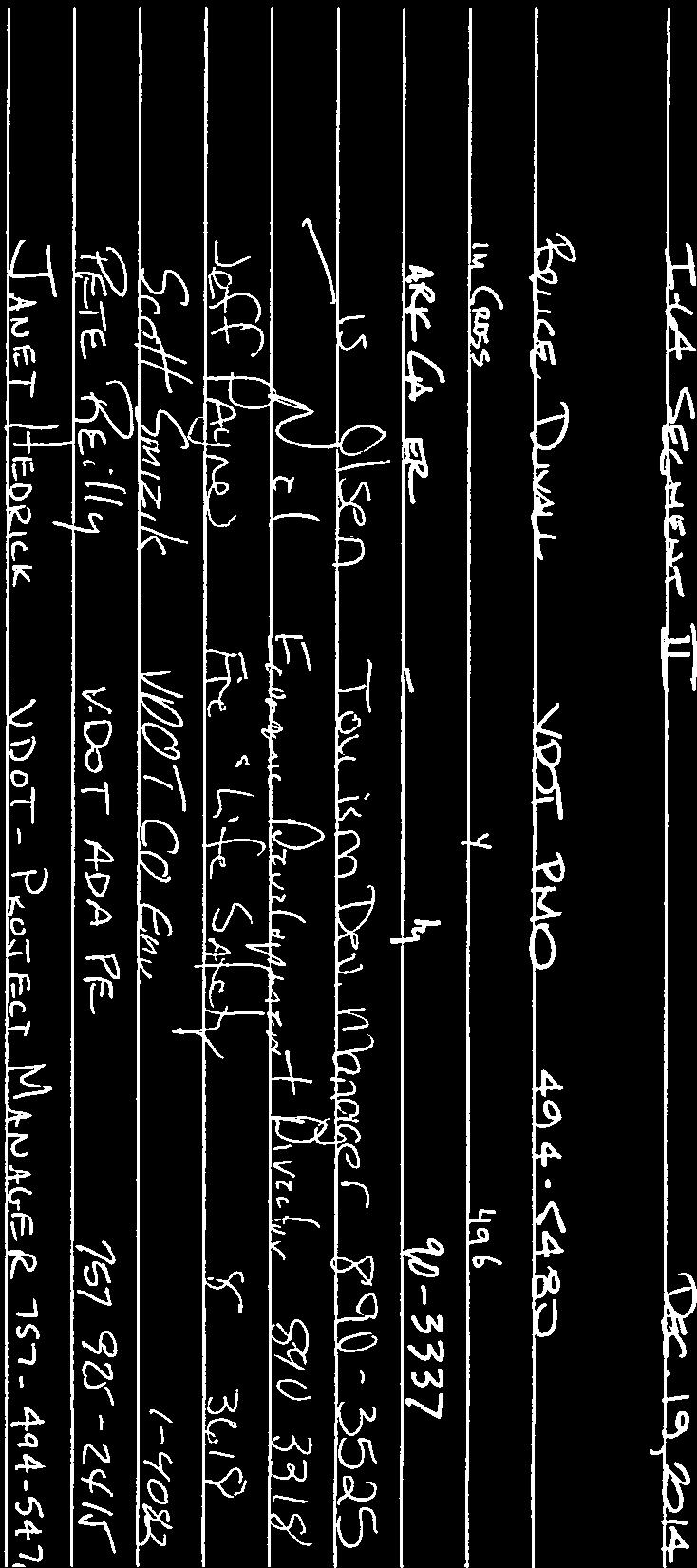


67
68 From: To: Cc: Subject: Date: Attachments: Smizik, Scott (VDOT) Mack Frost - DOT (mack.frost@dot.gov); John.Simkins@dot.gov "Dorothy Geyer"; Jonathan Connolly; "McLean, Timothy"; "Steven_Williams@nps.gov"; Duvall, Bruce L. P.E. (VDOT) (Bruce.Duvall@VDOT.Virginia.gov); Hedrick, Janet P.E. (VDOT); Deem, Angel N. (VDOT) (Angel.Deem@VDOT.Virginia.gov) I-64 Peninsula Study - NPS Meeting Thursday, vember 13, :37:00 PM I-64 Segment II NPS.pdf Good afternoon Mack As part of our forthcoming Request for Record of Decision (ROD) on Section II of the Interstate 64 Peninsula Study, VDOT met with staff from Colonial National Historical Park (NPS) this morning at park headquarters in Yorktown. Attendees from the NPS included: Dorothy Geyer, Steven Williams, Tim McLean, and Jonathan Connolly. I was accompanied by Janet Hedrick and Bruce Duvall, both from VDOT s Hampton Roads District Office. Bruce and Janet walked us through the attached presentation. Questions/discussions included: Median/shoulder width: Page 11 of the attached presentation illustrates a typical section with bifurcation greater than 6. There was some question/discussion about why this is required (different elevation between eastbound and westbound) and how safety in this type of section is similar to more typical medians. Bridge design: Questions were raised about how bridge heights were being set relative to potential sea level rise. Because the interstate is being widened, bridges in Section I and II are assumed to remain at their existing height. The group also discussed how VDOT was determining what level of rehabilitation is required for bridges during construction. VDOT is conducting ongoing/future testing of all structures to inform design requirements. It was noted that the bridges over Queens Creek will most likely be replaced as part of Section III. Stormwater management: Questions were raised about runoff from Section II draining into Section III. The NPS has property within Section III and there are stipulations in the Programmatic Agreement (PA) regarding stormwater management near NPS property. There are no known drainages that lead from Section II to Section III, VDOT intends to capture all stormwater from Section II within the boundaries of the section, and additional hydrologic analysis will be conducted to finalize the stormwater management plans. Schedule: VDOT reviewed the schedule included in the attached presentation, as well as the anticipated timeline for HRTPO/HRTAC to approve funding for the different sections and how this fiscal constraint requirement dictates the timing of VDOT s official ROD Request for Section II. VDOT intends to make the Request available for a two week public review, as it did with Section I. The group discussed the limited comments received on the first Request. Redoubt 8 & 9: The group discussed the location of Redoubt 8 and 9 relative to Section II and III and the commitments made in the PA to these resources. The attached presentation illustrates how Section II could extend to Redoubt 8 but that Redoubt 9 would not be encountered until Section III. Per the PA, Redoubt 8 will be avoided and VDOT anticipates conducting Phase III archaeological investigations to fully excavate Redoubt III prior to initiating Section III. Detours/Traffic Management: As traffic management along the Parkway is addressed in the
69 PA, the group discussed anticipated traffic patterns during construction. VDOT is requiring the design-builder to maintain closed work zones within the median, to keep two lanes of traffic open in both directions during peak hours, and to provide a tow truck on site at all times. The emergency access points within the median also will be maintained throughout construction. There could be some nighttime lane closures and VDOT anticipates there could be 24/7 working conditions during certain times of the construction process. Meeting attendees agreed that the logical detours most drivers would take would be Route 60 and 143; however, congestion on the interstate also often leads to increased traffic on the Parkway. The NPS has traffic counters on the Parkway and will monitor traffic volumes as construction begins. The following action items were agreed upon: The NPS requested an opportunity to review the public hearing/30% design drawings for Section II. VDOT will provide these plans shortly before/following the public hearing. The NPS will provide VDOT with a 2005 drainage study done near the I-64/Colonial Parkway boundary If any of the meeting attendees have anything else to add to this report, please reply all for the project record. Thanks again to the NPS for their continued support in this effort. Scott Smizik, AICP Location Studies Project Manager Virginia Department of Transportation Environmental Division 1401 East Broad Street Richmond, Virginia Desk: (804) Cell: (804) Fax: (804) Scott.Smizik@VDOT.Virginia.gov

70


71 Exit 234 Rt. 199 Newman Rd SEGMENT III Williamsburg Exit 238 Rt. 143 / Camp Peary Exit 242 York River Rt. 199 Humelsine Parkway SEGMENT II Exit 243 US 60/Rt. 143 Busch Gardens Exit 247 Rt. 143 Exit 250 Fort Eustis Blvd Exit 247 Rt. 238/Yorktown Rd SEGMENT I 2011 Traffic Volumes Shown James River Exit 2555 Jefferson Ave


72 Exit 247 Rte. 238 Yorktown Rd City of Newport News Park Exit 247 to Exit 255 Exit 250 Rt. 105 Fort Eustis Blvd Exit 255 Jefferson Ave
73

74


75
76 FHWA Record of Decision Advertise Design-Build RFQ Award Design-Build Contract Spring 2014 Spring 2014 Today February 2015 December 2013 Final EIS Approved Spring 2014 Design Public Hearing Summer 2014 Design-Build RFP


77 Williamsburg Exit 242 to 247 Proposed Limits 1.11 miles west of Humelsine Pkwy MM Exit 242 Rt. 199 Humelsine Parkway Exit 243 US 60/Rt. 143 Busch Gardens Yorktown Naval Weapons Station Exit 247 Rt. 143 Exit 247 Rt. 238/Yorktown Rd James River End Project 0.50 miles east of Yorktown Rd MM Exit 250 Fort Eustis Blvd

78
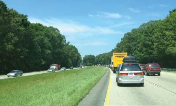
79


80

81 Williamsburg Rt. 641 Penniman Rd I-64 WB Off-Ramp Yorktown Naval Weapons Station Access Rd and RR to Naval Weapons Rt. 143 Rt. 238 Yorktown Rd James River Legend I-64 Mainline Bridges
82


83 Yorktown Naval Weapons Station Borders approximately 3.5 miles of the project


84 FHWA Record of Decision Advertise Design-Build RFQ Award Design-Build Contract Today Spring 2015 Spring December 2015 December 2013 Final EIS Approved Spring 2054 Design Public Hearing Summer 2015 Design-Build RFP


85 Exit 234 Route 199 Exit 234 to 242 Waller Mill Park Camp Peary Exit 238 Route 143/Camp Peary James River Williamsburg Exit 242 Route 199
86
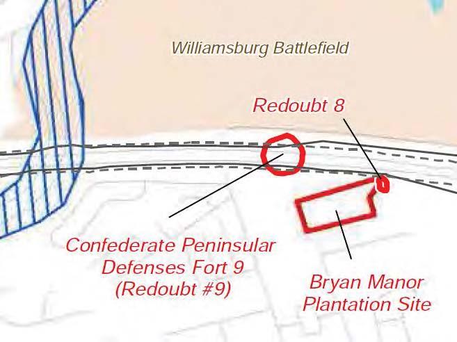
87
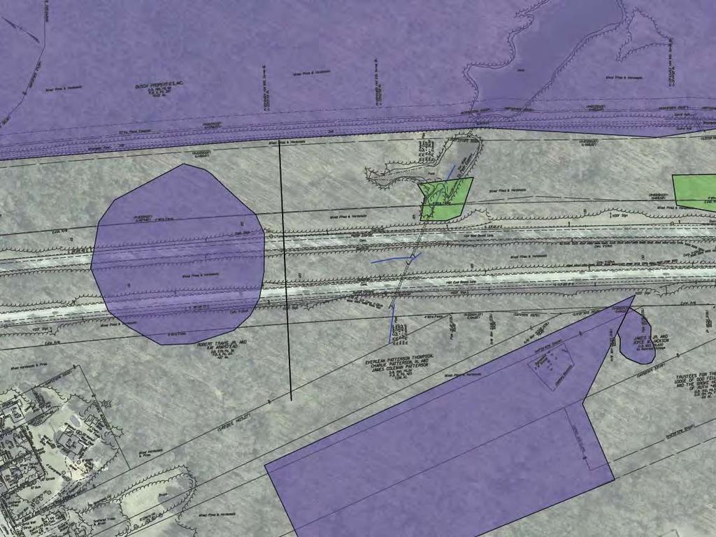


88


89

90
91 Species Conclusions Table Project Name: I-64 Section II ROD Request Date: October 7, 2014 Species / Resource Name Conclusion ESA Section 7 / Eagle Act Determination tes / Documentation small whorled pogonia Species present May effect Future habitat survey and coordination (Isotria medeoloides) with USFWS and VDCR will be northern long-eared Bat (Myotis septentrionalis) required. Species present May effect Further coordination with USFWS will be required. critical habitat no critical habitat present bald eagle (Haliaeetus leucocephalus) unlikely to disturb nesting bald eagles does not intersect with an eagle concentration area eagle act permit required
92 United States Department of the Interior FISH AND WILDLIFE SERVICE Virginia Ecological Services Field Office 6669 SHORT LANE GLOUCESTER, VA PHONE: (804) FAX: (804) URL: Consultation Tracking Number: 05E2VA SLI-0040 October 07, 2014 Project Name: I64 Section II Subject: List of threatened and endangered species that may occur in your proposed project location, and/or may be affected by your proposed project. To Whom It May Concern: The enclosed species list identifies threatened, endangered, proposed and candidate species, as well as proposed and final designated critical habitat, that may occur within the boundary of your proposed project and/or may be affected by your proposed project. The species list fulfills the requirements of the U.S. Fish and Wildlife Service (Service) under section 7(c) of the Endangered Species Act (Act) of 1973, as amended (16 U.S.C et seq. ). New information based on updated surveys, changes in the abundance and distribution of species, changed habitat conditions, or other factors could change this list. Please feel free to contact us if you need more current information or assistance regarding the potential impacts to federally proposed, listed, and candidate species and federally designated and proposed critical habitat. Please note that under 50 CFR (e) of the regulations implementing section 7 of the Act, the accuracy of this species list should be verified after 90 days. This verification can be completed formally or informally as desired. The Service recommends that verification be completed by visiting the ECOS-IPaC website at regular intervals during project planning and implementation for updates to species lists and information. An updated list may be requested through the ECOS-IPaC system by completing the same process used to receive the enclosed list. The purpose of the Act is to provide a means whereby threatened and endangered species and the ecosystems upon which they depend may be conserved. Under sections 7(a)(1) and 7(a)(2) of the Act and its implementing regulations (50 CFR 402 et seq. ), Federal agencies are required to utilize their authorities to carry out programs for the conservation of threatened and endangered species and to determine whether projects may affect threatened and endangered species and/or designated critical habitat. A Biological Assessment is required for construction projects (or other undertakings having
93 similar physical impacts) that are major Federal actions significantly affecting the quality of the human environment as defined in the National Environmental Policy Act (42 U.S.C. 4332(2) (c)). For projects other than major construction activities, the Service suggests that a biological evaluation similar to a Biological Assessment be prepared to determine whether the project may affect listed or proposed species and/or designated or proposed critical habitat. Recommended contents of a Biological Assessment are described at 50 CFR If a Federal agency determines, based on the Biological Assessment or biological evaluation, that listed species and/or designated critical habitat may be affected by the proposed project, the agency is required to consult with the Service pursuant to 50 CFR 402. In addition, the Service recommends that candidate species, proposed species and proposed critical habitat be addressed within the consultation. More information on the regulations and procedures for section 7 consultation, including the role of permit or license applicants, can be found in the "Endangered Species Consultation Handbook" at: Please be aware that bald and golden eagles are protected under the Bald and Golden Eagle Protection Act (16 U.S.C. 668 et seq. ), and projects affecting these species may require development of an eagle conservation plan ( Additionally, wind energy projects should follow the wind energy guidelines ( for minimizing impacts to migratory birds and bats. Guidance for minimizing impacts to migratory birds for projects including communications towers (e.g., cellular, digital television, radio, and emergency broadcast) can be found at: and We appreciate your concern for threatened and endangered species. The Service encourages Federal agencies to include conservation of threatened and endangered species into their project planning to further the purposes of the Act. Please include the Consultation Tracking Number in the header of this letter with any request for consultation or correspondence about your project that you submit to our office. Attachment 2
94 United States Department of Interior Fish and Wildlife Service Project name: I64 Section II Provided by: Virginia Ecological Services Field Office 6669 SHORT LANE GLOUCESTER, VA (804) Official Species List Consultation Tracking Number: 05E2VA SLI-0040 Project Type: Transportation Project Description: I64 Section II ROD Request 10/07/ :26 PM 1

95 United States Department of Interior Fish and Wildlife Service Project name: I64 Section II Project Location Map: Project Coordinates: MULTIPOLYGON ((( , , , , , , , , , , , , , ))) Project Counties: James City, VA Newport News, VA York, VA 10/07/ :26 PM 2
96 United States Department of Interior Fish and Wildlife Service Project name: I64 Section II Endangered Species Act Species List There are a total of 2 threatened or endangered species on your species list. Species on this list should be considered in an effects analysis for your project and could include species that exist in another geographic area. For example, certain fish may appear on the species list because a project could affect downstream species. Critical habitats listed under the Has Critical Habitat column may or may not lie within your project area. See the Critical habitats within your project area section further below for critical habitat that lies within your project. Please contact the designated FWS office if you have questions. Flowering Plants Status Has Critical Habitat Condition(s) Small Whorled pogonia (Isotria medeoloides) Threatened Mammals northern long-eared Bat (Myotis septentrionalis) Proposed Endangered 10/07/ :26 PM 3
97 United States Department of Interior Fish and Wildlife Service Project name: I64 Section II Critical habitats that lie within your project area There are no critical habitats within your project area. 10/07/ :26 PM 4

98
99 10/7/2014 VAFWIS Seach Report VaFWIS Search Report Compiled on 10/7/2014, 3:42:08 PM Help Known or likely to occur within a 3 mile radius around point 37,13, ,37,28.6 in 095 James City County, 181 Surry County, 199 York County, 700 Newport News City, 830 Williamsburg City, VA View Map of Site Location 637 Known or Likely Species ordered by Status Concern for Conservation (displaying first 51) (51 species with Status* or Tier I** or Tier II** ) BOVA Status* Tier** Common Name Scientific Name Code FESE I Woodpecker, red-cockaded Picoides borealis FESE II Sturgeon, Atlantic Acipenser oxyrinchus FESE IV Tern, roseate Sterna dougallii dougallii FESE Turtle, Kemp's ridley sea Lepidochelys kempii FESE Turtle, leatherback sea Dermochelys coriacea FESE Puma (= cougar), eastern Puma concolor cougar FTST I Turtle, loggerhead sea Caretta caretta FTST I Plover, piping Charadrius melodus SE I Sunfish, blackbanded Enneacanthus chaetodon SE I Rail, black Laterallus jamaicensis SE I Bat, Rafinesque's eastern big-eared Corynorhinus rafinesquii macrotis SE II Salamander, eastern tiger Ambystoma tigrinum SE II Rattlesnake, canebrake Crotalus horridus ST I Falcon, peregrine Falco peregrinus ST I Sandpiper, upland Bartramia longicauda ST I Shrike, loggerhead Lanius ludovicianus ST I Sparrow, Henslow's Ammodramus henslowii ST II Salamander, Mabee's Ambystoma mabeei ST II Treefrog, barking Hyla gratiosa ST Shrike, migrant loggerhead Lanius ludovicianus migrans FP IV Knot, red Calidris canutus rufa FP Bat, northern long-eared Myotis septentrionalis FC IV Alewife Alosa pseudoharengus FC Herring, blueback Alosa aestivalis FS II Eagle, bald Haliaeetus leucocephalus 1/6
100 10/7/2014 VAFWIS Seach Report FS II Skipper, rare Problema bulenta FS III Crayfish, Chowanoke Orconectes virginiensis FS III Skipper, Duke's (or scarce swamp) Euphyes dukesi FS IV fritillary, Diana Speyeria diana CC II Terrapin, northern diamondbacked Malaclemys terrapin terrapin CC III Turtle, spotted Clemmys guttata I Shiner, bridle tropis bifrenatus I Crossbill, red Loxia curvirostra I Sapsucker, yellow-bellied Sphyrapicus varius I Warbler, black-throated green Dendroica virens I Warbler, golden-winged Vermivora chrysoptera II Toad, oak Anaxyrus quercicus II Bittern, American Botaurus lentiginosus II Duck, American black Anas rubripes II Heron, little blue Egretta caerulea caerulea II Night-heron, yellow-crowned Nyctanassa violacea violacea II Owl, northern saw-whet Aegolius acadicus II Oystercatcher, American Haematopus palliatus II Rail, king Rallus elegans II Skimmer, black Rynchops niger II Sparrow, saltmarsh sharp-tailed Ammodramus caudacutus II Tern, least Sterna antillarum II Tern, royal Sterna maxima maximus II Warbler, cerulean Dendroica cerulea II Warbler, Swainson's Limnothlypis swainsonii II Wren, winter Troglodytes troglodytes To view All 637 species View 637 * FE=Federal Endangered; FT=Federal Threatened; SE=State Endangered; ST=State Threatened; FP=Federal Proposed; FC=Federal Candidate; FS=Federal Species of Concern; CC=Collection Concern ** I=VA Wildlife Action Plan - Tier I - Critical Conservation Need; II=VA Wildlife Action Plan - Tier II - Very High Conservation Need; III=VA Wildlife Action Plan - Tier III - High Conservation Need; IV=VA Wildlife Action Plan - Tier IV - Moderate Conservation Need Anadromous Fish Use Streams ( 5 records ) Str eam ID Stream Name Reach Status Anadr omous Fish Species Differ ent View Map of All Anadr omous Fish Use Str eams Highest Highest View Map 2/6
101 10/7/2014 VAFWIS Seach Report Species TE * Tier ** C92 James River 1 Confirmed 6 FC IV Yes P11 Black Swamp Potential 0 Yes P170 Unnamed Tr. of Black Creek Potential 0 Yes P58 Felgates creek Potential 0 Yes P86 King Creek Potential 0 Yes Impediments to Fish Passage ( 5 records ) View Map of All Fish Impediments ID Name River View Map 411 BREWERY ROAD DAM GROVE CREEK Yes 410 CONFERENCE CENTER DAM TR-JAMES RIVER Yes 409 KINGSMILL DAM HALFWAY CREEK Yes 666 POND #11 DAM TR-KING CREEK Yes 668 WILLIAMSBURG COUNTRY CLUB DAM KING CREEK Yes Threatened and Endangered Waters N/A Managed Trout Streams N/A Bald Eagle Concentr ation Ar eas and Roosts ar e pr esent. ( 5 records ) View Map of Bald Eagle Concentr ation Ar eas and Roosts BECAR ID 10 Obser vation Year Authority Type Comments View Map Bryan Watts (Center for Conservation Biology) Roost Count 15 Yes Jeannette Parker (VDGIF) Roost Count Center for Conservation Biology at the College of William and Mary/Virginia Commonwealth University Summer Concentration Area Eagle_use High Yes Yes Center for Conservation Biology at the College of William and Mary/Virginia Commonwealth University Summer Concentration Area Eagle_use Moderate Yes 3/6
102 10/7/2014 VAFWIS Seach Report Center for Conservation Biology at the College of William and Mary/Virginia Commonwealth University Winter Concentration Area Eagle_use Moderate Yes Bald Eagle Nests ( 13 records ) Nest N Obs Latest Date DGIF Nest Status View Map of All Query Results Bald Eagle Nests View Map JC Apr HISTORIC Yes JC Apr RECENTLY ACTIVE Yes JC Apr RECENTLY ACTIVE Yes JC Apr RECENTLY ACTIVE Yes JC Apr UNKNOWN Yes JC May HISTORIC Yes JC Jan HISTORIC Yes YK Apr RECENTLY ACTIVE Yes YK Apr RECENTLY ACTIVE Yes YK Apr RECENTLY ACTIVE Yes YK Jan HISTORIC Yes YK Jan HISTORIC Yes YK Jan HISTORIC Yes Displayed 13 Bald Eagle Nests Habitat Predicted for Aquatic WAP Tier I & II Species N/A Habitat Predicted for Terrestrial WAP Tier I & II Species ( 4 Species ) View Map of Combined Terrestrial Habitat Predicted for 4 WAP Tier I & II Species Listed Below ordered by Status Concern for Conservation BOVA Status* Tier** Common Name Scientific Name Code SE I Rail, black Laterallus jamaicensis Yes ST I Sparrow, Henslow's Ammodramus henslowii Yes ST II Salamander, Mabee's Ambystoma mabeei Yes CC II Terrapin, northern diamondbacked Malaclemys terrapin terrapin Yes View Map 4/6
103 10/7/2014 VAFWIS Seach Report Virginia Breeding Bird Atlas Blocks ( 5 records ) BBA ID Atlas Quadrangle Block Name View Map of All Query Results Vir ginia Br eeding Bir d Atlas Blocks Differ ent Species Br eeding Bir d Atlas Species Highest TE * Highest Tier ** Clay Bank, SW 101 FS II Yes Hog Island, CE 56 II Yes Hog Island, NE 105 FS II Yes Williamsburg, SE 38 IV Yes Yorktown, CW 1 Yes View Map Public Holdings: ( 3 names ) Name Agency Level Colonial National Historical Park National Park Service Federal Cheatam Annex Naval Supply Center U.S. Dept. of Navy Federal Yorktown Naval Weapons Station U.S. Dept. of Navy Federal Summary of BOVA Species Associated with Cities and Counties of the Commonwealth of Vir ginia: FIPS Code City and County Name Differ ent Species Highest TE Highest Tier 095 James City 420 FESE I 181 Surry 445 FESE I 199 York 431 FESE I 700 Newport News City 416 FESE I 830 Williamsburg City 361 FPSE I USGS 7.5' Quadrangles: Hog Island Williamsburg Yorktown Clay Bank USGS NRCS Watersheds in Virginia: N/A USGS National 6th Order Watersheds Summary of Wildlife Action Plan Tier I, II, III, and IV 5/6
104 10/7/2014 VAFWIS Seach Report Species: HU6 Code USGS 6th Or der Hydr ologic Unit Differ ent Species Highest TE Highest Tier JL34 College Creek 73 FPSS II JL35 James River-Skiffes Creek 95 FESE I JL38 Warwick River 81 FPSE II YO67 Queen Creek 68 FPSS II YO68 York River-Carter Creek 77 FESE I Compiled on 10/7/2014, 3:42:08 PM V report=v searchtype= R dist= 4827 poi= 37,13, ,37, /6
105 Ms. Irene Rico Federal Highway Administration May 8, 2015 Attachment 5: Figures
106 Ms. Irene Rico Federal Highway Administration May 8, 2015 Page intentionally left blank

107 Ms. Irene Rico Federal Highway Administration May 8, 2015
108 Ms. Irene Rico Federal Highway Administration May 8, 2015 Page intentionally left blank

109 Ms. Irene Rico Federal Highway Administration May 8, 2015