1.) A copy of the site-specific Nutrient Management Plan (NMP) was not available upon request per Part of the permit.
|
|
|
- Victoria Jean Osborne
- 5 years ago
- Views:
Transcription
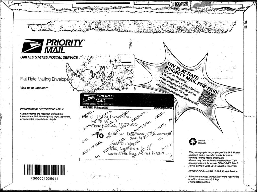
1 September 10, 2013 Jason Henson C & H Hog Farms HC 72 Box 10 Mt. Judea, AR Re: Compliance Assistance Inspection (Newton Co) AFIN: , Permit No.: ARG Dear Mr. Henson: On July 23, 2013, members of the Water Division Inspection Branch performed a compliance assistance inspection (hereinafter inspection ) of the above referenced facility located near Mt. Judea in Newton County. The inspection was conducted in accordance with the provisions of the Arkansas Water and Air Pollution Control Act and the regulations promulgated thereunder. At the time of the inspection, I noted the following: 1.) A copy of the site-specific Nutrient Management Plan (NMP) was not available upon request per Part of the permit. 2.) No means of managing farm mortality was observed onsite. The facility NMP calls for composting and rendering; however, no equipment or structures for managing this waste stream was observed onsite. Since the farm will soon be in full production and will be generating a steady waste stream of dead pigs and afterbirth, the composting and/or rendering equipment mentioned in the NMP must be onsite and capable of managing such waste. 3.) The wastewater pond liners were observed to have erosion rills, desiccation cracks and gravel to cobble-sized coarse content within the liner clay. If the liner is to be exposed for extended periods of time, it should be protected from deterioration by erosion and desiccation. 4.) During the review of the land application site maps, it was noted that a discrepancy may exist in the numbering of Field #5 and whether the field labeled as Field 5 on the WMP map(s) is covered under a land-use agreement. This discrepancy must be resolved prior to beginning land application activities. Please revise the site map(s) and resubmit each map(s) to the Department. 5.) A review of the Overall Site Map found in Section F of the NMP did not appear to include buffer zones around all ponds, streams, and drainages. Per Condition of the permit, please ensure all manure, litter, and process wastewater is not applied closer
2 than 100 feet to any down gradient surface waters, open tile line intake structures, sinkholes, agricultural well heads, or other conduits to surface waters; 300 feet of Extraordinary Resource Waters (ERW) as defined by the Department s Regulation No. 2; within 50 feet of property lines; or 500 feet of neighboring occupied dwellings. Attached to the inspection checklist are images of the land application fields with identified drainage features which were lacking buffers zones on the aforementioned map (see attachments 1-3). You may wish to flag or mark buffers and setbacks prior to land application activities. 6.) Condition states, wastes shall not be applied to slopes with a gradient of more than 15%. It appears Field #4 may contain slopes greater than 15%; and therefore, may not be usable for land application. The steep portion of Field #4 is marked in pink on the attached images (see attachments 1-3) included in the inspection checklist. Although this was a compliance assistance inspection, the above items require your immediate attention. You must submit a written response to these findings to the Water Division Inspection Branch of this Department. This response should be mailed to the address at the bottom of the first page of this letter or ed to Water-Inspection-report@adeq.state.ar.us. The response should contain documentation describing the course of action taken to address each item noted. This corrective action should be completed as soon as possible; however, the written response with all necessary documentation (i.e. photos) and individual item target completion dates is due by September 24, If you have any questions or would like to discuss this inspection in greater detail, please contact me at or by at bolenbaugh@adeq.state.ar.us. Sincerely, Jason Bolenbaugh Inspection Branch Manager Water Division cc: Water Division Permits Branch
3 UNITED STATES ENVIRONMENTAL PROTECTION AGENCY Washington, D.C NPDES Compliance Inspection Report Section A: National Data System Coding Form Approved OMB No Approval Expires Transaction Code NPDES yr/mo/day Inspec. Type Inspector Fac Type 1 N A R G H 19 S 20 3 A F I N Remarks Inspection Work Days Facility Evaluation Rating BI QA Reserved N 71 N 72 N Section B: Facility Data Name and Location of Facility Inspected (For industrial users discharging to POTW, also include POTW name and NPDES permit number) C&H Hog Farm located approximately ½ mile east of Mt. Judea in Newton County, turn east off of Hwy 123 onto CR54, cross over Big Creek and pass Sexton Cemetery turn right onto CR 41, continue approximately ½ mile to first road on left with C&H Hog Farm sign. ARG Name(s) of On-Site Representative(s)/Title(s)/Phone and Fax Number(s) Phillip Campbell Name, Address of Responsible Official/Title/Phone and Fax Number Jason Henson C&H Hog Farm HC 72 Box 10 Mt. Judea, AR Entry Time/Date 10:56 July 23, 2013 Exit Time/Date 17:30 July 23, 2013 Contacted Yes X No Permit Effective Date November 1, 2011 Permit Expiration Date October 31, 2016 Other Facility Data Front Gate on CR 41 Lat Long Section C: Areas Evaluated During Inspection (S = Satisfactory, M = Marginal, U = Unsatisfactory, N = Not Evaluated) S Permit S Operations & Maintenance N Compliance Schedules N Other: Land Application of Waste S Records/Reports N Sampling U Waste Handling/Disposal M Facility Site Review N Laboratory N Effluent/Receiving Waters Section D: Summary of Findings/Comments (Attach additional sheets if necessary) - The farm has been fully populated with sows which are presently being bred; no pigs are presently being shipped from the facility. - The Settling Basin is collecting wastewater but is not currently discharging to the Holding Pond. - A temporary recycle flush pump is installed in the Settling Basin to provide water for flushing from under the floor pit storage structures. - The Holding Pond contains only rain water at this time. No wastewater has flowed from the Settling Basin to the Holding Pond. Pond liners show signs of degradation with rill erosion and desiccation cracks. Large rocks were observed in the liner (see photo 5 and 6 of 6). - A means of managing on-farm mortality was not noted while onsite. - No land application equipment is presently onsite. - All land application sites were not visited during this inspection. However, several items were noted which must be addressed prior to the land application of waste. The drainage separating Fields 6 and 7 must have a 100 foot buffer on each side. Several other fields likely require buffers along drainages and ponds. Field 5 identified on the land application maps may be misidentified. Land application must not occur within 500 feet of occupied dwellings without written consent from the property owners. Aerial photos 1, 2 and 3 indicate buffers and rock outcrops not depicted on Waste Management Plan site maps. Name(s) and Signature(s) of Inspector(s) Tony L. Morris Agency/Office/Telephone/Fax Arkansas Department of Environmental Quality / Jasper Field Office/ /cell Date August 6, 2013 Signature of Reviewer Agency/Office/Phone and Fax Numbers ADEQ / NLR / Date August 26, 2013 Kerri McCabe
4 Arkansas Department of Environmental Quality Page 2 of 13 I. FACILITY OPERATION INFORMATION AND PERMIT VERIFICATION S S M U N/A N/E Name of Facility: C&H Hog Farm NPDES Permit No.: ARG Contact Person: Jason Henson, Phillip Campbell Date Inspected: July 23, 2013 Inspector s Name: Tony Morris Phone: Number and type of animals confined and maintained at this facility: Type of CAFO No. of Animals Dairy (Cattle) (500 head) Slaughter/feeder cattle X Swine (over 55 lbs.) 2500 X Swine (under 55 lbs.) 4000 Horses Sheep or lambs Chickens (laying hens, liquid manure handling system) Turkeys Ducks Other: 2. Number of days animals are stabled/confined and fed/maintained over any 12 month period: X 45 days or more less than 45 days 3. Does the operation meet the requirements for a Concentrated Animal Feeding Operation (CAFO) with liquid waste handling system? 4. Copy of Nutrient Management Plan (NMP) or Waste Management Plan (WMP) onsite? 5. Copy of permit onsite? Yes X No N/A Yes X No N/A 6. Do the animals confined on the CAFO come into direct contact with surface water of United States (40 CFR Part ((c)(2)(ii)))? Yes X No N/A If yes, please provide location and name of receiving stream: If yes, are fences used to restrict access? 7. Grow or Produce for: Cargill, Inc.
5 Arkansas Department of Environmental Quality Page 3 of 13 II. FACILITY SITE REVIEW S M X U N/A N/E A. CHEMICAL HANDLING 1. Are the measures identified in the NMP for handling chemical being implemented? 2. Is there any evidence of mishandling of pesticides, hazardous and toxic chemicals and Petroleum products/by-products contaminating manure and wastewater storage? Yes X No N/A Notes: 3. Are appropriate measures taken to prevent spills and to clean up spills of any toxic pollutants? B. DEAD ANIMAL DISPOSAL (Improper disposal of dead animals should be referred to the AR Livestock and Poultry Commission.) Is the animal mortality disposal method and equipment identified in the NMP in place and being properly implemented? Yes X No N/E Note any environmental problem: No dead animals were observed. No mortality management equipment observed. C. PRODUCTION AREA 1. Is there surface water in the production area? Yes X No N/A 2. Are the measures identified in the NMP or WMP being implemented and maintained to prevent direct contact of surface water with animals, waste or wastewater? 3. Are the diversion provisions identified in the NMP to divert clean water from the production area and waste storage structures being properly implemented? Comments for Facility Site Review: Surface water drainage between barns and ponds should be graded & vegetated. IlI. OPERATION AND MAINTENANCE X S M U N/A N/E 1. Is the facility being properly operated and maintained? 2. Does the facility have leaks and/or seeps from the waste collection system and /or waste storage structures? Yes X No N/A Has the leak and/or seep been properly reported to ADEQ? 3. Has the facility had a discharge of waste? If yes, did the discharge enter the Waters of the State? 4. Has the discharge been properly reported to ADEQ? Yes X No N/A
6 Arkansas Department of Environmental Quality Page 4 of 13 OPERATION AND MAINTENANCE (continued) 5. Does the current operation reflect the type of operation, and number of animals in the WMP or NMP? 6. Are solid and/or liquid waste being handled properly to prevent surface and/or groundwater pollution using recognized practices of good agricultural management? 7. Is a permanent marker installed and maintained within pits, pond and lagoons to indicate freeboard levels? 8. Is the required freeboard level being maintained? 9. At the time of inspection what was the freeboard levels in storage structures in inches? Settling basin: >5 ft Pits: Holding Pond: >10 ft Other: 10. Has an adequate amount of solids been removed from holding structures to maintain the storage volume as required in the WMP or NMP? 11. Is there a rain gauge properly installed on site? Comments for Operation and Maintenance: Settling Basin filling; Holding Pond empty. Pond levees should be graded, mulched and vegetated. IV. WASTE HANDLING AND DISPOSAL S X M U N/A N/E A. WASTE STORAGE AND HANDLING EQUIPMENT 1. Is all waste and wastewater being properly stored onsite? If no explain: 2. Is the waste holding and /or storage structure(s) as identified in the NMP or WMP? 3. Are the waste holding and/or storage structure(s) being properly operated and maintained? 4. Are inspections of the waste holding or storage structure(s) being performed at the frequency as required by the permit? 5. Is adequate waste and/or wastewater application or disposal equipment onsite and operational? Type of equipment used: No equipment observed onsite. NMP indicates a Vac Tanker, permanent pipe, and traveling gun will be used to apply waste from a given waste storage pond. 6. If equipment is not available onsite, does the facility have a contract with outside source for disposal or application of waste? Yes X No N/A If Yes, name of company or individual: 7. Is the land application or disposal equipment the same as the equipment identified in the NMP or WMP?
7 Arkansas Department of Environmental Quality Page 5 of 13 WASTE HANDLING AND DISPOSAL (continued) B. APPLICATION SITE 1. Is the total number of acres available for the disposal or application of waste or wastewater consistent with that identified in the NMP or WMP? Yes X No N/E 2. Is the type of crop(s) consistent in NMP or WMP that is used to determine the application rates? X Yes No N/E 3. Is the time of year for application of waste consistent with the NMP or WMP and the type of crop? Yes No X N/E 4. Is all waste and wastewater being properly applied in accordance with the NMP? If no, explain: Yes No X N/E 5. Is the application of waste and wastewater meeting the setback or buffer distance in the NMP, WMP, permit or regulation? Yes No X N/E 6. Is waste or wastewater being land applied on slopes with a grade of more than 15%? Yes No X N/E 7. Is there evidence of waste or wastewater being applied to frozen, saturated, or snow/ice covered ground, during precipitation, or when significant rainfall is reasonably expected in the next 24 hours? Yes No X N/E 8. Is there evidence of waste or wastewater leaving the application site? If yes, did the waste or wastewater enter the Waters of the State? Yes No X N/E 9. Is only waste and wastewater, as indicated by the NMP or WMP, being applied on the approved application site(s)? Yes No X N/E Comments on Waste Handling and Disposal: Discrepancy in Fields 5 and 6. V. RECORDS AND REPORTS X S M U N/A N/E 1. Are all records and reports being retained onsite by the permittee for the specified time frame as required by the permit, WMP, or NMP? 2. If the facility had a discharge of waste, were the required records kept? 3. Are records maintained at the facility of the soil sample results for each of the land application site(s)? 4. Are records maintained at the facility of the annual sampling and analysis of waste or waste water? 5. Has the annual report for the previous year been properly prepared and submitted as required by the NMP, permit, and/or regulation? (Liquid system due May 30) 6. Did the owner or manager attend annual refresher training and has record of the training onsite as required by the permit or Regulation # 5?
8 Arkansas Department of Environmental Quality Page 6 of 13 RECORDS AND REPORTS (continued) 7. Is a record or log being maintained of measurable rainfall events at the facility? 8. Are records being kept on the inspections of the waste holding structure(s) and do the records contain the required information? (Weekly Inspections Required by ) 9. Is a date log documenting inspections of the waste holding structure(s) and the liquid level in the structure(s) being maintained? 10. Are the required records being maintained on the application of waste and wastewater? (These records should contain date, weight and/or volume of wastes, destination and the acreage over which the load was spread. These records shall be kept in sufficient detail to determine application rate.) 11. Are required records being maintained on all waste or wastewater disposed off site? (Records need to contain the name and address of recipient of waste, the date, and the volume) Comments on Records and Reports: No waste has been land applied as of this time. VI. SAMPLING X S M U N/A N/E A. Soil Sampling 1. Were soil samples collected from each of the land application sites as required by the permit, WMP and /or NMP? 2. Were the soil samples collected prior to the application of waste? 3. Was the soil at the land application site(s) sampled and analyzed as required by the NMP, Regulation # 5 and/or permit? B. Waste Sampling 1. Was a representative sample of the waste and/or wastewater to be land applied collected at least once per year? 2. Was the representative sample of the waste and/or wastewater sampled and analyzed as required by the NMP,WMP, Regulation #5 and / or permit? 3. Are the results of the sample analysis of the waste consistent with the content and analyses shown in the NMP or WMP? Yes No X N/E C. Discharge Sampling ( If No Discharge mark N/A) 1. Sampling location adequate for representative samples and taken from the overflow or discharge? 2. Parameters and sampling frequency agree with permit? 3. A minimum of one grab sample taken within the 1st 30 minutes of discharge unless sampling waiver due to dangerous climatic conditions are documented?
9 Arkansas Department of Environmental Quality Page 7 of 13 SAMPLING (continued) 4. Samples taken in accordance with EPA approved methods for water analysis listed in 40 CFR Part 136? 5. Proper preservation techniques used? 6. Sample holding times prior to analysis in conformance with 40 CFR 136? 7. Sample collection and analysis records retained on the following information? a. Sampling date, time, and exact location? b. Individual collecting the sample? c. Analysis dates and times? d. Individual performing the analysis? e. Analytical methods/techniques used? f. Analytical results consistent with data reported? Comments on Sampling: Waste water ponds contain very little waste as of this time. VlI. LABORATORY S M U N/A X N/E 1. EPA approved analytical testing procedures used to analyze discharge waste stream as found in 40 CFR 136? 2. If alternate analytical procedures are used, proper approval has been obtained? 3. Contract laboratory used? 4. Contract laboratory state certified? Lab name: Lab address: Telephone: Contact Person: Comments on Laboratory:


10 Location: Arkansas Department of Environmental Quality Water Division NPDES Photographic Evidence Sheet C&H Hog Farm, Newton County Photographer: Tony Morris Witness: Phillip Campbell Photo # 1 Of 6 Date: 07/23/13 Time: 10:56 Description: Site entrance located on CR 41. Page 8 of 13 Photographer: Tony Morris Witness: Phillip Campbell Photo # 2 Of 6 Date: 07/23/13 Time: 12:08 Description: Holding pond on right with stormwater diversion and Farrowing Barn on left of photo.


11 Location: Arkansas Department of Environmental Quality Water Division NPDES Photographic Evidence Sheet C&H Hog Farm, Newton County Photographer: Tony Morris Witness: Phillip Campbell Photo # 3 Of 6 Date: 07/23/13 Time: 12:26 Description: Holding Pond containing rainwater with Settling Basin overflow spillway in distance. Page 9 of 13 Photographer: Tony Morris Witness: Phillip Campbell Photo # 4 Of 6 Date: 07/23/13 Time: 12:04 Description: Wastewater inflow structure in Settling Basin with temporary recycle flush pump.


12 Location: Arkansas Department of Environmental Quality Water Division NPDES Photographic Evidence Sheet C&H Hog Farm, Newton County Photographer: Tony Morris Witness: Phillip Campbell Photo # 5 Of 6 Date: 07/23/13 Time: 12:03 Description: Rill erosion in Settling Basin liner; large rocks in liner. Signs of liner deterioration. Page 10 of 13 Photographer: Tony Morris Witness: Phillip Campbell Photo # 6 Of 6 Date: 07/23/13 Time: 17:21 Description: Rill erosion and desiccation cracks in Holding Pond liner due to extended exposure.

13 Arkansas Department of Environmental Quality Page 11 of 13 Aerial Photo 1. Land application sites with drainages that require the appropriate 100 foot buffer indicated in red. The area outlined in pink have slopes which appear to exceed 15%. Areas outlined in green indicate limestone rock outcrops.

14 Arkansas Department of Environmental Quality Page 12 of 13 Aerial Photo 2. Land application sites with drainages that require the appropriate 100 foot buffer indicated in red. The area outlined in pink have slopes which appear to exceed 15%. Areas outlined in green indicate limestone rock outcrops.

15 Arkansas Department of Environmental Quality Page 13 of 13 Aerial Photo 3. Land application sites with drainages that require the appropriate 100 foot buffer indicated in red. Areas outlined in green indicate limestone rock outcrops.
16
17
18
19
20