Hydropeaking impacts on the Dordogne river Definition of mitigation measures and assessment of their efficiency
|
|
|
- Kerrie Hancock
- 5 years ago
- Views:
Transcription


1 Eawag/Wasser-Agenda 21 Workshop on Hydropeaking, Zurich, 19 June 2012 Hydropeaking impacts on the Definition of mitigation measures and assessment of their efficiency In alphabetical order : Chanseau M 5, Clave D 1 Courret D 6, Guerri O 3, Lascaux JM 2, & Wibaux B Presented by Courret D (dominique.courret@imft.fr) 1
 200 km and 20 species affected + 2 tributaries also equipped : Maronne and Cère river River mean")

2 Context : Hydroelectric schemes equipped with 5 principal dams in the upper part, organized in line (storage capacity of 970 Mm 3 ) 200 km and 20 species affected + 2 tributaries also equipped : Maronne and Cère river River mean discharge : 26 m 3 /s Maximum turbine discharge : 52.5 m 3 /s River mean discharge : 20 m 3 /s Maximum turbine discharge : 44 m 3 /s Studied area affected by hydropeaks River mean discharge : 107 m 3 /s Maximum turbine discharge : 340 m 3 /s 2
3 Context : Biological stakes on the Reintroduction plan under progress for Atlantic Salmon : 40% to 60% of the reproduction activity of the basin. Several fish species with high patrimonial and/or fisheries values : brown trout, grayling, dace, sculpin, planer lamprey, pike, perch, Number of large salmonid's redds per river of the basin, and per year Dordogne + petits affluents Bassin Maronne Bassin Souvigne Bassin Vézère Bassin Corrèze Bassin Cère Bassin Bave 3


4 Organisms involved in partnership : Studies leaders : National agency for water and aquatic environments Regional public water agency Association in charge of the management of migratory fish populations Territorial public institution of the Dordogne basin Technical operators : ONEMA R&D team Engineering firms Hydroelectric operator : Funding agencies : Departmental and Regional council 4
5 Studies and biological surveys : Biological surveys : Survey of large salmonid's reproduction since 1999/2000 (MIGADO ECOGEA) Survey of stranding-trapping of salmonid's alevins since 2005 (MIGADO / EPIDOR ECOGEA) Survey of spawning and stranding-trapping of others fish species since 2006 (EPIDOR ECOGEA) Survey of salmonid's juveniles abundances in riffles since 2003 (MIGADO ONEMA) Survey of other species recruitment since 2010 (OMB, BAF, VAN, GOU, BRO, PER, ) (EPIDOR ECOGEA). Hydrology and hydropeaks characterization updated each year (ECOGEA ONEMA R&D team). 5

6 Altitude relative (m) Studies and biological surveys : Hydraulic modelling of several sections, 10 km in total, keyed on the whole range of turbine flow (MIGADO SIEE - ONEMA R&D team) 99 Measured and simulated water level longitudinal profiles D view of the Malpas section Thalweg Modèle 20 m3/s Mesure 20 m3/s Modèle 30 m3/s Mesure 30 m3/s Modèle 117 m3/s Mesure 117 m3/s Modèle 200 m3/s Mesure 200 m3/s Modèle 303 m3/s Mesure 303 m3/s Distance à partir de l'aval (m) 6
 120% 100% 80% Mainly from October to May 60% 40% 20% 0% Weekly management Day 160 140 at Argentat Number of hydropeaks")
7 sam dim lun mar mer jeu ven sam dim lun mar mer jeu ven sam dim lun Flow (% of mean discharge) Hydropeaks characterization 200% 180% at Argentat Hydrogram extract Weekly and daily hydropeaks 160% 140% Daily hydropeaks Between 50 and 150 hydropeaks per year ( period) 120% 100% 80% Mainly from October to May 60% 40% 20% 0% Weekly management Day at Argentat Number of hydropeaks per year


8 Hydropeaks characterization High variability of hydropeaks Characterization useful : To understand the impacts on fish populations To reflect on mitigation measures 8
9 Biological issues linked to hydropeaks Salmonid s redds dewatering during returns at low flow. Trapping of salmonid s alevins occurring : In channels margins during flow decreases, especially after long high flow periods At the disconnection of secondary channels Spawning dewatering and stranding-trapping of alevins of other fish species On dewatered gravel bars At the disconnection of secondary channels and backwaters 9


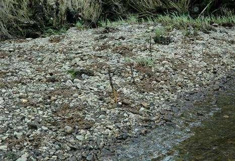
10 Salmonid s redds dewatering issue : 84 redds of large salmonid dewatered on the during the period. Redds generally located at less than 5 m from the shore, due to the rarefaction of adequate gravels, related to blockage of sediment transport by dams. Maintaining a base flow of 35 m 3 /s (33% of mean discharge) in winter and spring (15/11-15/06) 10


.")
11 Salmonid s redds dewatering issue : + downgrading work on morphology of particularly sensitive sites : Before work at 32 m 3 /s After work at 32 m 3 /s % of watered redd > 90% of redds safeguarded with a base flow of 35 m 3 /s, instead of only 30% at the regulatory minimum flow (10 m 3 /s). Flow (m 3 /s) 11


 Limiting maximum turbine discharge to 190 m")
, to the extent permitted by")
12 Trapping of salmonid s alevins : Principally in potholes on channel margins during flow decreases, and especially after long high flow periods During a hydropeak at 300 m 3 /s Back to 50 m 3 /s Flow connection of 44 potholes (m 3 /s) Limiting maximum turbine discharge to 190 m 3 /s (180% of mean discharge) during spring (15/03-15/06), to the extent permitted by natural hydrology. 12


13 Trapping of salmonid s alevins : + work on morphology : Deleting particularly tricky sites Before work After work Work on secondary channels intakes to ensure their permanent connection 13


14 Spawning dewatering and strandingtrapping of alevins of other species : At 110 m 3 /s At 80 m 3 /s 14


15 Spawning dewatering and strandingtrapping of alevins of others species : Sculpin spawning Grayling redds Perch spawning Dace eggs 15

16 Spawning dewatering and strandingtrapping of alevins of others species : At least 20 fish species are impacted, up to 200 km downstream the Argentat dam Mortalities are quantitatively unmeasurable! Distribution of collected fishes by species 16
17 Spawning dewatering and strandingtrapping of alevins of others species : Maintaining during spring (01/03-15/06) a base flow of : 50 m 3 /s at Argentat (47% of mean discharge) 80 m 3 /s downstream Maronne confluence (63% of mean discharge) Mean width (m) Section Malpas to the extent permitted by natural hydrology Saulou Saulières-Rodanges Gradient of flow decrease limited to 33 m 3 /s/h (instead of 100 m 3 /s/h) Flow (m 3 /s) 17


18 Survey of salmonid's juveniles abundances : It s considered we have achieved significant improvements in abundance, notably since 2008 Abundance index 4 historical riffles Abundance index Group of 8 riffles Abundance index / reproduction activity 4 historical riffles Abundance index / reproduction activity Group of 8 riffles 18
19 BAF CHA GOU VAI LOF TRF CHE OBR VAN GAR ABL GOU BAF VAI CHE LOF OBR VAN CHA BAF GOU VAI VAN LOF GAR CHE ABL BAF CHE GOU VAI ABL LOF VAN GAR CHA nb ind / 100 EPA Survey of other species recruitment : 2 years of feedback to this day Overall abundance by sector Upstream Downstream + 16 % + 69 % + 54 % % Significant response of populations to contrasted hydrology and hydropeaks regimes between 2010 and Need to continue to learn more. r < < r < < r < < r < 3 r > S1 S2 S3 S4 Abundances ratio 2011 / 2010 by species, on each sector S1 S2 S3 S4 19
20 Conclusions A study approach taken as an example in France, combining : hydrologic analysis, hydraulic modelling and a very considerable effort in biological surveys on hydropeaks impacts' mechanisms and populations states An evolutionary approach with, each year, collegial discussions between partners and the hydroelectric operator on measures for the following year Reflections on the different characteristics of hydropeaks : Measures are mainly implemented on base flows and maximum flows Improvements may still be possible on the gradients? + works on river morphology is used as a useful complement. 20
21 Conclusions However, several impacts remain to be addressed : The reproduction of phytophil species, pike and perch especially, which are severely affected if a significant drop of water level occurs during phases of egg and fixed larvae Seasonal stocking which can lead to early flow reductions in spring and summer and can affect : the dynamics of upstream and downstream fish migration the ascent of estuarine silt plug Consequences on river morphology and habitat, due to the flood reduction and to the blockage of sediment transport : Riverbed paving and depletion of fine grain sizes (gravels) Increased revegetation of channel margins Single channelization of the stream bed 21

22 Eawag/Wasser-Agenda 21 Workshop on Hydropeaking, Zurich, 19 June 2012 Hydropeaking impacts on the Lez river and studies to define mitigation measures In alphabetical order : Baran P 1, Boucard F 3 Boyenval E 3, Cassan L 1, Garmendia L 2, Hurel G 1 & Prel P 1 The Lez River downstream Eylie Power plant Mountain stream in Pyrenees - Slope : 0.3% - Width : 3-5 m - Brown trout population 1 Presented by Courret D 1 (dominique.courret@imft.fr) 22
23 Lez river Hydroelectric schemes Series of 13 water intakes and 1 reservoir at high altitude ( 1900 m, diverted basin area : 12 km²) Intermediate basin with flow reconstitution ( 16 km²) Hydropeaks restitution at an altitude of 870 m, on an nearly natural hydrological regime - Basin area : 28 km² - Mean discharge : 1 m 3 /s - Width : 3-5 m - Maximum turbine discharge : 3.6 m 3 /s This causes high flows compared to stream size Affected reach 7 km long 23
24 Flow (m 3 /s) Flow (m 3 /s) Lez river Hydropeaks characterization Hydropeaks visualisation, at Bordes station (around 15 km downstream hydropeaks restitution [212 km²], mean discharge 7.1 m 3 /s) Most hydropeaks amplitudes corresponds to maximum turbine flow Base flow estimates downstream Eylie power plant range down to m 3 /s (30-50% of mean discharge) Lez at Bordes station Year Lez at Bordes station Year /1 31/1 1/3 31/3 30/4 30/5 29/6 29/7 28/8 27/9 27/10 26/11 26/12 Date 0 1/8 5/8 9/8 13/8 17/8 21/8 25/8 29/8 Date 24
25 Lez river Hydropeaks characterization Number of hydropeaks per trout life stages Fry growth Larval Emergence Intragravel Spawning
26 Density of trout (ind./100 m) Biomass of trout (g /100 m) Lez river Density of trout (ind / 100 m) 0+ Biological issues linked to hydropeaks Low trout densities and biomass compared to non-affected streams (183 and 312 ind./100 m, in Isard and Riberot tributaries with comparable size]) Density Biomass
27 Density of trout fry (ind./100 m) Lez river Biological issues linked to hydropeaks Fry recruitment negatively related to the number of hydropeaks during emergence period Number of hydropeaks during emergence period 27
28 Density of trout 2+ year n+1 (ind./100 m) Density of trout 1+ year n+1 (ind./100 m) Lez river Biological issues linked to hydropeaks Low influence of fry (0+) recruitment level on juvenile (1+) densities the next year Density of trout 0+ year n (ind./100 m) No influence of juvenile densities on 2+ trout densities the next year It s suspected that habitat conditions during hydropeaks are limiting for juveniles and adults Density of trout 1+ year n (ind./100 m) 28

29 Lez river Studies to improve habitat conditions during hydropeaks Relicensing process includes blocks placement to mitigate hydropeaks impacts 2D hydraulic modelling of 4 stations to test several modalities for blocks placement assessment of efficiency thank to microhabitat method Topography of station 3 29


30 Lez river Studies to improve habitat conditions during hydropeaks Hydraulic conditions searched in block wakes : Minimum water depth of cm at low flow Maximum water velocity of 20 cm/s in wake during hydropeaks Provide shelter 2 modalities tested for blocks placement : Isolated block + groynes Rows of blocks forming porous sills 30
 and habitat values for adult")

31 Lez river Studies to improve habitat conditions during hydropeaks Flows velocities (left) and habitat values for adult (right) during an hydropeak on station 2 Presently With placement of blocks and groynes Presently With placement of blocks and groynes 31
32 Lez river Studies to improve habitat conditions during hydropeaks Hydraulic modelling results confirm that habitat conditions during hydropeaks can be limiting for trout population, more than low flow periods Block placement can be a solution to improve habitat conditions during hydropeaks Evolution of habitat values for adult stage in station 2 With block placement Presently Base flow During hydropeak Flow (m 3 /s) 32
33 Lez river Conclusions High flows conditions during hydropeaks (maximum flow over 4 times the mean discharge) appear to be limiting for the trout population. Block placement can be a solution to improve habitat conditions during hydropeaks, but this need to be dimensioned (size and position of blocks) 2D hydraulic modelling can be a useful tool. Solution not yet implemented on the Lez river. Work on morphology implies owning river banks, or owners agreement, and raise several questions : Structure stability and consequences on water level during floods This solution leads to important works to produce a significant effect at the reach scale Other ways of improvement, notably during emergence phase : Limiting number of hydropeaks and/or the maximum turbine discharge 33