Assessing the Hydrological Impacts of Grain for Green " Policy in the Loess Plateau of Northern China
|
|
|
- Samson Stewart
- 5 years ago
- Views:
Transcription


1 Assessing the Hydrological Impacts of Grain for Green " Policy in the Loess Plateau of Northern China Chansheng He 1,2, Bojie Fu 3, Yanda Xu 3, Lanhui Zhang 1 1 Research School of Arid Environment and Climate Change, Lanzhou University, Lanzhou, , China 2 Department of Geography, Western Michigan University, Kalamazoo, Michigan , USA. He@wmich.edu He@wmich.edu 3 Research Center for Eco-Environmental Science, The Chinese Academy of Sciences P.O. Box 2871, Haijian District, Beijing, , P.R. CHINA


2 Global Soil Degradation


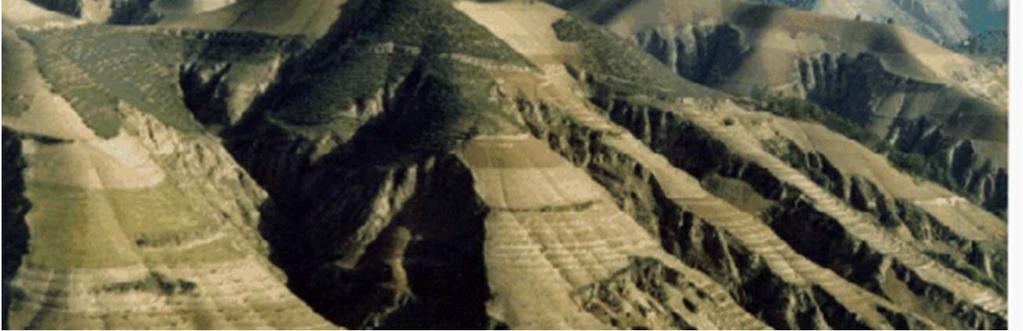
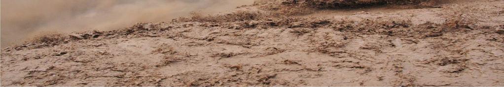
3 Soil erosion risk assessment 水土流失风险分布图 Loess plateau of China (1.65 M km²)
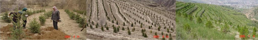
4 Program: Grain for Green The program of Grain for Green began in It represents the largest vegetation restoration activity in China. It will re-vegetate around million ha of cropland, 4.4 million of which are to be on cultivated land with a slope of at least 25 degrees. During the first three years, the program had extended to 20 provinces, 400 counties and 27 thousand villages. In 2002, Grain for Green was launched nation wide (Fu et al. 2006; Su et al. 2012).


5 Soil erosion control and ecosystem restoration 5


6 Ridge tillage Ground plastic cover Dams terraces 6
7 Research Question How is the Grain for Green program affecting the ecohydrological processes of the region (Fu et al. 2006; Wang et al. 2011; Su et al. 2012; Xu et al. 2012)?


8 Study Area Yanhe Watershed: E N 7725 km m to 1795 m above sea level

9 Hukou Watrerfall, 2010.


10 Conservation and re-vegetation programs in the Yanhe Watershed Program Comprehensive Treatment Project in the Xinghe Watershed Comprehensive Treatment Project in the Yanhe Watershed Implementation Period Grain for Green Program Revegetation Forest Shrub Grass


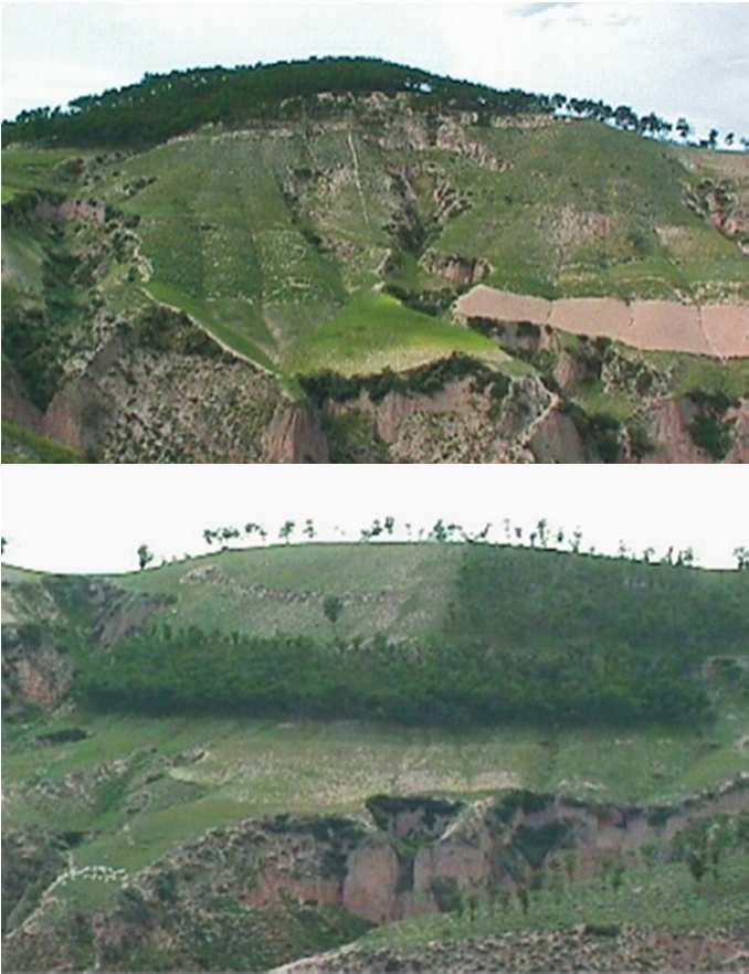

11 Grain for Green

12 Landuse map in 2000 Landuse map in 2008 Landuse % for Year 2000 % for Year 2008 Forest Shrubland Grassland Cropland Urban area Water
13 Assessment of the hydrological impacts of the "Grain for Green" program in the Yanhe Watershed "Grain for Green" program Spatio-temporal distribution of the hydrological process Drivers DEM, land cover, climate, soil, hydrology, hydrograph The Distributed Large Basin Runoff Model (DLBRM) Output Runoff ET Soil Moisture Groundwater
14 Distributed Large Basin Runoff Model The Distributed Large Basin Runoff Model (DLBRM) is being applied to assess the hydrological impacts of the "Grain for Green" program in the Yanhe Watershed. The DLBRM was developed jointly by the NOAA Great Lakes Environmental Research Laboratory and Western Michigan University (Croley and He 2005;2006; He and Croley 2007; 2010). It has been applied to over 40 U.S. watersheds and the Heihe Watershed of Northwest China. The DLBRM divides the Yanhe Watershed into over 7, km 2 grid cells. Each cell of the watershed is composed of moisture storages of the upper soil zone (USZ), lower soil zone (LSZ), groundwater zone (GZ), and surface.

15 Runoff Upper Soil Zone Evapotranspiration Lateral outflow Interflow Percolation Lower Soil Zone Lateral inflow Evapotranspiration Lateral Outflow Groundwater Deep Percolation Groundwater Zone Lateral inflow Evapotranspiration Evapotranspiration Lateral Outflow Surface Zone elevation Lateral Outflow Schematic of Distributed Large Basin Runoff Model (DLBRM)


16 Flow network in the Yanhe River


17 Hydrologic Station Data Hydrologicstations: Ansai Xinghe Zaoyuan Yanan Ganguyi


18 Soil Type Data Soil types: Dark-purple loess soil, 3.11% Loess soil, 86.38% Red clay soil, 5.30% Alluvial soil, 5.21%
19 Figure 4. Comparison of the simulated and observed discharges in the Yanhe River for 1971.( r= 0.495, RMSE= 0.033
20 Research Challenges Data availability: e.g., unavailable soil attribute data such as available water capacity (%) of USZ and LSZ, permeability (cm/hr) of USZ and LSZ. Data compatibility: incompatible Chinese and U.S. land use and soil classification systems; and data format, etc. DLBRM applicability to the Yanhe Watershed. Lack of long term, accurate, representative streamflow and groundwater data for model calibration and confirmation.
21 Summary The DLBRM is first calibrated against the observed streamflow data and then to be used to simulate the hydrology of the Yanhe Watershed prior to (2000) and after the implementation of the "Grain for Green" program (2008), respectively. Preliminary simulation results show that surface runoff and interflow accounts for 75% and 22% of the outflow, respectively, indicating the surface runoff is the main component of the discharge. Work is underway to assess the hydrological impacts of the Grain for Green program. Such results, once verified with field data, may be applicable to similar watersheds.
22 Acknowledgement Sino-U.S. Collaborative Research on Regionalization of Ecological Services, The Chinese Academy of Sciences. Partial support from the Scherer Endowment Fund of Department of Geography at Western Michigan University is appreciated.