STEPL & Region 5 Models
|
|
|
- Jessica Lesley Chandler
- 5 years ago
- Views:
Transcription

1 STEPL & Region 5 Models
2 Presentation Overview of STEPL and R5 models
3 Part 1: STEPL
4 What is STEPL? Calculates nutrient (N, P, and BOD pollutants) and sediment loads by land use type and aggregated by watershed Calculates load reductions as a result of implementing BMPs Data driven and highly empirical A customized MS Excel spreadsheet model Simple and easy to use Formulas and default parameter values can be modified by users (optional) with no programming required
5 STEPL Users? Basic understanding of hydrology, erosion, and pollutant loading processes Hydrology CN approach Erosion USLE and sediment delivery ratio, urban concentration Pollutant load runoff concentration Knowledge (use and limitation) of environmental data (e.g., land use, agricultural statistics, and BMP efficiencies) Familiarity with MS Excel and Excel Formulas
6 Process Sources Cropland Urban Groundwater Runoff Pasture Load before BMP BMP Load after BMP Forest Erosion/ Sedimentation Feedlot Others STEP 1 STEP 2 STEP 3 STEP 4


7 STEPL Main Program STEPL Main Program Run STEPL executable program to create and customize spreadsheet dynamically

8 STEPL Spreadsheet Composed of four worksheets

9 BMPs Worksheet Each land use type within each watershed can have a separate BMP. Also it can be partial application.

10 Total Load Worksheet Each row of results corresponds to a different watershed or project.

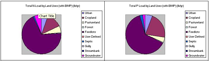
11 Graphs Worksheet


12 Accessing STEPL Model STEPL Site:
13 STEPL Model User Defined Data Requirements Watershed level data Land use distribution Agricultural animal population and manure application information Septic system information Soil information (USLE [county - NRI] and HSG) Irrigation information (optional) Land use specific BMP type and application area
14 STEPL Model System Defaults Curve Numbers (land use/soil group) Nutrient concentration in runoff/shallow groundwater Urban land use distribution
15 Cropland BMPs Available Combined BMPs-Calculated Contour Farming Diversion Filter strip Reduced Tillage Systems Streambank stabilization and fencing Terrace
16 BMPs Available - Cont Pastureland Combined BMPs-Calculated User Forest Combined BMPs-Calculated Road dry seeding Road grass and legume seeding Road grass and legume seeding-new Road hydro mulch Road straw mulch Road tree planting Site preparation/hydro mulch/seed/fertilizer Site preparation/hydro mulch/seed/fertilizer/transplants Site preparation/steep slope seeder/transplant Site preparation/straw/crimp seed/fertilizer/transplant Site preparation/straw/crimp/net Site preparation/straw/net/seed/fertilizer/transplant Site preparation/straw/polymer/seed/fertilizer/transplant
17 Feedlots BMPs Available - Cont Diversion Filter strip Runoff Mgmt System Solids Separation Basin Solids Separation Basin w/infilt Bed Terrace Waste Mgmt System Waste Storage Facility
18 Urban BMPs Available - Cont Alum Treatment LID/Filter/Buffer Strip Bioretention facility LID/Infiltration Swale Combined BMPs-Calculated LID/Infiltration Trench Concrete Grid Pavement LID/Vegetated Swale Dry Detention LID/Wet Swale Extended Wet Detention Oil/Grit Separator Filter Strip-Agricultural Porous Pavement Grass Swales Sand Filter/Infiltration Basin Infiltration Basin Sand Filters Infiltration Devises Settling Basin Infiltration Trench Vegetated Filter Strips LID*/Cistern Weekly Street Sweeping LID*/Cistern+Rain Barrel Wet Pond LID*/Rain Barrel Wetland Detention LID/Bioretention WQ Inlet w/sand Filter LID/Dry Well WQ Inlets

19 Add New Data to BMP List In STEPL customized menu, click View/Edit BMP List BMPList worksheet is shown, add or delete BMPs Customized menu Example: New data inserted here

20 STEPL: Add New Data to BMP List Update BMP button (BMPList worksheet) New BMP added! New BMP added! (BMPs worksheet) Click Update BMP Data button to update the BMP selections in the BMPs worksheet Click Save Updates to save changes to text files (comma delimited) C:or D:\Stepl\Support\AllBMPstepl.csv C: or D:\Stepl\Support\AllBMP.csv
21 Part 2: Region 5 Model
22 Region 5 Load Estimation Model Introduction Provide a general estimate of pollutant reduction at the source level Initially developed by Indiana Department of Environmental Management (IDEM) based on Michigan DEQ s pollution control manual for section 319 watersheds. Source Gully Streambank Agricultural Fields Feedlot Urban Runoff BMP Gully Stabilization Streambank Stabilization Field Management Practices and Filter Strips Animal Waste System Various BMPs Spreadsheet based model No watershed concepts Deals with single source and control
23 R5 model is not limited to Region 5 If controls of the model does not work, set EXCEL > Tools > Macro >Macros >Security to Medium Region 5 model has five functional worksheets.
 Enter gully dimensions and the number of years since the")
24 Gully Erosion: Calculate Load Reduction Select a soil texture (e.g. sand, loamy sand) Enter gully dimensions and the number of years since the gully formed
25 Gully Stabilization Load Average annual erosion during the life of the gully (t/y) = Volume x Soil Weight / Years Nutrient load = Annual Erosion x Soil Nutrient Conc. x Correction Factor Load Reduction after implementing gully stabilization Specify reduction efficiency (100% efficiency by default) Reduction is equal to annual erosion x user-specified efficiency Volume = (Top Width +Bottom Width) x Depth x Length / 2
26 Gully Erosion: Nutrient Correction Factor Correction Factor Smaller soil particles -> larger aggregated surface area -> more nutrients attached Soil Texture Nutrient Correction Factor Clay 1.15 Silt 1.00 Sand 0.85 Peat 1.50
 Enter the dimensions of the eroding stream")
27 Stream Bank Erosion Calculation Select a soil texture (e.g. silty clay) Enter the dimensions of the eroding stream banks
28 Stream Bank Erosion Load (Channel Erosion) = Length * Height * Lateral Recession rate * Soil weight Load Reduction = Load * Load reduction efficiency Determining Lateral Recession Rate by Field Observation Lateral Recession Rate (ft/yr) Category Description Slight Some bare bank, no exposed roots Moderate Bank is mostly bare Severe Bank is bare with exposed roots 0.5+ Very Severe Bank is bare with fallen trees

29 Agricultural Practices Usage Check BMPs: Agricultural field practices and filter strips (check both) Select a state and a county for default USLE parameter values Modify the default USLE parameter values for local conditions, especially the cover factor C and the supporting practice factor P to reflect the before and after treatment effects
30 Agricultural Practices Usage 2 Enter contributing areas (e.g. 50 acres) Select a soil texture (e.g. silt) Estimated Load Reductions for Agricultural Field Practices Treated Example Sediment Load Reduction (ton/year) Phosphorus Load Reduction (lb/year) Nitrogen Load Reduction (lb/yr) Estimated Additional Load Reductions through Filter Strips Sediment Load Reduction (ton/year) Phosphorus Load Reduction (lb/year) Nitrogen Load Reduction (lb/yr) Filter-Strip Efficiency Filter-Strip Treated Example Total Estimated Load Reductions Total Example Sediment Load Reduction (ton/year) Phosphorus Load Reduction (lb/year) Nitrogen Load Reduction (lb/yr) Note: This worksheet is also applicable to other cases (mining, construction sites) when USLE is used.
31 Feedlot Pollution Reduction Load Enter a contributing area (e.g acre) Specify the percentage of paved area (e.g %) Select state and a county (Pennsylvania, Lycoming) Select Weather Station (NY New York Central Park) Enter animal count for each type Animal Numbers Animal Type Design Weight* 0 Slaughter Steer 1,000 0 Young Beef Dairy Cow 1, Young Dairy Stock Swine Feeder Pig 50 0 Sheep Turkey 10 0 Chicken 4 0 Duck 4 0 Horse 1,000
32 Feedlot Pollution Reduction Load Reduction Select a feedlot best management practice (e.g. waste management system) System calculates load reduction using pre-assigned (BOD, P, N) efficiencies for the selected BMP Estimated Load and Load Reductions Pollutants Load before BMP Load Reduction Load after BMP Biochemical Oxygen Demand load (lbs/yr) 8,598 NA NA Phosphorus load (lbs/yr) Nitrogen load (lbs/yr) 7,239 5,791 1,448
33 Region 5 model vs. STEPL 1 Region 5 model Calculates load at the source level Sources are independent (no relationship between worksheets) STEPL Calculates load for different sources at source and watershed level Sources are related in watershed User can specify and update BMP list BMP calculator for complex BMP arrangements
34 Conclusion STEPL and R5 are simple models in terms of data needs, level of effort, etc. EPA can provide user support and customized versions, if needed Any observations, suggestions, or data that could improve the models are welcome