How to model catchment processes to reduce flood risk. By Lydia Burgess-Gamble (EA) and Alex Nicholson (ARUP)
|
|
|
- Elwin Chambers
- 5 years ago
- Views:
Transcription

 and")
1 How to model catchment processes to reduce flood risk By Lydia Burgess-Gamble (EA) and Alex Nicholson (ARUP)
2 Taking action to reduce flood risk by protecting, restoring and emulating the natural function of catchments, rivers, floodplain and coasts


3 Working with Natural Processes on rivers & their tributaries Grip blocking Flow interception Land /soil management River & floodplain woodlands Floodplain & wetland restoration River restoration Green/blue infrastructure Suds Ponds & runoff attenuation Woodlands in wider catchment & as flow interception River & floodplain reconnection In-channel measures to restore river floodplain connection Woody dams Urban Flood storage areas Uplands/steep slopes Floodplain In-channel Urban
4 Three stepped process Step 1 Step 2 Step 3 Use model library Read Chapter 3 Read case studies to choose model(s)

5 Step 1. Use the model library

6 Step 2. Read the technical report

7 Step 2. Read the technical report


8 Step 3. Refer to Case Studies


9


10

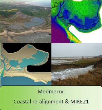
11 Case Study 5. Stroud chnicalfilm

12 Case Study 13. Lustrum Beck


13 Natural Flood Management: A modelling approach for Lustrum Beck Presentation for FCERM.net Alexander Nicholson, Ted Thomas, Samantha Byers, Phil Welton, and many others 13


14 Flood risk in Stockton-On-Tees Can flood risk be reduced in Stockton-On- Tees by storing water in the upstream catchment area? 14
15 Sub-catchment division Size: 45km 2 15

16 Mapping Interventions Using GIS to identify flow pathways and using mapping data (and aerial imagery) to identify suitable locations for NFM within catchment (which then need ground truthing and liaison with Land Owners) 16
17 Sub-catchment division Size: 45km 2 17
 All storage will remain inactive until the peak of the event.")
18 Mapping interventions Mapped storage: Sub-catchment 1 Overland flow storage = 25,000m 3 Floodplain storage = 47,000m 3 Assumptions: All storage is calculated by applying a constant depth in the pond areas (0.3m) All storage will remain inactive until the peak of the event. 18

19 Interventions Overland Flow Intercepting overland flow pathways with leaky barriers 19


20 Interventions Floodplain reconnection / maximise floodplain storage National Trust 20
21 Sub-catchment division Size: 45km 2 21
 How might the sub-catchments be")

22 Flow contribution Flood Impact Modelling Q (m 3 /s) Combined flow downstream t (hrs) How might the sub-catchments be interacting? How can this sort of analysis help with NFM and catchment management? Thanks to Gareth Owen and Paul Quinn (Newcastle University)
23 NFM Aggregate Storage Tool Q (m 3 /s) Upstream flow ReFH Unit t (hrs) 23
24 NFM Aggregate Storage Tool Q (m 3 /s) Threshold Flow Upstream flow ReFH Unit t (hrs) 24
25 NFM Aggregate Storage Tool Q (m 3 /s) Threshold Flow Upstream flow ReFH Unit t (hrs) Q (m 3 /s) Flow under threshold continues downstream Downstream flow t (hrs) 25
26 Flow enters storage NFM Aggregate Storage Tool Q (m 3 /s) Threshold Flow Flow above threshold (Eligible for storage) Upstream flow ReFH Unit t (hrs) Storage unit is uniform (surface area remains constant) Q (m 3 /s) Flow under threshold continues downstream Downstream flow t (hrs) 26
27 Flow enters storage NFM Aggregate Storage Tool Q (m 3 /s) Threshold Flow Flow above threshold (Eligible for storage) Upstream flow ReFH Unit t (hrs) Total sub-catchment storage Storage unit is uniform (surface area remains constant) Q (m 3 /s) Flow under threshold continues downstream Downstream flow t (hrs) 27
28 Flow enters storage NFM Aggregate Storage Tool Q (m 3 /s) Threshold Flow Flow above threshold (Eligible for storage) Flow converted into volume (Q x t) Upstream flow ReFH Unit t (hrs) Total sub-catchment storage Storage unit is uniform (surface area remains constant) Q (m 3 /s) Flow under threshold continues downstream Downstream flow t (hrs) 28
29 Flow enters storage NFM Aggregate Storage Tool Q (m 3 /s) Threshold Flow Flow above threshold (Eligible for storage) Flow converted into volume (Q x t) Upstream flow ReFH Unit t (hrs) Volume converted into level (lookup table) Total sub-catchment storage Storage unit is uniform (surface area remains constant) Q (m 3 /s) Flow under threshold continues downstream Downstream flow t (hrs) 29
30 Flow leaves storage (through orifice) Flow enters storage NFM Aggregate Storage Tool Q (m 3 /s) Threshold Flow Flow above threshold (Eligible for storage) Flow converted into volume (Q x t) Upstream flow ReFH Unit Total sub-catchment storage t (hrs) Volume converted into level (lookup table) Outflow determined by hydrostatics Storage unit is uniform (surface area remains constant) Q (m 3 /s) Flow under threshold continues downstream Downstream flow t (hrs) 30
31 Flow leaves storage (through orifice) Flow enters storage NFM Aggregate Storage Tool Q (m 3 /s) Flow above threshold (Eligible for storage) Threshold Flow Upstream flow ReFH Unit Total sub-catchment storage t (hrs) Flow converted into volume (Q x t) Volume converted into level (lookup table) Outflow determined by hydrostatics Storage unit is uniform (surface area remains constant) Q (m 3 /s) Outflow rate dependent on the number of mapped NFM features. Flow under threshold continues downstream Downstream flow t (hrs) 31
 Flow converted into volume (Q x t) Volume converted into level (lookup table) Outflow determined by hydrostatics Storage unit is uniform (surface area remains constant) Q (m 3 /s)")
32 Flow leaves storage (through orifice) Flow enters storage NFM Aggregate Storage Tool Q (m 3 /s) Flow above threshold (Eligible for storage) Threshold Flow Upstream flow ReFH Unit Total sub-catchment storage t (hrs) Flow converted into volume (Q x t) Volume converted into level (lookup table) Outflow determined by hydrostatics Storage unit is uniform (surface area remains constant) Q (m 3 /s) Outflow rate dependent on the number of mapped NFM features. Conserves mass balance Flow under threshold continues downstream Downstream flow t (hrs) 32

33 Sub-catchment division Size: 45km 2 33
34 Flood Impact Model Lustrum Beck 34
35 Flood Impact Model Lustrum Beck Delay sub-catchment 1 hydrograph by 2-hours 35
36 Flood Impact Model Lustrum Beck Delay sub-catchment 6 hydrograph by 2-hours 36
37 Flood Impact Model (with NFM) Lustrum Beck Introduce 40,000m 3 storage into sub-catchment 1 37
38 Flood Impact Model (with NFM) Lustrum Beck 38

39 Lustrum Beck next steps Floodplain scheme in Coatham Woods 39

40 Other EA Projects Lustrum Beck Cotting Burn Morpeth Guisborough Acomb Stokesley Great Ayton 40


41 Develop a high quality Working with Natural Processes evidence base to help flood and coastal erosion risk management authorities understand, justify, develop and implement schemes which WWNP to reduce flood risk.
42 Contact details: Lydia Burgess-Gamble Alex Nicholson Catchment Modelling Report & Case Studies ID=36c34c54-b1f b5e0- cdd38a95be32&pageid= d-81e9-4a8f-b46f cdce

43 Questions?