Prioritizing Local Action. Strengthening the Resilience of the Taunton River Watershed
|
|
|
- Laurence Price
- 5 years ago
- Views:
Transcription

1 Prioritizing Local Action Strengthening the Resilience of the Taunton River Watershed


2 No Really, We re Here to Help 6/12/14

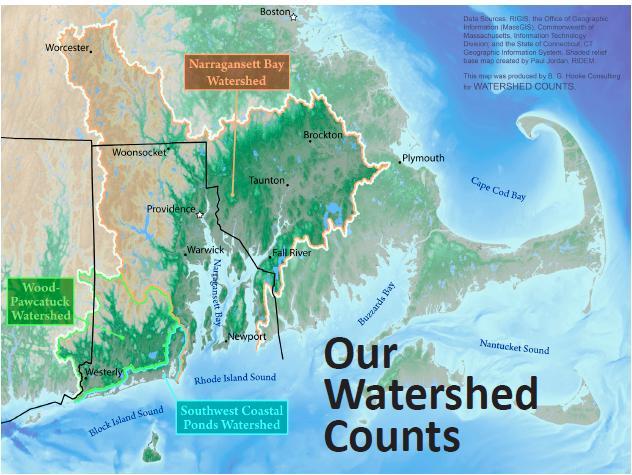
3 Healthy and Resilient Taunton Watershed Project EPA s Healthy Watershed Program Region 1 Pilot Taunton watershed project in partnership with TNC Contractor assistance from Cadmus Group and RTI Worked with Stakeholder group to get feedback Report finalized in June 2014 Stakeholder group has formed into Resilient Taunton Watershed Network Currently developing plans for municipal outreach and on the ground projects, top ten list 3
4 Now the Resilient Taunton Watershed Network And membership is growing 4
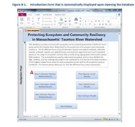
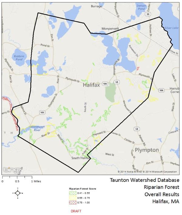
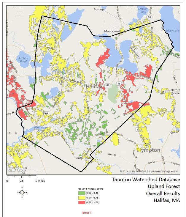
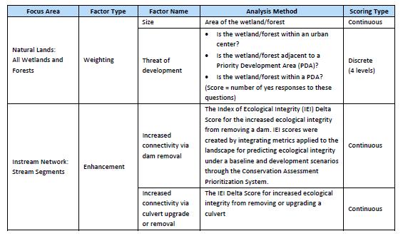
5 Final Report by RTI June 2014 Focus is on ecosystem services, ecological resilience The report included a database and GIS maps 5
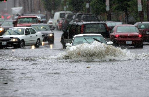
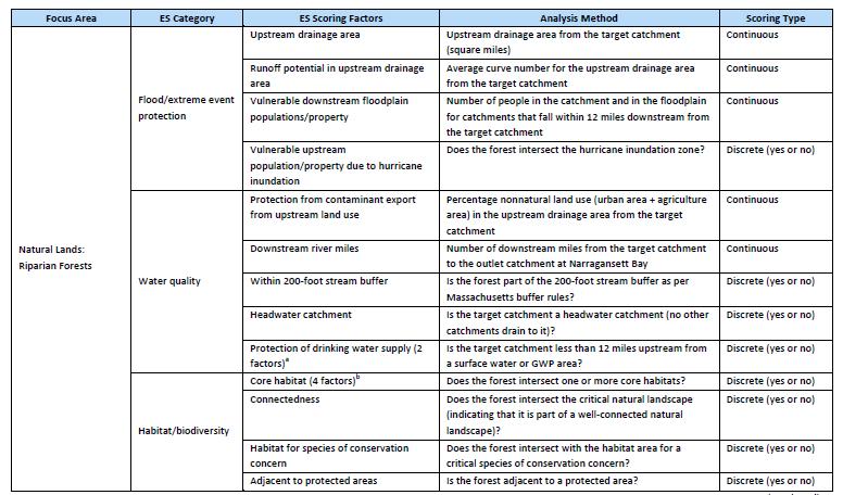
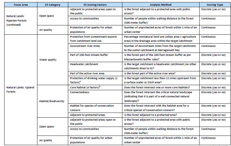
6 What are Ecosystem Services? Protect humans and ecosystems from disturbance and allow for easier recovery Support humans and ecosystems Examples of how natural systems support humans: Floodplains provide protection from extreme flooding Wetlands store water, filter pollutants and recharge groundwater for drinking water Streamside vegetation filters pollutants and reduces erosion Trees improve air quality and reduce urban heat effects Healthy fish populations support recreational fishing
7
8


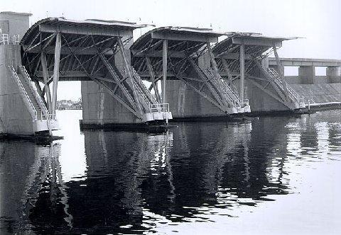
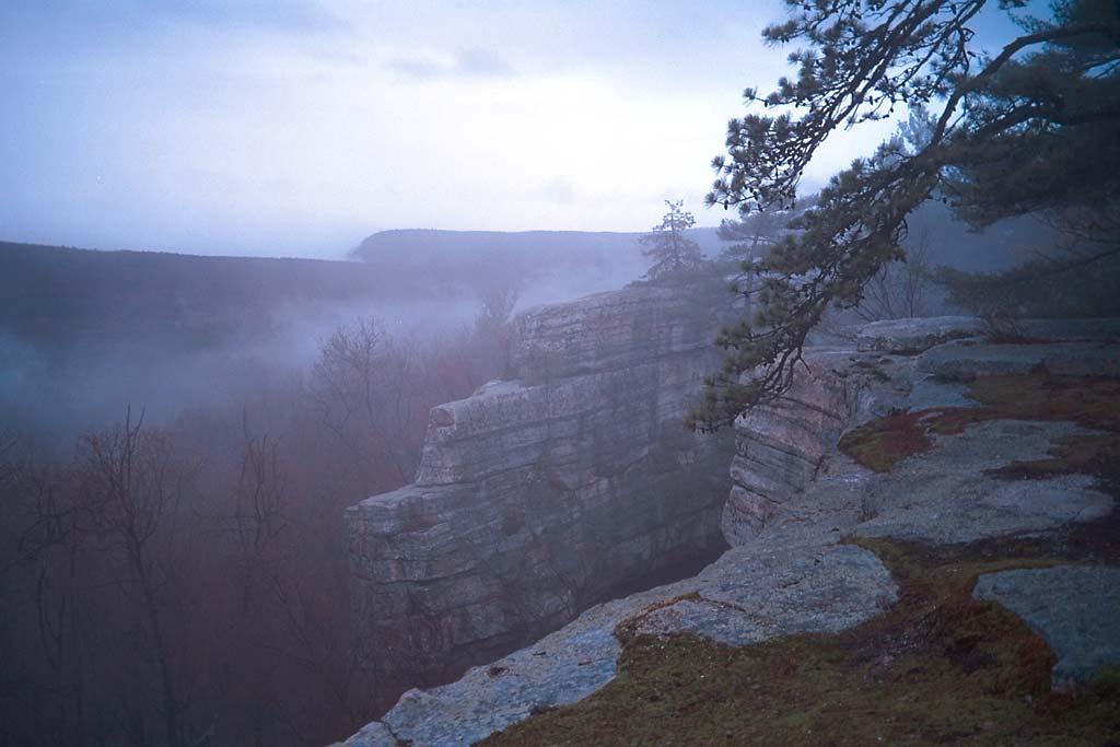
9 Protection and Restoration of Natural Infrastructure Nemasket River
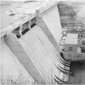
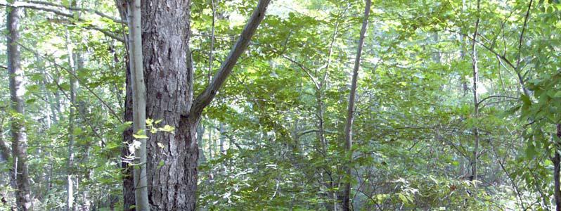
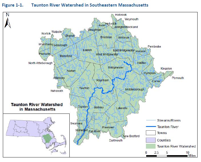
10 Why the Taunton? Coastal plain of southeastern MA, second largest watershed in MA, 42 towns Longest undammed tidal river in New England, designated Wild and Scenic River Recognized for its rich ecological, recreational, and cultural resources Most productive herring river run in the state Nemasket river which flows from Assawampset Pond for 11 miles to confluence with Taunton Key ecological resources Largest freshwater wetland in the state 17,000 acre Hockomock Swamp supporting at least 13 rare and endangered species Largest natural pond system Assawompset Pond Complex with includes Long Pond and four other interconnected ponds DW supply for more than 180,000 residents in 13 communities 560 square miles, flat landscape with only 20 foot drop in elevation along the main stem Land cover 46% natural lands, 27% developed land, 22% water/wetland, and 5% agriculture Taunton is largest freshwater contributor to Narragansett Bay Tauton starts at the confluence of the Matfield and Town rivers in Bridgewater and flows 40 miles to Mt. Hope bay, downstream 18 miles are tidal 10
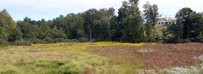
11 Example
12 12

13

14 Final Report by RTI June 2014 Focus is on ecosystem services, ecological resilience The report included a database and GIS maps 14
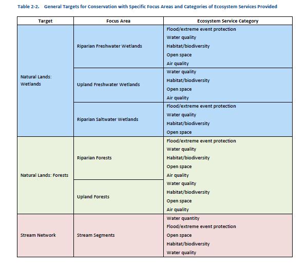
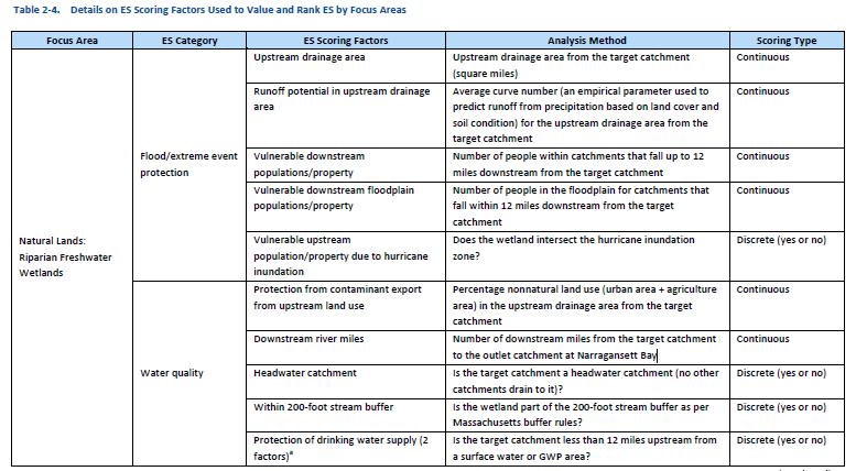
15 Report, and data base linked to GIS files 6 Focus Areas Riparian freshwater wetlands Upland freshwater wetlands Saltwater wetlands Riparian forests Upland forests Streams Ranked for Ecosystem Services Protection from extreme flooding Water quantity protection Water quality protection Habitat protection Air quality protection Open space protection
16
17

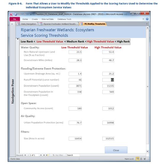
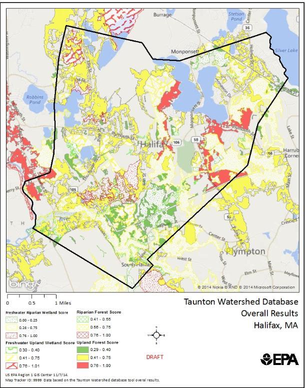
18 Decision support data base tool GIS Mapping 18
19
20
21
22
23
24
25

26 Customize the data to build specific scenarios Change the weighting scheme to what is important to your circumstances Focus on a particular ecosystem service Change the threshold values to reflect different scenarios Focus in one location
27
28 Closing Thoughts We learned a lot doing the pilot There is a tremendous amount of data out there for decision making, but you need to know what parts are important The questions you ask are critical There are many benefits to protecting ecosystem services The whole watershed is a system and your town is a part of it The tool can potentially help with prioritizing protection efforts or making decisions to strengthen resiliency You are not alone