Holcim (Australia) Pty Limited. Lynwood Quarry Riparian Area Management Plan Marulan Creek Catchment Area Revision 2
|
|
|
- Mariah Goodman
- 5 years ago
- Views:
Transcription
1 Holcim (Australia) Pty Limited Lynwood Quarry Riparian Area Management Plan Marulan Creek Catchment Area Revision 2 June 2011
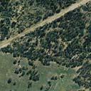
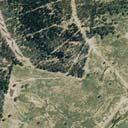
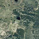
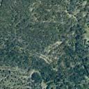
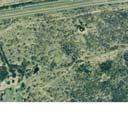
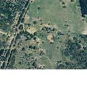
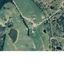
2 TABLE OF CONTENTS 1.0 Introduction Overview of the Project Development Consent Conditions Objectives of the Riparian Area Management Plan Consultation Marulan Creek Catchment Development within Marulan Creek Catchment Construction Phase Operational Phase Potential Surface Water Impacts Works within the Riparian Zone and Management Measures Catchment Wide Management Measures Identified Controlled Activity Locations Site M Site M Contingency Sediment and Erosion Controls during Construction Completion Criteria Monitoring and Maintenance Requirements Responsibilities Reporting and Review References FIGURES 1.1 Locality Plan Conceptual 30 Year Quarry Plan and Associated Infrastructure Marulan Creek Catchment Area Construction Phase Works Work Sites within Marulan Catchment /R26/Final June 2011 i
3 APPENDICES A B Plates Creek Cross and Long Sections 2238/R26/Final June 2011 ii
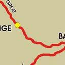
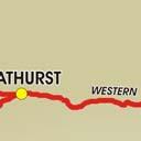
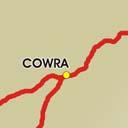
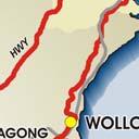
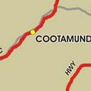
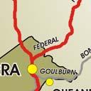
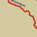
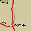
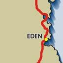
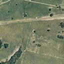
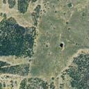
4 1.0 Introduction Rinker Australia Pty Limited (Readymix) was granted development consent in December 2005 by the Minister for Planning for the construction and operation of Lynwood Quarry west of Marulan in the Southern Tablelands region of NSW (refer to Figure 1.1). The Lynwood Quarry (along with the broader Rinker/Readymix group) was purchased in 2009 by Holcim (Australia) Pty Limited (Holcim). The quarry has approval to operate over an initial 30 year period and will include operations in the catchments of Joarimin, Lockyersleigh and Marulan Creeks, all of which form part of the Sydney Drinking Water Catchment. Separate riparian area management plans have been prepared for each of these creeks within the project area to ensure that works associated with the construction and operation of Lynwood Quarry are undertaken in a way which reduces impacts on riparian zones. This Riparian Area Management Plan for Marulan Creek provides a framework for the management of the Marulan Creek riparian zone that occurs within the Lynwood Quarry project area. The plan includes the management of works within waterfront land as defined by the Water Management Act 2000 (WMA) that was approved as part of the Lynwood Quarry project (DA ). The plan satisfies Conditions 44 and 45 in Schedule 3 of the Lynwood Quarry development consent (refer to Section 1.2). Revision 1 of this plan was approved by the Department of Planning (DoP) on 31 August 2006 and was used as a supporting document to the application for Controlled Activity Approval under the WMA. This approval was subsequently issued by the NSW Office of Water (NOW). This is the second revision of this plan and is being prepared following the approval of a modification to the development consent in March This plan forms part of the Rehabilitation and Landscape Management Plan required by Condition 44 in Schedule 3 of the Lynwood Quarry consent. A controlled Activity Approval under the Water Management Act (2000) was granted to Lynwood Quarry (Approval No. 10 ERM 2011/0446) on 15 June The approval allows for construction works to be undertaken at specific locations within the Marulan Creek catchment (refer to Section 4.2). It is noted that construction works commenced on the site in November 2010, with relevant works being undertaken in accordance with Revision 1 of this plan. This Riparian Area Management Plan has been prepared by (Umwelt) on behalf of Holcim. 1.1 Overview of the Project Lynwood Quarry (the project) will be located in the Goulburn Mulwaree Local Government Area approximately 160 kilometres south-west of Sydney and approximately 27 kilometres north-east of Goulburn (refer to Figure 1.1). The project area is bounded to the south by the Hume Highway and bisected in an east-west direction by the Main Southern Railway. It incorporates the headwaters of Joarimin, Lockyersleigh and Marulan Creeks and has historically been used primarily for agriculture, in particular grazing. The project will provide a long-term supply of high quality construction material into the Sydney, regional and local markets. The supply to the Sydney market will replace Holcim s current production from the Penrith Lakes Scheme which is approaching closure. The project area contains a substantial, high quality hard rock resource with ready transport access to the Main Southern Railway and Hume Highway. The quarry is approved to 2238/R26/Final June


5


6
7 produce up to 5 million tonnes per annum (Mtpa) of saleable quarry product for an initial 30 year quarrying period (refer to Figure 1.2). The target resource has an expected life of in excess of 90 years. 1.2 Development Consent Conditions The preparation of Riparian Area Management Plans is required by Conditions 44 and 45 in Schedule 3 of the Lynwood Quarry development consent. These conditions are outlined in Table 1.1 with an indication of where in the plan each requirement is addressed. Table 1.1 Development Consent Conditions Schedule 3 Rehabilitation and Landscape Management Plan 44. Within 6 months of this consent, the Applicant shall prepare (and following approval implement) a Rehabilitation and Landscape Management Plan for the development, in consultation with DECCW, NOW, and Council, and to the satisfaction of the Director-General. This plan must: b) include Riparian Area Management Plan/s (see condition 45) for those riparian areas to be disturbed in the next 5 years, excluding areas within quarry pits or emplacement areas as agreed with the Director-General; 45. The Riparian Area Management Plan/s must be prepared by a suitably qualified hydrologist; whose appointment has been approved by the Director- General, and include: a) baseline surveys of creeks, providing existing bed, bank and vegetation information (including representative cross and longitudinal sections), in the areas in which the development is located, excluding the quarry pits and emplacement areas; b) detailed designs of the proposed works, including any proposed stabilisation, scour protection, and / or enhancement works (including representative cross and longitudinal sections); c) a description of the measures that would be implemented in the event of flooding during construction / rehabilitation; Relevant Section of Report Entire document. Consultation discussed in Section 1.4 Section 1.4 Sections 2.0 and 4.2 Section 4.2 Section 4.3 d) details of proposed staging of the works; Sections 3.1 and 3.2 e) completion criteria for the rehabilitation of the riparian area; Section 4.4 f) a protocol for monitoring the performance of rehabilitation over time. Section Objectives of the Riparian Area Management Plan The objectives of this Riparian Area Management Plan are to: describe the current condition of riparian areas in Marulan Creek Catchment that fall within the project area, including the condition of sites that require a Controlled Activity Approval under the Water Management Act 2000; provide detailed designs of the proposed works and the proposed staging of works; outline the management measures to be implemented at the site level, including completion criteria for the rehabilitation of riparian areas disturbed by construction of the Lynwood Quarry Project; 2238/R26/Final June
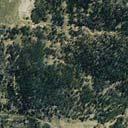
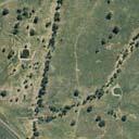
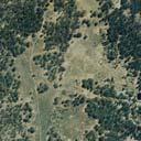
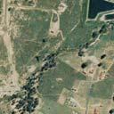
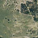
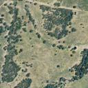
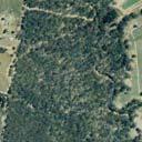
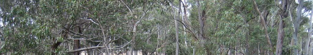
8 outline the management measures to be implemented for the Marulan Creek riparian zone for works undertaken within the project area: and define the monitoring and maintenance requirements for Marulan Creek, including a protocol for monitoring effectiveness of rehabilitation works over time. 1.4 Consultation Condition 44, Schedule 3 of the development consent requires that the Rehabilitation and Landscape Management Plan, of which this plan forms part, must be prepared in consultation with the Office of Environment and Heritage (OEH) (formerly Department of Environment, Climate Change and Water (DECCW)), NSW Office of Water (NOW) and Sydney Catchment Authority (SCA). During the preparation of Revision 1 of this plan a draft copy was provided to each of these agencies for comment prior to submission of a final draft to the then Department of Planning (DoP) for approval. Further details of agency consultation are included in the main text of the Rehabilitation and Landscape Management Plan. The consultation process for Revision 1 of the plan also built on the extensive consultation undertaken as part of the approval process for Lynwood Quarry. This included site meeting with personnel from the then Department of Environment and Conservation and the Department of Natural Resources (DNR) personnel that included specific discussions regarding site water management and management of riparian zones. This revision (Revision 2) of the plan was undertaken following approval of the second modification to the Lynwood Quarry development consent in March Marulan Creek Catchment Marulan Creek has a catchment area of approximately 2055 hectares, is a fourth order stream and drains in a south-easterly direction to the Shoalhaven River via Barbers Creek (refer to Figure 2.1). Land use within Marulan Creek catchment is predominantly grazing and residential with some woodland areas. A section of the town of Marulan lies within the catchment area. Generally the creek system is predominantly dry; however, some pools of permanent or semi-permanent water are present in the incised reaches. Marulan Creek extends from its confluence with Barbers Creek approximately 7.5 kilometres due west to the Hume Highway and Marulan. There is one major dam located along a tributary of the creek located approximately 3.6 kilometres to the west of the project area. In addition there are several harvestable rights dams located within the catchment area. All of these dams are located downstream of the project area. The catchment area has slopes varying from 1 per cent to 2 per cent in the east of the catchment to 15 per cent in the upper slopes in the west of the catchment. Marulan Creek is an ephemeral creek system with flows only occurring in the creek during storm events or after prolonged periods of heavy rain. There is limited riparian vegetation along the upper reaches of the creek; with established riparian vegetation downstream of the Hume Highway. Soil landscape mapping of the Marulan region has been undertaken by DNR (2003) and covers the project area. A soil survey was also undertaken within the project area for the Lynwood Quarry Environmental Impact Statement (Umwelt 2005) to confirm soil landscape 2238/R26/Final June
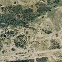
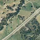
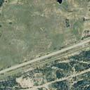
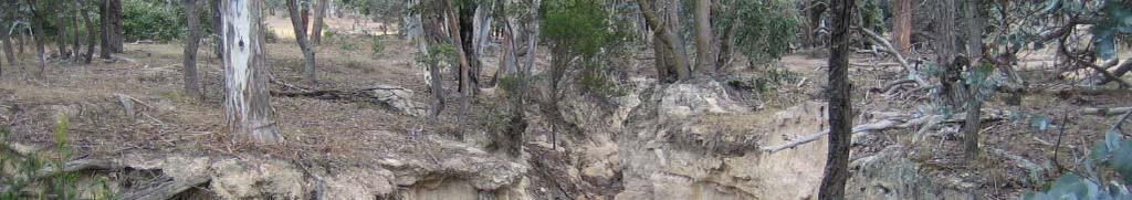
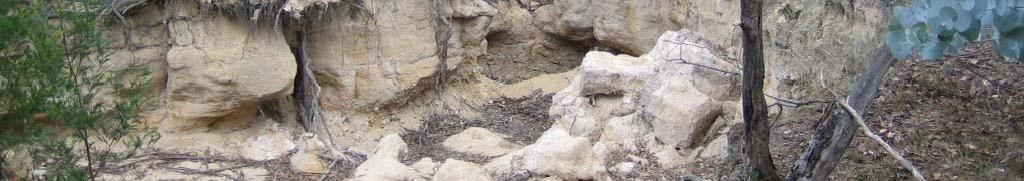
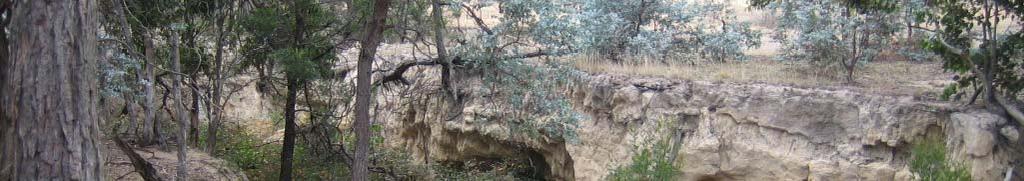
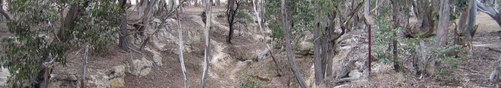
9 mapping and determine site specific soil properties. Three of the soil landscapes identified within the project area occur in the Marulan Creek catchment. Jaqua soils occur along the main creek channel with Marulan soils bounding either side of the main channel area. Bindook Road soils occur on the upper slopes of the northern extent of the Marulan Creek catchment area. The soil landscape mapping undertaken by DNR indicates that all three soil landscapes have gully and sheet erosion hazards. An inspection of Marulan Creek within the project area indicates that the subsoils are dispersive. The creek channel within the project area is deeply incised (up to four metres deep) for a length of approximately 1.1 kilometres, with widening of the channel visible. Soil landscape mapping undertaken by DNR indicates that this section of the creek channel occurs at the boundary of the Marulan and Jaqua soil landscapes. Both these soil types have dispersive subsoils on the mid to lower slopes, footslopes and channels (DNR, 2003). The extent of erosion evident along Marulan Creek is not present along the creeklines located elsewhere within the project area and is likely to be due to the dispersive subsoils as the historic land use of the three catchments within the project area has been similar. Approximately 40 hectares (2 per cent) of the catchment area of Marulan Creek lies upslope of the project area. Approximately 160 hectares (8 per cent) of the Marulan Creek catchment lies within the project area, with the remaining catchment downstream of the project area. The portion of the catchment within the project area is currently improved grazing pasture with some isolated pockets of woodland. 3.0 Development within Marulan Creek Catchment 3.1 Construction Phase As Lynwood Quarry is a greenfields project, substantial construction works are required prior to the quarry becoming operational. The construction phase commenced in November 2010 and is expected to last approximately two years and will include construction of a permanent site access road and Hume Highway interchange in the Marulan Creek catchment with a temporary construction compound required during the interchange construction. The location of the access road, interchange and associated construction compound are shown on Figure Operational Phase There will be no works within the Marulan Creek catchment during the operational phase of the project. The only ongoing activity during the operational phase will be the use of the access road and Hume Highway interchange. 3.3 Potential Surface Water Impacts The potential surface water impacts due to construction of infrastructure in the Marulan Creek catchment area were assessed as part of the Lynwood Quarry EIS (Umwelt 2005). A summary of these impacts is provided below. The peak flows, velocities and flood levels for the 20 year and 100 year Average Recurrence Interval (ARI) storm events in Marulan Creek were modelled using XP-Storm version 9.1, a one-dimensional hydrodynamic model which can be used to model stormwater flows in watercourses, culverts and street drainage systems. 2238/R26/Final June


10
11 Modelling of the flows for the 100 year ARI storm event indicated that a critical storm duration of nine hours at the project boundary gives a peak discharge of 10.2 m 3 /s. A critical storm duration of nine hours was also used for the 20 year ARI storm event and generated a peak discharge from Marulan Creek of 8.1 m 3 /s at the boundary. Modelling indicates that peak velocities and peak water levels in Marulan Creek for the 100 year ARI storm event at the project boundary are reduced with the quarry infrastructure in place. However, as discussed in the EIS (Umwelt, 2005) there is a predicted localised increase in flood level upstream of the access road culvert of 1.4 metres. Modelling also indicates that peak flow rates for the 1:20 year ARI storm event with the quarry infrastructure in place will slightly increase compared to the existing scenario (8.1 m 3 /s to 8.3 m 3 /s), with peak velocities remaining unchanged. Peak flood levels for the 1:20 year ARI storm event will increase slightly at the downstream boundary of the project by up to 6mm. This increase in peak flood level will not significantly increase the flooding extent (Umwelt, 2005). A range of control measures, including limiting the disturbed area and sediment fences, will be in place to ensure that runoff from the project area is maintained with a design maximum of 50 mg/l of suspended solids, with the aim being to prevent sediment export from the project area where possible. The water quality management measures to be implemented as part of the project are detailed in the Lynwood Quarry Water Management Plan and will ensure that oil/fuel spillages are contained on site with no impact on water quality in the downstream creek. Further details of the predicted surface water impacts and project water management system are included in the Lynwood Quarry EIS (Umwelt, 2005) and Lynwood Quarry Water Management Plan. 4.0 Works within the Riparian Zone and Management Measures 4.1 Catchment Wide Management Measures Construction Phase Management measures in the Marulan Creek catchment during the construction of the project will be detailed in the Lynwood Quarry Water Management Plan and will focus on erosion and sediment control measures. Erosion and sediment control measures will be developed as part of the construction and operational plans to satisfy the following objectives: comply with statutory requirements, including the development consent, Environment Protection Licence (EPL) and SEPP (Sydney Drinking Water Catchment) 2011; carry out all construction in accordance with relevant guidelines for erosion and sediment control, including the Blue Book (Landcom, 2004 and DECC, 2008) and NSW Office of Water guidelines; identify and manage potential erosion and sedimentation impacts that may occur as a result of quarrying and associated operations; and develop effective mechanisms for monitoring and maintenance of erosion and sediment control measures. 2238/R26/Final June
12 These controls will be designed and constructed to a standard consistent with Managing Urban Stormwater: Soils and Construction Volumes 1 and 2 (Landcom 2004) (the Blue Book) and Guidelines for Establishing Drainage Lines on Rehabilitated Minesites (Draft) (DLWC, 1999). The measures to be adopted for the construction phase of the project to control the quality of runoff in the Marulan Creek catchment will include the following: construction and regular maintenance of silt fences to contain sediment downslope of disturbed areas; seeding and controlled fertilising of all disturbed areas to provide for rapid grass cover. Areas will be seeded with a grass mix specific to the needs of the area to be grassed; and development of an inspection, maintenance and management system to ensure that the soil and erosion control measures for the construction phase are performing adequately. Operational Phase Water quality controls will also be implemented for the project during the operational phase to minimise surface water impacts. In Marulan Creek catchment, these controls will include: regular maintenance of all erosion control works and rehabilitated areas; and regular inspections of access tracks/roads to ensure that drainage is working effectively and the tracks/roads are stable particularly after rain. In addition to these controls specific to works associated with the quarry, Holcim propose to implement a program of rehabilitation works along existing drainage lines to reduce the current extent of bank and bed erosion and associated sediment transport, where possible. Rehabilitation works will initially include fencing of the third order section of Marulan Creek to prevent cattle access and allow for natural regeneration. This fenced area will be inspected annually for the first three years to assess the level of natural regeneration. If natural regeneration is not proceeding to an acceptable level by the third year of annual monitoring, then alternative regeneration measures including supplementary planting will be considered. Should supplementary planting be required, the works will be undertaken in accordance with the Rehabilitation and Landscape Management Plan. Lynwood Quarry s Environmental Officer will inspect Marulan Creek within the project area on a quarterly basis (and after severe storm events) to identify the condition of the vegetation and any significant erosion or creek stability issues. Controls will be implemented where practical to address any new issues identified as part of these inspections. Six monthly weed and pest inspections will also be undertaken in the riparian zone in accordance with the Rehabilitation and Landscape Management Plan, and controls will be implemented as required. 4.2 Identified Controlled Activity Locations On 4 February 2008 the Rivers and Foreshores Improvement Act 1948 (RFI Act) was repealed and the controlled activity provisions in the Water Management Act 2000 (WMA) commenced. A controlled activity approval (CAA) under the WMA is now required for controlled activities carried out in, on or under waterfront land. The following definitions are provided in the WMA: 2238/R26/Final June
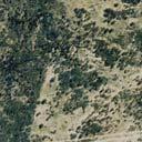
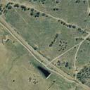
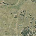
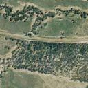
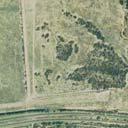
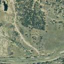
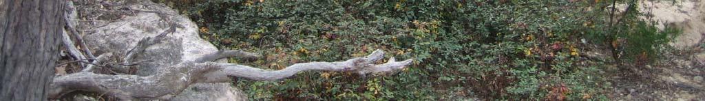
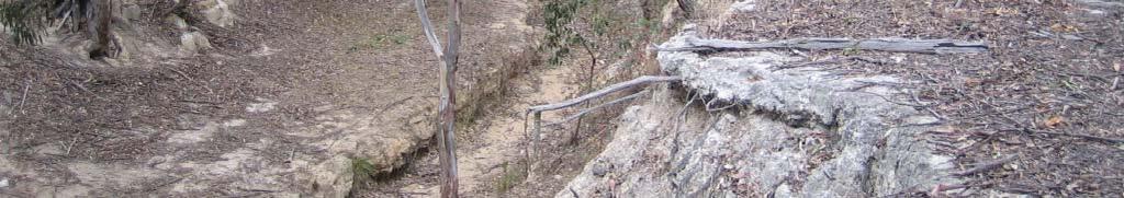
13 Waterfront Land includes the bed and bank of any river, lake or estuary and all land within 40 metres of the highest bank of the river, lake or estuary. River means: (a) any watercourse, whether perennial or intermittent and whether comprising a natural channel or a natural channel artificially improved, and (b) any tributary, branch or other watercourse into or from which a watercourse referred to in paragraph (a) flows, and (c) anything declared by the regulations to be a river, whether or not it also forms part of a lake or estuary, but does not include anything declared by the regulations not to be a river. Controlled Activity means: (a) the erection of a building or the carrying out of a work (within the meaning of the Environmental Planning and Assessment Act 1979), or (b) the removal of material (whether or not extractive material) or vegetation from land, whether by way of excavation or otherwise, or (c) the deposition of material (whether or not extractive material) on land, whether by way of landfill operations or otherwise, or (d) the carrying out of any other activity that affects the quantity or flow of water in a water source. Under the WMA a creek or drainage line will generally fall within the definition of a river if it is marked on a 1:25,000 topographical map sheet produced by the Land and Property Information Centre (LPIC) and has a defined channel bed and bank. A site inspection is typically required to determine if a defined bed and bank are present. Work sites requiring a Controlled Activity Approval have been identified from site inspections undertaken in May 2006 and assessments undertaken during preparation of the EIS (Umwelt, 2005), SEE (Umwelt, 2009) and EA (Umwelt, 2010). Two work sites occur within the Marulan Creek catchment area and both those sites were identified as requiring a Controlled Activity Approval under the WMA ( refer to Figure 4.1). The required approval for these works was granted on 15 June 2011 (Approval No. 10 ERM2011/0446) Site M1 The access road for Lynwood Quarry will cross Marulan Creek at site M1 (refer to Figure 4.1). The access road will be constructed during the construction phase of the project. Where the access road crosses Marulan Creek the creek has a defined bed and bank as shown in Plates 1 and 2 of Appendix A. Marulan Creek is deeply incised at site M1 with visible channel widening (refer to Plates 1 and 2). The creek banks at site M1 are approximately 3.7 metres high, steep (approximately 6:1 v:h) with a bed width of approximately 5.6 metres. The riparian vegetation is dominated by Riparian Gum - Box - Apple Woodland, with blackberries (Rubus fruitcosus sp. agg.) present along the base of the creek. A typical cross-section and long-section of the creek at this location is included in Appendix B. 2238/R26/Final June
14
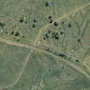
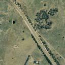
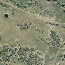
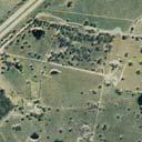
15 A culvert will be constructed to convey flows under the access road. The conceptual design of the culvert is a 42 metre long, 1.8 metre wide x 1.5 metre high box culvert. The 100 year ARI storm event peak discharge through the culvert has been modelled as 5.7 m 3 /s with a peak velocity of 4.1 m/s. The soils in the construction area will be treated with gypsum to reduce dispersibility and improve soil structure after excavation and prior to installation of the culvert. The culvert is to be placed approximately 300 millimetres deeper than the existing bed of the creek and then backfilled to original bed level with rock. Rip rap will also be placed upstream and downstream of the culvert to prevent localised scouring. This rip rap will consist of well graded rock to a depth of 300 millimetres with d 50 = 250 millimetres and will extend 10 metres upstream of the culvert and 20 metres downstream of the culvert. Sediment fences will be placed upstream and downstream of the work area during installation of the culvert and rip rap to prevent sediment mobilisation The disturbed areas outside of the creek channel including waterfront land will be topsoiled and seeded with grass species to aid stability. This will assist in maintaining a natural creek bed and reducing erosion along Marulan Creek Site M2 Site M2 is the location of the access road construction compound, which is located approximately 10 metres from the top of the bank of Marulan Creek at its closest point (refer to Figure 4.1). This compound has been constructed and will be utilised during the construction of the interchange. After the construction phase this compound will be decommissioned, all infrastructure removed and the area rehabilitated. The compound was designed to reduce disturbance to vegetation. Marulan Creek, adjacent to the site, has a defined bed and bank as shown in Plates 3 and 4 of Appendix A. A cross-section and long-section of the site are included in Appendix B. Similar to Site M1, the creekline at Site M2 is deeply incised with channel widening visible, and a lateral cut forming on the eastern bank of the creek. The riparian vegetation at this site is also dominated by Riparian Gum - Box - Apple Woodland. General management measures will be undertaken at Site M2 during the construction and operational phases of the project, as described in Section 4.1. These management measures will include: clearly identifying and delineating areas required to be disturbed and ensuring that disturbance is limited to those areas, clearing as little vegetation as required and minimising machinery disturbance outside of these areas; construction and regular maintenance of silt fences to contain sediment downslope of disturbed areas; construction of drains upslope of areas to be disturbed to convey clean runoff away from disturbed areas; creation of a No-Go zone between the compound and the creekline (i.e. no vehicle movements) to prevent impacts on the creek bank and core riparian zone (refer to Figure 4.1); progressively stripping and stockpiling topsoil for later use in rehabilitation; seeding and controlled fertilising of all disturbed areas to provide for rapid grass cover. Areas will be seeded with a grass mix specific to the needs of the area to be grassed; regular maintenance of all erosion control works and rehabilitated areas; and prompt revegetation of areas as soon as earthworks are complete. 2238/R26/Final June
16 4.3 Contingency Sediment and Erosion Controls during Construction A number of sediment and erosion controls have been identified that will be implemented during the construction phase of the project to mitigate erosion and sediment export from disturbed areas during storm events. These measures include: where a storm event is imminent, covering disturbed areas within the creek line with geotextile fabric and securing with stakes to reduce erosion potential (where practical to do so in the available time); regular inspection of sediment and erosion controls during works and rectification of any damaged controls where it is safe to do so; and installation of additional controls such as silt fences as required. 4.4 Completion Criteria The completion criteria for each work site are: practical completion of all infrastructure to be constructed; construction area stable; established vegetation on all disturbed areas; and removal of any temporary sediment and erosion control measures when revegetation has established on formerly disturbed areas. 5.0 Monitoring and Maintenance Requirements During the construction phase of the project all works will be inspected on a daily basis to ensure that all required controls are in place and effective. Following the completion of construction works, the work area will be inspected weekly and after any runoff events until the completion criteria listed in Section 4.4 are met. During the operational phase of the project monitoring of the management measures implemented will be undertaken in accordance with the Rehabilitation and Landscape Management Plan. Monitoring will also be undertaken after major storm events for sediment and erosion control structures that may be affected by such an event. Water quality monitoring will also be undertaken as part of the project as discussed in the Lynwood Quarry Water Management Plan. 6.0 Responsibilities The Lynwood Quarry Environmental Officer and Quarry Manager will be responsible for the implementation of the requirements of this plan and ongoing maintenance and review. 2238/R26/Final June
17 7.0 Reporting and Review The Quarry Environmental Officer will report any significant finding regarding the implementation of this plan in the Annual Environmental Management Report (AEMR). 8.0 References Asset Geotechnical Proposed Hard Rock Quarry Marulan Report on Geotechnical Investigation. Prepared for. Department of Land and Water Conservation Guidelines for Establishing Drainage Lines on Rehabilitated Minesites (Draft). Department of Natural Resources, Soil Landscapes of the Goulburn Region 1: Sheet. Soil Conservation Service of NSW, Sydney. Landcom Urban Stormwater: Soils and Construction., Environmental Impact Statement Proposed Lynwood Quarry, Marulan. Prepared for Readymix Holdings Pty Ltd., Statement of Environmental Effects Proposed Minor Modifications to Lynwood Quarry, Marulan. Prepared for CEMEX., Environmental Assessment - Proposed Modifications to Lynwood Quarry, Marulan. Prepared for Holcim (Australia) Pty Limited. 2238/R26/Final June
18 APPENDIX A Plates


19


20
21 APPENDIX B Creek Cross and Long Sections
22
23
24
25 2/20 The Boulevarde PO Box 838 Toronto NSW 2283 Ph Fax