INTRODUCTION. 1.1 Background Project Location and Brief Project Overview
|
|
|
- Aleesha Hunter
- 5 years ago
- Views:
Transcription
1 INTRODUCTION This chapter presents background and introductory information for the proposed Berths - Container Terminal Improvement Project (proposed Project), located in the north and eastern portions of the West Basin in the Port of Los Angeles (Port). This chapter presents the authorities of the Lead Agencies (United States [U.S.] Army Corps of Engineers [USACE] and the Los Angeles Harbor Department [LAHD]) preparing this Draft Environmental Impact Statement/Environmental Impact Report (EIS/EIR), the scope and content of the EIS/EIR, and the public outreach for the proposed Project. This Draft EIS/EIR has been prepared in accordance with the requirements of the National Environmental Policy Act (NEPA) ( United States Code [USC] et seq.), and in conformance with the Council for Environmental Quality (CEQ) Guidelines and the USACE NEPA Implementing Regulations. The document also fulfills the requirements of the California Environmental Quality Act (CEQA) (California Public Resources Code [PRC] 000 et seq.), and the State CEQA Guidelines (California Administrative Code [CAC] 00 et seq.). The USACE is the NEPA lead agency for this proposed Project, and the LAHD is the CEQA lead agency. This Draft EIS/EIR describes the affected resources and evaluates the potential impacts to those resources as a result of building and operating the proposed Project. In this document, the term Proposed Project is used in the same way as Proposed Action is used under NEPA. The proposed Project and alternatives are described in detail in Chapter. This Draft EIS/EIR will be used to inform decision-makers and the public about the environmental effects of the proposed waterside, terminal, and transportation improvements to Berths -.. Background.. Project Location and Brief Project Overview The LAHD operates the Port of Los Angeles under the legal mandates of the Port of Los Angeles Tidelands Trust (Los Angeles City Charter, Article VI, Sec. 0; California Tidelands Trust Act of ) and the California Coastal Act (PRC Div 0 S000 et seq.), which identify the Port and its facilities as a primary economic/coastal resource of the State and an essential element of the national Berths - Terminal EIS/EIR -
2 .0 Introduction maritime industry for promotion of commerce, navigation, fisheries and harbor operations. Activities should be water dependent and give highest priority to navigation, shipping and necessary support and access facilities to accommodate the demands of foreign and domestic waterborne commerce. The LAHD is chartered to develop and operate the Port to benefit maritime uses, and functions as a landlord by leasing Port properties to more than 00 tenants. The location of the proposed Project is shown on Figure -. The existing Berths - Terminal, which is currently leased to TraPac, Inc., a container terminal operator and stevedore, for operation as a container terminal, is located in the north and eastern portions of the West Basin of the Port, in the Wilmington and San Pedro Districts of Los Angeles. In 00, the Berths - Terminal handled, twenty-foot equivalent units (TEUs) of containerized cargo, and had vessel calls. Under the proposed Project, most of the improvements would occur on the acres currently operated by TraPac. The proposed terminal expansion areas are bounded by Harry Bridges Boulevard, the existing terminal, and the Pier A Rail Yard. Major elements of the proposed Project include the following: Dredging,000 cubic yards (cy) of marine sediments to deepen the berthing areas to match recently approved -foot channel depths; Renovating,000 feet of wharf and constructing 0 feet of new wharf; Replacing six gantry (container) cranes with five new cranes for a net loss of one gantry crane (there would be a total of gantry cranes at the proposed Project instead of the that existed in 00); Filling the 0-acre Northwest Slip and constructing a new 00-foot wharf built at an adjoining new berth; Expanding, redeveloping and constructing container terminal facilities and associated rail facilities; Constructing a new on-dock intermodal rail yard; Relocating the existing Pier A Rail Yard to an area adjacent to the Consolidated Slip; Improving Harry Bridges Boulevard; and Constructing a 0-acre landscaped area between C Street and Harry Bridges Boulevard... General Description of Container Terminal Operations A modern container terminal is a facility that integrates several different physical components and operational processes in order to load and unload oceangoing vessels and to move the cargo through the terminal to and from trucks and trains as costeffectively as possible. The physical components consist of marine container vessels, berths/wharves (docks), cranes, backland storage areas (container yard), entrance and exit - Berths - Terminal EIS/EIR

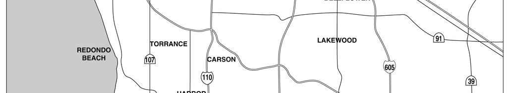

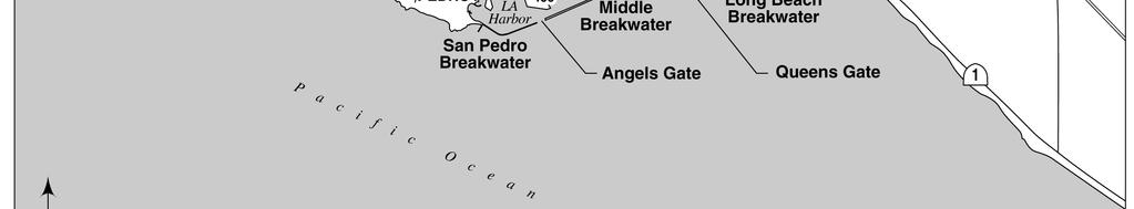
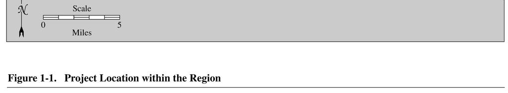
3 .0 Introduction Figure bw - Project Location within the Region Berths - Terminal EIS/EIR -
4 .0 Introduction gates, rail facilities (usually), and maintenance and administrative buildings (Figure -). The operational processes include stevedoring (loading/unloading ships), container storage and management, in-terminal drayage (hauling), on-dock rail operations, and trucking to offsite locations such as warehouses and rail yards. In the case of the Berths - Terminal, the Port owns the major terminal infrastructure (wharves, container storage yard, and buildings) and TraPac owns the wharf gantry cranes (Figure -), which directly affect terminal productivity and require regular maintenance. Operationally, imported containers arrive at, and exported containers depart from, the Port via container ships. Container ships average between 00 feet to over,000 feet long, and have capacities between a few thousand to over,000 TEUs (Twenty-foot Equivalent Units; a TEU is a measure of containerized cargo capacity equal to one standard 0 ft [length] ft [width] ft in [height] container; since most maritime containers are actually 0 or feet long, one container, on average, is equivalent to approximately. TEUs.) As a container ship arrives at the Port, two tugboats, one in front and one behind, assist the ship through the main channel to its berth at the container terminal. Once at berth, the off-loading/loading process begins; the ships typically hotel or stay at the terminal for approximately hours, or. days, but the largest ships may stay as long as three days. While at berth the ship s main propulsion engine is shut down but large diesel auxiliaries run continuously to provide electrical power for ship s functions, including supplying power to refrigerated containers. When the vessel arrives, most of the export cargo to be loaded is already stacked in the yard. Gangs (groups) of longshore workers work night and day shifts to unload and load the ship. Dockside crane operators lift cargo containers to and from the ships onto and off of specialized trailers pulled by yard tractors. Typically, cranes can transfer to 0 containers per hour. The cranes have specialized equipment including anti-sway devices, lighting, and adjustable spreaders (cargo hooks) that allow attachment to the various container sizes. The number of cranes operating simultaneously on one ship can vary from one to ten, depending upon the size of the ship, the number of vessels at berth, crane gauge (distance between crane legs), and the availability of cranes. Once containers have been off-loaded from the ship or received through the gates on trucks and trains, they are stored and moved around the backlands area of the container terminal (the storage yards) using one of three systems: ) a grounded or stacked system (where containers are stacked); ) a chassis or wheeled system (where the containers are stored on a single wheeled chassis and are not stacked); ) or, more usually, a combination grounded/chassis system. Export containers from local areas typically arrive at the gate on chassis (trailers) pulled by street-legal tractors (i.e., semitrucks) a day to a week prior to the scheduled departure of the ship that they are booked to travel on, and are stored in the terminal until they are loaded onto the ship. Export cargo from more distant locations typically arrives at the terminal via rail. It may arrive either directly at the on-dock rail yard inside the terminal or at another local rail yard from which it is trucked to the terminal gate for receiving. Cargo containers are transferred by toppick or Rubber Tired Gantry (RTG) cranes from the rail cars to - Berths - Terminal EIS/EIR


5 Backlands Area for Container Storage Gate Gate Pier A Rail Yard Container Ships Loading Gate LEGEND Berths - Container Terminal Boundary Figure -. Existing Container Terminal Gantry Cranes on Wharf Load and Unload Ships at to 0 Containers per Hour Figure -. Gantry Cranes
6 .0 Introduction 0 0 chassis hauled by yard tractors, and the tractors then drive to pre-planned locations in the yard where the cargo is lifted to grounded locations by toppicks or RTGs. As shown in Figure -, the import cargo is shifted to stacks or wheeled trailer locations in the container yard (CY or backlands). Some import containers are shifted to stacks near the on-dock rail yard, to be loaded onto departing trains. Others are delivered to trucks that arrive to pick-up the cargo. Cargo containers loaded on trucks are then processed out of the terminal at the exit gate. Import cargo that leaves the terminal by truck may be transferred to local rail yards (such as the ICTF, Burlington Northern-Santa Fe, or Union Pacific rail yards), to transloading warehouses, or directly to its final destination such as a distribution warehouse. The transloading warehouses unpack and reload containers that are then sent on to other locations. The number of containers that passes through a terminal is called its throughput. Each container terminal has an annual throughput capacity, i.e., the maximum number of containers it can handle in a year. As described below and in Section., the maximum capacity of a terminal is based on site-specific modeling of the physical and operating parameters. That number is a function of the terminal s configuration, berth length, backland area, the ratio of berth length to backland area, and the number and types of equipment it uses. Achieving the maximum capacity of terminals, which is the high end of a realistic operating range, requires that none of the various components of a terminal is a constraint to the movement of cargo through the terminal. The pipeline analogy shown in Figure - demonstrates that a terminal that is designed with equal-capacity components makes the most efficient use of its land and resources. Fig -. Flow of Containers through a Marine Cargo Terminal Berths - Terminal EIS/EIR -
7 .0 Introduction Historically, not all terminals at the Port were designed to provide for this maximum capacity. Accordingly, most terminals are limited by one or more of their components such as the amount of berth space available to accommodate the newest/largest ships in the fleet, the number and size of cranes used to unload the ships, the amount and shape of backland adjacent to the berth, adequate gate facilities for trucks, and access to ondock rail yards. As a simplified example, a terminal of 00 acres and only one berth would be constrained by the berth (berth constrained), while a terminal with five long berths and only 0 acres of backland would be constrained by the amount of cargo that could be handled by the backlands (backland constrained)... Growth in Containerized Cargo Since 0, containerized shipping through U.S. West Coast ports has increased twenty-fold, driven by this nation s increasing trade with Asian economies. In 000, the value of waterborne trade through West Coast ports reached $0 billion, a 00 percent increase since 0 (Dickerson and Iritani 00). Major West Coast ports, particularly the ports of Los Angeles, Long Beach, and Oakland, have continued to invest billions of dollars optimizing their facilities to accommodate increases in containerized shipping. These ports have deepened their harbors to accommodate large, deep-draft container ships; demolished existing facilities and built new container terminals in their place; and created new land to provide space for additional container terminal backlands. The terminal operators have purchased high-speed cranes and modernized transportation equipment and have installed automation to move containers more rapidly between ships and trucks or trains. The importance of this cargo and related port expansion to the Nation, and the economic benefits of navigation improvements, have been supported by both project authorizations and financial authorizations from the U.S. Congress, notably through the Water Resources Development Act. These include: Resolution of the Senate Committee on Public Works ; Resolution of the House Committee on Public Works ; Water Resources Development Act of Public Law - ; Water Resources Development Act (USACE, pp. I- I-), Water Resources Development Act 000, and Energy and Water Appropriation Bill FY00. Anticipating the continued importance of containerized shipping, the ports of Los Angeles and Long Beach and the USACE conducted a series of studies to forecast cargo volumes through the year 00 and to evaluate the capacity of the combined port complex in San Pedro Bay to accommodate those cargo volumes (e.g., LAHD et al. ; WEFA,, ). The cargo forecasts predicted significant increases in containerized cargo from Pacific Rim countries to the Pacific West Coast and the San Pedro Bay ports. These forecasts were used as a basis for development of an Operations, Facilities and Infrastructure (OFI) Study (VZM ). That study concluded that the ports needed to provide substantial additional physical facilities and make operational improvements in order to provide the necessary capacity. The resulting San Pedro Bay 00 Plan included the construction of new land for new container terminals and the optimization of existing terminals at both ports. In the Port of Los Angeles, this resulted in the construction of the Pier 00 container terminal operated by American President Lines (APL), the -acre Pier 00 supporting the container - Berths - Terminal EIS/EIR
8 .0 Introduction 0 terminal operated by APM Terminals, construction of the Alameda Corridor, and construction projects to modernize existing terminals and improve the port s transportation infrastructure (see USACE ; USACE and LAHD ). Presently the Port of Los Angeles is also deepening its main channels to accommodate newer generation container ships at existing container terminals in the Inner Los Angeles Harbor (USACE and LAHD 000; USACE 000). Since the early 0s, actual volumes of containerized cargo through the two San Pedro Bay ports have greatly exceeded both the WEFA forecasts and subsequent projections. A more recent, market-based forecast (Mercer 00) reevaluated the previous cargo projections through the year 00 and concluded that there would be continued growth in containerized cargo for the San Pedro Bay ports (Figure -). The Mercer study anticipated that the volume of containers would increase from. million TEUs in 000 to approximately. million TEUs in the year 00. Based on past performance of the two Ports, their gross acreage in container terminals, and their future development plans, port planners expect that this cargo would be approximately evenly split between the two ports. Therefore, the Port anticipates that approximately. million TEUs could come through the Port in the year Figure -. Actual (brown) and Forecasted (yellow) Cargo Volumes through San Pedro Bay Ports, in Millions of TEUs The original Mercer 00 cargo forecast projected growth to the year 00. By assuming a continual annualized growth rate of % per year (as used in the out-years by Mercer) for 0 additional years, a reasonable forecast for the year 00 can be derived. Assuming the growth rate of % annually, the number of TEU s at the Port would be expected to grow to. million TEUs in 0 and. million TEUs in 00 (Appendix I). This unconstrained demand number of. million TEUs does not account for the increasing Berths - Terminal EIS/EIR -
9 .0 Introduction trade imbalance that has occurred since the Mercer study, which could drive this number up due to increases in empty containers, nor does it account for possible cargo diversion through Mexico ports, or the Suez or Panama Canals, which could result in a reduced forecast. As discussed below, absent implementation of new operational technology beyond that already assumed in the cargo projections, Port container facilities are expected to be constrained by the physical capacity of the terminals at approximately. million TEUs in the year 00. Since the cargo forecast provided by Mercer is a demand forecast that is not constrained by the ability of individual terminals in Los Angeles and Long Beach to accommodate the projected cargo, the Port, with support from experts in container terminal operation (JWD Group 00) and input from its terminal operators, developed a methodology to determine the actual physical/operational capacity of each terminal (Appendix I). By making realistic assumptions in regards to different physical improvements (e.g., increasing the length of a berth or adding more container yard) and operating parameters (e.g., increasing the number of hours worked per day or crane productivity, decreasing the amount of time containers are allowed to remain in the terminal) it is possible to model the future operating capacity of a terminal. The methodology uses a combination of two capacity models, one that analyzes backland capacity and one that analyzes berth capacity, to project the maximum capacity of each terminal through the year 00. As mentioned in section.., a terminal may be berth-constrained, backlands-constrained, or evenly balanced between the two. In addition, some terminals may have a calculated throughput capacity that exceeds its projected cargo demand (Mercer) or does not have enough capacity to meet the demand. The Port s methodology selects the cargo volume that allows growth to occur until the terminal reaches the constraining factor as the reasonably foreseeable estimate of cargo throughput (Appendix I). The Port has confirmed its estimates by comparing actual throughput numbers with model projections in hindcasting exercises (Appendix I) and through discussions with individual terminal operators. The methodology for throughput projection was carried out for all seven of the existing container terminals at the Port (Appendix I; Figure -). For each terminal, reasonable assumptions were made concerning necessary construction projects and operational improvements to optimize capacity. Accordingly, the capacities shown in Figure - do not reflect existing terminal configurations and operating practices. Instead, they reflect the assumption that the Port will be able to build improvements and the terminal operators will be able to institute operational changes. The results of the capacity modeling show that even with the expansion and modernization of terminals that was assumed, throughput at the Port will be constrained at. million TEUs starting in approximately the year 00. A comparison of Figures - and - shows that between now and 00, all terminals will need to be functioning at their maximum capacities in order to accommodate the cargo volumes coming to the Port. Overall, this represents a projected throughput of approximately 0,000 TEUs per acre, compared to the throughput of existing terminals of between,000 and,000 TEUs per acre. The projected throughput of 0,000 TEU is a very aggressive assumption for a non-transhipment port. (A transshipment port, such as exist in Asia, is one that receives cargo from barges or other ships for transshipment to another port, whereas at the Port, all import and export cargo comes/goes to/from inland destinations.) -0 Berths - Terminal EIS/EIR
10 .0 Introduction Cumulative Port Terminal Capacities Throughput (TEUs/yr) Berth 0-0 Berth 0-0 Berth - Berth - Berth 0-0 Berth - Berth 00- Mercer Demand Forecast Figure -. Projected Throughput of Port Container Terminals (JWD Group 00) Compared to Projected Capacity 0 0 It is possible that operational improvements may eventually increase the capacity of Port container terminals beyond. million TEUs, but at present such improvement are speculative for technical, economic, or social reasons. However, should new feasible technology become available that would increase Port capacity beyond that anticipated, improvements to implement the technology would require discretionary actions and environmental evaluation in accordance with CEQA in order to evaluate potential environmental effects. The project evaluated in this Draft EIS/EIR represents part of a continued effort to meet the goals and objectives of the joint federal, state, and local planning process initiated by the 00 Plan and the Deep Draft Navigation Improvement Project EIS/EIR (USACE ), and continued in the West Basin Transportation Improvements Program and the Channel Deepening SEIS/SEIR.. Purpose of an EIS/EIR.. NEPA and the Purpose of an EIS NEPA was enacted by Congress in and requires federal agency decision makers to document and consider the environmental implications of their actions or decisions, with the intent of helping public officials make decisions that are based on understanding of environmental consequences, and take actions that protect, restore, Berths - Terminal EIS/EIR -
11 .0 Introduction and enhance the environment. When a federal agency determines that a proposed project could result in significant environmental effects, an EIS is prepared that provides full and fair discussion of anticipated significant environmental impacts. The EIS informs decision makers and the public of the reasonable alternatives that would avoid or minimize significant impacts or enhance the quality of the human environment. An EIS is not only a disclosure document, it is a decision-making aid that is used by federal officials in conjunction with other relevant material to plan actions and make decisions... CEQA and the Purpose of an EIR CEQA was enacted by the California Legislature in 0 and requires public agency decision makers to consider the environmental effects of their actions. When a state or local agency determines that a proposed project has the potential to significantly affect the environment, an EIR is prepared. The purpose of an EIR is to identify significant effects of a proposed project on the environment, to identify alternatives to the project, and to indicate the manner in which those significant effects can be mitigated or avoided. A public agency must mitigate or avoid significant environmental impacts of projects it carries out or approves whenever it is feasible to do so. In instances where significant impacts cannot be avoided or mitigated, the project may nonetheless be carried out or approved if the approving agency finds that economic, legal, social, technological, or other benefits outweigh the unavoidable significant environmental effects.. Lead, Responsible, and Trustee Agencies The USACE and the LAHD are the Lead Agencies for evaluating potential impacts and proposing mitigation measures under the federal NEPA and state CEQA laws, respectively. The USACE and LAHD are preparing this joint EIS/EIR in the interest of efficiency and to avoid duplication of effort. Several other agencies have special roles with respect to the proposed Project and may use this EIS/EIR as the basis for their decisions to issue any approvals and/or permit that might be required. Section of the CEQA Guidelines defines a responsible agency as: a public agency which proposes to carry out or approve a project, for which a lead agency is preparing or has prepared an EIR or negative declaration. For the purposes of CEQA, the term responsible agency includes all public agencies other than the lead agency which have discretionary approval power over the project. Additionally, Section of the CEQA Guidelines defines a trustee agency as: a state agency having jurisdiction by law over natural resources affected by a project which are held in trust for the people of the State of California. - Berths - Terminal EIS/EIR
12 .0 Introduction Table - lists responsible and trustee federal, state, and local agencies that may rely on this Draft EIS/EIR in a review capacity or as a basis for issuance of a permit for the proposed Project or for related actions. Table -. Agencies Expected to Use this EIS/EIR Agency U.S. Army Corps of Engineers (USACE) National Oceanographic and Atmospheric Association (NOAA) Fisheries/National Marine Fisheries Service U.S. Coast Guard (USCG) U.S. Environmental Protection Agency (USEPA) U.S. Federal Railroad Administration (USFRA) U.S. Fish and Wildlife Service (USFWS) Responsibilities, Permits, and Approvals FEDERAL AGENCIES Lead federal agency for implementation of NEPA. Responsible for navigational improvements in waters of the U.S., and permitting authority for work and structures in navigable waters and the discharge of dredged or fill material in waters of the U.S. A USACE permit pursuant to Section 0 of the Clean Water Act (CWA) and Section 0 of the River and Harbor Act (RHA) would be required for the proposed Project. If the proposed Project or alternative involves transportation of dredged material for ocean disposal (LA-, LA-), USACE authorization pursuant to Section 0 of the Marine Protection, Research, and Sanctuaries Act (MPRSA) would also be required. Reviews and submits recommendations to USACE related to federal construction actions and issuance of permits in accordance with the Fish and Wildlife Coordination Act. Also responsible for Essential Fish Habitat (EFH) under the Magnuson Stevens Act. Provides EFH information, reviews federal action potential effects on EFH, and provides conservation recommendations to USACE through consultation. Has jurisdiction over marine facilities, bridges, and vessel transportation in harbor waters. Responsible for ensuring safe navigation and for preventing and responding to oil or hazardous materials releases in the marine environment. Has primary responsibility for implementing the Clean Air Act and works with other federal agencies to implement conformity requirements. Reviews and submits recommendations for Spill Prevention Control and Countermeasure Plan (SPCC), for non-transportation related onshore and offshore facilities engaged in storing, processing, refining, transferring, distributing or consuming oil and gas products. Regulatory authority for determining suitability of dredged sediments for ocean disposal in accordance with Section 0 of the Marine Protection, Research and Sanctuaries Act (MPRSA). Reviews and submits recommendations to USACE related to federal construction actions and issuance of permits. Reviews and approves changes in rail trackage, connections, signage, and bridges. Reviews and submits recommendations to USACE related to federal construction actions and issuance of permits in accordance with the Fish and Wildlife Coordination Act and consultations pursuant to Section of the Endangered Species Act (ESA). Berths - Terminal EIS/EIR -
13 .0 Introduction Table -. Agencies Expected to Use this EIS/EIR (continued) Agency California Coastal Commission (CCC) California Department of Fish and Game (CDFG) California Department of Transportation (Caltrans) California Office of Historic Preservation California Public Utilities Commission The California Waste Management Board Regional Water Quality Control Board, Los Angeles Region (LARWQCB) California State Lands Commission (CSLC) Toxic Substance Control Division of the California Environmental Protection Agency (CalEPA) Los Angeles County Fire Department (LACFD) Responsibilities, Permits, and Approvals STATE AGENCIES Reviews environmental document to assure compliance with the Coastal Zone Management Act (CZMA) and consistency with the California Coastal Act; performs a Federal Consistency Determination; reviews and must approve Port of Los Angeles Master Plan Amendments. Reviews and submits recommendations in accordance with CEQA. Consultation in accordance with the Fish and Wildlife Coordination Act. Permitting authority for highway improvements and rail trackage, connections, and signage during construction operations. Consultation under Section 0 of the National Historic Preservation Act regarding impacts on cultural resources (i.e., demolition of buildings and structures) that are either listed, or eligible for listing, on the National Register of Historic Places. Permitting authority for rail trackage, connections, and signage during construction operations. Statutory and regulatory authority to control the handling and disposal of solid, non-hazardous waste in a manner that protects public safety, health, and the environment. State law assigns responsibility for solid waste management to local governments. Solid waste requiring disposal would be generated from the demolition of existing wharves and other structures. Permitting authority for CWA Section 0 water quality certifications subject to Section 0 of the CWA; permitting authority for California Waste Discharge Requirements pursuant to the state Porter-Cologne Water Quality Control Act; and responsible for issuance of both construction and industrial National Pollutant Discharge Elimination System (NPDES) storm water permits. The CSLC has oversight responsibility for tidal and submerged lands legislatively granted in trust to local jurisdictions, and has adopted regulations for the inspection and monitoring of marine terminals. The CSLC inspects and monitors all marine facilities for effects on public health, safety, and the environment. Regulatory jurisdiction over underground tanks containing hazardous material and implements groundwater monitoring provision of the Resource Conservation and Recovery Act (RCRA); and responsible for general site clean-up outside of UST s (state superfund sites, etc.). REGIONAL AGENCIES Licensing and inspection authority for all hazardous waste generation in the City of Los Angeles. Provides regulation and oversight of site remediation projects involving hazardous waste generators, where surface and subsurface soils are contaminated with hazardous substances. - Berths - Terminal EIS/EIR
14 .0 Introduction Table -. Agencies Expected to Use this EIS/EIR (continued) Agency South Coast Air Quality Management District (SCAQMD) Southern California Association of Government (SCAG) City of Los Angeles Harbor Department (LAHD) City of Los Angeles Building and Safety Department City of Los Angeles Bureau of Engineering City of Los Angeles Bureau of Sanitation City of Los Angeles Fire Department (LAFD) City of Los Angeles Transportation Department City of Los Angeles Planning Department Responsibilities, Permits, and Approvals REGIONAL AGENCIES (CONTINUED) Permitting authority for construction of landfill and operation of pump stations, storage tanks, and terminal facilities; activities involving hydrocarbon-containing soils (Rule ); and new or modified sources of air emissions (New Source Review). Responsible for developing regional plans for transportation and federal conformity, as well as developing the growth factors used in forecasting air emissions in the South Coast Air Basin. LOCAL AGENCIES The City of Los Angeles, through its Harbor Department, is the Lead Agency for CEQA and the California Coastal Act (via the Port s Certified Port Master Plan). Other City departments have various approval and permitting responsibilities, however, and are listed separately below for the sake of clarity. Pursuant to its authority, the Harbor Department may approve permits and other approvals (e.g., coastal development permits; leases for occupancy; approval of operating, joint venture, or other types of agreements for the operation of the facilities) for the projects evaluated in this EIS/EIR Leasing authority for the Port s land. Permitting authority for engineering construction. Responsible for general regulatory compliance. Master Plan amendment and map change (if required). Responsible for activities of other City of Los Angeles Departments for the projects evaluated in this EIS/EIR. Permitting authority for building and grading permits. Permitting authority for storm drain connections and stormwater discharges, permits for water discharges to the wastewater collection system, and approval of street vacations. Permitting authority for Industrial Waste Permit for discharges of industrial wastewater to the City sewer system. Approval of Business Plan and Risk Management and Prevention Program. Reviews and submits recommendations regarding design for building permit. Reviews and approves changes in City street design, construction, signalization, signage, and traffic counts. Zone changes or amendments. The proposed vacation and downgrade of streets between Harry Bridges Boulevard and C Street for the proposed Harry Bridges Buffer Area would require a City General Plan Amendment. The addition of Q conditions restricting the use of the property encompassing the proposed Harry Bridges Buffer Area to open space would also require a City General Plan Amendment. Berths - Terminal EIS/EIR -
15 .0 Introduction Table -. Agencies Expected to Use this EIS/EIR (continued) Agency City of Los Angeles Responsibilities, Permits, and Approvals LOCAL AGENCIES (CONTINUED) Lease approval from the Los Angeles City Council (if required). The proposed vacation and downgrade of streets between Harry Bridges Boulevard and C Street for the proposed Harry Bridges Buffer Area would require a City General Plan Amendment. The addition of Q conditions restricting the use of the property encompassing the proposed Harry Bridges Buffer Area to open space would also require a City General Plan Amendment. The Port may amend the boundaries of the Port Master Plan to include proposed Harry Bridges Buffer Area, which would also require an amendment to remove the area from the City General Plan Scope and Content of the Draft EIS/EIR The scope of this Draft EIS/EIR was established based on the Initial Study prepared pursuant to CEQA, the Environmental Assessment Checklist prepared pursuant to NEPA (see Appendix A), and comments received during the NOI/NOP review process... Scope of Analysis This Draft EIS/EIR has been prepared in conformance with the USACE NEPA Implementing Regulations; the Council for Environmental Quality (CEQ) Guidelines; CEQA (Public Resources Code, Section 000 et seq.); the State CEQA Guidelines ( CCR Section 000 et seq.); and Port Guidelines for the Implementation of CEQA; it includes all of the sections required by NEPA and CEQA. The criteria for determining the significance of environmental impacts in this Draft EIS/EIR analysis are described in the section titled Significance Criteria under each resource topic in Chapter. The threshold of significance for a given environmental effect is the level at which the LAHD or USACE finds a potential effect of the proposed Project or alternative to be significant. Threshold of significance can be defined as a quantitative or qualitative standard, or set of criteria, pursuant to which significance of a given environmental effect may be determined (CEQA Guidelines, Section 0. [a]). Except as noted in particular sections of the document, the Port has adopted the City of Los Angeles CEQA Thresholds (City of Los Angeles 00) for purposes of this Draft EIS/EIR, although some criteria were adapted to the specific circumstances of this project. The USACE also has adopted the City of Los Angeles CEQA Thresholds for purposes of this Draft EIS/EIR to achieve its NEPA responsibilities, unless otherwise noted in particular sections of the document. The NEPA Notice of Intent (NOI) was published in the Federal Register on October, 00 and the original CEQA Notice of Preparation (NOP) was mailed out on - Berths - Terminal EIS/EIR
16 .0 Introduction October, 00. A public scoping hearing was held November, 00. The comment period ended December 0, 00. A Special Notice, which identified changes to the originally noticed project, was issued March, 00 with a public meeting on April, 00 to receive additional public comments. The scope of analysis and technical work plans developed as part of preparing this Draft EIS/EIR were designed to ensure that the comments received from regulatory agencies and the public during the NOI/NOP review process would be addressed. The scope of the federal review is normally defined by Code of Federal Regulations (CFR) Part, Appendix B, which states the district engineer should establish the scope of the NEPA document to address the impacts of the specific activity regarding the DA permit and those portions of the entire project over which the district engineer has sufficient control and responsibility to warrant Federal review. USACE Regulations also require the USACE to examine whether the USACE s scope of review or scope of analysis should be expanded to account for indirect and/or cumulative effects of the issuance of a permit ( CFR Appendix B). Typical factors considered in determining sufficient control and responsibility include:. Whether or not the activity comprises merely a link in a corridor type project. Whether there are aspects of the upland facility in the immediate vicinity of the regulated activity that affect the location and configuration of the regulated activity. The extent to which the entire project will fall within USACE jurisdiction. The extent of federal cumulative control and responsibility. Based on CFR Part, Appendix B, the appropriate scope of analysis for the federal review of the proposed action consists of both permanent and temporary impact to waters of the U.S. associated with the construction of new wharves, creation of new land, deepening vessel navigation areas, and construction-related activities such as temporary access occurring in uplands within 00 feet of proposed wharves. Based on the Environmental Assessment Checklist, the USACE identified potentially significant indirect and cumulative effects within the scope of federal control in uplands that could occur as a result of the proposed Project (directly traceable to the construction of wharves). While operational impacts in the uplands are outside of the jurisdiction of USACE, NEPA requires the USACE to fully disclose potentially significant indirect and cumulative impacts occurring as a result of a proposed permit action. Therefore, the USACE is preparing this EIS for the proposed action and its alternatives. Normally, any ultimate permit decision would focus on direct impacts to the aquatic environment, as well as indirect and cumulative impacts in the uplands determined to be within the scope of federal control and responsibility as part of the required public interest review. These incremental impacts are typically defined by comparing the proposed Project to the No Federal Action alternative, which details the work and impacts that could occur without a permit from the USACE. Additionally, United States Environmental Protection Agency (USEPA) Section 0(b)() guidelines require the USACE to issue a permit only for the least environmentally damaging practicable alternative (LEDPA), which is the practicable Berths - Terminal EIS/EIR -
17 .0 Introduction alternative that has the least damage to aquatic resources. The factors that influence whether an alternative is practicable include cost, logistics, technology, and the ability of the alternative to meet the overall Project purpose. The Section 0(b)() guidelines focus on the impacts to the aquatic environment of discharges of dredged or fill material in waters of the U.S. The scope of the Section 0(b)() analysis can be narrower than that of the NEPA analysis and could reach different conclusions regarding the practicability of an alternative. The Section 0(b)() guidelines state that no discharge of dredged or fill material shall be permitted if there is a practicable alternative to the proposed discharge that would have less significant impact on the aquatic ecosystem, so long as the alternative does not have other significant environmental consequences (0 CFR 0.0[a]). A Section 0(b)() evaluation typically includes the following type of analysis:. Factual determinations (e.g., on the physical substrate; water circulation, fluctuation, and salinity; suspended particulates/turbidity; contaminants; aquatic ecosystem and organisms; proposed disposal sites; and cumulative effects on the aquatic ecosystem). Findings of compliance or noncompliance with restrictions on discharge, including evaluation of the availability of practicable alternatives that would have less significant impact on the aquatic ecosystem; and compliance with a variety of regulations (e.g., applicable state water quality standards; toxic effluent standards or prohibitions under Section 0 of the CWA; the federal Endangered Species Act; the Marine Protection, Research and Sanctuaries Act). Identification of practical steps taken to minimize potential significant impacts of the discharge on the aquatic ecosystem. A conclusion about the compliance of the proposed Project with the Section 0(b)() guidelines. The information presented in this Draft EIS/EIR specific to impacts to the aquatic environment would be used by USACE as part of any proposed permit action subject to jurisdiction under Section 0 of the CWA, Section 0 of the RHA, or Section 0 of the MPRSA. The following issues have been determined to be potentially significant and are therefore evaluated in this Draft EIS/EIR. aesthetics and visual resources air quality and meteorology biological resources cultural resources geology groundwater and soils hazards and hazardous materials land use marine transportation noise transportation/circulation utilities and public services water quality, sediments, and oceanography - Berths - Terminal EIS/EIR
18 .0 Introduction There are no agricultural soils or resources in the area, so agricultural resources are not evaluated in this Draft EIS/EIR. Mineral resources are evaluated in Section., Geology, and population impacts are evaluated in Chapter, Environmental Justice. Chapter discusses the issues that could be significantly affected by the proposed Project or alternatives. Mitigation measures to reduce impacts to a less-thansignificant level are proposed whenever feasible. This Draft EIS/EIR has been prepared by SAIC under contract to the Port and has been independently reviewed by USACE and Port staff. The scope of the document, methods of analysis, and conclusions represent the independent judgment of USACE and the Port. Staff members from the USACE, the Port, and SAIC who helped prepare this Draft EIS/EIR are identified in Chapter (List of Preparers and Contributors)... Intended Uses of this Draft EIS/EIR This Draft EIS/EIR has been prepared in accordance with applicable federal and state environmental regulations, policy, and law to inform federal, state, and local decision makers regarding the potential environmental impacts of the proposed Project and alternatives. As an informational document, an EIS/EIR does not recommend approval or denial of a project. This Draft EIS/EIR is being provided to the public for review, comment, and participation in the planning process. After public review and comment, a Final EIS/EIR will be prepared, including responses to comments on the Draft EIS/EIR received from agencies, organizations, and individuals. The Final EIS/EIR will be distributed to provide the basis for decision-making by the CEQA and NEPA lead agencies, as described below, and other concerned agencies.... USACE Use... LAHD Use The USACE has jurisdictional authority over the proposed Project pursuant to Section 0 of the CWA, Section 0 of the RHA, and Section 0 of the MPRSA. The USACE will consider this document in any permit actions that the LAHD might undertake to implement the proposed Project or alternative. This document, however, does not serve as a public notice of application for any Department of the Army (DA) permit at this time. Rather, such public notice of any permit application will be separate from and concurrent with the public review period for this Draft EIS/EIR. The USACE Record of Decision (ROD) will document the decision of the USACE on the proposed action, including issuance of any permit pursuant to Section 0 of the CWA and Section 0 of the RHA, as well as any required environmental mitigation commitments. The LAHD has jurisdictional authority over the proposed Project primarily pursuant to the Tidelands Trust, California Environmental Quality Act, and California Coastal Act. This EIR will be used by LAHD, as the lead agency under CEQA, in making a decision with regard to the construction and operation of the proposed Project and to inform agencies considering permit applications and other actions required to Berths - Terminal EIS/EIR -
19 .0 Introduction construct, lease, and operate the proposed Project. The LAHD s certification of the EIR, Notice of Completion, Findings of Fact, and Statement of Overriding Considerations (if necessary) would document LAHD s decision as to the adequacy of the EIR and inform subsequent decisions by the LAHD whether to approve and construct the proposed Project and whether to lease the Berths - Terminal to TraPac for a 0-year period and grant the necessary operating permits. LAHD would also use this Draft EIS/EIR to seek California Coastal Commission approvals to amend the Port Master Plan to redesignate land areas to accommodate expansion of container terminal operations. The Port Master Plan amendment would also allow container terminal operations on the 0-acre landfill that would be constructed in the Northwest Slip and would redesignate lands currently used for Port operations to non-port uses (Harry Bridges Buffer Area). Other agencies (federal, state, regional, and local) that have jurisdiction over some part of the proposed Project or a resource area affected by the proposed Project are expected to utilize this EIS/EIR as part of their approval or permit process as set forth in Table -. Specific approvals that could be required for this proposed Project include but not limited to: Coastal Development Permit, U.S. Army Corps of Engineers Permit (pursuant to Section 0 of the CWA, Section 0 of the RHA and Section 0 of the MPRSA), building and safety permits, Port Master Plan Amendments (PMP), water quality permits (CWA Section 0 Water Quality Certification, National Pollution Discharge Elimination System (NPDES) permits), approval of a lease by the Port and City Council, City General Plan Amendments and Construction contracts. Actions that could be undertaken by the LAHD following preparation of the Final EIR include: certification of the EIR, project approval, lease approvals, PMP Amendments as required, issuance of Coastal Development Permits, completion of final design, approval of engineering permits, obtaining other agency permits and approvals (e.g., dredge and fill, grading, construction, occupancy, fire safety, etc. and approval of construction contracts... Draft EIS/EIR Organization Table - contains a list of sections required under NEPA and CEQA, and references the specific chapter in this document where this information is located. To easily obtain information about the proposed Project and alternatives, and their specific impacts, this Draft EIS/EIR is organized into the chapters described below. Note that for the sake of efficiency Section, the analysis of impacts, considers impacts under CEQA first, then impacts under NEPA, rather than the more traditional format of NEPA then CEQA. This is because, in general, the scope of the CEQA impact analysis is greater than the NEPA analysis, so that presenting the CEQA analysis first allows a more efficient presentation of the NEPA impacts. -0 Berths - Terminal EIS/EIR
20 .0 Introduction Table -. Organization and Contents of the Draft EIS/EIR Draft EIS/EIR Section Executive Summary Chapter, Introduction Chapter, proposed Project Description Chapter, Affected Environment and Environmental Analysis Chapter, Cumulative Analysis Chapter, Environmental Justice Chapter, Comparison of Alternatives Chapter, Socio- Economic Analysis Chapter, Growth- Inducing Impacts Chapter, Significant Irreversible Changes Chapter 0, References Chapter, List of Preparers and Contributors Chapter,Acronyms and Abbreviations Appendices Description Summary of the proposed Project and alternatives, potential significant impacts and mitigation measures, the environmentally preferred alternative (in accordance with CEQA) and the Preferred Alternative (in accordance with NEPA), public comments and concerns, and unresolved issues and areas of controversy. Describes the purpose and need and the objectives of the proposed Project, the intended uses of the document and authorizing actions, the relationship to previous CEQA and NEPA documents, relationship to existing plans and policies, the scope and content of the document, and the organization of the document. Describes the proposed Project, alternatives initially considered but eliminated from further consideration, and alternatives evaluated in this document. Describes, for each environmental resource area, the baseline conditions as of December 00; criteria for judging whether an impact is significant; impact assessment methodology; impacts that would result from the proposed Project and each proposed Project alternative; applicable mitigation measures that would eliminate or reduce significant impacts; and the mitigation monitoring aspects. Provides a summary of significant cumulative impacts (from Chapter ) and whether or not the proposed Project contributes to that significant impact. Addresses the possible effects of the proposed Project on minority populations and low-income communities adjacent to the proposed Project site. Compares the significant environmental impacts of the proposed Project and proposed Project alternatives and identifies the Environmentally Preferred and Superior Alternatives. Identifies the proposed Project s socioeconomic effects including potential blight effects. Presents whether or not the proposed Project would result in growth-inducing impacts. Describes the significant irreversible changes associated with the proposed Project. Identifies the documents consulted in preparing this Draft EIS/EIR. Lists the individuals involved in preparing this Draft EIS/EIR. Provides the full names for acronyms and abbreviations used in this document. Presents additional background information and technical detail for several of the resource areas. Berths - Terminal EIS/EIR -