Soil Development Semi-Arid Landscapes. Section 20 Tier 2 Issues CBNG Development. Nature of the Landscape. Nature of the Landscape
|
|
|
- Audra Baker
- 5 years ago
- Views:
Transcription
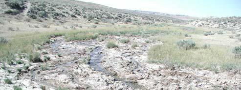
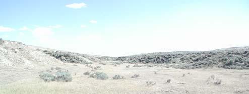
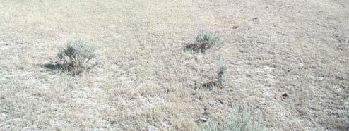
1 Section 20 Tier 2 Issues CBNG Development Larry C. Munn, Ph. D. Professor of Soil Science Department of Renewable Resources University of Wyoming Soil Development Semi-Arid Landscapes Precipitation less than Potential Evapo- Transpiration (PET). Since the end of the Pleistocene, the soils have been dry. The salt in the soil represents accumulation over a minimum of 15,000 years with essentially no leaching. Nature of the Landscape Evapo-transpiration greater than precipitation. Topography (and wind) redistributes water over the landscape. Soil depth parallels water availability. Little precipitation enters the soil in winter. Vegetation growth dries the soil every year. On uplands, water movement is by overland flow, not subsurface flow. Soils are not connected to a water table. Nature of the Landscape Erosion exceeds soil formation on steep slopes not protected by vegetation or rock. Rootzone is defined by water available each year. In most years it wets down into the Bk horizon and is then transpired. Most of the soils are non-saline (95%). Water in salt laden rivers like the Powder originated as salt free rain and snow. 1
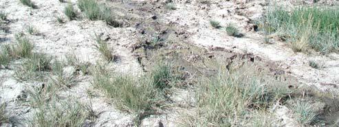
2 The Soil Landscape of Powder River Basin Aridisols (desert soils) have accumulations of clay, calcium carbonate, gypsum and soluble salts. Entisols (very young soils) are little changed from geologic materials. Saline soils are relatively rare (5 to 10% of the landscape). Salts come from weathering of rock minerakls and dust. Aridisols Mature, well developed desert soils. Have developed over thousands or tens of thousands of years. Water moves down into the soil dependant on Most Wyoming Aridisols have subsoil accumulations of CaCO 3. Slopes on which they are found are usually 10% or less. Entisols Commonly of two types: Torrifluvents along alluvial channels and Torriorthents on slopes and ridges. Torriorthents commonly occur on slopes greater than 10% (10 to 50%). Torriorthents are often moderately deep (50 cm to 100 cm) or shallow (less than 50 cm) to hard or soft bedrock. Water quality issues related to discharge into ephemeral channels Salinity Sodicity Conversion to perennial flow. 2
3 Salinity Measured as Electrical Conductivity (EC) or Total Dissolved Solids (TDS). EC (micromhos/cm) X.640 = TDS (ppm) (low salinity) Human Drinking Water: 700 micromhos/cm or 450 ppm TDS Salinity Most common problem is yield reduction. At high levels only halophytic plants can survive and grow. Species present change as salinity increases. Wet saline sites can produce high biomass (may not be palatable) but dry saline sites show lower production than normal (non-saline) soils. Sodium salt is very soluble! A maximum of 35.7 grams of NaCl will dissolve in 100 ml of water. A maximum of 0.24 grams of CaSO 4 will dissolve in 100 ml of water. A maximum of grams of CaCO 3 will dissolve in 100 ml of water. Sodicity sodic soils have poor infiltration and permeability. problems in soil caused by high sodium level on soil exchange sites. problems with water related to proportion Na, Ca, and Mg. Sodium Adsorption Ratio (SAR) 3
.")

4 Sodicity SAR = Na/ ((Ca + Mg)/2) ½ ; Na, Ca and Mg in millequivalents/l The effects of high SAR are related to salinity; high salinity will allow high SAR water to infiltrate. Tier 2 does not require high salinity to balance sodicity. High SAR can be a problem at low salinity levels (i.e. salinity and sodicity not directly related). Soil and Water Interactions The soils on the landscape reflect recent and past climate, vegetation, topography with a major influence by geology Soluble salts will be closer to the surface under sodium affected layers. Soil and Water Interactions Average Exchangeable Sodium Percentage has no physical meaning in the soil has no physical meaning in the soil. ESP above level which causes dispersion in a particular layer is critical. Depth of high ESP layer is also critical (at the surface is worst!). 4

.")


5 Tier 2 Procedures Composite samples from different sampling points before analyzing. Average salinity for profile. Divide by 1.5. Average ESP or SAR in soils (ever!). All the above are scientifically invalid. Photo: Dr. Harold Stepphuhn, Agriculture and Agri-Food Canada From the cover of: Daniel Hillel, 2000 Salinity Management for Sustainable Irrigation 5
6 6