Application of a Basin Scale Hydrological Model for Characterizing flow and Drought Trend
|
|
|
- Sharon Waters
- 6 years ago
- Views:
Transcription

1 Application of a Basin Scale Hydrological Model for Characterizing flow and Drought Trend 20 July 2012 International SWAT conference, Delhi INDIA TIPAPORN HOMDEE 1 Ph.D candidate Prof. KOBKIAT PONGPUT 1 Dr. YOSHIHIKO ISERI 2 Prof. SHINJIRO KANAE 2 1 Department of Water Resource Engineering, Faculty of Engineering, Kasetsart University, Thailand, 2Department of Mechanical and Environmental Informatics, Tokyo Institute of Technology, Tokyo, Japan
2 Contents Introduction Study area description and data Statement of problems and Objectives Methodology Simulation model (SWAT) Analysis of hydrological drought : threshold level and streamflow drought index Results and Conclusions 2

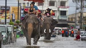

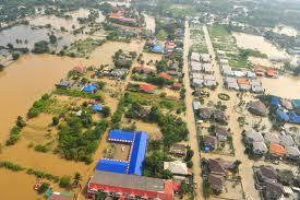
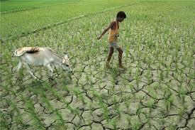
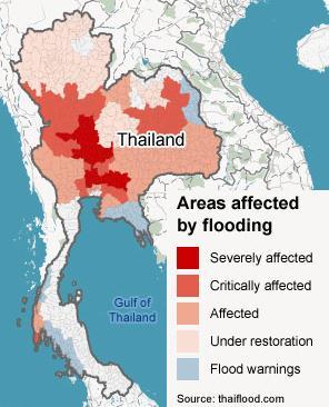


3 Introduction: How extreme climate hits Thailand? Floods Droughts 3


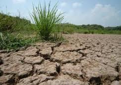
4 Types of drought a lack of precipitation over the region for a period of time declining of soil moisture and consequent crop failure without any reference to surface water resourced inadequate surface and subsurface water resources failure of water resources systems to meet water demands occurring when demand exceeds supply Relationship between meteorological, agricultural, hydrological and socio-economic drought (Source: national Drought Mitigation Center, University of Nebraska-Lincon, USA) 4

5 Study area Total catchment Area: 49,477 km 2 (60 % rainfed agricultural area ) Most area is high plateau ( steep at the upstream mountain area and flat at the lower part ) the tropical monsoon region Drought events : Dry spells always occurred in Jun July : an important period for agriculture Dry up in river always occurred in dry season Frequency, severity and duration of drought are higher than other regions (Suwanabatr and Mekhora, 2002). 5
6 Statement of problems Thailand : experienced with repeated deficit of river discharges but there is still less research conducted for hydrological drought analysis in the basin. The suitable evaluation will be useful to predict and monitor drought events in the future leading to a disaster risk reduction through early warning. Objectives propose the criterion for evaluating hydrological drought using two methods; the threshold level method and the standardized streamflow drought index (SDI). 6
7 Scope of this study Data collection Meteorological data: Precipitation Winds speed Relative humidity Solar radiation Temperature GIS data DEM Soil map Land use map Hydrological model SWAT model Sensitivity analysis Calibration and validation Flow time series Drought Analysis Threshold level method Standardized drought index (SDI) 7
 Recharge to deep aquifer SW = Soil Water Content")
8 Methodology : Hydrological Simulation Model The Schematic Hydrologic Cycle Evaporation and Transpiration Root Zone Vadose Zone Precipitation Surface Runoff Infiltration/plant uptake/ Soil moisture redistribution Lateral Flow Unconfined aquifer Confined aquifer Revap from shallow aquifer Flow out of watershed Percolation Return Flow (baseflow) Recharge to deep aquifer SW = Soil Water Content (mm H2O) Rday = Amount of precipitation Qsurf = Amount of surface runoff ET = Amount of daily evapotranspiration Wseep = Amount of water entering the vadose zone from the soil profile International SWAT Conference, Delhi INDIA Qgw = Amount of return Kasetsart flow University


 Soil Types Main Soil types Loam Sandy clay Clay loam")
9 Methodology: SWAT Simulation model DEM steep slope at the upstream mountain area and flat at the lower part. Watershed Delineation HRU Determination Flow simulation Land use Rice 43.5 % Forest deciduous 20.4 % Agricultural area 25.4 % (cassava, corn, sugarcane) Others 19.0% Sensitivity Analysis Base flow Separation: Automated Base flow Separation &Recession Analysis Technique (Arnold et al.1995) Soil Types Main Soil types Loam Sandy clay Clay loam Calibration and Validation Simulated Flow Evaluation 9
10 Methodology: Drought Analysis 1) Threshold level method: a constant or a variables threshold which can be chosen in several ways: the mean or median over a long period of flows Threshold value 10
11 Methodology: Drought Analysis Standardized Streamflow drought index (SDI) identical to the monthly standardized streamflow volume. To calculate SDI index, average of monthly streamflow was estimated as following formula. designed drought characteristic by standardized streamflow volume, which used threshold level as monthly basis as follows: 11
12 Results: Calibration and Validation model 2,500 Simulated flow Observed 2,000 Calibration Validation Discharge (m^3/s) 1,500 1, Nash = 0.81 R 2 = Parameters Description Model default CN Initial SCS CN II 10% to +10% Time (monthly) Esco Soil evaporation compensation factor SOL_AWC Available water capacity 15% to +15% Alpha_BF Baseflow alpha factor GW_REVEP Groundwater revap coefficient Rchrg_dp Deep aquifer percolation fraction Gw_Delay Groundwater delay 0-50 days Ranking of the seven most sensitive parameters 12

13 Results: Calibration and Validation model Observed streamflo w Calibration Validation R 2 Nash R 2 Nash E E E E E E E E E E8A E E32A World Meteorological Organization (WMO) recommended a minimum density for precipitation gauge network of km2 per station for mountain area. 13
 95 percentile of")
14 Results: Assessment of drought duration and severity 1) Threshold level method Define Threshold value : Flow Duration Curve (FDC) 95 percentile of flows 14
15 Results: Drought duration and severity Table 1 Streamflow drought events and their severity for Chi river basin at outlet basin E20A ( ) No. Year of event Onset date Termination date Durations (days) Severity (MCM) Jul 28-Jul Aug 20-Aug Jun 18-Jun Jul 22-Jul Sep 8-Oct Feb 28-Feb Sep 18-Sep Nov 10-Dec Apr 27-May Jun 21-Jun Oct 30-Oct Dec 30-Dec Jan 31-Jan Mar 21-Mar May 26-May Jun 16-Jun Feb 26-Feb Jun 30-Jun Nov 31-Nov Jan 31-Jan Apr 19-Apr Jun 6-Jun Aug 6-Aug Sep 14-Sep Nov 6-Nov Jan 31-Jan Mar 31-Mar
 Standardized streamflow drought index")
16 Results: Assessment of drought duration and severity 2) Standardized streamflow drought index (SDI ) 16
17 Conclusions The SWAT model was applied to assess changes in hydrological drought occurrences. the model performs sufficient well to simulate flow in the basin with relatively high values of coefficient of determination and Nash-Sutcliffe coefficient. Most sensitive parameters are the parameters representing surface runoff and soil properties such as CN, Esco and SOL_AWC. Propose criteria to characterize hydrological drought conditions (in terms of duration, frequency and severity. ) These results showed that the drought trends computed by threshold level and SDI are broadly consistency and likely reliable coinciding with such a kind of actual drought as El Niño events. However, drought analysis are subjective depending on objective, perspective and region of interest, thus application is much more significant. 17
18 18
Inside of forest (for example) Research Flow
 Research Flow") Study on Relationship between Watershed Hydrology and Lake Water Environment by the Soil and Water Assessment Tool (SWAT) Shimane University Hiroaki SOMURA Watershed degradation + Global warming Background
Study on Relationship between Watershed Hydrology and Lake Water Environment by the Soil and Water Assessment Tool (SWAT) Shimane University Hiroaki SOMURA Watershed degradation + Global warming Background
Evaluation of Swat for Modelling the Water Balance and Water Yield in Yerrakalva River Basin, A.P. National Institute of Hydrology, Roorkee
 Evaluation of Swat for Modelling the Water Balance and Water Yield in Yerrakalva River Basin, A.P. By Dr. J.V. Tyagi Dr. Y.R.S. Rao National Institute of Hydrology, Roorkee INTRODUCTION Knowledge of water
Hamid R. Solaymani. A.K.Gosain
 Motivation An integrated management plan is required to prevent the negative impacts of climate change on social- economic and environment aspects Each of these segments is expected to be strongly impacted
Evaluating the Reduction Effect of Nonpoint Source Pollution Loads from Upland Crop Areas by Rice Straw Covering Using SWAT
 SESSION J2 : Water Resources Applications - I New Delhi, India 2012 International SWAT Conference Evaluating the Reduction Effect of Nonpoint Source Pollution Loads from Upland Crop Areas by Rice Straw
Parameter Calibration of SWAT Hydrology and Water Quality Focusing on Long-term Drought Periods
 2017 SWAT June 28-30, 2017 Centrum Wodne SGGW, Warsaw, Poland Theme I3 Environmental Applications Room: Assembly Hall 2 2017 International SWAT Conference Parameter Calibration of SWAT Hydrology and Water
Lanie A. Alejo & Victor B. Ella* University of the Philippines Los Baños. *presenter
 ASSESSING THE IMPACTS OF CLIMATE CHANGE ON DEPENDABLE FLOW AND POTENTIAL IRRIGABLE AREA USING THE SWAT MODEL: THE CASE OF MAASIN RIVER WATERSHED IN LAGUNA, PHILIPPINES Lanie A. Alejo & Victor B. Ella*
IMPACT OF LAND USE/COVER CHANGES ON STREAMFLOW:
 IMPACT OF LAND USE/COVER CHANGES ON STREAMFLOW: THE CASE OF HARE RIVER WATERSHED, ETHIOPIA Kassa Tadele and Gerd Foerch University of Siegen July 06, 2007 Presentation outline 1. Introduction Study area
soil losses in a small rainfed catchment with Mediterranean
 Using SWAT to predict climate change effects on runoff and soil losses in a small rainfed catchment with Mediterranean climate of NE Spain Ramos MC, Martínez-Casasnovas JA Department of Environment and
Simulation of stream discharge from an agroforestry catchment in NW Spain using the SWAT model
 Simulation of stream discharge from an agroforestry catchment in NW Spain using the SWAT model Rodríguez-Blanco, M.L. 1, 2, Taboada-Castro, M.M. 1, Arias, R. 1, Taboada-Castro, M.T. 1, Nunes, J.P. 2, Rial-Rivas,
Estimation of transported pollutant load in Ardila catchment using the SWAT model
 June 15-17 Estimation of transported pollutant load in Ardila catchment using the SWAT model 1 Engineering Department Polytechnic Institute of Beja 2 Section of Environmental and Energy Technical University
Malfunctioning of streamgauge stations in the Chanza and Arochete rivers (Huelva, Spain) detected from hydrological modeling with SWAT.
 detected from hydrological modeling with SWAT.") Malfunctioning of streamgauge stations in the Chanza and Arochete rivers (Huelva, Spain) detected from hydrological modeling with SWAT. L. Galván, M. Olías and A. Van Griensven Introduction The Odiel river
Malfunctioning of streamgauge stations in the Chanza and Arochete rivers (Huelva, Spain) detected from hydrological modeling with SWAT. L. Galván, M. Olías and A. Van Griensven Introduction The Odiel river
Assessing the impact of projected climate changes on small coastal basins of the Western US
 Assessing the impact of projected climate changes on small coastal basins of the Western US William Burke Dr. Darren Ficklin Dept. of Geography, Indiana University Introduction How will climate change
APPLICATION OF SWAT MODEL TO THE STUDY AREA
 CHAPTER 5 APPLICATION OF SWAT MODEL TO THE STUDY 5.1 Introduction The Meenachil river basin suffers from water shortage during the six non-monsoon months of the year. The available land and water resources
Evaluation of Mixed Forest Evapotranspiration and Soil Moisture using Measured and SWAT Simulated Results in a Hillslope Watershed
 KONKUK UNIVERSITY Evaluation of Mixed Forest Evapotranspiration and Soil Moisture using Measured and SWAT Simulated Results in a Hillslope Watershed 5 August 2010 JOH, Hyung-Kyung Graduate Student LEE,
Comparative analysis of SWAT model with Coupled SWAT-MODFLOW model for Gibbs Farm Watershed in Georgia
 2018 SWAT INTERNATIONAL CONFERENCE, JAN 10-12, CHENNAI 1 Comparative analysis of SWAT model with Coupled SWAT-MODFLOW model for Gibbs Farm Watershed in Georgia Presented By K.Sangeetha B.Narasimhan D.D.Bosch
Modelling of the Hydrology, Soil Erosion and Sediment transport processes in the Lake Tana Catchments of Blue Nile River Basin, Ethiopia
 Modelling of the Hydrology, Soil Erosion and Sediment transport processes in the Lake Tana Catchments of Blue Nile River Basin, Ethiopia Combining Field Data, Mathematical Models and Geographic Information
Application of the SWAT Model to the Hii River Basin, Shimane Prefecture, Japan
 Application of the SWAT Model to the Hii River Basin, Shimane Prefecture, Japan H. Somura, I. Takeda, Y. Mori Shimane University D. Hoffman Blackland Research and Extension Center J. Arnold Grassland Soil
Hydrological Modelling of Narmada basin in Central India using Soil and Water Assessment Tool (SWAT)
") Hydrological Modelling of Narmada basin in Central India using Soil and Water Assessment Tool (SWAT) T. Thomas, N. C. Ghosh, K. P. Sudheer National Institute of Hydrology, Roorkee (A Govt. of India Society
Hydrological Modelling of Narmada basin in Central India using Soil and Water Assessment Tool (SWAT) T. Thomas, N. C. Ghosh, K. P. Sudheer National Institute of Hydrology, Roorkee (A Govt. of India Society
EVALUATION OF ArcSWAT MODEL FOR STREAMFLOW SIMULATION
 EVALUATION OF ArcSWAT MODEL FOR STREAMFLOW SIMULATION 212 International SWAT Conference By Arbind K. Verma 1 and Madan K.Jha 2 1. Assistant Professor, SASRD, Nagaland University, Ngaland (India) 2. Professor,
Analyzing water resources in a monsoon-driven environment an example from the Indian Western Ghats
 Analyzing water resources in a monsoon-driven environment an example from the Indian Western Ghats 1, Shamita Kumar 2, Peter Fiener 1 and Karl Schneider 1 1,,, Germany 2 Institute of Environment Education
Study of Hydrology based on Climate Changes Simulation Using SWAT Model At Jatiluhur Reservoir Catchment Area
 Study of Hydrology based on Climate Changes Simulation Using SWAT Model At Jatiluhur Reservoir Catchment Area Budi Darmawan Supatmanto 1, Sri Malahayati Yusuf 2, Florentinus Heru Widodo 1, Tri Handoko
Assessment of sediment and carbon flux in a tropical watershed: the Red River study case (China and Vietnam)
") Assessment of sediment and carbon flux in a tropical watershed: the Red River study case (China and Vietnam) Xi WEI Supervisors: Sabine SAUVAGE, Jose-Miguel SANCHEZ-PEREZ, Thi Phuong Quynh LE 2 th September
Assessment of sediment and carbon flux in a tropical watershed: the Red River study case (China and Vietnam) Xi WEI Supervisors: Sabine SAUVAGE, Jose-Miguel SANCHEZ-PEREZ, Thi Phuong Quynh LE 2 th September
Regional Seminar on SWAT, SANREM Book Launch and SWAT Workshop, Bogor, Indonesia (SWAT School of Bogor) June 27-29, 2012
 June 27-29, 2012") Regional Seminar on SWAT, SANREM Book Launch and SWAT Workshop, Bogor, Indonesia (SWAT School of Bogor) June 27-29, 2012 Introduction Objectives SWAT application Results Acknowledgements 2 Bi Doup - Núi
Regional Seminar on SWAT, SANREM Book Launch and SWAT Workshop, Bogor, Indonesia (SWAT School of Bogor) June 27-29, 2012 Introduction Objectives SWAT application Results Acknowledgements 2 Bi Doup - Núi
Using SWAT to understand the eco-hydrological response to droughts of a dry Mediterranean agro-forested catchment, southern Portugal
 GOVERNMENT OF THE PORTUGUESE REPUBLIC 213 International SWAT Conference & Workshops - Toulouse, France July 15-19, 213, Toulouse Using SWAT to understand the eco-hydrological response to droughts of a
SWAT application to simulate the impact of soil conservation measurements on soil and nutrient losses in a small basin with mechanised vineyards
 Soil loss prediction using SWAT in a small ungaged catchment Soil loss prediction using SWAT in a small ungaged catchment with Mediterranean climate and vines as the main land use Ramos MC & Martínez-Casasnovas
Evaluation of future climate change impacts on hydrologic processes in the Peruvian Altiplano region using SWAT
 Evaluation of future climate change impacts on hydrologic processes in the Peruvian Altiplano region using SWAT Carlos Antonio Fernández-palomino (cafpxl@gmail.com) 1,2 ; Fred F. Hattermann 1 ; Waldo S
M.L. Kavvas, Z. Q. Chen, M. Anderson, L. Liang, N. Ohara Hydrologic Research Laboratory, Civil and Environmental Engineering, UC Davis
 Assessment of the Restoration Activities on Water Balance and Water Quality at Last Chance Creek Watershed Using Watershed Environmental Hydrology (WEHY) Model M.L. Kavvas, Z. Q. Chen, M. Anderson, L.
Hydrological And Water Quality Modeling For Alternative Scenarios In A Semi-arid Catchment
 Hydrological And Water Quality Modeling For Alternative Scenarios In A Semi-arid Catchment AZIZ ABOUABDILLAH, ANTONIO LO PORTO METIER Final Conference: Brussels, Belgium-4-6 November 2009 Outline Problem
Joint Research Centre (JRC)
") Joint Research Centre (JRC) Marco Pastori and Faycal Bouraoui IES - Institute for Environment and Sustainability Ispra - Italy http://ies.jrc.ec.europa.eu/ http://www.jrc.ec.europa.eu/ CONTENT Introduction
Joint Research Centre (JRC) Marco Pastori and Faycal Bouraoui IES - Institute for Environment and Sustainability Ispra - Italy http://ies.jrc.ec.europa.eu/ http://www.jrc.ec.europa.eu/ CONTENT Introduction
Effects of land use change on the water resources of the Basoda basin using the SWAT model
 INDIAN INSTITUTE OF TECHNOLOGY ROORKEE Effects of land use change on the water resources of the Basoda basin using the SWAT model By Santosh S. Palmate* 1 (Ph.D. Student) Paul D. Wagner 2 (Postdoctoral
Agricultural Production Forecasting Using Planning Distribution Model (PDM):A Case Study of the Nam Oon Project
:A Case Study of the Nam Oon Project") Kasetsart J. (Nat. Sci.) 35 : 344-353 (2001) Agricultural Production Forecasting Using Planning Distribution Model (PDM):A Case Study of the Nam Oon Project Preeyaphorn Kosa and Kobkiat Pongput ABSTRACT
Kasetsart J. (Nat. Sci.) 35 : 344-353 (2001) Agricultural Production Forecasting Using Planning Distribution Model (PDM):A Case Study of the Nam Oon Project Preeyaphorn Kosa and Kobkiat Pongput ABSTRACT
Use of a distributed catchment model to assess hydrologic modifications in the Upper Ganges Basin
 River Basin Management VI 177 Use of a distributed catchment model to assess hydrologic modifications in the Upper Ganges Basin L. Bharati 1, V. Smakhtin 2, P. Jayakody 2, N. Kaushal 3 & P. Gurung 1 1
Agricultural drought analysis in the Arrecife basin (Pampas region, Argentina) using the SWAT model
 using the SWAT model") Agricultural drought analysis in the Arrecife basin (Pampas region, Argentina) using the SWAT model Mag. Sofia B. Havrylenko, Dr. José María Bodoque del Pozo, Mag. Graciela V. Zucarelli, Ph. Dr. Pablo
Agricultural drought analysis in the Arrecife basin (Pampas region, Argentina) using the SWAT model Mag. Sofia B. Havrylenko, Dr. José María Bodoque del Pozo, Mag. Graciela V. Zucarelli, Ph. Dr. Pablo
Hydrologic assessment in a Brazilian forest watershed using SWAT model
 2014 International SWAT Conference Porto de Galinhas, Brazil Hydrologic assessment in a Brazilian forest watershed using SWAT model Nadia Bernardi Bonumá; C. W. Corseuil; C. G. Rossi; M. Kobiyama; P R.
Regionalization of SWAT Model Parameters for Use in Ungauged Watersheds
 Water 21, 2, 849-871; doi:1.339/w24849 OPEN ACCESS water ISSN 273-4441 www.mdpi.com/journal/water Article Regionalization of SWAT Model Parameters for Use in Ungauged Watersheds Margaret W. Gitau 1, *and
M.L. Kavvas, Z. Q. Chen, M. Anderson, L. Liang, N. Ohara Hydrologic Research Laboratory, Civil and Environmental Engineering, UC Davis
 Assessment of the Restoration Activities on Water Balance and Water Quality at Last Chance Creek Watershed Using Watershed Environmental Hydrology (WEHY) Model M.L. Kavvas, Z. Q. Chen, M. Anderson, L.
SNAMP water research. Topics covered
 SNAMP water research SNAMP water team UC Merced Topics covered Objectives, goals & overview What & why the water component of SNAMP Pre-treatment Observations Water Quality Water Quantity Modeling & Scenarios:
Lecture 9A: Drainage Basins
 GEOG415 Lecture 9A: Drainage Basins 9-1 Drainage basin (watershed, catchment) -Drains surfacewater to a common outlet Drainage divide - how is it defined? Scale effects? - Represents a hydrologic cycle
Estimated Calibration Parameters in SWAT Model for Andean Watersheds
 Estimated Calibration Parameters in SWAT Model for Andean Watersheds Jefferson Valencia Gómez Decision and Policy Analysis j.valencia@cgiar.org July 18 th, 2013 Ecosystem Services Team Marcela Quintero
Assessment of Watershed Soundness by Water Balance Using SWAT Model for Han River Basin, South Korea
 2015 International SWAT Conference & Workshops October 12-16, 2015 Purdue University, USA SESSION A3: HYDROLOGY Room: Stewart 278 2015 International SWAT Conference Assessment of Watershed Soundness by
Sixth Semester B. E. (R)/ First Semester B. E. (PTDP) Civil Engineering Examination
/ First Semester B. E. (PTDP) Civil Engineering Examination") CAB/2KTF/EET 1221/1413 Sixth Semester B. E. (R)/ First Semester B. E. (PTDP) Civil Engineering Examination Course Code : CV 312 / CV 507 Course Name : Engineering Hydrology Time : 3 Hours ] [ Max. Marks
CAB/2KTF/EET 1221/1413 Sixth Semester B. E. (R)/ First Semester B. E. (PTDP) Civil Engineering Examination Course Code : CV 312 / CV 507 Course Name : Engineering Hydrology Time : 3 Hours ] [ Max. Marks
UNCERTAINTY ISSUES IN SWAT MODEL CALIBRATION AT CIRASEA WATERSHED, INDONESIA.
 UNCERTAINTY ISSUES IN SWAT MODEL CALIBRATION AT CIRASEA WATERSHED, INDONESIA. Sri Malahayati Yusuf 1 Kukuh Murtilaksono 2 1 PhD Student of Watershed Management Major, Bogor Agricultural University 2 Department
Model to assess the impacts of external drivers on the hydrology of the Ganges River Basin
 76 Evolving Water Resources Systems: Understanding, Predicting and Managing Water Society Interactions Proceedings of ICWRS2014, Bologna, Italy, June 2014 (IAHS Publ. 364, 2014). Model to assess the impacts
Modeling the production of multiple ecosystems services from agricultural and forest landscape in Rhode Island
 Modeling the production of multiple ecosystems services from agricultural and forest landscape in Rhode Island Tingting Liu a, Nathaniel H. Merrill a, Arthur J. Gold b, Dorothy Q. Kellogg b and Emi Uchida
Field Observations and Model Simulations of an Extreme Drought Event in the Southeast Brazil
 Field Observations and Model Simulations of an Extreme Drought Event in the Southeast Brazil Leonardo Domingues, Humberto Rocha, Jonathan Mota da Silva Warsaw, Poland 2017 Jaguari Sub-basin Drainage area:
Jian Liu, Tamie L. Veith, Amy S. Collick, Peter J. A. Kleinman, Douglas B. Beegle, and Ray B.
 Jian Liu, Tamie L. Veith, Amy S. Collick, Peter J. A. Kleinman, Douglas B. Beegle, and Ray B. Bryant Seasonal manure application timing and storage effects on field and watershed level phosphorus losses
Institute of Water and Flood Management, BUET, Dhaka. *Corresponding Author, >
 ID: WRE 002 HYDROLOGICAL MODELING FOR THE SEMI UNGAUGED BRAHMAPUTRA RIVER BASIN USING SWAT MODEL S. Paul 1*, A.S. Islam 1, M. A. Hasan 1, G. M.T. Islam 1 & S. K. Bala 1 1 Institute of Water and Flood Management,
Water Resources Status in Danube River Basin. SWAT Conference_ Spain, Toledo June 2011
 Water Resources Status in Danube River Basin SWAT Conference_ Spain, Toledo June 2011 Objectives Objectives Building and calibratîng a hydrologic model of Danube Basin Using SWAT and SWAT CUP Quantifying
Calibration and sensitivity analysis of SWAT for a small forested catchment, northcentral
 Calibration and sensitivity analysis of SWAT for a small forested catchment, northcentral Portugal Rial-Rivas, M.E. 1 ; Santos, J. 1 ;Bernard-Jannin L. 1 ; Boulet, A.K. 1 ; Coelho, C.O.A. 1 ; Ferreira,
IMPROVEMENT AND APPLICATION OF THE MODEL FOR PREDICTING PESTICIDE TRANSPORT: A CASE STUDY OF THE SAKURA RIVER WATERSHED
 SWAT 2018 / VUB-Brussels, Belgium IMPROVEMENT AND APPLICATION OF THE PCPF-1@SWAT2012 MODEL FOR PREDICTING PESTICIDE TRANSPORT: A CASE STUDY OF THE SAKURA RIVER WATERSHED GLOBAL SUSTAINABLE RICE PRODUCTION
Surface Soil Moisture Assimilation with SWAT
 Surface Soil Moisture Assimilation with SWAT Eunjin Han, Venatesh Merwade School of Civil Engineering, Purdue University, West Lafayette, IN, USA Gary C. Heathman USDA-ARS, National Soil Erosion Research
Modélisation sur Enxoé - Lisbonne, 9-11 mars 2011
 Modélisation sur Enxoé - Lisbonne, 9-11 mars 211 1 Enxoé watershed Description Area : 6km2 River Length: 9km Altitude Range: 16 35m Annual Precipitation: 5mm Pressures: 5% NoIrrigAgriculture/Pasture; 35%
Assessment of impacts of climate change on runoff: River Nzoia catchment, Kenya. Githui F. W, Bauwens W. and Mutua F.
 Assessment of impacts of climate change on runoff: River Nzoia catchment, Kenya by Githui F. W, Bauwens W. and Mutua F. Objective To investigate the impact of climate change on runoff of Nzoia river catchment
Reservoir on the Rio Boba
 Reservoir on the Rio Boba Michael J. Burns II Guillermo Bustamante J. James Peterson Executive Summary The National Institute of Water Resources in the Dominican Republic (INDRHI) plans to construct a
EXTREME EVENTS AFFECTING WATER RESOURCES IN THE HOPE RIVER WATERSHED IN JAMAICA: USE OF WETSPRO FOR BASEFLOW SEPARATION AND ITS LONG TERM TREND
 EXTREME EVENTS AFFECTING WATER RESOURCES IN THE HOPE RIVER WATERSHED IN JAMAICA: USE OF WETSPRO FOR BASEFLOW SEPARATION AND ITS LONG TERM TREND A.Mandal 1, P.Donk 2, J.Sidial 1 and M.Curtis 1 1. Department
Illinois in Drought. June 19, 2012, Updated June 21, 2012
 June 19,, Updated June 21, Illinois in Drought The ISWS now considers central and southern Illinois to be fully in drought based on several impacts including the early season onset of reservoir drawdown
CENTRAL ASSINIBOINE INTEGRATED WATERSHED MANAGEMENT PLAN SURFACE WATER HYDROLOGY REPORT
 CENTRAL ASSINIBOINE INTEGRATED WATERSHED MANAGEMENT PLAN SURFACE WATER HYDROLOGY REPORT Planning Area Boundary: The Central Assiniboine planning area covers the reach of the Assiniboine River from just
SIMULATING HYDROLOGICAL ALTERATIONS IN THE CONDITIONS OF LIMITED DATA: LESSONS FROM THE WALAWE RIVER BASIN IN SRI LANKA
 SIMULATING HYDROLOGICAL ALTERATIONS IN THE CONDITIONS OF LIMITED DATA: LESSONS FROM THE WALAWE RIVER BASIN IN SRI LANKA Neelanga Weragala 1) and Vladimir Smakhtin 2) International Water Management Institute
Improved Lower Mekong River Basin Hydrological Decision Making Using NASA Satellite-based Earth Observation Systems
 Improved Lower Mekong River Basin Hydrological Decision Making Using NASA Satellite-based Earth Observation Systems Ibrahim Mohammed Ibrahim.mohammed@nasa.gov John Bolten R. Srinivasan Venkat Lakshmi AGU
A comparison study of multi-gage and single-gage calibration of the SWAT model for runoff simulation in Qingjiang river basin
 A comparison study of multi-gage and single-gage calibration of the SWAT model for runoff simulation in Qingjiang river basin Dan YU, Xiaohua DONG, Lei LI, Sanhong SONG, Zhixiang LV and Ji LIU China Three
Welcome to the MWON Advanced Webinar Series
 Welcome to the MWON Advanced Webinar Series Today s presentation: The Importance of Forests to Streams and Groundwater You will need to have speakers attached to your computer to hear the presenter. You
Utilization of the SWAT Model and Remote Sensing to Demonstrate the Effects of Shrub Encroachment on a Small Watershed
 Utilization of the SWAT Model and Remote Sensing to Demonstrate the Effects of Shrub Encroachment on a Small Watershed Jason Afinowicz Department of Biological and Agricultural Engineering Texas A&M University
The Spatial Analysis between SWAT Simulated Soil Moisture, and MODIS LST and NDVI Products
 Konkuk University, Seoul, South Korea The Spatial Analysis between SWAT Simulated Soil Moisture, and MODIS LST and NDVI Products Geun Ae PARK Post-doctoral Researcher, Dept. of Civil and Environmental
Comparison of SWAT Phosphorus Watershed Modeling Transport Model Routines
 Comparison of SWAT Phosphorus Watershed Modeling Transport Model Routines Cole Green, Jeff Arnold & Jimmy Williams With thanks to Mauro Di Luzio and Mark Tomer Overview I. South Fork of the Iowa River,
ENSO Impact to the Hydrological Drought in Lombok Island, Indonesia
 ENSO Impact to the Hydrological Drought in Lombok Island, Indonesia Karlina Kyoto University 2017/11/15 1 Background Drought occurs in high as well as low rainfall areas (Wilhite and Glantz 1985) The occurrence
The Impact of Climate Change on a Humid, Equatorial Catchment in Uganda.
 The Impact of Climate Change on a Humid, Equatorial Catchment in Uganda. Lucinda Mileham, Dr Richard Taylor, Dr Martin Todd Department of Geography University College London Changing Climate Africa has
EVALUATION OF HYDROLOGIC AND WATER RESOURCES RESPONSE TO METEOROLOGICAL DROUGHT IN THESSALY, GREECE
 EVALUATION OF HYDROLOGIC AND WATER RESOURCES RESPONSE TO METEOROLOGICAL DROUGHT IN THESSALY, GREECE A. LOUKAS*, AND L. VASILIADES Laboratory of Hydrology and Water Systems Analysis,, Volos, Greece *E-mail:
Evaluation of drought impact on groundwater recharge rate using SWAT and Hydrus models on an agricultural island in western Japan
 doi:10.5194/piahs-371-143-2015 Author(s) 2015. CC Attribution 3.0 License. Evaluation of drought impact on groundwater recharge rate using SWAT and Hydrus models on an agricultural island in western Japan
Watershed Modeling of Haw River Basin using SWAT for Hydrology, Water Quality and Climate Change Study
 Watershed Modeling of Haw River Basin using SWAT for Hydrology, Water Quality and Climate Change Study Somsubhra Chattopadhyay, Graduate Student Manoj K. Jha, Assistant Professor Civil Engineering Department
Effect of climate change on low-flow conditions in Ruscom River watershed, Ontario
 Effect of climate change on low-flow conditions in Ruscom River watershed, Ontario by Tirupati Bolisetti Co-Authors: M. Rahman and R. Balachandar August 5, 2009 Introduction Climate change refers to the
Characterising the Surface Hydrology of Prairie Droughts
 QdroD QdfoD Qdro Qdfo SunMax C:\ Program Files\ CRHM\ Qsi global CalcHr t rh ea u p ppt Qso Qn Qln SunAct form_data calcsun Qsi hru_t hru_rh hru_ea hru_u hru_p hru_rain hru_snow hru_sunact hru_tmax hru_tmin
Hydrologic Modeling with the Distributed-Hydrology- Soils- Vegetation Model (DHSVM)
") Hydrologic Modeling with the Distributed-Hydrology- Soils- Vegetation Model (DHSVM) DHSVM was developed by researchers at the University of Washington and the Pacific Northwest National Lab 200 Simulated
Hydrologic Modeling with the Distributed-Hydrology- Soils- Vegetation Model (DHSVM) DHSVM was developed by researchers at the University of Washington and the Pacific Northwest National Lab 200 Simulated
Evaluation of SWAT in the context of climate change in a German lowland catchment. Björn Guse, Matthias Pfannerstill and Nicola Fohrer
 Evaluation of SWAT in the context of climate change in a German lowland catchment Björn Guse, Matthias Pfannerstill and Nicola Fohrer Motivation Changing climate conditions affect hydrological cycle Demand
RAINFALL RUN-OFF AND BASEFLOW ESTIMATION
 CHAPTER 2 RAINFALL RUN-OFF AND BASEFLOW ESTIMATION 2.1 Introduction The west coast of India receives abundant rainfall from the southwest monsoon. The Western Ghats escarpment (Sahyadri mountain range)
July, International SWAT Conference & Workshops
 Analysis of the impact of water conservation measures on the hydrological response of a medium-sized watershed July, 212 212 International SWAT Conference & Workshops ANALYSIS OF THE IMPACT OF WATER CONSERVATION
ICELANDIC RIVER / WASHOW BAY CREEK INTEGRATED WATERSHED MANAGEMENT PLAN STATE OF THE WATERSHED REPORT CONTRIBUTION SURFACE WATER HYDROLOGY REPORT
 ICELANDIC RIVER / WASHOW BAY CREEK INTEGRATED WATERSHED MANAGEMENT PLAN STATE OF THE WATERSHED REPORT CONTRIBUTION SURFACE WATER HYDROLOGY REPORT Disclaimer: The hydrologic conditions presented in this
Impact of Climate Change on Water Resources of a Semi-arid Basin- Jordan
 Impact of Climate Change on Water Resources of a Semi-arid Basin- Jordan Prof. Fayez Abdulla Civil Engineering Department Jordan University of Science & Technology Presented at the Water in an Arid Land,
Lecture 5: Transpiration
 5-1 GEOG415 Lecture 5: Transpiration Transpiration loss of water from stomatal opening substomatal cavity chloroplasts cuticle epidermis mesophyll cells CO 2 H 2 O guard cell Evaporation + Transpiration
R. Srinivasan, J.H. Jacobs, J.W. Stuth, J. Angerer, R. Kaithio and N. Clarke
 Impacts of reforestation policy and agro-forestry technology on the environment and food security in the Upper Tana river basin of Kenya R. Srinivasan, J.H. Jacobs, J.W. Stuth, J. Angerer, R. Kaithio and
APPLICATION OF SWAT MODEL ON THREE WATERSHEDS WITHIN THE VENICE LAGOON WATERSHED (ITALY): SOURCE APPORTIONMENT AND SCENARIO ANALYSIS
: SOURCE APPORTIONMENT AND SCENARIO ANALYSIS") APPLICATION OF SWAT MODEL ON THREE WATERSHEDS WITHIN THE VENICE LAGOON WATERSHED (ITALY): SOURCE APPORTIONMENT AND SCENARIO ANALYSIS R. Salvetti*, A. Azzellino*, D. Gardoni*, R. Vismara*, M. Carpani**,
APPLICATION OF SWAT MODEL ON THREE WATERSHEDS WITHIN THE VENICE LAGOON WATERSHED (ITALY): SOURCE APPORTIONMENT AND SCENARIO ANALYSIS R. Salvetti*, A. Azzellino*, D. Gardoni*, R. Vismara*, M. Carpani**,
The effects of the short-term Brazilian sugarcane expansion in stream flow: Monte Mor basin case study
 The effects of the short-term Brazilian sugarcane expansion in stream flow: Monte Mor basin case study Hernandes, TAD; Scarpare, FV; Seabra, JEA; Duft, DG; Picoli, MCA; Walter, A Overview 12,000,000 10,000,000
Anthropogenic and climate change contributions to uncertainties in hydrological modeling of sustainable water supply
 Anthropogenic and climate change contributions to uncertainties in hydrological modeling of sustainable water supply Roman Corobov The Republic of Moldova Several words about Moldova The Republic of Moldova
Soil and Water Assessment Tool. R. Srinivasan Texas A&M University
 Soil and Water Assessment Tool R. Srinivasan Texas A&M University Model Philosophy Readily available input Physically based Comprehensive Process Interactions Simulate Management ARS Modeling History Time
Effects of climate change on streamflow in Kon Ha Thanh river watershed, Vietnam
 EPiC Series in Engineering Volume 3, 2018, Pages 2233 2240 Engineering HIC 2018. 13th International Conference on Hydroinformatics Effects of climate change on streamflow in Kon Ha Thanh river watershed,
Hydrological Modelling for Agricultural Water Management
 Hydrological Modelling for Agricultural Water Management P V Raju National Remote Sensing Centre Indian Space Research Organisation raju_pv @ nrsc.gov.in Hydrological Models Simulate Surface Runoff Soil
Turbidity Monitoring Under Ice Cover in NYC DEP
 Turbidity Monitoring Under Ice Cover in NYC DEP Reducing equifinality by using spatial wetness information and reducing complexity in the SWAT-Hillslope model Linh Hoang 1,2, Elliot M. Schneiderman 2,
Prairie Hydrology. If weather variability increases, this could degrade the viability of many aspects of ecosystems, human activities and economy
 Prairie Hydrology John Pomeroy, Xing Fang, Robert Armstrong, Tom Brown, Kevin Shook Centre for Hydrology, University of Saskatchewan, Saskatoon, Canada Climate Change for the Prairies? Highly variable
Assessing the benefit of improved precipitation input in SWAT model simulations
 Assessing the benefit of improved precipitation input in SWAT model simulations Ilyas Masih 1,2, Shreedhar Maskey 2, Stefan Uhlenbrook 2,3, Vladimir Smakhtin 1 1 International Water Management Institute
Climate change impacts on water resources in the Upper Po basin
 limate change impacts on water resources in the Upper Po basin Giovanni Ravazzani, Marco Mancini, hiara orbari, Alessandro eppi, Laura Boscarello, Giulia Ercolani Department of ivil and Environmental Engineering
TECHNICAL NOTE: ESTIMATION OF FRESH WATER INFLOW TO BAYS FROM GAGED AND UNGAGED WATERSHEDS. T. Lee, R. Srinivasan, J. Moon, N.
 TECHNICAL NOTE: ESTIMATION OF FRESH WATER INFLOW TO BAYS FROM GAGED AND UNGAGED WATERSHEDS T. Lee, R. Srinivasan, J. Moon, N. Omani ABSTRACT. The long term estimation of fresh water inflow to coastal bays
Proposed Project. Integrated Water Resources Management Using Remote Sensing Data in Upper Indus Basin
 Proposed Project Integrated Water Resources Management Using Remote Sensing Data in Upper Indus Basin Background Snowmelt contributes more than 6% of water resources of Upper Indus Basin Most of the moisture
Columbia, Missouri. Contents
 Supplemental Material to Accompany: Long-term Agro-ecosystem Research in the Central Mississippi River Basin, USA - SWAT Simulation of Flow and Water Quality in the Goodwater Creek Experimental Watershed
1 THE USGS MODULAR MODELING SYSTEM MODEL OF THE UPPER COSUMNES RIVER
 1 THE USGS MODULAR MODELING SYSTEM MODEL OF THE UPPER COSUMNES RIVER 1.1 Introduction The Hydrologic Model of the Upper Cosumnes River Basin (HMCRB) under the USGS Modular Modeling System (MMS) uses a
Hydrologic Simulations of the Maquoketa River Watershed Using SWAT
 Hydrologic Simulations of the Maquoketa River Watershed Using SWAT Manoj Jha Working Paper 09-WP 492 June 2009 Center for Agricultural and Rural Development Iowa State University Ames, Iowa 50011-1070
Calibrating the Soquel-Aptos PRMS Model to Streamflow Data Using PEST
 Calibrating the Soquel-Aptos PRMS Model to Streamflow Data Using PEST Cameron Tana Georgina King HydroMetrics Water Resources Inc. California Water Environmental and Modeling Forum 2015 Annual Meeting
Assessment of StreamFlow Using SWAT Hydrological Model
 Assessment of StreamFlow Using SWAT Hydrological Model Sreelakshmi C.M. 1 Dr.K.Varija 2 1 M.Tech student, Applied Mechanics and Hydraulics, NITK, Surathkal,India 2 Associate Professor, Department of Applied
DEVELOPMENT OF A HYDRO-GEOMORPHIC MODEL FOR THE LAGUNA CREEK WATERSHED
 DEVELOPMENT OF A HYDRO-GEOMORPHIC MODEL FOR THE LAGUNA CREEK WATERSHED Agenda Background Hydro-Geomorphic Modeling Methodology HEC-HMS Modeling How is the Model Used Background Proposition 50 Grant Funding
ACRU HYDROLOGICAL MODELLING OF THE MUPFURE CATCHMENT
 ACRU HYDROLOGICAL MODELLING OF THE MUPFURE CATCHMENT Table of Contents: 1 INTRODUCTION... 1 2 CONFIGURATION OF ACRU... 2 2.1 RAINFALL DATA... 4 2.2 SOILS... 7 2.3 LAND COVER INFORMATION... 9 2.4 STREAM
Assessment of nitrogen retention in the Seine river basin by different approaches
 Assessment of nitrogen in the Seine river basin by different approaches Grizzetti B. 1, Passy P. 1, Billen G. 1, Garnier J. 1, Bouraoui F. 2 1 CNRS/University Pierre et Marie Curie, Paris, France 2 European
CONTINUOUS RAINFALL-RUN OFF SIMULATION USING SMA ALGORITHM
 CONTINUOUS RAINFALL-RUN OFF SIMULATION USING SMA ALGORITHM INTRODUCTION Dr. R N Sankhua Director, NWA, CWC, Pune In this continuous rainfall-runoff simulation, we will perform a continuous or long-term