POND CONSTRUCTION. Woodland Steward Series
|
|
|
- Thomas Wilcox
- 6 years ago
- Views:
Transcription

1 POND CONSTRUCTION Woodland Steward Series
2 BOB TWOMEY DISTRICT CONSERVATIONIST USDA NATURAL RESOURCES CONSERVATION SERVICE
3 COURSE OUTLINE DEFINITION OF A POND OR LAKE TYPES OF PONDS GEOLOGIC CONSIDERATIONS TOPOGRAPHIC CONSIDERATIONS SOILS CONSIDERATIONS PERMITS & REGULATIONS SAFETY & LIABILITIES DESIGN & ENGINEERING TOUR CRADLE OF FORESTRY POND
4 DEFINITION OF A POND A WATER IMPOUNDMENT MADE BY CONSTRUCTING AN EMBANKMENT ACROSS A CHANNEL OR BY EXCAVATING A PIT OR DUGOUT. IT IS EITHER AN EMBANKMENT POND, AN EXCAVATED POND, OR A COMBINATION OF BOTH.
5 PONDS CONSTRUCTED BY BOTH EXCAVATION AND EMBANKMENT INSTALLATION ARE CALLED EMBANKMENT PONDS IF THE DEPTH OF WATER AGAINST THE EMBANKMENT (DAM) IS 3.0 FEET OR DEEPER

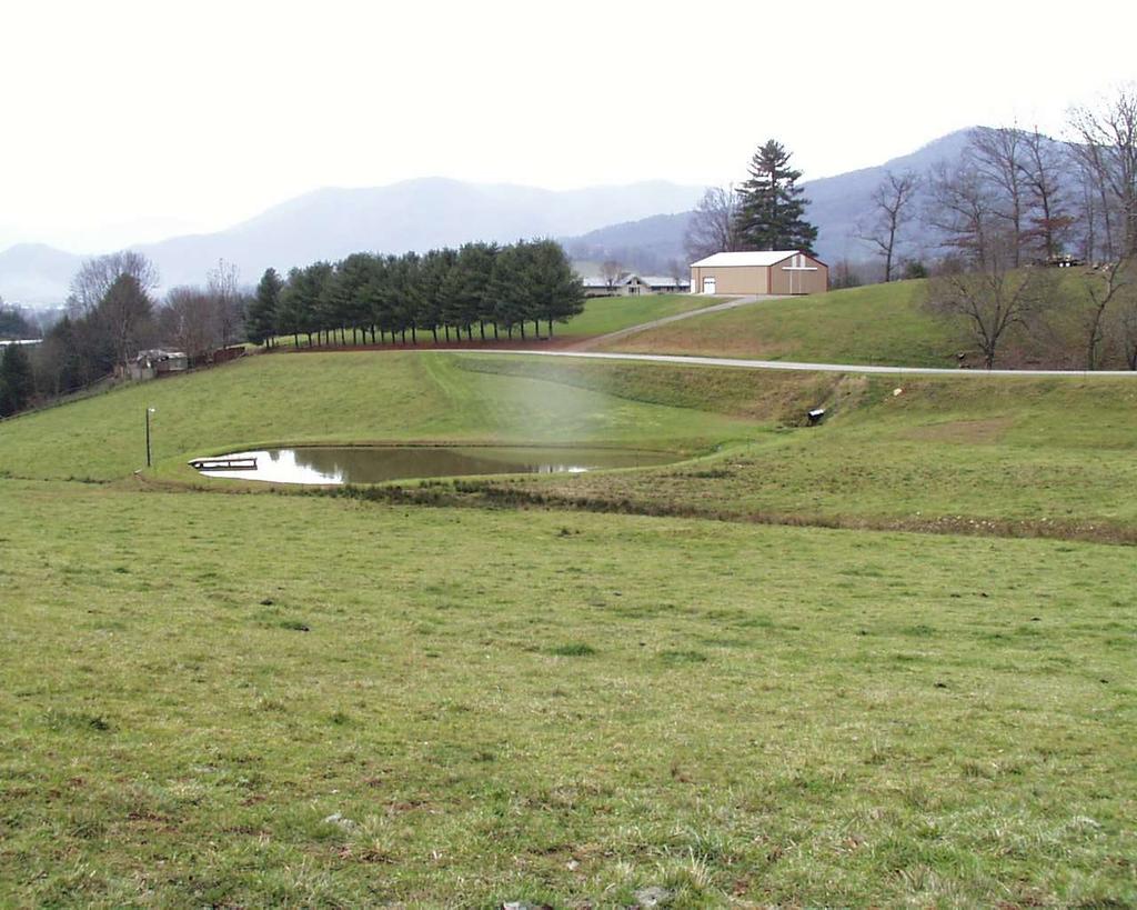
6 EXCAVATED POND EXCAVATED POND
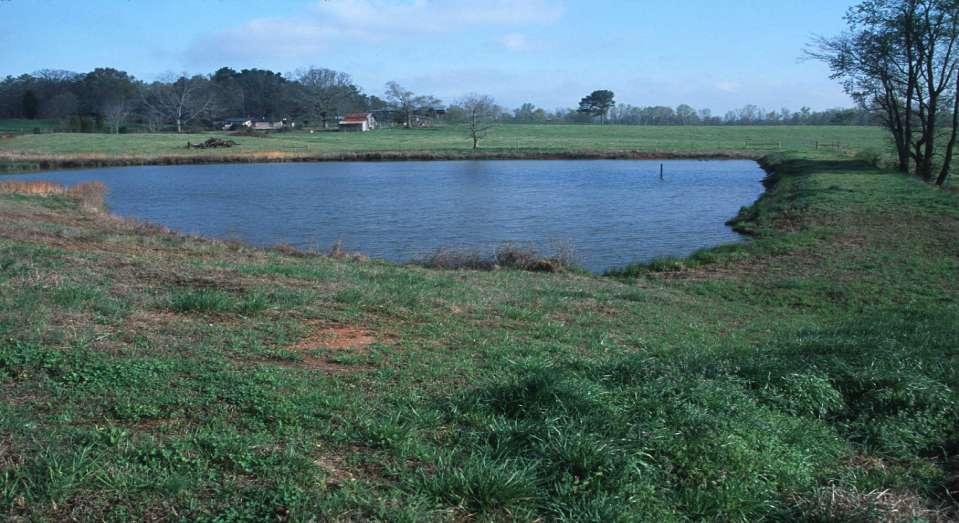
7 EMBANKMENT POND DAM

8 COMBINATION POND SMALL DAM EXCAVATED AREA

9 WHETHER YOU HAVE A BIG LAKE

10 OR JUST A SMALL FARM POND

11 YOU MUST HAVE A CLEAN, DEPENDABLE SOURCE OF WATER

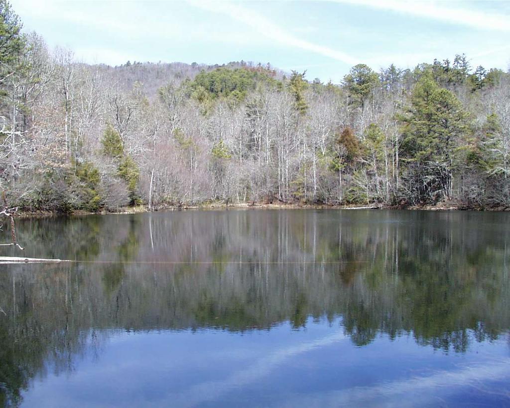
12 QUALITY PONDS COME FROM PROPER PLANNING, SITE SELECTION, SURVEY & DESIGN, & CONSTRUCTION
13 GEOLOGY AND PONDS LOOSE, FRACTURED OR FISSURED ROCK FORMATIONS UNDER A POND DON T HOLD WATER VERY WELL. NEITHER DO SCREEN DOORS ON A SUBMARINE. BEDROCK IS HARD TO BUILD A DAM UPON AND OBTAIN A WATER-TIGHT SEAL AT THE DAM/ROCK INTERFACE.
.")
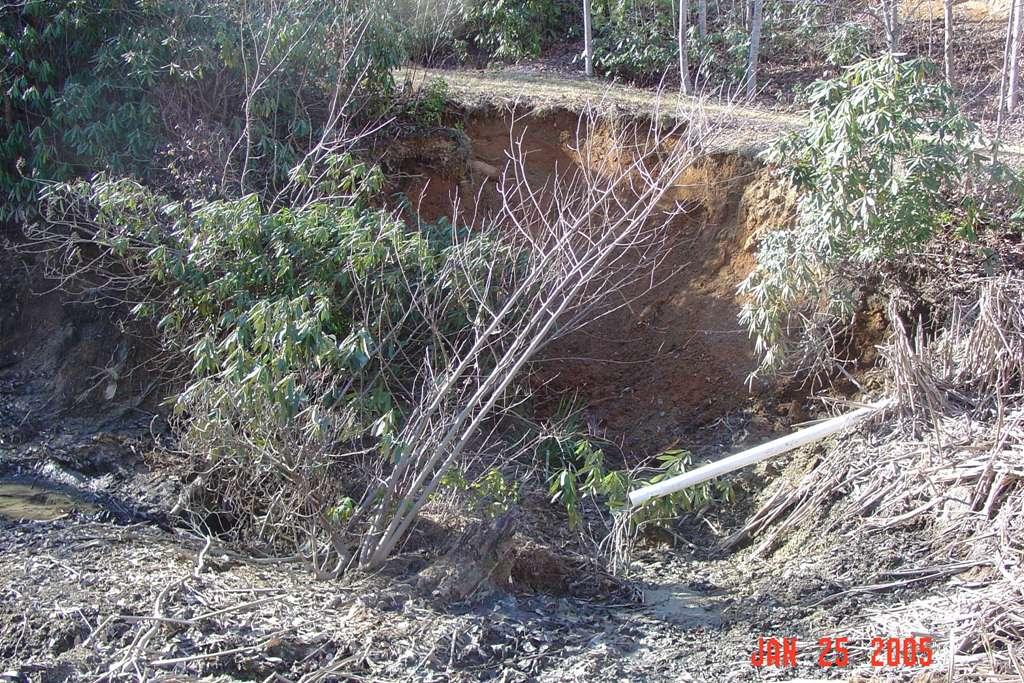
14 GEOLOGY CONT. ALL PONDS LEAK SOME, BUT IF THE LEAKAGE IS GREATER THAN ALL EVAPORATION & INFLOW(S).YOU RE GONNA HAVE A PROBLEM: ITS CALLED A MUDHOLE, AND IT COULD BE A CHRONIC MUDHOLE.
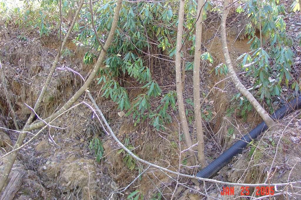
15 Leakage Problems POOR SOILS IN THE FILL AND/OR FOUNDATION, POOR COMPACTION OF SOIL, ROCKS AND ORGANIC MATTER IN THE EMBANKMENT FILL, RODENT ACTIVITY IN THE POND OR DAM, ROCK SUBSTRATA WITH FRACTURES.
16 TOPOGRAPHY AND PONDS
17 TOPOGRAPHY OR TERRAIN: CAN AFFECT SIZE, SHAPE & DEPTH OF A POND; AFFECT DAM/EMBANKMENT HEIGHT; AFFECT SPEED & INTENSITY OF RUNOFF INTO THE POND; GREATLY AFFECT COMPLEXITY OF DESIGN & CONSTRUCTION, THUS COST; DIRECTLY AFFECT SAFETY ISSUES.

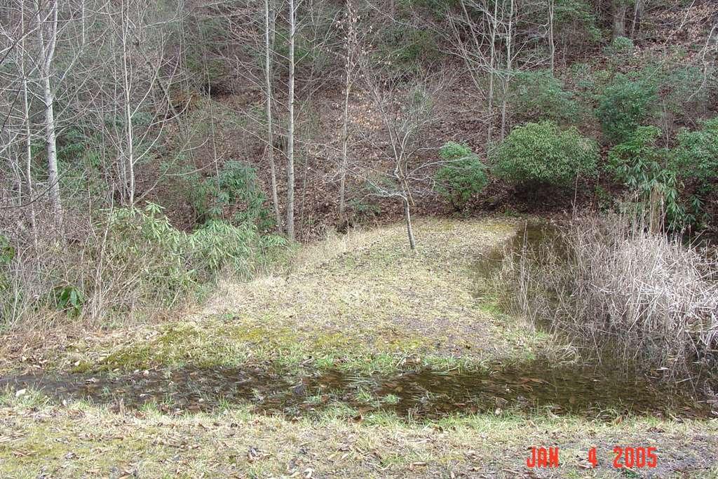
18 UPLAND EMBANKMENT POND IN PASTURES, CREEK FED. WATER SOURCE

19 HIGH MOUNTAIN LAKE
20 SOIL CONSIDERATIONS SOILS AT POND SITE MUST BE FAIRLY IMPERVIOUS IN POND BOTTOM; SOILS TO CONSTRUCT A DAM MUST BE COMPACTABLE, THUS NOT SANDY AND NOT HIGH SILT-CLAY CONTENT; PREFERABLY SANDY CLAY, SANDY CLAY LOAM, CLAY LOAM TEXTURE.
21 AND NOT CONTAIN ROCKS, STUMPS, LOGS OR ORGANIC MATTER A LITTLE TOO MUCH ROCK IN DAM
22 FOREIGN DEBRIS IN POND/DAM SOILS: IS NOT COMPACTABLE; CAUSES PIPING THROUGH THE SOIL PROFILE; CAN SETTLE OR SHIFT OVER TIME CAUSING LEAKAGE; CAN BECOME A DAM SAFETY ISSUE; CAN CAUSE A POND/DAM TO FAIL.

23 IMPROPER SOILS, INADEQUATE COMPACTION CAN ALLOWS WATER TO PIPE THROUGH THE DAM, BARREL PIPE CAUSING EVENTUAL DAM FAILURE DAM WASHED-OUT THROUGH THE EMBANKMENT
24 SOIL FOR PONDS SHOULD BE CLOSE BY TO REDUCE TRANSPORT COSTS TO DAM SITE; BE FREE OF LARGE ROCKS OR EXCESSIVE AMOUNTS OF ROCKS; BE FREE OF STUMPS, LOGS, LIMBS OR HIGH ORGANIC MATTER CONTENT.

25 HIGH ORGANIC MATTER CONTENT, LIMBS, AND TOO MUCH ROCK CONTENT IN THIS EARTHEN DAM LED TO DAM FAILURE.
26 Rim Pond Issues Volume of water available/water table; Volume of leakage through the rim or the floor of the pond; Safety Liability, depth, side slopes; Over-flooding by nearby live stream during flood conditions; Clogged supplemental water intakes.
27 Embankment Pond Issues Volume of constant water supply Volume of storm runoff inflow Upstream water quality and sediment load Integrity of the Embankment structure Leakage through the Embankment Requires a through the dam drain pipe Requires a by-pass emergency spillway Safety and downstream Liability
28 Planning and Design Issues Drainage area of stream watershed; Water quality & adequate volume; Intended purposes objectives; Foundation soils; Embankment soils; Potential downstream damages, liability; Safety, slope of dam sides, depth, etc..
29 Problems Too Little Water = stagnant pool; Too Much Water = over-topping dam/esw Excessive Sediment = loss of pool area; Leakage from unsuitable soils in/around pond and/or dam; Drain Pipe Failure = pipe corrosion, damaged piping,
30 WHICH BRINGS US TO THE PERMITS & REGULATIONS DIFFERENT TYPES OF PONDS REQUIRE DIFFERENT PERMITS.
31 EMBANKMENT PONDS USUALLY HAVE A DAM ACROSS A LIVE STREAM; REQUIRE US ARMY CORPS OF ENGINEERS PERMIT(S); REQUIRE NC WILDLIFE RESOURCES COMMISSION REVIEW/CONCURRENCE USUALLY REQUIRE APPROVED NC DENR SEDIMENT & EROSION CONTROL PLAN
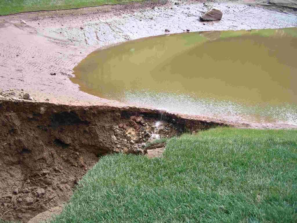
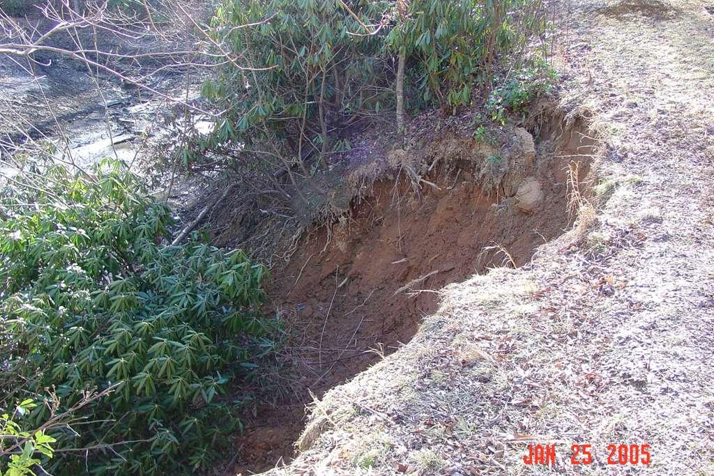
32 EMBANKMENT PONDS CONT. WILL REQUIRE NC DENR ENGINEERING CONSTRUCTION APPROVAL IF EITHER OF THE FOLLOWING APPLY: DAM IS 15 FT. HIGH OR HIGHER AS MEASURED FROM THE LOWEST DOWNSTREAM TOE OF THE DAM TO THE HIGHEST C/L OF THE DAM, OR
33 EMBANKMENT PONDS CONT. THE STORED WATER VOLUME BEHIND THE DAM IS 10.0 ACRE-FEET OR MORE. IF THE POND IS CONSIDERED A HIGH HAZARD DAM, NC DENR WILL REQUIRE A LICENSED ENGINEER TO DESIGN THE DAM & COMPONENTS & SUBMIT PLANS FOR NE DENR APPROVAL BEFORE CONSTRUCTION.
34 EMBANKMENT PONDS CONT. HIGH HAZARD DAMS, CLASS B & C DAMS, ARE THOSE DAMS SUCH THAT SHOULD CATASTROPHIC FAILURE OCCUR, THERE WOULD LIKELY BE A LOSS OF LIFE OR DAMAGE TO HOMES, ROADS, BRIDGES OR OTHER INFRASTRUCTURE DOWNSTREAM OF THE DAM.
35 EMBANKMENT PONDS CONT. HAZARD CLASS A DAMS ARE THOSE DAMS DEEMED LOW HAZARD SHOULD CATASTROPHIC BREACH OR FAILURE OF THE DAM OCCUR. HOWEVER, THIS IN NO WAY EVER RELIEVES A DAM OWNER FROM DAMAGES/LIABILITY SHOULD ANY DOWNSTREAM DAMAGE OCCUR.
36 EMBANKMENT PONDS CONT. SHOULD A LOW-HAZARD, CLASS A DAM EXCEED EITHER TWO CRITERIA MENTIONED ABOVE, i.e. DAM HEIGHT OR STORAGE VOLUME, A LICENSED ENGINEER MUST DESIGN/SIGN OFF ON THE DESIGN PLANS & SUBMIT SAME TO NC DENR FOR APPROVAL BEFORE CONSTRUCTION BEGINS.
37 SAFETY & LIABILITY IN NORTH CAROLINA, DAM/POND OWNERS ARE LIABLE FOR DOWNSTREAM DAMAGES ATTRIBUTED TO FAILURE OF THE DAM
38

39 SAFETY ISSUES EXIST BECAUSE A DAM HAS BEEN CREATED AND A POOL FORMED, BOTH OF WHICH POSSESS SPECIFIC HAZARDS. RELATIVELY STEEP DAM SLOPES AND DEEP POOL ON OTHERWISE BEAUTIFUL NEW POND.

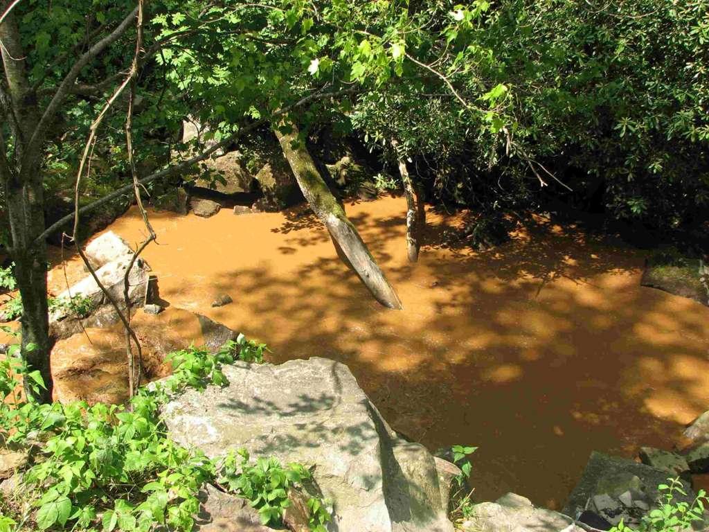
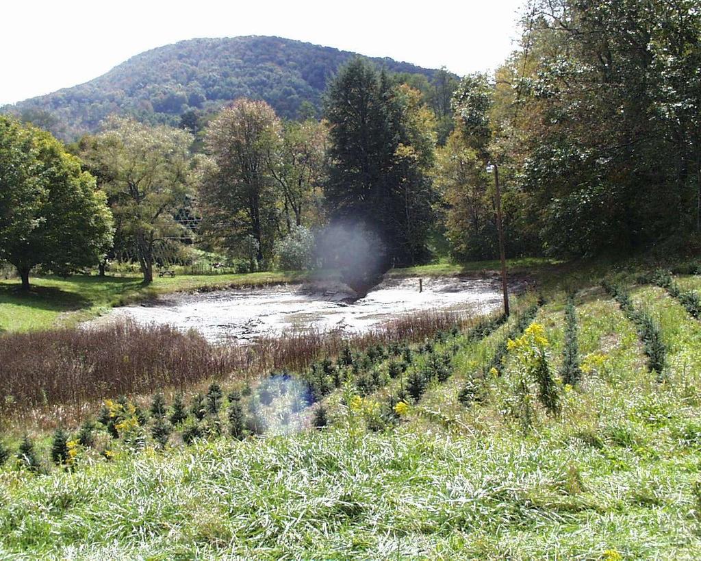
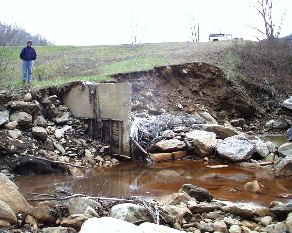
40 WHEN THIS DAM FAILED, A LOT OF WATER WAS RELEASED INTO THE DOWNSTREAM AREA QUICKLY. ORIGINAL CREEK
41 DAM SLOPES THAT ARE STEEPER TO REDUCE WATER WEED GROWTH BECOME A SPECIAL HAZARD TO POND WADING, SHALLOW WATER ACTIVITIES, & CHILDREN/NON-SWIMMERS. THIS APPLIES TO DUG OR EMBANKMENT PONDS.
42 STEEP DAM SLOPES ARE A HAZARD TO MOWING MACHINERY (OVERTURNS, SLIPPAGE) ARE MORE DIFFICULT TO MAINTAIN; ARE MORE SUSCEPTIBLE TO SLIDES WHEN EXCESSIVELY WET.
43 DESIGN AND ENGINEERING THERE ARE CRITICAL ELEMENTS OF DAMS THAT MUST BE PROPERLY DESIGNED

44 IMPORTANT FEATURES PROPER DAM HEIGHT, WIDTH, SLOPES, WATER LEVEL AND CONTROL STRUCTURES; PROPER PIPING AND DRAINAGE SYSTEMS; ADEQUATE EMERGENCY SPILLWAYS; OPERATION AND MAINTENANCE PLANS.
45 EMBANKMENT DAMS MUST HAVE A PERMANENT WATER LEVEL CONTROL SYSTEM; MUST HAVE AN ADEQUATE EMERGENCY SPILLWAY SYSTEM; MUST HAVE ADEQUATE STORM STORAGE CAPACITY; SHOULD HAVE INTERNAL DRAINAGE SYSTEM IN DAM FOR EXCESS WATER.

46 WELL MAINTAINED DAM, GOOD VEGETATION, GOOD SLOPES & TOP WIDTH, LARGE WELL-SODDED EMERGENCY SPILLWAY

47 WELL MAINTAINED AREA AROUND POND REDUCES SEDIMENTATION INTO POND DOCK DRAIN VALVE & PSW UNIT

48 POND CHOKED WITH SEDIMENT AND WEEDS FROM EROSION IN WATERSHED ABOVE.

49 IMPROPERLY CONSTRUCTED DAM, TOO SMALL PSW PIPE SYSTEM, OVERTOPPED AND FAILED

50 PSW PIPE INLET CHOKED WITH WATERWEED GROWTH, REDUCING INTAKE EFFICIENCY.

51 POND WHERE DAM IS BEING USED AS A VEHICULAR ACCESS CROSSING. SUCH ROADWAYS ARE OK WHEN PROPERLY MAINTAINED

52 GOOD INTENTIONS NOT FOLLOWED THROUGH W/THE RIGHT ANTI-SEEP COLLARS, PIPE AND EMERGENCY SPILLWAY.

53 ALL METAL PIPE DRAIN SYSTEMS & RISER PIPES HAVE A USEFUL LIFE BEFORE THEY FAIL. ALL GOOD THINGS END.

54 THE AVERAGE LIFE OF CORRUGATED PIPE FOR RISER SYSTEMS IS YEARS.
55 WHEN DAMS FAIL SOME COSTLY DAM MISTAKES AS SEEN FROM DESIGN FLAWS OR OVERWELMING WEATHER CONDITIONS
56
57
58
59
60
61
62
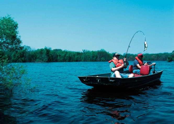
63 WELL PLANNED & CONSTRUCTED PONDS PROVIDE RECREATIONAL BENEFITS; CAN ENHANCE WILDLIFE AND FISHERY RESOURCES; CAN PROVIDE WATER SUPPLIES; CAN HELP RECHARGE GROUNDWATER AQUIFERS; CAN ENHANCE AESTHETICS; CAN PROVIDE IRRIGATION.
64
65

66
67
Ponds. Pond A water impoundment made by excavating a pit, or constructing a dam or an embankment.
 POND SITE SELECTION AND CONSTRUCTION Uses, Planning, & Design David Krietemeyer Area Engineer USDA-NRCS June 20, 2008 Uses Considerations for Location of Commonly Used Terms Pond A water impoundment made
Suggested Stormwater Management Practices For Individual House Lots
 Suggested Stormwater Management Practices For Individual House Lots These practices are necessary to satisfy the water quantity and water quality criteria of the Rappahannock Stormwater Ordinance. These
Ponds: planning, design, and construction
 Ponds: planning, design, and construction Ponds for many purposes: Fish Production Recreation Water Supply Esthetics Wildlife Habitat Natural ponds: Formed in natural depressions in the landscape Not man-made
SC-01 Surface Outlet and Baffle Sediment Basin
 Greenville County Technical Specification for: SC-01 Surface Outlet and Baffle Sediment Basin 1.0 Surface Outlet and Baffle Sediment Basin This Specification contains requirements for the design and construction
Construction Inspection Checklists
 III. Construction Inspection Checklists 33 Bioretention - Construction Inspection Checklist Project: Location: Site Status: Date: Time: Inspector: Construction Sequence Satisfactory / Unsatisfactory Comments
378 - POND NATURAL RESOURCES CONSERVATION SERVICE CONSERVATION PRACTICE SPECIFICATION I. SCOPE
 378-1 NATURAL RESOURCES CONSERVATION SERVICE CONSERVATION PRACTICE SPECIFICATION 378 - POND I. SCOPE The work shall consist of constructing an earthfill embankment and appurtenances to the lines, grades,
WASTE TREATMENT LAGOON
 359-1 NATURAL RESOURCES CONSERVATION SERVICE CONSERVATION PRACTICE STANDARD WASTE TREATMENT LAGOON (No.) CODE 359 DEFINITION A waste treatment impoundment made by constructing an embankment and/or excavating
4. Ponds and infiltration BMPs can achieve 60 to 100% removal efficiencies for sediment.
 Landscape BMPs For the purposes of this project, preventive measures have been categorized into two categories: landscape BMPs and source prevention BMPs. Landscape BMPs includes both vegetative practices
Lyon Creek Cedar Way Stormwater Detention Dam Operation and Maintenance Manual
 Lyon Creek Cedar Way Stormwater Detention Dam Operation and Maintenance Manual Prepared by: Mike Shaw Stormwater Program Manager City of Mountlake Terrace January 2010 Section I General Information This
APPENDIX A EARTHEN EMBANKMENT. VERSION 1.0 March 1, 2011
 APPENDIX A EARTHEN EMBANKMENT VERSION 1.0 March 1, 2011 SECTION A-1: DESCRIPTION OF PRACTICE An earthen embankment is a raised impounding structure made from compacted soil. The embankment is the feature
CONSTRUCTION PLAN CHECKLIST
 CONSTRUCTION PLAN CHECKLIST The design engineer is responsible for ensuring that plans submitted for city review are in accordance with this checklist. It is requested that the executed checklist be submitted
STRUCTURAL STABILITY ASSESSMENT
 STRUCTURAL STABILITY ASSESSMENT CFR 257.73(d) Pond 21, Pond 22, Pond 23 & WWSP Oklaunion Power Station Vernon, Texas October, 2016 Prepared for: Public Service Company of Oklahoma Prepared by: American
Constructed Wetland Pond T-8
 Constructed Wetland Pond T-8 Description A constructed wetlands pond is a shallow retention pond designed to permit the growth of wetland plants such as rushes, willows, and cattails. Constructed wetlands
Tips with Creation of your Erosion and Sediment Control Plan
 Tips with Creation of your Erosion and Sediment Control Plan By Chris Droste, CESCO Senior Erosion Control Specialist Westmoreland Conservation District Forming Your Narrative Use the DEP checklist. Page
BLOCKING AND FILLING SURFACE DRAINAGE DITCHES
 MINNESOTA WETLAND RESTORATION GUIDE BLOCKING AND FILLING SURFACE DRAINAGE DITCHES TECHNICAL GUIDANCE DOCUMENT Document No.: WRG 4A-1 Publication Date: 10/14/2015 Table of Contents Introduction Application
Diversion Dikes. Fe=0.95
 2.2 Diversion Dike Erosion Control Description: A diversion dike is a compacted soil mound, which redirects runoff to a desired location. The dike is typically stabilized with natural grass for low velocities
Highway Drainage 1- Storm Frequency and Runoff 1.1- Runoff Determination
 Highway Drainage Proper drainage is a very important consideration in design of a highway. Inadequate drainage facilities can lead to premature deterioration of the highway and the development of adverse
Standards for Soil Erosion and Sediment Control in New Jersey May 2012 STANDARD FOR SLOPE PROTECTION STRUCTURES. Definition
 STANDARD FOR SLOPE PROTECTION STRUCTURES Definition Structures to safely conduct surface runoff from the top of a slope to the bottom of the slope. Purpose The purpose of this practice is to convey storm
Operating and Reclamation Plan
 Operating and Reclamation Plan For sites in sensitive locations, additional information may be required. If more space is needed, attach additional sheets or use the blank sheet provided at the end of
CBC Aids WVDEP with Fresh Water Reservoir - Chief Logan State Park
 CBC Case Study-1212 1 of 5 CBC Aids WVDEP with Fresh Water Reservoir - Chief Logan State Park More Than Geotechnical Engineering DAYTON 125 Westpark Road Centerville, OH 45459 Phone: 937-428-6150 HAZARD
Supplemental Watershed Plan Agreement No. 10 for Neshaminy Creek Watershed Core Creek Dam (PA-620) Bucks County, Pennsylvania
 Bucks County, Pennsylvania") Supplemental Watershed Plan Agreement No. 10 for Neshaminy Creek Watershed Core Creek Dam (PA-620) Bucks County, Pennsylvania Project Authorization USDA's Small Watershed Program is carried out under the
Supplemental Watershed Plan Agreement No. 10 for Neshaminy Creek Watershed Core Creek Dam (PA-620) Bucks County, Pennsylvania Project Authorization USDA's Small Watershed Program is carried out under the
Constructed Wetland Use in Nonpoint Source Control
 Constructed Wetland Use in Nonpoint Source Control Description Constructed wetlands are excavated basins with irregular perimeters and undulating bottom contours into which wetland vegetation is purposely
ROLES AND RESPONSIBILITIES Small Pond Approval. SWM MD-378 Pond Checklist Training 10/17/07. Exemptions EMBANKMENT HEIGHT. Height of Dam Weir Wall
 SWM MD-378 Pond Checklist Training 10/17/07 Ken Wolfe Warren Johnson USDA, NRCS Frederick, Maryland ROLES AND RESPONSIBILITIES Small Pond Approval MDE, WMA, Dam Safety Division Authority (COMAR 26.17.04.03)
Figure Inlet protection (Source: Minnesota DOT)
") 3.9 INLET PROTECTION Figure 3.14. Inlet protection (Source: Minnesota DOT) Overview Description: A manufactured protective device or barrier used to trap sediment at a storm drain surface or curb inlet.
3.9 INLET PROTECTION Figure 3.14. Inlet protection (Source: Minnesota DOT) Overview Description: A manufactured protective device or barrier used to trap sediment at a storm drain surface or curb inlet.
OPERATIONS AND MAINTENANCE MANUAL. Project: STORMWATER CONTROL STRUCTURE Wet Detention Pond. Cary, NC. Owners: Prepared By: Date:
 OPERATIONS AND MAINTENANCE MANUAL Project: STORMWATER CONTROL STRUCTURE Wet Detention Pond Cary, NC Owners: Prepared By: Date: Site/Subdivision Project # Project: Date Constructed: Location: Receiving
Manure Storage for Environmental Management Systems
 WiMStor01 MStor Manure Storage for Environmental Management Systems Key: 1)Low Risk 2)Low-Moderate Risk 3)Moderate-High Risk 4)High Risk Location of Manure Storage Are the manure storage facilities in
Appendix B Stormwater Site Plan Submittal Requirements Checklist
 Stormwater Site Plan Submittal Requirements Checklist The Submittal Requirements Checklist is intended to aid the design engineer in preparing a Stormwater Site Plan. All items included in the following
4.12. Detention Basins
 4.12. Detention Basins Detention Basins can be a cost effective method to provide temporary storage, conveyance, and treatment of runoff when used within the context of Low Impact Development (LID) strategies.
Appendix 3-G SWM AND BMP CONSTRUCTION INSPECTIONS
 Appendix 3-G SWM AND BMP CONSTRUCTION INSPECTIONS Table of Contents APPENDIX SECTION HEADINGS 3-G.1.0 INTRODUCTION 3-G-2 3-G.1.1 Construction Inspections 3-G-2 3-G.1.2. As-Built Survey and Plan 3-G-2 3-G.1.2.1
TEMPORARY SEDIMENT TRAP CODE
 ILLINOIS URBAN MANUAL PRACTICE STANDARD TEMPORARY SEDIMENT TRAP CODE 960 Source: DEFINITION A small temporary stormwater storage structure designed to trap sediment. PURPOSE The purpose of this practice
Infiltration Basin Description Applicability
 Infiltration Basin Description An infiltration basin is a shallow impoundment which is designed to infiltrate storm water into the ground water. This practice is believed to have a high pollutant removal
Standards for Soil Erosion and Sediment Control in New Jersey May 2012 STANDARD FOR GRASSED WATERWAYS. Definition. Purpose
 STANDARD FOR GRASSED WATERWAYS Definition A natural or constructed watercourse shaped or graded in earth materials and stabilized with suitable vegetation for the safe conveyance of runoff water. Purpose
Sediment Basin. Fe= (Depends on soil type)
") 3.9 Sediment Control Description: A sediment basin is an embankment with a controlled outlet that detains stormwater runoff, resulting in the settling of suspended sediment. The basin provides treatment
3.9 Sediment Control Description: A sediment basin is an embankment with a controlled outlet that detains stormwater runoff, resulting in the settling of suspended sediment. The basin provides treatment
Inflow pipe. Drain. Drain
 Inflow pipe Screened overflow Drain Foul flush diverter Screened intake Manhole cover Maximum water level Seal Inspection cover Possible local drainage through screen Drain Bottom sloped Screened outlet
4. Present Activities and Roles
 4. Present Activities and Roles The present missions, authorities, activities and roles of the various agencies involved with flood protection, floodplain management and flood-damage reduction are identified
McElroy s Run Impoundment Structural Stability Assessment Report
 Allegheny Energy Supply Company, LLC A FirstEnergy Company Pleasants Power Station Pleasants County, West Virginia October 2016 Prepared for: Allegheny Energy Supply Company, LLC A FirstEnergy Company
NEW CASTLE CONSERVATION DISTRICT. through. (Name of Municipality) PLAN REVIEW APPLICATION DRAINAGE, STORMWATER MANAGEMENT, EROSION & SEDIMENT CONTROL
 PLAN REVIEW APPLICATION DRAINAGE, STORMWATER MANAGEMENT, EROSION & SEDIMENT CONTROL") NEW CASTLE CONSERVATION DISTRICT through (Name of Municipality) PLAN REVIEW APPLICATION DRAINAGE, STORMWATER MANAGEMENT, EROSION & SEDIMENT CONTROL Office use only: Received by Municipality: Received by
NEW CASTLE CONSERVATION DISTRICT through (Name of Municipality) PLAN REVIEW APPLICATION DRAINAGE, STORMWATER MANAGEMENT, EROSION & SEDIMENT CONTROL Office use only: Received by Municipality: Received by
Successful Foundation Preparations in Karst Bedrock of the Masonry Section of Wolf Creek Dam
 Successful Foundation Preparations in Karst Bedrock of the Masonry Section of Wolf Creek Dam David M. Robison, P.G. Geotechnical and Dam Safety Section, Louisville District, U.S. Army Corps of Engineers
Environmental Management Chapter ALABAMA DEPARTMENT OF ENVIRONMENTAL MANAGEMENT WATER DIVISION - WATER QUALITY PROGRAM ADMINISTRATIVE CODE
 Environmental Management Chapter 335-6-9 ALABAMA DEPARTMENT OF ENVIRONMENTAL MANAGEMENT WATER DIVISION - WATER QUALITY PROGRAM ADMINISTRATIVE CODE CHAPTER 335-6-9 SURFACE MINING RULES TABLE OF CONTENTS
Storm Water Pollution Prevention Plan (SWP3) Checklist
 Checklist") . Summit Soil and Water Conservation District Storm Water Pollution Prevention Plan (SWP3) Checklist Modified from the Ohio EPA SWP3 Checklist (Revised January 2017) SITE NAME: REVIEWER: DATE RECEIVED:
. Summit Soil and Water Conservation District Storm Water Pollution Prevention Plan (SWP3) Checklist Modified from the Ohio EPA SWP3 Checklist (Revised January 2017) SITE NAME: REVIEWER: DATE RECEIVED:
Appendix E. Coordinating Erosion and Sediment Control With Low-Impact Development Planning
 Appendix E Appendix E. Coordinating Erosion and Sediment Control With Low-Impact Development Planning E.1 Introduction It is essential to coordinate post-construction stormwater planning with the design
Dry Swale Wet Swale Grass Channel Dry Well Permeable Pavement Bioretention DESIGN ELEMENTS
 FACILITY ID: DATE: / / ASSESSED BY: NAME: ADDRESS: PHOTO IDS: SECTION 1- BACKGROUND INFORMATION (GIS) BMP TYPE : Dry Detention Pond Extended Detention Pond Wet Pond Filter (specify: ) Infiltration (specify:
STORM DRAINAGE DESIGN MANUAL
 Appendix I STORM DRAINAGE DESIGN MANUAL by: SUNGATE DESIGN GROUP, P.A. GEN ERAL DESIGN STAN DARDS AN D POLICIES 1. STREET AND LOCAL DRAINAGE Discharge estimates for specified design storms shall be calculated
DUBUQUE COUNTY SMART PLAN Watershed Management
 Introduction Dubuque County Watersheds are in a state of constant change. Land use changes, Agricultural farming practices, and urban development has produced habitat alteration and a drastic increase
CHAPTER 3.20 STORM WATER HYDROLOGY
 CHAPTER 3.20 STORM WATER HYDROLOGY Sections: 3.20.005 Purpose. 3.20.010 Definitions. 3.20.015 Rainfall Hydrology. 3.20.020 Conveyance. 3.20.025 Basins. 3.20.030 Discharge. 3.20.035 Permits / Practices.
Filter Tube Barriers (Instream)
") Filter Tube Barriers (Instream) INSTREAM PRACTICES Flow Control No Channel Flow Dry Channels Erosion Control Low Channel Flows Shallow Water Sediment Control High Channel Flows Deep Water Symbol Photo
Filter Tube Barriers (Instream) INSTREAM PRACTICES Flow Control No Channel Flow Dry Channels Erosion Control Low Channel Flows Shallow Water Sediment Control High Channel Flows Deep Water Symbol Photo
Natural and Engineered Wetlands for Stormwater Management
 Natural and Engineered Wetlands for Stormwater Management Dan Hitchcock, Ph.D., P. E. Baruch Institute of Coastal Ecology and Forest Science Clemson University Georgetown, SC Prominence and Diversity of
Extended Detention Basin Maintenance Plan for [[== Insert Project Name ==]]
![Extended Detention Basin Maintenance Plan for [[== Insert Project Name ==]]](/thumbs/72/68075589.jpg "Extended Detention Basin Maintenance Plan for [[== Insert Project Name ==]]") Extended Detention Basin Plan for [[== Insert Project Name ==]] [[== Insert Date =]] Project Address and Cross Streets Assessor s Parcel No.: Property Owner: Phone No.: Designated Contact: Phone No.: Extended
Extended Detention Basin Plan for [[== Insert Project Name ==]] [[== Insert Date =]] Project Address and Cross Streets Assessor s Parcel No.: Property Owner: Phone No.: Designated Contact: Phone No.: Extended
November 2011 Updated August 2014
 November 2011 Updated August 2014 INDEX BMP SUMMARY FOR CONSTRUCTION SITES GENERAL DESIGN GUIDELINES ESC 1.0...Permanent Seeding ESC 2.0...Temporary Seeding ESC 3.0...Temporary Construction Entrance ESC
Limited Visual Dam Safety Inspections OA Wahiawa Dam. Oahu, Hawaii
 Limited Visual Dam Safety Inspections OA00017 Wahiawa Dam Oahu, Hawaii Prepared by: U.S. ARMY CORPS OF ENGINEERS HONOLULU DISTRICT STATE OF HAWAII DEPARTMENT OF LAND AND NATURAL RESOURCES May 2006 Dam
Extended Detention Basin Design
 Extended Detention Basin Design 1 Extended Detention 2 Ohio Department of Transportation 1 Extended Detention Basin L&D Vol. 2 Section 1117.3 Provides quality and quantity treatment 3 Extended Detention
Shelbyville, Kentucky Stormwater Best Management Practices (BMPs) Stormwater Pollution Treatment Practices (Structural) DRAFT
 Stormwater Pollution Treatment Practices (Structural) DRAFT") Shelbyville, Kentucky Stormwater Best Management Practices (BMPs) Stormwater Pollution Treatment Practices (Structural) Activity: Infiltration Systems PLANNING CONSIDERATIONS: Design Life: Short IS Acreage
Shelbyville, Kentucky Stormwater Best Management Practices (BMPs) Stormwater Pollution Treatment Practices (Structural) Activity: Infiltration Systems PLANNING CONSIDERATIONS: Design Life: Short IS Acreage
Storm Water Technology Fact Sheet Wet Detention Ponds
 United States Environmental Protection Agency Office of Water Washington, D.C. Storm Water Technology Fact Sheet Wet Detention Ponds EPA 832-F-99-048 September 1999 DESCRIPTION Wet detention ponds are
Low Gradient Velocity Control Short Term Steep Gradient Channel Lining Medium-Long Term Outlet Control Soil Treatment Permanent [1]
![Low Gradient Velocity Control Short Term Steep Gradient Channel Lining Medium-Long Term Outlet Control Soil Treatment Permanent [1]](/thumbs/83/88729038.jpg "Low Gradient Velocity Control Short Term Steep Gradient Channel Lining Medium-Long Term Outlet Control Soil Treatment Permanent [1]") Diversion Channels DRAINAGE CONTROL TECHNIQUE Low Gradient Velocity Control Short Term Steep Gradient Channel Lining Medium-Long Term Outlet Control Soil Treatment Permanent [1] [1] The design of permanent
Diversion Channels DRAINAGE CONTROL TECHNIQUE Low Gradient Velocity Control Short Term Steep Gradient Channel Lining Medium-Long Term Outlet Control Soil Treatment Permanent [1] [1] The design of permanent
FARM A SYST Farmstead Assessment System
 FARM A SYST Farmstead Assessment System Worksheet 7 Assessing the Risk of Groundwater Contamination from Animal Waste Management Why should I be concerned? Careful handling of wastes from animal production
METROPOLITAN UTILITIES DISTRICT No Page: 1 of 10
 Page: 1 of 10 A. GENERAL Erosion control measures such as silt fence, inlet filters and soil stabilization blankets and matting, incorporated into underground pipeline construction projects, help prevent
MD Exhibit MD1 SMALL POND DESIGN CHECKLIST. ProjectName. Engineering Firm Date Submitted. Vicinity Map Pond Summary Sheet (MD-ENG-14) Pond Class
 Pond Class") MD501.06 Exhibit MD1 SMALL POND DESIGN CHECKLIST ProjectName Engineering Firm Date Submitted Vicinity Map Pond Summary Sheet (MD-ENG-14) Pond Class REVIEW INDEX R (required, not submitted) NA (not applicable)
MD501.06 Exhibit MD1 SMALL POND DESIGN CHECKLIST ProjectName Engineering Firm Date Submitted Vicinity Map Pond Summary Sheet (MD-ENG-14) Pond Class REVIEW INDEX R (required, not submitted) NA (not applicable)
Sediment Basins and Skimmers. Jay Dorsey/John Mathews Ohio Dept. of Natural Resources, Division of Soil and Water Resources
 Sediment Basins and Skimmers Jay Dorsey/John Mathews Ohio Dept. of Natural Resources, Division of Soil and Water Resources Dewatering Risers in Basins: Single orifice Perforated and wrapped riser And now
Rock Sock (RS) Rock Sock height.
 Rock Sock height.") Rock Sock (RS) SC-5 Description A rock sock is constructed of gravel that has been wrapped by wire mesh or a geotextile to form an elongated cylindrical filter. Rock socks are typically used either as
Rock Sock (RS) SC-5 Description A rock sock is constructed of gravel that has been wrapped by wire mesh or a geotextile to form an elongated cylindrical filter. Rock socks are typically used either as
Extended Detention Basin (EDB) Sedimentation Facility
 Sedimentation Facility") Extended Detention Basin (EDB) Sedimentation Facility Description An extended detention basin (EDB) is a sedimentation basin designed to totally drain dry sometime after stormwater runoff ends. It is an
Extended Detention Basin (EDB) Sedimentation Facility Description An extended detention basin (EDB) is a sedimentation basin designed to totally drain dry sometime after stormwater runoff ends. It is an
NATURAL RESOURCES CONSERVATION SERVICE CONSERVATION PRACTICE STANDARD. POND (No.) CODE 378
 CODE 378") NATURAL RESOURCES CONSERVATION SERVICE CONSERVATION PRACTICE STANDARD POND (No.) CODE 378 DEFINITION A water impoundment made by constructing a dam or an embankment or by excavating a pit or dugout. In
NATURAL RESOURCES CONSERVATION SERVICE CONSERVATION PRACTICE STANDARD POND (No.) CODE 378 DEFINITION A water impoundment made by constructing a dam or an embankment or by excavating a pit or dugout. In
Chapter 6 Erosion & Stormwater Study Team
 Chapter 6 Erosion & Stormwater Study Team Objective How do we stabilize the Las Vegas Wash environment to most effectively reduce erosion and enhance wetlands? Introduction The Las Vegas Wash (Wash) has
HISTORY OF CONSTRUCTION 40 CFR (c)(1)(i)-(xii) PLANT MCDONOUGH ASH POND 1 (AP-1) GEORGIA POWER COMPANY
(1)(i)-(xii) PLANT MCDONOUGH ASH POND 1 (AP-1) GEORGIA POWER COMPANY") HISTORY OF CONSTRUCTION 40 CFR 257.73(c)(1)(i)-(xii) PLANT MCDONOUGH ASH POND 1 (AP-1) GEORGIA POWER COMPANY (i) Site Name and Ownership Information: Site Name: Site Location: Site Address: Owner: Address:
HISTORY OF CONSTRUCTION 40 CFR 257.73(c)(1)(i)-(xii) PLANT MCDONOUGH ASH POND 1 (AP-1) GEORGIA POWER COMPANY (i) Site Name and Ownership Information: Site Name: Site Location: Site Address: Owner: Address:
Application for a Dam Permit Ash Basin No. 1
 Application for a Dam Permit Ash Basin No. 1 for the Sunbury Generating Station Shamokin Dam, Pennsylvania submitted to Commonwealth of Pennsylvania Department of Environmental Protection Bureau of Waterways
Travers Reservoir Rehabilitation Project Irrigation Technical Conference Lethbridge, AB June 2, 2010
 Travers Reservoir Rehabilitation Project 2010 Irrigation Technical Conference Lethbridge, AB June 2, 2010 Location Plan Western Irrigation District Headworks CALGARY Eastern Irrigation District Headworks
Background. AEM Tier 2 Worksheet Farmstead Water Supply Evaluation. AEM Principle: Glossary
 AEM Tier 2 Worksheet Glossary Casing: Steel or plastic pipe installed while drilling a well, to prevent collapse of the well bore hole and the entrance of contaminants, and to allow placement of a pump
INFLOW DESIGN FLOOD CONTROL SYSTEM PLAN 40 C.F.R. PART PLANT YATES ASH POND 3 (AP-3) GEORGIA POWER COMPANY
 GEORGIA POWER COMPANY") INFLOW DESIGN FLOOD CONTROL SYSTEM PLAN 40 C.F.R. PART 257.82 PLANT YATES ASH POND 3 (AP-3) GEORGIA POWER COMPANY EPA s Disposal of Coal Combustion Residuals from Electric Utilities Final Rule (40 C.F.R.
INFLOW DESIGN FLOOD CONTROL SYSTEM PLAN 40 C.F.R. PART 257.82 PLANT YATES ASH POND 3 (AP-3) GEORGIA POWER COMPANY EPA s Disposal of Coal Combustion Residuals from Electric Utilities Final Rule (40 C.F.R.
WQ-06 SAND FILTER. 1.0 Sand Filter. Greenville County Technical Specification for: 1.1 Description
 Greenville County Technical Specification for: WQ-06 SAND FILTER 1.0 Sand Filter 1.1 Description Sand Filters remove pollutants through sedimentation and filtration within the sand. The primary components
Standard for Wet Ponds
 New Jersey Stormwater Best Management Practices Manual February 2004 Definition Purpose C H A P T E R 9. 1 1 Standard for Wet Ponds A wet pond is a stormwater facility constructed through filling and/or
The soil is a very. The soil can. The manure. Soil Characteristics. effective manure treatment system if manures are applied at the proper rate.
 The soil is a very effective manure treatment system if manures are applied at the proper rate. The soil can filter pollutants and prevent them from reaching groundwater. The manure application rate should
ES Inspection and Maintenance of MS4 Structural Controls* Document Identification Number Date: March 14, 2018
 ES-301-4.08 Inspection and Maintenance of MS4 Structural Controls* Document Identification Number ES-301-4.08 Date: March 14, 2018 Document Owner: Kim Ohlson 1) Activity Description: MS4 Maintenance and
Bowling Green, Kentucky Stormwater Best Management Practices (BMPs) Sediment Management Practices (SMPs) Activity: Temporary Inlet Protection (TIP)
 Sediment Management Practices (SMPs) Activity: Temporary Inlet Protection (TIP)") Bowling Green, Kentucky Stormwater Best Management Practices (BMPs) Sediment Management Practices (SMPs) Activity: Temporary Inlet Protection (TIP) SMP-11 PLANNING CONSIDERATIONS: Design Life: 1 yr Acreage
Bowling Green, Kentucky Stormwater Best Management Practices (BMPs) Sediment Management Practices (SMPs) Activity: Temporary Inlet Protection (TIP) SMP-11 PLANNING CONSIDERATIONS: Design Life: 1 yr Acreage
FORM B: DAMMING AND DIVERSION OF WATER
 APPLICATION FOR RESOURCE CONSENT FORM B: DAMMING AND DIVERSION OF WATER NOTES Resource use activities must meet all the conditions of any relevant Permitted Activity Rules in the Waikato Regional Plan
ENGINEERING CHECKLIST SEDIMENT & STORMWATER MANAGEMENT BASIN CONSTRUCTION
 NEW CASTLE COUNTY DEPARTMENT OF LAND USE ENGINEERING CHECKLIST SEDIMENT & STORMWATER MANAGEMENT BASIN CONSTRUCTION For Permanent Structures, pursuant to Delaware Pond Code 378 and Delaware Sediment and
Typical Local Erosion Control Requirements (Storm Water Management Authority, Inc.)
") Module 2: Selection of Controls and Site Planning for Construction Site Erosion Prevention Robert Pitt Department of Civil, Construction, and Environmental Engineering University of Alabama Tuscaloosa,
Module 2: Selection of Controls and Site Planning for Construction Site Erosion Prevention Robert Pitt Department of Civil, Construction, and Environmental Engineering University of Alabama Tuscaloosa,
How Climate Change Impacts Urban Runoff and Water Quality Design
 How Climate Change Impacts Urban Runoff and Water Quality Design by J. C. Hayes, C. Privette, III and S. J. Klaine AWRA Conference Anchorage, AK May 4-7, 2009 Presentation Outline Introduction: Why manage
Appendix A Stormwater Site Plan Report Short Form
 Appendix A Stormwater Site Plan Report Short Form The Stormwater Site Plan Report Short Form may be used for projects that trigger only Minimum Requirements #1-#5. These projects typically fall within
Environmental Resource Inventories. What are ERIs? Significance of information How to use them
 Environmental Resource Inventories What are ERIs? Significance of information How to use them Environmental Resource Inventory - ERI Compiled by the environmental commission Information about the natural
No. 6 December, Wisconsin s Forestry Best Management Practices for Water Quality Forest Roads
 No. 6 December, 1995 Wisconsin s Forestry Best Management Practices for Water Quality Forest Roads Steve Holaday, Wisconsin Dept. of Natural Resources, and Jeff Martin, Dept. of Forestry, UW-Madison BMPs
LAKE COUNTY HYDROLOGY DESIGN STANDARDS
 LAKE COUNTY HYDROLOGY DESIGN STANDARDS Lake County Department of Public Works Water Resources Division 255 N. Forbes Street Lakeport, CA 95453 (707)263-2341 Adopted June 22, 1999 These Standards provide
6.5 Extended Detention Basin
 6.5 Extended Detention Basin Figure 6-22: Extended Detention Basin. Photograph courtesy of Bill Southard (DES Architects and Engineers) Best uses Detain low flows Can be expanded to detain peak flows Sedimentation
Appendix D Index. SWM/BMP Facility Site Photographs. Subshed 440 Facility Photo #
 Index Subshed 440 Facility Photo # 19 1-3 489 4-7 Subshed 444 Facility Photo # 63 8-9 207 No photo 208 No photo 632 10-12 Subshed 448 Facility Photo # 28 13-16 481 17-20 5147 21-23 5255 24-25 5355 No photo
Checklist for Joint Agency Review Stormwater Management / Erosion and Sediment Control
 Page 1 of 7 Updated 12/28/2017 Checklist for Joint Agency Review Stormwater Management / Erosion and Sediment Control Project Name: Tax Map: Parcel: Lot: Disturbed Acreage: Engineering Firm: Phone Number:
COWLITZ COUNTY DEPARTMENT OF BUILDING AND PLANNING
 COWLITZ COUNTY DEPARTMENT OF BUILDING AND PLANNING GENERAL GRADING REQUIREMENTS GRADING STANDARDS Unless otherwise recommended in a soils engineering or engineering geology report, approved by the County,
GENERAL INFILTRATION PRACTICES
 MINIMUM STANDARD 3.10 GENERAL INFILTRATION PRACTICES 3.10A Infiltration Basin 3.10B Infiltration Trench 3.10C Roof Downspout System 3.10D Porous Pavement LIST OF ILLUSTRATIONS # FIGURE PAGE 3.10-1a Infiltration
CHAPTER 7 PHYSICAL INVENTORY OF THE CITY
 CHAPTER 7 PHYSICAL INVENTORY OF THE CITY Chapter 7: Physical Inventory of the City 39 This page intentionally left blank. Chapter 7: Physical Inventory of the City 40 SECTION 1 PHYSICAL SETTING While communities
HISTORY OF CONSTRUCTION 40 CFR (c)(1)(i)-(xii) PLANT WANSLEY ASH POND (AP-1) GEORGIA POWER COMPANY. Carrollton, Georgia 30116
(1)(i)-(xii) PLANT WANSLEY ASH POND (AP-1) GEORGIA POWER COMPANY. Carrollton, Georgia 30116") (i) Site Name and Ownership Information: HISTORY OF CONSTRUCTION 40 CFR 257.73(c)(1)(i)-(xii) PLANT WANSLEY ASH POND (AP-1) GEORGIA POWER COMPANY Site Name: Site Location: Site Address: Owner: Owner Address:
(i) Site Name and Ownership Information: HISTORY OF CONSTRUCTION 40 CFR 257.73(c)(1)(i)-(xii) PLANT WANSLEY ASH POND (AP-1) GEORGIA POWER COMPANY Site Name: Site Location: Site Address: Owner: Owner Address:
General Groundwater Concepts
 General Groundwater Concepts Hydrologic Cycle All water on the surface of the earth and underground are part of the hydrologic cycle (Figure 1), driven by natural processes that constantly transform water
Via October Mr. William Neal, P.E. Technological Specialist DTE Electric Company One Energy Plaza Detroit, MI 48226
 17 October 2016 134 N. La Salle Street, Suite 300 Chicago, Illinois 60602 PH 312.658.0500 FAX 312.658.0576 www.geosyntec.com Via Email Mr. William Neal, P.E. Technological Specialist DTE Electric Company
Submittal Requirements. Post Construction Verification Document Plan Requirements
 Submittal Requirements Post Construction Verification Document survey plan in accordance with the items of this Checklist Supporting calculations in accordance with the items of this Checklist A copy of
Volume II: Hazard Annex Dam Failure
 Volume II: Hazard Annex Dam Failure Causes and Characteristics of Dam Failure Dam Characteristics Dams are impervious structures that block the flow of water in a river or stream, capturing water behind
Characteristics of Land Resources
 Chapter Chapter 1 Characteristics of Land Resources The geology, soils and topography of Woodford County T he geology, soils and topography of an area are important to the community planning process for
APPENDIX A - SURFACE OUTLET AND BAFFLE SEDIMENT BASINS
 APPENDIX A - SURFACE OUTLET AND BAFFLE SEDIMENT BASINS AND MULTIPURPOSE BASINS This Appendix contains requirements for the design, materials, equipment, and construction of temporary Surface Outlet and
Erosion & Sedimentation Control Policy
 Issue Date 10/22/2010 Page 1 of 8 Erosion & Sedimentation Control Policy Introduction: Soil erosion is the removal of soil by water, wind, ice or gravity and sediment deposition occurs when the rate of
WQ-08 ENHANCED DRY SWALE
 Greenville County Technical Specification for: WQ-08 ENHANCED DRY SWALE 1.0 Enhanced Dry Swale 1.1 Description An Enhanced Dry Swale is a shallow open-channel drainage way stabilized with turf grass or
Dry Creek Flood Control Improvement Project
 Dry Creek Flood Control Improvement Project The following is a brief overview of the planned IRWM Stormwater Flood Management Grant Application from the Fresno Metropolitan Flood Control District (FMFCD)
Suitable Applications Where concentrated flow of surface runoff must be conveyed down a slope in order to prevent erosion.
 Categories EC Erosion Control SE Sediment Control TC Tracking Control WE Wind Erosion Control Non-Stormwater NS Management Control Waste Management and WM Materials Pollution Control Legend: Primary Objective
STREAM EROSION. The Activity
 1 STREAM EROSION Erosion is an ongoing process on all bodies of water, especially moving water. Both natural and humancaused factors affect the amount of erosion a stream may experience. Natural factors
Stormwater Local Design Manual For Houston County, Georgia
 Stormwater Local Design Manual For Houston County, Georgia Adopted November 15, 2005 TABLE OF CONTENTS 1. FORWARD... 1 2. GENERAL LEVEL OF SERVICE STANDARDS... 2 2.1. DETENTION REQUIREMENTS... 2 2.1.1.
RETENTION BASIN EXAMPLE
 -7 Given: Total Tributary Area = 7.5 ac o Tributary Area within Existing R/W = 5.8 ac o Tributary Area, Impervious, Outside of R/W = 0.0 ac o Tributary Area, Pervious, Outside of R/W = 1.7 ac o Tributary