Brij Gopal M. Sengupta R. Dalwani
|
|
|
- Erika York
- 6 years ago
- Views:
Transcription

1
2 First published 2010 Copyright 2010, Ministry of Environment and Forests, Government of India, New Delhi Material from this publication may be reproduced in whole or in part only for educational purpose with due acknowledgement of the source. Text by: Brij Gopal, Ex-Professor, Jawaharlal Nehru University, New Delhi M. Sengupta, Former Adviser, Ministry of Environment and Forests, New Delhi R. Dalwani, Director, Ministry of Environment and Forests, New Delhi S.K. Srivastava, Dy Director, Ministry of Environment and Forests, New Delhi Satellite images of lakes reproduced from GoogleEarth. 2
 Government of India New Delhi")
3 Conservation and Management of Lakes An Indian Perspective National River Conservation Directorate Ministry of Environment and Forests (MOEF) Government of India New Delhi

4 Lake Fatehsagar, Udaipur ii
5 t;jke jes'k JAIRAM RAMESH jkt; ea=kh (Lora=k izhkkj) i;kzoj.k,oa ou Hkkjr ljdkj ubz fnyyh& MINISTER OF STATE (INDEPENDENT CHARGE) ENVIRONMENT & FORESTS GOVERNMENT OF INDIA NEW DELHI Message 28th July 2010 It gives me great pleasure to introduce to you all this publication on the conservation and management of India s lakes and wetlands, as a follow-up of the 12th World Lake Conference. This publication will surely serve to be useful reference material for policymakers, implementing agencies, environmentalists and of course those of us who enjoy the diversity and beauty of India s water bodies. The importance of this publication also stems from how valuable our lakes and wetlands are to our ecosystems. They are not only a source of water and livelihood for many of our populations, but they also support a large proportion of our biodiversity. The wetlands, shallower peripheral areas of large lakes, provide breeding and nesting grounds to huge population of birds, many of which migrate to India from as far north as Siberia. However, over the past few decades, lakes and wetlands have become degraded, mainly due to the anthropogenic pressures in their catchment areas. The resultant human waste and soil erosion has led to siltation and eutrophication of our lakes. Recognising the threat to our water bodies, the Ministry of Environment and Forests has formulated and implemented the National Lake Conservation Plan (NLCP) and the National Wetlands Conservation Programme (NWCP). The NLCP has supported the conservation and restoration of over 60 lakes in 14 states with the help of relevant departments and agencies of the State Governments. One of our recent successes is from Pushkar Lake where a combination of good rainfalls and the feeder channels constructed under the NLCP ensured that the lake has filled up with water after a 2-year dry spell. Of course, there needs to be a continued effort in ensuring that India s valued water bodies are preserved. I am sure that this publication will make a significant positive contribution to our continued efforts in this regard. I would also like to take this opportunity to congratulate the National River Conservation Directorate for bringing out this publication and the National Institute of Ecology for their editorial support. (Jairam Ramesh) iii
6 Fundamental Duties enshrined in the Constitution of India Article 51A - It shall be the duty of every citizens of India (a) (b) (c) (d) (e) (f) to abide by the Constitution and respect its ideals and institutions, the National Flag and the National Anthem; to cherish and follow the noble ideals which inspired our national struggle for freedom; to uphold and protect the sovereignty, unity and integrity of India; to defend the country and render national service when called upon to do so; to promote harmony and the spirit of common brotherhood amongst all the people of India transcending religious, linguistic and regional or sectional diversities; to renounce practices derogatory to the dignity of women; to value and preserve the rich heritage of our composite culture; (g) to protect and improve the natural environment including forests, lakes, rivers and wild life, and to have compassion for living creatures; (h) (i) (j) to develop the scientific temper, humanism and the spirit of inquiry and reform; to safeguard public property and to abjure violence; to strive towards excellence in all spheres of individual and collective activity so that the nation constantly rises to higher levels of endeavour and achievement. iv
7 Contents Message Contents Introduction 1 Lakes versus Wetlands 4 Lakes in India 5 Human Interactions with Lakes 7 State of Degradation 8 Conservation and Restoration 12 Technologies for Lake Restoration 14 National Lake Conservation Plan 17 Legal and Regulatory Framework 24 International Organisations 25 12the World Lake Conference 29 Lake Conservation Projects approved under the NLCP 31 Lakes Covered under the NLCP Andhra Pradesh 33 Jammu & Kashmir 35 Karnataka 39 Kerala 47 Madhya Pradesh 49 Maharashtra 53 Nagaland 59 Orissa 61 Rajasthan 63 Tamilnadu 71 Tripura 73 Uttarakhand 75 Uttar Pradesh 81 West Bengal 85 National Wetland Conservation Programme 87 Additional Reading 100 iii v v
8 A lake is the most beautiful and expressive feature of a landscape. It is often described as the Eye of the Earth and rightly so. A pristine lake reflects the beauty and joy around it, but a polluted lake choked by callous dumping of waste is like a blind eye. Unfortunately, today many of our lakes have been blinded and polluted on account of over-exploitation and reckless dumping of human and industrial waste. It would be well to remember that we are the custodians of the Earth and its resources. Unless remedial measures are taken, we would be guilty of depriving future generations of the beauty, the grandeur and the bountiful benefits of nature. Smt. Pratibha Devisingh Patil Her Excellency the President of India Inaugural Address to the 12 th World Lake Conference (Jaipur, 29 October 2007) vi
9 Introduction Lake is a very general term used for any body of standing water, generally large enough in area and depth, but irrespective of its hydrology, ecology, and other characteristics. Small water bodies are usually called ponds a term that also implies artificial confinement of water. These water bodies of different dimensions are given, in different parts of India, a variety of names which reflect their varied characteristics as well (Box 1). Formation of Lakes Lakes are formed naturally by a variety of earth processes (a) tectonic (related to the Earth s movement), (v) volcanic, (c) aeolian (related to wind action causing erosion or deposition of soil), (d) fluvial (related to the action of flowing water), (e) glacial (related to the movement of glaciers) and (f) coastal (related to the movement of water and sediments along sea coasts). Extra-terrestrial forces such as meteorites, are sometimes responsible for the formation of lakes. In mountainous regions, glacial moraine and landslides may block the flow of the streams causing the formation of a lake. Such lakes are generally temporary as the debris gets gradually washed downstream. However, humans have become a dominant agent for the construction of lakes, principally for storage of water for different uses. The man-made lakes, commonly known as reservoirs, fall into two categories: (i) those constructed by damming the flow of a perennial BOX 1. Indian terms used for water bodies Bawri Beel Bheel Bheri Chaur Jheel Johad Kayal Kere Kund Maun Pat Pokhar Sagar Samand Sar Sarassu Sarovar Tal Talao Talaiya Tso Small, usually shallow pond, sometimes man-made Oxbow lakes in Assam Oxbow lakes in Bengal Estuarine/brackishwater impoundments Oxbow lakes in Bihar Usually large and deep lake Natural or man made shallow water bodies in Rajasthan, small or large Backwater lakes in Kerala Tanks in Karnataka Small relatively deep water body, often associated with temples Oxbow lakes in Uttar Pradesh & Bihar Shallow natural floodplain lakes in Manipur Small pond (in Nepali, it refers to even large shallow lakes) Very large and deep man made lakes Very large and deep man made lake (Rajasthan dialect, for Samudra) Sanskrit word for lakes Telugu word for lakes Sanskrit word for relatively shallow lakes Large spread of water, generally an oxbow, but also natural lakes Usually a small pond, natural or man made Shallow small pond Tibetan word for lakes 1


10 river or stream, and (ii) those constructed by obstructing the surface runoff from a gently sloping area or that of ephemeral streams. Numerous man-made water bodies such are village ponds, temple tanks and irrigation tanks are dug out depressions. Ageing of Lakes Natural lakes are often compared with living organisms with a life cycle. Like any organism, lakes are born as they originate by various geological and geomorphic events, and grow with time to change in their various morphological and functional characteristics. They receive their water from surface runoff (sometimes also groundwater discharge) and along with it various chemical substances and mineral matter eroded from the land. The nutrient-enrichment of the lakes promotes the growth of algae, aquatic plants and various fauna. This process is known as natural eutrophication. Over periods spanning millennia, ageing occurs as the lakes accumulate mineral and organic matter and gradually, get filled up. Similar nutrient enrichment of lakes at an accelerated rate is caused by human activities (discharge of wastewaters or agricultural runoff) and the consequent ageing phenomenon is known as cultural eutrophication. waterlogging of the substrate, were designated as wetlands. They included lake littorals (marginal areas between highest and lowest water level of the lakes), floodplains (areas lying adjacent to the river channels beyond the natural levees and periodically flooded during high discharge in the river) and other marshy or swampy areas where water gets stagnated due to poor drainage or relatively impervious substrata. Bogs, fens and mangroves were included within the purview of wetlands due to similar ecological characteristics (prolonged or permanent waterlogging). The ancient Sanskrit literature made a distinction between lakes and wetlands which were respectively known as Sar (or Sarovar) and Anup. Lake Distinction from Wetlands During the past few years, the term wetland has gained much popularity and is used for all kinds of aquatic ecosystems. The term was originally intended for areas intermediate in character between deepwater and terrestrial habitats, also transitional in nature, and often located between them. These habitats which experienced periodic flooding from adjacent deepwater habitats and therefore, supported plants and animals specifically adapted to such shallow flooding or Lake Littoral Wetland Littoral Vegetation 2
.")
 is considered undesirable as it may affect the water quality adversely and interfere with the utilisation of the water body.")
11 Although the Ministry of Environment and Forests has not adopted a clear distinction between lakes and wetlands, the National Lake Conservation Programme considers lakes as standing water bodies which have a minimum water depth of 3 m, generally cover a water spread of more than ten hectares, and have no or very little aquatic vegetation (macrophytes). These water bodies are used primarily for drinking water supplies, irrigation and/or recreation. Excessive growth of macrophytes (both submerged and free-floating) is considered undesirable as it may affect the water quality adversely and interfere with the utilisation of the water body. However, marginal aquatic vegetation, particularly comprising of emergent plants and those inhabiting waterlogged soils, is not only desirable but is to be promoted because it checks erosion and helps improve water quality. Very low primary productivity (of both phytoplankton and macrophytes) and the absence of organic loading from the surrounding areas keep the secondary production also quite low, and therefore, such lakes are generally less important from the viewpoint of biodiversity conservation. Incidentally, most of these lakes are man-made and located in urban or semiurban areas. Shallow lakes (generally less than 3 m deep over most of their area) are usually rich in nutrients (derived from surroundings and their sediments) and have abundant growth of aquatic macrophytes. They support high densities and diversity of fauna, particularly birds, fish and macroinvertebrates, and therefore, have high value for biodiversity conservation. These shallow lakes are rightfully categorized as wetlands. 3
12 Lakes versus Wetlands It is necessary to distinguish between deep lakes on one hand and the shallow lakes and wetlands on the other for taking appropriate management decisions. Wetlands include a wide spectrum of habitats bogs, fens, marshes, swamps, mangroves which are clearly distinguished from lakes and rivers. The depth of water and its seasonal fluctuation (governed by climate or the balance between inflows and outflows) makes major differences in the structural and functional characteristics of the water bodies (see Box 2). In case of wetlands (littoral zones) associated with large deep lakes, they can be readily visualized as two adjacent interacting systems whose interactions are mediated by and depend upon the - specific hydrological regimes. The first and foremost effect of water depth is on the mixing of the water column which is necessary for the supply of oxygen to deeper layers of water, Wind movement is adequate to mix the water column to a depth of about two meters only in case of water bodies with larger surface area and unsheltered shoreline. Deeper lakes depend upon the thermal changes (cooling) of the surface waters so that it can move down and carry oxygen with it. Deep lakes with growing eutrophication, therefore, experience anoxia in the lower layers of water column because seasonal turnover does not provide enough oxygen to the deeper layers. The shallow water Algal blooms of both green and blue-green algae are undesirable in lakes which are important for drinking water supplies and in-water recreation besides being aesthetically undesirable. However, they are generally desirable in wetlands because they are a good source of food for aquatic animals. Flamingos feed entirely on the alga Dunaliella in saline waters. Green algae support the zooplankton, which then constitute the food of fish. The organic matter contributed by the algae or aquatic macrophytes is required by the benthic invertebrates which in turn are consumed by birds, fish and other aquatic animals. The bird fauna also varies depending upon the areas with different water depth. 4 BOX 2. Comparison between Lake and Wetlands Characteristic Lake Wetland (shallow lake) Origin Various Fluvial/Geomorphic processes Water turnover Permanent Permanent or Temporary Water level changes Relatively small Large Area : depth ratio Variable Large Catchment-area ratio Variable Large Littoral : Pelagial ratio Small Large Thermal stratification Yes No Vertical mixing Thermally regulated Wind regulated Dominant Producer Phytoplankton Macrophytes Food chain Grazing Pathway Detritus Pathway Nutrient Cycles Microbial loops less important Microbial loops dominant Productivity Low High Trophic status Oligotrophic Mostly Eutrophic (except desirable in bogs) Eutrophication P-controlled (?) N-controlled? Biodiversity / Species richness Generally low Generally high Functions- Flood control Less Significant Significant Groundwater recharge Negligible/low Low-high Waste treatment No Yes Management objectives Control of eutrophication Biodiversity conservation High Water quality Specific Functions
13 Lakes in India Lakes are categorized in several ways. Based on the mode of their origin, they are either natural or man-made. The natural lakes are in turn classified into; Tectonic Lakes formed by tectonic activity of the earth; e.g. Lake Tso Moriri and Pangong Tso Volcanic Lakes formed by volcanic activity, generally in the crater; There is no volcanic lake in India Glacial Fluvial Aeolian Lakes formed behind moraine dams, on the surface of glaciers, within glaciers, and in valleys blocked by glacial ice; Numerous lakes at high altitudes in the Himalayas are glacial lakes; e.g. Chandratal Lakes formed by the meandering of rivers; e.g., oxbow lakes that may remain periodically connected with the river or may be completely separated; e.g. Kabartal, Surahatal Lakes formed in depressions where surface flow is impeded by sediment brought by winds; e.g. Lake Sambhar Meteorite Lakes formed in the craters developed due to the impact of meteorites; e.g., Lake Lonar Tectonic, volcanic and glacial lakes have several variants. In India, there are relatively few natural lakes which lie mostly in the Himalayan region and in the floodplains of Indus, Ganga and Brahmaputra. However, in the semi-arid and arid regions of western and peninsular India, tens of thousands of water bodies have been constructed over millennia. Lake Sudarshan in Gujarat s Girnar area was perhaps the oldest man-made lake in India, dating back to 300 BC. An inscription at Girnar, dating back to 455 AD, records the repair of the embankment which had broken earlier. This lake supplied water for over a thousand years to the surrounding areas till the embankment finally collapsed in the 9th century AD. The largest known artificial lake of India was created in the middle of the 11th century at Bhojpur, near Bhopal, by constructing a vast embankment across two hills. The lake apparently received water from as many as 365 streams and springs. Though the lake has vanished, following the breaching of its embankment in 1434 AD, its traces indicate that the lake originally covered about 650 sq km. Such large lakes were constructed throughout India mostly for drinking water supply to the townships of princely states. In Rajasthan, Rajasamand and Jaisamand reservoirs were created in 1671 and 1730 respectively. Some parts of the country have a very high concentration of man-made lakes. For example, there are about 400 lakes of different size in the Metropolitan Area of Hyderabad, and 645 water bodies within Ahmedabad Urban Development Area. Lakes are also classified on the basis of their water chemistry. Based on the levels of salinity, they are known as Freshwater, Brackish or Saline lakes. On the basis of their nutrient content, they are categorized as Oligotrophic (very low nutrients), Mesotrophic (moderate nutrients) and Eutrophic (highly nutrient rich). Vast majority of lakes in India are either eutrophic or mesotrophic because of the nutrients derived from their surroundings or organic wastes entering them. Further groups of lakes are often recognized on the basis of their geographic location or climate of the region. For example, the lakes may be called Valley lakes, Forest Lakes and High Altitude lakes. In India, lakes are often grouped according to the physiographic regions into: Himalayan lakes, Lakes of Ganga Brahmaputra floodplain, Lakes of arid and semi-arid regions, Peninsular lakes and Coastal lakes. Coastal lakes which have their connection with the sea through small openings are better known as lagoons or backwaters. They exhibit a gradient in salinity from freshwater to marine depending upon the extent of influence of the sea water. 5

14 Functions of Lakes Natural lakes are not mere storages of water. They are dynamic ecosystems with complex interactions between geology, geomorphology, climate, hydrology and biology besides anthropogenic influences in their entire drainage basins. Natural lakes perform several hydrological, biological and biogeochemical and other ecological functions at both ecosystem and landscape levels, depending upon their location, nature, age, size, depth, turnover rate, and lake to catchment area ratio. Most riverine lakes (oxbows) play a very important role in flood mitigation and groundwater recharge. At the landscape level, large lakes significantly influence microclimate and therefore influence biotic diversity. Several socio-cultural and economic functions are also associated with the lakes. Man-made lakes have been constructed mostly to store seasonally available water, usually for urban water supply and/or irrigation. Power generation is generally a collateral use. Fisheries require annual stocking with fingerlings and substantial inputs of feed. Also, the biodiversity is usually quite low. A detailed account of comparison between lakes and reservoirs is published by UNEP-IETC/ILEC (2000). Man-made lakes may perform several other functions in the same manner as natural lakes (e.g. groundwater recharge or influence on microclimate) and may gradually, over long periods, turn into wetlands that support rich biodiversity and have high biological production). However, these functions usually conflict with the primary uses for which the reservoirs were constructed. From the viewpoint of management, while it is highly important and desirable to protect, and where necessary, rehabilitate or restore, the reservoirs against degradation of the habitat (e.g., by siltation) or water quality (by domestic sewage, industrial effluents or other wastes) to maintain their primary functions, the conservation and restoration must accord highest priority to natural lakes as ecosystems with multiple functions and values. The functions of lakes as ecosystems provide goods and services that are of great value to humans. Groundwater recharge and flood mitigation are services provided by the hydrological function. Water is valued by humans for drinking water supply, irrigation, power generation and other uses. The biological production in lakes provides for food such as fish. The lakes also provide many sociocultural and recreational benefits some of which are translated into direct economic benefits through tourism. Some values as the aesthetic enhancement of the landscape are difficult to value in monetary terms. Most of the natural Himalayan lakes are of great socio-cultural value as they are rooted in mythology and religion. Lake Wular, J&K 6
15 Human Interactions with Lakes Historically human civilizations are mostly river centric. Agriculture and settlements had their origin on the river floodplains. Irrigation also had its beginning from the rivers. After human settlements started near water sources in areas receiving precipitation only seasonally, construction of reservoirs became necessary to ensure water supply. All uses of lakes other than for drinking water started only later. People had recognized that standing waters are readily polluted and hence, unfit for drinking, whereas only rivers (flowing waters) have a self-purification capacity. All man-made water bodies such as village ponds and temple tanks were therefore frequently desilted and cleaned. Majority of the natural lakes in the Himalayas were, and still are, considered sacred and used only for religious functions. Dal Lake in Srinagar (J&K) is probably the only lake in India which has been used by the people living and cultivating on it for centuries. Degradation of Lakes: Causes and Consequences However, anthropogenic pressures on lakes have increased rapidly in recent decades. Major changes have occurred in the land use in their catchments where natural vegetation is cleared, and agricultural, urban and industrial activities are intensified. These anthropogenic activities (deforestation, agriculture, urban settlements and industries) have accelerated the aging process as increased amounts of sediments, nutrients and toxic substances enter the lakes with the runoff. Most lakes are in different stages of degradation in various ways through eutrophication, toxic pollution or habitat loss. In addition the catchment-based activities have been accompanied by encroachment on lake-shores by reclaiming shallow lake margins, sewage disposal, water abstraction, and diversification of in-lake recreational activities. All these activities directly cause rapid degradation of lakes. Large reservoirs constructed on perennial streams and rivers, face major problems of siltation, eutrophication and floating weed infestation. In India, the problem of weed infestation started with Salvinia in Kakki reservoir (Kerala) in late 1960s. Most of the lakes created primarily for urban water supply degrade rapidly as the settlements grow exponentially around them, and the drinking water reservoirs became recreational grounds as well as receptacles for urban wastes of all kinds. Rural reservoirs suffer most from siltation because their catchments are intensively cultivated and overgrazed. Many water bodies are also used for fisheries, cultivation of aquatic crops, religious purposes and/or recreation. 7
16 State of Degradation Most of the lakes in India, both natural and man-made, are in different states of degradation. Watershed degradation is the most important cause of degradation of both natural and man-made lakes. Watershed degradation occurs through deforestation, overgrazing, intensive agriculture, urbanization and industrial development. As mentioned earlier, most important and common form of lake degradation is that of deterioration of water quality due to organic pollution from disposal of domestic wastewater and other solid wastes. Eutrophication, i.e. enrichment with nutrients, is another major and most widespread problem in almost all lakes. Enrichment occurs due to nutrients entering with the runoff from the catchments. Stormwater runoff from urbanized catchments brings a variety of toxic substances besides nutrients and particulate matter. Siltation due to high sediment load in the runoff caused by erosion is also a serious problem in all reservoirs and lakes. Large reservoirs are affected by silt carried by the rivers from their large catchments whereas in rural lakes much of siltation occurs due to human activities such as agriculture and overgrazing in their close vicinity. Invasive aquatic weeds, particularly exotic species such as water hyacinth, are among other factors responsible for rapid degradation of lakes and reservoirs during recent decades. Finally, equally important contributor to the degradation of lakes are human alterations in hydrology (excessive water abstraction), shoreline modification through landfill or beautification measure that remove natural vegetation, and in-lake activities (bathing, washing, idol immersion and disposal of religious offerings). In many cases, even the intensive aquaculture to maximize yields has been responsible for the degradation of natural lake ecosystems. It may however be noted that many natural lakes, especially those at higher altitudes in the Himalayan ranges, are still in relatively good condition because of relatively negligible anthropogenic activity until recently. Some lakes are showing signs of beginning of degradation as observed by local people. As various human activities, settlements and tourism grow around these lakes, they deteriorate rapidly. Impacts of Degradation The degradation of lakes has both direct and indirect consequences for humans. The reduction or loss of various functions of lake ecosystems directly affects humans. For example, the reduction in area and depth by siltation affects the amount of water stored and groundwater recharge. Recent flood events around Hyderabad were found to be the direct consequence of loss of water bodies in the drainage basin. Degradation of water quality affects drinking water supplies, human health and recreational use. The loss of fisheries and other biota due to eutrophication or toxic pollution have both direct and indirect impacts. Another impact of lake degradation is on decline in tourism which provides sustenance to numerous people. 8
17 Regulation of Anthropogenic Pressures Lakes, wetlands and other freshwater ecosystems are affected by a variety of human activities which occur directly in these ecosystems and their immediate surroundings. They range from recreation (such as swimming and boating) and bathing or washing to disposal of solid wastes (such as idol immersion or garbage disposal) and the discharge of wastewaters directly or through the inflowing drains. The water bodies are directly impacted upon by the alteration of their hydrological regimes by abstraction of water or obstruction of inflow as well enhancement of flows (such as stormwater drainage from urban catchments). Also, the water bodies are always at the receiving end because the water entering them as runoff from their catchments brings with it all kinds of substances mineral particles, organic matter, nutrients and various pollutants arising from various anthropogenic activities in the catchment. These activities include clearing of natural vegetation cover, agriculture, overgrazing, settlements, mining, industrial activity and the burning of fossil fuels. In rural areas, the erosion from catchments caused by deforestation and clearing of plant cover, overgrazing, mining and agriculture, is an important contributor to the degradation of freshwater ecosystems. ln urban areas, the disposal of wastes through the drains entering the water bodies and directly on the shores is the major cause of their degradation. Such degradation takes the form of large seasonal change in area (and volume) of water spread, filling up of the shallow peripheral areas and further shallowing of the water bodies, and the loss of aesthetics besides the lowering of water quality. Other consequences include the emergence of noxious algal blooms and spread of noxious exotic weeds (such as water hyacinth). The shallowing of the water body with consequent changes in water quality and the kind of plants and animals occurring in it lead to changes, mostly adverse, in the ecosystem goods and services. In the past, the society regulated these activities on their own in different ways but gradually, most water bodies have turned into open access systems where the society has abdicated its responsibilities towards protection of water bodies from degradation. Therefore, there is a need for regulating various human activities that affect the water bodies, through appropriate legal measures beyond the existing legal provisions. The regulatory measures need to consider the following aspects. Lake Boundary: Delineation of the lake boundaries is an important task. It is useful for the evaluation of water resources, monitoring of bank erosion, protection of the shoreline, defining the catchment and understanding the changes over time. In most cases, the boundaries of the lake have been greatly altered by reclamation and construction of bathing ghats or boat jetties along the shore. It is desirable to define the lake boundaries by taking into consideration the highest water level attained during the past 25-30, or wherever possible, even 50 years. Hydrology: The characteristics of lakes and wetlands are directly dependent upon their specific hydrological regimes and their most important function is the hydrological function as they receive and retain water, and may also recharge the groundwater. The hydrological regimes also influence the water quality by modifying the input and output of sediments, nutrients, organic matter and various pollutants. All anthropogenic activities which alter the hydrological regimes therefore have to be regulated. These include abstraction of water, diversion of inflows, and both the prevention (obstruction) or acceleration of inflows. 9
18 Causes for degradation of water quality Various anthropogenic activities responsible for the degradation of water quality can be grouped into two: the in-lake activities and those in the catchment. In-lake activities requiring regulation are: Direct discharge of wastewater. Even the secondary treated effluents from sewage treatment plants should not be discharged into lakes because of their rapid degradation with the increase in nutrient concentrations. Wetlands are able to assimilate significantly larger amounts of organic matter and nutrients because of the presence of aquatic vegetation (macrophytcs) and associated fauna. In areas with seasonally prolonged dry periods, the lakes may experience large reduction in their depth and it may sometimes be necessary to increase this water level for particular functions of the lake. In such cases, the secondary-treated effluents could be further treated using the constructed wetlands and the tertiary-treated wastewater which does not have appreciable amounts of nutrients (especially phosphorus) or BOD, maybe allowed subject to the limits determined by the desired standards of water quality in the lake. Direct or indirect disposal of solid wastes (including religious offerings ash, flowers, etc) Immersion of idols and similar material, particularly those with toxic and nondegradable substances Where necessary and if possible (e.g., in larger and deeper lakes), a marginal area of the lake may be identified and isolated for religious rituals and the materials deposited there be periodically removed. Recreation and navigation - using motorized boats Shore line modification and Lake shore development - The submerged as well as emergent vegetation along the shallow periphery of the lakes and wetlands plays a significant role in removing nutrients and pollutants entering from the surrounding lands, intercepts sediments, prevents erosion, supports aquatic fauna, particularly birds, insects and amphibian, and enhances the aesthetics. lt is therefore necessary to regulate the removal of littoral vegetation. Instead, it is necessary that the lake shore development promotes its naturalization and development of native aquatic vegetation to enhance biodiversity. Stone pitching and concrete lining of the lakeshore area should be avoided or restricted to the minimum necessary spots for access to the lake, e.g., a small boat jetty. Any construction that may be required along the lake such as a recreational facility or a field laboratory should be located beyond a specified distance from the shoreline (determined by the high water level) and built in a manner and to the extent that it does not obstruct the inflow of runoff/storm water from the catchment, and does not contribute in any respect or amount to the pollution of the water body. Overexploitation of lake s physical or biological resources - Except in case this is mandated for the improvement of the lake water quality and other specific characteristic (removal of accumulated sludge or exotic weeds), exploitation of both physical and biological resources of the lake through dredging, harvesting of vegetation, fishing and hunting should be regulated. Bathing and washing especially with the use of detergents 10


19 Catchment Based Activities Catchments of the lakes and wetlands may vary considerably in area, biophysical characters and land use. Catchments of urban and suburban lakes are dominated by human settlements which contribute both wastewater and solid wastes. Even when these wastes are not directly discharged into the lakes, large amounts of wastes and pollutants find their way into the water bodies with the storm water. In such cases, the storm water drains require appropriate regulations for their management. In rural areas, the catchments may have natural vegetation with different levels of stress from clearing and grazing that cause erosion and enhance the movement of sediments with the runoff. In the case of agricultural catchments, the agronomic practices generally contribute nutrients and pesticides as well as some silt with surface or subsurface runoff (referred to as non-point pollution). The catchments may also be devoid of natural plant cover and subjected to erosion. Thus, all activities in the catchment that cause pollution and/or interfere with natural hydrology require some degree of regulation. The Ministry of Environment and Forests has for quite some time been considering regulatory measures for which a draft notification has also been issued inviting public comments and suggestions. It is hoped that appropriate regulatory measures would soon be in place for preventing further degradation of both lakes and wetlands. Washing clothes on lake shore Buffaloes wading into the lake Drain carrying wastes to the lake Trapa cultivation in a shallow lake 11
20 Conservation and Restoration Water is not only the most vital requirement of all living organisms but provides the habitat to a significant proportion of the Earth s biodiversity, representing practically all groups of plants and animals, ranging from the primitive microorganisms to large mammals which pass some or all stages in their life cycle in water. These water-dwelling organisms, through their interactions, confer upon the water bodies their characteristic attributes leading to the provision of specific goods and services. On the other hand, humans depend upon water not only for their biological needs but also for food production and all social and cultural activities such as industrial production, energy generation, microclimate regulation (cooling/heating), waste disposal, navigation, recreation, aesthetics, etc. Therefore, humans use water bodies not only for abstracting water and their plant and animal resources but also for a variety of insitu activities. These activities in and around the water bodies result in the degradation of water quality changes in the aquatic plant and animal communities and gradually the loss of ecosystem goods and services provided by the water bodies. Further, all human activities on land throughout the catchment (watershed) of the water bodies such as clearing of natural vegetation, agriculture, settlements, mining and overgrazing, also impinge upon the water bodies directly or indirectly, often resulting in their shrinkage or total loss due to siltation, besides the changes in water quality. Even the abstraction of groundwater often results in the drying up of the surface water bodies. The water bodies are thus multiple use systems and have too many stakeholders i.e. 12 from various human user groups to the aquatic organisms. Whereas the competing, and often conflicting, demands of various stakeholders create problems for the water bodies, the activities in places far away from the water body by those who have no direct stake in it contribute to even more serious threats to their very existence. Generally, the management of the water bodies lies in the hands of different stakeholder agencies which focus on one or the other use and take actions required to maximise the benefits from that use, for example, the water bodies are used for domestic water supplies, Irrigation, fisheries or recreation. Sometimes two or more agencies exercise control over the same water body though their interests conflict with each other. Still, most often the water bodies are not seen as a part of the landscape and the impacts of catchmentbased activities are not given adequate consideration in the management plans. Conservation and management of the water bodies accordingly involves bringing together a large array of stakeholders and the difficult task of resolution of the conflicts between their interests. lt requires coordination between different user organisations and stakeholders. and a participatory approach to the preparation and implementation of all management action plans. lt further requires the support by way of appropriate policies that consider water bodies in an integrated holistic manner. Adequate and appropriate institutional arrangements are required to ensure the implementation of policies and management plans. Decision and policy-makers as well as planners and managers in turn require the knowledge and an understanding of the contemporary science and technology related to the functioning and management of water bodies. Obviously, the need for training and capacity building at all levels cannot be underestimated. Finally, the implementation policies and plans also require support from legal measures that may be
21 brought in place through legislative action. Conservation of lakes and wetlands requires several actions to be taken together. It is necessary to first assess the current state of the water body in terms of its physical, chemical, hydrological and biological characteristics and then determine the objectives and goals for which the water body is to be conserved. These may relate to the conservation of water quality and for the conservation of biodiversity depending upon the services required from the water body. The first and foremost actions are required to prevent further degradation by controlling and regulating various activities that cause it. The lakes, which are in relatively undisturbed and in a better state, deserve immediate attention for preventive action. The next step is to restore the degraded lakes. Restoration implies return of both structure and functions of the ecosystem to an earlier desirable state. However, restoration depends upon a number of factors and its success depends upon the ability to prevent future impacts. The catchment (drainage basin) of the lake has to be considered an integral part of the lake for any conservation or restoration effort. If the catchment has been degraded irreversibly (e.g., complete urbanization), or the hydrology has been altered greatly or large amounts of toxic substances have accumulated in the lake and biodiversity has been affected considerably. It may be nearly impossible to restore the lake. In India, there are several thousand lakes and a majority of them needs restoration to varying extents. Too many problems and causative factors have to be addressed and obviously, no amount of money or time can be enough to undertake restoration of these lakes individually. It is therefore necessary that preventive measures are given top priority to halt further degradation of all lakes both degraded and those on the path of degradation. These measures, to be fully supported by a well-defined policy, must include various regulatory and legal measures for restoration, it is necessary to select lakes and prioritize them. The priorities themselves have to he decided rationally, based on sound scientific criteria and reasoning, rather than selecting them arbitrarily. These criteria should take into consideration the age of the lake, its hydrological attributes, its state of degradation with respect to the potential for restoration, its social. cultural and economic values, the current biodiversity and the availability of cost-effective, technically feasible and socially acceptable tools for restoration, Both inlake and shoreline measures for restoration must invariably be preceded by adequate preventive measures in the catchment in order to ensure the success of restoration efforts. Further, the sustainability of the restoration should be ensured through proper monitoring and adaptive management that may be required to achieve the desired goal. Taking into consideration the aforementioned aspects, the Ministry of Environment and forests has developed two programmes for the conservation of water bodies. The National Wetland Conservation Programme was initiated as early as l983. Both lakes and wetlands were considered for conservation under this programme until l989. However, considering the difference in the nature of activities required for the conservation of lakes, which were mostly in urban areas and hence required greater attention for pollution abatement, a separate National Lake Conservation Plan (NLCP) was initiated in
22 Technologies for Lake Restoration Throughout the world, lakes, both natural and man-made, have suffered degradation because of urban, industrial, agricultural and other impacts. In the early 20th century, the discharge of municipal sewage into lakes was a common practice in Europe and North America. The widespread eutrophication of lakes, marked by the development of algal blooms, lead to the study of its causes and the limiting nutrient under the aegis of the OECD under the leadership of Prof. R.A. Vollenweider of Canada. Their study pinpointed phosphorus as the culprit and recommended its control. During the past fifty years or so, extensive research effort has gone into the approaches to control and reverse degradation of lakes worldwide. Many methods have been used and technologies developed for lake restoration. There is also an increasing demand for a scientific and sustainable management that includes prevention and restoration. The experience with restoration in many European lakes has shown that the time needed to achieve the restoration target may be much longer than expected because of adaptation needed by the biological communities to the new conditions. The degradation of lakes, particularly in terms of water quality, results from excessive loading of nutrients, organic matter and variety of toxic contaminants. Whereas the organic matter loading quickly causes depletion of oxygen and fish kills, as well as foul smell (caused by the formation of ammonia and H 2 S), it also results in gradual build up of nutrients especially phosphorus. Anoxic conditions result in the loss of nitrogen through denitrification and hence, most of the polluted water bodies in India have high concentrations of phosphorus and correspondingly quite low N:P ratios. Restoration of lakes for improvement in water quality requires therefore interventions that address both the fac tors responsible for an increase in nutrient load and the accumulated nutrients. Control of the nutrient inputs from the catchment into the lakes The preventive measures must receive attention at the highest priority. They include the socio-political tools such as the legal options of using statutory regulations for controlling in-lake and catchment based activities. These actions also prevent the need for costly rehabilitation measures in future. Many technical solutions are now available to control eutrophication by minimizing the nutrient inflows. Nutrients enter the lakes from point sources with the discharge of the sewage or storm water drains. The most common practice is to divert the sewage from entering the water body and treat it in appropriate treatment plants. Generally, the conventional technologies used in the sewage treatment plants reduce only the organic matter (BOD) but are unable to reduce the nutrient load because only a fraction of total phosphorus is retained in the sludge, and nitrogen is transformed to dissolved nitrates. Therefore, treated effluents have to be either used as a source of nutrients (e.g. in agriculture, horticulture and forestry) or the nutrient elimination technologies must be used. Recycle and reuse of secondary and/or tertiary-treated wastewater is also an important option particularly in regions with high water scarcity (e.g., semi-arid or arid regions). Nutrients inputs from nonpoint sources can be reduced by (a) afforestation or development of suitable plant cover in the catchments 14
23 especially those prone to erosion, (b) development of vegetation buffer belts around the water bodies, (c) adopting agricultural practices that reduce the use of fertilizers and pesticides and/or their loss from the fields. Several kinds of interventions are also widely used to check the entry of nutrients into the lakes. These include creation of vegetation belts along the inflowing drains/streams, nutrient retention basins, use of constructed wetlands, and macrophytic biofilters such as those used in several European lakes such as Lake Constance, Zürichsee, Lago Maggiore, and Lake Geneva. Special and phosphorus elimination plants (PEPs) are widely used in Germany. Often organic loads and contamination with toxic substances also need to be controlled. In Europe, acidification and salinisation are among other common causes of lake degradation. The remedial measures for these various causative factors differ greatly and require very different technologies than those aimed at controlling eutrophication. Removing the nutrients from the lake Nutrients accumulate either in water column or in the sediments along with the organic matter. Under certain conditions, the nutrients, particularly phosphorus, accumulated in the sediments return to the water column (internal loading). These accumulated nutrients can be removed in one of several ways (Box 3): BOX 3. Removal of the nutrients from a lake Flushing with nutrient-poor waters. Deep water abstraction. On-site P-elimination by flocculation/flotation with water backflow, or floating Plant NESSIE with adsorbents. On-site algae removal by filters and P-adsorbers. On-site algae skimming and separator thickening. Artificial mixing / Destratification (permanent or intermittent). Harvest of fishes and macrophytes. Sludge removal. The nutrients can often be flushed out after diluting them with waters low in nutrient content. In deep water bodies, the nutrient-rich water can be drained out by using a bottom outlet during thermal stratification. In natural lakes, deep level abstraction of nutrients has been practised by using Olszewski-tubes. However, caution has to be exercised for the toxic products of anoxia (e.g., H 2 S). Higher nutrient elimination can be achieved during the stagnation period using artificial mixing or destratification, by compressed air passed through pipes inserted in horizontal position above the lake bottom, so that deep waters with high nutrient contents are mixed with the epilimnetic waters, and exported with the outflow at the surface. In both deep and shallow lakes destratification increases the nutrient export, but short term effects differ. In some newly developed methods, the deep water abstraction is accompanied with on-site external P elimination. The treated water is fed back into the lake by pipe to an appropriate depth somewhat above the level of the intake. Another technology (PELICON-technology) combines precipitation, flocculation and flotation with compressed air. Other P-elimination technologies use harvesting of phytoplankton by special shovels. Fish stocking and harvest have also been tried for reducing the P content of the lakes. This does not necessarily result in lake water quality improvement because the use of fish feeds may rather enhance the eutrophication. In shallow water bodies, dominated by macrophytes, removal and composting of the plants may remove a large proportion of the total phosphorus but requires a good understanding of the time when the harvested plants/plant parts have the highest nutrient content. The macrophytes can also reduce the algal blooms but their excessive growth is often undesirable. Removal of sediments is an expensive 15
24 method for removing the P, but it is the only possibility to counter rapid ageing and silting. The costs of de-sludgeing can be offset to a great extent if the nutrient-rich and organic matter-rich sediments are used in agriculture in nearby areas for soil improvement. However, this will not be possible if the sediments have accumulated hazard ous pollutants from urban and industrialised catchments. Large amounts of phosphorus in the water column can also be precipitated with the use of a variety of salts, particularly iron or aluminium chlorides and sulphates, alone or in combination with calcium carbonate, followed by the capping of the sediments so that the P does not return back to the water column. In case of using iron salts as flocculants, the phosphates may get redissolved under anoxic conditions and therefore, sediment oxidation with nitrates has to be considered. In soft water lakes, the combination with neutralizing components like lime is useful. Calcite serves as an active barrier material for sediment capping. Calcite formation can be stimulated by adding CaO and oxygen in the hypolimnion. Sand or clay are also used for sediment capping. However, it is important to consider the likely impacts on the benthic fauna of the lakes and its functions before embarking upon capping the sediments. Biomanipulation (Food-web manipulation) Besides various physical and chemical methods, several biological methods have also been tried for controlling / reversing eutrophication with variable degrees of success in different countries. The use of vegetation and constructed wetlands for removing nutrients and various pollutants from the wastewaters has already been mentioned earlier. The food chain relationships between algae (phytoplankton), zooplankton and fish have been exploited to remove nutrients by introducing specific organisms depending upon the conditions of the water bodies. The fish can help decrease the plankton by directly feeding on algal plankton or indirectly by feeding on zooplankton that feed on phytoplankton. Macrophytes, ducks and herbivorous fish are also involved in these trials in different situations. Biomanipulation is more effective if nutrient loads are reduced. The best results are often obtained by combining reduction of nutrient loadings, and reduction of planktivorous and benthivorous fish stocks. Macrophytes compete with phytoplankton for the nutrients and often support zooplankton and periphyton. The ducks and fish can then reduce the macrophyte populations. Biomanipulation success depends upon an elaborate understanding of the ecology and behaviour of these organisms and appropriate management strategies. Control of Organic Load The presence of dissolved organic matter is reflected in higher BOD. High organic matter content leads to oxygen depletion and production of toxic substances (H 2 S, ammonia) with consequent foul smell and fish kills. Aeration of the water column with the help of a variety of aerators and diffusers, using small amounts of oxygen as well, are generally used to reduce the organic content of the water column. In recent years, a combination of various microorganisms has been developed for targeting the organic matter through process referred to as bioremediation. It is also facilitated by the use of aeration in conjunction with the microbial formulations. 16
25 National Lake Conservation Plan Earlier ( ), lakes and wetlands were considered together under the National Wetland Conservation Programme (NWCP) of the Ministry and several lakes were proposed to be covered under the programme. However, considering the difference in the nature of activities required for the conservation lakes, mostly in urban areas and hence in greater need of pollution abatement, a separate National Lake Conservation Plan was initiated. The objective of the scheme is to restore and conserve the urban and semi-urban lakes of the country degraded due to waste water discharge into the lake and other unique freshwater eco systems, through an integrated ecosystem approach. Activities Covered Under NLCP Pollution from point sources is prevented by intercepting, diverting and treating the pollution loads entering the lake. The interception and diversion works may include sewerage & sewage treatment for the entire lake catchment area. The following activities are covered: i) In situ measures of lake cleaning such as de-silting, de-weeding, bioremediation, aeration, bio-manipulation, nutrient reduction, withdrawal of anoxic hypolimnion, constructed wetland approach or any other successfully tested eco-technologies etc depending upon the site conditions. ii) Catchment area treatment which may include afforestation, storm water drainage, silt traps etc. iii) Strengthening of bund, lake fencing, shoreline development etc. iv) Lake front eco-development including public interface. v) Prevention of pollution from non-point sources by providing low cost sanitation. vi) Public awareness and public participation. vii) Capacity building, training and research in the area of Lake Conservation. viii) Any other activity depending upon location specific requirements Prioritization of Lakes While the causes of degradation of lakes are many, in view of the limited resources available, it is not possible to take up all degraded lakes for conservation under NLCP at a time. It is, therefore, necessary to prioritize lakes along with the catchments, where conservation programmes need to be taken up first. In order to identify polluted and degraded lakes across the country, a study was carried out by the Ministry at the instance of Planning Commission, vide which 62 lakes were identified across the country for conservation. This list was sent to all State Governments for amendment and finalization keeping in view the state priority and the justification for their inclusion in the priority list. The state priority and justification for such a selection needs to be a pre-requisite for consideration of the proposal under NLCP. In view of the prevailing dynamic situation, states may revise the priority list at an interval of 5 years covering different geographic regions of the state. Selection Criteria The lakes are selected for conservation measures based on the following criteria: Hydrological Criteria The lake water body is perennial i.e. it holds a certain volume of water at all times, even in the lean season of the year. 17
26 Physical parameters of the lake are: Lake size > 10 ha (Exception: lakes larger than 3 ha having socio-cultural or religious importance), and maximum depth > 3m Scientific Criteria The lake is justifiably prioritized by the concerned State Government or if the water body is highly degraded and cannot be put to its traditional use primarily because of (a) discharge of domestic and industrial waste water into the lake or (b) dumping of municipal solid wastes or other non point sources of pollution and flow of heavy silt loads for the catchment. The lake water body is degraded and not meeting the desired water quality criteria. In the absence of specific water quality criteria developed in respect of lakes, for the present Designated Best Use criteria for surface waters for bathing quality as given by Central Pollution Control Board (CPCB) shall be the target for maintaining lake water quality (Box-4) Inappropriate land use leading to heavy soil erosion and sediment transport into the lake result in nutrient enrichment of lake (nitrate and phosphate) signifying eutrophication. BOX 4. Water quality criteria for outdoor bathing as notified by the Ministry Fecal Coliforms Fecal Streptococci Desirable: 500 MPN/100ml Maximum: 2500 MPN/100ml Desirable: 100 MPN/100ml Maximum: 500 MPN/100ml ph between 6.5 and 8.5 Dissolved Oxygen Biochemical Oxygen Demand (3 days at 27 o C) 5 mg/l or more 3 mg/l or less Administrative Criteria The lake if getting degraded/eutrophied, is an important source of drinking water supply, domestic use, recreational use, provide other goods and services, may be proposed under NLCP, when: There is a high degree of demand from a public forum/local stakeholders for its conservation and if The forum/ stakeholders give their commitment to bear 10% out of State share in the project cost. Lake categorized as a unique fresh water ecosystem. Other Conditions It has been suggested that the proposals for consideration for support under the Programme should also consider the following: i) The stakeholders involved and the impact of lake degradation on each of them as well as their involvement in operation and maintenance. ii) Adequate bathymetric data of the lake, especially where de-siltation is proposed as a major component iii) Lake Front Development activities should be restricted to 25% of the total cost. iv) Naturalisation of shoreline with appropriate vegetation should be the preferred option in place of structural works. v) The water quality after implementation of the project should meet the criteria for B class of the Designated Best Use classification. vi) Recycling and reuse of sewage should be considered to minimize adverse impacts on the lake. 18
27 Policy Initiatives The conservation and management of lakes is a multidisciplinary task of a high magnitude and requires cooperation, coordination and commitment of different agencies. A healthy functioning lake ecosystem is critical not only to its biotic community but also directly affects its stakeholders through improved aesthetics, better water quality, income from the goods and services provided by the lake and the overall quality of life of the people living in the lake catchment. The lake rejuvenation projects not only requires appropriate institutional arrangements for the timely implementation of various civil, biological, socio-economic components and their long-term sustainability. Institutions are also important for developing a holistic approach, proper coordination, providing a resource base, financial sustenance, accountability and a strong regulatory mechanism. There is also a need for developing the lake restoration proposals in concordance with other ongoing governmental and non-governmental programmes and investments of any kind in the lake catchment. The degradation of lake systems together with their watershed is also impacted by the policies governing the activities in the lake catchment,; for example, the policies related to agriculture, change in land use, water abstraction and various in-lake activities. Identification of the role of stakeholders and public participation are also important facets of lake restoration and need to be addressed adequately. Another key issue in lake management is the economic efficacy. The beneficiaries of lake restoration and those responsible for it often remain different entities. This results in a financial mismatch affecting the lake restoration and its long-term sustainability. Recognizing the ecological services rendered by the lakes and wetlands, the Ministry of Environment & Forests, Govt. of India, has launched separate conservation programmes for these aquatic ecosystems. The National Lake Conservation Plan (NLCP) initiated in June, 2001, received a significant response from some of the State Governments and proposals for the restoration of a number of lakes were received for consideration. During the process of implementation of the scheme, a study on Identification of Lakes for National Environment Policy (NEP), 2006 The National Environment Policy (NEP), 2006, recognised that, Wetlands are under threat from drainage and conversion for agriculture and human settlements, besides pollution. This happens because public authorities or individuals having jurisdiction over wetlands derive little revenues from them, while the alternative use may result in windfall financial gains to them. However, in many cases, the economic values of wetlands environmental services may significantly exceed the value from alternative use. On the other hand, the reduction in economic value of their environmental services due to pollution, as well as the health costs of the pollution itself, are not taken into account while using them as a waste dump. There also does not yet exist a formal system of wetland regulation outside the international commitments made in respect of Ramsar sites. A holistic view of wetlands is necessary, which looks at each identified wetland in terms of its causal linkages with other natural entities, human needs, and its own attributes. 19
28 Conservation under NLCP was carried out with an institutional support and a list of lakes was created. A prioritization of lakes for different states has been done by the respective State Governments based on scientific criteria and keeping local demands in view. This prioritization helps in appropriate budget allocation for the lakes at the Plan Budget stage. Since the NLCP scheme is implemented on the basis of a cost sharing between the Central Government and the States, the commitment on the part of participating State is also ensured for consideration of the project. Institutional Framework Lakes are multiple use systems and have therefore many stakeholders. Quite often, the same water body is managed by several agencies/departments with conflicting interests. The departments of Public Health Engineering, Water Supply, Fisheries, Irrigation, Urban Development, Tourism and Forests and Environment are among the common ones responsible for maintaining the water bodies in different States. The catchments are also used variously and controlled by different stakeholders depending upon their nature. The multiplicity of agencies involved in the use and management of the lakes is an important cause of their degradation. The lakes have turned from common property resources into open access resources. Even the municipal bodies which use the water for domestic supplies, allow the wastewater discharge and solid waste disposal into the water body by turning a blind eye to the problem, as was the case for the Upper Lake in Bhopal and Dal Lake in Srinagar. Another important component of lake management is the proper identification of stakeholders and their respective roles including participation in the conservation programmes, the beneficiaries of lake management and restoration, and those responsible for it often remain different entities 20 that never communicate and meet each other. The economic efficiency of the restoration and post-project maintenance is a key factor in the sustainability of the programme. Thus strong institutional mechanisms are required for coordination between different user agencies and concerned organisations and for stakeholders participation in conservation and management. It is most desirable to have a single apex body to manage such natural resources within a State. However, it is not practical to provide for an uniform system of institutional arrangements throughout the country. Various State Governments which have implemented programmes of rehabilitation of lakes under the NLCP or on their own have opted for one of the two arrangements: (a) constituting a Lake Development Authority to manage a specific lake in the State. or (b) bringing all water bodies within the State under the jurisdiction of one Lake Development Authority. There is as yet no specific institutional mechanism at the national level but a need is being felt to develop a central regulatory and monitoring mechanism for guidance to the States and for the sustainability of the conservation programme. Such a national institution or Authority is required together with the required expertise from different fields of ecology, conservation, technology, management techniques, social sciences, and economics for developing a scientifically sound, socially acceptable, holistic approach to sustainable management and conservation of the lakes and wetlands. Such a national body is also required to provide guidance on developing restoration proposals in conjunction with other governmental (central and state) programmes that are directly related to the water bodies or have a bearing on their conservation. In Karnataka, a Lake Development Authority was created vide Government Order No. FEE/12/ ENG/02-Bangalore, dated. l0th July 2002, and
29 registered as a Society under the Karnataka Societies Registration Act, This Lake Development Authority is an autonomous, regulatory, planning and policy making body for the Protection, Conservation, Reclamation, Restoration, Regeneration and Integrated Development of Lakes, whether natural or manmade in the state of Karnataka. Its jurisdiction extends to the entire state [order dated ]. The Authority is headed by the Chief Secretary, Government of Karnataka, and the Chief Executive Officer of the Authority is its Member Secretary. In Madhya Pradesh, the Government has constituted a Lake Conservation Authority (LCA) under the overall guidance of the Chief Secretary. After successful implementation of the multidisciplinary Bhoj Wetland project for integrated conservation and management of the Upper and Lower Lakes of Bhopal (a Ramsar site), with the assistance of the Japan Bank for International Cooperation (JBIC, now Japan International Cooperation Authority, JAICA), the State government constituted the LCA and registered it as a Society in May 2004, to execute post-project conservation and management works of Bhopal Lakes as well as other water resources of the entire State. The LCA is also responsible for regulation and control of all types of activities which are detrimental to the lakes and water bodies. In Manipur, the Loktak Lake Development Authority was set up specifically for coordinating the conservation activities in lake Loktak, also a Ramsar site. Similarly, in Orissa, the Government constituted the Chilka Development Authority (CDA) headed by the Chief Secretary, and managed by a CEO. The CDA was responsible for the restoration of the Lake Chilika, one of India s oldest Ramsar sites. After evaluating several options, the CDA decided on dredging out a direct connection between the lake and the Bay of Bengal to improve its hydrological and salinity regimes. The successful restoration saw a several-fold increase in fish catch and earned it the Ramsar Award for India in In the State of Jammu and Kashmir also, the Government has set up a Lake and Waterways Development Authority (LWDA) which is chaired by the Chief Secretary, and a Vice Chairman looks after its functioning. The LWDA is presently involved in the implementation of the conservation programme in Dal-Nageen lake basin under the NLCP. In Uttarakhand, the conservation programme for Lake Nainital and other lakes in the regions is coordinated by the Commissioner of Nainital without the status of an Authority. Similarly, in Maharashtra, the conservation of lakes is supervised by different bodies at the lake level. In Rajasthan, the restoration of lakes was started with the Mansagar Lake in Jaipur. The work was initially supervised by the Jaipur Development Authority which faced difficulties in coordinating the activities related to the renovation of the Sewage Treatment Plant. Later, the State government constituted an apex body chaired by the Chief Secretary that brought several concerned stakeholders together. Now the State has taken up programmes of rehabilitation of several other lakes of touristic importance (Fatehsagar, Pichhola, Pushkar, Anasagar and Nakki). Whereas the activities related to these lakes are implemented by the Local Urban Bodies in respective cities, the government has constituted a State level apex body a Standing Committee for Policy Formulation and Regulation of Lake/River Development Programmes with the Chief Secretary as its Chairman. Principal Secretaries of all concerned departments and a few academic experts are its Members. A hierachical organizational structure has been proposed for the management of various lakes in the State (Box 5). 21
30 BOX 5: Organizational Structure for Lakes in Rajasthan CLC = City Level Committee; DCS = Design & Supervision Consultant; UIT = Urban Improvement Trust; ULB = Urban Local Bodies; UMC = Udaipur Municipal Council Monitoring Mechanism For improving implementation and enhancing coordination between the Centre, the States and the Urban Local Bodies, The Ministry of Environment and Forests has asked all States to constitute City Level Monitoring Committees (CLMCs) for all river and lake conservation projects. The CLMCs will be chaired by the District Collector and include the administrative head of the ULB, representative of implementing agency, an environmental NGO and a prominent social worker. Besides ensuring timely implementation, monitoring flow of funds and better coordination between concerned agencies, the CLMCs are also expected to secure public cooperation and facilitate community mobilization for the conservation of lakes and river in the region. 22 Education and Capacity Building The Ministry of Environment & Forests (MoEF) has recognised the need for adequate trained manpower in various scientific & technical, social, economic, administrative aspects of conservation of lakes and wetlands to prepare and implement programmes/ projects/schemes of environmental conservation, operate and maintain the assets created for conservation of water bodies, and monitor the environmental status of rivers and lakes The Ministry of Environment & Forests has sponsored a multidisciplinary course Conservation of Rivers & Lakes with Alternate Hydro Energy Centre at the Indian Institute of Technology, Roorkee, as the coordinating department with Dept of Hydrology, Dept of Management, and the Dept of Civil Engineering as participating departments, for capacity building of the state, local and central government officers for conservation of water


31 bodies and maintaining their ecology. The 2-year M. Tech. programme consists of two semesters of teaching and practical work and another two semesters for seminars, project and dissertation on site-specific subjects. The lectures are supplemented by tutorials and preparation of concept/review papers and group discussions to illustrate the application of various principles. Field trips are organized to some of the river and lake projects to enrich the site experience. Discussion is oriented to identification and understanding of and finding solution to, various problems encountered at the project site. The students are required to prepare study tour reports and project reports based on the field data gathered for rivers/lakes projects. The students also take up dissertation work covering the subjects of practical and theoretical importance under the supervision of faculty members. The course is open to candidates with a recognized degree in Engineering/Architecture/Town Planning or its equivalent and a minimum of two years of professional experience in an organization/ department/institution dealing in water and/or waste water/environmental engineering, or pollution monitoring/control, or environmental conservation, or management of natural resources, area/regional/town planning or environmental impact assessment. Looking at the response and the constraints of the professionals working in different organizations dealing with conservation of water bodies, short-term courses of one week and two week durations have been introduced by the Indian Institute of Technology, Roorkee, and are very well received. Public Awareness Activities aimed at creating public awareness and public participation are built into individual projects and are carried out by the implementing agencies in the respective states. These vary from organising public shows, competitions and other children and adult programmes on lake conservation in the lake precinct to involving people in the lake maintenance. Desiltation of lake bed in progess Lake infested with weeds 23
32 Legal and Regulatory Framework Currently, there is no legal instrument specifically aimed at the protection and conservation of lakes, wetlands or other aquatic ecosystems. However, several legislations enacted till date have relevance and provisions for conservation of water bodies and their biodiversity (Box 6). The Forest Conservation Act, 1980 and The Wildlife Act, 1972 relate to the biodiversity aspects and exploitation of resources whereas The Water (Prevention & Control of Pollution) Act, 1974, prohibits discharge of untreated wastewater effluents. Because land and water are state subjects, some of the States have individual State level legal instruments for the protection and conservation of lakes, wetlands and rivers in their territory. The Supreme Court, in its many pronounce-ments, has given effect to the provisions of various Acts to direct the States to take preventive and mitigatory measures for protecting the water bodies from different anthropogenic pressures. The Environment (Protection) Act, 1986 is an umbrella Act under which the Central Government can notify steps to be taken by the States for ensuring protection and conservation of the environment, including water bodies. The National Environment Policy, 2006 seeks for setting up of a legally enforceable regulatory mechanism for lakes & wetlands to prevent their degradation and enhance their conservation. Accordingly, the Ministry has recently prepared a Draft Regulatory Framework for Wetlands (including all water bodies except main river channels) which is likely to be notified after receiving comments and suggestions from the public and concerned organizations. The Ministry is also considering the suggestion that some lakes and wetlands are accorded a special status for their protection and conservation in view of their importance as entities of incomparable value. BOX 6. Existing legal provisions The major legal provisions, which have bearing on lakes and environment, are: 1. The Water (Prevention and Control of Pollution) Act, 1974, as amended up to The Environment (Protection) Act, Environmental Impact Assessment of Development Projects 4. The Wildlife (Protection) Act, 1972, amended in 1983, 1986 & The Forest (Conservation) Act, 1980, amended in The Indian Fisheries Act Coastal Regulation Zone - Notifications Municipal Solid Wastes (Management & Handling) Rules, New Bio-diversity Bill Amending EIA Notification of 27th January Draft Notification 11. Protect & improve the environment in the Himalayas, October Draft Notification The Water (Prevention & Control of Pollution) Act, 1974 and amendments. It empowers the Government to maintain the wholesomeness of water bodies. The Act also provides for prohibition on use of streams (includes inland water whether natural & artificial) or wells for disposal of polluting matter, etc. It enables the Government through Central & State Pollution Control Boards to prescribe standards and has provision for monitoring & compliance and penal provisions against the violators of the Act. The Environment ({Protection} Act, 1986 empowers the Central Government to take measures to protect and improve environment which includes water, air and land and the inter relationship which exists among and between water, air and land and human beings, other living creatures, plants, micro organisms and property. The National Environment Policy (NEP), 2006, recognizes the ecological services rendered by the water bodies like lakes & wetlands. 24
33 International Organisations Many international organizations and institutions have an abiding interest in the conservation of lakes (and wetlands) throughout the world. Some have a long-term programme devoted to aquatic ecosystems, particularly inland lakes and wetlands. Several international agencies provide financial and technical assistance to governmental and non-governmental organization for their work related to lakes and wetlands. Among the United Nations organizations, the UNESCO, UNEP, FAO and WHO have specific programmes devoted to inland aquatic/ freshwater ecosystems whereas some intergovernmental organisations such as the IUCN and IUBS also promote the cause of their conservation. International Funding Agencies such as the UNDP, World Bank, ADB, JBIC, CIDA, SIDA, GTZ and others provide support for the conservation and restoration of the lakes and wetlands. Ramsar Convention ( Among various international Conventions, the Ramsar Convention, adopted in 197l, is the only one devoted solely to the protection of Wetland ecosystems. It has gradually evolved into a major force behind the conservation of all kinds of aquatic ecosystems. The Convention s mission is the conservation and wise use of all wetlands through local and national actions and international cooperation, as a contribution towards achieving sustainable development throughout the world. Countries, which join the Convention as a contracting party, are required to: Designate wetlands for inclusion in the List of Wetlands of International Importance Promote, as far as possible, the wise use of wetlands in their territory Promote international cooperation especially with regard to transboundary wetlands, shared water systems, and shared species, and Create wetland reserves. Ramsar Convention provides for monitoring of the designated Ramsar sites and if their ecological character deteriorates significantly, these sites are so identified under the provisions of the Montreux Protocol until the Contracting Party takes appropriate actions to restore their ecological character. Since 1997, every year, 2 February is celebrated as the World Wetland Day to undertake actions aimed at raising public awareness on wetland values and benefits in general and the Ramsar Convention in particular. In 1996, the Convention established the Ramsar Wetland Conservation Awards to recognize and honour the contributions of individuals, organizations, and governments around the world towards promoting the conservation and wise use of wetlands. India has been a Contracting Party to the Ramsar Convention since 1st February l982, and has far designated 25 wetlands under the convention. India is also a recipient of the Ramsar Wetland Conservation Award for its efforts to restore Lake Chilika, a Ramsar site. The Convention on Biological Diversity, the Convention on Migratory Species and the Convention on International Trade in Endangered Species (CITES) are other important conventions of great significance to the lakes and wetlands, particularly with respect to their biodiversity. 25
34 International Lake Environment Committee Foundation (ILEC) ILEC was founded in 1986 as an international non-governmental organisation, with the initial objective to organize and convene the World Lake Conference. It was given legal status in l987 by Environmental Agency and the Ministry of Foreign Affairs, Japan, its continuing mission is (i) to advance international cooperation for the conservation of lake environments, and (ii) to promote environmentally-sound management of lakes around the world, based on scientific knowledge gained through survey, analysis and research. The ILEC developed and promoted the World Lake Vision and the Integrated Lake Basin Management (ILBM) Initiative to further its vision and goals. It also publishes the journal, Lakes and Reservoirs Research and Management, as a means of providing an international forum for both scientific and management issues facing lakes, their basins and their resources, in both developing and developed countries, and the widespread dissemination to a global lake audience. Living Lakes ( Living Lakes is a Germany-based international network and partnership whose mission is to enhance the protection, restoration and rehabilitation of lakes, wetlands and other freshwater bodies of the world, including their catchment areas. The Living Lakes partnership promotes voluntary international collaboration among organizations that carry out projects benefiting lakes, and people. lt supports activities with the following goals: (i) permanent protection of natural resources and lake watersheds; (ii) environmentally-friendly economic activities and structures; and (iii) cooperation among 26 citizens, nongovernmental organizations, government authorities and businesses. LakeNet ( LakeNet is a global network of people and organizations in more than 90 countries dedicated to the conservation and sustainable development of lake ecosystems. The network is guided by an international steering committee, with regional representatives in Africa, Asia, Europe and the Americas. Its mission is to work with people and organizations to protect and restore the health of lake ecosystems throughout the world. The information services, exchanges, assistance programs and policy work are aimed at improving the stewardship of lake ecosystems by educating and inspiring people, cultivating leadership and strengthening lake organizations North America Lake Management Society ( The mission of the North American Lake Management Society (NALMS) is to forge partnerships among citizens, scientists and professionals to foster the management and protection of lakes for the present and in the future. The combination of science, technology and management, with a global perspective, creates a unique niche for NALMS among professional societies, and equips it to fulfill a global role in applied lake science, policy, protection and rehabilitation. lt publishes a journal, Lake and Reservoir Management. Wetlands International ( Wetlands International is an independent, not-for-profit, global organization supported by Government members from all continents of the world, extensive specialist networks
35 and volunteers. Headquartered in Wageningen, The Netherlands, it works through 15 country offices. It has four long-term, strategic global goals: (1) stakeholders and decision makers are well informed; (2) the functions and values of wetlands are recognized and integrated into sustainable development; (3) conservation and sustainable use of wetlands is achieved through integrated water resources management and coastal zone management, and (4) large scale, strategic initiatives result in improved conservation of species, habitats and ecological networks. The office of the Wetlands International- South Asia is located in New Delhi (India). Society of Wetland Scientists ( The Society of Wetland Scientists is an international society of wetland scientists, managers and professionals. It promotes understanding, scientifically based management and sustainable use of wetlands, it encourages incorporation of sound wetland science into policy, and cooperates closely with the Ramsar Convention. It holds an annual conference and publishes a journal, Wetlands. International Society of Limnology (SIL) ( The International Society of Limnology (formerly International Association of Theoretical and Applied Limnology; Societas lnternationalis Limnologiae, SIL) is the world s oldest association of limnologists (founded in 1922). It promotes and communicates new and emerging knowledge among limnologists to advance the understanding of all kinds of inland aquatic ecosystems and their management. It holds every three years an international Congress besides sponsoring many symposia on specific topics throughout the world, and publishes a Journal, It has specialist Working Groups devoted to different kinds of inland aquatic ecosystems and specific topics. Among them is a Working Group of Wetlands. Non-Government Organizations Non-Governmental organizations (NGOs) often act as catalysts and watchdogs to the Government s efforts towards conservation. There are several NGOs which have been active in the area of lake conservation and have raised awareness about the importance of lakes and the need for their protection, mobilized public participation in the lake conservation activities, and at times drawn attention through Public Interest Litigations (PILs). Some of the known NGOs are: The National Institute of Ecology, a professional NGO, has been particularly active in conducting educational and research activities related to the conservation and restoration of aquatic ecosystems. It organized the world s First International Wetlands Conference (New Delhi, l980), international conferences on Land- Water Interactions (Delhi, 1991) and Ecosystem Health of Tropical Aquatic Ecosystems (Nainital, 1999), conducted a World Bank-funded study on economic valuation of Lake Nainital (2002), drew attention to the issues of environmental flow (2005), and provided technical support to the Ministry in organizing the 12th World Lake Conference (2007). WWF India has an active Freshwater Programme for more than 20 years under which conservation of lakes and wetlands is actively promoted. WWF-India has published a Handbook of Wetland Management, Info packs on various Ramsar sites, and a variety of other material that focuses especially on high altitude Himalayan water bodies. 27
36 Jheel Sanrakshan Samithi (Udaipur Lake Conservation Society) Jheel Sanrakshan Samiti (JSS), grown out of socially sensitive voluntarism, was formally constituted in 1992 and registered in The society, consisting of concerned citizens from different walks of life including lake conservation professionals, is committed to arrest and reverse the fast deterioration of the lakes of southern Rajasthan. It organizes rallies, seminars, street plays, etc. It has actively pursued the cause of lake conservation in Udaipur through a PIL (Public Interest Litigation) Society of Appeal for Vanishing Environments (SAVE) The Society of Appeal for Vanishing Environments, started in 1975, is a voluntary association of young mountain residents committed to the cause of a better social and natural environment of the rural populations and preservation of the Himalaya. With its headquarter at Bhimtal (Nainital district), SAVE has actively worked on conservation issues in the Kumaun Lake region. Indian Association of Aquatic Biologists The IAAB, established in 1981 in Hyderabad, is a non-profit, scientific NGO with a large membership from universities and colleges, research organizations and corporate sector in the field of aquatic biology in particular and ecology and environment in general. The Association offers an informal platform for inter-disciplinary, cross sectoral dialogue on water related issues through seminars and symposia. It publishes the Journal of Aquatic Biology, besides many other books and a newsletter. It collaborates with various national and international organizations, in particular with the International Lake Environment Committee Foundation (ILEC). The association has also established an internet-based South Asia Network of Lakes and Reservoirs (SASNET- L & R) dedicated to issues of Integrated Water Resources Management (IWRM) and the World Lake Vision s principles for sustainable management of lakes. It also developed the concept of Sarovar Samvardhini (Societies for Conservation and Management of Lakes) for the protection and conservation of urban lakes. Limnology Association of Kerala The Limnological Association of Kerala s objectives include creating awareness in the field of Limnology among the public and students; providing a common meeting ground for persons connected with water resources; undertaking and encouraging limnological research; preparing an inventory of the aquatic fauna of Kerala, and suggesting remedial measures for conservation. Linkages with International Organizations India is a signatory to all international conventions. The Ministry is the focal point and participates actively in various activities of the Convention and its committees. India organized the meeting of the Asian Region parties of the Ramsar Convention, India was also the recipient of the Ramsar award for its successful efforts to restore the Chilika lake which had degraded due to loss of interaction with the sea. The Ministry also received a Ramsar grant for organizing a training course for wetland managers, in association with the WWF. 28

37 12th World Lake Conference The Ministry of Environment and Forests organized the 12th World Lake Conference of the International Lake Environment Committee Foundation, in Jaipur during 29 October to 2 November The Conference was inaugurated by Her Excellency Mrs Pratibha Devising Patil, President of India. The inaugural session was addressed by the Hon ble Governor of Rajasthan, Hon ble Chief Minister of Rajasthan, the Minister of State for Environment, Govt of India, and the Governor of Ibaraki Prefecture, Japan. The Conference comprised of 6 plenary sessions, 48 parallel sessions for oral presentations, and two poster sessions. The conference covered a wide range of topics namely, Inventory and Prioritization. Fisheries, other Resources and Human Use, Biodiversity and Conservation, Lake- Catchment Interaction and Catchment treatment, Biological Monitoring, Eutrophication Reversal (Hypolimnic withdrawal and aeration), Human Impact and Land Use, Lake Ecosystem Processes. Invasive Species and Weed Control, Education and Awareness, Lakes, Wetlands and Climate Change, Water Quality survey and monitoring, Eutrophication and Modeling, Bioremediation and Biomanipulation, Remote sensing and Modern techniques, Conservation and Restoration, Constructed Wetlands, Lake littoral zone management, Hydrology and Ecohydrology, Environmental Flow, Legal/Regulatory framework, Traditional Community/ Community participation/ Role of NGOs, Case Studies Indian states. Recreation, Ecotourism & Health, Research & training needs, Lakes and cultures, sacred lakes and temple tanks, High Altitude lakes, Arid zone lakes, Shallow lakes, Saline Lakes, Institutional Mechanisms for monitoring and evaluation, Marine and coastal wetlands, Integrated water resource management, Economic valuation and Pollution Control technologies, Urban lakes, and Integrated Lake Basin Management (ILBM). Each technical session had one invited keynote address by an eminent expert: Two Plenary sessions were devoted to case studies from several countries and several states in India respectively, A total of 286 oral and 82 poster papers were presented during the Conference, and the proceedings were published on a set of two CD-ROMs. The Conference discussed a draft declaration prepared by a Working Group of the Scientific Committee chaired by Dr M. Sengupta, Adviser, MoEF and Prof. Sven E. Jorgensen, and adopted it as the Jaipur Declaration. 29
38 Jaipur Declaration of the 12th World Lake Conference, 29th Oct-2nd Nov, 2007 Acknowledging the importance of lakes & wetlands for domestic, agricultural and recreational uses and for improving habitats for conserving biodiversity, Considering the critical contribution of lakes & wetlands in providing host of major ecosystem goods & services, Stressing the wise use of lakes & wetlands in terms of their values & functions including those of social, cultural and spiritual significance, Expressing concern over the rapid deterioration of lakes & wetlands from developmental and anthropogenic pressures, Taking note of the potential impacts of climate change on lakes & wetlands, Noting that lakes & wetlands provide wide range goods & services to human kind and that their economic value is not well-documented or understood, Having discussed at length the state of science and available technologies, sharing experiences and practices for managing lakes & wetlands, Appreciating the significant role of lake drainage basins in influencing the quantity and quality of water in lakes & wetlands and their ecological health, and taking note of the emerging concept of integrated Lake Basin Management (ILBM), and Realising the urgency of actions needed at national, regional and global level to prevent the degradation of lakes & wetlands. The 12th World Lake Conference organized by Ministry of Environment and Forests, Government of India at Jaipur during 28th October-2nd November,2007, calls upon the governments and international organization that:- Appropriate research methodologies be applied and data banks be established to facilitate execution of Management Action Plans. Standards be developed for physical, chemical and biological parameters for lakes and wetlands. Guidelines/protocols be developed on priority to control invasive aquatic species. Innovative low-cost eco-friendly technologies be developed for enhancing, the process of restoration of lakes & wetlands. Active participation of all stakeholders including women and youth in local communities be encouraged through awareness programmes for the conservation and wise use of water bodies, and traditional knowledge be blended with latest techniques for better results. Rational public private partnerships be promoted in conserving lakes & wetlands and maintaining their ecological services. Scientific studies be undertaken on priority and strategies for adaptation be developed to meet the challenges of climate change. Possibilities of linking Clean Development Mechanism projects with lake sustainability be explored. Strong institutional and financial mechanisms be developed for regional and international cooperation in management and restoration of lakes & wetlands. An Asian Centre of Excellence be established with international assistance for promoting research, training & education and development of appropriate technologies for sustainable management and restoration of lakes and wetlands. Restoration and management of lakes & wetlands be promoted through twining arrangements with international support. 30
39 Lake Conservation Projects approved under the NLCP (as on June 2010) State Lake Month/Year of sanction Sanctioned cost (in ` crore) Funds released (Central Share) Andhra Pradesh Banjara Lake, Hyderabad May, Sub total J&K Dal Lake, Srinagar September, Sub total Karnataka Vengaiahkere, Nagavara and Jarganahalli February, Lakes in Bangalore Bellandur Lake, Bangalore January, Kotekere Lake, Belgaum January, Bhishma Lake, Gadag September, Lal Bagh, Bangalore December, Channapatna Lake, Hasan January, Sharanbhasveshwara Lake, Gulbarga March, Akkamahadevi Lake, Haveri March, Kundawada Lake, Davangere June, Kote Tavarekere Lake, Chikmagalur June, Tripuranthkeshwar Lake, Bidar March, Gowramma and Hombalamma Lakes, January, Magadi town, Bangalore Rural Amanikere Lake, Tumkur September, Sub total Kerala Veli Akkulum Lake, September, Thiruvananthpuram Sub total Madhya Pradesh Rani talab, Rewa June, Sagar Lake, Sagar March, Shivpuri Lakes, Shivpuri August, Sub total Maharashtra Powai Lake, Mumbai June, Lakes in Thane (9 Lakes) December, Mahalaxmi Lake, Vadagaon Rankala Lake, Kolhapur October, Varhala Devi Lake, Bhiwandi March, Siddheshwar Lake, Solapur August, Sub total Nagaland Twin Lakes in Mokokchung October, Sub total Orissa Bindu sagar Lake, Bhubaneshwar March, Sub total
40 Rajasthan Mansagar Lake, Jaipur December, Anasagar Lake, Ajmer November, Pushkar Sarovar, Ajmer February, Fatehsagar Lake, Udaipur August, Pichola Lake system, Udaipur January, Nakki Lake, Mount Abu June, Sub total Tamilnadu Ooty Lake June, Kodaikanal Lake, Dindigul January, Sub total Tripura Lakes of Agartala (3 Lakes) March, Sub total Uttarakhand Bhimtal, Sattal, Naukuchiatal and July, Khurpatal (district Nainital) Nainital Lake, Nainital August, Sub total Uttar Pradesh Mansi Ganga Lake, Govardhan March, Ramgarh Tal, Gorakhpur April, Sub total West Bengal Rabindra Sarovar October, Mirik Lake, Darjeeling August, km stretch of Adi Ganga in May, South 24 Parganas Sub total Grand Total


, besides many large reservoirs, have been")
41 Andhra Pradesh Lakes covered under NLCP Lake Sanctioned Cost (` in crore) Sanction Date Banjara Lake, Hyderabad 4.30 May, 2009 Other Important Lakes Ramsar sites Himayatsagar Kolleru Hussainsagar Mir Alam Tank Osmansagar Pulicat Andhra Pradesh, the fourth largest State of India, along the eastern sea coast, has a hot, humid climate. Though two major rivers, Krishna and Godavari, flow through the State before meeting the sea, many areas are semi-arid. Natural lakes are rare. Thousands of large and small tanks (called chevuru), besides many large reservoirs, have been constructed over past centuries for irrigation and domestic water needs. The Hyderabad Urban Development Authority has identified 169 tanks/lakes (called cheruvu; >10 ha) within Hyderabad Metropolitan Area alone. 33


 with a maximum depth of 5.0 m (average 3.0 m). It is located on the west of Banjara hills in Hyderabad.")
42 discharged by three upstream colonies namely Udainagar, Gowrishankar and Ambedkar Colony, with a total population of Sewage from Hanuman Temple and wastewater from washing activities upstream also enters the lake. The lake is connected on its southeast to Banjara Nala which in turn joins Balkapur channel and flows to the Amberpet STP through a pipeline. A part of this wastewater is treated in another STP and the treated effluent is released into Hussainsagar. The upstream part of the lake is clogged by water hyacinth and garbage. Evidently, the lake water has no dissolved oxygen but high TSS, BOD, COD and ammoniacal N contents. Banjara Lake Banjara lake (also known as Hameed Khan Kunta) is an 80-year old small water body (4.17 ha) with a maximum depth of 5.0 m (average 3.0 m). It is located on the west of Banjara hills in Hyderabad. It is surrounded by apartment complexes on its north, a commercial complex and Taj Banjara hotel on the south, and some slums and a graveyard on the west. It receives about 1.5 mld sewage The Andhra Pradesh Tourism Development Corporation Ltd (APTDC) in association with Taj GVK, the owner of the hotels situated in the lake precinct, has developed a conservation and management plan. The conservation measures include: Prevention of further pollution by treating the sewage entering the lake, and lake aeration for improving the water quality. Other activities aimed at improving the aesthetics include the removal of encroachments and provision for public interface. 34 Banjara Lake, Hyderabad


43 Jammu & Kashmir Lakes covered under NLCP Lake Sanctioned Cost Sanction Date (` in crore) Dal Lake, Srinagar September, 2005 Important Lakes Ramsar sites Kishensar Hokerasar Neelnag Mansar-Surinsar Pangong tso Tso Moriri (Ladakh) Sheshnag Wular lake Tarsar Vishensar J&K, the northernmost state of India lies largely in western Himalaya. The Ladakh region which extends into trans- Himalaya, is a cold desert. River Indus and its tributaries, Jhelum and Chenab flow through the State. Numerous natural lakes and wetlands are spread throughout the State from the valley floor up to 5000 m altitude. Majority of lakes in Ladakh are saline or brackish. 35


44 Dal Lake Dal Lake, situated in the northeast of Srinagar (the capital of Jammu and Kashmir) in Kashmir valley (584 m above MSL), is one of the most beautiful lakes in India and the second largest lake in Jammu and Kashmir. The lake is probably of fluvial origin, formed from the oxbows of river Jhelum. Around 1200 AD, the lake spread over an area of 75 km 2. At present, it covers about 21.1 km 2 and has a maximum depth of 5.4 m, and a shoreline of 15.4 km. Of the total area, only about 11.4 km 2 is open water and the rest is under floating gardens most of which have now settled permanently. The lake has a large mountainous catchment spread over 316 km 2. The renowned Mughal gardens (Nishat, Shalimar, Chashma Shahi) on the gentle slopes of the hills along the shores and an island in the lake make it a major and fascinating tourist attraction. The lake is unique in having hundreds of houseboats, where the tourists can reside in peace and tranquility. The houseboats are served by shikaras (small boats) for transport and leisure. The lake has four main interconnected basins namely, Hazratbal, Bod dal, Gagribal and Nagin. More than 90% of the water enters the lakes from its catchment through a perennial inflow channel, the Telbal Nallah which enters the Hazratbal basin on its northeast side. Hazratbal basin receives water also from Doubkoul, Harishkoul and Boutkoul. Many springs rising from the lake bed contribute the remaining 10% water. The lake water drains out into a tributary of the River Jhelum through Nallah Amir Khan towards its southwest. Water also flows out of the Dal through a weir and lock system at Dal gate. Parallel to this exit is a stone lined canal, which connects the lake with the tributary. This channel is used for the movement of boats in and out of the lake and prevents inundation of floating gardens during high floods. Map of Dal Lake The lake receives large quantity of sediments and nutrients with the runoff from its catchment through Telbal Bota Khul. Sewage from the settlements around the lake and the large population (estimated 50,000) living on hamlets within the lake on floating islands and houseboats enters the lake without treatment. About 111 tons of Phosphorus and 380 tons of nitrogen are estimated to flow into the lake from point sources and 4.5 tons of P and 18.1 tons of N from non-point sources. The drains also carry sludge and solid wastes from the surrounding areas into the lake. The channel connecting Dal with Nagin and the Pokhribal and Baba Demb basins were choked by solid wastes. 36


,and desilting in the peripheral areas by suction dredging.")


45 Direct infl ow of raw sewage into the lake Floating gardens (Radh in Kashmiri) spread from Hazratbal to Gagribal basins and extensively used for cultivating vegetables. High nutrient loads in the lake promotes excessive growth of submerged and floating leaved plants. The NLCP has allocated large funds for the rehabilitation of the lake. The activities undertaken in this programme include prevention and control of pollution by domestic sewage, prevention of erosion in the catchment, trapping the sediments in a settling basin, extensive deweeding by mechanized weed harvesters (besides the usual manual harvesting),and desilting in the peripheral areas by suction dredging. Steps are being taken to alter the agricultural practices in the catchment and improving the water circulation within the lake by facilitating inflow and outflow of water. Besides controlling further encroachments, there are plans for removing large areas of floating islands and the state government has developed plans for rehabilitating the lakedwelling communities in other areas. Weeds House Boats Dredging Lotus and reeds 37

46 Satellite viwe of Dal Lake 38


47 Karnataka Lakes covered under NLCP Lake Sanctioned Cost Sanction Date (` in crore) Vengaiahnkere, Nagavara and January, 2003 Jarganahalli, Bangalore Bellandur Lake, Bangalore 5.64 January, 2003 Kotekere, Belgaum 5.64 January, 2003 Bhishma Gadag 2.50 September, 2003 Lal Bagh, Bangalore 1.66 December, 2003 Chanapatna, Hasan 4.97 January, 2005 Sharanabasveshwara, Gulbarga 4.89 March, 2005 Akkamahadevi, Haveri 2.64 March, 2005 Kundwad lake, Davengere 3.41 June, 2006 Kotetavarekere, Chickmaglure 3.64 June, 2006 Tripuranthekeshwar, Bidar, 4.67 March, 2007 Gowramma and Hombalamma lakes, Bangalore Rural 4.77 January, 2008 Karnataka, in southwest India, has a large plain on the Deccan Plateau separated from the coastal zone along the Arabian Sea by the hilly Western Ghats. Several rivers including Krishna, Godavari and Kaveri flow through the State but several parts experience long dry season. Hence, numerous lakes (tanks or kere ) were constructed throughout the State for irrigation and domestic supplies. Other Important Lakes Ramsar sitess Hebbal Ulsoor 39

 and a few are large (16 tanks 11-20 ha, 14 tanks 21-50 ha). Bellandur (361.3 ha) is the largest, followed by Madivala (114.2 ha), Lalbagh (96 ha), Hebbal (76.")

48 Lakes in Bangalore Bangalore was once known as the city of lakes because of the numerous tanks constructed by Kempegowda, the founder of Bangalore, primarily for agriculture. These tanks also enhanced the aesthetics and improved the microclimate of the urban landscape. Rapid urbanization during the past three decades has wiped out many of these tanks. Within the Greater Bangalore area, their number has declined from 379 in 1973 to 246 in 1996 and further to only 81 at present. Majority of them is quite small (<10 ha) and a few are large (16 tanks ha, 14 tanks ha). Bellandur (361.3 ha) is the largest, followed by Madivala (114.2 ha), Lalbagh (96 ha), Hebbal (76.9 ha), Agaram (56.7 ha), Hulimavu & Ulsoor (49.8 ha) and Doddabommasandra (40.9 ha). Practically all lakes (or tanks) in Bangalore are under high anthropogenic pressure, though to different degree. All are affected by pollution from storm runoff, solid waste disposal and wastewater discharge. Nearly 40% of lakes receive domestic sewage, 13% are surrounded by slums and 35% have lost their catchment to urban growth. Eutrophication, invasion by exotic weeds, and contamination with heavy metals, pesticides and other organic toxic compounds are common to most of these lakes. The Government of Karnataka has taken steps to rejuvenate and restore many of these tanks, and has set up a Lake Development Authority to coordinate and implement lake conservation programmes. Several lakes have been improved by the state on its own whereas some have been supported by the NLCP. Lakes in Greater Bangalore area 40


49 Lakes in Karnataka supported under NLCP Lake Location Area & Depth Bellandur Lake Bangalore, near old Airport 361 ha; 5 m Lal Bagh Inside Lal Bagh Botanical Garden, Bangalore 16 ha; 3.5 m deep Vengaiahnkere Bangalore suburb - Jarganahalli Magadi Town, Bangalore Rural ha Nagavara North Bangalore 44 ha Gowramma and Magadi Town, Bangalore Rural - Hombalamma lakes Kotekere Belgaum 27 ha; 6 m deep Tripuranthekeshwar Basavakalyan, about 80 km from Bidar 90 ha; 4.05 m deep, built in 12 th century Kotetavarekere Chickmaglure 14.6 ha Kundwad Davengere 100 ha Bhishma Gadag-Betageri town 41.7 ha, only source of water supply Sharanabasveshwara Gulbarga 50 ha Channapatna South of Hasan city, 180 km. east of Bangalore 57 ha Akkamahadevi, Haveri, middle of the city 6 ha; max. depth 3.3 m Lalbagh Lake The Lalbagh Botanical Garden, spread over about 100 ha in the heart of Bangalore City (about 1.5 km east of Bangalore Fort), was developed in 1760 by Haider Ali, Today, it has 1854 species representing 673 genera and over 5000 trees, many of which are exotic and were brought from Kabul, Iran, Mauritius, Turkey and Africa. At the southern end of the garden is a trapezoidal 16-ha lake with a maximum depth of 3.5 m. This Lalbagh Lake has a walk bridge over it at the eastern end. It appears to be a natural lake because it existed before the garden was developed and was used for watering the plants. Its current catchment area is estimated at about one sq km. The lake is connected with two small ponds lying on its northern and western corners. Known as Lotus Pond and Sunken Pond, these ponds are fully dried out and silted. In recent years, the lake has also got silted up and infested with water hyacinth and other weeds. Lalbagh Lake 41


 has an area of. 32.")

50 Nagavara Lake Nagavara Lake Vengaiahnkere and Nagavara Vengaiahnkere and Nagvara are two large lakes within the urban Bangalore. Vengaiahnkere has been restored and recreational facilities have been developed together with a jogging track along the lake shore. The lake attracts numerous visitors. Jaraganahalli, Gowramma and Hombalamma lakes, Magadi Town, Bangalore Rural Jaraganahalli is a picturesque village on Bangalore - Kanakapura road, and known for its temple dedicated to the goddess Banashankaria form of Devi Parvati. The Jaraganahalli tank on the eastern side of the village (also known as Sarakkikere) has an area of ha Conservation of several man-made lakes in other parts of the State has also been undertaken under the NLCP and the overall coordination of activities by the KLDA. Vangaiahnkere Lake Tripuranthakeshwar Lake Lake Tripuranthakeshwar lies in Basavakalyan, about 80 km from Bidar. The tank was built in 12 th Century for domestic use and irrigation. The tank spreads over 90 ha and the maximum depth is 4.05 m. Its total catchment area is sq. km.. The tank receives natural runoff through a stream. The annual rainfall in the catchment is only about 600 mm. Eight Tripuranthakeshwar Lake 42


 is taking up the interception and diversion of sewage from surrounding localities.")

51 Bellandur Lake borewells in its eastern part and one in the west extract groundwater for domestic supplies to Basavakalyan town and Khanpur Village, respectively. Bellandur Lake Bellandur lake, located in South Bangalore, covers an area of ha and has an average depth of 5 m. The water is used for irrigation by 10 surrounding villages. The overflow from the lake joins the Varthur Lake. Its large catchment is densely populated and about 50% of the sewage generated from the settlements enters the lake without treatment. The lake also receives some industrial effluents. High concentrations of nutrients promote excessive growth of algae, and water hyacinth and other aquatic vegetation which has formed extensive thick floating mats. The Bangalore Water Supply and Sewerage Board (BWSSB) is taking up the interception and diversion of sewage from surrounding localities. Bioremediation using the continuous Laminar Flow inversion and oxygenation is proposed to be undertaken under the NLCP. Kote Tavarekere Tank Kote Tavarekere is situated within Chickmagalur town, in a low-lying area of undulating terrain, Apart from the runoff from its catchment, the tank receives overflow from Dantaramakki lake. It is a relatively small tank (surface area 14.6 ha) and a catchment of 0.6 sq km. This lake is under the control of the minor irrigation department. Kotekere Lake Lake Kotekere lies in the middle of Belgaum which is surrounded by Musketry Hills in the west and Turukmatti Hill in the north. The city receives an average annual rainfall of only 138 mm The lake is fairly large (27 ha) but shallow (maximum depth 6 m). Its catchment spreads over 2.27 sq. km and is predominantly residential 43

, shoreline and lakefront development, and")


52 with a population of about The storm runoff from the city is the major source of inflow into the lake which also receives considerable amounts of domestic wastewater. Besides considerable amount of sludge deposited on the lake bottom over the years, the lake has a large algal bloom. The lake water is utilized for irrigation of about 340 acres of land through two canals on its left and right banks. The conservation measure for the improvement of the lake include: desiltation, sewerage & sewage treatment (by the Karnataka Water Supply and Drainage Board), shoreline and lakefront development, and recreational facilities. The island in the middle of the lake is also to be protected against erosion through appropriate plantation. Kundawada lake, Davengere Kundawada lake, located near Davangere town, is an old tank constructed in The tank has an area of over 100 ha, a maximum depth of 6 m along the 1.1 km long bund and a catchment area of 1700 ha. It got largely silted up and the water quality degraded because of erosion, solid waste and sewage disposal. The rehabilitation measures such as dredging, Work on Kundawada lake in progress pollution abatement and construction of silt traps improved the water quality. Recreation facilities were also developed. Bhishma Lake 44 Kotekere Lake The 41.7 ha Lake Bhishma is the only water body in the Gadag-Betageri town and supports 90% of water requirements of its more than 150,000 population. The maximum rainfall in the area is 666 mm spread over 45 days in a year. The lake water has high BOD and COD levels (21-29 mg/l and mg/l respectively). Nearly 80% of the lake s storage capacity is affected by siltation.


53 Shore line improvement includes stone pitching and afforestation of the foreshore area. Further steps include aesthetic improvement and recreational facilities. Karnataka Forest Department is the nodal agency for restoration work whereas the Gadag Municipality and Urban Development Authority will be responsible for management later. Sharanabasveshwara, Gulbarga The 178 year old tank, named after the 19th century saint SharanBasaveshwara is located in Gulbarga town, in northern Karnataka close to its border with Andhra Pradesh. Most of the 50-ha lake had silted up and the water turned highly alkaline and organically polluted. The rehabilitation measures included desiltation, pollution abatement, and development of recreational facilities. Bhishma Lake In the absence of a drainage system in the town, the main inlet channel of the lake serves as the open sewer. The sewage inflow has been restricted to a portion of the lake separated from the rest by a bund. The non-point sources include open defecation, washing of clothes, cattle grazing etc. Lake bed has been reclaimed and shoreline encroached upon for human settlements. The lake supports a fairly large number of waterfowl of which 41 species have been recorded including two endangered species. N island is proposed to be developed within the lake for providing habitat for the birds. Conservation measures include diversion and treatment of sewage together with the provision for a 1.5 ha wetland with cattails and reeds for tertiary treatment of the effluents. Desiltation is required over most of the lake area to remove 30 cm to 100 cm layer of silt deposit. Sharanabasveshwara Lake 45


54 Akkamahadevi Lake It is surrounded by major arterial roads of the city along which lie many important commercial, residential and office complexes. The Choultry Mylaralinga temple and Basavanna Temple are located on its southern side. Its catchment area of about 32 sq km is wholly urbanized. Major problems of the lake include the disposal of domestic wastewater from surrounding residential and commercial area, washing and bathing, wallowing of animals, and indiscriminate disposal of solid wastes. The lake discharges through an outlet on Subash Nagar side. The lake is cordoned with a bund of about 1175 m length ha. and includes villages such as Sathyamangala, Bommanayakanahally, and Channapatna. The northern side of the catchment consists of Karnataka housing board colony, Udayagiri, K.R. Puram, Rajagatta and Aduvalli village. A storm water drain from KHB colony and Beeranahally tank provides inflow to Channapatna tank. Most of Hassan city is located on its northwest whereas Govenahaly and Boovanahalli villages and tanks & Rajagatta village lie on its east. Hassan has a large number of tanks and village ponds which ensure a high groundwater table. Rapid urbanization has resulted in extensive encroachment on tanks for residential sites. The Municipal Council of Hassan has been entrusted with the task of maintaining the tanks. Channapatna Tank has gradually silted up and turned into a marsh which attracts numerous water birds. Akkamahadevi Lake The lake was proposed for restoration keeping in view its potential for influencing the recharge of groundwater and for recreation besides improving the aesthetics of the urban landscape. Seriec of tanks near Channapatna Channapatna Tank Channapatna tank forms a part of a chain of tanks that includes Beeranahally, Satyamangala, Gavenahally, Boovanahally and Rajagatta tanks. Channapatna tank is somewhat trapezoidal, has a catchment area of 46 Channapatna Lake


55 Kerala Lakes covered under NLCP Lake Sanctioned Cost Sanction Date (` in crore) Veli Akkulum, Thiruvananthapuram September, 2005 Important Lakes Ramsar sites Periyar Vembanad Sasthamkotta Ashtamudi The State of Kerala, at the south western tip of India, lies almost wholly in the Western Ghats. Many rivers run westwards down the steep hill slopes before joining the backwaters which extend north to south along the coastline. Backwaters are shallow, estuarine water bodies connected with the Arabian Sea, and sometimes lie partly below the sea level. There are several man-made lakes constructed on the rivers. 47

.")
56 Veli-Akkulum lake Veli-Akkulum, located 5 km northwest of Thiruvananthapuram, comprises of two lakes, separated by a ridge. Veli Lake on the east is connected to the sea through an outlet called Pozhi, which remains closed except during the monsoon season. Akkulum Lake lies towards the city on the west. The Veli-Akkulum lake system is also connected to the famous Kovalam stretch through a canal called Parvathy Puthanar Canal. Several important institutions such as the ISRO s Vikram Sarabhai Research Centre are located in the vicinity of the lake. The lake is about 75 ha (63.6 ha Akkulum and 12 ha of Veli Lake). Its depth ranges from 2.25 m. to 3.75 m. The estuarine part of the lake system supports mangroves with rich biodiversity and attracts several birds. The lake is highly important for tourism and recreation as well as for fisheries and inland navigation. The lake system has no perennial inflow but receives runoff from a small catchment of about 1089 sq km on eastern side of Akkulum lake. Ulloor canal brings considerable waste water, primarily domestic. The marshy, swampy and sandy areas around the lake have been extensively reclaimed. The lake is now highly degraded because of inflow of wastewater, high levels of siltation, extensive weed growth as well as the lack of flushing with the sea water due to sand bar formation at the Veli mouth. Apparently, lake water quality is extremely poor with high BOD, COD and microbial contamination. The sewerage system of Thiruvanathapuram, commissioned during 1945, has become obsolete and covers only about 40% of the total area. Out of 112 mld sewage generated in the lake catchment, 90 mld is diverted to Valiathura sewage farms and the rest enters the lake. Proposed restoration measures under NLCP include setting up of the sewerage system in Akkulum catchment and Sewage Treatment Plants at Ulloor and at sewage farm, dredging/ desilting of lake bed, opening of sand bar at Velli, lake shore development and mangrove protection, and a biodiversity park. A publicprivate partnership (PPP) component is also envisaged for contributing resources for the sustainable management of the lake in future. Veli-Akkulum Lake 48
 Rani Talab, Rewa 3.")

 The")


57 Madhya Pradesh Lakes covered under NLCP Lake Sanctioned Cost Sanction Date (` in crore) Rani Talab, Rewa 3.31 June, 2006 Sagar Lake, Sagar March, 2007 Lakes in Shivpuri August, 2007 Other Important Lakes Ramsar sites Amrit Sagar, Ratlam Bhoj (Upper & Lower Lakes of Bhopal) The State located in central India, lies south of the Gangetic Plain on the Deccan Plateau where the Vindhyan and Satpura ranges are a major feature. The landscape forms the catchment of several major rivers. The State has many urban lakes besides numerous large and small reservoirs. 49


58 Sagar Lake Sagar Lake, situated in the centre of Sagar city, is a relatively large (82 ha), shallow, rainfed lake with a small catchment (588 ha). The lake is supposed to have been formed by erosion of the overlying trap and exposure of underlying Vindhyan ranges. This was converted into a regular water body by King Laka Bangara by providing a waste weir in 16th century. Earlier, it had an area of 580 ha and a maximum depth of about 18.0 m. An earthen dam named Sanjay drive divides the lake into two parts; the main lake occupying an area 68 ha and a small wetland of 14 ha. The main lake is surrounded by many ghats, houses, roads and a stone fencing wall, except on the southern open side where the lake is connected with the wetland by a narrow passage through the earthen bund. The runoff from the catchment on the south-western side enters the wetland through a feeder canal before passing into the main lake. The outflow from the main lake is through Mongha weir behind the Ganga Mandir. This weir maintains the water level between and m. The main lake is shallower on the northeastern, eastern and south-western sides, with its maximum depth (5.5m) near the fort side. The average depth is only about 2 meters. The lake is used for bathing, washing clothes, recreation, navigation, Trapa cultivation etc. A large number of cattle wallow in water on the southern side. The lake receives runoff through several natural channels which have now turned into wastewater drains. Effluents from residential and commercial areas in the north of the lake also enter the lake. The conservation measures being undertaken under the NLCP include a sewerage system that will cover 6.92 sq. km. area out of the total catchment of sq.km, sewage treatment plant using sequential batch technology, construction of silt traps in the existing storm water drains; catchment treatment to check erosion and nuitrient loss from agricultural fields, de-silting and of lake front development. The Municipal Corporation of Sagar is the implementing agency. 50 Sagar Lake
.")
 and Madhav lake, located in the central and eastern part of the town, were built by the Scindia rulers during 1907 to")
59 Shivpuri lakes Shivpuri (25 24 to N latitude and to E longitude), 112 km from Gwalior, was once the summer capital of Scindias -the rulers of Gwalior. Known for the Madhav National Park, it is an important tourist destination for its numerous palaces and lakes, Sultangarh fall, and Scindia s Chattries (cenotaphs). Its dense forest with herds of elephants and many tigers was the hunting ground for Emperor Akbar. Three major lakes, namely, Jadav Sagar, Chandpatha (also known as Sakhya Sagar) and Madhav lake, located in the central and eastern part of the town, were built by the Scindia rulers during 1907 to 1925 by damming a seasonal stream called Maniyar river, creating a cascade of three lakes. Jadav Sagar is owned by Scindia Trust and is located within the municipal area of Shivpuri town, whereas the Chandpatha and Madhav lakes are located downstream in the National Park area. The average annual rainfall in the catchment is 800 mm. These lakes are now highly degraded because of pollution from various point and non point sources. Because the existing sewerage system in Shivpuri town, laid in 1940, is now non- functional, all waste water from the catchment drains into the lake. Commercial areas around Jadav Sagar also add major effluents. The spill over from Jadav Sagar flows into the Chandpatha lake through the drain, and Madhav lake receives water from Chandpatha.. The conservation measures being implemented include the construction of a sewerage system and a STP for 12 mld sewage, silt traps in open water drains and catchment area treatment to check erosion. Peripheral areas of Jadav Sagar will be de-silted and aquatic weeds will be removed. Further steps will be taken to develop the lake front and protect the shoreline. Shivpuri Municipal Council (SMC) is the implementing agency and the Environmental Planning & Coordination Organization (EPCO), Bhopal is the nodal agency for activities concerning environmental awareness and public participation in association with local NGOs. Lake Catchment area Water spread area Water depth Jadav Sagar 1020 ha 50 ha 2 m (originally 5 m) Chandpatha 7252 ha 2752 ha 12 m Madhav 129 ha 20 ha 7 m Shivpuri Lakes 51
 of Rewa City, the lake has a water spread of 9.25 ha and a mean depth of 3.5 m.")

 contributes silt, organic matter and nutrients which have resulted in siltation and eutrophication.")

60 Rani Talab Rani Talab is one of the oldest water bodies of Rewa. It is known for its aesthetic and holy perception. Situated in the southern part (Bichhiya & Panden Tola Sector) of Rewa City, the lake has a water spread of 9.25 ha and a mean depth of 3.5 m. The water body has been used for various purposes such as lotus and trapa cultivation, fisheries, washing of clothes, bathing and irrigation. On the west of the lake is a temple of Goddess Kali, besides a few smaller temples. The lake is infested all along its periphery with lpomoea fistulosa. It receives sewage, domestic wastes and storm runoff and solid wastes are dumped along its shores. The storm water from the catchment area (mainly under agriculture and human settlements) contributes silt, organic matter and nutrients which have resulted in siltation and eutrophication. The lake water has a high TSS and TDS content, moderate BOD and becomes nearly anoxic during summer season. The conservation measures under the NLCP include: diversion and treatment of domestic sewage with a provision for using the treated wastewater for irrigation; screening of storm water before it enters the lake, desiltation of the shallow parts of the water body, shoreline improvement (including plantation on the bund) and improvement in sanitation in the surrounding areas. The Rewa Municipal Corporation is also undertaking steps for the rehabilitation of unauthorized settlements of diversified communities along the earthen bund. Rani Talab 52


61 Maharashtra Lakes covered under NLCP Lake Sanctioned Cost Sanction Date (` in crore) Powai Lake, Mumbai 6.62 June, Lakes in Thane 2.53 December, 2002 Mahalaxmi Lake, Vadagaon 1.85 March, 2005 Rankala Lake, Kolhapur 8.65 October, 2006 Varhala Devi Lake, Bhiwandi 4.60 March, 2007 Siddheshwar Lake, Solapur 4.32 August, 2008 Important Lakes Ramsar sites Lonar Lake India s third largest state, Maharashtra lies west of Madhya Pradesh and borders the Arabian Sea. Besides major rivers, Krishna and Godavari which flow eastwards, many smaller rivers originate here in Western Ghats and discharge into the Arabian Sea. The only crater lake of India, Lonar Lake, lies here. The State has many man-made lakes, particularly in the east of Western Ghats. 53


62 Powai Lake Powai Lake (named after Framaji Kavasji Powai Estate), in the northern suburb of Mumbai, 55m above MSL, was created in 1891 by constructing a 10-m high masonry dam between two hillocks across Powai basin to conserve the rainy season flow of streams from the eastern and north eastern slopes of hills for drinking water supply to Mumbai city. Initially the lake had a water spread area of about 1.5 km² and the depth varied from about 3 m to 12 m. The average rainfall at Powai is about 2540 mm, and during the monsoon season, the lake overflows into the Mithi River. The drinking water supply from the lake was abandoned in the early 1990s because the water quality had degraded considerably due to wastes entering it from the surrounding areas and heavy infestation by water hyacinth and other weeds. The lake was leased out for fish culture and angling to the Western India Fishing Association, a quasi government organisation, which has now changed into the Maharashtra State Angling Association (MSAA) in The MSAA is involved in lake conservation activities such as removal of water hyacinth, supporting research with Fisheries Department for conservation of the Indian Mahaseer, water quality analysis and augmenting security. The lake is now used for recreation, gardening, cattle washing and fishing, and the lake water is supplied for non domestic uses. Over the years, real estate development around the lake and ersosion from the adjacent hills have reduced the total area of water spread and the water depth. Agricultural activity in somes area around the lake also contributed pesticides and nutrients. Domestic sewage from nearby settlements, particularly slums entered the lake directly and solid wastes are dumped on its shores. Aquatic weeds such Views of Powai Lake, Mumbai 54
 and the Government of Maharashtra to improve water quality through bioremediation and aeration that")
63 as Ipomoea and water hyacinth grow luxuriantly over the lake causing a serious problem. During 2002, the NLCP supported the efforts of the Brihanmumbai Municipal Corporation (BMC) and the Government of Maharashtra to improve water quality through bioremediation and aeration that resulted in the lake shifting from hypertrophic to mesotrophic condition, and reduction in the sludge at the lake bottom. Lakes in Thane Thane, located about 35-km from downtown Mumbai, is known as the City of Lakes. There are around 30 lakes, of which Talao Pali Lake (also called Masunda Talao) and Upvan Lake are better known. Talao Pali with its recreational facilities is a common tourist spot. Other lakes are Kacharali Talao, Makhamali Talao, Siddheshwar Talao, Bramhala Talao, Ghosale Talao, Railadevi Talao, Kausa Talao, Kolbad Talao, Hariyali Talao, Rewale Talao, Kasar Vadawali Talao, Kidkaleshwar Talao, and Nar Talao. The water in all the lakes is highly polluted, turbid and greenish black in colour. The lakes are also infested with dense growth of aquatic plants like water hyacinth, salvinia and algae. Thick deposits of organic sludge are common to all the lakes The lakes are highly eutrophic and breeding grounds for mosquitos.the need for recreation and improving the aesthetics of the region, deweeding, clearing of the garbage and bioremediation of lake water were undertaken by the Thane Municipal Corporation with support from the NLCP. The TMc has also successfully employed bioremediation technology for reviving the Masumda and Kachrali Lakes. Thane Municipal Corporation has undertaken conservation of 9 lakes ranging in area from less than 1 ha to >4 ha. Their average depth is only 2.5 m. Kachrali lake Lake Area, ha PH COD (mg/l) BOD (mg/l) Nitrate (mg/l) Phosphate (mg/l) DO (mg/l) Upwan Rewale Jail Makhmali Kasar Wadavali Nar Khidkali Kausa Kharigaon

64 Rankala Situated in the heart of Kolhapur city of Maharashtra, Rankala Lake is a man made lake constructed during the reign of Maharaja Shri Shahu Chhatrapati. The lake situated on the west side of the famous Mahalaxmi temple has an elevation of 550m above sea level. The total water spread area and the catchment area of the lake is 107 and 700 ha respectively while the maximum depth is 15m. The lake was earlier used for providing drinking water to Kolhapur city but is now confined mainly to irrigational and recreational use. Command area under irrigation is 80 ha. The average annual rainfall in the lake catchments area is 1000 mm. The Rankala Lake is in degraded condition due to pollution from various sources and siltation of the lakebed. Monitoring of lake water reveals higher BOD levels. Most of the area in the Rankala watershed is without any provision of sewers and drains. There are certain channels/nallas in the catchment area of the lake, which are major wastewater contributors (4.6 to 5.4 mld) to the lake especially during non power supply and rainy season. Wastewater flows into the lake through various drains entering the lake on its southern, western and southeastern sides. Excessive nutrient loading has resulted in extensive growth of submerged vegetation as well as free floating weeds. Other activities affecting the lake include like cattle washing and idol immersion. The restoration and revival of Rankala Lake proposes to include: Interception and diversion of sewage and other wastewater, deweeding and desilting, Bioremediation and phyto-remediation in a 1.5 km stretch of nalla from waste weir to the Shinde Farm until the 25 mld STP is ready at Dudhali, and shoreline development including fencing and creation of an island with plantation on it. Mahalaxmi Lake The Mahalaxmi Lake, an artificial lake, is located in Vadgaon town, 13 km in North- East direction of Kolhapur city, Maharashtra. The Maharaja of Kolhapur Sansthan constructed the lake in the year 1882 for drinking and irrigation purpose. The water-spread area of the lake is ha with an average depth of 10.5m. Lake Rankala, Kolhapur 56 As usual, the lake suffers from the discharge of wastewater mainly domestic, heavy siltation owing to intensive development work in the catchment area, improper sanitation, idol immersion and other anthropogenic activities as well as infestation by water hyacinth.

65 The conservation and restoration of the lake aims at improving its ecological, cultural and aesthetical values. The important activities undertaken with the support under NLCP include diversion and treatment of sewage, provision of septic tanks for sanitation at Sonarli Vasahat and Ashramshala, prevention of washing and cleaning of vehicles, buffaloes etc, deweeding along lake margins besides promotion of public awareness Varhala Devi Lake Varhala Devi Lake lies in the heart of Bhiwandi Nizampur City (15 km from Thane city) in Thane District. The lake has an area of 50 ha, 3.1 km shoreline and a mean depth of 3.68m. The catchment area comprises of human settlements on the East, forests on the West and Anubhav Mantap and agricultural fields in the South. The city is known for its handlooms, carpets and silk fabric and boasts of the largest number of power looms in the country. The lake is also known for its 800 year-old temple. The lake is highly polluted because of Sewage inflow from the city and the storm water from its catchment. The activities under the NLCP programme include the collection and diversion of sewage alongwith the setting up of a sewage treatment plant, dredging/cleaning of feeder channels/nallas, bioremediation and aeration of lake water and low cost sanitation in the surrounding areas. Special Nirmalaya Kunds are proposed to be constructed for the disposal of religious wastes. Bhiwandi Nizampur City Municipal Coroporation (BNCMC) is implementing sewerage system for the entire city Siddheshwar Lake The Siddheshwar Lake and the temple along with the fort on its western bank attract a large number of devotees of Solapur City and neighboring states for its unique spiritual, heritage, cultural and ecological identity. The temple located as an island within the large lake measures about 36 acres in area. The lake was developed by Shri Siddheshwar in 1180 A.D. Today it is looked on as a Tirthkshetra This tirtha also provided Jeevan to the people of Solapur for almost 700 years, till the municipal waterworks (Ekruk Lake) started supplying water to the city in The famous Gadda Yatra is celebrated during Makar Sankranti i.e. 14 January of every year, for about 15 days. The management of the lake and the temple and various religious, spiritual and charitable activities are being handled by the trust called Shri Siddheshwar Devsthan Panch Committee (SSDPC) since In 1956, the Lake Reformation Committee (LRC) was formed under the chairmanship of the Collector, Solapur, and accorded the Tirthkshetra status for the Siddheshwar Temple Complex in Siddheshwar Lake became the ecological haven for aquatic flora and fauna. Till about a decade ago it was also a site for migratory birds. Few wastewater outlets from the peripheral roads, markets and surrounding regions are directly connected to the lake, idol immersion, disposal Varhala Devi Lake 57


66 of garbage, defecation of surrounding places by people, which in turn pollutes the lake water. Solapur city has been facing severe draught conditions for the last three-years resulting in poor recharging of the lake. Hence the water level in the lake has reduced to its lowest. The conservation measures are taken under the NLCP with the following objectives: to increase the recharge process and retaining capacity of the lake. to improve the existing environmental, social, recreational and religious infrastructure and architecture in the vicinity of the lake. to improve the environmental status of the catchment area, thereby curbing the sources of pollution in the lake. to incorporate energy conservation and environment friendly technology for improving, both physically and aesthetically the surrounding areas and thus enriching the pilgrims and visitors experience of the lake and temple complex. The restoration work of Siddheshwar Lake will be implemented by the SSDPC and managed and monitored by the LRC. The LRC, which comprises of members from the SSDPC, the Collector of Solapur District, the Commissioner of the Municipal Corporation of Solapur, other Govt. bodies and Peoples representatives. Siddheshwar Lake Outline Map of Siddheshwar Lake 58

67 Nagaland Lakes covered under NLCP Lake Sanctioned Cost Sanction Date (` in crore) Twin Lakes, Mokokchung October, 2009 Important Lakes Ramsar sites This northeastern Himalayan State is entirely mountainous and covered with dense evergreen forests. Rivers such as Doyang, Diphu, Barak and the Chindwin river of Burma in the southeast, dissect the entire state. There are only a few small lakes in the valleys. 59


68 Twin Lakes, Mokokchung Mokokchung is an important urban centre in the north of the northeastern Himalayan State of Nagaland. District Mokokchung is home of the Ao Naga tribe. The district has six distinct hill ranges that run nearly parallel to each other and in southeast direction. In the midst of these hills, and close to the township lie two relatively small lakes which are the lifeline of the Mokokchung Town. In recent years, increasing anthropogenic pressure have rapidly deteriorated the water quality due to increasing pollution from the catchment area, dumping of solid wastes in and around the lakes, and erosion from the hills causing high silt load. Physical profile of twin Lakes: Parameters Lake A Lake B Water Spread Area m m 2 Maximum Depth 8.5 m 6 m Average Depth 3.91 m 2.76 m Minimum Depth 0.8 m 0.5m Water Storage Capacity m m 3 Catchment Area of Lake 1.6 km km 2 Source of water Surface Runoff Springs, Rainwater In order to improve the water quality of the lakes and the aesthetics of the area, the NLCP funded rehabilitation program seeks to prevent sewage inflow, treat the domestic sewage, remove accumulated sediments, install floating fountains for aeration and aesthetics, and manage the solid wastes. Water Quality characteristics of the Twin Lakes, Mokokchung S. No. Parameters Lake A Lake B Summer Winter Summer Winter 1 ph DO BOD COD Phosphorous Nitrate TSS *All results are given in mg/l excluding ph. Outline Map of Siddheshwar Lake Mokokchung Lake A Mokokchung Lake B 60
 Bindusagar Lake, Bhubaneshwar 3.")


69 Orissa Lakes covered under NLCP Lake Sanctioned Cost Sanction Date (` in crore) Bindusagar Lake, Bhubaneshwar 3.50 March, 2006 Other Important Lakes Ramsar sites Nandan Kanan Chilika lagoon Bhitarkanika mangroves Orissa is the eastern coastal state by the side of the Bay of Bengal. Major part of the State comprises of hills and mountains of the Eastern Ghats which rise abruptly and steeply in the east. State also forms the catchment of several major and medium rivers flowing eastwards. The coastal lagoon, Chilika, is a prominent feature of the State. 61


70 Bindusagar Lake Bindusagar is one of the heritage and holy lakes in Bhubaneswar City. Covering an area of about 7.4 ha, the lake is located in the heart of the old city, and is surrounded by many temples and monuments. The average water depth is about 2.5 m. The lake used to receive water through a wide channel on its south which has been completely blocked by roads and buildings. The upstream feeder channel is heavily silted up and infested with weeds. The lake receives wastewater and sewage from the surrounding buildings, flowers and offerings from the temples, and other wastes from the ghats. It is heavily silted up on the western side and overgrown with aquatic vegetation. The lake is highly degraded and its water is unsuitable for pilgrims and local residents for bathing or any other religious activity. The conservation measures under the NLCP include diversion of domestic wastewater of the area to existing sewers, aeration and bioremediation, deweeding, desilting along the lake periphery and sanitary facilities for pilgrims and local community. An interpretation center is planned for disseminating information for tourists and pilgrims and for creating environmental awareness. This is one of the few lakes where the representatives from several stakeholders have been involved in the restoration work which is coordinated by the. Bhubaneshwar Municipal Council (BMC) Project Components In situ Bioremediation Diversion of sewage from Adjacent Colonies Aesthetic Development, Restoring Heritage Buildings, Landscaping, & sanitation Provision of Land and other assistance Technical Assistance & Expertise Suggestion on Restoration of Heritage Site Supervision, Suggestion & Guidance Suggestion & Guidance Future Sustainability of the Project Setting up an Interpretation Centre Pumping make up water(5 HP) Executing Agencies Bhubaneshwar Municipal Council Bhubaneshwar Municipal Council Indian National Trust for Art and Cultural Heritage (INTACH) Housing & Urban Development Deptt. and Temple Administration Bhubaneshwar Development Authority, Orissa State Pollution Control Board, Tourism Dept and Xavier Institute of Management B Archeological Survey of India and INTACH Lingaraj Temple Administration Committees of Temple Priests Temple Administration, BMC & XIMB Tourism Dept. & Xavier Institute of Management Public Health Engineering Dept Bindusagar Lake and its satellite view 62


71 Rajasthan Lakes covered under NLCP Lake Sanctioned Cost Sanction Date (` in crore) Mansagar Lake, Jaipur December, 2002 Anasagar Lake, Ajmer November, 2007 Pushkar Sarovar, Ajmer February, 2008 Fatehsagar Lake, Udaipur August, 2008 Pichola Lake System, Udaipur January, 2009 Nakki Lake, Mount Abu 7.33 June, 2010 Other Important Lakes Ramsar sites Jaisamand Sambhar lake Keoladeo National Park, Bharatpur The largest western state of India is divided by the Aravalli ranges into a western arid and eastern semi-arid region. Mount Abu is the highest point in the south of the hills. The only natural lakes in the State are salt lakes. Hundreds of man-made lakes were constructed over the past centuries throughout the State for irrigation and domestic supplies. 63


72 Anasagar Lake, Ajmer Anasagar lake, situated in the northwest of Ajmer city, was created in the 12th century by building a dam across the river Luni for domestic water supply. The lake s waterspread area varies between 97 and 182 ha, and the depth ranges from 1.9 m to 4.4 m. Its catchment covers 70.6 sq.km. Nearly 30% of the population of the city resides within the catchment area of the lake. Anasagar Lake is highly degraded because of pollution from various point and non point sources. The wastewater from the catchment area enters the lake through an open surface drainage system as the natural valley lines have been converted into open drains. There are about 8 major/ minor open drains which carry an estimated 13 mld wastewater from the areas surrounding the lake. Settlements in the catchment have caused reduction in runoff into the lake whose peripheral areas have been encroached upon. The lake suffers also from the disposal of solid wastes, and various pollution-causing activities such as washing of clothes and wading of animals. The supply of water from the Bisalpur Dam to the rapidly growing city for domestic use is likely to steeply increase the wastewater load. The state government has planned a sewerage system and two sewage treatment plants under the JNNURM scheme of Government of India. The measures for the restoration and improvement of Anasagar Lake under the NLCP include: De-siltation by dredging out about 0.5 m of sediment deposits from all parts of the lake; cleaning of stormwater drains, constructed wetlands along the periphery of the lake for tertiary treatment of effluents from the proposed STPs and the storm water; Catchment area treatment for trapping the sediments and checking soil erosion with the help of about 30 check dams and plantation in over 200 ha; and a solid waste management system for the Ajmer City. Further, mechanical aeration of the water is proposed for improving water quality. Lake front development will be taken up to enhance the aesthetics and recreational facilities. The Lake Development Authority of the State is implementing the project with the help of Urban Improvement Trust (UIT) and active participation of the people and local NGOs. Anasagar Lake and its satellite view 64

73 Pushkar Sarovar (Ajmer) Pushkar Sarovar, situated about 12 km north-west of Ajmer city, is an ancient holy lake where millions of Hindu pilgrims bathe on an auspicious day in October-November. Pushkar is also known for its temple devoted to Sun and the annual camel fair when thousands of overseas tourists visit the area. The 10-ha lake, with a maximum depth of 8-10 m, is surrounded by 52 bathing ghats for the devotees, and several temples. The catchment, extending between two hill ranges, is spread over about sq km. Besides the surface runoff during the monsoon rains, the lake also receives some ground water from the springs. Major problems facing the Pushkar Sarovar are those of siltation due to increased inflow of fine sediments and wind blown sand from the catchment and the deterioration of water quality. The pollution load has increased due to disposal of bathing, washing, disposal of religious offerings (solid wastes) as well as lack of flushing and water circulation. The settlements around the lake also contribute septage from septic tanks of individual houses. The State government has planned a proper sewerage system and a sewage treatment facility (anaerobic cum facultative stabilization ponds) as well as solid waste management under the JNNURM scheme of the Government of India which shall also address the sewage load of lake catchments, presently discharging into the Pushkar Sarovar. The lake rejuvenation measures to be implemented under the NLCP include: storm water management, catchment area treatment for checking soil erosion through appropriate structural and non-structural interventions (e.g., hydraulic improvement of feeder canals, sedimentation tanks, silt traps, afforestation, etc.); in-lake treatment including aeration; and lake front development (e.g., renovation of old bathing ghats, proper visitor facilities, improved sanitation and aesthetic improvement). Pushkar being a major tourist and pilgrimage centre, special emphasis is placed on public awareness and participation, Capacity building and training of implementing, coordinating and monitoring agencies, and the establishment of an Interpretation Center. 65 Pushkar Sarovar and its satellite view


74 Mansagar Lake at Jaipur Mansagar Lake, located north of Jaipur was constructed by damming Darbhawati River around 1610 A.D. by Raja Man Singh I, the then ruler of Amer, for irrigation and recreation. A palace was built in the middle of the lake, and a temple on its northwestern end. The lake is flanked by hills on western, northern and eastern sides. After independence, the lake was no more used for recreation and the palace had been abandoned. In 1962, the sewage from the walled city of Jaipur was diverted into the lake. It resulted in rapid siltation, the water storage capacity decreased considerably and the palace got submerged to a depth of 3 m or more during the rainy season. The hills surrounding the lake have for decades been subjected to extensive deforestation rendering them almost bare. In August 1981, unprecedented rain caused heavy floods that brought enormous amounts of silt and sand from the south eastern side filling up large area of the lake. The lake had a water surface area of about 139 ha (in 1970s) and has a catchment area of 23.5 sq. km. Approx. 40 % of the catchment falls inside dense urban area and the remaining area is covered by denuded hills. The average depth of the lake varies from 1.5 to 4.5 m. During last few decades, considerable area of the lake on its south has been reclaimed and encroached upon. Vegetables were cultivated over most of the shallow marginal areas of the remaining lake for past several decades. The foremost problem of the lake is the inflow of wastewater through the Nagatalai and Brahampuri Nallas. Several household industries in the catchment also contribute their pollutant load. The north zone sewage treatment plant treats domestic wastewater only partially, leaving the effluent with primary treatment characteristics. The STP has limited capacity to treat the wastewater. Erosion from the hills on the north bring considerable silt into the lake. There had also been a severe infestation of water hyacinth which had been completely removed manually. The lake water is still used for irrigation in downstream areas. However, being close to the Amber Fort, a famous tourist place, and the only water body near Jaipur, the lake has a great potential for recreational tourism. The lake conservation plan for the Mansagar Lake under the NLCP, stressed upon the diversion and treatment of wastewater, desiltation, bioremedition and catchment treatment for improving water quality and Mansagar Lake and its satellite view 66

75 ensuring a certain level of water in the lake. Extensive desiltation of lake was undertaken to remove about 4.10 lakh cu m silt from the lake bed. A Settling Tank was constructed on the northern side near Amber Road to trap the sediments from the hills. The existing Sewage Treatment Plant was redesigned and renovated to enhance its treatment capacity. The wastewater drains from the western side of the lake were realigned and the wastewater from Nagtalai Nallah and Brahmpuri Nallah has been channelised to bypass the lake directly. A part of the effluents from the STP are planned to be passed through a system of constructed wetlands for tertiary treatment to remove excess nutrients before they are released into the lake for maintaining the desired water level. The water quality in the lake is being improved further by aeration and in-situ bioremediation. Water quality is regularly monitored against the baseline data gathered by the University of Rajasthan. Afforestation of the hills in the catchment has been undertaken by the State Forest Department. Lake Front has been improved with the development of a Promenade for the visitors, and extensive plantation of reeds and flowering trees along the shoreline. Some of the dredged sediments were used to create a few islands which were planted and provided nesting and resting sites for both resident and migratory birds.these have promoted biodiversity of birds, encouraged birdwatching and enhanced the aesthetic and educational value of the lake. A public-private-partnership has been considered desirable to sustain the lake maintenance on a continuous basis. The private partner has been entrusted with the task of renovating the Jal Mahal monument in the lake and develop the lake precincts for tourism and recreation facilities by developing a sports and sailing club, traditional food restaurants, handicraft shopping complex, amusement park and children s park, and appropriate parking facilities for the visitors. The revenue generated from the activities managed by the private partner will be used for the maintenance of the lake, thereby ensuring sustainability. Mansagar Lake 67
 has a large number of lakes lying within the basin of River Berach which in turn is a tributary of River Banas. These rivers drain the aravalli ranges from different directions.")
 and one large lake")
 chieftain and its embankment was further raised by Maharana Udai Singh in 1559 AD.")
 has a water spread area of about 696 ha and a maximum depth of 10.5m.")
76 LAKES IN UDAIPUR Udaipur in the midst of Aravalli ranges in southern Rajasthan (578 m. above sea level) has a large number of lakes lying within the basin of River Berach which in turn is a tributary of River Banas. These rivers drain the aravalli ranges from different directions. Here a system of many interconnected lakes had been developed by various rulers. Of these, three lakes (Lake Badi, Chhota Madar and Bada Madar).lie in the upper catchment area, six lakes within the municipal limits of Udaipur city (Lakes Pichhola, Fateh Sagar, Swaroop Sagar, Rang Sagar, Kumharia Talab and Goverdhan Sagar) and one large lake (Lake udai Sagar) downstream. Location of Udaipur Lakes Pichola Lake Lake Pichola was created in 1362 AD by a banjara (nomad) chieftain and its embankment was further raised by Maharana Udai Singh in 1559 AD. The lake receives water mainly from Sisarma stream, a tributary of river Kotra which drains a catchment of 55 sq km. The lake (4 km long and 3 km wide) has a water spread area of about 696 ha and a maximum depth of 10.5m. Over the centuries, many palaces, marble temples, family mansions, bathing ghats and platforms (chabutaras) have been developed around the lake and several islands were created within the lake. Famous buildings 68 Map and views of Pichola Lake include Jag Nivas (also known as Lake Palace, now a heritage hotel), Jag Mandir, Mohan Mandir (built by Jagat Singh during 1628 to 1652, in the northeast corner of the lake), the City Palace (Bansi Ghat, a boat jetty), the Arsi Vilas Island (a sanctuary for birds) and the Sitamata Game Sanctuary on the western shore of the Lake. At several places around the lake, there are ornamental arch bridges. The lake dries up during drought years. The catchment is also getting highly degraded.


77 Fateh Sagar Lake Lake Fateh Sagar is a perennial lake constructed in 1678, primarily for irrigation. It was renovated in 1889 by Maharana Fatehsingh & Duke of Connaught. It is a major source of drinking water supply to the city of Udaipur. The lake is somewhat pear-shaped, 2.6 km long and 1.8 km wide, with a maximum depth of 13.4 m and total water-spread of about 400 ha. The lake is surrounded by hills except on its eastern side where a 720m long and 100m wide masonary dam holds the water. Besides runoff from the hills, the lake receives water from Madar tank, about 15 km away, through a feeder canal. It is also connected to the adjoining Lake Pichhola through a canal with sluice gates. This lake has three prominent islands. The largest is developed into a public park. The second island on the northern side has a solar observatory. The smallest island on the western side supports a jet fountain. Marginal agricultural field occupies the western bank of lake. The vegetation cover around the lake is scanty. However, several species of plants are found along the undulating roads and hillocks around this lake. The length of the shoreline is 8.5 kms. All lakes in and around Udaipur are heavily polluted because of direct or indirect inflow of untreated sewage and solid waste, encroachment in peripheral and catchment areas, inflow of silt with storm water, idol immersion, anthropogenic activities, mining in the catchment, degradation of forest and loss of vegetal cover, water obstructions in the catchments area, weed infestation etc. These lakes are in an advanced stage of eutrophication. In the catchment area of Fateh Sagar Lake, effluents from synthetic fiber mills and soft drink plants are discharged. 69 Map and views of Fatehsagar Lake

78 Nakki Lake Nakki Lake lies on Mt. Abu (Sirohi District) in south west Rajasthan. The lake is considered sacred by the people who believe that it was dug out by nails of Goddess for protection against the oppression of the demon Bashkali. The lake is relatively small with a 2.5 km long shoreline, and a catchment area of 1.59 sq km some of which lies within the Mt. Abu wildlife sanctuary. Mt Abu (1722 m above mean sea level) in the Aravalli ranges is a major attraction for tourists. The lake faces two main problems. It is an important source of water for augmenting domestic supplies during the summer. The absence of an adequate sewerage system in the catchment area results in large amounts of wastewater, along with the stormwater, entering the lake through various drains. The existing sewerage network suffers from poor maintenance. Thus the water quality is deteriorating rapidly. The activities to be undertaken for rejuvenating the lake under the NLCP include: Catchment area treatment through afforestation and pasture development; cleaning and maintenance of drains, setting up duckweed-based wastewater treatment on the drains; improving sanitation and solid waste management; and lake aeration. Further action is planned to develop alternate sources for augmenting water supply, and enhancing the aesthetics and providing recreational facilities in the area surrounding the lake. Nakki Lake 70
 Ooty Lake 1.75 June, 2001 Kodaikanal Lake, Dindigul 10.")


79 Tamil Nadu Lakes covered under NLCP Lake Sanctioned Cost Sanction Date (` in crore) Ooty Lake 1.75 June, 2001 Kodaikanal Lake, Dindigul January, 2007 Other Important Lakes Ramsar sites Pulicat Point Calimere Tamil Nadu State constitutes the southeastern part of the Indian Peninsula and is bounded by the Eastern Ghats in the north, the Nilgiri and Anamalai Hills on the west, Bay of Bengal in the east and the Gulf of Mannar and the Palk Strait in the south. The State has relatively low rainfall during both monsoon periods and is prone to drought. The State has many man-made lakes. 71
 at 2133 m, between the Parappar and Gundar Valleys.")
 is a major attraction of Kodaikanal which is a well known area for tourists.")


80 Kodaikanal (Kodai lake) Kodaikanal refers to a dense forest in Tamil language. The township was established by the British administrators in 1845 on a plateau in the upper Palni Hills (district Dindigul) at 2133 m, between the Parappar and Gundar Valleys. A lake was created in 1863 by Vera Levinge, a former District Collector of Madurai by constructing a strong bund across the marshy land with several streams in the valley. The star-shaped Kodai lake in the midst of evergreen shola forest on the surrounding hills (2285m above sea level) is a major attraction of Kodaikanal which is a well known area for tourists. The lake has a water spread of only 25 ha and a maximum depth of 11.5 m which has declined to 9 m during the past 40 years. The average depth is only 3.0 m. The lake is surrounded by a 5 km road. The lake and its surroundings are extensively used by tourists for boating, sailing, angling, walking, cycling, horse riding and other leisure activities. Ooty Lake Ooty (= Ootacamund; now known as Udhagamandalam) is an extensive valley enclosed on all sides, except the West, by high hill ranges. In its west, a very picturesque lake was created by damming the narrow outlet of the valley in by the then Collector of Coimbatore, Mr. John Sullivan. The Ooty lake is about 2.75 km long and 100 to 140 m wide, covering a total surface area of 27 ha. The lake is extensively used for boating by the tourists. The Tamil Nadu Tourism Development Corporation mainitains a Boat House and provides row boats, paddle boats and motor boats. The TWAD Board has implemented measures for the interception, diversion and treatment of domestic sewage whereas the PWD undertook inlake treatment including bioremediation under the NLCP. Local administration provided the low cost sanitation in the catchment of Kodai lake. In case of Ooty lake, only bioremediation was undertaken under the NLCP to improve the lake water quality which had deteriorated with time. Kodaikanal and its location Ooty Lake and its satellite view 72
")


81 Tripura Lakes covered under NLCP Lake 3 Lakes of Agartala Durgabari, Laxminarayanbari & Dimsagar Sanctioned Cost Sanction Date (` in crore) 2.02 March, 2005 Other Important Lakes Ramsar sites Rudrasagar Tripura, in the north eastern part of India, is bounded mostly by Bangladesh except in the east where it has a common boundary with Assam and Mizoram. It is largely hilly and forested. There are only a few streams and lakes. 73
, associated with the palace of the erstwhile ruler, are relatively large man-made lakes,.")

82 Lakes of Agartala Among the many water bodies in and around Agartala, the capital of Tripura, Durgabari lake and Laxminarayanbari Lake (about 2.9 ha, maximum depth 3 m), associated with the palace of the erstwhile ruler, are relatively large man-made lakes,. Laxminarayanbari Lake lies within palace compound and the two roads on its east and west side lead to the palace. The lake is heavily infested with weeds on the north. The overall quality of the lake water is good. The eastern bank of the lake has a poorly-maintained pavement and a dilapidated retaining wall. There is also a ghat on the eastern bank consisting of a few steps. There are a few coconut trees around the lake. On the southern shore there is a temple along with a ghat for bathing and daily rituals. The lake is leased out for pisciculture which yields an annual income of Rs. 10 lakh. The lake is used for bathing, swimming, washing clothes, idol emersion and other rituals. Durgabari lake (about 3 ha area and maximum depth 2.5 m) lying on the south of the Palace is encircled by roads and has several buildings including a temple around it. This lake is currently used for pisciculture, bathing and swimming. The current fish production is only 1890 kg per year. The lake receives wastewater from the surrounding areas, particularly the settlements on the south and the temple. The southern end of the lake has a large growth of weeds. Another lake, Dimsagar, is located in the heart of Agartala and is surrounded by a residential area in the north, and clusters of building and hutments encroaching upon the lake. Once a fairly large lake, it has become silted up because of wastewater and silt inflows and shrunk to about 1.3 ha only with a maximum depth of only 2.7 m. A road separates the lake from the residential areas on the east and west. The two parts of the residential area are joined by a drain that carries polluted water from the northern part into the southern area. The residential areas dispose off their sewage into the lake. A large portion of lake is covered with weeds and garbage is regularly dumped along the lake. The conservation measures include the diversion of wastewaters, landscaping of the lake shoreline along with renovation of ghats, deweeding along the southern bank and desiltation. The Agartala Municipal Corporation and Urban Development department are the implementing agencies whereas the Fisheries Department, State Pollution Control Board and Life Science Department of Tripura University will assist in maintaining and monitoring the water quality. Satellite view of Agartala Lakes 74

 mountainous. Northern areas of the State are part of Greater Himalaya.")

83 Uttarakhand Lakes covered under NLCP Lake Sanctioned Cost Sanction Date (` in crore) Bhimtal, Naukuchiatal, Khurpatal and July, 2003 Sattal, District Nainital Nainital Lake, Nainital August, 2003 Other Important Lakes Ramsar sites The northern State Uttarakhand, carved out of Uttar Pradesh, is largely (93%) mountainous. Northern areas of the State are part of Greater Himalaya. River Ganga and its major tributary, River Yamuna, originate here. The State has many natural lakes at elevations from 1500 to 4500 m. The Kumaon region is particularly known as the Lake District of India for its large number of lakes. 75
 at an altitude of 1938 m above sea level. The kidney shaped lake is 1432 m long and 42 m wide with a water spread area of 48.76 h. Its maximum depth is 42 m.")

84 Distribution of lakes in Kumaon Himalaya Nainital Lake Nainital Lake is a natural lake of tectonic origin located in the Kumaon Himalaya (between N E and 29.4 N E) at an altitude of 1938 m above sea level. The kidney shaped lake is 1432 m long and 42 m wide with a water spread area of h. Its maximum depth is 42 m. The lake is flanked by steep hills which are covered by mixed oak-conifer forests. Soon after its discovery in 1839, the British colonised the hills around the lake and it became a favourite summer resort for the tourists. The hills are now occupied by a high concentration of old and new buildings of hotels, residences, institutions and government offices including the High Court of the State. The climate of the area is subtropical montane with mean monthly maximum and minimum temperatures of 25 and 0.5 o C. The area occasionally receives snowfall in the winter season. The annual rainfall around the lake is about 1300 mm. The lake receives runoff from the hilly catchment, and particularly through Sukha tal at its northern end (Mallital) and some 28 other drains from all sides. Several springs also feed the lake at the level below the lake surface. It has an outfall at the southeastern end (Tallital) into Balia Nala where the outflow is regulated by sluice gates. The lake had earlier very clear water and very little aquatic vegetation comprising mainly of Potamogeton species. The phytoplankton was dominated by green algae and there were few zooplankton. The fish fauna comprised mainly of mahseer and trouts. The mosquito fish, Gambusia sp. was also introduced earlier as a biocontrol agent. The excessive discharge of domestic wastes from the settlements all around the lake as well as the increasing erosion on the hills due to deforestation and grazing gradually resulted in extreme eutrophication of the lake. The lake water turned into a blue=green pea soup Naainital Lake and its satellite view 76

85 Depth profi le of Nainital Lake 77


86 due to excessive growth of blue green algae that reduced the lake transparency to a few centimeters only. The aquatic macrophytes nearly disappeared. The lake is monomictic and the hypolimnion could never receive enough oxygen during mixing and hence became totally anoxic. The lake also faced the problem of excessive siltation, particularly at its northern end where the sediments had to be periodically dredged out. The lake has received major support for its rehabilitation under the NLCP. The conservation and restoration work on the lake emphasises both in-lake and catchment treatment. The inflowing sewage has been diverted and the measures are being taken for soil conservation, slope stabilisation and to remove encroachments and disposal of solid wastes into drains. Another most important action has been the aeration of the hypolimnetic water (since August 2007) which has greatly improved the oxygen level and water quality besides reducing the algal bloom. Biomanipulation by introduction of carps is also being tried on experimental scale. A Lake Development Authority has been notified under U.P. Special Area Development Act 1986 for implementing the restoration works. Bhimtal Lake Bhimtal lake (29 o 21 N latitude and 79 o 24 E longitude) is located about 22 km from Bhimtal Lake and its satellite view 78
 and has a maximum depth of 18 m. The useful live storage capacity of the lake is 3.54 Mm 3 and total capacity is 4.61 Mm 3. The annual inflow is 1.")

87 Nainital at an altitude of 1346 m above mean sea level. The C shaped lake has a surface area of 47.8 ha and a catchment of km 2. It is 1701 m long and 451 m wide (average) and has a maximum depth of 18 m. The useful live storage capacity of the lake is 3.54 Mm 3 and total capacity is 4.61 Mm 3. The annual inflow is Mm 3 The subsurface flow into the lake constitutes about 35 to 80% of the total surface runoff in monsoon and non-monsoon months. The water is released through sluice gates for utilisation in Haldwani. The lake has a small island in its middle. An aquarium has recently been set up on the island as a tourist attraction. no recognised source of pollution except the flows from catchment. The physico-chemical, biological and bacteriological parameters indicate good water quality. The fish population is diverse and abundant and include Mahaseer, trout and other indigenous fish. The lake is warm monomictic with a prolonged stratification (March-November) and one winter circulation (December-January). Major problem facing the lake is the large amount of sediments that flow from the catchment into the lake and get deposited on the bed. Dreging is required frequentlty. The waste water also flows into the lake as the houses are not connected to the sewers. The lake is mesotrophic as the inflow of organic substances and nutrients is low. The conservation measures under the NLCP include the construction of a ring sewer around the lake and a Sewage Treatment Plant, to prevent waste water from entering the lake. Naukuchia Tal Naukuchiatal (29 o -25 N latitude and 79 o 20 E longitude, 1300 m above MSL) is located 25 km from Nainital. The beautiful lake with nine corners is a paradise for anglers and swimmers and heaven both for local and migratory birds. The average length, width and depth of the lake are 950 m, 691 m and 28 m (2.13 m- 36.5m) respectively. It covers an area of 30.6 ha at full water level and has a dead storage capacity of 4.60 Mm 3. The lake receives water through a small catchment of 1.03 km 2. It has Sattal Sattal (29 o 21 N latitude and 79 o 32 E longitude), named after the epic protagonists, Ram, Sita and Laxman is situated at 27 km from Nainital at an altitude of 1280 m. It is 900 m long, 165 m wide and the depth varies from 2 to 10 m. The lake has a catchment of 5.69 km 2 with a dead storage capacity of 0.38 Mm 3. The 79 Naukuchia Tal and its satellite view

88 Satellite view of Sattal population in the catchment area is very small. The lake has no identified source of pollution except from the catchment and activities of tourists around the lake. The quality of lake water is good and reasonable to support a good population of fauna and flora. The pollution level is minimal. The lake like other lakes is monomictic with one circulation in winters. Khurpatal Khurpatal is located close to Nainital at an altitude of 1630 m above msl. The lake has no inlet and outlet and has crystal clear water. It is a small lake of 5 ha and has a volume of 0.72 Mm3. There is no human population around the lake except some terrace farming on one side The quality of the lake is reasonable with no evidence of human pollution. (ii) The problems associated with these lakes are related more to conservation of their quality. With Nainital having been developed to its capacity and increasing permanent and floating population these lakes are bound to see the pressure of human activity diverted to them unless the development is planned, the catchments will be degraded and so also the lakes. These lakes, therefore, face a serious threat of degradation. (iii) The other problems are: (a) Very inadequate data. (b) Inflow of sediments and its deposition particularly at the mouth of drains feeding the lakes. (c) Deteriorating state of catchment and absence of master plans of development. (d) Anoxic conditions in hypolimnetic (bottom) layers in Naukuchiatal lake. (e) Discharge of water from Bhimtal in excess of the requirement at Haldwani. (f) Treatment of the catchment to prevent siltation and shrinkage. (g) Absence of basic facilities such as bus stand, parking lots and shoreline development. (h) Insufficient public awareness. Except at Bhimtal where there is a sewerage system existing and proposed, a sewerage system and a Sewage Treatment Plant of 1.25 mld utilising UASB technology has been proposed for Bhimtal. The sanitation around the lake and in the catchment has been proposed as a restoration measure, together with sanitation in the form of low cost individual toilets. For Bhimtal 3, Naukuchiatal 4, Sattal 1 and Khurpatal 2 new community toilets have been proposed. Solid waste management is proposed to be augmented for all the lakes in terms of equipment and staff. A settling basin with lining of drains in Bhimtal area has been incorporated in the proposal. Soil Conservation measures for all the catchments has been proposed as a major component of Conservation Plan. Dredging and desilting of Bhimtal, Sattal. Development works in the form of shoreline development and maintaining fish population have been included. Monitoring of relevant data has been proposed. Social awareness and participation has been included to involve the public and other agencies in conservation of these lakes. 80
 Mansi Ganga Lake, Govardhan 22.")


89 Uttar Pradesh Lakes covered under NLCP Lake Sanctioned Cost Sanction Date (` in crore) Mansi Ganga Lake, Govardhan March, 2007 Ramgarh Tal, Gorakhpur April, 2010 Other Important Lakes Ramsar sites Laxmi Tal, Jhansi Upper Ganga (from Braj Ghat to Narora) Uttar Pradesh shares its northern border with Nepal. It comprises of the Ganga-Yamuna Doab, the Ghaghra plains, the Ganga plains and the Terai. In the south are includes parts of Vindhya Hills and the Plateau. Many natural lakes, usually the oxbows, occur in the floodplains of rivers of the Ganga system. 81

 of the holy hill. Manasi Ganga is the traditional point to start and end the circumambulation.")
90 Mansi Ganga and its satellite view Mansi Ganga Govardhan is a small, well-known pilgrimage center, about 20 km west of Mathura the birth place of Lord Krishna. It is known for a large hill, the Govardhan hill, which is held sacred. It has a relatively small natural lake, Manasi Ganga in its middle, that spreads over 3.74 ha, has a maximum depth of 9.3 m (average 5.4 m) and a 1700 m long shoreline. The lake is fed largely by groundwater. A natural channel at its north also brings some runoff during the rainy season. Hundreds of thousands of pilgrims come here for a bath in the lake and circumambulation (Parikrama) of the holy hill. Manasi Ganga is the traditional point to start and end the circumambulation. Activities such as bathing, washing of clothes and religious 82 offerings in the lake, have deteriorated the lake water quality. The lake catchment has not yet been provided with sewerage, significant quantities of domestic sewage are discharged into the lake. Considerable siltation has occurred over time. In view of its high religious importance, the lake is supported for restoration of its water quality. The major interventions include desiltation through suction dredging, interception, diversion and treatment of sewage and chemical remediation. Ramgarh Taal Ramgarh Taal is a large natural lake situated southeast of Gorakhpur in eastern Uttar Pradesh. It lies within the floodplain of River Rapti and outflows into it through a drain called Gurrah Nalla. The lake had a maximum water spread of about 723 ha in 1970s but has now shrunk to 678 ha. Its maximum water depth has also declined from 4.5 m in 1990s to less than 3.5 m at present. The lake has a catchment area of more than ha most of which is urbabnised and densely populated. The lake and its catchment are under the control of the Gorakhpur Development Authority (GDA). The lake receives storm water runoff and wastewater through several drains such as the Kuda Ghat Nalla, Gordhaiya Nalla, Mohaddipur Power House Nalla, Golf Ground Nalla and Padley Ganj Nalla. The lake supports a significant fishery and numerous people depend upon it for their livelihood. Fishing rights are leased out by the GDA. The lake water is also used for irrigation and recreation. During later 1980s, a large tourist complex which included a Buddha museum, a Planetarium, a park and the facilities for water sports, was developed close to the lake. However, the lake has deteriorated rapidly because it receives huge amounts of


91 domestic wastewater and solid wastes from the urban catchment, besides large amount of sediments carried with the storm runoff. Large scale fish kills have been reported frequently in recent years. The lake also supports a large diversity of macrophytes but their excessive growth, and particularly that of water hyacinth, has created serious problems of water quality as well as for its use. The hypereutrophic state of the lake is reflected by its water quality: Total dissolved solids (TDS) up to 560 mg/l, COD up to 300 mg/l, BOD up to 110 mg/l, nitrates up to 4.6 mg/l and total phosphorus up to 4 mg/l. The rehabilitation measures being undertaken now under the NLCP include: integrated sewerage system for interception and diversion of domestic sewage, sewage treatment plants, dredging of the inflowing drains and a part of the lake area to remove organic and inorganic sediments accumulated over decades, mechanical removal of weeds using a weed harvester, lake aeration, inactivation and precipitation of phosphorus using alumina or other salts, lake shore stabilisation and lake front development, and recreational facilities. Education and awareness activities will be undertaken extensively and a nature interpretation centre will be established. The impact of the project implementation on different components, especially water quality, will be monitored regularly. The Gorakhpur Development Authority (GDA) is implementing the project and shall also be responsible for the operation and maintenance activities thereafter. 83 Ramgarh Taal and its satellite view

92 Views of Ramgarh Taal 84


93 West Bengal Lakes covered under NLCP Lake Sanctioned Cost Sanction Date (` in crore) Rabindra Sarovar, Kolkata 6.96 October, 2002 Mirik Lake, Darjeeling 4.01 August, 2004 Adi Ganga, 24 Parganas May, 2008 Other Important Lakes Ramsar sites Subhash Sarovar East Kolkata Wetlands Senchal Lake West Bengal, lying east of Bihar and Jharkhand, stretches from the Himalayas in the north to the Bay of Bengal in the south. A narrow Terai region separates this Himalayan part from the plains. The southern part is occupied by the Ganga river delta which continues eastwards in Bangladesh and harbours the world s largest mangrove system, the Sundarban. The state has many shallow floodplain lakes (oxbows) besides a few in the Himalayan region. 85


94 Rabindra Sarovar and its satellite view Rabindra Sarovar Rabindra Sarovar, earlier known as Dhakuria Lake, is a man-made lake in South Kolkata. The 30-ha lake was created by excavation in a swampy area and was named in May 1958, after the noted Bengali writer and Nobel Laureate, Rabindra Nath Tagore. It is surrounded by a 50-ha area which has been developed by the Kolkata Improvement Trust with parks, gardens and extensive tree plantation and is used for intensive sport, recreational and cultural activities. However, bathing and defecation by a large section of squatters along the lake is also very predominant. These activities together with disposal of solid wastes from the surrounding habitation have affected the water quality. Erosion of the lake shore is common and wastewater from non-point sources contributes to high nutrient loading that has resulted in algal blooms. The restoration measures planned for the lake include in-situ treatment through bioremediation using Continuous Laminar Flow Inversion + Oxygenation, and introduction of indigenous fish for controlling mosquitoes. Other measures include the improvement of drainage and sanitation in the surrounding areas, shoreline protection by bamboo piling, and improvement of aesthetics. Mirik Lake The Mirik Lake in the Kurseong sub-division of Darjeeling district.is a beautiful lake at in the midst of the hills (1700 m) of West Bengal. The lake is spread over an area of 110 ha and has a maximum depth of 8 m. Roads bound the lake on all sides. The lake gets water from several springs in its surrounding hilly catchment area. A dense coniferous forest lies on the southwest of the lake whereas the hills on the northern side experience extensive erosion. It was created in 1979 by damming the stream which feeds River Mechi and has developed into a popular tourist place for recreation with facilities for boating and jogging. Sewage from the human settlements and tourist facilities in its catchment directly enters the lake through several drains and solid wastes are dumped along it. Washing and bathing activities also impinge upon the lake water quality. The Darjeeling Gorkha Hill Council (DGHC) which has administrative jurisdiction over the area, including the lake has undertaken conservation measures supported under the NLCP. These include the diversion of all wastewater by providing sewerage and surface drains and low cost sanitation facilities, desiltation of the lake, appropriate measure to control erosion from the hilly catchment as well as the lake shores; and enhancement of recreational facilities. 86
95 National Wetland Conservation Programme Wetlands offer several substantive benefits. Unfortunately, they are often not fully understood. Some of the most obvious advantages are: Life support systems. Winter resorts for a variety of birds for shelter and feeding. Suitable habitats for fish and other flora and fauna. Effective in flood control, waste water treatment, reducing sediment loads and re-charging of aquifers. Valuable for their educational and scientific interest (especially their high diversity or species richness). Recreational benefits (swimming, diving, tourism). However, wetlands are threatened by the increasing biotic and abiotic pressures which include: Urbanization- increasing developmental pressure for residential, industrial and commercial facilities. Anthropogenic activities-unplanned urban and agricultural development, industries, road construction, impoundment, resource extraction and dredge disposal Agricultural Activities- conversion of wetlands for paddy fields; construction of a large number of reservoirs, canals and dams; diversion of streams and rivers to provide for irrigation Deforestation-removal of vegetation in the catchment leading to soil erosion and siltation Pollution-unrestricted dumping of sewage, solid wastes and toxic chemicals from industries and households Salinization- due to excessive withdrawal of groundwater. Aquaculture-pisciculture and aquaculture ponds Introduction of exotic plant species such as Water Hyacinth and Salvinia that clog waterways and compete with native vegetation Climate change- increased air temperature; shifts in precipitation; increased frequency of storms, droughts, and floods; increased atmospheric carbon dioxide concentration; and sea level rise. The Ministry of Environment and Forests in operationalized the National Wetland Conservation Programme (NWCP) in close collaboration with concerned State Governments, for the conservation and wise use of wetlands in the country. The objectives of the programme is to prevent degradation of wetlands due to encroachment, siltation, weed infestation, catchment erosion, surface Ramsar Definition The Ramsar Convention defines wetlands as: Wetlands are area of marsh, fen, peatland or water, whether natural or artificial, permanent or temporary, with water that is static or flowing, fresh, brackish or salt, including areas of marine water, the depth of which at low tide does not exceed six metres. 87
96 run-off carrying pesticides and fertilizers from agricultural fields, and discharge of domestic sewage and effluents, which resulted in deterioration of water quality, prolific weed growth, decline in biodiversity and other associated problems. 88 The program aims at the following : to lay down policy guidelines for conservation and management of wetlands in the country; to undertake intensive conservation measures in priority wetlands; to monitor implementation of the programme; and to prepare an inventory of Indian wetlands. The Ministry has so far identified 115 wetlands (Table 1) which require urgent conservation and management initiatives. The NWCP provides financial assistance for two components i.e. Management Action Plan (MAP) and Research Projects. Conservation and management of wetlands is primarily vested with the State/UTs, who are in physical possession of the area. After identification of wetlands under the Programme, the State/UTs submit comprehensive Management Action Plans (MAPs) taking into consideration factors responsible for degradation of the wetland. The MAPs have short-term objectives to cater to problems confronting wetlands and their immediate rectification measures. The comprehensive MAPs are based on integrated and multi-disciplinary approach. These are scrutinized and approved by the Central Government with such changes as necessary in accordance with the rules, procedures, and priorities of the particular area and availability of funds. After the approval of MAP, funds are released annually to the State/UTs as per Annual Plan of Operation (APOs). Financial assistance is provided by the Ministry on 100% grant basis for the following components of the MAPs: a) Survey and Assessment b) Catchment Area Treatment c) Protection and Monitoring d) Restoration Measures e) Desilting and Dredging f) Water Management g) Biodiversity Conservation h) Sustainable Resource Development i) Weed Infestation and its Control j) Pollution Control k) Supplementary/Alternate Livelihoods. l) Environmental Education and Awareness m) Impact Assessment through Concurrent and Terminal Evaluation The Ministry also sponsors multidisciplinary research projects by academic/ managerial/ research institutions on various aspects of wetland conservation to supplement execution of MAP in a realistic manner. A National Wetland Committee advises the Ministry on these projects. Long-term sustainable conservation and management of wetlands requires a multidisciplinary, holistic and integrated approach. At present, various models exist in States and different nodal agencies are responsible for implementing the Wetland Conservation Programme. In some States, the programme is executed by the Department of Forests and/or Environment or Urban Development; in some others, it is the Department of Irrigation or Science and Technology or Fisheries. However, the Wetland Conservation and Management is a specialized technical and scientific field where multi-disciplinary approach is needed, involving a number of components like water management, sustainable fisheries development, hydrological aspects, socio-economic issues,

97 community participation, weed control, biodiversity conservation and use of aquatic macrophytes for nutrient recycling process, hydrological aspects providing information about inflow/outflow pattern in the system, nutrient fluxes and nutritional dynamics. These aspects need to be dealt with in a coordinated manner by managers having expertise in the relevant fields. State Steering Committees have been constituted under the chairmanship of Chief Secretaries of the States, with members from all concerned departments. The Committees are also expected to have representatives from communities, NGOs and academicians. The officer from the nodal department acts as a member-secretary of the Committee. The success of the programme depends upon its strong institutional mechanism where conservation efforts are undertaken through integrated and multi-disciplinary approach. However, due to inadequacy of infrastructure and staff, conservation activities are yet to acquire comprehensiveness and sustainability in some States. State Governments have been advised to consider constitution of Wetland Conservation Authorities so that experts from various Departments undertake conservation activities in a more scientific, cohesive and sustainable manner. Recognising the need for the study and conservation of birds and other wildlife in general, particularly in wetlands, the Ministry of Environment and Forests established, in 1992, the Sálim Ali Centre for Ornithology & Natural History (SACONH) as a Centre of Excellence, in association with the Bombay Natural History Society (BNHS). SACONH conducts and promotes scientific research in ornithology, and on species, habitats and ecosystems with and within which avifauna coexist. It develops solutions to their conservation keeping in view the socio-economic realities. India has until now designated 25 wetlands (Table 2) as Ramsar sites. These wetlands broadly represent Himalayan, continental, coastal and marine systems, from sea level to high altitudes and a wide range of climatic conditions (from semi arid to humid). They include natural and man-made freshwater lakes, floodplain water bodies, salt lakes, river stretches, coastal lagoons and backwaters, mangroves and shallow coastal marine areas. Protection of these sites is envisaged through their notification under the provisions of the Environment (Protection) Act, 1986, as ecologically fragile areas. Salient features of some of these wetlands are described below. 89
98 Table 1. List of identified wetlands in India State Place Wetlands 1. Andhra Pradesh Eluru 1. Kolleru 2. Assam Dispur 2. Deepar Beel Kokrajhar 3. Urpad Beel Karimganj 4. Sone Beel 3. Bihar Begusarai 5. Kabar 6. Barilla Darbhanga 7. Kusheshwar Asthan 4. Gujarat Surendranagar 8. Nalsarovar Kuchh 9. Great Rann of Kachh Mehsana 10. Thol Bird Sanctuary Jamnagar 11. Khijadiya Bird Sanctuary Kuchh-Mehsana 12. Little Rann of Kachh Khera 13. Pariej Vadodara 14. Wadhwana Navsari 15. Nanikakrad 5. Haryana Gurgaon 16. Sultanpur Jhajjar 17. Bhindawas 6. Himachal Pradesh Sirmaur 18. Renuka Nurpur 19. Pong Dam Lahaul-Spiti 20. Chandratal Mandi 21. Rewalsar Chamba 22. Khajjiar 7. Jammu & Kashmir Baramula 23. Wular Changthang 24. Tso Moriri Changthang 25. Tisgul Tso Srinagar 26. Hokersar Jammu 27. Mansar-Surinsar Pathankot 28. Ranjitsagar Leh 29. Pangong Tso Jammu 30. Gharana Sopore 31. Hygam Srinagar 32. Mirgund Baramulla 33. Shalbugh Ladakh 34. Chushul & Hanley 8. Jharkhand Sahebgunj 35. Udhwa Gondwana 36. Tilaiya Dam 9. Karnataka Gadag 37. Magadhi Shimoga 38. Gudavi Bird Sanctuary Gulbarga 39. Bonal Belgaum 40. Hidkal & Ghataprabha 90
99 State Place Wetlands Harare 41. Heggeri Mandhya 42. Ranganthittu Shimoga 43. K.G. Koppa wetland 10. Kerala Quilon 44. Ashtamudi Quilon 45. Sasthamkotta Kozhikode 46. Kottuli Mallapuram /Kozhikode 47. Kadulandi Alappuzha 48. Vembnad Kol 11. Madhya Pradesh Raisen 49. Barna Indore 50. Yashwant Sagar Panna/Chhatarpur 51. Wetland of Ken River Morena 52. National Chambal Sanct. Gwalior 53. Ghatigaon Bhopal 54. Ratapani Hoshangabad 55. Denwa Tawa wetland Balaghat 56. Kanha Tiger Reserve Seoni & Chhindwara 57. Pench Tiger Reserve Shivpuri 58. Sakhyasagar Shivpuri 59. Dihaila Rewa 60. Govindsagar Adilabad 61. Sirpur 12. Maharashtra Solapur-Pune 62. Ujni Paithan 63. Jayakawadi Buldhana 64. Nalganga wetland 13. Manipur Bishnupur 65. Loktak 14. Meghalaya Shillong 66. Umiam 15. Mizoram Saiha 67. Tamdil Aizwal 68. Palak 16. Orissa Ganjam 69. Chilka Navgarh 70. Kuanria wetland Bhubaneshwar 71. Kanjia wetland Berhampur 72. Daha wetland Cuttack 73. Anusupa 17. Pondicherry Pondicherry 74. Ousteri lake 18. Punjab Amritsar 75. Harike Amritsar 76. Ropar Kapurthala 77. Kanjli Nangal 78. Nangal 19. Rajasthan Jaipur/Ajmer 79. Sambhar 20. Sikkim West Sikkim 80. Khechuperi Holy Lake North Sikkim 81. Tamze Wetland 91
100 State Place Wetlands North Sikkim 82. Tembao Wetland Complex East Sikkim 83. Phendang Wetland complex North Sikkim 84. Gurudongmar Wetland East Sikkim 85. Tsomgo wetland 21. Tamil Nadu Nagapattanam 86. Point Calimere Vullupuram 87. Kaliveli Kanchipuram 88. Pallaikarni 22. Tripura Agartala 89. Rudrasagar South Tripura 90. Gumti reservoir 23. Uttar Prdaesh. Unnao 91. Nawabganj Hardoi 92. Sandi Kannauj 93. Lakh Bahoshi Rai Bareilly 94. Samaspur Allahabad 95. Alwara Wetland Khiri-Lakhimpur 96. Semarai Lake Bareilly 97. Nagaria lake Agra 98. Keetham Lake Aligarh 99. Shekha wetland Mainpuri 100. Saman Bird Sanctuary Etawah 101. Sarsai Nawar Jalesar, Etah 102. Patna Bird Sanctuary Basti 103. Chando Wetland Bahraich 104. Tal-Baghel wetland Azamgarh 105. Taal Ganbhirvan & Taal Salona 106. Aadi Jal Jeev Jheel 24. Uttarakhand Hardwar 107. Ban Ganga Jhilmil Tal Dehradun 108. Asan 25. West Bengal South 24-Paragnas 109. East Calcutta Wetland South 24-Paragnas 110. Sunderbans Murshidabad 111. Ahiron Beel Cooch Behar 112. Rasik Beel Howrah 113. Santragachi Cooch Behar 114. Patlakhawa-Rasomati 26. Chandigarh (Union Territory) Chandigarh 115. Sukhna 92

101 Table 2. Wetlands designated as internationally important under the Ramsar Convention State Wetlands Area (ha) Date of Designation 1. Andhra Pradesh 1. Kolleru Lake 90, August Assam 2. Deepar Beel 4, August Himachal Pradesh 3. Renuka wetland November Pong Dam 15, August Chandertal November Jammu & Kashmir 6. Wular Lake 18, March Tso Moriri 12, August Hokerasar 1, November Mansar-Surinsar november Kerala 10. Ashtamudi 61, August Sasthamkotta August Vembnad Kol 151, August Madhya Pradesh 13 Bhoj wetland 3, August Manipur 14. Loktak Lake 26, March Orissa 15. Chilka lake 116, October Bhitarkanika mangroves 65, August Punjab 17. Harike Lake 4, March Ropar 1, January Kanjli 183 ha 22 January Rajasthan 20. Sambhar lake 24, March Keoladeo National Park 2, October Tamil Nadu 22. Point Calimere 38, August Tripura 23. Rudrasagar November Uttar Pradesh 24. Upper Ganga River (Brijghat to Narora Stretch) 26, November West Bengal 25. East Calcutta Wetland 12, August

102 LAKE CHILIKA Lake Chilika is the largest estuarine lagoon on the east coast (19 30 to North latitudes and to East longitudes) of India in Orissa State. Its water spread changes from 906 sq. km in the summer to 1165 sq. km during the rainy season. The pear-shaped 70-km long water body tapers from 30 km in the northeast to 3-5 km in its south-west. The lake is connected with the sea on the northeast through a 35 km long labyrinth of sand bars (the outer channel) on the seaside running parallel to the lake proper. Two distributaries of river Mahanadi, Daya and Bhargavi, discharge freshwater at its northern end. Another eight smaller rivulets also discharge fresh water and carry enormous amounts of silt into the lake from its western hilly catchment which enjoys a moderate climate with an average annual rainfall of 888 mm. The lake depth varies from m in summer to m in rainy season. The lake is divided into 4 sectors: the Northern sector with an average width of about 15 km, and m deep that is mostly fresh water; the Central sector: with an average depth of about 2 m in summer (area near Kalijai Island being deepest with 3 m); the Southern sector which is very narrow and shallow (average depth <1 meter during summer); and the Outer channel lying between Mugger-Mukh (near Satpara) and Arkhakuda village. The channel is on average 4-5m deep during the summer. The salinity of water varies throughout the lake during the year between The northern and central sectors become almost fresh during the rainy season and saline during the summer (April-June). Salinity in the southern sector fluctuates relatively little. Accordingly, the water quality of the lake also varies considerably. The lake sediments comprise of organically rich silt which readily gets lifted into the water column by the wind. Chilka lake is quite rich in its biodiversity. The avifauna comprises of 100 species. Large flocks of ducks, flamingos, pelicans, teals, geese, plovers, gulls and terns arrive here during the winter. About 160 species of fish and shrimps, mostly brackish water species, constitute the large commercial fisheries in the lake. Further faunal diversity includes numerous species of bottom-dwelling Foraminifera, Nematodes, 94


103 Fishing in Chilika Polychaetes, Copepoda, Ostracoda, Isopoda, Amphipoda, Gastropods and Lamellibranchs. The Irrawady river dolphin and the rare dugong occur near the mouth of the lake, The plant diversity comprises of numerous freshwater and marine algae, several submerged and emergent macrophytes. Noteworthy among them are species of Enteromorpha, Gracillaria, Polysiphonia, Halophyta ovata, Hydrilla, Najas, and Potamogeton. There is also a good population of black buck and deer in the casuarina forests on the narrow strip of land between the lake and the Bay of Bengal. LAKE LOKTAK Loktak Lake is a large water body (260 sq km) near Imphal (24 26 N latitude, E longitude) in the northeastern state of Manipur. It lies on the west of river Imphal with which it is connected by a small channel, the Khordak. The lake used to receive water from the river during the rainy season and drain it back into the river after the rain, through this channel. The 980 sq km area of the lake catchment is largely hilly on the norther and western side. Many streams carry the run-off from this catchment into the lake. The southwestern part of the lake has a large floating island donated by tall grasses and shrubs. This area, designated as Keibul Lamjao National Park, is the only habitat of the brow antlered deer (Cervus eldi eldi), locally called Sangai which is a threatened species. The lake is known also for its characteristic thick floating mats, called phumdis. They are masses of dead aquatic vegetation along with soil, and have been used since centuries by the local community as an aid to fishing. The traditional fishermen stay on these phumdis by constructing The natural coastal geomorphic processes transport huge amount of sediments northwards along the shore line. During 1980s, this had caused nearly total closure of the mouth of the lake and hence, its interaction with the sea. Consequently, the salinity levels changed drastically, affecting the fisheries. At the same time, large areas of lake margins were brought under intensive aquaculture which additionally affected the lake water quality and other natural fisheries. Later, the hydrological regime of the lake was restored by creating a connection between the lake and the seas by dredging through the Outer Channel. This instantly boosted the natural fisheries by several fold. India s efforts at restoring this important wetland were internationally recognised with the Ramsar Wetland Conservation Award in Data source: IRS LISS-III data (Feb. 2001, 2002) Hydrogeomorphological Map 95

104 khangpok (huts). Besides large number of fish species, the lake supports a rich biodiversity. In 1979, the Ithai barrage was constructed to regulate the flow of water in and out of the lake. Water from the the resultant permanent reservoir is used for hydropower generation by transferring it to the west of the hills. The permanently high water level resulted in the explosive growth of water hyacinth, increased siltation that was also accelerated by the growth of paddy cultivation and deforestation in the catchment, and a consequent decline in water quality, reduction in the native flora and fauna and also a reduction in the area of the floating landmass under the Keibul Lamjao National Park. Rapid proliferation of the phumdis caused also a decline in the fisheries. The barrage also caused inundation of low-lying areas and other wetlands lying on the east of the river because the lake could not receive the flood waters. In order to check deterioration of the lake and for an integrated sustainable development of the region, the State Government of Manipur constituted, in 1986, the Loktak Development Authority (LDA). The LDA, jointly with the Wetlands International South Asia (WISA), initiated in 1997 a project on Sustainable Development and Water Resources Management of Loktak Lake (SDWRML), with financial support from the India Canada Environment Facility. The project addressed the root cause problems by understanding of the structural and functional aspects of the ecosystem and assessing the impacts of unsustainable developmental activities leading to deterioration of the lake. The project emphasized on shifting the focus from sectoral approaches to an integrated management of wetlands with a focus on catchment conservation, water regime management, sustainable resources management and community development. The integrated management and development of Loktak Lake has recently been supported by the Ministry of Development of North-Eastern region. 96
, the capital of Madhya Pradesh.")

105 BHOJ WETLAND (Upper & Lower lakes of Bhopal) Bhoj wetland consists of two man-made lakes - the Upper Lake and Lower lake- with in Bhopal city 77 o o 26 E longitude and 23 o o 16 N latitude, 523 m above sea level), the capital of Madhya Pradesh. The Upper Lake was created in the 11th century by constructing an earthen dam on the River Kolans, and the lower lake was created immediately downstream of it two centuries later. The upper and Lower lakes have a water spread of 3072 ha and 129 ha, and a catchment of 361 sq km and 9.6 sq.km, respectively. The Upper lake is flanked on its south Van Vihar National Park, by the city on its north and east, and agricultural fields on the west. The Lower Lake is wholly surrounded by the city. Bhoj wetland supports a wide variety of flora (106 species of macrophytes, 208 species of phytoplankton) and fauna (105 species of zooplankton, 43 speices of fish, 27species of birds and 98 species of insects besides many reptiles and amphibia). There were more than 121 Sarus Cranes (rus antigone) reported for the lake. The Upper lake has been the main source of water supply to the Bhopal city. Until the 1950s, the water did not require even filtration. However, after Bhopal became the State capital, the lakes started receiving domestic sewage and wastes from the city, and turned mesotrophic. The water quality of the Lower lake rapidly turned hypereutrophic due to high The Upper lake has maximum and mean depth of 11.7 and 6 m, respectively. The Upper lake, receives water mainly through the seasonal Kolans River whereas the Lower lake receives seepage from the Upper lake and several drains from its urban catchment. A waste weir at Bhadbhada controls the overflow into the Upper lake. 97
 concepts.")


106 construction of check dams and silt traps in the catchment, management of the shoreline and fringe areas, deweeding, aquaculture and aeration to improve water quality. The ILEC provided regular support and helped implement the Integrated Lake Basin Management (ILBM) concepts. The successful implementation of the project was followed up by the establishment of a Lake Conservation Authority (LCA) in the state for other lakes and wetlands. sewage inflows and detergents from organised washing of clothes/linen. Besides water supply to the city, the Upper lake was also used for the immersion of idols (Ganesh and Durga) and Tazias, and the cultivation of water chestnut and lotus in the shallower part of the lakes. Concerned with the deteriorating status of the two lakes, the State Government prepared, through the Environmental Planning and Coordination Organisation (EPCO), prepared in 1989 a comprehensive Management Action Plan for their conservation and restoration. It was implemented under the Conservation and Management Project with financial assistance from JBIC (Now rechristened as JICA) of Japan since The activities under the plan included, desilting and dredging of the lakes, restoration of Takia island in the Upper Lake, interception and treatment of sewage by constructing a garland drain, prevention of pollution from washing activity and idol immersion, extensive afforestation and VEMBANAD-KOL Vembanad-Kol is a large estuarine backwater system covering over 1512 sq. km area at an elevation of 0.6 to 2.2 m below sea level, on the west coast of Kerala (south India). Three major towns, Alappuzha, Kochi and Thrissur, lie along this wetland. This region receives high rainfall during the southwest monsoon. The drainage basin is physiographically divisible into three almost parallel zones from east to west: the highland (>75 m above sea level), the middle reaches (7.5 m to 75 m above sea level) and the lowland (<7.5 m above sea level). The wetland is fed by 10 rivers which originate from the Western Ghats, flow westwards through the wetland system and join the Lakshadweep / Arabian Sea. Besides freshwater flow in the 98

107 rivers throughout the year, the wetland is also exposed to the sea water by diurnal tidal cycles. The wetland is thus typically divided into two distinct parts: a freshwater-dominant southern zone and a salt water-dominant northern zone. The whole area was once occupied by mangrove swamps, with Rhizophora apiculata, Derris heterophylla, Sonneratia alba, Acanthus ilicifolius, Acrostichum aureum, and Cerbera manghas as common species. The wetland supports 91 species of resident and 50 species of migratory birds including the vulnerable species, Spot-billed pelican (Pelicanus philippensis). The wetand is the habitat for a large number of fishes, prawns and shrimps, besides many other aquatic plants and animals. Vembanad is renowned for its live clam resources as well as sub-fossil deposits. The brackishwater areas with organically rich sediments are highly preferred habitats for shrimp culture. During the 1950s, rice cultivation was promoted by poldering the freshwater and pumping out the sea water. Soon more than 100 sq km area of the Kuttanad turned into the rice bowl of Kerala. The yield of rice from the wetland is 4-6 times more than in the uplands. The Thanneermukkom barrier was constructed in the northern part for arresting salinity intrusion into the rice fields. It has now adversely affected the prawn, clam and estuarine fisheries. Besides fisheries and agriculture, the Vembanad-Kol wetland system moderates floods and acts as a filter and flushing mechanism for the pollutants. It has been used for retting of coir. inland navigation, backwater tourism and it supports facilities at the Cochin Port. The wetland also receives the effluents of from a paper mill. Increasing land reclamation, pollution due to industrial effluents, agrochemicals and sewage, over exploitation of shell fisheries for lime, and several major irrigation and hydel project in the river basins have greatly affected freshwater inflows and water quality. Various management strategies that will ensure freshwater flows, reduced use of agrochemicals, prevention of municipal wastewaters entering into the wetland, scientific operation of the barrier, and appropriate catchment treatment to reduce the sediment load are being developed. 99
108 ADDITIONAL READING Allan, R.J What is aquatic ecosystem restoration? Water Quality Research Journal, Canada 32 (2): Beklioglu, M., O. Ince & I. Tuzun Restoration of the eutrophic Lake Eymir, Turkey, by biomanipulation after a major external nutrient control. Hydrobiologia 490: Benndorf, J Conditions for effective biomanipulation, conclusions derived from whole-lake experiments in Europe. Hydrobiologia 200/201: Benndorf, J Food web manipulation without nutrient control: a useful strategy in lake restoration? Schweiz. Zeitschrift für Hydrologie 49: Benndorf, J. & K. Pütz Control of eutrophication of lakes and reservoirs by means of predams. I. Mode of op eration and calculation of the nutrient elimination capac ity. Water Research 21: Cooke, G.D., E.B. Welch, S.A. Petersen & P.R. Newroth Restoration and management of lakes and reservoirs. 2nd ed. Lewis Publishers Boca Raton, USA. 558 pp. Department of Environment, Government of Rajasthan Lakes and Wetlands of Rajasthan. Jaipur. Donk, E. van, R.D. Gulati & M.P. Grimm Food web manipulation in Lake Zwemlust: positive and negative ef fects during the first two years. Hydrobiological Bulletin 23: Gopal, B Overview of lakes and wetlands in India. p in: Ando, M. (ed.) Conservation and Management of Lakes/Reservoirs in India. International Lake Environment Committee Foundation, Kusatsu, Shiga, Japan. 100 Gopal, B Biodiversity in inland aquatic ecosystems in India: An overview. International Journal of Ecology and Environmental Sciences 23: Gopal, B., A. Chatterjee & P. Gautam Sacred Waters of the Himalaya. WWF-India, New Delhi. Gulati, R. D. & E. van Donk Lakes in the Netherlands, their origin, eutrophication and restoration: state-of-the-art review. Hydrobiologia 478: Harper, D Eutrophication of freshwaters. Principles, problems and restoration. Chapman & Hall, London. 327 pp. Hyderabad Urban Development Authority National Seminar on Management of Urban Lakes, 1-2 Dec Proceedings. 28 pp. ILEC (International Lake Environment Committee) Managing Lakes and Their Basins for Sustainable Use: A Report for Lake Basin Managers and Stakeholders. International Lake Environment Committee Foundation, Kusatsu, Shiga, Japan. 146 pp. Klapper, H Control of Eutrophication in Inland Waters. Ellis Harwood, New York. 337 pp. Kodarkar, M.S. & Sandeep Joshi Conservation and management of lakes in urban environment; bioremediation a new frontier in the control of eutrophication in urban lakes. Proceedings Vol. II, 11th World Lake Conference, Nairobi, Kenya. Pp Lake Conservation Authority The Lake Atlas of Madhya Pradesh. Bhopal. Ministry of Environment and Forests Notification. The Gazette of India Extraordinary. Part II, section 3(i). 25 September 2000.
109 Ministry of Environment and Forests Guidelines for National Lake Conservation Plan. National River Conservation Directorate, Ministry of Environment and Forests. Government of India, New Delhi. 14 pp. Ministry of Environment and Forests National Wetland Conservation Programme: Guidelines for Conservation and Management of Wetlands in India (Revised on ). Conservation and Survey Division, Ministry of Environment and Forests. Government of India, New Delhi. Olszewski, P. & A. Sikorowa Drawing off of hypolimnion waters as a method for improving the quality of lake waters. Symposium Eutrophierung und Gewässerschutz, Reinhardsbrunn, DDR, Abstracts: Prepas, E.E., T.P. Murphy, W.P. Dinsmore, J.M. Burke, P.A.Chambers & S. Reedyk Lake management based on lime application and hypolimnetic oxygenation: the ex-perience in eutrophic hardwater lakes in Alberta. Water Quality Research Journal, Canada 32(2): Ramachandra, T.V. & Uttam Kumar Wetlands of Greater Bangalore, India: Automatic Delineation through Pattern Classifiers. Electronic Green Journal: Vol. 1: No. 26, Article 2. ( vol1/iss26/art2) Ramachandra T.V., N. Ahalya & C. Rajasekara Murthy (Editors) Aquatic Ecosystems Conservation, Restoration and Management. Capital Publishing Company, New Delhi. Ramachandra, T.V., C. Rajasekara Murthy, N. Ahalya (Editors) Restoration of Lakes and Wetlands. Proceedings of Lake Center for Ecological Sciences, Indian Institute of Science, Bangalore-12 proceedings_text/ Reddy, M.S. &N.V.V. Chari Management of lakes in India. International Lake Environment Committee, Japan. Ripl, W Oxidation of sediments with nitrate a restoration method for former recipients. Institute of Limnology, University of Lund: 151 pp. Ryding, S.-O. & W. Rast (Editors) The control of eutrophication of lakes and reservoirs. MAB Series Vol. 1 UNESCO, Paris and The Parthenon Publishing Group, Carnforth: 314 pp. Singh, S.P. & B. Gopal (Editors) Lake Nainital and Kumaon Himalayan Lakes. National Institute of Ecology, New Delhi. 76 pages. Sondergaard, M., J.P. Jensen & E. Jeppesen Retention and internal loading of phosphorus in shallow, eutrophic lakes. The Scientific World 1: Trisal, C.L. & Th. Manihar The Atlas of Loktak. Wetlands International South Asia, New Delhi & Loktak Development. Authority, Imphal. World Bank Lessons for managing lake basins for sustainable use. Environment Department Report No Washington, DC : World Bank. World Lake Vision Committee The World Lake Vision: A Call to Action. International Lake Environment Committee Foundation, Kusatsu City, Shiga, Japan. 36 pp. Zafar, A.R Taxonomy of lakes. Hydrobiologia 13(3) :
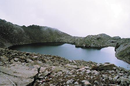
110 102
111 Acknowledgements Grateful thanks are due to Shri Vijai Sharma, Secretary, Ministry of Environment and Forests, and Mrs Meena Gupta, former Secretary, MoEF, for their full support to the activities under the NLCP Shri R.H. Khwaja, former Special Secretary and Project Director, NRCD (now Secretary, Ministry of Tourism) for his keen interest, constant encouragement, valuable guidance and suggestions Shri Rajiv Gauba, Joint Secretary, MoEF, for his unflinching support All officers of the National River Conservation Directorate (NRCD) and the Conservation & Survey (CS) Division for their cooperation and support, All concerned departments and agencies of the State Governments engaged in planning and implementation of the lake restoration, for providing necessary information (Late) Dr M.S. Kodarkar of the Indian Association of Aquatic Biologists, Hyderabad and Dr Arun Kumar of Alternate HydroEnergy Centre (AHEC), Indian Institute of Technology, Roorkee, for their helpful contributions National Institute of Ecology for its assistance in the compilation, editing and printing; Printed at: New United Process, A-26 Naraina Indl. Area, Phase II New Delhi
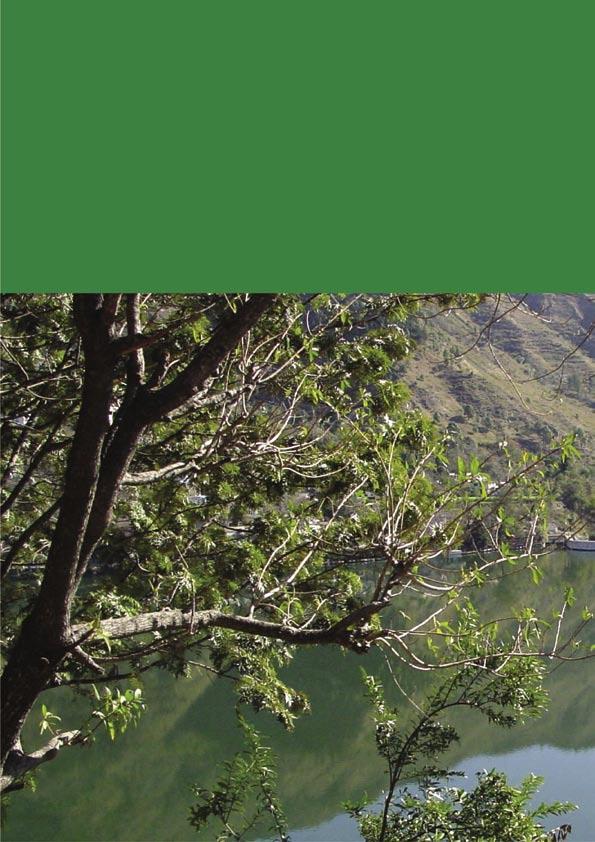
112
AP Environmental Science
 AP Environmental Science Types of aquatic life zones MARINE Estuaries coral reefs mangrove swamps neritic zone pelagic zone FRESHWATER lakes and ponds streams and rivers wetlands Distribution of aquatic
3 Objectives 3 Ob jec tives
 3 Objectives 3 Objectives 3 Objectives 3 Objectives contents Objective number Page 3.1 Ki uta ki tai: mountains to the sea O1-O5 37 3.2 Beneficial use and development O6-O13 38 3.3 Māori relationships
MARINE POLLUTION DEGRADATION MITIGATION MANAGEMENT IS ESSENTIAL FOR IMPROVING MARINE ENVIRONMENT
 MARINE POLLUTION DEGRADATION MITIGATION MANAGEMENT IS ESSENTIAL FOR IMPROVING MARINE ENVIRONMENT The health of the world s oceans and marine life is degrading rapidly as a result of excess human activities.
Foundation Course. Semester 3 THREATS TO THE ENVIRONMENT
 Foundation Course Semester 3 THREATS TO THE ENVIRONMENT INTRODUCTION Atmosphere, water and soil are the most important components of environment in which we live. Atmospheric factors like rainfall, humidity,
Hydrology and Water Quality. Water. Water 9/13/2016. Molecular Water a great solvent. Molecular Water
 Hydrology and Water Quality Water Molecular Water Exists as an equilibrium But equilibrium altered by what is dissolved in it Water Molecular Water a great solvent In reality, water in the environment
EUTROPHICATION. Student Lab Workbook
 EUTROPHICATION Student Lab Workbook THE SCIENTIFIC METHOD 1. Research Background literature research about a topic of interest 2. Identification of a problem Determine a problem (with regards to the topic)
FACTSHEET INTRODUCTION. help rebalance the water cycle, mitigate the effects of climate change and improve human health and livelihoods.
 1 FACTSHEET INTRODUCTION World Water Day, on 22 March every year, is about focusing attention on the importance of water. This year s theme, Nature for Water, explores nature-based solutions (NBS) to the
Water Resources on PEI: an overview and brief discussion of challenges
 Water Resources on PEI: an overview and brief discussion of challenges Components: Components and links Atmospheric water Surface water (including glacial water) Groundwater Links: Precipitation (atm(
Chapter Concepts LIFE IN WATER. The Hydrologic Cycle. The Hydrologic Cycle
 Chapter Concepts Chapter 3 LIFE IN WATER The hydrologic cycle exchanges water among reservoirs The biology of aquatic environments corresponds broadly to variations in physical factors such as light, temperature,
Fresh Water Treaty. International Setting and Issues in Water, Environment and Development
 Fresh Water Treaty Preamble International Setting and Issues in Water, Environment and Development 1. In recent years most countries have faced a grave economic crisis which generated a great decrease
Hamilton Harbour. Area of Concern Status of Beneficial Use Impairments September 2010
 Hamilton Harbour Area of Concern Status of Beneficial Use Impairments September 2010 Hamilton Harbour is a 2150-ha bay located at the western tip of Lake Ontario. The Area of Concern covers about 500 km
An Introduction to The Ecology of Lakes, Ponds and Reservoirs. Developing a Management Plan
 An Introduction to The Ecology of Lakes, Ponds and Reservoirs Developing a Management Plan Stephen J. Souza, Ph.D. Princeton Hydro, LLC 1108 Old York Road Ringoes, NJ 08551 ssouza@princetonhydro.com Objective
Water Pollution. Objective: Name, describe, and cite examples of the eight major types of water pollution.
 Water Pollution Objective: Name, describe, and cite examples of the eight major types of water pollution. Types of Water Pollution Water pollutants are divided into eight categories: 1. Sediment pollution
Life in Water. Chapter 3
 Life in Water Chapter 3 Outline Hydrologic Cycle Oceans Shallow Marine Waters Marine Shores Estuaries, Salt Marshes, and Mangrove Forests Rivers and Streams Lakes 2 The Hydrologic Cycle Over 71% of the
Read: Case Study: America s First River : A Success Story Summarize the story of the Hudson River and PCB s:
 Botkin & Keller: Environmental Science: Earth as a Living Planet- 8th Ed. APES- Chapter #19- Water Pollution and Treatment- Guided Reading Name: Brandon Tran Learning Objectives: Degradation of our surface-water
Design Features of Constructed Wetlands for Nonpoint Source Treatment. September 1995
 Design Features of Constructed Wetlands for Nonpoint Source Treatment September 1995 Brochure written by William W. Jones, School of Public and Environmental Affairs, Indiana University, Bloomington, Indiana.
Standards for SWMF s. (Stormwater Management Facilities) Lacombe County s Guide to Developing Stormwater Management Facilities
 Lacombe County s Guide to Developing Stormwater Management Facilities") Standards for SWMF s (Stormwater Management Facilities) Lacombe County s Guide to Developing Stormwater Management Facilities August 2017 PREAMBLE Development results in a great amount of impervious area,
Standards for SWMF s (Stormwater Management Facilities) Lacombe County s Guide to Developing Stormwater Management Facilities August 2017 PREAMBLE Development results in a great amount of impervious area,
WATERSHED. Maitland Valley. Report Card 201
 Maitland Valley WATERSHED Report Card 201 The Maitland Valley Conservation Authority has prepared this report card as a summary on the state of our forests, wetlands, surface water, and ground water resources.
Netley-Libau Nutrient-Bioenergy Project
 Netley-Libau Nutrient-Bioenergy Project Harvesting cattail provides a Lake Friendly biomass source for bioenergy production to displace fossil fuels and reduce greenhouse gas emissions Richard E. Grosshans,
12/9/2011. Constructed Wetlands. Functions, Design Criteria
 Constructed Wetlands Functions, Design Criteria 1 2 Functions of Wetlands Flood mitigation Water filtration/purification (treatment) Wildlife habitat, biodiversity Biogeochemical cycles Recreation Reasons
Chapter 8: Aquatic Biodiversity
 Chapter 8: Aquatic Biodiversity APES 2013 1 Aquatic Life Zones 71% of the Earth is covered in saltwater 2.2% is freshwater Aquatic life zones are the equivalent of biomes Two major types: saltwater (marine)
Watershed: an area or ridge of land that separates waters flowing to different rivers, basins, or seas. It is the interdependent web of living
 Watershed: an area or ridge of land that separates waters flowing to different rivers, basins, or seas. It is the interdependent web of living organisms that inhabit a geographic area and depend on it
Preface. MNR # Queen s Printer for Ontario, 2012 ISBN (PRINT) ISBN (PDF)
 ISBN (PDF)") Preface In 2008, the inter-agency Drainage Act & Section 28 Regulations Team (DART) was established by the Ministry of Natural Resources (MNR) and the Ministry of Agriculture, Food and Rural Affairs (OMAFRA)
Preface In 2008, the inter-agency Drainage Act & Section 28 Regulations Team (DART) was established by the Ministry of Natural Resources (MNR) and the Ministry of Agriculture, Food and Rural Affairs (OMAFRA)
Climate: describes the average condition, including temperature and precipitation, over long periods in a given area
 Ch. 6 - Biomes Section 6.1: Defining Biomes Biome: a group of ecosystems that share similar biotic and abiotic conditions, large region characterized by a specific type of climate, plants, and animals
STREAM AND BUFFER AREA PROTECTION/RESTORATION
 STREAM AND BUFFER AREA PROTECTION/RESTORATION AMENDMENT OPTIONS TO STRENGTHEN POLICY IN HEADWATERS AREAS DRAFT SUBSEQUENT TO THE JANUARY 25, 2007 MEETING OF THE PLANNING COMMISSION ENVIRONMENT COMMITTEE
Estuary Adventures. Background. Objective
 Estuary Adventures Objective Students will work in groups to understand the concept of estuaries, their importance, and the role that density plays in the mixing of fresh and salt water. Students will
Very slight to negligible limitations no special land management practices required.
 Land Capability Classes Land and Soil Capability Class 1 Class 1 Definition Very slight to negligible limitations no special land management practices required. On-site impact of land management practices
16 Management of Natural Resources
 Assignments in Science Class X (Term II) 16 Management of Natural Resources 1. We can manage and conserve our natural resources as well as the environment through sustainable development. 2. Sustainable
Cultural accelerated by anthropogenic activities
 EUTROPHICATION IMPLICATIONS OF N & P Intent of this lecture? Link our discussions of terrestrial N & P dynamics with its influences on receiving water bodies How the relative amounts of N & P can influence
INTRODUCTION TO HOBBY FARMING AND WATER QUALITY
 SECTION ONE INTRODUCTION TO HOBBY FARMING AND WATER QUALITY This is a handbook for owners of Hobby Farms - small scale farms operated primarily as a residential lifestyle - to provide their owners with
WILDLIFE ECOLOGY AND CONSERVATION STUDY NOTES
 WILDLIFE ECOLOGY AND CONSERVATION STUDY NOTES 1.0 Introduction: General principles of ecosystems management 2.0 Objectives 3.0 Main content 3.1. Principles of sustainable management of the ecosystems 3.2
What can be done to prevent seagrass loss?
 What can be done to prevent seagrass loss? The presence and distribution of seagrass beds depend on many complicated environmental factors and conditions. Nevertheless, the main factors responsible for
Remote Sensing and GIS for Forestry Interventions for Ganga (ForGanga) Implementing Institute Forest Research Institute, Dehradun
 Implementing Institute Forest Research Institute, Dehradun") Remote Sensing and GIS for Forestry Interventions for Ganga (ForGanga) www.forganga.in Implementing Institute Forest Research Institute, Dehradun Ganga: Glimpse of Few Issues Ganga: Glimpse of Few Issues
Remote Sensing and GIS for Forestry Interventions for Ganga (ForGanga) www.forganga.in Implementing Institute Forest Research Institute, Dehradun Ganga: Glimpse of Few Issues Ganga: Glimpse of Few Issues
Wetlands in Alberta: Challenges and Opportunities. David Locky, PhD, PWS, PBiol Grant MacEwan University
 Wetlands in Alberta: Challenges and Opportunities David Locky, PhD, PWS, PBiol Grant MacEwan University Overview What & Where Function & Value Alberta s Keystone Ecosystem Losses & Impacts Restoration
BIG ROCHE A CRI LAKE CHARACTERISTICS
 BIG ROCHE A CRI LAKE CHARACTERISTICS Lake Description Big Roche Cri Lake is located in north central Adams County and has a surface area of 205 acres, a shoreline length of 6.1 mile, a volume of 6,993
The Social and Economic Importance of Canada s Privately Owned Forest Lands
 The Social and Economic Importance of Canada s Privately Owned Forest Lands Key Points n Private forests make up 6% of Canada s 402 million ha of forested land and 13% of the managed forest. n Private
The Hypoxic Zone in the Gulf of Mexico
 The Hypoxic Zone in the Gulf of Mexico References Council Committee on Environmental and Natural Resources. 2003. An Assessment of Coastal Hypoxia and Eutrophication in U.S. Water. National Science and
GUIDE TO THE DEVELOPMENT OF A MINING AND RECLAMATION PLAN IN NEW BRUNSWICK
 PROVINCE OF NEW BRUNSWICK DEPARTMENT OF ENERGY AND RESOURCE DEVELOPMENT Minerals and Petroleum Development Branch GUIDE TO THE DEVELOPMENT OF A MINING AND RECLAMATION PLAN IN NEW BRUNSWICK Guide to the
Susan P. Abano Engineer IV Policy and Program Division
 National Water Resources Board Integrated Water Resources Management Susan P. Abano Engineer IV Policy and Program Division National Water Resources Board Outline Philippines Water Resources Situationer
Environmental science: An interdisciplinary area of study that includes both applied and theoretical aspects of human impact on the world.
 Chapter 1: Environmental Interrelationships THE NATURE OF ENVIRONMENTAL SCIENCE Environmental science: An interdisciplinary area of study that includes both applied and theoretical aspects of human impact
Dang Thi Tuoi Biodiversity Conservation Agency (BCA) Ministry of Natural Resources and Environment of Vietnam (MONRE)
 Ministry of Natural Resources and Environment of Vietnam (MONRE)") Dang Thi Tuoi Biodiversity Conservation Agency (BCA) Ministry of Natural Resources and Environment of Vietnam (MONRE) Main Contents: 1. Roles of biodiversity in Vietnam 2. Threats to biodiversity in Vietnam
Dang Thi Tuoi Biodiversity Conservation Agency (BCA) Ministry of Natural Resources and Environment of Vietnam (MONRE) Main Contents: 1. Roles of biodiversity in Vietnam 2. Threats to biodiversity in Vietnam
Pennsylvania Stormwater Best Management Practices Manual. Chapter 3. Stormwater Management Principles and Recommended Control Guidelines
 Pennsylvania Stormwater Best Management Practices Manual Chapter 3 Stormwater Management Principles and Recommended Control Guidelines 363-0300-002 / December 30, 2006 Chapter 3 Stormwater Management Principles
Chapter 13 of Agenda 21
 Chapter 13 of Agenda 21 What is Agenda 21? Agenda 21 is the global plan of action that was adopted at the United Nations Conference on Environment and Development (UNCED) held in Rio de Janeiro, Brazil,
Water Recycling and Reuse
 Water Recycling and Reuse WATER RECYCLING Water recycling is reusing treated wastewater for beneficial purposes such as agricultural and landscape irrigation, industrial processes, toilet flushing, and
Restoration and Protection of the Water Resources of the Greenwood Lake Watershed in New Jersey
 Restoration and Protection of the Water Resources of the Greenwood Lake Watershed in New Jersey Greenwood Lake Commission Bi-state commission that was formed in 2001 for the express purpose of improving
Chapter 10 Natural Environment
 Chapter 10 Natural Environment Existing Conditions The Natural Environment Element addresses the protection, conservation, preservation, and restoration of the natural resources the Bayview Ridge Subarea,
UNESCO EOLSS. The various methods available for the treating and disposing of treated sewerage in natural receiving water bodies are outlined.
 POTABLE WATER S. Pagliara and D. Dazzini Department of Civil Engineering, University of Pisa, Italy Keywords: Water supply, water uses, effluent disposal, wastewater impact, sewer network, aqueduct, receiving
ECOSYSTEMS, WATERSHEDS AND POLLUTION CONTROL REVIEW
 ECOSYSTEMS, WATERSHEDS AND POLLUTION CONTROL REVIEW ECOSYSTEMS: (6 th grade content) How biotic and abiotic factors make an ecosystem: https://www.youtube.com/watch?v=mdlwptkg-vi 1. A/An ecosystem is a
The Dublin Statement on Water and Sustainable Development
 The Dublin Statement on Water and Sustainable Development Dublín, Ireland, January 31, 1992 Contents Introduction Guiding Principles Principle 1 Principle 2 Principle 3 Principle 4 The Action Agenda Alleviation
EFFLUENT DOMINATED WATER BODIES, THEIR RECLAMATION AND REUSE TO ACHIEVE SUSTAINABILITY
 EFFLUENT DOMINATED WATER BODIES, THEIR RECLAMATION AND REUSE TO ACHIEVE SUSTAINABILITY Chapter 9 Vladimir Novotny DEFINITION Effluent dominated water body Predominantly contains waste water effluents during
EUTROPHICATION. Teacher s Manual
 EUTROPHICATION Teacher s Manual Preface The following is a, hands on, and inquiry based lesson plan developed by COSEE Mid-Atlantic for teaching eutrophication. The National Education Science Standards
Streamlines V2, n2 (May 1997) A Newsletter for North Carolina Water Supply Watershed Administrators
 A Newsletter for North Carolina Water Supply Watershed Administrators") Page 1 of 5 STREAMLINES A Newsletter for North Carolina Water Supply Watershed Administrators Volume 2, Number 2 May 1997 Non-Point Source (NPS) Pollution This issue of Streamlines provides basic information
Page 1 of 5 STREAMLINES A Newsletter for North Carolina Water Supply Watershed Administrators Volume 2, Number 2 May 1997 Non-Point Source (NPS) Pollution This issue of Streamlines provides basic information
Soil Degradation. Lesson Plan NRES B2-9
 Soil Degradation Lesson Plan NRES B2-9 Objectives 1. What is soil degradation? 2. How can construction result in soil degradation? 3. What are the sources of contamination, and how do they result in soil
GOVERNMENT OF INDIA MINISTRY OF ENVIRONMENT, FOREST AND CLIMATE CHANGE. LOK SABHA STARRED QUESTION No. 334 TO BE ANSWERED ON
 GOVERNMENT OF INDIA MINISTRY OF ENVIRONMENT, FOREST AND CLIMATE CHANGE LOK SABHA STARRED QUESTION No. 334 TO BE ANSWERED ON 09.08.2016 Ecological Impact of Mining *334. SHRI JANARDAN SINGH SIGRIWAL state:
Dead-Zones and Coastal Eutrophication: Case- Study of Chesapeake Bay W. M. Kemp University of Maryland CES Horn Point Laboratory Cambridge, MD
 Dead-Zones and Coastal Eutrophication: Case- Study of Chesapeake Bay W. M. Kemp University of Maryland CES Horn Point Laboratory Cambridge, MD Presentation to COSEE Trends Orientation at UMCES HPL 4 August
Introduction. Wetland System. A Wetland Scene at Lorne C. Henderson Conservation Area near Petrolia
 Wetland Treatment of Wastewater This monograph, one in a series of single issue documents that deal with our local environment, has been prepared by the Sarnia-Lambton Environmental Association in co-operation
Water Quality: The Basics
 Water Quality: The Basics Environmental Science Why is Water Quality Important? Effects all humans Safe drinking water Allows for food productions and SAFE food products Effects Wildlife Health domestic
1.6 Influence of Human Activities and Land use Changes on Hydrologic Cycle
 1.6 Influence of Human Activities and Land use Changes on Hydrologic Cycle Watersheds are subjected to many types of changes, major or minor, for various reasons. Some of these are natural changes and
Water Quality and Ecosystem Services
 Water Quality and Ecosystem Services Workshop on Capacity Development in Advancing Water and Sustainable Development 24-25 th February, 2015 Seleshi B. Awulachew Interregional Advisor, DSD Outline Introduction:
The South Australian River Murray is a highly regulated system comprised of a series of
 1 2 The South Australian River Murray is a highly regulated system comprised of a series of lake-like pools with largely stable water levels. These relatively deep, slow moving pools of water with stable
Environmental Impact Assessment of Hydroelectric Power Plant LEEZA MALIK (2013CEP2080) TUSHAR SINGLA (2011MT50623)
 TUSHAR SINGLA (2011MT50623)") Environmental Impact Assessment of Hydroelectric Power Plant LEEZA MALIK (2013CEP2080) TUSHAR SINGLA (2011MT50623) 1 Contents Background Objective EIA of Hydroelectric plants Tools and Techniques used
Environmental Impact Assessment of Hydroelectric Power Plant LEEZA MALIK (2013CEP2080) TUSHAR SINGLA (2011MT50623) 1 Contents Background Objective EIA of Hydroelectric plants Tools and Techniques used
Wetland Monitoring. City of Edmonton. Edmonton Wetlands Workshop December 4-5, 2013
 Wetland Monitoring City of Edmonton Edmonton Wetlands Workshop December 4-5, 2013 City of Edmonton Presentation Outline Kennedale Wetland Water Quality Sediment removal Vegetation management Biological
Dr. S. K. Sharma Ground Water Expert
 Dr. S. K. Sharma Ground Water Expert CONCEPT OF ARTIFICIAL RECHARGE Recharging practices began in 19 th century in Europe. Traditional water harvesting in India dates back to Indus Valley Civilization
Water Pollution & Quality. Dr. Deniz AKGÜL Marmara University Department of Environmental Engineering
 Water Pollution & Quality Dr. Deniz AKGÜL Marmara University Department of Environmental Engineering IMPORTANCE OF WATER Life on planet Earth would be impossible without water. All life forms, from simple
Baltic Marine Environment Protection Commission
 Baltic Marine Environment Protection Commission HELCOM Recommendation 38/1 Adopted 1 March 2017 having regard to Article 20, Paragraph 1 b) of the Helsinki Convention SEWAGE SLUDGE HANDLING THE COMMISSION,
Carp Creek 2013 Summary Report
 Monitoring Activity in the Carp River Watershed In 2012, Mississippi Valley Conservation Authority (MVCA) worked with Friends of the Carp River (FCR) on a preliminary assessment of the Carp River. This
Long Island s. Environmental Issues. Environmental Issues. Environmental Setting. Environmental Setting. Suburbia and the Environment
 Environmental Issues Long Island s Environmental Issues Copyright 2011 AFG 1 agricultural land air pollution aquifers automobile barrier islands biozones fisheries groundwater recharge invasive species
Linda Cooper, Eno River State Park, Durham, NC
 Linda Cooper, Eno River State Park, Durham, NC 2 Rivers and Streams All 50 states, 2 interstate river commissions, American Samoa, Guam, Puerto Rico, the District of Columbia (collectively referred to
Integrated Domestic Water Management. Workshop Date: 5 th June Venue: TARA Gram Orcha
 Integrated Domestic Water Management Workshop Date: 5 th June Venue: TARA Gram Orcha INTRODUCTION Water forms the very basis of life It covers 71% - Earth's surface 3 % - fresh water 69 % - in glaciers
POLICY FOR NATURAL RESOURCE MANAGEMENT AREAS
 POLICY FOR NATURAL RESOURCE MANAGEMENT AREAS I. POLICY STATEMENT Auburn University's (the University's) "Policy for Natural Resource Management Areas" implements the Campus Master Plan Land Use Element
Conservation Practices. Conservation Choices. These five icons will show the benefits each practice offers... 6/4/2014
 Conservation Choices Your guide to conservation and environmental farming practices. Conservation Choices These five icons will show the benefits each practice offers... The practice reduces soil erosion
CHAPTER 3 Environmental Guidelines for WATERCOURSE CROSSINGS GOVERNMENT OF NEWFOUNDLAND AND LABRADOR DEPARTMENT OF ENVIRONMENT AND LABOUR
 GOVERNMENT OF NEWFOUNDLAND AND LABRADOR DEPARTMENT OF ENVIRONMENT AND LABOUR CHAPTER 3 Environmental Guidelines for WATERCOURSE CROSSINGS WATER RESOURCES MANAGEMENT DIVISION Water Investigations Section
BIOMES. Living World
 BIOMES Living World Biomes Biomes are large regions of the world with distinctive climate, wildlife and vegetation. They are divided by terrestrial (land) or aquatic biomes. Terrestrial Biomes Terrestrial
THE LOWER INDUS RIVER: BALANCING DEVELOPMENT AND MAINTENANCE OF WETLAND ECOSYSTEMS AND DEPENDENT LIVELIHOODS
 THE LOWER INDUS RIVER: BALANCING DEVELOPMENT AND MAINTENANCE OF WETLAND ECOSYSTEMS AND DEPENDENT LIVELIHOODS 1. BACKGROUND Study area: location and geography Afghanistan China The Indus River originates
Master 5.1, Newspaper Articles. Special Edition December 14. Special Edition March 17
 Master 5.1, Newspaper Articles THE DAILY HERALD Special Edition December 14 Study Forecasts Future Food Shortage A new study published in the Journal of World Agriculture raises concerns that in the future
Environmental Information Worksheet
 Environmental Information Worksheet Water System Owner (Attach additional sheets if necessary) Needs and Alternatives Provide a brief narrative that describes: Current drinking water system needs. Project
VIDEO: Riparian Forest Buffers: The Link Between Land & Water
 VIDEO: Riparian Forest Buffers: The Link Between Land & Water Introduction to Riparian Buffers Adapted from: Riparian Forest Buffers: The Link Between Land & Water. Maryland Cooperative Extension. Wye
COUNCIL OF EUROPE COMMITTEE OF MINISTERS. RECOMMENDATION No. R (84) 2 OF THE COMMITTEE OF MINISTERS TO MEMBER STATES
 2 OF THE COMMITTEE OF MINISTERS TO MEMBER STATES") COUNCIL OF EUROPE COMMITTEE OF MINISTERS RECOMMENDATION No. R (84) 2 OF THE COMMITTEE OF MINISTERS TO MEMBER STATES ON THE EUROPEAN REGIONAL/SPATIAL PLANNING CHARTER (Adopted by the Committee of Ministers
COUNCIL OF EUROPE COMMITTEE OF MINISTERS RECOMMENDATION No. R (84) 2 OF THE COMMITTEE OF MINISTERS TO MEMBER STATES ON THE EUROPEAN REGIONAL/SPATIAL PLANNING CHARTER (Adopted by the Committee of Ministers
Ontario Envirothon LEARNING OBJECTIVES. Ontario Envirothon Learning Objectives
 Ontario Envirothon LEARNING OBJECTIVES Updated Fall 2015 5 Contents Contents... 6 Overall Objectives... 7 Aquatic Ecology... 8 Specific Objectives... 8 Overall Objectives... 8 Application/Analysis... 9
IMPO P RT R AN A C N E C E O F G RO R UN U D N W
 Introduction IMPORTANCE OF GROUNDWATER Global Groundwater Situation ACWADAM s database Sources for presentation CGWB, various publications FAO-database Various United Nations publications. UN World Water
MANITOBA ENVIROTHON WATER AND AQUATIC ECOSYSTEMS
 MANITOBA ENVIROTHON WATER AND AQUATIC ECOSYSTEMS Outcome Water and Aquatic Ecosystems as Resources Properties of Water, Water Bodies and Watersheds, and Aquatic Species Identification A1 A2 A3 A4 A5 A6
Progress and Potential of Horticulture in India
 Ind. Jn. of Agri.Econ. Vol.63, No.3, July-Sept. 2008 SUBJECT I TRIGGERING AGRICULTURAL DEVELOPMENT THROUGH HORTICULTURE CROPS Progress and Potential of Horticulture in India Ramesh Chand, S.S. Raju and
& Watershed Management Practices. 4 Sustainable Watershed Management
 Module 2 (L4) Sustainable Watershed Approach & Watershed Management Practices 4 Sustainable Watershed Management 1 1 L4 Sustainable Watershed Management Topics Covered Introduction to the concept of sustainable
CHAPTER 6 ADDITIONAL STANDARDS APPLYING TO SHORELAND AREAS AND PUBLIC WATERS
 CHAPTER 6 ADDITIONAL STANDARDS APPLYING TO SHORELAND AREAS AND PUBLIC WATERS Section 1 Intent. 49 Section 2 Floodplain Requirements 49 Section 3 Water-Oriented Accessory Structures 50 Section 4 Stairways,
Erosion & Sedimentation Control Policy
 Issue Date 10/22/2010 Page 1 of 8 Erosion & Sedimentation Control Policy Introduction: Soil erosion is the removal of soil by water, wind, ice or gravity and sediment deposition occurs when the rate of
Annex XX. Demonstration Projects, scope, selection criteria s and location
 Annex XX. Demonstration Projects, scope, selection criteria s and location The full development of the demonstration projects were not foreseen during the Project Preparation Phase, due to the lack of
Aquatic Communities Aquatic communities can be classified as freshwater
 Aquatic Communities Aquatic communities can be classified as freshwater or saltwater. The two sets of communities interact and are joined by the water cycle. Gravity eventually returns all fresh water
EFFECTS OF WATERSHED TOPOGRAPHY, SOILS, LAND USE, AND CLIMATE ON BASEFLOW HYDROLOGY IN HUMID REGIONS: A REVIEW
 PROGRESS IN PHYSICAL GEOGRAPHY EFFECTS OF WATERSHED TOPOGRAPHY, SOILS, LAND USE, AND CLIMATE ON BASEFLOW HYDROLOGY IN HUMID REGIONS: A REVIEW KATIE PRICE 2011 Presented by: Jordan Martin Article Overview
Florida Department of Environmental Protection. Bureau of Mining and Minerals Regulation. Regulation of Mines. Howard J. Hayes, Program Administrator
 Florida Department of Environmental Protection Bureau of Mining and Minerals Regulation Regulation of Mines Howard J. Hayes, Program Administrator April 2011 What is a mine? Nonphosphate mine: Subsections
Lakes and Ponds. Questions to consider. Ponds breathe. Sinkhole pond. Oxbow lake. Farm pond. Reservoir
 8 Lakes and Ponds dane johnson / visuals unlimited Oxbow lake Farm pond Sinkhole pond Reservoir albert copley / visuals unlimited Questions to consider 1 2 3 4 5 6 7 How do oxygen levels in ponds change
Managing Adaptive REsponses to changing flood risk. Bergen. Haukås Watercourse HAUKUS
 Managing Adaptive REsponses to changing flood risk Bergen. Haukås Watercourse HAUKUS 130405 Developers Long term ownership Wildlife Heritage Environment Water quality Water quantity Emergency planning
River Restoration in Japan
 River Restoration in Japan Keigo Nakamura, Ph.D Water Environment Research Group Public Works Research Institute Contents What is restoration? History of river restoration in Japan Basics for river restoration
Biodiversity and Conservation
 Chapter Test A CHAPTER 5 Biodiversity and Conservation Part A: Multiple Choice In the space at the left, write the letter of the phrase or sentence that best answers each question. Part B: Matching 1.
Chapter 3 Ecosystem Ecology. Tuesday, September 19, 17
 Chapter 3 Ecosystem Ecology Reversing Deforestation in Haiti Answers the following: Why is deforestation in Haiti so common? What the negative impacts of deforestation? Name three actions intended counteract
Contents: Purpose and objective Water and energy conservation 1 1
 1 Chapter 1 Contents: 652.0100 Purpose and objective 1 1 652.0101 Water and energy conservation 1 1 652.0102 Soil conservation, water quality, and pollution abatement 1 2 652.0103 Using the guide 1 3 (a)
Goose Management through Habitat Restoration
 Goose Management through Habitat Restoration presented at the Goose Management Workshop Bergen County Community College Paramus, New Jersey March 3, 2009 Christopher C. Obropta, Ph.D., P.E. Extension Specialist
Annex F Scoping Checklist
 Scoping Checklist Table F1: Scoping Checklist Table. Questions to be considered in Scoping /? Which Characteristics of the Project 1. Will construction, operation or decommissioning of the Project involve
Eutrophication: Tracing Nutrient Pollution Back to Penns Creek
 Eutrophication: Tracing Nutrient Pollution Back to Penns Creek Nutrients are substances that life depends on for growth and reproduction. However, when these nutrients enter our planets waterways in excess,
UNDERGRADUATE COURSES
 UNDERGRADUATE COURSES POLICY, PLANNING, AND MANAGEMENT RELATED COURSES AAEC 3324: ENVIRONMENT AND SUSTAINABLE DEVELOPMENT ECONOMICS Economics of environment and sustainable development. Topics include