CHAPTER 4: Risk Assessment Risk in Groundwater Contamination
|
|
|
- Bernice Harrington
- 5 years ago
- Views:
Transcription

1 CHAPTER 4: Risk Assessment Risk in Groundwater Contamination Instructor: Dr. Yunes Mogheir -١
2 Introduction: Water pollution is nowadays one of the most crucial environmental problems world-wide. Pollution in aquifers and surface waters originates, apart from local sources discharging wastewaters, mainly from diffuse sources, scattered withinthe entire river basin. The problem which must be dealt with by the engineer is the prediction in space and time of the concentration of a pollutant substance introduced in the water body. The analysis of this problem with mathematical or physical models may assist in the optimal design of wastewater treatment plants, the positioning of wastewater outfalls and the determination of the flow rate and composition of effluents at the discharge outlet. -٢
3 Introduction: From the engineering point of view, environmental water quality is subject to several types of uncertainty, These are related to the high variability in space and time of the hydrodynamic, chemical and biologicalprocesses involved. Quantificationof such uncertainties is essential for the performance and safety of engineeringprojects. -٣
4 Importance of Groundwater Resources Groundwater is the largest source of fresh water in the world. Although only a small fraction of the available groundwater resources is used, its development is recently of increasing importance for many countries. This is mainly due to the fact that surface waters are over-used and increasingly polluted from domestic, agricultural and industrial discharges. Usually groundwater is of very good quality still, and its sensible use along with surface waters can give an optimum solution to specific problems of water demand. -٤
5 For groundwater resources development it is not precipitation itself which is of importance but rather the so called effective precipitation. This is the amount of water resulting when the evapotranspiration is subtracted from total precipitation. Which equal the surface runoff plus the water infiltrating into the soil. For the development of water resources it is important to know the spatial distribution of the various components of the hydrological cycle. For groundwater resources development it is necessary to have geological, hydrogeological, hydrochemical information and also field data allowingevaluation of the groundwater balance. -٥
6 Steps in Groundwater Development From the engineering point of view, ultimate goal is the optimum use of the available groundwater resources. The quantity, quality and energy considerations in groundwater management form a multidisciplinary field requiring scientific cooperation between various discipline: 1. Hydrogeology: 2. Groundwater Hydrodynamics: mathematical modelling, 3.Groundwater Management: systems analysis, optimization techniques, risk and decision theory 4. Hydrochemistry : chemical composition of the soil and water 5. Hydrobiology : biological properties of groundwater systems -٦

7 Steps in Groundwater Development -٧
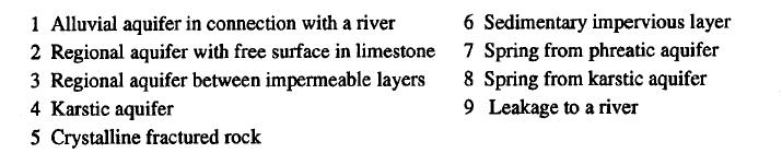
8 Properties and Field Investigation of Groundwater Systems Water infiltrating into the soil circulates through various geological formations. Depending on the boundary conditions (impermeable or semi-permeable layers of soil, atmospheric pressure, rivers and lakes) the groundwater forms various types of subsurface reservoirs, called aquifers. -٨
9 -٩
10 Space and Time Scales A space scale can be empirically defined as the extent of the flow domain. Atime scale characterizes the duration of ahydrological phenomenon. Space Scales is defined as the characteristic size of the spatial area in which the multiphase flow is studied. Five different space scales are distinguished. 1. Pore Scale: mm for soil materials (sand, clay or silt) 2. Sample Scale: 10 cm (a small soil sample containing alarge number of pores and solid particles. 3. Laboratory Scale: 1m(scale of common experimental setups of the order of 1meter) 4. LocalAquifer Scale: 100 m (the horizontal direction, 5. Regional Scale: 10 km (the horizontal direction much larger than the aquifer thickness.) -١٠
11 Space and Time Scales A space scale can be empirically defined as the extent of the flow domain. And also is defined as the characteristic size of the spatial area in which the multiphase flow is studied. Five different space scales are distinguished. 1. Pore Scale: mm for soil materials (sand, clay or silt) 2. Sample Scale: 10 cm (a small soil sample containing alarge number of pores and solid particles. 3. Laboratory Scale: 1m(scale of common experimental setups of the order of 1meter) 4. LocalAquifer Scale: 100 m (the horizontal direction) 5. Regional Scale: 10 km (the horizontal direction much larger than the aquifer thickness.) -١١
12 Time Scales In unsteady multiphase flow through porous media time scale can be defined as the duration of the flow phenomena. From a specific event, such as a rainfall, and the resulting recharge of the aquifer in geological time, taking one year as the time unit, the followingtime scales are distinguished. -١٢
, the irregular variations in space are smoothed and some macroscopic properties of the medium are defined.")
13 Aquifer Hydraulic Properties Aquifers are complex media consisting of networks of interconnected pores, fractures and cracks, through which watercirculates. By taking average values of the local properties (porosity and permeability), the irregular variations in space are smoothed and some macroscopic properties of the medium are defined. The Representative Elementary Volume (REV) must have large enough dimensions to smooth local variations. The smoothing procedure of REV can be extended in the regional scale of aquifers (Ganoulis, 1986). -١٣
14 Aquifer Hydraulic Properties 1.Specific Yield Sy : is the difference between porosity and the specific retention, Sr which is a portion of the water present in the pore space is held by molecular and surface tension forces and can not be drained by gravity. Sy = n - Sr This represents the water removed from a unit volume by pumping or drainage. It varies from 10-20% for alluvial aquifers to about 30% for uniform sands 2. Grain Size Distribution: -١٤
15 Aquifer Hydraulic Properties 3.Coeflcient of Permeability K: K is the coefficient of permeability (m/s), depending on fluid viscosity and the geometrical and properties of the porous medium. From Darcy Law : V=Ki Specific permeability K is a function of the structural characteristics of the porous medium. 4. Transmissivity Coefficient T(m2/s) This is the product of field permeability K(m/s) and the saturated thickness of the aquifer. For a confined aquifer of widthb(m) the transmissivity is T=Kb; for aphreatic aquifer of thickness h above the impervious layer the transmissivity is T=Kh. -١٥
16 Conceptual and Mathematical Models Conceptual models are idealizations of the natural aquifer systems (form, areal extension, physical properties of the aquifers) and their constituent processes (flow conditions, boundary Conditions) -١٦
17 Spatial Variability and Stochastic Modelling Because of the natural variability in space and time, the main problem for evaluating the risk of groundwater contamination is the fact that physical Parameters and variables of the system show random deviations. To this randomness, one must add various other uncertainties due to the scarcity of the information concerning the inputs, the value of the parameters (measurement and sampling uncertainties) and also the imperfection of the models (modelling uncertainties). the random variation in space of the porosity in a case of an alluvial aquifer -١٧
18 Stochastic Description As shown in Fig. (4.43), it is necessary to distinguish between: (a) the time variability of the aquifer boundary conditions and, (b) the spatial variability of the physical properties of the aquifer. -١٨
, may be formulated as astochastic process Multiphase flow and pollution in porous media are complex phenomena, because of the movement of the microscopic interfaces(menisci).")
19 Risk Assessment of Groundwater Pollution The intrusion of one fluid in aporous medium which is completely filled by another immiscible fluid (Fig. 4.47), may be formulated as astochastic process Multiphase flow and pollution in porous media are complex phenomena, because of the movement of the microscopic interfaces(menisci). The interpretation and modelling of the multiphase retention properties of porous media including the risk of pollution, must take into account the complexity of the internal geometry of the microscopic channels. -١٩
. As an example of application the computed water table elevation is shown in Fig. (4.")
20 Solute Transport and Random Walks For two-dimensional flows the velocity field can be computed by using the technique of boundary elements (Latinopoulos, Ganoulis et al., 1982). As an example of application the computed water table elevation is shown in Fig. (4.49). -٢٠
21 This is illustrated in the case of the Gallikos aquifer, located near the river Axios Makedonia, Greece. It is an unconfined allouvial aquifer, from which apart of the water supply of the city of Thessaloniki is provided. Vulnerability of the groundwater from pollutant sources has been investigated using random walks and Lagrangian methods. Introducing the corresponding velocity field, the groundwater pollution from a point source is studied, using the random walk simulation algorithm (Fig. 4.50). -٢١
22 Fig Random walk simulation in the Gallikos aquifer (dimensions are in meters) -٢٢
23 To evaluate impact probabilities (Fig. 4.51) and concentrations of the particles, the area is covered by aregular grid. Knowledge of the velocity components u, vat the grid points permits particle velocities to be computed by linear interpolation. The probability of reaching a given grid cell and consequently the particle concentrations are evaluated by counting the number of particles which fall withinthe grid square. -٢٣
24 Fig Impact probabilities in the Gallios aquifer (dimensions are in meters). -٢٤
25 Effluent Recovery and Irrigation Scheme (North Gaza) The project necessitates the implementation of risk management facilities. This is to avoid apotential long term irreversible impact to the groundwater, environment, society and public health of the nearby communities. The most challenging task in this project is to design the groundwater recovery wells scheme that will be able to capture the infiltrated water in the appropriate time and quantity. -٢٥


26 Risk Management Facilities 1. Recovery Scheme 2. Booster Pumps and Tanks 3. Irrigation Network -26
 is inflitrated in the basin starting from year 2009. In addition, around 20 agricultural wellswill be negatively influnecd.")
27 Impacts if NEGST and Current projcet are not implemented 20Agricultural wells are influenced 1000 m 1000 m The pollution will be extended to adistance of 1000 min the west and the west northern dircetion of the basin in year 2015 if bad quality of water (15,000 m3/day) is inflitrated in the basin starting from year In addition, around 20 agricultural wellswill be negatively influnecd. -27
 is inflitrated in the basin starting from year 2009. In addition, around 35 agricultural wellswill be negativelyinflunecd.")
28 35 Agricultural wells are influenced 1800 m The pollution will be extended to a distance of 1800 m in the west northern dircetion of the basin in year 2022 if bad quality of water (15,000 m3/day) is inflitrated in the basin starting from year In addition, around 35 agricultural wellswill be negativelyinflunecd. -28
 is inflitrated in the basin starting from year 2015. In addition, around 55 agricultural wells and some of municipal wellswill be negatively influnecd.")
29 55 Agricultural wells are Influenced The pollution will be extended to adistance of 2300 min the west and the west northern dircetions of the basin in year 2022 if bad quality of water (35600 m3/day) is inflitrated in the basin starting from year In addition, around 55 agricultural wells and some of municipal wellswill be negatively influnecd. -29

30 Impacts if NEGST and Current projcet are implemented The groundwater quality in the infiltration area for year 2025 if 35,600 m3/day is infiltrated with good quality. The quantity and quality of groundwater will be improved; however, the infiltrated water should be recovered by recovery wells since infiltrated water even with good quality water should not allowed to reach the nearby agricultural or municipal wells. -30

31 Location of the Recovery Wells Based on ModPath Around 30 recovery wells in adistance not exceed 1000 m from the basin should be located to capture the pollution plume. The wells will recover the infiltrated treated wastewater with 10% extract to guarantee the capturing of all infiltrated water and redirect the flow of watertowards the recovery wells. -31
Groundwater 3/16/2010. GG22A: GEOSPHERE & HYDROSPHERE Hydrology
 GG22A: GEOSPHERE & HYDROSPHERE Hydrology Definitions Groundwater Subsurface water in soil or rock that is fully saturated. Aquifer Contains enough saturated material to yield significant quantities of
ENGINEERING HYDROLOGY
 ENGINEERING HYDROLOGY Prof. Rajesh Bhagat Asst. Professor Civil Engineering Department Yeshwantrao Chavan College Of Engineering Nagpur B. E. (Civil Engg.) M. Tech. (Enviro. Engg.) GCOE, Amravati VNIT,
SEES 503 SUSTAINABLE WATER RESOURCES GROUNDWATER. Instructor. Assist. Prof. Dr. Bertuğ Akıntuğ
 SEES 503 SUSTAINABLE WATER RESOURCES GROUNDWATER Instructor Assist. Prof. Dr. Bertuğ Akıntuğ Civil Engineering Program Middle East Technical University Northern Cyprus Campus SEES 503 Sustainable Water
Questions: What is calibration? Why do we have to calibrate a groundwater model? How would you calibrate your groundwater model?
 Questions: What is calibration? Why do we have to calibrate a groundwater model? How would you calibrate your groundwater model? 13-11-2009 1 Uncertainties in groundwater models Conceptual model uncertainty
Lecture 20: Groundwater Introduction
 Lecture 20: Groundwater Introduction Key Questions for Groundwater 1. What is an aquifer? 2. What is an unconfined aquifer? 3. What is groundwater recharge? 4. What is porosity? What determines the magnitude
POROSITY, SPECIFIC YIELD & SPECIFIC RETENTION. Physical properties of
 POROSITY, SPECIFIC YIELD & SPECIFIC RETENTION Porosity is the the ratio of the voids to the total volume of an unconsolidated or consolidated material. Physical properties of n = porosity as a decimal
PhD Program Water Technology Groundwater Hydrology (WTEC 9309)
") PhD Program Water Technology Groundwater Hydrology (WTEC 9309) Topic 1: Introduction and Occurrence of Groundwater Instructor: Prof. Dr. Yunes Mogheir 2018 1 1. Introduction Definitions and General Groundwater
PhD Program Water Technology Groundwater Hydrology (WTEC 9309) Topic 1: Introduction and Occurrence of Groundwater Instructor: Prof. Dr. Yunes Mogheir 2018 1 1. Introduction Definitions and General Groundwater
GROUNDWATER Dr. DEEPAK KHARE GENERAL HYDROLOGY CYCLE FORMATIONS
 GROUNDWATER By Dr. DEEPAK KHARE Associate Professor Department of Water Resources Development & Management Indian Institute of Technology Roorkee, ROORKEE (Uttaranchal) 247 667, India E-mail: kharefwt@iitr.ernet.in
OUTLINE OF PRESENTATION
 GROUNDWATER?? OUTLINE OF PRESENTATION What is groundwater? Geologic investigation Definitions: aquifer and aquitard, unconfined and semi-confined Water level and interpretation of water level data Well
Groundwater. Groundwater Movement. Groundwater Movement Recharge: the infiltration of water into any subsurface formation.
 On March 22, 2014, a major landslide occurred near Oso, Washington. Death toll currently at 30, with 15 still missing. Groundwater Before and After Swipe http://bit.ly/pen1jt N. Fork Stillaguamish River
Hydrologic Cycle. Rain Shadow:
 Hydrologic Cycle The cyclical movement of water from the ocean to the atmosphere by evaporation, to the surface through precipitation, to streams through runoff and groundwater, and back to the ocean.
Storage and Flow of Groundwater
 Storage and Flow of Groundwater Aquifer AQUIFER (in Greek)= AQUA (water) + FERRE (to bear) Aquifer- a saturated geological formation which will yield sufficient quantity of water to wells and springs Underground
CHAPTER 13 OUTLINE The Hydrologic Cycle and Groundwater. Hydrologic cycle. Hydrologic cycle cont.
 CHAPTER 13 OUTLINE The Hydrologic Cycle and Groundwater Does not contain complete lecture notes. To be used to help organize lecture notes and home/test studies. Hydrologic cycle The hydrologic cycle is
University of Arizona Department of Hydrology and Water Resources Dr. Marek Zreda. HWR431/531 - Hydrogeology Problem set #1 9 September 1998
 University of Arizona Department of Hydrology and Water Resources Dr. Marek Zreda HWR431/531 - Hydrogeology Problem set #1 9 September 1998 Problem 1. Read: Chapter 1 in Freeze & Cherry, 1979. McGuiness
The Islamic University of Gaza Faculty of Engineering Civil Engineering Department Infrastructure Msc.
 The Islamic University of Gaza Faculty of Engineering Civil Engineering Department Infrastructure Msc. Special Topics in Water and Environment - ENGC 6383 Lecture 2 Instructors: Dr. Yunes Mogheir (ymogheir@iugaza.edu.ps)
General Groundwater Concepts
 General Groundwater Concepts Hydrologic Cycle All water on the surface of the earth and underground are part of the hydrologic cycle (Figure 1), driven by natural processes that constantly transform water
BANAT PLAIN THE ROMANIAN CASE STUDY FREEWAT PLATFORM APPLICATION
 Open Workshop 1st FREEWAT User and Developers International Workshop September 21 st 2017 IDAEA. CID - CSIC 16 Jordi Girona. 08034 Barcelona BANAT PLAIN THE ROMANIAN CASE STUDY FREEWAT PLATFORM APPLICATION
Seawater intrusion into coastal aquifers a case study
 The Sustainable City V 213 Seawater intrusion into coastal aquifers a case study J. Letha & D. B. Krishnan Civil Engineering Department, College of Engineering, Trivandrum, India Abstract Seawater intrusion
University of Arizona Department of Hydrology and Water Resources Dr. Marek Zreda
 University of Arizona Department of Hydrology and Water Resources Dr. Marek Zreda HWR431/531 - Hydrogeology Final exam - 12 May 1997 Open books and notes The test contains 8 problems on 7 pages. Read the
MODELLING THE GROUNDWATER FLOW FOR ESTIMATING THE PUMPING COST OF IRRIGATION IN THE AQUIFER OF N. MOUDANIA, GREECE
 Proceedings of the 13 th International Conference on Environmental Science and Technology Athens, Greece, 5-7 September 2013 MODELLING THE GROUNDWATER FLOW FOR ESTIMATING THE PUMPING COST OF IRRIGATION
Groundwater basics. Groundwater and surface water: a single resource. Pore Spaces. Simplified View
 Groundwater and surface water: a single resource Santa Cruz River, Tucson Groundwater basics Groundwater is water found within the pore spaces of geologic material beneath the surface of the Earth. It
3/7/ Basic Types of Rocks. A Brief Review of Physics
 A Brief Review of Physics Energy is the capacity to do work. Work is equal to the product of the net force applied to a fluid and the distance through which the force moves: W = F l W is work [M 2 T -2
An Introduction into Applied Soil Hydrology
 Klaus Bohne An Introduction into Applied Soil Hydrology Preface Contents 1 Introduction: The soil as a reactor between the earth's atmosphere and the subsurface 1 2 Mechanical composition of mineral soils
WHAT IS SOIL? soil is a complex system of organic and inorganic (mineral) compounds Soil properties depend on formation process particle size climate
 compounds Soil properties depend on formation process particle size climate") Lecture 5, Soil water and infiltration WHAT IS SOIL? soil is a complex system of organic and inorganic (mineral) compounds Soil properties depend on formation process particle size climate THE IMPORTANCE
Lecture 5, Soil water and infiltration WHAT IS SOIL? soil is a complex system of organic and inorganic (mineral) compounds Soil properties depend on formation process particle size climate THE IMPORTANCE
Grounding Water: An Exploration of the Unseen World Beneath Our Feet
 1 Grounding Water: An Exploration of the Unseen World Beneath Our Feet Kerry Schwartz, Director, Arizona Project WET Protect Your Groundwater Day: Tuesday, September 9, 2014 What I Hope to Convey Groundwater
Groundwater and surface water: a single resource. Santa Cruz River, Tucson
 Groundwater and surface water: a single resource Santa Cruz River, Tucson 1942 1989 1 Groundwater basics Groundwater is water found within the pore spaces of geologic material beneath the surface of the
Groundwater Flow Demonstration Model Activities for grades 4-12
 Groundwater Flow Demonstration Model Activities for grades 4-12 NR/WQ/2012-5 SET-UP Please allow time to practice using the groundwater model before conducting demonstrations. 1. Remove the groundwater
East Maui Watershed Partnership Adapted from Utah State University and University of Wisconsin Ground Water Project Ages 7 th -Adult
 INTRODUCTION What is groundwater? Water contained in saturated soil and rock materials below the surface of the earth. It is not NEW water, but is recycled water through the hydraulic cycle. The source
Chapter 1 Introduction
 Engineering Hydrology Chapter 1 Introduction 2016-2017 Hydrologic Cycle Hydrologic Cycle Processes Processes Precipitation Atmospheric water Evaporation Infiltration Surface Runoff Land Surface Soil water
Effect of Conjunctive Use of Water for Paddy Field Irrigation on Groundwater Budget in an Alluvial Fan ABSTRACT
 1 Effect of Conjunctive Use of Water for Paddy Field Irrigation on Groundwater Budget in an Alluvial Fan Ali M. Elhassan (1), A. Goto (2), M. Mizutani (2) (1) New Mexico Interstate Stream Commission, P.
Springshed Management Training Curriculum 2016 The Springs Initiative
 Springshed Management Training Curriculum 2016 The Springs Initiative SESSION TITLE: Aquifers SECTION: Understanding the Resource MODULE: II. Applied Hydrogeology AUTHORS: Dr Himanshu Kulkarni CONTRIBUTING
4.4 MODEL CODE DESCRIPTION 4.5 WATER SOURCES AND SINKS 4.6 MODEL DOMAIN AND BOUNDARIES. SLR South Africa
 Page 4-18 The developed model should therefore be seen as an initial site model which should be refined and recalibrated once more groundwater monitoring and other data become available. 4.4 MODEL CODE
Hydrogeology of Prince Edward Island
 Hydrogeology of Prince Edward Island General Characteristics and Groundwater on Prince Edward Island General Characteristics and Key Issues Issues PEI Dept. of Environment, Energy and Forestry 9/29/2009
9/9/ Basic Types of Rocks. Porosity of Earth Materials
 3 Basic Types of Rocks Porosity of Earth Materials Igneous rocks: crystalline solids which form directly from the cooling of magma. Example: granite. Sedimentary rocks: formed from material deposited as
DYNFLOW accepts various types of boundary conditions on the groundwater flow system including:
 Section 6 Groundwater Flow Model A groundwater flow model was developed to evaluate groundwater flow patterns in the site area and to provide a basis for contaminant transport modeling. 6.1 Model Code
4. Groundwater Resources
 4. Groundwater Resources 4-1 Majority (97 %) of unfrozen fresh water on earth exists as groundwater. In comparison to surface water, - groundwater is available all year around - groundwater is mostly invisible
FACT FLASH. 5: Groundwater. What is groundwater? How does the ground store water? Fact Flash 5: Groundwater
 FACT FLASH 5: Groundwater What is groundwater? Groundwater is fresh water (from rain or melting ice and snow) that soaks into the soil and is stored in the tiny spaces (pores) between rocks and particles
RUNNING WATER AND GROUNDWATER
 NAME RUNNING WATER AND GROUNDWATER I. Introduction In this exercise we will investigate various features associated with streams and groundwater. Our drinking water ultimately comes from either streams
Groundwater Modeling Guidance
 Groundwater Modeling Guidance Richard J. Mandle Groundwater Modeling Program Michigan Department of Environmental Quality Draft 1.0 10/16/02 Executive Summary The use of groundwater models is prevalent
GW Engineering EXAM I FALL 2010
 PROBLEM #1-25 points USE UNITS of METERS SECONDS and GRAMS Prepare a water budget for the year 2009 for the unconfined sedimentary aquifer that constitutes the basin illustrated below. The basin is surrounded
1. Apply knowledge of the controlling variables for groundwater flow. 2. Demonstrate groundwater flow direction based on hydraulic head observations.
 .9-12 HYDRAULIC HEAD SUBJECTS: TIME: Science (Physical Science, Physics), Math 1 class period MATERIALS: Copies of student sheets and background information OBJECTIVES The student will do the following:
The Islamic University of Gaza- Civil Engineering Department Sanitary Engineering- ECIV 4325 L5. Storm water Management
 The Islamic University of Gaza- Civil Engineering Department Sanitary Engineering- ECIV 4325 L5. Storm water Management Husam Al-Najar Storm water management : Collection System Design principles The Objectives
CHAPTER 2. Objectives of Groundwater Modelling
 CHAPTER 2 Objectives of Groundwater Modelling In the last two decades mathematical modelling techniques have increasingly proved their value in furthering the understanding of groundwater systems and,
GROUNDWATER BASICS SUBJECTS: TIME: MATERIALS: OBJECTIVES Math (Advanced), Science (Physics) 1 class period
, Science (Physics) 1 class period") 9-12 GROUNDWATER BASICS SUBJECTS: Math (Advanced), Science (Physics) TIME: 1 class period MATERIALS: calculator paper pencil student sheet and figures OBJECTIVES The student will do the following: 1. Compute
9-12 GROUNDWATER BASICS SUBJECTS: Math (Advanced), Science (Physics) TIME: 1 class period MATERIALS: calculator paper pencil student sheet and figures OBJECTIVES The student will do the following: 1. Compute
Hydrologic Cycle. Water Cycle. Groundwater
 Water Cycle, Groundwater, Water Pollution Hydrologic Cycle Distribution/Cycle Animation http://www.mnforsustain.org/water_climate_global_water_cycle_study.htm Water Cycle 86% of evaporation from sea surface
FLOW IN POROUS MEDIA LUÍS RIBEIRO INSTITUTO SUPERIOR TECNICO UNIVERSITY OF LISBON
 FLOW IN POROUS MEDIA LUÍS RIBEIRO INSTITUTO SUPERIOR TECNICO UNIVERSITY OF LISBON Where does groundwater flow? How water flows? Groundwater moves from areas of high hydraulic head to areas of low hydraulic
GROUNDWATER & SGMA 101
 GROUNDWATER & SGMA 101 Santa Cruz Mid-County GSA Public Orientation Workshop #1 Presenter: Derrik Williams, HydroMetrics Water Resources Inc. Thursday, October 5, 2017 Session Objectives 1. Understanding
Stormwater Retention Pond Recovery Analysis
 Stormwater Retention Pond Recovery Analysis By Nicolas E Andreyev The first in a series of courses on Green Drainage Design www.suncam.com Page 1 of 33 Forward To design a stormwater retention pond, one
Groundwater Risk Assessment
 Groundwater Risk Assessment ELQF - 6 November 2012 Katy Baker Technical Director ARCADIS (UK) Limited Imagine the result Problem definition The importance of the CSM 2 The definition of the problem: 3
Level 6 Graduate Diploma in Engineering Hydraulics and hydrology
 910-103 Level 6 Graduate Diploma in Engineering Hydraulics and hydrology Sample Paper You should have the following for this examination one answer book ordinary graph paper pen, pencil, ruler Work sheet
Is it time for us to go to fully integrated models for stream-aquifer management?
 Is it time for us to go to fully integrated models for stream-aquifer management? Tissa H. Illangasekare, PhD, PE, P.Hyd, BCEE,DWRE AMAX Distinguished Chair and Professor of Civil and Environmental Engineering
Instructor: Dr. Yunes Mogheir
 Environmental Engineering Department Water Resources Management (EENV 3352) COURSE OUTLINE Instructor: Dr. Yunes Mogheir -1 Why Do We Study Water Resources Management? -2 Water resources management Water
Groundwater Hydrology
 Groundwater Hydrology Þröstur Þorsteinsson Environment and Natural Resources, University of Iceland Why study groundwater? Important source of fresh water Large portion of the Earth s fresh water as groundwater
Research Areas: Subsurface Flow & Transport (modified after Springer; YZ s expertise/interest marked by X )
") Research Areas: Subsurface Flow & Transport (modified after Springer; YZ s expertise/interest marked by X ) Classification Description A Fundamental of Transport in Porous Media A1 Phenomenological theory
Research Areas: Subsurface Flow & Transport (modified after Springer; YZ s expertise/interest marked by X ) Classification Description A Fundamental of Transport in Porous Media A1 Phenomenological theory
Assessment of the Groundwater Quantity Resulting from Artificial Recharge by Ponds at Ban Nong Na, Phitsanulok Province, Thailand
 Research article erd Assessment of the Groundwater Quantity Resulting from Artificial Recharge by Ponds at Ban Nong Na, Phitsanulok Province, Thailand SIRIRAT UPPASIT* Faculty of Technology, Khon Kaen
Movement and Storage of Groundwater The Hydrosphere
 Movement and Storage of Groundwater The Hydrosphere The water on and in Earth s crust makes up the hydrosphere. About 97 percent of the hydrosphere is contained in the oceans. The water contained by landmasses
Prediction for Natural Recharging In Langat Basin and Ukm Campus as Case Study
 Prediction for Natural Recharging In Langat Basin and Ukm Campus as Case Study 1 Mohaad Fawzi Al Ajlouni, 2 Rakmi Abd Rahman, 3 Abdul Ghani Rafek, 4 Mazlin Mokhtar, 5 Noor Ezlin Ahmad Basri 1, 5 Department
Groundwater Level and Movement
 Groundwater Level and Movement Infiltration and Recharge Infiltration Entry of rain water into the ground. Recharge Addition of infiltrated water to the aquifer. Two types of Recharge- 1. Natural 2. Artificial
Introduction to Groundwater Science
 Introduction to Groundwater Science Laila Kasuri LUMS - WIT Overview Groundwater Hydrology and Basic Terms Groundwater Movement and Flow Groundwater Challenges Groundwater Management What is Groundwater
Sixth Semester B. E. (R)/ First Semester B. E. (PTDP) Civil Engineering Examination
/ First Semester B. E. (PTDP) Civil Engineering Examination") CAB/2KTF/EET 1221/1413 Sixth Semester B. E. (R)/ First Semester B. E. (PTDP) Civil Engineering Examination Course Code : CV 312 / CV 507 Course Name : Engineering Hydrology Time : 3 Hours ] [ Max. Marks
CAB/2KTF/EET 1221/1413 Sixth Semester B. E. (R)/ First Semester B. E. (PTDP) Civil Engineering Examination Course Code : CV 312 / CV 507 Course Name : Engineering Hydrology Time : 3 Hours ] [ Max. Marks
The Texas A&M University and U.S. Bureau of Reclamation Hydrologic Modeling Inventory (HMI) Questionnaire
 Questionnaire") The Texas A&M University and U.S. Bureau of Reclamation Hydrologic Modeling Inventory (HMI) Questionnaire May 4, 2010 Name of Model, Date, Version Number Dynamic Watershed Simulation Model (DWSM) 2002
The Texas A&M University and U.S. Bureau of Reclamation Hydrologic Modeling Inventory (HMI) Questionnaire May 4, 2010 Name of Model, Date, Version Number Dynamic Watershed Simulation Model (DWSM) 2002
CE 240 Soil Mechanics & Foundations Lecture 4.3. Permeability I (Das, Ch. 6)
") CE 240 Soil Mechanics & Foundations Lecture 4.3 Permeability I (Das, Ch. 6) Outline of this Lecture 1. Permeability in Soils 2. Bernoulli s Equation 3. Darcy s Law 4. Hydraulic Conductivity 5. Hydraulic
CE 240 Soil Mechanics & Foundations Lecture 4.3 Permeability I (Das, Ch. 6) Outline of this Lecture 1. Permeability in Soils 2. Bernoulli s Equation 3. Darcy s Law 4. Hydraulic Conductivity 5. Hydraulic
FLOW AND DISTRIBUTION OF WATER IN UNSATURATED, FRACTIONALLY-WET POROUS MEDIA SYSTEMS
 Proceedings of the 14 th International Conference on Environmental Science and Technology Rhodes, Greece, 3-5 September 2015 FLOW AND DISTRIBUTION OF WATER IN UNSATURATED, FRACTIONALLY-WET POROUS MEDIA
Rainwater harvesting and greywater recovery - Part 1 -
 Rainwater harvesting and greywater recovery - Part 1 - Prof. Patrice CANNAVO AGROCAMPUS OUEST / Agreenium, France Department of Physical Environment, Landscape Architecture Environmental Physics and Horticulture
Simulation of horizontal well performance using Visual MODFLOW
 Environ Earth Sci (2013) 68:1119 1126 DOI 10.1007/s12665-012-1813-x ORIGINAL ARTICLE Simulation of horizontal well performance using Visual MODFLOW Wan Mohd Zamri W. Ismail Ismail Yusoff Bahaa-eldin E.
Lecture Notes on Groundwater Hydrology. Part 1
 Lecture Notes on Groundwater Hydrology Part 1 1 1. Basic concepts and definitions 1.1 Aquifer, Aquitard, Aquiclude and Aquifuge Aquifer is a word produced from two Latin words: Aqua, which means water
The Hydrologic Cycle (with emphasis on groundwater)
") The Hydrologic Cycle (with emphasis on groundwater) The Hydrologic Cycle (viewed in series of steps) 1. Water evaporates from bodies of surface water and from land 2. As moist air is lifted, it cools and
The Hydrologic Cycle (with emphasis on groundwater) The Hydrologic Cycle (viewed in series of steps) 1. Water evaporates from bodies of surface water and from land 2. As moist air is lifted, it cools and
ASSESSMENT OF UTILIZABLE GROUNDWATER RESOURCES IN A COASTAL SHALLOW AQUIFER
 ASSESSMENT OF UTILIZABLE GROUNDWATER RESOURCES IN A COASTAL SHALLOW AQUIFER V. S. SINGH AND V. K. SAXENA National Geophysical Research Institute, Uppal Rd, Hyderabad, 500 007, India In the recent years
Groundwater. Importance of Groundwater. The Water Table. Geol 104: Groundwater
 Groundwater Subsurface water contained in soil and bedrock. There is ~ 60 times as much water underground than in freshwater streams and lakes. Source of groundwater is rain and snow. Represents the infiltration
Environmental Data Management and Modeling, Niagara Falls Storage Site Lewiston, New York
 Environmental Data Management and Modeling, Niagara Falls Storage Site Lewiston, New York Eric Evans and Don DeMarco HydroGeoLogic, Inc. May 7, 2008 Mr. Eric Evans, M.Sc., P.G. is a Senior Hydrogeologist
POTABLE WATER SUPPLY DEFINITIONS
 Definitions POTABLE WATER SUPPLY DEFINITIONS AQUIFER. A porous, water-bearing geologic formation. Generally restricted to materials capable of yielding an appreciable supply of water. BASIN. A natural
EART 204. Water. Dr. Slawek Tulaczyk. Earth Sciences, UCSC
 EART 204 Water Dr. Slawek Tulaczyk Earth Sciences, UCSC 1 Water is an amazing liquid, (high heat capacity - particularly in phase transitions, maximum density at ca. 4 deg. C) 2 3 4 5 6 7 8 9 Basin Hydrologic
Numerical Groundwater Model for the Kaweah Delta Water Conservation District
 Numerical Groundwater Model for the Kaweah Delta Water Conservation District Nels Ruud and Peter Leffler Fugro West, Inc. Larry Dotson Kaweah Delta Water Conservation District Presentation Outline Background
The Study of Reservoir Immersion of a Hydropower Station
 2017 2 nd International Conference on Architectural Engineering and New Materials (ICAENM 2017) ISBN: 978-1-60595-436-3 The Study of Reservoir Immersion of a Hydropower Station Shi You Zhang, Ai Guo Li
groundwater. Because watersheds are complex systems, each tends to respond differently to natural or human activities.
 The private development of Altos del María is located at an altitude between 550 and 1,000 meters above sea level in the environmentally sensitive Cordillera Central of Panama that separates the Pacific
Hydrogeology of East Anglia An Introduction
 East Land Quality Forum Hydrogeology of East Anglia An Introduction Richard Fry Ely Golf Club November 6 th 2012 1 2 Groundwater systems are complex and difficult to assess; they are based on aquifer systems
Reference Guideline #1. Hydrogeological Impact Assessment
 Reference Guideline #1 Hydrogeological Impact Assessment Reference Guideline #1 Hydrogeological Impact Assessment Hydrogeological assessments are required for some subdivision applications when triggered
SOIL MOISTURE CHARACTERISTICS IN UPPER PART OF HINDON RIVER CATCHMENT
 SOIL MOISTURE CHARACTERISTICS IN UPPER PART OF HINDON RIVER CATCHMENT C. P. Kumar * Vijay Kumar ** Vivekanand Singh *** ABSTRACT Knowledge of the physics of soil water movement is crucial to the solution
Seawater intrusion into the aquifer of Eleftherae-N. Peramos, Kavala, Greece
 River Basin Management IV 3 Seawater intrusion into the aquifer of Eleftherae-N. Peramos, Kavala, Greece C. Karamperidou, E. Karamperidou & K. L. Katsifarakis Department of Civil Engineering, Aristotle
GY 111 Lecture Note Series Groundwater and Hydrogeology
 GY 111 Lecture Notes D. Haywick (2008-09) 1 GY 111 Lecture Note Series Groundwater and Hydrogeology Lecture Goals A) The hydrologic cycle B) Groundwater dynamics C) Mapping groundwater (done in class not
Hydrology and Water Resources Engineering
 Hydrology and Water Resources Engineering SUB GSttingen 214 868 613 K.C. Patra 't'v Mai Narosa Publishing House New Delhi Chennai Mumbai Calcutta CONTENTS Preface vii 1. Introduction 1 1.1 General 1 1.2
DRAINAGE OF IRRIGATED LANDS
 CVE 471 WATER RESOURCES ENGINEERING DRAINAGE OF IRRIGATED LANDS Assist. Prof. Dr. Bertuğ Akıntuğ Civil Engineering Program Middle East Technical University Northern Cyprus Campus CVE 471 Water Resources
Part 1: Steady Radial Flow Questions
 Islamic University of Gaza Water Resources Management EENV 4359 First Semester (2014-2015) Instructors: Dr. Yunes Mogheir Eng. Wael Salem Eng. Israa Abushaban Question 1 (text book) Part 1: Steady Radial
Hydrogeology 101 3/7/2011
 Hydrogeology 101 W. Richard Laton, Ph.D., PG, CPG Associate Professor of Hydrogeology California State University, Fullerton Department of Geological Sciences 1 Hydrogeology 101 The objective is to obtain
7.0 GROUNDWATER AND STABILIZER TRANSPORT MODELING
 7.0 GROUNDWATER AND STABILIZER TRANSPORT MODELING 7.1 Introduction The concept of passive site remediation is the slow injection of stabilizing materials at the up gradient edge of a site and delivery
CHAPTER ONE : INTRODUCTION
 CHAPTER ONE : INTRODUCTION WHAT IS THE HYDROLOGY? The Hydrology means the science of water. It is the science that deals with the occurrence, circulation and distribution of water of the earth and earth
22 Tubewell Drainage Systems
 22 Tubewell Drainage Systems WK Boehmer' and J Boonstra2 221 Introduction ' Tubewell drainage is a technique of controlling the watertable and salinity in agricultural areas It consists of pumping, from
Issue paper: Aquifer Water Balance
 Issue paper: Aquifer Water Balance 1. Introduction And Background 1.1. Purpose and Scope The population in Kitsap County has grown rapidly in recent years and is expected to increase substantially in the
Introduction to Groundwater
 Introduction to Groundwater Unit Essential Questions: How does the Earth cycle its water through its major reservoirs? How does society s use of resources affect water quality? Presentation Objectives:
Water Resources on PEI: an overview and brief discussion of challenges
 Water Resources on PEI: an overview and brief discussion of challenges Components: Components and links Atmospheric water Surface water (including glacial water) Groundwater Links: Precipitation (atm(
Predicting Groundwater Sustainability: What Tools, Models and Data are Available?
 Predicting Groundwater Sustainability: What Tools, Models and Data are Available? Ray Wuolo Barr Engineering Company Assessing Sustainability is All About: Predicting (or describing) how potentiometric
1 THE USGS MODULAR MODELING SYSTEM MODEL OF THE UPPER COSUMNES RIVER
 1 THE USGS MODULAR MODELING SYSTEM MODEL OF THE UPPER COSUMNES RIVER 1.1 Introduction The Hydrologic Model of the Upper Cosumnes River Basin (HMCRB) under the USGS Modular Modeling System (MMS) uses a
The Hydrosphere: Lecture 8: Groundwater. Paul R. Houser,27 March 2012, Page 1
 The Hydrosphere: Lecture 8: Groundwater Paul R. Houser,27 March 2012, Page 1 Groundwater How is groundwater formed? What are the zones of subsurface water and their characteristics? What is a water table,
UNIT HYDROGRAPH AND EFFECTIVE RAINFALL S INFLUENCE OVER THE STORM RUNOFF HYDROGRAPH
 UNIT HYDROGRAPH AND EFFECTIVE RAINFALL S INFLUENCE OVER THE STORM RUNOFF HYDROGRAPH INTRODUCTION Water is a common chemical substance essential for the existence of life and exhibits many notable and unique
INVESTIGATION ON SURFACE AND SUBSURFACE FLUID MIGRATION: ENVIRONMENTAL IMPACT
 Proceedings of the 13 th International Conference on Environmental Science and Technology Athens, Greece, 5-7 September 2013 INVESTIGATION ON SURFACE AND SUBSURFACE FLUID MIGRATION: ENVIRONMENTAL IMPACT
Introduction to Land Surface Modeling Hydrology. Mark Decker
 Introduction to Land Surface Modeling Hydrology Mark Decker (m.decker@unsw.edu.au) 1) Definitions 2) LSMs 3) Soil Moisture 4) Horizontal Fluxes 5) Groundwater 6) Routing Outline 1) Overview & definitions
Physics of Aquatic Systems II
 Contents of Session 2 Physics of Aquatic Systems II 2. Introduction Hydrology/Aquatic Physics Werner Aeschbach-Hertig Institute of Environmental Physics University of Heidelberg Introduction to Hydrology
Supplemental Guide II-Delineations
 Supplemental Guide II-Delineations Contents Source Water Protection Area Delineation... 1 Delineation Criteria for Systems Using Groundwater Sources... 2 Time of Travel... 4 Flow Boundaries... 4 Delineation
CHAPTER 7 GROUNDWATER FLOW MODELING
 148 CHAPTER 7 GROUNDWATER FLOW MODELING 7.1 GENERAL In reality, it is not possible to see into the sub-surface and observe the geological structure and the groundwater flow processes. It is for this reason
Topic 2: Occurrence & Movement of Groundwater
 -1. Occurrence and Movement of Groundwater Properties of aquifers Porosity (φ) Pore spaces places where groundwater is stored and moves Porosity = ratio or percent that aquifer material is voids V Vvoid