J.H. CAMPBELL GENERATING FACILITY BOTTOM ASH PONDS 1-2 HAZARD POTENTIAL CLASSIFICATION ASSESSMENT REPORT. Assessment Report. Pursuant to 40 CFR 257.
|
|
|
- Leo Davidson
- 5 years ago
- Views:
Transcription

1 Hazard Potential Classification Assessment Report J.H. CAMPBELL GENERATING FACILITY BOTTOM ASH PONDS 1-2 HAZARD POTENTIAL CLASSIFICATION ASSESSMENT REPORT West Olive, Michigan Pursuant to 40 CFR Submitted To: Consumers Energy Company 1945 W. Parnall Road Jackson, Michigan Prepared By: Golder Associates Inc South US 27, Suite 50 Lansing, Michigan October Golder, Golder Associates and the GA globe design are trademarks of Golder Associates Corporation
2
3 October 2016 i Table of Contents CERTIFICATION... C-1 Professional Engineer Certification Statement [40 CFR (a)(2)(ii)]... C INTRODUCTION HAZARD POTENTIAL CLASSIFICATION ASSESSMENT DETERMINATION Dam Break Analysis Dam Breach Hydrograph D Hydraulic Model Dam Break Analysis Results Hazard Classification CONCLUSIONS AND SUMMARY REFERENCES... 6 List of Tables Table Dam Embankment and Breach Parameter Summary List of Figures Figure 1 Site Location Map Figure 2 Dam Break Inundation Map Bottom Ash Ponds 1-2 North Figure 3 Dam Break Inundation Map Bottom Ash Ponds 1-2 South
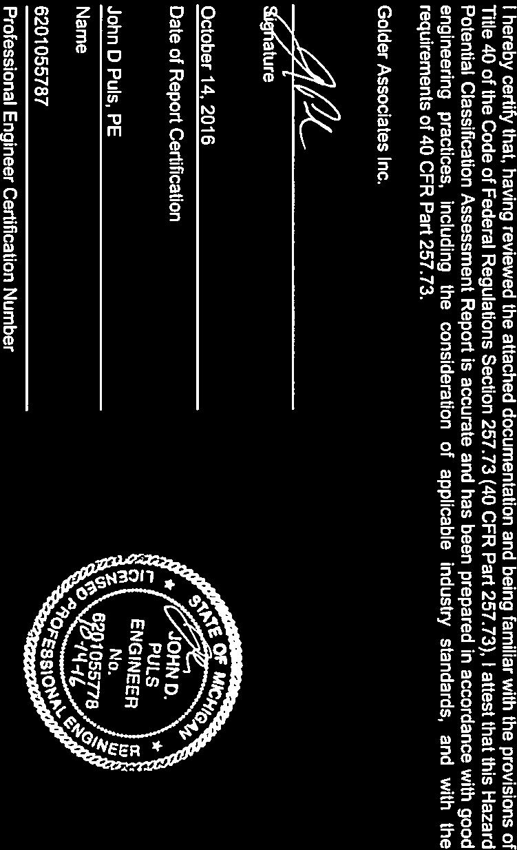
4 October INTRODUCTION On April 17, 2015, the United States Environmental Protection Agency (EPA) issued the Coal Combustion Residual (CCR) Resource Conservation and Recovery Act (RCRA) Rule (40 CFR 257 Subpart D) ( CCR RCRA Rule ) to regulate the solid waste management of CCR generated at electric utilities. Section (a)(2) of the CCR RCRA Rule requires the owner or operator of an existing CCR surface impoundment to document the hazard potential classification of each CCR unit as either a high hazard potential CCR surface impoundment, a significant hazard potential CCR surface impoundment, or a low hazard potential CCR surface impoundment. Consequently, the owner or operator must document the basis for each hazard potential classification. Hazard potential classification means the possible adverse incremental consequences that result from the release of water or stored contents due to failure of the diked CCR surface impoundment or mis-operation of the diked CCR surface impoundment or its appurtenances. The hazard potential classifications include high hazard potential CCR surface impoundment, significant hazard potential CCR surface impoundment, and low hazard potential CCR surface impoundment, which terms mean: High hazard potential CCR surface impoundment means a diked surface impoundment where failure or mis-operation will probably cause loss of human life. Significant hazard potential CCR surface impoundment means a diked surface impoundment where failure or mis-operation results in no probable loss of human life, but can cause economic loss, environmental damage, disruption of lifeline facilities, or impact other concerns. Low hazard potential CCR surface impoundment means a diked surface impoundment where failure or mis-operation results in no probable loss of human life and low economic and/or environmental losses. Losses are principally limited to the surface impoundment owner's property. According to Section (a)(2)(ii), the hazard classification potential assessment must be certified by a qualified professional engineer (QPE) stating that the initial hazard potential classification and each subsequent periodic classification were conducted in accordance with the requirements of 40 CFR Golder Associates Inc. (Golder) is submitting this Hazard Potential Classification Assessment Report (Report) to certify a significant hazard potential classification for the Bottom Ash Ponds 1-2 CCR surface impoundment (Bottom Ash Ponds 1-2) at the Consumers Energy Company (CEC) J.H. Campbell Generating Facility (JH Campbell) near West Olive, Michigan per 40 CFR Part (a)(2).
5 October HAZARD POTENTIAL CLASSIFICATION ASSESSMENT DETERMINATION Bottom Ash Ponds 1-2 is an existing CCR surface impoundment located at the southwest corner of the JH Campbell ash disposal area (Figure 1). Bottom Ash Ponds 1-2 is a single CCR unit with an internal dike that separates Bottom Ash Ponds 1-2 North surface impoundment from Bottom Ash Ponds 1-2 South surface impoundment. 2.1 Dam Break Analysis Two dam break analyses were conducted (Bottom Ash Ponds 1-2 North and Bottom Ash Ponds 1-2 South, separately) for the identification of potential hazards of the CCR unit. The dam break analyses followed a two-step process. First, the dam breach hydrograph was estimated using empirical methods. Then, the breach hydrograph was routed using a 2D hydraulic model Dam Breach Hydrograph Dam breach parameters including the volume of material eroded and failure time (from inception to completion of breach) were estimated based on the MacDonald and Langridge-Monopolis (1984) empirical equations as presented in Prediction of Embankment Dam Breach Parameters (Wahl 1998). These parameters are both a function of the storage volume and height of the dam. From these parameters, the final breach dimensions were estimated based on the geometry of the dam and assumed side slope of breach. Breach hydrographs were developed using level-pool routing techniques in a spreadsheet based on the above estimated breach parameters, a linear breach growth, and stage-storage relationships. Stage-storage curves were based on a topographic survey by Engineering and Environmental Solutions, LLC (May 2016). The water levels were set at the inflow design flood level as reported in the J.H. Campbell Generating Facility Bottom Ash Ponds 1-2 Inflow Design Flood Control System Plan (Golder 2016). Table summarizes the basic dimensions and estimated breach parameters of the impoundment.
6 October Table Dam Embankment and Breach Parameter Summary Parameter Bottom Ash Ponds 1-2 North Bottom Ash Ponds 1-2 South Crest elevation 1 (ft) Water level at dam breach 1000-year event (ft) Base elevation of breach (ft) Height differential between begin water level and bottom of breach level (ft) Dam Break Volume (ac-ft) Peak discharge (cfs) Breach development time (min) Notes: 1 Elevations are in NGVD D Hydraulic Model Dam break flood routing was conducted using TUFLOW, a hydraulic model that solves the full 2D shallow water equations. The following are components of the hydraulic model: Digital Elevation Model (DEM) A DEM for the hydraulic model was created by mosaicking three data sources using ArcGIS with NGVD29 as the vertical datum. The three data sources included: Site topo An AutoCAD file with one-foot contour lines of the site based on a topographic survey by Engineering and Environmental Solutions, LLC (May 2016). Topo outside site boundary A 30-foot DEM file downloaded from the United States Geologic Survey (USGS) National Elevation Dataset (NED). Note that this was in the NAVD88 datum and left uncorrected because the model did not extend into this portion of the DEM. It was included only for visualization of the surrounding topography. For reference, NAVD88 = NGVD feet. Bathymetry of Lake Michigan, Pigeon Lake, and Pigeon River A new bathymetry surface created by first drawing a 3D polyline around the edge of the water as the surface boundary (elevation 580 feet). A channel thalweg and lake bottom were then drawn as 3D polylines. The thalweg and lake bottom polylines were lowered below the water surface by 5 feet in the upper part of Pigeon River, 10 feet in Pigeon Lake, and 20 feet in Lake Michigan. 2D Grid Extents The hydraulic model s 2D grid extends from Lake Michigan, up through JH Campbell, and ends at the edge of Bottom Ash Ponds 1-2. The 2D extents were set to minimize the number of dry cells. Cell Size and Time Step The model was run with a cell size of 12-feet-by-12-feet and a 1.5-second time step. Manning s n-values Forested areas and waterbodies were digitized based on aerial photography. Manning s n-values were set as follows: Forest: n = Waterbodies: n = All other areas: n = 0.040
7 October Culverts Four culverts were included in the model as 1D elements. These culverts connect a collection ditch around the north, west, and south ends of the ash disposal area. Outlet Boundary Condition The outlet boundary condition was set as a constant head of 580 feet (NGVD29) (approximately mean lake level). It is located on the edge of the 2D grid, where Lakeshore Drive crosses over Pigeon Lake. Inflow Boundary Condition Separate inflow boundary conditions were developed for Bottom Ash Ponds 1-2 North and Bottom Ash Ponds 1-2 South dam break analyses. The boundary condition included the respective dam breach hydrographs. The boundary was positioned on the edge of the 2D grid. For Bottom Ash Ponds 1-2 North, it was positioned at the west end of Bottom Ash Ponds 1-2 North; and for Bottom Ash Ponds 1-2 South, it was positioned at the south end of Bottom Ash Ponds 1-2 South. 2.2 Dam Break Analysis Results Dam break flood routing was run assuming that the four culverts remained open to flow. The resulting dam break inundation maps are presented in Figure 2 Dam Break Inundation Map Bottom Ash Ponds 1-2 North and Figure 3 - Dam Break Inundation Map Bottom Ash Ponds 1-2 South. Flooding caused by a potential dam break of Bottom Ash Ponds 1-2 North spreads north and south along a perimeter ditch on the west side of Bottom Ash Ponds 1-2 North. Much of the flood wave flows down the perimeter ditch to the south, through the recirculation pond, and out to the Pigeon River. Approximately 10 acre-feet of the flood wave reaches the Pigeon River. The flood wave also overtops the perimeter ditch and drains west out onto Lakeshore Drive. Flooding caused by a potential dam break of Bottom Ash Ponds 1-2 South drains entirely into the perimeter ditch and flows down through the recirculation pond and out to the Pigeon River. Approximately 17 acre-feet of the flood wave reaches the Pigeon River Hazard Classification If a release of stored water due to failure or mis-operation were to occur, the dam break analysis predicts that water and/or stored content would discharge into the Pigeon River and Pigeon Lake waterbodies. No probable loss of human life, economic loss, or disruption of lifeline facilities are expected during this scenario; however, assuming the four culverts remain open to flow, environmental impacts/damages may not be limited to the surface impoundment owner s property based only on the results from the dam break analysis. As a result, the Bottom Ash Ponds 1-2 surface impoundment at JH Campbell has been rated a significant hazard potential classification.
8 October CONCLUSIONS AND SUMMARY Bottom Ash Ponds 1-2 at JH Campbell have been rated a significant hazard potential classification as a dike failure or mis-operation would result in no probable loss of human life, but could cause environmental damage that would not be limited to the surface impoundment owner s property. The significant hazard potential classification was determined based on failure or mis-operation of Bottom Ash Ponds 1-2 that could result in flood wave propagation into Pigeon River and Pigeon Lake and potentially release CCR into these waterbodies. Significant hazard potential classification assessments for existing CCR surface impoundments provide the design inflow criterion of the 1000-year flood event in the inflow design flood control system and the structural stability assessment required in 40 CFR and 40 CFR , respectively. Consequently, it also requires that an emergency action plan be developed as required in 40 CFR (a)(3). This initial hazard potential classification certification must be placed in the facility s operating record in accordance with Section (f) and must be made available on the facility s publicly accessible internet site in accordance with Section (f). Sincerely, GOLDER ASSOCIATES INC. Scott Stoneman, P.E. Senior Water/Civil Engineer John Puls, P.E. Senior Engineer
9 October REFERENCES Golder Associates J.H. Campbell Generating Facility Bottom Ash Ponds 1-2, Inflow Design Flood Control System Plan. Graham, Wayne J A Procedure for Estimating Loss of Life Caused by Dam Failure. DSO US Department of Interior Bureau of Reclamation, Dam Safety Office. MacDonald, Thomas C., and Jennifer Langridge-Monopolis Breaching Characteristics of Dam Failures. Journal of Hydraulic Engineering, vol. 110, no. 5, p USEPA (Environmental Protection Agency) Disposal of Coal Combustion Residuals from Electric Utilities; Final Rule. 40 CFR Part 257. Effective Date October 19, Wahl, Tony L Prediction of Embankment Dam Breach Parameters A Literature Review and Needs Assessment. DSO US Department of Interior. Bureau of Reclamation, Dam Safety Office.
10 FIGURES

11 # IF THIS MEASUREMENT DOES NOT MATCH WHAT IS SHOWN, THE SHEET SIZE HAS BEEN MODIFIED FROM: ANSI A SITE LOCATION REFERENCE(S) 1. BASE MAP TAKEN FROM 7.5 MINUTE U.S.G.S. QUADRANGLES OF PORT SHELDON MICHIGAN, DOWNLOADED FROM MICHIGAN DNR WEBSITE JUNE SITE LOCATION 0 MICHIGAN COUNTIES 1'' = 2000' NOT TO SCALE 2000 FEET PROJECT YYYY-MM-DD DESIGNED BAL PREPARED ARM REVIEWED DJS APPROVED MAB 1 in J.H. CAMPBELL GENERATING FACILITY BOTTOM ASH PONDS 1-2 HAZARD POTENTIAL CLASSIFICATION ASSESSMENT CONSUMERS ENERGY COMPANY CROSWELL ST. WEST OLIVE, MI TITLE SITE LOCATION MAP PROJECT NO. REV # FIGURE 1 0 CLIENT CONSULTANT 1000
12 LEGEND KEY MAP Groswell St Michigan Inflow Boundary Condition (Dam Breach) Outlet Boundary Condition (Lake Level) Existing Culvert Wisconsin 2D Grid Extents Michigan La ke s Waterbody Maximum Inundation Depth (ft) High : 3 ho r e Illinois Dr Indiana Ohio Low : 0 Olive Shore Ave J.H. Campbell Generation Facility Lake Michigan Bottom Ash Pond 1-2 North Bottom Ash Pond 1-2 South 500 1,000 2,000 Feet IF THIS MEASUREMENT DOES NOT MATCH WHAT IS SHOWN, THE SHEET SIZE HAS BEEN MODIFIED FROM: ANSI B NOTE(S) 1. RESULTS FROM TUFLOW 2D HYDRAULIC MODEL. REFERENCE(S) 1. BATHYMETRY IN LAKE MICHIGAN AND PIGEON LAKE ESTIMATED. 2. SERVICE LAYER CREDITS: SOURCE: ESRI, DIGITALGLOBE, GEOEYE, I-CUBED, EARTHSTAR GEOGRAPHICS, CNES/AIRBUS DS, USDA, USGS, AEX, GETMAPPING, AEROGRID, IGN, IGP, SWISSTOPO, AND THE GIS USER COMMUNITY ESRI, HERE, DELORME, MAPMYINDIA, OPENSTREETMAP CONTRIBUTORS, AND THE GIS USER COMMUNITY 3. COORDINATE SYSTEM: NAD 1983 STATEPLANE MICHIGAN SOUTH FIPS 2113 FEET INTL, DATUM: NORTH AMERICAN 1983 Pigeon Lake Port Sheldon R eon Pig r ive CLIENT CONSUMERS ENERGY PROJECT J.H. CAMPBELL GENERATING FACILITY CCR HAZARD POTENTIAL CLASSIFICATION ASSESSMENT Dr TITLE Wuskowhan Players Club DAM BREAK INUNDATION MAP BOTTOM ASH PONDS 1-2 NORTH CONSULTANT PROJECT NO YYYY-MM-DD DESIGNED TH PREPARED TH REVIEWED SJS APPROVED REV. E SJS 1 in ke La ore sh FIGURE 2 0 PATH: G:\Consumers_Energy\JH_Campbell\99_PROJECTS\ _JH_Campbell_HazAssess\02_PRODUCTION\MXD\RevE\ _F05_RevE_DamBreakModelResults_Pond1_2N.mxd 0
13 LEGEND KEY MAP Groswell St Michigan Inflow Boundary Condition (Dam Breach) Outlet Boundary Condition (Lake Level) Existing Culvert Wisconsin 2D Grid Extents Michigan La ke s Waterbody Maximum Inundation Depth (ft) High : 3 ho r e Illinois Dr Indiana Ohio Low : 0 Olive Shore Ave J.H. Campbell Generation Facility Lake Michigan Bottom Ash Pond 1-2 North Bottom Ash Pond 1-2 South 500 1,000 2,000 Feet IF THIS MEASUREMENT DOES NOT MATCH WHAT IS SHOWN, THE SHEET SIZE HAS BEEN MODIFIED FROM: ANSI B NOTE(S) 1. RESULTS FROM TUFLOW 2D HYDRAULIC MODEL. REFERENCE(S) 1. BATHYMETRY IN LAKE MICHIGAN AND PIGEON LAKE ESTIMATED. 2. SERVICE LAYER CREDITS: SOURCE: ESRI, DIGITALGLOBE, GEOEYE, I-CUBED, EARTHSTAR GEOGRAPHICS, CNES/AIRBUS DS, USDA, USGS, AEX, GETMAPPING, AEROGRID, IGN, IGP, SWISSTOPO, AND THE GIS USER COMMUNITY ESRI, HERE, DELORME, MAPMYINDIA, OPENSTREETMAP CONTRIBUTORS, AND THE GIS USER COMMUNITY 3. COORDINATE SYSTEM: NAD 1983 STATEPLANE MICHIGAN SOUTH FIPS 2113 FEET INTL, DATUM: NORTH AMERICAN 1983 Pigeon Lake Port Sheldon R eon Pig r ive CLIENT CONSUMERS ENERGY PROJECT J.H. CAMPBELL GENERATING FACILITY CCR HAZARD POTENTIAL CLASSIFICATION ASSESSMENT Dr TITLE Wuskowhan Players Club DAM BREAK INUNDATION MAP BOTTOM ASH PONDS 1-2 SOUTH CONSULTANT PROJECT NO YYYY-MM-DD DESIGNED TH PREPARED TH REVIEWED SJS APPROVED REV. E SJS 1 in ke La ore sh FIGURE 3 0 PATH: G:\Consumers_Energy\JH_Campbell\99_PROJECTS\ _JH_Campbell_HazAssess\02_PRODUCTION\MXD\RevE\ _F06_RevE_DamBreakModelResults_Pond1_2S.mxd 0

14 Golder Associates Inc South U.S. 27, Suite 50 Lansing, MI USA Tel: (517) Fax: (517) Golder, Golder Associates and the GA globe design are trademarks of Golder Associates Corporation