Landscape Conservation Planning and Design for the Grand Kankakee Marsh Watershed
|
|
|
- Amice Bates
- 5 years ago
- Views:
Transcription
1 Landscape Conservation Planning and Design for the Grand Kankakee Marsh Watershed 1895
2 The Grand Kankakee Marsh in Indiana in 1895
 Partner Organizations Jason MacLachlan DU, Field Museum, FWS, IL DNR, IN DNR Jody Peters IN Department of Agriculture, NRCS, TNC Chun-Mei Chiu Undergraduate assistants")
3 Project Participants Notre Dame Jessica Hellmann Diogo Bolster Alan Hamlet Mark Schurr USGS Ralph Grundel Dave Lampe Noel Pavlovic Notre Dame/USGS Project Manager & GIS Analyst Tammy Patterson Project Support (Notre Dame) Partner Organizations Jason MacLachlan DU, Field Museum, FWS, IL DNR, IN DNR Jody Peters IN Department of Agriculture, NRCS, TNC Chun-Mei Chiu Undergraduate assistants Project Funding UMGL LCC (80%) and USGS MWR (20%)
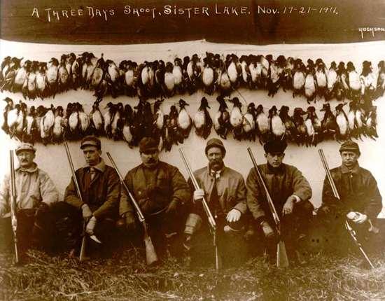
4 Why the LCC likes this project Ecological significance of the landscape Conservation scenario approach: Δ Land Use-> Δ Ecosystem Service Value Realistic assessment of how restoration scenarios benefit humans and wildlife
5 Why the LCC likes this project Restoration and ecosystem services linked by common mechanism water levels Common mechanism flexibly links how inputs (land use) affect outputs (ecosystem services) under many conditions (e.g. climate change) Historic, current, and future conditions evaluated High velocity of moving project results to use
6 Why project investigators like the LCC High velocity of moving project results to use The LCC process has clarified how the results will be used and what results are most useful LCC helped turn controversy into project focus LCC process has made the project more efficient
7 Kankakee Project Overview

8 2013 Upper Midwest & Great Lakes LCC RFP: Identifying and integrating objectives for waterfowl habitat, waterfowl populations, and people. Projects should develop and apply a modeling framework to link waterfowl population objectives, habitat objectives, and the values of stakeholders. Assessment of Waterfowl Habitat Restoration as an Adaptive Mechanism for Water Sustainability in the Grand Kankakee River Watershed
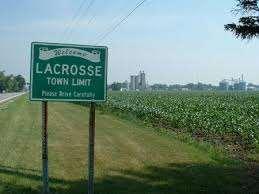
9 CHICAGO

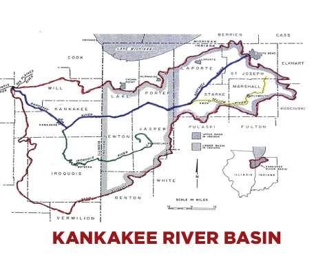
10 Current Everglades and Historic Kankakee Marsh similar area (ca. 500,000 acres)


11 10,000 Years of Human Occupation


12 The Sportsman s Marsh


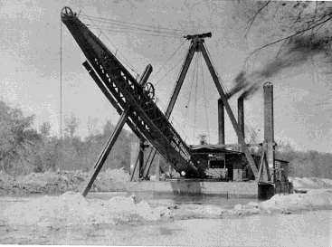

13 The Drained Marsh Present

14 ROCK LEDGE The Modern Marsh
15 Project Goal: Assess the value of potential Kankakee watershed restoration scenarios for humans and native species


16 Project Goals: Build surface & groundwater models surface water storage groundwater recharge aquifer storage & use Couple to valuation of ecosystems services waterfowl production/habitat sportsman/recreational user value agricultural production Identify potential wetland restoration scenarios improved historic knowledge peer-input Assess scenarios historic at present under climate change projections under urbanization projections Employ as planning decision support tool


17 Site Rationale: Once home to Grand Kankakee Marsh Hydrology is highly modified system Predominantly agricultural landscape Some quality remnant wetlands remain Wetland restorations completed in watershed Potential for National Wildlife Refuge

18 Modeling Scheme Historic Land cover Present Land-use Ground Water Scenario Values Surface Water Scenario A Peer Input Land-use Scenarios Scenario B Urbanization Agriculture Ecosystem Services Scenario C Climate Change

--reconstruct forest")
 data Historic tree")

19 Historic Land cover Historic Recreation Paleo-Ecologic Observatory Network (PalEON)--reconstruct forest composition Database of Public Land Survey (PLS) data Historic tree species density, landcover types Baselines for ecosystem service models Informs restoration planning Oak Density


20 Hydrology Models Surface Water Model Variable Infiltration Capacity (VIC) surface water model Value for surface water storage, recharge to groundwater, structure of wetlands Ground Water Model MODFLOW Value for water storage for public water supply & agricultural irrigation Surface Water Ground Water


21 MODFLOW Hydrology Model Simulation of groundwater transport & groundwater heights Ground water heights inform ecosystem services models Surface Water Ground Water Arihood, L. D. and M. E. Basch (1994). Geohydrology and simulated ground-water flow in an irrigated area of northwestern Indiana. U. S. G. Survey: 43.

22 EXAMPLE: Changing Hydrology in the Skagit Basin

23 Changes in Magnitude and Seasonal Timing of Stream Flow
24 Simulated 100-Year Flood (cfs) (+23%) (+23%) (+49%) (+49%) Summary of Regulated Flood Impacts By the 2040s, the historical 100-year event is projected to become a 22-year event Historical 2040s Mean 2080s Mean By the 2040s, the historical 30-year event is projected to become an 7-year event.


25 Wetland Volume (%) Soil Moisture (mm) Wetland Impacts Red = Simulated Soil Moisture Blue = Observed Wetland Volume


26 MODFLOW Hydrology Model Research Questions: How sensitive are wetlands to seasonal changes in temperature and precipitation? How will changes in agricultural withdrawal affect wetlands? How will wetlands affect water storage for agriculture? Surface Water Ground Water
27 Hydrology for the Kankakee Project Overall Objective: Explore effects of different land cover, climate, drainage infrastructure on the hydrologic response of the Kankakee. 1. Produce long retrospective hydrologic simulations of the Kankakee basin for current land use and drainage infrastructure ( ). 2. Evaluate the effects of climate change on the hydrologic response of the basin (e.g. Simulate changes in runoff, groundwater recharge, seasonal water table height and water bird habitat) for different land cover/drainage scenarios. 3. Simulate the hydrologic effects of pre-development land cover and drainage characteristics to establish ecosystem baselines such as pre-development marsh extent, waterfowl habitat, etc. 4. Evaluate hydrologic impacts of wetland restoration s, when specific areas of the watershed are restored to marsh. Evaluate effects on agricultural water storage. 5. Evaluate the effects of human infrastructure on watershed (e.g. simulate the effects of tile drainage on flooding and sediment)
28 Here we outline a vision for improving both the productivity and environmental performance of agriculture in the U.S. Midwest, also known as the Corn Belt. Mean annual precipitation has increased throughout the region over the past 50 years, consistent with climate models that attribute the increase to a warming troposphere. Stream gauge data indicate that higher precipitation has been matched or exceeded by higher stream flows, contributing to flooding, soil loss, and excessive nutrient flux to the Gulf of Mexico. We propose increasing landscape hydrologic storage through construction of ponds and restoration of wetlands to retain water for supplemental irrigation while also reducing flood risks. U.S. Midwest both can be sustainably increased with supplemental irrigation. The proposed strategy should reduce interannual yield variability by limiting losses due to transient drought, while facilitating adoption of cropping systems that perennialize the landscape to take advantage of the full potential growing season.


29 Ecosystem Services Ecosystem Services Models Based on Natural Capital Project InVEST Methodology INCLUDES: Waterfowl production/habitat quality Based on surface water/groundwater heights Waterfowl Guilds Hunter value Based on wetland extent, waterfowl production, & services Recreational user value Based on attributes & services Great Good
 Based on soil types & hydrology Research")

30 Agriculture Agricultural Model SALUS model (MSU) Based on soil types & hydrology Research questions: How might climate change affect agricultural production? InVEST Natural Capital Methodology


 OTHERS?")
31 Peer Input Land-use Scenarios Scenario Building Current Land Use/ Land Cover Return to historic 1800 s landcover Removal of agricultural tile drainage Chicago Wilderness Green Infrastructure Vision (GIV 2.2) OTHERS? REAL Restoration Possibilities? Peer Input!!