Drought Indices in North America. Richard R. Heim Jr.
|
|
|
- Kristin Todd
- 5 years ago
- Views:
Transcription
1 Drought Indices in North America Richard R. Heim Jr. NOAA/NESDIS/ Asheville, North Carolina, USA Inter-Regional Workshop on Indices and Early Warning Systems for Drought WMO/NDMC/NOAA/UNCCD/USDA Lincoln, NE, USA December 8-11, 2009
2 Historical Perspective Droughts & Agriculture Crop Failure, Famine, Collapse or Abandonment of Early Civilizations

3 Historical Perspective Droughts & Agriculture Crop Failure, Famine, Collapse or Abandonment of Early Civilizations


4 Historical Perspective North America Today Technology & Economic Systems Mitigate Drought s Impact on Agriculture, But Drought Still Can Have Severe Economic Impacts
5 The Drought Phenomenon Historical Perspective Definition Sectors Impacted Indices Early 20 th Century Drought Indices Incorporated some measure of precipitation over a given time Examples: 15 Consecutive Days with No Rain 21 Days or More with Precipitation less than One-Third (or 30%) of Normal Annual Precipitation less than 75% of Normal Monthly Precipitation less than 60% of Normal Any Amount of Rainfall less than 85% of Normal Other important climatic elements (soil moisture, evapotranspiration, etc.) were not readily available at that time
 of Normal Annual Precipitation less than 75% of Normal Monthly Precipitation less than 60% of Normal Any")
6 The Drought Phenomenon Historical Perspective Definition Sectors Impacted Indices Early 20 th Century Drought Indices Incorporated some measure of precipitation over a given time Examples: 15 Consecutive Days with No Rain 21 Days or More with Precipitation less than One-Third (or 30%) of Normal Annual Precipitation less than 75% of Normal Monthly Precipitation less than 60% of Normal Any Amount of Rainfall less than 85% of Normal Other important climatic elements (soil moisture, evapotranspiration, etc.) were not readily available at that time
7 (These Basic Indicators Are Still Widely Used Today) rought/mapscc_e.htm
8 (These Basic Indicators Are Still Widely Used Today) rought/mapscc_e.htm
9 (These Basic Indicators Are Still Widely Used Today) rought/mapscc_e.htm
10 (These Basic Indicators Are Still Widely Used Today) rought/mapscc_e.htm
11 (These Basic Indicators Are Still Widely Used Today) rought/mapscc_e.htm
12 (These Basic Indicators Are Still Widely Used Today)


13 (These Basic Indicators Are Still Widely Used Today)
14 Historical Perspective Mid-20 th Century Improvements Evapotranspiration Water Budget Antecedent Precipitation Palmer Drought Index (1965) Incorporated antecedent precipitation, moisture supply, & moisture demand in a (monthly) hydrologic accounting system using a 2-layer model for soil moisture Applied CAFEC (Climatologically Appropriate For Existing Conditions) Quantities to Normalize his Computations Negative values drought, positive values wet spell Comparison across space & time Short-Term Drought (One Month) Meteorological Drought (PDSI, PMDI) Hydrological Drought (PHDI)
 hydrologic accounting system using a 2-layer model for soil moisture Applied CAFEC (Climatologically Appropriate For Existing Conditions) Quantities to Normalize his")
15 Historical Perspective Mid-20 th Century Improvements Evapotranspiration Water Budget Antecedent Precipitation Palmer Drought Index (1965) Incorporated antecedent precipitation, moisture supply, & moisture demand in a (monthly) hydrologic accounting system using a 2-layer model for soil moisture Applied CAFEC (Climatologically Appropriate For Existing Conditions) Quantities to Normalize his Computations Negative values drought, positive values wet spell Comparison across space & time Short-Term Drought (One Month) Meteorological Drought (PDSI, PMDI) Hydrological Drought (PHDI)
 to crop productivity Computed from Palmer Z Index and crop yield Economic")
16 Historical Perspective Palmer s Crop Moisture Index (1968) Computed on a weekly basis for agricultural applications Moisture Stress Index Developed in 2003 by NCDC Annual index for corn and soybeans that relates moisture stress (drought and extreme wetness) to crop productivity Computed from Palmer Z Index and crop yield Economic impacts


17 Indices Based On: Post-Palmer Era Additional Observed Variables Advanced Statistical Methodologies More Sophisticated Models Data from New Observational Platforms


18 Surface Water Supply Index (SWSI) Developed in 1981 for Colorado (adopted by other Western States) Integrates Snowpack, Reservoir Storage, Streamflow, & Precipitation at High Elevation Standardized Units Plotted by River Basin
 Based on Probability Distribution of Precipitation, with Normalization Can Compute")

19 Standardized Precipitation Index (SPI) Developed by Colorado s McKee et al. (1993) Based on Probability Distribution of Precipitation, with Normalization Can Compute for Different Time Scales for Differing Applications drought/mapscc_e.htm


20 Standardized Precipitation Index (SPI) Can Express Droughts & Wet Spells in terms of: Precipitation Deficit Percent of Normal Probability of Non-Exceedence Standardized Index Value (SPI) Can Determine Drought Intensity, Magnitude, & Duration, & Probability of Emerging from a Drought research/prelim/drought/spi.html

21
22 Soil Moisture Soil Moisture Observation Networks Limited in U.S.


23 Soil Moisture Soil Moisture Observation Networks Limited in U.S.
24 Rely on Modeled Soil Moisture Soil Moisture Leaky Bucket Model
25 Rely on Modeled Soil Moisture Soil Moisture Leaky Bucket Model


26 Rely on Modeled Soil Moisture Soil Moisture Leaky Bucket Model

27 Using Soil Moisture Models to Monitor Drought at the NOAA Climate Prediction Center Leaky Bucket model: a 1-layer hydrological model. Uses observed precip. and temps to calculate soil moisture for a soil column of 1.6 meters. NLDAS 1-m and 2-m soil column; 4 separate models and ensemble; versions produced by NOAA EMC and the University of Washington
28 North American Land Data Assimilation System (NLDAS) The NLDAS is a multi-institution collaborative project sponsored by the Climate Prediction Program of the Americas (CPPA). The institutions are composed of NOAA s National Centers for Environmental Prediction (NCEP), NASA s Goddard Space Flight Center (GSFC), NOAA s Office of Hydrologic Development (OHD), Princeton University, and University of Washington. The NLDAS uses four land surface models: Noah, Mosaic, SAC and VIC. Four models are run in near real-time at the NCEP s Environmental Modeling Center to provide output products to support the US National Integrated Drought Information System (NIDIS) and US Drought Monitor.
29 Using the NLDAS Ensemble Mean Soil Moisture as a Drought Indicator NCEP Noah Shallow layers of soil moisture can be used as agricultural drought indicators. Model runoff as hydro indicators. Ensemble Mean NASA Mosaic OHD SAC Princeton VIC Percentile soil moisture levels correspond to U.S. Drought Monitor levels D0 to D4

30 U.S. Seasonal Drought Outlook Issued twice monthly by NWS/NCEP

31 Improved Drought Forecasting and Early Warning NLDAS models can be linked to downscaled seasonal forecast models to produce drought probability forecasts Forecast Drought Probability for February 2010 NOAA s Climate Prediction Center is working with its partners to develop operational numerical drought forecast products.


 Output")


32 USGS-EROS Early Warning & Environmental Monitoring Drought Monitoring using the VegET Model: Conducts daily water balance computations by pixel (5km-25km depending on input dataset) Output for operational vegetation water balance modeling Products include: Soil Water Index (SWI), Water Requirements Satisfaction Index (WRSI), and 3 ETa (actual evapotranspiration) products
33 NOAA/NWS Advanced Hydrologic Prediction Service Hybrid Product Integrates Radar Precipitation Estimates with In Situ Rain Gage Measurements


34 NOAA/NWS Advanced Hydrologic Prediction Service Hybrid Product Integrates Radar Precipitation Estimates with In Situ Rain Gage Measurements
35 U.S. Objective Blends Developed as support for U.S. Drought Monitor Operationally integrate multiple indicators in a weekly update using a percentile ranking method Produced weekly using CPC s real-time daily and weekly climate division data and NCDC s monthly archive of indices for All parameters are first rendered as percentiles with respect to data using a percent rank method The parameters (drought indicators) are then combined using a weighting scheme Short- and Long-Term Blends produced


36


37 FMDI Floating Month Drought Index FMDI a new drought index to provide guidance on drought termination amidst conflicting indicators Inspired by the Australian decile-based drought definition, USDM, & Objective Blends Based on precipitation percentiles Being developed by NCDC
 Dry Spell ends when: the total precipitation for the")
 Similar triggers for wet spell Modification for exceptionally")
38 FMDI Floating Month Drought Index Dry Spell begins when 3 consecutive months each have an anomaly <= 30 th percentile and the anomaly of total precipitation for the 3 consecutive dry months falls beyond the cutoff (<= 30 percentile) Dry Spell ends when: the total precipitation for the months from beginning anchor year-month to current month no longer falls beyond the cutoff (<= 30 th percentile), OR the precipitation for the past 3 months is extremely wet (3-month total precipitation >= 70 th percentile) Similar triggers for wet spell Modification for exceptionally dry seasons


39 FMDI Floating Month Drought Index Precipitation percentiles & Dx/Wx categories for current N-month wet & dry spells Length (number of consecutive months) and begin year/month of current wet & dry spells One-month precipitation percentile for current month


40 Hydrologic Indices Based on Streamflow or Groundwater Groundwater Observing Network Coarse

 or some")

41 Hydrologic Indices Based on Streamflow or Groundwater Streamflow Need to Remove Peak Flow from Hydrograph Streamflow-based drought indicators usually based on low-flow (base flow) or some averaged flow Flood Monitoring Drought Monitoring 14-Day Average Streamflow Monthly Average Streamflow


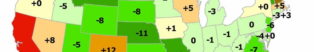
42 Hydrologic Indices Based on Streamflow or Groundwater Reservoir Data State data, no national access system Managed for different purposes (irrigation, urban water supply, flood control, etc.) Arizona reservoir levels, September 2009, percent of capacity.


43 Remotely-Sensed (Satellite-based) Indices Provide Global Coverage Spatially Consistent Reflected Intensities at Specific Wavelengths mapscc_e.htm smcd/emb/vci/vh/index.php


44 Vegetation Drought Response Index (VegDRI) Hybrid Drought Index that Integrates: Satellite-based observations of vegetation conditions Climate-based drought index data Biophysical characteristics of the environment (Source: Wardlow, 2008)


45 Paleoclimatic Drought Indices Based on Tree-Ring Data Extends Period of Record for Historical Comparisons Gridded Reconstructions DRY PDSI WET Drought Reconstruction for
46 Impacts (Producer Survey) Indicators edb/pasture-range-statewide-conditions.pdf
47 Impacts (Producer Survey) Indicators edb/pasture-range-statewide-conditions.pdf
48 Impacts (Producer Survey) Indicators edb/pasture-range-statewide-conditions.pdf
49 Impacts (Producer Survey) Indicators edb/pasture-range-statewide-conditions.pdf
 Indicators")


50 Impacts (Producer Survey) Indicators edb/pasture-range-statewide-conditions.pdf
51 NIDIS Drought Portal A Web-Services-Based Drought Information & Data System, for the U.S. Current conditions Forecasts Impacts Planning Education Research Going International with NADM Data and Services Working with UN on int l drought early warning & international clearinghouse


52 NIDIS Drought Portal A Web-Services-Based Drought Information & Data System, for the U.S. Current conditions Forecasts Impacts Planning Education Research Going International with NADM Data and Services Working with UN on int l drought early warning & international clearinghouse
53 U.S.-Canadian GEO Bilateral Drought Studies 5 testbeds/projects approved by the bilateral US- Canada GEO Committee at its May 2009 meeting: Three international, interdisciplinary water-related monitoring testbeds, building on existing initiatives, along the U.S.- Canada border: Great Lakes Prairie Region Rocky Mountains Two studies of drought in the context of hazards and extreme events: Drought Definitions and Indices Study Surface Water Supply Index (SWSI) Study Charters being developed Richard.Heim@noaa.gov


54 U.S.-Canadian GEO Bilateral Drought Studies Drought Definitions and Indices Study Improved definition of drought for different climatic regions needed, & new & improved indices for drought needed Continent-wide study for comparative analysis across regions, with close links to testbed activities 58 participants involved GEO Drought Indices community set up on NIDIS drought portal
55 The 2010 NADM and Global Drought Forum Location: Asheville, NC, USA When: April 20-23, 2010 Session/Agenda Topics: NADM technical & administrative issues NADM user issues & general drought issues The NIDIS Drought Portal as a platform for expanded international drought monitoring, global drought early warning system U.S.-Canadian GEO bilateral testbeds & drought studies
56 Thank You! NCDC Climate Monitoring Branch Reports & Products: NCDC State of the Climate Reports: North America Drought Monitor: U.S. Drought Monitor: NIDIS: