CHAPTER 2 Project Description
|
|
|
- Aleesha Hopkins
- 5 years ago
- Views:
Transcription
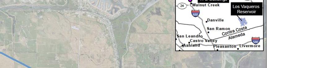
1 CHAPTER 2 Project Description The March 2010 Final EIS/EIR, as modified by the August 2013 EIR Addendum #1 (together the Final EIS/EIR ) analyzed, among other alternatives, a Timing Variant under which Los Vaqueros Reservoir would be expanded first to 160 TAF and later to 275 TAF. Los Vaqueros Reservoir has now been expanded to 160 TAF, and the project partners are considering a second phase of expansion. Since certification of the Final EIS/EIR, refinements have been made to elements of the previously analyzed facilities, and operational assumptions have been updated, primarily to reflect more detailed water demand and operational preference information from the Local Agency Partners and Refuges, as well as updated regulatory and environmental conditions in which the project would be constructed and operated. (These updated regulatory and environmental conditions are described in detail in Chapter 1.) Section 2.1 discusses the currently proposed Phase 2 Expansion alternatives. Section 2.2 describes the changes to the proposed project facilities from those described in the Final EIS/EIR. Section 2.3 discusses the greater detail now available about individual Local Agency Partner and Refuge operational preferences and the more specific project operational scenarios that have been formulated to reflect that information. 2.1 Phase 2 Expansion Alternatives The action alternatives considered in this Supplement are options for the second phase of the Los Vaqueros Reservoir Expansion Project (Phase 2 Expansion). The numbering of the action alternatives for the Phase 2 Expansion correlates, in terms of operational priorities and major features, with Alternatives 1, 2 and 4 analyzed in the Final EIS/EIR. The action alternatives are formulated to capture the full range of potential project operations to best meet the needs of the various Local Agency Partners as well as the south-of-delta wildlife refuges (Refuges) identified in the Central Valley Project Improvement Act (CVPIA). All action alternatives would continue to provide CCWD with the benefits of the original Los Vaqueros Project and already-completed expansion of Los Vaqueros Reservoir to 160 TAF storage capacity and also provide benefits of improved water supply reliability to the Local Agency Partners and Refuges. The potential benefits of the Phase 2 Expansion are described in Chapter No Project/No Action Alternatives The Final EIS/EIR evaluated alternatives under which the then-existing Los Vaqueros Reservoir would be expanded to 275 TAF or 160 TAF. The CCWD Board of Directors selected the 160-TAF reservoir expansion project for construction, which did not preclude future consideration of a second phase of expansion to 275 TAF under the Timing Variant. Expansion of Los Vaqueros Reservoir Expansion Project 2-1 June 2017
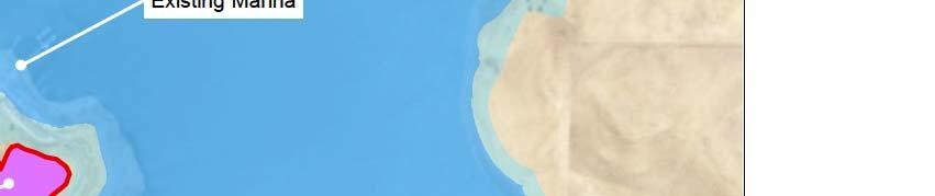
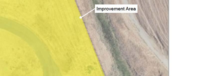
2 Los Vaqueros Reservoir to 160-TAF storage capacity was completed in 2012 as described in the Final EIS/EIR, except that CCWD did not upgrade the pumps at the Transfer Facility. This Supplement employs two No Project/No Action Alternatives. Each of the updated action alternatives will be compared to the updated 160-TAF No Project/No Action Alternative, to quantify the incremental impact/benefit of the Phase 2 Expansion. In addition, the updated action alternatives will be compared to the original Final EIS/EIR No Project/No Action Alternative (hereinafter referred to as the 100-TAF No Project/No Action Alternative), to enable the reader to compare the combined impacts of both the already-completed expansion of Los Vaqueros Reservoir to 160 TAF storage capacity and the proposed Phase 2 Expansion (hereinafter referred to as the Total Project) to the impacts of the Timing Variant previously presented in the Final EIS/EIR. Under the 100-TAF No Project/No Action Alternative, Los Vaqueros Reservoir is assumed to have a 100 TAF storage capacity behind the original dam with the associated inundation footprint, with CCWD operating the facilities to meet its customer demands subject to current regulatory and physical constraints. Under the 160-TAF No Project/No Action Alternative, no new facilities would be constructed, and CCWD would continue operating the existing Los Vaqueros Reservoir and other CCWD facilities to deliver water to meet its customer demands and delivered water quality goal subject to current regulatory and physical constraints. This alternative would not change operations of the Los Vaqueros Reservoir system. The Local Agency Partners and Refuges operations would likewise be unchanged, and their water supply reliability would not be improved through use of the existing Los Vaqueros Reservoir system, except through separate partnership agreements that could be developed in the future but are not contemplated in this analysis Alternative 1A Alternatives 1A, 1B, and 2A would expand Los Vaqueros Reservoir storage from 160 TAF to 275 TAF, build a new Delta-Transfer Pipeline, and relocate the existing Marina Complex and Los Vaqueros Watershed trails and access roads that would be inundated by the reservoir expansion. All of the action alternatives would upgrade the existing Transfer Facility, build a new Transfer-Bethany Pipeline, and add facilities to deliver water to the Transfer Facility from the Rock Slough Intake, which entails building a new Neroly High-Lift Pump Station and replacing Pumping Plant #1. All of the action alternatives would include a new EBMUD-CCWD Intertie Pump Station to facilitate deliveries from the Los Vaqueros Pipeline to the EBMUD system and also include variable frequency drives at EBMUD s Walnut Creek Pumping Plant to facilitate deliveries from EBMUD s Mokelumne Aqueduct #2 to the Los Vaqueros system. All of the action alternatives would also build new pipelines to deliver water to the City of Brentwood Water Treatment Plant and to ECCID s Bixler Intake, as well as improve Los Vaqueros Watershed facilities, which would include upgrading the existing Los Vaqueros Interpretive Center, upgrading the existing old barn near the Los Vaqueros Watershed Office, and adding a new trail surrounding the Mortero Wetland Complex. A list of the major components for all the alternatives is provided in Table 2-1 below. Alternatives 1A, 1B, and 2A differ from one another only in the proposed operations of the facilities. Figure 2-1 shows the facilities associated with these alternatives. Los Vaqueros Reservoir Expansion Project 2-2 June 2017
3 Operational Priority Proposed Modifications to Existing Facilities Los Vaqueros Reservoir Capacity Los Vaqueros Reservoir Maximum Water Surface Elevation Pumping Plant #1 Capacity Transfer Pump Station Capacity EBMUD Walnut Creek Pumping Plant Variable Frequency Drives Los Vaqueros Interpretive Center Los Vaqueros Watershed Office Barn Proposed New Facilities Transfer-Bethany Pipeline Capacity Delta-Transfer Pipeline Capacity Expanded Transfer Facility Pump Station Capacity Expanded Transfer Facility Storage Reservoir Capacity Neroly High-Lift Pump Station Capacity EBMUD-CCWD Intertie Pump Station Los Vaqueros Marina Complex Los Vaqueros Watershed Trails TABLE 2-1 MAJOR COMPONENTS OF PHASE 2 EXPANSION ALTERNATIVES 160-TAF No Project / No Action Alternative Alternative 1A Alternative 1B Alternative 2A Alternative 4A Water Supply Reliability Environmental Water Management & Water Supply Reliability Environmental Water Management Environmental Water Management & Water Supply Reliability 160 TAF 275 TAF 275 TAF 275 TAF 160 TAF 507 feet 560 feet 560 feet 560 feet 507 feet 200 cfs 350 cfs 350 cfs 350 cfs 350 cfs 150 cfs 200 cfs 200 cfs 200 cfs 200 cfs None Included Included Included Included No change Improved Improved Improved Improved No change Seismically upgraded and improved Seismically upgraded and improved Seismically upgraded and improved Seismically upgraded and improved None 300 cfs 300 cfs 300 cfs 300 cfs None 180 cfs 180 cfs 180 cfs None None 300 cfs 300 cfs 300 cfs 300 cfs None 5 MG 5 MG 5 MG 5 MG None 350 cfs 350 cfs 350 cfs 350 cfs None 155 cfs 155 cfs 155 cfs 155 cfs No change None Relocated upslope Relocated upslope As described in Final EIS/EIR, and new trail at Mortero Wetland Complex As described in Final EIS/EIR, and new trail at Mortero Wetland Complex Relocated upslope As described in Final EIS/EIR, and new trail at Mortero Wetland Complex No change New trail at Mortero Wetland Complex Brentwood Pipeline None Included Included Included Included ECCID Intertie None 80 cfs 80 cfs 80 cfs 80 cfs Los Vaqueros Reservoir Expansion Project 2-3 June 2017

4 Alternative 1A is formulated to maximize deliveries for water supply reliability, including drought and emergency supply reliability, to the Local Agency Partners. As shown in Figure 2-1, the first priority in Alternative 1A would be to deliver available water to meet Local Agency Partner demand, if any, and otherwise to divert that water to storage in Los Vaqueros Reservoir, if possible, for later use by the Local Agency Partners. If additional CCWD system capacity were available and if Central Valley Project (CVP) north-of-delta storage withdrawals were available to be made during high storage conditions, the next priority would be to wheel, in coordination with the Refuge Water Supply Program, CVPIA Level 2 water through CCWD facilities through the Transfer-Bethany Pipeline for the Refuges, in order to free up capacity at Jones Pumping Plant (or Banks Pumping Plant through a wheeling agreement with DWR), to move additional water to CVP south-of-delta contractors. Wheeling consists of pumping water through different facilities (in this case, CCWD s) than the water otherwise would have been pumped through (in this case, Jones Pumping Plant), and therefore would not provide a new water supply to the Refuges. The additional water that could be moved using the freed-up Jones Pumping Plant or Banks Pumping Plant capacity could include CVP allocations or water transfers. If water and system capacity were still available after these other three operations, additional deliveries would be made to provide ecosystem benefits by meeting Refuge demand. Los Vaqueros Reservoir Expansion Project 2-4 June 2017
 Alternative 1B is formulated to maximize potential project deliveries to both Local Agency Partners and Refuges and is considered the Proposed Project under CEQA.")
5 2.1.3 Alternative 1B Alternative 1B includes the same facilities as Alternative 1A. (See Figure 2-2.) Alternative 1B is formulated to maximize potential project deliveries to both Local Agency Partners and Refuges and is considered the Proposed Project under CEQA. Like Final EIS/EIR Alternative 1, Alternative 1B balances the priorities of water supply reliability to the Local Agency Partners and environmental water management for the Refuges. Water available to be moved by this alternative would go first to provide water supply reliability by meeting Local Agency Partner demand, if any, and then to provide ecosystem benefits by meeting Refuge demands. If water and system capacity were still available, water would then be stored in Los Vaqueros Reservoir for later use by the Local Agency Partners or Refuges. If system capacity were available after these other three operations, Level 2 Refuge water would be wheeled to the Refuge Water Supply Program for delivery to the Refuges in order to free up capacity at Jones Pumping Plant or Banks Pumping Plant to move additional water to other CVP south-of-delta contractors. Los Vaqueros Reservoir Expansion Project 2-5 June 2017

6 2.1.4 Alternative 2A Alternative 2A includes the same facilities as Alternatives 1A and 1B. (See Figure 2-3.) Alternative 2A is formulated to maximize potential project deliveries to the Refuges. Like Final EIS/EIR Alternative 2, Alternative 2A prioritizes environmental water management for the Refuges. Water available to be moved by this alternative would go first to the Refuge Water Supply Program to provide ecosystem benefits by meeting Refuge demands and would otherwise be stored in Los Vaqueros Reservoir for later use by the Refuges. If water and system capacity were still available after these other two operations, deliveries would be made to meet any Local Agency Partner water supply needs. Los Vaqueros Reservoir Expansion Project 2-6 June 2017

7 2.1.5 Alternative 4A Alternative 4A would not expand the existing 160-TAF Los Vaqueros Reservoir storage capacity or build a new Delta-Transfer Pipeline but would make all of the other major physical improvements identified for Alternatives 1A, 1B, and 2A. (See Figure 2-4.) Alternative 4A would include upgrade of the Transfer Facility, a new Transfer-Bethany Pipeline, and facilities to deliver water to the Transfer Facility from the Rock Slough Intake. Like Final EIS/EIR Alternative 4, Alternative 4A has a Los Vaqueros Reservoir storage capacity of 160 TAF. Alternative 4A uses the same operational priorities as Alternative 1B and is formulated to maximize potential project deliveries to both the Local Agency Partners and Refuges. Los Vaqueros Reservoir Expansion Project 2-7 June 2017
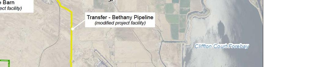
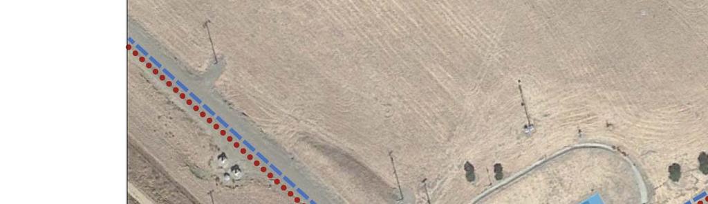
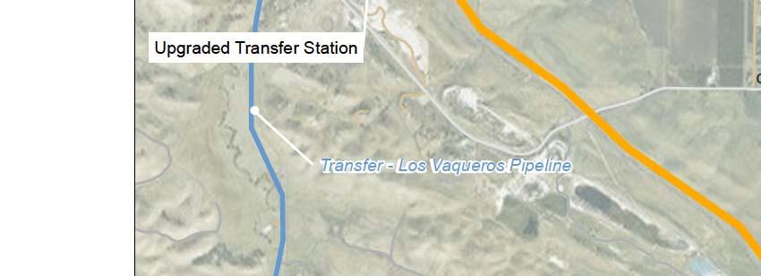
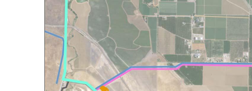
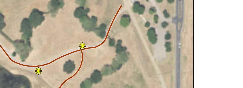
8 2.2 Project Facility Refinements Refinements to the proposed facilities have been made since the publication of the Final EIS/EIR. Several project facilities proposed in the Final EIS/EIR have been eliminated, several others have been reduced in size or otherwise modified, and some new project facility elements have been added. These refinements are summarized in Table 2-2 and described in greater detail below. The refinements apply to all the action alternatives unless otherwise noted Facilities Completed The following facilities described in the Final EIS/EIR have been constructed and are in operation: 1. Expansion of Los Vaqueros Reservoir from 100-TAF to 160-TAF storage capacity. 2. Relocation of the Marina Complex upslope of the original Marina location. 3. Relocation of trails and access roads that were inundated by the expansion of Los Vaqueros Reservoir to 160 TAF. 4. Acquisition and management of over 5,000 acres of habitat lands as compensatory mitigation, including almost 15 acres of wetland preservation and enhancement, 4,700 acres of grasslands, 90 acres of oak woodlands, 6 acres of scrub habitat, and over 118, 500 linear feet of drainages preserved or enhanced (CCWD, 2015) Facilities Eliminated Delta Intake and Pump Station The previously proposed new Delta Intake and Pump Station, with a capacity of 170 cfs, to be constructed on Old River south of the existing Old River intake, have been eliminated. The associated new electrical power facilities and upgrades to existing Western and PG&E power facilities have also been eliminated. (See Figure 2-5.) No new Delta Intake is now proposed; however, as explained below, the action alternatives now include facilities to enable diversion of water from the existing Rock Slough Intake to the Transfer Facility. The previously proposed diversion capacity from Old River was determined not to be necessary to meet the demands of the Local Agency Partners and Refuges when considered in combination with: 1) the flexibility provided by the new proposed facilities enabling the use of the existing Rock Slough Intake capacity to convey water to the Transfer Facility; and 2) the increased limitations on pumping from Old River due to the changes to the Delta regulatory environment, as discussed in greater detail in Section Transfer-Los Vaqueros Pipeline The previously proposed new Transfer-Los Vaqueros Pipeline, with a capacity of 670 cfs, from the Transfer Facility to Los Vaqueros Reservoir, has been eliminated. This component was included in the previously proposed 275-TAF reservoir expansion alternatives to increase Los Vaqueros Reservoir filling capacity. (See Figure 2-5.) There now is no proposed increase to the currently permitted Los Vaqueros Reservoir filling capacity of 200 cfs. Increasing the filling capacity as previously proposed would not improve the ability to meet Local Agency Partner and Refuge demands. Los Vaqueros Reservoir Expansion Project 2-8 June 2017
9 TABLE 2-2 FACILITIES CHANGES COMPARED TO THE FINAL EIS/EIR Final EIS/EIR Timing Variant Phase 2 Expansion Alternatives Los Vaqueros Reservoir Capacity Pumping Plant #1 Capacity Neroly High-Lift Pump Station Capacity New Delta Intake and Pump Station Capacity Delta-Transfer Pipeline Capacity Existing Transfer Pump Station Capacity New Transfer Pump Station Capacity New Transfer-Los Vaqueros Pipeline Capacity Transfer-Bethany Pipeline Capacity Transfer-Bethany Pipeline Alignment EBMUD Walnut Creek Pumping Plant Variable Frequency Drives EBMUD-CCWD Intertie Pump Station Capacity Los Vaqueros Marina Complex Los Vaqueros Interpretive Center Los Vaqueros Watershed Office Barn Los Vaqueros Watershed trails 275 TAF 275 TAF in Alternatives 1A, 1B, 2A 350 cfs (2010 capacity of existing pump station, before Contra Costa Canal Replacement Project) Not included 160 TAF in Alternative 4A 350 cfs (new pump station) 350 cfs 170 cfs None (Project component has been eliminated) 350 cfs 180 cfs in Alternatives 1A, 1B, 2A 200 cfs (2010 capacity, before 160-TAF Los Vaqueros Reservoir Expansion) None (project component eliminated) in Alternative 4A 200 cfs (upgraded capacity) 670 cfs 300 cfs 670 cfs None (Project component has been eliminated) 470 cfs 300 cfs Westside Option above-ground pipeline with tunnel section to Bethany Reservoir Eastside Option above-ground pipeline to Bethany Reservoir Not included Not included Relocated to northern end of Los Vaqueros Reservoir Second interpretive center added as part of Northern Marina Complex Not included Trails and access roads inundated by reservoir expansion relocated Westside Option unchanged Eastside Option shortened pipeline to California Aqueduct just south of Banks Pumping Plant Included 155 cfs Relocated upslope of existing Marina Complex at southern end of Los Vaqueros Reservoir in Alternatives 1A, 1B, 2A Existing Marina Complex unchanged in Alternative 4A Existing Interpretive Center upgraded; second interpretive center eliminated Seismically upgraded and improved Trails and access roads inundated by reservoir expansion relocated in Alternatives 1A, 1B, 2A New trail at Mortero Wetland Complex in all action alternatives Brentwood Pipeline Not included Included ECCID Intertie Capacity Not included 80 cfs Los Vaqueros Reservoir Expansion Project 2-9 June 2017
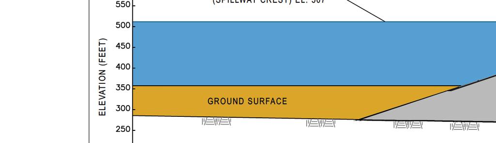
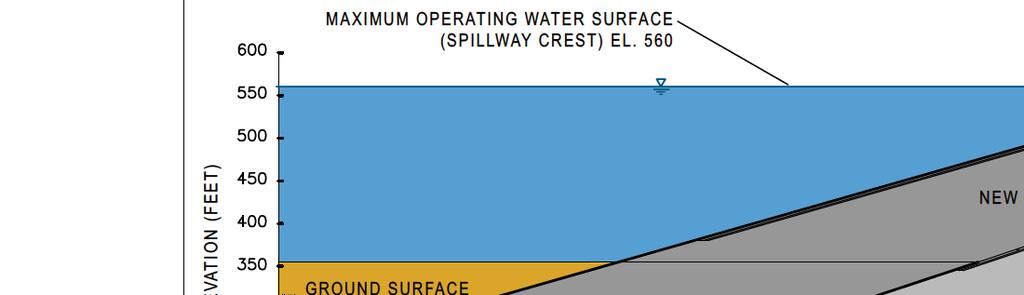
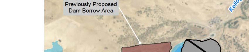
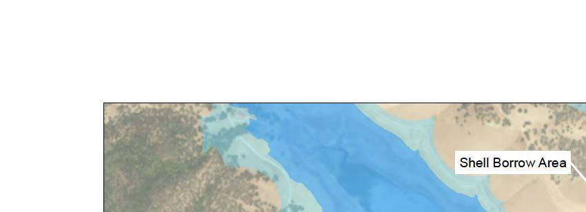
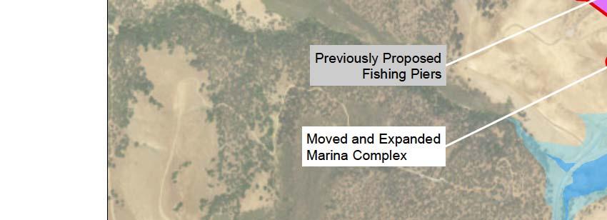
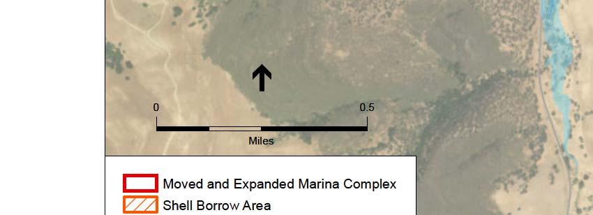
10 Northern Marina Complex The previously proposed Northern Marina Complex included site amenities in three separate areas on the northern side of the reservoir: 1. A new Marina building, fishing piers, and marina manager s house; 2. A new interpretive center with picnic area and parking facilities; and 3. A relocated fishing pier. The previously proposed locations for the new Marina building and new interpretive center were determined to be unsuitable because of access and cost issues. These site amenities have been eliminated, as indicated in Figure 2-5. The fishing pier facility at the northern end of Peninsula Cove has been retained from the Final EIS/EIR; it would be in the same location and be exactly the same size as shown in the Final EIS/EIR and would include a single pier, fish cleaning stations, picnic tables/shelters and pit toilets. As described below, under Alternatives 1A, 1B and 2A, a new Marina Complex, which would include an interpretive center, would be constructed at the southern end of the reservoir rather than relocating the complex to the northern end. Also, the existing Los Vaqueros Interpretive Center adjacent to the dam on the northern side of the reservoir would be upgraded in all action alternatives Facilities Modified Los Vaqueros Reservoir Dam Modification The dam required to expand Los Vaqueros Reservoir to 275-TAF storage capacity would be the same as previously proposed in the Final EIS/EIR. The general arrangement of the dam embankment and appurtenant facilities, dam slopes, crest elevation, freeboard, and internal zoning of the dam (i.e., the zones of different materials with specific properties that form the dam embankment) have all been retained. The design and construction sequencing however would take into account that the raise would be accomplished from the now-constructed 160-TAF dam rather than the original 100-TAF dam (see Figure 2-6). The expanded Los Vaqueros Reservoir dam would be included in Alternatives 1A, 1B, and 2A, but not in Alternative 4A. Most of the 4.3 million cubic yards of earthfill for the 275-TAF dam raise would be used for the upstream and downstream shells. The proposed source for the shell materials would be within the 143-acre shell borrow area located on the southeast end of the prominent ridge separating the north and south arms of the existing reservoir, as shown in Figure 2-7. Most of the shell borrow area would be within the 275-TAF Los Vaqueros Reservoir boundary and would be inundated after construction. Part of the shell borrow area would result in a cut slope approximately 100 feet above the water line after inundation of the 275-TAF reservoir, which would be revegetated. The Panoche formation claystones and sandstones from both areas are anticipated to have excavation, compaction and strength characteristics similar to the materials used for both the original dam and the 160-TAF dam raise. Los Vaqueros Reservoir Expansion Project 2-10 June 2017


11 2-11
12 This page intentionally left blank Los Vaqueros Reservoir Expansion Project 2-12 June 2017


13 2-13


14 2-14
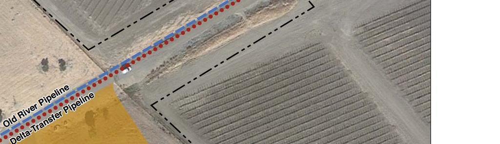
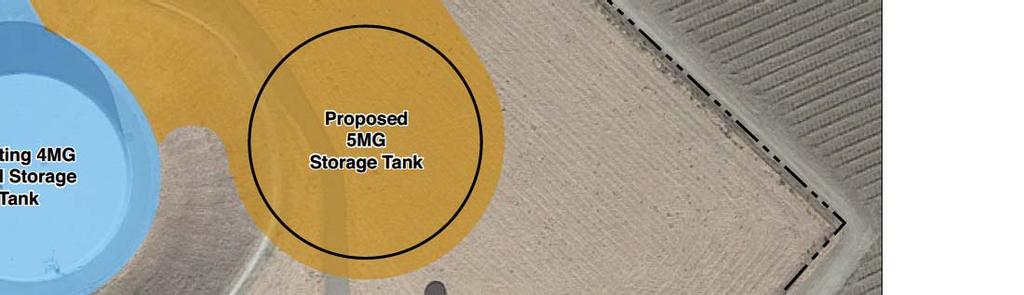
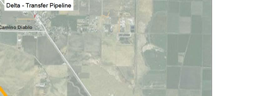
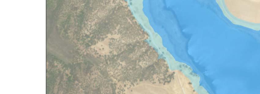
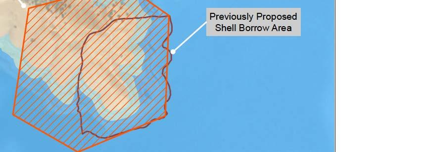
15 The previously proposed shell borrow area described in the Final EIR/EIS was the east-west trending ridge above the dam s left abutment, as indicated in Figure 2-7. It is an extension of the shell borrow source used for construction of both the original dam and the 160-TAF dam raise. However, construction experience gained during the 160-TAF raise showed that the extension of this borrow source would not yield sufficient higher quality target materials to compensate for the higher production costs associated with excavation on the ridge. Thus, this area would not be used as the shell borrow source for the Phase 2 Expansion. Clay for the core would be obtained from the same borrow source used for the 160-TAF construction, the naturally occurring alluvial deposits in the valley floor approximately 2.5 miles downstream of the dam. The borrow area would occur within the 58-acre area defined in Figure 2-7. The area defined by the limits includes the access haul road from Walnut Boulevard. The previously proposed core borrow described the Final EIR/EIS was upstream of the dam in the area currently inundated by the 160-TAF Los Vaqueros Reservoir. The proposed downstream borrow area was successfully used in the previous expansion of the Los Vaqueros Dam and produced very cost effective, high quality core materials. All other construction materials for the dam raise are as described the Final EIR/EIS Delta-Transfer Pipeline The proposed capacity of the new Delta-Transfer Pipeline has been decreased from 350 cfs to 180 cfs. With the elimination of the new Delta Intake and Pump Station and given the capacity of the existing Old River Pipeline of 320 cfs, an additional 180 cfs of pipeline capacity would be sufficient to match the 500-cfs total combined physical capacity of the existing Old River Intake (250 cfs) and Middle River Intake at Victoria Canal (250 cfs). The new Delta-Transfer Pipeline is included in Alternatives 1A, 1B, and 2A, but is not included in Alternative 4A (see Figure 2-5). The Delta-Transfer Pipeline would be constructed between the existing Old River Intake and Pump Station and the Transfer Facility, generally parallel to the existing Old River Pipeline. The Old River Pipeline is located 50 feet into the 85-foot wide permanent easement owned by CCWD and generally traverses agricultural fields and orchards as it extends first in a westerly direction from the Old River Intake and Pump Station parallel to State Route 4 to the intersection of Bixler Road, then in a southwesterly direction for about 1 mile before continuing west to the Transfer Facility outside of Byron off Vasco Road. The new Delta-Transfer Pipeline would be about 34,700 feet long (about 6.5 miles) and approximately 66 inches in diameter. Except for the smaller pipeline diameter, the details about construction of the proposed new Delta-Transfer Pipeline described in the Final EIS/EIR (pages ) are unchanged Transfer Facility Upgrade The proposed Transfer Facility Upgrade, which previously consisted of a new 670-cfs capacity pump station and 12-MG storage tank to accommodate both the previously proposed higher Los Vaqueros Reservoir filling capacity and the delivery of water into the Transfer-Bethany Pipeline, has been reduced in size. The smaller size of the proposed Transfer Facility Upgrade matches the sizes of the other facilities now proposed. The previously proposed energy recovery Los Vaqueros Reservoir Expansion Project 2-15 June 2017
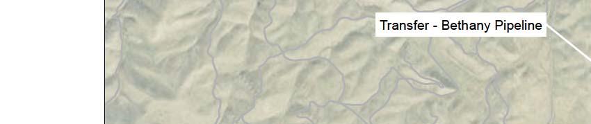
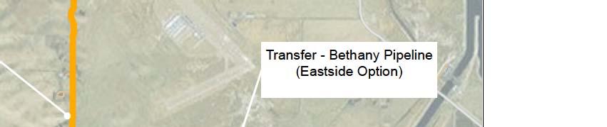
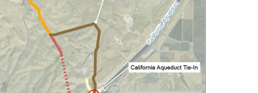
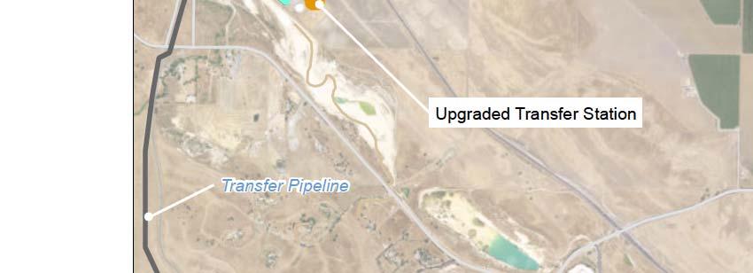
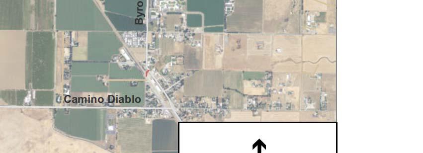
16 system to be installed at the Transfer Facility to capture the hydraulic energy generated by the water delivered by gravity from Los Vaqueros Reservoir to the Transfer-Bethany Pipeline has also been eliminated. The existing Transfer Pump Station pumps would be upgraded to retain the current permitted pumping capacity of 200 cfs under the higher head of the expanded Los Vaqueros Reservoir. The upgrades to the existing pumps would consist primarily of changing out electric pump motors and modifying the pumps. All work would be done within the existing paved footprint of the existing Transfer Facility. The existing 24.3-acre Transfer Facility site is owned by CCWD and is located about 2.75 miles west of Byron on Vasco Road between Camino Diablo and Walnut Boulevard. A new 300-cfs capacity pump station and an additional 5-MG storage tank would be constructed within the footprint of the existing Transfer Facility site, northeast of the existing Transfer Pump Station, as shown in Figure 2-8, to deliver water into the Transfer-Bethany Pipeline. Previously, a larger new pump station and storage tank were proposed to be located northwest of the existing pump station and tank (see Figure 3-22 of Volume I of the Final EIS/EIR), which would also have been on the existing Transfer Facility site but would have required more excavation. The new proposed site for the new pump station immediately adjacent to the existing Transfer Pump Station also minimizes the length of piping to the Transfer-Bethany Pipeline tie-in and intertie piping between the Old River Pipeline and Delta-Transfer Pipeline compared to other siting options. The new proposed location also minimizes operation and maintenance staff travel time. The primary building materials would include structural steel, concrete, and masonry. Concrete pouring and steel working activities would occur simultaneously with general construction activities for each component of the new pump station. The new 5-MG tank would have a 91-foot radius and be approximately 30 feet tall. The tank would be built on a reinforced concrete ring footing foundation with a layer of asphaltic cement pavement laid beneath the tank. Power would be provided to the six new 50-cfs pumps from a new substation and new electrical motor control center building. Pacific Gas and Electric (PG&E) power, of 21 kilovolts (kv) delivered to the new pump station and reservoir, would follow the same overhead route and come from the same PG&E substation as are used to deliver power to the existing Transfer Facility. The new substation to power the new pumps would match the existing Transfer Pump Station substation Transfer-Bethany Pipeline The proposed capacity of the new Transfer-Bethany Pipeline to deliver water from the Transfer Facility to the vicinity of Bethany Reservoir for south-of-delta partners has been decreased from 470 cfs to 300 cfs, with a corresponding decrease in proposed pipeline diameter from 132 inches to 84 inches. The smaller capacity would be sufficient to deliver water to meet the revised Local Agency Partner and Refuge demands. The location of the new Transfer-Bethany Pipeline is the same as described in the Final EIS/EIR except that the proposed Eastside Option for the alignment of the Transfer-Bethany Pipeline in the Final EIS/EIR has been shortened by about 1.8 miles to tie into the California Aqueduct just north of Bethany Reservoir in the Bethany Recreation Area, rather than into Bethany Reservoir near the Los Vaqueros Reservoir Expansion Project 2-16 June 2017


17 2-17
18 South Bay Aqueduct. (See Figure 2-9.) The Transfer-Bethany Pipeline would start at the same place and travel along the same alignment as proposed for the Eastside Option in the Final EIS/EIR for the first 7.1 miles. Except for the smaller pipeline diameter, the details about construction of the proposed Transfer-Bethany pipeline described in the Final EIS/EIR (pages ) are unchanged. Both the previously proposed and the revised Eastside Option alignment would avoid the tunneling that would be needed for the Westside Option alignment proposed in the Final EIS/EIR. The revised Eastside Option alignment, identified in the Reclamation 2016 Value Planning Study, would provide the same water supply benefit with a shorter pipeline as the originally proposed Eastside Option, but would not preserve the option for the South Bay Aqueduct water agency partners to receive a water quality benefit, since this alignment would blend any water delivered from the Los Vaqueros Reservoir with the much larger volume of water in the California Aqueduct pumped directly from the Delta Los Vaqueros Watershed Trails Los Vaqueros Watershed has an extensive trail network open to equestrians, hikers and cyclists. Some of these trails have been slightly modified from what was described in the Final EIS/EIR, after the expansion of Los Vaqueros Reservoir to 160 TAF. (See Figure 2-10.) Trails adjacent to the water at the 100 TAF storage level (elevation 487 feet) were moved to higher ground (water would rise to 521 feet at 160 TAF storage) to accommodate the rising water as part of the implementation of the Timing Variant. These modifications were on-the-ground refinements and were all done in areas, gradients or habitats previously analyzed in the Final EIS/EIR. In Alternatives 1A, 1B, and 2A, a few of these existing trails and access roads would be inundated or otherwise lost due to the Phase 2 Expansion. These trails would be relocated within the watershed on higher ground as described in the Final EIS/EIR. (See Figure 2-10.) Relocating these trails would maintain existing recreational benefits. All of these trail relocations would be implemented in areas, gradients and within habitats previously analyzed in the Final EIS/EIR. The previously proposed interconnecting trails on the east side of Los Vaqueros Reservoir have been eliminated from the Phase 2 Expansion due to sensitive biological and cultural resources that are in that area. Because of these sensitive resources, no current access is allowed, and none is proposed Facilities or Facility Improvements Added Pumping Plant #1 Replacement Replacement of Pumping Plant #1 on the Contra Costa Canal would be needed to match the designed and permitted Rock Slough Intake diversion capacity of 350 cfs in all the action alternatives. The separately-approved Contra Costa Canal Replacement Project, which is replacing the open channel portion of the Contra Costa Canal with a buried pipe, will lower the operating water surface levels at Pumping Plant #1 due to the friction losses added by the pipeline. Pumping would be limited to approximately 200 cfs using the existing Pumping Plant #1 pumps after the completion of the Canal Replacement Project, which is assumed for the Los Vaqueros Reservoir Expansion Project 2-18 June 2017


19 2-19


20 2-20
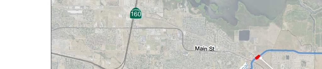
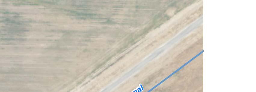
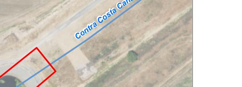
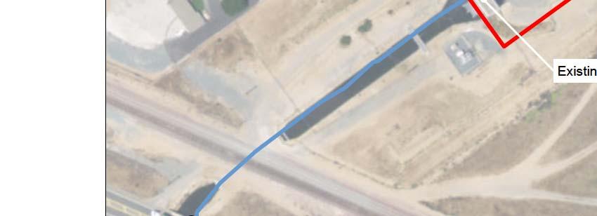
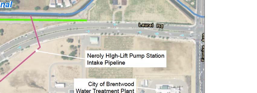
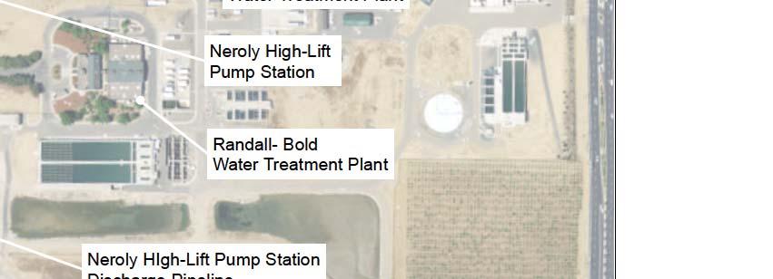
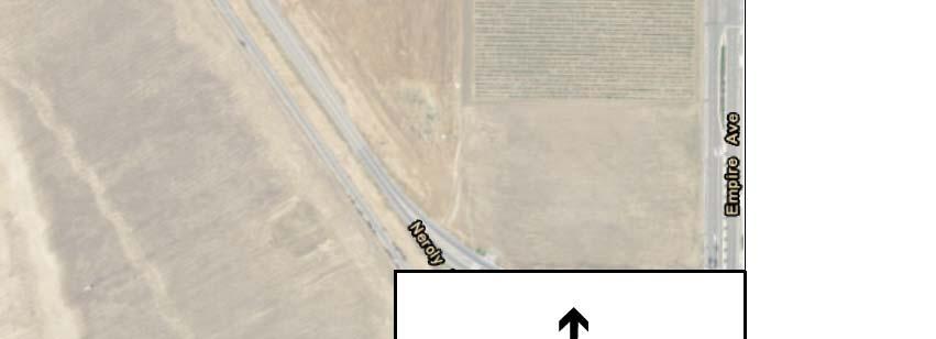
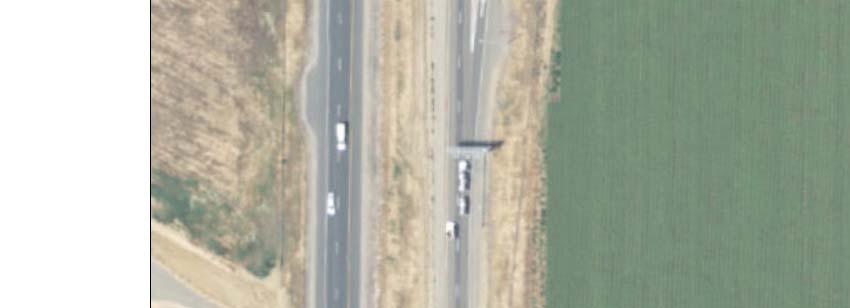
21 160-TAF No Project/No Action Alternative. Larger horsepower pumps set at a lower elevation (than existing) at Pumping Plant #1 would be needed to move the same amount of water (350 cfs) as previously has been moved through this system. A larger new building and upgraded electrical facilities are also included in the proposed upgrade of Pumping Plant #1 and would be built in the vicinity of the existing Pumping Plant #1 structure in the existing Contra Costa Canal right-of-way owned by Reclamation. (See Figure 2-11.) The proposed Pumping Plant #1 upgrade would involve demolition of the existing Pumping Plant #1 building and construction of a new building to house the upgraded pumps and appurtenances. The building would be constructed of concrete and would be similar in height to the existing Pumping Plant #1, approximately 35 feet tall. The square footage of the building would increase to approximately 4,000 square feet. The new pump station would have a total of six new pumps, three pumps in each of two parallel wet wells. A dedicated force main would carry flow from each pump. The below-grade valves would be housed within a valve box. The pump motors would be centered above the pumps and mounted on a floor slab with bottom elevation at approximately +16 feet. New power lines and substations would be required for the new Pumping Plant #1. Currently, incoming power is stepped down to 2300 volt, three phase, 60 hertz at a single existing Western Area Power Administration transformer with a capacity at 1500 kva. The new pump station would require a maximum of 2,100 horse power and would require two new 2000-kVA transformers. To construct the new Pumping Plant #1, the encased portion of the Contra Costa Canal would be isolated and dewatered. Sheet piling is already installed around much of the forebay of Pumping Plant #1, and additional sheet piling would be installed to isolate the construction site from the Contra Costa Canal. The site would be excavated to construct the foundation for the building and the wet wells, and to tie into the encased portion of the Contra Costa Canal. The existing pipeline is buried approximately 15 feet below the grade line and excavation may need to occur down to 25 feet below the grade line. During the construction of the foundation, wet wells, and pipeline tie-in, groundwater dewatering would be required to keep the site dry Neroly High-Lift Pump Station A proposed new high-lift pump station on the Contra Costa Canal near CCWD s Neroly Blending Facility (Neroly High-Lift Pump Station) has been added to all of the proposed action alternatives to pump water from the existing Contra Costa Canal to the existing Transfer Facility, which would enable filling of Los Vaqueros Reservoir and deliveries to the Transfer-Bethany Pipeline from the existing Rock Slough Intake. The proposed capacity of the Neroly High-Lift Pump Station is 350 cfs, to match the existing permitted diversion capacity at Rock Slough Intake. The Neroly High-Lift Pump Station, including electrical, hydraulic, and mechanical systems, would be constructed on the existing CCWD property at the Randall-Bold Water Treatment Plant site (see Figure 2-12), which is already-developed land. The primary building materials would include structural steel, concrete, and masonry. Concrete pouring and steel working activities would occur simultaneously with general construction activities for each component of the new pump station. Los Vaqueros Reservoir Expansion Project 2-21 June 2017


22 2-22


23 2-23
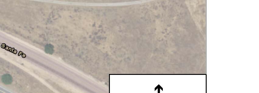
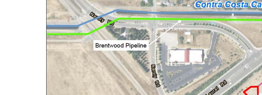
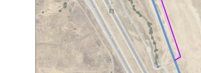
24 The intake to the Neroly High-Lift Pump Station would be two 72-inch pipelines that would deliver water under gravity to a wet-well that would be constructed under the pump station location, as shown in Figure The tap-in to Contra Costa Canal would require a gate structure on the canal to maintain water levels over the pump intake. Crossing of Laurel Road would be required for the twin 72-inch pipelines; tunneling under the road could be required, if open trench construction (which would require traffic detours) could not be accommodated. The pump station would include 6 pumps, each with 50-cfs capacity, requiring about 12,000 kva of new additional connected power load from the existing Western Area Power Administration transmission network that supplies CCWD facilities including the Multipurpose Pipeline pump station at the Randall-Bold Water Treatment Plant. The discharge from the Neroly High-Lift Pump Station would be a single 84-inch pipeline connecting to Los Vaqueros Pipeline as shown in Figure The discharge pipeline is proposed to extend southwesterly from the Neroly High-Lift Pump Station discharge header, passing through a flow meter (located inside a vault) and crossing perpendicular to the two-lane Neroly Road and the adjacent railroad tracks to a location approximately 200 ft. southwest of the railroad crossing. The alignment then turns west a short distance to a point near the top of the slope at the Lindsey Stormwater Detention Basin. From there the pipeline turns slightly to run southwesterly again and cross down the slope of the basin and run parallel to the slope, crossing under the existing box culvert at Antioch Creek to a connection point with the existing Los Vaqueros Pipeline. The total length of the discharge pipeline is approximately 1,155 feet. At the connection location, isolation valves would be required at Los Vaqueros Pipeline and the pipeline from the Neroly High-Lift Pump Station Brentwood Pipeline A new pipeline to move blended water from CCWD s Neroly Blending Facility to the City of Brentwood Water Treatment Plant would be constructed in all the action alternatives. Water from the Los Vaqueros Pipeline is blended with water in the Contra Costa Canal from the Rock Slough Intake at the Neroly Blending Facility. The up-to 48-inch diameter pipeline would be sized for flows up to 46.5 cfs (30 million gallons per day). The new pipeline would divert water from the Contra Costa Canal downstream of Flow Control Station #2 of the Los Vaqueros Pipeline to provide blended water from the Los Vaqueros Pipeline and the Contra Costa Canal. The pipeline would extend approximately 4,500 feet to the east, parallel to the south side of the Contra Costa Canal, and connect to the existing City of Brentwood Water Treatment Plant Inlet Pipeline, as shown in Figure The new pipeline would cross beneath the Highway 4 overpass, be constructed using standard open-trench construction techniques, and would cross beneath the Union Pacific railroad tracks likely using trenchless techniques, such as directional drilling, jack and bore or microtunnel. Construction could result in limited temporary impacts to the East Bay Regional Park District trail, which is located on the north side of the Contra Costa Canal. Segments of the pipeline may be constructed within existing roadways, which would require traffic control and short-duration closures. An easement or license from Union Pacific Railroad would be required, along with encroachment permits from the City of Brentwood and City of Oakley and licenses from Reclamation for segments of the pipeline within the Reclamation rightof-way along the Contra Costa Canal. Los Vaqueros Reservoir Expansion Project 2-24 June 2017
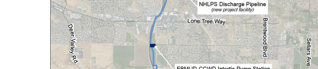
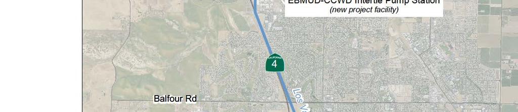
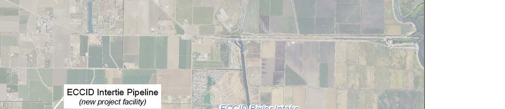
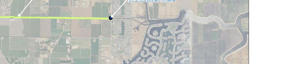
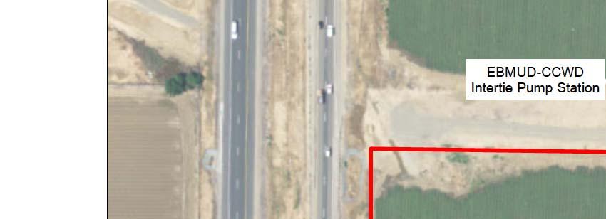
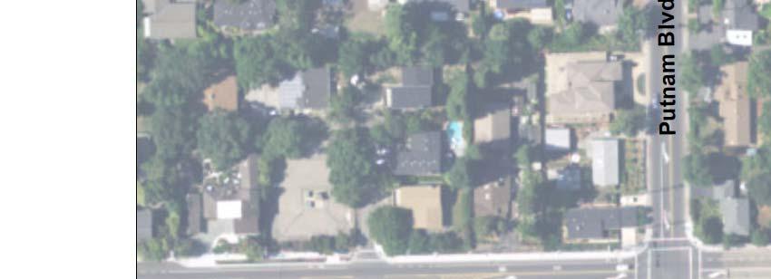
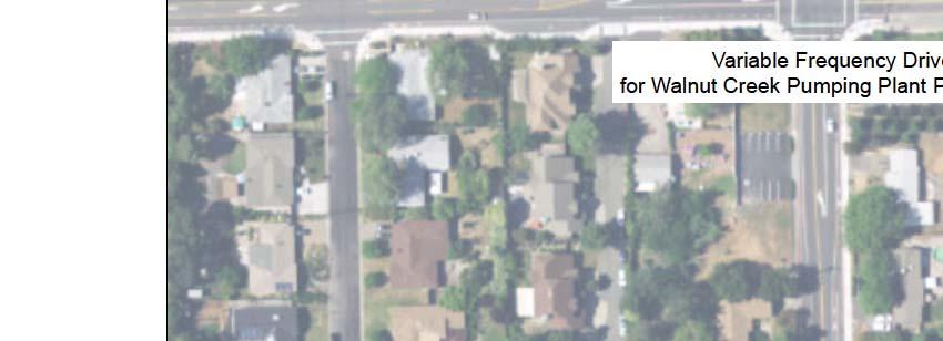
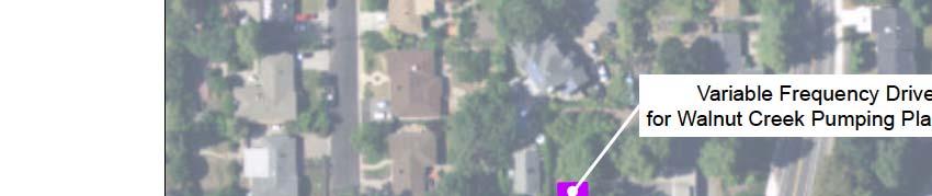
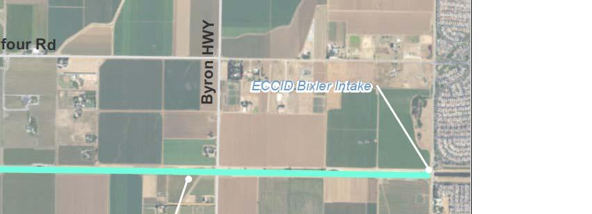
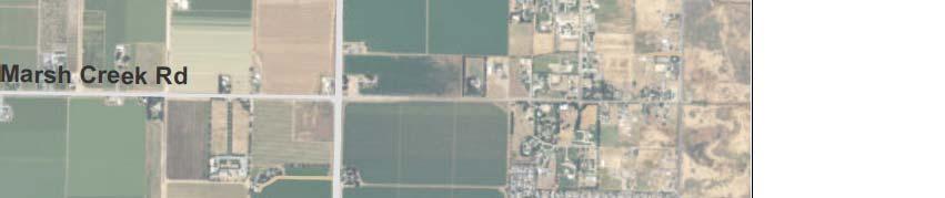
25 EBMUD-CCWD Intertie Pump Station A new high-lift pump station would be constructed at the EBMUD-CCWD Intertie in all the action alternatives to provide the 300 feet of head needed to lift water from Los Vaqueros Pipeline to EBMUD s Mokelumne Aqueduct #2, allowing water to be delivered at sufficient pressure and rates for EBMUD s use. The pump station would be approximately 9,675 square feet in size; note that this does not include any land that would be needed for an electrical substation or other similar facility, if needed. It would consist of four 2,000 hp pumps (three running to provide 85 mgd plus one standby pump). This pumping plant could cause very high surge pressures on the Los Vaqueros Pipeline, so significant surge controls would be needed. Figure 2-13 shows the proposed location for the new pump station. EBMUD would need to purchase land for the pump station EBMUD Walnut Creek Pumping Plant Variable Frequency Drives The installation of variable frequency drives at EBMUD s Walnut Creek Pumping Plant has been added to all of the proposed action alternatives to facilitate deliveries through the EBMUD- CCWD Intertie from EBMUD s Mokelumne Aqueduct #2 to the Los Vaqueros Pipeline. Currently, EBMUD meets its customer demand by managing flow rates on the three separate Mokelumne Aqueducts using a combination of pumping and gravity flows. The ability to throttle pumping on these aqueducts is limited. When flow is being conveyed through the EBMUD- CCWD Intertie from Mokelumne Aqueduct #2 to or from Los Vaqueros Pipeline, it is very challenging operationally to balance the flows entering EBMUD s Walnut Creek Pumping Plant with the demands on the other side. Variable frequency drives on all three aqueducts to would allow adjustments of supply to meet EBMUD service area demand while managing deliveries to the Los Vaqueros system. The installation of variable frequency drives at EBMUD s Walnut Creek Pumping Plant would require the construction of two new buildings to house the variable frequency drives, as shown in Figure A new structure approximately 200 feet by 25 feet and 20 feet tall would be located adjacent to the building housing Walnut Creek Raw Water Pumping Plants 1 and 2. A second structure, 180 feet by 25 feet and 15 feet tall, would be located next to Pumping Plant #3. Both of these structures would be located on EBMUD property ECCID Intertie Pipeline A new intertie pipeline of up to 80-cfs capacity between the existing Transfer Facility and East Contra Costa Irrigation District s existing Bixler Intake (ECCID Intertie) would be constructed to deliver water from CCWD facilities to ECCID. The proposed alignment of the approximately 7-mile long ECCID intertie pipeline would run north along Walnut Boulevard in Brentwood and east parallel to ECCID s main distribution canal, as shown in Figure Encroachment permits from the City of Brentwood would be required for the portion of the intertie pipeline constructed along Walnut Boulevard. ECCID maintains a cleared dirt right-of-way approximately 100 feet wide on the north side of the canal and an asphalt road of the canal road on their 100-foot wide right-of-way on the south side of the canal. Construction of the east-west portion of the Los Vaqueros Reservoir Expansion Project 2-25 June 2017


26 2-26


27 2-27


28 2-28
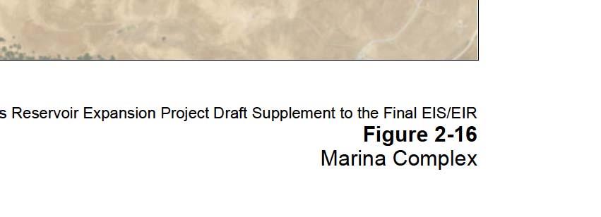
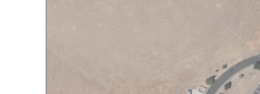
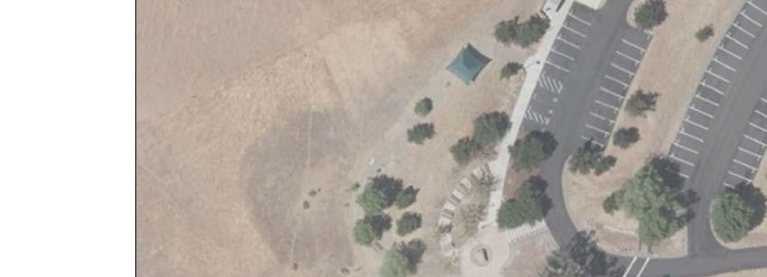
29 proposed ECCID intertie pipeline would occur entirely within the existing right-of-way along the canal. The new pipeline would be constructed using standard open-trench construction techniques. Construction within existing roadways would require traffic control and shortduration closures Los Vaqueros Watershed Recreation Facilities Marina Complex For Alternatives 1A, 1B, and 2A, the existing Marina Complex, including the facilities at the south cove and the end of Los Vaqueros Road, would be inundated to make way for an expanded 275 TAF reservoir. Since Los Vaqueros Reservoir would not be expanded in Alternative 4A, the existing Marina Complex would not need to be relocated in that alternative. In Alternatives 1A, 1B, and 2A, a new Marina Complex would replace the existing Marina Complex upslope of the existing facilities at the southern end of Los Vaqueros Reservoir (see Figure 2-16). The new Marina Complex would have a footprint of up to 12 acres. This new Marina Complex replaces the previously proposed marina facilities on the northern end of the Reservoir described in the Final EIS/EIR, as well as the previously proposed fishing facilities at the southern end of the Reservoir that included approximately 8 acres of fishing piers, fish cleaning stations, parking, etc. The new Marina Complex would be compliant with the Americans with Disabilities Act (ADA) and would include: 1. Parking, including ADA-accessible stalls and turnouts as close and as level as possible to the reservoir; 2. A boat launch ramp for servicing the rental fleet and for contractor s boats; 3. Covered picnic areas with concrete tables/benches, a play area, shade structures, remote restrooms, and other visitor amenities; 4. An outdoor amphitheater; 5. A Marina building, with room for a building lobby, interpretive displays, offices to accommodate up to 15 employees, requisite bathrooms and septic system, retail area, and food service area with sinks; 6. Outbuildings for storage, workshop space, water treatment and electrical equipment, and a large enclosed yard for larger items and other storage; 7. Fishing piers, fish cleaning stations, and a fish plant tube; and 8. Docks, which would include a dock surface smoother, two covered berths for patrol boats, berths for 50 electric-powered rental boats and three pontoon boats, davits (small cranes) to lift rental boats out of the water for cleaning, and a large boat house with room to hang life jacket/personal floatation devices and gear. The connections to the trails near the new Marina Complex would be slightly modified from what was shown in the Final EIS/EIR, but the footprint area would remain the same as was previously analyzed. Los Vaqueros Reservoir Expansion Project 2-29 June 2017


30 2-30
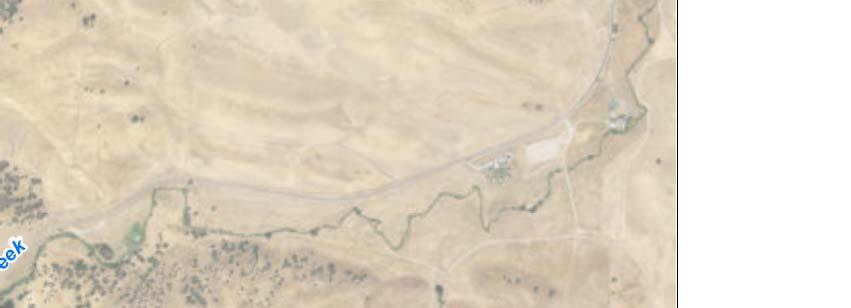
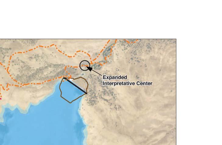
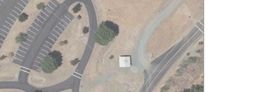
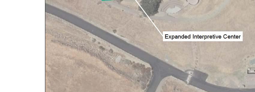
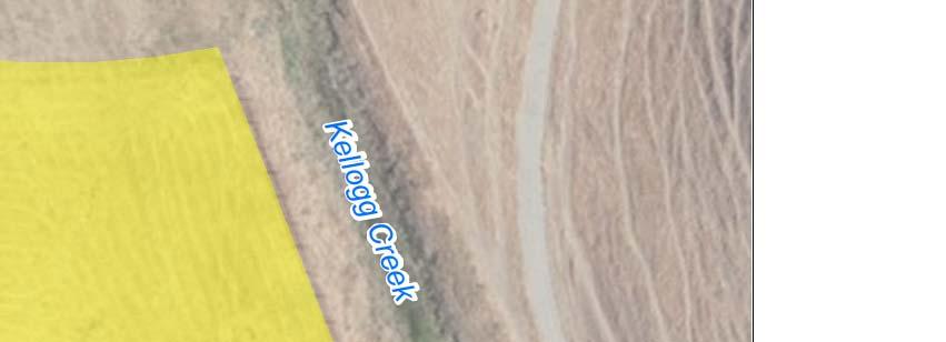
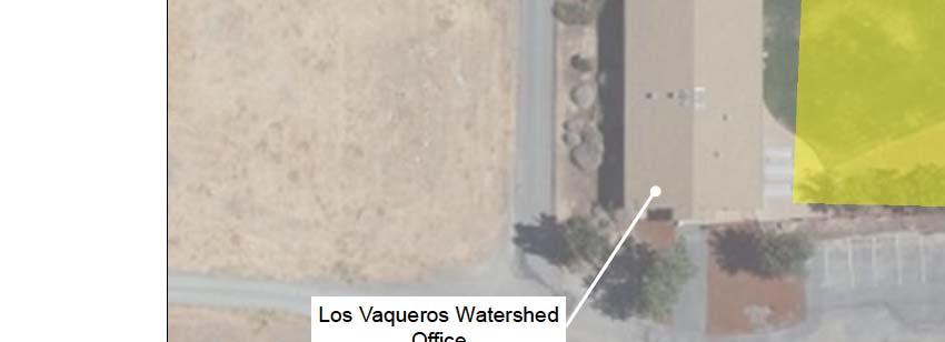
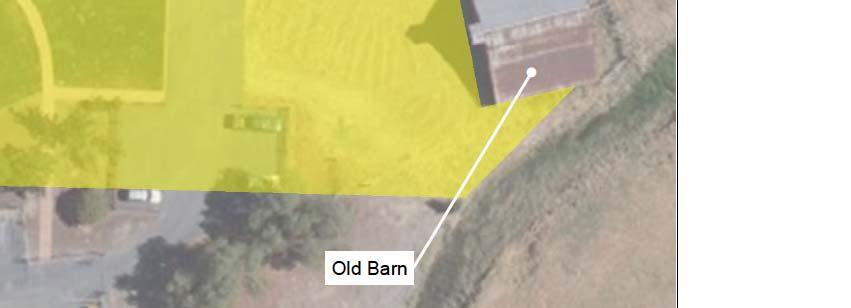
31 Los Vaqueros Interpretive Center The previously proposed second interpretive center that was to be part of the Northern Marina Complex has been eliminated. Instead, the existing Los Vaqueros Interpretive Center would be upgraded and enlarged within the existing developed location just north of the dam along Kellogg Creek, as shown in Figure This site has an educational pond, which would remain unchanged. Los Vaqueros Watershed Office Barn The existing old barn near the Los Vaqueros Watershed Office would be seismically and structurally upgraded (without expanding the existing footprint) and would contain an interpretive exhibit about ranching history in the area and an area for demonstrations to complement the existing outdoor education program. A new conservation and native plant demonstration garden of up to approximately 100 feet by 130 feet in area, 10 new parking stalls, and an expanded parking area of up to approximately 60 feet by 80 feet to accommodate school buses would be located in the vicinity of the old barn. Up to five new small picnic areas would be located adjacent to the new parking stalls, and a new vault toilet building would be added to the area. The vault toilet building would be self-contained, requiring water filling of the internal water supply tanks and pumping of the sewage containment vault approximately 3 to 4 times a year. All of these new facilities would be located within the existing footprint of disturbed area adjacent to the existing Watershed Office and Barn (see Figure 2-18). New Los Vaqueros Watershed Trail A new 0.5-mile ADA accessible interpretive trail would be built surrounding the Mortero Wetland Complex, which is located adjacent to the Walnut Staging Area at the northern end of the Los Vaqueros Watershed (see Figure 2-19). The new trail would include interpretive displays, viewing facilities, and shade structures and would generally follow the existing gravel road/trail with loops, turnouts, and rest areas. Approximately 0.5 acres of open space areas would be disturbed. 2.3 Project Operations Update The details of the operations proposed in the Final EIS/EIR have been updated to reflect changed conditions since the publication of the Final EIS/EIR, including changes in the conditions surrounding the project (as described in Chapter 1) as well as updated and more detailed information about Local Agency Partners, Refuges, and operations (described in this section below) Updates to All Alternatives The following two background conditions have changed since the publication of the Final EIS/EIR and are included in all of the modeling scenarios for the No Project/No Action Alternatives and the action alternatives. 1. CCWD s demands have been updated to reflect more recent customer usage, as documented in CCWD s 2015 Urban Water Management Plan (CCWD, 2016). These demand projections are compliant with California State Law (SBX7-7, colloquially known as 20% x 2020) as described in Chapter 1. Los Vaqueros Reservoir Expansion Project 2-31 June 2017


32 2-32


33 2-33


34 2-34
35 2. Diversions to Los Vaqueros Reservoir storage from the Old River Intake and Middle River Intake at Victoria Canal do not take place when Old and Middle River (OMR) flow restrictions are controlling CVP and SWP south Delta export operations under the 2008 U.S. Fish and Wildlife Service (USFWS) Operations Criteria and Plan (OCAP) Biological Opinion (USFWS, 2008) and 2009 National Marine Fisheries Service (NMFS) OCAP Biological Opinion (NMFS, 2009). This fisheries-related restriction is in addition to the no-fill/no-diversion period requirements specified in the existing biological opinions for Los Vaqueros Reservoir operations in the No Project/No Action Alternatives. In the Final EIS/EIR, diversions for partners were not made when OMR flow restrictions controlled export operations, but it was assumed that diversions for CCWD filling of Los Vaqueros Reservoir could take place using CCWD s CVP contract allocation. In the Final EIS/EIR action alternatives and in the No Project/No Action Alternatives for the Phase 2 Expansion, the default timing specified in the Los Vaqueros biological opinions and incidental take permit (USFWS, 1993; NMFS, 1993; CDFG, 2009) of March 15 through May 31 for the no-fill period, with a concurrent no-diversion period in April, was assumed to be shifted to the first half of February and all of March and June for the no-fill period, with a concurrent no-diversion period in March. This shifted timing better coordinates Los Vaqueros Reservoir filling operations with CVP and SWP operations under the OCAP biological opinions, since the limit on the ratio of San Joaquin River inflow to exports often controls CVP and SWP exports in April and May, rather than OMR flow restrictions, and CCWD diversions are considered to be in-delta diversions and therefore not included in total exports Updates to Action Alternatives Several additions or improvements to the operations of the action alternatives have been developed since the publication of the Final EIS/EIR to better meet Local Agency Partner and Refuge water supply needs while accommodating operational constraints. Greater detail has been provided about the Local Agency Partners and Refuges, including their operational preferences and available water supply Rock Slough Filling The ability to deliver water to the existing Transfer Facility from the existing Rock Slough Intake has been added, so that CCWD would be able to fill Los Vaqueros Reservoir and deliver water to the proposed Transfer Bethany Pipeline from the existing Rock Slough, Old River, and Middle River Intakes, as well as from the existing EBMUD-CCWD Intertie. Rock Slough Intake is, like the Freeport Intake, north of the locations where Old and Middle River flows are measured for the purposes of monitoring CVP and SWP compliance with the 2008 USFWS and 2009 NMFS OCAP Biological Opinions. Los Vaqueros Reservoir filling from Rock Slough Intake and deliveries to partners south of the Delta would not be constrained when Old and Middle River flow restrictions control CVP and SWP south Delta export operations. The proposed new Neroly High-Lift Pump Station and replacement of Rock Slough Pumping Plant #1, described in Section 2.2, would be needed to enable this operation CCWD No-Fill/No-Diversion Period The 75- to 90-day no-fill period and concurrent 30-day no-diversion period required by the 1993 USFWS Biological Opinion for the Los Vaqueros Project, the 1993 NMFS Biological Opinion Los Vaqueros Reservoir Expansion Project 2-35 June 2017