Riparian Setback- What is that and what should I be doing? October 25th, 2016 Presented by: Anil Tangirala, PE, CFM, ENV SP
|
|
|
- Marian Madeline Fleming
- 5 years ago
- Views:
Transcription
1 Riparian Setback- What is that and what should I be doing? October 25th, 2016 Presented by: Anil Tangirala, PE, CFM, ENV SP
2 Agenda Introduction Stream and Riparian Impacts Ohio EPA Stormwater General Permit Olentangy and Big Darby Watershed Construction General Permit Riparian Setback Definition How to determine Riparian Setback and how much mitigation is needed? Case Studies and Examples of Roadway GI applications Conclusions
3 Introduction
4 Stream Classification
5 Types of Transportation Projects Stream Crossings- New and Replacement Culverts Bridge Replacement projects New Bridge Crossings Roadway Widening adjacent to streams

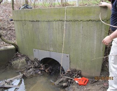
6 Stream Crossing New and Replacement Culverts
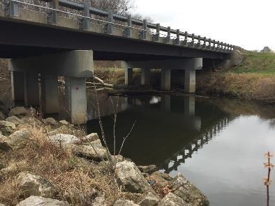
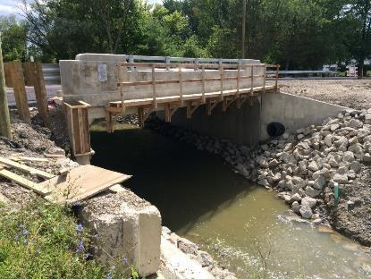
7 Bridge Replacement across a stream


8 Roadways Adjacent to Streams
9 Typical Stream Impacts Stormwater Impacts- Quantity and Quality Floodplain Impacts Riparian Setback- Olentangy and Big Darby Construction General permit Stream Corridor Protection Zone Compensatory Storage Groundwater Recharge
10 ODOT L&D Volume Watershed Specific NOI Requirements Additional requirements for projects located in certain designated watersheds are required by Ohio EPA. These projects require coverage under an Ohio EPA watershed specific NPDES permit. Coordinate projects in the following watersheds with Central Office Office of Hydraulic Engineering: o Big Darby Creek (entire watershed) o Olentangy River (portion of watershed as regulated under permit number OHC200002) In addition to post-construction BMP requirements, watershed specific NPDES permits include the following requirements: o Groundwater Recharge Mitigation, if applicable o Riparian Setback Mitigation o Temporary Sediment Basin Locations o Ohio EPA review and approval of the Storm Water Pollution Prevention Plan (SWPPP)
11 Ohio EPA Stormwater General Permit Ohio EPA Permit No.: OHC Issuance Date: April 11, 2013 Effective Date: April 21, 2013 Expiration Date: April 20, 2018 (5 Years After Effective Date) Permit covers the entire State Covers stormwater discharges associated with construction activity that enter surface waters of the state or a storm drain leading to surface waters of the state
12 Ohio EPA Olentangy Construction General Permit Ohio EPA Permit No.: OHC Issuance Date: June 2, 2014 Effective Date: June 2, 2014 Expiration Date: May 31, 2019 (5 Years After Effective Date) Permit covers portions of the Olentangy Watershed Covers stormwater discharges associated with construction activity that enter surface waters of the state or a storm drain leading to surface waters of the state
13 OHIO EPA BIG DARBY CONSTRUCTION GENERAL PERMIT (CGP) Ohio EPA Permit No.: OHCD00002 Issuance Date: October 1, 2012 Effective Date: October 1, 2012 Expiration Date: September 30, 2017 (5 Years After Effective Date) Permit covers the entire Big Darby Creek Watershed Covers stormwater discharges associated with construction activity that enter surface waters of the state or a storm drain leading to surface waters of the state
14 OEPA Requirements and Permits Quantity Quality Construction General Permit Olentangy River Watershed Permit Big Darby Creek Watershed Permit X X X X X X Riparian Setback Groundwater Recharge X X X
15 Local Stormwater Drainage Manuals Local requirements may be more stringent and will supersede Ohio EPA Construction General Permit Requirements.

16 Riparian Setback Definition Riparian areas are naturally vegetated lands along rivers and streams. Riparian setback regulations are designed to establish distances from water resources where building and other soil disturbing activities are prohibited. Riparian setbacks are a tool local governments can use to maintain riparian area functions.
17 Why Riparian Setbacks? Reduce Flooding Filter and Settle out Pollutants Stabilize Streambanks and prevent Streambank erosion Protect Aquatic and Terrestrial Habitat Provide community character
18 Typical factors to determine Setback Type of Stream (Perennial, Intermittent and Ephemeral) Drainage Area Designated Special Flood Hazard Area
19 How are Setbacks Calculated? Ohio EPA Construction General Permits Regulated MS4- City of Columbus Local Stormwater Ordinance
20 How are Setbacks Calculated? Step #1- Delineate Riparian Setbacks Step#2- Determine project intrusion and disturbance limits Step#3- Assess areas and degree of impact Step#4- Determine Riparian Mitigation Needed

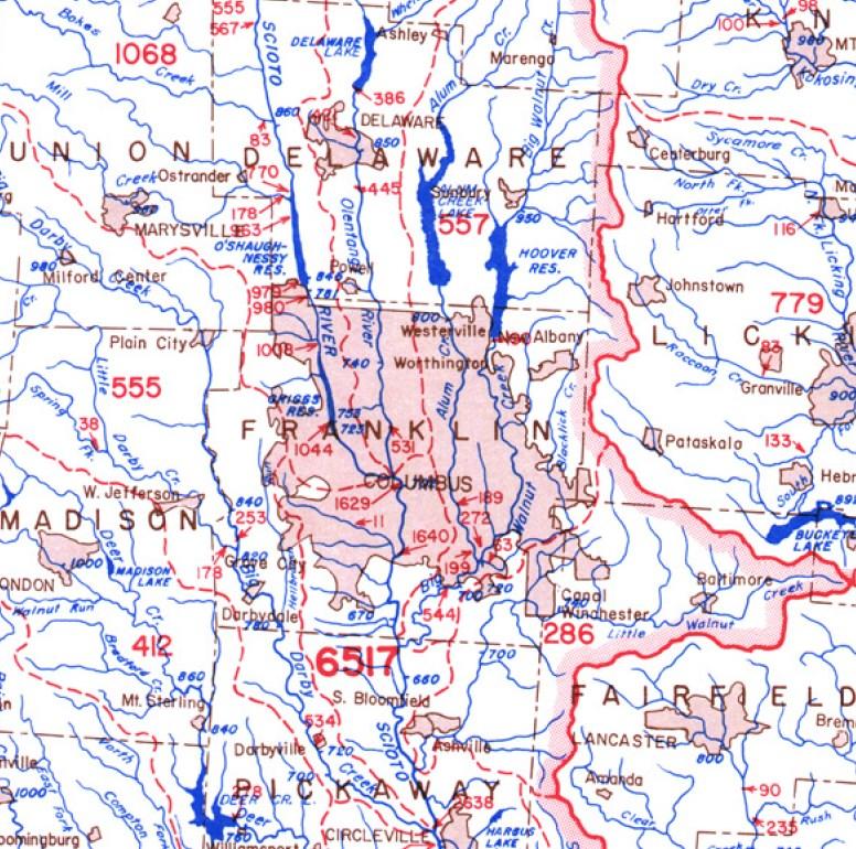
21 Ohio EPA Olentangy Watershed CGP
22 Types of Streams Olentangy Watershed CGP Olentangy River Mainstream Perennial Streams Intermittent Streams Ephemeral Streams

23 Setback Considerations Streams should have a defined bed and bank Setbacks include streamside buffer and outer buffer. Presence of Stream should be confirmed in the field Setbacks should be clearly displayed in the field prior to construction ODNR Rainwater and Land Development Manual
24 How to determine Stream Types Best to confirm on Field USGS National Hydrography Dataset USDA Soil Survey
25 Olentangy Watershed Setback Requirements Olentangy River Setback Requirements Olentangy River Watershed Perennial Stream Olentangy River Watershed Intermittent and Ephemeral Stream Streamside Buffer (ft.) 100 feet each side of the OHWM 80 feet each side of the OHWM 30 feet each side of the OHWM Outer Buffer (ft.) Regulatory FEMA 100 year Special Flood Hazard Area The greater of the regulatory FEMA 100 Year SFHA, or W=143DA 0.41, where DA is in sq. mi. No outer buffer.

26 Perennial Streams and Olentangy River Stream Setback Mitigation Zone 1 extends from 0 to 30 feet from the stream edge. Zone 2 extends from 30 feet to the outer edge of the streamside buffer. Zone 3 extends from the outer edge of the streamside buffer to the outer edge of the outer buffer.
27 Olentangy Watershed Mitigation Requirements for Perennial and Olentangy River Zone 1 Zone 2 Zone 3 Mitigated within the Site Mitigated within the immediate receiving watershed 4x 3x 2x 2x 1.5x 1x
28 Olentangy Watershed Mitigation Requirements for Intermittent and Ephemeral Streams Intermittent Streams Ephemeral Streams Mitigated within the Site 4x 2x Mitigated within the immediate receiving watershed 2x 1x
29 Stream Mitigation Requirements Mitigation protected in perpetuity by binding conservation easements or environmental covenants. All mitigation includes conserved or restored setback zone to maximize the ecological function of the mitigation. Granting of binding conservation easements for land outside of disturbed area, but within a required riparian setback, in itself, counts towards required mitigation.
30 OHIO EPA BIG DARBY CONSTRUCTION GENERAL PERMIT (CGP)
31 Big Darby Creek Watershed Setback Requirements The setback distance shall be sized as the greater of the following: 1. The regulatory 100 year floodplain based on FEMA mapping; 2. A minimum of 100 feet from the centerline of the stream on each side; or 3. A distance calculated using the following equation: W = 133DA 0.43
32 Big Darby Watershed Stream Restoration 100 feet from centerline of stream on each side for previously modified low gradient headwater stream No Structural Controls in Stream Setback Redevelopment projects exempt
33 Riparian Mitigation Zones The mitigation required for intrusion into the riparian setback of the perennial streams shall be determined by the horizontal distance the intrusion is from the stream. Up to three zones will be used in determining the required mitigation. Zone 1 extends from 0 to 25 feet from the stream edge. Zone 2 extends from 25 feet to 100 feet of the stream edge. Zone 3 extends from 100 feet to outer edge of stream corridor.
34 Big Darby Watershed Stream Mitigation Requirements Four (4) times the total area disturbed in the stream within Zone 1 of the site being developed shall be mitigated Three (3) times the area disturbed within Zone 2 of the site being developed shall be mitigated Two (2) times the area to be mitigated within Zone 3 of the site being developed shall be mitigated
35 Linear Transportation Projects Big Darby Watershed Stream Setback Mitigation Linear transportation projects with less than one acre of total new ROW exempt from Riparian Mitigation especially for correcting safety related issues, mandates of modern design requirements etc. In lieu of mitigation ratios in the permit, linear transportation projects which result in total new right-of-way greater than one acre and less than two acres shall provide Riparian Setback Mitigation at a ratio of 1.5 to 1.

36 Local Municipalities City of Columbus Requirements and Thresholds Stream Corridor Protection Compensatory Flood Storage
37 City of Columbus SCPZ Delineation The total width of the Stream Corridor Protection Zone for streams shall be established using the following criteria, whichever is greater: 1. The Federal Emergency Management Agency (FEMA) designated 100-year floodway, or 2. Using the equation below with a minimum of 50 feet to a maximum of 250 feet. W = 147(DA) feet from the top of each bank for fourth order streams or larger.
38 City of Columbus SCPZ Mitigation a) If the impact is directly to the stream, predicted post-construction QHEI/HHEI will meet or exceed the existing QHEI/HHEI. b) If the impact is solely to the SCPZ, and not directly into the stream, mitigation shall be considered sufficient if additional equivalent SCPZ is created at the following ratios: On site: 1 to 1 Adjacent site: 1 to 1.5 Same watershed assessment unit: 1 to 2 Same County: 1 to 3 Contiguous County: 1 to 5 c) Generally, mitigation SPCZ will be considered equivalent if it performs the same function as the disturbed SPCZ; for instance, if the disturbed SPCZ includes trees, the mitigation SPCZ should include at least an equivalent number of trees.


39 Olentangy Watershed Case Study
40 Intermittent and Ephemeral Stream

41 Perennial Stream

42 Big Darby Setback
43 Conclusions Know the regulations for the project area. Determine Stream Corridor Impacts during preliminary engineering. Confirm stream classification by field investigation. Work with project stakeholders to develop required mitigation strategies.
44 Questions Anil Tangirala, PE, CFM, ENV SP ms consultants, inc