Black River Watershed Management Plan Plan
|
|
|
- George Cameron
- 5 years ago
- Views:
Transcription


1 Black River Watershed Management Plan Plan Final Report Part II: Appendices May 2010 This watershed management plan was prepared for the New York State Department of State Division of Coastal Resources with funds provided under Title 11 of the Environmental Protection Fund, Local Waterfront Revitalization Program.
2
3 TABLE OF CONTENTS Black River Watershed Management Plan Part II Appendices 8 Appendices Watershed Glossary of Terms Watershed Maps Dams by Subwatershed Subwatershed Prioritization Factors Agricultural Best Management Practices State and Federal Agencies and Programs Funding Section agency, purpose, eligible, cost share, application, website Tables AGWLF Results Public Outreach Memorandum of Understanding (MOU) Endnotes
4 This page intentionally left blank
5 8 Appendices 8.1 Watershed Glossary of Terms Anaerobic Occurring without oxygen, especially of an environment or organism. Anoxic Sediments Sediments in areas of fresh water that are depleted of dissolved oxygen. Anthropogenic Processes or materials that are derived from human activities, as opposed to those occurring in natural environments without human influence. Biodiversity Simply defined as the variety of life and all processes that keep life functioning. At the watershed level, biodiversity is the variation of life forms within a given ecosystem and is often used as a measure of the health of biological systems. Built Environment The man-made surroundings that provide the setting for human activity, ranging from the large-scale developments and transportation infrastructure to smaller residential areas. This term is often used in contrast to the natural environment. Contiguous Areas that are in physical contact with one another. As it relates to flora and fauna, contiguous areas are those areas with similar ecological traits that are in physical contact with one another. Ecozone Individual geographic regions defined according to the geology, topography, climate, soils, vegetation, and land use of a given area. Erosion The removal of sediment, soil, rock and other particles in the natural environment by wind, water, or ice. Gravity and living organisms may also cause erosion. Evapotranspiration Describes the amount of water lost from a watershed through evaporation and transpiration. Evaporation is the movement of water to the air from surface water, soil, and canopy interception. Transpiration is the movement of water to the air from within plants. Extirpation The extinction of a species from a given study area, although that species still exists elsewhere (i.e., local extinction). Groundwater Water located beneath the ground surface in soil pore spaces and in the fractures of rock formations. Groundwater is naturally replenished by surface water from precipitation, streams, and rivers when this recharge reaches the water table. Hydrology The study of the movement, distribution, and quality of water in a given area. Infiltration Process by which water on the ground surface enters the soil. The infiltration rate is a measure of the rate at which soil is able to absorb rainfall or irrigation. Page 217
6 Macroinvertebrate An invertebrate that is large enough to be seen without the use of a microscope. An invertebrate is an animal without a vertebral column and includes species such as worms, snails, and insects. Moraines Any glacially formed accumulation of unconsolidated glacial debris (soil and rock) which can occur in currently glaciated and formerly glaciated regions. Ground moraines are till covered areas with irregular topography and no ridges, often forming gently rolling hills or plains. Nonpoint Source Pollution (NPS) Water pollution affecting a water body from diffuse sources, such as polluted runoff from agricultural areas draining into a river or wind-borne debris blowing out to sea. NPS is derived from many different sources with no specific solution to rectify the problem, making it difficult to regulate. NPS is the leading cause of water pollution in the United States today. Nutrient Load(ing) The mass of nutrients carried by water into surrounding waterways over a period of time. Nutrients may enter the water from runoff, groundwater, or the air (in the form of wet deposition such as rain or snow as well as dry deposition). Peak Flow The largest discharge found in a stream channel in response to a particular rainfall or snowmelt event. The timing of peak flow after a given event is dependent on the imperviousness of the watershed, with peak flows occurring sooner in more heavily developed watersheds. Permeability The ability of water to move through soil. A soil s permeability is determined by its composition, with soils made up of larger particles (e.g., sand) being more permeable than those composed on smaller particles (e.g., clay). Phytoplankton Phytoplankton are microscopic plant-like organisms that live in water. organisms are the foundation of the marine food chain. These Point Source Pollution A single identifiable localized source of air, water, thermal, noise or light pollution. Point-source pollution generally comes from wastewater discharged from the pipes of industrial facilities and municipal sewage treatment plants into rivers, streams, lakes, and the ocean. Potable Water Water that is fit for consumption by humans and other animals (i.e., drinking water). Sedimentation Sedimentation is the deposition of eroded materials (i.e., soil) in a given waterbody. Deposits of sediments in ditches, streams, and rivers reduce their capacity to store water resulting in more frequent and severe flooding and increased property damage. Accumulations of sediment may result in severe damage to storm drain systems. Siltation see Sedimentation. Stochastic Event An event involving chance or probability. Surface Water Water collecting on the ground or in a stream, river, lake, wetland, or ocean. Surface water is naturally replenished by precipitation and naturally lost through discharge to evaporation and sub-surface seepage into the groundwater. Page 218
7 Taxon A group of one or more organisms that have common characteristics (e.g., geographic population, genus, family, order) that differentiate the group from other such groups. Topography The surface shape and features of a given land area. Turbidity The cloudiness or haziness of water caused by individual particles (i.e., suspended solids). While heavier materials settle rapidly to the bottom, very small particles will settle only very slowly or not at all these unsettled particles cause the water to appear turbid. Turbidity can be caused naturally by phytoplankton and natural sedimentation, as well as through human land disturbance activities, such as construction, that also lead to increased sedimentation. Water Budget A water budget is an assessment of all the inputs and outputs to a hydrologic system, including rainfall, evaporation, runoff, and seepage. Page 219
8 This page intentionally left blank Page 220
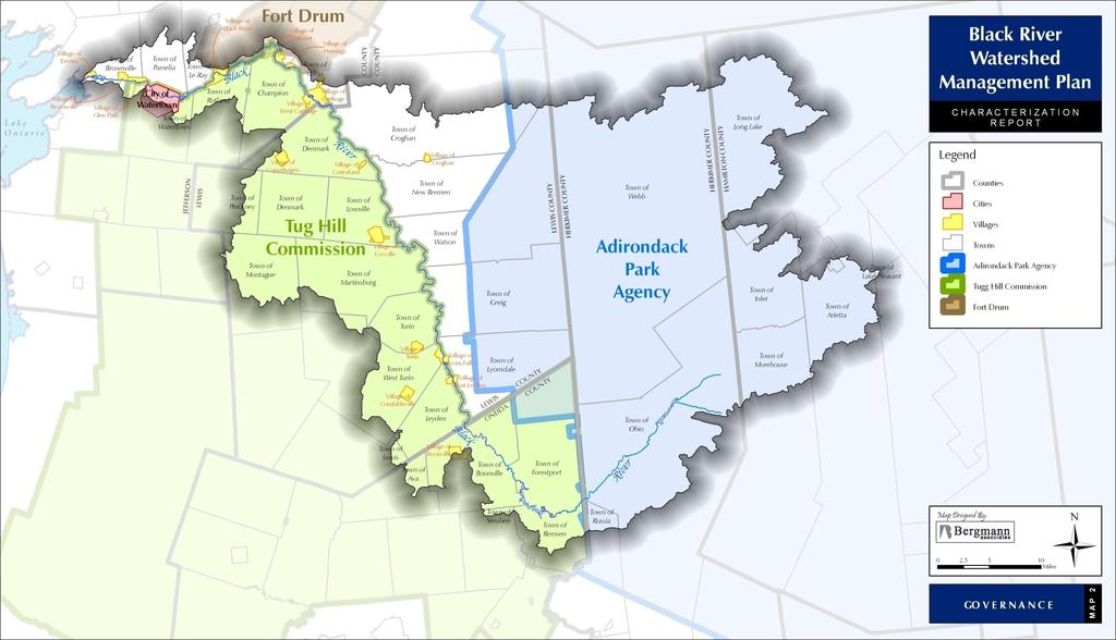
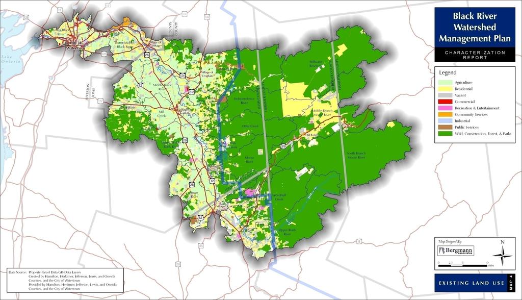
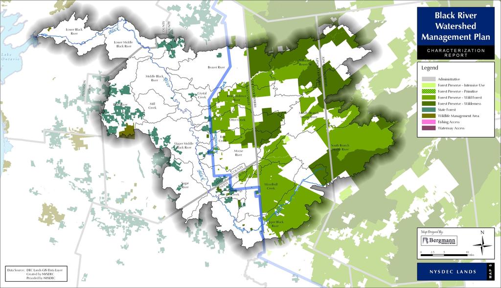
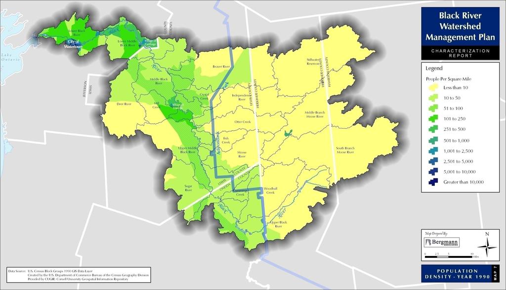
9 8.2 Watershed Maps MAP KEY Map 1 Project Location Map 2 Governance Map 3 Subwatersheds Map 4 Land Use Map 5 NYSDEC Lands Map 6 Land Cover Map 7 Population Density Year 1990 Map 8 Population Density Year 2000 Map 9 Topography Map 10 Steep Slopes Map 11 Hydrologic Soil Groups Map 12 Average Annual Precipitation Map 13 NYSDEC Stream Use Classifications Map 14 Dams Map 15 Priority Waterbody Impairments Map 16 NYSDEC Trout Waters Map 17 Wetlands Map 18 Floodplains Map 19 Aquifers Map 20 Ecozones Map 21 Water Quality Results Map 22 Land Cover Results Map 23 Land Use & Ownership Results Map 24 Natural Resources Results Page 221
10 This page intentionally left blank Page 222

11 BLACK RIVER WATERSHED MANAGEMENT PLAN P A R T II: A P P E N D I C E S Page 223
12 This page intentionally left blank Page 224
13 Page 225
14 This page intentionally left blank Page 226
15 Page 227
16 This page intentionally left blank Page 228
17 Page 229
18 This page intentionally left blank Page 230
19 Page 231
20 This page intentionally left blank Page 232
21 BLACK RIVER WATERSHED MANAGEMENT PLAN P A R T II: A P P E N D I C E S Page 233
22 This page intentionally left blank Page 234
23 Page 235
24 This page intentionally left blank Page 236
25 Page 237