ENVIRONMENTAL ASSESSMENT WORKSHEET
|
|
|
- Arleen Arnold
- 5 years ago
- Views:
Transcription
1
2 ENVIRONMENTAL ASSESSMENT WORKSHEET Note to reviewers: The Environmental Assessment Worksheet (EAW) provides information about a project that may have the potential for significant environmental effects. This EAW was prepared by the Minnesota Pollution Control Agency (MPCA), acting as the Responsible Governmental Unit (RGU), to determine whether an Environmental Impact Statement (EIS) should be prepared. The project proposer supplied reasonably accessible data for, but did not complete the final worksheet. Comments on the EAW must be submitted to the MPCA during the 30-day comment period which begins with notice of the availability of the EAW in the Minnesota Environmental Quality Board (EQB) Monitor. Comments on the EAW should address the accuracy and completeness of information, potential impacts that are reasonably expected to occur that warrant further investigation, and the need for an EIS. A copy of the EAW may be obtained from the MPCA by calling (651) An electronic version of the completed EAW is available at the MPCA Web site 1. Project Title: Menahga Wastewater Treatment Facility Improvements Project 2. Proposer: City of Menahga 3. RGU: Minnesota Pollution Control Agency Contact Person Teri Osterman Contact Person Jim Sullivan and Title City Administrator-Clerk-Treasurer and Title Project Manager Address nd Street Northeast Address 520 Lafayette Road North Menahga, Minnesota St. Paul, Minnesota Phone (218) Phone (651) Fax (218) Fax (651) Reason for EAW Preparation: EIS Scoping Mandatory EAW X Citizen Petition RGU Discretion Proposer Volunteered If EAW or EIS is mandatory give EQB rule category subpart number and name: , subpart 18 b 5. Project Location: County Wadena City/Twp Menahga SE 1/4 NE 1/4 Section 27 Township 138 N Range 35 W TDD (for hearing and speech impaired only): (651) Printed on recycled paper containing 100% fibers from paper recycled by consumers
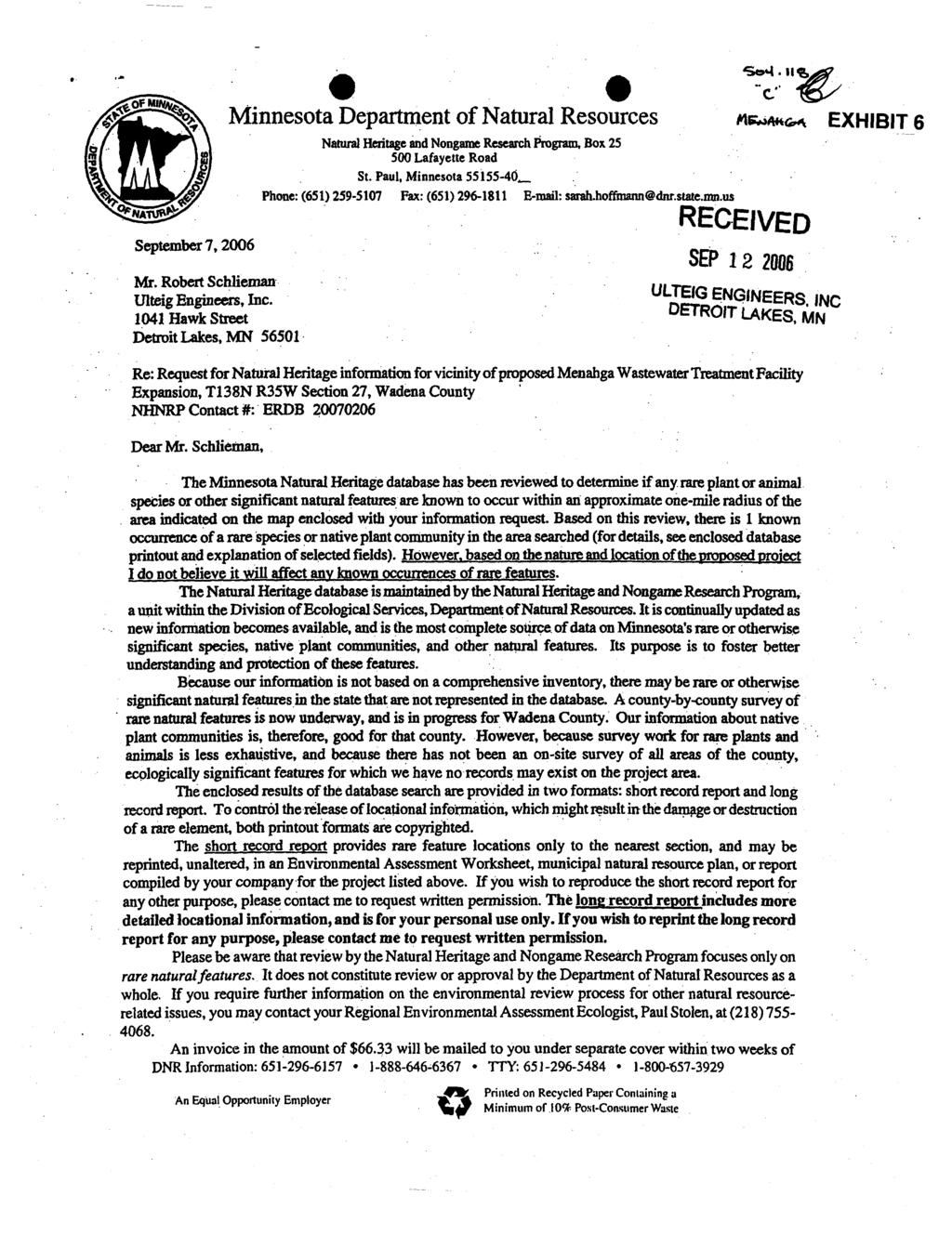
3 Tables, Figures, and Appendices attached to the EAW: Exhibit 1 County map showing the general location of the project Exhibit 2 United States Geological Survey Map showing project site Exhibit 3 Site Layout Map showing existing and proposed facilities Exhibit 4 City Zoning Map with legend Exhibit 5 Correspondence from the Minnesota Historical Society (MHS) Exhibit 6 Correspondence from the Minnesota Natural Heritage and Nongame Research Exhibit 7 Soils Map and Information Exhibit 8 Map showing wastewater effluent flow path to Crow Wing River 6. Description: a. Provide a project summary of 50 words or less to be published in the EQB Monitor. The city of Menahga (City) proposes to expand their existing three-cell wastewater treatment facility (WWTF), approximately 15 acres in size, by constructing a new 13.4-acre secondary stabilization pond directly to the south of the existing stabilization pond system (Project). The Project will provide for greater treatment of municipal wastewater treatment. The WWTF will discharge seasonally through an unnamed ditch and, ultimately, to the Crow Wing River. b. Give a complete description of the proposed project and related new construction. Attach additional sheets as necessary. Emphasize construction, operation methods and features that will cause physical manipulation of the environment or will produce wastes. Include modifications to existing equipment or industrial processes and significant demolition, removal or remodeling of existing structures. Indicate the timing and duration of construction activities. Existing Wastewater Treatment System A copy of the existing and proposed Project expansion is found in Exhibit 1. A copy of the physical site layout is found in the United States Geological Survey Map showing the Project site in Exhibit 2. A Site Layout Map showing existing and proposed facilities is found in Exhibit 3. The existing wastewater treatment system consists of 7,760 feet of eight-inch force main, one main lift station, a three-cell stabilization pond system, and 4,500 feet of ten-inch outfall piping. The stabilization pond system consists of one 5.55-acre primary pond and two 5.25-acre secondary ponds that were constructed in The facility is designed to treat an average wet weather (AWW) design flow of up to 111,000 gallons per day (gpd) with a 5-day Biochemical Oxygen Demand (BOD 5 ) of 230 milligrams per liter (mg/l). The rules for classification of WWTF systems are found in Minn. R The WWTF are classified by classes, with a Class A being the most sophisticated, and Class D reflecting the use of a pond or small system servicing a small community. This determination is made on such factors as wastewater flow, the treatment system components and the size of the area served. The WWTF, after expansion, will continue to be a Class D facility with a detention time of 180 days designed to discharge during controlled periods to an unnamed ditch that leads to Yaeger Lake and thence to the Crow Wing River. The only other dischargers identified above the point of discharge for the Project are in the city of Park Rapids (two WWTF dischargers and one industrial discharger) and the city of Akley (one WWTF discharge). Menahga Wastewater Treatment Facility Improvements Project Menahga, Minnesota 2 Environmental Assessment Worksheet
4 Proposed Wastewater Treatment System Additions and Upgrades The City has proposed to increase the capacity of their wastewater treatment system by adding a 13.4-acre secondary stabilization pond. The additional pond would be constructed just south of the existing basins and would be lined with 30-mil PVC similar the existing ponds. The addition of the secondary stabilization basin will increase the AWW design flow from 111,000 gpd to 195,000 gpd at 195 days of detention time. Construction of the Project is expected to commence in the spring/early summer of 2007 and be concluded in the fall of the same year. Construction methods will entail the utilization of common grading equipment and practices while manholes, control structures, valves, and piping will be installed or altered to accommodate the addition of the new secondary stabilization pond. Normal operation of the existing wastewater treatment system will continue throughout the construction process while the same discharge point and/or route will remain the same following construction. To meet the water quality requirements for phosphorous, standard alum would be added to the secondary ponds for phosphorous reduction, if necessary. The alum would be applied with a specially equipped pontoon that is outfitted with a slurry tank, pump, metering equipment, and rear distribution arm. A concrete access ramp into the secondary cell, a bulk alum storage tank, a transfer pump, and a small storage building for the alum equipment would be provided as part of the Project. c. Explain the Project purpose; if the Project will be carried out by a governmental unit, explain the need for the Project and identify its beneficiaries. The Project is being done in order to meet the current and future wastewater demands of the City as well as meet the requirements put forth by the MPCA. 1 The Project is being proposed by the City, while residents, businesses, and industries will be the beneficiaries of the waste treatment. d. Are future stages of this development, including development on any outlots, planned or likely to happen? Yes No If yes, briefly describe future stages, relationship to present project, time line and plans for environmental review. e. Is this project a subsequent stage of an earlier project? Yes No If yes, briefly describe the past development, time line and any past environmental review. 1 The requirement related to the expansion of the system is based on design flows within the existing MPCA Permit. As the Project nears the design flow, the system is required to expand in order to maintain the incoming flow rate. The new design flow rate will be reflected in the new Project MPCA Permit. Menahga Wastewater Treatment Facility Improvements Project Menahga, Minnesota 3 Environmental Assessment Worksheet
5 7. Project Magnitude Data Total Project Area (acres) 25 or Length (miles) N/A Number of Residential maximum units Units: Unattached N/A Attached N/A per building N/A Commercial/Industrial/Institutional Building Area (gross floor space): total square feet N/A Indicate area of specific uses (in square feet): Office N/A Manufacturing N/A Retail N/A Other Industrial N/A Warehouse N/A Institutional N/A Light Industrial N/A Agricultural N/A Other Commercial (specify) N/A Building height N/A If over 2 stories, compare to heights of nearby buildings N/A 8. Permits and approvals required. List all known local, state and federal permits, approvals and financial assistance for the project. Include modifications of any existing permits, governmental review of plans, and all direct and indirect forms of public financial assistance including bond guarantees, Tax Increment Financing and infrastructure. Unit of Government Type of Application Status MPCA National Pollutant Discharge Elimination System (NPDES)/State Disposal System Expansion of Existing Permit - Submitted (SDS) Permit MPCA NPDES/SDS Stormwater Permit Obtain prior to construction MPCA Facility Plan Submitted Minnesota Department of Natural Resources (DNR) Water Appropriation Permit If needed, will be submitted upon completion of environmental review. City Building permit To be applied for upon completion of environmental review. 9. Land use. Describe current and recent past land use and development on the site and on adjacent lands. Discuss project compatibility with adjacent and nearby land uses. Indicate whether any potential conflicts involve environmental matters. Identify any potential environmental hazards due to past site uses, such as soil contamination or abandoned storage tanks, or proximity to nearby hazardous liquid or gas pipelines. A copy of the City zoning map is included in Exhibit 4. The previous use of the existing WWTF land prior to City acquisition was cropland. The City acquired the property for the purpose of developing a WWTF in the 1970s. A copy of the City zoning map, with legend, is found in Exhibit 4. Currently, the Project area is zoned Industrial, with the surrounding area zoned Agricultural-Residential and Residential to the north and northwest, Manufactured Homes to the west, and Industrial to the southwest. A small parcel is zoned Residential south of the proposed Project. The Project is expected to be consistent with applicable City zoning and land use. The additional secondary stabilization pond will be constructed adjacent to the City s existing stabilization ponds on property owned by the City. Property abutting the Menahga Wastewater Treatment Facility Improvements Project Menahga, Minnesota 4 Environmental Assessment Worksheet
6 improvement site consists of forestland, which helps seclude the treatment system. No compatibility issues with nearby lands are expected, while no conflicts involving environmental matters are expected. No known environmental hazards due to past or future site uses are anticipated. 10. Cover Types. Estimate the acreage of the site with each of the following cover types before and after development: Before After Before After Types 1-8 wetlands Lawn/landscaping Wooded/forest Impervious Surfaces Brush/grassland Other (lagoons) Cropland Other (dikes) TOTAL Fish, Wildlife, and Ecologically Sensitive Resources. a. Identify fish and wildlife resources and habitats on or near the site and describe how they would be affected by the Project. Describe any measures to be taken to minimize or avoid impacts. Existing wildlife primarily consists of songbirds, rabbits, squirrels, deer, frogs, waterfowl, and other species typically found in this region. During construction, animals within the construction area could temporarily relocate, as there is an abundance of natural habitat in the Project vicinity. The existing wastewater effluent route, which includes Yaeger Lake, will continue to be utilized once the Project is complete. The wild rice presence in Yaeger Lake is a potentially sensitive resource within the Project area. The MPCA has developed phosphorus management guidelines for WWTFs that are not required to have an effluent discharge limit. 2 The guideline includes information specific to phosphorus management. The Project proposers will continue to follow the guidelines put forth by the MPCA. The discharge is not expected to create an adverse impact to the wild rice resources in Yaeger Lake. b. Are any state (endangered or threatened) species, rare plant communities or other sensitive ecological resources such as native prairie habitat, colonial waterbird nesting colonies or regionally rare plant communities on or near the site? Yes No Eastern Hognose Snake (Heterodon platirhinos) If yes, describe the resource and how it would be affected by the project. Indicate if a site survey of the resources has been conducted and describe the results. If the DNR Natural Heritage and Nongame Research program has been contacted give the correspondence reference number. 2 [October 10, 2006] Menahga Wastewater Treatment Facility Improvements Project Menahga, Minnesota 5 Environmental Assessment Worksheet
7 Describe measures to minimize or avoid adverse impacts. The DNR has provided a review of the Natural Heritage database and provided a summary of their review in a September 7, 2006, correspondence (ERBD see Exhibit 6). The DNR review indicated that the Eastern Hognose Snake (Heterodon platirhinos) has been documented in the area. The Eastern Hognose Snake is a non-venomous heavily bodied snake that varies in color from yellow, gray, brown, olive, and black. The DNR indicates that some are slate gray with dark blotches behind the eyes. Others have dark brown blotches on the back. Toads are the primary food of the eastern hognose snake. This snake also feeds on frogs, salamanders and small mammals. It has large teeth in the back of its mouths to puncture inflated toads to make them easier to swallow. Eastern hognose snakes live on sandy soils near open woodlands or forest edge. This species is found in the eastern third of the Minnesota. 3 The Project is expected to displace some potential habitat for the snake; however, the surrounding area is highly suitable for this species and will not permanently affect the population. 12. Physical Impacts on Water Resources. Will the project involve the physical or hydrologic alteration (dredging, filling, stream diversion, outfall structure, diking, and impoundment) of any surface waters such as a lake, pond, wetland, stream or drainage ditch? Yes No If yes, identify water resource affected. Describe alternatives considered and proposed mitigation measures to minimize impacts. Give the DNR Protected Waters Inventory (PWI) number(s) if the water resources affected are on the PWI. The Project is not expected to affect the existing usage of water resources. There is no plan to dredge, fill, divert, dike, or impound any surface waters. 13. Water Use. Will the project involve installation or abandonment of any water wells, connection to or changes in any public water supply or appropriation of any ground or surface water (including dewatering)? Yes No If yes, as applicable, give location and purpose of any new wells; public supply affected, changes to be made, and water quantities to be used; the source, duration, quantity and purpose of any appropriations; and unique well numbers and DNR appropriation permit numbers, if known. Identify any existing and new wells on the site map. If there are no wells known on site, explain methodology used to determine. Upon completion of the construction of the WWTF, it will be necessary to obtain up to ten million gallons of water from the original secondary ponds to do water balance testing of the new pond. In the event that the water from the existing secondary pond does not meet the discharge effluent limits, ground water will be used to conduct the water balance test. In the event that ground water will be used to conduct the water balance test, a DNR water appropriation permit will be required. The City is aware of this requirement and will submit an application for ground water use to the DNR if ground water is needed to conduct the test. 3 [October 10, 2006] Menahga Wastewater Treatment Facility Improvements Project Menahga, Minnesota 6 Environmental Assessment Worksheet
8 14. Water-related land use management districts. Does any part of the project involve a shoreland zoning district, a delineated 100-year flood plain, or a state or federally designated wild or scenic river land use district? Yes No If yes, identify the district and discuss project compatibility with district land use restrictions. 15. Water Surface Use. Will the project change the number or type of watercraft on any water body? Yes No If yes, indicate the current and projected watercraft usage and discuss any potential overcrowding or conflicts with other uses. The existing surface water use is not generally used for watercraft. This status will not change as a result of the Project. 16. Erosion and Sedimentation. Give the acreage to be graded or excavated and the cubic yards of soil to be moved: 20 acres; 100,000 cubic yards. Describe any steep slopes or highly erodible soils and identify them on the site map. Describe any erosion and sedimentation control measures to be used during and after project construction. The Project site is rather flat, with soils generally consisting of loamy sands. Prior to construction, an NPDES/SDS General Stormwater Permit for Construction Activity will need to be obtained. Erosion and sediment control devices will be utilized to minimize erosion on the project site during construction, while areas disturbed will be permanently established with turf once the Project is complete. 17. Water Quality Surface Water Runoff. a. Compare the quantity and quality of site runoff before and after the project. Describe permanent controls to manage or treat runoff. Describe any storm water pollution prevention plans. The quantity and quality of site runoff will not be significantly altered by the proposed Project as no new impervious surfaces are to be added. The peak stormwater runoff should actually be reduced and the water quality of wastewater effluent being discharged is expected to improve after construction because of the additional pond cell and anticipated phosphorus standard. A permanent grass cover will be established on all disturbed areas after construction is finished. A stormwater pollution prevention plan constructed in accordance with the NPDES/SDS General Stormwater Permit for Construction Activity will be incorporated into the bidding documents for the contractor to utilize during the construction process. b. Identify routes and receiving water bodies for runoff from the site; include major downstream water bodies as well as the immediate receiving waters. Estimate impact runoff on the quality of receiving waters. Runoff from the wastewater stabilization pond site flows in a westerly direction through a small section of forested land and eventually into a low-lying wetland. Runoff eventually reaches the Crow Wing River Basin, which historically has shown little variation from year to year in total discharge. The small amount of runoff from the wastewater stabilization pond site will have no effects on quantity and quality of flows in receiving waters. Menahga Wastewater Treatment Facility Improvements Project Menahga, Minnesota 7 Environmental Assessment Worksheet
9 18. Water Quality Wastewater. a. Describe sources, composition and quantities of all sanitary, municipal and industrial wastewater produced or treated at the site. Wastewater routed to the Project will originate from residents and light commercial uses (e.g., gas station, restaurant). The typical composition of untreated domestic wastewater includes solids (suspended and dissolved), organic carbon, organic nitrogen, free ammonia, nitrites, nitrates, phosphorus, chlorides, sulfates, grease, total coliform, volatile organic compounds, and alkalinity. 4 There are no high strength wastewater producers within the City. The City s existing wastewater flow consists of 90,000 to 100,000 gpd, while BOD 5 levels average around 215 pounds per day. The January 1, 1988, design AWW flow for this facility is million gallons per day (MGD). In accordance with MPCA rules regarding nondegradation for all waters, the design AWW flow of the facility as of January 1, 1988, and associated mass loading are the baseline design flow and mass loading. This baseline flow and mass loading will be used to determine whether nondegradation review is required for any change in the discharge. Any change that results in an increase in design flow greater than 0.2 MGD and an increased loading of one or more pollutants, or any change in a discharge containing a toxic pollutant that results in a mass loading rate likely to increase the concentration of the toxicant in the receiving water by greater than one percent over the baseline quality, is subject to nondegradation review in accordance with Minn. R The proposed Project increase is less than 0.2 MGD, so an MPCA nondegradation review (and related limits) is not needed. The Project is subject to a 1 mg/l effluent limit for phosphorus. 5 The treatment system designed for this Project will treat domestic wastewater to concentrations that meet the applicable effluent discharge regulations. b. Describe waste treatment methods or pollution prevention efforts and give estimates of composition after treatment. Identify receiving waters, including major downstream water bodies, and estimate the discharge impact on the quality of receiving waters. If the project involves on-site sewage systems, discuss the suitability of site conditions for such systems. The proposed wastewater treatment facility will consist of a four-cell stabilization pond system with seasonal discharges to unnamed ditch and eventually the Crow Wing River. The proposed treatment will be similar to that provided by the existing three-cell system. Discharges will be in accordance with the City s NPDES/SDS Permit as shown in the table below: Parameter Limiting Concentration BOD 5 25 mg/l Total Suspended Solids 45 mg/l Fecal Coliform Bacteria 200 MPN / 100 ml * ph Range 6.0 to 9.0 Phosphorus 1 mg/l * MPN = most probable number; ml = milliliter 4 Tchobanoglous, G., Burton, F.L. (1991). Wastewater engineering: Treatment, Disposal and Reuse. McGraw-Hill, Inc.: New York. (Third Edition) 5 [October 10, 2006] Menahga Wastewater Treatment Facility Improvements Project Menahga, Minnesota 8 Environmental Assessment Worksheet
10 The discharge flow path from the outfall drains into an unnamed ditch, which ultimately flows approximately 6.3 miles, until it reaches Yeager Lake, and then ultimately, into the Crow Wing River (See Exhibit 8). According to an August 4, 2004, MPCA memorandum, Yeager Lake is a shallow lake that is managed for production of wild rice. Dense algal blooms caused by excess phosphorus can shade out wild rice during its early life stages. A phosphorus standard will be implemented as a result of the Project, resulting in a net reduction in phosphorus loading to the receiving water. 6 Overall, impacts on downstream waters are expected to be negligible as the same discharge route currently being utilized by the existing system will continue to be used in addition to the enhanced treatment and the development of a phosphorus management plan, along with the 1 mg/l effluent discharge limit. Additionally, the discharge is seasonal rather than constant. Pollutant loading within the surface water drainage system is expected to be minimal. The MPCA does not reasonably expect an adverse environmental impact from the discharge of wastewater effluent from this Project. c. If wastes will be discharged into a publicly owned treatment facility, identify the facility, describe any pretreatment provisions and discuss the facility s ability to handle the volume and composition of wastes, identifying any improvements necessary. N/A. d. If the project requires disposal of liquid animal manure, describe disposal technique and location and discuss capacity to handle the volume and composition of manure. Identify any improvements necessary. Describe any required setbacks for land disposal systems. N/A. 19. Geologic hazards and soil conditions. a. Approximate depth (in feet) to Ground water: 7 to 9 minimum; >10 average. Bedrock: >280 minimum; >300 average. Describe any of the following geologic site hazards to ground water and also identify them on the site map: sinkholes, shallow limestone formations or karst conditions. Describe measures to avoid or minimize environmental problems due to any of these hazards. There are no known geologic hazards to ground water in the vicinity of the Project area or the City. 6 The proposed effluent for the Project was reviewed in an August 9, 2004, MPCA Water Standards Unit Memorandum. The results of the review indicate that this is an expanding discharge upstream of a water where phosphorus is a concern due to excess cumulative sources and that the proposed expansion would result in a loading rate greater than 1,800 lbs. P/yr. de minimus level, the MPCA s Phosphorus Strategy indicates a phosphorus limit should be assigned. The Water Standards Unit recommended a 1 mg/l phosphorus effluent limit. This limit will be included in the Project s new MPCA permit. Menahga Wastewater Treatment Facility Improvements Project Menahga, Minnesota 9 Environmental Assessment Worksheet
11 b. Describe the soils on the site, giving SCS classifications, if known. Discuss soil granularity and potential for ground water contamination from wastes or chemicals spread or spilled onto the soils. Discuss any mitigation measures to prevent such contamination. Soil Survey Information Soil Types Present: Menahga Loamy Sand, till substratum, 1 to 8 percent slopes Huntersville Loamy Fine Sand, 1 to 6 percent slopes Menahga Loamy Sand, 0 to 2 percent slopes A soil map is found in Exhibit 7. Soils within the Project area are loamy sands. The potential for ground water contamination is unlikely as the additional stabilization pond will be lined with an impervious polyvinyl chloride liner. The seasonally high ground water table is approximately ten feet below the expected basin bottom, thereby negating the need for any drain tiling. The designed seepage rate for this system is 500 gallons per acre per day, consistent with MPCA pond design criteria. 7 According to the Wadena County Local Water Resource Management Plan (Plan), the Project area and related effluent drainage path are located on the Pineland Sands surficial aquifer that covers northern Wadena, western Cass, and parts of Hubbard counties. It is noted that the seasonal high water tables can be at or near the surface. Based on information provided in the Plan, the presence of high water tables, water moves freely from surface to ground and back, especially in the Pineland Sand aquifer. 8 Generally, any pollutants introduced to ground water resources from systems employing this type of design attenuate to background concentrations within tens to hundreds of meters. As a result, the designed seepage rate for this system is not expected to adversely impact ground water resources and is sufficient for the soil type and design of this Project. It should also be noted that no hazardous materials are anticipated to be needed at the stabilization pond site. 20. Solid Wastes, Hazardous Wastes, Storage Tanks. a. Describe types, amounts and compositions of solid or hazardous wastes, including solid animal manure, sludge and ash, produced during construction and operation. Identify method and location of disposal. For projects generating municipal solid waste, indicate if there is a source separation plan; describe how the project will be modified for recycling. If hazardous waste is generated, indicate if there is a hazardous waste minimization plan and routine hazardous waste reduction assessments. Solid or hazardous waste will not be produced or handled during construction. 7 According to the MPCA Pond Design Review Considerations, 5.32: The permeability of the pond seal should be as low as possible and in no case should seepage loss through the seal exceed 500 gallons/acre/day. See MPCA, (March 1988). Recommended design criteria for stabilization ponds: Technical Criteria. Water Quality Division Municipal Section, Saint Paul, Minnesota. 8 Wadena County Local Water Resource Management Plan , p. 6. Menahga Wastewater Treatment Facility Improvements Project Menahga, Minnesota 10 Environmental Assessment Worksheet
12 b. Identify any toxic or hazardous materials to be used or present at the site and identify measures to be used to prevent them from contaminating ground water. If the use of toxic or hazardous materials will lead to a regulated waste, discharge or emission, discuss any alternatives considered to minimize or eliminate the waste, discharge or emission. No toxic or hazardous materials will be needed at the wastewater treatment facility site. If hazardous or toxic material is discovered during construction, it would be disposed of in accordance with MPCA guidelines as the MPCA would be notified of any such findings. Based on previous land use, the discovery of toxic or hazardous materials is not reasonably expected to occur. c. Indicate the number, location, size and use of any above or below ground tanks to store petroleum products or other materials, except water. Describe any emergency response containment plans. It is anticipated that no petroleum will be stored at the Project site. 21. Traffic. Parking spaces added: 0 Existing spaces (if project involves expansion): N/A Estimated total average daily traffic generated: N/A Estimated maximum peak hour traffic generated (if known) and its timing: N/A Provide an estimate of the impact on traffic Congestion affected roads and describe any traffic improvements necessary. If the project is within the Twin Cities metropolitan area, discuss its impact on the regional transportation system. The Project is designed specific to the treatment of wastewater. The Project will not increase the need for additional staff nor will if require additional trips to service the operation. As a result, no traffic improvements will be constructed as part of this Project. 22. Vehicle-related Air Emissions. Estimate the effect of the project s traffic generation on air quality, including carbon monoxide levels. Discuss the effect of traffic improvements or other mitigation measures on air quality impacts. Note: If the project involves 500 or more parking spaces, consult EAW Guidelines about whether a detailed air quality analysis is needed. No permanent increase in traffic will be generated as a result of this Project. Traffic in and around the site will increase during the construction process and will consist of normal construction equipment such as trucks, loaders, and other heavy equipment. 23. Stationary Source Air Emissions. Describe the type, sources, quantities and compositions of any emissions from stationary sources of air emissions such as boilers, exhaust stacks or fugitive dust sources. Include any hazardous air pollutants (consult EAW Guidelines for a listing), any greenhouse gases (such as carbon dioxide, methane, and nitrous oxides), and ozone-depleting chemicals (chlorofluorocarbons, hydrofluorocarbons, perfluorocarbons or sulfur hexafluoride). Also describe any proposed pollution prevention techniques and proposed air pollution control devices. Describe the impacts on air quality. The Project will be a stationary air emission source. The specific emission sources include the existing primary and secondary treatment ponds and the proposed secondary treatment pond. The typical emissions from a similar project include volatile organic compounds, reduced sulfurs, and various forms of nitrogen (e.g., ammonia). Methane and carbon dioxide, considered to be greenhouse gases, which are attributed to climate change, will also be emitted. The emissions will vary seasonally based on the waste Menahga Wastewater Treatment Facility Improvements Project Menahga, Minnesota 11 Environmental Assessment Worksheet
13 strength and treatment process. Additionally, the emission sources are not likely to exceed applicable ambient air quality or stationary source emission standards and are not a significant contributor to climate change gases. The Project will not require an MPCA air quality permit. 24. Odors, noise and dust. Will the project generate odors, noise or dust during construction or during operation? Yes No If yes, describe sources, characteristics, duration, quantities or intensity and any proposed measures to mitigate adverse impacts. Also identify locations of nearby sensitive receptors and estimate impacts on them. Discuss potential impacts on human health or quality of life. (Note: fugitive dust generated by operations may be discussed at item 23 instead of here.) The Project will generate odors, noise, and dust during construction. There is no anticipated noise or dust to be generated by operation of the WWTF throughout much of the year, however, during the spring of the year, there is a potential that some residents may experience an odor event periodically. Overall, the proposed Project will likely generate odors consistent with those generated by the existing WWTF. It should be noted that neither the MPCA nor the City has received any odor complaints about the existing WWTF. The MPCA has developed pond design review consideration guidance to assist project proposers with the development of WWTF ponds. One of the considerations pertains to the possible odor-based setback distance that is believed to be effective in addressing potential seasonal odor issues. The MPCA guidance suggests that, A pond site should be located at least one-fourth mile from the nearest dwelling or occupied residence. 9 There is one home that will be within ¼-mile radius of the proposed pond. The City will work with these property owners to obtain waivers from them; however, there is currently no requirement to do so. Based on the nature of the WWTF and the population density in the area, the MPCA concludes that no significant impact of odors is expected from the proposed Project. Dust, odor, and noise generation during construction will be that typical of grading and excavation construction operations. Water will be used as necessary to control dust during construction. Turf establishment will act as a permanent form of dust control. Odors and noise will be generated by the operation of gas and diesel powered equipment. Construction hours will be limited to reduce the anticipated impact on adjacent properties. No impacts on human health or quality will result from the proposed improvements. 25. Nearby resources. Are any of the following resources on or in proximity to the site? a. Archaeological, historical, or architectural resources? Yes No b. Prime or unique farmlands or land within an agricultural preserve? Yes No c. Designated parks, recreation areas, or trails? Yes No d. Scenic views and vistas? Yes No e. Other unique resources? Yes No 9 MPCA, (March, 1988). Recommended design criteria for stabilization ponds: Technical Criteria. Water Quality Division Municipal Section, Saint Paul, Minnesota. Menahga Wastewater Treatment Facility Improvements Project Menahga, Minnesota 12 Environmental Assessment Worksheet
14 If yes, describe the resource and identify any project-related impacts on the resources. Describe any measures to minimize or avoid adverse impacts. The Project proposer has contacted the MHS to determine if any cultural resources have been documented within the Project area. The MHS responded in an October 3, 2006, correspondence and indicated that there are no known occurrences of cultural resources within the Project (See Exhibit 5). In the event that the Project proposer identifies evidence of cultural resources within the Project area, the proposer will contact the MHS. 26. Visual impacts. Will the project create adverse visual impacts during construction or operation? Such as glare from intense lights, lights visible in wilderness areas and large visible plumes from cooling towers or exhaust stacks? Yes No If yes, explain. 27. Compatibility with plans and land use regulations. Is the project subject to an adopted local comprehensive plan, land use plan or regulation, or other applicable land use, water, or resource management plan of a local, regional, state or federal agency? Yes No If yes, describe the plan, discuss its compatibility with the project and explain how any conflicts will be resolved. If no, explain. The City has a zoning and land use plan in place that is created and implemented through the City ordinance. The City ordinance and related land use plan was updated in 2002 as part of a recodification and reflects the existing land use of the Project area. The land use plan identifies the existing and proposed WWTF as an industrial area. The City will not need to apply for a Conditional Use Permit for the construction and operation of the proposed WWTF. A copy of the City s zoning map with legend is found in Exhibit Impact on infrastructure and public services. Will new or expanded utilities, roads, other infrastructure or public services be required to serve the project? Yes No If yes, describe the new or additional infrastructure or services needed. (Note: any infrastructure that is a connected action with respect to the project must be assessed in the EAW; see EAW Guidelines for details.) The Project is not expected to require additional development of infrastructure or public service to serve the WWTF. The Project is in essence, designed to enhance and strengthen existing infrastructure. 29. Cumulative Potential Effects. A "cumulative potential effects" inquiry under Minn. R , subp. 7, requires a Responsible Governmental Unit to inquire whether a proposed project, which may not individually have the potential to cause significant environmental effects, could have a significant effect when considered along with other projects that (1) are already in existence or planned for the future; (2) are located in the surrounding area; and (3) might reasonably be expected to affect the same natural resources. A. Water Resources The MPCA has reviewed existing uses and conditions of both surface and ground water resources within the Project area. The following is a summary of this review. All projects included in this Menahga Wastewater Treatment Facility Improvements Project Menahga, Minnesota 13 Environmental Assessment Worksheet
15 assessment are already in existence. There are no other projects being planned for the area that would require an MPCA Permit or approval. The surface water resources within the Project area include Spirit Lake to the northwest, and an unnamed ditch that carries effluent to Yeager Lake and, ultimately, the Crow Wing River. A copy of the wastewater effluent flow path is found in Exhibit 8. There are no other point source users within the drainage path for the Project. There are no known water quality impairments within the un-named ditch or Yeager Lake. The Crow Wing River is listed as being impaired for mercury. As discussed in 6.B. of this document, there are five point source discharges upstream of the City discharge outfall. The Project is not expected to contribute to the mercury impairment of the Crow Wing River. Additionally, the Project is not considered to contribute to any phosphorus loading condition in the Crow Wing River based on the following: At the proposed design of mgd and 1 mg/l phosphorus, the daily phosphorus loading would be 1.63 pounds/day. At the current permitted flow of mgd, a 1.63 pounds phosphorus/day loading would be equivalent to 1.7 mg/l phosphorus. A typical phosphorus value for ponds is about 2.0 mg/l. Therefore, is appears that with the new phosphorus limit, this facility may result in a reduction of phosphorus loading, even with the increase in flow. Based on public records managed by the Minnesota Department of Health, there are approximately 37 drinking water wells within the City. Two of the listed wells are designated as municipal. The projected ground water usage for the Project is conditioned upon the ability to use pond effluent from the existing system to conduct a water balance test of the Project. The projected amount of ground water required to conduct the pump test is approximately 10 million gallons for a one-time usage. The one-time use of ground water to conduct the water balance test (if needed) is not considered to be an adverse impact in light of the availability of ground water and related recharge potential of the aquifer systems. No adverse cumulative potential effect is expected to occur from the short-term use of ground water for this Project. B. Land A copy of the City zoning map is found in Exhibit 4. The surrounding landscape is within the City limits. Other existing and proposed projects have been identified. The land use designation and identified usage are compatible with the surrounding land use. Based on the information provided by the DNR and MHS for this Project, there is no reason to believe that this Project will displace or disturb habitat, species, or cultural resources within the surrounding landscape. The size of the Project is designed primarily for enhanced treatment and not specific to a change in population growth. In essence, the Project is not enabling new development or expansion within the City, thereby further burdening land resources through additional zoning activities or annexation. As a result, the MPCA does not expect any adverse cumulative potential effect to occur to land-based resources as a result of this Project. C. Air Resources The MPCA has reviewed its public files to determine if any permitted emission sources are currently operating within the Project area. Three air quality permits have been identified within the Project area. Menahga Concrete Products, Inc., holds two air quality permits (Permit Number and Permit Number ) and Salo Manufacturing, Inc. (Permit Number ). Menahga Concrete Products, Inc., holds air quality permits for criteria pollutants related to stoning crushing and processing. Salo Manufacturing, Inc., also holds an air Menahga Wastewater Treatment Facility Improvements Project Menahga, Minnesota 14 Environmental Assessment Worksheet
16
17

18
19
20
21
22
23

24
25

26
27
28