Environmental Consequences and Mitigation
|
|
|
- Shannon Dickerson
- 5 years ago
- Views:
Transcription
1 Chapter 4 Environmental Consequences and Mitigation 4.1 Introduction This chapter provides a detailed description of the impacts (and indirect impacts where applicable) associated with the alternatives under consideration. The impacts of alternatives that were screened out earlier in project development are discussed in Chapter 2. This chapter focuses on the impacts that would be realized from the Preferred Alternative. All of the concepts considered as part of the NEPA process are similar in impacts. The non-preferred concepts are discussed in the chapter when the impacts vary distinctly from the preferred alternative, and relevant to the overall discussion and decision process. 4.2 Traffic and Transportation Introduction The capacity and operational benefits of the proposed alternatives are summarized in this section. Alternatives include the No Build as a base for comparison, Transportation Demand Management (TDM) strategies, Transportation System Management (TSM) measures, and the various highway widening and interchange improvement alternatives No-Build Alternative The No Build Alternative serves as a benchmark for comparison to the build alternatives. The No Build assumes that no improvements are made to the I-93 corridor or its interchanges to address capacity and operational issues. However, other projects that have been programmed and approved for the project area and region are assumed to have been implemented. The Microsimulation Model discussed in Section was used to develop both morning (AM) and afternoon (PM) peak hour traffic within the project limits. The design hour represents the average peak hour of the peak month. For this project, the peak AM month is September and peak PM month is August. Therefore, the AM design hour represents the average AM peak hour condition in September and the PM design hour represents the average PM peak hour in August. Figure 4.1 Design Year 2035 AM and PM Volumes depicts the Design Year 2035 AM and PM volumes within the project limits. Environmental Assessment/Draft Section 4(f) Evaluation Page 4.1
2 The traffic operations analyses for this project were also developed using the project Microsimulation Model. See Section for a detailed description of the operating conditions of a roadway based on Level-of-service (LOS). There are six levels of service (LOS A to F), freeway segments with LOS A to LOS C are deemed acceptable, LOS D is considered acceptable during peak periods, and LOS E and LOS F are considered unacceptable. The results of the freeway analyses for the future No Build condition are summarized in Table No Build I-93 Freeway Segments for Southbound I-93 and Northbound I-93. Those segments with LOS E or F are highlighted in red, indicating improvements are warranted. Table No Build I-93 Freeway Segments I-93 Segment Direction Type Segment Density (veh/mi/lane) (AM/PM) Speed (mph) (AM/PM) LOS (AM/PM) I-89 Off ramp Northbound Diverge 32/24 61/63 D/C At I-89 Northbound Basic 81/47 16/34 F/F I-93/I-89 Weave Northbound CD Weaving 97/54 11/25 F/F I-89 On ramp Northbound Merge 112/84 11/17 F/F Exit 12 Off ramp S Northbound Diverge 113/85 16/26 F/F Exit 12 Off ramp N Northbound Diverge 112/76 15/27 F/F Exit 12 On ramp Northbound Merge 111/73 12/22 F/F Exit 13 Off ramp Northbound Diverge 111/61 16/35 F/F Between Exit 13 Ramps Northbound Basic 70/81 19/24 F/F Exit 13 On ramp Northbound Merge 104/73 11/19 F/F Exit 14 Off ramp Northbound Diverge 109/58 13/35 F/F Between Exit 14 Ramps Northbound Basic 18/36 54/52 B/E Between Exit 14 & 15 Northbound Weaving 20/42 53/48 B/E Exit 15 Weave Northbound Weaving 17/37 49/46 B/E Exit 15 On ramp Northbound Merge 11/34 59/50 B/D North of Exit 15 Northbound Basic 12/36 58/52 B/E Environmental Assessment/Draft Section 4(f) Evaluation Page 4.2
3 I-93 Segment Direction Type Segment Density (veh/mi/lane) (AM/PM) Speed (mph) (AM/PM) LOS (AM/PM) North of Exit 15 Southbound Basic 146/22 10/56 F/C Exit 15 Off ramp Southbound Diverge 140/23 10/54 F/C Exit 15 Weave Southbound Weaving 61/41 32/42 F/E Between Exit 14 & 15 Southbound Weaving 49/34 42/52 F/D Between Exit 14 Ramps Southbound Basic 29/30 54/54 D/D Exit 14 On Ramp Southbound Merge 30/39 52/42 D/E Exit 13 Off ramp Southbound Diverge 33/40 53/49 D/E Between Exit 13 Ramps Southbound Basic 24/29 55/52 C/D Exit 13 On ramp Southbound Merge 29/56 50/28 D/F Exit 12 Off ramp N Southbound Diverge 30/47 52/42 D/F Exit 12 Off ramp S Southbound Diverge 33/47 48/46 D/F Exit 12 On ramp Southbound Merge 14/27 56/52 B/C At I-89 Southbound Basic 12/16 59/59 B/B I-89 On ramp Southbound Merge 10/13 66/66 B/B South of I-89 Southbound Basic 18/22 63/62 C/C The number of shaded I-93 segments above for the 2035 No Build condition indicate poor operating conditions for most of the segments within the project limits. The results of the intersection analyses for the future No Build condition are summarized in Table No Build Intersection Operations for each of the interchange area within the project limits. The results indicate the overall Delay and LOS for the intersection with the exception of those with Stop control. Overall operations for Stop control intersections are not possible; therefore, the worst-case approach of the intersection is presented. Those segments with LOS E or F are highlighted in red, indicating improvements are warranted. Environmental Assessment/Draft Section 4(f) Evaluation Page 4.3
4 Table No Build Intersection Operations Project Area Intersection Type Overall Delay (Seconds) (AM/PM) LOS (AM/PM) I-89/I-93 NH 3A/I-89/Hall Street Signal 41/51 D/D I-89 Exit 1 Exit 12 Logging Hill Road/I-89 Exit 1 Southbound Ramps (Westbound Approach) South Street/I-89 Exit 1 Northbound Ramps (Eastbound Approach) Stop Stop 36/34 I-93 Exit 12 Northbound Ramps/NH 3A Yield 6/6 A/A I-93 Exit 12 Southbound Ramps/NH 3A Yield 6/8 A/A D/D 11/77 B/F I-93 Exit 13/Manchester Street (Route 3) SPUI 1 Signal 123/100 F/F I-93 Exit 13 Northbound Off ramp Right turn Stop 326/329 F/F Exit 13 Exit 14 I-93 Exit 13 Southbound Off ramp/manchester Street/Hall Street Manchester Street/Old Turnpike Road/Black Hill Road 2 Northbound Off ramp/loudon Road/Fort Eddy Road Signal Signal Signal 20/30 18/31 299/209 Northbound On ramp/loudon Road Signal 33/22 C/C Southbound Ramps/Loudon Road Signal 55/26 D/C C/C B/C F/F Loudon Road/Stickney Avenue/Bridge Street Signal 13/25 B/C 1 Single Point Urban Interchange (SPUI). 2 The Manchester Street/Old Turnpike Road/Black Hill Road intersection is scheduled to be improved in Southbound Off ramp/us 202 Stop 1,050/27 F/D South Commercial Street/US 202 Exit 15 Signal 6/32 Eastbound I-393 Exit 1 Commercial Street/US 202 Westbound Signal 33/18 C/C Westbound Ramps/College Park Drive (Eastbound Approach) Eastbound Ramps/Fort Eddy Road Signal 13/17 B/B As the volume of traffic increases by the design year 2035, the level of congestion and delay would worsen during peak hours under the No Build condition. Also, the congestion is expected to expand to longer periods of time and to a greater number of days as drivers look to avoid the peak periods. A/C Stop 9/12 A/B Environmental Assessment/Draft Section 4(f) Evaluation Page 4.4
5 4.2.3 Build Alternatives Travel Demand Management Travel Demand Management (TDM) strategies aim to reduce the demand for travel during peak travel periods such as the morning and afternoon commuting times, rather than increase the capacity of the transportation system. The strategies included with the project include preservation of rail corridor for future passenger rail service, retention and expansion of park-and-ride lots in the project area, and increased bicycle and pedestrian facilities. These TDM strategies and proposals would provide some reduction to the traffic demand on I-93, but would not address the overall need to increase capacity and improve safety Transportation System Management Transportation Systems Management (TSM) refers to low cost easy to implement measures to address safety and congestions issues. A measure evaluated as part of the project included adding a right turn signal at the end of the northbound exit ramp at Exit 13. The daily back up from this ramp extends onto northbound I-93 and creates safety issues for the ramp and mainline. While a new signal would provide a short-term solution to this back-up, it would not address the long term need to widen the ramp and provide additional capacity Interstate 93 Mainline The traffic projections developed for the project indicate that by 2035, I-93 through Bow and Downtown Concord would require six traffic lanes, three in each direction, to accommodate the future traffic demand. An eight-lane interstate, four lanes in each direction, is not required for the projected traffic demand. Therefore, all the build alternatives developed for the project include the widening of I-93 to a basic six-lane interstate through Exit 15. Table 4.3 I-93 Projected Traffic Volumes below outlines the peak hour traffic, both AM and PM, for the various segments of I-93 for the projected demand by The widening of I-93 and the reconstruction of the ramps at the interchanges also requires an evaluation of the need for auxiliary lanes on the mainline between successive ramps. The two main criteria used to evaluate the need for auxiliary lanes were the operation of the ramp merges and diverges and the spacing between successive entrance and exit ramps. As a result of this evaluation, it was determined that auxiliary lanes are warranted between interchanges for all segments of I-93, both northbound and southbound as described below. Environmental Assessment/Draft Section 4(f) Evaluation Page 4.5
6 Table 4.3 I-93 Projected Traffic Volumes Peak Hour Volumes (Vehicles per Hour) Segment Projected Between I-89 and Exit 12 AM PM Northbound 4,039 4,352 Southbound 3,267 4,192 Between Exit 12 & 13 Northbound 4,045 4,747 Southbound 3,633 4,238 Between Exit 13 & 14 Northbound 3,398 4,697 Southbound 4,077 3,968 Between Exit 14 & 15 Northbound 2,265 4,104 Southbound 4,714 3,265 1 The projected volumes are demand volumes from the Central NH Regional Model developed by RSG in The volumes represent true demand and not just the volume that can be accommodated by the existing roadway system. Between I-89 and Exit 12 and between Exits 13 and 14, the distance between the entrance ramps and subsequent exit ramps is less than the minimum 2,000 feet distance recommended by ASSHTO. At these locations, the merge and diverge areas overlap and there is no basic segment between the exits. Auxiliary lanes are proposed to address this deficiency. Between Exits 12 and 13 the volume of traffic, and more importantly the amount of traffic entering and exiting I-93, creates congestion that results in poor operations. See Table 4.4 I-93 Auxiliary Lane Comparison below for a comparison of the I-93 segments with and without auxiliary lanes. The segment between Exits 14 and 15 is currently a weaving section and each alternative for this area handles the weaving in a unique way. See Section for this discussion. The following sections discuss the seven interchanges that exist within the project limits and the concepts developed to address operational and safety issues. Environmental Assessment/Draft Section 4(f) Evaluation Page 4.6
7 Table 4.4 I-93 Auxiliary Lane Comparison Level of Service (LOS) Projected 2035 Segment Without Auxiliary Lane With Auxiliary Lane AM PM AM PM Between Exit 12 & 13 Northbound E D C C Southbound C D B C Interstate 89 Area Concepts The I-89 Area is comprised of the I-93/I-89 Interchange and I-89 Exit 1 in addition to approximately 3,700 feet of I-93. The widening of I-93 addresses the capacity needs of this area but not the operational issues that exist due to the close proximity of the two interchanges. Three concepts (Concepts C, K and P) were developed to address the weaving deficiencies that exist between Exit 1 and I-93. There is also a deficient weave within the I-93/I-89 Interchange, which is on the Collector-Distributor road (CD Road) that carries northbound I-93 traffic connecting to I-89. Concept C Concept C proposes shifting Exit 1 further to the west to lengthen the weave between Exit 1 and the I-93 ramps to about 1,000 feet. Providing a longer weaving length improves the operations of both the northbound and southbound weaves. Concept C does not propose improvements to the I-93 northbound CD Road weave. Table 4.5 I-89 Area Concept C Weaving Comparison below compares the weaving operations of Concept C to the No Build. Table 4.5 I-89 Area Concept C Weaving Comparison Level of Service (LOS) Projected 2035 Segment No Build Concept C I-89 Northbound between Exit 1 and I-93 I-89 Southbound between Exit 1 and I-93 I-93 Northbound CD Road connecting to I-89 1 AM PM AM PM B E B B F E D C F F E F Concept C proposes minimal change to the intersections in the I-89 Area. Table 4.6 I- 89 Area Concept C Intersection Operations below presents the intersection Environmental Assessment/Draft Section 4(f) Evaluation Page 4.7
8 operations for the I-89 Area Concept C. These values are very similar to those of the No Build. Table 4.6 I-89 Area Concept C Intersection Operations Project Area Intersection Type Overall Delay (Seconds) AM/PM Peak Period Projected 2035 I-89/I-93 NH 3A/I-89/Hall Street Signal 42/56 D/E LOS I-89 Exit 1 Logging Hill Road/I-89 Exit 1 Southbound Ramps (Westbound Approach) South Street/I-89 Exit 1 Northbound Ramps (Eastbound Approach) Stop Stop 42/31 D/D 14/127 B/F Concept K Concept K retains the basic configuration of both interchanges; however, it proposes braided ramps between the two interchanges. The term braid refers to a grade separated crossing that occurs at an acute angle that resembles braids. The braided ramps eliminate the weaving section between the two interchanges. Concept K also includes a new directional ramp for northbound I-93 to northbound I-89 traffic. While the existing northbound C-D Road would remain, a s portion of the traffic volume in the weave would be diverted as the northbound I-93 to northbound I-89 traffic would use the new directional ramp. Table 4.7 I-89 Area Concept K Weaving Comparison below compares the weaving operations of Concept K to the No Build. The term Not Applicable (N/A) applies to the elimination of a weaving segment. Table 4.7 I-89 Area Concept K Weaving Comparison Level of Service (LOS) Projected 2035 Segment No Build Concept K I-89 Northbound between Exit 1 and I-93 I-89 Southbound between Exit 1 and I-93 I-93 Northbound CD Road connecting to I-89 AM PM AM PM B E N/A N/A F E N/A N/A F F D C Environmental Assessment/Draft Section 4(f) Evaluation Page 4.8
9 The new directional ramp for northbound I-93 to northbound I-89 traffic eliminates the direct I-89 extension to Bow Junction. This traffic can still access Bow Junction, but only by using Exit 1 or Exit 12 on I-93. The additional traffic on South Street and Logging Hill Road require that both intersections are signalized. Table 4.8 I-89 Area Concept K Intersection Operations below presents the intersection operations for the I-89 Area Concept K. Table 4.8 I-89 Area Concept K Intersection Operations Project Area Intersection Type AM/PM Peak Period Projected 2035 Overall Delay (Seconds) LOS I-89/I-93 NH 3A/I-89/Hall Street Signal 34/45 C/D I-89 Exit 1 Logging Hill Road/I-89 Exit 1 Southbound Ramps South Street/I-89 Exit 1 Northbound Ramps Signal 19/14 B/B Signal 13/20 B/C Concept K is the preferred alternative for the I-89 Area. Concept P Concept P is identical to Concept K except that it proposes new 50 mph directional ramps to replace both loop ramps at the I-93/I-89 Interchange. The results discussed above concerning Exit 1 and the weaving between Exit 1 and I-93 are the same for Concept P. The proposed directional ramps for the I-93/I-89 would eliminate the existing weaving on the CD Road. Table 4.9 I-89 Area Concept P Weaving Comparison below compares the weaving operations of Concept P to the No Build. The term Not Applicable (N/A) applies to the elimination of a weaving segment. Environmental Assessment/Draft Section 4(f) Evaluation Page 4.9
10 Table 4.9 I-89 Area Concept P Weaving Comparison Level of Service (LOS) Projected 2035 Segment No Build Concept P I-89 Northbound between Exit 1 and I-93 I-89 Southbound between Exit 1 and I-93 I-93 Northbound CD Road connecting to I-89 AM PM AM PM B E N/A N/A F E N/A N/A F F N/A N/A As with Concept K, Concept P eliminates the direct I-89 extension to Bow Junction and this traffic must use Exit 1 or Exit 12 on I-93. The additional traffic on South Street and Logging Hill Road require that both intersections are signalized. Table 4.10 I-89 Area Concept P Intersection Operations below presents the intersection operations for the I-89 Area Concept P, which is similar to Concept K. Table 4.10 I-89 Area Concept P Intersection Operations Project Area Intersection Type AM/PM Peak Period Projected 2035 Overall Delay (Seconds) LOS I-89/I-93 NH 3A/I-89/Hall Street Signal 34/45 C/D I-89 Exit 1 Logging Hill Road/I-89 Exit 1 Southbound Ramps Signal 19/14 B/B South Street/I-89 Exit 1 Northbound Ramps Signal 12/19 B/B Exit 12 Area Concepts The Exit 12 Area is comprised of approximately 4,000 feet of I-93 and Exit 12. The widening of I-93 addresses the capacity needs of this area but not the safety issues that exist at Exit 12. Two concepts (Concepts E and F) were developed to address the deficient deceleration at the Exit 12 off ramps. The solution for both concepts is to eliminate one of the two off ramps in each direction, which allows the remaining off ramps to have the appropriate deceleration distance. The proposed would be partial cloverleaf interchanges. The two concepts handle the new ramp intersections with NH Route 3A in different ways as described below. Environmental Assessment/Draft Section 4(f) Evaluation Page 4.10
11 Concept E Because all exiting traffic terminates at NH Route 3A at a single intersection, intersection control is required to provide acceptable levels of service. Concept E proposes traffic signals at the two ramp intersections with NH Route 3A. Table 4.11 Exit 12 Area Concept E Intersection Operations below presents the intersection operations for the Exit 12 Concept E. Table 4.11 Exit 12 Area Concept E Intersection Operations Project Area Intersection Type AM/PM Peak Period Projected 2035 Overall Delay (Seconds) LOS Exit 12 I-93 Exit 12 Northbound Ramps/NH 3A Signal 16/16 B/B I-93 Exit 12 Southbound Ramps/NH 3A Signal 15/16 B/B The two intersections are only about 1,000 feet apart, which restricts the amount of vehicle storage that can be provided for turning vehicles. The result is queuing that occurs on NH Route 3A for all approaches. The southbound queue does extend back along NH Route 3A such that Joffre Street is blocked. Concept F Concept F proposes hybrid roundabouts at the two ramp intersections with NH Route 3A. Table 4.12 Exit 12 Area Concept F Intersection Operations below presents the intersection operations for Exit 12 Concept F. Table 4.12 Exit 12 Area Concept F Intersection Operations Project Area Intersection Type AM/PM Peak Period Projected 2035 Overall Delay (Seconds) LOS Exit 12 I-93 Exit 12 Northbound Ramps/NH 3A Roundabout 11/12 B/B I-93 Exit 12 Southbound Ramps/NH 3A Roundabout 12/14 B/B The roundabouts effectively process the traffic between the two intersections and there is little queuing on NH Route 3A as a result. Concept F is the preferred alternative for the Exit 12 Area. Environmental Assessment/Draft Section 4(f) Evaluation Page 4.11
12 Exit 13 Area Alternatives The Exit 13 Area is comprised of approximately 6,900 feet of I-93 and Exit 13. Exit 13 was reconstructed in 2002 with the Single Point Urban Interchange (SPUI) and a new bridge that accommodates up to six lanes on I-93. The widening of I-93 addresses the capacity needs of this area but not the operational issue that exists at the northbound exit ramp at Exit 13. During morning peak periods, traffic backs up daily from the intersection of Manchester Street (US Route 3) onto I-93. The cause of the backup is the high volume of traffic that makes a right turn onto Manchester Street. This movement is controlled by a stop sign and the limited sight distance requires each turning vehicle to wait to make the turn. Two concepts (Concepts A and B) were developed to address the queuing issue that exists. Concept A Concept A proposes signalizing the northbound exit ramp right turn onto Manchester Street. The proposed signal addresses the queuing issue in the short term; however, by the design year 2035 the queue would again back onto I-93. Concept B Concept B proposes signalizing and widening the northbound exit ramp right turn by providing two right turn lanes onto Manchester Street. The combination of the proposed signal and widening addresses the queuing issue through to the design year The traffic queue would not back onto I-93 in Concept B is the preferred alternative for the Exit 13 Area Exit 14 / 15 Area Concepts The Exit 14/15 Area is comprised of Exit 14, Exit 15 and I-393 Exit 1 in addition to approximately 10,000 feet of I-93. The widening of I-93 addresses the capacity needs of this area but not the operational issues that exist due to the close proximity of the interchanges. Four concepts (Concepts D2, F, F2, and O3) were developed to address the weaving deficiencies. There are eight deficient weaving segments between Exit 14 and 15, within Exit 15, and between Exit 15 and I-393 Exit 1. Concept D2 Concept D2 retains most of the existing configurations for each interchange and proposes widening I-93 to six lanes to a point south of the bridge over the Merrimack River. The one exception to maintaining the existing configuration is at Exit 14 where the northbound entrance ramp would be eliminated. Eliminating this ramp allowed the alignment of I-93 to be shifted east to avoid impacts along the west side of the corridor. Environmental Assessment/Draft Section 4(f) Evaluation Page 4.12
13 The elimination of the entrance ramp eliminated one of the weaving deficiencies in this area. The weaving on I-93 southbound between Exits 14 and 15, as well as the weaving on I-93 in both directions at Exit 15, improve with Concept D2 due to the added lanes on I-93. This increased capacity allows vehicles passing through on I-93 to remain in the left lanes and this provides more capacity in the right lanes for the weaving traffic. Table 4.13 Exit 14/15 Area Concept D2 Weaving Comparison below compares the weaving operations of Concept D2 to the No Build. The term Not Applicable (N/A) applies to the elimination of a weaving segment. Those segments with LOS E or F are highlighted in red, indicating improvements are warranted. Table 4.13 Exit 14/15 Area Concept D2 Weaving Comparison Level of Service (LOS) Projected 2035 Segment No Build Concept D2 AM PM AM PM I-93 Northbound between Exit 14 and 15 B E N/A N/A I-93 Southbound between Exit 14 and 15 F D C B I-93 Northbound at Exit 15 B E A B I-93 Southbound at Exit 15 F E C B I-393 Westbound at Exit 15 D C D C I-393 Eastbound at Exit 15 A B A B I-393 Westbound between Exit 15 and Exit 1 C C C C I-393 Eastbound between Exit 15 and Exit 1 A C B C The proposed modifications to ramps at Exit 14 benefits the operations of the Loudon Road corridor. Currently there are four signalized intersections within a distance of 700 feet. The elimination of the northbound entrance ramp eliminates one of these intersections, which allows for more storage and fewer conflicts. The delay is considerably reduced as compared to the No Build. Table 4.14 Exit 14/15 Area Concept D2 Intersection Operations below presents the intersection operations for the Exit 14/15 Area Concept D2. Environmental Assessment/Draft Section 4(f) Evaluation Page 4.13
14 Table 4.14 Exit 14/15 Area Concept D2 Intersection Operations Project Area Intersection Type Northbound Off ramp/loudon Road/Fort Eddy Road AM/PM Peak Period Projected 2035 Overall Delay (Seconds) LOS Signal 30/46 C/D Exit 14 Northbound On ramp/loudon Road N/A N/A N/A Southbound Ramps/Loudon Road Signal 21/17 C/B Loudon Road/Stickney Avenue/Bridge Street Signal 5/11 A/B Southbound Off ramp/us 202 Yield 3/2 A/A Exit 15 South Commercial Street/US 202 Eastbound Signal 6/22 A/C Commercial Street/US 202 Westbound Signal 81/16 F/C I-393 Exit 1 Westbound Ramps/College Park Drive Eastbound Approach) Stop 10/13 A/B Eastbound Ramps/Fort Eddy Road Signal 13/16 B/B Concept F Concept F proposes substantial changes to I-93, Exit 14 and Exit 15 as follows: Collector-Distributor (C-D) Roads for northbound and southbound I-93 between Exits 14 and 15. A Single Point Urban Interchange (SPUI) at Exit 14. A cloverstack interchange at Exit 15. No changes to Exit 1 on I-393. New access to Stickney Avenue Area. The C-D Roads benefit the weaving because the weaving traffic is traveling at slower speeds and there is no interference with I-93 traffic. The proposed cloverstack at Exit 15 eliminates the four weaving segments within the interchange. The weaving segments between Exit 15 and I-393 Exit 1 are geometrically deficient, however, due to the relatively low volume of ramp traffic at Exit 1, they operate at acceptable levels. No modifications to Exit 1 are proposed. Table 4.15 Exit 14/15 Area Concept F Weaving Comparison below compares the weaving operations of Concept F to the No Build. The term Not Applicable (N/A) Environmental Assessment/Draft Section 4(f) Evaluation Page 4.14
15 applies to the elimination of a weaving segment. Those segments with LOS E or F are highlighted in red, indicating improvements are warranted. Table 4.15 Exit 14/15 Area Concept F Weaving Comparison Level of Service (LOS) Projected 2035 Segment No Build Concept F AM PM AM PM I-93 Northbound between Exit 14 and 15 B E A B I-93 Southbound between Exit 14 and 15 F D B B I-93 Northbound at Exit 15 B E N/A N/A I-93 Southbound at Exit 15 F E N/A N/A I-393 Westbound at Exit 15 D C N/A N/A I-393 Eastbound at Exit 15 A B N/A N/A I-393 Westbound between Exit 15 and Exit 1 C C C C I-393 Eastbound between Exit 15 and Exit 1 A C B C The SPUI intersection at Exit 14 operates very well; however, to accommodate four ramps and the SPUI, the Loudon Road intersection with Stickney Avenue must be eliminated. Eliminating this intersection also eliminates access to the Ralph Pill Building. The Loudon Road corridor operates well but the access to Stickney Avenue and Bridge Street are lost. Table 4.16 Exit 14/15 Area Concept F Intersection Operations below presents the intersection operations for the Exit 14/15 Area Concept F. Environmental Assessment/Draft Section 4(f) Evaluation Page 4.15
16 Table 4.16 Exit 14/15 Area Concept F Intersection Operations Project Area Intersection Type Northbound Off ramp/loudon Road/Fort Eddy Road AM/PM Peak Period Projected 2035 Overall Delay (Seconds) LOS Signal 23/57 C/E Exit 14 Exit 14/Loudon Road SPUI Signal 27/34 C/C Loudon Road/Stickney Avenue/Bridge Street N/A N/A N/A Southbound Off ramp/us 202 Yield 12/3 B/A Exit 15 South Commercial Street/US 202 Eastbound Signal 10/39 A/D Commercial Street/US 202 Westbound Signal 48/12 D/B I-393 Exit 1 Westbound Ramps/College Park Drive (Eastbound Approach) Stop 10/12 A/B Eastbound Ramps/Fort Eddy Road Signal 13/16 B/B Concept F2 Concept F2 is a hybrid alternative that contains elements of Concept F and Concept D2. Like Concept D2, it includes a modified diamond interchange at Exit 14 where the northbound entrance ramp has been eliminated. It also includes a southbound C-D Road between Exits 14 and 15. Like Concept F, it includes a cloverstack interchange at Exit 15 where two of the loop ramps are eliminated. Table 4.17 Exit 14/15 Area Concept F2 Weaving Comparison below compares the weaving operations of Concept F2 to the No Build. The term Not Applicable (N/A) applies to the elimination of a weaving segment. Those segments with LOS E or F are highlighted in red, indicating improvements are warranted. Environmental Assessment/Draft Section 4(f) Evaluation Page 4.16
17 Table 4.17 Exit 14/15 Area Concept F2 Weaving Comparison Level of Service (LOS) Projected 2035 Segment No Build Concept F2 AM PM AM PM I-93 Northbound between Exit 14 and 15 B E N/A N/A I-93 Southbound between Exit 14 and 15 F D B B I-93 Northbound at Exit 15 B E N/A N/A I-93 Southbound at Exit 15 F E N/A N/A I-393 Westbound at Exit 15 D C N/A N/A I-393 Eastbound at Exit 15 A B N/A N/A I-393 Westbound between Exit 15 and Exit 1 C C C C I-393 Eastbound between Exit 15 and Exit 1 A C B C As with Concept D2, the proposed modifications to ramps at Exit 14 benefits the operations of the Loudon Road corridor. The elimination of the northbound entrance ramp eliminates one of these intersections, which allows for more storage and fewer conflicts. The delay is substantially reduced as compared to the No Build. Table 4.18 Exit 14/15 Area Concept F2 Intersection Operations below presents the intersection operations for the Exit 14/15 Area Concept F2. Environmental Assessment/Draft Section 4(f) Evaluation Page 4.17
18 Table 4.18 Exit 14/15 Area Concept F2 Intersection Operations Project Area Intersection Type Exit 14 Northbound Off ramp/loudon Road/Fort Eddy Road AM/PM Peak Period Projected 2035 Overall Delay (Seconds) LOS Signal 30/46 C/D Northbound On ramp/loudon Road N/A N/A N/A Southbound Ramps/Loudon Road Signal 21/17 C/B Loudon Road/Stickney Avenue/Bridge Street Signal 5/11 A/B Southbound Off ramp/us 202 Yield 12/3 B/A Exit 15 I-393 Exit 1 South Commercial Street/US 202 Eastbound Commercial Street/US 202 Westbound Signal 48/12 D/B Westbound Ramps/College Park Drive (Eastbound Approach) Signal 10/39 A/D Stop 10/12 A/B Eastbound Ramps/Fort Eddy Road Signal 13/16 B/B Concept F2 is the Preferred Alternative for the Exit 14/15 Area. Concept O3 Concept O3 proposes several ambitious modifications to the Exit 14/15 Area. At Exit 14, Concept O3 proposes flipping the interchange whereby I-93 would be depressed and Loudon Road would cross over the interstate. The northbound entrance ramp at Exit 14 would be eliminated. Two of the loop ramps at Exit 15 would be eliminated and replaced with directional ramps thus eliminating the four weaves that exist within Exit 15. Access to and from southbound I-93 for Concept O3 is provided with a combination of C-D roads and slip ramps. A C-D road is provided for southbound traffic between Exits 14 and 15. A portion of this road is for two-way traffic and a portion is for one-way traffic. The two-way portion provides access to the Stickney Avenue area by the way of bridges over the relocated railroad corridor. The one-way portion of the C-D road provides access to Loudon Road from southbound I-93 and westbound I-393. The southbound connection between Exits 15 and 14 would be eliminated by Concept O3 and this traffic would have to use local roadways. The combination of eliminating ramps, directional ramps, C-D Roads, and slip lanes results in the elimination of all weaving sections along I-93 at Exits 14 and 15. The only Environmental Assessment/Draft Section 4(f) Evaluation Page 4.18
19 weaving sections to remain are those between Exit 15 and Exit 1 on I-393, which operate at acceptable levels of service. Table 4.19 Exit 14/15 Area Concept O3 Weaving Comparison below compares the weaving operations of Concept O3 to the No Build. The term Not Applicable (N/A) applies to the elimination of a weaving segment. Those segments with LOS E or F are highlighted in red, indicating improvements are warranted. Table 4.19 Exit 14/15 Area Concept O3 Weaving Comparison Level of Service (LOS) Projected 2035 Segment No Build Concept O3 AM PM AM PM I-93 Northbound between Exit 14 and 15 B E N/A N/A I-93 Southbound between Exit 14 and 15 F D N/A N/A I-93 Northbound at Exit 15 B E N/A N/A I-93 Southbound at Exit 15 F E N/A N/A I-393 Westbound at Exit 15 D C N/A N/A I-393 Eastbound at Exit 15 A B N/A N/A I-393 Westbound between Exit 15 and Exit 1 C C C C I-393 Eastbound between Exit 15 and Exit 1 A C B C There was no specific operational analysis conducted for the intersections associated with Concept O3. However, Loudon Road would be expected to operate very well as not only is the northbound entrance ramp eliminated, the Stickney Avenue intersection is eliminated. The intersections associated with Exit 14 and I-393 Exit 1 are expected to operate similar to Concept F2 as the configurations are similar. It should be noted maintaining traffic during construction for Concept O3 would require closing Loudon Road for an extended period. Traffic on I-93 would be maintained at all times during construction but Loudon Road would be closed while lowering I Comparison of Alternatives Tables 4.20a 4.20d on the following pages include Alternative Comparison Matrices for the four project areas. The safety and operational impacts of the proposed modifications of the Preferred Alternative are discussed in detail in the Technical Feasibility Report, included in Appendix G (Volume 2). Figure Preferred Alternative Year 2035 Peak Hour Traffic Volumes shows the projected design year (2035) peak hour volumes for the Preferred Alternative. Environmental Assessment/Draft Section 4(f) Evaluation Page 4.19
20 Table 4.20a I-89 Area Alternatives Comparison Matrix CRITERIA NO BUILD BUILD ALTERNATIVES CONCEPT C CONCEPT K CONCEPT P Description No Improvements I-93 to be widened to a sixlane interstate. I-93 to be widened to a sixlane interstate. I-93 to be widened to a sixlane interstate. Auxiliary Lanes added on both sides of I-93 between I-93/I-89 Interchange and Exit 12 Auxiliary Lanes added on both sides of I-93 between I- 93/I-89 Interchange and Exit 12 Auxiliary Lanes added on both sides of I-93 between I-93/I-89 Interchange and Exit 12 Relocate I-89 Exit 1 to provide improved weaving distances to I-93 ramps. Grade separated ramps between I-89 Exit 1 and I-93 to eliminate weaving. Grade separated ramps between I-89 Exit 1 and I-93 to eliminate weaving. No changes to I-93/I-89 Interchange Provide new NB I-93 to NB I- 89 directional ramp to improve the weave on the existing collector-distributor road at the I-93/I-89 Interchange. New directional ramps at the I-93/I-89 Interchange to make it a fully directional interchange. No weaving. Traffic Capacity No additional capacity. Congestion to worsen as traffic demand increases. Additional lanes on I-93 would address projected traffic volumes. Additional lanes on I-93 would address projected traffic volumes. Additional lanes on I-93 would address projected traffic volumes. Traffic Operations Undesirable weave between I-89 Exit 1 and I-93 would continue to deteriorate. Undesirable weave within the I-93/I-89 Interchange for NB traffic would continue to deteriorate. Improved weave lengths between I-89 Exit 1 and I-93 ramps would improve operations. Undesirable weave within the I-93/I-89 Interchange for NB traffic would continue to deteriorate. Elimination of the weaves between I-89 Exit 1 and I-93 would eliminate this operational issue. The substantial reduction in the amount of traffic within the NB weave at the I-93/I-89 Interchange would improve this operation. Elimination of the weaves between I-89 Exit 1 and I-93 would eliminate this operational issue. Elimination of the weave within the I-93/I-89 Interchange would eliminate this operational issue. Access No Change No Change Direct access between I-89 and Route 3A would be eliminated. Access to be provided via Exit 1 or Exit 12. New access from NB I-93 to Route 3A to be provided. Direct access between I-89 and Route 3A would be eliminated. Access to be provided via Exit 1 or Exit 12. New access from NB I-93 to Route 3A to be provided. Estimated Project Cost (Approx $) $0 $34.1M Includes 1 Red List Bridge $70.0M Includes 1 Red List Bridge $92.8M Includes 1 Red List Bridge Concept K is the Preferred Alternative for the I-89 Area. Environmental Assessment/Draft Section 4(f) Evaluation Page 4.20
21 Table 4.20b Exit 12 Area Alternatives Comparison Matrix CRITERIA NO BUILD CONCEPT E BUILD ALTERNATIVES CONCEPT F Description No Improvements I-93 to be widened to a sixlane interstate. I-93 to be widened to a sixlane interstate. Auxiliary Lanes added NB & SB between I-89 and Exit 12. Auxiliary Lanes added NB & SB between I-89 and Exit 12. Auxiliary Lanes added NB & SB between Exit 12 and Exit 13. Auxiliary Lanes added NB & SB between Exit 12 and Exit 13. Partial Cloverleaf configuration. Partial Cloverleaf configuration. Traffic Signals at both ramp terminals. Hybrid Roundabouts at both ramp terminals. Traffic Capacity No additional capacity. Congestion to worsen as traffic demand increases. Additional lanes on I-93 would address projected traffic volumes. Additional lanes on I-93 would address projected traffic volumes. Traffic Operations Deficient deceleration at exit ramps would remain. Deficient deceleration at exit ramps eliminated. Deficient deceleration at exit ramps eliminated. Access No Change Two exit ramps eliminated but full access between I-93 and Route 3A maintained. Two exit ramps eliminated but full access between I-93 and Route 3A maintained. Estimated Project Cost (Approx $) $0 $36.1M Includes new bridge over Railroad. $33.8M Includes new bridge over Railroad. Concept F is the Preferred Alternative for the Exit 12 Area. Environmental Assessment/Draft Section 4(f) Evaluation Page 4.21
22 Table 4.20c Exit 13 Area Alternatives Comparison Matrix CRITERIA NO BUILD CONCEPT A BUILD ALTERNATIVES CONCEPT B Description No Improvements I-93 to be widened to a sixlane interstate. I-93 to be widened to a sixlane interstate. Auxiliary Lanes added NB & SB between Exit 12 and Exit 13. Auxiliary Lanes added NB & SB between Exit 12 and Exit 13. Auxiliary Lanes added NB & SB between Exit 13 and Exit 14. Auxiliary Lanes added NB & SB between Exit 13 and Exit 14. Maintain SPUI configuration. Signalize Right Turn for NB Exit Ramp onto Route 3. Maintain SPUI configuration. Widen NB exit ramp to provide two right turn lanes onto Route 3. Signalize Right Turn for NB Exit Ramp onto Route 3. Traffic Capacity No additional capacity. Congestion to worsen as traffic demand increases. Additional lanes on I-93 would address projected traffic volumes. Additional lanes on I-93 would address projected traffic volumes. Traffic Operations Traffic backups at NB exit ramp would continue to worsen. Signal for NB Exit Ramp Right Turn addresses queuing that extends back onto I-93 until Widened and Signalized NB exit ramp for Right Turn solves queuing that extends back onto I-93. Access No Change No change. No change. Estimated Project Cost (Approx $) $0 $33.2M Includes 1 Red List Bridge $38.7M Includes 1 Red List Bridge Concept B is the Preferred Alternative for the Exit 13 Area. Environmental Assessment/Draft Section 4(f) Evaluation Page 4.22
23 Table 4.20d Exit 14/15 Area Alternatives Comparison Matrix CRITERIA NO BUILD BUILD ALTERNATIVES CONCEPT D2 CONCEPT F CONCEPT F2 CONCEPT O3 Description No Improvements I-93 to be widened to a six-lane interstate. I-93 to be widened to a six-lane interstate. I-93 to be widened to a six-lane interstate. I-93 to be widened to a six-lane interstate. Auxiliary Lanes added on both sides of I-93 between Exits 13 and 14 Auxiliary Lanes added on both sides of I-93 between Exits 13 and 14 Auxiliary Lanes added on both sides of I-93 between Exits 13 and 14 Auxiliary Lanes added on both sides of I-93 between Exits 13 and 14 Retain Exit 14 Configuration, except eliminate NB entrance ramp. Retain Full Cloverleaf at Exit 15 Retain I-393 Exit 1 Configuration SPUI at Exit 14. Cloverstack at Exit 15, which eliminates 2 loop ramps. Collector-Distributor (C- D) Roads between Exits 14 & 15. Retain Exit 14 Configuration, except eliminate NB entrance ramp. Cloverstack at Exit 15, which eliminates 2 loop ramps. SB C-D Road between Exits 14 & 15. Modified Diamond at Exit 14. Exit 14 Flipped with Loudon Road over I-93. Exit 14 eliminate NB entrance ramp. Two-loop/twodirectional ramp configuration at Exit 15. Relocated Railroad an option. Traffic Capacity No additional capacity. Congestion to worsen as traffic demand increases. Additional lanes on I-93 would address projected traffic volumes. Additional lanes on I-93 would address projected traffic volumes. Additional lanes on I-93 would address projected traffic volumes. Additional lanes on I-93 would address projected traffic volumes. Traffic Operations Undesirable weaves between Exit 14 and 15 would continue to deteriorate. Undesirable weaves within Exit 15 would continue to deteriorate. Loudon Road would continue to operate poorly. NB weave between Exit 14 and 15 eliminated. SB weave between Exit 14 and 15 to improve with additional of lane on I-93. Undesirable weaves within Exit 15 to improve with additional lanes on I-93. Loudon Road to improve as one intersection is eliminated. Weaves between Exit 14 and 15 improved with C-D Roads. Weaves within Exit 15 eliminated. Loudon Road to improve with the single point intersection. Potentially more traffic on Fort Eddy Road. NB weave between Exit 14 and 15 eliminated. SB weave between Exit 14 and 15 improved with C-D Road. Weaves within Exit 15 eliminated. Loudon Road to improve as one intersection is eliminated. NB weave between Exit 14 and 15 eliminated. SB weave between Exit 14 and 15 eliminated. Weaves within Exit 15 eliminated. Loudon Road to improve as one intersection eliminated. Access No Change Exit 14 NB entrance ramp eliminated. Stickney Ave access from Loudon Road eliminated. Access to Ralph Pill Bldg. eliminated. Exit 14 NB entrance ramp eliminated. Exit 14 NB entrance ramp eliminated. Stickney Ave access via Storrs Street. New connection over I- 93 between Fort Eddy Road and Stickney Ave. Estimated Project Cost (Approx $) $0 $91.5M Includes 4 Red List Bridges $188.9M Includes 4 Red List Bridges Includes 4 New Bridges $124.6M Includes 4 Red List Bridges Includes 2 New Bridges $170.8M Includes 4 Red List Bridges Includes 7 New Bridges Concept F2 is the Preferred Alternative for the Exit 14/15 Area. Environmental Assessment/Draft Section 4(f) Evaluation Page 4.23
24 4.3. Air Quality A microscale air quality analysis was completed to document project-level conformity with the National Ambient Air Quality Standards (NAAQS) for carbon monoxide (CO), Particulate Matter 10 (PM10), and Particulate Matter 2.5 (PM2.5). Refer to the Air Quality Report Analysis report in Appendix E (Volume 2) for detailed information regarding this analysis Methods The three Intersections in the analysis were chosen based on throughput traffic volumes, levels of service, and distance from or connection with the Interstate. The intersections are as follows: Exit 13 SPUI and Manchester Street Exit 14 Northbound off Ramp with Ft Eddy Road Exit 14 Southbound off and on ramp with Loudon Road The analysis was done with the EPA Motor Vehicle Emissions Simulator (MOVES2014a) and dispersion modeling software CAL3QHC through the CAL3i Windows interface. The function of the MOVES modeling was to determine emission factors and emission inventories from on-road motor vehicles. MOVES models the emissions produced from cars and trucks at the identified signalized intersections based on vehicle types, time period of analysis, geographical area, vehicle operating characteristics, and road types. The pollution output from motor vehicles as calculated through MOVES2014a is then used as input for the CAL3QHC dispersion modeling. The CAL3QHC dispersion modeling determines concentrations of the pollutants at set distances from the intersection based on roadway geometries, receptor locations, meteorological conditions and vehicular emission rates. This analysis is used to determine the concentrations of pollutants at receptor locations intended to replicate likely pedestrian experiences, essentially recording the air quality for someone walking along the sidewalk or nearby. The worst-case scenario was modeled for the build design year with the presumption that if the concentrations of CO, PM2.5, and PM10 are substantially below the NAAQS limits, then it can be safe to assume the project would meet these standards during other scenarios, and no further modeling is necessary. The worst-case modeling assumptions were made for traffic, meteorological conditions, and other inputs to generate estimates of the maximum concentrations. Traffic volumes used in the model were the peak hours for the AM and PM. The model was run for January because the winter months historically are found to have higher concentrations of air pollutants. All modeling inputs and procedures were developed based on EPA guidance, including EPA 1992 Guideline for Modeling Carbon Monoxide from Roadway Intersections, Using MOVES2014 in Project-Level Carbon Monoxide Analyses, and Transportation Conformity Guidance for Quantitative Hot-spot Analyses in PM2.5 and PM10 Environmental Assessment/Draft Section 4(f) Evaluation Page 4.24
25 Nonattainment and Maintenance Areas. These inputs reflect the traffic information generated for the project, including vehicle volumes and classifications (trucks, etc.). CAL#QHC inputs were per the EPA guidance, including Users Guide to CAL3QHC Version 2.0: A Modeling methodology for Predicting Pollutant Concentrations Near Roadway Intersections. Additional assumptions may be found in the Air Quality Analysis report Results Carbon monoxide (CO) The highest CO concentrations modeled ranged from ppm at the three locations over the 24-hour period. With the majority of the receptors recording a negligible concentration of CO under the aforementioned worst-case scenario, it can be assumed that this project would not cause exceedances of the current 1-hour CO NAAQS of 35 ppm. Recent CO samples taken from the Londonderry Air Monitoring Station operated by NHDES at Moose Hill School in Londonderry, NH (approximately 29 miles southeast of the project area) show a maximum of 2.65 ppm over 8,600 hourly samples taken in Even if the ambient CO levels at the intersections of interest are equivalent to the highest measured concentrations at the Londonderry station, the concentrations would still be well below the 1-hour standard of 35 ppm. Due to these findings, no additional analysis of CO is deemed necessary. Particulate Matter 10 (PM10) Modeled PM10 concentrations ranged from 9.5 μg/m3 to 13.3 μg/m3 at the three locations over both time periods. The concentration limit in the NAAQS is 150 μg/m3 averaged over a 24-hour period. There is no information in the SIP regarding an ambient concentration to consider in the modeling. Since modeled concentrations for the worst-case scenario are substantially below the NAAQS, no additional analysis of PM10 is believed to be necessary. Particulate Matter 2.5 (PM2.5) Modeled PM2.5 concentrations ranged from 2.4 μg/m3 to 2.8 μg/m3 at the three intersections over both time periods and are well below the 24-hour NAAQS concentration of 35 μg/m3. Because these results represent the worst-case scenario for one hour, it is assumed the 24-hour average is well below the threshold and no further analysis is needed Conclusions The build conditions for the design year are well below the CO, PM2.5, and PM10 standards. Therefore, it is concluded that this project would not cause or contribute to exceedances of the NAAQS. No analysis of additional alternatives or design years is warranted. Environmental Assessment/Draft Section 4(f) Evaluation Page 4.25
26 4.4 Noise The noise analysis predicted existing and future sound levels for 300 receptor locations within the 4.5 mile project corridor. Noise study methods, terminology, and existing noise levels are reported in Chapter 3. A barrier analysis was conducted to determine if noise mitigation measures were feasible and reasonable Noise Analysis Results This section summarizes noise analysis results for each Noise Measurement Site. For each location, results are compared to the Noise Abatement Criteria (NAC) to determine whether there would be a noise impact based on federal definitions. For each impacted location, the results of an abatement analysis are also reported, including the ability to achieve the required 7 db reduction in noise levels ( insertion loss ) at the most benefitted property, number of benefitted receptors, and barrier effectiveness. The results are summarized below in Tables 4.21 and In December 2017, after evaluation of all of the concepts (11 total) within the four project segments, the NHDOT selected a preferred concept for each segment. The four preferred concepts became the overall preferred alternative for the project. The concept selected in each segment as the preferred are listed below: Concept K in the segment known as the I-89/Exit 1 Area Concept F in the segment known as the I-93 Exit 12 Area Concept B in the segment known as the I-93 Exit 13 Area Concept F2 in the segment known as the I-93 Exit 14/15 Area These four concepts were used for the final Traffic Noise Prediction Model (TNM) analyses. Each concept was created as a separate TNM run with all receptors within the 500 foot buffer, as seen on the appendices figures. The Exit 12 Area has a relatively small footprint and few receptors located adjacent to the proposed improvements, therefore there are not many receptors located within the buffer. Additionally, the majority of traffic is focused on off and on ramps, which do not model accurately for continuous travel. Due to the small footprint and limited number of receptors, the Exit 12 Area was modeled separately and combined with preferred concept Exit 13 Area Concept B. It was determined from modeling the Existing and No Build models, that Exit 12 alone was not providing a verified model of accurate travel due to the acceleration and deceleration of traffic focused on the off and on ramps. Combining the preferred alternative models for Exit 12 and Exit 13 allowed for a more complete analysis of potential noise. Therefore, the preferred concept at the Exit 12 Area, Concept F, was modeled and illustrated on the graphics in conjunction with preferred concept Exit 13 Area Concept B. Environmental Assessment/Draft Section 4(f) Evaluation Page 4.26
27 4.4.2 Noise Abatement Measures According to NHDOT, noise abatement measures should be considered where predicted traffic noise levels approach or exceed the applicable noise abatement criteria (NAC), or when the predicted traffic noise levels substantially exceed the existing noise levels. When assessing noise abatement measures, there are two main elements to consider: reasonableness and feasibility. Reasonableness is based on a number of factors including, but not limited to: The noise abatement measure must provide a noise reduction of at least 7 db(a) for at least one benefitted receptor. A receptor is considered benefitted when a 7 db(a) reduction is provided. The noise abatement measure must provide a noise reduction of at least 5 db(a) for at least one impacted receptor. The noise abatement measure must provide a noise reduction of at least 5 db(a) to be considered a benefit for any other receptors. The noise abatement measure must not pose a safety hazard. The noise abatement measure must not exceed 1,500 square feet (SF) of protective surface per benefited receptor. The majority of the affected residents must agree with installation of the noise abatement measure. Feasibility is based on the engineering and safety considerations of noise abatement. These considerations include topography, access, drainage, maintenance, safety, and the consideration of other noise sources. In order to be considered feasible, NHDOT requires at least a 7 db(a) reduction for at least one receptor and 5 db(a) reduction to be considered benefitted. A feasible noise barrier has the following characteristic: The barrier must be less than 25 feet tall. Possible noise abatement measures include berms, traffic management measures, buffer zones, and noise barriers (walls). Traffic management measures were considered during the design phase of the project and implemented as necessary to create a safe and efficient roadway. Changing the traffic management measures for the purpose of noise abatement is not a feasible option as it would change the design characteristics of the roadways. Buffer zones are not feasible since there is not enough space between the roadway and the residences to create a sufficient buffer zone. Due to the amount of space available and the level of noise reduction needed, noise barriers were the option chosen for analysis. The 20 Noise Sensitive Areas contained impacted receptors, therefore, noise barrier modeling was warranted for the impacted receptors. Environmental Assessment/Draft Section 4(f) Evaluation Page 4.27
28 Fourteen noise barriers were modeled within the project corridor based upon the identification of the impacted receptors. The barriers modeled included the following and their locations are depicted on Figures and Modeled Noise Barriers. NHTI Barrier Delta Drive Soccer Field Barrier Kimball School of Art Barrier Higgins Place Barrier Uno s Outside Seating Area Barrier Fort Eddy Road Barrier 74 Basin Street Barrier The Common Man Barrier West Terrill Park Barrier Hall Street Barrier Basin Street Barrier Logging Hill Road Barrier Grandview Road North and South Barriers Carriage Road North and South Barriers Of the 14 barriers modeled, only one barrier was found both reasonable and feasible; however, it was found feasible and reasonable at two separate heights, both 16 feet and 25 feet. This barrier is located along the edge of the NHTI Community College Complex and further detailed below in Section NHTI Barrier A potential noise barrier was modeled along the NHTI property adjacent to I-93. The NHTI Barrier includes impacts at five receptor locations. The barrier was modeled south of Delta Drive parallel to I-93 and terminating at Fan Road. This area includes residence halls, tennis courts, and the McAuliffe-Shepard Discovery Center. A total of four receptors were benefitted by this barrier. The 16 foot barrier totals 25,760 SF in size (16 feet tall by 1,610 feet long). One benefitted receptor is a residence hall which has fifty (50) bedrooms. None of the other impacted receptors would receive above the 5 decibel reduction with the 16 foot barrier. If every bedroom of the benefitted residence hall is occupied and counted as a benefitted receptor, the noise barrier is feasible as it is under the 1,500 SF per benefitted receptor threshold at 515 SF per benefitted receptor. The 25 foot barrier totals 40,250 SF in size (25 feet tall by 1,610 feet long). Two of the benefitted receptors protected by this barrier are residence halls each with fifty (50) bedrooms. Additionally, two other benefitted receptors (a classroom building and a recreation area) would receive above the 5 decibel reduction with the 25 foot barrier. Therefore, if every bedroom in the benefitted residence halls is occupied and the additional two receptors are counted as benefitted, the noise barrier is feasible as it is under the 1,500 SF per benefitted receptor threshold at 395 SF per benefitted receptor. Environmental Assessment/Draft Section 4(f) Evaluation Page 4.28
29 Communication about the noise barrier with NHTI is currently ongoing with FHWA and NHDOT Conclusions The following conclusions have been drawn from the noise analysis: The I-89/Exit 1 Area Concept K along Carriage Road and I-93 yielded the potential for two modeled noise barrier options separated by Grandview Road, for a total of four separate potential barriers. Neither of the Carriage Road North and South Barriers were deemed cost effective (below the 1,500 SF per benefitted receptor threshold) at the optimized height (the height at or below 25 feet tall with sufficient decibel reduction). The Grandview North and South Barriers were modeled at several heights for optimization of sufficient reduction and cost effectiveness. However, while many receptors were considered benefitted, the 1,500 SF limit of barrier size per benefited receptor was not met. A separate barrier was modeled along the eastbound on-ramp to I-89 for the residence at 2 Logging Hill Road (Appendix B, Figure 16); however, the barrier exceeds the 1,500 SF per benefitted receptor threshold measure of cost effectiveness. Modeling the Exit 12 Area alone was yielding inconclusive and widely varying noise results due to the small area the limits encompassed. Because of this, and in order to yield the most precise future models, the preferred concept for the Exit 12 Area, Concept F, was modeled with the Exit 13 Area, Concept B. Additionally, all of the receptors within the 500 foot buffer of the Exit 12 Area overlap the Exit 13 Area, which supports the validity of combining the two concepts. Therefore, once combined, these two areas allow a model with accurate and valid results. Impacts were not identified in the Exit 12 Area. The Exit 13 Area (including the Exit 12 Area) did have receptors that approached or exceeded the noise abatement criteria (NAC) of 67.0 db(a), including receptors along Basin Street and Hall Street. However, noise barriers protecting these neighborhoods were not cost effective based on the 1,500 SF size limit per benefitted receptor. The Hall Street and Basin Street Barriers did not have the appropriate cost effectiveness with optimized barrier heights. 74 Basin Street, West Terrill Park (Healy Park) and the Common Man restaurant outside seating area were modeled with 16 feet barriers. Although the receptors were benefitted, they exceeded the 1,500 SF cost effectiveness. In the I-93 Exit 14/15 Area impacted receptors were located on the south side of Fort Eddy Road. For Fort Eddy Road a barrier was modeled on the south side of Fort Eddy Road, adjacent to the receptors. However, it was not feasible to construct a barrier in this location due to space and access constraints. The barrier was then modeled on the north side of Fort Eddy Road at the maximum height for optimized noise reduction. However, due to the distance from the receptors, the barrier did not sufficiently reduce the noise from I-93. At Uno s Outside Seating Area, Higgins Place, Kimball School of Environmental Assessment/Draft Section 4(f) Evaluation Page 4.29
30 Art, and Delta Drive Soccer Field a barrier would result in noise reductions but would exceed the cost effectiveness. Residence Halls, sports complexes, and outdoor activity areas are associated with the NHTI Community College campus. At this time, FHWA and the NHDOT are in discussions with NHTI regarding a noise barrier that may be placed along I-93 from Delta Drive south to Fan Road. The barrier analysis resulted in the finding that a barrier between 16 and 25 feet tall is feasible and reasonable. Out of fourteen modeled barriers, only one barrier (at two potential heights) meets the criteria set forth by FWHA and NHDOT for noise abatement. Both the 16 foot and 25 foot barriers in Exit 14/15 Area would be located along I-93 from Delta Drive south to Fan Road along the NHTI property. Communications with NHTI are on-going at this time. Environmental Assessment/Draft Section 4(f) Evaluation Page 4.30
31 Table 4.21 Measured, Existing, and Predicted Noise Levels Noise Sensitive Area Highest Leq in NSA/Neighborhood Impact Y/N 1A Y 3 1B Y Y 1C y Y 1D Y Y 1E N 0 2A N 0 2B N 0 2C Y Y 2D N NA 2E Y Y 2F Y Y 2G Y Y 2H Y Y 3A Y Y 3B Y Y 3C Y Y 3D Y N 3E Y NA 3F Y Y 3G Y Y Leq = the value of a steady sound level that contains the same amount of energy as the actual time-varying sound evaluated over the same period NSA = Noise Sensitive Area (Neighborhood) Insertion Loss = reduction in noise due to barriers Total Impacts 2035 Modeled Leq Same Receptor (2035) Max. Insertion Loss In Neighborhood 2035 Accoust. Feasible or Reasonable Environmental Assessment/Draft Section 4(f) Evaluation Page 4.31
32 Table 4.22 Noise Barrier Analysis Results Noise Barrier Barrier Barrier Barrier No. Barrier Area Effective? Sensitive Name Height Length Area (SF) Benefitted Per Benefitted (Reasonable) Area Ave. (FT) (FT) Receptors Receptor (SF) 1A 0 1B 1B 1C 1D 1D 1E 2A 2B 2C 2D 2E 2F 2G 2H 3A 3B 3C 3D 3E Grandview Road North Logging Hill Road Grandview Road South Carriage Road North Carriage Road South NA NA NA Basin Street Barrier NA Hall Street Barrier 74 Basin Street Barrrier West Terrill Park Barrier Common Man Barrier Uno's Outside Barrier Kimball Jenkins Barrier Higgins Place Barrier NA NA 20 2,723 54, ,538 N , ,704 N 20 4,972 99, ,287 N 25 1,962 49, ,175 N 25 4, , ,993 N 14 1,806 25, ,806 N 14 2,997 41, ,662 N 16 1,012 16, ,192 N , ,613 N , ,264 N , ,520 N , ,275 N , ,000 N 3F NHTI Barrier 16' 16 1,610 25, Y 3F NHTI Barrier 25' 25 1,610 40, Y 3G Delta Dental Field Barrier , ,968 N Environmental Assessment/Draft Section 4(f) Evaluation Page 4.32
33 4.5 Water Resources Groundwater Resources This section presents an analysis of potential impacts to the groundwater resources within the project area associated with the proposed project. The groundwater resources located within the project area include an aquifer and public water supply wells. Some of the public water supply wells have Wellhead Protection Areas (WHPAs). Increased impervious area represents a concern as it may reduce or restrict the amount of rainfall that is able to recharge the groundwater. As discussed in Section , the majority of the project area is underlain by an aquifer with relatively low transmissivity of 0-1,000 square feet per day. The No Build Alternative would not result in a change in the amount of existing impervious surface. The preferred alternative would result in approximately 24 acres of new impervious surface. Considering the densely developed nature of the project area, this increase in impervious surface is not expected to have a significant impact on aquifers. Spills of oil, gas or other hazardous materials could also affect local aquifers. The widened highway and reconfiguration of the interchanges should result in safer driving conditions, reducing the chances of spills from vehicular crashes. Finally, most highway runoff would be captured in stormwater BMP areas, which should facilitate cleanup of any spills Mitigation Stormwater BMP areas would be incorporated into the drainage design to capture and treat stormwater runoff prior to discharge. Stormwater treatment is addressed in further detail in Section Surface Waters Potential impacts to surface water resources associated with infrastructure improvements are generally due to changes in the amount and intensity of highway runoff which conveys sediment and pollutants from the roadway surface to receiving waters. It is expected that projects that increase the amount of pavement also increase the amount of stormwater runoff. Unmitigated, this increased stormwater runoff would carry increased amounts of sediment and pollutants to receiving waters as well as increase the potential for erosion within existing waterways. Stormwater BMPs can be employed to remove sediment and pollutants from stormwater and also mitigate peak flow rates through detention and retention of the stormwater. This analysis outlines the BMPs necessary to minimize potential impacts to surface water resources associated with the preferred alternative. Environmental Assessment/Draft Section 4(f) Evaluation Page 4.33
34 Regulatory Framework In accordance with the New Hampshire Department of Environmental Services (NHDES) Alteration of Terrain (AOT) Administrative Rules Env-Wq 1500, activities that result in terrain alteration shall not cause or contribute to any violations of the surface water quality standards established in Env-Wq These rules apply when the project area is more than 100,000 ft 2 of land (or more than 50,000 ft 2 if within a protected shoreland) or any land with a grade of 25% or greater within 50 feet of a surface water. Per a Permit Exemption signed by NHDES and NHDOT in 2011, NHDOT projects are not required to obtain an AOT Permit but must still comply with AOT regulations Receiving Waterways The study area is located entirely within the Merrimack River watershed, meaning that all of the stormwater runoff along the roadways within the study area ultimately ends up in the Merrimack River. Overall, the watershed area of the Merrimack River is approximately 2,400 square miles where it flows adjacent to the east side of the project area. Within this larger watershed are sub-watersheds which include the Turkey River, Bow Brook, the South End Marsh/NHDOT Mitigation Wetland, Fort Eddy Pond, and Wattanummon Brook (the outlet stream from Horseshoe Pond). These watersheds are smaller than the Merrimack River but are still comprised of at least a few square miles each Water Quality Analysis As previously mentioned, since the preferred alternative would be increasing the amount of pavement by approximately 24 acres, the amount of sediment and pollutants generated within the project limits would be increasing as well. To mitigate this, stormwater BMPs must be employed to remove these sediments and pollutants before they reach any of the receiving waterways. Typical BMPs include ponds, wetlands, infiltration practices, or filtering practices. The selection of BMPs is dependent on many factors such as size of the catchment area, existing soils type, and groundwater elevation. The selection of specific types of BMPs to be utilized on projects would be done during final design. Each type of BMP removes pollutants from stormwater differently and therefore, has different removal efficiencies for total suspended solids, nitrogen, and phosphorus. BMP removal efficiency rates are published in the New Hampshire Stormwater Manual published by NHDES. In general, stormwater BMPs can remove on average 80% of total suspended solids, 50% of total nitrogen, and 50% of total phosphorus from stormwater, with total suspended solids, total nitrogen, and total phosphorus being the key indicators of pollutants related to stormwater. Therefore, to estimate that the amount of pollutants to receiving surface waters is not increased, roughly twice the amount of new pavement area resulting from the preferred alternative would need to be Environmental Assessment/Draft Section 4(f) Evaluation Page 4.34
35 directed to stormwater BMPs to receive treatment to mitigate any increase in the amount of sediment, total nitrogen and total phosphorus entering receiving waterways. Overall, the preferred alternative would be increasing the amount of pavement by approximately 24 acres which is distributed within the four project segments as the following: Six additional acres in the I-89 Exit 1 Area; Three additional acres near Exit 12; Seven additional acres near Exit 13; and Eight additional acres in the Exit 14 and 15 Area. Therefore, the project action would direct approximately 48 acres of pavement to stormwater treatment within the study area so as not to impact water quality. It is important to note that two areas of existing pavement within the study area are already directed to existing stormwater BMPs (gravels wetlands). These BMPs were constructed when the bridges that carries I-93 over I-89 were reconstructed. These gravel wetlands currently treat 5.6 acres of stormwater. The approximately 48 acres of pavement that would need to be directed to new stormwater BMPs is in addition to the pavement areas that are already receiving treatment. Ideally, stormwater treatment would be provided at every stormwater outfall location within the project area anywhere new pavement is being added. This would be the goal as the design of the project progresses, but there are many places within the project area where this would not be possible. The largest area where stormwater treatment would not be possible would be between Exit 13 and Exit 14 on I-93. The existing roadway constructed in the 1950 s is directly adjacent to wetlands and the Merrimack River where there are not any suitable locations available to construct a stormwater BMP to provide water quality treatment. Therefore, water quality treatment would be maximized in other areas where it can be provided, such that stormwater runoff from at least 48 acres of pavement would receive water quality treatment within the project area, thereby satisfying the treatment goal for the project. Fifteen potential stormwater BMP locations have been identified within the project area that could provide stormwater treatment for over 87 acres of pavement if all 15 locations are constructed. These potential BMP locations would be further evaluated during final to determine their feasibility, size and treatment capacity. These potential BMP locations are shown on the Figures through Environmental Consequences. It is likely that not all 15 locations would be included in final design as some are outside of the existing right-of-way (ROW) and contain design challenges such as the presence of wetlands and existing surface or subsurface contamination. Table 4.23 Potential Stormwater BMPs summarizing the 15 potential BMP locations, the sub-watershed, the amount of impervious area that could be treated at each location, their purpose, if they are within the existing right-of-way (ROW), and if the BMP would impact a wetland. Environmental Assessment/Draft Section 4(f) Evaluation Page 4.35
36 Basin # Watershed Table 4.23 Potential Stormwater BMPs Size of Treatment Area (Ac.) 1 Turkey River Turkey River 1.5 BMP Purpose Detention & Treatment Detention & Treatment Within ROW No Yes Within a Wetland 3 Turkey River 1.5 Treatment Only Yes No 4 Bow Brook 1.7 Detention & Treatment Yes No 5 Turkey River 2.0 Treatment Only Yes No 6 Turkey River 12.1 Detention & Treatment Yes Yes South End Marsh Mitigation Pond Mitigation Pond Merrimack River Merrimack River Merrimack River Fort Eddy Pond Merrimack River Wattanummon Brook No No 5.8 Detention & Treatment Yes No 5.6 Detention & Treatment Yes No 4.0 Detention & Treatment No No 12.6 Treatment Only No No 4.5 Treatment Only Yes No 6.1 Treatment Only Yes No 23.5 Detention & Treatment No No 2.2 Treatment Only Yes No 2.3 Detention & Treatment No No The proposed project is committed to treating stormwater runoff that would be added as result of the project to mitigate any impacts to the water quality of receiving waterways Water Quantity Analysis Additional pavement not only results in additional sediment and pollutants, but it also increases the quantity and intensity of stormwater overall. Increasing the quantity and intensity of stormwater can cause erosion in the receiving waterway and could also increase the flow in waterways to a point where the capacity of downstream structures, such as culverts and bridges, is exceeded causing damage. To mitigate these impacts, Environmental Assessment/Draft Section 4(f) Evaluation Page 4.36
37 stormwater BMPs would be designed to detain peak stormwater flows (50-year storm event) to be at or below existing levels so that new erosion would not occur and peak stormwater rates at downstream structures would be maintained. On the other hand, stormwater detention is typically not necessary when stormwater is discharged directly to a large receiving waterbody. This is due to the fact that the peak stormwater flow rates from the project area are typically well below the peak flow rate of the larger receiving waterway and the time of the peak flow from the project site occurs well before the peak flow rate would occur in the receiving waterbody. A general rule is projects can discharge directly to streams, rivers, and ponds without the need for detention if the receiving waterbody has a watershed area of at least 10 square miles. This would be the case for the Merrimack River and the Turkey River. Of the 15 potential stormwater BMP locations, nine of these potential locations are needed to provide stormwater detention to limit the peak rate of discharge from the project area to existing levels. It is important to note that stormwater BMPs can be designed to provide water quality treatment as well stormwater detention Water Supply Areas In areas where stormwater is discharged near drinking water wells, additional measures would need to be employed to avoid having pollutants from stormwater impact the quality of the drinking water supply. These additional measures are described in NHDES Recommendations for Implementing Groundwater Protection Measures when Siting or Improving Roadway and could include increased distances between the bottom of the BMP and the groundwater table or installing liners to limit the amount of stormwater that can enter the groundwater. As the design of the project progresses, these measures would be employed where needed to comply with the recommendations set forth in NHDES Stormwater Manual Chloride Loading As a result of increasing the number of travel lanes and auxiliary lanes within the project area under the preferred alternative, additional chloride would be generated due to the increased deicing applications required for winter maintenance. The No-Build alternative would not add any additional lane miles and would maintain the existing 41.7 lane miles. The preferred alternative would add 13.1 lane miles for a total of 54.8 lane miles. Existing salt application rates were obtained over a ten-year period ( ) from the NHDOT for the Merrimack maintenance facility that covers a portion of the turnpike. Based on this information road salt is applied at an average annual rate of 21.4 tons per lane mile per year. Using this application rate, the No-Build alternative would maintain an average quantity of road salt of tons per year. The preferred alternative would increase the amount of road salt to 1,172.7 tons per year, or an additional tons Environmental Assessment/Draft Section 4(f) Evaluation Page 4.37
38 per year. Table 4.24 Existing and Proposed Salt Application Load provides a summary of the information. Table 4.24 Existing and Proposed Salt Application Load Project Segment Interstate 93 Northbound Interstate 93 Southbound Interstate 89 Northbound Interstate 89 Southbound Interstate 393 Eastbound Interstate 393 Westbound New NH 3A to South St. Connector Existing Lane Miles Existing Salt Load (Tons) Proposed Lane Miles Proposed Salt Load (Tons) Net Increase in Lane Miles Net Increase in Salt Load (Tons) Loudon Road Totals , NHDOT currently employs measures to limit the amount of road salt utilized by performing salt use accounting at storage areas, pre-wetting pavement with brine, remote weather station monitoring, guidelines for application rates, spreading unit calibration, salt truck driver training, improved storage practices such as covering piles, and public outreach, such as variable message boards. Utilizing low salt zones within the project area is not feasible as the traffic volumes exceed NHDOT guidelines for the use of that practice. NHDOT would continue to explore options and methods that Environmental Assessment/Draft Section 4(f) Evaluation Page 4.38
39 reduce the amount of road salt applied balanced with the needs of winter roadway maintenance. 4.6 Floodplain Impacts The evaluation of floodplain impacts utilized information derived from the Federal Emergency Management Agency (FEMA) mapping for the project area, described in Chapter 3. The floodplain and floodway data were overlaid onto the footprint of the proposed preferred alternative and impacts were assessed. The Merrimack River and Turkey River are the only waterbodies in the project areas that have FEMA mapped 100-year floodplain and associated regulatory floodway (refer to Figure 3.13). Based upon preliminary design, the proposed preferred alternative would result in temporary impacts to the 100-year floodplain and floodway necessary for the construction of retaining walls and bridge abutments. These temporary impacts would occur between I-93 and the Merrimack River south of Loudon Road and at along the Turkey River, where no bridges are proposed. Permanent impacts to floodplains or floodways are not anticipated, however, further analysis would be conducted during final design Mitigation During final design, floodplain and floodway impacts would be further evaluated to assess the potential for permanent impacts as well as temporary. If permanent impacts are realized, mitigation measures would be incorporated and coordination in consultation with regulatory agencies. Impacts to floodplains would be minimized to the extent practicable Floodplain Finding All projects potentially impacting floodplains require an evaluation under Executive Order 11988, Floodplain Management (May 24, 1977). The regulation that sets forth the policy and procedures of this order is entitled Floodplain Management and Protection of Wetlands (44 CFR Part 9), which is under the authority of FEMA. FHWA policies and procedures also cover the impact of projects on floodplains and floodways, and are found in Location and Hydraulic Design of Encroachments on Floodplains (23 CFR 650A). The proposed project has been evaluated with respect to its effect on floodplains, practicable alternatives to such impacts and practicable mitigation measures as required under the provisions of Executive Order and 23 CFR 650A. The proposed preferred alternative would involve encroachments on the 100-year floodplain and regulatory floodway of the Merrimack River and Turkey River. Based upon preliminary design, the proposed project would result in temporary impacts (ground disturbance during construction) to 100-year floodplain and regulatory Environmental Assessment/Draft Section 4(f) Evaluation Page 4.39
40 floodway. Permanent impacts within the 100-year floodplain and regulatory floodway have been avoided by ensuring that all bridge work and the culvert extension proposed at Bow Brook provide the same or greater hydraulic openings. The proposed stormwater BMP areas along the highway would also provide additional flood storage for 50-year storms. Based on the above considerations, FHWA will review the project to determine that there is no practicable alternative to the proposed construction in floodplains and the proposed preferred alternative includes all practicable measures to minimize impacts to floodplains. The agency s finding will be included in the Revised Environmental Assessment. 4.7 Wetland and Waterway Impacts Wetland Impact NEPA, Section 404 of the Clean Water Act, and Executive Order require consideration of impacts to wetlands and other Waters of the U.S., including direct impacts and impacts to functions and values. Other impacts considered include habitat fragmentation, the effects of runoff (erosion, sedimentation, flooding), other hydrologic modifications, and temporary disturbances associated with construction that may adversely affect wetland functioning. As described in Section 3.5.2, a functional assessment of wetlands within the project area was performed in the field and office using the U.S. ACOE Highway Methodology (refer to Table 3.13). A total of 29 individual wetland areas were identified within the project area. Of these 29 wetland areas, eight would be impacted directly by the proposed preferred alternative, with one additional wetland area possibly impacted with a potential stormwater BMP. Impacts to these resource areas are described in the following sections. Compensatory mitigation to offset these proposed project impacts is also discussed Wetland Impact Analysis Methodology The areas of wetland impacts were determined by measuring the wetland area to be permanently cut or filled. Project slope lines were overlaid with delineated wetland boundaries, and the total amount of permanent wetland impact or fill was determined for each wetland area Wetland Impact Analysis Results Direct wetland impacts, i.e., the loss of wetland acreage due to proposed grading and other earthwork, totals 1.6 acres of palustrine wetlands (not including an additional 1.5 acres of potential wetland impact from one potential stormwater BMP. Environmental Assessment/Draft Section 4(f) Evaluation Page 4.40
41 Wetland impacts are summarized in Table 4.25 Wetland Impact Areas. Impacts to wetland functions and values are summarized in Table 4-26 Wetland Function and Value Impacts. Wetland impacts are shown in Figures through Table 4.25 Wetland Impact Areas (approximate) Wetland ID Project Segment Cowardin Classification Impacts (square feet) Impacts (acres) C Concept K PEM1E 20, D Concept K R4SB2/PFO1E 7, P Concept K PFO1E 6, S Concept F PFO/SS1E 18, U Concept F PFO1E 4, V Concept F PEM1E 8, AA Concept F2 PEM1E 16, GG Concept F2 R3UBH Total 79, H (Potential Impact) Concept K PEM1E (69,696) 1.6 Total (Potential) 149, Environmental Assessment/Draft Section 4(f) Evaluation Page 4.41
42 Table 4.26 Wetland Function and Value Impacts Wetland Functions and Values Wetland ID Impacts (ac) Groundwater Recharge/ Discharge Floodflow Alteration Fish and Shellfish Habitat Sediment/ Toxicant Retention Nutrient Removal/ Retention/ Transfer Production/ Export Sediment/ Shoreline Stabilization Wildlife Habitat Recreation Education/ Scientific Uniqueness/ Heritage Visual Quality/ Aesthetics Endangered Species C 0.4 X X X D 0.2 X X X P 0.1 X X X X X X S 0.4 X X X X U 0.02 X X V 0.09 X X X AA 0.4 X GG X X X X X X X X X X H 1.6 X Notes: X The function and value is present and impacted Environmental Assessment/Draft Section 4(f) Evaluation Page 4.42
43 Many of the wetland systems in the vicinity of the proposed project have already been impacted in some way by the original construction of the existing highway and interchanges. Most of the proposed wetland impacts are located along the edge of wetland systems that have experienced prior disturbance and modifications. Indirect impacts to wetland systems can also result from highway construction. For example, hydrological changes can occur in wetland systems from drainage modifications and/or grading changes. Tree clearing can reduce forested habitat and remove or thin the forest overstory, thereby eliminating shading of wetlands or streams. This has the potential to increase water temperature and have an adverse effect on the ecological community. Increased sedimentation and pollution has the potential to adversely affect water quality in wetlands and streams if stormwater treatment BMPs are inadequate or not maintained. The results of the wetland functional analysis demonstrate that most of the wetland systems that would be impacted by the proposed project serve to provide groundwater recharge/discharge, reduce flooding, retain sediment and toxicants, retain and remove nutrients, provide ecosystem production/export, and provide wildlife habitat. Direct wetland impacts would have some effect on the functions and values of the overall wetland systems. However, as previously discussed, most of the wetland impacts resulting from the proposed highway reconstruction are located along the edge of wetland systems previously impacted by the highways original construction. In most cases the area of impacts constitutes a relatively small percentage of the overall wetland acreage. Therefore, it is assumed that the incremental impacts would not result in the elimination of functions and values of the remaining wetland areas New Hampshire Prime Wetland Impacts Prime Wetlands are areas designated by municipalities and NHDES that are given a higher level of regulatory protection through the State wetland process than nondesignated wetland areas. As discussed in Section , the Town of Bow has designated Prime Wetlands; however, no Prime Wetlands are located in the vicinity of the project. The City of Concord has not designated any wetlands as Prime Wetlands Waterway Impacts Waterways within the project area are also regulated and subject to the regulations discussed above that apply to wetlands. Temporary impacts during construction are anticipated to occur for the construction of retaining walls and bridge abutments along a portion of the Merrimack River and Turkey River. Temporary impacts to the Turkey River are anticipated for the construction of the new bridges. The proposed culvert extension, currently under I-93 that conveys Bow Brook, is anticipated to induce both permanent and temporary impacts to Bow Brook. These impacts would be coordinated with the regulatory agencies and the Bow and Concord Conservation Commissions throughout the final design process and permitting. Environmental Assessment/Draft Section 4(f) Evaluation Page 4.43
44 4.7.6 Compensatory Wetland (and Waterway) Mitigation Mitigation for wetland impacts followed a sequential approach of 1) avoidance, 2) minimization, and 3) compensation. Avoidance measures were taken early in the design process. High quality and noteworthy wetlands were identified based on a variety of factors including size, functions and values, and potential for rare species habitat. Preliminary project slope lines were overlaid on delineated wetland mapping and areas were identified where impacts could be avoided or minimized by adjusting slope lines. Compensation would be required for any permanent impacts to wetlands, channels and banks. As impacts are refined in final design, a proposed mitigation package would be developed through coordination with regulatory agencies, Bow and Concord Conservation Commissions, and other interested parties as appropriate Land Preservation During final design, coordination with the Bow and Concord Conservation Commissions would be conducted to determine if land was available and desired for preservation. A desktop review of vacant land in the area was conducted to determine potentially suitable sites for preservation. One site immediately adjacent to the project corridor appears to have good habitat and conservation value and good wetland mitigation value. This site is located adjacent to the South End Marsh, a local conservation land and borders I-93, however, the parcel is separated from the South End Marsh by the Pan Am Railroad. It contains a mixture of upland forest, palustrine emergent and forested wetland and potential habitat for rare species. The proximity to the conservation area, as well as the proposed project area and associated impacts, and potential rare species habitat give this parcel high value as a potential mitigation site In-Lieu Fee The NHDES established the Aquatic Resource Compensatory Mitigation (ARM) Fund in 2006 to provide an additional compensatory mitigation option available to applicants for impacts to wetlands and other aquatic resources. In-lieu fee payment is the U.S. Army Corps of Engineers preferred mitigation alternative, and the most common form of mitigation. The NHDES ARM Fund wetland payment amounts will be calculated for all palustrine wetland and stream channel impacts associated with the preferred alternative. The appropriate in-lieu fee will be arrived at based on the mitigation package agreed to in consultation with the ACOE, NHDES, Bow and Concord Conservation Commissions and other resource agencies as applicable Wetland Finding The FHWA will review the social, economic, and environmental information contained in this document and the preceding summary to determine if (1) there is no practicable alternative to such construction and (2) that the construction of the proposed project contains all practicable measures to minimize harm to wetlands which may result from Environmental Assessment/Draft Section 4(f) Evaluation Page 4.44
45 such use. The FHWA s finding will be included in the Revised Environmental assessment. 4.8 Land Resources Farmlands The majority of the proposed project is located within the Concord, NH Urban Cluster 2010 U.S. Census Bureau determination. However, areas of prime farmland are located in the vicinity of the project as discussed in Section and shown on Figure Impacts to these farmland areas are not anticipated to occur Conservation Lands Impact Analysis Methodology The New Hampshire Conservation/Public Lands GIS data layer was downloaded from NH Granit and the proposed project slope lines and clearing limits were overlaid on top of this layer to determine project impacts to conservations lands. Noise wall locations and stormwater BMP areas were also reviewed for impacts to conservation lands. The following programs were contacted regarding the location of conservation lands within or near the project area: Land and Community Heritage Investment Program (LCHIP); Conservation Land Stewardship (CLS) Program; Land and Water Conservation Fund (LWCF). (Appendix B, Exhibit 3) Impact Analysis Results In the I-89/Exit 1 Area the State of New Hampshire owns the Cilley State Forest that borders I-89 and the interchange with South Street/Logging Hill Road. The land consists of vacant forested lands under fee ownership with the State of New Hampshire. All three concepts (C, K and P) were presented to the NH Department of Conservation and Natural Resources (DCNR) as part of the consultation process. Concept K, the preferred alternative would impact approximately 0.7 acres of the Cilley State Forest. Concepts C and P proposed a larger impact estimated at up to 10 acres. In correspondence dated June 22, 2018, the DCNR is in agreement of the impact and the proposed mitigation for Concept K. The work would not adversely affect the Cilley State Forest conservation land Mitigation Mitigation is proposed to take the form of a land swap with similar land owned by the NHDOT that is adjacent to the impacted area of the Cilley State Forest. Coordination with DCNR will continue throughout final design. (Appendix B, Exhibit 4) The Cilley State Forest is not regulated under Section 4(f) of the U.S. Department of Transportation Act and not regulated under Section 6(f) of the Land and Water Environmental Assessment/Draft Section 4(f) Evaluation Page 4.45
46 Conservation Fund Act. Therefore, the proposed impact would not require a Section 4(f) or Section 6(f) evaluations Section 4(f) Properties Resources afforded protection under Section 4(f) were identified through coordination with the NH State Historic Preservation Office (SHPO) and Federal Highway Administration (FHWA), as well as local organizations, local officials, and the public. Section 4(f) resources in the project area consist of properties eligible for the National Register of Historic Places and publicly owned recreation areas. There are no wildlife or waterfowl refuges in the project area. The project area contains two publicly owned recreation trails and twelve historic sites located in three of the four project segments. Historic properties within and adjacent to the project area consist of nine residential and commercial buildings and three historic districts. All are eligible for listing on the National Register. Each property is described in detail in inventory forms that are on file at the SHPO and NHDOT. Chapter 5 Section 4(f) Evaluation presents the properties and the impacts in detail. Refer to Table 5.2 Section 4(f) Impacts from Proposed Alternative and Figure 5.1 Section 4(f) Resources Overview as well as Figures 5.2 to 5.10 for details on each 4(f) resource Section 6(f) Properties The proposed preferred alternative would not affect any Section 6(f) properties, those which have received Land and Water Conservation Fund funding. There are no Section 6(f) properties within the project study area. (Appendix B, Exhibit 3) 4.9 Wildlife Short-Term and Long-Term Impacts Highway construction can have both short-term and long-term impacts on wildlife habitats and populations. Short-term impacts can result from disturbance caused by construction activities including increased noise levels, visual disturbances, tree clearing, earth disturbance, machinery, and the presence of humans. Long-term impacts related to highway construction can include permanent habitat loss. New highway construction on a new location can result in increased fragmentation and a loss of habitat connectivity. The proposed project is located within an existing highway corridor and the surrounding habitats have already been fragmented by the original construction of the highway and surrounding development. Environmental Assessment/Draft Section 4(f) Evaluation Page 4.46
47 Direct Mortality Direct mortality due to construction impacts would potentially occur for fossorial (burrowing) mammals, reptiles, and amphibians, as well as breeding animals and their young, whose nests or dens may be destroyed by tree clearing and other construction activities. More mobile individuals and species would likely relocate to other habitats when disturbed by construction. These individuals may find habitat that has sufficient food and cover, assuming the adjacent habitats are not already at carrying capacity. Animals that are forced to relocate that are unable to find food or cover may fail to successfully breed, and eventually perish Tree Clearing The areas of proposed tree clearing are depicted on Figures through The proposed project would require approximately 38 acres of tree clearing associated with proposed roadway widening, reconfiguration of interchanges, associated grading. The tree clearing required to construct all 15 of the potential stormwater BMP areas is estimated at 1.3 acres. In total, if all 15 stormwater BMPs are constructed, 39.3 acres of tree clearing would occur throughout the 4.5-mile project corridor. Tree clearing associated with the project would typically remove trees and brush located immediately adjacent to the existing highway corridor. These forested habitats are typically edge habitats that have been disturbed by prior tree clearing associated with highway construction and maintenance. These areas are also exposed to higher levels of noise and disturbance given their proximity to the highway. The construction of stormwater BMP areas typically requires the clearing of larger, more contiguous patches of wooded areas. There are a total of 15 potential BMP areas proposed. It is anticipated that not all 15 would be viable and incorporated into final design. Many of these BMP areas are located entirely in highway right of way that have already been cleared. Tree clearing may affect wildlife populations in several ways. Noise and Disturbance Animal species living in proximity to the existing highway habituate to the elevated levels of noise; however, construction activities could result in elevated noise levels as well as sudden loud noises that could potentially disturb wildlife. Home Range Impacts Animals with relatively small home range sizes such as amphibians, reptiles, and small mammals have a greater potential for impacts from the proposed highway widening. Medium-sized to large mammals generally have larger home ranges, and impacts would likely be less severe, given the larger area and their ability to move to other nearby habitats. Environmental Assessment/Draft Section 4(f) Evaluation Page 4.47
48 Wildlife-Vehicle Collisions Increasing the number of lanes can lead to increased wildlife mortality due to potential collisions with vehicles as animals attempt to cross a wider highway. Travel Corridors Riparian corridors along streams and other waterbodies are important wildlife habitats and are often used as travel corridors. The project design has retained as much of the existing riparian corridors as possible by avoiding and minimizing impacts Highest Ranked Wildlife Habitat Impacts The 2015 New Hampshire Wildlife Action Plan Highest Ranked Wildlife Habitat GIS data layer was overlaid with the proposed project slope limits and tree clearing limits to determine impacts to ranked wildlife habitats. The proposed project would result in approximately 1.5 acres of impact to areas of Supporting Landscapes. The Supporting Landscapes impacted are located along the Merrimack River (south of Loudon Road) in Concord and near the Turkey River and Cilley State Forest in Bow. Impacts to Highest Ranked Wildlife Habitat and Highest Ranked Habitat in the Biological Region are not anticipated to occur. The total area of impacts to Wildlife Action Plan Ranked Wildlife Habitats is estimated at 1.5 acres Indirect Impacts Indirect impacts to wildlife and wildlife habitats could include increased noise levels associated with the additional travel lanes. This increased disturbance could displace some animals currently living in the vicinity of the project area. Tree clearing would result in some habitat loss, particularly of the edge habitat along the existing highway corridor. While not high-quality habitat given its proximity to the existing highway and surrounding development, this habitat is important for some species. The proposed project would increase the width of the existing roadway by a lane in both the northbound and southbound direction. This additional distance created by the addition of two travel lanes could make wildlife crossing more difficult and possibly less successful, leading to increased wildlife-vehicle collisions or further isolating populations. Construction of proposed noise wall could also create barriers to wildlife passage, although the noise wall would be placed between the highway and the NHTI campus, where habitat value is limited Mitigation There are no formal mitigation measures proposed for wildlife impacts associated with the proposed project. However, during final design, additional agency consultation would be conducted and measures may be incorporated to improve, enhance or preserve habitat and wildlife corridors along stream crossing. Environmental Assessment/Draft Section 4(f) Evaluation Page 4.48
49 4.10 Fisheries Impacts to Fish Habitat Direct impacts to fisheries resources may result from construction that places fill material, either temporary or permanent, in waterbodies or waterways and results in the loss of habitat. Highway construction can result in additional direct and indirect impacts including: stream channelization, loss of bank structural complexity, loss of stream flow complexity, shading from bridges or loss of shading from tree clearing, changes in water temperature, alterations in hydrology, and reduction of water quality from highway runoff. Impacts to fisheries and other aquatic life were quantified by calculating the length of the proposed channel impacts, as well as comparing the existing and proposed structures at the locations of stream crossings Essential Fish Habitat The Magnuson-Stevens Fishery Conservation and Management Act requires federal agencies to conduct an EFH consultation with the National Marine Fisheries Service (NMFS) regarding any of their actions that may adversely affect EFH. An EFH Assessment Worksheet was completed for the project and concluded that any adverse effect on EFH would not be substantial. Therefore, an abbreviated consultation was requested with NMFS. The results of that consultation, including any conservation recommendations, will be provided in the Revised Environmental Assessment. A total of three waterbodies in the project area that have been designated as EFH for Atlantic Salmon for all life cycle stages (eggs, larvae, juveniles, and adults). These include the Merrimack River, Turkey River, and Bow Brook. There would be approximately 1,800 linear feet of temporary channel impacts in the Merrimack River, on the east side of I-93, south of Loudon Road. Cofferdams would likely have to be installed during the construction of a retaining wall. These impacts would be confined to the western edge of the Merrimack River. The majority of the channel would remain open and would not be impacted during construction Mitigation There are no formal mitigation measures proposed for impacts to fisheries associated with the proposed project. However, prior to the publishing of the Revised EA additional agency consultation will be conducted. The results of the consultation will be included in the Revised EA. Measures may be incorporated during final design to improve, enhance or preserve habitat and wildlife corridors along stream crossing. Environmental Assessment/Draft Section 4(f) Evaluation Page 4.49
50 4.11 Threatened and Endangered Species Plants Federally Threatened and Endangered Plant Species Small Whorled Pogonia (Isotria medeoloides) According to the NH Natural Heritage Bureau document, Rare Plants, Rare Animals, and Exemplary natural Communities in New Hampshire Towns (July 2013), the Exit 1/I- 89 Area may include occurrences of small whorled pogonia. This species most often occurs in hemlock-beech-oak pine forest and tends to prefer mesic/seasonally damp soils. A site inspection was conducted in June 2018 by NHB staff that resulted in the finding that it is not anticipated that the small whorled pogonia would impacted by the project. (Appendix B, Exhibit 5) State Rare, Threatened and Endangered Plant Species There are no known occurrences of state listed rare, threatened, or endangered species identified by the NH Natural Heritage Bureau New Hampshire Exemplary Natural Communities Silver Maple False Nettle Sensitive Fern Floodplain Forest The Silver Maple False Nettle Sensitive Fern Floodplain Forest is located along the Merrimack River near the northern end of the project area. A portion of this exemplary natural community is located adjacent to the project area, east of I-93 and south of the I- 93 crossing over the Merrimack River at the northern project terminus. Only a small amount of slope work is proposed in this area, and this would not result in an adverse impact to this natural community. (Appendix B, Exhibit 6) Wildlife Federally Threatened and Endangered Wildlife Species Northern Long-Eared Bat (Myotis septentrionalis) Northern long-eared bats may occur in forested habitat throughout New Hampshire and may additionally use bridges for roosting. The project proposes clearing 39.3 acres of trees for road widening, construction of noise walls, and construction of stormwater BMP areas. The Natural Heritage Bureau did not report any known winter hibernacula or maternity roost trees in the vicinity of the project. NH Fish & Game also has not indicated that known hibernacula or maternity roost trees exist in the vicinity of the project. An Environmental Assessment/Draft Section 4(f) Evaluation Page 4.50
51 acoustic survey was completed in the summer of 2017 to assess the likelihood that northern long-eared bat is present in the project area. The survey resulted in no acoustic files manually identified as northern long-eared bat; therefore, the presence of this species is not considered probable. FHWA is among the Federal transportation agencies that have entered into a programmatic consultation with U.S. Fish and Wildlife Service to streamline the Endangered Species Act consultation process and promote better conservation outcomes for rare bat species. The Range-wide Programmatic Consultation for Indiana Bat and Northern Long-eared Bat (Version 3, May 2016) and was developed from the Revised Programmatic Biological Opinion for Transportation Projects in the Range of the Indiana Bat and Northern Long-Eared Bat issued in Based on the results of the acoustic survey, northern long-eared bat is considered absent from the project area; therefore, the project would result in a finding of may affect - not likely to adversely affect (NLAA). The project adheres to the criteria and conditions of the Range-wide Programmatic Consultation for Indiana Bat and Northern Long-eared Bat (Version 3, May 2016). (Appendix B, Exhibit 7) Coordination with USFWS would continue throughout final design to ensure compliance with applicable laws and agreements State Rare, Threatened, Endangered, and Special Concern Wildlife Species A meeting with NH Fish & Game was held on May 8, 2018 to discuss any potential concerns with State-listed wildlife species. The results of this coordination are incorporated below for each species of concern. Brook floater mussel (Alasmidonta varicosa) The brook floater a NH-listed Endangered species, is known to occur in the Merrimack River in the vicinity of the project area. A retaining wall is proposed along the Merrimack River, south of Exit 14. Construction of this wall would likely require work in the channel (temporary impacts) of the Merrimack River. Additional coordination with NH Fish & Game will be required, including possible surveys to identify and/or relocate brook floaters from the proposed impact area. Appropriate soil erosion and sediment control practices would be implemented during construction to minimize introduction of sediment into downstream waterways, including the Merrimack River. American eel (Anguilla rostrata) American eel, a NH-listed species of Special Concern, has been documented in the Merrimack River watershed including the Merrimack River and Turkey River. During construction, American eels would likely temporarily relocate within the watercourses where work is to be performed. Cofferdams or other standard stream diversion methods Environmental Assessment/Draft Section 4(f) Evaluation Page 4.51
52 would be utilized during construction to maintain stream flows. In addition, all replacement bridges and culverts would be designed in accordance with USACE guidelines to maintain aquatic life passage. Further coordination with the NHFG regarding additional avoidance and minimization measures will be conducted during the permitting process. As a result, impacts to American eel are not anticipated from the proposed project. Bald eagle (Haliaeetus leucocephalus) Bald Eagle, a NH-listed Threatened species, and is legally protected in New Hampshire. Wintering bald eagles have been documented along the Merrimack River. There are no known bald eagle nests located within 660 feet of the project site. Based on current USFWS bald eagle management guidelines, the project would not disturb" or otherwise agitate or bother a bald eagle to a degree that it causes or is likely to cause injury to a bald eagle, a decrease in its productivity, or nest abandonment, based on the best scientific information available. Spotted turtle (Clemmys guttata) A single spotted turtle, a NH-listed Threatened species, was documented at the Concord Sewage Treatment Plant. Suitable habitats (wetlands and slow-moving streams) located within the vicinity of this area include the Merrimack River, Turkey River and the South End Marsh. Additional suitable habitat exists near the northern end of the project in the vicinity of Horseshoe Pond and Fort Eddy Pond. Coordination with NHFG will take place to determine whether construction mitigation measures should be implemented. There are no anticipated impacts to spotted turtle as a result of this project. Wood turtle (Glyptemys insculpta) Wood turtles, a NH-listed species of Special Concern, have been documented in the floodplain areas on the NHTI Campus near the northern limits of the project and in a wetland area associated with Bow Brook, just north of the I-93 and I-89 interchange. Potential suitable habitat is present within the project corridor including the Merrimack River, Turkey River, and Bow Brook, and their associated riparian wetlands and adjacent uplands. Coordination with NHFG will take place to determine whether construction measures should be implemented. While there could be impacts to wood turtle habitat, associated with bridge replacements, no direct impacts to the turtles are expected as a result of this project. Northern Leopard Frog (Lithobates pipiens) Northern leopard frogs, a NH-listed species of Special Concern, have been documented in multiple locations in the vicinity of the project area. The first location is west of the Merrimack River and east of I-93 in West Terrill Park. Northern leopard frogs have also been observed in the vicinity of Horseshoe Pond, Fort Eddy Pond, NHTI campus, and Environmental Assessment/Draft Section 4(f) Evaluation Page 4.52
53 the boat launch under the I-93 bridge. Project impacts in these areas would be limited to the edges of the existing roadway, and impacts to northern leopard frogs or these habitats is not anticipated. Common Nighthawk (Chordeiles minor) Common nighthawks, a NH-listed species of Special Concern, have been observed flying over and nesting on rooftops in downtown Concord. The area where common nighthawks have been documented is west of North Main Street, over 1,000 feet away from the proposed project area. Therefore, the project is not anticipated to have an effect on common nighthawks. State-Listed Bats The acoustic survey completed in 2017 determined that the presence of little brown bat (Myotis lucifugus) and tricolored bat (Perimyotis subflavus) is considered probable. Both are NH-listed endangered species. Both species are also under review by the USFWS for potential future listing under the Endangered Species Act. Coordination with NHFG will take place to determine if construction mitigation measures should be implemented to avoid or minimize impacts to these species. Should either species become a federally listed or candidate species prior to project construction, further review would be undertaken to evaluate potential impacts and additional coordination with the USFWS would be carried out Invasive Species Invasive species are located throughout the project corridor and disturbance of these plants is likely to occur during construction. Appropriate BMPs would be summarized in an Invasive Species Control and Management Plan and implemented during construction to avoid spreading invasive plants to new sites. NHDOT Standard Specifications designate invasive plants as Type I or Type II based on the complexity of control measures that are required to prevent the spread of the plants during construction. In general Type II plants require a greater level of control due largely to their ability to spread from stem or root fragments. Of the invasive plants identified in the project area, purple loosestrife, Japanese knotweed, and common reed require Type II control measures. The remaining species require Type I controls Cultural Resources Historic Architectural Resources Architectural historians reviewed project plans showing project impacts within the Area of Potential Effect (APE) where National Register eligible properties occur. Potential impacts included property acquisition, tree clearing, placement of a noise wall, cut and fill slopes, and the potential construction of storm water BMPs. Environmental Assessment/Draft Section 4(f) Evaluation Page 4.53
54 The National Historic Preservation Act, at 36 CFR 800.5, provides criteria for evaluating the effects of federal actions on historic properties: An adverse effect is found when an undertaking may alter, directly or indirectly, any of the characteristics of a historic property that qualify the property for inclusion in the National Register in a manner that would diminish the integrity of the property's location, design, setting, materials, workmanship, feeling, or association. Examples of adverse effects include: Physical destruction or damage to all or part of the property; Alteration of a property that is not consistent with the Secretary s Standards for the Treatment of Historic Properties (36 CFR 68); Change of the character of the property s use or of physical features within the property s setting that contribute to its historic significance; and Introduction of visual, atmospheric or audible elements that diminish the integrity of the property s significant historic features. No adverse effect may be found when the undertaking s effects do not meet the criteria for adverse effect, i.e., do not alter, directly or indirectly, any of the characteristics of a historic property that qualify the property for inclusion in the National Register. No adverse effect may also apply when the undertaking is modified or conditions are imposed to avoid adverse effects. If a project would not affect a historic property in any way, it is determined to have no effect. Effects on National Register eligible properties were determined by the FHWA, in consultation with NHDOT and SHPO (NHDHR), based on the Section 106 review process established by the National Historic Preservation Act of 1966 and outlined at 36 CFR Two members of the public (one each from Bow and Concord) have participated as Consulting Parties during this consultation process. The project has received an Adverse Effect Determination for its impacts to National Register eligible properties and districts (Appendix B, Exhibit 8). The adversely effected properties are listed in Table 4.27 National Register Eligible Properties with Adverse Effects. The locations of the National Register Eligible sites evaluated for adverse effects are depicted on Figures through Table 4.27 National Register Eligible Properties with Adverse Effects Property Address Adverse Effect 521 South Street / 1 Valley Full acquisition for Lamora s Garage Road, Bow transportation use Upton House and Store 2 Valley Road, Bow Setting/Visual Environmental Assessment/Draft Section 4(f) Evaluation Page 4.54
55 Mitigation for the adverse effect will be coordinated by FHWA with the SHPO (NHDHR) and NHDOT and memorialized in a Memorandum of Agreement that will be included in the Revised Environmental Assessment Archaeological Resources A Phase 1A archaeological sensitivity assessment was conducted to define all known or potential archaeological resources that may be impacted by the project. Potential archaeological resources include Native American sites as well as any subsurface features related to the eighteenth to early twentieth-century use within the APE. Potential effects include (but are not limited to) direct impacts from demolition, sediment, dredging, and realigned interchanges, ramps, shoulders and travel lanes. The Phase IA assessment identified areas with moderate to high potential for undisturbed archaeological resources throughout the APE. These areas have been deemed as archaeologically sensitive with high potential for undisturbed ancient Native American cultural deposits based on data from the known Pre-Contact site distribution. A few areas may encompass intact Euroamerican deposits based on historic map review. In total, 27 potential Euroamerican resources were identified within the APE: 19 in Bow and 8 in Concord. In order to determine the specific location of potential resources, a Phase IB Intensive Archaeological Investigation would be conducted during final design Socio-Economic Resources Property Acquisitions Property acquisitions, either full or partial, would occur throughout the project area. Most acquisitions are needed for areas of grading and some are needed to place stormwater BMP features for the treatment of stormwater runoff from the roadways. Property requiring acquisition would be appraised using techniques recognized and accepted by the appraising profession. Acquisitions would be carried out in conformity with the federal Uniform Relocation Assistance and Real Property Acquisition Policies Act of 1970, as amended, and applicable New Hampshire state law. The dollar amount offered for partial acquisitions is the difference between the fair market value of the property before the project is constructed and its value after the portion needed for the project has been acquired. Completed appraisals are carefully reviewed by an independent appraiser to ensure that requirements of condemnation law and acceptable appraisal methods are met. Table 4.28 Property Acquisitions lists those parcels with known acquisitions (partial and full) and parcels that are yet to be determined as acquisitions, but have been deemed potential acquisitions. The acquisition areas and acreages would not be final until the next phase of the project, final design. Final design would provide a greater level of detail relative to the project limits. Full acquisitions known at this time are highlighted in red. Environmental Assessment/Draft Section 4(f) Evaluation Page 4.55
56 Table 4.28 Property Acquisitions Town / City Tax Map Parcel # Parcel Type Acquisition Type Reason for Acquisition I-89/Exit 1 Area Bow A Undeveloped Partial Grading Bow Undeveloped Partial Grading Bow Undeveloped Partial Grading Bow Residential Partial Grading Bow Undeveloped Partial Grading Bow Residential Potential Possible Grading Bow Residential Potential Possible Grading Bow Residential Full New Ramp Bow Residential & Auto Repair Full New Ramp Bow Undeveloped Full New Ramp Bow Residential Potential Possible Temporary Impacts Bow Residential Potential Possible Grading Bow Residential Potential Possible Grading Bow Residential Potential Possible Grading Bow Residential Partial Grading Bow Residential Partial Grading Bow Residential Potential Possible Grading Bow Undeveloped Potential Possible Grading Bow A Undeveloped Full Stormwater Treatment Area Bow Undeveloped Full Stormwater Treatment Area Bow Cilley State Forest Partial New Ramp Bow N/A Undeveloped Partial Stormwater Treatment Area Bow Restaurant Partial Possible Grading Bow Undeveloped Partial Grading Bow Bow Mobil Full New Ramp Bow Residential Potential Possible Grading Bow Baker Free Library Potential Possible Grading Bow Bow Mills Methodist Church Potential Possible Grading Bow A Commercial Potential Possible Grading Bow Residential Potential Possible Grading Bow A Dentist Potential Possible Grading Bow Hampton Inn Partial Grading Bow Pitco Frialator Potential Possible Grading Bow B Commercial Partial Grading Bow Undeveloped (Town of Bow) Partial Grading Environmental Assessment/Draft Section 4(f) Evaluation Page 4.56
57 Table 4.28 Property Acquisitions Town / City Tax Map Parcel # Parcel Type Acquisition Type Reason for Acquisition Exit 12 Area Concord Residential Partial Possible Grading Concord Residential Potential Possible Grading Concord Residential Partial Possible Grading Concord Residential Partial Possible Grading Concord Residential Partial Possible Grading Concord Residential Potential Possible Temporary Impacts Concord Residential Partial Grading Concord Residential Partial Grading Concord Undeveloped Partial Grading Concord Mitigation Potential Possible Grading Concord Commercial Potential Possible Grading Concord Days Inn Potential Possible Grading Concord Commercial Potential Possible Grading Concord Dunkin Donuts Potential Possible Grading Concord Commercial/Vacant Potential Possible Grading Concord Commercial/Vacant Partial Stormwater Treatment Area Exit 13 Area Concord Commercial Potential Possible Grading Concord N/A Undeveloped Full New Cul-de-Sac Concord N/A Utility Corridor Partial Grading Concord Commercial Full Stormwater Treatment Area Concord Commercial Full Stormwater Treatment Area Concord Commercial Full Stormwater Treatment Area Environmental Assessment/Draft Section 4(f) Evaluation Page 4.57
58 Table 4.28 Property Acquisitions Town / City Tax Map Parcel # Parcel Type Acquisition Type Reason for Acquisition Concord N/A Railroad (PAR) Partial Grading Concord 45-A 1-2 Commercial (Ralph Pill) Partial Grading Concord 644-Z 10 Undeveloped (City of Concord) Partial Grading Concord 644-Z 43 Shopping Plaza Partial Grading Concord 641-Z 44 Parking Lot Potential Possible Grading Concord 46-A 2-1 Commercial (NHDOT) Partial Grading Concord 46-A 2-3 Bus Terminal Partial Grading Concord 644-Z 9 Undeveloped (City of Concord) Potential Possible Grading Concord 641-Z 49 Commercial Potential Possible Grading Concord Residential Full New Road Concord Residential Potential Possible Temporary Impacts Concord Residential Potential Possible Temporary Impacts Concord Residential Potential Possible Temporary Impacts Concord Residential Potential Possible Temporary Impacts Concord Residential Partial New Road Concord Undeveloped (NHDOT) Partial Grading Concord T Parking Lot Partial Grading Concord 48-Z 110 Railroad (NHDOT) Partial Retaining Walls/Grading Concord 594-Z 11 Commercial Potential Possible Grading Concord 594-Z 10 Commercial Potential Possible Grading Concord 594-Z 5 Commercial Potential Possible Grading Concord 59-Z 8 NHTI Partial Grading Concord 59-Z6 1-1 Commercial Potential Possible Grading Concord 59-Z 5 Commercial Potential Possible Grading Concord 59-Z 4 Commercial Potential Possible Grading Concord Commercial Potential Possible Grading Property Value Impacts Exit 14/15 Area With no new interchanges, no major improvements programmed at existing interchanges, and limited property acquisitions adjacent to the existing right-of-way, major property value impacts resulting from the proposed improvements are not anticipated. It is conceivable that with reduced congestion and improved safety, some positive property value impacts would be felt within the corridor communities in the face of easier movement among the communities. These impacts would probably be less serious than macro-economic factors unrelated to the project, such as interest rates and life style preferences. Environmental Assessment/Draft Section 4(f) Evaluation Page 4.58
59 Over the longer term, if the improvements were not undertaken, the LOS would decline to level E and F, which could have a negative effect on property values Impacts on Growth and Development This section presents an overview of the anticipated land use impacts within the region and within each community impacted by this project. Profiles of the demographic and economic characteristics of the I-93 corridor were evaluated including a broad corridor influence area, extending some 15 miles from Bow and Concord (northern Manchester to the south and Franklin-Tilton to the north Exits 10 and 20 respectively), and the immediate corridor communities of Bow and Concord. The land use patterns in the project area have evolved over time along the highway, and the communities directly impacted are concerned with the current congestion and safety-related issues. Within the general project area, there is a sophisticated level of land use planning and regulation taking place in each of the communities, and little concern related to land use impacts of the project. More specifically, the consensus from interviews with town/city staff is that the improvements in the project area are important for improved safety and quality of life. It was also determined that no substantial impact on growth or land use change is anticipated in the two communities. A review of the existing planning documents for the region identified support for the improvements whenever the topic was addressed. None of the professional planning staff interviewed had concerns related to their zoning or developable land areas when discussing the potential for additional lanes and capacity on I Analysis The current traffic issues consist of peak hour delays and accidents, resulting in a perceptible negative impact on quality of life (and vehicular safety) within and passing through the corridor. The proposed improvements would accommodate current and expected future highway traffic more efficiently and safely, resulting in improved LOS and the shortening of commuting and overall travel times both north and south bound. Most of the prime development sites in the corridor have already been developed. As a result, the improvements would not have a major impact on land development within the corridor. In the absence of the improvements, it is conceivable that the future LOS would deteriorate to the point where limited capacity would dilute future economic development among corridor communities. Based upon the above findings, the project is not anticipated to generate significant economic and land development activity within the corridor. Environmental Assessment/Draft Section 4(f) Evaluation Page 4.59
60 Community Facilities This section presents an overview of the anticipated impacts on community facilities, such as police and fire stations, schools, municipal buildings, post offices, libraries, public works facilities, etc. There would be no direct impacts to any of these types of community facilities from this project. During the construction phase of the project, when local bridges and roadways could be impacted, access to these facilities could be subject to delays. Construction of the preferred alternative would include traffic management measures to accommodate traffic during construction. A particular area of concern is the Bow Town Hall complex located on Grandview Avenue where access would need to be maintained at all times. Bicycle and pedestrian use on local roads during construction would also be considered and incorporated where possible Community Cohesion The proposed improvements would be undertaken primarily within the existing right-ofway. There is a high degree of interaction among the corridor communities for shopping, job commuting, and for personal/business services. The proposed improvements would ease these interactions by improving traffic flow Environmental Justice The proposed project has been evaluated pursuant to Title VI of the Civil Rights Act of 1964 and Executive Orders and 13166, which are intended to ensure fair and full participation and equal receipt of any benefits that may be realized from the proposed project. The Civil Rights Act of 1964 (Title VI) prohibits discrimination on the basis of race, color, and national origin in programs and activities receiving federal financial assistance. Executive Order 12898, Federal Actions to Address Environmental Justice in Minority Populations and Low-Income Populations, specifically requires federal actions to be reviewed for the potential to have disproportionately high and adverse human health or environmental effects on minority populations and low-income populations. Executive Order 13166, Improving Access to Services for Persons with Limited English Proficiency, requires federal actions to translate public information meeting notices and to take appropriate measures to ensure language access. In summary, projects having substantial effects on human health or the environment shall be undertaken in a manner that does not exclude anyone from participating in or benefiting from the project because of their race, color or national origin. An inventory of potentially underrepresented groups has been conducted within a onemile radius and within a three-mile radius of the project area. Underrepresented groups have been identified within these locations. The underrepresented groups listed in Table 4.29 Environmental Justice Populations. The groups that occur in numbers meaningfully greater than the surrounding area and constitute Environmental Justice populations are shown in bold text. Environmental Assessment/Draft Section 4(f) Evaluation Page 4.60
61 Study Area 1-mile radius from project area 3-mile radius from project area Table 4.29 Environmental Justice Populations Average % Elderly Population Average % Minority Population Average % Low Income Household Population** Average % LEP*** 15.8% 7.3% 25% 1.3% 7% 1.7% 12.5% 2% Remarks: ** Low-income population for this analysis is defined as household income of less than $25,000. ***LEP (Limited English Proficiency): Individuals who do not speak English as their primary language and who have a limited ability to read, speak, write, or understand English. This project would not create new uses or changes in land use that would adversely impact elderly, low income, or LEP populations. The project does call for the acquisition of properties (full and partial) that are located adjacent to the existing highway right-ofway. These properties are spread out along the entire project corridor. EJ populations would not be disproportionately impacted by construction of the preferred alternative. The project does not alter public transit services. The project is consistent with the provisions of Title VI of the Civil Rights Act of 1964 and Executive Orders and Such 4.14 Visual Resources The size and scale of the existing highway within the study area would increase due to the expansion of the pavement footprint, widened bridges, removal of vegetation, and the expansion of the current cut and fill slope lines that are generally maintained grass areas adjacent to the existing pavement limits. Some areas of vegetation removal would occur in existing vegetated buffers between the highway and development areas including residential neighborhoods, businesses, and commercial sites. The proposed reduction of vegetation and expansion of the cut and fill slope lines may create an adverse visual impact for the residents and businesses that rely on the vegetated buffers that serve to screen the views to the highway. Similarly, portions of the proposed vegetation removal in forested areas may lessen the visual appeal of the rural sections for travelers. Several visualization techniques were used within this Visual Impact Assessment to help illustrate the visual effect of the preferred alternative on the existing topography and surrounding uses. Illustrative roadway sections and photo simulation renderings of the preferred alternative were created and compared to the existing conditions (Refer to Appendix D). Environmental Assessment/Draft Section 4(f) Evaluation Page 4.61
62 The discussion below details the potential impacts of the preferred alternative to the visually sensitive resources identified in Chapter I-89/Exit 1 Area A visual impact would be the removal (property acquisition) of the Bow Mobil gas station, located on South Street adjacent to the Hampton Inn. The gas station property would be replaced with a connector road from Route 3A to South Street. This proposed connector road consists of one vehicular travel lane in each direction. As it reaches South Street, the road widens to accommodate north and south turn lanes. Some existing vegetation would be removed. Two new bridges are proposed to support a new ramp connecting southbound I-89 to southbound I-93 as it crosses over the proposed new Exit 1 ramp and Logging Hill Road. The new southbound ramp would be located closer to the residential area in Bow along Logging Hill Road, Valley Road and Grandview Road. One property, Lamora s Garage, a National Register eligible property, would be removed (full acquisition) and replaced with the new ramp. The current visual setting for the adjacent National Register eligible property, the Upton House and Store, would be adversely effected by the location of the new ramp, located approximately 20 feet from the property line, at its closest point. The proposed on-ramp to I-89 northbound from South Street would impact approximately 0.7 acres of Cilley State Forest due to property acquisition (partial). This portion of the Cilley State Forest would be acquired for the new on-ramp. The vegetation removal would be visual impact, but would be offset by adding forested area to the Cilley State Forest through a land swap between the NHDOT and the NH Division of Forests and Lands. Some vegetation removal would occur along the edges of the existing highway right-ofway in numerous locations but it is not anticipated to visually impact the adjacent properties. Stormwater BMPs would be designed to minimize visual impacts and would be long-term features with vegetation Exit 12 Area The proposed roundabouts to the north and south of I-93 would be utilized by vehicles entering and exiting to and from NH Route 3A. The central portion of these roundabouts would be vegetated. Proposed vegetation in this area would provide some color and texture to these areas of the project. Along the south side of NH Route 3A, plantings would help to define the pedestrian movement and give some human scale to the roadway project. Some vegetation removal would occur along the edges of the existing highway right-of-way in numerous locations but it is not anticipated to visually impact the adjacent properties. Stormwater Environmental Assessment/Draft Section 4(f) Evaluation Page 4.62
63 BMPs would be designed to minimize visual impacts and would be long-term features with vegetation Exit 13 Area The existing splitter island from the I-93 northbound exit ramp would become slightly larger but may be planted with vegetation to help screen this portion of the road from US Route 3. The main visual changes to the I-93 corridor in this portion of the project would be the removal of a centrally located planted zone with grass and some low shrub plantings. This landscaped area is replaced by two new passing lanes with interior shoulders; one northbound and one southbound. A proposed reinforced concrete traffic barrier would provide a safe separation of the north and southbound vehicular travel lanes and would replace the existing vegetation. Some vegetation removal would occur along the edges of the existing highway right-ofway in numerous locations but it is not anticipated to visually impact the adjacent properties. Stormwater BMPs would be designed to minimize visual impacts and would be long-term features with vegetation Exit 14/15 Area This area of the project is more urban in comparison to the others area and contains numerous property that are eligible for the National Register including: NH Highway Garage Complex located on Stickney Avenue; Ralph Pill Building and Concord Electric Company Building located on Bridge Street; and two historic districts, the Boston, Concord, Montreal Railroad corridor and the NHTI campus. The visual impacts from the preferred alternative include the benefit of a greater view of the downtown area resulting from the proposed wider underpass on Loudon Road. This new wider opening provides an enhanced framed view of downtown Concord when approaching from the east along Loudon Road. This view may be further enhanced by new plantings. The NHTI historic district may be adversely affected by the placement of a noise wall along the portion of I-93 that abuts the campus beginning at the southern portion of Fan Road and extending north to College Drive. The noise barrier is estimated at 1,700 feet in length. Coordination with NHTI on the disposition of the noise barrier is ongoing. Some vegetation removal would occur along the edges of the existing highway right-ofway in numerous locations but it is not anticipated to visually impact the adjacent properties. Stormwater BMPs features would be designed to minimize visual impacts and would be long-term features with vegetation. Environmental Assessment/Draft Section 4(f) Evaluation Page 4.63
64 Mitigation Efforts to mitigate the loss or reduction of the visual quality within the four segments would occur during the final design phase of the project. Mitigation measures may include the following: Planting natural vegetation within the disturbed areas along the highway and providing plantings to serve as screening for residences and business. Design considerations for drainage structures, bridges, and other hardscape features to enhance their visual appearance. Privacy fencing to minimize impacts to adjacent residential properties from increased views of the roadway. In areas were visual impacts and noise impacts occur, noise walls would assist to mitigate the visual impact by creating a barrier to the view of the highway. Vegetation may be installed in conjunction with the noise walls Contaminated Properties and Structures During construction, the project has the potential for encountering hazardous or contaminated materials at several locations. NHDES currently maintains 19 open case files for properties within the project area. The locations of these open case files are depicted on Figures through Contaminated soil or groundwater may be encountered whenever excavation takes place within the boundaries, or near, of the open status sites. In addition, the case files that are currently closed would also be considered as this does not necessarily indicate that a parcel of land is free of contaminants. As limits of ground disturbance are further refined during the final design phase of the project, the NHDOT would review design plans and cross sections to assess potential concerns and determine if further investigation of remediation sites is warranted. If necessary, appropriate measures would be implemented during construction to avoid adverse effects from potential contaminated materials. Soil disturbance within the right-of-way is subject to the protocol set for by the Limited Reuse Soils (LRS) and must be addressed in accordance with applicable NHDES rules and/or waivers. The project may be subject to management through a Soils Management Plan. Roadside soils currently managed as LRS include all topsoil within the limits of the existing right-of-way, regardless of its depth. In those instances where there is no measurable topsoil, LRS would be measured from the top of the ground to a depth of six inches. During final design of the project, it would be determined if LRS would be generated by the project and, if generated, if the material would require reuse on-site, disposal, and/or temporary stockpiling. Any excess materials that result from the project within the operational right-of-way would be addressed in accordance with applicable NHDOT guidance and NHDES rules. Environmental Assessment/Draft Section 4(f) Evaluation Page 4.64
65 At the time of the NHDES PFAS database review, that there are three sites with PFAS detections just to the north of the I-89/I-93 interchange, but at concentrations well below the AGQS of 70 parts per trillion. It is assumed that the database is incomplete at this time. PFAS data collection within the corridor is on-going. In addition, the laws and regulations governing PFAS procedures evolving. During final design, further work would be necessary to develop a comprehensive database of the sites with PFAS contamination. Evidence of asbestos or lead-based paint was not detected from a review of the as-built bridge plans; however, additional on-site investigation would be necessary during final design to determine the presence or absence of asbestos or lead-based paint prior to construction. Should these materials be encountered during construction, the Contractor would be required to implement necessary measures to ensure the proper handling and disposal in accordance with applicable laws and regulations Energy Impacts The preferred alternative would require additional energy expenditures during construction in the form of consumable natural resources including diesel and gasoline fuels. The no-build alternative would not involve any additional energy expenditures. However, the existing highway infrastructure, including bridges and highway pavement, is deteriorating, and continued maintenance efforts would require energy-dependent work efforts over time. The proposed project would reduce congestion and improve the flow of traffic through the project corridor. Therefore, the preferred alternative would reduce vehicular energy requirements. The additional travel lanes associated with the preferred alternative would require greater energy expenditures in the future due to increases in routine maintenance activities. These fuel-requiring activities include plowing, sanding, bridge and drainage maintenance, and roadway surface repairs. However, the new roadway surface would be built to improved standards, which would incorporate the latest technology and materials, and would therefore require less maintenance in the future Indirect and Cumulative Impacts The Council on Environmental Quality (CEQ) regulations (40 CFR ) require that indirect and cumulative effects of a project must be considered in the NEPA process in addition to the project s direct effects. CEQ regulations (40 CFR and ) define direct, indirect, and cumulative effects as follows: Direct effects are caused by the action itself and occur at the same time and place (40 CFR ). The direct effects of the proposed project are detailed above in Section 4.2 through Section 4.16 of this chapter. Environmental Assessment/Draft Section 4(f) Evaluation Page 4.65
66 Indirect effects are caused by the action and are later in time or farther removed in distance but are still reasonably foreseeable. Indirect effects may include growth inducing effects and other effects related to induced changes in the pattern of land use, population density or growth rate, and related effects on air and water and other natural systems, including ecosystems. (40 CFR ) Cumulative effects are the impacts on the environment resulting from the incremental impact of the proposed project when added to other past, present, and reasonably foreseeable future actions regardless of what agency, entity or person undertakes such other actions. Cumulative effects can result from individually minor but collectively significant actions taking place over a period of time (40 CFR ). According to FHWA s Questions and Answers Regarding the Consideration of Indirect and Cumulative Effects in the NEPA Process, indirect effects are caused by another action or actions that would not occur except for the implementation of a project. Cumulative effects analysis is resource-focused, and involves considering the total of all impacts to a particular resource that have occurred, are occurring, and would likely occur as a result of any action, including the proposed project. Only cumulative effects to resources that are directly affected by the project are considered. Both indirect and cumulative effects analyses consider reasonably foreseeable future actions and effects. According to FHWA s Questions and Answers, reasonably foreseeable events, although still uncertain, must be considered probable. This means that those effects that are considered possible, but not probable, may be excluded from NEPA analysis. There s an expectation in the CEQ guidance that judgments concerning the probability of future impacts will be informed, rather than based on speculation Indirect Effects Screening of Activities for Consideration of Indirect Effects The need for indirect effects analysis is determined on a case by case basis for each project and resource. Potential indirect effects of the I-93 Bow Concord Improvement project may occur because of land disturbance activities necessary to construct the project and the increased footprint of the interstate system with the 4.5-mile project corridor. The screening has resulted in the determination that indirect effects would occur. The indirect effects are addressed along with the direct effects in the applicable resource categories. Refer to the topics and sections listed below for a discussion on the indirect effects anticipated to occur: Environmental Assessment/Draft Section 4(f) Evaluation Page 4.66
67 Wetlands (refer to Section 4.7.3) Wildlife (refer to Section 4.9.3) Fisheries (refer to Section 4.10) Cumulative Impacts Selection of Resources for Cumulative Impacts Analysis Cumulative impacts are addressed in this section for resources which may be negatively or positively affected by the project. The following resources are being considered in the cumulative impacts analysis: Tree Clearing/Habitat Loss Wetlands/Surface Waters Historic Resources Land Use Traffic and Transportation General stressors affecting the above resources in the vicinity of the alternatives corridor, including past, present, and foreseeable future activities, include: increase in impervious area, fragmentation of the landscape, loss of historic properties, and commercial and industrial development. Tree Clearing/Wildlife Habitat: Tree clearing would occur throughout the 4.5-mile project corridor but would be primarily located within the existing highway right-of-way. Few areas of tree clearing would occur outside of the right-of-way. At most, tree clearing activities would result in the loss of approximately 39.3 acres of trees (including all 15 potential stormwater BMPs). The project corridor is generally urban in nature, with the exception of a portion of the project area located in the Town of Bow, specifically the area west of I-93. Large areas of undeveloped land are present. The Town of Bow recently passed a new zoning district known as the Bow Mills Mixed Use District. Additional tree clearing would occur in this undeveloped area when development plans are approved and constructed. The acreage of additional tree loss is unknown at this time. Tree loss and the conversion to transportation use would result in the loss of some wildlife habitat. Although much of the tree loss would occur in edge habitat (along the edge of the existing highway), moving the edge farther into the forested areas would result in the loss of viable habitats within and around the corridor, including foraging, breeding, daily or seasonal movements, etc. For the purposes of the cumulative impacts analysis, the study area includes the project corridor and the areas of habitat that are likely to be impacted in the future such as the Bow Mills Mixed Use District. Environmental Assessment/Draft Section 4(f) Evaluation Page 4.67
68 Major impacts to wildlife habitat in the specified study area and time period include ongoing impacts from residential and commercial development, with loss of habitat and increased fragmentation and human activity; road construction; and other land use changes. These changes do not affect all wildlife species equally and may be beneficial to certain species. Development and changes in land use is anticipated to continue incrementally in the broader study area as well. The cumulative impacts of the project and other changes in the landscape affect the viability of wildlife species in many ways. Destruction of habitat reduces the total amount of habitat available and therefore limits wildlife population levels. Habitat alteration can change the suite of wildlife species able to use a habitat. Fragmentation of habitat can limit animal migration from one habitat to another, which in turn can result in local extirpation of sub-populations and lower genetic diversity of remaining populations. As development and other land use changes continue, habitat and wildlife populations would be affected. For most species, however, there are still broad areas of similar habitat found through much of the area, so for the near term, these habitats and populations appear to be stable. Wetlands/Surface Waters: Historical impacts to the wetlands and streams in the project area are predominantly from land development and construction of transportation infrastructure. Future foreseeable impacts to wetlands and surface waters within the project area are not quantifiable at this time but are anticipated to occur from additional development on undeveloped land within the Town of Bow and the City of Concord, including redevelopment and infill development, and transportation improvements throughout the immediate area. Future wetland and surface water impacts in the area would most likely probably be incremental, as land is converted to residential, commercial, transportation, or other uses. Filling of wetlands, stormwater discharged into wetlands, culverting of streams for road crossings, and other impacts would likely continue to occur. The capacity for streams and wetlands to continue to perform their functions would depend both on the development pressure in the region and the regulatory environment in which development takes place. Historic Resources: Most historic resources are located along area roadways, where the most rapid development is occurring. Historic structures may be modified, eliminated, or otherwise altered such that the contributing elements are no longer present and the structures are no longer eligible for the National Register. There is some regulatory protection for these resources through the Section 106 process, but these regulations apply to projects with federal funding or permitting and do not extend to all projects and modifications. Aside from the adverse effect determination on specific resources the cumulative impacts of historical land use changes and the proposed project would result in continued changes to the setting of Environmental Assessment/Draft Section 4(f) Evaluation Page 4.68
69 the historic resources. At some point these changes may cumulatively alter the setting or feeling of historic structures to the extent that they are not eligible for the National Register. Structural modifications of historic resources in and near the project area would also continue. In an effort to minimize the project s contribution to cumulative impacts on historic resources, during final design measures would be proposed to minimize impacts to the setting of historic resources within the project area. Land Use: In the Exit 14/15 Area, I-93 has created a barrier between Downtown Concord and the Merrimack River. This issue has been addressed in Concord s land use plans. The 2020 Vision, Opportunity Corridor Master Plan, and the City-wide Master Plan both address the need for improvements to I-93 and anticipated impacts of those improvements to the city. The 2020 Vision, dated 2001, asks: how can I-93 improvements enhance the city's relationship with the Merrimack River and open space connections? The proposed project has been the impetus for the 2020 Vision this planning process within the City of Concord. The 2020 Vision identifies the Downtown's proximity to the Merrimack River and the City's abundance of open space as assets presenting opportunities to create a vibrant, livable district adjacent to I-93 that would support the Downtown. I-93 severed the relationship between Downtown and the river, and the City would like to reconnect these areas of the community. The proposed project addresses many of the concerns related to potential land use impacts raised by the City. This design preserves access to the Ralph Pill Building and adjacent land uses southwest of Exit 14, and of Stickney Avenue to the northwest. These are identified priorities for the City of Concord and enable the City to continue to work on the redevelopment of this portion of the Downtown. The addition of a new local road connecting Stickney Avenue to South Commercial Street, as proposed by the project, would help provide greater connectivity between the existing land uses along this portion of the corridor. The remaining changes proposed by the project are largely within the project area and do not appear to present any impacts to existing adjacent land uses or preclude any of the future plans of the City of Concord as outlined in the two studies including: construction of an esplanade over the highway in a location behind the Brixmor Shopping Plaza; and the creation of transit-oriented development off of Stickney Avenue. Traffic and Transportation: There are a number of planned transportation improvements in the region. The cumulative effects from these projects are deemed as economically positive to the overall region. A summary of these proposed projects and the anticipated time frame (if known) for implementation are listed in Table 4.30 Summary of Transportation Projects in the Foreseeable Future: Environmental Assessment/Draft Section 4(f) Evaluation Page 4.69
70 Table 4.30 Summary of Transportation Projects in the Foreseeable Future Project Temporary Impacts to I-93 Overall Impact to I-93 Langley Parkway Storrs Street north extension (City of Concord project) Storrs Street south extension Whitney Road Extension Manchester Street Widening (City of Concord project) I-89 Exit 2 Roundabouts McKee Square Roundabout There would be minimal impact as the Langley Parkway project is not immediately adjacent to the project. The current schedule for the City of Concord indicate the parkway would be constructed before the project. However, the Langley Parkway has been discussed for many years and it is unclear if and when it would proceed. The northern extension of Storrs Street proposes connecting Storrs Street to Commercial Street and Constitution Avenue. This new connection would be constructed before the project per the current schedule. The southern extension of Storrs Street proposes connecting Storrs Street to South Main Street. This new connection would be constructed before the project per the current schedule. Whitney Road would be extended from its current dead-end south of US 4 to Sewalls Falls Road. There is no set date for its construction, but it is over 3 miles north of the project and is not anticipated to impact the project construction. The widening of Manchester Street (Route 3) to four lanes would begin approximately 900 feet from the Old Turnpike Road intersection and continue for approximately one mile to the Airport road intersection. This widening would be constructed before the project per the current schedule. The two stop-controlled ramp junction intersections at Exit 2 on I-89 would potentially be replaced with roundabouts. This project would have no impact on the construction of I-93 as Exit 2 is about a mile from the project limits and its traffic does not affect I-93 traffic. A roundabout would replace the signal at McKee Square (Broadway/West Street) and is scheduled to occur in This corresponds to the proposed I-93 construction, however, this intersection has minimal impact on I-93 traffic. The purpose of the Langley Parkway is to improve circulation in Downtown Concord by providing a new corridor for traffic destined for the medical facilities, businesses, schools, and state government facilities located along Pleasant Street. The construction of the parkway is not anticipated to impact I-93 traffic as it focuses on traffic within the local street network. The Storrs Street extension north provides another north-south access from Downtown Concord to Route 202 and Exit 15. The long-term impacts to I-93 are minimal as the access points to I-93 remain the same. The Storrs Street extension south provides better access to Storrs Street from South Main Street. The long term impacts to I-93 are minimal as the access points to I-93 remain the same. The extension of Whitney Road is not anticipated to impact I-93 traffic within the project area. The current access points remain the same. The widening of Manchester Street increases capacity on this major arterial in the City of Concord. Manchester Street is also the main point of access between I-93 and the Town of Pembroke. The increased capacity of Manchester Street would increase traffic on Exit 13. The I-89 Exit 2 roundabouts would have no long-term impacts to I-93. The McKee Square roundabout would have no long-term impacts to I-93. Environmental Assessment/Draft Section 4(f) Evaluation Page 4.70
71 Based upon these foreseeable projects, minimal cumulative impact is anticipated to occur in the region. The NHDOT would closely coordinate the construction of the project with other projects in the region to minimize impacts to the traveling public Construction Impacts No Build Alternative There would be no proposed improvements associated with the No Build Alternative; however, there would be construction impacts related to required actions to maintain the transportation system within the 4.5-mile corridor. There are currently six Red List bridges within the project limits. These bridges, as well as those bridges expected to be added to the Red List during the coming years, would need to be repaired, rehabilitated, or replaced. In addition, pavement, guardrail, signing and other elements of the corridor would need to be replaced Preferred Alternative Traffic and Transportation Traffic control plans would be developed that detail the requirements for maintaining I- 93 traffic lanes, access at each interchange, and traffic lanes on local streets as well as bicycle and pedestrian accommodation during construction. Two lanes of traffic in each direction (northbound and southbound) would be maintained on I-93 during daytime hours. Lane closures and traffic detours would occur during nighttime hours. It is anticipated the widening of I-93 and the replacement of bridges would be done in phases with traffic shifting several times before reaching their final configuration. Some inconvenience and delay is unavoidable as roadwork and bridge construction is conducted. Access from I-93, I-89 and I-393 at the seven project interchanges would be maintained during construction, however, some short-term detours are anticipated. These detours are required to construct new ramps adjacent to existing ramps. Businesses and residents along local roads within the project limits would experience some inconvenience due to construction activities. Work adjacent to these private properties would be coordinated with the owners to ensure access is maintained to their properties throughout construction. A Transportation Management Plan (TMP) would be developed to ensure safe and efficient travel through the proposed construction work zone. The elements of the TMP include Traffic Control Plans, Public information, and Transportation Operations. The Traffic Control Plans provide detailed sequencing of construction and traffic activities. Traffic would be protected from the work zone to ensure safe travel for the public. Public Information would inform users of the I-93 construction activities via press Environmental Assessment/Draft Section 4(f) Evaluation Page 4.71
72 releases, news stories and electronic message boards. Transportation Operations seek to mitigate the impacts of the construction by managing travel through the work zone. This is achieved through programs to encourage car-pooling, Park-and-Ride use, surveillance of the work zone, and increased enforcement through police presence Other Construction Related Impacts Impacts caused by construction activities would occur with the proposed preferred alternative. These impacts would be short-term and temporary in nature, but could potentially result in adverse effects during construction. The primary concerns include air quality, soil erosion and sediment control, traffic, and noise impacts. Construction equipment and machinery powered by diesel and gasoline engines can emit air pollutants such as nitrogen oxides, carbon monoxide, hydrocarbons, and particulates. These emissions could potentially result in elevated ambient concentrations in the immediate vicinity of construction activity. Particulate matter can also be emitted as dust as a result of excavating, hauling, grubbing, grading, and blasting operations. Dust emitted during construction can be minimized and controlled by wetting unpaved areas in the construction zone, covering loads on all open trucks, and seeding and revegetating all disturbed areas as soon as practicable. These methods would be implemented during construction of the Build Alternative in order to help minimize and avoid impacts. Activities associated with the proposed construction would likely require the blasting of bedrock material in some areas requiring extensive grading. The grading would include the stripping of existing vegetation, followed by extensive excavation and filling. This construction would likely result in the complete reworking and/or removal of existing surficial and subsoils along the turnpike. The removal of existing vegetation and the exposure of previously vegetated soils could potentially lead to erosion if not properly controlled. Increased erosion could lead to increased sedimentation in surrounding wetlands and streams. Increased runoff could also have a negative impact on water quality. Construction activities can also result in impacts associated with elevated noise levels from construction equipment and machinery Mitigation To mitigate potential sedimentation impacts from construction, a drainage and erosion control program, including BMPs, would be developed. The Contractor would be required to prepare a Storm Water Pollution Prevention Plan prior to the commencement of construction activities in compliance with the EPA Construction General Permit. In addition, the contractor would also be required to utilize properly maintained equipment with the appropriate emission control measures. Environmental Assessment/Draft Section 4(f) Evaluation Page 4.72
73 Figure 4.1: Design Year 2035 AM and PM Peak Hour Traffic Volumes Note: The projected volumes are demand volumes that represent true demand and not just the volume that can be accommodated by the existing roadway system. Environmental Assessment/Draft Section 4(f) Evaluation Page 4.73


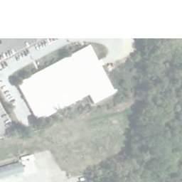
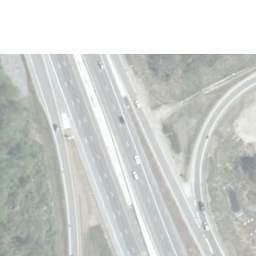
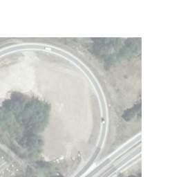


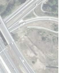


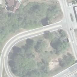
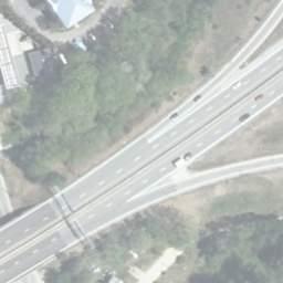
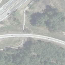

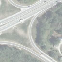


74 GRID TEH S TATEOFNEWHAMPSHIRE SOUTH STREET DEPAR TMENTOFTRANSPORTATION TO LEBANON city of concord town of bow B CILLEY STATE TURKEY RIVER E BOW MOBIL HAMPTON INN TURKEY RIVER FOREST B B 1 D EXIT VALLEY ROAD MATCHLINE A C EVERETT AVENUE W ILDERNESS LANE LOGGING HILL ROAD GRANDVIEW ROAD LIMITED ACCESS RIGHT-OF-WAY CONTROLLED ACCESS RIGHT-OF-WAY RIGHT-OF-WAY PROPERTY LINES RAILROAD TRACKS LEGEND HISTORIC SITE EFFECTED WETLAND ID DELINEATED WETLAND TREE CLEARING CUT SLOPE FILL SLOPE B WETLAND IMPACT POTENTIAL STORM WATER TREATMENT SITE POTENTIAL STORM WATER TREATMENT SITE ID POTENTIAL CONTAMINATED SITE 1 BOW-CONCORD I-93 IMPROVEMENTS ENVIRONMENTAL CONSEQUENCES PREFERRED ALTERNATIVE (CONCEPT "K") FIGURE I-89 / EXIT 1 AREA DATE: AUGUST 2018 SCALE: 1" = 300' Page 4.74
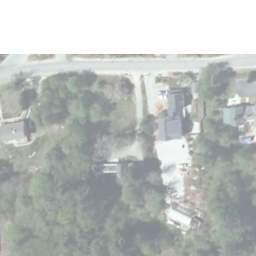
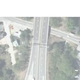
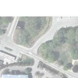
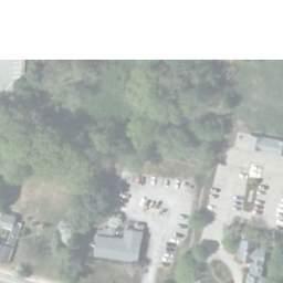
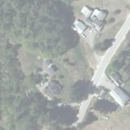
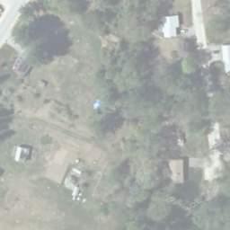
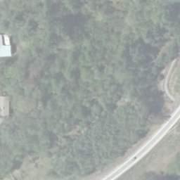
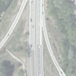
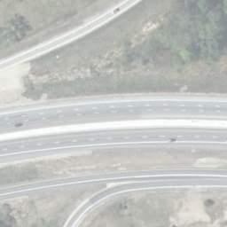
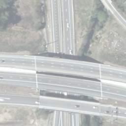
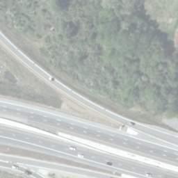

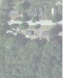
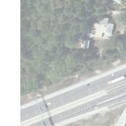
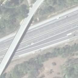
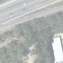
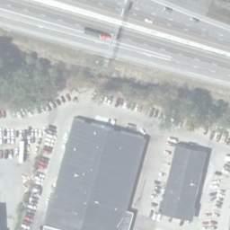
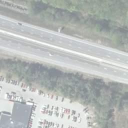
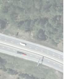
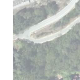

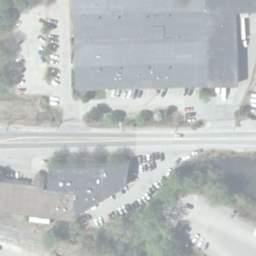
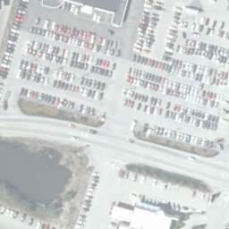
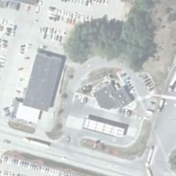
75 DEPA RTMENTOFTRANSPORTATION VALLEY ROAD BOW TOWN OFFICES ROAD EVERETT AVENUE TEH S TATEOFNEWHAMPSHIRE RIDGEW OOD DRIVE BOW MOBIL GRID GRANDVIEW BIKE/PED PATH TO BE RELOCATED TO CONNECTOR ROAD/SIDEWALK G RIVER HAMPTON INN MATCHLINE BAKER FREE LIBRARY SOUTH STREET G TURKEY L K I H N BOW P BROOK 6 4 O TURKEY RIVER TO MANCHESTER J CARRIAGE ROAD BIKE/PED PATH TO BE RELOCATED TO CONNECTOR ROAD/SIDEWALK GRAPPONE MERRIMACK RIVER 5 PARK & RIDE PITCO FRIALATOR GRAPPONE IRVING GAS town of bow city of concord ROW MATCHLINE DUNKIN DONUTS LIMITED ACCESS RIGHT-OF-WAY CONTROLLED ACCESS RIGHT-OF-WAY RIGHT-OF-WAY PROPERTY LINES RAILROAD TRACKS LEGEND HISTORIC SITE EFFECTED WETLAND ID DELINEATED WETLAND TREE CLEARING CUT SLOPE FILL SLOPE B HALL STREET WETLAND IMPACT POTENTIAL STORM WATER TREATMENT SITE POTENTIAL STORM WATER TREATMENT SITE ID POTENTIAL CONTAMINATED SITE 1 BLUE SEAL ROW BOW-CONCORD I-93 IMPROVEMENTS ENVIRONMENTAL CONSEQUENCES PREFERRED ALTERNATIVE (CONCEPT "K") FIGURE I-89 / EXIT 1 AREA DATE: AUGUST 2018 SCALE: 1" = 300' Page 4.75


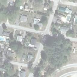
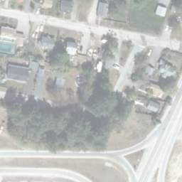

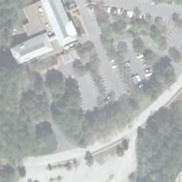
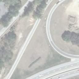
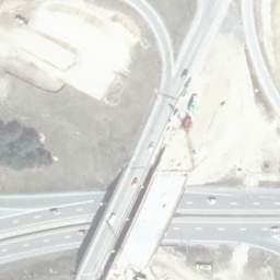
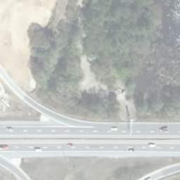
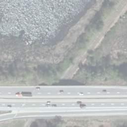
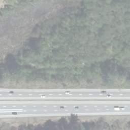
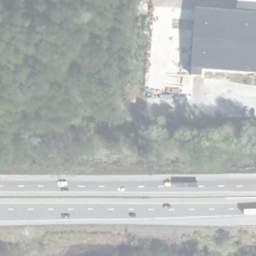
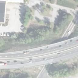
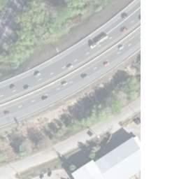
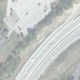

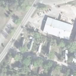
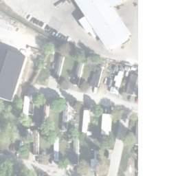
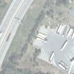
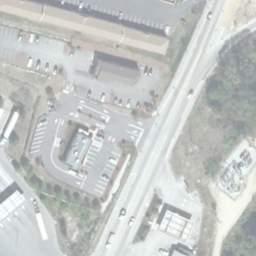
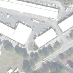
76 DONOVAN STREET JOFFRE STREET BROADW AY SOUTH MAIN ROW STREET ROW SOUTH END PAN AM RAILROAD TEHS TA TEOFNEWHAMPSHIRE DEPAR TMENTOFTRANSPORTATION GRID MARSH HISTORIC DISTRICT R LANE BOW BROOK EXIT R S V U T 9 ROWROW ROW MATCHLINE BASIN STREET ROW Q DAYS INN DUNKIN DONUTS EXISTING WETLAND MITIGATION HALL STREET MATCHLINE city of concord ROW ROW SITE BHW WASTE WATER TREATMENT PLANT LIMITED ACCESS RIGHT-OF-WAY CONTROLLED ACCESS RIGHT-OF-WAY RIGHT-OF-WAY PROPERTY LINES RAILROAD TRACKS town of bow LEGEND HISTORIC SITE EFFECTED WETLAND ID DELINEATED WETLAND TREE CLEARING CUT SLOPE FILL SLOPE AMOSKEAG BEVERAGES B WETLAND IMPACT POTENTIAL STORM WATER TREATMENT SITE POTENTIAL STORM WATER TREATMENT SITE ID POTENTIAL CONTAMINATED SITE 1 BOW-CONCORD I-93 IMPROVEMENTS ENVIRONMENTAL CONSEQUENCES PREFERRED ALTERNATIVE (CONCEPT "F") FIGURE EXIT 12 AREA DATE: AUGUST 2018 SCALE: 1" = 300' Page 4.76
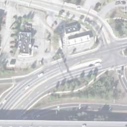
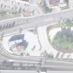
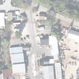
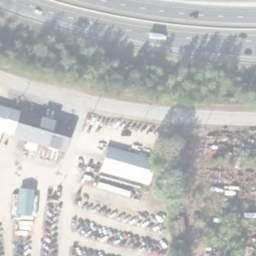
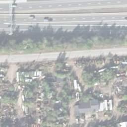
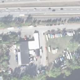


77 DEPA RTMENTOFTRANSPORTATION MATCHLINE MATCHLINE HALL STREET PAN AM RAILROAD CVS TEH S TATEOFNEWHAMPSHIRE GRID BEST WESTERN MARRIOTT RESIDENCE INN COMFORT INN EXISTING STORMWATER TREATMENT POND GRANITE STATE COLLEGE SPEEDWAY BURGER KING COMMON MAN GULF WATER STREET STREET ROW BASIN STREET EXIT 13 X 10 PATH (SECTION) TO BE REALIGNED MERRIMACKRIVER LIMITED ACCESS RIGHT-OF-WAY CONTROLLED ACCESS RIGHT-OF-WAY RIGHT-OF-WAY PROPERTY LINES RAILROAD TRACKS LEGEND HISTORIC SITE EFFECTED WETLAND ID DELINEATED WETLAND TREE CLEARING CUT SLOPE FILL SLOPE BLACK HILL B ROAD MANCHESTER STREET WETLAND IMPACT POTENTIAL STORM WATER TREATMENT SITE POTENTIAL STORM WATER TREATMENT SITE ID POTENTIAL CONTAMINATED SITE CARLSON'S MOTOR SALES OLD ROAD TURNPIKE TERRILL PARK 1 FUTURE CITY OF CONCORD PROJECT BOW-CONCORD I-93 IMPROVEMENTS ENVIRONMENTAL CONSEQUENCES PREFERRED ALTERNATIVE (CONCEPT "B") FIGURE EXIT 13 AREA DATE: AUGUST 2018 SCALE: 1" = 300' Page 4.77

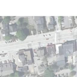
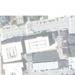
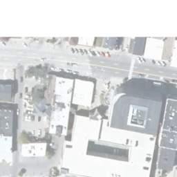
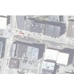
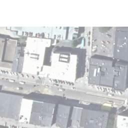
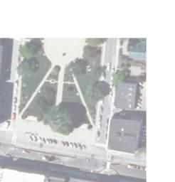
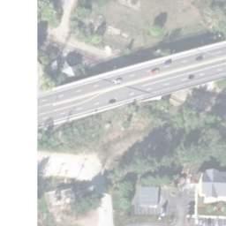
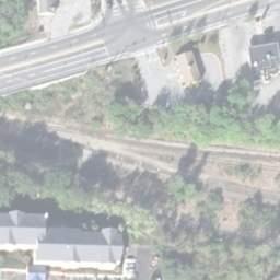
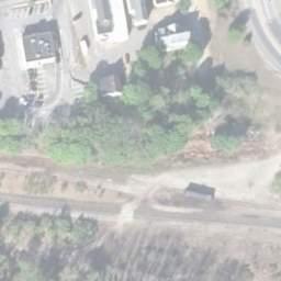
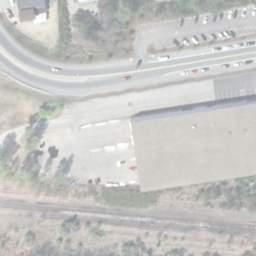
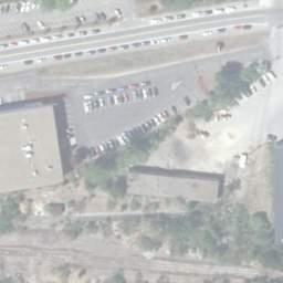
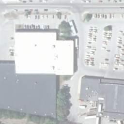
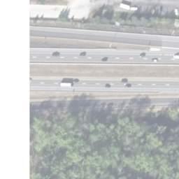
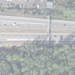
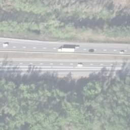


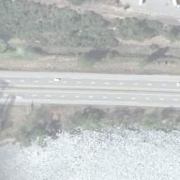
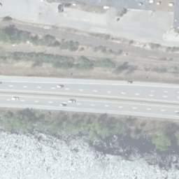


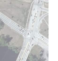


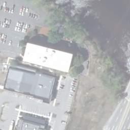
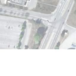

78 MATCHLINE DEPA RTMENTOFTRANSPORTATION FORT E ROAD STATE HOUSE SOUTH MAIN STREET WATER STREET SOUTH MAIN STREET STORRS STREET PLEASANT STREET EXTENSION TEH S TATEOFNEWHAMPSHIRE GRID NORTH MAIN STREET FAIRFIELD INN PAN AM RAILROAD HISTORIC DISTRICT CAPITOL SHOPPING CENTER MARKET BASKET BURLINGTON COAT FACTORY MATCHLINE RALPH PILL CAROW SUB STATION X MERRIMACK RIVER EXI LOUDON ROAD LIMITED ACCESS RIGHT-OF-WAY CONTROLLED ACCESS RIGHT-OF-WAY RIGHT-OF-WAY PROPERTY LINES RAILROAD TRACKS LEGEND HISTORIC SITE EFFECTED WETLAND ID DELINEATED WETLAND TREE CLEARING CUT SLOPE FILL SLOPE B WETLAND IMPACT POTENTIAL STORM WATER TREATMENT SITE POTENTIAL STORM WATER TREATMENT SITE ID POTENTIAL CONTAMINATED SITE 1 BOW-CONCORD I-93 IMPROVEMENTS ENVIRONMENTAL CONSEQUENCES PREFERRED ALTERNATIVE (CONCEPT "F2") FIGURE EXIT 14 & 15 AREA DATE: AUGUST 2018 SCALE: 1" = 300' Page 4.78
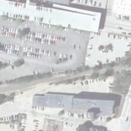
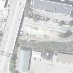
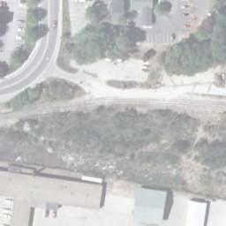
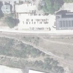
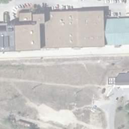
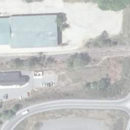
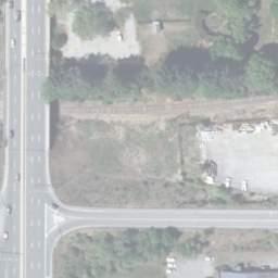
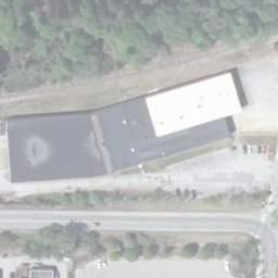
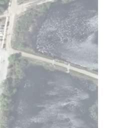
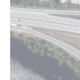
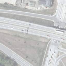
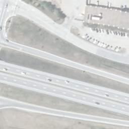
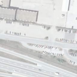
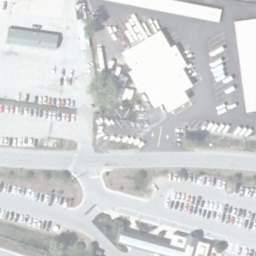
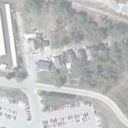
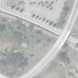

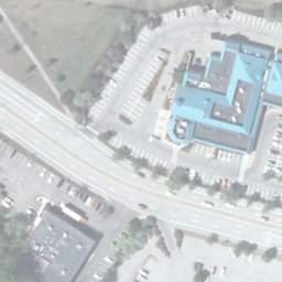
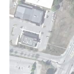
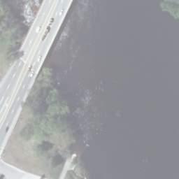
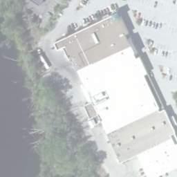
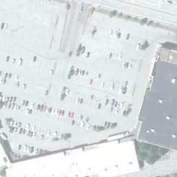
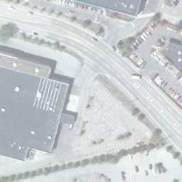
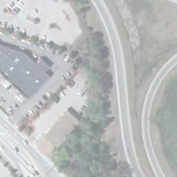
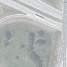
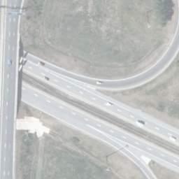
79 DEPA RTMENTOFTRANSPORTATION NORTH MAIN STREET TEH S TATEOFNEWHAMPSHIRE NORTHMAIN STREET GRID MATCHLINE RALPH PILL STORRS ROW CAROW CAROW ROW STREET ROW HISTORIC DISTRICT FUTURE CITY OF CONCORD PROJECT CONCORD CENTER SOUTH ROW ROW COMMERCIAL STREET COMMERCIAL STREET PAN AM RAILROAD Z ROW U-HAUL MOVING ROW HORSESHOE POND ROW STICKNEY AVENUE CONSTITUTION MERRIMACK RIVER CONCORD COACHLINES BUS DEPOT ROW 12 ROW EXIT 14 L.L. BEAN OUTLET ROW FORT EDDY ROAD HANNAFORD EXIT 15 AVENUE ROW GRAPPONE CONFERENCE CENTER COMMERCIAL SUPERMARKET STREET LOUDON ROAD WATER FRONT PARK SHAW'S SUPERMARKET BAM! BOOKS-A-MILLION FORT EDDY ROAD AA NH RAIL & TRANSIT RAILROAD MATCHLINE PROPOSED NOISE WALL LIMITED ACCESS RIGHT-OF-WAY CONTROLLED ACCESS RIGHT-OF-WAY RIGHT-OF-WAY PROPERTY LINES RAILROAD TRACKS LEGEND HISTORIC SITE EFFECTED WETLAND ID DELINEATED WETLAND TREE CLEARING CUT SLOPE FILL SLOPE B WETLAND IMPACT POTENTIAL STORM WATER TREATMENT SITE POTENTIAL STORM WATER TREATMENT SITE ID POTENTIAL CONTAMINATED SITE 1 13 MATCHLINE BOW-CONCORD I-93 IMPROVEMENTS ENVIRONMENTAL CONSEQUENCES PREFERRED ALTERNATIVE (CONCEPT "F2") FIGURE EXIT 14 & 15 AREA DATE: AUGUST 2018 SCALE: 1" = 300' Page 4.79
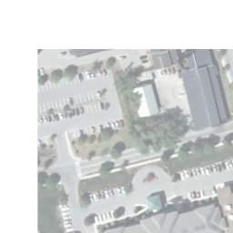


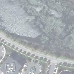
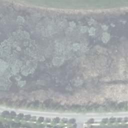
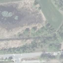
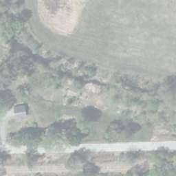

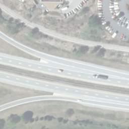
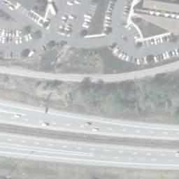
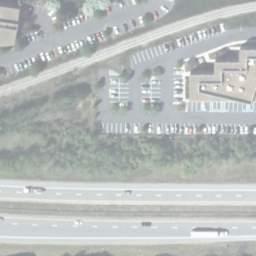
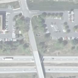
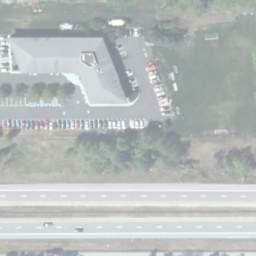
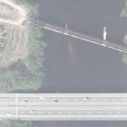
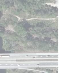
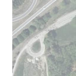
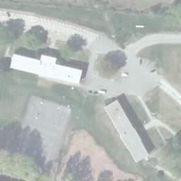
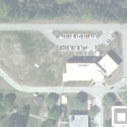
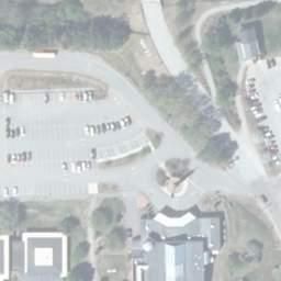
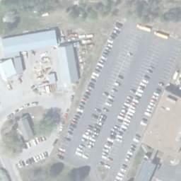
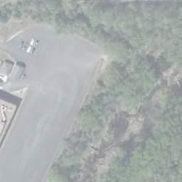


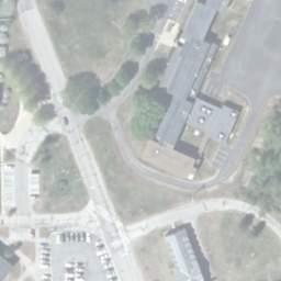


80 DEPA RTMENTOFTRANSPORTATION TEH S TATEOFNEWHAMPSHIRE GRID GRAPPONE CONFERENCE CENTER MATCHLINE HORSESHOE POND COMMERCIAL STREET WATTANUMMON BROOK nh rail & transit railroad ROW ROW ROW DELTA DRIVE ROW GG BROCHU NURSERY MERRIMACK FAN ROAD HH II RIVER PROPOSED NOISE WALL 13 ROW ROW McAULIFFE - INSTITUTE DRIVE NEW HAMPSHIRE SHEPHARD TECHNICAL INSTITUTE DISCOVERY CENTER FORT EDDY POND HISTORIC DISTRICT LIMITED ACCESS RIGHT-OF-WAY CONTROLLED ACCESS RIGHT-OF-WAY RIGHT-OF-WAY PROPERTY LINES RAILROAD TRACKS LEGEND HISTORIC SITE EFFECTED WETLAND ID DELINEATED WETLAND TREE CLEARING CUT SLOPE FILL SLOPE B WETLAND IMPACT POTENTIAL STORM WATER TREATMENT SITE POTENTIAL STORM WATER TREATMENT SITE ID POTENTIAL CONTAMINATED SITE 1 BOW-CONCORD I-93 IMPROVEMENTS ENVIRONMENTAL CONSEQUENCES PREFERRED ALTERNATIVE (CONCEPT "F2") FIGURE EXIT 14 & 15 AREA DATE: AUGUST 2018 SCALE: 1" = 300' Page 4.80

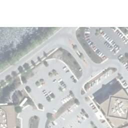
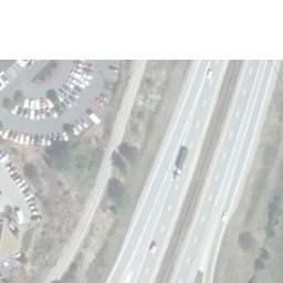


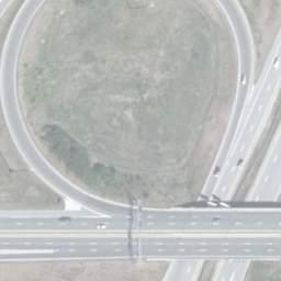
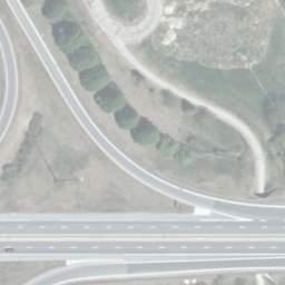

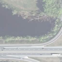
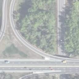
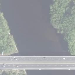
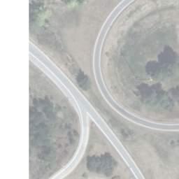
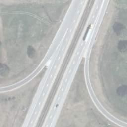
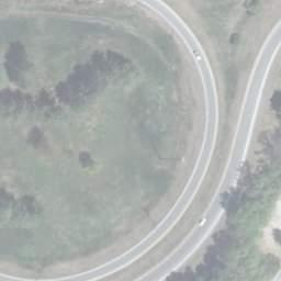
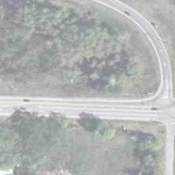
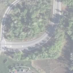


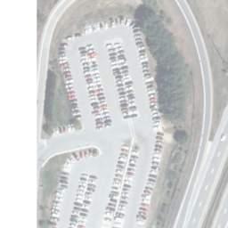
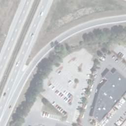
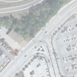


81 MATCHLINE HORSESHOE POND COMMERCIAL STREET PROPOSED NOISE WALL FORT EDDY POND TATEO FNEWHAMPSHIRE TEH S GRID DEPAR TMENTOFTRANSPORTATION GRAPPONE CONFERENCE CENTER NH RAIL & TRANSIT RAILROAD COLLEGE DRIVE MERRIMACK RIVER CC DD 13 PLANET FITNESS EXIT 1 EE FF FORT EDDYROAD EXIT 15 MARKET BASKET VCA CAPITAL AREA VETERINARY EMERGENCY HOSPITAL LIMITED ACCESS RIGHT-OF-WAY CONTROLLED ACCESS RIGHT-OF-WAY RIGHT-OF-WAY PROPERTY LINES RAILROAD TRACKS LEGEND HISTORIC SITE EFFECTED WETLAND ID DELINEATED WETLAND TREE CLEARING CUT SLOPE FILL SLOPE B WETLAND IMPACT POTENTIAL STORM WATER TREATMENT SITE POTENTIAL STORM WATER TREATMENT SITE ID POTENTIAL CONTAMINATED SITE 1 BOW-CONCORD I-93 IMPROVEMENTS ENVIRONMENTAL CONSEQUENCES PREFERRED ALTERNATIVE (CONCEPT "F2") FIGURE EXIT 14 & 15 AREA DATE: AUGUST 2018 SCALE: 1" = 300' Page 4.81


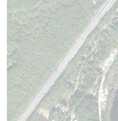
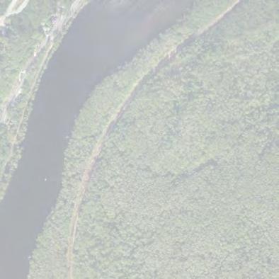
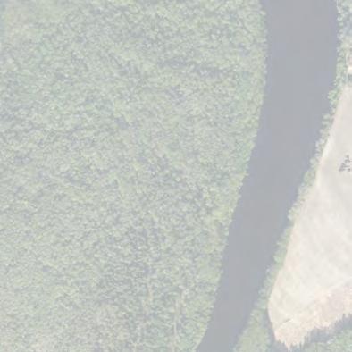
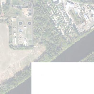
82 DEPARTM EN T OF TRA N SP ORTATION HE STATE OF NEW HAMPSHIRE T 1A CLINTON STREET GRID city of concord town of bow PLEASANT ST SOUTH STREET STREET LOGGING EXIT 1 SOUTH 2B HILL RD ROAD 1B VALLEY ST 1E 2A HEATHER LANE 2D DONOVAN ST ROCKINGHAM ST BROADWAY SOUTH MAIN STREET STORRS ST SOUTH MAIN STREET MATCHLINE 1C BETTY LANE GRANDVIEW 1D CARRIAGE RD TURKEYR IVER MERRIMACK RIVER GARVINS FALLS EXIT 12 HALL STREET SOUTH END MARSH LONGMEADOW DR 2C PAN AM RAILROAD BASIN STREET MERRIMACK RIVER HALL STREET 2E 2F STREET MANCHESTER EXIT 13 TERRILL PARK OLD WATER ST 2H 2G TURNPIKE ROAD LEGEND BOW-CONCORD I-93 IMPROVEMENTS NOISE SENSITIVE AREAS PROPOSED NOISE WALLS MODELED NOISE WALLS DATE: MODELED NOISE BARRIERS SHEET 1 OF 2 OCTOBER 2018 SCALE: 1" = 1,000' FIGURE Page 4.82


83 DEPARTM EN T OF TRA N SP ORTATION HE STATE OF NEW HAMPSHIRE T MERRIMACK RIVER CENTRE ST BOUTON ST GRID CLINTON STREET SOUTH MAIN ST STREET SOUTH MAIN ST STORRS PAN AM RAILROAD PLEASANT ST MATCHLINE NORTH STREET STATE CAPITOL EXIT 14 MAIN STICKNEY 3A FORT STREET CONSTITUTION AVENUE EDDY 3C 3B COMMERCIAL AVE EXIT 15 3E HORSESHOE FORT EDDY POND COMMERCIAL POND ST DR FAN RD 3F DELTA NHTI INSTITUTE 3G DRIVE EXIT 13 WATER ST LOUDON MERRIMACK RIVER GRAPPONE DR 3D McKEE DR STEVENS DR ROAD EXIT 1 COLLEGE DRIVE ROAD HAZEN DR ROAD LEGEND BOW-CONCORD I-93 IMPROVEMENTS ROAD NOISE SENSITIVE AREAS PROPOSED NOISE WALLS MODELED NOISE WALLS DATE: MODELED NOISE BARRIERS SHEET 2 OF 2 OCTOBER 2018 SCALE: 1" = 1,000' FIGURE Page 4.83

84 Figure 4.4: Preferred Alternative Year 2035 Peak Hour Traffic Volumes Environmental Assessment/Draft Section 4(f) Evaluation Page 4.84