Port of San Francisco Transportation July 6, 2016 Waterfront Plan Update
|
|
|
- Brenda Shields
- 5 years ago
- Views:
Transcription

1 Port of San Francisco Transportation July 6, 2016 Waterfront Plan Update
2 Tonight s Presentation Port Policies and Key Transportation Projects SFMTA Policies and Planning: Waterfront Transportation Assessment SFMTA Transportation Demand Management (TDM) SFMTA Embarcadero Enhancement Project

3 Port Industrial Access


4 Southern Waterfront Industry

5 Many Modes for Mixed Use Development

6 Mixed Use Developments
7 Waterfront Plan Policies Southern Waterfront: Protect industrial access (roadway, rail, water) Coordinate with expanded public access Mixed Use Development: Promote public transportation Efficient parking Promote pedestrian uses and public access Promote water transportation

8 Ferry Building Area Projects Replace 400+ Parking Spaces

9 Parking Meter Pilot: Demand-based Pricing


10 Fisherman s Wharf Public Realm Improvements Pier 43 Bay Trail Promenade Jefferson Street Phase 1


11 Transit-Oriented Development Projects South of China Basin Mission SWL 337 Forest Pier 70 Pedestrian-oriented site design Coordinated transportation investments TDM measures and strategies

12 Port Tenant Transportation Survey Key Issues and Concerns: Curbside loading and access More public transit capacity needed Traffic backups from cruise & special events Pedestrian and bicycle safety Reduced parking availability

13 Ferry and Water Taxi Landings


14 Water Taxies

15 Downtown Ferry Terminal Phase 2

16 Downtown Ferry Terminal - Phase 2
17 Coordination and Partnerships America s Cup People Plan Waterfront Transportation Assessment Jefferson Street Phase 1 Project Coordinated street management (Port, SFMTA, PUC, SF Public Works) Ballpark Transportation Coordinating Committee Embarcadero Enhancement Project & Vision Zero
18 Transportation Policies to Consider Embarcadero Enhancement Project & Vision Zero West side of The Embarcadero public realm Transportation Demand Management in major development project planning Port Seawall seismic project: protect BART/Muni subways and The Embarcadero Continued transportation coordination (SFMTA, SFCTA, OEWD, Planning Department) Continued partnerships to expand public ferry and water-taxi berthing and operations
19 SFMTA Presentation Overview 1. Share SFMTA transportation policy framework 2. Share recent and planned transportation improvements/policies affecting waterfront 3. Frame major waterfront transportation opportunities + challenges Contextualizing analysis of travel demand and capacity Areas of possible focus for Waterfront Land Use Plan policies
20 SFMTA Presentation Overview 1. Share SFMTA transportation policy framework 2. Share recent and planned transportation improvements/policies affecting waterfront 3. Frame major waterfront transportation opportunities + challenges Contextualizing analysis of travel demand and capacity Areas of possible focus for Waterfront Land Use Plan policies


21 SFMTA Strategic Plan Goals GOAL 1: SAFETY GOAL 2: TRAVEL CHOICES GOAL 3: LIVABILITY GOAL 4: SERVICE
22 Presentation Overview 1. Share SFMTA transportation policy framework 2. Share recent and planned transportation improvements/policies affecting waterfront 3. Frame major waterfront transportation opportunities + challenges Contextualizing analysis of travel demand and capacity Areas of possible focus for Waterfront Land Use Plan policies
23 Presentation Overview 1. Share SFMTA transportation policy framework 2. Share recent/planned transportation improvements affecting waterfront 3. Frame major waterfront transportation opportunities + challenges Contextualizing analysis of travel demand and capacity Areas of possible focus for Waterfront Land Use Plan policies Key Area for Waterfront Land Use Plan Policy Coordination
")

24 Historic streetcar service along the Waterfront: E-Line supplements popular F-line service What its providing Supplement to F-line Embarcadero service (20-22k daily passengers) Direct access between northeast waterfront + Caltrain/ballpark 15 minute frequency service 10-7pm In the works Running time adjustments Permanent signage platforms Ticket vending machines

25 F-line Capacity Improvement as a part of Better Market Street Turn-back at 7 th to allow increase service between Powell and Fisherman s Wharf
26 Safety Embarcadero Enhancement Project Target 2020 Construction Vision Zero Citywide Policy to Achieve Zero Traffic Deaths in SF by 2024 Key Area for Waterfront Land Use Plan Policy Coordination


27 Central Subway opening in 2019 New access to SoMa/Chinatown, major frequency increases, upgrade to 2-car Ts


28 Committed Regional Transit Improvements This year first ten new BART cars in service! 2017 Transbay Terminal Opens 2018-Richmond Ferry Service Begins ~ Caltrain Electrification, Downtown Extension to Follow

29 Transportation Demand Management Ordinance and Best Practices Key Area for Waterfront Land Use Plan Policy Coordination
30 Presentation Overview 1. Share SFMTA transportation policy framework 2. Share recent and planned transportation improvements/policies affecting waterfront 3. Frame major waterfront transportation opportunities + challenges Contextualizing analysis of travel demand and capacity Areas of possible focus for Waterfront Land Use Plan policies


31 A few bits of analysis from the Waterfront Transportation Assessment

32 Major travel corridors leaving waterfront during afternoon peak hour Fifty percent increase in person trips from Waterfront anticipated by
33 Within SF Regional Existing and forecast trips leaving the waterfront Study Area Trips of Interest (Outbound/Internal) by Mode by Corridor, 2012, and Growth to 2040, pm peak period (3-hours) East Bay South Bay North Bay 34 Peak Hour Study Area Trips Destined for Local vs. Regional Destinations (2040) Downtown + Study Area Southeast SF Southwest SF Mission/Potrero Northern SF Richmond All Others Regional 41% Within SF Within SF 59% Regional Source: SF-CHAMP, ,000 40,000 60,000 80, ,000 Auto Transit Walk/Bike Growth in Trips by

34 Traffic congestion is a regional problem that is felt acutely in SF near Bay Bridge approaches After Thursday Afternoon Speeds, 5:55pm (Source: Google)

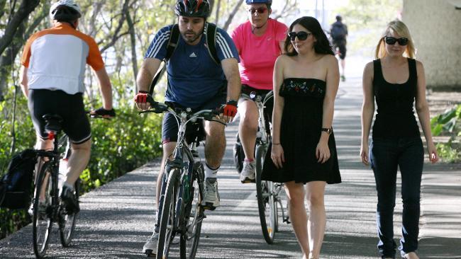
35 Mode share vision Source: Muenster Department of Transportation Shape travel in recognition of limited roadway capacity and in support of SF s policy goals. 36
36 Areas of possible focus for Waterfront Land Use Plan transportation policies Potential Alignment with Waterfront Land Use Plan Vision Zero policy Transportation Demand Management strategies for Port controlled land Embarcadero Enhancement Project Discussed in tonight s presentation Port is Stakeholder In ConnectSF Core Capacity Transit Study Managed Lanes Implementation Plan Plan Bay Area Railyard Alternatives and I-280 Boulevard Feasibility Study Freeway Corridor Management Study Southern Bayfront Strategy More information in handout


37 Vision Zero SF Our Goal: zero traffic deaths in San Francisco It s a citywide effort. Are you in?

38 TRANSPORTATION DEMAND MANAGEMENT ENCOURAGING SUSTAINABLE TRAVEL

39 Robust TDM Plans Negotiated TDM plans Examples: Transit subsidies Carshare/bikeshare Memberships Family amenities: storage for carts, carseats & strollers, cargo bikes Information and marketing Parking supply and parking management Auto mode share or trip cap & compliance monitoring
40 TDM Ordinance Basics Target Aimed at reducing Vehicle Miles Traveled (VMT) Menu of Options Project sponsor chooses the best fit for each project to reach targets Implementation Strategy Measure and enforce progress to ensure targets are achieved
41 TDM Ordinance Basics Target Aimed at reducing Vehicle Miles Traveled (VMT) Menu of Options Project sponsor chooses the best fit for each project to reach targets Implementation Strategy Measure and enforce progress to ensure targets are achieved
")


42 TDM Ordinance Basics Target Aimed at reducing Vehicle Miles Traveled (VMT) Menu of Options Project sponsor chooses the best fit for each project to reach targets Implementation Strategy Measure and enforce progress to ensure targets are achieved
43 Shaping Trips in Existing Land Uses Mechanisms: Property owner/employer/destination-provided (voluntarily) Lease terms Transportation Management Association Examples: Sustainable transportation allowance Parking management (cash-out, unbundling, pricing) Communications/information Campaigns and incentives


44 Embarcadero Enhancement Project July 2016 Project Update


45 What is the Project? Planning Improve Safety Design Concept Complete Street

46 Goals and Objectives Safe and Comfortable for All Improve Access Efficiency Economic Development Urban Design Integrated Planning/Design

47 Mobility


48 Function Introduction

49 Delivery Introduction

50 Various Needs Introduction

51 Conflict Introduction
52 Uncomfortable Introduction

53 Safety 58


54 What is a Bikeway? Dedicated Physically separated


55 2014 Design Workshops Summary Wide and Welcoming / Think Big Details Matter! Accommodate Loading/Unloading Flexibility On-street Parking Not a Priority Maintain Travel Lane Widths 65
56 Design Direction 2014 Design Workshops Street Cross Section Concepts Key Themes Big Ideas 2015 SFMTA/Port Analysis King Street/3rd Ave Analysis Bike Strategy Spot Improvements - Tw o-way waterside and oneway curbside (no centerrunning option) - Ferry Building frontage road/bikeway - Pier 39 Circulation Study (includes review of potential elevated pathway?) - Townsend Bikeway Connector (no King Street SB bikeway) - Pier 27 Cruise Terminal Access Issues - Port Tenant Transportation Survey - Short-Term Efforts 66

57 Trade-Off Evaluation Traffic/Circulation Parking Loading Pedestrian Facilities Trees/Landscape Design Transit/Bus Operations Bikeway Separation/Quality Cost

58 Project Status / Schedule 69
59 Thank You! Questions?