Empowered lives. Resilient nations. COMMUNITIES IN ACTION FOR LANDSCAPE RESILIENCE AND SUSTAINABILITY The COMDEKS Programme
|
|
|
- Stuart Bruce
- 6 years ago
- Views:
Transcription


1 Empowered lives. Resilient nations. COMMUNITIES IN ACTION FOR LANDSCAPE RESILIENCE AND SUSTAINABILITY The COMDEKS Programme

2 Disclaimers: The views expressed in this publication are those of the authors and do not necessarily represent those of the United Nations Development Programme, its Executive Board, the United Nations Member States or the GEF. This is an independent publication by the COMDEKS Programme. The boundaries and names shown and the designations used on maps in this document do not imply official endorsement or acceptance by the United Nations. Reproduction: All rights reserved. This publication or parts of it may not be reproduced, stored by means of any system or transmitted, in any form or by any medium, whether electronic, mechanical, photocopied, recorded or of any other type, without the prior permission of the United Nations Development Programme. Author: Gregory Mock Editors: Nick Remple and Diana Salvemini The production of this publication was coordinated by Diana Salvemini. Acknowledgements: This publication and the case studies profiled in it would not have been possible without the invaluable contributions and support of GEF SGP Country Programme staff - Isabel Figueiredo (Brazil), Navirak Ngin and Socheata Kim (Cambodia), Katarina Atalifo (Fiji), Zeleke Tesfaye and Tigist Admassu (Ethiopia), George Ortsin and Anna Mensah (Ghana), Sodhi Prabhjot and Anil Arora (India), Alex Damaliphetsa (Malawi), Gopal Sherchan and Vivek Sharma (Nepal), Klara Tothova (Slovakia) and Gokmen Argun (Turkey) as well as COMDEKS grantees and partners. Many thanks to Valerie Askinazi, Benan Berhan, Anna Krueger, Peilin Li, Rachel Olanoff, Linda Pappagallo, Frank Reig and Karina Solomonik for their contributions to the development of the case studies. Special thanks to Fumiko Fukuoka for her invaluable contribution to making the COMDEKS Programme happen. UNDP would like to thank the Japanese Ministry of the Environment, the United Nations University for the Advanced Study of Sustainability (UNU-IAS) and the Secretariat of the United Nations Convention on Biological Diversity for their continuous support of COMDEKS, and the Global Environment Facility for the parallel co-financing provided to support COMDEKS through its Small Grants Programme. Citation: United Nations Development Programme Communities in Action for Landscape Resilience and Sustainability The COMDEKS Programme. UNDP, New York. Cover photos: Top: UNCDF Bottom: Shigeki Lida Designed by: Kimberly Koserowski Published by: United Nations Development Programme, 304 East 45th Street New York, NY September United Nations Development Programme All rights reserved Printed in the United States For more information, visit
3 Empowered lives. Resilient nations. COMMUNITIES IN ACTION FOR LANDSCAPE RESILIENCE AND SUSTAINABILITY The COMDEKS Programme
4
5 CONTENTS Preface... 2 Foreword... 3 Part 1. Learning From the COMDEKS Community-Based Landscape Approach 1. Introduction to COMDEKS Understanding the COMDEKS Landscape Approach COMDEKS Methodology and Outcomes Emerging Messages from the COMDEKS Community-Based Landscape Approach...17 I. Participatory Landscape Planning and Collective Action...17 II. Governance of Integrated Landscapes...19 III. Knowledge, Innovation, and Scaling...21 IV. Long-term Engagement...22 Part 2. COMDEKS on the Ground: Phase 1 Country Case Studies Brazil: Jequitinhonha Valley...26 Cambodia: Steung Siem Reap Watershed...36 Ethiopia: Gilgel Gibe Catchment...50 Fiji: Natewa-Tunuloa Peninsula...62 Ghana: The Weto Range...74 India: Himalayan State of Uttarakhand...88 Malawi: Takumbo-Kande Region...98 Nepal: Makawanpur District Slovakia: Laborec-Uh Region Turkey: Datça-Bozburun Peninsula The Way Forward: Building on the Experiences of the Phase 1 Countries Semau Island, COMDEKS Indonesia
6 Preface PREFACE The Satoyama Initiative, which started as a joint collaboration between Japan s Ministry of the Environment and the United Nations University Institute for the Advanced Study of Sustainability, recognizes that in order to promote societies in harmony with nature, it is necessary to consider not only the ecosystems that surround us but to understand the role that people around the world have played in shaping landscapes to support their livelihoods and well-being. The Initiative had its origins in 2006 in an assessment of ecosystem conditions in Japan that noted that many traditional working landscapes combining a mosaic of different land uses such as paddy fields, woodlands, ponds, canals, and settlements produced a bundle of goods and services that both sustained the local economy and conserved local biodiversity. In Japan, these sustainably managed landscapes are known as satoyama, but such living landscapes exist, to varying extents, in every nation, often as the remnants of traditional land management systems. As the discussion of sustainable development has progressed over the last decade, it has become clear that such landscapes are important examples of the kind of human-nature relationship capable of producing the three pillars of sustainable development environmental, social, and economic sustainability. The Satoyama Initiative is focused on revitalizing these socio-ecological production landscapes and seascapes (SEPLS) as dynamic elements of sustainable rural development and key contributors to the conservation of global biodiversity. 2 The International Partnership for the Satoyama Initiative (IPSI), launched during the Tenth Meeting of the Conference of the Parties to the Convention on Biological Diversity (CBD COP10) in Nagoya, Japan, October 2010, is a global platform which aims to facilitate and accelerate the implementation of activities under the Satoyama Initiative. The Partnership consists of diverse organizations committed to promoting and supporting SEPLS for the benefit of biodiversity and human well-being and since its establishment IPSI has provided a comprehensive platform for sharing knowledge and creating synergies among its networks. Covering a range of complex mosaic landscapes and aquatic systems, IPSI seeks to build on the knowledge and experiences of communities and cultures for sustainable management of ecosystem services and improved livelihoods. Furthering the IPSI s strategic mission, the Community Development and Knowledge Management for the Satoyama Initiative Programme (COMDEKS), implemented by UNDP, represents the IPSI partners flagship effort to realize the goals of the Satoyama Initiative. Supported by the Japan Biodiversity Fund, COMDEKS builds on the continued collaboration between the Government of Japan and UNDP to promote knowledge sharing and expertise, and to strengthen capacities for sustainable development toward achievement of the Aichi Biodiversity Targets. Thus, I am delighted to work with the COMDEKS Programme, providing support for local community activities that maintain and revitalize critical production landscapes and seascapes and disseminating best practices learned from this approach. Through the case studies provided in this report, I hope we will be able to make progress towards maintaining and expanding landscapes and seascapes where there is a harmonious interaction between people and nature, and enhancing understanding and awareness of their importance. Ultimately, knowledge and experiences gained from successful on-the-ground actions by local communities to maintain and revitalize SEPLS can be scaled and replicated in other parts of the world. Soichiro Seki Vice-Minister for Global Environmental Affairs Japan
7 Foreword FOREWORD Twenty years since the Rio Earth Summit, it is clear that the world faces increasingly urgent, complex and intersecting economic, environmental, and social challenges. Meeting these challenges requires integrated approaches that tackle a wide range of cross-cutting priorities such as poverty eradication, food security, energy access, climate change, biodiversity conservation, and sustainable environmental and natural resource governance. To catalyze such integrated approaches, UNDP has embraced a new development paradigm that supports national and subnational governments and civil society to formulate and implement green, low emission and climate resilient development strategies (green LECRDS) that can address crucial socioeconomic needs in an environmentally sustainable manner. However, addressing global challenges by working at the national and subnational levels is necessary but not sufficient. Locally created solutions are critical since smallholders play a decisive role in the livelihoods and incomes of their communities, as well as in shaping the state of biodiversity and ecosystem services on which they depend. Communities are uniquely positioned as the primary agents to increase agricultural productivity and improve food security, while decreasing greenhouse gas (GHG) emissions and conserving ecosystem functions and biodiversity. While there is increasing support for community-based activities, few approaches deliberately target local organizations as partners rather than simple beneficiaries, and building their capacities through learning-by-doing, that is, by implementing activities that they have designed and then evaluated in a longer term process of adaptive management. Additionally, few programmes provide local actors with a multi-sectoral, strategic format to analyze and guide their own progress towards environmental and socioeconomic resilience. Fewer still are initiatives that form the basis for wider engagement by donors in the process of adaptive management and social capital building to ensure long-term resilience to climate change and other shocks. Thus, in addressing these considerations, UNDP is pleased to collaborate with the Ministry of the Environment of Japan (MOEJ), the Secretariat of the Convention on Biological Diversity (SCBD), and the United Nations University (UNU) in implementing the COMDEKS Programme as a unique and integrated landscape management approach. 3 UNDP, with over two decades of experience working with local civil society resource management programmes among them the Global Environment Facility Small Grants Programme (SGP), the SGP Upgrading Country Programmes, Community-Based Adaptation (CBA), Community Management of Protected Areas for Conservation (COMPACT), and the Community Water Initiative is firmly positioned to support nongovernmental organizations (NGOs) and communitybased organizations (CBOs) in undertaking coordinated small-scale actions to generate both local and global sustainable development benefits. COMDEKS builds on the accumulated knowledge and experience of UNDP s flagship civil society programmes to engage and enable local communities to manage their own socio-ecological production landscapes. Through the COMDEKS Programme, UNDP works directly with CBOs and local NGOs to assist them to formulate and implement community-driven landscape strategies and to strengthen the social capital required for long-term adaptive management for continued enhancement of community and ecosystem resilience and sustainability. With this report, we present experiences and lessons learned from the first phase countries of the COMDEKS programme, which subsequent efforts can use as a basis for or an input to their own adaptive management and local empowerment efforts. María Eugenia Casar Associate Administrator United Nations Development Programme

8 4 Gamri Watershed, COMDEKS Bhutan

9 Part 1. Learning from the COMDEKS Community-Based Landscape Approach
10 Part 1. Learning from the COMDEKS Community-Based Landscape Approach 1. Introduction to COMDEKS The Community Development and Knowledge Management for the Satoyama Initiative Programme (COMDEKS) was launched in 2011 as the flagship of the Satoyama Initiative, a global effort to promote sustainable use of natural resources in the landscapes worked in and relied upon by rural communities. These working landscapes and waters known as socio-ecological production landscapes and seascapes (SEPLS) encompass many uses, from farming and fishing to forestry, and provide an economic and cultural mainstay of village life in developing nations. They also provide a reservoir of critical biodiversity and productive habitat that is key to the large-scale success of conservation efforts. The COMDEKS Programme has been designed to support local community activities that maintain and rebuild these critical production landscapes and seascapes, and to collect and disseminate knowledge and experiences from successful on-the-ground actions so that, if feasible, they can be adapted by other communities throughout the world to their specific conditions. The programme provides small-scale finance to local community organizations in developing countries to support sound biodiversity and ecosystem management as well as to develop or strengthen sustainable livelihood activities planned and executed by community members themselves. 6 COMDEKS is currently piloted in selected communities in 20 countries: Bhutan, Brazil, Cambodia, Cameroon, Costa Rica, El Salvador, Ecuador, Ethiopia, Fiji, Ghana, India, Indonesia, Kyrgyzstan, Malawi, Mongolia, Namibia, Nepal, Niger, Slovakia, and Turkey. The target landscapes and seascapes in these countries represent a wide variety of ecosystems: watersheds in Cambodia, Ecuador, and Costa Rica; inland water systems such as lakes in Malawi, Niger, and Kyrgyzstan; agropastoral systems in Ethiopia, Cameroon, and Brazil; mountain ecosystems in Bhutan, Ghana, India, and Nepal; coastal seascapes in Fiji, El Salvador, Indonesia, and Turkey; and grasslands in Mongolia and Namibia. Funded by the Japan Biodiversity Fund, the Programme is implemented by the United Nations Development Programme, in partnership with the Ministry of the Environment of Japan, the Secretariat of the Convention on Biological Diversity, and the United Nations University Institute of Advanced Studies of Sustainability. Grants are delivered through the GEF Small Grants Programme in each country. This publication has three principal purposes: Set out the conceptual basis of the COMDEKS Programme and explain its community-led approach to landscape management; Summarize key messages gleaned from the overall Programme design and lessons learned during the community consultation and early implementation phases in target landscapes; Present case studies of target landscapes and communities that set the local context, describe programme activities, and report preliminary findings on the ground in ten countries participating in the first phase of the programme. Since local projects are still actively in process in many of the pilot countries, this report does not attempt a complete enumeration of program results or an ex-post analysis of the program s effectiveness overall. Through COMDEKS, we hope to make strides toward achievement of the Aichi Biodiversity Targets, and the realization of societies in harmony with nature, in keeping with the Satoyama concept. Nobuteru Ishihara, Minister of Environment, Japan

11 Part 1. Learning from the COMDEKS Community-Based Landscape Approach What are Socio-Ecological Production Landscapes and Seascapes? Humans have been interacting with ecosystems for millennia to produce food and fiber, collect building materials, extract energy and mineral resources, and support their spiritual and cultural lives. The landscapes that have resulted are altered by human management, but in many cases remain ecologically vital and productive, providing the basis of local livelihoods. In fact, many local land use practices have evolved into highly productive and sustainable management schemes, informed by years of local adaptations and traditional knowledge. They are often characterized by a mosaic of land uses that may include crop land, home gardens, agroforestry systems, pastures, forest groves, marine and freshwater fishing grounds, and water harvesting sites, as well as community protected areas and sacred sites that are less disturbed. These so-called socio-ecological production landscapes and seascapes (SEPLS) are coupled systems dependent for their production on both their social and ecological components. They are found in many places in the world under different names, and are deeply linked to local culture and knowledge. Such production landscapes have historically provided the backbone to rural economies and play an important role in the cultural and spiritual well-being of the communities that live and work in them. They also comprise a globally significant repository of biodiversity. However, the resilience and productivity of many of these landscapes has declined as economic, social, and demographic changes in nearby communities have eroded traditional landscape management systems. 7 Gamri Watershed, COMDEKS Bhutan

12 Part 1. Learning from the COMDEKS Community-Based Landscape Approach 2. Understanding the COMDEKS Landscape Approach Mobilizing Community Action at the Landscape Level The COMDEKS Programme is built around a community-based approach to managing natural resources across the local landscape. This approach, framed around a community-driven vision for restoring and maintaining the productivity and resilience of local ecosystems, integrates biodiversity conservation, the careful stewarding of ecosystem services, and the practice of sustainable agriculture and sound fishing practices across the landscape as a basis for sustainable livelihoods. The impetus for the COMDEKS Programme, and for the Satoyama Initiative itself, comes from the realization that community-based work at a landscape level can be an effective tool to serve local development needs and meet conservation goals simultaneously. Ecosystems and the species and genes they contain the building blocks of biodiversity are being lost across the world at an unparalleled pace. This has implications both for the communities that rely on these ecosystems for their survival, and for the larger biosphere. In the last few decades, significant progress has been made in expanding the national networks of Protected Areas (PA) that provide a refuge for many species of plants and animals and protect vital ecosystem services. Yet, most biodiversity remains outside of the PA systems in production landscapes involving agriculture, forestry and other land and water uses (e.g. fisheries). The fate of this biodiversity, and of the vital ecosystem services it sustains, will depend on the sound management of these landscapes and seascapes. 8 In many rural communities, such sound practice is supported by traditional land management practices. Indeed, indigenous farming systems and resource management systems are often biodiversity-friendly the result of hundreds, if not thousands, of years of production practice. Unfortunately, these traditional systems have often come under stress as communities are influenced by external pressures and opportunities and local economies evolve. The result has been an increase in the degradation of landscapes and ecosystem processes, exacerbated by a loss of biodiversity and increasing climate change. COMDEKS seeks to reverse this trend by supporting community organizations to revitalize their landscapes through participatory land use planning that builds their capacities for governance and adaptive management. Lake Issyk-Kul, COMDEKS Kyrgyzstan

13 Part 1. Learning from the COMDEKS Community-Based Landscape Approach By empowering communities to envision multifunctional landscapes, plan a course of action to achieve their vision, and carry it through with appropriate financial, logistical, and capacity support, the COMDEKS programme aims to achieve landscape-level results, increasing the ecological resilience of local ecosystems, as well as the social and economic resilience of the communities that reside within them. Communities as Agents of Landscape Change A fundamental tenet of the COMDEKS landscape approach is that if communities are to fully embrace the ethic of landscape sustainability, they must be the primary agents for change in that landscape, not simply the beneficiaries of changes originated or mandated by others. This agency is expressed and work on the ground accomplished through local organizations that can channel and interpret local needs and demands into effective collective action. However, community organizations such as cooperatives, advocacy groups, church groups, and self-help groups, will pursue sustainable management of the landscape and its resources only if the benefits of doing so enhance the economic and social wellbeing of the people who belong to these groups. Community groups must own the process of landscape planning and management if it is to be sustainable. This ownership is built when these groups decide for themselves the social, economic, and ecological objectives of landscape management, the modes of implementation, the indicators of success, and the lessons learned. By reflecting on the decisions they have made in implementing their own initiatives, local groups build their capacities to continuously adapt to ecological, economic, and social challenges and opportunities. What is a Landscape? A landscape is a unit of land on which a mosaic of uses occurs involving a number of communities. The landscape includes not only the physical processes of the locality, but the cultural, social, and economic processes at work there as well. Although this geographic unit rises above the scale of individual landholdings, it is not so large that community members are unfamiliar with its processes and properties. 9 Restoring Landscape Resilience COMDEKS projects are focused on building the resilience of target landscapes and communities. Resilience is the ability of a system to absorb disturbances while retaining the same basic structure and ways of functioning. The resilience of a complex construct such as a landscape, which includes the land and the social and economic systems associated with it, has three major dimensions that COMDEKS activities address: ecosystem resilience, social resilience, and economic resilience. The resilience of ecosystems within the landscape reflects their ability to Alto Napo River Watershed, COMDEKS Ecuador
14 Part 1. Learning from the COMDEKS Community-Based Landscape Approach continue to deliver ecosystem services such as water, soil fertility, pollination, and biological productivity in the face of human pressures as well as external stressors such as climate change. In many production landscapes, this resilience has eroded with increased intensity of cultivation, poor soil management, loss of vegetative cover, and the increased use of monocropping, pesticides, and other practices that can harm biodiversity and disrupt ecosystem functioning. Social resilience refers to the ability of communities to work together to address common problems, pursue shared goals, resolve disputes, and provide a stable and productive environment for individuals to pursue their well-being. It includes the capacity of institutions and governance processes to react to complex problems and changing circumstances with equity and flexibility. As with ecological resilience, modern communities often face many challenges to their social resilience, from ethnic discord, to out-migration, to poverty and political marginalization. Likewise, the economic resilience of rural communities their ability to provide livelihoods to local residents within the modern global economic context is often restricted by a lack of employment opportunities, isolation from markets and government support services, and a lack of appropriate skills and other capacity constraints. In practice, these three types of resilience ecosystem, social, and economic are interwoven. Particularly in the working landscapes in which the COMDEKS Programme works, economic vitality is strongly affected both by local ecosystem productivity and community dynamics. 10 With its integrated approach to working in the landscape, the COMDEKS Programme works to build ecosystem, social, and economic resilience simultaneously. By providing opportunities for community groups to work collaboratively on landscape initiatives, COMDEKS works to strengthen social bonds within the community, improve local ecosystem health, and expand economic opportunities and increase household incomes activities that together increase the overall resilience of the landscape and build the ability of communities to adapt to the challenges of climate change and the rigors of the wider economy. 3. COMDEKS Methodology and Outcomes To achieve its ends, COMDEKS has adopted a strategic framework built around a cycle of adaptive management in which communities assess their landscape; identify desirable ecological, social, and economic outcomes as building blocks of resilience; plan activities to boost ecosystem productivity and sustainability and improve the organizational capacities of communities; execute projects and measure results; and adapt their planning and management practices to reflect lessons learned. The COMDEKS process is illustrated in Figure 1. Figure 1. The COMDEKS Process COMMUNITY CONSULTATION INDICATORS OF RESILIENCE IN SOCIO-ECOLOGICAL PRODUCTION LANDSCAPES AND SEASCAPES (SEPLS) LOCAL PLANNING LANDSCAPE STRATEGY DEVELOPMENT CAPACITY DEVELOPMENT LEARNING-BY-DOING THROUGH COMMUNITY- DRIVEN INNOVATIONS- GRANTS FACILITATING KNOWLEDGE AND LEARNING LESSONS LEARNED THROUGH CASE STUDY DEVELOPMENT UP-SCALING COHERENT NATIONAL AND SUB-NATIONAL DEVELOPMENT POLICIES AND STRATEGIES Adaptive Management Cycle Enhancing Resilience of Socio-Ecological Production Landscapes

15 Part 1. Learning from the COMDEKS Community-Based Landscape Approach Adaptive Management: Learning By Doing The COMDEKS process of local development is built around a process of adaptive management in which a suite of ecosystem management activities are designed essentially as experiments to achieve landscape goals agreed upon by the communities in the target landscape. The results of local COMDEKS projects the management experiments are not conceived as endpoints, but as midpoints in a long-term process of optimizing local conditions for sustained yield of ecosystem services, economic benefits, and social well-being. Measurement of baseline conditions and monitoring of the project results are essential tools in the adaptive management process. Based on an initial assessment of the landscape baseline, stakeholders identify desirable landscape outcomes through a process of community consultations. Local organizations then identify possible interventions and agree on suitable indicators to assess progress compared to baseline conditions. A critical element is that these local actors then undertake the activities themselves and are responsible for applying the agreed indicators and assessing the results of their actions. Based on these results they can then design followon activities aimed at improving progress toward the landscape objectives. A key point of this learning-by-doing method is that failures and uncertainties are seen as opportunities to learn, adapt, and innovate. This emphasis on learning and innovation means that extracting and disseminating lessons learned from community projects is an essential part of the adaptive management cycle. Another key point is that continually testing innovations and adapting them is a long-term endeavor. Experience shows that it can take several project cycles some five to ten years, in many cases before the practice of adaptive management is thoroughly ingrained in an organization. The long-term nature of the process demands a similar long-term commitment from donors and other government and NGO partners supporting the COMDEKS landscape approach. 11 Central Selenge Region, COMDEKS Mongolia

16 Part 1. Learning from the COMDEKS Community-Based Landscape Approach Participatory Landscape Planning Community-driven, participatory landscape planning is the linchpin of the COMDEKS approach. The COMDEKS process commences with a stakeholder-driven process where communities take a careful look at their landscape and its condition, including local socio-economic conditions, and reflect on steps that can be taken to achieve greater productivity and sustainability. The first step is to identify the target landscape itself. In each country, the target landscape the area where community projects will later take place is selected on the basis of several criteria, the most important of which is the demonstrated interest and engagement of the communities themselves. Resilience Indicators: A Tool for Landscape Assessment 12 Ipumbu-ya-Shilongo Conservancy, COMDEKS Namibia The use of resilience indicators is integral to conducting the participatory baseline assessment for each target landscape. For local communities to strengthen resilience of their SEPLS, it is important for them to understand the current conditions of the landscapes or seascapes in which they live and work. To accomplish this, the baseline assessment uses a set of 20 resilience indicators designed to capture community perceptions of different aspects of key systems ecological, agricultural, cultural and socio-economic. The indicator set includes both qualitative and quantifiable indicators, but measurement is based on the observations, perceptions, and experiences of the local communities themselves. The indicators aim to provide communities with a framework for discussion and analysis of socio-ecological processes essential for SEPLS resilience. This relates to critical management objectives such as food security, agricultural sustainability, livelihood development, provision of ecosystem services and conservation of biodiversity, strengthening of community- and landscape-level organizations, and landscape governance for equity and sustainability. Discussion of the indicators within communities stimulates knowledge-sharing and analysis, which are key factors in creating social capital for landscape governance, planning and management, and which confirm community ownership of this process. COMDEKS is one of the first programs of its kind to deploy resilience indicators as an integral part of its design and as an organizing principle for community participation. Nor are the indicators meant to be used only once and then forgotten. Rather, they are designed to be revisited periodically by the community, allowing community members to evaluate progress toward Landscape Outcomes and to identify priority actions for local innovation. As such, they are a primary mechanism for adaptive management and the sustainability of COMDEKS interventions. In addition, the indicator set is meant to be a flexible tool that can be customized to reflect the circumstances of each particular landscape or seascape. In fact, the indicator set originally deployed in COMDEKS landscapes has already been modified in response to community experience in COMDEKS pilot countries. The latest version of the indicator set, along with guidance notes on its application in the field, can be found in a newly released Resilience Indicators Toolkit.

17 Part 1. Learning from the COMDEKS Community-Based Landscape Approach After selection of the target landscape, communities carry out a participatory baseline assessment to identify priority problems in the landscape as well as their root causes. This often begins with an interactive mapping exercise in which the community identifies land uses, and pinpoints resource access and management challenges. To provide key baseline data, community members then apply a set of resilience indicators, originally developed by the United Nations University and Bioversity International (a member of the CGIAR consortium). The indicators measure four interrelated dimensions, namely, ecosystem protection and the maintenance of biodiversity; agricultural biodiversity; knowledge, learning and innovation; and social equity and infrastructure. The landscape communities discuss each of these themes, and the indicators are scored on the basis of these consultations. Community members also participate in focus groups and problem tree analyses to complement the results of the indicator scorecards. Together, these discussions yield a substantive assessment of the status of the socio-ecological landscape as seen through the eyes of the community an assessment which serves as a baseline for later measurement of improvements in the landscape as local activities progress. Once they have agreed on the landscape conditions through their participation in the baseline assessment, communities decide what their long-term objectives are for landscape management. These objectives take the form of desired landscape resilience outcomes in four different areas: Enhancing ecosystem services; Strengthening the sustainability of production systems; Developing and diversifying livelihoods and income generation; and Strengthening institutions and governance systems at the landscape level. COMDEKS Purpose and Process Achieve resilience and sustainability of eco-system services and production systems in the landscape while increasing incomes, equity, and security through a process of participatory planning, innovations in management of landscape resources, participatory evaluation of impacts, and continuous adaptation based on lessons learned. 13 In each target landscape, the landscape resilience outcomes agreed through the community consultation process form the basis for a formal COMDEKS Landscape Strategy, a comprehensive document outlining the landscape profile and strategic approaches for community-based actions to achieve the objectives of the Strategy. The Landscape Strategy is the basic blueprint communities use to guide the design of specific community projects for direct grant funding either from COMDEKS, or other donors. In other words, the Landscape Strategy details the Alto Napo River Watershed, COMDEKS Ecuador

18 Part 1. Learning from the COMDEKS Community-Based Landscape Approach improvements in the landscape they wish to see, as well as the plan they have for achieving these improvements through local projects. Table 1 gives examples of typical resilience outcomes of a COMDEKS Landscape Strategy and some of the activities that communities use to achieve these outcomes. The participatory planning process that gives rise to the landscape strategy is itself a considerable achievement one that strengthens the capacities of the local organizations that take part and deepens their ownership of the strategy outcomes. It also nourishes the networks of organizations and relationships across sectors that are fundamental ingredients of social capital for resilience and sustainable development. Table 1. Desired Outcomes and Potential Activities of a COMDEKS Landscape Strategy 14 Landscape Outcomes Maintenance and Enhancement of Ecosystem Services and Biodiversity More Sustainable Production Systems and Greater Food Security Sustainable Livelihoods; Increased Household Income Stronger Landscape Governance Sample Activities to Achieve Landscape Outcomes Forest restoration activities Soil conservation and improved water management Wetland restoration Invasive species removal Small-scale aquifer recharge systems Diversification of agricultural landscapes (e.g., agroforestry) Diversification of production systems (e.g., greater crop diversity and integration of crops, livestock, and trees) Low-input agriculture; agroecology Establishment of community seedbanks Activities that promote access to new markets for biodiversity friendly products Activities that promote nature-based tourism that generates income for local communities Activities that diversify livelihoods, augmenting or providing alternatives to subsistence agriculture Activities that promote participatory governance systems for making and implementing decisions about target landscapes Strengthening NGO and CBO capacities for landscape governance and management Promotion of networks for policy, advocacy, learning, and commerce Establishment of linkages and partnerships with relevant government agencies, municipalities, academic institutions, and business organizations Jaltepeque Naja Lempe, COMDEKS El Salvador

19 Part 1. Learning from the COMDEKS Community-Based Landscape Approach Gamri Watershed, COMDEKS Bhutan Local Implementation: Learning by Doing All local COMDEKS projects are implemented by community members themselves, ensuring that the community takes ownership of the local Landscape Strategy and benefits from the lessons learned. Each approved project is designed to increase the resiliency of the socio-ecological landscape, while improving the livelihoods of community members. A fundamental premise of the COMDEKS approach is that community organizations select the problems to be addressed in the landscape as well as the innovations to current practices that should be tested for potential future adoption and dissemination. The enormous diversity of landscapes requires locally adapted solutions to meet the needs of stakeholders and the ecosystem functions on which they depend. The knowledge of local stakeholders has been developed through years of observation and experience with the management of natural resources and ecological processes in that locale. When combined with more systematic and conventionally scientific approaches, community organizations can identify innovations, test them and obtain reliable results for reflection and analysis. Based on this analysis, these innovations may be adapted for further experimentation by community organizations, and lessons learned are disseminated to all other stakeholders in the organization as well as across the network of organizations COMDEKS Local Project Funding COMDEKS activities are delivered through the GEF Small Grants Programme (SGP), a decentralized funding mechanism with a 20-year track record of delivering small grants to community organizations for local development projects. Following SGP protocols, COMDEKS projects are approved by National Steering Committees in each country multistakeholder groups composed of representatives from civil society organizations (a majority), along with representatives of government, UNDP, and other donors. Grants are made directly to CBOs and local NGOs since they take the lead role in planning and carrying out local landscape projects. Within each country, a National Coordinator supports local grantees in planning and carrying out project activities, measuring progress against goals, communicating and sharing experiences with other grantees, and meeting the formal requirements of the grantmaking process. 15

20 Part 1. Learning from the COMDEKS Community-Based Landscape Approach Bogo Region, COMDEKS Cameroon 16 in the landscape. In this sense, resilience-enhancing techniques and technologies are developed or adapted locally by the organizations themselves. This adaptive management model is a key feature of the COMDEKS approach. Learning reliable systems of innovation is critical to the process of community empowerment to adapt to change. At the same time, innovation, adaptation and the dissemination of the lessons learned and other knowledge gained is the essence of social learning and the basis for the formation of social capital for adaptation and resilience. Within the context of COMDEKS projects, the formal mechanism for evaluating local projects, analyzing their effectiveness, and identifying successful innovations is an ex-post baseline assessment that occurs at the completion of the first cycle of local projects. During this ex-post assessment, representatives from each local project assemble and evaluate the results of the projects against the landscape outcomes put forward in the Landscape Strategy, using the set of agreed performance indicators. In addition, the group revisits the landscape resilience indicator set used in the original participatory baseline assessment to identify how perceptions of the landscape have changed among community members in response to the completed projects. On the basis of these results, the group extracts appropriate lessons learned and then considers the implications for future projects in the landscape. The result is an updated Landscape Strategy that recognizes and builds upon progress that has been made, and identifies new opportunities for local work an example of adaptive management and planning in practice. Disseminating Lessons Learned to Encourage Scaling Planning and implementing community-based landscape initiatives are not the only important aspects of the COMDEKS Programme. Spreading the word about what these local projects can teach is also fundamental to the COMDEKS model. The Programme focuses on reviewing, analyzing, and codifying results from on-the-ground activ-
21 Part 1. Learning from the COMDEKS Community-Based Landscape Approach ities to distill and disseminate lessons that can inform other landscape management initiatives around the world and be communicated to policy makers for coherent policy development and scaling up of the landscape approach. Knowledge management is essential for building adaptive management capacities in community and landscapelevel organizations. Relevant lessons are generated both at the individual project level and at the landscape level. Those at the project level capture essential learning about successful and unsuccessful innovations and processes and their physical, social and economic impacts; landscape-level lessons capture impacts at a larger scale, and are particularly important in identifying successful governance innovations and synergies between individual local projects. The process of observing field results, comparing them to baseline data, evaluating the findings, and deriving lessons is also fundamentally empowering to community members, and is thus an end in itself. Of course, scaling up the successes of the COMDEKS landscape approach requires more than just disseminating lessons learned. It also requires strengthening global, national, and local policies to provide an enabling environment for changes at the local level. 4. Emerging Messages from the COMDEKS Community-Based Landscape Approach The initial COMDEKS community consultation and planning phase is now complete in each of 10 COMDEKS Phase 1 pilot countries. These 10 initial pilot countries Brazil, Cambodia, Ethiopia, Fiji, Ghana, India, Malawi, Nepal, Nepal, Slovakia, and Turkey were the first to begin the COMDEKS planning process and have proceeded farthest in implementation. In these countries, baseline assessments have been conducted and Landscape Strategies adopted for each target landscape, and local projects are in the process of being implemented at this time. Some key messages that have emerged so far are captured below: 17 I. Participatory Landscape Planning and Collective Action Participatory landscape planning develops social capital, strengthens local institutions, and provides the basis for collective action. Landscape processes typically take place over areas larger than individual private landholdings. Thus, work at the landscape level requires collective action, where community members work together to achieve shared goals across many smaller parcels, or to manage areas of common ownership. In COMDEKS target landscapes, the process of participatory landscape planning which includes conducting the baseline assessment of the landscape, piloting the resilience indicators, agreeing on landscape outcomes, and crafting a formal Landscape Strategy sets the stage for successful collective action and creates a context in which the different local projects are linked and the complementary aspects of the Landscape Strategy its ecosystem management and livelihood activities become clear to community members. The relationships nourished in this process, as well as the networks formed and the partnerships forged with government officials and other support groups, build the social capital and the organizational capacity necessary to support local project implementation and sustain community participation over the longer term. Landscape assessment creates a neutral space for trust-building. The initial landscape assessment exercises demand that different stakeholder groups within the community communicate and interact in a prolonged and meaningful way. The activities involved in quantifying and analyzing the landscape conditions and trends to establish a baseline activities like joint mapping exercises and agreeing on scores for

22 Part 1. Learning from the COMDEKS Community-Based Landscape Approach 18 Tabalak Lake, COMDEKS Niger the different resilience indicators create a neutral space where community members can work side by side on tasks that stress measurement over value judgment, and thus are more apt to build trust, and less apt to spark controversy. This provides an opportunity for new relationships to form among community groups and may allow community members either within a single community or in adjacent communities to set aside previous divisions to work on the joint task of providing an information base to inform later decisions on what outcomes to strive for and what projects to undertake. Applying the indicator set makes resilience real to the community. Use of the resilience indicators has proven to be a particularly fruitful exercise in the COMDEKS participatory planning phase. The scoring exercise provides a structure for a community discussion on what resilience means in their particular landscape, and how it should be measured. This then provides a context for discussing the specific goals and approach to landscape management that will be detailed in the Landscape Strategy they adopt as a group. The resilience indicators, and the baseline assessment more broadly, keep the landscape visioning process the heart of the Landscape Strategy grounded in local environmental conditions, economic realities, and local culture. The landscape planning process energizes local organizations. Local organizations are key implementers of local landscape projects, and key drivers of the planning process. Participation in the baseline assessment and specific contributions to the Landscape Strategy help to establish local CBOs and NGOs as credible community representatives and build their capacity for mobilizing community action and for establishing connections with other partners in the community and in government. The landscape planning process can also be an occasion for existing local organizations to broaden their missions to include the landscape-level work spelled out in the Landscape Strategy, or to create new institutions such as cooperatives, resource user groups, or other community organizations to address the specific work within the Strategy.
23 Part 1. Learning from the COMDEKS Community-Based Landscape Approach The Landscape Strategy provides a framework for integrated solutions. Reports from pilot countries make it clear that one of the most compelling features of the landscape approach is that it explicitly links the economic, social, and environmental factors at work in the landscape. The vision expressed in the Landscape Strategy and the portfolio of activities that it spawns are from the start conceived as an integrated and interlinked set of local solutions, with each initiative containing activities that contribute to local livelihoods and increase household incomes, empower local families, and help restore the productivity of local ecosystems. For many communities, this linking of environmental, social, and economic outcomes stands in contrast to sectoral interventions they may have encountered in the past development programs that focus on one aspect of rural life, such as improving local agriculture, without considering other related social or environmental challenges. By acknowledging the tight connections between these spheres, the Landscape Strategy becomes a more dynamic tool to inspire local action. II. Governance of Integrated Landscapes The governance of Integrated landscapes calls for new institutional models. COMDEKS landscapes by design include several communities, a mosaic of land uses, and a suite of interlocked environmental, social, and economic considerations. Effective governance of such integrated landscapes, keeping all these actors and considerations in mind, is bound to be a challenge. It calls for institutions that can represent multiple stakeholders and manage multiple activities within an integrated landscape plan. Doing so requires understanding how these activities affect one another, and managing the inherent trade-offs. The challenge is made even greater by the fact that a number of existing institutions already share or compete for authority at different levels within this landscape: local governments, state government ministries, traditional authorities, and sometimes regional bodies such as river basin authorities. Typically, each institution has a defined role managing one activity or jurisdiction, but lacks the mandate or vision to manage a number of activities across the landscape in an integrated manner. For example, management of production landscapes is often divided up sectorally, with separate bodies governing forestry, agriculture, and fishing, with little cross-over or integration. Likewise, the integration of social factors into the management of such resources is often minimal or absent in existing institutions. For these reasons, new or enhanced models of landscape governance are needed if communities are to benefit from the promise of increased landscape resilience that COMDEKS strives for. 19 Institutional innovations have already begun to spring up in COMDEKS landscapes. The structure of the COMDEKS Programme has already begun to generate interest in new institutional arrangements meant to better accommodate the many stakeholders and mixed activities common in the target landscapes. The fact that the variety of stakeholders within a target landscape are jointly responsible for formulating a single areawide landscape strategy means that the parties to this strategy are already aware of each other and their interdependency, and ultimately, the need to govern the area s resources cooperatively. In Ghana, this awareness prompted several existing institutions to come together to form the Weto Platform, a composite group that includes different traditional authorities, civil society organizations, local landowners, and representatives With this programme, we are pursuing a resilience-based approach to sustainable development, encouraging collective action and learning-by-doing, and strengthening organizations to be effective decision makers in landscape management. The programme has already helped to establish multistakeholder platforms to build the capacities of communities and local institutions to plan and act together. Helen Clark, UNDP Administrator

24 Part 1. Learning from the COMDEKS Community-Based Landscape Approach 20 Gamri Watershed, COMDEKS Bhutan from the District Assembly and Regional Coordinating Council. The Weto Platform is responsible for developing resource management policies in the target landscape and supporting the coordination, implementation, and oversight of local projects, including the settlement of disputes. While the Weto Platform provides a good example of new thinking in landscape governance, other institutional models may work just as well. Indeed, it is impossible to be too proscriptive about what institutional form landscape governance should take. Nor is it always necessary or desirable to create a new administrative body for landscape governance; existing bodies may serve just as well, with appropriate additions or innovations. The form that landscape governance takes in a particular landscape will depend to a great extent on the current array of institutions in the landscape and how well they can work together. Beyond formal institutions, successful landscape governance can benefit from robust networks. Successful governance of integrated landscapes does not just rely on establishing formal institutions. It also benefits from mechanisms that create connections between communities and user groups within the landscape, so that they come to understand each other, reach consensus on shared goals, and communicate about successes and challenges. Often, it is difficult for communities to relate to other groups outside their working domain. However, the COMDEKS landscape planning process and the local projects it supports provide a mechanism for creating larger communities of interest and connection over the landscape. These networks are essential if a larger landscape community is to develop that sees its role in wider terms and can take ownership of the Landscape Strategy, creating connections and synergies among its activities.
25 Part 1. Learning from the COMDEKS Community-Based Landscape Approach III. Knowledge, Innovation and Scaling Knowledge exchange and dissemination of lessons learned are critical to scaling up the COMDEKS model. Communities that successfully navigate the landscape planning process, implement local projects, and see the resulting benefits are unquestionably the best advocates for the community-based landscape approach and are the key to grassroots scaling. Through its emphasis on knowledge exchange, training in communication skills, extraction of lessons learned, and development of peer networks, the COMDEKS Programme is designed to capitalize on and amplify this natural scaling mechanism by giving community groups the skills and networks they need to share their experiences. Beyond peer-to-peer exchange, scaling also requires communication with policymakers as well as donors and support organizations that may partner with community groups to achieve their goals. In addition, scaling is more than just replication of successful planning processes and landscape interventions in new communities or landscapes. It also involves growing the internal capacities of community organizations a qualitative scaling so that they become more self-sufficient and sustainable, and more able to direct the processes of community dialogue and landscape management necessary to transform landscapes. The process of identifying trends and distilling lessons from community experience builds the capacity for effective outreach and scaling. Community organizations that take part in crafting and implementing the Landscape Strategy quickly become experts in their landscape, and can become an invaluable resource for groups in other communities who want to obtain similar benefits in their own landscapes. Their street credibility with outside groups stems largely from their direct experience managing projects and solving problems on the ground. However, their effectiveness at communicating the ingredients of their success is greatly enhanced through the process of observation and introspection that is part of the COMDEKS methodology. Measuring performance data from local projects, analyzing the results, and extracting the lessons from their ground-based experiments provides community groups with facts and insights that add substance to their outreach activities, and makes them more likely to inspire other groups to follow their lead. 21 The SGP funding mechanism is a useful platform for disseminating COMDEKS ideas and approaches among national governments and civil society groups. The GEF Small Grants Programme awards grants through a decentralized assessment and selection process involving a National Steering Committee (NSC) in each country. These NSCs consist of representatives from a combination of prominent civil society organizations, national governments, UNDP, and other donors. Each local COMDEKS project is carefully evaluated by the NSC before being funded and is subsequently tracked during and after implementation. As a result, NSC members are in an ideal position to observe and learn from COMDEKS experiences. Since these NSC members are often prominent individuals with active networks in local and national development, their exposure to COMDEKS projects is a convenient and effective route to spread COMDEKS insights, and to influence local development in other communities and other contexts. Just as importantly, there is considerable potential to spread these insights internally within SGP and thus encourage replication and upscaling in other SGP country programs beyond COMDEKS. Scaling involves organizational development, not just replicating a land management approach. Success in scaling up the landscape approach is not just a matter of numbers either of the landscape area affected or the number of communities adopting the approach. Successful scaling also must expand the ability of local organizations to drive the public process of landscape planning, to execute projects transparently and manage finances soundly, and to take on new tasks that may be needed to build on initial successes or overcome challenges. This qualitative scaling involves building the organizational capacity of local groups and their skill sets so that they can progressively take more ownership of local interventions and enter into partnerships with government or other organizations on an equal basis in order to pursue their ecosystem management and economic expansion plans. This kind of scaling builds the internal resilience of local organizations, so that as the physical and socioeconomic landscape changes, they can adapt with it and continue to guide and contribute to the evolving Landscape Strategy.
26 Part 1. Learning from the COMDEKS Community-Based Landscape Approach IV. Long-term Engagement and Adaptive Management Work at the landscape level requires time and long-term support, but frees communities and donors from the constraints of a single-project focus. Change in landscapes does not appear overnight. Convening a landscape-wide process of visioning, baseline analysis, and project planning; building the capacities of local organizations; executing local projects on the ground; and waiting for ecosystems and local economies to respond all require time measured more in years than months. Likewise, the process of adaptive management does not proceed quickly, since it involves first implementing a management action, then analyzing the impacts, and adjusting on the basis of these observations a process that may take many seasonal cycles. Thus, reaping the full benefit of the landscape approach requires sustained commitment by the communities involved, and long-term engagement from donors and support organizations. This extended timeframe challenges communities and donors to calibrate their expectations carefully, setting realistic short, medium, and long-term goals. The same is true for donors, who must wrestle with the mismatch between the normal one or two-year project timeframe and the longer cycles of landscape recovery and the gradual modification of the local economy that COMDEKS strives for. However, work at the landscape level offers several significant advantages over initiatives that focus on a single project or a single community. 22 A landscape focus allows donors a more strategic entry point for large-scale change and greater funding flexibility. Interventions at a landscape level offer considerable latitude to donors to pursue longterm and large-scale outcomes without being tied to a single project or a single community. Such landscape interventions, when guided by an overarching Landscape Strategy that includes multiple complementary lines of work, are an opportunity for multiple donors to collaborate in funding a suite of activities over a longer timeframe. In this way, the work program in a given landscape can transcend the participation of one donor, allowing donors to cycle their participation in and out more easily without disrupting the overall landscape goals. This is relevant in the case of the COMDEKS Programme, which is limited both in terms of funds and the longevity of the program. The fruition of the landscape projects brought on-line through COMDEKS in most cases will not occur until after the program is over. However, the guiding philosophy and the social and institutional infrastructure of the Landscape Strategy will remain in each target landscape, offering a ready vehicle for funding from other sources (perhaps through the Small Grants Programme, which will continue to function in these areas). This also makes it clear how important the process of documenting and disseminating lessons learned is so that there is continuity of effort and continued refinement of the funding model among donors. The landscape approach offers communities an integrated package of benefits and a context for working with other communities to magnify the benefits of their efforts. The landscape approach is built to take advantage of synergies between projects, communities, and local institutions. Because the Landscape Strategy includes a range of activities over a large area in an extended timeframe, its benefits can reach more widely than single-activity projects, or single-location projects. Synergies between projects in the landscape add a significant multiplier effect to the benefits felt in communities. For example, if several local projects in adjacent area employ better forest harvest practices or soil management practices, the scale of the resulting ecosystem recovery will be larger, and the resulting increase in productivity greater. In addition, these projects often improve wildlife habitat, preserve or restore the scenic qualities of the landscape, or support local cultural features that in turn contribute to related ecotourism or cultural tourism projects in the same area. Additional synergies may occur as local organizations in adjacent communities begin to interact in the context of the Landscape Strategy, creating opportunities for collaboration and experimentation that would not have arisen otherwise. These additive benefits are an important feature of the integrated Landscape Strategy, because they increase the potential pay-off in terms of ecosystem recovery and livelihood enhancements for all the communities in the landscape.

27 Part 1. Learning from the COMDEKS Community-Based Landscape Approach Rio Jesus Maria Watershed, COMDEKS Costa Rica 23 The landscape approach offers flexibility and sustainability because the Landscape Strategy is a living document. The Landscape Strategy adopted by stakeholders in each target landscape is not a static product, but a living document meant to be revised and updated as communities implement projects, see the results, and reevaluate their choices to take advantage of new opportunities and lessons learned. The living nature of Landscape Strategies has already begun to emerge, as stakeholders begin to tailor their use of the resilience indicators to better reflect the outcomes they seek and the human and physical geography of their landscapes. This built-in flexibility of the landscape approach both requires and makes the most of long-term engagement by all parties. Only with consistent support over time can real learning occur and be reflected in an updated Landscape Strategy. At the same time, the process of periodically updating the Landscape Strategy is itself a tool to keep communities engaged and to sustain the benefits of the landscape approach. The landscape approach increases the learning and efficiency of adaptive management. A Landscape Strategy naturally involves work on several different projects at once in several different communities and physical settings within the target landscape. Since these projects are related to each other through the Landscape Strategy and linked through a network of contacts and support organizations, this maximizes landscape learning through the project cycle and increases the potential for cross-project synergies and up-scaling. In other words, it supports and magnifies the process of adaptive management by increasing the experimental base and providing multiple points of comparison, feeding the process of evaluation and innovation. Of course, applying the lessons learned from these local experiments still requires several iterations of the project cycle, and therefore requires a firm foundation of long-term donor and technical support.

28 24 Semau Island, COMDEKS Indonesia

29 Part 2. COMDEKS on the Ground: Phase 1 Country Case Studies

30 BRAZIL JEQUITINHONHA VALLEY 1. The Landscape Geography The landscape for COMDEKS in Brazil is in the upper Jequitinhonha Valley of northern Minas Gerais state in the southeast of the country. The target landscape is a semi-arid region covering roughly 40,000 ha that encompasses 14 rural communities in the municipalities of Veredinha and Turmalina. Surrounded by an 800-meter plateau and intersected by rolling hills running through the center, the topography of the valley creates a stunning landscape. However, due to inappropriate land management practices and impacts from surrounding large scale eucalyptus plantations, the region is facing increasing pressure through depletion of water resources, soil degradation, and loss of regional biodiversity. The resulting water scarcity and loss of agricultural productivity have exacerbated poverty in the region. Socioeconomic conditions in the local communities are deteriorating, characterized by poor infrastructure and basic services as well as rural exodus.
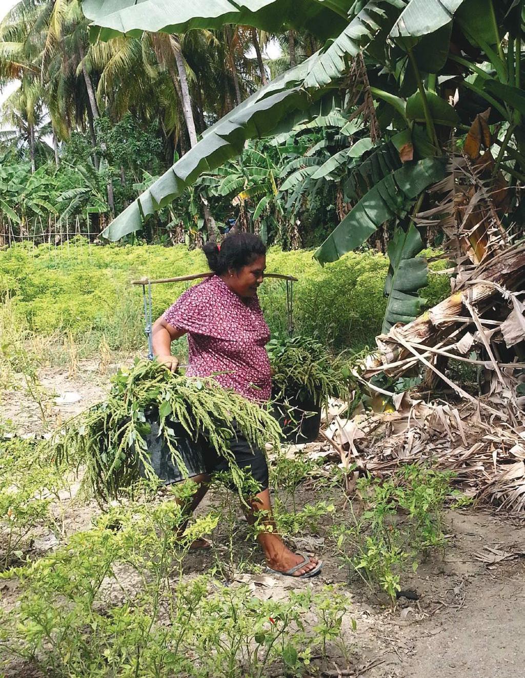
31 Brazil: Jequitinhonha Valley Biological Resources and Land Use The target landscape falls within the Cerrado biome, the vast tropical savanna typified by wooded grasslands and gallery forests. A spatial analysis of the target landscape shows that it can be broken into two main geographic zones that dictate overall land use: the highlands, with altitudes ranging from 800 to 900 m, where the eucalyptus plantations are concentrated, and the central area, with hills between 600 and 800 m in elevation, where most of the communities are located. Within this larger landscape, four specific land uses predominate: Small-scale agriculture takes place on 11.0 percent of the land area mostly using natural and planted pastures; Eucalyptus monoculture takes place on 3.7 percent of the land area; Degraded areas, consisting of exposed and eroded soils, account for 27.7 percent of the land area; and Remnant and/or recovering vegetation covers 50 percent of the land area, comprised of steep plateau edges, hillsides, gullies, gallery forests and disturbed areas that are in the process of recovering, but are still considered degraded vegetation. Other land uses account for the remaining 7.8 percent of the land area. Socioeconomic Context Although for estry, and particularly eucalyptus production, plays a significant role in the local economy, poverty is still endemic in the region. The community faces pressure from water scarcity, prolonged droughts, and low agricultural productivity. These factors, coupled with the low level of public and private investments, poor infrastructure and basic services, contribute to a high poverty level and a significant rural exodus over the last decade. 27 The municipality of Veredinha, where most of the communities in the landscape reside, typifies conditions within the landscape. From 2000 to 2010, the municipality s rural population dropped by 16 percent. During this time, the municipality s Human Development Index (HDI) showed some improvement in education, but by comparison to the HDI of Minas Gerais state as a whole, Veredinha is still well below average, especially in terms of family income. Health services are underdeveloped, and patients in serious condition or requiring hospitalization need to be transferred to neighboring municipalities. The water supply and sanitation services are also poor and do not cover rural communities. In addition, rural communities are only accessible through hilly dirt roads which become increasingly difficult to traverse through the rainy season. As a result, the communities remain largely isolated. Within the municipality of Veredinha and surrounding areas, several civil society organizations are working to improve the local quality of life and train smallholders. Of the 14 communities in the COMDEKS Landscape, four have Community Associations officially recognized local civil society groups. The most active NGO regionally is the Centre for Alternative Agriculture Vicente Nica (CAV), whose goal is to create livelihood alternatives that would enable families to remain in the region in order to reduce the seasonal migration of rural workers. The CAV is the key local partner supporting COMDEKS activities in the region, and the target landscape was determined in consultation with its team in consideration of their field experience managing umbrella projects in the region.

32 Brazil: Jequitinhonha Valley 28 Confirming landscape boundaries, COMDEKS Brazil 2. Key Environmental and Social Challenges The principal environmental and social vulnerabilities in the target landscape center around water availability, poor land management, and the cultural and economic impoverishment of the area. These challenges include: Poor access to water in sufficient quantity and quality to meet the domestic and productive needs of the communities. Much of this lack of access is due to extensive production of eucalyptus in the headwaters of springs and inadequate livestock management, as well as climatic factors. Water scarcity is undoubtedly the greatest vulnerability in the landscape, undermining food security and fueling rural exodus in the region. In some communities where water scarcity is particularly acute, farmers have moved to town and only go to their farms on weekends. Another more recent development is the subdivision of farms for building weekend houses or condominiums. Soil degradation due to inappropriate land management techniques, particularly cattle grazing, as the stocking rate often exceeds the carrying capacity of pastures, and renovation of pastures is not performed properly. This degradation is also due historically to the removal of vegetation for charcoal, although this activity has declined substantially over the past few years. Eucalyptus monocultures. Installed in the 1970s in high plateau areas and extending to the edges of the mesas, plantations have caused serious environmental and socioeconomic impacts in the region, reducing water availability and undermining the livelihoods of family farmers. Particularly in locations where the eucalyptus occupies the plateau edges, family farmers and their cattle were left to pursue their activities in the gullies
33 Brazil: Jequitinhonha Valley and slopes, leading to soil erosion and a decrease in streams flows. Grazing in low areas increased trampling around springs, and felling of trees for firewood and charcoal contributed to the drying up of water sources. The exodus of rural youth due to lack of income and leisure opportunities. From the perspective of the young people consulted for the baseline assessment, water scarcity and soil degradation also figure prominently as factors in the youth exodus. Loss of biodiversity due to suppression of native vegetation for Eucalyptus monocultures, logging for charcoal, and intensification of livestock and agricultural activities. Widespread use of chemical fertilizers and pesticides. According to observations from farmers, this practice is increasing the amount of certain pests that previously did not occur in the region and contaminating water sources. Low degree of social organization among farmers, since their associations generally lack the technical, administrative and financial capacity to defend the interests and rights of farmers vis-à-vis public agencies and policymakers. Cultural degradation due to a lack of interest among young people in participating in local activities such as traditional festivals, dances and regional cuisine. The community of Monte Alegre is the only one in the landscape noted for producing local handicrafts, mostly ceramics with flower designs using natural materials extracted in the region. Other communities have embroiderers, whose products are sold informally at fairs and in the towns Veredinha and Turmalina. 3. COMDEKS Activities, Achievements, and Impacts 29 Community Consultation and Baseline Assessment In order to assess the situation in the target landscape, three Brazilian NGOs (Instituto Salvia (ISSA), Instituto Sociedade, População e Natureza (ISPN, the national host institution of the Small Grants Programme), and Centro de Agricultura Alternativa Vicente Nica (CAV)) designed a baseline assessment comprised of four components: 1. A desk study and analysis of documents and studies on the region, including previous project appraisals. 2. A compilation of statistical and spatial data on socioeconomic and environmental factors at the municipal level, including the generation of maps (hydrology, soils, topography and land-use classification) at the landscape level. The land use map was prepared through analysis of satellite images. These maps were validated by the community during the participatory workshop. 3. A field survey through 14 communities that focused on biophysical aspects: soil conservation, vegetation, water resources and land use patterns. These field observations were also aimed at verifying and fine-tuning the spatial analysis (land use classification) on the ground. 4. A two-day participatory workshop, where 1-3 representatives from each of the 14 communities within the landscape, as well as other stakeholders, scored the set of landscape resilience indicators through facilitated focus group discussions. The participants were evenly divided between men and women, and some younger people participated as well.

34 Brazil: Jequitinhonha Valley Participatory consultation, COMDEKS Brazil 30 The first three components of the baseline assessment were carried out by the NGO ISSA, with the collaboration of ISPN and CAV. The fourth component the two day workshop comprised the primary community consultation of the assessment. In preparation for this workshop, the landscape resilience indicators developed through the Satoyama Initiative were adapted by ISSA to tailor them to the cultural and biophysical reality of this landscape. The indicator language and concepts were rendered in language that was simpler and more accessible to the key stakeholders, mainly smallholder farmers, many of whom have low schooling levels. Thus, basic concepts in the Satoyama approach such as multi-functionality, heterogeneity, and landscape components, as well as the scoring criteria, were translated to terminology and concepts that could be easily understood by farmers. Similarly, the criteria for scoring these indicators were also adapted. Moreover, some indicators that were not deemed relevant in this context were discarded and, at the same time, three new indicators were added to reflect the particular vulnerabilities of this landscape. These were: a) access to water; b) quality of soils/adoption of agroecological production systems; and c) amount of social/political resources. The discussion on the indicators during the workshop helped the community representatives think about the landscape from a different perspective. The scoring exercise and methodology helped them to develop a more The baseline assessment and the inception workshop promoted an integration among the communities, which led to a coordinated planning of the activities of all grants. The expectation is this approach will be incorporated in the communities actions even after the end of the project. baseline assessment participant
35 Brazil: Jequitinhonha Valley systemic and complex vision of the landscape, as well as specific strategies and solutions to address the main vulnerabilities identified for each indicator. These laid the foundation for designing the proposals for local community-based projects to be funded by COMDEKS. It was a significant moment when the workshop participants realized they had their own answers to the challenges they are facing within the landscape. Landscape Strategy Using the landscape assessment as a basis, the three NGOs developed the COMDEKS Landscape Strategy for Brazil, which describes and analyzes the landscape data and findings from the baseline assessment, describes expected landscape outcomes and indicators that communities have agreed to jointly pursue, and lists potential community-based activities to achieve these outcomes. The participants set priorities for interventions based on key socio-environmental vulnerabilities, including water scarcity, soil degradation, climate conditions and changes, low agricultural productivity, rural exodus, poor infrastructure (mainly roads) and weak social/political assets. Designed initially in the workshop focus groups as strategies for overcoming these vulnerabilities, the priorities were then joined, complemented and agreed on collectively by the entire workshop group as a whole. Table B-1 lists the four Landscape Outcomes around which the strategy is built, as well as the performance indicators that will be used to measure these outcomes. Table B-1. Landscape Outcomes and Indicators from the Brazil Landscape Strategy Landscape Outcomes Outcome 1: Increase in the quantity and quality of water available to farmers in the landscape as a whole through the adoption of integrated water resource management systems. Outcome 2: Adoption of sustainable farming and land management techniques that enable improvements in soils, recovery of degraded areas, and conservation of native vegetation connecting farming systems. Outcome 3: Improved livelihoods through increased income, food security and market access, thus increasing the number of young people staying in rural areas. Outcome 4: Strengthening of community organizations and other collective forums such as committees and councils for participatory natural resource management through agreements (formal and informal) on land use at the community and landscape level. Key Performance Indicators Flow and quality of water in springs and storage systems (small-scale reservoirs and cisterns). Capacity to cope with stresses and shocks related to changes in the environment and climate. Number of families with access to water. Number of farmers adopting sustainable production systems on their property. Area (ha or % of property) managed through sustainable production systems. Number of farmers selling their products in local markets. Increase in household income as a result of supported activities. Availability and variety of food in communities (food security). Extent of market access. Existence of natural resource management agreements (formal or informal). 31

36 Brazil: Jequitinhonha Valley 32 Protecting water resources, COMDEKS Brazil Community-Led Landscape Projects To guide the selection of local projects, the Landscape Strategy for the Jequitinhonha Valley suggests a number of activities that together would contribute to the Strategy s specified Resilience Outcomes: Outcome 1: Increasing water quantity and quality: Construction and maintenance of small-scale reservoirs, containment basins, swales, cisterns, and spring protection; Implementation of on-site wastewater treatment and re-use systems; Reforestation around springs and water courses; Monitoring and evaluation of quantity and quality of water available to farmers. Outcome 2: Adopting sustainable farming and land management techniques: Implementation of demonstration plots with agroecological and agroforestry farming systems; Support for extraction, use and processing of products derived from the Cerrado s biodiversity; Setting up bee-keeping (honey and native/stingless bees); Setting up demonstration plots with ecological/sustainable cattle grazing practices;
37 Brazil: Jequitinhonha Valley Monitoring and technical support for demonstration plots (field visits); Farmer-to-farmer exchanges of experience and visits; Collective/community labor in planting and land management practices (mutirões). Outcome 3: Improving livelihoods through increased income, food security, and market access: Support for marketing of products mentioned in Outcomes 1 and 2, including organization of production, labeling, brand development, business plans, market studies; Construction, maintenance and/or improvement of small-scale agro-industrial processing facilities using Cerrado resources and other products such as tropical fruits from home gardens; Production and cultural activities geared towards youth and other members of the community, including collective labor, farming activities, and festivals. Outcome 4: Strengthening community organizations and other collective forums Training courses and capacity-building workshops in administrative and financial management, project cycle management, aimed at local leaders and technicians working with associations; Meetings and workshops of groups, community organizations and councils aimed at establishing land use and participatory natural resource management agreements; Meetings with policymakers and other government authorities. Using this guidance, Brazil has recently selected seven community-led landscape projects as its initial COMDEKS project portfolio (see Table B-2). Since these are still in the earliest stage of implementation, they do not yet have local project results or impacts to report. 33 Table B-2. COMDEKS Community-Led Projects in the Jequitinhonha Valley, Brazil Project Grantee (NGO/Civic Association) Contribution to Landscape Resilience Outcomes Description Social and Environmental Interventions in Communities Along the Upper Jequitinhonha Valley: Experiences in Caquente and Gentio Communities Caquente Association US$34,000 Outcomes 1, 3 Improve water management and address soil degradation through construction of small dams, water harvesting systems, agricultural terraces, and fences around springs. Increase farm income through construction of a cassava processing unit and capacity-building activities. Target communities: Caquente and Gentio. Communities and Their Environment: Developing Sustainability Community Development Association for Family Education and Agriculture of Veredinha US$35,300 Outcomes 2, 4 Promote sustainable farm production and watershed protection through better soil and cattle management, adoption of agroecology methods, recovery of degraded areas and better water resources management. Build institutional capacity through courses in running associations and cooperatives, and through creation of a Community Association in Boiada. Target communities: Gameleira and Boiada.
38 Brazil: Jequitinhonha Valley Project Grantee (NGO/Civic Association) Contribution to Landscape Resilience Outcomes Description Water Recovery of Degraded Areas: Changing the Scenario United Farmers of Pindaíba Association US$34,000 Outcomes 1, 2, 3, 4 Institute sustainable water and soil management practices though construction of small dams, terraces, and water containment systems, as well as fencing around springs to prevent cattle damage, and recovery of degraded lands. Install piping system for supplying water to Pindaíba. Recover cultural practices in the community by promoting traditional festivals. Target communities: Pindaíba and Córrego do Ouro. Sustainable Management of Water and Vegetation: Changing the Landscape Association of Community Development in Pontezinha US$31,000 Outcomes 1, 2, 4 Reduce grazing damage and promote natural regeneration of vegetation around springs through cattle fencing. Construct dams and water harvesting systems to increase water supplies. Restore riparian forest around the Lamba stream. Build capacity to carry out and monitor these activities. Target communities: Pontezinha and Ribeirão das Posses. 34 Sustainable Landscape: Strengthening Collective Action, Knowledge, and Biodiversity Sisterhood Association Senhora de Santana US$31,700 Outcomes 1, 2, 3 Increase water availability by constructing dams and water harvesting systems, fencing spring areas, and capacity building for better cattle and soil management. Increase income from local fruit production through training in fruit processing and labeling, promoting the planting of fruit trees in yards, construction of a fruit processing kitchen, and providing technical assistance. Target communities: Monte Alegre and Macaubas. Managing the Field: Guaranteeing Land, Water and Food Association for Family Farmers of Veredinha (AFAVE) US$33,200 Outcomes 1, 2 Promote recovery of degraded areas through construction of water harvesting systems, terraces, and fences around spring areas. Build capacity in agroecology and provide technical assistance to implement sustainable farming practices such as the use of biofertilizers, natural pesticides, biological control, and mixed crop cultivation. Target communities: Grota do Porto and Porto Velho. Conservation and Management of Natural Resources: Opportunity for Sustainable Production Association for the Community Development of Ribeirão Veredinha (ADCRV) US$34,000 Outcomes 1, 2, 3, 4 Improve water availability through fencing and monitoring of water sources, and construction of water harvesting systems, underground dams, and terraces. Build capacity for agroecology and good water management. Encourage enrichment of yards with fruit trees. Target communities: Ribeirao Veredinha and Grota do Engenho. Lessons Learned From the Baseline Assessment The analysis of resilience indicators must be coupled with other assessment methodologies (on-site visits, analysis of secondary data, semi-structured interviews and focus groups) as well as participatory planning tools such as those used during the baseline assessment workshop. Adopting these other methods in addition to the indicators will enable assessing the landscape reality in a more thorough and comprehensive fashion and thus allow for planning actions that will effectively empower communities to overcome the most important socio-environmental vulnerabilities at the landscape level.

39 Brazil: Jequitinhonha Valley Adapting the resilience indicators used and the scoring methodology so that it was better suited to the Jequitinhonha Valley situation was critical to the success of the community consultation workshop. It allowed the workshop participants to gain a deeper understanding of the concepts underlying the indicators and produced results more pertinent to the actual situation on the ground. Furthermore, the use of focus groups to break up the larger group enabled facilitators to draw out qualitative data considered just as important as the quantitative data given by the resilience indicators, such as participants explanations about the factors driving certain changes both positive and negative in the indicators over time, as well peculiarities of certain communities within the landscape. This exercise in focus groups was also essential to provide inputs for the next step in the workshop methodology: planning actions and setting priorities. It also proved useful to have a local NGO partner to coordinate and catalyze the assessment process and ensure continuity over time. In this case, the fact that CAV already knew the challenges, had experience with the local stakeholders, etc., really helped speed up the process of familiarizing the communities with the landscape approach of the COMDEKS Project and preparing them for the community consultation workshop. The support of professional facilitators in the workshop was key to ensuring that the four focus groups achieved the expected results through rich and thorough discussions about each topic raised by the indicators. Thus, the interventions proposed for the landscape were directly linked to the vulnerabilities identified in the group discussions on indicators and their root causes. Indeed, the workshop facilitators concluded that the quantitative indicators alone though valuable as an assessment tool - would not have sufficed to plan actions that effectively addressed these underlying causes so as to ultimately increase the socio-ecological resilience in the landscape. Moreover, the interactions between representatives of different communities in these focus groups provided a safe and enabling environment for sharing information and ideas about problems common to all, while also fostering discussions about practical solutions for overcoming vulnerabilities already adopted by some members of the communities. 35 Building a Landscape Community Improving watershed management and increasing water supplies is a central theme linking all the projects in the target landscape and providing the context for the outcomes of increased food security, higher agricultural incomes, and empowered community organizations. This commonality also forms a strong basis for building a landscape community of organizations and individuals that sees itself as part of an area-wide effort to make water supplies more adequate, and land uses more sustainable and profitable for local residents. The first steps in building an acceptance of the landscape perspective happened in the baseline assessment workshop. At the end of the workshop, most of the participants had recognized that they themselves had caused soil degradation by overgrazing and deforestation Stakeholder workshop, COMDEKS Brazil for charcoal. For the first time, they also saw themselves as part of a wider landscape with multiple interconnections that need to be preserved for the communities to be able to thrive. With local community-led activities just beginning, there has as yet been little time to build a landscape-wide network to capitalize on this realization. However, SGP s National Steering Committee is now considering a proposal for an umbrella project that would enable engagement and exchange among communities, knowledge management and indicator measurement, as well as administrative coordination of projects.

40 Chapter Title 36 CAMBODIA STEUNG SIEM REAP WATERSHED 1. The Landscape Geography The COMDEKS target landscape in Cambodia is the Steung Siem Reap watershed area, located in the northwestern province of Siem Reap, home of the historic temple of Angkor Wat, one of Cambodia s most significant tourist attractions. The watershed covers an area of 362,000 ha, and encompasses a wide range of elevations, from 500 m above sea level in the upstream area of the Phnum Kulen mountain range, to about 15 m in the downstream areas. Rainfall ranges from mm per year. The landscape of the watershed is very diverse. Six distinct zones were identified during the landscape-wide baseline assessment, delineated by topography, rainfall pattern, soil type, land use, forest cover change, and land tenure status. In each of these zones, the relationship between the land, the local communities, and their manage-
 the Tonle Sap flood plain, (2) the rice-growing plain, (3) the agro-archeological complex near Angkor Wat, (4) an agro-forest mosaic, (5) an area of upland agriculture and (6)")
41 Cambodia: Steung Siem Reap Watershed ment practices are somewhat homogenous. These zones are: (1) the Tonle Sap flood plain, (2) the rice-growing plain, (3) the agro-archeological complex near Angkor Wat, (4) an agro-forest mosaic, (5) an area of upland agriculture and (6) Phnom Kulen National Park (see Figure C-1). There are three main protected areas in the target landscape: the Phnom Kulen National Park, the Angkor Protected Landscape, and the Tonle Sap Biosphere reserve. In production landscapes outside the protected area systems, land-use patterns are continuously changing. Common uses include rice cultivation, cattle grazing, freshwater fishing, and harvesting of non-timber forest products. Evergreen, semi-evergreen and dry-deciduous vegetation are present in different parts of the catchment area, while patches of forest are found in zones 4-6. Figure C-1. Steung Siem Reap Watershed and Its Six Socio-Ecological Zones 37 Biological Resources and Land use The Steung Siem Reap watershed is one of the biodiversity hot spots identified in the Cambodian GEF-SGP Country Programme Strategy, but the biological resources of each zone vary considerably. Zone 1 includes the floodplains of the Tonle Sap Lake, which are traditionally a rich area due to seasonal flooding. This zone includes grasslands, shrub lands, forests, deep-water rice ponds and lakes. The majority of households combine farming and fishing as their main sources of income, except in the area closer to the city of Siem Reap, where work in the service sectors is important as well. Farm activities include rice cultivation in flooded areas, cattle grazing on the grasslands, and collection of non-timber forest products on shrublands. Maintaining this multifunctional aspect of land management is crucial for local livelihoods. Fisheries are managed by households through community fisheries administrations, which oversee the demarcation of specific fishing grounds and approve fishing regulations. There are 10 community fisheries across the zone, covering a total area of 60,000 ha.

42 Cambodia: Steung Siem Reap Watershed Zone 2 is an agricultural plain, primarily used for rain-fed rice production, with low biological diversity. The level of agricultural intensification and crop diversification in these rice hinterlands are low and the area is mainly managed through household farming. However, a more intensive commercial form of agriculture is practiced where water storage infrastructures are available. Zone 3 consists of the agricultural and forest area surrounding the archeological park of Angkor Wat. Although family farming is predominant, Zone 3 is under the overall management of APPSARA (Authority for the Protection and Management of Angkor and the region of Siem Reap). The clearing of forest land to expand agricultural land is forbidden by APPSARA, which has created tension with local communities. Zone 4 is an agriculture-forest mosaic area of cropping areas and forest patches. Lack of irrigation water and low soil fertility restrict agricultural productivity in this zone, and the forest is still an important source of subsistence income. Unfortunately, the forest is highly fragmented due to recent deforestation. However, local communities have managed to protect some forest areas under community forestry agreements. Since 2007, the government has recognized 26 community forestry schemes, covering a total land area size of 6,900 ha. Local management groups have started to develop regulations and management plans for these community entitlements and there has been increasing cooperation between local communities, forestry administration, and development partners. Zone 5 is an upland agricultural area. Water availability and soil fertility problems are similar here to zone 4. Over the last 10 years, forest cover has been entirely cleared and substituted with upland cropping systems, such as rice and other annual and perennial crops. 38 Farmers using new practices to plant rice, COMDEKS Cambodia
43 Cambodia: Steung Siem Reap Watershed Zone 6 is the Phnom Kulen protected area, under the management of the Ministry of the Environment and partly in co-management with local communities in Community Protected Areas (CPAs). People in this zone consider themselves as farmers and they are engaged in a rain-fed agriculture system involving both rice and non-rice (chamcar) production. Timber and non-timber forest resource collection are also central to their livelihoods. Since it is a protected area, land use rules are defined and enforced by the government, limiting forest conversion for agriculture. Within the zone, four specific areas have been designated as CPAs, following co-management principles similar to those used in community forestry schemes. Local management groups have been established and have begun to develop regulations and management plans for these community entitlements. There are 5 CPA schemes recognized by the ministry of environment, covering a total land area of 900 ha. CPAs are considered multifunctional areas that are not restricted exclusively to protection, with the possibility of integrating forest management with other income-generating activities such as agroforestry and tourism. Socioeconomic Context The target landscape comprises 10 districts, 66 communes, and 470 villages. The total population is 500,000, with an annual growth rate of 2.2 percent. The heterogeneity of the landscape is an important dimension of the target landscape. Watershed residents are traditionally involved in a wide variety of natural resource management activities across the plain. For example, on the main agricultural land, household farming is dominant (mainly rice, but also other annual and tree crops). Access to land can be a challenge in some zones; in Zone 1, 2, and 3, for example, percent of farmers own less than 1 ha of land. In zones 2, 3, and 4, landlessness is a factor among farmers, with 7-28 percent of farmers without land. Although watershed residents rely upon agriculture for their livelihood, farming is increasingly insufficient to meet employment needs. Farmers opting to use relatively high-yield agricultural practices (including chemical fertilizers and pesticides) may benefit initially, but contribute to land degradation and loss of biodiversity in the long term. Food security in the region has been put at risk as a result. 39 On public lands, natural resource management is mostly conducted through co-management schemes between communities and relevant government authorities. Management schemes include community forestry on forest land, community-run fisheries on fishing grounds, and community protected areas in the Phnom Kulen Natural Park protected area. The province of Siem Reap is home to the world-famous historic temple of Angkor Wat, and its surrounding archeological park. The archeological site attracts the largest number of the country s international tourists. Domestic tourism to the area is also growing. Despite this growing tourist industry, Siem Reap province has one of the highest poverty rates in Cambodia. Although many people in the area around Siem Reap town benefit from the economic impact of the rapid growth in tourism, those employed in the construction, services, and handicraft sectors capture more of these benefits than the 80 percent of families involved in the agricultural sector. This disparity has contributed to demographic shifts in the area to take advantage of wage employment in the tourism sector. In areas further from the city, individual household members are migrating to the city to work in the construction and services sectors. In areas closer to the city, some entire households are abandoning farming by selling land and moving into non-farm jobs. Thus, there seems to be a gradual shift in the structure of employment and the ownership of land around Siem Reap away from small-scale farming toward tourism and other emerging industries.

44 Cambodia: Steung Siem Reap Watershed Awareness raising meeting on natural resource management, COMDEKS Cambodia Key Environmental and Social Challenges Although key environmental issues vary somewhat by zone, in general, unsustainable farming and fishing practices, illegal logging and forest conversion to agriculture are the area s most pressing environmental problems. On the watershed s agricultural lands, the reliance on intensive modern agricultural practices for subsistence leads to low soil fertility, and subsequently low crop yields. Key issues are limited rainfall, lack of water storage capacity, and low water retention in the soil. In addition, agricultural diversification is limited. Despite a very high demand for vegetables from the growing tourist trade, most vegetables consumed in local restaurants are imported from neighboring countries. The poor coordination between markets and production is paradoxically a key issue in this region. In the area around Tonle Sap (zone 1), the most important problem faced by the local population is the decline of the fish catch. This is a human as well as an ecological issue attributed to the increased use of illegal or inappropriate fishing gear coupled with the growing number of fishers, the destruction of flooded forests (which are an important spawning ground for the fish), and the use of fertilizers, which pollute water run-off. Although community fisheries have managed to reduce the prevalence of illegal fishing activities, the problems still persists. Poverty remains a widespread concern due to seasonal unemployment in agricultural production, and the frequency of landlessness amongst farmers. Access to school and health facilities is problematic as well. Illegal logging is common, to increase agricultural plot holdings. Zone 4 (agro-forest mosaic) in particular is highly fragmented due to recent deforestation. Forest cover has been entirely cleared and substituted for upland cropping systems over the past 10 years in zone 5 (upland agriculture).

45 Cambodia: Steung Siem Reap Watershed 3. COMDEKS Activities, Achievements, and Impacts Community Consultation and Baseline Assessment The target landscape was chosen both because it was one of Cambodia s noted biodiversity hotspots, and because it aligned with a region identified by the government, the Mekong River Commission, and GTZ in 2004 for a pilot program in watershed management to address problems of deforestation and resource degradation. An assessment of problems and potential opportunities in the target landscape was carried out in the field using several different methods. Participatory rural appraisals were organized in 13 villages (two/three villages in each socio-ecological zone), with follow-up workshops in each village to validate the village survey and collect additional information. In total, 66 people participated in these workshops, with participants from community-based organizations, farmers associations, and local authorities. At the village workshops, a number of participatory tools were employed, such as resource mapping exercises to identify community assets, seasonal calendars to clarify the relation between production activities and other natural and economic events, and problem/solution analyses to probe particular issues in each community. A prime activity at each workshop was the scoring of a set of resilience indicators developed by Bioversity International and the United Nations University. These indicators helped measure and understand the resilience of the different socioecological zones of the landscape, with data sets compiled for each separate zone. Finally, a workshop took place in the city of Siem Reap to present the findings of all analyses and indicator scoring and generate discussion with other stakeholders (local authorities and technical institutions) about strengths, weaknesses, opportunities, and challenges of resource management in each socio-ecological zone. The data sets were complemented with secondary information available through local government (commune-level) statistical databases. 41 Participatory village mapping, COMDEKS Cambodia
46 Cambodia: Steung Siem Reap Watershed Landscape Strategy Using the landscape assessment as a basis, stakeholders developed the COMDEKS Country Programme Landscape Strategy for Cambodia, a document that describes and details the different zones in the landscape, sets out a vision for restoring and sustainably managing this diverse landscape, outlines the expected outcomes and indicators, and lists appropriate community-based activities to achieve these outcomes. The Steung Siem Reap Landscape Strategy vision: To maintain and restore functional socio-ecological production landscapes to preserve biodiversity, improve local livelihoods, and enhance ecological and institutional landscape connectivity. Table C-1 shows the four Landscape Outcomes around which the strategy is built, as well as the performance indicators that will be used to measure these outcomes. The Strategy calls for addressing problems in upstream areas first to reduce negative impacts downstream. This means initially prioritizing interventions in zones 4, 5, and 6 where forest degradation and biodiversity loss have occurred, and then moving to zones 1, 2, and 3 in the second phase of the program. Table C-1. Landscape Outcomes and Indicators from the Cambodia Landscape Strategy 42 Landscape Outcomes Outcome 1: Degraded biodiversity and ecosystem services are restored through multi-functional land use systems. Outcome 2: Ecologically sound agricultural production systems in the target landscape are strengthened for a sustainable increase in crop yield and productivity. Outcome 3: Livelihoods of people in the landscape are improved through the development of ecologically sound and community-owned income-generating activities. Outcome 4: Robust governance systems are established and strengthened for effective participatory decision making at the landscape level. Key Performance Indicators Number of hectares or percentage of land area managed under sustainable multifunctional land use systems. Number of hectares or percentage of agricultural land put into sound ecological production systems. Percentage increase in yield of major crops due to project activities. Number of new income-generating activities/measures being implemented that are biologically and culturally practical. Percentage increase in income from project activities. Number of community-based organizations established and strengthened with a mandate for conservation and development in the target landscape. Number of development plans adopted that integrate landscape management perspectives. For each Resilience Outcome above, the Landscape Strategy provides the following guidance on the appropriate focus for local activities: Outcome 1: focus on protecting natural resources within each zone, while increasing ecosystem services through: Reforestation and tree nursery development in areas under community forestry (zone 6); Promoting of multipurpose trees and plantations on private forest lands (zones 4, 5, 6); Supporting the integration of community forestry and grazing areas into Commune Land Use Plans (zones 4, 5);
; Stabilizing river banks by planting trees (Zone 1-6); Outcome 2: focus on reinforcing eco-friendly")
47 Cambodia: Steung Siem Reap Watershed Releasing fish behind the Ta Lean dam, COMDEKS Cambodia Developing forest corridors to connect community forestry areas (Zone 4); 43 Supporting management of flooded forests and shrub lands, and integrating these into Commune Land Use Plans (zones 1, 2); Stabilizing river banks by planting trees (Zone 1-6); Outcome 2: focus on reinforcing eco-friendly farming and cropping methods to increase soil and crop productivity and enhance livestock production through: Promoting the production and use of compost, forest humus, and liquid slurry (Zone 2, 3, 4); Use of green manure/cover crops (Zone 4, 5); Promoting a system for rice intensification, entailing a change in transplantation techniques, combined with better weed and water control (Zone 3, 4, 5); Promotion of hedge rows with fast growing and nitrogen-fixing trees (Zone 2, 3, 4); Producing rain water storage systems (Zone 5, 6); Introducing bio-digesters (Zone 4, 5, 6); Outcome 3: focus on addressing lack of farmer-to-market linkages, while enhancing income opportunities for local people through: Promoting bee keeping activities and strengthening existing bee keeping associations (Zone 4, 5, 6); Promoting ecotourism activities and supporting the improved production of handicrafts (Zone 1, 3, 4, 5, 6); Promoting farmer associations (Zone 2, 3);
 organizations, and community protected area (CPA) organizations, and strengthening their management plans (Zone 1-6); Integrating CFis, CFs, and CPAs into commune land use plans and")
48 Cambodia: Steung Siem Reap Watershed Outcome 4: focus on ensuring efficient coordination of community conservation activities through: Reinforcing community forestry (CF) organizations, community fisheries (CFi) organizations, and community protected area (CPA) organizations, and strengthening their management plans (Zone 1-6); Integrating CFis, CFs, and CPAs into commune land use plans and into commune development plans (Zone 1-6), and also, where possible, into district and provincial development plans as well. Establishing a network or federation of CFis, CFs, and CPAs (Zone 1-6). Community-Led Landscape Projects Based on this guidance, seven local projects were chosen as part of COMDEKS Cambodia s portfolio of landscape interventions in the Steung Siem Reap watershed (see Table C-2). Each is led by a different community-based organization and supported by a grant of approximately US$38,000 to $50, Farmers harvesting rice in Ta Lean dam area, COMDEKS Cambodia
49 Cambodia: Steung Siem Reap Watershed Table C-2. COMDEKS Community-Led Projects in Steung Siem Reap Watershed Areas, Cambodia Project Grantee (LNGO/CBO) Contribution to Landscape Resilience Outcomes Description Ecology System Restoration and Community Livelihood Improvement of Steung Siem Reap Watershed Sataphana Chivit Organization (SCO) US$50,000 Outcomes 1, 2, 3 Build capacity of communities in the Kok Thlok Leu commune to conserve 10 ha of forest and to manage its 9-ha Community Fisheries Conservation area to increase the natural fish stock. Rehabilitate 2500 m of small canals and 70 m of dams so that farmers have sufficient water to increase crops yields on 500 ha of crop land. Introduce integrated farming systems to 100 farmers. Organize 5 women s saving groups to increase livelihood options. Promoting Community Forestry Management and Community Livelihood Improvement in Chansor Commune, Soutr Nikum District, Siem Reap Province Human Resource and Rural Economic Development Organization (HURREDO) US$47,600 Outcomes 1, 3, 4 Build capacity of three Community Forestry Committees to conserve more than 550 ha of Community Forest Areas by preparing 15-year Community Forestry Management Plans. Demarcate community forestry areas in Chansor Tbong Community Forest and organize community to construct 5,000 m of fire road there. Construct community tree nursery to produce seedlings for forest restoration. Establish agroforestry demonstration sites (pineapple and Chinese Bamboo) and provide training in bee-keeping, as well as developing market connections for these enterprises. Flooded Forest and Fish Refuge Management of Community-Based Eco-Tourism at Kampong Phluk Commune, Prasat Bakong District, Siem Reap Province Kampong Phluk Community- Based Ecotourism (KPCBET) US$47,200 Outcomes 1, 3, 4 Improve the economic and ecological resilience of Kampong Phluk Commune by conserving more than 7,900 ha of flooded forest and replanting 15 ha of flooded forest on degraded land. Conserve 13 ha of fish refuge to increase natural fish stock in the target areas. Improve the success of community-based eco-tourism by strengthening the management capacity of community members and providing new tourist infrastructure such as patrol house, dock, and rest rooms to serve the flooded forest and fish refuge. 45 Sustainable Conservation of Watershed and Improving Livelihood of Community Protected Area (CPA) in the Top of Kulen Mountain. Federation for Integrated Development of Agriculture in Cambodia (FIDAC) US$49,300 Outcomes 1, 2, 4 Improve the economic and ecological resilience of the community members living on Kulen Mountain by introducing integrated agricultural techniques and developing a sustainable water supply through formation of water user groups, construction of reservoirs and water distribution lines. Protect the ecosystem assets of Kulen mountain by reforesting 25 ha of degraded land, conserving 940 ha of the Kulen National Park, and supporting the formation of 5 Community Protected Areas. Protection and conservation of Steung Siem Reap watershed involves everybody up-stream and downstream; we need to work together to get the watershed back to normal functioning. village workshop participant

50 Cambodia: Steung Siem Reap Watershed Project Grantee (LNGO/CBO) Contribution to Landscape Resilience Outcomes Description Restoration of Ecosystem and Construction of Water System for Livelihood Improvement of Communities in Steung Siem Reap Watershed Areas. Conservation and Development on Cambodia (CDCam) US$41,500 Outcomes 2, 3, 4 Increase water availability for human consumption and agriculture in Svay Leu Commune through construction of a community water system. Regulate local water use to increase agricultural production and manage climate change by forming a Water Use Association with appropriate regulations. Raise farm incomes through building the capacity of 50 model farmers for integrated agriculture. Diversify local livelihoods by establishing Women s Saving Groups, and by encouraging the planting, processing, packaging and marketing of Moringa Leaf products. Sustainable Community Forestry Management for Livelihood Improvement of Forest-Depend Community Rural Economic and Agriculture Development Agency (READA) US$38,000 Outcomes1, 2, 3, 4 Build the capacity of the SvayChek Community Forestry Committee to conserve its 232-ha community forest by preparing a 15-year Community Forestry Management Plans, demarking the forest with cement poles, reforesting with 30,000 seedlings, and constructing fire roads with labor contributed by community members. Expand livelihoods and income by introducing multipurpose farming, establishing a Farmer Field School, and installing bio-digesters. 46 Conservation of Community Forest and Improve Livelihood Tropaing Pring Community Rachna Satrei Organization (R.S) US$41,800 Outcomes 1, 3, 4 Build the capacity of Tropaing Pring Community Forestry Committee to conserve its 409-ha community forest by preparing a 15-year Community Forestry Management Plan, replanting 50 ha of degraded forest, establishing a community nursery to produce tree seedlings, and constructing fire roads and patrol houses. Establish village saving groups to create revolving fund to invest in small livestock (goats). Savings group monthly meeting, COMDEKS Cambodia

51 Cambodia: Steung Siem Reap Watershed Selecting small trees in community nursery, COMDEKS Cambodia 47 Achievements and Impacts to Date Rehabilitating upland and lowland (flooded) forests: Communities have planted more than 68,000 tree seedlings in degraded community forestry areas and community conservation areas in upland zones, as well as in the flooded forests in community fishery areas in lowland zones. This has improved the condition and management of 7,800 ha of degraded forests. Establishing tree nurseries for forest augmentation and agroforestry: Two tree nurseries have been constructed that have produced more than 2,000 seedlings to date. These seedlings include fruit trees for planting in degraded community forestry areas as well as around residences to increase subsistence food supplies and income. Establishing management plans for community forests, community protected areas, and community fisheries: Local residents are in the process of developing 15-year management plans for 6 community forests, 5 community protected areas, and 2 community fisheries. These plans will strengthen the sustainable use of some 46,000 ha of forest areas and 5,800 ha of flooded forests within the watershed. Enhancing fire protection and forest patrols: More than 13 km of fire roads have been constructed to protect the trees in local community forestry areas. Additional funds have been provided to community forestry committees to support forest patrols. Promoting sustainable rice farming: Some 600 ha of agricultural lands have been placed under a more sustainable production system, which has increased the rice yield from 2 tons/ha before the project to 3 tons/ha now.

52 Cambodia: Steung Siem Reap Watershed 48 Tourists visiting Kampong Phluk floating community in Siem Reap province., COMDEKS Cambodia Introducing alternative income opportunities: Several projects have introduced new income-generating activities to more than 6,700 local residents, including the culture of bamboo and pineapple crops, integrated farming including crops and animal culture, bee-keeping, and ecotourism. Incomes of those participating in these enterprises are estimated to have increased percent over their previous earnings. Supporting local organizations and improving environmental governance: Since the implementation of local projects began, some 52 community-based organizations have been established or strengthened to participate in sustainable agriculture and livelihood activities. This includes 13 saving groups, 14 self-help groups, 6 water user groups, 5 rice banks, and one cow bank. In addition, a major focus of the project work is strengthening the capacity of the 11 community forestry organizations, 2 community fisheries organizations, and the 5 community protected area organizations that are responsible for management decisions in these community assets. These groups are working closely with local NGOs, and with different levels of government, such as Commune Councils, the Forestry and Fisheries Administration, the Kulen National Part Authority, the Agriculture Department, and the Department of Rural Development to strengthen their technical and governance abilities. Progress at the Landscape Level Although the landscape varies widely in the different zones of the target area, land use problems follow similar themes, including poor management of community forest areas and community fishery areas, lack of sustainable water supplies, and low agricultural yields. The local project portfolio thus emphasizes steps to regularize and improve community resource management and enforcement and rehabilitate degraded areas, as well as up-grade

53 Cambodia: Steung Siem Reap Watershed agricultural practices and improve water management. The similarity of these interventions provides a basis for exchanging experiences between communities. However, the complexity of the human and agro-ecological diversity in the landscape complicates the emergence of a larger landscape community and of landscape-level effects. To encourage landscape-wide thinking and interaction among different projects and communities, all GEF-Small Grants Programme grantees in the area, including COMDEKS grantees, attend an annual workshop in which they can share experiences and lessons learned. In addition, all of the COMDEKS projects in the Siem Reap watershed are linked into a pilot watershed management program established in 2004 under the auspices of the Cambodian National Working Group on Watershed Management, supported by the Mekong River Commission and GTZ. The members of the watershed management committee include all target commune council members, district Governors and staff from different technical departments. The COMDEKS grantees work closely with this committee to receive technical support. This committee is responsible for coordinating the implementation of any development activities within the watershed area, as well as donor support for these activities. Lessons Learned Involving local government (Commune Council) in the COMDEKS process has been very beneficial and has increased local skills in designing and implementing projects. For example, Commune Council members are now able to coordinate the support from different technical departments during project design and implementation. When community priorities are clearly understood and rapidly translated into actions, local authorities and communities are very willing to participate in project activities. This close link between local voice and action is essential for project sustainability as well. If the local authority and the community have a high level of ownership of projects and see themselves as project managers, they will remain engaged. 49 Although the timeline for project implementation in the Steung Siem Reap watershed is typical of SGP projects (1-2 years), it may not be sufficient to accommodate the limited ability of local NGOs and CBOs at the start of the COMDEKS process to plan and execute projects. Building up this local implementation capacity requires time and ample mentoring from support partners and support groups. Ensuring the sustainability and strengthened capacity of local communities, and in particular the Farmer Water User Groups and Saving Groups Committees, an expanded timeline for project support may be required. Ms. Chum Kreun taking tourists on a boat tour in the flooded forest in Kampong Phluk floating community, COMDEKS Cambodia
54 Chapter Title 50 ETHIOPIA GILGEL GIBE CATCHMENT 1. The Landscape Geography The COMDEKS target landscape in Ethiopia is the Gilgel Gibe 1 catchment, located in the Oromia Regional State, about 260 km southwest of Addis Ababa and about 55 km northeast of Jimma. The catchment, which contains the Gilge Gibe 1 dam (one of Ethiopia s major hydroelectric power generating facilities), has a total area of 127,800 ha and is enclosed within four districts: Sekoru, Omo Nada, Kersa and Tiro Afeta Districts. The catchment area has a population density of 5.82 people per hectare, and the total population of these four Districts was estimated at 743,000 in The climate in the area is sub-humid and the main rainy season is between June and September, with a mean annual rainfall of 1300 to 2000 mm, and an average temperature of 17 C. Topographically, the landscape is diverse, characterized by dissected plateaus, mountains, hills, plains, and valleys. The Gibe-Omo Basin, in which the target area is situated, is one of the major watersheds in Ethiopia, where three hydroelectric power stations generating nearly 2500 MW of electricity are located. The basin is generally charac-
55 Ethiopia: Gilbel Bige Catchment terized by rugged topography and severely degraded ecosystems due to deforestation, overgrazing and poor land management associated with the subsistence agriculture that forms the basis of the local economy. As a result of soil erosion, the lifespan of the hydroelectric dams is threatened by siltation, on top of the sharp decline in agricultural production that has resulted from the loss of topsoil and organic matter. Biological Resources and Land Use The natural vegetation of Gilgel Gibe catchment has been heavily cleared, except for some remnant scattered trees and shrubs and patches of planted Eucalyptus species. As a result, the surrounding hills are severely eroded. Many of the scattered tree species that remain (including Cordia africana, Albizia species, Croton macrostachys, Sesbania sesban and Millettia ferruginea) are incorporated in local farming systems, primarily to provide shade for coffee plants in home gardens. In the past, this landscape was characterized by dense natural forest with a variety of indigenous tree species, especially in the mountainous areas, which were a source of timber, fuel wood, construction materials and medicinal plants to some extent, and provided habitat for wildlife ranging from birds, bats, rodents, monkeys and waterbuck to carnivores like lions and tigers. However, at present, there are limited remnants of high forests, woodlands, riverine vegetation, bush lands, shrubs and man-made forests. Although there are no game reserves, various wild animals such as pigs, warthogs, apes, porcupine, spotted hyena, hippopotamuses, civet cats, baboons, colobus monkeys, foxes and antelope are still found in the area. Socioeconomic Context 51 Livelihoods within the catchment are very much linked to the sustainability of local ecosystems. Agriculture is by far the dominant activity. People in the area generally produce more than half of their annual food requirement in their own fields. The principal crops grown are maize, sorghum, teff and coffee, with maize both the most important household food source and the largest cash earner. The main livestock kept are cattle, goats, sheep, donkeys and chickens. Market access is considered good due to the number of all-weather roads in the area and its proximity to urban market centers. Land area cultivated, livestock ownership (especially oxen) and household size are the chief determinants of wealth in area households. Historically, the target area has produced a surplus of food, but beginning in 1997, poor harvests and the appearance of crop diseases such as grey leaf spot on maize have resulted in lower agricultural production. As a consequence, food insecurity has increased significantly, with 37 percent of the region s inhabitants now experiencing some level of food insecurity. 2. Key Environmental and Social Challenges Despite its rich history of biodiversity, deforestation, logging, expansion of farming and population growth are placing extreme stresses on the area s forest resources, resulting in serious threats to the sustainability of the rich biodiversity and to the resilience of the landscape at large. This is the result of various factors such as poor land-use planning, inappropriate farming practices, weak implementation of environmental policies, and inadequate empowerment of communities. More specifically, the following represent the predominant environmental and social challenges in the Gilgel Gibe 1 landscape: Deforestation and fragmentation of forest ecosystems, and conversion of forestland to farmlands;
 into more")
56 Ethiopia: Gilbel Bige Catchment 52 Soil degradation, including soil erosion and its associated soil fertility decline and increased flood risk; Sedimentation and siltation in the reservoir of Gilgel Gibe 1 dam, lowering its hydroelectric power producing potential and lifetime; Conversion of the original heterogeneous ecosystems (such as forests with the associated biodiversity) into more homogeneous agricultural production systems due to increased demand for farmlands, which in turn is driven by increased population pressure; Encroachment/expansion of farmlands onto steep slopes, which are not appropriate for farming, due to the poor living condition of the communities and the lack of alternative livelihoods; Low agricultural yields, which in turn lead to deforestation of hillside vegetation in the search for more fertile/ productive lands; Heavy dependence on biomass (mainly fuel wood) for use as an energy source due to lack of alternative energy sources; Rapid population growth beyond the carrying capacity of the land, resulting in smaller landholding sizes per individual household; Overgrazing of communal pasturelands, resulting from increased livestock populations and lack of adequate fodder; Lack of awareness among community members regarding the need for integrated landscape management and adequate conservation measures; Failure by development organizations to encourage proper land use planning practices. Community members discuss land use planning, COMDEKS Ethiopia

57 Ethiopia: Gilbel Bige Catchment During the community consultation separate groups of women and men ensure both perspectives are heard, COMDEKS Ethiopia COMDEKS Activities, Achievements, and Impacts Community Consultation and Baseline Assessment With the support of Jimma University, a local academic institution, a landscape-wide baseline assessment was conducted in May 2012 to determine conditions in the target landscape. During the baseline assessment, COMDEKS Ethiopia piloted a set of socio-ecological production landscape indicators, developed by Bioversity International and the United Nations University, to measure and understand the resilience of the target landscape. These indicators were modified slightly to make them more applicable to the local context. Full and active participation of local communities and other key stakeholders in the baseline assessment was assured through a series of focus group discussions and workshops in which neighborhood groups and expert groups met separately with professional facilitators. These focus groups were conducted in the context of local social conventions, with men separated from women, to enable effective participation of women in the planning process and in the development of a resiliencestrengthening strategy. In this process, a total of four men s focus groups and four women s focus groups were convened. The scoring of the resilience indicators took place at a separate workshop in which local experts and elders were trained in the indicator scoring. These experts were able to augment the information on landscape trends over time. Before the assessment, the target area was mapped so that the resulting maps could be used as a common reference point among the different focus groups and workshops. The results of the scorecard exercise were summarized and presented as radar diagrams. These were used to catalyze discussion with stakeholders on the goal and expected outcomes of the Landscape Strategy. The discussion also helped identify guidelines and project areas that CBOs could use as guidance to develop specific project proposals for community-based measures to mitigate the various threats identified in the baseline assessment.
58 Ethiopia: Gilbel Bige Catchment Landscape Strategy Using the landscape resilience indicator scoring and the community consultation as a basis, stakeholders and Jimma University facilitators drew up the COMDEKS Country Programme Landscape Strategy for Ethiopia, which describes the landscape, details local threats and opportunities, and sets out an integrated approach to build synergies among food production, sustainable rural livelihoods, and the conservation of biodiversity and ecosystem services. The Gilgel Gibe 1 Ethiopia Landscape Strategy vision: The target area (Gilgel Gibe1) will become a resilient socio-ecological production landscape and harbor societies living in harmony with nature, which will be realized through adaptive collaborative management. Table E-1 shows the four Landscape Outcomes around which the strategy is built, as well as the performance indicators that will be used to measure these outcomes. Table E-1. Landscape Outcomes and Indicators from the Ethiopia Landscape Strategy 54 Landscape Outcomes Outcome 1: Degraded ecosystems within the landscape are restored through improved water, soil and vegetation management, contributing to ecosystem connectivity and enhanced ecosystem services. Outcome 2: Increased and stabilized agricultural yields through crop diversification, agro-forestry systems, tree plantations, integrated crop-animal systems and other approaches, as well as improved storage of agricultural products. Outcome 3: Livelihoods of people in the landscape improved through developing eco-friendly small-scale community enterprises and improving market access. Outcome 4: Effective community-based institutional governance structures in place for effective participatory decision making at the landscape level. Key Performance Indicators Number of hectares of degraded ecosystems in the landscape brought under sustainable land and water resource management Extent of improvement in the conservation of the dam. Proportion of reduced siltation. Number of hectares where more sustainable land use practices/systems are implemented by type: crop diversification, agro-forestry systems, tree plantations, integrated crop-animal systems and other defined approaches. Number of eco-friendly small-scale enterprises created for communities. Number of households benefited from created enterprises. Number of community-based organizations established and strengthened who are engaged in integrated landscape management. Number of people at different levels whose capacity was enhanced. Community-Led Landscape Projects Strategic guidelines for selecting community-led projects were set for each of the four Resilience Outcomes in the Landscape Strategy, as follows: Outcome 1: The severe resource degradation in most parts of the target landscape has been previously acknowledged by the government and remedial efforts have already been initiated with significant community involvement, especially in terms of construction of physical soil and water conservation structures. Projects under

59 Ethiopia: Gilbel Bige Catchment Outcome 1 should supplement and further scale-up these existing restoration measures. Among the priority activities is biological stabilization of the physical soil and water conservation structures through planting appropriate multiple-use species of trees, shrubs and grasses at critical points in the landscape. One direct result will be that the lifespan of the Gilgel Gibe 1 dam is extended through improved buffer zone and watershed management. For example, planting in the buffer zone of the Gilgel Gibe 1 dam will reduce siltation and thereby protect the dam, as well as providing a source of animal fodder and bee forage to support local livelihoods. Outcome 2: The landscape-wide baseline assessment indicated that the heterogeneity of the target landscape has changed over time, becoming a more homogeneous agricultural landscape, with reduced ecosystem and economic benefits to local communities. Nonetheless, traditional practices of maintaining diversified land uses and conserving biodiversity in agro-ecosystems do persist in some areas in the catchment. Community-based projects should aim to support and enhance these existing efforts by promoting agroforestry systems, integrating livestock and crop systems, diversifying crops, establishing plantations of multipurpose trees, and reducing crop loss through better storage practices. Outcome 3: The baseline assessment confirmed that poverty was the major driving force behind environmental degradation in the target area. Communities lack diversified livelihood strategies and hence are heavily dependent on land resources for their survival. The lack of alternative livelihoods has, for example, led to encroachment of the people into the dam s buffer zone. Thus, attempts to ensure environmental sustainability cannot succeed if they do not at the same time improve and support local livelihoods. In the dam s buffer zone, for instance, small-scale eco-friendly enterprises could be started with the dual purpose of contributing to the sustainability of the dam and the livelihood of the local communities. These enterprises include forage development and animal fattening through a cut-and-carry system, bee keeping/apiculture, and aquaculture. Moreover, improving market access through developing appropriate business plans should also be considered as an integral part of these small-scale enterprises in order to enhance the income-generating capacity of the CBOs engaged in the enterprises. In light of the heavy dependence on biomass fuel, the introduction and dissemination of energy saving stoves and other alternative energy technologies is also an area with potential as a small-scale enterprise with both economic and environmental benefits. 55 Area closures allow degraded land to rehabilitate, COMDEKS Ethiopia
60 Ethiopia: Gilbel Bige Catchment Outcome 4: Decision making at the landscape level cannot be effective without community-based institutions having the required capacities. Therefore, projects under this strategic outcome should focus on creating or strengthening existing institutions and organizations at the landscape level for more effective collective decision making. Projects should ideally involve more than one community and be focused on activities and decisions that affect the management of the landscape and its elements as a system, such as developing or strengthening water management associations, producers associations, seed sharing networks, etc. Using these guidelines, 10 local projects in the Gilgel Gibe 1 catchment were chosen for the COMDEKS Ethiopia Country Strategy portfolio of landscape interventions, supported by grants to local community-based organizations of approximately US$19,000 to $27,000 (see Table E-2). It should be noted that these 10 projects are complemented by 12 additional projects of a very similar nature in the Gilgel Gibe 1 catchment that are also funded through the Small Grants Programme with GEF grant funding (that is, not with COMDEKS funds). Altogether these 22 projects bring to bear over $560,000 in funding for integrated interventions in the target landscape, greatly increasing the potential landscape-level effects. Table E-2. COMDEKS Community-Led Projects in the Gilgel Gibe 1 Catchment, Ethiopia Project Grantee (CBO) Contribution to Landscape Resilience Outcomes Description 56 Enhancing SEPL Resilience through Integrated Conservation and Development Strategies in Bore-Agalo Kebele of GG 1 Catchment Burka-Gibe Integrated Conservation and Development Cooperative US$25,700 Outcomes 1, 3 Rehabilitate degraded areas around Gilgel Gibe 1 dam through closures to cattle grazing and other uses. Establish animal fattening enterprise using cut and carry fodder system. Plantation of Multipurpose Plants and Animal Fattening for Enhancing SEPL Resilience in Inkure Kebele of GG 1 Catchment Margitu Animal Fattening Cooperative US$26,700 Outcomes 2, 3, 4 Sensitize and train the Cooperative members on the roles of integrated conservation and development strategies, such as planting of fodder species for animal fattening operations. Promoting Integrated Development and Conservation Enterprises for Ensuring SEPL Resilience in Bore-Daru Kebele of GG 1 Catchment Tola Bula Integrated Conservation and Development Cooperative US$25,300 Outcome 1 Restore degraded ecosystems by installing soil and water conservation structures such as check dams and bunds, and planting seedlings of multipurpose plant species on gullies, areas prone to landslides, and degraded riverbanks. Plantation of Multipurpose Plants and Animal Fattening for Enhancing SEPL Resilience in Chala Kebele of GG 1 Catchment Urgaha Animal Fattening Cooperative US$27,000 Outcome 2, 3, 4 Train Cooperative members to carry out augmentation planting of multipurpose plants and shrubs in the catchment area and establish animal fattening operations. Forage Production and Animal Fattening for Livelihood Improvement in Sayo Adami Kebele and its Implication on Sustainability of GG 1 Dam Nada Aba Bora Beef Fattening Cooperative US$23,700 Outcome 2, 3 Carry out integrated natural resources management and alternative livelihood improvement on 100 hectares of the Gilgel Gibe 1 catchment.

61 Ethiopia: Gilbel Bige Catchment Building under construction to be used for fattening livestock, COMDEKS Ethiopia Project Grantee (CBO) Contribution to Landscape Resilience Outcomes Description Promotion of Modern Aquaculture and Plantation of Multipurpose Plants for Enhancing SEPL Resilience in Burka-Asendabo Kebele of GG 1 Catchment Gilgel Gibe Fishery Cooperative US$21,250 Outcomes 2, 3 Promote integrated conservation and development through improved aquaculture, animal fattening operations, and augmentation planting of multipurpose plants in degraded areas. 57 Integrating Natural Resources Conservation with Rural Livelihood for Enhancing SEPL Resilience in Nada Chala Kebele of GG 1 Catchment Nada Chala Natural Resources Conservation Cooperative US$23,100 Outcome 1 Restore45 ha area of degraded land by constructing bio-physical soil and water conservation measures such as check dams, soil bunds, and canals, and through revegetation. Integrated Approach for Natural Resources Conservation: The Case of Energy-Efficient Stove Production and Marketing, Multipurpose Plant Nursery Establishment for Afforestation, Animal Feed Production and Fattening Kake Integrated Conservation and Development Cooperative US$19,250 Outcomes 1,2 Establish nursery sites to produce multipurpose tree seedlings for revegetation and agroforestry systems. Rehabilitate degraded areas through area closures, supported with physical soil and water conservation measures, as well as planting vetiver and elephant grass. Planting of Multipurpose Plant to Improve the Natural Conditions of Lelise Bula Kebele and Enhance CBO Members Income Kara Multipurpose Agricultural Cooperative Society US$18,550 Outcomes 1, 2, 3 Restore 42 ha of degraded land through area closures and other means. Engage in honey production by putting the beehives in the closed area. Integrated Beekeeping for Ensuring Socio-Ecological Production Landscape (SEPL) Resilience in GG 1 Catchment s Hawi Beekeeping Cooperative Society US$22,150 Outcomes 2, 3 Undertake livestock interventions and promote modern beekeeping as an income-generating business for Cooperative members.

62 Ethiopia: Gilbel Bige Catchment 58 Some of the rehabilitated land in closure areas is used for honey production, COMDEKS Ethiopia Achievements and Impacts to Date Constructing soil and water conservation structures on degraded sites: All 10 CBOs in the target landscape participated in constructing soil bunds, cut-off drains, waterways, check dams constructed of live plant materials, the planting of vetiver grass, and other physical measures meant to reduce erosion and reverse soil degradation in the catchment. For example, members of the Urgaha Animal Fattening Cooperative in Sokoru woreda constructed 10 km of soil bunds, 1 km of waterways, 2 km of cut-off drains and 80 m3 of gabion check dams. In total, some 308 km of soil bunds, 16.4 km of cut-off drains, 13.2 km of waterways, and 28,500 m3 of live check dams have been installed throughout the catchment to date, which has mitigated some of the worst erosion. Rehabilitating Gilgel Gibe dam buffer zone through area closures and augmentation planting: In addition to installing physical soil and water conservation structures, community members in each woreda closed several severely degraded areas in the buffer zone adjacent to near Gilgel Gibe 1 dam/reservoir to all grazing and human use. For instance, GG Fishery Cooperative CBO in Omo Nada woreda closed 50 hectares of land from human and livestock interference. Similarly, Hortu-Gibe Beef Fattening Cooperative, Dawe-Gibe Animal Fattening Association and Jiru-Gudina Beef Fattening Association in Tiro Afeta woreda, protected 50, 16.5, and 20 hectares respectively. A total of 611 ha were closed in this manner throughout the catchment. Excluding human and livestock use allowed remaining vegetation to recuperate rapidly. Augmentation planting of multi-purpose trees, shrubs, and grasses complemented the natural regeneration. Together with favorable rains, many of the sites were substantially rehabilitated within 5 months. Encouraged by the success of the restoration, community members have committed to prepare byelaws to protect the restored areas from future grazing pressure and develop benefit-sharing mechanisms to share the assets that they have created.
63 Ethiopia: Gilbel Bige Catchment Establishing nurseries for grassland rehabilitation, agroforestry, and income: All CBOs in the target landscape are involved in the production of multi-purpose trees and shrubs at community-owned plant nurseries. Seedlings are sold to generate income and are also used for planting on degraded lands as well as on the private lands of community members. For instance, Burka-Gudina Honey and Wax Production Cooperative & Kake Integrated Conservation and Development Cooperative in Kersa woreda, raised 112,000 and 361,000 coffee seedlings, respectively. When planted on the landscape, nursery seedlings create multiple benefits: revegetation has cut siltation rates and increased ground water recharge; improved wildlife habitat; supplied fuel wood and construction materials for local consumption; and produced animal fodder and bee forage. In addition, locally produced seedlings have contributed to the up-take of agroforestry practices in the catchment. Introduction of leguminous tree species such as sesbania sp. and leuceana sp. into local farming systems has helped to increase the fertility and productivity of the soil, which in turn will contribute to crop yield increases. Introducing alternative income opportunities: Several projects in the catchment introduced incomegenerating activities such as cattle-fattening, bee-keeping, and aquaculture to local communities, who created cooperatives to organize these efforts. The animal fattening enterprises were conducted by confining cattle to locally constructed enclosures and feeding them using a cut-and-carry system using fodder harvested from closure areas where sufficient grass had returned. By keeping them confined, damage from animal trampling and overgrazing was avoided, which contributed to land restoration. Sale of the animals after fattening reaped significant income for the participating cooperatives. Likewise, several CBOs purchased bee hives to establish bee-keeping enterprises. Producing and distributing fuel-saving cook stoves: Wood remains the main source of energy in the catchment, and the lack of alternative energy sources is a contributing factor to the area s deforestation and land degradation. In Tiro Afeta district, the Biftu Fuel Saving Stoves and Seedling Producing Cooperative has begun to produce and sell energy-efficient stoves that allow users to cut their fuel wood consumption by 50 percent. In addition to providing a new income source for the cooperative, stove sales have helped ease pressure on area forests, reduce indoor air pollution and its associated health problems, and contributed to saving time for women and children who are usually responsible for fuel wood collection. 59 Establishing functional CBOs to undertake local landscape interventions: Prior to working with COMDEKS and SGP, there were very few community groups organized to pursue collective projects in the Gilgel Gibe catchment. That has changed with the advent of the COMDEKS portfolio, which put a premium on establishing and legally registering CBOs in the form of conservation and development cooperatives. These CBOs have their own bylaws, organizational structures, and documentation, and work closely with the local government. Simply having functional CBOs in all four woredas (districts) in the catchment that are capable of leading their own local development efforts is an achievement in itself. But they are also critical to the environmental sustainability of these local efforts and the acceptance of a landscape approach, since these CBOs have a long-term vision of improving community livelihoods while at the same time protecting local ecosystems. Their existence is also essential to catalyze and maintain the process of participatory decision making. One indication that the local cooperatives are succeeding in their work is that their membership numbers continue to rise. COMDEKS has helped us to create collaboration among different development actors, and its grassroots approach has contributed to the improvement of ecosystems and created self-confidence. a COMDEKS grantee
64 Ethiopia: Gilbel Bige Catchment Progress at the Landscape Level Throughout the Gilgel Gibe catchment, the local projects supported by COMDEKS share a similar design and are undertaking similar interventions. This is in part dictated by the poor physical condition of the watershed, which requires remedial interventions such as soil stabilization and revegetation over wide areas. At the same time, the dearth of local CBOs requires similar efforts in each woreda to organize, educate, and empower communities. One advantage of this similarity of projects is that it may result in greater connectivity and mutual reinforcement among projects and more rapid emergence of landscape-level effects. Although it is too early to observe widespread physical or economic effects at this early juncture, there has been fairly rapid advancement of local CBO capabilities and the establishment of a landscape-wide CBO network to share experiences. Within each of the four districts, grantees meet regularly with the coordination of local government to interact, and twice since projects began all 22 grantees (the 10 COMDEKS projects and 12 affiliated GEF-SGP projects) within the target landscape have come together to exchange experiences, providing the initial impulse to create a landscape-wide network of organizations and communities with shared goals under the Gilgel Gibe Landscape Strategy. Lessons Learned 60 Although creating area closures on heavily degraded sites requires substantial organization and effort, it has been an excellent way to create public awareness within the community about the need for new land management practices and the potential benefits when these are undertaken seriously. Because it required shared sacrifice and collaborative effort, the effort helped build a sense of community ownership of the project. Using the restored lands to support new cattle fattening and bee-keeping enterprises demonstrated the interconnection between interventions on the landscape and the benefits of an integrated approach. Ultimately, the problems of mismanagement and land degradation of the buffer area around Gilgel Gibe dam turned into an opportunity for communities who have used the area closures to create new income opportunities. Local CBOs face a considerable challenge in implementing landscape projects because of their lack of project management experience, emphasizing the need for capacity building and continuous support. Unfortunately, local government staffs who should support these CBOs often face a shortage of funds to provide this support. At the same time, the project life cycle is quite short, and does not factor in inevitable delays as community groups organize themselves and generate project proposals. Notwithstanding the challenges local CBOs face, the attitudinal change that has come both from the communities and local governments working with and through interested and legally recognized community organizations is very significant and is part of a long term solution to the social, environmental, and economic problems of the landscape. Nonetheless, it is clear that there will continue to be the need for broad-scale public education on the consequences of current destructive land uses on local livelihoods and ecosystems, and the connection between ecosystem recovery and greater economic and environmental security. This understanding, and the fact that communities themselves are given the main responsibility to manage local development projects, are the keys to the sustained community interest in landscape interventions called for in the Landscape Strategy. During the conduct of the landscape baseline assessment, it is very difficult for local communities to fully understand the landscape resilience indicators and score them appropriately, even with training. This reinforces the necessity of using focus group discussions, facilitated by expert groups of native language speakers, to interpret the indicators and draw out information and discussion that can be used to form the basis of the Landscape Strategy. In addition, creating separate focus groups for men and women is critical in order to address gender barriers and create a situation in which women s input can be given full consideration.

65 Ethiopia: Gilbel Bige Catchment 61 Reducing soil erosion, COMDEKS Ethiopia

66 Chapter Title 62 FIJI NATEWA-TUNULOA PENINSULA 1. The Landscape Geography The target landscape for COMDEKS activities in Fiji is the Natewa-Tunuloa Peninsula, covering an area of about 25,000 hectares. It is located on the island of Vanua Levu, one of the two largest islands in the Fiji archipelago. The landscape lies in the southeastern section of the island and borders the southern coastline of Natewa Bay, the longest bay in the South Pacific. The priority landscape encompasses the two districts of Natewa and Tunuloa. Both districts are part of Cakaudrove Province, one of the fourteen provinces making up Fiji, and fall under the country s northern division of administration. The target landscape remains largely undeveloped, the closest urban locality being the township of Savusavu, 60 km to the southwest. The 16 villages within the area are spread out along the coastal periphery of the peninsula; inland areas are mostly devoid of settlement.
67 Fiji: Natewa-Tunuloa Penninsula The Natewa-Tunuloa Peninsula is located on the wetter, windward side of Vanua Levu, and receives mm of rainfall annually; the annual temperature range in the area is 19.6 C C. The drier, cooler months last from May to October and the warmer, wetter months last from November to April, during which cyclones and tropical depressions usually occur. The volcanic soils are well drained and not prone to waterlogging in normal rainfall years. However, they tend to be low in nitrogen, phosphorus, and potassium. The Natewa-Tunuloa Peninsula was chosen as the target landscape for the COMDEKS project firstly due to the status of the landscape s terrestrial and marine environments as national and global biodiversity hotspots. Secondly, COMDEKS strategy to address poverty and provide viable income options for communities within the landscape aligns well with Fiji s national development policies. The region presently lacks the diversity of organizations and community projects prevalent in other rural areas in Fiji, and it is hoped that COMDEKS activities will raise the area s profile, improve its social infrastructure, and increase investment in sustainable enterprises. Thirdly, this landscape provides an opportunity to document and revive traditional practices, and to meld local knowledge with modern concepts and technology to revitalize the landscape and its communities. Biological Resources and Land Use Within the target landscape, the combination of climate and topography provides for a variety of natural terrestrial habitats and ecosystems, from littoral coastal shrub-land and mangroves, to low and montane forests. The estimated forest cover area for the landscape is 70 percent, of which roughly half is old growth lowland and montane forest. The other half of the forested area consists of scattered remnant multiple-use forest and timber plantation forest. The remaining 30 percent of the landscape that is not forested includes coconut plantations, community agricultural areas, and grasslands. 63 Industry within the landscape is almost non-existent, the major activities still being agriculture-based, with limited opportunities for non-farm employment. From the 1950s until the last decade, the area was a major timber-producing area, both from native forests and pine plantations. Likewise, copra played a major economic role in the area for many decades until the industry s eventual decline. Presently the major source of revenue for communities is the cultivation of dalo (Colocasia esculenta) and yaqona (Piper methysticum). Copra is also still harvested as a cash crop and honey has recently appeared as a lucrative source of income for the area. However, in general, much of what is cultivated in the area is for subsistence consumption. The landscape has been listed as a site of national significance under the Fiji National Biodiversity Action Plan and prioritized for conservation since it is one of the last places in Fiji which retains forest with an intact range from lowland to montane habitats. Due to the intact forest, the area retains very high bird diversity, of which 21 of the 28 species present are endemic to Fiji. This includes the landscape s flagship species, the threatened Vanua Levu subspecies of Silktail (Lamprolia v.kleinschmidti), whose habitat is confined to the Peninsula. The forest is also known to support unique ground-dwelling species such as endemic terrestrial mollusks and cicadas. The freshwater systems too are noted for biodiversity, including a high diversity of freshwater fishes, such as endemic gobies.
 and Fijians of other ethnicities (1.8) making up the remainder.")
68 Fiji: Natewa-Tunuloa Penninsula Socioeconomic Context The population of the Natewa and Tunuloa districts is 3,428 (1,753 male, 1,675 female), and the area has a relatively low population density of 13.6 persons/km. Indigenous Fijians make up 97.8 percent of the local population, with Fijians of Indian descent (0.4) and Fijians of other ethnicities (1.8) making up the remainder. Households are largely multi-generational, with three or four generations residing together. In terms of landscape demographics, the population is primarily agrarian, predominately indigenous, and contained within 16 traditional rural village settlements. Each village is led by a traditional village chief, who heads a collective number of clans (mataqali). These village chiefs are then consolidated under a traditional government unit called the vanua, in which an overall district or high chief presides. This traditional system is still very active in decision making processes during village and district meetings regarding the welfare and development of communities in the landscape. In terms of governance at the state level, both districts officially fall under the administration of the Cakaudrove Provincial Office, the official implementing arm of government. The provincial office maintains and coordinates elected headmen in each of the villages, who are responsible for implementing, monitoring and reporting defined community activities, such as the collection of provincial levies or community projects. 64 Road, power and water infrastructure are somewhat marginal within the area. Although most villages are connected by a road system, it is unpaved and in some sections severely degraded; three of the villages fall outside of this road network. Access to electricity is quite limited, with many village generators having fallen into disrepair. However, some villages have installed microhydro dams or solar power. Most village dwellings receive piped water from communal reservoirs. Recently, water quality issues have arisen due to contamination of water sources and a general decline in health and hygiene practices. Community conserved area, COMDEKS Fiji
69 Fiji: Natewa-Tunuloa Penninsula The incidence of poverty in the area is high, with 62 percent of the total population of the two districts falling below the poverty line, according to a 2009 survey. The high poverty incidence and limited employment and income opportunities have translated into other social ills, such as illegal marijuana cultivation. The general lack of economic opportunity coupled with the poor social infrastructure is a contributing cause for the general underdevelopment of the landscape. 2. Key Environmental and Social Challenges Deforestation and the loss of native old growth forest is one of the primary environmental threats in the target landscape. One of the root causes for this has been commercial logging of the indigenous forest since the 1950s, and the replacement of these former lowland forests with timber plantations of pine and mahogany, as well as the continuance of logging activities in an unsustainable manner. An additional contributing factor is the continued reliance on wood as a home cooking fuel; some 90 percent of households still cook on wood fires. The second major threat comes from accelerated cycles of shifting cultivation, where farmers encroach on existing forest to create new agricultural plots when the fertility of their old plots declines. Formerly, they would return to their original farm plots when vegetation returned and soil fertility improved. But acceleration of the cycle has left insufficient time for revegetation to occur fully before cultivation starts again, resulting in an overall loss of soil fertility, compromised water quality, and sedimentation of low-lying and coastal areas. These effects, in turn, threaten local food security, both directly, through soil loss and declining yields, and indirectly, through disruption of marine ecosystems by sediment overload, and the consequent decline in coastal fisheries. One underlying cause for these landscape threats is the lack of a concerted and coordinated effort by both the communities themselves and the local government with regard to natural resource planning and management, and building a general awareness on environmental issues. But just as important is the general lack of income opportunities and social infrastructure. Unless these are improved in tandem with greater environmental awareness and improved production techniques, communities will likely continue to perpetuate unsustainable practices COMDEKS Activities, Achievements, and Impacts Community Consultation and Baseline Assessment In order to set the stage for the landscape baseline assessment, Birdlife International-Fiji (BIF), the NGO selected to conduct the baseline assessment, carried out a preliminary scoping assessment of the target area in February They visited key stakeholders including government representatives, NGOs and communities members in all 16 villages within the two districts of Natewa and Tunuloa to collate the relevant information that would contribute to a more comprehensive baseline assessment of the landscape. Stakeholders met to discuss landscape threats, active community projects and priorities, governance structures, and critical issues for the development of a landscape strategy to enhance the socio-ecological resilience of the target landscape. With this community consultation as a basis, 46 participants were selected to attend the baseline assessment workshop in Natewa Village, at which they scored the resilience indicator set developed by Bioversity International and the United Nations University. The workshop was conducted in the local language. Key stakeholders were identified from various agencies, civil society organizations and community representatives in the target area. Two persons from each of the 16

70 Fiji: Natewa-Tunuloa Penninsula Participatory landscape assessment, COMDEKS Fiji 66 villages were nominated by the Provincial Office to participate in the assessment based on community standing and influence. Community members in attendance included community elders and leaders, youth representatives, women leaders, and local community members with a sound knowledge of the landscape (such as farmers and community conservation monitors). Of the 46 participants, 18 were women. In addition to those chosen to participate in the indicator scoring exercise, 30 other community members attended as observers simply because they wished to be part of the process. During the scoring exercise, participants were broken into three groups, one group comprising the government and NGO representatives, and the remaining two groups containing community representatives from each of the two districts. Maps for the baseline assessment were derived from community mapping exercises conducted earlier by Birdlife International-Fiji. The indicator scoring results were collected and analyzed by district groupings and as a consolidated group. Participants were then asked to discuss and identify ideal community activities that could improve landscape resilience in successive years and contribute to the long-term sustainability of their landscape. Landscape Strategy The baseline assessment and community consultation gave rise to the COMDEKS Country Programme Landscape Strategy for Fiji, which describes the landscape, sets out the findings of the baseline assessment, lists local threats and opportunities, and sets out a slate of four landscape outcomes and associated indicators to measure progress toward these outcomes. The strategy also sets out the selection criteria to be used to choose local projects to attain the landscape outcomes. The Natewa-Tunuloa Peninsula Landscape Strategy vision for Fiji: Protect, restore and sustainably manage the Natewa- Tunuloa SEPL natural assets to sustain and guarantee the perpetuation of heritage, livelihoods, resilience, and opportunities for current and future communities within the landscape. Table F-1 shows the four Landscape Outcomes around which the strategy is built, as well as the performance indicators that will be used to measure these outcomes.
71 Fiji: Natewa-Tunuloa Penninsula Table F-1. Landscape Outcomes and Indicators from the Fiji Landscape Strategy Landscape Outcomes Outcome 1: Critical ecosystems and habitats within the landscape are protected, restored, or effectively placed under an acceptable and recognized sustainable natural resource management regime. Outcome 2: Agricultural biodiversity and productivity within the landscape is maintained and enhanced through sustainable land use practices and approaches. Outcome 3: Local livelihoods sensitive to maintaining landscape natural assets within a sustainable exploitation context are enhanced, improved, and replicated through community-driven income generation and development initiatives. Outcome 4: Institutional and local community capacity strengthened to enhance participatory planning on conservation and sustainable production issues affecting landscape resilience. Key Performance Indicators Area of critical ecosystems brought under community protection or another form of sustainable management. Area of degraded ecosystems restored or rehabilitated. Number of studies documenting natural assets present within the landscape. Area of existing and former plantation forest brought under a replanting program and a sustainable forest management regime. Area of agricultural land brought under a sustainable land use management regime. Number of community farmers actively taking up and practicing sustainable land use management and demonstrating productivity. Number of communities establishing viable seed banks for enhancing crop diversification. Number of community farmers actively reviving sustainable traditional farming methods and retention of traditional breeds of local crops. Number of landscape-appropriate livelihood projects implemented and demonstrating viable income generation and diversification. Number of community households whose income level is improving through participation with livelihoods initiatives Number of markets established and actively accessed by community households as part of livelihood initiatives. Number of local community-based institutions established or strengthened to actively apply integrated landscape management. Number of strategic partnerships formed or networks established to up-scale community-based efforts and initiatives. Number of best practices and lessons learned that have been captured at the local, national and international level. Number and type of policies influenced at the local, landscape, and national levels. 67 In selecting local projects to achieve these Landscape Outcomes, the Landscape Strategy offers the following guidance. Suitable projects include those that: Demonstrate effective protection of existing natural biodiversity within the landscape and rehabilitate degraded areas to restore ecosystem connectivity, services, and function (e.g. restoration of buffer strips, natural vegetation near community water sources). Demonstrate an improvement in and the promotion of sustainable agricultural practices within the landscape (organic farming, model farming, agroforestry, etc.). Integrate local knowledge and modern tested approaches and innovations that will protect local crop diversity, promote cultural practices, and contribute to livelihoods improvement (e.g. traditional taro irrigation system, traditional mulberry cloth production, etc.). Enhance a multi-faceted approach in achieving COMDEKS outcomes, for example designing agricultural activities that promote agricultural crop diversity, local food security and improve income potential for communities.
72 Fiji: Natewa-Tunuloa Penninsula Utilize research and planning in project design that directly lead to building knowledge regarding the landscape and achieving a conservation target in tandem with improving local socio-economies (e.g. supporting District Planning and addressing development needs with reference to natural resource management, Land Use Planning and improving utilization of land as part of a landscape production approach). Strengthen local capacities for self-management and long-term sustainability (e.g. trainings, meetings to strengthen local networks and improve stakeholder planning, and partner collaboration, etc.). Are complimentary in design and with the potential to secure external funding outside COMDEKS, especially development components which may go beyond its objectives and financing capacity (e.g. drainage project to improve community health, ice plant, or processing plant as part of livelihoods enhancement). Community-Led Landscape Projects With this guidance in mind, five projects have been selected as part of the COMDEKS Fiji Country Strategy portfolio of local landscape interventions in the target landscape of the Natewa-Tunuloa Peninsula (see Table F-2). Two are landscape-wide support projects meant to provide initial capacity building and information to allow communities to successfully plan and implement their own local projects. Table F-2. COMDEKS Community-Led Projects on the Natewa-Tunuloa Peninsula, Fiji 68 Project Grantee Contribution to Landscape Resilience Outcomes Description Capacity Development and Institutional Strengthening Targeting District and Village-Based Groups for the Effective Implementation of COMDEKS Cakaudrove Provincial Council Office US$45,000 Outcome 4 (Meant to precede other projects.) Designed to prepare communities so that they can propose, plan, and implement COMDEKS projects that can realize the outcomes in the Landscape Strategy. In addition to providing community members technical help and capacity support in project planning, the project will also create a village-level structure of committees to make sure that communities can effectively govern their landscapes. It will also work to establish a good link with the District government, which is a key partner in implementing the COMDEKS local projects. Community Forest Mapping and Land Valuation Initiative for the Effective Design and Implementation of COMDEKS Soqosoqo Vakamarama Cakaudrove US$45,000 Outcomes 1, 2, 3, 4 Designed to support local projects by providing a complete land use and biophysical survey of the target area. A second aspect of the project is a targeted awareness program to inform community members about the need for and benefits of landscape level management. A third aspect deals with building the capacities of women in the landscape so that they can actively participate in COMDEKS projects. Vusaratu Community Agricultural Biodiversity and Productivity Restoration and Enhancement Initiative Mataqali Vusaratu US$40,000 Outcome 1, 2, 3 In this multifaceted project, the community will recondition a former nursery, turning it into a seed bank and producer of agricultural crop and tree seedlings to be used to bring abandoned land back into useful production. The nursery will also produce tree seedlings for forest replanting. Demonstration farms will also be established for dalo and masi production. A final aspect of the project will be training in bee-keeping and honey box construction.

73 Fiji: Natewa-Tunuloa Penninsula Project Grantee Contribution to Landscape Resilience Outcomes Description Establishing a Sustainable Land Management Approach to Enhance and Conserve the Natewa- Tunuloa SEPL and Community-Managed Protected Area Sisi Initiative Site Support Group US$30,000 Outcomes 2, 3 The emphasis of this project will be to increase agricultural productivity and maintain agricultural biodiversity by reviving traditional crop varieties and establishing demonstration farms. In addition to the practical effect of increasing local incomes, these activities will also help to relieve pressure on the nearby community protected area, which has come under threat from unsustainable farming and logging practices. School Community Landscape Rehabilitation Through Replanting and Sustainable Land Use Management Natewa District School Committee US$30,000 Outcomes 1, 2, 3 The Natewa District School sits on a 1200-acre site--the remnants of an abandoned pine plantation now covered in grass. This project will bring this land back into sustainable production by replanting Mulberry and Calliandra trees, and also establish a nursery that will focus on indigenous species and commercially valuable trees such as sandalwood and teak. A third aspect of the project will be establishing an apiculture project to generate income for the school. Establishment of Village Forest Nursery for the Community Landscape Restoration Programme and Coastal Rehabilitation Project for the Village of Vusasivo Nacowaga Development Committee US$30,000 Outcome 1 Designed to rehabilitate the coast line of Vusasivo Village through the construction of a nursery to raise mangrove and native tree seedlings that will be used near the coastline as natural stabilizers for degraded or eroded areas. Mangrove will reduce sedimentation along the waterway. The project also aims to build awareness of local communities about the adverse impacts of climate change on their natural resources and ecosystems. 69 Site support group members are trained in bird identification and Important Bird Areas monitoring, COMDEKS Fiji

74 Fiji: Natewa-Tunuloa Penninsula Achievements and Impacts to Date Developing comprehensive land use maps of the target landscape: To help communities make informed decisions about how to use their forest and agricultural resources, an extensive forest and agricultural mapping exercise was conducted with the help of the state Land use, Agriculture, and Forestry Departments. This was accompanied by the training of field staff in GIS methods and forest mapping techniques. The maps included data on the types of leased forest land in the area. They gave communities and forest owners access to background information on forest boundaries and the geographic characteristics of the forest (such as slope, altitude and area covered by different forest types) information that allowed local landowners to better plan forestry projects that were feasible and to determine the types of consultations they needed to bring them about. Obtaining these maps and sharing them with the community established the principle of genuine participation by local communities, stressing the need for their participation in the application of GIS and GPS mapping methods. 70 Developing an institutional platform at the landscape level: An extensive participatory survey was conducted to examine and strengthen the local landscape governance framework. Survey results were used to assemble a village profile for all 16 villages in the target area. One concrete outcome of the village profiling was the establishment of Village Development Committees in each village, with the responsibility of developing a village development plan, under which all development and environment projects would fall. Simultaneously, Natural Resources and Environment Committees were also established in many villages (9 committees so far) to oversee the formulation of management action plans to help coordinate environmentrelated projects. Establishment of these bodies gave communities an official route to manage and own the COMDEKS projects within the larger framework of the landscape. At the provincial level, effort was made to Map of community declared protected areas in Natewa Tunaloa Peninsula, COMDEKS Fiji
75 Fiji: Natewa-Tunuloa Penninsula make sure support services were available for local grantees. At the national level, a technical advisory group was formed to make sure the services of the Agriculture, Forestry, Land use, and other government departments were also available for support. Altogether, this set the institutional landscape so that local projects would be primed for success and be properly lodged in local institutions, with support from provincial and state institutions. Capacity building among village leaders and natural resources committee representatives: village leaders and environment/natural resources committee representatives took part in three separate consultations with technical advisory personnel from the government and other Small Grants Programme grantees with expertise in community forestry, sustainable agriculture and food security, land use planning and management. These consultations allowed a more one-on-one engagement with technical partners who would be assisting communities to implement local COMDEKS projects, but they also provided in-depth knowledge on the technical design and rationale of some potential interventions. These briefings prepared these local leaders to be a resource to their communities in organizing and carrying out local projects and engaging properly with government partners. Topic areas included: understanding forest degradation; guidelines and techniques to assess and monitor forest degradation; and background on likely interventions such as community-based plantations to replace logged areas. Mainstreaming gender into local community development and natural resource planning: A workshop on gender and climate change-a first in the province-was attended by 60 men and women from the villages in the area. The workshop raised awareness of women s roles and contributions not just to natural resource management, but to community development initiatives in general. One of the outcomes of the workshop was the formulation of village-level action plans for gender inclusion in local development plans and projects. Rejuvenating abandoned lands for forestry and farm income: Replanting of 1000 ha of former pine plantation at the District school with commercial tree crops has begun, as well as the replanting of 500 ha of former crop lands with dalo and copra (coconut palm), bringing these lands back into sustainable productivity. Four community nurseries have been established to produce seedlings for these and other rehabilitation efforts, with another two soon to come. 71 Progress at the Landscape Level Since local landscape activities are still in the early implementation stages, landscape level effects have had little time to emerge, and landscape-wide networks and contacts between local community groups are still in the process of forming. However, the completion of two broadscale capacity-building and information gathering projects has laid a good foundation for bringing about landscape-wide effects. Providing landscape-wide land use maps and information on land tenure to all communities gives these separate communities a more synoptic view of conditions throughout the landscape, and makes it easier for communities to see their local projects in relation to other efforts within the Natewa-Tunuloa peninsula, reinforcing the integrated landscape approach. Accessing the information presented in the maps and having this information packaged in a user-friendly manner has allowed land and resource owners to appreciate the limitations that land and soil types can have on the interventions they make on their land. At the same time, creating an institutional structure in each village (i.e., Village Development and Natural Resources and Environment Committees) that can attend to local planning and project implementation, and yet meshes with larger-scale government planning and management efforts within the region, is a clear starting point for the development of functional governance mechanisms at the landscape level. One important expression of this is the fact that government partners have increasingly engaged with the villages committees on a range of development and infrastructure issues beyond purely environmental matters.

76 Fiji: Natewa-Tunuloa Penninsula Communities plant vertiver grass to stabilize hillside soils, COMDEKS Fiji 72 Lessons Learned The integrated approach to landscape development was a key factor in community acceptance of OMDEKS. One of the most powerful aspects of the baseline assessment workshop is that the indicator scoring exercise and following discussion did not just focus on biodiversity and ecosystem integrity alone, but put these physical and ecosystem elements in the context of local development and improving the community s social well-being. In addition, it forced participants to look at the landscape more broadly, rather than focus exclusively on their own village. In the mapping exercise, most community members tended to fix on their own village, but once the scorecard exercise was undertaken, they realized that there was a bigger picture, and that any actions taken at the village level would have repercussions throughout the landscape. Overall, communities have expressed their strong appreciation for COMDEKS landscape approach. In Fiji, the baseline assessment acted as a platform for a productive meeting of stakeholders at three different levels: local community members, provincial officials, and national technical departments. The consultations associated with the assessment allowed these parties to critically examine the target landscape together and generate locally appropriate approaches and actions that will bring positive change to the landscape and its communities. One important benefit of this was that it effectively combined two useful perspectives: community involvement represented a bottom-up approach that engaged communities at a grassroots level, challenging local people to act in their own interest and determine what sustainable development means in the local context. At the same time, the substantive involvement of provincial and national officials at the top means that the local projects will not be marginalized at higher levels of government. In fact, the information generated by communities for the baseline assessment will become part of the National Strategy. With the combination of planners and decision-makers considering community input for the target landscape, the baseline assessment was able to bring all participants nearer to a common vision for protecting and managing the Natewa-Tunuloa landscape.
77 Fiji: Natewa-Tunuloa Penninsula Weaknesses in the local institutional framework and the capacities of CBOs to generate high-quality project proposals was a source of immediate concern that had to be dealt with before local project planning could really commence something that delayed the initiation of local projects and that should be factored into the greater COMDEKS timeline in the future. Due to the technical nature of COMDEKS, the engagement of technical service providers, advisory groups, and other partners was critical from the onset. In Fiji, and particularly for remote rural areas such as the target landscape, the engagement of extension services from the government s Agriculture Department, Landuse and Planning Department, and Forestry Department had to be prearranged and senior staff from these agencies had to be involved in project planning from the beginning. There is a need to better integrate traditional leadership into the overall governance of the COMDEKS project portfolio, while also respecting the important role of the provincial government in the planning and oversight of local projects. Communities need to better understand and respect the different roles of the various traditional and government administrative institutions to insure both local ownership and government participation and support. That said, the COMDEKS programme did allow for real engagement of the Provincial Office in the arena of environmental and conservation work, and also allowed for meaningful realignment of village, district, and provincial plans and objectives. The baseline assessment process in the Natewa-Tunuloa Peninsula illustrated that gender sensitivity and inclusivity is imperative for the COMDEKS initiative to meet its target goals. Decision-making and ownership of resources are inherited by men in the Natewa-Tunuloa Peninsula, but women, despite little access to resources, have proven that they can greatly improve the livelihoods of their communities. For this reason, landscape projects should include elements particularly focused on strengthening women s capacities, leadership abilities, and helping to advance their involvement in governance and decision making processes. In the future, COMDEKS Fiji should support specific projects managed by women s groups within the landscape. An additional entry point is to ensure that women s participation is a criterion for community based institution strengthening, and that women are involved in any engagement with external partners and networks. Finally, it is essential that gender knowledge is captured and documented to improve the participation of women in future community programs. The success of the workshop on gender and climate change demonstrated that progress in this area can be made and that COMDEKS can be a fruitful platform for gender mainstreaming. 73 Through the COMDEKS initiative, my village community has been able to slowly but surely come to appreciate the full value of our forest resources and surrounding landscape. Through technical assistance and the sharing of good practices with the COMDEKS project, we see that we are in fact destroying our forests when we go about life as usual, succumbing to pressure from logging companies and engaging in unsustainable forest uses and agriculture. I am indeed happy that our project has allowed youth of our community to play a lead role in planning, designing and training initiatives. They have a sense of pride and ownership now, instead of being isolated and made to feel useless. Petero Qaloibau, SISI Initiative (COMDEKS grantee)
78 Chapter Title 74 GHANA THE WETO RANGE 1. The Landscape Geography The target landscape for the COMDEKS project in Ghana is the Weto Range. The Weto landscape forms the southern part of the Togo-Atakora Range, a belt of ridges and hills beginning west of Accra and extending northeast into Togo and Benin. The average elevation of the Weto Range is 450 meters, with very deep and relatively narrow valleys. Ghana s highest point, Mount Afadjato (885 meters), is located in this range. The project area within the Weto range measures about 15,000 hectares and spans eleven traditional and three political administrative areas, namely, the South Dayi District Assembly, and Hohoe and Ho municipalities in the Volta region. The area is a mountainous mosaic landscape with diverse habitats and land uses, including cities, towns, and villages; farmlands with adjacent cocoa, oil palm, avocado and mango plantations; and natural forests, grasslands, wetlands, and water bodies. There are some 180 streams and rivulets located in the project area; Volta Lake and Dayi River are two major aquatic resources utilized for aquaculture and irrigation within the landscape.
79 Ghana: The Weto Range The area has a tropical savannah climate, characterized by moderate temperatures of 12-25oC. Annual rainfall follows a bi-modal pattern and ranges from mm, with the highest rainfall in the central highland areas and in the forest zone. The area consists of a generally rugged complex of folded strata, with many prominent heights composed of volcanic rock. Heavy clay loams, sandy loams and alluvial soils are the common soil types in the valley areas. Biological Resources and Land Use The Weto range is well-endowed with a diversified natural resource base in the form of high biodiversity, hydrological systems, rich soils, and a conducive climate, all of which form a strong base for economic activities and sustainable development. As part of the Guinean Forest of West Africa, the Weto Range has been identified by IUCN as a biodiversity hotspot of global significance. The area contains at least 1,500 species of endemic plants, but has lost at least 70 percent of its original habitat (Conservation International, 2000). In addition to its rich endemic flora, the Weto Range landscape has a rich wildlife, including birds, bats, rodents, monkeys, waterbuck and butterflies. The most common vegetation in the landscape is open forest (51 per cent of the total land area), which is comprised of a mixture of food crop farms, bush fallows, and cash crops like oil palm, oranges, and timber plantations. Closed forests (23 per cent of total area) are mostly community-conserved areas, sacred groves and mountain vegetation above 80 percent gradient. The built-up area constitutes only about 5 percent of the total area. The range is highly heterogeneous in agricultural biodiversity and food systems. On the high slopes different tree species exist, especially within the sacred sites. Different traditional farming systems that promote the conservation of biodiversity exist along the range. Local knowledge about agricultural biodiversity is high, with farmers practicing traditional agroforestry, where trees are left on farms and integrated with growing crops like cocoa, plantain, cassava, mango, and pear. Strips of land along water bodies are left uncultivated, with their maintenance guided by local belief systems and taboos. The traditional slash-and-burn practice is still in use, with a fallow period of not less than 3 years needed to restore soil fertility. Locally cultivated food forms the basis of more than 70 percent of the local dishes eaten. 75 There are over 90 caves of social and religious significance and are communally revered as either the abode for the gods, or having historically served as hiding places during wars. The caves now serve as shelter and habitat for animals like pythons, birds, bats, and special animals that are totems for the people. There are 136 traditionally protected forests (sacred groves) of varying sizes ranging from 0.2 ha to 15 ha. The most significant groves are Kale, Weto, Tandze, Dienor, Hator, Obudiaye (monkey sanctuary), which are 10 ha or more in area, and serve as homes to important deities worshipped by the people. Socioeconomic Context The population of the three districts is 580,588 people (2010 Census) with an annual growth rate of 1.9 percent, and a comparatively high literacy rate. The major ethnic groups are Ewes (90 percent), Akans (6 percent), and Northerners (4 percent). The average annual household income in the area is about GH 2, (US$1,200), while the average per capita income is almost GH 800 (US$400.00). Approximately 20 percent of the population lives below the national poverty line. Farming, hunting, and petty trading are the main subsistence activities. Farm holdings range from one-half to two hectares of arable land, with farmers engaging in mixed-cropping along the slopes of the mountains or in the relatively flat valley terrain. Among the cash crops cultivated in the area are avocados, pears, oranges, mangoes,
80 Ghana: The Weto Range pineapples, bananas, oil palm and cocoa. The main food crops are plantain, sweet potatoes, rice, maize, cassava, legumes, and vegetables. Other subsistence activities include small ruminant rearing, cattle ranching and artisanal fishing. About 46 percent of all households in the area operate non-farm enterprises, with women operating 72 percent of these businesses. 2. Key Environmental and Social Challenges The main environmental challenges confronting the landscape are increasing habitat destruction; unsustainable farming practices; inadequate livelihood support systems and weak institutional capacity to support conservation and production. Extensive forest degradation has occurred due to poor agricultural practices such as slash and burn, as well as illegal logging and frequent bush fires. Removal of vegetative cover on slopes has led to serious erosion, loss of soil fertility, and an increase in landslides. Loss of forest cover has also resulted in a reduction in stream volumes and soil moisture. The result of these environmental challenges has been increased loss of biodiversity, reduced ecosystem services, land degradation, lower agricultural production, and widespread poverty. 76 Lack of adequate livelihoods is one root cause for the area s environmental challenges, as people turn to the forest to meet their subsistence needs. Agricultural production and income is low due both to poor farming practices and lack of access to technology and high-quality seeds and other inputs. Reduced soil fertility means that farmers who once harvested 7-8 bags of maize per acre now get only 2-4 bags, decreasing income and increasing food insecurity. Lack of employment opportunities beyond subsistence agriculture in turn fuels out-migration, particularly among the young, and destabilizes communities. 3. COMDEKS Activities, Achievements, and Impacts Community Consultation and Baseline Assessment To begin the COMDEKS process in Ghana, the SGP Country Programme in Ghana, in collaboration with the Development Institute and the three District Assemblies within the Weto landscape, held a series of community level meetings and a district workshop in April 2012 to introduce the concept of integrated management of socio-ecological production landscapes, and to discuss the COMDEKS implementation strategy. Over 50 stakeholders, including civil society organizations operating in the area, traditional rulers, government service providers, opinion leaders, District Assembly members, religious groups and farmers, attended the workshop, which was funded by the District Assemblies. The participating groups subsequently agreed in 2012 to form a WETO platform a formal affiliation of these groups to galvanize resources to support the implementation of landscape-level activities. The Weto Range was jointly identified as the target landscape and geographical area for the COMDEKS project by Traditional Authorities in the eleven traditional areas, non-governmental organizations (NGOs) operating on the Weto Range, local people living on the landscape, and the three District Assemblies. The selection of the Weto landscape was validated with the community leaders, landowners and traditional authorities through a series of community meetings spearheaded by the WETO NGO Platform. As part of this community consultation process, village-level meetings and focus group discussions were organized with the 36 selected communities in the target landscape. The baseline assessment of the target landscape began with village-level discussions in 36 communities, organized and facilitated by the Development Institute, a national NGO. During these local discussions, all community

81 Ghana: The Weto Range 77 National Steering Committee members interact with grantees, COMDEKS Ghana members were given a chance to express their knowledge of the landscape. More than 1600 people participated in this part of the process. Additional focus-group discussions took place involving key opinion leaders in the communities to elicit more details. Finally, a one-day landscape-wide workshop took place in June 2012, during which the set of landscape resilience indicators developed for the Satoyama Initiative by the United Nations University and Bioversity International were used to score landscape conditions and trends. During the baseline assessment workshop, community resource mapping activities and a GIS map developed by the Centre for Remote Sensing and Geo-Information Services (CERGIS) at the University of Ghana, Legon, were used to provoke discussions, identify community assets, and assess the current situation on the range. Stakeholders were also asked to identify potential community-based activities to manage the Weto Range towards the goal of landscape resilience. The community consultation process was conducted in the native Ewe language spoken in the target area, in order to encourage maximum participation, ensure good understanding of the issues, and allow for a more meaningful discussion with local communities. Stakeholders were selected to represent the variety of communities and regions within the larger Weto landscape: the east and west sides of the Weto range, lowland and highland areas, a configuration of traditional areas, downstream and upstream communities, and adjacent and contiguous communities. This diversity of stakeholders was helpful in addressing cross-boundary problems such as bushfires, chain sawing,

82 Ghana: The Weto Range Participatory stakeholder workshop, COMDEKS Ghana 78 illegal harvesting of trees and uncontrolled hunting. In addition, a special effort was made to include women the process, with women making up nearly 60 percent of all participants. Women s participation was especially important at the focus-group level, where 36 Queen Mothers one from each settlement participated. Queen Mothers play a critical role in traditional governance of communities in Ghana. The baseline assessment gave key stakeholders a snapshot of the landscape s social, economic, and environmental situation, including the status of the area s natural resources. This snapshot helped the communities understand their recent lack of stewardship towards their environmental endowments. In the process, it developed time series environmental data in the form of maps for the landscape that have proven essential in landscape planning and will be the foundation of future performance assessments. The associated workshop provided an opportunity for the local community and the local government to sit together and discuss environmental problems affecting the target landscape, and possible land use planning and management responses. The net effect was an increased commitment to stronger stewardship of natural resources. Landscape Strategy The baseline assessment and community consultation process led to the development of a COMDEKS Country Programme Landscape Strategy for Ghana, a comprehensive document that, based on priorities identified by landscape stakeholders, outlines the landscape profile, expected goals and outcomes, and key measures and strategies for community-based actions. The WETO Landscape Strategy vision: A thriving socio-ecological production landscape where the local communities are actively involved in the sustainable management and utilization of the natural resources for increased production, the restoration of biodiversity, wealth creation and continuous flow of ecosystem services.
83 Ghana: The Weto Range To give greater definition to this vision, the Landscape Strategy sets out a slate of four interconnected outcomes meant to increase landscape resilience in four critical areas. Table G-1 lists these landscape outcomes for the Weto Range, along with the performance indicators that will be used to assess the extent to which these outcomes have been achieved. Table G-1. Landscape Outcomes and Indicators from the Ghana Landscape Strategy Landscape Outcomes Outcome 1: Natural and semi-natural habitats and ecosystem services within the WETO landscape (watershed, sacred groves, wildlife habitats, and agro-biodiversity areas) are conserved. Outcome 2: Sustainable agricultural practices are implemented across the landscape to enhance and revive traditional conservation and production practices and adoption of new technologies. Outcome 3: Livelihood and wellbeing of target social groups within the landscape are sustained and enhanced through the development of livelihood enterprises in line with the local tradition and culture. Outcome 4: Strengthened institutional capacity at the landscape level to realize the goal of integrating conservation and production in the management of the target landscape. Key Performance Indicators Number of hectares of degraded ecosystems in the landscape brought under sustainable land/resource management. Number of people and percentage of communities participating in biodiversity conservation and sustainable land management activities funded by COMDEKS (disaggregated by gender). Number of hectares where more sustainable land use and agricultural practices have been implemented, by type (i.e. traditional and innovative practices). Number of communities participating in sustainable agricultural practices promoted by COMDEKS at the landscape level (disaggregated by gender). Increase in household income and assets as a result of supported activities. Number and type of livelihood enterprises (and/or alternative income sources) established and sustained. Number of institutions created or strengthened that are engaged in integrated landscape management. Number and type of plans and decisions relevant for the target landscape that have been agreed and implemented. Number of COMDEKS lessons learned and best practices captured at the program level. 79 Community-Led Landscape Projects Based on the feedback from the community consultation process, the Landscape Strategy for Ghana prioritized the following activities and interventions: Conservation and restoration of ecosystems within the Weto landscape through forest restoration, restoration and protection of wetlands and watersheds, and installation of soil and water retention structures; Sustainable production of crops, livestock, fish, forest, and non-timber forest products; diversification of agricultural landscapes and production systems; Development of new livelihood enterprises, including new value-added agricultural activities as well as ecotourism and cultural tourism;

84 Ghana: The Weto Range Promotion of participatory community-based land use planning, and adoption of action plans to prevent rapid degradation of wildlife and water resources ; Building the institutional capacity needed to realize the goal of integrating conservation and production; Protection of areas of significant ecological importance or areas known to contain medicinal plants, including sacred groves and caves, as well as fragile areas such as hill slopes, wetlands, and estuaries; Strengthening conflict resolution mechanisms in natural resource management by building upon traditional as well as new institutions and authorities to reduce insecurity and increase economic opportunities. With these guidelines in mind, 10 local projects were selected for Ghana s portfolio of COMDEKS landscape interventions in the Weto Range (see Table G-2). Each is focused on a subregion within the larger Weto Range, and each is led by a different local NGO or foundation. Proposals for these projects, which grew out of the adopted Landscape Strategy, were vetted by the Ghanaian National Steering Committee of the GEF Small Grants Programme and approved for grants ranging from US$6,000 to $30,000. Projects generally contain a mix of activities addressing two or more of the overarching Landscape Outcomes from the Landscape Strategy, with elements of ecosystem restoration, agricultural extension, capacity building, and institution-building. Nearly all projects also have an enterprise development component in recognition of the importance of improving the environmental sustainability and income potential of local livelihoods. 80 Local authorities and COMDEKS grantees visit nursery site, COMDEKS Ghana
85 Ghana: The Weto Range Table G-2. COMDEKS Community-Led Projects on the Weto Range, Volta Region, Ghana Project Grantee (CBO/NGO) Contribution to Landscape Resilience Outcomes Description Multiple Land Use Practices for Sustainable Biodiversity Conservation and Livelihood Development through Integrated Production Systems in Agbateh, Tsibu, and Peki Wudome Production Landscapes Centre for Youth in Agricultural Development US$25,140 Outcomes 2, 3, 4 Strengthen capacity of local fire squads and other existing community institutions to participate in natural resource management. Train farmers in techniques suitable for slope farming, such as agroforestry and stone terracing, as well as organic farming methods. Invest in fish farming and bee keeping as alternative livelihoods. Document indigenous practices for conserving caves and other sacred features of the landscape. Develop participatory land use plans. Reforestation and Livelihood Enhancement Project (RILEP) for Biodiversity Conservation & Sustainable Land Management Within the Weto Landscape Area of Kaira, Todome and Peki-Adzokoe Communities Socioserve- Ghana US$25,000 Outcomes 1, 2, 3 Improve attitudes and practices of the local community members and traditional authorities in biodiversity conservation and sustainable land management. Build capacity of local clan leaders to implement conservation practices as part of traditional laws. Introduce agroforestry and sustainable farming practices, including multiple cropping and composting technologies. Establish 2 community nurseries for production and sale of plant materials. Establish 40 model reforestation activities to rehabilitate degraded lands. Support rearing of grass cutters, snails, and mushrooms as alternative livelihood enterprises 81 Sustainable Eco-Agricultural Development and Community-Based Natural Resource Management for Conservation of Biodiversity and Socio-Ecological Production Landscapes in Sanga, Dededu and Avenul Communities Support Services Foundation US$26,000 Outcomes 2, 3, 4 Establish agroforestry as a viable income source by building a community nursery for fruit and timber seedlings and training 30 lead agroforestry farmers. Carry out extension programs for area farmers in soil, water, animal, and crop management using sustainable practices. Support interested farmers to invest in integrated livestock raising, snail farming, and mushroom growing as alternative enterprises. Set up 5 producer associations and develop value-added market chain. Support organizational development to help local organizations mature and sustain themselves over time. Integrated Resource Management in the Weto Landscape for Livelihood through Community Mobilization and Institutional Collaboration in Bame, Kwanta and Wegbe Volta Region Association of Beekeepers US$25,000 Outcomes 1, 2, 3 Encourage reforestation by establishing a central nursery for tree seedlings and training local groups in reforestation practices. Promote bee-keeping, livestock rearing, fish farming, vegetable production, and fruit and timber tree growing as alternative income sources, and construct ponds to collect run-off water to support these activities. Encourage famers cultivating slopes to adopt agroforestry. Establish resource management support center and product processing center.
86 Ghana: The Weto Range Project Grantee (CBO/NGO) Contribution to Landscape Resilience Outcomes Description Restoration of forest cover and conservation of biodiversity of the Nyagbo- Logba cluster of Weto landscape for the socioeconomic transformation of the people HATOF Foundation US$21,200 Outcomes 1, 2, 3 Strengthen community skills in biodiversity conservation and sustainable agriculture, providing training in sustainable tillage methods and composting. Establish tree nursery and provide training in agroforestry methods to help restore forest cover. Provide alternative sources of livelihood through establishment of demonstration farms and training in gari processing and rice farming; conduct outreach to schools and form environmental clubs to establish a conservation mindset in students. Restoration of the Natural Forest within the Nyagbo Fume portion of the Weto landscape for biodiversity conservation and wealth creation Youth Aid Foundation for Winners US$21,200 Outcomes 1, 2, 3, 4 Reduce pressure on the mountain resources while reducing poverty by creating a local land use plan; establishing a community tree nursery; regenerating mountain forest cover with timber and nontimber species; training farmers in sustainable agricultural practices such as zero tillage and strip cropping; establishing demonstration farms; and providing training in bee-keeping, small ruminant rearing, citrus farming, and vegetable cultivation. 82 Livelihood promotion and institutional building for Natural Resource Management of Kpale, Etordome, Saviefe Gborgame, Agokop, Xorse and Anfoeta section of the Weto landscape for biodiversity conservation and wellbeing of the people Green Globe Society International US$25,600 Outcomes 2, 3 Provide alternative livelihoods by supporting establishment of rural enterprises in livestock rearing, beekeeping, fruit tree cultivation, cocoa, and bamboo and rattan products. Construct a nursery to produce agro-forestry seedlings. Establish demonstration farms to teach organic methods and composting. Initiate a microcredit system to support farmers adopting sustainable methods. Consolidation of Bio-diversity Conservation and Sustainable Livelihood in Have- Domefe, Have- Gborxome, Ando, Jerusalem, Aneta and Jordan portion of the Weto Range Environmental Development Youth Movement US$30,000 Outcomes 1, 2, 3 Raise awareness of the need to protect the Weto range. Promote the regeneration of forest cover and biodiversity on 120 ha degraded areas in the Have Domefe and Have-Gborxome areas. Develop alternative sustainable livelihood technologies for 200 farmers in the six beneficiary communities. Weto integrated eco-cultural tourism and sustainable livelihood development project for the conservation of biodiversity and enhanced wellbeing of the people of Todome-Agate The Development Institute US$26,000 Outcomes 3, 4 Develop the tourist potential of the Todome-Agate potion of the Weto landscape, including ancestral caves, watersheds, sacred groves, and wildlife habitats. Develop land use plans to integrate local agricultural production and tourism. Practice afforestation, establish community woodlots, and construct a community nursery for tree seedlings Assessment, documentation and biological inventory of Sacred sites in the Kpeve Agate cluster of the Weto Mountain Range Ecosystem Accelerated Rural Development Organization US$6,000 Outcome 4 Assess the status of sacred sites in the Kpeve-Agate Cluster on the Weto Range mountain ecosystem, document them for policy formulation, and develop the capacities of the local people for biodiversity conservation and sustainable management of the surrounding forest.
87 Ghana: The Weto Range Achievements and Impacts to Date Restoring forests and rehabilitating degraded land: Communities have established 18 tree nurseries, which have produced and distributed 1 million tree seedlings so far, which were in turn used to rehabilitate 850 ha of degraded lands using indigenous species including mahogany, ofram, and cedar. Another 2,500 ha of partially degraded forest have been placed under natural regeneration with enrichment planting, governed by traditional rules and regulations. Establishing community protected areas: An estimated 5,000 ha have been put under strict protection due to their ecological and cultural importance. These include areas critical to local water supplies, caves, fallow lands rich in herbs and other plant species, sacred sites and shrines, and ecologically sensitive areas such as erosion-prone slopes. Cataloging and assessing sacred sites: In the Kpeve-Agate area, communities have biologically surveyed and documented 20 sacred sites, which are often rich in biodiversity and cultural significance. Promoting agroforestry and training farmers in sustainable agricultural practices: Cash crops under agroforestry cultivation have been established, the main crops being cocoa, avocado, pear, oil palm, citrus, mango, and guava. Agroforestry technologies to support sustainable agriculture have been introduced to 500 lead farmers, 100 Community Trainers (CTs), and 120 Farmer Trust Groups. Sustainable land management techniques for soil fertility improvement, soil conservation, dry season gardening, organic farming and wildfire management have also been conveyed. For example, one project has established a conservation village and created a farmer field training school to provide demonstration sites, introduce new technology, and train small-scale farmers in the Weto range in sustainable agriculture techniques. Farmers have been trained in organic vegetable cultivation and the use of drip irrigation, which has brought permanent employment to over 200 farmers. In addition, the project has educated 800 small-scale women farmers on the need to protect the Weto range. These farmers have subsequently rehabilitated 220 ha of degraded land near Have- Domefe and Have-Gborxome with indigenous species and established a natural regeneration area of 1,000 ha to restore biodiversity. 83 Introducing alternative income opportunities: Rural enterprises have been established in several areas. In the South Dayi District, for example, the Reforestation and Livelihood Enhancement Project has developed five enterprises: processing non-timber forest products (NTFPs) such as palm oil, moringa, honey, and mushrooms, and processing and packaging cassava (into gari) and fruit; integrated livestock rearing, using goats, pigs, rabbits, and grasscutters (a ruminant); development of fodder and feed banks for livestock; establishment of commercial fruit plantations; and honey production. Household incomes for those participating in these enterprises have in some cases increased 100 percent. A project in the Todome-Agate area has helped revive the local cocoa industry by supplying improved cocoa seedlings to over 200 farmers and initiating the process of obtaining organic certification for locally produced cocoa. Another project in the communities of Bwame, Kwanta, and Wegbe has empowered over 1,000 smallholder farmers in sustainable agriculture and Initially we did not understand, but the COMDEKS strategy and approach has won our hearts. Today the mountain is forested, we farm to get more yield, our youth have been mobilized to invest in bee keeping and the wild animals are coming back, including royal pythons, antelopes, and red hogs. Mr. Jabu, Avenui Community
88 Ghana: The Weto Range environmental conservation through education and investment in apiculture as an enterprise. Over 8,000 beehives have been established, which has led to the conservation of about 2,200 ha of natural and seminatural habitats and their associated ecosystem services. The project has attracted support from the Government of Ghana to build a honey processing and bottling plant in the area to help market the local product. Supporting local organizations and improving environmental governance: Since the implementation of local projects began, some 125 different community groups have been established in the Weto region to undertake the landscape work. At the same time, government authorities at all levels have shown their support for COMDEKS: all grantees have signed formal MOUs with the Ministry of Food and Agriculture, the Forest Commission. The Municipal and District Assemblies in the Weto area are also collaborating in the local projects, as is the Environmental Protection Agency. One important governance innovation has been the establishment of the Weto Platform, a group of civil society groups and traditional authorities that have agreed to work together to achieve integrated landscape governance in the Weto region. Influencing local planning and land management policies: Eight community land use plans have been prepared and endorsed by the traditional authorities. This has led to the enactment of 12 local byelaws to protect ecologically sensitive areas along the mountain ridge. One project has started the process of asking the state to establish a Community Resource Management Area (CREMA) in the Weto region. This involves the preparation of local constitutions to guide the management of the area. The South Dayi District Assembly is now deliberating on the constitution to pass a byelaw to back its management. If accepted, the Ministry of Lands and Forestry will devolve the legal authority to manage the area to the community. 84 Teaching environmental awareness in area schools: Over 50 environmental clubs have formed in public and community schools in the area that serve to stimulate environmental awareness and teach conservation practices to the children. This is seen as a key strategy in building understanding and long-term demand for the landscape approach. Progress at the Landscape Level All of the local projects in the Ghana portfolio have stressed adoption of agro-forestry and other sustainable and organic agricultural practices that can rehabilitate local watersheds and prevent future land degradation. They have also focused on creating new agricultural enterprises including bee-keeping, small ruminant rearing and snail farming, and ecotourism that can expand the region s local economic base and create new livelihood opportunities. Since similar activities have been implemented throughout the target landscape, the additive effects of these activities should emerge relatively quickly. Connections and synergies among the projects are emerging. For example, the Volta Region Association of Beekeepers provides technical backstopping to the establishment of apiaries throughout the target landscape, and supports standardization and marketing of the honey. The management of Environmental Development Youth Movement supports other members of the platform with technical knowledge on organic agriculture, grafted mango promotion, and cultivation of indigenous leafy vegetables. Currently, Development Institute is supporting Youth Aid Foundation for Winners in developing the ecotourism potentials upon request. Although such synergies are in the early stages of forming, the networks for communication and sharing that are already active are encouraging. The most significant development in terms of landscapewide governance has been the formation of the Weto Platform, which links different civil society groups, traditional authorities, and government bodies in a single institution with the goal of approaching natural resource management from a landscape-wide perspective. Initiated in 2012, the Weto Platform has been formally recognized by the Government of Ghana and granted considerable power over natural resource management policies in the region, as well as day-to-day decision-making and oversight at the project level (see Box G-1).

89 Ghana: The Weto Range Nursery group transplanting seedlings, COMDEKS Ghana BOX G-1. THE WETO PLATFORM Governance structure 85 The Weto Platform has a three-tier governance structure: the Weto Governing Council, the Weto Consultative body and the local community groups. This structure and the Weto Platform itself has been registered and certified by the Government of Ghana. a. The Weto Governing Council is a 11-member council made up of: Landowners within the Weto range (2): Participating NGOs have facilitated the formation of the Weto landowners association from which one representative has been selected for the Weto Governing Council. Traditional Authorities (2): Chiefs along the range have nominated a representative. District Assemblies and Regional coordinating council (3): The District Chief Executives were involved in appointing 3 representatives to the council. Opinion Leaders (1): two Influential persons in the area were selected to the Council. Academia/Research institution (1): Existing institutions must be invited to form part of the council. Civil Society Organizations operating along the range (2). Their functions include sourcing, dispersing, and managing support for the management of the natural resources within the Weto range. They approve of policies governing the management of the resources, settle disputes, and ensure political and social support for the management of the area. They approve the management plan and management of the landscape. They meet twice a year to deliberate on matters arising from the operations of the platform members and other matters affecting the welfare of the Weto landscape.
90 Ghana: The Weto Range b. Weto COMDEKS Consultative Body (WCCB) The following bodies form the consultative body: Representative from all the implementing CSOs under COMDEKS. Representatives of other CSOs operating in the area but not under COMDEKS. Collaborating Ministries, Departments and Agencies operating within the Weto range. These institutions are: Environmental Protection Agency, Forestry Commission, and the Ministry of Food and Agriculture. They have signed MOUs with the participating CSOs. Donors: GEF/SGP, IUCN and SNV, as well as other future donors. Media: all media house with coverage reaching the Weto range are represented. The Consultative body takes the day to day decisions and drive progress of project actaivities. They monitor project progress, discuss the challenges and ensure peer review of project performance and ensure that the COMDEKS project is on course. c. Local Groups 86 This group is made up of the various groups and associations formed under the COMDEKS project. They include the tree nursery groups, agroforestry development groups, bee honey production groups, tree planting groups, and the project management and implementation committees. They are involved in project implementation and participate in fora and congresses meant to propagate concepts of the WETO Platform. They are the project beneficiaries and therefore can advise project management on the appropriate measures to support the progress of the project. The Organization Of The Weto Governing Council At the apex of the Weto Platform is the Weto Governing Council as the highest decision-making body. They are supposed to meet at least once but not more than twice a year, except on special occasions. The Weto COMDEKS Consultative Body (WCCB) follows directly under the Governing Council and implements the decisions of the council. Project Implementation Committees are the local groups. They meet as often as required to review projects and strategies for progress. At the base are the beneficiaries. Lessons Learned Community members had been apathetic towards rehabilitating the degraded areas with indigenous timber species due to the unfavorable tree and land tenure system, which did not give them ownership over the restored areas. The COMDEKS program has changed local attitudes on this by utilizing the provisions of the new Timber Plantation Act, which does provide tree-planting incentives. As a result, many timber species are now being planted by local people.

91 Ghana: The Weto Range Introducing new cash crops has been important. The introduction of cocoa species in the conservation program, for example, has generated a great deal of interest, since it both helps restore biodiversity and generates income. Improving the governance structure of the landscape with the introduction of the WETO Platform has promoted community ownership of the project and has encouraged the citizens to take up other activities that will help manage the landscape more sustainably and productively. Efforts to promote ecotourism and cultural tourism have begun to revitalize local culture. With continuous community education and sensitization, the youth in consultation with their Chief and Elders, are reintroducing some of the abandoned annual festivals like the yam festival, which has not been celebrated for the past 30 years. This effort has been aided by the project to catalog sacred sites, which, as traditional protected areas, are natural ecotourism assets. The participatory land use planning concept that COMDEKS employs is not always well understood by community members. Some fear that it means land alienation, and have therefore been slow to embrace it. This has in some cases slowed reaching agreement with landowners on the appropriate sustainable land use practices, and emphasizes the importance of the public education and environmental awareness components of COMDEKS projects. The expectations of communities have been very high, but the collaborating institutions have not always been able to meet their commitments, a situation which has created anxiety. Managing community expectations has thus been very challenging. 87 SGP National Coordinator visits grantees to monitor their project, COMDEKS Ghana
92 Chapter Title 88 INDIA HIMALAYAN STATE OF UTTARAKHAND 1. The Landscape Geography The COMDEKS target landscape in India includes an area of approximately 50,000 ha spread over six locations in Uttarakhand in the country s north-central region. Of these six landscapes, Rasulpur is located in the foothills of the Himalayas, while Ranman, Almora and Kausani, Pipalkoti, Tadikhet, and Ranikhet lie within the Himalayan mountain region. Rasulpur lies near Rajaji National Park, near Haridwar, and hosts a large number of forest dwellers who were driven from the park without compensation and have turned to environmentally harmful practices. The Uttarakhand State comprises 13 districts distributed over two administrative divisions, Garhwal and Kumaon, and shares international borders with Tibet in the north and Nepal in the east. Uttarakhand is spread over 5.4 million ha, of which 4.6 million ha is classified as hill region, and 750,000 ha as plains. Of this area, 3.5 million ha have forest cover.
93 India: Himalayan State of Uttarakhand The Himalaya mountain system plays an important role in the climate of the region. Areas towards the north that fall within the rain shadow region have very little precipitation. Interior regions also have little rain, but are nonetheless prone to landslides and flash floods during the winter monsoon season. Temperatures vary by altitude, but summers are usually extremely hot and winters cool. The higher areas of the Himalayas experience precipitation as snowfall from December to February. Biological Resources and Land Use Uttarakhand presents a very pristine and picturesque landscape due to its wide variation in altitude from about 350 m in the southern plains to about 7,800 m on the northern mountain peaks bordering Tibet and the western passes bordering Nepal. This variation in altitude influences the biological diversity of the landscape, which is characterized by mosaics of rich biodiversity hotspots, wildlife sanctuaries and national parks, interspersed with rivers, deep valleys, glaciers, flower valleys and high peaks. The role of nature and human dependence on it are very pronounced in Uttarakhand. Nearly 70 percent of the population resides in rural areas, and communities within the Himalayan Mountains earn their living through traditional forestry, agriculture and animal husbandry practices. However, most of the area is forested, and much of it is steeply sloped; only 12 percent of the area is suitable for cultivation. Further, fragmentation of land holdings, migration, and weak support from the state are testing traditional land use systems and threatening once-sustainable practices. The soil cover in the hills is very thin, and erosion has become a problem, with flash floods during the rainy season followed by drought and drinking water shortages during dry summer months. Rapid surface runoff has washed away the rich top soils in places, rendering large stretches of land infertile, unproductive and unprofitable for cultivation. Gully formation and land slide erosion are not only damaging productive land, but also destroying homes and disrupting the communication and transport systems. 89 Socioeconomic Context Some 10 million people inhabit the state of Uttarakhand. Agriculture is the most prevalent livelihood, although its ability to support families has been declining as agricultural production has fallen and migration has diverted much of the male population to cities seeking factory work. Generally, agricultural practices depend on whether farmers use irrigation or depend on natural rainfall. Cereals are emphasized in irrigated agriculture, and mono-cropping is prevalent, with two crops harvested per year. However, in the rain-fed system, mixed cropping is practiced, with millets, maize, pulses, and tuber crops grown along with cereals and oilseeds. Mixed cropping, practiced commonly in the hill region, helps in maintaining crop diversity and reduces the risk of environmental uncertainty. One important factor constraining agriculture as a livelihood is the small size of land holdings. Surveys show that 71.4 percent of families own less than 1 ha of land; 17.7 percent have 1-2 ha, and 10.8 percent have 2-10 ha. Only 0.1 percent have land holdings larger than 10 ha. In many cases, this is spread over a large area, making dairying and farming difficult to pursue. This in turn forces men to migrate from the villages for wage labor, and thus remittances sent from afar have become a major source of village income. One of the unfortunate consequences of the migration of men away from area villages is that managing the landscape has become an increasingly female task. Land management adds an additional dimension to the many challenges that women face. Women are responsible for securing fodder for cattle, fuel wood for cooking, and

94 India: Himalayan State of Uttarakhand 90 Village mapping: a strategy for collaboration and community empowerment, COMDEKS India water, which are all found far from the village. The involvement of women in the agricultural workforce is an essential aspect of food security in present day Uttarakhand. In addition to agriculture and remittances, tourism is also important to the local economy of the mountain region, with major Hindu temples and holy sites attracting both pilgrims and tourists to the area. 2. Key Environmental and Social Challenges As might be expected, mountain livelihoods that once existed within a well-balanced landscape have come under pressure with the passage of time and increasing population density. The changing demographic and economic conditions have not only disrupted livelihoods but have also increased pressure on natural resources, further impacting family life and driving out-migration. Lack of local infrastructure and weak understanding by policy makers of the hardships of mountain life has further aggravated the situation. While reasons for this degradation over time can be attributed to many factors, the following constitute the major reasons for this changed scenario over the years: Restrictions on the forest-based livelihood options traditionally available to communities. Lack of access to technology and sufficient credit to allow communities to invest in the production of valueadded forest and nature-based products. Human-animal conflicts that disrupt agriculture, due to the depletion of forest habitats and the consequent ingress of wildlife into farm areas.
95 India: Himalayan State of Uttarakhand Lack of appreciation of the importance and relevance of local biodiversity, matched with pressing survival needs that encourage activities that degrade local ecosystems. Climate change and shifting weather patterns. Pressure to increase immediate income from agriculture, leading to the replacement of multi-crop horticulture-based systems with more mono-cropping landscape systems of paddy-wheat crops. Centrally devised initiatives for integrated rural development and related livelihood support that have weak relevance to mountain scenarios. Poor infrastructure and connectivity, as well as the lack of efficient linkage to markets, resulting in higher input and output costs for agriculture. Outward migration driven from a need to insure a decent living standard. 3. COMDEKS Activities, Achievements, and Impacts Community Consultation and Baseline Assessment Community consultation to assess baseline conditions in the landscape and identify potential opportunities for community action took place through field visits conducted at eight different locations (at least km apart from each other) within the state, involving a total of 150 people. At these visits, community members were asked to participate in the identification of increased pressures on natural resources and mountain communities. An important part of the community consultation was a mapping exercise in each of the participating villages to list and locate the critical local natural resources and identify who had access to these resources. Feedback gathered at these consultations was later followed up with a one-day workshop, during which 112 community representatives scored and discussed the resilience indicators developed by Bioversity International and the United Nations University. The main areas of concern emerging from the baseline assessment included the loss of productive land due to forest fires, soil erosion, and threats from wild animals; soil and water degradation from industrialization; and a shortage of labor from migration. Poor market linkages and lack of awareness of best management practices have also contributed to the loss of biodiversity and the economic hardships that residents are facing, according to the assessment. 91 Landscape Strategy Community input from the village consultations and workshops informed the design of the COMDEKS Country Programme Landscape Strategy for India. Table I-1 shows the four Landscape Outcomes around which the strategy is built, as well as the performance indicators that will be used to measure these outcomes. COMDEKS is empowering poor communities cut off from the mainstream by rivers for 3-4 months of the year. It is creating impacts on their livelihoods through a range of actions, such as improving cultivation to inhance income and introducing energy efficient technologies to reduce the use of fuel wood and reduce pressure on forests. Arijit Banerjee, President, Friends of the Doon Society
96 India: Himalayan State of Uttarakhand Table I-1. Landscape Outcomes and Indicators from the India Landscape Strategy 92 Landscape Outcomes Outcome 1: Enhanced provision of ecosystem services within the target landscapes through conservation activities and sustainable use of natural resources. Outcome 2: Improved agricultural productivity in the target landscape by promoting sound and sustainable agricultural practices, resulting in increased food security and income generation. Outcome 3: Alternative livelihood options promoted within the landscape to enable access to markets and local financial institutions. Outcome 4: Institutional systems strengthened at the landscape level by promoting sharing of knowledge and information on effective use of resources and landscape-related issues, and more participatory decision making in the target landscapes. Key Performance Indicators Number of hectares of degraded ecosystems in the landscape brought under sustainable resource management, restored, or rehabilitated. Number of communities demonstrating sustainable land and forest management practices. Number of hectares where more sustainable land use practices is implemented by type. Number of farm groups/communities and farmers (disaggregated by gender) participating in adoption of appropriate technologies and systems, including crop diversification, agro-forestry, irrigated agriculture, conservation farming, low cost renewable technologies for drying, and energy efficiency technologies, mixed farminglivestock systems, etc. Number of alternative income sources created through livelihood diversification (i.e. dairying and ecotourism). Number of participating community members (gender disaggregated) benefitting from project activities. Number of community-based institutions created or strengthened that engaged in integrated landscape management. Number of policies or plans influenced or created at the national and community levels which reflect decisions negotiated in a participatory manner at the landscape level. Number of COMDEKS lessons learned from the project. To achieve these outcomes, communities will be guided by the following principles in their choice of local activities: Promote respect for biodiversity and ethnic values to help restore the balance between people and nature. Reviving cultivation of traditional food crops will be part of this strategy, which is also more suitable to the small land holdings that are common in the area. Address the decline of agricultural productivity. Sustainable agriculture must be approached from a livelihood and food security perspective, with an understanding of the unique resources and challenges of mountain communities. Enhance support to women, who are a potent workforce in the hills. Projects should reflect the fact that women stand at the heart of the landscape in terms of their livelihood responsibilities and key role in environmental management. Tap niche areas for income generation, enterprise development, and potential to serve local markets. Potential areas to explore include tourism, niche crops, handicrafts, health foods, organic produce, dairying and floriculture. Create a strong knowledge capture and sharing system. Capturing lessons learned will improve understanding of landscape dynamics, stakeholder livelihoods and needs, and governance requirements. Create local institutions for sustainable practices and convergence. Emphasis will be given to the facilitation of local kinship and area-based people s institutions.
: Table I-2.")
97 India: Himalayan State of Uttarakhand Women cut and carry livestock forage, COMDEKS India Community-Led Landscape Projects 93 To date, the COMDEKS India Country Strategy has a portfolio of six local projects, supported by small grants of US$32,000 to $36,000 to six local CBOs and NGOs (see Table I-2): Table I-2. COMDEKS Community-Led Projects in Uttarakhand Region, India Project Grantee (CBO/NGO) Contribution to Landscape Resilience Outcomes Description Alternate/ Renewable Energy for Sustainable Land and Resource Management Lok Paryavaran Shiksha Sansthan (LPSS) US$34,300 Outcomes 1, 2, 3 Enable 1500 households in the Juanpur Valley to adopt alternative energy technologies such as micro-hydro, biogas and improved cookstoves to support creation of local small enterprises and improve household health conditions. Provide skills training for women in tailoring as alternative employment; introduce fodder and vegetable seeds for better farm management, nutrition and higher farm incomes. Conserving Biodiversity for Positive Human- Nature Relationship through Nature and Tourism in Kausani District of Almora District Mahila Haat US$32,600 Outcomes 2, 3, 4 Promote ecotourism by local providers in the Kausani valley region through training and organizing guides, porters, and cooks, and obtaining their recognition by the Forest Department, creating local craft and service enterprises to cater to tourists, improving trek routes, and creating other tourist infrastructure, and organizing the community through public meetings and creation of self-help groups. Promote home kitchen gardens and value-added crops such as spices and fruits to increase farmer incomes.
98 India: Himalayan State of Uttarakhand Project Grantee (CBO/NGO) Contribution to Landscape Resilience Outcomes Description Creating Resilient Communities in a Landscape Approach through Institutional Strengthening in the Tarikhet Block Chhatrasal Sewa Sansthan (CSS) US$34,500 Outcome 3 Promote dairying and other livestock-based livelihoods through herd improvement, veterinary care, fodder improvement, strengthened management, biogas installation, and market expansion. Promote value-added processing and packaging of local cash crops like turmeric, red peppers, garlic and ginger, as well as better market linkages. Daluwala Kalan Gram Panchayat Community Landscape Development Initiative Friends of the Doon Society (FODS) US$34,900 Outcomes 1, 2, 3 Support Tongia Cultivators, a community living inside Rajaji National Park, to adopt sustainable farming methods and a variety of energy alternatives to reduce pressures on the park. Provide skills development in tailoring, rug making, and computer data entry for women and poor families to increase income opportunities and raise living standards. 94 Sustainable Landscape Development through Eco-tourism Based Livelihood Promotion in Himalayas Value Addition of Fruits, Vegetables and Herbs for Income Enhancement Alaknanda Ghaati Shilpi Federation (AAGAAS) US$36,300 Central Himalayan Rural Action Group (CHIRAG) Outcomes 2, 3, 4 Outcomes 2, 3, 4 Develop local economy through training in organic farming and food processing; establishment of nurseries for fruits, herbs and medicinal plants; establishment of an Ayurvedic Herbal Therapy facility; and promotion of local bamboo and nettle crafts, including opening local shops run by community institutions to allow direct marketing of local crafts. Promote crop diversification with a mix of food crops, horticulture, floriculture, and the culture of herbs and aromatic plants. Improve market access and capture more value through local fruit and vegetable processing, including creation of a community-managed fruit processing center. US$33,700 Achievements and Impacts to Date Continuing community consultation to increase local ownership and empowerment of women: In all six project locations, there has been an attempt to keep the consultation process begun in the baseline assessment alive and make it an active part of project implementation through participatory rural appraisals and frequent village meetings. In all, 134 village meetings some per village have occurred since the project planning process started. These continued consultations have been particularly empowering to women, who have used them as an organizing platform to form 36 self-help groups involving nearly 750 members since These groups make their own decisions, document them in village meetings, and have participated in the local projects at every level. They have also opened bank accounts and mobilized a total of approximately US$3,600 to contribute to local project activities as community co-financing. Such community contributions, as well as the chance to share responsibilities for both planning and implementing projects, has resulted in a greater feeling of ownership at the community level for the project outcomes. Capacity enhancement to open up new livelihood opportunities: A total of 48 training and capacity building workshops have been conducted to date. These cover a broad range of technical skills from setting up solar stations, to adopting organic farming practices, to animal husbandry, to dairy management, to processing

99 India: Himalayan State of Uttarakhand herbs, medicinal plants, and low-quality fruits, to tailoring. For example, in the area around Rajaji National Park, six trainings on sustainable agriculture and nursery development took place, while in the Kausani Valley, ecotourism training was provided, including instruction in being a nature guide, providing hospitality, and sanitary food preparation. Training in traditional choolia and jhora dance has also been provided to a newly formed cultural group who will find employment by providing entertainment in local tourist hotels. A new facilitation center in the Kausani Valley now provides instruction in local arts and crafts production for the tourist trade, such as knitting and production of jams and fruit juices. Training in craft weaving of Himalayan nettles has resulted in new enterprises in three villages, while training in and promotion of bamboo crafts has produced eight new designs and increased sales. Constructing energy and enterprise infrastructure and introducing appropriate technologies: On a number of different fronts, small infrastructure projects have been completed to provide new energy services and give communities the capability to start local enterprises. For example, two milk centers to support dairy farming were completed in the Haldwani District, benefitting 125 families. These worked hand in hand with breed improvement efforts and the adoption of better animal husbandry practices. In addition, three training and food processing facilities were completed in the Chamoli District, and a Community Facilitation Center consisting of a cafeteria, information center, and other facilities to support ecotourism is under construction in the Almora District. In other districts, low cost and easy to handle food processing technologies have been introduced, as has the use of poly-houses for vegetable culture. On the energy side, nine biogas digesters have been constructed within the last nine months in various locations, while mason work on five power generating water mills has been completed, with final installation of the power units to come. In addition, 16 water mills for grinding grain have also been built. These facilities have enabled communities to commence new income-generating activities and take advantage of the skills training they have received, in addition to cutting their use of wood fuels. 95 Residents meet for village discussion, COMDEKS India

100 India: Himalayan State of Uttarakhand Creating linkages with government to support local projects: NGOs and CBOs directing local projects have interacted on a regular basis with relevant state authorities, including the Agriculture, Animal Husbandry, Tourism, Horticultural, Renewable Energy, and Forest Departments, as well as the State Agricultural Banks, Medicinal Plants Board, and Biodiversity Board. This has cultured a sense of mutual understanding and respect and created a context in which state departments are anxious to provide key areas of technical support. For example, the state Ecotourism Board has contributed to the ecotourism project in Almora District by providing master trainers as well as communicating state ecotourism guidelines. Similarly, the Uttarakhand Forest Department has linked with efforts in the Chamoli District to promote local handicrafts by offering to buy local nettle crafts for resale through the State Forest Department Board. This approach has also helped local groups to access enterprise subsidies from various national and state government programs. Progress at the Landscape Level 96 A stress on sustainable enterprise development, creation of alternative income streams for those living near parks, and adding value to current agricultural efforts while making them more environmentally sound marks the overall approach among the project portfolio in Uttarakhand, where expansion of livelihood options and the empowerment of marginalized communities are seen as critical themes. To accomplish this, projects are being institutionalized through a large number of local resource user and self-help groups, with a particular emphasis on women s self-help groups such as saving and credit groups. In this beginning phase, the emphasis is on firmly establishing individual groups, with coordination among groups not yet the most important consideration. Nonetheless, regular meetings among the NGOs leading the projects and increased contacts between communities for the purposes of skills training and knowledge sharing is now beginning to create a network of actors conscious of complementary activities throughout the target landscape. All the projects are also being networked with the National Watershed Programme, which will link them with technical and political support at a larger level. Still, the development of a functioning landscape community is in its infancy. Communities and project activities are physically quite isolated separated from each other by a distance of km in mountainous terrain posing a challenge to the development of a larger landscape-wide identity. While community members have embraced the integrated approach of the COMDEKS activities, it will require more time for the socio-economic benefits of the approach to become clear and the connections between these enterprises and new agricultural patterns to emerge in a dynamic way. Home gardens enhance food security, nutrition and income, COMDEKS India
101 India: Himalayan State of Uttarakhand Lessons Learned The village mapping exercise at the beginning of the baseline assessment was found to be an essential tool to create a base of understanding among community members about the extent, location, status, and usage of local natural resources. It gives the community clear insights into the social structures existing in the village such as the role of kinship and the local power structure and how they affect access to resources. The exercise itself is also very empowering for the whole community, particularly the poor, giving a range of local men and women of different backgrounds, education, and castes an opportunity to come together and agree on facts on the ground, to be used as a basis for negotiating a community plan. Although time-consuming to produce, the maps are highly valued as a community resource and are often kept in a common place in the village and displayed prominently as a reference document. In addition, the act of mapping is an important prelude to the development of a regular regimen of resource and project monitoring conducted by community members to assess progress against commitments and goals. Mapping exercises also build vision, rapport and mutual trust between different stakeholders, clarifying the roles they need to play for the success of the project. It is a tool which produces a blend of people s local knowledge and the modern knowledge base on a range of issues. This lends greater empowerment and recognition of people s knowledge and creates more interest for people to participate and share benefits from a range of actions agreed during the mapping exercises. The resilience indicator scoring exercise was crucial to building community understanding of the landscape concept. Local NGOs and community members used this baseline exercise as a forum where they could discuss issues relating to forest use, agriculture, water resources, and the landscape changes highlighted by the different indicators. The detailed discussion on their landscape and its components allowed participants to make connections they usually did not make between actions in one part of the landscape and effects on another. For example, communities previously had not paid attention to the relation between deforestation and soil erosion on farm land, since they seemed to be two separate spheres. However, the indicator scoring exercise gave them the chance to understand the link. 97 Regular and timely village meetings are very helpful in building a rapport and mutual respect and trust between the NGO managing the local project and community members. These regular meetings are essential to keeping the community engaged and thus ensuring the sustainability of the project. They are also a crucial means of enhancing the skills and capacities of a range of community volunteers to plan, implement, manage, and monitor resources and activities according to the agreed work plan. This helps to build a long-term vision and willingness to pursue activities that will produce higher incomes. Also helpful is establishing a community contribution agreement specifying what costs the community will share from its own money and what community members roles will be in the project. Some projects have successfully utilized community wealth ranking exercises, where communities decide which households belong to different wealth categories, so that some project benefits can be specially targeted to poor households, addressing community inequities. This process of locally defining social inequalities and wealth categories has proved to be an effective method of tackling a delicate subject and avoiding conflicts surrounding the distribution of project benefits. Informal, issue-based groups, such as forest groups, livelihood activities groups, and women s self-help groups, have proven to be essential in organizing project activities, gaining buy-in from different segments of the community, and enhancing governance skills within the community. To be effective, the purpose of forming these institutions needs to be clearly understood by those involved and not imposed by NGOs or COMDEK partners. Saving and credit groups have been an especially effective way of putting development capital in the hands of women for livelihood actions. Many of these groups are linked with commercial banks, magnifying the availability of credit for local enterprise development.
102 Chapter Title 98 MALAWI TUKOMBO-KANDE REGION 1. The Landscape Geography The target landscape for COMDEKS activities in Malawi is the Tukombo-Kande area, located in Nkhata Bay District in northern Malawi, 330 km north of Lilongwe City. The target area is approximately 27,000 ha, and covers three Traditional Authority (TA) areas: Zilakoma, Malengamzoma, and Fukamapiri. The Dwambazi River forms the lower boundary, while the northern section extends up to the Kande Trading Centre. The climate of the area is fairly humid, with annual rainfall of 1400 mm and average monthly temperatures ranging between C. Along the shore of Lake Malawi, however, the temperatures are modified by lake breezes. Elevations range from the lake shore plains of m to the plateau of 800 m. Marshes and wetlands dominate the area along the lakeshore.
103 Malawi: Tokombo-Kande Region The Tukombo-Kande region is a scenic area composed of mountain ranges on the eastern stretch (with swaths of both protected and customary forests), cascading down into customary farmland and settlements areas. Wetland areas along the shores of Lake Malawi are rich in biodiversity, and support a number of fishing activities. Tukombo-Kande has been selected as the target landscape due to the potential for integration of fishing and farming communities with the rich Tonga (ethnic tribe) culture. The combination of biodiversity protection and trade center development creates the potential for successful projects in this region. Biological Resources and Land use The Tukombo-Kande landscape is very heterogeneous, characterized by mosaics of forest land, agricultural land, beaches, wetlands, and aquatic systems with many fish landing sites. Land use can be classified into five patterns: forest land, arable land, fallow land, grassland and homesteads. Grasslands found along the lakeshores serve as grazing land for goats. Agricultural land is vast, with many different types of produce, including cassava, maize and cereals. The dominant crops in terms of land allocation are cassava, maize, groundnuts, sweet potato, rice, bananas and beans. However, the poor soils in the area are not able to support crops that have high nutrient demands, and are thus a limiting factor for agricultural production. The area has two important forest reserves close to Kande (Kuwirwe and Chisasira), as well as a number of Village Forest Areas (VFAs). The tree and shrub species from the forests are used for firewood, medicinal uses, construction of canoes, and rafters for fish processing. The forests are habitats for different wildlife such as birds, rodents, warthogs, monkeys, hyenas, and antelopes. Fruit trees such as mango and orange trees are common on homesteads. 99 The wetlands near the shores of Lake Malawi are dominated by Ficus sycomorus, Syzygium cordatum, kamphalasa/ mtatu and mgoza plants. The rivers have a variety of wildlife such as crocodiles and different fish types, while the lake has hippopotamuses. The most common fish making up the local catch are Usipa (Engarulicypris sadella), tilapia, and Copadichromis species. Different fishing gear, including seine nets, gillnets, and hand lines, are in common use. Fish are dried and sold at the fish landing sites. Socioeconomic Context The target landscape is predominantly an agricultural and pastoral rural area with relatively low population density and no large towns. According to the 2007/08 census, the Tukombo-Kande area has a population of approximately 58,000 people. The major ethnic groups in the area are Tongas (64%) and Tumbukas (33%), as well as tribes of Nkhonde, Chewa, Lomwe and Ngoni. The inhabitants have deep cultural traditions that have been used in the protection of biodiversity. The major sources of income and livelihood support for the Tukombo-Kande area are agriculture, fishing and small businesses. Both farming and fishing contribute approximately 40 percent of household income, while small enterprises contribute around 14 percent. Less than 1 percent of total household income comes from formal sector employment (see Table M-1).
 Mngali/Makwenda (Zilakoma) Iteta/Mtiti (Zilakoma) Mazinga/Mpatawezi")
104 Malawi: Tokombo-Kande Region Table M-1. Sources of Household Income by Village in the Tukombo-Kande Region Livelihood Source Proportion of Total Household Income (%) Mngali/Makwenda (Zilakoma) Iteta/Mtiti (Zilakoma) Mazinga/Mpatawezi (Malanda) Mtowoli (Fukamapiri) Agriculture Fishing SME/Petty Trade Wage Labor Others Total Mean 100 Some 11,200 families in the area are involved in farming. Agriculture is largely a woman-dominated occupation, since men consider fishing to be more commercially attractive. The Tukombo-Kande landscape is unique as it has cassava as a predominant food crop. The farming communities mainly rely on the state Agricultural Development Marketing Corporation (ADMARC) and private dealers to buy and sell high-value agricultural outputs and inputs such as maize, rice or fertilizers, but the bulk of low-value crops such as cassava, sweet potato, and leafy vegetables are traded locally and not properly integrated into the urban markets. Commodity prices are extremely low at the peak season due to high supply which does not match the available demand. Although the area has high potential for irrigated farming, irrigation is not common, and most crops are rain-fed. Cassava processing, typical livelihood activity in the target area, COMDEKS Malawi
105 Malawi: Tokombo-Kande Region Fishing is another major household activity. Just like agriculture, fishing is also seasonal in nature, with different fish species available at different times of the year, and the value of the catch varying by season. Fishermen make up to K97,600 (US$238) per landing on a good day. Small-scale and household businesses are also an important additional income source, with a variety of wares sold in roadside stalls or open-air markets. Nkhata Bay is an important tourism destination in Malawi. One important site is Chintheche, 15 km from the northern boundary of the landscape. There are several attractive beaches that are potential sites for tourism within the target landscape. However, important infrastructure to support a tourism industry, such as access roads, chalets, and health facilities, remain underdeveloped. In general, the road network in the area is poor, and the water and sanitation infrastructure are very limited. An additional economic obstacle is the lack of banking services and credit for local investment in better fishing gear, tourist facilities, or other economic development activities. 2. Key Environmental and Social Challenges The main environmental challenges confronting the Tukombo-Kande landscape are deforestation due to agricultural expansion, declining biodiversity, shifting cultivation, forest fires, overfishing, and overexploitation of tree resources for fish processing. Over the past 30 years, for example, significant changes in forest cover have taken place, with crops expanding at the expense of forest area due to a rapid increase in the practice of slash and burn agriculture and a simultaneous decline in the use of fallow periods. At the same time, an increase in the number of fishers has put pressure on the lake s fish stocks and also caused a spike in wood use associated with fish drying and processing. Visible results of these pressures include low fish catches, increased soil erosion, and siltation in the Lake and rivers. High incidences of crop pests and disease outbreaks significantly reduce the yield of cassava and banana crops. 101 Population increase has been a major driving force of change in the landscape. The southern tip of the landscape has faced massive temporary settlements of fish mongers from Salima, Lilongwe and Kasungu districts, while the middle section has migrants from Karonga cultivating rice and tobacco. Increased population has resulted in encroachment on forest sites and overexploitation of forest resources for firewood, fish racks, canoe construction, tobacco racks, and other uses. Despite being rich in diversity, beautiful scenery, cultural heritage, historical monuments and other ecologically attractive features, community-based ecotourism has not developed significantly in the target area. Furthermore, inadequate water and sanitation infrastructure pose additional challenges for residents. 3. COMDEKS Activities, Achievements, and Impacts Community Consultation and Baseline Assessment Eleven communities took part in community consultations and the baseline assessment in order to determine conditions in the target landscape and engage local residents in the process of landscape planning. The effort was was coordinated by Lilongwe University of Agriculture and Natural Resources, Bunda College. The consultations were authorized by the local District Commissioner, who sought the participation of local traditional authorities Chiefs and village headpersons and sanctioned the participation of relevant government departments (Agriculture, Fisheries, Environment, Education, Planning, and others). The traditional authorities, in concert with

106 Malawi: Tokombo-Kande Region 102 Community members gather for a stakeholder consultation, COMDEKS Malawi a key NGO in the area, in turn mobilized the communities, including grassroots community groups engaged in agriculture, fish farming, and farm commodity trading. A draft map was created before the baseline assessment, but final agreement on the boundaries of the target areas was done with community participation. To conduct the baseline assessment and score the resilience indicators, 12 different workshops were conducted, due to the diversity of the landscape, the number of different land uses, and the variety of tribes living in the area. For each meeting, local stakeholders included members of the Village Natural Resource Management Committee, village headperson or his/her representative, an agricultural officer, and two facilitators from Bunda College. In each community, two focus groups of 5-15 men, women, and youth were organized one in the lowland, which is dominated by fishing activities, and the other in the upland, which has a more diverse mixture of agricultural activities and forest biodiversity. Scores on the resilience indicators were arrived at by consensus through the facilitated group discussions. In total, over 140 participants were directly involved in the community consultation and baseline assessment workshops. When tabulated, the results of the baseline assessment showed that the upper part of the landscape scored highly on ecosystems protection, while the sites very close to the lake were rated very low for social equity and infrastructure. The fish landing sites had inadequate social infrastructure for communication, water, education and health. Social equity and infrastructure underdevelopment were perceived as a main challenge for communities living very close to fish landing sites. Microfinance opportunities were identified as a desired mechanism to improve social equity. Loans may be made to support business enterprises that have the added objective of environmental and livelihood diversification
107 Malawi: Tokombo-Kande Region efforts such as improved market access of fish products, mango processing, apiculture, and rice milling and packaging. The development of irrigation was pinpointed as a strategy to improve crop production. Household food security may also be improved through promotion of small-scale livestock and dairy production. Ecosystem protection is perceived as poor due to the threats from shifting cultivation, wildfire, and opening of new gardens due to migration of people from other sites, traditional brick-making and over-exploitation of forest resources. Illegal pit sawing and charcoal burning is commonly practiced in the Tchesamu forest, for example. Cutting of trees for firewood in the rainy season is another major threat to sustainable forest management. Landscape Strategy Community input from the village workshops informed the design of the COMDEKS Country Programme Landscape Strategy for Malawi. Table M-2 shows the five Landscape Outcomes agreed upon by communities, as well as the performance indicators that will be used to measure these outcomes. Table M-2. Landscape Outcomes and Indicators from the Malawi Landscape Strategy Landscape Outcomes Outcome 1: Natural woodlands, Village Forest Areas and other habitats such as sacred groves, watersheds, and aquatic habitats are revitalized and conserved. Outcome 2: Sustainable agricultural practices implemented through adoption of agroforestry, crop diversification, conservation agriculture, value addition and processing of produce. Outcome 3: Community-based ecotourism developed to broaden household income base. Outcome 4: Community-based institutional governance structures in place for effective integration of conservation and production in the targeted landscape. Outcome 5: Diversified livelihood resources and improved welfare of the landscape. Key Performance Indicators Hectares under afforestation/regeneration. Number of nurseries, VFAs, and woodlots established. Percent of seedlings surviving. Number of groups involved in fish farming. Number of fishing grounds rehabilitated or revitalized. Number of hectares under sustainable land use. Number of farm groups participating in crop diversification, agroforestry, or irrigated agriculture. Number of people engaged in ecotourism as viable incomegenerating activity. Number of community-based tourist centers constructed. Number of tourists visiting the community- based tourist centers. Number of CBOs created for integrated conservation. Number of governance structures with existing bye-laws. Number of Environmental and Social Impact Assessments (ESIAs) and Forest Management Plans developed. Number of COMDEKS lessons learned and best practices identified. Number of village loan and savings groups. Number of group deposits/savings. Number of loan agreements. 103

108 Malawi: Tokombo-Kande Region To guide the choice of local projects, the Strategy calls for funding projects that: Promote initiatives for crop diversification, livestock production, bee keeping, agroforestry and the integration of crops and livestock. Improve the shelf life of an agricultural product, and increase value addition and processing of such crops as rice, cassava, mango and fish. Promote restoration and protection of riparian areas, wetlands, watersheds, and indigenous forests as well as the use of soil and water-saving technologies. Promote use of alternative materials (plastic or metals) for fabricating fish racks, shades, and mats in order to lower wood demand. Promote rearing of fish in ponds through capacity building and identification of suitable aquaculture sites. Establish and promote appropriate soil, water, and energy saving practices such as soil conservation, conservation agriculture, irrigated agriculture, water harvesting, and energy-saving technologies such as improved cook stoves. Build the leadership skills, group dynamics, and management capacity of local institutions such as CBOs, Village Natural Resource Management Committees, water management associations, fisheries associations, seed sharing networks and cooperatives. 104 Improve access to credit and markets through development of appropriate business plans. A local development worker answers community questions, COMDEKS Malawi
109 Malawi: Tokombo-Kande Region Improve the provision of water and sanitation services to communities to improve local quality of life. Establish seed banks for developing disease-free planting material for economically important crops such as bananas and cassava. Community-Led Landscape Projects The COMDEKS Malawi Country Strategy currently has a portfolio of six local projects, supported by small grants of US$25,000 to $50,000 to six local CBOs and NGOs (see Table M-3): Table M-3. COMDEKS Community-Led Projects in Takumbo-Kande Region, Malawi Project Grantee (CBO/NGO) Contribution to Landscape Resilience Outcomes Description Community-Based Ecotourism, Nature Conservation and Cultural Heritage Preservation Project Myaya-Muuka CBO US$50,000 Outcome 3 Establish the basis for a local ecotourism industry through community training of tour guides, establishment of lodging and other tourism facilities, building nature trails, and documenting local cultural practices and sites. Creating Sustainable Community Livelihoods Through an Integrated Approach Chifundo- Chapeta CBO US$25,000 Outcomes 1, 5 Increase environmental awareness and establish its connection to increased income; build local business management skills; establish village saving and loan groups with proper regulations and begin loan disbursement for local enterprises; facilitate adoption of improved cookstoves; facilitate tree planting and natural regeneration in degraded areas. 105 Promotion of Environmental Education for Sustainable Development Wildlife and Environmental Society of Malawi, Nkhata Bay Branch US$30,000 Outcomes 1, 2, 3, 4, 5 Promote public awareness of the importance of sound environmental management and sustainable development; equip local people with skills to rehabilitate and sustainably manage essential ecosystems through their active participation. Equip women and youth with better skills for participation in environmental action. Establish an environmental education center to increase community access to environmental information. Foster partnerships for sustainable development between schools, CSOs, religious institutions, and others. Improved Fish Processing and Sanitation Nkhata Bay South Fishers Association US$35,000 Outcomes 1, 4 Promote fish farming as an alternative to capture fisheries. Pilot environmentally friendly fish drying racks to reduce deforestation. Improve sanitation at fish landing sites. Strengthen the Nkhata Bay South Fisher Association s governance systems to enhance development of and compliance with byelaws. Promote alternative enterprises to enhance off-season financial security for fishers.
110 Malawi: Tokombo-Kande Region Project Grantee (CBO/NGO) Contribution to Landscape Resilience Outcomes Description Mtowole-Chavula Beekeeping and Forest Conservation Project Kuwirwi-Utoto Village Natural Resources Management Organization (KUTO) US$25,000 Outcomes 1, 2 Improve traditional bee-keeping practices and business skills to increase incomes from honey sales; increase sustainable use of area forests by reducing wood cutting, encouraging the adoption of improved cookstoves and other energyefficient practices, controlling brush fires, planting trees, and encouraging natural regeneration of degraded areas. Promotion of Sustainable Rural Livelihoods for Nature Conservation Kunyanja Development Organization (KUDO) US$50,000 Outcomes 1, 2, 5 Promote crop diversification, seed improvement, planting of fruit trees, and establishment of smallscale irrigation to increase farm productivity and food security; improve agricultural practices to make more sustainable, including reducing use of chemical fertilizers; increase small livestock diversity, improve livestock management, and introduce dairying; facilitate forest tree planting and adoption of improved woodstoves to reduce forest degradation. Achievements and Impacts to Date 106 Establishing the infrastructure and skills to support local ecotourism: Community workers have constructed three ecotourism chalets to accommodate visitors in three distinct sites representing the diversity of the local landscape. At the same time, 62 ha of indigenous forests proximate to the ecotourism sites have been brought under conservation management to keep the area desirable. To serve guests, 70 local youths have received training in community-based tour operation and guiding. In addition, nature trails to attractions such as hot springs, caves, streams, and unusually beautiful sites and overlooks have been charted. Ecotourism represents a new and potentially transformative economic opportunity in the target landscape, with the potential to increase incomes and provide economic incentives for better forest management. Increasing the diversity, productivity, and profitability of local agriculture: In the southern Nkhata Bay area, 75 households have received 210 goats in a 100% pass-on scheme in which these recipient families will in turn distribute goats to other area families as their livestock increases, extending the benefit to some 600 households in three years. In the same area, 400 farmers have adopted more sustainable crop practices and have been provided with improved maize seed (open pollinated variety) and rice seed (aromatic variety), which is already bearing out in expanded production and higher incomes. In addition, 1300 fruit tree seedlings have been planted on area homesteads and 8,000 agroforestry seedlings have been planted in local fields. Some three tons of cassava seedlings have also been distributed to 100 area farmers, both for home consumption and for seed propagation. Each year we haave been maintaining the fish racks using trees from the forest. And when we heard about the COMDEKS project we were so happy and embraced it. The project will reduce the destruction of the forests and we are also saving money. Magodi Nkhwazi, fisherman at the Tukombo fish landing site

111 Malawi: Tokombo-Kande Region Rice farming is largely practiced by women and children as men fish in the Lake, COMDEKS Malawi Establishing local fish-farming as a viable and sustainable alternative to traditional lake fishing: The first steps in creating a local nucleus of fish farming activities have been taken with the rehabilitation and stocking of 15 fish ponds, and the training of 20 fish farmers. An important innovation is the construction of 5 demonstration fish drying racks made with concrete pillars rather than wood in an attempt to provide an alternative to the forest destruction associated with construction of traditional wood drying racks. This has the potential to significantly reduce the environmental impact of not just fish farming, but traditional fishing. The region has 10 active fish landing sites, each containing hundreds of drying racks. 107 Establishing saving and loan groups to empower local women and youth: At least 56 village saving and loan groups have been formed in the target landscape, with a combined membership of 690 people, of which 75 percent are women, 25 percent are youth, and only 2 percent are men. Small loans granted to community members are used to fund alternative livelihood activities that have displaced firewood selling and other unsustainable activities. The community-managed Village Saving and Loan Fund portfolio has grown rapidly to over US$18,000. One measure of the success of the Savings and Loan Clubs is that two commercial banks have now decided to offer mobile banking services in the area. Local savings and loan clubs also provide a venue for training in afforestation and business management, as well as discussions on gender, human rights, and group dynamics. Over 83 percent of households participating in the savings and loan clubs reported improved wellbeing, exemplified by such things as the ability to pay school fees for their children, pay for public transit, buy new clothes and bedding, or open a personal bank account. Some women also reported increased trust and respect from their husbands. Another benefit associated with the COMDEKS initiative and has attracted Strengthening protection of Village Forest Areas: Although there is a national policy requiring creation of Village Forest Areas (VFAs), it is typically not enforced. However, with the advent of the COMDEKS local projects, renewed interest has been shown by communities and traditional authorities in the area, resulting in the creation of 12 new VFAs, covering 34 ha. In fact, 3 Village Natural Resource Management Committees in the area have adopted policies mandating that all villages in their jurisdiction must demarcate VFAs. Such designation of VFAs strengthens local governance over forest resources.

112 Malawi: Tokombo-Kande Region Support to sustainable livelihoods brightens future of Malawi youth, COMDEKS Malawi Progress at the Landscape Level 108 The Malawi project portfolio addresses the need to reorient the area s two major sources of livelihood agricultural income from cassava and maize farming, and fishing income from Lake Malawi fisheries to make them more sustainable, and also to relieve pressure on the area s forests. Development of ecotourism as a viable alternative income source is an important piece of this effort as well. While there is great connectivity between these efforts, such as the connection between reforming fish drying practices and preserving area forests as attractive tourist areas, these project synergies have not yet had time to fully emerge. Nonetheless, there is a sense of increasing cohesion among landscape communities, evidenced by greater landscape-level interaction between grantees and communities. One factor in this is the COMDEKS Project on promoting environmental education for sustainable development (EESD). This project is a landscape-wide initiative that works with all landscape grantees and communities, and it has helped to enhance the cooperation among various stakeholders. Through the EESD Project, a Landscape Environmental Education Centre has been established at Tukombo Trading Centre that will enhance learning for both communities and in-school and out-of-school youth. Strides in EESD will benefit other projects as well. Another factor in building landscape-level connections is the financial empowerment initiative that works by creating village savings and loans groups. As a result of this initiative, communities are taking up more responsibilities, because now they believe that positive transformation is possible. At the same time, two landscape level associations have recently been created: the Producers and Marketing Farmers Association, and the Nkhatabay South Beekeepers Association. Here, landscape-level umbrella committees are responsible for policy direction, while respective village-level clubs concentrate on ground activities. These activities are aimed at enhancing communities bargaining power with potential buyers, pooling their products together to access bigger and more dependable markets, and encouraging economies of scale. One somewhat surprising area of progress at the landscape level can be found on the legislative side. As it happens, the target landscape lies within a single parliamentary constituency (Nkhatabay South), with one parliamentary
113 Malawi: Tokombo-Kande Region (National Assembly) representative and two ward councilors. In the 20 May 2014 General Elections, Mrs. Emily Phiri- Chinthu, Project Coordinator for Kunyanja Development Organization (a COMDEKS grantee with CBO oversight function) won the Nkhatabay South Parliamentary Seat on an independent ticket. Emily s campaign manifesto was based on transforming the landscape through agriculture, women and youth empowerment, and enterprise development a manifesto no doubt inspired by the COMDEKS philosophy. This will undoubtedly be a positive factor in strengthening landscape-level governance for ecosystem management, as well as women and youth empowerment. In addition, the Constituency Development Fund, under the direct influence of the Parliamentary and Local Government representatives, could become an important source of support for infrastructure projects that directly contribute to the goals of COMDEKS projects. An example would be sanitation facilities on fish landing sites. Through Emily s new role, there is also an opportunity for partnership building within and beyond the target landscape, which could result in the injection of additional resources into the landscape from other donors, both public and private. Lessons Learned Landscape assessment can have repercussions beyond the immediate target landscape. For example, it may open up an area to potential outside interest groups as information about a hitherto unknown area begins to spread to other parts of the country. Before this exercise, little was known about this landscape except as just an ordinary stretch of land. Through the COMDEKS investment and publicity, other stakeholders such as investors and development practitioners are likely to come and take part in the development or exploitation of opportunities in the landscape. Landscape assessment must be approached with great sensitivity. First, many local residents fear that when people begin investigating the local landscape, it may be a prelude to alienation of their land. So this suspicion must be laid to rest by reassuring communities through the consultation process, explaining the goals and means of development projects at issue. In addition, organizers of the assessment should be aware of political differences among potential stakeholder participants and how this may affect their interactions. Finally, in introducing the COMDEKS program, organizers should be careful not to give the impression that project activities will solve all the community s problems. Past experience with development projects that have overpromised has left communities disappointed. 109 The participation of women and girls, and men and boys in the baseline assessment workshops was vital as it brought out their different needs in terms of choice of enterprises and conservation efforts to be supported. For example, tree planting was favored by women and girls, probably because it is women and girls that are overburdened with the responsibility of firewood collection. An analysis of the strengths, weaknesses, opportunities, and threats of the target area (a so-called SWOT analysis) is essential to begin the development of the Landscape Strategy. Ideally, this should be done using stakeholders from different disciplines and backgrounds so that local priorities and potential projects can be evaluated from different perspectives. The use of Village Savings and Loan clubs to fund livelihood activities involving nature conservation was new to this area and has been very successful. It is clear from local results that economic empowerment of this kind has reduced the dependence of local people especially the poor on natural resource extraction. It reinforces the insight that integrating wealth creation in conservation work creates win-win scenarios for both nature and its local custodians. Using the landscape approach to local conservation and development work provides an opportunity to deepen engagement with communities through sustained and concentrated effort. However, it also presents a challenge where community capacity for project planning and execution is low. Change agents must be prepared to invest more time and resources in order to achieve meaningful results and sustainable impacts.

114 Chapter Title 110 NEPAL MAKAWANPUR DISTRICT 1. The Landscape Geography The COMDEKS target landscape in Nepal is located in the Makawanpur District in the country s central region, and covers an area of 78,900 ha. The Makawanpur region is comprised of a diverse mosaic of ecosystems, and lies in the Manahari River watershed, which drains into the Rapti River. The landscape is composed of hills and flat plains, with nearly half of the area under forest. Hill slopes range from less than 10 to more than 30. Climate varies by altitude, with a near-temperate climate at higher altitudes, and a near-tropical climate at lower elevations. An analysis of climate trends between 1996 and 2010 shows that annual rainfall is decreasing, and the minimum temperature is increasing. The hilly terrain and mosaic of alluvial plains has been formed by the actions of water flow and gravity. Rural communities within the East Rapti River Basin have a close relationship with the flow of the river and its tributaries.
115 Nepal: Makawanpur District Communities are dependent on the river for fishing, timber collection during floods, subsistence farming, washing, bathing, swimming and other activities. However, the sandy texture of the soil has implications for water management. The coarse soil is unable to hold water, resulting in increased surface runoff. Soil erosion and landslides are common upstream, while intense flooding occurs downstream. An investigation following a massive flood in 1993 showed that nearly 40 percent of the watershed is designated as a very high and high hazard zone for landslides; 7 percent is susceptible to debris flow hazards; and 4 percent is a high hazard flood zone. Thus, the landscape is known as one of the most hazard-prone areas in central Nepal. The target area covers 10 designated administrative units known as Village Development Committees (VDCs): Handikhola, Bharta, Raksirang, Kankada, Dandakharka, Khairang, Kalikatar, Namtar, Manahari and Sarikhet. Some areas of the Manahari hills lie in the buffer zone of Chitwan National Park, whereas part of Manahari and Handikhola fall in the buffer zone of Parsa Wildlife Reserve. Biological Resources and Land Use Forested areas in the lower hills of the landscape are composed of Sal (Shorea robusta) and other hardwood species. The upper region of the Mahabharat hills has different hardwood species such as Painyu (Prunus cerasoides) and Katus (Castanopsis indica). The forests along the banks of the Rapti and Manhari Rivers are distinct with patches of Sisso (Dalbergia sisso), Khair (Acacia catechu) and Simal (Bombax ceiba). Only 8 percent of the area is cultivated, due to the risks associated with the unstable, sloped terrain. Agricultural areas are dominated by maize cropping systems. Pulses such as peas and soybeans are grown as intercrops. Existing GEF Small Grants Programme projects in the area are now promoting agroforestry systems, where banana, amriso, pineapple and fodder trees are planted. Cultivation of vegetables such as cauliflower, cabbage, potatoes, and beans is also becoming more common. 111 Socioeconomic Context The Makawanpur region is home to indigenous groups such as the Chepang, Tamang, Bote and Danuwar. The 2001 census counted some 13,400 households with nearly 78,000 people. The Tamangs comprise 52 percent of the population, and the Chepangs 17 percent. Both groups are regarded as among the most marginalized and resource-poor groups in Nepal. Small land holdings (less than one hectare) provide no more than three to six months of food security. Additional challenges include low education levels, insufficient access to basic social services, and high population density on a fragile landscape. Recurring disasters such as famines and floods further induce poverty for the inhabitants of the area. Although all inhabitants experience these challenges, several hotspot areas have been identified where the livelihoods of local populations are especially threatened. These areas are highly poverty-ridden, with inequitable land tenure arrangements and limited access to other natural resources. The access of indigenous groups to land and resources has diminished drastically over time due to exclusionary policies associated with land and forest use and nature conservation, contributing to poor food security and unsustainable land degradation. 2. Key Environmental and Social Challenges Key environmental challenges are natural hazards and local land use practices. The hilly and mountainous terrain presents a challenge for natural resources management. Landslides and erosion become more likely as the slope

116 Nepal: Makawanpur District 112 Farmers in Nepal using Sloping Agriculture Land Technology (SALT), COMDEKS Nepal increases. Accessible water also becomes increasingly scarce as altitude increases, and the costs associated with development and transporting goods increase as well. Erosion leads to loss of topsoil, and a significant decline in land productivity. The soil is transported as alluvial deposits in the river valleys, which causes a rise in the riverbeds. The resulting change in topography threatens the existence of nearby settlements. Although the topography and geology of the target landscape is naturally prone to landslide and flooding, land use practices in the region are also equally to blame for the area s high incidence of natural hazards. In fact, slashand-burn agriculture practiced by the indigenous Chepang and Tamang people is a key challenge to the landscape. It is the dominant land use practice in parts of more than 20 hill districts of Nepal, particularly in inaccessible and steep lands. Slash-and-burn agriculture may be sustainable if adequate fallow periods are incorporated into the farming cycle. However, the reduction of the traditional 3-5 year cultivation cycle to a virtually annual cycle has led to serious erosion problems. Indigenous Chepang and Tamang groups that rely on slash-and-burn agriculture have significantly decreased the productivity of the upland areas where they dwell through deforestation, loss of biodiversity, forest fires, and serious soil erosion. Other practices, such as planting maize in steep outward-sloping terraces, have also led to significant loss of topsoil, thus increasing surface run off. Extraction of sand, gravel, and stones from the landscape for profit presents another environmental challenge. The expansion of extractive industries along the banks of the Rapti and Manahari Rivers may affect the local ecosystem should these resources become over-exploited.
, a national NGO.")
117 Nepal: Makawanpur District 3. COMDEKS Activities, Achievements, and Impacts Community Consultation and Baseline Assessment The baseline assessment was conducted by the Manahari Development Institute (MDI), a national NGO. Stakeholders convened for a rigorous pre-workshop in Daman, Nepal on June 20, 2012 to establish the boundaries of the target landscape. The 32 stakeholders that participated included representatives from the District Development Committee, heads of district line agencies, local political leaders, journalists, and farmers from the landscape. A study team of experts including agro-forestry and GIS professionals, engineers and rural officers was formed with the mandate to carry out the field surveys and workshop exercises. After the pre-workshop, baseline surveys were carried out in all 10 selected Village Development Committees. Over 200 households were surveyed across the landscape, taking care to include women, Janajati, Dalit, and other marginalized households. Questions about the landscape were divided into four categories: ecosystem protection; agricultural biodiversity; local knowledge, learning and innovation; and social equity and infrastructure. Survey answers were used to help measure and understand the resilience of the target landscape. All questions were translated into Nepali, and for each question, ground-level examples were presented by facilitators, study team members and locals. The survey scorecard results were consolidated into visual diagrams displaying the baseline performance in each VDC. Additional radar diagrams were completed to consider gender-based differences in survey answers. The results of the resilience indicators, as well as field analysis, revealed that the main concerns for community members were the recurrent floods and landslides affecting the target landscape, the effects of slash-and-burn agriculture and the resulting deforestation, the loss of agricultural biodiversity, and the sharp decline in agriculture productivity of cereals and vegetables. 113 Integrated farming of carp and small indigenous species (Carp-SIS polyculture) is practiced in the target area, COMDEKS Nepal
118 Nepal: Makawanpur District Landscape Strategy The information gathered from the baseline assessment was used to develop the COMDEKS Country Programme Landscape Strategy for Nepal. The strategy describes a community approach to maintaining, restoring and revitalizing sustainable socio-ecological production in the landscape, with activities proceeding at both the community and landscape levels. Table N-1 shows the four Landscape Outcomes around which the strategy is built, as well as the performance indicators that will be used to measure these outcomes. Table N-1. Landscape Outcomes and Indicators from the Nepal Landscape Strategy 114 Landscape Outcomes Outcome 1: Buffer capacity of key ecosystems enhanced in 10 VDCs of West Makawanpur. Outcome 2: Agricultural biodiversity and genetic resources in the target landscape maintained and protected through conservation and diversification in farming practices. Outcome 3: Local communities livelihoods enhanced and diversified through community development activities. Outcome 4: Community-based institutional governance structures in place for effective participatory decision making and local knowledge exchange at the landscape level. Key Performance Indicators Number and type of ecosystems rehabilitated. Number of hectares where more sustainable land use practices have been implemented, by type. Number of community-level seed banks established in the target landscape. Number of communities (and number of people, disaggregated by gender) participating in conservation and farm diversification practices with increased access to food. Number of alternative income sources created through livelihood diversification. Number of community members participating (disaggregated by gender). Number of poverty hotspots where environmentally friendly livelihood activities are developed. Number of community-based institutions created or strengthened which are engaged in integrated landscape management. Number of community mechanisms established to enable access to and exchange of local knowledge. Number of COMDEKS lessons learned and best practices captured at the program level. To achieve these outcomes, communities will be guided by the following principles in their choice of local projects: Increasing connectivity: Connectivity is defined as integrating the fragmented patches of different ecosystems (cultivated land, forest, water, etc.) for conservation and production to improve the livelihood of the local communities on a sustained basis as well as to improve the habitat of wild animals by connecting forest patches through tree-planting and conservation activities. More broadly, it also connotes the integration of different ecosystems to generate synergies across ecosystems towards better productivity, as opposed to fragmented system operation. It also includes promoting integrated water resource management for more efficient use, to ensure local water supplies, and to mitigate potential disasters and land degradation.

119 Nepal: Makawanpur District Addressing marginality and inequality: Poverty is rampant within the target landscape, and is a direct threat to the environment. Equality in opportunity is equally important. Therefore, these two aspects must be dealt with as soon as possible. Diversification of land uses: Agricultural diversification has a direct influence on landscape resilience. During the baseline study, the majority of respondents reported that their resilience was enhanced after adding amriso, banana, pineapple, and citrus to their traditional cropping portfolio, so that even if one crop failed somehow, they could rely on others. Respecting traditional knowledge and complementing it with innovations: Traditional knowledge is an outcome of several generations informal research, and hence should not be ignored. This knowledge might be mixed with new innovations to produce even better livelihood outcomes. Thus, a system of documenting and disseminating traditional knowledge should be put in place. During the baseline assessment, it was found that there was certain local knowledge transmitted (through oral traditions) and used, but this was not systematically documented. For tracking innovations, continuous research will be needed. Synergy building: Discussions during the baseline assessment survey revealed that there are noted synergies between certain livelihood activities. For example, honey-bee keeping and mustard/chiuri cultivation side by side improves the yield of mustard/chiuri through better pollination and at the same time improves the honey yield due to the higher availability of pollen sources. Similarly, higher bat population near pulse fields enhances the pulse yield because the bats eat the harmful insects affecting pulse crops. More of such synergistic enterprises springing from indigenous knowledge must be explored and used. On a landscape level, the potential synergy between hills and plains could be in the form of producing off-season vegetables when these are not feasible in the plains and producing the same vegetables in the plains at a much lower cost in the regular season. 115 Harvesting carps and small indigenous species, COMDEKS Nepal
120 Nepal: Makawanpur District Gender and Social Inclusion: Local projects will favor women s participation because women play a major role in producing, harvesting, and marketing of several crops and livestock. Women will be the special targets of promotional and awareness-raising campaigns. Special efforts will also be made to identify and link women s group to credit sources in order to overcome the financial constraints that many female-headed households are confronted with. Market linkage: For the improvement of livelihoods, links to markets for the products generated through local projects is essential. Pursuing market linkages will also include institutional development, such as the formation of cooperatives, which also provides backward linkages to enhance production. Community-Led Landscape Projects The COMDEKS Nepal Country Programme has a portfolio of six local projects, supported by small grants ranging from US$24,000 to $41,500 to six NGOs (see Table N-2): Table N-2. COMDEKS Community-Led Projects in Makawanpur District, Nepal Project Grantee (NGO) Contribution to Landscape Resilience Outcomes Description 116 Building Resilience of Livelihoods at the Landscape Level by Strengthening the Capacity of Local Institutions and Fostering Knowledge Management National Disaster Risk Reduction Centre Nepal (NDRC Nepal US$34,100 Outcomes 1, 2, 3, 4 Promote agroforestry to replace slash-and-burn farming; introduce SALT techniques for farming slopes; encourage micro-irrigation systems. Increase livelihood security by introducing new vegetable and other alternative cash crops. Establish and strengthen farmer cooperatives. Create mechanism for exchange of local knowledge. Target VDCs: Sariket, Namtar, and Kalikatar. Community-Based Ecosystem Protection and Sustainable Livelihood Support Community Resource Management Centre (CRMC) US$42,400 Outcomes 2, 3, 4 Improve the sustainability and profitability of local farming by introducing farming techniques suitable for steep slopes; encouraging agroforestry and enrichment planting; constructing micro-irrigation facilities; providing improved seed varieties; and promoting formation of saving and credit groups. Improve energy options through improved cook stoves, biogas, and training in making bio-briquettes. Targeted VDCs: Kalikatar and Dandakharka. Conserving Hill Slopes with Improved Agroforestry Systems Women, Children and Environment Development Centre US$24,000 Outcomes 1, 2, 4 Bring marginal lands under sustainable management by encouraging SALT techniques and through planting fruits and other NTFPs such as broomgrass and bamboo. Improve domestic and irrigation water supplies by establishing water harvesting ponds and up-grading local water systems. Establish village savings and conservation groups to undertake local green development projects for income generation. Conduct training courses in agroforestry and local water management. Targeted VDCs: Kalikatar and Namtar.

121 Nepal: Makawanpur District Project Grantee (NGO) Contribution to Landscape Resilience Outcomes Description Conservation and Maintenance of Biological Diversity Important to Agriculture in West Makawanpur Development Organization for Community Nepal. US$49,300 Outcomes 1, 2, 4 Establish community seed banks to promote crop varieties tolerant of pests, diseases, and other threats. Rehabilitate slash-and-burn areas with agroforestry techniques such as alley cropping. Promote water-conserving irrigation systems, as well as carp polyculture. Encourage formation of local conservation groups and their federation into landscape level organizations. Targeted VDCs: Khairang, Dandakharka, Bharta, Kalikatar, and Namtar. Empowering Farming Families as Successful Commercial Organic Vegetable Producers at Handikhola VDC of Makawanpur District Institute for Sustainable Agriculture Nepal US$41,500 Outcomes 2, 3, 4 Establish farmers in Handikhola VDC as commercial vegetable producers by: facilitiating the creation of a vegetable farmers cooperative and organizing production groups of farmers; training farmers in organic farming methods and marketing practices; making appropriate seeds available; establishing a collection center to aid vegetable distribution and marketing. Targeted VDC: Handikhola Improving Livelihoods of Marginalized People Through Socio-ecological Production Landscape in Makawanpur District Multi-dimensional Resource Centre Nepal US$39,300 Outcomes 2, 3 Reorient local agriculture to make it less destructive and more productive and profitable by: creating local farmer groups, training local farmers in eco-agriculture methods; establishing a local plant nursery and seed bank to provide high-quality planting materials; transitioning away from slash-and-burn through planting fruit trees, fodder, and broomgrass; promoting commercial vegetable production through riverbank cultivation; and identifying and documenting traditional farming knowledge that is biodiversity friendly. 117 Targetted VDCs: Rakshirang and Manahari. Banana, pineapples and broomgrass are grown using SALT technology and sold in Manahari, a local market, COMDEKS Nepal

122 Nepal: Makawanpur District 118 Preparing a seed bed for vegetables, COMDEKS Nepal Achievements and Impacts to Date Converting slash-and-burn agriculture to agroforestry: Nearly 450 ha of sloping land that had been used in slash and burn agriculture have been brought under agroforestry. Over 1 million seedlings have been used in this effort, including over 900,000 broomgrass plants to stabilize slopes and prevent erosion, as well as some 140,000 banana trees and 30,000 lemon trees to increase household food security and income. This is part of the larger landscape-wide effort to move away from slash-and-burn agriculture and train local communities in the use of Sloping Agriculture Land Technology (SALT) techniques that use slope-adapted cropping practices to prevent soil loss and mitigate landslide risks. Promoting new agricultural models and products to improve incomes and food security: Several innovations in local agriculture have begun to provide enhanced income and new food sources for local consumption. For example, river bed farming of ground nuts, watermelons and pointed gourds has allowed farmers to conserve river bank soils and to take advantage of areas that had been considered unusable. Promotion of organic agriculture, including new crops such as turmeric and ginger, has also brought new economic opportunities. For example, extension of irrigation to 7 ha of land and its conversion to vegetable farming allowed local farmers to produce 90 tons of vegetables with a market value of US$25,000. Another innovation involves remote village sites whose inaccessibility makes it unfeasible to raise fresh vegetables for the commercial market. Instead, these remote sites are being used to raise seeds, which, because they are dried,
123 Nepal: Makawanpur District do not need to be rushed to market. One additional benefit of these new agricultural models is that they have provided an alternative to the growing of hemp in the area, which is illegal. Substituting fish farming for destructive fishing practices: As an alternative to river fishing, over 100 fish ponds have been constructed to raise a combination of carp and small indigenous fish species (SIS). Local fishing practices included a number of destructive techniques such as the use of poison and electrocution to stun fish, which had harmed local fish biodiversity. By comparison, the carp-sis polyculture, in which river water is routed through the fish ponds, is both more productive and sustainable. The carp is sold for cash, while the farmers harvest the small indigenous fish for their own use, enhancing their incomes and food security simultaneously. Just as importantly, the projects are changing attitudes and policies around river fishing, particularly in the area around the Masine River, where a ban on river fishing has been adopted by the local community. Improving water availability for domestic and agricultural use: Considerable work has been done to improve water infrastructure in the area, including installation of 25 micro-irrigation structures, multi-use water systems that provide both domestic and crop water, drip irrigation systems, and micro-canal irrigation systems. In many instances, providing more secure water sources for farm and home use was one piece of an integrated strategy to replace slash-and-burn farming practices with more productive and sustainable practices. For example, in one remote village in Kalikatar VDC, a community project rehabilitated the local water system, including renovating a 4.5-km canal and the village road. The up-graded water system served 80 households and provided irrigation water for 14.5 ha of land in the valley, which was then suitable for new crops such as ginger, taro, and turmeric. This allowed villagers to convert nearby steep slopes from slash-andburn agriculture (maize in this case) to agroforestry crops such as banana, pineapple, and other fruit trees, as well as leguminous trees. Connecting local community groups and projects with government support: In addition to helping local communities to create and train Community Based Organizations to carry out local project activities, a crucial institutional aspect of the COMDEKS Nepal work has been creating linkages between these groups and government departments that can offer technical support. For example, the Village Development Committees and the District Development Committee have supported efforts to promote agroforestry, extend irrigation systems, and develop vegetable farming. The District Forest Office and District Agriculture Office have also lent their support in forest conservation and agriculture promotion initiatives, respectively. For example, the District Forest Office has provided tree seedlings, while the District Agriculture Office has supplied fruit tree saplings, irrigation equipment, and support for fish pond construction and the purchase of fingerlings to stock the ponds, as well as providing technical support for vegetable farming. Developing these linkages is important as a way to increase the level of government services and create vital partnerships in this generally underserved region. 119 The lifestyle of Rabang village is changing. Earlier we used to go to market to buy food. But now we carry bananas, broom grass or local chicken to sell in the market. With the money, we buy rice, cloth, slippers, books and stationery for children. Mrs. Putali Maya Praja, COMDEKS grantee

124 Nepal: Makawanpur District Progress at the Landscape Level Nepal s local project portfolio has been carefully developed so as to address the various ecosystem types throughout the landscape from riverine to mountain, and forest to grassland. It has placed a strong emphasis on reforming agricultural practices such as slash-and-burn farming that intensify local poverty through their lack of productivity, impair local ecosystems, and exacerbate landslide risks. Considerable progress has been made throughout the target landscape on adopting agroforestry, organic agriculture, and SALT practices more suitable for the landslide-prone terrain that can simultaneously increase incomes and add to the food security of local households. In order to improve partnership among the grantees, a bimonthly meeting of all grantees is convened. In addition, biannual learning and review workshops are held to encourage knowledge sharing among grantees. At the district level, an annual review is scheduled, with district level line agencies and the Member of Parliament representing the target landscape invited. One significant barrier to planning and action at the landscape level is the ruggedness of the terrain and the lack of road infrastructure, which makes travel and connection throughout the landscape difficult. This is particularly true during the monsoon season, when heavy rains swell streams, cause landslides, and interfere with crop agriculture. One way the Nepal COMDEKS program has tried to overcome this seasonal obstacle is by emphasizing agroforestry interventions that can be undertaken before the monsoon rains. 120 Drip irrigation, COMDEKS Nepal

125 Nepal: Makawanpur District Grantee benefits from agroforestry systems, COMDEKS Nepal 121 Lessons Learned There will be a continuing need for basic literacy and public awareness campaigns within the landscape communities to acquaint them with the benefits of changing their familiar agricultural patterns and adopting more sustainable and profitable practices. The message that there is a real connection between sounder farming practices, increased yields, new economic opportunities, and higher incomes will take time to be fully embraced by these very poor communities. While COMDEKS projects have been very successful in opening new opportunities and increasing local capacities for successful new ventures, these efforts will require additional support from government and other donors if they are to be replicated and up-scaled. For example, local knowledge about and expertise in agroforestry has increased greatly, but additional funding support will be needed to supply seedlings. Likewise, experience with carp-sis polyculture has been positive, but support to purchase fingerlings to new ponds is still needed if this is to become a viable alternative livelihood locally. External policy support is required to tackle some of the environmental problems plaguing the target landscape. Not everything can be accomplished at the local level. For example, quarrying for boulders is rampant in the Chure region, a practice that disrupts and destabilizes the riverine ecosystem. Community effort alone has failed to control this practice. Although action to stop stone mining in Chure was pledged at the national level, this has not yet been translated into action. Without such action, this environmentally destructive practice will continue to act as a drag on local efforts to improve environmental conditions within the landscape.
, in the Bodrog River basin.")
126 Chapter Title 122 SLOVAKIA LABOREC-UH REGION 1. The Landscape Geography The target landscape for COMDEKS activities in Slovakia is the Laborec-Uh region in the Eastern Slovakia Lowland (Východoslovenská nížina), in the Bodrog River basin. The territory is defined by the river Laborec in the west, the river Uh in the south, the Veľké Revištia-Bežovce canal in the east and Zemplínska Šírava Lake in the north. The target area is part of a low-lying depression that was once characterized by extensive wetlands and alluvial forests. Over the years, water from the basin has been drained through a network of drainage ditches, melioration canals and pumps. By 1990, 85 percent of the target territory had been drained, however water still has to be permanently pumped from the area to prevent partial flooding of agricultural land and settlements. The target area covers some 40,200 ha and includes 35 municipalities, with a combined population of approximately 22,750 people (2010). It has a rural character and a relatively low population density. The region is dominated
127 Slovakia: Laborec-Uh Region by smaller municipalities; there are no large towns or cities. The largest municipality in the area is Pavlovce nad Uhom, which has 4,532 citizens. However, the town of Michalovce, with nearly 40,000 inhabitants, is located just outside the area, close to its northwestern border. The area was selected as a COMDEKS pilot landscape mainly due to its biodiversity and hydrological values, as well as its ranking as one of the most underdeveloped Slovak regions in terms of its social, economic, agricultural, and ecological aspects. Biological Resources and Land Use Prior to the introduction of intensive agriculture and melioration practices, the landscape was covered by a combination of forest types, including softwood alluvial forests and hardwood bottomland forests on elevated areas. Water and wetland ecosystems were also widely distributed in the past, however large-scale drainage and deforestation of the area to create favorable conditions for intensive agriculture has altered the ecological characteristics of the region. Today, only forest remnants remain, and those can only be found in the southeastern part of the landscape around the Stretávka, Tašula and Kristy areas. In the absence of forests, dominant land types today are arable land, meadows, grasslands and fishponds. Only a fraction of the original biotopes have been preserved. As a result, the target area shows low levels of ecological stability, and the remaining centers of biological diversity are not connected by biological corridors. Nonetheless, the area is still of great ecological significance, particularly with respect to waterfowl habitat. Some sections of the Východoslovenská nížina lowland landscape have been preserved and enlisted as part of the Convention on Wetlands of International Importance (the Ramsar Convention). The Senné fishponds (Rybníky Senné), which are along a major waterfowl migration route, are one notable example. The Ramsar site includes the National Nature Reserve ( ha), where 145 bird species have been documented, of which 5 species are globally endangered and 53 species are endangered in Europe. 123 The region is traditionally agricultural and pastoral. Even today, the most important economic activity is agriculture. However, low-fertility soils with high groundwater are an impediment. Indeed, agricultural productivity in the target landscape is lower than the national average. In addition, agricultural trends have had notable effects on agricultural land use. In the past few years arable land has been mostly used for growing crops subsidized by the main European Union agrarian support schemes crops such as wheat, barley, corn, sunflower, and soya. Canola for use in bio-fuels production is also a significant crop, bringing with it the need for increased use of agrochemicals. Participation in COMDEKS Slovakia is a good experience for us on how to define the goals of local development based on local resources, and how to fulfill them in harmony with nature. We utilized the uniqueness of our landscape and started activities that are a source of income or savings for the participating people. By continuing these activities we will further improve the life of local people, and I believe they will inspire other regions also. Vladimir Mati, Mayor of Zemplinska Siroka
 has been declining, even though the region has more favorable conditions for this type of activity.")
128 Slovakia: Laborec-Uh Region On the other hand, growers of alternative and less typical crops suitable for lower-quality land are missing from the region. Cattle raising (beef cattle in particular) has been declining, even though the region has more favorable conditions for this type of activity. Cattle raising has traditionally been an important part of local agriculture, co-forming the landscape and playing an important role in its maintenance. Socioeconomic Context The target area ranks among the regions with the highest unemployment rates in Slovakia, approximately 7 percentage points higher than the national average of percent. Its peripheral position, deterioration of agriculture, demography, lack of investments and, above all, lack of capable local entrepreneurs (small and medium enterprises in particular), coupled with other socio-economic factors, have had a negative impact on the economic situation in the region. In the majority of municipalities there has been a significant drop in the number of inhabitants over the last 15 years. These changes are mainly caused by the lack of jobs in the region, low wages, low education level, and segregation of Roma communities, which have historically ranked among the most socially excluded groups of the Slovak population. At present, the occupational profile of the population does not reflect the developmental needs of the region and the change in regional conditions. The departure of educated and skilled youth from the region is a major and persisting problem, and, in general, there is a lack of educational and training programs for adults, such as life-long learning. 124 Community participants during a field monitoring visit, COMDEKS Slovakia
129 Slovakia: Laborec-Uh Region 2. Key Environmental and Social Challenges Local agriculture is declining due to low soil fertility and challenging soil cultivation conditions, deterioration of the food-processing industry in the region, and unclear land ownership, as well as from emigration of qualified workers, and, last but not least, from the distorting influence of the European Union subsidy policy. This has resulted in abandonment of cultivation (mowing, grazing, etc.) in many fields, leading to their colonization by invasive weed species with low levels of biodiversity. In terms of surface water, high levels of PCBs constitute the most pressing problem. Even though the local production of PCBs ended more than 20 years ago, the consequences of long-term contamination are still present in sediments. Intensive agriculture and animal breeding represent another source of water pollution, resulting in high nitrate concentrations in wells, as well as high concentrations of artificial fertilizer residues and agro-chemicals. Lower water quality is also caused by industrial pollution, as well as sewage contamination. Currently, only 11 percent of inhabitants in the area are connected to the public sewage system. One of the factors exacerbating the agricultural problems of the area is the structure of land ownership, stemming from collectivization of agriculture in the 1950s. As a result of the seizure of privately owned land and the establishment of collective farms in the Soviet era, and of the not-so-clear returning of the land to the original owners in the 1990s, the link between land ownership and farming itself has been lost. Extreme fragmentation of plots has often resulted, many only a few hectares in size. These small plots are then often divided further into a number of even smaller lots. In addition, families frequently own several small land parcels that are located far from each other, making it difficult to farm them efficiently. Joint ownership is another complicating factor, where several people may own land without specifying who owns which part of it. The combination of fragmented ownership and the consequent need to gain the agreement of many different landowners in order to carry out a landscape-wide program is one of the obstacles to improving conditions on the land COMDEKS Activities, Achievements, and Impacts Community Consultation and Baseline Assessment The consultative process and baseline assessment undertaken to develop the Slovakia COMDEKS Country Programme Landscape Strategy used as its starting point the results of a previous assessment carried out in during an earlier UNDP/GEF project called Integration of Principles and Practices of Ecological Management into the Land and Water Management in Východoslovenská nížina Lowland. The COMDEKS activities in Slovakia are expected to build on the lessons learned, the networks of partners and stakeholders and the strengthened institutions resulting from the earlier project. They will also be fully aligned with the Integrated Local Development Strategy that was one of the outputs of that project. To update and expand on the results of the earlier assessment, a two-day landscape-wide baseline assessment workshop was organized in August It was attended by 20 participants representing members of civic associations and volunteer organizations, village mayors, representatives of agricultural cooperatives and craft centers, and local communities. In all, 13 municipalities from the districts of Michalovce and Sobrance were included in the assessment. The workshop relied on maps compiled during the earlier UNDP/GEF project. The workshop facilitators used various methods, such as SWOT analysis, scaling sheets, and power point presentations on the landscape to catalyze discussions.

130 Slovakia: Laborec-Uh Region Wetlands in the Latorica river basic, COMDEKS Slovakia 126 In addition, the baseline assessment workshop piloted a set of landscape resilience indicators developed by the United Nations University and Bioversity International to help measure and understand the resilience of the target landscape. Using the indicator scoring exercise, stakeholders assessed the status of the target socio-ecological landscape and identified the main concerns that needed to be addressed in the area. The results of the indicator scoring exercise and subsequent discussion made it clear that while social equity and infrastructure issues have seen improvements in recent years, ecosystem protection and biodiversity conservation have declined, and require significant attention. Some stakeholders pointed out that although some knowledge of traditional crop growing practices still exists especially regarding fruits, vegetables and herbs these traditions are quickly dying out because of a lack of willingness to revert back to a perceived traditional way of life. The indicator scoring exercise served to engage stakeholders on important discussions regarding the likely future developments of community-led sustainable practices within the Slovak context, and participants confirmed that the resilience indicators helped them to better understand the need to link social and ecological aspects within the landscape in order to improve the region s overall resilience. Landscape Strategy Using the results of the baseline assessment workshop, together with the earlier assessment of landscape conditions and the Integrated Local Development Strategy developed in 2009, the stakeholders in the target landscape adopted the COMDEKS Country Programme Landscape Strategy for Slovakia, which has as its core the following long-term goal for the Laborec-Uh basin: The Laborec-Uh Landscape Strategy Vision: to improve the water quality and hydrologic regime of the target landscape in order to retain water in the landscape, to revitalize and manage (semi) natural ecosystems, as well as to promote production of traditional products and services in harmony with local resources and conditions.
131 Slovakia: Laborec-Uh Region Table S-1 shows the four Landscape Outcomes agreed upon by landscape stakeholders, as well as the performance indicators that will be used to measure these outcomes. Table S-1. Landscape Outcomes and Indicators from the Slovakia Landscape Strategy Landscape Outcomes Outcome 1: Improved ecosystem services through integrated water management and landscape regeneration. Outcome 2: Strengthened agricultural production that promotes agro-diversity and landscape resilience through sustainable practices and systems. Outcome 3: Enhanced livelihoods through the development of small-scale production activities and businesses using local resources. Outcome 4: Strengthened multi-stakeholder participatory decision making at the landscape level for greater resilience. Key Performance Indicators Area (in ha) of natural ecosystems, including water bodies, with revitalized or improved quality of eco-system services. Tons of CO2 retained due to the improved state of ecosystems. Increased water retention potential (in m3) of the landscape due to the improved state of ecosystems. Volume (in m3) of treated municipal waste waters (sewage). Area (in ha) of production areas where sustainable management practices are applied. Number and type of traditional varieties (cultivated plants) and breeds (livestock) grown and raised. Number of small ecological/traditional enterprises created or strengthened that provide alternative livelihoods to local inhabitants. Number/percentage of priority area inhabitants involved in clusters/partnerships supporting the production and sales of ecological/traditional local products and services. Monetary value of ecological/traditional products and services created with the support of the program. Number and type of networks and support mechanisms created. Number of community members (gender disaggregated) actively participating in decision-making processes within supported projects. 127 The Landscape Strategy contains the guiding philosophy and project selection guidance for each landscape outcome: Outcome 1: Improved ecosystem services through integrated water management and landscape regeneration: Integrated management means the entire section of the basin area with all its elements (forests, bank vegetation, wetlands, agricultural soil, pastures, built-in areas, water surfaces, and water courses) is managed and protected as a whole. At present, it is often the case that these elements are cared for by a number of different entities, which results in a lack of synergy across the landscape. Drainage of the land and deforestation of the area have led to the degradation of the landscape, with disappearance of natural water courses and water bodies as well as the original vegetation. EU Water Framework Directive asks for the achievement of the so-called good ecological status on selected parts of water courses, revitalization of water courses, and the protection and regeneration of wetlands and bank vegetation. In order to revitalize the landscape, it is key to bring water and forests back to the selected landscape.

132 Slovakia: Laborec-Uh Region Outcome 2: Strengthened agricultural production: Promoting traditional agriculture can provide a foundation for improved food production and a stronger local economy, as well as landscape integrity. Outcome 3: Enhanced livelihoods: Small enterprises should be based on sustainable utilization of renewable local resources and adding value to promote alternative livelihoods and increase overall income. Such enterprises should support landscape, skills, and resource diversity. Such forms of entrepreneurship should support enterprises arising from specific local conditions, potential, and needs and which can react flexibly to changes in the wider environment. European rural experience shows being different is immensely important. It might be difficult to compete with common everyday products, yet many good examples exist of positive development through products traditional to a region or which are little known and have the potential for added value. 128 Outcome 4: Strengthened multi-stakeholder participatory decision-making at the landscape level: Continued mobilization and engagement of local stakeholders to form partnerships and cooperation networks is needed in order to improve their involvement in the decision making processes affecting the target landscape. Improving the awareness and capacities of local communities and civil society can provide a foundation for better planning and implementation of initiatives addressing local problems and needs, at the same time also contributing to national-level objectives. To this effect, the existing territorial public-private partnership should strengthen its capacity and codify its local-level experience; this can increase its potential for policy influence and enable it to be involved in decision-making affecting the target landscape on the national level. In addition, communities can get actively involved in decision making through engagement in project activities. This can take several forms: being a team member and project partner, being involved in processes initiated by the project (public discussions, opinion polls, petitions, training), or participation in systems established by the project (such as a regional tradition mark or quality mark, exchange of knowledge, and experience within networks). Community-Led Landscape Projects The COMDEKS Slovakia Landscape Strategy currently has a portfolio of 7 local projects, supported by grants of US$9,000 to $50,000 to six local NGOs and Civic Associations (see Table S-2): Local youths participating in workshop exercises, COMDEKS Slovakia
133 Slovakia: Laborec-Uh Region Table S-2. COMDEKS Community-Led Projects in the Laborec-Uh Region, Slovakia Project Grantee (NGO/Civic Association) Contribution to Landscape Outcomes Description Replanting Forests in Region Laborec-Uh Medzi Riekami US$36,400 Outcome 1 Help to restore natural forest ecosystems in the Lower Zemplin region, specifically through tree planting on 12 ha in the villages of Hazin, Bajany, and Senne. Management of a Bird Area near Senne Through Renewal of Livestock and Cattle Farming NSO Senne US$49,750 Outcomes 1, 2, 3 Ensure sustainable management of 110 ha of flooded meadows in the Eastern Slovakia Lowlands near Senne through restoration of cattle grazing to maintain favorable breeding habitat for waterfowl. Train tourist guides and maintain existing nature trail to increase nature tourism. Revival of Rural Land by Support to Beekeeping and Goat and Sheep Farming NSO Vcelari z vtacieho raja US$27,200 Outcomes 1, 2, 3 Increase biodiversity, improve maintenance of the countryside, and increase local food self-sufficiency through expanded beekeeping and raising of domestic farm animals, as well as tree planting and habitat improvement. The Farm Market Reintroducing Ducks and Geese to Senne- Inacovce Fishponds Zaluzka US$25,900 NSO Kniezo US$39,950 Outcomes 2, 3 Outcomes 1, 2, 3 Establish and operate local farmers markets to create a market for local organically raised food. Create a regional brand for local organic products. Expand the number of small farmers through public education and demonstration crops. Revive traditional breeding of waterfowl. Revitalize wetlands on which waterfowl feed and simultaneously rehabilitate natural water regime to improve flood protection and water availability during drought. 129 Plant Root Waste Water Treatment Plant in Senne Nadacia zachrany a obnovy Senianskeho kastiela US$50,000 Outcome 1 Improve water quality of the protected bird site called Bird Paradise as well the ground and surface waters near the village of Senne by constructing a low-cost plant-root wastewater treatment plant. Involving Region Laborec-Uh in Regional Development Medzi riekami US$9,130 Outcome 4 Strengthen the capacities of the local Civic Association Medzi riekami (Among the Rivers) so that it can effectively represent the interests of the Laborec-Uh region in planning and decisionmaking processes and regional development. Achievements and Impacts to Date Revival of small-scale and sustainable farming: A number of traditional agricultural practices were revived at small farms in the area, with special emphasis on promoting agro-diversity and creating new farming opportunities that would both recreate the traditional land mosaic and be harmonious with local waterfowl. This included establishing beekeeping and traditional breeds of goats, sheep, and pigs on four family farms; revival of traditional varieties of fruits and vegetables by 10 local producers on 100 ha without the use of chemicals; revitalizing abandoned rural land with native trees and shrubs; revival of open air breeding of ducks and geese on wetland ecosystems, making sure to keep them within the system s carrying capacity; and revival of grassing and mowing in wetlands, respecting the natural water level fluctuation and the needs of nesting and migrating birds.

134 Slovakia: Laborec-Uh Region Improving wetlands management and renewing forest ecosystems: Project activities brought integrated water management to a number of parcels and helped restore the natural water regime. For example, when a small, 2-hectare wetland next to a local farm was restored, it allowed the natural water regime of seasonal flooding to resume on an adjacent 68-ha meadow, on which waterfowl feed. Similarly, cattle were reintroduced on 95 ha of seasonally flooded meadows, supporting farm productivity while respecting habitat values and breeding activities. In addition, 15 ha of wetlands that host thousands of water birds during spring and autumn migrations were protected. These wetlands and meadows are also part of a Protected Bird Area designated under Natura 2000, which is a pan-european network of protected areas. In terms of forest renewal, educational meetings on the benefits of reviving local forests have been held in several communities, and replanting has now commenced in three villages, supported in part by children from local schools participating as part of their environmental education. Establishing and promoting a local farmers market: A farmers market is now operating in Zaluzice, serving 20 local producers selling products such as apples, potatoes, cabbages, eggs, jams, and handicrafts. The marketplace building is a retired school building offered by the local municipality that has been reconstructed by hiring local unemployed workers. The market operates once a month, usually in connection with a local event such as a farm competition, holiday party, or exhibition. Information leaflets promoting the market have been distributed to more than 5,000 people in the area. In addition, a network has been formed among local small farmers participating in the market to share experiences and help generate new ideas for marketing local products. 130 Coordinating at a landscape and regional level: Several joint meetings of the groups involved in the different local landscape projects have occurred in the first quarter of 2014 to develop a system of supporting local production and the marketing of regional products. In addition, a regional fair was organized by COMDEKS projects and the regional authorities in Kosice and Presov to support the development of local partnerships in eastern Slovakia. The fair provided a convenient venue to share COMDEKS experiences with other interested groups in the area. Advocating for local concerns in regional development: The civic association Medzi riekami is a key player in implementing the Integrated Local Development Strategy developed in 2009, and also works with the Kosice Regional Authority as a member of its Working Group for Regional Development. With additional capacity building through coaching and internships, the group is now more able to participate in the organization of events such as conferences and seminars on the regional level to present local needs, recount local experiences, forge new partnerships, and generate new ideas for sustainable development in the Laborec-Uh region. Meadow and wetland gallery forests, COMDEKS Slovakia
135 Slovakia: Laborec-Uh Region Progress at the Landscape Level COMDEKS projects have taken the initial steps in creating a landscape identity among the region s communities that revitalizes traditional agricultural activities and land uses and makes them part of a modern, participatory local development process. In fact, COMDEKS projects have provided a new model for how Local Action Groups can pursue local development in a more sustainable manner. The European Union encourages the formation of Local Action Groups (LAGs) representing business and civil society in a particular micro-region in order to take advantage of financial opportunities associated with the EU, particularly related to local development. These LAGs, which have a diverse membership representing municipalities, civil society and local entrepreneurs, formulate Integrated Local Development Strategies to guide their efforts. COMDEKS-supported projects have created a momentum in the cultural landscape for biodiversityfriendly landscape management that contributes to economic and social development. In eastern Slovakia, a region that is coping with problems similar to those in the COMDEKS target landscape, COMDEKS experiences have been presented and discussed as best practices in terms of shaping water, soil and ecological management at the local level, and strengthening environmental considerations in the local development strategies that LAGs follow. Also, regional authorities have welcomed COMDEKS as a model combining a bottom-up and top-down development approach by involving the local stakeholders in the formulation of the objectives for a selected landscape, and at the same time defining the general objectives and the framework for implementation in a manner that contributes to the solution of global problems. Lessons Learned The COMDEKS process successfully built on and enriched previous UNDP/GEF work in the area. Although small in size, the Laborec-Uh region was chosen because it was both one of the least developed areas in Slovakia and because the earlier project work provided a foundation on which to build. To some extent, local stakeholders were already mobilized and engaged in cross-sectoral communication and cooperation, and some measures to improve local ecosystem functioning had been piloted. On the other hand, the cooperation among stakeholders was too formal and weak, and many remained suspicious of efforts to introduce environmental measures. However, with the COMDEKS contribution, local partnerships have been strengthened, and the viability of measures integrating environmental, economic and social aspects has been demonstrated. At the same time, local capacities have been improved by direct participation in development and implementation of practical projects, leading to the fulfillment of a jointly developed strategy. Thus, in this area, long-term support to local groups has resulted in a broad partnership with empowered local actors. 131 The provision of adequate facilitation, consultation, and technical support is important at every stage of COMDEKS planning and implementation. During the conduct of the baseline assessment and the formulation of the landscape strategy and project proposals, for example, COMDEKS stakeholders stressed the importance of a well-facilitated participatory process that also draws on external expertise. Support to local NGO grantees was even more important during project implementation, due to their lack of technical expertise and project management skills. Indeed, the involvement of external technical experts was crucial for the success of the projects, improving the cohesion of the projects and increasing the ability of the communities to take these projects on. The compressed timeframe of the planning and implementation cycle presented a challenge. The COMDEKS baseline assessment was conducted in August 2012, the national landscape strategy approved in October, and projects approved by the National Steering Committee in December Projects commenced in January 2013 with a 15-month window for implementation. While projects generally came in on time, the rapid implementation cycle to some extent pushed local stakeholders beyond their evolving capacity levels. This was mitigated to some degree by more intense support during preparation and implementation of COMDEKS projects and by involving external technical expertise.

136 Chapter Title 132 TURKEY DATÇA-BOZBURUN PENINSULA 1. The Landscape Geography The target landscape for the COMDEKS Project in Turkey is the Datça-Bozburun peninsula, located in Muğla province in the southwest of Turkey. The Datça-Bozburun peninsula is recognized as a Key Biodiversity Area as it represents one of the most pristine Mediterranean lowland forest and coastal landscapes. The target landscape spans 247,700 ha and includes Datça and Bozburun peninsulas and their surroundings, with a northward extension covering the rich marine habitats of Gökova Bay. It is a diverse, hilly landscape with harbors and bays along its coasts. The steep cliffs prevent the expansion of the road network to some extent and provide suitable patches of habitat for wildlife. About 90 percent of the Datça-Bozburun peninsula is protected under several natural parks, wildlife reserves, natural and archeological sites, as well as six no-fishing zones and two Special Environmental Protection Areas
137 Turkey: Datça-Bozburun Peninsula (Gökova SEPA and Datca-Bozburun Peninsula SEPA). Because of these protection efforts as well as the maintenance of traditional practices, the Datça-Bozburun Peninsula has preserved a healthy human-nature relationship and landscape resilience. However, due to increasing tourism and residential development, traditional practices are increasingly being abandoned; human attachment to nature is progressively weakening, resulting in degradation of the landscape and loss of heterogeneity, despite the protected status and management efforts by the state. Biological Resources The Datça-Bozburun peninsula is a rich trove of biodiversity. It triggers key biodiversity area criteria for seven different taxa, including plants, birds, mammals, amphibians, reptiles, butterflies and dragonflies, and hosts several globally endangered terrestrial species. The Mediterranean lowland forests in the area are the most pristine in the Agean region, containing evergreen shrub-lands and coastal plants such as red pine (Pinus brutia), liquid amber (Liquidambar orientalis), cypress (Cupressus sempervirens), Datça phoenix (Phoenix theoprasti). Additionally, the Datça-Bozburun peninsula encompasses an exceptionally valuable marine and coastal area that is an important nursing ground for several marine species and a source of rare fauna, including the Mediterranean monk seal (Monachus monachus), the loggerhead sea turtle (Caretta caretta) and the Sandbar shark (Carcharhinus plumbeus). On this basis, a 2,300-ha section of Gokova Bay has been designated as a Marine Protected Area. Socioeconomic Context The population of the target landscape exceeds 100,000 people, with high population growth due to significant migration into the area. Household income for residents of Datça-Bozburun is moderate and literacy is low. The majority of the population still depends on natural resources for their livelihoods. Today, local communities of the peninsula earn their living mainly through fishing, tourism and agriculture. Poverty and food security issues are minimal in the target landscape. 133 The heterogeneity of the area s agricultural habitat is high, due to the typological, climatic, historical and cultural characteristics of the region. The warm climate, along with varying soil quality and moderate precipitation have enabled people to produce crops such as barley, almonds and olives that can thrive in modest conditions. Almonds and olives are generally produced under rain-fed conditions, based on traditional practices, often involving steep hillside terraces. This makes traditional farming an important livelihood activity for the local community. Other commodities that contribute to local economy are wild herbs that are harvested for local markets, bee farms and fisheries. In the area, there are also efforts to cultivate salvia and oregano in order to prevent over exploitation of wild stocks. Bee-keeping is locally practiced and is now expanding into forest and grazing lands. Fishing is a major source of income for many families in the region, with women being active in the trade. Indeed, the Datça-Bozburun peninsula has the highest population of fisherwomen in Turkey approximately 200 women actively fishing. Ownership of almost all forested land belongs to the state and is managed by state authorities. Locals are free to benefit from the wood and non-timber forest products within the legal limits set by the national legislation. Locals have all the ownership and tenure rights of their own agricultural or residential land except in the situations where their land falls into protected area boundaries. There, associated legislation comes into play and land owners are free to manage the land as the protection status allows.

138 Turkey: Datça-Bozburun Peninsula 2. Key Environmental and Social Challenges Many of the most imminent threats on the Mediterranean coast seem to appear on the Datça-Bozburun peninsula. Local traditional livelihoods are now subject to strong pressures from tourism, seasonal migration and residential development, despite the desire and potential for nature-friendly development by the local residents. Seasonal population fluctuation is high (the population increases about fivefold in the summer) due to secondary settlements and tourism. This puts additional pressure on the scarce water resources and infrastructure, which, in turn, increase pollution and cause destruction of sensitive habitats. Attachment to the landscape by area inhabitants weakens day by day as traditional practices, which ensured the heterogeneity of the landscape for centuries, are abandoned and lands are sold to tourism developers for a handsome price. An important factor contributing to the local loss of attachment to place is the feeling by local stakeholders that they are not part of the decision-making process or management of the local protected areas, which cover a considerable portion of the peninsula. As a result of these increasing development pressures and accompanying habitat destruction in local land and marine ecosystems, the rate of degradation of the landscape is increasing. The most troubling manifestations of this degradation are loss of local agricultural products such as fig and mastic, abandonment of traditional fishing/diving practices for higher profit activities, destruction of valuable forests, and decreasing wildlife populations. Studies also show that, despite their protected status, the population of vulnerable Mediterranean species 134 Local fisherwoman in Datça-Bozburun Peninsula, COMDEKS Turkey
139 Turkey: Datça-Bozburun Peninsula continues to decline. In addition, recent changes in national laws regarding protected area management, as well as reorganization of administrative structures in charge of protection, have some troubling implications for the area s parks and protected areas. Datça-Bozburun is among several protected areas that face the loss of their valuable protected status, which to date has limited threats to the landscape. 3. COMDEKS Activities, Achievements, and Impacts Community Consultation and Baseline Assessment The consultative process undertaken for the development of the COMDEKS Country Programme Landscape Strategy for Turkey brought together 42 key stakeholder representatives, including cooperatives and unions of farmers; fishermen; hotel owners and tourism operators; local residents; state authorities responsible for conservation and management of natural resources such as forests, water, protected areas, and agriculture; and municipalities and city councils. Also included were local and national NGOs working on nature conservation and agrobiodiversity, cycling, marine protection and underwater research, culture, art and sports, and academics. The baseline assessment of the landscape situation was based on a) an interactive mapping exercise, b) a scorecard aimed at piloting the Resilience Indicators developed by the United Nations University and Bioversity International, and c) a problem tree analysis, which was based on the discussions that took place during the baseline assessment process. During the baseline assessment workshop, participants were asked to mark important assets, values, threats and conflict areas on a map of the proposed landscape. The resulting map not only provided valuable information on the key characteristics of the area, but also underlined the sensitive areas of interest, problems, opportunities and threats. 135 The results from the scorecard exercise revealed that all stakeholders shared similar views on two main themes: agro-biodiversity and knowledge, and learning and innovation. Although the agricultural biodiversity theme received a high score, suggesting generally a good performance of the landscape under this theme, participants were wary about the threats and the negative trends upon the agriculture sector in the target landscape. Highest divergence in the views appeared under the ecosystems protection theme, indicating that it is one of the most controversial issues in the area. However, despite their differences in scoring, the majority of participants agreed that, given the size of the designated protected area, which is relatively large, the score should have been higher overall. The baseline assessment clearly indicates that the resilience of the Datça-Bozburun landscape is quite good compared to other similar landscapes in Turkey. However, according to the participants, the landscape is now under severe threat, which has already started to negatively affect the landscape s resilience and provision of ecosystem services. This was a key reason for selecting the area as the target landscape. Landscape Strategy Input from the baseline assessment workshop informed the design of the COMDEKS Country Programme Landscape Strategy for Turkey, a comprehensive document that profiles the target landscape and its challenges, lists expected goals and outcomes, and outlines key measure and strategies for community-based actions. Table
140 Turkey: Datça-Bozburun Peninsula T-1 shows the four Landscape Outcomes the strategy is expected to produce, as well as the performance indicators that will be used to measure these outcomes. Table T-1. Landscape Outcomes and Indicators from the Turkey Landscape Strategy 136 Landscape Outcomes Outcome 1: Improved or maintained ecosystem services, reduced land degradation/habitat loss, and species with improved conservation status through strengthened participatory land use planning and management practices. Outcome 2: Increased resilience of agriculture in the target landscape through conservation of plant genetic resources and implementation of agro-ecological practices using traditional knowledge. Outcome 3: Livelihoods of people improved through eco-friendly community-based enterprises that reduce impacts on the ecosystem functions and scenic value of the landscape. Outcome 4: Institutional governance mechanisms created and/ or strengthened to make decisions on land use and sustainable economic development in the target peninsula through more inclusive and participatory decision making processes at the landscape level. Key Performance Indicators Number of hectares of land (by land use type: indigenous and community conserved areas, protected areas, production landscapes-seascapes, including marine/coastal areas or fishing grounds) brought under sustainable land and resource management. Number of significant species with maintained or improved conservation status. Number of targeted communities implementing innovative or traditional sustainable land use management practices. Hectares of land applying sustainable forest, agricultural, and water management practices. Number of farmers implementing traditional and adaptive practices for agro-ecosystem and landscape management. Percentage of targeted households and communities with a more secure access to livelihood assets (disaggregated by gender). Increased per capita income of targeted households due to measures applied (US dollar equivalent). Decrease in number of complaints and/or cases of illegal fishing. Number and type of stakeholders (gender disaggregated) participating in institutional governance mechanisms created and/or strengthened at the landscape level. Number of NGOs/CBOs (or other institutional governance mechanisms) formed, reactivated or registered to address land-use planning and management issues at the landscape level. Number and type of participatory decisions officially taken and adopted locally or regionally affecting the landscape. For guidance, the Landscape Strategy provides examples of the kinds of local projects needed for each outcome: Outcome 1: Conservation and restoration activities within terrestrial and/or marine ecosystems, such as establishment of ecological buffer zones, no fishing zones, improved fire management systems, sustainable tourism, protection of sea grass beds via establishment of mooring sites, beach clean-up, etc. Activities enhancing the connectivity and improving resilience of the landscape, such as re-vegetation in dry lands using native species; innovative provision of public utilities such as: rainwater harvesting, optimum land use practices for transportation, energy, etc.

141 Turkey: Datça-Bozburun Peninsula Landscape poster developed during the participatory consultation, COMDEKS Turkey 137 Participatory conservation and awareness-raising activities towards priority species. Activities reducing impact of seasonal population increase with a view to prevent further fragmentation and degradation of landscapes. Outcome 2: Conservation of agricultural mosaics, such as adaptation of the ancient terraces to current agricultural practices, enhancing productivity of almond and olive orchards. Diversification of agricultural landscapes through agroforestry, non-timber forest products, medical plants, etc. Establishment of low-input, low-carbon, non-polluting agricultural systems based on local varieties (permaculture, organic production practices, efficient use of water, rainwater harvesting, fallow, intercropping, crop rotation, etc.) Sustainably managed marine/coastal areas and fishing grounds. Outcome 3: Sustainable tourism initiatives. Activities reducing illegal fishing in order to sustain the traditional fishing community. Improving fisher women capacity for sustainable management of the marine landscape. Improving marketing of traditionally produced local varieties.
142 Turkey: Datça-Bozburun Peninsula Outcome 4: Awareness raising and capacity building for advocacy and participation of local people in decision-making and policy dialogue. Establishment of local working groups, committees, and thematic platforms via networking, etc. Awareness-raising of non-native residents to enable their participation in monitoring and evaluation of the landscape. Community-Led Landscape Projects To date, the COMDEKS Turkey Country Strategy has a portfolio of nine local projects, supported by small grants of US$10,000 to $38,000 to local CBOs and NGOs (see Table T-2): Table T-2. COMDEKS Community-Led Projects on the Datça-Bozburun Peninsula, Turkey Project Grantee (CBO/NGO) Contribution to Landscape Resilience Outcomes Description 138 Transition to Responsible Fishing Practices in the Datca Peninsula Underwater Research Society US$38,600 Outcomes 1, 3 Using public education campaigns and direct contact with fishers, change attitudes of both fishers and fish consumers to encourage them to embrace sustainable fishing practices in local waters and respect local Marine Protected Areas. Educate consumers on responsible fish consumption and encourage restaurant owners to serve only sustainably caught fish. Ghost Net Busters Gokova Global Sailing and Marine Sports Society Outcomes 1, 3 Educate local fishing communities about the dangers posed by ghost nets (derelict nets that entrap fish and marine organisms). Locate and remove ghost nets in local waters. US$21,000 Nature of Datça- Bozburun Dogma Koruma Merkezi US$36,500 Outcomes 1, 4 Conduct field research to determine priority forest ecosystems in the Datça-Bozburun area and recommend specific conservation measures for inclusion in a new Forest Management Plan for the area being formulated by the General Directorate of Forestry. Species Action Plans for Priority Mammalian Species of Datça- Bozburun Peninsula Nature Research Center US$28,500 Outcomes 1, 4 Develop and apply species conservation action plans for priority terrestrial mammals in the area. Encourage a cooperative approach and coordinated effort between government agencies responsible for managing these species. Knowledge Gets Richer by Sharing Local History Association US$15,000 Outcomes 1, 2, 3, 4 Produce and distribute a TV documentary that depicts all local COMDEKS projects and shows how they relate to each other, in order to increase the reach of the projects, inform the local and national public about project benefits, and encourage up-scaling.

143 Turkey: Datça-Bozburun Peninsula Project Grantee (CBO/NGO) Contribution to Landscape Resilience Outcomes Description Ecosystem Sustainability, Rehabilitation, and a Start for Ecotourism at Hacet Evi Hill Hizirsah Village Agricultural Development Cooperative Outcomes 1, 2, 3 Rehabilitate the ecosystems and renovate the cultural site at Hacet Evi Hill, a local sacred site. Initiate an ecotourism effort to promote the cultural heritage of the area. US$35,200 Information Exchange and Knowledge Workshop in Datça- Bozburun Key Biodiversity Area Datça Environment and Tourism Society US$10,000 Outcomes 1, 2, 3, 4 Organize a public event at which all COMDEKS projects and other similar environmental projects in the region can be publically discussed and the groups responsible for these projects can exchange information and increase their cooperation. Fisherwomen of the Datça-Bozburun Peninsula Mediterranean Conservation Society US$35,000 Outcome 3 Support the fisherwomen of the Datça-Bozburun area to recognize their unique contributions and challenges in order to educate the public about them and better meet their needs. The Conservation, Promotion, and Fair Trade of Datça Almonds Sindi Village Agricultural Development Cooperative Outcomes 2, 3 Conserve a unique local almond variety through organic production, and improve associated income through better harvesting, packaging, and marketing. US$12, Organically produced local almonds provide extra income, COMDEKS Turkey

144 Turkey: Datça-Bozburun Peninsula Ghost Net Hunters contributing to sustainable seascape management, COMDEKS Turkey 140 Achievements and Impacts to Date Improving the sustainability of local fisheries by educating fishers and consumers: Important progress was made in suppressing illegal fishing in local No Fishing Zones through public education campaigns around the need for sustainable fishing practices and responsible consumption of locally caught fish. As part of the project, a group of experts prepared an educational kit, including audio-visuals, to help inform fishers about responsible fishing practices. Responsible Fisher certificates were offered to those fishers willing to adopt such practices. The effort involved 500 fishers in 5 fishery cooperatives, fishing in 250 boats, and resulted in substantial recovery of local fish stocks. In addition, 20 restaurant owners in the region who agreed to serve only sustainably caught local fish were awarded Responsible Restaurant certificates to distinguish themselves as environmentally responsible. The public education effort also extended to school children, as classes were invited to participate in an outdoors educational session where images from an underwater camera were used to enhance their learning. In a separate project, the location of ghost nets (derelict nets that kill fish and marine organisms) was mapped in 5 ha of local Marine Protected Areas; 700 m of ghost nets and 5000 m of ghost fishing line were subsequently removed by volunteer scuba divers. Combined with efforts of other marine projects in the area, this has greatly improved the safety of area waters for fish and other marine organisms. Increasing the visibility of local fisherwomen and improving their livelihoods and connections: Fisherwomen are an important part of the local fishing trade and significant contributors to their family s income. However, until now there has been limited information available about the particular challenges they face. By interviewing local elders and other active fisherwomen, the profile of some 70 local fisherwomen has been raised and their social standing enhanced. Networking within the local fishery cooperatives has brought new solidarity among these women, and encouraged them to organize themselves and reach out to fisher-
145 Turkey: Datça-Bozburun Peninsula women in other regions. One practical effect is that the fisherwomen have been officially added to the list of eligible groups who can seek microfinance through the Turkey Grameen Micro Credit Program. In addition, local fisherwomen have begun to participate actively in meetings of marine experts, local cooperatives and local governing bodies. In recognition of the effectiveness of these efforts, the Mediterranean Conservation Society, the local NGO responsible for leading this work, has recently received two prestigious awards: the 2014 Equator Prize, given by the Equator Initiative, and the 2013 Whitley Award, given by the Whitley Fund for Nature. Increasing the income, efficiency, and sustainability of local traditional almond producers: One of the most typical and economically important traditional crops in the target landscape is the Datça almond. However, local production is threatened by its labor intensive nature and poor marketing, which compete poorly with cheaper imports. Local production efficiency has now been greatly improved by provision of a shelling machine, which has saved $11,000 in labor costs. Packaging and labeling have also been improved, and growers have formed a cooperative. Just as importantly, a program to convert farmers to organic growing methods and to certify them as organic producers to add value to the local crop has increased the number of certified growers from 7 to 20, and organic culture has been increased by 50 ha. Rehabilitating a local sacred site and promoting ecotourism: Hacet Evi Hill is a well-known local sacred site near Hizirsah Village that has fallen into disrepair. A multi-pronged effort has re-established the cultural value of the site, rebuilt pathways, and revegetated the site with almond trees to prevent erosion, increase its visitor appeal, and bring some income to local residents. This, along with establishment of a visitor center, has set the ground for promoting Hacet Evi as a tourist site. In a related effort, aromatic and medicinal herbs are now being raised organically in nearby Hizirsah Village on 20 ha of village common land as an additional source of sustainable income for residents. The project was also significant for its effect on local land use policies by setting a precedent for the use of village common land for the herb-raising effort a project that brought both environmental and economic benefits to the village 141 Promoting conservation plans for area forests and endangered mammals: Local scientists and community members acted to directly inform government conservation plans in the target area. In one project, a local nature conservation NGO organized field research to identify priority forest ecosystems in the area such as areas containing the vulnerable oriental sweetgum tree and Datca palm trees and recommend conservation measures. These finding were then submitted for inclusion in the new Forest Management Plan recently Many of us had been thinking that projects do not count for much, and we were questioning whether what we were doing made sense for nature and man. However, the COMDEKS approach was different. By letting us approach the problems from various angles it helped us believe that what we were doing was more effective and would create an impact. Local communities learned many things in this regard too; they realized they could count on themselves. Also, during the implementation process, exchanges between projects and activities and local communities were very strong, because the program encouraged us to look at the land, the sea, and even a single tree and consider them all. COMDEKS embraced us all under its comprehensive, holistic approach. Ozan Veryeri, Underwater Research Society
146 Turkey: Datça-Bozburun Peninsula formulated by the General Directorate of Forestry. In another project, all the area s priority mammals were specified, their habitat mapped, and local species action plans drawn up for their management. In addition, training in mammal conservation methods was provided for 18 government personnel involved in management of the protected areas in the landscape. Training has also been provided to members of the local nature NGO who would like to take part in monitoring conservation efforts in the area. 142 Exchanging information on local landscape projects, and building community acceptance and enthusiasm for landscape interventions: The COMDEKS project portfolio in Turkey has emphasized communicating with local community members, both to educate them about the need for action to preserve local environmental assets, cultural traditions, and livelihoods, but also to inform them of the successes already achieved through local projects and the opportunities to contribute to these efforts in the future. One part of this effort involved organizing a local festival to facilitate information exchange and communication between different groups who had undertaken projects in the area. The 2-day festival involved 16 presentations on various issues and initiatives, followed by public discussions. This allowed for a wide variety of local opinions to be heard on issues relating to the impact that the community is having on the land and seascapes. The participants left the festival informed and more aware of environmental projects happening around them. Educational booklets, DVDs, and other informational tools are now being prepared to increase the longevity and the reach of the projects around Datça-Bozburun Peninsula. In a separate effort, the eight NGOs involved in the local COMDEKS projects produced a 23-minute documentary titled Knowledge gets richer by sharing. Through images of the target landscapes and interviews, the documentary depicts how the projects are environmentally and culturally related to one another, enabling the audience to get a coherent picture of the COMDEKS Country Program in Turkey. This will increase the reach of the projects both locally and nationally, and encourage replication in similar landscapes. Likewise, in order to more widely disseminate information on the landscape approach in Turkey, an abstract on the combined COMDEKS efforts on the Datça-Bozburun peninsula has been submitted for presentation at the International Congress on Landscape Ecology, to be held in October Finally, the Seferihisar Nature School, located near Muğla, has been designated an education center for dissemination of information on COMDEKS Datça-Bozburun cases to nature conservationists throughout Turkey. Progress at the Landscape Level The COMDEKS project portfolio in Turkey has worked extensively on two fronts within the target landscape. In the marine environment, progress has been made in pressing the case for cutting back on illegal fishing within protected waters, publicly rewarding fishers and restaurant owners who only deal in sustainably caught fish. Local physical hazards of ghost nets have also decreased. At the same time, the low social profile of women fishers in the Datça-Bozburun area has begun to be addressed. On the terrestrial side, the portfolio has contributed to conservation efforts both through its scientific work and its advocacy for management of local mammal species, while at the same time working to safeguard the traditional land use mosaic by strengthening the income profile of local almond producers and creating opportunities for cultural tourism. To tie these two different fronts of activity together, the program has taken pains to create opportunities through events, publications, video programs, and school programs, for the public to find out about local projects and to see how they relate to each other. In the process, a peninsula-wide network is starting to form that can begin to approach present and future work at a landscape level. This network is already having an influence on the management of designated protected areas in the region. From a public policy standpoint, the scientific data, analyses, conservation assessments and knowledge products produced as part of COMDEKS activities have begun to have an effect at the landscape level, influencing the recent release of a Datça development plan and changing the level of public discussion of the plan.

147 Turkey: Datça-Bozburun Peninsula Lessons Learned In developing and carrying out local projects, gaining the attention of local authorities is an important consideration. If their interest can be engaged and their attention gained, it can be an enormous benefit to project planning and implementation. Failing to do this will mean that more effort and planning responsibility will fall on the local grantee. An informal network has sprung up among COMDEKS grantees and communities since the baseline assessment was undertaken. However, for this network to truly be effective at organizing efforts at the landscape level and affecting policy development, it must become more formalized, visible, and accessible to local community members. Sometimes, simple interventions can play a key role in the overall success of a project. For example, with regard to the project to increase the profitability of Datça almonds, it was found that the most problematic stage of production was almond peeling, which was addressed through the acquisition of a peeling machine managed by the local cooperative. The labor savings this provided allowed the other elements of the project, such as better packaging and marketing, and conversion to organic culture, to work. Careful analysis of the solution path for each project outcome is therefore crucial to ensure a successful outcome. Creating a designated education center such as the Seferihisar Nature School can strengthen and amplify the dissemination of the landscape conservation methodology used in COMDEKS projects, strengthening awareness and support for existing projects and building demand for new landscape projects. Knowledge management and public information exchange through local programs, publications, and conferences is essential to the development of a landscape-wide sense of identify and ownership among local communities, students, and policymakers. Only when community members understand their local assets and the benefits associated with them, and make the connection between local action and the preservation of these benefits, will landscape projects become widely accepted and sustainable. Public communication plays an essential role in making this connection, as shown by the effectiveness of the publications and outreach efforts in the Datça-Bozburun area. 143 Sustainable fishing in Gokova Bay, COMDEKS Turkey
148 The Way Forward: Building on the Exeriences of the Phase 1 Countries THE WAY FORWARD: BUILDING ON THE EXPERIENCES OF THE PHASE 1 COUNTRIES With projects in most of the 10 COMDEKS pilot countries still underway, it is early yet to confirm the effectiveness of the COMDEKS model at the landscape level. However, the process of successfully conducting community consultations, forging Landscape Strategies, and assembling portfolios of local projects in 10 countries has built a base of experience that can inform efforts in Phase 2 pilot countries and in working landscapes worldwide. Implementation Insights 144 The baseline assessment should be seen as a learning tool and platform for introducing the landscape management concept. The baseline assessment is much more than a means to collect data about landscape conditions. Without exception, COMDEKS country programs report that, in addition to eliciting information about the target landscape, community consultations and baseline assessments have proved to be a very effective tool to introduce the landscape concept in a way that makes sense to local residents. Many country programs commented that, although community members work on the land and have many environmental insights, the landscape concept as put forward by COMDEKS is unfamiliar to most and requires time to absorb. In many cases, the basic connection between individual actions on the land and their larger aggregate impacts on the landscape is not fully understood at the local level, and the awareness of the relationship between ecosystem conditions, livelihoods, and community well-being in the landscape context is still weak. The community consultation and assessment process provided a structured opportunity for community members to consider these connections and relate them to their immediate environment and livelihoods. The resilience indicators should be a flexible tool that can be adapted to local audiences. Although the set of resilience indicators developed by Bioversity International and the United Nations University has proved to be a tractable and useful set of measures, local organizers of the baseline assessment have found that they often need to be interpreted to local audiences and sometimes modified and augmented to make them more relevant and useful. When this is done well, community members are able to use the indicator scoring exercise to see the strong relationship among environmental conditions, food security, economic opportunities, and social factors. When the indicator scoring is combined with landscape mapping exercises and focus group discussions, local residents can place their village within a larger landscape context. This is crucial to seeing the COMDEKS Landscape Strategy as a vehicle for integrated local development. This, in turn, sets the stage for developing an integrated package of local landscape projects. Creating a local institutional structure capable of formulating and managing local COMDEKS projects requires an initial and continuing emphasis on capacity building of local CBOs. Many COMDEKS country programs commented that communities and CBOs in the target landscape may initially lack the capacity to absorb the information from the baseline assessment and the strategic directions of the Landscape Strategy and use it to generate good project proposals. And once project proposals are accepted, local CBOs may lack adequate project management experience to ensure smooth implementation. In addition, local institutions may not yet have developed good linkages with government departments and other potential providers of technical and financial support. In fact, one of the greatest governance benefits associated with the COMDEKS process is gaining these capacities and linkages through direct experience, supported by government partners. With this in mind, early mentoring and frequent attention to local CBOs who will plan and carry out local projects is seen as a necessity, with adequate time and budget allocated to this in the project timeline.

149 The Way Forward: Building on the Exeriences of the Phase 1 Countries Alto Napo River Watershed, COMDEKS Ecuador It is important to make clear up front what COMDEKS is NOT. In addition to communicating to community members early on what the COMDEKS Programme strives for and how it achieves its goals, it is also critical to communicate what COMDEKS is not. Previous experience with development projects that did not follow through or produce local benefits can be an obstacle for communities when it comes to understanding and embracing the landscape approach. In some instances, community members suspect that participation may ultimately lead to alienation of local lands by the state or private interests. In other instances, community members may see landscape projects as a way to tap government subsidy programs or other direct government benefits. In still other cases, community expectations for immediate economic gains may be unreasonably high. Thus, early on, country programs have found that it is necessary to clearly define for local stakeholders what COMDEKS is, and to distinguish it from other programs that the community may have encountered before, both to manage expectations and to reduce initial skepticism. This includes discussing the nature of the benefits that the landscape approach can deliver and when, and the fact that success ultimately rests with the communities themselves. 145 Future Challenges Using the ex-post baseline assessment as a bridge to adaptive management. Given the relatively short time that has elapsed since the inception of most local landscape projects, there has been little opportunity for applying adaptive management, that is, for using observations from project experience on the ground to inform future landscape management decisions. That is about to change with the ex-post baseline assessments that will soon be carried out in most pilot country landscapes. These ex post assessments will systematically look at results at the project and the landscape level and allow the derivation of lessons learned. They will also give grantees and other stakeholders the chance to suggest how these lessons should translate into changes in the Landscape Strategy or to suggest what steps should be taken to consolidate and scale-up the gains achieved in local projects so far. As such, the ex post assessments represent the first opportunity to ground test the principles of adaptive management within the context of the landscape approach. Capitalizing on the potential for public analysis, consultation, and re-visioning that this ex post assessment offers will be crucial in demonstrating the long-term viability and sustainability of the landscape approach.
Investing in Community-based Resilience of Socio- Ecological Production Landscapes and Seascapes
 Investing in Community-based Resilience of Socio- Ecological Production Landscapes and Seascapes Piloting indicators for resilience in COMDEKS Project sites Diana Salvemini, COMDEKS Project Coordinator
Investing in Community-Based Resilience of Socio-Ecological Production Landscapes
 Investing in Community-Based Resilience of Socio-Ecological Production Landscapes Rio+20 Side Event The Satoyama Initiative and the Green Economy 18 June, 2012 Global Challenges for Sustainable Development
Monitoring Resilience and Indicators
 Monitoring Resilience and Indicators Nadia Bergamini, Bioversity International International Conference Agrobiodiversity to manage risk and empower the poor Rome 27-29 April 2015 Neil Palmer/IWMI Socio-ecological
COMDEKS. Community Development and Knowledge Management for the Satoyama Initiative Programme. Fourth Annual Report
 COMDEKS Community Development and Knowledge Management for the Satoyama Initiative Programme Fourth Annual Report May 2014 - May 2015 Table of Contents Executive Summary... 3 Background... 5 Implementation
A COMMUNITY-BASED APPROACH TO RESILIENT AND SUSTAINABLE LANDSCAPES Lessons from Phase II of the COMDEKS Programme
 A COMMUNITY-BASED APPROACH TO RESILIENT AND SUSTAINABLE LANDSCAPES Lessons from Phase II of the COMDEKS Programme Empowered lives. Resilient nations. Disclaimers: The views expressed in this publication
Strategy for the International Partnership for the Satoyama Initiative (IPSI)
") Strategy for the International Partnership for the Satoyama Initiative (IPSI) Table of Contents I: Introduction Page 2 II: Vision Page 5 III: Mission Page 5 IV: Strategic Objectives Page 6 V: Monitoring
Strategy for the International Partnership for the Satoyama Initiative (IPSI) Table of Contents I: Introduction Page 2 II: Vision Page 5 III: Mission Page 5 IV: Strategic Objectives Page 6 V: Monitoring
Gaborone Declaration for Sustainability in Africa Background Document
 Gaborone Declaration for Sustainability in Africa Background Document March 2015 The Gaborone Declaration for Sustainability in Africa (GDSA) is a transformative framework for pursuing sustainable development
The International Partnership for the Satoyama Initiative (IPSI)
") The International Partnership for the Satoyama Initiative (IPSI) Alphonse Kambu UNEP, Division of Environmental Law and Conventions on behalf of ICRAF, Bioversity International and UNEP About Us and Our
The International Partnership for the Satoyama Initiative (IPSI) Alphonse Kambu UNEP, Division of Environmental Law and Conventions on behalf of ICRAF, Bioversity International and UNEP About Us and Our
UNDP-Spain MDG Achievement Fund. Terms of Reference for Thematic Window on Environment and Climate Change
 UNDP-Spain MDG Achievement Fund Terms of Reference for Thematic Window on Environment and Climate Change This document provides policy guidance to UN Country Teams applying for funding under the UNDP-Spain
Integrated Agricultural Systems for the Poor and Vulnerable
 Thematic Theme Integrated Agricultural Systems for the Poor and Vulnerable Starting from the users: IN THE BEGINNING... 1. In the past CGIAR has in most cases defined itself around its products, rather
A Coherent Research Portfolio to Deliver on the CGIAR Strategy and Results Framework
 A Coherent Research Portfolio to Deliver on the CGIAR Strategy and Results Framework By the CGIAR centers; version 30-02-2014 The second phase of CGIAR Research Programmes (CRPs) for 2017-2022 marks an
BIOFIN The Biodiversity Finance Initiative WORKBOOK 2018 Finance for Nature EXECUTIVE SUMMARY
 BIOFIN The Biodiversity Finance Initiative WORKBOOK 2018 Finance for Nature EXECUTIVE SUMMARY Full workbook available online at www.biodversityfinance.org Executive Summary Key messages Awareness that
SATOYAMA GOVERNORS SUMMIT Towards sustainable use of satoyama/satoumi landscapes and regional revitalization
 20 October, 2010 SATOYAMA GOVERNORS SUMMIT Towards sustainable use of satoyama/satoumi landscapes and regional revitalization Satoyama and satoumi landscapes are socio-ecological systems in Japan which
COMMITTEE ON FORESTRY
 May 2018 FO:COFO/2018/Inf.2 E COMMITTEE ON FORESTRY TWENTY-FOURTH SESSION Rome, 16-20 July 2018 SCALING UP AGROECOLOGY TO ACHIEVE THE SUSTAINABLE DEVELOPMENT GOALS Outcomes of the 2 nd International Symposium
2.1 FAO s Forest and Landscape Restoration Mechanism
 2.1 FAO s Forest and Landscape Restoration Mechanism Douglas McGuire Every year, around 13 million hectares (ha) of land are deforested (FAO 2010), an area the size of Greece. Although more than half the
COMMITTEE ON AGRICULTURE
 July 2016 COAG/2016/4 E COMMITTEE ON AGRICULTURE Twenty-fifth Session Rome, 26-30 September 2016 Agriculture and the 2030 Agenda for Sustainable Development Executive Summary The 2030 Agenda for Sustainable
Important Linkages between Green Economy, Resilience, the Satoyama Initiative and its Partnership
 ISAP 2013 Parallel session on Green Economy and the Satoyama Initiative 24 July 2013 Pacifico Yokohama Important Linkages between Green Economy, Resilience, the Satoyama Initiative and its Partnership
Revised mapping of the CITES Strategic Vision: objectives and the Aichi Targets in the Strategic Plan for Biodiversity
 Revised mapping of the CITES Strategic Vision: 2008 2020 objectives and the Aichi Targets in the Strategic Plan for Biodiversity 2010-2020. Analysis of how CITES Strategic Vision objectives contribute
Setting National Biodiversity Targets, making use of the CBD s Framework for the 2010 Biodiversity Target
 Setting National Biodiversity Targets, making use of the CBD s Framework for the 2010 Biodiversity Target Module B-4 Version 1 July 2007 This module was prepared with funds from the GEF, through the Biodiversity
Beating Famine Southern Africa Conference Declaration
 Beating Famine Southern Africa Conference Declaration Sustainable Food Security through Land Regeneration in a Changing Climate 14-17 April 2015, Bingu International Conference Centre, Lilongwe, Malawi
Kazuhiko Takemoto, Ph.D. Director United Nations University Institute for the Advanced Study of Sustainability
 Research on Development and Implementation of National Biodiversity Strategy and Action Plans (NBSAPs) Toward Realization of Societies in Harmony with Nature REPORT March 2018 United Nations University
Gender Mainstreaming Plan
 Gender Mainstreaming Plan Ensuring that both men and women have equal opportunities to participate in and benefit from the GEF project can be achieved through progressive and efficient mainstreaming of
IPSI Members Activities during CBD COP11 (8-19 October 2012, Hyderabad, India)
") IPSI Members Activities during CBD COP11 (8-19 October 2012, Hyderabad, India) Aichi Prefectural Government Ecosystem networking with the Aichi Method Aichi s pragmatic approach to biodiversity as a sub-national
IPSI Members Activities during CBD COP11 (8-19 October 2012, Hyderabad, India) Aichi Prefectural Government Ecosystem networking with the Aichi Method Aichi s pragmatic approach to biodiversity as a sub-national
A draft strategy (Revised version: 30 January 2013)
") A draft strategy (Revised version: 30 January 2013) Summary Context In decades to come, the global demand for livestock products will continue to increase driven by growing populations, incomes and urbanization.
A draft strategy (Revised version: 30 January 2013) Summary Context In decades to come, the global demand for livestock products will continue to increase driven by growing populations, incomes and urbanization.
Ministerial Declaration --- Message from the Lake Biwa and Yodo River Basin---
 Ministerial Declaration --- Message from the Lake Biwa and Yodo River Basin--- 23 March 2003 We, the Ministers and Heads of Delegation, assembled in Kyoto, Japan on 22-23 March 2003, on the occasion of
MILLENNIUM DEVELOPMENT GOALS AND CLIMATE CHANGE ADAPTATION
 MILLENNIUM DEVELOPMENT GOALS AND CLIMATE CHANGE ADAPTATION THE CONTRIBUTION OF UNDP-GEF ADAPTATION INITIATIVES TOWARDS MDG1 Issue No.1: Eradicate Extreme Poverty and Hunger - from Climate Change United
Revitalizing Socio-ecological Production Landscapes and Seascapes: Toward Creating Resilient and Sustainable Societies
 The Satoyama Initiative Regional Workshop in Florence 27 May 2014, Florence, Italy Revitalizing Socio-ecological Production Landscapes and Seascapes: Toward Creating Resilient and Sustainable Societies
Resolution XI.3. Adjustments to the Strategic Plan for the triennium
 11 th Meeting of the Conference of the Parties to the Convention on Wetlands (Ramsar, Iran, 1971) Wetlands: home and destination Bucharest, Romania, 6-13 July 2012 Resolution XI.3 Adjustments to the Strategic
CLIMATE FINANCE FOR GLOBAL IMPACT
 CLIMATE FINANCE FOR GLOBAL IMPACT GEF: US$3 BILLION CLIMATE FINANCE FOR GLOBAL IMPACT Climate change is the defining challenge of our time. It is no longer a threat; it is already a reality. Atmospheric
Basic Policy for Nature Restoration
 Basic Policy for Nature Restoration Basic Directions for Promotion of Nature Restoration (1) Status of Japan s Natural Environment The natural environment, based on biodiversity and a natural material
Revised note on Selection criteria and possible themes for the Fourth Session of the UN Environment Assembly
 United Nations Environment Programme 9 March 2018 Committee of Permanent Representatives Subcommittee meeting Thursday 15 March 2018 9:30 a.m. to 12:30 p.m. Conference Room 4 United Nations Office at Nairobi,
PROCOSTA SUSTAINABLE MANAGEMENT OF COASTAL AND MANGROVE ECOSYSTEMS PROGRAM
 PROCOSTA SUSTAINABLE MANAGEMENT OF COASTAL AND MANGROVE ECOSYSTEMS PROGRAM 2014-2024 PACHA PROCOSTA INTRODUCTION Along certain pacific coastal shores in Latin America, dramatic changes are underway. Mangroves,
Ecoagriculture: Agricultural landscapes for people, food and nature
 Ecoagriculture: Agricultural landscapes for people, food and nature Abigail Hart, EcoAgriculture Partners 23-26 September 2011 Inception Workshop for the Project Community Development and Knowledge Management
COMMITTEE ON FORESTRY
 May 2018 FO:COFO/2018/5.3 E COMMITTEE ON FORESTRY TWENTY-FOURTH SESSION Rome, 16-20 July 2018 MAINSTREAMING BIODIVERSITY INTO AGRICULTURE, FORESTRY AND FISHERIES I. Introduction 1. The 2016 UN Biodiversity
Pilot Scheme to Improve the Resilience of Rural Communities to Climate Change in Yemen (IRRCCC) Concept Note
 Concept Note") Republic of Yemen Pilot Scheme to Improve the Resilience of Rural Communities to Climate Change in Yemen (IRRCCC) Concept Note Pilot Program for Climate Resilience - Yemen - Strategic Program for Climate
Republic of Yemen Pilot Scheme to Improve the Resilience of Rural Communities to Climate Change in Yemen (IRRCCC) Concept Note Pilot Program for Climate Resilience - Yemen - Strategic Program for Climate
Participatory Watershed Governance Water Sustainability at Scale through Inclusive Approaches
 Participatory Watershed Governance Water Sustainability at Scale through Inclusive Approaches Abstract Participatory watershed management has been identified as a key focus area in the 12 th five year
UN-DESA Division for Sustainable Development. Sustainable Development Goal 15: Progress and Prospects
 UN-DESA Division for Sustainable Development Sustainable Development Goal 15: Progress and Prospects An Expert Group Meeting in preparation for HLPF 2018: Transformation towards sustainable and resilient
Chapter 13 of Agenda 21
 Chapter 13 of Agenda 21 What is Agenda 21? Agenda 21 is the global plan of action that was adopted at the United Nations Conference on Environment and Development (UNCED) held in Rio de Janeiro, Brazil,
INTEGRATED SAFEGUARDS DATA SHEET. Costa Rica FCPF READINESS PREPARATION GRANT CONCEPT STAGE
 Public Disclosure Authorized Public Disclosure Authorized Public Disclosure Authorized Public Disclosure Authorized INTEGRATED SAFEGUARDS DATA SHEET Costa Rica FCPF READINESS PREPARATION GRANT CONCEPT
FAO STRATEGY FOR FORESTS AND FORESTRY
 FAO STRATEGY FOR FORESTS AND FORESTRY Food and Agriculture Organization of the United Nations Rome, 2010 FAO STRATEGY FOR FORESTS AND FORESTRY THE CHALLENGES AHEAD The forest sector continues to be affected
Agricultural Innovation for Food Security and Poverty Reduction in the 21st Century: Issues for Africa and the World. Guidance for Authors
 Agricultural Innovation for Food Security and Poverty Reduction in the 21st Century: Issues for Africa and the World Issues Paper for State of the World 2011: Innovations that Nourish the Planet Guidance
JICA s Position Paper on SDGs: Goal 15
 JICA s Position Paper on SDGs: Goal 15 Goal 15: Protect, restore, and promote the sustainable use of terrestrial ecosystems, sustainably manage forests, combat desertification, halt and reverse land degradation,
AFRICAN RESILIENT LANDSCAPES INITIATIVE Concept Note
 AFRICAN RESILIENT LANDSCAPES INITIATIVE Concept Note African Resilient Landscapes Initiative Concept Note Background The challenges and opportunities of managing the land and water resources of Africa
Synergies between National Biodiversity Strategies and Action Plans (NBSAPs) and REDD+
 and REDD+") Synergies between National Biodiversity Strategies and Action Plans (NBSAPs) and REDD+ 1. Summary of the best practice: Information for this best practice has been extracted from the report titled National-level
Synergies between National Biodiversity Strategies and Action Plans (NBSAPs) and REDD+ 1. Summary of the best practice: Information for this best practice has been extracted from the report titled National-level
FOREST INVESTMENT PROGRAM DESIGN DOCUMENT. (Prepared by the Forest Investment Program Working Group)
") CIF/DMFIP.2/2 February 24, 2009 Second Design Meeting on the Forest Investment Program Washington, D.C. March 5-6, 2009 FOREST INVESTMENT PROGRAM DESIGN DOCUMENT (Prepared by the Forest Investment Program
CIF/DMFIP.2/2 February 24, 2009 Second Design Meeting on the Forest Investment Program Washington, D.C. March 5-6, 2009 FOREST INVESTMENT PROGRAM DESIGN DOCUMENT (Prepared by the Forest Investment Program
Expert Meeting on Climate Change Adaptation and Mitigation FAO Headquarters, Rome, 5-7 March Options for Decision Makers
 Expert Meeting on Climate Change Adaptation and Mitigation FAO Headquarters, Rome, 5-7 March 2008 Options for Decision Makers Introduction Climate change will compound existing food insecurity and vulnerability
MINISTÈRE DES AFFAIRES ÉTRANGÈRES ET EUROPÉENNES 20 December /5 6th World Water Forum Ministerial Process Draft document
 MINISTÈRE DES AFFAIRES ÉTRANGÈRES ET EUROPÉENNES 20 December 2011 1/5 6th World Water Forum Ministerial Process Draft document 1. We the Ministers and Heads of Delegations assembled in Marseille, France,
Key conservation policies and their targets
 Key conservation policies and their targets Veronika Ferdinandova IUCN SEE Belgrade, 21 December, 2011 Nature keeps us alive Air to breath Water to drink Food to eat Raw materials for all products we use
GLOBAL ALLIANCE FOR CLIMATE-SMART AGRICULTURE (GACSA) FRAMEWORK DOCUMENT. Version 01 :: 1 September 2014
 FRAMEWORK DOCUMENT. Version 01 :: 1 September 2014") GLOBAL ALLIANCE FOR CLIMATE-SMART AGRICULTURE (GACSA) FRAMEWORK DOCUMENT Version 01 :: 1 September 2014 I Vision 1. In today s world there is enough food produced for all to be well-fed, but one person
GLOBAL ALLIANCE FOR CLIMATE-SMART AGRICULTURE (GACSA) FRAMEWORK DOCUMENT Version 01 :: 1 September 2014 I Vision 1. In today s world there is enough food produced for all to be well-fed, but one person
MESSAGE OF THE V TH IUCN WORLD PARKS CONGRESS TO THE CONVENTION ON BIOLOGICAL DIVERSITY
 MESSAGE OF THE V TH IUCN WORLD PARKS CONGRESS TO THE CONVENTION ON BIOLOGICAL DIVERSITY The V th IUCN World Parks Congress met on 8-17 September in Durban, South Africa, bringing together some 3000 delegates,
DECISION ADOPTED BY THE CONFERENCE OF THE PARTIES TO THE CONVENTION ON BIOLOGICAL DIVERSITY AT ITS TENTH MEETING
 CBD Distr. GENERAL UNEP/CBD/COP/DEC/X/22 29 October 2010 ORIGINAL: ENGLISH CONFERENCE OF THE PARTIES TO THE CONVENTION ON BIOLOGICAL DIVERSITY Tenth meeting Nagoya, Japan, 18-29 October 2010 Agenda items
CFS contribution to the 2018 High Level Political Forum on Sustainable Development global review
 CFS contribution to the 2018 High Level Political Forum on Sustainable Development global review Transformation towards sustainable and resilient societies In depth-review of SDGs 6, 7, 11, 12, 15, 17
Background. Q1: Why is biodiversity important for sustainable development? KEY MESSAGES (Revised June 11 th, 2013)
") Biodiversity and Sustainable Development the relevance of the Strategic Plan for Biodiversity 2011-2020 and the Aichi Biodiversity Targets for the post-2015 development agenda and the Sustainable Development
Biodiversity and Sustainable Development the relevance of the Strategic Plan for Biodiversity 2011-2020 and the Aichi Biodiversity Targets for the post-2015 development agenda and the Sustainable Development
Prof. Kazuhiko Takeuchi
 Prof. Kazuhiko Takeuchi Vice-Rector, United Nations University The Second IPSI Global Conference Public Forum 13 February 2012, Nairobi IPSI s progress towards its vision of realizing societies in harmony
Foreword... iii. 2 Situation Analysis... 1 Current status... 3 Key issues affecting Health Systems Global... 3
 Strategic Plan 2013 2015 Table of Contents Foreword... iii 1. Introduction... 1 Overview of Health Systems Global... 1 Purpose of the strategic plan... 1 How the strategic plan was developed... 1 2 Situation
Action Plan for Biodiversity Research in Europe European Platform for Biodiversity Research Strategy Aims Background
 The mission of the European Platform for Biodiversity Research Strategy (EPBRS) is to ensure that research contributes to halting the loss of biodiversity by 2010. Action Plan for Biodiversity Research
African Forest Landscape Restoration Initiative
 African Forest Landscape Restoration Initiative Overview prepared by the World Resources Institute (WRI), New Partnership for Africa s Development (NEPAD), and German Federal Ministry for Economic Cooperation
and synergistic action in achieving the 1.5 C goal. With the adoption of the Katowice climate package at COP 24, the world entered a new era,
 Global Conference on Strengthening Synergies between the Paris Agreement and the 2030 Agenda for Sustainable Development: Maximizing Co-Benefits by Linking Implementation across SDGs and Climate Action
Draft Regional Framework [Action Strategy]for Nature Conservation and Protected Areas in the Pacific Islands Region
![Draft Regional Framework [Action Strategy]for Nature Conservation and Protected Areas in the Pacific Islands Region](/thumbs/94/122365458.jpg "Draft Regional Framework [Action Strategy]for Nature Conservation and Protected Areas in the Pacific Islands Region") Draft Regional Framework [Action Strategy]for Nature Conservation and Protected Areas in the Pacific Islands Region 2014-2020 9th Pacific Conference on Nature Conservation and Protected Areas in the Pacific
Draft Regional Framework [Action Strategy]for Nature Conservation and Protected Areas in the Pacific Islands Region 2014-2020 9th Pacific Conference on Nature Conservation and Protected Areas in the Pacific
DECISION ADOPTED BY THE CONFERENCE OF THE PARTIES TO THE CONVENTION ON BIOLOGICAL DIVERSITY AT ITS TENTH MEETING. Biodiversity and climate change
 CBD Distr. GENERAL UNEP/CBD/COP/DEC/X/33 29 October 2010 ORIGINAL: ENGLISH CONFERENCE OF THE PARTIES TO THE CONVENTION ON BIOLOGICAL DIVERSITY Tenth meeting Nagoya, Japan, 18-29 October 2010 Agenda item
STATEMENT BY MR AHMED DJOGHLAF THE EXECUTIVE SECRETARY OF THE CONVENTION ON BIOLOGICAL DIVERSITY
 STATEMENT BY MR AHMED DJOGHLAF THE EXECUTIVE SECRETARY OF THE CONVENTION ON BIOLOGICAL DIVERSITY ON THE OCCASION OF THE MINISTERIAL CONFERENCE ON THE OCCASION OF THE FOURTH REGULAR SESSION OF THE GOVERNING
by 2010 or beyond and what are the implications for the Convention on Biological Diversity?
 6. What are the prospects for reducing the rate of loss of biodiversity by 2010 or beyond and what are the implications for the Convention on Biological Diversity? Biodiversity will continue to decline
CAMBODIA S ROAD MAP FOR SUSTAINABLE DEVELOPMENT
 CAMBODIA S ROAD MAP FOR SUSTAINABLE DEVELOPMENT The National Environment Strategy and Action Plan Cambodia s National Environment Strategy and Action Plan, 2016 2023 (NESAP) aims to ensure that environmental
Holistic approaches to Community Based Adaptation to climate change, Namibia.
 Holistic approaches to Community Based Adaptation to climate change, Namibia. Creative Entrepreneurs Solutions sharing Namibia's holistic CBA experiences delivered December 5, 2012, at Momentum for Change
World Water Week 2018: Seminars
 World Water Week 2018: Seminars Tapping into collective wisdom: gender sensitive development and water ecosystems Water is key to combating poverty and achieving sustainable development, while improving
Forest Biodiversity and Sustainable Forest Management -- Outcomes of CBD COP 10
 Forest Biodiversity and Sustainable Forest Management -- Outcomes of CBD COP 10 International Seminar on Challenges of Sustainable Forest Management - integrating environmental, social and economic values
forests strengthened support Sustainable Strategy
 GEF-6 Sustainable Forest Management Strategy forests strengthened support The Importance of Forests Governments face a range of economic, ecological, and political choices in achieving sustainable forest
Reducing Vulnerability and Managing Risk. Pre-Consultation Briefing Note for the Europe and Others Group Consultation
 Photo credit: UNOCHA / Eduardo Diaz The purpose of this preconsultation briefing paper is to stimulate discussions at the World Humanitarian Summit Regional Consultation for the Europe and Others group
LAND, WATER AND ENVIRONMENT FARM AFRICA S APPROACH
 LAND, WATER AND ENVIRONMENT FARM AFRICA S APPROACH CONTENTS Farm Africa s vision Preface What s the issue? Theory of change Farm Africa s approach Methodology How to use Farm Africa s approach papers FARM
IIRR Partnership Policy/Guide
 International Institute of Rural Reconstruction IIRR Partnership Policy/Guide May 2013 1.0 Introduction and Background Even before 1960 when IIRR was formally established, its predecessor organization
Socio-ecological production landscapes, Agroforestry and the Satoyama Initiative
 Socio-ecological production landscapes, Agroforestry and the Satoyama Initiative Dennis Garrity, Director General Roberto Porro, Latin America Regional Coordinator World Agroforestry Centre (ICRAF) World
CBD and SEEA Implementation of the Strategic Plan for Biodiversity Markus Lehmann CBD Secretariat
 CBD and SEEA Implementation of the Strategic Plan for Biodiversity 2011-2020 Markus Lehmann CBD Secretariat markus.lehmann@cbd.int The CBD One of the three Rio Conventions Three objectives: conservation,
Community-Based Natural Resource Management
 Community-Based Natural Resource Management Chris Gerrard and Lars Soeftestad EDIEN Brown Bag, World Bank November 23, 1998 Outline Introduction and background CBNRM workshop: Major lessons Existing follow-up
COMMITTEE ON AGRICULTURE
 July 2014 COAG/2014/11 E COMMITTEE ON AGRICULTURE Twenty-fourth Session Rome, 29 September - 3 October 2014 Report of the Second Meeting of the Plenary Assembly of the Global Soil Partnership (GSP) Executive
PROJECT INFORMATION DOCUMENT (PID) CONCEPT STAGE
 CONCEPT STAGE") Public Disclosure Authorized Public Disclosure Authorized Public Disclosure Authorized Public Disclosure Authorized Project Name Region Country Sector(s) Theme(s) Lending Instrument Project ID Parent Project
Public Disclosure Authorized Public Disclosure Authorized Public Disclosure Authorized Public Disclosure Authorized Project Name Region Country Sector(s) Theme(s) Lending Instrument Project ID Parent Project
Realisation of the SDGs in Countries Affected by Conflict and Fragility: The Role of the New Deal. Conceptual Note
 Realisation of the SDGs in Countries Affected by Conflict and Fragility: The Role of the New Deal Conceptual Note Realisation of the SDGs in Countries Affected by Conflict and Fragility: the Role of the
Guide to the Convention on Biological Diversity. Module A-1
 Guide to the Convention on Biological Diversity Module A-1 Version 1 - July 2007 Contents 1. What is Biological Diversity and why is it important? 2. What is the Convention on Biological Diversity? 3.
Special High-Level Event A New Rural Development Paradigm and the Inclusive and Sustainable New Communities Model Inspired by the Saemaul Undong
 Republic of Korea Special High-Level Event A New Rural Development Paradigm and the Inclusive and Sustainable New Communities Model Inspired by the Saemaul Undong Organized by UNDP, OECD and the Ministry
CONVENTION ON INTERNATIONAL TRADE IN ENDANGERED SPECIES OF WILD FAUNA AND FLORA
 SC62 Inf. 4 (English only / únicamente en inglés / seulement en anglais) CONVENTION ON INTERNATIONAL TRADE IN ENDANGERED SPECIES OF WILD FAUNA AND FLORA Sixty-second meeting of the Standing Committee Geneva
Road Map. To transform the agricultural research for development system into a coherent whole for greater impact. (Montpellier Action Plan)
") Road Map To transform the agricultural research for development system into a coherent whole for greater impact. (Montpellier Action Plan) Defining GFAR and its components GFAR: is an open and inclusive
Road Map To transform the agricultural research for development system into a coherent whole for greater impact. (Montpellier Action Plan) Defining GFAR and its components GFAR: is an open and inclusive
T h e E c o n o m i c s o f E c o s y s t e m s & B i o d i v e r s i t y
 T h e E c o n o m i c s o f E c o s y s t e m s & B i o d i v e r s i t y THE TEEB REPORTS All TEEB reports are available online at www.teebweb.org TEEB (2008) The Economics of Ecosystems and Biodiversity:
Resilience Marker. Guidance note 1. INTRODUCTION
 Resilience Marker Guidance note 1. INTRODUCTION This guidance document provides additional information and explanation on using the Resilience Marker Vetting Form. Increasing Resilience is one of three
Sustainable Development 6 and Ecosystem Services
 Sustainable Development 6 and Ecosystem Services 6 28 On Target for People and Planet: Setting and Achieving Water-related Sustainable Development Goals Sustainable Development and Ecosystem Services Lead
Realisation of the SDGs in Countries Affected by Conflict and Fragility: The Role of the New Deal Conceptual Note
 Realisation of the SDGs in Countries Affected by Conflict and Fragility: The Role of the New Deal Conceptual Note This publication was made possible, in part, thanks to the generous support of the European
Conservation International Contribution to Zero Draft Outcomes for Rio+20 The Contribution of Natural Capital to Sustainable Development
 Conservation International Contribution to Zero Draft Outcomes for Rio+20 The Contribution of Natural Capital to Sustainable Development UN Conference on Sustainable Development 4 6 June 2012 Rio de Janeiro,
The International Model Forest Network 2008
 International Model Forest Network The International Model Forest Network 2008 Developing collaborative opportunities for advancing sustainability Fred Pollett, Associate International Model Forest Network
The future strategic framework of the Convention. Draft decision submitted by the Chair of the Committee of the Whole
 United Nations Convention to Combat Desertification ICCD/COP(13)/L.18 Distr.: Limited 14 September 2017 Original: English Conference of the Parties Thirteenth session Ordos, China, 6 16 September 2017
Putting ecosystems into the SDGs
 Putting ecosystems into the SDGs Development hinges on environmental sustainability Women working in their rice paddy fields in Odisha, India. (Trocaire) This September, leaders from the United Nations
Subject: Invitation for views on the preparation, scope and content of the post-2020 global biodiversity framework (Ref.: SCBD/OES/DC/RH/KNM/87538)
") Subject: Invitation for views on the preparation, scope and content of the post-2020 global biodiversity framework (Ref.: SCBD/OES/DC/RH/KNM/87538) With regard to Notification 2018-102, Japan would like
Subject: Invitation for views on the preparation, scope and content of the post-2020 global biodiversity framework (Ref.: SCBD/OES/DC/RH/KNM/87538) With regard to Notification 2018-102, Japan would like
NBSAP The policy document for Cambodia s biodiversity and ecosystem services. K. Jo Mulongoy IPSI-6, Siem Reap, Cambodia Jan. 2016
 NBSAP The policy document for Cambodia s biodiversity and ecosystem services K. Jo Mulongoy IPSI-6, Siem Reap, Cambodia Jan. 2016 8 points in 8 minutes National Biodiversity Strategy and Action Plan (NBSAP)
STRATEGY TO PROTECT AND ADVANCE INDIGENOUS WATER RIGHTS
 STRATEGY TO PROTECT AND ADVANCE INDIGENOUS WATER RIGHTS The Creator placed us on this earth, each in our own sacred and traditional territories to care for all creation. We stand united to follow and implement
Theme 2: Competing Claims on Natural Resources
 Theme 2: Competing Claims on Natural Resources Problem description Natural resources lie at the heart of social, political and economic life in most developing countries. Agriculture, natural resources
Joint Framework for Action Ghana
 Joint Framework for Action Ghana 1. Preamble Recognizing the vital role of the cocoa sector in Ghana in bringing jobs and wealth to local communities, while at the same time seeking to be environmentally
UNDP Submission of Inputs on the Contribution of Forests to Agenda 2030
 UNDP Submission of Inputs on the Contribution of Forests to Agenda 2030 6 December 2017 In response to the invitation contained in UNFF Resolution 12/1, UNDP is pleased to submit, as a United Nations system
STATEMENT BY MR. BRAULIO F. DE SOUZA DIAS EXECUTIVE SECRETARY CONVENTION ON BIOLOGICAL DIVERSITY. at the opening of the
 STATEMENT BY MR. BRAULIO F. DE SOUZA DIAS EXECUTIVE SECRETARY CONVENTION ON BIOLOGICAL DIVERSITY at the opening of the ASEAN CONFERENCE ON BIODIVERSITY Bangkok, Thailand 14 February 2016 Secretariat of
Initiative. 4 per Join the. Soils for food security and climate
 Join the 4 per 1 000 Initiative Soils for food security and climate Building on solid, scientific documentation and concrete actions on the ground, the 4 per 1000 Initiative: soils for food security and
7 9 March 2016 Algiers, Algeria. Preamble
 CONCLUSIONS OF THE REGIONAL CONFERENCE ON BUILDING A FUTURE FOR SUSTAINABLE SMALL- SCALE FISHERIES IN THE MEDITERRANEAN AND THE BLACK SEA 7 9 March 2016 Algiers, Algeria Preamble The Regional Conference
Agro-ecology for tropical and Mediterranean farming systems. An essential transition for tropical and Mediterranean farming systems
 Agro-ecology Agro-ecology for tropical and Mediterranean farming systems CIRAD s research position.. An essential transition for tropical and Mediterranean farming systems The biophysical conditions in
Fresh Water Treaty. International Setting and Issues in Water, Environment and Development
 Fresh Water Treaty Preamble International Setting and Issues in Water, Environment and Development 1. In recent years most countries have faced a grave economic crisis which generated a great decrease
Water Futures and Solutions: World Water Scenarios Initiative
 Water Futures and Solutions: World Water Scenarios Initiative Summary BACKGROUND In 2000, the World Water Vision i prepared under the aegis of the World Water Council was presented at the 2nd World Water