Development of Chlorophyll-a Criteria to Support Recreational Uses of Texas Reservoirs
|
|
|
- Laura Singleton
- 6 years ago
- Views:
Transcription
1 Development of Chlorophyll-a Criteria to Support Recreational Uses of Texas Reservoirs Exploratory Data Analysis - Year 1 of a 2-Year Study William W. Walker, Jr., Ph.D. Environmental Engineer wwwalker.net presented at "Lakes: Habitat for Fish, Habitat for People" North American Lake Management Society Victoria, British Columbia November 5, 2004
2 Abstract Numerical nutrient criteria can based upon a variety of factors, including linkage to other water quality standards for protection of aquatic life (dissolved oxygen, ph), support of specific water uses (fisheries, recreation, water supply), anti-degradation concepts, and regional comparisons with minimally impacted water bodies. This presentation describes an exploratory analysis of data from the first of a two-year study undertaken by regional water authorities in conjunction with Alan Plummer Associates, Inc. to support the development of chlorophyll-a criteria for protecting recreational uses of reservoirs. The study is designed to assess relationships among eutrophication-related water quality conditions, aesthetic qualities, and suitability for recreational uses, as gauged by reservoir user surveys. Similar studies have supported development of regional and lake-specific nutrient criteria in Minnesota, Vermont, New York, Florida, and other states using similar survey forms. This study also collects information on several factors that may influence relationships between algal density and perceived impairment, including: site type (cove vs. open lake), optical properties (relative importance of algae vs. inorganic suspended solids as factors controlling water transparency), trophic state (overall level of enrichment), observer category (lay public vs. sampling crew), type of water use (swimming, boating, fishing, hiking, etc.), and observer visit frequency. The study involves 8 reservoirs and 16 sites reflecting a wide range of nutrient and turbidity levels and biweekly water quality sampling events paired with an average of 7 user survey forms per event. Ranges and patterns in the preliminary data are explored using simple cross-tabulation and graphical techniques. Results indicate the potential power and limitations of the full survey dataset to support statistical modeling and development of chlorophyll/nutrient criteria.
3 Texas Water Conservation Association Investigation to Support the Development of Nutrient Criteria Based on Recreational Uses of Reservoirs Interim Report - Year 1 of a 2-Year Study May 2004 prepared by Brazos River Authority Guadalupe-Blanco River Authority Lower Colorado River Authority Sabine River Authority San Antonio River Authority Tarrant Regional Water District Trinity River Authority in association with Alan Plummer Associates, Inc. William W. Walker, Jr.

4 Exploratory Data Analysis
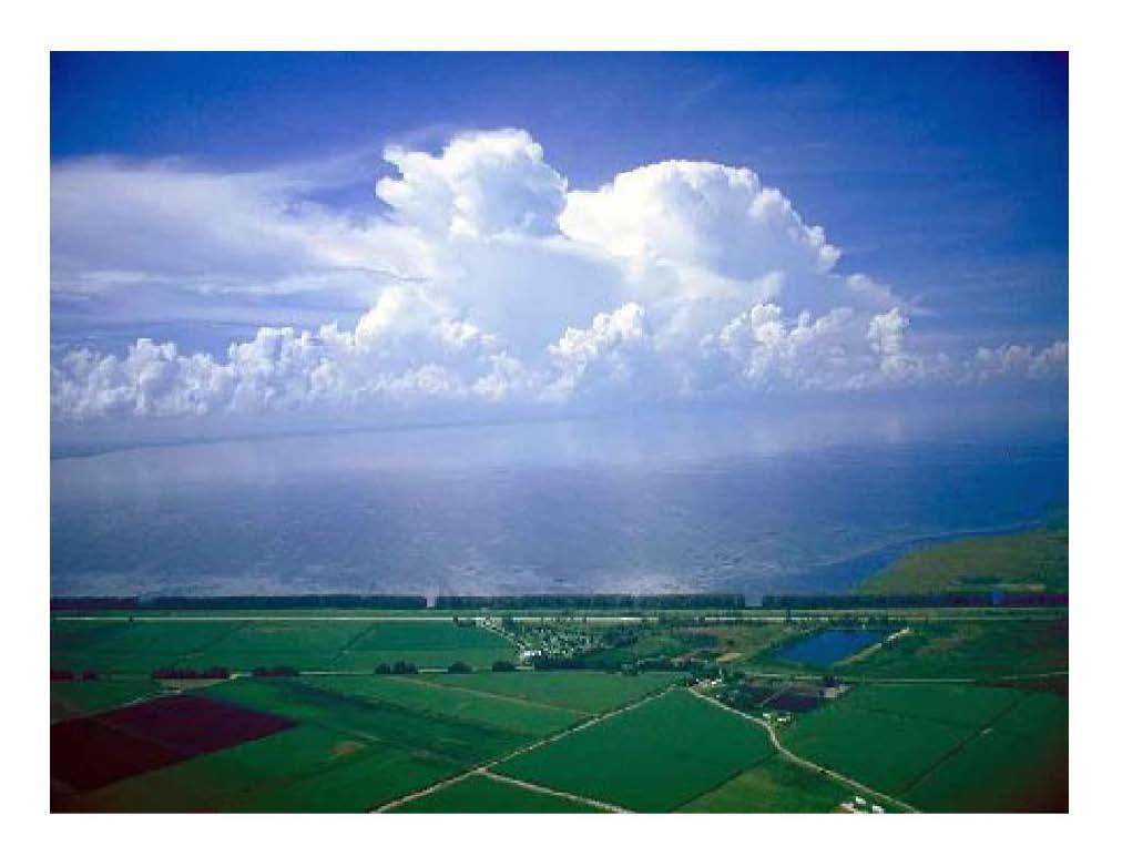
5 Cast of Characters Travis Georgetown Granger Bridgeport Fork Cedar Creek Canyon Livingston 'IOURe 1-1 CI<l.OROPIm.l... C " ~CREA T IOIW,. u.n ITUO't' IIUI_.
6 Bases for Nutrient & Chlorophyll-a Criteria Regional Reference Lakes Pre-Development Condition Limnological Concept - "Trophic State" Linkage to Numeric Water Quality Stds DO, ph, Ammonia, Secchi Ecological - Fishery Water Supply Concerns Taste & Odor, THM's, Treatment Cost Support of Recreational Uses Swimming, Boating Aesthetic Enjoyment Anti-Degradation
7
8
9 Statistical Basis for Mean Chlorophyll-a Criteria Frequency of Severe Nuisance Blooms vs. Mean Chl-a 5 Vermont Lakes CE Reservoirs SA Reservoirs Percent > Threshold Log-Normal Distribution Mean Chlorophyll-a (mg/m 3 ) Based upon Log-Normal Frequency Distribution Models Calibrated to Various Datasets Walker, W., "Statistical Bases for Mean Chlorophyll-a Criteria", Lake & Reservoir Mgt, 1985
10 Previous Applications of the Concept Regional Criteria Minnesota New York Vermont Florida new!!! Lake-Specific Criteria Cherry Creek Reservoir Lake Champlain Lake Okeechobee Vadnais Lake Lake Pepin Onondaga Lake Colorado Vermont/New York Florida Minnesota Minnesota New York Communicating to Public Meaningful Expression of Lake Condition Gain Support for Restoration & Management Programs
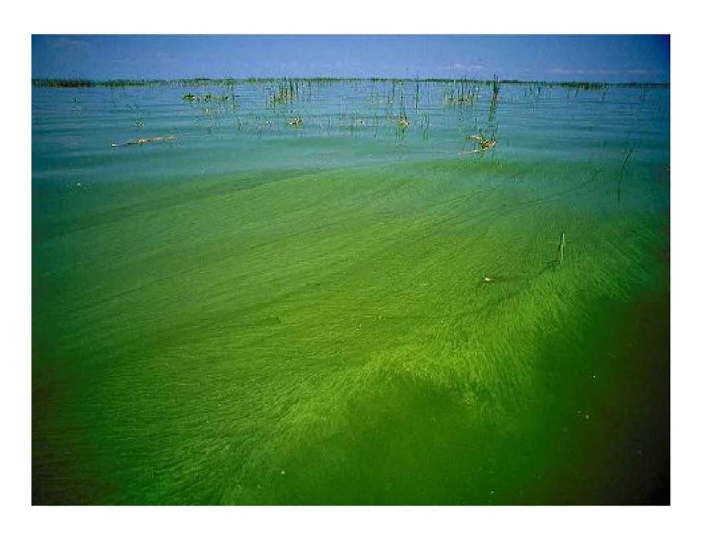
11 Study Design 8 Reservoirs, 2 Sites Each ( Main Lake, Cove ) Criteria for Site Selection Depth >= 10 Feet Adjacent to Use Areas (Beaches, Marinas, etc) No Significant Stands of Aquatic Vegetation Biweekly Sampling, June-Sept (April-Sept in 2004) 0, 3, 6 Foot Composite Samples Nutrient Species, TSS, VSS, Turbidity, Field Param Chl-a & Phaeophytin Analyzed by a One Lab (LCRA) ~ 7 Survey Forms Completed on Sampling Date Target ~ 5 Lay Users Target ~ 2 Sampling Crew 5 Survey Questions : Appearance Suitability for Use Green vs. Muddy Visit Frequency User Type
12 Recreational User Survey Questions 1 & 2 1) Please circle the one response that best describes the physical condition of the lake water today: a) No algae, or crystal clear water b) A little algae visible c) Definite algal greenness d) Very green; some scum present and/or mild odor apparent e) Pea-soup green with one or more of the following: massive floating scums on lake or washed up on shore, strong foul odor, or fish kill 2) Please circle the one response that best describes your perception of how suitable the lake water is for recreation and aesthetic enjoyment today: a) Beautiful, could not be any nicer b) Very minor aesthetic problems; excellent for swimming, boating enjoyment c) Swimming and aesthetic enjoyment slightly impaired d) Desire to swim and level of enjoyment of the lake substantially reduced e) Swimming and aesthetic enjoyment of the lake nearly impossible
13 Recreational User Survey Questions 3-5 3) If you circled c, d, or e in Question No. 2 above, please indicate the factor that most affected your answer: a) Muddiness b) Algae/greenness c) Other (please specify) 4) How many times a year do you visit the lake? (Circle one response) a) Permanent resident b) More than six times per year c) Two to six times per year d) Typically every year e) This is my first visit 5) Please circle the activity that best describes your primary recreational activity today: a) Swimmin d) Skiing/Windsurfing b) Fishing e) On-Shore Activity (camping, picnicking, etc.) c) Boating f) Other or non-recreational (Please specify)
14 Survey Cross-Tabs Question 1 - Appearance Question 4 - Type of Use Count of Date Question1 Count of Date Question4 ResLabel ove_ma a b c d e rand Total Re Cove_Main a b c d e rand Total Bridgeport Cove Bri Cove Main Main Bridgeport Total Bridgeport Total Canyon Cove Ca Cove Main Main Canyon Total Canyon Total Cedar Creek Cove Ce Cove Main Main Cedar Creek Total Cedar Creek Total Fork Cove Fo Cove Main Main Fork Total Fork Total Georgetown Cove Ge Cove Main Main Georgetown Total Georgetown Total Granger Cove Gr Cove Main Main Granger Total Granger Total Livingston Cove Liv Cove Main Main Livingston Total Livingston Total Travis Cove Tra Cove Main Main Travis Total Travis Total Grand Total Grand Total Question 2 - Use Impairment Question 5 - Visit Frequency Count of Date Question2 Count of Date Question5 ResLabel ove_main a b c d e rand Total Re Cove_Main a b c d e f and To Bridgeport Cove Bri Cove Main Main Bridgeport Total Bridgeport Total Canyon Cove Ca Cove Main Main Canyon Total Canyon Total Cedar Creek Cove Ce Cove Main Main Cedar Creek Total Cedar Creek Total Fork Cove Fo Cove Main Main Fork Total Fork Total Georgetown Cove Ge Cove Main Main Georgetown Total Georgetown Total Granger Cove Gr Cove Main Main Granger Total Granger Total Livingston Cove Liv Cove Main Main Livingston Total Livingston Total Travis Cove Tra Cove Main Main Travis Total Travis Total Grand Total Grand Total
15 Q5 - Use Type Other Shore Fishing Boating Skiing Swimming % of Responses Georgetown Travis Canyon Granger Bridgeport Fork Livingston Cedar Creek All Increasing Mean Chlorophyll-a
16 Exploratory Analysis Bloom Frequency vs Seasonal Mean Chl-a Statistical Model Survey Responses vs. Sample Chl-a Within Reservoirs Across Reservoirs Responses vs. Observer Category Sampling Crew Contact Users Noncontact Users
17 Calibration of Bloom Frequency Model Log-Normal Freq. Distribution Temporal Coef. of Variation This Study ~ 0.37 Historical Data (Same Res.) ~0.67 Other Lakes & Reserv
18 Observed & Predicted Bloom Frequencies vs Mean Chl-a Mean Threshold ~ 0.5 x Bloom Criterion Freq > 10 ppb (%) 8 4 Main Cove Predicted Mean Chl-a (ppb) Freq > 20 ppb (%) 8 4 Main Cove Predicted Mean Chl-a (ppb) Freq > 30 ppb (%) Main Cove Predicted Freq > 40 ppb (%) Main Cove Predicted Mean Chl-a (ppb) Mean Chl-a (ppb)
19 Response Frequencies by Site, Sorted by Mean Chl-a Mean Chl-a + Phaeophytin (ppb) Question 1 - Physical Appearance Bloom Frequencies Question 2 - Use Impact < >40 a b c de Georgetown - Main Georgetown - Cove Travis - Main Travis - Cove Canyon - Main Canyon - Cove Granger - Main Granger - Cove Bridgeport - Main Bridgeport - Cove Fork - Main Fork - Cove Livingston - Main Livingston - Cove Cedar Creek - Main Cedar Creek - Cove Percent of Responses Georgetown - Main Georgetown - Cove Travis - Main Travis - Cove Canyon - Main Canyon - Cove Granger - Main Granger - Cove Bridgeport - Main Bridgeport - Cove Fork - Main Fork - Cove Livingston - Main Livingston - Cove Cedar Creek - Main Cedar Creek - Cove Georgetown - Main Georgetown - Cove Travis - Main Travis - Cove Canyon - Main Canyon - Cove Granger - Main Granger - Cove Bridgeport - Main Bridgeport - Cove Fork - Main Fork - Cove Livingston - Main Percent of Responses Livingston - Cove Cedar Creek - Main Cedar Creek - Cove a b c de Georgetown - Main Georgetown - Cove Travis - Main Travis - Cove Canyon - Main Canyon - Cove Granger - Main Granger - Cove Bridgeport - Main Bridgeport - Cove Fork - Main Fork - Cove Percent of Responses Livingston - Main Livingston - Cove Cedar Creek - Main Cedar Creek - Cove 100 Mean & Range 10 Mean Chl-a + Phaeo (ppb) 1
20 Data Screening Based upon Non-Algal Turbidity Secchi (meters) y = 2.14e -0.02x R 2 = Chl-a (ppb)
21 Data Screening Based upon Non-Algal Turbidity 1/Secchi (m) y = 0.03x R 2 = 0.72 TSS (mg/l) y = 0.19x R 2 = Chl-a (ppb) Chl-a (ppb) Turbidity (ntu) y = 0.14x R 2 = 0.56 VSS (mg/l) y = 0.41x R 2 = Chl-a (ppb) TSS (mg/l)
22 Question 1 - Appearance Question 2 - Use Impact Beautiful OK Slight Imp Impacted Mean Chl-a (ppb) Georgetown Georgetown Travis Canyon Granger Bridgeport Fork Livingston Cedar Creek All Travis Canyon Granger Bridgeport Fork Livingston Cedar Creek All Mean Chl-a vs. Survey Response by Reservoir No Algae Some Definite High Mean Chl-a (ppb)
23 Chl-a Frequency Distribution Samples Most Sensitive Range For User Perception Chl-a + Phaeophytin (ppb)
24 Responses vs. Reservoir & Observer Category 10 Crew Contact Non-Contact Q1 = c, d, e 8 4 Cedar Creek Livingston Fork Bridgeport Granger Canyon Travis Georgetown 8 Crew Contact Non-Contact Q2 = c, d, e 4 Cedar Creek Livingston Fork Bridgeport Granger Canyon Travis Georgetown Use Impacted Algae Visible
25 Survey Responses vs Chl-a Interval Sampling Crews & Contact Users Survey Responses vs Chl-a Interval Non-Contact Water Users Question No Algae Some Definite High Question No Algae Some Definite High < >40 < >40 Chl-a Interval (ppb) Chl-a Interval (ppb) Question Beautiful OK Slight Imp Impaired Question Beautiful OK Slight Imp Impaired < >40 Chl-a Interval (ppb) < >40 Chl-a Interval (ppb)
26 Survey Responses - Lake Champlain vs. Texas Reservoirs Question 1 - Appearance Question 2 - Use Impact Lake Champlain Lake Champlain a b c de a b c de Texas Reserv - Crew or Contact User a b c de > > Texas Reserv - Crew or Contact User a b c de >18 >18 Texas Reserv - Other Observer Texas Reserv - Other Observer a b c de 8 4 a b c de > >18 Chl-a Interval (ppb) Chl-a Interval (ppb)
27 Factors Potentially Influencing Correlations Between Survey Responses & Chlorophyll-a Exploratory Analysis - First of Two Survey Years yes Level of Enrichment (Oligo-Meso vs. Hypereutrophic) yes Observer Category (Sampling Crew vs. Lay Observer) yes Water Use ( Contact vs. Noncontact) yes Non-Algal Turbidity (Low-Moderate vs. Extremely High) yes Site Type (Cove vs. Open Lake) yes Spatial/Temporal Variance in Reservoir (High vs. Low) no Observer Visit Frequency no Season (June-July vs.. Aug-Sept) no Include or Exclude Phaeophytin
Portage Lake CASS COUNTY
 Portage Lake 11-0204-00 CASS COUNTY Summary Portage Lake is located near Bena, MN in Cass County. It covers 1,539 acres, which places it in the upper 10% of lakes in Minnesota in terms of size. Portage
Boy Lake CASS COUNTY
 Boy Lake 11-143- CASS COUNTY Summary Boy Lake is located near Remer, MN in Cass County. It covers 3,452 acres, which places it in the upper 1% of lakes in Minnesota in terms of size. Boy Lake has two main
Gull Lake CASS & CROW WING COUNTIES
 Gull Lake 11-0305-00 CASS & CROW WING COUNTIES Summary Gull Lake is located just northwest of Brainerd, Minnesota, on the border of Cass and Crow Wing Counties. It covers 9,947 acres, which places it in
Ploof s Creek South. Johannes Creek. Grand Lake, Ploof s Creek South, Johannes Creek. Introduction
 524 4th Street South Sauk Centre, MN 56378 320.352.2231 Grand Lake, Ploof s Creek South, Johannes Creek Introduction Since the 2012 monitoring season, the Grand Lake Improvement District (Grand LID) and
Medicine Lake Excess Nutrients TMDL project: Water Quality Standards
 Medicine Lake Excess Nutrients TMDL project: Water Quality Standards Steering Committee Meeting #1 November 18 th, 2008 Water Quality Standards Water quality standards the fundamental benchmarks by which
Sand Lake ( ) Carnelian - Marine - St. Croix Watershed District
 Carnelian - Marine - St. Croix Watershed District") Sand Lake (82-0067) Carnelian - Marine - St. Croix Watershed District Sand Lake is a 46-acre lake located within City of Scandia (Washington County). The lake has a surface area of 46 acres. On each sampling
Sand Lake (82-0067) Carnelian - Marine - St. Croix Watershed District Sand Lake is a 46-acre lake located within City of Scandia (Washington County). The lake has a surface area of 46 acres. On each sampling
Nutrient Criteria Update
 Nutrient Criteria Update Jim Davenport Monitoring & Assessment Section Water Quality Planning Division Office of Water Texas Commission on Environmental Quality jdavenpo@tceq.state.tx.us tel. 512/239-4585
Chapter 3. Lake Assessments
 Chapter 3. Lake Assessments Introduction The Pelican Group of Lakes encompasses 4 lakes: Pelican, Little Pelican, Bass, and Fish. Although these lakes have somewhat different characteristics, they are
CLMP+ Report on Fleming Lake (Aitkin County)
") CLMP+ Report on Fleming Lake (Aitkin County) Lake ID# -5-5-6 CLMP+ Data Summary July 7 Authors Shannon Martin Contributors/acknowledgements Terry Dahlberg Sandy Dahlberg Pam Anderson For questions regarding
CLMP+ Report on Fleming Lake (Aitkin County) Lake ID# -5-5-6 CLMP+ Data Summary July 7 Authors Shannon Martin Contributors/acknowledgements Terry Dahlberg Sandy Dahlberg Pam Anderson For questions regarding
CLMP+ Report on Grass Lake (Anoka County) Lake ID# CLMP+ Data Summary
 Lake ID# CLMP+ Data Summary") CLMP+ Report on Grass Lake (Anoka County) Lake ID# 02-0113-00 2012-2013 CLMP+ Data Summary October 2014 Authors Shannon Martin, MPCA Editing and graphic design Public Information Office Staff The (MPCA)
CLMP+ Report on Grass Lake (Anoka County) Lake ID# 02-0113-00 2012-2013 CLMP+ Data Summary October 2014 Authors Shannon Martin, MPCA Editing and graphic design Public Information Office Staff The (MPCA)
Redwood Shores Lagoon August Monthly Water Quality Monitoring Report
 Redwood Shores Lagoon August Monthly Water Quality Monitoring Report Prepared for Redwood City Public Works Services Department 1400 Broadway Redwood City, CA 94063-2594 Prepared by Clean Lakes, Inc. P.
Long-Term Volunteer Lake Monitoring in the Upper Woonasquatucket Watershed
 Long-Term Volunteer Lake Monitoring in the Upper Woonasquatucket Watershed Linda Green URI Watershed Watch 1-87-95, lgreen@uri.edu WATER QUALITY IS A REFLECTION OF THE ACTIVITIES IN THE LANDS AND WATERS
Smithville Lake 2000 Water Quality Report
 Smithville Lake 2 Water Quality Report 1. General. a. Project location. The dam is located at river mile 12.9 on the Little Platte River, a tributary of the Platte River. The drainage area above the dam
Lake Whatcom Water Quality - Presentation to Bellingham City Council
 Western Washington University Western CEDAR Lake Whatcom Other Reports Lake Whatcom 7-6-2015 Lake Whatcom Water Quality - Presentation to Bellingham City Council Robin A. Matthews Western Washington University,
Clearwater Lake CLEARWATER / BELTRAMI COUNTY
 Clearwater Lake 04-0343-00 CLEARWATER / BELTRAMI COUNTY Lake Water Quality Summary Clearwater Lake is located on the border of Clearwater and Beltrami Counties, 16.5 miles northeast of the city of Bagley.
Lino Lakes Chain of Lakes Nutrient TMDL
 Lino Lakes Chain of Lakes Nutrient TMDL Prepared for Rice Creek Watershed District Minnesota Pollution Control Agency July 213 Lino Lakes Chain of Lakes Nutrient TMDL Wenck File #1137-5 Prepared for: RICE
Appendix A. General Concepts in Lake Water Quality. Black Dog WMO Watershed Management Plan P:\23\19\513\plan\Black Dog WMO adopted plan.
 Appendix A General Concepts in Lake Water Quality Black Dog WMO Watershed Management Plan P:\23\19\513\plan\Black Dog WMO adopted plan.doc General Concepts in Lake Water Quality There are a number of concepts
ÆÕ 65. Sullivan Lake Monitoring Report Æÿ Monitoring Sites. MWMO Watershed Bulletin: Lake Levels Lake Water Quality
 Sullivan Lake Monitoring Report 2013 "S Mississippi River æº 2013 Monitoring Sites æº Lake Levels Lake Water Quality ÆÕ 65 Sullivan Lake æº Æÿ65 MWMO Watershed Bulletin: 2014-4 ÆÕ 65 Sullivan Lake Monitoring
Recap rivers and streams Refined Aquatic Life Uses (and Nutrient Criteria for Rivers and Streams) depend on bioassessment tools and
 depend on bioassessment tools and") August 19, 2009 Agenda Aquatic Life Use Refinement Nutrient Criteria Rivers and Streams Nutrient Criteria Lakes and Reservoirs Nutrient Criteria Direct Use Water Supply Res CMA issues Recap rivers and
August 19, 2009 Agenda Aquatic Life Use Refinement Nutrient Criteria Rivers and Streams Nutrient Criteria Lakes and Reservoirs Nutrient Criteria Direct Use Water Supply Res CMA issues Recap rivers and
Water Quality Standards What s coming up for lakes? Kristi Minahan, WI DNR WI Lakes Convention April 7, 2017
 Water Quality Standards What s coming up for lakes? Kristi Minahan, WI DNR WI Lakes Convention April 7, 2017 Water Quality Standards Water Quality Standards 1. Designated Uses 2. Water Quality Criteria
EUTROPHICATION. Student Lab Workbook
 EUTROPHICATION Student Lab Workbook THE SCIENTIFIC METHOD 1. Research Background literature research about a topic of interest 2. Identification of a problem Determine a problem (with regards to the topic)
Continuous records for the Chariton River indicate that 2004 was an average water year, with total flow approximately equal to the average annual
 2004 Rathbun Report Iowa State University Limnology Laboratory John A. Downing, Ph.D. George Antoniou, Assistant Scientist For Rathbun Land and Water Alliance August 31, 2005 A. Tributaries Personnel of
Redwood Shores Lagoon November 2016 Monthly Water Quality Monitoring Report
 Redwood Shores Lagoon November 2016 Monthly Water Quality Monitoring Report Prepared for Redwood City Public Works Services Department 1400 Broadway Redwood City, CA 94063-2594 Prepared by Clean Lakes,
Redwood Shores Lagoon February 2019 Monthly Water Quality Monitoring Report
 Redwood Shores Lagoon February 2019 Monthly Water Quality Monitoring Report Prepared for Redwood City Public Works Services Department 1400 Broadway Redwood City, CA 94063-2594 Prepared by Clean Lakes,
Lake Washington. Water Quality Assessment Report. Copyright 2012 PLM Lake & Land Management Corp.
 Lake Washington 2012 Water Quality Assessment Report Copyright 2012 PLM Lake & Land Management Corp. Water Quality Report On May 22nd, June 18th, July 30th, August 29th, and September 27 th, 2012, PLM
Redwood Shores Lagoon May 2017 Monthly Water Quality Monitoring Report
 Redwood Shores Lagoon May 2017 Monthly Water Quality Monitoring Report Prepared for Redwood City Public Works Services Department 1400 Broadway Redwood City, CA 94063-2594 Prepared by Clean Lakes, Inc.
R.N. Nordin Ph.D. Resource Quality Section Water Management Branch Ministry of Environment (now called Ministry of Water, Land and Air Protection)
") Water Quality Water Quality Criteria for Nutrients and Algae Overview Report Prepared pursuant to Section 2(e) of the Environment Management Act, 1981 R.N. Nordin Ph.D. Resource Quality Section Water Management
Water Quality Water Quality Criteria for Nutrients and Algae Overview Report Prepared pursuant to Section 2(e) of the Environment Management Act, 1981 R.N. Nordin Ph.D. Resource Quality Section Water Management
Portage Lake Hubbard County
 Prepared in cooperation with the Minnesota Department of Natural Resources Minnesota Lake ID: 9- Area: acres Watershed Area: 6,7 acres Ecoregion: Northern Lakes and Forests (NLF) Portage Lake Hubbard County
Development of Nutrient Criteria for Wyoming Streams and Lakes
 Development of Nutrient Criteria for Wyoming Streams and Lakes Eric Hargett Wyoming Department of Environmental Quality Water Quality Division Watershed Protection Program Monitoring Program Wyoming Nutrient
Utah Lake Watch Report Utah State University Water Quality Extension. Prepared by:
 Utah Lake Watch Report 2007 Utah State University Water Quality Extension Prepared by: Andrea Dunn and Susan Anderson Introduction Utah Lake Watch (ULW) is a statewide monitoring program which enlists
ALAN PLUMMER ASSOCIATES, INC. ENVIRONMENTAL ENGINEERS - DESIGNERS - SCIENTISTS
 Grapevine Lake Watershed Characteristics February 18, 2010 NCTCOG REGIONAL WATERSHED ROUNDTABLE ALAN PLUMMER ASSOCIATES, INC. ENVIRONMENTAL ENGINEERS - DESIGNERS - SCIENTISTS 1 Presentation Overview Geography
Tarrant Regional Water District Water Quality Trend Analysis Final Report Executive Summary. July 2011
 Tarrant Regional Water District Water Quality Trend Analysis 1989-2009 Final Report Executive Summary July 2011 Prepared for Tarrant Regional Water District 201 North Shore Drive Fort Worth, TX 76135 Phone:
A Study of Eutrophication Phenomenon of a Lake of a Modern City of India
 A Study of Eutrophication Phenomenon of a Lake of a Modern City of India Shilpa (Student of Masters in Engineering in Environmental Engineering, Department of Civil Engineering, PEC University of Technology,
Interpreting Lake Data
 Interpreting Lake Data Indiana Clean Lakes Program The Indiana Clean Lakes Program was created in 1989 as a program within the Indiana Department of Environmental Management's (IDEM) Office of Water Management.
Utah Lake Watch Report Utah State University Water Quality Extension. Prepared by:
 Utah Lake Watch Report 2008 Utah State University Water Quality Extension Prepared by: Eric Peterson Introduction Utah Lake Watch (ULW) is a statewide monitoring program which enlists the help of volunteers
Interpreting Lake Data
 Interpreting Lake Data Indiana Clean Lakes Program The Indiana Clean Lakes Program was created in 1989 as a program within the Indiana Department of Environmental Management's (IDEM) Office of Water Management.
Dog River Watershed Management Plan
 Dog River Watershed Management Plan Preliminary Water Quality Data Analysis Doug Robison, PWS ESA is where solutions and service meet. Water Quality - Regulatory Primer Designated Use Categories Swimming
2006 Aliceville Reservoir Report. Rivers and Reservoirs Monitoring Program
 2006 Aliceville Reservoir Report Rivers and Reservoirs Monitoring Program Field Operations Division Environmental Indicators Section Aquatic Assessment Unit May 2011 Rivers and Reservoirs Monitoring Program
Restoration of the Harris Chain of Lakes: Return to Neverland
 Restoration of the Harris Chain of Lakes: Return to Neverland How Shifting Baselines Impact Eutrophication Restoration Targets Dr. Daniel E. Canfield Jr. Professor of Limnology Fisheries and Aquatic Sciences
Evaluation of Water Quality in. Sylvia Heaton Water Bureau, MDNRE
 Evaluation of Water Quality in Ford and Belleville Lakes Sylvia Heaton Water Bureau, MDNRE Objectives of 2010 TMDL Reevaluation Evaluate nutrient (total phosphorus) levels in Ford and Belleville Lakes
LAKE PARTNER PROGRAM. Report Card 2015
 LAKE PARTNER PROGRAM Report Card 2015 Contents 1 What This Report Tells You 2 Ontario s Lakes 3 What is the Lake Partner Program? 5 Total Phosphorus 8 Calcium 10 Water Clarity 12 Moving Forward What You
Burnt Shanty Lake ITASCA COUNTY
 Burnt Shanty Lake 31-424- ITASCA COUNTY Lake Water Quality Summary Burnt Shanty Lake is located 23 miles north of Grand Rapids, MN in Itasca County. It is a small lake covering 198 acres (Table 1). Burnt
There is no organized lake association for Clearwater (Round) Lake at this time. Transparency data Good data set from , 2015.
 Lake at this time. Transparency data Good data set from , 2015.") Clearwater (Round) 31-214- ITASCA COUNTY Lake Water Quality Summary Clearwater (Round) is located 9.7 miles southeast of Grand Rapids, MN in Itasca County. It is a round lake covering 132 acres (Table
Clearwater (Round) 31-214- ITASCA COUNTY Lake Water Quality Summary Clearwater (Round) is located 9.7 miles southeast of Grand Rapids, MN in Itasca County. It is a round lake covering 132 acres (Table
Arkansas Water Resources Center
 Arkansas Water Resources Center WATER QUALITY MONITORING OF MOORES CREEK ABOVE LINCOLN LAKE Submitted to the Arkansas Soil and Water Conservation Commission By M.A. Nelson L.W. Cash G.K. Trost Arkansas
Platte Lake CROW WING & MORRISON COUNTIES
 Platte Lake 18-088-00 CROW WING & MORRISON COUNTIES Summary Platte Lake is located in Crow Wing and Morrison Counties of north-central Minnesota, six miles northeast of the town of Harding at the north
2000 and 2001 Water Quality Study
 2000 and 2001 Water Quality Study Crane Lake (BCWMC), Northwood Lake (CAMP), South Rice Lake (CAMP), Sweeney Lake (CAMP), Parkers Lake (CAMP), and Westwood Lake (CAMP), Wirth Lake (MPRB), Medicine Lake
2018 Data Report for. Crystal Lake, Montcalm County
 Michigan Lakes Ours to Protect 218 Data Report for Crystal Lake, Montcalm County Site ID: 5915 43.25584 N, 84.93362 W The CLMP is brought to you by: 1 About this report: This report is a summary of the
Red Rock Lake: A Path Forward
 University of Minnesota Morris Digital Well University of Minnesota Morris Digital Well Center for Small Towns 6-2016 Red Rock Lake: A Path Forward Colette Millard Student - University of Minnesota, Morris
Loon Lake ITASCA COUNTY
 Loon Lake 31-571- ITASCA COUNTY Lake Water Quality Summary Loon Lake is located 5 miles west of Grand Rapids, MN in Itasca County. It is a long lake covering 231 acres (Table 1). Loon Lake has one inlet
Limnology 101. PA AWWA SE District & Eastern Section WWOAP Joint Technical Conference October 13, 2016
 Limnology 1 PA AWWA SE District & Eastern Section WWOAP Joint Technical Conference October, 2 Kristen Bowman Kavanagh, P.E. Flow Science Incorporated Limnology is the study of the biological, chemical,
2016 Summit Lake Water Quality Report Prepared by Thurston County Environmental Health Division
 ! 216 Summit Lake Water Quality Report Prepared by Thurston County Environmental Health Division PART OF TOTTEN INLET WATERSHED LENGTH OF LAKE: 2.2 miles SHORELINE LENGTH: 5.6 miles LAKE SIZE: 53 acres
Lake Elsinore and San Jacinto Watersheds Authority. Canyon Lake Phase 2 Water Quality Monitoring Plan
 Lake Elsinore and San Jacinto Watersheds Authority December 2010 Background Canyon Lake was formed in 1928 when the Canyon Lake (Railroad Canyon) Dam was constructed; the lake has three main sections the
2017 Data Report for Spider Lake, Grand Traverse County
 Michigan Lakes Ours to Protect 217 Data Report for Spider Lake, Grand Traverse County Site ID: 28395 44.675987 N, 85.49947 W The CLMP is brought to you by: 1 About this report: This report is a summary
Phosphorus Goal Setting Process Questions and Answers 2010
 Lake Winnipesaukee Watershed Management Plan Phase I: Meredith, Paugus, Saunders Bays 1. What is phosphorus? Phosphorus (P) is a naturally occurring element and a major nutrient required for biological
2017 Data Report for Lake Independence, Marquette County
 Michigan Lakes Ours to Protect 217 Data Report for Lake Independence, Marquette County Site ID: 2149 46.88337 N, 87.711393 W The CLMP is brought to you by: 1 About this report: This report is a summary
2017 Data Report for Earl Lake, Livingston County
 Michigan Lakes Ours to Protect 217 Data Report for Earl Lake, Livingston County Site ID: 755 2.191 N, 3.95 W The CLMP is brought to you by: 1 About this report: This report is a summary of the data that
Summary of Water Quality Assessments for Each Waterbody Type. National Summary Water Quality Attainment in Assessed Rivers and Streams
 Summary of Water Quality Assessments for Each Waterbody Type National Summary Water Quality Attainment in Assessed Rivers and Streams National Summary Designated Use Support in Assessed Rivers and Streams*
Lower Hay Lake CROW WING COUNTY
 Lower Hay Lake 18-378- CROW WING COUNTY Lake Water Quality Summary Lower Hay Lake is located 2 miles northeast of Jenkins, MN in Crow Wing County. It has a rounded shape and covers 693 acres. Lower Hay
Lake Pepin. TMDL Basics
 NORTH DAKOTA SOUTH DAKOTA Lake Pepin Basins BASIN Cannon River Basin Minnesota River Basin Minnesota River Basin St. Croix River Basin Upper Mississippi River Basin HUC 07040001 Major Rivers Metro Area
2017 Data Report for Perch Lake, Iron County
 Michigan Lakes Ours to Protect 217 Data Report for Perch Lake, Iron County Site ID: 3646 46.361392 N, 88.658338 W The CLMP is brought to you by: 1 About this report: This report is a summary of the data
Walker Brook Lake CLEARWATER COUNTY
 Walker Brook Lake 15-0060-00 CLEARWATER COUNTY Lake Water Quality Summary Walker Brook Lake is located 4 miles southeast of Bagley, MN in Clearwater County. It is a long and narrow lake covering 95 acres
Mayflower Lake Management Planning Committee UWSP Center for Watershed Science and Education Marathon County Wisconsin Department of Natural
 Mayflower Lake Management Planning Committee UWSP Center for Watershed Science and Education Marathon County Wisconsin Department of Natural Resources Reduces conflicts Addresses problems Allows for proactive
The Impact of Excess Phosphorus on Minnesota s Lakes and Rivers presented at SERA 17 November 2015
 The Impact of Excess Phosphorus on Minnesota s Lakes and Rivers presented at SERA 17 November 2015 Steven Heiskary Research Scientist III Environmental Analysis and Outcomes Division Overview 1. Minnesota
Tina Laidlaw US EPA 1
 Tina Laidlaw US EPA 1 Many states have developed approaches for listing waterbodies for nutrient-related impairments based on the narrative standard Existing state approaches are similar to CO s proposal
Upper Hay Lake CROW WING COUNTY
 Upper Hay Lake 18-0412-00 CROW WING COUNTY Lake Water Quality Summary Upper Hay Lake is located 1 mile east of Jenkins, MN in Crow Wing County. It is a round lake with a total surface area of 596 acres.
Sediment Management Alternatives Analysis
 Conservancy District April 19, 2017 Sediment Management Alternatives Analysis Report prepared for the Conservancy District -Unionville, IN Report By: KCI Technologies, Inc. 6983 Corporate Circle Indianapolis,
2017 Data Report for Arbutus Lake, Grand Traverse County
 Michigan Lakes Ours to Protect 217 Data Report for Arbutus Lake, Grand Traverse County Site ID: 2819 44.65917 N, 85.519726 W The CLMP is brought to you by: 1 About this report: This report is a summary
2014 Data Report for Clark Lake, Jackson County
 2014 Data Report for Clark Lake, Jackson County Michigan Lakes Ours to Protect The CLMP is brought to you by: About this report: This report is a summary of the data that have been collected through the
Hadlock Pond, Washington Co., Lake Hadlock Association, Inc.
 Hadlock Pond, Washington Co., Lake Hadlock Association, Inc. Lake Characteristics Watershed Characteristics Surface Area (ac/ha) Max Depth (ft/m) Mean Depth (ft/m) Retention Time (years) Water Class Dam
Movil Lake BELTRAMI COUNTY
 Movil Lake 04-0152-00 -BELTRAMI COUNTY Lake Water Quality Summary Movil Lake is located 8 miles north of Bemidji, MN in Beltrami County. It is an irregular shaped lake covering 853 acres with a maximum
CASE STUDY: CLEAN-FLO inversion oxygenation reverses eutrophication - improves raw drinking
 CASE STUDY: CLEAN-FLO inversion oxygenation reverses eutrophication - improves raw drinking water The Challenge Toa Vaca dam was built in 1972 to create a 247 acre raw drinking water reservoir in Puerto
Nutrient Limits: What to Expect. Water Division Arkansas Department of Environmental Quality
 Nutrient Limits: What to Expect Water Division Arkansas Department of Environmental Quality wentz@adeq.state.ar.us bailey@adeq.state.ar.us Timeline of Nutrient Criteria Development 1998 EPA published the
Lake Emily CROW WING COUNTY
 Lake Emily 18-0203-00 CROW WING COUNTY Lake Water Quality Summary Lake Emily is located on the eastern edge of the City of Emily, MN in Crow Wing County. It is a shallow lake that covers 720 acres and
LAKE OF THE WOODS PROGRAM
 LAKE OF THE WOODS PROGRAM Water quality and aquatic ecosystem health is of concern in OBJECTIVES the Lake of the Woods. The most critical issue affecting Lake of the Woods water quality and aquatic ecosystem
Daggett Lake CROW WING COUNTY
 Daggett Lake 18-271- CROW WING COUNTY Lake Water Quality Summary Daggett Lake is located 2 miles north of Cross Lake, MN in Crow Wing County. It is a long lake covering 231 acres (Table 1). Daggett Lake
West Leaf Lake DNR ID:
 East Otter Tail County Water Quality Factsheet West Leaf Lake DNR ID: 56-0114-00 Vitals Physical Characteristics MN Lake ID: 56-0114-00 Surface area (acres): 700 Zoning Authority: Ottertail Littoral area
2017 Data Report for Painter Lake, Cass County
 Michigan Lakes Ours to Protect 217 Data Report for Painter Lake, Cass County Site ID: 1418 41.81667 N, 85.99194 W The CLMP is brought to you by: 1 About this report: This report is a summary of the data
Big Trout Lake CROW WING COUNTY
 Big Trout Lake 18-0315-00 CROW WING COUNTY Lake Water Quality Summary Big Trout Lake is located just east of Pine River, Minnesota. It covers 1,363 acres, which places it in the upper 10% of lakes in Minnesota
Blue-green algae, more appropriately
 Algal Toxins Microcystin in Minnesota Lakes Steven Heiskary and Matt Lindon Where Do We Find It and What Does It Relate To? Blue-green algae, more appropriately referred to as cyanobacteria, are a common
Lake Hubert CROW WING COUNTY
 Lake Hubert 18-0375-00 CROW WING COUNTY Lake Water Quality Summary Lake Hubert is located two miles southeast of Nisswa, Minnesota, in Crow Wing County. It is oval-shaped and covers 1,287 acres. According
2018 Data Report for Pickerel Lake, Kalkaska County
 Michigan Lakes Ours to Protect 2018 Data Report for Pickerel Lake, Kalkaska County Site ID: 400035 44.800559 N, 84.97667 W The CLMP is brought to you by: 1 About this report: This report is a summary of
INVESTIGATION INTO THE NECESSITY OF DISSOLVED ORTHOPHOSPHATE-PHOSPHORUS FIELD FILTRATION
 INVESTIGATION INTO THE NECESSITY OF DISSOLVED ORTHOPHOSPHATE-PHOSPHORUS FIELD FILTRATION Prepared for: Trinity River Authority of Texas 5300 South Collins P.O. Box 60 Arlington, TX 76004 Phone: 817-467-4343
B4N BMW TMDL MIRL. CLRMA Annual Fall Conference. Barr Lake & Milton Reservoir Watershed Association
 B4N BMW TMDL MIRL CLRMA Annual Fall Conference Nov. 16th, 2011 Barr Lake & Milton Reservoir Watershed Association History Watershed (datashed) Population: o 2.5 Million (1 in 2 Coloradoans) 850 Sq. Miles
Lake Blanche OTTER TAIL COUNTY
 Lake Blanche 56-24- OTTER TAIL COUNTY Lake Water Quality Summary Lake Blanche is located 7 miles south of Otter tail, MN in Otter tail County. It is a round lake covering 1,314 acres (Table 1). Lake Blanche
Little Pine Lake CROW WING COUNTY
 Little Pine Lake 18-266- CROW WING COUNTY Lake Water Quality Summary Little Pine Lake is located 4 miles northeast of Crosslake, MN in Crow Wing County. It is a mostly oval lake covering 352 acres (Table
Lake Koronis STEARNS COUNTY
 Lake Koronis 73-0200-00 STEARNS COUNTY Lake Water Quality Summary Lake Koronis is located 1 mile south of Paynesville, MN in Stearns County and covers 2,958 acres. Lake Koronis has five inlets and one
2017 Data Report for Silver Lake, Van Buren County
 Michigan Lakes Ours to Protect 2017 Data Report for Silver Lake, Van Buren County Site ID: 800534 42.3891 N, 86.0599 W The CLMP is brought to you by: 1 About this report: This report is a summary of the
Appendix A: CSLAP 2010 Lake Water Quality Summary: Song Lake
 Appendix A: CSLAP 2010 Lake Water Quality Summary: Song Lake General Lake Information Location County Basin Size Lake Origins Watershed Area Retention Time Mean Depth Sounding Depth Public Access? Major
2016 WATER QUALITY MONITORING PROMPTON RESERVOIR PROMPTON, PENNSYLVANIA
 2016 WATER QUALITY MONITORING PROMPTON RESERVOIR PROMPTON, PENNSYLVANIA U.S. Army Corps of Engineers Philadelphia District Environmental Resources Branch December 2016 2016 Water Quality Monitoring Prompton
Placid Lake CROW WING COUNTY
 Placid Lake 18-76- CROW WING COUNTY Lake Water Quality Summary Placid Lake is located 5 miles south of Deerwood, MN in Crow Wing County. It is a long lake covering 185 acres (Table 1). Placid Lake has
Turning water quality data into lake-specific nutrient standards
 Turning water quality data into lake-specific nutrient standards 2015 Tribal Lands and Environment Forum Nancy Schuldt, Water Projects Coordinator Fond du Lac Reservation Current Narrative Standard:
2017 Data Report for Shingle Lake, Clare County
 Michigan Lakes Ours to Protect 217 Data Report for Shingle Lake, Clare County Site ID: 1818 43.96359 N, 84.95282 W The CLMP is brought to you by: 1 About this report: This report is a summary of the data
Clitherall Lake DNR ID:
 East Otter Tail County Water Quality Factsheet Clitherall Lake DNR ID: 56-0238-00 Vitals Physical Characteristics MN Lake ID: 56-0238-00 Surface area (acres): 4,540 Zoning Authority: Fergus Falls Littoral
MiCorps 101. Presented by Paul Steen. & MiCorps Staff
 MiCorps 101 Presented by Paul Steen & MiCorps Staff MiCorps Team Bill Dimond Laura Kaminski Anne Sturm Dina Klemens Paul Steen, Ph.D. Jason Frenzel Scott Brown Jean Roth Jo Latimore, Ph.D. Together, we
Attainment of Water Quality Objectives for Lakelse Lake in
 Attainment of Water Quality Objectives for Lakelse Lake in 2001-2003 A.J. Downie and Julia Kokelj Environmental Quality Section Environmental Protection Division Skeena Region British Columbia Ministry
LAKE AUBURN: THE EFFECT OF CLIMATE DRIVERS ON LAKE WATER QUALITY
 LAKE AUBURN: THE EFFECT OF CLIMATE DRIVERS ON LAKE WATER QUALITY Zachary Eichenwald and Bernadette Kolb, CDM Smith Kenneth Wagner, Water Resource Services Mary Jane Dillingham, Auburn Water District and
What s Happening in Lake Whatcom?
 What s Happening in Lake Whatcom? Dr. Robin A. Matthews, Director Institute for Watershed Studies Huxley College of the Environment Western Washington University June 6, 2011 Site 2 Basin 2 Lake Whatcom
Harmful Algal Blooms and Cyanotoxins in Maine
 Harmful Algal Blooms and Cyanotoxins in Maine Linda Bacon, Biologist Lake Assessment Section Volunteer Lake Monitoring Program Annual Meeting July 30, 2016 MAINE DEPARTMENT OF ENVIRONMENTAL PROTECTION
OKLAHOMA CLEAN LAKES AND WATERSHEDS 23rd ANNUAL CONFERENCE AGENDA. SUCCESS STORY: 20 YEARS of HYPOLIMNETIC OXYGENATION of a RESERVOIR
 OKLAHOMA CLEAN LAKES AND WATERSHEDS 23rd ANNUAL CONFERENCE AGENDA SUCCESS STORY: 20 YEARS of HYPOLIMNETIC OXYGENATION of a RESERVOIR Agenda EBMUD & Camanche Reservoir Water Quality Challenges Speece Cone