2935 TELEGRAPH AVENUE (COURTHOUSE CONDOMINIUMS)
|
|
|
- Wilfred Stone
- 6 years ago
- Views:
Transcription
1 2935 TELEGRAPH AVENUE (COURTHOUSE CONDOMINIUMS) Draft Environmental Impact Report Prepared for: March 19, 2007 City of Oakland
2
3
4
5
6 2935 TELEGRAPH AVENUE (COURTHOUSE CONDOMINIUMS) Draft Environmental Impact Report Prepared for: March 19, 2007 City of Oakland 225 Bush Street Suite 1700 San Francisco, CA Los Angeles Oakland Orlando Petaluma Portland Sacramento Seattle Tampa
7 TABLE OF CONTENTS 2935 Telegraph Avenue (Courthouse Condominiums) Project Draft Environmental Impact Report Page I. Summary I-1 II. Project Description II-1 A. Site Location and Project Characteristics II-1 B. Project Objectives II-10 C. Discretionary Actions and Other Planning Considerations II-10 III. Environmental Setting, Impacts, and Mitigation Measures III-1 A. Historic Resources III.A-1 B. Transportation, Circulation, and Parking III.B-1 IV. Alternatives IV-1 A. Criteria for Selecting Alternatives IV-1 B. Alternatives Selected for Consideration IV-2 C. Description and Analysis of Alternatives IV-2 D. Environmentally Superior Alternative IV-17 V. Impact Overview V-1 A. Significant, Unavoidable Environmental Impacts V-1 B. Cumulative Impacts V-1 C. Growth-Inducing Impacts V-2 VI. Responses to Comments Received During EIR Scoping VI-1 A. EIR Scoping Hearing Comments and Responses VI-1 B. NOP Comments and Responses VI-4 VII. Report Preparation VIII. Appendices A. NOP and Initial Study B. NOP Comment Letters C. OCHS Historic Resource Inventory and Research Forms D. Evaluation of Telegraph Avenue Bus Rapid Transit VII-1 VIII Telegraph Avenue i ESA / Draft EIR March 2007
8 Table of Contents Page List of Figures II-1 Project Location II-2 II-2 Project Site Existing Conditions II-3 II-3 Ground Floor Plan II-5 II-4 Level 2 Floor Plan II-6 II-5 Telegraph Avenue and 29th Street Elevations II-8 II-6 30th Street and Rear Elevations II-9 III.A-1 Historic and Current Views of the Former Courthouse Athletic Club III.A-4 III.A-2 Period Revival Style Funeral Homes in Project Vicinity III.A-6 III.B-1 Study Area III.B-6 III.B-2 Existing Lane Geometry and Traffic Control III.B-7 III.B-3 Existing Peak Hour Volumes III.B-8 III.B-4 Existing Transit Network III.B-9 III.B-5 Project Trip Distribution III.B-17 III.B-6 Project Peak-Hour Traffic at Intersections III.B-18 III.B-7 Existing plus Project Peak-Hour Traffic at Intersections III.B-19 III.B-8 Site Access Plan III.B-20 IV-1 Partial Preservation / Lower Density Alternative Ground Floor Site Plan IV-6 IV-2 Partial Preservation / Lower Density Alternative Level 2 Floor Plan IV-7 IV-3 Partial Preservation / Lower Density Alternative Telegraph Avenue and 30th Street Elevations IV-8 IV-4 Full Preservation / Higher Density Alternative Ground Floor Site Plan IV-13 IV-5 IV-6 Full Preservation / Higher Density Alternative Typical Residential Floor Plan IV-14 Full Preservation / Higher Density Alternative Telegraph Avenue and 30th Street Elevations IV-15 List of Tables I-1 Summary Of Impacts And Mitigation Measures For The 2935 Telegraph Avenue (Courthouse Condominiums) Project I-4 II-1 Project Components By Use and Size II-4 III.A-1 Period Revival-Style Funeral Homes in the Project Vicinity III.A-5 III.B-1 Definitions for Intersection Level of Service III.B-4 III.B-2 Existing Intersection Level of Service (LOS) and Delay III.B-10 III.B-3 Bus Service Summary for Project Area III.B-11 III.B-4 Modal Split III.B-15 III.B-5 Project Weekday Trip Generation III.B-15 III.B-6 Existing and Existing Plus Project Peak-Hour Intersection Levels of Service (LOS) III.B-21 III.B-7 Cumulative and Cumulative Plus Project Peak-Hour Intersection Levels of Service (LOS) III.B-22 III.B-8 City of Oakland Off-Street Parking Planning Code Requirements III.B-26 III.B-9 City of Oakland Loading Planning Code Requirements III.B-27 III.B-10 Estimated Peak Project-Generated Parking Demand III.B-28 III.B-11 Intersection Accident Data III.B-28 IV-1 Summary of Impacts: Project and Alternatives IV Telegraph Avenue ii ESA / Draft EIR March 2007
9 CHAPTER I Summary A. Project Description Project Characteristics The project would demolish the existing fitness club and surface parking lot on the site and construct approximately 142 residential units, about 2,900 square feet of ground floor retail, and on-site parking for approximately 204 automobiles, in a five story building (four stories of residential construction above a two-level parking garage; one level of parking would be below ground and one at ground level, accessed by an internal ramp). The maximum height of the building would be approximately 50 feet, measured to the top of the roof. The development would be about 276,000 square feet in size. The ground floor would contain two retail spaces, a residential lobby, an HOA room and a Community room along the Telegraph Avenue elevation. Two access points to the parking garage would be located along 29th and 30th Streets. The remainder of the ground floor elevations along 29th and 30th Streets would contain a total of seven one bedroom flats and three studios that would be accessible directly from the 29th and 30th Street frontages. The dwelling units on the second through fifth floors would consist of a mix of studios (16 percent) one bedroom flats (35 percent) and two bedroom flats (45 percent) totaling approximately 137,300 square feet of residential space. The residential lobby off Telegraph Avenue would provide elevator access to a series of internal hallways to access the residential units. A total of nine landscaped courtyards would be on the podium (second) level, totaling approximately 18,450 square feet of common open space. Two of the courtyards would face the rear (western) elevation of the building. Over 6,000 square feet of open space would also be provided in the form of balconies for a total of about 24,530 square feet of project open space Landscaping provided by the project would include approximately 20 deciduous trees and shrubbery to be planted within the project site courtyards, as well as approximately 20 new street trees to be planted along Telegraph Avenue, 29th Street, and 30th Street. The two-level parking garage would provide up to 204 parking spaces, including four disabledaccessible spaces, 29 compact spaces and 31 tandem stalls. To accommodate about 90 bicycles, the garage would also include 650 square feet of bicycle storage on the ground floor. Vehicular access to the garage would be via two, two-way driveways; one each on 29th and 30th Streets (see Figure II-3). The lower level of the parking garage would be accessed by an internal, twoway ramp. The parking garage entrances on 29th and 30th Streets would be secured by an automatic gate/roll-up door. There would also be an off-street truck loading dock adjacent to the vehicle entrance on 29th Street Telegraph Avenue I-1 ESA / Draft EIR March 2007
10 I. Summary General Plan and Zoning The Project Site is within the Community Commercial / Urban Residential General Plan Designation and the C-40 Community Thoroughfare Zone / R-80 High Rise Apartment Zone. B. Environmental Impacts and Mitigation Measures Potentially significant environmental impacts of the project are summarized in Table I-1 at the end of this chapter. This table lists impacts and mitigation measures in two major categories: Significant and Unavoidable Significant impacts that would remain significant even with mitigation and/or standard conditions of approval (Section A of Table I-1); Less than Significant Impacts Impacts that would not be significant and that would not require mitigation measures (Section B of Table I-1). For each significant impact, the table includes a summary of mitigation measures and/or conditions of approval, and an indication of level of significance after implementation of mitigation measures or conditions. A complete discussion of each impact and associated mitigation measure is provided in Chapter III, Environmental Setting, Impacts and Mitigation Measures. C. Alternatives Alternative 1A: No Project / Site and Existing Building Remain Vacant. In this scenario, the project site and existing building would remain vacant, similar to existing conditions. The former Courthouse Athletic Club would continue to be closed and locked, and the adjacent parking lot would remain vacant and inaccessible through the use of a locked chain link gate. The site conditions would remain essentially as discussed in the setting sections of Chapter III, and would generally appear as it does today. Alternative 1B: No Project / Reasonably Foreseeable Development (i.e., reuse of the existing building for a gym or other commercial use). In this scenario, the former Courthouse Athletic Club would be reused for another athletic facility or other commercial venture, such as retail or professional office use. It is assumed that the exterior of the building would remain unchanged from current conditions, except for minor repair/maintenance, and that all reuse activities would occur on the interior of the building. The adjacent parking lot would also serve this new commercial use, retaining its basic configuration and number of parking spaces as under current conditions. Alternative 2: Partial Preservation / Lower Density Alternative. In this scenario, the historically significant portions of the former Courthouse Athletic Club would be retained, rehabilitated, and reused, in accordance with the Secretary of the Interior s Standards. On the balance of the site, the project would construct 127 residential units, 2,750 gross square feet of retail, and 172 residential parking spaces, in a five story building. However, the external and internal layout of this alternative would differ markedly from the proposed project. Alternative 3: Partial Preservation / Higher High-Density Preservation Alternative. This scenario is similar to Alternative 2, although it would maintain the number of residential units (142) and commercial square footage (2,900) as the proposed project by constructing a building that is seven stories tall (75 feet) on the balance of the site Telegraph Avenue I-2 ESA / Draft EIR March 2007
11 I. Summary Alternative 4: Full Preservation / Higher Density Alternative. In this scenario, nearly the entire former Courthouse Athletic Club would be retained, rehabilitated, and reused, in accordance with the Secretary of the Interior s Standards. On the balance of the site, the project would construct 142 residential units, 3,900 commercial square feet, and parking for 204 automobiles. This alternative would be achieved, however, by constructing a building that is ten stories tall (100 feet) on the balance of the site. Environmentally Superior Alternative Alternative 2, Partial Preservation / Lower Density Alternative, would avoid all significant and unavoidable impacts to historic resources associated with the project while maintaining a building envelope that is more compatible with the scale of the neighborhood. Therefore, it would be environmentally superior to the proposed project. The City would weigh the merits of each of alternative in light of the competing policies of historic preservation, and residential neighborhood impacts (shadow, encroachment of high-rise buildings) that are raised. For purposes of this EIR, Alternative 2 is considered the environmentally superior alternative. D. Areas of Controversy Major areas of controversy regarding the project that are known to the City of Oakland are listed below. These major areas are based on comments received from public agencies and members of the public in response to the Notice of Preparation (NOP) of this EIR, as well as from input received during the public scoping meeting. This is not intended to be an exhaustive list of all issues raised, but general areas that encompass the fundamental concerns. The issues raised that pertain to potential environmental impacts of the project and that are appropriate for inclusion in the EIR pursuant to CEQA, are identified in Appendix B. Major areas of controversy (including some non-ceqa issues) include, but are not limited to, the following: Potential impacts to historic architectural resources on the project site and in the project vicinity Inclusion of project alternatives that would avoid potentially significant impacts to historic architectural resources on the project site. Evaluation of long-term construction impacts. Request to bury overhead power lines, widen sidewalks, and enforce illegal on-street parking in the project vicinity. Evaluation of project noise and air quality impacts from the nearby freeway on to new residents. Concern over vandalism and crime. Concerns about project loading and garage access Request for additional soil and groundwater sampling. Request to retain all trees on the project site Telegraph Avenue I-3 ESA / Draft EIR March 2007
12 I. Summary TABLE I-1 SUMMARY OF IMPACTS AND MITIGATION MEASURES FOR THE 2935 TELEGRAPH AVENUE (COURTHOUSE CONDOMINIUMS) PROJECT Environmental Impact Mitigation Measures or Standard Conditions Level of Significance after Mitigation or Standard Condition A. SIGNIFICANT AND UNAVOIDABLE IMPACTS (Remains Significant after Implementation of Mitigation Measures and/or Standard Conditions of Approval) A. Historic Resources A.1: The project would result in the demolition of the former Courthouse Athletic Club at 2935 Telegraph Avenue, a building that qualifies as a historic resource as defined by CEQA Section Mitigation Measure A.1a: Archival Documentation. Trammell Crow Residential shall document the building at 2935 Telegraph Avenue prior to its demolition through the use of large-format black and white photography and a brief historical report, meeting the specifications of the Historic American Building Survey (HABS). The historic report should briefly describe the building and its historic significance to the City of Oakland. The documentary photographs and report would be archived locally at the Oakland History Room (OHR) of the Oakland Public Library along with a copy on archival paper. Digital copies of the photographs would be forwarded to the Oakland Cultural Heritage Survey. Mitigation Measure A.1b: Interpretive Materials: Trammell Crow Residential shall prepare interpretive materials as directed by the City, including, but not limited to on-site interpretive signage, brochures, or any combination thereof. Any such materials should address not only the history and architecture of the building, but also its contribution to a potential API of period revival style funeral homes in the project vicinity. Mitigation Measure A.1c: Relocation: In accordance with HPE Policy 3.7, the City will normally require that reasonable efforts be made to relocate the property to an acceptable site as a condition of approval for all discretionary projects involving demolition of existing or Potential Designated Historic Properties. Under this condition, the applicant is normally released from the relocation requirement after 90 days if the applicant demonstrates to the satisfaction of the Director of City Planning that all reasonable efforts have been made to relocate the building and that these efforts have been unsuccessful. Therefore, Trammell Crow Residential shall make reasonable efforts to relocate the project site building, and demonstrate to the satisfaction of the city why such efforts would be unsuccessful within 90 days of certification of this EIR. Significant and Unavoidable 2935 Telegraph Avenue I-4 ESA / Draft EIR March 2007
13 I. Summary TABLE I-1 (Continued) SUMMARY OF IMPACTS AND MITIGATION MEASURES FOR THE 2935 TELEGRAPH AVENUE (COURTHOUSE CONDOMINIUMS) PROJECT Environmental Impact Mitigation Measures or Standard Conditions Level of Significance after Mitigation or Standard Condition B. LESS THAN SIGNIFICANT, OR NO IMPACT (No Mitigation Measures or Standard Conditions of Approval Required) A. Historic Resources A.2: The project would construct substantially larger and taller buildings in the vicinity of historic resources, which could alter their historic setting. A.3: The proposed project would not combine with cumulative development that would involve demolition or substantial alteration of other historic buildings in the Central/Chinatown Planning Area of Oakland to form a significant cumulative impact to historic resources. The project would also have a less-than-significant cumulative impact to a potential period revival-style funeral home API. A.2: The project would construct substantially larger and taller buildings in the vicinity of historic resources, which could alter their historic setting. None Required. None Required. None Required. B. Traffic, Circulation, and Parking B.1: Traffic generated by the project would affect project driveways. B.2: Traffic generated by the project would affect existing traffic levels of service at local intersections B. 3: Traffic generated by the project would affect traffic levels of service at local intersections under cumulative conditions. B.4: The project would increase ridership on public transit providers serving the area. B 5: Development of the proposed project would potentially conflict with existing pedestrian and/or bicycle facilities. B.6: Project construction would affect traffic flow and circulation, parking, and pedestrian safety. None Required. None Required. None Required. None Required. None Required. None Required Telegraph Avenue I-5 ESA / Draft EIR March 2007
14 CHAPTER II Project Description A. Site Location and Project Characteristics Site Location The project site is located at 2935 Telegraph Avenue in the Central / Chinatown planning area of Oakland, approximately six blocks north of the Central Business District. The project site consists of approximately 1.4 acres on the eastern two-thirds of the block bounded by 29th Street, Telegraph Avenue, 30th Street and Interstate I-980 (see Figure II-1, Project Location). Uses on the project site include a two-story, approximately 30,000 square-foot fitness club (Courthouse Athletic Club now closed) on the corner of 30th Street and Telegraph Avenue. Adjacent to the former fitness club is surface parking lot which accommodated approximately 93 automobiles (also closed). The parking lot is encircled by a chain link fence, with the former entrance on Telegraph Avenue adjacent to the athletic club fenced off as well. The site is completely developed with the exception of two groupings of mature redwood trees located toward the westerly and southerly portions of the site (see Figure II-2, Project Site Existing Conditions). The project site is located in the C-40 and R-80 zoning districts, and the Community Commercial and Urban Residential land use districts from the City of Oakland s LUTE from the General Plan. The project vicinity includes a mix of residential, commercial, and institutional land uses. Commercial uses primarily front Telegraph Avenue, which is a four-lane arterial boulevard with a center turning lane and on-street parking, connecting downtown Oakland with downtown Berkeley to the north. The commercial uses opposite Telegraph Avenue from the project site are primarily two to three-story buildings with ground floor retail and office uses above, as well as a few older, single family homes that have been converted to office and/or commercial uses. The residential uses in the project vicinity are mostly two-story, single-family detached residences, with smaller number of multi-family residential buildings range from three to five stories. Institutional uses in the project vicinity include a concentration of hospitals and medical services. Medical retail and office uses occupy many of the retail spaces including a former church and mortuary on the northwest corner of 30th Street and Telegraph Avenue, now a medical office building. Other institutional/civic uses in the project vicinity include Alta Bates Summit Medical Center on the corner of 30th Street and Telegraph Avenue, diagonally across Telegraph Avenue from the project site, St. Augustine s Episcopal Church, a City of Oakland Historical Landmark on the southwest corner of 29th Street and Telegraph Avenue, as well as a number of small restaurants, cafes and food markets. Interstate I-980 (Grove/Shafter Freeway) is located approximately 160 feet west from the western boundary of the project site, separated by three properties containing single-family homes Telegraph Avenue II-1 ESA / Draft EIR March 2007

15 Telegraph Hill Medical Plaza Alta Bates Summit Medical Center Summit Campus Project Site St. Augustine s Episcopal Church Feet SOURCE: Google Maps, Telegraph Avenue Draft EIR Figure II-1 Project Location II-2
16 TELEGRAPH AVENUE 30TH. Courthouse Athletic Club Redwood Tree No. 2 Redwood Tree No. 1 29TH. Project Site N NOT TO SCALE SOURCE: GlobeXplorer, 2002; Google Earth, Telegraph Avenue Draft EIR Figure II-2 Project Site Existing Conditions
17 II. Project Description Project Description The project sponsors, Trammell Crow Residential, intend to demolish/replace the fitness club and adjacent surface parking lot and construct approximately 142 residential units, about 2,900 square feet of ground floor retail, and on-site parking for approximately 204 automobiles, in a five story building (four stories of residential construction above a two-level parking garage; one level of parking would be below ground and one at ground level, accessed by an internal ramp). The maximum height of the building would be approximately 50 feet, measured to the top of the roof. The development would be about 276,000 square feet in size, encompassing about 93 percent of the lot area. See Table II-1, below. TABLE II-1 PROJECT COMPONENTS BY USE AND SIZE Use Approximate Size (sq. ft.) Studios (16%) 14,700 Junior 1 bedroom flats (4%) 5,300 1 bedroom flats (35%) 40,700 2 bedroom flats (45%) 76,600 Residential (142 Units) Total 137,300 Residential Common Space (includes lobbies and corridors) 25,200 Utility and Storage Space 9,000 Common Open Space 24,530 Retail 2,900 Parking (204 spaces on 2 levels) 81,500 Total 280,430 SOURCE: Trammell Crow Residential, 2006 The ground floor would contain two retail spaces, a residential lobby, an HOA room and a Community room along the Telegraph Avenue elevation (see Figure II-3, Ground Floor Plan). Two access points to the parking garage would be located along 29th and 30th Streets. The remainder of the ground floor elevations along 29th and 30th Streets would contain a total of seven one bedroom flats and three studios that would be accessible directly from the 29th and 30th Street frontages. The dwelling units on the second through fifth floors would consist of a mix of studios (16 percent) one bedroom flats (35 percent) and two bedroom flats (45 percent) totaling approximately 137,300 square feet of residential space. The residential lobby fronting Telegraph Avenue would provide elevator access to a series of internal hallways to access the residential units. The units would be grouped into a series of wings separated by U-shaped courtyards on the 29th and 30th Streets elevations (see Figure II-4, Level 2 Floor Plan, which is typical of floors two through five). A total of nine landscaped courtyards would be on the podium (second) level, totaling approximately 18,450 square feet of common open space. Two of the courtyards would face the rear (western) elevation of the building. Over 6,000 square feet of open space would also 2935 Telegraph Avenue II-4 ESA / Draft EIR March 2007
18 30th Street Existing Building Existing Building Existing Building Existing Building 1 Bedroom 1 Bedroom 1 Bedroom Studio Retail Storage Bicycle Room MEP II-5 Existing Building MEP Trash Room Community Room Lobby Telegraph Avenue Existing Building 1 Bedroom 1 Bedroom Studio 1 Bedroom 1 Bedroom Studio MEP Loading HOA Room Retail th Street Feet SOURCE: MBH Architects, Telegraph Avenue Draft EIR Figure II-3 Ground Floor Plan
19 30th Street 2 Bedroom 2 Bedroom 2 Bedroom 2 Bedroom Existing Building Existing Building Existing Building Existing Building Private Courtyard 4,630 sf Bedroom 1 Bedroom Private Courtyard 3,532 sf Bedroom 1 Bedroom II-6 Existing Building 1 Bedroom 2 Bedroom MEP Light Well 1 Bedroom Light Well 1 Bedroom 1 Bedroom MEP 2 Bedroom Studio Courtyard 2,040 sf + - Studio 2 Bedroom Studio Light Well 2 Bedroom Lobby Trash Room 1 Bedroom 2 Bedroom Telegraph Avenue MEP Existing Building Private Courtyard 1,624 sf + - Studio Studio 2 Bedroom 2 Bedroom Private Courtyard 2,834 sf Bedroom 1 Bedroom 2 Bedroom 2 Bedroom Private Courtyard 2,890 sf Bedroom 2 Bedroom 2 Bedroom 2 Bedroom th Street Feet SOURCE: MBH Architects, Telegraph Avenue Draft EIR Figure II-4 Level 2 Floor Plan
20 II. Project Description be provided in the form of balconies for a total of about 24,530 square feet of project open space. Landscaping provided by the project would include approximately 20 deciduous trees and shrubbery to be planted within the project site courtyards, as well as approximately 20 new street trees to be planted along Telegraph Avenue, 29th Street, and 30th Street. All units would be for sale. Parking and Circulation The two-level parking garage would provide up to 204 parking spaces, including four disabledaccessible spaces, 29 compact spaces and 31 tandem stalls. To accommodate about 90 bicycles, the garage would also include 650 square feet of bicycle storage on the ground floor. Vehicular access to the garage would be via two, two-way driveways; one each on 29th and 30th Streets (see Figure II-3). The lower level of the parking garage would be accessed by an internal, twoway ramp. The parking garage entrances on 29th and 30th Streets would be secured by an automatic gate/roll-up door. There would also be an off-street truck loading dock adjacent to the vehicle entrance on 29th Street. Construction Schedule and Type The construction period is anticipated to last approximately 24 months, beginning in Fall 2007 and ending in Fall The proposed project would excavate to a depth of approximately 12 feet for the construction of the underground parking garage and would remove approximately 22,200 cubic yards of soil. The project assumes full remediation of all contaminated soils at the project site to residential standards in accordance with federal, state, and local environmental laws concerning the characterization, transport, stockpiling, and disposal of hazardous materials. The proposed building would be constructed on a concrete mat foundation that would not require pile driving or drilled piers. A two-level concrete podium encompassing the basement and ground floor levels would support wood frame construction above (Type 5 one hour fire rated construction). All construction materials, storage, and construction worker parking would be provided on-site or at designated off-site locations. The project is being designed by MBH Architects in a contemporary style using exterior surface materials such as cement plaster (stucco), wood siding, metal railings and aluminum-framed window units (see Figure II-5, showing the conceptual building elevations along Telegraph Avenue and 29th Street, and Figure II-6, showing conceptual buildings elevations along 30th Street and at the rear of the building). The building would be built to the lot line at the ground floor with intermittent setbacks in the form of courtyards at the podium level along 29th Street, 30th Street and rear (west) elevations Telegraph Avenue II-7 ESA / Draft EIR March 2007
21 29th Street 30th Street East Elevation (Telegraph Avenue) II-8 Telegraph Avenue South Elevation (29th Street) 0 20 Feet SOURCE: MBH Architects, Telegraph Avenue Draft EIR Figure II-5 Telegraph Avenue and 29th Street Elevations
22 Telegraph Avenue North Elevation (30th Street) II-9 30th Street 29th Street West Elevation (Rear) 0 20 Feet SOURCE: MBH Architects, Telegraph Avenue Draft EIR Figure II-6 30th Street and Rear Elevations
23 II. Project Description B. Project Objectives The project sponsor, Trammell Crow Residential, seeks to develop an infill residential project in greater downtown Oakland, providing up to 142 residential units, 2,900 square feet of retail, and approximately 204 on-site parking spaces in a five-story building. The project objectives include the following: Redevelop an underutilized site into a mixed-use residential/retail project that maximizes housing opportunities in close proximity to local and regional transportation and job opportunities in greater downtown Oakland. Maximize development of urban infill residential units at appropriate densities which provide ownership opportunities in a variety of dwelling sizes and types to accommodate the greatest range of potential residents and a range of income levels. Provide neighborhood-serving commercial uses that provide goods and services to the local community and the City. Ensure an active street frontage along the three primary streets where possible, including street-level townhouse-style condominiums with separate entrances on 29th and 30th Streets, and ground-floor commercial space on Telegraph Avenue. Create a residential community that will complement and enhance existing adjacent residential and commercial neighborhoods. Provide for a 24-hour population in the greater downtown, furthering the goals of the City of Oakland s 10K Downtown Housing Initiative. Maximize much-needed housing to help meet existing housing needs and to help alleviate the current jobs/housing imbalance for the region. Enhance the appearance of an existing urban infill property to improve the streetscape and visual quality of Telegraph Avenue in keeping with the City s vision to revitalize the Telegraph Avenue corridor. Provide construction jobs as well as other long term employment opportunities. Develop a mixed-use project that includes residential and retail components that are both internally compatible (with each other) and externally compatible (with surrounding neighborhood). Develop and/or contribute to the active residential/retail/office corridor of Telegraph Avenue in order to make the City s central area more inviting for residents and visitors. C. Discretionary Actions and Other Planning Considerations The City of Oakland is the Lead Agency responsible for preparation of this EIR (pursuant to CEQA Guidelines Section 15051). This EIR is intended to be used for all required discretionary actions for the project described below, along with any other discretionary approvals required for 2935 Telegraph Avenue II-10 ESA / Draft EIR March 2007
24 II. Project Description the project. In addition, the project may require review and approval by a number of public and quasi-public agencies and jurisdictions that have authority over specific aspects of the project. These other agencies may also consider this EIR in their review and decision-making processes. The discretionary actions and other considerations and approvals anticipated to be required for the project include the following, without limitation; 1) consistency with General Plan Policy 3.5[2] (the proposed design is at least equal in quality to the existing design and is compatible with the neighborhood), and 2) tree removal permit. City of Oakland Variances to the Oakland Planning Code Section , including 1) provision of a rear yard depth of ten feet as pursuant to Sections and because the project would not have the required 10-foot rear yard setback; 2) provision of two residential off-street loading berths with a 12 w x 33 l x 14 h dimension for projects between 150, ,999 square feet pursuant to Section as the project would include a single berth with a height of 10 feet; and 3) provision of a 25-foot minimum separation between two driveways on 29th Street as required per Section Demolition Permits (Oakland Municipal Code Chapter 15.36). The project would require City approval of demolition permits to demolish existing buildings and structures on the project site (the former Courthouse Athletic Club and adjacent parking lot). Preliminary and Final Development Plans and Design Review. Preliminary and final development plans would be required to develop any portion of the project site, as set forth in Oakland Municipal Cod, requiring approval by the Planning Commission. The project area also would be subject to Final Development Plan/Final Design Review, which would require approval by the Planning Commission. Parcel Map. The project would be required to obtain approval from the City for a parcel map for condominium purposes. Tree Removal Permit (Oakland Municipal Code Chapter ). Pursuant to the City s Protected Trees Ordinance, the project sponsor would be required to obtain an approved Tree Removal Permit prior to remove (or have construction activity in close proximity to) a Protected Tree, as defined in Oakland Municipal Code Section Tree permits would require approval by the Oakland Office of Parks and Recreation. Encroachment Permits (Oakland Municipal Code Chapter 12.08). The project would require City approval of encroachment permits (non-discretionary) to work within various public rights of way, including overhead pedestrian bridges. Excavation Permits (Oakland Municipal Code Chapter 12.12) The project would require City approval of excavation permits (non-discretionary) to conduct excavation activities on the project site. Other Various Building Related Permits. The project would require City approval of all other permits required for project construction on the project site Telegraph Avenue II-11 ESA / Draft EIR March 2007
25 II. Project Description Other Agencies and Considerations California Department of Toxic Substances Control (DTSC) The California Department of Toxic Substances Control (DTSC) would have lead oversight responsibility for investigation and remediation of hazardous materials at the site, including approval of the proposed remediation plan. California State Water Resources Control Board - San Francisco Region (RWQCB) The project would require San Francisco Regional Water Quality Control Board (RWQCB) review and approval regarding storm water discharge. The RWQCB would also participate in the process for investigation and remediation of hazardous materials at the site. Alameda County Environmental Health Department The Alameda County Department of Environmental Health would participate in the process for investigation and remediation of hazardous materials at the site. Bay Area Air Quality Management District (BAAQMD) The project would be subject to applicable regulations of the BAAQMD, such as construction emission reduction measures that are imposed by the City. East Bay Municipal Utility District (EBMUD) The project would require EBMUD review and approvals regarding water and sewer service, capacities, and facilities Telegraph Avenue II-12 ESA / Draft EIR March 2007
26 CHAPTER III Environmental Setting, Impacts, and Mitigation Measures Introduction to the Environmental Analysis This chapter contains a discussion of 1) setting (existing baseline conditions and regulatory background), 2) environmental impacts (direct, indirect or secondary, short-term, and cumulative) that could result from the proposed project, and 3) mitigation measures and/or standard conditions of approval that would reduce or eliminate the adverse impacts that are identified. An Initial Study/Notice of Preparation (IS/NOP) was published on October 6, 2006 which identified two potentially significant impacts as a result of the project; impacts to historic architectural resources, and impacts to transportation, circulation, and parking. As such, this EIR evaluates the proposed project s impacts on historic resources and transportation, and identifies mitigation measures to avoid or reduce such impacts. This EIR also evaluates project alternatives that would avoid or reduce impacts of the proposed project to a less-than-significant level. Impacts to all other environmental factors were determined to be less-than-significant with incorporation of standard conditions of approval (see Initial Study, Appendix A). The NOP and public scoping meeting held on November 6, 2006 elicited a number of comments and concerns from the general public, interested parties, and members of the City of Oakland Planning Commission. These NOP and scoping meeting comments and responses are provided in Section VI of this EIR. Comment letters are provided in Appendix B. Throughout the EIR, the analysis addresses the potential impacts of all activities that would result from development of the entire project site and during all development phases. The significance criteria used to assess the significance of adverse environmental effects are identified, and the significance of the impact after implementation of mitigation is reported. The analysis provided in this EIR has been prepared in accordance with CEQA, as amended (Public Resources Code Section , et seq.), and the State CEQA Guidelines (California Code of Regulations) Telegraph Avenue III-1 ESA / Draft EIR March 2007
27 III. Environmental Setting, Impacts, and Mitigation Measures A. Historic Resources The Initial Study (see Appendix A) for the proposed project concluded that it would not adversely affect archaeological or paleontological resources or disturb any human remains. The Initial Study did, however, find that the proposed project may have adverse impacts to historic architectural resources under CEQA. This section, therefore, evaluates the potential impacts to historic architectural resources that could result from the proposed project, as well as the project s consistency with the Historic Preservation Element (HPE) of the City of Oakland General Plan. Included in this section is a description of project area s history, a description of the buildings on the project site, a summary of the regulatory environment governing protection of historic resources, potential impacts to historic resources associated with the project, and mitigation measures to reduce potential impacts. Resources used to prepare this section include cultural resource information developed for the Broadway West Grand Mixed Use Project Draft EIR, archival research at the California Historical Resources Information System s Northwest Information Center; and consultation with the Oakland Cultural Heritage Survey (OCHS). Setting The project site is within the Rancho San Antonio land grant that was granted to Luis Maria Peralta on August 3, 1820, for his service to the Spanish government. The 43,000-acre rancho included the present-day cities of Oakland, Berkeley, Alameda, and parts of San Leandro and Piedmont. Peralta s land grant was confirmed after Mexico s independence from Spain in 1822, and the title was honored when California entered the Union by treaty in Despite the title, by the middle of the 19th century, squatters had moved in to use portions of Peralta s undeveloped land. The Gold Rush and California statehood brought miners, businessmen, lumbermen and other speculators to the area in search of opportunities. Early settlers of that period include Edson Adams, Andrew Moon, and Horace Carpentier, who squatted on 480 acres of Vicente Peralta s (one of Luis Peralta s sons) land. Adams, Moon, and Carpentier subsequently hired Jules Kellsersberger, an Austrian-educated Swiss military engineer, to plot a new city Oakland, which was incorporated in The city originally encompassed the area roughly bordered by the Oakland Estuary on the south, Market Street on the west, 14th Street on the north, and the Lake Merritt Channel on the east. Broadway served as the main street. The majority of the early city dwellers, numbering under one hundred, lived near the foot of Broadway in proximity to the estuary. In 1869, transcontinental rail service began along 7th Street, which was followed by the 1st Street freight line and Long Wharf in With the arrival of the railroad, Oakland was transformed into a commercial center with a rapidly growing population. The city s population tripled from 10,500 in 1870 to 34,555 in City development moved north along the street car lines of Broadway and Telegraph Avenue towards the Oakland Hills and ultimately towards East Oakland. The 1906 earthquake and fire in San Francisco prompted a population increase in Oakland, and by 1910 the City s population of 150,000 was more than double the 1900 level of 67,000. Residential and commercial development in Oakland increased during this time to accommodate 2935 Telegraph Avenue III.A-1 ESA / Draft EIR March 2007
28 III. Environmental Setting, Impacts, and Mitigation Measures A. Historic Resources displaced San Francisco residents. Older neighborhoods became more densely populated as new apartment buildings and related growth became part of Oakland s residential fabric. The population growth also increased the demand for retail goods, and shopping districts expanded throughout the next decade to meet this demand. The post-earthquake development boom defined much of downtown Oakland as it is known today, resulting in most of the City s notable early 20th century architecture. Brief History of the Project Site The project site and immediate surroundings were developed during the late nineteenth and early twentieth centuries as street car lines down Telegraph Avenue provided quick transportation to Downtown, and from a population boom due to post-earthquake development pressures. Sanborn maps from 1902 identify sparse residential development on the blocks along Telegraph Avenue in the project vicinity. This map identifies a single family dwelling on the project site with address given as 1395 Telegraph Avenue. 1 A later Sanborn map from 1912 denotes the same house on the project site as seen on the earlier map. By this time, nearly every lot in the project vicinity had been developed with single family dwellings. The larger lot, adjacent to the south of the house, however, was still vacant at this time. Around 1912 or 1913, the property was purchased by Charles Truman who had previously operated a funeral home in San Francisco for about 10 years prior to his purchase of the Oakland property. In 1916, Truman took out a permit to construct an undertaking parlor. It was likely at this point that the original, circa-1900 dwelling was transformed into the Truman Mortuary, as all subsequent permits over the next three decades were pulled to expand the mortuary business. Substantial additions and alterations included a new garage facing 30th Street (1921), an addition to the rear of the house along 30th Street (1922), interior changes including installation of an organ grill and plaster work (1935, 1936), and two additions to the rear of the house, between the house and the garage (1939) (Lombardi, 2005). Charles Truman died in 1940, and his son, Lloyd H. Truman, took over the business. The most profound change to the building occurred when plans and specifications for large, new addition to the mortuary were completed by architects Miller & Warnecke in December In 1946, a large, Colonial style chapel and port cochere was added to the southern façade of the building, nearly doubling the size of the structure. A brick veneer was placed over the wood siding of the remaining portions of the building to fireproof the exterior, at a total cost of approximately $25,000, according to permit information. A photo from a 1948 phone book shows the New Truman Colonial Chapel, with pews in the foreground. The exterior of the building is basically unchanged from its 1940s configuration. The building sat vacant for a number of years before being purchased in 1978 by Thomas Schmitz, a local sports medicine doctor who opened a health and fitness center at the site (the Courthouse Athletic Club). Permits from this year indicate that the interior of the building was transformed into sports, health, and evaluation center, with no exterior alterations. Building 1 Street addresses were changed between 1909 and Telegraph Avenue III.A-2 ESA / Draft EIR March 2007
29 III. Environmental Setting, Impacts and Mitigation Measures A. Historic Resources permits indicate that an indoor pool was installed in 1983, with a number of smaller interior building, electrical, and plumbing alterations occurring throughout the next two decades. The Schmitz family ran the Courthouse Athletic Club from 1978 until Fall The 1951 Sanborn map identifies that a service station, auto sales, and auto repair shop had once existed on the southern half of the project site. Previously, the southern half of the project site had been a vacant lot, as indicated on earlier Sanborn maps from , described above. This property was likely purchased by the Truman family in the 1950s and the buildings removed at some point during this decade to create parking for the mortuary business. This site served as the parking lot for the Courthouse Athletic Club when the entire property was purchased in The parking lot remains closed today. Description of Project Site Buildings The following description of the former Courthouse Athletic Club is provided in the Primary Record Form (DPR Form 523A) prepared by the Oakland Cultural Heritage Survey (OCHS) in September 9, 1996: 2935 Telegraph Avenue is a Colonial Revival funerary building. It is two stories, accretive plan, on a corner lot. It has a hip roof and dormer, tall columned porch with a pediment and steeple, and arched windows on the right side. Exterior walls are brick. Roof is composition shingle. Structure is wood frame. The building has wood sash windows, shutters in the second story windows, and a scrolled broken pediment over the entry. There is a porte cochere with balustrade above on the left side. Visible alterations include rear addition. The building is in excellent condition; its integrity is excellent. A reconnaissance-level architectural review of the project site building by ESA, Inc. in January, 2007 indicates that the exterior of the building is essentially unchanged from the description provided by the OCHS in 1996 (see Figure III.A-1 on the following page). Architectural Style and Period Revival Funeral Homes The 1946 addition to the former Courthouse Athletic Club exhibits the Colonial Revival style of architecture. This style of architecture was first introduced to the United States by Thomas Jefferson, who used it for his house at Monticello as well as for the University of Virginia. This style was widely used for monumental buildings in the Southern United States, both before and after the Civil War. The use of period revival styles for funeral facilities was typical in Oakland, as well as throughout the nation, throughout the early-mid twentieth century. There are a total of five period revival-style funeral homes in the project vicinity, including the former Courthouse Athletic Club, within approximately 0.5 mile of the project site. These current or former funeral homes, including the project site building, are shown in Table III.A-1 and Figure III.A-2. OCHS inventory and/or research forms for each of these buildings are provided in Appendix C Telegraph Avenue III.A-3 ESA / Draft EIR March 2007


30 1915 Oakland Tribune Yearbook Truman Mortuary 1948 Oakland Phone Book New Truman Colonial Chapel III.A-4 March, Courthouse Athletic Club May, Courthouse Athletic Club 2935 Telegraph Avenue Draft EIR Figure III.A-1 Historic and Current Views of the Former Courthouse Athletic Club
31 III. Environmental Setting, Impacts and Mitigation Measures A. Historic Resources TABLE III.A-1 PERIOD REVIVAL-YLE FUNERAL HOMES IN THE PROJECT VICINITY Name Address Year Built Architectural Style OCHS Rating 1 Grant Miller Mortuary (currently operational) 2 Truman Mortuary (former funeral home, project site building) 3 Telegraph Hill Medical Plaza (former funeral home) 4 Albert Brown Mortuary (currently operational) 5 Mosswood Chapel/Albert Engel Funeral Home (currently operational) 2850 Telegraph Avenue 2935 Telegraph Avenue Telegraph Avenue 3476 Piedmont Avenue 3630 Telegraph Avenue 1931 Tudor Revival B+3 c. 1916, 1946 Colonial Revival B+3 c Tudor Revival B Exotic Revival ( Byzantine ) B+3 c Spanish Revival C3 SOURCE: OCHS, 2007 While there may be other period-revival style funeral homes in the City of Oakland, they are not in the vicinity of the project site and would beyond the scope of this discussion. Miller & Warneke, Architects The design of the 1946 addition was prepared by the architectural firm of Miller & Warnecke. The 26-year-old Carl I. Warnecke joined Chester Miller's Oakland architectural firm in 1917 to form the design firm Miller & Warnecke, who were best known for a number of civic and quasicivic buildings, as well as period revival houses and apartment buildings, throughout Oakland. 2 Other buildings in Oakland, Piedmont, and Berkeley designed by Miller & Warnecke include the St. Andrew Missionary Baptist Church, an Oakland City Landmark at 2624 West Street, Oakland (1920), 3 the Tudor Revival style Grant Miller Mortuary at 2850 Telegraph Avenue (1931), the Art Deco style Sherman Cleaners Building 3249 Lakeshore Avenue, Oakland (1936), 4 the Piedmont Avenue Branch Library at st Street ( ), a one story commercial building at 1500 Leimert Boulevard in Piedmont, 5 and Mulford Hall (1948) and an addition to Le Conte Hall (1950) on the U.C. Berkeley campus. 6 Carl I. Warnecke is not as well-known as his son, John Carl Warnecke, who joined his father s firm and later became nationally known in the 1950s and 1960s for completing a number of modern civic projects. 2 City of Oakland, Historic Resources Inventory Form, St. Andrew Missionary Baptist Church at 2624 West Street, City of Oakland, Ordinance No. 1266, An Ordinance Designating St. Andrew Missionary Baptist Church At 2624 West Street As A Landmark, August 9, Telegraph Avenue III.A-5 ESA / Draft EIR March 2007
 Alta Bates Summit Medical Center Summit Campus Former Truman Funeral Home (Project Site 2935 Telegraph Ave) Grant Miller Mortuary (2650")
32 Mosswood Chapel/ A. Engel Funeral Home (3630 Telegraph Ave) Albert Brown Mortuary (3476 Piedmont Ave) Piedmont Ave III.A-6 Telegraph Hill Medical Plaza ( Telegraph Ave) Alta Bates Summit Medical Center Summit Campus Former Truman Funeral Home (Project Site 2935 Telegraph Ave) Grant Miller Mortuary (2650 Telegraph Ave) Feet SOURCE: ESA, Telegraph Avenue Draft EIR Figure III.A-2 Period Revival Style Funeral Houses in Project Vicinity
33 III. Environmental Setting, Impacts and Mitigation Measures A. Historic Resources Records and Literature Searches, Consultations and Surveys Previous Records and Literature Searches The staff of the California Historical Resources Information System s Northwest Information Center (NWIC) at Sonoma State University, Rohnert Park, California, completed a record search of the project area on November 13, 2006 (NWIC File No ). The record search included a review of the National Register of Historic Places (NRHP), the California Register of Historical Resources (CRHR), the California Inventory of Historic Resources (1976), the listing of California Historical Landmarks (1990), the California Points of Historical Interest listing (May 1992 and updates), the Historic Property Directory (Office of Historic Preservation) current computer list, historical maps of the area (Thompson and West, 1878), and other pertinent historic data available at the NWIC for each specific county. The City of Oakland Cultural Heritage Survey (OCHS) was also consulted in 2006 as part of this project. OCHS supplied primary record forms and other historical background material on existing structures on the project site the Courthouse Athletic Club at 2935 Telegraph Avenue. Copies of 1953 Sanborn maps (updated through the early 1970s by the Oakland Planning and Zoning Division using maps produced by the Sanborn Fire Insurance Company) were reviewed for this analysis. A photocopied set of these maps contain field survey notes and estimated construction dates of structures observed during the OCHS windshield surveys of Oakland. Historic Architectural Resources Surveys and Ratings This building was originally surveyed and evaluated by OCHS as part of its citywide reconnaissance survey in 1986, which assigned the building with a preliminary field rating of B+3 (major importance, not in an area of primary or secondary importance - see discussion under Regulatory Setting, below, for further information). OCHS later prepared a primary record survey form (DPR 523a) for this building as part of its citywide reconnaissance survey in Again, OCHS assigned the building with a preliminary field rating of B+3. No Building, Structure, and Object (BSO) form (DPR form 523b) was prepared for this building. This preliminary rating has not been changed or confirmed by OCHS since it was originally assigned in Given its rating of B+3, the former Courthouse Athletic Club is considered a Potential Designated Historic Property (PDHP) in accordance with Policy 1.2 and 3.8 of the Historic Preservation Element of the Oakland General Plan. (See discussion under Regulatory Framework, below) This building is not listed in the National Register of Historical Places (NRHP) or the California Register of Historic Resources (CRHR). The State Office of Historic Preservation (OHP) assigned this building with a rating of 7 (not evaluated for the NRHP or CRHR). There are no recorded historic structures on the project site (NWIC, 2006) Telegraph Avenue III.A-7 ESA / Draft EIR March 2007
34 III. Environmental Setting, Impacts, and Mitigation Measures A. Historic Resources Historic Resources in the Project Vicinity There are three historic resources in the immediate project vicinity (within one block); 1) St. Augustine s/old Trinity Church, constructed in 1892, located at 2845 Telegraph Avenue (corner of Telegraph and 29th Streets immediately opposite 29th Street from the project site), Oakland City Landmark # 79 and has an NRHP rating of 1S (listed in the NRHP); 2) Grant Miller Mortuary (Miller Cathedral Chapel), a Tudor revival style building designed by Miller & Warnecke and constructed in 1931 at 2850 Telegraph Avenue (about, one block south from the project site) which has a local rating of B+3 (major importance, not in an ASI or API) and an NRHP rating of 3S (appears eligible for the NRHP as an individual property through a survey evaluation); 3) Telegraph Hill Medical Plaza, a Tudor revival style former funerary building constructed in the 1920s at Telegraph Avenue (corner of Telegraph and 30th Streets immediately opposite 30th Street from the project site) which has a local rating of B+3 (major importance, not located in an area of primary or secondary importance) no NRHP rating. A number of older residential and commercial properties are located in the immediate project vicinity. Approximately six single family residences constructed between located at th Street just west from the project site were surveyed by OCHS and assigned historical ratings between C and D (secondary to minor importance). A number of commercial and residential properties constructed between are located along Telegraph Avenue opposite from the project site. Many of these former residences were later converted to commercial use. These buildings were also assigned historical ratings by OCHS between C and D (secondary to minor importance). Due to their relatively low local survey ratings, they do not appear to qualify as City of Oakland historic resources. Existing or Potential Historic Districts The project site is not located within or near any designated historic districts, including areas of primary or secondary importance (API or ASI). However, there are five period revival-style funerary buildings, including the project site building, within 0.5 mile of the project site, as shown in Table III.A-1 above. These are the Grant Miller Mortuary at 2850 Telegraph Avenue (also designed by Miller & Warnecke) the Telegraph Hill Medical Plaza at Telegraph Avenue, the Mosswood Chapel/Albert Engel Funeral Home at 3630 Telegraph Avenue, and the Albert Brown Mortuary at 3476 Piedmont Avenue. These funerary buildings were likely sited along this portion of Telegraph Avenue due to their proximity to hospitals and other medical facilities in Oakland s nearby Pill Hill neighborhood. Other associated funerary facilities in this area include the floral shops located along Telegraph Avenue. According to the Oakland Cultural Heritage survey (OCHS), these facilities are a historicallyrelated cluster of period revival-style funerary buildings, and as such, may form a multiple resource district, defined in the HPE as, a significant concentration, linkage, or continuity of buildings, structures, objects, sites, natural features related to human presence; or activities united historically or aesthetically by plan, appearance, or physical development. An example of a 2935 Telegraph Avenue III.A-8 ESA / Draft EIR March 2007
35 III. Environmental Setting, Impacts and Mitigation Measures A. Historic Resources designated multiple resource district in the City of Oakland is the Carnegie Library Multiple Resource District, which includes four historic Carnegie Libraries located throughout the city. As further defined in the HPE, an API is a, historically or visually cohesive area or property group identified by the Reconnaissance or Intensive Surveys which usually contains a high proportion of individual properties with ratings of C or higher. At least two-thirds of the properties within an API must be contributory to the API, i.e., they reflect the API s principal historical or architectural themes. Properties which do not contribute to the APE because of alterations, but which would contribute if restored are considered non-contributors for purposes of the two-thirds threshold. APIs appear eligible for the National Register of Historic Places either as districts or historically-related complexes. Although this grouping of period revival-style funerary buildings, including the project site building, have not been designated by the City as forming or being part of an API or ASI, they may qualify for local listing as an API as a historically or visually cohesive area or property group identified by the Reconnaissance Survey containing individual properties with ratings of C or higher. While there may be other period-revival style funeral homes in the City of Oakland, they are not in the vicinity of the project site and would beyond the scope of this evaluation, as described above. At minimum, these five period revival-style funeral homes located along Telegraph and Piedmont Avenues may contribute to a potential API. Regulatory Framework City of Oakland Historical Resources In the City of Oakland, a historical resource under CEQA is a resource that meets any of the following criteria: 1) A resource listed in, or determined to be eligible for listing in, the California Register of Historical Resources; 2) A resource included in Oakland s Local Register of historical resources (defined below), unless the preponderance of evidence demonstrates that it is not historically or culturally significant; 3) A resource identified as significant (e.g., rated 1-5) in a historical resource survey recorded on Department of Parks and Recreation Form 523, unless the preponderance of evidence demonstrates that it is not historically or culturally significant; 4) Any object, building, structure, site, area, place, record, or manuscript which the Oakland City Council determines to be historically significant or significant in the architectural, engineering, scientific, economic, agricultural, educational, social, political, military, or cultural annals of California, provided the determination is supported by substantial evidence in light of the whole record. Generally, a resource is considered historically significant if it meets the criteria for listing on the California Register of Historical Resources CEQA Guidelines section ; or 2935 Telegraph Avenue III.A-9 ESA / Draft EIR March 2007
36 III. Environmental Setting, Impacts, and Mitigation Measures A. Historic Resources 5) A resource that is determined by the City Council to be historically or culturally significant even though it does not meet the other four criteria listed here. In March 1994, the Oakland City Council adopted a Historic Preservation Element (HPE) of the General Plan (amended July 21, 1998). The Historic Preservation Element, sets out a graduated system of ratings and designations resulting from OCHS and Oakland Zoning Regulations. The Oakland Cultural Heritage Survey uses a five-tier rating system for individual properties, ranging from A (highest importance) and B (major importance) to E (of no particular interest). This letter rating is termed the Individual Property Rating of a building and is based on the following criteria: 1) Visual Quality/Design: Evaluation of exterior design, interior design, materials and construction, style or type, supporting elements, feelings of association, and importance of designer. 2) History/Association: Association of person or organization, the importance of any event, association with patterns of history, and the age of the building. 3) Context: Continuity and familiarity of the building within the city, neighborhood, or district. 4) Integrity and Reversibility: Evaluation of the building s condition, its exterior and interior alterations, and any structural removals. Properties with conditions or circumstances that could change substantially in the future are assigned both an existing and a contingency rating. The existing rating (UPPER CASE letter) describes the property under its present condition, while the contingency rating (lower case letter, if any), describes it under possible future circumstances. All areas of the City that are not yet intensively surveyed by the OCHS have been evaluated through windshield surveys in and This Preliminary Citywide Historical and Architectural Inventory, known as the Reconnaissance Survey, employs the same A-B-C-D-E rating system as the OCHS, but is not as thorough and is intended to be confirmed or modified over time by the OCHS. Local Plans and Policies The EIR must assess whether the project would conflict with any applicable land use plan, policy, or regulation that has been adopted for the purpose of avoiding or mitigating an environmental effect. Conflicts with a General Plan do not inherently result in a significant effect on the environment within the context of CEQA. As stated in Section 15358(b) of the CEQA Guidelines, [e]ffects analyzed under CEQA must be related to a physical change. Section 15125(d) of the Guidelines states that EIRs shall discuss any inconsistencies between the proposed project and applicable General Plans in the Setting section of the document (not under Impacts). Therefore, this section discusses the project s overall consistency (or inconsistency) with each plan and applicable policies Telegraph Avenue III.A-10 ESA / Draft EIR March 2007
37 III. Environmental Setting, Impacts and Mitigation Measures A. Historic Resources Consistent with CEQA, not every Oakland General Plan policy that could apply to the project is included here. Appendix G of the Guidelines (Environmental Checklist Form) makes explicit the focus on environmental policies and plans, asking if the project would conflict with any applicable land use plan, policy, or regulation... adopted for the purpose of avoiding or mitigating an environmental effect (emphasis added). Even a response in the affirmative, however, does not necessarily indicate the project would have a significant effect, unless a physical change would occur. The policies listed include those that address impacts to the physical environment, and as previously indicated, the City also has included a number of policies that do not address environmental impacts. To the extent that physical impacts may result from policy conflicts, such physical impacts are analyzed throughout this section of the EIR. Also, to the extent that a policy is also a significance criterion or contains a regulatory threshold that the project must meet, the project s consistency with such policies is also addressed throughout this section of the EIR. The General Plan contains many policies, which in some cases may address different goals, and thus some policies may compete with each other. The Planning Commission/City Council, in deciding whether to approve the proposed project, must decide whether, on balance, the project is consistent (i.e., in general harmony) with the General Plan. City of Oakland goals and policies that pertain to cultural resources are provided primarily in the General Plan Historic Preservation Element (HPE) (amended 1998) and the General Plan Land Use and Transportation Element (LUTE) (1998). The following overall HPE goals and policies apply to the proposed project and are relevant to assessing its historic status: HPE Policy 1.2: The City considers any property receiving an existing or contingency rating from the Reconnaissance or Intensive Surveys of A (Highest importance). B (major importance), or C (secondary importance) and all properties determined by the Surveys to contribute or potentially contribute to an Area of Primary or Secondary Importance to warrant consideration for possible preservation. Unless already designated as Landmarks, Preservation Districts, or Heritage properties pursuant to Policy 1.3 [Designated Historic Properties] will be called Potential Designated Historic Properties [PDHPs]. HPE Historic Preservation Goal 2: To preserve, protect, enhance, perpetuate, use, and prevent the unnecessary destruction or impairment of properties or physical features of special character or special historic, cultural, educational, architectural or aesthetic interest or value. Such properties or physical features include buildings, building components, structures, objects, districts, sites, natural features related to human presence, and activities taking place on or within such properties or physical features. HPE Policy 3.1: Avoid or Minimize Adverse Historic Preservation Impacts Related to Discretionary City Actions: The City will make all reasonable efforts to avoid or minimize adverse effects on the Character-Defining Elements of existing or Potential Designated Historic Properties which could result from private or public projects requiring discretionary City actions Telegraph Avenue III.A-11 ESA / Draft EIR March 2007
38 III. Environmental Setting, Impacts, and Mitigation Measures A. Historic Resources HPE Policy 3.5: Historic Preservation and Discretionary Permit Approvals. For additions or alterations to Heritage Properties or Potential Designated Historic Properties requiring discretionary City permits, the City will make a finding that: (1) the design matches or is compatible with, but not necessarily identical, to the property s existing or historical design; or (2) the proposed design comprehensively modifies and is at least equal in quality to the existing design and is compatible with the character of the neighborhood; or (3) the existing design is undistinguished and does not warrant retention and the proposed design is compatible with the character of the neighborhood. For any project involving complete demolition of Heritage Properties or Potential Designated Historic Properties requiring discretionary City permits, the City will make a finding that: (1) the design quality of the proposed project is at least equal to that of the original structure and is compatible with the character of the neighborhood; or (2) the public benefits of the proposed project outweigh the benefit of retaining the original structure; or (3) the existing design is undistinguished and does not warrant retention and the proposed design is compatible with the character of the neighborhood. HPE Policy 3.7: Property Relocation Rather than Demolition. As a condition of approval for all discretionary projects involving demolition of existing or Potential Designated Historic Properties, the City will normally require that reasonable efforts be made to relocate the properties to an acceptable site. HPE Policy 3.8: Local Register of Historical Resources and Definition of Significant Effects for Environmental Review Purposes. For purposes of environmental review under the California Environmental Quality Act, the following properties will constitute the City of Oakland s Local Register of Historic Resources: 1) All Designated Historic Properties (Landmarks, Heritage Properties, Study List Properties, Preservation Districts, and S-7 and S-20 Preservation Combining Zone Properties); and 2) Those Potential Designated Historic Properties that have an existing rating of A or B or are located within an Area of Primary Importance (API). The Local Register also includes properties within Areas of Primary Importance (API). An API is a district that appears eligible for the National Register of Historic Places. The above policies from the Historic Preservation Element generally encourage, but do not mandate, the preservation of Oakland s historic resources, within the context of and consistent with other General Plan goals, objectives, and policies (as discussed in Section IX of the Initial Study, Land Use/Planning, in Appendix A). So, for example, the admonition in HPE Historic Preservation Goal 2 against the unnecessary destruction of historic buildings and HPE Policy 3.1 s direction to employ all reasonable efforts to avoid or minimize adverse effects on historic resources are reviewed against the overall benefits of the proposed project to the community. A determination of consistency with the above policies by the Planning Commission and City Council must be predicated upon a finding that, as specified in HPE Policy 3.5, (1) the design quality of the proposed project is at least equal to that of the original structure and is compatible with the character of the neighborhood; or (2) the public benefits of the proposed project 2935 Telegraph Avenue III.A-12 ESA / Draft EIR March 2007
39 III. Environmental Setting, Impacts and Mitigation Measures A. Historic Resources outweigh the benefit of retaining the original structure; or (3) the existing design is undistinguished and does not warrant retention and the proposed design is compatible with the character of the neighborhood. HPE Policy 3.5 is discussed under Project Impacts, below. City of Oakland Historic Resources on the Project Site and Vicinity As discussed above, the former Courthouse Athletic Club has an existing field survey rating of B+3 (major importance, not located in an API or ASI) by OCHS in Although this preliminary field rating has not been confirmed by OCHS or the LPAB, a building with an existing rating of B is considered to be a historical resource for purposes of CEQA, in accordance with Policy 3.8 of the Historic Preservation Element. This building is also considered a PDHP, in accordance with Policy 1.2 of the Historic Preservation Element. No Oakland Preservation Districts, APIs, Heritage Properties, or any buildings on Oakland s Preservation Study List were identified on the project site. City of Oakland historic resources in the project vicinity include St. Augustine s/old Trinity Church at 2845 Telegraph Avenue (Oakland City Landmark # 79), the Grant Miller Mortuary at 2850 Telegraph Avenue (local rating of B+3 ), and the Telegraph Hill Medical Plaza at Telegraph Avenue (local rating of B+3 ). These buildings would be considered historic resources for CEQA purposes. All other buildings in the immediate project vicinity (within one block) were assigned ratings of C (Secondary Importance), D (Minor Importance), and would not be considered City of Oakland or CEQA historic resources based on their local survey status. No designated Oakland Preservation Districts, APIs, Heritage Properties, or any buildings on Oakland s Preservation Study List were identified in the project vicinity. As described above, the project site building may contribute to a potential API of period revival-style funeral homes clustered along Telegraph and Piedmont Avenues in the project vicinity. California Register of Historic Resources The California Register of Historic Resources (CRHR) is an authoritative guide to the state s historical resources a guide by which properties are considered significant for CEQA purposes. The CRHR includes resources listed in, or formally determined eligible for listing in, the National Register of Historic Places (NRHP), California State Landmarks, and Points of Historical Interest. The State Office of Historic Preservation (OHP) maintains a list of historic resources by county in their Directory of Properties in the Historic Property Data File. A building or structure identified on OHP s Directory with a rating of 1 or 2 (on or determined eligible for the National Register) is considered to be listed on the CRHR. Properties of local significance that have been designated under a local preservation ordinance (i.e., local landmarks), or that have been identified in a local historical resources inventory may also be eligible for listing in the CRHR and are presumed to be significant resources for purposes of CEQA. In order for a resource to meet the criteria for listing in the CRHR, it must satisfy all of the following three provisions: 2935 Telegraph Avenue III.A-13 ESA / Draft EIR March 2007
40 III. Environmental Setting, Impacts, and Mitigation Measures A. Historic Resources 1. It meets one of the following four criteria of significance (PRC (c) and CEQA Guidelines ): (a) (b) (c) (d) the resource is associated with events that have made a significant contribution to the broad patterns of California s history and cultural heritage. the resource is associated with the lives of persons important in our past. the resource embodies the distinctive characteristics of a type, period, region, or method of construction, or represents the work of an important creative individual, or possesses high artistic values ; or the resource has yielded, or may be likely to yield information important in prehistory or history (this criterion applies primarily to archaeological sites). 2. The resource retains historic integrity; and 3. It is fifty years old or older (except where it can be demonstrated that sufficient time has passed to understand the historical importance of the resource). The state CEQA Guidelines indicate that projects that are consistent with the Secretary of the Interior s Standards for Rehabilitation and Guidelines for Rehabilitating Historic Buildings generally shall be considered as mitigated to a level of less than a significant impact on the historic resource (Section (b)(3)). California Register Historic Resources on the Project Site and Vicinity No buildings or structures on the project site are listed in, or have been formally determined eligible for listing in, the CRHR (i.e., on OHP s Directory with a rating of 1 or 2 ). In 1996, OHP assigned the Courthouse Athletic Club with a rating of 7 (Not Evaluated for NRHP or CRHR). As discussed above, a historical resource under CEQA is a resource that is identified as significant (e.g., rated 1-5 ) in a historical resource survey recorded on DPR Form 523, unless the preponderance of evidence demonstrates that it is not historically or culturally significant (CEQA Guidelines Section ). Although the project site building has an OHP rating greater than 5, if it were further evaluated against the CRHR criteria, it may viewed as embodying the distinctive characteristics of the Colonial Revival style of architecture and representing the work of a relatively well-known Oakland architecture firm, Miller & Warnecke. The building is also more than 50 years old, and the exterior of the 1946 addition and alterations retains a sufficient degree of integrity on the exterior to convey its architectural style. As such, the Courthouse Athletic Club would be eligible for listing in the CRHR upon further evaluation. A building eligible for listing in the CRHR would be considered a historical resource for CEQA purposes. California Register resources in the project vicinity include St. Augustine s/old Trinity Church at 2845 Telegraph Avenue (rated 1S listed in the CRHR and NRHP). This building is considered a historic resource for CEQA purposes Telegraph Avenue III.A-14 ESA / Draft EIR March 2007
41 III. Environmental Setting, Impacts and Mitigation Measures A. Historic Resources National Register of Historic Places The National Register of Historic Places (NRHP) is the nation's official list of cultural resources worthy of preservation. Authorized under the National Historic Preservation Act of 1966, the National Register is part of a national program to identify, evaluate, and protect our historic and archeological resources. Properties listed in the Register include districts, sites, buildings, structures, and objects that are significant in American history, architecture, archeology, engineering, and culture. The NRHP is administered by the National Park Service, which is part of the U.S. Department of the Interior. To be listed on the NRHP, a property must be shown to be significant at the local, state, or national level under one or more of the following criteria. 1. Criterion A (Event): That are associated with events that have made a significant contribution to the broad patterns of our history. 2. Criterion B (Person): That are associated with the lives of persons significant in our past. 3. Criterion C (Design/Construction): That embody the distinctive characteristics of a type, period or method of construction, or that represent the work of a master, or that possess high artistic values, or that represent a significant and distinguishable entity whose components may lack individual distinction.. 4. Criterion D (Information Potential): That have yielded, or may be likely to yield, information important in prehistory or history. Integrity: The property must also possess historic integrity. Integrity is defined as the ability of a property to convey its significance. The National Register criteria recognize seven qualities that define integrity: location, design, setting, materials, workmanship, feeling, and association. Location refers to the place where the historic property was constructed. Design is the combination of architectural elements that create the form, structure and style of the property. Setting is the physical environment surrounding a historic property. Materials are the original physical components that were combined during a particular period in time and in a particular pattern to form the historic property. Workmanship is the physical evidence of the building crafts and skills of a particular culture during a given period. Feeling is a property s expression of the aesthetic or historic sense of a particular period of time. Association is the direct link between an important historic event or person and a historic property Telegraph Avenue III.A-15 ESA / Draft EIR March 2007
42 III. Environmental Setting, Impacts, and Mitigation Measures A. Historic Resources Buildings less than 50 years old are generally not considered eligible for listing in the NRHP, Special considerations apply to moved or reconstructed properties, cemeteries, religious or commemorative properties, and properties achieving significance within the past 50 years. Properties listed in the NRHP are automatically listed in the CRHR. National Register Historic Resources on the Project Site and Vicinity No buildings on the project site are listed in or have been determined eligible for listing in the NRHP. As discussed above, the Courthouse Athletic Club has an NRHP rating of 7 (Not Evaluated for NRHP or CRHR). If the building were further evaluated against the NRHP criteria, which are generally similar to the CRHR criteria, the project site building would also meet the NRHP criteria in terms of age, integrity, and architectural associations (i.e., potentially eligible for listing in the NRHP at the local level). A building eligible for listing in the NRHP would be considered a historical resource for CEQA purposes. As discussed above, NRHP resources in the project vicinity include the St. Augustine s/ Old Trinity Church at the corner of 29th and Telegraph Avenue (rated 1S listed in the NRHP). Impacts and Mitigation Measures Significance Criteria An impact to historic resources would be considered significant if the project would result in any of the following: Cause a substantial adverse change in the significance of a historic resource, as defined in Section CEQA Section states that a project that may cause a substantial adverse change in the significance of an historical resource is a project that may have a significant effect on the environment. A substantial adverse change is defined in Section (b)(1) of the CEQA Guidelines as physical demolition, destruction, relocation, or alteration of the resource or its immediate surroundings such that the significance of an historical resource would be materially impaired. The significance of a historical resource is materially impaired, according to Guidelines Section 15064(b)(2), when a project demolishes or materially alters, in an adverse manner, those physical characteristics of the resource that: convey its historic significance and that justify its inclusion in, or eligibility for inclusion in, the California Register of Historical Resources (including a determination by the lead agency that the resource is eligible for inclusion in the California Register); account for its inclusion in a local register of historical resources adopted by local agency ordinance or resolution (in accordance with Public Resources Code Sec (k)); or account for its identification in a historical resources survey that meets the requirement of Public Resources Code Sec (g), including, among other things, that the resource is 2935 Telegraph Avenue III.A-16 ESA / Draft EIR March 2007
43 III. Environmental Setting, Impacts and Mitigation Measures A. Historic Resources evaluated and determined by the [State Office of Historic Preservation] to have a significance rating of Category 1 to 5 on DPR Form 523, unless the lead agency establishes by a preponderance of evidence that the resource is not historically or culturally significant. As previously indicated in the above discussion of CRHR, the state CEQA Guidelines indicate that projects that are consistent with the Secretary of the Interior s Standards for Rehabilitation and Guidelines for Rehabilitating Historic Buildings generally shall be considered as mitigated to a level of less than a significant impact on the historic resource (Section (b)(3)). Project Impacts and Mitigation Measures Impact A.1: The project would result in the demolition of the former Courthouse Athletic Club at 2935 Telegraph Avenue, a building that qualifies as a historic resource as defined by CEQA Section (Significant and Unavoidable) The proposed project would replace the former Courthouse Athletic Club and the adjacent parking lot with a five story, mixed use building containing 142 residential units, 2,900 square feet of ground floor retail, and parking for 204 automobiles. The Courthouse Athletic Club is considered a historic resource pursuant to CEQA Section or Policy 3.8 of the City of Oakland s Historic Preservation Element given its existing B+3 rating. Upon further review, the building would also meet the state and federal criteria for listing in the CRHR and NRHP. As the proposed project would result in the physical demolition of the resource such that the significance of an historical resource would be materially impaired, the project would cause a substantial adverse change in the significance of a historic resource. Therefore, the proposed project would result in a significant impact to historic resources pursuant to CEQA Section CEQA Guidelines Section (b)(2) states that, In some circumstances, documentation of a historical resource, by way of historic narrative, photographs, or architectural drawings as mitigation for the effects of demolition of the resources will not mitigate the effects to a point where clearly no significant effect on the environment would occur. In such cases, the demolition or substantial alteration of a historical resource would remain a significant and unavoidable impact on the environment even after the historical documentation has been completed. Implementation of the following measures would reduce the potential impacts to historic resources (2935 Telegraph Avenue), but not to a less-than-significant level. Mitigation Measure A.1a: Archival Documentation. Trammell Crow Residential shall document the building at 2935 Telegraph Avenue prior to its demolition through the use of large-format black and white photography and a brief historical report, meeting the specifications of the Historic American Building Survey (HABS). The historic report should briefly describe the building and its historic significance to the City of Oakland. The documentary photographs and report would be archived locally at the Oakland History 2935 Telegraph Avenue III.A-17 ESA / Draft EIR March 2007
44 III. Environmental Setting, Impacts, and Mitigation Measures A. Historic Resources Room (OHR) of the Oakland Public Library along with a copy on archival paper. Digital copies of the photographs would be forwarded to the Oakland Cultural Heritage Survey. Mitigation Measure A.1b: Interpretive Materials: Trammell Crow Residential shall prepare interpretive materials as directed by the City, including, but not limited to on-site interpretive signage, brochures, or any combination thereof. Any such materials should address not only the history and architecture of the building, but also its contribution to a potential API of period revival style funeral homes in the project vicinity. Mitigation Measure A.1c: Relocation: In accordance with HPE Policy 3.7, the City will normally require that reasonable efforts be made to relocate the property to an acceptable site as a condition of approval for all discretionary projects involving demolition of existing or Potential Designated Historic Properties. Under this condition, the applicant is normally released from the relocation requirement after 90 days if the applicant demonstrates to the satisfaction of the Director of City Planning that all reasonable efforts have been made to relocate the building and that these efforts have been unsuccessful. Therefore, Trammell Crow Residential shall make reasonable efforts to relocate the project site building, and demonstrate to the satisfaction of the city why such efforts would be unsuccessful within 90 days of certification of this EIR. Even with implementation of the above mitigation measures, the demolition of the building would result in the permanent loss of the historic resource. Although preferable to demolition, relocation of a historic resource would substantially alter the building s historic setting, resulting in an adverse impact to the significance of the property. Therefore the impact of demolition or relocation would remain significant and unavoidable. City decision-makers would consider all aspects of the proposed project and overall General Plan policies to determine whether or not an affirmative finding could be made, under Policy 3.5 of the General Plan Historic Preservation Element, that the design quality of the proposed project is at least equal to that of the original structure[s] and is compatible with the character of the neighborhood (Finding 1) and that the public benefits of the proposed project outweigh the benefit of retaining the original structure[s] (Finding 2). The Historic Preservation Element recommends that a project design should be modified to avoid adversely affecting the character defining elements. As required by CEQA, preservation alternatives to the project are included in Chapter IV of this EIR that would retain and reuse the former Courthouse Athletic Club, in whole or in part, while constructing portions of the proposed project around and behind the existing building. Impact A.2: The project would construct substantially larger and taller buildings in the vicinity of historic resources, which could alter their historic setting. (Less than Significant) Historic resources in the project vicinity include St. Augustine s/old Trinity Church, the Grant Miller Mortuary, and the Telegraph-Hill Medical Plaza. The proposed project would be separated from St. Augustine s Church by the width of 29th Street, or about 60 feet, not including property 2935 Telegraph Avenue III.A-18 ESA / Draft EIR March 2007
45 III. Environmental Setting, Impacts and Mitigation Measures A. Historic Resources setbacks on both properties, which would include an additional feet for a total separation of about feet. This distance would provide a sufficient buffer to allow St. Augustine s to continue to read as a separate, historical structure, and the project would have no substantial direct or indirect impact on this building such that it would no longer qualify as an Oakland City Landmark or for listing on the NRHP. The proposed project, at 55 feet tall, would be about 20 feet taller than the height of St. Augustine s Church, estimated to be about 35 feet tall to the top of its spire. This height differential, while noticeable, would not have a significant impact on the historic significance of St. Augustine s. The proposed project s garage and loading entrance would be located across 29th Street from St. Augustine s, separated by the width of the street as discussed above, and would not have a significant impact on the use, function, or enjoyment of the church such that it would no longer qualify for listing in the NRHP or as an Oakland Landmark. As described on page 14 of the Initial Study (see Appendix A), St. Augustine s Church is located to the south of the project site, and no evidence suggests that the project shadow would reach the Church at any point during the year. Therefore, the project would not result in a significant physical effect such that the shadow would materially impair the resource s historical significance by precluding its inclusion on or eligibility for listing in the National Register of Historic Places or as an Oakland Landmark. As a result, project effects to St. Augustine s Church are anticipated to be less-than-significant. Similar to the setback from St. Augustine s Church, the proposed project would be separated from the Telegraph-Hill Medical Plaza by the width of 30th Street, for a total separation of about feet including building setbacks. This distance would provide a sufficient buffer as to allow the Telegraph-Hill Medical Plaza to read as a separate structure, and would have no substantial direct or indirect impact on this building such that it would no longer qualify as City of Oakland building of major (historical) importance. The proposed project, at 55 feet tall, would be about 20 feet taller than the height of Telegraph-Hill Medical Plaza s, estimated to be about 35 feet tall to the top of its steeply peaked roof. This height differential, while noticeable, would not have a significant impact on the historic significance of the Telegraph-Hill Medical Plaza. Because the Telegraph-Hill Medical Plaza is located to the north of the proposed project, shadows would be cast on this structure during certain times of the day, depending on the time of year. However, as this building is no longer a funerary building or used as a chapel, project site shadows would not substantially impair the use of this building such that it would no longer qualify as a City of Oakland historical resource. As a result, project impacts to Telegraph-Hill Medical Plaza are anticipated to be less-than-significant. The Grant Miller Mortuary is located at 2850 Telegraph Avenue, approximately 430 feet southeast from the project site, and on the opposite side of Telegraph Avenue from the project site. Due to the distance and the number of intervening buildings separating the two structures, the proposed project would have no discernable effect on this building such that it would no longer qualify as a historic resource. As a result, the proposed project would have no impact to the Grant Miller Mortuary Telegraph Avenue III.A-19 ESA / Draft EIR March 2007
46 III. Environmental Setting, Impacts, and Mitigation Measures A. Historic Resources Mitigation: None required. Cumulative Impacts Impact A.3: The proposed project would not combine with cumulative development that would involve demolition or substantial alteration of other historic buildings in the Central/Chinatown Planning Area of Oakland to form a significant cumulative impact to historic resources. The project would also have a less-than-significant cumulative impact to a potential period revival-style funeral home API. (Less than Significant) Although the proposed project would have a significant, adverse impact on a local historic resource, its loss would not combine with other past, present, or reasonably foreseeable projects in the Central/Chinatown Planning Area of Oakland to form a significant cumulative impact. Aside from impacts to the project site building, there are no other known projects in this part of Oakland that have demolished or will demolish historic, former funerary buildings or other historic buildings designed by Miller & Warnecke, to which the loss of the former Courthouse Athletic would cumulatively contribute. The building is one of five period revival-style funerary buildings in Oakland that may contribute to a potential API as a historically related property group identified by the Reconnaissance Survey with existing B and C ratings. The proposed project may have a cumulative impact to this potential historic district, given the relative rarity of this resource type (period-revival funeral homes in Oakland in general). However, because at least two-thirds of the properties within an API must be contributory to the API, this potential district would continue to meet the two-thirds threshold after demolition of the former Courthouse Athletic Club considering that the project site building represent only one-fifth or 20 percent of the contributors to the potential API. The remaining contributors (or 80 percent) would be unaffected by the proposed project and would continue to be eligible as contributors to a potential API with or without the project site building. Finally, the Grant Miller Mortuary may also be viewed as a superior work by architects Miller & Warnecke when compared to the project site building, given its more elaborate architectural style, greater level of interior and exterior integrity, and continuous use as a mortuary since Therefore, the loss of the project site building as a relatively lesser work by Miller & Warnecke would not have a significant, cumulative impact on these architects body of work in Oakland. As a result, the proposed project would have a less-than-significant cumulative impact to historic resources. Mitigation: None required Telegraph Avenue III.A-20 ESA / Draft EIR March 2007
47 III. Environmental Setting, Impacts and Mitigation Measures A. Historic Resources References Cultural Resources California Environmental Quality Act (CEQA) Guidelines, Section , Determining the Significance of Impacts on Historical and Unique Archaeological Resources, City of Oakland, Oakland Cultural Heritage Survey, State Department of Parks and Recreation (DPR) Form 523, 2935 Telegraph Avenue, 2850 Telegraph Avenue, City of Oakland, Oakland Cultural Heritage Survey, Building Research File, , 3630 Telegraph Avenue, 3476 Piedmont Avenue, 2935 Telegraph Avenue, 2850 Telegraph Avenue. Various dates. City of Oakland, Historic Resources Inventory Form, St. Andrew Missionary Baptist Church, 2624 West Street, City of Oakland, Ordinance No. 1266, An Ordinance Designating St. Andrew Missionary Baptist Church At 2624 West Street As A Landmark, August 9, 2004 Lombardi, Gail, City of Oakland Cultural Heritage Survey, to Michael Schmitz, Re: 2935 Telegraph Avenue Permit History (letter), August 2, City of Oakland, Broadway West Grand Mixed Use Project Draft EIR, August, City of Oakland, Historic Preservation Element of the City of Oakland General Plan, Northwest Information Center (NWIC), Memo from Lisa Hagel, NWIC, to Dean Martorana, ESA, Re: Courthouse Condos Project ( ), NWIC File No , November 13, Public Resources Code section , citing sections (k) and (g). Maps City of Oakland, Oakland Cultural Heritage Survey, OCHS Reconnaissance Survey Maps, Telegraph Avenue (Annotated copies of Sanborn Fire Insurance Co. Maps), January 3, Sanborn Fire Insurance Co. Maps, 1902 (Vol. 1, Sheet 33), 1912 (Vol. 1, Sheet 31), 1950 (Vol. 1, Sheet 33) Websites (Accessed November 9, 2006) (Accessed November 9, 2006) (Accessed November 9, 2006) 2935 Telegraph Avenue III.A-21 ESA / Draft EIR March 2007
48 III. Environmental Setting, Impacts, and Mitigation Measures B. Transportation, Circulation, and Parking Setting Existing Street and Highway System 1 The project study area is served by regional and local roadways, as described below. 2 Regional Access Interstate 980 (I-980) is located west of the project site, extending between Interstate 880 and Interstate 580, where I-980 becomes State Route 24. Five lanes are provided in each direction on this freeway in the general vicinity of project area. In the project vicinity, a northbound on-ramp and a southbound off-ramp are provided along 27th Street. Annual average daily traffic on I-980 north of 27th Street is about 104,000 vehicles (Caltrans, 2006). Interstate 580 (I-580) is a major east-west regional freeway that is located north of the project site, extending between United States Highway 101 in San Rafael and Interstate 5 south of the City of Tracy. Four lanes are provided in each direction on this freeway east of the project site, and five lanes are provided west of the project site. Access to I-580 from the study area is provided via I-980. Annual average daily traffic on I-580 east of I-980 was 178,000 vehicles and west of I-980 is about 203,000 vehicles (Caltrans, 2006). Interstate 880 (I-580) is a major north-south regional freeway that is located south of the project site, extending between Interstate 80/580 in Emeryville and Interstate 280 in San Jose. Four lanes are provided in each direction on this freeway near the project site. Access to I-880 from the study area is provided via I-980. Annual average daily traffic on I-880 east of I-980 is about 195,000 vehicles (Caltrans, 2006). Interstate 80 (I-80) is a major north-south regional freeway that is located north of the project site, connecting San Francisco and Sacramento. Beginning in San Francisco, it crosses the San Francisco Oakland Bay Bridge and then to continues northeastward to and beyond the Carquinez Bridge. In the vicinity of the project site, five lanes are provided in each direction on this freeway. Access to I-80 from the study area is provided via I-580. Annual average daily traffic on I-80 north of the MacArthur Maze is about 303,000 vehicles (Caltrans, 2006). State Route 24 (SR 24) runs from Walnut Creek in the east to Oakland in the west, and is the continuation of I-980 east of I-580. SR 24 provides four lanes in each direction in the general vicinity of project area. Annual average daily traffic on SR 24 north of I-580 is about 144,000 vehicles (Caltrans, 2006) 1 Following Oakland convention, the East Bay Hills are characterized as northerly in compass orientation and the Bay as southerly; thus Telegraph Avenue and streets parallel are considered to run north-south, while 29th Street and streets parallel are considered to run east-west. 2 A screening process, described on page IV.B-3, was used to identify a project study area that adequately covers the potential project-generated traffic impacts Telegraph Avenue III.B-1 ESA / Draft EIR March 2007 Preliminary Subject to Revision
49 III. Environmental Setting, Impacts, and Mitigation Measures B. Transportation, Circulation, and Parking Local Access Telegraph Avenue is a four-lane north-south arterial that borders the eastern edge of the project site. Telegraph Avenue extends from Bancroft Avenue in the City of Berkeley into downtown Oakland, where it merges with Broadway. MacArthur Boulevard is a six-lane east-west arterial, extending from Hollis Street in north-west Oakland to Estudillo Avenue in San Leandro. West Grand Avenue is a four-lane east-west arterial extending from I-80 in the west to beyond I-580 in the east. Broadway is a four-lane north-south arterial that extends from Jack London Square in the south to SR 24 to the north. There are traffic signals at most of the major intersections, and separate leftand right-turn lanes at some key intersections. Martin Luther King Jr. Way is a four-lane arterial that extends from the Embarcadero in the south to Hopkins Street in the City of Berkeley. 27th Street is a six-lane east-west arterial that provides access to I-980, and extends between San Pablo Avenue and Broadway. 29th Street is a two-lane east-west road that borders the southern edge of the project site, and extends from San Pablo Avenue in the west to Harrison Street in the east. 30th Street is a two-lane east-west road that borders the northern edge of the project site, and extends from Peralta Street in the west to Richmond Boulevard in the east. Northgate Avenue is a four-lane north-south road that extends from West Grand Avenue in the south to 28th Street in the north. Northgate Avenue provides direct access to northbound I-980. Existing Traffic Conditions The traffic conditions in urban areas are affected more by the operations at the intersections than by the capacities of the local streets because traffic control devices (signals and stop signs) at intersections control the capacity of the street segments. Intersection operations are measured in terms of Level of Service (LOS), which is based on average delay per vehicle experienced at an intersection. That delay is a function of the signal timing, intersection lane widths and configuration, hourly traffic volumes, pedestrian volumes, and parking and bus conflicts. Conditions were determined for weekday a.m. and p.m. peak hours, based on weekday traffic counts conducted on Wednesday, June 14, 2006 at the study intersections. Level of Service Analysis Methodologies The operation of a local roadway network is commonly measured and described using Level of Service. The LOS grading system qualitatively characterizes traffic conditions associated with varying levels of vehicle traffic, ranging from LOS A (indicating free-flow traffic conditions with 2935 Telegraph Avenue III.B-2 ESA / Draft EIR March 2007
50 III. Environmental Setting, Impacts, and Mitigation Measures B. Transportation, Circulation, and Parking little or no delay experienced by motorists) to LOS F (indicating congested conditions where traffic flows exceed design capacity and result in long queues and delays). This LOS grading system applies to both signalized and unsignalized intersections. LOS A, B, and C are generally considered satisfactory service levels, while the influence of congestion becomes more noticeable (though still considered acceptable) at LOS D. LOS E and F are generally considered to be unacceptable, though LOS E is considered acceptable in the downtown area of Oakland. Signalized Intersections At the signalized study intersections, traffic conditions were evaluated using the Synchro software program, which uses the 2000 Highway Capacity Manual (HCM) operations methodology. The operational analysis uses various intersection characteristics (e.g., traffic volumes, lane geometry, and signal phasing/timing) to estimate the average control delay experienced by motorists traveling through an intersection. Table III.B-1 summarizes the relationship between control delay and LOS. Unsignalized Intersections For the unsignalized (two-way stop-controlled) study intersections, traffic conditions were evaluated using the Synchro software program, which uses the 2000 HCM operations methodology. With this methodology, the LOS is related to the delay per vehicle for each stopcontrolled movement or approach. Delay is defined as the total elapsed time from when a vehicle stops at the end of the queue until the vehicle departs from the stop line. This time includes the time required for a vehicle to travel from the last-in-queue position to the first-in-queue position. Table III.B-1 summarizes the relationship between delay and LOS. Existing Intersection Traffic Operating Conditions All intersections that could potentially be affected by project traffic were tested and screened for inclusion in the traffic analysis, based on the significance criteria of the City of Oakland. All intersections that satisfy the following two criteria are included in the study analysis: Intersections to which the project would add 30 or more peak-hour trips; and Inside the downtown area, the intersection was identified as operating at LOS D or worse, or, outside of the downtown area, the intersection was identified as operating at LOS C or worse. It is at these intersections where the project could result in a significant adverse impact. It should be noted that this screening approach is similar to criteria and methodology commonly employed by other Bay Area jurisdictions. Based on the City s significance criteria, a significant impact is identified when an intersection deteriorates to worse than LOS E inside of the downtown area and worse than LOS D outside of the downtown area. The addition of 30 or fewer trips to an intersection can not reasonably be expected to degrade a service level from LOS D or better to worse than LOS E (inside of the downtown area) or to degrade a service level from LOS C or better to worse than LOS D (outside of the downtown area) Telegraph Avenue III.B-3 ESA / Draft EIR March 2007
 Level of Service Grade Average Control Vehicle Delay (Seconds)")
51 III. Environmental Setting, Impacts, and Mitigation Measures B. Transportation, Circulation, and Parking TABLE III.B-1 DEFINITIONS FOR INTERSECTION LEVEL OF SERVICE Unsignalized Intersections Average Total Vehicle Delay Description (Seconds) Level of Service Grade Average Control Vehicle Delay (Seconds) Signalized Intersections Description No delay for stopcontrolled approaches. Operations with minor delay. Operations with moderate delays. Operations with increasingly unacceptable delays. Operations with high delays, and long queues. Operations with extreme congestion, and with very high delays and long queues unacceptable to most drivers A 10.0 Free Flow or Insignificant Delays: Operations with very low delay, when signal progression is extremely favorable and most vehicles arrive during the green light phase. Most vehicles do not stop at all. >10.0 and 15.0 B >10.0 and 20.0 Stable Operation or Minimal Delays: Generally occurs with good signal progression and/or short cycle lengths. More vehicles stop than with LOS A, causing higher levels of average delay. An occasional approach phase is fully utilized. >15.0 and 25.0 C >20.0 and 35.0 Stable Operation or Acceptable Delays: Higher delays resulting from fair signal progression and/or longer cycle lengths. Drivers begin having to wait through more than one red light. Most drivers feel somewhat restricted. >25.0 and 35.0 D >35.0 and 55.0 Approaching Unstable or Tolerable Delays: Influence of congestion becomes more noticeable. Longer delays result from unfavorable signal progression, long cycle lengths, or high volume to capacity ratios. Many vehicles stop. Drivers may have to wait through more than one red light. Queues may develop, but dissipate rapidly, without excessive delays. >35.0 and 50.0 E >55.0 and 80.0 Unstable Operation or Significant Delays: Considered to be the limit of acceptable delay. High delays indicate poor signal progression, long cycle lengths and high volume to capacity ratios. Individual cycle failures are frequent occurrences. Vehicles may wait through several signal cycles. Long queues form upstream from intersection. >50.0 F >80.0 Forced Flow or Excessive Delays: Occurs with oversaturation when flows exceed the intersection capacity. Represents jammed conditions. Many cycle failures. Queues may block upstream intersections. SOURCE: Transportation Research Board, Special Report 209, Highway Capacity Manual, updated Telegraph Avenue III.B-4 ESA / Draft EIR March 2007
52 III. Environmental Setting, Impacts, and Mitigation Measures B. Transportation, Circulation, and Parking On arterial roadways in the project study area, 30 or fewer trips are within daily traffic fluctuations. Daily and peak-hour traffic fluctuations of plus-or-minus 5 percent or more are commonplace on these types of roadway facilities. For comparison purposes, 30 trips would comprise roughly 1.5 percent of AM peak-hour traffic at the Telegraph Avenue / 27th Street intersection, and approximately 1.2 percent of total traffic during the PM peak hour. This is less than typical daily fluctuations in traffic, and less than the 3.0 percent increase necessary to constitute a significant impact on the Alameda County Congestion Management Agency (ACCMA) Metropolitan Transportation System (for facilities operating at LOS F in the baseline condition). Analysis of peak-hour traffic conditions was conducted at nine intersections in the project vicinity. As described above, the signalized intersections were selected on the basis of being where the proposed project would add 30 or more peak-hour trips and where the intersection potentially would operate at an unacceptable level of service as a result of the project or other planned cumulative growth. Intersections abutting the project site are also included in the analysis. The nine analysis intersections are listed below and shown in Figure III.B Telegraph Avenue / MacArthur Boulevard (signalized) 2. Telegraph Avenue / 30th Street (signalized/unsignalized) 3 3. Telegraph Avenue / 29th Street (signalized) 4. Telegraph Avenue / 27th Street (signalized) 5. Telegraph Avenue / West Grand Avenue (signalized) 6. Martin Luther King Jr. Way / 27th Street (signalized) 7. I-980 Southbound Off-Ramp / 27th Street (signalized) 8. Northgate Avenue / I-980 Northbound On-Ramp / 27th Street (signalized) 9. Broadway / 27th Street (signalized) Figure III.B-2 illustrates the existing lane geometry and traffic control at the study intersections. Existing a.m. and p.m. peak-hour traffic volumes are presented in Figure III.B-3. The existing a.m. and p.m. peak-hour intersection LOS and delays are summarized in Table III.B-2. As shown, each of the study intersections currently operates under acceptable conditions (at LOS D or better). Transit Services Existing transit service near the project site includes bus service provided by the Alameda-Contra Costa Transit District (AC Transit) and rail service provided by Bay Area Rapid Transit (BART). Each of these services is described below, and shown in Figure III.B-4. 3 At the Telegraph Avenue / 30th Street intersection, the eastbound and westbound approaches are displaced by approximately 150 feet. At the westbound approach located further north than the eastbound approach the intersection is signalized. The eastbound approach is stop controlled. The two intersections are analyzed as separate intersections herein Telegraph Avenue III.B-5 ESA / Draft EIR March 2007
53 AV BROADWAY BROADWAY BART BART 42ND 40TH TELEGRAPH WEBER PIEDMONT AV 1 MacARTHUR BLVD 37TH 36TH 35TH 34TH 31 30TH AV PROJECT SITE HAWTHORNE 2 30TH 3 29TH HARRISON OAKLAND AV ORANGE ADAMS VERNON MacARTHUR SANTA 580 AV BLVD CLARA AV W. 28TH 26TH 24TH GRAND SAN PABLO ATHENS AV ISABELLA AV 27TH AV NORTHGATE TELEGRAPH W. 22ND 21 27TH 26TH AV 25TH 24TH 5 23RD GRAND 9 20TH VALDEZ AV HARRISON MONTECITO AV LENOX LEE PERKINS VAN BUREN BELLEVUE AV ATEN EUCLID AV AV GRAND LINDEN MARKET 18TH 14TH 12TH 10TH MARKET WE BRUSH 980 CARO MARTIN LUTHER KING, JR., WAY 16TH JEFFERSON WILLIAMS CLAY 18TH 19TH 17TH FRANKLIN WEBER 15TH 14TH 13TH 12TH HARRISON 11TH 10TH 9TH ALICE JACKSON MADISON OAK LAKESIDE DR Lake Merritt 2 1 AV ADELINE 8TH 8TH 7TH 7TH 880 5TH 880 4TH 6TH 3RD 2ND SOURCE: Korve Engineering, Telegraph Avenue Draft EIR Figure III.B-1 Project Location and Study Intersections III.B-6
54 AV BROADWAY BROADWAY BART BART 42ND W. MacARTHUR BLVD 26TH 14TH GRAND 35TH 34TH 28TH LINDEN 40TH 27th 24TH 27th 18TH 37TH 36TH MARKET 12TH SAN 10TH 31 Martin Luther King Jr 30TH ATHENS AV I-980 Off Ramp MARKET PABLO ISABELLA AV WE 27TH BRUSH AV 6 TELEGRAPH AV CARO 27th PROJECT SITE 980 MARTIN LUTHER KING, JR., WAY 8 NORTHGATE 16TH JEFFERSON WEBER MacArthur HAWTHORNE 2 30TH 3 TELEGRAPH W. 22ND 21 CLAY 29TH 27TH 26TH 18TH 25TH WILLIAMS I-980 On Ramp 4 AV 24TH 5 23RD GRAND Telegraph 9 20TH FRANKLIN VALDEZ 19TH 17TH 15TH WEBER 14TH 13TH 12TH Grand PIEDMONT AV AV HARRISON HARRISON 11TH 10TH 9TH HARRISON ALICE Telegraph 30th OAKLAND AV JACKSON MONTECITO AV ORANGE MADISON ADAMS VERNON LENOX 29th LEE LAKESIDE DR OAK Telegraph 27th 27th VAN PERKINS MacARTHUR BUREN BELLEVUE 580 AV 30th SANTA Telegraph AV Broadway BLVD ATEN CLARA AV AV Lake Telegraph EUCLID Merritt AV GRAND 1 AV 2 ADELINE 8TH 8TH 7TH 7TH 880 5TH 880 4TH 3RD 6TH Traffic Signal Stop Sign SOURCE: Korve Engineering, ND 2935 Telegraph Avenue Draft EIR Figure III.B-2 Existing Lane Geometry and Traffic Control III.B-7
55 AV BROADWAY BROADWAY BART BART 42ND W. MacARTHUR BLVD 26TH 14TH GRAND 35TH 34TH 28TH LINDEN 40TH 27th 24TH 18TH 37TH 36TH 30 (43) 175(150) 53 (53) 12 (15) 145(279) 14 (40) 27th MARKET 12TH SAN 10TH 31 Martin Luther King Jr 30TH 241(171) 919(185) 527(264) 219(358) 27 (32) 97 (52) 192(281) 116(78) 11 (9) 83(212) 63 (39) ATHENS AV I-980 Off Ramp MARKET PABLO ISABELLA AV WE 27TH 178(244) 8 (12) BRUSH AV 6 TELEGRAPH AV CARO 27th PROJECT SITE 980 MARTIN LUTHER KING, JR., WAY 8 NORTHGATE 16TH 169(252) 624(403) JEFFERSON WEBER HAWTHORNE 2 30TH 3 TELEGRAPH W. 22ND 21 CLAY 29TH 27TH 26TH 18TH 25TH WILLIAMS I-980 On Ramp 4 AV MacArthur 24TH 23RD GRAND 31 (73) 370(574) 63 (95) 67 (125) 211(381) 67 (93) 5 248(640) 182(212) 11 (25) 180(659) 180(33) 9 20TH Telegraph FRANKLIN VALDEZ 19TH 17TH 15TH WEBER 14TH 13TH 12TH 121(220) 239(330) 79 (79) PIEDMONT AV 37 (94) 305(607) 50 (92) Grand AV HARRISON HARRISON 11TH 10TH 9TH HARRISON ALICE 84(147) 297(305) 42 (76) 104(111) 664(627) 191(103) Telegraph 30th OAKLAND AV JACKSON MONTECITO AV 107(243) 13 (9) 402(711) 37 (53) 29 (33) 0 (0) 33 (23) ORANGE MADISON ADAMS VERNON LENOX 78 (59) 343(414) 88 (77) 237(473) 37(41) 29th LEE LAKESIDE DR OAK Telegraph 27th 11 (14) 482(661) 107(32) VAN 60 (80) 0 (0) 36 (63) 16 (31) 440(695) 33 (36) PERKINS MacARTHUR 12 (15) 35 (19) 21 (22) BUREN BELLEVUE 580 AV 72 (108) 471(702) 106(148) 119(109) 204(236) 93 (66) 27th 188(376) 309(380) 42 (78) 309(103) 381(311) 107(112) SANTA Telegraph AV Broadway 26 (20) BLVD ATEN CLARA AV AV Lake Telegraph 65 (65) 7(30) 32 (150) 541(612) 101(101) EUCLID Merritt AV 212(166) 195(268) 38 (37) 56 (120) 344(677) 16 (23) 80 (81) 192(396) 64 (40) 55 (102) 304(536) 27(38) GRAND 1 AV 2 ADELINE 8TH 8TH 7TH 7TH 880 5TH 880 4TH 6TH 3RD 2ND SOURCE: Korve Engineering, Telegraph Avenue Draft EIR Figure III.B-3 Existing Traffic Volumes AM (PM) Peak Hour III.B-8
56 BROADWAY BROADWAY 19th St. BART Sta. TELEGRAPH BLVD WEBER PIEDMONT AV MacARTHUR AV 51 37TH 36TH TH GRAND MARKET 31 30TH SAN PABLO AV 27TH 15 72R 72M ATHENS AV ISABELLA AV PROJECT SITE 980 NORTHGATE AV HAWTHORNE 30TH TELEGRAPH 22ND 40L W TH 27TH 26TH AV 25TH 24TH 23RD GRAND VALDEZ 12 AV HARRISON 11 HARRISON OAKLAND ORANGE VERNON MONTECITO AV MARKET WE BRUSH TH 21 WILLIAMS TH TH FRANKLIN TH 17TH 15TH WEBER 59 HARRISON ALICE 59 JACKSON SOURCE: Korve Engineering, Telegraph Avenue Draft EIR Figure III.B-4 Existing Transit Network III.B-9
57 III. Environmental Setting, Impacts, and Mitigation Measures B. Transportation, Circulation, and Parking TABLE III.B-2 EXIING INTERSECTION LEVEL OF SERVICE (LOS) AND DELAY (seconds/vehicle) Existing AM Existing PM No. Intersection Traffic Control LOS Delay LOS Delay #1 Telegraph Ave. / MacArthur Blvd. Signal A 9.0 B 17.4 #2a Telegraph Avenue / 30th Street Signal A 6.6 B 10.1 #2b Telegraph Avenue / 30th Street Side-Street Stop-Control B 12.7 C 18.6 #3 Telegraph Avenue / 29th Street Signal A 7.8 A 9.7 #4 Telegraph Avenue / 27th Street Signal B 17.3 B 15.9 #5 Telegraph Ave. / West Grand Ave. Signal B 17.9 B 19.6 #6 Martin Luther King Jr. Way / 27th St. Signal B 12.8 B 11.7 #7 I-980 Southbound Off-Ramp / 27th Street Signal A 9.0 B 11.9 #8 Northgate Avenue - I-980 Northbound On-Ramp / 27th Street Signal B 19.0 C 31.3 #9 Broadway / 27th Street Signal B 14.4 B 15.0 a The LOS and delay for side-street stop controlled intersections represent the worst movement or approach. The LOS and delay for signalized intersections represent the overall intersection. SOURCE: Korve Engineering, 2006 AC Transit Several AC Transit bus lines running through major north-south and east-west corridors serve the project site. Table III.B-3 summarizes the bus routes and service schedules for the AC Transit lines located within walking distance (approximately one-half mile) from the project site. In the vicinity of the proposed project site, AC transit bus stops are located on Telegraph Avenue at 30th Street (Lines 40 and 43), on Martin Luther King Jr. Way at 27th Street (Line 15), on San Pablo Avenue at 30th Street (Lines 72 and 88), on Broadway at 27th Street (Lines 51 and 59), on Harrison Street at 27th Street (Line 11), and on Broadway at Grand Avenue (Line 12). BART The Bay Area Rapid Transit (BART) is an automated rapid transit system serving the three BART counties of Alameda, Contra Costa, San Francisco, as well as northern San Mateo County. The MacArthur BART Station and the 19th Street BART Station are equidistant from the project site (approximately two-thirds of a mile away). Three of the five BART lines serve both stations (i.e., the Richmond Fremont; Richmond Daly City; and Pittsburg/Bay Point Daly City) Telegraph Avenue III.B-10 ESA / Draft EIR March 2007
58 III. Environmental Setting, Impacts, and Mitigation Measures B. Transportation, Circulation, and Parking Line Peak Hour Headways Service Area TABLE III.B-3 BUS SERVICE SUMMARY FOR PROJECT AREA min Diamond District Downtown Oakland Piedmont min MacArthur BART to Downtown Oakland min Montclair Transit Center Downtown Oakland El Cerrito BART min Berkeley Oakland Bay Fair BART min El Cerrito Eastmont Transit Center min Alameda Oakland Berkeley min Lake Merritt BART Oakland Rockridge BART min Hill Top Mall Oakland min Lake Merritt BART North Berkeley BART SOURCE: AC Transit, Route and Bus Schedules, Effective June 18, 2006 Pedestrian and Bicycle Facilities In the vicinity of the proposed project site, sidewalks are provided on all streets. Crosswalks are provided at all approaches at all study intersections, with the exception of at the I-980 Southbound Off-Ramp / 27th Street and Northgate Avenue / I-980 Northbound On-Ramp / 27th Street intersections. At the I-980 Southbound Off-Ramp / 27th Street intersection, a northsouth crosswalk along the east side of the intersection is not available. At the Northgate Avenue / I-980 Northbound On-Ramp / 27th Street intersection, north-south crosswalks are not provided. According to the City of Oakland s Pedestrian Master Plan, adopted November 2002, Telegraph Avenue, Broadway, Martin Luther King Jr. Way, and West Grand Avenue are City Pedestrian Routes. 27th Street is a District Pedestrian Route in the vicinity of the proposed project site. Currently, the bicycle facilities located in the proximity of the proposed project site are on Grand Avenue, Broadway north of 25th Street, Webster Street north of 27th Street, and around Lake Merritt. The types of bicycle facilities range from a Class II bike lane to a Class III bike route (signage only) along different stretches of Broadway and Grand Avenue. The facility surrounding Lake Merritt is a discontinuous Class I bike path, which also serves as a pedestrian walkway. 4 It should be noted that in the City of Oakland s Bicycle Master Plan, adopted in July 1999, Class II bike lanes and Class III bike routes are recommended at various locations near the project site. Some of these locations include Class II bike lanes along 27th Street east of Telegraph Avenue, along Telegraph Avenue north of Broadway, and along Martin Luther King Jr. Way north of West Grand Avenue. 4 A Class I bicycle facility (bicycle path) is completely segregated from vehicle traffic and tends to be a recreational facility. A Class II bicycle facility (bicycle lane) is an on-street facility established on roadways with high bicycle demand, is a minimum of 1.5 meters in width, and is delineated by a six inch stripe on the left-hand side of the lane, an optional four inch stripe on the right side of the lane, and in-pavement markings such as the symbol of a cyclist with a helmet. A Class III bicycle facility (bicycle route) is a denoted by route signs and is installed on streets that are recommended for cycling but do not require bike lane striping due to the low-volume of vehicle traffic flow Telegraph Avenue III.B-11 ESA / Draft EIR March 2007
59 III. Environmental Setting, Impacts, and Mitigation Measures B. Transportation, Circulation, and Parking Planned Transportation Improvements AC Transit is exploring implementation of a Telegraph Avenue Bus Rapid Transit (BRT). The proposed BRT project would eliminate one through lane in each direction and narrow Telegraph Avenue to one through lane in each direction. Although there are no finalized design plans, an assurance of full funding for the BRT project, or approvals from AC Transit, the City of Oakland and other public agencies, and although proposed (but not approved) transit improvements are not typically considered as part of the projected baseline conditions, this EIR nevertheless (conservatively) provides an evaluation of the potential effects on project impacts caused by proposed modifications to the traffic circulation network by the proposed Telegraph Avenue BRT (see Appendix D). Project Impacts and Mitigation Measures Approach to Analysis The transportation analysis was conducted for typical weekday a.m. and p.m. peak commute hour conditions at local intersections. Those time periods are the most relevant for this analysis because traffic volumes are generally the highest in Oakland during those periods, and therefore, traffic and circulation conditions during the weekday morning and evening commute hours are considered the most critical to evaluate in determining potentially significant impacts. In addition, standard traffic analytical tools focus on the weekday peak hours. Traffic impacts are assessed at the nine study intersections in the study area for the following four scenarios 5 : Existing Conditions; Existing plus Project Conditions; Cumulative (2025) Baseline Conditions; and Cumulative (2025) plus Project Conditions. Intersection traffic volumes for the Cumulative (2025) Baseline Conditions were derived through the use of the ACCMA s Countywide Transportation Demand Model, with land uses within Oakland modified to reflect the City s updated growth scenario for As described below, the proposed project would generate fewer than 100 peak-hour vehicle trips (the threshold for ACCMA-required evaluation of project effects on regional roadways). Therefore, no such evaluation is required. 5 An interim year (e.g., 2010) analysis was not assessed for this EIR because the absence of significant traffic impacts for this project under both Existing Plus Project and Cumulative Plus Project conditions (see Impacts B.2 and B.3, pages IV.B-21 and IV.B-22, respectively) indicates there would be no impacts in an interim year. A 2010 analysis would be an academic exercise that would add nothing to the analysis of project impacts. 6 The most-recent modifications were completed by the Hausrath Economic Group in June Telegraph Avenue III.B-12 ESA / Draft EIR March 2007
60 III. Environmental Setting, Impacts, and Mitigation Measures B. Transportation, Circulation, and Parking Significance Criteria Intersection Peak-Hour Level of Service The project would have a significant effect at the analysis intersections if it would cause an increase in traffic which is substantial in relation to the baseline traffic load and capacity of the street system (i.e., result in a substantial increase in either the number of vehicle trips, the volume to capacity ratio on roads or congestion at intersections), or change the condition of an existing street (i.e., street closures, changing direction of travel) in a manner that would substantially affect access or traffic load and capacity of the street system. Specifically, the project would have a significant impact if it would: Cause the baseline level of service (LOS) to degrade to worse than LOS E (i.e., LOS F) at a signalized intersection that is located within the Downtown area 7 ; Cause the baseline LOS to degrade to worse than LOS D (i.e., LOS E or F) at a signalized intersection that is located outside the Downtown area; Cause the total intersection average vehicle delay to increase by four or more seconds, or degrade to worse than LOS E (i.e., LOS F) at a signalized intersection outside the Downtown area where the baseline level of service is LOS E; Cause an increase in the average delay for any of the critical movements of six seconds or more, or degrade to worse than LOS E (i.e., LOS F) at a signalized intersection for all areas where the baseline level of service is LOS E; At a signalized intersection for all areas where the baseline level of service is LOS F, cause: (a) (b) (c) The total intersection average vehicle delay to increase by two or more seconds, An increase in average delay for any of the critical movements of four seconds or more, or An increase in the volume-to-capacity ( V/C ) ratio that exceeds three percent (but only if the delay values cannot be measured accurately); At an unsignalized intersection for all areas, the project would add ten or more vehicles and after project completion satisfy the Manual on Uniform Traffic Control Devices (MUTCD) peak hour volume warrant; and Make a considerable contribution to cumulative impacts at a signalized intersection where the future level of service is LOS E or F. The City of Oakland considers a project s contribution to cumulative impacts to be considerable (i.e., significant) when the project contributes five percent 8 or more of the cumulative traffic increase as measured by the difference between existing and cumulative [with project] conditions AND results in a 7 Downtown is defined in the Land Use Transportation Element of the General Plan (page 67) as the area generally bound by West Grand Avenue to the north, Lake Merritt and Channel Park to the east, the Oakland estuary to the south and I-980/Brush Street to the west. The study intersection at Telegraph Avenue / West Grand Avenue is located within the Downtown area; all other intersections analyzed herein are outside the Downtown area. 8 The five-percent threshold is based on the fact that day-to-day traffic volumes can fluctuate by as much as ten percent, and therefore a variation of less than five percent is unlikely to be perceptible to the average motorist Telegraph Avenue III.B-13 ESA / Draft EIR March 2007
61 III. Environmental Setting, Impacts, and Mitigation Measures B. Transportation, Circulation, and Parking Transit substantial increase in traffic. In other words, the project must contribute five percent or more of the incremental growth and exceed at least one of the thresholds listed above. The project would have a significant effect on transit services if it would generate added transit ridership that would: Increase the average ridership on AC Transit lines by three percent where the average load factor with the project in place would exceed 125 percent over a peak 30-minute period; Increase the peak hour average ridership on BART by three percent where the passenger volume would exceed the standing capacity of BART trains; Increase the peak hour average ridership at a BART station by three percent where average waiting time at fare gates would exceed one minute. Other Considerations The project would have a significant effect if it would increase traffic hazards to motor vehicles, bicycles, or pedestrians due to a design feature (e.g., sharp curves or dangerous intersections) that does not comply with Caltrans design standards, or due to the introduction of incompatible uses. The project would have a significant effect if it would fundamentally conflict with adopted policies, plans, or programs supporting alternative transportation (e.g., bus turnouts, bicycle racks). Construction Period Potential short-term construction impacts generated by the proposed project would include the impacts associated with the delivery of construction materials and equipment, removal of construction debris, and parking for construction workers. The project would have a significant effect on the environment if it would result in interim significant impacts based on the abovecited criteria during the construction period. For purposes of this analysis, the potential impacts resulting from project construction activity are assessed. Project Trip Generation Modal Split The proposed project is located within Census Tract 4013 in the City of Oakland. Census Tract 4013 is bounded by I-580 to the north, West Grand Avenue to the south, Broadway to the east, and I-980 to the west. Journey to Work data provided by the US Census (2000) for this tract was used to determine the modal split for the proposed project. As shown in Table III.B-4, approximately 35.5 percent of the proposed project s trip generation can be expected to use transit. However, for the purposes of providing a conservative traffic analysis, only a 10 percent reduction from the residential trip generation was taken to account for transit usage Telegraph Avenue III.B-14 ESA / Draft EIR March 2007
62 III. Environmental Setting, Impacts, and Mitigation Measures B. Transportation, Circulation, and Parking TABLE III.B-4 MODAL SPLIT Mode Number of People Percentage Car, Truck, or Van % Transit % Other % Total 1, % SOURCE: Korve Engineering; US Census Bureau, Journey to Work: Trip Generation The number of vehicle trips that would be generated by the proposed project was estimated by applying the appropriate trip generation rates or regression equations to each land use category. The trip generation rates and regression equations were taken from the Institute of Transportation Engineers Trip Generation (ITE, 2003). 9 The proposed project s trip generation is provided in Table III.B-5. As shown, the proposed project can be expected to generate about 66 vehicle trips in the AM peak hour and about 95 vehicle trips in the PM peak hour. It should be noted that because the project would generate fewer than 100 peak-hour vehicle trips, an ACCMA-required evaluation of project effects on regional roadways is not required. TABLE III.B-5 PROJECT WEEKDAY TRIP GENERATION Daily AM Peak Hour PM Peak Hour Land Use Size Total In Out Total In Out Total Apartments (units) 142 1, Retail (1,000 sq. ft.) Subtotal , Modal Split Reduction (10%) ---- (100) (2) (6) (8) (6) (3) (9) Total (Vehicle Trips) , SOURCE: Korve Engineering; ITE, Trip Generation, 7th Edition, Although the residential units are intended for sale, the analysis conservatively used trip generation rates for apartments rather than for residential condominiums/townhouses so as to not underestimate potential impacts Telegraph Avenue III.B-15 ESA / Draft EIR March 2007
63 III. Environmental Setting, Impacts, and Mitigation Measures B. Transportation, Circulation, and Parking Project Trip Distribution / Assignment Vehicle trips forecast to be generated by the proposed project were assigned to the surrounding transportation network on the basis of a distribution pattern developed specifically for this study based on information from the ACCMA Model, updated to reflect the cumulative land use forecasts of the City of Oakland. Figure III.B-5 illustrates the project s anticipated trip distribution pattern. Approximately 33 percent of project traffic is forecast to arrive from and depart towards the north: seven percent via I-980/SR 24, and 26 percent via Telegraph Avenue. Approximately 20 percent of project traffic is forecast to arrive from and depart towards the south via Telegraph Avenue. Approximately 24 percent of project traffic is forecast to arrive from and depart towards the east: 14 percent via I-580, two percent via 27th Street, two percent via Grand Avenue, and six percent via I-880. Approximately 23 percent of project traffic is forecast to arrive from and depart towards the west: 13 percent via I-580, five percent via 27th Street, and five percent via West Grand Avenue. Figure III.B-6 illustrates the Project traffic volumes. Figure III.B-7 illustrates the Existing plus Project traffic volumes. Site Access Impacts Access to the proposed project would be provided by a two-way driveway on 29th Street, and a two-way driveway on 30th Street. Both driveways would be located approximately 60 feet away from Telegraph Avenue. Figure III.B-8 displays the project site access. Impact B.1: Traffic generated by the project would affect project driveways. (Less than Significant) At the eastbound approaches to the Telegraph Avenue / 30th Street and Telegraph Avenue / 29th Street intersections, the average queue length is (and would be) roughly the length of one car (about 25 feet) in all analysis scenarios. Because the project driveways would each be about 60 feet away from Telegraph Avenue, there would be room for vehicles exiting the project site to maneuver into their respective eastbound approaches at the Telegraph Avenue / 30th Street and Telegraph Avenue / 29th Street intersections. As a result, queuing delays at the project driveways would be minimal. Mitigation: None required Telegraph Avenue III.B-16 ESA / Draft EIR March 2007
64 AV BROADWAY BROADWAY BART BART 42ND W. MacARTHUR BLVD 26TH 14TH GRAND 35TH 34TH 28TH LINDEN 40TH 24TH 37TH 36TH 13% 18TH MARKET 12TH 7% SAN 10TH 31 30TH MARKET PABLO ATHENS AV ISABELLA AV 5% WE 27TH 6% 5% BRUSH AV 980 6% TELEGRAPH AV CARO 14% 980 MARTIN LUTHER KING, JR., WAY NORTHGATE 16TH JEFFERSON WEBER PROJECT SITE HAWTHORNE 30TH TELEGRAPH W. 22ND 21 CLAY 29TH 27TH 26TH AV 18TH 25TH WILLIAMS 24TH 23RD GRAND 2% 2% 20TH 26% FRANKLIN VALDEZ 19TH 17TH 15TH WEBER 14TH 13TH 12TH PIEDMONT AV AV 14% HARRISON HARRISON 11TH 10TH 9TH HARRISON ALICE OAKLAND AV JACKSON MONTECITO AV ORANGE MADISON ADAMS VERNON LENOX LEE LAKESIDE DR OAK VAN PERKINS MacARTHUR BUREN BELLEVUE 580 AV SANTA AV BLVD ATEN CLARA AV AV Lake EUCLID Merritt AV GRAND 1 AV 2 ADELINE 8TH 8TH 7TH 7TH 880 5TH 880 4TH 6TH 6% 3RD 2ND SOURCE: Korve Engineering, Telegraph Avenue Draft EIR Figure III.B-5 Project Trip Distribution III.B-17
65 AV BROADWAY BROADWAY BART BART 42ND W. MacARTHUR BLVD 26TH 14TH GRAND 35TH 34TH 28TH LINDEN 40TH 24TH 37TH 36TH 13% 18TH MARKET 12TH 7% SAN 10TH 31 30TH MARKET PABLO ATHENS AV ISABELLA AV 5% WE 27TH 6% 5% BRUSH AV 980 6% TELEGRAPH AV CARO 14% 980 MARTIN LUTHER KING, JR., WAY NORTHGATE 16TH JEFFERSON WEBER PROJECT SITE HAWTHORNE 30TH TELEGRAPH W. 22ND 21 CLAY 29TH 27TH 26TH AV 18TH 25TH WILLIAMS 24TH 23RD GRAND 2% 2% 20TH 26% FRANKLIN VALDEZ 19TH 17TH 15TH WEBER 14TH 13TH 12TH PIEDMONT AV AV 14% HARRISON HARRISON 11TH 10TH 9TH HARRISON ALICE OAKLAND AV JACKSON MONTECITO AV ORANGE MADISON ADAMS VERNON LENOX LEE LAKESIDE DR OAK VAN PERKINS MacARTHUR BUREN BELLEVUE 580 AV SANTA AV BLVD ATEN CLARA AV AV Lake EUCLID Merritt AV GRAND 1 AV 2 ADELINE 8TH 8TH 7TH 7TH 880 5TH 880 4TH 6TH 6% 3RD 2ND SOURCE: Korve Engineering, Telegraph Avenue Draft EIR Figure III.B-6 Project Traffic Volumes AM (PM) Peak Hour III.B-18
66 AV BROADWAY BROADWAY BART BART 42ND W. MacARTHUR BLVD 26TH 14TH GRAND 35TH 34TH 28TH LINDEN 40TH 27th 24TH 18TH 37TH 36TH 30 (43) 175(150) 53 (53) 12 (15) 146(282) 14 (40) 27th MARKET 12TH SAN 10TH 31 Martin Luther King Jr 30TH 241(171) 919(185) 531(285) 220(361) 27 (32) 97 (52) 195(283) 116(78) 11 (9) 83(212) 63 (39) ATHENS AV I-980 Off Ramp MARKET PABLO ISABELLA AV WE 27TH 181(246) 8 (12) BRUSH AV 6 TELEGRAPH AV CARO 27th PROJECT SITE 980 MARTIN LUTHER KING, JR., WAY 8 NORTHGATE 16TH 169(252) 629(427) JEFFERSON WEBER HAWTHORNE 2 30TH 3 TELEGRAPH W. 22ND 21 CLAY 29TH 27TH 26TH 18TH 25TH WILLIAMS I-980 On Ramp 4 AV MacArthur 24TH 23RD GRAND 31 (73) 371(578) 63 (95) 67 (125) 211(381) 68 (97) 5 266(652) 185(214) 11 (25) 180(659) 180(33) 9 20TH Telegraph FRANKLIN VALDEZ 19TH 17TH 15TH WEBER 14TH 13TH 12TH 121(220) 239(330) 81 (88) PIEDMONT AV 40 (96) 308(609) 58 (97) Grand AV HARRISON HARRISON 11TH 10TH 9TH HARRISON ALICE 87(149) 311(314) 43 (77) 105(114) 664(627) 191(103) Telegraph 30th OAKLAND AV JACKSON MONTECITO AV 107(243) 16 (25) 402(711) 37 (53) 43 (42) 0 (0) 41 (28) ORANGE MADISON ADAMS VERNON LENOX 78 (60) 343(414) 88 (77) 240(489) 37(41) 29th LEE LAKESIDE DR OAK Telegraph 27th 13 (23) 482(661) 107(32) VAN 60 (80) 0 (0) 36 (63) 16 (31) 448(700) 33 (36) PERKINS MacARTHUR 12 (15) 35 (19) 53 (42) BUREN BELLEVUE 580 AV 72 (108) 471(702) 106(148) 119(109) 205(237) 93 (66) 27th 209(389) 327(391) 43 (79) 314(127) 381(311) 107(112) SANTA Telegraph AV Broadway 34 (57) BLVD ATEN CLARA AV AV Lake Telegraph 65 (65) 7(30) 32 (150) 543(621) 101(101) EUCLID Merritt AV 212(166) 195(269) 38 (37) 56 (120) 344(677) 16 (23) 80 (82) 192(396) 64 (40) 55 (102) 308(556) 27(38) GRAND 1 AV 2 ADELINE 8TH 8TH 7TH 7TH 880 5TH 880 4TH 6TH 3RD 2ND SOURCE: Korve Engineering, Telegraph Avenue Draft EIR Figure III.B-7 Existing Plus Project Traffic Volumes AM (PM) Peak Hour III.B-19
67 30th Street Existing Building Existing Building Existing Building Existing Building 1 Bedroom 1 Bedroom 1 Bedroom Studio Retail Storage Bicycle Room MEP III.B-20 Existing Building MEP Trash Room Community Room Lobby Telegraph Avenue Existing Building 1 Bedroom 1 Bedroom Studio 1 Bedroom 1 Bedroom Studio MEP Loading HOA Room Retail th Street Feet SOURCE: MBH Architects, Telegraph Avenue Draft EIR Figure III.B-8 Site Plan
68 III. Environmental Setting, Impacts, and Mitigation Measures B. Transportation, Circulation, and Parking Intersection Impacts Existing plus Project Conditions Impact B.2: Traffic generated by the project would affect existing traffic levels of service at local intersections. (Less than Significant) As shown in Table III.B-6, all study intersections would continue to operate at acceptable levels of service during the a.m. and p.m. peak hours with traffic associated with the project. Thus, the proposed project would not create significant impacts in the Existing plus Project conditions. Mitigation: None required. TABLE III.B-6 EXIING AND EXIING PLUS PROJECT PEAK-HOUR INTERSECTION LEVELS OF SERVICE (LOS) AM Peak Hour PM Peak Hour Existing With Project Existing With Project No. Intersection LOS a Delay LOS a Delay LOS a Delay LOS a Delay #1 #2a #2b #3 #4 #5 #6 #7 #8 Telegraph Avenue / MacArthur Boulevard (signalized) Telegraph Avenue / 30th Street (signalized) Telegraph Avenue / 30th Street (side-street stop control) Telegraph Avenue / 29th Street (signalized) Telegraph Avenue / 27th Street (signalized) Telegraph Avenue / West Grand Avenue (signalized) Martin Luther King Jr. Way / 27th Street (signalized) I-980 Southbound Off-Ramp / 27th Street (signalized) A 9.0 A 9.0 B 17.4 B 17.4 A 6.6 A 6.6 B 10.1 B 10.1 B 12.7 B 13.6 C 18.6 C 20.2 A 7.8 A 8.2 A 9.7 A 9.9 B 17.3 B 17.4 B 15.9 B 16.3 B 17.9 B 18.0 B 19.6 B 19.7 B 12.8 B 12.8 B 11.7 B 11.7 A 9.0 A 9.1 B 11.9 B 11.9 Northgate Avenue - I-980 Northbound On-Ramp / 27th Street (signalized) b B 19.0 B 19.1 C 31.3 C 31.0 #9 Broadway / 27th Street (signalized) B 14.4 B 14.4 B 15.0 B 15.0 a The LOS and delay for side-street stop controlled intersections represent the worst movement or approach. The LOS and delay for signalized intersections represent the overall intersection. b Project would add trips primarily to non-critical movements, thus resulting in a minor decrease to overall average delay in Existing plus Project conditions. SOURCE: Korve Engineering, Telegraph Avenue III.B-21 ESA / Draft EIR March 2007
69 III. Environmental Setting, Impacts, and Mitigation Measures B. Transportation, Circulation, and Parking Cumulative 2025 Conditions Impact B.3: Traffic generated by the project would affect traffic levels of service at local intersections under cumulative conditions. (Less than Significant) Traffic increases for each study intersection were estimated based on the ACCMA Countywide Transportation Demand Model forecasts, updated to reflect the cumulative land use forecasts of the City of Oakland. This cumulative scenario includes all development contemplated in the study area. As shown in Table III.B-7, all study intersections would continue to operate at acceptable levels of service during the a.m. and p.m. peak hours with traffic associated with the project. Thus, the proposed project would not create significant impacts in the Cumulative plus Project conditions. TABLE III.B-7 CUMULATIVE AND CUMULATIVE PLUS PROJECT PEAK-HOUR INTERSECTION LEVELS OF SERVICE (LOS) AM Peak Hour PM Peak Hour Cumulative With Project Cumulative With Project No. Intersections LOS a Delay LOS a Delay LOS a Delay LOS a Delay #1 #2a #2b #3 #4 #5 #6 #7 #8 Telegraph Avenue / MacArthur Boulevard (signalized) Telegraph Avenue / 30th Street (signalized) Telegraph Avenue / 30th Street (side-street stop control) Telegraph Avenue / 29th Street (signalized) Telegraph Avenue / 27th Street (signalized) Telegraph Avenue / West Grand Avenue (signalized) Martin Luther King Jr. Way / 27th Street (signalized) I-980 Southbound Off-Ramp / 27th Street (signalized) C 24.8 C 25.5 D 36.6 D 37.3 A 6.7 A 6.7 A 9.9 A 9.9 B 13.8 B 14.3 C 21.6 C 23.0 A 8.0 A 8.4 B 10.7 B 11.1 C 20.2 C 20.3 B 19.0 B 19.6 C 23.7 C 23.8 C 28.1 C 28.5 B 14.9 B 14.9 B 13.0 B 13.0 B 10.1 B 10.1 B 12.0 B 12.0 Northgate Avenue - I-980 Northbound b B 19.4 B 19.5 D 45.7 D 45.4 On-Ramp / 27th Street (signalized) #9 Broadway / 27th Street (signalized) B 15.5 B 15.5 C 22.1 C 22.1 a The LOS and delay for two-way stop controlled intersections represent the worst movement or approach. The LOS and delay for signalized intersections represent the overall intersection. b Project would add trips primarily to non-critical movements, thus resulting in a minor decrease to overall average delay in Cumulative with Project conditions. SOURCE: Korve Engineering, Telegraph Avenue III.B-22 ESA / Draft EIR March 2007
70 III. Environmental Setting, Impacts, and Mitigation Measures B. Transportation, Circulation, and Parking Analysis of 29th Street and 30th Street Operating Conditions Although the traffic analysis assigns all project trips travel paths through the study intersections, it is possible that some project trips would use alternate routes to and from the project site. For instance, trips traveling to and from the west via city streets are assigned to Telegraph Avenue, where they would turn at 27th Street or West Grand Avenue to travel west. However, it is possible that some of these trips would travel west via 29th Street or 30th Street instead. Based on the estimated trip distribution and the project s estimated 96 auto trips during the p.m. peak hour, it is estimated that, at most, ten project trips could travel to and from the west via 29th Street and 30th Street. Those ten autos would represent about 3.2 percent of vehicles presently using these streets, an increase that is less than significant. Also, although it is possible that some trips would travel to and from the west via 29th Street and 30th Street, existing travel patterns suggest that the majority would use Telegraph Avenue. Mitigation: None required. Transit Impacts Impact B.4: The project would increase ridership on public transit providers serving the area. (Less than Significant) According to the project s mode split, 35.5 percent of project generated trips are expected to be by transit. Of the transit trips, 22.8 percent are expected to use AC Transit, 10.6 percent are expected to use BART, and 2.1 percent are expected to use other means of transit. However, because the only nearby public transportation available is BART and AC Transit, it is likely that project trips would use AC Transit in order to reach these other means of transit. In the a.m. peak hour, the proposed project is forecast to generate approximately 18 AC Transit bus trips and eight BART trips. In the p.m. peak commute hour, the project would generate roughly 26 AC Transit bus trips and 11 BART trips. Project AC Transit Ridership. With as many as 26 AC Transit buses running in the vicinity of the proposed project during the peak commute hours, the project would add on average less than one passenger per bus. Thus, the project s contribution to transit impacts as it concerns AC Transit ridership would be less than significant. Project BART Ridership. The proposed project would add on average less than one passenger per BART train during either peak commute hour. Thus, the project s contribution to transit impacts as it concerns BART ridership would be less than significant. Mitigation: None required Telegraph Avenue III.B-23 ESA / Draft EIR March 2007
71 III. Environmental Setting, Impacts, and Mitigation Measures B. Transportation, Circulation, and Parking Pedestrian and Bicycle Facilities Impacts Impact B.5: Development of the proposed project would potentially conflict with existing pedestrian and/or bicycle facilities. (Less than Significant) The proposed project would not require existing or planned pedestrian or bicycle facilities to be removed or restructured. The project proposes no features that would be unsafe or hazardous to bicycle or pedestrian travel. Thus, the project would not conflict with existing or planned pedestrian or bicycle facilities. Mitigation: None required. Construction Period Impacts Project Impact B.6: Project construction would affect traffic flow and circulation, parking, and pedestrian safety. (Potentially Significant) During the construction period, temporary and intermittent transportation impacts would result from truck movements as well as construction worker vehicles to and from the project site. The construction-related traffic would result in a temporary reduction to the capacities of project area streets because of the slower movements and larger turning radii of construction trucks compared to passenger vehicles. Given the proximity of I-580 and I-980 freeway ramps, use of local roadways would be limited. Truck traffic that occurs during the peak commute hours (7:00 to 9:00 a.m. and 4:00 to 6:00 p.m.) could result in worse levels of service and higher delays at local intersections than during off-peak hours. Parking of construction workers vehicles would temporarily increase parking occupancy levels in the area. Standard Condition of Approval: Prior to the issuance of each building permit, the project sponsor and construction contractor shall meet with the Transportation Services Division of the Oakland Public Works Agency and other appropriate City of Oakland agencies to determine traffic management strategies to reduce, to the maximum extent feasible, traffic congestion and the effects of parking demand by construction workers during construction of this project and other nearby projects that could be simultaneously under construction. The project sponsor shall develop a construction management plan for review and approval by the City Transportation Services Division. The plan shall include at least the following items and requirements: A set of comprehensive traffic control measures, including scheduling of major truck trips and deliveries to avoid peak traffic hours, detour signs if required, lane closure procedures, signs, cones for drivers, and designated construction access routes. Notification procedures for adjacent property owners and public safety personnel regarding when major deliveries, detours, and lane closures will occur Telegraph Avenue III.B-24 ESA / Draft EIR March 2007
72 III. Environmental Setting, Impacts, and Mitigation Measures B. Transportation, Circulation, and Parking Location of construction staging areas for materials, equipment, and vehicles (must be located on the project site). Identification of haul routes for movement of construction vehicles that would minimize impacts on vehicular and pedestrian traffic, circulation and safety; and provision for monitoring surface streets used for haul routes so that any damage and debris attributable to the haul trucks can be identified and corrected by the project applicant. Temporary construction fences to contain debris and material and to secure the site. Provisions for removal of trash generated by project construction activity. A process for responding to, and tracking, complaints pertaining to construction activity, including identification of an onsite complaint manager. Provisions for monitoring surface streets used for truck routes so that any damage and debris attributable to the trucks can be identified and corrected. Subject to City review and approval, prior to start of construction, a construction worker transportation demand management (TDM) program shall be implemented to encourage construction workers to carpool or use alternative transportation modes in order to reduce the overall number of vehicle trips associated with construction workers. Significance after Standard Condition: Less than Significant. Evaluation of Project s Proposed Parking Supply (Non-CEQA) Because a Court of Appeal decision (regarding a challenge to San Francisco s treatment of parking as a social, not physical, effect) held that parking is not part of the permanent physical environment, and that parking conditions change over time as people change their travel patterns, unmet parking demand created by the project need not be considered a significant environmental effect under CEQA unless it would cause significant secondary effects. 10 However, the City of Oakland, in its review of the proposed project, wants to ensure that the provision of parking spaces in conjunction with measures to lessen parking demand (by encouraging the use of non-auto travel modes) would result in minimal adverse effects to project occupants and visitors, and that any secondary effects (such as on air quality due to drivers searching for parking spaces) will be minimized. As such, although not required by CEQA, this EIR provides City policymakers and other readers of this document with information about the relation between proposed parking supply and estimated parking demand and City code requirements. Parking deficits may be associated with secondary physical environmental effects, such as air quality and noise effects, caused by congestion resulting from drivers circling as they look for a 10 San Franciscans Upholding the Downtown Plan v. the City and County of San Francisco (2002) 102 Cal.App.4th Telegraph Avenue III.B-25 ESA / Draft EIR March 2007
73 III. Environmental Setting, Impacts, and Mitigation Measures B. Transportation, Circulation, and Parking parking space. However, the absence of a ready supply of parking spaces, combined with available alternatives to auto travel (e.g., transit service, shuttles, taxis, bicycles or travel by foot), may induce or incentivize drivers to shift to other modes of travel, or change their overall travel habits. Any such resulting shifts to transit service, in particular, would be in keeping with the City s Transit First policy. Additionally, regarding potential secondary effects, cars circling and looking for a parking space in areas of limited parking supply is typically a temporary condition, often offset by a reduction in vehicle trips due to others who are aware of constrained parking conditions in a given area. Hence, any secondary environmental effects that might result from a shortfall in parking in the vicinity of the proposed project are considered less than significant. This EIR evaluates if the project s estimated parking demand (both project-generated and projectdisplaced) would be met by the project s proposed parking supply or by the existing parking supply within a reasonable walking distance of the project site. Project-displaced parking results from the project s removal of standard on-street parking, City or Agency owned/controlled parking and/or legally required off-street parking (non-open-to-the-public parking which is legally required). City Off-Street Parking and Loading Requirements A consideration when evaluating the project s proposed parking supply is how it compares to the City s Planning Code requirements for off-street parking (Municipal Code Chapter ). However, Code requirements are not used to judge parking impacts; parking supply versus estimated parking demand (discussed below) is used to judge impacts. The City s parking requirements are based on the zoning designation for the property. The project site is located in C-40 and R-80 zones. According to the Oakland Municipal Code, the proposed project would require a total of 142 vehicle parking spaces (see Table III.B-8) and one loading space (see Table III.B-9). The proposed project would provide 204 total parking spaces and one loading space, which would exceed the Code requirements. TABLE III.B-8 CITY OF OAKLAND OFF-REET PARKING PLANNING CODE REQUIREMENTS Land Use Project Size a Zone Requirement Requirement at Project Buildout Apartments/Condos 142 One space per dwelling unit 142 Retail 2,900 No requirement for retail smaller than 3,000 SF 0 Total 142 a Project size expressed in gross square footage, except for Residential (in dwelling units). SOURCE: Korve Engineering; City of Oakland, Municipal Code, Chapter , Off-Street Parking and Loading Requirements 2935 Telegraph Avenue III.B-26 ESA / Draft EIR March 2007
74 III. Environmental Setting, Impacts, and Mitigation Measures B. Transportation, Circulation, and Parking TABLE III.B-9 CITY OF OAKLAND LOADING PLANNING CODE REQUIREMENTS Land Use Project Size Requirement at Project Buildout Apartments/Condos 137,300 1 Retail 2,900 0 Total 1 SOURCE: Korve Engineering; City of Oakland, Municipal Code, Chapter , Off-Street Parking and Loading Requirements According to the City s Planning Code requirement (Title 17 Chapter ), a regular parking space shall not be less than 18 feet long and 8.5 feet wide for all parking patterns except for parallel parking. A compact parking space shall not be less than 16 feet long and 7.5 feet wide for all parking patterns except for parallel parking. As shown earlier in Figure III.B-8, all parking spaces would meet these requirements. According to the City s Planning Code requirement (Title 17 Chapter ), maneuvering aisles necessary for access into and out of required parking spaces shall have minimum width of 24 feet where parking is at an angle of 90 degrees or less but more than 60 degrees. As shown earlier in Figure III.B-8, the drive aisles would meet these requirements. Parking Demand According to empirically-collected data, land uses similar in size and type to the proposed project generate a demand for a total of about 215 parking spaces; see Table III.B-10. The total proposed onsite parking supply of 204 spaces would not accommodate the estimated demand onsite. During peak parking periods, the overflow demand of about 11 parking spaces would need to use on-street parking spaces in the area. Observations of on-street parking occupancies during periods of peak project parking demand (weekday evenings and weekends) in a two-block radius of the project site have found substantial available capacity to serve this spillover demand. In addition, it should be noted that the ITE parking demand rates are based primarily on data collected at suburban locations with little or no transit use. Because the project site is in a generally urban environment with transit service, these rates are likely conservative with respect to conditions that will prevail at the project site. Evaluation of Accident Data (Non-CEQA) Accident data was secured from the City of Oakland for each of the project study intersections. For each intersection, a three-year history covering the period from June 30, 2003 through June 30, 2006 was obtained. Total accidents, the number of injury accidents (including the number of persons injured), and the number of fatalities were reported. Using the available data, incident rates (collisions per million vehicles) were determined for each intersection. This data is presented in Table III.B Telegraph Avenue III.B-27 ESA / Draft EIR March 2007
75 III. Environmental Setting, Impacts, and Mitigation Measures B. Transportation, Circulation, and Parking TABLE III.B-10 EIMATED PEAK PROJECT-GENERATED PARKING DEMAND Land Use Project Size a Parking Demand Rate Parking Demand Proposed Commercial (General Retail) b 2, vehicles per 1,000 sq. ft. GLA 8 Condominiums c vehicles per dwelling unit 207 Total a b c Project size expressed in gross square footage, except for Residential (in dwelling units). Land Use: Code 820; Shopping Center; Monday-Thursday Non-December Peak Period Parking Demand Land Use: Code 230; Residential Condominiums/Townhouses. SOURCE: Korve Engineering; Institute of Transportation Engineers, Parking Generation (Third Edition), 2004 TABLE III.B-11 INTERSECTION ACCIDENT DATA No. Intersection Damage Collision Types Injury (# of injuries) Fatalities Total Incident Rate a #1 #2a #2b #3 #4 #5 #6 #7 #8 Telegraph Avenue / MacArthur Boulevard (signalized) Telegraph Avenue / 30th Street (signalized) Telegraph Avenue / 30th Street (side-street stop control) Telegraph Avenue / 29th Street (signalized) Telegraph Avenue / 27th Street (signalized) Telegraph Avenue / West Grand Avenue (signalized) Martin Luther King Jr. Way / 27th Street (signalized) I-980 Southbound Off-Ramp / 27th Street (signalized) Northgate Avenue - I-980 Northbound On-Ramp / 27th Street (signalized) 12 5 (7) (0) (5) (3) (5) (12) (2) (0) (31) #9 Broadway / 27th Street (signalized) 15 3 (3) a Incident rate in collisions per million vehicles. SOURCE: City of Oakland, CA; Korve Engineering, Telegraph Avenue III.B-28 ESA / Draft EIR March 2007
76 III. Environmental Setting, Impacts, and Mitigation Measures B. Transportation, Circulation, and Parking As shown, the Northgate Avenue / 27th Street intersection had the highest accident rate during the three-year span, with a total of 45 accidents, 20 of which causing injuries. This equates to fewer than two accidents per one million vehicles passing through the intersection. No accidents were recorded at the I-980 Southbound Off-Ramp / 27th Street intersection or at the signalized portion of the Telegraph Avenue / 30th Street intersection during the three-year span. Also, it should be noted that no fatalities were recorded at any of the study intersections. Of the 45 accidents that occurred at the Northgate Avenue / 27th Street intersection during the three-year span, the majority were broadside collisions (northbound vehicles traveling straight through the intersection colliding with east-westbound vehicles traveling straight through the intersection). To ensure that all vehicles have enough time to pass through the intersection before a green light is shown to an opposing movement, it is recommended that the City modify the signal timing to increase the intersection s all-red time by one second, which would reduce the number of broadside collisions without causing average delay to deteriorate to levels below City standards. References Transportation, Circulation, and Parking Caltrans (California Department of Transportation), 2005 Traffic Volumes on California State Highways, 2006; at accessed October ITE (Institute of Transportation Engineers), Trip Generation, 7th Edition, ITE (Institute of Transportation Engineers), Parking Generation, 3rd Edition, Oakland, City of, Envision Oakland, General Plan Land Use and Transportation Element, Adopted March TRB (Transportation Research Board), 2000 Highway Capacity Manual, Telegraph Avenue III.B-29 ESA / Draft EIR March 2007
77 CHAPTER IV Alternatives A. Criteria for Selecting Alternatives The California Environmental Quality Act (CEQA) requires that the EIR compare the effects of a reasonable range of alternatives to the effects of the project. The alternatives selected for comparison would attain most of the basic objectives of the project and avoid or substantially lessen one or more significant effects of the project (CEQA Guidelines Section ). The range of alternatives is governed by the rule of reason which requires the EIR to set forth only those alternatives necessary to permit an informed and reasoned choice by the decisionmaking body and informed public participation (CEQA Guidelines Section [f]). CEQA generally defines feasible to mean an alternative that is capable of being accomplished in a successful manner within a reasonable period of time, taking into account economic, environmental, social, technological, and legal factors. The alternatives addressed in this EIR were selected based on the following factors: 1. The extent to which the alternative would accomplish most of the basic objectives of the project (identified in Chapter II). 2. The extent to which the alternative would avoid or lessen any of the identified significant environmental effects of the project (discussed throughout Chapter III). 3. The extent to which an alternative contributes to a reasonable range of alternatives necessary to permit a reasoned choice. 4. The requirement of the CEQA Guidelines to consider a no project alternative and to identify an environmentally superior alternative in addition to the no-project alternative (CEQA Guidelines, Section (e)). Significant Project Impacts To determine alternatives that would avoid or lessen any of the identified significant environmental effects of the project, the significant impacts of the project must be considered and are listed below. Impacts that are not mitigated to less-than-significant levels are considered significant and unavoidable and are indicated in parentheses by SU. This list is intended to provide context for the extent to which an alternative would avoid or lessen any of the identified significant environmental effects of the project. Historic Resources (SU) 2935 Telegraph Avenue IV-1 ESA / Draft EIR March, 2007
78 IV. Alternatives State Law Compliance / No Project The purpose of the no project alternative is to allow a comparison of the environmental impacts that would result if the project were not approved with those that would occur if the project is approved. In some situations, the existing environment (the existing development and uses on the property) would not change if a project is rejected, and the no project alternative would be a continuation of existing uses. The no project alternative analyzed in this EIR consists of two different scenarios that could likely occur if the proposed project is not approved, as described below. B. Alternatives Selected for Consideration With consideration given to the selection criteria identified above, the City selected the following reasonable range of project alternatives, Alternative 1A: No Project / Site and Existing Building Remain Vacant Alternative 1B: No Project / Reasonably Foreseeable Development (i.e., reuse of the existing building for a gym or other commercial use) Alternative 2: Partial Preservation / Lower Density Alternative Alternative 3: Partial Preservation / Higher Density Alternative Alternative 4: Full Preservation / Higher Density Alternative C. Description and Analysis of Alternatives As permitted by CEQA, the significant effects of the alternatives are discussed in less detail than the effects of the project (CEQA Guidelines Section [d]). However, the alternatives analysis is conducted at a sufficient level of detail to provide the public, other public agencies, and City decision-makers adequate information to fully evaluate the alternatives and for the City to approve any of the alternatives without further environmental review. A summary table of project and alternative impacts is provided at the end of this section. Alternative 1A: No Project / Site and Existing Building Remain Vacant Description In this scenario, the project site and existing building would remain vacant, similar to existing conditions. The former Courthouse Athletic Club would continue to be closed and locked, and the adjacent parking lot would remain vacant and inaccessible through the use of a locked chain link gate. The site conditions would remain essentially as discussed in the setting sections of Chapter III, and would generally appear as it does today but could deteriorate in fairly short order Telegraph Avenue IV-2 ESA / Draft EIR March 2007
79 IV. Alternatives Impacts (Alternative 1A) Under this alternative, the project s significant unavoidable impacts related to demolition of a historic resource would be avoided. This alternative could, however, lead to deteriorating conditions at the project site as no user would occupy and maintain the facility. Such deteriorating conditions could affect the integrity of the historic resource if allowed to continue indefinitely, potentially affecting its status as a local historic resource. In general, however, this alternative would avoid the significant impact of demolition associated with the proposed project. The vacant site could become a magnet for vandalism and/or squatters, potentially creating security and safety problems for the neighborhood, despite the fencing and other security measures currently employed at the site, thereby causing urban decay which is a CEQA issue. As no activities would occur at the project site, the No Project Alternative would avoid all traffic, air quality, and noise effects of the proposed project. Consequently, this alternative would not avoid or reduce any significant impacts of the proposed project in terms of traffic, air pollution, or noise, as none were identified. From a visual standpoint, the project site would generally appear as it does today, and no visual impacts associated with this alternative are anticipated in the near term, other than the potential for urban blight due to empty/abandoned buildings, which could rise to a potentially significant impact on the environment. The No Project Alternative also would avoid the impacts related to potential disturbance of archaeological and paleontological resources, construction air and noise emissions, and hazardous materials exposure and/or handling during construction associated with the proposed project. However, these impacts for the proposed project also are considered to be less-than-significant with incorporated standard conditions of approval (see Initial Study, Appendix A). Alternative 1B: No Project / Reasonably Foreseeable Development (reuse of the existing building for a gym or other commercial venture) Description In this scenario, the project site building (the former Courthouse Athletic Club) would be reused for another athletic facility or other commercial venture, such as retail or professional office use. It is assumed that the exterior of the building would remain unchanged from current conditions, except for minor repair/maintenance, and that all reuse activities would occur on the interior of the 30,000 square-foot building. The adjacent parking lot would also serve this new commercial use, retaining its basic configuration and number of parking spaces (93) as under current conditions. Aside from redevelopment of the project site for medium-density housing similar to the proposed project, reuse of the project site building as an athletic facility or other commercial use is considered another reasonably foreseeable future use of the site Telegraph Avenue IV-3 ESA / Draft EIR March 2007
80 IV. Alternatives The project site building is not well suited to commercial/retail use due to accessibility barriers (the ground floor is 2-4 feet above the street level), existing, historic windows that are too small for retail sales (new shop windows would alter the building s historic appearance), and difficulty in using the second story for retail uses. As such, a more likely reuse scenario of the project site building would be for another gym similar to the Courthouse Athletic Club, or commercial offices (medical/dental/legal/other professional, etc.). The parking requirement for a 30,000 square foot commercial use (the size of the existing building) would be about 50 spaces, 1 or approximately 43 less than the 93 spaces provided in the adjacent parking lot. As such, the remaining 43 spaces could be leased out to adjacent uses, such at St. Augustine s Church, whose congregation has expressed a desire to use this parking lot during services and other events. Impacts (Alternative 1B) This alternative would avoid the significant, unmitigable impacts of the project with respect to demolition of historic resources, as the historically significant portions of the former Courthouse Athletic Club building would be retained and rehabilitated; it is assumed that rehabilitation would be undertaken consistent with the Secretary of the Interior s Standards for Rehabilitation (Secretary s Standards). The state CEQA Guidelines indicate that projects that are consistent with the Secretary s Standards generally shall be considered as mitigated to a level of less than a significant impact on the historic resource (Section (b)(3)). Reuse of the project site buildings and parking lot for limited commercial uses would have effects generally similar to the site s former use as an athletic facility, in that it would not generate significant traffic, air quality, or noise impacts. While potentially significant effects of the proposed project would be substantially reduced under this alternative, it would not avoid or reduce any significant impacts of the proposed project in terms of traffic, air pollution, or noise, as none were identified with the proposed project. The project site effects under this alternative would be generally similar to the project site s use as the Courthouse Athletic Club during its operation from 1978 to As no significant impacts associated with this former use were identified, Alternative 1B would also have no significant environmental effects. From a visual standpoint, the project site would generally appear as it did when the athletic club was in operation, although possibly with new commercial signage/lighting. As such, no adverse visual impacts associated with this alternative are anticipated. The potential for a leased parking arrangement with nearby uses such as St. Augustine s Church would allow the use of about 43 parking spaces that would generate traffic typically limited to off-peak hours (such as Sunday mornings during church services). The No Project Alternative would avoid the impacts related to potential disturbance of archaeological and paleontological resources, construction air and noise emissions, and hazardous materials exposure and/or handling during construction associated with the proposed project. 1 Oakland Planning Code requires 1 parking space for every 60 square feet of commercial office space (30,000 / 600 = 50 spaces) 2935 Telegraph Avenue IV-4 ESA / Draft EIR March 2007
81 IV. Alternatives However, for the proposed project, these impacts are considered to be less-than-significant with incorporated standard conditions of approval (see Initial Study, Appendix A). Alternative 2: Partial Preservation / Lower Density Alternative Description This alternative would retain, rehabilitate, and reuse the historic resource on the project site (the former Courthouse Athletic Club), and would construct residential units, commercial space, and parking on the remainder of the site. No new construction would occur atop the retained structure. Those portions of the building which contribute to the building s historic significance, such as the 1946 Colonial Revival style addition and port cochere, and brick-clad former residence on the corner of Telegraph Avenue and 30th Street, would be retained and rehabilitated. The additions to the building completed in the 1980s, such as the indoor swimming pool and associated structures toward the rear of the building, would be removed as they do not contribute to the historic significance of the building. The project sponsor would reuse the historic buildings for community rooms, the project s home owners association (HOA) room, and storage in a reconfigured interior layout (see Figures IV-1, -2, and -3). It is assumed that the building would be rehabilitated in accordance with the Secretary of the Interior s Standards for Rehabilitation (Secretary Standards). This alternative would construct a building similar to that proposed for the project, except that the site plan for this alternative would provide setbacks around the existing historic buildings on it southern and western elevations, forming a small side yard off Telegraph Avenue and a small courtyard on 30th Street. (see Figures IV-1, -2 and -3). This alternative would include about 127 residential units, or 15 fewer than the 142 units proposed with the project (total 10 percent reduction in units) while maintaining the overall height of the building at five stories. This alternative would include 2,750 gross square feet of retail, or 150 gsf less than the 2,900 gsf of retail for the proposed project (0.5% reduction in retail square footage). This alternative would also have 172 residential parking spaces, or 32 fewer parking spaces than the 204 under the proposed project (15% reduction in the amount of parking). Similar to the proposed project, this alternative would be five stories in height (four stories of residential use over ground floor retail and two levels of parking). However, the external and internal layout of this alternative would differ markedly from the proposed project. This alternative would have a large, central common courtyard, as opposed to the multiple courtyards as part of the proposed project. Overall, this alternative would have approximately 22,270 square feet of common open space, or about 2,260 square feet less than the 24, 530 square feet of open space provided in the proposed project. Similar to the proposed project, residential units would front 29th and 30th Streets under this alternative. Because this alternative would be approximately 10 percent smaller than the proposed project in terms of the number of residential units, this alternative is considered a lower density alternative Telegraph Avenue IV-5 ESA / Draft EIR March 2007

82 IV-6 NOT TO SCALE SOURCE: MBH Architects, Telegraph Avenue Draft EIR Figure IV-1 Partial Preservation/ Lower Density Alternative Ground Floor Plan

83 IV-7 NOT TO SCALE SOURCE: MBH Architects, Telegraph Avenue Draft EIR Figure IV-2 Partial Preservation/ Lower Density Alternative Level 2 Floor Plan


84 Telegraph Avenue Elevation IV-8 30th Street Elevation NOT TO SCALE SOURCE: MBH Architects, Telegraph Avenue Draft EIR Figure IV-3 Partial Preservation/ Lower Density Alternative Telegraph Avenue and 30th Street Elevations
85 IV. Alternatives Impacts (Alternative 2) This alternative would avoid the significant, unmitigable impacts of the project with respect to demolition of historic resources. The historically significant portions of the former Courthouse Athletic Club building would be retained and rehabilitated for use as a community room, HOA room, and storage in a manner that would be consistent with the Secretary Standards. The state CEQA Guidelines indicate that projects that are consistent with the Secretary s Standards generally shall be considered as mitigated to a level of less than a significant impact on the historic resource (Section (b)(3)). Other impacts of this alternative would, in general, be similar to or somewhat reduced than those of the proposed project. In the case of impacts related to construction activities, such as noise and dust emissions during construction, use of or potential exposure to hazardous materials, or the potential to disturb unknown archaeological and paleontological resources, impacts of this alternative generally would be similar to those of the project because, while fewer residential units would be developed, the project site would be roughly the same size and, thus, the duration of construction would not vary markedly. As elevated levels of contaminated soils likely exist directly beneath the former Courthouse Athletic Club, this alternative would retain most of this structure and therefore would not remediate the soils on this portion of the site. By leaving these soils in place, this alternative would reduce the potential for exposure to hazardous materials during handling and transportation. However, for the proposed project, these potential impacts were determined to be less-than-significant with implementation of the standard conditions of approval, HAZ-1 and HAZ-2, identified in the Initial Study (see Appendix A), and such conditions would apply to this alternative as well. In the case of impacts related to the intensity of development, including effects of traffic, trafficgenerated air quality and noise, this alternative would have fewer impacts, because the 10 percent fewer residential units (and slightly less retail space) would generate about 85.5 pm peak hour automobile trips or about 9.5 fewer trips than the proposed project. Although this alternative would generate somewhat less automobile traffic than the proposed project, it would not avoid or mitigate any significant traffic or transportation impacts associated with the proposed project, as none were identified (see Section III.B of this EIR). Similarly, although this alternative would generate fewer air quality and noise impacts associated with the proposed project s traffic generation, it would not avoid or mitigate any significant air quality or noise impacts associated with the proposed project, as none were identified (See Initial Study, Appendix B). This alternative would include approximately 172 residential parking space, or 32 fewer than the proposed project s 204 spaces. As only 127 residential parking spaces would be required for a project of this size, this alternative would exceed the zoning requirement for parking by about 45 spaces. This alternative would have similar visual effects to those of the proposed project because, while the overall mass of the development would be somewhat reduced, this alternative still would include development of buildings of up to five stories over the majority of the project site. In this scenario, the former Courthouse Athletic Club would be retained and clearly visible from the 2935 Telegraph Avenue IV-9 ESA / Draft EIR March 2007
86 IV. Alternatives corner of Telegraph Avenue and 30th Street, with a proposed new building constructed immediately adjacent to and behind this existing building within minimal setbacks, and extending some feet higher than existing structure. While the former Courthouse Athletic Club would continue to read as a separate structure, the visual relationships between the Colonial Revival style historic building and the contemporary new construction may noticeably contrast. This contrast, however, could be addressed through the City s design review process. Shadow impacts of this alternative would be somewhat reduced than those of the proposed project, because the building, in total, would be slightly smaller (by about 10 percent). In particular, effects on existing uses on 30th Street would be incrementally less than with the project, because there would be no new construction at the location of the historic buildings on the corner of Telegraph Avenue and 30th Street. Alternative 3: Partial Preservation / Higher-Density Alternative Description This alternative would retain, rehabilitate, and reuse the historic resource on the project site (the former Courthouse Athletic Club), and would construct residential units, commercial space, and parking on the remainder of the site similar to Alternative 2. This alternative, however, would maintain the same number of residential units under the proposed project (142), but would include two additional stories to accommodate the approximately 15 units that would be lost by retaining the significant portions of the former Courthouse Athletic Club. This would result in a building that is seven stories or about 75 feet in height, compared with five stories and 50 feet in height for either the proposed project or Alternative 2. The floor plan of this alternative would appear essentially similar to those shown in Figures IV-1 and -2. The exterior elevations would also be similar to those shown on Figure IV-3, but with two additional stories (about 25 feet). All other program elements would be the same as those described under Alternative 2, however, this alternative would have 200 parking spaces, slightly less than the proposed project (difference of four spaces). Similar to Alternative 2, the additions to the building completed in the 1980s, such as the indoor swimming pool and associated structures toward the rear of the building, would be removed under this alternative as they do not contribute to the historic significance of the building. Because this alternative would retain the same number of residential units as the proposed project, but in a taller building than either the proposed project or Alternative 2, this alternative is considered a higher-density preservation alternative. Impacts (Alternative 3) This alternative would avoid the significant, unmitigable impacts of the project with respect to demolition of historic resources. The historically significant portions of the former Courthouse Athletic Club building would be retained and rehabilitated for use as a community room, HOA room, and storage in a manner that would be consistent with the Secretary Standards. The state 2935 Telegraph Avenue IV-10 ESA / Draft EIR March 2007
87 IV. Alternatives CEQA Guidelines indicate that projects that are consistent with the Secretary s Standards generally shall be considered as mitigated to a level of less than a significant impact on the historic resource (Section (b)(3)). Other impacts of this alternative would, in general, be similar to those of the proposed project. In the case of impacts related to construction activities, such as noise and dust emissions during construction, use of or potential exposure to hazardous materials, or the potential to disturb unknown archaeological and paleontological resources, impacts of this alternative generally would be similar to those of the project because the project site would be roughly the same size and, thus, the duration of construction would not vary markedly. As elevated levels of contaminated soils likely exist directly beneath the former Courthouse Athletic Club, this alternative would retain most of this structure and therefore would not remediate the soils on this portion of the site. By leaving these soils in place, this alternative would reduce the potential for exposure to hazardous materials during handling and transportation. However, for the proposed project, these potential impacts were determined to be less-than-significant with implementation of the standard conditions of approval, HAZ-1 and HAZ-2, identified in the Initial Study (see Appendix A), and such conditions would apply to this alternative as well. In the case of impacts related to the intensity of development, including effects of traffic, trafficgenerated air quality and noise, the Preservation Alternative would have generally similar impacts as the proposed project, because it would have the same number of residential units generating the same number of peak-hour automobile trips. This alternative would not avoid or mitigate any significant traffic or transportation impacts associated with the proposed project, as none were identified (see Section III.B of this EIR). Because the overall program of this alternative would be similar to the proposed project, this alternative would generate similar levels of air emissions and noise impacts associated with the proposed project s traffic generation. This alternative would not avoid or mitigate any significant air quality or noise impacts associated with the proposed project, as none were identified (See Initial Study, Appendix B). This alternative would include approximately 200 residential parking spaces, or four fewer than the proposed project s 204 spaces. As only 142 residential parking spaces would be required for a project of this size, this alternative would exceed the zoning requirement for parking by about 58 spaces. This alternative would have similar visual effects to those of the proposed project because, but would be incrementally taller by about 25 feet to accommodate the extra two stories, and would appear about 28percent taller than the proposed project or Alternative 2. This alternative would include development of a building up to seven stories or about 75 feet in height over the majority of the project site. This alternative would be less visually compatible in terms of scale than the two and three-story detached residential and commercial buildings in the immediate vicinity, but would be somewhat more visually compatible with the multi-family residential buildings which range from three to five stories on 20th and 30th Streets. While noticeably larger than either the proposed project or Alternative 2, this alternative would not have a significant adverse impact on visual resources in the area or substantially diminish the visual character of the neighborhood. At 75 feet in height and including residential and commercial land uses, this alternative would be 2935 Telegraph Avenue IV-11 ESA / Draft EIR March 2007
88 IV. Alternatives generally consistent with the R-80 and C-40 and zoning districts and the Community Commercial and Urban Residential land use districts on the site and in the area. Similar to the Alternative 2, the historically significant portions of former Courthouse Athletic Club would be retained and clearly visible from the corner of Telegraph Avenue and 30th Street, with proposed new building constructed immediately adjacent to and behind this existing building within minimal setbacks, and extending some feet higher than existing structure. While the former Courthouse Athletic Club would continue to read as a separate structure, the visual relationships between the Colonial Revival style historic building and the contemporary new construction may noticeably contrast. This contrast, however, could be addressed through the City s design review process. Shadow effects of this alternative would be incrementally greater than those of the proposed project or the Preservation Alternative, because the building would be two stories or about 25 feet taller, thereby casting longer shadows to the north, east, and west. In particular, shadow effects on existing uses on 30th Street would be incrementally greater than with the project, but would not significantly reduce the use or enjoyment of public parks or other public amenities, as none are located immediately north, east, or west of the project site. Alternative 4: Full Preservation / Higher-Density Alternative Description The Full Preservation / Higher-Density Preservation Alternative would retain, rehabilitate, and reuse nearly the entire historic resource on the project site (the former Courthouse Athletic Club), including those areas located to the rear of the building (except for the swimming pool), and would construct residential units, commercial space, and parking on the remainder of the site similar to Alternatives 2 and 3. This alternative would maintain the same number of residential units under the proposed project (142), but would include five additional stories to accommodate the number of units that would be lost by retaining nearly the entire former Courthouse Athletic Club. Under this alternative, only the swimming pool would be removed and replaced by an access driveway to the site from 30 th Street; all other portions to the rear of the building would be retained and reused. By retaining nearly the entire former Courthouse Athletic Club, this alternative would result in a mid-rise tower ten stories or about 100 feet in height, compared with five stories and 50 feet in height for either the proposed project or Alternatives 2. The floor plans and elevations of this alternative are shown on Figure IV-4 6. Similar to the proposed project, this alternative would have 204 parking spaces, but they would be located on three levels instead of two. Under this alternative, the ground floor elevation facing 29 th Street would be a blank wall concealing the parking areas behind, instead of a row of residential townhouses as under the proposed project, due to the constrained site layout. This alternative would also have 3,900 square feet of retail fronting Telegraph Avenue, instead of 2,900 square feet under the proposed project (an increase of 1,000 square feet) Telegraph Avenue IV-12 ESA / Draft EIR March 2007

89 IV-13 NOT TO SCALE SOURCE: MBH Architects, Telegraph Avenue Draft EIR Figure IV-4 Full Preservation/ Higher Density Alternative Ground Floor Site Plan

90 IV-14 NOT TO SCALE SOURCE: MBH Architects, Telegraph Avenue Draft EIR Figure IV-5 Full Preservation/ Higher Density Alternative Typical Residential Floor Plan


91 0 40 Feet SOURCE: MBH Architects, Telegraph Avenue Draft EIR Figure IV-6 Full Preservation/ Higher Density Alternative Telegraph Avenue and 30th Street Elevations IV-15
92 IV. Alternatives Because this alternative would retain the same number of residential units as the proposed project, but in a taller building than either the proposed project or Alternatives 2 or 3, this alternative is considered a higher-density preservation alternative. Impacts (Alternative 4) This alternative would avoid the significant, unmitigable impacts of the project with respect to demolition of historic resources. Nearly the entire former Courthouse Athletic Club except for the non-historic indoor pool would be retained and rehabilitated for use as a community room, HOA room, and storage in a manner consistent with the Secretary Standards. The state CEQA Guidelines indicate that projects that are consistent with the Secretary s Standards generally shall be considered as mitigated to a level of less than a significant impact on the historic resource (Section (b)(3)). Other impacts of this alternative would, in general, be similar to potentially greater than those of the proposed project. In the case of impacts related to construction activities, such as noise and dust emissions during construction, use of or potential exposure to hazardous materials, or the potential to disturb unknown archaeological and paleontological resources, impacts of this alternative generally would be similar to those of the project because the project site would be roughly the same size and, thus, the duration of construction would not vary markedly. As elevated levels of contaminated soils likely exist directly beneath the former Courthouse Athletic Club, this alternative would retain most of this structure and therefore would not remediate the soils on this portion of the site. By leaving these soils in place, this alternative would reduce the potential for exposure to hazardous materials during handling and transportation. However, for the proposed project, these potential impacts were determined to be less-than-significant with implementation of the standard conditions of approval, HAZ-1 and HAZ-2, identified in the Initial Study (see Appendix A), and such conditions would apply to this alternative as well. In the case of impacts related to the intensity of development, including effects of traffic, trafficgenerated air quality and noise, this alternative would have generally similar impacts as the proposed project, because it would have the same number of residential units generating the same number of peak-hour automobile trips. Similar to the proposed project, these trips would be distributed from two garage entrances; one on 29 th Street and another on 30 th Street. The additional 1,000 square feet of retail under this alternative would generate less than one additional PM peak hour trip per day, 2 which would be imperceptible given the daily fluctuation of traffic in the area. This alternative would not avoid or mitigate any significant traffic or transportation impacts associated with the proposed project, as none were identified (see Section III.B of this EIR). Because the overall program of this alternative would be similar to the proposed project, this alternative would generate similar levels of air emissions and noise impacts associated with the proposed project s traffic generation. This alternative would not avoid or mitigate any significant air quality or noise impacts associated with the proposed project, as none were identified (see Initial Study, Appendix B). 2 Additional retail-related trips are estimated to be 0.3 inbound and 0.3 outbound PM peak hour trips, for a total of 0.6 PM peak hour trips Telegraph Avenue IV-16 ESA / Draft EIR March 2007
93 IV. Alternatives This alternative would include approximately 204 residential parking spaces on two levels, the same as the proposed project. As only 142 residential parking spaces would be required for a project of this size, this alternative would exceed the zoning requirement for parking by about 62 spaces. The Full Preservation / Higher-Density Preservation Alternative would have greater visual effects than those of the proposed project because it would be five stories or about 50 feet taller; an increase in height of about 50 percent. This alternative would include development of a building up to ten stories or about 100 feet in a mid-rise tower primarily fronting 29 th Avenue, with the balance of the site devoted to the former Courthouse Athletic Club. This alternative would be much less visually compatible than the proposed project in terms of scale with the two and threestory detached residential and commercial buildings in the immediate vicinity, as well as the three to five story multi-family residential buildings on 20th and 30th Streets. Because this alternative would be substantially taller than the proposed project (or Alternatives 2 and 3), this alternative could diminish the visual character of the relatively low-rise neighborhood. Due to the more constrained site layout of this alternative, the ground floor elevation facing 29 th Street would be a blank wall concealing the parking areas behind, instead of a row of residential townhouses as under the proposed project. As a result, the ground floor elevation along 29 th Street under this alternative would be less visually appealing from an urban design standpoint than the proposed project. Similar to the Alternatives 2 and 3, the former Courthouse Athletic Club would be retained and clearly visible from the corner of Telegraph Avenue and 30 th Street, with proposed new building constructed immediately adjacent to and behind this existing building within minimal setbacks, and extending some feet higher than existing structure. While the former Courthouse Athletic Club would continue to read as a separate structure, the visual relationships between the Colonial Revival style historic building and the contemporary mid-rise construction immediately adjacent to it would noticeably contrast (see Figure IV-6). Shadow effects of this alternative would be substantially greater than those of the proposed project or Alternatives 2 or 3, because the building would be five stories or about 50 feet taller, thereby casting significantly longer shadows to the north, east, and west. In particular, shadow effects on existing uses on 29 th and 30th Street would be much greater than project shadows, but would not significantly reduce the use or enjoyment of public parks or other public amenities, as none are located in the immediate project vicinity. D. Environmentally Superior Alternative CEQA Guidelines require an EIR to identify an environmentally superior alternative in addition to the no-project alternative (CEQA Guidelines, Section (e)). Other than the two No Project alternatives, Alternative 2 (Partial Preservation / Lower Density Alternative) would result in the fewest environmental effects, and therefore would be considered the environmentally superior alternative Telegraph Avenue IV-17 ESA / Draft EIR March 2007
94 IV. Alternatives TABLE IV-1 SUMMARY OF IMPACTS: PROJECT AND ALTERNATIVES NOTE: Significance levels shown in the table reflect levels of significance after mitigation or standard conditions of approval and indicate maximum impact during buildout and operation, unless otherwise specified. Proposed Project 142 Units 204 parking 2.9K sf retail 5 stories 1A No Units 93 parking No retail 2 stories No Project 1B No Units 93 parking 30K sf comm. 2 stories 2 Partial Preservation / Lower Density* 127 Units 172 parking 2.7K sf retail 5 stories 3 Partial Preservation / Higher Density 142 Units 200 parking 2.9K sf retail 7 stories 4 Full Preservation / Higher Density 142 Units 204 parking 3.9K sf retail 10 stories A. Historic Resources A.1: The project would result in the demolition of the former Courthouse Athletic Club at 2935 Telegraph Avenue, a building that qualifies as a historic resource as defined by CEQA Section A.2: The project would construct substantially larger and taller buildings in the vicinity of historic resources, which could alter their historic setting. A.3: The proposed project would not combine with cumulative development that would involve demolition or substantial alteration of other historic buildings in the Central/Chinatown Planning Area of Oakland to form a significant cumulative impact to historic resources. The project would also have a less-than-significant cumulative impact to a potential period revival-style funeral home API. SU LTS LTS LTS LTS LTS LTS LTS LTS LTS LTS LTS LTS LTS LTS LTS LTS LTS B. Transportation, Circulation, and Parking B.1: Traffic generated by the project would affect project driveways. B.2: Traffic generated by the project would affect existing traffic levels of service at local intersections B. 3: Traffic generated by the project would affect traffic levels of service at local intersections under cumulative conditions. B.4: The project would increase ridership on public transit providers serving the area. B.5: Development of the proposed project would potentially conflict with existing pedestrian and/or bicycle facilities. LTS LTS LTS LTS LTS LTS LTS LTS LTS LTS LTS LTS LTS LTS LTS LTS LTS LTS LTS LTS LTS LTS LTS LTS LTS LTS LTS LTS LTS LTS B.6: Project construction would affect traffic flow and circulation, parking, and pedestrian safety. LTS LTS LTS LTS LTS LTS Legend LTS Less than significant or negligible impact; no mitigation required SU Significant and unavoidable adverse impact, after mitigation * Environmentally Superior Alternative 2935 Telegraph Avenue IV-18 ESA / Draft EIR March 2007
95 CHAPTER V Impact Overview Introduction This section summarizes the findings with respect to significant, unavoidable environmental impacts, cumulative impacts, and growth-inducing impacts of the proposed project. A. Significant, Unavoidable Environmental Impacts Impact A.1: The project would result in the demolition of for former Courthouse Athletic Club at 2935 Telegraph Avenue, a building that qualifies as a historic resource as defined in CEQA Section B. Cumulative Impacts The California Environmental Quality Act (CEQA) defines cumulative impacts as two or more individual impacts which, when considered together, are substantial or which compound or increase other environmental impacts. The cumulative analysis is intended to describe the incremental impact of the project when added to other, closely related past, present, or reasonably foreseeable future projects that can result from individually minor but collectively significant projects taking place over a period of time (CEQA Guidelines Section 15355). The analysis of cumulative impacts is a two-phase process that first involves the determination of whether the project, together with reasonably foreseeable projects, would result in a significant impact. If there would be a significant cumulative impact of all such projects, the EIR must determine whether the project s incremental effect is cumulatively considerable, in which case, the project itself is deemed to have a significant cumulative effect (CEQA Guidelines Section 15130). Cumulative impacts that could occur as a result of the project are discussed in the applicable sections of Chapter III of this report. In summary, the proposed project would have no significant cumulative impacts to historic resources or traffic Telegraph Avenue V-1 ESA / Draft EIR March 2007
96 V. Impact Overview C. Growth-Inducing Impacts In general, a project would be considered growth-inducing if its implementation would result in a substantial population increase and/or new development that might not occur if the project were not approved and implemented, such as by removing barriers to subsequent development by providing new infrastructure that includes capacity for further development. The proposed project, an infill development consisting of 142 units of housing and 2,900 square feet of retail would result in approximately 277 additional residents in the area 1 and approximately 8 new jobs 2. According to the US Census, the City of Oakland s population in 2000 was approximately 400,000 persons. Based on the City projections, population in Oakland is anticipated to increase by approximately 13 percent, to about 453,000, by The population increase generated by the project s proposed 142 new residential units and 2,900 square feet of new commercial space would not result in a substantial contribution to this anticipated population growth. The population increase from the project would be an incremental portion of the anticipated new growth in persons and housing, therefore, the project would not result in any significant impacts related to growth inducement. The project would be located in an urbanized area and would not provide new infrastructure that would provide added capacity for other kinds of development in the vicinity. The proposed project is consistent with many policies in the General Plan Land Use and Transportation Element (LUTE). Specifically, the General Plan encourages additional in-fill urban housing projects in an effort to provide new housing opportunities in close proximity to the downtown and alternative transportation options. 1 Conservative estimates assume 1.5 residents per 1 bedroom unit and 2.5 residents per 2 bedroom unit. 2 Employment estimates assume that each 350 square feet of retail/commercial use would generate approximately one employee 2935 Telegraph Avenue V-2 ESA / Draft EIR March 2007
97 CHAPTER VI Responses to Comments Received During EIR Scoping A Notice of Preparation (NOP) was published on October 10, 2006 (Appendix A) and circulated to all interested parties and regulatory agencies for 30 days. A public hearing was also held by the Oakland Planning Commission on November 1, 2006, for the city to receive public testimony on the appropriate scope of the EIR. While both the NOP and the EIR scoping hearing generated a number of comments related to the merits of the proposed project, those comments which addressed the scope of the EIR have been summarized below, followed by a brief response. A. EIR Scoping Hearing Comments and Responses Public Comment Period 1. Naomi Schiff (OHA) 1.1 Comment: EIR should explore alternatives considering the loss to older users of the former athletic club. 1.1 Response: See Section IV, Alternatives to the Proposed Project, including a No Project Alternative that would retain the building for a foreseeable new use as a gym (Alternative 1B), as well as three preservation alternative (Alternatives 2, 3 and 4) that would maintain and restore the former Courthouse Athletic Club while building residential units adjacent to it. 1.2 Comment: EIR should consider St. Augustine s Church adjacent to the project site. The project should be designed with this historic context in mind. 1.2 Response: Please see Section III.A Historic Resources, which identifies St. Augustine s Church and potential project effects to this historic resource. 1.3 Comment: Request a more thorough study of the courthouse building than what has been prepared previously. 1.3 Response: Please see Section III.A Historic Resources, which identifies the project site building as a historic resource and describes the potential effects to this building as a result of the proposed project, as required by CEQA. No additional studies would be required Telegraph Avenue VI-1 ESA / Draft EIR March 2007
98 VI. Responses to Comments Received During EIR Scoping 2. Kegan Steadwell (Neighbor) 2.1 Comment: EIR should look at long-term construction impacts. 2.1 Response: construction impacts are addressed in the Initial Study (see Appendix A). Construction-period impacts were determined to be less-than-significant with incorporation of standard conditions of approval for such factors as noise, construction traffic, and air emissions. EIR will address construction traffic effects] 2.2 Comment: Developer should consider burying powerlines along 29th and 30th Streets 2.2 Response: Powerlines are located in the public right-of-way, not on the (private) subject property. As such, the project sponsor would have no authority to bury the nearby powerlines on city property without approval from the city and the utility companies. Regardless, the existence of powerlines in a project vicinity not an environmental issue that would normally be addressed in a CEQA document, but could be considered by decisionmakers during project review. This issue is not discussed further in this EIR. 2.3 Comment: Developer should consider planning street trees. 2.3 Response: See Response 2.2. The project sponsor intends to plant approximately 20 street trees on the periphery of the proposed project, as described in Section II, Project Description. This issue is not discussed further in this EIR. 3. Sanjeev Honda (East Bay News) 3.1 Comment: Developer should consider widening the sidewalks. 3.1 Response: The existing sidewalks in the periphery of the project site will be reconstructed as part of the project, and will meet all city width requirements. This issue is not discussed further in this EIR. 3.2 Comment: Lack of parking enforcement. 3.2 Response: Parking impacts of the proposed project is provided in Section III.B. Transportation, Traffic, and Parking. As noted in this section, the proposed project would meet or exceed all city parking requirements. Planning Commission Comment Period 1. Douglas Boxer 1.1 Comment: Echoes Naomi s concerns about St. Augustine s Church. 1.1 Response: Please see Response 1.2, above Telegraph Avenue VI-2 ESA / Draft EIR March 2007
99 VI. Responses to Comments Received During EIR Scoping 2. Michael Colbruno 2.2 Comment: EIR should address the historical nature of the courthouse building s architecture (why designed in a southern plantation style?) 2.2 Response: The architectural style of the former courthouse building is described in Section III.A, Historic Resources, as well as Appendix B, Historic Resources Technical Memorandum, of this EIR 2.3 Comment: EIR should look at an alternative that preserves the building and reuses it. 2.3 Response: See Section IV, Alternatives to the Proposed Project, including a No Project Alternative that would retain the building for a foreseeable new use as a gym (Alternative 1B), as well as three preservation alternative (Alternatives 2, 3 and 4) that would maintain and restore the former Courthouse Athletic Club while building residential units adjacent to it. 3. Madeleine Zayas-Mart 3.1 Comment: The EIR should evaluate two alternatives; 1) high-density alternative that preserves the courthouse building, and 2) a low-density alternative that preserves the courthouse building. 3.1 Response: See Section IV, Alternatives to the Proposed Project, including three preservation alternatives; 1) Partial Preservation/Lower Density Alternative, 2) Partial Preservation/Higher Density Alternative, and 3) Full Preservation/Higher Density Alternative (Alternatives 2 4) 3.2 Comment: Will the EIR discuss noise and air quality impacts? 3.2 Response: The Initial Study evaluated noise and air impacts (see Appendix A), and found them to be less-than-significant with incorporation of standard conditions of approval. These issues are not discussed further in this EIR. 3.3 Comment: Will pollution from the nearby freeway affect people using the outdoor open space in the project? 3.3 Response: The potential air qualify impacts associated with the nearby I-980 freeway are addressed on page 19 of the Initial Study (see Appendix A). The Initial Study states that the proposed project would not expose sensitive receptors to substantial pollution concentrations due to the project s distance from the freeway (approximately 500 feet), as recommended by the California Air Resources Board (CARB) when siting sensitive new land uses in the vicinity of a freeway. This issue is not discussed further in this EIR Telegraph Avenue VI-3 ESA / Draft EIR March 2007
100 VI. Responses to Comments Received During EIR Scoping 4. Suzie W. Lee 4.1 Comment: Project site is within a high-rise zoning designation. EIR should look at a highrise option. 4.1 Response: See Section IV, Alternatives to the Proposed Project. Alternative 4 (Full Preservation / Higher Density Alternative) examines the effects of a high-rise option on the site. B. NOP Comments and Responses (See Appendix B for actual comment) 1. Delphine Prevost (Oakland Landmarks Preservation Board) 1.1 Comment: Standard Condition Cul-1 in the Initial Study should be modified to contain a Cultural Resources Contingency Plan, subject to review and approval by City staff, which would be incorporated into the project s construction documents. Recommend that a qualify archaeologist be retained to inspect the project site during construction to assess potential discoveries. 1.1 Response: Standard Condition Cul-1 is sufficient to reduce potential impacts to cultural resources to a less-than-significant level. As there are no recorded sites on the subject property, and given the disturbed nature of the site, the site has relatively low sensitivity for encountering archaeological resources during construction. As such, neither a Contingency Plan nor archaeological monitoring during construction would be warranted. This issue is not discussed further in this EIR. 1.2 Comment: There is no discussion in the NOP of whether the Oakland Cultural Heritage Survey (OCHS) has further assessed this property since 1996 to consider an upgrade or downgrade of the preliminary survey rating (B+3). Further, review of this rating should be evaluated prior to, or as par of, the EIR preparation. Additionally, the existing rating, or any amended rating, should be clearly assigned to relevant portions of the building. 1.2 Response: See Section III.A, Historic Resources, for a discussion of the building s existing rating of 3+B and its meaning as it relates to CEQA and the City of Oakland s Historic Preservation Element policies. As described in this section OCHS has not further assessed the property since However, additional research of the building s potential historical significance prepared for this EIR found that the building may also be eligible as a CRHR resource and as a contributor to a potential API. Regardless of whether the building s rating is appropriate or not, the EIR identifies the Courthouse Athletic Club as a historic resource for CEQA purposes, adequately evaluates the project s potential impact to this historic resource, and provides a project alternative that would fully mitigate the loss of the building Telegraph Avenue VI-4 ESA / Draft EIR March 2007
101 VI. Responses to Comments Received During EIR Scoping 1.2 Comment: The EIR should evaluate project alternatives that would provide for the reuse and restoration of the entire building(s) or portions of the building(s). 1.2 Response: See Section IV, Alternatives to the Proposed Project, including a No Project Alternative that would retain the historic building for a foreseeable new use as a gym (Alternative 1B), as well as three preservation alternative (Alternatives 2, 3, and 4) that would maintain and restore the former Courthouse Athletic Club while building residential units adjacent to it. 1.3 Comment: Alternatives for the loading and garage access [opposite from St. Augustine s Church] should be evaluated. Additionally, a study should be conducted to determine potential shadow effects [of the project] on the Church. 1.3 Response: See Section III.A, Historic Resources, for a discussion of the proposed project s loading and garage access functions, as well as shadow effects, on St. Augustine s Church. As described in this section, the proposed project would have no significant impact to St. Augustine s church, such that it would no longer qualify as a local landmark. Also see Section IV, Alternatives to the Proposed Project, including two No Project alternatives that would have no such effects on the adjacent church. 1.4 Comment: [I]f any measure requires documentation of the site history (photos, maps, text), I recommend that such documentation be displayed at the project site. 1.4 Response: See Section III.A, Historic Resources, Mitigation Measure A.1b. states that the project sponsor shall prepare interpretive materials as directed by the City, including, but not limited to on-site interpretive signage, brochures, or any combination thereof. 2. Department of Toxic Substances Control (Denise M. Tsuji) 2.1 Comment: Soil and groundwater sampling was conducted as part of the Limited Phase II Report activities, detecting elevated concentrations of metals, petroleum hydrocarbons, and volatile organic hydrocarbons. However, samples were not collected and analyzed under the existing building or from under the raised area of the parking. A full site characterization of the site is recommended. 2.1 Response: The Limited Phase II report characterized the soil from numerous locations in the parking area, including the raised parking area, but did not characterize the soil from under the building due to limited access to this part of the site. Regardless, Standard Conditions Haz-1 and Haz-2 identified on page 33 of the Initial Study (see Appendix A), are sufficient to mitigate any potential exposure of hazardous materials during construction or transport to a less-than-significant level. 2.2 Comment: [i]f the remediation activities include the need for soil excavation, the CEQA document should include: (1) an assessment of air impacts and health impacts associated with the excavation activities; (2) identification of any applicable local standards which may be exceeded 2935 Telegraph Avenue VI-5 ESA / Draft EIR March 2007
102 VI. Responses to Comments Received During EIR Scoping by the excavation activities, including dust levels and noise; (3) transportation impacts from the removal or remedial activities; and (4) risk of upset should there be an accident at the Site. 2.2 Response: Please see Section VII, Hazards and Hazardous Materials, of the Initial Study (page 32-34, in Appendix A). Standard Conditions HAZ-1 and HAZ-2 adequately provide for the mitigation of potential impacts from the identified hazardous substances found in the soil and groundwater onsite. As is stated in HAZ-2, the project applicant shall ensure that environmental assessment and remediation would either be performed under the oversight of the ACDEH or other agencies, or be conducted by qualified professionals with experience in soil and groundwater contamination remediation. In cases where regulatory involvement is not necessary, soil and groundwater removal and disposal would still occur to mitigate the potential hazards that could result from removal of soil and/or groundwater during construction. Standard Condition HAZ-2 also states that the project applicant submit a Soil Management Plan for review and approval by the appropriate agencies (i.e., (DTSC, ACDEH, BAAQMD), which shall be prepared to outline required procedures for handling and disposing impacted soil. All disposal and transportation of contaminated soil shall be done in accordance with state and federal agencies and under federal (RCRA) and state laws. All contaminated soil determined to be hazardous or non-hazardous waste must be adequately profiled for acceptable disposal before it can be removed from the site. The applicant shall ensure that impacted soil is handled in accordance with the approved Soil Management Plan. Therefore, all secondary hazards identified in the DTSC letter such as air and noise from remediation efforts would be mitigated through implementation of the standard conditions listed in the Initial Study, including the Soil Management Plan, and by the other applicable regulations of the appropriate agencies. For these reasons, the potential impact associated with hazardous materials would be less than significant with implementation of the standard conditions of approval. This issue will not be discussed further in the EIR. 3. East Bay Municipal Utility District (William Kirkpatrick) 3.1 Comment: The project sponsor must submit copies to EBMUD of all known information regarding soil and groundwater quality within or adjacent to the project boundary and a legally sufficient, compete and specific written remediation plan establishing the methodology, planning and design of all necessary systems for the removal, treatment, and disposal of contaminated soil an groundwater. 3.1 Response: Please see Section VII, Hazards and Hazardous Materials, of the Initial Study (page 32-34, in Appendix A). Standard Conditions HAZ-1 requires the preparation of a Phase 1 and Phase 2 Environmental Site Assessments to adequately characterize the project site soils. Standard Condition HAZ-2 requires the preparation of a Soil Management Plan which outlines the procedures for handling and disposal of contaminated soil and groundwater in accordance with state and federal laws. All of these documents must be submitted to the City of Oakland Planning Department prior to the issuance of any 2935 Telegraph Avenue VI-6 ESA / Draft EIR March 2007
103 VI. Responses to Comments Received During EIR Scoping grading or building permits. These documents will also be forwarded to EBMUD for their review. 4. Kegan Steadwell (Neighbor) 4.1 Comment: The biggest thing that this project could do for our streets is to bury the powerlines underground and add large trees. 4.1 Response: Powerlines are located in the public right-of-way, not on the (private) subject property. As such, the project sponsor would have no authority to bury the nearby powerlines on city property without approval from the city and the utility companies. Regardless, the existence of powerlines in the project vicinity not an environmental issue that would normally be addressed in a CEQA document. This issue is not discussed further in this EIR. The project sponsor intends to plant approximately 20 street trees on the periphery of the proposed project, as described in Section II, Project Description. This issue is not discussed further in this EIR. 4.2 Comment: We are very invested in seeing if it is possible to keep the trees that are currently on the Courthouse property as part of the new design. 4.2 Response: Please see Section IV. Biological Resources, on page of the Initial Study (Appendix A). As noted in this section, Standard Condition BIO-4: Prior to receiving building permit, the applicant must secure a tree removal permit, and abide by the conditions of that permit, prior to removal of any trees located on the project site or in the public right-of-way adjacent to the project. With implantation of this standard condition, the proposed project would have no significant impact with regard to tree removal. Please also see Section IV, Alternatives, of this EIR which outlines two no project alternatives, both of which would retain the existing trees on the property. This issue will not be further discussed in the EIR. 4.2 Comment: We feel that it is imperative that some form of committee or process is in place to ensure that the commercial retail spaces are not rented specifically to the following: No liquor stores. No fast food establishments. No pawn or porn stores, and no gun shops. 4.3 Response: The comment refers to the project description, rather than to the adequacy or accuracy of the environmental analysis. 5. Anne Mudge (former member of Courthouse Athletic Club) 5.1 Comment: I request you study an alternative to retain the athletic facility. 5.1 Response: Please see Section IV, Alternatives, of this EIR which outlines two no project alternatives, one of which assumes use of the property as an athletic facility 2935 Telegraph Avenue VI-7 ESA / Draft EIR March 2007
104 VI. Responses to Comments Received During EIR Scoping (Alternative 1B). Alternatives 2, 3, and 4 also assume retention and reuse of the former Courthouse Athletic Club. 5.2 Comment: [T]he B+3 historic building is going to be torn down. 5.2 Response: Please see Section III.A, Historic Resources, for an evaluation of the potential impact of the demolition of a historic resource. This impact is considered significant and unavoidable with the implementation of recommended mitigation measures. Please also see Section IV, Alternatives, of this EIR which contains three preservation alternatives (Alternatives 2, 3, and 4) that assume retention and reuse of the former Courthouse Athletic Club. 6. Dao Matthews (Neighbor) 6.1 Comment: [W]e are all vehemently opposed to any motion of removing our historic and cherished building of historic value.our courthouse is an extremely important structure of old Oakland Historic Property Heritage! 6.1 Response: Please see Section III.A, Historic Resources, which evaluates the proposed project s effects on historic architectural resources on the project site and vicinity. This section identifies the former Courthouse Athletic Club as a historical resource for CEQA purposes, and states that the potential demolition of this building would be considered significant and unavoidable impact of the project. Please also see Section IV, Alternatives, of this EIR which contains three preservation alternatives (Alternatives 2, 3 and 4) that assumes retention and reuse of the former Courthouse Athletic Club. 6.2 Comment: We oppose the additional traffic and crime that such a thing will attract. 6.2 Response: Please see Section III.B, Transportation, Traffic, and Parking, which evaluates the proposed project s impacts on local traffic, and has determined that the project would have a less-than-significant impact on the operation of local roadways. The issue of crime, while an important topic, is not an environmental topic considered by CEQA. This issue will not be discussed further in the EIR. 6.3 Comment: Let us use our Courthouse for [list of 10 community uses] 6.3 Response: Please see Section IV, Alternatives, of this EIR which outlines two no project alternatives, one of which assumes reuse of the property as an athletic facility or other commercial use (Alternative 1B). Alternatives 2, 3, and 4 also assume retention and reuse of the former Courthouse Athletic Club Telegraph Avenue VI-8 ESA / Draft EIR March 2007
105 VI. Responses to Comments Received During EIR Scoping 7. Alameda County Congestion Management Agency (Saravana Suthanthira) 7.1 Comment: Based on our review of the NOP, the proposed project appears to generate at least 100 p.m. peak hour trips over existing conditions. If this is the case, the CMO Land Use Analysis Program requires the City to conduct a traffic analysis of the project using the Countywide Transportation Demand Model for projection years 2010 and 2025 conditions. 7.1 Response: Please see Section III.B, Transportation, Traffic, and Parking. As stated under subsection Trip Generation, the proposed project can be expected to generate about 66 vehicle trips in the AM peak hour and about 95 vehicle trips in the PM peak hour. It should be noted that because the project would generate fewer than 100 peak-hour vehicle trips, an ACCMA - required evaluation of project effects on regional roadways is not required. 7.2 Comment: Potential impacts of the project on the Metropolitan Transportation System (MTS) including cumulative impacts need to be addressed. 7.2 Response: Please see Section III.B, Transportation, Traffic, and Parking, which states all study intersections would continue to operate at acceptable levels of service during the a.m. and p.m. peak hours under Existing plus Project and Cumulative (2025) conditions. Thus, the proposed project would not create significant traffic impact Comment: The adequacy of any project mitigation measures should be discussed. 7.3 Response: As noted above in Response 7.2, the proposed project would have no significant traffic impact. As such, no mitigation measures, or their adequacy, would be required. 7.4 Comment: Potential impacts of the project on CMP transit levels of service must be analyzed. 7.4 Response: Please see Section III.B, Transportation, Traffic, and Parking, which states that the project would add on average less than one passenger per AC Transit bus or BART train. Thus, the project s contribution to transit impacts as it concerns AC Transit and/or BART ridership would be less than significant. 7.5 Comment: The DEIR should also consider demand-related strategies that are designed to reduce the need for new roadway facilities over the long term and to make the most efficient use of facilities. 7.5 Response: As noted in Response 7.2, the proposed project would have no significant traffic impacts. As such, the project would not create demand for new roadways. Due to the project s urban in-fill location and adjacency to both AC Transit and BART lines, the project could be viewed as potentially reducing the demand for new roadways in the long term Telegraph Avenue VI-9 ESA / Draft EIR March 2007
106 CHAPTER VII Report Preparation EIR Report Authors City of Oakland Community and Economic Development Agency Planning Division 250 Frank H. Ogawa Plaza, Suite 3315 Oakland, California Director of Development: Claudia Cappio Director of Major Projects: Gary Patton Project Planner: Joann Pavlinec EIR Consultants Environmental Science Associates 225 Bush Street, Suite 1700 San Francisco, California Project Director: Marty Abell, AICP Project Manager: W. Brad Brewster Korve Engineering/DMJM Harris 155 Grand Avenue, Suite 700 Oakland, CA Project Manager: Bill Burton Project Sponsor Trammell Crow Residential 1810 Gateway Drive, Suite 240 San Mateo, CA Project Director: Dan Garibaldi Project Manager: Jonathan Frank 2935 Telegraph Avenue VII-1 ESA / Draft EIR March 2007
107 CHAPTER VIII Appendices A. NOP and Initial Study B. NOP Comment Letters C. OCHS Historic Inventory and Research Forms D. Evaluation of Telegraph Avenue Bus Rapid Transit 2935 Telegraph Avenue VIII-1 ESA / Draft EIR March 2007
108 APPENDIX A NOP and Initial Study 2935 Telegraph Avenue A-1 ESA / Draft EIR March 2007
109
110
111 City of Oakland File No. ER INITIAL UDY AND ENVIRONMENTAL REVIEW CHECKLI California Environmental Quality Act (CEQA) 1. Project Title: Courthouse Condominiums / 2935 Telegraph Avenue 2. Lead Agency Name and Address: City of Oakland Community and Economic Development Agency Planning Division 250 Frank H. Ogawa Plaza, Suite 3315 Oakland, CA Contact Person and Phone Number: Joann Pavlinec, Planner III (510) jpavlinec@oaklandnet.com 4. Project Location: 2935 Telegraph Avenue between 29 th and 30 th Streets Eastern two thirds of the block bounded by 30 th Street, Telegraph Avenue, 29 th Street and the I-980 Freeway. APN: Project Sponsor s Name and Address: Trammell Crow Residential 1810 Gateway Drive; Suite 240 San Mateo, California General Plan Designation: Community Commercial / Urban Residential 7. Zoning: C-40 Community Thoroughfare Zone / R-80 High Rise Apartment Zone 8. Description of Project: Project Site. The project site is located at 2935 Telegraph Avenue in the Central / Chinatown planning area of Oakland, approximately six blocks north of the Central Business District. 1 The project site consists of approximately 1.4 acres on the eastern two-thirds of the block bounded by 29th Street, Telegraph Avenue, 30th Street and Interstate I-980 (See Figure 1, Project Location). Current uses on the project site include a two-story fitness club (Courthouse Athletic Club) approximately 30,000 square feet 1 Following Oakland convention, the East Bay Hills are characterized as northerly in compass orientation and the Bay as southerly; thus Telegraph and streets parallel are considered to run north-south, while 29 th Street and streets parallel are considered to run east-west. ER Courthouse Condominiums 1 Initial Study ESA /
112 File No. ER in size on the corner of 30th Street and Telegraph Avenue. Adjacent to the fitness club is surface parking lot which can accommodate approximately 93 automobiles. The parking lot is encircled by a chain link fence, with an entrance to the lot on Telegraph Avenue adjacent to the athletic club. Previous uses on the site included a gas station (no longer extant) and a former mortuary, currently used as the fitness club. The former 1940 s-era mortuary was assigned a preliminary (field) survey rating of B+3 by Oakland Cultural Heritage Survey (OCHS) as part of its citywide historic resources inventory in The site is completely developed with the exception of two groupings of mature redwood trees located toward the westerly and southerly portions of the site (See Figure 2, Project Site Existing Conditions). The project site is located in the C-40 and R-80 zoning districts, and the Community Commercial and Urban Residential land use districts. Project Description: The project sponsors, Trammell Crow Residential, intend to demolish the fitness club and surface parking lot and construct approximately 142 residential units, about 2,900 square feet of ground floor retail, and on-site parking for approximately 204 automobiles, in a five story building (four stories of residential construction above a two-level parking garage; one level of parking would be below ground and one at ground level, accessed by an internal ramp). The maximum height of the building would be approximately 50 feet, measured to the top of the roof. The development would be about 276,000 square feet in size, encompassing about 93 percent of the lot area. See Table 1, below. TABLE 1. PROJECT COMPONENTS BY USE AND SIZE Use Approximate Size (sq. ft.) Residential (142 Units) 137,300 studios (16%) 14,700 Junior 1 bedroom flats (4%) 5,300 1 bedroom flats (35%) 40,700 2 bedroom flats (45%) 76,600 Residential Common Space 25,200 (includes lobbies and corridors) Utility and Storage Space 9,000 Common Open Space 24,530 Retail 2,900 Parking (204 spaces on 2 levels) 81,500 Total 280,430 SOURCE: Trammell Crow Residential, 2006 The ground floor would contain two retail spaces, a residential lobby, an HOA room and a Community room along the Telegraph Avenue elevation (See Figure 3, Ground Floor Plan). Two access points to the parking garage would be located along 29th and 30th Streets. The remainder of the ground floor elevations along 29th and 30th Streets would contain a total of seven one bedroom flats and three studios that would be accessible directly from the 29th and 30th Street frontages. The dwelling units on the second through fifth floors would consist of a mix of studios (16 percent) one bedroom flats (35 percent) and two bedroom flats (45 percent) totaling approximately 137,300 square feet of residential space. The residential lobby off Telegraph Avenue would provide elevator access to a series of internal hallways to access the residential units. The units would be grouped into a series of wings separated by U-shaped courtyards on the 29th and 30th Streets elevations (see Figure 4, Level 2 Floor Plan, which is typical of floors two through five). A total of nine landscaped courtyards would be on the podium (second) level, totaling approximately 18,450 square feet of common open space. Two of the ER Courthouse Condominiums 2 Initial Study ESA /
113 File No. ER courtyards would face the rear (western) elevation of the building. Over 6,000 square feet of open space would also be provided in the form of balconies for a total of about 24,530 square feet of project open space Landscaping provided by the project would include approximately 20 deciduous trees and shrubbery to be planted within the project site courtyards, as well as approximately 20 new street trees to be planted along Telegraph Avenue, 29 th Street, and 30 th Street.. All units would be for sale. Parking and Circulation. The two-level parking garage would provide 204 parking spaces, including four disabled-accessible spaces, 29 compact spaces and 31 tandem stalls. To accommodate about 90 bicycles, the garage would also include 650 square feet of bicycle storage on the ground floor. Parking access to the garage would be via two, two-way driveways; one each on 29th and 30th Streets. The lower level of the parking garage would be accessed by an internal, two-way ramp. The parking garage entrances on 29th and 30th Streets would be secured by an automatic gate/roll-up door. There would also be an off-street truck loading dock adjacent to the vehicle entrance on 29th Street. Construction Schedule and Type The construction period is anticipated to last approximately 24 months, beginning in Fall 2007 and ending in Fall The proposed project would excavate to a depth of approximately 12 feet for the construction of the underground parking garage and would remove approximately 22,200 cubic yards of soil. The proposed building would be constructed on a concrete mat foundation that would not require pile driving or drilled piers. A two-level concrete podium encompassing the basement and ground floor levels would support wood frame construction above (Type 5 one hour fire rated construction). All construction materials, storage, and construction worker parking would be provided on-site or at designated off-site locations. The project is being designed by MBH Architects in a contemporary style using exterior surface materials such as cement plaster (stucco), wood siding, metal railings and aluminum-framed window units (See Figure 5, showing the building elevations along Telegraph Avenue and 29 th Street, and Figure 6, showing buildings elevations along 30 th Street and at the rear of the building). The building would be built to the lot line at the ground floor with intermittent setbacks in the form of courtyards at the podium level along 29th Street, 30th Street and rear (west) elevations. The project applicant would seek the following variances pursuant to Oakland Planning Code Section : 1) provision of a rear yard depth of ten feet as pursuant to Sections and because the project would not have a the required 10-foot rear yard setback; 2) provision of two residential off-street loading berths with a 12 w x 33 l x 14 h dimension for projects between 150, ,999 square feet pursuant to Section as the project would include a single berth with a height of 10 feet; and 3) provision of a 25-foot minimum separation between two driveways on 29 th Street as required per Section Surrounding Land Uses and Setting: The project site is located in the Telegraph Corridor district of Oakland s Central / Chinatown planning area, which is considered an essential urban center for the region. The mix of institutional, commercial and residential uses characterizes the project vicinity. The project site is surrounded by residential uses on 29th and 30th Streets, and primarily commercial uses fronting Telegraph Avenue. Telegraph Avenue is a four-lane arterial boulevard with a center turning lane and on-street parking, connecting downtown Oakland with downtown Berkeley to the north. The residential uses in the project vicinity are mostly twostory, single-family detached residences, with smaller number of multi-family residential buildings range ER Courthouse Condominiums 3 Initial Study ESA /
114 File No. ER from three to five stories. The commercial uses opposite Telegraph Avenue from the project site are primarily two to three-story buildings with ground floor retail and office uses above, as well as a few older, single family homes that have been converted to office and/or commercial uses. Land use in the Telegraph corridor is influenced by the nearby Pill Hill area; Oakland s largest concentration of hospitals and medical services. Medical retail and office uses occupy many of the retail spaces including a former church and mortuary on the northwest corner of 30th Street and Telegraph Avenue, now a medical office building. Other uses in the project vicinity include Alta Bates Summit Medical Center on the corner of 30th Street and Telegraph Avenue, diagonally across Telegraph Avenue from the project site, St. Augustine s Episcopal Church, a City of Oakland Historical Landmark on the southwest corner of 29th Street and Telegraph Avenue, as well as a number of small restaurants, cafes and food markets. Interstate I-980 (Grove/Shafter Freeway) is located approximately 160 feet west from the western boundary of the project site, separated by three properties containing single-family homes. 10. Other Public Agencies Whose Approval May Be Required: n/a 11. This Initial Study is intended to determine the environmental impacts of development of the proposed project and any discretionary actions that may be required including, but not limited to, the following: Design Review pursuant to the C-40 zone (Sec ) and the R-80 zone (Sec ); Variances to Oakland Planning Code Section , , , , and Tree Removal Permit (Sec ) ER Courthouse Condominiums 4 Initial Study ESA /

115 Alta Bates Summit Medical Center Summit Campus Project Site St. Augustine s Episcopal Church Oakland Emilio Zapata Street Academy Fire Station Feet SOURCE: Google Maps, 2006 Courthouse Condominiums Figure 1 Project Location

116 TELEGRAPH AVENUE 30TH. Courthouse Athletic Club Redwood Tree No. 2 Redwood Tree No. 1 29TH. Project Site N NOT TO SCALE SOURCE: GlobeXplorer, 2002; Google Earth, 2006 Courthouse Condominiums Figure 2 Project Site Existing Conditions
117 30th Street Existing Building Existing Building Existing Building Existing Building 1 Bedroom 1 Bedroom 1 Bedroom Studio Retail Storage Bicycle Room MEP Existing Building MEP Trash Room Community Room Lobby Telegraph Avenue Existing Building 1 Bedroom 1 Bedroom Studio 1 Bedroom 1 Bedroom Studio MEP Loading HOA Room Retail th Street Feet SOURCE: MBH Architects, 2006 Courthouse Condominiums Figure 3 Ground Floor Plan
118 30th Street 2 Bedroom 2 Bedroom 2 Bedroom 2 Bedroom Existing Building Existing Building Existing Building Existing Building Private Courtyard 4,630 sf Bedroom 1 Bedroom Private Courtyard 3,532 sf Bedroom 1 Bedroom Existing Building 1 Bedroom 2 Bedroom MEP Light Well 1 Bedroom Light Well 1 Bedroom 1 Bedroom MEP 2 Bedroom Studio Courtyard 2,040 sf + - Studio 2 Bedroom Studio Light Well 2 Bedroom Lobby Trash Room 1 Bedroom 2 Bedroom Telegraph Avenue MEP Existing Building Private Courtyard 1,624 sf + - Studio Studio 2 Bedroom 2 Bedroom Private Courtyard 2,834 sf Bedroom 1 Bedroom 2 Bedroom 2 Bedroom Private Courtyard 2,890 sf Bedroom 2 Bedroom 2 Bedroom 2 Bedroom th Street Feet SOURCE: MBH Architects, 2006 Courthouse Condominiums Figure 4 Level 2 Floor Plan
119 29th Street 30th Street East Elevation (Telegraph Avenue) Telegraph Avenue South Elevation (29th Street) 0 20 Feet SOURCE: MBH Architects, 2006 Courthouse Condominiums Figure 5 Telegraph Avenue and 29th Street Elevations
120 Telegraph Avenue North Elevation (30th Street) 30th Street 29th Street West Elevation (Rear) 0 20 Feet SOURCE: MBH Architects, 2006 Courthouse Condominiums Figure 6 30th Street and Rear Elevations
121 File No. ER ENVIRONMENTAL FACTORS POTENTIALLY AFFECTED The environmental factors checked below would be potentially affected by this project, involving at least one impact that is a Potentially Significant Impact as indicated by the checklist on the following pages and will be further studied in an Environmental Impact Report (EIR). The environmental factors that are not checked will not be studied in the EIR. Aesthetics, Shadow, & Wind Agricultural Resources Air Quality Biological Resources Cultural Resources Geology/Soils Hazards/Hazardous Materials Hydrology/Water Quality Land Use/Planning Mineral Resources Noise Population/Housing Public Services Recreation Transportation/Traffic Utilities/Service Systems Mandatory Findings of Significance DETERMINATION On the basis of this initial evaluation: I find that the proposed project COULD NOT have a significant effect on the environment, and a NEGATIVE DECLARATION will be prepared. I find that although the proposed project could have a significant effect on the environment, there will not be a significant effect in this case because mitigation measures have been added to the project. A MITIGATED NEGATIVE DECLARATION will be prepared. I find that the proposed project MAY have a significant effect on the environment, and an ENVIRONMENTAL IMPACT REPORT is required for selected environmental factors. I find that the proposed project MAY have a potentially significant impact or potentially significant unless mitigated impact on the environment, but at least one effect 1) has been adequately analyzed in an earlier document pursuant to applicable legal standards, and 2) has been addressed by mitigation measures based on the earlier analysis. An ENVIRONMENTAL IMPACT REPORT is required, but it must analyze only the effects that remain to be addressed. I find that although the proposed project could have a significant effect on the environment, because all potentially significant effects (a) have been analyzed adequately in an earlier EIR or NEGATIVE DECLARATION pursuant to applicable standards, and (b) have been avoided or mitigated pursuant to that earlier EIR or NEGATIVE DECLARATION, including revisions or mitigation measures that are imposed upon the proposed project, nothing further is required. Signature Joann Pavlinec, Planner III For: Claudia Cappio Director of Development Date ER Courthouse Condominiums 11 Initial Study ESA /
122 File No. ER EVALUATION OF ENVIRONMENTAL IMPACTS CEQA requires that an explanation of all answers except No Impact answers be provided along with this checklist, including a discussion of ways to mitigate any significant effects identified. As defined here, a significant effect is considered a substantial adverse effect. I. AEHETICS -- Would the project: a) Have a substantial adverse effect on a scenic vista? b) Substantially damage scenic resources, including, but not limited to, trees, rock outcroppings, and historic buildings within a state or locally designated scenic highway? c) Substantially degrade the existing visual character or quality of the site and its surroundings? d) Create a new source of substantial light or glare which would adversely affect day or nighttime views in the area? Less Than Potentially Significant Significant w/standard Potentially Unless Less Than Conditions Significant Mitigation Significant No of Impact Incorporated Impact Impact Approval Comments to I.a, b, c and d: The relatively flat project site is located just south of Interstate I-580 and east of Interstate I-980 in the Telegraph Corridor district of Oakland s Central / Chinatown planning area. The 50-foot tall project, located east of the elevated Interstate I-980, would not block views of the hills to the east, as these hills are not immediately visible from the site. Nor would the project obstruct views of Lake Merritt, the shoreline or open space visual resources. In addition, views looking southward along Telegraph offer clear sight of Oakland s downtown high-rise development which would not be disrupted by the project. Finally, the proposed project would not become a prominent feature in long range views looking west from hillside locations such as Grizzly Peak Road or Skyline Boulevard. The proposed project would not be located within or near a state scenic highway; therefore it would not damage scenic resources within a state scenic highway. The project would result in a visual change to the project site since it would result in construction of a 50- foot-tall mixed-use building on approximately 95 percent of the project site replacing a smaller (2-story, approximately 30,000 square foot) structure surrounded by surface parking. However, the project would be located on an in-fill site in an area that is already well developed and has been targeted for increased community and economic development in the General Plan. The proposed architecture includes a combination of modern and traditional design elements, which would be compatible with existing development within the project vicinity as well as promote a more urban aesthetic. The project s mix of exterior building materials includes cement plaster (stucco), wood siding, metal railings and aluminum-framed window units. Built to the street, the project s nearly continuous, small scale commercial use along Telegraph Avenue would be consistent with design goals established in the General Plan and the Planning Code Design Review Criteria and would enhance the desirable existing characteristics of the Telegraph Avenue Corridor. Direct access to ground floor residential townhouses and flats along Telegraph Avenue, 29th and 30th Streets would also contribute to the project s ability to increase ER Courthouse Condominiums 12 Initial Study ESA /
123 File No. ER pedestrian activity and promote a safe and attractive neighborhood environment. Consistent with the zoning classifications for the site, the proposed project would be subject to the City s Design Review process, during which the Landmarks Preservation Advisory Board and the Planning Commission would influence specific building designs and materials. Therefore, while the project would result in a change to the visual quality of the project site, the proposed building would not degrade the visual character or quality of the site or its surroundings. Sources of light and glare in the project vicinity would include interior and exterior building lights, as well as light and glare associated with increased vehicular traffic in the project vicinity. The existing level and sources of light and glare are typical of those in a developed urban setting. The project is not anticipated to create a significant or substantial new source of light or glare, nor would it adversely affect day or nighttime views in the area. In addition, the project applicant shall be required to implement and comply with the following uniformly-applied standard conditions of approval, which would help reduce the potential for impacts associated with light and glare to a less than significant level. Standard Condition A-1: The project applicant will submit a plan for exterior lighting that is visible from the exterior of the building for review and approval by the Electrical Services Division. The plan shall include the design and location of all lighting fixtures or standards. The plan shall indicate lighting fixtures that are adequately shielded to a point below the light bulb and reflector and that prevent unnecessary glare onto adjacent properties. All lighting shall be architecturally integrated into the site. e) Introduce landscape that would now or in the future cast substantial shadows on existing solar collectors (in conflict with California Public Resource Code Section )? f) Cast shadow that substantially impairs the function of a building using passive solar heat collection, solar collectors for hot water heating, or photovoltaic solar collectors? g) Cast shadow that substantially impairs the beneficial use of any public or quasi-public park, lawn, garden, or open space? h) Cast shadow on an historic resource, as defined by CEQA Section (a), such that the shadow would materially impair the resource s historical significance by materially altering those physical characteristics of the resource that convey its historical significance and that justify its inclusion on or eligibility for listing in the National Register of Historic Places, California Register of Historical Resources, Local register of historical resources or a historical resource survey form (DPR Form 523) with a rating of 1-5? i) Require an exception (variance) to the policies and regulations in the General Plan, Planning Code, or Uniform Building Code, and the exception causes a fundamental conflict with policies Less Than Potentially Significant Significant w/standard Potentially Unless Less Than Conditions Significant Mitigation Significant No of Impact Incorporated Impact Impact Approval ER Courthouse Condominiums 13 Initial Study ESA /
124 File No. ER and regulations in the General Plan, Planning Code, and Uniform Building Code addressing the provision of adequate light related to appropriate uses? j) Create winds exceeding 36 mph for more than 1 hour during daylight hours during the year, for projects 100 or more feet tall and either Downtown or adjacent to a substantial water body? Comments to I.e, f, g, h, i and j: In the morning and afternoon of the winter solstice in December, the sun is at its lowest and the project shadows would be at their longest. Shadows on any other day of the year would be within the range of shadows cast between the spring and fall equinoxes in March and September respectively, when shadows are midway through a period of shortening and lengthening. In general, new shadows from the project would fall in a westerly to northwesterly direction during the morning hours and sweep eastward to terminate in a northeasterly and then easterly direction as the afternoon progresses. Overall, the extent of new shadowing by the project would affect existing uses to the west and north of the project site. The site reconnaissance conducted for this analysis did not identify any passive solar heat collectors, solar collectors for hot water heating, or photovoltaic solar collectors in the areas adjacent to the project site. The project and proposed landscaping would not cast a shadow on a public building using passive solar heart collection, solar collectors for hot water hearting or photovoltaic solar collectors; on any public or quasipublic park, lawn, garden or open space. The St. Augustine s Episcopal Church, located on the southwest corner of 29 th Street and Telegraph Avenue, is a City of Oakland Historical Landmark and is therefore considered an historic resource as defined by CEQA section (a). However, as this resource is located to the south of the project site, it is not anticipated that the project shadow would reach the Church at any point during the year. Therefore, the project would not result in a significant physical effect such that the shadow would materially impair the resource s historical significance by precluding its inclusion on or eligibility for listing in the National Register of Historic Places, California Register of Historical Resources, Local register of historical resources or a historical resource survey form (DPR Form 523) with a rating of 1-5. The project would reach a maximum height of approximately 50 feet. Buildings of this height are unlikely to generate ground force winds enough to create wind hazards and are therefore exempt from wind analysis testing requirements.. Source: Field Survey. List of Officially Designated State Scenic Highways, Caltrans website, accessed January 14, 2006, at Open Space, Conservation, and Recreation (OSCAR) Element of the General Plan Project Description and Plans. ER Courthouse Condominiums 14 Initial Study ESA /
125 File No. ER Less Than Potentially Significant Significant w/standard Potentially Unless Less Than Conditions Significant Mitigation Significant No of Impact Incorporated Impact Impact Approval II. AGRICULTURAL RESOURCES -- Would the project: a) Convert Prime Farmland, Unique Farmland or Farmland of Statewide Importance (Farmland), as shown on the maps prepared pursuant to the Farmland Mapping and Monitoring Program of the California Resources Agency, to non-agricultural use? b) Conflict with existing zoning for agricultural use, or a Williamson Act contract? c) Involve other changes in the existing environment which, due to their location or nature, could result in conversion of Farmland to non-agricultural use? Comments to II.a, b and c: The proposed project would be located in a built-out urban area and there are no agricultural or farmland uses within or adjacent to the project site. The site is not zoned for agricultural use nor is it within a Williamson Act contract. The project would not result in the conversion of farmland to non-agricultural uses. Therefore, the proposed project would not affect any agricultural resources. Source: Oakland General Plan, Land Use and Transportation Element, March 24, Oakland General Plan: Open Space, Conservation and Recreation Element, June ER Courthouse Condominiums 15 Initial Study ESA /
126 File No. ER Less Than Potentially Significant Significant w/standard Potentially Unless Less Than Conditions Significant Mitigation Significant No of Impact Incorporated Impact Impact Approval III. AIR QUALITY -- Would the project: a) Conflict with or obstruct implementation of the applicable air quality plan? b) Violate any air quality standard or contribute substantially to an existing or projected air quality violation? c) Result in a cumulatively considerable net increase of any criteria pollutant for which the project region is non-attainment under an applicable federal or state ambient air quality standard (including releasing emissions which exceed quantitative thresholds for ozone precursors)? d) Expose sensitive receptors to substantial pollutant concentrations? e) Frequently create substantial objectionable odors affecting a substantial number of people? f) Contribute to CO concentrations exceeding the State AAQS of 9 ppm averaged over 8 hours and 20 ppm for 1 hour? g) Result in total emissions of ROG, NOx, or PM10 of 15 tons per year or greater, or 80 pounds (36 kilograms) per day or greater? h) Result in a potential to expose persons to substantial levels of Toxic Air Contaminants (TAC) such that the probability of contracting cancer for the Maximally Exposed Individual (MEI) exceeds 10 in one million? i) Result in ground level concentrations of non-carcinogenic TACs such that the Hazard Index would be greater than 1 for the MEI? j) Result in a substantial increase in diesel emissions? Comments to III.a: The Bay Area is currently designated as a nonattainment area for state and national ozone standards and as a nonattainment area for the state particulate matter (PM-10 and PM-2.5) standards. The 2001 Bay Area Ozone Attainment Plan and the Bay Area 2005 Ozone Strategy have been prepared to address ozone nonattainment issues. No PM-10 or PM-2.5 plan has been prepared or is required under state air quality planning law. Demolition of existing structures at the site and construction of the proposed structures would involve use of equipment and materials that would emit ozone precursor emissions (i.e., reactive organic gases, or ROG, and nitrogen oxides, or NO x ). ER Courthouse Condominiums 16 Initial Study ESA /
127 File No. ER The regional agency primarily responsible for developing the regional ozone plans is the Bay Area Air Quality Management District (BAAQMD). BAAQMD is also the agency with permit authority over most types of stationary sources in San Francisco Bay Area. BAAQMD exercises permit authority through its Rules and Regulations. Both federal and state ozone plans rely heavily upon stationary source control measures set forth in BAAQMD s Rules and Regulations. The overall stationary source control program that is embodied by the BAAQMD Rules and Regulations has been developed such that new stationary sources can be allowed to operate in the Bay Area without obstructing the goals of the regional air quality plans. With respect to the construction phase of the project, applicable BAAQMD regulations would relate to portable equipment (e.g., Portland concrete batch plants, and gasoline- or diesel-powered engines used for power generation, pumps, compressors, pile drivers, and cranes), architectural coatings, and paving materials. Project construction would be subject to the requirements of BAAQMD Regulation 2 (Permits), Rule 1(General Requirements) with respect to portable equipment unless exempt under Rule (Exemption, Registered Statewide Portable Equipment); BAAQMD Regulation 8 (Organic Compounds), Rule 3 (Architectural Coatings); and BAAQMD Regulation 8 (Organic Compounds), Rule 15 (Emulsified and Liquid Asphalts). With respect to the operational-phase of the project, emissions would be generated primarily from motor vehicle trips to the project site and emissions from stationary equipment, to a lesser extent. However, the number of average daily trips generated by the project would only marginally increase daily emissions of ozone precursors and PM-10 and would be well below BAAQMD established thresholds for consideration of a significant impact (refer to response to III.g). Consequently, the project would not affect air quality in the region or conflict with or obstruct implementation of the applicable Air Quality Attainment Plans. Any stationary sources on site would be subject to the BAAQMD Rules and Regulations. Compliance with BAAQMD Rules and Regulations would ensure that the project would not conflict with or obstruct implementation of the applicable air quality plans. Comments to III. b, c, f, and g: The project site is located in the City of Oakland, within the San Francisco Bay Area Air Basin (Bay Area). The Bay Area experiences occasional violations of ozone and particulate matter (PM-10 and PM-2.5) standards. Although the regional monitoring network no longer records violations of the carbon monoxide standard, congestion on busy roadways and intersections could lead to local carbon monoxide hotspots, particularly during peak traffic hours. The proposed project would result in up to 142 dwelling units, 2,900 square feet of retail and 204 parking spaces. The project would affect local pollutant concentrations in two ways. First, during project construction, the project would affect local particulate concentrations by generating dust. Over the long term, the project would result in an increase in emissions due to related motor vehicle trips associated with the residential and commercial uses proposed by the project, and the increase in motor vehicle trips would affect carbon monoxide concentrations along the local road network. In addition, any on-site stationary and area sources associated with the project may also affect local pollutant concentrations, but since they would likely be subject to BAAQMD permit requirements, they can be presumed to have a less-than-significant effect on local pollutant concentrations. During construction, the project would generate short-term emissions of criteria pollutants, including suspended and inhalable particulate matter and equipment exhaust emissions. Project-related construction activities would include demolition, site preparation, earthmoving and general construction activities. Emissions generated from these activities include dust (including PM-10 and PM-2.5) 2 primarily from fugitive sources, such as soil disturbance; combustion emissions of criteria air pollutants (reactive organic 2 Particles that are 10 microns or less in diameter and 2.5 microns or less in diameter, respectively ER Courthouse Condominiums 17 Initial Study ESA /
128 File No. ER gases [ROG], nitrogen oxides [NOx], carbon monoxide [CO], sulfur oxides [SOx], and PM-10) primarily from operation of construction equipment and from worker vehicles; and evaporative emissions (ROG) from asphalt paving and architectural coating applications. Construction-related fugitive dust emissions would vary from day to day, depending on the level and type of activity, silt content of the soil, and the weather. In the absence of mitigation, construction activities may result in significant quantities of dust, and as a result, local visibility and PM-10 and PM-2.5 concentrations may be adversely affected on a temporary and intermittent basis during the construction period. In addition, the fugitive dust generated by construction would include not only PM-10, but also larger particles, which would fall out of the atmosphere within several hundred feet of the site and could result in nuisance-type impacts. The BAAQMD CEQA Guidelines recognize that construction equipment emits ozone precursors, but indicate that such emissions are included in the emission inventory that is the basis for regional air quality plans. Therefore, construction emissions of ROG and NOx are not expected to impede attainment or maintenance of ozone standards in the Bay Area. The impact of construction equipment exhaust emissions would therefore be less than significant and would not obstruct implementation of regional air quality plans. The BAAQMD s approach to analyses of fugitive dust emissions from construction is to emphasize implementation of effective and comprehensive dust control measures rather than detailed quantification of emissions. The District considers any project s construction related impacts to be less than significant if the required dust-control measures are implemented. Without these measures, the impact is generally considered to be significant, particularly if sensitive land uses are located in the project vicinity. In the case of this project, residential land uses are located as close as 10 feet from the boundaries of the project site. The proposed project would be subject to the measures recommended by the BAAQMD (listed below), which are uniformly applied by the City as standard conditions of approval, and which would reduce constructionrelated PM-10 and PM-2.5 emissions to a less than substantial contribution level. Standard Condition AQ-1: During construction, the project sponsor shall require the construction contractor to implement the following measures required as part of BAAQMD s basic and enhanced dust control procedures required for all construction sites. These include: Water all active construction areas at least twice daily. Watering should be sufficient to prevent airborne dust from leaving the site. Increased watering frequency may be necessary whenever wind speeds exceed 15 miles per hour. Reclaimed water should be used whenever possible. Cover all trucks hauling soil, sand, and other loose materials or require all trucks to maintain at least two feet of freeboard (i.e., the minimum required space between the top of the load and the top of the trailer). Pave, apply water three times daily, or apply (non-toxic) soil stabilizers on all unpaved access roads, parking areas and staging areas at construction sites. Sweep daily (with water sweepers using reclaimed water if possible) all paved access roads, parking areas and staging areas at construction sites. Sweep streets (with water sweepers using reclaimed water if possible) at the end of each day if visible soil material is carried onto adjacent paved roads. Pave all roadways, driveways, sidewalks, etc. as soon as feasible. In addition, building pads should be laid as soon as possible after grading unless seeding or soil binders are used. ER Courthouse Condominiums 18 Initial Study ESA /
129 File No. ER Designate a person or persons to monitor the dust control program and to order increased watering, as necessary, to prevent transport of dust offsite. Their duties shall include holidays and weekend periods when work may not be in progress. The name and telephone number of such persons shall be provided to the BAAQMD prior to the start of construction as well as posted on-site over the duration of construction. Clean off the tires or tracks of all trucks and equipment leaving any unpaved construction areas. Install appropriate wind breaks at the construction site to minimize wind blown dust. Once complete and occupied, the proposed project would generate emissions of criteria air pollutants, primarily as a result of increased motor vehicle traffic. The project could affect localized carbon monoxide (CO) concentrations at nearby intersections. However, CO levels have been declining for a number of years and are expected to continue to do so in the future, and the relatively small number of vehicle trips that the project would generate (initially estimated to be approximately 85 3 vehicle trips in the p.m. peak hour, even when not subtracting existing trips generated by the fitness club currently operating on the project site), would be unlikely to result in violation of the state CO standard at any local intersections. Therefore, the project would not be expected to result in a violation of the state or federal standards for CO. Based on analysis of the proposed project using the URBEMIS air quality model, project vehicle traffic would generate levels of criteria pollutants far below the significance criteria in Item III.g (80 lbs./day), which are the thresholds identified by the BAAQMD. Maximum emissions of reactive organic gases (ROG), nitrogen oxides (NOx), and fine particulate (PM-10) generated by project traffic would be approximately 9 pounds per day, 18 pounds per day, and 7 pounds per day, respectively, even without accounting for a reduction in auto travel due to transit access, or the number of existing trips to an from the fitness club. Therefore, the project would not be expected to result in a violation of the state or federal standards ozone standards. Comments to III.d: The project proposes to develop residential dwelling which would be considered sensitive receptors for the purposes of air quality impact assessment. The proposed project is located in a mixed use area with no substantial stationary sources of criteria pollutants in the vicinity. A review of the BAAQMD s most recent air toxics annual report indicates that there are no identified sources of toxic air contaminants is the project vicinity. The project is located approximately 500 feet from I-980 based on measurement using Google-Earth. In April 2005, the California Air Resources Board (ARB) published Air Quality And Land Use Handbook: A Community Health Perspective. This handbook is intended to give guidance to local governments in the siting of sensitive land uses near sources of air pollution. Recent studies have shown that public exposure to air pollution can be substantially elevated near freeways and certain other facilities. Specifically, the document focuses on risks from emissions of diesel particulate matter, a known carcinogen, to establish recommended siting distances. The proposed project would just conform with the general guidelines of this handbook regarding freeways, which is: Avoid siting new sensitive land uses within 500 feet of a freeway, urban roads with 100,000 vehicles/day, or rural roads with 50,000 vehicles/day. 3 Korve Engineering, Draft Transportation Impact Analysis, Courthouse Condominium Project, June, ER Courthouse Condominiums 19 Initial Study ESA /
130 File No. ER Consequently, the proposed project would not be considered to expose sensitive receptors to substantial pollutant concentrations. Comments to III.e: As a general matter, the types of land use development that pose potential odor problems include wastewater treatment plants, refineries, landfills, composting facilities and transfer stations. No such uses would occupy the project site. Therefore the project would not create objectionable odors that would affect a substantial number of people. Also, there are no existing odor sources in the vicinity of the project site that would impact future occupants of the project site. Comments to III.f: Please see Comment III.b and c. Comments to III.g: Please see Comment III.b and c. Comments to III.h and III.I: Demolition of existing structure may result in airborne entrainment of asbestos, a toxic air contaminant, particularly where structures built prior to 1980, such as the existing building on the project site, are being demolished. As required for all development projects involving demolition of existing buildings, the project applicant shall be required to implement and comply with the following uniformly-applied standard conditions of approval, which would help reduce the potential for public health hazards associated with airborne asbestos fibers or lead dust to a less than significant level. Standard Condition AQ-2: If asbestos is found to be present in building materials to be removed, demolition and disposal is required to be conducted in accordance with procedures specified by Regulation 11, Rule 2 (Asbestos Demolition, Renovation and Manufacturing) of BAAQMD s regulations. No other toxic substantial emissions of air contaminants would typically result from a project such as that proposed. Comments to III.j: As a primarily residential development, the project would generate a limited number of truck trips, and would not be expected to result in a substantial increase in emissions of diesel particulate, identified by the California Air Resources Board as a toxic air contaminant. Source: Bay Area Air Quality Management District, Toxic Air Contaminant Control Program, Annual Report, ER Courthouse Condominiums 20 Initial Study ESA /
131 File No. ER Less Than Potentially Significant Significant w/standard Potentially Unless Less Than Conditions Significant Mitigation Significant No of Impact Incorporated Impact Impact Approval IV. BIOLOGICAL RESOURCES - - Would the project: a) Have a substantial adverse effect, either directly or through habitat modifications, on any species identified as a candidate, sensitive, or special status species in local or regional plans, policies, or regulations, or by the California Department of Fish and Game or U.S. Fish and Wildlife Service? b) Have a substantial adverse effect on any riparian habitat or other sensitive natural community identified in local or regional plans, policies, regulations, or by the California Department of Fish and Game or U.S. Fish and Wildlife Service? c) Have a substantial adverse effect on federally protected wetlands as defined by Section 404 of the Clean Water Act (including, but not limited to, marsh, vernal pool, coastal, etc.) through direct removal, filling, hydrological interruption, or other means? d) Interfere substantially with the movement of any native resident or migratory fish or wildlife species or with established native resident or migratory wildlife corridors, or impede the use of native wildlife nursery sites? f) Fundamentally conflict local policies or ordinances protecting biological resources, such as the City of Oakland Tree Preservation and Removal Ordinance (Oakland Municipal Code (OMC) Chapter 12.36) by removal of protected trees under certain circumstances and/or the City of Oakland Creek Protection Ordinance (OMC Chapter 13.16) intended to protect biological resources? f) Fundamentally conflict with the provisions of an adopted Habitat Conservation Plan, Natural Community Conservation Plan, or other approved local, regional, or state habitat conservation plan? Comments to IV.a - f: The proposed project site is an in-fill site located in an area that has been urbanized for at least 100 years. Urban development has replaced any former natural biotic habitats and natural vegetation. The project site is currently occupied by a paved surface parking lot and a fitness club. Given the existence of substantial urban development in the vicinity and motor vehicle traffic in the area, the site is unlikely to be a part of an established native resident or migratory wildlife corridor, and is unlikely to be located within a designated habitat area. There are street trees along the east side of Telegraph Avenue, the south side of 29 th Street as well as a few trees on the north side of 30 th Street; all of which are across the street from the project block. There is also a small corridor of vegetation and trees to the west of the project site, adjacent to Interstate I-980. The only ER Courthouse Condominiums 21 Initial Study ESA /
132 File No. ER vegetation on the site other than ornamental landscaping around portions of the building s exterior are two mature redwood trees; one on the southern boundary of the site (Tree No.1) and the other in the western half of the parking lot (Tree No. 2). See Figure 2 for tree locations. In accordance with standard city practices, any removal of protected trees as a result of the proposed project would be subject to the Oakland Tree Preservation Ordinance and standard city tree protection/removal permit procedures. A protected tree includes on any property, Quercus agrifolia (California or Coast Live Oak) measuring four inches diameter at breast height or larger, and any other tree measuring nine inches diameter at breast height (DBH) or larger except Eucalyptus and Pinus radiata (Monterey Pine). Tree No.1 has a DBH of 40 inches and is considered to be in fair condition with some dieback in the branches and foliage and root damage from the parking lot. Tree No. 2 has a DBH of 51 inches and is considered to be in fair to poor condition with some minor deadwood and dieback in foliage and concrete to the base of the trunk. Because both existing redwood trees have DBH of more than nine inches, they are defined as protected trees per the City of Oakland Municipal Code (see Figure 2). The proposed project would include a concrete podium that is two stories high (one level below ground and one above) which covers the entire site. Both of the redwood trees on the site fall within the footprint of the proposed concrete podium. The podium (and therefore project) would have to be redesigned in order to accommodate the two trees, which would compromise the economic viability of the project and the city s vision for the site s development. In order to retain Tree No. 2 located at the center of the site, the project s internal corridor system and interior courtyard network would have to be redesigned. The internal parking structure also would have to be significantly altered due to the tree s central location. Consequently, a considerable amount of parking would be lost, triggering the need for a larger and less functional parking garage that could accommodate the number of parking spaces required by the City. This could result in ground floor parking that is no longer hidden from the streetscape, an attractive benefit of the current project s plans. To accommodate Tree No. 1, which also falls within the area of proposed concrete podium, the podium and the project would also have to be redesigned, including the City-required ingress and egress locations. The preservation of the redwood trees would result in a reduction of approximately 20 units (or 14 percent of the proposed 142 units), which would affect the project in terms of both its design and financial viability. Finally, because both trees are in marginal health, especially Tree No. 2 which is in fair to poor condition, these existing trees may pose a safety threat to the property and its residents should tree branches fall to the ground, or should the trees become compromised in any way. Therefore, the project would necessitate the removal of the redwood trees to accommodate the project. The project sponsor intends to replace these two existing trees with approximately 20 deciduous trees to be planted within the project site courtyards, not including approximately 20 new trees to be planted along the street. The project applicant shall be required to implement the following uniformly-applied standard conditions of approval, including acquisition of a Tree Removal Permit and adherence to its terms and conditions. Compliance with these standard conditions, as well as consultation with the City on any new street tree planting along the perimeter of the site, would ensure that the project does not conflict with any local ordinances, plans or policies and would reduce the potential for impacts associated with biological resources to a less than significant level. Standard Condition BIO-1: To the extent feasible, removal of the large trees and other vegetation suitable for nesting shall not occur during the breeding season of March 15 and August 15. If tree removal must occur during the breeding season, all sites shall be surveyed by a qualified biologist to verify the presence or absence of nesting birds or raptors. If the survey indicates that potential presences of nesting birds or raptors, the results would be coordinated with CDFG and suitable avoidance measures would be developed and implemented. Construction shall observe the CDFG avoidance guidelines which are a minimum 500-foot buffer zone surrounding active raptor nests and a 250-foot buffer zone surrounding nests of other birds. Buffer zones shall remain until young have fledged. ER Courthouse Condominiums 22 Initial Study ESA /
133 File No. ER Standard Condition BIO-2: Replacement plantings shall be required in order to prevent excessive loss of shade, erosion control, groundwater replenishment, visual screening and wildlife habitat in accordance with the following criteria: No tree replacement shall be required for the removal of nonnative species, for the removal of trees which is required for the benefit of remaining trees, or where insufficient planting area exists for a mature tree of the species being considered. Replacement tree species shall consist of Sequoia sempervirens (Coast Redwood), Quercus agrifolia (Coast Live Oak), Ancutus merciesii (Madrone), Aesculus californica (California Buckeye) or Umbelluiana californica (California Bay Laurel). Replacement trees shall be of twenty-four (24) inch box size, except that three fifteen (15) gallon size trees may be substituted for each twenty-four (24) inch box size tree where appropriate. Minimum planting areas must be available on site as follows: o For Sequoia sempervirens, three hundred fifteen square feet per tree; o For all other species listed above, seven hundred (700) square feet per tree. In the event that replacement trees are required but cannot be planted due to site constraints, an in lieu fee as determined by the master fee schedule of the city may be substituted for required replacement plantings, with all such revenues applied toward tree planting in city parks, streets and medians. Plantings shall be installed prior to the issuance of a certificate of occupancy, subject to seasonal constraints, and shall be maintained by the applicant until established. The Tree Reviewer may require a landscape plan showing the replacement planting and the method of irrigation. Any replacement planting which fails to become established within one year of planting shall be replanted at the applicant's expense. Standard Condition BIO-3: Workers compensation, public liability, and property damage insurance shall be provided by any person(s) performing tree removal work authorized by a tree removal permit. Standard Condition BIO-4: Prior to receiving building permit, the applicant must secure a tree removal permit, and abide by the conditions of that permit, prior to removal of any trees located on the project site or in the public right-of-way adjacent to the project. Source: Environmental Science Associates, Arborist Report for Courthouse Condominiums, Oakland California, August Oakland General Plan: Open Space, Conservation and Recreation Element, June Oakland Municipal Code Title 12, Chapter (Oakland Tree Ordinance). ER Courthouse Condominiums 23 Initial Study ESA /
134 File No. ER Less Than Potentially Significant Significant w/standard Potentially Unless Less Than Conditions Significant Mitigation Significant No of Impact Incorporated Impact Impact Approval V. CULTURAL RESOURCES -- Would the project: a) Cause a substantial adverse change in the significance of a historical resource as defined in Section ? Comments to V.a: The building on the project site is a former residence dating from the turn of the nineteenth century that was transformed into a mortuary in the1940s. The mortuary was remodeled into a fitness club in the early 1980s, which is its current use. The building was assigned a preliminary (field) survey rating of B+3 by Oakland Cultural Heritage Survey (OCHS) as part of its citywide historic resources inventory survey in This existing rating indicates that the building is of major importance, not in an area of primary or secondary importance. As buildings or structures that are designated City landmarks or have existing ratings of A or B qualify on the City of Oakland s local register of historical resources for purposes of CEQA (pursuant to Policy 3.8 of the Historic Preservation Element of the General Plan), the proposed demolition of the B-rated former mortuary would constitute a significant impact under CEQA. Therefore, impacts to historical architectural resources will be analyzed in the EIR. The existing building was also reviewed for its potential historic significance in a historic resources evaluation technical report; the findings of which will also be presented in the EIR. Adjacent historic resources include St. Augustine s Episcopal Church, a City of Oakland Landmark on the southwest corner of 29th Street and Telegraph Avenue. Three blocks south of the project site along Broadway is the 25 th Street Garage District, a City-identified Area of Primary Importance (API), or National Register quality district. The EIR will additionally address potential effects to the setting of nearby historic resources. b) Cause a substantial adverse change in the significance of an archaeological resource pursuant to Section ? Less Than Potentially Significant Significant w/standard Potentially Unless Less Than Conditions Significant Mitigation Significant No of Impact Incorporated Impact Impact Approval Comments to V.b The area of the project site and vicinity is disturbed and surface evidence of any cultural or archeological resource is non existent due to development. Although no extant cultural resources within the project area are apparent or have been recorded, no intensive survey with subsurface testing has been conducted. Moreover, heavily paved, urbanized environment throughout the project area precluded adequate surface examination. Therefore, the nonexistence of subsurface cultural resources cannot be demonstrated and unidentified, buried archaeological remains could be present along the corridor. Buried archaeological remains such as prehistoric midden deposits, flaked and ground stone artifacts, bone, shell, building foundations and walls, and other buried cultural resource materials could be damaged during grading, trenching, and other construction related activities. The project would involve excavation for one subsurface floor level and foundations. The potential exists for such disturbance, including of archaeological resources (as identified in CEQA Guidelines Section or CEQA Section (g)), which could cause substantial adverse changes to the significance of such resources, thereby resulting in a significant impact. Accordingly, the following standard condition would be implemented by the project sponsor and included as a condition of approval by the City. ER Courthouse Condominiums 24 Initial Study ESA /
135 File No. ER Implementation of this standard condition would reduce the impact from potential discovery of subsurface cultural resources to a less-than-significant level. Standard Condition Cul-1: In the event that any prehistoric or historic subsurface cultural resources are discovered during ground disturbing activities, all work within 50 feet of the resources shall be halted and the City shall consult with a qualified archaeologist to assess the significance of the find. If any find is determined to be significant, representatives of City and the qualified archaeologist shall meet to determine the appropriate avoidance measures or other appropriate mitigation, with the ultimate determination to be made by the CEDA Development Director. All significant cultural materials recovered shall be, as necessary, subject to scientific analysis, professional museum curation, and a report prepared by the qualified archaeologist according to current professional standards. In considering any suggested mitigation proposed by the consulting archaeologist in order to mitigate impacts to historical resources or unique archaeological resources, the City shall determine whether avoidance is necessary and feasible in light of factors such as the nature of the find, project design, costs, and other considerations. If avoidance is infeasible, other appropriate measures (e.g., data recovery) shall be instituted. Work may proceed on other parts of the project site while mitigation for historical resources or unique archaeological resources is carried out. c) Directly or indirectly destroy a unique paleontological resource or site or unique geologic feature? Less Than Potentially Significant Significant w/standard Potentially Unless Less Than Conditions Significant Mitigation Significant No of Impact Incorporated Impact Impact Approval Comments to V.c: Paleontological resources are the fossilized evidence of past life found in the geologic record. Despite the tremendous volume of sedimentary rock deposits preserved worldwide, and the enormous number of organisms that have lived through time, preservation of plant or animal remains as fossils is an extremely rare occurrence. Because of the infrequency of fossil preservation, fossils particularly vertebrate fossils are considered to be nonrenewable resources. Because of their rarity, and the scientific information they can provide, fossils are highly significant records of ancient life. The project site has a relatively thin (3 to 8.5 feet thick) heterogeneous fill material of very stiff to hard clay with some fine to medium sand. Natural alluvial deposits, identified by the U.S.G.S as the Alameda formation, underlie the fill and consist of medium stiff to hard sandy clay interbedded with gravelly sand layers. These types of alluvial sediments have been known to yield significant paleontologic remains because they are formations considered as fossil-bearing rock units. Because the proposed project would result in excavation of up to 12 feet, significant paleontological discoveries could be made. Excavation activities related to the proposed project could damage or destroy significant paleontological resources that could result in a significant effect. Accordingly, the following standard condition would be implemented by the project sponsor and included as a condition of approval by the City. Implementation of this standard condition would reduce the impact from potential discovery of paleontological resources to a less-than-significant level. Standard Condition Cul-2: In the event of unanticipated discoveries paleontologic discoveries, the project sponsor shall notify a qualified paleontologist who shall document the ER Courthouse Condominiums 25 Initial Study ESA /
136 File No. ER discovery as needed, evaluate the potential resource, and assess the significance of the find under the criteria set forth in CEQA Guidelines Section In the event of an unanticipated discovery of a brea (a seep of natural petroleum that preserved and fossilized remains of trapped animals) or of fossils during construction, excavations within 50 feet of the find shall be temporarily halted or diverted until the discovery is examined by a qualified paleontologist (per Society of Vertebrate Paleontology standards (SVP 1995). The paleontologist shall notify the appropriate agencies to determine procedures that would be followed before construction is allowed to resume at the location of the find. If the City determines that avoidance is not feasible, the paleontologist shall prepare an excavation plan for mitigating the effect of the project on the qualities that make the resource important, and such plan shall be implemented. The plan shall be submitted to the City for review and approval by the Director of Development. d) Disturb any human remains, including those interred outside of formal cemeteries? Less Than Potentially Significant Significant w/standard Potentially Unless Less Than Conditions Significant Mitigation Significant No of Impact Incorporated Impact Impact Approval Comments to V.d: There is no indication that a particular site has been used for burial purposes in the recent or distant past. Thus, it is unlikely that human remains would be encountered during project construction. However, in the event of the accidental discovery of any human remains, including those interred outside of formal cemeteries, during project construction, the following standard condition, which would be included as a condition of approval by the City, would be implemented by the project sponsor, and reduce the impact from accidental discovery of human remains to a less-than-significant level. Standard Condition Cul-3: In the event that human skeletal remains are uncovered during construction activities for the Proposed Project, the project contractor shall immediately halt work, contact the Alameda County Coroner to evaluate the remains, and follow the procedures and protocols pursuant to Section (e)(1) of the CEQA Guidelines. If the County Coroner determines that the remains are Native American, City shall contact the California Native American Heritage Commission, pursuant to subdivision (c) of Section of the Health and Safety Code, and all excavation and site preparation activities shall cease until appropriate arrangements are made. Source: California Department of Parks and Recreation, Primary Record, 2395 Telegraph Avenue/ th Street, September 30, Project Description and Plans URS Corporation, Limited Phase II Environmental Site Investigation. Prepared for Trammell Crow Residential, May 25, ER Courthouse Condominiums 26 Initial Study ESA /
137 File No. ER Less Than Potentially Significant Significant w/standard Potentially Unless Less Than Conditions Significant Mitigation Significant No of Impact Incorporated Impact Impact Approval VI. GEOLOGY AND SOILS -- Would the project: a) Expose people or structures to potential substantial adverse effects, including the risk of loss, injury, or death involving: i) Rupture of a known earthquake fault, as delineated on the most recent Alquist-Priolo Earthquake Fault Zoning Map issued by the State Geologist for the area or based on other substantial evidence of a known fault? Refer to Division of Mines and Geology Special Publication 42 and 117 and PRC Section ii) Strong seismic ground shaking? iii) Seismic-related ground failure, including liquefaction? Comments to VI.a.i, ii, and iii: The project site is not located within a Fault-Rupture Hazard Zone as designated by the Alquist-Priolo Earthquake Fault Zoning Act of 1972, and no known active faults have been mapped on or in the immediate vicinity. 4 5 The closest active fault is the Hayward fault, located approximately 4 miles east. Other notable active faults include the San Andreas fault (14 miles southwest), the Calaveras fault (15 miles east), and the Rodgers Creek fault (19 miles north). As the site is not located on an active or potentially active fault, potential for surface fault rupture is low and the impact is considered less than significant. The San Francisco Bay Area is considered a seismically-active region. The project site is located in an area subject to very strong groundshaking (Modified Mercalli Intensity VIII) from a characteristic earthquake along the Hayward Fault, according to the Association of Bay Area Governments (ABAG). 6 Groundshaking can result in significant structural damage or structural failure in the absence of appropriate seismic design. Seismic shaking can also trigger ground-failures caused by liquefaction. 7 The proposed project site is located within an area designated by the California Division of Mines and Geology (CDMG) Seismic Hazards Mapping Act as a Seismic Hazard Zone for liquefaction. The Seismic Hazards Mapping Act (SHMA) was enacted in 1990 to protect the public from the effects of strong ground shaking, liquefaction, landslides, or other ground failure, and from other hazards caused by earthquakes. This act requires the State Geologist to delineate various seismic hazard zones and requires cities, counties, and other local permitting agencies to regulate certain development projects within these zones. In accordance with standard City practices, before a development permit is granted for a site within a seismic 4 California Geological Survey (CGS), formerly the California State Department of Conservation, Division of Mines and Geology (CDMG) Cities and Counties Affected by Alquist-Priolo Earthquake Fault Zones as of May 1, 1998, [ November 16, 1998, and CDMG, Fault Rupture Hazard Zones in California Alquist Priolo Earthquake Zoning Act, Special Publication 42, Revised URS Corporation, Final Geotechnical Characterization 2935 Telegraph Avenue Oakland, California, Prepared for TCR Northern California Construction, Inc., May 19, Available on ABAG website (viewed May 15, 2006) at: 7 Liquefaction is the process by which saturated, loose, fine-grained, granular, soil, like sand, behaves like a dense fluid when subjected to prolonged shaking during an earthquake. ER Courthouse Condominiums 27 Initial Study ESA /
138 File No. ER hazard zone, a geotechnical investigation must be conducted and appropriate measures incorporated into the project design. A geotechnical investigation performed for the proposed project characterized the surface and subsurface conditions. 8 The proposed project site has a relatively thin (3 to 8.5 feet thick) heterogeneous fill material of very stiff to hard clay with some fine to medium sand. Natural alluvial deposits, identified by the U.S.G.S as the Alameda formation, underlie the fill and consist of medium stiff to hard sandy clay interbedded with gravelly sand layers. Some contaminated soils and no bedrock were encountered during field exploration. Groundwater depth was found to be between 9 to 12 feel below grade. Accordingly, the geotechnical investigation recommends that to restrict foundation settlements to tolerable movements, the proposed project be founded in the alluvium. The project sponsor has indicated that the foundation will be constructed of a concrete slab, but that no pile driven or drilled piers will be utilized in the foundation construction. The geotechnical report also recommends that once the proposed project foundation load is determined, two to three additional soil borings to further assess the subsurface conditions are suggested to finalize the foundation recommendation. A final decision on the project foundation would be made in conjunction with the project civil engineer. The project structures would be designed and constructed to meet the 1997 Unified Building Code (UBC) standards which require a seismic evaluation and particular seismic design criteria to reduce ground-shaking effects in structures. Although the potential for injury and damage from seismic ground shaking cannot be eliminated, adherence to the recommendations in the geotechnical investigation, the UBC and other applicable local construction codes would reduce the potential impact to a less-than-significant level. In accordance with standard City practices, complying with the UBC standards, and incorporating a foundation design intended to minimize effects of ground shaking and seismically related ground failures such as liquefaction, the applicant shall be required to submit an engineering analysis report along with detailed engineering drawings to the Oakland Building Services Division prior to excavation, grading, or construction activities on the site. To ensure that buildings are designed and built in conformance with the seismic requirements of the City of Oakland Building Code, the project applicant shall be required to implement and comply with the following uniformly-applied standard conditions of approval:, Standard Condition GEO-1: A site-specific, design level geotechnical investigation for each construction site within the project area shall be required as part of this project. Specifically: Each investigation shall include an analysis of expected ground motions at the site from known active faults. The analyses shall be in accordance with applicable City ordinances and policies, and consistent with the most recent version of the California Building Code, which requires structural design that can accommodate ground accelerations expected from known active faults. The investigations shall determine final design parameters for the walls, foundations, foundation slabs, and surrounding related improvements (utilities, roadways, parking lots and sidewalks). The investigations shall be reviewed and approved by a registered geotechnical engineer. All recommendations by the project engineer, and geotechnical engineer, as approved by the City will be included in the final design. 8 URS Corporation, Final Geotechnical Characterization 2935 Telegraph Avenue Oakland, California, Prepared for TCR Northern California Construction, Inc. May 19, ER Courthouse Condominiums 28 Initial Study ESA /
139 File No. ER Recommendations that are applicable to foundation design, earthwork, and site preparation that were prepared prior to or during the project design phase, shall be incorporated in the project. Final seismic considerations for the site shall be submitted to and approved by the City of Oakland Building Services Division prior to the commencement of the project. Considering that the proposed project would be constructed in conformance with the UBC, the City of Oakland Building Code, and the project applicant would implement Standard Condition GEO-1, the risks of injury and structural damage from a known earthquake fault, ground shaking, or seismic-related ground failure would be reduced and the impacts would be less than significant. Source: State of California Seismic Hazard Zones Map, Oakland West Quadrangle, February 13, 2003 URS Corporation, Final Geotechnical Characterization 2935 Telegraph Avenue Oakland, California, Prepared for TCR Northern California Construction, Inc. May 19, iv) Landslides? Less Than Potentially Significant Significant w/standard Potentially Unless Less Than Conditions Significant Mitigation Significant No of Impact Incorporated Impact Impact Approval Comments to VI.a.iv: The project site is relatively level and is not located on or adjacent to a hillside. In addition, the proposed project site is not located within an area designated by the California Division of Mines and Geology (CDMG) Seismic Hazards Mapping Act as a Seismic Hazard Zone for earthquake-induced landslides. Potential impacts associated with landslides are not significant. Source: State of California Seismic Hazard Zones Map, Oakland West Quadrangle, February 13, 2003 b) Result in substantial soil erosion or the loss of topsoil, creating substantial risks to life, property, or creeks/waterways? Comments to VI.b: The project site is currently completely occupied by the existing building and asphalt parking lot. As such, no soil erosion or substantial loss of topsoil is anticipated. With development of the proposed project, the site would similarly be fully occupied by the proposed structure. Subsurface construction would include one basement level with the addition of the foundation slab and extend to a maximum depth of approximately 12 feet. Approximately 22,200 cubic yards of soil would be excavated and groundwater is expected to be encountered between 9 and 12 feet below ground surface. To address the shallow groundwater table, the geotechnical report recommends that basement walls be designed for hydrostatic lateral forces, basement floors for hydrostatic uplift forces, and waterproofing techniques applied to watertight the basement structure. A drainage system may be required below the basement slab. To minimize wind or water erosion on the site during construction, the applicant shall be required in accordance with standard City practices, to submit a construction period erosion control plan to the Building Services Division for approval prior to the issuance of grading and building permits. The plan shall be in ER Courthouse Condominiums 29 Initial Study ESA /
140 File No. ER effect for a period of time sufficient to stabilize the construction site throughout all phases of the project. Long-term erosion potential shall be addressed through installation of project landscaping and storm drainage facilities, both of which shall be designed to meet applicable regulations. In addition, the following standard measures shall be implemented as conditions of approval to avoid adverse long-term erosion impacts: Standard Condition GEO-2: To erosion impacts, the project applicant shall implement the following measures: Construction operations, especially excavation and grading operations, shall be confined as much as possible to the dry season, in order to avoid erosion of disturbed soils; and Final project landscaping plans shall be submitted to the Planning Director for review and approval. With the implementation of these standard conditions and the recommendations in the geotechnical report, the proposed project would not result in significant impacts with respect to erosion or loss of topsoil. Source: Oakland General Plan, Open Space, Conservation, and Recreation Element, October Project Description and Plans. URS Corporation, Final Geotechnical Characterization 2935 Telegraph Avenue Oakland, California, Prepared for TCR Northern California Construction, Inc. May 19, c) Be located on a geologic unit or soil that is unstable, or that would become unstable as a result of the project, and potentially result in on- or off-site landslide, lateral spreading, subsidence, liquefaction, or collapse? d) Be located on expansive soil, as defined in Table 18-1-B of the Uniform Building Code (1994, as it may be revised), creating substantial risks to life or property? Less Than Potentially Significant Significant w/standard Potentially Unless Less Than Conditions Significant Mitigation Significant No of Impact Incorporated Impact Impact Approval Comments VI.c and d: Landsliding (section VI.a.iv), liquefaction ground failures including lateral spreading (Section VI.a.i through iii), soil subsidence, and soil collapse have been determined to be less than significant because the project design would incorporate foundation recommendations of the project geotechnical evaluation, comply with applicable City regulations, be constructed to applicable UBC standards, adhere to, where appropriate, guidelines of the CDMG Special Publication 117, and would incorporate the proposed measure to address potential liquefaction hazards. According to the U.S.D.A. Natural Resource Conservation Service soils classification, the soils in the project area are characterized as Urban Land-Danville complex, which have some development limitations, including expansive behavior. Four borings to a depth of 40 feet each at the approximate locations of the four corners of the proposed building were taken as part of a geotechnical investigation prepared for the project site. The borings revealed that soils underlying the site consists predominantly heterogeneous fill material of very stiff to hard clay with some fine to medium sand underlain by natural alluvial deposits of ER Courthouse Condominiums 30 Initial Study ESA /
141 File No. ER medium stiff to hard sandy clay interbedded with gravelly sand layers, identified by the U.S.G.S as the Alameda formation. Depth to groundwater is between about 9 feet and 12 feet below ground surface. As noted above, in the discussion under Section VI.a.i through iii, the geotechnical investigation identified various options for foundation systems would be feasible at the project site, and the project sponsor has indicated that it is not likely that drilled piers will be used to support a concrete slab. In accordance with standard City practices, and in conformance with current codes and regulations, the project sponsor shall be required to submit detailed engineering drawings and materials to the Building Services Division prior to excavation, grading, or construction on the site. This measure would ensure that the building is designed and built in conformance with the requirements of the City of Oakland Building Code and the applicable provisions of the UBC. Therefore, the proposed project would not result in substantial risks to life or property due to unstable or expansive soil. Source: Oakland General Plan, Environmental Hazards Element, September Oakland General Plan, Open Space, Conservation, and Recreation Element, October URS Corporation, Final Geotechnical Characterization 2935 Telegraph Avenue Oakland, California, Prepared for TCR Northern California Construction, Inc. May 19, e) Be located above a well, pit, swamp, mound, tank vault, or unmarked sewer line, creating substantial risks to life or property? f) Be located above landfills for which there is no approved closure and post-closure plan, or unknown fill soils, creating substantial risk to life or property? Less Than Potentially Significant Significant w/standard Potentially Unless Less Than Conditions Significant Mitigation Significant No of Impact Incorporated Impact Impact Approval Comments to VI.e and f: The project site is not located on a site subject to the conditions identified in Item VI.e, nor is it located on a current or former known landfill. g) Have soils incapable of adequately supporting the use of septic tanks or alternative wastewater disposal systems where sewers are not available for the disposal of wastewater? Comments to VI.g: Because the project site is located in an urban area and has been previously developed, the proposed project would be able to connect to the existing central sewer system, which provides wastewater collection service for the City of Oakland. Therefore, the project would not result in any significant impacts due to soils incapable of adequately supporting septic tanks or alternative wastewater disposal systems since neither septic tanks nor alternative wastewater disposal are found in this part of Oakland. Source: Site Observation. ER Courthouse Condominiums 31 Initial Study ESA /
142 File No. ER VII. HAZARDS AND HAZARDOUS MATERIALS -- Would the project: a) Create a significant hazard to the public or the environment through the routine transport, use, or disposal of hazardous materials? b) Create a significant hazard to the public or the environment through reasonably foreseeable upset and accident conditions involving the release of hazardous materials into the environment? c) Emit hazardous emissions or handle hazardous or acutely hazardous materials, substances, or waste within one-quarter mile of an existing or proposed school? d) Be located on a site which is included on a list of hazardous materials sites compiled pursuant to Government Code Section and, as a result, would it create a significant hazard to the public or the environment? Less Than Potentially Significant Significant w/standard Potentially Unless Less Than Conditions Significant Mitigation Significant No of Impact Incorporated Impact Impact Approval Comments to VII.a, b, c and d: The project, as a residential development would not involve the transport, use, storage, or disposal of hazardous materials, other than routine use of minor quantities of household cleaning products, commercial products used in cleaning and maintenance of the building, and, potentially, pesticides and fertilizers for care of on-site landscaping. These materials would not pose a significant hazard to the public. The project would not produce emissions other than from natural gas for space and water heating. A Phase I Environmental Site Assessment prepared for the project site identified two sources of potential soil or groundwater contamination; a former gas station and auto repair facility which occupied the southeastern corner of the property prior to 1975, and former mortuary uses within the existing facility. No regulatory agency files were found regarding the presence or removal of underground storage tanks (U) associated with the gas station. A small fuel U was reported removed from the northern boundary of the project site, however, no regulatory agency information was found regarding this U and its removal. The former presence of a gas station and auto repair facility suggests the presence of underground storage tanks. In addition, embalming chemicals, such as formaldehyde and petroleum hydrocarbons, associated with the existing buildings former use as a mortuary are considered potential sources of soil and groundwater contamination on the project site. In terms of off-site sources of soil or groundwater contamination, a former Shell Gas Station at 2800 Telegraph Avenue is located approximately 500 feet south of the subject property. Although this site is at a lower elevation and cross-gradient to the subject property, monitoring wells located within one block south of the subject property have historically been reported to contain petroleum hydrocarbons, BTEX, and MTBE. Due to historical groundwater contamination, the proximity to the subject property, and the limited local groundwater flow direction information, this site is considered an off-site Recognized Environmental Condition (REC) property, relative to the subject site. A limited Phase II Site Assessment was conducted in January 2006 to determine the extent of potential soil and groundwater contamination. The assessment included the collection of seven soil borings using direct- ER Courthouse Condominiums 32 Initial Study ESA /
143 File No. ER push techniques and four soil borings using rotary mud drilling techniques. In addition, the assessment sampled groundwater from temporary wells installed at six locations selected based on proximity to evaluated RECs, probable groundwater flow direction and field screening results. Petroleum hydrocarbons, formaldehyde, Volatile Organic Compounds (VOC) and heavy metals impacted soils from collected samples. The petroleum hydrocarbon concentrations identified were below the Environmental Screening Levels (ESLs) established by the Regional Water Quality Control Board Region 2 (RWQCB). However, visible staining and odors suggest hot spots of petroleum hydrocarbon contamination may exist on the project site. Groundwater samples were found to have petroleum hydrocarbons from diesel and gasoline above their respective ESLs. One groundwater sample contained 2-methylnaphthaliene above its ESL. Formaldehyde was detected above its ESL in one groundwater sample and below its ESL in several soil samples. The assessment postulated that higher concentrations of formaldehyde are likely to exist under the building, where sampling was not conducted due to drill rig access limitations. Arsenic was detected above its ESL in nine soil samples and barium and nickel were detected in the groundwater at levels above the applicable ESLs. However, these concentrations were in the range of naturally occurring concentrations. It should be noted that the presence of chemical concentrations above ESLs do not necessarily indicate a human health risk, but that further evaluation may be necessary. In general, results from the Phase II investigation suggest that stockpile management and soils disposal may be impacted by elevated contaminant concentrations. Removal and disposal of contaminated soils may be required. Although on-site and off-site groundwater may require additional investigation and/or monitoring, since the shallow groundwater is not a source of drinking water, it is possible that a non-drinking-water cleanup level may be acceptable. The project site is within one-quarter mile of the Oakland Emiliano Zapata Street Academy. However, it is not anticipated that the project would emit hazardous emissions or handle hazardous materials in a way that would pose a significant hazard to this school. Accordingly, the following standard conditions would be implemented by the project sponsor and included as conditions of approval by the City. Implementation of these standard conditions would reduce the impact from potential exposure of construction workers, the school, and the public to soil and/or groundwater contamination to a less-than-significant level. Standard Condition HAZ-1: Prior to issuance of demolition, grading, or building permits the applicant shall submit the Phase 1 and Phase II reports for the existing buildings to determine if remediation of contaminated soil and groundwater are identified on the site. The Planning Director shall review and provide a determination on the completeness of the reports. Standard Condition HAZ-2: If the Phase I and/or Phase II reports indicate that remediation is required, the applicant must submit the following: a. The project applicant shall ensure that environmental assessment and remediation would either be performed under the oversight of the ACDEH or other agencies, or be conducted by qualified professionals with experience in soil and groundwater contamination remediation. In cases where regulatory involvement is not necessary, soil and groundwater removal and disposal would still occur to mitigate the potential hazards that could result from removal of soil and/or groundwater during construction. b. The project applicant submit a Soil Management Plan for review and approval by the appropriate agency, which shall be prepared to outline required procedures for handling and disposing impacted soil. All disposal and transportation of contaminated soil shall be done in accordance with state and federal agencies and under federal (RCRA) and state laws. All contaminated soil determined to be hazardous or non-hazardous waste must be adequately profiled for acceptable disposal before it can be removed from the site. The applicant shall ensure that impacted soil is handled in accordance with the approved Soil Management Plan. ER Courthouse Condominiums 33 Initial Study ESA /
144 File No. ER c. Groundwater pumped from the subsurface would be contained onsite prior to treatment and disposal to ensure environmental and health issues are resolved pursuant to oversight agencies. Engineering controls shall be utilized, which include impermeable barriers to prohibit groundwater and vapor intrusion into the building. d. Written verification that the appropriate State, Federal or County authorities including but not limited to the Regional Water Quality Control Board and the Alameda County Public Health Department have granted all required clearances and confirmed that all applicable standards, regulations, and conditions are in compliance, for all previous contamination at the site. d. The applicant shall provide evidence from the City s Fire Department, Office of Emergency Services, indicating compliance with the City of Oakland Hazardous Material Assessment and Reporting Program, pursuant to City Ordinance No e. Prior to issuance of any demolition, grading or building permits, the applicant shall demonstrate to the satisfaction of the Office of Fire Department, Office of Emergency Services, that the site has been investigated for the presence of lead and does not contain hazardous levels of lead. The Phase I site assessment also noted the likelihood that asbestos-containing building materials and lead-based paint are present in the existing structure, given its age. Both of these materials could be harmful to construction workers and the public if treated improperly during demolition of the existing building. Section of the California Health and Safety Code requires that local agencies not issue demolition or alteration permits until an applicant has demonstrated compliance with notification requirements under applicable federal regulations regarding hazardous air pollutants, including asbestos. The Bay Area Air Quality Management District is vested by the California legislature with authority to regulate airborne pollutants, including asbestos, through both inspection and law enforcement, and is to be notified ten days in advance of any proposed demolition or abatement work. Because of the likelihood that asbestos and lead-based paint are present in the existing building, the following standard conditions would be implemented by the project sponsor and included as conditions of approval by the City. Implementation of these standard conditions would reduce the impact from potential exposure of construction workers and the public to asbestos and lead-based paint to a less-than-significant level. Standard Condition HAZ-3: Prior to issuance of any demolition, grading or building permit, the applicant shall submit for review and approval by the Planning and Zoning Division, written documentation that any asbestos containing materials (ACMs) have been removed from the project site prior to the start of any demolition activities. A licensed asbestos abatement firm in accordance with the BAAQMD s Regulation 11 shall conduct the removal of ACMs, Rule 2. Standard Condition HAZ-4: Future demolition or renovation activities shall require the project sponsor to prepare an assessment for the potential presence of lead-based paint or coatings, asbestos, or PCB-containing equipment be prepared prior to commencing these activities. Standard Condition HAZ-5: If the assessment required by Standard Condition 4 finds presence of lead-based paint, asbestos, and/or PCBs, the project sponsor shall create and implement a health and safety plan to protect workers from risks associated with hazardous materials during demolition or renovation of affected structures. ER Courthouse Condominiums 34 Initial Study ESA /
145 File No. ER Standard Condition HAZ-6: If the assessment required by Standard Condition 4 finds presence of lead-based paint, the project sponsor shall develop and implement a lead-based paint removal plan. The plan shall specify, but not be limited to, the following elements for implementation: Develop a removal specification approved by a Certified Lead Project Designer. Ensure that all removal workers are properly trained. Contain all work areas to prohibit off-site migration of paint chip debris. Remove all peeling and stratified lead-based paint on building and non-building surfaces to the degree necessary to safely and properly complete demolition activities according to recommendations of the survey. The demolition contractor shall be responsible for the proper containment and disposal of intact lead-based paint on all equipment to be cut and/or removed during the demolition. Provide on-site personnel and area air monitoring during all removal activities to ensure that workers and the environment are adequately protected by the control measures used. Clean up and/or vacuum paint chips with a high efficiency particulate air (HEPA) filter. Collect, segregate, and profile waste for disposal determination. Properly dispose of all waste. Standard Condition HAZ-7: If the assessment required by Standard Condition 4 finds presence of asbestos, the project sponsor shall ensure that asbestos abatement shall be conducted prior to building demolition or renovation. Standard Condition HAZ-8: If the assessment required by Standard Condition 4 finds presence of PCBs, the project sponsor shall ensure that PCB abatement shall be conducted prior to building demolition or renovation. Standard Condition HAZ-9: Fire Safety: The project applicant and construction contractor will ensure that during project construction, all construction vehicles and equipment will be fitted with spark arrestors to minimize accidental ignition of dry construction debris and surrounding dry vegetation. Standard Condition HAZ-10: Handling Misuse: The project applicant and construction contractor shall ensure that construction best management practices are implemented as part of construction to minimize the potential negative effects to groundwater and soils. These shall include the following: Follow manufacturer s recommendations on use, storage, and disposal of chemical products used in construction; Avoid overtopping construction equipment fuel gas tanks; During routine maintenance of construction equipment, properly contain and remove grease and oils; Properly dispose of discarded containers of fuels and other chemicals. Source: Project Description and Plans ER Courthouse Condominiums 35 Initial Study ESA /
146 File No. ER URS Corporation, Limited Phase II Environmental Site Investigation. Prepared for Trammell Crow Residential, May 25, URS Corporation, Phase I Environmental Site Assessment. Prepared for Trammell Crow Residential, June 15, e) For a project located within an airport land use plan or, where such a plan has not been adopted, within two miles of a public airport or public use airport, would the project result in a safety hazard for people residing or working in the project area? f) For a project within the vicinity of a private airstrip, would the project result in a safety hazard for people residing or working in the project area? Less Than Potentially Significant Significant w/standard Potentially Unless Less Than Conditions Significant Mitigation Significant No of Impact Incorporated Impact Impact Approval Comments to VII.e and f: The project is not located within two miles of a public airport, and there are no private airstrips in the vicinity. Therefore the project would not result in any significant safety hazards for people residing or working in the project area. Source: Oakland General Plan, Land Use and Transportation Element, March g) Impair implementation of or physically interfere with an adopted emergency response plan or emergency evacuation plan? Comments to VII.g: Upon review of the City of Oakland s Multi-Hazard Functional Plan, ( City Emergency Plan ), the proposed project would not significantly interfere with emergency response plans or evacuation plans. The City of Oakland Fire Services Agency (Fire Department) is responsible for first response in an emergency. Standard notification procedures required by the City are designed to ensure that the Fire Department is notified if construction traffic would block any city streets. Specifically, the job site supervisor is required to call the Fire Department s dispatch center any day construction vehicles would partially or completely block a city street during the construction process. Therefore, assuming compliance with the City s notification requirements, project construction would not significantly interfere with emergency response plans or evacuation plans, nor adversely affect the City s response and operational procedures in the event of a large scale disaster or emergency. Source: City of Oakland, Draft Multi-Hazard Functional Plan, Project Description and Plans. ER Courthouse Condominiums 36 Initial Study ESA /
147 File No. ER h) Expose people or structures to a significant risk of loss, injury, or death involving wildland fires, including where wildlands are adjacent to urbanized areas or where residences are intermixed with wildlands? Less Than Potentially Significant Significant w/standard Potentially Unless Less Than Conditions Significant Mitigation Significant No of Impact Incorporated Impact Impact Approval Comments to VII.h: The project site is within downtown Oakland and not located adjacent to wildlands. Any new structures built on the site would be required to comply with all applicable Fire Code and fire suppression systems, as routinely required by the City. Therefore, the proposed project would not expose people or structures to significant risks associated with wildland fires. Source: Project Description and Plans. VIII. HYDROLOGY AND WATER QUALITY -- Would the project: a) Violate any water quality standards or waste discharge requirements? b) Substantially deplete groundwater supplies or interfere substantially with groundwater recharge such that there would be a net deficit in aquifer volume or a lowering of the local groundwater table level (e.g., the production rate of pre-existing nearby wells would drop to a level which would not support existing land uses or planned uses for which permits have been granted)? Less Than Potentially Significant Significant w/standard Potentially Unless Less Than Conditions Significant Mitigation Significant No of Impact Incorporated Impact Impact Approval Comments to VIII.a and b: The proposed project would not increase the amount of impervious surface, since the site is currently entirely covered by the existing structure and surface parking. Hazardous materials associated with construction activities are likely to involve minor quantities of paint, solvents, oil and grease, and petroleum hydrocarbons. Construction activities on 10,000 square feet or more, such as the proposed project, that would discharge storm water to a municipally owned storm drain system would be required to comply with the Alameda County Clean Water Program (ACCWP) NPDES permit that includes the city of Oakland. Project applicants would also be required to apply for a NPDES General Construction Permit for discharges associated with project construction activities. These requirements are detailed in Standard Condition HYDRO-1 below. This uniformly-applied standard measure shall be implemented as conditions of approval to avoid impacts related to water quality: ER Courthouse Condominiums 37 Initial Study ESA /
148 File No. ER Standard Condition HYDRO-1: Prior to and during project demolition, grading and construction activities, the project shall comply with all City of Oakland Grading Permit requirements and all NPDES Permit requirements as follows: Grading Plan, Erosion and Sedimentation Control Plan, and Drainage Plan City of Oakland Municipal Code Chapter and Section require that the project applicant prepare a grading plan for the proposed project. Because during project construction the volume of the excavated fill material would exceed 50 cubic yards and involve depths of excavation that exceed five feet, the project sponsor must prepare a grading plan, erosion and sedimentation control plan, and drainage plan. The required plan shall include drainage, erosion, and sediment control measures and incorporate construction BMPs to prevent pollutants from entering the storm sewer to the maximum extent practicable. The grading plan shall discuss existing, temporary, and final drainage facilities. Erosion and sediment control must combine interim and permanent measures to minimize erosion, stormwater runoff, and sedimentation. Such measures, at a minimum, shall include provision of filter materials at the catch basin to prevent debris or dirt from flowing into the storm drain system. According to the City Public Works Agency, such filter materials shall be applied to batch basins within private areas. As proposed by the project, filter protection at catch basins and inlets will include filter fabric covering the grates, straw bales or wattles circling the inlet, or some combination of these and/or other measures. The plan shall specify that, after construction is complete, the sponsor shall ensure that the storm drain system shall be inspected and that the sponsor shall clear the system of any debris or sediment. Preparation and implementation of the grading plan would include preparation of the construction stormwater pollution prevention plan (SWPPP) (discussed below). NPDES Permit and Construction Stormwater Pollution Prevention Plan (SWPPP) The project sponsor shall apply for and comply with all requirements of the ACCWP NPDES General Construction Permit. As required by the permit: The sponsor shall prepare a SWPPP in coordination with a project's grading plan. The SWPPP shall describe erosion and sedimentation control measures as recommended in the California Stormwater Best Management Practice Handbook (Stormwater Quality Task Force, 2003). The project sponsor shall prepare the SWPPP and submit a notice of intent to the RWQCB prior to construction activities, as required by the RWQCB. Implementation of the SWPPP shall start with the commencement of construction and continue though the completion of the project. At a minimum, the SWPPP shall include a description of construction materials, practices, and equipment storage and maintenance; a list of pollutants likely to contact stormwater; site-specific erosion and sedimentation control practices; a list of provisions to eliminate or reduce discharge of materials to stormwater; best management practices (BMPs), and inspection and monitoring program. ER Courthouse Condominiums 38 Initial Study ESA /
149 File No. ER After construction is completed, the project sponsor shall submit a notice of termination to the RWQCB. Following the completion of construction activities, the application of pesticides and herbicides related to landscape maintenance are potential sources of polluted stormwater runoff. However, on-site landscaping would be minimal, and the proposed project would not significantly increase the use of pesticides or herbicides, compared to existing conditions. In addition, the proposed project would be required to comply with the City of Oakland and Alameda County stormwater quality protection requirements. Potential groundwater quality impacts associated with the proposed project are therefore considered less than significant. As noted in Section VI, Geology and Soils, the depth to groundwater is between about 9 feet and 12 feet below grade, according to geotechnical characterization prepared for the project. The proposed project design may involve some dewatering of the site to accommodate one level of subsurface construction with the addition of the foundation slab. If dewatering is required, the water generated may contain Volatile Organic Compounds (VOC) and Total Petroleum Hydrocarbons (TPH) as diesel and gasoline, according to the Phase II site assessment. Barium and nickel, found in ground water samples at levels above their respective Environmental Screening Levels (ESL) established by the Regional Water Quality Control Board Region 2 (RWQCB), could also be found in water generated from dewatering. However these dissolved metals appear to be in the possible range of naturally occurring concentrations. Depending on discharge requirements, this water may be discharged into the City of Oakland sanitary sewer system or be temporarily stored and then transported to an appropriate disposal facility. In areas of the project site where the water table is higher than 12 feet below ground level, a permanent dewatering system may be required. Water quality requirements associated with required permits would necessitate treatment of contaminated groundwater prior to discharge (see Standard Condition HAZ-2 in Section VII. Hazards and Hazardous Materials). Considering the permitting requirements for treatment and discharge of groundwater generated during temporary or ongoing dewatering, the project would not violate any water quality or waste discharge standards. The shallow groundwater in the project area is not considered potable and is not used as a public drinking water supply. Permanent dewatering, as discussed above, may result in slight lowering of the groundwater table some areas of the project site but would not result in a substantial depletion of the groundwater supplies. In accordance with standard City practices, the project sponsor shall be required to comply with all applicable regulatory standards and regulations pertaining to potential contaminants and to project-related grading and excavation prior to issuance of grading and building permits, consistent with standard City practices (see Section VI. Geology and Soils). Therefore, the project would not result in significant impacts on water quality or on groundwater supplies. Source: Project Description and Plans. URS Corporation, Final Geotechnical Characterization 2935 Telegraph Avenue Oakland, California, Prepared for TCR Northern California Construction, Inc. May 19, URS Corporation, Limited Phase II Environmental Site Investigation. Prepared for Trammell Crow Residential, May 25, URS Corporation, Phase I Environmental Site Assessment. Prepared for Trammell Crow Residential, June 15, ER Courthouse Condominiums 39 Initial Study ESA /
150 File No. ER c) Substantially alter the existing drainage pattern of the site or area, including through the alteration of the course of a stream or river, in a manner which would result in substantial erosion or siltation on- or off-site that would affect the quality of receiving waters? d) Substantially alter the existing drainage pattern of the site or area, including through the alteration of the course of a stream or river, or substantially increase the rate or amount of surface runoff in a manner that would result in flooding on- or off-site? e) Create or contribute runoff water which would exceed the capacity of existing or planned stormwater drainage systems or provide substantial additional sources of polluted runoff? f) Otherwise substantially degrade water quality? Less Than Potentially Significant Significant w/standard Potentially Unless Less Than Conditions Significant Mitigation Significant No of Impact Incorporated Impact Impact Approval Comments to VIII.c, d, e and f: The project site currently is occupied by an existing building and surface parking lot. There are no known streams or rivers on the project site or in the vicinity. Completion of the proposed project would not require the alteration of a stream or river course. The site is currently fully developed with impervious surfaces and, therefore, the proposed project would not alter the volume of surface runoff, compared to existing conditions. The proposed project would be connected to the City of Oakland s stormwater drain system. Because the site is currently developed, the stormwater discharges are not expected to increase due to the project. Thus, the proposed project would not effect on the amount of runoff, and would not result in flooding on- or off-site. The proposed landscaping, although minimal, would absorb some storm water runoff, potentially reducing surface runoff. In accordance with standard City practices, and in order to minimize any short-term (construction-related) or long-term impacts on surface water quantity (i.e. stormwater) or quality, the applicant shall be required to comply with applicable standards and regulations of the City of Oakland. In addition, the following standard measures shall be implemented as conditions of approval to avoid impacts related to stormwater or water quality: Standard Condition HYDRO-2: The project sponsor shall implement site design/landscape characteristics as feasible, which maximize infiltration (where appropriate), provide retention or detention, slow runoff, and minimize impervious land coverage, so that post-development pollutant loads from the site have been reduced to maximum extent possible. Where feasible, the project shall introduce measures to help reduce the rate and volume of stormwater runoff. Considering the above discussion, the proposed project would not result in significant impacts with respect to erosion, flooding, stormwater drainage system capacity, surface water quality or quantity. Source: City of Oakland, Oakland Community Services Analysis, Technical Report #5, October Oakland General Plan, Open Space, Conservation, and Recreation Element, October ER Courthouse Condominiums 40 Initial Study ESA /
151 File No. ER Project Description and Plans. g) Place housing within a 100-year flood hazard area as mapped on a federal Flood Hazard Boundary or Flood Insurance Rate Map or other flood hazard delineation map? h) Place within a 100-year flood hazard area structures which would impede or redirect flood flows? i) Expose people or structures to a significant risk of loss, injury or death involving flooding, including flooding as a result of the failure of a levee or dam? Less Than Potentially Significant Significant w/standard Potentially Unless Less Than Conditions Significant Mitigation Significant No of Impact Incorporated Impact Impact Approval Comments to VIII.g, h and i: The proposed project site is located in Zone C, as shown on the Federal Emergency Management Agency Flood Insurance Rate Map. This zone is located in neither a 100-year nor in a 500-year flood boundary and is therefore considered a zone at minimal risk for flooding hazards. The project site is not located near a levee or a dam. Therefore, the project would not result in significant impacts by exposing people or structures to risk of flooding. Source: Flood Insurance Rate Map, Federal Emergency Management Administration. Oakland Community Services Analysis, Technical Report #5, October Oakland General Plan, Open Space, Conservation, and Recreation Element, October j) Result in inundation by seiche, tsunami, or mudflow? Comments to VIII.j: Although seiches and tsunamis can occur and cause tidal surges in the San Francisco Bay, these events are extremely rare, and would not result in wave run-up capable of causing flood damage at the project site. The potential for mudslides to occur is low due to the developed urbanized nature of the surrounding area and the lack of exposed slopes. Regardless, the project sponsor would be required to comply with applicable City regulations and standards to address potential geologic and seismic impacts prior to the issuance of grading or building permits, consistent with standard City practices (also see Section VI. Geology and Soils). Therefore, the project would not result in significant impacts with respect to seismic-related flood hazards or unstable soils that result in mudflows. k) Fundamentally conflict with the elements of the City of Oakland Creek Protection (OMC Chapter 13.16) ordinance intended to protect hydrologic resources. Although there are no specific, numeric/quantitative criteria to assess impacts, factors Less Than Potentially Significant Significant w/standard Potentially Unless Less Than Conditions Significant Mitigation Significant No of Impact Incorporated Impact Impact Approval ER Courthouse Condominiums 41 Initial Study ESA /
152 File No. ER to be considered in determining significance include whether there is substantial degradation of water quality through (a) discharging a substantial amount of pollutants into a creek; (b) significantly modifying the natural flow of the water or capacity; (c) depositing substantial amounts of new material into a creek or causing substantial bank erosion or instability; or (d) substantially endangering public or private property or threatening public health or safety. Comments to VIII.k: No creek is located on or near the project site, and the project would not affect any creeks subject to the City of Oakland Creek Protection Ordinance Source: Oakland General Plan, Open Space, Conservation, and Recreation Element, October IX. LAND USE AND PLANNING -- Would the project: Less Than Potentially Significant Significant w/standard Potentially Unless Less Than Conditions Significant Mitigation Significant No of Impact Incorporated Impact Impact Approval a) Physically divide an established community? b) Result in a fundamental conflict between adjacent or nearby land uses? Comments to IX.a and b: The project site is located at 2935 Telegraph Avenue on approximately 1.4 acres of the block bounded by 29th Street, Telegraph Avenue, 30th Street and Interstate I-980. This project would be in the Telegraph Corridor district of Oakland s Central / Chinatown planning area, which is considered an essential urban center for the region. In this area of Oakland, a mix of institutional, commercial and residential uses characterize the project vicinity. Broadway Auto Row, an area noted for automobile-related sales and services, is to the east and north east of the project site. Institutional uses, primarily the Alta Bates Summit Medical Center, characterize the area to the north and north east of the project site. Three blocks south of the project site along Broadway is the 25 th Street Garage District, a City-designated Area of Primary Importance (API) as an historic district. The Central Business District, approximately six blocks south of the project site, defines views down Telegraph Avenue. Interstates I-580 and I-980 border the project area to the north and west respectively. The project site is surrounded by residential uses on 29th and 30th Streets, and primarily commercial uses fronting Telegraph Avenue. Telegraph Avenue is a four-lane arterial boulevard with a center turning lane and on-street parking, connecting downtown Oakland to the south with downtown Berkeley to the north. The residential uses in the project vicinity are mostly two-story, single-family detached residences, with smaller number of multi-family residential buildings range from three to five stories. The commercial uses opposite Telegraph Avenue from the project site are primarily two to three-story buildings with ground floor retail and office uses above, as well as a few older, single family homes that have been converted to office and/or commercial uses. ER Courthouse Condominiums 42 Initial Study ESA /
153 File No. ER Land use in the Telegraph corridor is influenced by the nearby Pill Hill area; Oakland s largest concentration of hospitals and medical services. Medical retail and office uses occupy many of the retail spaces including the former church and mortuary on the northwest corner of 30th Street and Telegraph Avenue, which is now a medical office building. Other uses in the project vicinity include Alta Bates Summit Medical Center on the corner of 30th Street and Telegraph Avenue, diagonally across Telegraph Avenue from the project site, St. Augustine s Episcopal Church, a City of Oakland Historical Landmark on the southwest corner of 29th Street and Telegraph Avenue, as well as a number of small restaurants, cafes and food markets. Interstate I-980 (Grove/Shafter Freeway) is located approximately 160 west from the western boundary of project site, separated by about three properties containing single-family homes. Current uses on the project site include a two-story fitness club (Courthouse Athletic Club) approximately 30,000 square feet in size on the corner of 30th Street and Telegraph Avenue. Adjacent to the fitness club is surface parking lot which can accommodate approximately 93 automobiles. The parking lot is encircled by a chain link fence, with an entrance to the lot on Telegraph Avenue adjacent to the athletic club. The site is completely developed with the exception of two groupings of mature redwood trees located toward the westerly and southerly portions of the site. The proposed project would replace these uses with residential and commercial activities and associated parking. As these uses are consistent with the surrounding community, the proposed project would not physically divide an established community or demonstrably conflict with nearby land uses. c) Fundamentally conflict with applicable land use plan, policy, or regulation of an agency with jurisdiction over the project (including, but not limited to, the general plan, specific plan, local coastal program, or zoning ordinance) adopted for the purpose of avoiding or mitigating an environmental effect? Less Than Potentially Significant Significant w/standard Potentially Unless Less Than Conditions Significant Mitigation Significant No of Impact Incorporated Impact Impact Approval Comments to IX.c: Development on the project site is subject to the City of Oakland General Plan and zoning ordinance. The following General Plan policies and zoning ordinances applicable to the project are described below. Land Use and Transportation Element. As identified in the Land Use and Transportation Element of the Oakland General Plan, which identifies policies for managing Oakland s land uses, the project site is located within the both the Community Commercial and the Urban Residential areas. The eastern third of the project site, fronting along Telegraph Avenue, falls within the Community Commercial land use designation. The intent of the Community Commercial designation is identify, create, maintain, and enhance areas suitable for a wide variety of commercial and institutional operations along the City s major corridors and in shopping districts. The rear (western) two thirds of the project site falls within the Urban Residential land use designation. The intent of the Urban Residential designation is to create, maintain, and enhance areas of the City that are appropriate for multi-unit, mid-rise or high-rise residential structures in locations with good access to transportation and other services. The following policies in the Land Use and Transportation Element of the General Plan, without limitation, apply to the proposed project: Facilitating the construction of housing units should be considered a high priority for the City of Oakland (Policy N3.1, Facilitating Housing Construction). ER Courthouse Condominiums 43 Initial Study ESA /
154 File No. ER In order to facilitate the construction of needed housing units, infill development that is consistent with the General Plan should take place throughout the City of Oakland (Policy N3.2, Encouraging Infill Development). High-quality design standards should be required of all new residential construction. Design requirements and permitting procedures should be developed and implemented in a manner that is sensitive to the added costs of those requirements and procedures (Policy N3.8, Requiring High Quality Design). Residential developments should be encouraged to face the street and orient their units to desirable sunlight and views, while avoiding unreasonably blocking sunlight and views for neighboring buildings, respecting the privacy needs of residents of the development and surrounding properties, providing for sufficient conveniently located on-site open space, and avoiding undue noise exposure (Policy N3.9, Orienting Residential Development). Off-street parking for residential buildings should be adequate in amount and conveniently located and laid out, but its visual prominence should be minimized (Policy N3.10, Guiding the Development of Parking). Retail uses should be focused in nodes of activity, characterized by geographic clusters of concentrated commercial activity, along corridors that can be accessed through many modes of transportation (Policy I/C3.3, Clustering Activity in Nodes ). The vitality of existing neighborhood mixed-use and community commercial areas should be strengthened and preserved (Policy I/C3.4, Strengthening Vitality). Neighborhood-serving commercial development should be promoted within one-quarter to one-half mile of established transit routes and nodes (Policy T2.3, Promoting Neighborhood Services). The city should make major efforts to improve the visual quality of streetscapes. Design of the streetscape, particularly in neighborhoods and commercial centers, should be pedestrian-oriented, including lighting, directional signs, trees, benches and other support facilities (Policy T6.2 Improving Streetscapes). Create a pedestrian-friendly downtown (Objective D3). Pedestrian-friendly commercial areas should be promoted (Policy D3.1, Promoting Pedestrians). New parking facilities for cars and bicycles should be incorporated into the design of any project in a manner that encourages and promotes safe pedestrian activity (Policy D3.2, Incorporating Parking Facilities). Increase the economic vitality of downtown (Objective D4). Enhance the safety and perception of safety downtown at all hours (Objective D5). Activities and amenities that encourage pedestrian traffic during the work week, as well as evenings and weekends should be promoted (Policy D5.1, Encouraging Twenty-Four Hour Activity). Eliminate blight caused by underutilized properties (Objective D6). ER Courthouse Condominiums 44 Initial Study ESA /
155 File No. ER Downtown residents should have access to goods and services to meet their daily and long term needs within the downtown area (Policy D9.2, Meeting Daily Needs). Maximize housing opportunities in the downtown to create a better sense of community (Objective D10). Housing in the downtown should be encouraged as a vital component of a 24-hour community presence (Policy D10.1, Encouraging Housing). Housing in the downtown should be encouraged in identifiable districts, within walking distance of the 12th Street, 19th Street, City Center, and Lake Merritt BART stations to encourage transit use, and in other locations where compatible with surrounding uses (Policy D10.2, Locating Housing). Downtown residential areas should generally be within the Urban Density Residential and Central Business District density ranges, where not otherwise specified. The height and bulk should reflect existing and desired district character, the overall city skyline, and the existence of historic structures or areas (Policy D10.3, Framework for Housing Densities). Housing in the downtown should be safe and attractive, of high quality design, and respect the downtown s distinct neighborhoods and its history (Policy D10.5, Designing Housing). Infill housing that respects surrounding development and the streetscape should be encouraged in the downtown to strengthen or create distinct districts (Policy D10.6, Creating Infill Housing). Foster mixed use developments to help create a diverse, lively, and vibrant downtown (Objective D11). Mixed use development should be encouraged in the downtown for such purposes as to promote its diverse character, provide for needed goods and services, support local art and culture, and give incentive to reuse existing vacant or underutilized structures (Policy D11.1, Promoting Mixed-Use Development). Mixed use development should be allowed in commercial areas, where the residential component is compatible with the desired commercial function of the area (Policy D11.2, Locating Mixed-Use Development). The project would be generally consistent with the above policies because it would provide new infill housing near the downtown and close to transit routes at densities consistent with the General Plan. The project would also include commercial uses on a major commercial corridor, Telegraph Avenue. The project includes on-site parking to serve residents and the parking would be visually concealed behind the commercial and residential frontages. On-site open space would be provided on the podium (second) level in the form of nine courtyards totaling approximately 18,450 square feet. Over 6,000 square feet of open space would also be provided in the form of balconies for a total of about 24,530 square feet of project open space. The proposed new construction would be designed and oriented to minimize the blocking of sunlight and views from nearby buildings. The Urban Residential and the Community Commercial areas allow a maximum residential density of 125 units per net acre. The Community Commercial area allows a maximum floor area ratio (FAR) of 5.0. The 142 units proposed on the 1.4-acre project site would be consistent with the maximum allowed General Plan density and allowable FAR. ER Courthouse Condominiums 45 Initial Study ESA /
156 File No. ER Open Space, Conservation and Recreation Element. The Open Space, Conservation and Recreation Element (OSCAR) of the Oakland General Plan addresses the management of open land, natural resources, and parks in Oakland. The following OSCAR policies are most relevant to the proposed project: Continue to require new multifamily development to provide usable outdoor open space for its residents (Policy OS-4.1, Provision of Useable Open Space). Encourage site planning for new development which minimizes adverse visual impacts and takes advantage of opportunities for new vistas and scenic enhancement (Policy OS-10.2, Minimizing Adverse Visual Impacts). Provide better access to attractive, sunlit open spaces for persons working or living in downtown Oakland. The development of rooftop gardens is encouraged, especially on parking garages (Policy OS- 11.1, Access to Downtown Open Space). The project would be generally consistent with the above policies because it would provide accessible and useable group open space within the proposed development. The project design would be compatible with the surrounding area such that parking and loading as well as mechanical units would be screened from view from key vantage points along Telegraph Avenue. The Cultural Resources analysis that will be included in the EIR will include analysis of the project with respect to consistency with policies in the Historic Preservation Element of the General Plan. Zoning Regulations. The project site is mapped with the C-40 Community Thoroughfare Commercial Zone and the R-80 High- Rise Apartment Zones. The C-40 Zone exists in the front (east) portion of the project site along Telegraph Avenue with the rear (west) portion of the site falling in the R-80 Zone. This arrangement is generally contiguous with the two land use designations on the site ( Community Commercial and Urban Residential ). The C-40 zone is intended to create, preserve, and enhance areas with a wide range of both retail and wholesale establishments serving both short and long term needs in convenient locations, and is typically appropriate along major thoroughfares (Section ). Residential, general retail sales and general personal service, the most likely uses that would be included in the project, are permitted in the C-40 zone. Residential uses in the C-40 zone are subject to the density regulations for the R-70 High Density Residential Zone, which allow approximately one regular dwelling unit for each 450 square feet of lot area (Section ). The maximum floor area ratio for projects in the C-40 zone is 3.00 for projects containing both residential and nonresidential facilities (Section ). This may also be exceeded by ten (10) percent on any corner, which applies to the project site. There is no maximum height for residential facilities in the C-40 zone, unless, per Section , it abuts a boundary of any of certain other zones, which the project does not. The proposed residential, parking and ground floor commercial uses along Telegraph Avenue would be consistent with the uses and densities allowed under the C-40 zone. The R-80 zone is intended to create, preserve, and enhance areas for high-rise apartment living at high densities in desirable settings, and is typically appropriate to areas near major shopping and community centers and rapid transit stations (Section ). Residential activities are permitted in the R-80 zone. Residential uses in the R-80 zone allow approximately one regular dwelling unit for each 300 square feet of lot area (Section ). The maximum floor area ratio for projects in the R-80 zone is 3.50 for projects containing both residential and nonresidential facilities (Section ). This may also be exceeded by ten (10) percent on any corner, which applies to the project site. There is no maximum height for residential facilities in the R-80 zone, unless, per Section , it abuts a boundary of any of certain other zones, which the project does not. The proposed residential and parking uses would be consistent with the use and density requirements of the R-80 zone. ER Courthouse Condominiums 46 Initial Study ESA /
157 File No. ER The Oakland Tree Preservation Ordinance. The Oakland Tree Preservation Ordinance is intended to protect and preserve certain trees, prevent unnecessary tree loss, minimize environmental damage from improper tree removal, enforce tree preservation regulations, and promote the appreciation and understanding of trees (Section ). The project site contains two groupings of mature redwood trees that are protected under the Oakland Tree Preservation Ordinance due to their size. In accordance with standard city practices, any removal of protected trees as a result of the proposed project would be subject to the standard city tree protection/removal permit procedures. Acquisition of a Tree Removal Permit and adherence to its terms and conditions would ensure that the project does not conflict with any local ordinances, plans or policies (See IV. Biological Resources). Guidelines for Determining General Plan Conformity. As a general rule, whenever there is an express conflict between the General Plan and zoning regulations, a project must conform with the General Plan (Section ). As required by Section of the Planning Code, the Oakland City Planning Commission (May 6, 1998 and as amended through July 15, 2003) adopted Guidelines for Determining General Plan Conformity to determine if a project conforms to the General Plan. Pursuant to these Guidelines, in cases where the project clearly conforms to the General Plan but is not permitted by the Zoning and/or Subdivision Regulations, the project may be allowed upon the granting of a conditional use permit. It is anticipated that the project would require Design Review pursuant to the C-40 zone ( ) and the R-80 zone ( ); a Tree Removal Permit ( ); and Variance approvals pursuant to ( ) In summary, the project would not conflict with any plans, policies, or regulations as discussed above. d) Conflict with any applicable habitat conservation plan or natural community conservation plan? Less Than Potentially Significant Significant w/standard Potentially Unless Less Than Conditions Significant Mitigation Significant No of Impact Incorporated Impact Impact Approval Comments to IX.d: The proposed project site is not located in an area that is governed by any habitat conservation plan or natural community conservation plan. Therefore, the proposed project would not conflict with any applicable habitat conservation plan or natural community conservation plan affecting the area. Source: Oakland General Plan, Land Use and Transportation Element, March Oakland General Plan, Open Space, Conservation and Recreation Element, June Oakland Municipal Code, accessed May 19, 2006 at Project Description and Plans. ER Courthouse Condominiums 47 Initial Study ESA /
158 File No. ER Less Than Potentially Significant Significant w/standard Potentially Unless Less Than Conditions Significant Mitigation Significant No of Impact Incorporated Impact Impact Approval X. MINERAL RESOURCES -- Would the project: a) Result in the loss of availability of a known mineral resource that would be of value to the region and the residents of the state? b) Result in the loss of availability of a locally important mineral resource recovery site delineated on a local general plan, specific plan, or other land use plan? Comments to X.a and b: The proposed project would be located on an urban in-fill site and would replace an existing building with new construction. The project site has no known existing mineral resources. The project would not require quarrying, mining, dredging, or extraction of locally important mineral resources on site, nor would it deplete any nonrenewable natural resource. Therefore, the project would not impact any mineral resources. Source: Oakland General Plan, Open Space, Conservation, and Recreation Element, October Project Description and Plans. XI. NOISE -- Would the project result in: a) Expose persons to or generate noise levels in excess of standards established in the Oakland General Plan or other agencies (e.g., OSHA)? b) Violate the City of Oakland Noise Ordinance (Oakland Planning Code Section ) regarding operational noise? c) Generate interior Ldn or CNEL greater than 45 dba for multifamily dwellings, hotels, motels, dormitories and long-term care facilities (and may be extended by local legislative action to include single-family dwellings) per California Noise Insulation Standards (CCR Part 2, Title 24)? d) Result in a 5 dba permanent increase in ambient noise levels in the project vicinity above levels existing without the project? e) Conflict with state land use compatibility guidelines for all specified land uses for determination of acceptability of noise Less Than Potentially Significant Significant w/standard Potentially Unless Less Than Conditions Significant Mitigation Significant No of Impact Incorporated Impact Impact Approval ER Courthouse Condominiums 48 Initial Study ESA /
159 File No. ER (Source: State of California, Governor s Office of Planning and Research, General Plan Guidelines, 2003)? Comments to XI.a, b, c, d and e: The existing ambient noise environment at the project site is dominated by traffic noise on Telegraph Avenue. Though the western boundary of the site is 160 feet away from the elevated Interstate I-980, noise from the freeway is barely audible due to the sound barrier along the freeway that blocks direct line of sight to the project site. Use of the parking lot associated with existing activities at the site also influence the noise environment. To provide the basis for evaluating potential noise impacts of the project, three short-term noise measurements were taken at different points on the project site during the morning peak hour. Where traffic dominates the ambient noise environment (such as the project site), the peak hour Leq approximately is the same the DNL. 9 Table NOI-1 below summarizes the noise measurements: TABLE NOISE-1 Existing Noise Levels at the Project Site (dba) Peak Hour Leq Location dba At the project site s boundary along Telegraph Avenue approximately 30 feet from the curb dba Along the site s northern boundary along 30th Street, approximately 100 feet from Telegraph Avenue dba At the rear of the parking lot approximately 40 feet from the curb of 29th Street and approximately 250 feet from Telegraph Avenue SOURCE: Environmental Science Associates, The City of Oakland uses state noise guidelines for judging the compatibility between various land uses and their noise environments. For multifamily residential land uses, the guidelines indicate that a noise environment of DNL 65 dba or less is normally acceptable, while a noise environment between DNL 60 and 70 dba is considered conditionally acceptable. These standards are for outdoor noise levels. Given the measured exterior noise levels in the vicinity of the project site, the interior noise levels within the project s residential units could exceed DNL 45 dba, the interior noise standard for dwelling units according to the City of Oakland General Plan Noise Element and the requirements of California Noise Insulation Standards found in California Code of Regulations, Title 24 (Building Standards Administrative Code), Part 2 (California Building Code), Appendix Chapters 12 and 12A. In order to meet the interior noise standard of 45 DNL dba, building construction would need to reduce exterior noise levels by as much as 25 dba from the external facades of the building. Conventional contemporary building construction methods and materials decrease outdoor noise by db (with partially open windows) which would not be adequate to meet the City s interior noise standard. Therefore, the following standard condition would be applicable: 9 Sound pressure is measured in decibels (db), with zero db corresponding roughly to the threshold of human hearing, and 120 db to 140 db corresponding to the threshold of pain. Because sound pressure can vary by over one trillion times within the range of human hearing, a logarithmic loudness scale is used to keep sound intensity numbers at a convenient and manageable level. Owing to the variation in sensitivity of the human ear to various frequencies, sound is weighted to emphasize frequencies to which the ear is more sensitive, in a method known as A-weighting and expressed in units of A-weighted decibels (dba). The L eq is the constant sound level, which would contain the same acoustic energy as the varying sound level, during the same time period (i.e., the average noise exposure level for the given time period).the day-night noise level (DNL) is an average 24-hour noise level that accounts for the greater sensitivity of most people to nighttime noise by giving greater weight to nighttime noise. ER Courthouse Condominiums 49 Initial Study ESA /
160 File No. ER Standard Condition NOISE-1: If necessary to comply with the interior noise requirements of the City of Oakland's General Plan Noise Element and achieve an acceptable interior noise level, noise reduction in the form of sound-rated assemblies (i.e., windows, exterior doors, and walls) shall be incorporated into project building design. Final recommendations for soundrated assemblies will depend on the specific building designs and layout of buildings on the site and shall be determined during the design phase. Implementation of standard condition of approval NOISE-1 would reduce interior noise levels to an acceptable level, and would render noise impacts less than significant. In terms of project-generated traffic noise, ambient noise levels in the vicinity of the project are typical of noise levels in urban Oakland. The ambient noise is dominated by vehicular traffic, including trucks, cars, buses, and emergency vehicles along Telegraph Avenue as well as traffic on Interstates I-980 and I-580. Generally, traffic must double in volume to produce a noticeable increase in noise levels. Although traffic volumes would increase in the immediate project vicinity, it is not anticipated that these volumes would double on any nearby streets as a result of the proposed project; therefore, substantial increases in traffic noise levels would not be anticipated in the project area. Traffic noise will not be analyzed further in the EIR. Building operations would not be expected to result in unusual or noticeably loud noises. f) Violate the City of Oakland Noise Ordinance (Oakland Planning Code Section ) regarding construction noise, except if an acoustical analysis is performed and all feasible mitigation measures imposed, including the standard City of Oakland noise measures adopted by the Oakland City Council on January 16, 2001? g) Violate the City of Oakland Noise Ordinance (Oakland Municipal Code Section ) regarding nuisance of persistent construction-related noise? Less Than Potentially Significant Significant w/standard Potentially Unless Less Than Conditions Significant Mitigation Significant No of Impact Incorporated Impact Impact Approval Comments to XI.f and g: The City of Oakland noise ordinance requires that any nighttime noise level received by any land use and produced by any construction or demolition activity between weekday hours of seven p.m. and seven a.m. or between eight p.m. and nine a.m. on weekends and federal holidays shall not exceed the applicable nighttime noise level standards outlined in Table NOISE-2 below. ER Courthouse Condominiums 50 Initial Study ESA /
161 File No. ER TABLE NOISE-2 Maximum Allowable Receiving Noise Level Standards, (dba) Cumulative Number of Minutes in Nighttime One Hour Time Period Residential, school, child care, health care or nursing home, public open space, and similar land uses Commercial land uses SOURCE: City of Oakland Planning Code Section Noise. Where technically and economically feasible, construction activities are required to be conducted in such a manner that the maximum daytime noise level received by any residential or commercial land use which is produced by repetitively scheduled and relatively long-term construction or demolition operation (ten days or more) shall not exceed noise level standards outlined in those listed in Table NOISE-3 below. TABLE NOISE-3 Maximum Allowable Receiving Noise Level Standards for Temporary Construction or Demolition, (dba) Land Use Daily 7 a.m. to 7 p.m. Weekends 9 a.m. to 8 p.m. Residential Commercial, Industrial SOURCE: City of Oakland Planning Code Section Noise. The project includes demolition of the fitness club and surface parking lot and construction of approximately 142 residential units, about 2,900 square feet of ground floor retail, and on-site parking for approximately 204 automobiles, in a five story building (four stories of residential construction above a two-level parking garage; one level of parking would be below ground and one at ground level). Project related construction activities would intermittently and temporarily generate noise levels above existing ambient levels in the project vicinity. During the construction period, a wide variety of construction and demolition equipment would be used, and material would be transported to and from the site by truck. Some equipment would generate relatively steady-state noise levels, such as the noise from diesel engines, and other equipment would generate impulse or impact noise. These activities would intermittently and temporarily increase ambient noise levels in the project vicinity over the duration of construction. The receptors nearest to the proposed construction would be the residences located across 29th and 30th Streets from the project site as well as residences on the project block to the rear (west) of the project site. Receptors opposite Telegraph Avenue from the project site include commercial uses such as ground floor retail with office uses above and a few homes that have been converted to office and/or commercial uses. In addition, a medical office building on the northwest corner of 30th Street and Telegraph Avenue, Alta Bates Summit Medical Center on the corner of 30th Street and Telegraph Avenue, diagonally across Telegraph ER Courthouse Condominiums 51 Initial Study ESA /
162 File No. ER Avenue from the project site and St. Augustine s Episcopal Church, on the southwest corner of 29th Street and Telegraph Avenue would receive noise from construction related activities. Construction-related noise levels at and near locations on the project site would fluctuate depending on the particular type, number and duration of use of various pieces of construction equipment. The effect of construction noise would depend upon the level of construction activity on a given day and the related noise generated by that activity, the distance between construction activities and the nearest noise-sensitive uses, and the existing noise levels at those uses. The main noise sources associated with excavation are the operation of excavators removing and loading material and trucks hauling excavated materials away. The noisiest phase of construction would be likely during boring for cast concrete piers, which could generate noise levels of up to 95 L eq at 50 feet. Pile driving would not be required as part of this construction. Table NOISE-4 shows typical noise levels generated by construction equipment typically used for commercial buildings. TABLE NOISE-4 Typical Commercial Construction Equipment Noise Emission Levels Equipment Noise Level (L eq ) a Shovel (Excavator) 82 Back Hoe 80 Concrete pumps 82 Jack Hammer 88 Pneumatic tools 85 Truck 88 Pile Driving 101 a Estimates correspond to a distance of 50 feet from the piece of equipment. SOURCE: U.S. Department of Transportation, Transit Noise and Vibration Impact Assessment, April Given that sensitive residential receptors are located within 50 feet of the project site and that multiple piece of construction equipment could be operating simultaneously, resulting cumulative construction noise levels would have the potential to exceed the applicable standards of the City of Oakland as discussed previously (Table NOISE-3). Consequently, noise levels from project related construction activities would have the potential to exceed the maximum allowable receiving noise level standards for temporary construction or demolition as set forth in the City of Oakland Noise Ordinance. To reduce noise impacts of the project construction on adjacent sensitive receptors, the project applicant shall be required to implement and comply with the following uniformly-applied City standard conditions of approval throughout the duration of construction activity: Standard Condition NOISE-2: The project sponsor shall require construction contractors to limit standard construction activities as required by the City Building Department. Such activities are limited to between 7:00 a.m. and 7:00 p.m. Monday through Friday, with pile driving and/or other extreme noise generating activities greater than 90 dba limited to between 8:00 a.m. and 4:00 p.m. Monday through Friday. Any construction activity proposed to occur outside of the standard hours of 7:00 am to 7:00 pm for special activities (such as concrete pouring which may require more continuous amounts of time) shall be evaluated on a case by case basis, with criteria including the proximity of residential uses and a survey of resident's preferences for ER Courthouse Condominiums 52 Initial Study ESA /
163 File No. ER whether the activity is acceptable if the overall duration of construction is shortened and such construction activities shall only be allowed with the prior authorization of the Building Services Division. Construction activity shall not occur on Saturdays, with the following possible exceptions: o o Prior to the building being enclosed, requests for Saturday construction for special activities (such as concrete pouring which may require more continuous amounts of time), shall be evaluated on a case by case basis, with criteria including the proximity of residential uses and a consideration of resident s preferences for whether the activity is acceptable if the overall duration of construction is shortened. Such construction activities shall only be allowed on Saturdays with the prior written authorization of the Building Services Division. No extreme noise generating activities shall be allowed on Saturdays, with no exceptions. After the building is enclosed, requests for Saturday construction activities shall only be allowed on Saturdays with the prior authorization of the Building Services Division, and only then within the interior of the building with the doors and windows closed. No extreme noise generating activities shall be allowed on Saturdays, with no exceptions. No construction activity shall take place on Sundays or Federal holidays. For clarification, construction activities include but are not limited to: tuck idling, moving equipment (including trucks, elevators, etc) or materials, deliveries, and construction meetings held on-site in a non-enclosed area. Standard Condition NOISE-3: To reduce daytime noise impacts due to construction, the project sponsor shall require construction contractors to implement the following measures: site-specific noise reduction program, subject to city review and approval, which includes the following measures: Equipment and trucks used for project construction shall utilize the best available noise control techniques (e.g., improved mufflers, equipment redesign, use of intake silencers, ducts, engine enclosures and acoustically-attenuating shields or shrouds, wherever feasible). Impact tools (e.g., jack hammers, pavement breakers, and rock drills) used for project construction shall be hydraulically or electrically powered wherever possible to avoid noise associated with compressed air exhaust from pneumatically powered tools. However, where use of pneumatic tools is unavoidable, an exhaust muffler on the compressed air exhaust shall be used; this muffler can lower noise levels from the exhaust by up to about 10 dba. External jackets on the tools themselves shall be used ER Courthouse Condominiums 53 Initial Study ESA /
164 File No. ER where feasible, and this could achieve a reduction of 5 dba. Quieter procedures shall be used, such as drills rather than impact equipment, whenever feasible. Stationary noise sources shall be located as far from adjacent receptors as possible, and they shall be muffled and enclosed within temporary sheds, incorporate insulation barriers, or other measures to the extent feasible. If feasible, the noisiest phases of construction (such as pile driving) shall be limited to less than 10 days at a time. Standard Condition NOISE-4: If pile driving, pile drilling or other extreme noise generating construction impacts were to occur, a set of site-specific noise attenuation measures shall be completed under the supervision of a qualified acoustical consultant. Prior to commencing construction, a plan for such measures shall be submitted for review and approval by the City to ensure that maximum feasible noise attenuation will be achieved. This plan shall be based on the final design of the project. A third-party peer review, paid for by the applicant, shall be required to assist the City in evaluating the feasibility and effectiveness of the noise reduction plan submitted by the applicant. A special inspection deposit is required to ensure compliance with the noise reduction plan. The amount of the deposit shall be determined by the Building Official, and the deposit shall be submitted by the project sponsor concurrent with submittal of the noise reduction plan. The noise reduction plan shall include, but not be limited to, an evaluation of the following measures. (Major projects only? These attenuation measures shall include as many of the following control strategies as feasible: Erect temporary plywood noise barriers around the construction site, particularly along on sites adjacent to residential buildings; Implement "quiet" pile driving technology (such as pre-drilling of piles, the use of more than one pile driver to shorten the total pile driving duration), where feasible, in consideration of geotechnical and structural requirements and conditions; Utilize noise control blankets on the building structure as the building is erected to reduce noise emission from the site; The feasibility of temporarily improving the noise reduction capability of adjacent or nearby buildings, by the use of sound blankets for example, if acceptable to adjacent or nearby users. Evaluate the feasibility of noise control at the receivers by temporarily improving the noise reduction capability of adjacent buildings; and Monitor the effectiveness of noise attenuation measures by taking noise measurements. Standard Condition NOISE-4: Prior to the issuance of each building permit, along with the submission of construction documents, the project sponsor shall submit to the City Building ER Courthouse Condominiums 54 Initial Study ESA /
165 File No. ER Department a list of measures to respond to and track complaints pertaining to construction noise. These measures shall include: A procedure for notifying the City Building Division staff and Oakland Police Department; (during regular construction hours and off-hours); A plan for posting signs on-site pertaining with permitted construction days and hours and complaint procedures and who to notify in the event of a problem; A listing of telephone numbers (during regular construction hours and off-hours); The designation of an on-site construction complaint and enforcement manager for the project; Notification of neighbors within 300 feet of the project construction area at least 30 days in advance of pile-driving activities about the estimated duration of the activity; and A preconstruction meeting shall be held with the job inspectors and the general contractor/on-site project manager to confirm that noise mitigation and practices (including construction hours, neighborhood notification, posted signs, etc.) are completed. Based on the significance criteria used by the City of Oakland, compliance with the Noise Ordinance is achieved if the above measures are implemented. Implementation of standard conditions of approval NOISE-2 through NOISE-5 would reduce the construction noise levels from the project to the extent feasible, and thus project construction impacts would be considered less than significant. Source: Environmental Science Associates, Noise Analysis Report for Courthouse Condominiums, Oakland California, June Oakland General Plan, Noise Element, June Project Description and Plans h) Create a vibration which is perceptible without instruments by the average person at or beyond any lot line containing vibration-causing activities not associated with motor vehicles, trains, and temporary construction or demolition work, except activities located within the (a) M-40 zone or (b) M-30 zone more than 400 feet from any legally occupied residential property (Oakland Planning Code Section )? Less Than Potentially Significant Significant w/standard Potentially Unless Less Than Conditions Significant Mitigation Significant No of Impact Incorporated Impact Impact Approval ER Courthouse Condominiums 55 Initial Study ESA /
166 File No. ER Comments to XI.h: Project construction activities could result in some vibration, but these impacts would not be expected to be substantial, because pile-driving is not anticipated as part of the project. (See VI., Geology and Soils, above.) In terms of operational impacts, as a residential project, the project would not result in substantial vibration perceptible at nearby locations. Source: Project Description and Plans. i) For a project located within an airport land use plan or, where such a plan has not been adopted, within two miles of a public airport or public use airport, would the project expose people residing or working in the project area to excessive noise levels? j) For a project within the vicinity of a private airstrip, would the project expose people residing or working in the project area to excessive noise levels? Less Than Potentially Significant Significant w/standard Potentially Unless Less Than Conditions Significant Mitigation Significant No of Impact Incorporated Impact Impact Approval Comments to XI.i and j: The proposed project site is not located within two miles of a public airport, or in the vicinity of a private airstrip. The Metropolitan Oakland International Airport is located approximately seven miles south of the project site, and the San Francisco International Airport is located approximately 18 miles southwest of the project site. Therefore, the project would not expose persons residing at the project site to excessive noise levels as a result of proximity to an airport or land strip. Source: Field Survey. Oakland General Plan, Land Use and Transportation Element, March Project Description and Plans. ER Courthouse Condominiums 56 Initial Study ESA /
167 File No. ER Less Than Potentially Significant Significant w/standard Potentially Unless Less Than Conditions Significant Mitigation Significant No of Impact Incorporated Impact Impact Approval XII. POPULATION AND HOUSING -- Would the project: a) Induce substantial population growth in a matter not contemplated in the General Plan, either directly (for example, by proposing new homes and businesses) or indirectly (for example, through extension of roads or other infrastructure), such that additional infrastructure is required but the impacts of such were not previously considered or analyzed? b) Displace substantial numbers of existing housing, necessitating the construction of replacement housing elsewhere in excess of that contained in the City s Housing Element? c) Displace substantial numbers of people, necessitating the construction of replacement housing elsewhere in excess of that contained in the City s Housing Element? Comments to XII.a, b and c: The proposed project would provide about 142 one- and two-bedroom residential units which would result in approximately 277 additional residents in the area. 10 There are no existing residential units on the project site, and therefore no residents would be displaced by the proposed project. The project also proposes up to 2,900 feet of commercial floor area resulting in approximately eight new employment opportunities. 11 The existing fitness club employs approximately 72 people in full and part-time positions. As a result, the approximately 64 jobs would be lost at the project site. However, these individuals could seek employment elsewhere in Oakland, and the project would not create a substantial loss of employment in the City s overall economy. The proposed project is consistent with many policies in the General Plan Land Use and Transportation Element (LUTE). Specifically, the General Plan encourages additional in-fill urban housing projects in an effort to provide new housing opportunities in close proximity to the downtown and alternative transportation options. According to the US Census, the City of Oakland s population in 2000 was approximately 400,000 persons. Based on the City projections, population in Oakland is anticipated to increase by approximately 13 percent, to about 453,000, by The population increase generated by the project s proposed 142 new residential units and 2,900 square feet of new commercial space (a total of approximately 277 additional residents and eight new employees) would not result in a substantial contribution to this anticipated population growth. The population increase from the project would be an incremental portion of the anticipated new growth in persons and housing, therefore, the project would not result in any significant impacts related to population and housing. 10 Conservative estimates assume 1.5 residents per 1 bedroom unit and 2.5 residents per 2 bedroom unit. 11 Employment estimates assume that each 350 square feet of retail/commercial use would generate approximately one employee. 12 City of Oakland, Oak to Ninth Mixed Use Development Draft EIR, September 1, Case No. ER (State Clearinghouse Number ); p,. IV.J-22. Available for review on the internet at ER Courthouse Condominiums 57 Initial Study ESA /
168 File No. ER Source: Association of Bay Area of Bay Area Government (ABAG) projections, 2002 Oakland General Plan, Housing Element, June Oakland General Plan, Land Use and Transportation Element, March Project Description and Plans US Census 2000 XIII. PUBLIC SERVICES - - Would the project result in substantial adverse physical impacts associated with the provision of new or physically altered governmental facilities, or the need for new or physically altered governmental facilities, the construction of which could cause significant environmental impacts, in order to maintain acceptable service ratios, response times, or other performance objectives for any of the following public services: a) Fire protection? Less Than Potentially Significant Significant w/standard Potentially Unless Less Than Conditions Significant Mitigation Significant No of Impact Incorporated Impact Impact Approval Comments to XIII.a: The project site is located in a developed urban area already served by public services. Fire protection and emergency medical response services would be provided by the Oakland Fire Department. The nearest fire station, Station 15, is located less than one half mile (approximately 2.5 blocks southeast) from the project site at th Street at Telegraph Avenue. Station 15 serves a geographic area generally bounded by 37 th Street to the north, 20 th Street to the south, Perkins Street to the east, and Martin Luther King Jr. Way to the west. The response time to the project site is estimated to be within seven minutes the Citywide response goal established by the City of Oakland. In accordance with standard City practices, the proposed project would be designed in compliance with Oakland s Building Code, and the Fire Services Agency would review the project plans at the time of building permit issuance to ensure that adequate fire and life safety measures are designed into the project and in compliance with all applicable state and city fire safety requirements. Therefore, there would not be any significant impacts on fire services. In particular, as a residential mid-rise structure, the project would be required to be of fire-resistive construction (Type 5-one hour fire rated) and fully sprinklered, and to have a firefighters control room to allow responding crews to monitor building alarms and override elevator controls. The proposed project, with about 142 residential units and 2,900 square feet of commercial space would replace an existing fitness club. The increased on-site population would be expected to result in an incremental increase in the number of emergency medical calls at the project site. The project-generated increase in traffic to and from the site could also incrementally increase the number of motor vehicle accidents requiring Fire Department response. However, neither increase would be anticipated to be substantial in the context of existing development and response patterns, because the project would result in relatively little growth in the context of the greater downtown. Assuming compliance with building codes, the number of fire responses could be expected to show a slight, but not substantial, increase. Therefore, there would not be any significant impacts on fire services. b) Police protection? Comments to XIII.b Police protection services would be provided to the project site by the Oakland Police Department, headquartered in downtown Oakland at 455 Seventh Street, about 1.5 miles from the project site. The Police ER Courthouse Condominiums 58 Initial Study ESA /
169 File No. ER Department has more than 700 officers and more than 300 civilian staff (City of Oakland, 2005; p. IV.L-1). As with fire and EMS services, the proposed project could incrementally increase the demand for police services, but the increased demand generated by 142 residential units and 2,900 square feet of commercial space would not be substantial, and therefore, the project is not anticipated to affect police response time or result in a significant impact on police services. The Police Department recommends that preventative design measures, such as landscaping, lighting and security alarms and door locks be incorporated into final project designs for new development projects. As part of standard development practices, project plans would be reviewed by the Police Department, and the project applicant shall be required to incorporate the Department s recommendations into the final project design. c) Schools? d) Parks? Less Than Potentially Significant Significant w/standard Potentially Unless Less Than Conditions Significant Mitigation Significant No of Impact Incorporated Impact Impact Approval Comments to XIII.c: The Oakland Unified School District (OUSD) operates public schools within the vicinity of the project site. The project site lies within the boundaries serviced by Hoover Elementary School located to the northwest on Brockhurst St. The project site also lies within the boundaries of Westlake Middle/Junior High School and Oakland Technical High School located on Harrison Street and Broadway and 42nd Street, respectively. School enrollment generated by the project could be expected to be approximately 100 students, based on the California State Department of Education student generation rate of approximately 0.7 students per residential unit. The project would develop about 142 residential units, about 55 percent of which would be studios and one-bedroom units. As studios and one-bedroom units are typically occupied by singles or couples without children, the proposed project would likely generate fewer than the 100 school-age children that would be expected for larger, especially detached, units. As a result, the project impact to schools would be less than significant. In addition, prior to issuance of building permits and as required by Senate Bill 50, the project sponsor would be required to pay school impact fees of $2.63 per square foot for residential space and $0.42 per square foot for commercial space to offset any impacts to school facilities from the proposed project. Senate Bill 50 implements Proposition 1A, approved by the voters on November 4, 1998; prohibits local agencies, such as the City of Oakland, from denying land use approvals on the basis that school facilities are inadequate; and establishes statewide school impact mitigation fees, adjusted biannually, that preempt local existing school impact fees. The project would not interfere with the operations of existing schools. Comments to XIII.d: The project would be located in a developed urban area served by existing parkland including a neighborhood park fewer than five blocks from the project site and Mosswood Recreation Center, a community park less than one mile from the project site. The project also would be served by parkland around Lake Merritt which includes Children s Fairyland, a boat house, a bird sanctuary and other recreational facilities. In addition, the project would include 24,530 square feet of open space in the form of nine courtyards on the podium level and private balconies accessible to most residents in all other dwelling units. Therefore, impacts on park facilities are anticipated to be less-than-significant. e) Other public facilities? Comments to XIII.e: Finally, the Community Services Analysis prepared for the Land Use and Transportation Element of the General Plan stated that future in-fill development through the General Plan horizon year of 2015 would not be likely to impose a burden on existing public services. The proposed project s increase in the on-site ER Courthouse Condominiums 59 Initial Study ESA /
170 File No. ER population is assumed within the horizon ear Thus, the proposed project is not anticipated to result in significant impacts on public services. Source: City of Oakland, Broadway-West Grand Mixed-Use Project Draft EIR (ER ), August, City of Oakland, Oak to Ninth Avenue Project Draft EIR (ER ), August Oakland Community Services Analysis, Technical Report #5, October Project Description and Plans. XIV. RECREATION - - Would the project: a) Increase the use of existing neighborhood and regional parks or other recreational facilities such that substantial physical deterioration of the facility would occur or be accelerated? b) Include recreational facilities or require the construction or expansion of recreational facilities which might have an adverse physical effect on the environment? Less Than Potentially Significant Significant w/standard Potentially Unless Less Than Conditions Significant Mitigation Significant No of Impact Incorporated Impact Impact Approval Comments to XIV.a and b: The proposed project is not anticipated to result in significant impacts related to recreation. The project would include 24,530 square feet of open space in the form of nine courtyards on the podium level and private balconies accessible to most residents in all other dwelling units. As described above, the project would be located in a developed urban area served by existing parkland including a neighborhood park fewer than five blocks from the project site and Mosswood Recreation Center, a community park less than one mile from the project site. In addition, the project would be served by parkland around Lake Merritt which includes Children s Fairyland, a boat house, a bird sanctuary and other recreational facilities. As the project would not induce significant population growth, it is not anticipated to result in adverse effects on any of the existing parks or recreational facilities in the area. Therefore, the proposed project is not anticipated to result in significant impacts related to recreation. Source: City of Oakland, Office of Parks and Recreation (map) General Plan: Open Space, Conservation, and Recreation Element, June Project Description and Plans. ER Courthouse Condominiums 60 Initial Study ESA /
171 File No. ER Less Than Potentially Significant Significant w/standard Potentially Unless Less Than Conditions Significant Mitigation Significant No of Impact Incorporated Impact Impact Approval XV. TRANSPORTATION/TRAFFIC - - Would the project: a) Cause an increase in traffic which is substantial in relation to the existing traffic load and capacity of the street system (i.e., result in a substantial increase in either the number of vehicle trips, the volume to capacity ratio on roads, or congestion at intersections) or change the condition of an existing street (i.e., street closures, changing direction of travel) in a manner that would substantially impact access or traffic load and capacity of the street system? b) Cause a roadway segment on the Metropolitan Transportation System to operate at LOS F or increase in V/C ratio by more than three (3) percent for a roadway segment that would operate at LOS F without the project? c) Result in a change in air traffic patterns, including either an increase in traffic levels or a change in location that results in substantial safety? d) Substantially increase traffic hazards to motor vehicles, bicycles, or pedestrians due to a design feature (e.g., sharp curves or dangerous intersections) that does not comply with Caltrans design standards or incompatible uses (e.g., farm equipment)? e) Result in fewer than two emergency access routes for streets exceeding 600 feet in length? f) Fundamentally conflict with adopted policies, plans, or programs supporting alternative transportation (e.g., bus turnouts, bicycle routes)? g) Generate added transit ridership that would increase the average ridership on AC Transit lines by three (3) percent at bus stops where the average load factor with the project in place would exceed 125% over a peak thirty minute period; increase the peak hour average ridership on BART by three(3) percent where the passenger volume would exceed the standing capacity of BART trains; or increase the peak hour average ridership at a BART station by three (3) percent where average waiting time at fare gates would exceed one minute? Comments to XV.a, b, c, d, e, f and g: The proposed construction of 142 residential units with parking for 204 automobiles plus 2,900 square feet of commercial uses would increase vehicular traffic in the project vicinity, may decrease the level of service (LOS) or V/C ratio of nearby roadway segments, and may generate added transit ridership in the area which ER Courthouse Condominiums 61 Initial Study ESA /
172 File No. ER could result in significant impacts to transportation and traffic. Therefore, the project EIR will address the project s potential transportation impacts, including transit impacts and (non-ceqa) parking impacts. Regarding Item XV.c, the project would result in no change in air traffic patterns. Regarding Items XV.d and e, the project would not result unusual design features that could result in traffic hazards, nor would the project result in fewer than two emergency access routes. Regardless, the project EIR will analyze the project s effects on traffic hazards. Regarding Item XV.f, the project would not fundamentally conflict with adopted policies supporting alternative transportation, as the project would be infill development on a site served by existing transit (AC Transit bus service). Regardless, the project EIR will analyze the project s potential conflict with adopted policies, plans, or programs supporting alternative transportation. Source: Project Description and Plans. XVI. UTILITIES AND SERVICE SYEMS -- Would the project: a) Exceed wastewater treatment requirements of the San Francisco Bay Regional Water Quality Control Board? b) Require or result in the construction of new storm water drainage facilities or expansion of existing facilities, construction of which could cause significant environmental effects? c) Exceed water supplies available to serve the project from existing entitlements and resources, and require or result in the construction of water facilities or expansion of existing facilities, construction of which could cause significant environmental effects? d) Result in a determination by the wastewater treatment provider which serves or may serve the project that it does not have adequate capacity to serve the project s projected demand in addition to the provider s existing commitments and require or result in construction of new wastewater treatment facilities or expansion of existing facilities, construction of which could cause significant environmental effects? e) Be served by a landfill with insufficient permitted capacity to accommodate the project s solid waste disposal needs and require or result in construction of landfill facilities or expansion of existing facilities, construction of which could cause significant environmental effects? Less Than Potentially Significant Significant w/standard Potentially Unless Less Than Conditions Significant Mitigation Significant No of Impact Incorporated Impact Impact Approval ER Courthouse Condominiums 62 Initial Study ESA /
173 File No. ER f) Violate applicable federal, state, and local statutes and regulations related to solid waste? g) Violate applicable federal, state, and local statutes and regulations relating to energy standards? h) Result in a determination by the energy provider which serves or may serve the project that it does not have adequate capacity to serve the project s projected demand in addition to the provider s existing commitments and require or result in construction on new energy facilities or expansion of existing facilities, construction of which could cause significant environmental effects. Comments to XVI.a, b, c, d, e, f, g and h: The proposed project site is located in an urban area already served by utilities and service systems. The Community Services Analysis prepared for the Land Use and Transportation Element (LUTE) of the General Plan states that future in-fill development through the General Plan horizon year of 2015, which assumes a certain degree of urban in-fill development such as that proposed for the project site, would not be likely to exceed the capacity of existing utilities and service systems. With a proposed development of approximately 142 residential units and 2,900 square feet of commercial space, the project would not exceed the threshold for requiring a water supply assessment from the East Bay Municipal Utility District (EBMUD) per State Senate Bill 610 (which requires a water supply assessment for larger projects, including a 500-unit threshold for residential projects). The net increase in water consumption is estimated at about 18,000 gallons per day, after subtracting demand from the existing fitness club and pool on the project site. 13 This increase would be negligible in the context of existing and projected future water demand in Oakland. Similarly, with regard to wastewater treatment, the net increase of approximately 16,000 gpd would also be negligible. However, if sufficient local distribution capacity in existing water, wastewater, and storm water drainage facilities were not available to serve the proposed project, the project sponsor would be required to provide infrastructure improvements and pay required installation and hookup fees to the affected service providers to ensure provision of adequate service, prior to service connection. The project site currently generates demand for both potable water and wastewater treatment, as a result of the existing fitness club. Because the proposed project would result in an increase of more than 20 percent in wastewater generation over existing conditions (about 22,200 gpd proposed compared to approximately 6,300 gpd existing, for an increase of 16,000 gpd or about 250 percent), and because the project site is within a wastewater sub-basin (sub-basin number 52-06) where the growth allowance is 20 percent above existing conditions, the project sponsor would be required to pay for relief sanitary sewers in the basin or be required to upgrade any of the existing sewer lines from the project site to the interceptor. Improving the system elsewhere would reduce flows and is a methodology approved by the Oakland Public Works Agency for accommodating local growth in wastewater flow such as would occur with the project. Such improvements as would be required to be funded by the project sponsor would have relatively minor local construction impacts, typical of local utility improvements, and would not be expected to result in any significant environmental impact as defined by CEQA. In light of the above, the proposed project would not result in 13 Water demand estimates are based upon the average daily flow estimates of 150 gallons per day (gpd) per 1 bedroom condominium, 200 gpd per 2 bedroom condominium, 100 gpd per 1000 gross square feet of retail area as presented in the City of Oakland Public Words Agency Standards Sanitary Sewer Design Guidelines. Wastewater generation is based upon the conservative estimate of 90% of water demand. Existing water usage at the project site is estimated to be approximately 7,000 gpd (personal communication, Mike Schmitz, Courthouse Athletic Club, with Brad Brewster, ESA, June 8, 2006). ER Courthouse Condominiums 63 Initial Study ESA /
174 File No. ER significant impacts related to the utilization of water supplies or wastewater treatment facilities. There would be little or no impact to storm water drainage facilities, because the project site would remain virtually entirely covered with impervious surfaces, as it is under existing conditions. Assembly Bill 939 requires that all cities divert 50 percent of their solid waste from landfills by December 31, The waste diversion rate in the City of Oakland was 55 percent in The project sponsor shall be required to comply with the City s construction and demolition debris recycling ordinance, which requires submittal of a plan to divert at least 50 percent of the construction waste generated by the project from landfill disposal. Compliance with this ordinance would result in less than significant short-term impacts on solid waste. In addition, the following standard measure shall be implemented as a standard condition of project approval: UTL-1: As feasible and applicable, the project sponsor shall implement the following waterefficient equipment and devices into building design and project plans, consistent with the Landscape Water Conservation section of the City of Oakland Municipal Code (Chapter 7, Article 10): low-, ultra-low, and dual flush flow toilets and showerheads; water efficient irrigation systems that include drip irrigation and efficient sprinkler heads; evapotranspiration (ET) irrigation controllers; drought-resistant and native plants for landscaping; and minimization of turf areas. UTL-2: Prior to issuance of any building permits including the grading and/or demolition permit the project applicant will submit a demolition/construction waste diversion plan and operational waste reduction plan for review and approval by the Public Works Agency. The plan will specify the methods by which the development will make a good faith effort to divert 50% of the demolition/construction waste generated by the proposed project from landfill disposal. After approval of the plan, the project applicant will implement the plan. The operational diversion plan will specify the methods by which the development will make a good faith effort to divert 50% of the solid waste generated by operation of the proposed project from landfill disposal. After approval of the plan, the project applicant will implement the plan. Contact the City of Oakland Environmental Services Division of Public Works at (510) for information. UTL-3: Prior to completing the final design for the project s sewer service, confirmation of the City s surrounding stormwater and sanitary sewer system capacity and state of repair shall be completed by a qualified civil engineer with funding from the project sponsor. The project sponsor shall be required to pay mitigation fees to improve stormwater and sanitary sewer infrastructure if required by the City. Improvements to the existing sanitary sewer collection system shall specifically include, but are not limited to, mechanisms to control or minimize increases in infiltration/inflow associated with the proposed project. Additionally, the project sponsor shall be responsible for payment of the required installation or hook-up fees to the affected service providers. Adherence to the above standard condition would reduce the potential long-term impacts of the proposed project on solid waste disposal to a less-than-significant level. The project would increase energy consumption at the project site, but not to a degree that would require construction of new facilities. The project demand would be typical for a project of this scope and nature and would meet, or exceed, current state and local codes and standards concerning energy consumption, ER Courthouse Condominiums 64 Initial Study ESA /
175 File No. ER including Title 24 of the California Code of Regulations enforced by the City of Oakland through its building permit review process. Source: California State Water Code Cherinet, P.E., Mastewal, City of Oakland, Public Works Agency, personal communication, June 13, City of Oakland, Public Works Agency, Design and Construction Division, March 6, City of Oakland, Public Works Agency, Draft Sanitary Sewer Design Guidelines, November City of Oakland, Public Works Agency, City of Oakland, Oakland Community Services Analysis, Technical Report #5, October XVII.MANDATORY FINDINGS OF SIGNIFICANCE a) Does the project have the potential to degrade the quality of the environment, substantially reduce the habitat of a fish or wildlife species, cause a fish or wildlife population to drop below self-sustaining levels, threaten to eliminate a plant or animal community, reduce the number or restrict the range of a rare or endangered plant or animal, or eliminate important examples of the major periods of California history or prehistory? Less Than Potentially Significant Significant w/standard Potentially Unless Less Than Conditions Significant Mitigation Significant No of Impact Incorporated Impact Impact Approval Comments to XVII.a: As explained above, the proposed project would not affect natural habitat or fish or wildlife populations, threaten or otherwise restrict plant or animal communities or species. The project would eliminate a building important to local history, resulting in a potentially significant impact. The project EIR will analyze impacts related to historic resources. b) Does the project have impacts that are individually limited, but cumulatively considerable? ( Cumulatively considerable means that the incremental effects of a project are considerable when viewed in connection with the effects of past projects, the effects of other current projects, and the effects of probable future projects.) Comments to XVII.b: The additional traffic generated by the proposed project could contribute to a cumulative traffic impact. Potential cumulative impacts of the proposed project with respect to traffic generation will be analyzed in the project EIR. Less Than Potentially Significant Significant w/standard Potentially Unless Less Than Conditions Significant Mitigation Significant No of Impact Incorporated Impact Impact Approval ER Courthouse Condominiums 65 Initial Study ESA /
176 File No. ER c) Does the project have environmental effects which will cause substantial adverse effects on human beings, either directly or indirectly? Comments to XVII.c: As described in the various analyses above, the project would not result in any direct or indirect effects that would result in substantial adverse effect on human beings. ER Courthouse Condominiums 66 Initial Study ESA /
177 APPENDIX B NOP Comment Letters 2935 Telegraph Avenue B-1 ESA / Draft EIR March 2007
178
179
180
181
182
183
184
185
186
187
188
189
190
191
192
193

194

195
196

197
198
199
200
201
202 APPENDIX C OCHS Historic Inventory and Research Forms 2935 Telegraph Avenue C-1 ESA / Draft EIR March 2007

203

204
205
206
207
208

209
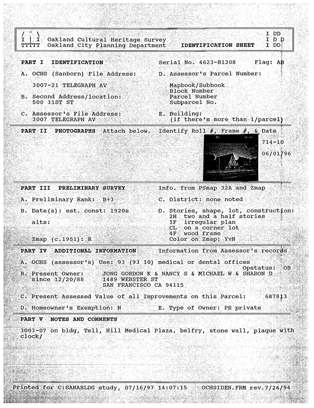
210

211

212
213
214

215

216

217
Section 4.0 ALTERNATIVES
 Section 4.0 ALTERNATIVES 4.1 Introduction Section 15126.6 of the State California Environmental Quality Act (CEQA) Guidelines requires an environmental impact report (EIR) to describe a range of reasonable
r e s i d e n t i a l o u t s i d e v i l l a g e c e n t e r
 N e w A l b a n y, O h i o r e s i d e n t i a l o u t s i d e v i l l a g e c e n t e r D e s i g n G u i d e l i n e s & R e q u i r e m e n t s s e c t i o n 5 I. Overview This section applies to all
5 February 12, 2014 Public Hearing APPLICANT AND PROPERTY OWNER: ERIK HOMES, L.L.C.
 5 February 12, 2014 Public Hearing APPLICANT AND PROPERTY OWNER: ERIK HOMES, L.L.C. STAFF PLANNER: Kristine Gay REQUEST: Special Exception for Alternative Compliance to the Oceanfront Resort District Form-Based
Neighborhood Traditional Single-Family District Regulations City of St. Petersburg City Code Chapter 16, Land Development Regulations
 Section 16.20.010 - Neighborhood Traditional Single-Family Districts ( NT ) Typical Houses in a Neighborhood Traditional District Typical Block in a Neighborhood Traditional District Common Features of
Neighborhood Suburban Single-Family District Regulations City of St. Petersburg City Code Chapter 16, Land Development Regulations
 Section 16.20.020 - Neighborhood Suburban Single-Family Districts ( NS ) Sections: Typical Block in a Neighborhood Suburban District 16.20.020.1 History and Composition of Suburban Neighborhoods 16.20.020.2
B-2 COMMUNITY COMMERCIAL BUSINESS DISTRICT. Uses allowed in the B-2 Community Commercial Business District are subject to the following conditions:
 SECTION 46-53.1 B-2 COMMUNITY COMMERCIAL BUSINESS DISTRICT A. PURPOSE The B-2 Community Commercial Business District is oriented toward retail, service businesses and multi-family residential development.
FINAL ENVIRONMENTAL IMPACT REPORT Volume 1. NBC Universal Evolution Plan ENV EIR STATE CLEARINGHOUSE NO Council District 4
 Division of Land / Environmental Review City Hall 200 N. Spring Street, Room 750 Los Angeles, CA 90012 FINAL ENVIRONMENTAL IMPACT REPORT Volume 1 ENV-2007-0254-EIR STATE CLEARINGHOUSE NO. 2007071036 Council
Environmental Setting, Impacts, Standard Conditions of Approval, and Mitigation Measures
 CHAPTER 4 Environmental Setting, Impacts, Standard Conditions of Approval, and Mitigation Measures This Draft EIR has been prepared in accordance with CEQA, as amended (Public Resources Code Section 21000,
Corridor Residential Traditional District Regulations City of St. Petersburg City Code Chapter 16, Land Development Regulations
 Section 16.20.060 - Corridor Residential Traditional Districts ( CRT ) Typical Buildings in the CRT District Sections: 16.20.060.1 Composition of Traditional Residential Corridors 16.20.060.2 Purpose and
Christy Usher, AICP Associate Planner Phone Fax:
 Item No: 2 Meeting Date: March 12, 2013 To: Planning Commission Date: March 7, 2013 Authorized By: Ron Munekawa Chief of Planning By: Christy Usher, AICP Associate Planner Phone 650 522-7215 Fax: 522-7201
Project Location: 384 Railroad Avenue, Pittsburg, CA. APN:
 MEMORANDUM Date: 5 January 2010 To: From: Project: Re: Via: Alexandra Endress Associate Planner City of Pittsburg Sheila McElroy Mecca Block Phase II Crosby Building: design compatibility E-mail Project
Request Conditional Use Permit (Automobile Repair Garage) Staff Planner Jimmy McNamara
 Staff Planner Jimmy McNamara") Applicant Property Owner Sarrow One, LLC Public Hearing December 14, 2016 City Council Election District Princess Anne Agenda Item 13 Request Conditional Use Permit (Automobile Repair Garage) Staff Planner
Applicant Property Owner Sarrow One, LLC Public Hearing December 14, 2016 City Council Election District Princess Anne Agenda Item 13 Request Conditional Use Permit (Automobile Repair Garage) Staff Planner
HISTORIC DISTRICT BOARD OF REVIEW SAVANNAH HISTORIC DISTRICT Instructions for Certificate of Appropriateness Application
 HISTORIC DISTRICT BOARD OF REVIEW SAVANNAH HISTORIC DISTRICT Instructions for Certificate of Appropriateness Application This document is for information purposes only and does not need to be submitted
Public Hearing January 13, Request Conditional Use Permit (Auto Repair Garage) Staff Planner Carolyn A.K. Smith
 Staff Planner Carolyn A.K. Smith") Applicant Property Owner Holland Century Associates, LLP Public Hearing January 13, 2016 Request Conditional Use Permit (Auto Repair Garage) Staff Planner Carolyn A.K. Smith Location 3949 Holland Road
Applicant Property Owner Holland Century Associates, LLP Public Hearing January 13, 2016 Request Conditional Use Permit (Auto Repair Garage) Staff Planner Carolyn A.K. Smith Location 3949 Holland Road
Table of Contents. City of Redlands - Redlands Crossing Center
 City of Redlands - Redlands Crossing Center Executive Summary... ES-1 Section 1: Introduction...1-1 1.1 - Overview of the CEQA Process...1-1 1.2 - Scope of the EIR...1-5 1.3 - Organization of the EIR...1-8
CHAPTER 4.0 ENVIRONMENTAL SETTING, IMPACTS, AND MITIGATION
 CHAPTER 4.0 ENVIRONMENTAL SETTING, IMPACTS, AND MITIGATION Sections 4.1 through 4.14 of Chapter 4.0 of this EIR contain a discussion of the potential environmental effects from implementation of the proposed
City of Palo Alto (ID # 7047) City Council Staff Report
 City Council Staff Report") City of Palo Alto (ID # 7047) City Council Staff Report Report Type: Consent Calendar Meeting Date: 6/13/2016 Summary Title: East Palo Alto Comment Letter Title: Approval and Authorization for the City
City of Palo Alto (ID # 7047) City Council Staff Report Report Type: Consent Calendar Meeting Date: 6/13/2016 Summary Title: East Palo Alto Comment Letter Title: Approval and Authorization for the City
Residential Design Standards Draft 9 August 2013
 RESIDENTIAL DESIGN STANDARDS ORDINANCE DRAFT 9 AUGUST 2013 17.25 Residential Design Standards 17.25.010 Purpose The purpose of this chapter is to establish minimum design standards for new residential
REPORT TO PLANNING AND DESIGN COMMISSION City of Sacramento
 REPORT TO PLANNING AND DESIGN COMMISSION City of Sacramento 915 I Street, Sacramento, CA 95814-2671 4 To: Members of the Planning and Design Commission: PUBLIC HEARING May 11, 2017 Subject: Capital City
3 PROJECT DESCRIPTION
 3.1 PROJECT OVERVIEW 3 PROJECT DESCRIPTION The Rocklin 60 project (proposed project) includes the subdivision of 56.9 acres of land, construction of 179 single-family, detached dwelling units, and installation
Certificate of Appropriateness Review Packet
 Certificate of Appropriateness Review Packet When a Certificate of Appropriateness is required Historic preservation categories of review Decisions on applications for a Certificate of Appropriateness
306 6th Street SW
 306 6th Street SW 104-0213-0132 Primary Resource Information: Single Dwelling, Stories 2.00, Style: Other, ca 1890 July 2006: This 1890s, 2-story, 2-bay, cross-gabled, side-passage vernacular frame dwelling
Residential Uses in the Historic Village Core
 BLACK DIAMOND DESIGN GUIDLINES for Residential Uses in the Historic Village Core Adopted June 18, 2009 Introduction and Purpose These guidelines are intended to guide infill development within the Historic
Corridor Residential Traditional District Regulations City of St. Petersburg City Code Chapter 16, Land Development Regulations
 16.20.060 - Corridor Residential Traditional District ( CRT ) Figure REFERENCE Typical Buildings in the CRT District Sections: 16.20.060.1 Composition of Traditional Residential Corridors 16.20.060.2 Purpose
Neighborhood Suburban Single-Family District Regulations City of St. Petersburg City Code Chapter 16, Land Development Regulations
 16.20.020 Neighborhood Suburban Single-Family District ( NS ) Figure REFRENCE Typical Houses in Neighborhood Suburban 1 Figure REFRENCE Typical Block in a Neighborhood Suburban District Sections: 16.20.020.1
4) Garage placement must be in compliance with Sec. 6.3.G.2 below.
 Garage placement must be in compliance with Sec. 6.3.G.2 below.") 6.3 SMALL TOWN CHARACTER OVERLAY DISTRICT 6.3.1 Small Town Character Overlay District Article 6 / Overlay Districts A) Purpose The purpose and intent of the Small Town Character Overlay District is to
6.3 SMALL TOWN CHARACTER OVERLAY DISTRICT 6.3.1 Small Town Character Overlay District Article 6 / Overlay Districts A) Purpose The purpose and intent of the Small Town Character Overlay District is to
Project Title: Major Site Review (SR16-06) for Ripon Gardens II Commercial
 for Ripon Gardens II Commercial") Planning Commission Staff Report Planning Commission Hearing November 14, 2016 Project Title: Major Site Review (SR16-06) for Ripon Gardens II Commercial Request: A request to develop a 15,996 square foot
Planning Commission Staff Report Planning Commission Hearing November 14, 2016 Project Title: Major Site Review (SR16-06) for Ripon Gardens II Commercial Request: A request to develop a 15,996 square foot
H2. Residential Rural and Coastal Settlement Zone
 H2. Residential Rural and Coastal Settlement Zone H2.1. Zone description The Residential Rural and Coastal Settlement Zone applies to rural and coastal settlements in a variety of environments including
INTENT OBJECTIVES HISTORIC DESIGNATIONS
 TOWN OF LOS GATOS RESIDENTIAL DEVELOPMENT STANDARDS FOR ALL SINGLE FAMILY AND TWO-FAMILY DWELLINGS IN ALL ZONES EXCEPT THE RESOURCE CONSERVATION AND HILLSIDE RESIDENTIAL ZONES INTENT These development
CEQA Categorical Exemption Determination
 CEQA Categorical Exemption Determination PROPERTY INFORMATION/PROJECT DESCRIPTION Project Address Block/Lot(s) REC & PARK: 210V HYDE STREET 0336/003 Case No. 2017-016267ENV Permit No. Addition/ Alteration
H3. Residential Single House Zone
 H3. Residential Single House Zone H3.1. Zone description The purpose of the Residential Single House Zone is to maintain and enhance the amenity values of established residential neighbourhoods in number
THE DEVELOPMENT REVIEW BOARD. 1. New construction or relocation of single-family homes, including mobile/modular and manufactured homes.
 - I THE DEVELOPMENT REVIEW BOARD The General Plan of the City of Lakewood has been established to guide and promote the orderly growth and development of the community. The goals of the City, specified
RE: Letter of Intent Land Use Application for Plan Commission and UDC Initial/ Final Approval Request
 TO: City of Madison Planning Division 126 S. Hamilton Street Madison, WI 53701 Jessica Vaughn Department of Planning & Development City of Madison 126 S. Hamilton Street Madison, WI 53701 RE: Letter of
RS-1 District Schedule
 District Schedule 1 Intent The intent of this Schedule is generally to maintain the single-family residential character of the District, but also to permit conditionally one-family dwellings with secondary
CEQA Categorical Exemption Determination
 CEQA Categorical Exemption Determination PROPERTY INFORMATION/PROJECT DESCRIPTION Project Address Block/Lot(s) Case No. Permit No. Plans Dated Addition/ Demolition Alteration (requires HRER if over 45
CHAPTER R-6,000 Single-Family Residential. 6,000 Square Foot Minimum Lots
 CHAPTER 19.25 R-6,000 Single-Family Residential 6,000 Square Foot Minimum Lots Sections: 19.25.010 PURPOSE 19.25.020 PERMITTED USES 19.25.030 USES SUBJECT TO A CONDITIONAL USE PERMIT 19.25.040 PERMITTED
Architectural Review Board Report
 Architectural Review Board Report Architectural Review Board Meeting: December 15, 2014 Agenda Item: 7.5 To: From: Subject: Architectural Review Board Steve Traeger, Principal Urban Designer Grace Page,
A. Applicability and Review Authority.
 5.6 Development Plans Required for Architectural and Site Design Review in the TC: Town Center District, the R-U: Urban Residential District and the MU: Mixed Use District. Intent In order to: assure the
NOTICE OF PREPARATION OF AN ENVIRONMENTAL IMPACT REPORT
 Date: September 19, 2017 NOTICE OF PREPARATION OF AN ENVIRONMENTAL IMPACT REPORT To: Agencies and Interested Parties Lead Agency: Sacramento Municipal Utility District 6201 S Street, MS B203 Sacramento,
DESIGN REVIEW COMMITTEE AGENDA ITEM
 DESIGN REVIEW COMMITTEE AGENDA ITEM AGENDA DATE: NOVEMBER 16, 2016 TO: THRU: FROM: SUBJECT: Chair Fox and Members of the Design Review Committee Anna Pehoushek, Assistant Community Development Director
H3 Residential Single House Zone
 H3. Residential Single House Zone [ENV-2016-AKL-000243: K Vernon] Addition sought [CIV-2016-404-002333: Franco Belgiorno-Nettis]-Note: The properties affected by this appeal are identified on the Auckland
RAND CORPORATION HEADQUARTERS BUILDING. Final Environmental Impact Report
 RAND CORPORATION HEADQUARTERS BUILDING Final Environmental Impact Report State Clearinghouse No. 1999122008 Prepared by: Planning & Community Development Department 1685 Main Street Santa Monica, CA 90407-2200
TOWN OF ROTTERDAM RESIDENTIAL BUILDING PERMIT APPLICATION Ext. 395 Needed to Obtain Permit:
 TOWN OF ROTTERDAM RESIDENTIAL BUILDING PERMIT APPLICATION 355-7575 Ext. 395 Needed to Obtain Permit: 1. Building Permit Application, and/or residential plumbing permit application, as applicable, to be
Draft Noise Abatement Guidelines
 Document under Separate Cover refer to IMLC01-13 Draft Noise Abatement Guidelines April 2013 Legislative & Planning Services Table of Contents 1.0 Introduction...1 1.1 Key Definitions...1 2.0 Existing
ARTICLE 987. PD 987. PD 987 was established by Ordinance No , passed by the Dallas City Council on June 14, (Ord.
 ARTICLE 987. PD 987. SEC. 51P-987.101. LEGISLATIVE HISTORY. PD 987 was established by Ordinance No. 30512, passed by the Dallas City Council on June 14, 2017. SEC. 51P-987.102. PROPERTY LOCATION AND SIZE.
SITE PLAN CRITERIA FOR MUNICIPAL SOLID WASTE & RECYCLABLES STORAGE & ENCLOSURE REQUIREMENTS
 SITE PLAN CRITERIA FOR MUNICIPAL SOLID WASTE & RECYCLABLES STORAGE & ENCLOSURE REQUIREMENTS April 2009 General Solid Waste and Recycling Service Responsibilities: The City of Denton is the exclusive provider
ARTICLE VII - OFF-STREET PARKING AND LOADING Section 7-10
 ARTICLE VII - OFF-STREET PARKING AND LOADING Section 7-10 Section 7-10.1 Off Street Parking. Off-street parking spaces, with proper access from a street, alley or driveway shall be provided in all districts
SECTION 5 EXCEPTIONS AND MODIFICATIONS
 Sec. 5-1 Walls and Fences. SECTION 5 EXCEPTIONS AND MODIFICATIONS All walls and fences shall be erected or constructed in compliance with the provisions of this section. These regulations shall not prohibit
11.0 Commercial Infill
 11.0 Commercial Infill 11.1 INTRODUCTION Infill is the process of building a new structure on a vacant site within an existing neighborhood. These Infill guidelines are also applicable to the review of
4. ENVIRONMENTAL SETTING AND IMPACTS A. INTRODUCTION TO CHAPTER 4 FORMAT OF THE ENVIRONMENTAL ANALYSIS
 4. ENVIRONMENTAL SETTING AND IMPACTS A. INTRODUCTION TO CHAPTER 4 Chapter 4, Environmental Setting and Impacts, addresses the physical environmental effects of the Proposed Project. This Introduction to
10.1 PERMITTED USES SECTION 10 SECTION 10 HIGHWAY COMMERCIAL ZONE (C2) HIGHWAY COMMERCIAL ZONE (C) J.L. Richards & Associates Limited
 HIGHWAY COMMERCIAL ZONE (C) J.L. Richards & Associates Limited") SECTION 10 HIGHWAY COMMERCIAL ZONE (C) No person shall hereafter use any lands or erect, alter, enlarge or use any building or structure in a Highway Commercial (C2) Zone except in accordance with the
SECTION 10 HIGHWAY COMMERCIAL ZONE (C) No person shall hereafter use any lands or erect, alter, enlarge or use any building or structure in a Highway Commercial (C2) Zone except in accordance with the
# 7 ) UN MY PLACE HOTEL SPECIAL USE PERMIT PUBLIC HEARING
 UN MY PLACE HOTEL SPECIAL USE PERMIT PUBLIC HEARING") # 7 ) UN-53-16 MY PLACE HOTEL SPECIAL USE PERMIT PUBLIC HEARING STAFF REPORT To: Planning Commission Meeting date: September 14, 2016 Item: UN-53-16 Prepared by: Marc Jordan GENERAL INFORMATION: Applicant:
# 7 ) UN-53-16 MY PLACE HOTEL SPECIAL USE PERMIT PUBLIC HEARING STAFF REPORT To: Planning Commission Meeting date: September 14, 2016 Item: UN-53-16 Prepared by: Marc Jordan GENERAL INFORMATION: Applicant:
Guidelines for New Construction in Albany s Residential Historic Districts & Neighborhoods
 Guidelines for New Construction in Albany s Residential Historic Districts & Neighborhoods Examples of new construction that fit into the historic neighborhood. 1 Albany s historic residential neighborhoods
ARTICLE VIII. (SF-A, SF-TH) SINGLE-FAMILY ATTACHED AND TOWNHOUSE RESIDENTIAL DISTRICTS
 SINGLE-FAMILY ATTACHED AND TOWNHOUSE RESIDENTIAL DISTRICTS") (Ord. No. 2835; 07/01/03) SECTION A. PURPOSE. ARTICLE VIII. (SF-A, SF-TH) SINGLE-FAMILY ATTACHED AND TOWNHOUSE RESIDENTIAL DISTRICTS 1. The (SF-A, SF-TH) Single-Family Residential Districts are intended
(Ord. No. 2835; 07/01/03) SECTION A. PURPOSE. ARTICLE VIII. (SF-A, SF-TH) SINGLE-FAMILY ATTACHED AND TOWNHOUSE RESIDENTIAL DISTRICTS 1. The (SF-A, SF-TH) Single-Family Residential Districts are intended
Community Plan Exemption Checklist
 Case No.: 2014.0836E Project Title: 340 350 11th Street Zoning/Plan Area: WMUO (WSoMa Mixed Use Office) District 55 X Height and Bulk District Western SoMa Community Plan Block/Lot: 3521/005 and 007 Lot
1431 Jefferson Street Marriott Hotel Project
 1431 Jefferson Street Marriott Hotel Project CEQA Analysis Prepared for: City of Oakland Planning 250 Frank H. Ogawa Plaza, Suite 2114 Oakland, CA 94612 Prepared By: Lamphier Gregory 1944 Embarcadero Oakland,
SECTION 832 "C-P" - ADMINISTRATIVE AND PROFESSIONAL OFFICE DISTRICT
 SECTION 832 "C-P" - ADMINISTRATIVE AND PROFESSIONAL OFFICE DISTRICT The "C-P" Administrative and Professional Office District is intended to provide for the development of an integrated professional district
Commercial Remodel Permit
 Commercial Remodel Permit Zoning requirements Staff recommends always verifying the zoning requirements for your project before deciding to build. Warrensburg has eleven separate zoning districts, each
BOSTON REDEVELOPMENT AUTHORITY DEVELOPMENT PLAN FOR PLANNED DEVELOPMENT AREA NO. 103 SOUTH BAY DEVELOPMENT. 101 Allstate Road.
 BOSTON REDEVELOPMENT AUTHORITY DEVELOPMENT PLAN FOR PLANNED DEVELOPMENT AREA NO. 103 SOUTH BAY DEVELOPMENT 101 Allstate Road Dorchester Allstate Road (Edens), LLC [, 2016] Development Plan: In accordance
Planning, Land Use and Mobility Committee
 Planning, Land Use and Mobility Committee Case Report: DIR-2016-3785 - SPP Chick-fil-A 20101 Ventura Boulevard, Woodland Hills, CA 91364 PLUM Hearings: March 2, 2017 (First Presentation) May 18, 2017 (Second
7.0 Design Guidelines
 7.0 Design Guidelines 7.1 Scotia s Historic/Cultural Resources Inventories of Scotia s historic and cultural resources are included in the Appendices. Contributing and non-contributing resources are shown
CHAPTER 13 R-5 MANUFACTURED MOBILE HOME PARK RESIDENTIAL DISTRICT
 15.1300 CHAPTER 13 R-5 MANUFACTURED MOBILE HOME PARK RESIDENTIAL DISTRICT 15.1301 SECTION 13.01 STATEMENT OF PURPOSE To provide for manufactured home park development, of long-term duration of stay, in
1375 St. Andrews Apartments Project Case No. ENV EIR ZA ZAA-ZAI-SPR. Council District No. 13
 Major Projects & EIR Section City Hall 200 N. Spring Street, Room 750 Los Angeles, CA 90012 INITIAL STUDY HOLLYWOOD COMMUNITY PLAN AREA 1375 St. Andrews Apartments Project Case No. ENV-2015-4630-EIR ZA-2015-4629-ZAA-ZAI-SPR
Findings of Fact and Statement of Overriding Considerations
 Findings of Fact and Statement of Overriding Considerations Pursuant to Sections 21081 and 21081.6 of the Public Resources Code and Sections 15091 and 15093 of the CEQA Guidelines Creative Arts & Holloway
ONLY ONLY BUILDING AND PARKING ENVELOPE RAMP STAIRS NEW SURFACE PARKING PROPOSED HOTEL PROPOSED TWO STORY PARKING STRUCTURE NEW SURFACE PARKING
 LOCATION MAP SITE DEVELOPMENT DATA: --ACREAGE: ± 5. ACRES -- ZONING: MUDD-O -- USES: UP TO TWO () HOTELS WITH UP TO 70 ROOMS (APPROXIMATELY 00 ROOMS IN THE EXISTING HOTEL ON THE SITE, AND UP TO 70 ROOMS
ORDINANCE NO. _5063. The Board of Supervisors of the County of Santa Cruz ordains as follows: SECTION I
 ORDINANCE NO. _5063 AN ORDINANCE AMENDING SUBDIVISION (d) OF SECTION 13.10.170 AND SECTION 13.10.400, AND ADDING COUNTY CODE SECTIONS 13.10.444, 13.10.445, 13.10.446 AND 13.10.447, ESTABLISHING A PLEASURE
DEPARTMENT OF PLANNING JEFFERSON PARISH, LOUISIANA
 DEPARTMENT OF PLANNING JEFFERSON PARISH, LOUISIANA DESIGN REVIEW REPORT DOCKET NO: SUMMAR NO.: : : Paul D. Johnston AT LARGE: A: Chris Roberts B: Elton M. Lagasse ADVERTISING DATES: PAB PUBLIC HEARING:
Departure from Parking & Loading Standards
 The Maryland-National Capital Park and Planning Commission Prince George's County Planning Department Development Review Division 301-952-3530 Note: Staff reports can be accessed at www.mncppc.org/pgco/planning/plan.htm.
TRANSPORTATION IMPACT ANALYSIS GUIDELINES FOR ENVIRONMENTAL REVIEW
 TRANSPORTATION IMPACT ANALYSIS GUIDELINES FOR ENVIRONMENTAL REVIEW October 2002 The Planning Department City and County of San Francisco TABLE OF CONTENTS I. Introduction 1 II. Overview of Process and
Appendix H. Millennium Hollywood Project Trip Cap and Mitigation Triggers
 Appendix H Millennium Hollywood Project Trip Cap and Mitigation Triggers MILLENNIUM HOLLYWOOD PROJECT TRIP CAP AND MITIGATION TRIGGERS Crain and Associates Introduction The Millennium Hollywood Project
Design Guidelines for Construction and Renovation in the Longmeadow Historic District
 Design Guidelines for Construction and Renovation in the Longmeadow Historic District Revision 2008.1 The following list of Guidelines has been compiled to facilitate the homeowner's planning for projects
# 5 ) UN THREE CUPS YARD NORTH AMERICA CULTIVATION FACILITY SPECIAL USE PERMIT PUBLIC HEARING
 UN THREE CUPS YARD NORTH AMERICA CULTIVATION FACILITY SPECIAL USE PERMIT PUBLIC HEARING") # 5 ) UN-74-16 THREE CUPS YARD NORTH AMERICA CULTIVATION FACILITY SPECIAL USE PERMIT PUBLIC HEARING STAFF REPORT To: Planning Commission Meeting date: November 9, 2016 Item: UN-74-16 Prepared by: Marc
# 5 ) UN-74-16 THREE CUPS YARD NORTH AMERICA CULTIVATION FACILITY SPECIAL USE PERMIT PUBLIC HEARING STAFF REPORT To: Planning Commission Meeting date: November 9, 2016 Item: UN-74-16 Prepared by: Marc
PC 10 05, Request for conditional use permit and and text amendment construct construct new North Education Education Center, Center, 5530 Zealand
 PC 10 05, 05, Request for conditional use permit and text amendment to construct new North Education Center, 5530 Zealand Ave N Planning Commission October 5, 2010 General Information Planning Case: 10-05
Notice of Preparation For Link Union Station (Link US) Project. Joint Environmental Impact Statement and Environmental Impact Report
 Project. Joint Environmental Impact Statement and Environmental Impact Report") Notice of Preparation For Link Union Station (Link US) Project Joint Environmental Impact Statement and Environmental Impact Report Date: May 27, 2016 To: Subject: Project Title: From: All Interested Agencies,
Notice of Preparation For Link Union Station (Link US) Project Joint Environmental Impact Statement and Environmental Impact Report Date: May 27, 2016 To: Subject: Project Title: From: All Interested Agencies,
Application for Historic Review. Reconstruction of a Existing Detached Garage. 815 Washington Street Oregon City
 Application for Historic Review Reconstruction of a Existing Detached Garage 815 Washington Street Oregon City 1 Project: Application: Garage reconstruction Historic Review for new construction with preservation
City of Richmond Zoning Ordinance Page 12-1
 ARTICLE 12 BUILDING DESIGN AND COMPOSITION Section 12.01 Purpose. High quality architectural design and building composition are important elements in reinforcing a comfortable, human-scale environment,
TO: Tommy Lee Reception: PPA Case No U for Haight Street
 v COON r. T 1650 Mission St Suite 400 DATE: October 13, 2011 San Francisco, CA 94103-2479 TO: Tommy Lee Reception: 415.558.6378 FROM: Joy Navarrete, Planning Department F: RE: PPA Case No. 2011.0898U for
# 17 ) UN DESERT GREEN FARMS SPECIAL USE PERMIT EXTENSION OF TIME PUBLIC HEARING
 UN DESERT GREEN FARMS SPECIAL USE PERMIT EXTENSION OF TIME PUBLIC HEARING") # 17 ) UN-101-14 DESERT GREEN FARMS SPECIAL USE PERMIT EXTENSION OF TIME PUBLIC HEARING STAFF REPORT To: Planning Commission Meeting date: December 9, 2015 Item: UN-101-14 Prepared by: Robert Eastman GENERAL
# 17 ) UN-101-14 DESERT GREEN FARMS SPECIAL USE PERMIT EXTENSION OF TIME PUBLIC HEARING STAFF REPORT To: Planning Commission Meeting date: December 9, 2015 Item: UN-101-14 Prepared by: Robert Eastman GENERAL
RESOLUTION NO.15- The Planning Commission of the City of La Habra does hereby resolve as follows:
 RESOLUTION NO.15- A RESOLUTION OF THE PLANNING COMMISSION OF THE CITY OF LA HABRA CERTIFYING MITIGATED NEGATIVE DECLARATION OF ENVIRONMENTAL IMPACTS 14-02 FOR A 32 UNIT MULTI-FAMILY RESIDENTIAL DEVELOPMENT
CITY OF WINTER PARK SETBACK/COVERAGE WORKSHEET GUIDE FOR SINGLE FAMILY ZONING
 CITY OF WINTER PARK SETBACK/COVERAGE WORKSHEET GUIDE FOR SINGLE FAMILY ZONING See Setback/Coverage Worksheet & Criteria: Pages 1-4 & Accessory Structure Guide Step 1 Step 2 Step 3 Step 4 Step 5 Step 6
ADMINISTRATIVE SITE PLAN REVIEW FOR SINGLE- AND TWO-FAMILY DWELLINGS AND MULTIPLE-FAMILY DWELLINGS HAVING THREE OR FOUR DWELLING UNITS
 Community Planning and Economic Development Development Services Division 250 South 4 th Street, Room 300 Minneapolis MN 55415-1316 612-673-3000 ADMINISTRATIVE SITE PLAN REVIEW FOR SINGLE- AND TWO-FAMILY
Community Development Department Planning Division 1600 First Street + P.O. Box 660 Napa, CA Napa (707)
") Community Development Department Planning Division 1600 First Street + P.O. Box 660 Napa, CA 94559-0660 Napa (707) 257-9530 PLANNING COMMISSION STAFF REPORT MAY 19, 2016 AGENDA ITEM #7.B. 16-0063-DR; NAPA
Community Development Department Planning Division 1600 First Street + P.O. Box 660 Napa, CA 94559-0660 Napa (707) 257-9530 PLANNING COMMISSION STAFF REPORT MAY 19, 2016 AGENDA ITEM #7.B. 16-0063-DR; NAPA
PLANNED UNIT DEVELOPMENT & SUBDIVISION STAFF REPORT Date: July 11, 2013
 PLANNED UNIT DEVELOPMENT & SUBDIVISION STAFF REPORT Date: July 11, 2013 SUBDIVISION NAME DEVELOPMENT NAME LOCATION Northside LTD/Joint Venture Subdivision, Resubdivision of and Addition to Lot 3A Northside
III. VILLAGE CORE A. LOCATION AND DESCRIPTION
 III. VILLAGE CORE A. LOCATION AND DESCRIPTION Within the commercial district along Mentor Avenue there exists Old Mentor Village. This four block area represents the original historic core of the City
Architectural Commission Report
 City of Beverly Hills Planning Division 455 N. Rexford Drive Beverly Hills, CA 90210 TEL. (310) 285-1141 FAX. (310) 858-5966 Architectural Commission Report Meeting Date: Wednesday, March 15, 2017 Subject:
City of La Palma Agenda Item No. 2
 City of La Palma Agenda Item No. 2 MEETING DATE: March 9, 2015 TO: FROM: SUBMITTED BY: AGENDA TITLE: DEVELOPMENT COMMITTEE DOUGLAS D. DUMHART COMMUNITY DEVELOPMENT DIRECTOR SCOTT HUTTER, ASSOCIATE PLANNER
Draft Environmental Impact Report Serramonte Views Condominiums and Hotel Project
 Draft Environmental Impact Report Serramonte Views Condominiums and Hotel Project File Nos. GPA-9-14-9640, PD-9-14-9637, SUB-9-14-9643, Design Review-9-14-9644, UPR-1-18-013248 SCH# 2016062063 Prepared
MIAMI 21 AS ADOPTED JANUARY 2011
 TABLE OF CONTENTS 5.1 Generally 5.2 Natural Transect Zones (T1) and Rural Transect Zones (T2) 5.3 Sub-Urban Transect Zones (T3) 5.4 General Urban Transect Zones (T4) 5.5 Urban Center Transect Zones (T5)
Notwithstanding article VII of this chapter, the following conditional uses may be permitted in the planned mixed use development (PMUD) zone:
 zone:") DIVISION 14. - PLANNED MIXED USE DEVELOPMENT (PMUD) Sec. 78-1021. - Purpose. The town is a community with a rich tradition of mixed use neighborhoods and a paucity of land area dedicated for large commercial,
DIVISION 14. - PLANNED MIXED USE DEVELOPMENT (PMUD) Sec. 78-1021. - Purpose. The town is a community with a rich tradition of mixed use neighborhoods and a paucity of land area dedicated for large commercial,
II. Corrections and Additions to the Draft EIR
 II. Corrections and Additions to the Draft EIR II. Corrections and Additions to the Draft EIR This section of the Final EIR provides changes to the Draft EIR that have been made to clarify, correct, or
# Mercyhealth Hospital Project Review for Planning and Zoning Commission
 #2017-38 Mercyhealth Hospital Project Review for Planning and Zoning Commission Meeting Dates: December 6, 2017 and January 3, 2018 Requests: 1. Preliminary Planned Unit Development and 2. Special Use
104 TODD AVENUE. Primary: Single Dwelling (contributing) Secondary: Garage (contributing) Architectural Description
 Secondary: Garage (contributing) Architectural Description") 104 TODD AVENUE 104 Todd Avenue DHR RESOURCE NUMBER: 104-5084-0147 DATE/PERIOD: circa 1916 Craftsman Secondary: Garage (contributing) Site Description: Placed on the south side of Todd Avenue the house
104 TODD AVENUE 104 Todd Avenue DHR RESOURCE NUMBER: 104-5084-0147 DATE/PERIOD: circa 1916 Craftsman Secondary: Garage (contributing) Site Description: Placed on the south side of Todd Avenue the house
Northwest State Route 138 Corridor Improvement Project
 Northwest State Route 138 Corridor Improvement Project Los Angeles County, CA DISTRICT 7- LA- 138 (PM 0.0/36.8); DISTRICT 7- LA- 05 (PM 79.5/83.1); DISTRICT 7- LA- 14 (PM 73.4/74.4) 265100/ 0700001816
LDR RESIDENTIAL LAND DEVELOPMENT REGULATIONS (LDRs) CODE UPDATE D.R.C. June 7, 2017
 CODE UPDATE D.R.C. June 7, 2017") LDR 2017-01 RESIDENTIAL LAND DEVELOPMENT REGULATIONS (LDRs) CODE UPDATE D.R.C. June 7, 2017 SECTION NO. SECTION TITLE COMPLEXITY DESCRIPTION 1. 16.20.010.5. Problem Statement: Concerns have been expressed
LDR 2017-01 RESIDENTIAL LAND DEVELOPMENT REGULATIONS (LDRs) CODE UPDATE D.R.C. June 7, 2017 SECTION NO. SECTION TITLE COMPLEXITY DESCRIPTION 1. 16.20.010.5. Problem Statement: Concerns have been expressed
Technical and Physical Feasibility Fact Sheet Alternative 28: Infill/Density
 Technical and Physical Feasibility Fact Sheet Alternative 28: Infill/Density Acknowledgements: This fact sheet was written by Phyllis Taylor of Sites Southwest as part of the Evaluation of Alternative
SITE PLAN AND ARCHITECTURAL REVIEW APPLICATION
 SITE PLAN AND ARCHITECTURAL REVIEW APPLICATION CITY OF GENEVA, NEW YORK The purpose of the site plan and architectural review process is to secure compliance with the City s Zoning Ordinance and to promote
STAFF REPORT. Project Description. Proposal. Snyderville Basin Planning Commission From:
 STAFF REPORT To: Snyderville Basin Planning Commission From: Ray Milliner, County Planner Date of Meeting: May 12, 2015 Type of Item: Public Hearing, No Action Process: Administrative Review RECOMMENDATION:
Summary of Regulations and Permits for Fences and Walls
 Basic Fence Regulations Location and Height Summary of Regulations and Permits for Fences and Walls The maximum permitted height for a fence depends on where the fence is located on a property. Setbacks
IC-1 and IC-2 Districts Schedule
 Districts Schedule 1 Intent The primary intent of this Schedule is to permit light industrial uses that are generally compatible with one another and with adjoining residential or commercial districts.
Baseline Hillside Ordinance Correction Sheet (Ordinance No. 184,802 Effective 3/17/17)
") Baseline Hillside Ordinance Correction Sheet (Ordinance No. 184,802 Effective 3/17/17) Plan Check #: Permit App. #: Job Address: Zone: Maximum Allowed RFA: Plan Check Engineer: Phone: Fax: (E-mail: firstname.lastname@lacity.org)
Baseline Hillside Ordinance Correction Sheet (Ordinance No. 184,802 Effective 3/17/17) Plan Check #: Permit App. #: Job Address: Zone: Maximum Allowed RFA: Plan Check Engineer: Phone: Fax: (E-mail: firstname.lastname@lacity.org)