Statement of Proposal for a Land Use Plan
|
|
|
- Brittney Griffith
- 6 years ago
- Views:
Transcription


1 Statement of Proposal for a Land Use Plan Port of Bundaberg Gladstone Ports Corporation 31 October 2017
2 Contents 1 Introduction Gladstone Ports Corporation Port of Bundaberg The land use plan review The Port of Bundaberg Land Use Plan What is a land use plan? What is a statement of proposal for a land use plan? What is the process for a new land use plan? Setting the context regional and local factors influencing port land use Regional context Local context Long term economic influences Bundaberg State Development Area Existing localities and Strategic Port Land Existing localities Strategic Port Land Future Strategic Port Land Core matters What are the core matters? Land use and development Port facilities Valuable features Consultation for the statement of proposal What consultation is occurring and how is feedback being dealt with? How can a submission be made? References Attachments Attachment A Strategic Port Land holdings Figures Figure 1 Figure 2 Figure 3 Port of Bundaberg locality Process for preparing a new land use plan The Bundaberg State Development Area Cover image and document images: GPC (2017a) Statement of Proposal for a Land Use Plan Port of Bundaberg i

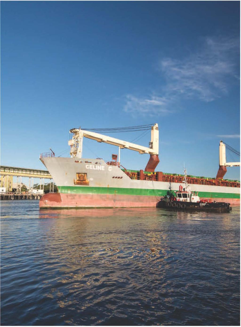
3 1 Introduction 1.1 Gladstone Ports Corporation Gladstone Ports Corporation Limited (GPC) is a Company Government Owned Corporation, pursuant to the Government Owned Corporations Act GPC manages the Port of Gladstone, Port Alma Shipping Terminal and the Port of Bundaberg. The Port of Bundaberg was transferred to GPC in 2009 and now operates as a business unit of GPC. Since that time, GPC has been working to develop the Port s potential in line with GPC s mission to responsibly manage, develop and operate port facilities and services for the sustainable economic growth and social prosperity for our region, Queensland and Australia. GPC s operational goal is to carry out port operations in accordance with world s best practice. This reflects GPC s desire to develop competitive, attractive, prosperous and responsible port operations while at the same time acknowledging that the Port of Bundaberg is a part of the Bundaberg community and has certain responsibilities and obligations. These responsibilities and obligations are effected by GPC through day to day operations and decision making (expressed through port land use plans) together with long term planning (port strategic plans). 1.2 Port of Bundaberg The Port of Bundaberg (the Port) is situated on the Burnett River approximately 19 kilometres (km) from the city of Bundaberg and 4.8 km from the mouth of the Burnett River. The Port is located approximately 40 km south of the Great Barrier Reef Marine Park. The location of the Port of Bundaberg is illustrated in Figure 1. Originally established on 3 December 1895 and operating at the Town Reach Locality of the Burnett River, the then Bundaberg Harbour facilitated the trade of timber, general cargo and bagged sugar. In response to the need to support the export trade requirements of a burgeoning sugar industry, the Port was moved to its current location at Burnett Heads in 1958 (GPC 2017a). Figure 1 Port of Bundaberg locality Statement of Proposal for a Land Use Plan Port of Bundaberg 1

4 The Port is centrally located on the eastern seaboard of Australia within 14 days sailing of all major ports in Asia, enabling it to be well positioned to trade in both import and export bulk and break bulk commodities. Whilst the Port s imports/exports have traditionally been bulk sugar and molasses, commodity types have diversified in recent years and now include wood pellets, silica sand and most recently in mid-late 2017, gypsum (GPC 2017a). In 2016/2017, 26 vessels visited the Port. During this period, the Port handled approximately 443,765 tonnes of sugar, along with 86,793 tonnes of silica sand and 37,113 tonnes of wood pellets. In addition to these commodities, the import of gypsum has also commenced and the recently established plasterboard manufacturing plant at the Port will soon begin exporting plasterboard products (GPC 2017b). Significant new investment in infrastructure (ie the recent industrial gas supply to the Port and future upgrades to electricity, water, sewerage and roads) will lead to new port related development. The challenge for GPC is to continue to provide balanced and demand driven development and manage and maintain efficient and effective services whilst maintaining its competitive edge. GPC considers that the Port will play an important role in the future prosperity of the Wide Bay Burnett region and the State of Queensland through future development of port and marine industry (GPC 2017a). 1.3 The land use plan review Queensland s port authorities are landowners and land managers, and have statutory management responsibility over their port authority land or Strategic Port Land. Under the Transport Infrastructure Act 1994, all port authorities must prepare and implement a land use plan for their Strategic Port Land every eight years. Land use plans regulate the planning and development of Strategic Port Land, and are an important tool for port authorities in the assessment and management of future development activities on Strategic Port Land. Land use plans have previously been prepared and implemented for the Port, with the current plan being the Port of Bundaberg Land Use Plan The requirements and process for preparing a new land use plan is prescribed by the Transport Infrastructure Act 1994, and this Statement of Proposal is the first step in that statutory process. Section 2 provides further detail regarding the land use plan process and requirements. Statement of Proposal for a Land Use Plan Port of Bundaberg 2


5 2 The Port of Bundaberg Land Use Plan 2.1 What is a land use plan? Land use plans typically deal with a range of land uses, and port land use planning is often focussed on industry, transport and infrastructure related development having regard to synergies that come from the co-location of uses, proximity to waterfront and berthing activities. Land use plans also address issues of protection of ecological values, interface issues and community well-being. The Transport Infrastructure Act 1994 requires a land use plan to: Contain details of Strategic Port Land and future Strategic Port Land; Coordinate and integrate the core matters relevant to the land use plan; Establish desired environmental outcomes (the vision); and Include measures to achieve the desired environmental outcomes (for example, land use designations/zones, codes). Since 2000, the approval processes for development on Strategic Port Land have, in addition to the Transport Infrastructure Act 1994, been subject to the provisions of State planning legislation, currently the Planning Act These provisions (amongst others) prescribe that port authorities are the Assessment Manager for all assessable development on Strategic Port Land and accordingly, land use plans are required by all port authorities for Strategic Port Land as the assessment benchmark for all assessable development. 2.2 What is a statement of proposal for a land use plan? All port authorities are required under the Transport Infrastructure Act 1994 to prepare and release a Statement of Proposal when making or amending land use plans and must consider State interests as part of the land use plan process. The Transport Infrastructure Act 1994 requires the Statement of Proposal to be prepared at the early stages of this process. The Statement of Proposal document is primarily a consultation tool. It should provide sufficient land use information for the relevant port area to enable the community to form views and influence the preparation of the land use plan. Whilst the Statement of Proposal presents a discussion of key issues or processes, it should also set out policy proposals. A Statement of Proposal must: Identify matters the land use plan will address; and State how the port authority intends to address each core matter in preparing the land use plan. Core matters are discussed further in Section 4. Statement of Proposal for a Land Use Plan Port of Bundaberg 3

6 2.3 What is the process for a new land use plan? As part of the land use plan review, GPC and its consultants have already undertaken an information review and targeted round of consultation with key government stakeholders. This Statement of Proposal represents the next step in the process of taking this early work to the community for consideration and feedback. The current status of this process in relation to the overall methodology is illustrated in Figure 2. Figure 2 Process for preparing a new land use plan Statement of Proposal for a Land Use Plan Port of Bundaberg 4
7 3 Setting the context regional and local factors influencing port land use 3.1 Regional context The Port is situated within the Wide Bay Burnett region, which has an estimated population of 293,500 (Wide Bay Burnett Regional Organisations of Councils Inc (WBBROC) 2014). Approximately 80% of the region s population is located in the urban centres of Bundaberg, Maryborough, Hervey Bay, Gympie and Kingaroy (Department of Infrastructure, Local Government and Planning (DILGP) 2011). Agriculture, forestry and fishery, manufacturing and mining industries are important to the economic prosperity of the Wide Bay Burnett region. The region is rapidly emerging as the food bowl of Queensland and is capitalising on the diversification of traditional manufacturing and food processing industries, like sugar. Two thirds of the State s softwood plantation resources are in Wide Bay Burnett s timber and forestry industry. Advantages of the region include: Ease of access to Asian and South Pacific markets; Proximity to domestic consumer markets, notably south-east Queensland; and Proximity to the mining areas of North Burnett and Wide Bay (WBBROC 2014). 3.2 Local context The Port is located within the Bundaberg Regional Council (BRC) local government area, approximately 356 km north of Brisbane. At the 2016 Australian census, the BRC local government area had a population of 92,897, with over half living in the Bundaberg city area (ABS 2016; WBBROC 2014). All Strategic Port Land at the Port is situated within BRC s planning scheme area. The BRC s Bundaberg Regional Council Planning Scheme 2015 commenced on 19 October 2015 as a blueprint for the future growth and development of the Bundaberg region (BRC 2017). While Strategic Port Land is not subject to the provisions of the Bundaberg Regional Council Planning Scheme 2015, it is important that there is consistency across the BRC s planning intent and GPC s vision. Common advantages of Bundaberg city area and the Port of Bundaberg include: Being located south of the Great Barrier Reef Marine Park; Potential for new port infrastructure; and Capacity for future port related industry and investment opportunities at the Port. The city is well connected by road and rail to the key south-east Queensland consumer markets and the mining and agricultural sectors within Central Queensland (GPC 2017a). 3.3 Long term economic influences In its Economic Development Strategy Bundaberg Region; A Better Climate for Business, BRC has identified the Port precinct as a major industry investment. The Port is well positioned as an emerging opportunity for future investment and value-adding growth, supporting the development of the precinct as a major transport and logistics hub in moving freight out of the State and nationally, as well as important industrial land contributor for the region and the State (BRC 2014). BRC has also identified the potential opportunity for the expansion of the use of port land to include boutique residential and village development. Statement of Proposal for a Land Use Plan Port of Bundaberg 5
.")
8 The Port of Bundaberg/Fairymead Industrial Investigation Area is identified as a key area for the unlocking of potential industrial investment in the State (BRC 2014). In particular, the Fairymead area has been identified as a growth area for the Port in the Wide Bay Burnett Regional Plan 2011, which may be suitable to accommodate expansion of the Port (DILGP 2011). 3.4 Bundaberg State Development Area In February 2017, the Queensland government declared an area of 6,076 hectares as the Bundaberg State Development Area (Bundaberg SDA) (refer Figure 3). The Bundaberg SDA is located north of Bundaberg city and includes: Land on the eastern side of the Burnett River near the Port, including parcels of Strategic Port Land surrounding port-related industrial land uses; and Land on the western side of the Burnett River, predominately comprising existing rural land, including sugar cane cultivation. The Bundaberg SDA was declared to encourage the establishment of industrial and port-related development of regional, State and/or national significance, as well as support other associated industries, facilities and local utilities. GPC recognises the following future potential opportunities at the Port which support the objectives of the Bundaberg SDA: New export and import opportunities for existing and new industries in and around Bundaberg; Facilitate establishment of new industries requiring export/import facilities; Increasing the number of vessels visiting the Port; Upgrading infrastructure including roads and material transport corridors within the Port area; and Working in cooperation with the Queensland government in relation to the Bundaberg SDA to plan transport, utilities and service corridors and support new port-related industries. Figure 3 The Bundaberg State Development Area Statement of Proposal for a Land Use Plan Port of Bundaberg 6

9 4 Existing localities and Strategic Port Land 4.1 Existing localities GPC s existing Strategic Port Land is located at three key localities across the Port, being Burnett Heads, Fairymead and the Town Reach Burnett Heads Burnett Heads is the current port area which extends from Marina Drive south to Strathdees Road. There is significant vacant land in the Buss Street area available for port industry development requiring access to import/export facilities. Plasterboard manufacturing has recently established in this area as have exports of ilmenite sands and forestry products. The area also incorporates land uses for dredged material placement Fairymead Fairymead includes land that has been set aside for future port industry development on the western side of Burnett River opposite the existing Burnett Heads port industry area Town Reach This land in the Burnett River was the original Port and is now used for marina and mooring activities associated with small to medium recreational and commercial vessels. 4.2 Strategic Port Land As part of the land use plan review process, a review of GPC s Strategic Port Land holdings will be undertaken, with the new land use plan identifying all land that is to be Strategic Port Land. GPC s review will include consideration of Strategic Port Land at each of the localities of Burnett Heads, Fairymead and the Town Reach to ensure current holdings reflect and support GPC s future intent and objectives for the Port. GPC s existing Strategic Port Land holdings are shown in Figure 1 and detailed in Attachment Future Strategic Port Land In addition to reviewing existing Strategic Port Land holdings, GPC must also specify within the land use plan, the details of any land that the port authority proposes to become Strategic Port Land. Generally, future Strategic Port Land is identified where it is considered to be vital to meeting the future requirements of the Port, including supporting efficient and effective port operations. Statement of Proposal for a Land Use Plan Port of Bundaberg 7
10 5 Core matters 5.1 What are the core matters? As noted in Section 1, the Transport Infrastructure Act 1994 prescribes the core matters that must be addressed in a land use plan. These are: Land use and development; Port facilities; Valuable features. The sections below provide background regarding each of these core matters, including how they are relevant to the Port and surrounds, and how GPC will address and consider these in the new land use plan. 5.2 Land use and development Background In accordance with the Transport Infrastructure Act 1994, land use and development includes the discussion of the following matters: (a) the location of, and the relationships between, the land uses in the area; (b) the current effects of land use in the area; (c) the likely effects of any proposed development of the land; (d) the accessibility to the area Future land use intent and precincts for Strategic Port Land GPC s future land use intent for Strategic Port Land will reflect the outcomes of the review of current Strategic Port Land described in Sections 4.2 and 4.3. Once this review is complete, it is anticipated that a number of strategic objectives and planning outcomes will be developed and incorporated in the new land use plan to guide future land use and development on GPC s Strategic Port Land. It is expected that the land use plan will adopt a precinct based approach to classifying parcels of Strategic Port Land that have similar functions or land use intent. Currently, the Port of Bundaberg Land Use Plan 2009 classifies Strategic Port Land into 15 precincts. It is anticipated that GPC will seek to review and revise these into a more simplified and consolidated set of precincts. These precincts may include some or all of the following designations: Port industry (including heavy and light industry that support core port activities, as well as land based infrastructure such as transport corridors and conveyors); Port industry support services (including light and general industry uses, warehousing and storage); and Marine operations (for activities or uses that require a waterfront location to maximise efficiency and for operational needs, including port marine infrastructure such as wharves and berths). These precinct designations will be further examined and confirmed in the land use plan. The land use plan will also identify areas where possible interface or potential conflict may arise between port activities and adjoining land uses, and include specific provisions (by way of a development code) to be addressed to minimise conflict, including appropriate design, site planning and traffic management. Consideration of appropriate transitional uses (as well as buffers and separation areas) will also be considered to minimise conflicts at the interface. Statement of Proposal for a Land Use Plan Port of Bundaberg 8
11 5.2.3 Future land use intent beyond Strategic Port Land The land use plan will need to have regard to the existing land use planning provisions for land surrounding the Port regulated by the Bundaberg Regional Council Planning Scheme 2015, as well as recognise the land use intent for the Bundaberg SDA, including consideration of the Bundaberg SDA Draft Development Scheme Key issues for consideration will include proposed infrastructure corridors; ensuring incompatible development is not encouraged through land use zoning for areas adjoining Strategic Port Land; and acknowledgement of port roads and other roads carrying significant port-related vehicles. 5.3 Port facilities Background Under the Transport Infrastructure Act 1994, port facilities are facilities or land that are owned or controlled by a wholly owned subsidiary of the port authority and are used in the operation or strategic management of the port authority s port. Port facilities include, but are not limited to shipping channels, berths and berth pockets, marine and port structures (including wharves and bulk loading and unloading facilities), monitoring and security facilities, and dredged material placement areas Existing port facilities Shipping channels The Port is serviced by an existing shipping channel and swing basin. Whilst existing spare capacity of both the shipping channel and swing basin is constrained by the vessel size that the Port can accept, both are currently adequate for the committed trade growth. Notwithstanding this, future development at the Port, beyond committed trade growth may trigger the need for increased capacity of the shipping channel and for new berth pockets. Available vessel depth and draft has been typically restricted at the Port as a result of periodic flood events. However, it is anticipated that GPC s annual maintenance dredging program will progressively return the Port s channel to its original design depths. Berth and wharf infrastructure Over the past 10 years, the Port has handled between vessels per year. Whilst berth utilisation has historically remained low, rates are improving with current utilisation expected to increase to approximately 20% in 2017/18 (GPC 2017a). The Port is currently serviced by two wharves; the Sir Thomas Hiley Wharf and the John T Fisher Wharf. The Sir Thomas Hiley Wharf, which is owned by Sugar Terminal Ltd functions as a dry bulk, break bulk and general cargo wharf, whilst the John T Fisher Wharf, owned by GPC supports bulk molasses loading and bulk petroleum loading. As at October 2017, the John T Fisher Wharf is not currently in use. Transport and services infrastructure The Port and surrounding Bundaberg region is serviced by key transport infrastructure, including: Bundaberg Airport; Two main road connections to the Bruce Highway, including the Isis Highway and Gin Gin Road; Access to the Port s main precinct at Burnett Heads via Burnett Head Road and Bundaberg Port Road; Statement of Proposal for a Land Use Plan Port of Bundaberg 9
12 Access to the Port s mixed use area via Harbour Esplanade; and Access to the Port s Fairymead area via Fairymead and River Roads. The Port is currently undertaking an upgrade of its internal port roads to B-double standard to ensure the safe and efficient transport of products and people with the Port precinct. Studies are also currently being undertaken to investigate the potential for a new infrastructure corridor, including road transport into the Port. The Port is serviced by a range of service utilities, including: Electricity; Gas, including the newly operational Bundaberg Port Gas Pipeline; Potable and non-potable water; and Telecommunications Future intent for port facilities The new land use plan will consider the need or planned provision of new port facilities and infrastructure, whilst having regard to existing port facilities and infrastructure, their existing capacities and potential for increased utilisation. Key considerations for the new land use plan include: Accommodating growth in cargo handled by the Port (through possible new facilities, land use planning and land availability); Identifying growth areas (eg at Burnett Heads and Fairymead); Identifying current and future Strategic Port Land, and the interface with the Bundaberg SDA and the BRC planning scheme area in order to give some context to the Port s activities and interests to the adjoining land use jurisdictions and the local community; Identifying important existing or planned infrastructure supporting or servicing the Port (such as major roads, mineral resources corridors); and Provision of a Development Code which may include requirements for new development to address local infrastructure provisions (eg water, sewerage and roads). 5.4 Valuable features Background The Transport Infrastructure Act 1994 defines valuable features as including the following terrestrial and aquatic matters: Resources or areas of ecological significance including, for example, habitats, wildlife corridors, buffer zones, places supporting biodiversity or resilience, and features contributing to the quality of air, water (including catchments or recharge areas) and soil Areas contributing significantly to amenity including, for example, areas of high scenic value, physical features that form significant visual backdrops or that frame or define places or localities, and attractive built environments Areas or places of cultural heritage significance including, for example, areas or places of indigenous cultural significance, or aesthetic, architectural, historical, scientific, social or technological significance, to the present generation or past or future generations Statement of Proposal for a Land Use Plan Port of Bundaberg 10
13 Resources or areas of economic value Including, for example, extractive deposits, fishery resources, forestry resources, water resources, sources of renewable and non-renewable energy and good quality agricultural land The new land use plan will address how the Port will appropriately consider, prioritise, manage and protect valuable features from potential impact. Where relevant, or where a proposed development has the potential to impact valuable features, development design and operational requirements, along with key mitigation measures will be required to be considered and assessed as part of a proponent s Port Development Application. To achieve this, it is anticipated that the new land use plan will include specific assessment benchmarks for the management of valuable features within a Development Code that will apply to all assessable development. In addition to the above, the new land use plan will incorporate and reflect the matters of State interest as identified in the Queensland government s State Planning Policy Ecological significance Environmental values The Wide Bay Burnett region has a rich biodiversity, including wetlands, coral reefs, stream systems and forests, relatively intact hinterland areas, as well as a variety of ancient, rare and threatened fauna and flora species (DILGP 2011). Most notably, the region includes the significant natural resources of the World Heritage listed Great Barrier Reef and Fraser Island which are located to the north, and south of the Port, respectively. In closer proximity to the Port are a number of marine parks and protected areas, including the Ramsar listed Great Sandy Straits wetland, the Commonwealth and State significant Mon Repos Conservation Park and Mon Repos Turtle Rookery as well as the State protected Barrubra Island Conservation Park. The Mon Repos Conservation Park supports the largest concentration of nesting marine turtles on the eastern Australian mainland, and has the most significant loggerhead turtle nesting population in the South Pacific region (Department of National Parks, Sport and Racing 2017). In addition to the high ecological value waters associated with the marine parks and protected areas, there are a number of other important terrestrial ecological values within and surrounding the Port, including Commonwealth and State protected Threatened Ecological Communities (Subtropical lowland rainforest), State significant regulated vegetation (endangered and of concern regional ecosystems), mapped areas of essential habitat (for species including the Koala and Wallum froglet) and important shorebird areas (Department of Environment and Energy (DoEE) 2017; DILGP 2017; GHD 2009) Furthermore, the Port contains important wetlands, including the area adjacent to the marina and Burnett Heads Boat Harbour. This wetland has been identified as an environmental management area in recognition of its ecological importance and role in stormwater management of the inner port area east of Buss Street. Coastal processes and natural hazard risk The Port is located within areas identified as subject to erosion and storm tide inundation. In addition, some areas around the Port are subject to flooding from the Burnett River, with the most recent flooding events occurring in 2011 and Amenity Unlike other parts of the Wide Bay Burnett region, Bundaberg, and the Port precinct consists of proximately flat terrain (DILGP 2011). Despite this, the Burnett River, as well as the coastal localities of Burnett Heads, Mon Repos and Bargara provide important coastal and scenic amenity vistas and outlooks. In addition, the Port area contains a number of open space areas, recreational areas, public foreshores and parks which further contribute to the natural scenic amenity of the Port area and surrounds. Statement of Proposal for a Land Use Plan Port of Bundaberg 11
 applies to all land within the Port (ARCHEO 2002).")
14 5.4.4 Cultural heritage and Native Title The area is of importance to the Gooreng Gooreng, Gurang and Taribeland Bunda People (DATSIP 2017). GPC is aware of several culturally significant sites/features within the Port area. An existing Cultural Heritage Management Plan (CHMP) applies to all land within the Port (ARCHEO 2002). GPC acknowledges that the new land use plan must take into consideration the duty of care provisions under the Aboriginal Cultural Heritage Act An active Native Title claim applies to approximately 4,600 km 2 of land within the Bundaberg region, which includes portions of Strategic Port Land. GPC recognises the rights of Aboriginal traditional owners, including their rights to be consulted in accordance with the Native Title Act Additionally, GPC has a registered Gladstone, Rockhampton and Bundaberg Ports Project Indigenous Land Use Agreement (ILUA) dated 21 November 2013, and this document is used to guide GPC in dealing with Native Title Rights and Interest and Aboriginal Cultural Heritage Areas of economic value Since its original beginnings at the Town Reach, the Port has continued to provide a vital link for the Bundaberg region s industry for over a century and has established itself as a Port of economic importance at the local, regional and State level (GPC 2017a). The Port is identified as one of Queensland s 15 strategic ports under the Queensland government s State Planning Policy. The State Planning Policy recognises the need to protect the operation of strategic ports and priority ports, and support their future growth and development (DILGP 2017b). The State Planning Policy s State interest for strategic ports also recognises the need to: Identify strategic ports and their Strategic Port Land; Ensure that development complements the role of a strategic port as an economic, freight and logistics hub, enhancing the economic opportunities that are available in proximity to a strategic port; Protect strategic ports from development that may adversely affect the safety, viability or efficiency of existing and future port operations; Ensure non-port-related development is located and designed to mitigate impacts on the development from environmental emissions generated by port operations; and Identify and protect key transport corridors linking strategic ports to the broader transport network. Whilst the Bundaberg region has been historically known for its sugar and timber production, newer industries, including aquaculture and tourism continue to emerge and grow, complimenting these traditional sectors. As detailed in Section 3.4, the recent declaration of the Bundaberg SDA will further contribute to economic development and growth within Bundaberg, the Wide Bay Burnett region and the State. Statement of Proposal for a Land Use Plan Port of Bundaberg 12

15 6 Consultation for the statement of proposal 6.1 What consultation is occurring and how is feedback being dealt with? Comments and feedback are being sought on the Statement of Proposal to assist GPC to identify all the relevant issues and matters that should be considered in preparing the new land use plan. Therefore, feedback received during this period will directly influence what will be contained in the new land use plan. The community, general public and other key stakeholders will have a further opportunity to comment during the land use plan review process once a draft land use plan has been prepared and released by GPC. 6.2 How can a submission be made? GPC welcomes written submissions by 5:00 pm, 12 January All submissions should be directed to: Statement of Proposal Submission Gladstone Ports Corporation PO Box 259 GLADSTONE QLD 4680 Telephone: geninfo@gpcl.com.au All written submissions or comments on the Statement of Proposal must: Be written and signed by each person who is making the submission; Include the full name and address of each person who made the submission; Clearly state the concerns, support or comments being made on the Statement of Proposal; and Be received by GPC no later than 5:00pm on 12 January Statement of Proposal for a Land Use Plan Port of Bundaberg 13
16 7 References ARCHEO Cultural Heritage Services (2002) Cultural Heritage Management Plan for the Bundaberg Port Authority lands (unpublished) Bundaberg Regional Council (2014) Economic Development Strategy Bundaberg Region: A Better Climate for Business A 10 Year Blueprint for Sustainable Economic Growth [online] Available: Accessed: 27 September 2017 Department of Aboriginal and Torres Strait Islander Partnerships (2017) Cultural Heritage Unit Public Map [online] Available: Accessed 28 September 2017 Department of Environment and Energy (DoEE) (2017) Protected Matters Search Tool [online] Available: Accessed: 28 September 2017 Department of Infrastructure, Local Government and Planning (DILGP) (2017a) Development Assessment Mapping System (DAMS) [online] Available: Accessed: 28 September 2017 Department of Infrastructure, Local Government and Planning (DILGP) (2017b) State Planning Policy (July 2017) [online] Available: Accessed 28 September 2017 Department of Infrastructure, Local Government and Planning (DILGP) (2011) Wide Bay Burnett Regional Plan Cultivating a strong, healthy and sustainable future for the Wide Bay Burnett [online] Available: Accessed: 27 September 2017 Department of National Parks, Sport and Racing (2017) Mon Repos Turtle Centre [online] Available: Accessed: 28 September 2017 GHD (2009) Report for Port of Bundaberg Land Use Plan 2009 Essential Habitat Assessment, prepared for the Port of Brisbane, February 2009 (unpublished) GPC (2017a) Port of Bundaberg Positioned for Success [online] Available: Accessed: 20 June 2017 GPC (2017b) Origin and Destination Cargoes Totals for Financial Year (Bundaberg) [online] Available: Accessed 26 September 2017 Wide Bay Burnett Regional Organisations of Councils Inc (2014) Wide Bay Burnett [online] Available: Accessed: 27 September 2017 Statement of Proposal for a Land Use Plan Port of Bundaberg 14
17 A Strategic Port Land holdings
18 Schedule of Strategic Port Land holdings Lot Plan Area (ha) Tenure Current precinct Burnett Heads 1 RP Freehold Port Operational and Support Services 1 RP Freehold Port Industry Landscaped/Buffer 2 RP Freehold Port Industry 3 SP Freehold Port Industry 5 RP Freehold Investigation Area 5 SP Freehold Conservation Investigation Area Landscaped/Buffer 6 RP Freehold Investigation Area 6 SP Freehold Conservation Investigation Area 10 RP Freehold Investigation Area 198 SP Freehold Landscaped/Buffer 275 SP Lands Lease Marine Operations-Wet 276 SP Lands Lease Terminals/Wharves 287 SP Lands Lease Terminals/Wharves 299 SP Freehold Marine Support/Commercial 300 SP Freehold Mixed Use 301 SP Freehold Recreation/Open Space Parkland 302 SP Freehold Marine Support/Commercial 501 SP Freehold Port Industry Port Operational and Support Services Dredge Materials Rehandling Landscaped/Buffer Conservation Investigation Area Fairymead 23 SP Freehold Future Industry Town Reach 271 SP Lands Lease Special use 277 SP Lands Lease Special use 283 SP Lands Lease Special use 284 SP Lands Lease Special use 285 SP Lands Lease Special use Statement of Proposal for a Land Use Plan Port of Bundaberg
19
Understanding the State Planning Policy July 2017 Changes to state interest statements, policies and assessment benchmarks
 Understanding the State Planning Policy July 2017 Changes to state statements, policies and assessment benchmarks This fact sheet outlines the key policy changes to the state statements, policies and assessment
PORT OF WEIPA Land Use Plan 2013
 PORT OF WEIPA Land Use Plan 2013 Prepared by North Queensland Bulk Ports Corporation CONTENTS About this Land Use Plan...1 Purpose of the Port of Weipa Land Use Plan....2 Background....3 About the Town
July State Planning Policy. Department of Infrastructure, Local Government and Planning
 July 2017 State Planning Policy Department of Infrastructure, Local Government and Planning The State of Queensland, July 2017. Published by the Department of Infrastructure, Local Government and Planning,
Gladstone Australia s 21 st Century Industrial City
 Gladstone Australia s 21 st Century Industrial City A DECADE OF GROWTH, PROSPERITY, COMMUNITY The Powerhouse of the Eastern Seaboard 2005-2015 Cairns Gladstone Region Brisbane $40 billion of direct investment
MINISTERIAL DESIGNATION FOR PROPOSED 66/11KV DARTMOUTH STREET ELECTRICITY SUBSTATION
 DARTMOUTH STREET ELECTRICITY SUBSTATION PAGE 1 MINISTERIAL DESIGNATION FOR PROPOSED 66/11KV DARTMOUTH STREET ELECTRICITY SUBSTATION TOWN PLANNING ASSESSMENT REPORT PREPARED FOR REF: 111005 DARTMOUTH STREET
Section 32 Evaluation Report Business Mixed Use Zone (formerly the Business Zone) Contents
 Contents") Section 32 Evaluation Report Business Mixed Use Zone (formerly the Business Zone) Contents Section 32 Evaluation Report: Business Mixed Use Zone (formerly the Business Zone)... 2 1. Strategic Context...
Section 32 Evaluation Report Business Mixed Use Zone (formerly the Business Zone) Contents Section 32 Evaluation Report: Business Mixed Use Zone (formerly the Business Zone)... 2 1. Strategic Context...
Contents. Table of Contents
 Brisbane Port Land Use Plan 2015 Contents Table of Contents Part 1 Introduction... 4 1.1 Background... 5 1.2 Brisbane Core Port Land... 5 1.3 Outline of planning administration for Brisbane core port land...
Provincial Policy Statement 2014 Training Aid
 This job aid has been developed for education and training purposes as a high-level summary of the policy changes in the PPS 2014. It should not be relied upon as a substitute for specialized legal or
This is a working draft report provided for information purposes only, and may be modified prior to finalisation. It has been prepared on the basis
 This is a working draft report provided for information purposes only, and may be modified prior to finalisation. It has been prepared on the basis of the design and engineering work as part of the feasibility
CONSERVATION OF ENVIRONMENT ENACTMENT 1996 CONSERVATION OF ENVIRONMENT (PRESCRIBED ACTIVITIES) ORDER 1999
 ORDER 1999") (No. JPBN. 1509/27 Vol. II CONSERVATION OF ENVIRONMENT ENACTMENT 1996 CONSERVATION OF ENVIRONMENT (PRESCRIBED ACTIVITIES) ORDER 1999 In exercise of the powers conferred by section 5 of the Conservation
(No. JPBN. 1509/27 Vol. II CONSERVATION OF ENVIRONMENT ENACTMENT 1996 CONSERVATION OF ENVIRONMENT (PRESCRIBED ACTIVITIES) ORDER 1999 In exercise of the powers conferred by section 5 of the Conservation
7. Value Management Workshop
 7. Value Management Workshop 7.1 Introduction A two day Value Management Workshop (VMW) was held on 12 and 13 December 2005. The value management workshop was used to review and assess the four route options
PART A INTRODUCTION TO THE AEIS 1. PURPOSE OF THE ADDITIONAL
 PART A INTRODUCTION TO THE AEIS 1. PURPOSE OF THE ADDITIONAL information to the environmental impact statement 1 1.1. Consultation process since release of the EIS 1 2. ANALYSIS OF SUBMISSIONS 4 2.1. Number
Submission to the Queensland Competition Authority Aquaculture. Regulation in Queensland. Draft report July 2014.
 Submission to the Queensland Competition Authority Aquaculture Regulation in Queensland Draft report July 2014. Submission by the City of Gold Coast to the Queensland Competition Authority s Aquaculture
SEARs project justification and conclusion
 31 Project justification and conclusion This chapter presents a justification for the project and a conclusion to the environmental impact statement (EIS). The justification is based on the strategic need
Caval Ridge Mine Change Request 8 Accommodation Village Condition Changes
 Caval Ridge Mine Change Request 8 Accommodation Village Condition Changes 31 May 2013 Contents Executive Summary... 3 1 Introduction... 5 1.1 Project Background... 6 1.1.1 Bowen Basin Coal Growth Project...
Community Strategic Plan ALBANY Our Vision. To be Western Australia s most sought-after and unique regional City to work, live and visit
 Community Strategic Plan ALBANY 2023 Our Vision To be Western Australia s most sought-after and unique regional City to work, live and visit Message from the Mayor Introduction Financial Sustainability
Recreation Management Framework
 Recreation Management Framework Kayaking at Hinze Dam Recreation area at Lake Baroon Seqwater delivering Australia s most secure water supply Seqwater ensures a safe, secure and reliable water supply for
F2. Coastal General Coastal Marine Zone
 F2. Coastal General Coastal Marine Zone [The regional coastal plan [rcp] provisions are not operative until the Minister of Conservation has formally approved the regional coastal plan part of the Auckland
Port of Bundaberg Port Information Handbook 2010 is published by Gladstone Ports Corporation.
 Port of Bundaberg Port Information Handbook 2010 is published by Gladstone Ports Corporation. If you have any comments on this publication, please contact us via telephone, fax or our website. Tel: +61
australian network of environmental defender s offices
 australian network of environmental defender s offices Submission on Australia s Native Vegetation Framework Consultation Draft March 31 2010 Contact Us The Australian Network of Environmental Defender
Works, services and infrastructure code
 9.4.11 Works, services infrastructure code 9.4.11.1 Application (1) This code applies to assessable development identified as requiring assessment against the Works, services infrastructure code by the
environmental defender s office new south wales
 environmental defender s office new south wales Submission on the Discussion Paper for the Metropolitan Strategy Review Sydney Towards 2036 30 April 2010 The EDO Mission Statement: To empower the community
RIPARIAN LAND MANAGEMENT AND PUBLIC ACCESS DISTRICT WIDE ACTIVITY
 SECTION 13.9 RIPARIAN LAND MANAGEMENT AND PUBLIC ACCESS DISTRICT WIDE ACTIVITY 13.9.1 INTRODUCTION The Resource Management Act requires Council to recognise and provide for the preservation of the natural
Australia Pacific LNG Project. Volume 5: Attachments Attachment 2: ToR Cross-Reference Table
 Australia Pacific LNG Project Volume 5: Attachments Contents 1. cross-reference table... 2 Australia Pacific LNG Project EIS Page 1 March 2010 1. ToR cross-reference table ES Executive summary ES GT Glossary
Draft Queensland solar farm guidelines: Guidance for local governments
 Draft Queensland solar farm guidelines: Guidance for local governments March 2018 State of Queensland, March 2018. Published by the Department of State Development, Manufacturing, Infrastructure and Planning,
Qube Holdings Limited. Presented to. Challenges & Efficiencies Presentation to AmCham May 2015 Maurice James Managing Director
 Qube Holdings Limited Presented to XYZ Sydney s Company Freight Challenges & Efficiencies Presentation to AmCham May 2015 Maurice James Managing Director Disclaimer Important Notice ABN 141 497 230 53
RURAL LIVING AREAS Rural Living Areas Rural Lifestyle and Rural Residential 8.1 Issues, Objectives and Policies
 . Rural Living Areas Rural Lifestyle and Rural Residential.1 Issues, Objectives and Policies.1.1 Resource Management Issues Discussion of additional relevant issues is found in the following Parts of the
MARINE POLLUTION DEGRADATION MITIGATION MANAGEMENT IS ESSENTIAL FOR IMPROVING MARINE ENVIRONMENT
 MARINE POLLUTION DEGRADATION MITIGATION MANAGEMENT IS ESSENTIAL FOR IMPROVING MARINE ENVIRONMENT The health of the world s oceans and marine life is degrading rapidly as a result of excess human activities.
Chapter 4 Planning and statutory requirements. Chapter 4 Planning and statutory requirements
 Chapter 4 Planning and statutory requirements Chapter 4 Planning and statutory requirements Contents Page number 4. Planning and statutory requirements 4-1 4.1 Approval under the EPBC Act 4-1 4.1.1 Controlled
Scenarios for the Great Barrier Reef catchment: Learning from the future. Iris Bohnet, Erin Bohensky and Clare Gambley
 Scenarios for the Great Barrier Reef catchment: Learning from the future Iris Bohnet, Erin Bohensky and Clare Gambley 10 th International Riversymposium & Environmental Flows Conference, Brisbane, September
Bauxite Hills Project. Supplementary Report to the. Metro Mining. Section 3 Introduction. Environmental Impact Statement
 Metro Mining Bauxite Hills Project Supplementary Report to the Environmental Impact Statement Section 3 Introduction 3 Introduction This section refers to submission comments relating to Chapter 1 Introduction
Provincial Policy Statement 2014
 Provincial Policy Statement 2014 Planning for Prosperity and Sustainability Intersecting Challenges Integrated Solutions The Provincial Policy Statement (PPS) sets out Ontario s land use planning directions
Part 2 Strategic Plan
 Part 2 Strategic Plan 25 BRISBANE PORT LAND USE PLAN 2015 2.1 Context 2.1.1 Statutory Context Under the TIA, this LUP is required to include a strategic plan for the Brisbane core port land which: (a)
Performance Standard 6 V2
 Introduction 1. Performance Standard 6 recognizes that protecting and conserving biodiversity, maintaining ecosystem services, and sustainably managing living natural resources are fundamental to sustainable
Dang Thi Tuoi Biodiversity Conservation Agency (BCA) Ministry of Natural Resources and Environment of Vietnam (MONRE)
 Ministry of Natural Resources and Environment of Vietnam (MONRE)") Dang Thi Tuoi Biodiversity Conservation Agency (BCA) Ministry of Natural Resources and Environment of Vietnam (MONRE) Main Contents: 1. Roles of biodiversity in Vietnam 2. Threats to biodiversity in Vietnam
Dang Thi Tuoi Biodiversity Conservation Agency (BCA) Ministry of Natural Resources and Environment of Vietnam (MONRE) Main Contents: 1. Roles of biodiversity in Vietnam 2. Threats to biodiversity in Vietnam
FULL SCOPING AND ENVIRONMENTAL IMPACT ASSESSMENT PROCESS
 FULL SCOPING AND ENVIRONMENTAL IMPACT ASSESSMENT PROCESS Agricultural Expansion on Portion 2 of Farm 92, Tregaron, known as Sylvania, Sundays River Valley Municipality BACKGROUND INFORMATION DOCUMENT,
Chapter 10 Natural Environment
 Chapter 10 Natural Environment Existing Conditions The Natural Environment Element addresses the protection, conservation, preservation, and restoration of the natural resources the Bayview Ridge Subarea,
The Queensland Coastal Plan
 The Queensland Coastal Plan The practical implications for planners AUGUST 2011 Matthew Schneider Humphreys Reynolds Perkins Planning Consultants Purpose 1 Provide an overview of how the Queensland Coastal
County of Calaveras Department of Planning
 Date: July 18, 2013 To: From: Project: Advisory Agencies Amy Augustine, AICP - Planner County of Calaveras Department of Planning Rebecca L. Willis, AICP ~ Planning Director Phone (209) 754-6394 Fax (209)
Primary Health Networks
 Primary Health Networks Drug and Alcohol Treatment Activity Work Plan 2016-17 to 2018-19 Central Queensland, Wide Bay, Sunshine Coast 1 1. Strategic Vision for Drug and Alcohol Treatment Funding Aligning
INTEGRATED TRANSPORT PLANNING: A QUEENSLAND EXPERIENCE
 INTEGRATED TRANSPORT PLANNING: A QUEENSLAND EXPERIENCE Louw, J. Queensland Transport. ABSTRACT Transport plays a vital role in maintaining quality of life and enhancing attractiveness for industry development
The Nore Suir River Trust Strategy Report Phase 1 Why Do The Nore and Suir Rivers Need a River Trust?
 The Nore Suir River Trust Strategy Report Phase 1 Why Do The Nore and Suir Rivers Need a River Trust? Snap-net Fishing on the Suir White-clawed Crayfish Safely Releasing a Salmon Contents Page Executive
Gold Coast Waterways. Access Needs Study. Terms of Reference
 Gold Coast Waterways Access Needs Study Terms of Reference Queensland Transport Integrated Transport Planning Division Boating Infrastructure Branch Level 4, 200 Mary Street BRISBANE QLD 4000 Telephone:
Gold Coast. Rapid Transit. Chapter content. Chapter ten Environmental impacts
 Chapter ten Environmental impacts Gold Coast Rapid Transit Chapter ten Environmental impacts Chapter content Environment overview...219 EPBC referral...220 Impacts and mitigation strategies for: Flora
ENVIRONMENTAL MANAGEMENT AND PLANNING LEGISLATION A Guide for Queensland Rural Landholders
 ENVIRONMENTAL MANAGEMENT AND PLANNING LEGISLATION A Guide for Queensland Rural Landholders Version 2 2015 QUEENSLAND FARMERS FEDERATION Regulation of agricultural activities: Land tenure, planning, environment
Shell Quest Carbon Capture and Storage Project. Shell Canada Limited
 SCREENING SCOPING DOCUMENT For the proposed Shell Quest Carbon Capture and Storage Project Shell Canada Limited Prepared by: Canadian Environmental Assessment Agency Natural Resources Canada Fisheries
DOWNSTREAM PETROLEUM 2017 DOWNSTREAM PETROLEUM
 DOWNSTREAM PETROLEUM Maintaining supply security and reliability KEY MESSAGES Australia s longer-term fuel supply security and transport energy needs will be best met through market measures including:
Appendix A: Project Characteristics
 Gorgon Fourth Train Expansion Proposal Appendix A: Project Characteristics Appendices Project Characteristics A Key Characteristics table has been prepared to describe the elements of the Foundation Project
Sustainable Natural Environment Fish Habitat
 Town of Huntsville Official Plan Review - POLICY BACKGROUND PAPER Sustainable Natural Environment Fish Habitat BACKGROUND: Lakes, rivers, streams, ponds and many wetlands provide fish habitat. Intermittent
Timber harvesting in native State forests
 OCTOBER 2008 PRIMEFACT 693 Timber harvesting in native State forests Forest Management There are approximately 2 million hectares of native State forests in NSW. In managing these areas, Forests NSW aims
SCHEDULE OF PORT CHARGES
 SCHEDULE OF PORT CHARGES AS AT 1 JULY 2018 Schedule of Port Charges Terms and Definitions Use of Port of Brisbane Pty Ltd (PBPL) facilities attracts charges as defined in this document, with component
LAND USE POLICIES BY COMMUNITY DESIGNATION
 137 2040 138 Land Use Policies by Community Designation As discussed earlier in Thrive MSP 2040, the Council assigns a community designation to each city and township. This designation indicates the overall
VICTORIA S NATIVE VEGETATION MANAGEMENT A FRAMEWORK FOR ACTION
 VICTORIA S NATIVE VEGETATION MANAGEMENT A FRAMEWORK FOR ACTION CONTENTS 1. INTRODUCTION... 7 2. NATIVE VEGETATION MANAGEMENT POLICY CONTEXT... 9 3. A VISION FOR VICTORIA S NATIVE VEGETATION... 12 4. PRINCIPLES
=== 1 P a g e. Myalup-Wellington Water for Food Project What is the project? What are its estimated benefits?
 === Myalup-Wellington Water for Food Project The Myalup-Wellington Water for Food Project has been called a game changer for agricultural production in the region. It provides better and more secure water
Safety and Environment Management Plan
 PORT OF HASTINGS DEVELOPMENT AUTHORITY Safety and Environment Management Plan Revision number: 0 POH-HSE-PLN-002 Date: 25 May 2017 Glossary and Abbreviations AMSA AQIS AS/NZS 4801:2001 Ballast water Bilge
Report for Agenda Item: 2
 QLDC Council 28 September 2017 Department: Planning & Development Report for Agenda Item: 2 Stage 2 Proposed District Plan Notification Purpose The purpose of this paper is to present those parts of Stage
The province has been divided into six Fire Management Zones based on common management objectives, land use, fire load, and forest ecology.
 Appendix A: Fire Management Zones & Zone Specific Direction The province has been divided into six Fire Management Zones based on common management objectives, land use, fire load, and forest ecology.
Industrial land demand forecasting for supply chain business supporting Queensland s resources sector
 Industrial land demand forecasting for supply chain business supporting Queensland s resources sector Queensland is the focus of major developments in the resources sector, creating huge potential for
Acknowledgement. For more information on the regional plan, contact: Mackay, Isaac and Whitsunday Regional Plan (MIW Regional Plan) Disclaimer
 Disclaimer") Mackay, Isaac and Whitsunday Regional Plan (MIW Regional Plan) Prepared by the Honourable Paul Lucas, Attorney-General, Minister for Local Government and Special Minister of State in accordance with the
Mackay, Isaac and Whitsunday Regional Plan (MIW Regional Plan) Prepared by the Honourable Paul Lucas, Attorney-General, Minister for Local Government and Special Minister of State in accordance with the
UNEP Principles 1. Integration of Tourism into Overall Policy for Sustainable Development
 UNEP Principles The principles cover: 1. Integration of Tourism into Overall Policy for Sustainable Development 2. Development of Sustainable Tourism 3. Management of Tourism 4. Conditions for Success
Section 1 General Information
 Section 1 General Information Terminal 0 Environmental Impact Statement Abbot Point Coal Terminal 0 EIS Adani Section 1 General Information 1.1 Objective and Scope This Environmental Impact Statement (EIS)
FAQ. Lady Elliot Island Eco Resort Carbon Offset Program FREQUENTLY ASKED QUESTIONS
 FAQ Lady Elliot Island Eco Resort Carbon Offset Program FREQUENTLY ASKED QUESTIONS WHERE IS THE $2 OFFSET GOING? We, Lady Elliot Island Eco Resort (LEIER), request our guests donate $2 per person to help
Babergh & Mid Suffolk Joint Local Plan: Sustainability Appraisal. August 2017
 Babergh & Mid Suffolk Joint Local Plan: Sustainability Appraisal August 2017 Contents NON TECHNICAL SUMMARY... 1 CHAPTER 1 INTRODUCTION... 2 Table 1: Stages of SA/SEA production... 2 Table 2: Statutory
AND. Principal Environment Judge L J Newhook sitting alone under s 279 of the Act In Chambers at Auckland CONSENT ORDER
 BEFORE THE ENVIRONMENT COURT IN THE MATTER of the Resource Management Act 1991 (the Act) and the Local Government (Auckland Transitional Provisions) Act 2010 (LGATPA) AND IN THE MATTER of an appeal under
ACCC Review of Proposed Timber Transaction
 28 October 2009 Company Announcements Platform Australian Securities Exchange ACCC Review of Proposed Timber Transaction Please find attached a release to the market. Yours sincerely Wayne Chapman Company
FACT SHEET Land and Property
 FACT SHEET Land and Property Introduction Glencore Coal Assets Australia (GCAA) is part of the broader Glencore group, one of the world s largest global diversified natural resource companies. GCAA is
Planning For Employment and Industry in Melbourne s Growth Areas
 Planning For Employment and Industry in Melbourne s Growth Areas Growth Areas Authority October 2011 Planning For Employment and Industry in Melbourne s Growth Areas Executive Summary A key part of the
GUIDELINE. environmental management of mining. GUIDELINE 11 - Terms of Reference and Preparation of an Environmental Impact. Statement.
 GUIDELINE environmental management of mining GUIDELINE 11 - Terms of Reference and Preparation of an Environmental Impact Statement Content: 1 Introduction 2 Background 3 Objectives page 1 page 1 page
RE: Submission on the Proposed National Policy Statement on Urban Development Capacity
 Fonterra Co-operative Group Limited 165 Broadway Avenue PALMERSTON NORTH 4414 15 July 2016 NPS Urban Development Ministry for the Environment PO Box 106483 AUCKLAND 1143 Dear Sir / Madam RE: Submission
Land Accounting for SDG Monitoring and Reporting
 Regional Expert Workshop on Land Accounting for SDG Monitoring and Reporting Bangkok - Thailand 25-27 September 2017 Mrs. Niroshinie De Silva Assistant Director Ministry of Mahaweli development & Environment
Reef Advisory Committee Advice on Responding to Mass Coral Bleaching of the Great Barrier Reef
 Reef Advisory Committee Advice on Responding to Mass Coral Bleaching of the Great Barrier Reef Outcomes from Workshop: 19th May, 2017 In late 2016 the Great Barrier Reef Ministerial Forum requested advice
2. Project Justification and Feasible Alternatives
 2. Project Justification and Feasible Alternatives 2.1 Project Justification Energy intensive industries associated with the coal and gas sectors in the Surat region continue to drive electricity demand
7. NATURAL HAZARDS 7.1 SECTION INTRODUCTION
 7. NATURAL HAZARDS 7.1 SECTION INTRODUCTION 7.1.1 The Resource Management Act empowers Council to control any actual or potential effects of the use, development, or protection of land for the purpose
Looking After Our Environment
 Item: 12.06 Subject: DRAFT BIODIVERSITY CERTIFICATION ASSESSMENT AND APPLICATION - PORT MACQUARIE AIRPORT AND SURROUNDING LAND Presented by: Development and Environment Services, Matt Rogers Alignment
Plan Change 85A: Rural Production Environment
 Plan Change 85A: Rural Production Environment Section 32 Evaluation Report Prior to Notification Part 3 JUNE 2016 1 Contents 1. Introduction... 3 1.1 Overview and background... 3 1.2 The proposed plan
draft Environment Strategy
 draft Environment Strategy Our Commitment Our vision is to be the lifestream of Sydney for generations to come. We want to be world-class, delivering essential services that our customers love, in our
LAND DEVELOPMENT AND PLANNING FORUM 2014 THE 2014 PROVINCIAL POLICY STATEMENT AND ENVIRONMENTAL PROTECTION
 LAND DEVELOPMENT AND PLANNING FORUM 2014 THE 2014 PROVINCIAL POLICY STATEMENT AND ENVIRONMENTAL PROTECTION MARY L. FLYNN-GUGLIETTI AND ANNIK FORRISTAL THE 2014 PROVINCIAL POLICY STATEMENT & ENVIRONMENTAL
I208. Port Precinct I Precinct description
 I208. ort recinct I208.1. recinct description The purpose of the ort recinct is to provide for a nationally and regionally significant component of Auckland and New Zealand s transport infrastructure and
Inland waterways as a catalyst for regional development in Europe. Glenn Millar Economic Development Manager British Waterways
 Inland waterways as a catalyst for regional development in Europe Glenn Millar Economic Development Manager British Waterways What is British Waterways? Public corporation Government-owned not-forprofit
A1 Australian and South Australian Government Guidelines 813. A2 South Australian Government Guidelines 871
 Appendix A EIS Guidelines CONTENTS A1 Australian and South Australian Government Guidelines 813 A2 South Australian Government Guidelines 871 A3 Northern Territory Government Guidelines 929 Olympic Dam
CANADA TRANSPORTATION ACT REVIEW INITIAL SUBMISSION FOCUSED ON THE GRAIN INDUSTRY. Infrastructure, Efficiency, Transparency
 CANADA TRANSPORTATION ACT REVIEW INITIAL SUBMISSION FOCUSED ON THE GRAIN INDUSTRY Infrastructure, Efficiency, Transparency December 31, 2014 Table of Contents Introduction and context... 2 Executive summary...
The National Environment and Planning Agency (NEPA)
") The National Environment and Planning Agency (NEPA) Managing and protecting Jamaica s land wood and water ORGANIZATIONAL HISTORY The National Environment and Planning Agency (NEPA) is a new Executive Agency
The National Environment and Planning Agency (NEPA) Managing and protecting Jamaica s land wood and water ORGANIZATIONAL HISTORY The National Environment and Planning Agency (NEPA) is a new Executive Agency
PORT OF THURSDAY ISLAND PORT RULES
 PORT OF THURSDAY ISLAND PORT RULES Far North Queensland Ports Corporation Limited ABN: 38 657 722 043 ACN: 131 836 014 PO Box 594 CAIRNS QLD 4870 Telephone: 07 4052 3888 INTRODUCTION DEFINITIONS "Act"
STRENGTHENING YOUR PORT S FINANCIAL STABILITY THROUGH DIVERSIFICATION
 STRENGTHENING YOUR PORT S FINANCIAL STABILITY THROUGH DIVERSIFICATION A Case Study of the Vancouver Fraser Port Authority s Natural Advantages and Diversification Strategies Larry Sawrenko, Director Finance
WCS Recommendations for The Ocean Conference
 Fiji s Namena Marine Reserve Keith Ellenbogen WCS Recommendations for The Ocean Conference Background The United Nations will hold the high-level UN Conference to Support the Implementation of Sustainable
PRINCE REGENT NATIONAL PARK
 PRINCE REGENT NATIONAL PARK THE WESTERN AUSTRALIAN BIODIVERSITY SCIENCE INSTITUTE This paper outlines the rationale for establishing a Western Australian Biodiversity Science Institute. There are significant
ENVIRONMENTAL REVIEW AND MANAGEMENT PROGRAMME WAGERUP REFINERY UNIT THREE. for Alcoa World Alumina Australia ( Alcoa ) 1.
 1.") Page 32 MENTAL REVIEW AND MANAGEMENT PROGRAMME WAGERUP REFINERY UNIT THREE for ( Alcoa ) 1. INTRODUCTION 1.1 BACKGROUND Alcoa s Wagerup Alumina Refinery (the refinery) is located 120 kilometres (kms) south
Page 32 MENTAL REVIEW AND MANAGEMENT PROGRAMME WAGERUP REFINERY UNIT THREE for ( Alcoa ) 1. INTRODUCTION 1.1 BACKGROUND Alcoa s Wagerup Alumina Refinery (the refinery) is located 120 kilometres (kms) south
A Better Life in Rural Areas
 A Better Life in Rural Areas Considerations Having met at Cork, Ireland from 5 th to 6 th September 2016 Building Considering on the 1996 Cork Declaration "A living countryside"- developed by the participants
Port of Brisbane Stormwater Management
 Port of Brisbane Stormwater Management The Port of Brisbane Pty Ltd is committed to managing our activities to help protect our surrounding natural environment and ensuring our Port operations do not adversely
Brightlingsea Harbour Strategic Study. Katherine Harris, HR Wallingford Dan McKiernan, Marina Projects
 Brightlingsea Harbour Strategic Study Katherine Harris, HR Wallingford Dan McKiernan, Marina Projects 7 March 2012 Strategic study To identify and plan the actions necessary to sustain a harbour that can
IMPLEMENTING WATER REFORM IN QUEENSLAND, AUSTRALIA CASE # 24
 IMPLEMENTING WATER REFORM IN QUEENSLAND, AUSTRALIA CASE # 24 ABSTRACT Description This case describes a series of legislative and policy developments which were undertaken to reform the water sector in
74 Subdivision Rules - Business 1, 2, 3, 4, Town Basin, Marsden Point Port, Port Nikau and Airport Environments
 74 Subdivision Rules - Business 1, 2, 3, 4, Town Basin, Marsden Point Port, Port Nikau and Airport 74.1 Introduction This chapter contains subdivision rules for the Business 1, 2, 3, 4, Town Basin, Marsden
Plantations for Australia: The 2020 Vision. Presentation to the. Workshop on Forestry. Strategic Planning in the. Asia-Pacific Region
 Plantations for Australia: The 2020 Vision Presentation to the Workshop on Forestry Strategic Planning in the Asia-Pacific Region Ben Mitchell, International Forest Policy 3 November 2013 Overview Introduction
Cork County Development Plan Volume Three: SEA Statement and Natura Impact Report
 Cork County Development Plan 2014 Volume Three: SEA Statement and Natura Impact Report 3 Volume 3: SEA Statement and Natura Impact Report Cork County Development Plan 2014 Contents Section 1 Strategic
DETAILED IMPACT ANALYSIS OF MARMOT BASIN LONG RANGE PLAN
 2.0 JURISDICTION Parks Canada s decisions about the acceptability of proposals presented in the LRP are guided by a number of regulatory instruments and policies, the most relevant of which are described
Ecological Society of Australia submission on Australia s Biodiversity Conservation Strategy Consultation draft
 Ecological Society of Australia submission on Australia s Biodiversity Conservation Strategy 2010-2020 Consultation draft May 2009 EXECUTIVE SUMMARY The ESA commends the Australian Government on drafting
Background Information Document
 Environmental Impact Assessment (EIA) of the Proposed Development of Phosphate Deposits off the Coast of Namibia Background Information Document Note 1. This BID addresses the proposed activities within
Provincial Policy Statement 2014
 Natural Heritage Provincial Policy Statement 2014 NATURAL HERITAGE Nature is bountiful. It is also fragile and finite. Provincial Natural Heritage 0 Interest: Ontario s natural heritage resources are valuable
Coal Seam Gas Water Management
 Coal Seam Gas Water Management Response to 2012 Draft Policy 30 November 2012 AgForce Queensland Industrial Union of Employers ABN 21 241 679 171 First Floor, 183 North Quay, Brisbane, Qld, 4000 PO Box
DRAFT SUBMISSION REGARDING
 DRAFT SUBMISSION REGARDING Biodiversity Certification Draft Assessment Methodology DATE July 2010 Opening: The Local Government Association of NSW and Shires Association of NSW (the Associations) are the