TRANS-SHIPPING OF IRON ORE IN GREENLAND WATERS. TERMS OF REFERENCE FOR ENVIRONMENTAL IMPACT ASSESSMENT (Revision 2) March 2015
|
|
|
- Sabina Gallagher
- 5 years ago
- Views:
Transcription

1 TRANS-SHIPPING OF IRON ORE IN GREENLAND WATERS TERMS OF REFERENCE FOR ENVIRONMENTAL IMPACT ASSESSMENT (Revision 2)
2 MARY RIVER PROJECT Terms of Reference for EIA (Draft for Public Review) TABLE OF CONTENTS SECTION INTRODUCTION PURPOSE OF THIS DOCUMENT... 4 SECTION APPROVAL PROCESS AND REGULATORY FRAMEWORK FOR SHIPPING APPROVAL PROCESS FOR TRANS-SHIPPING REGULATORY FRAMEWORK FOR SHIPPING... 7 SECTION PROJECT OVERVIEW (PART 1)... 9 SECTION PROJECT DESCRIPTION AND EVALUATION OF ALTERNATIVES (PART 2) SECTION INVESTIGATION AND DOCUMENTATION OF NAVIGATIONAL SAFETY (PART 3) SECTION PUBLIC CONSULTATION (PART 4) SECTION ENVIRONMENTAL IMPACT ASSESSMENT (PART 5) SCOPING PHASE STUDY AREA AND TEMPORAL BOUNDARIES ENVIRONMENTAL BASELINE STUDIES AND MODELLING Physical Conditions and Trans-shipping Site Selection Water Quality Sediment Quality Ballast Water Handling Air Quality Noise Modelling Marine Habitat including Seabed Fauna Marine Fauna (Marine Mammals and Seabirds) ENVIRONMENTAL IMPACT ASSESSMENT METHODOLOGY SUMMARY OF IMPACT ASSESSMENT AND RESIDUAL EFFECTS CUMULATIVE EFFECTS ASSESSMENT TRANS-BOUNDARY EFFECTS ASSESSMENT SECTION ENVIRONMENTAL MANAGEMENT PLANS AND ENVIRONMENTAL MONITORING (PART 6) ENVIRONMENTAL MANAGEMENT PLAN Compliance with MARPOL and IMO Standards Shipboard Oil Pollution Emergency Plan (SOPEP) Oil Spill Emergency Response Plan ENVIRONMENTAL MONITORING PLAN SECTION REFERENCES APPENDIX 1 Project Description Figure 1 Conceptual shipping route from Milne Port to the preferred transshipment location (N3) and alternate (M3) location of 20
3 MARY RIVER PROJECT Terms of Reference for EIA (Draft for Public Review) Acronyms and Abbreviations Proponent Baffinland Baffinland Iron Mines Corporation Government Agencies & Organizations PAIAN Ministry of Nature, Environment and Justice BMP Bureau of Minerals and Petroleum DCE Danish Centre for Environment and Energy DMA Danish Maritime Authority GINR Greenland Institute of Natural Resources IMO International Maritime Organization ISNN Ministry of Industry, Labor and Trade (former Ministry of Industry and Mineral Resources) UN United Nation Environmental Assessment Terminology TOR Terms of Reference EIA Environmental Impact Assessment VEC Valued Ecosystem Components LSA Local study area RSA Regional study area Other Acronyms DWT GAIRAS IBA UNCLOS MARPOL MTPA PC4 PC4 S/D Panamax Dead Weight Tonne Generally Accepted International Rules and Standards Impact Benefit Agreement UN Convention of the Law of the Sea International Convention for the Prevention of Pollution from Ships Million Tonnes Per Annum Polar Class 4 vessels Polar Class 4 self-discharging vessels Spill Responses Acronyms OSRL Oil Spill Response Limited GOSR Greenland Oil Spill Response SOPEP Shipboard Oil Pollution Emergency Plan 3 of 20
4 SECTION INTRODUCTION MARY RIVER PROJECT Terms of Reference for EIA (Draft for Public Review) Baffinland Iron Mines Corporation (Baffinland) is a Canadian company with its corporate head office located in Oakville, Ontario, Canada, and a northern headquarters located in Iqaluit, Nunavut, Canada. Baffinland is a joint venture between ArcelorMittal (50%) and Iron Ore Holdings LP (50%), with AcelorMittal acting as the Project Operator. Baffinland operates an iron ore mine at the Mary River site, located in the North Baffin region of Nunavut, Canada (see Mary River Project in Figure 1). The mine is scheduled to begin shipment of iron ore from Milne Port (see Figure 1) during the open-water season of A second phase of the Mary River Project development (Phase 2) will enable Baffinland to increase shipment of iron ore from 4.2 million tonnes per annum (mtpa) to 12 mtpa from Milne Port by This second phase of development will extend the shipping season from June through to March each year for 21 years. The current design of the Milne Port ore dock is limited to Panamax-size ore carriers of up to 85,000 dead weight tonne (dwt). To achieve cost effective iron ore shipping, a trans-shipment operation to larger Cape-size bulk carriers (capacity of up to 180,000 dwt) will be required. For Phase 2 of the Mary River Project, Baffinland will design and purchase two self-discharging ice reinforced PC4 (DNV ICE17) Panamax ships, capable of transporting 85,000 dwt per voyage. During the open-water season in Nunavut, from mid-july to October, trans-shipment of ore to the larger Cape-size ore carriers will be conducted in Eclipse Sound, Nunavut. During the periods of ice coverage, specifically June to mid-july and mid-october through March, Baffinland proposes to conduct seasonal trans-shipment operations off the coast of Greenland (Figure 1). It is projected that approximately 6 million tonnes per annum (mtpa) of iron ore would be trans-shipped in Greenlandic waters. A more detailed Project Description for proposed trans-shipping activities is located in Appendix 1 of this document. An evaluation of trans-shipping sites was completed and is included as Attachment 1 to Appendix 1 of this document. 1.1 PURPOSE OF THIS DOCUMENT The trans-shipping operation in Greenland waters requires authorization from the Government of Greenland. In order to be granted a licence to conduct trans-shipping activities in Greenland waters, Baffinland understands (refer to Section 2) that it must: 1. Provide an environmental impact assessment (EIA) for the Project activities. For the preparation of the EIA, Baffinland will use as a guide the Bureau of Minerals and Petroleum (BMP) Guidelines for preparing an Environmental Impact Assessment (EIA), Report for Mineral Exploration in Greenland, 2 nd edition, dated January 2011, supplemented with best international practices where applicable; 4 of 20
5 MARY RIVER PROJECT Terms of Reference for EIA (Draft for Public Review) 2. Provide a separate document that describes the potential social and economic benefits for Greenland from the trans-shipping activities; and, 3. Satisfy the requirements of the Danish Maritime Authority (DMA) as outlined in the DMA guidelines dated January 10, 2011, for an investigation of issues in connection with projects operating in Greenland waters. The primary objectives of this document are to provide a draft Terms of Reference (TOR) for the Environmental Impact Assessment (EIA) of the proposed trans-shipping operations in Greenland. Baffinland understands that final TOR will be developed in consultation with stakeholders. This document also provides an overview of the proposed EIA approach. The primary purpose of an EIA is to identify, predict and communicate potential effects associated with the proposed project activities, and identify mitigation measures to minimize predicted effects. The EIA includes a description of the baseline conditions, assessment of potential impacts, identification and development of mitigation measures, which are measures designed to control, reduce or eliminate potentially adverse impacts of an activity or project. It also contains monitoring and reporting methods to verify the accuracy of impact predictions. Baffinland s Project documentation submitted with the EIA to the Greenland Government for review and approval will be structured as follows: Part 1 Project Overview Part 2 Project Description and Evaluation of Alternatives Part 3 Investigation and Documentation of Navigational Safety Part 4 Public Consultation Part 5 Environmental Baseline Description and Environmental Impact Assessment Part 6 Environmental Management Plan and Environmental Monitoring Programme Details of the content of each Part listed above are provided in Sections 3 through 8 of this document which will serve as the TOR for Baffinland s request for project approval. Prior to expanding on the contents of these TOR, Baffinland has provided an overview of its understanding of the regulatory context for trans-shipping activities in Greenland waters. 5 of 20
6 MARY RIVER PROJECT Terms of Reference for EIA (Draft for Public Review) Figure 1 Conceptual shipping route from Milne Port to the preferred trans-shipment location (N3) and alternate (M3) location 6 of 20

 and alternative location")
7 70 W 60 W 50 W 40 W 77 30'N 80 W G Map Area R E Mary River Project Shipping Area Mary River Project E N L AA DD 75 N NN LEGEND l) Shipping Route has been generalized for mapping purposes. IS S Manitsoq A DD IT Nuuk N3 Qeqertarssuag Island Scale: 1:10,000, Km Pangnirtung FOXE BAS IN Iqaluit 65 N 67 30'N North America Lambert Conformal This document is not an official land survey and the spatial data presented is subject to change without notice. R N V T Qikiqtarjuaq A Map Projection: Conic Sisimiut HUD SO N ST RA LAB RAD OR SEA IT Conceptual shipping route from Milne Port to the preferred trans-shipment location (N3) and alternative location (M3) in Greenland Date: 15/01/2015 Figure 1 80 W 70 W 60 W Path: J:\Yukon\Projects\2014\14_Y_0611_Baffinland_P hase2e A\Mapping\Mapping_13Jan2015\Fig1_ShippingMap_Overview_14Jan2015_MP.mxd 70 N NOTES D LA Shipping Route - Winter Months KK )) ua pt 72 30'N ce IS Shipping Route - Open Water Season R AA R on (C Qeqertarsuaq Clyde River F IN Capital M M te B AF Community EE NN u Ro BAY Pond Inlet Milne Port (( DD g BAFFIN Milne Port Mary River Project pi n MILNE INLET ip Sh ECLIPSE SOUND Mary River Project
8 MARY RIVER PROJECT Terms of Reference for EIA (Draft for Public Review) SECTION APPROVAL PROCESS AND REGULATORY FRAMEWORK FOR SHIPPING The trans-shipment activities proposed by Baffinland are entirely marine-based. The ore carriers will sail from Milne Port to the ice free coastal waters of Greenland. The ore carriers will enter Greenland waters in proximity of the proposed trans-shipping site. Trans-shipping will take place in Greenland territorial waters, within a few kilometres from the coast. The project activities may result in effects on the coastal environment, marine fauna and local residents. Baffinland understands that beyond 3 nautical miles from shore, DMA has sole jurisdiction for Greenland territorial waters. Within 3 nautical miles, DMA and Ministry of Nature, Environment and Justice (PAIAN) will both undertake the review of Baffinland s proposal. An EIA is required for this review. The TOR for the EIA are presented in Section APPROVAL PROCESS FOR TRANS-SHIPPING Based on dialogue with the Greenland Government and the DMA, Baffinland understands that: It will be the Ministry of Industry, Labor and Trade (ISNN) that will be the responsible Ministry of the cooperation between Baffinland and the Government of Greenland; A Terms of Reference in consultation with and approved by the Ministry of Nature, Environment and Justice (PAIAN) will be required. PAIAN will be the lead Greenland agency for the review of the Project proposal. A risk assessment will have to be included in the EIA. Documentation of agreement(s) for oil spill and other necessary responses which reflects risks and scale of the activity will be necessary. The regulations of the Danish Maritime Authority have to be followed as well as a Navigational Safety Investigation Report has to be approved by the DMA. It is Baffinland s understanding that the DMA will review the project proposal and provide guidance on the necessary navigational conditions for the application (1) for Baffinland s proposed trans-shipping activities in Greenland waters. Hence, Parts 1, 2, 3, and 7 of Baffinland s submission for Project approval will focus on providing the required technical information for the DMA s review. Baffinland will communicate with PAIAN as the main point of entry in regards to the governmental processing of all environmental aspects of the proposed project. 2.2 REGULATORY FRAMEWORK FOR SHIPPING A comprehensive regulatory framework is in place for both international and domestic commercial shipping activities. All parties involved in Baffinland s trans-shipping activities will comply with 7 of 20
9 MARY RIVER PROJECT Terms of Reference for EIA (Draft for Public Review) International Maritime Organization (IMO) guidelines, Danish and Canadian shipping regulations. Greenland and Canada are both parties to the United Nation (UN) Convention of the Law of the Sea (UNCLOS Convention) which functions as a legal framework for maritime shipping. This framework for the regulation of maritime shipping consists of a range of instruments adopted within the IMO and International Convention for the Prevention of Pollution from Ships (MARPOL). The Greenland shipping legislation is essentially Danish legislation that is specifically applied to Greenland by Royal Decree. Danish/Greenlandic legislation applies Generally Accepted International Rules and Standards (GAIRAS) in terms of shipping. The two purpose built PC4 self-discharging Panamax ore carriers transporting iron ore from Milne Port will be Canadian-flagged, while the Cape ore carriers will be internationally-flagged. As trans-shipment operations will take place in both Eclipse Sound and in Greenland territorial waters, Baffinland shipping providers will be required to abide by both Canadian and Greenland shipping regulations. All standards set out in Canadian Regulations implement the standards recognized worldwide and negotiated at the IMO [MARPOL (International Convention for the Prevention of Pollution from Ships), Marine Environmental Protection Committee], the United Nations specialized agency governing safety and environmental protection in shipping. The Company is aware and fully knowledgeable of the Polar Code and will implement those requirements in it shipping operational plans as the Code is implemented. 8 of 20
10 SECTION PROJECT OVERVIEW (PART 1) MARY RIVER PROJECT Terms of Reference for EIA (Draft for Public Review) Part 1 of the EIA submission will present the Project overview and contain the following information: Identification of the Proponent o Legal name, statute of incorporation, head office, officers of the Company and contact representative for the review and approval process. A non-technical summary of the Project proposal; o Description of specific activities to be undertaken, location and duration. Identification of the trans-shipping site location along with a brief discussion of alternative sites considered and justification for site selection; A summary of public consultation undertaken; The identification of valued ecosystem components (VECs); Human Use and Economic Activities; Summary and conclusions of the environmental impact assessment (EIA); Environmental management plan and proposed environmental monitoring plan; References used in the EIA process and Glossary of terms and abbreviations; and List of contributors for the EIA. 9 of 20
11 MARY RIVER PROJECT Terms of Reference for EIA (Draft for Public Review) SECTION PROJECT DESCRIPTION AND EVALUATION OF ALTERNATIVES (PART 2) Part 2 of the EIA document will present details on the following topics: o Objectives of the Project; o Location of the preferred trans-shipping site; o Evaluation of potential trans-shipping sites and justification for preferred trans-shipping site; o Evaluation of alternatives for anchoring and moorage of vessels during trans-shipping; o Types and size of ore carriers involved; o Support vessels required for trans-shipping operation; o Description of trans-shipping operation; o Expected number of voyage annually; The description for the proposed trans-shipping activity is attached in Appendix 1 of this document. 10 of 20
12 MARY RIVER PROJECT Terms of Reference for EIA (Draft for Public Review) SECTION INVESTIGATION AND DOCUMENTATION OF NAVIGATIONAL SAFETY (PART 3) Baffinland s trans-shipping activities will be carried out in Greenland waters without any of these activities occurring on land. Therefore, the investigation and documentation of navigational safety as outlined by the DMA is of primary concern. Part 3 will focus on the navigational safety investigation associated with the proposed trans-shipping activities with the objective of acquiring a statement from the Danish Maritime Authority on the necessary navigational conditions for the application. The aim of this investigation is to ensure that ship voyages and shipping activities can be made in a safe and environmentally reasonable manner. The investigation will document how Baffinland intends to plan and secure the shipping activities in Greenland waters in the best possible way considering the risk at hand. The content of this section will address specific issues outline in the DMA guidelines (3) and will include: Project Background, contents and geographical area; A summary of the navigational safety investigations carried out; Description of other shipping activities within the proposed trans-shipping zone/area; Description of the shipping route selection, hydrographic surveys and navigational charts; Description of ice conditions; Description of meteorological and oceanographic conditions; Ships and crews; o Arctic experience Ports, places of call, anchorages; Risk assessment; Emergency preparedness and risk-reducing measures. o Oil Spill Response Plan (refer to section 8.1.3) The assessment of possible environmental effects required by the DMA will be addressed in Part 5 of the submission. 11 of 20
13 SECTION PUBLIC CONSULTATION (PART 4) MARY RIVER PROJECT Terms of Reference for EIA (Draft for Public Review) The development of the EIA will include stakeholder input and feedback throughout the process, and open communication will be maintained at all stages. Baffinland proposes to undertake public consultation in Nuuk and at the preferred trans-shipping site location in order to collect information and feedback from community representatives. Stakeholder interviews and public consultation meetings will be held throughout the EIA process and incorporated into the EIA report. Consultation activities as well as stakeholder information and feedback throughout the EIA process will be documented in the final EIA. 12 of 20
14 MARY RIVER PROJECT Terms of Reference for EIA (Draft for Public Review) SECTION ENVIRONMENTAL IMPACT ASSESSMENT (PART 5) Part 5 of Baffinland s submission will provide the EIA for the proposed trans-shipping activities. The content and format of the EIA will be based on the BMP Guidelines for the preparation of an EIA (2). 7.1 SCOPING PHASE Preliminary identification of the environmental issues that may result from implementation of the nearshore trans-shipping of iron ore in Greenland waters and ore carrier transits offshore in Greenland waters are summarised below: Dust generation during trans-shipping operations while unlikely to be problematic as the iron ore is coarse and does not generate large amounts of dust upon handling; this potential interaction with the marine environment will be considered in the EIA. The EIA will describe in detail the trans-shipping operation, the characteristics of the ore, the particle size of the ore, and, the estimated range of dust dispersal. Effects of in-air noise generated during the operation of the unloading mechanism and the ship engine/machinery noise at the trans-shipping location, which would be located approximately 1 km from shore, on local users from the communities in southwest Greenland, and on marine mammals and birds. Effects of underwater noise generated from ore carriers transiting near shore at the transshipping site will be evaluated in the EIA. Marine mammals are the primary species of concern. Effects of shipping and trans-shipment on Human Activities and Resource Use there is the potential for the project to interact with marine boating, local harvest activities, commercial fishing, and tourism. Effects on seabed of trans-shipment operation especially as it relates to moorage and anchorage. Effects of ship emissions on air quality. The EIA will describe how Baffinland will implement the MARPOL regulation (use of less than 0.1% sulphur in fuel oil by 2020) and how emission of greenhouse gases will be minimized. Potential effects of the release of ballast water in Greenland waters and how Baffinland will prevent the introduction of alien/invasive species at the trans-shipment site and how the new IMO regulation for ballast water will be implemented. Accidental spills of ore and its potential effects on the receiving marine environment. Accidental spills of fuel and potential effects on the marine coastal waters. Preliminary scoping of the potential effects of the near-shore trans-shipping in Greenland waters component of the Mary River Project was partly based on consultation, studies and literature reviews conducted for the Mary River Project EIA. Additional scoping will be conducted as the EIA process is developed in cooperation with the Greenland Government. These scoping exercises will provide the 13 of 20
15 MARY RIVER PROJECT Terms of Reference for EIA (Draft for Public Review) foundation for identifying the design of baseline studies, Study Area boundaries, VECs, issues and Project-related linkages, and impact assessment considerations. As part of the preliminary scoping, the following VECs have been identified and will be assessed in the EIA: 1) marine mammals; 2) marine birds; 3) marine fish; 4) seabed fauna (macro-invertebrates and benthos); 5) air quality; 6) water and sediment quality; and 7) marine habitat. For each of these VECs, key indicators (representative species or species groups as appropriate) will be selected based on a thorough review of background information and input obtained during consultations. The use of Key Indicators to focus an EIA on key issues and species of concern is a common environmental assessment technique. 7.2 STUDY AREA AND TEMPORAL BOUNDARIES The environmental baseline and project related studies will cover the areas that may be directly affected by trans-shipping activities and Project vessel transits in Greenland waters. This will include marine fauna and habitat in the vicinity of the trans-shipping location and communities in southwest Greenland, adjacent to the trans-shipping location. It will also include VECs that may be affected along the ore carrier transit route. Once VECs and corresponding Key Indicators for the EIA are identified and a final trans-shipping location is selected, local and regional study areas (LSA and RSA, respectively) will be defined. Typically, the LSA is defined as that area where there exists the reasonable potential for immediate impacts due to project activities, ongoing normal activities, or to possible abnormal operating conditions. The RSA is defined as the area within which there exists the potential for direct, indirect, and/or cumulative biophysicaleffects. The temporal boundaries will include the period of trans-shipping activities and ore carrier transits offshore Greenland (June to mid-july and mid-october through March) each year. For the purpose of the assessment, the temporal boundary is considered to be the Project duration of 21 years. 7.3 ENVIRONMENTAL BASELINE STUDIES AND MODELLING Baffinland will undertake baseline studies and modelling in support of the EIA. Baseline studies will be undertaken for biology, chemistry, oceanography and meteorology in order to monitor effects of the 14 of 20
16 operation and the effects of potential spills. MARY RIVER PROJECT Terms of Reference for EIA (Draft for Public Review) A literature review will be conducted that includes the Strategic EIAs prepared by the BMP for offshore West Greenland this will form the primary basis of the environmental background sections in the EIA. Modelling will also be undertaken at the Greenland trans-shipment site including in-air noise levels and underwater sound levels. Underwater sound levels from ore carriers will also be characterized along the transit route offshore Greenland. Project-specific field studies will be undertaken to characterize existing baseline marine habitat conditions at the proposed trans-shipping location in Greenland waters before trans-shipping commences. These field studies will also occur during and after Baffinland s trans-shipping activities to monitor the potential effects of trans-shipping activities on marine fauna and habitat. Study plans for project-specific field programs will include maps (indicating sampling stations and study scope), description of timing of studies, measurable parameters, and methodology. These detailed plans will be submitted to the PAIAN for approval prior to implementation. The environmental study program will be updated in consultation with the PAIAN if and as required. Data obtained from these field studies will be submitted to the Greenland Institute of Natural Resources (GINR) and the Danish Centre for Environment and Energy (DCE) and will be stored so that it is available to PAIAN. A brief summary is provided for each proposed study; details for field programs will be provided in the study plans submitted to the PAIAN for approval Physical Conditions and Trans-shipping Site Selection A more in-depth study is in progress to finalize the selection of the preferred trans-shipment site for ship to ship transfer of iron ore in Greenland waters. The study utilised the 2011 work (i.e., Baffinland s Transshipment Screening Study) as a starting point, followed by an evaluation and field reconnassiance study by LNS Greenland. The combined studies ranked the preferred trans-shipment site(s), including an analysis of alternative sites. Results of the studies are appended to the Project Description (Appendix 1) of this Terms of Reference. For the two preferred trans-shipping sites, the EIA will present coastal sensitivity mapping of the area. If Baffinland obtains Project approval in both Canada and Greenland, the Company will undertake detailed bathymetric surveys of the proposed trans-shipment area and its access/exit shipping route as required. The work may also require updating existing navigational charts for the trans-shipment area. Collection of existing and new meta-ocean data (wind, current, tide, wave activity) will be completed as a necessary part of the trans-shipping operation Water Quality Surface and deep-water (1 m above the bottom or to a maximum water depth of 30 m) samples will be 15 of 20
17 MARY RIVER PROJECT Terms of Reference for EIA (Draft for Public Review) collected at various depths and distances from shore to characterize the overall conditions at the transshipping location. Results will be compared to Greenland Water Quality Guidelines in connection with mining activities Sediment Quality Sediment samples will be collected shoreward and seaward of the site selected for the trans-shipment location to characterize the overall conditions of the site and adjacent areas Ballast Water Handling Ballast water dispersion modelling will be undertaken and presented in the EIA. Ballast water handling will be in accordance with IMO ballast water management directives and best available techniques Air Quality Based on trans-shipping experience at other sites (Pointe Noire, Port of Sept-Isles, Canada, and, Liberia) dust emissions generated during ship-to-ship transfer of iron ore is minimal. Emissions from the ore carriers will be the main source of air borne contaminants. Gaseous emissions will be estimated based on vessel and fuel specifications as well as vessel maneuvering patterns Noise Modelling Both in-air and underwater sound levels from trans-shipping activities will be estimated for vessels involved in trans-shipment activities. Underwater sound levels from ore carriers transiting in offshore Greenland waters will also be considered in the assessment. Modelling results will be used to predict potential impacts on marine mammals along the ore carrier transit route and at the trans-shipment site Marine Habitat including Seabed Fauna Information for describing the existing marine habitat and organisms in the vicinity of the trans-shipping location will include a review of existing literature, Greenlandic traditional knowledge collected during public consultation, and field studies. Field studies will include the collection of sediment samples and recognized indicator species for bio-chemical analyses. Sampling protocols and analytical procedures will be submitted to PAIAN for review Marine Fauna (Marine Mammals and Seabirds) The baseline study will include a review of scientific information of marine mammal species that occur within the vicinity of the trans-shipping location including the transit route for the ore carriers offshore Greenland. In addition, background information will be collected during public consultation this information will be incorporated directly into the EIA. 16 of 20
18 MARY RIVER PROJECT Terms of Reference for EIA (Draft for Public Review) With respect to the seabird communities in the transhipping area, information from the GINR will be supplemented by field studies as input in the EIA. In addition, a review of scientific information relevant to the area will be conducted. 7.4 ENVIRONMENTAL IMPACT ASSESSMENT METHODOLOGY Baffinland will present a detailed description of the impact assessment methodology. This methodology will identify the specific effect and establish the significance of the residual effect if any. The determination of significance of an effect will be based on the following criteria: Nature of the change (what is affected and how); Size, scale or intensity of impact; Geographic extent; Duration; Frequency; and Reversibility. 7.5 SUMMARY OF IMPACT ASSESSMENT AND RESIDUAL EFFECTS For each VEC identified, Baffinland will present a summary of the assessment and expected residual effects of its activities. 7.6 CUMULATIVE EFFECTS ASSESSMENT Recognizing the importance of shipping activities on the west coast of Greenland, Baffinland will provide an assessment of potential cumulative effects of its trans-shipping operations. 7.7 TRANS-BOUNDARY EFFECTS ASSESSMENT Marine mammal populations and marine birds migrate over large distances in the Arctic region. Baffinland will provide an assessment of potential trans-boundary effects of its shipping activities between Milne Port and Nuuk. 17 of 20
19 MARY RIVER PROJECT Terms of Reference for EIA (Draft for Public Review) SECTION ENVIRONMENTAL MANAGEMENT PLANS AND ENVIRONMENTAL MONITORING (PART 6) As the proposed trans-shipping activities are entirely marine based, there are two management plans that are the main instrument for protection of the marine environment: Shipboard Oil Pollution Emergency Plan (SOPEP); and, Oil Spill Response Plan Once the trans-shipping activities are approved by the Government of Greenland, Baffinland will undertake environmental monitoring (as required) to confirm that the predictions of its EIA are validated. 8.1 ENVIRONMENTAL MANAGEMENT PLAN Compliance with MARPOL and IMO Standards Pollution prevention is set out in international standards of the International Convention for the Prevention of Pollution from Ships, known as MARPOL. This convention sets out detailed technical standards for: Carrying and handling oil Carrying and handling noxious liquid substances in bulk Carrying packaged dangerous goods Managing vessel sewage discharges Managing vessel garbage Managing vessel air emissions Management of Ballast Water For Canadian flagged vessels, these standards are enforced through the Vessel Pollution and Dangerous Chemical Regulations under the Canada Shipping Act All Baffinland s shipping providers will be required to abide by the Canada Shipping Act 2001, which imposes additional requirements for: Preventing Oil Pollution; Having a Shipboard Oil Pollution Emergency Plans (SOPEP); Managing Vessel Sewage Discharges Managing Vessel Garbage Managing Vessel Air Emissions Antifouling System Reporting Pollution Shipboard Oil Pollution Emergency Plan (SOPEP) MARPOL also requires that all ships have an approved Shipboard Oil Pollution Emergency Plan (SOPEP). All SOPEP are ship-specific. SOPEP for foreign vessels are approved by their flag State or an 18 of 20
20 MARY RIVER PROJECT Terms of Reference for EIA (Draft for Public Review) organization recognized by them. The SOPEP provides important guidance to shipboard personnel on how to deal with an unexpected discharge of oil. Their main purpose is to set in motion the necessary actions to stop or minimize the discharge and to reduce its effects. Effective planning ensures that the necessary actions are taken in a structured, logical and timely manner. SOPEP must go beyond providing for operational spills. They must include guidance to help the master of the ship meet the demands of a catastrophic discharge, should one occur Oil Spill Emergency Response Plan Baffinland s shipping providers will also have the capability to respond to a fuel spill resulting from shipping incidents or accidents involved in the trans-shipment activities. To this end, Baffinland is an associated member of Oil Spill Response Limited (OSRL). OSRL is assisting Baffinland with the development of its emergency response for fuel spill at sea as it relates to potential accidents associated with shipping operations from Milne Port. OSRL is also has a memorandum of understanding with Greenland Oil Spill Response (GOSL). This plan will consider and discuss mitigative measures, such as potential deployment of response equipment on the coast near the trans-shipping site, booming and equipment when bunkering from ship to ship and requirements to the suppliers of fuel oil. An overview of Baffinland s spill response plan will be presented in the Project documentation. 8.2 ENVIRONMENTAL MONITORING PLAN Environmental monitoring plans will focus on the parameters identified during the baseline environmental data collection which include: Marine water and sediment quality (refer to sections 7.3.2, and 7.3.4); Air quality and noise (refer to sections and 7.3.6); Marine habitat including seabed fauna (refer to section 7.3.7); Monitoring of marine fauna (refer to section 7.3.8); and Monitoring of local use (7.3.9). 19 of 20
21 SECTION REFERENCES MARY RIVER PROJECT Terms of Reference for EIA (Draft for Public Review) 1) Bureau of Minerals and Petroleum (BMP), Greenland, BMP Guidelines for preparing an Environmental Impact Assessment (EIA), Report for Mineral Exploration in Greenland, 2 nd edition guidelines, January of 20
22 APPENDIX 1 PROJECT DESCRIPTION

23 TRANS-SHIPPING OF IRON ORE IN GREENLAND WATERS Project Description
24 TRANS-SHIPPING IN GREENLAND WATERS Project Description TABLE OF CONTENTS SECTION PROJECT DESCRIPTION NEED FOR TRANS-SHIPPING TRANS-SHIPPING TRANS-SHIPPING SITES IDENTIFIED ON THE GREENLAND COAST TRANS-SHIPPING OPERATION DURATION OF THE TRANS-SHIPPING OPERATION SECTION NAVIGATIONAL SAFETY INVESTIGATION CHARTING OF SHIPPING ROUTE AND BATHYMETRIC SURVEYS ENVIRONMENTAL IMPACT ASSESSMENT SECTION REGULATORY FRAMEWORK FOR SHIPPING PREVENTING POLLUTION AND VESSEL DISCHARGES SHIPBOARD OIL POLLUTION EMERGENCY PLANS (SOPEP) NAVIGATIONAL SAFETY NAVIGATION AND RADIO COMMUNICATIONS EQUIPMENT SHIP WASTE MANAGEMENT BALLAST WATER MANAGEMENT SPILL RESPONSE PROCEDURES SECTION ENVIRONMENTAL CONSIDERATIONS DUST NOISE INTERACTIONS WITH MARINE MAMMALS INTERACTION WITH ANTHROPOGENIC ACTIVITIES ENVIRONMENTAL IMPACT ASSESSMENT SECTION ECONOMIC DEVELOPMENT OPPORTUNITIES IN GREENLAND TUG BOAT SERVICES FUEL AND GENERAL RESUPPLY OF PC4 SELF-UNLOADING VESSELS SOCIAL IMPACT ASSESSMENT SECTION REFERENCES of 19
25 Attachment A: Evaluation of Potential Trans-shipment Sites in Greenland Waters TRANS-SHIPPING IN GREENLAND WATERS Project Description Figure 1 Conceptual shipping route from Milne Port to the preferred transshipment location (N3) and alternative (M3) location... 6 Figure 2 Preferred trans-shipment location N3 north of Qeqertarssuaq Island... 7 Figure 3 Alternative trans-shipment location (M3) Kangerluk Fiord, Maniitsoq Island... 8 Figure 4 Trans-shipping of Iron Ore... 9 Figure 5 Canada Steamship Lines Atlas (self-discharging vessel) Figure 6 Dust Generated during Trans-shipping of Iron Ore Concentrate (~150 micron in size) of 19
26 TRANS-SHIPPING IN GREENLAND WATERS Project Description SECTION PROJECT DESCRIPTION Baffinland Iron Mines Corporation (Baffinland), which is a joint venture between ArcelorMittal (50%) and Iron Ore Holdings LP (50%) owns several iron ore deposits in the Qikiqtani Region of Nunavut, Canada. In September of 2014, Baffinland began mining of its Deposit No. 1 and, in July of 2015, plans to commenced shipping of up to 4.2 million tonnes per annum (mtpa) of iron ore from its Milne Inlet Port facility located on North Baffin Island. The iron ore will be shipped primarily to European customers with the use of market ore carriers. The Milne Inlet port can accommodate ore carriers ranging in size from 55,000 dead weight tonnes (dwt) to 95,000 dwt (Supramax to Post-Panamax ore carriers). Since few market ore carriers are capable of navigation in ice covered waters, direct shipping activities from Milne Port will initially be limited to the open water season of the Canadian Arctic (mid July to mid October annually). Beginning in June 2017, Baffinland proposes to extend the ship loading season to about eight (8) months per year and ship up to 12 mtpa of iron ore from Milne Port. The shipping season will commence in June and carry through into March of each year. 1.1 NEED FOR TRANS-SHIPPING As the Canadian shipping route via Baffin Bay - Eclipse Sound - Milne Inlet (refer to Figure 1) is covered in ice during much of the proposed shipping period (late October through to mid July each year), and, there are limited numbers of market ore carriers capable of navigating through ice covered waters, achieving the desired objective for shipment of 12 mtpa from Milne Port to European customes will depends on: 1) Reliable access to Milne Port by ore carriers during the ice covered period. Therefore, Baffinland will acquire two purposed built self-discharging ore carriers with ice-breaking capabilities that will allow access to Milne Port year round. 2) The use and availability of market ore carriers for shipment of iron ore, including the use of larger vessels such as Cape size ore carriers (capacity of 180,000 dwt) for shipping of iron ore. The use of Cape sized vessels is necessary to achieve shipment of 12 mtpa and will also enable more efficient and cost effective shipment of larger tonnage of iron ore. 3) The Milne Port loading dock can accommodate vessels of up to 90,000 dwt. In order to ship ore with the larger Cape size ore carriers, a trans-shipping operation in ice free waters will be necessary. 4) Baffinland proposes to carry out trans-shipping activities at a selected location in Eclipse Sound (Nunavut) during the open water season, and, at a location in the ice free waters of southwest Greenland during the winter months (June to mid July and, October to March annually). 1.2 TRANS-SHIPPING For obvious economic reasons, the suitable trans-shipping site needs to be as close to the Milne Port as possible. Therefore, during the open water season of the Canadian Arctic (mid July to late October), Baffinland proposes to carry out the trans-shipping activities at a site in Eclipse Sound. Once the shipping 4 of 19
27 TRANS-SHIPPING IN GREENLAND WATERS Project Description route (Baffin Bay Eclipse Sound Milne Inlet) freezes in late October, market vessels which are not designed to navigate in ice infested waters can no longer sail to Milne Port. Therefore, an alternative to Eclipse Sound must be used for trans-shipping activities during the ice covered period (June to mid July and from October to March). The nominal shipping route and proposed trans-shipping location in Greenland waters is shown on Figure 1. Trans-shipping can only be achieved in open waters. The essential characteristics of a suitable transshipping site include: Absence of strong ocean currents; Natural protection from high winds and large swells; Deep bathymetry with suitable anchorage locations; Site protected against sea ice, ice flows and icebergs; Ease of access and navigation by large vessels; Some desirable characteristics include: Absence of human activities such fisheries and recreational boating to limit interference with trans-shipping activities; Proximity to an established community in order to access established support services such as ship re-supply, refuelling of vessels, tug boat services. The southern west coast of Greenland benefits from ice free water condition year around and is expected to be practical for shipping access during a 12 month period using cape ore carriers with no ice strengthening. During the winter months, the sea ice in Baffin Bay typically only extends down to the region of Aasiaat and Sisimiut, with a navigable corridor that is occasionally covered in new ice extending down as far as Maniitsoq in the extreme year during about February/March. The southern limit is bounded by the Storis (or East Ice), which rounds Cape Farewell in the spring. The Storis is usually a combination of multiyear sea ice and ice of land origin that can make its way as far north as Paamiut in the early summer before it finally melts or is driven by the currents west toward the Canadian coastline. 1.3 TRANS-SHIPPING SITES IDENTIFIED ON THE GREENLAND COAST Based on the generalized assessment of ice conditions and navigation maps, the southern west coast of Greenland offers a number of suitable sites for the trans-shipment. Numerous potential trans-shipping sites on the southwest coastline of Greenland were investigated for proposed favourable trans-shipment site. An initial Trans-shipment screening study completed by Baffinland in 2011 identified twenty-one potential trans-shipment sites. The ranking of the sites considered a number of factors including navigation concerns, proximity to manpower, flat land for land-based storage of iron ore and the relative comparison of ice conditions; and therefore considers the less favourable ice conditions near Aasiaat and also south of Paamiut. A complementary site investigation study was completed in An overview of these studies is presented in Attachment A. Based on preliminary review, Site N3 located 40 km south of Nuuk between the island of Qeqertarsuaq and Qarajat Qeqertaat emerged as the optimal trans-shipment site (Figure 2). Site M3 (Figure 3) located 16 nautical miles from the town of Maniitsoq, the North side of the Maniitsoq Island, has potential to be an alternative to the N3 site. 5 of 19
28 TRANS-SHIPPING IN GREENLAND WATERS Project Description Figure 1 Conceptual shipping route from Milne Port to the preferred trans-shipment location (N3) and alternative (M3) location 6 of 19
29 70 W 60 W 50 W 40 W 77 30'N 80 W G Map Area R E Mary River Project Shipping Area Mary River Project E N L AA DD 75 N NN LEGEND l) Shipping Route has been generalized for mapping purposes. IS S Manitsoq A DD IT Nuuk N3 Qeqertarssuag Island Scale: 1:10,000, Km Pangnirtung FOXE BAS IN Iqaluit 65 N 67 30'N North America Lambert Conformal This document is not an official land survey and the spatial data presented is subject to change without notice. R N V T Qikiqtarjuaq A Map Projection: Conic Sisimiut HUD SO N ST RA LAB RAD OR SEA IT Conceptual shipping route from Milne Port to the preferred trans-shipment location (N3) and alternative location (M3) in Greenland Date: 15/01/2015 Figure 1 80 W 70 W 60 W Path: J:\Yukon\Projects\2014\14_Y_0611_Baffinland_P hase2e A\Mapping\Mapping_13Jan2015\Fig1_ShippingMap_Overview_14Jan2015_MP.mxd 70 N NOTES D LA Shipping Route - Winter Months KK )) ua pt 72 30'N ce IS Shipping Route - Open Water Season R AA R on (C Qeqertarsuaq Clyde River F IN Capital M M te B AF Community EE NN u Ro BAY Pond Inlet Milne Port (( DD g BAFFIN Milne Port Mary River Project pi n MILNE INLET ip Sh ECLIPSE SOUND Mary River Project
30 TRANS-SHIPPING IN GREENLAND WATERS Project Description Figure 2 Preferred trans-shipment location N3 north of Qeqertarssuaq Island 7 of 19

31 64 15'N 52 W 51 30'W Map Area Qeqertasussuk Trans-shipping in Nuuk Region Nuuk Godthab Qeqertarsuaq Saattunnguit Kangilliit Habets O LEGEND Eqalunguit Nunat Community Hundeo Capital Tarqo Renso Kangeq Preferred Trans-shipping Location Rype Island Qeqertangussakuluk Conceptual Shipping Route Pikiutdleq Pularqavit Tulugartalik Amitsoq Jakobsholm Igdlutaligssuaq Angissunguak UUmmannaq Simiuta NOTES Mitsimavigssuaq Qernertuligssuaq Kisigtut Map Projection: Conic Iluliumanerssup Tasia Kagssissagdlit North America Lambert Conformal This document is not an official land survey and the spatial data presented is subject to change without notice. Kangerdluk Angisorsuak Karajak Naajarluttuut Qarajat Qeqertait Akilia Kigtorqat Scale: 1:250,000 N Km Qeqertarssuaq Island Kigdlut Ilua Qaqortorssuaq Kilangarsuit Qagssit Agpanguit Iluat Sagdlerssua Date: 19/03/2015 Ingnerssuartut 52 W Preferred trans-shipment location N3 - north of Qeqertarssuaq Island 51 30'W FIGURE 2 Path: J:\Yukon\Projects\2014\14_Y_0611_Baffinland_P hase2e A\Mapping\Mapping_13Jan2015\MapNuukRegion_14Jan2015_EDI.mxd 64 N Trans-shipping location is approximate and subject to baseline work. The shipping route has been generalized for mapping purposes.
32 TRANS-SHIPPING IN GREENLAND WATERS Project Description Figure 3 Alternative trans-shipment location (M3) Kangerluk Fiord, Maniitsoq Island 8 of 19

33 53 W Ujarasugssugtalik Qioqit Qeqertarmiut Map Area Trans-shipping in Maniitsoq Region Kingigtu Karrata Tasia Inugsuit Taserssuat LEGEND Innarsuit Hamborgerland Community Alternative Trans-shipping Location Conceptual Shipping Route Sujorardlit Manitsuarssuit Satuarssuit NOTES 65 30'N Avallerpaarsuaq M3 Milorfik Saattut Trans-shipping location is approximate and subject to baseline work. The shipping route has been generalized for mapping purposes. Map Projection: Conic North America Lambert Conformal This document is not an official land survey and the spatial data presented is subject to change without notice. Naujarssuit Kin of Sal Maniitsoq Island Sukkertoppen Manitsoq Qeqertarsuaq Kulinguaq Imartorngup Tima Scale: 1:400, Km Alternative trans-shipment location M3 - Kangerluk Fiord, Maniitsoq Island Date: 15/01/2015 FIGURE 3 Path: J:\Yukon\Projects\2014\14_Y_0611_Baffinland_Phase2EA\Mapping\Mapping_13Jan2015\MapManitsoqRegion_14Jan2015_EDI.mxd 53 W
34 TRANS-SHIPPING IN GREENLAND WATERS Project Description 1.4 TRANS-SHIPPING OPERATION Trans-shipment operations (Figure 4) are commonly done at port facilities that cannot accommodate larger Cape ore carriers due to various limitations at the load port site. This can be due to the port configuration, bathymetry of the port area or other physical constraints preventing movement of larger vessels in and out of the port loading area. Trans-shipping is regularly accomplished in numerous areas around the world and notably in the Port of Sept Iles in the St-Lawrence River, Canada. For iron ore, the trans-shipping has existed in Canada since and at Sept Iles, Canada, some 6 million tonnes is trans-shipped annually. Baffinland s trans-shipping operation in Greenland waters will be accomplished through the use of two (2) purposed built Panamax 85,000 dwt PC4-DNV ICE 17 ore carriers with self-discharging (S/D) capability. The S/D vessel would be similar to the Canada Steamship Lines CSL Atlas as shown in Figure 5. Figure 4 Trans-shipping of Iron Ore It is expected that each trans-shipping operation will take up to 48 hours. The sequence of activities is as follows: Arrival of Cape size vessel and mooring at trans-shipping site; Arrival of first PC4 S/D and positioning of ship with assistance of tug boats; 9 of 19
35 TRANS-SHIPPING IN GREENLAND WATERS Project Description Begin transfer of ore at a rate of 5,000 to 6,000 tonnes per hour. The transfer of the 85,000 tonnes cargo is expected to take 17 to 18 hours; While unloading, the PC4 S/D vessel is resupplied with fuel and other necessities required by the crew; Once the transfer completed, the first PC4 S/D vessel departs for Milne Inlet Port; The second PC4 S/D arrives at trans-shipping location; Tugs assist in positioning of PC4 S/D and unloading of cargo begins; While unloading, the second PC4 S/D vessel is resupplied with fuel and other necessities required by the crew; Once the transfer completed, the second PC4 S/D vessel departs for Milne Port; The Cape size vessel leaves mooring site with cargo of ~170,000 tonnes of ore. The tugs return to the nearest city for resupply and waits for next cape ore carrier. It is expected that total loading time for the Cape size vessel will be in the range of 40 hours and that each of the PC4 S/D vessels would remain in the trans-shipping location for a maximum of 24 hours. Baffinland expects that up to 6.0 mtpa of iron ore will be transhipped in Greenland territorial waters corresponding to 35 Cape vessels annually. This operation will require up to 35 ore loads from each of its PC4 S/D vessels (total of 70 loads) from Milne Port to the trans-shipment location. During the trans-shipment operation, up to six vessels will be active in the trans-shipment area (one Cape size ore carrier, two PC4 S/D vessels, two tug and one resupply ship). 10 of 19
36 TRANS-SHIPPING IN GREENLAND WATERS Project Description Figure 5 Canada Steamship Lines Atlas (self-discharging vessel) 1.5 DURATION OF THE TRANS-SHIPPING OPERATION The duration of the trans-shipping operation is expected to occur for 21 years which is the estimated life of the Mary River Project. 11 of 19
37 SECTION NAVIGATIONAL SAFETY INVESTIGATION TRANS-SHIPPING IN GREENLAND WATERS Project Description Baffinland s trans-shipping activities will be carried out in Greenland waters without any of these activities occurring on land. Therefore, the investigation and documentation of navigational safety as outlined by the Danish Maritime Authority is of primary concern. Baffinland will prepare a Navigational Safety Investigation Report in accordance with the requirements of the Danish Maritime Authority (DMA) with the objective of acquiring a statement from the Danish Maritime Authority on the necessary navigational conditions for the application. The aim of this investigation is to ensure that ship voyages and shipping activities can be made in a safe and environmentally reasonable manner. The investigation will document how Baffinland intends to plan and secure the shipping activities in Greenland waters in the best possible way considering the risk at hand. The content of this section will address specific issues outline in the DMA guidelines (11) and will include: Project Background, contents and geographical area; A summary of the navigational safety investigations carried out; Description of other shipping activities within the proposed trans-shipping zone/area; Description of the shipping route selection, hydrographic surveys and navigational charts; Description of ice conditions; Description of meteorological and oceanographic conditions; Ships and crews; o Arctic experience Ports, places of call, anchorages; Risk assessment; Emergency preparedness and risk-reducing measures. o Oil Spill Response Plan (refer to section 3.7) 2.1 CHARTING OF SHIPPING ROUTE AND BATHYMETRIC SURVEYS Once Baffinland obtains Project approval in both Canada and Greenland, the Company will, where and if required, commission detailed bathymetric surveys of the proposed trans-shipment area and its access/exit shipping route. The work may also include the updating of navigational charts for the transshipment area. Collection of existing and new meta-ocean data (wind, current, tide, wave activity) will be completed as a necessary part of the trans-shipping operation. 2.2 ENVIRONMENTAL IMPACT ASSESSMENT The assessment of possible environmental effects required by the DMA will be addressed in the Environmental Impact Assessment. Baffinland has prepared a separate document outlining the Terms of Reference for the Environmental Impact Assessment. 1 Danish Maritime Authority, The Danish Maritime Authority s guidelines of 10 January 2011 on investigation of navigational safety issues in connection with mineral exploration projects in Greenland as a basis for navigation in the operational phase, Case , File , Centre for Maritime Regulations/cgj 12 of 19
38 TRANS-SHIPPING IN GREENLAND WATERS Project Description SECTION REGULATORY FRAMEWORK FOR SHIPPING A comprehensive regulatory framework is in place for both international and domestic commercial shipping activities. All parties involved in Baffinland s trans-shipping activities will comply with International Maritime Organization (IMO) guidelines, Danish and Canadian shipping regulations. Greenland and Canada are both parties to the United Nation (UN) Convention of the Law of the Sea (LOS Convention) which functions as a legal framework for maritime shipping. This framework for the regulation of maritime shipping consists of a range of instruments adopted within the IMO and International Convention for the Prevention of Pollution from Ships (MARPOL). The Greenland shipping legislation is essentially Danish legislation that is specifically applied to Greenland by Royal Decree. Danish/Greenlandic legislation applies Generally Accepted International Rules and Standards (GAIRAS) in terms of shipping. The two purpose built PC4 self-discharging Panamax ore carriers transporting iron ore from Milne Port will be Canadian-flagged, while the Cape ore carriers will be internationally-flagged. As trans-shipment operations will take place in both Eclipse Sound and in Greenland territorial waters, Baffinland shipping providers will be required to abide by both Canadian and Greenland shipping regulations. All standards set out in Canadian Regulations implement the standards recognized worldwide and negotiated at the IMO [MARPOL (International Convention for the Prevention of Pollution from Ships), Marine Environmental Protection Committee], the United Nations specialized agency governing safety and environmental protection in shipping. 3.1 PREVENTING POLLUTION AND VESSEL DISCHARGES Pollution prevention is set out in international standards of the International Convention for the Prevention of Pollution from Ships, known as MARPOL. This convention sets out detailed technical standards for: Carrying and handling oil Carrying and handling noxious liquid substances in bulk Carrying packaged dangerous goods Managing vessel sewage discharges Managing vessel garbage Managing vessel air emissions These standards are enforced through the Vessel Pollution and Dangerous Chemical Regulations under the Canada Shipping Act All Baffinland s shipping providers will be required to abide by the Canada Shipping Act 2001 and relevant international regulation (i.e. IMO, Marpol) which imposes additional requirements for: Preventing Oil Pollution; Having a Shipboard Oil Pollution Emergency Plans(SOPEP); Managing Vessel Sewage Discharges Managing Vessel Garbage Managing Vessel Air Emissions Antifouling System Reporting Pollution 13 of 19
39 3.2 SHIPBOARD OIL POLLUTION EMERGENCY PLANS (SOPEP) TRANS-SHIPPING IN GREENLAND WATERS Project Description Canadian shipping regulations (Vessel Pollution and Dangerous Chemicals Regulation) requires the owner of every Canadian ship of 400 tons gross tonnage or more that carries oil as fuel or cargo, to submit copies of the vessel s Shipboard Oil Pollution Emergency Plan (SOPEP) to Transport Canada. All Plans must be ship-specific. Transport Canada pollution prevention officers who have also been appointed as marine vessel safety inspectors examine SOPEPs for Canadian vessels. SOPEP for foreign vessels are approved by their flag State or an organization recognized by them. The SOPEP help shipboard personnel deal with an unexpected discharge of oil. Their main purpose is to set in motion the necessary actions to stop or minimize the discharge and to reduce its effects. Effective planning ensures that the necessary actions are taken in a structured, logical and timely manner. SOPEP must go beyond providing for operational spills. They must include guidance to help the master of the ship meet the demands of a catastrophic discharge, should one occur. It is noted that the IMO continues to make the International Code of safety for ships operating in polar waters (Polar Code) a priority issue with a target adoption date early in NAVIGATIONAL SAFETY All vessels chartered by Baffinland will be required to comply with Greenland and Canadian navigation safety requirements. Specific challenges regarding the Greenland waters and the Canadian Arctic include navigation in ice infested waters, limited charting information, and limited marine infrastructure. The vessels will have the appropriate navigation equipment, follow navigational rules and procedures, and have effective means of communications for safety. For example, vessels must follow international regulations for preventing collisions at sea, which include a requirement to proceed at a safe speed at all times. Vessels must also have up-to-date nautical charts and, for each voyage, a passage plan that takes into account relevant information for safe navigation and protection of the environment and that will ensure the progress of the vessel can be closely monitored. There are vessel reporting requirements and vessel routing measures that also help ensure safe navigation. 3.4 NAVIGATION AND RADIO COMMUNICATIONS EQUIPMENT Baffinland will require that chartered Cape vessels be equipped with navigation and radio communications equipment as set out in international requirements and the CSA Each item of equipment must also meet detailed international standards. To ensure compliance, vessels will be subject to regular inspections and must have valid inspection certificates that show the vessel s navigation equipment (Cargo Ship Safety Equipment Certificate) and radio equipment (Cargo Ship Safety Radio Certificate) meet all requirements. 3.5 SHIP WASTE MANAGEMENT The vessels involved in the Project will be required to meet international standards and Canadian regulations that control how they manage pollutants such as sewage, garbage, anti-fouling coatings, ballast water, onboard chemicals, and air emissions, and how they report any pollutant discharges. All ships chartered by Baffinland will be required to comply with the requirements of the Canadian Arctic Waters Pollution Prevention Act (AWPPA) which imposes strict requirements for the management of waste on board of ships. Waste generated by the ships involved in the trans-shipment operation will be disposed of at the port of destination of the Cape vessels at European ports. 14 of 19
40 TRANS-SHIPPING IN GREENLAND WATERS Project Description Existing Canadian Regulations also require that ships report on their ballast water management in advance of entering Canadian waters and keep a ballast water management plan and record book. Baffinland will extend this requirement to all vessels involved in the trans-shipment operation in Greenland. 3.6 BALLAST WATER MANAGEMENT Ballast water is brought on board a vessel to increase the draft and change the trim so as to regulate the stability or maintain stress loads within acceptable limits. For the trans-shipment activities occurring in Greenland waters, the Cape vessel will discharge ballast water while taking on the ore shipment whereas the two PC4 S/D vessels will take on board ballast water for their return voyage to Milne Port. Baffinland s shipping provider will be required to abide by the IMO s International Convention for the Control and Management of Ships' Ballast Water and Sediments. 3.7 SPILL RESPONSE PROCEDURES Spills of intermediate fuel oils and marine diesel are the main concern. The spillage of iron ore is not an environmental concern as the iron is chemically inert in water or acid. For all shipping activities, the key fuel spill prevention measures are: The Ship master s responsibility is to navigate with caution. He is responsible for the safety of his crew and the ship; Vessels have anti-collision devices with alarms and radar to ensure that collisions are avoided; Vessels are equipped with dual/redundant back-up systems such as twin engines, radar, and have redundancy for navigational systems and communication systems; The bathymetry of the shipping route is well established; Ship operators must abide by the IMO/MARPOL regulatory framework; Ship must sail within the established shipping corridor; and, Ship must have a SOPEP. Minor spills of intermediate fuel oil or marine diesel could occur during the ship to ship refuelling operation. The vessel SOPEP helps shipboard personnel deal with an unexpected discharge of oil. Their main purpose is to set in motion the necessary actions to stop or minimize the discharge and to reduce its effects. Effective planning ensures that the necessary actions are taken in a structured, logical and timely manner. SOPEP must go beyond providing for operational spills. They must include guidance to help the master of the ship meet the demands of a catastrophic discharge, should one occur. Should a catastrophic event occur on one of the vessels, the maximum amount of marine diesel that could be discharged amounts to the content of the fuel storage tank in the vessel affected. For the PC4 vessels, onboard fuel storage will be in the range of 2,000 tonnes. Cape size bulk ore carriers can carry up to 4,000 tonnes. For trans-shipping activities in Greenland waters, Baffinland proposes to enter into a service agreement with a Greenlandic company specializing in oil-spill response services, e.g. Greenland Oil Spill Response. 15 of 19

41 SECTION ENVIRONMENTAL CONSIDERATIONS TRANS-SHIPPING IN GREENLAND WATERS Project Description Environmental aspects associated with the proposed trans-shipment operation include dust emissions, noise, interaction with marine mammals and seabirds and interaction with recreational, business and industrial activities. 4.1 DUST Dust generation is unlikely to be problematic as the ore is coarse and does not generate large amounts of dust upon handling. Figure 6 provides an indication of the amount of dust generated during trans-shipping of iron ore concentrate. Iron ore concentrate is composed of a fine iron ore with P80 of 200 microns (80% of the material is finer than 200 micron) or P50 of 150 microns. Baffinland will ship 75% lumpy material (+6.3mm-28mm) and the fine iron ore will have a P50 of 3 to 4 mm, so the generation of dust will be negligible and less than that associated with iron ore concentrate as shown in Figure 6. Figure 6 Dust Generated during Trans-shipping of Iron Ore Concentrate (~150 micron in size) 4.2 NOISE The proposed trans-shipping location would be approximately 1 km from shore. Noise generated during trans-shipping is associated with the operation of the unloading mechanism and the ship engine noise. Ambient low frequency noise in oceans has been increasing approximately 3 db per decade. Noise from shipping is formed by: Propeller Machinery Icebreaking 16 of 19
42 TRANS-SHIPPING IN GREENLAND WATERS Project Description Flow through the water Propeller noise is the most dominant and for bulk carriers greater than 100 metres in length, the dominant frequencies are 20 to 40 Hz range. Transfer of ore to the holds of Cape Ore carriers are not expected to make sufficient noise to impact or effect marine mammals as the noise is of short duration and minimal in comparison to propeller noise. 4.3 INTERACTIONS WITH MARINE MAMMALS To achieve transshipment of 6 MTPA in Greenland, Baffinland expects up fifty (70) transits (to and from the Greenland trans-shipping site) by each of its PC4 S/D vessels corresponding to twenty-five (35) Cape ore carriers loaded in Greenland waters in the months of June to July and October to March. Assuming that each trans-shipment is completed within 48 hours, the trans-shipping operation will take a total of 70 days and require 105 ship passages in and out of the trans-shipment zone. In addition to this traffic, tug boats would sail from Nuuk to assist in positioning the vessels for trans-shipment and for refuelling of the PC4 self-unloading ships. For the identified trans-shipment site, Baffinland will commission an assessment of potential effects to marine mammals and seabirds and develop mitigation plans if required to ensure that no significant effects occur as a result of the proposed activities. 4.4 INTERACTION WITH ANTHROPOGENIC ACTIVITIES For the identified trans-shipment site, Baffinland will commission studies to establish use of the propose trans-shipment site and shipping route. 4.5 ENVIRONMENTAL IMPACT ASSESSMENT The assessment of possible environmental effects will be addressed in the Environmental Impact Assessment. Baffinland has prepared a separate document outlining the Terms of Reference for the Environmental Impact Assessment. 17 of 19
43 TRANS-SHIPPING IN GREENLAND WATERS Project Description SECTION ECONOMIC DEVELOPMENT OPPORTUNITIES IN GREENLAND The economic opportunities for Greenland based companies associated with this trans-shipment operation include: Supply and operation of tug boats services; Fuel supply and general resupply for Baffinland s PC4 S/D vessels; and, Environmental monitoring activities during the trans-shipment operation. 5.1 TUG BOAT SERVICES It is expected that two tugs, each with ~5,000 to 6,000 hp and tbp will be contracted locally to support trans-shipping and movement of the PC4 Panamax and Cape ore carriers. 5.2 FUEL AND GENERAL RESUPPLY OF PC4 SELF-UNLOADING VESSELS Fuel consumption of the PC4 Panamax S/D vessels will be limited to low-sulphur IFO380 when transiting and marine diesel oil (MDO/MGO) when approaching port or trans-shipping locations. Both the Cape ore carriers and the capes will use MDO when ore is being transferred to operate generators and ballast pumps. The PC4 Panamax S/D vessels will require refueling on each second transit to Greenland. 5.3 SOCIAL IMPACT ASSESSMENT Baffinland will prepare a Social Impact Assessments (SIA) which will describe the social and economic benefits of Baffinland s proposed trans-shipping activities for Greenland. This SIA will also address the local use of the selected sites and any agreements with Greenlandic companies. 18 of 19
44 SECTION REFERENCES TRANS-SHIPPING IN GREENLAND WATERS Project Description 1) Danish Maritime Authority, The Danish Maritime Authority s guidelines of 10 January 2011 on investigation of navigational safety issues in connection with mineral exploration projects in Greenland as a basis for navigation in the operational phase, Case , File , Centre for Maritime Regulations/cgj 19 of 19
45 ATTACHMENT A EVALUATION OF POTENTIAL TRANS-SHIPMENT SITES IN GREENLAND WATERS
46 TABLE OF CONTENTS Section 1.0 Introduction Site selection Criteria LNS Desk-Top Evaluation and Field Reconnaissance (2013)... 4 Section 2.0 Maniitsoq Area Site M1: Site M Site M Site M Section 3.0 Nuuk Area Site N Site N Site N Site N Section 4.0 Færingehav Site F Section 5.0 Qeqertar Site Q Site Q Site Q Site Q Site Q Section 6.0 Paamiut Site P Site P Section 7.0 Grønnedal Site G Site G Section 8.0 References... 31
47 List of Figures Figure 1-2: Ranking of Potential Trans-shipment Sites... 6 Figure 2-1: Potential Trans-shipment Sites near Maniitsoq... 7 Figure 2-2: Photo and Bathymetry of Site M Figure 2-3: Photos and Bathymetry of Site M Figure 2-4: Photos and Bathymetry of Site M Figure 2-5: Photos and Bathymetry of Site M Figure 3-1: Potential Trans-shipment Sites near Nuuk Figure 3-2: Photos and Bathymetry for Site N Figure 3-3: Photos and Bathymetry for Site N Figure 3-4: Photos and Bathymetry for Site N Figure 3-5: Photos and Bathymetry for Site N Figure 4-1: Potential Trans-shipping Site near Færingehav Figure 4-2: Photos and Bathymetry for Site F Figure 5-1: Potential Trans-shipping Site near Qeqertar Figure 5-2: Photos and Bathymetry for Site Q Figure 5-3: Photos and Bathymetry for Site Q Figure 5-4: Photos and Bathymetry for Site Q Figure 5-5: Photos and Bathymetry for Site Q Figure 5-6: Photos and Bathymetry for Site Q Figure 6-1: Potential Trans-shipping Site near Paamiut Figure 6-2: Photos and bathymetry for Site P Figure 7-1: Potential Trans-shipping Site near Grønnedal Figure 7-2: Photos and Bathymetry for Site G Figure 7-3: Bathymetry for Site G
48 SECTION 1.0 INTRODUCTION The southwest coast of Greenland is expected to be practical for shipping access during a 12 month period using cape ore carriers with no ice strengthening. Based on the generalized assessment of ice conditions and navigation maps, suitable sites for the transshipment were investigated from Paamiut to Aasiaat. The limits were chosen by the approximate limits of the navigable sea ice. The sea ice in Baffin Bay typically only extends down to the region of Aasiaat and Sisimiut, with a navigable corridor that is occasionally covered in new ice extending down as far as Maniitsoq in the extreme year during about February/March. The southern limit is bounded by the Storis (or East Ice), which rounds Cape Farewell in the spring. The Storis is usually a combination of multiyear sea ice and ice of land origin that can make its way as far north as Paamiut in the early summer before it finally melts or is driven by the currents west toward the Canadian coastline. 1.1 SITE SELECTION CRITERIA The ranking of the sites considered a number of factors including navigation concerns, proximity to manpower, flat land for land-based storage of iron ore and the relative comparison of ice conditions; and therefore considers the less favorable ice conditions near Aasiaat and also south of Paamiut. Trans-shipping can only be achieved in open waters. The essential characteristics of a suitable transshipping site include: Absence of strong ocean currents; Natural protection from high winds and large swells; Deep bathymetry with suitable anchorage locations; Site protected against sea ice, ice flows and icebergs; Ease of access and navigation by large vessels; Some desirable characteristics include: Absence of human activities such fisheries and recreational boating to limit interference with trans-shipping activities; No protected areas; Proximity to an established community in order to access established support services such as ship re-supply, refuelling of vessels, tug boat services, and, accessibility by air via an established airstrip. 1.2 LNS DESK-TOP EVALUATION AND FIELD RECONNAISSANCE (2013) Following the completion of an initial desk-top screening site selection study in 2011, in 2013 Baffinland commission LNS Greenland and Inuplan to undertake site reconnaissance and evaluation of the potential trans-shipment site identified the initial screening study. LNS carried out a field reconnaissance in order to get on-site information about access, water depths, recreational activities, and, other potential obstacles for a potential trans-shipment site. The northern limitation for this survey was set at Maniitsoq as more northern sites were considered too far off the shipping route to Europe. The southern limitation was set to Ivittut (Grønnedal), due to the risk of pack ice.
49 The areas surveyed were: Maniitsoq, Nuuk, Polar Oil, Fiskenæsset, Paamut and Ivittut (Grønnedal). During the field reconnaissance, a number of new potential sites for the transshipping operation were identified. These additional potential locations are included in this evaluation and have been numbered using the first letter in the name of the nearby town, and then successively a number for example M1. An overview of all stations surveys is presented in Sections 2 to 7. The approach in this report is to present a map of the area identifying the location of the potential site, followed by a description and photos of the specific site, concerns and conclusions with respect to suitability for trans-shipping operation. A total of 18 sites situated in 6 different areas on the West coast of Greenland have been surveyed. From these 18 potential sites, 12 sites are considered unsuitable for the trans-shipment activities. Six (6) sites fulfilled most of the desired site selection criteria but only three (3) sites meet the criteria of proximity to airstrip. One of these sites is in the vicinity of Paamiut, one is North of Maniitsoq and one South of Nuuk. With respect to ease of accessibility by air via the proximity of an airstrip, the frequency of flights to Paamiut is only twice a week, while Maniitsoq is serviced 3 to 4 times a week, and, Nuuk has several flight connections on a daily basis. Based on the site selection criteria listed in Section 1.1, Figure 1-2 presents a ranking of the potential trans-shipment sites. In order of suitability for trans-shipment activities, the suitable sites are: Site N3 (located 20 nautical miles south of Nuuk, near Qeqertarssuaq Island), Site M3 (located 16 nautical miles from the town of Maniitsoq, the North side of the Maniitsoq Island), and, Site P2 (located east of Paamiut on Eqaluit fiord). Overall, site N3 offers the best combinations of attributes for the trans-shipment activities.

50 Figure 1-1: Ranking of Potential Trans-shipment Sites
 well protected, however the passage at the")
51 SECTION 2.0 MANIITSOQ AREA The potential trans-shipping sites in the Maniitsoq area are shown on Figure 2-1. Figure 2-1: Potential Trans-shipment Sites near Maniitsoq 2.1 SITE M1: Location: Approximately 3 nautical miles north east of Maniitsoq Coordinates: B 65*26`77 N; L 52*54`36 Description: A small secluded inlet (Ata) well protected, however the passage at the entrance to the fiord is quite narrow. The approach to the fiord is fairly strait forward with several hundred meters of water depth. Past the beacon at Kirkegaardsnæs, the inlet narrows and water depths range between 53 to 143 meters. The inlet (Ata) is quite narrow and the passage after the beacon is infested with reefs and shallow areas which present obstacles to safe navigation. The width of the entire passage along Manitsoq Island ranges between 400 to 500 meters and contains many shallow areas with reefs in between. Once in the inlet the bottom is good for anchorage with depths between 33 to 54 meters. Concerns: Narrow inlet populated with reefs and shallow areas present many obstacles to safe navigation. According to residents consulted, there is a strong current in the passage.


52 The area is not suitable for navigation of larger vessels. Conclusion: This site is not suitable for trans-shipping operation. Figure 2-2: Photo and Bathymetry of Site M1 2.2 SITE M2 Location: Coordinates: 5 nautical miles north east of Maniitsoq B 65*29`47 N; L 52*52`18 W Description: The approach and access to this site is from the north via Angmarqoq fiord passing the island of Manitsuarssuit and turning East going into the passage called Tunnarsuk. Depths range between 100 to 400 meters up to Tunnuarssuk. Past this location, the bottom rises to between 26 to 126 meters with many shallower areas with reefs in between. The width of the passage between the reefs and the island of Maniitsoq is not more than 400 to 500 meters. There are 4-5 cabins at the area. Concerns: According to local residents, the passage has a strong current. The bottom is rocky with some outcrops and depths ranging between 25 to 60 meters.

 (1,8 nm long and 0,5 nm wide).")
53 The area is not suitable for anchorage of large vessels due to strong currents and reefs. Conclusion: This site presents many obstacles to safe navigation and is not suitable for a trans-shipment operation. Figure 2-3: Photos and Bathymetry of Site M2 2.3 SITE M3 Location: Coordinates: Situated on the North side of the Maniitsoq Island, approximately 16 nautical miles from the town site. The site is a small fiord (Kangerluk) (1,8 nm long and 0,5 nm wide). B 65*28`993 N; L 52*59`782 W Description: The approach to the site is via the fiord called Angmarqoq with depths ranging between 160 to 440 meters. Vessels must enter Kangerluk from the centre of the fiord, since there are some islands and reefs. Once passed these islands there is a good passage into the fiord, with depths ranging between 64 to 120 meters. This site has been investigated by Alcoa as a potential site to establish a port facility and an aluminum smelter. Alcoa has undertaken a number of geotechnical investigation and bathymetric surveys in this area. Alcoa and Asiaq maintain a weather station at this location.


54 Although the site is well sheltered, it is subjected to large swells, especially with North and North-westerly winds. The western part of the fiord is not affected very much by the swells, since it is sheltered behind some islands. There are no strong currents. Half way into the fiord, the fiord narrows to 500 meters. The depths are between 34 to 116 meters in the center of the fiord. The fiord bottom appears to be quite flat with depths ranging between 64 to 28 meters and without too many rocky peaks, which facilitate anchorage. Conclusion: Preliminary site reconnaissance suggests that this site could be suitable for the transshipment operation. Figure 2-4: Photos and Bathymetry of Site M3 2.4 SITE M4 Location: Coordinates: Situated NNE of the island Maniitsoq approximately 10 nautical miles from the town. B 65*31`207 N; L 52*55`950 W Description: This site is a passage called Ikerasarssuk lying between the island of Maniitsoq and the island Maniitsuarssuit. The approach to the site is via the fiord Angmarqoq with depths ranging between 160 to


55 440 meters. The site is reasonably sheltered from swells and has no strong currents. At its entrance, the passage is 900 meters wide. A number of small islands are encountered half way through the passage. These islands could be used to put up bollards in connection with anchorage. The whole passage has never been surveyed and would therefore need to be surveyed. The depth ranges between 54 to 120 meters. The bottom seems to be very peaky with variable depth which makes it difficult for anchorage. The depths along the island of Maniitsoq towards the West ranges between 25 and 64 meters and it varies a lot, which means that it will be difficult to find a suitable bottom for anchorage. The rock formation is too steep to construct a duc d`albe. Concerns: Lack of suitable anchorage. Conclusion: operation. Based on LNS s reconnaissance work, this site is not suitable for a trans-shipment Figure 2-5: Photos and Bathymetry of Site M4

56 SECTION 3.0 NUUK AREA The potential trans-shipping sites evaluated in the Nuuk area are shown on Figure SITE N1 Figure 3-1: Potential Trans-shipment Sites near Nuuk Location: Site N1 is situated just outside an abandoned settlement called Kangeq, approximately 8 nautical miles West of Nuuk. Coordinates: B 64*06`35 N; L 52*01`56 W Description: The approach to the site is excellent, with water depths ranging between 97 to 427 meters. The passage between Eqalunguit Nunat og Kangerq is 450 meters wide at the entrance and just before the entrance there is 300 meters between two smaller islands. The depths at the site are between 70 to 79 meters but the bottom is not well suited for anchorage. The area is not well suited for duc d`albe since the topography of the adjacent land is steep around the channel. Currents are not too strong and the site is

 nautical mile south of Nuuk in proximity of Hundeø Island Position B 64*06`35 N; L 52*01`56 W Description: The approach")

.")
57 reasonably sheltered against swells. However the site is not well protected against wind from the south. The main advantage of this site is that it is easily accessed from Nuuk. Conclusion: Based on site reconnaissance, this site is not suitable for trans-shipment activities. Figure 3-2: Photos and Bathymetry for Site N1 3.2 SITE N2 Location: Coordinates: Located two (2) nautical mile south of Nuuk in proximity of Hundeø Island Position B 64*06`35 N; L 52*01`56 W Description: The approach to the site is excellent, with water depths ranging from 97 to 427 meters. The site lies on the same approach line that is used when calling the port of Nuuk. Depths range from 35 to 60 meters to 68 to 79 meters at Site N2. The area is well protected from Southerly wind and swells. The current is quite strong at Hundeø but not so strong in the area at Rypeø. Larger ore carriers and the trans-shipping operation must take place at a safe distance from the shore (approximately 400 meters from shore). At this site, the sea floor drops rapidly and quickly becomes too deep for anchorage. The same problem exists along the coast just beneath Store Malene towards the bay of Malene, where ocean the depth is problematic for anchorage. In the bay of Malene there are actually excellent anchor opportunities, but Baffinland would expect strong opposition from local resident.


58 These areas, together with the Malebugt and close to Taartunnguaq, have been used as stand by area during the exploration for oil & gas. The population in Nuuk is used to activity in the area, and, there are no cabins. Fishing activities are also very limited in this area. Conclusion: On the basis of current use of the area (both industrial and recreational) and the intensity of vessel traffic, this site is not suitable for the trans-shipment activities. Figure 3-3: Photos and Bathymetry for Site N2 3.3 SITE N3 Location: Coordinates: Twenty (20) nautical miles South of Nuuk just North of an island called Qeqertarssuaq. B 64*08`35 N ; L 51*46`44 W Description The approach from the south to this site is a well known route called the Narsaq løb with beacons etc. The depths range between 172 to 270 meters. The depths at the proposed trans-shipping site range from 23 to 55 meters and the bottom is quite flat and good for anchorage. The site is very well protected from strong wind from the South. The passage between Qeqertarssuaq and the small isles of Qarajat is 836 meter wide and approximately 3 km long, which leaves ample space for ship maneuvering.


59 There are a few cabins on the West side of the island, but they will be out of sight for the proposed transshipment activities. Conclusion: Site N3 satisfies all the selection criteria for the trans-shipment activities. Figure 3-4: Photos and Bathymetry for Site N3 3.4 SITE N4 Location: Coordinates: North Nuuk in proximity of the airport B 64*12`17 N ; L 51*38`13 W Description: The approach to the site is the through the Godthaab fiord following the town to the North of the town. The depths are between 123 to 352 meters. The depths at the proposed trans-shipment site range from 50 to 80 meters close to the shore line, and then it drops to more than a 100 meters very rapidly. As a result, it is not possible to put out anchors due to the bottom conditions. The site is well protected from southern wind, however at winds from NW the site is quite exposed. There are currents due to the convergence of large fiords. Glacial ice from the glacier at the end of the Godthaab fiord flows through this area.


60 There is hardly any fishing going on in the area since there is a landfill site in the area and there are no cabins. Conclusion: This site is not suitable for trans-shipping activities due to wind exposure, strong currents and potential ice flows. Figure 3-5: Photos and Bathymetry for Site N4

61 SECTION 4.0 FÆRINGEHAV The potential trans-shipping sites evaluated in the Færingehav area are shown on Figure 4-1. Figure 4-1: Potential Trans-shipping Site near Færingehav 4.1 SITE F1 Location: Coordinates: Located at the Polar Oil terminal approximately 35 nautical miles South of Nuuk B 63*41`901 N; L 51*30`446 W Description: Although the fiord offers excellent for trans-shipping activities, the entrance to the fiord Kangerluarsoruseq is quit narrow and might difficult for navigation of larger Cape-size ore carriers. The approach towards the site is excellent with water depths of 204 to 83 meters until the entrance of the Kangerluarsoruseq fiord is reached where it water depth is approximately 60 meters. The island Smuk Ø at the entrance to the fiord does is too narrow for large Cape size vessel and multiple vessel operation (200 meters to the shore line). The area past the entrance of the fiord is excellent for anchorage with the possibility of establishing bollards on shore as well. The fiord is well protected from swells and wind and the current is not particular strong.


62 Polar Oil captains have more than 20 years of experience in the area guiding in tankers. They have expressed concerns with guidance of vessels exceeding 200 meters in length. The largest tanker they have had through was 245 meters long and it has only been there once. Conclusion: Based on LNS s site reconnaissance and discussions with Polar Oil employees, site F1 is not suitable for trans-shipping activities. Figure 4-2: Photos and Bathymetry for Site F1
 Description: The approach towards the Qeqertarssuatsiaq island is excellent with")
63 SECTION 5.0 QEQERTAR The potential trans-shipping sites evaluated in the Qeqertar area are shown on Figure 5-1. Figure 5-1: Potential Trans-shipping Site near Qeqertar 5.1 SITE Q1 Location: South of the island Mannisaat only 2 nautical miles West from Qeqertarsuatsiaat (Fiskenæsset) Description: The approach towards the Qeqertarssuatsiaq island is excellent with water depths ranging from 300 to 450 m of water. Once in the Fiskenæs Fjord the depths range from 225 to 300 meters. The site is situated in the Kangrdluk fiord and the depth is ranging from 38 meters to 100 meters, however just in the centre of the fiord there are shallow areas with only 5 and 19 meters of water. The distance between these areas and the Mannisaat Island is approximately between 250 to 600 meters. This is measured right to the edge of the rock formation on land to the rim of the shallow points. There is practically no current apart from the tide and it is reasonably sheltered from swells coming from the open sea. Since it is close the settlement of Qeqertarsuatsiaat (Fiskenæsset) there is cellular telephone coverage in the area.

 in an almost straight line. The depth is in the range from 66 m to 182 m.")
64 Conclusion: Based on visual inspection, the shallow areas in the centre of the fiord are situated too close to the mainland which does not leave sufficient open water and space for trans-shipment activities. Figure 5-2: Photos and Bathymetry for Site Q1 5.2 SITE Q2 Location: Coordinates: One (1) nautical mile NNE of Qeqertarssuatsiaq (Fiskenæsset) called Pudtlat B 63*6`201 N; L 50*40`745 W Description: The approach is the same as for the site Q1 you just carry on passing Qeqertarsuatsiaat (Fiskenæsset) in an almost straight line. The depth is in the range from 66 m to 182 m. In the small inlet Pudtlat water dephs exceed 50 meters and the area offers the possibility of installing duc d`albe on shore. The closest shallow point is 476 meters away from the 50 m depth contour. This allows room enough for the carriers to turn and there will still be ample space for the tugs to maneuver as well. The site is well sheltered from swells and experiences practically no current. There is also cellular telephone coverage in the area due to the proximity of the settlement.


65 Concerns: There are considerable fishing activities at both sites Q1 and Q2. Conclusion: Based site reconnaissance this area could be a potential site worth considering. Figure 5-3: Photos and Bathymetry for Site Q2 5.3 SITE Q3 Location: Coordinates: South east of the island of Qeqertarssuatsiaq in a fiord called Kingutilik B 62*59`212 N ; L 50*32`338 W Description: Site has an easy approach with water depths from 50 m to 220 meters. On or close to the Kangarssuk peninsula offers the possibility of installing a duc d`albe and the depths are approximately 10 to 31 meters at smaller peaks. There is ample space for turning in the fiord and no shallow places. The bottom seem to be mostly rock which makes it a bit more difficult to use anchors. Conclusion: Based site reconnaissance, this site is not suitable for trans-shipping activities.
 the bottom is rocky but with a lot of smaller peaks and valleys.")

66 Figure 5-4: Photos and Bathymetry for Site Q3 5.4 SITE Q4 Location: Coordinates: Igutalik Fjord B 63*00`186 N; L 50*30`125 W Description: Further into the fiord (Igutalik) the bottom is rocky but with a lot of smaller peaks and valleys. There are two shallower spots in the fiord with a distance between them of approximately 352 meters. The depths are quite steady from 50 to 80 meters. This place could be an ideal place for anchoring. It is completely sheltered from swells, there are no current and finally the fiord is protected from Southerly wind. The access to the suggested anchor site or area can be either between the two shallower points or between the Southern shallow point and shore. The latter has the best draught. Conclusion: Based site reconnaissance this area could be a potential site worth considering for the trans-shipping operation.


67 Figure 5-5: Photos and Bathymetry for Site Q4 5.5 SITE Q5 Location: Coordinates: Q5 is situated Southeast on the island of Qeqertarssuatsiaq. B 63*01`683 N; L 50*39`633 W Description: The approach is the same as Q3 but instead of turning East after passing the islands of Simiutat, the ship sails straight ahead for 3 nm. The depths are excellent in the approach ranging between 197 to 250 meters of water. From the end of a smaller peninsular and approximately 700 meters ahead, water depths range from 20 to 35 meters fairly close to land and almost 200 meters of depth to the East of the peninsula. The site is ideal for installing a duc d`albe, but not for anchorage due to the steep ridge fairly close to land. There can be swells by a Southwestern storm but the site is well protected, with few current except for the tide. Conclusion: Based on site reconnaissance, this area could be a potential site worth considering for the trans-shipment activities.


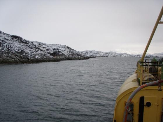
68 Figure 5-6: Photos and Bathymetry for Site Q5

69 SECTION 6.0 PAAMIUT The potential trans-shipping sites evaluated in the Paamiut area are shown on Figure 6-1. Figure 6-1: Potential Trans-shipping Site near Paamiut 6.1 SITE P1 Location: Coordinates: P1 is situated just north of the town Paamiut, close to the island called Søndre Storø. B 62*01`920 N; L 49* 38`980 W Description: Access to the site will be via Imartuneq Bay. The approach to the site passing Søndre Storø is excellent with water depths ranging between 155 to 230 meters. The Imartuneq Bay has two smaller reefs but there is passage on either side with depths of 71 to 80 meters passing on the North side and 30 to 50 meters passing south of the reef. The distance between the Northern most reef and the island called


70 Ukivit is approximately 500 m, and the distance between the Southernmost reef and the island Søndre Storø and the isles called Ulimautialik is also 500 m. The area around these isles is quite shallow but the distance has been measured to where the shallow area begins (less than 50 m). However, the Northern passage is preferred for access. There can be some swells from North-westerly and a South-westerly gale force, but otherwise the site is well sheltered. There are no currents except for tidal currents. There are excellent anchorage sites in this area where the depths vary between 44 to 73 meters. There is also an opportunity to install bollards on land or some of the islands. Conclusion: Based on site reconnaissance of this area, the site could be suitable for trans-shipment activities. However, on detailed review, the site has been determined to be unsuitable for safe navigation by large bulk carriers. Figure 6-2: Photos and bathymetry for Site P1 6.2 SITE P2 Location: Coordinates: P2 is situated east of the town Paamiut in a fiord called Eqaluit. B 62*03`001 N; L 49*25`423 W Description:
71 The access to the fiord is via a larger fiord called Kvanefjord. The approach is excellent with water depths ranging between 83 to 590 meters. The fiord is approximately 3.7 nm long and 0.8 nm wide and the depths through the fiord range from 47 to 157 m. The fiord is well protected from swells and wind from all directions except for direct wind from the West which is extremely rare. There are ice producing glaciers at the end of the Kvanefjord, and vessels will encounter pieces of ice in various sizes but no bergs on way to Eqaluit. There is no ice in the fiord of Eqaluit. There is a stretch of approximately 1.5 km where water depths range from 30 to 40 m at a distance of 200 m from shore. There a good anchorage sites at the end of the fiord where water depths range between 45 to 55 meters. The fiord floor is flat and consists of sediments/moraine gravel which offers good conditions for anchors. There are also several opportunities to install bollards on shore. Conclusion: Based on site reconnaissance, this site could be suitable for trans-shipment activities.
.")
72 SECTION 7.0 GRØNNEDAL The potential trans-shipping sites evaluated in the Grønnedal area are shown on Figure 7-1. Figure 7-1: Potential Trans-shipping Site near Grønnedal 7.1 SITE G1 Location: Coordinates: The site is situated NE of the former naval base and is a smaller cove (Ellerslie Havn). This is the site of the former Danish naval base that was relocated to Nuuk (2013). B 61*18`255 N; L 48*08`218 W Description: Water depths exceed 200 meters up to the latter third of the cove, where depths range between 30 to 60 meters. The cove is approximately 900 meter wide and offers ample space for ship maneuvering. The sea floor is not very good for anchoring since it is very steep and rocky. The glacier situated at the end of

 there has been no record of sea ice in the areas covering from Maniitsoq to Paamut")


73 the Arsuk fiord is not producing any significant amount of ice. The site is accessed via the Arsuk fiord which is very well surveyed due to the presence of the Danish Navy during the past 6 decades. The naval base was originally established by the Americans in 1942 to protect the kryolit mine at Ivituut. The ice charts shows that during the ten year period ( ) there has been no record of sea ice in the areas covering from Maniitsoq to Paamut including Grønnedal (Ivituut). Storms from the south-east (sydoest) are common, and winds of up to 234 km/hour have been recorded. Conclusion: Based on site reconnaissance and discussion with Danish Navy personnel, this site is not suitable for trans-shipment activities. Figure 7-2: Photos and Bathymetry for Site G1 7.2 SITE G2 Location: Coordinates: G2 is situated just across the former mine Ivigtut and is called Christians Havn. B 61*14`31 N; L 48*14`124 W Description: There are excellent water depths ranging from 110 to 432 meters at the approach to the site. At the end of the cove, water depths range between 33 to 86 meters. The cove is approximately 800 meters wide with ample space for ship maneuvering. The sea floor is reasonable for anchoring with depths of

 than site G1.")
74 approximately 60 meters. There is a steep drop off to over 200 meters at a short distance from the shore. This cove is even more exposed to south-east winds (sydoest) than site G1. Conclusion: Based on site reconnaissance, this site is not suitable for trans-shipment activities. Figure 7-3: Bathymetry for Site G2
Accidents & Malfunctions Preparedness & Emergency Response
 Accidents & Malfunctions Preparedness & Emergency Response 2 Erik Madsen Michael Anderson Michael Zurowski Fernand Beaulac Tim Keane Panel Members 3 Prevention Preparedness Training Exercises and Testing
 1 Geographic Context 3 PROJECT PROPOSAL SUMMARY Baffinland s Mary River Project PHASE 2 Proposal On October 29, 2014, the Nunavut Planning Commission (NPC) received a request for a conformity determination
OVERVIEW OF PRESENTATION
 Transport Canada Nunavut Impact Review Board Final Hearings Baffinland Iron Mines Corporation Mary River Project Technical Presentation - Iqaluit - July 2012 OVERVIEW OF PRESENTATION Transport Canada (TC)
Emerging long term effects:
 Emerging long term effects: 14 years of Exxon Valdez oil spill studies documents delayed, chronic and indirect effects of marine oil pollution (Peterson et. al. 2003. SCIENCE 302, p. 2084) Seabirds Thick-billed
Arctic shipping: Recent activity, future trends
 Lee Narraway/WWF-Camada ARCTIC Arctic shipping: Recent activity, future trends Martin von Mirbach WWF-Canada Presentation to Last Ice Area workshop June 4, 2013 Iqaluit, Nunavut 1 OUTLINE Recent shipping
APPENDIX D 2017 PHOTO ESSAY
 APPENDIX D 2017 PHOTO ESSAY Mary River Project 2017 NIRB Annual Report March 2018 Project Overview - 2017 In 2017, Baffinland focused on mine production from Deposit No. 1 with 4.54 million tonnes mined
NUNAVUT PLANNING COMMISSION PUBLIC HEARING ON THE 2016 DRAFT NUNAVUT LAND USE PLAN BAFFINLAND IRON MINES PRE HEARING WRITTEN SUBMISSIONS
 NUNAVUT PLANNING COMMISSION PUBLIC HEARING ON THE 2016 DRAFT NUNAVUT LAND USE PLAN BAFFINLAND IRON MINES PRE HEARING WRITTEN SUBMISSIONS January 13, 2017 Contents 1 Background and Objectives... 2 2 General
Scoping Document for the Environmental Assessment. BP Exploration (Canada) Ltd. Tangier 3D Seismic Survey
 Ltd. Tangier 3D Seismic Survey") Scoping Document for the Environmental Assessment BP Exploration (Canada) Ltd. Tangier 3D Seismic Survey Exploration Licenses 2431, 2432, 2433, and 2434 August 2013 Contents 1.0 Purpose... 2 2.0 Regulatory
Scoping Document for the Environmental Assessment BP Exploration (Canada) Ltd. Tangier 3D Seismic Survey Exploration Licenses 2431, 2432, 2433, and 2434 August 2013 Contents 1.0 Purpose... 2 2.0 Regulatory
Implementation of the Polar Code in Canada: Challenges and Opportunities
 Implementation of the Polar Code in Canada: Challenges and Opportunities Donald Roussel Associate Assistant Deputy Minister, Safety & Security Transport Canada 22 February, 2018 OBJECTIVES Provide an overview
Contents. Non-Technical Summary. 1. Introduction. 2. Policy, Regulatory and Administrative Framework. 3. Impact Assessment Methodology
 Contents Non-Technical Summary Units and Abbreviations 1. Introduction 1.1 Introduction... 1-2 1.1.1 Overview of 3D Seismic Survey... 1-2 1.1.2 Other BP Exploration and Production Activities in the SWAP
Public Comment Period. Consideration to Amend Permit No Direct Transfer Coal Facility May 4 19, 2015 Discussion Guide and Feedback Form
 Public Comment Period Consideration to Amend Permit No. 2012 072 Direct Transfer Coal Facility May 4 19, 2015 Discussion Guide and Feedback Form Consideration to Amend Permit No. 2012 072 Direct Transfer
Scoping Document. for the. Strategic Environmental Assessment. for Exploration Activities. on the Southwestern Scotian Slope
 Scoping Document for the Strategic Environmental Assessment for Exploration Activities on the Southwestern Scotian Slope Canada-Nova Scotia Offshore Petroleum Board July 2011 Table of Contents 1.0 Introduction...
Scoping Document for the Environmental Assessment Statoil Waverley 3D Seismic Survey Exploration Licenses 2435 and 2436
 Scoping Document for the Environmental Assessment Statoil Waverley 3D Seismic Survey Exploration Licenses 2435 and 2436 September 1, 2017 Page 1 This page is intentionally left blank Table of Contents
Transport Canada Marine Transportation in the Canadian Arctic Presentation to the International Maritime Statistics Forum
 Transport Canada Marine Transportation in the Canadian Arctic Presentation to the International Maritime Statistics Forum Centre of Excellence in Economics, Statistics, Analysis and Research (CEESAR) May
TERMPOL Review Process Report on the Enbridge Northern Gateway Project
 TERMPOL Review Process Report on the Enbridge Northern Gateway Project Northern Gateway Project TERMPOL Review Process Report Table of Contents FOREWORD... ii GLOSSARY... iii 1. INTRODUCTION... 1 1.1 Project
Scoping Document. for the. Strategic Environmental Assessment. for Exploration Activities. on the Southwestern Scotian Slope
 Scoping Document for the Strategic Environmental Assessment for Exploration Activities on the Southwestern Scotian Slope Canada-Nova Scotia Offshore Petroleum Board August 2011 Table of Contents 1.0 Introduction...
b. further OSPAR s work on marine protected areas with the view of achieving a network of marine protected areas which:
 PART II THE THEMATIC STRATEGIES Biological Diversity and Ecosystems 1. Objectives 1.1 The OSPAR Commission s strategic objective with regard to biodiversity and ecosystems is to halt and prevent by 2020
Green Marine. Environmental Program. Performance Indicators for Ship owners
 Green Marine 2015 Environmental Program Performance Indicators for Ship owners Table of contents 1. AQUATIC INVASIVE SPECIES... 3 1.A - DOMESTIC SHIP OWNERS... 3 1.B - INTERNATIONAL SHIP OWNERS... 4 2.
Operations Mine Site, Tote Road and Railway
 Operations Mine Site, Tote Road and Railway 2 Panel Members Michael Anderson Richard Cook John Binns Fernand Beaulac Steve Walker Mike Lepage Michael Sheahan 3 The Panel will address: FEIS Volumes 3, 5,
The Environmental Agency for the Mineral Resources Area (EAMRA) Jesper Bistrup Larsen. RE: TGS-NOPEC s EIA for the SEG15 seismic survey
 Jesper Bistrup Larsen. RE: TGS-NOPEC s EIA for the SEG15 seismic survey") DCE DANISH CENTRE FOR ENVIRONMENT AND ENERGY AARHUS UNIVERSITY PINNGORTITALERIFFIK Greenland Institute of Natural Resources The Environmental Agency for the Mineral Resources Area (EAMRA) Jesper Bistrup
DCE DANISH CENTRE FOR ENVIRONMENT AND ENERGY AARHUS UNIVERSITY PINNGORTITALERIFFIK Greenland Institute of Natural Resources The Environmental Agency for the Mineral Resources Area (EAMRA) Jesper Bistrup
Audit and Advisory Services Integrity, Innovation and Quality. Follow-Up Audit of Ship-Source Spills
 Audit and Advisory Services Integrity, Innovation and Quality Follow-Up Audit of Ship-Source Spills June 2017 Table of Contents Follow-Up Audit of Ship-Source Spills EXECUTIVE SUMMARY... I Introduction...
SPECIFIC TERMS OF REFERENCE. Conceptual and detailed design study for a floating off shore transfer terminal for bulk sugar in Belize
 SPECIFIC TERMS OF REFERENCE Conceptual and detailed design study for a floating off shore transfer terminal for bulk sugar in Belize FWC BENEFICIARIES 2009 - LOT 2: Transport and Infrastructure EuropeAid/127054/C/SER/multi
Certificates, Documents & Publications.
 Certificates, Documents & Publications. 1. What are the onboard Environmental Certificates? 1. International Oil Pollution Prevention Certificate. 2. International Pollution Prevention Certificate for
EAGLE S NEST PROJECT
 A Federal/Provincial Environmental Impact Statement/Environmental Assessment Report Draft Copy December 20, 2013 VOLUME 1 EXECUTIVE SUMMARY PAGE EXECUTIVE SUMMARY... 1-1 1 INTRODUCTION... 1-1 1.1 PROJECT
Theme: Climate action, agriculture waste management and pollution-free oceans
 Theme: Climate action, agriculture waste management and pollution-free oceans Ensuring healthy and productive waters The world s oceans and coasts support the livelihoods of billions of people around the
MINIMUM REQUIREMENTS FOR VESSELS BOUND FOR OR LEAVING PORTS OF THE BALTIC SEA STATES AND CARRYING DANGEROUS OR POLLUTING GOODS
 CONVENTION ON THE PROTECTION OF THE MARINE ENVIRONMENT OF THE BALTIC SEA AREA HELSINKI COMMISSION - Baltic Marine HELCOM 19/98 Environment Protection Commission 15/1 Annex 7 19th Meeting Helsinki, 23-27
Significant prevention measures in place for each LNG carrier *
 Safe shipping About LNG Canada LNG Canada is a joint venture company comprised of four global energy companies with substantial experience in liquefied natural gas (LNG) Shell, PetroChina, KOGAS and Mitsubishi
Canadian Coast Guard Services in the Arctic
 Canadian Coast Guard Services in the Arctic Centre for Foreign Policy Studies June 5, 2015 Presented by Daniel Breton Senior Director, World Class Strategies 1 Purpose Discuss CCG s vision for its role
For personal use only
 Disclaimer Page 2 Page 3 Share Price (13 July 2012 ) $ 0.085 Shares On Issue m 160.1 Market Capitalisation $m 13.6 Cash (30 June 2012) $m 4.7 Convertible Note $m 5.0 Enterprise Value $m 13.9 (For further
Government of Greenland Bureau of Minerals and Petroleum
 Government of Greenland Bureau of Minerals and Petroleum Guidelines for submitting applications for approval of offshore installations for hydrocarbon exploration in Greenland, with particular emphasis
Shipping and Marine Wildlife Management Plan TABLE OF CONTENTS 1 INTRODUCTION PURPOSE REGULATORY FRAMEWORK... 10
 Page 3 of 66 TABLE OF CONTENTS 1 INTRODUCTION... 8 1.1 PURPOSE... 8 1.2 REGULATORY FRAMEWORK... 10 1.2.1 APPLICABLE LEGISLATION, REGULATIONS, ACTS AND GUIDELINES... 10 1.3 BAFFINLAND S COMMITMENTS... 12
ESTIMATES OF OIL ENTERING THE MARINE ENVIRONMENT IN THE PAST DECADE: GESAMP WORKING GROUP 32 PROJECT
 #166, 1999 International Oil Spill Conference ESTIMATES OF OIL ENTERING THE MARINE ENVIRONMENT IN THE PAST DECADE: GESAMP WORKING GROUP 32 PROJECT Dagmar Schmidt Etkin Oil Spill Intelligence Report Cutter
3.0 APPROACH AND METHODOLOGY
 3.0 APPROACH AND METHODOLOGY The EIA will be completed to meet the requirements as set out in the Environmental Impact Assessment Guidelines and Procedures for Barbados, 1998 and the Thermal Power Guidelines
Potential hydrocarbon and chemical spill
 Potential hydrocarbon and chemical spill Table of Contents 20 POTENTIAL HYDROCARBON AND CHEMICAL SPILL 20-3 20.1 Introduction 20-3 20.2 Legislative framework and relevant guidance 20-3 20.3 Scoping and
Legislative and Policy Framework
 2 Legislative and Policy Framework 2 L E G I S L A T I V E A N D P O L I C Y F R A M E W O R K 2.1 Introduction The principal statute under which the natural and physical resources of Otago s coastal marine
ANNEX 25. RESOLUTION MEPC.220(63) Adopted on 2 March GUIDELINES FOR THE DEVELOPMENT OF GARBAGE MANAGEMENT PLANS
 Adopted on 2 March GUIDELINES FOR THE DEVELOPMENT OF GARBAGE MANAGEMENT PLANS") Annex 25, page 1 ANNEX 25 RESOLUTION MEPC.220(63) Adopted on 2 March 2012 2012 GUIDELINES FOR THE DEVELOPMENT OF GARBAGE MANAGEMENT PLANS THE MARINE ENVIRONMENT PROTECTION COMMITTEE, RECALLING Article
Annex 25, page 1 ANNEX 25 RESOLUTION MEPC.220(63) Adopted on 2 March 2012 2012 GUIDELINES FOR THE DEVELOPMENT OF GARBAGE MANAGEMENT PLANS THE MARINE ENVIRONMENT PROTECTION COMMITTEE, RECALLING Article
MANAGING SHIPPING IN THE FUTURE
 MANAGING SHIPPING IN THE FUTURE RECOMMENDATIONS TO REDUCE IMPACTS AND RISKS ASSOCIATED WITH INCREASED SHIPPING IN GREENLAND Bowhead whale (Balaena Mysticetus) just under the ice. naturepl.com / Martha
Potential Impacts and Mitigations from a Saline Discharge into Marine Environment
 Meliadine Division Potential Impacts and Mitigations from a Saline Discharge into Marine Environment DECEMBER 2017 VERSION 1 Table 1: Potential Impacts and Mitigations Marine Environment Benthic Invertebrates
International Convention for the Prevention of Pollution from Ships (MARPOL)
") MARPOL 1973, as amended Adoption: 1973 (Convention), 1978 (1978 Protocol), 1997 (Protocol - Annex VI); Entry into force: 2 October 1983 (Annexes I & II) International Convention for the Prevention of Pollution
MARPOL 1973, as amended Adoption: 1973 (Convention), 1978 (1978 Protocol), 1997 (Protocol - Annex VI); Entry into force: 2 October 1983 (Annexes I & II) International Convention for the Prevention of Pollution
Prepcom 1 Conservation and sustainable use of marine biological diversity of ABNJ. Policy brief IMO
 Prepcom 1 Conservation and sustainable use of marine biological diversity of ABNJ Policy brief IMO Overview 1 As a specialized agency of the United Nations, the International Maritime Organization (IMO)
Port of Long Beach Port Master Plan Overview December 22, 2008
 Port of Long Beach Port Master Plan Overview December 22, 2008 PORT OF LONG BEACH PORT MASTER PLAN OVERVIEW INTRODUCTION In 1978 the California Coastal Commission certified the Port of Long Beach Port
SHORTSEA SHIPPING WORKSHOP
 SHORTSEA SHIPPING WORKSHOP Government of Nunavut Community Government & Transportation Winnipeg, Manitoba November 24, 2003 UBLAKKUT- GOOD MORNING Presentation Outline Background & Modal Factors Unique
Proposed Amherst Island Turbine Project APAI Comments on Marine Logistics and Safety in the draft Operations Plan
 PO Box 6, 5695 Front Road, Stella, ON K0H2S0 protectai@kos.net WITHOUT PREJUDICE May 22, 2017 Mayor Bill Lowry and Members of Council Loyalist Township Box 70, 263 Main Street Odessa, Ontario K0H 2H0 Dear
Leamus / Thinkstock. Summary of Recommendations. Navigating the North: An Assessment of the Environmental Risks of Arctic Vessel Traffic
 Leamus / Thinkstock Summary of Recommendations Navigating the North: An Assessment of the Environmental Risks of Arctic Vessel Traffic Jupiter Unlimited As the Arctic experiences profound environmental
Regulations of the People s Republic of China on the Emergency. Prevention and Handling of Marine Pollution Caused by Ships
 Regulations of the People s Republic of China on the Emergency Prevention and Handling of Marine Pollution Caused by Ships Chapter One General Principles Article 1 In order to improve the emergency handling
REVISED LIST OF CERTIFICATES AND DOCUMENTS REQUIRED TO BE CARRIED ON BOARD SHIPS
 INTERNATIONAL MARITIME ORGANIZATION 4 ALBERT EMBANKMENT LONDON SE1 7SR Telephone: 020 7735 7611 Fax: 020 7587 3210 Telex: 23588 IMOLDN G IMO E Ref. T3/2.01 FAL/Circ.90 MEPC/Circ.368 MSC/Circ.946 3 July
Deep Panuke Offshore Gas Development. Comprehensive Study Report
 Deep Panuke Offshore Gas Development Comprehensive Study Report October 2002 DEEP PANUKE OFFSHORE GAS DEVELOPMENT COMPREHENSIVE STUDY REPORT Prepared By: EnCana Energy Corporation 7 th Floor, Royal Centre
About WCC LNG Project Ltd.
 About WCC LNG Project Ltd. WCC LNG Project Ltd. (WCC LNG) is a proposed project led by ExxonMobil to develop and operate a liquefied natural gas (LNG) export facility on the eastern shore of Tuck Inlet
NATIONAL CONTINGENCY PLAN FOR OIL POLLUTION PREPAREDNESS AND RESPONSE
 Translation NATIONAL CONTINGENCY PLAN FOR OIL POLLUTION PREPAREDNESS AND RESPONSE Chapter I Preamble Section 1 - Purpose of the Plan Japan, as a country surrounded by the sea and rich in natural environment,
Arctic region briefing - The European environment state and outlook 2015
 Countries and regions Arctic region briefing - The European environment state and outlook 2015 SOER 2015 The European environment state and outlook 2015 > Countries and regions > Arctic region briefing
ENVIRONMENTAL IMPACT ASSESSMENT (BASIC ASSESSMENT) PROCESS: PROPOSED REVERSE OSMOSIS PLANT, IRON ORE HANDLING FACILITY, PORT OF SALDANHA
 PROCESS: PROPOSED REVERSE OSMOSIS PLANT, IRON ORE HANDLING FACILITY, PORT OF SALDANHA") ENVIRONMENTAL IMPACT ASSESSMENT (BASIC ASSESSMENT) PROCESS: PROPOSED REVERSE OSMOSIS PLANT, IRON ORE HANDLING FACILITY, PORT OF SALDANHA BACKGROUND INFORMATION DOCUMENT SRK Project 364470/42G June 2007
ENVIRONMENTAL IMPACT ASSESSMENT (BASIC ASSESSMENT) PROCESS: PROPOSED REVERSE OSMOSIS PLANT, IRON ORE HANDLING FACILITY, PORT OF SALDANHA BACKGROUND INFORMATION DOCUMENT SRK Project 364470/42G June 2007
EPA Issues General Permit for Vessels
 EPA Issues General Permit for Vessels Background On December 18, 2008, EPA issued its Vessel General Permit ( VGP ) for discharges incidental to the normal operation of vessels. The permit responds to
The Economic Benefits of Hydrography and Ocean Mapping
 The Economic Benefits of Hydrography and Ocean Mapping FIG XXIV Congress, Sydney Australia, 2010 Commission 4: Hydrography Gordon Johnston Venture Geomatics Limited gordon.johnston1@orange.net Overview
MARINE POLLUTION DEGRADATION MITIGATION MANAGEMENT IS ESSENTIAL FOR IMPROVING MARINE ENVIRONMENT
 MARINE POLLUTION DEGRADATION MITIGATION MANAGEMENT IS ESSENTIAL FOR IMPROVING MARINE ENVIRONMENT The health of the world s oceans and marine life is degrading rapidly as a result of excess human activities.
Draft Structure of the Environmental Report for the Spatial Offshore Grid Plan of the German Exclusive Economic Zone (EEZ) in the Baltic Sea 2013
 in the Baltic Sea 2013") Draft Structure of the Environmental Report for the Spatial Offshore Grid Plan of the German Exclusive Economic Zone (EEZ) in the Baltic Sea 2013 1 Introduction 1.1 Legal Basis and Function of Environmental
Draft Structure of the Environmental Report for the Spatial Offshore Grid Plan of the German Exclusive Economic Zone (EEZ) in the Baltic Sea 2013 1 Introduction 1.1 Legal Basis and Function of Environmental
Marine Terminal Project on the North Shore of the Saguenay. Environmental Assessment Report
 Marine Terminal Project on the North Shore of the Saguenay Environmental Assessment Report October 2018 Her Majesty the Queen in Right of Canada, represented by the Minister of the Environment, October,
7 MONITORING PLAN 7.1 INTRODUCTION
 7 MONITORING PLAN 7.1 INTRODUCTION The purpose of this chapter is to outline the key monitoring requirements identified through the EIA process to monitor the environmental and social performance of the
Marine Protection Rules Part 100 Port Reception Facilities Oil, Noxious Liquid Substances and Garbage
 Marine Protection Rules Part 100 Port Reception Facilities Oil, Noxious Liquid Substances and Garbage MNZ Consolidation Marine Protection Rules ISBN 978-0-947527-29-7 Published by Maritime New Zealand,
Ministry of Natural Resources and Environment Responses to Relevant Comments in the Statement from Finland on the Espoo Report
 Ministry of Natural Resources and Environment Responses to Relevant Comments in the from Finland on the Espoo Report Table of Contents 1 Introduction... 3 2 Construction schedule (Ministry of Environment
Cliff # Attachment 1
 Lines of Inquiry Panel Review Phase II: Hazardous and Noxious Substances These Lines of Inquiry are intended to provide general structure to the Panel s review and draw out information and perspectives
The Economic Benefits of Hydrography and Ocean Mapping
 OVERVIEW The Economic Benefits of Hydrography and Ocean Mapping FIG 6th Regional Meeting, San Jose, Costa Rica 2007 Commission 4: Hydrography Gordon Johnston Venture Geomatics Limited gordon.johnston1@orange.net
Committed to improving water quality in Cockburn Sound
 2004 Committed to improving water quality in Cockburn Sound A Valuable Asset Cockburn Sound, located 20 kilometres south of Fremantle Inner Harbour, is the most intensively used marine environment in Western
ABI6010 International Technical Certificate in Jetty and Terminal Operational Safety UNIT 1 TERMINAL MANAGEMENT, SAFETY AND SECURITY
 ABI6010 International Technical Certificate in Jetty and Terminal Operational Safety UNIT 1 TERMINAL MANAGEMENT, SAFETY AND SECURITY ELEMENT 1 Regulations, Guidance and Legislation 1.1 Shipping Industry
MANDATORY SHIP REPORTING SYSTEM
 INTERNATIONAL MARITIME ORGANIZATION 4 ALBERT EMBANKMENT LONDON SE1 7SR Telephone: 020 7587 3152 Fax: 020 7587 3210 IMO E Ref. T2-OSSHE/2.7.1 SN.1/Circ.254 26 May 2006 MANDATORY SHIP REPORTING SYSTEM 1
Ocean Energy Specialisation 2014 OER 1 and EPE 1&2 assignments
 Ocean Energy Specialisation 0 OER and EPE & assignments The following text describes the assignments for the OER and EPE & modules. The assignment intends to provide the students with an opportunity to
Programme of measures of the Finnish marine strategy
 Programme of measures of the Finnish marine strategy 2016 2021 SUMMARY On 3 December 2015, Finland's government approved the programme of measures for the Finnish marine strategy 2016 2021. The programme
As a general summary the following changes have been made:
 4 REVISED IMPLEMENTATION PLAN (1) 4.1 BACKGROUND It is proposed that Chapter 7 pages 7-1 through 7-10 of the EMPr submitted in May 2010 and Chapter 3 and Chapter 4 pages 6 through 10 of the first Addendum
Technical Publication. IMO requirements on carriage of publications on board ships /
 Publication IMO requirements on carriage of publications on board ships / August 2016 The Maritime Safety Committee together with Marine Environmental Protection Committee provided requirements on carriage
RE: TGS-NOPEC s EIA for the NEG15 seismic survey
 DCE DANISH CENTRE FOR ENVIRONMENT AND ENERGY AARHUS UNIVERSITY PINNGORTITALERIFFIK Greenland Institute of Natural Resources The Environmental Agency for the Mineral Resources Area (EAMRA) Jesper Bistrup
Operative Part VI Annexes 26 February Annex 1: Resource Management (Marine Pollution) Regulations 1998
 Regulations 1998") Operative Part VI Annexes 26 February 2011 PART VI ANNEXES Annex 1: Resource Management (Marine Pollution) Regulations 1998 This annex is Sections 2-15 and Schedules 3-4 of the Resource Management (Marine
Operative Part VI Annexes 26 February 2011 PART VI ANNEXES Annex 1: Resource Management (Marine Pollution) Regulations 1998 This annex is Sections 2-15 and Schedules 3-4 of the Resource Management (Marine
GENICE. Microbial Genomics for Oil Spill Preparedness In Canada s Arctic Marine Environment
 GENICE Microbial Genomics for Oil Spill Preparedness In Canada s Arctic Marine Environment https://www.genomecanada.ca/en/news-and-events/news-releases/13-research-projects-deploy-genomicsaddress-challenges-canadas
The environmental licensing in the coastal and marine zones in Brazil as an instrument for the implementation of international legal regime
 United Nations Office of Legal Affairs Division for Ocean Affairs and the Law of the Sea UN-The Nippon Foundation of Japan Fellowship Programme The environmental licensing in the coastal and marine zones
The Polar Code. Turid Stemre. Legislation and International relations. Nordic Expert Meeting October 2011
 The Polar Code Turid Stemre Legislation and International relations Nordic Expert Meeting 25.-26 October 2011 Fridtjof Nansen (1861-1930) Nansen: We are all adventurers in life, whatever path we follow.
Canaport Energy East Marine Terminal Presentation Carlos Pardo September 26 & 28, 2016
 Canaport Energy East Marine Terminal Presentation Carlos Pardo September 26 & 28, 2016 Document Number Energy East Protected UNCONTROLLED IF PRINTED Canaport Marine Terminal Berths and Platforms 2 Project
APPENDIX C: Shipping Management Plan
 APPENDIX C: Shipping Management Plan Shipping Management Plan MARCH 2018 VERSION 7 TABLE OF CONTENTS Table of Contents... i Figures and Tables... iii Document Control... iv Executive Summary... vi Acronyms...
Overview of Technical Skills and Competencies
 Overview of Technical Skills and Competencies Technical Skills and Competencies (TSCs) TSC Business Finance Budgeting Prepare organisational budgets to support short- and long-term business plans through
RESOLUTION MSC.433(98) (adopted on 16 June 2017) GUIDELINES AND CRITERIA FOR SHIP REPORTING SYSTEMS
 (adopted on 16 June 2017) GUIDELINES AND CRITERIA FOR SHIP REPORTING SYSTEMS") MSC 98/23/Add.1 Annex 17, page 1 ANNEX 17 RESOLUTION MSC.433(98) (adopted on 16 June 2017) THE MARITIME SAFETY COMMITTEE, RECALLING Article 28(b) of the Convention on the International Maritime Organization
MSC 98/23/Add.1 Annex 17, page 1 ANNEX 17 RESOLUTION MSC.433(98) (adopted on 16 June 2017) THE MARITIME SAFETY COMMITTEE, RECALLING Article 28(b) of the Convention on the International Maritime Organization
Parlee Beach Water Quality Summary
 Parlee Beach Water Quality Summary Introduction This document presents a summary of the report of the Steering Committee for the Parlee Beach Water Quality project. The Committee was comprised of representatives
NAMEPA s Mission protect maritime commitment marine industry Save our Seas Educate
 MARINE POLLUTION NAMEPA s Mission Preserve and protect the marine environment Demonstrate maritime commitment to environmental protection and pollution prevention Support the marine industry Engage maritime
Marine Terminal Information Booklet
 1 Marine Terminal Information Booklet: Guidelines and Recommendations Marine Terminal Information Booklet Guidelines and Recommendations (First edition 2018) Issued by the Oil Companies International Marine
AT A GLANCE. Cairns Shipping Development Project. Revised Draft Environmental Impact Statement Fact Sheet July 2017.
 Cairns Shipping Development Project Revised Draft Environmental Impact Statement Fact Sheet July 2017 AT A GLANCE > An additional 70 cruise ships into Port of Cairns each year by 2031 > Project design
Panama Canal Shipboard Oil Pollution Emergency Plan (PCSOPEP) Requirements
 Requirements") June 4, 2004 MR S ADVISORY TO SHIPPING No. A-25-2004 TO: SUBJECT: All Steamship Agents, Owners, and Operators Panama Canal Shipboard Oil Pollution Emergency Plan (PCSOPEP) Requirements 1. The Panama Canal
June 4, 2004 MR S ADVISORY TO SHIPPING No. A-25-2004 TO: SUBJECT: All Steamship Agents, Owners, and Operators Panama Canal Shipboard Oil Pollution Emergency Plan (PCSOPEP) Requirements 1. The Panama Canal
ENVIRONMENTAL PROTECTION AND MARITIME TRANSPORT POLLUTION CONTROL PROGRAM IN THE GULF OF HONDURAS TECHNICAL SHEET
 ENVIRONMENTAL PROTECTION AND MARITIME TRANSPORT POLLUTION CONTROL PROGRAM IN THE GULF OF HONDURAS TECHNICAL SHEET Gulf of Honduras, Puerto Cortes. Number 1. November 2007. DESIGNATION OF THE GULF OF HONDURAS
The North-East Atlantic Environment Strategy
 The North-East Atlantic Environment Strategy Strategy of the OSPAR Commission for the Protection of the Marine Environment of the North-East Atlantic 2010 2020 (OSPAR Agreement 2010-3) Preamble 1. RECALLING
Santoy 8 Satellite Mine at the Seabee Gold Mine. Technical Review Comments. on the. Environmental Impact Statement.
 Environmental Impact Assessment Technical Review Comments on the Environmental Impact Statement as submitted by Claude Resources Inc. Saskatchewan Ministry of Environment December, 2009 1. INTRODUCTION
Environmental Management in Oil Spills
 CF 10/6/1/2 Environmental Management in Oil Spills Presentation to the 10 th Cooperation Forum on Safety of Navigation and Environmental Protection in the Straits of Malacca and Singapore 2-4 October 2017
1986 Panda symbol WWF-World Wide Fund For Nature (also known as World Wildlife Fund) WWF and living planet are WWF Registered Trademarks
 WWF and living planet are WWF Registered Trademarks") 1986 Panda symbol WWF-World Wide Fund For Nature (also known as World Wildlife Fund) WWF and living planet are WWF Registered Trademarks World Wildlife Fund - Canada Brief Standing Committee on Environment
1986 Panda symbol WWF-World Wide Fund For Nature (also known as World Wildlife Fund) WWF and living planet are WWF Registered Trademarks World Wildlife Fund - Canada Brief Standing Committee on Environment
Newfoundland and Labrador Offshore Spill Preparedness and Response Initiatives
 Newfoundland and Labrador Offshore Spill Preparedness and Response Initiatives Paul Barnes Manager, Atlantic Canada Canadian Association of Petroleum Producers MUN NRPOP Lab Workshop - November 14, 2011
Pilot Project Licensing Justification Statement
 Pilot Project Licensing Justification Statement The following demonstrates that the Snohomish County Public Utility District No. 1 (Snohomish) Admiralty Inlet Pilot Tidal Project (the Project ) meets the
The Halifax Harbour Solutions Project Provision of Sewage Treatment
 The Halifax Harbour Solutions Project Provision of Sewage Treatment ENVIRONMENTAL SCREENING PURSUANT TO THE CANADIAN ENVIRONMENTAL ASSESSMENT ACT Prepared by Halifax Regional Municipality June, 2000 Revised
B.C. TOWBOAT INDUSTRY CONFERENCE
 LN G T erm inals on C ana da s W est C oast Kitimat LNG LN G T erm inals on C ana da s W est C oast Presentation to 17 th B.C. TOWBOAT INDUSTRY CONFERENCE Whistler, BC Kitimat LNG Alfred Sorensen Kitimat
Carriage of Dangerous Goods and Harmful Substances
 MANX SHIPPING NOTICE DEPARTMENT OF ECONOMIC DEVELOPMENT MSN 056 Issued 01 August 2015 Carriage of Dangerous Goods and Harmful Substances This Notice provides information on Isle of Man Regulations which
TAB 20 BIM Ltr Response to NPC Information Request of Feb Feb pdf
 TAB 20 BIM Ltr Response to NPC Information Request of Feb 10 2015 - Feb 13 2015.pdf February 13, 2015 Mr. Brian Aglukark Director, Implementation Nunavut Planning Commission P.O. Box 2101 Cambridge Bay,
A NEW SINGLE INFORMATION WINDOW. THE NEW REFERENCE. THE MARITIME INFORMATION BUREAU (MIB)
") A NEW SINGLE INFORMATION WINDOW. THE NEW REFERENCE. THE MARITIME INFORMATION BUREAU (MIB) Vous avez une question sur l industrie maritime? You wish to speak to a marine-sector expert? You wish to get specific
A NEW SINGLE INFORMATION WINDOW. THE NEW REFERENCE. THE MARITIME INFORMATION BUREAU (MIB) Vous avez une question sur l industrie maritime? You wish to speak to a marine-sector expert? You wish to get specific
Government of Canada Comments and Recommendations on the 2016 Draft Nunavut Land Use Plan
 Government of Canada Comments and Recommendations on the 2016 Draft Nunavut Land Use Plan Table of Contents 1 Introduction... 3 2 General Comments and Recommendations... 5 2.1 Scope... 5 2.2 Unintended
Climate Change, Marine Environmental Regulatory Development, and Sustainable Development in Ports and Shipping American Association of Port
 Climate Change, Marine Environmental Regulatory Development, and Sustainable Development in Ports and Shipping American Association of Port Authorities Annual Conference Leigh Mazany, Director, Environmental
DECISION ON MARINE DISCHARGE CONSENT APPLICATION
 DECISION ON MARINE DISCHARGE CONSENT APPLICATION Application Ref:EEZ300005 OMV New Zealand Limited Application to discharge harmful substances CI-111 and DMO86277 This page is intentionally blank MARINE
Barossa Gas Export Pipeline Installation
 Overview Barossa Gas Export Pipeline Installation Environment Plan Notice of Consultation January 2019 Barossa is an offshore gas and condensate project located 300 kilometres west of Darwin that proposes
Alaska Deep-Draft Arctic Ports Navigation Feasibility Study. U.S. Army Corps of Engineers Bruce Sexauer P.E. Chief of Planning, Alaska District
 Alaska Deep-Draft Arctic Ports Navigation Feasibility Study U.S. Army Corps of Engineers Bruce Sexauer P.E. Chief of Planning, Alaska District Alaska Deep Draft Arctic Port System Study Purpose To identify