Table of figures. Table of contents. Executive summary... i Introduction... 1 Purpose... 1
|
|
|
- Camilla Tate
- 5 years ago
- Views:
Transcription
1
2 Table of contents Executive summary... i Introduction... 1 Purpose... 1 The corridor at a glance... 2 Corridor overview... 2 The regional economy... 2 Understanding our customers... 3 Key customers... 3 How we deliver services along the corridor... 5 Transport partners... 5 Network Outcomes Contracts approach... 6 Drivers for change... 7 Understanding customer levels of service on the corridor... 8 Current levels of service performance... 8 Improving the customer experience... 9 Access Resilience Reliability and efficiency Safety People, places and environment Understanding the infrastructure assets Corridor asset base Asset condition and performance Asset condition and performance pressures Asset condition and performance future considerations Investing in the corridor Summary investment Investing in access and resilience Investing in reliability and efficiency Investing in safety Investing in people, places and environment Investment pressures Investment future considerations Appendix A Information sources Table of figures Figure 1 - Performance of the corridor against ONRC outcomes... i Figure 2 - Corridor management plan framework... 1 Figure 3 Corridor overview... 2 Figure 4 - Key customers, journeys, and destinations... 3 Figure 5 - Map of associated local authorities... 5 Figure 6 - NOC Process... 6 Figure 7 - Current ONRC levels of service performance... 8 Figure 8 - Corridor characteristics Figure 9 - Horizontal alignment Figure 10 - Corridor capacity Figure 11 Resilience Figure 12 - Reliability and efficiency Figure 13 - Safety Figure 14 People, places and environment Figure 15 Corridor asset base Figure 16 - Asset condition and performance Figure 17 Asset condition Figure 18 Asset condition Figure 19 Asset condition Figure 20 Corridor investment Figure 21 Access and resilience investment Figure 22 Reliability and efficiency investment Figure 23 Safety investment Figure 24 People, places and environment investment... 34
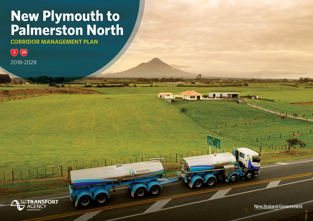
3 Executive summary The New Plymouth to Palmerston North corridor comprises SH3 from its intersection with Courtney Street in New Plymouth to the centre of Palmerston North. It also comprises SH3A from Inglewood to the SH3 intersection at Sentry Hill. Figure 1 - Performance of the corridor against ONRC outcomes The corridor is approximately 231km long (2.0% of the state highway network). The total value of assets along the corridor is $352M (1.5% of the total national asset value). Spanning the Taranaki and Manawatu-Whanganui regions, the corridor supports a strong horticultural and agricultural industry and connects multiple towns and villages to the larger centres of Palmerston North, Whanganui and New Plymouth, and is a key freight route for goods being transported between New Plymouth, Port Taranaki, the Palmerston North freight hub, and further to Napier, Wellington and Tauranga Ports. It is also a main link between the lower North Island and Taranaki, used by commuters, tourists, recreational customers and freight operators. The corridor is critical to the movement of manufacturing and food processing commodities the local economies rely on, with dairy a dominate player. The Fonterra Whareroa site at Hawera is the second largest dairy processing facility in the southern hemisphere, employing 1000 staff and collecting up to 14 million litres of milk a day. As a shared route with SH1/SH3 between Bulls and Sanson is addressed in the Pokeno to Levin Corridor Management Plan. For visitors, the Palmerston North, Whanganui and New Plymouth airports offer choice in terms of access to the main centres. However, movement around the key tourist attractions (such as Egmont National Park, the Forgotten Highway and the Whanganui National Park) require access by road. With Taranaki being voted 2 nd in the Lonely Planet s Best in Travel 2017 publication, tourist numbers are expected to increase in the future. Network observations suggest journey times for commuters has degraded over the last five years as people migrate from the main centres to outlying towns. This is particularly relevant between Hawera, Stratford and New Plymouth. This corridor is fully HPMV capable, but options are immediately restrained once traffic is detoured away from SH3. In the event of a significant road closure HPMVs reliant on SH3 connectivity to and from Inglewood and Palmerston North face lengthy diversions. Permitting the movement of loads unique to the region (i.e. oil and gas industry plant and equipment) has not been fully tested. Understanding the potential constraints on heavy industry accessing the corridor for transportation of specialist plant and equipment will be a key consideration in the future. Reducing conflict between local and through traffic and focusing on safety will continue to be a focus. This includes improving intersections, applying identified safety treatments and focusing on conflicts around schools in urban areas. i Future proofing and maintaining appropriate levels of service for communities to avoid severance and other conflicts between local and through traffic will be an essential consideration for investment as this corridor continues to face challenges from urban growth and competing community and state highway user needs. Although the corridor has proven resilient to date, targeted preventative works along sections of the corridor with known weaknesses will be needed to maintain corridor resilience and levels of service especially with wetter conditions predicted for the regions from climate change. Applying identified safety treatment options and improving high risk intersections will be vital to improve safety star ratings and improve crash statistics New Plymouth to Palmerston North Corridor Management Plan

4 Introduction Purpose What is the corridor management plan? This Corridor Management Plan describes the customer service delivery story for the New Plymouth to Palmerston North corridor, as measured against the One Road Network Classification performance framework. It is intended to describe the investment story, i.e. why invest in this corridor, in a context everyone can understand whether the activities are delivered through investment in the State Highways maintenance, operations, renewals and improvements programmes. The corridor management plan considers a combination of: How will we use it? The Corridor Management Plan will provide the customer story and case for investment in maintenance, renewal and improvement on the corridor, based on targeting maintenance to achieve the appropriate customer levels of service within the context of providing value for money. The information presented in the corridor management plan helps to inform the business case for investment in State Highways for the subsequent triennial period. The corridor management plan will provide for engagement with key stakeholders and partners to shape the future of the corridor. It responds to the needs of the users of the corridor to shape the future service levels. Figure 2 - Corridor management plan framework The pressures on the system that are resulting in increased demand or a reduction in levels of service The current state of the system and how it is performing The response the Agency is investing in to deliver the customer levels of service along the corridor. It is important to note that this is a first-generation Corridor Management Plan, therefore, we expect it to be improved as we learn from this approach. It sets a firm foundation to improve from in the next 2-3 years, utilising a common framework and consistent data sets across the 30 corridors. Why is it needed? The corridor plan provides a link between the long-term planning outlook, the 10-year medium term investment programme and the 3-year land transport programmes for the next funding round. Traditionally, the approach to investing in maintenance and renewals is to consider each asset activity in isolation, i.e. pavement, structures, drainage, and in isolation of capital expenditure. The Corridor Management Plan approach considers all assets within the corridor and takes a holistic view of the customer levels of service they provide throughout the corridor. Planning is currently undertaken at the regional level, but typically significant journeys traverse more than one region. By considering the significant customer journeys and destinations, the corridor management plan is a vehicle to engage in regional and inter-regional conversations by focusing on the issues that are important and may extend beyond the state highways network New Plymouth to Palmerston North Corridor Management Plan

5 The corridor at a glance Corridor overview The New Plymouth to Palmerston North corridor comprises SH3 from the centre of Palmerston North to its intersection with Courtney Street in New Plymouth. It also comprises SH3A from Inglewood to the SH3 intersection at Sentry Hill. The corridor is a key freight route for goods being transported between New Plymouth, Port Taranaki, the Palmerston North freight hub, and further to Napier, Wellington and Tauranga Ports. It is also a main link between the lower North Island and Taranaki, used by commuters, tourists, recreational customers and freight operators. Oil and gas exploration and production has grown strongly in recent years and is New Zealand s fourth largest export, all of which is based in Taranaki. Port Taranaki is the second biggest bulk exporting port and the 5 th biggest bulk importing port in New Zealand, handling large volumes of farming, engineering and petrochemical cargoes. Tourism is a growing industry, with Taranaki being voted the #2 region in the world to visit by Lonely Planet in Figure 3 Corridor overview The corridor is critical to the movement of manufacturing and food processing commodities the local economies rely on, with dairy a dominate player. The Fonterra Whareroa site at Hawera is the second largest dairy processing facility in the southern hemisphere, employing 1000 staff and collecting up to 14 million litres of milk a day. As a shared route with SH1, SH3 between Bulls and Sanson is addressed in the Pokeno to Levin Corridor Management Plan. The regional economy The corridor traverses two regions; the Manawatu-Whanganui region and the Taranaki region. These regions collectively make up approximately 8% of New Zealand s Gross Domestic Product (GDP) and 7.5% of New Zealand s resident population. Approximately half of the regions population resides in the main centres of Palmerston North, Whanganui and New Plymouth. Compared with New Zealand as a whole, the Taranaki and Manawatu-Whanganui regions collectively account for approximately 11% of sheep livestock, 13% of beef livestock and 14% of dairy livestock. Because primary industries are prevalent, the regions economies are reliant on the land transport network in transporting product from its point of origin to its destination. A large proportion of product eventually makes its way out of the regions for either export overseas or to be redistributed to other parts of New Zealand. It is therefore critical that transport links are resilient New Plymouth to Palmerston North Corridor Management Plan

6 Understanding our customers Figure 4 - Key customers, journeys, and destinations Key customers The key customers are diverse, utilising a range of transport modes. Different customers have different needs, expectations, and personal circumstances for using the transport system. Daily commuter As there are limited public transport, the use of personal vehicles is the primary mode of commuter transport, with some cycling and walking activity within the major urban centres. Within the Taranaki section of the corridor, the majority of commuters travel between Stratford, Hawera and New Plymouth, with no tidal flow in either direction. Similarly, in the Manawatu- Whanganui region, commuters predominantly travel into Whanganui from smaller surrounding settlements and between Bulls and Palmerston North. There are multiple major employers influencing travel times (which coincide with shift changes) and destinations. These include, but are not limited to, Silver Ferns Farm in Hawera and Waitotara (between Waverley and Whanganui), Tegal (Hawera), and Fonterra s Whareroa site (just south of Hawera). Insights into daily commuter users: Road use: Use of private vehicles is the principal mode of transport. Cycling, walking and public transport are mostly in the main centres. Road knowledge: Commuters are familiar with their route and the available local road alternatives to avoid congestion when required. Journey times are mostly predictable with congestion points known to commuters. Pain points: Commuters travel through many lower speed limit areas due to the number of towns and villages along this route. Whilst consistent with urban environment safety requirements, the lower speed limits contribute to a longer commute time overall. Congestion around schools, major intersections and town centres occurs when state highway through traffic interacts with local traffic. Daily commuters expect: Predictable journeys, resilient routes and accurate and up to date information (peak and off peak), weather, road conditions and hazards New Plymouth to Palmerston North Corridor Management Plan
7 Tourist and recreational users Lonely Planet s Best in Travel 2017 listed Taranaki as #2 in its top 10 regions worldwide. Whilst tourism is currently approximately 85% domestic, it is anticipated the level of exposure from the Lonely Planet listing will increase international tourist numbers in the coming years. The Taranaki region has many tourist attractions including the Egmont National Park, surf beaches south of New Plymouth, and access to tourist ventures on SH43 (marketed as the Forgotten World Highway). Although there are few notable destinations on the Manawatu Whanganui section of this corridor, Palmerston North is a well-travelled thoroughfare to tourist destinations further afield including the Hawke s Bay and Central North Island. The regions host a number of events attracting large crowds of both domestic and international tourists such as the WOMAD festival in New Plymouth, Ohakea Air Show and Targa Rally in Palmerston North. Surfing, walking and snow sports are prevalent in Taranaki, resulting in a fairly consistent level of tourism throughout the year. Insights into tourist and recreational users are as follows: Road use: There are recreational users every weekend between towns and main centres. As the regions have both summer and winter attractions, there is a fairly consistent level of tourist traffic throughout the year, increasing during long weekends and when there are special events. While the main centres are serviced by the Palmerston North, Whanganui and New Plymouth airports, key tourist destinations require access by road. Road knowledge: International and domestic visitors arriving by car are likely to have travelled on similar roads before entering the corridor. There is sufficient signage along the route directing travellers to tourist attractions and other key hubs. Journeys are a comfortable length within the corridor, with plenty of stopping opportunities. However, many visitors arriving by car have come from other areas and their journey through this corridor can be part of a much longer journey. Pain points: There are several sections along the corridor where mountain views are spectacular, and tourists pull over sporadically on narrow shoulders to take photos. This unpredictable behaviour can be a safety issue for other drivers. Tourist and recreational users expect: Ease of getting around, good directional signage to destinations, and places to stop for refreshments and toilet breaks. Freight operator SH3 is a vital freight route providing industry with a link to external markets through the Palmerston North freight hub. It is also part of the main freight route between Taranaki, Manawatu and Hawke s Bay and provides land transport access to Port Taranaki. Freight operators depend on reliable road networks. Short duration closures can impact deadlines for shipping schedules and rail connections or, in the case of perishable goods, maintaining quality of product. With five Fonterra plants along the corridor (one of which produces the largest volume of dairy ingredients from a single factory anywhere in the world), transport of dairy products is a key part of the freight story. Other products being transported in lesser quantities include logs, palm kernel, aggregate and chicken feed. This corridor also supports goods being transported to and from the Foodstuffs main distribution centre in Palmerston North. Insights into freight operators are as follows: Road use: Drivers accessing ports, meat and dairy processing plants, and important freight hubs in and via Palmerston North use the corridor, as do drivers freighting goods between towns. Road knowledge: Knowledge of road conditions and variability is estimated to be high with drivers likely to be travelling the corridor on a regular basis. Pain points: Efficiency is affected by the frequent towns along the corridor, with lower speed limits through these environments. Efficiency is also affected by the Manawapou Hill and Tangahoe Rail Bridge sections where trucks slow down to negotiate the steep geometry and the narrow, tight corners leading on to the bridge. In addition to the time lost when travelling at lower speeds, the frequent acceleration and deceleration increases heavy vehicle operating costs. The implications of road configuration and traffic volumes between Bulls and Sanson have not been considered as part of this Corridor Management Plan. However, it is worth noting this section will have an impact on the overall journey for freight along this corridor. Freight operators expect: Infrastructure that supports commercial activity. This includes alternative routes that cater for freight trucks, convenient places to stop with services and facilities for drivers, passing lanes for vehicles that want to overtake slower vehicles, and information about road conditions allowing considered decision-making and confidence to keep their businesses operating efficiently New Plymouth to Palmerston North Corridor Management Plan

8 How we deliver services along the corridor Figure 5 - Map of associated local authorities Transport partners The land transport system comprises more than State Highways. To provide customers with a reliable and safe journey usually requires the use of two or more transport infrastructure provider s networks. As such we work with other network providers to provide a one network approach. We work closely with the Territorial Local Authorities (TLAs) and Regional Councils along the corridor shown in Figure 5. Collaboration along the corridor The NZ Transport Agency has a Memorandum of Understanding with the Stratford District Council (DC), South Taranaki DC, New Plymouth DC, Manawatu DC, Rangitikei DC and Palmerston North City Council for management of street cleaning, lighting and catchpit cleaning in urban areas. There is also a Memorandum of Understanding with the District and City Councils to enable the movement of new generation 9-axle, 50 tonne freight vehicles. Upgrades to level crossings are managed through minor safety improvement budgets in partnership with KiwiRail. The NZ Transport Agency is working with the Palmerston North City Council, Manawatu District Council and Horizons Regional Council to implement recommendations from the Joint Transport Study which was undertaken in New Plymouth to Palmerston North Corridor Management Plan
 have been integrated into the NOC contract model that delivers services through a primary supplier incorporating")
9 Network Outcomes Contracts approach The Network Outcome Contracts (NOC) are aimed at improving the effectiveness of service delivery for maintenance and operations of the state highway network. Elements of previous procurement methodologies (PSMC, Hybrid and Traditional models) have been integrated into the NOC contract model that delivers services through a primary supplier incorporating both professional services and physical works for all key maintenance activities. To support this, a central Governance and Management Group represents the interests of the Maintenance and Operations teams in the delivery of the NOCs. This group resolves issues, looks at opportunities for improvement, recommends changes to the national contact documentation, and ensures a consistent application, understanding and implementation of the NOC delivery model. The core scope of work typically includes, but is not limited to maintenance, operations and renewals. The core scope of work typically excludes transport planning, ITS maintenance and management, capital works, emergency works reinstatement, Traffic Operation Centre activities, and maintenance and repairs of bridges and other structures. The contract process for the NOC s is shown below: Figure 6 - NOC Process Collaborative delivery of services The Palmerston North to New Plymouth corridor crosses over two NOC areas as outlined below. The NOC s are divided at the regional boundary approximately 18 km south of Waverley. Manawatu-Whanganui Network Outcomes Contract The Manawatu-Whanganui NOC (MWNOC15) is delivered by Higgins (contractor) in partnership with Beca (professional service consultant). The contract commenced July 2015 for a five-year period with the option to extend for two years based on performance. Taranaki Network Outcomes Contract The Taranaki NOC (TN014) is delivered by Downers. The contract commenced July 2014 for a five-year period with the option to extend for one year based on performance. The NOC s are supported by the following specialist maintenance contracts and supply arrangements: Traffic counting contract Currently there are separate traffic monitoring contracts for the Manawatu/Whanganui/Taranaki and Gisborne/Hawke s Bay regions that expire in mid A new contract combining these regions with Wellington will be tendered in 2017 and include traffic counting, installing new count sites, repairs, maintenance and upgrades of assets and carrying out special counts or speed surveys. Manawatu/Whanganui/Taranaki regional bridge and structures [PSWT 25] - Undertaken by Opus since December 2014, this contract runs to June 2017 with the option to extend for two years (3+1+1). This contract is managed by the NZ Transport Agency Palmerston North Regional Office and includes all bridge and structure inspections and engineering and HPMV permitting. ITS and traffic signals Excluded from the NOCs, ITS and traffic signals are managed by staff at the NZTA Wellington Regional Office and supported by local authorities. Urban street cleaning, lighting and catchpit cleaning Excluded from the NOCs, the NZ Transport Agency has a Memorandum of Understanding with Local Authorities for management of street cleaning, lighting and catchpit cleaning in urban areas New Plymouth to Palmerston North Corridor Management Plan
10 Drivers for change The Palmerston North to New Plymouth corridor caters for variable levels and types of customers and this demand is expected to growth into the future. The drivers for change associated with the corridor are briefly described below. Regional growth and development The Manawatu-Whanganui region (Horizons Region) is the second largest North Island region by land area, with a diverse range of natural resources and economic activity. The region specialises in industries that do not employ many people or tend to be low paying. A growth study published in July 2015 identified several advantages the region can build on, including its: Central North Island location (with good road and rail transport links) Joint transport study A Joint Transport Study (JTS) was undertaken by Palmerston North City Council, Manawatu District Council, Horizons Regional Council and the NZ Transport Agency in The primary objective of the study was to provide an evidence based 30-year strategy for development and management of the strategic transport network within the study area. The study area is roughly bounded by the Manawatu Gorge, Fielding, Sanson and Shannon, including Palmerston North City and a large portion of the Manawatu District. Of particular relevance to this corridor, proposed expansion to industrial areas in and around Palmerston North will have implications on sections of the corridor due to increased numbers of heavy vehicles. Highly productive agricultural industries, particularly high-country beef and lamb Notable institutions including Massey University and agricultural research facilities with an international reputation. A subsequent Manawatu-Whanganui Economic Action Plan was launched in August. The implementation work programme, known as Accelerate25, is currently led by the Horizons Regional Council, with continued central government support. The Manawatu-Whanganui Economic Action Plan looks to build on the regions strengths in primary production and food innovation, while taking advantage of opportunities in sectors such as tourism, aged care and business process outsourcing, which were identified in the Study. Under the Enabler: Transport priority area, the Plan includes the following opportunities: Enabling flat country, vegetables, poultry, and Food-HQ opportunities by streamlining logistics capability for produce transport Enabling quality care and lifestyle for the aged working with the local authorities on the transport aspects of the planning actions. There is potential for future co-funding of pedestrian and cycling facilities and public transport services, which would meet these residents needs. In March 2017, a Taranaki Regional Economic Growth Study was in progress New Plymouth to Palmerston North Corridor Management Plan
11 Understanding customer levels of service on the corridor Figure 7 - Current ONRC levels of service performance Current levels of service performance The One Network Road Classification (ONRC) is a framework that categorises roads throughout the country depending on what purpose they serve. Importantly it will also help New Zealand to plan, invest in, maintain, and operate the road network in a more strategic, consistent and affordable way throughout the country. Over time all roads in a particular category should offer an increasingly consistent and fit for purpose customer level of service (CLoS) for road users. With the knowledge of current CLoS experienced by customers, we can better target investment to meet future intended service levels. Overall, customers will be provided with the right level of road transport infrastructure where it is needed, determined by a robust, impartial, nationally consistent tool the ONRC. Road classification SH3 between New Plymouth and Palmerston North has a Regional classification, linking large population centres, industries and ports. SH3A between Inglewood and Sentry Hill is an Arterial road, providing a direct connection to SH3 northbound and the ability to bypass New Plymouth CBD, particularly for heavy vehicles. Overleaf provides additional context to explain the current levels of service along the corridor based on the road classification New Plymouth to Palmerston North Corridor Management Plan
12 Summary of current performance Figure 7 shows how the New Plymouth to Palmerston North corridor is performing against the ONRC Levels of Service, as they relate to each of the three current classifications. Levels of service performance has been determined by workshop participants in the development of this corridor plan and is therefore not solely based upon consolidated evidence from the ONRC technical measures. A simple four-point assessment has been utilised as follows: Exceeds The level of service provided by the section of corridor for the activity under consideration exceeds what is required for a highway of that classification Good The section of corridor generally meets the LOS requirements for the activity and ONRC Average The section of corridor meets some but not all of the LOS requirements for the activity and ONRC classification Poor The section of corridor generally fails the LOS requirements for the activity and ONRC classification, or there is a significant gap in the LOS for some aspects of the activity. Travel time reliability Travel time along this corridor is reliable with little variability other than some exceptions in urban areas during commuter peak times, holidays and major events. Given the Regional and Arterial classifications of the corridor, these exceptions are considered acceptable. Resilience Levels of service (LoS) for resilience is considered good. There are some sections of the corridor with long diversion lengths (via state highways) and limited local road alternatives. There are also sections prone to flooding and slips, however, there have only been a couple of significant road closures between 2011 and Amenity There are frequent stopping places along the corridor with adequate amenities given journey times. Generally, tourist destinations are well signed, appropriately located, and vistas are protected by rural surroundings. There are isolated areas of roughness along the corridor. However, this is a short-term issue that will be rectified by maintenance. Accessibility The corridor is rated average for accessibility as land use access is not restricted. While there are multiple adjoining roads and direct accesses to private properties, intersections are generally provided with widened seal or turning bays maintaining the efficiency of the corridor. SH3 has priority over the Arterial (SH54 and SH3A), Primary Collector (SH4) and Secondary Collector (SH43) roads as expected for the Regional classifications. SH3 does not have priority over SH45 at the intersection in Hawera which is not consistent with ONRC LoS. Signage along the corridor is relevant to regional road user needs and SH3A is signposted as an alternative route to Hamilton at Inglewood. Safety The current safety customer levels of service along the corridor is largely deficient. The corridor has a target 3-star KiwiRAP rating, achieving only a 2-star rating in many discrete sections of the corridor. These sections generally have narrow shoulders, narrow bridges and inconsistencies in the road cross-section. There are very limited safety barriers and numerous road side hazards (e.g. trees, ditches, roadside furniture). In addition, there are several intersections along the corridor with a poor safety record. The intersections are of a varying standard, some with no right turn bays (resulting in nose to tail crashes), and others with poor visibility where drivers can easily make a poor judgement call. Improving the customer experience For the most part, the corridor operates well with regards to travel time reliability, resilience, optimal speeds, amenity and accessibility, but is below LoS requirements for safety. There are no significant improvements underway or planned for this corridor New Plymouth to Palmerston North Corridor Management Plan
13 Access Carriageway configuration Figure 8 - Corridor characteristics The corridor is predominantly two way opposing lanes supporting rural and urban commuter, tourist and heavy vehicle traffic. There is a small section of four lane road in Whanganui and again at the entrance to Palmerston North that services the greater traffic volumes heading onto and out of these cities. The frequency of passing lanes along this corridor is considered adequate, given the volume of traffic and geometry of the road. Overall, the alignment of the road is of a high quality. Speed limits The majority of the corridor is 100 km/h with short sections of lower posted speed limits of 50 km/h in urban areas and 70 km/h in rural towns. A rural intersection advance warning sign (reducing traffic from 100 km/hr to 70 km/hr) is installed at the SH3/SH54 intersection as a safety feature. There is also a variable speed limit at Kai Iwi School, north of Whanganui. Topography/geography The dominance of farming, combined with the relatively small scale of most urban areas (being rural towns), gives a rural quality to most the corridor. Topography is mainly rolling hills and flats. There are only a few noticeably steeper areas at Mount Stewart (between Palmerston North and Sanson) and Manawapou Hill (between Patea and Hawera) New Plymouth to Palmerston North Corridor Management Plan
14 Horizontal alignment The infographic shows the location and extent of the out of context curves along the corridor. The height of the bar is an! indication of the severity of the curve calculated as, "#$%&' ( meaning the taller the bar, the smaller the radius of the curve. Note: Unlike other infographics, the horizontal alignment infographics are drawn in proportion to the length along the corridor. As such they are not shown in context with the intermediate points which have been excluded. Figure 9 - Horizontal alignment The corridor contains a regular occurrence of larger radius curves, with higher concentrations occurring in the southern part of the corridor between Mokoia and Kai Iwi. Alignment of the corridor is generally good with no sharper bends with a radius below 25m New Plymouth to Palmerston North Corridor Management Plan

15 Volumes Figure 10 - Corridor capacity Daily average traffic volumes per lane along this corridor are considered low (between 100 and 5625 for the majority of the route) with increasing numbers around urban areas, as expected. Heavy vehicle volumes are moderate along SH3, reducing at the Inglewood SH3/SH3A intersection as vehicles split between the routes. Heavy vehicle volumes also reduce near Palmerston North as vehicles turn off onto SH54 or opt to use the Kairanga Bunnythorpe Road alternative entrance to Palmerston North industrial estates. The reduction of heavy vehicle volumes between Waverley and Patea shown in the data is unexplained, with no significant difference experienced when driving this section. HPMV routes This corridor is available for HPMV following the completion of planned bridge strengthening work. SH3A is commonly utilised by HPMVs to bypass New Plymouth and connect to SH3 northbound. Connecting HPMV routes include SH1 and the Kairanga - Bunnythorpe Road, a local road available from Palmerston North to SH56. Critical customers and assets There are a number of customers that rely on the corridor to be open 24/7 and are vulnerable to having short-term interruptions. These include hospitals, airports, ports and Fonterra. Any long-term disruption to the network has the potential to severely affect transportation of raw milk from farms to a number of Fonterra processing factories accessed via the corridor. On this corridor, critical assets are mostly bridges that carry vital utilities (including power, gas, water and telecommunications) and provide key connections that would otherwise result in long detours New Plymouth to Palmerston North Corridor Management Plan
16 Pressures The pressures on the corridor resulting in increased demand or a reduction in levels of service for Access are the following: Traffic congestion at the entrance to New Plymouth: Though not illustrated in Figure 10 (potentially due to the location of telemetry sites), the section of SH3 adjacent to New Plymouth Boys High School is often congested due to traffic entering New Plymouth conflicting with those attempting to access the school, TSB stadium, Brooklands Zoo, and commercial buildings within the area. Long wait times at intersections: The SH3 and Lemon St (in New Plymouth), Mangorei Road (just outside of New Plymouth) and SH54 (west of Palmerston North) intersections are particularly susceptible to traffic queuing as traffic volumes on SH3 make it difficult to turn. Lack of HPMV alternative routes: This corridor is fully HPMV capable, but options are immediately constrained once traffic is detoured away from SH3. In the event of a significant road closure, HPMVs reliant on SH3 connectivity to and from Inglewood and Palmerston North face lengthy diversions. Future considerations The future considerations relating to corridor pressures, intervention triggers and appropriate levels of investment related to Access are as follows: Manage congestion hot spots: Partnering with the New Plymouth District Council to address congestion caused by the competing needs of corridor users (e.g. through traffic, school traffic, customers and suppliers to commercial properties) on SH3 adjacent to the New Plymouth Boys High School. Intersection improvements: Upgrading intersections to avoid traffic queuing and give drivers safer opportunities to turn on and off SH3, particularly SH3/Lemon Street, SH3/Mangorei Road and SH3/SH54. Industry engagement: Working with industry groups to determine the potential constraints on heavy industry accessing the corridor for transportation of specialist plant and equipment, and what, if any, investment may be needed. Maintaining HPMV levels of service: Although the corridor has proven resilient to date, targeted preventative works along sections of the corridor with known weaknesses will be needed to maintain corridor resilience and HPMV levels of service. Poor understanding of unique industry requirements: The full impact of corridor constraints to proposed heavy industry activities is not fully understood. For example, planning has already commenced for increased activity on oil and gas offshore facilities that will require unique types of plant (e.g. capping devices) to be transported. Permitting the movement of this type of plant has not been fully tested (i.e. the potential weak points or restrictions on the corridor for oversized loads) New Plymouth to Palmerston North Corridor Management Plan

17 Resilience Figure 11 Resilience Overall, the corridor performs well in terms of resilience. Between 2011 and 2015 there were very few road closures. As one of only two viable routes out of the Taranaki region, resilience of the corridor is vital, particularly for freight movement where any significant closure would mean a lengthy diversion and potentially unacceptable delays for export commodities requiring access to ports and rail connections. In the unlikely event of a significant natural disaster, for example tsunami or an eruption of Mount Taranaki, the corridor also provides a key evacuation route for communities. Vulnerabilities SH3 is prone to flooding between Hawera and New Plymouth and there are pockets of the corridor where slips or rock falls are common. These hazards are generally cleared quickly, and usually only result in short disruptions to traffic. Alternative routes and diversion lengths As shown in Figure 11, there are viable alternative state highway routes available for much of the corridor, with the exception of SH3 between Whanganui and Hawera where the diversion is up to 500km. SH43 (commonly referred to as the Forgotten World Highway) is not shown in Figure 11 as it is not recommended as an alternative route. The road is unsealed and would quickly deteriorate with increased traffic volumes. With the exception of the SH56, SH57 and SH1 diversion between Sanson and Palmerston North, none of the diversions are HPMV rated. Closures and duration There have only been two major unplanned road closures of 8 hours or more since 2012, being a washout on Manawapo Hill, and an unplanned public event (Americana classic car event) New Plymouth to Palmerston North Corridor Management Plan
18 Pressures The pressures on the corridor resulting in increased demand or reduction in levels of service for Resilience are as follows: Weather events, particularly flooding: SH3 is prone to flooding between Hawera and New Plymouth where numerous waterways come down from Mount Taranaki. Although flooding does not often close the road, the maintenance response can require reducing the road to one lane. Slope instability: There are pockets of the corridor where slips or rock falls are common and require frequent maintenance. Slips are often cleared quickly although the maintenance response may vary from monitor and fill to more long-term structural repairs and disruption to traffic (such as the Manawapou drop-out where a retaining wall was installed). Future considerations The future considerations relating to corridor pressures, intervention triggers and appropriate levels of investment related to Resilience are as follows: Developing a higher quality asset: Predicted wetter conditions will put pressure on areas already susceptible to flooding, slips and rock falls. Engineered controls to achieve higher standards of environmental management should be considered in relation to stormwater, erosion and sediment control, particularly in sensitive ecological environments. Preventative maintenance works: Although the corridor has proven resilient to date, targeted preventative works along sections of the corridor with known weaknesses will be needed to maintain corridor resilience and HPMV levels of service. Lack of HPMV alternative routes: This corridor is fully HPMV capable, but options are immediately constrained once traffic is detoured away from SH3. In the event of a significant road closure HPMVs reliant on SH3 connectivity to and from Inglewood and Palmerston North face lengthy diversions New Plymouth to Palmerston North Corridor Management Plan

19 Reliability and efficiency Figure 12 - Reliability and efficiency Efficiency In general, available data shows the corridor is reasonably efficient with free-flowing traffic. The exception is the PM Peak from New Plymouth to Hawera, and from the SH3/SH54 intersection to Palmerston North. Lower levels of service along the corridor are indicative of urban areas and changes in topography. The AM Peak efficiency data shown in Figure 12 does not show level of service for the more realistic AM peak between 7am-8am (data shown is for 8am-9am). It also does not show gradual deterioration of travel times between Stratford and New Plymouth where network observations suggest reduced service since 2012 as people migrate from New Plymouth to live in outlying communities. The level of service data just north of Hawera (LOS E) will include previous slow alignment and temporary speed restrictions (30 km/hr) in place for a 12-month period while the now completed Normanby Overbridge Project was under construction. Variability This corridor has a low variability. Journey times are predictable and consistent. While SH3 between Bulls and Sanson is not addressed in this CMP, overall variability along this corridor will be affected by this section due to high traffic volumes. Commercial vehicle average speed Available commercial vehicle average speed data shows the corridor performs as expected given the posted speed limits. Overall, reduced average speeds are explained by the multitude of lower posted speed limits and changes in topography (particularly SH3 between Whanganui and New Plymouth). Current constraints The major current constraints on the network affecting journey reliability and efficiency are shown in Figure 12. Constraints tend to be related to congestion in urban areas, many near schools New Plymouth to Palmerston North Corridor Management Plan

20 Pressures Future considerations The pressures on the corridor that are resulting in increased demand or a reduction in levels The future considerations relating to corridor pressures, intervention triggers and appropriate of service for reliability and efficiency are as follows: levels of investment related to reliability and efficiency are as follows: Intersection efficiency: There are several intersections along the corridor where high SH3/SH45, SH3/Glover Road and SH3/London Street/Victoria Ave levels of local traffic limit efficiency of intersections and cause congestion. These include the SH3/SH45 intersection that is configured so SH45 traffic has priority over SH3 traffic. This results in SH3 traffic queueing in a turning bay as they wait to cross. A high volume sensitivity issues early, through discussions about land use planning and urban form. the SH3/Glover Road roundabout as traffic backs up while giving way to the right. The Develop travel management solutions that help ease congestion at school start and finish SH3/London Street/Victoria Ave intersection (which includes a rail crossing) has a non- times. For example, different pick-up/drop-off areas, alternative placement of pedestrian standard configuration that is confusing to some motorists and can cause delays (see crossings, off road cycle ways. image). Areas of localised congestion: Eltham, Stratford and Inglewood are busy towns where through traffic (including heavy vehicles) competes with local road users accessing town centre amenities. The town centres tend to be narrow, have pedestrian crossings, and car Collaboration with stakeholders: Work with Councils to consider alternative routes around town centres such as Eltham, Stratford and Inglewood. Similarly avoiding reverse of local traffic accessing the Hawera town centre along Glover Road causes congestion at Intersection improvements: Reconfiguring or upgrading intersections, particularly Decisions regarding recommendations in the SH3/SH45 Business Case: Future considerations recognised in the SH3/SH45 Business Case will need to be reviewed and approved, as will agreement on local and state highway development. parks directly accessed from the state highway. There are also specific choke points at New Plymouth Boys High School, Eltham School, Whanganui High School and Turakina School where an influx of pedestrians, cyclists, buses and private vehicles result in congestion at peak times around schools. Tension between efficiency of SH3 and accessibility from SH54: The variable speed sign at the SH3/54 intersection slows traffic on SH3 from 100 km/hr to 70 km/hr when lower priority state highway users approach the intersection. This results in reduced efficiency for daily commuters travelling along SH3 at peak times when there are a high number of non-priority road users. In addition, the SH3/SH54 Business Case questions the level of service at the SH3/SH54 intersection and suggested proposals to further develop the local and SH network to cater for future demand. SH3, London St and Victoria Ave intersection New Plymouth to Palmerston North Corridor Management Plan
21 Safety Figure 13 - Safety Collective risk The collective risk rating on SH3 between New Plymouth and Patea varies significantly from low and medium-low to high. High ratings are located between New Plymouth and Inglewood as well as on the approach to Hawera. From Waverley to Bulls, the corridor generally has a medium-low collective risk rating followed by a medium-high rating from Bulls to Palmerston North. Personal risk Personal risk along SH3, between New Plymouth and Patea, varies from low to high. The high-risk sections are to the north and south of Hawera. From Patea to Palmerston North, most of the corridor has a low risk rating. The approach to Brixton from Inglewood on SH3 also has a high personal risk. Star rating The corridor is either 2 or 3-star rated. Notably between Whanganui Turakina the corridor is unrated. Intersection risk indicator There are a significant number of risk intersections from New Plymouth to Patea and Sanson to Palmerston North. There are seven high risk intersections along the SH3 corridor, with five being located in or near Palmerston North, one near Inglewood and one between Hawera and Patea (SH3/Whakamara Road) New Plymouth to Palmerston North Corridor Management Plan
22 Pressures The pressures on the corridor that are resulting in increased demand or a reduction in levels of service for Safety are as follows: Requirement to improve safety: While there are no major safety works sites identified or currently planned, there are safety treatment options identified that would be applied in response to crash history and a business case is expected to identify locations for detailed treatment. Substandard intersections: A number of intersections along the corridor do not meet current best practice for safe system design either due to poor sight lines and/or their position in higher speed areas. These include the SH3/SH45 (Hawera), SH3/Mangorei Rd (just south of New Plymouth), SH3/Dudley Rd (just south of Inglewood), SH3/Egmont Rd (Egmont Village) and SH3/SH3A (Inglewood) intersections. Limited separation between road and rail corridors: Parts of the railway line running parallel to SH3 and SH3A are in close proximity to the roadside corridor. Therefore, truck and trailers (such as milk tankers) turning off the corridor into local roads which have a level crossing must stop within the live lanes on the state highway before proceeding over the railway crossing. The shoulder is not wide enough to accommodate a heavy vehicle. Other vehicles continuing along the state highway must cross the centreline to navigate around these stopped vehicles. Future considerations The future considerations relating to corridor pressures, intervention triggers and appropriate levels of investment related to Safety are as follows: Implement identified safety treatments: These include: - Bulls to Whangaehu (approximately 16kms south of Whanganui) and Whanganui to Hawera: Safety Management treatments, for example additional or updated signage, improvement line markings, ATP and speed limit controls. - SH3/SH54 intersection to Bulls, Whangaehu to Whanganui and Hawera to New Plymouth: Safer Corridor treatments, for example small scale realignments, shoulder widening and installation of guard rails. - Palmerston North to SH3/SH54 intersection: Safe System Transformation treatment, for example wider centrelines, wide pavement, complete intersection transformation. Intersections improvements: Particularly SH3/SH45 (Hawera), SH3/Mangorei Rd (just south of New Plymouth), SH3/Dudley Rd (just south of Inglewood), SH3/Egmont Rd (Egmont Village) and SH3/SH3A (Inglewood). Rail/road safety improvements: Investigate what improvements can be made to approaches and exits from railway level crossings to enable heavy vehicles to safely wait clear of SH traffic lanes and rail lines. Similarly, long heavy vehicles turning onto the state highway at these intersections cannot clear the railway crossing and wait at the Give Way or Stop. They either must sit well back from the intersection before the rail crossing or straddle the rail line while at the Give Way or Stop New Plymouth to Palmerston North Corridor Management Plan

23 People, places and environment Figure 14 People, places and environment Natural environment The corridor is dominated by rural landscape, and mountain and sea views. It provides access to popular Department of Conservation parks including the Egmont National Park, Meeting of the Waters Scenic Reserve, Waitotara Conservation Area and Whanganui National Park. There are many rivers and streams that contribute to flooding along sections of the corridor. The section of SH3 between Hawera and New Plymouth is subject to frequent flooding events with a large number of streams converging at this point on the corridor (Mount Taranaki catchment area). Noise, vibration and air quality Noise complaints are mainly in urban areas and have predominately been attributed to pavement condition rather than traffic volumes. There are no known air quality issues and only a handful of vibration complaints have been made in the past. Cultural landmarks, heritage and built environment The corridor is characterised by urban, peri-urban and rural areas with a number of small towns and villages between the main centres of Palmerston North, Whanganui and New Plymouth. These settlements provide stopping places and amenities. Visible man-made landmarks along the corridor are predominantly memorials, with the exception of the Glockenspiel clock tower and Cameron Blockhouse. The Glockenspiel clock tower in the centre of Stratford is the only one of its kind in New Zealand and forms part of the Stratford Heritage Walkway. Directly accessible from SH3, and constructed in 1868, the Cameron Blockhouse is a rare example of a privately constructed redoubt. Of historical importance to Māori, Rātana Pā is accessed from SH3. Every year Rātana hosts a large number of visitors for a week of sports, cultural and religious activities, including a political forum New Plymouth to Palmerston North Corridor Management Plan

24 Pressures The pressures on the corridor resulting in increased demand or a reduction in levels of service for People, Places and Environment are as follows: Noise and vibration near urban areas: Noise complaints continue to be received in urban areas, mainly attributed to pavement type and/or condition. Increasing rain events: A change in climate patterns is expected to bring wetter conditions to the Manawatu-Whanganui and Taranaki regions. Ex-tropical cyclones will likely be stronger and cause more damage as a result of heavy rain and strong winds, putting pressure on areas already susceptible to flooding, slips and rock falls. Regulatory agencies are continuing to seek higher standards of environmental outcomes. Location of stopping places: There are several sections along the corridor where mountain views are spectacular, and tourists pull over sporadically on narrow shoulders to take photos. This unpredictable behaviour can be a safety issue for other drivers on the route. There are few stopping places, other than in townships, along SH3. Future considerations The future considerations relating to corridor pressures, intervention triggers and appropriate levels of investment related to People, Places and Environment are as follows: Collaborative approaches to environmental outcomes: Collaboration with other agencies such as councils, the Department of Conservation, Land Care groups, etc. to develop environmental management strategies could collectively achieve higher environmental outcomes. This could reduce the burden of meeting high environmental standards by sharing responsibilities. Review of stopping places: A review of stopping places along the corridor would assess the appropriateness of the location and facilities at each place. It is important to locate stopping places in areas where tourists tend to pull over to take photos, along with adequate signage so people know a stopping place (and photo opportunity) is up ahead New Plymouth to Palmerston North Corridor Management Plan


25 Understanding the infrastructure assets The following sections contain information about the condition and performance of the state highway assets within the corridor. This information is necessarily complex and therefore challenging to communicate simply. Every effort has been made to explain the base data inputs and what the information is describing in as simple terms as possible, however full comprehension does require some technical knowledge of the terms used. Corridor asset base Figure 15 Corridor asset base The state highway system is a significant national asset, made up of 11,412 km of roads and associated assets. This corridor contributes approximately 231 km of road network which reflects 2.0% nationally. The total value of the assets along the corridor is $352M. The corridor assets have been divided into eight groups as shown in Figure 15 which directly support the access, reliability and efficiency, safety, resilience and people, places and environment outcomes on the network. Asset condition and performance summary Figure 16 - Asset condition and performance The infographic shows the summary score the entire corridor achieves for each of the eight measures used in this document to assess the condition and performance of the assets. These measures are assessed in more detail along the corridor in the following sections of the document New Plymouth to Palmerston North Corridor Management Plan

26 Asset condition and performance Figure 17 Asset condition Surface skid resistance The infographic shows the proportion of the Route Section, as a percentage, that falls within the two levels of either threshold limit or investigation level. The change in Surface Skid Resistance infographic shows the change in the levels from the 2014 survey to the survey, as either an improvement or degradation. The information is derived from inspection data that records a value every 10m in each direction. Each 10m length is rated as to whether it is within one of the bands: below threshold limit; within investigation limits; or above Investigation limits. The proportion is then the number of 10m lengths in that section as a percentage of all 10m lengths in that section. Fairly continuously along this corridor, there is a level of surface skid resistance either below the threshold limit or within the investigatory range. The worst sections that show ongoing degradation across the three-year period include the area between Stratford and south of Hawera, RS279 through to RS310. Priority for surface safety treatment The infographics show the proportion of the Route Section that has a Priority for Surface Safety Treatment (Skid Assessment Length) that would qualify for funding, i.e. a score >140. The second infographic shows the change in these levels from the 2014 survey to the survey, as either an improvement or degradation. Taken from inspection data that is normally recorded every 100m in each direction. Each 100m assessment length is rated and if it achieves a score over 140 it qualifies for funding. The proportion is then the length of route section that qualifies for funding as a percentage of the total length of that section. Although only 8.6 lane-km qualify for surface skid resistance based funding, these sections are well distributed along the corridor, with a slightly higher amount north of Waverley. Considering the change in priority for surface safety treatment score across the three-year period highlights the degradation through the section Stratford to Patea, RS 279 to RS321 inclusive New Plymouth to Palmerston North Corridor Management Plan

27 Surface defects Figure 18 Asset condition 2 The infographics show the proportion of the Route Section that has a Surface Defects (100m Priority) score that would signal the need for further investigation, i.e. a score >20. The second infographic shows the change in these levels from the 2014 survey to the survey, as either an improvement or degradation, as well as the three-year trend. The Surface Defects score is made up of a number of measures which all contribute to the overall score including: roughness, rutting, shoving, flushing, and design life. Any 100m section achieving a score over a total of 20 rates as flagged for inspection. The proportion is then the length of corridor that is flagged for inspection as a percentage of the total length of that section. Overall, 19% of the corridor achieves a score above which inspection is required. This is most prevalent in the sections 3/240 Between New Plymouth and Inglewood, 3/371 south of Hawera, and 3/471, the urban portion of Palmerston North. These sections also showed the highest level of degradation over the last 3 inspections. Surface age The infographic shows the weighted average age of road surface, and the proportions of surface age that fall within the three age bands. The base data is all the seal lengths and their age from RAMM. Then a weighted average is then calculated. Overall, all sections add up to 100%. The proportion is the length of corridor in a particular age band as a percentage of the total length of that section. The sections of corridor with the oldest age profile are 3/287 around Eltham, and 3/338 and 3/352 between Patea and Waverley. Service life of prior surface The infographic shows the weighted average age achieved for the sections of road surface that were resurfaced in the last financial year ( ). The infographic only shows sections where re-surfacing work was undertaken in the 2015/16 season. The value is derived from the weighted average age of the sections of seal that were overlaid by a new first coat seal. This is a standard ONRC measure. Four sections, 3/279 south of Stratford, 3/338 south of Patea, 3/402 south of Whanganui, and 3/450 south of Sanson achieved a service life in excess of 10 years New Plymouth to Palmerston North Corridor Management Plan

28 Resurfacing Figure 19 Asset condition 3 The infographics show the proportion of Route Sections planned for resurfacing in the /17 and 2017/18 approved annual plans, confirmed through the RAPT tour, as an indication of the response to the surface condition described previously, and current surface condition. The major resurfacing works are planned for sections 3/310 south of Hawera, and 3/468 just north of Palmerston North. Proportion of travel on smooth roads The infographic shows whether the route section passes the ONRC standard for Proportion of Travel on Smooth Roads (Smooth Travel Exposure). 97% is the ONRC target for proportion of travel on smooth roads. The infographic simply shows whether the route section achieves this level or not. Smooth Travel is not achieved either side of Stratford township, on the southern approach to Hawera, north of Whanganui and on the approach to Palmerston North. Much of the proposed resurfacing coincides with these areas. Pavement strength Recommended deflection constraints for thin asphaltic surfaces is used as a measure of pavement strength. The infographic shows the proportion of the Route Section that fails to achieve the recommended deflection constraint for the classification of road, based on lane-km. The sections of corridor with the highest proportion of pavement failing to meet the deflection constraints occur through the Taranaki sections of the corridor between New Plymouth and Waverley, and along SH3A New Plymouth to Palmerston North Corridor Management Plan
29 Asset condition and performance pressures The pressures on the corridor that are resulting in increased demand or a reduction in levels of service for Asset Condition and Performance are as follows: Maintaining adequate surface skid resistance local sourced material does not achieve high enough values and is unable to retain level required for first two years. GMA can provide these results, but cost and access to supply are also under pressure. Glenbrook melter aggregate (GMA): Provides very high skid resistance but is a byproduct of steel processing and not available as a continuous supply and only limited volumes. An increasingly popular product for this purpose so is greater demand than supply. GMA is not stored over Winter. Supply of GMA is likely to become a national issue with 37,000 tonnes used by NZTA annually. Pressure around affordability, sustainability, and safety. Land use changes in land use or to more intense activity can occur with limited lead time or warning for operation of the highway. This can extend from individual property uses such as changes from dry stock to dairy or to forestry harvesting or to the more extensive zoning changes that will have wider effects, such as new bridge connections for Palmerston North and suggestions arising from strategic initiatives such as Accelerate25 and Accessing Central or to the southerly relocation of the New Plymouth regional landfill to Rotokare Road in Eltham, which is expected to increase truck volumes between New Plymouth and Eltham.. Flushing and seal instability are increasing across the corridor. The current minimisation initiatives such as water cutting and pavement recycling are stretching the surface lives but will eventually need addressing with more costly treatments. Asset condition and performance future considerations The future considerations relating to corridor pressures, intervention triggers and appropriate levels of investment related to Asset Condition and Performance are as follows: Scarcity of GMA: An option is to address scarcity of GMA is to stockpile the aggregate, but a national approach should be preferred. Access to premium aggregate products should be prioritised at a national level, according to local availability and risk. Such as the increasing popularity of Glenbrook Melter slag initially used as a trial in an area that lacked a complying material, proved very effective and now this area is back to square one as they cannot compete for the limited quantities available of the product that they proved. Supporting and enforcing appropriate use of the corridor and surrounding networks. Providing off road or separated facilities for pedestrians, cyclists and vulnerable road users. Providing adequate provision for commercial and heavy vehicles along the corridor and actively discouraging inappropriate local road use be that through townships or residential areas or providing strong connections to industrial areas. Increase in roadside litter as a consequence of relocation of New Plymouth regional landfill south towards Eltham. Sealing practices to ensure appropriate application rates, materials and practices. There is a question if the current flushing and pavement deterioration is unnecessary and if sealing practices could be improved. Intersection of Devon and Mountain Roads, SH3/SH3a is under increasing pressure from Truck and trailer usage both from vehicles accessing New Plymouth to the south and from Inglewood bypass to reconnect with SH3 northbound. SH3 has priority and there is pressure on queuing lengths into and out of the controlled SH3a side road. Asphalt in New Plymouth Asphalt is aged and condition is deteriorating. Inadequate drainage and limited proactive drainage works has contributed to greater maintenance need and cost throughout the corridor New Plymouth to Palmerston North Corridor Management Plan
30 Investing in the corridor The Customer Levels of Service shapes our response to our investment in maintenance, renewals and improvements. The NZ Transport Agency must consider the impact we have on our customers, the environment, communities, iwi, and the NZ economy in everything we do. Decisions must be evidence based, informed and transparent with investment targeted to the right treatment, in the right place, at the right time while considering a range of competing priorities for investment. This requires significant analysis of various alternatives and options and expertise in applying appropriate judgement in collaboration with our service delivery partners. Right treatment, right place, right time A range of factors have been considered to determine the best point at which to intervene with maintenance and/or renewal treatments and improvements along the corridor. Intervention works will be programmed to ensure: The right treatment, At the right place, and, At the right time. Interventions will: Summary investment The proposed investment in the corridor is as follows: Table 1- Summary Corridor Investment ($000) Outcome Expenditure Category Access and Resilience Reliability and Efficiency Maintenance and Operations $9,043 $9,808 $14,861 Renewals $15,931 $17,732 $22,499 Improvements $0 $0 $0 Maintenance and Operations $5,267 $5,640 $8,429 Renewals $500 $442 $795 Improvements $0 $0 $0 Safety Maintenance and Operations $9,845 $10,777 $16,441 People, places and Environment Renewals $2,080 $2,226 $3,344 Improvements $30,400 $12,600 $7,000 Maintenance and Operations $1,779 $1,874 $2,821 Renewals $75 $78 $118 Improvements $0 $0 $0 Total $74,919 $61,178 $76,306 Be based on minimising whole of life, whole of system costs and be underpinned by facts derived from enhanced asset information and modelling Figure 20 Corridor investment Define the most appropriate approach to asset maintenance, inspection and renewal, supported by reliability, availability, maintainability and safety specifications Use a risk-based approach to determining intervention requirements to specified levels of reliability People, Places and Environment 3% Access and Resilience 42% Improvements 24% Maintenance and Operations 45% Use resilience requirements to a specified range of weather conditions, considering climate change Safety 45% Define how sustainable development requirements are to be addressed Reliability and Efficiency 10% Renewals 31% New Plymouth to Palmerston North Corridor Management Plan
31 Table 2 - Summary investment by work category ($000) Outcome Work Category Outcome Work Category Access and Resilience 111 Sealed Pavement Maintenance $2,200 $2,533 $3, Unsealed Roads $29 $32 $48 Safety 111 Sealed Pavement Maintenance $2,370 $2,683 $4, Unsealed Roads $0 $0 $0 113 Drainage Maintenance $803 $887 $1, Drainage Maintenance $178 $191 $ Structures Maintenance $1,797 $1,942 $2, Structures Maintenance $256 $269 $ Environmental Maintenance $1,073 $1,165 $1, Environmental Maintenance $510 $570 $ Traffic Services Maintenance $111 $151 $ Traffic Services Maintenance $4,131 $4,541 $6, Cycle Path Maintenance $21 $19 $ Cycle Path Maintenance $8 $12 $18 Reliability and Efficiency 151 Network & Asset Management $2,416 $2,472 $3, Property $594 $607 $ Unsealed Road Metalling $373 $211 $ Sealed Road Resurfacing (excl. surface skid resistance) $7,796 $9,406 $13, Drainage Renewals $479 $456 $ Pavement Rehabilitation $4,724 $5,059 $4, Structures Component Replacements $2,452 $2,517 $3, Traffic Services Renewals $106 $82 $ Improvements $0 $0 $0 121 Environmental Maintenance $1,032 $1,103 $1, Operational Traffic Management $3,235 $3,512 $5, Network & Asset Management $891 $915 $1, Property $109 $110 $ Traffic Services Renewals $500 $442 $ Improvements $0 $0 $0 People, places and Environment 151 Network & Asset Management $2,137 $2,246 $3, Property $254 $266 $ Surface Skid Resistance $1,362 $1,485 $2, Pavement Rehabilitation $53 $39 $ Structures Component Replacements $251 $278 $ Traffic Services Renewals $415 $425 $ Improvements $30,400 $12,600 $7, Sealed Pavement Maintenance $236 $253 $ Environmental Maintenance $1,221 $1,293 $1, Network & Asset Management $258 $263 $ Property $64 $65 $ Environmental Renewals $75 $78 $ To be confirmed through the RLTP Improvements $0 $0 $0 Total $74,919 $61,178 $76, New Plymouth to Palmerston North Corridor Management Plan

32 Investing in access and resilience Figure 21 Access and resilience investment Operations and maintenance The main areas of investment to provide and preserve access and resilience are drainage maintenance, sealed road surfacing and structural component replacements and vegetation control. A key focus is to realign the base preservation quantities toward increased preventative maintenance and to slow pavement deterioration specially through improved drainage. Maintenance hot spots The following maintenance hotspots require additional monitoring or cause an increased maintenance burden along the corridor: Between Patea and Hawera, on section SH3/321 there is a history of dropouts that requires ongoing monitoring and maintenance. There is a previous site of a large dropout that required bypassing and meant a winding climb for trucks. Turakina, RS415 minor rockfalls occur in this area occasionally. Whangaehu Bridge approach goes under water and is closed from time to time as a preventative measure. Waitotara & Whenuakura Bridges potentially vulnerable structures that are equipped with depth gauges and sensors New Plymouth to Palmerston North Corridor Management Plan

33 Renewals Resurfacing The infographic shows the proportion of route section by carriageway length planned for resurfacing within the period 2018/19 to 2020/21, the three-year span of the SHIP. This is also broken down in to the individual years to indicate the timing of expenditure over the three-year period. Significant investment in resurfacing is planned for sections: 3A/0 between Brixton and Inglewood, 3/279 south of Stratford, 3/310 south of Hawera, and, 3/371 through Maxwell. Improvements Planned The following projects are planned and underway. Details of the project progress can be found on the Transport Agency website at: SH3 Normanby Bridge Realignment Description: This project will see the creation of an entirely new section of SH3 north of Normanby. The new road will be built on the western side of the existing SH3. It will begin at the northern end of Waihi Rd and connect back to SH3 via an underpass below the Marton-New Plymouth Railway Line New Plymouth to Palmerston North Corridor Management Plan
34 Investing in reliability and efficiency Figure 22 Reliability and efficiency investment Operations and maintenance The main areas of investment to provide and preserve reliability and efficiency are environmental maintenance through keeping potential obstructions clear of the highway, wayfinding signage, and operational traffic management. Maintenance hot spots The following maintenance hotspots require additional monitoring or cause an increased maintenance burden along the corridor: Crash closures road closures from crashes between Whanganui & Mt Stewart (Awahuri, turn off to Fielding) can result in large delays and queuing. Renewals There are no reliability and efficiency related renewals planned for the corridor. Improvements There are no reliability and efficiency related improvements planned for the corridor New Plymouth to Palmerston North Corridor Management Plan
, signage, edge markers, safety barriers, speed")
35 Investing in safety Operations and maintenance Figure 23 Safety investment Safer Journeys Goal to 2020 is to reduce the likelihood of crashes occurring and to minimise the consequences. The main areas of investment into ensuring safer journeys include: specialist pavement treatments, road marking including audio-tactile markings (ATP), signage, edge markers, safety barriers, speed limits, roadside vegetation control, and, street lighting. Maintenance hot spots The following maintenance hotspots require additional monitoring or cause an increased maintenance burden along the corridor: London Street, Whanganui awkward rail line intersection that is non-standard layout and in area that is shaded and requires constant attention to maintain skid resistance. Pedestrian crossings - surfacing at pedestrian crossing approaches at the New Plymouth end of corridor. Gap programme indicator The potential for reducing fatal and serious injuries across the corridor has been assessed under the Gap programme. The Gap programme looks at the collective risk rating, likely level of intervention and the potential reduction in death and serious injury that may be achieved to determine a possible treatment approach. For instance, a road segment rated Very High could potentially achieve a 50-70% reduction in fatal and serious injuries with the application of high cost improvements. Alternatively, if the risk level is Elevated a 10-20% reduction may be realised through targeted low cost, high coverage treatment improvements. The SH3 corridor between Sanson and Palmerston North has a high potential to reduce fatal and serious injuries through targeted, mediumhigh cost, improvements. There is a significant potential between Hawera and Whanganui and an elevated potential from Whanganui to Sanson and Inglewood to Brixton for injury reduction through the application of targeted low medium cost improvements. The unrated segments are either areas where potential crash savings are low or are being addressed under other existing programmes New Plymouth to Palmerston North Corridor Management Plan

36 Renewals There are no safety related renewals planned for the corridor. Improvements Draft Regional Land Transport Programme considered for the SHIP The following table shows the list of projects being considered through the Draft Regional Programme for SHIP, and cover the next 10 years. Table 3- Draft regional programme considered for SHIP Project SH3/3A Hawera to New Plymouth Corridor Improvements SH3 Hawera to Whanganui Safety Improvements Funding Status Description Detailed Business Case to deliver against the safety projects identified in earlier phases (TBC). Safer Corridors improvements which may include: Wide Centre lines, edge barriers New Plymouth to Palmerston North Corridor Management Plan
37 Investing in people, places and environment Figure 24 People, places and environment investment Operations and maintenance The main areas of investment into people, places and environment are: pavement rehabilitation to ensure a high proportion of travel on smooth roads, control of litter, provision of rest areas and stopping points, landscaped areas maintenance, and, environmental compliance. Maintenance hot spots The following maintenance hotspots require additional monitoring or cause an increased maintenance burden along the corridor: Whanganui Virginia Lake this is a noise sensitive area requiring specialised surface treatment. Stratford township seal failure through the township not yet resolved to satisfaction of community. Renewals There are no people, places and environment related renewals planned for the corridor. Improvements There are no people, places and environment related improvements planned for the corridor New Plymouth to Palmerston North Corridor Management Plan
38 Investment pressures Access and resilience The following concerns excerpt pressure on the investment in Access and resilience on the corridor. Proactive Maintenance: Along this corridor, the contractor is proactive with preventative maintenance, including first season drainage reset programme when they commenced this contract. Historic exposure to serious events has delivered a reasonably resilient corridor that ably handles demanding events. Vulnerable bridges: Some of the bridges are recognised as vulnerable, but increasing their resilience might compromise nearby communities. Reliability and efficiency The following concerns excerpt pressure on the investment in Reliability and efficiency on the corridor. Priority: Except for travel through Whanganui, SH3 retains priority along this entire corridor, including over SH1 through the short section between Bulls and Sanson. Through Whanganui the highway weaves through a series of roundabouts and then is controlled by a compulsory stop northbound at the intersection of London Street and the North Whanganui Branch rail line. Investment is limited to business as usual, essentially maintaining traffic services to preserve reliability and efficiency. Multiple alternative routes: A feature of the Manawatu end of the corridor is that there are alternative parallel routes available and there is value in providing advance advice of events/delays etc. Increasingly the public have an expectation of real time advice of delays. Safety The following concerns excerpt pressure on the investment in Safety on the corridor: Safety Improvements: On this corridor road safety improvements include surfacing for skid resistance, electronic curve warning signs, audio-tactile markings (ATP), speed management and ensuring that safety features such as ATP or line markings are adequately reinstated following renewals or repairs. Pedestrian safety requires good lighting and definition of zones such as around parks and schools through Whanganui, at pedestrian crossings in New Plymouth, through Taranaki townships and in Manawatu. Minor safety programme improvements are likely to focus on pedestrian safety issues through the built-up portions of Whanganui. Cycle volumes are increasing along the corridor, both around the townships and rurally. There is an expectation of both good levels of safety and increasingly a degree of separation from high volume and large-scale traffic. People, places and environment The following concerns excerpt pressure on the investment in People, places and environment on the corridor. Investment considerations for people, places and environment revolve around adjacent land uses and communities, severance, accessibility, noise mitigation and environmental areas such as fish passage constraints and vegetation control. Noise: Selection and application of suitable noise friendly surface treatments is a challenge. Specialised treatments: Where specialised treatments are installed there needs to be a maintenance provision for their maintenance and reinstatement. The Fish passage device at RS240 was damaged in a flood event and requires a retrofit. It is scheduled for replacement next financial year and an additional provision is made within the maintenance budget for ongoing fish passage management. Vegetation management this requires a concerted effort from contractor to meet OPMs New Plymouth to Palmerston North Corridor Management Plan
39 Investment future considerations Consideration of investment in the corridor in future should take account of the following: Manage congestion hot spots: Partnering with the New Plymouth District Council to address congestion caused by the competing needs of corridor users (e.g. through traffic, school traffic, customers and suppliers to commercial properties) on SH3 adjacent to the New Plymouth Boys High School. Intersection improvements: Upgrading intersections to avoid traffic queuing and give drivers safer opportunities to turn on and off SH3, particularly: SH3/Lemon Street, and SH3/Mangorei Road in New Plymouth; SH3/SH45 and SH3/Glover Road in Hawera; SH3/London Street/Victoria Ave in Whanganui; and SH3/SH54 junction in Newbury. Industry engagement: Working with industry groups to determine the potential constraints on heavy industry accessing the corridor for transportation of specialist plant and equipment, and what, if any, investment may be needed. Maintaining HPMV levels of service: Although the corridor has proven resilient to date, targeted preventative works along sections of the corridor with known weaknesses will be needed to maintain corridor resilience and HPMV levels of service. Developing a higher quality asset: Predicted wetter conditions will put pressure on areas already susceptible to flooding, slips and rock falls. Engineered controls to achieve higher standards of environmental management should be considered in relation to stormwater, erosion and sediment control, particularly in sensitive ecological environments. Rail/road safety improvements: Investigate what improvements can be made to approaches and exits from railway level crossings to enable heavy vehicles to safely wait clear of SH traffic lanes and rail lines. Collaborative approaches to environmental outcomes: Collaboration with other agencies such as councils, the Department of Conservation, Land Care groups, etc. to develop environmental management strategies could collectively achieve higher environmental outcomes. This could reduce the burden of meeting high environmental standards by sharing responsibilities. Supporting and enforcing appropriate use of the corridor and surrounding networks. Providing off road or separated facilities for pedestrians, cyclists and vulnerable road users. Providing adequate provision for commercial and heavy vehicles along the corridor and actively discouraging inappropriate local road use be that through townships or residential areas or providing strong connections to industrial areas. Impact on surrounding communities quality of life and business economics, whether that is noise impacts, severance or consequential effects such as flooding from corridor management decisions. There is increasing pressure for investment to mitigate community severance such as through Whanganui or rural townships of Stratford and Eltham. Collaboration with stakeholders: Work with Councils to consider alternative routes around town centres such as Eltham, Stratford and Inglewood. Similarly avoiding reverse sensitivity issues early, through discussions about land use planning and urban form. Develop travel management solutions that help ease congestion at school start and finish times. For example, different pick-up/drop-off areas, alternative placement of pedestrian crossings, off road cycle ways New Plymouth to Palmerston North Corridor Management Plan
40 Appendix A Information sources Section Infographic Information Source Date Introduction Corridor Overview Map Understanding our Customers Key Customers The Road Efficiency Group Key journeys Network Manager and Regional Staff Daily commuters Network Manager and Regional Staff Freight Network Manager and Regional Staff Tourism and recreation Demographics and population centres Network Manager and Regional Staff MBIE Regional Economic Activity Report Web Tool Understanding Customer Levels of Service on the Corridor Customer Levels of Service Current Levels of Service Performance Improving the Customer Experience Corridor classifications Current ONRC Levels of Service Performance Significant planned improvements The Road Efficiency Group ONRC -right-road-right-value-right-timecombined-poster.pdf Network Manager and Regional Staff Network Manager and Regional Staff NZTA Projects web page: NZTA Safe Roads web page: Submitted Regional SHIP programmes 2017 Section Infographic Information Source Date Access ONRC classification Carriageway configuration Posted speed limit The Road Efficiency Group Network Manager and Regional Staff Corridor drive-over Highway information Sheets NZTA MapHub Speed Limits on NZ Road Network 2013 Topography Elevations derived from Google Earth Geography Traffic volumes heavy vehicles Traffic volumes all vehicles HPMV routes Critical Customers Network Manager and Regional Staff Corridor drive-over RAMM Carriageway Table December Traffic Estimates RAMM Carriageway Table December Traffic Estimates NZTA MapHub High Productivity Freight Network Network Manager and Regional Staff Critical Assets Network Manager and Regional Staff Resilience Vulnerabilities NZTA MapHub Hazard Incidents and Area Warnings Major Alternate Routes Diversion Lengths Closures Network Manager and Regional Staff Desktop analysis Corridor drive-over NZTA StateHighways.pptx Diversion Routes NZTA _Treis_incidents_by_region.xlsx Unknown 2015 Reliability and efficiency Efficiency NZTA MapHub EfficiencyNet New Plymouth to Palmerston North Corridor Management Plan
41 Section Infographic Information Source Date Section Infographic Information Source Date Safety Variability Commercial Vehicle Average Speed Current Constraints KiwiRAP Collective Risk NZTA / Beca Dwg No. GIS Network Performance - Attachments.pdf March 2012 eruc Commercial Vehicle Data State Highway Austroads Variability Assessment NZTA / Beca Dwg No. GIS Network Performance - Attachments.pdf March 2012 eruc Commercial Vehicle Data State Highway Average Speeds Network Manager and Regional Staff Corridor drive-over SafetyNET Understanding the Infrastructure Assets Overview Asset condition and performance Corridor Asset Base Asset Condition and Performance Surface Skid Resistance Surface Safety Treatment Surface Defects Surface Age NZTA_ 2017 Values by Corridor.xlsx complied by Opus International Consultants from RAMM and other asset information sources Summarised from the data sets described below SCRIM data derived from RAMM by NZTA Data Quality and Access team SAL data derived from RAMM by NZTA Data Quality and Access team 100m Priority data derived from RAMM by NZTA Data Quality and Access team Surface Age data derived from RAMM by NZTA Data Quality and Access team KiwiRAP Personal Risk KiwiRAP Star Rating Intersection Risk Indicator Gap Programme Rating SafetyNET From 2010 KiwiRAP star rating report. SafetyNET SafetyNET Service life of Prior Surface Resurfacing Proportion of Travel on Smooth Roads Pavement Strength Investing in the Corridor Surface Age data derived from RAMM by NZTA Data Quality and Access team Resurface data derived from forward works programme STE data derived from RAMM by NZTA Data Quality and Access team Deflection data derived from RAMM by NZTA Data Quality and Access team Environment Culture and Heritage Natural Environment People and Place: Journeys People and Place: Landmarks and Heritage Places Noise and Vibration NZTA - Environment and Urban Design Team NZTA - Environment and Urban Design Team NZTA - Environment and Urban Design Team NZTA - Environment and Urban Design Team Summary Investment Summary Corridor Investment Summary investment by work category Investing in access and resilience Investing in access and resilience Maintenance Hot Spots Resurfacing SHIP programme funding requests 2017/18 Annual Plans SHIP programme funding requests 2017/18 Annual Plans Network Manager and Regional Staff 2017 Resurface data derived from forward works programme Drainage Catchments NZTA - Environment and Urban Design Team Renewal Investment National Bridge Replacement Programme National bridge replacement programme 2017 LCMP data.xlsx New Plymouth to Palmerston North Corridor Management Plan
42 Section Infographic Information Source Date Improvements Network Manager and Regional Staff NZTA Projects web page: Investing in reliability and efficiency Maintenance Hot Spots Renewal Investment Improvements Submitted Regional SHIP programmes Network Manager and Regional Staff 2017 Network Manager and Regional Staff NZTA Projects web page: Investing in safety Maintenance Hot Spots Renewal Investment Improvements Submitted Regional SHIP programmes Network Manager and Regional Staff 2017 Network Manager and Regional Staff NZTA Projects web page: NZTA Safe Roads web page: Investing in people places and environment Maintenance Hot Spots Renewal Investment Improvements Submitted Regional SHIP programmes Network Manager and Regional Staff 2017 Network Manager and Regional Staff NZTA Projects web page: Submitted Regional SHIP programmes New Plymouth to Palmerston North Corridor Management Plan

43
Accelerate 25: Draft Manawatu-Whanganui Economic Growth Action Plan Enabler Transport
 Accelerate 25: Draft Manawatu-Whanganui Economic Growth Action Plan Enabler Transport KEY INVESTMENT OPPORTUNITY: Palmerston North - Manawatu Regional Ring Road GOAL: To better enable economic growth and
Table of figures. Table of contents. Executive summary... i Introduction... 1 Purpose... 1
 Table of contents Executive summary... i Introduction... 1 Purpose... 1 The corridor at a glance... 2 Corridor overview... 2 The regional economy... 2 Understanding our customers... 3 Key customers...
DRAFT Nelson, Tasman and Marlborough (Top of the South) regional summary STATE HIGHWAY INVESTMENT PROPOSAL SEPTEMBER 2017
 regional summary STATE HIGHWAY INVESTMENT PROPOSAL SEPTEMBER 2017") DRAFT Nelson, Tasman and Marlborough (Top of the South) regional summary STATE HIGHWAY INVESTMENT PROPOSAL SEPTEMBER 217 REGIONAL TRANSPORT SYSTEM PROBLEMS AND OPPORTUNITIES Customer safety is compromised
DRAFT Nelson, Tasman and Marlborough (Top of the South) regional summary STATE HIGHWAY INVESTMENT PROPOSAL SEPTEMBER 217 REGIONAL TRANSPORT SYSTEM PROBLEMS AND OPPORTUNITIES Customer safety is compromised
One Network Road Classification (ONRC) Performance Measures. A General Guide
 Performance Measures. A General Guide") One Network Road Classification (ONRC) Performance Measures A General Guide Contents 2 Who should read this guide? 3 Introduction 4 7 8 What is the One Network Road Classification? Customer Levels of Service
One Network Road Classification (ONRC) Performance Measures A General Guide Contents 2 Who should read this guide? 3 Introduction 4 7 8 What is the One Network Road Classification? Customer Levels of Service
8. STRATEGIC ROAD NETWORK
 8. STRATEGIC ROAD NETWORK 8.1 INTRODUCTION The strategic road forms the backbone of the region s transport. It comprises the state highways and some higher volume local roads. It serves an important role
WELLINGTON NORTHERN CORRIDOR. Project Summary Statement 21 December 2009
 WELLINGTON NORTHERN CORRIDOR Project Summary Statement 21 December 2009 1 Table of Contents 1. Purpose of Document 2. Strategic Context 3. Benefits 4. Project Scope and Economics 5. Implementation Plan
STRATEGIC CASE RESILIENCE INSIGHTS
 STRATEGIC CASE RESILIENCE INSIGHTS PURPOSE This note is for Agency staff and consultants who are developing strategic cases where resilience is identified as a problem. It gives examples and insights using
Proposed Petone to Grenada Link Road Options
 Report 15.41 Date 2 March 2015 File TP/03/29/02 Committee Author Regional Transport Committee Chris Upton, Chair Chief Executives Forum Proposed Petone to Grenada Link Road Options 1. Purpose This report
Hastings District Council. Whakatu Arterial Link Traffic Management Plan
 Hastings District Council Whakatu Arterial Link Traffic Management Plan June 2014 Table of contents 1. Introduction... 2 1.1 Purpose of this report... 2 1.2 The Whakatu Arterial Link... 2 2. Traffic Management...
Draft Regional Land Transport Plan (2018 Review)
") Draft Regional Land Transport Plan 2015-2025 (2018 Review) 1 Month and Y 2 Contents Introduction from the Chairman 5 PART 1: FRONT END STRATEGIC DIRECTION AND CONTEXT 6 Context of the Regional Land Transport
Draft Regional Land Transport Plan 2015-2025 (2018 Review) 1 Month and Y 2 Contents Introduction from the Chairman 5 PART 1: FRONT END STRATEGIC DIRECTION AND CONTEXT 6 Context of the Regional Land Transport
Government Policy Statement on Land Transport 2018/ /28. DRAFT (FOR ENGAGEMENT ) NOT GOVERNMENT POLICY February 2017
 NOT GOVERNMENT POLICY February 2017") DRAFT (FOR ENGAGEMENT ) NOT GOVERNMENT POLICY February 2017 Government Policy Statement on Land Transport 2018/19 2027/28 DRAFT GOVERNMENT POLICY STATEMENT Contents 1 Land transport context 1 A: Role of
DRAFT (FOR ENGAGEMENT ) NOT GOVERNMENT POLICY February 2017 Government Policy Statement on Land Transport 2018/19 2027/28 DRAFT GOVERNMENT POLICY STATEMENT Contents 1 Land transport context 1 A: Role of
One Network Road Classification (ONRC) Performance Measures
 Performance Measures") 2016 One Network Road Classification (ONRC) Performance Measures 1 Contents Introduction 4 Safety Customer Outcome Performance Measures 5 Customer Outcome 1: the number of fatal and serious injuries on
2016 One Network Road Classification (ONRC) Performance Measures 1 Contents Introduction 4 Safety Customer Outcome Performance Measures 5 Customer Outcome 1: the number of fatal and serious injuries on
OTAGO STATE HIGHWAY FORECAST EXECUTIVE SUMMARY
 OTAGO STATE HIGHWAY FORECAST EXECUTIVE SUMMARY Transit s forecasts of expenditure in for the next 10 years are set out in Table O1. For forecast purposes only, Transit has made an assessment of regional
Section 32 Report: Chapter 8 - Transportation
 Section 32 Report: Chapter 8 - Transportation Introduction Hurunui District is highly reliant on its land transport network. The District s size and rural nature necessitates an efficient, safe, sustainable
Economics Assessment
 Economics Assessment December 2017 Brown, Copeland and Company Limited Technical Report 4 Quality Assurance Statement Prepared by: Mike Copeland Brown, Copeland and Company Limited Reviewed by: Mike Copeland
RCA Forum: Wellington, 6 September Update on ONRC Regional Engagement. Jim Paterson
 RCA Forum: Wellington, 6 September 2013 Update on ONRC Regional Engagement Jim Paterson 2 One Network Road Classification project team 3 Principles for developing the classification Partnership approach
5. transportation. 5.5 Methods of implementation. 5.1 Introduction. 5.6 Principal reasons. 5.2 Issues. 5.7 Anticipated environmental results
 5. transportation 5.1 Introduction The land transportation routes (road and rail) provide communication links for the District with other regions and a means of movement within the District. The District
Activity: Roads and Footpaths. How this Activity Contributes to Related Community. Outcome
 Activity: Roads and Footpaths How this Activity Contributes to Related Community Outcomes This Activity contributes to the Community Outcomes of Environment, Economy, People, Mobility and Living by: Outcome
5 Kapiti Coast: Community, Transport and Travel Behaviour
 5 Kapiti Coast: Community, Transport and Travel Behaviour 5.1 Population Of all territorial authorities in the region, Kapiti Coast has the highest population. It also has the fourth highest population
3. THE RANGE OF PROJECTS PROPOSED FOR EVALUATION
 Prioritisation process for funding of competing Transport related projects (Auckland Perspective) Ayokunle Martins (Land Transport Programme Coordinator) Auckland Regional Transport Authority ABSTRACT
Project Brief. ONRC Gap Analysis. (Updated March 2016) Page 1 of 15
 Page 1 of 15") Project Brief ONRC Gap Analysis (Updated March 2016) Page 1 of 15 Document control File name File location Document date Gap Analysis Project Plan https://teams.at.govt.nz/sites/ams/onrc Draft 18 Sept
Project Brief ONRC Gap Analysis (Updated March 2016) Page 1 of 15 Document control File name File location Document date Gap Analysis Project Plan https://teams.at.govt.nz/sites/ams/onrc Draft 18 Sept
Ministerial Update May 2017 Indicative Construction Cost. Treatment Types
 Safe s and sides - investment programme Start SH11 Airfield to Lily Pond is $1,900,000 Shoulders have been widened and side barriers installed. complete. SH1 Ohaewai to Whangarei TBD TBD The Programme
MIXED ACTIVITY ZONE. Chapter 4. Mixed Activity Zone
 Chapter 4 Mixed Activity Zone 4. MIXED ACTIVITY ZONE 4.1 RESOURCE MANAGEMENT ISSUES 1. Activities adjoining main arterial roads can adversely affect the safety, sustainability and efficiency of the network.
Road Maintenance Visual Guide: Introduction
 Road Maintenance Visual Guide: Introduction The One Network Road Classification (ONRC) was born from the opportunity for a better and more transparent way to plan and invest in maintaining and operating
OVERVIEW: Treatment Length Segmentation KEY POINTS
 OVERVIEW: Treatment Length Segmentation KEY POINTS Treatment Length Segmentation: Should section the network into uniformly performing contiguous sections of road that are performing differently from the
An Automated Process of Identifying High-Risk Roads for Speed Management Intervention
 An Automated Process of Identifying High-Risk Roads for Speed Management Intervention Haris Zia, Paul Durdin, Dale Harris Abley Transportation Consultants Abstract Infrastructure Risk Rating (IRR) is a
Conceptual Design Report
 Conceptual Design Report I-244/Arkansas River Multimodal Bridge Tulsa, Oklahoma Prepared for the Oklahoma Department of Transportation Prepared by: August 2009 I-244 / ARKANSAS RIVER MULTIMODAL BRIDGE
State highway 1 Clarence to Oaro safety and amenity improvements Business case for implementation executive summary overlay NZ Transport Agency
 State highway 1 Clarence to Oaro safety and amenity improvements Business case for implementation executive summary overlay NZ Transport Agency 27 June 2017 Revision: 1.0 Reference: 255928 Document control
SECTION 32 TRANSPORT CHAPTER
 SECTION 32 TRANSPORT CHAPTER AUGUST 2014 VERSION 1 CONTENTS 1. STRATEGIC CONTEXT...3 1.1 PURPOSE AND SCOPE OF THE TRANSPORT CHAPTER...3 1.2 PROPOSED DISTRICT PLAN: OVERVIEW AND SYNOPSIS...4 1.3 RESEARCH...5
Strategic Transport Plan
 Strategic Transport Plan Palmerston North SMALL CITY BENEFITS, BIG CITY AMBITION 2018/21 Te Kaunihera o Papaioea Palmerston North City Council Palmerston North City Council Strategic Transport Plan 2 To
LEVIN TO WELLINGTON ROAD OF NATIONAL SIGNIFICANCE - QUESTIONS AND ANSWERS
 LEVIN TO WELLINGTON ROAD OF NATIONAL SIGNIFICANCE - QUESTIONS AND ANSWERS GENERAL What is a Road of National Significance? The Government has identified seven Roads of National Significance (RoNS). The
Stakeholder Consultation Outcomes
 City of Hobart TRANSPORT STRATEGY 2018-2030 Consultation Phase MODULE 1 FREIGHT, PORT AND AIR Stakeholder Consultation Outcomes November 2016 in association with T ABLE OF C ONTENTS 1. Background 2. Consultation
Draft Newell Highway Corridor Strategy SUBMISSION June 2014
 Draft Newell Highway Corridor Strategy SUBMISSION June 2014 1 This Regional Organisation of Councils speaks for over 236,000 people covering an area of more than 70,000sq kms comprising Bathurst Regional,
DIVISION I TRAFFIC IMPACT STUDY GUIDELINES ENGINEERING STANDARDS
 CITY OF ALBANY DEPARTMENT OF PUBLIC WORKS DIVISION I TRAFFIC IMPACT STUDY GUIDELINES ENGINEERING STANDARDS Prepared By PUBLIC WORKS DEPARTMENT ALBANY, OREGON 97321 Telephone: (541) 917-7676 TABLE OF CONTENTS
IOWA TRANSPORTATION BY THE NUMBERS:
 IOWA TRANSPORTATION BY THE NUMBERS: Meeting the State s Need for Safe and Efficient Mobility MARCH 2013 202-466-6706 www.tripnet.org Founded in 1971, TRIP of Washington, DC, is a nonprofit organization
Feedback on the 2015 Government Policy Statement
 7 October 2016 Andrew Jackson Deputy Chief Executive Ministry of Transport PO Box 3175 Wellington 6140 Dear Andrew Feedback on the 2015 Government Policy Statement I write to you today in response to the
RELEASED UNDER THE OFFICIAL INFORMATION ACT. NZ Transport Agency. SH2 Te Marua to Masterton Programme Business Case (Rev 2.4)
") NZ Transport Agency SH2 Te Marua to Masterton Programme Business Case (Rev 2.4) As submitted to the NZ Transport Agency Board, October 2016 Executive Summary Introduction The purpose of this programme
NZ Transport Agency SH2 Te Marua to Masterton Programme Business Case (Rev 2.4) As submitted to the NZ Transport Agency Board, October 2016 Executive Summary Introduction The purpose of this programme
MAINE TRANSPORTATION BY THE NUMBERS:
 MAINE TRANSPORTATION BY THE NUMBERS: Meeting the State s Need for Safe and Efficient Mobility OCTOBER 2012 202-466-6706 www.tripnet.org Founded in 1971, TRIP of Washington, DC, is a nonprofit organization
Economic Stimulus Package RCA Forum
 Economic Stimulus Package RCA Forum April 2009 Cate Quinn, Programmes Manager, H&NO Fast-tracked public projects give $500m boost O Education $216.7 million of spending, including five new schools, school
Regional Freight Plan
 Regional Freight Plan Adopted June 2011 Quality for Life Regional Freight Plan Adopted June 2011 For more information: Greater Wellington 142 Wakefield Street PO Box 11646 Manners Street Wellington 6142
DDI s Can Move More Than Cars. Alex Ariniello. Presentation for the ITE Western District Annual Meeting. July, 2016 in Albuquerque, New Mexico
 DDI s Can Move More Than Cars Alex Ariniello Presentation for the ITE Western District Annual Meeting July, 2016 in Albuquerque, New Mexico In January, 2016, a Diverging Diamond Interchange (DDI) opened
How the NZ Transport Agency keeps you moving
 How the NZ Transport Agency keeps you moving How the NZ Transport Agency keeps you moving March 2011 NZ Transport Agency March 2011 ISBN 978-047837-1758 (print) ISBN 978-047837-1765 (online) Copyright:
US 14 EIS (New Ulm to N. Mankato) Interchange and Intersection Type Comparison
 Interchange and Intersection Type Comparison") T E C H N I C A L M E M O R A N D U M US 14 EIS (New Ulm to N. Mankato) Interchange and Intersection Type Comparison PREPARED FOR: Mn/DOT District 7 PREPARED BY: CH2M HILL DATE: March 27, 2007 This technical
T E C H N I C A L M E M O R A N D U M US 14 EIS (New Ulm to N. Mankato) Interchange and Intersection Type Comparison PREPARED FOR: Mn/DOT District 7 PREPARED BY: CH2M HILL DATE: March 27, 2007 This technical
Business and Industrial Areas Queenstown, Frankton, Arrowtown and Wanaka 11.1 Issues, Objectives and Policies
 . Business and Industrial Areas Queenstown, Frankton, Arrowtown and Wanaka.1 Issues, Objectives and.1.1 Resources, Activities and Values Business activities occur throughout the commercial, service and
Chapter 1 Introduction
 Chapter 1 Introduction KEY POINTS The amount and value of freight are critical components of the overall economic health of Missouri. Missouri s multimodal freight system supports the movement of trucks,
Chapter 6 Freight Plan
 Chapter 6 Freight Plan Overview This chapter presents a review and assessment of needs, deficiencies, policies and improvement options affecting the freight transportation system within the Medford Urban
NEW HAMPSHIRE TRANSPORTATION BY THE NUMBERS:
 NEW HAMPSHIRE TRANSPORTATION BY THE NUMBERS: Meeting the State s Need for Safe and Efficient Mobility February 2013 202-466-6706 www.tripnet.org Founded in 1971, TRIP of Washington, DC, is a nonprofit
HVTT14: A TRANSFORMATION IN FREIGHT PRODUCTIVITY A CASE STUDY OF HIGH PRODUCTIVITY MOTOR VEHICLES IN NEW ZEALAND
 HVTT14: A TRANSFORMATION IN FREIGHT PRODUCTIVITY A CASE STUDY OF HIGH PRODUCTIVITY MOTOR VEHICLES IN NEW ZEALAND David Silvester Freight Portfolio Director NZ Transport Agency New Zealand David is a senior
Report to INFRASTRUCTURE SERVICES Committee for decision
 15/247 Subject: Prepared by: Network Outcomes Contracts Dave Hadfield (General Manager - Tairāwhiti Roads) Meeting Date: 6 August 2015 Report to INFRASTRUCTURE SERVICES Committee for decision SUMMARY The
Greater Cambridge City Deal Executive Board. A428/A1303 Better Bus Journeys Scheme Public Consultation Outcomes and Next Steps
 Report To: Greater Cambridge City Deal Executive Board 3 rd March 2016 Lead Officer: Graham Hughes, Executive Director of Economy, Transport and Environment, Cambridgeshire County Council A428/A1303 Better
GUIDE FOR THE PREPARATION OF TRAFFIC IMPACT STUDIES
 GUIDE FOR THE PREPARATION OF TRAFFIC IMPACT STUDIES Adopted by Town Council on November 25, 2008 Prepared By: HNTB Engineering Department Planning Department TABLE OF CONTENTS I. INTRODUCTION... 1 II.
Niagara s Transportation Strategy 1. Introduction:
 Niagara s Transportation Strategy May 8, 2002 Niagara s Transportation Strategy 1. Introduction: Transportation is of pivotal importance in the development of Niagara. This, Niagara s first comprehensive
Network Operation Planning - A new approach to managing congestion
 Network Operation Planning - A new approach to managing congestion Andrew Wall VicRoads, Melbourne, VIC, Australia 1 Introduction Congestion is an unavoidable aspect of most urban cities. However, there
B-triple Road Network. NFF Submission
 B-triple Road Network NFF Submission August 2007 Table of Contents The National Farmers Federation... 3 Introduction... 3 B-triple Network Expansion Needs... 4 North South-Railway... 4 Grain Lines... 4
Objective - Promoting an Integrated Transport Network
 TauranifaOty Section 4B 4B Purpose of Transportation Provisions The transport network is a significant and essential physical resource for the City and the region which contributes to the social and economic
Pukekohe-Paerata Structure Plan. Growth Themes Background Paper -Transport
 Pukekohe-Paerata Structure Plan Growth Themes Background Paper -Transport Table of Contents 1 Introduction... 3 2 Study area, location and description... 3 3 Existing Transport Environment... 8 4 Plans,
ALBION FLATS DEVELOPMENT EXISTING TRAFFIC CONDITIONS AND POTENTIAL IMPACTS
 EXISTING TRAFFIC CONDITIONS AND POTENTIAL IMPACTS FINAL REPORT SEPTEMBER 2010 TABLE OF CONTENTS 1.0 INTRODUCTION 1 2.0 EXISTING TRAFFIC CONDITIONS 2 3.0 FUTURE TRAFFIC CONDITIONS 3 4.0 POTENTIAL IMPACTS
Kapiti residents: consultation on options for a four-lane expressway
 August 2009 Photo: The Dominion Post Road transport upgrade through Kapiti Kapiti residents: consultation on options for a four-lane expressway The Government has made improving roading links through and
White Rock Wind Farm. Traffic and Transport Impact Assessment
 White Rock Wind Farm Traffic and Transport Impact Assessment November 2010 Page 2 of 19 Contents 1. Introduction...3 1.1 Project location...3 1.2 Project description...3 2. Key Issues and their Assessment...4
PROJECT INFORMATION DOCUMENT (PID) APPRAISAL STAGE Report No.: PIDA569
 APPRAISAL STAGE Report No.: PIDA569") PROJECT INFORMATION DOCUMENT (PID) APPRAISAL STAGE Report No: PIDA569 Project Name Region Country Sector(s) Lending Instrument Project ID Borrower(s) Implementing Agency Environmental Category Enhancing
PROJECT INFORMATION DOCUMENT (PID) APPRAISAL STAGE Report No: PIDA569 Project Name Region Country Sector(s) Lending Instrument Project ID Borrower(s) Implementing Agency Environmental Category Enhancing
Transport choices for everyone
 Getting around easily. Well connected routes. Integrated transport options. Great public transport. A well planned city. Proofed for the future. Personal safety. Enjoyable journeys. River walkways. Choices
TRANSPORT and INFRASTRUCTURE
 The Resource Management Act allows district and regional plans and policy statements to enable people and communities to provide for their economic, cultural and social well being (that is part of the
Chapter 7 Transport. Appendix A to Legal Submissions. Council's Revised Stage 2 Proposal (marked up) 1 September 2015 version
 1 September 2015 version") Chapter 7 Transport Key: In this Revised Proposal Appendix A to Legal Submissions Stage 1 provisions are shown in grey text; and Stage 2 provisions are shown in black text. The Stage 1 text is as per the
Chapter 7 Transport Key: In this Revised Proposal Appendix A to Legal Submissions Stage 1 provisions are shown in grey text; and Stage 2 provisions are shown in black text. The Stage 1 text is as per the
PART A INTRODUCTION AND BACKGROUND TO THE PROJECT
 PART A INTRODUCTION AND BACKGROUND TO THE PROJECT Section 1: Introduction 1.0 Introduction The NZ Transport Agency (the Transport Agency) has lodged Notices of Requirement (NoRs) and applications for resource
Regional Travel Demand Management Plan
 Regional Travel Demand Management Plan Adopted October 2009 Quality for life Regional Travel Demand Management Plan Adopted October 2009 For more information, contact: Greater Wellington 142 Wakefield
TRANSPORTATION RELATIONSHIP TO OTHER ELEMENTS OF THE PLAN AND COUNTY REGULATIONS VISION FOR TRANSPORTATION PLANNING ROAD NETWORK SECTION 7
 TRANSPORTATION Like many growing western counties, Douglas County focuses on one of the most integral elements in land-use planning: transportation. The primary purpose of a transportation network is to
Drury-Opaheke Structure Plan Background Research Specialist Input (Transport)
") Drury-Opaheke Structure Plan Background Research Specialist Input (Transport) Prepared by Auckland Council and Auckland Transport, with input from the New Zealand Transport Agency August 2017 3 Table
Drury-Opaheke Structure Plan Background Research Specialist Input (Transport) Prepared by Auckland Council and Auckland Transport, with input from the New Zealand Transport Agency August 2017 3 Table
Long-term Plan Transport Proposal. 29 October 2014
 Long-term Plan Transport Proposal 29 October 2014 2 Table of Contents Introduction... 4 The Two Networks... 5 What will it cost?... 12 What are the benefits?... 15 Meeting the government s transport objectives...
Foreword. Mayor Stuart Crosby
 Foreword Transport continues to be an area that impacts on everyone who lives in, works in or visits Tauranga. This updated Tauranga Transport Strategy 2012-2042 continues the work we started in 2006 with
Traffic Impact Study Guidelines. City of Guelph
 Traffic Impact Study Guidelines City of Guelph April 2016 Engineering and Capital Infrastructure Services Infrastructure, Development & Enterprise 1 Carden Street Guelph, Ontario Canada N1H 3A1 Page 1
Local Transport Plan. Implementation Plan ( )
") Local Transport Plan Implementation Plan (2011-2015) www.cheshireeast.gov.uk/travel Contents 1 Introduction 2 Initiatives to Ensure a Sustainable Future 3 Initiatives to Create Conditions for Business
Local Transport Plan Implementation Plan (2011-2015) www.cheshireeast.gov.uk/travel Contents 1 Introduction 2 Initiatives to Ensure a Sustainable Future 3 Initiatives to Create Conditions for Business
Appendix F: Scenario Planning
 Appendix F Scenario Planning Appendix F: Scenario Planning This technical memorandum discusses scenario planning, a visioning tool for the future of Missouri freight and freight planning. Why scenario
Project Initiation Form
 Meeting Date: The Project Initiation Form should be completed in conjunction with the Level 2 Screening Form. Process Leads and/or Planners should complete the Project Initiation Form to document coordination
SUBMISSION ON Proposed Smart growth Future Development
 SUBMISSION ON Proposed Smart growth Future Development TO: Bay of Plenty Regional Council and Smart Growth BOP NAME OF SUBMITTER: CONTACT FOR SERVICE: Lucy Deverall PO Box 10-232 WELLINGTON Ph: 0275826655
MOBILITY 2045: A FOCUS ON TRANSPORTATION CHOICE:
 Mobility 2045: The Metropolitan Transportation Plan for North Central Texas is the defining vision for the multimodal transportation system in the Dallas- Fort Worth Metropolitan Planning Area. The plan,
Transportation Facility Inventory
 CHAPTER 3 Transportation Element Section 3.1 Introduction Movement of people, goods, and services within and through the Town is an integral part of everyday life for the citizens of Hull. Decisions made
Queensland Freight Strategy
 Department of Transport and Main Roads Queensland Freight Strategy Advancing Freight in Queensland 1 The State of Queensland, March 2019. Published by the Department of Transport and Main Roads, 1 William
LYTTELTON PORT OF CHRISTCHURCH TRAFFIC RULES AND MANAGEMENT
 LYTTELTON PORT OF CHRISTCHURCH TRAFFIC RULES AND MANAGEMENT Version: 28 April 2016 CONTENTS 1. Introduction... 1 2. Road Network... 2 Direction of Travel... 2 Main Port Intersection... 3 Speed Limits 3
Grottoes. Transportation Plan. Transportation Planning Division. Virginia Department of Transportation
 2020 Transportation Plan Developed by the Transportation Planning Division of the Virginia Department of Transportation in cooperation with the U.S. Department of Transportation, Federal Highway Administration
SECTION 32 REPORT - TRANSPORT CHAPTER 7
 SECTION 32 REPORT - TRANSPORT CHAPTER 7 CONTENTS (Please note text highlighted turquoise in this document represents additions as part of phase 2 of the District Plan Review. Phase 1 text has been coloured
FOR INTERSTATE 81 AND ROUTE 37 INTERCHANGE FREDERICK COUNTY, VIRGINIA MILEPOST 310
 INTERCHANGE MODIFICATION REPORT FOR INTERSTATE 81 AND ROUTE 37 INTERCHANGE FREDERICK COUNTY, VIRGINIA MILEPOST 310 PREPARED BY: VIRGINIA DEPARTMENT OF TRANSPORTATION STAUNTON DISTRICT DECEMBER 13, 2006
19. ROADS AND TRANSPORT
 19. ROADS AND TRANSPORT This section provides a summary of the road and transport values within and surrounding the project development area and an assessment of the potential for these values to be affected
Appendix S10 - Airport Business Zone Structure Plan
 S10.1 S10.1.1 S10.1.2 General The Airport Business Zone Structure Plan covers an area of some 157ha surrounding the airport operational area. It contains some existing industrial and service activities
3. STATION SPACING AND SITING GUIDELINES
 3. STATION SPACING AND SITING GUIDELINES The station spacing and siting guidelines are summarized in Table 3-1. Table 3-1 also includes benchmark information for local transit service and express bus as
Roading Activity Management Plan Business Case Approach RLTP. Effective date: 1 July 2018
 Roading Activity Management Plan Business Case Approach 2018-21RLTP Effective date: 1 July 2018 May 2017 Roading Activity Management Plan Business Case Approach 2018-21 RLTP effective date 1 July 2018
Countdown Hawera Proposed Supermarket Redevelopment
 Countdown Hawera Proposed Supermarket Redevelopment Transportation Assessment Report May 2016 TDG Ref: 13384 countdown hawera tar.docx Countdown Hawera Proposed Supermarket Redevelopment Transportation
Gisborne Network Operating Framework
 First steps and Appendix scoping 1 Gisborne Network Operating Framework NZ0117049 Prepared for Gisborne District Council 23 August 2017 23 August 2017 Cardno i Contact Information Cardno Ltd Level 5, IBM
Strategic Case. Safer Journeys Delivering Safe Roads & Roadsides for the State Highway Network as part of the NZ Transport Agency s response
 Strategic Case Strategic Assessment Safer Journeys Delivering Safe Roads & Roadsides for the State Highway Network as part of the NZ Transport Agency s response 26 August 2013 The copyright of this document
VISION STATEMENT, MISSION STATEMENT, AND GOALS AND OBJECTIVES
 VISION STATEMENT, MISSION STATEMENT, AND GOALS AND OBJECTIVES Vision Statement: Our vision is to provide a high quality, safe, efficient, and cost-effective multi-modal transportation system that supports
LYTTELTON PORT OF CHRISTCHURCH TRAFFIC RULES AND MANAGEMENT
 LYTTELTON PORT OF CHRISTCHURCH TRAFFIC RULES AND MANAGEMENT Version: 20 June 2016 CONTENTS 1. Introduction... 1 2. Road Network... 2 Direction of Travel... 2 Main Port Intersection... 3 Speed Limits 3
Information sheet: STRATEGIC CASE: DEFINING PROBLEMS AND BENEFITS WELL
 NZ TRANSPORT AGENCY Business Case Approach information sheet Strategic case: defining problems and benefits well June 2017 Information sheet: STRATEGIC CASE: DEFINING PROBLEMS AND BENEFITS WELL This information
Fishermans Bend Integrated Transport Plan Peer Review John Kiriakidis, GTA Consultants 28/03/2018
 Fishermans Bend Integrated Transport Plan Peer Review John Kiriakidis, GTA Consultants 28/03/2018 GTA creating transport that works 01 Preliminaries GTA creating transport that works Review scope : Review
3 Planning and design of the transport network. Chapter State highway and local road networks
 3 Planning and design of the transport network Chapter 3 Delivering the Integrated Planning Policy through planning and design of the transport network This chapter contains the following sections: Section
Problem Framing Report
 NGAURANGA TO AIRPORT STRATEGIC STUDY Problem Framing Report Problem Framing Report prepared for by Prepared by: Approved for Release: Tim Selby, Deputy Team Leader Ian Clarke, Traffic/Transportation Manager
Illawarra Business Chamber/Illawarra First. Submission on NSW Draft Freight and Ports Plan
 Illawarra Business Chamber/Illawarra First Submission on NSW Draft Freight and Ports Plan Illawarra Business Chamber A division of the NSW Business Chamber Level 1, 87-89 Market Street WOLLONGONG NSW 2500
NZCPS 2010 Guidance note Policy 9: Ports
 NZCPS 2010 Guidance note Policy 9: Ports Contents Policy 9...1 Overview of the policy... 2 Rationale... 3 Related objectives, policies and provisions...4 NZCPS 2010... 4 Resource Management Act 1991...
4.11 TRAFFIC AND CIRCULATION
 4.11 4.11.1 ENVIRONMENTAL SETTING EXISTING TRAFFIC CONDITIONS Hyampom Road is the only all-weather access to the community of Hyampom, thereby making it the only school bus and mail route. It is also a
PROJECT STUDY REPORT. Cal Poly Pomona Senior Project
 06/2014 PROJECT STUDY REPORT (Cal Poly Pomona Senior Project) For Conceptual Approval of an Interchange Improvement And Cooperative Agreement with The City of Lake Elsinore for completion of Project Approval
MWH AND THE FIJI ROADS AUTHORITY: A COLLABORATIVE APPROACH TO ASSET RENEWALS
 MWH AND THE FIJI ROADS AUTHORITY: A COLLABORATIVE APPROACH TO ASSET RENEWALS Beth Parkin, Water and Wastewater Engineer MWH Global, Wellington, New Zealand Abstract Fiji is facing comparable problems to
TEXAS FREIGHT MOBILITY PLAN: DRAFT KEY POLICY RECOMMENDATIONS
 TEXAS FREIGHT MOBILITY PLAN: DRAFT KEY POLICY RECOMMENDATIONS Texas Freight Advisory Committee Midland August 14, 2014 Draft Key Policy Recommendations August 14, 2014 2014 Freight Mobility Plan Recommendations