Desert Cymopterus (Cymopterus deserticola)
|
|
|
- Audra Porter
- 6 years ago
- Views:
Transcription

 provides a detailed description of this species, and subsequent descriptions in floras appear to be based on this work (Bagley 2006).")
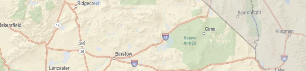
1 Desert Cymopterus (Cymopterus deserticola) Legal Status State: None California Rare Plant Rank: 1B.2 1 Federal: Bureau of Land Management Sensitive Critical Habitat: N/A Recovery Planning: N/A Photo courtesy Jasmine J. Watts Photo courtesy of Jasmine J. Watts Taxonomy Distribution General Desert cymopterus (Cymopterus deserticola) was originally described by Townshend Stith Brandegee in 1915 (Hall 1915, p. 168; IPNI 2005). Mathias (1930) provides a detailed description of this species, and subsequent descriptions in floras appear to be based on this work (Bagley 2006). Desert cymopterus is in the carrot family (Apiaceae) (Jepson Flora Project 2011). Desert cymopterus is a taprooted perennial about 15 centimeters (5.9 inches) in height. A full physical description of the species can be found in the Jepson Flora Project (2011). There are a total of 79 occurrences in the California Natural Diversity Database (CNDDB) (CDFG 2012a). The historical distribution of desert cymopterus ranged from Apple Valley in San Bernardino County northward approximately 55 miles to the Cuddeback Lake basin in San Bernardino County, and westward approximately 45 miles to the Rogers and Buckhorn Dry Lake basins on Edwards Air Force Base in Kern and Los Angeles Counties. However, the Apple Valley locations 1 1B: Rare, threatened, or endangered in California and elsewhere; X.2: Fairly endangered in California. 1
2 have presumably been extirpated resulting in a current distribution that includes the Rogers Dry Lake, Harper Dry Lake, Cuddeback Dry Lake, and Superior Dry Lake basins (69 FR ; Figure SP- P12). This species occurs at elevations from 2,000 to 3,000 feet, and possibly up to 5,000 feet (69 FR ; CNPS 2011). Distribution and Occurrences within the Plan Area Historical There are three CNDDB occurrences from before Two of these are located in the vicinity of Leuhman Ridge and Kramer Hills near other occurrences of this species. One of these is possibly extirpated and located over 25 miles southeast of other occurrences east of Victorville (Figure SP-P12; CDFG 2012a). Recent Natural History There is a total of 79 CNDDB occurrences in the Plan Area (CDFG 2012a). Of these, there are 76 recent occurrences (status updated since 1990) that range from south of Buckhorn Lake along the Kern Los Angeles County boundary north to the Black Hills and Fort Irwin (Figure SP-P12). However, the majority of these occurrences are located on or near Edwards Air Force Base. Those on Edwards Air Force Base and the one occurrence at Fort Irwin are on lands owned by the Department of Defense (DOD). Other occurrences on public land include those managed by the Bureau of Land Management (BLM) in the general vicinity of North Edwards, Harper Lake, and Cuddeback Lake. The remaining nine recent records are either located on private land or the ownership is unknown (CDFG 2012a). Habitat Requirements Desert cymopterus grows in Joshua tree woodland, saltbush scrub, and Mojavean desert scrub communities on loose, sandy soils. The sandy soils required by this species occur on alluvial fans and basins, stabilized sand fields, and occasionally sandy slopes of desert dry lake basins (69 FR ). 2
3 Table 1. Habitat Associations for Desert Cymopterus Land Cover Type Joshua tree woodland, Saltbush scrub, Mojavean desert scrub Habitat Designation Habitat Parameters Supporting Information Primary habitat Loose, sandy soils, 2,000 3,000 feet 69 FR Reproduction As a taprooted perennial, desert cymopterus does not appear to reproduce vegetatively, but rather reproduces via seeds. Seedling establishment has not been reported for this species. Establishment of new individuals in a population may be infrequent given that many reported desert cymopterus populations are highly dispersed and low density (NatureServe 2010). Depending on the year, desert cymopterus flowers between early March and mid-may, and may not flower at all in unfavorable years. Poor seed production or seed survival may be a factor in infrequent establishment observed in field studies. At a number of sites in several different years little or no seed production has been observed. A study conducted in 1988 at five sites found that the inflorescences dried up and aborted before setting fruit at each site (Moe 1988, cited in Bagley 2006). In a 1992 study at three sites on Edwards Air Force Base, Charlton (1993, cited in Bagley 2006) reported that only a small portion of the plants flowered and that even fewer successfully produced seed. On the other hand, in 1995, a wet El Niño year, most plants (95%) produced inflorescences at the same three sites, and 51% of the plants had set fruit near the end of the growing season (Mitchell et al. 1995, cited in NatureServe 2010). However, this still indicates a lot of inflorescences aborted before setting fruit (NatureServe 2010). Fruits of desert cymopterus are fairly large and do not seem well adapted for dispersal over long distances. Fruits generally seem to fall relatively close to the parent plant. However, the fruits have a marginal wing that may facilitate dispersal by wind. In addition, the fruits mature late in the season, typically after the end of the rainy season, so they remain dry and light. Therefore, given that wind is 3
4 relatively common in the open sandy habitats where this species is found, it could easily push the fruits along the soil surface, although the fruits probably don t become airborne (NatureServe 2010). Because of the annual variability in rainfall, the underground parts of herbaceous desert perennials, including desert cymopterus, must be able to maintain the populations over time with frequent years of reproductive failure; in addition, they must be able to survive prolonged periods of low soil moisture and entire years without aboveground photosynthetic activity (NatureServe 2010). In dry years, desert cymopterus may not produce flowers or fruit and may even remain dormant underground during the usual growing season. In very wet years, however, they may produce flowers and fruits abundantly. Observations of abundant desert cymopterus in 1995 on Edwards Air Force Base demonstrated the species ability to survive the drought in large numbers and with great vigor (NatureServe 2010). Populations of desert cymopterus are probably maintained by periodic recruitment only after years of exceptionally favorable conditions for seed production (Bagley 2006; NatureServe 2010). Ecological Relationships Population sizes appear to vary greatly from year to year, evidently in response to the amount and timing of winter and spring rainfall, making it difficult to determine population trends (NatureServe 2010). Population Status and Trends Global: G2, Imperiled (CDFG 2012b) State: S2, Imperiled ( CDFG 2012b) Abundance estimates for each population are usually less than 1,000 plants. However, estimating population size is difficult for a number of reasons. First, occurrences and population size fluctuate widely from year to year in response to climatic conditions, especially on the amount of rainfall. Desert cymopterus is dependent upon frequent spring rains. Furthermore, this species may remain dormant underground as a taproot and may not emerge when there isn t 4
5 enough rainfall, so the number of individuals underground could be greater than the number of individuals aboveground. Also, detectability many be low in years when plants only produce leaves and no inflorescence (NatureServe 2010). The largest and most robust populations of desert cymopterus occur on Edwards Air Force Base. Seventeen population surveys were performed during a study in 1995, a good year for the species, and population sizes at each location ranged from 1 to 1,929 individuals. In total, 14,093 individuals were counted over an area of 1,465 acres (Tetra Tech 1995, cited in NatureServe 2010). Threats and Environmental Stressors Desert cymopterus is potentially threatened by habitat alteration and destruction resulting from military activities on Edwards Air Force Base, the expansion of Fort Irwin, oil and gas development, utility construction, renewable energy development, off-road vehicle use, sheep grazing, Land Tenure Adjustment, and urban development (69 FR ; CNPS 2011). However, according to the proposed rule (69 FR ), the magnitude and relative importance of most of these potential threats were unknown. Grazing by native and non-native herbivores presumably including mammals, insects, and desert tortoise (Gopherus agassizii) is also a threat to this species. This may contribute to the low-density, dispersed nature of the majority of reported desert cymopterus populations by limiting the plants reproductive potential and reducing their vigor (Bagley 2006). Conservation and Management Activities The vast majority of plants and acreage of habitat for desert cymopterus are currently thought to occur on the Edwards Air Force Base. Therefore, this species is not covered by the West Mojave Habitat Conservation Plan (Edwards Air Force Base 2002). Management areas at Haystack Butte and Leuhman Ridge on Edwards Air Force Base support desert cymopterus. Another management area consisting of undeveloped land north of Mercury Boulevard also supports this species (Edwards Air Force Base 2002). The Edwards Air Force Base Integrate Natural Resources Management Plan offers 5
6 general conservation measures based on an ecosystem approach with a general goal of conserving and improving the habitat that would benefit all native species (Edwards Air Force Base 2002). Data Characterization In general, data availability for desert cymopterus is poor except for population data in some years at Edwards Air Force Base. Population trends are difficult to assess due to the fluctuations caused by variation in rainfall year to year. Furthermore, little is known regarding the species reproduction, seed dispersal, and recruitment, and nothing is known about pollination. No studies have examined seed viability, longevity in the soil, and predation. Nothing is known of the physiology of dormancy in desert cymopterus or how long plants can survive dormancy. In addition, the requirements for seed germination and establishment of new plants in the population are unknown (NatureServe 2010). Management and Monitoring Considerations Protection should focus on currently known to occur on Edwards Air Force Base just south of Rogers Lake, and west and south of Leuhman Ridge. The long-term viability of populations may also rely on the protection of habitat corridors between these populations. Little is known of the distribution and abundance of desert cymopterus off Edwards Air Force Base. Focused surveys for this plant should be conducted in suitable habitat off Edwards Air Force base in favorably wet years to determine if high-density sites exist and how any such areas could be protected (Bagley 2006). Predicted Species Distribution in Plan Area There are 2,487,663 acres of modeled suitable habitat in the Plan Area. Modeled suitable habitat occurs in the northwestern portion of the Plan Area from 1,900 to 4,500 feet. Modeled suitable habitat includes some scrub vegetation types as well as desert playa and North American warm desert bedrock cliff and outcrop, with sandy soils (Figure SP-P12). Appendix C includes specific model parameters and a figure showing the modeled suitable habitat in the Plan Area. 6
7 Literature Cited Appendix C provides a summary of the methodology used to model DRECP Covered Species with Maxent. For the desert cymopterus, 154 occurrence points were used to train the Maxent model and 51 occurrence points were used to test the model s performance. Overall, the Maxent model has excellent statistical support. The relatively large number of occurrence points occur in limited environmental conditions relative to the entire Plan Area, increasing the predictive power of the model. Based on a natural break in the distribution of the probability of occurrence that Maxent estimates, all 100-meter grid cells with greater than probability of occurrence were defined as desert cymopterus habitat. The Maxent model predicts 418,061 acres of desert cymopterus habitat, compared with 2,487,663 acres predicted by the expert model. The Maxent model predicts desert cymopterus habitat in the West Mojave around occurrence data, including interspersed areas around occurrence data north of Barstow. The expert model predicts desert cymopterus habitat similar to the Maxent model around occurrence records, but covering more of the West Mojave and central Mojave region as well as the area east of Victorville that lacks occurrence data. 69 FR Proposed rule: Endangered and Threatened Wildlife and Plants; 12-Month Finding for a Petition to List Cymopterus deserticola (desert cymopterus) as Endangered. November 9, Bagley, M Desert Cymopterus. West Mojave Plan Species Accounts. U.S. Department of the Interior, Bureau of Land Management. January Accessed February 21, CDFG (California Department of Fish and Game). 2012a. Cymopterus deserticola. Element Occurrence Query. California Natural Diversity Database (CNDDB). RareFind, Version 4.0 (Commercial Subscription). Sacramento, California: CDFG, Biogeographic Data Branch. Accessed February
8 CDFG. 2012b. Special Vascular Plants, Bryophytes, and Lichens List. California Natural Diversity Database (CNDDB). January Accessed. cnddb/plants_and_animals.asp. CNPS (California Native Plant Society) Inventory of Rare and Endangered Plants (online edition, v8-01a). Sacramento, California: California Native Plant Society. Accessed February Edwards Air Force Base Integrated Natural Resources Management Plan for Edwards Air Force Base, California. Mojave Desert Ecosystem Program. Environmental Management Office, Edwards Air Force Base California. October Accessed March documents/docs/pln_intgrtd_nat_res_mngmnt_pln_eafb_20 02.pdf. Hall, H.M New and Noteworthy Californian Plants, II. University of California Publications in Botany 6(7): Berkeley, California: University of California Press. IPNI (International Plant Names Index) Plant Name Details and Author Details. Accessed February 21, Jepson Flora Project Cymopterus deserticola. The Jepson Online Interchange: California Floristics. Berkeley, California: University of California. Accessed February NatureServe Desert Cymopterus. NatureServe Explorer: An Online Encyclopedia of Life [web application]. Version 7.1. Arlington, Virginia: NatureServe. Accessed February Mathias, M Studies in the Umbelliferae. III. Annals of the Missouri Botanical Garden 17:


9 Species Range in California Utah Nevada Current Occurrence Point Historic Occurrence Point Note: Occurrence point size graphically represents the precision level code for the data point but is not scaled geographically. Arizona P a c i f i c O c e a n Z:\Projects\CEC\j_DRECP\MAPDOC\MAPS\BaselineBioReport\SpeciesProfiles I Miles Sources: DRECP Species Occurrence Database (2011), CNPS (2011), CEC (2010), USGS (2010), ESRI (2010) Desert Renewable Energy Conservation Plan (DRECP) Baseline Biology Report MEXICO FIGURE SP-P12 Desert Cymopterus Occurrences in the Plan Area (N=79)
Parish s Alkali Grass (Puccinellia parishii)
") Parish s Alkali Grass (Puccinellia parishii) Legal Status [Species photo to come] Taxonomy State: S1 1 California Rare Plant Rank: 1B.1 2 Federal: Bureau of Land Management Sensitive Critical Habitat:
Parish s Alkali Grass (Puccinellia parishii) Legal Status [Species photo to come] Taxonomy State: S1 1 California Rare Plant Rank: 1B.1 2 Federal: Bureau of Land Management Sensitive Critical Habitat:
Alkali Mariposa-Lily (Calochortus striatus)
") Alkali Mariposa-Lily (Calochortus striatus) Legal Status Taxonomy Distribution General State: S2 1 California Rare Plant Rank: 1B.2 2 Photo courtesy of Dr. Heath McAllister. Federal: Bureau of Land Management
Alkali Mariposa-Lily (Calochortus striatus) Legal Status Taxonomy Distribution General State: S2 1 California Rare Plant Rank: 1B.2 2 Photo courtesy of Dr. Heath McAllister. Federal: Bureau of Land Management
Owens Valley Checkerbloom Sidalcea covillei
 Owens Valley Checkerbloom Sidalcea covillei Legal Status Taxonomy Distribution General State: Endangered; S3 1 California Rare Plant Rank: 1B.1 2 Federal: Bureau of Land Management Sensitive Critical Habitat:
California Rare Plant Rank: 1B.2, Rare, threatened, or endangered in California and elsewhere. Fairly endangered in California
 Legal Status State: S2, Imperiled California Rare Plant Rank: 1B.2, Rare, threatened, or endangered in California and elsewhere. Fairly endangered in California Federal: Bureau of Land Management (BLM)
Parish s Daisy (Erigeron parishii)
") Parish s Daisy (Erigeron parishii) Legal Status Taxonomy Distribution State: S2S3 1 CNPS: Rare Plant Rank 1B.1 2 Federal: Threatened Critical Habitat: Originally Photo courtesy of Duncan S. Bell. designated
Parish s Daisy (Erigeron parishii) Legal Status Taxonomy Distribution State: S2S3 1 CNPS: Rare Plant Rank 1B.1 2 Federal: Threatened Critical Habitat: Originally Photo courtesy of Duncan S. Bell. designated
Emerging Restoration Approaches for Disturbed Mojave Desert Shrublands and the Search for Suitable Native Plant Materials
 Emerging Restoration Approaches for Disturbed Mojave Desert Shrublands and the Search for Suitable Native Plant Materials Lesley A. DeFalco USGS, Western Ecological Research Center Henderson, Nevada Conference
DRAFT October 26, 2011
 5. PLAN INTEGRATION This section summarizes previous presentations provided to stakeholders regarding the form of the Natural Community Conservation Plan/Habitat Conservation Plan (NCCP/HCP) and provides
Chapter 13: Wildlife and Vegetation
 Chapter 13: Wildlife and Vegetation Introduction and Setting Nevada County contains an extremely wide range of plants, animals and habitat types. With topographic elevations ranging from 300 feet in the
Preliminary Conservation Strategy - Overview
 Preliminary Conservation Strategy - Overview Desert Renewable Energy Conservation Plan Stakeholder Meeting November 9, 2011 PCS Overview Document structure Brief review of content previously reviewed with
Strong site and year specific needs, particularly driven by annual systems Well drained, <1200 m, over diverse soil types
 California s grasslands span over 10% of CA s land area (5,640,400 ha). The grasslands are also a key understory component of California s woodlands and coastal scrub, so grassland species cover at least
Home to about 56 million people, the Southwest includes Nevada, Arizona, New Mexico, Utah, Colorado and most of California.
 Climate change in the U.S. Southwest U.S. Environmental Protection Agency Overview The Southwest is the hottest and driest region in the nation. Extending from the Pacific Ocean east to the Rocky Mountains
DRECP DESERT RENEWABLE ENERGY CONSERVATION PLAN
 DRECP DESERT RENEWABLE ENERGY CONSERVATION PLAN PROPOSED LAND USE PLAN AMENDMENT AND FINAL ENVIRONMENTAL IMPACT STATEMENT Executive Summary October 2015 2 DRECP PROPOSED LUPA AND FINAL EIS TABLE OF CONTENTS
Panther Fire Salvage Project
 Prepared by: Julie Knorr Botanist Klamath National Forest May 04, 2009 Abstract Regulatory Framework Section 7 of the Endangered Species Act of 1973, as amended, Forest Service Policy (FSM 2670), and
Short Form Botany Resource Reports:
 United States Department of Agriculture Forest Service December 2014 Short Form Botany Resource Reports: 1) Botany Resource Report 2) Biological Assessment for Threatened, Endangered, Proposed Species
Botany Resource Reports:
 United States Department of Agriculture Forest Service December 2014 Botany Resource Reports: 1) Botany Resource Report 2) Biological Assessment for Threatened, Endangered, Proposed Species 3) Biological
A.35 SLENDER ORCUTT GRASS (ORCUTTIA TENUIS)
") A. SLENDER ORCUTT GRASS (ORCUTTIA TENUIS) A.. Legal and Other Status 0 Slender Orcutt grass (Orcuttia pilosa) is listed as threatened under the federal ESA and is listed as endangered under the California
A. SLENDER ORCUTT GRASS (ORCUTTIA TENUIS) A.. Legal and Other Status 0 Slender Orcutt grass (Orcuttia pilosa) is listed as threatened under the federal ESA and is listed as endangered under the California
Low Northern Rockcress (Neotorularia humilis)
") The Status of Low Northern Rockcress (Neotorularia humilis) in Newfoundland and Labrador THE SPECIES STATUS ADVISORY COMMITTEE REPORT NO. 1 September 30, 2004 1 ASSESSMENT Assessment: Endangered Current
The Status of Low Northern Rockcress (Neotorularia humilis) in Newfoundland and Labrador THE SPECIES STATUS ADVISORY COMMITTEE REPORT NO. 1 September 30, 2004 1 ASSESSMENT Assessment: Endangered Current
RECORD OF DECISION INTRODUCTION
 United States Department of the Interior Bureau of Land Management California Desert District Office 22835 Calle San Juan De Los Lagos Moreno Valley, CA 92553 RECORD OF DECISION Supplemental Environmental
Common Name: ALABAMA SNOW-WREATH. Scientific Name: Neviusia alabamensis Gray. Other Commonly Used Names: none. Previously Used Scientific Names: none
 Common Name: ALABAMA SNOW-WREATH Scientific Name: Neviusia alabamensis Gray Other Commonly Used Names: none Previously Used Scientific Names: none Family: Rosaceae (rose) Rarity Ranks: G2/S1 State Legal
The Southern Sierra Hardwood Range region, consisting of Madera, Fresno,
 Blue Oak Regeneration in Southern Sierra Nevada Foothills 1 Ralph L. Phillips 2 Neil K. McDougald 3 Richard B. Standiford 4 Douglas D. McCreary 5 William E. Frost 6 Abstract: A survey of blue oak stands
(1) The proposed commercial solar energy generation facility is either
 The proposed commercial solar energy generation facility is either") (2) The design and siting of these facilities shall avoid the placement of turbines on or immediately adjacent to the upwind side of ridge crests; (3) The design may include other design features to minimize
(2) The design and siting of these facilities shall avoid the placement of turbines on or immediately adjacent to the upwind side of ridge crests; (3) The design may include other design features to minimize
3 Baseline and Existing Conditions
 1 2 3 4 5 6 7 8 9 10 11 12 13 14 3 Baseline and Existing Conditions The effective date of the VSP legislation is July 22, 2011. This is also the date chosen by the legislature as the applicable baseline
A.23 VALLEY ELDERBERRY LONGHORN BEETLE (DESMOCERUS
 A. VALLEY ELDERBERRY LONGHORN BEETLE (DESMOCERUS CALIFORNICUS DIMORPHUS) A.. Legal and Other Status 0 The Valley elderberry longhorn beetle is listed as threatened under the ESA ( FR 0). The U.S. Fish
Ranching In The Mojave. Noah Amme Professor Raymond E. Arvidson Pathfinder 202; March 2014
 1 Ranching In The Mojave Noah Amme Professor Raymond E. Arvidson Pathfinder 202; March 2014 Mojave Desert and Boundaries: Mojave desert occupies much of southeastern California, northwestern Arizona, southern
A.21 VALLEY ELDERBERRY LONGHORN BEETLE (DESMOCERUS CALIFORNICUS DIMORPHUS) Legal and Other Status. Species Distribution and Status
 Legal and Other Status. Species Distribution and Status") A.21 VALLEY ELDERBERRY LONGHORN BEETLE (DESMOCERUS CALIFORNICUS DIMORPHUS) A.21.1 Legal and Other Status The Valley elderberry longhorn beetle is listed as threatened under the ESA (45 FR 52803). The U.S.
A.21 VALLEY ELDERBERRY LONGHORN BEETLE (DESMOCERUS CALIFORNICUS DIMORPHUS) A.21.1 Legal and Other Status The Valley elderberry longhorn beetle is listed as threatened under the ESA (45 FR 52803). The U.S.
Executive Summary for the Record of Decision
 for the Record of Decision for the Record of Decision for the Land Use Plan Amendment to the California Desert Conservation Plan, Bishop Resource Management Plan, and Bakersfield Resource Management Plan
Lane Mountain Milk-Vetch (Astragalus jaegerianus)
") Lane Mountain Milk-Vetch (Astragalus jaegerianus) Legal Status Taxonomy State: S1.1 1 California Rare Plant Rank: 1B.1 2 Federal: Endangered Photo courtesy of the California Native Plant Society. Critical
Lane Mountain Milk-Vetch (Astragalus jaegerianus) Legal Status Taxonomy State: S1.1 1 California Rare Plant Rank: 1B.1 2 Federal: Endangered Photo courtesy of the California Native Plant Society. Critical
Steps in Producing Ecological Site Descriptions: A Perspective from Arizona. Dan Robinett Rangeland Management Specialist NRCS, Tucson
 Steps in Producing Ecological Site Descriptions: A Perspective from Arizona. Dan Robinett Rangeland Management Specialist NRCS, Tucson Land Classification by NRCS MLRA Major Land Resource Area MLRAs represent
Previously Used Scientific Names: Oxypolis filiformis (Walter) Britton var. canbyi Coulter & Rose
 Britton var. canbyi Coulter & Rose") Common Name: CANBY S DROPWORT Scientific Name: Oxypolis canbyi (Coulter & Rose) Fernald Other Commonly Used Names: Canby's cowbane Previously Used Scientific Names: Oxypolis filiformis (Walter) Britton
Common Name: CANBY S DROPWORT Scientific Name: Oxypolis canbyi (Coulter & Rose) Fernald Other Commonly Used Names: Canby's cowbane Previously Used Scientific Names: Oxypolis filiformis (Walter) Britton
ARIZONA. Arizona. Smart Solar Focusing on Low-Conflict Zones to Promote Arizona s Economy, Protect Wildlands and Build a Clean Energy Future
 ARIZONA The sun shines almost year round on, and with strong local support for renewable energy and proximity to urban energy markets, it is a great place for solar energy development. With the needed
Mojave Scrub. Conservation Profile 3,120,000 ha ([,706,000 ac] 11% of state. Key Bird-Habitat Attributes. Hab-12-1
![Mojave Scrub. Conservation Profile 3,120,000 ha ([,706,000 ac] 11% of state. Key Bird-Habitat Attributes. Hab-12-1](/thumbs/95/124666979.jpg "Mojave Scrub. Conservation Profile 3,120,000 ha ([,706,000 ac] 11% of state. Key Bird-Habitat Attributes. Hab-12-1") habitat in Esmeralda County. Photo by Elisabeth Ammon. Key Bird-Habitat Attributes Stand Structure Ideal Scale for Conservation Action Distance to Riparian/Spring Habitats and Ephemeral Washes Presence
habitat in Esmeralda County. Photo by Elisabeth Ammon. Key Bird-Habitat Attributes Stand Structure Ideal Scale for Conservation Action Distance to Riparian/Spring Habitats and Ephemeral Washes Presence
Ulmus pumila -- Minnesota
 Plant Risk Evaluator -- PRE Evaluation Report Ulmus pumila -- Minnesota 2017 Farm Bill PRE Project PRE Score: 13 -- Evaluate this plant further Confidence: 75 / 100 Questions answered: 19 of 20 -- Valid
Common Name: SWAMP PINK. Scientific Name: Helonias bullata Linnaeus. Other Commonly Used Names: none. Previously Used Scientific Names: none
 Common Name: SWAMP PINK Scientific Name: Helonias bullata Linnaeus Other Commonly Used Names: none Previously Used Scientific Names: none Family: Heloniadaceae (swamp pink), Melanthiaceae (bunchflower),
County of Riverside - PSEC Project General Habitat Assessment Appendix A
 County of Riverside - PSEC Project General Habitat Assessment Appendix A Joshua Tree Joshua Tree The Joshua Tree study area is located on the northern portion of the Little San Bernardino Mountains, north
DOCKETED 09-RENEW EO-1
 Desert Tortoise Preserve Committee, Inc. 4067 Mission Inn Avenue, Riverside, CA 92504 Telephone: (951) 683 3872 / Email: dtpc@pacbell.net Web site: www.tortoise-tracks.org California Energy Commission
TERR 6 VALLEY ELDERBERRY LONGHORN BEETLE
 TERR 6 VALLEY ELDERBERRY LONGHORN BEETLE 1.0 EXECUTIVE SUMMARY Valley elderberry longhorn beetle (VELB) (Desmocerus californicus dimorphus) habitat mapping and U.S. Fish and Wildlife Service (USFWS) protocol-level
Carex specuicola. Status Report. Navajo Sedge. Daniela Roth Navajo Natural Heritage Program P.O. Box 1480 Window Rock, AZ 86515
 Carex specuicola Navajo Sedge Status Report 2004 Daniela Roth Navajo Natural Heritage Program P.O. Box 1480 Window Rock, AZ 86515 INTRODUCTION Navajo Sedge, Carex specuicola, was federally listed as threatened
Restoration Assessment and Monitoring Program for the Southwest (RAMPS)
") Photo credit: NPS Restoration Assessment and Monitoring Program for the Southwest (RAMPS) Seth M. Munson 1,*, John B. Bradford 1, Bradley J. Butterfield 2, Troy E. Wood 1, Stella M. Copeland 2 1 U.S. Geological
Photo credit: NPS Restoration Assessment and Monitoring Program for the Southwest (RAMPS) Seth M. Munson 1,*, John B. Bradford 1, Bradley J. Butterfield 2, Troy E. Wood 1, Stella M. Copeland 2 1 U.S. Geological
Appendix D. Conservation and Management Action Implementation Support Information and Maps
 Appendix D Conservation and Management Action Implementation Support Information and Maps D DRECP BLM Land Use Plan Amendment CONSERVATION AND MANAGEMENT ACTION IMPLEMENTATION SUPPORT INFORMATION AND
Great Basin Native Plant Project and BLM Plant Conservation Program: Its Role in Sage Grouse Conservation
 Great Basin Native Plant Project and BLM Plant Conservation Program: Its Role in Sage Grouse Conservation Peggy Olwell BLM Plant Conservation Program Lead March 17, 2014 Overview Native Plant Materials
Common Name: CUTLEAF BEARDTONGUE. Scientific Name: Penstemon dissectus Elliott. Other Commonly Used Names: dissected beardtongue
 Common Name: CUTLEAF BEARDTONGUE Scientific Name: Penstemon dissectus Elliott Other Commonly Used Names: dissected beardtongue Previously Used Scientific Names: none Family: Scrophulariaceae (snapdragon)
Southern California Chaparral and Sage Scrub Habitats
 Southern California Chaparral and Sage Scrub Habitats Climate Change Adaptation Actions Summary An Important Note About this Document: This document represents an initial effort to identify adaptation
Beverly. Produced in This report and associated map provide information about important sites for biodiversity conservation in your area.
 CONSERVING THE BIODIVERSITY OF MASSACHUSETTS IN A CHANGING WORLD Beverly Produced in 2012 This report and associated map provide information about important sites for biodiversity conservation in your
4.2 Agriculture and Forestry Resources
 The purpose of this Section is to identify existing agriculture and forest resources within the Project area, analyze potential agriculture and forest resources associated with the development of the proposed
Wood Canyon Emergent Wetland Project. City of Aliso Viejo 12 Journey, Suite 100 Aliso Viejo, CA 92656
 Wood Canyon Emergent Wetland Project City of Aliso Viejo 12 Journey, Suite 100 Aliso Viejo, CA 92656 Introduction Wood Canyon is located within Aliso and Wood Canyon Regional Park in southwest Orange County,
V. CONSULTATION, COORDINATION, AND PUBLIC PARTICIPATION
 V. CONSULTATION, COORDINATION, AND PUBLIC PARTICIPATION This section describes the actions taken by BLM to ensure full participation by the public, tribal governments, and other agencies in the development
Sand Transport Paths in the Mojave Desert
 Sand Transport Paths in the Mojave Desert Lack of Monitoring Stations, Soil Analyses, and the Outdated Rule 403.2 Put Communities and the Environment at Risk Sierra Club Desert Committee Meeting February
Appendix C. Evaluation of Ungaged Local Mountain Runoff in Centro and Baja Subareas
 Evaluation of Ungaged Local Mountain Runoff in Centro and Baja Subareas Table of Contents 1.1 Background and Purpose... C1 1.2 Local Mountain Rainfall... C1 1.3 Review of Previous Studies... C3 1.3.1 Bulletin
Biological Assessment. Threatened & Endangered Plant Species. Ash Valley Grazing
 Modoc National Forest Supervisor s Office April 1, 2016 Biological Assessment for Threatened & Endangered Plant Species Ash Valley Grazing (Signed) Forest J. Gauna, Forest Botanist. (530) 233-8737 fgauna@fs.fed.us
Modeling the Impact of Climate and Anthropogenic Change on Birds and Vegetation on Military Lands in California (Legacy )
") Modeling the Impact of Climate and Anthropogenic Change on Birds and Vegetation on Military Lands in California (Legacy 10-465) Abstract Global climate change will affect the landscapes and biological
Modeling the Impact of Climate and Anthropogenic Change on Birds and Vegetation on Military Lands in California (Legacy 10-465) Abstract Global climate change will affect the landscapes and biological
Washington Rare Plant Care and Conservation Rare Care Ex Situ Seed Storage
 Washington Rare Plant Care and Conservation Rare Care Ex Situ Seed Storage To: cc: From: Kelli Van Norman Bureau of Land Management Molly Boyter Bureau of Land Management Wendy Gibble Washington Rare Plant
Non-irrigated Irrigated Difference. Early 27.1 bushels per acre 33.8 bushels per acre 6.7 bushels per acre
 University of Missouri Extension G4420, Reviewed October 1993 Editor's note The printed version of this publication includes illustrations. Irrigating Soybeans Diana G. Helsel and Zane R. Helsel Department
Appendix G Soils Characterization Report
 Appendix G Soils Characterization Report Draft Environmental Impact Report Beacon Photovoltaic Project July 2012 AECOM (805)388-3775 tel 1220 Avenida Acaso (805)388-3577 fax Camarillo, CA 93012 Memorandum
Overview of America s Longleaf Restoration Initiative and the Longleaf Partnership Council
 Overview of America s Longleaf Restoration Initiative and the Longleaf Partnership Council Vernon Compton The Longleaf Alliance Gulf Coastal Plain Ecosystem Partnership October 25, 2013 1 Longleaf Historical
3.9 Master Response on Biological Resources
 3.9.1 Introduction Overview This master response addresses issues commenters raised on Biological Resources. Generally, concerns were raised that the Project could adversely affect the desert ecosystem.
Common Name: SANDHILL ROSEMARY. Scientific Name: Ceratiola ericoides Michaux. Other Commonly Used Names: Florida rosemary, sand heath
 Common Name: SANDHILL ROSEMARY Scientific Name: Ceratiola ericoides Michaux Other Commonly Used Names: Florida rosemary, sand heath Previously Used Scientific Names: Ceratiola falcatula Gandoger Family:
Climate Trends in Northern California: How Do We Manage for the Future?
 Climate Trends in Northern California: How Do We Manage for the Future? Forest Management and Watershed Science Symposium April 30, 2013 Kyle Merriam, Sierra Cascade Province Ecologist, USDA Forest Service,
Common Name: GEORGIA PLUME. Scientific Name: Elliottia racemosa Muhlenberg ex Elliott. Other Commonly Used Names: Elliottia
 Common Name: GEORGIA PLUME Scientific Name: Elliottia racemosa Muhlenberg ex Elliott Other Commonly Used Names: Elliottia Previously Used Scientific Names: none Family: Ericaceae (heath) Rarity Ranks:
Long-term Management Plan For The Mitigation Bank
 Note: The California multi-agency Project Delivery Team developed this general outline to assist in the development of the Long-term Management Plan for mitigation banks. Objectives and tasks are provided
Mgmt. Plan/Date of Original Designation NEMO Plan Amendment 2002
 Description/Location: Located within the Valley, east of the Mojave ational Preserve, southwest of the California border. The original ACEC was bounded on the northwest by 15. The expanded boundary encompasses
Long-term Management Plan For The Mitigation Bank
 Note: The California multi-agency Project Delivery Team developed this general outline to assist in the development of the Long-term Management Plan for mitigation banks. Objectives and tasks are provided
Typical Impacts Common to All Action Alternatives
 IV.17 WILD HORSES AND BURROS This chapter analyzes potential impacts on wild horse and burro herd areas and herd management areas (s) from implementing the Desert Renewable Energy Conservation Plan (DRECP)
History and Future of Oaks in and around the San Joaquin
 History and Future of Oaks in and around the San Joaquin January 24, 2011 San Joaquin County Historical Society Tom Gaman California Oaks East-West Forestry Associates, Inc. www.forestdata.com Tonight:
Evaluation of a Drip Vs. Furrow Irrigated Cotton Production System
 Evaluation of a Vs. Irrigated Cotton Production System Item Type text; Article Authors Norton, E. R.; Silvertooth, J. C. Publisher College of Agriculture, University of Arizona (Tucson, AZ) Journal Cotton:
Cadiz Inc. CORPORATE OVERVIEW
 Cadiz Inc. CORPORATE OVERVIEW March 2017 2 SAFE HARBOR AGREEMENT December 2016 During the course of this presentation, we will make forward-looking statements. Any statement that is not a historical fact
Syringa reticulata -- Minnesota
 Plant Risk Evaluator -- PRE Evaluation Report Syringa reticulata -- Minnesota 2017 Farm Bill PRE Project PRE Score: 7 -- Accept (low risk of invasiveness) Confidence: 68 / 100 Questions answered: 20 of
MONITORING GRANITE STATE SNOWSHOE HARE POPULATIONS TO UNDERSTAND THE ELUSIVE LYNX. by Jillian Kilborn. 6 n New Hampshire WILDLIFE JOURNAL
 MONITORING GRANITE STATE SNOWSHOE HARE POPULATIONS TO UNDERSTAND THE ELUSIVE LYNX by Jillian Kilborn 6 n New Hampshire WILDLIFE JOURNAL January / February 2019 n 7 JIM KRUGER / istockphoto.com A s I move
Restoration of Riparian Forests and Riparian Ecosystem Processes and Implications for Salmon Restoration. Katie Ross-Smith Jennifer Hammond
 Restoration of Riparian Forests and Riparian Ecosystem Processes and Implications for Salmon Restoration Katie Ross-Smith Jennifer Hammond Outline > Background California riparian communities Riparian
Triadica sebifera -- Georgia
 Plant Risk Evaluator -- PRE Evaluation Report Triadica sebifera -- Georgia 2017 Farm Bill PRE Project PRE Score: 19 -- Reject (high risk of invasiveness) Confidence: 73 / 100 Questions answered: 19 of
Appendix C Risk Assessment Methods
 Appendix C Risk Assessment Methods The following section outlines the specific methods, data, and values used to evaluate wildfire risk in Lane County. Identifying the Wildland Urban Interface Risk The
Nandina domestica -- Texas
 Plant Risk Evaluator -- PRE Evaluation Report Nandina domestica -- Texas 2017 Farm Bill PRE Project PRE Score: 18 -- Reject (high risk of invasiveness) Confidence: 80 / 100 Questions answered: 19 of 20
Conservation Issues In North America s Arid Ecosystems. Rob Klinger: USGS, Western Ecological Research Center
 Conservation Issues In North America s Arid Ecosystems Rob Klinger: USGS, Western Ecological Research Center A Little Full Disclosure Long ago at a party far far away (well OK, last Saturday in Davis)
Habitat and Fragmentation Impacts: A Perspective from Landscape Ecology. Todd BenDor Wuhan 2017
 Habitat and Fragmentation Impacts: A Perspective from Landscape Ecology Todd BenDor bendor@unc.edu Wuhan 2017 Presentation Overview Introduction to habitat issues Habitat loss Habitat Fragmentation Assessment
Forensic Forestry Reading the Land
 Principles of Forest Ecology and Management or Forensic Forestry Reading the Land Jonathan Kays University of Maryland Extension Where Do We Start? Think Like A Plant Act Like A Plant Thinking and Acting
CONVENTION ON INTERNATIONAL TRADE IN ENDANGERED SPECIES OF WILD FAUNA AND FLORA
 CoP16 Inf. 11 (English only / Únicamente en inglés / Seulement en anglais) CONVENTION ON INTERNATIONAL TRADE IN ENDANGERED SPECIES OF WILD FAUNA AND FLORA Sixteenth meeting of the Conference of the Parties
CADIZ VALLEY WATER CONSERVATION, RECOVERY, AND STORAGE PROJECT Final Environmental Impact Report SCH#
 Volume 6: Responses Response to Comments CADIZ VALLEY WATER CONSERVATION, RECOVERY, AND STORAGE PROJECT Final Environmental Impact Report SCH# 2011031002 Prepared for Santa Margarita Water District July
CADIZ VALLEY WATER CONSERVATION, RECOVERY, AND STORAGE PROJECT Final Environmental Impact Report SCH#
 Volume 5: Comments Response to Comments CADIZ VALLEY WATER CONSERVATION, RECOVERY, AND STORAGE PROJECT Final Environmental Impact Report SCH# 2011031002 Prepared for Santa Margarita Water District July
Understanding Gilia tenuiflora ssp. arenaria population fluctuations and community relationships
 California State University, Monterey Bay Digital Commons @ CSUMB Capstone Projects and Theses 2007 Understanding Gilia tenuiflora ssp. arenaria population fluctuations and community relationships Brianne
The Survey of Rare and Protected Vascular Plant Species in the Republic of Ireland. John Conaghan
 The Survey of Rare and Protected Vascular Plant Species in the Republic of Ireland John Conaghan Presentation Structure Background to protected species lists Record Sources and Survey techniques Case histories
Dr. Dorothy Robyn Deputy Under Secretary of Defense (Installations and Environment) Before the Senate Committee on Energy and Natural Resources
 Before the Senate Committee on Energy and Natural Resources") HOLD UNTIL RELEASED BY THE COMMITTEE Statement of Dr. Dorothy Robyn Deputy Under Secretary of Defense (Installations and Environment) Before the Senate Committee on Energy and Natural Resources S. 2921,
HOLD UNTIL RELEASED BY THE COMMITTEE Statement of Dr. Dorothy Robyn Deputy Under Secretary of Defense (Installations and Environment) Before the Senate Committee on Energy and Natural Resources S. 2921,
Rainforests and Deserts: Distribution, Uses, and Human Influences. Visual Aids California Education and the Environment Initiative
 E s California Education and the Environment Initiative Earth Science Standard E.5.e. Rainforests and Deserts: Distribution, Uses, and Human Influences California Education and the Environment Initiative
Inventory, Monitoring, and Research Efforts for Natural Resource Management on DoD Installations and USACE Project Lands
 Inventory, Monitoring, and Research Efforts for Natural Resource Management on DoD Installations and USACE Project Lands U.S. Army Corps of Engineers Engineer Research & Development Center - Environmental
Comment Letter A1 A1-1
 Comment Letter A1 A1-1 A1-2 A1-3 A1-4 A1-5 A1-6 A1-7 A1-7 Cont. A1-8 A1-9 A1-10 Comment Letter A2 Comment Letter for Areas of Critical Environmental Concern in the Desert Renewable Energy Conservation
Red Pine Management Guide A handbook to red pine management in the North Central Region
 Red Pine Management Guide A handbook to red pine management in the North Central Region This guide is also available online at: http://ncrs.fs.fed.us/fmg/nfgm/rp A cooperative project of: North Central
Conservation and Renewable Energy Development in California. Jim Kenna, May 18, 2012 U.S. Bureau of Land Management
 Conservation and Renewable Energy Development in California Jim Kenna, May 18, 2012 U.S. Bureau of Land Management Touch on Three Subjects Policy Framework and Direction Implementation Action Overview
Slide 1. Earth Science. Chapter 11 Living Systems
 Slide 1 Earth Science Chapter 11 Living Systems Slide 2 Biomes A biome is a region with a certain climate and certain forms of vegetation. It is mostly the climate temperature and precipitation in an area
INTRODUCTION. Why Save Endangered Trees?
 INTRODUCTION Why Save Endangered Trees? As we walk through the world every day, we are surrounded by trees and plants. They are so ubiquitous and common that we take them for granted. They are part of
Common Name: OGLETHORPE OAK
 Common Name: OGLETHORPE OAK Scientific Name: Quercus oglethorpensis Duncan Other Commonly Used Names: none Previously Used Scientific Names: none Family: Fagaceae (oak) Rarity Ranks: G3/S2 State Legal
Mike Pellant Bureau of Land Mgt. Boise, ID. An Overview on Research and Studies on Diversifying Crested Wheatgrass Seedings
 Mike Pellant Bureau of Land Mgt. Boise, ID An Overview on Research and Studies on Diversifying Crested Wheatgrass Seedings Topics Evolution from conversion to Crested WG to seeding diversification? Why
Making Pasture Weed Control Decisions
 Making Pasture Weed Control Decisions Rocky Lemus 1 and Jason Weirich 1 Extension Forage Specialist Visit us at http://msucares.com/crops/forages/index.html As we approach spring growth, weed control becomes
Technical Memorandum
 Specialists in Agricultural Water Management Serving Stewards of Western Water since 1993 To: From: Technical Memorandum Butte County Department of Water and Resource Conservation Davids Engineering Date:
Grazing and the Management of Conservation Rangelands
 Grazing and the Management of Conservation Rangelands Morgan Doran Livestock & Natural Resources Advisor University of California Cooperative Extension Beautiful vernal pool ecosystem Bad actors: Annual
Pat L. Shaver USDA-NRCS-WNTSC Portland, OR
 Pat L. Shaver USDA-NRCS-WNTSC Portland, OR Process to collect and document professional knowledge and observations on selected indicators and attributes of rangeland health. How Ecological Processes are
Oak woodland management: an example from California State Parks
 Oak woodland management: an example from California State Parks Austin Creek State Recreation Area & Armstrong Redwoods State Reserve Q. garryana Range 2000 acres Oak Woodland 9 species of true oaks Red
Report. Environmental Water Demands. Butte County Department of Water and Resource Conservation Integrated Water Resources Plan.
 Report Butte County Department of Water and Resource Conservation Integrated Water Resources Plan s June 2004 s Section 1 - Introduction 1.1 Project Description This project is a preliminary investigation
Number of Species on Earth
 Number of Species on Earth 1,400,000 animal sp. 320,000 plant sp. Estimated # of tropical species (based on birds) = 2-3 x temperate = 2.8-4.2 million So total = 4.2-5.6 million The Creator, if He exists,
Sally Manning, Ph.D. Big Pine Paiute Tribe Environmental Director
 GROUNDWATER PUMPING EFFECTS ON NATIVE VEGETATION IN OWENS VALLEY Sally Manning, Ph.D. Big Pine Paiute Tribe Environmental Director s.manning@bigpinepaiute.org Los Angeles Dept. of Water & Power (LADWP)
MONTEREY PENINSULA WATER MANAGEMENT DISTRICT PROJECT DESCRIPTION FOR SELECTIVE VEGETATION MANAGEMENT AND BANK RESTORATION (RANCHO SAN CARLOS AREA)
") MONTEREY PENINSULA WATER MANAGEMENT DISTRICT PROJECT DESCRIPTION FOR SELECTIVE VEGETATION MANAGEMENT AND BANK RESTORATION (RANCHO SAN CARLOS AREA) IN THE CARMEL RIVER CHANNEL, SUMMER AND FALL 2014 SELECTIVE
MONTEREY PENINSULA WATER MANAGEMENT DISTRICT PROJECT DESCRIPTION FOR SELECTIVE VEGETATION MANAGEMENT AND BANK RESTORATION (RANCHO SAN CARLOS AREA) IN THE CARMEL RIVER CHANNEL, SUMMER AND FALL 2014 SELECTIVE
BLY 303 Lecture Notes, 2011 (O Brien) Introduction to Ecology
 Introduction to Ecology") BLY 303 Lecture Notes, 2011 (O Brien) Introduction to Ecology I. Basic Concepts A. Ecology 1. Definition: study of the interactions that determine the distribution and abundance of organisms 2. Ecological
BLY 303 Lecture Notes, 2011 (O Brien) Introduction to Ecology I. Basic Concepts A. Ecology 1. Definition: study of the interactions that determine the distribution and abundance of organisms 2. Ecological
2018 Arkansas State Wildlife Grant Pre-proposal
 2018 Arkansas State Wildlife Grant Pre-proposal EXPANDING PINE FLATWOODS HABITAT RESTORATION AT LONGVIEW SALINE NATURAL AREA TO BENEFIT SPECIES OF GREATEST CONSERVATION NEED Project Summary High priority