OF EXTENSIVE CROPS IN SPAIN sigagroasesor Project. Antonio Mestre AEMET
|
|
|
- Vincent Phelps
- 6 years ago
- Views:
Transcription


1 CUSTOMIZED ADVANCED GIS ADVISORY TOOLS FOR THE SUSTAINABLE MANAGEMENT OF EXTENSIVE CROPS CUSTOMIZED ADVANCED GIS ADVISORY TOOLS FOR THE SUSTAINABLE MANAGEMENT OF EXTENSIVE CROPS IN SPAIN sigagroasesor Project Antonio Mestre AEMET International Conference on Promoting Weather and Climate Information for Agriculture and Food Security Antalya, Turkey 7 9 April 2014
2 l 2 General Objective SigAGROasesor is a demonstration project supported by the EU LIFE+11 programs (Grant agreement reference n LIFE11 ENV/ES/641). This project aims to develop and refine a set of decision-support tools (DST) for extensive agriculture. These tools are being implemented in a web platform to provide on-line services to farmers, allowing them to work more efficiently, effectively and competitively, and by doing so move toward the environmental, economic and social sustainability of the agricultural systems.

3 The partners involved in the project are a set of public regional institutions in Spain. Their aim is to include this new tool in the services provided to the agricultural sector to booster growth and innovation. AEMET is involved in this project as technological partner to provide meteorological and climate support and data Partners: INTIA Instituto Navarro de Tecnologías e Infraestructuras Agroalimentarias; Navarra ITAP Instituto Técnico Agronómico Provincial, Castilla La Mancha NEIKER Instituto Vasco de Investigación y Desarrollo Agrario S.A. Vasque Country Fundació Mas Badia, Catalonia IFAPA Instituto de Investigación y Formación Agraria, Pesquera, Alimentaria y de la Producción Ecológica, Andalusia AEMET Agencia Estatal de Meteorología
4 l 4 KEY ASPECTS OF THE PROJECT The sigagroasesor on line services platform comprises three pillars on which this expert system and decision support tool are based: The application of modern GIS technologies for the management of georeferenced information, making use of soil variability, climate, crop condition, plant health alerts, and biotic and abiotic risks in the decisionmaking process. Web based Decision Support Tools (DST) to systematise the management decisions. Geo referenced Traceability, as a tool to register and manage historical records of Crop Management Units (CMU).
5 l 5 Functionalities: integrated into a collaborative framework Decision Support Tools (DST) consultation To collect all the georeferenced information at farm plot level Management of farm plots and cadastral information. Phenological crop monitoring along the campaign. Integration of climate information, daily meteorological information and quantitative forecasts. Reports of technical and economic management practices at both plot and agrarian exploitation levels.
6 l 6 Who is it for? Group managers Agrarian cooperatives Agribusiness Farmers Advisory Agencies Agricultural technicians Irrigation Communities

7 l 7 Objectives for targeted users For Group Managers, Agrobusiness and Cooperatives To have information about the location, dimension and potential crop yield of providers. For Advisory Agencies Communication platform with farmers and cooperatives. Platform to systematize the information generated by farmers and technicians For Farmers Traceability +reports Economical management Technical management Sustainabilty indicators To maintain historical records of each agricultural parcel. Use of technical itineraries (management sequences) Use of DST


8 l 8 Simplified scheme of sigagroasesor data and report management MANAGER, COOPERATIVES DATA FARMER REPORTS DATA FARM CMU 1 CMU 2 CMU 4 CMU 3 REPORTS ON time Data NDVI Risk Maps Meteo: Daily+ forecast PROCESSES Phenology Mineralization Leaching OM Dynamics Extractions ETP Drainage Decision Support Tools DST FERTILIZATION DST IRRIGATION DST VARIETY DST CONTROL DST INDICATORS SOIL DATABASE, CROP DATABASE, MAP SERVER, METEO SERVER USERS MANAGEMENT TECHNICAL MANAGEMENT
9 Simplified scheme of sigagroasesor data and report management FARMER FARMS Individual Management Associated Management User DB Administration Reports Pilot programs Cooperatives Technical management groups Input DB maintenance Reports/Statistics INTRODUCTION Basic: CMU Group: CMU INTRODUCTION/Edition Basic: CMU (% apply surf.) Group: CMUs (% surf.) Filters: Crop, Variety Registration CMU Registration PRACTICES CMU Registration FARMING OPERATIONS CMU CROP PRACTICES DATE Administrative subplots Technical DB Crop and variety selection Technical DB CROP VARIETY Sowing date Harvesting date Yield Potential productivity (auto/val.) Management (R/I) Residue Incorporation INPUTS MACHINERY LABOUR PRODUCTS CONTROL Basic Elements (EB) PRODUCT Type Seeds Mineral fertilizers Organic fertilizers Phytosanitary products Contracted Tasks Irrigation water

10 Versión 0 of sigagroasesor Platform l 10 Decision Support Systems Geo referenced Traceability Sustainability Indicators

11 TRACEABILITY TOOL: Agricultural practices management l 11

12 Version 1 of Agroasesor platform l12

13 Version 1 of Agroasesor platform l 13
14 PILOT PROGRAMS l 14 The objective of this action is to validate the sigagroasesor technical recommendations for the different participant regions, for different crops, for different conditions and for different users. Validation of recommendations provided by the different HAD. Validation of the usability of the platform at the user's level. Calibration of the data obtained in order to parameterize the variables VALIDATION PAC: Network of collaborative farmers (99) PPC: Control Pilot Plots (600) Cooperatives PAAP: Network of Plots under Precision Agriculture(41) CALIBRATION DAP: Network of Plots for difusion of Precision Agriculture(2) MPM: Network of Microplots for maintenance (38) GENVCE


15 PILOT PROGRAMS l 15
 in the plots controlled in Navarre.")
16 DECISION SUPPORT TOOLS: DST + NEW TECHNOLOGIES l 16 Integration in the DST N Fertilization of data from N-Sensor in order to provide variable rate N advice in winter cereal topdressing. Efficiency of N application, adjusted to the crop needs. Reduction of the applied doses (6%) in the plots controlled in Navarre. Better distribution.


17 DECISION SUPPORT TOOLS: DST + NEW TECHNOLOGIES l 17 At experimental field level, reduction of 10% of the N doses applied, while production is maintained.

18 DECISION SUPPORT TOOLS: DST + NEW TECHNOLOGIES l 18 TELEDETECTION. Satellite images Support from images from DEIMOS (20 m pixel). Great coverage, windows of 3000 km 2 in from March till August. Development of different indices: Plan cover fraction NDVI Yield potential.

19 DECISION SUPPORT TOOLS: DST + NEW TECHNOLOGIES l 19 TELEDETECTION. Satellite images satélites

20 DECISION SUPPORT TOOLS: DST + NEW TECHNOLOGIES l 20 TELEDETECTION. UAVs images (Drons) Support of UAV images (6 cm pixel). Reduced coverage, 1 2 km of radius for flights. Not affected by clouds Production of several indices: Plant cover fraction NDVI Yield potential Characterization of resistance patches. Characterization in campaign for cooperatives

21 RISKS MAPS DECISION SUPPORT TOOLS: DST + NEW TECHNOLOGIES Incorporation in the HAD Historic risks maps, zonal characterization. Campaign risks maps. Algorithms of risks on time in campaign. l 21 Risk map of brown rust (AEMET)
22 Sustainability Indicators l 22 OBJECTIVE: Incorporate environmental criteria to guide economic and social farming practices towards more sustainable production models. The information generated by the participating agencies it is introduced in the CMU to make technical recommendations on the DST should be the basis on which to calculate the indices. Furthermore, through maps, algorithms, data tables, etc. we will incorporate the extra needed information. In this action we will pay special attention to the development of composite indicators such as: nutrient balances, energy balance, GHG emissions balance, carbon footprint and water footprint.
23 COMMUNICATION TOOL l 23 PILOT ROGRAMS: Second level management. Web of the project. Training for Platform use. Diffusion. Professionalization. Traceability Second level managers. Global management: Technical itineraries. Sustainability.
24 l 24 DEGREE OF ADVANCE AND ONGOING ACTIVITIES 1. An initial version of the sigagroasesor platform has been developed in the first year of the project in order to use it in the Pilot demonstration areas, including a preliminary version of four tools: selection of varieties, PK fertilization, N fertilization and irrigation. 2. The GIS Web application has been developed using 100% open source technologies by the company PRODEVELOP, which will also be involved in upgrading the Platform. The new version will include all the improvements needed according to the experience gained in the 2013 agricultural campaign as well as the new support tool for risk of plagues, diseases and weeds. 3. Besides, a DST Indicators will be added to the new version of the Platform to incorporate the selected environmental indicators: Carbon footprint Water footprint and water footprint stress Nutrient Balances Energy Balance Pesticide ecotoxicity Pesticide pressure
25 Management of daily meteorological data and climate data 7 marzo 2013

26 METEO Data Management l26
27 Data provided by AEMET in the framework of sigagroasesor The system is being fed with weather information in near real time from three different data sources : A network of automatic stations with daily data loading (SIAR, EUSKALMET, METEOCAT, AEMET) as input to the System adn assigned to tha agricultural parcel in question (UGC). Raster maps of interpolated meteorological variables: met. data from the current season as well as forecasting ut to 7 days. User s own stations, only available to the owner.
28 Data provided by AEMET in the framework of sigagroasesor Near real time information for every requested AEMET station. Information comes from the archives of AEMET s National Climatological Database. A csv file for each met variable of the selected stations is sent every day, and within 48 hours. These files contain information on the following variables: Daily maximum and minimum temperature Daily maximum and minimum relative humidity Daily precipitation. Wind run (00h to 24h).
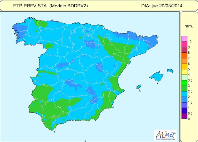
29 Data provided by AEMET in the framework of sigagroasesor Outputs from the Operational Water Balance: Daily gridded data ( 5x5 Km resolution) covering all the country for the following variables: (coming from the AEMET Water Balance outputs): 24 H Precipitation. Maximum and Minimum Temperature. Relative Humidity (Daily Mean Value). ETo Soil Moisture content at different depths. Forecasts up to 7 days in advance of ETo, 24 H Precipitation, Maximum and Minimum Temperature and Relative Humidity


30 Data provided by AEMET in the framework of sigagroasesor
31 Climate information for the SigAGROasesor Project Climate information takne from the digital Iberia Atlas (0,5 Km resolution): Monthly mean temperature ( ) Monthly mean of daily minimum temperature( ) Monthly mean of daily maximum temperature ( ) Monthly mean precipitation ( ) Number of days over a specific precipitation threshold for every month ( ) Monthly mean ETo ( ) Risk maps based on specific climate information Climatic maps generated using GIS techniques for the analysis of brown rust (Puccinia spp.) infection risk and shrivelled grain risk in some extensive crops.
 infection risk 32")
32 Example of risk map: Analysis of brown rust (Puccinia spp.) infection risk 32

33 l 33

34 l 34 On line Services Platform sigagroasesor = expert system TRACEABILITY TOOL ADVISORY TOOL COMUNICATION TOOL SUSTAINABILITY INDICATORS Farmers, farm managers Cooperatives Management experts PROGRESS = SHARED KNOWLEDGE

35 Thanks for your attention
Improving food production through innovative Smart Farming services
 HIGHER - Better Policy Instruments for High Innovation Projects in the European Regions Improving food production through innovative Smart Farming services Vassilis Kappas (GAIA EPICHEIREIN) v_kappas@c-gaia.gr
Capture the invisible
 Capture the invisible A Capture the invisible The Sequoia multispectral sensor captures both visible and invisible images, providing calibrated data to optimally monitor the health and vigor of your crops.
Agricultural Aerial Services
 Agricultural Aerial Services Satellite Imagery Satellite LOW Imagery RESOLUTION IMAGE LOW RESOLUTION IMAGE Satellite Imagery LOW RESOLUTION IMAGE High Resolution Imagery High Resolution SUPERIOR Imagery
CAN LOW COST, CONSUMER UAV'S MAP USEFUL AGRONOMIC CHARACTERISTICS?
 Wilson, J.A., 2017. Can low cost, consumer UAV s map useful agronomic characteristics? In: Science and policy: nutrient management challenges for the next generation. (Eds L. D. Currie and M. J. Hedley).
Timing. Position BDS. Short message. Navigation
 Position Navigation BDS Timing Short message The BeiDou Navigation Satellite System (BDS) has been independently constructed and operated by China with an eye to the needs of the country s national security
 FP7- SPA.2013.1.1-06: Stimulating development of downstream services and service evolution. Contract N : 606983 A downstream service to support agro-production, planning and policy http://www.ermes-fp7space.eu/
Ms. Le Thi Quy Nien Agriculture Solutions Sales and Distribution IBM Vietnam Smarter Agriculture
 Ms. Le Thi Quy Nien Agriculture Solutions Sales and Distribution IBM Vietnam nienlq@vn.ibm.com Smarter Agriculture Cognitive IOT Solutions: Digital Precision Forestry Agricultural, Industrial & Infrastructure
Farming for the Future
 Farming for the Future Craige Mackenzie Arable & Dairy Farmer www.agrioptics.co.nz NZIPIM Winter Forum 2015 Farming Businesses Greenvale Pastures Ltd 200 ha intensive cropping Three Springs Dairies Ltd
WatchITgrow, for the future of the Belgian potato chain
 WatchITgrow, for the future of the Belgian potato chain Romain Cools Belgapom Isabelle Piccard VITO Remote Sensing The future of the Belgian potato chain starts now! The Belgian potato sector : a long
 A downstream service to support agro-production, planning and policy FP7-SPACE-2013-1- CALL Contract N : 606983 http://www.ermes-fp7space.eu/ ERMES 1st Annual Meeting 26-27/03/2015 - Valencia End-Users
4. For increasing the effectiveness of inputs: Increased productivity per unit of input used indicates increased efficiency of the inputs.
 Precision Agriculture at a Glance Definition: An information and technology based farm management system to identify, analyze and manage variability within fields by doing all practices of crop production
The TCS PRIDE Model Empowering Farmers!
 Experience certainty. Innovation for masses The TCS PRIDE Model Empowering Farmers! Using Digital Five Forces to Revolutionize Agriculture: - Better Prices - Cost Reduction - Mitigate Risk - Improve Supply
DMC 22m Sensors for Supertemporal Land Cover Monitoring. Gary Holmes DMC International Imaging Ltd June 2014
 DMC 22m Sensors for Supertemporal Land Cover Monitoring Gary Holmes DMC International Imaging Ltd June 2014 DMC 2 nd Generation Satellites UK-DMC2 and Deimos-1 launched 29 th July 2009 650km swath width
ArcGIS as an Image Management Platform for Agriculture Applications
 ArcGIS as an Image Management Platform for Agriculture Applications BADRI LOKANATHAN ACCENTURE 2018 ESRI SOUTHEAST USER CONFERENCE MAY 2018 DO YOU KNOW? Q1. According to recent U.S. census data, which
Introduction -session Mark Noort Latin America Geospatial Forum, Mexico City, 2014
 G-tech for agriculture Introduction -session Mark Noort Latin America Geospatial Forum, Mexico City, 2014 Scope In relation to crop farming and livestock farming, the term agriculture may be defined as:
Review. of the application of modern information technologies in the agricultural management systems. S.Korsakova
 Review of the application of modern information technologies in the agricultural management systems S.Korsakova REVIEW OF MODERN INFORMATION TECHNOLOGIES APPLIED INAGRICULTURAL MANAGEMENT SYSTEMS The USA,
Balance DIANA FATIMA. of nutrients. Groundwater management in a changing world
 Balance of water of nutrients DIANA FATIMA Groundwater management in a changing world La Mancha Oriental, Jucar River Basin, SouthEast of Spain, Junta Central de Regantes Mancha Oriental ICT tools for
Agriculture at the crossroads of IIoT and HPC
 Agriculture at the crossroads of IIoT and HPC when real-time observation meets simulation to improve plant proteins and reduce nitrate pollution Marion CARRIER Context : increasing expectations and challenges
Irrigation Advisory Plan of Campania Region
 Irrigation Advisory Plan of Campania Region Amedeo D Antonio Regione Campania - ITALY Agriculture Assessorship Carlo De Michele Ariespace srl, Spin-Off Company University of Naples - ITALY agriculture
System of Rice Intensification MWRI-Egypt EWRMP 6/18/2018 INTRODUCTION. Enhanced Water Resources Management Project Egypt
 System of Rice Intensification 2014-16 Enhanced Water Resources Management Project Egypt MWRI-Egypt EWRMP INTRODUCTION Rank Country Yield t/ha 1 Australia 10.22 2 Egypt 9.59 3 United States of America
Guided by WMO-134 ( Guide to Agricultural Meteorological Practices (GAMP) 2007 completely revised version) Sistana SCADA Systems Ltd.
 2007 completely revised version) Sistana SCADA Systems Ltd.") Agricultural Decision Support System Guided by WMO-134 ( Guide to Agricultural Meteorological Practices (GAMP) 2007 completely revised version) Sistana SCADA Systems Ltd. Agricultural Decision Support
Agricultural Decision Support System Guided by WMO-134 ( Guide to Agricultural Meteorological Practices (GAMP) 2007 completely revised version) Sistana SCADA Systems Ltd. Agricultural Decision Support
Collaboration of Space Research Institute NASU-SSAU with EC JRC on satellite monitoring for food security: background and prospects
 Collaboration of Space Research Institute NASU-SSAU with EC JRC on satellite monitoring for food security: background and prospects Prof. Nataliia Kussul 1 Space Research Institute NASU-SSAU, Ukraine Context
11. Precision Agriculture
 Precision agriculture for crop production can be defined as a management system that: is information- and technology-based is site-specific uses one or more of the following sources of data for optimum
UAS In Agriculture A USDA NIFA Perspective; Appropriate Science, Possibilities, and Current Limitations
 UAS In Agriculture A USDA NIFA Perspective; Appropriate Science, Possibilities, and Current Limitations Steven J. Thomson, Ph.D National Program Leader Background Faculty member at Virginia Tech for seven
The System for Providing Farmers with Agro- Meteorological Information on the Base of Web-Technology Prof. Alexander Kleschenko
 The System for Providing Farmers with Agro- Meteorological Information on the Base of Web-Technology Prof. Alexander Kleschenko Russian National Institute on Agricultural Meteorology 82, Lenin street,
Improving Farm Practices with Automation
 Improving Farm Practices with Automation Geospatial Applications in Mitr Phol Sugar, Thailand Saravanan Rethinam Geospatial Agriculture Specialist saravananr@mitrphol.com THAILAND Presented at GEO SMART
AGRICULTURE SOLUTIONS RECOMMENDATIONS IN IRRIGATION FOR CULTIVATION OF CORN.
 AGRICULTURE SOLUTIONS RECOMMENDATIONS IN IRRIGATION FOR CULTIVATION OF CORN www.azud.com 00000346 The corn is a crop from Central America of the Poaceae family, with thousands of years old. The approximate
Presentation map. Major Problems Faced in Farming Sector. How M2M can help. A Generic Architecture. Enabling Technologies and Standards
 M2M in Agriculture Presentation map 1 Major Problems Faced in Farming Sector 2 How M2M can help 3 A Generic Architecture 4 Enabling Technologies and Standards 5 Representative Business model 2 Major Problems
IRRIGATION SCHEDULING: KNOWING YOUR FIELD
 INSIGHT SERIES INSIGHTS ON IRRIGATION SCHEDULING: KNOWING YOUR FIELD A critical aspect of farm management is the ability to identify the appropriate timing of irrigation applications to a field and to
Highlight. Smart farming: Hope for the world, opportunity for Thailand. 12 October 2016
 Smart farming: Hope for the world, opportunity for Thailand 12 October 2016 Highlight The global demand for agricultural products is rapidly rising, while agricultural land remains limited. To produce
An application of GIS technologies for rational use of agricultural land
 An application of GIS technologies for rational use of agricultural land Alexander Shestakov Rector of South Ural State University (National Research University) Doctor of Science, Professor Russia; Liudmila
Farm-Oriented Open Data in Europe
 Farm-Oriented Open Data in Europe GEOSS Architecture Implementation Pilot 8 Agriculture and Water Pollution Monitoring Tomáš ŘEZNÍK (Masaryk University/WIRELESSINFO) w w w. f o o d ie- p r o j e c t. eu
USE OF REMOTE SENSING AND SATELLITE IMAGERY IN ESTIMATING CROP PRODUCTION: MALAWI S EXPERIENCE
 USE OF REMOTE SENSING AND SATELLITE IMAGERY IN ESTIMATING CROP PRODUCTION: MALAWI S EXPERIENCE Emmanuel J. Mwanaleza Ministry of Agriculture, Irrigation and Water Development, Statistics Unit, Malawi DOI:
Efficient Fertilizer Use Soil Sampling for High Yield Agriculture: by Dr. Harold Reetz
 SECTION CONTENTS: Soil Sampling Sampling Procedures Sampling Patterns Options Auxiliary Data Layers Sampling Under Different Tillage Systems Identifying Missed Opportunities Through Intensive Sampling
Current use and potential of satellite imagery for crop production management
 Current use and potential of satellite imagery for crop production management B. de Solan, A.D. Lesergent, D. Gouache, F. Baret June 4th, 2012 Increasing needs in observation data to optimize crop production
National Perspectives : Insights from Murcia (Spain)
") Dr. Francisco M. del Amor Instituto Murciano de Investigación y Desarrollo Agrario y Alimentario (IMIDA) Tuesday, 18 November 2014 Brussels Where we live What we are doing What is our expertise What does
Dr. Francisco M. del Amor Instituto Murciano de Investigación y Desarrollo Agrario y Alimentario (IMIDA) Tuesday, 18 November 2014 Brussels Where we live What we are doing What is our expertise What does
Automated classification of land cover for the needs of CAP using Sentinel data. A proactive approach.
 22nd CAP/IACS conference, 24-25 November 2016, Lisbon - Portugal Automated classification of land cover for the needs of CAP using Sentinel data. A proactive approach. Dimitris KAPNIAS (GAIA) d_kapnias@c-gaia.gr
USING MULTISPECTRAL DIGITAL IMAGERY TO EXTRACT BIOPHYSICAL VARIABILITY OF RICE TO REFINE NUTRIENT PRESCRIPTION MODELS.
 USING MULTISPECTRAL DIGITAL IMAGERY TO EXTRACT BIOPHYSICAL VARIABILITY OF RICE TO REFINE NUTRIENT PRESCRIPTION MODELS. S L SPACKMAN, G L MCKENZIE, J P LOUIS and D W LAMB Cooperative Research Centre for
Business Proposal. 1) Obtaining aerial images - Using state-of-the-art drones and sensors or special cameras, multispectral images are obtained.
 Obtaining aerial images - Using state-of-the-art drones and sensors or special cameras, multispectral images are obtained.") Business Proposal Current Situation In order to maximize their production volumes efficiently, Mexican countryside producers require both natural and economic resources. This is now achievable by using
Business Proposal Current Situation In order to maximize their production volumes efficiently, Mexican countryside producers require both natural and economic resources. This is now achievable by using
Craige Mackenzie Arable & Dairy Farmer - New Zealand -
 Presented at the FIG Working Week 2016, May 2-6, 2016 in Christchurch, New Zealand Craige Mackenzie Arable & Dairy Farmer - New Zealand - Farming Businesses Greenvale Pastures Ltd 200 ha intensive cropping
Precision Ag A Midwestern Look at Cotton Production. Randy Taylor Extension Ag Engineer Biosystems & Ag Engineering Oklahoma State University
 Precision Ag A Midwestern Look at Cotton Production Randy Taylor Extension Ag Engineer Biosystems & Ag Engineering Oklahoma State University Precision Ag Technologies Yield Monitors Georeferenced Sampling
CGIAR Research Program on Water, Land and Ecosystems: Use of remote sensing and GIS tools in the irrigation commands to assist planning and management
 CGIAR Research Program on Water, Land and Ecosystems: Use of remote sensing and GIS tools in the irrigation commands to assist planning and management Summary Remote sensing (RS) and geographic information
SPATIAL DATA USAGE IN TURKEY
 MINISTRY OF FOOD AGRICULTURE AND LIVESTOCK GENERAL DIRECTORATE OF AGRICULTURAL REFORM INTEGRATED ADMINISTRATION AND CONTROL SYSTEM DEPARTMENT SPATIAL DATA USAGE IN TURKEY Dr.Hakan ERDEN (herden45@gmail.com)
ITALIAN AGRICULTURAL PRODUCTION AND THE HEAT WAVE DURING SUMMER Luigi Perini 1 and M. Carmen Beltrano Ministry of Agriculture, Rome, Italy
 P1.41 ITALIAN AGRICULTURAL PRODUCTION AND THE HEAT WAVE DURING SUMMER 23 Luigi Perini 1 and M. Carmen Beltrano Ministry of Agriculture, Rome, Italy 1. INTRODUCTION Mediterranean climate is usually defined
EASY Efficient Agriculture Systems. Precision farming
 EASY Efficient Agriculture Systems Precision farming Simply get more done. Sound management Productivity and efficiency are the buzzwords in modern farming. Only those who farm successfully with these
Artificial Intelligence in Agriculture
 Artificial Intelligence in Agriculture To eradicate extreme poverty and hunger - Millennium Development Goal, UN Summit 2000 Abstract According to UN Food and Agriculture Organization, the population will
The agricultural benefits of IoT weather conditions monitoring solutions
 The agricultural benefits of IoT weather conditions monitoring solutions Sigfox-enabled sensors offer more precise monitoring of weather conditions for better predictions of crop needs. Weather monitoring
Remote sensing in irrigated onion production: Challenges & opportunities
 Remote sensing in irrigated onion production: Challenges & opportunities Hort Connections 2017 Adelaide Convention Centre Michael Cutting, Natural Resources SA MDB Region Project Background: In 2004/05
Challenges for increasing crop productivity: Farmer & scientist solutions
 Challenges for increasing crop productivity: Farmer & scientist solutions by Pete Berry: Head of ADAS Crop Physiology www.adas.co.uk Background Increasing demand for food, feed & fuel Requirement for smaller
Precision agriculture: PPP&P What is needed?
 Precision agriculture: PPP&P What is needed? Corné Kempenaar et al NSO workshop AgriEO, 4-5July 2017, The Hague, NL Precision Agriculture / Farming Precision agriculture is a farm management concept based
Precision Agriculture. for Smart Farming solutions
 Precision Agriculture for Smart Farming solutions What is Precision Agriculture? An integrated agricultural management system incorporating several advanced technologies The technological tools often include
DIGITAL AGRICULTURE: IMPROVING ACCENTURE DIGITAL AGRICULTURE SERVICE AND CONNECTED CROP SOLUTION HELP THE AGRICULTURE ECOSYSTEM FULFILL ITS POTENTIAL
 DIGITAL AGRICULTURE: IMPROVING PROFITABILTY ACCENTURE DIGITAL AGRICULTURE SERVICE AND CONNECTED CROP SOLUTION HELP THE AGRICULTURE ECOSYSTEM FULFILL ITS POTENTIAL TODAY, THERE ARE MORE THAN 7 BILLION PEOPLE
Integrated Agricultural Monitoring and Information System (AGRIMONIS - TARBiL)
") Integrated Agricultural Monitoring and Information System (AGRIMONIS - TARBiL) D Turgay ALTILAR,Assoc.Prof. Istanbul Technical University ITU TARBIL Research and Application Center Dept. of Computer Eng.
Integrated Agricultural Monitoring and Information System (AGRIMONIS - TARBiL) D Turgay ALTILAR,Assoc.Prof. Istanbul Technical University ITU TARBIL Research and Application Center Dept. of Computer Eng.
Use of Sentinel 2 for agricultural operational applications at farm level - Talking Fields
 Use of Sentinel 2 for agricultural operational applications at farm level - Talking Fields Dr. Heike Bach Vista - Remote Sensing in Geosciences GmbH VISTA 2016 www.vista-geo.de No. 1 Vista Remote Sensing
SST Software Mark Pawsey
 Manage Data. Harvest Information. SST Software Mark Pawsey Making it work 2016 SST Software Where we Fit Agricultural Data management Company that builds software Started in 1996 Global focus Australia
NDVI for Variable Rate N Management in Corn
 NDVI for Variable Rate N Management in Corn David Mulla, Ph.D. Director Precision Ag. Center Dept. Soil, Water & Climate University of Minnesota Co-authors: Aicam Laacouri, Tyler Nigon and Jeff Vetsch
Sustainability of the dairy sheep farming: Examples from Greece and Spain
 Sustainability of the dairy sheep farming: Examples from Greece and Spain Irene Tzouramani 1, John Zelovitis 1, Juan Manuel Intxaurrandieta 2, and Paola Eguinoa 2 1 Agricultural Economics Research Institute,
Aquapath-Soil agricultural forecast service. Sustainable Agriculture and Land Use Pedro Chambel Leitão
 Aquapath-Soil agricultural forecast service Sustainable Agriculture and Land Use Pedro Chambel Leitão chambelpc@tecnico.ulisboa.pt Partners What is MOHID and Why is important for Nexus? MOHID is an integrated
Agricolus FIWARE Case Study June 2016
 Agricolus Profile Project Name: Agricolus Company: Teamdev srl FIWARE Accelerator: SpeedUp!Europe Country: Italy Grant Funding: March to October 2015 Web: www.agricolus.com Level of Grant funding secured:
Making the Best of Scanty and Variable Rains with Telemetric Rain Gauges & Weather Systems Background & Objectives
 Making the Best of Scanty and Variable Rains with Telemetric Rain Gauges & Weather Systems Background & Objectives The larger part of agriculture in India is rain-fed; more so in Karnataka with average
AGENDA. Global Transformation. Precision Agriculture and its Challenges. Overcoming the Challenges. The Right Data. Data Science
 AGENDA Global Transformation Precision Agriculture and its Challenges Overcoming the Challenges The Right Data Data Science Unprecedented Opportunity GLOBAL TRANSFORMATION PRECISION AGRICULTURE IS HAPPENING
Bringing the benefits of precision agriculture to smallholder farmers. Co-founded by the European Union
 Bringing the benefits of precision agriculture to smallholder farmers http://apollo-h2020.eu/ Co-founded by the European Union APOLLO is an EU-funded innovation project aiming to develop a market-ready
Precision agriculture and the future of farming
 Precision agriculture and the future of farming Technology, Environment, Training Josse De Baerdemaeker Department of Biosystems KU Leuven Distribution of EU farm holdings by size 2 EU farmers/ farm managers
XIII de Jornadas de Investigación de la Zona No Saturada 8 th 10 th November 2017 Zaragoza, Spain. Claus Kohfahl
 METEOROLOGICAL INFLUENCE ON NATURAL RECHARGE IN THE DOÑANA NATIONAL PARK USING METEO-LYSIMETER MEASUREMENTS Lidia Molano Leno 1, Claus Kohfahl 1, Daniel Jesús Martínez Suárez 1, Fernando Ruiz Bermudo 1,
Sowing the seeds. for a better future
 Sowing the seeds for a better future ` Information about crops season by season Key Solutions Land Management System GIS is a catalyst to agricultural developments and a beneficial tool to the farming
Utilizing the Precision Ag Tools you Already Have
 Utilizing the Precision Ag Tools you Already Have 2015 Fremont Corn Expo January 8 th, 2015 Joe D. Luck Assistant Professor and Precision Agriculture Engineer University of Nebraska-Lincoln Extension Department
Productive and Ecological Agriculture. Strategy, organization and needs of the InVivo network
 Productive and Ecological Agriculture Strategy, organization and needs of the InVivo network Plan 1. Who are we 2. Network organization 3. Productive agriculture: main items 4. Ecological agriculture:
Variable Rate Treatments
 Variable Rate Treatments Getting Started Precision farming applications are being adopted by producers to varying degrees within western Canada. The adoption of automated guidance has been the most widespread
Application of remote sensing technique for rice precision farming
 Application of remote sensing technique for rice precision farming Teoh Chin Chuang (DR) Chan Chee Wan (DR) Abu Hassan Daud Malaysian Agricultural Research and Development Institute (MARDI) Background:
Session 4: Agri-Environmental statistics and indicators within FAOSTAT
 Session 4: Agri-Environmental statistics and indicators within FAOSTAT Workshop on Environment Statistics (Yaounde, Cameroon, 5-9 December 2011) Characteristics of Agri-Environmental data Problems of scale:
The introduction, persistence and impact of seed and soil-borne pathogens on potato crops within a rotation
 The introduction, persistence and impact of seed and soil-borne pathogens on potato crops within a rotation Jennie Brierley, James Lynott, Louise Sullivan, Cathy Hawes and Alison Lees The Centre for Sustainable
The future of agriculture Technologies shaping the industry
 The future of agriculture Technologies shaping the industry Technology shifts impacting global industry 03 Technology shifts in agriculture 05 Future of farming: Exploring the tractor segment Future of
Strengthening Geospatial Collaboration for Sustainable Growth
 Strengthening Geospatial Collaboration for Sustainable Growth Geospatial decision support systems for sustainable intensification: South Asia and Latin America @BramACCIMMYT #4MasAgro International scenario
CLICK HERE TO KNOW MORE
 CLICK HERE TO KNOW MORE Digital Agriculture for Food and Soil Security Suhas P Wani Director, Regional Program Asia & Director, ICRISAT Development Center A Global R&D Organization for Semi-Arid Agriculture
Overview and Value of Digital Technologies for Soybean Producers. John Fulton, Jenna Lee, Kaylee Port, Richard Colley III
 Overview and Value of Digital Technologies for Soybean Producers John Fulton, Jenna Lee, Kaylee Port, Richard Colley III BACKGROUND Increased adoption of precision agriculture technologies Increasing options
DEVELOPMENT OF A DECISION SUPPORT SYSTEM FOR NATURAL DAMAGE ASSESSMENT BASED ON REMOTE SENSING AND BIO-PHYSICAL MODELS
 DEVELOPMENT OF A DECISION SUPPORT SYSTEM FOR NATURAL DAMAGE ASSESSMENT BASED ON REMOTE SENSING AND BIO-PHYSICAL MODELS M.A. Sharifi a*, W.G.M. Bastiaanssen b, S.J. Zwart b a ITC, P.O. Box 6, 7500 AA, Enschede,
Drought monitoring and early warning in the Sahel : The AGRHYMET experience
 Drought monitoring and early warning in the Sahel : The AGRHYMET experience Presentation at the World Conference on Disaster Reduction Kobe, Japan, 18 22 January, 2005 by Dr Seydou B. TRAORE Agrometeorologist
Nutrient Management. Clain Jones, Extension Soil Fertility Specialist (406)
") Technological Advances in Nutrient Management Clain Jones, Extension Soil Fertility Specialist (406) 994-6076 What can new technologies do for the producer? New technologies can: Assess soil nutrient variability
Technological Advances in Nutrient Management Clain Jones, Extension Soil Fertility Specialist (406) 994-6076 What can new technologies do for the producer? New technologies can: Assess soil nutrient variability
Fertinnowa: the farmer s point of view
 INNOVATION Fertinnowa: the farmer s point of view Partial results and situation of the European project Juan del Castillo García, Isabel Gárriz Ezpeleta, Maite Astiz Muguerza, Ángel Matilla Iraola, Inmaculada
Introduction to yield forecasting with CST
 Introduction to yield forecasting with CST H. Kerdiles (JRC), H. Boogaard & S. Hoek (Alterra) Harare, Zimbabwe 26 Oct 2016 Yield variability: can you rank the maize fields according to their yield? Same
Sensor Network Applications in Rural Areas. Arun Jose CSRE, IIT BOMBAY
 WELCOME Sensor Network Applications in Rural Areas Arun Jose 07331002 CSRE, IIT BOMBAY INTRODUCTION Issues and problems in rural areas Technology transfer and sustainable development are needed For decision
Farming from Space: Current and future opportunities for remote sensing to boost productivity for grain growers
 Farming from Space: Current and future opportunities for remote sensing to boost productivity for grain growers Hamlyn G Jones Division of Plant Sciences and University of Dundee, UK School of Plant Biology
Crop Rotation. Definition:
 28 Definition: Crop Rotation Crop rotation can be defined as a regular recurrent succession of different crops on the same land through a considerable period of years according to a define plan. Rotations
Method for automated classification with INSPIRE data and Sentinel-2 satellite imagery: case remote crop monitoring
 Method for automated classification with INSPIRE data and Sentinel-2 satellite imagery: case remote crop monitoring Joona Laine / Spatineo INSPIRE CONFERENCE 2018 Antwerp www.spatineo.com 1 EU is supporting
TOUCH IOT WITH SAP LEONARDO PROTOTYPE CHALLENGE
 TOUCH IOT WITH SAP LEONARDO PROTOTYPE CHALLENGE SMART AGRICULTURE The Future of Farming through the IoT Perspective Wireless and autonomous M2M sensors are installed in the field between the crops. Unmanned
DIGITAL AGRICULTURE. Harold van Es TECHNOLOGY INNOVATION IN COMPLEX PRODUCTION ENVIRONMENTS. Cornell University
 DIGITAL AGRICULTURE TECHNOLOGY INNOVATION IN COMPLEX PRODUCTION ENVIRONMENTS Harold van Es Cornell University CHALLENGES WITH AGRICULTURE Feed a global population of 10B by 2050 with diminishing land and
Real-time monitoring of Farmland in Asia using Field Server
 International Symposium on Geoinformatics for Spatial Infrastructure Development in Earth and Allied Sciences 2008 December 5, 2008, Hanoi, Vietnam Real-time monitoring of Farmland in Asia using Field
CropSyst model and model testing for use in Serbia
 Republic of Serbia Republic Hydrometeorological Service of Serbia CropSyst model and model testing for use in Serbia Technical Workshop on Crop Yield Forecast in SEE, Skopje, Macedonia 30 31 May 2013 CropSyst
Crop monitoring along the seasons with the Sentinels
 EnGE Crop monitoring along the seasons with the Sentinels The on-going BELCAM, Sen2-Agri, LifeWatch experiences C. Delloye, G. Chomé, M.J. Lambert, S. Bontemps, N. Bellemans, J. Radoux, F. Hawotte, P.
Organic farming and new technologies in EU perspective
 Organic farming and new technologies in EU perspective Cristina Micheloni IOF2020 Vegetable Trial Ecosystem chair Agriflanders, Ghent 10 January 2019 New technologies to do what? Increase knowledge site
Information flow for precision crop management: a use case in the Tuscan regional territory
 Information flow for precision crop management: a use case in the Tuscan regional territory Marco Napoli; Simone Orlandini marco.napoli@unfi.it ; simone.orlandini@unifi.it ; Precision crop management allows
Organic Wastes As a Resource For Mediterranean Soils
 Workshop Biological Treatment of Biodegradable Waste Technical aspects Jointly co-organised by DG Environment and the JRC Organic Wastes As a Resource For Mediterranean Soils Brussels, 8-10 april 2002
Data Challenge: Harmonise GI and open data from a wide variety of sources Technology Challenge:
 THREE KEY GOALS Data Challenge: Harmonise GI and open data from a wide variety of sources Technology Challenge: Combine GI and open data to extract new information and insights Innovation Challenge: Provide
High-Yielding Soybean: Genetic Gain Fertilizer Nitrogen Interaction
 Kansas Agricultural Experiment Station Research Reports Volume Issue 5 Kansas Field Research Article 4 January 6 High-Yielding Soybean: Genetic Gain Fertilizer Nitrogen Interaction I. A. Ciampitti Kansas
Smart Precision Farming
 Smart Precision Farming Janez Avsec DATALAB d.d. janez.avsec@datalab.eu Where we are now in 2018? ICT Evolution Industry Industry 4.0 1997 Accounting ERP Sensorica Robots Data exchange Farming Accounting
WIDE-SCALE MODELLING OF WATER AND WATER AVAILABILITY WITH EARTH OBSERVATION/SATELLITE IMAGERY
 WIDE-SCALE MODELLING OF WATER AND WATER AVAILABILITY WITH EARTH OBSERVATION/SATELLITE IMAGERY Ferreira F 1, Goudriaan R 2, Gibson LA 3, Jarmain C 4, Kemp JN 6, Mashimbye E 5, Münch Z 6, Pauw T 6, Stephenson
Data Fusion in Agriculture
 AgriCircle Data Fusion in Agriculture Hands on Solutions for farmers and Scientists Peter Fröhlich August 2016 1 AgriCircle Vision Technology to produce more and healthier Food More Yield For Farmers Financial
Empower the local farmer. ICTApplications'17 By GO Empowered by...
 Empower the local farmer ICTApplications'17 By GO Empowered by... Our mission: Maximize harvest and grow financially...empower the local farmer! Maximize its harvest Optimize its activities Increase its
Precision Agriculture Based on GIS
 Term Paper Precision Agriculture Based on GIS For CRP 514: Introduction to GIS Term (112) BY Mohammad Bin Thabit ID # 201002300 SUBMITTED TO Instructor : Dr. Baqer DATE May. 19, 2012 Contents Abstract...
SMART-AKIS HIGHLIGHTS
 SMART-AKIS HIGHLIGHTS Smart-AKIS Overview Spyros Fountas - Agricultural University of Athens Thanos Balafoutis - CERTH ibo What are we addressing? Source: http://bit.ly/1kuvvor 3 4 FOCUS: Smart Farming