Groundwater Modeling
|
|
|
- Darren Sanders
- 6 years ago
- Views:
Transcription
1 Groundwater Modeling -introduction and some applications in Delaware Presented by: Cangming He Delaware Geological Survey

2 Wat is a groundwater flow model? A groundwater flow model is a matematical representation of ground water system and includes assumptions and simplifications made for various specific purposes. R t S z K z y K y x K x s z y x = + +
3 Wy model? Understanding present groundwater systems -framework for integrating ydrologic data -establising data collection programs Prediction -forecasting future canges in water levels or concentrations -assessing future compliance wit regulatory criteria -analyzing remedial designs
 Hydraulic parameters Water stresses (R) Pumping, Recarge, etc.")
4 Model Data Needs Geomoetric data (x,y,z) DEM, LiDAR, Drilling, Geopysical logs et al. Aquifer properties (k,s) Hydraulic parameters Water stresses (R) Pumping, Recarge, etc. R t S z K z y K y x K x s z y x = + +
5 Numerical Modeling R t S z K z y K y x K x s z y x = + + Inputs Results Visual ModFlow Package


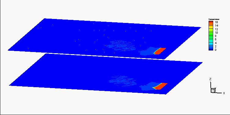
6 Model Output Can develop useful grapics Maps of water level, drawdown, concentration Time series at points Flow vectors Animations
7 Notes: Groundwater flow model is a powerful tool in ydrogeology. A ground water model cannot be used as a substitute for data collection in te field. Model s accuracy/reliability is largely depended on te field data collection.


8 Example 1: Soutern New Castle County Groundwater modeling


9 400X320X9=1,152,000 grids Model Layer Delaware Maryland New Jersey (tis study) unit unit unit 1 Columbia Columbia Water table 2 Confining Confining Confining 3 Rancocas Aquia Vincentown 4 Confining Confining Confining 5 Mt. Laurel Monmout Mt. Laurel 6 Confining Confining Confining 7 Magoty Potomac A Patapsco prm upper 8 Potomac B Arundel (Confining) prm middle 9 Potomac C Patuxent prm lower
10 Aquifer property estimation Specific Capacity (Sc) vs. Transmissivity (T) TT = AA SS cc BB
11 Flow cart of modeling Construct Model Run Model Modify assumptions Adjust input data Compare to calibration targets Analyze outputs Assess model limitations Document, present, and debate results

12 Simulated eads Rancocas aquifer Mt. Laurel aquifer


13 Simulated eads Mag./Pt A aquifer Pt C aquifer Pt B aquifer

14 Head difference between aquifers = Mt. Laurel Mag./ Pt. A


15 Predictions Head canges due to increased pumping Rancocas aquifer Mt. Laurel aquifer Magoty/Pt. A aquifer Pt. B aquifer Pt. C aquifer

16 Example 2: Impacts of sea level rise on agriculture land use in St. Jones River watersed DNREC Sea-Level Rise Tecnical Workgroup 2007


17 Aquifer Two concerns: Water Table Rise Salt Water Intrusion Aquifer
 of local crops. DD mmmmmm DD mmmmmm > 0.5m")
18 Criterion 1: water table dept Effective rooting depts (ERD, Brisson et al., 2002, Mannering, 2007) of local crops. DD mmmmmm DD mmmmmm > 0.5m
19 Criterion 2: Irrigation water salinity Cloride concentration Less tan 600mg/L Delaware Kent County Agricultural Extension, 2007 Salt water
20 Assumptions: Tidal and seasonal variations of sea level are not simulated. Te mars is simulated as a drain. Groundwater discarges to te mars until te sea level rises above te mars land surface. Tereafter all submerged cells form a constant ead boundary. Te river stage, as well as salinity, increases troug time to account for te effect of a laterally encroacing tidal prism due to sea level rise. In te area were te land surface is lower tan te rising sea level, te first layer cells turn into constant ead boundaries wit ead values equal to sea level. Initial condition was obtained by running te model for 1000 years using a constant sea level.

21 Boundary Conditions

22 S1

23


24
25 Ag land loss due to saltwater Ag land loss due to dept criterion Total Ag land loss ectares S1 S2 S3
26 Summary Groundwater flow model is an useful tool in groundwater resource management, even toug it is true tat all te models are wrong due to te simplifications and assumptions. Reliability of model largely depends on te acquirement of tremendous field data.

27 Te END
A Roadmap for the Scientific Assessment of Maryland s Coastal Plain Groundwater Resources
 A Roadmap for the Scientific Assessment of Maryland s Coastal Plain Groundwater Resources David W. Bolton Maryland Geological Survey Robert J. Shedlock U.S. Geological Survey James M. Gerhart U.S. Geological
Delaware Water Supply Coordinating Council Report to the DRBC WMAC
 Delaware Water Supply Coordinating Council Report to the DRBC WMAC West Trenton, NJ Oct 24, 2017 Delaware DNREC Division of Water Dover, Del. University of Delaware Water Resources Center Newark, Del.
MEMORANDUM. RAI Responses Related to East Lake Road Wellfield Drawdown Analysis, WUP No SDI Project No. PCF-180.
 SDI Environmental Services, Inc. 13911 N. Dale Mabry Hwy. Suite 201, Tampa, FL 33618; (813) 961-1935 MEMORANDUM TO: FROM: SUBJECT: Dave Slonena, P.G., Pinellas County Cathleen Beaudoin Jonas RAI Responses
18 Subsurface & Groundwater
 Module 4 (L12 - L18): Watersed Modeling Standard modeling approaces and classifications, system concept for watersed modeling, overall description of different ydrologic processes, modeling of rainfall,
USGS National Water Census. Coastal Carolinas Water Availability Study
 USGS National Water Census Coastal Carolinas Water Availability Study Chad Wagner USGS South Atlantic Water Science Center North Carolina - South Carolina - Georgia What is the USGS National Water Census?
USGS Groundwater Resources Program Regional Groundwater Evaluations
 USGS Groundwater Resources Program Regional Groundwater Evaluations -- Northern Atlantic Coastal Plain Aquifer System -- John Masterson* New England Water Science Center Northborough, Massachusetts Delaware
Groundwater in Anne Arundel County, Maryland
 Groundwater in Anne Arundel County, Maryland Presented to Fort George G. Meade Restoration Advisory Board March 15, 2012 David W. Bolton Maryland Geological Survey Physiographic Provinces and Aquifer Types
Modeling Irrigation Systems in Semi-Arid Regions: Current Status & Emerging Needs for SWAT
 Modeling Systems in Semi-Arid Regions: Current Status & Emerging Needs for SWAT Ryan T. Bailey Timothy K. Gates Miles Daly SWAT Conference, Oct. 15 Irrigated Stream-Aquifer Systems Salts, N, P Salts, N,
Strategies for Managing Water Resources in Saltwater Intrusion Environments
 Hilton Head Public Service District Groundwater Management Associates, Inc. Strategies for Managing Water Resources in Saltwater Intrusion Environments Hilton Head Island and Vicinity Feet Below Mean Sea
Integrated Water Management Modeling Framework in Nebraska
 Integrated Water Management Modeling Framework in Nebraska Association of Western State Engineers Spring Workshop Salt Lake City, Utah June 9, 2015 Mahesh Pun, EIT Integrated Water Management Analyst Nebraska
Challenging Tides: Results of Delaware s Sea Level Rise Vulnerability Assessment
 Challenging Tides: Results of Delaware s Sea Level Rise Vulnerability Assessment Presentation for Delaware Estuary Science Conference January, 2013 Potential Impacts of Sea Level Rise Permanent inundation
Water Supply in Coastal Georgia Meeting Water Demand Using Alternative Water Sources to the Upper Floridan Aquifer
 Water Supply in Coastal Georgia Meeting Water Demand Using Alternative Water Sources to the Upper Floridan Aquifer John Clarke U.S. Geological Survey Georgia Water Science Center U.S. Department of the
Virginia Coastal Plain Model 2004 Withdrawals Simulations Reported Use
 1/43 Virginia Coastal Plain Model 24 Withdrawals Simulations 24 Reported Use A Virginia Coastal Plain Model ( VCPM ) simulation was performed representing the withdrawals reported to DEQ for calendar year
OPEN FILE REPORT NO. 52 RESULTS OF GROUNDWATER FLOW SIMULATIONS IN THE EAST DOVER AREA, DELAWARE
 Re 1 State of Delaware DELAWARE GEOLOGICAL SURVEY David R. Wunsch, State Geologist OPEN FILE REPORT NO. 52 RESULTS OF GROUNDWATER FLOW SIMULATIONS IN THE EAST DOVER AREA, DELAWARE By Changming He and A.
by Phatcharasak Arlai 1*, Manfred Koch 1, Sucharit Koontanakulvong 2
 Embedding an Optimization Module within a 3D Density Dependent Groundwater and Solute Transport Model to determine an effective Groundwater Management Scheme in the Bangkok Aquifers System by Phatcharasak
VARIANCE REQUEST FOR EXPANDED WATER USE FROM EXISTING WELL IN A STAY MANAGEMENT AREA OF THE LOWER PLATTE NORTH NRD (LPNNRD)
") VARIANCE REQUEST FOR EXPANDED WATER USE FROM EXISTING WELL IN A STAY MANAGEMENT AREA OF THE LOWER PLATTE NORTH NRD (LPNNRD) Updated Form: August 2012 NRD USE ONLY Date Received Paid: Cash or Check Initial
VARIANCE REQUEST FOR EXPANDED WATER USE FROM EXISTING WELL IN A STAY MANAGEMENT AREA OF THE LOWER PLATTE NORTH NRD (LPNNRD) Updated Form: August 2012 NRD USE ONLY Date Received Paid: Cash or Check Initial
Abstract. Introduction
 Invited Paper The modelling of saline intrusion during the construction of submerged tunnels T. Roberts', J. White, Z. Mohammed' "WJ Engineering Resources Ltd. Civil Engineering, Queen Mary and Westfield
Irrigation modeling in Prairie Ronde Township, Kalamazoo County. SW Michigan Water Resources Council meeting May 15, 2012
 Irrigation modeling in Prairie Ronde Township, Kalamazoo County SW Michigan Water Resources Council meeting May 15, 2012 Development of a Groundwater Flow Model INFLOWS Areal recharge from precipitation
GAM RUN : IRION COUNTY WATER
 GAM RUN 12-017: IRION COUNTY WATER CONSERVATION DISTRICT MANAGEMENT PLAN by William Kohlrenken Texas Water Development Board Groundwater Resources Division Groundwater Availability Modeling Section (512)
T E C H N I C A L M E M O R A N D U M
 INTERA Incorporated 9600 Great Hills Trail, Suite 300W Austin, Texas, USA 78759 512.425.2000 T E C H N I C A L M E M O R A N D U M To: From: Barton Springs/Edwards Aquifer Conservation District Wade Oliver,
Climate Change and the Delaware Estuary Appendix K PDE Figure 1: Groundwater/Seawater Interaction (Source: USGS)
") Appendix K Climate Change Impacts on Water Supply Wells in the Delaware River Estuary James Bennett, Delaware Valley Regional Planning Commission July 2009 One of the many threats that climate change and
Appendix K Climate Change Impacts on Water Supply Wells in the Delaware River Estuary James Bennett, Delaware Valley Regional Planning Commission July 2009 One of the many threats that climate change and
Groundwater Modeling for. in the Upper Central Plain of Thailand
 Groundwater Modeling for Conjunctive Use Patterns Investigation in the Upper Central Plain of Thailand Colloque International Symposium May 31, 2006 Dijon, France Werapol Bejranonda Water Resources System
Groundwater modelling study for sustainable water management in Town of High River. Han Sang-Yoon WaterTech, April 12, 2013
 Groundwater modelling study for sustainable water management in Town of High River Han Sang-Yoon WaterTech, April 12, 2013 Acknowledgements Town of High River: Reiley McKerracher Jasen Craigie Project
Ingress of salinity in coastal area
 Ingress of salinity in coastal area P re p a re d B y : - Patel Hardik P. Patel Dax S. Patel Sapana S. Patel Hiral J. (En No.110780106034) (En No.110780106026) (EnNo.110780106011) (En No.110780106023)
Numerical Groundwater Model for the Kaweah Delta Water Conservation District
 Numerical Groundwater Model for the Kaweah Delta Water Conservation District Nels Ruud and Peter Leffler Fugro West, Inc. Larry Dotson Kaweah Delta Water Conservation District Presentation Outline Background
Genetic Algorithm based Simulation Optimization Approach to Seawater Intrusion
 International Symposium on Genetic Algorithm based Simulation Optimization Approach to Seawater Intrusion 1313 Integrated Water Resources Management (IWRM 2014) February 19 21, 2014, CWRDM, Kozhikode,
GROUND-WATER LEVELS AND RIVER-AQUIFER INTERACTIONS IN THE UPPER ARKANSAS RIVER CORRIDOR IN SOUTHWEST KANSAS
 GROUND-WATER LEVELS AND RIVER-AQUIFER INTERACTIONS IN THE UPPER ARKANSAS RIVER CORRIDOR IN SOUTHWEST KANSAS Presentation for Upper Arkansas CREP Educational Meetings Donald Whittemore University of Kansas
Municipal Groundwater Flow Modelling Study. Town of Torbay, NL
 Municipal Groundwater Flow Modelling Study Town of Torbay, NL October 19, 2015 Agenda 1 Purpose 2 What is a Groundwater Model 3 Approach 4 Conceptual Model & GW Flow Model Construction 5 Model Predictions
Exploring Regional Groundwater Supply Alternatives to Manage Saltwater Intrusion in the Hilton Head Island Area
 Exploring Regional Groundwater Supply Alternatives to Manage Saltwater Intrusion in the Hilton Head Island Area 2011 GWPC Annual Forum Robert Fitzgerald, Kristina Masterson, Dr. James Kennedy, Dr. Mark
MODELLING THE GROUNDWATER FLOW FOR ESTIMATING THE PUMPING COST OF IRRIGATION IN THE AQUIFER OF N. MOUDANIA, GREECE
 Proceedings of the 13 th International Conference on Environmental Science and Technology Athens, Greece, 5-7 September 2013 MODELLING THE GROUNDWATER FLOW FOR ESTIMATING THE PUMPING COST OF IRRIGATION
Transitioning to an Enhanced Groundwater Management Framework in Alberta. Dan Palombi Alberta Geological Survey
 Transitioning to an Enhanced Groundwater Management Framework in Alberta Dan Palombi Alberta Geological Survey Alberta Water Demand Water Use in Major River Basins Peace River Basin 5.8% 1.9% 9.0% 10.4%
Documentation of Groundwater Model
 Documentation of Groundwater Model Groundwater Model The primary tool used to evaluate potential impacts on groundwater was a groundwater flow and solute transport model developed by San Benito County
Ground-Water Flow to Wells Introduction. Drawdown Caused by a Pumping Well
 1 Ground-Water Flow to Wells Introduction Wells used to control salt water intrusion, remove contaminated water, lower the water table for construction, relieve pressure under dams, and drain farmland
APPENDIX, GSA REPOSITORY
 APPENDIX, GSA REPOSITORY 2007045 Te Crow Wing model developed for tis study ad to be able to represent all aspects of te surface and subsurface ydrologic cycle (Fig. 18). A.1 Groundwater Flow Time-dependent
Purpose. Utilize groundwater modeling software to forecast the pumping drawdown in a regional aquifer for public drinking water supply
 MODFLOW Lab 19: Application of a Groundwater Flow Model to a Water Supply Problem An Introduction to MODFLOW and SURFER The problem posed in this lab was reported in Chapter 19 of "A Manual of Instructional
Hydrogeology of the Merti Aquifer. Impact of abstractions on drawdown of water level and salinity. Arjen Oord Jan de Leeuw (presenter)
") Hydrogeology of the Merti Aquifer Impact of abstractions on drawdown of water level and salinity Arjen Oord Jan de Leeuw (presenter) Impacts of abstractions? Abstractions have two major geo-hydrological
Hydrogeology of the Merti Aquifer Impact of abstractions on drawdown of water level and salinity Arjen Oord Jan de Leeuw (presenter) Impacts of abstractions? Abstractions have two major geo-hydrological
APPLICATION FOR A PERMIT TO CONSTRUCT A WATER WELL IN THE LOWER PLATTE NORTH NATURAL RESOURCES DISTRICT
 APPLICATION FOR A PERMIT TO CONSTRUCT A WATER WELL IN THE LOWER PLATTE NORTH NATURAL RESOURCES DISTRICT DNR & NRD USE ONLY Permit No. Date Approved/Denied NRD Representative Permit Type: New, Replacement
Mechanism of controlling seawater intrusion at coastal aquifers using subsurface barrier
 European Water 57: 47-412, 217. 217 E.W. Publications Mechanism of controlling seawater intrusion at coastal aquifers using subsurface barrier R. Shafiee, S.S. Mehdizadeh * and A.S. Gooya Civil Engineering
San Mateo Plain Groundwater Basin Assessment Stakeholder Workshop #7 9 NOVEMBER 2017
 San Mateo Plain Groundwater Basin Assessment Stakeholder Workshop #7 9 NOVEMBER 2017 PRESENTATION OVERVIEW Introductions Project Overview Stakeholder Outreach Summary Phase 2 Updates Modeling Activities
DYNFLOW accepts various types of boundary conditions on the groundwater flow system including:
 Section 6 Groundwater Flow Model A groundwater flow model was developed to evaluate groundwater flow patterns in the site area and to provide a basis for contaminant transport modeling. 6.1 Model Code
Simulation of Seawater Intrusion Due to Climate Change Impacts in North Gaza Aquifer Using SEAWAT
 Simulation of Seawater Intrusion Due to Climate Change Impacts in North Gaza Aquifer Using SEAWAT Reem Fathi Sarsak, MSc UNRWA- Environment Health Department Nablus-Palestine E-mail: reem2525@yahoo.com
Linking Soil Water and Groundwater Models to Investigate Salinity Management Options
 Linking Soil Water and Groundwater s to Investigate Salinity Management Options Carl C. Daamen a and Greg P. Hoxley a a Sinclair Kight Merz, P.O.Box 25, Malvern, VIC 3162, Australia. Abstract: Salinisation
Appendix I. Groundwater Modeling
 Appendix I. Groundwater Modeling This appendix describes current and future groundwater modeling efforts associated with the. 0 I. Current Objectives of Groundwater Modeling Efforts The objectives of groundwater
Assessment of the Groundwater Quantity Resulting from Artificial Recharge by Ponds at Ban Nong Na, Phitsanulok Province, Thailand
 Research article erd Assessment of the Groundwater Quantity Resulting from Artificial Recharge by Ponds at Ban Nong Na, Phitsanulok Province, Thailand SIRIRAT UPPASIT* Faculty of Technology, Khon Kaen
Modeling and Planning The Joint Groundwater Planning Process and Groundwater Models
 Modeling and Planning The Joint Groundwater Planning Process and Groundwater Models Andrew Donnelly Senior Hydrogeologist Daniel B. Stephens and Associates Groundwater Management in Texas n Water is critical
Comparative analysis of SWAT model with Coupled SWAT-MODFLOW model for Gibbs Farm Watershed in Georgia
 2018 SWAT INTERNATIONAL CONFERENCE, JAN 10-12, CHENNAI 1 Comparative analysis of SWAT model with Coupled SWAT-MODFLOW model for Gibbs Farm Watershed in Georgia Presented By K.Sangeetha B.Narasimhan D.D.Bosch
GIS in Water Resources Term Paper. Thomas Freeman
 GIS in Water Resources Term Paper Thomas Freeman A Study of the Temporal Relationship between Groundwater Levels and Precipitation in, FL Introduction is located on the eastern coast of Florida (Figure
Investigation of sustainable development potential for Ulubey Aquifer System, Turkey
 doi:10.5194/piahs-364-513-2014 Evolving Water Resources Systems: Understanding, Predicting and Managing Water Society Interactions Proceedings of ICWRS2014, Bologna, Italy, June 2014 (IAHS Publ. 364, 2014).
Physics of Aquatic Systems
 Pysics of Aquatic Systems Contents of Session 7: Groundwater 7.1 Introduction to ydrogeology 7.2 Groundwater flow 7.3 Transport in groundwater 7. Flow and Transport in Groundwater Werner Aescbac Hertig
Hydraulic Head in 1999 Saline plume migration in 1999
 Numerical Modeling of possible Saltwater Intrusion Mechanisms in the Multiple Layer Coastal Aquifer System of the Gulf of Thailand by Mr.Phatcharasak Arlai Contents of Presentation 1. Introduction 2. Literature
6.0 USGS MODEL. 6.1 Background
 6.0 USGS MODEL 6.1 Background A groundwater flow model is a simplification of a real groundwater flow system. Real groundwater flow systems are complex, and they are often simplified with a model for the
Numerical Groundwater Flow Model Report. Caloosa Materials, LLC 3323 Gulf City Road Ruskin, Florida 33570
 Numerical Groundwater Flow Model Report Caloosa Materials, LLC 3323 Gulf City Road Ruskin, Florida 33570 GHD 2675 Winkler Ave Suite 180 Fort Myers, FL 33901 11138224 Report July 27, 2017 Table of Contents
Manfred KOCH 1 and Phatsaratsak ARLAI 1, Department of Geotechnology and Engineering Hydrology, University of Kassel, Germany
 Deterministic and stochastic modeling of groundwater flow and solute transport in the heavily-stressed Bangkok coastal aquifer, Thailand, and investigation of optimal management strategies for possible
Mitigating salt water advance using horizontal wells: risk based comparison of different approaches.
 Mitigating salt water advance using horizontal wells: risk based comparison of different approaches. D. Labregère, J. P. Delhomme and A. Priestley Abstract Many coastal regions in the world experience
USING DIFFERENTIAL RECHARGE IN ORDER TO AVOID SALT WATER INTRUSION By Maddalena Vitali
 USING DIFFERENTIAL RECHARGE IN ORDER TO AVOID SALT WATER INTRUSION By Maddalena Vitali vitali.maddalena@gmail.com Index ABSTRACT... 1 OPTIMAL RECHARGE THEORY... 1.1 Factors which affect the extension of
Draft Phase 6 Watershed Model Updates Modeling Workgroup Conference Call May 2017
 05/18/2017 Draft Phase 6 Watershed Model Updates Modeling Workgroup Conference Call May 2017 Gopal Bhatt 1 and Gary Shenk 2 1 Penn State, 2 USGS Presentation Outline Brief overview of the Phase 6 draft
A simulation of groundwater discharge and nitrate delivery to Chesapeake Bay from the lowermost Delmarva Peninsula, USA
 326 A New Focus on Groundwater Seawater Interactions (Proceedings of Symposium HS11 at IUGG27, Perugia, July 27). IAHS Publ. 312, 27. A simulation of groundwater discharge and nitrate delivery to Chesapeake
22 Tubewell Drainage Systems
 22 Tubewell Drainage Systems WK Boehmer' and J Boonstra2 221 Introduction ' Tubewell drainage is a technique of controlling the watertable and salinity in agricultural areas It consists of pumping, from
Recap: Greenhouse Effect
 Recap: Greenouse Effect Relies on fact tat glass (or plastic) is transparent to visible radiation but opaque to infra-red (IR) radiation. E,g. Car window closed visible radiation only transmitted. Car
Surface Water and Seawater Interactions in the Coastal Environment of Biscayne Bay, Southeast Florida
 Surface Water and Seawater Interactions in the Coastal Environment of Biscayne Bay, Southeast Florida William C. Hutchings, MS, PG Nicholas Albergo, PE, DEE Paper No. 191-8 2005 Salt Lake City Annual Meeting
Montana Bureau of Mines and Geology Kevin Chandler Jon Reiten. AWRA October 6 th,2011
 Montana Bureau of Mines and Geology Kevin Chandler Jon Reiten AWRA October 6 th,2011 Funding for this modeling effort came from the RRG project Modeling Aquifer Response to Urban Sprawl, West Billings
Groundwater Protection and Management Planning for the Eastern Shore of Virginia
 Groundwater Protection and Management Planning for the Eastern Shore of Virginia Using a Sustainable Development Approach Britt McMillan, Malcolm Pirnie, Inc. Quick Definitions What is an Aquifer Any coarse
A Hydrologic Study of the North Hills, Helena, Montana
 A Hydrologic Study of the North Hills, Helena, Montana Andrew Bobst, Kirk Waren, James Swierc, and Jane Madison MBMG Groundwater Investigations Program 10/6/11 MT AWRA Background Groundwater Steering Committee
Groundwater Modeling Guidance
 Groundwater Modeling Guidance Richard J. Mandle Groundwater Modeling Program Michigan Department of Environmental Quality Draft 1.0 10/16/02 Executive Summary The use of groundwater models is prevalent
APPENDIX 5: SAMPLE MODEL RESULTS
 APPENDIX 5: SAMPLE MODEL RESULTS A. Evaluation of Groundwater Sustainability in the Ramsey Area B. Evaluation of Groundwater Sustainability in the Woodbury Area C. Evaluation of Future Drawdown Conditions
Modeling the Contamination of an Aquifer from a Highway Salt Storage Facility
 First International Conference on Saltwater Intrusion and Coastal Aquifers Monitoring, Modeling, and Management. Essaouira, Morocco, April 23 25, 01 Modeling the Contamination of an Aquifer from a Highway
GROUNDWATER MODELING A PRIMER FOR THE COMMUNITY
 GROUNDWATER MODELING A PRIMER FOR THE COMMUNITY Public Orientation Session #4 Presenter: Cameron Tana, HydroMetrics Water Resources Inc. Thursday, December 7, 2017 Objectives and Outline Objectives 1.
May 3, 2011 BUILDING STRONG BUILDING STRONG ALBUQUERQUE DISTRICT. US Army Corps of Engineers. US Army Corps of Engineers
 Upper Rio Grande Water Operations Model Present t& Future Work May 3, 2011 US Army Corps of Engineers US Army Corps of Engineers BUILDING STRONG ALBUQUERQUE DISTRICT URGWOM Website http://www.spa.usace.army.mil/urgwom/default.asp
Environmental Cleanup & Restoration Design Project Summer 2002 Overview
 Environmental Cleanup & Restoration Design Project Summer 2002 Overview Natrium, Oregon is a coastal city known for its waterfront park and summer Saltwater Taffy festival held on the banks of the Nackel
Update on Cuyama Basin Groundwater Modeling
 Cuyama Basin Groundwater Sustainability Agency Update on Cuyama Basin Groundwater Modeling December 3, 2018 Approach for Cuyama Basin Model Development Develop a Robust and Defensible Integrated Water
MEMORANDUM To: From: Date: Subject: Attendees Summary Wednesday, March 22 9 AM
 Date: March 7, 2006 Conference Call # - Meeting Minutes March 7, 2006 This conference call was the first of three to discuss alternatives for potentially reducing costs of the Ranney well system at M&T
GROUNDWATER General Facts and Concepts
 GROUNDWATER General Facts and Concepts General schematic of hydrologic cycle. As the term implies, water moves within the cycle and groundwater (aquifer) is just one zone of the cycle. Aquifers and Wells
SWIBANGLA On modeling salt water intrusion
 SWIBANGLA On modeling salt water intrusion Managing Salt Water Impacts in Bangladesh Project duration May 2013 up to September 2014 OUR FINAL MODELING GOAL To build a reliable 3D variable-density groundwater
DRAFT REVIEW OF POULTRY HOUSE GROUNDWATER WITHDRAWAL PERMIT APPLICATIONS
 DRAFT REVIEW OF POULTRY HOUSE GROUNDWATER WITHDRAWAL PERMIT APPLICATIONS August 2018 Locations of Poultry Houses that have submitted Groundwater Withdrawal Applications 57 Poultry Houses All located in
LAKE LABELLE DEWATERING MODEL. AUTHOR Gail Murray Doyle, P.G. September Murray Consultants, Inc 769 Skyview Dr Hayesville, NC
 LAKE LABELLE DEWATERING MODEL AUTHOR Gail Murray Doyle, P.G. September 2013 Murray Consultants, Inc 769 Skyview Dr Hayesville, NC 28904 828-389-2476 LAKE LABELLE DEWATERING MODEL INTRODUCTION Purpose The
Recommendations for a Water Quality Buffer System for the Inland Bays Watershed
 Recommendations for a Water Quality Buffer System for the Inland Bays Watershed Delaware Center for the Inland Bays Scientific & Technical Advisory Committee Meeting June 6 th, 2008 Chris Bason Science
FIELD TESTING AQUIFERS TO. (Field Follies) James Robinson, Goodwyn, Mills and Cawood, Inc.
 James Robinson, Goodwyn, Mills and Cawood, Inc.") FIELD TESTING AQUIFERS TO ESTIMATE HYDRAULIC PROPERTIES (Field Follies) James Robinson, Goodwyn, Mills and Cawood, Inc. Objectives Estimate t hydraulic coefficients; i Test conceptual models of aquifer;
FIELD TESTING AQUIFERS TO ESTIMATE HYDRAULIC PROPERTIES (Field Follies) James Robinson, Goodwyn, Mills and Cawood, Inc. Objectives Estimate t hydraulic coefficients; i Test conceptual models of aquifer;
Groundwater 3/16/2010. GG22A: GEOSPHERE & HYDROSPHERE Hydrology
 GG22A: GEOSPHERE & HYDROSPHERE Hydrology Definitions Groundwater Subsurface water in soil or rock that is fully saturated. Aquifer Contains enough saturated material to yield significant quantities of
ENG. MUSLEM B. KASHOB MINISTRY OF REGIONAL MUNICIPALITY AND WATER RESOURCES DEPARTMENT OF MATHEMATICAL MODELING MUSCAT, OMAN
 Put your Organizati on logo here ENG. MUSLEM B. KASHOB MINISTRY OF REGIONAL MUNICIPALITY AND WATER RESOURCES DEPARTMENT OF MATHEMATICAL MODELING MUSCAT, OMAN Overview Introduction Objectives Study area
SEAWAT Concentration and Temperature Effects
 v. 10.4 GMS 10.4 Tutorial Examine Concentration and Temperature Impacts on Fluid Density with SEAWAT Objectives Learn how to simulate the effects of concentration and temperature on fluid density with
Geology 627, Hydrogeology Review questions for final exam h t 1/ 2
 Geology 67, Hydrogeology Review questions for final exam 004 Multiple choice and fill in the blank. There may be more than one correct choice for each question. 1. Which hydrogeologic quantities are represented
Update on Model-Development Status for the North Florida Regional Water Supply Plan Stakeholder Advisory Committee. June 27, 2016
 Update on Model-Development Status for the North Florida Regional Water Supply Plan Stakeholder Advisory Committee June 27, 2016 1 Overview Summary of June 1 Tech Team Meeting June activity by the model-development
San Mateo Plain Groundwater Basin Assessment Stakeholder Workshop #8 17 APRIL 2018
 San Mateo Plain Groundwater Basin Assessment Stakeholder Workshop #8 17 APRIL 2018 PRESENTATION OVERVIEW Introductions Project Overview Summary of Analysis Supporting Model Development Model Development
Water supply issues in unconfined bedrock aquifers in the Ft. McMurray area
 Water supply issues in unconfined bedrock aquifers in the Ft. McMurray area Alex Haluszka, M.Sc., P.Geol., Hydrogeologist Chris Pooley, P.Geoph., Geophysicist Gordon MacMillan, P.Geol., Principal Hydrogeologist
Numerical Estimation of the future sustainable Groundwater Yield in the Kok River Basin, Northern Thailand
 Numerical Estimation of the future sustainable Groundwater Yield in the Kok River Basin, Northern Thailand PHATCHARASAK ARLAI 1, MANFRED KOCH 2 and ARUN LUKJAN 1 1 Research Center of Water Resources and
Investigation of a Floodplain Pond to Improve Alluvial Aquifer Sustainability: A Quantity and Quality Report
 Investigation of a Floodplain Pond to Improve Alluvial Aquifer Sustainability: A Quantity and Quality Report Water Resources Investigation Report 16 i P a g e Investigation of a Floodplain Pond to Improve
Mid-County Basin Groundwater Hydrology and Management
 Mid-County Basin Groundwater Hydrology and Management Presented on July 8, 2014 to Mid-County Groundwater Stakeholder Advisory Group Santa Cruz County HydroMetrics WRI Introduction Consulting groundwater
NEW YORK STATE WATER RESOURCES INSTITUTE Department of Earth and Atmospheric Sciences
 NEW YORK STATE WATER RESOURCES INSTITUTE Department of Earth and Atmospheric Sciences 1123 Bradfield Hall, Cornell University Tel: (607) 255-3034 Ithaca, NY 14853-1901 Fax: (607) 255-2016 http://wri.eas.cornell.edu
Associate Groundwater Resources Engineer Principal Hydrogeologist
 Project No.: 140369 March 2, 2016 Revised March 25, 2016 To: Cami Apfelbeck From: Peter Bannister, PE Timothy Flynn, LHG, CGWP Associate Groundwater Resources Engineer Principal Hydrogeologist pbannister@aspectconsulting.com
Dynamic groundwater-river interaction model for planning water allocation in a narrow valley aquifer system of the Upper Motueka catchment
 Dynamic groundwater-river interaction model for planning water allocation in a narrow valley aquifer system of the Upper Motueka catchment Timothy Hong t.hong@gns.cri.nz Gilles Minni g.minni@gns.cri.nz
Climate Change and Sea Level Rise
 Potential Effects of Sea-Level Rise on the Hydrologic System of Cape Cod, Massachusetts 3 rd Cape Coastal Conference, December 7, 2016 Continued release of anthropogenic greenhouse gases is resulting in
NUMERICAL MODELLING OF SALTWATER PLUME MOVEMENT IN A FRACTURED AQUIFER ON SUB-REGIONAL SCALE
 NUMERICAL MODELLING OF SALTWATER PLUME MOVEMENT IN A FRACTURED AQUIFER ON SUB-REGIONAL SCALE Sascha E. Oswald (Groundwater Protection and Restoration Group, University of Sheffield, United Kingdom) INTRODUCTION
HYDRODYNAMICS OF A COASTAL KARST AQUIFER AFFECTED BY SALTWATER INTRUSION UNDER OCEANIC CLIMATIC INFLUENCE, CO. CLARE, IRELAND
 HYDRODYNAMICS OF A COASTAL KARST AQUIFER AFFECTED BY SALTWATER INTRUSION UNDER OCEANIC CLIMATIC INFLUENCE, CO. CLARE, IRELAND Marie Perriquet 1,2 ;Tiernan Henry 1 ;Rachel Cave 1 ;Véronique Leonardi 2 ;Hervé
Scientific insights on emerging groundwater concerns in Prince Edward Island Atlantic Agrology Workshop, Stanley Bridge Resort, PEI 21 July 2014
 Scientific insights on emerging groundwater concerns in Prince Edward Island Atlantic Agrology Workshop, Stanley Bridge Resort, PEI 21 July 2014 Yefang Jiang Agriculture and Agri-Food Canada Yefang.jiang@agr.gc.ca
Appendix I. Potential Adverse Change to Wetland Function Methodology and Results
 Appendix I Potential Adverse Change to Wetland Function Methodology and Results Technical Memorandum North Florida Regional Water Supply Plan Potential Adverse Change to Wetland Function January 3, 2017
MWRA Annual G1 Compliance Report for Calendar Year 2007
 Nature of Operations at Your Facility Te following questions are designed to determine if your facility as te appropriate MWRA permit. Please answer all of te questions below. 2. Wat does your facility
ENVIRONMENTAL HYDROGEOLOGY
 ENVIRONMENTAL HYDROGEOLOGY m LEWIS Mostafa M. Soliman Professor, Faculty of Engineering Ain Shams University Cairo, Egypt Philip E. LaMoreaux Senior Hydrogeologist Bashir A. Memon Executive Vice President
CHRISTCHURCH CITY GROUNDWATER MODEL
 CHRISTCHURCH CITY GROUNDWATER MODEL Mike Thorley 1, Peter Callander 1, Howard Williams 1, Hilary Lough 1, Mike Kininmonth 2, Bruce Henderson 2 1 Pattle Delamore Partners Ltd Level 2, Radio New Zealand
Context for Central Sands Water Use Trends and Impacts
 Context for Central Sands Water Use Trends and Impacts Wisconsin Food, Land, and Water meeting Wisconsin Rapids, WI November 10, 2016 Kenneth R. Bradbury Wisconsin Geological and Natural History Survey,
Geothermal Energy Storage
 Geothermal Energy Storage SedHeat Workshop, UTAH March 02 2017 Maurice Dusseault University of Waterloo Energy Storage Everyone talks about batteries, but Cost, space, environmental impacts Let s consider