DEVELOPMENT OF MODEL INTELLIGENT TRANSPORT SYSTEMS DEPLOYMENTS FOR THE ASIAN HIGHWAY NETWORK
|
|
|
- Ellen Carroll
- 6 years ago
- Views:
Transcription


1 DEVELOPMENT OF MODEL INTELLIGENT TRANSPORT SYSTEMS DEPLOYMENTS FOR THE ASIAN HIGHWAY NETWORK Bangkok DECEMBER 2017 i
2 The views expressed in this publication are those of the authors and do not necessarily reflect the views of the United Nations Secretariat. The opinions, figures and estimates set forth in this publication are the responsibility of the authors, and should not necessarily be considered as reflecting the views or carrying the endorsement of the United Nations. The designations employed and the presentation of the material in this publication do not imply the expression of any opinion whatsoever on the part of the Secretariat of the United Nations concerning the legal status of any country, territory, city or area, or of its authorities, or concerning the delimitation of its frontiers or boundaries. Mention of firm names and commercial products does not imply the endorsement of the United Nations. Mention of firm names and commercial products does not imply the endorsement of the United Nations. This publication is issued without formal editing. Notes on the member country names: The list of country abbreviations (ISO Alpha-3 code) are used in the figures in this document. The corresponding full country names are as follows: AFG: Afghanistan, ARM: Armenia, AZE: Azerbaijan, BGD: Bangladesh, BTN: Bhutan, KHM: Cambodia, CHN: China, PRK: Korea (Democratic People's Republic of), GEO: Georgia, IND: India, IDN: Indonesia, IRN: Iran (Islamic Republic of), JPN: Japan, KAZ: Kazakhstan, KGZ: Kyrgyzstan, LAO: Lao People's Democratic Republic (the), MYS: Malaysia, MNG: Mongolia, MMR: Myanmar, NPL: Nepal, PAK: Pakistan, PHL: Philippines (the), KOR: Korea (the Republic of), RUS: Russian Federation (the), SGP: Singapore, LKA: Sri Lanka, TJK: Tajikistan, THA: Thailand, TUR: Turkey, TKM: Turkmenistan, UZB: Uzbekistan, VNM: Viet Nam ii
3 Acknowledgements This document has been prepared by Dr. Jeong Whon Yu, Professor, Ajou University, Republic of Korea, as an international consultant, under the direction and guidance of Mr. Ishtiaque Ahmed, Economic Affairs Officer, Transport Infrastructure Section, Transport Division as the project manager. Valuable advices were extended by Mr. Pierre Chartier, Section Chief, Transport Infrastructure Section and Mr. Yuwei Li, Director, Transport Division of the United Nations Economic and Social Commission for Asia and the Pacific (ESCAP). Mr. Jeongsu Park, an Expert from the Republic of Korea to ESCAP also contributed to the study. The development of the model Intelligent Transport Systems (ITS) deployments has been realised with the generous support of the Korea Expressway Corporation (KEC) under the direction of Dr Sung-Min Cho, Director of R&D Planning Office. The following countries participated in the project by providing up to date information on their practices and experiences on deployment of ITS services. National Experts from the above member countries have provided inputs: China (Prof. Xiaojing Wang) Republic of Korea (Dr. Jungwoo Lee) Russian Federation (Mr. Vladimir Kryuchkov) Turkey (Mr. Murat Dursan Barut) Experts and delegates from member countries of the Asian Highway network have offered valuable comments on the development of this document. iii
4 CONTENTS Page EXECUTIVE SUMMARY... 1 INTRODUCTION Purpose of the Project Overview of the Asian Highway Network Key Facts of the Asian Highway Countries Socioeconomic characteristics Natural disasters Implications INITIAL INPUTS FROM THE PARTICIPATING COUNTRIES China Introduction Development strategy for Intelligent Transport System, Development strategy for China ITS focusing on multimodal transport Development strategy for next-generation ITS Development of expressway network electronic toll collection Review on China ITS policy Statistics of China ITS Notable ITS projects and initiatives in China with potential for further studies Republic of Korea Background Chronology of ITS development in Korea and KEC Cooperative-ITS initiatives Russian Federation ITS development history in Russian Federation Transport system of Russian Federation Infrastructure Russian national road safety program Russian transport strategy (up to 2030) National ITS architecture ITS application/deployment policies and plans Legislation related to ITS in the Russian Federation (basic information) Development of the technical and legal regulation of ITS ITS standardization committee (TC 57) International cooperation National ITS standards based on the global ITS platform Electrification of vehicles Turkey History of ITS in Turkey Advanced Traffic Management Services (ATMS) Electronic Toll Collection (ETC) system Advanced Traveller Information System (ATIS) Advanced Public Transportation System (APTS) Emergency Management System (EMS): E-Call project Tunnel Traffic Management System (TTMS) Bridge Traffic Management System (BTMS) Commercial Vehicle Operation (CVO) Weather Information Systems (WIS) Preparation of technical documents iv
5 Legislation Investment program International cooperation Evaluation ITS SURVEY QUESTIONNAIRES Questionnaire Survey Preliminary Survey Questionnaire Survey responses Key survey results Implications of the preliminary survey Detailed survey questionnaire Survey outline Key survey results ITS SERVICES SELECTED FOR FURTHER CONSIDERATION Operational and Deployable ITS Services ITS services and architecture ITS technologies and physical elements Recent trends in ITS services Fundamental Services of the Asian Highway Model ITS Selection of the model ITS services Advanced Traveller Information System Electronic Toll Collection System Emergency Management System Tunnel Traffic Management System Bridge Traffic Management System Weather Information System Emerging Technologies in the Field of Intelligent Transportation Systems Automated vehicles Connected vehicles Smart highways PROJECTS IMPLEMENTED IN THE PARTICIPATING COUNTRIES China Expressway network ETCS in China Expressway network operation monitoring and service project Intelligent urban public transport Overall situation of ITS practices in China Republic of Korea ITS Practices in Korea Expressway Corporation FTMS (Freeway Traffic Management System) Traffic information centre Electronic toll collection system Emergency management system Weight enforcement system Tunnel traffic management system Fiber optic cable communication system ITS accreditation and evaluation Russian Federation Urban mobility traffic management and traveller information services Cooperation ecall / ERA-GLONASS Electronic toll collection systems Advanced traveller information system v
6 5.3.5 Emergency management system Tunnel traffic management system and bridge traffic management system Weather information system Notable ITS projects in the Russian Federation focusing on the six ITS services Future plans for ITS deployments Turkey Traffic management systems Traveler information systems Electronic toll collection Tunnel control systems Public transport management systems Emergency management systems Fleet and freight managements Ongoing installation activities Future plans for ITS deployment MODEL ITS DEPLOYMENT Process of ITS Deployment ITS planning Stakeholders Strategies for the Model ITS Deployment Flowchart Identification of the optimal ITS deployments MAIN CONCLUSIONS AND RECOMMENDATIONS Core Issues in the Model ITS Deployments Suggestions to the developing member countries Implementation Strategies and The Steering Committee for the Model ITS Deployments APPENDIX: Survey Questionnaire vi
7 LIST OF FIGURES Figure 1. Asian Highway network route map (2016)...5 Figure 2. Length of the Asian Highway by member country...5 Figure 3. Asian Highway by road classification (October 2017)...6 Figure 4. Worldwide distribution of population...8 Figure 5. Nominal GDP in Figure 6. Passenger car ownership by the member country Figure 7. Road density and percentage of paved roads by the member country Figure 8. Worldwide distribution of natural disasters...12 Figure 9. ITS Development in the Republic of Korea...22 Figure 10. Cooperative-ITS in Korea...24 Figure 11. International transport corridors of Russian Federation...31 Figure 12. FITSRUS project corridors...32 Figure 13. International highway corridors of Turkey...44 Figure 14. Number of the detailed ITS functions in operation...48 Figure 15. Number of the current ITS services by service category...49 Figure 16. Most popular ITS service elements in operation...50 Figure 17. Most popular ITS service elements in consideration...50 Figure 18. Usefulness of six ITS services proposed from the initial study...51 Figure 19. Number of the member countries collecting ITS data by the type of data...52 Figure 20. Data collection method and frequency...53 Figure 21. Quality of ITS-related data currently collected...53 Figure 22. Main benefits of ITS deployments...54 Figure 23. Key barriers to providing more and better ITS services...55 Figure 24. Data collection for six fundamental ITS services in the participating countries...56 Figure 25. Level of achievement in terms of different Measure of Effectiveness...57 Figure 26. Key aspects in operating and improving ETCS in the participating countries...57 Figure 27. Key aspects in operating and improving ATIS in the participating countries...58 Figure 28. Comparison of motivations of EMS/TTMS/WIS deployments...59 Figure 29. Use of information dissemination media...61 Figure 30. Difficulties in providing ITS services in the participating countries...61 Figure 31. Economical and efficient sources to collect ITS-related data...62 Figure 32. Key physical elements of ITS...64 Figure 33. ATIS framework...67 Figure 34. Overall ETCS system...68 Figure 35. EMS configuration...69 Figure 36. Roadside emergency telephone...70 Figure 37. Key elements of Tunnel Traffic Management System...70 Figure 38. Operation of Bridge Traffic Management System...72 Figure 39. Weather Information System...73 Figure 40. Autonomous vehicles...74 Figure 41. Communication among connected vehicles...75 Figure 42. Smart Highway in Korea...76 Figure 43. ETC system in China...77 Figure 44. National Trunk Highway System (NTHS) network of freeways in China...78 Figure 45. Urban public transport system in China...79 Figure 46. Information management system of Shanghai Hongqiao Integrated Transport Hub...84 Figure 47. AutoNavi smart phone App in China...85 Figure 48. Main ITS services implemented by KEC...86 Figure 49. Concept of FTMS...87 Figure 50. Traffic data collection sources in Korea...88 Figure 51. Traffic management and information dissemination media in Korea...89 vii Page
8 Figure 52. Main systems and functions of traffic information center...90 Figure 53. Concepts of ETCS and TCS (Toll Collection System) in the Republic of Korea...91 Figure 54. Weight enforcement systems operated by KEC...92 Figure 55. Tunnel traffic management system operated by KEC...93 Figure 56. Schematics of fiber optic cable system used by KEC...94 Figure 57. Overview of ITS accreditation and evaluation center in Korea...95 Figure 58. Recent development of ITS services in Russian Federation...96 Figure 59. Road Weather Information System in Irkutsk near Lake Baikal, Russian Federation...99 Figure 60. Weather information system in Russian Federation...99 Figure 61. ETCS on the highway M-4 in Russian Federation Figure 62. ETCS on the ring road in Moscow Figure 63. ITS on the highway M-11 in Russian Federation Figure 64. Emergency management system in Russian Federation Figure 65. TTMS and BTMS in Russian Federation Figure 66. ITS on the federal highway A-121 in Russian Federation Figure 67. Weight control system in Russian Federation Figure 68. SYNOP system for weather information Figure 69. Express railways in Russian Federation Figure 70. Central ring automobile road around Moscow Figure 71. Travel time estimation through On-Board Units Figure 72. General overview to traffic counting and classifying systems Figure 73. Mobile application for traveler information systems in Turkey Figure 74. General architecture of DSRC toll systems Figure 75. Planned traffic management systems centers in Turkey Figure 76. Proposed ITS communication infrastructure in Turkey Figure 77. Overall recommended process for model ITS deployment Figure 78. Stakeholders in model ITS deployment Figure 79. Strategies for the model ITS deployment Figure 80. Flowchart of selecting the level of ITS deployments for a road section Figure 81. Identification of the optimal services for the model ITS deployment viii
9 LIST OF TABLES Table 1. The Asian Highway network routes...4 Table 2. Asian Highway design standards...6 Table 3. Configuration of the Asian Highway by member country (October 2017)...7 Table 4. Population of the Asian Highway member countries...9 Table 5. Chronology of ITS development in the Republic of Korea and KEC...23 Table 6. ITS standards of Russian Federation...33 Table 7. International cooperation in ITS by Turkey...44 Table 8. Preliminary questionnaire structure...47 Table 9. Participants of the preliminary questionnaire survey...47 Table 10. Importance and usefulness of six services perceived by the participating countries...56 Table 11. Type of traffic information collected from Video Detection System (VDS)...67 Table 12. Communication protocol for ETCS...68 Table 13. FTMS devices operated by KEC...87 Table 14. TTMS deployment by KEC...93 Table 15. Systems from motorway network in Turkey Table 16. Lane equipment of ETCS in Turkey Table 17. Toll revenue and vehicle counts in Turkey Table 18. Tunnels longer than 500m in operation in Turkey Page ix
10 EXECUTIVE SUMMARY Intelligent transport systems (ITS) is a set of transport infrastructure and operation systems that maximize safety, efficiency and convenience of the road system by using advanced information technologies while minimizing costly large-scale road construction. While there is currently no single internationally agreed definition for ITS, it is generally understood to be the combination of technologies, most of which involve information and communications technology (ICT) as a platform, that are embedded within conventional transport infrastructure. These systems are a combination of technologies based on the new capabilities offered by modern ICT systems. Deployment of ITS allows improved traffic management, more smooth traffic flows and higher levels of safety and security. They include telematics and all types of communications within vehicles, between vehicles and between vehicles and infrastructure. Typically, ITS can address traffic congestion, reduce traffic accidents and mitigate environmental externalities generated by road transport. It lays the foundation for creating benefits such as increased competitiveness of transport logistics, ensuring effective use of relevant resources, realizing low-carbon green transport and promoting new drivers of growth. As one of the initiatives towards sustainable transport connectivity in Asia and the Pacific, the ESCAP secretariat, in association with the Korea Expressway Corporation conducted a study on the development of model ITS deployments for the Asian Highway network during Under the study, the secretariat collected information on deployment of intelligent transport systems in China, Republic of Korea, Russian Federation and Turkey. In January 2016, with a view to assessing ITS deployments in the Asia-Pacific region, the secretariat conducted a survey to gather information about the status and practices of ITS deployments in Asian Highway member countries. Responses from 21 member countries indicated that the deployment status of ITS services varied extensively across the region. Currently deployable ITS services in the Asia-Pacific region can generally be categorized into six systems: i) Advanced Traffic Management System (ATMS), ii) Electronic Toll Collection System (ETCS), iii) Advanced Traveller Information System (ATIS), iv) Advanced Public Transportation System (APTS), v) Emergency Management System (EMS) and vi) Commercial Vehicle Operation (CVO). Under each ITS service category, a variety of ITS elements/functions exist which are commonly implemented all over the world. Six ATMS functions were included in the list of the most widely used ITS services across the Asian Highway network, thereby showing that the traffic management aspect of ITS is currently the main priority in the ESCAP region with user-oriented services such as ATIS and APTS receiving attention only after a minimum level of ATMS has been implemented. As an increased number of member countries introduces ITS into their road system, evidence mounts as to the benefits that such deployments have for road users and operators in terms of traffic operation and safety. In this respect, countries reported that the deployment of specific ITS services had always yielded the expected benefits. For instance, the introduction of ETCS showed reduced congestion on access-controlled highways leading to shorter travel time, while the introduction of the EMS component of ITS led reduced road fatality and injury severity through improved emergency response time. However, the member countries of the region encounter several challenges in deploying ITS services. In this respect, countries reported that lack of funding was the most critical barrier. Lack of knowledge and experience in ITS deployments were reported to be major challenges. The level of ITS infrastructure and services deployed in the member countries can be classified into three different levels: i) high, ii) middle and iii) low. The high-level of ITS deployment would accommodate future changes in transport paradigm such as autonomous vehicles and smart highways, while the low-level is expected to provide only basic ITS services. The middle-level would accommodate ITS components adopted for improving not only mobility but also other parameters such as safety and comfort. The key attributes to determine the level of ITS deployments may include: i) availability of ITS technologies, ii) existing physical infrastructure elements, iii) legal and institutional constraints, iv) desired ITS services, v) availability of the financial resources, and vi) social and cultural background. 1
11 The study revealed that modern technologies allow developing countries to skip several steps that previously developed countries had to follow. However, several elements which the developed countries adopted in the past must be adjusted while implementing in the developing countries. The study recommended that i) it is necessary to develop customized ITS services by appropriately classifying the member countries according to their socioeconomic characteristics, existing and planned road infrastructure and social desires, ii) member countries can gain experience and learn lessons through deployment of ITS services in their territories, iii) standardization of the Asian Highway model ITS services would be required to provide an integrated and seamless ITS services to travellers on all Asian Highway routes, iv) sharing of knowledge and dissemination of information on the standard practices by ESCAP will contribute to uniform practices in the region, and v) establishment and successful operation of a strong committee responsible for the model ITS planning and coordination would be necessary. The role of the committee would be to resolve the issues among the member countries and leading towards full cooperation in the entire process of the model ITS deployments. 2
12 1 INTRODUCTION 1.1 Purpose of the Project The Asian Highway network, servicing 60 per cent of the world s population and contributing to 30 per cent of the world s GDP, was conceived in 1959 to resurrect people s dream of wider trade and travel and to bring the world closer. In the 1990s, the Asia-Pacific region as a whole emerged as a dynamic arena of economic growth. Demand increased for reliable and efficient road transport to move large number of people and goods across borders. Recognizing such need, the governments of Asian countries worked collaboratively under the auspices of ESCAP to identify a network of international highways best suited for the purpose. This collaboration culminated in the 2004 signing of the Intergovernmental Agreement on the Asian Highway Network, which ushered in a new chapter for connectivity in the region and laid the bedrock for intra-regional and inter-regional connectivity. The 141,700-kilometre Asian Highway network spans over 32 member countries in Asia with linkages to Europe. The network provides access to major capital cities, industrial and agricultural centres, air and sea ports, container terminals and depots, and tourist attractions. It also sets down common technical standards to provide consistent and continuous connections throughout the region. The Asian Highway serves as a guiding post for Asian countries to coordinate planning, construction and operation of highways of international importance. Based on the Asian Highway, a number of subregions have developed their highway networks and corridors. In a desire to facilitate operation of the network, member governments have signed numerous bilateral and multilateral agreements to open up Asian Highway routes to cross-border and transit transport of people and goods. Intelligent transport systems (ITS) maximizes efficiency and convenience of road travel by using advanced information technologies while minimizing costly large-scale road construction. It embraces a wide variety of communications-related applications intended to increase travel safety, minimize environmental impact, improve traffic management and maximize the benefits of transportation to both commercial users and the public. Hence, ITS has become a very effective means for traffic safety and disaster response through the rapid development of related technologies. Therefore, the importance of ITS in the efficient deployment and successful operation of the AH network in the future is widely recognized among the member countries. However, the gap between the road infrastructure and operational technologies is so large that the level of ITS operation varies from world-class to a very low level in the Asian Highway member countries. While in the leading developed countries such as Japan and the Republic of Korea, smart highways using advanced information and communication technologies are emerging rapidly, at the same time, in the low-income developing countries, even a very basic traffic information system or electronic toll collection has not been deployed. Therefore, there exists a big gap in the status of ITS deployments among the Asian Highway member countries, which needs to be addressed. To facilitate safe, smooth and efficient traffic operation along the Asian Highway routes, it is important to consider an optimum level of ITS that can be operated and managed by member countries of the Asian Highway network. At the same time, it is very important to draw out strategies and measures to realize model ITS deployments effectively and systematically. The ESCAP secretariat, with financial and technical support from the Korea Expressway Corporation of the Republic of Korea, conducted a study 1 during on the 1 The ESCAP secretariat with financial and technical assistance of the Korea Expressway Corporation conducted this study on the development of model ITS deployments for the Asian Highway Network during Detailed information was provided by China, Republic of Korea, Russian Federation and Turkey on their deployment experiences. 3
13 development of model ITS deployments for the Asian Highway network. The project provided an opportunity to study the experience of selected member countries in implementing ITS services to improve road infrastructure management and operation along the routes of the Asian Highway network and promote the spread and use of related technologies through the development of model ITS deployments for the region. In this regard, the secretariat reviewed the ITS deployment experiences in China, Republic of Korea, Russian Federation and Turkey; and conducted a comprehensive survey on ITS deployments in the Asian Highway member countries. This report is divided into seven chapters. Chapter 2 compiles the initial ITS reports submitted by the four participating member countries (China, Republic of Korea, Russian Federation and Turkey). Chapter 3 analyses the preliminary and detailed survey questionnaires received from the member countries and compiles the results. Chapter 4 updates the short-list of specific elements or services to consider for the development of Model ITS Deployments. Chapter 5 provides detailed information on the projects implemented in the participating countries related to the selected ITS services. Chapter 6 develops the model ITS deployments related to the selected ITS services with different options. The last chapter (Chapter 7) presents the key findings of the study and recommends specific ways to achieve the goals. 1.2 Overview of the Asian Highway Network As shown in the figure and table below, the Asian Highway network connects member countries within themselves as well as adjacent regions. The longest route is Route 1, which connects Japan and Turkey, while the shortest route is Route 8 connecting Russia and Iran. Since all eight corridors exist across different countries, they have different characteristics, which makes it difficult to derive universal standards that encompass the entire network. Table 1. The Asian Highway network routes Route Number* Section Length 1 Tokyo (Japan) ~ Kapikule (Turkey) 20,557 km 2 Denpasar (Indonesia) ~ Khosravi (I. R. of Iran) 13,177 km 3 Ulan-Ude (Russian Federation) ~ Chiang Rai (Thailand) 7,331 km 4 Novosibirsk (Russian Federation) ~ Karachi (Pakistan) 6,024 km 5 Shanghai (China) ~ Kapikule (Turkey) 10,380 km 6 Busan (Republic of Korea) ~ Krasnoe (Russian Federation) 10,475 km 7 Yekaterinburg (Russian Federation) ~ Karachi (Pakistan) 5,868 km 8 Torpynovka (Russian Federation) ~ Bandar Emam (I. R. of Iran) 4,178 km Other routes** 63,184 km Total 141,714 km *Asian Highway routes substantially crossing more than one subregion. **Asian highway routes within subregions, including those connecting to neighbouring subregions, and Asian Highway routes located within member States. 4

 Figure 2.")

14 Figure 1. Asian Highway network route map (2016) Figure 2. Length of the Asian Highway by member country 5
15 The Asian Highway Network roads are classified as shown in the following Table 2. "Primary" class refers to access-controlled highways which are used exclusively by automobiles, while Class I, II and III roads allow other modes and pedestrians to enter them. The AH network which aims to connect countries quickly and efficiently, should consist solely of high-grade roads. However, considering the present situation of Asian countries, road sections with very low level of road environment are also included in AH considerably. Primary roads allowing high-speed uninterrupted flow are only 12.12% of the total Asian Highway roads. Class I, II and III account for 19.31%, 40.58% and 18.99%, respectively. A key issue here is that the current service levels of the Asian Highway roads differ significantly by the Asian Highway member countries. In these low-grade roads, it is difficult to secure the most basic elements for ITS construction and operation, which is the biggest obstacle to implementing the model ITS for AH network. Table 2. Asian Highway design standards Classification Description Pavement type Primary Access-controlled highways Asphalt or Concrete ClassⅠ 4 or more lanes Asphalt or Concrete ClassⅡ 2 lanes Asphalt or Concrete ClassⅢ 2 lanes Double Bituminous Treatment Below ClassⅢ Less than 2 lanes Earthen or Graveled Source: The Asian Highway Classification and Design Standards Figure 3. Asian Highway by road classification (October 2017) Below Class III, 7.3% Primary, 11.8% Class III, 20.0% Class I, 21.2% Class II, 39.7% Table 3 provides comparison of highway mix by the Asian Highway member countries. Among the member countries, large discrepancies exist in highway mix as well as the total length of highway under operation. 6
16 Table 3. Configuration of the Asian Highway by member country (October 2017) Primary Class I Class-II Class III Below Class III Total Country km km km km km km Afghanistan ` , , Armenia Azerbaijan Bangladesh , Bhutan Cambodia , China 8, , * Democratic People's Republic of Korea Georgia , India , , , Indonesia , Islamic Republic of Iran Japan 1, Kazakhstan , , Kyrgyzstan , Lao People's Democratic Republic , Malaysia Mongolia , Myanmar , Nepal , Pakistan , , Philippines , Republic of Korea Russian Federation 0 2, , Singapore Sri Lanka Tajikistan Thailand , Turkey , Turkmenistan , Uzbekistan 0 1, , Viet Nam 0 1, , Total 14, , , , , , Percentage 11.82% 21.17% 39.72% 20.06% 7.25% % 7
.")
17 1.3 Key Facts of the Asian Highway Countries Socioeconomic characteristics In 2014, the population of Asia and the Pacific region reached 4.3 billion people which is equivalent to 60% of the world s total. However, the region s population growth rate was 0.9% in 2014, lower than the global population growth rate (1.1%). Population aging has continued and over the next 20 years, the elderly population (aged 65 years and older) is expected to double from its current level of 330 million people. The Asia and Pacific region has added nearly 1 billion people to its urban population from 1990 to 2014; about half of those in China alone (450 million). The phenomenon is part of a long-term trend. The urban population of the region more than doubled between 1950 and 1975, and doubled again between 1975 and It is projected to be almost double once more between 2000 and Rapid urbanization not only poses challenges related to habitat, transport and other facilities, but also creates elevated expectations, especially among educated youth. Sense of relative deprivation and a mismatch between expectations and what is available can lead to social unrest and political instability. Thus, managing expectations is increasingly going to be a challenge which can be compounded by a lack of opportunities. Urbanization in Asia-Pacific is characterized by the emergence of mega-cities, defined as urban agglomeration of 10 million people or more. The share of urban population in the region has increased to 47.7% in 2014, although the urbanization rate remains below the world average of 53.6%. However, the Asia and Pacific region is being rapidly urbanized with an annual growth of 2.6% since The region has added nearly 1 billion people to its urban population from 1990 to 2014, which becomes quite a big challenge to transportation of people and goods. The emergence of mega-cities is a typical and important urbanizing characteristic. Currently 17 of the 28 world s mega-cities exist in the region, having nearly 300 million people. Smaller cities with fewer than 500,000 people represent over half of the urban population (54.4%). Figure 4. Worldwide distribution of population 8
18 Table 4. Population of the Asian Highway member countries Country Population Land Area (1,000 persons) (km 2 ) Density (person/km 2 ) Country Population (1,000 persons) Land Area (km 2 ) Density (person/km 2 ) Afghanistan 28, , Myanmar 51, , Armenia 2,963 29, Nepal 26, , Azerbaijan 9,095 86, Pakistan 173, , Bangladesh 151, , Philippines 93, , Bhutan , South Korea 48,454 99, Cambodia 14, , Russian Federation 143,618 16,377, China 1,359,821 9,326, Singapore 5, North Korea 24, , Sri Lanka 20,759 62, Georgia 4,389 69, Tajikistan 7, , India 1,205,625 2,864, Thailand 66, , Indonesia 240,676 1,811, Turkey 72, , Iran (I. R. of) 74,462 1,531, Turkmenistan 5, , Japan 127, , Uzbekistan 27, , Kazakhstan 15,921 2,699, Viet Nam 89, , Kyrgyzstan 5, , Asia 4,179,471 44,579, Lao PDR 6, , Europe 597,794 10,180, Malaysia 28, , World 6,916, ,000, Mongolia 2,713 1,553, Urbanization is often seen as a sign of economic development; but, in 2009, the latest year for which data were available, more than half a billion people in Asia and the Pacific continued to live in slums, equal to 30% of the urban population (a decrease from 50% in 1990). This problem is particularly acute in low- income economies in the region, where nearly two thirds of urban dwellers live in slums. More than 40% of people in the Asia and Pacific region still live in extreme poverty. 9


19 Figure 5. Nominal GDP in 2014 Car ownership and existing road infrastructure are the most crucial factors that determine traffic conditions. If proper road provision cannot be made in accordance with the increase in the number of passenger cars, it will not be possible to maintain expected road service level. In terms of passenger car ownership, there are big gaps among the Asian Highway member countries. The top three countries in car ownership consist of Japan, Malaysia and the Republic of Korea with 455 cars per 1,000 people, 341 and 284 cars, respectively. On the other hand, in Southeast and West Asia the car ownership is less than one car per 1,000 people. One of the critical challenges in developing the Asian Highway network is that the current level of highway systems varies widely among countries. For instance, road density shows big discrepancies among the Asian Highway member countries. The ratios of paved roads to total roads, which is one of the most critical elements in road transportation, are quite different from more than 90% to less than 5%. In 12 countries, out of 32 Asian Highway member countries, the overall road pavement ratios are less than 50%. However, five countries selected for the Asian Highway model ITS deployment have more than 60% of pavement rates. In terms of information technology, mobile phone users in Asia-Pacific has grown rapidly, but the regional average mobile-cellular subscriptions per 100 population is lower than the world average and other developing regions. Since the progress in information and communication technologies (ICT) is mainly led by mobile communication, Asia and the Pacific is one of the most digitally divided regions in the world, mainly due to the excessive cost of international bandwidth in some parts of the region. As evidence of this, the growth in Internet users was much less impressive than the growth in mobile-cellular subscriptions over the last decade. Nevertheless, the number of Internet users in the Asia-Pacific region has grown from 6.8 in 2003 to 32.4 per 100 population in The annual growth rate of Internet users slipped to 8.0% in 2013, the first single-digit growth rate in the last decade. The highest Internet-use rate was recorded in the Pacific (64.3%) and North and Central Asia (53.4%), with the lowest in South and South-West Asia (15.8%). Only 7.7 persons per 100 population were estimated to have access to high-speed fixed broadband in 2013 in the Asia-Pacific region, lagging other world regions (Europe with 27.1, and Latin America and the Caribbean with 9.1). Predictably, low levels of international bandwidth correlate with the high prices of basic monthly broadband Internet packages in some developing economies in Asia and the Pacific. The fixed broadband subscription rate is particularly low in South and South-West Asia (1.6%) and South-East Asia (3.2%), compared with higher rates in North and Central Asia (12.6%) and the Pacific (19.1%). In addition, the growth in this indicator has been slowing down over the last decade from 58.7% in 2003 to 5.8% in This can be partially attributed to the fact that mobile Internet is displacing fixed broadband subscriptions. 10

20 Figure 6. Passenger car ownership by the member country Figure 7. Road density and percentage of paved roads by the member country 11
 of the world s reported natural disasters occurred in the region.")
21 1.3.2 Natural disasters It is worthwhile to note that Asia and the Pacific region remained the region with highest number of natural disasters between 2004 and 2013, during which 41.2% (1,690 incidences) of the world s reported natural disasters occurred in the region. The natural disasters during the period between 2004 and 2013 caused economic damage of over $560 billion (2005 US dollars). Although the frequency of natural disasters during the two decades remained virtually unchanged, the death toll in the Asia- Pacific region rose more than threefold. The number of recorded deaths from natural disasters went up from 205,388 during to 713,956 during Figure 8. Worldwide distribution of natural disasters Implications The review on key statistics of the Asian Highway member countries provides three critical implications for model ITS deployment in the region. Firstly, there exist big gaps in economic resources and capabilities which directly affect the financing opportunities for developing and operating ITS elements especially in low-income countries. Secondly, the status of road infrastructure should be reflected in planning and designing the deployable ITS elements. The level of current road infrastructure and the environment for ITS deployment are too different to apply the same level of ITS services, even among four-member countries selected for this study. Lastly, the model ITS should be able to provide appropriate and efficient tools for emergency responses to recurrent natural disasters in the member countries. 12
22 2 INITIAL INPUTS FROM THE PARTICIPATING COUNTRIES Four Asian Highway member countries participated in the study for the development of model ITS deployments for the Asian Highway Network: China, Republic of Korea, Russian Federation, and Turkey. This chapter summarizes the past, present and future of ITS deployments in the selected four countries based on the reports provided by ITS experts in the relevant countries. The valuable experiences and lessons learned from the policy, planning and operation processes in each country provide very important guidelines and directions for building the model ITS in other AH countries. 2.1 China Introduction ITS is the result of integrated application of communication, information and control technology in transportation systems. Since its beginning in the mid-1990s, China's ITS has had two decades of development. During the 9th Five-Year Plan ( ), the Ministry of Transport carried out the development strategy for China intelligent transport and study on national ITS architecture. During the 10th Five-Year Plan ( ), based on the key projects of national science and technology, the research on important technology and development of ITS and key products were launched. Meanwhile the application of ITS was demonstrated in 13 cities which showed some positive results. During the 11th Five-Year Plan ( ), according to the major demands of the national economy and people, a series of demonstration on integrated services and mass application was carried out which achieved meaningful results. The government and the community had a deeper insight into the effect of intelligent transport on improving management level, service quality and emerging industries. During the 12th Five-Year Plan ( ), with the deep integration of industrialization and informatization, modern technologies developed quickly such as new-generation broadband mobile communications, cloud computing and other technologies. The capacity of information collection, processing and transmission was continuously enhanced. The intelligent terminal became popular. The mobile Internet was in the ascendant. The application mode acquired constant innovation. Based on the results of 10th Five-Year Plan and 11th Five-Year Plan, the national intelligent transportation carried out the integrated innovation and application of various information technologies. Also intelligent transport in China, the integrated innovation and application of various information technologies have taken place. In order to better review the milestone and current status of the development of intelligent transport in China, this report will focus on the strategic plans, standards, specification, and policy paper related to the development of intelligent transport Development strategy for Intelligent Transport Systems, Since the 1990s, China began to follow up with the development of ITS in the world. The official systematic research, development and construction of ITS started in At that time, the per capita GDP of China was USD 604, and the expressway construction and urbanization was at the very beginning. In 1994, the Ministry of Transport put forward The Development of Highway and Water Transport Technology, Plan and the 2010 Long-Term Plan, which clearly proposed that ITS would become the basic mode of transport and development direction of modern transportation system in the 21st century. It was necessary to develop and apply the high-tech technology for the transportation industry, to establish the ITS key laboratory and the national ITS engineering technology research centre, and to develop the scientific and technological talents construction plan. At that time, the construction boom of transportation infrastructure just emerged. Under the condition that infrastructure construction was in great need, the release of this plan let the Chinese intelligent construction move forward and play a key role for its future development. In 1996, the construction of transportation infrastructure just emerged and the motorization level was quite low in China. Based on these 13
23 situation, the Ministry of Transport carried out the key project The Study on the Developmental Strategy of the ITS in China, which was the first systemic research put forward by the Chinese government on the development strategy and the related content of ITS. It hoped to answer the basic issues including whether it was necessary to start the construction of ITS in the current stage in China, from which aspects and how to perform intelligent transport system construction in China. Based on the extensive collection of foreign research outputs and domestic investigation results, A Study on the Developmental Strategy of the ITS in China was conducted and published. Taking into consideration the national situation and technology development at the macroscopic level, the study put emphasis on the necessity of ITS development and application in China. Under the existing conditions the intelligent transport system technology played a vital role in improving transportation safety and efficiency. The planning and development of ITS could be planned and synchronized with the development of transportation infrastructure. The study proposed an ITS architecture mostly consisting of highway transportation, addressing the local environment in China. Based on this it included the development goals and main tasks of the national ITS in three different horizons, the near future (2000), mid (2010) and forward (2020). The Study also clarified that the research on the framework of ITS in China, electronic toll collection system, and application technology of ITS information would be conducted with priority during the 9th Five-Year Plan ( ). According to the nature of ITS, it was proposed that to some extent ITS standardization should be done ahead of time. The ITS architecture proposed the contents that the standard ITS should cover and the existing contents that were in urgent needed to be standardized. In order to support the overall development of intelligent transport systems in China, the relevant departments of transportation management in the Chinese government will work on the ITS framework, standardization, technology research, pilot applications etc. The Chinese government paid great attention to the development of ITS architecture, and made it as the programmatic and macroscopic technical guideline document for ITS development in China. Since 1999, the Chinese government has organized the ITS researches based on the actual situation and foreign ITS research experiences, which wanted to carry out the establishment, modification, improvement, method investigation, tool development, application and promotion of China ITS architecture. These efforts lead to the formation of National Intelligent Transport System Architecture which acts as the basis for the research and development of national ITS. In the National Intelligent Transport System Architecture, the overall need of national ITS was proposed in the form of service. The national ITS services included 8 service sectors, 34 services, and 138 sub-services. The 8 service sectors were traffic management and planning, electronic fee and toll collection, traveller information service, vehicle safety and driver assistance, emergency and traffic safety, operation management, multimodal transportation, and automated highway, among which the last two sectors were mentioned for the first time. Based on the user demand and user service the overall architecture of national ITS was considered and the basic structure of the system, interactive relationship, logics, and physical structure among constitutional parts were proposed. Under the premise of ensuring the uniqueness and stability of the Chinese intelligent transport system, sufficient space was given to the specific development of each subsystem. The architecture analysed the basic conditions of ITS, including geographical information and communication system, and a unified transportation information exchange platform was proposed to solve the problem of information sharing and interaction, which made the basis for the future integrated transportation information platform. The standardized sectors of national ITS, composed of two sectors. One was the general standard of ITS, and the second one was the standard of ITS s sub-systems. According to the function of each subsystem, the standard system of ITS had standards in terms of information definition and encoding, specific short-range communication, digital map and location, electronic toll collection, transportation and emergency management, integrated transportation and transportation management, information service, automated highway and driver s assistance system. The layout of National Intelligent Transport System Architecture first explained how to carry out the ITS staged construction and secondly explained the unification of ITS staged development, making it possible that while the early-stage development of ITS would show benefits, it would not disturb the follow-up development, thus guaranteeing the efficient integration of both the early and the later stages of development. So, it ensured the stability of the system and service functions, and the adaptability and inclusiveness of system and service functions to modern technologies. Thus, it became easier to achieve the results, and was good for the development of ITS technologies. 14
24 Since the early stage of the development of ITS, the Chinese government has realized the importance of ITS standardization. In the study on development strategy for ITS, the priority on standardization was put forward, to ensure the compatibility and integration of ITS nationwide. In 1998, with the guidance of the State Bureau of Quality and Technology Supervision, the Ministry of Transport officially approved the establishment of ISO/TC204 Secretariat of China. In 2000, the Ministry of Transport set out the study on national ITS informatization standard system, and formed The Principles and Methods on Standard System of Intelligent Transport System, thus working out a list of national ITS standard system and sorting the existing standards, standards in process, and standards under planning into a systematic way. The establishment of the standard system was conducive to balancing the differences among different interest bodies. It benefited the high-tech enterprises in China to choose the technology direction, promoted the development and application of hightech technologies, stimulated the development of production, and increased the varieties and global competitiveness of ITS products. Under the guidance of ITS standard system, in 2003, approved by the Standardization Administration of China, the National Technical Committee on Intelligent Transport System of Standardization Administration of China (SAC/TC268) was established. Up to now, the SAC/TC268 has altogether put forward 89 national and industrial ITS standards, especially in the implementation of standards in electronic toll collection field, which provided strong support for the realization of electronic toll collection nationwide. During the 10th Five-Year Plan ( ), relying on the key projects of national science and technology, as well as the specific supports from the State Development and Reform Commission, Ministry of Transport, Ministry of Science and Technology and other agencies, research on key technologies, key product development, ITS demonstration and application, were carried out which mainly focused on intelligent transport control, scheduling and management system, intelligent city-bus dispatching, integrated transportation information platform, with city and intercity highway transportation as the major objects. There were two spells of ITS demonstration and application, held in 13 demonstration cities including Beijing, Shanghai, Tianjin, Chongqing, Guangzhou, Shenzhen. A number of key technologies, specific equipment, and application systems were invented. The ITS research, development and application were widely carried out. Certain pilot demonstration effects were achieved in different regions and application fields Development strategy for China ITS focusing on multimodal transport In September 2002, the Chinese government launched a new initiative towards the Development Strategy for China Intelligent Transport System under the guidance of the Ministry of Science and Technology, Ministry of Transport, Ministry of Public Security, Ministry of Construction, Ministry of Railways, Civil Aviation Administration, and others. The multidisciplinary research was carried out in consideration of different aspects including social economics, transportation, industrial development, international trends and standard requirements. It put forward the comprehensive development strategies for intelligent transport from five aspects, including urban transport, highway transport, railway transport, water transport, and civil aviation. It proposed the requirements of standard setting and consideration of the social environment. According to the strategic planning with comprehensive consideration of the overall development of the transportation industry in China, the development of future ITS was divided into three stages. The first stage ( ) consisted of the prototype formation process of ITS technology system and the intelligent integrated transportation system. In the year 2000, in several application fields, the application level in China reached or was close to the level of developed countries. During the second stage ( ), a complete intelligent transport technology system was formed. The integrated intelligent transport system had already begun to show results and has been gradually improving itself. The level of ITS development in China reached the level of the developed countries during the second generation of development level around in It is believed that, during the third level ( ), ITS will become a necessary part of people's life and the people, vehicles and road will become a stable, harmonious intelligent body. It will reach the mature stage of the intelligent transport system development, and will get closer to the developed countries. The strategy proposed the next step of development of ITS in urban, highway, railway and water transportation and aviation fields. In the aspect of urban intelligent transport system, the focus is on the development of transportation information service and guidance, intelligent traffic management system, public transportation 15
25 service, parking management, and driver and vehicle management. The aim was that by 2015 urban transportation intelligent technology could be initially deployed in mega-cities of China. In regards of the highway intelligent transport system, within 5-10 years the development and application would be achieved in fields including electronic toll collection within regions, national highway network operation monitoring and information service, travel data management centre etc. In the aspect of railway intelligent transport system, the emphasis was on the development and deployment of an intelligent ticket system, on-line electronic travel and freight service management and payment, railway line real-time monitoring, diagnosis and maintenance etc. In the aspects of water transportation, the focus was on the development of ITS of ships, intelligent ship automatic identification technology, application of electronic chart and digital water channel, port automation and digital monitoring, water transportation information resource platform etc. In the aspect of civil aviation intelligent transport system, the aim was digital civil aviation, focusing on the development of global travel service system, airport operation management information system, aviation logistics information platform etc. The strategy pointed out, during the 11th Five-Year Plan, that the application of intelligent transport system would be expanded from single city to urban belt and group, from single system to integrated system, from highway transportation based to integrated transport system based. With the opportunities of big events such as the 2007 Beijing ITS World Congress, the 2008 Beijing Olympic Games, the 2010 Shanghai World Expo and the 2010 Guangzhou Asian Games, the demonstration, application and promotion of ITS would be comprehensively done in order to investigate the technology system, management system and the operation mode of intelligent transport system that were fit for the national conditions. The intelligent transport management and service system of Beijing Olympic Games has fully supported the transport management and service during the Olympic Games, and has realized the integrated, unified, efficient and powerful control and management of the overall urban roads. The transport management system was evaluated as reaching the world advanced level. The integrated intelligent transport system at Shanghai World Expo, without any traffic limitation and special traffic control measures, guaranteed the smooth operation of transport system during the Shanghai World Expo, 184 days, accommodating 70 million tourists, and addressing a demand of single day highest number of tourists as 1.03 million. The integrated intelligent transport information platform system of Guangzhou Asian Games achieved the integration of information resources and services in Guangzhou, covering transport modes such as railway, water, highway, aviation and urban transport, which assured the transportation efficiency during the Asian Games. In the aspect of highway network management, the national highway network management and emergency response system demonstration projects have been implemented. The operation monitoring and management of regional highway network has been realized. The above ones played vital roles in emergency. In the aspect of expressway operation service, it was possible to implement the network electronic toll collection in two demonstration regions, Yangtze River Delta and Beijing, Tianjin, and Hebei, which achieved a certain economic benefits and good social repercussions. In this stage, the development strategy for China ITS was changing the development mode from passive to active, from tracking to adaptive. The government was the major promoter of intelligent transport system application. According to the demand of city, expressway, integrated transportation, and key economic region, use of the existing information technology results were utilized, the existing system and technology were integrated, the ITS projects that were fit for the demand of national economic development were systematically developed, and the basic support for the information exchange and service of integrated transportation system was provided. Meanwhile, we should take the opportunity to carry out independent innovation research, and develop intelligent transport products and service industry to provide growth point and market for Chinese high-tech industries Development strategy for next-generation ITS With the global economic development, the ITS technologies are developing very fast, especially in Japan, United States and in Europe. On the basis of the last 15 years development experience, countries have launched new research plans and innovative technologies. For example, Japan proposed Smartway as the representative of the second stage ITS plan, the United States proposed a five-year research plan called IntelliDrive, and Europe put forward the European ITS action plan. The rapid growth of the economy of China created an environment for the people to have greater demand for the improvement of transportation service level. The rapid development of information technologies including cloud computing, big data, and 16
26 next-generation Internet, the increasing capability of information collection, processing and transmission, the extensive application of intelligent terminal with strong computing ability, now a days provide sufficient technical means and environment conditions for the development of intelligent transport system to come to a higher application stage. In the face of new requirements, new environment and new technology, the Ministry of Transport has carried out the Study on the Development Strategy for Next-Generation Intelligent Transport Technology, aiming to establish an ITS, its key technology system, standard system, and industry system, that could basically meet the development needs of modern transportation industry. Now it is possible to provide travel service with improved safety and convenience, and freight service with high efficiency. Thus we would build a strong basis for realizing transportation modernization in the mid-21st century. The strategy emphasized the market role of intelligent transport system development. It proposed that we should make full use of social resources, promote cross-sector and cross-industry cooperation, and speed up the development of intelligent transport system. It also put forward that, based on national situation and economic development level and the consideration of the demands from people and industry development, we should make full use of the new-generation information technology in order to promote the research, development and integrated application of intelligent transport system technology with independent intellectual property. The major tasks of intelligent transport system in the 12th Five-Year Plan ( ) have focused on topics such as integrated application, key technology research and development, standardization and industrialization. Great attention has been paid to develop the relevant systems including the intelligent transport control and management, intelligent transport safety, integrated transportation information service, intelligent public transport operation and service, advanced freight transport organization and management, integrated transport electronic payment. Researches have been conducted on technologies such as real-time transport data acquisition and processing, transportation information interaction, intelligent transport safety and intelligent organization control and management, to acquire key techniques and products that have independent intellectual property rights. The intelligent transport standard system has been improved, and researches have been conducted on setting of intelligent transport basic key standards, application and service standards. The intention is to realize mass application and service in the fields, such as integrated information service, intelligent operation management and transport electronic payment. The aim is to basically form an intelligent transport industry chain that covers product manufacturing, system integration and operation service Development of expressway network electronic toll collection ETCS (Electric Toll Collection System) is a vital means to solve the problem of expressway toll station congestion, energy saving and emission reduction. From 1990s to 2002, lot of researches was conducted in Europe and in Japan to develop standards for the electronic toll collection. The main technical specification was with frequency 5.8GHz, speed 256kbps~1Mbps and the power was 2W. The European security mechanism was simple, while Japan used comparatively complex system with smart card security system. In the early 1980s, the United States used electronic toll collection system and there was no unified standard. Each company had its own patent, no universal use, and with frequency of 915MHz. The mass expressway network toll collection in China is without following any foreign country system. China carried out ETCS in its toll system when the overall expressway network is still in the process of construction. This is an issue that the developed countries have never faced, thus the existing technology and system in foreign countries are not suitable for China. The main causes are due to: i) the regional economic development in China is not balanced. Different expressway sections have different demands for ETCS, ii) most of the expressways have closed-type toll collection system. The foreign single-piece OBU is not applicable for China; Thirdly, China has been using IC card as the passing card. The single-piece OBU technology of Europe and USA is obviously not suitable for China. Because a provincial expressway network in China covers at least kilometres, and a large number of ramp toll collection stations have only a few toll collection lanes with small traffic flow. Thus, it preferred to use IC card in this ramp toll station. According to the complicated application environment of expressways in China and comprehensive consideration of the reliability and economy, from the late 1990's, with the strong support of the Chinese government, a series of technical studies and pilot projects were conducted. After extensive researches and 17
27 demonstrations on DSRC (Dedicated Short-Range Communications) and RFID (Radio Frequency Identification) technology in the aspects of technology advancement, transmission rate and security, future development space, further development etc., the final choice of the China ETCS standard communication platform was DSRC technology. Based on the international general bandwidth of 5.8 GHz, the combinatorial ETCS theory and technology standard system were established, which was the first to propose and invent the combinatorial ETCS technology. Since the release of China ETCS standards, the domestic electronic toll collection technology and the growth and development of its industry chain have been strongly supported. By 2015, China's expressway ETCS has achieved nationwide networking, covering 29 provinces and cities, 12,000 ETCS specific lanes, and over 21 million ETCS users Review on China ITS policy The Chinese government had a systematic arrangement on the intelligent transport system policy. In 1995, the Ministry of Transport issued the 9th Five-Year Plan and 2010 Long-Term Plan for the Development of Highway and Water Transportation Technology, which showed long-term planning on the development of future China transportation technology and opened up a new era to the development of China intelligent transport system. In 2001, the Ministry of Transport released the 10th Five-Year Development Plan for Highway and Water Transportation, and 10th Five-Year Development Plan for Highway and Water Transportation Technology. The two documents proposed to put the development of intelligent transport system at the leading place, speed up the development of intelligent transport system, and develop the key technologies in intelligent transport system field, such as expressway transportation integrated information service system, expressway network toll system, expressway traffic accident prevention, and emergency rescue. In 2006, the State Council issued the National Long-Term Science and Technology Development Plan ( ), which clearly made the intelligent transport management system as one of the priority themes of transportation industry technology development strategy. In the same year, the Ministry of Transport officially issued the 11th Five-Year Plan for the Information System Development of Highway and Water Transportation and 11th Five-Year Plan for the Technology Development of Highway and Water Transportation, which made it clear that during , the ITS would still be the key research direction of the transportation industry. In May 2011, the Ministry of Transport issued the 12th Five-Year Plan for Transportation Development, 12th Five-Year Plan for Highway and Water Transportation Development, and the 12th Five-Year Plan for Highway and Water Transportation Technology Development. These papers clearly showed that during the 12th Five-Year, the technology innovation, integrated innovation and application of ITS, would still be the vital development trend. In 2012, after the State Council issued the Guidelines on Urban Priority Development of Public Transport, the development of public transport became a national priority in the development strategy. In 2015, the State Council issued a series of new-generation guidelines and outlines for information technology development, such as the Opinions on Promoting the Cloud Computing and Innovative Development of Information Industry, Guidelines on Promoting Internet+, Outlines on promoting Big Data and etc. It clearly proposed the key action of Internet+ high efficiency logistics and Internet+ convenient transportation, promoting the formation of new business model and new mode of transportation under the background of Internet+, and accelerating the construction process of intelligent transport. With the continuous development and adoption of related policies on intelligent transport system by the Chinese government, significant success has been achieved in the development of China s intelligent transport system. China s ITS industry has become an important part of the global intelligent transportation systems Statistics of China ITS General data: By the end of 2014, the total length of China national highway had exceeded 4,463,913 km, of which 107,694 km was newly added. The national-wide average highway density had been increased to km/km2. The total length of national Expressway System had reached 111,936 kilometres, with a total growth of 7,498 km than By the end of 2014, the national motor vehicle ownerships had increased to 264 million, 18
28 among which 154 million were automobiles; the total number of motor vehicle drivers had passed 300 million, including more than 246 million automobile car drivers and 54 million motorcycle drivers. Urban traffic management: By 2014, the general urbanization rate of China was 54.77%, and the total urban residents had exceeded million; there had been more than 300 cities or regions proposed smart city planning and strategy; 586 cities had established urban traffic control centre, of which 325 centres installed GIS-based coordination platform; 467 cities utilized traffic signal networking coordination and control; the total number of cameras for urban traffic management in the country had been more than 51,000. Ground transit and electronic payment: By the end of 2013, the total number of public transportation vehicles (including electric vehicles) was 509,600, where 371,000 public buses had installed on-board satellite positioning terminals; all the 41,738 bus operating lines had a total route length of 748,900 km, of which 2,753 km for BRT lines; the annual total passengers transferred by public buses was billion, of which billion by BRT systems. In 2013, 37 cities were selected for urban intelligence bus system demonstrations. And by that time, 35 cities interoperated their public transit IC card systems, and the application of bus card and bank card cooperation had cover 45 cities in 17 provinces. Highway network management and traffic monitoring facilities: By the end of 2014, Beijing, Inner Mongolia, Shanghai, Jiangsu, Anhui, Chongqing, Tibet, Shaanxi, Xinjiang, Guizhou, Qinghai, Ningxia and Shandong had completed their construction of provincial highway network monitoring and managing centres (cover expressway system and national highway system), and 26 provinces, including Beijing, Tianjin, Hebei, etc., had established expressway system monitoring network (expressway toll settlement) centres. In addition, Tianjin, Shanghai, Liaoning and Yunnan had built provincial national highway system monitoring centres. The total number of traffic flow parameters monitoring facilities along expressway system was 11,000 sets with the average density of km/set, including 39,000 sets of video monitoring facilities with average density of 4-6 km/set, as well as 7000 sets of meteorological monitoring facilities with average density of km/set. The total number of traffic flow parameter monitoring facilities along national highway system was 7000 sets with the average density of km/set, including 1,000 sets of video monitoring facilities with average density of km/set, as well as 100 sets of meteorological monitoring facilities. ETCS: On September 28th, 2015, national ETCS network covered 29 provinces (Hainan and Tibet have no expressway toll collecting system), which means more 20 million ETCS users could travel the around the country with one ETCS card. Up to September 2015, there were more than 12,000 ETCS lanes all over China. Meanwhile, the total number of ETCS user had grown to about 21,715,000. More than 1,100 service dealers, about 16,000 cooperation agency branches, and 27,000 all kinds of service terminals have come into service. Travel information service data: By the end of 2014, 31 provincial transportation departments and highway departments had run 115 websites. 17 provinces had opened a total of 33 mobile websites and applications; 26 provinces had opened 58 travel information service related Weibo, and 26 provinces had opened 42 WeChat account; according to incomplete statistics, 27 provinces had cooperated with 57 radio broadcast media and TV media. Moreover, the China Expressway Radio co-developed by the Ministry of Transport and China National Radio had covered the area of Beijing, Tianjin, Hebei, and Hunan. ITS standards: As of May 2015, there were 89 national and industrial intelligent transportation system standards. Eleven new ITS standard proposals were approved in China National Technical Committee on ITS Standardization Administration (ITS Standard Committee), as the technical counterparts of International Organization for Standardization Technical Committee on Intelligent Transportation (ISO/TC204), takes part in the voting of international standard periodic files every year. Mobile internet based taxi-hailing, ride-sharing, and short-rent services: Taxi-hailing and ride-sharing services based on Mobile Internet has been developed rapidly in China, and service providers by both P2P mode and B2C mode include Yidao Yongche, Uber China, AA Yongche, Didi, Kuaidi, CAR Inc., Kuaidi One, and etc. In 2015, the total transaction of short-rent service will exceed billion RMB. In July 2015, the average daily short-rent order number was 1.05 million/day, of which 260,000 from Didi platform and 205,000 from CAR Inc. platform. 19
29 Vehicle navigation: In China vehicle navigation market, according to 2014 data, NAVIONE with 56.6% of the market share ranks at the first. NAVINFO and AMAP rank the second and the third, with 16.1% and 8.1% of whole share, respectively. In China mapping and navigation APP market, Baidu with 40.3% of the market share ranks at the first, AMAP takes the second with 29.1% and NAVIONE with 9.7% ranks at the third Notable ITS projects and initiatives in China with potential for further studies China began to research and develop ITS in 1990s. With 20 years of development, Chinese ITS has achieved great progress which has been supporting economic development of China. The following decade is an important period for China to deepen its reform and opening-up as well as speeding up the transformation of economic development mode. By 2020, the per capita GDP, resident income as well as degree of consumption and education in China will be increased greatly, the urbanization rate and mechanization level will be further enhanced, the transport demand of passenger and freight will be much higher and economic and social development will have greater demand of transportation. Currently, a profound change in terms of information technology development and application is taking place globally, including rapid expansion of internet usage, cloud computing and big data technology. For the intelligent transport systems, the improvement of those common technologies provides sufficient technical means and environmental conditions toward a higher level of application such as accurate traffic data acquiring, active interaction of traffic elements, intelligent control and management. With the innovation in application mode and rapid popularity of the intelligent mobile terminal, ITS will redefine and even reinvent transportation in the connected world. Based on the huge market size and enormous service needs, China will explore the new generation information technology and ITS development continuously. In 2015, the Chinese government proposes a development concept for the next five years or even a longer time. This concept contains five words: innovation, coordination, green, opening and sharing. Based on the national development strategies such as new urbanization, the Belt and Road, Beijing-Tianjin-Hebei integration and Yangtze River Economic Zone, China will strengthen the technology innovation in ITS to satisfy the requirements of the society. For instance, connected vehicle, new energy vehicle, intelligent vehicle, green and sustainable ITS, multi-model traffic integration, transportation reinventing under sharing economy and etc. These will promote the application of ITS technology in integrated development of the region, promote Internet plus in transport field and carry out in-depth reform of transport production mode, management style and social forms with internet thinking. Meanwhile, to achieve joint development of ITS between the China and other Asian countries and regions, China will carry out more international cooperation on ITS field, such as deployment of ITS in the Asian Highway Network. The future studies of ITS in China will be carried out based on following aspects. Connected vehicle: Under the connected conditions, the following projects will be carried out: technical research on the vehicle-vehicle communication(v2v), vehicle-infrastructure communication(v2i), data concurrent processing for the large-scale vehicle network development of vehicle crash warning and anti-crash system based on V2V and V2I promoting the cooperative ITS pilot applications on commercial vehicles and dangerous goods transport vehicles establishment of the national cooperative ITS integrated testing and certification platform develop cooperative ITS standards New energy vehicles and intelligent vehicles: The intelligent vehicle and electric vehicle have lots of commonalities, and they are supplement to each other. The intelligent vehicle is an important part of the intelligent transport. The researches on the new energy vehicles and intelligent vehicles will be carried out, especially the electrification and modernization of the urban passenger transport in China and intelligent and efficient travel service management and control of the new energy vehicles. On the intelligent vehicles side, researches on the automated driving and eco-driving are considered as the important developing directions in the future. 20
30 Intelligent public transport: In this area, key projects include: application of the intelligent dispatching system of the public transport, signal priority system and dedicated lane operation monitoring system development of intelligent service in passenger terminal Development of intermodal service system covering the bus, subway, taxi and public bicycle development of intelligent support system for intercity commuting traffic In Beijing, Tianjin and Hebei and Yangtze River Delta region, multi-level regional passenger transport monitoring, coordination and operation system will be established in near future. Intelligent regional traffic coordinating and monitoring: The urban traffic coordinate and management system will be established in main cities. This system will cover city road network, multi-mode transports, and comprehensive transportation hubs. The functions include: operating situation analysis on comprehensive transportation network and large-scale highway network data-fusion-based risk identifying of multi-modes transportation network intelligent routing optimization for green travel dangerous freight management and emergency response Integrated traffic information services: Government will promote enterprises provide integrated traffic information service based on DSRC, Next Generation Internet, and the Broadband Mobile Communications Network. Intelligent logistics: In this area, key projects include: Construction of national multimodal intelligent coordinative service system of container transport Development of the freight loading and discharging reservation service Development of intelligent comprehensive logistics information service platform Next generation transport control and operation system: Based on the technology of Cyber-Physical System, Big Data, Cloud Computing and next generation mobile communication, Chinese government is organizing the development and deployment of Next Generation Transport Control and Operation System. Currently, the Ministry of Transport and the State Development and Reform Commission are making the implementation plan of this project. In the future, this project will carry out some researches forcing on interactive transport services, intelligent driving, system parameters and management mode dynamic adjusting, EV and ITS integration, etc. 2.2 Republic of Korea Background Traffic volume on the Korean expressway is on average four million vehicles per day (3% increase compared to year 2014) in year Cost of expressway congestion cost reached 2.7 billion US dollars in Road density of 165 vehicles/kilometre ranked at two among OECD nations and expressway traffic accident fatality rate is three times higher (2.4 death/10,000 vehicles) than that of developed countries. The socioeconomic cost of accident on expressway has a considerable impact. Korea had experienced several traffic congestions induced by inclement weather (heavy snow storm, fog). As the road congestion rate increases, the need for traffic management and enhancement of efficiency of traffic accident management have resulted in the development of efficient Intelligent Transport System combined with cutting edge Information technologies. Advanced transport systems are designed to maximize the utilization efficiency, to provide convenient and safe travel, and to reduce energy consumption by applying advanced electronics, IT and telecommunication technologies to roads, automobiles and goods. ITS is defined in the National Integrated Transportation System Efficiency Act as the application of advanced technologies to transport facilities and modes, and consists of four factors and communication technologies connecting functioning factors. Functions and roles of ITS consists of data collection, data processing, information distribution, information utilization and communication. ITS, providing real-time information, scientific decision-making, and rapid and precise 21
31 information processing, can help save time and money for travellers, reduce casualties from accidents, and decrease energy consumption and pollution caused by transport activities. Therefore, ITS is very important as it can improve the efficiency of the existing transport systems and enhance traffic safety Chronology of ITS development in Korea and KEC The ITS development process in Korea can be divided into two parts: before and after the Transportation System Efficiency Act. The Act enacted in 1999 includes general articles about ITS. ITS was first introduced and started to develop in technological and academic fields, and the pilot project was implemented in an area to evaluate the effects of easing traffic problems. On the other hand, after the Act, the government initiated the laying of the foundation for the introduction of ITS at a national level, and as a part of these efforts, a national ITS master plan was established. In this period of time, various systems were established. Also, local governments have earnestly adopted ITS, built traffic information centres and offered a variety of ITS services for people s convenience. In 1990, the traffic broadcasting system started to provide traffic information service at a basic level, and the introduction of ITS triggered research activities and technology development both in academic and private sectors. KEC developed systems for the operation improvement and the traffic management of road transport and promoted pilot projects. KEC promoted a pilot project for FTMS from 1992 to 1994 to offer the electronic VMS services on expressways to give travellers real-time information about traffic congestion, accidents and incidents. In 1997, the government set up the ITS master plan and applied its pilot program to the city of Gwacheon to evaluate relevant technologies. And the 5th ITS World Congress was held in In 1999, the government enacted the Transportation System Efficiency Act to secure an institutional framework for the project promotion. For the efficient implementation of the ITS projects, since 2004 the government has established technical standards and promoted the standardization of ITS and published various guidelines and manuals and set up national ITS architectures. Also, the transportation system efficiency act (1999) was amended to the national integrated transportation system efficiency act (2009) which created a larger legal framework for ITS. The National ITS Master plan 2020 was enacted. Figure 9. ITS Development in the Republic of Korea 22
32 Table 5. Chronology of ITS development in the Republic of Korea and KEC Republic of Korea KEC 1990s 2000s 2010s Enactment of ITS ITS Growth and Expansion Next Generation ITS 1993 Introduction of ITS 1997 Establishment of 1st national ITS master plan th ITS World congress in Seoul 1999Enactment Transportation System Efficiency Act 1999 Development of national ITS architecture First introduction of the Transportation Management System 1994 Opening the TCS(Toll Collection System) Nation wide Cooperative-ITS initiatives 2003 Establishment of 2nd national ITS master plan Bus Information System(BIS) operation of wide area and local government 2009 Amendment of National Integrated Transportation System Efficiency ACT Operation of ETCS 2001 Expanded FTMS nationwide 2004 Touch and Go 2007 Opening Hi-pass (DSRC) nationwide 2010 Development of national ITS architecture Establishment of 3rdnational ITS master plan Construction and operation of ETCS Operating the Advanced Forecasting system for Traffic Incident Management th ITS World congress BUSAN 2012 Building Completion of Advanced ITS nationwide 2014 C-ITS pilot project promotion The ITS installation rate on the arterial roads will be increased from the currently 14% to 30% by 2020, and the installation of road side equipment (RSE) for vehicle-to-vehicle (V2V) and vehicle-to-infrastructure (V2I) communications will be increased from 2,000 to 15,000 sites by a great margin. The analysis shows that the ITS operation would result in an increase of average travel speed by 15-20%, and a decrease of traffic congestion by 20%. ITS installation over 1,000 Km of road is expected to decrease 19,000 tons of CO 2. To support such policies, the Ministry of Land, Infrastructure and Transport (MOLIT) announced a plan to expand the investment for ITS to 2% of road budget by Also, according to the MOLIT, the traffic information centres, run by the MOLIT, KEC and local governments will be expanded to the local cities with a population of over 100,000 expecting an increase of centres from 48 to 75 cities. In a ubiquitous society in the future, there will be an information communication environment where information exchange and processing can be possible anytime and anywhere. Cooperative ITS (C-ITS), next generation national ITS pilot project is underway which is focusing on safety, mobility and green durability. V2V and V2I communication technology would be developed for sharing information on the road. 23


33 Figure 10. Cooperative-ITS in Korea C-ITS is a subset of the overall ITS that communicates and shares information between ITS stations to give advice or facilitate actions with the objective of improving safety, sustainability, efficiency and comfort beyond the scope of stand-alone systems. In C-ITS, vehicles communicate with each other and/or with roadside infrastructure, which greatly enhances the quality and reliability of information available about the vehicles, their location and the road environment. This will bring major social and economic benefits and lead to greater transport efficiency and increased safety. In 2014, CEN (European Committee for Standardization) and ETSI (European Telecommunication Standards Institute) delivered the first basic set of standards for C-ITS, as 24
34 requested by the European Commission in When they have been applied by vehicle manufacturers, the new specifications should contribute to preventing road accidents by providing warning messages, for example about driving the wrong way or possible collisions at intersections, as well as advance warnings of work zones, traffic jams and other potential risks to road safety. This vision of safe and intelligent mobility can be achieved by utilizing wireless communication technologies to link vehicles and infrastructure and identify potential risks in real time. The next generation of connected vehicles will not work without common technical specifications, for example regarding radio frequencies and messaging formats. This is why the European Commission decided in 2009 to issue a formal request to CEN and ETSI, asking them to prepare a coherent set of standards, specifications and guidelines to support the implementation and deployment of C-ITS systems across Europe. Standards for C-ITS are being developed by the competent technical committees of CEN and ETSI, which bring together experts from key players in the automotive industry including car manufacturers and their suppliers, as well as infrastructure system suppliers and operators. 2.3 Russian Federation ITS development history in Russian Federation The beginning of ITS development in Russian Federation can be attributed to the introduction of the automated traffic control systems and the researches of psychophysiological features of the roads users with a view order to optimise the process of informing the users by road signs, boards, etc. At first traffic lights were used, which were switched manually, however, the growth of motorisation and, consequently, an increase in traffic intensity led to an increase of the controller staff. This development became unacceptable and the process of transition to the automatic control started. Automatic traffic light switching devices appeared in the 1920s. The first pilot projects for the implementation of adaptive traffic light management systems began in the late 1920s - early 1930s. Already in 1960s electronic controllers began to appear. During the same period the development and implementation of the city-wide and highway computer management systems began. As an example, we can name the system of START in Moscow. Works and research in the field of informing the road users began in 1960s as well. These studies of the perception by the driver of the road conditions allowed determining the most optimal ways of presenting the information and the optimal parameters of its installation along the road. We should also mention the automatic time warning systems, fog or air pollution warning systems, oncoming vehicles warning systems in areas with limited visibility etc., which consisted of a certain type of sensor, power element and road sign equipped with warning lights. Such already more elaborate systems are widely spread in large cities of Russian Federation. To date, the number of theoretical and practical problems in the field of increasing of the efficiency of automatic control systems, automated road and urban electric transport management, automated passenger flow monitoring, traffic routing, transport timetables, as well as integration of the urban traffic control systems into intelligent transport systems. By 1995 (the beginning of the navigation era in Russia) there was considerable experience accumulated in development and operation of the automated systems-of urban passenger transport control and management based on physical devices controllers placed in the terminal stations and key points on the route. Since 1995 several stages of development of automated satellite navigation control systems were passed. Modern systems implement in full the existing dispatching technology of passenger transport process management. Accounting and control of the vehicles on line is based on the regularly positioning of the transport units by the signals of the global satellite navigation system GLONASS or GLONASS / GPS (satellite navigation method). Also in a typical system the electronic map provides actual movement of the transport units including historical data Transport system of Russian Federation At 17,075,400 square kilometres, Russia is by far the largest country in the world, covering more than a ninth of the Earth's land area. Russia is also the ninth most populous country in the world with 142 million people. It extends across the whole of northern Asia and 40% of Europe, spanning 9 time zones and incorporating a wide 25
35 range of environments and landforms. Russia has the world's largest reserves of mineral and energy resources, and is considered an energy superpower. It has the world's largest forest reserves and its lakes contain approximately one-quarter of the world's fresh water. Russia Transport system in figures: 11 major cities with the population more than 1 million inhabitants 1,140 medium cities 240,000 villages 1,140,000 km regional roads 45,000 km federal roads 56.6 million vehicles Access to 3 oceans 64 seaports 131 river ports 200,000 km of rail roads 250 federal and 400 regional airlines 2,000 expedition companies billion passengers-km passenger transportation (overall, 2008) billion-km cargo transportation (overall, 2008) Car ownership has increased in 3.6 times in Russia since the 1990s, exceeding 200 cars per 1,000 inhabitants. While rapid motorisation has greatly increased mobility and trade, it has also led to growing road safety problems due to the increase in road accident-related fatalities. There are around 27,000 deaths in 2015 (compared to around 34,500 in 2004) and more than 231,000 injuries annually on Russian roads, and 30% of those coming from the age groups. Pedestrians pay a particularly high price. About 70% of the total number of road accidents occurs in urban areas. The gap between the existing road network capacity and the sharply increased motorisation level is a serious problem. The socio-economic cost of road accidents in Russia is estimated at 2.6% of GDP (11.8 billion euro). While the loss caused by traffic jams and congestion rises up to 7-9% of GDP. The increased incidence of congestion also results in considerable economic and social losses and greatly reduces the efficient functioning of both the urban and national economy Infrastructure Owing to the geographical features of Russia the transport system plays the priority role in the development of the competitive advantages of the country in the context of its transit potential realization. The access to the safe and quality transportation services determines the outcome of the business, industrial and social development. For the sake of development of the modern and efficient transport infrastructure which would speed the goods movement, decrease the transportation costs, and enhance the accessibility of transportation services for the people a number of steps is foreseen. This includes the implementation of regional projects with high investment attraction and of high importance for the region and for the country. The companies and policy makers in the regions began to display their interest to the new technologies, systems, and services for the road infrastructure and road traffic organisation and management. The use of ITS, the innovative dispatch and communication systems (including meteorology monitoring systems, information systems and data management) will enable the complex management of road signs and information tables, traffic lights, surveillance and road safety systems, traffic flows management, electronic payment collection and other elements of the road infrastructure Russian national road safety program During the last decade motor vehicle accidents have become one of Russia s nationwide problems. Around 27 thousand people died last year in motor vehicle crashes. Over the quarter of them are people at the peak of their working age (26-40 years old). Finding a prompt solution to this problem became one of the State s priorities. It was decided to develop and implement a national strategy to ensure road safety. 26
36 President Vladimir Putin paid special attention to this issue during the session of the State Council Presidium. Following the results of the session a list of instructions was prepared for law enforcement bodies. One of the instructions was to develop a long-term National Program Road Traffic Safety Enhancement up to The Russian Government adopted the Program that determined the State strategy in the field of the road safety and became a mechanism of state-wide road safety initiatives. The expected Program outcomes for 2020 are: 1.5 decrease of fatal road traffic accidents in 2020 as compared to 2014, 10% decrease of road traffic accidents involving personal injury. Such outcomes will allow Russia to approach the road safety level typical for countries with high vehicle-to-population ratio and decrease accident risks, thus reducing the scope of the problem. The most important Program success indicators are: reduction of accidents severity (number of persons killed in road traffic accidents per 100 victims), reduction of traffic risk (number of persons killed in road traffic accidents per 10,000 motor vehicles) and Reduction of social risk (number of persons killed in road traffic accidents per 100,000 population). It is expected that there will be an annual decrease in the number of fatal accidents victims by 11.5 thousand people and in the number of injured by 20.3 thousand people in All in all it is expected that around 54 thousand lives will be saved due to the Program. The delivery of the Program will have a positive socioeconomic effect (626,059.2 million roubles) and a positive effect for the federal budget (85,079.5 million roubles). The Program has been designed at the request of the government bodies, namely: the Russian Ministry of the Interior (coordinator of the Program), Ministry for Emergency Situations, Ministry of Public Health and Social Development, Federal Agency for Education and Federal Road Agency. Currently Federal State Institution Management Board of the Target Program Road Traffic Safety Enhancement is in charge of the Program Russian transport strategy (up to 2030) The strategy of the transport system development in Russia is targeted to satisfy the demands of the innovative socially oriented economy and society in terms of competitive and quality transportation services. As the creation of the competitive market of highly safe transportation services is prioritised the three main objectives are determined: Development of the legislation for transportation services (safety, security, environmental issues, quality, and government regulation methods). And one of the key points here is the establishment of effective feedback through the control and surveillance system; Development of a high-end transportation and logistics infrastructure which will provide competitive transportation services (it concerns, first of all, speed and reliability); Achievement of a high technical and technological level of innovations ensuring the conformity with the security, ecology, economy and quality standards for the transportation services. One of the priority issues of the realization of the transport strategy in Russia is the improvement of the system of the specialists training who would be responsible for the design and realization of the projects for the transport, operation of the transport infrastructure and vehicles, provide transportation and logistics services etc. Targets for the transportation system development until 2030: Creation of the common transport space in Russia Developing of the accessibility and competitiveness in terms of quality of the cargo transport service, considering the demands of the innovative economy; Developing of the accessibility and quality of the transportation services for people in compliance with high social standards Integration into the international transportation space and realization of Russia s transit potential Transport system safety improvement Mitigation of negative environmental impact from the transport complex. The transport strategy until 2030 supposes that the problems of the bottlenecks and the increase of road system capacity will be solved by The Action plan is determined in the corresponding federal target programs and strategies and conceptions of types of transport development. In the same time the Strategy and conceptions are flexible and will be adjusted according to the results and new circumstances. The main references for the 27
37 existing Strategy to be achieved by 2030 are stated in the federal target program The Transportation System in Russia Enhancement in , and those corresponding to the road transport are the following: Geographical and technological accessibility of transportation services: - Accessibility and quality of transportation services for all population segments; Mobility: - Increase in the population mobility by 13,200 km per person per year, which exceeds the level of 2007 by 2.2 times; - Constant and all-year connection of all the settlements through the roads with hard service to the main road system; - Decrease the share of the population without access to the transportation services to 2% (comparing to 10% in 2010); - Affordability of the transportation services for all population segments; Transportation system security, safety and environmental issues: - Considerable decrease in the accidents rate, security risks. Totality of deaths on the roads should decline from 23 to 8 people per 100,000 people per year; - Mitigation of the negative environmental impact of the road transport by 40% and railroad transport by 60%. Transportation speed and continuality: - Increase of the road transportations speed of the up to 1400 km/day and railroad transportations speed up to km/per day; - Maintenance of the delivery deadlines according to developed countries standards, which will let to decrease the storage expenses; Price and quality characteristics of the transportation services: - Decrease of the transportation costs in the products cost by 30%; - Significant increase (by 2-4 times) of the transport systems performance due to the decrease of the downtimes in the automotive international and interurban transportations; - Increase of the returns on assets and cost-effectiveness of the transport infrastructure; - 30% increase of the power-intensity of the transport; - Road network that is a part of international transport corridors should be suitable for heavy vehicles all along the way; - Creation of the federal public road network connecting all the regional centres of Russian Federation through the paved roads; transformation of the road system structure from radial to network; - Stimulation of the connected industries (suppliers) development through the coordination of their strategies; Volume characteristics of the transport system services: - Competitiveness of the national carriers; their share of the international automotive cargo transportation market will increase from 41% to 50%. - Increase of the export of the transportation services by 7.8 times. Increase of the transit flows through Russia will reach 100 million tonnes (comparing to 28 million tonnes nowadays) National ITS architecture National ITS architecture is not appeared yet in Russia because the development of ITS segment of economy is not regulated by special ITS legislation and this needs time. The development of National ITS architecture is going fragmentary: i) from project to project, ii) from one region to another. In order to coordinate this process Russian Ministry of transport together with ITS - Russia initiated the Expert Council, which is aimed to synchronize the development of ITS technologies, work out the Conception of ITS Deployment and propose the amendments to existing legal and technical regulations ITS application/deployment policies and plans Investments in the development of the transport infrastructure of Russia will exceed 10% of GDP until According to the estimates the world's experts on ITS costs reach 30% of the cost of the infrastructure (i.e. about 3% of GDP of Russia). 28
38 The largest infrastructure projects in the transport sector of Russia up to 2020 include: Transport strategy of Moscow region until 2020 (6.5 bln. Rub.) Emergency response system ERA-GLONASS (4.32 billion. Rub.) The projects proposed by the President of the Russian Federation (initially allocated 450 bln. Rub. from the National Wealth Fund): - Construction of high-speed rail Moscow - Kazan (937 bln. Rub.) - The construction of the Central Ring Road in the Moscow region (330 bln. Rub.) - Deep modernisation of the Trans-Siberian Railway International transport corridors: - Creation of pilot ITS services in the international transport corridor Saint-Petersburg Helsinki - Construction of high-speed toll highway Moscow Saint-Petersburg - Construction of toll roads (M1, M3, M4) - Creation of the information and navigation support on the basis of GLONASS of the transport corridors East-West, North-South (7.826 billion. Rub.) - Creation of the network of car parks and logistic centres for freight - Increased capacity of Baikal-Amur Mainline Urban transport systems: - Development of public transport in Moscow (250 billion. Rub.) - Development of the transport system of Saint-Petersburg - The infrastructure program for the World Cup 2018 (664 billion. Rub., including transport infrastructure) Legislation related to ITS in the Russian Federation (basic information) The Concept of ITS development was developed by the Federal Road Agency (ROSAVTODOR) in According to the Concept the structure of the governmental regulation of ITS development is based on the interaction between the three layers: Layer 1: The authorities (ministries, departments) The main function of this level is to build a coordinated interaction of executive authorities who have competences in the field of ITS development. Layer 2: Scientific organizations, carrying out studies and evaluation of the effectiveness of projects during their life cycle This level is essentially a scientific centre created on the basis of the major state scientific (educational and research) institution that coordinates the preparation of the technical and legal regulation, the examination of ITS projects, the implementation of the scientific audit of the implemented ITS projects. Layer 3: Business implementation of ITS projects In practice, ITS projects are implemented by business community that has the ability to attract public organisations and groups Development of the technical and legal regulation of ITS Within the developed strategy much attention was paid to the creation of the legal and regulatory framework in the field of ITS. Plan of the technical and regulatory development was carried out in accordance with Russian legislation, the Doctrine of Information Security of the Russian Federation and the Russian Transport Strategy. The most important standardisation aspects are: creation of the unified conceptual apparatus in the field of ITS - the standardisation of terms and definitions; establishment of requirements for the on-board devices and ITS infrastructure providing telematic interaction in the ITS; establishment of the requirements for the range and quality of telematics and ITS services; establishment of the requirements for compatibility and interoperability of ITS telematics; regulation (testing and measurements) in conformity assessment and quality assessment of telematics and ITS services; creation of consumer information on the types and main indicators of telematics and ITS services; 29
39 Harmonisation of industry standards with international recommendations and standards ITS standardization committee (TC 57) Technical Committee on ITS (TC 57) was created in 2012 by the Federal Agency for Technical Regulation and Metrology (Rosstandart) on the base of MADI University together with ITS - Russia. The members of the TC 57 are 11 governmental organisations, research institutions, representatives of the business community. Taking into account the international experience of the ITS regulation system, ITS development and challenges of ITS implementation in Russia, TC 57 contains 7 subcommittees (Working Groups), which cover a wide range of the standardisation trends in the field of ITS. To date the TC 57 has developed a number of national standards harmonised with the European standards and practices in accordance with the Russia special features. There are 15 approved standards and projects 16 under development. It is in active cooperation with the Technical Committee of ISO TC204. In the future it is planned to create on the basis of TC 57 a certification body that will provide certification of the ITS elements for compliance with the national regulations International cooperation International transport corridors: The development of the international transport corridors crossing the territory of Russia opens the shortest routes between Europe, Asia, and America. The main Eurasian cargo turnover by sea goes through the Suez Canal, bypassing Russia and CIS (less than 0.01% of the total trade turnover between Europe, Asia, and America passes through Russia). The priority to 2020 is to switch at least 10% of the traffic passing through the Suez Canal. The following tasks can be solved through the development of the international transport corridors: The social dimension improvement of the quality of life: improving the quality of transport of passengers and goods, improving the emergency response systems, improving the safety of traffic and transport, optimizing traffic flows, improving traffic management and transport, the fight against congestion, ecological situation improvement, control on the movement of hazardous and valuable cargo. The economic dimension the use of the transit potential: the creation of alternative regional and global logistics routes, the formation of new more efficient trade routes reducing risks, costs, time, distance, inclusion of Russia and the CIS into the international production sharing, development of multimodal logistics, trade increase, the development of rapid transit (rail, water, small aircraft). The political dimension the integration into the international transport space: the development of domestic innovative technologies, the promotion of domestic innovation on the domestic and international markets, increase of the investment attractiveness of Russia, integration of the CIS countries into the global ITS market, access to resources and development of the regions, creation of the modern infrastructure for passenger and freight transportation (automated weight control infrastructure for freight and passenger transport, toll roads). 30
: Transport corridor Saint- Petersburg Helsinki acquires 80% of the")
40 Figure 11. International transport corridors of Russian Federation FITSRUS Transport corridor Russia Finland (Saint-Petersburg Helsinki): Transport corridor Saint- Petersburg Helsinki acquires 80% of the intersections of the Russian-Finnish border, in Russia it includes public roads of federal importance A-181 Scandinavia, in Finland road E18, connecting the capital of Norway, Sweden and Finland to Saint-Petersburg. In the result, we get an international highway between the European Union and Russia, which, in turn, would eventually become part of a major international corridor Europe - Western China. November 26, 2012 the Ministers of Transport of Russia and Finland signed the Communique on the establishment of the pilot project Intelligent transport corridor Saint-Petersburg Helsinki (FITSRUS). The aim of this project is to provide sustainable movement of passenger and freight traffic between Helsinki and Saint- Petersburg using modern technologies and provide user services as well as through the introduction of interoperable intelligent transport tailors systems and services in border areas of the corridor and its extension to the territory of Russia and Finland. Intelligent solutions require secure movement, facilitating border crossing procedures, information about the traffic and weather conditions, as well as the trip planning through the selection of the optimal routes. This project also covers monitoring of transport and goods, provision of the emergency assistance in case of road accidents using the Russian GLONASS satellite system. FITSRUS project aims to create conditions for increasing trade volume between Russia and the European countries through the border with Finland. The major source here is seen in implementation of the intelligent transport systems by which the necessary level of transport security and border crossing efficiency will be achieved. Also new user services will be introduced, which will provide opportunities for business development and lead to the creation of additional jobs. With the help of the mobile services and applications drivers will be able to cross the border smoothly, as well as with detailed information on road conditions, weather conditions, traffic jams and interchange modes on the territory of another state. Gradually increasing the volume of this information and connecting new sources and new types of equipment to the system we will create a truly intelligent transport corridor for the movement which is safe, comfortable and as fast as possible. The main idea of the project is to increase capacity, provide information and safety for the user, implement the one stop shop mechanism, manage freight and passenger flows, and create the multimodal transport corridor. The first stage includes 4 pilot projects (recorded in the communiqué, signed by the Minister of Transport of 31

41 Russia and Finland, November 14, 2012): automated system for meteorological support, automated system for detecting an accident and an emergency warning, information system in real time about traffic, available services and roadside service, parking system, passenger information on the transport routes covering all modes of transport. In September 2014, the Federal Road Agency Rosavtodor and the Finnish Road Agency on behalf of the international Russia-Finland working group on transport prepared and signed Memorandum on data sharing, which sets the parameters and the nature of the information used to provide ITS services on the international transport corridor Saint-Petersburg - Helsinki. This, of course, is the first step towards the implementation of the intelligent transport systems on the international transport corridors. Currently the partners from Russia and Finland continue working on expansion of services in the intelligent transport corridors, the expansion of the cooperation in the field of road traffic safety is planned. Figure 12. FITSRUS project corridors Currently, within the framework of cooperation between Russia and Finland on the exchange of data on weather conditions and road situation the following measures have been implemented: Agreed formats and technical aspects of the data transfer from automatic road weather, point s video surveillance and traffic detectors of Sevzapupravtodor into the information systems under the responsibility of the Finnish authorities. Data transfer is effectuated by geo-information system of Sevzapupravtodor ; In April 2015 the technical implementation was carried out; Currently, the geo-information system Sevzapupravtodor receives in on-line mode data from the automatic road weather stations and video control points on the roads in Finland. In order to exchange experiences, harmonize fundamental issues, eliminate constructive comments the Russian and Finnish sides hold seminars, conferences and meetings at various levels. For operational cooperation in the event of major accidents in the border zone, two-way interaction in which information is being exchanged on prevention and users Elimination of accidents, carried out mutual exchange information on electronic and telephone communications National ITS standards based on the global ITS platform Speaking about the on-going activities in standardisation for ITS in Russia we can name the following: GLONASS Navigation system operation architecture, functions, tasks, configuration, equipment: - urban, suburban, and interurban public transport dispatch management systems 32
42 - cars and urban electric transport dispatch management systems - commercial vehicles dispatch management systems - special vehicles dispatch management systems - information support, transportation monitoring systems - federal roads maintenance control systems ERA GLONASS standards The Federal Law No. 395-FZ on ERA-GLONASS State Automated System approved on 28 December 2013, effective as of 01 January 2014 and amended on July 13, 2015 by Federal Law No. 235-FZ. The Law establishes mechanisms for formation and usage of ERA-GLONASS system information resources, rights and responsibilities of government bodies, specifically, the requirements to inter-agency data transfer in the course of the system operation. Customs Union Technical Regulation Technical Regulation on wheeled vehicles safety containing the requirements regarding IVS (ERA-GLONASS in-vehicle systems) and their mandatory installation, adopted on 30 January National Standardization to ensure execution of Technical Regulation the set of National Standards have been developed and approved in 2011 and amended in Regional Standardization In order to match Customs Union scope, a set of Interstate standards based on Russian national standards have been developed and approved in Development of the UNECE Regulation for Emergency Call Systems Following the proposal of Russian Federation, a new UN Regulation, governing emergency call systems, is currently under development by Informal Working Group, established by The World Forum for Harmonization of Vehicle Regulations (WP 29). Table 6. ITS standards of Russian Federation Number Title GOST R w/amendment #1 (2014) General technical requirements GOST R Protocols of data transmission from in-vehicle emergency call system to w/amendment #1 (2014) emergency response system infrastructure Compliance test methods of in-vehicle emergency call system for GOST R electromagnetic compatibility, environmental and mechanical resistance w/amendment #1 (2014) requirements GOST R Functional test methods of In-Vehicle Emergency Call System and data transfer protocols GOST R In-Vehicle Emergency Call System. Compliance testing for the requirements for hands-free audio quality in a vehicle GOST R Test methods for navigation module of in-vehicle emergency call system GOST R Test methods for in-vehicle system crash detection feature GOST R Test methods for wireless communication module of In-Vehicle Emergency Call System GOST General technical requirements GOST Protocols of data transmission from in-vehicle emergency call system to emergency response system infrastructure Compliance test methods of in-vehicle emergency call system for GOST electromagnetic compatibility, environmental and mechanical resistance requirements GOST Functional test methods of In-Vehicle Emergency Call System and data transfer protocols GOST In-Vehicle Emergency Call System. Compliance testing for the requirements for hands-free audio quality in a vehicle GOST Test methods for navigation module of in-vehicle emergency call system GOST Test methods for in-vehicle system crash detection feature 33
43 GOST Test methods for wireless communication module of In-Vehicle Emergency Call System Electrification of vehicles The EU (European Union) has adopted a Communication ( A European strategy on clean and energy efficient vehicles ) on 28 April 2010 which sets out a strategy for encouraging the development and uptake of clean and energy efficient ( green ) heavy- (buses and trucks) and light-duty vehicles (cars and vans) as well as two- and three-wheelers and quadricycles. The strategy contains over 40 actions on a wide range of policy fields covering: regulatory framework for reduction of environmental impacts, research and innovation in green technologies, market uptake and consumer information, trade and employment aspects as well as specific actions on electric vehicles such as standardisation, charging and refuelling infrastructure or recycling and transportation of batteries. This strategy will complement the actions being pursued in the fields of the legislation, research, standardisation and others. In Russia, the electrification of vehicles follows the main stream, and the Transport Strategy until 2030 promotes the collaboration on this matter with the EU. It supposes the creation of a mechanism of consultations and dialogue between the regulation bodies and the enhancement of the cooperation. These will lead to the convergence of the legislation and the alignment of the main requirements for the safety, the conformance evaluation procedures and standards, transparency, predictability and commensurability of the market and goods regulation systems in the sphere of electric vehicles. The following topics were identified within SIMBA II activities that became the target of joint EU-Russia research cooperation: Estimation and roadmap of electric vehicles application. Improving road safety and environmental protection technologies for electric vehicles. Sharing information on development and deployment of electric vehicles. Impacts of electrification of vehicles on infrastructure. 2.4 Turkey History of ITS in Turkey The Republic of Turkey was established in At that time, there was 18,350 km of road network which was completely in need of renovation. The Republic of Turkey took over a highway network from Ottoman Empire which was required to be improved in terms of accessibility and length. In the early years of the establishment of the Republic of Turkey, roads were constructed with manpower. After the Second World War, mechanized road construction techniques used with the beginning of innovations in motor vehicle industry and road construction machines technology. General Directorate of Highways was organized with new highway policies based on contemporary management and dynamic institutional principles in The policy of General Directorate of Highways was to construct roads providing accessibility throughout the country for social development in its early years. By this policy, about 60,000 km of road network was constructed in the 1960s. The first computer used in a public organization in Turkey was put into service in General Directorate of Highways in The development of road network created more traffic, and the need for more comfortable roads. As a result, construction of high standard asphalt paved roads became important between 1960 and The construction of multilane roads and motorways were required for the road sections with high traffic density during 1970s. 1st İstanbul Straight Bridge, İstanbul Ring Road and İzmit - İstanbul Expressway are some examples of multilane road constructions. The first application of Intelligent Transport Systems was realized in Electronic Toll Collection Systems on 1st İstanbul Straight Bridge were deployed. It was a staffed, but electronically controlled toll system. Tolls were collected in cash or by prepaid tickets. In the 1980s, signalization systems on some junctions on state highways network were implemented. 34
44 General Directorate of Highways decided to increase the capacity of the main arterials with high traffic volume to realize the development and extension of road network. A motorway initiative, covering some ITS applications, was planned in the 1980s, and motorway construction was accelerated with a new vision in the second half of the 1980s. Together with motorway initiative, closed type toll collection systems were deployed on motorways. Additionally, two separate ITS Applications, Emergency Call Systems and Tunnel Control Systems, became functional on motorway network. The first non-stop tolling system was inaugurated in Some Traffic Management and Traveller Information Systems applications were installed on state highways at the late 1990s. The improvement works in the existing road network and construction projects to increase the length of divided multilane roads were initiated according to the scheduled program of With the construction of dual carriage highways, medium and large size tunnels were equipped with Tunnel Control Systems in the 2000s. In 2011, General Directorate of Highways decided to install Intelligent Transport Systems applications through the entire highway network and a preparatory study was started to achieve this goal including establishment of functional diagrams, recruitment of new staff, forming new projects under the scope of investment program, and preparing technical documents regarding ITS. General Directorate of Highways has currently 66,179 km of road network covering 2,285 km of motorways. In addition to existing ITS applications on motorways and state highways, a new work on establishment of Traffic Management Systems Centres in 17 regional divisions and headquarter has been conducted and will gradually be finalized by Building construction of Traffic Management Systems Centre in pilot region has already been completed. The ultimate goal is to establish a nationwide interoperable and integrated ITS on highways network covering all necessary sub-elements. General Directorate of Highways is responsible for intercity highways. The road network of GDH consists of motorways, state roads and provincial roads. In spite of being responsible for the intercity highways, GDH determines the rules for the road signing which is applicable to all the roads in Turkey. There is not any Master Plan for the Intelligent Transport Systems. However, National ITS Strategy is available. National Intelligent Transport Systems Strategy and supplementing Action Plan was issued in Action Plan covers 38 actions. General Directorate of Highways is responsible for performing 7 actions and acts as a partner organization in 12 actions. The applications of Intelligent Transport Systems on the highway network especially focus on four major systems. These applications include Traffic Management Systems, Traveller Information Systems, Electronic Toll Collection Systems and Tunnel Control Systems. In most cases, Traffic Management Systems and Traveller Information Systems are installed as united systems. In addition to these systems some specific implementations such as roadside control stations for axle weight and dimension check of heavy goods vehicles, weight-in-motion systems, speed detection systems, vehicle counting equipment, and bridge monitoring devices for suspension bridges functionally operate in road network Advanced Traffic Management Services (ATMS) Real-time traffic monitoring and control: Real time traffic monitoring and control in some sections of the state roads, motorways and tunnels is realized by the transmission of instant traffic data (text, photo, video), which are collected by means of the cameras installed to the site, meteorological sensors and vehicle detectors, to the centre by means of existing communication infrastructure. In the centre, the data are displayed on the imaging systems and analysed by the software. Among the traffic data which are collected and analysed in the scope of real time traffic monitoring and control are as follows: Total number of vehicles in a certain time period, Vehicle classification based on length of the vehicle, Information on the average speed and road occupancy, Identification of the direction and speed of the vehicles, Identification of the mobile and standing vehicles, Locations of the road works, Road and weather conditions, etc. After the analysis of the data collected in the centre, drivers are notified about the traffic volume via web and mobile platforms by using traffic density maps and variable message signs. Further, they are warned about 35
45 weather condition and notified about the road conditions in case of traffic accident and road works to guide them to the alternative routes. Traffic signal monitoring and control: On the intersections located on the road network of General Directorate of Highways, fixed time signalization systems are available. This system enables operation of multi signal program on intersection control device based on time of day, seasons and specific days. In order to monitor and control signalization management centres were established in some Highways Regional Directorates e.g. İzmir, Samsun, Kastamonu and Van. By means of the web based software in these centres, the remote accession to the intersection control device is provided for enabling modification of signal times, sending new signal programs, monitoring breakdowns. In addition to the fixed signalization systems, the studies to install semiactuated, fully actuated and adaptive signalization systems and to provide remote and real-time traffic management through the centre are still in progress. Moreover, the signal control applications are prevalently utilized in the municipalities. Speed violation vehicle enforcement: The establishment and inspection of speed violation detection system on highway network is under the responsibility of Ministry of Interior Affairs in Turkey. In addition, speed limit warning systems, which are integrated with radars and variable message signs and located on accident black spots and the road sections in which drivers have to be warned on the road network of General Directorate of Highways, are established. In Turkey, radar and laser based speed violation detection systems are used to measure instantaneous speed. Radar and laser based speed measurement devices are generally used for speed limit inspection, but they are also used for spot speed studies. On the road network of General Directorate of Highways, spot speed studies are conducted by using laser speed measurement device and automatic traffic counting devices such as magnetic loop and air pressure tubes. Every year, information about average speed for state and provincial roads, the 85th percentile speed and information of speed limit violations are released. Moreover, the average speeds of the vehicles are detected by corridor speed limit detection systems which are installed at certain spots on the road sections. Average speed detection will also be conducted by using entryexit data of electronic toll collection systems. In tunnels, the speed behaviour of the drivers is monitored by radars. Variable Message Signs (VMS): One of the components of Intelligent Transport Systems to improve traffic safety and driving comfort is driver and passenger information system. The most active element of the passenger information system is Variable Message Signs. This is a graphic system which is composed of regular matrix sphere by using LED, and capable of displaying text, image and picture. Variable Message Signs established by GDH are operated in integration with other ITS components (camera, sensor etc.) and also Meteorological Information Stations that are installed on the locations in which road are closed frequently and with adverse weather conditions. The data received from these systems are transmitted to control centre and after analysing the gathered data drivers are notified about traffic density, traffic accidents, road and weather conditions via the messages displayed on VMS automatically based on predefined scenarios or manually by operators and if necessary drivers are directed to available alternative routes. In this way, it is ensured that drivers behave in conformity with road and weather conditions and traffic flow can easily be controlled. Thus, road network capacity is used more efficiently and traffic safety is improved. Moreover, Variable Message Signs with radar and laser technology deployed in this system identify the information about speed and license plate, and transmit that information to the Variable Message Signs. Vehicles that exceed the speed limit are warned by speed and license plate information displayed on VMS, and thus traffic safety is provided. In addition to VMS Variable Traffic Signs are also established on highway networks to show speed limits and lane assignments. Illegal parking enforcement: Parking enforcement system applied in İstanbul detects the vehicles which park illegally on the non-parking areas, records the duration of illegal parking and issues a penalty to those who exceed the parking time limit. Components of the System are: ANPR software, Violation detection software, Cameras (Entry and exit). 36
46 System Operation: Camera takes photo for each violation. The photos of violation that are captured are safe by digital signature technology. Provide road surface status information: Data about the condition of road surface are notified to the drivers by Variable Message Signs as the warnings for slippery road and black icing by using meteorological sensors such as below ground sensors, active road surface sensors and road side sensors Electronic Toll Collection (ETC) system Electronic toll collection: In Turkey, the use of motorways and İstanbul Straight Bridges is subject to toll. The Dedicated Short-Range Communication (DSRC) and Radio Frequency Identification(RFID) systems are utilized. Toll collection systems were installed on 95 locations. Toll depends on vehicle class and distance travelled. In the content of electronic toll collection systems, the following data are received. Number of Lanes for DSRC and RFID Systems: 739 Subscribers: 11,000,000 Vehicles: 413,000,000 Revenue: 1,070,000,000 TL. Traffic count: Electronic Toll Collection Systems utilize on board unit in vehicles which is suitable to each vehicle class. The passing vehicles are counted in communication with on board units and antennas. In addition, vehicle classification system counts the vehicles for control purpose. Journey time: On İstanbul Ring Road, travel time estimation is realized by DSRC. This application enables the collection of basic information for the travel time estimation with the communication between DSRC antennas and DSRC on-board units in the vehicles. The travel times are designated by variable message signs on the identified significant access points such as İstanbul Straight Bridges and intersections. Vehicle classification: Electronic Toll Collection Systems classify vehicles into 6 classes. Wheelbase and axle count are taken into consideration in classification. 6th class consists of only motorcycles. Vehicle categories are given below. 1st Class: Vehicles with 2 axles, having axle separation smaller than 3.2 m 2nd Class: Vehicles with 2 axles, having axle separation longer than 3.2 m 3rd Class: Vehicles with 3 axles 4th Class: Vehicles with 4 and 5 axles 5th Class: Vehicles with 6 and more axles. 6th Class: Motorcycle Advanced Traveller Information System (ATIS) Provide basic traffic information: Regarding road, weather and traffic conditions, Ministry of Transport Maritime Affairs and Communications, General Directorate of Highways and some municipalities provide some services to road users. National Transport Portal project, which is developed by Ministry of Transport Maritime Affairs and Communications for the purpose of disseminating up to date information from a single point, offers the information such as: Distance between cities, Estimated arrival time, Alternate travel routes, Offering public transport options. GDH presents some information on the best travel route, road works, traffic density on the internet and mobile phones. Some greater municipalities also offer similar services. Provide traffic information to vehicles on the road: In road transport, transmission of current information on road, weather and traffic to traveller enables them to travel more comfortably. For this reason, traveller information systems were established by the Ministry of Transport, Maritime Affairs and Communications, General Directorate of Highways and municipalities. Of them, GDH and municipalities provide information to the passengers by Variable Message Signs, Internet and mobile applications whereas MTMA only utilize 37
47 Internet to provide this service. General Directorate of Highways offers road condition and route analysis services via its website and mobile applications for the road users to enable them to make inquire about the most suitable route, alternative routes, roads which are closed to traffic and with road works, condition of roads and traffic conditions on map base. In addition to these systems, 159 Call Line of GDH offers information and helps about routes to the drivers who travel on the road network of GDH. Turkish Radio-Television Association and General Directorate of Highways signed a protocol to realize announcement broadcasting with RDS through FM Radio transmitters. The aim of this system is to provide real time information about traffic accidents, road maintenance works and road and traffic conditions to the road users who travel in the coverage area of radio station Advanced Public Transportation System (APTS) Bus information system (location/arrival notification): Passenger information systems as deployed in İstanbul are installed in bus stops. The aim of the system is to give information to the passengers about bus lines, routes and arrival time of the busses. The images are displayed on the outdoor industrial monitors. Arrival time of the busses is calculated by GPS data. The communication between the server and the system computer is provided by 3G modem. Information Communication Spot: Push to talk system, which will be installed on the bus stops, enables passengers to make live voice calling by İETT call centre to get information and ask for help in case of emergency. New Generation Intelligent Bus Stop: Intelligent bus stops, which will be located on the bus lines, contains LED/LCD based digital passenger information and advertising monitors, automatic ticket vending units, push to talk unit, wireless connection equipment, interfaces for charging disabled vehicles. These bus stops are in conformity with the urban architecture, transparent, easily cleanable and new generation systems. Public bus operation management: Urban public transportation in İstanbul is managed by Fleet Management Centres which is based on computer support and operates 7/24 professionally. In this scope, fleet management centres perform the following services: Journey management, Staff scoring, Data integration, Data production to information channels, Administrative operation information, Creating the recordings of all the events and conditions of the site, Provision of key performance indicators and improvements. İETT, which provides public transportation services to 14 million citizens of İstanbul with 5100 bus and more than routes, established Bus Fleet Management Centre in Ikitelli bus terminal for monitoring and management of public transport vehicles electronically. Thus, safe and comfortable transportation is provided by monitoring all the public transport vehicles 7 days, 24 hours. Fleet Management Centre, which was established to facilitate the management in cases of emergency, has many operators who monitor the system. In this centre, traffic operators who monitor the transport services in accordance with time table at the operation centre, communication operators who provide the communication by monitoring the events on the site, breakdown monitoring operators who provides the timely repair of the defected vehicles, call centre operators who keep the complaints of the passengers and the required information and give the required information and communication desks provides service 7 days, 24 hours Emergency Management System (EMS): E-Call project HeERO addresses the pan-european in-vehicle emergency call service ecall based on 112, the common European Emergency number. For three years (January 2011 to December 2013), the nine European countries forming the HeERO 1 consortium (Croatia, Czech Republic, Finland, Germany, Greece, Italy, The Netherlands, Romania and Sweden) carried out the start-up of an interoperable and harmonized in-vehicle emergency call system. The second phase of the HeERO project - HeERO 2 - started on 1st January 2013 and will last 2 years. 38
48 6 new countries (namely Belgium, Bulgaria, Denmark, Luxembourg, Spain and Turkey) have joined the other 9 pilot sites of HeERO 1 ( The in-vehicle ecall is an emergency call generated either manually by vehicle occupants or automatically via activation of in-vehicle sensors. When activated, the in-vehicle ecall system will establish a voice connection directly with the relevant PSAP (Public Safety Answering Point), this being either a public or a private ecall emergency centre operating under the regulation and/or authorization of a public body. At the same time, a minimum set of incident data will be sent to the PSAP operator receiving the voice call. Turkey implemented and integrated ecall service into the existing 112 PSAP in Antalya. The existing PSAP and the planned ecall PSAP operated without affecting each other. Any type of vehicle travelling through Antalya equipped with an IVS will be able to get the support from this ecall service. Turkish automotive industry s two leading automotive manufacturers Tofas and Oyak Renault acted as subcontractors of the Turkish Ministry of Interior. Tofas and Oyak Renault provided the ecall telematic devices implementing the ecall inband modem standardised by ETSI. Tofas were supported by CRF, Italian partner of the HeERO1 project, in the definition of the solutions including M1 and N1 vehicle types with retrofit solutions and OEM installed solutions and geo-referencing solutions. This permitted the CRF outcomes of the HeERO1 pilot project to be exploited in the Turkish pilot site ( All test described in the description of work were carried out in the Turkish pilot site. The model deployed in Antalya means that the Antalya PSAP can deal with all ecall in Turkey if necessary. Turkcell achieved the implementation of the ecall flag across the entire province of Antalya Tunnel Traffic Management System (TTMS) Important progress has been made in tunnel construction, maintenance and operation. The tunnel network of General Directorate of Highways consists of 272 tunnels, which are 270,8 km in length. In terms of the number of tubes, motorways, state roads and provincial roads cover: 170 one tube tunnels, which are 73,8 km in length, 102 double tube tunnels, which are 197 km in length (length of one tube) In 2016, one tunnel, which is 7.1 km in length, has been constructed. The construction works of 96 tunnels, which are 286 km in length, are still in progress. On a daily basis, 250 m of highway tunnel is constructed. It is aimed that 470 tunnels which have 700 km length in total will be in operation by By means of traffic control equipment the vehicles are counted at the entry and exit of a tunnel and classified. The systems to be installed for a tunnel by its length and lane traffic are; Control Centre, Telecontrol, Incident detection, Traffic Control, Emergency Call, Vehicle Height Checker, Surveillance, Communication, Radio Broadcasting, Public Announcement, Power Supply, Lighting, Air, Quality Control, Ventilation, Fire Detection. Various data are collected in tunnels such as amount of traffic, vehicle classification data, and height of vehicles etc. by means of tunnel systems Bridge Traffic Management System (BTMS) Tidal Flow (Reversible Lane Application on İstanbul Straight Bridges): Most of the business centres are located on the European side of İstanbul. Therefore, the morning peak traffic volume occurs in the European direction, and the evening peak traffic volume occurs in the Asian direction. In order to meet this traffic demand, tidal flow system is applied in the morning and evening hours. The fourth and fifth lane applications on İstanbul Straight Bridges are implemented by the decisions of İstanbul Transportation Coordination Centre and Provincial Traffic Commission. The AADT (Annually Average Daily Traffic) for Second İstanbul Straight Bridge in both directions is Tidal flow application is applied between to in the Asia-Europe direction for the traffic commuting to work and between to in the Europe-Asia direction for the traffic commuting from work by means of control and guidance of Traffic Enforcement teams of Security Headquarter, and by assessing the footages of 7/24 cameras. 2nd İstanbul Straight Bridge has 8 lanes in total. Of those, 4 are in the Europe-Asia direction, and the remaining is in the Asia-Europe direction. With tidal flow application, one lane is added to the Asia-Europe direction for traffic commuting to work as fifth lane in the mornings whereas one lane is added to the Europe-Asia direction for traffic commuting from work. 39
49 In a similar vein, tidal flow is applied on 1st İstanbul Straight Bridge. Moreover, tidal flow application and portable traffic markings on toll plazas and connection roads of the bridges are monitored by the officer on the tower via 7/24 cameras. This officer guides tidal flow teams so that they respond to the events such as dispersing or falling of cones on tidal flow lanes. Tidal flow lane is comprised of the aligning traffic safety cones on the lane by a patrol officer. Heavy vehicles are not allowed to use the tidal flow lane. Further, tidal flow is not applied on windy and adverse weather conditions so that it will not endanger traffic safety. Tidal flow application on İstanbul Straight Bridges contributes to meet the traffic demands in the morning and evening and to provide safer and faster driving Commercial Vehicle Operation (CVO) Weigh-ln-Motion (WIM): Main components of the Roadside Inspection Station Pre-Selected System are; High Speed Weigh in Motion (Weight measurement system/hswim), height measurement system, Variable Message Signs and license plate recognition cameras. The system enables inspection of the vehicles in motion without interruption to the traffic, separation and diversion of the vehicles which are suspicious or violate the legislation into roadside inspection station. High Speed Weigh in Motion System (HSWIM): Piezoelectric weight measurement sensors and loop detectors are used in HSWIM system. Sufficient number of sensors has been installed based on the number of the lanes on the road. Speed, vehicle class, number of the axles, distance between two axles and weight of the vehicles are measured in HSWIM system. HSWIM is a pre-selection system for low speed weigh in motion system. It is also possible to obtain data on the number and group of the axles in this system, where the axle and gross weight of the vehicles are quickly measured, and class of the vehicle is identified through this data to compare permissible weight of the vehicle as required in the related regulations. 23 roadside inspection stations have been equipped with HSWIM system in highways network so far. Fleet management: Fleet monitoring system enables the transmission of vehicle location data received through GPS installed in vehicles to the centre by GSM (GPRS-SMS) and surveillance of the vehicles on the map. The data on the location and sensors which are received from vehicles are reported with the descriptions of the identified regions, routes and warnings. In recent years, GSM operators in Turkey, Turkcell, Vodafone and Avea, are come into prominence by their M2M Communication studies and the number of M2M subscribers are also increasing accordingly. M2M is a technology which provides the remote monitoring and management of the vehicles and the communication between them through mobile network via a special sim-card installed in the devices. This technology is generally used in the fleet monitoring systems in Turkey. Fleet monitoring systems transmit the location data, which are received from GPS satellites through OBU with a sim-card installed on the vehicles, and special data such as fuel consumption data, which are received from vehicle sensors connected to the device, to the centre by mobile communication. To illustrate, Turkcell monitored 450,000 vehicles via M2M by the end of In addition, this data collected from the vehicles can also use to obtain traffic volume information. In Turkey, three types of Vehicle Monitoring System are generally performed: i) Real time monitoring on the map, ii) Archive monitoring on the map, and iii) Real time monitoring on the list. By real time monitoring on the map, all the vehicles can be displayed on the dynamics maps. Vehicles can be monitored as identified groups on the map. The vehicle which is required to be monitored can be monitored on the map and the others can be hidden. System can display the information about speed, direction and sensors based on the status of the vehicles and make emphasize by using different colours. In this way, an efficient monitoring is possible to be realized Weather Information Systems (WIS) Weather Information System enables the transmission of the data about road conditions, weather temperature, icing, black icing, snow, humidity, pressure, wind, fog etc. to the drivers by means of road surface temperature sensor, road surface event detection sensor, below ground temperature sensor, active road sensor and cameras. These systems are installed in the following locations: On the entrance and exits of tunnels Accident spots Road sections where icing/heavy fog/heavy rainfall occurs Road sections where black ice occurs 40
50 On depth valleys with microclimate On roads adjacent to stream beds where fog and haze can occur On location with heavy wind On the road network of GDH, 68 Meteorological Information Stations are available. These devices detect temperature, wind, precipitation, humid, air pressure, and visibility Preparation of technical documents A generalized set of technical rules and principles is of a crucial importance to realize nationwide interoperability of ITS. In the scope of ITS works, priority was given to the preparation of required technical documents to deploy Intelligent Transport Systems as an integrated and interoperable system on road network. The activity for the preparation of Country Reports, National Intelligent Transport Systems Architecture and Application Plan, Technical Specifications and Unit Price Lists, Technical Reports, Provision of Trainings were initiated in 2013 and will be finalized by the end of The studies are being performed by means of a consultancy service. These technical documents will also perform as guidelines for the other institutions and private companies in this sector and will be updated regularly by General Directorate of Highways to enable monitoring of technological developments and maintaining of the structure of newly established integrated Intelligent Transport Systems. National ITS architecture: The reasons for establishment of ITS architecture are availability of discrete systems on highway network which do not have capability of communication with each other and readiness for enlargement of ITS. National ITS Architecture is a base document to provide nationwide interoperability and establish integrated and expandable systems on highway network. ITS Architecture is function-oriented, independent from technology, and therefore; ITS Architecture do not become outdated even though current technology develops. In other words, ITS Architecture identifies what should be done in ITS systems, but does not identify how it should be done. The first requirement of ITS Architecture is to define user services. The components of ITS Architecture are logical architecture, physical architecture and sub-elements of physical architecture e.g. terminators, information flows and equipment packages. The National ITS Architecture will be a guidance in planning, defining and integrating of ITS systems for ITS planners and designate the systems which can be integrated to this system in the future. Provide interoperability of ITS systems of different stakeholders and prevent double investment. Identify the functions of stakeholders in ITS systems, and also the information which they are required to share. The user services were identified in stakeholder meetings which were held before the creation of ITS architecture. Governmental organizations, universities, municipalities, private sector representatives, and other related organizations take part in identification of user services which cover service needs. User services are the bases for the definition of ITS Architecture. User services, first of all, provide stakeholders with a full set of user service needs and also correlate between the user service needs and the components of the architecture that satisfy these needs. Logical architecture The Logical Architecture defines the functions that are required to meet user services. Many different functions must operate together and share information to provide a user service. Physical Architecture The physical architecture defines units of real life that realize the functions and data flows in logical architecture. The physical architecture consists of physical entities such as subsystems and terminators that make up an intelligent transportation system. It also covers architectural flows that connect the various subsystems and terminators to each other. Service packages Service package is the key element of physical architecture and carries out a specific function. Service package integrates several different subsystems, equipment packages, terminators and architecture flows to meet the desired service. Physical architecture components are as follows: - 97 service packages - 22 subsystems - 76 terminators 41
51 - 233 equipment packages physical flows The Draft of the National ITS Architecture has been completed. Formally, it will be concluded by the end of 2016 by National ITS Strategy and Action Plan. Regarding the service packages in the Architecture, General Directorate Highways elaborated its own service packages, but it will be requested other relevant institutions and organizations to review their service packages again in ITS application plan: The ITS Architecture is a general framework which enables the planning of ITS applications in any region. Within this framework ITS Application Plan, which was prepared for every Regional Division of GDH, presented ITS projects comprised of ITS systems peculiar to the requirements of the Regional Division by analysing the current conditions. The problems of Regional Divisions were analysed under 8 main categories and 40 groups, and 36 different strategy groups were formed. The applicability of strategies which can contribute to the resolution of problems on the problem-strategy matrix were examined and assessed. At the final stage, service packages were selected from Turkey National ITS Architecture for the developed strategies which can be solved by ITS Systems. The applicable ITS solutions in order to solve the problems of the Regional Division were revealed and project proposals were made. These projects can be on spot or national basis. Toolkit for ITS: There is also a software called toolkit Architecture Design Instrument which facilitates the implementation of ITS Architecture. The toolkit of ITS Architecture supports the creation of regional ITS Application Plan from National ITS Architecture and development of ITS projects. This software enables ITS planners to get outputs such as diagram, report, table and website regarding local, regional and countrywide ITS solutions based on ITS architecture. Technical specifications: Technical specifications are the supplement to ITS Architecture. 41 separate technical specifications and their unit price tariffs are being prepared in the content of preparation of technical documents. Some of them are given below. VMS Database Mobile informing Power Radio broadcasting Traffic management systems centres Fiber optic cable Camera Meteorological sensor Vehicle detectors Interoperability Deployment of ITS: General Directorate of Highways decided to extend Intelligent Transport Systems on highways network. To this end, technical documents have already been completed. Traffic Management Centres and communication network for intelligent transport systems will be established. For that reason, bidding progress has been launched for pilot application in Antalya. The applications will mainly cover Traffic Management Systems and Traveller Information Systems, and then prevalently deployed other road sections Legislation Intelligent Transport Systems are specifically mentioned in the National ITS Strategy and Action Plan The Strategic Plan of General Directorate of Highways also sets out strategy and actions in connection with ITS. The legislation, below mentioned, regarding transport, highways and traffic authorizes relevant institutions and organizations to use ITS in their specific area of responsibilities. Law on Organization and Duties of General Directorate of Highways By Law on Law on Organization and Duties of General Directorate of Highways Highways Traffic Law 42
52 By Law on Highways Traffic Law Highway Transport Law By Law on Tunnel Operation Circular on Design Criteria of Tunnel Safety By Law on Toll Collection for the Access Controlled Highways under Responsibility of General Directorate Highways Being a candidate country, Turkey is obliged to adopt European Union Legislation in respect of road infrastructure and Intelligent Transport Systems. This legislation is given below; Directive 1999/62/EC of the European Parliament and of the Council of 17 June 1999 on the charging of heavy goods vehicles for the use of certain infrastructures. Directive 2004/52/EC of the European Parliament and of the Council of 29 April 2004 on the interoperability of electronic road toll systems in the Community. Commission Decision of 6 October 2009 on the definition of the European Electronic Toll Service and its technical elements (2009/750/EC). Directive 2010/40/EU of the European Parliament and of the Council of 7 July 2010 on the framework for the deployment of Intelligent Transport Systems in the field of road transport and for interfaces with other modes of transport. Directive 2004/54/EC of the European Parliament and of the Council of 29 April 2004 on minimum safety requirements for tunnels in the Trans-European Road Network. The legislation given below set out rules in respect of ITS in particular. National intelligent transport systems strategy and action plan : The Ministry of Transport, Maritime Affairs and Communications issued the National Intelligent Transport Systems Strategy and Action Plan in In accordance with the strategies and actions envisaged in this document, detailed studies will be realized. General Directorate of Highways is responsible for realizing seven actions and will be in cooperation with other institutions for additional twelve actions in the National ITS Strategy. Some are given below. Preparation National ITS Architecture Establishment Traffic Management Systems Centres Road marking and vertical signing Fibre optic cable in highways network Highways radio broadcasting Using energy-efficient technology for VMS, traffic signals Strategic plan of General Directorate of Highways : The strategy and actions with regard to ITS in the strategic goal of mobility are given below. Establishment of traffic management systems centres Installation of fibre optic cable to meet the requirement of data transfer for ITS Study on vehicle to infrastructure communication Installation of non-stop tolling systems Installation of surveillance cameras Installation of variable message signs Investment program The Ministry of Development approved an investment project proposal for consultancy service procurement on Intelligent Transport Systems. Within the scope of this project, preparation of aforementioned technical documents was initiated by means of a consultant company in Draft technical documents were produced and will be finalized by the end of Another investment project for the deployment of ITS was also approved by the Ministry of Development in Motorways department has its own investment project for the purpose of deployment of electronic toll collection. It is also possible to deploy ITS in road and tunnel construction projects in the investment program. 43

53 International cooperation Turkey covers various international highway corridors. These are motorways or high standard state roads on which Intelligent Transport Systems will be extended. Figure 13. International highway corridors of Turkey Table 7. International cooperation in ITS by Turkey ORGANIZATION LENGTH (km) Trans European North-South Motorway (TEM) 6,940 E-Roads (AGR) 9,353 Economic Cooperation Organization (ECO) 9,987 Pan European Corridors 261 Transport Corridor for Europa, Caucasia and Asia (TRACECA) 8,365 Euro-Asian Transport Linkages (EATL) 5,663 Black Sea Economic Cooperation (BSEC) 4,472 Economic and Social Commission for Asia and the Pacific (UNESCAP) Evaluation The application of various elements of Intelligent Transport Systems on highway network focuses on goals for the improvement of traffic safety, driver information by different communication means and collection of tolls. There is a need for extension of the existing applications for traffic management and driver information. Although these applications fulfil their expected functions, it is possible to make them more efficient through newly installed systems. Moreover, all intelligent transport systems applications are required to be concentrated under management centers. These necessitate the improvement of capacity of communication system which is still operated by wireline and wireless systems. Approximately, one-third of interurban highway network in Turkey is dual carriageway. This network will be ideal application area of ITS. The evolution stages of highway network in Turkey are as follows: 1923: Roads providing accessibility 1950: Roads providing accessibility during summer and winter 1960: Surface treated roads 1970: Bituminous hot mixture paved roads 44
54 1985: Motorways 2003: Divided multi-lane roads The current stage for the evolution of highway network in Turkey is Intelligent Highways. To deploy the facilities led by information and communication technologies on road network will be an important opportunity for the road users and road authorities. When General Directorate of Highways decided to extend ITS applications on interurban roads a preliminary preparation for the following basic reasons was required: An updated and comprehensive technical documentation for ITS is needed. Intelligent Transport Systems Architecture and technical specifications form its basis. The most critical aspect in either Architecture or technical specifications is communication protocols and standards for systems which are the most significant element of intersystem integration. The products available in the market have different standards, and no worldwide harmonization exists in this respect. It is essential to make a good research on communication protocols and select them well in order to establish an interoperable system infrastructure. This is valid for these three fields: i) In communication between management centres, ii) In communication between management centres and devices on highways, and iii) In communication between vehicles to infrastructure. It is likely that interoperability will be the most critical technical issue on the studies of installation of ITS on Asian Highway Network. 45
55 3 ITS SURVEY QUESTIONNAIRES 3.1 Questionnaire Survey Consultation with the member countries was essential for achieving successful outcome of the study. Receiving information on the present state of the art deployments of ITS was important. Therefore, the member countries with extensive experience in ITS planning and deployment were asked to provide their inputs on the model ITS development process. At the same time, it was necessary to understand exactly what should be achieved through the ITS model deployments from the member countries with little experience in ITS. In particular, the questionnaire survey was the most efficient tool among others to hear invaluable suggestions on how to take the model ITS forward into actual deployment in each member country. Two types of questionnaire survey were carried out separately: i) preliminary survey for all member counties and ii) detailed survey for the participating member countries. Two surveys were implemented separately in such a way that the second detailed survey can benefit from the first preliminary survey. The first survey was conducted to gather information about the status and practices of ITS deployments in the member countries of the Asian Highway. The information collected through this survey was used as critical inputs towards the development of the model ITS deployments for the region. Following the first preliminary questions on the status and practices of ITS deployments, further questions were asked to selected member countries of the Asian Highway to gather more detailed information on their own evaluation of ITS deployment projects carried out. To ensure that a comprehensive consultation with the member countries is achieved, the preliminary questionnaire was based on addressing the objectives defined as follows: identify the status of ITS deployment across the Asian Highway network collection of detailed information on ITS data collection and performance measurement identify the use of ITS services across the range of member state groups/types identify the priorities/preferences of the initially selected ITS services for the Asian Highway network identify the existing data sources used in deploying the selected ITS elements/services identify new ITS services that are being/ will be deployed that could support the Asian Highway model ITS deployments identify possible constraints/barriers to the adoption of proposed model ITS services identify issues of international cooperation and integration Following the completion of the preliminary survey, the questions and structure of the detailed questionnaire were prepared to gather more and further information from the participating countries including follow-up questions on the first survey responses, lessons and insights from their ITS experiences. The second survey questions were developed to be consistent with the first survey to complete for the participating countries. The participating countries suggestions and recommendations serve as reliable grounds of developing the proposed model ITS deployments for the Asian Highway. The following table provides an outline of the questionnaire structure and the question topics within it. The full questionnaire can be found in the Appendix of this report. 46
56 Table 8. Preliminary questionnaire structure Theme About you/your organization Current status of ITS Data collection Evolution of ITS Question Topics Type of organization represented Types of highway network involved/interested in Types of ITS activities focused on Types of ITS plans available Type of ITS services currently available Usefulness of six selected ITS services Information used to operate/monitor the extent of ITS deployment Data collection methods and sources used Data collection frequency Rating of different facets of data (e.g. completeness, coverage, consistency) Usefulness of information and rationale Values/benefits of ITS services deployed Types of ITS services planned to deploy Barriers to additional ITS deployments Ways to overcome barriers 3.2 Preliminary Survey Questionnaire Survey responses In January 2016, a survey was conducted to gather information about the current status and practices of ITS deployments in the 32 member countries of the Asian Highway. Until now, 21 countries have responded (65.6%). 81.3% of respondents are with national roads authorities while the remaining 21.5% and 6.3% are transport/road operators and academic researchers, respectively. It is also worthwhile to note that the level of detail and quality in survey response is so diverse among countries. Table 9. Participants of the preliminary questionnaire survey Country Response Country Response Country Response Country Response AFG Yes GEO Yes MYS Yes SGP No ARM No IDN Yes MNG No LKA Yes AZE No IND Yes MMR Yes TJK No BGD Yes IRN Yes NPL No THA No BTN No JPN No PAK No TUR Yes KHM Yes KAZ Yes PHL Yes TKM Yes CHN Yes KGZ No KOR Yes UZB Yes PRK Yes LAO Yes RUS Yes VNM Yes Key survey results Existence of master plan or national plan for provision of ITS Services: 12 member countries responded that they have master/national ITS plans which is 75% of 21 responses. However, the depth and details of the existing ITS plans varies from a member state to another. 47
57 Currently operational ITS services: Currently deployable ITS services are generally categorized into six systems: i) Advanced Traffic Management System (ATMS), ii) Electronic Toll Collections System (ETCS), iii) Advanced Traveller Information System (ATIS), iv) Advanced Public Transportation System (APTS), v) Emergency Management System (EMS), and vi) Commercial Vehicle Operation (CVO). Under each ITS service category, there exist a variety of ITS elements/functions which are frequently implemented all over the world. A question was asked to the member countries which ITS services are currently available so that the current level of ITS deployments can be recognized. As expected, the participating countries show high levels of ITS deployments ranging from 16 to 26 operational elements. On the other hand, most developing member countries have only a few ITS functions in operation, which results from assigning lower priorities to ITS development in their financial resources allocation. This is mainly because there is big gap among the member countries in their socioeconomic, geographical and cultural characteristics as well as transport infrastructure. Figure 14. Number of the detailed ITS functions in operation AFG BGD KHM CHN PRK GEO IDN IND IRN KAZ LAO MYS MMR PHL KOR RUS LKA TUR TKM UZB VNM The survey results show that ATMS is the most frequently deployed ITS service category among the six fundamental groups of ITS services. ATIS ranks the second followed by ETCS and CVO. Among ATMS, variable messages signs and traffic signal control are basic ITS elements that have been widely applied in the member countries. 48
58 Figure 15. Number of the current ITS services by service category AFG BGD KHM CHN PRK GEO IDN IND IRN KAZ LAO MYS MMR PHL KOR RUS LKA TUR TKM UZB VNM ATMS ETCS ATIS APTS EMS CVO As shown in the following figure, six ATMS functions are included in the list of the most widely used ITS services across the Asian Highway Network, which implies that at this point traffic management is the focus of interest in the member countries. Looking into the past development of ITS infrastructure and services, useroriented services such as ATIS and APTS start to get people s attention only after a minimum level of automated traffic management is achieved. 49
59 Figure 16. Most popular ITS service elements in operation ATMS(Variable Message Signs) ATMS(traffic signal monitoring and control) CVO(Weigh-In-Motion) 12 ATMS(speed violation vehicle enforcement) ETCS(Electronic Toll Collection) ATIS(provide basic traffic information) 9 ATMS(real-time traffic monitoring and control) 11 ATMS(Weather Information System) ATMS(incident detection/monitoring) APTS(Bus Information System) ITS services to come In order to find the most useful and wanted ITS services, respondents are asked which ITS service elements are considered and/or being planned for actual field deployment in their countries. ATMS again ranks the top among this list, which suggests that a very basic set of ITS services should be provided before more advanced and cutting-edge technologies are considered. Figure 17. Most popular ITS service elements in consideration ATMS(real-time traffic monitoring and control) ATIS(provide basic traffic information) ATMS(Variable Message Signs) ETCS(Electronic Toll Collection) EMS(emergency situation detection) ATMS(provide traffic control information) ATMS(speed violation vehicle enforcement) ATMS(traffic facility ATMS(safety control of reduced speed road) Evaluation of existing ITS services From the initial study, the following six elements were selected as the most critical and urgent ITS services in model ITS deployments for the Asian Highway network: i) ETCS, ii) ATIS, iii) EMS, iv) TTMS, v) BTMS, and vi) WIS. Since this selection was purely based on a holistic review of ITS deployment experiences in the past, most of which are observed in the western developed countries as well as a few ITS leading countries in the Far East. Hence, it is necessary to understand the member countries actual perceptions of those six ITS service from their own experiences. 50
60 The survey results suggest that ETCS, ATIS and EMS are regarded as the most useful ITS services by the member countries. Average relative rank scores among six ITS Services are calculated as follows from the top to bottom: 1)ATIS: 2.13, 2 EMS: 2.33, 3 ETCS: 2.47, 4 WIS: 4.13, 5 TTMS: 4.43, 6) BTMS: These indicate unexpected results because no many countries deploy ETCS and ATIS across their highway networks. Thus, it is reasonable to assume that most road users and operators in developing countries have confidence in the feasibility of these two ITS services from benchmarking of ITS leading countries. EMS is not widely used at this point either, but the increasing values of traffic safety and human rescue draw attention to advanced emergency response systems. Figure 18. Usefulness of six ITS services proposed from the initial study 100.0% 1st 2nd 3rd 4th 5th 6th None 90.0% 80.0% 19.0% 23.8% 28.6% 33.3% 33.3% 23.8% 70.0% 9.5% 4.8% 4.8% 4.8% 0.0% 4.8% 4.8% 19.0% 60.0% 9.5% 14.3% 14.3% 19.0% 50.0% 28.6% 9.5% 40.0% 19.0% 23.8% 28.6% 14.3% 30.0% 20.0% 10.0% 0.0% 28.6% 23.8% 19.0% 4.8% 33.3% 4.8% 28.6% 9.5% 9.5% 9.5% 14.3% 9.5% 4.8% 4.8% ETCS ATIS EMS TTMS BTMS WIS Collecting and processing ITS data: With increase in traffic volumes and road network complexity, it becomes extremely difficult for human beings to keep track of the large amount of traffic information. Hence, ITS must can capture a range of road network information, from measuring the number of vehicles passing a certain point and their average speeds to following the positioning of vehicles through mobile phone tracking or satellitebased systems. The way of collecting and processing data can be the very best indicator of ensuring the efficient 51
61 operation of road networks. The survey respondent provided the list of all data collected to provide the six fundamental ITS services along with their methods and frequencies of data collection, as shown in the following figure. Traffic count and travel speed are basic data collected for ITS deployment while more detailed information like vehicle classification and vehicle queues at junctions are not widely collected. Road weather information is also collected in many ways, simple and complicated because of the critical effects road visibility and temperature on safety. Figure 19. Number of the member countries collecting ITS data by the type of data ETCS vehicle queue vehicle classification journey time speed traffic count ATIS vehicle queue vehicle classification journey time speed traffic count EMS emergency response emergency detection 7 8 TTMS vehicle queue vehicle classification journey time speed traffic count BTMS vehicle queue vehicle classification journey time speed traffic count visibility 8 humidity 7 WIS radiation precipitation 4 6 wind 9 temperature 10 52


62 In terms of data collection methods, about 40% of data are collected by using manual approaches which a little of 40% of data collection adopt fully-automated systems. Hence, more than half of ITS data can be collected in real time. It is quite good news that more than 60% of collected data can be updated within a few minutes. Although data is collected automatically in real time, the key thing is the accuracy and reliability of the collected data. Regarding the qualities of ITS data currently collected, the respondents gave ratings below average as shown in the following figure. Even traffic count and speed which are the most basic data are not rated as good enough to be used for advanced traffic information provision and management. Figure 20. Data collection method and frequency (a) Collection method (b) Collection frequency Figure 21. Quality of ITS-related data currently collected Feasibilities of ITS deployments: Introducing ITS services to developing needs clear evidences of benefits from providing ITS service, tangible or intangible. Most of the survey respondents agree that ITS actually has 53


63 brought various benefits to road users and operators from road safety, mobility to security. The survey results clearly prove that the benefits accrue to all member countries from deploying ITS services. Interestingly, the results suggest that each ITS service has been successful in fulfillment of its main objectives. For instance, ETCS mainly serves to reduce travel time and to enhance traveler comfort by passing toll gates without stopping. EMS appears quite successful in fastening emergency responses while improving road safety at the same time. The seven typical benefits in the questionnaire were selected based on the literature review of ITS feasibility studies in the past. The survey results also imply that these benefits can explain most of utilities of ITS deployments. Figure 22. Main benefits of ITS deployments It is important to highlight quite difficult challenges and barriers that we need to overcome for deploying news ITS services and/or expanding existing ones. For instance, the average level of funding for ITS in most member countries is limited and the budgets only can be found through a lot of serious persuasion to convince the stakeholders of the benefits and advantages of ITS deployments. As expected, lack of funding is the most critical barrier in ITS deployments for most of the member countries. It is worthwhile to note that three top barriers except the first one are related to lack of knowledge and experience in ITS, which implies that the participating countries can play important roles in deploying common ITS services across the Asian Highway Network by means of knowledge sharing and education programs. 54
64 Figure 23. Key barriers to providing more and better ITS services Other Lack of Socio-economic Benefits 2 2 Lack of Cooperation among Relevant Entities Lack of Political Willingness 7 7 Lack of Available Data 8 Lack of Human Resources 10 Lack of Guidance/Best Practice 11 Lack of Knowledge/Skills 13 Lack of Financing/Funding Implications of the preliminary survey The detailed analysis of the preliminary questionnaire survey results provides a significant amount of feedback on understanding of the current status of ITS across the Asian Highways and the member counties perceptions and thoughts on model ITS deployments. The survey results clearly demonstrate a wide range of discrepancy in developed and developing member countries in terms of ITS deployments. The survey results are used as key inputs to identify a list of fundamental ITS services and their requirements, which leads to developing the model ITS deployments. 3.3 Detailed survey questionnaire Survey outline As indicated in Chapter 2, four member countries participated in developing the model ITS deployments for the Asian Highway network. They are China, Republic of Korea, Russian Federation, and Turkey. In June 2016, detailed questionnaires were distributed to four participating countries to get more specific understandings of their ITS infrastructure and operation. The detailed survey questions consist of three parts as follows: follow-up questions to their previous responses to the preliminary survey for further clarification detailed description and explanations of their implementation of six fundamental ITS services selected in initial study suggestions/recommendations for developing member countries in the model ITS deployments Key survey results About six selected ITS services: As shown in the following figure, all participating countries consider ETCS and ATIS as the most important and fundamental ITS services for the Asian Highways, which are quite similar to the results of 21 member countries except EMS. The average relative rank scores of six ITS services are: 1) ETCS: 1.50, 2) ATIS: 1.75, 3) EMS: 3.25, 4) TTMS: 3.75, 5) WIS: 4.00, 6) BTMS: BTMS is selected as the least important service among the six services while TTMS ranks at the fourth. WIS turns out to be less significant than other services although other member countries consider it more important. 55


65 Table 10. Importance and usefulness of six services perceived by the participating countries Category CHN KOR RUS TUR ETCS 1st 2nd 2nd 1st ATIS 1st 1st 3rd 2nd EMS 3rd 4th 1st 5th TTMS 4th 3rd 5th 3rd BTMS 5th 6th 6th 6th WIS 3rd 5th 4th 4th The participating countries have been collecting most of fundamental traffic and weather information data for deploying various ITS services. However, vehicle queues at junctions and/or bottlenecks are not accurately measured at this point, which will be difficult challenge for providing more accurate traveller information and implementing upgrade ATMS. Figure 24. Data collection for six fundamental ITS services in the participating countries The levels of achievement of six ITS services were asked in terms of five different MOEs (Measure of Effectivenesses): i) Safety, ii) Mobility, iii) Capacity/throughput, iv) Customer satisfaction, and v) Productivity. The participating countries show acceptable ratings of achievement in operating six ITS services. The performance of ETCS is perceived to reach quite a satisfactory level. ETCS service has already become a basic element in constructing new roads and widely deployed in all the participating countries. Hence, ETCS operation is quite consistent and reliable across all highway networks in the participating countries. 56


66 Figure 25. Level of achievement in terms of different Measure of Effectiveness Further questions were asked to the participating countries to understand the key aspects of ETCS and ATIS, two most important ITS services and their critical elements for service enhancement. For ETCS, level of automation is perceived as the most important aspect while its construction cost is the least important. System reliabilities such as error rate and transaction speed are also evaluated to be critical elements. Market penetration is proposed to be the key element to improve ETCS performance and satisfaction, because more ETCS users can dramatically reduce the whole operating and maintenance costs while providing more convenient services at a lower user cost. Figure 26. Key aspects in operating and improving ETCS in the participating countries (a) Key aspects of ETCS 57


67 (b) Critical element of improving ETCS In case of ATIS, real-time performance ranks at the top in providing information to road users. It is important to note that respondents consider privacy protection as one of the most critical aspects in ATIS. Accuracy and coverage size are also perceived to be important as well. The survey results suggest that upgrade of technical elements is critical in order to further improve the quality of ATIS. This suggestion is quite reasonable because fast and reliable estimation of travel time is mostly dependent on data quality and the robustness of methodologies adopted. Figure 27. Key aspects in operating and improving ATIS in the participating countries (a) Key aspects of ATIS 58


68 (b) Critical elements of improving ATIS EMS, TTMS and BTMS are not as common as ETCS and ATIS. In general, TTMS and BTMS are site-specific ITS services while EMS is one of the fundamental elements required by both TTMS and BTMS in addition to its own purposes. All three services are originally motivated by needs of enhancing road safety and security especially where road sections are most vulnerable to heavy traffic and adverse weather conditions. The objectives of these services have been extended to improve road maintenance and user convenience. Figure 28. Comparison of motivations of EMS/TTMS/WIS deployments (a) EMS 59
.")


69 (b) TTMS (c) WIS Lessons from past experiences: Traditionally, most traffic information generated by ITS services used to be disseminated via roadside equipment like VMS and special broadcasting including HAR (Highway Advisory Radio). However, with rapid advance in mobile technologies, mobile devices have become dominant media for information provision. Thus, developing countries do not need to follow the same paths of developed countries in the past. Several traditional media like HAR are expected to become obsolete in the near future. In developing the model ITS for developing countries, it is most critical to select efficient and economical media considering road and information infrastructure. 60


70 Figure 29. Use of information dissemination media Contrary to the barriers of deploying ITS services in developing countries, knowledge and human resources are enough in the participating countries. However, lack of budgets is generally the biggest barrier to deploying various ITS services. Figure 30. Difficulties in providing ITS services in the participating countries Lack of Financing/Funding 4 Lack of Knowledge/Skills Lack of Human Resources Lack of Political Willingness Lack of Cooperation among Relevant Entities Lack of Available Data Lack of Guidance/Best Practice 1 1 Lack of Socio-economic Benefits Other 0 0 As an effort to improve the feasibility of ITS deployment, new sources to collect ITS-related data in an economical and efficient way have been proposed and adopted in many countries. Although road equipment such as loop detectors and surveillance cameras are still required on most highway links, more accurate data sources while being much more inexpensive than roadside devices have been invented and upgraded continuously. For instance, Russia uses aero surveillance systems to track vehicle movement along a long stretch of highway link. Personal mobile devices became quite reliable sources to collect detailed movements of both vehicles and pedestrians. 61


71 Figure 31. Economical and efficient sources to collect ITS-related data 62
72 4 ITS SERVICES SELECTED FOR FURTHER CONSIDERATION 4.1 Operational and Deployable ITS Services ITS services and architecture ITS is a generic term for the integrated application of communication, control and information processing technologies to the transportation system. The definition encompasses a broad array of techniques and approaches that may be achieved through stand-alone technological applications or as enhancements to other transportation strategies. The concepts of ITS were motivated by developing modern technologies for use in advanced surface transport systems to address transport-related issues such as congestion, safety, sustainable environment, and productivity. Along with the rapid advance in information and communication technologies, various ITS projects have been implemented to achieve four key abilities of: i) sensing vehicles or shipments in real-time, ii) communicating large amounts of information more reliably, iii) processing large amounts of through advanced information technology, and iv) using this information properly and in real-time. ITS covers all modes of transport and considers all elements of the transportation system (the vehicle, the infrastructure, and the driver or user) interacting together dynamically. The overall function of ITS is to improve decision making, often in real time, by transport network controllers and other users, thereby improving the operation of the entire transport system. Data generated by ITS may provide real-time information about current conditions on a network, or on-line information for journey planning, enabling highway authorities and agencies, road operators, public and commercial transport providers and individual travellers to make better informed, safer, more coordinated and more intelligent decisions or smarter use of networks. Deployable ITS services can be identified and classified according to ITS architecture. Hence, development of a comprehensive and systematic national architecture is a prerequisite for properly selecting the model ITS services deployed in each member country. A national ITS architecture identifies what should be done in ITS systems, but does not identify how it should be done. The first requirement of ITS Architecture is to define user services. The user services can be identified in stakeholder meetings before the creation of ITS architecture. Governmental organizations, universities, municipalities, private sector representatives, and other related organizations take part in identification of user services which cover service needs. User services are the bases for the definition of ITS architecture. User services, first of all, provide stakeholders with a full set of user service needs and also correlate between the user service needs and the components of the architecture that satisfy these needs. The components of ITS architecture are logical architecture, physical architecture and subelements of physical architecture. The logical architecture defines the functions that are required to meet user services. Many different functions must operate together and share information to provide a user service. The physical architecture defines units of real life that realize the functions and data flows in logical architecture. The physical architecture consists of physical entities such as subsystems and terminators that make up an intelligent transportation system. It also covers architectural flows that connect the various subsystems and terminators to each other. Service package is the key element of physical architecture and carries out a specific function. Service package integrates several different subsystems, equipment packages, terminators and architecture flows to meet the desired service. Hence, the national ITS architecture will: Be a guidance in planning, defining and integrating of ITS systems for ITS planners and designate the systems which can be integrated to this system in the future. Provide interoperability of ITS systems of different stakeholders and prevent double investment. Identify the functions of stakeholders in ITS systems as well as the information which they are required to share. 63
73 4.1.2 ITS technologies and physical elements The term ITS is flexible and capable of being interpreted in a broad or narrow way. Transport telematics is a term used in Europe for the group of technologies that support ITS. ITS covers all modes of transport and considers all elements of the transportation system the vehicle, the infrastructure, and the driver or user, interacting together dynamically. Information is at the core of ITS whether it is static or real-time traffic data or a digital map. Hence, many ITS tools are based on the collection, processing, integration and supply of information. The technologies and physical elements that ITS must rely on include the followings: Communications: microwave, short-range radio and infrared-based dedicated short-range communications, mobile communications used for real-time travel information; fleet management; emergency response, internet Geographical Information Systems: location-based databases of transportation networks, locationbased services Data Acquisition and Exchange: real-time traffic management and information Camera Systems and Artificial Vision: traffic enforcement and security Detection and Classification: traffic management, incident management, compliance, safety, security In-vehicle Systems: travel information, vehicle control systems, accident avoidance Digital Mapping: traffic management, traffic information, route guidance, car park management and routing, lorry route monitoring; recreational facilities direction Figure 32. Key physical elements of ITS Recent trends in ITS services As the evolution of cars is parallel to development of technologies as well as changes in socioeconomic systems, the history of ITS implementation clearly demonstrates a trial-and-error process all over the world. The past experiences suggest that the best solution to implement ITS services depends on the local characteristics of ITS deployment site including socioeconomic attributes, road infrastructure, available technologies and even cultural background. To date, vehicles basically have operated alone but in the future, they will communicate and collaborate with each other and the era of smart car equipped with the cutting-edge IoT technologies is just around corner. New technologies such as wireless communication and IoT allow developing countries to skip 64
74 several steps that developed countries had to take. In terms of ITS services, several elements which the leading countries adopted in the past must be removed or modified when they are considered to be implemented in the following underdeveloped countries. Some advanced ITS elements such as mobile phone based services can be simultaneously implementable in both the leading and following member countries. The model ITS deployments for the Asian Highways must be developed in consideration of rapidly changing smart mobility environments including such as: Connected Vehicle: vehicle-vehicle (V2V) and vehicle-infrastructure (V2I) communications, data concurrent processing for the large-scale vehicle network, development of vehicle crash warning and anti-crash system based on V2V and V2I, promoting the cooperative ITS pilot applications on commercial vehicles and dangerous goods transport vehicles New Energy Vehicles: electric, hybrid electric, hydrogen Intelligent Public Transport: intelligent dispatching system of the public transport, signal priority system, dedicated lane operation monitoring system, intelligent service in passenger terminal, intermodal service system integrating bus/subway/taxi/bicycle, intelligent support system for intercity commuting traffic, multi-level regional passenger transport monitoring/coordination/operation system Intelligent Regional Traffic Coordinating and Monitoring: operating analysis of comprehensive transportation and large-scale highway networks, data fusion-based risk identification of multimodal transportation network, hazardous freight management and emergency response Integrated Traffic Information Services: DSRC, Next Generation Internet, Broadband Mobile Communications Network Intelligent Logistics: multimodal intelligent coordinative service system for container transport, freight loading and discharging reservation service, comprehensive logistics information service platform Next Generation Transport Control and Operation: cyber-physical system, big data, cloud computing, next generation mobile communication In addition, there are four main areas to be taken a good care of, separately and collectively: i) road users, ii) traffic management centres, iii) vehicle, and iv) road equipment. Each area follows its own evolving path mainly affected by both development of relevant technologies and regulations, which result in temporal mismatch and/or inconsistency among them. For example, a technological gap between vehicle and road equipment may disable specific services. Legal regulations on privacy are always a key issue in the design and operation of advanced traveller information systems. 4.2 Fundamental Services of the Asian Highway Model ITS Selection of the model ITS services Based on the findings from the preliminary and detailed questionnaire surveys as well as the initial study, six ITS services were selected for the model ITS deployments on the Asian Highways. Deployable functions and elements of the selected ITS services for the member countries should be determined in consideration of each country s current needs and available resources. The six fundamental services are: Advanced Traveler Information System (ATIS) Electronic Toll Collection System (ETCS) Emergency Management System (EMS) Tunnel Traffic Management System (TTMS) Bridge Traffic Management System (BTMS) Weather Information System (WIS) Other key ITS services such as ATMS, APTS and CVO require traffic information which are collected and generated by ATIS in order to perform their own services. ETCS now becomes a must in toll road operation because of its manifest benefits as well as technical easiness. EMS coupled with TTMS and BTMS becomes more critical as traffic accident fatality is strongly correlated with efficiency of highway incident response system. In general, tunnels and bridges are preferred to normal highway which may require a large amount of 65
75 cut and fill earthwork due to environmental issues. At the same time, their construction costs have continuously decreased thanks to advances in tunnel and bridge technologies. Weather information is highly valued in various services and applications while it is rather difficult to collect enough observations to produce accurate forecast over wide area. Hence, ITS roadside equipment can be used as an efficient and reliable instalment of weather instruments, not to mention WIS dramatically helps to prevent weather-related traffic incidents. The following sections provide detailed description on the key elements and functionalities of the selected ITS services Advanced Traveller Information System ATIS is one of the most fundamental ITS services, which collect, analyses, and disseminates information to assist highway travellers in moving from their origins to desired destinations. ATIS is aimed at providing users of the transportation system with more information with which to make decisions about route choices, estimate travel times, and avoid congestion. Relevant information may include locations of incidents, weather and road conditions, optimal routes, recommended speeds, and lane restrictions. The information generated by ATIS is public, private, or a combination and can be provided free, through user subscriptions, or third-party sponsorship. Most ATIS technologies are also aimed at the motor vehicle operator. ATIS consists of three main components: Data Collection: Traditionally traffic information is collected from VDS (Vehicle Detection System) such as loop detectors and CCTV (Closed Circuit Television). In recent years, new collecting methods using mobile phones and car navigation systems are rapidly spread in urban areas. - Vehicle detection sensor: actually collect traffic data using loop detectors and/or video camera - Controller: analyze raw data collected from detectors to remove erroneous observations and impute missing data - Communication device: transfer the traffic data processed through controller into electrical signals to send them the traffic information management center Information Generation: The type and amount of traffic information collected from detectors can vary depending on the main purposes of ATIS. - Spot (single spot): collect volume, throughput, speed, and turn volume using loop, Radar, and video - Section (a pair of two detectors installed between the start and end of a specific road section which is typically less than several kilometers long): collect volume, throughput, headway, occupancy, turn volume, and speed using dual loop and AVI (Automatic Vehicle Identification) - Wide Area (Track the whole traveling path of a vehicle using communication devices between the vehicle and roadside equipment): collect route speed and travel time using AVI, DSRC, and GPS Information Provision: VMS is the most fundamental media for traveler information provision. - Generic: average travel speed, travel time, level of congestion, incident ahead, crash information, special events, work zone, severe weather conditions, frequent accident location, tourism information, emergency notice - Location-specific traffic congestion due to incidents: cause of congestion, travel warning, expected travel time, detour information - Location-specific traffic control due to work zone and special events: cause of control, start and end of traffic control 66

76 Figure 33. ATIS framework Information disseminated through VMS is grouped into generic and location-specific based on the information contents. VMS information can be used for not only helping drivers to make more informed decisions but also controlling traffic flows by providing prescriptive information. Other information dissemination media are also widely used, such as in-vehicle navigation, HAR (Highway Advisory Radio), web-based information, and smart phone applications. It is important to note that the display of traveller information should be delicately designed depending on the information dissemination media. For example, drivers are generally unable to recognize and understand more than three information messages simultaneously displayed on VMS. In some cases, graphical information can be easier to understand than text messages while driving. Hence, various elements should be examined to select the most effective dissemination manner including message volume, letter size, colour, font, and symbol. Table 11. Type of traffic information collected from Video Detection System (VDS) Category Data Type Collection System Quantity Traffic Volume, Headway, Travel Distance/Time Loop, Video, Radar, Laser Quality Speed, Density, Occupancy, Delay Loop, Video, Radar Intersection Vehicle Movement Loop, Video, Radar Traffic Mix Vehicle Classification Loop, Video Electronic Toll Collection System ETCS is installed to mitigate traffic congestion and to enhance driver comfort by automating toll payment without stopping at a toll booth. Automatic toll collection is made through detection of vehicle identification and electronic charge of toll on the corresponding vehicle. In general, the payment method is in the form of direct debit from bank account of the subscribers or charge on their credit cards. The toll transactions produced by on-board units at the toll lanes are gathered at main centre in hierarchical order and are transmitted to respective banks. Banks deduct the toll amounts from user s accounts or charge to their credit cards. Banks keep the money arising from toll transactions for a limited duration and then transfer to the account of respective toll road operators. The commissioned banks carry out the functions of subscription of road users, delivering on-board units, managing user s accounts and issuing bank statements. The main elements of ETCS consist of four parts: i) gate control, ii) in-vehicle device, iii) control centre, and iv) communication protocol. Gate Control: Two types of gate control exist: i) open and ii) closed system. The former is used when 67
.")
77 toll is collected at a specific location of road, while the latter is to collect toll on actual travel distance from the entrance to the exit of toll road. In-vehicle Device: The core of the toll system is automatic log-on, using an On-Board Unit (OBU). OBU is installed to communicate between vehicle and gate antenna for vehicle identification and toll collection. IC card needs to be inserted into OBU to toll charge. This is the ideal way if you wish to pay the toll with as little fuss as possible. Control Center: A main control center collects real-time information from ETCS gates and controls the whole ETCS by maintaining data communication, archival, and retrieval. Communication Protocol: Microwave, short-range radio and infrared-based DSRC are most widely used all around the world. The following table provides the details on major protocols used in ETCS. Figure 34. Overall ETCS system Table 12. Communication protocol for ETCS Type Radio Frequency Passive Active Infrared Frequency ~ Ghz ~ Ghz 850mm Communication Distance About 10 meters More than meters More than meters Frequency Usage Efficiency Average Excellent Excellent Key Facts Adopting Countries - Widely validated technology - Difficult to provide additional services - More flexible application - Appropriate to provide additional services Vulnerable to interference from other frequencies France, Italy, Germany, U.S.A., Singapore, Japan, Korea, U.S.A. Chile, etc. - Highly reliable communication - Little interference from other frequencies - Weak to fog and rainfall Korea, Germany, Malaysia, India, Austria, etc. 68
78 4.2.4 Emergency Management System Possible emergencies on the Asian Highway network range from severe road conditions due to natural disaster to vehicle crashes. EMS is designed to quickly respond to those emergent events through automatic detection, emergency vehicle dispatch, evacuation, route guidance, and support for relief work. The most critical element is to minimize the emergency response time which can be measured by detection-arrival-evacuation time. Advanced Traffic Management System (ATMS) has been effectively used for more effective response to largescale emergencies, and integrated more closely with government and police security operations. Real-time provision of traffic information via ATIS can contribute to minimizing reaction times and ensuring optimal performance. The Asian Highway network typically runs through rural areas where very low volume of traffic is observed. With a little traffic, it is rather difficult to automatically detect emergencies on road because such an emergency does not create severe congestion. Hence, automatic notification of emergencies by e-call services can be critical in saving lives in remote or rural areas of the Asian Highway network. In e-call system, emergency notification can be manual by the driver s pushing a panic/emergency button inside his/her vehicle or automatic by detection of air bag deployment. Roadside emergency call system should also be provided for vehicles without e-call system. A rapid spread of wireless communication devises supports to bring rapid help in remote areas. In case of seriously-injured victims, doctors can monitor patient condition and advice on first aid before hospital arrival. Figure 35. EMS configuration 69


79 Figure 36. Roadside emergency telephone Tunnel Traffic Management System Prompt and proper responses to traffic incidents are extremely critical in terms of saving human lives and minimizing adverse traffic impacts on whole traffic network. Tunnel Traffic Management System includes a planned and coordinated multi-disciplinary process to detect, respond to, and clear traffic incidents inside tunnels so that traffic flow may be restored as safely and quickly as possible. Effective traffic incident response reduces the duration and impacts of traffic incidents and improves the safety of motorists, crash victims and emergency responders, especially in case of tunnel incidents. Figure 37. Key elements of Tunnel Traffic Management System Some of the most challenging incident scenes for first responders involve tunnels. A report of a smoke condition, unknown odours or possible flooding will necessitate a speedy fire service response. Even a simple vehicle fire 70
80 can create a situation in which many helpless civilians are trapped. Thus, TTMS generally consists of several sub-systems including: Tunnel Lighting Management System: i) control the lighting in a very different and effective manner compared to the traditional manual methods with different type of source (LED or High Pressure Sodium) controls, ii) control all lighting sources from the centre. Tunnel Ventilation and Control System: i) measure the level of poisonous gas (e.g., CO, NO, NO 2) and other from the exhaust emission with special sensors, ii) make these gas flowed out of the tunnel with different level of ventilations Tunnel Traffic Control and Management System: i) various kinds of visual and acoustic information system for drivers to disseminate all the information and the current situation in the tunnel, ii) Variable Message Signs, iii) variable Lane and speed control signs iv) tunnel radio and wireless communication systems, v) in-tunnel public announcement systems, vi) vehicle counting and classification system Road Weather Information and Control System: i) measure weather information with the weather stations at the entrance and exit of the tunnels, ii) forecast weather (e.g., for the next 30 minutes), iii) send weather information to tunnel information system in order to inform the drivers Tunnel CCTV and Incident Detection System: i) detect any type of unusual events using cameras seeing all parts of the tunnel, ii) store all the images digitally including the ones from emergency exit, iii) process the camera images using the incident detection system to detect events such as stopped and wrong way vehicles, packages dropped from trucks, and walking passengers, iv) give alarms to the operators Enforcement and Plate Recognition System: i) detect the plate of the over speed vehicles using the surveillance cameras and send to the enforcement system for ticketing, ii) choose speed corridor or fixed location for enforcement Fire Detection, Alarm and Monitoring Control Systems: i) first phase of the detection based on the fibre optic cable on the tunnel, ii) second phase of detection using the detectors located on all types of equipment in the tunnel such as the fire fighting cabinets, fire extinguisher, and also from the fire buttons located on different part of the tunnels, iii) final and most important detection by the smoke on the camera images Fire Extinguishing System: i) specially designed fire cabinets with the combination water and gas extinguishing solutions, ii) no need for any other equipment for fighters both for the water and gas system, iii) small size extinguishers and fire hoses for unprofessional people which are easy to access and use Emergency Stations and SOS Emergency Phone Systems: emergency stations within a close distance, ii) fire cabinets resisting for a long period (e.g., 120 minutes) which are isolated for dust, heat and water, iii) SOS emergency phone, fire button, and two 6 litre fire extinguishers, iv) high speed fiber communication with redundant system to the centre Bridge Traffic Management System Like tunnel, bridge is also a very critical road section where prompt and effective responses must be achieved to all kinds of incidents. BTMS has a similar set of sub-systems which are included in TTMS except for ventilation system as follows: Bridge Lighting Management System Bridge Traffic Control and Management System Road Weather Information and Control System Bridge CCTV and Incident Detection System Enforcement and Plate Recognition System Fire Detection, Alarm and Monitoring Control Systems Fire Extinguishing System Emergency Stations and SOS Emergency Phone Systems 71
 includes automatic weather stations, a communication system for data transfer, and central systems to collect field data from numerous Environmental Sensor")
81 Figure 38. Operation of Bridge Traffic Management System Weather Information System WIS plays a key role in various ITS services which uses road weather information as input. A Road Weather Information System (RWIS) includes automatic weather stations, a communication system for data transfer, and central systems to collect field data from numerous Environmental Sensor Stations (ESS). These stations measure real-time atmospheric, pavement, water level conditions, and visibility. Central RWIS hardware and software are used to process observations from ESS to develop weather forecasts and disseminate road weather information to traffic management centres as well as drivers. RWIS data are also used by road operators and maintainers to support offline decision making. Typical sensors used in RWIS includes: i) thermometer for measuring temperature and pavement conditions, ii) anemometer for measuring wind speed, iii) wind vane for measuring wind direction, iv) visibility sensor for detecting fog and smoke, and v) rain gauge for measuring precipitation 72

82 Figure 39. Weather Information System 4.3 Emerging Technologies in the Field of Intelligent Transportation Systems Automated vehicles An automotive vehicle is a vehicle in which some aspect of safety control functions such as steering, throttle or braking occur without the driver entering it directly. Automated vehicles can be autonomous using only vehicle sensors or connected using communication systems such as connected vehicle technology where cars and roadside infrastructure communicate wirelessly. Connectivity is an important factor in realizing all the potential benefits and broad implementation of automated vehicles. Automated vehicles have the potential to bring traffic safety, mobility, energy and environmental benefits to the Asian Highway network. These benefits include collision avoidance, reduced energy consumption and reduced vehicle emissions, reduced travel times, improved run-time reliability and multi-modal connectivity, improved transportation system efficiency and accessibility, and increased population, especially people with disabilities and aging populations. The speed of research, development and commercialization of automation technology has increased rapidly in recent years. Today's available technology requires human operators to be prepared to monitor and control the roads, but research is underway to develop fully self-propelled vehicles. 73


83 Figure 40. Autonomous vehicles Connected vehicles While development of fully automated vehicles is in progress, connected vehicles are also being developed and tested which cars, buses, trucks, trains, roads and other infrastructures, smart phones and other devices can communicate with each other. For example, cars on highways communicate with each other using short-range radio signals, so every car on the road can see where other nearby cars are. As the driver approaches the intersection or approaching car, he or she will be alerted and warned of dangerous situations such as running red lights, running red lights off the curve, or crossing lanes to avoid obstacles on the road. Connected vehicles are expected to bring great benefits in three areas: i) safety, ii) mobility and iii) environment. Safety: Connected vehicle allows 360-degree recognition of risks and situations that are not visible to the driver. In-vehicle warnings alert the driver of imminent collision situations, such as sudden braking of a truck, a vehicle on the driver's blind or the vehicle. By communicating with roadside infrastructures, the driver can predict when an upcoming traffic light is about to change. Automotive driver advisory applications warn drivers of worsening or dangerous driving conditions. Forward collision warning alerts a driver of a risk of a rear-end collision when cars ahead are stopped. Mobility: Anonymous signals from connected vehicles will help generate new data on how, when, and where the vehicle moves. Traffic management centres will analyse those information that will help make roads safer and less congested. This new and rich data environment will be the source of new mobility applications that help keep traffic flowing and help people plan their travel experiences more easily. For example, various applications using real-time date generated by connective vehicles help you find open parking spaces, available last-minute carpooling partners, guarantee bus or train connections, or help blind pedestrians cross the street. Environment: Connected vehicle applications can save gas by optimizing the phasing of traffic signals to eliminate idling and unnecessary stop-and-go. The applications can also help you avoid congestion 74


84 by using public transit or changing travel schedules to choose a different route, which makes it more environmentally friendly to travel. Special lanes can be dedicated to drivers of low emissions, high occupancy, public transportation, alternative fuel vehicles and trucks to promote and support the most environmentally friendly driving possible. Figure 41. Communication among connected vehicles Smart highways In 2006, Korean Government launched Smart Highway Project to build the world s most intelligent highways. Currently in Korea, approximately 80% of traffic accidents on expressways are attributed to driver negligence and Korea records the lowest level of traffic safety among OECD member countries. The Smart Highway Project aims to reduce the accident rate and help people use expressways more conveniently by converging information, automobile and road management technologies. The Smart Highway Project can be divided into four fields; the development of road-based technology, traffic management technology using wireless communications, automobile-related technology and the application of the research outcomes. The first one covers safe driving in adverse weather conditions such as fog and snow, the utilization of natural energy sources in the form of natural lighting and the like, and the development of safety structures such as high-performance barriers and road signs with higher legibility. The idea is to achieve the core values of an intelligent highway system, that is, safety, convenience, punctuality and eco-friendliness. The second part is associated with combining telecommunications technologies with traffic management in order to prevent chain collisions by dint of vehicle-to-vehicle and vehicle-to-base station communications designed to cope with unexpected contingencies in real time. The development 75


85 of multilane tolling systems, in which tolls can be paid without the need to reduce speed, is also included in this category. The third one is related to the provision of real-time traffic information for individual cars. In this, comprehensive road and vehicle management systems are established and technologies for lane departure prevention and vehicle control assistance based on road related data developed. The last one is research into how such smart highway technologies can be applied on a commercial scale. A 7.7km-long test section in the Jungbu Inland Expressway was built in order to verify the feasibility and operationality of the following four main technologies. Smart-I: It monitors expressway sections kilometre by kilometre and provides the administrator with real-time information regarding stone or rock droppings, and broken vehicles, etc. The system is made up of an array of cameras, auto-tracking CCTV and radar. It is capable of detecting such droppings of a minimum size of 30cm within 30 seconds at an accuracy rate of at least 95%. Smart tolling: This multi-lane tolling system allows cars to pass toll booths without reducing their speed or change lanes for toll stations. It is the first active-type tolling system in the world, and more improved and efficient than existing Hi-Pass tolling and passive systems found in the United States and Europe. Active-type defogging system: Deep fog causes not only traffic accidents but also road congestion, which is a serious problem for drivers and road managers. Until now, however, there was no mist removal technique, so the road manager had to wait for the fog to clear. The Smart Highway is equipped with a mobile fog removal vehicle or a fog remover on the highway median. In the case of the fog remover installed on the highway separator, when the fog is deeply caught, it automatically detects it and proceeds to remove the fog. A system for detecting road surface conditions using radar is also installed. Through the radar installed on the side of the highway, the road condition is checked and if it is not normal, the driver can be informed immediately through the control room. If there is an icing section, the hot coil buried beneath the road is operated to melt ice, or road maintenance personnel are automatically notified for immediate dispatch to that road section. Autonomous and connected vehicle operation: Smart highways are constructed to improve the operational convenience of autonomous and connected cars to be developed in the future. A special device is planted underneath the smart highway to help autonomous or connected vehicles with a builtin automatic driving function recognize the road lane easily. Figure 42. Smart Highway in Korea 76


86 5 PROJECTS IMPLEMENTED IN THE PARTICIPATING COUNTRIES Four national ITS experts from each member country participating in the model ITS development provided detailed reports on the past and current ITS projects implemented in each country as well as future plans. All of four ITS reports describe the details of their ITS projects including goals, policies, contents, and effects. In particular, the experts have provided very specific advice and suggestions for ITS implementation in other member countries, based on their in-depth experience and intuition gained through the ITS project implementation. This chapter systematically reorganizes and summarizes the four ITS reports prepared by the national ITS experts. Therefore, the figures, tables and data presented here have been quoted from the ITS expert reports and the relevant sources mentioned in the reports. 5.1 China Expressway network ETCS in China ETCS is a vital means to solve the problem of expressway toll station congestion, energy saving and emission reduction. The mass expressway network toll collection in China is without precedent in foreign countries. With extensive coverage, hundreds of construction companies, or still in the process of construction help China carry out ETCS in its toll system where the overall expressway network transportation amount is not evenly distributed. This is an issue that the developed countries have never met, thus the existing technology and system in foreign countries are not applicable for China. Normally, a provincial expressway network in China covers at least kilometres, and a large number of ramp toll collection stations have only a few toll collection lanes and low traffic flow. The toll collection system of expressway in China is far more complicated than that in other countries. China needs both ETCS and the current existing manual toll collection (MTC). Figure 43. ETC system in China According to the complicated application environment of expressway in China and comprehensive consideration of the reliability and economy of the mass enclosed-type expressway toll collection systems, from the late 1990's. With the strong support of the Chinese government, we began to organize a series of technical studies and pilot projects. After sufficient researches and demonstrations on DSRC and RFID technology in the aspects of technology advancement, transmission rate and security, future development space, internationalization extent, further development etc., the final choice of China ETCS standard communication 77

87 platform was DSRC technology. Based on the international general 5.8GHz vehicle-infrastructure and vehiclevehicle communication frequency, we established the theory and technology standard system of a combinatorial ETCS with independent intellectual property rights, which was the first to propose and invent the combinatorial ETCS technology. Since the release of China ETCS standard, it has been strongly supporting the domestic electronic toll collection technology and the growth and development of its industry chain. By 2015, China's expressway ETCS had achieved nationwide networking, covering 29 provinces and cities, 12,772 ETCS specific lanes, million ETCS users and 23,187 service points. Every year, 380,000 tons CO2 emission was deducted due to the nonstop toll Expressway network operation monitoring and service project Expressway network is the strategic infrastructure that supports socio-economic development, serves public transport, and secures national defence. With over 20 years of development, expressways in China have been formed into a network. The national wide expressway network operation monitoring and service system was developed based on the current monitoring and tolling system. This system wanted to prove efficiency with integrative service and promote the overall efficiency on this mass network. The expressways are managed by different road authorities in China, this leads to the expressway management systems being different and close to each other. This project has solved a series of key technical issues through years of tackling and doing practices, such as deficiency in methods of operating status evaluation, difficulty in integration of heterogeneous systems, and deficiency in wide-range service methods. Figure 44. National Trunk Highway System (NTHS) network of freeways in China This project built up the theory and methods for transport information granular computing and network condition evaluation. The analytical methods of the network structure, the evaluation index system, and quantitative evaluation of the operation status of national and regional network were all estimated. In order to deal with the interregional and multiple systems connection, data exchange problem and a guarantee on the steadiness and compatibility of provincial systems, this project developed the distributed system information interoperable technologies, the key secure and credible technologies of highway tolls, and the developed data upfront connected apparatus. A multi-level (National, provincial and road segment) network operation monitoring and service framework was established. Based on the researches above, this project estimated the 78


88 national expressway network operation monitoring and service system, which realized high efficient interconnection and information sharing among 30 provincial platforms. The national-provincial-segment three-layer network operation monitoring and service system, which covers 2000 segments, km expressway, and km trunk highway, apprehended national network conditions evaluation, crossprovincial network monitoring and scheduling, and large-scale road meteorological warnings. This project formed 20 national standards and 5 industrial specifications. The results have been implemented widely, which comprehensively promote the ability of overall operational efficiency, emergency response, and service of national expressway network Intelligent urban public transport In December 2011, the Ministry of Transport decided to choose some of the cities that intended to build Public Transport Metropolis, and initiated the first-batch demonstration project of intelligent urban public transport. Up to now, most of these pilot cities have implemented the initial design. In some fast construction cities such as Zhengzhou, Xi an, Jinan, Shenzhen and Chongqing, have already entered the engineering construction phase. The demonstration project mainly includes the software and hardware construction in three aspects, including traffic dispatching management of urban public transport enterprise, passenger travel information service, industry operation supervision and decision-making. Meanwhile, 11 engineering standards are made according to the engineering operation, such as on-board intelligent service terminal, electronic bus-stop board, data communication protocol, and a data collection communication protocol. Take Shenzhen as an example. Shenzhen is one of the Public Transport Metropolis project pilot cites. By using the intelligent public transport method, the congestion in Shenzhen is decreased and the usage of public transport is increased. A public transport data centre is constructed which gives sufficient data to public transport information service platforms. The intelligent public transport dispatching management system is thoroughly applied in urban public transport enterprises in Shenzhen. It greatly changed the existing backward operation and dispatching mode. Via the network, it provides remote dispatching services to public transport enterprises, thus reducing the cost of intelligent dispatching of public transport enterprises, effectively improving the production efficiency and safety of public transport enterprises, and improving the coordinative operation efficiency and service capability of urban passenger transport. Figure 45. Urban public transport system in China Overall situation of ITS practices in China The Chinese government has put high priorities on the ITS development and deployments since A series of activities were carried out from 1996 to 2014, including the research of national ITS development strategies and architecture, ITS standardization programs, the research plan of key technology, urban and highway deployment projects. In addition, a special emphasis was put as the national ITS projects serving the Olympic Games, World Expo and other important events. A new generation ITS research plan has been launched in 79
89 China, based on China social and economic background. Some new technologies, such as 4G and 5G telecommunication, DSRC, internets are used as powerful tools in intelligent transportation systems. These new systems will be designed and tested in the next 5-10 years. ITS Architecture: Since 1996, the Chinese government implemented a series of international exchange and cooperation programs in the field of ITS, and supported related domestic research and development initiatives. The ITS development and application have involved many fields and departments in the comprehensive transportation system. The Chinese government began to organize the Study of National ITS Architecture in This program was assigned to the National ITS Centre. More than 100 experts from universities, research institutes, enterprises and various departments participated in the research work of this program. The National ITS Architecture of China was published in In the process of completing the research work, the current administrative and managerial system of China were carefully considered to make ITS feasible for real use in China. The research output has outlined the development and will be the basis for the future ITS development in China. Standardization: The National Standardization Administration of China, Ministry of Transport, National ITS Centre and ISO/TC204 China Domestic Committee undertook Research of the China ITS Standard System from The standard system covers areas including information definition and encoding, dedicated short range communications, digital mapping and positioning, electronic toll collection, traffic management and emergency management, comprehensive transportation, transportation management, information services, smart road and vehicle systems. The National Technical Committee on ITS Standardization (SCA/TC268) was established in May The National ITS Centre (ITSC) serves as the secretariat of the committee. Until 2015, 89 ITS standards were released, and 33 drafts were reviewed. Demonstration projects of urban intelligent traffic management: In 2008, the Beijing Olympic integrated intelligent traffic management and service systems were established in Beijing. The system used the integrated Olympic traffic information platform as the centre platform, and included urban traffic control and command system, vehicle monitoring and service system, public transit management system and traffic information and decision-making system. The system covered more than 20 kinds of traffic information, such as bus, metro, IC card, expressway and long-distance passenger transport. The real-time road side traffic information covered 90% of major road within the 5th ring road area. This system provided advanced technical support for the Olympic Games, and strongly guaranteed the smooth traffic operation during the Olympic Games, thus fully implemented the concept of Hi-tech Olympics. During two months of the Olympic Games and Paralympic Games, the urban road traffic was safe and smooth, and the driving speed of vehicles was significantly improved. The transport management and service system during the Olympic Games improved the public transport and urban freight, operation of social traffic, transport for the Games, and traffic environment in Beijing. For the 2010 Shanghai World Expo, the Shanghai integrated intelligent transport system was set up, which included the urban road monitoring system, transport hub travel information system, traffic emergency incident management system, Expo traffic routing system and the Expo vehicle priority system. The integrated intelligent transport system at Shanghai, without any traffic restrictions and special traffic control measures, guaranteed the smooth operation of the transport system during the Shanghai World Expo for 184 days accommodating 70 million tourists, with a single day highest number of tourists of 1.03 million. This system provided a comprehensive technical support and information service during the World Expo. It improved the efficiency of road traffic operations in Shanghai, which effectively alleviated traffic jam, traffic accident, vehicle emissions, and improved the traffic ecological environment. According to the evaluation of relevant departments, the average speed in central urban area was increased by 3%, roads gridlock-free time was increased by 7%, vehicle emissions was reduced by 3%. The real-time traffic processing time was less than 1 minute, and 92% accurate. The responding time of the overall coordination guidance scheme was less than 2 minutes. The case disposal time was decreased by 25%. After 2010, the Beijing Intelligent traffic management system and the Shanghai integrated intelligent transport system became models of the China urban traffic management system. A series of standards and specifications were developed based on practices and experiences of Beijing and Shanghai. Expressway network ETCS: ETCS is a vital means to solve the problem of expressway toll station congestion, savings in energy consumption and emission reduction. From the late 1990's, with the strong support of the 80
90 Chinese government, a series of technical studies were conducted and pilot projects were implemented. After sufficient researches and demonstrations on DSRC and RFID technologies in terms of technology advancement, transmission rate and security, future development space, potential for future extensions and further development, the final choice of China ETCS standard communication platform was DSRC technology. Based on the international general 5.8 GHz vehicle-infrastructure and vehicle-vehicle communication frequency, the theory and technology standard system of a combinatorial ETCS with independent intellectual property rights was established, which was the first to propose and invent the combinatorial ETCS technology. Since the release of the China ETCS standard, it has been strongly supporting the domestic electronic toll collection technology and the growth and development of the industry chain. By 2015, China's expressway ETCS has achieved nationwide networking, covering 29 provinces and cities, 12,772 ETCS specific lanes, million ETCS users and 23,187 service points in total. The scale effect of ETCS has emerged which is explained below. First, it significantly improves traffic capacity and efficiency, effectively alleviated the traffic congestion at toll stations, and reduced travel delay. In terms of traffic capacity, the traffic capacity of one ETCS lane is equivalent to 5 manual toll collection lanes, which leads to the average time for vehicle to pass the toll station decreasing from 14 seconds to 3 seconds. After setting up the exclusive ETCS lane, the traffic capacity and efficiency of the toll station were significantly improved, and the traffic congestion at peak-hour was effectively alleviated. At some mainline toll stations, the transaction volume of ETCS at peak-hour accounts for more than 30%, which greatly alleviated the congestion at toll stations. With show continuous increases in demands, the actual effect will become more and more significant. Secondly, it reduces fuel consumption and emission. The reduction of energy consumption and emission due to ETCS are an important manifestation of its external benefits on energy and environment. The environmental protection department finds that compared to the manual toll collection lane, the average fuel consumption of ETCS lane was decreased by litre/vehicle, discharge of CH compound is decreased by about 0.7 g/vehicle, discharge of CO compound is decreased by 4.7 g/vehicle, and discharge of NO compound is decreased by 0.3 g/vehicle. ETCS can reduce average fuel consumption by 20%, carbon dioxide discharge about 50%, and carbon monoxide discharge about 70%. It is estimated that the fuel saving of ETCS in China is about 65 million litres, the average annual energy saving is about RMB 430 million. Based on the current market price, it can save about RMB 150 million on annual environment pollution control cost. Thirdly, it saves land resource and decreases operation costs. In the past when the traffic capacity of toll station was saturated, in order to alleviate the congestion at the toll station, usual expansion of the toll collection area solved the problem. The number of toll collection lanes at some provincial boundaries added up to 40 lanes. ETCS improves the traffic efficiency of expressway toll station and reduces the number of manual toll collection lanes. Thus, ETCS saves indirect costs, such as land acquisition costs and toll station construction costs, which can save up to 87% of the toll station extension costs, and around 20% of labour and service costs. Fourthly, it leads the development in the relevant information technology industry. Based on the independent intellectual property rights of ETCS open standards and technology, the ETCS-related hardware and software industry have already been developed. The industrial development of all dimensions quickly increased external benefit, with a rapid growth in market size. Up to now, there are more than 30 enterprises developing and manufacturing the key equipment of ETCS based on relevant standard specifications, among which products of 52 OBU types, 22 RSU types and 28 smart card types have passed the examination. Currently these enterprises have produced around sets of RSU and around 20 million sets of OBU. More than 10 enterprises have developed and produced smart card products, including PSAM card, CPU user card and OBE-SAM with an annual output capacity up to 300 million pieces. The total output value of these enterprises adds up to RMB 10 billion. It can be predicted that the future large-scale construction and development of ETCS system will also lead to a broader market. Intelligent road network management: In China, the total number of expressway traffic flow detection facilities is up to nearly 11,000 sets, camera-monitoring facilities (along the road section) up to 39,000 sets, meteorological monitoring facilities up to 1,700 sets. The total number of common provincial and national main roads traffic flow detection facilities is up to 7,000 sets, and its camera-monitoring facilities (along the road section) up to 10,000 sets. In addition to those, the expressway toll plaza, grand bridge, and long tunnel are covered with traffic flow detectors and camera-monitoring facilities. Across the country, more than 200 sets of 81
91 bridge health monitoring facilities have been set up for various kinds of across-sea and across-river grand bridges. More than 170 sets of monitoring facilities have been set up for various kinds of cutting slope and road embankment settlements. The nationwide expressway network operation monitoring and service system was developed based on the current monitoring and tolling system. This project has resolved a series of key technical issues through years of experiences, such as deficiency in methods of operating status evaluations, difficulty in integration of heterogeneous systems, and deficiency in wide-range service methods. This project built up the theory and methods for transport information granular computing and network condition evaluations. A multilevel (national, provincial and road segment) network operation monitoring and service framework was established. Currently, 13 provinces (autonomous regions and direct-controlled municipalities) have officially established the provincial road network centre, and 26 provinces, autonomous regions and direct-controlled municipalities have established the expressway network monitoring centre. In addition, Tianjin, Shanghai, Liaoning, and Yunnan, these four provinces and direct-controlled municipalities, have set up the provincial level, common provincial and national main roads monitoring centre. The Ministry of Transport has set up the national expressway network operations monitoring and service system, which realizes efficient interconnection and information sharing with 30 provincial and municipal road network operations, monitoring and service platforms. Thus the 3-layered road network operations monitoring and service systems, including national, provincial and municipal, and local road, has been set up, covering over 2000 road segments, 100 thousand kilometres of expressways and 400 thousand kilometres of main roads. It includes services like the condition assessment of road network all over China, interprovincial road network monitoring and dispatching, large-scale highway weather forecasting and early warning, and electronic toll collection systems. It has comprehensively improved the overall efficiency of expressway network operations, emergency disposal capacity and service level, leading to tremendous social benefits and significant indirect economic benefits. Compared to 2013, in 2014 the average duration of blocking events of the road network was decreased by 20%, and the comprehensive operative index that reflected the road network technical condition and gridlock-free condition was increased by more than 22%. Urban transport coordination system: In recent years, the intelligent level of urban road monitoring has been continuously improved. There are more than 300 cities and regions undergoing smart city planning in China. A total of 586 cities have built up intelligent centres of public security and traffic, among which 325 cities have set up intelligent dispatching platforms that are based on geographical information system. Four hundred and sixty-seven cities have implemented network controls of traffic signals. There are 95 thousand video monitoring nodes in China (including 25 thousand highway monitoring nodes), among which there are 57 thousand highdefinition video monitoring nodes. Meanwhile, traffic video monitor platform is built in 280 cities. Through the extensive range of urban road monitoring, the traffic incident detection and processing speed has been significantly improved, effectively alleviating urban traffic jams. For example, the Beijing Transport Department has gradually established a multilayer transportation operations coordination system, including transportation operations coordination centre (TOCC) as the lead; ground public transit intelligent coordination centre, rail transport control centre, and expressway operations coordination centre as the backbone; and taxi operations coordination centre and provincial long-distance passenger transport monitor centre as the support. Thus, it was possible to realize a centralized, unified, efficient, and authoritative control and management of traffic in Beijing. Intelligent public transportation system: In December 2011, the Ministry of Transport decided to choose some of the cities that intended to build Public Transport Metropolis, and initiated the first demonstration project of intelligent urban public transport. Up to now, most of these pilot cities have implemented the initial design; in some fast construction cities such as Zhengzhou, Xi an, Jinan and Chongqing, have already entered to the construction phase. The demonstration project mainly includes the software and hardware development in three aspects, including traffic dispatching management of urban public transport enterprise, passenger travel information service, and industry operation supervision and decision-making. Meanwhile, 11 engineering standards are made according to the engineering operation, such as on-board intelligent service terminal, electronic bus-stop board, data communication protocol, and data collection communication protocol. The intelligent public transport dispatching management system is thoroughly applied in urban public transport enterprises in Beijing, Shenzhen, Zhengzhou, Shanghai, Jinan, Nanjing, Chengdu, Guangzhou, and Xi an. It greatly upgrades the existing backward operation and dispatching mode. Through this system, remote dispatching service to public transport enterprises is possible. The system reduces the cost of intelligent 82
92 dispatching of public transport enterprises, effectively improves the production efficiency and safety of public transport enterprises, and improves the operation efficiency and service capability of urban passenger transport. Network control of commercial vehicles: China has set up a GPS network control system for critical commercial vehicles, which mainly regulates that GPS equipment should be installed on commercial vehicles carrying dangerous goods. Thus, the movement of the vehicle can be monitored to check whether the vehicle is following the scheduled route. The system consists three parts, the exchange platform at national level, provincial public service platform (provincial platform), and the local and enterprise platform. The specific transport information network is applied between national and provincial platforms to realize GPS positioning data exchanges. The data of electronic route form and transport management is delivered through Internet. Currently, based on GPS and Beidou system, the dynamic information exchange platform for national critical commercial vehicles is implemented. Three million vehicles of including two types of passenger vehicles and one type of vehicle that carries dangerous goods (passenger vehicle for tourism, route vehicle above III class, and road special vehicle carrying dangerous chemicals, firework, and civil explosives) have been fully connected to the network control system. The coverage rate of dynamic monitoring of bus and taxi in provincial capital cities and cities in eastern area is over 90%. Before the end of 2015, it was expected that two types of passenger vehicles, and vehicles carrying dangerous goods will have pre-instalment of satellite positioning devices. This system plays an important role in reducing traffic accidents while strengthening the monitoring of critical commercial vehicles in the region. It improves the monitoring capability of transport vehicles, and has achieved remarkable results in ensuring safety and security of road traffic and road transport. Integrated intelligent transportation hub: In 2011, in the integrated transportation 12th five-year plan, the Ministry of Transport made the integrated intelligent passenger transportation hub, including railway, highway, and urban transport, as a major trend. The coordination management and information service systems of the integrated passenger transport hub are established in Beijing, Shanghai, Shenzhen, Chongqing, Changsha, and Chengdu. These urban intelligent hub systems mainly include hub station operation and management system, system of various transport modes coordination and transfer support, passenger integrated information service system, and hub integrated information management system. Shanghai Hongqiao hub is a large-scale integrated transportation centre, including railway, Pudong Maglev, aviation, subway, light rail, bus, passenger transport station and taxi. It is currently the most modern, fully functional, advanced, energy efficient and environmentally friendly large-scale railway integrated hub in China. The intelligent hub system has already become the daily business support system for the whole hub operation. The intelligent hub system is also built in Beijing Dongzhimen hub, Sihui hub, and Songjiazhuang hub, respectively. Every day it provides information for management departments of various transport modes in the hub. Especially, the passenger flow monitoring and early warning technology provides decision-making support for management staff at rush hour, which effectively alleviates the accumulation of passenger flow in the hub. The intelligent hub system provides timely and accurate information for the hub s passenger transport enterprises, so that it reasonably allocates operational capacity, improves vehicle's attendance rate, reduces vehicle s unnecessary hub-inside and hub-outside waiting time, improves transport efficiency, and reduces energy consumption. In addition, through providing timely, accurate and authoritative comprehensive information, the system provides personalized and practical comprehensive information service for travellers. The information is circulated among different transport modes, which facilitates the scientific planning of travellers, allows to adjust travel modes, travel route and travel arrangements. It effectively shortens travel time and transfer time, and enhances the travel experience of travellers. 83

93 Figure 46. Information management system of Shanghai Hongqiao Integrated Transport Hub Intelligent transportation information service: The Ministry of Transport established the China highway information network and waterway travel service board, and provides travel information services to the public through the ministerial website. At present, all over China the Department of Transport (bureau, committee) of 30 provinces (autonomous regions and direct-controlled municipalities) have established travel information service system, or are relying on the government website to establish public travel service boards, providing basic highway information, long-distance passenger transport information, waterway travel information, urban public transport information, railway and civil aviation information, tourism meteorology and other services. Twenty-seven provinces have carried out the development of provincial road passenger transport network ticketing systems, providing diversified ticketing services and comprehensive passenger information services for the public. The network-operating telephone system (call number: 12328) is under construction. It realizes the one number service of monitoring, which significantly improves service capabilities, such as processing of complaints and advisory services. This enables the running of 3-layered passenger transportation service networks including national, provincial, and municipal level. In addition, Internet companies such as AutoNavi, Baidu, and Tencent have launched travel information services. The information service not only includes various transport information products, such as path navigation, real-time traffic, taxi call, bus dynamic information, and flight dynamic information. But also includes daily life information services, including information such as food, hotel, and shopping malls. According to the customer s requirement, it can provide multiple value-oriented travel route planning s, such as the shortest distance, quickest time, and most economical route planning. Based on the real-time road condition, it can choose the best bus/vehicle driving route, and provide travel planning and daily live information services for the customer. The construction and development of intelligent transportation travel information service systems have greatly improved the capability of public transportation information service. 84


94 Figure 47. AutoNavi smart phone App in China Freight transportation and logistics: In order to efficiently support the domestic and international trade and logistics, the government and enterprises promote the development of logistics information service platforms actively. The national transportation logistics information platform is a public logistics information service network. The enterprises could provide logistics information on this platform, which will make contribution to logistics efficiency and service level. Through several years of development, it has made great progress. More than 100,000 enterprises are involved in this platform which has produced about 200 million transaction data records. The Northeast Asia Logistics Information Service Network is also involved in this platform which provides service for the container information sharing among China, Japan and Korea. Most of local government promotes the development of local transportation logistics information platform which is a necessary complement to national transportation logistics information platform. This platform provides better support for intelligent logistics development in China. 5.2 Republic of Korea ITS Practices in Korea Expressway Corporation The ITS projects in Korea have been led mainly by public sectors including central, local governments, and public institutions. Among them, Korea Expressway Corporation (KEC) have been playing a key role in terms of the scale and diversity of ITS projects. In particular, KEC opened the ITS era in Korea by introducing Korea's first ITS into their toll expressway operation and management. 85


95 The main ITS services implemented by Korea Expressway Corporation (KEC) are grouped into four categories: i) FTMS, ii) ETCS, iii) TTMS and iv) OVES (Overloaded Vehicle Enforcement System). FTMS uses both of direct and indirect ways of controlling traffic flows. Direct control of expressway traffic includes LCS (Lane Control System), ramp metering and toll booth operations while indirect control tries to optimize traffic flow through providing descriptive and prescriptive traffic information to users under severe traffic congestion. In 1995, KEC first examined the feasibility of automated toll collection system in order to mitigate traffic congestion and driver s inconveniences due to cash payment at tollbooths. After three years of system development and field tests, KEC initiated the first Korean ETCS so-called Hi-Pass at three toll plazas located in metropolitan Seoul. After upgrading Hi-Pass system, KEC expanded the operation of Hi-Pass system to all KEC toll plazas in Figure 48. Main ITS services implemented by KEC 86

96 5.2.2 FTMS (Freeway Traffic Management System) As KEC is already operating expressway networks up to 4,346 km in total length, and more than 3.7 million vehicles are using the expressway every day, there is an increasing demand to manage the expressway more efficiently. FTMS manages congestions, incidents and natural disaster separately to improve the efficiency of traffic management and to have prompt response. Traffic congestion management requires both direct management to control the traffic volume and roads through LCS, ramp metering, toll booth control, and indirect management to disperse traffic volume through accurate information delivery and detour guide in case of large traffic volume. The traffic information centre manages traffic congestion for smooth traffic on the expressways both directly and indirectly. The traffic information service consists of three stages: collection, processing and provision. Firstly, the traffic information collection is a stage to collect traffic information such as traffic volume, speed, and occupancy through on-road vehicle detectors or CCTV. Secondly, the collected information is processed in a traffic information centre to fit for operators and users. Lastly, the processed data is provided through VMS (Variable Message Signs), the Internet or mobile. Based on such real-time information, road users can make a decision on the choice of route to their destinations. Table 13. FTMS devices operated by KEC Type of Device CCTV VMS VDS DSRC Spacing 2-3 km 3 km (at junction) 1 km 3-4 km Number of devices 1,696 1,011 2, Note) 31 routes of 3,817 km as of January 1, 2015 Figure 49. Concept of FTMS 87


97 Figure 50. Traffic data collection sources in Korea 88


98 Figure 51. Traffic management and information dissemination media in Korea Traffic information centre KEC has integrated traffic information of expressways, national highways and local roads to provide stable traffic information for content providers. KEC also has developed various contents that meet customer needs via the internet, TV and radio broadcasting stations for more efficient use of expressways and ease traffic congestions. The Ministry of Land and Infrastructure and Transport (MOLIT) designated KEC as the official 89
 to provide the public with nationwide traffic information of expressways and national highways.")
99 provider of traffic information. Thus, KEC collects the traffic data of national highways, which is linked to those of expressways. It enables the Traffic Information Centre (TIC) to provide the public with nationwide traffic information of expressways and national highways. KEC shares the traffic information of expressways and the traffic condition of national highways and local roads provided by the MOLIT and the local governments to provide real-time traffic information. Real-time traffic conditions are displayed on websites. Traffic information is provided to several content providers to promote traffic information such as breaking traffic news, detour information and travel time. KEC provides customers with fast and accurate traffic information during the holiday and summer vacation seasons when the needs of traffic increased sharply. By doing so, KEC encourages traffic dispersion and contribute to alleviating traffic congestion. Figure 52. Main systems and functions of traffic information center Electronic toll collection system Korea introduced an ETCS, the so-called, Hi-Pass, which allows drivers to pay highway tolls without having to stop to pay. The electronic toll payment service saves delays and inconveniences to drivers and improves the efficiency of toll collection. In Korea, the Hi-Pass system is installed at 344 tollgates. Currently, 5.6 million vehicles, 50.8% of the registered cars, use the non-stop toll payment system. 90

 in the")
100 Figure 53. Concepts of ETCS and TCS (Toll Collection System) in the Republic of Korea 91

101 5.2.4 Emergency management system Traffic incident management requires investigation of incidents on expressway with various information resources and shares the incident information with related incident control organizations; including regional headquarters, branch offices, 119 and Expressway police patrol, for prompt actions to prevent secondary incidents, delayed control, and severe congestion. By doing so, KEC can transport seriously injured patients urgently, and managed prompt response actions with necessary equipment. KEC currently uses wired/wireless phones, SMS and radio for smooth communication. Because tunnel fires, multi-car collisions and incidents requiring complete closure of expressways are mostly grand in scale, prompt management is critical. Other incidents refer to damages caused by natural disaster, including flooding, heavy snow, and strong winds. In case of such incidents, KEC quickly gathers, report and distribute information for mutual cooperation from the related organizations and departments. Such cooperation focuses on prompt dispatch of necessary equipment and ensures the safety of isolated vehicles for the driver s convenience and safety Weight enforcement system In order to protect roadway structures and prevent fatigues from excessive traffic loading, fixed type weight enforcement Weigh-In-Motion (WIM) has been installed at the entrance of expressway tollgates by the KEC law. Also, high speed WIM is now under development which will be installed on other classes of roadways. Figure 54. Weight enforcement systems operated by KEC Tunnel traffic management system Accident inside the road tunnels may cause serious damages to tunnel structures accompanying property damages by stopped travel and further could make fatal damages to human lives. In order to protect expressway tunnels and prevent accident inside road tunnels, related TTMS laws are enforced and accordingly tunnel traffic management systems is in place. TTMS is built for traffic monitoring and prevention of follow-on accidents in emergency situations. 92

102 Table 14. TTMS deployment by KEC Length of tunnel Spacing/Location VDS Over 1,000 meters 1,000 meters VMS Over 1,000 meters At the entrance of the tunnel LCS Over 1,000 meters meters Tunnel CCTV Over 800 meters Outside of tunnel and meter inside of tunnel Less than 800 meters Inside 250 meters Emergency Telephone Over 500 meters 250 meters Radio Transmission Over 200 meters Inside of the tunnel Emergency Broadcasting Over 500 meters 50 meters Figure 55. Tunnel traffic management system operated by KEC Fiber optic cable communication system As the expressway connect the shortest way between major cities and the fiber optic cables installed along the expressway roadsides are well preserved and maintained from the outside interuption, the cutting and reinstallation needs are relatively low than local roads. Expressway fiber optic cables can provide stable communication services. In consideration of future rent and lease business to local telephone companies, KEC planned to install fiber optic cables along the expressways in the early stage of ITS implementation. 93


103 Figure 56. Schematics of fiber optic cable system used by KEC 94

104 5.2.8 ITS accreditation and evaluation On- Board-Unit (OBU) for HI-pass should conform to the technical standards specified by MOLIT and should pass accreditation test to satisfy successful transaction of payment. Also, other ITS systems should be evaluated by MOLIT before public use. ITS accreditation and evaluation centre which is located and operated under KEC Research Institute is designated as the exclusive institute by the government in Figure 57. Overview of ITS accreditation and evaluation center in Korea 5.3 Russian Federation Urban mobility traffic management and traveller information services In Russia, a pilot project is currently underway in the city of Dubna, situated approximately 125 km to the north of Moscow, on the Volga River. This pilot aims to demonstrate a multi-modal transportation solution in order to improve mobility of people and goods and road safety. The key subsystems for this pilot are telematics services, traffic management system and provision of information to all users in all modes of transportation. The Winter Olympic Games in Sochi in 2014 were identified as an opportunity for the application of complex mobility management strategies in order to manage the high number of people (visitors, athletes, employees, etc.) and logistics. ITS and more specifically traffic management and traveller information improved the overall performance of the transportation system. By performance we refer to the transport services efficiency, comfort, affordability and ease of use, safety and security as well as impacting the areas of congestion, air quality and accident risk which affect both users and non-users of transport services. Several projects were developed in Russian cities such as Moscow, Saint Petersburg, Sochi and Kazan with the modern traffic management and traveller information services. It could serve as demonstration spots, acting model and practical illustration of the benefits of ITS on the Russian market. 95
 to deploy emergency assistance will save lives and reduce the social burden of road accidents by improving the notification of")


 Beginning of the cooperation between ITS Russia")
105 5.3.2 Cooperation ecall / ERA-GLONASS ecall is a high priority area within the European Commission. The use of in-vehicle emergency call (ecall) to deploy emergency assistance will save lives and reduce the social burden of road accidents by improving the notification of such accidents, speeding up the emergency service response and lowering the subsequent effects of fatalities, severity of injuries and traffic flows. ecall is an emergency call either generated manually by vehicle occupants or automatically via activation of in-vehicle sensors when an accident occurs. When activated, the in-vehicle ecall system establishes a 112-voice connection directly with the relevant PSAP (Public Safety Answering Point), which is a public authority or a private ecall centre that operates under the regulation and/or authorisation of a public body. At the same time, a minimum set of data (MSD) including key information about the accident such as time, location and vehicle description is sent to the PSAP operator receiving the voice call. The minimum set of data may also contain the link to a potential Service Provider by including its IP address and phone number. Numerous actions have been taken in the EU towards a pan-european ecall in what regards: research and studies, development of standards, running of expert groups and gathering political support. The ecall Implementation Platform was established in 2009 as a coordination body bringing together representatives of the relevant stakeholders associations and of the National Platforms supporting the implementation of a pan-european in-vehicle emergency call in Europe. ITS Russia started to work with European ecall Implementation Platform from the very first meeting and set the productive international cooperation between Russian and European experts in harmonization of European ecall and Russian ERA GLONASS. It aims to guide, coordinate and monitor the progress of the implementation of the ecall/era GLONASS service across Europe and Russia to ensure a timely, effective and harmonised deployment of the ecall service in Europe. Figure 58. Recent development of ITS services in Russian Federation FITSRUS International transport corridor Saint-Petersburg Helsinki ERA GLONASS is one of the priority projects Cooperation with HeERO Memorandum between ITS Russia and ERTICO Test interaction of ERA GLONASS and ecall (Russia - Finland) Beginning of the cooperation between ITS Russia and ERTICO for the emergency call program 2008 Participati on in EeIP 2009 Federal program ERA GLONASS International Working group for ERA GLONASS and ecall harmonization ERA 2010 GLONA SS ready 2013 for fullscale use ERA GLONASS standards development (GOST R) Modification 2011 s to the Technical 2012 regulations on the car safety of the Customs Union First bunch of ERA GLONASS standards is put in the operation All ERA GLONASS standards are put in the operation At the beginning ecall services were deployed in Russia through private local telematics operators. Given the good ratio cost/benefits this system has had strong support of insurance companies. Now ecall is applied in 96
106 Russia through ERA GLONASS: concentrated on the special, national telematics service provider which is today the state company. As ecall in Russia has commercial and governmental support, activities are coordinated with Europe taking shape of cross-border ecall pilots. ERA GLONASS (the system of the emergency help on the roads based on the use of Russian navigation system GLONASS) was implemented starting from The goal of the project is to decrease the level of deaths and accidents on the roads. It is also required GLONASS to be compatible with the standards being developed in Europe for ecall program, which will ensure the emergency help throughout the territory of both Russia and Europe. There are already some pilot projects in action, including the implementation of the GLONASS-based navigation equipment for the logistics management in Sochi and traffic information system for Moscow region implemented on public transport Electronic toll collection systems Tolling roads development constitutes a big part in terms of the federal target program Russia Transport system modernisation and the program of the strategic long-term development of the public company AVTODOR ( ), which manages tolling road around Russia and is responsible for their construction, reconstruction, repair and maintenance. In Russia tolling roads are almost absent as opposed to other countries where the tolling highways and autobahns systems have already become successful, widely used and profitable. Nowadays there is the only tolling section of the federal roads in Lipetskaya oblast around 20 kilometres long. Some European companies are interested in taking part in the projects of construction of the tolling roads in Russia. The experience of other countries showed the importance of tolling roads for social and economic development and investment activity increase. The construction of tolling roads allowed to attract private investments into road complex, create transport infrastructure, provide high quality services to the motorways users, and decrease dramatically time waste, transportation costs and losses from transport accidents. The Program of strategic development of AVTODOR supposes the reconstruction of the regional roads 92.1 km long for them to attain the status of tolling roads: Construction and reconstruction of the road Saint-Petersburg Vologda Kazan Orenburg border with Kazakhstan (which is included into the transport corridor Europe West China Construction of the ring road in Kaliningradskaya oblast (which is a part of the pan-european transport corridor N 1A Riga Kaliningrad Gdansk) The demand in motor highways and freeways creation in Russia is already exceeding 9,000 kilometres/ according to the Transport strategy of Russian Federation until 2030 it is planned to build 3,000 km of tolling roads by 2020 and 9,000 km by But their development depends a lot on the legislation Advanced traveller information system Advanced traveller information systems are used in Sochi, Moscow, Kazan, Saint Petersburg. Examples of these systems are presented below Emergency management system Major efforts of the Federal Road Agency (Rosavtodor) are aimed at the prevention of emergency situations, ensuring the smooth and safe passage of vehicles, regardless of the time of the year and weather conditions, raising the level of operational management in everyday conditions and ensuring the coordination of the emergency services in emergency situations. Subsystem of emergency notifications allows automation of the notification procedure by sending a voice message. System features allow simultaneous transmission of a voice message to all employees of Rosavtodor, as well as all subordinated services. Rosavtodor signed a government contract with the Russian hydrometeorological centres to provide the following information across all the subjects of the Federation: warning (notification) on hazardous natural hydrometeorological phenomena - without delay; provide bulletin of natural hazards and complex meteorological phenomena - every day; update features meteorological conditions over the past day and the forecast for 3 days - every day; Forecast of maximum levels of spring flooding this year - every year from January 1 to March15. 97
107 5.3.6 Tunnel traffic management system and bridge traffic management system These systems are presented on the network of Federal roads, and in the cities of Moscow and Sochi. Examples of such systems are presented below. From professional point of view the targets of the management, operation and maintenance of highways are actively changing. Strategy and motorway management concept originally developed in order to create conditions for safety and prevent traffic congestion. This remains a major goal. However, practitioners on motorways are also beginning to see themselves as capable managers, who manage not only the flow of traffic on the network, but also the physical elements of the network itself, solving safety issues and trying to take pre-emptive action against potential problems, rather than simply respond. In this case, the object of automation is a high-speed highway. Feature of the object is to increase the speed limit for vehicles, availability of transport interchanges at different levels with other roads and minimal regulation of traffic lights or even its absence Weather information system The automated system of meteorological support is operated by Rosavtodor since Currently the federal roads are equipped with the weather monitoring systems (966 pcs.) and video surveillance (1,371 pcs.). Organisational and technological basis for obtaining objective data is the use of computer-based navigation systems, supervisory control machines and mechanisms work, carrying out work on the content of federal highways. This condition is satisfied Rosavtodor by implementing a unified system of navigation supervisory control performance of the state order for the maintenance of federal highways ( Dortransnavigatsiya ) within the framework of the federal target program of activities Global Navigation System. The aim of introducing the system is to cardinally improve the efficiency of basic control processes for road maintenance. Dortransnavigatsiya system on federal roads is designed for automated planning of the maintenance of roads and road facilities, navigation control and accounting of work performed using the road machinery. The single automated system for supervisory navigation control is implemented and operates at three levels: Rosavtodor; federal public institutions subordinated Rosavtodor; road maintenance companies and other enterprisescontractors carrying out maintenance work. Currently Dortransnavigatsiya is implemented on all the 34 federal state-owned institutions that organise the maintenance of federal highways. Under the system s control approximately 9,000 road vehicles are operated. All road cars are equipped with on-board navigation and communication equipment. The objectives of the implementation of the complex Dortransnavigatsiya are provision of the control of road maintenance based on the use of satellite navigation, mobile communications, network information technologies. 98


108 Figure 59. Road Weather Information System in Irkutsk near Lake Baikal, Russian Federation Figure 60. Weather information system in Russian Federation 99


109 5.3.8 Notable ITS projects in the Russian Federation focusing on the six ITS services Electronic toll collection system 1) M-4 Don Highway The length of the highway M-4 Don is 1,517 km. The main part of the route from Moscow to Krasnodar is part of European route E115. The section from Krasnodar to Dzhubga forms E592 route, from Dzhubga to Novorossiysk part of the E97. In addition, the road M-4 passes portion of European route E50 from the intersection with the M19 in Novoshakhtinsk to branch M29 in the village of Pavlovsk. The federal highway M-4 Don Moscow - Voronezh - Rostov-on-Don - Krasnodar - Novorossiysk is the main vertical axis of Russian road system connecting the central and northern regions of the European part of the country with the North Caucasus, the Black Sea coast, the port of Novorossiysk. The road is equipped with intelligent transport system that allows to monitor and manage traffic, to notify drivers about weather conditions and traffic situation changes. Currently more than 300 km of the M-4 Don have toll sections. Road fare is collected in the following ways: cash or using a credit card; using contactless smart cards «T-card»; using transponder «T-pass». When paying by smart card the driver places the card in card tray. Cashier debit the required amount from customer's account in accordance with the established tariff. When using the transponder the amount is debited automatically when a vehicle equipped with a transponder passes through the gates. On the reconstructed parts of the road automated traffic control system is introduced, which provide the following functions: collect information about the situation on the road in real time through the video surveillance system; collect information about the weather conditions through the automatic road weather stations; collect information on the work of outdoor lighting and immediate operational information from an emergency point; rapid decision-making; transfer of information to the services operators of the road, if necessary to the emergency services; inform road users of the high-speed mode, the possible restrictions of travel through the boards installed all over the road. Figure 61. ETCS on the highway M-4 in Russian Federation 100


110 2) New exit on the Moscow Ring Road to the federal highway M-1 Belarus (Bypass Odintsovo) The concession agreement on the construction and operation of the toll road with length of 18.5 km from the Moscow Ring Road in the area Molodogvardeyskaya transport interchange to the 33rd km of the federal highway M-1 was signed in July The road is divided into three areas, which can be used independently of each other, as there are several exits and entrances while moving. The toll charges are arranged in such a way that the user pays only for the section of the road which he used. Toll payment is collected in three ways: cash; bank card, which speeds up the payment process and is quite comfortable; via the transponder without stopping at the gate. The highway is operated by the automated toll road management system. It is a single information space, uniting its constituent hardware and software systems for the toll road management. The complex is scalable integration solution representing the flexible component settings, depending on customer needs. It also allows a flexible approach to tariff policy taking into account the long-term and shortterm traffic forecasts. Additionally, gate navigation system is worth special mention which allows switching the direction of movement on the lanes depending on the traffic density. This system allows increasing the number of lanes and gates serving one direction. Figure 62. ETCS on the ring road in Moscow 101
111 3) ITS on the highway M-11 Moscow Saint-Petersburg New high-speed road M11 Moscow Saint-Petersburg stretches from the Moscow Ring Road to the junction with the ring road around Saint-Petersburg. The total length of the highway is 669 km. The road passes through the territories of the Central and North-West Federal District, Moscow, Tver, Novgorod and Leningrad regions bypassing all localities. The head section is the first highway in the Russian Federation designed, constructed and operated applying the European innovative technologies. On this part of the road there is a centralised information system of control and traffic management implemented that combines automated traffic management system, road communication integrated service management system and central control unit/. Its main objectives are: maintain uniformity of traffic and traffic safety; collect information on the traffic and weather conditions; data processing and preparation on the basis for the forecast of actions and events; continuous informing of road users about traffic conditions, existing difficulties, weather conditions, etc.; implement the system of automatic traffic incidents detection; availability of communication with the operator to transmit messages about an accident, necessary assistance (emergency calling posts due to sites-shelters are provided every 2 km, as well as in all areas for recreation); random roadside assistance, emergency evacuation by vehicles patrolling. Figure 63. ITS on the highway M-11 in Russian Federation Advanced traveller information system 1) ITS Moscow The creation of the Automated system of traffic management Moscow Intelligent transport system was started in 2011 on the basis of the Resolution of the Moscow Government 1-PP dated On creation of intellectual transport system of the city of Moscow and sketched technical design of the ITS. It is financed by the state program of Moscow Development of transport system for The main goals of the ITS Moscow are: 102
112 obtain information about road and traffic conditions; reduce travel time by public, private and freight transport; maximize throughput; organisation and traffic management during emergencies; improve the safety of road users; curb emissions of pollutants from motor vehicles. ITS Moscow is designed to: monitor and control traffic in different situations; retrieve data about the parameters of traffic flows; automatically detect the abnormal situations; inform drivers about driving conditions by displaying text and graphic information on the scoreboard information display, dynamic information scoreboards, controlled traffic signs. The main subsystems ITS Moscow are: Automated System of traffic violations photo and video fixation Automated road traffic control system: - automated management system of technical facilities traffic control and management - automated system of traffic flow parameters monitoring - automated system of road user information - video monitoring system The upper level of ITS - Situation Centre Components of the ITS Moscow: Traffic management control centre Traffic incident detection and monitoring: - Traffic flow monitoring system (~6,741 detectors) Ensuring real-time monitoring of speed and traffic intensity around the city Support of transport model and traffic situation forecast Incidents alarms for traffic control centre operators Adaptation of the traffic light phases - CCTV system (~2,500 video cameras) Deep-dives in local traffic incidents to understand the root-cause and define set of actions to resolve the incidents Reduction in the time of registration of and response to incidents in the road network The system is integrated with all the cameras of the Moscow Government Traffic management: - Traffic light management (~2,289 traffic light units) Reduction in the time required to pass crossroads equipped with controllable traffic lights according to the vehicle movement patterns; provision of higher priority for public transport. More than 2,289 traffic light groups (intersections) ~1,700 modernized traffic lights under centralized ITS management in Adimot ~500 traffic lights in coordinated groups available for traffic control centre operators ~1,100 traffic lights with adaptive regime One of the key tools for traffic operators and road police - Travellers information system (~144 electronic displays) Visual notification of the travellers as to the traffic situation on the adjacent sites of the road network and the average traffic speed therein notification of the average time of traveling to a certain point on the road; notification of the traffic load of different roads, measured in points; traffic jams presentation on mimic diagrams; notification of other important events in the city Information on displays updates every 5 minutes 103
113 Additional services: - Traffic enforcement system for the photo and video recording of rules violations (~805 camera sets, mobile camera - 34) Recording of traffic rules violations Speeding in the most dangerous zones Special public transportation lanes occupation Recording of parking rules violation - Moscow parking space administration (~100 K parking lots) Administration of the payment for paid parking lots Enforce parking rules Inform drivers Payment technologies: solar battery parking meters, mobile systems (SMS< application); technologies enforcing the requirements (hand-held devices, mobile on-board devices in floating cars) - Surface Public Transport Dispatching Control System (~10,000 rolling stock units equipped with GLONASS - Data transfer system (~700 km of fibre-optic communication lines) Integrated traffic management systems: Moscow Headquarters of the Road Police, Russian Railways, Aeroexpress, Moscow Metro State Unitary Enterprise, Moscow Headquarters of the Russian Ministry for Emergency Situations 112 Service, CPPK OJSC, MTPPK OJSC Emergency management system KAD Saint-Petersburg ring road: Length km, 23 interchanges, 146 bridges, overpasses, overpasses and tunnels, traffic lanes 4-6-8, design speed km/h. Subsystems of the automated traffic management system: Data collection, traffic control and driver information Weather monitoring Surveillance Data transmission Traffic violations recording (speeding, fixing the trucks in the left lanes, fixing the car traffic on the backup lanes) The system includes: 112 traffic controllers 550 variable message signs 44 information boards 32 weather stations 84 camcorder 514 traffic detectors 400 km of fibre-optic communication lines Information from the sensors, cameras and weather stations is transmitted into the software of the Management centre. The software automatically controls the signs and boards. The software was developed in Russia specifically for KAD. The operators in the Management centre inform road users on the dangerous weather conditions, about the road accidents, on the conducted repair works. KAD Management centre serves as the integrated management centre for ITS of the North-West of Russia. Future development includes installation of the scoreboards at the entrances to the ring road, organization of interaction with the traffic management systems of the highways of the city of Saint-Petersburg and region, participate in the intelligent transport corridor Helsinki Saint-Petersburg Moscow (FITSRUS). 104
: The construction and maintenance of the roads and")


 were opened.")


114 Figure 64. Emergency management system in Russian Federation Tunnel traffic management system and bridge traffic management system ITS Chernomorye (Sochi): The construction and maintenance of the roads and transport tunnels on the territory of the Black Sea coast of Caucasus around Sochi are held in difficult geological conditions. It should be noted that unpredictable development of dangerous geological processes is possible not only during the construction phase, but also during the operation. Geotechnical monitoring enabled to timely determine the nature of the stress, strain, dangerous geological processes and reduce the number of accidents during the construction and operation of tunnels and other transport infrastructure, as well as issue timely recommendations to adjust the working documentation. The first section was introduced in 2001 the first section of Sochi bypass 4.5 km long. At the same time the Matsestinsky tunnel 1317 meters long and the bridge-overpass over Matsesta river (911 meters) were opened. A notable chapter was the reconstruction of the road Adler - Krasnaya Polyana (length 56 km), it was the only way to ensure administrative and economic activities of the village of Krasnaya Polyana located in the mountain region and the entire alpine region. Four-lane bridge crossing connects Resort prospectus doubler lying over the river Sochi in the Central District of the Olympic capital. Its length meters. As with all built by Rosavtodor facilities in Sochi the bridge is designed for nine-level seismicity. By km of federal roads were built and reconstructed, total length km. The total length of constructed bridges, tunnels, overpasses for the Olympic venues km, and the total quantity Overall tunnel length km, and the number 20 Bypass of Sochi and Alternate of the Resort prospectus. Sochi bypass consists of 5 tunnels (including the third-longest road tunnel in Russia - 2,600 meters), 11 bridges and 5 road junctions, coupled with street and road network of the city of Sochi. Two traffic management centres were built on Kurortny prospectus doubler and on the road Adler-Vesioloye, as well as the centre of the process control of the Sochi bypass. In addition, the control and management centre for the combined road Alpika Service (road and railway). 105


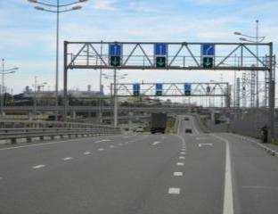


115 Figure 65. TTMS and BTMS in Russian Federation The main types of work carried out in the framework of monitoring are: visual inspection of geological hazards and phenomena; monitoring of surface and deep groundwater movement; control of banks, deformations and horizontal and vertical transfer displacements of structural elements; assessment of stability of the bottom hole zone without violating continuity within the surrounding rock tunnelling. monitoring of the avalanche areas: The principle of operation of avalanche warning system is to register the fact of avalanche with the movement of the snow mass through the set of sensors installed in front of her with subsequent data transmission to the control centre. monitoring system of landslides and retaining structures on the object: Automated monitoring system which includes deep soil movements monitoring, anchor force measuring sensors for load control in bolted compounds anchor piles, linear strain gauges to control the stresses in the bored piles, hydrogeological groundwater level indicator, network of geodetic marks and benchmarks to monitor structural movements. environmental monitoring system: The sensors were installed into the permanent interior of the tunnels which allow controlling the technical condition of the structures, surface monitoring, monitoring of the dangerous geological processes and phenomena in the coastal area in front of the tunnel. 106
116 Automated Traffic Management System (ATMS) The combined (road and rail) road Adler (Sochi) mountain resort Alpika-Service : ATMS Adler Alpika Service consists of: Integrating subsystem - Complex integrating system provides all the basic functions of the system and represents the core of ATMS platform. - At this level, there is the basic configuration of the core platform with the included features, modules, and blocks (controls, automatic control algorithms, databases, GIS-server, user interface modules, access level control, traffic flows parameters archive, diagnostic data archive, etc.). - The hardware control complex includes: i) management servers and databases, ii) workstations, iii) LAN network switching equipment, iv) storage system, and v) system of accurate time. Traffic flow monitoring subsystem - Traffic flow monitoring subsystem is intended for automatic measurement of traffic flow parameters, automatic detection of congestion and road accidents as input to generate control actions on the traffic flow, coordination plans library replenishment, collection of statistical data. - The functions of this subsystem include automatic collection of data about the parameters of traffic flow and processing of the results of the traffic flow measurement. - The subsystem also provides diagnostics of the technical condition of the equipment and record results. CCTV and video recording subsystem - CCTV and video recording subsystem are designed for visual observation of the transport and the operational situation on the road, transport interchanges, tunnels and adjacent areas of the road network, as well as automatic and continuous recording of incoming video data, its archiving and analysis to identify the causes of complications of the traffic situation. - The functions of this subsystem include: i) surveillance of the conditions of traffic flow, including visual detection of the incidents by the operator, ii) video surveillance of the operational situation (during special events), iii) control of the security services (police, etc.) and operational services, v) surveillance of the work of technical equipment systems (traffic lights, etc.), vi) remote control of cameras, including changing the pan, tilt, zoom and focus, as well as the installation of cameras in the pre-programmed position, vii) automatic control of the delivery of video from a camera located near the site of a traffic incident (based on the results of the traffic flow monitoring information processing), and viii) remote control of the glass cleaning of the cameras, ix) continuous recording of video and collection of the primary video archive from all cameras. Traffic management subsystem - Traffic management subsystem is designed for the automated management of technical means of traffic control, both in normal operation and in the event of congestion, road accidents, adverse weather conditions, roadworks on the road, in the area of interchanges, tunnels and adjacent areas. - Traffic management subsystem provides: i) dispatching control of traffic lights, ii) control of the traffic on the lanes, iii) speed limits control and iv) management of entries/exits. Information subsystem - Subsystem informing road users is intended for informing drivers about traffic situation changes like aggravation of traffic situations (accident, traffic congestion, road works, movements of maintenance equipment, deterioration of weather conditions), temporal changes in the traffic organisation (jams, emergencies, conducting law enforcement operations, etc.), and speed limits, including meteorological reasons. Weather and environmental conditions monitoring subsystem - The subsystem serves to automatically gather information on weather parameters (wind speed and direction, air temperature and humidity, visibility, type and intensity of precipitation, atmospheric pressure) - It determines the state of the coating on the lanes (dry, moist, raw, the presence of residual salt, the freezing of water, ice or snow) and environmental indicators at the site (concentration of pollutants) - It transmits this information into traffic control subsystems. - It disseminates information to road users as well as maintenance services. Traffic control subsystem 107
117 - Traffic flow control subsystem is intended for record and register the vehicles, photo/video fixation of traffic rules violations. - The subsystem provides reading state registration plates of the vehicles that pass through a control zone, searches the federal databases and operational investigation ( black or white lists, databases of travel authorisation, etc.), and creates database of the state registration plates numbers as well as formation of data base of images of cars without license plates Data transmission subsystem - Data and video transmission subsystem provides information exchange between the central equipment subsystems and the peripheral hardware complexes located on the road network. - Applied technical solutions allow to organise the bi-directional data transfer. Weather information system ITS Sevzapupravtodor : The total length of roads under the jurisdiction of Sevzapupravtodor is 2446 km is the Leningrad Region km, the Kaliningrad region km, and the Pskov region km. The main tasks of ITS Sevzapupravtodor are the following: inform road users about the state of the transport network; have an impact on road users, thereby changing traffic situation, according to the certain goal; increase the level of security, reliability and efficiency of the transport system; monitor the weather conditions, the state of the roadway, the environment, traffic parameters and issue recommendations based on the indicators (for the control system or dispatching service). Meteorological station consists of temperature sensors, wind sensors, sensors of current meteorological conditions, visibility sensor, relative humidity sensor, temperature sensor, barometric module, sensor of pavement surface. Meteorological stations provide the following functions: measurement of the meteorological parameters; preliminary handling, storage and transmission of weather data; informing promptly the operating organisations about the meteorological situation on the road. As an example, the section of the federal highway A-121 Sortavala Saint-Petersburg - Sortavala - road P-21 Kola is equipped with 15 variable information displays, 47 variable message signs, 50 active traffic detectors, 35 passive traffic detectors, 4 automatic road weather stations, 44 static cameras, 7 movable cameras, 5 points of dynamic weight control. Traffic detectors collect information about the vehicles crossing their installation area and thus collect data about all motor vehicles traveling on the highway, entering/leaving the highway. Besides the transport detectors provide feedback for transport control system. The information received from the hardware is used to determine the effectiveness of the control actions and adjust the planned actions. Variable message signs: Hardware-software complex of the control centre in the automatic mode aggregates information from the peripheral hardware, analyses it and decides on the implementation of coordinated control action. One of the main traffic controls are the variable message signs. The software has the ability to regulate the installation of certain limitations in manual and automatic modes. The automated control and diagnostic system of traffic lights and the automated outdoor lighting control system are two of the major subsystems of the system. The variable information displays display the following information: prohibition of traffic on the streets connecting to the exits to the highway Saint-Petersburg - Sortavala; difficult traffic conditions directly on the highway Saint-Petersburg - Sortavala caused by: the increasing intensity of transport flows; road traffic accidents, passage of the special vehicles, deterioration of the road conditions due to meteorological conditions, the repair works, maintenance works. traffic situation directly on the crossings (interchanges) on the highway Saint-Petersburg - Sortavala; operational information for the maintenances and special services; social and motivating information. 108


118 Figure 66. ITS on the federal highway A-121 in Russian Federation Weight control system: Unicam WIM is designed for pre-weighing of vehicles in motion and fixing potential violators of the established rules for the transportation of heavy and oversized cargo. The system is a set of sensors that determine the speed of vehicles and the weight of their axes, as well as survey cameras and video cameras fixing registration plates and. The collected data is sent to the central software via the data transmission system and is designed by the stationary points of weight control. Weight control stations include: strain gauges, inductive frame, hardware fixing the registration plates of the vehicles. Figure 67. Weight control system in Russian Federation 109


119 SYNOP computer-aided system SYNOP system is a conceptually new solution, enabling to forecast weather conditions and risks automatically on a real-time basis. High accuracy of weather forecast is achieved by application of a unique computer-aided technology for preparation of synthesized forecast information based on a combination of products of different forecast systems and implementation of a multiple mathematical model. FGBU Meteorology Centre of Russia participates in the development of this solution. The system provides information in a form convenient and easily understandable by non-experts in meteorology and is a tool to support management decision-making: Real-time monitoring of current weather conditions Hourly weather forecast for 72 hours ahead with highly detailed space-time data Automatic updates of forecast information A weather forecast for 15 days ahead Transmission of messages about predicted and occurred hazardous and unfavourable hydrometeorological phenomena on a real-time basis Hazards mapping for industrial and civil facilities, depending on actual weather, forecasted conditions and facility type Figure 68. SYNOP system for weather information Future plans for ITS deployments The main objectives of the creation of ITS in the road sector are as follows: Transport safety; Increase of turnover; Increase of passenger traffic; Reduction of operating costs of the maintenance of highways; Increase user comfort. The achievement of the above objectives is possible through the number of different systems that are already functioning and continue to be developed by Rosavtodor. The main objectives of such measures are to prevent man-caused emergencies to protect life, health and property of citizens, protect their rights and legal interests, as well as protect the interests of society and the state by preventing traffic accidents, reducing the severity of their consequences. To this end, measures are being taken to ensure the safety of transport during construction, reconstruction, repair and maintenance of the roads. Particular attention is paid to the intelligent management systems and traffic control based on the use of modern telecommunications and information technologies. Transport and highways monitoring system is designed to retrieve information from the road network (of general use and federal roads) in real time. Currently this system is used in Rosavtodor Situational centre and in nine pilot areas ( Kholmogory, Kola, Sevzapupravtodor, 110
120 KAD, Tsentravtomagistral, Russia M-10, Bobruisk-Moscow, Moscow - Nizhny Novgorod, Chernozemyie ). One of the most promising target programs are Independent and Cooperative ITS. Both programs are closely linked. Improving training activities (project management training and highway engineers training): It would be beneficial for both Asia-Pacific and Russian experts to undergo further training in the area of ITS and Infrastructure projects, leading to more involvement of Russian and Asia-Pacific specialists in the funded projects and ultimately boosting further the collaborative research. Such training could take the shape of workshops and seminars. It could be also built on the existing training programmes within the certain projects. The basic Technical University for ITS in Russia are: MADI (Moscow Institute for road and automobile engineers), Transport and Construction Universities in Saint Petersburg and in Rostov-na-Donu. Road infrastructure safety: One of the important challenges is the complex development of the roads and the road services facilities. It supposes the creation of the multifunctional zones of the road service considering the technical and architectural international standards. This will allow to improve the quality for the users, the increase the attraction of the tolling roads, decrease the accidents rate and the severity of the injuries in the road accidents. This infrastructure system has to include the following services: Information on the traffic conditions through the interactive road signs, itinerary schemes, LBS navigation, meteorological information; Leisure points along the road (every 50 km) equipped with the repair service and car maintenance, motels, commerce etc.; Emergency call service; Emergency and medical assistance in case of a transport accident. Transport corridors: To increase the competitiveness of the transport system of Russia and to realize the transit potential of the country in it necessary to solve the problem of creation of the motorways for the system of roads that constitute international transport corridors North-South and EU Russia transport corridors N 2, 9 and A1 as well as new Eurasian corridors including the international corridors Europe Western China. Thereto the Program of the strategic long-term development of ROSAVTODOR provides the construction and reconstruction of 1380 km of federal roads corresponding to the transport corridors, including km of the road M-1 Belorussia, 122 km of the road M-3 Ukraine, km of the road M-4 Don, 259 km of the road M-10S Moscow Saint-Petersburg, 54 km of the Central ring road of the Moscow region (which will be included into international transport corridor after its construction). The development of the federal motorways that constitute the international transport corridors will create the strong point of the freeways in the European and Asian parts of Russia. On the one hand, the network of high speed, comfortable and good quality roads will reduce the transportation costs, time losses, quantity and severity of the road accidents. On the other hand, it will improve the investments attraction of the regions of Russia by enhancing their accessibility and social and economic conditions. The creation of the system of motorways will enable to form the new centres of economic activity. International transport corridors: The idea under discussion - the international conference on Smart Silk Route organised by ITS - Russia in of September It will be possible to discuss economic relevance of the international transport corridor from China to Europe crossing Russia using automobile road infrastructure equipped with the advanced ITS technologies and services for the safe, secure, cheap and fast delivery of goods from Asia-Pacific to the new and traditional markets in Central Asia, Russia and Europe. The second issue for discussion will be the legal environment for such project. It is necessary to understand if the existing legislation in the countries concerned allows implementation of the idea and what is necessary to be improved or updated. The third issue will be the discussion how this corridor will be located on the ground: which roads should be included in the corridor, is there the only possible route or there are variations, is it necessary to build new roads or use and improve the existing ones. Also, it is necessary to identify the customer needs for the services on the corridor to make it the most attractive for logistic and transport companies and travellers. We need to create the modern infrastructure of gas stations, maintenance network for trucks and buses, warehouses and logistic centres for containers, hotels, shops, laundries, places for recreation and rest of the truck drivers and tourists. The equipped stations along the Smart Silk Route should appear each km, to provide the safe working time for drivers. This network will provide the transport companies with the unique network of pit- 111


121 stops where they could change drivers and trucks but let containers move through. The following technologies should be implemented: modern gas and petrol stations; autonomous trucks and trains of trucks; communication and navigation based on satellite and space technologies; cooperative ITS: vehicle to vehicle communication, vehicle to infrastructure communication, modern traffic management and enforcement systems; modern and perspective communication tools: radio, internet, mobile network and applications for users of Smart Silk Route including e-customs and e-cross border procedures; modern logistic technologies; modern technologies for other services along the corridor (hotels, restaurants, shops, recreation, sport, entertainment, tourism), etc. It will be possible to discuss the concept with the professional and expert international community and as a result to get the feedback from the interested companies and stakeholders of future international consortium, which could be selected for this project. After that it will be possible to create JSC Smart Silk Route initiated by UN ESCAPE, ITS Russia, ITS China and selected stakeholders, address the Shanghai Organisation for Cooperation and governments for their political support and for different financial structures for the funding. Express railways: Express rail Moscow Kazan Yekaterinburg, initiated by the Governments of Tatarstan and Sverdlovskaya regions to be built by The railroad in planned to be 1,100 km long and the trip should take 3.5 hours (instead of 12 hours today). Figure 69. Express railways in Russian Federation Central Ring Automobile Road (TsKAD) around Moscow region: This project involves reconstruction of 49 km of the existing roads and construction of 290 km of new roads with the budget of 330 billion Rubles. The total length is 521 km. The road should be finished by Besides the high-speed movement ( km/h) the road will provide several ITS services: advanced automated traffic management system, meteorological stations, helicopter pads, emergency call system, trucks parking areas, road service stations. 112

122 Figure 70. Central ring automobile road around Moscow 5.4 Turkey The applications of Intelligent Transport Systems on the highway network especially focus on four major systems. These applications include Traffic Management Systems, Traveler Information Systems, Electronic Toll Collection Systems and Tunnel Control Systems. In most cases, Traffic Management Systems and Traveler Information Systems are installed as united systems. In addition to these systems some specific implementations such as roadside control stations for axle weight and dimension check of heavy goods vehicles, weight-in-motion systems, speed detection systems, vehicle counting equipment, and bridge monitoring devices for suspension bridges functionally operate in road network Traffic management systems TMS (Traffic Management Systems) operate functionally on some sections of state roads and motorways. Traffic Management Centres were established in Ankara, İstanbul, İzmir and Mersin on the motorway network. These centres contain control rooms, the sensors for weather and road conditions, information systems, CCTV cameras and multi-lane vehicle sensors. In state highways, most of the functional systems in the content of traffic management and travel information have no regional centres based on 7/24 monitoring. They run standalone under their local control centres. However, there are regional based control centres only for signalization and information systems in some regional divisions. Existing components of Traffic Management Systems concentrate on signalization systems, CCTV Cameras, sensor for weather road conditions (meteorological information station), vehicle detectors, incident detection and control centres. 113
123 Table 15. Systems from motorway network in Turkey System Number Incident Detection 17 Camera 678 Variable Message Sign 51 Variable Traffic Sign 720 Meteorological Information Station 21 Radio Broadcasting 26 Traffic Detector 58 Traffic signalization systems: The traffic volume on the road network of Turkey has grown rapidly since the fact that number of vehicles in Turkey has increased due to raised economic growth and wealth. In addition, the necessity for taking new additional measures to maximize traffic safety and driving comfort of road users was determined based on the fact that road transport is preferred for freight and passenger transport by road users. LED technologies which provide high energy savings are used on Traffic Signalization Systems. LED vehicle and pedestrian signal lamps are preferred to be used due to their high durability and low cost. Some applications such as fixed, semi-actuated and fully actuated signal systems, green wave, pedestrian crossing studs, flashing signals and also signalized intersections coordinated by a single centre are available. On highway network, the number of signalized intersection on road network is 2,175 as of the end of Travel time estimation: It is a typical joint ITS application of traffic management system, electronic toll collection system and traveller information system on 2nd Peripheral Road in İstanbul. For this purpose, the main route is equipped with DSRC type travel time detectors on overhead gantry. These are the same kind of antenna used in Electronic Toll Collection on motorways. They have capability of identifying on-board units in vehicles. Data are collected from DSRC on-board units along the road and an algorithm runs at the main management centre by using the data and estimate travel durations for specific arrival points such as İstanbul Straight Bridges, major intersections, and finally travellers are informed of travel times through VMS. The following figure shows the arrival time variation between Mahmutbey Toll Plaza and 2nd İstanbul Straight Bridge, 22 km of motorway section, below. Figure 71. Travel time estimation through On-Board Units 70 TRAVEL TIME (MINUTE) TIME OF DAY (HOUR) Traffic counting and classification: To prepare the map of traffic volume for highway network traffic counting and classifying system is used. It produces presence, speed and classification data for vehicle. The traffic data gathered by the devices on roads is transmitted to the centre via the GPRS communications during 365 days - 24 hours. And all the devices are online all the time. The inductive loop detector is commonly used for 114


124 permanent traffic counting and classifying applications as well as short term applications. The data supplied by conventional inductive loop detectors are vehicle count, occupancy, speed and classification. Figure 72. General overview to traffic counting and classifying systems The operation of inductive loop sensors is well understood and their application for providing basic traffic parameters e.g. volume, presence, occupancy, speed, classification and gap represent a mature technology. The equipment cost of inductive loop sensors is low when compared to non-intrusive sensor technologies. This type of detector is deployed in interurban road network including peripheral roads. Interurban road network, 66,179 km, lies within 17 regional divisions of General Directorate of Highways. Aforementioned inductive loops are functional in every regional division. We have 500 inductive loop detector devices throughout the interurban road network at present. They are used for permanent surveys to get traffic data from roads Traveller information systems Information Systems address two separate applications; pre-trip information systems and on-trip information systems. Current applications focus on variable message sign, toll free telephone line, internet, mobile applications, radio broadcasting. Generally, Traffic Information Systems and Traffic Management Systems are used as an integrated system. Mobile application: By means of the mobile application of General Directorate of Highways which was developed for smartphones and tablets. Road users can display their routes and receive directions, and also learn the total travel distance and travel time. Furthermore, it is possible to get information about the road and traffic conditions, roadworks and road closures. Road users can also get information about the distance between provinces and districts by displaying the distance between two cities through distance calculation apps. In addition to these applications which assist road users during their travel, it is also possible to interrogate violation of automatic toll collection systems. Road users can easily access to information on motorways which they use by their smartphones. The bid notifications can be queried. The General Directorate of Highways Mobile Application is available to download free from Apple Store, Google Play and Windows Market. The mobile application has been in use since Currently, the number of active users has exceeded


125 Figure 73. Mobile application for traveler information systems in Turkey Internet: It is possible to get some information such as the best travel route, road closures, roadworks, roadside facilities and traffic conditions on the map on the official website of General Directorate of Highways ( Variable message signs: VMSs are used to warn road users about traffic time, accidents, road works, decreased speed of vehicles because of the density as well as meteorological conditions which are gathered form cameras, meteorological sensors and other sources. Radio Broadcasting: RDS-TMC systems are used in some road sections and tunnels. Road users are being informed in real time regarding road and traffic conditions regularly and when necessary in this system. It is planning to expand radio broadcasting Electronic toll collection Motorway network in Turkey comprises toll motorways and two toll suspension bridges. All of them are stateowned transport infrastructure. The systems to be installed on new motorways and a suspension bridge which under construction by BOT model will be integrated to existing ETC network. Tolling is the primary ITS implementation on motorway network. Turkey is a pioneer country in its region in terms of tolling implementation. Toll was collected by pre-paid ticket and in cash from 1973 to Unstaffed lanes based on DSRC technology were implemented in After that, contactless card systems and RFID systems were implemented. Here, RFID symbolizes a set of small on-board unit in the vehicle, antenna on the roadside and communication between them. All toll lanes were transformed into cashless tolling lanes in Finally, the first Multi-lane Free Flow (MLFF) application was inaugurated on the 2 nd İstanbul Straight Bridge in 2014, and it was decided to extend it to entire motorway network starting from mainline toll plazas. MLFF in toll collection means collecting of tolls at the free flow speed on the road by means of systems e.g. cameras, DSRC or RFID antenna, installed on overhead gantries. It doesn t require an enlarged toll plaza. Current toll system is basically divided into two groups; open system and closed system. Open system refers to a system in which toll is collected according to the category (class) of a vehicle. In addition to vehicle class, the distance travelled is taken into consideration to calculate payment in a closed system. Two different in vehicle devices are used. These are DSRC type active and RFID type passive tag (on-board unit). The DSRC is of R/W type on-board unit and it operates at 5.8 GHz and is compliant with the CEN TC 278 set of standards. The RFID sticker operates at 860 MHz. The tags are affixed inside of the vehicle s windscreen. The private road operators of new BOT motorways have to install compatible toll collection systems to existing ones on motorway network to maintain nationwide interoperability. Tolling systems covers Video Enforcement System which captures the scene of vehicle in the case of any violation. Vehicles are categorized into 5 vehicle class in Vehicle Classification System. 116
126 1st Class: Vehicles with 2 axles, having axle separation smaller than 3.2 m 2nd Class: Vehicles with 2 axles, having axle separation longer than 3.2 m 3rd Class: Vehicles with 3 axles 4th Class: Vehicles with 4 and 5 axles 5th Class: Vehicles with 6 and more axles The payment method is in the form of direct debit from bank account of the subscribers. The toll transactions produced by on-board units at the toll lanes are gathered at Main Centre in hierarchical order and are transmitted to respective banks. Banks deduct the toll amounts from user s accounts or charge to their credit cards. Banks keep the money arising from toll transactions for a limited duration and then transfer to the account of Ministry of Finance. The toll revenue is allocated to General Directorate of Highways. The commissioned banks carry out the functions of subscription of road users, delivering on-board units, managing user s accounts and issuing bank statements. A toll lane at a classical toll plaza is composed of: Lane controller Transceiver Automatic vehicle Classification (AVC) Video Enforcement System (VES) License Plate Recognition (LPR) Toll and vehicle class indicator Automatic barrier Canopy sign Traffic sign But, a Multi-lane Free Flow (MLFF) type tolling doesn t need toll and vehicle class indicator, automatic barrier, canopy sign, and traffic sign at lane. Figure 74. General architecture of DSRC toll systems VIOLATION PROCESSING CENTER BANK-1 MAIN CENTER BANK-N REGIONAL CENTER REGIONAL CENTER TOLL PLAZA. TOLL PLAZA TOLL PLAZA TOLL PLAZA A S E L S A N A S E L S A N A A S S E E L L S S A A N N A A S S E E L L S S A A N N A S E L S A N A S E L S A N A A S S E E L L S S A A N N A A S S E E L L S S A A N N Entire toll system covers 1 Main Centre and 6 Regional Centres. 96 Toll Plazas were established to collect toll in motorway network. Over 10 million of on-board devices are at disposal of users at present. Of these,
127 million of tag obtained from DSRC, 8,4 Millions of tag obtained from RFID. In total, 14 banks have a contract with General Directorate of Highways to deliver tags to users. The users of both payment means have an opportunity to use their tags at all toll plazas. This is a condition to realize a seamless system. Table 16. Lane equipment of ETCS in Turkey OGS HGS TOTAL ENTRY LANE EXIT LANE TOTAL The amount of collected revenue and corresponding vehicle numbers for motorways and suspension bridges are given below by years. Table 17. Toll revenue and vehicle counts in Turkey YEAR Revenue (USD) Vehicle Counts ,491, ,412, ,358, ,423, ,813, ,322, ,514, ,644, ,867, ,477, ,861, ,949, ,479, ,111, ,035, ,834, ,608, ,214, ,104, ,639, ,685, ,847, ,286, ,805, ,446, ,618, ,120, ,491,789 TOTAL 5,397,674,106 4,131,792,946 Some facts on ETCS are as follows: Staffed toll lane equipment can handle 250 vehicles per hour at an exit lane in a motorway toll plaza. This figure goes up to 400 vehicles for an entry lane. It is an electronic system, but the toll is collected by means of a toll collector. General Directorate of Highways employed over 1100 toll collectors for toll collection until More breakdowns occur in staffed lane system comparing to full electronic system since some components of lane equipment are composed of mechanical parts such as ticket vendors and card readers. A non-stop tolling lane such as DSRC can handle 1800 vehicles per hour and it doesn t need any staff at lane. The payment means in non-stop tolling provide additional opportunities and can be used for travel time estimation, traffic management, other payments and congestion charging in urban areas. A toll transaction for a vehicle at the staffed lane lasts 22 seconds. Reading of ticket and printing of voucher take time. An electronic transaction for a non-stop tolling lane is completed in a second and the passage of a vehicle under the canopy is completed in 2-3 seconds depending on vehicle speed. Stepwise installation on yearly basis reduces restrictive effect of the budget constraint to complete all system on entire network. 118
128 MLFF removes some barriers ahead of the classical tolling implementation. It does not require any additional area to build a toll plaza. Vehicles do not need to slow down and pass through at the same travelling speed to pay the toll. Interoperability is the most crucial factor for an electronic toll collection. In this context, standards of radio frequency systems, e.g. transceiver, on-board unit and communication protocol between them, must be taken into consideration. Tolling is an uninterrupted process which operates on 7/24 basis. Maintenance, operation and upgrade of a tolling system are of vital importance. These processes require competent technical teams to provide aforementioned services. Back office activities and customer relations have essential functions. It is of necessity that an easily accessible on-board delivering mechanism be set up to facilitate membership process of road users to toll system. Commonly, the request of vehicle users is to access the on-board unit and complete the subscription process at the nearest place to them such as toll plazas, fuel stations and rest areas along highways. Tolling is a financial issue as well as technical system. It plays a vital role in PPP model road constructions specifically Tunnel control systems In line with the motorway initiative in the1980s and divided road initiative in 2002 high capacity roads have been constructed. Tunnels have become important facilities of road network in the course of both initiatives. Mountainous geographical conditions bring tunnels into the forefront. The number of tunnels has been continuing increasing at a growing rate. Totally 244 tunnels are open to traffic. Additionally, a toll tunnel constructed by BOT model is in operation. Tunnels, particularly longer ones, require some specific systems to eliminate adverse effects of accident, poor visibility, contaminated air, fire and other risks. The tunnels longer than 500m are equipped with some control systems on highway network. The following table shows the number of tunnels longer than 500m in operation on highway network. For smooth application of systems to tunnels it is necessary a generalized guideline. In 2005, General Directorate of Highways adopted the safety measures set out in Annex-1 to The European Union Directive 2004/54/EC of The European Parliament and of the Council of 29 April 2004 on minimum safety requirements for tunnels in the Trans- European Road Network. The type and size of systems to be installed in tunnels depend on assessment parameters. The length of tunnel and amount of traffic passing through tunnel are the major criteria to define systems to be installed in tunnel. But, each tunnel has its own conditions and is a unique structure in terms of systems. In detail, some other provisions of tunnel such as, tube number, curve, lane number, proposed vehicle speed, wind, availability of heavy good vehicle traffic are taken into consideration. The road network consists of 16 control centres belong to longer tunnels and tunnel series. Table 18. Tunnels longer than 500m in operation in Turkey Tunnel length Number of tunnels 500M. Tunnel Length< 1000M M. Tunnel Length < 3000M M. Tunnel Length 3 Total 95 Safety is the most important phenomenon for tunnels. A tunnel is of additional risks due to being a confined space. To eliminate risk factors such as accident, accessibility difficulty, or visibility, contaminated air and particularly fire some technical measures are taken, and an operation model consistent with the systems is set. The systems projected for safety of tunnels are given below. SCADA control centre Tele-control Incident detection Traffic control 119
129 Emergency call Vehicle height checker Surveillance Communication Radio broadcasting Public announcement Power supply Lighting Air quality control Ventilation Fire detection Hydrant and extinguisher Public transport management systems Public Transport Management includes the monitoring of public transport fleets and management, electronic payment for public transport fees and notification of passengers by web/mobile applications and on stops. In Turkey, these services are provided in Metropolitan Municipalities of İstanbul, Ankara, İzmir and also in some other municipalities. To illustrate, İstanbul Metropolitan Municipality tracks the location of vehicles instantly. By this way, operational changes can be made by directing the fleet instantly from the center for example, by sending information as high traffic density from Traffic Control Center of İstanbul Metropolitan Municipality in case of failure of services. Passengers can be notified by websites, mobile applications and boards on stops about estimated time of arrival of the vehicle regularly. Moreover, it is possible to make payments by a single contactless electronic card for all types of public transport Emergency management systems 112 Emergency Call Centres will enable the operation of emergency calls by using a single number in a coordinated manner and it will be possible to access emergency location and the people who need in help as soon as possible. 112 Emergency Call Centres were put into service in 14 provinces and are being extended to some other provinces. In addition to this, Turkey took part in a European Union project named HeERO aiming to realize an in-vehicle emergency call system operates with112 emergency call number. If a vehicle having this system has an accident the system will automatically put into service and call 112 Emergency Call Centres and convey a message with the position of vehicle. After taking an e-call message from a vehicle involved in an accident the emergency team will respond to the accident. In-Vehicle Emergency Call System (E-call) will be installed in 112 Emergency Call Centres by means of Harmonized Europe In-Vehicle E-Call Project which has been carried out in cooperation with European Union. In this way, it will be possible for a vehicle equipped with this system to call 112 Emergency Call Centre in case of collision regardless of its location in EU region. The Ministry of Internal Affairs will conduct the project ( Fleet and freight managements GSM operators come into prominence by Machine to Machine applications in recent years, and the number of M2M subscribers is growing. M2M is a technology which enables the remote monitoring and management of devices, and communication among them through Mobile Network by means of a special SIM card affixed to devices. This technology is usually employed in fleet monitoring systems in Turkey. Fleet monitoring systems receives location data from satellites by means of an on-board unit with SIM card affixed to vehicles and also special data (such as fuel consumption) obtained from vehicle sensors, and send these data to the centre through mobile communication. Further, the data collected from vehicles can be employed to get information about traffic density Ongoing installation activities All required devices are being installed on motorways under construction by BOT method in the content of the abovementioned systems. Traffic Management Systems and Traveler Information Systems on state highways 120
130 and state-owned motorways such as signalization, VMS, weather sensors, cameras, communication systems are being deployed to a certain extent Future plans for ITS deployment General Directorate of Highways adopted the extension of Intelligent Transport Systems on state and provincial roads by giving priority to the dual carriageways. To this end, organizational structuring was realized in first place. Traffic Safety Department was established at the Headquarter of General Directorate of Highways and the related units of this Department were established at Headquarter and in the Regional Divisions of Highways. The generalization of Intelligent Transport Systems was adopted by General Directorate of Highways in order to contribute to transport systems for following subjects. Improvement of road and driving safety Reduction in energy consumption Effective use of road network capacity Reduction in traffic congestion and travel time Providing alternative route and lane management Reduction in traffic accidents Improvement of efficiency of transport and management of highway crews Response to traffic accidents rapidly Notifying and warning road users on road, weather and traffic conditions instantly Providing a controlled flow for vehicles and pedestrians Alleviating transport related environmental hazards Providing comfortable transport The newly planned system will create a compatible integrated structure and all road side devices will be subject to traffic management system centres. In this respect, traffic management and traveller information systems are particularly required. Within this context the works to be carried out are given below. Traffic management systems centres: It is aimed to establish Traffic Management Systems Centres in which road and traffic data will be collected, administrative decisions will be taken, and drivers will be regularly informed about weather and road conditions. The existing fragmented systems will be united by means of setting up traffic management systems centres. The integrated structure will cover a Traffic Management Systems Centre in every Regional Divisions of Highways, and thus it will comprise 17 Regional Centres in total. Main Traffic Management Systems Centre to which all regional centres would be connected will be located at the Headquarter of General Directorate of Highways. The first Traffic Management Systems Centre was built in 13 th Division (Antalya). The existing systems will be adapted to new systems to be established on the road network and will be operated under the control of these centres. 121


131 Figure 75. Planned traffic management systems centers in Turkey Communication infrastructure: Communication has a crucial importance for Intelligent Transport System applications. Fiber optic cable infrastructure is the most suitable one for ITS operation in the sense of high rate data transferring. It is also aimed to establish an efficient communication infrastructure which will allow those systems built in the scope of ITS to provide communication with each other and with other transport modes. Wireless communication will also be used when necessary. To this end, fiber optic cables will be installed on approximately 15,000 km road network. Figure 76. Proposed ITS communication infrastructure in Turkey Pilot projects: The preparation of related technical documents is still in process. A model deployment will be carried out in the pre-selected pilot Regional Division. After monitoring of the first realization of system installations applications will be implemented in all the Regional Divisions. In that project, some of the applications of Intelligent Transport Systems, which will be installed in conjunction with the completion of technical documentation, are as follows: Road and Weather Detection Systems Vehicle to Infrastructure (V2I) Communication Application Variable Message Signs Road and Weather Detectors 122
132 Radio Broadcasting System Signalization Systems Communication systems Incident Detection Systems Traffic Management Center Cameras Traffic Counting and Classifying Mobile Applications Web based Information General Directorate Highways will initiate the pilot project. Two separate investment projects were allocated to ITS applications for consultancy services and system installation. The fund in the investment program accounts for 200 million TL up to

133 6 MODEL ITS DEPLOYMENT 6.1 Recommended Process for ITS Deployment ITS planning It is recommended to go through three main steps in the process of deploying ITS services, as shown in the following figure. The first step is to set realistic goals and visions for model ITS deployment. The goals and visions set out should be based on detailed review and analysis of the current socio-economic environment and level of road infrastructure of each Asian Highway member country. Figure 77. Overall recommended process for model ITS deployment Once the goals and visions for the ITS deployment are determined, the second step is to develop a suitable ITS architecture to implement them. In the process of designing and building the architecture, a set of Asian Highway ITS services must be first identified. In this regard, three main stakeholders perspectives are to be considered: i) road users, ii) road operators and iii) ITS service related 3 rd parties. It is not possible to deploy all types of ITS services on the entire Asian Highway network, because each ITS service needs a specific set of road and traffic infrastructure for deployment in the field. Therefore, candidate road sections for the model ITS deployments need to be classified into several groups according to road and socio-economic characteristics. Then, deployable ITS services for each road group will have to be selected. The final set of selected ITS services would be the basis for the model ITS deployments. The last step is to deploy and operate the model ITS services. Real-world deployment and sustainable operation of ITS services would require realistic and detailed implementation strategies. Two key components at this stage would be: i) systematic feasibility study process to come up with the best ITS solutions and ii) existence of efficient and powerful organizations to eliminate possible barriers and obstacles to ITS deployments. 124
134 Traditional cost-benefit analysis is a typical tool for the feasibility study. For resolving technical, institutional and financial difficulties, an international coordination body should be established to take charge of ITS design and operation standards and related to harmonized development of ITS infrastructure. In the development of ITS architecture as well as for the ITS deployment and operation, it is most important to learn from the participating countries experiences in ITS deployments. Information must be collected on the successful ITS projects from the Asian Highway member countries, especially on the selected six ITS services. Success in some countries cannot guarantee success in other countries. Thus, the results of social and environmental analysis at the first stage should be carefully incorporated into selection of deployable ITS services. With the same reason, unsuccessful ITS projects may be successfully adopted in other countries when a careful consideration of socio-economic, technological and financial aspects has been made in determining the optimal ITS services and deployment options. The questionnaire survey results would be useful as key inputs in this process. Model ITS services should be operational across the member countries depending on their suitability by enabling service exchange between systems, integration of new systems to existing systems, device exchange between systems, uninterrupted communication between service elements, and provision of services in all applicable areas. These aspects are specified as the following: i) Interoperability, ii) Expandability, iii) Interchangeability, iv) Connectivity, and v) Seamlessness. Hence, for successful deployment of model ITS on the Asian Highway network, the following issues need to be adequately addressed in the planning process: Identification of communication protocols and standards carefully which can be adopted in all member countries Determination of model ITS Architecture and its corresponding general framework Implementation of preliminary installations as pilot projects Selection of a single tender for the installation of model ITS instead of separate tenders for every subsystem Formation of organizational structure and the employment of the staff during system development process Consideration of operation, upgrade, renovation, and maintenance process in the planning stage Clarification of some legal issues such as security and sharing of the data, protection of privacy and operational interoperability Establishment of the legal and technical infrastructure for data exchange among traffic management centres of various member countries The applications can be initiated by joint projects Facilitation of related staff s visits to successful ITS project sites for learning good practices and exchanging ideas Consideration of modern technologies in selecting model ITS services Determination of general principles and rules on model ITS services for uniform practices Stakeholders Successful deployment of model ITS requires full understanding of the needs of relevant stakeholders, to avoid conflicts of interests among stakeholders. Additionally, each of selected ITS services may have a diverse set of stakeholders. Therefore, the stakeholders engaged in a specific ITS application need to be clearly identified starting from its planning process to deployment and operation. As shown in figure 78, the model ITS stakeholders consist of three entities: i) road operators, ii) road users, and iii) 3 rd parties. 125

135 Figure 78. Stakeholders in model ITS deployment Road operators include central/local governments, road authorities, and road construction related agencies which are involved in deployment of the Asian Highway network and operation/control of the Asian Highway traffic. Road users indicate actual users traveling on the Asian Highway network as passenger car drivers, bus drivers and truck drivers who are in general interested in traveller information provision. The 3rd parties are nor directly linked to road construction, operation and use, but have indirect interests and business connection in ITS operation such as telecommunication companies and information service providers. 6.2 Strategies for the Model ITS Deployment Flowchart Successful deployment of model ITS requires careful and realistic implementation strategies which can be developed only through clear understanding of socioeconomic, cultural and political environments in the target member countries. The results of analysing the Asian Highway network environments suggest the following six important characteristics are to be incorporated into the development of the strategies for model ITS deployments (figure 79). Large discrepancies in financial capabilities and road infrastructure Limitations in free transportation operations among adjacent countries Difference in monetary currencies Frequent occurrences of natural disasters Non-existence of an international road organization and a coordination body Absence of the universal standards and regulations related to ITS design and operation Considering the abovementioned characteristics, the strategies for model ITS deployments are proposed as follows: Classification of deployable ITS elements by member state Automation of immigration control on the Asian Highway Electronic toll systems and smart tolling systems Provision of the cutting-edge ITS on the critical paths of the Asian Highway network Establishment of an international coordination body: International Cooperation Committee, which would be multinational and multidisciplinary in nature, established under an international platform, 126

136 recommended to be under the umbrella of the United Nations ESCAP. The basic function of the committee would be to oversee and supervise the entire process of planning, design, construction and operation of the model ITS. It would also serve as a mechanism to resolve conflicts among the stakeholders that may arise through the entire process, and to discuss issues of mutual agreement and cooperation among countries. Therefore, the committee will be composed of experts and representatives from academia, industry, government and civil society, and it is appropriate that 3 to 5 members from each country participate in the committee. Development of the Asian Highway standards for ITS design and operation Figure 79. Strategies for the model ITS deployment As shown in figure 80, the level of ITS infrastructure and services deployed in each member country can be classified into three different levels: i) high, ii) middle and iii) low. The high-level of ITS deployment can accommodate future changes in transportation paradigm such as autonomous vehicles and smart highways, while the low-level can provide only basic ITS services. The middle-level can implement ITS components adopted for improving not only mobility but also other values such as safety and comfort. The key attributes used to determine the level of the model ITS deployments for each AH member country may include: Available ITS technologies: Existing physical elements Legal and institutional constraints Desired ITS services Financial resources availability Social and cultural background In developing the model ITS deployments, the level of ITS infrastructure and services should be considered for each road segment separately, not the whole country altogether. The type and level of ITS services required in a particular AH section will depend on the traffic demand, socioeconomic environments and geographic characteristics. The following three criteria are to be considered for determination of the level of ITS deployments: Financial resources 127
 connection of major hub cities and ii) no connection of major hub cities + sufficient economic power of country + sufficiency of ITS and road-related")

137 Existing and planned status of the road infrastructure Geographical importance in terms of network connectivity As shown in the flowchart below (figure 80), the selection of each level is made under the following conditions: High-level: i) connection of major hub cities and ii) no connection of major hub cities + sufficient economic power of country + sufficiency of ITS and road-related infrastructure Middle-level: i) no connection of major hub cities + sufficient economic power of country + no sufficiency of ITS and road-related infrastructure and ii) no connection of major hub cities + no sufficient economic power of country + sufficiency of ITS and road-related infrastructure Low-level: no connection of major hub cities + no sufficient economic power of country + no sufficiency of ITS and road-related infrastructure Figure 80. Flowchart of selecting the level of ITS deployments for a road section The results suggest that if a road section is a connecting link between two major hub cities, the high-level of ITS deployments should be implemented regardless of economic resources and status of the road infrastructure. Because one of the top priorities of the Asian Highway network is efficient and convenient connections between major cities, even in the developing countries. These type of road links should receive priority in resource allocation. Also, if both economic strength and road ITS infrastructure are sufficient, it is desirable to apply advanced ITS components even if the road segment is not located on the main path. If either economic or road infrastructure is sufficient, it is advisable to consider at least the middle-level of ITS deployments. The low-level components should only be adopted when a road link is considered in a region where neither economic strength nor road ITS infrastructure is available. 128
138 6.2.2 Identification of the optimal ITS deployments There are several challenges in identifying the suitable set of ITS services at an optimum level for the model ITS deployment. Those are as follows: Even very basic ITS services do not seem to be available in many Asian Highway member countries in near future. On the other hand, there is no need to develop model ITS for several leading countries who have already successfully deployed their own set of ITS services. It is difficult to determine the type and level of ITS placement for complex road sections to ensure seamless ITS operation. The goals and objectives of the model ITS deployments would differ from one country to another according to each country s needs and circumstances. Too many stakeholders would be related to model ITS deployments, which makes it quite difficult to reach at mutually beneficial agreements. ITS technologies are advancing very fast. Recognizing the challenges indicated above, a systematic economic feasibility study would be required to find the optimal ITS for any road segment. The optimal ITS services for each member countries can be identified in consideration of the country s capabilities of satisfying technical, legal, financial and operational requirements. As illustrated in figure 81, feasibility study approach can be applied to identify the optimal ITS deployments, because the whole decision-making process involves a complex evaluation process which deals with both quantitative and qualitative criteria. ITS feasibility study aims to develop a comprehensive set of desirable ITS options and services for each participating member country. Traditional cost-benefit analysis can be a practical and effective tool for finding the optimal ITS deployments. Review of literature revealed that the deployment of ITS services has potentials to improve safety for vulnerable road users including school children, both boys and girls, pedestrians, bi-cyclists and elderly people. ITS deployments can reduce the number of road fatalities as well as severity of road crashes. These benefits are to be considered in the feasibility studies for ITS projects. Additionally, with the changes of travel pattern and modal choice, in increasing number of Asian Highway member countries, considerable number of women ride the public transportation and drive private vehicles. Safety and security and the specific needs of women/girls, as well as elderly and disabled persons are to be taken in to account. However, privacy for women and girls can be hampered through closed-circuit camera monitoring, recording of travel data as well as through security checking. These aspects are recommended to be considered and other social impacts need to be considered prior to selection of ITS services. The feasibility study outputs can be used as inputs and the basis for finalizing the model ITS planning for any member country. The study results may suggest: Assessment of ITS service needs based on the current and future transport demands and identifying key priorities for ITS services for the member country Assessment of operating environment with respect to legal and institutional arrangements and technical capacity Recommendations for technological and financing options for the ITS deployments Stakeholder workshop for consultation on the feasibility study and action plan and awareness raising, including capacity building Provision of technical support to key stakeholders in planning proposed activities, which would ultimately include development of an ITS architecture, an action plan, and recommended assignments of roles and responsibility with a well-defined timeline. 129

139 Figure 81. Identification of the optimal services for the model ITS deployment 130
- Chapter 1 - Introduction
 - Chapter 1 - Introduction One main feature of economic development in the last decade of the 20 th century has been the globalisation of markets which brought with it increased demand for the unhindered
International and regional corridors and Islamic Republic of Iran Transit Roles and Strategy
 Expert Meeting on REGIONAL COOPERATION IN TRANSIT TRANSPORT: SOLUTIONS FOR LANDLOCKED AND TRANSIT DEVELOPING COUNTRIES 27 28 September 2007 International and regional corridors and Islamic Republic of
Sustainable Transport Development: Global Mandates & Regional Overview of Transport Development
 Regional Expert Group Meeting on Policy Options for Sustainable Transport Development 27-29 November 2013, Incheon Sustainable Transport Development: Global Mandates & Regional Overview of Transport Development
Subnational Purchasing Power Parities: Integrating International Comparison Program and Consumer Price Index in Asia 1
 Subnational Purchasing Power Parities: Integrating International Comparison Program and Consumer Price Index in Asia 1 Eileen Capilit* Asian Development Bank, Manila, Philippines ecapilit@adb.org Yuri
GUIDE TO KEY ISSUES IN DEVELOPMENT OF LOGISTICS POLICY
 GUIDE TO KEY ISSUES IN DEVELOPMENT OF LOGISTICS POLICY The views expressed in this publication are those of the authors and do not necessarily reflect the views of the United Nations Secretariat. The opinions,
Brief: Transport Sector
 1 ANNEX 2 Central Asia Regional Economic Cooperation Brief: Transport Sector Good Neighbors Good Partners Good Prospects TRANSPORT I. STRATEGY AND PRIORITIES The Central Asia Regional Economic Cooperation
2.3 CBTI Development. 1) Asian Highway History of Asian Highway 7)
 Asian Highway History of Asian Highway 7)") 2.3 CBTI Development 1) Asian Highway History of Asian Highway 7) The Asian Highway project started in the 1950s with the aim of developing the international land transport network as was achieved with
2.3 CBTI Development 1) Asian Highway History of Asian Highway 7) The Asian Highway project started in the 1950s with the aim of developing the international land transport network as was achieved with
Developing a Regional Roadmap on Energy Connectivity. China Electric Power Planning & Engineering Institute Bangkok
 Developing a Regional Roadmap on Energy Connectivity China Electric Power Planning & Engineering Institute 2017.12 Bangkok Outline 1. Current Status of Energy Connectivity 2. Potential Analysis in the
ADB and Nationally Appropriate Mitigation Actions in transport sector. Nana Soetantri Transport Specialist, RSDD 05 May 2015
 ADB and Nationally Appropriate Mitigation Actions in transport sector Nana Soetantri Transport Specialist, RSDD 05 May 2015 nsoetantri@adb.org OVERVIEW ADB s Sustainable Transport Initiative NAMA related
Build resilient infrastructure, promote inclusive and sustainable industrialization and foster innovation
 Build resilient infrastructure, promote inclusive and sustainable industrialization and foster innovation OUTLOOK Projected investment needs in Asia and the Pacific are substantial. Hundreds of millions
UN DESA/DSD Transport Assessment Methodology Meeting
 Asian Environmentally Sustainable Transport (EST) Initiative Follow up Proposal on Kyoto Declaration signed by 34 Asian Cities UN DESA/DSD Transport Assessment Methodology Meeting Choudhury R.C. Mohanty,
IV. IMPROVEMENT OF CROSS-BORDER TRANSPORT BY RAIL TRANSPORT
 48 IV. IMPROVEMENT OF CROSS-BORDER TRANSPORT BY RAIL TRANSPORT The region is characterized by long distances within and across countries. This is particularly challenging for landlocked countries which
REPORT ON THE APO STUDY MEETING ON STRATEGIC MERGER & ACQUISITION FOR SMEs
 REPORT ON THE APO STUDY MEETING ON STRATEGIC MERGER & ACQUISITION FOR SMEs Dr. Christopher Kummer, Institute of Mergers, Acquisitions and Alliances (IMAA) ASIAN PRODUCTIVITY ORGANIZATION Introduction The
Keynote Address at the Final Symposium of Study of Long-Term Transport Action Plan for ASEAN 20 Feb, Tokyo Japan
 Catalyzing the development of low carbon transport in Asia and the Pacific: the role of ADB Bindu N. Lohani Vice President for Knowledge Management and Sustainable Development Asian Development Bank Keynote
NAMAS IN THE CONTEXT OF LOW CARBON GREEN GROWTH IN ASIA- PACIFIC
 Regional Workshop on Nationally Appropriate Mitigation Actions in Asia and the Pacific: Scaling-up climate change mitigation efforts and prospects for NAMAs in the waste sector Bangkok, Thailand, 18-19
CHAPTER II. TRANSIT TRANSPORT ISSUES IN LANDLOCKED AND TRANSIT DEVELOPING COUNTRIES
 CHAPTER II. TRANSIT TRANSPORT ISSUES IN LANDLOCKED AND TRANSIT DEVELOPING COUNTRIES Efficient transit transport is crucial for landlocked nations. Due to their lack of territorial access to seaports and
Global Tracking Framework 2017 Asia-Pacific Progress in Sustainable Energy ACCESS TO ENERGY
 Global Tracking Framework 2017 Asia-Pacific Progress in Sustainable Energy ACCESS TO ENERGY by 2030 ensure universal access to modern energy services PROGRESS IN INCREASING ACCESS TO ELECTRICITY 2012-2014
2014 UN E-Government Survey and E-Government Indicators
 2014 UN E-Government Survey and E-Government Indicators UN Project Office on Governance DPADM, UN Department of Economic and Social Affairs ICT Regional Forum on Telecommunications/ICT Indicators 13-16
An Overview of Urban Transport Situtation in Asia
 Chapter 2 An Overview of Urban Transport Situtation in Asia Study on energy efficiency improvement in the transport sector through transport improvement and smart community development in the urban area
China's Economic Ties with Southeast Asia
 Vol. 7 No. 18 ISSN 2233-9140 China's Economic Ties with Southeast Asia OH Yoon Ah Research Fellow, Southeast Asia and Oceania Team, Department of Asia-Pacific (yaoh@kiep.go.kr) I. Introduction In the past
EXECUTIVE SUMMARY. Economic Outlook for Southeast Asia, China and India Special supplement: Update June 2016 UPDATE
 EXECUTIVE SUMMARY Economic Outlook for Southeast Asia, China and India 2016 Special supplement: Update June 2016 UPDATE JUNE 2016 Executive Summary: update on the Economic Outlook for Southeast Asia, China
Global Financial Crisis and South Asian Economies: Outlook, Risks and Policy Options
 Global Financial Crisis and South Asian Economies: Outlook, Risks and Policy Options Presentation at the South Centre Conference Geneva, 31 January- 1 February 2013 by Nagesh Kumar Director, ESCAP South
Production Networks and Regional Integration: Role of Economic Corridor Case Study of India s Trade in P&C with Southeast Asia
 Production Networks and Regional Integration: Role of Economic Corridor Case Study of India s Trade in P&C with Southeast Asia Prabir De RIS, New Delhi ARTNeT Research Workshop: Trade and Investment for
SECTOR ASSESSMENT (SUMMARY): TRANSPORT (RAIL TRANSPORT [NONURBAN])
![SECTOR ASSESSMENT (SUMMARY): TRANSPORT (RAIL TRANSPORT [NONURBAN])](/thumbs/76/73866832.jpg "SECTOR ASSESSMENT (SUMMARY): TRANSPORT (RAIL TRANSPORT [NONURBAN])") Railway Rolling Stock Project (RRP BAN 49094) SECTOR ASSESSMENT (SUMMARY): TRANSPORT (RAIL TRANSPORT [NONURBAN]) Sector Road Map 1. Sector Performance, Problems, and Opportunities 1. Bangladesh s transport
Railway Rolling Stock Project (RRP BAN 49094) SECTOR ASSESSMENT (SUMMARY): TRANSPORT (RAIL TRANSPORT [NONURBAN]) Sector Road Map 1. Sector Performance, Problems, and Opportunities 1. Bangladesh s transport
The 2015 ASEAN Community Building & Post-2015 ASEAN. AKP Mochtan Deputy Secretary-General Community & Corporate Affairs ASEAN
 The 2015 ASEAN Community Building & Post-2015 ASEAN AKP Mochtan Deputy Secretary-General Community & Corporate Affairs ASEAN ASEAN: Association of South East Asian Nations 10 MEMBER STATES Brunei Darussalam
OBIN. Asia. Off Grid Business Indicator South(East)
") OBIN Off Grid Business Indicator 2014 South(East) Asia OBIN Global Off Grid Business Indicator Asia Copyright 2014 by Stiftung Solarenergie Solar Energy Foundation Cover photo: fotolia.de This publication
OBIN Off Grid Business Indicator 2014 South(East) Asia OBIN Global Off Grid Business Indicator Asia Copyright 2014 by Stiftung Solarenergie Solar Energy Foundation Cover photo: fotolia.de This publication
OVERVIEW OF RECENT TRENDS IN NATURAL DISASTERS IN ASIA AND THE PACIFIC. Ti Le-Huu 19
 NATURAL DISASTERS OVERVIEW OF RECENT TRENDS IN NATURAL DISASTERS IN ASIA AND THE PACIFIC Introduction Ti Le-Huu 19 Natural disasters have profound impact on the quality of life through their destruction
EUTRAIN Europe Neighbourhood Cooperation Countries (incl. Russia, CIS, Black Sea, Balkan States) 3rd Regional Workshop Moscow, Russia
 3rd Regional Workshop Moscow, Russia") EUTRAIN Europe Neighbourhood Cooperation Countries (incl. Russia, CIS, Black Sea, Balkan States) 3rd Regional Workshop Moscow, Russia 5-6 December 2012 Frank SMIT Directorate Transport "Horizontal aspects"
EUTRAIN Europe Neighbourhood Cooperation Countries (incl. Russia, CIS, Black Sea, Balkan States) 3rd Regional Workshop Moscow, Russia 5-6 December 2012 Frank SMIT Directorate Transport "Horizontal aspects"
Regional Overview of Sustainable Urban Transport Systems in Asia
 Capacity Building Workshop on Sustainable Urban Transport Index 30-31 October 2017, Colombo Regional Overview of Sustainable Urban Transport Systems in Asia Madan B. Regmi, DEng Transport Division UNESCAP,
JOINT MINISTERIAL STATEMENT
 Final THE TWENTY-FIRST ASEAN TRANSPORT MINISTERS MEETING (21 st ATM) 5 November 2015, Kuala Lumpur, Malaysia JOINT MINISTERIAL STATEMENT 1. The Twenty-First ASEAN Transport Ministers (ATM) Meeting was
DRAFT Multilateral Permits System for International Road Freight Transport on the Asian Highway Network
 DRAFT Multilateral Permits System for International Road Freight Transport on the Asian Highway Network June 2017 The views expressed in this publication are those of the authors and do not necessarily
UNECE-UNESCAP Project on Developing Euro-Asian Transport Links
 UNITED NATIONS ECONOMIC COMMISSION FOR EUROPE UNECE-UNESCAP Project on Developing Euro-Asian Transport Links Michalis P. Adamantiadis Chief, Transport and Infrastructure Development Section Transport Division,
Mr. Sungwon LEE The Korea Transport Institute
 SEMINAR ON OVERCOMING BORDER CROSSING OBSTACLES 5-6 March 2009, Paris IMPROVING EFFICIENCY IN THE LOGISTICS SECTOR FOR SUSTAINABLE TRANSPORT DEVELOPMENT IN THE REPUBLIC OF KOREA Mr. Sungwon LEE The Korea
An Introduction of Smart Information & Traffic Management System (SITMS)
") An Introduction of Smart Information & Traffic Management System (SITMS) Ki-Young Lee, Tae-Ho Kim Transportation Research Team Expressway & Transportation Research Institute, Korea Expressway Corporation
An Introduction of Smart Information & Traffic Management System (SITMS) Ki-Young Lee, Tae-Ho Kim Transportation Research Team Expressway & Transportation Research Institute, Korea Expressway Corporation
Global Mandates and Regional Overview of Sustainable Urban Transport Policies, Practices & Systems
 Expert Group Meeting on Planning and Development of Sustainable Urban Transportation Systems 22-23 Sept. 2016, Kathmandu, Nepal Global Mandates and Regional Overview of Sustainable Urban Transport Policies,
SERVICES IN INDUSTRIAL VALUE CHAINS
 8 SERVICES IN INDUSTRIAL VALUE CHAINS Services value-added, across all world economies, accounted for 29% of global gross exports in 29, according to research by ESCAP (214). In addition, there has been
ADVANCED TRAVELLER INFORMATION SYSTEM FOR CHANDIGARH CITY USING GIS
 ADVANCED TRAVELLER INFORMATION SYSTEM FOR CHANDIGARH CITY USING GIS Bhupendra Singh 1, Ankit Gupta 2 and Sanjeev Suman 3 1 Former M.Tech. Student, Transportation Engineering, Civil Engineering Department,
Japan s International Cooperation for Resource Efficiency and the 3Rs
 22/2/2016 (Mon) Japan s International Cooperation for Resource Efficiency and the 3Rs Kazuhisa MATSUDA Director Office of Sound Material-Cycle Society, Waste Management and Recycling Department Ministry
Development Strategy of Integrated Transport Planning in Korea
 National Seminar on Integrated Intermodal Transport Connectivity, 8 9 September 2015, Yogyakarta, Indonesia Development Strategy of Integrated Transport Planning in Korea Ho Choon Lee Senior Researcher
National logistics master plan and strategies for integrated intermodal transport systems in Korea
 Workshop on Implementing ESCAP transport facilitation tools and strengthening the capacity to plan and achieve integrated intermodal transport among Cambodia, Lao People s Democratic Republic, Myanmar,
Concept of Sustainable Transport: Planning and Designing for Sustainable and Inclusive Transportation Systems UNESCAP Transport Division
 National Capacity Building Workshop on Sustainable and Inclusive Transport Development Colombo, Sri Lanka 9-10 July 2015 Concept of Sustainable Transport: Planning and Designing for Sustainable and Inclusive
STATISTICAL EVALUATION OF AGRICULTURAL DEVELOPMENT IN ASIAN COUNTRIES
 STATISTICAL EVALUATION OF AGRICULTURAL DEVELOPMENT IN ASIAN COUNTRIES Bhatia, V.K. Indian Agricultural Statistics Research Institute Library Avenue, Pusa, New Delhi-110012 (INDIA) E-mail: vkbhatia@iasri.res.in
ITS Action Plan- Internet Consultation
 ITS Action Plan- Internet Consultation * What are Intelligent transport Systems (ITS)? Intelligent Transport Systems (ITS) are generally defined as a collection of applications and services based on advanced
Key Points of the 2016 White Paper on Information and Communications in Japan
 of the 2016 White Paper on Information and Communications in Japan Part 1 Special Theme IoT, Big Data, and AI: New Values Created by Networks and Data Chapter 1 ICT-based Innovation and Economic Growth
Public Transportation. Connected: Using intelligent platforms to transform public transport in rapidly-growing cities
 Public Transportation. Connected: Using intelligent platforms to transform public transport in rapidly-growing cities Introduction The Asia-Pacific region is marked by rapid population growth and increasing
The Role of Clean Energy and Renewables in the Lower Mekong Energy Scenario
 ADB Clean Energy Week Workshop on Renewables in the Lower Mekong Region The Role of Clean Energy and Renewables in the Lower Mekong Energy Scenario Venkatachalam Anbumozhi Economic Research Institute for
Central Asia Think Tank Development Forum
 Central Asia Think Tank Development Forum CAREC Program: Improving infrastructure connectivity to promote construction of economic corridors and economic cooperation and integration Astana, Kazakhstan
PRICING STRATEGIES PRESENTED BY JEFFREY D. ENSOR MALAYSIA TRANSPORT RESEARCH GROUP TO THE NOVEMBER 25, 2003
 PRICING STRATEGIES PRESENTED BY JEFFREY D. ENSOR TO THE MALAYSIA TRANSPORT RESEARCH GROUP NOVEMBER 25, 2003 Outline Motivations Distance-based pricing Congestion pricing Overview Scheme types Technology
IT AND E-GOVERNMENT STATUS IN VIETNAM
 IT AND E-GOVERNMENT STATUS IN VIETNAM ABSTRACT Vietnam is a developing country and among the poorest countries in the world; as a result, Vietnam ICT industry has not developed until very late. In reality,
E-Government Readiness Index
 E-GOVERNMENT READINESS IN THE MEMBER COUNTRIES INTRODUCTION Today we are living in an era of speed caused by the technological progress of mankind which has a deep impact on each and every process in both
Transport Domain Plan. Draft list of Enduring Questions
 Transport Domain Plan Draft list of Engagement Draft v1.0 August 2014 Introduction The Transport Domain Plan is jointly led by Statistics NZ and the Ministry of Transport. It is a project that will identify
International Training Course on. Molecular biological techniques for research in agriculture and biomedical sciences
 International Training Course on Molecular biological techniques for research in agriculture and biomedical sciences Jointly Organized by Government of India & Colombo Plan Secretariat O3 February 03 March,
Outcome of the Global Sustainable Transport Conference 2016 (Ashgabat, Turkmenistan)
") Presentation issued without formal editing FOR PARTICIPANTS ONLY 14 March 2017 ENGLISH ONLY UNITED NATIONS CENTRE FOR REGIONAL DEVELOPMENT In collaboration with Ministry of Public Works and Transport,
Presentation issued without formal editing FOR PARTICIPANTS ONLY 14 March 2017 ENGLISH ONLY UNITED NATIONS CENTRE FOR REGIONAL DEVELOPMENT In collaboration with Ministry of Public Works and Transport,
REVIEW OF DEVELOPMENTS IN TRANSPORT IN ASIA AND THE PACIFIC TRANSPORT FOR SUSTAINABLE DEVELOPMENT AND REGIONAL CONNECTIVITY
 REVIEW OF DEVELOPMENTS IN TRANSPORT IN ASIA AND THE PACIFIC TRANSPORT FOR SUSTAINABLE DEVELOPMENT AND REGIONAL CONNECTIVITY 2015 United Nations publication Copyright United Nations 2015 All rights reserved
MEDIA ADVISORY. Tokyo, January 29, 2007
 Tokyo, January 29, 2007 MEDIA ADVISORY The Waseda University Institute of E-Government has released its 2007 World E-Government Ranking. For three consecutive years, the Institute has ranked the development
Operations in the 21st Century DOT Meeting Customers Needs and Expectations
 Operations in the 21st Century DOT Meeting Customers Needs and Expectations 1 Purpose of this Meeting: Share Thoughts & Discuss Challenges brought about by the changing transportation environment and public
Victor Zhou, International Copper Association. Copper Production, Flow and Usage in Southeast Asia Current and Future
 Victor Zhou, International Copper Association Copper Production, Flow and Usage in Southeast Asia Current and Future Content Macroeconomic Overview Copper Production & Flow from Concentrate to Semis Copper
National Experience: Mongolia
 United Nations Conference on Trade and Development Expert Meeting on Trade Facilitation as an Engine for Development. Geneva 21-23 September 2005 [Subject to further editing] National Experience: Mongolia
UNECE Workshop Role of freight forwarders and logistics in intermodal transport chains
 UNECE secretariat document 26 March 2014 ENGLISH Original: ENGLISH AND FRENCH WORKING PARTY ON INTERMODAL TRANSPORT AND LOGISTICS (WP.24) UNECE Workshop Role of freight forwarders and logistics in intermodal
VICE MINISTER FOR TRANSPORTATION REPUBLIC OF INDONESIA
 VICE MINISTER FOR TRANSPORTATION REPUBLIC OF INDONESIA Opening Remarks ASEAN IN 2050: THE TRANSPORT SYSTEM AND ITS IMPLICATIONS ON ENERGY, ENVIRONMENT, AND CLIMATE CHANGE BALI, 23 FEBRUARY 2012 Assalamu
The evolution of public transport policy in Hong Kong since 1981
 Smart Construction Research RESEARCH ARTICLE The evolution of public transport policy in Hong Kong since 1981 Li Zhe Wuhan Organize Research, Hubei, Wuhan Abstract: Counting only the usable land, the population
Role of Fuel and Energy Potential of East Siberia and the Far East in Implementation of Russia s Eastern Energy Strategy
 Role of Fuel and Energy Potential of East Siberia and the Far East in Implementation of Russia s Eastern Energy Strategy B.G. Saneev, Energy Systems Institute, SB of RAS, Irkutsk V.V. Saenko, Institute
Harnessing opportunities in South and South-East Asia looking beyond China for the next wave of Asia s growth
 Harnessing opportunities in South and South-East Asia looking beyond China for the next wave of Asia s growth Andrew Geczy CEO, International and Institutional Banking, ANZ Good afternoon everyone. It
Economic and Social Council
 United Nations Economic and Social Council E/ESCAP/FAMT(2)/5 Distr.: General 27 August 2013 Original: English Economic and Social Commission for Asia and the Pacific Forum of Asian Ministers of Transport
The Route of Informationization to Promote Agricultural Modernization of Yunnan Province of China
 China-USA Business Review, January 2016, Vol. 15, No. 1, 50-54 doi: 10.17265/1537-1514/2016.01.005 D DAVID PUBLISHING The Route of Informationization to Promote Agricultural Modernization of Yunnan Province
Transport and automotive industry of the Republic of Kazakhstan
 JSC Rating Agency Regional Financial Centre of Almaty 136 Dostyk ave., 9 th floor, office 94, 551 Almaty, The Republic of Kazakhstan Transport and automotive industry of the Republic of Kazakhstan Analyst:
JICA s Cooperation for the 3Rs JICA. 30/10/2006 Global Environment Department. Implementation of 3R s program in a school, Malaysia
 JICA s Cooperation for the 3Rs Implementation of 3R s program in a school, Malaysia 30/10/2006 Global Environment Department JICA 1 Today s s Presentation Outline of JICA JICA s Cooperation for Solid Waste
Energy Cooperation in Northeast Asia
 March 2004 Energy Cooperation in Northeast Asia A Study on the Oil Pipeline Construction in Northeast Asia Chang-Won Park, Dal-Sok Lee Korea Energy Economics Institute Summary
Bangkok Chonburi Highway Construction Project (1)
") Thailand Bangkok Chonburi Highway Construction Project (1) 1. Project Profile and Japan s ODA Loan Report Date: March 2001 Field Survey: September 2000 Myanmar Loas Thailand Bangkok Chonburi Cambodia Project
Thailand Bangkok Chonburi Highway Construction Project (1) 1. Project Profile and Japan s ODA Loan Report Date: March 2001 Field Survey: September 2000 Myanmar Loas Thailand Bangkok Chonburi Cambodia Project
Rice Outlook and Baseline Projections. University of Arkansas Webinar Series February 13, 2015 Nathan Childs, Economic Research Service, USDA
 Rice Outlook and Baseline Projections University of Arkansas Webinar Series February 13, 2015 Nathan Childs, Economic Research Service, USDA THE GLOBAL RICE MARKET PART 1 The 2014/15 Global Rice Market:
WORK PLAN. A. Background
 WORK PLAN STRENGTHENING CONTAMINATED SOIL MONITORING IN VIETNAM AECEN Twinning Partnership: Ministry of Natural Resources and Environment of Vietnam and Ministry of Environment of Korea A. Background Soil
Government Policy Statement on Land Transport 2018/ /28. DRAFT (FOR ENGAGEMENT ) NOT GOVERNMENT POLICY February 2017
 NOT GOVERNMENT POLICY February 2017") DRAFT (FOR ENGAGEMENT ) NOT GOVERNMENT POLICY February 2017 Government Policy Statement on Land Transport 2018/19 2027/28 DRAFT GOVERNMENT POLICY STATEMENT Contents 1 Land transport context 1 A: Role of
DRAFT (FOR ENGAGEMENT ) NOT GOVERNMENT POLICY February 2017 Government Policy Statement on Land Transport 2018/19 2027/28 DRAFT GOVERNMENT POLICY STATEMENT Contents 1 Land transport context 1 A: Role of
INTERNATIONAL ENERGY CHARTER
 ENERGY CHARTER SECRETARIAT INTERNATIONAL ENERGY CHARTER Frequently Asked Questions What is the International Energy Charter? Brussels, 21 November 2014 In May 2015, states representing up to one half of
STATISTICS ON WORLD PRODUCTION, EXPORT, IMPORT, PRICES AND UTILIZATION OF RICE: REPORT COMPILED BY: IQRA JUNEJO
 STATISTICS ON WORLD PRODUCTION, EXPORT, IMPORT, PRICES AND UTILIZATION OF RICE: REPORT COMPILED BY: IQRA JUNEJO 1 TABLE OF CONTENT S:NO CONTENT PAGE # 1 Acknowledgement 3 2 Rice sector of Pakistan 4 3
Promoting regional cooperation in the Asia-Pacific gas industry, for sustainable development in the region
 Natural Gas Trade as a Catalyst for Regional Market Integration Promoting regional cooperation in the Asia-Pacific gas industry, for sustainable development in the region Norio Ichino Chairman, The Japan
Towards Prosperous, Inclusive and Sustainable Cities in Asia and the Pacific
 Towards Prosperous, Inclusive and Sustainable Cities in Asia and the Pacific Presentation for the High level Symposium on Sustainable Cities and Sustainable Urbanization Yangzhou, China 16 18 December
SOUTH CAUCASUS RAILWAY REPORT OF THE DIRECTOR GENERAL OF SOUTH CAUCASUS RAILWAY CJSC VIKTOR REBETS
 SOUTH CAUCASUS RAILWAY REPORT OF THE DIRECTOR GENERAL OF SOUTH CAUCASUS RAILWAY CJSC VIKTOR REBETS Prague 2013 «SCR» CJSC GOALS AND OBJECTIVES Strategic goals are focused on the development and positioning
To provide an update on the progress of the Peel Goods Movement Task Force and Peel Goods Movement Strategic Plan.
 8.4-1 REPORT Meeting Date: 2014-06-26 Regional Council For Information DATE: June 17, 2014 REPORT TITLE: PEEL GOODS MOVEMENT STRATEGIC PLAN UPDATE 2014 FROM: Dan Labrecque, Commissioner of Public Works
The Impact of Logistics Costs on the Economic Development: The Case of Thailand
 The Impact of Logistics Costs on the Economic Development: The Case of Thailand Liu Xianghui, International School, Associate Dean Huaqiao University, PRC Abstract Thai economy has been suffering from
Intelligent Transport Systems Master Plan
 Intelligent Transport Systems Master Plan The RAC welcomes the preparation of the Intelligent Transport Systems (ITS) Master Plan by Main Roads Western Australia (MRWA) to set out the strategic direction
THE REGION S PLAN POLICY FRAMEWORK. August 2015
 THE REGION S PLAN POLICY FRAMEWORK August 2015 2 What is The Policy Framework? Cover photo credit: Sinan Sinharoy for Atlanta BeltLine, Inc. Atlanta is one of the world s most dynamic metropolitan areas,
A brief introduction to ECO Activities in the field of Transport
 Economic Cooperation Organization A brief introduction to ECO Activities in the field of Transport Presented on Contents Transit Facilitation Capacity Building Regional Studies/Regional Plans Corridor
Green Freight in Asia in the Context of the Sustainable Development Goals
 10th Regional Environmentally Sustainable Transport Forum in Asia 16 March 2017 Vientiane, Lao PDR Green Freight in Asia in the Context of the Sustainable Development Goals Friedel Sehlleier ASEAN-German
FINAL. 7 th Regional 3R Forum in Asia and the Pacific, 2 4 November 2016, Adelaide, SA, Australia
 Adelaide 3R Declaration 1 towards the Promotion of Circular Economy in Achieving Resource Efficient Societies in Asia and the Pacific under the 2030 Agenda for Sustainable Development Preamble Asia and
Green Growth and Railway Development. Manmohan Parkash Principal Transport Specialist 26 May 2010
 Green Growth and Railway Development Manmohan Parkash Principal Transport Specialist 26 May 2010 Asia on the Move Sustained economic progress High GDP growth rates 6% since 1999 Share of global exports
Telematics System dedicated for Provisioning of On-Line Information about Predicted Occupancy of Highway Parking Areas
 Telematics System dedicated for Provisioning of On-Line Information about Predicted Occupancy of Highway Parking Areas Tomas ZELINKA, Michal JERABEK, Martin SROTYR, Zdenek LOKAJ, Petr KUMPOST Faculty of
HR Connect Asia Pacific
 China and Hong Kong Compensation Trends and Outlook By Peter Zhang, Vice-President, Aon Hewitt China and Tzeitel Fernandes, Principal and Broad Based Rewards and Executive Compensation Leader, Aon Hewitt
To provide an update on the progress of the Peel Goods Movement Task Force and the Peel Goods Movement Strategic Plan.
 9.2-1 REPORT Meeting Date: 2015-11-26 Regional Council For Information DATE: November 10, 2015 REPORT TITLE: REGION OF PEEL GOODS MOVEMENT STRATEGIC PLAN - 2015 STATUS UPDATE FROM: Dan Labrecque, Commissioner
TEXAS MEXICO TRANSPORTATION BORDER MASTER PLAN UPDATE
 TEXAS MEXICO TRANSPORTATION BORDER MASTER PLAN UPDATE Border Trade Advisory Committee Footer Text Date Background Information: May 31, 2017 Previous border master plans (2013 / 2014) Primarily focused
Welcome to the presentation of
 Welcome to the presentation of Bangladesh. Vision of Ministry of shipping; world class port, maritime and Watertransport management system. Vision of Land port; Efficient,secured and Envirnmentfriendly
Seminar on Importance of Transport Infrastructure for National Development Chamber of Construction Industry 26th August 2008
 Amal S. Kumarage kumarage@sltnet.lk Seminar on Importance of Transport Infrastructure for National Development Chamber of Construction Industry 26th August 2008 Constraints for Development Infrastructure
Embassy of Denmark in Vietnam 2 / 10
 Date July 2015 1. Keywords... 2 2. Abstract... 2 3. Introduction... 2 4. Sector Overview... 3 5. Government policy... 7 6. Opportunities for Danish companies... 8 7. Conclusion... 8 Transport, Logistics,
Review of wetland inventory information in Asia
 Review of wetland inventory information in Asia D Watkins 1 & F Parish 2 1 Wetlands International Oceania GPO Box 787, Canberra, ACT, 2601, Australia 2 Global Environment Network 7A, Jalan 19/29, 46300
Trade & Transport Corridors. European Projects & Initiatives
 Trade & Transport Corridors European Projects & Initiatives Trade Corridors A concept in evolution WORLD BANK Assisting land-locked countries which depend on overland routes to access sea-ports for international
Safety. Introduction. Total System
 Safety Introduction Ohio is the 35 th largest state in the nation based on geographic size, however it carries the 5 th largest total traffic volume and the 4 th largest truck traffic volume. With such
The ROI of training: Strategies and evaluation methods
 The ROI of training: Strategies and evaluation methods As global organizations seek to gain a competitive advantage through employee development, more pressure has been placed on HR and learning professionals
Recent transformations in the Global Economy and its consequences for economic and social development. Joseph E. Stiglitz Cuba December 2016
 Recent transformations in the Global Economy and its consequences for economic and social development Joseph E. Stiglitz Cuba December 2016 Outline The recent evolution of beliefs system about what makes
Toll Road Development in China: Highlights in Practice
 Toll Road Development in China: Highlights in Practice Xiaoxia Yao September 11, 2012 Outline Evolution and Current Development Challenges and Issues Missions Ahead Toll Road Network of National Arterial
I know that you all understand the critical importance of the freight transportation system
 United States Senate Subcommittee on Surface Transportation and Merchant Marine Infrastructure, Safety and Security Testimony of Michael L. Ducker President and CEO FedEx Freight Corporation April 4, 2017