PLANNING AND DEVELOPMENT COMMITTEE AGENDA
|
|
|
- Kory Thompson
- 6 years ago
- Views:
Transcription
1 PLANNING AND DEVELOPMENT COMMITTEE Thursday, July 18, 2013 SCRD Board Room, 1975 Field Road, Sechelt, BC CALL TO ORDER 9:30 a.m. AGENDA AGENDA 1. Adoption of the Agenda Part 1 (pages 1 107) for pages see Part 2 for pages see Part 3 PETITIONS AND DELEGATIONS 2. Bylaw 675: Halfmoon Bay OCP i. Joan Harvey, Advisory Group Chair (Invited Guest) ii. Staff Report Electoral Area B (Rural Planning Services) 3. Elphinstone Logging Focus Regarding Proposal for Study for best and highest use of Elphinstone Forest Slopes i. Bill Legg (Regional Planning Services) Part 2 (pages ) for pages see Part 1 for pages see Part 3 REPORTS 4. BC Timber Sales 2013 Operations Plan (Regional Planning Services) 5. June 20 th Environmental Assessment Working Group Meeting for the Proposed BURNCO Aggregates Project (Regional Planning Services) 6. Forage Fish Workshop Diane Sanford in attendance to answer questions (Regional Planning Services) 7. Medical Marihuana (Regional Planning Services) 8. Bylaw (Youngman) Electoral Area D (Rural Planning Services) 9. OCP / Zoning Amendment Bylaw Nos & (Groom) Electoral Area D (Rural Planning Services) 10. OCP / Zoning Amendment Bylaw Nos & (Penonzek & Johnson) Electoral Area E (Rural Planning Services) ANNEX A pp 1 85 ANNEX B pp ANNEX C pp ANNEX D pp ANNEX E pp ANNEX F pp ANNEX G pp ANNEX H pp ANNEX I pp Part 3 (pages ) for pages see Part 1 for pages Part Zoning Amendment Bylaw No (Box Canyon IPP) supporting documentation can be found at Electoral Area F (Rural Planning Services) 12. Helicopter Tour Hillside and McNab Valley Hillside ANNEX J pp ANNEX K pp 199
2 Planning and Development Committee Agenda Thursday, July 18, 2013 Page 2 of Proposed Penalties for Completing Construction without Permits (Building Inspection) 14. Building Department Revenues for June, 2013 (Building Inspection) 15. Planning and Development Monthly Report for June, 2013 (Regional/Rural Planning Services) 16. Agricultural Advisory Committee Minutes of June 25, 2013 (Regional Planning Services) 17. Natural Resources Advisory Committee Minutes of July 3, 2013 (Regional Planning Services) 18. Egmont/Pender Harbour (Area A) APC Minutes of June 26, 2013 Electoral Area A (Rural Planning Services) 19. Roberts Creek (Area D) APC Minutes of June 24, 2013 Electoral Area D (Rural Planning Services) 20. Elphinstone (Area E) APC Minutes of June 26, 2013 Electoral Area E (Rural Planning Services) 21. West Howe Sound (Area F) APC Minutes of June 25, 2013 Electoral Area F (Rural Planning Services) COMMUNICATIONS 22. Kim Carter, Ombudsperson, dated June 18, 2013 Regarding the Administration of the Riparian Area Regulation (RAR) 23. Karla Graham, City Clerk, City of North Vancouver, dated June 13, 2013 Regarding Support of a Genetically Engineered Free Zone in the City of North Vancouver 24. Islands Trust, dated June 20, 2013 Regarding Submission to Tanker Safety Expert Panel 25. AVICC, dated June 25, 2013 Regarding June 2013 Update to Members and Requests for Assistance 26. Tamsin Baker, Stewardship Coordinator, South Coast Conservation Program, Regarding Coastal Sand Summer Celebration flyer Buccaneer Bay Provincial Park ANNEX L pp ANNEX M pp ANNEX N pp ANNEX O pp ANNEX P pp ANNEX Q pp ANNEX R pp 228 ANNEX S pp ANNEX T pp ANNEX U pp 234 ANNEX V pp 235 ANNEX W pp ANNEX X pp ANNEX Y pp 244 IN CAMERA The public be excluded from attendance at the meeting in accordance with the Community Charter, Section 90 (1) (a) personal information about an identifiable individual who holds or is being considered for a position as an officer, employee or agent of the municipality or another position appointed by the municipality; are to be discussed. ADJOURNMENT
3 Bylaw 675: Halfmoon Bay Official Community Plan ANNEX A 1 SCRD STAFF REPORT DATE: June 24, 2013 TO: Planning and Development Committee, July 18, 2013 FROM: Andrew Allen, Planner RE: BYLAW 675: HALFMOON BAY OFFICIAL COMMUNITY PLAN Recommendation 1. THAT the report titled Bylaw 675: Halfmoon Bay Official Community Plan and dated June 24, 2013, be received; 2. AND THAT Halfmoon Bay Official Community Plan Bylaw No. 675, 2013 be forwarded to the Board for consideration of First Reading; 3. AND THAT pursuant to Section 879 of the Local Government Act, consultation be commenced with persons, organizations and agencies indicated in Attachment 1 of the Planning Division report dated June 24, 2013 and titled Bylaw 675: Halfmoon Bay Official Community Plan. Background SCRD Planning staff along with an advisory group comprised of Halfmoon Bay residents have been working together to draft a new Official Community Plan (OCP) for Halfmoon Bay. The OCP has been under review for a little over a couple of years now and at this time a draft is in place which is ready to be considered for first reading and referred to interested parties, pursuant to requirements of the Local Government Act. Preparation of the OCP has benefited from a significant amount of public consultation. Two public meetings; one a work shop and the other an information meeting have been held and the advisory group has attended Halfmoon Bay Community Fair on two occasions and a Welcome Beach Community Association open house. Recently a public information meeting was held on June 22 nd of this year at the Halfmoon Bay Elementary school to present the OCP to the public. The meeting was successful and overall the OCP was well received. Highlights of the OCP were presented by planning staff during a brief presentation followed by a question and answer period. It was estimated that there were 25 members of the public and 10 advisory group members that observed the presentation and took part in the question and answer period. Following the question and answer period there was an open house format where general discussion and individual questions were entertained. A further 10 people attended the open house after completion of the presentation and discussion period. 50 copies of the OCP were published for distribution at the open house and all copies were taken from the meeting. The OCP is also posted on the SCRD web page and it is hoped that it will be reviewed by the community. N:\Planning & Development\6480 OCP Area B\ Board Review & Public Hearings\Bylaw 675\2013-Jul-18 PDC report re 1st reading.docx 1
4 Bylaw 675: Halfmoon Bay Official Community Plan 2 A public feedback period was extended until July 15 th, comments from this feedback will considered at the next OCP advisory group meeting, likely in to be held in September. Any further changes to the draft may be considered in advance of second reading. Prior to this year s public information meeting, a workshop meeting called the Halfmoon Bay Community forum was held in March of The community forum, facilitated by John Talbot was a workshop format where guests participated in answering community development and planning questions within a workbook, which was later submitted for summary and analysis. It was estimated that there were approximately 130 people in attendance that day. The results of the workbook summary were utilized by the advisory group and staff when drafting the new OCP document. The intent of the workbook was to provide direct feedback to the advisory group with feedback and to allow the guests in attendees to engage in discussion with other Halfmoon Bay residents. The meeting was very successful and went a long way in garnering community support and awareness for the OCP review. The OCP has been developed with public consultation and detailed input from the Advisory Group over the past two and a half years and planning staff are confident in the quality of this document and its readiness to be considered for first reading and external referral consideration. Planning staff will meet with the OCP Advisory Group in the September to review the public feedback and referral responses and to consider any changes in advance of consideration of second reading and scheduling of the public hearing. Content of OCP The draft OCP contains the following chapters and map attachments: 1. Vision 2. Goals 3. Acknowledgements 4. Introduction 5. Plan Area 6. We Envision: Regional Sustainability Plan 7. shíshálh Nation Strategic Land Use Plan 8. Culture and Community 9. Environment 10. Economy 11. Land Use 12. Residential 13. Rural Residential 14. Resource 15. Community Recreation and Conservation 16. Community Hubs 17. Neighbourhood Commercial 18. Mixed Multi-Family 19. Tourist Commercial 20. Institutional 21. Future Public Recreation and Conservation 22. Private Recreation 23. Marine Transportation 24. Waste Disposal 25. Water Service and Watershed Management 26. Climate Action 27. Energy 28. Transportation System 29. Stormwater Management 30. Remainder of Electoral Area B 31. Development Permit Areas N:\Planning & Development\6480 OCP Area B\ Board Review & Public Hearings\Bylaw 675\2013-Jul-18 PDC report re 1st reading.docx 2
5 Bylaw 675: Halfmoon Bay Official Community Plan 3 Map Schedules: Map 1 Land Use Map 2 Parks and Trails Map 3 Essential Services Map 4 Major Road Network Map 5 Development Permit Areas Map 6 Plan Area Map 7 Natural Resources Many of the above noted chapters can be found within the existing Halfmoon Bay OCP (Bylaw 325) while several other chapters such as the We Envision: Regional Sustainability Plan, shíshálh Nation Strategic Land Use Plan, Community Hubs and Energy & Emissions are additions to the new OCP(Bylaw 675). The chapters that are in the current OCP and carried over into the proposed have all been updated to reflect the current values, goals and legislation, with a vision for the future toward the year There has also been some streamlining of chapters. For example there are currently 11 residential and rural residential designations and this has been reduced to four. The new OCP contains several new chapters and is a shorter document than the existing OCP. One of the goals of the OCP review was to streamline and simplify the OCP. While the current OCP is an excellent document and has served the SCRD well over the years, it is quite technical and difficult to read, particularly for citizens. An effective OCP should be useful for both citizens and planners. The new OCP is more direct and easier to understand for the citizens of Halfmoon Bay. The vision and goals clearly establish the lead for the remainder of the content to follow. Planning staff believe that the new OCP will help move the community forward to a more sustainable future and thus in line with principles of We Envision. Referral Opportunities During this review period the OCP should be referred to SCRD advisory groups, first nations, federal and provincial agencies. Pursuant to Section 879 of the Local Government Act the Board shall specifically determine which groups should receive a referral of the OCP. Attached to this report as Attachment 1 is a list of recommended referral agencies. The OCP document shall be sent out to each of these groups with an indication that SCRD planning staff will be available to meet in person to further discuss the content of the OCP. Upon receipt of external agency comments, the advisory group will meet with planning staff to determine if any changes to the draft OCP are required. After making further refinements, the OCP would then be ready for second reading and scheduling of a public hearing. Timeline The following is the recommended general timeline for completing the OCP process: July Board for 1 st Reading July September Referral Period October/November Consideration of referrals, 2 nd reading and scheduling of public hearing December/January - Review report on public hearing and consider 3 rd reading & Adoption N:\Planning & Development\6480 OCP Area B\ Board Review & Public Hearings\Bylaw 675\2013-Jul-18 PDC report re 1st reading.docx 3
6 Bylaw 675: Halfmoon Bay Official Community Plan 4 Summary After more than two years of hard work, in collaboration with a volunteer advisory group, a draft of the new Halfmoon Bay OCP is now in place. Several opportunities for public engagement have already taken place and the next step is to have the adopting bylaw be considered for first reading and for the draft OCP to be considered by referral agencies. Planning staff believe that the content of the OCP will help Halfmoon Bay move toward sustainability and the development of the OCP is consistent with other SCRD plans, most notably the We Envision plan. The new OCP has added several core chapters, introduced neighbourhood hubs, refined the development permit areas, while streamlining the document and making it more readable for the general public. It is a quality document and should proceed to first reading and referrals at this time. Andrew Allen N:\Planning & Development\6480 OCP Area B\ Board Review & Public Hearings\Bylaw 675\2013-Jul-18 PDC report re 1st reading.docx 4
7 Bylaw 675: Halfmoon Bay Official Community Plan Early/Ongoing Consultation Opportunities to be provided Aboriginal Groups: shíshálh Nation Squamish Nation Provincial Agencies: Ministry of Forests, Lands and Natural Resource Operations Ministry of Transportation and Infrastructure Vancouver Coastal Health Authority Agricultural Land Commission Islands Trust Ministry of Energy and Mines Ministry of Aboriginal Relations and Reconciliation Ministry of Community, Sport and Cultural Development Ministry of Agriculture and Lands Ministry of Environment Adjacent Municipalities: Adjacent RDs District of Sechelt Town of Gibsons Metro Vancouver Squamish-Lillooet Powell River Strathcona School district boards, greater boards and improvement district boards School District 46 Improvement District Organisations: Attachment 1 Halfmoon Bay Community Association Welcome Beach Community Association Other: Advisory Groups: Halfmoon Bay Advisory Planning Commission Agricultural Advisory Committee Persons: The public Federal: Department of Fisheries and Oceans Other: 5
8 Halfmoon Bay Official Community Plan Bylaw No. 675 A bylaw to adopt an Official Community Plan for the Halfmoon Bay Plan Area within Electoral Area B. WHEREAS Section 876 of the Local Government Act provides that the Sunshine Coast Regional District may, by bylaw, adopt an official community plan; AND WHEREAS The Board of the Sunshine Coast Regional District deems it necessary to adopt an official community plan in order to ensure orderly development of the Halfmoon Bay community; NOW THEREFORE, the Board of the Sunshine Coast Regional District, in open meeting, enacts as follows: 1. TITLE This bylaw may be cited as the "Halfmoon Bay Official Community Plan Bylaw No. 675, 2013". 2. APPLICATION This bylaw is applicable to all land within the boundaries of the Halfmoon Bay Plan Area as shown on Maps 1-7 within Appendix A attached to and forming part of this bylaw. 3. ORGANIZATION The Halfmoon Bay Official Community Plan, contained within Appendix A attached to and forming part of this bylaw, is comprised of: 1. Vision 2. Goals 3. Acknowledgements 4. Introduction 5. Plan Area 6. We Envision: Regional Sustainability Plan 7. shíshálh Nation Strategic Land Use Plan 8. Culture and Community 9. Environment 10. Economy 11. Land Use 12. Residential 13. Rural Residential 14. Resource 15. Community Recreation and Conservation 16. Community Hubs 17. Neighbourhood Commercial 18. Mixed Multi-Family 19. Tourist Commercial 20. Institutional 21. Future Public Recreation and Conservation 22. Private Recreation 23. Marine Transportation 24. Waste Disposal 25. Water Service and Watershed Management 26. Climate Action 27. Energy 28. Transportation System N:\Planning & Development\6480 OCP Area B\ Board Review & Public Hearings\Bylaw 675\2013-Jul-18 Bylaw 675 1st Reading.doc 6
9 29. Stormwater Management 30. Remainder of Electoral Area B 31. Development Permit Areas Map Schedules: Map 1 Land Use Map 2 Parks and Trails Map 3 Essential Services Map 4 Major Road Network Map 5 Development Permit Areas Map 6 Plan Area Map 7 Natural Features 4. SEVERABILITY If any section, subsection, sentence, clause or phrase of this bylaw is held to be invalid by a court of competent jurisdiction, that section, subsection, sentence, clause or phrase, as the case may be, shall be severed and the validity of the remaining portions of the bylaw shall not be affected. 5. REPEAL Halfmoon Bay Official Community Plan Bylaw No. 325, 1990 and all amendments thereafter is hereby repealed. 6. ADOPTION PURSUANT TO SECTION 879 OF THE LOCAL GOVERNMENT ACT CONSULTATION REQUIREMENTS CONSIDERED this DAY of READ A FIRST TIME this DAY of READ A SECOND TIME this DAY of CONSIDERED IN CONJUNCTION WITH THE SUNSHINE COAST REGIONAL DISTRICT FINANCIAL PLAN AND ANY APPLICABLE WASTE MANAGEMENT PLANS AND THE 10-YEAR WATER PLAN PURSUANT TO SECTION 882 OF THE LOCAL GOVERNMENT ACT this DAY of PUBLIC HEARING held this DAY of READ A THIRD TIME this DAY of ADOPTED this DAY of Chair Corporate Officer N:\Planning & Development\6480 OCP Area B\ Board Review & Public Hearings\Bylaw 675\2013-Jul-18 Bylaw 675 1st Reading.doc 7

 Draft December June")
10 Halfmoon Bay Official Community Plan Rural By Nature 8 Sunshine Coast Regional District Draft (Layout Trial) Draft December June

11 Halfmoon Bay Official Community Plan (OCP) Feedback Form Please return to SCRD by July 15 th 1. Did you attend the Halfmoon Bay Community Forum in March 2012? Yes No 2. What general comments do you have about the OCP? 3. What specific comments do you have? (please note specific section) Contact Information (optional) Name: Address: For more information on the Halfmoon Bay OCP, contact Andrew Allen at the SCRD office 1975 Field Road, Sechelt ext. 2 Andrew.allen@scrd.ca 9
12 CONTENTS CONTENTS... i VISION... iii GOALS... iv ACKNOWLEDGEMENTS... vi 1. INTRODUCTION PLAN AREA WE ENVISION: REGIONAL SUSTAINABILITY PLAN... 5 Land Use Strategic Directions shíshálh NATION STRATEGIC LAND USE PLAN CULTURE AND COMMUNITY ENVIRONMENT ECONOMY POLICIES LAND USE RESIDENTIAL a. Residential Density Policies: b. Residential Land Use Policies: RURAL RESIDENTIAL RESOURCE COMMUNITY RECREATION AND CONSERVATION COMMUNITY HUBS NEIGHBOURHOOD COMMERCIAL MIXED MULTI-FAMILY TOURIST COMMERCIAL INSTITUTIONAL FUTURE PUBLIC RECREATION AND CONSERVATION MARINE TRANSPORTATION i 10 Colour Maps available at
13 20. PRIVATE RECREATION WASTE DISPOSAL a. Liquid Waste b. Solid Waste WATER SERVICE AND WATERSHED MANAGEMENT a. Water Service b. Watershed Management CLIMATE ACTION ENERGY TRANSPORTATION SYSTEM STORMWATER MANAGEMENT REMAINDER OF ELECTORAL AREA B DEVELOPMENT PERMIT AREAS Development Permit Area 1: Coastal Zone Hazards DPA 1A: Coastal Flooding DPA 1B: Coastal Slopes Development Permit Area 2: Creek Hazards DPA 2A: Creek Corridor DPA 2B: Ravines DPA 2C: Floodplain DPA 2D: Low Channel Confinement Development Permits in DPA s 2C & D Development Permit Area 3: Slope Hazards DPA 3A: Open Slope Failures DPA 3B: Rockfall Development Permit Area 4: Riparian Assessment Areas Development Permit Exemptions METRIC TO IMPERIAL CONVERSION TABLE ii 11

14 VISION RURAL BY NATURE: A GREAT PLACE TO LIVE, WORK & PLAY We preserve our rural community character, exceptional quality of life and abundant recreational opportunities. We protect and live in harmony with our natural environment and its diverse habitats. We encourage sustainable social and economic growth while respecting our heritage. iii 12 Colour Maps available at
15 GOALS The Halfmoon Bay Official Community Plan is based on a balanced community model, which recognises the rural nature of Halfmoon Bay as a predominantly residential seaside community, rich in natural beauty in a low density community, characterised by a variety of unique neighbourhoods. The goals of the plan speak to the themes of community building including land use, economic development, the environment and the socio-cultural components of our backyards, neighbourhoods and public spaces. The following goals establish a link between the vision for Halfmoon Bay and the decisions made at a local level which enhance the fabric of our community: 1. To maintain the rural characteristics of the area, reinforced by the low density community. Balanced Community Model: The concept of balanced community is finding the best possible mix of land uses and services within Halfmoon Bay that serve to maintain the rural community character and environmental integrity while providing for local sustainable social and economic growth. Recognising the local scale of Halfmoon Bay within the regional context of the Sunshine Coast provides the direction toward a balanced community. 2. To ensure on-going biodiversity through the protection, restoration and enhancement of plant and animal habitats. 3. To retain and to protect visually and ecologically important areas and to maintain public ownership of historical sites. 4. To reduce visual, air, sound and light pollution and light trespass. 5. To ensure sufficient cultural and recreational opportunities exist including accessible parkland public and access to the natural environment including the waterfront. 6. To enhance and expand the existing system of natural open spaces. 7. To actively foster a walk-able and bike-able community culture where people have easy access to their community and pedestrians and cyclists have priority. iv 13
16 8. To ensure that compatible land uses are located in proximity to each other, and that adequate buffer zones separate non-compatible uses. 9. To encourage innovative housing projects to improve affordability and choice. 10. To encourage limited neighbourhood commercial development supporting both tourism and the needs of the local community. 11. To encourage value added local business opportunities. 12. To ensure that sufficient services and infrastructure are available to support human needs. v 14 Colour Maps available at
17 ACKNOWLEDGEMENTS The Sunshine Coast Regional District acknowledges the time and valuable contribution made by the following residents in preparing the Halfmoon Bay Official Community Plan. An advisory group was established to assist in guiding the public engagement process and providing insight into the vision, goals, objective and policies which shape this plan. Halfmoon Bay Official Community Plan Advisory Group Joan Harvey, Chair Ron Breadner Don Cunliffe Eleanor Lenz Karen Nield Elise Rudland Mike Vance Alda Grames Ray Moscrip Wendy Pearson Marina Stjepovic Frances Wasserlein The Official Community Plan was prepared during the elected term of Director for Electoral Area B: Halfmoon Bay Garry Nohr. vi 15
18 1. INTRODUCTION Official Community Plans (OCPs) are documents legislated through the Local Government Act and are required to contain a number of goals, objectives and policies pertaining to community planning. The OCP is a high level document which guides decision making on land use, water and sewer service, road development, parks and use of Crown land. The plan also provides specific detail on the development of sensitive properties in the Development Permit Areas chapter. Development Permit Areas are in place for a variety of reasons, including environmental protection and geotechnical safety. Building form and efficiency are also managed through development permits. Official Community Plans must have policies suitable for at least five years and are often valid for upward of 15 to 20 years. The original Halfmoon Bay OCP was adopted in 1990, underwent a significant review of land use and servicing policies in 2002, and remains in place through to the present time. The 2013 OCP was drafted using a guiding vision of Halfmoon Bay to Therefore the OCP looks at Halfmoon Bay today and into the next two decades. It is the task of the goals, objectives and policies in this document to maintain the current quality of life in Halfmoon Bay and to look to the future. In the years since the initial OCP completion, Halfmoon Bay has seen a population increase and at the same time there has been a decline in traditional resource activities and associated land uses. This points toward an uncertain and constantly evolving future. According to the 2011 Census, Halfmoon Bay was the fastest growing rural electoral area in the Sunshine Coast Regional District (SCRD). The population growth from 1991 to 2011 was overall 38%, which equates to an annual growth of 1.9%. Population projections from B.C. Stats indicate on-going growth, albeit at a lesser rate of 1.3% annually through to This is not an enormous growth rate; it does however highlight the necessity of careful planning for the future, as the OCP strives to maintain the rural community character of Halfmoon Bay. The District of Sechelt is located adjacent to the Halfmoon Bay Plan area and is the primary area for settlement and future development; West Sechelt represents the major growth area for Sechelt. The District of Sechelt OCP contemplates a 1-2% growth into the foreseeable future and also states that there is more land than needed to accommodate this growth. This fact should be considered when reviewing future development in Halfmoon Bay, particularly those areas outside of the Community Hubs, as described in Chapter Colour Maps available at
19 The goals, objectives and policies in this plan are intended to apply to today and to the future. The Objectives and Policies in each chapter are intended to achieve the Vision and Goals of this Official Community Plan. As the future unfolds and populations, economies and environments change, the policies in the OCP must be periodically reviewed to ensure relevance and to reflect the current range of issues and desires of the community. Future bylaws enacted and works undertaken by the Regional District shall be consistent with the OCP. This OCP contains 7 map attachments: Map 1: Land Use Designations Map 2: Parks and Trails Map 3: Essential Services Map 4: Major Road Network Map 5: Development Permit Areas Map 6: Plan Area Map 7: Natural Resources 2 17
20 2. PLAN AREA There are two components to the Plan area: land within the 1990 OCP boundary, encompassing existing residential areas, and the extension to the remainder of Electoral Area B, encompassing the Sechelt Inlets beyond the residential interface area. The 1990 OCP boundary includes the settled portion of Halfmoon Bay. It extends from Wood Bay in the northern part to Sargeant Bay in the southern part, Redrooffs Road in the western part and the slopes of the Sechelt Peninsula and Caren Range to the east. In the settled portion of the plan area, detailed technical analyses of geotechnical conditions, soils, and environmental suitability have been conducted. This area is characterized by a diversity of parcel sizes and housing styles which for the most part form a linear pattern of development extending along the coastline. The waterfront areas of Halfmoon Bay and the Welcome Woods residential area, located on a bench land upslope from the Sargeant Bay and Redrooffs escarpment areas, form neighbourhoods that include Halfmoon Bay Elementary School land and various park sites. Small neighbourhood commercial areas located in Welcome Woods and the heart of Halfmoon Bay have historically served the local residents. Tourist commercial facilities located in the Secret Cove area form the major service commercial land use in the plan area. Larger scale commercial facilities and service industrial opportunities are provided nearby within the District of Sechelt. The Sechelt Provincial Forest and Private Managed Forest Lands make forestry the major resource land use base in this portion of plan area. The second component of this Plan area is an expansion to the remainder of Electoral Area B including the Caren Range and the land surrounding the Sechelt, Salmon and Narrows Inlets. This land is characterized by Provincial Parks, historic settlements primarily used for cottages, industrial uses in the form of power projects and aquaculture operations. Much of Area B is also within the territory of the shíshálh Nation and is an area of focus of the Strategic Land Use Plan (SLUP) for the shíshálh Nation. Land in this area falls within all four land use categories of the shíshálh Nation strategic land use plan: Community Forest, Cultural Emphasis Area, Conservation Area and Stewardship Area. Wherever possible, portions of the Halfmoon Bay OCP which extend into the Sechelt Peninsula and adjacent inlets will strive for consistency and cohesion with the Strategic Land Use Plan for the shíshálh Nation. Development proposals will be reviewed by both the SCRD and the shíshálh Nation. Although this portion of the OCP lacks the technical background information to provide detailed land use designations and development permit areas, it is determined that there should be 3 18 Colour Maps available at
21 general land use designations throughout this area to provide input on land conservation, energy production, resource applications and future residential developments. For convenience throughout this OCP, the entire area will be called the Halfmoon Bay OCP; this includes all areas of the plan including Halfmoon Bay, Secret Cove, Wood Bay, the Caren Range and the Sechelt Inlets. Maps 1-5 focus on the settled community area, while Maps 6 and 7 apply to the entire OCP area. 4 19
.")
22 3. WE ENVISION: REGIONAL SUSTAINABILITY PLAN Official Community Plans and other local and regional initiatives on the Sunshine Coast are informed and guided by the Regional Sustainability Plan entitled: We Envision - One Coast: Together In Nature, Culture and Community (We Envision). We Envision was developed by representatives from a number of local groups including the SCRD, District of Sechelt, Town of Gibsons, School District 46 (SD 46), Sunshine Coast Community Foundation, Sunshine Coast Community Services and Sunshine Coast Community Futures. Letters of support were also received from numerous local individuals, groups and companies. We Envision is the Sunshine Coast s long range vision, action and policy recommendation document that provides direction to specific and regulatory documents, such as the Halfmoon Bay OCP. The plan outlines a set of core values for a sustainable region and thirteen interrelated strategic directions to assist in moving towards our best possible future. The Halfmoon Bay OCP looks at the future of the community in the context of land use and related servicing decisions for the Halfmoon Bay community. Together, We Envision and the Halfmoon Bay OCP inform the way in which land use decisions are made to help create a better future for the community. The 13 Strategic Directions of We Envision We Envision includes thirteen Strategic Directions which represent critical paths towards a more sustainable future. Each Strategic Direction includes a long term vision to 2060 and a set of targets to be achieved by The Strategic Directions are as follows: 5 20 Colour Maps available at
23 All thirteen of the Strategic Directions are connected to community development and many are linked to the goals, objectives and policies within the OCP. The strategic directions are described in more detail in the We Envision document. Future land use decisions within the Sunshine Coast Regional District jurisdiction will be measured against the applicable directions. The following is a summary of the Land Use Strategic Direction which is most relevant to the foundation of values within this OCP. Land Use Strategic Directions The Land Use strategic direction is the one particular area most directly linked to planning associated with creating the goals, objectives and policies within the Halfmoon Bay OCP. The development and subsequent implementation of the OCP will be based on the following land use principles which set the table for a pathway to a sustainable future: 1. Focusing growth in existing neighbourhoods; 2. Concentrating new development within easily serviced areas; 3. Providing a variety of transportation choices; 4. Creating diverse housing opportunities; 5. Celebrating the unique attributes of the different communities; 6. Preserving open spaces; 7. Protecting and enhancing agricultural lands; 8. Discouraging development and resource extraction within drinking-water sheds; and 9. Enhancing our aquatic resources for both drinking water and recreation. The preceding principles from the Land Use strategic direction are a reflection of not only the We Envision plan but the vision and goals of the Halfmoon Bay OCP and they represent key fundamentals of smart growth and a more sustainable future. 6 21
24 4. shíshálh NATION STRATEGIC LAND USE PLAN The SCRD recognizes that lands within the Halfmoon Bay Plan area are also located within the territory of the shíshálh Nation. The SCRD has a close working relationship with the shíshálh Nation, represented on the SCRD Board by a member of the Sechelt Indian Government District Council. The shíshálh Nation adopted a Strategic Land Use Plan for the shíshálh Nation (SLUP) which provides details of the rich history of the shíshálh people. The shíshálh Nation s SLUP represents a summary of the values found across their territory. The plan describes how the shíshálh Nation would like to see their intertidal and land resources protected, managed, and utilized now and into the future. The shíshálh Nation expects that other governments, including the SCRD, will work with them to align any decisions with their Strategic Land Use Plan: lil xemit tems swiya nelh mes stutula (roughly translated this means we are looking after our land, where we come from ). The SLUP designates lands within the shíshálh Nation territory into land use zones including: Stewardship Areas, Conservation Areas, Cultural Emphasis Areas and Community Forests. Land use recommendations within this OCP and future decisions made by the SCRD will consider the recommendations provided within the shíshálh Nation s Strategic Land Use Plan. Stewardship Area Much of the settled portion of the Halfmoon Bay OCP is within the Stewardship Area. The intent of this zone is to maintain opportunities for shíshálh cultural use, while allowing for appropriate economic development activities which respect the integrity of the shíshálh Nation territory as whole. Cultural Emphasis Area Land surrounding Narrows Inlet and the head of Salmon Inlet are located within the Cultural Emphasis Area land use zone. The primary management intent for lands within this zone is to protect and or restore cultural use resources and activities and sensitive cultural, ecological and/or tourism and recreation values, while allowing for appropriate resource development. The Cultural Emphasis area does not contain an outright ban of industrial activity, as described in the Conservation Area zone. However, land in this area should be managed in a way that promotes protection of cultural use and activities Colour Maps available at
25 Conservation Area Expanding the proposed OCP boundary to include the entirety of Electoral Area B will cover parts of two areas identified as Conservation Areas; these particular areas are of prime importance to the shíshálh Nation and the OCP supports conservation within these areas. The primary management intent for land within this zone is to protect and where necessary to restore their cultural and natural values, while maintaining and enhancing opportunities for cultural use. Industrial land uses and permanent land dispositions are prohibited in the Conservation Areas, although appropriate low impact tourism and recreation is permitted. The two areas designated Conservation Area located within the Halfmoon Bay Plan area are: A) spipiyus swiya (Caren Range) The first conservation area is the Caren Range Conservation Area. The shíshálh Nation has identified the primary management intent of this area as to maintain and if necessary restore the area to largely natural or wilderness condition for the benefit, education, and enjoyment of present and future generations. shíshálh community members use this area heavily for cultural harvesting activities, including hunting, plant gathering, and fishing. B) ts úkw um stulu (Tetrahedron Chapman Creek Conservation Area) The second conservation area is a portion of Chapman and Grey Creek areas at the east end of the Plan area. This area is identified in the SLUP for conservation, to protect the cultural and ecological values and water supply and quality in the vicinity of the main shíshálh community at ch átlich (Sechelt). The SLUP notes this is an area of extremely high cultural and spiritual values with high wildlife/biodiversity values, community drinking water supply, high value backcountry recreation area, provincial protection area, old growth forest, and s-chélchálihten (salmon) habitat. Community Forestry Area of Interest Two areas of land located partly within Electoral Area B are identified in the SLUP as Community Forestry Area of Interest. The SLUP describes these areas as being potentially suitable for long-term forest management by the shíshálh Nation. The primary management intent for these areas is to ensure that the land base is not further alienated from potential use by the shíshálh Nation for sustainable forest management. 8 23

26 Relation to Halfmoon Bay OCP All SLUP land use zones will be considered during implementation of the Halfmoon Bay OCP to provide where possible for protection of identified archaeological sites and traditional territory of the shíshálh Nation. The culture, traditions, history, present and future of the shíshálh Nation deserve respect and consideration through the vision and land use decisions found within this official community plan Colour Maps available at
27 5. CULTURE AND COMMUNITY The sense of community and neighbourliness are two of the primary factors that make Halfmoon Bay a great place to live. More can be done to continue to make Halfmoon Bay a desirable place: create a welcoming community for young families, provide more waterfront accesses, provide additional community halls, increase cultural events in the community and allow community hubs with gathering places to develop. Land use decisions can greatly impact community integration, health and social sustainability. From the way the built environment affects walkability to the way mixed uses can create more spaces for social interaction, OCPs are well placed to have an impact on our quality of life. The general objectives listed below are used as background to the policies within the Land Use chapters. The We Envision plan views a community that protects its natural, indigenous and cultural heritage and creates and participates in a diverse range of arts, heritage and cultural experiences, both traditional and contemporary. This vision applies not only to the Sunshine Coast as a whole, but to Halfmoon Bay specifically and the goals, objectives and policies within this OCP point us in the right direction. OBJECTIVES: 5.1 To ensure a range of housing types exist to meet the needs of residents in various stages of life. 5.2 To establish cycling and walking as the preferred mode of transportation for short trips in the community. 5.3 To make the waterfront more accessible. 5.4 To develop public facilities, such a parks and community halls which are both safe and accessible for all users. 5.5 To support art and theatre in the community. 5.6 To create a built environment that supports active and healthy lifestyles. 5.7 To enable place. ageing in 10 25
28 POLICIES: 5.8 Build and maintain a well marked comprehensive walking and cycling network. 5.9 Improve and maintain access to the waterfront on existing rights of ways as funds and approvals are available Continue to designate, develop and maintain public facilities such as parks and community halls Support collaborative efforts to strengthen local arts, culture and heritage sector Support the use of parks, civic buildings and public spaces for public art, performances, festivals and exhibitions where appropriate Promote retention of a variety of open spaces for public use Require recreational trails shown on Map 2 to be dedicated as public right-of-way or as otherwise provided by the SCRD, in accordance with and to the extent permitted by provincial legislation Require recreation areas or open space to be dedicated as park or otherwise provided to the SCRD in accordance with and to the extent permitted by provincial legislation Encourage all private and public development and redevelopment to implement and support best practices of accessibility and inclusivity for all potential users including barrier- free and accessibility design principles Colour Maps available at
29 6. ENVIRONMENT Halfmoon Bay is blessed with an abundant and diverse natural environment. People are drawn here to be in a community that is close to nature. All developments or changes in our area should preserve and enhance the natural attractions of Halfmoon Bay. There is a growing global consciousness of the importance of water and how we use our water resources. The SCRD Comprehensive Regional Water Plan directs the development of the water use priorities for the Chapman system, which serves a large part of the settled portion of Halfmoon Bay. Every effort should be made to reduce our water consumption to protect this valuable resource for the future. Local lakes, trails and waterfront parks provide opportunities for residents and visitors to enjoy the natural setting. Improved access will encourage tourism and stimulate local business. Improved bikes paths and multi-use trails would create recreational opportunities. A significant amount of Agricultural Land Reserve (ALR) land in Halfmoon Bay is currently used primarily for silviculture or rural residential purposes. Food production should be encouraged in Halfmoon Bay, particularly on the larger rural properties; food production benefits the local community and the environment. The We Envision plan envisions complete, compact, low environmental impact communities based on energy efficient transportation and settlement patterns. To achieve this goal we must respect the surrounding environment and strive to live within the means that the land provides and do our part to ensure vitality into the future. OBJECTIVES: 6.1 To protect sensitive habitats and wildlife corridors. 6.2 To preserve the remaining stands of Coastal Douglas Fir biogeoclimatic zone. 6.3 To protect areas of old growth forest. 6.4 To encourage compatibility between forest operations and trail use
30 6.5 To investigate the possibility of enlarging existing or creating new parks. 6.6 To protect our foreshore, creeks and wetlands. 6.7 To make our lakes and mountains accessible destinations. 6.8 To maintain air and water quality. 6.9 To protect vistas, landmarks and visual buffers To encourage individual stewardship of ecosystem networks on both public and private property To preserve natural ecosystem networks on both public and private property To develop a strategy to eliminate invasive plant species To develop a greenways system that links existing parks and trails, Crown forest lands, and areas of outstanding natural beauty with the waterfront. POLICIES: 6.14 Identify the most important natural areas for biodiversity, recreation and aesthetic values Seek and apply best management practices and stewardship initiatives to new development, significant redevelopment, and operation/maintenance of existing infrastructure Ensure that new development or significant redevelopment assesses the cumulative environmental effects of changes to the landscape and uses the assessment to minimize negative environmental impacts Restrict new development in and around sensitive ecosystems and areas such as streams, rivers, lakes, wetlands and their surrounding riparian zones Protect shorelines by limiting the amount of intensive development in proximity to the natural boundary of water bodies Colour Maps available at
31 6.19 Create an inventory of land available for use by the public and identify which areas should be protected with limited or no human access Create an inventory of access roads and trails to selected back country sites and determine which areas require access improvement Protect biodiversity and the natural environment by prohibiting the use of invasive plant species and support eradication of invasive plants Continue to monitor streams and lakes, compare results to provincial water quality objectives, and take action to improve results when necessary Reduce particulates and other emissions from transportation, industry, building heating and other human- created sources Develop a Greenways/Open Space Plan to identify the natural features and other limiting factors to be avoided when developments are proposed. The plan will include a map of the following: (a) (b) (c) (d) (e) Wetlands (tidal and fresh) and creek corridors; 100 year floodplains; Steep slopes (50% or greater); Habitats of species that are endangered or threatened; Mature forest with local, regional or broader significance; (f) (g) Hazardous lands; (h) (i) Sensitive ecosystems (as determined by the Sensitive Ecosystem Inventory) historic, archaeological or cultural sites (as listed by the Archaeology Branch of the Ministry of Sustainable Resource Management); Scenic view corridors; and Greenways and trails
32 7.ECONOMY The OCP encourages a vibrant economy and supports development which complements existing commercial centres and home-based occupations. Growth and expansion is anticipated in home-based businesses, agriculture and food production, and small-scale neighbourhood commercial and tourist related enterprises. The forestry industry is important as it provides both a renewable resource and special features for tourism and the local community. Parks and open areas are preserved for recreation as well as for natural purposes. Trail networks are recognized as an important recreation opportunity for residents and visitors alike. The strategy for the economic sector is to balance the diversity of community and business needs while maintaining the rural community character of the area. The community is encouraged to use the land for agriculture and home-based businesses to help increase selfsufficiency, entrepreneurship and business opportunities. The We Envision plan views a diverse and thriving economy, stimulated by green jobs and regional economic development in which all residents have the opportunity to participate and add value to existing community assets, and to eliminate poverty on the Sunshine Coast. To achieve this goal the local economy must be resilient and be able to adapt with changing times. OBJECTIVES: 7.1 To strengthen community hubs with a mix of land uses. 7.2 To support both home-based occupations and sustainable growth in tourism and related revenue sources. 7.3 To support increased arts, cultural, entertainment, sport and tourism opportunities to diversify the economy and provide a more balanced revenue source. 7.4 To support a mix of accommodation types to provide a wide opportunity for the tourism experience in residential areas without changing the character of the neighbourhood. 7.5 To support further development of tourist accommodation in areas where tourist attractions and recreation is currently located. 7.6 To support and encourage economic development that is low impact, environmentally sensitive and ecologically sound Colour Maps available at
33 7.7 To support the traditional economic base of resource, construction and service sectors while recognizing the need to support sustainable opportunities in ecotourism, knowledge-based occupations, education and value-added opportunities. 7.8 To support development of a clean/green small-scale manufacturing, and technological sustainable industry sector. 7.9 To support and encourage marine services that diversify our tourism based economy including the expansion of upland commercial activities and the development of gathering places for both tourists and local residents To participate in the development and support of the SCRD s Economic Development Strategy and Plans To gather business and customer feedback on services and products provided in order to encourage further business opportunities To improve the overall tax base by reducing the reliance on residential property taxes 7.13 To support and encourage the increased production of locally grown food, including the use of ALR on Crown land 7.14 To support transportation and communication infrastructure for future expansion of commercial centres and tourist destinations To support the implementation of high speed and quality communication links to support knowledge-based occupations and other related businesses. POLICIES: 7.16 Monitor the mix and performance of accommodation types to optimize performance and visitor experience Review and implement zoning regulations to better support home occupations Develop a strategy to support cultural, arts, entertainment, sport, tourism and other opportunities
34 7.19 Amend zoning regulations to support a mix of accommodation types for the tourism experience in residential areas, e.g. B&B s, rental cottages, which do not impact neighbourhood character and which provide a wide opportunity for tourist accommodation Prepare a clean/green small-scale manufacturing, and technological sustainable industrial strategy Develop alternative revenue sources through the identification of small scale industries that are compatible with tourism and rural home-based occupations Prepare strategies to ensure an improved sustainable green economy that attracts businesses Colour Maps available at
35 8. LAND USE Halfmoon Bay is a predominantly rural community with several distinct areas: residential neighbourhoods located primarily below the highway and in proximity to the ocean, interface areas comprised of larger rural properties adjacent to Crown lands, and remote areas including the Community Forest, the Caren Range, water access residential properties and resource areas around the Sechelt Inlets. Land uses within Halfmoon Bay shall be considered in the context of the balanced community model, a reminder that Halfmoon Bay is a rural community and that our settlement and use of land and resources shall be appropriate locally and within our means. Areas with high water tables or slow rain water infiltration shall be allowed to develop only after sensitive and careful consideration. Location, as well as the capability of the earth to sustain the land use, is important when planning the future use of land. The land use chapter provides a direct link to the land use designations shown on Map 1. A description of the land use designations listed below will appear in the following chapters. The land use designations are: Residential A; Residential B; Residential C; Rural Residential; Resource; Community Recreation & Conservation; Institutional; Commercial; Tourist Commercial; Mixed Multi-Family & Commercial; Future Public Recreation; Marine Transportation; Private Non-Commercial Recreation; and Jurisdiction of the Islands Trust 18 33
36 9. RESIDENTIAL The Residential designation applies to the lands in proximity to the waterfront from Sargeant Bay through to Wood Bay. Many of these areas were previously subdivided for residential purposes, Redrooffs Road in the 1940 s and Welcome Woods in the 1970 s. A limited amount of land is available for future development, and development should be undertaken only if the land is developed in a way that meets the needs of a rural residential community and provides suitable amenities, such as park or trail dedication, access to the ocean and affordable housing. Recognising the diversity in the neighbourhoods, the residential designation has been divided into three categories: Residential A, B and C. The Residential A designation applies to properties that are located within areas serviced by SCRD owned and operated community sewer systems. The density in these areas is greater than the other two residential designations due to historic settlement patterns and zoning based on servicing provided by community sewage systems rather than by individual on-site septic fields. The Residential B designation includes many of the existing smaller properties located in Welcome Woods, Halfmoon Bay, Square Bay and the long arm of Secret Cove. The designation also includes some areas of land that have either on-going or future development potential. The Residential C designation represents residential properties with lower density, larger area and less future development potential. This includes properties from Sargeant Bay to Coopers Green; Square Bay to Frenchman s Cove, Secret Cove through to Wood Bay. The properties are in the Residential C designation due to factors such as location, unstable lands with geotechnical hazards or bedrock waterfront. OBJECTIVES: 9.1 To provide for a variety of housing types and parcel sizes. 9.2 To ensure that parcel sizes and residential densities are appropriate for the level of services and utilities that can be provided and are compatible with the desired rural character. 9.3 To encourage subdivision layout, dwelling design and siting that respects natural attributes and opportunities for energy efficiency. 9.4 To provide for home occupation employment opportunities compatible in scale and character with a residential area Colour Maps available at
37 9.5 To carefully plan new development to avoid residential sprawl. 9.6 To encourage development of land to be aesthetically pleasing and environmentally responsible. 9.7 To maintain buffer zones between non-compatible land uses. 9.8 To allow for community hubs within residential areas, as shown on Map To encourage housing that meets the needs of a variety of income levels To encourage clustered development on appropriate sites To include opportunities for food production within residential areas To create walkable and connected neighbourhoods To encourage pilot projects for innovative housing. 9 a. Residential Density Policies: Residential A 9.14 Minimum parcel size in the Residential A designation is based on an average or minimum of 1,000 square metres for the purpose of subdivision Properties exceeding 2,000 square metres may be permitted to have an auxiliary dwelling or a suite within the principle dwelling where community sewage capacity is accounted for and determined prior to issuance of a building permit Parcels exceeding 4,000 square metres may be permitted to have a second dwelling or duplex where community sewage capacity is accounted for and determined prior to issuance of a building permit Dwellings on adjacent parcels on smaller properties may be connected to provide row housing, based on the allowable density in this designation. Residential B 9.18 Minimum parcel size in the Residential B designation is based on an average or minimum of 3,500 square metres for the purpose of subdivision
38 9.19 Existing parcels exceeding 2,000 square metres may be permitted to have an auxiliary dwelling or a suite within the principle dwelling Parcels exceeding 4,000 square metres may be permitted to have a second dwelling or one duplex. Residential C 9.21 Minimum parcel size in the Residential C designation is based on an average or minimum of 8,000 square metres for the purpose of subdivision Existing parcels exceeding 2,000 square metres may be permitted to have an auxiliary dwelling or a suite within the principle dwelling Existing parcels exceeding 4,000 square metres may be permitted to have a duplex Parcels exceeding 8,000 square metres may be permitted to have a second dwelling. 9 b. Residential Land Use Policies: 9.25 On any parcel within the Residential A, B or C designation, bed and breakfast or cottage rentals are permitted when a principle resident resides on the property in compliance with zoning bylaws Home occupations shall be permitted subject to compliance with zoning bylaws Home occupation regulations on properties large enough to handle on-site parking and traffic flow may be expanded to allow dance, art, music and related teaching. Site specific zoning approvals may be required Local food production is encouraged on residential parcels, where permitted within the zoning bylaws. Animals may be raised for domestic use in residential zones, while fruits, vegetables and other products may be grown for commercial purposes Neighbourhood hubs are permitted within residential areas in the locations shown on Map 1 and described in Chapter 13: Community Hubs Alternative forms of housing to improve affordability or assisted living arrangements may be constructed within the permitted density of the residential designation and applicable land use zone Colour Maps available at
39 9.31 Consideration may be given to strata conversion of previously occupied dwellings on properties that have two dwellings but are not zoned for further subdivision Consideration may be given to smaller parcels, based on the overall density permitted in the applicable land use designation, to allow the clustering of new parcels provided that: (a) The proposed subdivision development is consistent with the Halfmoon Bay Liquid Waste Management Plan; (b) The use of an existing ocean outfall is limited to remaining within the parameters of the outfall permit issued by the Ministry of Environment; (c) The number of new parcels in the proposed development does not exceed an average of that permitted within the residential designation; (d) All new parcels are connected to an existing community water system; (e) The zoning bylaw is amended to reflect the proposed use and density; (f) 50% or more of the total area in the subdivision is preserved as dedicated or covenanted undivided open space, including a minimum 20% dedication reserved for public or park space, not to be further subdivided; (g) Land clearing and other activities have not compromised the values of the proposed permanent undivided open space; and (h) Buildings and site layout are designed to ensure energy efficiency
40 10. RURAL RESIDENTIAL The Rural Residential designation applies to properties in a variety of locations throughout the plan area, including the areas around Leaning Tree and Tapp Roads, the base of Trout Lake Road, along the highway in proximity to Curran and Brooks Road, and Secret Cove toward Wood Bay. This designation provides a buffer between residential properties on Crown land, ALR and other resource areas while permitting a range of uses which will help diversify the local economy and assist in local food production. The properties are generally larger than the Residential properties and play a part in maintaining the rural community feel that Halfmoon Bay so clearly values. OBJECTIVES: 10.1 To maintain the rural residential properties for an increased flexibility in use To permit agriculture with an emphasis on local food production To support a variety of tourist accommodations such as Bed & Breakfasts and cottage rentals and retreats To allow home occupations in conjunction with permitted uses in the zoning bylaw. POLICIES: 10.5 Properties within the Rural Residential designation shall have a 1.75 hectare minimum or average parcel size for subdivision purpose. Properties within this designation may be considered for a 1 hectare parcel size provided the following: (a) Sensitive ecosystems such as wetlands, intertidal areas and stream corridors are not impacted and are restricted by covenant; (b) Extensive road construction on the subject property is not required; (c) No additional highway driveway accesses are created; (d) Safe building sites can be achieved; (e) Consideration is given to community amenities, such as waterfront accesses or trail dedications; Colour Maps available at
41 (f) Site specific rezoning applications are required to consider proposed change in density Properties located within this designation and located within the ALR shall remain within the ALR and be used for farming and residential uses pursuant to the Agricultural Land Act and the relevant zoning bylaw Agricultural activities, including the opportunity for marketing locally produced agricultural products, are encouraged on properties not within the ALR in the Rural Residential designation Properties with a parcel size within the range of 4,000 square metres to 1 hectare shall be zoned for one auxiliary dwelling Properties 1 hectare or greater shall be zoned for a second dwelling Camping facilities at a maximum density of 10 recreational sites per hectare are may be permitted on sites of 1.75 hectares and larger
42 11. RESOURCE The Resource designation applies to the majority of the land north of the Sunshine Coast Highway extending up into the Caren Range and to the Sechelt Inlets including the traditional lands of the shíshálh Nation described in the shíshálh Nation Strategic Land Use Plan. This designation includes privately owned forestry properties in the Trout Lake Road area, the Sunshine Coast Community Forest, ALR properties including both Crown land and private forests lands and a number of private properties. Despite the presence of some residential properties in this designation, the OCP s overall intent is to maintain this land base for resource, conservation and recreation. Further residential subdivision is discouraged within the Resource designation. The mountain slopes leading up to the Caren Range combined with recreation opportunities and protected Provincial Park areas contribute to the rural lifestyle which is highly valued by the residents of Halfmoon Bay. OBJECTIVES: 11.1 To recognize the requirements of the Forest Act and other relevant acts and the responsibilities of the Ministry of Forests and other Provincial Ministries for managing land within the Sechelt Provincial Forest and Crown land within their jurisdiction To provide for forest related and other compatible resource activities, within and adjacent to the Sechelt Provincial Forest To support foraging and other non-timber related harvesting within the Resource designation To minimize conflicts between sand and gravel processing operations, forest related operations and adjacent private land uses To protect existing and future agricultural activities from potentially conflicting nonagricultural uses within and adjacent to the ALR To recognize the land use zones within the shíshálh Nation Strategic Land Use Plan To encourage the protection of important ecological and recreation areas on both public and private lands To encourage selective logging rather than clear cutting on the Crown lands ALR Colour Maps available at
43 POLICIES: 11.9 Land within the Halfmoon Bay OCP boundary but lying beyond the extent of Map 1 is designated as Resource, unless it falls within a Provincial Park All uses of Crown land within the Sechelt Provincial Forest shall be compatible with the provisions of the Forest Act, other relevant acts and regulations thereto Properties within the Resource designation shall have a minimum parcel size requirement for subdivision purposes of 100 hectares Land presently within the ALR shall remain within the ALR Wherever feasible, future major roads, utility or communication corridors shall be directed around land included in the ALR, or aligned with rights-of-way and with legal property boundaries Existing deposits of sand and gravel currently being utilized for extraction are included within the Resource designation. Mining and other resource extraction and processing shall not occur within community drinking watersheds and shall only occur at a scale that is suitable for supplying Sunshine Coast needs The SCRD encourages and supports the Ministry of Forests Land and Range to manage the Sechelt Provincial Forest lands in a way that mitigates conflicts and the impact of forestry related activities on other land uses Saw mills, shake mills, gravel extraction, mining and other industrial uses on private property may be permitted within the Resource designation subject to consideration of a temporary permit issued by the SCRD. The primary considerations of a temporary permit will be buffering from adjacent properties, particularly rural residential properties, adjacent roads and the scale of operation. The intent is to enable small scale operations on Resource properties that have a residential component. Impact on the environment shall also be considered as well as remediation to occur after completion of the activity. Large scale operations shall require industrial zoning Permit outdoor recreation within the Resource designation Maintain working relations with the Sunshine Coast Community Forest to ensure that sensitive lands and recreation areas are protected and restored where possible
44 11.19 Referrals from the Provincial Government for resource extraction on Crown land within the Cultural Emphasis and Conservation Area designation in the shíshálh Nation Strategic Land Use Plan shall be referred to the shíshálh Nation at a protocol meeting prior to providing input to the Province Colour Maps available at
45 12. COMMUNITY RECREATION AND CONSERVATION The Community Recreation and Conservation designation includes properties that are formally designated parks as well as Crown lands used for recreation and conservation purposes. This includes SCRD parks: Big Firs, Coopers Green, Connor Park and smaller neighbourhood parks; Provincial Parks: Sargeant Bay, Smuggler Cove, Caren Range; and other recreation areas such as Trout Lake and Homesite Creek. Within this designation not all lands are used exclusively for recreation or conservation; therefore possible future uses must also be recognized. For example, land in proximity to Connor Park and Halfmoon Bay Elementary School is located within the ALR and may be considered for agricultural use; trails below the Sunshine Coast Highway, opposite Trout Lake, may be considered for future Provincial forest interests. In considering additional uses, preference will be given to recreation and conservation on these properties. The Parks and Recreation Master Plan is the guiding document that provides direction on site specific planning for parks owned and managed by the SCRD. The OCP provides overall direction for all parks and recreation areas. OBJECTIVES: 12.1 To recognize the need for park opportunities at neighbourhood, community, regional and provincial levels to fulfill the recreational needs of residents and visitors of all ages and abilities To make waterfront more accessible To preserve land and water areas with natural recreational potential for public recreational use To enhance public access and use of water resources in a manner that minimizes detrimental effects on the environment and adjacent land uses To complete the Suncoaster Trail multiuse trail network through Halfmoon Bay and into Sechelt To support the designation of a footpath through Halfmoon Bay to be incorporated into the National Hiking Trail initiative
46 12.7 To coordinate park and recreational development with SD. 46 to minimize public expenditure, to provide an enhanced neighbourhood focus, and to coordinate use of the services provided by SD. 46 and the SCRD. POLICIES: 12.8 Provincial Parks beyond the boundary of Map 1 are designated as Community Recreation and Conservation Existing waterfront accesses shall be maintained and enhanced and remain viable into the future Roads leading to the waterfront will not be closed or alienated Neighbourhood and shoreline access park areas depicted on Map 2 should be acquired by the SCRD for community recreation uses. These include: 1. Secret Road Crown properties: Two properties located on Secret Road along the long arm of Secret Cove could provide water access. 2. The wetland portion of the property on District Lot 1952 between Brooks Road and Jorgensen Drive: The wetland area provides a trail link forming part of the proposed National Hiking Trail, shown on Map 2; it also provides bird and wildlife observation opportunities and preservation of the natural habitat. 3. The old Halfmoon Bay School site on Trout Lake road: This site has historical significance and has physical characteristics conducive to the development of neighbourhood opportunities. The property adjacent to the old school site to the south and west also has subdivision potential and should be considered for park dedication at a future stage of development. 4. Kenyon Creek The properties surrounding Kenyon Creek below Redrooffs Road have potential for subdivision. Park dedication could provide an opportunity for waterfront access at the eastern end of the OCP boundary Secure the Forest Recreation Site on Homesite Creek, and any Recreation Sites and Recreation Trails that may be established under the Forest Act, to provide for nature oriented recreational opportunities and to maintain them in their present wooded state Continue to provide for water oriented recreation opportunities at Coopers Green Park; expand the upland conservation opportunities Continue to establish paved bicycle and walking paths in the Plan area Colour Maps available at
47 12.15 Maintain Crown lands within the Community Recreation and Conservation designation Consider portions of Crown land located within the ALR for local food production in addition to recreation and conservation Undertake further consultation on details and location of the extension of the Suncoaster Trail, as shown on Map Dedicate the Halfmoon Bay portion of the National Hiking Trail within existing trail networks and where possible through local neighbourhoods Lobby the Provincial Government to involve local residents in the formulation of site development plans within the Provincial Parks of Halfmoon Bay Work with the Provincial Government to explore conservation opportunities for Coastal Douglas Fir areas
48 13. COMMUNITY HUBS As a whole, Halfmoon Bay remains a rural community characterized primarily by a low density residential settlement pattern; however, there is a desire to create focal points within the community where multiple land uses converge to form community centres or hubs. The diversity of land uses encourages social interaction, creates gathering places and supports local commercial activity. Because Halfmoon Bay is a diverse area with existing neighbourhoods that function somewhat independently, three community hubs have been identified in this OCP: one in Welcome Woods, one in Halfmoon Bay and one in Secret Cove. The Community Hubs are shown on Map 1. A community hub is a focal point - a neighbourhood centre where people can come together to socialise, to eat, to purchase the basic necessities or provide a service to the community, all within the scale of a rural community. A hub may also highlight the natural beauty of the neighbourhood with access to the ocean and forest. A hub contributes to the sense of community and focuses growth in identified areas while maintaining the rural community character. As we move toward 2031, existing hub areas will continue to evolve into focal points of the community. The following is a list of suggested mixed land uses suitable within the hubs: Restaurants; Coffee shops; Pubs; Community halls; Parks; Youth drop in centres; Stores; Community gardens and small scale farming; Cultural and art venues and events; Live-work dwellings; Gathering places; Multi-Family dwellings; Village centre; Affordable Housing; and Commercial amenities; Tourist Accommodations;. The following chapters: Neighbourhood Commercial, Mixed Multi-Family, and Tourist Commercial provide additional detail on permitted uses within the Community Hub designation. Rezoning will ensure community consultation, including an opportunity for Halfmoon Bay residents to contribute toward the design, layout and future of the neighbourhood hubs Colour Maps available at
49 14. NEIGHBOURHOOD COMMERCIAL The Neighbourhood Commercial designation accommodates the uses described in Chapter 13. Existing neighbourhood commercial facilities in Halfmoon Bay, Welcome Woods and Secret Cove provide focal points for their respective neighbourhoods and provide limited neighbourhood retail opportunities. To continue to build the sense of community, existing neighbourhood commercial areas may expand to increase potential for gathering places, both public and private. This expansion must be undertaken carefully to preserve the rural community character. OBJECTIVES: 14.1 To permit neighbourhood commercial expansion within designated hub areas To maintain the sense of neighbourhood and rural community character To expand community gathering facilities, both public and private. POLICIES: 14.4 Proposed rezoning applications will be evaluated on criteria that include but are not limited to the following: (a) Efficient traffic movement and vehicle access and egress, and adequate parking provisions; (b) Opportunity for pedestrian access; (c) Either on-site liquid waste management capability or within an area to be serviced by a community sewer system and consistent with the Halfmoon Bay Liquid Waste Management Plan; (d) Access neither fronting onto nor accessed by the Sunshine Coast Highway; (e) Any parcel abutting the highway shall be screened from the highway by vegetation; and (f) Design consideration to maintain the rural community character
50 15. MIXED MULTI-FAMILY The Mixed Multi-Family and Commercial designation applies primarily to properties currently containing multi-family buildings and having development approvals in place. The intent is to maintain this land use designation within the community hub areas, building on what is currently in place and mixing the existing multi-family housing with limited neighbourhood commercial. OBJECTIVES: 15.1 To recognize existing multi-family developments in the Secret Cove Area To provide a diversity of housing options in Halfmoon Bay including multi-family dwellings To achieve a high level of building and site planning energy efficiency for multi-family facilities To maintain the rural character through building and site plan design To focus development of multi-family buildings within the three community hubs shown on Map 1. POLICIES: 15.6 Zoning amendment applications for mixed multi-family developments shall be considered subject to the application showing how the development will be integrated with surrounding land uses and to the following subjects: (a) The proposed development conforms to the requirements of the Halfmoon Bay Liquid Waste Management Plan; (b) The use of an existing ocean outfall is limited to the outfall permit issued by the Ministry of Environment; (c) The number of new units in the proposed development does not exceed 1 unit per 750 square metres of parcel area; (d) All new dwelling units are connected to an existing community water system; (e) The zoning bylaw is amended to reflect the proposed use and density; Colour Maps available at
51 (f) Approximately 50% of the total area in the development shall be preserved as dedicated or covenanted undivided open space not to be further developed; (g) Land clearing and other activities related to development of the land have not compromised the values of the possible permanent undivided open space; (h) Commercial uses are limited to a maximum combined commercial floor area of approximately 175 square metres; (i) Recreation facilities may be allowed as an ancillary residential use; (j) Surface parking may be allowed subject to consideration of traffic impact and adequate landscape screening; and (k) Such other requirements as determined by the SCRD Board Notwithstanding Policy 15.5 c, proposals exceeding 1 unit per 750 square metres shall be evaluated on criteria that include the following with respect to building form and site planning: (a) Architectural themes; (b) Energy efficiency of the buildings; (c) Landscaping and buffering; (d) Public park land and open space requirements; (e) Site layout, including parking, access, internal circulation and pedestrian connections ; (f) Traffic impact on surrounding neighbourhood; (g) Opportunity to be serviced in the future by public transit; (h) Suitable setbacks from property lines; (i) Integration of the new development within the existing community; and (j) Such other requirements as determined by the SCRD Board
52 16. TOURIST COMMERCIAL The Tourist Commercial designation applies to properties within the Community Hub areas that have tourist commercial use in place. These facilities are an important part of the Halfmoon Bay community as they provide an economic and social benefit to the community and are frequented by residents and tourists alike. The existing facilities should remain in place as they provide a variety of services to the community including accommodation, shopping, food, moorage, boat repair and access to the ocean. Any expansion of existing facilities or establishment of new facilities requires careful consideration of the surrounding properties and the natural environment. OBJECTIVES: 16.1 To support existing tourist commercial services To permit additional marine oriented and land based commercial recreational activities that have minimal impact on nearby properties or on sensitive habitat areas. POLICIES: 16.3 Land parcels and adjacent foreshore leases that have been developed for tourist commercial purposes, including accommodation, restaurant facilities, marinas and auxiliary support services shall continue to be permitted to operate Extension of zoning to provide for expansion of commercial marina related activities in Secret Cove shall be subject to review for marine navigational concerns, ecological concerns and a comprehensive analysis to determine the viability of expanded or additional marina facilities Extension of zoning to permit marina related facilities in parts of the plan area other than Secret Cove shall be evaluated on criteria that include but are not necessarily limited to the following: (a) absence of any significant habitat areas associated with intertidal/upland marshy areas and fishery resources that would be affected adversely by the proposed development; (b) presence of an upland area associated with the proposed development that could accommodate parking and other required ancillary uses; Colour Maps available at
53 (c) access to the proposed development acceptable to the MoTI and in proximity to a route forming part of the major road network system, as shown on Map 4 (d) existing terrain features or vegetation that could serve to buffer residential properties from the proposed development; (e) either on-site liquid waste management capability or within an area to be serviced by a community sewer system delineated in a future waste management plan; and (f) the proposed development does not pose a navigational hazard
54 17. INSTITUTIONAL The Institutional land use designation applies to public use facilities in Halfmoon Bay including: the fire halls on Redrooffs and Fawn Roads, Halfmoon Bay Elementary School, the former school site on Trout Lake Road and the church at 8835 Redrooffs Road. Facilities within the Institutional designation provide valuable services to the community and should be maintained and potentially expanded for community use into the future. OBJECTIVES: 17.1 To recognize established institutional uses that serve the community To support additional institutional uses required to serve the residents of Halfmoon Bay. POLICY: 17.3 Future public institutional uses within Halfmoon Bay may be considered without amendment to the OCP. 18. FUTURE PUBLIC RECREATION AND CONSERVATION The Future Public Recreation and Conservation designation applies to the ocean and shoreline, unless other otherwise designated. OBJECTIVE: 18.1 To reserve land and water areas with high scenic value and recreational potential for future public use and conservation Reserve the foreshore area designated as Future Public Recreation and Conservation Use for public recreation and preservation of the natural environment without alienation by private use or resource extraction Colour Maps available at
55 19. MARINE TRANSPORTATION The Marine Transportation designation applies to portions of the ocean area within the OCP boundary including in front of Coopers Green, the Halfmoon Bay Regional wharf and Welcome Passage. The designation recognizes the use of these areas for boat launches, moorage and transportation. OBJECTIVES: 19.1 To recognize existing marine transportation facilities in the form of public wharfs, boat launches and transportation corridors To encourage the creation of suitable vehicle parking locations To support community docks as a means of reducing individual moorage facilities. POLICIES: 19.4 Utilize existing wharves and boat launches for public marine transportation and recreational purposes Utilise areas designated as Marine Transportation, as shown on Map 1, for loading and un-loading at docks, for boat launches and for transportation through the Plan area. All other foreshore areas within the OCP boundary not designated as Marine Transportation shall be set aside for public water oriented recreational uses, consistent with the designation of Future Public Recreational and Conservation Encourage the establishment of upland parking facilities and maintenance of road allowances in proximity to the government wharfs Discourage the movement of hazardous goods within this designation Support community docks in other parts of the Plan area subject to adequate parking and access provisions to minimize the impact of excessive private moorage facilities on habitats and traffic. on marine 38 53
56 20. PRIVATE RECREATION The Private Non-Commercial Recreation designation applies to the Royal Vancouver Yacht Club property on Wescan Road in Secret Cove. OBJECTIVE: 20.1 To support the Royal Vancouver Yacht club to continue its on-going operation. POLICY: 20.2 To maintain the existing commercial zoning on the upland and foreshore lease. 21. WASTE DISPOSAL 21 a. Liquid Waste The primary method of liquid waste disposal within Halfmoon is, and will continue to be, private land based septic systems. There are existing locations where the Regional District manages sewage effluent into pre-approved ocean outfalls; similarly, there are other preapproved private ocean outfalls. Wherever site re-development occurs that triggers the need for a review of the liquid waste disposal systems, an upgrade in the treatment and effluent quality shall be required. New residential developments may require installation of community liquid waste management systems. Community sewage systems must be consistent with the Halfmoon Bay Liquid Waste Management Plan. No additional ocean outfalls will be permitted. The OCP is guided by the policies within the Halfmoon Bay Liquid Waste Management Plan. OBJECTIVES: 21.1 To adopt cost efficient wastewater management approaches that minimize the potential for pollution of land or water areas or both To use the Halfmoon Bay Liquid Waste Management Plan as the guiding document for decision making Colour Maps available at
57 POLICIES: 21.3 Methods of sewage disposal for the Plan area shall consist of those currently in place as depicted on Map 3 and conform to the Halfmoon Bay Liquid waste management plan New subdivisions and developments shall not include any facility for the ocean disposal of liquid waste Use of an existing ocean outfall is limited to remaining within the parameters of the outfall permit issued by the Ministry of Environment Community sewage treatment systems may be considered for new residential developments only if they are consistent with the Halfmoon Bay Liquid Waste Management Plan and Subdivision Servicing Bylaw. 21 b. Solid Waste Decisions on waste reduction and solid waste planning will occur through the implementation SCRD Solid Waste Management Plan. OBJECTIVE: 21.7 To support the goal of achieving zero waste on the Sunshine Coast
58 22. WATER SERVICE AND WATERSHED MANAGEMENT 22 a. Water Service Water supply is provided by the SCRD Regional water system, primarily supplied by Chapman Creek, and independently operated wells and water licenses properties located beyond the service area. The Chapman system extends through the settled part of the Plan area along both Redrooffs Road and the Sunshine Coast Highway through to Mercer Road. There is a desire to resolve the water quality concern in other areas; supplying high quality water supply is consistent with the goals of this OCP. The SCRD s Comprehensive Regional Water Plan will guide infrastructure and servicing decisions into the future. The Plan will provide an estimate of the amount of water and related infrastructure necessary to supply properties within the regional system. 22 b. Watershed Management The SCRD works with the shíshálh Nation to preserve the Chapman and Gray Creek watersheds. In 2003, a Watershed Accord was signed between the SCRD and the shíshálh Nation, for the purpose of protecting community water drinking resources in the ts úkw um stulu - Chapman Creek and Gray Creek watersheds. This agreement commits both parties to sharing responsibility and the decision-making processes in respect of the shared management of the watersheds and for the sharing of the costs, expenses, and liabilities from the shared management of the watersheds. The SCRD and the shíshálh Nation will continue to work together to protect the watershed from any development which will impact the drinking water supply. OBJECTIVES: 22.1 To protect surface and groundwater supply sources To supply high quality and cost effective water within the service area boundaries To use the SCRD Comprehensive Regional Water Plan as the guiding document for the supply of water service in Halfmoon Bay Colour Maps available at
59 22.4 To maintain both the water license on Trout Lake and the related infrastructure for an emergency backup supply. POLICIES: 22.5 The Regional District will develop and maintain facilities required to provide water related infrastructure as shown on Map Use of land within the Community Recreation and Conservation designation shall not jeopardize existing and future public water supply
60 23. CLIMATE ACTION The SCRD, in partnership with local governments on the Sunshine Coast developed Our Coast, our Climate, the Community Energy and Emissions Plan (CEEP) to determine the source and amount of Green House Gasses (GHG s) emitted on the Sunshine Coast. The plan of the CEEP, which applies throughout the SCRD is to achieve a 7% green house gas reduction by The GHG emission sectors that apply to the Halfmoon Bay Plan area are: Residential, Commercial, Solid Waste, Transportation and Agriculture/Land Conversion. As is to be expected in a rural environment where the private automobile is the primary method of movement, transportation has the highest sector output (about 40%) in all electoral areas, followed closely by land use patterns (residential output and land use conversion). For the Halfmoon Bay Plan area, focussing actions and initiatives towards transportation and land use patterns will support the biggest emissions reductions. OBJECTIVE: 23.1 To reduce the green house gas output by 7% by POLICIES: 23.2 Locate new development in existing neighbourhood areas and in particular the community hubs to encourage efficient land use patterns Increase efficiency in design and construction of dwellings to meet or exceed the target adopted by the SCRD, dating back to the 2007 output levels. CEEP Goals 1. Support Energy Efficient Land Use Practices. 2. Reduce Dependence on Single Occupant Vehicles. 3. Enhance the Green Building Sector. 4. Expand Local Renewable Energy Opportunities. 5. Reduce and Reuse Solid Waste as a Resource. 6. Strengthen the Local Economy. 7. Manage Brownfield Sites. 8. Foster a Culture of Conservation in the Community Colour Maps available at
61 24. ENERGY The Halfmoon Bay community values the lands and waters throughout Electoral Area B for their natural ecosystem functions, for eco-tourism and recreation opportunities, for future sustainable resource use and extraction and for the benefit of the local community. Numerous sites within Halfmoon Bay are currently being used for independent power production (IPP) or have plans underway to construct new facilities. In the recent past these facilities have primarily been run of the river hydro electric power generation; however as we move into the future we are more likely to see additional types of energy production in the form of solar, wind, tidal and bio-mass facilities. The SCRD supports, in concept, sustainable energy production supplied by independent power projects, provided approval is subject to a number of factors which are detailed in the SCRD corporate policy on IPPs and are customized to the objectives and policies of the Halfmoon Bay OCP. This includes the expansion of the OCP boundary into Sechelt, Salmon and Narrows Inlets, where the majority of IPP works are underway. In addition to energy production, focus should be placed on decreasing our energy demand. Residential neighbourhoods, particularly within the identified community hubs, should become more accommodating for walking and cycling. Developments should occur in locations that can be serviced by public transit. District energy and heating opportunities should also be encouraged as these lead to greater efficiencies and can create cost effectiveness for green energy systems. OBJECTIVES: 24.1 To support social and environmentally responsible energy production To increase the energy efficiency of both new and existing buildings
62 POLICIES: 24.3 Promote and consider ways to diversify energy supply through consideration of solar, biomass, geothermal, wind and tidal power to reduce the emission of Green House Gases Encourage diverse energy options including district heating solar hot water and geothermal systems for dwellings 24.5 Support green energy development facilities in the region when: (a) The facilities have been comprehensively evaluated and are shown to be technically sound, environmentally sensitive and socially responsible; (b) The facilities are located, designed, constructed and operated in a manner that is consistent with the overall Vision; (c) The facilities can be connected into the existing transmission and distribution infrastructure with minimal impact and do not require the development of any new major transmission corridors; (d) The facilities provide community amenity benefits and local benefit; and 24.6 Site specific rezoning application may be required; consideration for zoning approval will be based on the above policies and supplemented by SCRD Board policy in place at the time of the application review Colour Maps available at
63 25. TRANSPORTATION SYSTEM Planning the road network within Halfmoon Bay is a collaborative effort between the SCRD and the Ministry of Transportation and Infrastructure (MoTI). The hierarchy of road types in the Plan area consists of trunk highways, major collector roads, minor collector roads and local roads. MoTI has jurisdiction over all the roads in Halfmoon Bay and makes the final decision on road dedication, construction and maintenance considerations. However, the OCP and other guiding documents such as the Integrated Transportation Study (2011) guide the decision making process to ensure the development of an efficient and multi-modal transportation system. The Integrated Transportation Study is primarily focused on the Highway 101 corridor and the intersections leading into neighbourhoods. Additional objectives and policies within this chapter apply to neighbourhood roadways. Future transportation planning must include more than consideration of private automobiles; public transit, cycling and walking also form a part of transportation decisions. OBJECTIVES: 25.1 To encourage development of a balanced system of roads based on a classification of road types so as to ensure transportation safety and efficiency To work with the MoTI to plan for a road system that effectively provides for through traffic and fulfils the needs of residents and visitors while having minimal impact on the rural residential character of the Plan area To encourage road layouts and pedestrian links which facilitate a multi-modal transportation system primarily serving the community south of Highway 101 where settlement is focused To ensure the provision of adequate off street parking and safe access to serve residential, commercial, and industrial activities to minimize parking spillover onto Highway 101 and major collector roads To consider the design of new road construction which supports narrower roadways, to enable more room for alternative transportation modes such as bicycle and walking paths To implement the Integrated Transportation Study
64 POLICIES: 25.7 The Major Road Network depicted by Map 4 and developed in conjunction the MoTI shall form the future highway and Major Collector Road system for the plan area Future development shall occur in locations that do not require extensive construction of new roadways Road layouts and pedestrian links will facilitate access to the Major Road Network routes and public transit services. Access to future developments will be via local and collector roads and not by direct access to the Trunk Highway or Major Collector Roads Continuous strip development, and in particular commercial development, will be discouraged along Trunk Highways Vegetation and tree retention, or replanting on private property fronting Major Collector Roads and the existing Highway 101, shall be encouraged at the time of subdivision or development Seek a variety of strategies, including agreements with the MoTI, to develop road standards incorporating design standards that are consistent with the Plan area s existing rural character Work with the MoTI to consider the design of roads at the time of subdivision to reduce impacts on environmentally sensitive areas, streams and resource lands and to preserve the scenic quality of the area Request that safety improvements be made to the Halfmoon Bay portion of Highway 101, and that intersection improvements become a provincial funding priority in the immediate term. Highway improvements shall be based on recommendations from the Integrated Transportation Study Consider options for a community neighbourhood bus as part of the Sunshine Coast Transit System to provide more convenient and frequent transit service Colour Maps available at
65 26. STORMWATER MANAGEMENT Management of drainage and stormwater in the SCRD has traditionally been overseen by the MoTI; however its mandate is focused on protecting the road system against flooding and damage rather than on the overland flow of stormwater which may impact properties. The guiding principle for dealing with on-site stormwater is to not increase flow from the site and to return a property to its natural condition post development. Stormwater infrastructure should not funnel water into streams, particularly where there are geotechnical and environmental concerns. Managing stormwater on-site by creating permeable surfaces and using retention measures is the preferred approach to stormwater management. Soft solutions are preferred to hard engineered solutions such as planted swales over hard pipes. Climate change predictions include the possibility of more numerous precipitation events of greater intensity and extended hot and dry periods. On-site management of stormwater, particularly through landscaping, should account for the possibility of more extreme weather events. The SCRD will continue to work with the MoTI in their role of subdivision approving authority to ensure that adequate drainage management systems are implemented at the time of subdivision and development approval. OBJECTIVES: 26.1 To maintain the existing natural flow characteristics of watersheds within the OCP area by taking into account the cumulative impacts of development within the watershed areas To minimize the negative effects of stormwater runoff on streams and other watercourses and properties located below new developments To limit the percentage of total impervious area surfaces on properties To minimize the impact of stormwater and drainage at the subdivision and development stage. POLICIES: 26.5 Amend current zoning bylaws to include provisions limiting the percentage of impervious paving and building areas on a development to encourage on-site retention and to reduce surface runoff
66 26.6 Establish a protocol with the MoTI regarding requirements for site specific drainage plans to minimize the impact of stormwater at the time of subdivision both on the site and on properties downstream Amend the Subdivision Servicing Bylaw to ensure that developments requiring building permit or subdivision applications meet on-site and off-site stormwater management criteria. The criteria shall support the above stormwater objectives and address the following types of development: (a) a dwelling unit, duplex, multi-family unit development, expansion or development of a mobile home park; (b) auxiliary buildings with a floor area exceeding 200 sq. m. (2152 sq. ft.); (c) a commercial, industrial or institutional building; and (d) subdivisions that would result in a net increase in three or more parcels for any type of land use Drainage plans for independent water supply sources such as wells on rural residential properties shall be cognizant of water quality and quantity standards At the time of rezoning and other discretionary development applications, the retention of native trees and vegetation may be required to reduce the effect of rainfall on stormwater flows Where retention of native vegetation is not possible, re-vegetation using the Naturescape BC guidelines shall be undertaken to reduce the effect of rainfall on stormwater flows Stormwater planning at the watershed level and at the individual development level shall take into account the full spectrum of rainfall events to maintain or replicate natural systems to the greatest possible extent Stormwater infrastructure shall relate to the size of the development and its potential impact on the area Development should not result in the pollution of surface or groundwater supplies. Particular care shall be taken to ensure that there are no detrimental impacts to agricultural land, water wells or streams due to water pollution Colour Maps available at
67 27. REMAINDER OF ELECTORAL AREA B The remainder of Electoral Area B beyond the boundary of the 1990 Halfmoon Bay OCP is considered a component of this OCP for the purpose of providing future direction on land use and resource activities. The area is not mapped with specific designations; however, it is generally understood that Provincial Parks and Conservation areas within the Strategic Land Use Plan for the shíshálh Nation will be designated as Community Recreation and Conservation. Other areas including un-alienated Crown land, sporadic residential settlements and industrial uses are designated as Resource. Site specific rezoning applications outside of the basic zoning will be required for new uses such as IPPs, resource extraction or tourist commercial facilities. This area serves multiple functions including wilderness conservation, tourism, resource extraction and small residential pockets. Residential and industrial developments in this area should not expand at the expense of wilderness preservation and eco-tourism opportunities. OBJECTIVES: 27.1 To support renewable energy production in appropriate locations To support the land designations within the shíshálh Nation Strategic Land Use Plan To minimize the settlement footprint in this area To support Provincial Parks, both marine and land based, in this area. POLICIES: 27.5 Approvals for renewable energy products shall be subject to the policies in Chapter Lands that are within the Conservation area of the shíshálh Nation Strategic Land Use Plan shall be considered for preservation rather than resource extraction Map 7: Natural Resources will be utilised when reviewing development applications and referrals in this areas as a means of recognising the qualities of the natural environment Residential subdivisions are discouraged in this area Tourist resort and lodge developments may be considered, subject to case by case zoning approvals
68 27.10 Fire hazard assessments shall be conducted as a condition of development applications in this area Support consideration of expansion of the marine park network within the Sechelt Inlets Colour Maps available at
69 28. DEVELOPMENT PERMIT AREAS The Development Permit Areas designation identifies sensitive locations such as habitats and potentially un-safe properties and protects them from the negative impacts of development. In 2012 and 2013 Kerr Wood Leidel Associates Ltd. Consulting Engineers (KWL) conducted an inventory of hazardous lands within the Halfmoon Bay area including creek flow areas and coastal and open slopes. In addition to the inventory of hazardous lands, KWL provided recommendations on the safe use of these lands. All lakes and creeks, both mapped and un-mapped, are within the Development Permit Area designation for riparian protection. Many creek ravines and surrounding land are within a Development Permit Area for geotechnical concerns relating to land stability and for determining suitable setbacks from the top of banks. Development Permit Areas also apply to high bank waterfront properties, particularly along the Redrooffs Road escarpment from Sargeant Bay to the Welcome Beach area. There are four main categories within Development Permit Areas: Coastal Zone Hazards, Creek Hazards, Slope Hazards and Riparian Assessment Areas. The first three relate to the safety and geotechnical suitability of development and the fourth relates to environmental protection, in particular the provincial Riparian Areas Regulation. Objective: 28.1 A Development Permit on lands identified as being within a Development Permit Area (DPA) is required for the following activities: Policy: (a) Subdivision as defined in the Land Title Act and Strata Property Act; (b) Building permit; and (c) Land alteration, which includes, but is not limited to the removal and deposition of soils and aggregates, paving, removal of trees and the installation of septic fields Property owners seeking a development permit must hire consulting biologists and/or engineers to determine that the proposed development will be suitable with minimal impact on the natural environment and safe from a geotechnical perspective. The following objectives provide the background to the individual DPA s and the DPA descriptions outline the specific requirements of a development permit
70 Development Permit Area 1: Coastal Zone Hazards Coastal zone hazards include flooding of lower-lying terrain and erosion and instability of oceanfront slopes. Slope stability issues on oceanfront slopes may arise as a result of coastal erosion (e.g. undermining of the toe), poor or mismanaged drainage, gradual weakening, or seismic shaking. Rising sea level has been considered in the development of the Ocean Hazards DPA 1A, but the impact of sea level rise on ocean slope erosion and stability is difficult to anticipate. Consideration should be given to a regional study to define future coastal flood construction levels incorporating sea level rise. Provincial Guidelines prepared by Ausenco Sandwell in 2011 establish the flood control guidelines and are further described below. DPA 1A: Coastal Flooding the flood construction level: DPA 1A extends from the ocean to eight metres Canadian Geodetic Datum (CGD). Within this DPA, development applications require a coastal flood hazard assessment to define the coastal flood components, namely wave runup, wave setup and wind setup. Guidelines to address coastal flood hazard and sea level rise have been released by the provincial Ministry of Forests, Lands and Natural Resource Operations. The guidelines define the coastal flood construction level (FCL) as the sum of a number of components, such as tide, sea level rise, storm surge, wave effects and freeboard. A coastal flood hazard assessment within this development permit area would estimate the FCL for construction on a property. The following chart summarises the components that make up Colour Maps available at
71 Component Note Tide Higher high water large tide Sea Level Rise Recommended allowance for global sea level rise: 1 m for year 2100, 2 m for year 2200 Storm Surge Estimated storm surge associated with design storm event Wave Effects Freeboard Nominal allowance = 0.6 m Flood Construction Level = Sum of all components. DPA 1B: Coastal Slopes times the height of the bluff. 50% of estimated wave run up for assumed design storm event. Wave effect varies based on shoreline geometry and composition If areas on the property are below 8 metres CGD a coastal flood hazard assessment is required, that would include: estimation of coastal flood levels, consideration of future sea level rise and wave run-up effects as outlined in the Provincial Guidelines. A report within DPA 1A shall include an analysis of the coastal flood hazard including the following: (a) An estimation of coastal flood levels for the expected life of the development; and (b) An outline all protective measures required to achieve the FCL (e.g. engineered fill or foundations or coastal bank protection or building envelope design). Land is located within DPA 1B if the future estimated natural boundary is located 15 metres or less seaward of the toe of the bluff. If this is the case then the assessment area shall extend from the future estimated natural boundary will be located at a horizontal distance of at least
72 In some conditions, setbacks may require site-specific interpretation and could result in the use of a minimum distance measured back from the crest of the bluff. The setback may be modified provided the modification is supported by a report, giving consideration to the coastal erosion that may occur over the life of the project, prepared by a suitably qualified professional engineer. A report within DPA 1B shall include the following: (a) Slope profiles with documentation of the limits of slope instability. Consideration shall be given to the limits and types of instability and changes in stability that may be induced by forest clearing. The down-slope impact of land alteration and development shall also be considered. As well, slope stability assessments should consider potential coastal erosion under conditions of future sea level rise; (b) A detailed stability assessment indicating foreseeable slope failure modes and limiting factors of safety, and stability during seismic events; (c) An assessment of shallow groundwater conditions and the anticipated effects of septic systems and footing drains on local slope stability; (d) A recommendation of required setbacks based on slope height, erosion susceptibility, and stability from the crest of steep slopes, and a demonstration of suitability for the proposed use; (e) If required, definition of the site-specific rock fall shadow area, including an indication of the appropriate buffer zone and required protective works; and (f) Appropriate land use recommendations such as restrictions on tree cutting, surface drainage, filling and excavation. Development Permit Area 2: Creek Hazards Development Permit Area 2 applies to creek hazards including flooding, debris floods, debris flow and slope instability associated with ravine sidewalls. There are three categories within this DPA: creek corridor, ravines, and floodplain. Eleven creeks in the settled portion of the Halfmoon Bay OCP were examined by the Kerr Wood Leidel consulting engineers; each creek contains its own set of potential hazards Colour Maps available at
73 DPA 2A: Creek Corridor DPA 2A applies to all creeks extending 30 metres from the streamside natural boundary. Flood, debris flow and debris flow hazard assessments will be required within this development permit area. Riparian assessments, as described below in DPA 4 are also required. A development permit in DPA 2A shall include a review of the property by an appropriately qualified Professional Engineer or Professional Geoscientist as part of a development permit review process. The report shall include an analysis of the land located within the development permit area as well as an analysis of the proposed developments including, but not limited to, building footprint, septic field and land alteration, including tree removal. Flooding and associated creek processes are subject to assessment and hydrologic investigation at the time of subdivision or building permit or land alteration application. The assessment and investigation shall include a survey of the natural boundary of the creek, and the degree of confinement (e.g. typical cross-sections) and shall consider upstream channels and floodways, debris dams, culverts, sources of debris (channels and eroded banks) and related hydrologic features. Analysis shall include an estimate of the 200-year return period peak flow and corresponding flood elevation. In addition, consideration shall be given to potential for overbank flooding due to blockages in the creek, such as at upstream road crossings, or areas where debris accumulates. DPA 2B: Ravines Ravine areas were defined using the crest lines mapped in the SCRD GIS mapping. Based on consideration of stable angles of repose and the typical terrain seen in the on the Sunshine Coast; however, Halfmoon Bay typically has broader and shallower ravines than the areas to the south and east. A 30 metre assessment from ravine crests defines the area that falls within DPA 2B. A 15 metre assessment line is also indicated. A report within DPA 2B shall include the following: (a) A recommendation of required setbacks from the crests and/or toes of ravine or other steep slopes, and a demonstration of suitability for the proposed use; (b) A field definition of the required setback from the top of a ravine or other steep slope; and 56 71
74 (c) The required setback to top of bank and recommendations relating to construction design requirements for the above development activities, on-site storm water drainage management and other appropriate land use recommendations. DPA 2C: Floodplain Floodplain areas are distinguished from the creek/river corridor based on their spatial extent. The creek corridor flood hazard applies to relatively well-confined creeks while DPA 2C applies where there is a large area of low-lying land susceptible to flooding located adjacent to watercourses, which is not captured in DPA 2A. Flood and erosion hazard assessment will be required within DPA 2C. DPA 2D: Low Channel Confinement DPA 2D delineates alluvial fans or areas of low channel confinement. Alluvial fans or areas of low channel confinement may exist at several locations on a single creek, although typically at the mouth. These areas are either current or former deposition zones that provide opportunities for channel avulsions to occur. Available air photographs and contour mapping were used to identify potential areas of low channel confinement, which are included in DPA 2D. Flood and erosion, and channel avulsion hazard assessment will be required within DPA 2D. Development Permits in DPA s 2C & D A report within DPA 2C and 2D shall include the following: (a) A review of the property by an appropriately qualified Professional Engineer or Professional Geoscientist; (b) An analysis of the land located within the development permit area as well as an analysis of the proposed developments including, but not limited to, building footprint, septic field and land alteration including tree removal; (c) A hydrologic investigation and assessment of flooding and associated creek processes at the time of subdivision or building permit or land alteration application; Colour Maps available at
75 (d) A survey of the natural boundary of the creek and degree of confinement (e.g. typical cross-sections) and consideration of upstream channels and floodways, debris dams, culverts, sources of debris (channels and eroded banks) and related hydrologic features; and (e) An estimate of the 200-year return period peak flow and corresponding flood elevation. In addition, consideration shall be given to potential for overbank flooding due to creek blockages such as at upstream road crossings, or areas where debris accumulates. Development Permit Area 3: Slope Hazards DPA 3A: Open Slope Failures Potential for open slope failures were identified where there are areas of moderately steep and steep terrain. Areas of steep terrain within the Halfmoon Bay OCP are not common, although small, isolated rock bluffs (< 10 m in height) are found throughout the area. Potential landslide impact areas were only estimated for slopes of 10 metre in height or greater. Open slope crests where initiation of a landslide may occur (bluffs higher than 10 m) are delineated in the DPA maps. Landslide risk assessments will be required within DPA 3A. Different hazards have been identified within the general category of steep slope hazards ; applications for subdivision, building permit or land alteration shall include a report from an appropriately qualified professional. A report within DPA 3A shall include the following: (a) Slope profiles with documentation of the limits of slope instability. Consideration shall be given to the limits and types of instability and changes in stability that may be induced by forest clearing. The down-slope impact of forest clearing and land development shall also be considered; (b) A detailed stability assessment indicating foreseeable slope failure modes and limiting factors of safety, and stability during seismic events; (c) An assessment of shallow groundwater conditions and the anticipated effects of septic systems, footing drains, etc. on local slope stability; 58 73
76 (d) A recommendation of required setbacks from the crests and/or toes of steep slopes, and a demonstration of suitability for the proposed use; (e) A field definition of the required setback from the top of steep slope; and (f) Appropriate land use recommendations such as restrictions on tree cutting, surface drainage, filling and excavation. DPA 3B: Rockfall Within the Plan area, there are no extensive, tall rock bluff areas that present a significant rockfall hazard. Areas of potential rockfall have been identified by slope scarp topography, field assessment, and aerial photo analysis. Areas of potential rockfall hazard coincide with the open slope failure areas delineated for DPA 3A. Slope profiles with documentation of the limits of slope instability. Consideration shall be given to the limits and types of instability and changes in stability that may be induced by forest clearing. The down-slope impact of forest clearing and land development shall also be considered. A report within DPA 3B shall include the following: (a) A detailed stability assessment indicating foreseeable slope failure modes and limiting factors of safety and stability during seismic events; (b) An assessment of shallow groundwater conditions and the anticipated effects of septic systems, footing drains, etc. on local slope stability; (c) A recommendation of required setbacks from the crests and/or toes of steep slopes, and a demonstration of suitability for the proposed use; (d) A field definition of the required setback from the top of steep slope; appropriate land use recommendations such as restrictions on tree cutting, surface drainage, filling and excavation; and (e) If required, definition of the site-specific rock fall shadow area, including an indication of the appropriate buffer zone and required protective works Colour Maps available at
77 Development Permit Area 4: Riparian Assessment Areas Development Permit Area 4: Riparian Assessment Areas consists of the lakes and streams as shown on Map 5, including un-mapped streams and tributaries. The development permit area includes land adjacent to all streams, tributaries, wetlands and lakes connected to fish habitat. The assessment area generally extends 30 metres on both sides of the stream, measured from the natural boundary and more specifically applies as follows: (a) for a ravine less than 60 metres wide, a strip on both sides of the stream measured from the natural boundary to a point that is 30 metres beyond the top of the ravine bank; (b) for a ravine 60 metres wide or greater, a strip on both sides of the stream measured from the natural boundary to a point that is 10 metres beyond the top of the ravine bank; and (c) 30 metres from the natural boundary of a lake. Proposed developments shall include an analysis by a Qualified Environmental Professional (QEP) to determine the appropriate setback to the water course, known as the Streamside Protection and Enhancement Area (SPEA) and to determine the necessary measures to protect the SPEA both during and after construction. Development Permits may require that: (a) Areas of land, specified in the permit must remain free of development, except in accordance with any conditions contained in the permit; (b) Specified natural features or areas be preserved, protected, restored or enhanced in accordance with the permit; (c) Required works be constructed to preserve, protect, restore or enhance watercourses or other specified natural features of the environment; (d) Protection measures be followed, including retaining or planting vegetation to preserve, protect, restore or enhance fish habitat or riparian areas, or to control drainage or erosion or to protect banks; and (e) A reference plan be prepared by a BC Land Surveyor, in conjunction with a subdivision plan to delineate the identified SPEA
78 A development permit may include bending of the SPEA boundary under the condition that the overall riparian area (as calculated in square metres) remains the same. This enables a shifting of the SPEA boundary, but not an overall reduction in the amount of area providing riparian protection. The following will be considered if SPEA bending is proposed by the consulting QEP: (a) Bending of the SPEA is not appropriate for sites that have not been previously developed. This tool is intended for use where activities are proposed for small parcels or existing buildings located in close proximity to watercourses; (b) Bending of the SPEA boundary must not result in any portion of the boundary being less than 10 metres from the high water mark; (c) New areas added to the riparian area to make up for those shifted out must be contiguous with the original SPEA area and located as close to the watercourse as possible; (d) The quality of the existing riparian vegetation must be considered in decisions around bending the SPEA boundary (the boundary should not bend in a place that removes the only large trees in the riparian area from the SPEA). If the developer has retained a QEP, he or she should provide assistance with this aspect of the project. Geotechnical stability cannot be compromised in any variation of the SPEA the QEP will need to reassess the slope stability measures in relation to the new SPEA boundary; (e) The SPEA (and areas that are added to the SPEA through this approach) must be planted with native plant species; and (f) Fencing of the SPEA (and areas added to the SPEA through this approach) may be required and should be addressed in the QEP assessment in the Encroachment measures. Development Permit Exemptions The following general exemptions may be granted in the following circumstances: (a) For Low Importance structures, as defined in the BC Building Code: Buildings that represent a low direct or indirect hazard to human life in the event of failure, Colour Maps available at
79 including: low human-occupancy buildings, where it can be shown that collapse is not likely to cause injury or other serious consequences, or minor storage buildings; (b) The proposed construction involves a structural change, addition or renovation to existing conforming or lawfully non-conforming buildings or structures provided that the footprint of the building or structure is not expanded and provided that it does not involve any alteration of land; (c) The planting of native trees, shrubs, or groundcovers for the purpose of enhancing the habitat values and/or soil stability within the development permit area; (d) A subdivision or rezoning application, where an existing registered covenant or proposed covenant with reference plan based on a geotechnical engineer and/or qualified environmental professional s review, relating to the protection of the hazardous or environment conditions outlined in the subject development permit area, is registered on title or its registration secured by a solicitor s undertaking; (e) Immediate threats to life and property provided they are undertaken in accordance with the provincial Water Act and Wildlife Act and the Federal Fisheries Act, and are reported to the Regional District; (f) Emergency procedures to prevent, control or reduce erosion, or other immediate threats to life and property provided they are undertaken in accordance with the provincial Water Act and Wildlife Act and the Federal Fisheries Act, and are reported to the Regional District; and (g) The removal of 2 trees over 20 centimetre diameter breast height or 10 square metres of vegetated area of per calendar year per lot, provided there is replanting of 4 trees or re-vegetation of the same amount of clearing
80 METRIC TO IMPERIAL CONVERSION TABLE Metric Imperial 1,000 square metres 10,764 square feet 0.25 acre 2,000 square metres 21,528 square feet 0.5acre 3,500 square metres 37,674 square feet 0.86 acre 4,000 square metres 43,056 square feet 1 acre 8,000 square metres 86,111 square feet 2 acres 1 hectare 107,639 square feet 2.47 acres 1.75 hectares 188,368 square feet 4.32 acres 4 hectares 430,556 square feet 9.88 acres 100 hectares 247 acres Colour Maps available at


81 1b : Legend Official Community Plan Boundary Parcel Boundaries Agricultural Land Reserve Sunshine Coast Hwy. Landuse Designations Resource Rural Residential Community Recreation & Conservation Institutional Jurisdiction of Islands Trust Residential A Residential B Residential C Community HuB Future Public Recreation Use Marine Transportation Private Recreation Thormanby Islands 1a Sechelt 3 Kilometers Sunshine Coast Regional District Area B - Halfmoon Bay Official Community Plan 79 Map 1 Landuse Designations
82 1 2 3 : Legend Official Community Plan Boundary Parcel Boundaries Parks SCRD Dock Provincial Park Municipal Park SCRD Park School UREP Suncoaster Trail Suncoaster Trail Proposed Suncoaster Phase II Proposed National Hiking Trail All Trails Sunshine Coast Hwy. 1 Future Park Opportunities Thormanby Islands 4 Sechelt Kilometers Area B - Halfmoon Bay Official Community Plan 80 Sunshine Coast Regional District Map 2 Parks and Trails


83 Heritage Rd Mason Rd : Legend Iska Rd!!! Official Community Plan Boundary Parcel Boundaries BC Hydro Lines Natural Gas Distribution Lines Sewer Outfall SCRD Water Mains Sunshine Coast Hwy. Roads! Fire Halls Mercer Rd Fire Protection Area Strata Solid Waste Disposal Area Reservoir Trout Lake Rd Sunshine Coast Hwy Secret Rd Brooks Rd Truman Rd Wescan Rd! Sewage Treatment Plant Watershed Reserve Curran Rd Mintie Rd Walker Rd Crowston Rd Birch Way Redrooffs Rd Tapp Rd Northwood Rd Reeves Rd Reeves Rd Frances Rd Nickerson Rd Southwood Rd Thormanby Islands! Cooper Rd Fawn Rd Norwest Bay Rd Wakefield Rd Edward Rd Belle Rd Dale Rd Mills Rd Mccourt Rd Yule Rd Eureka Pl Kilometers Sunshine Coast Regional District Area B - Halfmoon Bay Official Community Plan Map 3 Essential Services 81
84 : Legend Official Community Plan Boundary Parcel Boundaries Route 4 Bus Stop Bus Route 4 - Halfmoon Bay Existing Trunk Highway Major Collector Roads Roads ) Way Stephe ns Rd Mercer Sunshine Coast Hwy Souci Rd Sa ns Rd Rd Wescan Trout Lake B rooks Rd ) ) Truman Rd ) ) ) ) ) ) ) ) ) ) Sunshine Coast Hwy Redrooffs Rd ) ) ) ) ) ) ) ) ) ) ) d Redrooffs ) ) R Thormanby Islands Southwood Rd ) ) ) ) ) ) ) ) ) Lohn Rd ) ) Kilometers Sunshine Coast Regional District Area B - Halfmoon Bay Official Community Plan Map 4 Major Road Network 82
85 : Legend Official Community Plan Boundary Parcel Boundaries DPA 1A Coastal Flooding DPA 1B Coastal Slopes (caution zone) DPA 1B Coastal Slopes DPA 2A Creek/River Corridor DPA 2B Ravines (15m) DPA 2B Ravines (30m) DPA 2D Low Channel Confinement (Fan) DPA Zone 2C Floodplain DPA 3 Slope Hazards DPA 4 Stream Riparian Assessment Areas Sunshine Coast Hwy. Thormanby Islands Sechelt Kilometers Sunshine Coast Regional District Area B - Halfmoon Bay Official Community Plan 83 Map 5 Development Permit Areas


86 : Legend Electoral Area Boundary Official Community Plan Boundary Original Boundary Expansion Area Sunshine Coast Hwy. BC Ferry Route Nelson Island Jervis Inlet Malaspina Strait Egmont - Pender Harbour Salmon Inlet Sechelt Inlet Halfmoon Bay West Howe Sound Thornborough Channel Thormanby Islands Sechelt SIGD Gambier Island Roberts Creek Elphinstone Howe Sound Strait of Georgia Gibsons Keats Island Kilometers Bowen Island West Vancouver Sunshine Coast Regional District Area B - Halfmoon Bay Official Community Plan 84 Map 6 Plan Area


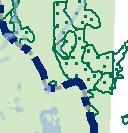


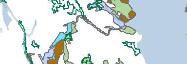


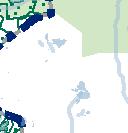


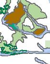
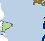


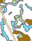


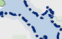

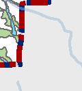

87 : Legend Original Boundary Expansion Area Electoral Area Boundary Old Growth Forest (< 250 years) Old Growth Management Areas Ungulate Winter Range Eelgrass Beds Anadromous Salmonids Resident Salmonids Not Specified Nelson sland Jervis Inlet Sunshine Coast Hwy. BC Ferry Route SEI Class Component 1 Cliffs Herbaceous Mature Forest Older Forest Kilometers! Thormanby Islands Egmont - Pender Harbour!!!!!!!!!!!!!!!!! Halfmoon Bay!!!!! Sechelt Inlet Salmon Inlet Sechelt Area B - Halfmoon Bay Official Community Plan SIGD Roberts Creek 85 West Howe Sound Thornborough Gambier Island Channel Riparian Wetland Woodland Young Forest Sunshine Coast Regional District Map 7 Natural Resources
88
89 ANNEX B Board of Directors SCRD 1975 Field Road Sechelt BC. VON 3A1 Planning and Development Committee Meeting Presentation July 18, 2013 Subject: Call For Protection of the Old Growth and Ancient Forests of BCTS Cuthiocks Dakota Bowl. Protecting them as Wildlife Habitat areas. Old Growth management areas, Archaeological Heritage sites or as Ecological Reserves. In the Directors / Committee NI embers. Regarding the SCRD s upcoming review and comments on BCTS Logging and Operational Plans we call on the SCRI) Board to consider our request, supported by the information and attachments that follow, to call on BCTS to cancel selling the l)akota Bowl cuthiocks and protect them as Wildlife Habitat areas Old Growth management areas, Archaeological Hiritage sites or as Loloica1 R.sta forest management to previously logged areas. es dditionall that the confinc their logging and We hope that the SCRD Board will support this effort. Background Some of the last great ancient Red and Yellow Cedars on the Sunshine Coast are threatened by BC Timber Sales cutblocks in the Dakota Bowl. on the backside of Mt. Elphinstone. Unfortunately they are threatened by BC Timber Sales (BCTS) TSL/cutblocks A84612 (DK045) and A (DK042. DK043 and DK044). Logging these areas will lead to the liquidation of this rare ceo-system where some of Canada s oldest trees can be witnessed. The Archaeological Branch in Victoria has Nation Culturally Modified Trees. Currently these sites protect Trees (CMTs) and these results are not based on CMTs and other features likely exist. 7 protected sites ina846l2 (DK045) set aside for definite Culturally Modified complete surve of this block and many more a 17 1st From studying maps we found that the DK045 cuthlock Areas (WHA). The BCTS logging would split this WHA protect the Marbled Murrelet seabird which nests only is in in located between 2 Wildlife Habitat half. This WHA was established to old growth forests. Outside of this proposed cuthlock and the WHA, the majority of the surrounding Age Classes on the high slopes between years old. This of Mt. Elphinstone are rated at Age Class growth yellow cedar to Highway 101 ecological values. Just one of the many features found Yews. 2 - is the closest old and thus holds awesome tourism potential due to its high this site at is its high number Pacific This presents an exciting opportunity for cultural and natural history education for nearby communities if all surrounding forests are protected. The forests revered in Europe and other parts of the world, but here in in Dakota Bowl would be BC the chain saws are ready to take 86
90 - them down. Growth at these sub-alpine elevations is very ery slow severely compromising tree farm re-growth and with climate change in full effect the mortality of Yello cedars is rising due to diminishing snow packs. Additionally, with respect to the Dakota Bowl cuthiocks ofa795l7 (DK042, DK043 and DK044) and others surrounding cutblocks that lie within the Dakota Community Watershed areas that drain into Howe Sound, it is our understanding that Teresa Fortin (SCRD Planner) commented last year to BCTS that the SCRD was opposed to logging in this area. In today s world of fragmented forest landscapes. connecti ity should rule. These sites need to he added to nearby Wildlife Habitat Areas (WHA) to help protect habitat ftr Black Bears. Marbled Murrelet. the variety of native plants. and the Cedar Heritage Trees. The Sunshine Coast cannot afford to lose anymore biodiversity that is locked up in these ancient fbrests, especially at this elevation. Action Steps Requested of the SCRD Therefore we are requesting that the SCRD. in its upcoming re ie a and commeni of BC IS operational and logging plans. call on BCTS to cancel selling these cutbiocks and protect them as Wildlife Ecological Reserves. I labitat areas. Old Growth management areas. Archaeological Heritage sites or as Call for the protection of: ij the Old (iro\vth. Ancient Forests and confirmed archaeological sitcs of BC ES cuiblock adko45 (localk kno a as the Roberts ( reek I 1 SI, A846 lead aters Ancient Forestk and ii) the Old Growth and \ncient Forests of the Dakota Boi area BC S TSLA7O51 7 euthlocks DK042. DK043 and DK(144, iii) AdditionaiR. ith respect to upper Li himaone Slopes request that BC logging and forest management to pre iousi logged jj5 I S conflne their 1 2 This is the last chance for the SCRD to speak up to BCTS and protect these old growth and ancient forests. Thank You Elphinstone Logging Focus wvvvv. loggingfoc us.org end7attachments 87
91 tapering - Photo I -, - Forest Rktck Ccimj A84612 HARVEST AREA SUMMARY 453- UTM:4t1474E.54gll82N H H Ltt & Lor 49 2X Block DK045,j -ta Harvest Method Hoe Thg2-162 Area(ha) 17.6 Volume/ha 573 TSL :+84 Volume (rn 3) [1ar est P RPO+6J3 / 7 Mapsheet 03+ Definite CMT L c- Opeatng Area P0; / -, TSAITSP 39 a Forest Pegion. Cot D,st ;ct Sur A DiRv 9 d General Location ID U - I Lat;tui 4g e n Note. Locations are approximate A and based upon handhold Mapping by Jim Stafford. August A Lorio;tude. 122 En1pNPy LYPA C atone 2012 map provided by J Stafford DiRv-12,- following reconnaissance of BCTS - Di Rv -10 Block DK045 DiRv l1 l ; Threetaperingscarsonsinglestem Photo 13 of A I tong tapering scar / Photo 11 & 12 of on sirlgte stem A A / Photo 9 & 10 of A / tong tapering scat Harrest Strategy preserved on stem -. tllparianlnformat Di Rv 13 (() WHA tapering scars on single stem - Tag ii - Four tapering scars on single stem+0 A Baseoata crcur S AA A, i Incus A Photo 6 of typical long tapering scar 3 a ok, o F+ C. u... - I n+0+04+d A I A Op+0Cr a 305d04+01e;bbSr ) I / 3 I ft I Pi ekodaten+.iio+t53as -x nre 0+5 t +000b0+0 -.rr odush e+i ICeS txre rr 10-.r+0lrIO +I?,lI> I- % _4+f3I I I II4+0.0,s; + +0Ir.+1,11 i * I / 5 of typical tong tapering scar D1v lb\ I \ \ / A DiRvl4 \ Photos 14 of Photo 7 & 8 of long scars tapering scar with with scar crust scar crust, / Ptryniegraptric Data 0K045 \ /..x +..+y..onr us. (one on ground) - > I x 50 1: 88 oar COO

92 -. -: - _r_-..k a s -V._ an.? $ I44- s.4 i i a, a - c _ F,.4 --4, _ _ 1 -._. -.: /.4- _ /.-,,s - I $ -, -t. E41u IRobertEOlee I - ar,aeia.._ 4. bkfla( -: H it i-fr. ioient r- DIest, * t4( *4 -. :t andcentiv- ed 4 Wa ArchRIuiirR,, 0KP44 -, 4-371( :.. HHSIhM i w a --S k $ =. S - [:a ctae;c IL:utEioo-: --- -(! N,,
93 N O4i1 5+ c7 /V/ 55 L/5?V/3?t/&/2Y&/ 90
94 Press Release July 8, 2013 ELPHINSTONE LOGGING FOCUS BC Timber Sales 2013 Logging Plans Presented Elphinstone Logging Focus (ELF) has reviewed BC Timber Sales (8CTS) 2013 logging proposal for the Elphinstone and Dakota Bowl areas. The scope of the logging incudes lower Elphinstone slopes. 2 cutblocks above Gibsons and 3 farms all are in maturing. intact and old-growth forests n 3 cutbiocks on the Dakota Bowl. None are in tree On June 3e, BCTS Staff met with EF in Sechelt to rev:ew the plan, followed by meetings with Sunshine Coast Reion& District (SCRD L and The Sechelt lrdan Band. The pn nc.uoes CiCOrCUt ogg ng a former rorestry research o or above the Roberts-Flume FSR, 2 blocks in the Clack Creek drainage. 2 blocks above Gibsors (one at the end of Reed Rdl and blocks in Dakota Bowl. including The Roberts Creek Headwaters Ancient Forest. 3 We are very concerned about the continued destruction of the Elphinstone forests and tne ancient forests in Dakota Bowl by BCTS. Aithough we appreciate meeting with them, they were basically telling us what they planned to go ahead with. without due consideration of what our forest protection grouo is seekng. states Ross Muirhead of ELF. We told them that piant it then they shouldn t be logging it. if they didn t BCTS keeps talidng about their harvesting plans to soften the impact of cutting valuable ntact, older forests that provide many more key values, other than just producing 2 x 4 s and telephone poles. Muirhead said. it s alarming to us that BCTS wants to log 1ocks in 3ctb I,500Ha Mt. Ephinstone Prov. Park expansion area that rna;onty of residents support Already 60% of the lower slopes have been logged, in another few years there won t be anything left to protect. Hans Penner of ELF remarks. We proposed to BCTS to cooperate in a study that will outline the highest and best use of these forests BCTS agreed to entertain tne dea, We have submitted a draft outline and we urge SCRD to also support it, Penner adds. The largest amount of forest cover ost oud be old, ancient forests year c a trees n 1 wou d be :ogged Dakota Bowl where 69-ia l70 acres) of very in the sub-amine. For more information contact: Elphinstone Logging Focus
95 Press Release June 25, 2013 ELPHINSTONE LOGGING FOCUS Extraordinary Number of Pacific Yews found in Roberts Creek Forest Elphinstone Logging Focus (ELF) has completed a tree survey of Pacific Yews in a Roberts Creek Headwaters forest and discovered a rare high density of this old-growth dependent tree. On June 21, ELF volunteers visaed a BC limber Sales Block DK045 and conducted a tree survey looking for all of the Pacific Yews at this site. The community knows this forest as The Roberts Creek Headwaters Ancient Forest where ELF has conducted several public walks. The team walked the full length and breath of the proposed cutblock. Some of the Yews emerged from a single base, in which case, it was counted as one tree. The total number came to an astonishing 340 Pacific Yews in a single 1 5Ha patch. There are 10+ instances of Yews growing around the base of the Yellow-cedar suggesting a symbiotic relationship between the 2 species. The growing conditions for Yew are optimal at this site, with a high under-storey creating suitable shade conditions. wet, rich organic soils, and a stable forest regime. states Ross Muirhead of ELF. We are going back in here this Sunday and invite the public to join us to see this specutualr forest. Information is available at our web site: There s certainly nothing quite like this forest on the entire Sunshine Coast. Muirhead concludes. In a search of the Ecological Reserves in BC, there isn t a reserve devoted to the protection/education of the Pacific Yew. ELF has made a request to BC Timber Sales to protect this forest and have it nominated it as an Ecological Reserve. The Ministry of Environment has assigned an Ecologist to visit The Roberts Creek Headwaters Ancient Forest in August to conduct their own Pacific Yew tree survey based on these findings. For more information contact: Elphinstone Logging Focus Ross Muirhead
96 equivalent ELPHI NSTON LOGGING FOCUS FOR IMMEDIATE RELEASE: September 26, 2012 I Roberts Creek, BC Canada New Archaeological Sites Created to Protect Culturally Modified Trees in the Roberts Creek Headwaters Ancient Forest Elphinstone Logging Focus (ELF) is pleased to advise the community that seven (7) new Archaeological Sites have been created to protect seventeen (17) definite Culturally Modified Trees (CMTs). These CMTs. and now Archaeological Sites, are located within BC Timber Sales (BCTS) cutblock DK045 locally known as the Roberts Creek I leadwaters Ancient Forest. At the invitation of ELF, on July 19 and 20, 2012 two respected professional archaeologists, Jim Stafford and John Maxwell, undertook a reconnaissance of BCTS block DK045. Jim Stafford and John Maxwell have extensive experience identifying and recording CMTs in coastal BC and have documented high elevation yellow cedar stands containing dense clusters of CMTs. In the report to Ewan Anderson of the Archaeological Branch. Jim Stafford writes, Our survey resulted in the identification of many cedar trees which we are confident are CMTs. As few red cedars occur. almost all of the CMTs are yellow cedar. Tie further notes. We also identified other patterns on the landscape which raise our confidence in identifying the scarred trees as being CMTs such as probable CMTs clustered near Roberts Creek itself and, It was also apparent that cedar trees smaller than about 60 cm exhibited no scarring, with the exception of a few we identified as likely bark stripped CMTs. The decline of local Indigenous populations during the 1800 s could explain the lack of more recent scars. In a subsequent , Jim Stafford asks Ewan Anderson to please note that this is in no way a complete survey of this block and many more CMTs, and possibly other features, likely exist. In our view, and that of many others who have become aware of the natural and cultural heritage these last remaining stands of ancient forests represent, it is time to take them off the BCTS sales list permanently, including nearby proposed blocks DK042, DK043 and DK044 with similar ancient forest characteristics says Hans Penner of ELF. Remember that you can never replace these rare old yellow-cedar forests that contain trees that are over a thousand years old. When standing amongst them, you are truly in a cathedral to the cathedrals of Europe, but what we have here are natural living cathedrals. adds Ross Muirhead also of ELF. For further information contact: Elphinstone Logging Focus I or iconi 93
97 between ELPH NSTOIE LOGGING FOCUS LOGGING IN ROBERTS CREEK HEADWATERS PLANNED BY BC TIMBER SALES FOR IMMEDIATE RELEASE: JUNE 20, 2012 Elphinstone Logging Focus (ELF) has conducted an expedition into the headwaters of Roberts Creek (Sunshine Coast) and located a proposed BC Timber Sales Cutblock A84612 (DK045). There are 2 headwater tributaries in this area that make up the main channel of Roberts Creek which eventually flows into the Salish Sea. One of the tributaries that ELF followed runs off the back side of Mt. Elphinstone. The surveyed cutblock and logging road is across steep terrain and encompasses an Age Class 9 (old growth) forest. From studying maps we found out that the cutblock is located between 2 Wildlife Habitat Areas (WHA). The BCTS logging would split this WHA in half, states Ross Muirhead of Elphinstone Logging Focus (ELF) a Sunshine Coast forest protection group. This WHA was established to protect the Marbled Murrelet seabird which nests only in old- growth forests. Outside of this proposed cutblock and the WHA, the majority of the surrounding Age Classes on the high slopes of Mt. Elphinstone are rated at Age Class years old. This is the closest old growth yellow cedar to Highway 101 and thus holds awesome tourism potential due to its high ecological values. One of the highest populations of Pacific Yew is found at site, with clusters of 4-5 Yews growing at the bases of the giant Yellow Cedars. BCTS has said they will sell this block in the Fall of 2012 we say this Crown land needs protection. Muirhead adds. Two parcels in the A84612 block on Dakota Ridge were granted OGMA status by BCTS several months ago after ELF brought their possible destruction to the attention of the community. ELF is calling block DK045 The Roberts Creek Headwaters Ancient Forest given that the water source for Roberts Creek begins here and that trees in this forest range from years old. Hans Penner of ELF notes, It would be a travesty if this forest is logged. Logging it also poses a high risk to downstream fisheries and water users on the lower reaches of Roberts Creek. We will be sketching out a trail as soon as possible into this forest so that community members can get in and see this amazing forest. It is hard to believe that logging these rare yellow cedar forests is even being considered in this day and age Roberts Creek residents will be shocked to learn that the headwaters of their namesake creek could be wiped out with unknown long term consequences. Elphinstone Logging Focus is calling on BCTS senior Forest Planners to place this parcel into an OGMA, thus ensuring a connection between the two Wildlife Habitat Areas, ensuring that a heritage-ancient forest remains intact, and the protection of the headwaters to Roberts Creek is guaranteed for generations to come. For further information contact: Ross Muirhead Elphinstone Logging Focus
98 16. i Reporter Friday Ju 2 L1 Logging plans B.C. Timber Sales (BCTS) has submitted its operational plans for he Sunshine Coast to,ie regional district for revi w and comment. Planning staff h e reviewed the plans a9d referred them to the acvi sory planning commissions in Pender Harbour/Egmo t Roberts Creek, Elphinstone and West Howe Sound, d will also forward them o the natural resources ad sory committee. Staff intends to report cn the operational plans at tl July 18 planning and deve opment committee mee - ing, planner Teresa Forti: reported. BCTS has asked fc comments to be submitte before September. In related business. th committee recommended sending the revised drat communication protocol between BCTS an SCRD to BCTS for signatur. 95
99 Board of Directors SCRD 1975 Field Road Sechelt BC. VON 3M Planning and Development Committee Meeting Presentation July 18, 2013 Subject: Proposal to Study l500ha Elphinstone Community Interface Zone Directors / Committee Members. Below is the proposal we have made to BC Timber Sales (BCTS) first discussed at our meeting with BCTS in June. We hope that the SCRD Board will support this effort and communicate this support to BCTS to have future decisions in this area based on sound scientific study and community participation. Proposal to Study lsooha Elphinstone Community Interface Zone Roberts Creek, Sunshine Coast, BC June, 2013 Background The proposed study area is located above the residential areas of Roberts Creek between the Town of Gibsons and the District of Sechelt. The lsooha area was identified as an environmentally important site in The Land for Nature Project initiated in (Excerpt re the lsooha attached). A complete copy of this Project is available in the Sechelt and Gibsons public libraries. The lsooha Park / Protected area proposal is included in the recently adopted Roberts Creek Official Community Plan. The area is also identified as a Community Interface Zone by the Ministry of Forests. (See attached maps). Logging activity in the l500ha area has been very controversial. In 2012, the logging of TSL A87124 by BC Timber Sales (BCTS) and blocks EW 001 and EW 002 by the Sunshine Coast Community Forest (SCCF) resulted in a number of roadblocks, injunctions and finally in over a dozen arrests. Proposal To avoid conflict in the community and provide guidelines for the long term use of this area, Elphinstone Logging Focus (ELF) proposes a detailed professional study of the lsooha 96
100 Elphinstone Forest. This study would build on the analysis done in the 1990s and further broaden the scope to include an assessment of the natural services provided by the environment of the site. The Sunshine Coast Community would be consulted and invited to participate including First Nations, Community Organizations, Recreation Groups, Forest Industry, BC Parks, Sunshine Coast Regional District, Conservation Organizations, Tourism Operators and others. We are convinced that only such a professional study can form the foundation of a long term sustainable use of the area and hopefully become a key component of a larger Land Use Plan for the Sunshine Coast. Funding and Terms of Reference If we can agree to proceed with a study as suggested, detailed Terms of Reference will have to be prepared which then would be used as the basis for Requests for Proposals. It is understood a study of this nature would have a significant financial cost. Funding sources will have to be found. For its part, ELF is prepared to make a commitment to contribute at least $5, to this Project. Action Steps Requested of the SCRD Request the SCRD respond and send a message to BCTS and comment indicating: I) support in principle the concept of this study proposal. ii) that there be a moratorium on logging while this study proceeds iii) Additionally, with respect to the lower Elphinstone Slopes request that BCTS confine their logging and forest management to previously logged areas. Thank you Elphinstone Logging Focus encl,/attachments 97
101 43bsoflS & Distrkt Pubiic Libra r Nature Land for [NVIRO NMENTALLY IMPORTANT SITES AND STREAMS ON THE Map in pocket at back of binder. 110A81 Funded by: Nature Land for Federation of SC Naturalists BR?iIsF1 COLUMB Ministry of Envlronment Lands and Parks Fisheries Urban Salmon Habitat Program ACTION 21 Environment Canada Working rogjzer fora hethhier environment ACTION 21 Environnement Canada zsenthie. vvishlons a amdrs I nkioraamnv# sthn wwf C,AD Nature Land or -,%- An Initiative By The Federation of British Columbia Naturalists West Broadway, Vancouver, B.C. 6H 4A9 Telephone (604) Fax (604) internet home page 98
102 Squarnish Sumas Nature Land for Land for Nature an initiative by The Federation of B. C. Naturalists The Federation of B.C. Naturalists is a non-profit, umbrella organization of the many local naturalists clubs throughout the province. Its goal is to promote the understanding and enjoyment of nature by education through field trips, lectures, and publications. It is a respected, effective voice on issues of conservation and preservation in B.C. Land for Nature was established by the Federation of B.C. Naturalists in 1990 to assist naturalists and other community groups to identify and protect critical habitat increasingly threatened by urban growth and development. Land for Nature, with funding from a variety of government and non-governmental partners, works with local naturalists to conduct habitat inventories, bird surveys, and host workshops and seminars on conservation issues. Both the FBCN and Land for Nature participate in local, regional and provincial land use planning processes, and help to frame public policy. This binder is part of the Land for Nature project Identfication and Mapping ofstreams and Environmentally Important Sites on the Sunshine Coast. The binder along with the companion map, Environmentally Important Sites and Streams on the Sunshine Coast, are some of the final products of the Urban Habitat Protection Program that was initiated in 1995 by Andrew Bales, New Product Coordinator of Land for Nature and Bob Phillips, Director of Land for Nature. This project was made possible by our funders and the many volunteers that nominated sites and provided support and technical assistance. Project coordination and management was provided by the contract staff of Land for Nature and Elkhart Bell International (Bob Phillips ). Bob Phillips, MBA - John Boulanger, MSC - Lisa Matthaus, MA - Sunshine Doreen Olson - Leah Hartley, Mcw - Okanagan Director, Land for Nature Odete Pinho, BES - Field Ecologist Denis Knopp - Lower Mainland Coordinator Prairie Coordinator Coast Coordinator Kye Goodwin, BSc - Sunshine Coast Ecologist Development Coordinator Tor Rognmo - Okanagan Shuswap LRMP Coordinator Multi media Specialist Landfor Nature Management Advisor, Committee: Nils Hoeg - Dr. Dick Stace-Smith, Allan Brooks, Ed Andrusiak, Dr. Bert Brink - Chair Honourary Director 99
103 - Forestry it Elphinstone Forest Map Reference #2 SiTE DATA TRIM Map #: 92G.042 Airphoto #: 30 BCB90014 No Electoral Area: D Site location and access This large area of forest is north of and above the residential areas of Roberts Creek and below the clear-cut areas higher on the slope. It extends almost the full length of Roberts Creek (Electoral Area D), from Wilson Creek in the west to Clough Creek in the east, a distance of about 8 km. There are several road access points to the area. Two of the most used are the Roberts Creek Forest Service Road which joins Hwy. 101 at Cliff Gilker Park, and the top of Field Road above Wilson Creek Mall. OCP N/A UTM #: Designation Site Ownership Current Use Adjacent Use Provincial Forest; 140 ha have now been protected under the provincial Protected Areas Strategy. (logging and silviculture) - Ministry of Forests research in Roberts Creek study forest. - Non-commercial mushroom foraging, especially for chanterelles - Extensive commercial pine mushroom harvesting - Recreation (hiking, mountain-biking, etc.); a well marked and maintained trail system is emerging from volunteer efforts - Protected areas (140 ha) Forestry and residential. SITE DESCRIPTION Size (approxj: 1500 ha Elevation (range): 150 to 700 m. Biogeoclimatic CWHxm1, CWHdm, Zone(s): CWHvm2 Habitat Type Wildlife Habitat Values Species Known to Occur Associated Creeks and Lakes Maturing low-elevation coniferous forest with old-growth attributes, cascading streams. This site has some old-growth characteristic forest that has never been clear-cut, so it retains a diversity of tree species and ages, much large woody debris and many cavity trees. Amphibians: The Tailed Frog (a Provincially blue-listed species) has been found in each creek that has been investigated including Roberts, Clack, Flume, East Wilson and Gough Creeks. Other amphibians that have been identified in this site: Ensatina Salamander, Red-legged Frog, Tailed Frog, Rough-skinned Newt, Northwest Salamander, Pacific Treefrog, Long-toed Salamander and Western Red-backed Salamander. Fish: Resident cutthroat trout and dolly varden occur in most of the larger creeks. Birds: This area supports many of the species associated with late successional second growth forests on the Sunshine Coast (see list in Appendix 2). Ii is particularly important for the Redbreasted Sapsucker, Hammond s Flycatcher, Pacific Slope Flycatcher, Red-breasted Nuthatch and Brown Creeper. Small mammals: In roughly descending order of abundance: masked shrew, vagrant shrew, redbacked vole, deer mouse, long-tailed vole (from Linda Dupuis s work in the MoPs Research Forest). Robinson Creek: Cutthroat trout are present. Flume Creek: The Sechelt Fish & Game Club did some work on the creek in the late 1970s and early 80s, however impassable falls near the tidal zone continue to prevent fish passage. The creek is subject to low summer flows, with only a few pools remaining during dry periods. Flume Creek has been heavily impacted by urban development and road construction, and there is active logging in the watershed. Species present are coho, chum and cutthroat trout. Malcolm Creek: The lower section of the creek was channelized in It now appears to be good fish habitat. The creek has good flows - does not dry in summer - and is excellent spawning and rearing habitat. There is spawning to the culvert at 0.5km from the mouth. Species present are resident cutthroat trout. DFO inventory and assessment is to be carried out in Stevens Creek: Coho, chum, steelhead, and cutthroat spawn in the bottom m (to Lower Road). DFO inventory and assessment is to be carried out in Sunshine Coast Inventory of Environmentally Important Sites 100
, Roberts Creek East Branch, East Malcolm Creek, Clough Creek and at least one unnamed creek.")
104 Elphinstone Forest Map Reference #2 Other creeks associated with this extensive site include East Wilson Creek, Gough Creek. Clack Creek, Roberts Creek (see site #37), Roberts Creek East Branch, East Malcolm Creek, Clough Creek and at least one unnamed creek. Vegetion Entire site - Inventory Site mushroom list from Paul Kroeger. General Site Description The Elphinstone Forest is most representative of the ecology of the Sunshine Coast. Gentle slopes, typically around 10% to 15%, a south-west aspect, low to middle elevations and well to moderately drained soils, combine here to grow almost uninterrupted coniferous forest. What is exceptional about the Llphinstone slope is that a serendipitous combination of fire and logging history has left intact a large area of natural low-elevation forest, In the 1860 s, before logging had begun, a catastrophic fire burned almost the entwe slope, leaving alive only large fire-resistant Douglas-fir. Some of these fire veterans were later felled by hand-loggers, especially lower on the slope, but most live on, centuries old, and in places in dense concentrations. At several different times through the twentieth century the area has been selectively logged for the old-growth red cedar that was killed in the fire. This was done with relatively little disturbance because the wood was cut to shake-block size on site and taken out by flume or on minimal roads. The regenerating fir and cedar were not quite large enough to be cut in early power-logging days, especially as there was still older growth available. So it is only recently that clear-cut logging has started in this area. The forest that has regenerated naturally after the fire is dominated by Douglas fir well over 100 years old, with many trees on better sites now approaching a metre in diameter. Red cedar and western hemlock are also major species, and unlike Douglas fir, are everywhere present as seedlings and juveniles under the forest canopy. Oldgrowth cedar that survived the fire are widely scattered but much less common than old-growth Douglas fir. Oldgrowth western hemlock is very rare, so far reported from just two small areas that apparently were not burned. Less common tree species include grand fir and western white pine that grow as widely scattered individuals now generally of canopy height, and western yew, always growing in the understory. A few large rock outcrops support shore pine but no arbutus. Some wetter areas have Sitka spruce, sometimes in small stands. One site with old growth Sitka spruce is known. Under the trees, the shrub and herb layers are generally sparse and monotonous. In the dry summer the biodiversity on the forest floor is not apparent, but in autumn mushrooms appear in great variety. Many of these fungi are mycorhizal, that is, they live in a dose, mutually beneficial partnership with the trees, trading water and minerals collected from the soil for sugars created in the canopy above. The species of fungi clearly differ from place to place through the forest. The relationships between these complex fungal populations and stand species and age composition are poorly understood. Jim Pojar, a senior researcher for the B.C. Forest Service has written, Fungi play fundamental roles in nutrient and energy dynamics, and our lack of knowledge about them is appalling. Despite their importance ecologically and the irreplaceable service they provide to our silvicultural efforts, their continued survival is generally taken for granted; The nominators of the Elphinstone Forest have tried to bring forward the idea that mushrooms too are an element of biodiversity and may need to be protected. Given the state of our ignorance only the preservation of intact forest ecosystems can ensure that this complexity is not diminished. The Elphinstone Forest is now a rare forest type. Of all the forest in the CWHdm biogeoclimatic subzone, only 6% is as old or older. Paul Kroeger, considered one of the most knowledgeable field mycologists in western Canada, has written that the Elphinstone forest appears to be especially diverse in mycota, compared with other south coast sites. His discovery of a rare species, now believed to be Thcholoma apium, in the Roberts Creek Research Forest, generated controversy but did not prevent the destruction in 1996 of most of its known habitat in North America that is, the clear-cut block of the research forest. Arguments about its rarity may continue but it is worth noting that it wasn t found in the autumn of 1996, despite increased interest, but was found again in the Elphinstone Forest in the particularly wet summer of This forest is habitat for several interesting plants that live without photosynthesis below the soil surface, appearing above only when they flower. These are often described as saprophytic that is, living on dead organic matter, but it is probably more accurate to say that they are parasites on the mycorhizal relationship of the trees and mushrooms and so will only be found in forest where these relationships are well established. These include the gnome plant (Hemitomes congestum), pinesap (Hypopitys monotropa), candystick (Ailotropa vi,gata), Indian pipe (Monotropa unora), and western coralroot (Corallothiza maculata). Three small, special sites, totaling 140 ha have been selected for protection within the original 1500 ha Elphinstone Forest Protected Area Strategy proposal. One site is near the upper elevation limit and contains 2 or 3 ha of wetter ground on which the old-growth hemlock has survived, as well as impressive old-growth fir and cedar. A second area at mid-elevation contains a dense concentration of Douglas fir veterans. In a single square 1 ha block, 50 old-growth trees have been counted. This veteran stand is only one of many identified by the nominators. This area also includes the largest veteran so far recorded from the slope, a giant 2.3 m in diameter in the ravine of Roberts Creek. A third area, near the top of Crow Road, harbours about 3 ha of old growth forest. A linear wet area with some surface water flow supports at least 15 Sitka spruce, some over a metre in diameter, and many more red cedar, both Sunshine Coast Inventory of Environmentally Important Sites 101
105 Elphinstone Forest Map Reference #2 of old-growth age. At least one old hemlock is present, further supporting the idea that the fire somehow missed this patch. Younger hemlock, dwarfed by the site and heavily affected by mistletoe, add to the special appearance of this spot. Dwarf dogwood (Comus canadensis) occurs here, a plant common higher on the slope but unusual at this elevation. Issues The present intention of the Ministry of Forests is to log the majority of this area. A Local Resource Use Plan (LRUP) for Mt. Elphinstone (8400ha), involving the public and encompassing the nominated site, was underway for six years with the intention of developing a higher level plan for the area that would recognize all relevant values. However, the process was terminated by the Ministry of Forests in February The Landscape Unit Plan for Mt. Elphinstone is instead being done internally by the Ministry of Forests in conjunction with that for the Chapman (sites #4, ) and Gray Creeks Watershed (#44) and Mt. Richardson (21). The biodiversity emphasis option was tentatively set at intermediate, but it is possible that this will drop to low. At this level, 9% of the harvesting land base will be designated as old growth retention areas, though not all of this must consist of old growth trees. Old growth retention in intermediate areas is 13%. Visual Quality Objectives for the area will be approved soon. Proposals for A public campaign, supported by the World Wildlife Fund and the BC Environmental Network, is protection or underway to educate the public about the importance of the area for its mushroom diversity and as remediation a representative of an under-protected forest type, and to rally support for full protection. Much of the area could be protected as a Forest Ecosystem Network. The biodiversity emphasis for the whole landscape unit, including as it does this site, two major parks (the Tetrahedron and Mt Richardson) and Chapman Creek (major salmon stream and the primary water supply for the Sunshine Coast), should be set at high rather than intermediate or low. Biodiversity values could also be protected by designating the site as environmentally sensitive under the Forest Practices Code, thereby placing the area under joint management of the Ministry of Forests and the Ministry of the Environment, Lands and Parks. Pockets of old-growth, as identified in the Elphiristone Forest Plan Committee s response to the MoF s draft Chapman Landscape Unit Plan and draft Mt. Elphinstone Forest Management Plan, may qualify for low elevation old growth retention. Further Research paper on amphibians and small mammals: The Response of Amphibians to Various information Silvicultural Treatments in the Roberts Creek Experimental Forest Study Forest, by Linda Dupuis, MSc., unpublished, presented to the Ministry of Forests. lichen list Terry Taylor moss Mt. Elphinstone LRUP proceedings Elphinstone Forest Plan Committee Mt. Elphinstone Forest Watch Mt. Elphinstone Research Forest (M0F) & Chapman Landscape Unit Plan (draft); Mt. Elphinstone Management Plan (draft); Small Business Forest Enterprise Program Five Year Plan (draft) Planner) Rick O Neill (re: amphibians) - all MoF (contact: Brian Smart, DFO FISS reports available on Robinson (Watershed Code ), Malcolm ( ), Roberts ( ), Flume ( ) and Wilson ( ) Creeks Sunshine Coast Inventory of Environmentally Important Sjtes 102
106 Elphinstone Forest Map Reference #2 VEGETATION INVENTORY Mushroom species identified from the Elphinstone Forest (1983 to 1996) by Pau Kroeger; 165 species. Agancus semotus, Agancus syivaticus. *Albafrellus ellissii, Aleuria auraritia. Amanita aprica, Arnanita constricta, Amanita gemmata, Amanita porphyria, Amanita silvicola, Amanita smithiana, Armillana meiiea, Beauvaria bassiana, Bisporella citrina, Boletopsls leucomelaena, Boletus edulis, Boletus mirabilis, Boletus piperatus, Calocera cornea, Caloscypha fulgens, Cantharellus cibarius, Cantharellus infundibuliformis, Chroogornphus tornentosus, C/a varia purpurea, Clavulina cristata, Clitocybe clavipes, Clitocybe dilatata, Collybia con fluens, Collybia dryophila, Con olus tomentosus, Corlo/us ve,sicolor, Cortinarius affin canus, Cortinarius cinnamomea, Con inarius croceofolius, Cortiriarius glaucopus, Cortinarius semisanguineus. Cortinarius traganus, Cortinanus vanduserensis, Cortirianus v/brat/us, Crepidotus applanatus, Crepidotus mo//is, Crucibulum laeve, Cudonia circinans, Cudonia monticola, Cudoniella c/a vus. Entoloma lividum, Entoloma sinuatum, Entoloma verne. Fomes fornentarius, Fornitops/s pinicola, Fuligo septica, Ganoderma applanatum, Gautiena monticola, Gomphidius subroseus, *Gomphus c/a vatus, Guepiniopsis alpinus, Gymnopilus penetrans, *Gyrnnopilus punctifolius, He!ye/la elastica, He/vet/a macropus, Helvella macropus, Hydneilurn aurantiacum, Hydnellum peck/i, Hydnellum regium, *Hydnum repandum var. album, *Hydnurn umbi/icatum, Hygrocybe cantharellus, Hygrocybe laetus, Hygrocybe miniata, Hygrocybe psittacina, Hygrocybe turunda, Hygrophoropsis aurantiaca, Hygrophorus bakerensis, Hygrophorus saxatilis, Hymenogaster sp., Hypholoma capnoides, Hypholoma fasciculare, Hypomyces cervinogenus, Hypomyces ch,ysospermus, Hypomyces cf tiyalinus, Hypomyces luteovirens, lnocybe ca/am/strata, Inosybe geophylla, lnocybe olympiana, Inocybe atfin. calamistrata, Kuehneromyces lignicola, Kuehneromyces muta bills, Laccaria amethysteo-occidentalis, Laccaria laccata, Lactarius affin. pa/lidus, Lactarius deliciosus, Lactarius kauffmariii, Lactarius luculentus, Lactarius pseudomucidus, Lactarius rubn lactus, Lactarius trivia/is, Laetiporus suiphureus, Lepiota clypeolaria, Lepiota c!ypeolarioides, Lycogala epidendron, Lycoperdon pyriforme, Ma,asmiellus candidus, Marasmius androsaceus, Marasmius candidus, Mycena a/cal/na, Mycena aurantiidisca, Mycena awantiidisca, Mycena aurantiomarginata, Mycena Cf a/cal/na, Mycena eplpfyrigia, Mycena haematopus, Mycena pura, Mycena stylobates, Mycena subsanguinolenta, Omphalina wynniae, Panaeolus foenisecii, Panellus stipt/cus, Paxi/lus atrotomentosus, Phaeolus schweinitzii Phiebia radiate, Pholiota scamba, Phylloparus rhodoxanthus, Pleuracybella porrigens, Pleurotus dryinus, Pluteus atromarginata, Pluteus cervinus, Polyporus bad/us, Polyporus picipes, Pseudoarmillariella ectypoides, Pseudohydnum gelatinosum, Psilocybe crobula, Ramaria cystidiophora var.citronel!a, Ramar/a formosa, Rarnana formosa, Ramaria stricta, Rozites caperata. Russula albonigra. Russu/a brev/pes var. acr/or, Russula cascadensis, Russula claret/eva, Russula emetica, Russula laurocerasi, Russula nigricans, Russula msea, Russula xerarnpalina, Saroosphaera crassa, Sparrassis crispa, Spathu/ana flavida, Suillus brevipes, Suit/us lakei, Suil/us subolivaceus, Tarzetta cupularis, Tricholoma albobrunneum, Tricholoma apiurn, Tncholoma catigata, Tricholoma magnive/are. Tricho/orna pardinum, Tricholoma platyphyliurn, Tricholoma sejunctum. Tr/choloma virgatum, Thcho/omopsis decora. Truncocolume/la citrina, Tyromyces a/be//us, Xeromphatina campane/la. Xeromphat/na fulvipes. Xylaria hypoxy/on * Species listed in United States Standards and Guidelines for Management of Habitat for Late Successional and Oldgrowth Forest Related Species Within the Range of the Northern Spotted Owl. Sunshine Coast inventory of Environmentally Important Sites 103

107 7 9:! t fl V 104

108 OWNERSHIP CrtM1 Ccnbibutlng flmberucee Woodlots CrowGants, Losses Riot Nattons ReseMs P* UREP, Ecdogkcl Reeives cnunytntefathna FZ9 MWpatBCUndY Ferest Oteatot Bow Sati Water Lakes, Rkess Scale 1:300,000 June 27, 2001 Pm the Minlstiyof Forests Vancouver Forest RegIon GIS Team 105
SUNSHINE COAST REGIONAL DISTRICT. January 11, 2018
 SUNSHINE COAST REGIONAL DISTRICT January 11, 2018 MINUTES OF THE MEETING OF THE BOARD OF THE SUNSHINE COAST REGIONAL DISTRICT HELD IN THE BOARDROOM AT 1975 FIELD ROAD, SECHELT, B.C. PRESENT: Chair B. Milne
In July 2000, City Council adopted an. Environmental Protection Program for. the City of North Vancouver.
 In July 2000, City Council adopted an Environmental Protection Program for the City of North Vancouver. Chapter 8 Environment 8.1 RELATIONSHIP TO OUR VISION The Environment is core to our vision of a sustainable
Lincoln - OFFICIAL PLAN PART 1 INTRODUCTION 1.1. THE COMMUNITY VISION
 Lincoln - OFFICIAL PLAN PART 1 INTRODUCTION 1.1. THE COMMUNITY VISION The vision for Lincoln is to be a Centre of Excellence for Agriculture; an inclusive community that values diversity, partnerships,
PLANNING AND DEVELOPMENT COMMITTEE May 14, 2015 SCRD Board Room, 1975 Field Road, Sechelt, BC AMENDED AGENDA
 PLANNING AND DEVELOPMENT COMMITTEE May 14, 2015 SCRD Board Room, 1975 Field Road, Sechelt, BC AMENDED AGENDA CALL TO ORDER 9:30 a.m. AGENDA 1. Adoption of the Agenda DELEGATIONS 2. Matt Thomson, Coordinator,
O f f i c i a l C o m m u n i t y P l a n
 City of West Kelowna O f f i c i a l C o m m u n i t y P l a n CI T Y OF Page intentionally left blank for double-sided printing Document Overview The Official Community Plan has been organized into four
REGIONAL GROWTH STRATEGY
 THOMPSON-NICOLA REGIONAL DISTRICT REGIONAL GROWTH STRATEGY Bylaw 2409, 2013 Source: Picture BC Thompson-Nicola Regional District 300-465 Victoria Street Kamloops, BC V2C 2A9 Telephone: 1-250-377-8673 Toll
Community Vision and Core Values DRAFT SEPTEMBER 2013
 Community Vision and Core Values DRAFT SEPTEMBER 2013 Introduction Plan Rapid City is the effort to update the Rapid City Comprehensive Plan, a long-range planning strategy that will provide a blueprint
Provincial Policy Statement 2014 Training Aid
 This job aid has been developed for education and training purposes as a high-level summary of the policy changes in the PPS 2014. It should not be relied upon as a substitute for specialized legal or
SUNSHINE COAST REGIONAL DISTRICT STAFF REPORT
 SUNSHINE COAST REGIONAL DISTRICT STAFF REPORT TO: Planning and Community Development Committee July 12, 2018 AUTHOR: Andrew Allen, Manager, Planning and Development SUBJECT: EGMONT/PENDER HARBOUR OFFICIAL
PROJECT UPDATE. Your town. Your plan. Your future.
 PROJECT UPDATE Your town. Your plan. Your future. Agenda Project Overview o Work-to-date OCP Highlights o Highlights Next steps Project Overview WORK-TO-DATE Project Overview Timeline Project Overview
Our Provincial Mandate
 June 27, 2012 Islands Trust Strategic Plan Potential Objectives and Strategies for 2011-2014 Discussion Draft for Public Consultation Preserving Island communities, culture and environment Our Provincial
Environment & Conservation Introduction
 Environment & Conservation Introduction Anacortes is blessed with an abundance of natural beauty. Residents identify marine shorelines, streams, lakes, forested areas, and other natural features as defining
Keep The Scenic Rim Scenic 19 th March 2013
 Keep The Scenic Rim Scenic keepthescenicrimscenic@gmail.com 19 th March 2013 Chief Executive Officer Scenic Rim Regional Council PO Box 25 Beaudesert Q 4285 mail@scenicrim.qld.gov.au Dear Sir, Re: Draft
Policy NR Maintain the natural and functional characteristics of Portsmouth s soils. (Related Policies: AG 1.1, LU 6.2)
") PORTSMOUTH DRAFT COMPREHENSIVE COMMUNITY PLAN POLICY STATEMENTS SUMMARY 1 NATURAL RESOURCES Policy NR - 1.1 - Ensure that new development and redevelopment in Portsmouth takes place in a manner which protects
PORTSMOUTH DRAFT COMPREHENSIVE COMMUNITY PLAN POLICY STATEMENTS SUMMARY 1 NATURAL RESOURCES Policy NR - 1.1 - Ensure that new development and redevelopment in Portsmouth takes place in a manner which protects
Lake Country. Our Home. Our Future.
 3. Environment and Sustainability 3.1 Existing Conditions, Goals, Objectives and Existing Conditions The District of Lake Country is renewing its commitment to protecting and enhancing the environmental
Chapter 8 Natural Resources
 Chapter 8 Natural Resources 127-134 8.1 Introduction 8.2 Extractives Industry 8.3 Forestry 8.4 Fishing / Aquaculture 8.1 Introduction Kerry has a number of naturally occurring resources that contribute
PRESENTED: March 27th th, 2007 FILE: Bylaw No FROM: Planning Department
 DISTRICT OF SQUAMISH REPORT TO: Council FOR: Regular PRESENTED: March 27th th, 2007 FILE: 2005-21 Bylaw No. 1873 FROM: Planning Department SUBJECT: Bylaw No. 1873 Logger s Lane Small Lot Residential Recommendation:
District of Muskoka Official Plan Review (MOPR) TOWARDS ESTABLISHING PLANNING POLICY DIRECTIONS OCTOBER 21, 2016 (REVISED MARCH 6, 2017)
 TOWARDS ESTABLISHING PLANNING POLICY DIRECTIONS OCTOBER 21, 2016 (REVISED MARCH 6, 2017)") District of Muskoka Official Plan Review (MOPR) TOWARDS ESTABLISHING PLANNING POLICY DIRECTIONS OCTOBER 21, 2016 (REVISED MARCH 6, 2017) Page 1 TABLE OF CONTENTS EXECUTIVE SUMMARY... 3 1.0 INTRODUCTION...
District of Muskoka Official Plan Review (MOPR) TOWARDS ESTABLISHING PLANNING POLICY DIRECTIONS OCTOBER 21, 2016 (REVISED MARCH 6, 2017) Page 1 TABLE OF CONTENTS EXECUTIVE SUMMARY... 3 1.0 INTRODUCTION...
WELCOME. RM of Big River Official Community Plan & Zoning Bylaw. The purpose of this Open House is: What is a Zoning Bylaw? Background information:
 WELCOME The purpose of this Open House is: To present highlights of the draft versions of proposed new planning bylaws (Official Community Plan and Zoning Bylaw) for the Rural Municipality of Big River
For additional copies of this document in either French or English, please contact:
 For additional copies of this document in either French or English, please contact: Ministry of Municipal Affairs and Housing Provincial Planning Policy Branch 777 Bay Street, 14 th Floor Toronto, ON M5G
MUNICIPAL PLAN BY-LAW
 BY-LAW NO. 07-02 MUNICIPAL PLAN BY-LAW BEING A BY-LAW OF THE TOWN OF SAINT ANDREWS TO ADOPT A MUNICIPAL PLAN The Town Council of Saint Andrews, under authority vested in it by the Community Planning Act,
CITY OF CAMPBELL RIVER PUBLIC HEARING AGENDA
 CITY OF CAMPBELL RIVER PUBLIC HEARING AGENDA PUBLIC HEARING MEETING, Monday, October 24, 2016 at 6:00 PM in the City Hall Council Chambers, 301 St. Ann's Road, Campbell River, BC. Page The agenda presents
Green - Green Space & Habitat
 Green - Green Space & Habitat Healthy and resilient ecosystems. Why green space and habitat matter: People, plants and wildlife all depend on healthy habitat. Green space makes our city more livable. It
Commercial Zoning Update
 Project Summary Applicant: Type of Amendment: Location and Size of Area: Current Land Use and Zoning: Neighborhood Council Area: Staff Recommendation: Planning Scope and and Development Assessment Services
STAFF REPORT. Permit Number: Tallman. Kitsap County Board of Commissioners; Kitsap County Planning Commission
 STAFF REPORT Permit Number: 15 00742 Tallman DATE: November 9, 2015 TO: FROM: RE: Kitsap County Board of Commissioners; Kitsap County Planning Commission Katrina Knutson, AICP, Senior Planner, DCD and
SCRD STAFF REPORT RECOMMENDATION BACKGROUND
 SCRD STAFF REPORT DATE: November 10, 2014 TO: Referral Agencies - November, 2014 FROM: David Rafael, Senior Planner RE: Marihuana Production Facilities and Development Permit Area Designation for Form
Conservation Authorities Act Review
 Conservation Authorities Act Review What it is: As a first step, the Ministry of Natural Resources and Forestry has developed a Discussion Paper which is posted on the provincial government s Environmental
RE: WAVERLEY WEST SOUTHEAST NEIGHBOURHOOD AREA STRUCTURE PLAN. Standing Policy Committee on Property and Development
 RE: WAVERLEY WEST SOUTHEAST NEIGHBOURHOOD AREA STRUCTURE PLAN FOR SUBMISSION TO: Standing Policy Committee on Property and Development ORIGINAL REPORT SIGNED BY: Development Director of Planning, Property
Provincial Policy Statement, 2014: Key Changes by Policy Area
 : Key Changes by Policy Area Policy Area Provincial Policy Statement, 2005 Healthy, Active Communities Northern and Rural Communities Support healthy, active communities by promoting efficient development
REGIONAL DISTRICT OF NORTH OKANAGAN. BYLAW No. 2500
 REGIONAL DISTRICT OF NORTH OKANAGAN BYLAW No. 2500 A bylaw for Regional District of North Okanagan to adopt a Regional Growth Strategy WHEREAS the Local Government Act provides that a regional board may
Your Bright Future: Municipal Development Plan
 Your Bright Future: Municipal Development Plan 2010-2020 Executive Summary OVERVIEW Municipalities face many challenges and opportunities. Central to a municipality s ability to provide a high standard
Maple Ridge Official Community Plan Policies that Support Community Greenhouse Gas Emissions Reduction
 Maple Ridge Official Community Plan Policies that Support Community Greenhouse Gas Emissions Reduction Transportation & Land-Use Sector Reduce transportation related energy use through compact communities,
Marihuana Production Facilities and Development Permit Area Designation for Form and Character (Areas D and E)
") SCRD STAFF REPORT DATE: September 24, 2014 TO: Planning and Development Committee- October 16, 2014 FROM: RE: David Rafael, Senior Planner Marihuana Production Facilities and Development Permit Area Designation
SCRD STAFF REPORT DATE: September 24, 2014 TO: Planning and Development Committee- October 16, 2014 FROM: RE: David Rafael, Senior Planner Marihuana Production Facilities and Development Permit Area Designation
Fish Habitat Protection Development Permit Area
 Appendix A2 3 Fish Habitat Protection Development Permit Area 1.0 PURPOSE: The area shown on Map No. 7 as the Fish Habitat Protection Development Permit Area is designated for the purpose of protecting
COUNTY COMPREHENSIVE PLAN
 86 : Policy Statement Lewis County has an abundance of natural resources, including water, wind, soils, and wildlife. Together with our citizens, they form a unique ecosystem that must be preserved and
District of Muskoka Planning and Economic Development Department. Lake of Bays Association Executive Committee
 Date: November 10, 2017 To: From: C.C. District of Muskoka Planning and Economic Development Department Lake of Bays Association Executive Committee Lake of Bays Association Board of Directors Township
5. How does the designation of these woodlots fit into FLNRO s Principles for locating new forest tenures of Nov 2011?
 1 QUESTIONS FROM THE GAMBIER ISLAND CONSERVANCY AND ANSWERED BY BRIAN KUKULIES, FLNRO, ABOUT THE PROPOSED NEW GAMBIER WOODLOTS (JULY 2013) Part 1 Planning and background questions Why more woodlots on
Province - Department of Municipal and Provincial Affairs Nunatsiavut Government. Activities Responsibility Timing
 SUBJECT: Consultation on land use laws Activity Sheet: 10-1 OBLIGATION: PARTIES: Consult on land use policy or development regulation in Labrador Inuit Settlement Area (LISA) outside Labrador Inuit Lands
Environment GOALS OVERVIEW
 Environment 10 GOALS 10 (A) Victoria s urban forests and public and private green spaces support healthy and diverse ecosystems. 10 (B) Victoria s Harbour, coastline, ponds and streams support healthy
PEEL REGION Bolton Residential Expansion Regional Official Plan Amendment DISCUSSION PAPER
 Bolton Residential Expansion Regional Official Plan Amendment DISCUSSION PAPER The Planning Partnership April 15, 2016 TABLE OF CONTENTS 1.0 Introduction... 2 1.1 Summary of the Application 2 1.2 Purpose
CATEGORY a protection of the natural environment, its ecosystems and biodiversity.
 29. ENVIRONMENTAL DEVELOPMENT PERMIT AREA CATEGORY a protection of the natural environment, its ecosystems and biodiversity. The requirement to obtain an environmental development permit is cited in Section
Lincoln - OFFICIAL PLAN APPENDIX 1 DEFINITIONS
 Lincoln - OFFICIAL PLAN APPENDIX 1 DEFINITIONS Where a term used in this Plan, or a definition in this Section, is inconsistent with a definition in the Provincial Policy Statement or Provincial Plan,
STAFF REPORT WASHINGTON STATE PARKS AND RECREATION COMMISSION COVERED SHELTERS AND BIKE RACKS
 STAFF REPORT WASHINGTON STATE PARKS AND RECREATION COMMISSION COVERED SHELTERS AND BIKE RACKS TO: Douglas County Hearing Examiner FROM: Douglas County Land Services Staff RE: SP-2019-02 DATE: April 8,
ANCR INDIVIDUAL RESPONSES SUMMARY: 2/11/04 WATER RESOURCES GOALS AND OBJECTIVES
 ANCR INDIVIDUAL RESPONSES SUMMARY: 2/11/04 WATER RESOURCES GOALS AND OBJECTIVES Goal 1: Protect the health and safety of the Dane County population. a. Prevent development that may have an adverse effect
CHAPTER 2: KEY TRENDS AND ISSUES
 CHAPTER 2: KEY TRENDS AND ISSUES As part of a major metropolitan region, Port Moody continues to be influenced by many of the same social, economic and environmental issues that face other communities
WHEREAS, in the Township of Denville 7 acres are in the Preservation Area and 8,155 acres are in the Planning Area; and ~ 4 ~
 WHEREAS, the New Jersey Highlands Region (Highlands Region) is an area of over 859,358 acres that consists of 88 municipalities in parts of seven counties Bergen, Hunterdon, Morris, Passaic, Somerset,
Name of Local Government: District of West Vancouver.
 Project Plan Whyte Lake Park Avoided Forest Conversion Green Communities Carbon Neutral Framework OPTION 1 1E: Avoided Forest Conversion Project (AFCP) Name of Local Government: District of West Vancouver
CITY POLICY POLICY NUMBER: C531 REFERENCE: ADOPTED BY: City Council Council July 2007 SUPERSEDES: Policy C467
 CITY POLICY REFERENCE: ADOPTED BY: City Council Council 1995 07 25 17 July 2007 SUPERSEDES: Policy C467 PREPARED BY: Office of Natural Areas DATE: 5 June 2007 Policy Statement: Since Edmonton was settled
Wildlife Management Area
 Proposed Wildlife Management Area A wildlife management area designation is being proposed for the Harrison-Chehalis area to conserve fish and wildlife habitats while also respecting existing and compatible
Community Benefits of Land Restoration
 Community Benefits of Land Restoration Introducing Green Infrastructure for Coastal Resilience Matt Fulda, Acting Director Monroe May 23 rd, 2017 Avery Point Campus, University of Connecticut Easton Trumbull
CLAREMONT CONSERVATION COMMISSION CONSERVATION PLAN Adopted 7/21/2016
 CLAREMONT CONSERVATION COMMISSION CONSERVATION PLAN Adopted 7/21/2016 THE CLAREMONT CONSERVATION COMMISSION The Claremont Conservation Commission provides the following services to the City: Advises residents
Bylaw , being "Official Community Plan Bylaw, 2016" Schedule "A" 5Improve. Natural + Built Systems
 Bylaw 2600-2016, being "Official Community Plan Bylaw, 2016" Schedule "A" 5Improve Natural + Built Systems Vision Abbotsford will become both more city and more country, where the city becomes more urban
STRATEGIC PLAN. Becoming Canada s Most Livable Community
 2013 2030 STRATEGIC PLAN Becoming Canada s Most Livable Community May 2018 Our Vision Living in Strathcona County Strathcona County, located in the heart of Alberta, is an energetic and thriving community.
Chair Robert Hobson, President
 TO: FROM: UBCM Members Chair Robert Hobson, President DATE: September 9, 2009 RE: PROPOSED RECOGNITION AND RECONCILIATION ACT Suite 60 10551 Shellbridge Way Richmond British Columbia Canada V6X 2W9 604.270.8226
Welcome. ngdale Terminal - Existing. What s Happening Tonight? Project Background. Purpose of the Public Information Session
 Welcome ngdale - Existing What s Happening Tonight? The purpose of this information session is to share details on the rezoning application that BC Ferries has submitted to the Sunshine Coast Regional
THURSDAY MARCH 26, 2015 AMENDED AGENDA
 SUNSHINE COAST REGIONAL DISTRICT REGULAR BOARD MEETING TO BE HELD IN THE BOARDROOM OF THE SUNSHINE COAST REGIONAL DISTRICT OFFICES AT 1975 FIELD ROAD, SECHELT, B.C. CALL TO ORDER 7:30 p.m. AGENDA 1. Adoption
S e c t i o n S u b d i vision
 S e c t i o n 2. 6 - S u b d i vision Subdivision is a process of defining and redefining land parcel boundaries and can provide a framework for future land use and development. Integrated, well planned
14. Sustainable Forestry Principals
 14. Sustainable Forestry Principals Fish River Lakes Concept Plan Addendum Materials April 2018 14. SUSTAINABLE FORESTRY PRINCIPLES In response to our discussion with LUPC Staff and others on the topic
Drinking Water and Watershed Protection Program
 Drinking Water and Watershed Protection Program Submission for: 2010 UBCM Community Excellence Awards Regional District of Nanaimo 6300 Hammond Bay Road Nanaimo, BC V9T 6N2 250-390-6560 Summary Here on
C O N T E X T. A VISION FOR THE UPPER LANDS (Excerpt from June 2001 Upper Lands Report)
") C O N T E X T West Vancouver s forested g visual backdrop for both the community and the region. Planning policies for this 6,265 acre area, known as the Upper Lands, are long term and comprehensive, and
C O N T E X T West Vancouver s forested g visual backdrop for both the community and the region. Planning policies for this 6,265 acre area, known as the Upper Lands, are long term and comprehensive, and
TREASURE COAST REGIONAL PLANNING COUNCIL M E M O R A N D U M
 TREASURE COAST REGIONAL PLANNING COUNCIL M E M O R A N D U M To: Council Members AGENDA ITEM 5H From: Date: Subject: Staff July 16, 2010 Council Meeting Local Government Comprehensive Plan Review Draft
Draft RSS - Targets Backgrounder
 Draft RSS - Targets Backgrounder To be read in conjunction with the Draft CRD Regional Sustainability Strategy (RSS) Feedback Form. Part C: Targets Targets are a concrete way to represent what we mean
Council Directives for One Calgary
 2019-2022 for One Calgary imaginecalgary 100-Year Vision and Goals For thousands of years, people have met at the confluence of two vital rivers to imagine and realize their futures. Together, we have
Transportation Master Plan Introduction
 1. Introduction Building a Liveable Ottawa 2031 has set out a process to guide the completion of a fiveyear update of the City s Official Plan, Transportation Master Plan, Infrastructure Master Plan, Cycling
Vision, Goals, Objectives, and Land Use Scenarios Welcome
 Vision, Goals, Objectives, and Land Use Scenarios Welcome Event purpose is to: 1. present draft land use scenarios, as well as the vision, goals and objectives. 2. provide a project update and the next
District of Muskoka Official Plan Draft October 5, 2017
 Made in Muskoka District of Muskoka Official Plan Draft October 5, 2017 A land use and community development plan based on the principles of sustainability and recognizing the unique context of the District
The Toronto and Region Conservation Authority. request that the report be reviewed;
 GREENING OUR WATERSHEDS REVITALIZATION STRATEGIES FOR ETOBICOKE AND MIMICO CREEKS Including The Etobicoke-Mimico Report Card May, 2002 PREPARED BY THE ETOBICOKE AND MIMICO CREEK WATERSHEDS TASK FORCE November
RIVER ACCESS STRATEGY GUIDING PRINCIPLES & STRATEGIES
 RIVER ACCESS STRATEGY GUIDING PRINCIPLES & STRATEGIES SEPTEMBER 2015 RIVER ACCESS STRATEGY GUILDING PRINCIPLES & STRATEGIES TABLE OF CONTENTS Executive Summary... 3 The Need for a Strategy... 4 What the
Draft COASTAL SUSTAINABILITY CHARTER. and POLICY FRAMEWORK FOR COASTAL AUSTRALIA. Discussion Paper
 Draft COASTAL SUSTAINABILITY CHARTER and POLICY FRAMEWORK FOR COASTAL AUSTRALIA Discussion Paper Towards a national policy framework that integrates the environmental, social and economic wellbeing of
METAMORPHOSIS Conservation Halton Strategic Plan 2020 DRAFT
 METAMORPHOSIS Conservation Halton Strategic Plan 2020 DRAFT OPENING COMMENTS FROM HASSAAN BASIT In nature, metamorphosis is the biological process of transformation, differentiation and growth that many
o n e c i t y d i v e r s e p l a c e s Draft City of Swan Strategic Community Plan
 o n e c i t y d i v e r s e p l a c e s Draft City of Swan Strategic Community Plan 2012 2022 The Strategic Community Plan will become the principal strategy and planning document for the City, and will
LAND DEVELOPMENT AND PLANNING FORUM 2014 THE 2014 PROVINCIAL POLICY STATEMENT AND ENVIRONMENTAL PROTECTION
 LAND DEVELOPMENT AND PLANNING FORUM 2014 THE 2014 PROVINCIAL POLICY STATEMENT AND ENVIRONMENTAL PROTECTION MARY L. FLYNN-GUGLIETTI AND ANNIK FORRISTAL THE 2014 PROVINCIAL POLICY STATEMENT & ENVIRONMENTAL
enhance the significant values of the Highlands resources throughout the entire Highlands Region; and
 WHEREAS, the New Jersey Highlands Region (Highlands Region) is an area of over 859,358 acres that consists of 88 municipalities in parts of seven counties Bergen, Hunterdon, Morris, Passaic, Somerset,
Table of Contents. List of Tables. 11. Advantages and Disadvantages
 Table of Contents 11. Advantages and Disadvantages... 11-1 page List of Tables... 11-1 11. Advantages and Disadvantages The overall advantages and disadvantages of the DMNP are articulated, summarized
Introduction Page I-1 INTRODUCTION
 Introduction Page I-1 INTRODUCTION The Arcata General Plan: 2020 will help shape how the city of Arcata will look, function, provide services, and manage resources for the next 20 years. The plan is the
City of Chilliwack Official Community Plan Update. Ryder Lake Neighbourhood Meeting Nov. 28, 2012
 City of Chilliwack Official Community Plan Update Ryder Lake Neighbourhood Meeting Nov. 28, 2012 Agenda Introductions OCP Context Community issues Neighbourhood issues Report back Discussion Introductions
Chapter 5. Natural Features. Environmental Management Mode Land Resources Water Resources Air Quality Preparing for Climate Change
 Chapter 5 Natural Features Natural Features Environmental Management Mode Land Resources Water Resources Air Quality Preparing for Climate Change 5.1 NATURAL FEATURES BACKGROUND Maple Ridge encompasses
Land Use INTRODUCTION
 Land Use INTRODUCTION The Land Use Element provides the policy context for the Centre Region to achieve its goals for the preservation and future development of rural, suburban, and urban land uses. This
WHEREAS, in the Township of Holland 1,973 acres are in the Preservation Area and 13,352 acres are in the Planning Area; and ~ 4 ~
 WHEREAS, the New Jersey Highlands Region (Highlands Region) is an area of over 859,358 acres that consists of 88 municipalities in parts of seven counties Bergen, Hunterdon, Morris, Passaic, Somerset,
The District of Salmon Arm 1 Agricultural Area Plan Summary
 The District of Salmon Arm 1 Agricultural Area Plan Summary City of Salmon Arm Statistics 2 : Population (2006) 16,012 Jurisdictional Area: City Plan Study Area ALR in Study Area Total Area Farmed (2006)
PSRC REVIEW REPORT & CERTIFICATION RECOMMENDATION
 PSRC REVIEW REPORT & CERTIFICATION RECOMMENDATION SNOHOMISH COUNTY COUNTYWIDE PLANNING POLICIES July 2, 2012 BACKGROUND A major emphasis of the Washington State Growth Management Act (GMA) is the need
WHEREAS, in the Township of Tewksbury 13,469 acres are in the Preservation Area and 6,857 acres are in the Planning Area; and ~ 4 ~
 WHEREAS, the New Jersey Highlands Region (Highlands Region) is an area of over 859,358 acres that consists of 88 municipalities in parts of seven counties Bergen, Hunterdon, Morris, Passaic, Somerset,
WHEREAS, in the Borough of High Bridge there are no lands in the Preservation Area and 1,558 acres are in the Planning Area; and ~ 4 ~
 WHEREAS, the New Jersey Highlands Region (Highlands Region) is an area of over 859,358 acres that consists of 88 municipalities in parts of seven counties Bergen, Hunterdon, Morris, Passaic, Somerset,
Case Report HEARING DATE: MARCH 21, 2018
 Central SoMa Plan HEARING DATE: MARCH 21, 2018 Project Name: Central SoMa Plan Date: March 14, 2018 Record Number: 2011.1356MTZU Staff Contact: Steve Wertheim, Principal Planner, Citywide Planning (415)
COASTAL CONSERVANCY. Staff Recommendation March 25, 2004 NCCP PROGRAM IMPLEMENTATION: SAN DIEGO RIVER CALMAT PROPERTY PHASE 2
 COASTAL CONSERVANCY Staff Recommendation March 25, 2004 NCCP PROGRAM IMPLEMENTATION: SAN DIEGO RIVER CALMAT PROPERTY PHASE 2 File No. 03-137 Project Manager: Marc Beyeler RECOMMENDED ACTION: Authorization
APPENDIX D --MYAKKA RIVER WILD AND SCENIC DESIGNATION AND PRESERVATION ACT
 APPENDIX D --MYAKKA RIVER WILD AND SCENIC DESIGNATION AND PRESERVATION ACT 258.501 Myakka River; wild and scenic segment.-- (1) SHORT TITLE.--This section may be cited as the "Myakka River Wild and Scenic
Green Infrastructure: A Guide to Asset Mapping in the Rappahannock-Rapidan Region. Rappahannock-Rapidan Regional Commission December 2015
 Green Infrastructure: A Guide to Asset Mapping in the Rappahannock-Rapidan Region Rappahannock-Rapidan Regional Commission December 2015 What Is Green Infrastructure? Green infrastructure is an interconnected
PITKIN COUNTY LAND USE POLICY GUIDELINES
 PITKIN COUNTY LAND USE POLICY GUIDELINES September 2002 Mark Harvey Available on the Pitkin County Web Site at www.aspenpitkin.com and/or at the Pitkin County Community Development Department 130 S. Galena
Webinar June 24, 2015
 Webinar June 24, 2015 Helene Roberge, BC Ministry of Environment 1 Margaret Henigman, BC Ministry of Forests, Lands and Natural Resource Operations Purpose By the end of this session you should be: 2 Familiar
DISTRICT OF COLDSTREAM BYLAW NO. 1673, 2015 A BYLAW TO ESTABLISH AN OFFICIAL COMMUNITY PLAN FOR THE DISTRICT OF COLDSTREAM
 DISTRICT OF COLDSTREAM BYLAW NO. 1673, 2015 A BYLAW TO ESTABLISH AN OFFICIAL COMMUNITY PLAN FOR THE DISTRICT OF COLDSTREAM WHEREAS the Local Government Act provides that local government may adopt an Official
Plan Background. Introduction. Purpose and Relationship to GMA Planning Process
 Plan Background Introduction This Comprehensive Plan was prepared by the citizens and elected officials of Granite Falls in compliance with the Growth Management Act (GMA) and to be consistent with Snohomish
Future Plan Advisory Committee SWOT Analysis Report
 Cultus Lake Official Community & Park Plan Future Plan Advisory Committee SWOT Analysis Report July 16, 2013 1.0 SWOT Analysis On July 2, 2013, the Cultus Lake Park Board Future Plan Advisory Planning
REPORT TO CORE AREA LIQUID WASTE MANAGEMENT COMMITTEE MEETING OF WEDNESDAY 28 JULY 2010 INTEGRATED WATERSHED MANAGEMENT PROGRESS REPORT
 Report #EEP 10-57 REPORT TO CORE AREA LIQUID WASTE MANAGEMENT COMMITTEE MEETING OF WEDNESDAY 28 JULY 2010 SUBJECT INTEGRATED WATERSHED MANAGEMENT PROGRESS REPORT ISSUE To consider revising the existing
SPECIAL INFRASTRUCTURE SERVICES COMMITTEE. Thursday, June 9, 2016 SCRD Boardroom, 1975 Field Road, Sechelt, B.C. AGENDA
 SPECIAL INFRASTRUCTURE SERVICES COMMITTEE Thursday, June 9, 2016 SCRD Boardroom, 1975 Field Road, Sechelt, B.C. AGENDA CALL TO ORDER: 9:30 a.m. AGENDA 1. Adoption of Agenda PETITIONS AND DELEGATIONS 2.
WHEREAS, in the Borough of Ringwood includes 18,230 acres of land all of which is entirely in the Preservation Area; and ~ 4 ~
 WHEREAS, the New Jersey Highlands Region (Highlands Region) is an area of over 859,000 acres that consists of 88 municipalities in parts of seven counties Bergen, Hunterdon, Morris, Passaic, Somerset,
Sustainable Natural Environment Fish Habitat
 Town of Huntsville Official Plan Review - POLICY BACKGROUND PAPER Sustainable Natural Environment Fish Habitat BACKGROUND: Lakes, rivers, streams, ponds and many wetlands provide fish habitat. Intermittent
Transportation, Mobility and Access
 Transportation, Mobility and Access In The City of North Vancouver A Discussion Paper Prepared to Inform the Direction of a New Official Community Plan 2021 & Beyond Dragana Mitic Assistant City Engineer
GREATER DANDENONG PLANNING SCHEME AMENDMENT C201
 Planning and Environment Act 1987 GREATER DANDENONG PLANNING SCHEME AMENDMENT C201 Who is the planning authority? EXPLANATORY REPORT This amendment has been prepared by the City of Greater Dandenong who
Chapter 10 Natural Environment
 Chapter 10 Natural Environment Existing Conditions The Natural Environment Element addresses the protection, conservation, preservation, and restoration of the natural resources the Bayview Ridge Subarea,
Shoreline Policy & Regulatory Tools for Local Governments
 Shoreline Policy & Regulatory Tools for Local Governments Association of Vancouver Island & Coastal Communities 69 th Annual General Meeting & Convention Songhees & Esquimalt Territories Victoria, BC April