FEAT - Flash Environmental Assessment Tool to identify acute environmental risks following disasters The tool, the explanation and a case study
|
|
|
- Shana Short
- 6 years ago
- Views:
Transcription

1 Report /2009 S. van Dijk E. Brand D. de Zwart L. Posthuma J. van Middelaar FEAT - Flash Environmental Assessment Tool to identify acute environmental risks following disasters The tool, the explanation and a case study
2 RIVM Report /2009 FEAT - Flash Environmental Assessment Tool to identify acute environmental risks following disasters The tool, the explanation and a case study S. van Dijk, RIVM, VROM E. Brand, RIVM D. de Zwart, RIVM L. Posthuma, RIVM J. van Middelaar, DHV Contact: Leo Posthuma Laboratory for Ecological Risk Assessment leo.posthuma@rivm.nl This investigation has been performed at the request of the United Nations Office for the Coordination of Humanitarian Affairs (OCHA) by the National Institute for Public Health and the Environment (RIVM), within the projects E/ Rapid Environmental Assessment Tool and S/ Environmental Impact Assessment, with support from the Inspectorate of the Ministry of Housing, Spatial Planning and the Environment of the Netherlands (VROM) and from the Director-General of RIVM within the framework of the Strategic Research program of RIVM, Spearhead Environmental Quality and Health. DHV-Engineering Consultancy also contributed to the development of FEAT. RIVM, P.O. Box 1, 3720 BA Bilthoven, the Netherlands Tel
3 RIVM 2009 Parts of this publication may be reproduced, provided acknowledgement is given to the 'National Institute for Public Health and the Environment', along with the title and year of publication. 2 RIVM Report
4 Abstract FEAT Flash Environmental Assessment Tool to identify acute environmental risks following disasters The tool, the explanation and a case study The Flash Environmental Assessment Tool (FEAT) was developed for use by field teams of the United Nations that are deployed in the case of (natural) disasters. Its primary aim is to facilitate the identification of existing or potential acute environmental impacts that pose risks for humans and nature following the release of chemical compounds. FEAT prioritizes disaster-stricken facilities on the basis of potential risk in order to prevent further impacts. It is specifically designed to be used in the immediate aftermath of a disaster (hours and days) and can be used on location. The starting point is the maximum area that can be affected by the disaster. This assessment tool was developed by the National Institute for Public Health and the Environment (RIVM), the Dutch Ministry of Spatial Planning, Housing and the Environment (VROM) and DHV Engineering Consultancy. FEAT translates large quantities of scientific information on compounds, their environmental behavior and their toxicity into three basic effect types. These are direct effects on humans, direct effect on nature and so-called life support functions (such as drinking water, agriculture and fisheries) and longterm effects on humans and the environment. The area around the facility where possible effects can be expected is presented in the form of a risk contour area. FEAT processes available information in a stepwise manner, which enables the user to feed in increasingly more detailed information as the situation develops. The availability of relevant information and site specificity of the risk assessment are positively correlated; as such, the less information available, the lower the site specificity of the risk assessment (a worst case approach). This mode of operation provides the user with a rapid and reliable insight into those areas that can be expected to bear the effects of the disaster. This report comprises three sections. Section I describes the underpinning of FEAT, section II provides an example of how to use FEAT and section III contains the complete FEAT user version (FEAT 1.0), which is used by the UNDAC field teams of the United Nations. Key words: United Nations, emergency response, (natural) disaster, environmental impact assessment, FEAT RIVM Report
5 Rapport in het kort FEAT - Flash Environmental Assessment Tool voor het snel identificeren van acute risico s volgend op calamiteiten Het instrument, de onderbouwing en een case study Voor veldteams van de Verenigde Naties die bij (natuur)rampen worden ingezet is de methode Flash Environmental Assessment Tool (FEAT) ontwikkeld. Hiermee kan worden ingeschat in welk gebied effecten van vrijgekomen chemische stoffen voor mens en milieu te verwachten zijn. De methode geeft aan welke van de getroffen bedrijven het meeste gevaar voor mens en milieu vormen, zodat daar met prioriteit naar kan worden gehandeld. FEAT is bedoeld voor de eerste uren en dagen na de ramp, en is op locatie te gebruiken. Uitgangspunt is de maximale omvang van het gebied waarin risico s te verwachten zijn. Het instrument is ontwikkeld door het RIVM, het ministerie van Volkshuisvesting, Ruimtelijke Ordening en Milieu (VROM), en DHV-Raadgevend Ingenieurs. De methode vertaalt een grote hoeveelheid wetenschappelijke informatie over stoffen, hun milieugedrag, en hun toxiciteit naar drie soorten effecten. Dit zijn directe effecten op de mens, directe effecten op natuur en zogeheten life support functies (zoals drinkwater, landbouwgewassen en de visstand) en langetermijneffecten op mens en milieu. De mogelijke effecten worden weergegeven in een zone rond het bedrijf waarbinnen risico s kunnen worden verwacht. FEAT verwerkt de beschikbare informatie trapsgewijs. Hierdoor kan steeds gedetaileerdere informatie worden ingevoerd. Hoe minder details beschikbaar zijn, hoe ruimer de indicatie van gevaren wordt (worst-case-inschatting). Op deze wijze geeft FEAT snel en betrouwbaar inzicht in welk gebied de te verwachten risico s hun weerslag hebben. Dit rapport bestaat ut drie secties. Sectie I beschrijft de onderbouwing van FEAT. Sectie II geeft een voorbeeldstudie van het gebruik van FEAT. Sectie III omvat de complete gebruikersversie (FEAT 1.0), zoals die door UNDAC-veldteams gebruikt wordt. Trefwoorden: Verenigde Naties, natuurrampen, chemische stoffen, milieu-effectbeoordeling, FEAT 4 RIVM Report
6 Preface This report has been prepared by various parties, working together to transfer a large body of scientific data into a workable system for UNDAC-teams when they are sent to an area with a natural disaster which might involve a secondary release of vast amounts of chemicals. The development of this tool was initiated at the recommendation of the Sixth Meeting of the Advisory Group on Environmental Emergencies (AGEE), convened by the United Nations Environment Programme (UNEP) and United Nations Office for the Coordination of Humanitarian Affairs (OCHA). At the request of OCHA, the Flash Environmental Assessment Tool (FEAT) has been developed by the National Institute for Public Health and the Environment (RIVM), with support from Inspectorate of the Ministry of Housing, Spatial Planning and the Environment of the Netherlands (VROM). DHV- Engineering Consultancy also contributed to the development of the FEAT). Initially, the outlines of the method were developed by VROM and DHV-Engineering Consultancy, supported by the department Inspection, Environmental Accidents and Drinking Water (IMD) and the Centre for External Safety (CEV), both of the Dutch National Institute for Public Health and the Environment (RIVM). IMD and CEV together have compiled models, data and approaches to address direct environmental hazards for man in case of emergencies. In this phase, a first prototype of FEAT was developed. However, since impacts on man can occur also through ecosystems for example, through those ecosystems providing foods for local populations the team was extended with the Laboratory for Ecological Risk Assessment (LER). Through that addition, the scope of FEAT was widened, thereby making the method a tool that addresses both the direct and the indirect effects of environmental disasters involving chemical releases on man. The final concept of FEAT was determined in close collaboration between the development team and the United Nations. Sander van Dijk guided the development of the overall concept of the methodology and acted as liaison between developers and end-users, and as liaison between theory and practice the latter based on his practical involvement in various UNDAC-deployments. The final concept of FEAT was discussed with 7th AGEE-meeting in Geneva, July Thereafter, different processes started, with two major steps: first the final development of the tool according to the adopted final concept, and second the description of the tool for different reader groups. These steps resulted in the current report, and the publication of the User Version of FEAT. The targeted readership consists of (potential) UNDAC team members, while in practice there can be extended readership when local authorities use FEAT to derive a local Hazard Identification Tool (so called HITs; these are incidentally prepared directly after a disaster occurs). The report provides the information on FEAT in such a way that it can serve in e.g. training situations for potential UNDAC team members. Neither in this report nor in the User Version there is emphasis of scientific details, or of precise assumptions being written out extensively for this readership; the scientific details will be published elsewhere. It is to be expected that FEAT leads to practical experiences and suggestions, either from UNDAC field teams during training or real disasters, or from cases where local HITs are prepared using FEAT, as well as from increasing scientific insights. The Dutch Ministry of VROM and the CEO-RIVM, who both supported the development of FEAT, support this future process. The development team also welcomes feedback on the method in practice and on its scientific underpinning, to eventually improve FEAT as considered appropriate. RIVM Report
7 6 RIVM Report
8 Contents Summary 11 SECTION I Underpinning of FEAT 13 1 Introduction and context What is FEAT Disclaimer on FEAT This report 15 2 Scope, users and use of FEAT Scope and intended use Scope Impact types addressed in FEAT Acute and indirect impacts Profile of the intended user Reader s guide to this report 19 3 FEAT s basic structure and principles Preconditions for FEAT Question-oriented, stepwise and modular approach Same assessment methodology for each module Focus on relevant combinations of impact-determining factors Predefined assessments and underlying reasoning Current impacts, future situations and secondary risks Towards mitigation measures 23 4 FEAT s general underpinning of impact assessment One universal impact assessment formula Impact types considered Hazard Hazard sensu stricto Hazard combined with pathway issues Exposure and pathway issues Quantity Focus on key combinations of impact-determining factors 27 5 General assessment issues and user guidance Navigation and overview of processes Overview The standard route through the FEAT modules Standard steps to assess a specific case Repeating loops within the assessment process General features of impact assessment for all modules Step 1: select the appropriate module Step 2: perform the impact assessment Step 3: output Step 4: follow-up actions to consider Step 5: exit or next impact assessment Additional considerations for impact assessment 40 RIVM Report
9 5.3.1 Safety in the field The background/reference situation Sources of information 40 6 The Likely Scenario Table General use of the LST Special types of likely scenarios Natural impacts Exceptional type of hazard: small containers with chemicals Humans as a pathway of dispersion Stand-alone use of Likely Scenario Table Summary of hazard-impact relationships 42 7 First Alert Module and look-up FM1, Step 1: select the appropriate module FM1, Steps 2 through 3: one table to immediate output FM1, Step 4: consider follow up actions FM1, Step 5: exit or next impact assessment 46 8 Priorities Scan Module and look-up FM2, Step 1: select the appropriate module FM2, Step 2: perform the impact assessment FM2, Step 2a: what is the hazard? FM2, Step 2b: what are possibilities of exposure? FM2, Step 2c: what quantity is involved? FM2, Step 2d: processing the information FM2, Step 2e: check for other impacts FM2, Step 3: output FM2, Step 4: consider follow-up actions FM2, Step 5: exit or assess next case 49 9 Facilities and Objects Assessment Module and look-up FM3, Step 1: select the appropriate module FM3, Step 2: perform the impact assessment FM3, Step 2a: what is the hazard? FM3, Step 2b and 2c: exposures and quantities involved FM3, Step 2d: processing the information FM3, Step 2e: check for other impacts FM3, Step 3: output FM3, Step 4: consider follow-up actions FM3, Step 5: exit or assess next case 53 8 RIVM Report
10 Appendix 1 General risk assessment paradigm 55 Appendix 2 Human impact assessment overview 57 Appendix 3 Ecosystem impact assessment overview 59 References 63 SECTION II Case study A case study with FEAT Introduction First hours after the disaster Information present in first hours after disaster: Stepwise assessment results Priority setting after obtaining basic local information Information present after arriving at the location: Stepwise assessment results Risk assessment of the facility Information present after field visiting the location Stepwise assessment results 72 SECTION III User version and executive summary 77 RIVM Report
11 10 RIVM Report
12 Summary United Nations emergency response teams require operational tools to assess and help to reduce potential damage in case of general environmental disasters that involve chemical releases as byproduct. This need is addressed by the development of FEAT, a Flash Emergency Assessment Tool. FEAT is meant as a tool which can be used in field conditions, from the first hours after a disaster. It consists of a logical user guidance, which ends up in look-up tables. One of the key issues of the tool is, that it summarizes a huge body of scientific information on the chemicals, their environmental behaviour, and their (eco)toxicity. Moreover, it is categorized in the main type of impact expected and calculated into easy-to-apply units, that is: metres of impact distance. In addition the tool consists of a tiered system, whereby increasing amounts of site-specific information can be used to derive appropriate impact assessments. The method can be used quickly, without requiring complex facilities or time-consuming calculations. The three main impact types distinguished are: direct impact on human health, direct impacts on life support functions and nature (e.g. water supply, agricultural land and fish resources) and long-term impacts (on life-support functions, nature and humans). The method aims to quickly assess the type and magnitude of impacts to help setting priorities in handling the disaster, which results in minimizing direct and indirect impacts of chemical releases after natural disasters. This report (in three sections) describes the current version of the tool and its underpinning, illustrated by a case study. Section I provides the underpinning of FEAT. Section II presents a case study, to illustrate the use of FEAT. Section III presents the user version of FEAT (Version 1.0) for field teams. The tool has been developed by the Dutch National Institute for Public Health and the Environment (RIVM), the Dutch Ministry of Housing, Spatial Planning and the Environment (VROM), and DHV-Engineering Consultancy. RIVM Report
13 12 RIVM Report
14 SECTION I Underpinning of FEAT RIVM Report
15 14 RIVM Report
16 1 Introduction and context 1.1 What is FEAT The Flash Environmental Assessment Tool (FEAT), described in this report, provides a rapid scan to identify the most acute environmental hazards immediately following the occurrence of a natural disaster, whereby release of vast amounts of chemicals has occurred, or is possible. FEAT focuses primarily on the acute hazards arising from released chemicals. It also provides general indications of the type of impact to be expected from physical impacts such as erosion of fertile soil and salt water intrusion. United Nations emergency response teams require operational tools to assess and help reduce potential damage in case of general environmental disasters that involve chemical releases as by-product. This need was addressed by the development of FEAT, a Flash Environmental Assessment Tool. FEAT is meant as a tool that can be used in field conditions, from the first hours after a disaster. It consists of a user guidance, which ends up in look-up tables. The key issue of the tool is, that it summarizes a large body of scientific information on the chemicals, their environmental behaviour, and their (eco)toxicity into easy-to-apply units. That is: metres from the disaster. By applying impact perimeter as key endpoint in FEAT, the method can be used quick and anywhere, without requiring complex facilities or time-consuming calculations. The method consists of a series of look-up tables and a user guidance, formatted in modules that can be used separately or consecutively, as related to the amount of information available. The user guidance and the Likely Scenario Module (LSM) provide support to manage the assessment. The so-called First Alert Module, Priority Scan Module and Facilities and Objects Assessment Module, operate through associated look-up tables (FT1 through FT3), providing the risk assessors and managers with useful information on potential impacts, useful in the sense that they can prioritize contingency- and relief actions. 1.2 Disclaimer on FEAT The FEAT method aims to help setting priorities in handling the disaster, which should result in minimizing direct and indirect impacts of chemical releases after natural disasters. FEAT combines large amounts of scientific insights and data into one simple tool for use in field-based situations. Assumptions are made in the FEAT, some of them approximate. FEAT outputs will help prioritize the activities of relief and risk management teams, but cannot provide definitive scientific assessments or analyses. For example, FEAT cannot provide exact impact perimeters. Exact results will depend on individual cases and conditions. Users will need to set priorities based on actual field situations, which may differ from those presented in this document. The outcomes of FEAT, although presented in specific potential damage perimeters, should thus not be interpreted as absolute perimeter damage, but as guidance to the most hazardous aspects of a disaster, and subsequently, the most effective measures to reduce (further) impact. 1.3 This report This report describes underpinning of the first version of the tool (section I), and illustrates its use with an imaginary but realistic case study (section II). The tool itself is presented in section III. The tool consists of a tiered system, whereby increasing amounts of site-specific information can be used to RIVM Report
17 derive appropriate risk management measures. The tool has been developed by the Dutch National Institute for Public Health and the Environment (RIVM), the Dutch Ministry of Housing, Spatial Planning and the Environment (VROM), and DHV-Engineering Consultancy. 16 RIVM Report
18 2 Scope, users and use of FEAT 2.1 Scope and intended use Scope The disasters that are addressed by FEAT are general natural disasters (earthquakes, landslides, tsunami s, floods, volcanic eruptions, forest fires, et cetera), and involve the (potential or actual) release of chemicals to the environment. The method starts with the impact assessment of a specific effect that is caused by a disaster, regardless of what type of disaster. Consequently, this approach facilitates the impact assessment of a wide range of possible disasters. Physical impacts of the actual disaster are also taken into account to a certain extent. Assessing the impact of released chemicals is the main focus of FEAT. The FEAT-method is meant: 1. to identify and prioritize various impacts, potential impacts and secondary environmental risks after a natural disaster that caused the release of chemicals, and thereby to support a structured decision process by addressing all information relevant to the impact or potential impact; 2. to be used by field teams (including UNDAC teams) in the first hours and days after a natural disaster, which generally implies the absence of advanced facilities; and therefore: 3. to present impacts in easy-to-handle units, i.e. in terms of distance to the source (impact perimeter) where preset impact levels are exceeded. Based on practical requisites, like use in remote areas in the first hours after a major disaster, the method was developed to consist of: 1. a user guidance and a Likely Scenario Module, which should function to address and keep track of all (potentially) relevant hazards in a systematic and efficient way; 2. three other modules, each with an appropriate look-up table, to: a. recognize whether the disaster area harbours one or more of the presence of extremely hazardous facilities immediate after the disaster (first hours after warning); b. consider a broader set of facilities, with potential specific acute hazards for man, life support functions, nature and/or longer-term effects (from few hours to days after the disaster); c. provide gross effect distances and classes for specific chemical facilities or objects (when sufficient data are made available). The key target of the FEAT method is to facilitate decision making for the impacts or potential impacts of chemical releases, by expressing the most threatened expected receptor (humans, livelihood or nature), the expected duration of the impact (immediate/short-term or long-term effects) and its expected size expressed in terms of the size of the impact area (in metres). Given this information, prevention or mitigation measures can be prioritized and taken, in order to avoid or minimize the exposure of humans and the environment within the gross estimate of the effect zone. With FEAT thus being a prioritization tool for use in the absence of advanced facilities, the outcomes of FEAT should not be interpreted in an absolute sense (that is: exact meters with exact impact magnitude ). RIVM Report
19 The FEAT methods and look-up tables have been developed on the basis of a large body of scientific knowledge, in combination with a series of necessary but gross assumptions. In its design, FEAT was meant to be biased, if at all, to conservatism. That is: FEAT likely provides impact magnitude information that is relevant for worst-case conditions (that is: when a large factory completely releases all stored chemicals at once, whereby there are pathways of exposure for man and ecosystems, and where environmental dilution is minimal). Without any information to modify the results of FEATusage, the local response team thus takes measures when there are indications of possible threats, and prioritizes actions within the set of possible threats Impact types addressed in FEAT The following impact types are distinguished in FEAT: 1. direct impact on human health; immediate death and immediate adverse health effects (explosion, immediate toxic effects); 2. direct impact on life-support functions and nature; humans are impacted through effects on their life-support functions e.g. direct impact on crops, fish resources, agricultural land, water supply; same direct impacts that affect life support functions can also threaten biodiversity and specific species or ecosystems; 3. long-term impact on life-support functions, nature and humans (toxic persistent substances entering the food chain and natural ecosystems and effects of carcinogenic substances) Acute and indirect impacts The primary focus of the method is on the identification of acute impacts. Nonetheless, the method also addresses longer-term issues to help preventing secondary or long-term impacts when there are hazards of this kind. Quick preventive measures could be taken to avoid such impacts when they are recognized by FEAT, such as blocking a pathway of exposure with physical means (e.g., to decide to keep a lock system closed, to prevent chemicals to reach and affect a river system downstream of the locks). 2.2 Profile of the intended user The intended users of FEAT are specifically trained first responders, such as UNDAC team members. These users are familiar with field assessments, but have no specific background in assessing the magnitude of impacts of released chemicals. The users have attended a basic training programme on the use of FEAT and are assumed to be familiar with the method before applying FEAT in disaster situations. The user understands that FEAT not only delivers impact magnitude information, but also highlights the most likely types of impacts. The field workers are therefore able to identify the type of expertise that will most likely be required, so that the relevant experts from around the world can be recruited. In turn, these experts can confirm or refine the flash assessment of FEAT, in order to mitigate or prevent further impacts. It is assumed that the user knows how to obtain the relevant information that is needed to perform the impact assessment. Relevant web references or information resources are provided for only some cases. Field assessments especially those involving surveillance of situations with hazardous chemicals require a basic understanding of safety practices and precautionary measures. The field teams are assumed to have the general knowledge to perform a field assessment, also at sites with hazardous substances. If there is doubt about the personal safety of the team, field visits should never be conducted. The knowledgeable assessor is facilitated in his/her decisions on personal safety issues by 18 RIVM Report
20 using the human-toxicity feature of FEAT. This can provide some initial indications of precautionary measures, expressed in terms of the hazardous perimeter distance from the contamination source. 2.3 Reader s guide to this report This report consists of three different sections. Section I describes the FEAT-method in a classical report style, and provides detailed background information on FEAT, its assumptions, and the steps made. This second part contains three Appendices, providing information on generic theory underpinning the stepwise approach followed in FEAT (Appendix 1), and the scientific underpinning of the human- and ecosystem related hazard assessments (Appendix 2 and 3, respectively). Section II presents an imaginary case study, which is addressed according to the FEAT-method, and which shows how read-offs from the look-up tables (in section II) provide increasingly specific impact information as more details on the disaster become available over time. Section III contains the so-called user version of the FEAT. The user version is a stand-alone version of the tool, only containing essential information to understand and use the tool. Within this report this first part serves as executive summary and provides the main (look-up) tables and figures of the method. RIVM Report
21 20 RIVM Report
22 3 FEAT s basic structure and principles 3.1 Preconditions for FEAT The most important precondition of the FEAT method is that it must be user friendly and appropriate for UNDAC teams operating in disaster conditions. The method should be both simple and sensible, and it should support decision-making in a disaster environment with few facilities. 3.2 Question-oriented, stepwise and modular approach To meet the preconditions of FEAT-development, three essentially independent FEAT modules have been designed based on the following criteria: the assessment question and time frame of the assessment; spatial scale; detail in data availability and requirement; accuracy and detail of the impact assessment. An impact assessment can be carried out for different types of impact and on different spatial scales. To guide the user through different steps of the assessment, FEAT has been made question-oriented. Regarding the presence of an current situation at chemical facilities within or near the disaster area, this takes account of users (UNDAC teams) who, stepwise, get hold of increasingly specific information, as follows: have little or no information (hours after the disaster); are superficially informed by local or regional authorities (hours till one or two days after the disaster; are informed in detail about the quantities and types of hazardous chemicals and the possibilities of exposure of specific sites (two or more days after the disaster). Thereby, it was assumed, as worst case, that no specific contingency plans are available for the disaster area, so that immediate and short-term actions can be derived from the FEAT-method solely. However the method also indicates which specialized help should be called in for assistance. Parts of the method, are no longer useful when specialized, (site-)specific contingency plans are available, or when the experts, who are called in, are able to generate tailored contingency advices. Depending on the degree of detail of the question, the user is aided with different modules, which are all based on one basic and fairly simple concept (see chapter 4). The modules and their dependence on the different preconditions are shown in the user guidancesummary (section III). FEAT offers a complete impact assessment in the form of a specific look-up table in the Facilities and Objects Assessment Module. However, this look-up table is not immediately useful when the UNDAC teams have little or no information, or only gross information on the disaster area. In these cases, the user is directed to essentially independent modules of the FEAT method, specifically designed for information-poor conditions. RIVM Report
23 The other two modules present a rough impact assessment of: the spatial magnitude of the entire effected area ( First Alert Module ), and a more detailed assessment of facilities to prioritize the field assessments ( Priority Scan Module ). This is done by gross screening of the potential impacts of the facilities actually present within the disaster area. The stepwise approach that is followed in FEAT has been derived from classical stepwise approaches in practical (eco)toxicological risk assessment (Figure 1). Realistic Scan Specific Consultation expert Days Facilities and objects assessment Priorities scan module Conservative First alert module Hours Visual Data driven Figure 1. FEAT modules and their characteristics 3.3 Same assessment methodology for each module Each assessment module applies the same basic concept of impact assessment. This involves three main impact determining factors: quantity; hazard; the possibility of exposure (pathway and receptor present). Together, these factors determine the magnitude of the impact. Depending on the required detail and available information, the impact determining factors are considered roughly or in more detail in accordance with the requirements and specifications of the different modules. 3.4 Focus on relevant combinations of impact-determining factors To keep FEAT comprehensive and useful in a disaster environment, the complex matter of a detailed impact assessment must be simplified. The method is designed to provide quick insight into and consideration of only the most likely and highest-impact combinations of pathways, receptors and type of impact to be expected from a certain hazard. This insight limits the assessment efforts needed and still provides focus to suitable mitigation or preventive measures and/or the required type of expertise. 22 RIVM Report
24 3.5 Predefined assessments and underlying reasoning Providing predefined assessments and the underlying reasoning is considered very helpful to the users in a disaster environment. Assuming that the method has appropriate underpinning (from science and practice), they can use the look-up tables, and generate and implement contingency actions quickly. To support ease and speed of use, predefined FEAT impact assessment results as obtained by experts are thus presented in the format of the look-up tables. The data as presented in the look-up tables can provide rapid answers to regular situations, since those situations have been analyzed in detail by experts based on realistic disaster scenarios. However, there are unforeseen situations and local conditions can vary greatly. Users can also be faced with unexpected variations on the predefined scenarios. To help them handling these cases appropriately too, the FEAT-methodology is also explained in detail, so that the local team can address peculiarities in local disasters by following the line of reasoning of the method. That is, if the amounts of chemicals being released are e.g. halved as compared to the predefined condition, the field team (by simple calculations) can derive a locally expected impact perimeter. The explanation concerns on a basic level the logical steps taken previously by the experts. In this way, the user is encouraged and enabled to keep thinking and to become aware of the ideas that underpin the assessments and the predefined figures. 3.6 Current impacts, future situations and secondary risks The primary impact is defined as the impact directly caused by the natural disaster. Secondary (or higher-order) impacts may occur when a disaster causes e.g. the release of toxic chemicals. Most secondary adverse effects, such as soil erosion or chemical spills, occur during or quickly after the actual occurrence of the natural disaster. In some situations, the effects of the secondary event can be delayed (by a considerable amount of time), or they can slowly increase (e.g. dispersion of chemicals through water systems). When such a secondary event has not yet occurred, but the initial disaster has increased the probability that a secondary event will occur, reducing the probability of this secondary event to occur is an opportunity to take preventive action. If the secondary event and its impact depend on a probability of an event to occur, we generally refer to risk assessment instead of impact assessment (like in FEAT). However, actions may be possible and may be needed to prevent the event from occurring. The FEAT method can also be used to assign priorities to various potential situations. The priority for preventive action in FEAT is based on the potential impact of the future events as if they are sure to happen. FEAT does not take the probability of the occurrence of the event into account; this must be based on local conditions and the opinion of the assessor. 3.7 Towards mitigation measures The three impact-determining factors (quantity, hazard and pathway) are combined in FEAT to provide directions to appropriate mitigation or preventive measures. In the case that serious impacts are predicted, these predictions themselves do not necessarily identify the mitigation activities. RIVM Report
25 The local team, by considering the outcomes as data to prioritize remedial actions, should use the outcomes in the context of the local conditions, and derive appropriate actions for priorities as defined, e.g. like the following: hazard and quantity can be reduced through e.g. absorption/immobilization of an organic toxicant by charcoal or coverage with foam; a pathway of exposure can be blocked, amongst others by removal of the receptor (e.g., evacuation of people) or by blocking the physical pathway (keep a locks-system closed). 24 RIVM Report
26 4 FEAT s general underpinning of impact assessment 4.1 One universal impact assessment formula To evaluate the three main factors that together determine the magnitude of the impact of a disaster, only one basic assessment formula has been used by the experts in the different situations and modules of FEAT (Equation 1). Equation 1 Impact= F (Hazard, Exposure, Quantity) In other words, the impact of a (chemical) disaster is determined by three variables, namely: the (intrinsic) toxicity of a chemical compound for a receptor (which can differ between receptors); the possibilities of exposure, which is modulated by the presence of a pathway from source to receptor; the quantity of the substance (released and exposed to). A disaster situation has a significant impact only if the hazard, the exposure and the quantity are all significant. For instance, if the impact of a chemical spill on human health is evaluated using this method, this means that the substance that is spilled must be toxic (significant hazard), that contact between the chemical and humans needs to be present or possible (pathway), and that a significant amount must be spilled (quantity). If one of these factors is not relevant or substantial, then it is unlikely that there is substantial impact and such situations are of low priority as compared to situations where all aspects are relevant. The magnitude of the impact is always determined by the proportional contributions of each of these three main factors. A large quantity of highly toxic material has a small impact if minimal exposure takes place, whereas a smaller quantity of material with moderate toxicity has a high impact if people or the environment are exposed at a higher level. The following paragraphs explain the three main impact-determining factors in greater detail, after an introduction of the impact types that are considered. 4.2 Impact types considered Since impact is a result of a receptor that is exposed to a certain hazard, different impacts are distinguished, representing typical combinations of a hazard and a receptor. The following impacts are distinguished in FEAT: 1. direct impact on human health immediate death and immediate adverse health effects (explosion, immediate toxic effects); 2. direct impact on life-support functions and nature humans are impacted through effects on their life-support functions, e.g. direct impact on crops, fish resources, agricultural land, water supply; the same direct impacts as those on life support functions can threaten the intrinsic value of nature, biodiversity and certain species or ecosystems; 3. long-term impact on life-support functions, nature and humans RIVM Report
27 toxic persistent substances entering the food chain and natural ecosystems and effects of carcinogenic substances. For all direct impact categories, FEAT calculates probable impact distances in similar ways. By choosing a set of pre-defined impact criteria for humans, life-support functions and nature, the zone in which these impact criteria (with corresponding critical concentration levels) are exceeded is calculated by assuming immediate and perfect distribution of the released substance into the environment. Regarding the long-term impact of persistent, bio-accumulating and carcinogenic substances, all exposure must be prevented. The impact area is therefore defined as being equal to the actual dispersion of the substance. 4.3 Hazard Hazard sensu stricto The impact of a disaster on human health, life support functions and nature can originate both from chemical hazards that are caused by chemical spills and from physical hazards such as landslides, waves of water and saltwater intrusion. The physical threats play a role mainly during the first screening of potential impacts ( First Alert Module ). Within FEAT, hazardous chemicals are the main focus and are specified for different types of chemical hazards, i.e. groups of chemical compounds. On the gross impact estimation scale of this tool, the intrinsic toxicity of hazardous substances is considered to be equal for humans, livestock that play a role in life support functions and nature. The intrinsic toxicity for aquatic and soil-dwelling organisms (including those on farms and in ecosystems) is derived from acute aquatic toxicity data. The main difference that determines the distinction between intrinsic toxicity (potential impact of a compound) and impact (actual exposure and associated effects) is considered to be mainly caused by the difference in the exposure route (the pathway, through air, water or soil). The types of hazards that are considered by FEAT are based on a set of (eco)toxicological effects and on relevant physical and chemical characteristics of hazardous substances that define the exposure route Hazard combined with pathway issues The combination of hazardous compounds with the key exposure routes (e.g., gas through air, liquid through water) has yielded the key information for the overall design of the look-up tables. In other words, a combination of a gas and an aquatic endpoint are not considered as priorities, because the gas must first dissolve in water before it can result in damage to fish and other aquatic organisms. The FEAT look-up tables (only) focus on realistic priority combinations of a hazardous compound type, priority of the exposure route and priority of the endpoint of concern. The main groups of hazard types defined are: toxic gas, explosive, flammable, combustible, small containers; toxic liquids (to human and environment); persistent and accumulating substances; natural impacts on nature and infrastructure. The basic subdivision and the most detailed sub-division of this main hazard types that are used within FEAT is provided in the first column of the Likely Scenario Table and the Facilities and Objects Assessment Module respectively (see section III). 26 RIVM Report
28 There are also substances that pose more than one type of hazard. The hazards of secondary concern are accounted for by an extra iteration of the assessment process. 4.4 Exposure and pathway issues Exposure is only possible if a receptor and a transport mechanism or transport medium are present. Possible receptors of concern are humans (direct exposure through air), elements of the environment that play an important role in the life support function (e.g. fish, cattle, water, crops and fertile soil) and valuable ecosystems. The estimation of the extent of exposure is conceptually difficult. Many factors are known to influence the transport mechanisms and the vulnerability of the receptor. Local conditions are often important, and specific expertise would be required to evaluate the local situation. The predefined impact assessments of FEAT are based on the assumption that the receptor is present, that the transport mechanism is present and that the extent of exposure is maximized. The factually used assumption of instantaneous dispersion of the emitted quantity in the environment implies that the time period for the dispersion process is ruled out. All these assumptions imply that the potential effect distances after full dispersion can be considered realistic under worst-case conditions. However, if the quantity is smaller, the volume of environment is larger, the dispersion is minimized or vulnerability is low, these distances over-estimate the true impact distance in the field. This could be taken into account when specific information on the case suggests any of these factors being lower than the standard scenarios. 4.5 Quantity The quantity of a substance present and/or released after a disaster must be estimated and quantified. An expert inventory, involving possible quantities of hazardous substances that are present in typical chemical facilities around the world, has been used as input for assessing the worst-case scenario of potentially released quantities. Within the predefined impact estimations, such quantities have been tabulated, prioritized and used to provide quantity information for situations that are often present with a specific type of industry or process. In the first hours after a disaster, the quantities released are usually unknown. During the first screening made in the First Alert Module (Module 1) the quantities generally needed for the specific industrial processes are assumed to be present. 4.6 Focus on key combinations of impact-determining factors The most likely and highest-impact relationships between the type of hazard, pathways of dispersion, threatened receptors and the resulting type of impact have been determined To focus and simplify the assessment process, only these general combinations are initially taken into account. For example, a toxic gas is hazardous primarily due to exposure through the air and primarily impacts human health. Other possibilities of exposure (via rivers), and other types of impact (such as the impact on fishing grounds) are unlikely and are not the primary focus during in the first run. Quick insight into and consideration of only the main relevant pathways, receptors and types of impact to be expected from a certain hazard limit the required assessment efforts. This enables the user to focus on suitable mitigation or preventive measures and/or on the required type of expertise. The most likely and highest-impact scenarios used within FEAT are presented in the Likely Scenario Module (section III). RIVM Report
29 28 RIVM Report
30 5 General assessment issues and user guidance This chapter describes the general aspects of the assessment process, including: 1. navigation; description of the general user guidance on how to navigate through the different modules; 2. the general features of actual use explained along the assessment steps 3. additional considerations during impact assessments such as safety in the field and sources of information Use the general user instructions in this chapter together with the specific directions for the different modules. A detailed description of the actual application of the individual modules and the Likely Scenario Table is provided in the chapters 6 to Navigation and overview of processes Overview FEAT consists of three essentially independent modules and the Likely Scenario Module (and Table) that is used throughout the assessment to distinguish the most likely and highest-impact scenario. The guidance for the user is provided in the summarizing flowchart user guidance-summary and in a more detailed flowchart user guidance, both presented in section III of this report. Each module is designed to answer a specific question and reflects a situation the user may encounter. The modules are intended for independent use, but together represent the typical steps usually followed when going from the first notification until the end of the initial response. Starting with an initial screening of the big and obvious potential secondary disasters (Module 1: First Alert ), the user can identify and prioritize the additional objects of interest within the region (Module 2: Priority Scan ) and finally perform an actual impact assessment of a specific object (Module 3: Facilities and Objects Assessment ). Each impact assessment (using one of the modules) is based on the same universal impact assessment concept (see paragraph 4.1) and is performed following the same steps: the standard impact assessment steps. The user facing a specific situation or having a specific question can go directly to the appropriate module to conduct an impact assessment. Nevertheless, a probable use and sequence of the modules has been envisioned: the standard route through the FEAT modules. FEAT focuses on typical cases. The concept is based on the most likely general relationships between the type of hazard, pathways of dispersion, threatened receptors and the resulting type of impact. These general relationships are captured in the Likely Scenario Table (section III) and used throughout the assessment to focus on the most likely and highest-impact scenarios. RIVM Report
31 5.1.2 The standard route through the FEAT modules Immediately after the emergency The First Alert Module (abbreviated as FEAT Module 1, or FM1) is used within the first hours after a disaster to screen for the big and obvious potential impacts and possibilities of secondary disasters (the associated look-up table is FEAT table 1, abbreviated as FT1). If one of the facilities from this list is present in the area, immediate direct follow-up action is recommended: check the actual status of the facility (the hazard and quantity) and the possibilities of exposure by evaluating the presence of receptors (humans, life support functions and nature) and dispersion routes such as wind, slopes and water. Consult the Likely Scenario Table (LST) to determine the main type of impact to be expected; this provides focus regarding the type of receptors and exposure routes that must be given priority to be checked. If the actual information is available, an impact assessment can be performed using the Facilities and Objects Assessment Module (see paragraph ) First (on the ground) assessment of areas of interest to determine priorities based on local (spatial) information. During the second phase of the response to an emergency, a team of assessors arrives in areas of interest; they must plan the field actions and priorities for actual field visits based on expert knowledge (what facilities and processes potentially pose a risk to the humans and environment) and local (spatial) information (actual presence of facilities, spatial situation of receptors). This prioritization is performed with the Priorities Scan Module (FEAT Module2, or in short FM2) Actual impact assessment The actual impact assessment of the selected objects, facilities or cases is performed with the Facilities and Objects Assessment Module (FEAT Table 3, or in short FT3). This is done by using actual information for all three impact-determining factors: the hazard, the possibilities of exposure and the quantities involved Obvious shortcuts from the standard route 1. Using the Likely Scenario Table (LST) in a specific local situation. If the user is confronted with a specific case or object (physically or for instance by phone) and from the information available only the type of hazard to be expected can be derived a first impact assessment can be performed using the Likely Scenario Module. If the user is for instance informed about the leakage of a toxic gas in a specific facility, he or she is able to determine from the Likely Scenario Table that this will mainly impact humans and most likely pose a limited threat to life-support functions (agriculture, fisheries, drinking water) or nature. 2. The use of the Facilities and Objects Assessment Module during the first hours of the emergency. After the onset of the emergency, it is possible that detailed information is available, for example, on the failure of a chemical facility involving a specific hazardous substance in specific quantities. This information can be used in the Facilities and Objects Assessment Module to facilitate a flash impact assessment. An impact assessment can be quickly conducted, even from a distance and/or a desk, with the most detailed module of FEAT. This module is normally used in the phase of more detailed and well-supported impact assessments. 30 RIVM Report
32 5.1.3 Standard steps to assess a specific case Every impact assessment (using one of the modules to assess a specific case) is based on one/the same universal impact assessment concept and is performed following the same steps: the standard impact assessment steps (see the first column of user guidance-summary or user guidance in section III of this report). The standard assessment steps are the following: 1. step 1: define your question or situation and select the appropriate module by matching your situation with the characteristics of the individual modules. 2. step 2: perform the impact assessment with the selected module, following steps 2a to 2e. This step includes gathering actual information to complement the predefined estimations as provided in the FEAT modules: a. what is the hazard? b. what are opportune receptors and pathways of dispersion to consider that determine possibilities of exposure? c. what quantity is involved? d. process the information e. check for exceptions 3. step 3: generate and/or evaluate the output 4. step 4: consider follow-up actions 5. step 5: exit or perform next impact assessment The steps within each module are standard, but the detailed application differs for each module, depending on the goal of the module. The detailed application of the standard steps in the various modules and the actual use is described in chapters 7 to 9 for the First Alert, Priorities Scan and Facilities and Objects Assessment modules, respectively Repeating loops within the assessment process Two loops are included in the total assessment process: 1. the first loop is to assess several single cases repeatedly. This loop is included to make sure that all relevant cases and objects are assessed. A single case is assessed by completing a single assessment sequence by going through steps 1 through 4. Each case is reported and followed up separately. A case can essentially be defined as the impact that emerges from a specific object of interest. At a single facility, several objects or processes may be distinguished as relevant separate cases that must be reported on and followed up individually. 2. a second loop is nested in this first loop. The first loop is to assess one complete case, while the second loop ensures that all distinct aspects of one case are considered; within step 2, the user is asked to consider other possible impacts of the case being assessed. For instance, if a single substance has multiples types of hazards, the sequence from step 2a to 2e is performed repeatedly to take these different types of hazard into account. This repetition is seen as a subassessment of the same case and is evaluated and reported as such. In a sub-assessment, only one aspect of a case is evaluated at a time, while taking account of a single set of input figures (or estimations) of the impact-determining factors (hazard, exposure, quantity and the resulting impact). The user is asked to determine what repetitions of the single assessments are needed (which separate cases must be defined), taking the local situation into account and using common sense. The exact definition of a single case or a sub-assessment of a case is not relevant, and the user is authorized to choose the suitable level of detail. For instance, it does not matter whether you define two substances in one process to be separate cases or you define the total process to be a single case. If you define the RIVM Report
33 process to be a single case, both substances are evaluated as sub-assessments, while in the other option you report the impact of the two substances of the same process as separate cases. Advanced users can process different sub-assessments simultaneously. The less advanced user is advised to follow the steps more precisely. 5.2 General features of impact assessment for all modules From a conceptual point of view, the individual FEAT modules are designed based on features such as the assessment question, the spatial scale, the appropriate accuracy and the need for actual information versus predefined estimations. In actual use, the difference between the FEAT modules mainly concerns the difference in the requirement for actual information versus assumed and predefined information on the three impact-determining factors. The steps within each module are standard, but the details within the steps differ for each module, depending on the goal of the relevant module. Each FEAT module contains a different look-up table that provides the user with the information needed to perform the standard impact assessment using that module. The look-up tables are numbered in accordance with the corresponding module (the First Alert Module is synonymous to FEAT-Module 1 (FM1), and its corresponding look-up table is therefore called FEAT Table 1 (FT1). Every module and its corresponding look-up table provide the same types of information: the expected type of hazard, the quantities involved and the estimated magnitude of the expected impact. However the format and details of this information differs between the Modules, and the exact use of the various look-up tables requires explanation. The steps in a standard impact assessment and the specifications for each of the modules are summarised in the user guidance presented in section III of this report Step 1: select the appropriate module If you do not follow the standard route through the FEAT modules, then choose a specific module by matching your question to the characteristics of the modules (as described and summarized in step 1 of the user guidance) Step 2: perform the impact assessment Step 2a: what is the hazard? The various hazard types Each chemical compound has a corresponding hazard. It is not feasible to include this amount of detail into a flash impact assessment performed by non-experts. Therefore the wide range of specific hazards is simplified and reduced to a few basic types of hazards; the FEAT impact assessment is based on these basic types of hazards. These basic types of hazard essentially convert chemical names which are often complex and obscure to an understandable set of hazard classes. Do not bother about thousands of substances with all their chemical properties and exceptions, but use the estimated main hazard corresponding to the substance in question as an indication of the hazard setting. Each type of hazard is represented by the most hazardous substance of this group (as indicated in the first column of Table FT3 next to the hazard type). The hazard look-up table, which is mainly used in the Facilities and Objects Assessment Module, converts the chemical names to the hazard types. The hazard types are listed as abbreviations, which are the key to using most of the tables. In the individual tables, a categorization method is used that is explained in varying detail. The Likely Scenario Table (LST; refer to Part 1 of this report) contains the basic categories, whereas Table FT3 32 RIVM Report
34 uses subdivisions and contains the most fully-explained list of hazard types. The first letters of the abbreviation of the hazard type indicate the main hazard type. In addition, the number reflects a subdivision and indicates the severity of this hazard. As an example, the hazardous gasses range from GT5 (an acutely toxic gas such as chlorine) to GT1 (a very low-toxicity gas). These abbreviations are listed in the FEAT Abbreviations list of section III of this report. The type of chemical facility or processes indicates the type of hazard In tables FT1 and FT2, the type of hazard is indicated according to the type of facility, process or substances presumed to be present. In these tables, the user can only indicate whether a specific type of industry, process or substance is actually present, in order to estimate the type of hazard from the lookup table. In the Likely Scenario Table (LST), physical hazards such as wind, mudflow and salt water intrusion are also included. In FT3, the user must first enter the actual type of hazard. Therefore, an indication of the main type of hazard resulting for the substance in question must be available. If information on the main type of hazard is missing, you can obtain indications of the type of hazard from the substance look-up table or the placard look-up table. If more than one hazardous substance is associated with one chemical process In some cases the type of process or industry is mentioned more than once. The process is repeated, and different hazardous substances are listed that are associated with this single process. Such processes involve more than one type of hazardous material that must to be taken into account. Start with the substance listed first (or the one that you think is most hazardous in your case, for instance based on the presence of certain types of receptors or the type of area you are dealing with). Decide whether you want to define the impact of the other substance involved in the process as a separate case or take it into account as a sub-assessment of the entire chemical process (for instructions on making this decision, refer to paragraph 6.1). If you define the second substance as a separate case, then you continue the assessment up to step 5 and repeat all single impact assessment steps again for the other type of substance; this results in a separate impact assessment with its own output and follow up. If you choose to perform a sub-assessment, continue the assessment until step 2e and repeat only steps 2a to 2e to take the second substance into account as a sub-assessment of the entire case. A skilled user who is familiar with the method can simultaneously process these different types of substances and the corresponding types of hazard. More than one type of hazard is associated with a single substance To correctly define the type of hazard, you must understand that the distinction between the hazard types is essentially arbitrary. Some substances pose more than one type of hazard at the same time. For example, substances may not only have direct toxic effects, but can also be persistent and bioaccumulating. If a substance poses more than one type of hazard, both types of hazard are taken into account as different sub-assessments of the same case. Use the main type of hazard first (listed first) and return to the second type of hazard when you are asked in the last action of step 2 to check if all types of impact have been taken into account. In the look-up tables, the main type of hazard from a certain substance determines the predefined allocation to a certain hazard type. The most relevant threat is indicated and determines the use of the FEAT tables and classification into categories (based on formulas that take into account of properties such as vapour pressure and boiling point). Radiation hazard Although somewhat outside the scope of FEAT, the processes or objects containing radioactive sources are included in table FT2 to provide a complete overview of objects of interest. If objects or processes RIVM Report
35 that use radioactive sources are present, the risk assessor should seek technical backstopping from the Joint OCHA/UNEP Environment Unit (JEU) or IAEA) to discuss follow up actions. Classification of the listed facilities according to their expected type of impact Within the First Alert Module the list of objects of interest is divided into three main types: those involving direct impact on humans, those involving long-term impacts on life support and nature and objects that mainly pose an immediate threat to life support and nature. This classification enables the user to quickly navigate to the facilities that pose the relevant type of impact according to the type of area an assessor is dealing with. If the disaster took place in a densely populated area, the user can start your investigation by checking for the presence of facilities that cause direct impact on humans. If the disaster location is an agricultural area or an area with important drinking water catchment areas, the user should check for facilities that mainly pose a potential long-term impact on life support functions and nature. The immediate impacts on life support and nature often involve aquatic ecosystems (because they are most vulnerable to this kind of hazard) and are thus most relevant in regions with ecologically important bodies of water, including coral reefs and fishing grounds. Different types of impact also indicate a different window of opportunity to take preventive or mitigation measures. If the user expects the probability of a release of toxic gases to be greatly enhanced due to the actual natural disaster (e.g. foundations of installations weakened by floods), the user may wish to start with the inventory of impacts that cause direct impact on human health; this is because most of these hazards are caused by gaseous substances. In case of gaseous releases, action must be taken to prevent the actual loss of containment. Once the gas is released, the window of opportunity to take mitigation measures is often too narrow to be effective. On the other hand, if the user assumes that all secondary events have already happened and the actual loss of containment of the substances has already taken place, the user may want to focus on the facilities and processes that potentially cause long-term impacts, which are often caused by toxic liquids. Prevention of dispersion of persistent and accumulating substances can greatly mitigate the extent of the impact in the long term Step 2b: what are possibilities of exposure? Exposure is defined as a combination of a receptor and a pathway of dispersion. The combinations between the type of hazard, pathways of dispersion, threatened receptors and the resulting type of impact are used within all FEAT modules and are provided in the Likely Scenario Table (LST). For guidance on use of this specific table refer to chapter 7. From the LST you obtained the opportune/relevant receptors and pathways of dispersion and than you assess which combinations of receptors and pathways are present and lead to actual possibilities of exposure. This is a qualitative judgement using common sense and is not quantified or calculated. The predefined impact figures assume that dispersion is homogeneous and instantaneous and that exposure is maximal. Exposures via respiration (air) or oral intake are the fastest and in many cases most hazardous routes Step 2c: what quantity is involved? If a user wants to assess the impact of the actual situation, enter only the quantities of the substances that actually have lost containment. Of course, it is also possible to enter the quantities that are likely to lose containment in the near future to predict the expected impact and determine the appropriate mitigation or preventive measures. Only the Facilities and Objects Assessment Module takes actual quantities into account. The other modules base the predefined impact figures on estimated quantities. 34 RIVM Report
36 Step 2d: processing the information Processing of the information in most cases means the reading of the type or magnitude of the expected impact and adapting the predefined figures to the actual and local situation by using common sense. To do so the user needs to understand some of the nature of the predefined figures. Background information on the types of impact Different types of impact are distinguished (as described in chapter 4). The two main types of impact are impact on human health and impact on life-support functions and nature. Within these main types, a distinction is made between the direct impacts and long term impacts. The direct impacts have adverse effects that occur immediately after exposure (acute toxic effects). If exposure stops, the effects can be reversible, but they can also be irreversible. Generally speaking the direct impact on life support functions and nature cause short-term problems, because the systems are able to recover after the loss of individual wildlife or livestock. In general, the humanitarian effect of this direct impact is limited to its impact on the life support functions for one or two years. For example, if a fishing ground is polluted with an acutely toxic substance, individual fish will die and the fish harvest of this season will be lost. However, in most cases the fish population will be able to recover (from the survivors or repopulation from other areas) and the toxic substances will be biodegraded (if a substance is persistent and is unlikely to biodegrade, the impact potential would be categorized as a long-term impact). After a relatively brief time period, the impact will be diminished. Direct impact to humans is valued differently, since we do not accept the loss of individuals. In case of direct impact to humans, it is important whether the effects are reversible or irreversible. This is because of the degree of detail and the expertise needed to make this distinction the FEAT method does not take this into account. The long-term impacts have adverse effects that are not instantaneous and may have a delayed effect or require repeated exposure (often at low concentration levels) to cause adverse effects. These impacts are usually long lasting. They include the impact of toxic persistent substances entering the food chain or natural ecosystems and the effects of carcinogenic substances. Generally speaking, the humanitarian effect of a long-term impact on life support functions is serious, since the life support functions must be replaced or relocated for a long period of time, or different resources must be used. In the Likely Scenario Table (LST) and FEAT Module 1 (FT1), the types of impacts are limited to the three main types. In the other, more detailed tables, these main types of impact are subdivided. The predefined impact figures In the look-up tables FT2 and FT3, you initially focus on the impact distances or severity indexes of the main type of impact. Take the other types of impact into account during a second repetition if they are assumed to be relevant. For all direct impact categories, FEAT calculates probable impact distances in similar ways. By choosing a set of pre-defined impact criteria for humans, life-support functions and nature, the zone in which these impact criteria (with corresponding critical concentration levels) are exceeded is calculated by assuming immediate and perfect distribution of the released substance into the environment. For long-term impact of persistent, bio-accumulating and carcinogenic substances, all exposure must be prevented, resulting in the definition of the impact area to equal the actual dispersion of the substance. For the long-term impacts, a severity index of the impact is provided, indicating the level of carcinogenicity and the severity of the accumulating and persistent properties. The indexes range from 1 to 5, where level 1 indicates a low level of severity and 5 indicates the most severe long-term RIVM Report
37 properties. The impact criteria used for the impact distances and severity indexes are listed and explained below and summarized in Table 1. Direct impact to humans 1. Lethal: the distance within which the concentration of the toxic substance in air is expected to be lethal for 1% of the population exposed. 2. Health: the impact distance for adverse human health effects represents the distance from which one could escape within 30 minutes without incurring serious adverse health effects (based on the Immediately Dangerous to Life or Health threshold values, often referred to as IDLH threshold values). Long-term impact 1. The severity index of carcinogenic effects (CMR index) expresses the level of the carcinogenic, mutagenic and teratogenic properties and corresponding effects. This type of impact is mainly of concern for humans. 2. The severity index of Persistence and Bioaccumulation (PB index) indicates the level of the accumulating and persistent properties, representing the expected severity of the impact. Persistence and bioaccumulation mainly affect life support functions (accumulation into the food chain) and thus indirectly impact human health and sustainability over the long term. Direct impact on life-support and nature For all predefined impact distances for life-support functions and nature, the ecotoxicity criterion is set in such a way that at the impact distance, 50 percent of the biological species will seriously suffer from the chemical distributed in the environment as a result of the disaster; seriously suffer means that at least 50% of the populations of those species are killed. To calculate the predefined impact distances, typical dimensions of several environmental compartments are fixed. The impact on soil is based on the assumption that the upper layer of 2 cm is polluted. A lake is assumed to be circular and 1m in depth. The assumed depth of a river is set to 1m with a width of 50 m. The methodology is explained in Appendix 3. Table 1. Impact criteria that define the impact distance Main Impact type Human, direct Direct impact on life support and nature Long-term impact on life support and nature Secondaryimpact Unit or evaluation Impact criteria type mechanism Lethal Mortality 1% human mortality Health Mortality Possibility to escape within 30 minutes without serious adverse health effects (based on IDLH threshold values) Soil, lake, Mortality Direct toxic effects on organisms: river 50 % mortality of species population PB index CMR index Index from 0 to 5; if index >1, impact distance equals actual dispersion Index from 0 to 5; if index >1, impact distance equals actual dispersion Effects through the food chain and long-term exposure from persistent substances Carcinogenic, mutagenic and reprotoxic substances 36 RIVM Report
38 In all calculations, the experts followed the hazard and risk assessment paradigm that is used by risk assessment experts all over the world (see Appendix 1). What do the predefined impact figures mean? The predefined impact figures are meant as guidance to the user and are under no circumstances meant to be used as true and accurate figures. Some remarks about the meaning of the predefined figures are therefore in order: 1. the predefined impact distances are on the safe side (based on realistic worst case scenarios ) and concern severe effects (see Table 1). Less severe effects, such as nuisance and odour, can be observed at much greater distances. The human nose is sensitive to some chemicals and is able to detect some substances long before hazardous concentrations are reached. These are also impacts, but in FEAT they are not considered to be acute. 2. many assumptions are made to calculate the predefined figures. You should be aware and familiar with these assumptions in order determine to what extent the actual situation corresponds with the scenario used to calculate the figures in advance. The most important assumptions are: a. for dispersion through air, advanced dispersion models are used to estimate the exposure. Standard/average weather conditions are assumed. For the other environmental compartments, fixed dimensions of components of the receiving environment, such as lakes and rivers, are used and instantaneous and homogenous dispersion of the substances is assumed. b. a single substance is used to represent the impacts of all individual substances which are attributed to this group. c. in Modules 1 and 2, critical or typical quantities of the substances are assumed to be present. More detailed scientific underpinning and explanation of the calculation methods are provided in Appendices 2 and 3. Setting priorities In all modules, but especially in the Priorities Scan, the user may want to prioritize the impacts of different cases. You can prioritize the listed objects of interest based on common sense and taking into account the local situation and the proportional contribution of the hazard, possibilities of exposure and predefined impacts as provided by the previous steps. The following examples, which generally indicate a high priority, are provided to give you some guidance on the process of prioritization. Presence of highly vulnerable and valuable receptors Determine the presence of highly vulnerable receptors within the estimated impact area; for example, human settlements, water catchments (including drinking water), coral reefs are general given a high priority. Preventable release of toxic gas upwind of humans The situation where a release of toxic gas is expected, but preventive measures are possible, is usually not encountered, but a field check to determine if preventive measures are needed and possible still deserves a high priority. Continuous sources Obviously, expected continuous sources of all kinds should be given priority to be inspected. This category includes pipelines, large chemical complexes having substantial amounts of hazardous RIVM Report
39 material undergoing processing and large storage facilities for liquids. Moreover, liquids with high volatility are potentially a continuous source of toxic gas, even though although the actual spill of the liquid may have been stopped. In all cases where a toxic liquid is concerned, it is advisable to check if this liquid is volatile. Extensive dispersion of persistent substances Check for the combination of substantial amounts of persistent and bio-accumulating substances and extensive possibilities of dispersion and exposure. Examples are reservoirs or facilities containing persistent liquids located near flowing water with a intensive downstream use (agricultural, fisheries, coral reefs). Volatile toxic liquids that are easily spilled within a urban area. In most cases, the quantities involved in facilities that are located within a densely populated area are limited when compared to large chemical plants. The reason to highlight such cases here is the fact that these situations are often encountered in the field, where they are not big and obvious but may still have serious health impacts on a local scale (also because of the continuous character of the gaseous source). Because the prioritization takes place on a relative scale, these cases are given priority if no major industrial sites or facilities are present within the area of interest Step 2e: check for other impacts The FEAT concept is based on a simplified version of reality; it uses general and common combinations of specific hazards, main receptors, pathways and expected impacts. However, the local situation may be different, so you should be aware of any exceptions to these general combinations. To ensure that all the aspects of a case are considered, this second loop is nested within the loop of a total impact assessment for a specific case. The explanation of the step defining the hazard previously explained that more than one type of hazard can be associated with a single substance or additional routes of exposure can be present. For instance, if a single substance poses multiple types of hazard, the sequence of step 2a to 2e is performed repeatedly to take these different types of hazard into account. This repetition is seen as a sub-assessment of the same case and is evaluated and reported as such. If you are an advanced user, you can simultaneously process different sub-assessments as soon as you identify them in the previous steps. If you are less familiar with the method, we recommend that you follow the standard steps. A common combination of hazards results from a liquid that is both toxic and volatile. This substances will pose hazards as both as a toxic liquid and a toxic gas (which emerges as a more or less continuous source from the evaporating liquid). In case of toxic liquids, always inquire about the expectation of substantial amounts of toxic fumes. Another common combination of hazards is posed by liquids that not only have acute toxic properties (the hazards of a toxic liquid), but also persistent characteristics. These substances will have both immediate and long-term effects on life support and nature The common pathways of dispersion and exposure are included in FEAT. Of course, it is possible that local situations are exceptional and other possibilities of exposure are present. Rubble cleaning activities, playing children, animals like gulls feeding on contaminated material, drainage through an underground drainage network or vehicle movement are examples of possible means of dispersion that are not inherently part of FEAT. 38 RIVM Report
40 5.2.3 Step 3: output Each single impact assessment is processed, reported and followed up separately. The format of the Likely Scenario Table is useful for listing, evaluating and reporting on the various assessments if supplemented with a description of the actual objects of interest and remarks on findings Step 4: follow-up actions to consider The user can apply the result of the impact assessment as input for decision making outside the FEAT method. FEAT does not give specific recommendations for action because this largely depends on specific disaster conditions. However, the assessor using FEAT can use the information from the Lookup Tables to identify logical actions that are site-specific. The look-up table of impact distances for humans, life-support functions and the environment provides an overview of possible threats each of which can be counteracted, minimized or prevented by actions taken. In case of a FEAT-based warning, the specific set of potential impacts directs the user to the most important actions or required expertise and to effective management options. The three main impact-determining factors provide indications of appropriate mitigation or preventive measures. Since the impact depends on the proportional contribution of the impact-determining factors, impact may be prevented or mitigated by affecting or diminishing one of these factors: 1. reduce hazard and quantity. The quantity and hazard are reduced by stopping the source, recontainment or additions that promote chemical reactions to neutralize the hazard. 2. prevent exposure. To reduce the possibilities of exposure, dispersion can be reduced or the receptor can be removed. Evacuation of humans or relocation of livestock prevent or reduce exposure. Several measures are possible to minimize or prevent dispersion: a. absorption or coverage (with charcoal or foam) to prevent evaporation; b. secure/fence off the area; c. dam or relocate flowing water (close the sluice); d. prevent usage of contaminated water (for washing or drinking): e. prevent usage of contaminated goods (crops, fish, et cetera) Step 5: exit or next impact assessment The user is asked to determine what repetitions of the single assessments are needed (which separate cases must be defined) taking the local situation into account and using common sense. This loop is included to make sure that all relevant cases and objects are assessed. Each case is reported and followed up separately. At one facility, several separate objects or processes may be determined to be relevant separate cases that you must report and follow up individually. In the objects of interest list (Table FT2), it is possible that a type of process or industry is mentioned more than once. The process is repeated and different relevant hazardous substances are listed that are associated to this single process. In this case, these processes use more than one type of hazardous material that must be taken into account. You start by assessing the substance listed first (or the one that the user thinks is most severe in the pertinent case, for instance based on the presence of certain types of receptors or the type of area one is dealing with). RIVM Report
41 5.3 Additional considerations for impact assessment Safety in the field Field assessments especially surveillance in situations involving hazardous chemicals require basic understanding of safety practices and precautionary measures. The field teams are assumed to have sufficient general knowledge to perform a field assessment, also at sites with hazardous substances. In addition, here are some important reminders: chemical pollution cannot always be detected before serious adverse effects take place; always approach a site from the up-wind side; use binoculars for the initial surveillance (from a safe distance); wear suitable clothing (especially boots); respiratory protection aids that depend on ambient air, such as dust masks, do not ensure full protection; expertise is required to ascertain and use the appropriate type of protection. In very hazardous situations, self-contained breathing apparatus is required; the impact distances of the look-up tables provided in FEAT may provide the knowledgeable assessor with some initial indications of precautionary measures, expressed as a hazard distance perimeter from the contamination source The background/reference situation In general terms, the environmental assessment aims at mapping out the impact caused by the disaster. This is defined as the additional environmental impact to the normal background/reference situation. For example, there is a major difference between a spill of lubricants in a pristine, vulnerable ecosystem or the same spill in an industrial area where the environmental hygiene standards are not very strict and emissions and spills take place regularly. Generally speaking, additional pollution on a site that is already polluted has a smaller impact than the same pollution on a relatively clean site, especially regarding the intermediate and long-term impact on life support functions and nature. It is not feasible to fully assess the additional impact, including all details and qualifications, in a flash assessment. Therefore, it is important to stay on the practical side and note and report the degree of background pollution. Make a rough estimation of whether the additional impact of the disaster will make a significant change in the prevailing environmental conditions, and take this into account in your final impact assessment and follow-up measures Sources of information It is assumed that the user knows to obtain the relevant information that is needed to perform the impact assessment. As a reminder, several sources are listed below: local authorities and regional or national authorities, especially the environmental departments; environmental working groups/ Environmental protection organizations; personnel or help desks of chemical facilities; inhabitants / local population. 40 RIVM Report
42 6 The Likely Scenario Table FEAT helps the user to determine the most likely and highest-impact combinations of hazards, receptors, and pathways. These general relationships are captured in the Likely Scenario Table (see section III). Understanding and using only the main relevant pathways, receptors and type of impact to be expected from a specific hazard, simplifies the system and limits the assessment efforts needed. It provides focus to suitable mitigation or preventive measures and/or the required type of expertise; this approach is used in all FEAT modules. 6.1 General use of the LST The Likely Scenario Table (shown in section III) lists the main types of hazard (first column). Find the actual hazard of your situation/case (in most cases derived from step 2a of the single impact assessment) in the first column of the table, and follow the rows of this hazard type to determine the relevant receptors for this hazard, the relevant pathways of dispersion and the expected main type of impact. The relevant receptors and pathways are indicated by the presence of a checkbox. The main type of impact is indicated with colour codes and priority numbers that are explained below the table. For example, if you are dealing with a toxic gas or smoke, Table LST indicates that humans are the main relevant receptors and wind is the main dispersion pathway. Direct impact to humans is the most likely type of impact and is a high priority concern. This knowledge provides focus to your follow up measures and assessment process. You would then make it a priority to check for the presence of human population downwind of the expected source. Possible mitigation measures include providing protective shelter or evacuation. If the Likely Scenario Table (LST) is used as part of a single assessment using another module, these receptors and sources are taken into account in the subsequent steps of the assessment. Always start your impact assessment with the relevant receptors, pathways and type of impact, and repeat the assessment for a next case or perform a sub-assessment to take the impacts of secondary concern into account. In Tables FT2 and FT3, you initially focus on the impact distances or severity indexes of the main type of impact. During a second round, you can take the other types of impact into account, if they are assumed to be relevant. 6.2 Special types of likely scenarios Natural impacts Most natural hazards, such as landslides and saltwater intrusion, cause direct impacts (on humans, life support or nature). The expected type of impact from several natural hazards, such as landslides an saltwater intrusion, is also included in the LST. The effects often take place immediately during the natural disaster and cannot be prevented. In some cases, such as landslides, the risks of a second impact are enhanced by the first event, and preventive measures are possible if the hazard is recognized as such. The LST indicates that water waves, landslides and fires mainly pose an immediate threat to humans, while saltwater intrusion and erosion of fertile soil (e.g. caused by landslides or mudflows) lead to long-term effects on life support and nature. Saltwater may damage aquatic ecosystems that are not usually exposed to high concentrations of salt, and agricultural land (such as rice paddies) maybe damaged for RIVM Report
43 long periods because the usual crops are not tolerant of high salt concentrations that may persist for long periods in the soil. In addition, shallow wells may be affected. Mud has a direct impact on life support functions because of the devastation of crops. In some cases mudflow may cause human casualties because of its force. In addition, mud may cause long-term impacts on life support functions and nature if it is dispersed into aquatic environments. Excessive turbidity of the water caused by clay or mud particles may kill fish populations (as a direct effect). If huge amounts of mud settles upon coral reefs, such ecosystems will seriously suffer (resulting in long-term impacts). Fires that contain hazardous substances are not included as such, but may pose adverse health effects. In most cases these are not acute or life threatening, but may result in delayed effects or contamination of the surrounding area. To stay on the safe side, you should avoid contact with the fumes of these kinds of fires Exceptional type of hazard: small containers with chemicals All chemical hazards are based on a mixture of toxicological effects and on relevant physical and chemical characteristics of hazardous substances that define the exposure route. The LST includes an exceptional type of hazard: small containers with chemicals. Of course, small containers with chemicals do not pose any hazard if the containment is properly secured. This exceptional type of hazard is included for a simple reason. Small containers with many different kinds of chemicals are often encountered during field assessments, and they do pose serious risks if not considered and identified as such. Because quantities are small, the impact will be relatively local and mainly effects individuals, but due to the potential mobility of these containers and the uncertainty about when the substance will lose containment, the effects may occur at unexpected locations and times. As shown in the LST, small containers mainly pose a risk to humans and aquatic environments if the substances lose containment. The most likely means of transport ( pathways ) are running water, mudflows and especially humans who intend to reuse the contents or the container or simply do not recognize the hazard because the labels are damaged. Children may also move and open the container or damage the contents. If the containers are only moved and located resided outdoors, weathering may cause the release of the contents in the long term, resulting in possibly unknown exposure of humans, aquatic ecosystems or life support functions such as drinking water supplies Humans as a pathway of dispersion Humans can transport substances, either intentionally or unintentionally, for resale, reuse or accidentally (e.g. playing children). In addition dispersion is possible through infrastructures such as drainage, sewage systems and vehicles (traffic). 6.3 Stand-alone use of Likely Scenario Table The Likely Scenario Table (LST) can also be used separately from the other modules. For instance, the notification of an emergency may contain only sketchy information about a toxic spill. As soon as the type of hazard is known (e.g. does it concern a directly toxic gas, liquid or a persistent substance?) the expected impact can be roughly determined using this table, thereby giving focus to the information to be checked, follow-up actions, possible measures or the type of expertise needed. 6.4 Summary of hazard-impact relationships To enhance understanding of the LST, Table 2 presents an even broader view of the most likely basic relationships between the type of hazard and the expected impact. In addition, this table indicates the corresponding environmental compartment, the areas and receptors of prior concern and the window 42 RIVM Report
44 of opportunity to prevent exposure after loss of containment. Running sources should of course always be stopped as soon as possible to limit the quantities involved. Table 2. Broad overview of the most likely relationships between chemical hazards, type of impact and the main receptors Hazard Impact Transport route and receptor Toxic gas, explosion, fire Toxic liquid Persistent substance Carcinogenic Type of area, receptor of main concern Direct impact on humans Air Populated areas, large animals Direct impact on lifesupport Water Fishing grounds, coral & nature reefs, aquatic Long-term impact Long-term impact (mainly on humans, but also on life-support and nature) Soil, sediment, particles, groundwater Particulates, soil, sediment environments Agricultural areas, drinking water catchments, following water, deltas Populated areas Window of opportunity to prevent exposure Immediate Medium Long Long RIVM Report
45 44 RIVM Report
46 7 First Alert Module and look-up 7.1 FM1, Step 1: select the appropriate module Use the First Alert Module if your assessment question and situation is similar to: what major potential impacts are present in the affected area? The First Alert Module provides an initial overview of the whole disaster area based on rough information. It is meant to be used directly after notification of an emergency to screen for potential secondary disasters. In addition, the expected type of impact (e.g. impact on human health, life support functions and or nature) is defined for a type of hazard presumed present (directly from table FT1 or using table LST). 7.2 FM1, Steps 2 through 3: one table to immediate output Since speed and simplicity are crucial during this phase of the emergency, the First Alert Module is kept as simple as possible and all steps of the single impact assessment are actually compressed into a single look-up action using look up table FT1. This table contains all information relevant at this time and spatial scales. The only action needed is to check whether one of the facilities as listed in table FT1 is present within the disaster area. If so, you have a high priority alert for possible secondary disasters. The table includes an indication on the type of impact to be expected (you do not need to use the LST for this in your first response). The look-up table of the First Alert Module consist of a list of facilities that are known to work with very hazardous materials in quantities that potentially cause major impacts. The presence of this kind of facilities is sufficient reason to be concerned about potential secondary disasters and take follow-up actions with priority. During the first response, it is assumed that the hazardous material is present in at least the critical quantities and that exposure will take place (receptors and pathway of dispersion present). The list of objects of interest is divided into three main types: those involving direct impact on humans, those involving long-term impacts on life support and nature and objects that mainly pose an immediate threat to life support and nature. You may want to focus on one of these types of impact based on the type of region in which the disaster took place (densely populated, agricultural, aquatic biotopes, fishing grounds, water catchments or coral reefs). 7.3 FM1, Step 4: consider follow up actions The potential magnitude and complexity of the impacts dealt with in the First Alert Module often require direct involvement of specific expertise. Consultation must be sought immediately if one of the listed facilities is present and damage cannot be ruled out. The expected type of impact provides directions to the type of expertise needed. The LST can be used to check what relevant receptors and pathways of dispersion might be involved. If more information becomes available (e.g. type of hazard and quantities involved), a quick impact assessment can be performed from a distance using the Facilities and Objects Assessment Module (FM3). In this case data that is estimated from a distance is used as input instead of actual on-site information (as in the usual on-site use of the Facilities and Objects Assessment Module ). RIVM Report
47 7.4 FM1, Step 5: exit or next impact assessment Apply the general procedure of this step as described in chapter RIVM Report
48 8 Priorities Scan Module and look-up 8.1 FM2, Step 1: select the appropriate module The goal of the Priorities Scan is to select and prioritize the objects or facilities within a certain area of interest that has already checked for the big and obvious potential impacts, but which require further investigation at a regional and local scale. The Priorities Scan is generally used when the user first arrives at a certain area of interest and if no prior objects of concern have been defined. The user must decide which facilities/objects potentially pose a significant impact on human health and the environment and must prioritize before making an inventory and performing a field check. Location-specific information is needed. This information primarily concerns the spatial situation of hazardous facilities, distribution mechanisms (rivers, slopes, drainage systems) and receptors (humans, life support functions and nature). 8.2 FM2, Step 2: perform the impact assessment FM2, Step 2a: what is the hazard? The objects of interest list (Table FT2) provides the user with all types of processes and the corresponding hazardous substances that potentially have adverse effects on human health or the environment. Match the listed facilities and processes in the first two columns of the table with the actual regional situation regarding the presence of the facilities in the area of interest. You can do this either by listing all processes present and comparing this actual list with the objects of interest list, or by going through the objects of interest list with local respondents and checking which processes are actually present in the area. Note that the main type of hazard is indicated in the column hazard type. In several cases more than one type of hazard is indicated with the listed processes. Make an assessment of the type of hazard listed first; if you are asked to perform a sub-assessment during step 2e, return to the second type of hazard FM2, Step 2b: what are possibilities of exposure? The relevant receptors and pathways of dispersion that match with the hazard type you are dealing with are found in the LST. Local geographical information needs to be obtained. This information includes the presence and location of relevant receptors (humans, life support functions such as drinking water systems, fishing grounds, crops and nature) and dispersion pathways (slopes, rivers, humans or groundwater systems) related to the objects of interest present (obtained from maps or local knowledge). Match the actual location of the objects of interest (derived from step 2a) with the location of relevant receptors and pathways (derived from step 2b). Assess the possibilities and potential extent of exposure. The expected magnitude of the different types of impact is indicated in Table FT2 by the impact distance or severity index (for carcinogenic and persistent substances). For the direct impacts on humans, the predefined impact distance as provided in Table M2 is used to estimate whether relevant receptors are located within the predicted impact distances. For instance, if a factory for textile production (dyes) is present in the area, the main hazard is noted to be a very toxic gas (chlorine, hazard type GT3). From table LST it is clear that direct impact on human health is the main concern. In that case the predicted impact distance as provided in table FT2, listed in the column direct impact to humans is used to provide an indication on the impact distance that must be taken RIVM Report
49 into account. If humans are expected to be present within this impact distance (in this case 500 m to 5 km) downwind from the facility, possibilities of exposure are to be expected. Note that the impact distances are rough indications to work with. The figures are based on the release of assumed typical quantities as listed in the quantity column of Table FT2. Furthermore, the general assumptions in the explanation of the user guidance apply to these impact distances. The magnitude of the long-term impacts is indicated by severity indexes ranging from 0 to 5 (not relevant to severe impact expected). For these types impact, the expected impact distance is assumed to be equal to the actual distance of dispersion; for each concentration level, the possibility of exposure is thereby prevented. The possible extent of dispersion must be roughly estimated from the type pathway and the local situation FM2, Step 2c: what quantity is involved? To calculate impact distances (as indications of the radius around the object of interest where you need to scan for the presence of relevant receptors and assume serious effects), typical quantities from the listed processes are provided in the quantity column. Modify the impact distance if you have indications that the quantities involved are actually different than the typical quantities assumed in Table FT2. If you have all the relevant information available, you can use the look-up table of the Facilities and Objects Assessment table to modify the estimation of the actual impact distance. In this way you can prioritize the objects of interest based on more detailed estimations of the impact distances FM2, Step 2d: processing the information The previous steps provide an indication on the severity of the hazard, the possibilities of exposure and the expected type of impact for each of the objects of interest present. To process this information, you prioritize the listed objects of interest based on common sense and taking into account the local situation and the proportional contribution of the hazard, possibilities of exposure and predefined impacts provided by the previous steps. The general description about setting priorities (priority paragraph within section 6.2) provides general guidance about which cases should be assigned a high priority FM2, Step 2e: check for other impacts Apply the general procedure of this step as described in chapter FM2, Step 3: output The format of the LST is useful for listing, evaluating and reporting on the various assessments if supplemented with a description of the actual objects of interest and remarks on findings. Especially in the Priorities Scan Module, it is important to report all cases and sub-assessments so you can correctly compare and prioritize the entire list. 8.4 FM2, Step 4: consider follow-up actions A likely follow up action is to field visit the listed facilities, to check the actual status and perform an actual impact assessment using Module RIVM Report
50 8.5 FM2, Step 5: exit or assess next case Apply the general procedure of this step as described in chapter 5. RIVM Report
51 50 RIVM Report
52 9 Facilities and Objects Assessment Module and look-up 9.1 FM3, Step 1: select the appropriate module The actual Facilities and Objects Assessment Module (FM3) of FEAT is obviously the module that delivers the impact assessment by providing predefined calculations of the magnitude of the impact. An impact assessment is performed primarily to assess the impact of a specific situation that is encountered in the field. The Facilities and Objects Assessment Module provides predefined impact distances and severity indexes for the different receptors given certain quantities of a substance of a certain hazard class. First of all, make sure that you understand and apply the basic safety practices and precautionary measures for field assessments, especially when conducting surveillance of situations with hazardous chemicals. If you are unsure about the safety of the situation, do not perform the field assessment: safety first! 9.2 FM3, Step 2: perform the impact assessment FM3, Step 2a: what is the hazard? An indication of the main type of hazard resulting from the substance concerned must be available. If information on the main type of hazard is missing, indications of the type of hazard can be obtained from field observation, the Substance look up table, the label look up table or consulting local experts where possible. Table FT3 contains the most fully explained list of hazard types (abbreviations of the hazard types are explained in the abbreviation section of PART I). The first letters of the abbreviation of the hazard type indicate the main hazard type. In addition, the number reflects a subdivision and indicates the severity of this hazard. As an example, the hazardous gasses range from GT5 (an acutely toxic gas such as chlorine) to GT1 (a very low-toxicity gas). The nature of the hazard can be observed in the field by e.g. coloured plumes in air or water, smell or obvious leakage of containments that are labelled or expected to contain hazardous materials. Be aware that not all releases are obvious and there are possibilities for silent releases without odour or colour. In some cases these can be discovered from signs of actual effects such as death of poultry or fish, discoloration of vegetation and reports of adverse health effects on humans. These signs can help indicate the nature of the hazard. The Substance look-up table includes most of the commercially used hazardous substances and provides an indication of the primary type of hazard (as defined within FEAT) of this substance. The Substance look-up table is divided into four sections: (a) toxic gas, flammables, and small containers; (b)toxic liquids; (c) persistent, bio-accumulative or carcinogenic substances; and (d) substances that are not rated. This categorization is the same as in the corresponding Table FT3 and the Most Likely Scenario table. Within these categories, the substances are listed alphabetically by name. When searching for specific aspects, for example the main hazard of a liquid substance, use the corresponding part of the substance look-up table. If there is no indication of the type of substance, you can then search in all parts of the substance look-up table (by substance name in alphabetical order). The Substance look-up table hazards are noted in order of priority, starting with the main type of hazard. RIVM Report
53 For transport hazard labels, the Label look-up table also provides an indication of the type of hazard that must be taken into account. International transport labels indicate the hazard corresponding to a substance. Within FEAT, comparable hazard types are used. This look-up table provides a link between these two hazard indications. However, there is no perfect match between them, and you should interpret this information cautiously. To match the hazards more accurately, include the physical property of the substance from your field observations FM3, Step 2b and 2c: exposures and quantities involved The Likely Scenarios Table supports field observations and helps estimate actual exposure. For the hazard in question, first estimate the exposure for the relevant receptors and dispersion pathways (as listed in the Likely Scenarios Table). Of course, you should think beyond these general indications and look for possible other factors that influence your case. Estimate the actual exposure based on the quantity of substance to which people or the environment are exposed. It is often difficult to quantify the extent of exposure. For gaseous substances, for instance, it may be obvious that people have been exposed due to the detection of its typical odour, but this does not mean that the exposure has been harmful. If exposure takes place and you doubt the extent of exposure, call the main office to discuss the need for additional expertise or analytic measurements. However, there are also substances that are only detectable by their odour at exposure levels which are harmful or even deadly. And many hazardous substances have no odour at all FM3, Step 2d: processing the information In Table FT3, read the predefined impact distance or severity index that corresponds with the hazard and the quantities to which people or the environment are exposed. Use the estimated impact distances as an indication of the magnitude of the impact, keeping in mind the limitations of this estimate. For substances that have a long-term impact (i.e. persistent, bio-accumulating, carcinogenic, mutagenic and reprotoxic substances) the impact area is equal to the dispersion area. For such substances, the lowest detectible concentrations are indicated as undesirable. The primary concern is to prevent dispersion to the greatest extent possible. A severity index for the relevant substances (specified in the Substance look-up table) indicates to what extent the substances are actually persistent, accumulating or carcinogenic, and provides a measure for the severity of the dispersal and the degree to which longterm effects can be expected FM3, Step 2e: check for other impacts Apply the general procedure of this step as described in chapter FM3, Step 3: output The output of evaluating the risks of actual amounts of compounds should be incorporated in the priority setting for management action. 9.4 FM3, Step 4: consider follow-up actions The follow-up action is impact mitigation by the field team, and/or calling in further specialists. 52 RIVM Report
54 9.5 FM3, Step 5: exit or assess next case Apply the general procedure of this step as described in chapter 5. RIVM Report
55 54 RIVM Report
56 Appendix 1 General risk assessment paradigm The general formula of FEAT is based in the international risk assessment paradigm, which defines a general process for risk assessment (see Figure 2). Figure 2. General risk assessment paradigm (modified from Suter (1993)) Each risk assessment can be seen as a four-step procedure: 1. problem or hazard definition, in this case: a Flash Environmental Assessment needs to be made; 2. exposure assessment, in this case: determining the concentrations of toxic compounds in the environment after a disaster, following both primary and secondary releases, and considering both here and now and there and in the future exposure scenarios; the exposure assessment yields Q (a stored Quantity), and / or C (a local concentration of the compound, after release of the full Quantity, or a part of it), and considers whether there is an exposure route (Exposure). 3. effect assessment, in this case: considering the dose-effect relationships that are known for the different endpoints (human, life support functions and environment); and finally (by combining 2 and 3): 4. risk estimation or Risk Characterization, in this case: the impact distance is used to characterize the spatial spread of impacts of a certain degree or intensity. The risk assessment is followed by risk management, which can have a feedback loop to the monitoring of the hazard as it changes following risk management actions. The data for the formulas in FEAT have been developed by assuming disaster scenarios (desktop) with different compounds and environmental conditions, starting from the identification of potential sources of chemical releases in the First Alert Module. Thereafter, the formulas have been used to analyze the scenarios quantitatively or qualitatively. Based on these results, the look-up tables have been filled in. The most detailed look-up table presents the possible resulting classes of Impact Distances (in the Facilities and Objects Assessment), calculated under realistic worst case disaster scenarios. RIVM Report
57 The look-up tables are applied for the situation that the disaster has taken place (for example the disruption of a storage tank) and for the situation that the probability of impact is greatly increased as a result of the natural disaster (for example a foundation weakened by inundation, as secondary impact). The type of priority measures that must be taken (prevention, mitigation) are dependent on the assumption that the impact probability is 1 (has taken place) or is <1 (has not taken place, but the probability is greatly increased by the natural disaster). Visual or desktop inspection should reveal the probability of secondary impacts, and the higher the probability of secondary impacts, the more local field workers need to focus on reducing that probability. It is possible that the time-window for actions to prevent (secondary) impacts is very narrow (toxic gas emission directly after earthquake) and that nothing can be done to mitigate the impact. In other cases (for example pipeline rupture with release of liquids), the time-window can be long enough to take mitigating actions against primary impacts or secondary impacts. 56 RIVM Report
58 Appendix 2 Human impact assessment overview The determination of priority and the calculation of effect distances for humans is based on specific scenarios. A scenario is essentially a description of the loss of containment of a hazardous material, taking the circumstances into account, as well as an assessment of the effect on humans ( FEAT- Human Health ). To determine the type of effect on humans (e.g. inhalation of a toxic gas or heat radiation), the following aspects are taken into account in FEAT: 1. the type of facility and the type of hazardous material that is released (e.g. toxicity); 2. the quantity of the hazardous material (e.g. kilograms or cubic metres); 3. the method of release (e.g. liquid, gas, aerosol); 4. the meteorological circumstances; 5. the effects on humans (time of exposure, exposure method inhalation or physical contact). Note to 1, The type of facility and the type of hazardous material that is released (e.g. toxicity). There are many types of facilities with even more types of chemicals or hazardous substances. In the Netherlands every type of facility (enterprise) has a specific code the SBI code list. This code list has been used as the basis for selecting types of facilities in FEAT. At every facility a variety of hazardous materials can be present. For humans, the hazard norms basically concern toxic, explosive and combustible materials. The toxicity depends on the LC or LD concentration (Lethal Concentration or Lethal Dose) and the gas-generating capacity. In Europe several national databases are available from which this information can be derived. For FEAT, the S3B database of the Netherlands has been used. This database is a nationally accepted database for determining the type and effect of release of hazardous materials with respect to external safety, i.e. the effect on human populations. For effects on humans the Substance look-up table is based on the S3B list. The full SBI code list has been assessed and combined with the S3B code list to make it operative for FEAT, resulting in a list of approximately 225 types of facilities (FEAT facility listing of the Priorities Scan Module ). In order to prioritize in the First Alert Module (FM1), the result has been assessed with the effect distances listed in The Green Book. Dutch municipalities use this methodology for spatial planning purposes and for providing environmental permits. The Green Book is a general and indicative assessment tool to determine the effect distances (safety distances) around specific types of facilities, without having detailed information on a specific facility. Note to 2: the quantity of the hazardous material (e.g. kilograms or cubic metres). The effect of a release of a hazardous material depends on the quantity released. In Europe, a Council Directive (96/82/EC) was issued in 1996 to identify the most hazardous enterprises and locations of hazardous materials (the so-called Seveso Directive). The Directive is based on the quantity and type of specific hazardous materials. In the FEAT methodology, the type and lower tier quantities of the Seveso Directive have been used as basis criteria for determining the potential impact (low, medium or high). Note to 3: the method of release FEAT assumes a full rupture of the installation, where the total quantity (e.g. of a storage tank) is released into the environment. Basically, the following release scenarios are used in FEAT: toxic gas (GT) leads to a toxic cloud: RIVM Report
59 toxic liquid (L-GT) leads to a liquid pool; and o the pool partly evaporates, generating a toxic cloud (into the air); o the pool partly releases to the environment (into soil, a river or a lake). flammable liquids (LF) lead to a pool: o the pool partly evaporates, generating a flammable cloud (into the air), and the cloud ignites (fire/explosion); o the pool partly releases to the environment (into soil, a river or a lake). flammable gas (GF) leads to a flammable cloud, the cloud ignites (fire/explosion); liquid persistent substances (Lp) release to the environment (into soil, a river or a lake); carcinogenic, mutagenic and reprotoxic (CMR) materials release to the environment (into air, soil, a river or a lake); explosive materials (E) explode, leading to overpressure (shock wave); combustible materials (C) lead to fire (heat radiation). Note to 4: the meteorological circumstances The calculation of the dispersion of gasses is based on the Dutch Yellow Book (formerly CPR 14). Basically, the meteorological circumstances are assumed to be a wind speed of 5 m/s and stability class D, according to the most commonly used atmospheric turbulence classification developed by Pasquill in Six stability classes named A, B, C, D, E and F were designed, where class A being the most unstable or most turbulent class, and class F the most stable or least turbulent class. Note to 5: the effects on humans (time of exposure, exposure method - inhalation or physical contact) The effects on humans depend on various factors, such as time of exposure and exposure method (inhalation or physical contact). Beginning in 2003, several studies have been conducted in the Netherlands to determine the effect of quantity and the effect of hazardous material on humans. In 2005, this led to the National Register of Dangerous Substances (the Risc Register ). This methodology is used in FEAT. This implies that the effect of release of hazardous substances on humans is based on the following. direct lethal effect (toxic): 1% human mortality (irreversible effects): Lethal. direct health effect (toxic): less serious harm to humans (50% reversible effects): Health. direct lethal effect (direct contact with flames): 100% human mortality; outside flames: no effect. direct lethal effect (inside heat radiation area): 100% human mortality inside area where heat radiation is above 20 kw per m 2 ; outside this area of heat radiation: no effect. direct lethal effect (within overpressure area): 1% human mortality inside 0.1 Pa overpressure area; others are wounded. 58 RIVM Report
60 Appendix 3 Ecosystem impact assessment overview Introduction The environmental assessment of FEAT focuses on so-called life-support functions and on protection of valued ecosystems, with the eventual target of minimizing indirect impacts on man, or undesired impacts of any kind. This brief summary presents the scientific background of the FEAT approach with special focus on environmental impacts ( FEAT-Environment ). Key method characteristics of FEAT Environment The key method characteristics of FEAT Environment are the following: the method follows the outlines of the other FEAT assessment; it uses the three-part concept of source, pathway and receptor to address whether real impacts can be expected (if one component is missing for example, if there is no pathway, then real damage will be nil); it expresses potential damage in units that are easy to use and interpret: metres of potentially affected area (in diameter for lakes and land areas and in metres for rivers lengths); it determines the damage diameter or river length based on scientific information (ecotoxicology); it considers not only direct impacts, but also the potential damage that may occur secondarily; it is aims for impact prevention and management, for example by evacuating the hazardous area (human population) or by preventing hazardous compounds from reaching valued environments. The method begins with typical chemical facilities, where each type of facility is considered to have a typical array of chemicals stored or in transport, in typical quantities (Q). FEAT Environment method Follow the risk assessment paradigm The FEAT Environment method takes account of the typical methods of risk assessment that have been adopted worldwide (see Appendix 1) this means that: 1. the problem definition is that which is used above; 2. an exposure assessment is made; 3. an effect assessment is made. Furthermore, because it combines exposure and effects assessment in the requirements for the problem definition: 4. it provides a risk characterization expressed as the area of damage. From Quantity to environmental Concentration The exposure assessment step starts with the quantity (Q) of stored and potentially released chemical(s), where the Q values have been derived as part of the main FEAT approach, for typical, major factory types around the globe. The units of Q are kilograms or litres, and usually expressed in summary amounts like tonnes. Since risks are determined by ambient concentrations, FEAT considers a disaster to cause Q to be spread over a volume of environment (E). The unit of this parameter is cubic metre. When the quantity Q spreads over the environment (E), the environment will contain a concentration (C), expressed in kg/m 3, or any other equivalent concentration unit. The larger the environment in which Q disperses, the lower the concentration, and the lower the impact. RIVM Report
61 Based on lists of Q determined for the FEAT method in general, and based on assumptions of the shape and volume of potentially affected environment, it is easy to describe the decrease of concentration in the environment as a function of distance. For FEAT, we have provided the following scenarios for some typical environmental situations: a lake (with a circular shape), so that the concentration is influenced by the lake volume (V) as follows: V = πr 2 * Depth, where (for the tabulated values of the FEAT Environment method) the lake depth is assumed to be 1 metre and R (Radius) is the impact measurement of interest; a river, where the concentration is influenced by the river volume (V) as follows: V = Length * Width * Depth. FEAT assumes that Width=50 metres and Depth = 1 metre, and the affected river length is the impact measurement of interest; a soil area, with a circular shape, so that the concentration is influenced by the soil volume (V), as follows: V = πr 2 * Depth, where (for the tabulated values of the FEAT Environment method) the affected soil depth is assumed to be 2 centimetres, and R (Radius) is the impact measurement of interest. Conceptually, all exposure calculations are therefore mathematically straightforward and are determined by typical Q values and by the FEAT assumptions of the lake, river or soil volume that is potentially affected. Concentration data related to impact magnitude The effects assessment of FEAT Environment are based on vast amounts of ecotoxicity data, according to the principles of the Species Sensitivity Distribution (SSD) approach (Posthuma et al., 2002). Figure 3 provides an example of an SSD derived from acute toxicity data. An SSD is the statistical description of the variability in sensitivity (S) across tested species. SSDs can be made for each of the relevant compounds for which Q values are compiled in the general FEAT methodology, provided that there are ecotoxicity data. An SSD relates the environmental concentration (C) (linkage to the exposure assessment, on the X axis) to the fraction of species that is likely to be affected on the Y axis. The latter fraction is quantified as the potentially affected fraction, PAF. The value of PAF varies between 0 and 1 (or between 0 and 100%). SSDs can be made on the basis of NOECs (No-Observed Effect Concentrations), which is common practice for deriving environmental quality standards for toxic compounds in various jurisdictions (including the EU and the US), but also on the basis of acute ecotoxicity data (EC50 values, those concentrations that imply serious adverse effects in 50% of the tested individuals). The latter approach was used for the FEAT Environment assessment. Ecotoxicity data were obtained from databases on chemical compound ecotoxicity that are used worldwide: the EPA database in the USA and the RIVM database in the Netherlands (USEPA, 2002; Wintersen et al., 2004), as summarized by De Zwart (De Zwart, 2002). 60 RIVM Report
62 Figure 3. An example of a Species Sensitivity Distribution for a compound based on EC50 data from ecotoxicity tests with the aquatic species as identified. Each compound has a typical SSD, which is shifted left or right as compared to this example compound (for compounds with higher and lower toxicity, respectively). By selecting the PAFacute = 50% as the FEAT impact criterion to address serious environmental damage (on the Y axis), the associated ambient concentration of a compound (on the X axis) can be determined from the SSDacute,. Simple exposure assessment calculations can then be used to determine the acute risk perimeter for soil areas or lakes, or the acute risk river length. Risk characterization in metres Based on the exposure assessment formulas (derived from Q) and the effects assessment data (derived from ecotoxicity databases and SSDs), the risk characterization can now determine the unknown variables that are relevant to underpin risk management action, i.e. the lake or soil diameter and the river length that would be seriously affected. In the FEAT methodology, the risk characterization is then tabulated as a look-up table (in metres) to enable quick application in difficult and realistic assessment conditions as experienced in the first hours and days after a major disaster. Summary As summary, tabulated typical Q quantities are assumed to be emitted (directly or indirectly) following a disaster in an environmental volume (V), yielding a distance-concentration function (larger distance implies larger volume, which implies lower concentration). With this function, the perimeter of a lake or a soil area is sought where the concentration would immediately cause 50% mortality of the species in the environment. This so-called PAF acute = 50% depends on the ecotoxicity of the compounds. By means of simple calculations (combining Q with the characteristics of typical lakes, soil systems or rivers) the affected area or river length is expressed in metres and is tabulated. In other words, when either the toxicity of the compound or the value of Q increases, the diameter and river length also increase. Discussion The strength of the method is that it compiles all available scientifically complex knowledge on the ecotoxicity of compounds into easy-to-use units: metres of potential damage. This is enough to take immediate action when needed. Actions can be anything that helps to reduce damage dispersion of Q in the environment, such as keeping Q localized as much as possible. RIVM Report
63 A weakness of the method is that various assumptions are made to obtain look-up tables for expected impacted areas, e.g. the shape and depth of lakes, soil areas or rivers. Only when such assumptions are made, can values be tabulated, which was the requisite for FEAT Environment. Scientifically, there is an easy solution: FEAT Environment provides formulas to calculate the impact area based on local river width and depth, lake shape and depth, and intrusion of compounds into soil. This would, however, seriously affect the usefulness of the method in the first hours after the disaster, since it would require calculations. By including the assumptions in FEAT, the system was designed so that the information as presented in the look-up tables is representative for typical situations that may occur in the field, and so that the field teams can interpret the outcomes to take immediate measures, depending on the potentially affected areas. In that sense, when they see compound A and B having vastly different impact areas, this should and does imply that they would focus primarily on the compound with the largest impact area. 62 RIVM Report
64 References Selected key reference for Appendix 1 Suter G.W., Barnthouse L.W., Bartell S.M., Mill T., Mackay D., Patterson S., (1993). Ecological Risk Assessment. Boca Raton, FL: Lewis Publishers. 538 p. Selected key references for Appendix 2 Pasquill F., (1961). The estimation of the dispersion of windborne material, The Meteorological Magazine, vol 90, No. 1063, pp Jansen C.M.A., Weger D. de (1994, 2nd revised edition). Schadescenario book. Ministry of Internal Affairs, the Netherlands AVIV register (S3B list) (1999, 2nd revised edition), National Institute for Public Health and the Environment (RIVM), the Netherlands, contact: A.J.C.M. Matthijsen (RIVM-CEV) Council Directive 96/82/EC ( Seveso Directive ) Background Document Guideline Risk Assessment Hazardous Substances RRGS Green Book, Association of Dutch Municipalities, Retrieved Selected key references for Appendix 3 De Zwart D. (2002). Observed regularities in SSDs for aquatic species. In: Posthuma L, Suter GW, II, Traas TP, editors. Species sensitivity distributions in ecotoxicology. Boca Raton, FL, USA: Lewis Publishers. p Klok C., Zorn M., Koolhaas J. (submitted) Maintaining viable earthworm populations in riverfloodplains. Does plasticity in maturation in Lumbricus rubellus promote population survival? Oikos Posthuma L., Traas T.P., Suter G.W., II, editors. (2002). Species sensitivity distributions in ecotoxicology. Boca Raton, FL: Lewis Publishers. 587 p. USEPA (2002). ECOTOXicology Database System. Available: Wintersen A, Posthuma L, De Zwart D. (2004). The RIVM e-toxbase. A database for storage, retrieval and export of ecotoxicity data. National Institute for Public Health and the Environment (RIVM), the Netherlands, contact: A. Wintersen (RIVM-LER) RIVM Report
65 64 RIVM Report
66 SECTION II Case study RIVM Report
67 66 RIVM Report
68 10 A case study with FEAT 10.1 Introduction This section presents a simple case study performed with FEAT. The case study sketches how FEATemergency management activities can unfold when information about an affected industrial site becomes available over time. To perform the impact assessment and to go through the different steps of the assessment the user guidance and tables of section III of this report are used. Only the main features and the most-likely use of the modules are highlighted. The case study represents the steps by (and for) an advanced user, omitting a detailed description, but providing insight into the generality of FEAT and its result as disaster management support tool in a post-disaster management situation First hours after the disaster Information present in first hours after disaster: One hurricane and severe rains struck one of the most important provinces of a developing country. Within the disaster area there is an industrial site which is located on the embankment of the (imaginary) river Wool near the (imaginary) city of Woolmouth. There is a production facility of industrial gasses such as hydrogen chlorine and a wood-treating industry which is believed to use (concentrated) arsenic Stepwise assessment results Step 1. By matching the situation with the characteristics of the modules described in the user guidance, the First Alert module is selected to be used at this stage because it serves as first screening for big and obvious major potential impacts in cases where very limited information is available. Step 2 through 3 It is checked whether the facilities are listed in the look-up table of the First Alert Module, FT1, and what the major potential implications would consist of. Both facilities are listed in FT1, and there is thus a high priority alert for possible major effects. The table entry for the production of industrial gasses suggests potential for serious direct impact on humans. From the same table it is derived that this facility also may have medium effects on life support and nature and lower effects on the long-term. The table entry for the wood treating facility suggests primarily long-term impacts. It can be determined that wood treating industries using arsenic potentially affect the receptors human and nature in the long term and can also directly affect the functions life support and nature as major impacts. RIVM Report
69 Step 4 As a follow up action the Likely Scenario Table (LST) table is used to indicate the relevant receptors and pathways (based on the information about the location) in relation to the potential hazards that are present. The LST indicates that the main pathway of dispersion connected to the hazard of toxic gasses is air. Humans are identified as the main receptors. Based on this information it follows that for this facility the presence of humans downwind of the facility are of prior concern if the toxic gasses have lost or might lose containment. Arsenic is known to be toxic and to have accumulating properties. If the wood treating facility uses arsenic it may have a serious direct and long term impact (derived from FT1). From the available information it is thus concluded that one has to deal with a toxic liquid with persistent and accumulating properties. Considering the gross information that is available on the location the Likely Scenario Table indicates that besides humans also fishing areas and surface waters, ground water wells, rivers and lakes are potentially relevant receptors. The main pathway of dispersion is water (groundwater, river, lake). Checking the possibilities of dispersion and thus exposure of the relevant receptors trough water is one of the priorities for follow-up management investigations and action. The wood-treating facility is listed within the table under the heading long-term impacts. It can be determined that wood-treating industries using arsenic potentially affect the receptors human and nature in long term and can also directly affect the functions life support and nature as major impact. Another follow up action is a first desktop impact assessment using Module FM3 for both facilities if there is an estimation of the quantities involved. As long as there is no information on quantities the Priorities module (FM2) can be used to determine priority between the facilities. Step 5 The first assessment was focused on the information of the facilities readily available. Within the context of the disaster other facilities or hazards as listed in the First Alert Module (FT1) or the Likely Scenario Table (LST) might be present. For instance: are one or more of the natural impacts as listed in the LST to be expected? o direct impact on life support from the wind by the damage to agricultural products (banana trees et cetera)? o possibility of landslides from the rain if the area has steep hills? o erosion of fertile soil or mudflows? It is advised to check whether other receptors, damage types or facilities are present or likely present Priority setting after obtaining basic local information Information present after arriving at the location: Usually the disaster management team (or members) has arrived in the area or location of interest, and as the disaster has evolved, more information becomes available. The situation in this phase is now characterized by the following additional information (as compared to the initial phase described above): the industrial zone is the most important hazard source in the disaster area (any natural impact on nature and infrastructure such as landslides or erosion is not expected any more upon local inspection and expertise). 68 RIVM Report

70 the facility producing industrial gasses is severely damaged by the disaster but no emissions have been reported so far; it is assumed but not confirmed that there is little damage to the wood-treating facility; there is also a paint production facility within the same industrial zone near the city of Woolmouth. There is no information about the damage to this facility. the surface near the industrial site is flat, with a generally low slope towards the riverbanks. The soil consists of semipermeable mixture of gravel and sand. The location is seismically stable. The groundwater flow from under the industrial site is direct towards the river. The groundwater level is approximately 1 m below surface. Figure 4 provides a rough map of the region. The river Wool (at 100 m from the industrial site) discharges in Lake Woolly at 15 km downstream of the river Wool. The lake is an important fishing and food source area for the local community. The industrial site is surrounded by city areas (being the city Woolmouth at 3 km) and agricultural land. Close to the site at approximately 10 km a nature reserve is present. Woolmouth Industrial site Nature reserve River Wool Downstream Lake Woolly Figure 4. Location of the storage site main and local watercourses Stepwise assessment results Step 1 The industrial zone itself has now been identified to be the most important environmental hazard in the disaster area, therefore focus lies on this site. It is now time to determine which of the facilities has a priority for field visits. This can be determined with help of module 2, the Priorities Module. Step 2a through 2d The advanced user will perform step 2a till 2e for all facilities simultaneously to yield actual information on the main potential hazard and actual estimates of possibilities of exposure. This assessment is based on the spatial situation of the facilities and the relevant receptors and pathways present in the area as well as estimates of the magnitude of the impact based on typical quantities as derived from table FT2 Facilities and Objects of interest. When the assessor is not familiar with FEAT, the assessment proceeds by following the steps as presented in the user guidance. RIVM Report
71 By consulting FT2 the assessor can conclude that paint production facilities use solvents for the production of color and paint. Solvents are considered liquids with medium toxicity (based on hazard type LTe2). From FT2 it is concluded that the main effects of this type of compounds can be expected on life support and nature. Medium effects are expected on humans and small effects on the long term. If a typical quantity of 25,000 kg of solvents is present at the facility, effects on humans can be expected from 500 m to 5 km away (in case there is a pathway present). By using the Likely Scenario Table it can be determined that fishing areas, surface water and other water bodies like rivers and lakes are the most relevant receptors. Water bodies are also the main pathway through which exposure of the receptors takes place. Considering the available information about the situation of the industrial site near the river Wool, direct impact on aquatic life support and nature functions is concluded to be of prior concern. Impacts on humans are less likely to be expected due to the absence of a relevant exposure pathway (soil or air). To conclude, there are mainly possibilities of exposure of and impacts on aquatic life support functions when the stored substances have lost containment and reach the nearby river Wool, as the river is connected to fishing grounds and a nature reserve. Possibilities of exposure after the loss of containment depend on the connection between the exact location of the substances and the river system via drainage or direct discharge. When consulting FT2 for the facility producing industrial gasses it is known that the most important hazard is the toxic gas hydrogen chlorine. If the gas looses containment humans and (land) animals are at immediate risk downwind of the plant. The expected impact contour is between 5 and 50 km (at typical quantities of 5,000 kg) because the gas is transported by air (determined earlier with help of the Likely Scenario Table). Life-support functions and long-term effects have a medium and low priority respectively. From the map it is clear that the city of Woolmouth is located within the potential effected area if the gas looses containment (not yet reported). Meaning that further research on the state of the containment has a very high priority. When consulting FT2 and combining the results with results of the first assessment, the wood-treating facility potentially has a serious long-term impact on humans, (aquatic) life-support systems and nature. Also potentially direct effects are present on (aquatic) nature. Direct effects on humans are of medium priority and only if the typical quantities of kg are present. A possible impact contour of 500 m to 5 km can be drawn for direct effects on humans. Water courses or groundwater are the most important pathways that might lead to exposure. Considering the location of the facility near the river Wool relevant watercourses are present and the fishing grounds in Lake Woolly and the nature reserve are vulnerable receptors that are seriously threatened if the solvents loose containment. Exposure is not sure but possible. Possibilities of exposure after the loss of containment depend on the connection between the exact location of the substances and the river system via drainage or direct discharge. If the substances reaches Lake Wooly the fishing area might be damaged without the possibility of recovery. Step 2e In the above approach the main hazards of the facility and chemicals have been identified. However chemicals can have multiple hazards. At this stage these additional hazards have not yet been assessed. If deemed relevant, assessing these hazards in addition tot the main hazard can now be done. To do this the same steps as before have to be taken per chemical and hazard (not worked out in this example). The additional hazard types are considered relevant if they have a different or increasing type of impact or reveal different possibilities of exposure. Step 3 Table 3 summarizes the results from step 2a to 2d for the main hazards of the facilities. 70 RIVM Report
 is based on common sense and is thus subject to discussion.")
72 Table 3. Summary of steps 2a till 2d for the main hazards of the facilities. Step 4 Prioritization for field visits (which further support management action after inspection) is based on common sense and is thus subject to discussion. In this case study the facility producing industrial gasses gets priority for a field visit because severe damage to the facility is reported and the potential direct impact to humans is large. If the gas is about to loose containment in the near future due to damage of the facility, preventive measures are highly effective and may save many lives. On the other hand one could argue that no effect is noted and thus the chance that the gasses have lost containment is small. If the gasses are already released and the source is not continuous (for example a pipeline) the damage has already occurred and possibilities of mitigation measure will have a limiting effect. Also the wood-treating facility needs to be visited with priority. If the substances have already lost containment, any measure to prevent further dispersion of the substances would be highly effective and would reduces the impact downstream of the facility (the river and the lake) significantly. Preventive management (causing the hazardous compound not to reach the sensitive receptors) prevents longlasting or even irreversible impacts on e.g. life support by fisheries. The facility producing paint has the lowest priority for a site visit due to the medium toxicity and the possibility of recovery after an impact has occurred. Evidently, low priority does not mean that the field team shouldn t visit the field site of low priority at all; it just indicates the sequence of site visits that would be optimal to reduce secondary damage to the most. Another follow up action is an impact assessment using Module FM3 for all facilities if there is an estimation of the quantities involved. RIVM Report
73 Step 5 A next step is to consider less likely scenaria that are not highlighted in the Likely Scenario Table. Within this case, additional pathways of exposure could be considered, like a drainage system that connects the paint producing and wood-treating facilities to the nearby river Wool which would seriously increase the risk of spreading of the contaminants. Also the use of irrigation water originating from the river Wool for the agricultural use can be considered a realistic pathway. In the latter case, the water might be contaminated by the substances from the wood-treating industry (persistent and bioaccumulating), and this poses an additional potential impact. Avoiding this potential exposure is easy, since it implies a management action to stop the pumps temporarily Risk assessment of the facility For the explanation of this module only one of the facilities is described in this example. For the other facilities a similar approach can be used. In the pervious module it was determined that the facility producing industrial gasses would need to get management priority due to potential direct effects on humans. This facility is taken as an example to perform an impact assessment using Table FT3 of the Facilities and Objects Assessment module Information present after field visiting the location In the present phase, it is known that the facility is severely damaged and that it contains hydrogen chlorine as an acutely toxic gas Stepwise assessment results Results from earlier assessments and Step 1 The detailed hazard type (in this case GT5) can be found in the Substance look-up Table or if you have done an assessment with the priorities module FT2 you have already determined the hazard type during this assessment. Because of the direct impact on humans by air it is crucial to consider the personal health and safety of the risk assessors and managers, next to the hazards for the local receptors. The look-up tables suggest to approach the facility from a safe upwind distance if really needed. A local authority confirms that approximately 4000 kg of hydrogen chlorine is currently stored at the plant. Visual inspection from a safe distance, using binoculars, suggests that the plant is in real bad shape and the foundations of some of the installations are partly washed away. There are however, no clear visual signs proofing effects or releases at this point, although there is neither information demonstrating that the situation is safe for the coming hours and days. Step 2 through 3 From the earlier assessments and novel information, a lot of information has become available about the facility. Now that the quantity of the stored compound is relatively well known and precise, the risk assessor can use the Facilities and Objects Assessment module to give a precise estimation for one or more maximum effect contours. Table FT3 shows relevant information under the heading Toxic gas, explosive, flammable and small containers, where it suggest the hazard type GT5; this stands for acutely toxic. Due to the absence of 4000 kg in the table you can use the most related quantity above the actual quantity (in this case 5000 kg). At a quantity of 5000 kg hydrogen chlorine the potential lethal impact zone for humans is up to 350 m. Severe health impacts on humans are possible up to about 6.2 km. The same impact distance applies to large (terrestrial) animals (e.g. cows). There is no indication for impact on life support and nature. 72 RIVM Report
74 Step 4 The city limits of Woolmouth are located at 3 km downwind. This suggests that the number of human casualties may be limited (as compared to a facility within a city area), but that human health effects can be expected well within the city of Woolmouth. Effects have not yet been reported, which indicates that a release of hydrogen chlorine has most likely not yet taken place. However due to the bad condition of the plant and the potential impact distance the follow-up actions to be considered are to (1) notify all the competent local authorities (usually the fire brigade of civil defense) about the facility and the potential impact and (2) calling the emergency back-office to discuss the situation or if necessary request for an expert opinion. Step 5 If you have assessed all facilities with the FT3 table and there are no further facilities or chemicals that can pose risks you can finish your assessment with FEAT. Further actions that can follow, but are not within the scope of FEAT, are: the evacuation of the inhabitants of Woolmouth; repair of the storage tank containing the hydrogen chlorine; the controlled removal of the hydrogen chlorine from the industrial site. RIVM Report
75 74 RIVM Report
76 Acknowledgements The development team of FEAT acknowledges the valuable contributions of: 1. the Ministry of Housing, Spatial Planning and the Environment of the Netherlands, for providing the opportunity to develop FEAT, amongst which by means of practical and financial support, and especially by organizing the liaison-position of Mr. Sander van Dijk, to establish a close link between UN-OCHA / UNDAC, the ministry and RIVM; 2. CEO-RIVM, Dr. M. Sprenger, for funding part of the work through the Strategic Research Program , Spearhead Environmental Quality and Health, project Environmental Impact Assessment (S/607001); 3. the Director of the RIVM-Division Environment and Safety, Dr. ir. R. Woittiez, and the coordinators of R&D in the spearhead Environmental Quality and Health, Prof. dr. E. Lebret and Dr. R. Cleven, for their support in organizing the FEAT-activities; 4. the Head of the Laboratory for Ecological Risk Assessment, Prof. dr. A.M. Breure, for his support in the daily work on FEAT and by providing the optimal working atmosphere for this project; 5. the Heads of the RIVM centers from which expertise and temporary experts were obtained, ir. J.J.G. Kliest and ir. C.M. van Luijk, for providing this expertise and those experts; 6. the Director of DHV, for supporting the contributions of Johan van Middelaar to the development of FEAT; 7. all the valued colleagues and experts within or outside VROM, RIVM and DHV who contributed directly or indirectly to the development of FEAT; 8. all those who contributed to FEAT, amongst others by starting the process, by stimulating discussions, by offering bright ideas, feedback and critical comments, e.g. through the regular meetings of AGEE. RIVM Report
77 76 RIVM Report
78 SECTION III User version and executive summary RIVM Report
79 78 RIVM Report
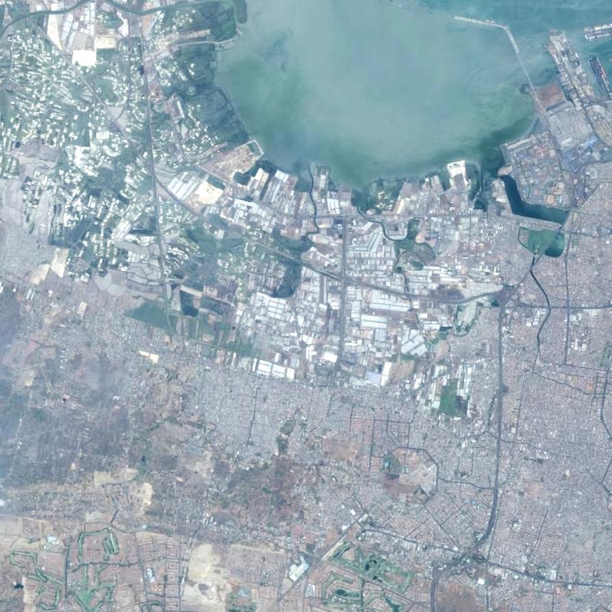
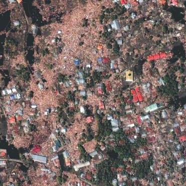
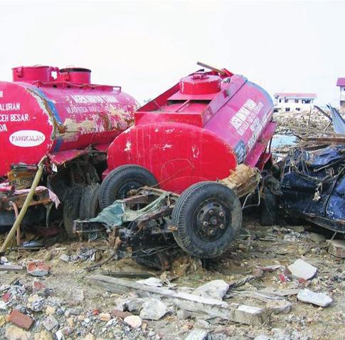


80 The Flash Environmental Assessment Tool (FEAT) To identify acute environmental risks immediately following disasters Version 1.0
81
82 The Flash Environmental Assessment Tool (FEAT) To identify acute environmental risks immediately following disasters Version 1.0
83 Table of Contents 1 Introduction 04 2 Basics of the FEAT concept Modular approach Operational output: metres of probable effect distance One basic concept for the entire assessment tool Focus on the most likely scenarios Reliance on common sense 06 3 Use of FEAT 08 Introduction 08 Part 1: General information on the use of FEAT 08 Part 2: Module-specific information 11 Likely Scenarios Module 11 First Alert Module 12 Priorities Module 13 Facilities and Objects Assessment Module 15 User Guidance - Summary 17 User Guidance 19 Likely Scenarios Table 23 First Alert Module 25 Priorities Module 29 Facilities and Objects Assessment Module 41 Lable Look-up Table 45 Substance Look-up Table 47 Acknowledgements This document is a user version of FEAT based on the extensive description of the method in: van Dijk et al. (RIVM report no ). The development of this tool was initiated at the recommendation of the Sixth Meeting of the Advisory Group on Environmental Emergencies (AGEE), convened by the United Nations Environment Programme (UNEP) and United Nations Office for the Coordination of Humanitarian Affairs (OCHA). At the request of OCHA, the Flash Environmental Assessment Tool (FEAT) has been developed by the National Institute for Public Health and the Environment (RIVM), with support from Inspectorate of the Ministry of Housing, Spatial Planning and the Environment of the Netherlands (VROM). DHV-Engineering Consultancy also contributed to the development of the FEAT. Contact: Sander van Dijk Sander.van.dijk@rivm.nl, sander.vandijk@minvrom.nl Disclaimer FEAT combines large amounts of scientific insights and data into one simple tool for use in field-based situations. Assumptions are made in the FEAT, some of them approximate. FEAT outputs will help prioritize the activities of relief and risk management teams, but cannot provide definitive scientific assessments or analysis. For example, FEAT cannot provide exact impact perimeters. Exact results will depend on individual cases and conditions. Users will need to set priorities based on actual field situations, which may differ from those presented in this document.
84 03 Foreword and Scope The Flash Environmental Assessment Tool (FEAT) helps to identify existing or potential acute environmental impacts that pose risks for humans, human life-support functions and ecosystems, following sudden-onset natural disasters. FEAT focuses primarily on immediate and acute impacts arising from released hazardous chemicals. It can also help to identify potential long-term issues, for example those involving releases of persistent compounds. FEAT also provides information on physical impacts to the natural environment, such as soil erosion and salt water intrusion. Based on this information, users can decide on initial risk management actions under disaster conditions. In particular, it helps users make timely and accurate requests for additional, specialized equipment or expertise to address impacts.
85 04 1. Introduction Natural disasters such as earthquakes, floods and hurricanes can damage infrastructure and result in secondary environmental impacts such as immediate or potential releases of hazardous materials. These can pose acute risks to human life and health, and adversely affect surrounding environments that are vital for livelihoods. Natural disasters may also trigger physical impacts such as salt water intrusion, mudslides, slope instability and flooding. Disaster response teams are faced with the difficult task of not only dealing with the disaster at hand, but also identifying and responding appropriately to these potential environmental impacts. However, thousands of toxic chemicals could be involved in any given disaster, each with its own toxicity profile, and with a multitude of exposure pathways (e.g. air, water and soil) and receptors (e.g. humans, livestock, fishing grounds). In such complex situations, it can be easy to overlook or misjudge important risks. At the same time, given the often overwhelming demands of disaster situations, complex and full-fledged environmental assessments would be inappropriate. Therefore, a practical, accurate, yet simple tool is required to assist initial response teams such as United Nations Disaster Assessment and Coordination (UNDAC) teams. With these challenges in mind, FEAT is a carefully balanced compromise between simplicity and scientific rigor, with emphasis on usefulness to response mechanisms such as UNDAC teams. It provides quick answers in complex disaster situations, even in the absence of specialized technical resources or expertise. In summary, FEAT is a first aid tool to identify environmental impacts, and support initial response actions in disaster contexts. It does not take the place of in-depth environmental assessments, which may be appropriate at later stages of the disaster response. Findings from use of the FEAT should be communicated quickly to appropriate organizations so that appropriate actions can be taken, as described in this document.
86 05 2. Basics of the FEAT concept Following is an overview of the key elements of the FEAT, a tool designed to balance scientific rigor with simplicity of use. 2.1 Modular approach FEAT consists of three increasingly detailed assessment modules. This approach allows for maximum flexibility in differing and evolving disaster conditions. It also recognizes that users will have varying questions and needs, at different stages of the initial disaster response. The modules can be used independently, but taken together they represent the typical steps usually followed from the first notification of a disaster to the end of the initial response. The First Alert Module helps to scan for the presence of certain potentially high risk facilities in the affected area (FEAT Module 1/FM1) The Priorities Module helps users to determine objects of interest within an area and to, prioritize field visits (FEAT Module 2/FM2); and, The Facilities and Object Assessment Module helps users determine risks from individual facilities such as factories, or objects, such as storage tanks and trucks of chemicals (FEAT Module 3/FM3). These modules provide pre-defined impact assessment information that help the user identify the potential magnitude of the impact of a given hazard and quantity. To determine whether the potential impact is actually relevant, it must also be determined whether exposure is likely. The FEAT Likely Scenarios Module (LSM) provides the most likely and important combinations of the type of hazard, the receptors, pathways and the type of impact to be expected, as described in more detail below. Each FEAT module links to a table that provides the user with the information needed to use that particular module. The tables are numbered in accordance with the corresponding module. For example, the Module 1 (FM1) is the First Alert Module, and its corresponding table is Table FT1. All modules follow the same basic steps. 2.2 Operational output: metres of probable effect distance FEAT Module 2 and Module 3 combine all information on substance toxicity and chemical impacts into a single unit, called metres of probable effect distance. This concept is easy to use anywhere. To express the severity of various long-term potential effects, such as carcinogenic hazards, a severity index is used. 2.3 One basic concept for the entire assessment tool The core concept of FEAT can be expressed by the formula: Impact = F (hazard, exposure, quantity). Stated differently, all FEAT assessments are based on three impact-determining factors: 1. Intrinsic hazard of the compound 2. Possibility of exposure (if there is no receptor and/or no pathway, there is no exposure and thus no impact) 3. Quantity (the larger the quantity, the more severe the impact). A situation only has a relevant impact if the hazard, exposure and the quantity are all significant. The magnitude of the impact depends on the combined contribution of all three impact determining factors together. For example: a highly toxic material in large quantities has a small impact if minimal exposure takes place. By contrast, small amounts of a substance with only medium toxicity will have a high impact if people or the environment are highly exposed. FEAT provides the user either with predefined information or requests estimates for all three impact-determining factors. It then provides a predefined estimate of the impact in terms of metres of expected impact distance or severity indexes. 2.4 Focus on the most likely scenarios FEAT helps the user to determine the most likely and highest-impact combinations of hazards, receptors, and pathways. Less likely combinations of hazard, exposure and quantity are not prioritized in the FEAT.
87 06 For example, toxic gases normally pose risks primarily due to exposure through the air, and are of most immediate concern to human health. This would be prioritized in FEAT. Toxic gases may lead to other types of exposure for example, it may become a solution in a river, or lead to crop damage. However, such impacts are generally less likely, and/or less relevant in the first phase of a disaster. Therefore, they are not prioritized in the FEAT. These distinctions allow users to focus assessment needs and concentrate on most probable risks. 2.5 Reliance on common sense There are infinite possible combinations of hazards, pathways and receptors. More than 100,000 compounds can be emitted under a wide range of possible geographical conditions. All situations can therefore never be contained in a single tool. The information in FEAT can at best provide insight into situations that are similar to those that will be encountered in the field, and illustrate implications for action. Beyond this, FEAT assumes and relies on the common sense of its users to adapt the FEAT to actual situations using the above-noted formula and the Likely Scenarios Module.
88 07 BOX 1: A parable Imagine a child sitting at a table in a dining room. A goldfish swims nearby in its bowl, and a cat lies under the table on a carpet. Soup is being served. Unfortunately, the soup is spilled and spreads across the table. What do you do? It is clear that you have to assess the situation quickly, make some assumptions and act accordingly. Your actions will depend on your interpretation of the most important potential impact scenarios, ranging from: a dead fish, an injured child, a ruined carpet, an injured cat, and the remaining soup being edible. This action will, in turn, be guided by your understanding of the hazards posed by the soup, such as its temperature, the possibility for stains, the pathways along which the soup can reach receptors, and the amount of soup spilled. Many possible risks can be imagined, and assessment needs can be high. The soup may be hot, cold, a thin bouillon or thick pea soup. The child may be old enough to jump aside, or too young to move alone. The carpet may be a family wool heirloom and difficult to clean, or may be cheap and worn Assumptions must be made in this situation if no further information is available: soup is generally served hot, the child is unlikely to be able to move quickly, and avoiding harm to children is normally considered more important than avoiding harm to a cat or carpet. Therefore, child safety would guide initial decisions, and first action taken would be to remove the child. This would prevent damage to what is considered the most valued and threatened entity. After the child is safe, the situation can be re-assessed and the risks to other targets can be considered. By looking at the pathway of the hot soup, the second action is to stop the soup flow, and by taking a single action, save both the cat and the carpet. No action is needed for the fish; exposure is unlikely due to the protective bowl and water around the fish. Finally, after the emergency situation is declared to be under control, cleanup activities are started. If necessary, this can be done with some delay. The parable helps to understand the basic concept of FEAT, namely to identify and act upon the most important likely scenario. FEAT takes the same steps as in the parable: The logical and most adverse combinations of hazard, possibilities of exposure and type of impact are determined in the Likely Scenarios Module and the situation is assessed using one or more of the three assessment modules. In the parable, the most hazardous situation is a hot, thin soup moving towards a young, vulnerable child. Damage to carpets is secondary, or can be addressed later. Damage to fish could happen, but is unlikely. In FEAT, hazardous compounds are classified as gases, liquids or solids. These are linked to typical pathways of exposure (air, bodies of water, soil) and to typical impact types (human mortality, effects on life support systems including effects on drinking water, fisheries and agriculture). By pre-selecting the most likely cases such as injury to a child, in the above example - FEAT limits assessment efforts and helps users focus on the most relevant scenarios.
89 08 3. Use of FEAT Introduction FEAT consists of three independent assessment modules, the Likely Scenarios Module and the User Guidance. Following the User Guidance, FEAT users will select the module that best suits their needs and circumstances, follow the instructions to perform the assessment, and proceed to the next module as needed. The user will go through the same basic steps in each module. The modules can be used independently, but taken together represent the steps normally taken from the first notification of a disaster, to the end of the initial response. Figure 1, snapshot of the User Guidance - Summary User Guidance - Summary Step 1: Select the appropriate Module FM1 FM2 Assessment Process First Alert Module Priorities Scan Facilities and Module Objects Assessment Module 17 FM3 Define your question and Key question: What potential Key question: What are Key question: What impact select the appropriate major impacts are present in objects and facilities does this object or facility module by matching your this area? of interest? potentially pose? question and situation with t Where to go first? t the listed characteristics of Module outputs: High priority t Module outputs: Magnitude the modules alert of possible major Module outputs: Priority of potential impact (impact impacts and list of objects distance in type of expected of interest. metres or impact severity index) Step 2: Perform the impact assessment Collect the Collect the information information Collect the Collect the FM1 FM2 FM3 information information Use of the FEAT is guided by: the background information contained in this chapter, which explain the use of each module. This is divided into Part 1, which provides general information, and Part 2, which provides module-specific information; and, the FEAT User Guidance, which provide detailed, stepby-step instructions in a visual format and show the link between modules. Step 2a to 2c: Collect the information on the impact determining factors i = H + Exp + Q Impact Hazard Exposure Quantity Predefined information is obtained from the look-up tables or from the actual situation (in the field) Step 2d: Process the information Step 2e: Check if all possible hazards of this case are accounted for, or if repetition of step 2a-2d is needed i = H + Exp + Q Impact Hazard Exposure Quantity Step 2d Process: Check if one of the listed facilities (hazards) Table FT1 is present in the disaster area. If positive, this means a high priority alert of possible major impacts. Note from the table the main type of impact expected. Table FT1 + www = Contact with disaster area field High Priority alert i = H + Exp + Q Impact Hazard Exposure Quantity Step 2d Process: Match objects and facilities of interest from Table FT2, with relevant receptors and pathways in the Likely Scenarios Table to estimate actual possibilities of exposure and potential impact based on the actual spatial situation. Prioritize this list for field visits. Table FT2 LS Table v w = Actual spatial situation Priority List i = H + Exp + Q Impact Hazard Exposure Quantity Step 2d Process: Assess the actual type of hazard and quantities exposed to and look-up the magnitude of the impact using the Table FT3. + = Table FT3 Field LS Table observations Substance + Label Look-up Tables Actual impact assessment Step 3: Output One of the most important outputs of the process is a clear understanding of whether additional international expertise and/or resources are needed to address any of the impacts identified. This information, as well as any other information resulting from a FEAT assessment, should be communicated at the earliest possible time to the appropriate body. Part 1: General information on use of FEAT Step 1: Select the appropriate module Select the appropriate module by matching your situation and questions with the characteristics of the modules described below and summarized in the Summary of the User Guidance (Figure 1). Users should choose one of the following three assessment modules: The First Alert Module (FM1) to scan for the presence of certain potentially high risk facilities in the affected area; The Priorities Module (FM2) to identify facilities and objects of interest in the affected area, rank according to potential impact and prioritize field visits; and, The Facilities and Objects Assessment Module (FM3) Generate and/or review to determine impacts from individual facilities such as factories, or objects, such as storage tanks of chemicals. As described in more detail below, the Likely Scenarios Module is the core of the FEAT. It will be referred back to following the use of any of Modules 1-3, to focus efforts on the most likely and highest impact scenarios of a certain hazard. After selecting the appropriate module, follow the remaining steps as shown in the column in the User Guidance for the selected module. Step 2: Performing the impact assessment general information The following steps are common to all modules. Additional, module-specific guidance is provided below in part 2. Steps 2a through 2c: Collect information on the impactdetermining factors. Using these steps, collect information about the factors

90 09 Figure 2: snapshot of the User Guidance User Guidance 19 Step 1: Select the appropriate Module (FM) Assessment Process Define your question and select the appropriate module by matching your question and situation with the listed characteristics of the modules Key question answered Key words of situation Need for actual information Predefined information is i = H + Exp + Q obtained from the look-up Impact Hazard Exposure Quantity tables or from the actual situation (in the field) First Alert Module Priorities Module Facilities and Objects Assessment Module FM1 FM2 FM3 Key questions answered by this module Key questions answered by this module Key question answered by this module What serious potential impacts are present What are the main objects of interest? What impact does this particular facility or in the affected area? What is the first priority for field visits? object potentially pose? Key words of situation Key words of situation Key words of situation Area covered: spatial scale of entire disaster More localized regions within affected area Assessment of specific facility or object. area local spatial scale, Typically used on site by field assessors Main use of module: as first screening, Screening for priority situations within the very limited information available, only affected area that require a field visit including big and obvious major potential impacts. Main users: Typically used by response teams after i = H + Exp + Q Main users: desk officers directly after notification of the Impact Hazard Exposure Quantity arrival on site in preparation for actual field visits. disaster. Most detailed level of impact assessment of FEAT, using i = H + Exp + Q actual information on all three impact-determining i = H + Exp + Q Impact Hazard Exposure Quantity factors: type of hazard, exposure and quantity exposed to. Impact Hazard Exposure Quantity Requires estimate of the actual exposure based on the Requires check of presence of major potential hazards spatial situation of the facilities (hazards), relevant Output (facilities) receptors and possibilities of dispersion. Impact assessment of a facility or object. Provides an impact distance for the relevant receptors (types of Output Output impact) the actual type of hazard and quantities involved. High priority alert of possible potential major impacts List of facilities and objects that are priortised for the Type of impact to be expected. Indicating the receptors field visit. and pathways, reaction time frame, opportune mitigation The priority is a relative ranking of the identified objects or preventive measures and type of expertise required. of interest and does not imply the priority towards other response activities. Step 2: Perform the impact assessment Collecting the information on the impact determining factors Step 2a: What is the hazard? Step 2b: What are opportune receptors and pathways of dispersion to consider, that determine possibilities of exposure? Step 2c: What quantity is involved? All predefined Table FT1 Check the actual presence and location of the facilities listed in Table FT2 within the region of interest. Note the corresponding main type of hazard defined in the table. Use the Likely Scenarios Table to define the main type of impact, the opportune receptors and pathways from the hazard posed by the facilities present in the area. Assess the possibilities and potential extent of exposure based on local spatial situation of the facilities, receptors and pathways Prioritize the list of objects (facilities) of interest using common sense and taking into account the proportional contribution of the hazard, possibilities of exposure and magnitude of the predefined impacts (based on assumed quantities and listed in Table FT2 as impact distance and severity indexes). Focus on the main hazard first. Assess the main type of hazard through field observations, using the Substance look-up Table, the Label look-up Table or by consulting local experts where possible. Use the Likely Scenarios Table to define the main type of impact, the opportune receptors and pathways based on the hazard Determine actual presence of receptors and pathways of dispersion in the field and assess the possibilities and extend of exposure Assess the quantity involved (exposed to). Table FT3 provides predefined impact distances for the different types of impact based on the actual hazard type and the quantities involved (exposed to). Use common sense to adapt the predefined impact figures to the actual situation. The predefined figures are realistic worst-case estimates and presume that determine the impact: (a) main hazard, (b) possibilities of exposure (i.e. pathways and receptors as selected from the Likely Scenario Module), and (c) substance quantity. Part of the required information can be found in the tables within the modules. In Modules 1-3, you collect information in a similar fashion. Instructions are included below which will help you in collecting and interpreting the required information. Every table within a module contains information about the hazard, the quantity of the substance and the potential (type or magnitude) of impact. For all modules, the information about the possibilities of exposure is obtained by referring back to the Likely Scenarios Module, which combines details on receptors, pathways and the expected main type of impact relevant to specific hazards. The tables that belong to the various modules have the same general structure. The general structure of the headers shows the main divisions of the tables in which the impact-determining factors can be found (H, Exp, Q = i). Varying amounts of detail are provided in the columns of the respective table, according to the aim of the module. When collecting information about the impactdetermining factors, users will have varying amounts of the predefined information from the FEAT table that corresponds with the module. In some cases, estimates must be made with the information from the field. The FEAT User Guidance Tables describe the sources of the information used for the module and the extent to which actual field observations are required for each module. The table FT1 that corresponds to the First Alert Module is divided into three impact types: those involving direct impact on humans, those involving long-term impacts on life support and nature and objects that mainly pose an immediate threat to life support and nature. Users may want to focus on facilities, processes or hazards for one of these types of impact, based on the type of region in which the disaster took place (e.g. densely populated, agricultural, or aquatic environments). All tables provide an estimate of the type, magnitude and/ or severity of impact.
91 10 The following types are distinguished: Direct impact on human health - Immediate death and immediate adverse health effects (e.g. explosion, immediate toxic effects) Direct impact on life-support functions and nature - humans are impacted through effects on their life-support functions e.g. direct impact on crops, fish resources, agricultural land, water supply - the same direct impacts that affect life support functions can also threaten biodiversity and specific species or ecosystems Long-term impact on life-support functions, nature and humans (toxic persistent substances entering the food chain and natural ecosystems and effects of carcinogenic substances).! N N Human direct Long term! Life support and nature direct The tables corresponding with the First Alert Module and the Priorities Module provide recognizable objects/facilities and processes that use substances having a specific type of hazard. This makes it easier to determine the hazard. Depending on the information that is available in the field, one of the following columns is to be used: facility, process, substance or hazard type, to define the hazard in question. substance. If substances pose more than one type of hazard, such as toxic liquids with substantial volatility (e.g. with the potential hazard of the liquid itself, and the gas evaporating from the liquid), both types of hazard must be considered and both types of expected impacts must be taken into account. To do this, go through steps 2a to 2d as many times as necessary for each hazard. Step 3: Generate or review your output Compare the importance of the impact-determining factors and evaluate them based on your common sense understanding of the collected information. This is the definitive result of the assessment of this case. Step 4: Follow-up actions to consider Based on the results of the impact assessment of this case, consider suitable follow-up actions or collect supplementary data from the field to make a more detailed impact assessment with one of the other modules. Step 5: Exit or go to next impact assessment Determine if there are other cases that require evaluation (other objects or, for example, the leakage of a second substance from the same object) or if the assessment has been completed. Follow up actions after completing the impact assessment It is vital that relevant findings be communicated to the relevant organizations, so that action can be taken to mitigate impacts. In many cases the appropriate organization will be the Joint UNEP/OCHA Environment Unit Joint Environment Unit. Step 2d: Process the information, Processing for each module is adapted to the aim and characteristics of the module. Step 2e: Check if the first steps should be repeated to account for other hazards Determine whether steps 2a to 2d of the assessment must be repeated for other hazard aspects of the same case or
92 11 Part 2: Module-specific information Likely Scenarios Module (LSM) As noted, this module is the core of the FEAT. It focuses the assessment on the highest impact and most likely scenarios by allowing the user to combine the information on the hazard, with likely pathways and receptors and resulting impact to be expected. In this way, the user can determine whether an identified potential impact creates a high-risk scenario. In most cases, users will keep coming back to this module, to determine and focus assessment needs identified in other modules. Using the table The combinations of hazards, pathways, receptors, and resulting impacts are relevant to all FEAT modules and are provided in the LSM (Likely Scenario Module). This module lists the main types of hazards (first column). Find the actual hazard of your situation/case (in most cases derived from step 2a of the single impact assessment you have conducted using modules 1-3) in the first column of the table. Follow the rows of this hazard type to determine the relevant receptors for this hazard, the relevant pathways of dispersion and the expected main type of impact. The main type of impact is indicated with colour codes and priority numbers that are explained below the table. For example, if you are dealing with a toxic gas or smoke, the LSM indicates that humans are the main relevant receptors and air (wind) is the main dispersion pathway. The table indicates that direct impact on humans is the most likely type of impact and is a high priority concern. Estimate the possibilities of exposure from the proximity of the nearest humans (settlements) and the direction of the wind would be your follow up actions based on this scenario information. This knowledge provides focus to your assessment process and follow-up measures. If this Likely Scenarios Module is used as part of a single assessment using another module, the listed receptors and pathways are taken into account in the subsequent steps of the assessment. Figure 3: snapshot of the Likely Senario Table. Likely Scenarios Table 21 H Exp Q i Hazard Type from facilities and substances Humans 1 Relevant Receptors Fishing area surface water Ground water (wells) Agriculture Nature reserves Toxic gas, explosive, flammable, combustible, small containers Rivers, lake coast Relevant Pathways Air Soil, Groundwater Lake River, drains Human Animal Potential Impact Human Human Live support Nature direct Long-term! Toxic gas and smoke (GT) n n n Explosives (liquid, solid) (E) n n n n Flammable and explosive gas (GF) n n n Flammable liquids (LF) n n n n Small containers of chemicals *** n n n n Toxic liquids (to humans and environment) Life support and nature direct!
93 12 Figure 4: snapshot of First Alert Module. Figure 5: snapshot of table FT1 First Alert. First Alert Module Overview of process to perform the impact assessment using Table FT1: Objects with potential for major impacts 23 Table FT1 First Alert Module Objects with potential for major impact 24 FM1 H Hazard + + = Steps 2a to 2c: Collecting the information on the impact determining factors Table FT1 hazard columns Exp = Assumed present Exposure Q = Assumed above critical Q Quantity = Table FT1 i columns = = Contact with disaster area + &www : field Potential type First Alert Module (FM1) Immediately after the onset of an emergency, the First Alert Module (FM1) is used to screen for big and obvious potential impacts. Generally speaking, if one of the listed facilities is present in the affected area, there is cause for concern and reason to investigate further. = Potential hazard actually present H Hazard Exp Q i Potential Impact Quantity Life support Human Long-term and nature Type of industry Type of facility Substance most hazardous direct direct Direct impact on humans!! N N N Production Production industrial gasses ethene, propane, hydrogen of chemicals chlorine, oxigen n n Production anorganic chemical base materials ammoniumnitrate n n Production agricultural chemicals chlorine n n carbon disulfide n n Production pharmaceutical base materials methanol n n Production organic chemical base materials ammonia, isopropanol, pentane acrylonitrile, bromine, chlorine, monovinylchloride n n fluorosulfonic acid, vinyl bromide, fluorine, acrolein n n dimethylsulfate n n butane n n Tankercleaning cleaning agents n n Production of Tanning industry cyanide, sulfuric acid n n (natural) products ammonium sulfate n n Textile industry (dyes) bromine, chlorine, naphtalene, alkali, sodium sulfide n n Textile industry (dyes) sodium nitrate n n Mining and Oil and gas mining (onshore, offshore) natural gas n n exploration Fireworks and Production fertilizers, fireworks ammonia, ammoniumnitrate, fireworks n n explosive products Trading, wholesale professional fireworks Storage, steel (large enterprises) ammoniumnitrate, fireworks n n Production organic chemical base materials organic peroxide n n Wholesale fertilizers ammoniumnitrate n n Winning, preparing and distribution drinking water (with chemicals) chlorine n n (Un-) Loading and storage ships (oil and and (marshalling) solvents, hazardous, etc) oil and solvents n n yards Marshalling yards LPG n n Airports, military, Refinery oil and solvents and gas (incl. storage) Energy production and distribution (steam, natural gas civil propane/butane, oil and solvents, etc) propane, butane, ammonia, natural gas n n Hospital /sterilizing industry ethylene oxide of impact as an indication of the threatened receptors, exposure routes, reaction time frame, opportune prevention or mitigation measures, and type of expertise required. In the First Alert Module, both the substance that causes the hazard and the exposure are assumed to be above the critical level (as shown in the table).! The First Alert Module has been kept as simple as possible, and all steps of the impact assessment are compressed into a single look-up action using its corresponding table, FT 1. The only action needed is to check whether one of the facilities listed in the first column of FT1 is present within the disaster area. If the facility is present you will have a high priority alert for possible major secondary effects, and immediate action is recommended to verify the actual status of this facility and act accordingly. By following the row for the facility (table FT1) that is actually present in the disaster area (indicating a certain hazard), you can find the main type of impact to be expected. Use the type
94 13 Priority Scan Module (FM2) During the second phase of the response to an emergency, assessment teams must identify objects and facilities of interest, plan field activities and establish priorities for actual field visits with the Priorities Module. Figure 6: snapshot of the Priorities Module. Priorities Module Overview of process to perform the impact assessment using Table FT2: Objects of interest list 27 When using the Priorities Module, facilities or objects that may be of concern within a specific region are identified and compared in order to determine priorities for field observations. In theory, the user follows the universal steps of the impact assessment for every object individually, after which the estimated impact of the various objects is compared to determine their relative priority. In practice, the experienced user may take all objects through the steps of the impact comparison simultaneously. In this case, conducting the impact assessment essentially amounts to taking the following actions: Collect information on the impact-determining factors (Steps 2a through 2c) Step 2a: Define the hazard Determine which facilities or processes from Table 2, Facilities and Objects of interest, are present in the area and then use the table to find the most urgent type of hazard for the corresponding process. Step 2b: Assess possibilities of exposure Using the Likely Scenarios Module, determine the relevant receptors and pathways given the type of hazard expected. Using geographical information from the area, determine whether the relevant receptors and pathways of dispersion (e.g. rivers) are actually present in the vicinity of various hazardous objects and estimate the actual possibilities of exposure. Step 2c: Predefined quantities from table FM2 are used (referred to as Q-typical) to predefine the impact distances in table 2. These quantities are estimated quantities that are typically used in the facility and process under consideration. FM2 H Hazard + + = Exp = Exposure Q = Quantity = Steps 2a to 2c: Collect the information on the impact-determining factors Table FT2 Hazard columns LS Table relevant receptors pathways Table FT2 column Q Typical + Location of hazard (hazardous objects in region) Actual location of + hazard, pathways, = receptors = Assumed typical quantity of process Process the information (Step 2d and Step 3) Step 2d: Process the information The results include the objects or processes for which relevant receptors are present within the estimated impact area and for which relevant pathways are present. Prioritize them based on common sense. Evaluate the objects regarding the priority for making a field visit by considering the proportional contributions of the three impact-determining factors, together with the expected magnitude and type of impact. The estimated magnitude of impact (from Table 2) and the probability and estimated degree of exposure play an important role in evaluating the priority, as does the potential susceptibility of the region to a specific type of impact. For example, a long-term impact on the hydrological system or a coral reef weighs more heavily in an area where the local population depends on fishing than in an industrial area where the population does not depend on surface water, or where the water was heavily contaminated before the disaster (e.g. near an industrial site). = Potential hazard actually present Possibilities of exposure
95 14 Figure 7: snapshot of Table FT2 Priorities Module, Objects of interest list. Table FT2 Priorities Module, Objects of interest list 29 H Hazard Exp Q Quantity i Potential Impact! N N Human Facility or process Substance Hazard type Typical (kg) direct Long term Exposure! Life support and nature direct (Un) Loading and storage ships (containers, minerals, coal, grain, etc): fire m to 5 km 3 3 (Un) Loading and storage ships (oil and solvents, hazardous, etc) oil and solvents LTe1/LF2/PB1, km to 50 km 2 2 Aerospace manufacture/repair (land-side) cyanide LTW/LTe m to 5 km 3 2 Aerospace manufacture/repair (land-side) hydrofluoric acid LTe4/L-GT* m to 5 km 3 1 Agricultural services (incl small storage) mixed chemicals (fire) GT4 (toxic smoke) m to 5 km 3 2 Agriculture (animals, crop, forestry, fruit, etc.) carbamate pesticide LTe4/LT* m to 5 km 3 2 Agriculture (animals, crop, forestry, fruit, etc.) dithiocarbamate pesticide LTe2/LT*/LF/CRM m to 5 km 2 2 Agriculture (animals, crop, forestry, fruit, etc.) mercury based pesticide LTe4/CMR1/L-GT* m to 5 km 2 1 Agriculture (animals, crop, forestry, fruit, etc.) organochlorine pesticide PB2/CMR1/LTe4/L-GT*/LF m to 5 km 1 1 Agriculture (animals, crop, forestry, fruit, etc.) organophosphorus pesticide LTe4/LF2/CMR m to 5 km 2 2 Agriculture (animals, crop, forestry, fruit, etc.) organotin pesticide PB2/CMR1/LTe4/L-GT* m to 5 km 1 1 Agriculture (animals, crop, forestry, fruit, etc.) phenoxyacetic acid derivative pesticide L-GT*/LTe2/LF2/CMR0, m to 5 km 3 2 Agriculture (animals, crop, forestry, fruit, etc.) pyrethroid pesticide LTe4/LT*/LF m to 5 km 2 2 Agriculture (animals, crop, forestry, fruit, etc.) substituted nitrophenol pesticide LTe3/LT*/PB m to 5 km 2 2 Agriculture (animals, crop, forestry, fruit, etc.) triazine pesticide LTe3/LT*/LF/PB1/CMR m to 5 km 2 2 Agriculture (horticulture, fruit, crop, etc) mixed chemicals (fire) GT4 (toxic smoke) m to 5 km 3 2 Airports (air-side) kerosine LTe1/PB1, m to 5 km 2 1 Artificial ski run ammonia GT3/GTe m to 5 km 3 2 Auction agriculture and fishery fire 5 Less than 50 m 3 3 Auction personal objects fire 5 Less than 50 m 3 3 Breeding and keeping animals mixed chemicals (fire) GT4 (toxic smoke) m to 5 km 3 2 Buildig industry fire 5 Less than 50 m 3 3 Bus-, tram- and metro, taxi, touringcar stations cleaning agents LTe2/LF2/PB m to 5 km 2 2 Bus-, tram- and metro, taxi, touringcar stations solvents LTe2/PB1/CMR m to 5 km 2 2 Business trading (general, offices) fire 5 Less than 50 m 3 3 Car- and truckparks (incl. cooling) fire 5 Less than 50 m 3 3 Car racing tracks, skelter- and carting fire 5 Less than 50 m 3 3 Car scrapyard cleaning agents LTe2/LF2/PB m to 500 m 2 2 Car scrapyard solvents LTe2/PB1/CMR m to 500 m 2 2 Cleaning companies (buildings) fire 5 Less than 50 m 3 3 Computer services and information (technology) fire 5 Less than 50 m 3 3 Culture and recreation (theatre, museum, library, dancing, zoo) fire 5 Less than 50 m 3 3 Defence explosives E m to 5 km 3 3 Defence fuel LTe1/LF1/PB1, m to 5 km 2 2 Step 3: Output Your output is a list of actually present potential hazards (hazardous objects) that possibly expose relevant receptors, prioritized by the need for a field visit.
96 15 Figure 8: snapshot of Table FT3 Facilities and Objects Assessment Module. Figure 9: snapshot of the Substance Look-up Table. Table FT3 Facilities and Objects Assessment Module 36 Substance Look-up Table Part 1: Toxic gases, explosives, flammables, small containers 47 H Hazard Exp Q Quantity i Potential Impact! N Human direct Hazard type Hazard sub-type amount (unit) Toxic gas, Explosive, flammable, small containers Exposure Lethal (m) Health (m)! Life support and nature direct Soil (m) Lake (m) River (m) Large animals (m) GT Gas Toxic to GT5 Acute toxic (based on chlorine) n 20 kg n humans n 100 kg n n 1,000 kg 250 2,400 n n 5,000 kg 350 6,250 n GT4 High toxic (based on sulphur dioxide) n 200 kg n n 1,000 kg 60 2,400 n n 10,000 kg 250 9,500 n n 50,000 kg ,850 n GT3 Medium toxic (based on ammonia) n 200 kg n n 1,000 kg n n 10,000 kg 250 2,050 n n 50,000 kg 600 5,350 n GT2 Low toxic (based on ethylchloride) n 1,000 kg n n 10,000 kg n n 50,000 kg n GT1 Very low toxic n 50,000 kg 0 0 n Explosive (E) E (Class 1.1, 1.2 and 1.5) n 1,000 kg 350 NA n Gas toxic to the GTe-1 to GTe4 Gas toxic to the n 5,000 kg 450 NA n environment GTe environment n 50,000 kg 500 NA n (going into solution) Flammable (F) LF0 to LF4 Liquefied flammable gas n 1,000 kg n n 10,000 kg n n 50,000 kg n Substance name Hazard type (in order of relevance) UN-nr 1,1-Difluoroethane GF ,1-Difluoroethylene GF ,1-Dimethoxyethane LF ,2,3,6-Tetrahydrobenzaldehyde LF1/LTe ,2,3,6-Tetrahydropyridine LF ,2-Butylene oxide, stabilized LF ,2-Di-(dimethylamino)ethane LF ,2-Dimethoxyethane LF Bromo-3-methylbutane LF Chloro-1,1-difluoroethane GF Methoxy-2-propanol LF ,2 -Dichlorodiethyl ether LF ,2-Dimethylpropane GF ,3-Dihydropyran LF ,3-Dimethylbutane LF Diethylaminoethanol LF Dimethylaminoethanol LF Ethylbutanol LF Ethylbutyl acetate LF Ethylbutyraldehyde LF Ethylhexylamine LF Methyl-1-butene LF Methyl-2-butene LF Methylpentan-2-ol LF ,3-Diethoxypropene LF Methyl-1-butene LF Methylbutan-2-one LF Methoxy-4-methylpentan-2-one LF Acetal LF Acetic acid, glacial LF Acetic anhydride LF Acetyl methyl carbinol LF Acetylene GF Acetylene, Ethylene and Propylene in mixture, refrigerated liquid containing at least 71.5% Ethylene with not more than 22.5% Acetylene and not more than 6% Propylene. GF Adhesives (flammable) LF2/LF Facilities and Objects Assessment Module (FM3) The Facilities and Objects Assessment Module of FEAT provides an estimate of specific impacts, by providing predefined calculations of the magnitude of the impact. The module provides impact distances and severity indexes for the various receptors that correspond with certain quantities of a substance having a certain type of hazard. Before performing an impact assessment in the field, make sure that you understand and apply the basic safety practices and precautionary measures for field assessments, especially when conducting surveillance of situations involving hazardous chemicals. If you are unsure about the safety of the situation, do not perform the field assessment: safety first! Collect information on the impact-determining factors (Steps 2a through 2c) Step 2a: Define the hazard By observation or using information available in the field, estimate the type of hazard resulting from the facility or object. In some situations, effects can be noted such as death of poultry or fish, discoloration of vegetation and reports of adverse health effects on humans. These signs can help indicate the nature of the hazard. If information on the main hazard is missing, indications of the type of hazard can be obtained from the Substance Lookup Table or the Label Look-up Table. The Substance Look-up Table includes most of the commercially used hazardous substances and provides an indication of the primary type of hazard (as defined within FEAT) of this substance. The Substance Look-up Table is divided into four sections: (a) toxic gas, flammables, and small containers; (b)toxic liquids; (c) persistent, bio-accumulative or carcinogenic substances; and (d) substances that are not rated. This categorization is the same as in the corresponding Table 3 and the most likely scenario table. Within these categories, the substances are listed alphabetically by name. When searching for specific
97 16 aspects, for example the main hazard of a liquid substance, use the corresponding part of the Substance Look-up Table. If there is no indication of the type of substance, you can then search in all parts of the Substance Look-up Table (by substance name in alphabetical order). The Substance Lookup table hazards are noted in order of priority, starting with the main type of hazard. Figure 10: snapshot of the Lable look-up table. Label look-up table Goal: International transportation labels indicate the hazard emerging from a substance. Within FEAT similar hazard types are used. This look-up table provides a link between both hazard indications although there is no perfecft match and caution with the interpretation is needed. Add the physical property of the substance from your field observations to match more acurately with the hazard types as listed in the Likely Scenarios Table. Symbol Addition to symbol Indication of Feat hazard type Abreviation of Feat hazard type Expected impact 39 For transport hazard labels, the Label Look-up Table also provides an indication of the type of hazard that must be taken into account. International transport labels indicate the hazard corresponding to a substance. Within FEAT, comparable hazard types are used. This look-up table provides a link between these two hazard indications. However, there is no perfect match between them, and you should interpret this information cautiously. To match the hazards more accurately, include the physical property of the substance from your field observations. no symbol E E, Explosive E Human direct O Oxidizing: Flammable, Explosive F, E Human direct (in contact with flammable material) F+ Extremely Flammable F (FL*, FG*) Human direct F Flammable F (FL*, FG*) Human direct - Flammable F (FL*, FG*) Human direct T+ Highly Toxic T (GT*, LT*) Human direct, Life support and nature direct T Toxic T (GT*, LT*) Human direct, Life support and nature direct Xn Toxic T (GT*, LT*) Human direct, Life support and nature direct Steps 2b and 2c: assess possibilities of exposure and quantities involved The Likely Scenarios Table supports field observations and helps estimate actual exposure. For the hazard in question, first estimate the exposure for the relevant receptors and dispersion pathways (as listed in the Likely Scenarios Table). Of course, you should think beyond these general indications and look for possible other factors that influence your case. Estimate the actual exposure based on the quantity of substance to which people or the environment are exposed. C Xi Human direct Human direct N Toxic, special attention to life support T (GT*, LT*), PB Life support and and nature and long-term impacts nature direct, Long-term (PB) persistent, accumulating or carcinogenic, and provides a measure for the severity of the dispersal and the degree to which long-term effects can be expected. Process the information (Step 2d and Step 3) In Table FT3, read the predefined impact distance or severity index that corresponds with the hazard and the quantities to which people or the environment are exposed. Use the estimated impact distances as an indication of the magnitude of the impact, keeping in mind the limitations of this estimate. For substances that have a long-term impact (i.e. persistent, bio-accumulating, carcinogenic, mutagenic and reprotoxic substances) the impact area is equal to the dispersion area. For such substances, the lowest detectible concentrations are indicated as undesirable. The primary concern is to prevent dispersion to the greatest extent possible. A severity index for the relevant substances (specified in the Substance Look-up Table) indicates to what extent the substances are actually

98 User Guidance - Summary 17 Step 1: Select the appropriate Module Assessment Process First Alert Module Priorities Scan Facilities and Module Objects Assessment Module Define your question and select the appropriate module by matching your question and situation with the listed characteristics of the modules FM1 Key question: What potential major impacts are present in this area? t Module outputs: High priority alert of possible major impacts and type of expected impact FM2 Key question: What are objects and facilities of interest? Where to go first? t Module outputs: Priority list of objects of interest. FM3 Key question: What impact does this object or facility potentially pose? t Module outputs: Magnitude of potential impact (impact distance in metres or severity index) Step 2: Perform the impact assessment Collect the information Step 2a to 2c: Collect the information on the impact determining factors i = H + Exp + Impact Hazard Exposure Predefined information is obtained from the look-up tables or from the actual situation (in the field) Step 2d: Process the information Step 2e: Check if all possible hazards of this case are accounted for, or if repetition of step 2a-2d is needed Q Quantity Collect the information i = H + Exp + Impact Step 2d Process: Check if one of the listed facilities (hazards) Table FT1 is present in the disaster area. If positive, this means a high priority alert of possible major impacts. Note from the table the main type of impact expected. Table FT1 Hazard + Exposure www = Contact with disaster area field Collect the Collect the FM1 FM2 FM3 Q Quantity High Priority alert information i = H + Exp + Impact Step 2d Process: Match objects and facilities of interest from Table FT2, with relevant receptors and pathways in the Likely Scenarios Table to estimate actual possibilities of exposure and potential impact based on the actual spatial situation. Prioritize this list for field visits. Table FT2 LS Table Hazard v w Exposure = Actual spatial situation Q Quantity Priority List information i = H + Exp + Impact Hazard Exposure Q Quantity Step 2d Process: Assess the actual type of hazard and quantities exposed to and look-up the magnitude of the impact using the Table FT3. + = Table FT3 Field LS Table observations Substance + Label Look-up Tables Actual impact assessment Step 3: Output Generate and/or review your output Step 4: Follow-up actions to consider Follow up and link to other modules FM1 FM2 FM3 Step 5: Exit or next impact assessment Determine what repetitions are needed, and whether another object of interest should be screened Define your next question and repeat the cycle
99

100 User Guidance 19 Step 1: Select the appropriate Module (FM) Assessment Process Define your question and select the appropriate module by matching your question and situation with the listed characteristics of the modules Key question answered Key words of situation Need for actual information Predefined information is obtained from the look-up tables or from the actual situation (in the field) i = H + Exp + Impact Hazard Exposure Q Quantity First Alert Module Priorities Module Facilities and Objects Assessment Module FM1 Key questions answered by this module What serious potential impacts are present in the affected area? Key words of situation Area covered: spatial scale of entire disaster area Main use of module: as first screening, very limited information available, only including big and obvious major potential impacts. Main users: desk officers directly after notification of the disaster. i = Impact H Hazard + Exp + Exposure Q Quantity Requires check of presence of major potential hazards (facilities) Output High priority alert of possible potential major impacts Type of impact to be expected. Indicating the receptors and pathways, reaction time frame, opportune mitigation or preventive measures and type of expertise required. Key questions answered by this module What are the main objects of interest? What is the first priority for field visits? Key words of situation More localized regions within affected area local spatial scale, Screening for priority situations within the affected area that require a field visit Main users: Typically used by response teams after arrival on site in preparation for actual field visits. i = Impact H Hazard + Exp + Exposure Q Quantity Requires estimate of the actual exposure based on the spatial situation of the facilities (hazards), relevant receptors and possibilities of dispersion. FM2 Output List of facilities and objects that are priortised for the field visit. The priority is a relative ranking of the identified objects of interest and does not imply the priority towards other response activities. Key question answered by this module What impact does this particular facility or object potentially pose? Key words of situation Assessment of specific facility or object. Typically used on site by field assessors i = Impact H Hazard + Exp + Exposure Q Quantity FM3 Most detailed level of impact assessment of FEAT, using actual information on all three impact-determining factors: type of hazard, exposure and quantity exposed to. Output Impact assessment of a facility or object. Provides an impact distance for the relevant receptors (types of impact) the actual type of hazard and quantities involved. Step 2: Perform the impact assessment Collecting the information on the impact determining factors Processing the information Step 2a: What is the hazard? Step 2b: What are opportune receptors and pathways of dispersion to consider, that determine possibilities of exposure? Step 2c: What quantity is involved? Step 2d: processing the information All predefined Table FT1 Check if one of the listed facilities (Table FT1) is present in the disaster area. Note the corresponding main type of impact defined in the table Check the actual presence and location of the facilities listed in Table FT2 within the region of interest. Note the corresponding main type of hazard defined in the table. Use the Likely Scenarios Table to define the main type of impact, the opportune receptors and pathways from the hazard posed by the facilities present in the area. Assess the possibilities and potential extent of exposure based on local spatial situation of the facilities, receptors and pathways Prioritize the list of objects (facilities) of interest using common sense and taking into account the proportional contribution of the hazard, possibilities of exposure and magnitude of the predefined impacts (based on assumed quantities and listed in Table FT2 as impact distance and severity indexes). Focus on the main hazard first. Assess the main type of hazard through field observations, using the Substance Look-up Table, the Label look-up Table or by consulting local experts where possible. Use the Likely Scenarios Table to define the main type of impact, the opportune receptors and pathways based on the hazard Determine actual presence of receptors and pathways of dispersion in the field and assess the possibilities and extend of exposure Assess the quantity involved (exposed to). Table FT3 provides predefined impact distances for the different types of impact based on the actual hazard type and the quantities involved (exposed to). Use common sense to adapt the predefined impact figures to the actual situation. The predefined figures are realistic worst-case estimates and presume instantaneous and maximum dispersion and exposure. Table FT1 + www Contact with disaster area field High = w = Priority Priority + = List alert Table FT2 LS Table w Actual spatial situation Table FT3 LS Table Substance + Label Look-up Tables Field observations Actual impact assessment Step 2e: using common sense, check if all possible impacts of this case are accounted for or if repetition of steps 2a-2d is needed Does the substance pose multiple types of hazard? If yes, perform the impact assessment cycle again. For many substances the different types of hazards are indicated within the Substance Look-up Tables Check whether the main type of impact is the only impact to be expected Determine if there are any other possibilities of dispersion or exposure than those taken into account.
101 User Guidance, continued Step 3: Output Assessment Process First Alert Module Priorities Module Facilities and Objects Assessment Module FM1 FM2 FM3 Generate or review your output Evaluate/review your output if more iterations of the actual impact assessment are performed Step 4: Follow-up actions to consider Follow up and link to other modules Check the actual situation prior to all other (humanitarian) activities. The Likely Scenarios Table provides an indication of the opportune receptors and pathways (given the presumed hazard of the indicated substances) to check for their presence with priority. Consider performing a first desktop impact assessment using Module FM3 (information on type of hazard, quantities involved and possible exposure are needed). Follow-up actions suitable to the expected type of impact (described in Module FM3). Field visits to check the actual status and perform an actual impact assessment using Module FM3. Depending on the severity of actual or potential impacts, FEAT users should consider requesting additional, specialized expertise. Step 5: Exit or next impact assessment Determine which steps, if any, should be repeated. For example, is it necessary to go to the next module or use the same module again to assess the impact from another object of interest? Define your next question and repeat the cycle (starting with step 1).
102 Likely Scenarios Table 21 H Exp Q i Hazard Type from facilities and substances Humans 1 Relevant Receptors Fishing area surface water Ground water (wells) Agriculture Nature reserves Toxic gas, explosive, flammable, combustible, small containers Rivers, lake coast Relevant Pathways Air Soil, Groundwater Lake River, drains Human Animal Potential Impact Human Human Live support Nature direct Long-term! Toxic gas and smoke (GT) n n n Explosives (liquid, solid) (E) n n n n Flammable and explosive gas (GF) n n n Flammable liquids (LF) n n n n Small containers of chemicals *** n n n n Toxic liquids (to humans and environment) Toxic liquid (LTW, LTe) n n n n n n n n n Volatile Toxic liquid (L-GT) n n n Persistent and accumulating substances Persistent and/or bio accumulating, carcinogenic liquid (PB-L, CMR-L) n n n n n n n n n Persistent and /or bio accumulating, carcinogenic dust and particles (PB-D, CMR-D) n n n n n n n n n Natural impact on nature and infrastructure**** Landslide n n Wave / flash floods n n n n n n Fire (forest) n n n Erosion (fertile soil) n n n 3 1* 2* Salt n n n n n n n n n 3 1* 2* Mudflow / particles in water n n n n n n n 2 3** 1 Wind n n n n n Life support and nature direct! n Occasional n Assumed present 1 High Priority 2 Medium Priority 3 Low Priority 1 Humans and large (breathing) animals * Long-term impact on life support functions ** Except damage of mud on coral reefs *** For example: jerry cans of pesticides. These are listed as an extra category because they are commonly used by small business and easily transported. The substances may be (re-)used or displaced by inexperienced persons which may cause uncommon scenarios of exposure. **** If relevant and possible, potential natural impacts on nature and infrastructure should be identified in order to assess whether specialised assistance is needed. Determine the hazard The tables corresponding with the First Alert Module and the Priorities Module provide recognizable objects/ facilities and processes that use substances with a specific type of hazard. This makes it easier to determine the hazard. Depending on the information available in the field, use one of the following columns: facility, process, substance or hazard type. The Substance Look-up Table provides hazard types of specific substances.
103 FEAT Abbreviations 22 Main-code Sub-code Explanation Any * Star as subcategory indicates that no further specification within main group is available. If no additional information can be obtained from the field, use the most severe sub-hazard type as a worst case estimation. CMR Carcinogenic, mutagenic and reprotoxic CMR0.5 to CMR2 CMR with severity index ranging from 0.5 to 2 CMR-L Carcinogenic, mutagenic and reprotoxic liquid CMR-D Carcinogenic, mutagenic and reprotoxic dust E Explosive F Flammable GF Gas, flammable GF3 Gas, very highly flammable GF2 Gas, highly flammable GF1 Gas, flammable GNR Gas, not rated GT Gas, toxic by inhalation (to humans and large animals) GT5 Gas, toxic acute toxic GT4 Gas, toxic high toxic GT3 Gas, toxic medium toxic GT2 Gas, toxic low toxic GT1 Gas, toxic very low toxic GTe Gas, toxic to the aquatic environment (heavy and soluble) GTe4 Gas, toxic acute toxic GTe3 Gas, toxic high toxic GTe2 Gas, toxic medium toxic GTe1 Gas, toxic low toxic LF Liquefied flammable LF2 Liquid, highly flammable LF1 Liquid, flammable LFW Liquid, flammable after contact with water LNR Liquid, not rated LP Liquid, persistent LTW Liquid, toxic (to humans and large animals) when in contact with water L-GT Liquid, evaporating into gas that is toxic (to humans and large animals) by inhalation L-GT4 Liquid, evaporating acute toxic gas L-GT3 Liquid, evaporating high toxic gas L-GT2 Liquid, evaporating medium toxic gas L-GT1 Liquid, evaporating low toxic gas LTe Liquid, toxic (to the environment) by direct contact or toxic liquid emerging from solution of toxic substances LTe4 Liquid, toxic acute toxic LTe3 Liquid, toxic high toxic LTe2 Liquid, toxic medium toxic LTe1 Liquid, toxic low toxic NR Not rated PB Persistent and bioaccumulating substance PB0.5 to PB2 PB with severity index ranging from 0.5 to 2 PB-L Persistent and bioaccumulating liquid PB-D Persistent and bioaccumulating dust SNR Solid, not rated SF Solid, flammable SFW Solid, flammable after contact with water STW,ST and STe STe4 STe3 STe2 STe1 Solid, toxic by direct contact (to humans, animals and the environment). Consider processing as LTe when dissolved in water Solid, acute toxic Solid, high toxic Solid, medium toxic Solid, low toxic
104 First Alert Module Overview of process to perform the impact assessment using Table FT1: Objects with potential for major impacts 23 FM1 Steps 2a to 2c: Collecting the information on the impact determining factors H Hazard = Table FT1 hazard columns + Contact with disaster area www field = Potential hazard actually present + Exp = Assumed present Exposure + Q Quantity = Assumed above critical Q = Impact i = Table FT1 columns potential impact = Potential type of impact Step 2d: Processing the information FM1 + Check if one of the listed facilities (hazards) is present = High priority alert
105 Table FT1 First Alert Module 24 Objects with potential for major impact H Hazard Exp Q i Potential Impact Quantity Life support Human Long-term and nature Type of industry Type of facility Substance most hazardous direct direct Direct impact on humans! N!! N N Production Production industrial gasses ethene, propane, hydrogen of chemicals chlorine, oxigen n n Production anorganic chemical base materials ammoniumnitrate n n Production agricultural chemicals chlorine n n carbon disulfide n n Production pharmaceutical base materials methanol n n Production organic chemical base materials ammonia, isopropanol, pentane acrylonitrile, bromine, chlorine, monovinylchloride n n fluorosulfonic acid, vinyl bromide, fluorine, acrolein n n dimethylsulfate n n butane n n Tanker cleaning cleaning agents n n Production of Tanning industry cyanide, sulfuric acid n n (natural) products ammonium sulfate n n Textile industry (dyes) bromine, chlorine, naphtalene, alkali, sodium sulfide n n Textile industry (dyes) sodium nitrate n n Mining and Oil and gas mining (onshore, offshore) natural gas n n exploration Fireworks and Production fertilizers, fireworks ammonia, ammoniumnitrate, fireworks n n explosive products Trading, wholesale professional fireworks (large enterprises) ammoniumnitrate, fireworks n n Production organic chemical base materials organic peroxide n n Wholesale fertilizers ammoniumnitrate n n Winning, preparing and distribution drinking water (with chemicals) chlorine n n Storage, steel (Un-) Loading and storage ships (oil and and (marshalling) solvents, hazardous, etc) oil and solvents n n yards Marshalling yards liquified petroleum gas (lpg) n n Refinery oil and solvents and gas (incl. storage) natural gas Airports, military, Energy production and distribution (steam, civil propane/butane, oil and solvents, etc) propane, butane, ammonia, natural gas n n Hospital /sterilizing industry ethylene oxide n n n Assumed present
106 Table FT1 First Alert Module, continued 25 Objects with potential for major impact H Hazard Exp Q i Potential Impact Quantity Life support Human Long-term and nature Type of industry Type of facility Substance most hazardous direct direct N!! Long-term impacts (persistent and bioaccumulating and carcinogenic, mutagenic and reprotoxic = pbt-cmr ) N Production Production organic chemical base materials arsenic chlorine n n of chemicals! Agriculture (animals, crop, forestry, fruit, etc) Life support and nature arsenic compound, chromic fluoride, organotin n n dibromomethane, hexachlorobenzene n n pentachloroethane, tetrabromoethane n n (dithiocarbamate, pyrethroid, triazine) pesticide n n Production of Agriculture (animals, crop, forestry, fruit, etc) organochlorine pesticide n n (natural) products Agriculture (animals, crop, forestry, fruit, etc) organotin pesticide n n Tanning industry arsenic n n Tanning industry chromium (III) n n Wood treating industry arsenic n n Wood treating industry chromium (III) n n Mining and Mining other (gold, copper, nickel) arsenic n n exploration Mining other (gold, copper, nickel) mercury n n Storage, steel and Galvano industry chromium (III) n n (marshalling) yards Airports, military, Hospitals ethylene oxide n n civil Airports (air-side) kerosine n n Production of Manufacturing synthetic fibres acrylic acid n n chemicals Production industrial gasses monovinylchloride n n Production lubricants oil and solvents n n Production of pharmaceutical products medicine n n Production of lacker and varnish toluene diisocyanate n n Production of synthetic resin acrylic acid, toluene diisocyanate n n Production oil and solvents products (base materials) oil and solvents n n Production organic chemical base materials mercury compound, pentachlorophenol, (chloro) benzenes n n Tanker cleaning oil and solvents n n Production of Agriculture (animals, crop, forestry, fruit, etc) mercury based pesticide n n (natural) products Glass production hydrogen fluoride n n Production cardboard and paper chlorine bleaching n n Production cokes electrodes liquid acid n n Production of colour and paint solvents n n Production (recycling) of rubber chloroprene, (trichloro) benzenes n n Synthetic manufacturing acrylic acid, phenolic resin n n Textile, tanning industry (dyes) benzene, aniline n n Wood treating industry copper salts, pentachlorophenol, creosote n n Mining and Oil and gas mining (onshore, offshore) oil and solvents n n exploration Storage, steel and Marshalling yards chlorine n n (marshalling) Refinery oil and solvents and gas (incl. storage) oil and solvents n n yards Airports, military, Aerospace manufacture/repair (land-side) hydrofluoric acid n n civil Swimming facilities chlorine bleaching n n Winning, preparing and distribution drinking water (with chemicals) chlorine n n n Assumed present
107 26
108 Priorities Module Overview of process to perform the impact assessment using Table FT2: Objects of interest list 27 FM2 Steps 2a to 2c: Collect the information on the impact-determining factors H Hazard = Table FT2 Hazard columns + Location of hazard (hazardous objects in region) = Potential hazard actually present + Exp Exposure = + Q = Quantity = i = Impact LS Table relevant receptors pathways Table FT2 column Q Typical Table FT2 columns potential impact + hazard, pathways, = = Assumed typical quantity of process = Actual location of receptors Estimated magnitude and type of impact Possibilities of exposure Step 2d: Process the information Prioritize the list of objects (facilities) of interest using common sense and taking into account the proportional contribution of the hazard, possibilities of exposure and magnitude of predefined impacts
109
110 Table FT2 Priorities Module, Objects of Interest List 29 H Hazard Exp Quantity Potential Impact Facility or process Substance Hazard type Exposure Q Typical (kg) i! Human direct Long term! Life support and nature direct (Un) Loading and storage ships (containers, minerals, coal, grain, etc): fire m to 5 km 3 3 (Un) Loading and storage ships (oil and solvents, hazardous, etc) oil and solvents LTe1/LF2/PB1, km to 50 km 2 2 Aerospace manufacture/repair (land-side) cyanide LTW/LTe m to 5 km 3 2 Aerospace manufacture/repair (land-side) hydrofluoric acid LTe4/L-GT* m to 5 km 3 1 Agricultural services (incl small storage) mixed chemicals (fire) GT4 (toxic smoke) m to 5 km 3 2 Agriculture (animals, crop, forestry, fruit, etc.) carbamate pesticide LTe4/LT* m to 5 km 3 2 Agriculture (animals, crop, forestry, fruit, etc.) dithiocarbamate pesticide LTe2/LT*/LF/CRM m to 5 km 2 2 Agriculture (animals, crop, forestry, fruit, etc.) mercury based pesticide LTe4/CMR1/L-GT* m to 5 km 2 1 Agriculture (animals, crop, forestry, fruit, etc.) organochlorine pesticide PB2/CMR1/LTe4/L-GT*/LF m to 5 km 1 1 Agriculture (animals, crop, forestry, fruit, etc.) organophosphorus pesticide LTe4/LF2/CMR m to 5 km 2 2 Agriculture (animals, crop, forestry, fruit, etc.) organotin pesticide PB2/CMR1/LTe4/L-GT* m to 5 km 1 1 Agriculture (animals, crop, forestry, fruit, etc.) phenoxyacetic acid derivative pesticide L-GT*/LTe2/LF2/CMR0, m to 5 km 3 2 Agriculture (animals, crop, forestry, fruit, etc.) pyrethroid pesticide LTe4/LT*/LF m to 5 km 2 2 Agriculture (animals, crop, forestry, fruit, etc.) substituted nitrophenol pesticide LTe3/LT*/PB m to 5 km 2 2 Agriculture (animals, crop, forestry, fruit, etc.) triazine pesticide LTe3/LT*/LF/PB1/CMR m to 5 km 2 2 Agriculture (horticulture, fruit, crop, etc) mixed chemicals (fire) GT4 (toxic smoke) m to 5 km 3 2 Airports (air-side) kerosine LTe1/PB1, m to 5 km 2 1 Artificial ski run ammonia GT3/GTe m to 5 km 3 2 Auction agriculture and fishery fire 5 Less than 50 m 3 3 Auction personal objects fire 5 Less than 50 m 3 3 Breeding and keeping animals mixed chemicals (fire) GT4 (toxic smoke) m to 5 km 3 2 Buildig industry fire 5 Less than 50 m 3 3 Bus-, tram- and metro, taxi, touringcar stations cleaning agents LTe2/LF2/PB m to 5 km 2 2 Bus-, tram- and metro, taxi, touringcar stations solvents LTe2/PB1/CMR m to 5 km 2 2 Business trading (general, offices) fire 5 Less than 50 m 3 3 Car- and truckparks (incl. cooling) fire 5 Less than 50 m 3 3 Car racing tracks, skelter- and carting fire 5 Less than 50 m 3 3 Car scrapyard cleaning agents LTe2/LF2/PB m to 500 m 2 2 Car scrapyard solvents LTe2/PB1/CMR m to 500 m 2 2 Cleaning companies (buildings) fire 5 Less than 50 m 3 3 Computer services and information (technology) fire 5 Less than 50 m 3 3 Culture and recreation (theatre, museum, library, dancing, zoo) fire 5 Less than 50 m 3 3 Defence explosives E m to 5 km 3 3 Defence fuel LTe1/LF1/PB1, m to 5 km 2 2 Defence hydrazine LTe3/L-GT m to 5 km 3 2 Education fire 5 Less than 50 m 3 3 Electricity distribution ammonia GT3/GTe m to 5 km 3 2 Electrotechnical industrie other fire 5 Less than 50 m 3 3 Energy production and distribution (steam, propane/butane, oil and solvents, etc.) ammonia GT3/GTe km to 50 km 3 2 Energy production and distribution (steam, propane/butane, oil and solvents, etc.) natural gas GF0/GTe km to 50 km 3 3 Energy production and distribution (steam, propane/butane, oil and solvents, etc.) propane, butane GF3/GTe km to 50 km 3 2 Environmental services mixed chemicals (fire) GT4 (toxic smoke) m to 5 km 3 2 Financial institutions fire 5 Less than 50 m 3 3 Fire brigade fire 5 Less than 50 m 3 3 Fishfarming mixed chemicals (fire) GT4 (toxic smoke) m to 500 m 3 2 Forestry and -services (incl. small storage) mixed chemicals (fire) GT4 (toxic smoke) m to 5 km 3 2 Galvano industry chromium (III) PB1/CMR1/STe km to 50 km 1 2 Gas distribution natural gas GF0/GTe m to 5 km 3 3 Gas servicestations (with LPG) liquified petroleum gas GF3/GTe m to 5 km 3 3 Gas servisestations (no LPG) fire 5 Less than 50 m 3 3 Glass production hydrogen fluoride L-GT3/L-GTe km to 50 km 3 1 Government, province, municipalities (offices) fire 5 Less than 50 m 3 3 Health care fire 5 Less than 50 m 3 3 Heating facilities (e.g. gasboil and solvents) fire 5 Less than 50 m 3 3 Hospital ethylene oxide GT3/GF1/CMR m to 5 km 2 2 Hospital /sterilising industry ethylene oxide GT3/GF1/CMR km to 50 km 2 2 For possibility of exposure, see LS Table
111 Table FT2 Priorities Module, Objects of Interest List 30 H Hazard Exp Quantity Potential Impact Facility or process Substance Hazard type Exposure Q Typical (kg) i! Human direct Long term! Life support and nature direct Hotels, conferencecentres, disco s, cafes, bar, cafeterias, catering fire 5 Less than 50 m 3 3 Ice skating rinks ammonia GT3/GTe m to 5 km 3 2 Iron and steel foundries cleaning agents LTe2/LF2/PB m to 5 km 2 2 Iron and steel foundries solvents LTe2/PB1/CMR m to 5 km 2 2 Large storage and terminalling structures fire 5 Less than 50 m 3 3 Laundry, carpet clean, hairdresser, undertaker, fitness, etc. chlorosilane L-GT2/LTe m to 5 km 3 2 Laundry, carpet clean, hairdresser, undertaker, fitness, etc. dibenzoylperoxide PB1/L-GT2/LTe m to 5 km 2 1 Laundry, carpet clean, hairdresser, undertaker, fitness, etc. hydrogen peroxide L-GT2/LTe m to 5 km 3 2 Manufacturing rubber products fire 5 Less than 50 m 3 3 Manufacturing synthetic fibres acrylic acid LTe1/LF m to 5 km 3 1 Marshalling yards chlorine GT5/GTe km to 50 km 2 1 Marshalling yards LPG GF3/GTe km to 50 km 3 3 Metal and threat rollinging, profiling, walshing and milling fire 5 Less than 50 m 3 3 Minerals mining fire 5 Less than 50 m 3 3 Mining other (gold, copper, nickel) arsenic compound, liquid, n.o.s. PB2/CMR2/LTe2/L-GT* m to 5 km 1 1 Mining other (gold, copper, nickel) cyanide LTW/LTe m to 5 km 3 2 Mining other (gold, copper, nickel) mercury PB2/CMR1/LTe4/L-GT* m to 5 km 1 1 Nuclear plants and cooling towers radiation Nursery fire 5 Less than 50 m 3 3 Offices, church, clubhouse, animal training fire 5 Less than 50 m 3 3 Oil and gas mining (onshore, offshore) natural gas GF0/GTe km to 50 km 3 3 Oil and gas mining (onshore, offshore) oil and solvents LTe1/LF2/PB1, km to 50 km 2 1 Peat mining fire 5 Less than 50 m 3 3 Photo and film development solvents LTe2/PB1/CMR m to 500 m 2 2 Post and telecom fire 5 Less than 50 m 3 3 Preparation recyling/shredder metal, cars, building materials, etc fire 5 Less than 50 m 3 3 Printing and publishers fire 5 Less than 50 m 3 3 Production accumulators and batteries mixed chemicals (fire) GT4 (toxic smoke) m to 500 m 3 2 Production anorganic chemical base materials ammoniumnitrate E km to 50 km 3 2 Production audio viauls products, telecom fire 5 Less than 50 m 3 3 Production bicycle and motors fire 5 Less than 50 m 3 3 Production cardboard and paper chlorine bleaching GT3/GTe m to 5 km 2 1 Production cars, trucks and lorries fire 5 Less than 50 m 3 3 Production chemicals - other chloride salts L-GT2/LTe m to 5 km 3 3 Production chemicals - other dimethylsulfate LTe2/L-GT m to 5 km 3 2 Production clothing (incl. painting and printing) solvents LTe2/PB1/CMR m to 500 m 2 2 Production cokes oxigas GTe3/GF m to 5 km 3 2 Production cokes electrodes hydrogen GTe2/GF m to 5 km 3 3 Production cokes electrodes liquid acid LTe2/NR m to 5 km 3 1 Production cokes electrodes methanol LTe1/L-GT2/LF2/CMR m to 5 km 3 2 Production electromotors- and generators cleaning agents LTe2/LF2/PB m to 500 m 2 2 Production electromotors- and generators solvents LTe2/PB1/CMR m to 500 m 2 2 Production electrotechnical components fire 5 Less than 50 m 3 3 Production eletrotechnical machinery fire 5 Less than 50 m 3 3 Production fertilizer ammonia GT3/GTe km to 50 km 3 2 Production fertilizer ammoniumnitrate E km to 50 km 3 2 Production fireworks ammonia GT3/GTe km to 50 km 3 2 Production fireworks ammoniumnitrate E km to 50 km 3 2 Production flour fire 5 Less than 50 m 3 3 Production furniture fire 5 Less than 50 m 3 3 Production glas, earthware, pottery, etc fire 5 Less than 50 m 3 3 Production glue and adhesives fire 5 Less than 50 m 3 3 Production industrial gasses ethene GTe3/GF0/CMR0, km to 50 km 3 2 Production industrial gasses hydrogen chloride GT5/GTe km to 50 km 3 2 Production industrial gasses monovinylchloride GT2/CMR km to 50 km 2 1 Production industrial gasses oxigen CMR/GTe km to 50 km 3 2 Production industrial gasses propane GF3/GTe km to 50 km 3 2 For possibility of exposure, see LS Table
112 Table FT2 Priorities Module, Objects of Interest List 31 H Hazard Exp Quantity Potential Impact Facility or process Substance Hazard type Exposure Q Typical (kg) i! Human direct Long term! Life support and nature direct Production industrial machinery fire 5 Less than 50 m 3 3 Production industrial wiring fire 5 Less than 50 m 3 3 Production iron and steel base materials oxigas GTe3/GF m to 5 km 3 2 Production lamps hydrogen GTe2/GF m to 5 km 3 3 Production leather galvano/zinc bath L-GT3/LTe3/PB m to 5 km 2 2 Production lubricants oil and solvents LTe1/LF2/PB1, m to 5 km 2 1 Production medical and optical products and instruments fire 5 Less than 50 m 3 3 Production metal products fire 5 Less than 50 m 3 3 Production metals (base products) fire 5 Less than 50 m 3 3 Production non ferro fire 5 Less than 50 m 3 3 Production of agricultural chemicals carbon disulfide LTe2/LF km to 50 km 2 2 Production of agricultural chemicals chlorine GT5/GTe km to 50 km 2 1 Production of color and paint solvents LTe2/PB1/CMR m to 5 km 2 1 Production of pharmaceutical base materials ammonia GT3/GTe km to 50 km 3 2 Production of pharmaceutical base materials isopropanol LTe1/LF km to 50 km 3 2 Production of pharmaceutical base materials methanol LTe1/L-GT2/LF2/CMR km to 50 km 2 2 Production of pharmaceutical base materials pentane L-GT2/LTe2/LF km to 50 km 3 2 Production of pharmaceutical products medicine ST km to 50 km 3 1 Production of food and drink, incl. slaughterhouse ammonia GT3/GTe m to 5 km 3 2 Production of lacker and varnish toluene diisocyanate LTe2/L-GT1/PB0, km to 50 km 3 1 Production of rubber chloroprene CMR2/LTe m to 5 km 2 1 Production of synthetic resin acrylic acid LTe1/LF m to 5 km 3 1 Production of synthetic resin toluene diisocyanate LTe2/L-GT1/PB0, m to 5 km 3 1 Production office machinery fire 5 Less than 50 m 3 3 Production oil and solvents products (base materials) oil and solvents LTe1/LF2/PB1, m to 5 km 2 1 Production organic chemical base materials acrolein, inhibited LTe3/LF2/L-GT3/PB km to 50 km 2 2 Production organic chemical base materials acrylonitrile L-GT3/CMR2/LF2/LTe km to 50 km 2 1 Production organic chemical base materials acrylonitrile L-GT3/CMR2/LF2/LTe km to 50 km 2 1 Production organic chemical base materials arsenic chloride PB2/CMR2/LTe2/L-GT* m to 5 km 1 1 Production organic chemical base materials arsenic compound, liquid, n.o.s. PB2/CMR2/LTe2/L-GT* m to 5 km 1 1 Production organic chemical base materials bromine, chlorine GT3/GTe km to 50 km 2 1 Production organic chemical base materials bromomethylpropanes LTe4/LF m to 5 km 3 2 Production organic chemical base materials butadienes, inhibited GF2/GTe2/CMR m to 5 km 2 2 Production organic chemical base materials butane GT2/GTe3/GF km to 50 km 3 2 Production organic chemical base materials chlorobenzene LTe2/LF m to 5 km 3 1 Production organic chemical base materials chromic fluoride, solution LTe3/PB1/CMR1/L-GT* km to 50 km 1 2 Production organic chemical base materials dibromomethane PB2/CMR1/LTe3/L-GT* km to 50 km 1 2 Production organic chemical base materials dimethylsulfate LTe2/L-GT km to 50 km 3 1 Production organic chemical base materials fluorine GT0/GTe3/PB km to 50 km 2 2 Production organic chemical base materials fluorosulfonic acid LTe3/PB1/L-GT* km to 50 km 2 2 Production organic chemical base materials formaldehyde, solution LTe1/LF1/CMR m to 5 km 2 2 Production organic chemical base materials hexachlorobenzene PB2/CMR2/L-GT*/LTe km to 50 km 1 2 Production organic chemical base materials hexachlorocyclopentadiene LTe3/L-GT m to 5 km 3 2 Production organic chemical base materials hydrazine, anhydrous LTe3/LF1/L-GT m to 5 km 3 2 Production organic chemical base materials mercury compound, liquid, n.o.s. LTe4/CMR1/L-GT* km to 50 km 2 1 Production organic chemical base materials monovinylchloride GT2/CMR km to 50 km 2 1 Production organic chemical base materials organic peroxide LTe3/E/L-GT2/CMR km to 50 km 2 1 Production organic chemical base materials organotin compound, liquid, n.o.s. PB2/CMR1/LTe4/L-GT* km to 50 km 1 2 Production organic chemical base materials pentachloroethane CMR2/PB0,5/LTe2/L-GT km to 50 km 1 2 Production organic chemical base materials pentachlorophenol CMR2/PB0,5/STe3/L-GT* km to 50 km 2 1 Production organic chemical base materials tetrabromoethane PB2/CMR1/LTe4/L-GT* km to 50 km 1 2 Production organic chemical base materials trichlorobenzenes, liquid LTe2/LT*/CMR0,5/PB0, km to 50 km 3 1 Production organic chemical base materials vinyl bromide, inhibited GT3/GTe2/GF km to 50 km 2 2 Production organic chemical base materials vinyl chloride, inhibited GF2/GTe m to 5 km 2 2 Production perfumes and cosmetics solvents LTe2/PB1/CMR m to 500 m 2 2 Production photochemical products solvents LTe2/PB1/CMR m to 5 km 2 2 For possibility of exposure, see LS Table
113 Table FT2 Priorities Module, Objects of Interest List 32 H Hazard Exp Quantity Potential Impact Facility or process Substance Hazard type Exposure Q Typical (kg) i! Human direct Long term! Life support and nature direct Production rubber tyres chloroprene CMR2/LTe m to 5 km 2 1 Production soap and detergents chloride salts L-GT2/LTe m to 5 km 3 3 Production steel pipes cleaning agents LTe2/LF2/PB m to 500 m 2 2 Production steel pipes solvents LTe2/PB1/CMR m to 500 m 2 2 Production sugar sulfur dioxide GT4/GTe m to 5 km 3 2 Production textile solvents LTe2/PB1/CMR m to 500 m 2 2 Production tobacco fire 5 Less than 50 m 3 3 Production transport - other fire 5 Less than 50 m 3 3 Production wood solvents LTe2/PB1/CMR m to 500 m 2 2 Production wood plating and laminating fire 5 Less than 50 m 3 3 Pump- and compressorstations pipelines fire 5 Less than 50 m 3 3 Radio controlled aeroplane facilities fire 5 Less than 50 m 3 3 Radioactive and nuceal industry radiation Railwaystations (no marshalling) cleaning agents LTe2/LF2/PB m to 5 km 2 2 Railwaystations (no marshalling) solvents LTe2/PB1/CMR m to 5 km 2 2 Recycling fire 5 Less than 50 m 3 3 Recycling liquids and rubber trichloride ethanes L-GT3/LTe m to 500 m 3 2 Recycling liquids and rubber trichlorobenzenes LTe2/LT*/CMR0,5/PB0, m to 500 m 2 1 Recycling oil and solvents and lubricants oil and solvents LTe1/LF2/PB1, m to 500 m 2 2 Refinery of vegetable oil and solvents and grease ammonia GT3/GTe m to 5 km 3 2 Refinery oil and solvents and gas (incl. storage) natural gas GF0/GTe km to 50 km 3 3 Refinery oil and solvents and gas (incl. storage) oil and solvents LTe1/LF2/PB1, km to 50 km 2 1 Renewal rubber tyres fire 5 Less than 50 m 3 3 Research and development (incl laboratories) fire 5 Less than 50 m 3 3 Scrap yards (collection) cleaning agents LTe2/LF2/PB m to 500 m 2 2 Scrap yards (collection) solvents LTe2/PB1/CMR m to 500 m 2 2 Services and consultancy - other (offices) fire 5 Less than 50 m 3 3 Ship dismantling cleaning agents LTe2/LF2/PB m to 5 km 2 2 Ship dismantling solvents LTe2/PB1/CMR m to 5 km 2 2 Shipyards and repair fire 5 Less than 50 m 3 3 Shooting faciliteis fire 5 Less than 50 m 3 3 Small and medium enterprises trading and repair for private individuals fire 5 Less than 50 m 3 3 Sportsfacilities fire 5 Less than 50 m 3 3 Stadions (sport) fire 5 Less than 50 m 3 3 Swimming faciliteis chlorine bleaching GT3/GTe m to 5 km 2 1 Synthetic manufacturing acrylic acid LTe1/LF m to 5 km 3 1 Synthetic manufacturing phenolic resin LTe3/L-GT2/CMR0, m to 5 km 3 1 Tanker cleaning cleaning agents LTe2/LF2/PB km to 50 km 2 2 Tanker cleaning oil and solvents LTe1/LF2/PB1, km to 50 km 2 1 Tanker cleaning solvents LTe2/PB1/CMR km to 50 km 2 1 Tanning industry ammonium sulfate L-GT*/LTe km to 50 km 3 3 Tanning industry aniline CMR2/LTe2/LNR km to 50 km 2 1 Tanning industry arsenic compound, liquid, n.o.s. PB2/CMR2/LTe2/L-GT* m to 5 km 1 1 Tanning industry chromium (III) PB1/CMR1/STe km to 50 km 1 2 Tanning industry cyanide LTW/LTe km to 50 km 3 2 Tanning industry sulfuric acid LTe2/LNR km to 50 km 3 2 Textile industry (dyes) alkali L-GT*/LTe km to 50 km 3 2 Textile industry (dyes) benzene CMR2/LTe2/LF km to 50 km 2 1 Textile industry (dyes) bromine GT3/GTe km to 50 km 2 2 Textile industry (dyes) chlorine GT5/GTe km to 50 km 2 2 Textile industry (dyes) naphtalene L-TG3/PB1,5*/STe km to 50 km 2 2 Textile industry (dyes) sodium nitrate LTe1/NR km to 50 km 3 3 Textile industry (dyes) sodium sulfide L-GT*/LTe km to 50 km 3 2 Trading and merchandising - general fire 5 Less than 50 m 3 3 Trading and repair cars, motorcycles, service stations cleaning agents LTe2/LF2/PB m to 500 m 2 2 Trading and repair cars, motorcycles, service stations solvents LTe2/PB1/CMR m to 500 m 2 2 For possibility of exposure, see LS Table
114 Table FT2 Priorities Module, Objects of Interest List 33 H Hazard Exp Quantity Potential Impact Facility or process Substance Hazard type Exposure Q Typical (kg) i! Human direct Long term! Life support and nature direct Trading personal estate fire 5 Less than 50 m 3 3 Trading professional fireworks (large enterprises) fireworks E km to 50 km 3 3 Trading professional fireworks (SME) fireworks E m to 5 km 3 3 Trading real estate fire 5 Less than 50 m 3 3 Transport - other fire 5 Less than 50 m 3 3 Transport companies (no (tank) cleaning) fire 5 Less than 50 m 3 3 Transport offices and services fire 5 Less than 50 m 3 3 Truck and (rail) lorry repair shops cleaning agents LTe2/LF2/PB m to 500 m 2 2 Truck and (rail) lorry repair shops solvents LTe2/PB1/CMR m to 500 m 2 2 Water cleaning fire 5 Less than 50 m 3 3 Wholesale chemical products mixed chemicals (fire) GT4 (toxic smoke) m to 5 km 3 2 Wholesale fertilizers ammoniumnitrate E km to 50 km 3 2 Wholesale fire products (SME) fire m to 5 km 3 3 Wholesale intermediate products fire 5 Less than 50 m 3 3 Wholesale iron and metal and heating equipment fire 5 Less than 50 m 3 3 Wholesale liquid and gas fuels natural gas GF0/GTe m to 5 km 3 3 Wholesale liquid and gas fuels oil and solvents LTe1/LF2/PB1, m to 5 km 2 1 Wholesale machines fire 5 Less than 50 m 3 3 Wholesale metal / minerals fire 5 Less than 50 m 3 3 Wholesale metals and half products fire 5 Less than 50 m 3 3 Wholesale mineral oil and solvent product (excl. fuels) oil and solvents LTe1/LF2/PB1, m to 5 km 2 2 Wholesale other fire 5 Less than 50 m 3 3 Wholesale scrap and metals fire 5 Less than 50 m 3 3 Wholesale wood and building materials fire 5 Less than 50 m 3 3 Wiindmills fire 5 Less than 50 m 3 3 Winning, preparing and distribution drinking water (no chemicals) fire 5 Less than 50 m 3 3 Winning, preparing and distribution drinking water (with chemicals) chlorine GT5/GTe m to 5 km 2 1 Wood treating industry arsenic compound, liquid, n.o.s. PB2/CMR2/LTe2/L-GT* m to 5 km 1 1 Wood treating industry chromium (III) PB1/CMR1/STe m to 5 km 1 2 Wood treating industry copper salts PB1/LTe m to 5 km 2 1 Wood treating industry creosote LTe4/L-GT1/CMR m to 5 km 3 1 Wood treating industry pentachlorophenol CMR2/PB0,5/STe3/L-GT* m to 5 km 2 1 For possibility of exposure, see LS Table
115

116 Facilities and Objects Assessment Module Overview of process to perform the impact assessment using table FT3: Facilities and Objects Assessment Module 35 Field observations FM3 Step 2a to 2c: Collect the information on the impact determining factors H Hazard = Actual field observation or CH2 o Ho Substance Look-up Table or Lable Look-up Table = Actual main hazard + Exp Exposure + LS Table = focus to + receptors, pathways Actual field observation = Actual magnitude of exposure (Q) Q Quantity = Field observation actual quantity exposed released = Impact i = (m) Table FT3 Magnitude of impact (in metres of effect distance or severity) Step 2d: Process the information Determine the actual hazard and estimate the released quantity. Look-up predifined magnitude of the impact or severity index
117 Table FT3 Facilities and Objects Assessment Module 36 H Q i Hazard Exp Quantity Potential Impact! N! Human Life support direct and nature direct Hazard type Hazard sub-type amount (unit) Lethal Health Soil Lake River Large (m) (m) (m) (m) (m) animals (m) Toxic gas, explosive, flammable, small containers Exposure GT Gas Toxic to GT5 Acute toxic (based on chlorine) n 20 kg n humans n 100 kg n n 1,000 kg 250 2,400 n n 5,000 kg 350 6,250 n GT4 High toxic (based on sulphur dioxide) n 200 kg n n 1,000 kg 60 2,400 n n 10,000 kg 250 9,500 n n 50,000 kg ,850 n GT3 Medium toxic (based on ammonia) n 200 kg n n 1,000 kg n n 10,000 kg 250 2,050 n n 50,000 kg 600 5,350 n GT2 Low toxic (based on ethylchloride) n 1,000 kg n n 10,000 kg n n 50,000 kg n GT1 Very low toxic n 50,000 kg 0 0 n Explosive (E) E (Class 1.1, 1.2 and 1.5) n 1,000 kg 350 NA n Gas toxic to the GTe-1 to GTe4 Gas toxic to the n 5,000 kg 450 NA n environment GTe environment n 50,000 kg 500 NA n (going into solution) Flammable (F) LF0 to LF4 Liquefied flammable gas n 1,000 kg n n 10,000 kg n n 50,000 kg n Small containers not specified Serious but mainly local/individual impacts. Dispersion and exposure due to with chemicals Toxic liquids (to humans and environment) curiousity, playing of children or intended reuse of substances L-GT Liquid L-GT4 Liquid toxic - acutely toxic n 20 kg n evaporating into (based on methylisocyanate) n 100 kg n toxic gas (exposure n 1,000 kg 850 2,750 n to humans n 5,000 kg 2,150 7,250 n trough air) L-GT3 Liquid toxic - highly toxic n 100 kg n (based on Acroleine) n 1,000 kg 150 2,750 n n 5,000 kg 400 7,250 n L-GT2 Liquid toxic - medium toxic n 1,000 kg n (based on nitric acid) n 10,000 kg n n 50,000 kg 200 3,250 n L-GT1 Liquid toxic - low toxic n 1,000 kg n (based on acrylonitrile) n 10,000 kg n n 50,000 kg 200 1,250 n n For possibility of exposure, see LS Table n = equal human health
118 Table FT3 Facilities and Objects Assessment Module 37 H Q i Hazard Exp Quantity Potential Impact! N! Human Life support direct and nature direct Hazard type Hazard sub-type amount (unit) Lethal Health Soil Lake River Large (m) (m) (m) (m) (m) animals (m) Toxic liquids (to humans and environment) LTe Liquid toxic to LTe4 Liquid toxic - acutely toxic to the Exposure the environment environment n 100 kg 2, ,000 (exposure through (based on creosote) n 1,000 kg 8,900 1, ,000 dispersion of n 5,000 kg 19,900 2, ,000 the liquid) LTe3 Liquid toxic - highly toxic to the environment n 1,000 kg 5, ,700 (based on hydrazine) n 10,000 kg 15,900 2, ,000 n 50,000 kg 35,500 5,000 1,584,900 Liquid toxic to the LTe2 Liquid toxic - medium toxic to the environment (LTe) environment n 20 kg (based on methylisocyanate) n 100 kg n 1,000 kg 1, ,000 n 5,000 kg 2, ,000 LTe1 Liquid toxic - low toxic to the environment n 1,000 kg (based on methanol) n 10,000 kg n 50,000 kg PB or CMR properties, long term impact PB (-L, -D) Persistent/Bioaccumulating n any n n n n n n (-Liquid, dust). Substances listed in the Substance Look-up Table including PB severity index CMR (-L, -D) Carcinogenic, n any kg n n n n n n Mutugenic and Reprotoxic (-Liquid, -Dust). Substances listed in the Substance Look-up Table including CMR severity index. n For possibility of exposure, see LS Table n impact area = dispersion area: prevent all dispersion possible n = equal human health
119 38


 Human direct, Life support and nature direct T Toxic T (GT*, LT*) Human direct, Life support and nature direct Xn Toxic T (GT*, LT*) Human direct, Life")
 T Carcinogenic CMR Long-term (CRM) Xn Possibly carcinogenic CMR Possibly Long-term (CRM) T Carcinogenic CMR Long-term (CRM) Xn Possibly carcinogenic CMR Long-term (CRM)")
120 Label Look-up Table Goal: International transportation labels indicate the hazard emerging from a substance. Within FEAT similar hazard types are used. This look-up table provides a link between both hazard indications although there is no perfecft match and caution with the interpretation is needed. Add the physical property of the substance from your field observations to match more acurately with the hazard types as listed in the Likely Scenarios Table. 39 Symbol Addition to symbol Indication of Feat hazard type Abreviation of Feat hazard type Expected impact E E, Explosive E Human direct O Oxidizing: Flammable, explosive F, E Human direct (in contact with flammable material) F+ Extremely flammable F (FL*, FG*) Human direct F Flammable F (FL*, FG*) Human direct no symbol - Flammable F (FL*, FG*) Human direct T+ Highly toxic T (GT*, LT*) Human direct, Life support and nature direct T Toxic T (GT*, LT*) Human direct, Life support and nature direct Xn Toxic T (GT*, LT*) Human direct, Life support and nature direct C Human direct Xi Human direct N Toxic, special attention to life support T (GT*, LT*), PB Life support and and nature and long-term impacts nature direct, Long-term (PB) T Carcinogenic CMR Long-term (CRM) Xn Possibly carcinogenic CMR Possibly Long-term (CRM) T Carcinogenic CMR Long-term (CRM) Xn Possibly carcinogenic CMR Long-term (CRM) T Possibly carcinogenic CMR Long-term (CRM) Xn Possibly carcinogenic CMR Possibly Long-term (CRM)
Information Requirements Table for Liquid Waste
 Applicant Summary Tracking # Authorization # Applicant / Facility Name Ministry of Environment Prepared by: Title Date The Information Requirements Table (IRT) for Liquid Waste is a tool used by Ministry
Manifesto from the Workshop Climate Change Impacts on Groundwater
 Manifesto from the Workshop Climate Change Impacts on Groundwater EU Working Group C workshop October 12th, Warsaw A workshop on Climate Change Impacts on Groundwater was held in Warsaw under the umbrella
AIR TOXICS "HOT SPOTS" PROGRAM PRIORITIZATION PROCEDURES
 AIR POLLUTION CONTROL DISTRICT COUNTY OF SAN DIEGO AIR TOXICS "HOT SPOTS" PROGRAM PRIORITIZATION PROCEDURES January 2017 These prioritization procedures have been developed by the San Diego Air Pollution
Procedures for Reviewing EIA Reports
 These procedures are based on the work of Lee, N. and Colley, R. (1990) Reviewing the Quality of Environmental Statements. Occasional Paper Number 24. EIA Centre. University of Manchester and Boyle, J.
joint Joint UNEP/OCHA Environment Unit At Environmental and Humanitarian Crossroads Wendy Cue Chief of Section
 Joint UNEP/OCHA Environment Unit At Environmental and Humanitarian Crossroads joint Wendy Cue Chief of Section Joint UNEP/OCHA Environment Unit OCHA Emergency Services Branch Geneva, Switzerland Vision
Chapter 8 Interpreting Uncertainty for Human Health Risk Assessment
 What s Covered in Chapter 8: Chapter 8 Interpreting Uncertainty for Human Health Risk Assessment 8.1 Uncertainty and Limitations of the Risk Assessment Process 8.2 Types of Uncertainty 8.3 Qualitative
Radiation Protection Adviser (RPA) Register
 Register") Radiation Protection Adviser (RPA) Register Guidelines for Creating a Portfolio of Evidence for those Seeking Category II (Industrial & Educational Practices and Work Activities) Approval by the EPA for
Radiation Protection Adviser (RPA) Register Guidelines for Creating a Portfolio of Evidence for those Seeking Category II (Industrial & Educational Practices and Work Activities) Approval by the EPA for
CAPCOA Air Toxic Hot Spots Program
 CAPCOA Air Toxic Hot Spots Program Facility Prioritization Guidelines Prepared by: California Air Pollution Control Officers Association (CAPCOA) Air Toxics and Risk Managers Committee (TARMAC) August
WATER QUALITY PROTECTION OF SURFACE WATERS IN SLOVAKIA AND MEASURES TO REDUCE IMPACT OF INCIDENTS IN WHICH WATERS COULD BE ACCIDENTALLY POLLUTED
 WATER QUALITY PROTECTION OF SURFACE WATERS IN SLOVAKIA AND MEASURES TO REDUCE IMPACT OF INCIDENTS IN WHICH WATERS COULD BE ACCIDENTALLY POLLUTED Pavel Hucko hucko@vuvh.sk HUSK 0801/072 Project Developing
Hot Issues in Fire Engineering 21 December 2012
 Hot Issues in Fire Engineering 21 December 2012 Need of Studying Disaster Management in Hong Kong W.K. Chow Research Centre for Fire Engineering, Department of Building Services Engineering The Hong Kong
Report /2009
 Report 601780002/2009 Y. Bruinen de Bruin P. Zweers J. Bakker M. Beekman Estimation of emissions and exposures to PFOS used in industry A PFOS use inventory in metal plating and fire fighting RIVM Report
Development of Remediation Targets for Contaminated Land
 Development of Remediation Targets for Contaminated Land Dr Trevor Jones Managing Consultant Remediation on Nuclear Sites The Decision Making Process Birmingham, 7 October 2009 Overview Framework for managing
Nepal Earthquake Building Back Better, Safer and Greener for a More Resilient Nepal
 Nepal Earthquake 2015 Building Back Better, Safer and Greener for a More Resilient Nepal The Nepal earthquake in April 2015 and its aftershocks resulted in huge loss of life, injury, and economic damage.
STRAGETIC RISK MANUAL
 Strategic Risk Manual 1 Unofficial Translation prepared by The Foreign Banks' Association This translation is for the convenience of those unfamiliar with the Thai language. Please refer to the Thai text
Chapter 15: Asset Management System
 Chapter 15: Asset Management System In this section, the phrase asset management system refers neither to an organization, a set of procedures, or a logical structure, but to software, that is, a tool
Review Scoping Report for an EIA for a Coal Fired Power Plant. Memorandum by the NCEA GHANA
 Review Scoping Report for an EIA for a Coal Fired Power Plant Memorandum by the NCEA GHANA 28 January 2016 Advice of the Secretariat To Attn From Environmental Protection Agency (EPA) - Ghana Ms Andriana
Principles for Preparing Water Quality Objectives in British Columbia
 Water Quality Principles for Preparing Water Quality Objectives in British Columbia Original signed by Ben Marr Deputy Minister Environment, Lands and Parks (now called Ministry of Environment) September
EUROPEAN COMMISSION DIRECTORATE-GENERAL FOR HEALTH AND FOOD SAFETY COMMISSION GUIDANCE DOCUMENT 1
 EUROPEAN COMMISSION DIRECTORATE-GENERAL FOR HEALTH AND FOOD SAFETY Safety of the Food Chain Pesticides and Biocides COMMISSION GUIDANCE DOCUMENT 1 SANCO/12184/2014 rev. 5.1 14 July 2015 Guidance Document
CHAPTER 3 DECISION SUPPORT SYSTEM FOR ECOLOGICAL RISK ASSESSMENT
 CHAPTER 3 DECISION SUPPORT SYSTEM FOR ECOLOGICAL RISK ASSESSMENT Mesman M., Jensen J., Rutgers M. and Bierkens J. 3.1 Introduction Ecological Risk Assessment is often a complex process with many variables
Emergency Planning. What is a workplace emergency? What is an emergency action plan? Are written and oral emergency action plans required?
 What is a workplace emergency? Any unforeseen situation that might threaten your employees, customers, or the public could turn into an emergency situation. Emergencies can be natural or man-made and include
NGSS Example Bundles. Page 1 of 17
 High School Modified Domains Model Course III Life Sciences Bundle 6: Humans Affect the Lives of Other Organisms This is the sixth bundle of the High School Domains Model Course III Life Sciences. Each
Raw Water Monitoring and Event Detection
 LiquID for Water Treatment January 2012 Raw Water Monitoring and Event Detection Source Water Monitoring As a dynamic resource, the composition of water can change. This is true for any water source creeks,
Methods for the Risk Assessment of Priority Assessment Chemical Substances
 Methods for the Risk Assessment of Priority Assessment Chemical Substances January 2012 Table of Contents I. Introduction... 1 1. Background...1 2. Objectives of the risk assessment...1 II. Basic premises
Life-Cycle Cost Approach to Bridge Management in the Netherlands
 IBMC3-17 LIFE-CYCLE COST CONSIDERATIONS Life-Cycle Cost Approach to Bridge Management in the Netherlands H. E. KLATTER Netherlands Ministry of Transport, Public Works, and Water Management J. M. VAN NOORTWIJK
2. What happens if I now determine non-compliance with air standards when I consider section 10 as amended?
 General 1. When do the section 10 amendments take effect? The amendments to section 10 of O. Reg. 419/05 take effect on July 1, 2018. After July 1, 2018, the next time you prepare or update your Emission
REPORT OF WORKING GROUP 3 AWARENESS AND PREPAREDNESS ACTIONS FOR AN INDIAN OCEAN TSUNAMI WARNING SYSTEM
 SC/IOC/2005/TSUNAMI/WORK/GP.3 International Coordination Meeting for the Development of a Tsunami Warning and Mitigation System for the Indian Ocean within a global framework UNESCO Headquarters, Paris,
CHAPTER 1 INTRODUCTION
 CHAPTER 1 INTRODUCTION The Comprehensive Environmental Response, The goal of the Superfund human health Compensation, and Liability Act of 1980, as evaluation process is to provide a framework for amended
Generic numerical standards.
 3745-300-08 Generic numerical standards. [Comment: For dates of non-regulatory government publications, publications of recognized organizations and associations, federal rules, and federal statutory provisions
GUIDELINE FOR WRITING A BUSINESS PLAN
 GUIDELINE FOR WRITING A BUSINESS PLAN Copyright CERIM This project is implemented through the CENTRAL EUROPE Programme co-financed by the ERDF. DIRECTORY WRITING A BUSINESS PLAN 3 1. Why you need to write
6.3.2 Exposure Assessment
 6.3.2 Exposure Assessment A key component of conducting a risk-based screening evaluation is identification of potential exposures. An exposure assessment includes an evaluation of potential human and
DIOXINS AND THEIR EFFECTS ON HUMAN HEALTH
 Fact Sheet No 225 June 1999 DIOXINS AND THEIR EFFECTS ON HUMAN HEALTH What are dioxins? Dioxins are environmental "repeat offenders". They have the dubious distinction of belonging to "dirty dozen club"
5. ENVIRONMENTAL IMPACT ASSESSMENT
 5. ENVIRONMENTAL IMPACT ASSESSMENT 5.1 INTRODUCTION Environmental Impact Assessment (EIA) is a process that considers how a proposed development will change existing environmental conditions, and what
PRINCIPLES AND GUIDELINES FOR THE CONDUCT OF MICROBIOLOGICAL RISK ASSESSMENT CAC/GL Adopted Amendments 2012, 2014.
 PRINCIPLES AND GUIDELINES FOR THE CONDUCT OF MICROBIOLOGICAL RISK ASSESSMENT CAC/GL 30-1999 Adopted 1999. Amendments 2012, 2014. CAC/GL 30-1999 2 1. INTRODUCTION 2. SCOPE 3. DEFINITIONS 4. GENERAL PRINCIPLES
Initiative for Disaster Reduction through ODA
 Initiative for Disaster Reduction through ODA January 18, 2005 Government of Japan Ⅰ Japan s basic position on disaster reduction The disaster caused by the major earthquake off the coast of Sumatra and
The Environmental Management and Protection (Saskatchewan Environmental Code Adoption) Regulations
 Regulations") ENVIRONMENTAL MANAGEMENT 1 ENVIRONMENTAL CODE ADOPTION) E-10.22 REG 2 The Environmental Management and Protection (Saskatchewan Environmental Code Adoption) Regulations being Chapter E-10.22 Reg 2 (effective
ENVIRONMENTAL MANAGEMENT 1 ENVIRONMENTAL CODE ADOPTION) E-10.22 REG 2 The Environmental Management and Protection (Saskatchewan Environmental Code Adoption) Regulations being Chapter E-10.22 Reg 2 (effective
Combined Use of AERMOD, ArcGIS, and Risk Analyst for Human Health Risk Assessment. Paper No Prepared By:
 Combined Use of AERMOD, ArcGIS, and Risk Analyst for Human Health Risk Assessment Paper No. 33578 Prepared By: Aubrey Jones Senior Consultant/ Meteorologist Abhishek Bhat, PhD, EPI Senior Consultant Tiffany
Executive Summary. Climate Change threatens China s Food Security
 Executive Summary Climate change has become one of the greatest challenges faced by the human race. It affects almost all aspects of our society, including food supply. Agriculture has long been the foundation
Sourav Chakrabortty, CSO, India
 Sourav Chakrabortty, CSO, India 1 Intergovernmental Panel for Climate Change (IPCC) defines climate change as a statistically significant variation in either the mean state of the climate or in its variability,
APPLICATION OF SECIENCE AND TECHNOLOGY IN DISASTER MANAGEMENT
 APPLICATION OF SECIENCE AND TECHNOLOGY IN DISASTER MANAGEMENT The advances in science and technology lend themselves to greater possibilities for more efficient disaster management worldwide. The Role
Relative hazard and risk measure calculation methodology
 Relative hazard and risk measure calculation methodology R. D. Stenner, D. L. Strenge & M. S. Elder Pacific Northwest National Laboratory, Richland, WA Abstract The relative hazard (RH) and risk measure
Definitions & Concepts
 Introduction Risk provides the answer to three key questions: what can go wrong; how likely is it; what are the consequences? (Kaplan and Garrick, 1981). To this can be added the question: what can be
IDENTIFICATION AND ACCIDENTAL RISKS ANALYSIS. Neil Manning, Cortona
 IDENTIFICATION AND ACCIDENTAL RISKS ANALYSIS Neil Manning, Cortona HAZARD Intrinsic property of a determined entity to cause a damage RISK Combination of the FREQUENCY with which an hazardous event may
SAFETY DATA SHEET TIGI Bed Head Ego Boost Split End Mender
 SECTION 1 IDENTIFICATION Product name : Product type : Hair Styling Product Internal product code : Relevant identified uses of the substance or mixture and uses advised against Identified uses Industrial
ENVIRONMENTAL AUDITING GUIDE TD 16/16/E
 ENVIRONMENTAL AUDITING GUIDE MIDDLE EAST GASES ASSOCIATION (MEGA) European Business Center, Office BC 25 Dubai Investments Park, PO Box: 166 Dubai-UAE Tel: +971-4-8135525 / Fax: +971-4-8135575 / E-mail:
Version 2 Last Revision Date February Lone Working Policy
 Version 2 Last Revision Date February 2010 Lone Working Policy DOCUMENT CONTROL POLICY NAME Lone Working Policy Department Human Resources Telephone Number 01443 425536 Initial Policy Launch Date October
This course book preview is provided as an opportunity to see the quality of the course material and to help you determine if the course matches your
 This course book preview is provided as an opportunity to see the quality of the course material and to help you determine if the course matches your needs. The preview is provided in a PDF form that cannot
ALBUQUERQUE PUBLIC SCHOOLS
 ALBUQUERQUE PUBLIC SCHOOLS CHEMICAL MANAGEMENT PROGRAM Risk Management Department 1 ALBUQUERQUE PUBLIC SCHOOLS RISK MANAGEMENT DEPARTMENT CHEMICAL MANAGEMENT PROGRAM TABLE OF CONTENTS TABLE OF CONTENTS...2
A Guide for Local Governments: EAM and GIS for Complete Asset Management
 29 91 $1,487 A Guide for Local Governments: EAM and GIS for Complete Asset Management A Guide for Local Governments: EAM and GIS for Complete Asset Management Think back to a time before smartphones. You
Setting National Biodiversity Targets, making use of the CBD s Framework for the 2010 Biodiversity Target
 Setting National Biodiversity Targets, making use of the CBD s Framework for the 2010 Biodiversity Target Module B-4 Version 1 July 2007 This module was prepared with funds from the GEF, through the Biodiversity
UKCIP Adaptation Wizard
 UKCIP Adaptation Wizard Extract from Climate adaptation: Risk, uncertainty & decision-making Stage 4: Identify options (tiered) Introduction For any particular problem, there is likely to be a number of
The performance expectation above was developed using the following elements from A Framework for K-12 Science Education: Disciplinary Core Ideas
 HS-ESS3-1 HS-ESS3-1. Construct an explanation based on evidence for how the availability of natural resources, occurrence of natural hazards, and changes in climate have influenced human activity. [Clarification
(Preface and Executive Summary only. The full report will be posted on STAP s website shortly at
 Scientific and Technical Advisory Panel to the Global Environment Facility: the use of bioindicators, biomarkers and analytical methods for the analysis of POPs in developing countries (Preface and Executive
Third Session: Small island developing States: Transport and trade logistics challenges. Ecosystems Based Adaptation for SIDS
 Multi-year Expert Meeting on Transport, Trade Logistics and Trade Facilitation Third Session: Small island developing States: Transport and trade logistics challenges 24 26 November 2014 Ecosystems Based
10.0 Environmental protection, follow-up and monitoring
 10.0 Environmental protection, follow-up and monitoring 10.1 Introduction Manitoba Hydro will implement the mitigation measures, monitoring and other follow-up actions identified in chapter 8 through an
approach, specific protection goals and linking exposure to effects Info Session on Aquatic Guidance 6/7 November 2013
 Introduction ti to terminology, tiered approach, specific protection goals and linking exposure to effects Theo Brock, Alterra, Wageningen UR (PPR Panel Member) Info Session on Aquatic Guidance 6/7 November
Product Stewardship Summary
 Product Stewardship Summary Sodium xylene sulfonate General Statement Sodium xylene sulfonate is a hydrotrope, an organic compound that increases the ability of water to dissolve other molecules. Sodium
BUYER S GUIDE CRISIS COMMUNICATIONS
 BUYER S GUIDE CRISIS COMMUNICATIONS At Curzon we know that a reputation is hard to build and easy to lose. EXECUTIVE SUMMARY This document is designed to provide prospective clients with a short guide
Contaminated Land and Agriculture in England: An Overview.
 Contaminated Land and Agriculture in England: An Overview. Steven J. Pye, Freelance Consultant, United Kingdom, sjpgas@yahoo.co.uk International Conference CONTAMINATED SITES 2016 Bratislava, 12. 13. 09.
Fisheries and Oceans Canada Species at Risk Act. Directive on the Identification of Critical Habitat for Aquatic Species at Risk
 Fisheries and Oceans Canada Species at Risk Act Directive on the Identification of Critical Habitat for Aquatic Species at Risk January 2015 Species at Risk Program Programme d espèces en péril To be read
Towards consistency in Risk assessment tools for contaminated sites management in the EU
 Letter Report 711701091/2009 F.A. Swartjes et al. Towards consistency in Risk assessment tools for contaminated sites management in the EU The HERACLES strategy from the end of 2009 onwards RIVM Letter
Environment & Disaster Reduction in a Changing Climate entry points for gender
 Environment & Disaster Reduction in a Changing Climate entry points for gender Objective 1. To describe UNEP s approach to disaster risk reduction 2. To identify concrete entry points for integrating gender
4.1 Evaluation Criteria
 Section 4 Detailed Analysis of Alternatives A detailed evaluation of the alternatives provides the relevant information necessary for decision makers to select an appropriate site remedy. In this section,
A dialogue in practice. joint. Integrating climate change adaptation into. civil protection
 A dialogue in practice Integrating climate change adaptation into joint civil protection Emilia Wahlström Programme Officer Joint UNEP/OCHA Environment Unit OCHA Emergency Services Branch Geneva, Switzerland
Case Study. Multi-disciplinary teams bring agricultural adaptation to climate change in China. SDGs addressed CHAPTERS. More info:
 Case Study Multi-disciplinary teams bring agricultural adaptation to climate change in China BEIJING SDGs addressed This case study is based on lessons from the joint programme, The China climate change
Nuclear Power Plant Emergencies
 Nuclear Power Plant Emergencies Introduction Display Slide N-0 Explain that the construction and operation of nuclear power plants are closely monitored and regulated by the Nuclear Regulatory Commission
ECETOC Response to Publication of E-Team Findings on the available REACH Tier 1 worker exposure models
 EUROPEAN CENTRE FOR ECOTOXICOLOGY AND TOXICOLOGY OF CHEMICALS AISBL ECETOC Response to Publication of E-Team Findings on the available REACH Tier 1 worker exposure models A major study of the available
MEDIUM TERM PLAN
 Saint Petersburg, 28 September 2010 AP/CAT (2010) 05 rev.2 Or. E. EUROPEAN AND MEDITERRANEAN MAJOR HAZARDS AGREEMENT (EUR-OPA) MEDIUM TERM PLAN 2011 2015 Working together in Europe and the Mediterranean
When disaster strikes, will you be ready? An introduction to the Civil Defence Emergency Management Act 2002
 When disaster strikes, will you be ready? An introduction to the Civil Defence Emergency Management Act 2002 Resilient Communities The awesome effects of nature are a fact of life in New Zealand. Earthquakes,
VIRIDOR WASTE MANAGEMENT LIMITED. Lostock Waste Treatment Plant. Odour Management Plan. November 2009
 VIRIDOR WASTE MANAGEMENT LIMITED Lostock Waste Treatment Plant CONTENTS 1 Introduction...1 2 Sources, releases and impacts...2 3 Odour Control Measures...3 3.2 Site Management Responsibility...3 3.3 Physical
Disaster Recovery Strategies for the BlackBerry Enterprise Solution
 Disaster Recovery Strategies for the BlackBerry Enterprise Solution An Overview Contents Audience... 1 Purpose... 1 Introduction to disaster recovery planning... 1 Key considerations in disaster recovery
Book Outline. Software Testing and Analysis: Process, Principles, and Techniques
 Book Outline Software Testing and Analysis: Process, Principles, and Techniques Mauro PezzèandMichalYoung Working Outline as of March 2000 Software test and analysis are essential techniques for producing
Monitoring and Assessment of Chemical Quality. Session Objectives
 Monitoring and Assessment of Chemical Quality Session Objectives To highlight the relative priority for microbiological and chemical water quality monitoring and emphasis the need for a rational, health-based
POSITION PAPER FITNESS-CHECK OF THE WATER FRAMEWORK DIRECTIVE (WFD)
") Copa-Cogeca EN(17)3758:5 VO/fb Brussels, 12th April 2018 POSITION PAPER FITNESS-CHECK OF THE WATER FRAMEWORK DIRECTIVE (WFD) POSITION PAPER FITNESS-CHECK OF THE WATER FRAMEWORK DIRECTIVE (WFD) There is
Copa-Cogeca EN(17)3758:5 VO/fb Brussels, 12th April 2018 POSITION PAPER FITNESS-CHECK OF THE WATER FRAMEWORK DIRECTIVE (WFD) POSITION PAPER FITNESS-CHECK OF THE WATER FRAMEWORK DIRECTIVE (WFD) There is
Types of Disaster. Disaster NEC - DOH
 Types of Disaster NEC - DOH FETPAFI 1 Disaster An event that occur when significant number of people are exposed to hazards to which they are vulnerable, with resulting injury and loss of life often combined
: ENVIRONMENTAL SCIENCE AND DISASTER MANAGEMENT COURSE CODE : 3001 COURSE CATEGORY : P PERIODS/ WEEK : 3 PERIODS/ SEMESTER : 45 CREDIT : 3
 COURSE TITLE : ENVIRONMENTAL SCIENCE AND DISASTER MANAGEMENT COURSE CODE : 3001 COURSE CATEGORY : P PERIODS/ WEEK : 3 PERIODS/ SEMESTER : 45 CREDIT : 3 TIME SCHEDULE MODULE TOPICS PERIODS 1 Renewable and
LESSON 5 - WATER WOES POLLUTION AND SOLUTIONS
 LESSON 5 - WATER WOES POLLUTION AND SOLUTIONS Overview: s are introduced to different categories of aquatic pollution, research how sources of water contamination are affecting our planet, and explore
Principles and Guidelines for the Conduct of Microbiological Risk Assessment
 1 2 3 4 5 6 7 8 9 10 11 12 13 14 15 16 17 18 19 Introduction Risks from microbiological hazards are of immediate and serious concern to human health. Microbiological Risk Analysis is a science-based structured
CHAPTER 1 PRINCIPLES AND CONCEPTS IN ECOLOGICAL RISK ASSESSMENT
 CHAPTER 1 PRINCIPLES AND CONCEPTS IN ECOLOGICAL RISK ASSESSMENT Jensen J., Mesman M., Bierkens J. and Rutgers M. 1.1 Scope and content Numerous decisions have to be made before, during and after conducting
Use of PSA to Support the Safety Management of Nuclear Power Plants
 S ON IMPLEMENTATION OF THE LEGAL REQUIREMENTS Use of PSA to Support the Safety Management of Nuclear Power Plants РР - 6/2010 ÀÃÅÍÖÈß ÇÀ ßÄÐÅÍÎ ÐÅÃÓËÈÐÀÍÅ BULGARIAN NUCLEAR REGULATORY AGENCY TABLE OF CONTENTS
6 IMPACT ASSESSMENT METHOD
 6 IMPACT ASSESSMENT METHOD ENTER HERE BACK TO CONTENTS 6 Impact Assessment Method This chapter outlines the methods employed within the EIS specialist technical studies to undertake an assessment of potential
CHAPTER 3: RISK ASSESSMENT
 Eastern Shore of Virginia Hazard Mitigation Plan CHAPTER 3: RISK ASSESSMENT RISK ASSESSMENT PROCESS The process of risk assessment began with a half-day workshop on November 4, 2016 at the Eastern Shore
1. Introduction. 2. Classification of Environmental Incidents
 EPA Guidance to Licensees/COA holders on the Notification, Management and Communication of Environmental Incidents 1 1. Introduction This guidance does not purport to be a legal interpretation of the requirements
Road Safety Information System (RIS): key information supporting traffic safety policy in The Netherlands
: key information supporting traffic safety policy in The Netherlands") Road Safety Information System (RIS): key information supporting traffic safety policy in The Netherlands Martha Brouwer D-97-14 Road Safety Information System (RIS): key information supporting traffic
Road Safety Information System (RIS): key information supporting traffic safety policy in The Netherlands Martha Brouwer D-97-14 Road Safety Information System (RIS): key information supporting traffic
Audit Research Summaries
 Audit Research Summaries Ook deze maand presenteren wij weer enkele Audit Research Summaries uit de database van de American Accounting Association (www.auditingresearchsummaries.org). De eerste samenvatting
SAFETY DATA SHEET. March 1, 2017
 Tex-Trude, LP urges each customer or recipient of this Safety Data Sheet to study it carefully to become aware of and understand the hazards (or not) that are associated with the product This (SDS) is
PRINCIPLES OF EMERGENCY PROCEDURES IN THE GAS TRANSMISSION: THE SNAM RETE GAS EXPERIENCE
 PRINCIPLES OF EMERGENCY PROCEDURES IN THE GAS TRANSMISSION: THE SNAM RETE GAS EXPERIENCE PRINCIPES DES PROCEDURES D ALERTE POUR LE TRANSPORT DU GAZ: L EXPERIENCE DE SNAM RETE GAS A. Cappanera, Snam Rete
Understanding UPP. Alternative to Market Definition, B.E. Journal of Theoretical Economics, forthcoming.
 Understanding UPP Roy J. Epstein and Daniel L. Rubinfeld Published Version, B.E. Journal of Theoretical Economics: Policies and Perspectives, Volume 10, Issue 1, 2010 Introduction The standard economic
WASTE MANAGEMENT PROGRAM
 Waste Management Program Page 1 of 23 WASTE MANAGEMENT PROGRAM 1.0 Objective The objective of this performance assessment is to evaluate the effectiveness of the laboratory's waste management program as
Chapter 2: Railway Traffic Safety
 Chapter 2: Railway Traffic Safety 1. Achieving a Society with No Railway Accidents Railway system is used by many people and it is indispensable for their lives. 2. Objectives Set in Railway Traffic Safety
Overview. Study Approach. Impacts
 Overview Natural disasters such as hurricanes, cyclones, and tropical depressions cause average annual direct losses of US$284 million in the Pacific. With a combined population of fewer than 10 million
Public health professionals, general target group
 Case study title: Target group: Linked to modules: Source of case study: Case handling: Cyanide spill in Kyrgyzstan Public health professionals, general target group Heavy metals, water National Institute
Earthquake-triggered accidents at industrial facilities: lessons learned from the Wenchuan earthquake
 Chengdu, 14 July, 2009 IDRC 2009 1 Earthquake-triggered accidents at industrial facilities: lessons learned from the Wenchuan earthquake E. Krausmann and A. M. Cruz European Commission, Joint Research
Chapter 6 Risk Characterization
 hapter 6 Risk haracterization What s overed in hapter 6: g g g Risk Estimation Risk Description Uncertainty and Limitations of the Screening Level Risk Assessment Risk characterization includes risk estimation
Diversified Services. Our Diversified Services include:
 Diversified Services GRC s innovative approach to risk management entails consistent development of new services to better serve our clients. By continuously striving to meet our clients' needs, GRC's
Discrete Event Simulation: A comparative study using Empirical Modelling as a new approach.
 Discrete Event Simulation: A comparative study using Empirical Modelling as a new approach. 0301941 Abstract This study introduces Empirical Modelling as a new approach to create Discrete Event Simulations
9/4/2013. Training for all employees on the Haz Com Program. Manufacturer Labels on every chemical container
 Employee s Right to Know Known as the Right to Know Law. Worker s safety can be compromised through the improper handling of chemicals, which can result in injury or death due to fire, explosion or other
8. Risk Assessment Process
 134 Browse FLNG Development Draft Environmental Impact Statement 8. Risk Assessment Process This section provides an overview of the EIA process undertaken for the Browse FLNG Development, from identification
Safety Data Sheet. Hazard Statements Causes skin irritation. Causes serious eye damage. Appearance White Physical state Powder Odor Mild
 Dry Step Sodium Percarbonate Floor Treatment Section 1 Product Description Product Name: Recommended Uses: Synonyms: Distributor: Chemical Information: Emergency: Chemtrec 1.800.424.9300 Dry Step Sodium
EBM EVIDENCE-BASED MANAGEMENT GUIDE
 EBM EVIDENCE-BASED MANAGEMENT GUIDE Scrum.org August 2018 How to improve business results by measuring business value and using empirical management OVERVIEW Organizations adopting agile product delivery