Hydrilla (Hydrilla verticillata) Monitoring in. Nearby Waters of the Hudson River. Restoring Balance. Enhancing Beauty.
|
|
|
- Dayna Ferguson
- 6 years ago
- Views:
Transcription


1 Hydrilla (Hydrilla verticillata) Monitoring in the Croton River/Bay and Nearby Waters of the Hudson River By Chris Doyle, CLM Senior Aquatic Biologist and Water Quality Supervisor Restoring Balance. Enhancing Beauty.


2 Hydrilla (Hydrilla verticillata) Monitoring in the Croton River/Bay and Nearby Waters of the Hudson River This Project was funded by and prepared for the Hudson River Estuary Program, New York State Department of Environmental Conservation, with support from the New England Interstate Water Pollution Control Commission The Viewpoints expressed here do not necessarily represent those of NEIWPCC or NYSDEC, nor does mention of trade names, commercial products, or causes constitute endorsement or recommendation for use

3 Initial Discovery Croton River, NY October 19,2013 NY Botanical Garden Survey of Rare Plants Confirmed by S. Kishbaugh Non rooted fragments and rooted plants observed

4 2014 Results GPS referenced Point Intercept (PIM)Survey: Followed Methods Used at Cayuga Inlet 50 meter grid 2 weed rake tosses/site 354 Sites in Nine Locations Hydrilla occurred at 42.3% of the sites surveyed Funding for this project was coordinated through the LH PRISM provided from the Environmental Protection Fund as administered by the New York State Department of Environmental Conservation


5 Project Goals Conduct GPS referenced PIM Aquatic Plant Surveys at Selected Sites Along the Hudson River Target Plants: Hydrilla and Wild Celery But collect data on all SAV present Hydrilla Tuber Sampling At the Croton River/Bay Any additional sites where we find Hydrilla Additional Goals Added Wild Celery Pilot Planting Sites Future Hydrilla Monitoring Priority Ranking


6 Point Intercept Aquatic Plant Surveys


7 Original Project Specifications 25 Sampling Locations LH PRISM RFP 24 Additional Sites 200 m x 200 m grid Min. 6 GPS referenced sites/location Two weed rake tosses per site All Field Sampling August 15 (Saturday!) to October Field Days (excluding holiday and weekends) Tuber Monitoring at Croton River/Bay Plus any sites where we find Hydrilla


8 What We Actually Did Sample Locations LH PRISM Sites Added to project 50 m by 50 m grid at most sites Min. 6 sites per location Field Sampling Initiated on August 17 th concluded on October 15 th 33 days in the field sampling Additional Tuber Monitoring at Croton River/Bay only

9 Grid Size Comparison Fish Kill Creek Bay acres 200 m grid: 14 sites 100 m grid: 50 sites Fishkill Creek Used 50 m grid


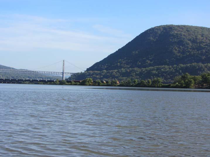
10 Sampling Locations 46 Locations 70 mile stretch of the Hudson River Six Counties Near Five Bridges Selected by NYSDEC Added/Subst. Four Size Range:.07 acres to 639 acres

11 Sample Locations: Part 1

12 Sample Locations: Part 2


13
")

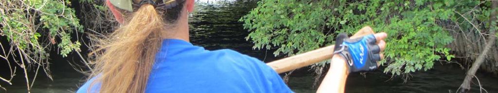
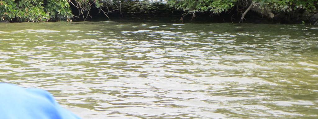
14 Project Challenges Time ~ 6 weeks from RFP release to field sampling 43 available field days ~ 4 weeks draft report (11/20/15) Tides Weather Wind at open water sites (canoe) 11 of the first 16 sampling days were greater than 90 F Location Variability Location Access

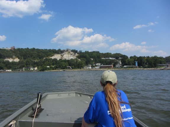

15 Location Variability


16 Location Variability


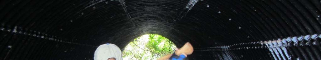
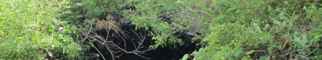
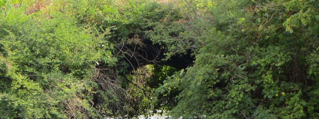
17 Location Access


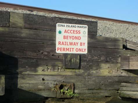
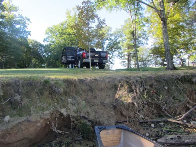

18 Location Access

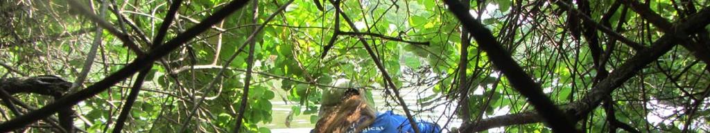
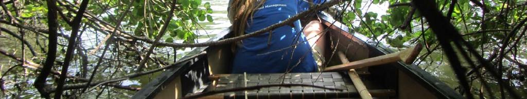


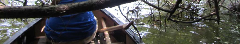


19 Location Access


20 Our Office on Most Days

21


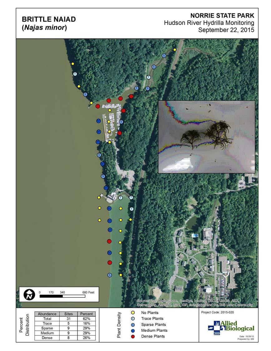
22 Two More Locations As seen from atop the Walkway over the Hudson

23 Visual Observations Supplemented GPS Referenced Sites


24 Where Did We Find Hydrilla?

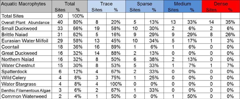
25 Results: Aquatic Plants


26 Notes 1,838 GPS referenced Sites at 46 Different Locations Two tosses per site = 3,676 total weed rake tosses 1,102 sites had aquatic plants 59.95% of the sites Most Plants collected at >5% of the sites Four Invasive Species Two Macro algae Six Pondweeds and Three Naiads

27 Turbidity Factors that Limit SAV Growth in the Hudson River and Nearby Waters SAV limited to 3.0 ft. Tides Salinity Depth Fluctuation ~ 2.5 to 4.0 ft. Wind Shoreline/Substrate Water Depth


28


29 Example Data Summary


30 Sample Maps 384 Total Maps! Maps Per Location: Site Location Total Vegetation Each Plant Species Example: If a Location had 10 different plants, we generated 12 maps for that Location.


31 Recommended Future Hydrilla Monitoring Priority Factors to Consider SAV Habitat observed The Proximity to Croton River System Plant Diversity Elodea Present? Volunteers?


32 Tuber Monitoring Conducted October 13, 2015 by North Carolina State University Staff


33 The Worst Part of the Project We spent an estimated 115 hours driving to and from locations!


34 The Best Part of the Project


35 Signs

36 Acknowledgements Sandra LaVigne, ABI (Field) Krista Michniewicz, Solitude (maps) Cathy McGlynn, NYSDEC Dan Miller, NYSDEC Michael Jennings, NEIWPCC Barre Hellquist

37 Thank you! Questions? By Chris Doyle, CLM Senior Aquatic Biologist and Water Quality Supervisor solitudelakemanagement.com LAKE
Hydrilla : A Brief Overview
 Hydrilla : A Brief Overview Michael D. Netherland US Army ERDC Rob Richardson North Carolina State University Hydrilla in FL has had a major Environmental and Economic Impact (several hundred million dollars
Northern Chain of Lakes
 Northern Chain of Lakes Presented by Pat Conrad and Joe Pallardy on behalf of the Brown s Creek Watershed District Board of Managers w a t e r I e c o l o g y I c o m m u n i t y Lake by Lake Analysis
Long Lake ( ) Aquatic Vegetation Survey
 Aquatic Vegetation Survey") Long Lake (15-0057-00) Aquatic Vegetation Survey 22796 County Highway 6 Detroit Lakes, MN 56501 (218) 846-1465 www.rmbel.info Lake: Long Lake DOW Number: 15-0057-00 Date of inspection: 7/14/ 2015 County:
Long Lake (15-0057-00) Aquatic Vegetation Survey 22796 County Highway 6 Detroit Lakes, MN 56501 (218) 846-1465 www.rmbel.info Lake: Long Lake DOW Number: 15-0057-00 Date of inspection: 7/14/ 2015 County:
Kerr Lake Vegetation Survey. October November Report submitted by NC State University. Background
 Kerr Lake Vegetation Survey October November 2011 Report submitted by NC State University Background Hydrilla (Hydrilla verticillata) is a non-native invasive submersed aquatic plant. This plant was first
Lomond Lake ( ) Aquatic Vegetation Survey
 Aquatic Vegetation Survey") Lomond Lake (15-0081-00) Aquatic Vegetation Survey 22796 County Highway 6 Detroit Lakes, MN 56501 (218) 846-1465 www.rmbel.info Lake: Lomond Lake DOW Number: 15-0081-00 Date of inspection: 7/13/ 2015 County:
Lomond Lake (15-0081-00) Aquatic Vegetation Survey 22796 County Highway 6 Detroit Lakes, MN 56501 (218) 846-1465 www.rmbel.info Lake: Lomond Lake DOW Number: 15-0081-00 Date of inspection: 7/13/ 2015 County:
Pine Lake ( ) Aquatic Vegetation Survey
 Aquatic Vegetation Survey") Pine Lake (15-0149-00) Aquatic Vegetation Survey 22796 County Highway 6 Detroit Lakes, MN 56501 (218) 846-1465 www.rmbel.info Lake: Pine Lake DOW Number: 15-0149-00 Date of inspection: 6/30, 7/2/ 2015
Pine Lake (15-0149-00) Aquatic Vegetation Survey 22796 County Highway 6 Detroit Lakes, MN 56501 (218) 846-1465 www.rmbel.info Lake: Pine Lake DOW Number: 15-0149-00 Date of inspection: 6/30, 7/2/ 2015
Herbicide Control of Cayuga Inlet Hydrilla. Glenn Sullivan, Allied Biological, Inc., Dr. Mark Heilman, SePRO Corp.
 Herbicide Control of Cayuga Inlet Hydrilla Glenn Sullivan, Allied Biological, Inc., Dr. Mark Heilman, SePRO Corp. 2011-2012 Herbicide Timeline 2011 2012 Aquathol K application Sonar Genesis injection started
An Ecological Approach to Submersed Aquatic Plant Management
 An Ecological Approach to Submersed Aquatic Plant Management Biological Control for Nature Oct 3 7, 2010 Northampton, Massachusetts Michael Smart & Mike Grodowitz US Army Corps of Engineers Engineer Research
New York State Federation of Lake Associations. New York Citizens Statewide Lake Assessment Program
 New York State Federation of Lake Associations New York Citizens Statewide Lake Assessment Program AQUATIC VEGETATION SAMPLING 1. BACKGROUND Aquatic vegetation plays a critical role in lake ecosystems.
Vegetation survey of South Lindstrom Lake ( ), Chisago County, Minnesota. Summer 2010
, Chisago County, Minnesota. Summer 2010") Minnesota Dept. of Natural Resources Division of Fish and Wildlife Section of Fisheries Vegetation survey of South Lindstrom Lake (13-0028), Chisago County, Minnesota Summer 2010 Area Fisheries Supervisor
Minnesota Dept. of Natural Resources Division of Fish and Wildlife Section of Fisheries Vegetation survey of South Lindstrom Lake (13-0028), Chisago County, Minnesota Summer 2010 Area Fisheries Supervisor
Fish Lake; Echo Bay ( ) Aquatic Vegetation Survey
 Aquatic Vegetation Survey") Fish Lake; Echo Bay (56-0768-00) Aquatic Vegetation Survey 22796 County Highway 6 Detroit Lakes, MN 56501 (218) 846-1465 www.rmbel.info Lake: Fish Lake; Echo Bay DOW Number: 56-0768-00 Date of inspection:
Fish Lake; Echo Bay (56-0768-00) Aquatic Vegetation Survey 22796 County Highway 6 Detroit Lakes, MN 56501 (218) 846-1465 www.rmbel.info Lake: Fish Lake; Echo Bay DOW Number: 56-0768-00 Date of inspection:
Aquatic Plant Point-Intercept Survey for Haas Lake, Scott County, Minnesota
 Haas Lake, Scott County, Minnesota, 2017 Aquatic Plant Point-Intercept Survey for Haas Lake, Scott County, Minnesota [Plant Survey Conducted August 29, 2017] Prepared for: Prior Lake-Spring Lake Watershed
USING AQUATIC PLANT SURVEYS TO EVALUTE LAKE QUALITY
 USING AQUATIC PLANT SURVEYS TO EVALUTE LAKE QUALITY Reesa Evans, Lake Specialist Certified Lake Manager Adams County Land & Water Conservation Department P.O. Box 287 Friendship, WI 53934 Water is an important
Strategy for Control of Hydrilla in Deep Creek Lake. Image or Graphic. DCL Policy Review Board Meeting 3/20/2014
 Image or Graphic Strategy for Control of Hydrilla in Deep Creek Lake DCL Policy Review Board Meeting 3/20/2014 1 Hydrilla Discovery Timeline September 21- Hydrilla verticillata was first detected in DCL
2014 Lamoka and Waneta Lakes Plant Community Response to the 2008 through 2014 Triclopyr Applications to Control Eurasian watermilfoil
 2014 Lamoka and Waneta Lakes Plant Community Response to the 2008 through 2014 Triclopyr Applications to Control Eurasian watermilfoil Wolffia columbiana 0.6% Nymphaea odorata 3.1% 2.3% Potamogeton praelongus
COUNTY OF CHAUTAUQUA, NEW YORK A Municipal Corporation Gerace Office Building Mayville, New York hereinafter called "County," -and-
 19- MEMORANDUM OF AGREEMENT Chautauqua Lake Weed Management Consensus Strategy This Agreement is made as of May 1, 2019, by and between the following parties: COUNTY: COUNTY OF CHAUTAUQUA, NEW YORK A Municipal
Minnesota Department of Natural Resources. Aquatic Plant Management Program
 Minnesota epartment of Natural Resources Aquatic Plant Management Program The Goal of the MN NR s Aquatic Plant Management Program-APM Protect & enhance Minnesota s aquatic resources, while allowing lakeshore
East Okoboji Lake Aquatic Vegetation Management Plan. Curlyleaf Pondweed Control
 East Okoboji Lake Aquatic Vegetation Management Plan Curlyleaf Pondweed Control What is Curlyleaf Pondweed? Non-native submersed, rooted aquatic plant Introduced in the mid 1800 s First found in Iowa
2013 Milfoil Weevil Stocking and Survey at Dewart Lake, Kosciusko County, Indiana. The Dewart Lake Protective Association
 2013 Milfoil Weevil Stocking and Survey at Dewart Lake, Kosciusko County, Indiana The Dewart Lake Protective Association Project No. 1639-3921 Date: November 8, 2013 1.0 Introduction Eurasian watermilfoil
Monitoring and response following the discovery of starry stonewort (Nitellopsis obtusa) in Wisconsin
 in Wisconsin") Monitoring and response following the discovery of starry stonewort (Nitellopsis obtusa) in Wisconsin Illinois Lake Management Association Conference March 22-24, 2018 Bloomington, IL Michelle Nault AIS
Monitoring and response following the discovery of starry stonewort (Nitellopsis obtusa) in Wisconsin Illinois Lake Management Association Conference March 22-24, 2018 Bloomington, IL Michelle Nault AIS
Wilkinson Lake. Macrophyte and Biovolume Survey 8/11/17
 Wilkinson Lake 8/11/17 This document contains two types of vegetation data collected on Wilkinson Lake. The first section details the methods and findings of a point intercept survey of macrophyte vegetation.
RTWN: Who We Are. RTWN is a partnership to help you make your community more resilient.
 RTWN: Who We Are RTWN is a partnership to help you make your community more resilient. Session 1: Setting the Stage Why We re Here DAY ONE: Identify Community Assets and Vulnerabilities Discuss Climate
New Ideas & Leadership CLP End-of-Season Rally, September 2, 2017
 New Ideas & Leadership CLP End-of-Season Rally, September 2, 2017 Welcome/Agenda Review 2017 Update Data Collection (herbicide) Project Shoreline/Near Shoreline Demonstration Project Grant Requests Submitted/Status
SAV, & DO
 College Creek water quality, SAV, & mussel results, 2008 (with graphs of 2003-2008 DO & clarity) Peter Bergstrom, NOAA Chesapeake Bay Office, FINAL 4/16/09 Background: The Friends of College Creek (FOCC),
Ms. Patricia Edelstein Friends of Lake Garfield c/o September 5, Dear Pat:
 Water Resource Services Inc. 144 Crane Hill Road Wilbraham, MA 01095 kjwagner@charter.net 413-219-8071 Ms. Patricia Edelstein Friends of Lake Garfield c/o mdrn1hart@gmail.com September 5, 2013 Dear Pat:
Ocklawaha River Restoration as Mitigation
 Ocklawaha River Restoration as Mitigation Dredging Will Further Harm the St. Johns Salinity = Farther Upstream Impacting Wetlands Damaging Submerged Grasses Further Stressing Trees Altering Dissolved Oxygen
Expanded Detection and Control of Hydrilla in Ohio s Lake Erie Basin
 Expanded Detection and Control of Hydrilla in Ohio s Lake Erie Basin Binational Great Lakes Aquatic Invasive Species Forum Mark Warman Hydrilla Project Coordinator 6 21 2017 Hydrilla verticillata Du Jour
2016 Data Report for Iron Lake, Iron County
 Michigan Lakes Ours to Protect Data Report for Iron Lake, Iron County.1397 N,.533 W The CLMP is brought to you by: 1 About this report: This report is a summary of the data that have been collected through
2014 AQUATIC VEGETATION SURVEY
 Cedar Lake, Scott County: 2014 AQUATIC VEGETATION SURVEY Report by the Invasive Species Program Division of Ecological and Water Resources Minnesota Department of Natural Resources Lake: Cedar Lake (DOW#70009100)
Pilot projects to control curly-leaf pondweed or Eurasian watermilfoil on a lake-wide or bay-wide basis for ecological benefits
 Pilot projects to control curly-leaf pondweed or Eurasian watermilfoil on a lake-wide or bay-wide basis for ecological benefits Funds available from the Minnesota Department of Natural Resources Grant
Archibald Lake Association EWM Meeting
 Welcome to the Archibald Lake Association EWM Meeting 1 Agenda Saturday August 15th, 2008 9:00am 1. Call to Order: Dick Rankin 2. Recognition Dick Rankin 3. EWM History/Plant Survey Steve Fleming 4. Actions
FINAL PROJECT REPORT. Agreement Number: G Prepared by: Thurston County Noxious Weed Control Board. October 22, 2010
 FINAL PROJECT REPORT FOR Agreement Number: G0900221 Chehalis River Egeria densa Control Prepared by: Thurston County Noxious Weed Control Board October 22, 2010 Total Cost of Project: $79,617.00 Grant
Black Lake Integrated Aquatic Vegetation Management Plan. Harry Gibbons Toni Pennington Shannon Brattebo
 Black Lake Integrated Aquatic Vegetation Management Plan Harry Gibbons Toni Pennington Shannon Brattebo 1 Benefits of Native Plants Provide diverse habitat for fish & wildlife Competes with algae for nutrients
2012 Lake Vegetation Summary Lake Sarah (Hennepin County)
") 2012 Lake Vegetation Summary Lake Sarah (Hennepin County) Introduction Lake Sarah is a 561 acre lake located near the town of Rockford in Hennepin County. It has a littoral area of 373 acres, and is dominated
2012 Lake Vegetation Summary Lake Sarah (Hennepin County) Introduction Lake Sarah is a 561 acre lake located near the town of Rockford in Hennepin County. It has a littoral area of 373 acres, and is dominated
Considerations for the Development of Aquatic Plant Survey Methods for Alaska
 15 th Annual Invasive Species Workshop Considerations for the Development of Aquatic Plant Survey Methods for Alaska Cecil F. Rich and Suresh A. Sethi, U.S. Fish and Wildlife Service, 1011 E. Tudor Rd.,
Ecological Study to Measure the Effectiveness of Soft Sediment Dredging to Eradicate Invasive and Nuisance Species
 Ecological Study to Measure the Effectiveness of Soft Sediment Dredging to Eradicate Invasive and Nuisance Species Upper Lake Yaphank, New York June 2015 Prepared for: Town of Brookhaven One Independence
Aquatic Nuisance Species
 Aquatic Nuisance Species Exotic Species Nonindigenous species (NIS) Aquatic nuisance species (ANS) ANS Impacts Threaten the diversity or abundance of native species Threaten activities dependent on these
GUIDANCE FOR DELINEATING INVASIVE AQUATIC PLANTS FOR MANAGMEMENT
 GUIDANCE FOR DELINEATING INVASIVE AQUATIC PLANTS FOR MANAGMEMENT Objectives 1. Delineating and qualifying boundaries of invasive aquatic plants for management purposes. 2. Collect additional information
2017 Data Report for Hoags Lake, Mason County
 Michigan Lakes Ours to Protect 17 Data Report for Hoags Lake, Mason County.171 N,.19575 W The CLMP is brought to you by: 1 About this report: This report is a summary of the data that have been collected
2018 Data Report for. Crystal Lake, Montcalm County
 Michigan Lakes Ours to Protect 218 Data Report for Crystal Lake, Montcalm County Site ID: 5915 43.25584 N, 84.93362 W The CLMP is brought to you by: 1 About this report: This report is a summary of the
Osher Course. What Lies Beneath the Inland Bays?
 Osher Course What Lies Beneath the Inland Bays? Objectives for Course Describe the Delaware Inland Bays and their tributaries Illustrate the ecology and importance of estuaries Demonstrate the threats
2017 Data Report for Shingle Lake, Clare County
 Michigan Lakes Ours to Protect 217 Data Report for Shingle Lake, Clare County Site ID: 1818 43.96359 N, 84.95282 W The CLMP is brought to you by: 1 About this report: This report is a summary of the data
2017 Data Report for Perch Lake, Iron County
 Michigan Lakes Ours to Protect 217 Data Report for Perch Lake, Iron County Site ID: 3646 46.361392 N, 88.658338 W The CLMP is brought to you by: 1 About this report: This report is a summary of the data
2018 Data Report for. Lotus Lake, Oakland County
 Michigan Lakes Ours to Protect 218 Data Report for Lotus Lake, Oakland County 42.6941 N, 83.4244 W The CLMP is brought to you by: 1 About this report: This report is a summary of the data that have been
2017 Data Report for Big Maggie Lake, Iron County
 Michigan Lakes Ours to Protect 2017 Data Report for Big Maggie Lake, Iron County Site ID: 360173 46.01 N, 88.4626 W The CLMP is brought to you by: 1 About this report: This report is a summary of the data
2017 Data Report for Earl Lake, Livingston County
 Michigan Lakes Ours to Protect 217 Data Report for Earl Lake, Livingston County Site ID: 755 2.191 N, 3.95 W The CLMP is brought to you by: 1 About this report: This report is a summary of the data that
Charley Lake. Macrophyte and Biovolume Survey 8/04/17
 Charley Lake 8/04/17 This document contains two types of vegetation data collected on Charley Lake. The first section details the methods and findings of a point intercept survey of macrophyte vegetation.
2017 Data Report for Painter Lake, Cass County
 Michigan Lakes Ours to Protect 217 Data Report for Painter Lake, Cass County Site ID: 1418 41.81667 N, 85.99194 W The CLMP is brought to you by: 1 About this report: This report is a summary of the data
2017 Data Report for Arbutus Lake, Grand Traverse County
 Michigan Lakes Ours to Protect 217 Data Report for Arbutus Lake, Grand Traverse County Site ID: 2819 44.65917 N, 85.519726 W The CLMP is brought to you by: 1 About this report: This report is a summary
Starry stonewort, Nitellopsis obtusa WI Lakes Convention April 1 st, 2016
 Starry stonewort, Nitellopsis obtusa WI Lakes Convention April 1 st, 2016 Heidi Bunk, Lakes Biologist, WDNR Bradley Steckart, Washington and Waukesha County AIS Coordinator Tim Plude, WDNR to MDNR Tim
2016 Data Report for Magician Lake, Cass County
 Michigan Lakes Ours to Protect 216 Data Report for Magician Lake, Cass County Site ID: 1465 42.649 N, 86.179 W The CLMP is brought to you by: 1 About this report: This report is a summary of the data that
Preferred Alternative Proposal
 Preferred Alternative Proposal Advisory Committee March 27, 2007 Agenda Formation of the Preferred Alternative Proposal Description of the Preferred Alternative Proposal Preferred Alternative Proposal
2017 Data Report for Deer Lake, Alger County
 Michigan Lakes Ours to Protect 2017 Data Report for Deer Lake, Alger County Site ID: 020127 46.48016 N, 86.98277 W The CLMP is brought to you by: 1 About this report: This report is a summary of the data
RESULTS OF THE POST-APPLICATION VEGETATION SURVEY OF GOOSE BAY, NEW YORK
 RESULTS OF THE POST-APPLICATION VEGETATION SURVEY OF GOOSE BAY, NEW YORK FINAL REPORT PREPARED FOR: GOOSE BAY RECLAMATION CORPORATION PREPARED BY: Lee H. Harper and Anne Johnson Riveredge Associates, LLC,
2017 Data Report for Loon Lake, Iosco County
 Michigan Lakes Ours to Protect 2017 Data Report for Loon Lake, Iosco County Site ID: 350078 The CLMP is brought to you by: 1 About this report: This report is a summary of the data that have been collected
2018 Data Report for Pickerel Lake, Kalkaska County
 Michigan Lakes Ours to Protect 2018 Data Report for Pickerel Lake, Kalkaska County Site ID: 400035 44.800559 N, 84.97667 W The CLMP is brought to you by: 1 About this report: This report is a summary of
2017 Data Report for Pleasant Lake, Wexford County
 Michigan Lakes Ours to Protect 2017 Data Report for Pleasant Lake, Wexford County Site ID: 830183 44.3 N, 85.4775 W The CLMP is brought to you by: 1 About this report: This report is a summary of the data
2017 Data Report for Oxbow Lake, Oakland County
 Michigan Lakes Ours to Protect 2017 Data Report for Oxbow Lake, Oakland County Site ID: 630666 42.64167 N, 83.477226 W The CLMP is brought to you by: 1 About this report: This report is a summary of the
City of Casselberry & Florida Fish & Wildlife Conservation Commission Middle & South Lake Triplet, Lost Lake, & Queens Mirror Lake Workshop
 City of Casselberry & Florida Fish & Wildlife Conservation Commission Middle & South Lake Triplet, Lost Lake, & Queens Mirror Lake Workshop Workshop Goals Explore physical & biological characteristics
2017 Data Report for Portage Lake, Washtenaw County
 Michigan Lakes Ours to Protect 2017 Data Report for Portage Lake, Washtenaw County Site ID: 810248 42.420559 N, 83.921392 W The CLMP is brought to you by: 1 About this report: This report is a summary
Water and Watersheds. Data Maps Action
 Water and Watersheds Data Maps Action What is the Wildlife Action Plan? Restore rare wildlife and habitats. Keep common species common. 2015 Revision: Partners in Conservation Science 2015 Revision Data
GLP UPDATE: INDIANA HYDRILLA ERADICATION & STARRY STONEWORT BATTLE
 GLP UPDATE: INDIANA HYDRILLA ERADICATION & STARRY STONEWORT BATTLE ERIC FISCHER, AQUATIC INVASIVE SPECIES COORDINATOR INDIANA DEPT. OF NATURAL RESOURCES INVASIVE SPECIES MOVE FAST!! Who or What was knocking
2004 Satellite Imagery/Ground Survey Invasive Vegetation Mapping Final Report
 2004 Satellite Imagery/Ground Survey Invasive Vegetation Mapping Final Report Aquatic Nuisance Plant Control s final fall invasive vegetation survey was completed using ArcView 9.0 GIS software. The method
2017 Data Report for Silver Lake, Van Buren County
 Michigan Lakes Ours to Protect 2017 Data Report for Silver Lake, Van Buren County Site ID: 800534 42.3891 N, 86.0599 W The CLMP is brought to you by: 1 About this report: This report is a summary of the
An Introduction to Cedar Creek Ecosystem Science Reserve.
 An Introduction to Cedar Creek Ecosystem Science Reserve. Habitats at Cedar Creek Ecosystem Science Reserve Cedar Creek Natural Ecosystem Science Reserve is within the meeting point of the three largest
Where s has the grass gone? Factors impacting submerged aquatic vegetation bring together partners at Lake Mattamuskeet
 Where s has the grass gone? Factors impacting submerged aquatic vegetation bring together partners at Lake Mattamuskeet Michelle Moorman Mattamuskeet NWR The purpose of Mattamuskeet NWR is to protect and
Evaluation of aquatic plant control via automated mechanical roller system
 Evaluation of aquatic plant control via automated mechanical roller system T.L. Brandt 1 INTRODUCTION Canadarago Lake (N42 o 48.9, W75 o.4 ), 39 m (128ft) above sea level, is located in the towns of Exeter,
An Assessment of the Applied Research, Management, and Outreach Needs Associated with Wisconsin s Great Lakes Freshwater Estuaries
 An Assessment of the Applied Research, Management, and Outreach Needs Associated with Wisconsin s Great Lakes Freshwater Estuaries Patrick Robinson Environmental Restoration Specialist, University of Wisconsin-Extension
2016 Field Survey West Branch of Fish Creek (From Kasoag Lake Outlet) SLELO-PRISM Early Detection Surveillance June 20 th - 23 rd, 28 th - 29 th, 2016
 SLELO-PRISM Early Detection Surveillance June 20 th - 23 rd, 28 th - 29 th, 2016") St. Lawrence Eastern Lake Ontario Partnership for Regional Invasive Species Management 206 Field Survey West Branch of Fish Creek (From Kasoag Lake Outlet) Early Detection Surveillance June 20 th - 23
St. Lawrence Eastern Lake Ontario Partnership for Regional Invasive Species Management 206 Field Survey West Branch of Fish Creek (From Kasoag Lake Outlet) Early Detection Surveillance June 20 th - 23
Deep Creek Lake Submerged Aquatic Vegetation Survey
 Deep Creek Lake Submerged Aquatic Vegetation Survey Report of Summer 2010 Survey Activity February 4, 2011 ABSTRACT Maryland Department of Natural Resources (DNR) Resource Assessment Service (RAS) staff
Volunteers Keeping A Watchful Eye on the Health of Maine Lakes and Ponds for 39 Years!
 Volunteers Keeping A Watchful Eye on the Health of Maine Lakes and Ponds for 39 Years! VLMP is the Largest Collector and Provider of Lake Data in the State of Maine 2009 608 volunteers collected water
NJ Watershed Ambassadors Program Getting Things Done
 NJ Watershed Ambassadors Program Getting Things Done 8th Water Monitoring Summit Kimberly Cenno,, Supervising Environmental Specialist, NJDEP Division of Water Monitoring & Standards Lauren Smith Watershed
A Multi-Stakeholder Partnership to Protect, Manage, and Restore our Springs: A National Estuary Program Model for the Florida Springs Coast
 A Multi-Stakeholder Partnership to Protect, Manage, and Restore our Springs: A National Estuary Program Model for the Florida Springs Coast Chris J Anastasiou, Ph.D. Chief Scientist & Springs Team Lead
Biodiversity Conservation
 SITE PLAN REVIEW & BIODIVERSITY CONSERVATION Hudsonia Ltd. Session 3 of a workshop series sponsored by the Teatown Lake Reservation Site Plan Review & Biodiversity Conservation Biodiversity and Ecosystem
Position Statement Lake Minnetonka Milfoil Control
 Eurasian watermilfoil has been in Lake Minnetonka since 1987. In 1989, the Lake Minnetonka Conservation District (LMCD) initiated a harvesting program to cut and remove milfoil from critical areas of the
Modeling the impacts of water quality on SAV and other living resources in the tidal Chesapeake Bay
 Modeling the impacts of water quality on SAV and other living resources in the tidal Chesapeake Bay Bio-optics, Biogeochemistry & SAV Distribution Dick Zimmerman 1, Victoria Hill 1, Chuck Gallegos 2 Hydrodynamics
Aquatic Plant Control
 Tawas Lake Nuisance Aquatic Plant Control Report Prepared for: Tawas Lake Improvement Association Aquatic Plant Control Prepared by: Progressive AE 1811 4 Mile Road, NE Grand Rapids, MI 49525-2442 616/361-2664
Please find the latest bioassessment report for your lake below. Key highlights of this update include:
 Greetings Lake Tuskawilla residents! Please find the latest bioassessment report for your lake below. Key highlights of this update include: Lake Vegetation Index (LVI) conducted Results of April 25 th
Clam Lakes (Lower & Upper), Burnett County Four-Phased Lake Management Planning Project Description
, Burnett County Four-Phased Lake Management Planning Project Description") 1 Clam Lakes (Lower & Upper), Burnett County Four-Phased Lake Management Planning Project Description Lake and Watershed Characteristics The Clam Lakes are a combined 1544 acres with Upper Clam Lake essentially
1 Clam Lakes (Lower & Upper), Burnett County Four-Phased Lake Management Planning Project Description Lake and Watershed Characteristics The Clam Lakes are a combined 1544 acres with Upper Clam Lake essentially
2017 Data Report for Fern Lake, Grand Traverse County
 Michigan Lakes Ours to Protect 2017 Data Report for Site ID: 280438 44.73475 N, 85.73409 W The CLMP is brought to you by: 1 About this report: This report is a summary of the data that have been collected
2017 Data Report for Rogers Pond, Mecosta County
 Michigan Lakes Ours to Protect 2017 Data Report for 43.6175478 N, 85.4718313 W The CLMP is brought to you by: 1 About this report: This report is a summary of the data that have been collected through
APPLICATION FOR AN INDIVIDUAL AQUATIC HERBICIDE TREATMENT PERMIT
 APPLICATION FOR AN INDIVIDUAL AQUATIC HERBICIDE TREATMENT PERMIT File #: Area/SUB #: This is an application to obtain an Individual Aquatic Herbicide Treatment Permit. Georgia Power Company prohibits the
2017 Data Report for Ottawa Lake, Iron County
 Michigan Lakes Ours to Protect 2017 Data Report for Site ID: 360033 46.08484 N, 88.76419 W The CLMP is brought to you by: 1 About this report: This report is a summary of the data that have been collected
2016 Data Report for Bruin Lake, Washtenaw County
 Michigan Lakes Ours to Protect 1 Data Report for Bruin Lake, Washtenaw County Site ID: 8575.189788 N, 8.39387 W The CLMP is brought to you by: 1 About this report: This report is a summary of the data
2015 Data Report for South Torch Lake, Antrim County
 Michigan Lakes Ours to Protect 2015 Data Report for South Torch Lake, Antrim County Site ID: 050240 44.91590 N, 85.30280 W The CLMP is brought to you by: About this report: This report is a summary of
Canandaigua Lake Watershed Program Partners in Watershed Protection
 Canandaigua Lake Watershed Program Partners in Watershed Protection 5 PROTECTION THEMES Research Education Restoration Open Space Protection Regulation Canandaigua Lake Watershed Association Canandaigua
2016 Data Report for Barlow Lake, Barry County
 Michigan Lakes Ours to Protect 216 Data Report for Barlow Lake, Barry County Site ID: 8176 42.67559 N, 85.5242 W The CLMP is brought to you by: 1 About this report: This report is a summary of the data
2017 Data Report for Lake Independence, Marquette County
 Michigan Lakes Ours to Protect 217 Data Report for Lake Independence, Marquette County Site ID: 2149 46.88337 N, 87.711393 W The CLMP is brought to you by: 1 About this report: This report is a summary
2017 Data Report for Little Paw Paw Lake, Berrien County
 Michigan Lakes Ours to Protect 2017 Data Report for Site ID: 110765 42.21899 N, 86.29072 W The CLMP is brought to you by: 1 About this report: This report is a summary of the data that have been collected
AQUATIC PLANT MANAGEMENT PLAN FOR U.S. ARMY CORPS OF ENGINEERS, SAVANNAH DISTRICT WATER RESOURCES PROJECTS SOUTH CAROLINA AND GEORGIA
 AQUATIC PLANT MANAGEMENT PLAN FOR U.S. ARMY CORPS OF ENGINEERS, SAVANNAH DISTRICT WATER RESOURCES PROJECTS SOUTH CAROLINA AND GEORGIA Appendix A CY 2018 Update Annual Aquatic Plant Treatment Plan and Summary
A Synopsis of the 2014 Hydrilla Treatments on the Erie Canal
 A Synopsis of the 2014 Hydrilla Treatments on the Erie Canal Michael D. Netherland 1, K. Dean Jones 2, Rich Ruby 3, and Mike Greer 3 1 S Army ERDC, Gainesville, FL 2 niversity of Florida, CAIP, Lake Alfred,
Webinar for the Natural Floodplain Function Alliance 18 November 2013
 Moving toward Floodplain Restoration at Scale on the Illinois River and Upper Mississippi Basin: Valuing Ecosystem Services, Demonstrating Flood Reduction, and Policy Implications Webinar for the Natural
TOWN OF RHINEBECK RESOLUTION
 TOWN OF RHINEBECK RESOLUTION 2018197 REQUESTING AN ETENSION OF THE SCOPING COMMENT PERIOD WITH ADDITIONAL PUBLIC INFORMATION AND SCOPING MEETINGS, FOR THE NY/NJ HARBOR & TRIBUTARIES COASTAL STORM RISK
ENGINEERING ECOSYSTEM RESTORATION
 APPENDIX D ENGINEERING ECOSYSTEM RESTORATION ENGINEERING APPENDIX FOR EXISTING CONDITION ANALYSIS FOR RISK INFORMED DECISION MAKING FOR PROJECT ALTERNATIVE SELECTION DELTA ISLANDS AND LEVEES FEASIBILITY
Spokane River Project Aquatic Weed Management Program
 Spokane River Project Aquatic Weed Management Program David Armes Terrestrial Resource Specialist (509) 495-2796 david.armes@avistacorp.com Aquatic Weeds, Why Should You Care? Invasive aquatic weeds degrade
Grandfather Restoration Project
 Grandfather Restoration Project a Collaborative Forest Landscape Restoration (CFLR) Program Presentation by Lisa Jennings Grandfather Restoration Project Coordinator lisanjennings@fs.fed.us August 12,
2017 Data Report for Duck Lake, Muskegon County
 Michigan Lakes Ours to Protect 217 Data Report for Duck Lake, Muskegon County Site ID: 61778 43.33785 N, 86.39258 W The CLMP is brought to you by: 1 About this report: This report is a summary of the data
Aquatic Macrophyte Survey of Mirror Lake and Shadow Lake in Waupaca Wisconsin
 Aquatic Macrophyte Survey of Mirror Lake and Shadow Lake in Waupaca Wisconsin Summer 2011 Prepared By Center for Watershed Science and Education University of Wisconsin-Stevens Point Contents Acknowledgements...
2017 Data Report for Lake Tahoe, Oceana County
 Michigan Lakes Ours to Protect 17 Data Report for Lake Tahoe, Oceana County Site ID: 33 3.1 N,.3 W The CLMP is brought to you by: 1 About this report: This report is a summary of the data that have been