THE MARLETTE LAKE WATER SYSTEM
|
|
|
- Logan Dixon
- 5 years ago
- Views:
Transcription
1 1.
2
3 THE MARLETTE LAKE WATER SYSTEM A Report on the Feasibility and Desirability of Its Retention LEGISLATIVE COMMISSION OF THE LEGISLA TIVE COUNSEL BUREAU FEBRUARY 1969 BULLETIN NO. 79
4

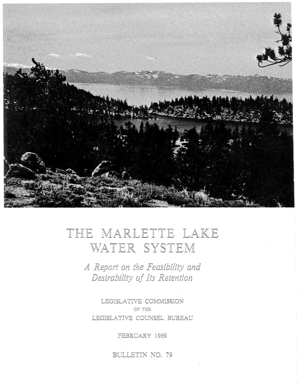
5 Frontispiece. Aerial view of Marlette Lake, May 31, Courtesy Robert S. Leighton, Sierra Pacific Power Company; provided by Millard-Spink Associates, Inc. of Nevada.
6
7 Tab.le of Contents Senate Concurrent Resolution No. 21, 54th session of the Nevada Legislature (1967), directing the Legislative Commission to study the feasibility and desirability of retaining the Marlette Lake water system Report of the Legislative Commission Report to the Legislative Commission from the Subcommittee for Study of the Marlette Lake Water System... ' Part I--Subcommittee's Findings and Recommendations A. B. C. In troduction.... Problems of Divided Ownership Required Improvements to the System; Costs Pipeline from tunnel to Red House Tunnel Pipeline: Marlette Lake to tunnel Hobart Creek Reservoir darn Pipeline to Carson City Replacement of tanks D. E. F. Subcommittee's Recommendations Acknowledgment Suggested Legislation Part II--History of the Water System 13 Part the Nevada ~--- Part IV--Water Supply, Storage and Facilities of the Present System A. B. C. D. Wa ter Supply Water From Tunnel and East Slope Area Storage.... Facili ties Mar let te Lake.. Tunne 1. Tunnel to Red House Flume Hobart Reservoir Red House Diversion Dam... Pipeline: Red House to Tanks Tanks. Syphon
8 Table of Contents Page Part V--Water Rights in Marlette Lake water System 35 Part VI--Supervision and Administration'of the Marlette Lake Water System by the Buildings and Grounds Division, Department of Administration A. In General B. Equipment c. Personnel D. Health Division's Recommendations E Summer-Autumn Activity F. Finances....;.... Part VII--Water Service for Virginia City, Gold Hill and Silver City Part VIII--State Water Facilities in Carson City and Ormsby County A. History B. Facilities c. Water Rights Vicee Canyon Creek; Lower Rose Spring 2. Upper Rose Creek 3. Ash Canyon Creek 4. Dead Horse Spring D. Future Demands on State Water Facilities Part IX--Carson water Company A. History..... ~~ B. Water Supply and Facilities C. Possible City-County Acquisition Part X--Nevada's Cutthroat Trout Program A. Introduction.... B. Marlette Lake and Its Potential as a Cutthroat Trout Brood Stock Area C. Evaluation of the Economic Effect of the Cutthroat Brood Stock in Marlette Lake for the State of Nevada D. Fisheries Potential of Hobart Reservoir E. Possible Recreational Angling F. Impact on Cutthroat Trout Program by Water Withdrawal From Marlette Lake =--.-'
9 Table of Contents.. pagi Part XI--State Parks and Outdoor Recreation... 8 A. Generally ~ B. Land Values C. Land and Water Conservation Fund Dedication 83 D. Economic Impact 84 Part XII--Future Water Needs of the Carson City- Eagle Valley Area 85 A. Future Requirements 85 B. Possible Sources Surface water development in Eagle Valley Imports from Washoe Valley Diversions from the Carson River; Proposed Watasheamu Dam and Reservoir Wel~s in Eagle Valley Increased Imports from the Marlette Lake water system., 85,- Notes 87 Senator B. Mahlon Brown Senator Carl F. Dodge Senator James I. Gibson Senator Archie Pozzi, Jr. * * * * * Legislative Commission Assemblyman Melvin D. Close, Jr. Assemblyman Zelvin D. Lowman Assemblyman James E. Wood Senator Marvin L. White
10
11 Senate Concurrent Resolution No. 21 (1967) SENATE CONCURRENT RESOLUTION--Directing the legislative commission to make a study of the feasibility and desirability of retaining the Marlette Lake water system. WHEREAS, The State of Nevada acquired the Marlette Lake water system, now supervised and administered by the department of administration; and WHEREAS, It may be desirable for the state to dispose of the water system by sale to private persons but a complete study of the present and future needs of and demands upon the water system should first be made, now, therefore, be it RESOLVED BY THE SENATE OF THE STATE OF NEVADA, THE ASSEMBLY CON CURRING, That the legislative commission is hereby directed to make a study of the Marlette Lake water system, and its present and future requirements, and report the results of such study and make specific recommendations to the 55th session of the Nevada legislature. -1-
12
13 Report of the Legislative Commission To the Members of the 55th Session of the Nevada Legislature: The Legislative Commission appointed a subcommittee to make the complete study of the present and future needs of and demands upon the Marlette Lake water system and the feasibility and desirability of its retention by the State of Nevada pursuant to the direction of Senate Concurrent Resolution No. 21 adopted by the 1967 legislature. Members of the subcommittee were: Assemblyman Lawrence E. Jacobsen (Chairman) Minden, Nevada Senator M. J. Chr~stensen Las Vegas, Nevada Mr. Eric Cronkhite, Administrator Division of State Parks State Department of Conservation and Natural Resources Carson City, Nevada Mr. George Gottschalk Carson City, Nevada Mr. Frank Groves Director of Fish and Game Reno, Nevada Assemblyman Robert H. Smith Henderson, Nevada Assemblyman Roy L. Torvinen Reno, Nevada Mr. Walter G. Reid Virginia City, Nevada Mr. Francis Slade Carson City, Nevada Mr. Roland D. Westergard State Engineer Department of Conservation and Natural Resources Carson City, Nevada In accepting the subcommittee's report the Legislative Commission acknowledges a job well done and thanks the subcommittee for the obvious efforts and expenditure of personal time devoted to the required investigation and report. The report is transmitted to the members of the 1969 legislature for their consideration and possible action. Carson City, Nevada February, 1969 Respectfully submitted, Legislative Commission State of Nevada -3-
14
15 Report to the Legislative Commission from the Subcommittee for Study of the Marlette Lake Water System A. Introduction. PART I Subcommittee's Findings and Recommendations Your subcommittee was directed to make a complete study of the present and future needs of and demands upon the Marlette Lake water system in accordance with the directions of Senate Concurrent Resolution No. 21 (1967). This we have done. We apologize for the length of our report occasioned by the many complex facets of the study but believe that for a minimal understanding of the water system and its problems the legislator who has not had the opportunity to inspect it or become acquainted with its operation will find the contents both instructive and interesting. Often the written word in technical studies is inadequate to describe the subject. Such is"the case here, and the report is illustrated liberally with photographs and maps to assist the reader. Our subcommittee was given invaluable assistance and advice from many of its members appointed because of their expert knowledge of and experience concerning the water system. At the outset the subcommittee chairman assigned specific tasks to individual members for investigation. Six meetings of the subcommittee were held during the period August 1967 to November 1968, and several inspections of the system were made by the whole subcommittee and member groups. Testimony was taken from several individuals, and published works were consulted both by the staff and subcommittee members. B. Problems of Divided Ownership. Carson Water Company and the State of Nevada each own and operate water supply and distribution systems serving parts of the same area. Each relies on the Marlette Lake water system as a source. This situation is not conducive to the development of the water resources of the Carson City-Eagle Valley area. Carson Water Company has not engaged in a well-drilling program only because of the availability of state water sold at the high price of 16 cents per 1,-000 gallons. Carson Water Company is reluctant to enter into long-term contracts with the state guaranteeing any more than a minimum water use during peak demand periods. The state continues to demand the l6-cent price because of its large investment in the purchase and subsequent expenditures on the system and legislative direction to use revenue excesses over costs for debt service. Continuing required improvement expenditures have lowered the anticipated reduction of debt. Insistence by the state on the high rate has serious implications for both Carson City and the state. Roy L. Torvinen, Esq., assemblyman and subcommittee member, -5-

16 speaking for the subcommittee on November 11, 1968, describes the state's dilemma: To start with, to date, June 30, 1967, not now, this system has cost the State of Nevada, not including the purchase price, not including salaries, $36,700. In addition, we have spent almost $400,000 retiring the bonds. To improve the water resources system to its potential, here are just a few items that the State Planning Board suggested last year during the session when they made their report: Enlarging Hobart, $324,000; independent connecting pipeline, $306,000; connecting Red House and the tunnel, $182,000; tunnel rehabilitation, $62,000~ another pipe to Marlette tunnel, $161,000; lower reservoir, $200,000. This is up to the 1985 potential. We have over $1,000,000 right there. You people who say the state should retain and own the water resource system are looking at a future expenditure, conservatively, of onehalf million dollars, according to the State Planning Board, or $1,000,000 above what is already invested. If we continue to do this and sell water to the Carson Water Company only when they need it we are going to realize only about ~ or 10 percent interest on our investment--the actual invested capital. It is impossible of recovery based on these facts. It is economically not feasible for the state to pay for the improvement of the water resources development area, the production of the water, and sell it occasionally at wholesale. It is my feeling, strongly, that all of the land with the exception of a few acres, the easements for the pipelines and possibly portions of Hobart could be retained by the stat~. All of the water resources and waters themselves, the collection areas, can be sold or leased on a royalty basis to either the Carson City Water Company, Carson City-Ormsby County or a district to be formed. A district or municipal water system in Eagle Valley is the best thing if it can come to pass. Production facilities of the water ~ould be sold and somebody else be responsible for spending this half million to million to produce the water. * * * I would recommend that we look towards the distribution of the water and saddling of the responsibility of improving the collection system on someone else who can amortize the cost against sales of water in the Eagle Valley area, where it should be paid, and not by taxpayers of all the state. This committee should suggest that as soon as possible an engineer or evaluation firm be employed to give us an evaluation of the * * * economic value of the system, the water source and the distribution system, with a view of ultimately either negotiating on an informed basis with Carson City Ormsby County or a district that is formed or the Carson Water Company. C. Required Improvements to the System; Costs. In order to make full use of the water resources of the Marlette Hobart area which supplies the Marlette Lake water system, a number of improvements are required. -6-
17 1. Pipeline from tunnel to Red House. An 8-inch line was installed in part during the summer of 1967 as a temporary device at the expense of Carson Water Company. The Reid report describes this project as the most urgent of the required developments. Mr. Walter G. Reid recommends a pipe 18 inches in diameter to carry as much as 6,000,000 gallons per day in order that Marlette Lake could furnish the major portion of the water during the dry years and complement the flows from other areas. His cost estimate for this work on August 19, 1968, is $140,000. His estimate of cost of extending the 10-inch pipe to the east portal of the tunnel is $83, Tunnel. In his original report to the Legislative Commission, Reid estimated the cost of reopening.the tunnel to be $40,000. In August 1968, because of the work done -on-the tunnel in the interval, he was unable to make an intelligent estimate without considerably more investigation. 3. Pipeline: Marlette Lake to tunnel. Mr. Reid advocates bringing water from Marlette Lake to the west portal of the tunnel by a l4-inch-diameter pipe 25,200 feet in length. In August 1968 he estimated the cost to be $250, Hobart Creek Reservoir dam. To construct a dam at the sight of the dam, enlarged to create a reservoir with a capacity of 838,000,000 gallons, Reid's recent estimate of cost is $330, Pipeline to Carson City. When the demand from the state and Carson City exceeds 3,000,000 gallons per day, it will be necessary to install an additional line to the state reservoir from the tanks. Reid's estimated cost for this work is $83, Replacement of tanks. The tanks are wooden. Because of high fire hazard, they should be replaced with either concrete or steel tanks. No estimate of cost is made. D. Subcommittee's Recommendations. 1. In order to eliminate most of the disadvantages of the present method of operation of the water system and to minimize others, the subcommittee recommends that the legislature initiate action to convey responsibility for operation and development of the Marlette Lake water system to Carson City, Ormsby County or a general improvement district formed for the purpose. It is proposed that the state retain ownership of all the land and full control of the use of the area, including recreational and fisheries uses of the lakes. -7-

18 The recommended sale would also include the state's water distribution facilities in Carson City and Ormsby County. Such a sale would result in the state's purchasing all needed water from the city, county or district. Legislation to effect this recommendation should: (a) Appropriate to the Department of Administration sufficient moneys for a professional appraisal and evaluation of the economic value of the water system, the water source and the distribution system. (b) Authorize the Department of Administration to sell (or perhaps lease for a term of years) the water system, source and distribution system at not less than the appraised value, recognizing the historic needs of Virginia City, Gold Hill and,silver City. Broad guidelines should be given the department for negotiation of the recommended sale. (c) Provide administrative direction for multiple use of the land for recreation and fisheries purposes. It is suggested that the responsibility for land use and management be assigned to the State Department of Conservation and Natural Resources, its Divisions of State Parks and Forestry having a direct interest in the land. Use of the lakes for the fisheries programs of the Fish and Game Commission should be retained by that commission. (d) Direct the establishment at the house at Lake- Fiq. 1. Lakeview Hill House, view Hill (Fig. 1) and a sufficient amount of land surrounding it by the Nevada State Parks System of a picnic area and a visitors' center interpretive of the historic Marlette water system. 2. If the first recommendation is not possible, then your subcommittee recommends that the state remain in the wholesale water business, developing its water supply but selling to a public utility- Carson City, Ormsby County or a general improvement district--all of its water facilities below the tanks. To assist the Department of Administration in fixing the rate for the sale of wholesale water the legislature should recognize that the land originally was purchased for other than water system purposes--namely, parks and outdoor recreation purposes--and should, by appropriate legislative act, amend existing statutes to assist the department in future contract negotiations. Debt service required for the land purchase should perhaps realistically be funded from the state's general fund and not from revenue excesses over operating costs. Acceptance of -8-
19 this recommendation would of course lead to a high priority development of Hobart Reservoir and expenditure of state funds to meet long-term wholesale water contract obligations. 3. It is also recommended that the subcommittee be continued for the next biennium to advise the next legislature concerning the system. E. Acknowledgment. Your subcommittee gratefully acknowledges the cooperation and assistance of all persons, both public and private, who assisted it in its investigations. They include officers and representatives of the Carson Water Company, Virginia City Water Company, Carson City, Ormsby County, Storey County, Carson Chapter of the Nevada Society of Professional Engineers, United States Bureau of Reclamation, and many of the state's departments and agencies. All photographs used in the report (except as hereinafter credited) were taken for the subcommittee by Mr. William A. Rollins, conservation agent, Nevada Fish and Game Commission. The aerial photograph was made available by Mr. Robert S. Leighton, Sierra Pacific Power Company, having been taken on May 31, 1968, by Millard-Spink Associates, Inc. o'f Nevada. The subcommittee thanks the University of Nevada for giving its permission to reproduce several early photographs of the system from its publication, Geology and Mining Series No. 45 (1947). The subcommittee's special thanks are given to its member Walter G. Reid who, at no expense, updated his earlier report on the water system and provided the subcommittee with expert, technical information. Russell W. McDonald, Esq., Legislative Counsel, assisted the subcommittee in its labors. F. Suggested Legislation. Suggested legislation to effect the recommendations of the subcommittee follows. SUMMARY--Provides for administration of Marlette Lake water system. (BDR ) AN ACT relating to the Marlette Lake water system; providing separately for the administration of land and for the administration, sale or lease of the water supply system; making an appropriation; and providing other matters properly relating thereto. THE PEOPLE OF THE STATE OF NEVADA, REPRESENTED IN SENATE AND ASSEMBLY, DO ENACT AS FOLLOWS: Section 1. NRS is hereby amended to read as follows: -9-

20 The Marlette Lake water system, [comprised] composed of the water rights, [land,] easements, pipelines, flumes and other fixtures and appurtenances used in connection with the collection, transmission and storage of water in Washoe, Ormsby and Storey Counties, Nevada, acquired by the State of Nevada pursuant to law, is hereby created. 2. The purposes of the Marlette Lake water system are: (a) [To preserve and protect the sources of water. (b)] To provide adequate supplies of water to the areas served. [(c) To improve and pr~serve the watershed. (d)] (b) To maintain distribution lines, flumes, dams, culverts, bridges and all other appurtenances of the system in a condition calculated to assure dependable supplies of water. [(e)} (c) To sell water under equitable and fiscally sound contractual arrangements. Any such contractual arrangement shall not include the value of the land comprising the watershed as an element in determining the cost of water sold. 3. The department of administration is designated as the state agency to supervise and administer the functions of the Marlette Lake water system. 4. The director of the department of administration may [assign] : (a) -Assign the. supervision and administration of the functions of the Marlette Lake water system to one of the divisions of the department or may establish a separate division to carry out the purposes of NRS to , inclusive [.] ; or (b) Sell or lease the Marlette Lake water system, if and in such manner as provided by special law, to Carson City, Ormsby County or a general improvement district. 5. subject to the limit of funds provided by legislative appropriation or expenditures authorized pursuant to the provisions of chapter 353 of NRS, or both, the chief of the division shall employ necessary staff to carry out the provisions of NRS to , inclusive. The water system supervisor employed by the private owner of the system on the date of acquisition by the State of Nevada shall be employed by the chief of the division, which position shall be in the unclassified service of the state until such employee terminates his employment with the state. Such employee shall receive an annual salary in the amount specified in NRS Thereafter such position shall be in the classified service of the state. Sec. 2. NRS is hereby amended to read as follows: The state department of conservation and natural resources [is directed to cooperate in carrying out the purposes of NRS to , inclusive. The director of the department of administration is empowered to allocate moneys appropriated by the legislature or authorized to be expended pursuant to the provisions of chapter 353 of NRS for the Marlette Lake water system to the state department of conservation and natural resources for the purpose of carrying out the provisions of NRS to , inclusive.] shall control and administer the land acquired by the State of Nevada with the purchase of the Marlette Lake water system, to assure its optimum use for recreation, water development, forestry and fishery. 2. The state department of conservation and natural resources -10-

21 shall cooperate with the department of administration or its vendee or lessee of the water system: (a) To preserve and rotect the sources of water; and To preserve and 1mprove t e waters e 3. The state department of conservation and natural resources shall cooperate with the state board of fish and game commissioners in the use of Marlette Lake and its tributaries for fishery and propagation. Sec. 3. The department of administration shall cause an appraisal to be made of the Marlette Lake water system, as redefined by section 1 of this amendatory act, by a competent, disinterested appraiser. Such appraisal shall establish: 1. The value of the entire system; and 2. The separate value of the water distribution facilities, serving parts of Carson City and Ormsby County, which are part of the system and lie below the siphon inlet tanks. Sec The department of administration may sell the Marlette Lake water system, as redefined by section 1 of this amendatory act, to Carson City, Ormsby County, or a general improvement district authorized to furnish water facilities, for a price not less than its appraised value, which price may be payable over such term of years as will permit its payment, with interest at a mutually agreed rate upon the deferred balance, to be made from revenues of the system. The department of administration may, alternatively, lease the system for a term of not more than 99 years to any entity which would be a qualified purchaser under this section, at a rental based upon the appraised value of the system. 2. In making any sale or lease pursuant to this section, the department of administration shall: (a) Reserve full control over all land which is subject to NRS , as amended, for the purposes of that section. (b) Consider and protect the needs of Virginia City, Gold Hill and Silver City to be supplied with water from the system. Sec. 5. If the department of administration finds that a sale or lease pursuant to section 4 of this act is not feasible, it may, with the approval of the governor, sell the water distribution facilities, serving parts of Carson City and Ormsby County, which are below the siphon inlet tanks, at a price not less than the appraised value of such facilities, to: 1. Carson City; 2. Ormsby County; 3. A general improvement district authorized to furnish water facilities; or 4. A public utility. Sec. 6. The Nevada state park system shall establish on the parcel of land situated in section 36, T. 16 N., R. 19 E., M.D.B. & M., containing the building and water facilities at Lakeview Hill and more fully described in chapter 462, Statutes of Nevada 1963, at page 1304, a picnic area and visitor's center for the explanation of the Marlette Lake water system and its historic siphon. Sec. 1. There is hereby appropriated from the general fund in the -11-
22 state treasury to the department of administration the sum of $10,000 to be expended in whole or in such part as may be needed to procure the appraisal required by section 3 of this act. Sec. 8. This act shall become effective upon passage and approval. SUMMARY--Directs continuation of Marlette Lake study. (BDR 1272) ASSEMBLY CONCURRENT RESOLUTION--Directing the legislative commission to continue its study of the Marlette Lake water system. WHEREAS, The legislature by Senate Concurrent Resolution No. 21 of the 54th session directed the legislative commission to study the feasibility and desirability of retaining the Marlette Lake water system: and WHEREAS, The legislative commission conducted this study through a subcommittee and has recommended several courses of action, some of which are mutually alternative; and WHEREAS, Further study and guidance, after the choice among these alternatives, is desirable; now, therefore, be it RESOLVED BY THE ASSEMBLY OF THE STATE OF NEVADA, THE SENATE CON CURRING, That the legislative commission is directed to continue its study and retain its subcommittee for the purpose of reporting to the 56th session of the legislature its advice on the continuing administration or disposition of the several elements of the Marlette Lake water system. -12-

23 PART II History of the Water Systeml Located at an elevation of about 6,200 feet Virginia City and Gold Hill are on the eastern side of the Virgin~a range. Winter storms cover the upper portions of its mountains with snow but the surface runoff, confined to the winter and spring months, is slight. Available water from the mountain interior is limited, being mostly solid rock. In the early days of the Comstock, natural springs afforded a sufficient supply for the relatively few persons inhabiting the two mining camps. As the population increased the spring flow became inadequate and various methods were devised to collect and distribute water. The Gold Hill News of March 2, 1865, in an article entitled "Where We Get Our Water,n describes the sources and methods of the then supply: When the existence of silver mines in Nevada first became known, the item of water was considered of vast importance, for at that time, in Storey County particularly, there was hardly a drop of the article to be had, and the Ophir Company gave for the privilege of a small spring in the canyon west of their claim 100 feet of ground (the Mexican Mine) which has yielded to the possessors an immense fortune. First was organized a company styled the Virginia Water Company, and subsequently another called the Gold Hill Company, each affording a limited supply of water to the different towns. But on the 12th of May, 1862, the Virginia and Gold Hill Water Company was first incorporated, being a consolidation and enlargement of each of those companies. From that date both Virginia and Gold Hill have been bountifully supplied with water, and to know the source of that most necessary flood will perhaps prove not uninteresting. There being no single source from whence an adequate supply could be obtained, the company have secured the water from several points: First, from the Santa Rita Tunnel, situated in Spanish Ravine north of Virginia; second, from a tunnel piercing the western side of the hill in 7-Mile Canyon about two miles northwest of Virginia; third, from the Old Ironsides Tunnel (now styled the Virginia Tunnel) directly west of the city; fourth, from the Yolo Tunnel in Gold Hill; and finally, from several prominent mining companies in this district. The streams of water mentioned are conveyed through ditches for a distance of over 10 miles, and supply various large reservoirs, which in turn connect with pipes conveying the water to any required place. Virginia City is supplied from four huge reservoirs, substantially constructed and having a capacity of above 200,000 gallons, and keeping constantly full 21 fire cisterns besides furnishing all the water for drinking, culinary and other uses that may be required--the average cost to each family supplied being $1 per week exclusive of the cost of laying the necessary pipes, of which there is at -13-
 also 45 mills and hoisting works. In fact,.")
24 this time several miles in length. Gold Hill and the mills in the canyon below are supplied from four reservoirs of a smaller capacity, yet amply large enough to furnish the demand. Like Virginia, Gold Hill is dependent upon the company for water; and so is (sic) also 45 mills and hoisting works. In fact,.so used have the people of Storey County become to the" liberal supply of God's vineyard to them that they hardly ask where comes this article so necessary to prosperity and health. The present winter has been one of unparalleled severity in this country, and at times it has been an utter impossibility to the company to keep the pipes and ditches from freezing, although a large force of laborers have been constantly employed and every means known to ingenuity used to keep the reservoirs full; and now it is hoped the severity of the season has passed and failure of the accustomed supply need not be apprehended. The company has struggled through all kinds of ill luck in past years but are now in affluent circumstances. As Dan DeQuille related, "Virginia City and Gold Hill were frequently placed upon a short allowance of water, and it was seen that a great water famine must soon prevail in both towns, in case the tunnels that had been run into the mountains were depended upon for a supply. The Virginia and Gold Hill Water Company then determined to bring a supply of pure water from the streams and lakes of the Sierra Nevada Mountains--from the regions of eternal snow.,,2 The decision was made by the company in August The Sierra Nevada range bordering the eastern side of Lake Tahoe is higher than the Virginia range by 1,000 to 1,500 feet. From Virginia City to the Lake Tahoe mountains the distance exceeds 30 miles. Between the Virginia range and the Sierras lie Eagle and Washoe Valleys, approximately 1,200 to 1,500 feet below Virginia City. The Virginia range is connected to the Sierra Nevadas by a mountain spur called the Washoe Mountains. The Lakeview saddle is approximately 150 feet above Washoe Lake and 500 feet above Eagle Valley. The Lakeview saddle and the Washoe Mountains determined the location of the proposed aqueduct. The plan was bold, its accomplishment remarkable. Two problems were involved. First, a diversion dam was to be constructed on Hobart Creek together with long lines of box flumes. Second, a pressure pipe across the Washoe depression was an unprecedented undertaking as the static head (difference in elevation) was much greater than had ever been used in a waterpipe. This problem was solved by the use of iron plates bent to a cylindrical shape and riveted to form a pipe. (Fig. 2.) The design of the pressure pipe was done by Hermann Schussler, a San Francisco engineer, who had had experience with riveted pipelines of the Cherokee Hydraulic Mining Company across a branch of the Feather River. Surveys were made in the spring of 1872, and manufacturing of the pipe was ordered from Risdon Iron Works in San Francisco. It took nearly a year to manufacture the pipe from -14-

25 English wrought iron. Risdon Iron Works were furnished with a diagram of the line on which it was to be laid and each section was made to fit a certain location. Twelve inches in diameter, varying in thickness depending on the water pressure encountered, the pipe was made up in 26-foot lengths. (Fig. 3.) It weighed a total of 700 tons and stretched for 7 miles when installed. There were 1,524 joints in the pipe as laid, and one million rivets and 35 tons of caulking lead were used. After fabrication in San Francisco the Fig 2 Section of original rl.'veted Pipe was shipped by railroad' pipe, to Lakeview, distributed to its preassigned locations and installed in a trench 4 feet deep, dug for the purpose. The first joint was laid on June 11, The last section was in place on July 25, just 6 weeks after ground had been broken for the project. Construction of the other Fig. 3. Sections of original riveted pipe, portions of the aqueduct was carried on at the same time that the pipe was being manufactured and installed. A diversion dam was built on Hobart Creek and a wooden flume 18 inches deep and 20 inches wide, 4.62 miles in length, was built along the mountainside to a tank where the water entered the pressure pipe. From the outlet of the pressure pipe a flume 4.04 miles long lead to a saddle where Five-Mile Reservoir was subsequently constructed. This flume was 16 inches by 18 inches in section. From the reservoir site the flume ran 5.66 miles to Gold Hill and Virginia City. Water reached Gold Hill and Virginia City on the night of August 1, DeQuille describes the rejoicing: "Cannons were fired, bands of music paraded the streets, and rockets were sent up allover the city. Many persons went out and filled bottles with this first water from the Sierras * * *.,,3 The system, over 21 miles in length, was capable of delivering 2,200,000 gallons in 24 hours. The demand for more water on the -15-

26 comstock increased. Hobart Creek could not produce a sufficient supply, stream flow falling to about 700,000 gallons each day during the summer months. Plans for a second pipe were made, and that pipe was laid in 1875 on ground close to the first pipe. The pipe was lapwelded iron, screw-jointed, with a 10-inch internal diameter. Since there were no rivet heads in it to produce friction, it delivered the same amount of water (2,200,000 gallons each 24 hours) as the larger first pipe. A second flume, 4.72 miles long, was constructed from Hobart Creek parallel to the first flume and a second tank was erected as the pressure pipe inlet. An additional flume 3.98 miles long was also built from the outlet end of the two pipes to Five-Mile Reservoir created by an earth dam with a capacity of 5,000,000 gallons. 4 (Fig. 4.) Another flume from Five-Mile Reservoir was constructed, 7.31 miles long, leading to Gold Hill and Virginia City. (Fig. 5.) Fig. 4. Five-Mile Reservoir and ice house, c Meanwhile, up in the Sierras Duane L. Bliss and H. M. Yerington were conducting their lumbering enterprises. In the summer of 1873, they placed a dirt fill and stone dam across the head of Marlette Basin, creating a small lake or reservoir at an elevation of 8,000 feet above sea level. Originally named Goodwin Lake, it was renamed Marlette Lake, honoring Seneca Hunt Marlette, first Surveyor General of the State of Nevada. 5 The water collected in Marlette Lake, to be used for fluming purposes, was conveyed in a 6-mile V-flume south to Spooner Summit, then down the Clear Creek main flume to their lumberyard south of Carson City. The Hobart Creek supply was insufficient, despite the two flumes and pressure pipes, to supply the increasing Comstock demands. In 1876 the Virginia and Gold Hill Water Company received the consent of Bliss and Yerington to draw water from Marlette Lake. The dam was raised to a height of 37 feet. It was about 213 feet long, 16 feet wide at the crest, with battered sides. The exterior walls were made of dry rubble masonry with roughly coarsed stones. (Fig. 6.) The lake formed by these improvements was about 1 3/4 miles long by three-fourths of a mile wide, containing about 2,000-million gallons of water. -16-
 Also a flume, 8.")
27 Fig. 5. Flumes in the Virginia Range: Five-Mile Reservoir to Virginia City, c A covered box flume was built from Marlette Lake 14 inches by 30 inches in section north along the mountainside 4.38 miles to the west portal of a tunnel driven through the granite ridge dividing the Lake Tahoe drainage from the Hobart Creek drainage. (Fig. 7.) Also a flume, 8.25 miles long, was constructed along the mountainside to the north of the tunnel, for the purpose of collecting waters from the many creeks on the west side of the mountains. (Figs. 8, 9, 10, 11.) This flume joined the west portal of the tunnel, combin-. ing its flow with the Marlette Lake water. The tunnel was 3,994 feet in length " connection between the headings being made May 13, Lined with timber over one-half the length, the tunnel was 7 feet high, 4 1/2 feet wide at the top, and 6 1/2 feet wide at the f1oor. 6 Fig. 6. Dam at Marlette, c

28 Fig. 8. flume on Lake Tahoe dra1 North. nage 100 king north, c Fig. 7. Flume: to west tunnel, Marlette Lake portal of c Fig. 9. North flume, c

29 Fig. 10. Remains of north flume, From the east portal of the tunnel a flume 2.77 miles long led to Hobart Creek (Fig. 12). A storage reservoir, designated Hobart Reservoir, was built a short distance above the diversion dam of the flumes by constructing a rubble masonry and earth dam. This reservoir had a capacity of 35,000,000 gallons, and served to regulate the discharge of the stream (Fig. 13). In 1887, a third pressure pipe was installed in substantially the same location as the first two pipes. When completed, the water supply system included three reservoirs, over 21 miles of pressure pipes across the Washoe depression, approximately 46 miles of covered box flume and the tunnel. The total investment was in excess of $3,500,000. Fig. 11. Remains of north flume, With the decline of the Comstock the fortunes of the water system suffered. In 1933 the company's name' was changed from "Virginia and Gold Hill water Company" to the "Virginia City Wa ter Company." Due to the advanced age of the pipelines, failures became severe during ; and the company having operated at a financial loss for many years, funds were not available to make necessary repairs and replacements. CurtiSS-Wright Corporation loaned the water company money to replace the flume and pipeline from Virginia City to Five-Mile Reservoir. In 1957 Curtiss-Wright Corporation purchased from the Virginia City water Company -19-

30 all the water rights, storage facilities at Marlette Lake, Hobart Reservoir, flumes and pipelines, up to and including Five-Mile Reservoir. The physical production and transmission system was extended, augmented and expanded by Curtiss-wright Corporation and subsequently sold to the Marlette Lake Company. Fiq. 12. Flume: Tunnel to Hobart Creek, c Fiq. 13. Dam and reservoir at Hobart Creek, c
31 PART III Acquisition of the Water System by the state of Nevada In 1963 Marlet.te Lake Company offered to sell to the State of Nevada for $1,650,000 of the state's general obligation bonds, bearing interest at 3 percent per annum, its water rights, approximately 5, acres of land, easements, pipelines, flumes and other fixtures and appurtenances used in connection with the collection, transmission and storage of water by the company in Washoe, Ormsby and Storey Counties. The 1963 legislature accepted the offer by enacting Chapter 462, Statutes of Nevada 1963, which, among other things, directed the state bond commission to issue the bonds. The constitutionality of the 1963 act was questioned by the state bond commission, which refused to issue the bonds, and the Marlette Lake Company then commenced an original proceedings in mandamus in the Supreme Court of Nevada to force the issuance of the bonds. In Marlette Lake Co. v. Sawyer, 79 Nev. 334, 383 P.2d 369 (1963), the supreme court granted the writ, holding that the Nevada Constitution permits the legislature to authorize the state to exceed the debt limitation by purchasing private water rights, watershed, and water collection, transmission, storage and distribution systems. Thereafter the bonds were issued and the state became the owner. Anticipating possible acquisition of the water system, the 1963 legislature also enacted two additional acts. Chapter 463, Statutes of Nevada 1963 (now NRS to , inclusive), gave statutory recognition to the system and placed its ~upervision and administration in the Department of Administration. Chapter 465, Statutes of Nevada 1963, made a $20,000 appropriation to the Legislative Commission of the Legislative Counsel Bureau for the purposes of engaging the services of engineers and appraisers to make engineering studies and appraisals of the system. The Legislative Commission employed Mr. Walter G. Reid, Civil Engineer, of Virginia City to make the engineering investigation, analysis and report. (Mr. Reid is a member of the Legislative Commission's sub-. committee which has prepared this report.) The Reid report was filed with the Legislative Commission in November 1964, and extracts from it are liberally quoted in this subcommittee report, particularly in Part IV. -21-
32

33 PART IV Water Supply, Storage and Facilities of the Present System A. Water Supply. The water supply for the Marlette Lake-Hobart Creek water system is supplied from three areas or drainage basins. These drainage basins are the Marlette Lake basin, Hobart Creek drainage basin and the East Slope area, draining to the west and north between the tunnel and the new diversion dam on Hobart Creek at Red House and above the flume, including the flow from the tunnel. Very little information was available to Walter Reid as to the actual water production from these areas. No continuous flow records were kept, a large amount of water went down the creek below Red House during the spring runoff, and releases from Marlette Lake in the spring were variable. Use records were not indicative of the water available due to the large amount of loss from the flumes. In order to arrive at a reasonable estimate of the water available from the system it was necessary to use the snow surrey records at the snow survey course at Marlette Lake since By referring to othe~ snow survey-records in drainage basins comparable to those at Marlette and Hobart Creek, and which have measuring and recording devices such as those maintained by the Surface Water Division of the Geological Survey, Mr. Reid was able to make a reasonably accurate estimate of the total runoff from the drainage area. The Marlette Lake basin varies in elevation from 7,830 feet at the lake to 9,000 feet at the top of the ridge. The snow survey course is located at about 8,000 feet, a short distance from the lake. With nearly all of the drainage area at an elevation higher than the snow survey course, the snow depths would be equal to or greater than at the course. Reid believes that the extra snow at the higher elevations, along with summer showers, should nearly offset the evaporation losses. A figure of 96 percent of the water content at the snow course was used. In previous reports the average water content for the years prior to 1956 was used, which was 25.2 inches of water. Since that time the snow survey reports have used a normal for the Marlette course of 23.3 inches. The basin has an area of 1,880 acres, and thus there is an expected normal water supply from the Marlette Lake basin as follows: Drainage area Normal water content 1,880 x 1.94' x 96% x 325,851 gals./acre at Marlette = feet = 1,880 acres 23.3 inches 3,501 acre feet 1,140,000,000 gals. The Hobart Creek drainage basin is located just east of the Marlette basin and the elevation runs from a high of 9,000 feet to about 7,370 at the diversion dam at Red House. Using the water content at the Marlette course in comparison with the runoff percentage figures in comparable basins, Reid found that the expected runoff in normal years should be about 68 percent of the water content at Marlette. During the water year, a recorder was installed at Red House to measure the overflow, and a record was kept of the diversion -23-
34 into the flumes. These records showed a runoff of between 50 percent and 60 percent of normal based on the 68 percent, and the snow measurement at Marlette was 13.7 inches of water, or 58 percent of normal. From this he concluded that the available water from the Hobart Creek basin in a normal year is as' follows': Drainage area 2100 x 1.94' x 68% x 325,851 gals./acre feet Below dam 500 acres x 1.94' x 40% Production above reservoir B. Water From Tunnel and East Slope Area. 2,100 acres 2,769 acre feet 902,280,000 gals. 126,430,000 gals. 775,850,000 gals. The East Slope area lies north of the Marlette and Hobart Creek areas and covers the area above the flume line running from the tunnel to the Red House diversion dam. The water from this area must be picked up at various springs and creeks or gullies along the flume line. There will be some losses during the high runoff periods at the diversion points and at points where it is impractical to try to catch the runoff. Reid felt that the available water from this area would not exceed 50 percent of the water content shown at Marlette. There is a continuous flow from the tunnel which does not vary appreciably during the year. With the tunnel in a caved-in condition as it has been the last few years, there has been a flow of better than 300 gallons per minute. Recent work on the tunnel and measurements taken in 1958 and 1959 indicate that with the tunnel open this flow may be increased to as much as 500 gallons per minute. He sta~ed that a safe, conservative figure to use for this source would be 400 gallons per minute. 2 This gives a total available water supply from this area as follows: SUMMARY: Drainage area 1,200 x 1.94' x 50% x 325,851 ga1s./acre Tunnel--400 G.P.M. 1,200 acres = 1,164 acre feet feet = 379,000,000 gals./year = 210,000,000 ga1s./year 589,000,000 ga1s./year Marlette Lake basin Hobart Creek basin Tunnel and East Slope Total supply--normal years 1,140,000,000 gals. 902,280,000 gals. 5S9,000,00n gals. 2,631,280,000 gals. The above figure is a normal or expected amount of water. In order to make this amount available it is necessary to have storage capacity to store the water during high runoff periods, but also to store water during above-average years for use during low water years. From the snow survey figures it appears that this variation is between 50 percent of normal and 150 percent of normal, with very -24-

35 few exceptions. Approximately two-thirds of the runoff from these basins, with the exception of the water from the tunnel, takes place in about 3 months during the spring. C. Storage. The only adequate storage available is Marlette Lake, which has a capacity of 3,400,000,000 gallons. This is equal to 3 years of normal water production from the area. The capacity of Hobart Creek Reservoir is 35,000,000 gallons, and there is no storage available for the East Slope area. In order to make the water available for use during the main demand periods, additional storage is necessary. The only feasible location for this storage is on Hobart Creek. The most economical storage appears to be at the site of the present reservoir by the construction of a dam high enough to store 838 million gallons. This would store all the runoff from the drainage area above the reservoir during the high runoff period, except in years when the supply is 150 percent of normal. During the runoff period the demand could be supplied from the tunnel and East Slope area, and the area below the darn up to about 4,000,000 g.p.d. in normal years, if a pipeline and interceptors were to be installed from the tunnel to Red House. Reid carefully examined the area to determine the best and most economical location for a darn to increase the storage in the Hobart Creek drainage basin. There appeared to be a possible site about one-half mile downstream from the present darn. The canyon is fairly narrow and the location has the advantage of having more of the Hobart drainage above the reservoir. However, this does not amount to very much water and there are a number of disadvantages. Due to the slope of the creek in this area, it would require a dam 120 feet high as against a height of 65 feet at the site of the present dam for the same capacity. There is also a question concerning the foundation for the lower dam, which would require considerable investigation and expensive drilling. The present dam was rebuilt in 1956 following the washing out in the 1955 flood, under Reid's supervision, at which time he was able to see the foundation situation. It is solid material underlying the layer of mud at the bottom of the reservoir and presents no problem. The lower darn would require 60 percent more fill material and double the cost of outlet works and increase other costs accordingly.,d. Facilities. Figure 14 shows the location of the facilities of the Marlette Lake water system (except the siphon, Five-Mile Reservoir and transmission lines to Virginia City, Gold Hill and Silver City). 1. Marlette Lake. This storage facility has a capacity of 3,405,000,000 gallons or 10,500 acre feet. The dam was reconstructed with new outlet pipes and the reservoir capacity increased in (Figs. 15, 16.) No increase in capacity is needed and no expense should be required on this facility for many years. The outlets from the dam consist of -25-
36

37 Fig. 15. Southwest face of Marlette Dam showing level of old dam and additional structure above placed b~ Curtiss-Wright, Fig. 16. Marlette Dam, looking southwest, two 16-inch diameter pipes having a discharge capacity of about 20 c.f.s. each with a full reservoir. 2. Tunnel. The tunnel, which carries the water from the west slope of the hills to the east slope, was originally 3,990 feet long. This originally carried the water both from Marlette Lake and from the north flume. Most of the water carried by the north flume came from Third Creek on the north slope of Mount Rose. This water was sold and is no longer available to the system
 An attempt was made in 1963 to force water through the tunnel by filling the easterly end of the tunnel with water from Marlette Lake.")
38 Both portals of the tunnel have been excavated back into the hill about 100 feet, shortening the tunnel by some 200 feet. (Figs. 17, 18.) An attempt was made in 1963 to force water through the tunnel by filling the easterly end of the tunnel with water from Marlette Lake. This attempt had considerable merit, as little was known about the cave-ins along the tunnel, and if they were not too high or were of sufficiently loose material, water FO W es t porta 1 0 f tunnel, could have been delivered to the west end of the tunnel at little or no expense. While this did not work, little was lost except timer After the attempt to force water through the tunnel failed, a tunnel contractor was brought in to open the tunnel. Work was started at the easterly or lower end of the tunnel. It was discovered, after going into the old tunnel, that the cave-in had reached such a height that it was too expensive and impractical to try to timber and hold the present tunnel. A parallel tunnel through the faulted area was then begun but later abandoned. 4 Fig. 18. East portal of tunnel showing spring outflow, The tunnel will have to be opened in order to bring water from Marlette Lake to Hobart Creek and into the system. Considerable thought has been given to the possibility of abandoning the tunnel and providing some other method of transporting the water from Marlette Lake to Hobart Creek. Studies have been made as to the feasibility of a tunnel directly from Marlette Lake to Hobart Creek, pumping over the hill from Marlette Lake, and of practically every other method which presented itself. In addition to the cost factors, the one factor which makes it impractical and uneconomical to abandon the tunnel is the water which the tunnel supplies to the system.

39 Using the estimated 400 g.p.m., and assuming a demand for the full capacity of the system, this would amount to $42,000 at 20 cents per thousand per year. Even under the present conditions, when the demand would only be for 100 days it would amount to over $11,000 per year. 3. Tunnel to Red House flume. Water had been transported from the east end of the tunnel to Hobart Creek above the diversion dam through a flume 14,800 feet long. This flume has Fig. 19. Hobart Reservoir dam looking west, decayed and settled to a point that even with plastic lining it would hardly carry the 300 g.p.m. from the tunnel. This flume must be replaced by pipeline in order to bring the water from the tunnel and from the springs and streams which can be picked up by the line between the tunnel and Red House. This pipeline should have a capacity to handle all future requirements- all the water from the tunnel and the interceptor points above the pipeline plus the water from Marlette Lake. Transporta Fig. 20. West face of Hobart Dam looking east, tion facilities to deliver up to 4 million g.p.d. from Marlette Lake should be ultimately installed; this amount would not be required during peak flow periods from the interceptors. However, it should be able to carry the 4 million g.p.d. from Marlette Lake and up to 2 million g.p.d. from the tunnel and interceptors. At the slope available, an IS-inch diameter pipe will be required to deliver 6 million g.p.d. at Red House. 4. Hobart Reservoir. The Hobart Reservoir darn has a height of 28 feet above the bottom of the creek, with 7 feet of freeboard, or a spillway height of -29-

40 Fig. 21. Hobart Reservoir looking south, Fig. 22. Hobart Reservoir as seen from Sunflower Hill, looking south, Fig. 23. Red House diversion dam, c

41 Fig. 24. Red House divers ion dam, Fig. 25. Tanks and valves at diversion point for Carson City and Virginia City water, Fig. 26. Tanks, 1968, showing inflow of water and old flumeline. -31-

42 22 feet. (Figs. 19, 20.) The reservoir has a capacity of 35,000,000 gallons. (Figs. 21, 22.) The outlet is two l2-inch diameter gates and pipes. This reservoir stores a very small percentage of.the spring runoff from the drainage basin. In order to make all the water from the drainage basin above the reservoir available for use, it will be necessary to provide a storage capacity somewhat above the normal runoff, to take care of wet years. Reid's report contains plans for a reservoir with a capacity of 838 million gallons. 5. Red House diversion darn. The diversion darn located at Red House diverts the water from all sources of the Marlette system into a pipeline for transportation to the tanks, thence to the place of use. The darn is a concrete, gravity type dam, containing 150 cu. yds. of reinforced concrete. The dam is constructed to form a stilling basin to reduce the amount of silt, and can be flushed out. (Figs. 23, 24.) 6. Pipeline: Red House to tanks. This pipeline cpnsists of 800 feet of 24-inch diameter, 10-gauge pipe and 21,460 feet of l8-inch diameter l2-gauge pipe. The 800 feet of 24-inch pipe begins at the diversion dam and has a drop of about 510 feet. The purpose of this is to get the flow into the pipeline and build up sufficient head on the l8-inch pipe to bring its carrying capacity to at least 8,500,000 gallons per day. The elevation at the diversion darn is 7,360 feet, and at the top of the tanks 7,147 feet, or a total drop 213 feet. This pipe was installed in Tanks. The tanks at the end of the pipeline described above in "6. 11 are two wooden water tanks of about 9,000 gallons capacity each. (Figs. 25, 26.) Until 1959 this was the end of the flumes and the tanks existed for the purpose of entrance tanks for the siphon pipelines. Now one of them serves as entrance to the siphon carrying water to Virginia City, and the other takes water for the state pipelines. 8. Siphon. There is now but one pipeline carrying water to the Virginia Hills. This pipe is a 10-inch diameter pipe, varying in wall thickness as the head on the pipe increases, so that at Lakeview it is ~ five-sixteenths of an inch thick. The pipe has threaded ends and sleeve connections. This pipeline is almost 90 years old but is generally in good condition. (Fig. 27.) About 1962 when construction was started on the Lakeview Hill section of U. S. Highway 395, it was necessary to lower the pipeline. To do this a new section of pipe, approximately 500 feet long, was put in so as not to disrupt the flow of water to Virginia City any longer than necessary. When the old pipe was taken out it was found to be in surprisingly good condition. While there are occasional breaks in the pipe, usually due to extreme temperature conditions, the pipe welds very well and repair is not too difficult. Reid's opinion is that this -32-

43 Fig. 27. Exposed pipe on Ophir Grade looking north, pipe will serve for many years more if the pressure range does not exceed 800 p.s.i. The siphon drops from an elevation of 7,147 at the top of the tanks to 5,140 at Lakeview, a distance of 10,300 feet. This gives a head of 2,007 feet at Lakeview or 871 p.s.i. if the outlet were closed off. However, the outlet end of the siphon where it previously entered the flume, is at an elevation of 6,670 feet or a vertical head of 1,530 feet or a static head of 664 p.s.i. This is a length of 26,500 feet, making a total length of the siphon pipeline of 36,800 feet. At the east end the siphon connects with an 8-inch pipeline 17,000 feet long to the Five-Mile Reservoir. (Fig. 28.) Theoretically, 800 p.s.i. at Lakeview would deliver about 700 gallons per minute. This is probably high as there are many conditions along the pipeline by which the flow may be affected. In order to Fig. 28. East end of siphon to Virginia City, looking east,
44 deliver about 200 g.p.m. to.the Five-Mile Reservoir, the gauge at Lakeview is usually held at about 750 p.s.i. The 8-inch line from the end of the siphon to Five-Mile Reservoir was installed in February 1957, as an emergency measure, for it had become impossible to get water through the old flume to Virginia City, and its inhabitants were out of water. Five-Mile Reservoir has a capacity of about 5,000,000 gallons of water, and is the end of the state system toward Virginia City. (Fig. 29.) Virginia City Water Company takes the water through a meter and their own pipeline to serve the Virginia City, Gold Hill and Silver City areas. Fig. 29. Five-Mile Reservoir, looking east,
45 PART V Nater Rights in Marlette Lake Water System The Reid report alerted the subcommittee that there has been no determination on the water rights in Marlette Lake. In reviewing the status of the system's water rights, Mr. Reid stated: The water rights on Franktown Creek and tributaries, "which includes Hobart Creek" has (sic) been determined and were set out by Case No , Washoe County District Court about three years ago. l The terminations under this case are on record in the State Engineer's Office. However, the rights as adjudicated to the Marlette Lake Company, and Curtiss-Wright Corporation, successor to the Virginia City Water Company and predecessor to the State of Nevada, are briefly as follows: "The full and earliest right to a flow of 10.0 cubic feet per se~ond (6,480,000,000 g.p.d.) of water flowing at or above the diversion points on Hobart Creek and at the Tunnel and along the flume. The water may be stored in Hobart Creek Reservoir and they may be released and diverted at any and all times and in quantities necessary to satisfy any demand on the distribution system." This does not include any rights from Marlette Lake. There has been no determination on the water rights at Harlette Lake. The history of the storage and diversion of water from Marlette Lake is that the Virginia City Water Company used all or any portion of the water from this source as needed and as the facilities would allow. In discussions with the State Engineer's Office, they have indicated that it was their opinion that under the law the right to all the water from this source belongs to the Virginia City Water Company and their successors. This has been further substantiated by the fact that since the enlargement of the Marlette Dam in 1959, no water has been released from Marlette Lake into Lake Tahoe except for a small amount during work on the pipeline and tunnel this past summer. I believe this indicates that the State has full rights to the water from the Marlette drainage basin.2 On August 8, 1967, the subcommittee requested Mr. Roland D. Westergard, State Engineer, a member of the subcommittee, to review the status of the water rights of the Marlette Lake Water Company. In response to this request he provided the subcommittee with two memoranda from his office, both dated May 29, 1963, regarding the extent of the Marlette Lake water rights, in which he stated: "No intervening water filings have been made to this date (September 11, 1967) to appropriate any of the waters of Marlette Lake and the data contained in the two * * * memorandums are correct and applicable to this date." The memoranda referred to are as follows: -35-
46 May 29, 1963 MEMORANDUM TO: Hugh A. Shamberger, Director Department of Conservation and Natural Resources. FROM: SUBJECT: Elmo J. DeRicco, State Engineer Opinion of the Extent of the Marlette Lake Water Rights. Although the extent of the Marlette Lake Company's rights in and to the waters of Marlette Lake has not been determined by adjudication proceedings, it is my opinion that this Company has exclusive rights to all of the waters of this source upstream from its natural discharge. It is a further op~n~on that the rights on Marlette Creek below the natural discharge of the Lake have in the past been satisfied and are restricted to servioe from inflow below the darn at the outflow of the Lake. These opinions are based on the following facts: There has been no contest or protest of the use made in the past of Marlette Lake waters by the Marlette Lake Company or its predecessors, there was no contest or protest when the Marlette Lake Company built additional storage facilities at the outlet of the Lake; there are no proofs of appropriations or valid appropriative rights of record of other parties on waters of Marlette Lake; Map dated June 1913, on file in the State Engineer's Office indicates that the Virginia and Gold Hill Water Company's water works included facilities to convey water from Marlette Lake for use in the Virginia City area. Consideration of the date of this map and the extent of the works existing at that time would indicate initiation of use prior to 1905, which in turn would substantiate the existence of a vested right initiated by a predecessor of the Marlette Lake Company. Subject: MEMORANDUM May 29, 1963 Marlette Lake Company Rights to Waters of Franktown Creek and Tributaries and Marlette Lake. In Opinion 4386 In the Matter of the Determination of the Relative Rights in and to the Waters of Franktown Creek and its Tributaries filed September 27, 1961, the ~upreme Court of the State of Nevada affirmed judgment entered by the Second Judicial District Court, Washoe County, Grant L. -36-
47 Bowen, Judge. This judgment approved the final order of determination made by the state Engineer. The judgment thus entered permits Marlette Lake Company to appropriate 10.0 c.f.s. of water from Hobart Creek, a tributary of Franktown Creek, above the Red House diversion for municipal, commercial, industrial, and domestic purposes. The period of use is designated as January 1st to December 31st, in the general area comprising the Cities of Carson City, Virginia City, Silver City, and Gold Hill. Reference is made to the Franktown Creek adjudication files for specific details. Application for approval of reconstruction of Hobart Creek Reservoir Dam (J-3l) filed by the Virginia City Water Company was approved on September 10, An application to appropriate the water to be stored was not filed, apparently because this darn was to provide regulatory storage for the vested water rights. Application for approval of Red House Diversion Dam (J-49) filed by the Marlette Lake Company was approved August 24, The purpose of this darn is for diversion of Hobart Creek waters. The above are the only valid water rights of record of the Marlette Lake Company or its predecessors in the Hobart and Franktown Creek watershed. There are no valid rights of record to appropriate water of Marlette Lake. The La Grande Oro Consolidated Hydraulic Mining Company filed a claim to surplus waters flowing into Marlette Lake. This claim was recorded in Washoe County on January 22, No proofs of appropriation, applications, or other documents have been filed in the State Engineer's office to support this claim. Application 361 and Application filed for the waters of Marlette Lake were withdrawn by the applicants, and Application was canceled. The Marlette Lake Company filed an application for the approval of reconstruction of Marlette Lake Darn (J-48) on July 13, This application was approved August 24, The purpose of the dam is storage and apparently waters to be stored are those claimed under vested rights. This dam is located within the SE 1/4 Sec. 12, T. 15 N., R. 18 E., or at the natural outlet of Marlette Lake. There have been numerous filings for waters of Marlette Creek at points downstream from the natural outlet of the Lake. The following filings for waters of Marlette Creek have either been withdrawn or canceled: Permit 8350, Permit 10055, Permit 10162, and Permit Application 8288 for waters of f.1arlette Creek (East Branch of North Fork) for irrigation and domestic purposes, and Application 8311 for waters of Marlette Creek for power purposes, -37-
48 (Applications 8288 and.8111 stand in the names of Hope, walter D. and William S. Bliss.) and Application (George Whittell) for waters of Marlette Creek (Main North Fork and Tributaries) for quasi-municipal and domestic purposes, are still pending. Certificates have been issued under Permits 12085, and to George Whittell for waters of Marlette Creek for power and domestic purposes. State Land Office records indicate that the E 1/2 Sec. 12, T. 15 N., R. 18 E., M.D.B.&M., was patented on August 13, 1869 to O. P. Willis. The original Marlette Lake, prior to enlargement, was located within this area. The chain of title to the land surrounding the lake is not complete on our office records. However, the earliest deed of which we have a record was dated April 17, 1922, between Virginia and Gold Hill Water Company and The Virginia and Gold Hill Water Company. This deed includes a description of property surrounding Marlette Lake as it appears on the Carson City, Nevada, quadrangle sheet dated This deed also includes a general clause to assign interest in waters, water rights, control structures,and conveyance systems. A deed dated December 2, 1957, between Curtiss-Wright Corporation and Marlette Lake Company includes in part a description of the same property surrounding Marlette Lake. This deed also specifically refers to waters having a source in Marlette Lake. Map 896-D-7 on file in the State Engineer's Office, which is dated June, 1913, bears the title IIGeneral Map of the Works Comprising Virginia and Gold Hill Water Cos System". This map includes the Marlette Lake watershed, the Marlette flume, the tunnel, siphon, and remainder of the conduit to the Virginia City area. The above is a summary of information included in the records of the State Engineer's Office pertaining to rights or evidence of rights of the Marlette Lake Company to waters of Franktown Creek and Tributaries and Marlette Lake. Roland D. Westergard, Chief Adjudication Section Mr. westergard further advised the subcommittee: "In addition to the Decree by the Second Judicial District Court in the Matter of the Determination of the Relative Rights in and to the Waters of Franktown Creek and its Tributaries and affirmed by the Nevada Supreme Court in Opinion 4386,3 the State Engineer has issued certificates under all water rights in accordance with the above decree. The right under the Franktown Creek Decree for 10.0 c.f.s. of water from Hobart Creek, and which may be stored in the Hobart Creek Reservoir, stands in the name of the Marlette Lake Company. The date of priority is August, l87l~ the period of use from January 1st -38-
49 to December 31st of each year and the place of use is within the cities of Virginia City, Gold Hill, Silver City and Carson City. "The proposed California-Nevada Interstate Compact of the waters of Lake Tahoe, Truckee River, Carson River and Walker River Basins * * * recognizes a diversion of 3,000 acre-feet per annum from Marlette Lake for use in Nevada as an existin'g transbasins diversion * * *. This is not a determination of the water rights of Marlette Lake but if accepted and compacted under the California-Nevada Interstate Compact would only be an allocation of water between California and Nevada.,,4 On October 6, 1967, the State Engineer recommended to the subcommittee that: 1. The state initiate proceedings to adjudicate the sources of water where a claim of vested right can be supported; and 2. If there are sources of supply where the use was initiated too late to be considered a vested right, applications to appropriate be filed. Following the recommendations of the State Engineer, the Director of the Department of Administration, on behalf of the State of Nevada, has initiated proceedings to adjudicate the sources of water where a claim of vested right can be supported and has filed applications to appropriate water from sources of supply where the use might have been initiated too late to be considered a vested right. -39-
50
51 PART VI Supervision and Administration of the Marlette Lake Water System by the Buildings and Grounds Division, Department of Administration A. In General. The 1963 legislature created the Marlette Lake water system and designated the Department of Administration as the supervising agency. The working capital fund was established to receive deposits from the sale of water and other revenue and to pay for the cost of operation. l The purpose of the system is: 1. To preserve and protect the sources of water. 2. To provide adequate supplies of water to the areas served. 3. To improve and preserve the watershed. 4. To maintain the system in a condition calculated to assure dependable supplies of water. 5. To sell water under equitable and fiscally sound contractual arrangements. On October 16, 1967, Mr. Howard E. Barrett, Director, Department of Administration, described to the subcommittee his department's activities concerning the system. The system was secured in 1963 and the responsibility for its operation and maintenance placed in the hands of the Department of Administration, where it has been ever since, specifically under the direction of the Buildings and Grounds Division. Mr. Barrett's involvements had been in the areas of water use, budgets and studies, with the most interesting, he said, being the preparation of the contract for sale of water to the Virginia City Water Company, in which were involved rate hearings before the Public Service Commission of Nevada. 2 Mr. Barrett stated he felt the state should not be in the public utility business. However, he said his judgment was tempered by two things: (1) The proposed park system in the surrounding area would make it desirable to include the Marlette land already owned by the state in the system. He felt agreement on possible disputes could be more easily reached between two state agencies such as the Nevada State Park System and the Buildings and Grounds Division than between the State Park System and a private company leasing the state's water system; and (2) if the state needs the Marlette water for its own use in the capitol complex. "I believe," he continued, "that the Marlette Lake system should not be operated at a profit to the state (which it is in no danger of being at this time) but the system should not be operated with tax moneys collected from all citizens of the state purely to benefit local water consumers in Carson City and Virginia City. I would ask that in your study you consider the possibility, if the state is going to retain the system, of adding language into the law giving -41-

52 us more explicit direction as to what information should be taken into account when we build rates for the sale of the wholesale water." The system should charge sufficient rates, Mr. Barrett stated, to repay the interest on the bonds that were sold to purchase the system in the first place. There being nothing in the statute requiring such a procedure, he had found it difficult to "defend" the proposal in hearings before the Public Service Commission of Nevada on rates. B. Equipment. The current working equipment includes one Jeep pickup; one fourwheel drive International pickup; one Studebaker truck; one D-7 Caterpillar with dozer; and one small John Deere diesel tracklayer with dozer. Also, the diesel pump installed in 1966 to help supply Carson Water Company with peak needs is in position, has been overhauled and is ready for emergency Fig. 29A. CaretaKer's house at Marlette dam (1968), which was maintained by Virginia and Gold Hill water Company. Similar caretaker residences were maintained at west portal of tunnel, Red House diversion dam, Tank House and Five Mile Reservoir. use. The pickups and truck have been overhauled, and it is planned that the tractors will be overhauled this winter (1969). with proper maintenance the existing e~uipment should suffice for some time. C. Personnel. Mr. Jac Shaw, Chief of the Buildings and Grounds Division, described the existing operation on October 16, 1967, as one that covers only the bare necessities of keeping water moving to the vital areas. Basically it is a one-man operation4 with little or no opportunity to develop or improve either the water system or the value of the real estate. (Fig. 29A.) The current budget allows for one permanent unclassified employee plus a half position for emergency help. Hobart Reservoir was cleaned with a $35,000 appropriation from the 1967 legislature. 5 This project was accomplished by a time and material contract with Savage Construction Company of Carson City. Mr. Shaw recommended that the system should have three permanent employees: One stationed at Lakeview as watermaster and another stationed at Red House (nearly the center of operations) to -42-
53 eliminate the many "tough, man-killing trips" necessary during the winter months, and a third as laborer when needed. Mr. Harry E. ("Red") McGovern, who maintains the system under Mr. Shaw's direction, agreed. For good supervision and maintenance of the system, at least three employees would be needed, since the job is a 24-hour one. "Water runs that way," he remarked. "It doesn't take any holidays." Water must be checked in order to assure its purity, up in the hills and near intakes. Once a week the whole pipe system must be personally inspected. Continual surveillance is required to be sure obstructions are removed and breaks (sometimes caused by vandals) are promptly repaired. This requires maintenance personnel to continue inspections in winter by the use of snowshoes and skis, and a careful watch on ice formation and water flow control is necessary. D. Health Division's Recommendations. Mr. Wendell D. McCurry, Public Health Engineer, Health Division, Department of Health and Welfare (now Department of Health, Welfare and Rehabilitation) in a letter to Mr. Shaw on October 12, 1967, made the following observations. It is time the State made up its mind about what to do with this system. If the State continues to operate the system and provide water to the Carson Water Company, there should be a definite commitment from the Carson Water Company on the amount of water they will need, so the system can be designed accordingly. Below is a list of recommendations * * *: 1. Complete the cleaning of muck and debris from Hobart and this includes the removal of such material from the drainage basin or stabilization of the material so that it cannot be leached or washed into Hobart or the creek from Hobart. 2. Clean the creek channel immediately below Hobart reservoir and any other place where the water flows through dead or decaying organic material. The ultimate solution for this is to pipe the water from Hobart reservoir to Red House. 3. Steps should be taken to insure that cattle are kept out of the drainage basin. 4. Cover the two tanks where the Virginia City and Carson City lines take off. 5. Clean five-mile reservoir and establish a routine schedule of applying chemicals to control algae. -43-

54 6. Cover the two concrete tanks near Carson City where chlorine is applied. 7. Build a dike to protect the concrete tanks from flash floods. 8. Revamp the treatment system so that taste, color, iron and odor can be removed when necessary. This may require complete treatment, i.e. flocculation, sedimentation and filtration. 9. Develop the water above the flume line between Red House and the tunnel. This water should all be piped to the diversion at Red House. Because this is such high quality water, the water supply will be considerably enhanced by using this water from above the flume line to dilute the water from Hobart. 10. The State will need to employ a consulting engineer to design an adequate treatment system. E Summer-Autumn Activity. At the final subcommittee meeting held November 14, 1968, Mr. Shaw reported what the Buildings and Grounds Division had accomplished in the system during the summer and autumn of It was an exceptionally bad water year. The demands from Carson Water Company were excessive, and the company agreed to furnish the capital necessary to provide more water. The pump at Marlette Lake was completely overhauled (Figs. 30, 31) and the section system properly engineered. Pipe (8 inch) was supplied by the company and the pipeline extended down the canyon into Hobart Creek. (Figs. 32, 33.) Additional creek waters were also captured by this pipe installation. Capital costs approximated $33,000 paid by Carson Water Company. While the pump was in operation, the Building and Grounds Division supplied 'round-theclock crews. The pumping operation left a margin of roughly $20 a day of income over expense. "It was a break-even operation." Fig. 30. Pumping station north end The cleaning of Hobart Reservoir was finished, cre west, Marlette Reservoir looking ating problems of unclear water. It took all year to -44-

55 Fig. 32. East portal of tunnel, 1968, showing installation of catchment weir to capture water flow. Fig. 31. Exposed pipeline running between Marlette pumping station and Red House diversion dam, resettle and. it will not be known until next year whether this activity is going to change or lessen coloration. Fire danger in the area was extreme during this period. The buildings at the tanks were demolished with the help of prison crews to lessen fire danger, and the area was completely cleared to lessen the chance of the wooden tanks' burning. F. Finances. Fig. 33. Pipeline and catchment station installed in 1968 near east portal of tunnel. The system is financed from water sales to Carson Water Company, Virginia City Water Company and the Buildings and Grounds Division. The rate is 16 cents per thousand gallons of water used, less 10 percent for evaporation and spillage. The budget of the Buildings and Grounds Division, Department of Administration, requests authoriz~tion of $33,795 and $34,376 for the biennium to operate the system. The following chart shows actual and projected consumption by the three customers of the system: -45-
56 Actual and projected Sales b~ Marlette Lake Water System I ~ 0'1 I State Carson Cit:l Virginia City S:t:stem Year Ga11ons 1 Sa1es 2 Ga11ons 1 Sa1es 2 Ga11ons1 Sa1es2 Ga11ons1 Sa1es ,051 $12,610 93,390 $18,678 50,423 $1, ,864 $32, ,767 17,683 61,221 9,800 53,790 1, ,778 28, ,310 10,334 86,851 16,805 46,757 7, ,918 34, ,998 13,774 72,178 11,548 53,521 7, ,697 33, ,000 13,680 85,000 12,240 55,000 7, ,000 33, ,000 13,680 85,000 12,240 55,000 7, ,000 33, ,000 13,680 85,000 12,240 55,000 7, ,000 33, Gallons are reported in thousands. 2. Prior to , the rate was 20 per thousand gallons for the State and Carson City, and $1,000 per year for Virginia City. In , Virginia City's rate was raised to 16 and in all three users were assessed at 16 with a 10% reduction for evaporation and spillage. The rate for the coming.biennium is recommended to continue at 16 per thousand gallons less 10% for evaporation. I
57 A summary of capital costs and receipts and expenditures of the system's working capital fund was prepared by the Fiscal Analyst for the subcommittee on May 20, Copies follow. -47-
58 RUSSELL W. McDONALD DIRECTOR FRANX W. DAYKIN DEPUTY DIRECTOR STA:TE OF NEVADA LEGISLATIVE COUNSEL BUREAU ROOM 45, CAPITOL BUILDING CARSON' CITY, NEVADA FISCAL AND AUDITING DIVISION ROBERT E. BRUCE Fiscal Analyst LEGAL DIVISION RUSSELL W. McDONALD Legislative Counsel RESEARCH DIVISION ARTHUR J. PALMER, JR. Research Director May 20, 1968 TO: ALL MEMBERS OF THE LEGISLATIVE COMMISSION'S SUBCOMMITTEE FOR STUDY OF THE MARLETTE LAKE WATER SYSTEM We have prepared the following statements for your review regarding the State of Nevada's investment in the Marlette Lake Water System: Exhibit A Schedule No. 1 - Schedule No. 2 - Summary of Capital Costs. Allocation of State's Purchase Cost and Additions. Plant Investment in the Marlette System by the Curtiss-Wright Company as of December 31, These statements do not reflect the investment by the State for the distribution system from the reservoir to Carson City and in Carson City. These statements are not intended to reflect the current value of all or any part of the Marlette Lake Water System. In addition, we have prepared the following statement which reflects the results of operation of the Marlette Lake Water System: Exhibit B Receipts and Expenditures. Respectfully submitted, Robert E. Bruce, C.P.A. Fiscal Analyst REB:ss Attachments -48-
59 MARLETTE LAKE WATER SYSTEM SUMMARY OF CAPITAL COSTS FROM AUGUST, 1963 TO APRIL, 1968 EXHIBIT A Acquisition Cost From Curtiss-Wright Additions By State Total Costs 4/30/68 LANDED CAPITAL Water Shed Land Storage Land Transmission Land Other Land Total Landed Capital $ 376,066 50, , $ 667,396 $ 46,197 $ $ 422,263 50, , $ SOURCE OF WATER SUPPLY- Collection and Impounding System $ ,. TRANSMISSION Structures and Improvements $ 2 Reservoir and Tanks 66,175 Mains Total ~ransmission $ $ $ $ $ $ 2 66, $ ,. GENERAL PLANT $ $ $ 55,887 COMBINED TOTALS $ ~ ~lz NOTE: Refer to Schedule No. 1 for further information regarding method used in determining allocation of purchase price. -49-
60 L MARLETTE LAKE WORKING CAPITAL FUND RECEIPTS AND EXPENDITURES EXHIBIT B Ten Months Fiscal Year Ended Ended 6/30/64 6/30/65 6/30/66 6/30/67 4/30/68 BALANCE, JULY 1 $ --- $25,000 $ 5,375 $21,035 $ 7,347 RECEIPTS General Fund Appropriation $25,000 $ --- $ $ --- $ Water Sales 12,464 32,288 28,483 35,846 17,331 Board of Examiners Emergency Fund 25,000 Miscellaneous Total Receipts $ $57,307 $ $ $ Total Funds Available $ $ $ $ $24,678 EXPENDITURES Payroll Costs $ 5,298 $ $ 6,829 $12,020 $11,098 Travel $ $ $ --- $ 191 $ Operating Costs: Equipment Rent $ $ 712 $ 158 $ 462 $ 140 Postage Heat and Power Telephone Insurance Equipment Repairs ,464 2,675 1,763 Bldg. & Grounds Maintenance Contract Services 46, Truck Operation 1,045 1,745 1,709 1,989 1,295 Flume & Pipe Replacement 1,603 13,942 5,181 25,815 1,406 Prisoners' Stipends & Food 51 1,933 1, Interest on Bonds 4,225 Miscellaneous Total Operating Costs $ 3,969 $70,346 $11,580 $32,288 $ 5,271 Equipment Purchases $ $ 51 $ $ 35 $ 1,021 Total Expenditures $ $76,932 $ $ $17,390 TRANSFERS TO BOND AND INTEREST FUND $ $ $ $ 5,000 $ REVERSIONS TO GENERAL FUND $ 3,245 $ $ $ $ BALANCE 1 JUNE 30 $ $ $ $ $
61 MARLETTE LAKE WATER SYSTEM ALLOCATION OF STATE. PURCHASE COST AND ADDITIONS SCHEDULE NO. 1 Investment at Change in Value Total State Additions State's 12/31/59 By No IncrJase Purchase Subsequent Investment Curtiss-Wright Decrease Change Amount % of Total Allocation Cost to Purchase 6/30/67 LANDED CAPITAL Water-Shed Land: Marlette Lake Acres $ 51,200.$ $ $ 51, % $ 137,837 $ 137,837 $ $ 137,837 Tunnel & Tunnel Flume Rights 5,000 5, ,396 13,396 46,197-59,593 North Flume Rights 1,000 1, ,744 2,744 2,744 Hobart Creek & Reservoir Rights 10,000 10, ,954 26,954 26,954 Additional Acreage 72,496 72, , , ,135 Total Water-Shed Land ~139,696 ~ $ ~139, % ~ 376,066 ~. 376,066 $ 46,197 $ 422,263 Storage Lana: Marlette Lake Acres $ 13,800 $ $ $ 13,800 2_30% $ 37,122 $ 37,122 $ $ 37,122 I Additional Acreage 4,917 4,917 _82 13,235 13,235 13,235 IJ1 Total Storage Land $ 18,717 $ $ $ 18, % $ 50,357 $ 50,357 $ $ 50,357 I--' I Transmission Land: Land at Tanks - 80 Acres $ 1,000 $ $ $ 1,000 _17% $ 2,744 $ 2,744 $ $ 2,744 Land at Five Mile Reservoir 80 Acres 1,000 1, ,744 2,744 2,744 Additional Acreage 80, , , :439 Total Transmission Land $ 82,454 $ $ $ 82, % ~ 221,927 ~., 221,927 $ $ Other Land: Lakeview Acres $ 2,000 $ $ $ 2,000.33% $ 5,326 $ 5,326 $ $ 5,326 Other Rights not Specified ,291 1,291 1,291 Additional Acreage 4,605 4,605 _77 12,429 12,429 12,429 Total Other Land $ 7,105 ~ $ $ 7, % ~ 19,046 ~ 19,046 $ $ 19,046 Total Landed Capital ~247,972 ~ $ ~ % ~ ~ $ $ 713,593 SOURCE OF WATER SUPPLY Collection and Impounding System: Marlette Dam $ 70,651 $ $ $ 70, % $ 190,131 $ 190,131 $ $ 190,131 Hobart Creek Reservoir Dam , Total Source of Water Supply $ ~ $ ~; % ~ ~ 217,085 $ 49,177 $ 266,262
62 MARLETTE LAKE WATER SYSTEM ALLOCATION OF STATE PURCHASE COST AND ADDITIONS SCHEDULE NO.1 (CONT.) TRANSMISSION Structures and Improvements: Red House Five Mile Reservoir House Total Structures & Improvements Investment at 12/31/59 By Cur tis s -Wrigh t $ 500 2,699 $ 3,199 Decrease $ 499 2,698 $ 3,197 No Change Change in Value Increase Amount % of Total $ 1 $ 1,,-$_~2... $ % % Allocation $ Total State Purchase Cost 1 1 $ 2 Additions Subsequent to Purchase $ State's Investment 6/30/67 $ Reservoir and Tanks: Tanks Red House Dam Total Reservoir and Tanks $ 1,000 23,572 $ 24,572 $ $ $ 1,000 23,572 $ 24,572.17% % $ 2,744 63,431 $ 66,175 $ 2,744 63,431 $ 66,175 $ $ 2,744 63,4n $ 66,175 I Ln I\J I Mains: Pipeline-Syphon to Five Mile Reservoir Syphon Pipeline-Red House to Tanks Total Mains $ 40,000 10, ,415 $246,415 $ $ $ $ $ 40,000 10, ,415 $246, % % $ 107,655 26, ,751 $ 663,360 $ 107,655 26, ,751 $ 663,360 $ $ $ 107,655 26, ,751 $ 663,360 Total Transmission $274,186 $ 3,197 ;,:.$_--=.2 $270, % $ 729,535 $ 729,537 $ $ 729,537 GENERAL PLANT Structures and Improvements Transportation Equipment Tools and Work Equipment Engineering During Construction Legal Expense During Construction Organization Expense $ 8,572 4,004 23,406 26,111 34,376 4,501 26,111 34,376 4,501 $ 8,572 $ 4,004 23,406 % 8,572 4,004 23,406 3,578 16,327 $ 8, ,733 Total General Plant $100,970 $64,988 $35,982 ;,:.$ % $ $ 35,982 $ 19,905 $ 55,887 COMBINED TOTALS $703,779 $68,185 $35,984 $599, % $1,614,016 $1,650,000 $115,279 $1,765,279 NOTES: (1) (2) Refer to Schedule No.2 for further information regarding the amount of investment by Curtiss-Wright at December 31, Information regarding the amount of investment by Curtiss-Wright from 12/31/59 to 8/63 was not available.
63 MARLETTE LAKE PLANT INVESTMENT IN THE MARLETTE SYSTEM BY THE CURTISS-WRIGHT COMPANY AS OF DECEMBER 31, 1959 PER REPORT PREPARED BY ROY A. WEHE. CONSULTING ENGINEER SCHEDULE NO.2 Plant Acquired from V.C. Water Co. Additions Made by Curtiss-Wright Total Investment at 12/31/59 LANDED CAPITAL Water-Shed Land: Marlette Lake Acres Tunnel and Tunnel Flume Rights North Flume Rights Hobart Creek and Reservoir Rights Additional Acreage Total Water-Shed Land $ 51,200 5,000 1,000 10,000 $ $ 72,496 $ 72,496 $ 51,200 5,000 1,000 10,000 72,496 $139,696 Storage Land: Marlette Lake Acres Additional Acreage Total Storage Land- $ 13,800 $ $ 4,917 $ 4,917 $ 13,800 4,917 $ 18,717 Transmission Land: Land at Tanks - 80 Acres Land at Five Mile Reservoir - 80 Acres Additional Acreage Tot al Transmission Land $ 1,000 1,000 $ $ 80,454 $ 80,454 $ $ Other Land: Lakeview Acres Other Rights Not Specified Additional Acreage Total Other Land $ 2, $ $ 4,605 $ 4,605 $ 2, ,605 $ 7,105 Total Landed Capital $ $162,472 $247,972 SOURCE OF WATER SUPPLY Collection and Impounding System: Marlette Dam Hobart Creek Reservoir Dam $ 9,500 10,000 $ 61,151 $ 70,651 10,000 Total Source of Water Supply $ 19,500 $ 61,151 $ 80,651 TRANSMISSION Structures and Improvements: Red House Five Mile Reservoir House Total Structures and Improvements $ 500 1,500 $ 2,000 $ 1,199 $ 1,199 $ 500 2,.699 $ 3,
64 MARLETTE LAKE PLANT INVESTMENT IN THE MARLETTE SYSTEM BY THE CURTISS-WRIGHT COMPANY AS OF DECEMBER 31, 1959 PER REPORT PREPARED BY ROY A. WERE, CONSULTING ENGINEER SCHEDULE NO.2 (CONT) Plant Acquired from V.C. Water Co. Additions Made by Curtiss-Wright Total Investment at 12/31/59 TRANSMISSION (CONT.) Reservoir and Tanks: Tanks Red House Dam Total Reservoir and Tanks $ 1,000 $ $ $ $ 1, $ 24,572 Mains: Pipeline - Syphon to Five Mile Syphon Pipeline - Red House to Tanks Total Mains Reservoir $ 40,000 10,000 $ $ $196,415 $ 40,000 10, Total Transmission ~ GENERAL PLANT Structures and Improvements Transportation Equipment Tools and Work Equipment Engineering During Construction Legal Expense During Construction Organization Expense $ $ 8,572 4,004 23,406 26,111 34, $ 8,572 4,004 23,406 26,111 34, '- " Total General Plant 2 $ $ COMBINED TOTALS $ $

65 PART VII water Service For Virginia City, Gold Hill and Silver City Prior to May 1862, Virginia City and Gold Hill were supplied with water by the Virginia Water Company and the Gold Hill Company. On May 12, 1862, the companies consolidated to form the Virginia and Gold Hill Water Company. On December 19, 1862, the Nevada territorial legislative assembly granted to Robert C. Buhan, his heirs and assigns, a 20-year water franchise for Silver City.l Water was to be furnished free of charge to the town for fire purposes, and the town was given the right after 10 years to purchase the works and franchise. The growth, expansion and operation of the Virginia and Gold Hill Water Company is detailed in Part II of this report. The distribution system eventually covered the territory included in Virginia Ci~y, Gold Hill and Silver City. Three large wooden tanks, holding 30,000 gallons of water were built on the line of the flume above the cities, and large storage tanks were constructed at the numerous mines. Five-Mile Reservoir was built, and eventually two flumes led to Virginia City and Gold Hill. (Fig. 33A.) The pipe distribution system included pipes from 1 inch to 4 inches in diameter, with a total length in excess of 87,000 feet. 2 Over the years the water company's fortunes followed the rise and decline of the Comstock. In 1933 its name was changed to the Virginia City Water Company, and there was a financial deficiency in earnings from water sales for many years. In 1957 the Virginia City Water Company sold to Curtiss-Wright Company all the water rights, storage facilities at Marlette Lake, Hobart Reservoir, flumes, and pipelines up to and including Five-Mile Reservoir. From,the proceeds of the sale the Virginia City Water Company rehabilitated its Virginia City distribution system by the installation of new mains and services, and placed meters on all services. The present Virginia City water system provides water service to the towns of Virginia City, Gold Hill and Silver City in Storey and Lyon Counties. (Fig. 34.) The number of customers perhaps exceeds 200. The company purchases all its water at wholesale from the State of Nevada. Water deliveries are made and metered at the intake of the water company's main transmission line at Five Mile Reservoir from Virginia City. (Figs. 35, 36, 37.) Water enters the Virginia system at three points where local distribution storage is provided. The three tanks have a Fig. 33A Remains of flume from Five-Mile Reservoir to Virginia City, 1968.
66 ! II ( ---t,. ~ T.17 N. T.ISN..,.. '" i' i ~1 5 4 m~t.. J:~~O" 12 ~-r +- -4, \ ,f \~~.." -- Y. 2 I I /5 MILE " RES ERV 01 IT 7 >" :~~ ~ ~+- ~I ;:IJj "::ti '. 31 ~/I '(/32 ~I " ~ i I/t0LOHILL ' I \ I \ I \.1 6 i\ 5 S_lrV_E_R I C_IT_~_~_~~i WASHOE N> N 18 LAKE 0 - \ V,ENO OF!"It :~., SYPHO"; / / / I , "r ~,," i, 20,//21 "", ~ I,," -... ~ I-.----I- "1 ---, l j ~9-11 ~y I ~ 25 /' //'~r I 2" ~--~~4_--~~~ ~ ~ L ~------~L ~--., 35 ~... :A:EVIE W 31' ; c, ~, \ i T.IS N. ;on lsion CITY 2 TO I t-\--\ I \J Ii, _T. 1 5 N; _~_'2 14! 13 I Fig. 34. State and Virginia City water Company facilities siphon: Five-Mile Reservoir, Virginia City, Gold Hill and Silver City. -56-

67 Fig. 35. Structure protecting Virginia City water Company catchment gauge and valves near Five-Mile Reservoir, Fig. 36. Pipe valves and gauge inside metering shack, Fig. 37. "Bookkeeping system" employed for metering water removed from Five-Mile Reservoir by Virginia City Water Company,

68 Fig. 38. Exposed pipeline for Virginia City and Gold Hill tanks, looking south, Fig. 39. Virginia City water tank, Fig. 40. Gold Hill water tank,
69 combined capacity of approximately 290,000 gallons. (Figs. 38, 39, 40.) At the outskirts of Virginia City, a tap is made from the pipeline from Five-Mile Reservoir to another reservoir of perhaps 3,000,000 gallons capacity, known as Divide Reservoir. A pipeline from this reservoir serves Gold Hill but a short distance further on, and continues another 4 to 5 miles to supply Silver City. During the subcommittee's investigations it heard statements by a limited number of Virginia City residents concerning the dependency of the area on the Marlette Lake system. Mr. Hobart Leonard stated: "Virginia City is totally dependent upon the Marlette system for its water." Mr. Fred Garrett, then county commissioner of Storey County, stated that at one time there had been hope of Storey County's acquiring the water system, but that the state's price had been too high and the county and state had been unable to reach agreement. "I still feel it should be in Storey County, myself," he said, "if some kind of agreement could be made." Mr. Garrett explained he was not referring to the whole system but only to that portion of it extending from U. S. Highway 395 east. Mr. Walter Reid, a member of the subcommittee and a resident of Virginia City, indicated that Storey County's main interest is in protecting its water supply. "We feel in a matter of time we may have to take over the distribution system up there * * * if they feel * * * they need to take over part of the system in order to protect themselves, realizing that if Carson City'takes it over their interest is going to be mainly in this area and not in the Virginia City area. While we are not interested in taking on a big financial burden, we know we must have water to exist." -59-
70
71 PART VIII State water Facilities in Carson City and Ormsby County A. History. As early as 1903 the state moved to secure an additional water supply in Carson City for the Capitol and the state orphans' home. The 1903 legislature appropriated $6,000 to the State Board of Capitol Commissioners to purchase "water or land" to secure the additional water supply.l In 1905 an additional $10,000 was appropriated to the State Board of Capitol Commissioners for the purpose of providing a larger water supply for the Capitol and the state orphans' home. The board was directed to commence the sinking of an artesian well upon the grounds of "the Capitol square" or upon the grounds of the orphans' home for the purpose of developing an artesian or subterranean water supply for the state's uses. 2 In 1929 the legislature appropriated $12,000 for the sinking and equipping of wells on land of the state prison farm and the state orphans' home. 3 After the Virginia and Truckee Railway discontinued service in Carson City, the state attempted to purchase the railway's water rights in Ash Canyon Creek. The 1959 legislature appropriated $15,000 for the purpose,4 but the desired water rights were in dispute. In 1961 the sale was accomplished, the railway selling to the state lands containing a reservoir, pipeline right-of-way connected therewith, and its interest in the water rights. 5 The state system serves the Capitol complex wi thin the city and the maximum s.ecuri ty prison. Prior to the purchase of the Marlette water system, its sources of supply were spring developments in Vicee Canyon, a minor development of Dead Horse Spring, partial rights to Ash Canyon Creek flow, and the orphans' home (now the Nevada State Children's Home) well. Substantial water was purchased from the Marlette Lake Company. B. Facilities. The pipeline to carry water to the state facilities and to the Carson Water Company takes off at the tanks (described in Part IV of this report) in an 8-inch diameter pipeline which extends to the junction with the 4-inch line in Vicee Canyon. This line falls very rapidly, close to 10-percent slope, which gives it a capacity of about 3,000,000 gallons per day. A 10-inch diameter pipeline carries the water from the Vicee Canyon junction to the new state reservoir. (Figs. 41, 42, 43, 44.) This line has a capacity of 3,000 g.p.m. or about 4,000,000 g.p.d. From the new state reservoir a 10-inch line runs to the old state reservoir, about 3,500 feet, and an 8-inch line runs to the Carson Water Company reservoir, a distance of about 4,600 feet. From the old state reservoir an 8-inch line runs into Carson City to the state facilities, and a l2-inch line diverts water directly to the Carson Water Company's facilities. -61-

72 Fig. 41. Upper reservoir, state water facilities west of Carson City, Fig. 42. Second reservoir, state water facilities west of Carson City, Fig. 43. Third reservoir, state water facilities west of Carson City,

73 Fig. 44. Fourth and lowest reservoir, state water facilities west of Carson City, The new state reservoir has a capacity of 1,000,000 gallons and the old reservoir has a capacity of 235,000 gallons. As the demand for water in the Carson City area increases this storage capacity should be increased to at least twice the present capacity. It may be possible to do'this by enlarging the old V & T reservoir and making it usable. At present it is not being used. In Vicee Canyon there is a 2-inch pipe carrying water from Upper Rose Spring, and this connects with a 4-inch line at Lower Rose Spring, which carries the water from the springs, and a tunnel to the 10-inch line. There is a 4-inch line from Dead Horse Spring and a 2 1/2-inch pipe from Ash Canyon carrying water into the state reservoir. The production from these sources amounts to about 40 g.p.m. during the spring but usually drops to 15 to 20 g.p.m. during the late summer. Under these conditions where the flow is so small during the period of greatest demand it does not appear that much expense in developing these sources would be economical. However, the flows should be maintained and used so as to maintain the water rights. The length of the pipeline from the tanks to the Nevada State Prison tank, the end of the system, is 8.5 miles. (Fig. 45.) There is an 8-inch line from the lower reservoir to Fig Nevada State Prison water tank, showing gauge and pump house, 1968.

74 a point in front of the children's home. One 4-inch line serves the Supreme Court and the Heroes' Memorial buildings. A 4-inch line serves from the east side of the Capitol to the old state printing office and the National Guard building. One 2-inch line serves the Nye Building~ one 4-inch line serves the Blasdel Building, and one 6-inch line serves the new state printing office. The 8-inch line in front of the children's horne goes into the property where it is reduced for cottage and sprinkler system use. From the children's home to the state prison the line is reduced to 4 inches. The capacity of the prison tank is 500,000 gallons. The Carson City fire department uses and maintains 15 fire hydrants on the state's water lines at no charge. The following existing buildings are not connected to the state water system, due to the fact that distribution lines are not available: Nevada State Museum, the Department of Highways, Department of Motor Vehicles, Nevada Industrial Commission and the Employment Security Department. The distribution system within the city generally is in good repair with the exception of a portion approximately two blocks long which needs replacement. Mr. Jac Shaw, Chief, Buildings and Grounds Division, Department of Administration, described the well at the children's home: -"At the Children's Home at the corner of Fifth and Stewart, II he said, "we do have probably the best well in the valley.~ It produces at least 1,000 gallons a minute. The well serves as a standby in case of need and is only utilized when actually required. " (Fig. 46.) C. Water Rights. The State Engineer supplied the subcommittee with the following information regarding the water rights of record in the name of the State of Nevada from Vicee Canyon Creek, Dead Horse Spring and Ash Canyon. 1. Vicee Canyon Creek; Lower Rose spring. There are no water rights of record in the name of the State of Nevada on Vicee Canyon Creek. Fig. 46. Well at Nevada State Children's Home, However, Permit No was issued to the State of Nevada for waters of Lower Rose Spring on June 27, 1960, for 2.0 c.f.s. for irrigation and domestic purposes. The Proof of Commencement of Work was filed January 30, 1961, and the Proof of Completion of Work was filed January 5, Upper Rose Creek. Permits Nos and were issued to the State of Nevada for -64-
75 the waters of Upper Rose Creek on April 16, 1965, for 1.0 c.f.s. each for irrigation and domestic and for general domestic purposes respectively. The Proof ofcomrnencement of Work was filed under each on November 18, Ash Canyon Creek. Rights to the use of the waters of Ash Canyon Creek (or Gregory Canyon Creek) were determined by a civil decree of November 14, 1885, R. R. Bigelow, District Judge of the Fourth Judicial District of Nevada, presiding in the District Court of the Second Judicial District of the State of Nevada. Although there is no record in this office of the assignment of these rights, we understand the State of Nevada is the present owner of the Virginia and Truckee Railroad Company water right. This right is defined in the decree as a quantity of water that will flow into and through an iron pipe 5 inches in diameter at the upper end and 3 1/2 inches in diameter at the lower end. The decree provides that the rights of all other parties to the action are subject and subordinate to the rights of the Virginia and Truckee Railroad Company. Application No was filed by the Virginia and Truckee Railroad Company on October 24, 1952, to change the place and manner of use of this decreed water right. No action. has been taken on this application * * * 4. Dead Horse Spring. There are no water rights of record in the office of the State Engineer on Dead Horse Spring. D. Future Demands on State Water Facilities. Mr. Jac Shaw stated to the subcommittee that eventually the 24- block Capitol complex will be serviced by the state water system. Water use will increase considerably as buildings and landscaping are added within the complex. Mr. William E. Hancock, Manager, State Planning Board, enlarged: In consideration of the development indicated by the Master Plan, water use at the present time must be considered to be minimal. For example, it has been estimated that the new Legislative Building will require a total of 9,595,000 gallons of water per year for domestic, mechanical, and irrigation purposes. The scope of building projects being submitted to the State Planning Board for capital improvement consideration are increasing to a point where we, undoubtedly, will consider high rise air-conditioned buildings as a solution. This, obviously, will substantially increase demands over what now exists, due to the fact that existing buildings are small and non-airconditioned, and landscaping is limited
76

77 PART IX Carson Water Company A. History. Hutching's California Magazine in April,'1860, in describing Carson City, praised the fact that the town was laid out in regular squares. About the water supply, the writer said: "Water of the best quality is abundant, running through the town in small ditches dug for the purpose. It is procured both from the springs adjacent, and the streams corning down from the mountains, which never fail, winter or summer." In 1861 the Nevada territorial legislative assembly granted a 50- year water franchise to John J. Musser, Jonathan Wilde, Sarah A. Blackburn and John G. Kelly and their associates to lay distributing pipes in Carson City and Ormsby County.l Water rates were to be fixed by the board of county commissioners, and the city or county had the right to purchase the works and franchise after 5 years. Apparently, the 1861 franchise holders failed to perform under the terms of the legislative act, for in 1864 T. G. Smith and his associates were grant~d a IS-year water franchise in Carson City and Ormsby County.2 Incorporation of the Carson Water Company followed in In 1893 the board of trustees of Carson City were authorized to contract for water supplies for 10 years for sewers, fire and other municipal purposes. 3 In 1919 and 1921 the board of trustees of Carson City were authorized by legislative acts to call elections for the issuance of bonds to provide funds for the acquisition of waterworks and other public utilities. 4 Nothing came of this enabling legislation, although the board of trustees, at a meeting held March 3, 1919, adopted a resolution strongly endorsing the Greater Carson Club's movement for municipal ownership of a distributing water system for the city.5 In 1960 a special city bond election was held upon the proposed issuance of the city's general obligation water bonds in the aggregate principal amount of $550,000 for the acquisition by purchase and construction of a municipal waterworks system. The bond question failed to carry. B. Water Supply and Facilities. Carson Water Company, owned by Southwest Gas Corporation, serves Carson City (except the Capitol complex described in Part VIII of this report) and portions of Ormsby County, including New Empire and Carson Industrial Park. Its owned water sources are: 29 percent of the water supply originating in Ash Canyon1 28 percent of the water supply in King's Canyon, the yield being supplemented by spring water from the Premier Mine: and a supply from Taylor Flat Spring through a 2 1/2-inch pipe to its reservoirs. The company also had (in September 1967) three producing wells in operation, operating full time against supply pressure. Well No. 1 is at bedrock depth of 525 feet, well No. 2 at 425 feet, and well No. 3 at 451 feet. The company maintains three reservoirs with storage facilities aggregating -67-
78 approximately 5 million gallons. There are no sites available for reservoirs of sufficient capacity to be useful for storage of excess spring runoff from the company's owned sources for later use. The Carson Water Company presently owns and maintains mains and service lines of the following types and sizes:!-1ains: Steel--2", 4 ", 6", 8", 12" and 16" (welded and rubber gasket) Cast iron--6" and 8" (mechanical joints) Transite--6", 8" and 12" (rubber joint seals) Service lines: Copper and steel--3/4", 1" and 2" The condition of mains and lines is generally good. size below 6 inches are being eliminated. All mains of a The number of meter hookups has gained at the rate of approximately 10 percent per year for the past several years. As of August 31, 1966, there were 2,880 meter hookups; on the same date in 1967 there were 3,183. Carson Water Company, in times of need beyond the capacity of its owned sources, purchases water from the State of Nevada at 16 cents ~. per 1,000 gallons and from ranchers who own rights in Ash and King's Canyon creeks at 20 cents per 1,000 gallons or more. The price at which water is purchased frequently exceeds the price at which it is sold to residential users. Although not updated to reflect 1967 and 1968 purchases and sales (See actual and projected sales in Part VI of this report) the following tables are illustrative of the dependency of the water company on the state's supply. The following table contains water sales in the service area of the company, comprising Carson City, New Empire and the Carson Industrial Park: Water Sales--Carson Water Company Service Area (Operating year--september to September) Month 1965 Gallons Sold 1966 Gallons Sold September 64,887,000 77,337,000 October 45,903,000 60,499,000 November 34,327,000 38,498,000 December 12,366,000 11,368,000 January 10,044,000 11,077,000 February 11,938,000 12,452,000 March 12,227,000 12,422,000 April 44,961,000 26,388,000 May 76,135,000 46,262,000 June 97,684,000 81,346,000 July 116,090, ,812,000 August 97,873, ,073,000 Attention is invited to the desperate water condition existing during -68-
79 the summer of In July and August 1966 the company sold to consumers in excess of 208,000,000 gallons. This service necessitated the purchase during that period from the state water supply of in excess of 64,000,000 gallons. The following table provides information concerning the gallonage purchased from the state of Nevada from May to September 1966 and from May to September (estimated) 1967: Month Water Purchased From State of Nevada by Carson Water Company May 1966 June 1966 July 1966 August 1966 September 1966 May 1967 June 1967 July 19~7 August 1967 September 1967 (est.) Gallons 11,992,000 23,268,000 40,070,000 24,-346,000 8,313,000 4,557,000 9,564,000 12,295,000 10,070,000 8,000,000 Commenting on this problem at a subcommittee meeting held October 16, 1967, Mr. Jac Shaw, Chief, Buildings and Grounds Division, Department of Administration, said: "Another problem that has been assumed too often is that we're supposed to be a peak supplier for Carson Water Company for maybe two months' water every second year and that we were supposed to develop it to do this. This is asinine." The Eagle Valley water committee of the Carson Chapter of the Nevada Society of Professional Engineers in a report dated June 28, 1968, urges Carson l"1ater Company to proceed with an immediate program of well drilling to provide at least one more high production well. Commenting on the critical summer shortages the report says: "* * * it seems apparent to us that no city should be dependent on emergency programs of temporary assistance to provide so essential a commodity as its water." C. Possible City-County Acquisition. On May 21, 1968, the subcommittee was advised by Richard R. Hanna, Esq., City Attorney of Carson City, and Mr. Henry Etchemendy, City County Manager of Carson City and Ormsby County, that tentative consideration was being given to the purchase of Carson Water Company from Southwest Gas Company by the city, the county, or by a special district to be formed for that purpose. Mr. Hanna told the subcommittee: If the decision is to go ahead with the purchase, attention will be directed toward the source of supply (the state's holdings at Marlette Lake and Hobart Reservoir) and whether the state would then be interested in selling -69-

80 to the city the present state water distribution system, so that the water company would not have an outside large user right in the middle of its service area. Negotiations are presently being conducted with Southwest Gas Company, and the matter is being given thorough consideration. If the purchase is made, the city will recognize the requirement that Virginia City be served. Mr. Etchemendy, affirming Mr. Hanna's previous statement, continued: "Basically, it is our present thinking that there has to be some thought given to a municipally owned water system here to provide the best service. Whether it can be provided in a municipal manner hasn't been determined at present * * *. In the preliminary stages, we feel we could provide better service than a private entity." Rapport existing between the city, county and the state, he continued, would provide a favorable environment for cooperative service to Virginia City. In addition, he said, "A public entity possibly would have a better contact with the public who is being served with the water and would be more responsive to the public than a private company might be." One of the biggest problems, of course, is financing, he continued, but municipal sources of financing are a great deal less expensive than private financing because of tax exemptions on municipal bonds. This would affect the over-all rate paid by the people for water. "For all these reasons, \'I7e feel strongly that prior to the time the water company is sold and at the time it is sold, we certainly want to have * * * at least an informal right of refusal from Carson Water Company." A tentative report has been made by the city-county engineer, he concluded, and based upon this the two entities are considering hiring a water consultant to make further recommendations and prepare material to support further negotiations. On November 11, 1968, the subcommittee was advised by Mr. Etchemendy that Carson City was actively engaged in getting an appraisal of the value of Carson Water Company for the purpose of eventually going to the voters to obtain authority for the issuance of bonds to acquire the company's assets. He indicated that if voter approval were obtained the city certainly would want to deal with the state for acquisition of' the state water system. He indicated the city would prefer to get the water at its source. Under its present special charter,6 Carson City's financial ability to acquire Carson Water Company is seriously questioned. Section 35, 3(h), provides that "the total bonded indebtedness of the city incurred for water purposes shall at no time exceed an amount equal to 10 percent of the total of the last assessed valuation of taxable property situated within the city." However the consolidation of Carson City and Ormsby County as proposed by Senate Bill No. 75,7 introduced January 28, 1969, in the 55th legislative session, if effected, would appear to permit the issuance of sufficient water bonds to acquire and improve the water system in question. 7 The Eagle Valley water committee report, dated June 28, 1968, of the Carson Chapter of the Nevada Society of Professional Engineers contains the following cogent reasons why the city should acquire Carson Water Company: -70-
81 1. The water company has indicated its willingness to sell; the city has expressed interest in the purchase. The major Eagle Valley water problem is the supply of Carson City. Plans and decisions concerning Carson City water should preferably be made in Carson City. It does not appeal.that any ownership problems of importance would result from later consolidation of city and county. 2. We believe that the city as owner would have the confidence of the people and be able to accomplish water rate increases if these were necessary to assure adequate water supplies. 3. We believe that the city would similarly enjoy the confidence of the state and be able to work out acceptable long-term agreements with the state which would: (a) (b) Permit the full and economic development of all the water resources of the area; and Allow consolidation of the distribution systems, with the state then buying its water from the distributor in the same manner as other users. It would then be possible for the city to make at least portions of required payments to the state by rebates on water bills, thus relieving the requirement for funds. 4. Federal grants of 50 percent of approved construction costs may be available to the city. Such grants do not require repayment; they cannot be secured by private utilities. 5. While purchase of the water company would reduce city and county tax rolls, we believe that this would be offset by city financing through tax-free bonds and resultant better interest rates on development loans than can be secured by private companies. 6. We favor city ownership over general improvement district ownership for the following reasons: (a) (b) (c) (d) City ownership would avoid expensive duplications of controlling boards, work forces, administrative forces and equipment for billing. Problems of coordination would arise with a water board as one more element in an already complex situation involving the city and state. We believe the city could deal more effectively with the state than could a new and untried board. Administrative problems could be better solved by the city. The city would not be under the control of the Public Service Commission of Nevada and would resultantly have greater freedom of action and decision. Either city or district will require technical -71-
82 management. We believe the city, with its engineering and management organization, would be best qualified to oversee such management. -72-

83 PART X Nevada's Cutthroat Trout Program A. Introduction. In the 1880's eastern brook trout were plated in Marlette Lake by Captain J. B. Overton. Their numbers decreased rapidly because they were a delicacy and taken for their spawn to stock the surrounding lake areas. l Robert V. Broadbent, M.D., member of the State Board of Fish and Game Commissioners, wrote in 1967: It was at Marlette Lake in 1883 that, through the courtesy of the old Virginia and Gold Hill Water Company, Nevada performed its first spawn take of any kind. The Fish Commission seined spawners at the mouths of the ice-clogged streams, eyed them in troughs built on the spot, then transported them with men on skis and snowshoes to the Carson City Hatchery. The total take that first year: 250,000 eggs. Spawning of the fall-run brook trout was a yearly affair at Marlette until 1930 when operations were discontinued in favor of less expensive sources of eggs. 2 The state's purchase of the Marlette Lake water system imposed the responsibility of managing its fisheries resources on the State Board of Fish and Game Commissioners. The board's management program is best described in the following two statements (designated "B" and "C" of this Part X) filed with the subcormnittee in September and October 1967 by Mr. A. Jack Dieringer, Assistant Chief of Fisheries, State Board of Fish and Game Commissioners. B. Marlette Lake and Its Potential as a Cutthroat Trout Brood Stock Area. "Since 1947, the Nevada Fish and Game Commission has attempted to find a suitable location for the establishment of a cutthroat trout brood stock. The cutthroat trout Salmo clarkii henshawi is the native trout of the State of Nevada and is classified as one of the rare and endarigered species of fish found in the United States. It has the desirable ability of adapting to the wide range of water quality conditions found in the state. It does equally as well in the clear cold waters of the high mountain lakes, such as Marlette, or the eutrophic, highly mineralized waters of Pyramid or Walker Lakes. These fish also have the ability to reach exceptionally large size, in fact, the largest cutthroat trout ever taken on hook and line was recorded at Pyramid Lake in The fish was caught by John Skimmerhorn and weighed 41 pounds. "With these attributes it is obvious that a fish of this type has an important place in the fisheries management program of the state. Since there were no reliable brood stock source of these fish in Nevada, attempts were made to establish them in Catnip -Reservoir on the Charles Sheldon Antelope Range, Squaw Valley Reservoir and Wall Canyon Reservoir, all in northern Washoe County. Squaw Valley proved to be completely unsuitable, Wall Canyon did develop -73-

84 a sizable population of trout, but the temperature of the water of the inflowing stream had such a diurnal fluctuation, that egg taking could only be accomplished in the early morning and made holding the fish in pens impossible. "Catnip Reservoir shows a definite potential as a brood stock area, but several improvements will have to be made to bring it to its full potential. The existing dam should be raised and the two streams flowing into the reservoir will have to be joined to provide sufficient water flow to maintain the fish in the holding pens during the spawn taking period. Since this land is administered by the Refuge Division of the Bureau of Sport Fisheries and Wildlife, there is no assurance that these items will be accomplished. Even if they are, the total production of eggs from this source would not meet the demands. "Negotiations with the Summit Lake Indian Tribal Council have been carried on since Summit Lake which lies entirely within the Summit Lake Indian Reservation in western Humboldt County, has a population of cutthroat trout. The Tribal Council however, has not been willing to enter into more than a yearly agreement with the Commission for egg taking at the lake, and on occasion, has refused to allow any egg taking at all. Due to the unreliability of this source, it has been eliminated from consideration. ~- "The main source of cutthroat eggs for the Commission has been Heenan Lake in Alpine County, California. The operation has been conducted cooperatively with the California Fish and Game Department. In 1952, California only had a passive interest in the spawn taking operation and utilized only 250,000 eggs. Last year their basic requirements were 1,250,000 eggs and it is evident that a good possibility exists in future years there may not be any eggs left for Nevada. "Also during this period, contacts were made with the Virginia City Water Company to see if they would be receptive to the use of Marlette Lake and Hobart Reservoir as cutthroat trout brood areas. They were not interested, desiring to maintain only the brook trout that were in the two lakes. When Curtiss-Wright Company purchased this area from the Virginia City Water Company, they too were uninterested, since they desired to maintain the fishing in the lakes for visiting dignitaries from prospective customers. This of course was completely uncompatible with the operation of a brood,stock area. "When the State of Nevada purchased the Marlette Lake water system from the Curtiss-Wright Corporation in 1964, a meeting of interested state agencies was held in Carson City and the Nevada Fish and Game Commission was given the responsibility of managing the fisheries resource of the system. The stocking of cutthroat trout in Marlette Lake started that fall and has continued each year. To date, a total of 122,783 fish have been planted. In the spring of 1965, a small spawning run of cutthroat trout was noted ascending the tributary streams of the lake. During the spring of 1966, temporary trapping facilities were installed on the main tributary stream and the first egg taking operation occurred on June 3. (Figs. 47, 48, 49, 50, 51, 52.) At the conclusion of the operation over 900 fish had been handled and 190,000 eggs taken. The 1967 egg take was considerably -74-
85 Fiq. 47. Fish traps at south end of Marlette used for trapping and holdinq cutthroat trout prior to spawning, Fig. 48. Fish in trap at Marlette Lake. Fiq. 49. Separation of fish by sex and subspecies. -75-
86 Fig. 50. Taking eggs at Marlette Lake in shelter of spawntaking tent. Fig. 51. Method of taking eggs by fish and game personnel, Marlette spawntaking station. Fig. 52. Washing of eggs after taking and fertilization. -76-

87 larger as was the size and number of fish handled. Approx~mately 820,000 eggs were taken with over 3,000 fish passing through the pens. It was obvious from the excellent condition of the fish that Marlette Lake is a suitable environment for them and that plans for increased stocking and permanent holding pens should be prepared. In developing these tentative plans it is proposed to replace the temporary holding pens with a concrete facility fully covered and enclosed so as to provide the most efficient type of operation and maximum protection to the fish. It is estimated that sufficient population of cutthroat trout can be developed in the lake to provide a minimum yearly production of 3,000,000 eggs. In addition, any surplus fish could be hauled from the lake to surrounding waters and planted. "For comparative purposes the average price of the standard domesticated trout eggs such as rainbow, brook and brown, is $2.50 to $3.00 per thousand. Specialty species and those available only in limited quantity, Kokanee salmon and Kamloops trout, vary from $3.25 per thousand to $5.00 per thousand. "Since the cutthroat trout eggs of this strain are not available from any other source, it is obvious they would fall in the limited supply category ahd should have at least a $5.00 per thousand value or approximately $15,000 per year for the estimated yearly egg production. "As long as a sufficient m~n~mum pool is maintained there is no reason why, if it is necessary to use water from Marlette for domestic purposes, that the two operations could not be compatible. "Over 100 years ago Marlette Lake played an important part in the history and economy of the State of Nevada, providing the necessary water for the growth and development of Virginia City and the fabled mines of the Comstock. Today with the tremendous interest in outdoor recreation and fishing and the ability of the native cutthroat trout to reach a premium size and the beauty of its untouched natural surroundings, it may well be ready to write another page in history." c. Evaluation of the Economic Effect of the Cutthroat Brood Stock in Marlette Lake for the State of Nevada. "In the 1965 National Survey of Fishing and Hunting conducted by the U. S. Bureau of Sport Fisheries and Wildlife, the average expenditure per angler day amounted to $4.98. "During 1963, the Nevada Fish and Game Commission compiled an angler questionnaire composed of a 10 percent sample of all fishing licenses sold in the state. From this information it was determined that 35,904 angler days were spent on Pyramid Lake and 27,871 on Walker Lake. Since the native cutthroat trout is the only trout known to date that will live in Walker Lake and the only trout that gives satisfactory results in Pyramid Lake, it is safe to assume that the fishing effort expended on these lakes is directly attributed to the cutthroat trout planted there. with the developing brood stock of these fish in Marlette Lake, making it possible to plant larger numbers of cutthroat in Pyramid and Walker Lakes, then -77-

88 the economic values derived therefrom can be said to be applicable to the value of Marlette Lake to the people of the State of Nevada. "The annual amount involved would be as follows: Pyramid Walker Total 35,904 x $4.98 = $178, ,871 x $4.98 =' 138, ,775 x $ $317, "These figures can be considered as a minimal evaluation since the basic trend in angling interest has been increasing steadily over the last 20 years. As an example, in the State of Nevada in 1957, there were 59,127 fishing licenses sold, 83,964 in 1963 and 110,392 in This represents an increase of 51,265 licenses in 9 years. "In ascertaining the value of cutthroat trout, several factors must be considered. The production facilities available, the number of waters suitable for these fish, the ability to live in certain waters that other game fish species cannot tolerate, etc. "Until recently, production of cutthroat trout had been extremely limited with planting restricted to Pyramid and Walker Lakes. However, since 1964 ~ith the completion of the re-construction of the Verdi Hatchery and the initial construction phase of the Lahontan National Fish Hatchery in Carson Valley, the outlook has markedly improved. The Verdi Station will produce approximately 30,000 pounds of cutthroat annually and the federal hatchery, when completed, is expected to approach 125,000 pounds, of this poundage, 75,000 pounds are to be cutthroat trout. The Lahontan National Hatchery is being constructed in association with the Bureau of Reclamation Washoe Project and fish from this stat~on are restricted in distribution to the effected waters of that project. Walker Lake was added to the list of eligible waters at the request of U.S. Senator Alan Bible. "When production quotas are met, then plants of the cutthroat will be available for selected waters throughout the state. At the present time, experimental plantings of limited amounts are being made in Lake Mohave, Topaz, Ryepatch, Lahontan and Dacey Reservoirs, South Fork of the Humboldt River, the highlakes in the Ruby and Snake Ranges and several other small streams and reservoirs. It is too early to evaluate the results, but some fish of appreciable size have been taken from Lake Mohave. Any increased angler effort in these waters because of these fish could also be considered an economic benefit, resulting from Marlette Lake." D. Fisheries Potential of Hobart Reservoir. Hobart Reservoir has a potential, according to fish and game officials, for a project similar to Marlette Lake, but program development has been delayed pending completion of the state's cleaning and enlargement of the reservoir. Eventually the water there will have to be treated, at which time the reservoir will have great recreational value. (Fig. 53.) E. Possible Recreational Angling. During the subcommittee's investigations there was discussion, in -78-

89 " '...-r,..;-""":!.l' -JIIj Fig. 53. Eastern brook trout taken from Hobart Reservoir, connection with the proposed parks program, as to whether the possibility exists of allowing limited or restricted fishing in Marlette Lake. Mr. A. Jack Dieringer explained that part of his agency's program is to learn whether the lake will support such an activity, saying that the possibility does exist of fishing limited to the use of lures only, or perhaps a "fish for fun" program where fish are caught and then released with none being taken home by the fisherman. lithe lake," he said, "is like a built-in classroom. We put them (cutthroat trout) in for the first time. We can recognize and classify them * * *," and thus check their cycles of growth and reproduction. F. Impact on Cutthroat Trout Program by Water Withdrawal From Marlette Lake. At its meeting of May 21, 1968, the subcommittee, looking to a required increased use of Marlette Lake water to supply Eagle Valley, inquired how much water could be sold out of Marlette Lake without interfering with the fish operations of the Nevada Fish and Game Commission. Mr. Walter A. Reid explained that what would be sold would be the annual replacement and a certain percentage of lake storage, balancing from one year to the next, storage being an important part of the function of the lake for the purpose of a carryover from a wet to a dry year. Even though the level of the lake drops, there would be a good amount of water remaining. Mr. Dieringer said a certain amount of water could be taken without affecting the fish, but the winter low would have to be watched to avoid a winter kill. If there were not sufficient inflow there would have to be depth. Mr. Reid added that after the dam was raised by Curtiss-Wright Company, one-third more capacity had been developed and that there had been no problem of winter kill even in the old reservoir. -79-

90 - LEGEND AUTHORIZED PARK BOUNDARY mte PARK LANDS ( ) ;. \1 ('l i I MARLETTE LAKE PROPERTY PRIVATE LMOS-FUTURE ACQUISITION U.S. FOREST SERVICE UNIVERSITY OF NEVADA :r c WASHOE CO ORMSBYCO ;---":', Fig. 54. Location relation of Marlette Lake parcel in to Lake Tahoe state park. -80-

91 -PART XI State Parks and Outdoor Recreation A. Generally. Authorization to acquire 12,102 acres for- a Lake Tahoe state park became a reality in the 1964 special and the 1965 regular sessions of the Nevada 1egis1ature.1 The Marlette Lake parcel ties together the north and south park parcels. (Fig. 54.) According to Mr. Eric R. Cronkhite, Administrator, Nevada State Park System, and a member of the subcommittee, "It has been envisioned by state park system personnel that the Marlette Lake properties would continue in public ownership as an important link in the over-all state park. It is, however, recognized that management policies governing consumptive use of the waters in Marlette Lake may necessitate restrictive recreational use of the area. Retention of the land for recreation and watershed purposes has always been assumed. The-legislature studied and acted on the Marlette purchase at the same time that the Lake Tahoe state park proposal was introduced. It has been further assumed that the legislature considered a part of the investment in the Marlette property for outdoor recreation purposes. "Marlette Lake and adjacent lands compliment the area proposed for a state park and the adjacent national forest lands. These lands with their magnificent scenic beauty (Figs. 55, 56) afford the opportunity for many miles of hiking and horseback riding trails which is a form of outdoor recreation now becoming extremely popular. By removing the Marlette Lake property from this recreation proposal, access north and south in the high country would be virtually impossible. "The Marlette Lake property in addition to above recreation uses affords opportunities for boating (nonmotor), fishing (if compatible to the Fish and Game Commission's cutthroatrearing program), camping and picnicking (walk-in type), nature study and mountain climbing. The road through North Canyon could be developed for light traffic with a terminal point within one-half mile of Marlette Lake. With this form of improved access, many recreationists would have the opportunity to enjoy Fig. 55. the breathtaking high country in the area Marlette Lake and Marlette Peak, c

92 Fig. 56. Marlette Lake, "In addition ta outdoor recreation, retention of Marlette Lake in state ownership, would prove to be an important asset in preservation of scenic beauty in the Lake Tahoe Basin. These lands in their natural state are needed for watershed and pollution protection in the basin, Carson City and its environs. This land is exceptionally scenic and by its very character possesses high quality potential for outdoor recreation. "* * * the State Park System is amenable to the multiple use concept for management of our natural resources. It is realized that fish and game programs, a potable water supply and watershed protection are important benefits to be derived from the Marlette Lake properties." At a subcommittee meeting held May 21, 1968, Mr. Cronkhite said: I have strong feelings about the land resource. I definitely felt when I came on the committee, and I feel strongly now, that the 5,000+ acres involved in the Marlette system are extremely important recreation-wise. They will be more valuable in the future. They tie in with the Lake Tahoe Park purchase. They are going to be very significant as far as offering high mountain type experience in recreation--riding, hiking, picnicking (the fisheries I will leave to fish and game [representatives on the subcommittee1). I think we would be giving away this land if we were to dispose of it; I think we would be making a mistake we would look back on. The recreation land will be more valuable as time goes on. These land resources are needed and we should retain them. B. Land Values. In a letter to the subcommittee dated October 11, 1967, Mr. Cronkhite said: -82-
93 I have discussed this matter with a forest appraiser in the U.S. Forest Service who readily agrees on one point; land of this general type does not sell for less than $100 per acre. From a total acreage of 5,300 acres,.500 acres comprises Marlette Lake and its immediate environs, and 4,800 acres comprise various land types in the remainder of the area. An average of $150 per acre for 4,800 acres of this property was considered by the U.S. Forest Service spokesman to be a realistic value. In addition, we can assume that approximately 400 summer home lots could be hypothetically subdivided on lands adjacent or close to Marlette Lake. A reasonable value may be $2,000 per lot under present road access. If access could not be granted over adjacent property, this value may be greatly deflated. Using this basis for judging land value, we could assume that the value of the Marlette Lake lands exclusive of a water supply and improvements would not be less than $1.5 million.. Potential value of this land undoubtedly could be much higher as a good recreation land becomes scarcer and access is improved. C. Land and water Conservation Fund Dedication. The Federal Land and Water Conservation Fund Act was created for purposes of assisting states in providing for more outdoor recreation opportunities. From this fund, federal financial assistance on a 50-percent matching basis is available to states for acquisition of recreation lands. Preliminary investigation with the Bureau of Outdoor Recreation, administrating agency fo~ the Land and water Conservation Fund Act, indicates that all or part of the Marlette Lake property, if dedicated by the legislature for outdoor recreation purposes, could qualify for 50-percent matching funds of its appraised value. The Bureau of Outdoor Recreation Manual, Part 640, entitled Acquisition and Development, Chapter 2, IICriteria for Acquisition projects," states as follows: Nonrecreation uses that are compatible with and secondary to recreation, such as water conservation, timber management, grazing and other natural resource uses may be carried out within the area. Such uses must be thoroughly described in project proposals. Acquisition of land and water, or interest therein, may be accomplished through purchase, eminent domain, transfer, gift or other means. When the acquisition is by gift, the nature of any restrictions of the use of the -83-
94 donation will be examined to assure they are compatible with the purposes of the project. Prior to making an application for matching assistance from the Federal Government, it will be necessary to conduct a land appraisal to determine the actual value of the property. The next step would be for the legislature (in conformance with the criteria for federal fund eligibility) to pass a resolution dedicating the property for outdoor recreation use. D. Economic Impact. It is impossible to assess accurately how much visitor impact could be expected on the Marlette Lake property until certain policy determinations are made regarding the use of the property, access and the type and magnitude of development on the adjacent Lake Tahoe state park. It is assumed that most of the visitor use of the Marlette Lake recreation area would be in conjunction with use of the proposed Lake Tahoe state park. It is further assumed for purposes of this report that at least the final mile to Marlette Lake will be reached on foot and that. limited fishing will be allowed on Marlette Lake. On this basis, we will envision a thousand persons per week may rec- ~... reate on Marlette Lake property, to fish, hike and to enjoy the scenery. Major visitation periods would spread over the summer l2-week season. For an entire year, we can probably expect up to 15,000 visitors. Expenditures made by this group would be very difficult to document and certainly there would be no direct expenditures in the Marlette Lake recreation area. Using an average of expenditures computed for various types of recreation such as camping, picnicking, hiking and fishing, we would estimate that recreation expenditures for all types of goods and services would amount to approximately $2 per visit per day. Conceivably, $30,000 of recreation expenditure could be attributed to the Marlette Lake area. -84-
95 PART XII Future Water Needs of the Carson City-Eagle Valley Area A. Future Requirements. Carson Water Company advised the subcommittee on November 13, 1967, that if Eagle Valley continues at its present rate of growth, the total Marlette yield will be utilized in less than 10 years. Population increase projections for the Carson City-Eagle Valley area indicate a population of 50,000 to 70,000 by the year B. Possible Sources. The Eagle Valley water committee report describes and analyzes five possible water sources to meet future requirements: 1. Surface water development in Eagle Valley. The lack of storage reservoir sites makes use of water lost from spring runoff unlikely. The water committee recommends that the agency supplying water should engage in a continuing program of acquisition of additional water rights as agricultural lands in the valley are converted to high density uses. 2. Imports from Washoe Valley. The water committee eliminates this possible source of supply as of little significance because of water rights problems. 3. Diversions from the Carson River; pro osed Watasheamu Dam an Reservo~r. While the purchase of water rights in the Carson River is possible, the water committee eliminated this source from significance because of expenses of diversion, pumping and piping. The proposed Watasheamu Project, considered as another possible source, will not be available in less than 10 years and water will be expensive. l 4. Wells in Eagle Valley. The water committee concluded that there is good potential for the development of large quantities of water from wells, but actual well drilling has been disappointing because of the absence of welldefined aquifers. Also large-scale development of underground sources for municipal supply will lower the water table and possibly affect production of small, individually owned wells serving outlying areas. The committee cautions that "a multiplicity of problems could result." 5. Increased imports from the Marlette Lake water system. The water committee recommends avoiding the necessity for large expenditures in reopening the tunnel and piping water from Marlette Lake to the tunnel. It suggests the development of a large reservoir on Hobart Creek, which would not interfere with present uses nor diminish the area's recreational and fisheries potentials. The -85-
96 connnittee's opinion is that Ita reliable annual supply on the order of 500 million gallons can be provided by raising the dam and increasing the reservoir storage as recommended by [M~. Walter] Reid. "To achieve this high ratio of reliable supply to normal annual runoff will require continuing present arrangements whereby Marlette water can be pumped into the Hobart watershed during dry cycles. We believe this can be accomplished with only relatively minor modifications to the present pumping equipment. The unique situation of Marlette Lake just over the hill from the proposed storage development provides the safety factor for prolonged dry cycles which make this proposal feasible." -86-
97 NOTES PART II History of the Water System 1. More detailed accounts are found in Galloway, Early Engineering Works Contributory to the Comstock, University of Nevada Bulletin, Vol. XLI No.5, June 1947, Geology and Mining Series No. 45, pp ; Thompson and West, History of Nevada (1881), pp ; De Quille, The Big Bonanza, Knopf (1947), pp ; and Scott, Saga of Lake Tahoe, Sierra-Tahoe Publishing Co. (1957), pp De Quille, The Big Bonanza, p Ibid., p At the Five-Mile Reservoir for several years ice was cut during the winter and stored in an ice house at the site for city and mine use. 5. Pioneer, politician and entrepreneur, Seneca Hunt Marlette was born near Syracuse, New York on January 18, His public school education was followed by graduation from Rensselaer Institute at Troy, New York, as a civil engineer. Starting as a railroad surveyor, he switched to the study of medicine, but abandoned that pursuit for employment as a civil engineer with the New York & Erie Railroad Co. He joined the gold rush to California, arriving in San Francisco by ship around Cape Horn on September 23, After prospecting for a short time in Calaveras County, he soon returned to San Francisco where he was employed by the city surveyor. He returned to Calaveras to establish a general merchandise store in Mokelumne Hill with former Governor Edwards of Missouri. In 1852 he was elected County Surveyor of Calaveras County, and his mercantile business was terminated at a loss. On June 23, 1853, he was nominated on the second ballot of the state democratic convention held at Benicia for the office of state Surveyor General, and on September 7, 1853, he was elected, defeating Selim E. Woodworth, the self-declared savior of the suffering Donner Party, by a vote of 42,100 to 34,663. He served as Surveyor General of California from January 1854, to January On May 29, 1855 he was again nominated by the state democratic convention held at Sacramento, this time without opposition, but was defeated by a vote of 49,994 to 46,977 at the general election held September 5, During his term of office he became California's first highway builder. In April 1855, the California legislature provided by act for the construction of a wagon road from the Sacramento Valley to Carson Valley. Marlette, as the state's Surveyor General, was charged by the law to select the most practical and economical route by careful reconnaissance. The only thing the -87-

98 NO'I'ES California legislature forgot was an appropriation to accomplish ~ the directed project. But he did the job anyway by appealing for and receiving funds from the people of Placerville and Calaveras and the supervisors of Eldorado County. Under his direction the road was built over the Sierras to Carson Valley, now the route followed by the u.s. highway from Sacramento through Placerville to Lake 'I'ahoe and then into Nevada. Marlette purchased an interest in a San Andreas mine which he retained until 1860, when Washoe beckoned, and he departed for Carson County, Utah 'I'erritory, in March Soon after arrival he was elected County Surveyor of Carson County, but not.without protest. On August 24, 1860, Thomas J. Atchison of Silver City, his defeated opponent, filed a petition with the county court of Carson County alleging Marlette's election to be invalid because he had not been a resident of Utah Territory for 1 year previous to the election. The county court disallowed Atchison's petition, stating it had no jurisdiction to try the right or title to the office. The same county court during this period, although without legal authority, was most liberal in qranting petitions for land grants in the county. On October 29, 1860, Marlette petitioned the county court for a 640-acre grant of a tract.. of timberland about 6 miles southwesterly from Carson City on the head of the south fork of Clear Creek. 'I'he grant was made to him December 3, He subsequently surveyed the grant for himself on December 7 and 8, Being an enterprising man, on December 6, 1860, he filed another petition with the county court seeking the right to construct a canal to carry waters from Clear Creek and Steam Boat Creek to a point on Gold Canyon near Devil's Gate for the purpose of floating timber and the construction of reservoirs and flumes. His petition was granted the same day. 'I'he year 1861 found him in Gold Hill boarding at the Main Street Hotel, and on August 14, 1861, he was appointed by Governor Nye as County Surveyor of Carson County, 'I'erritory of Nevada. On September 18, 1861, he and Eilley Orrum (Mrs. L. S. "Sandy" Bowers) became joint owners of 320 acres of coal mine land in the Butte Mining District, 7 miles south of the Carson River and 10 miles east from Chinatown (now Dayton). His apparent acquisitive nature led him to purchase 640 acres in American Flat on October 22, He continued to follow surveying, being appointed County Surveyor of Storey County on December 12, 1861, and during this period maintained his business office with Sylvester A. Kellogg, Justice of the Peace for Gold Hill, on Main Street in Gold Hill. When the Nevada territorial legislative assembly enacted a law in 1863 authorizing the formation of mining corporations in the territory the big rush to sell mining stock set in. Capital was necessary for mine development, and Marlette joined the crowd of incorporators filing articles with Orion Clemens, Secretary of the Territory. In 1863 he was an incorporator and director of 10 mining corporations: -88-
99 NOTES Texas Gold and Silver Mining Co., incorporated February 4, 1863, Virginia Mining District, capital stock $450,000; Jacob Little Gold and Silver Mining Co., incorporated February 21, 1863, Virginia Mining District, capital stock $372,000; Polhemus Co., incorporated February 21, 1863, Gold Hill Mining District, capital stock $600,000; Gold Hill and Virginia Divide Mining Company, incorporated March 12, 1863, Gold Hill Mining District, capital stock $500,000; Silver Hills Gold and Silver Mining Co., incorporated March 23, 1863, Gold Hill Mining District, capital stock $200,000; Marlette Gold and Silver Mining Co., incorporated April 11, 1863, Virginia Mining District, capital stock $220,000; Aylesworth Gold and Silver Mining Co., incorporated April 30, 1863, Gold Hill Mining District, capital stock $800,000; Gold Hill and Virginia Tunnel and Mining Co., incorporated May 2, 1863, Gold Hill and Virginia Mining Districts, capital stock $5,000,000; Mountain Peak Mining Company, incorporated September 14, 1863, Gold Hill District, capital stock $1,200,000; Retribution Gold and Silver Mining Co., incorporated December 15, 1863, Gold Hill Mining District, capital stock $200,000. When Nevada became a state, Marlette, who had switched his political affiliation to the Republicans, was elected the state's first Surveyor General. His first term was from 1864 to He was reelected in 1866 but failed to qualify, so the Governor appointed him to the position until the 1868 general election. Marlette's reports, the legislative journals and his office records indicate his disenchantment with politics in the young state. In his 1865 report he said: I believe that during the next term of this office there will be sufficient to keep a competent incumbent constantly employed. An accurate map of the' State should be made; accurate statistics collected; plans proposed for the irrigation and reclamation of lands; the State lands must be selected by somebody. I would therefore recommend that the salary be increased for the next term sufficient to secure the services of a competent man. If this be deemed unadvisable, I would recommend that the office be abolished. This office, for the -89-

100 NOTES past year, has been running on its own responsibility, and paying its own expenses for postoffice and express charges, stationery, fuel, rent, etc. Now, I would recommend a small appropriation as a contingent fund, just enough to show that this is a State office. * * * ~hould the report fall short of what might have been expected from an officer enjoying a large salary, and able to devote his whole time to his office, I would remind your Excellency that such is not the case in this instance, and suggest that where but little is given, but little should be required. In 1866 he engaged in a running battle with the State Board of Examiners and the legislature concerning the refusal to pay certain claims made by him for operating his office. On April 30, 1866, the State Board of Examiners approved his claims in part only, and on May 14, 1866, Charles Martin, clerk of the board wrote Marlette: Sir--The following was the action on your bill by the Board of Examiners, April 30th, 1866, viz: Approved for $45.75, being amount of proper contingent expenses since January- 1st, Rent deemed improper charge, because there is no authority of law for allowing the Surveyor General an office. Porterage and printing Errata deemed improper charges. All expenses incurred in 1864 and 1865 are rejected on the ground that the Annual Re~ort of the Surveyor General for the year 1865 (page 28) shows that up to the close of that year the Surveyor General's office had been running on its own responsibility, and paying its own expenses for post office and express charges, stationery, fuel, rent, etc. You will find a warrant for the amount approved, at the Controller's office. In his 1866 annual report Marlette answered the State Board of Examiners. Alluding to Martin's letter, he wrote: That the above is a remarkable document to issue from a Board consisting of the Governor, the Secretary of State, and the Attorney General of the State of Nevada, will, doubtless, be generally conceded; but, as your Excellency had been for some time absent from the capital at the time of its issuance, the glory of its authorship must be conceded wholly to the other members of the Board. At first view, it appears like a practical joke perpetrated at my expense, or like the quibble of a tricky lawyer employed by a dishonest debtor to defraud a creditor, but as the document bears the impression of the "Great Seal of the State of Nevada," it is doubtless genuine; and as the Board was acting under a solemn oath to faithfully perform its duties, the supposition of a joke or a quibble must not be entertained, especially as the reason assigned by me for asking for an appropriation is ostentatiously paraded by the Board as a reason for rejecting my bill, viz: "That this office has been running on its own responsibility, paying its own expenses, etc.;" in other words, that I had paid the expenses, which the Board ought to have known was -90-

101 NOTES the intended meaning, especially when followed by a bill of items, vouched for by affidavit. Does not the foregoing document declare that the Board rejects my claim for expenses of this office because I had paid those expenses? such a stultifying pretext for the rejection of a bill never should have been acknowledged by a Secretary of State and Attorney General. The bill for 1864 and 1865 amounts to $ in coin; the bill for the first four months of 1866 is $ in coin. Total, $712 in coin, all of which was rejected by the Board, except $45.75 of the latter bill, for the items designated thus, (*) for which I was offered a warrant worth about $20 in coin, which I declined to accept. The Board did allow six dollars for a record-book in 1865, the only sum received by the undersigned for contingent expenses of this office since its organization, over two years, to the close of 1866, and by the liberal action of the Board I might have received about $20 more, in coin, or $26 in all- a trifle more than one dollar per month. Has an equally rigid economy governed the Board in its action on the bills of other State officers? My bill for the last eight months of 1866 amounts to $205 in coin, of which the Board would, if presen~ed to it, have rejected all but $51.25, for which it would probably have allowed a warrant worth about $25 in coin. To save time I therefore send this bill to be transmitted directly to the Legislature, to which I have appealed from the decision of the Board upon my former bill. It may not be improper to remark, in this connection, that when I assumed the duties of this office, the provision was that the salary should be paid in coin; but, by virtue of a decision of the Supreme Court, I understand it would have been paid, for the last three quarters of 1866, in greenbacks, had there been any greenbacks to pay with, but it has been paid in warrants, worth less than fifty per cent. in coin; and although I believe there are not more than two of the executive State offices which demand a greater amount of personal attention than does this, and although this is the poorest paid of all, yet as all are alike affected by the decision of the Court and the lack of funds in the treasury, I make no complaint, and, had a decent pretext been given for rejecting the bill of expense prior to 1866, merely a respectful appeal from the decision of the Board would have been presented. But when it was rejected under such a pretext, it appeared to me that intentional insult had been added to injury, and that a mild protest against the action of the Board would not be out of place. * * * In conclusion, I would state that it has been my endeavor, under rather discouraging circumstances, to make this office useful to the State; and although I have fallen far below even my own expectations, and perhaps much more below those of others, yet I believe all intelligent men will concede it is no fault of mine. I therefore appeal to the Legislature, confidently expecting that 1ustice will be done, and asking fo r nothing more. -91-

102 NOTES Marlette found a sympathetic ear in the 1867 senate to hear his official troubles. On February 23, 1867, the chairman of the committee on claims, submitted a report on Marlette's appeal. The report read in part: We find that there is no law compelling the State to furnish an office for the Surveyor General, or pay the contingent expenses connected with the same; but we do find that, by an Act approved March loth, 1865, the Governor, Secretary of State, Supreme Judges, Clerk of the Supreme Court, State Treasurer, and Attorney General were allowed offices~ and that in some cases, former Legislatures have ordered the State to pay for offices other than above. We find on a close examination of the items, that those for porterage, amounting to $107, should not be allowed, and that of $90, for eighteen days' assistance in copying and compiling statistics, we could not report favorably upon, only under the circumstances of the case, requiring that his report be made out by a certain day in accordance with law~ and the delay of the county surveyors to send in their reports made it necessary to employ such assistance. The charges for rent we deem very reasonable, being onefourth of the amount which he paid for an office to transact both his own and the business connected with State. The balance being for contingent expenses, we can see no reason or precedent why it should not be allowed. We find that the duties of the office are much greater than we had supposed, requiring about three months' labor to make out the annual report required by law~ and here we are happy to state that the reports of the Surveyor General are very elaborate and able, reflecting credit upon him as an officer, and imparting valuable information to the citizens at large, both of this and other States. In view of all the contingent expenses having been paid by him in coin (should he not be reimbursed) the salary of $1,000 in currency is a very small compensation for the duties enjoined, services performed, and expenses incurred; and with all due respect to the State Board of Examiners., we cannot see how they could interpret from the quotatipn taken from the Surveyor General's Report of 1865, that the office itself has reimbursed the officer, while, on the contrary, he says the office "has been running on its own responsibility, and paying its own expenses. 1I It seems plain enough that he has individually paid all these expenses. From the equity of the claim, and believing that the Surveyor General should be entitled to a reasonable rent for an office and the necessary expenses of the same, do recommend that a bill herewith submitted appropriating $810, do pass. Marlette also had his difficulties with county officers, particularly with Thomas J. Reed, County Surveyor of Lander County. In his 1867 annual report he included the following correspondence and delightful rebuttal to charges made by Reed concerning the -92-
103 NOTES Surveyor General's refusal to make a survey of the boundary line between Lander and Nye Counties. The following choice specimen of official correspondence, in which the wit and humor are about equal to the liberality and official courtesy, was received' October 13th: I acknowledge the receipt of 12 cents postage stamps, but as the gentleman had not sense enough to profit by my "advice," I shall return him the $O.Ol--the 11 cents I have used for the State. I cannot grant the gentleman's "earnest prayer," and make my "future residence" with him. I will however, give him a "drop of water to cool his parched tongue," which he will appreciate more highly than he does good advice. Austin, October 5th, S. H. Marlette, Esq., Surveyor General of Nevada: Dear Sir:--Some weeks ago I was induced to telegraph you in reference to the county line at White Pine District. I only incurred the expense of telegraphing, in the fond hope that you might take some action in the premises. Your answer to my telegraph and my first letter showed me how utterly useless it was for me to rely on you for prompt action. If it had not have been for a message given me by Major E. A. Sherman I would not have troubled you a second time; but if this tract of land is in dispute at election time, it will cause a great deal of trouble and expense to both counties, besides what may be caused by assessments and collection of taxes. This, together with the belief that the message I received originated with you, made me risk another attempt to get you to take action in the matter. I have found my mistake, and hope some day you may awake from the awful lethargy into which you have fallen. My only object in asking the appointment was to save expense. In thus closing our correspondence, allow me to remunerate you for your valuable services, time and advice, together with your expenses. I believe the account stands thus: Lander County to S. H. Marlette, Surveyor General of Nevada... Dr. To incidental expenses $O 06 Services and time 0 05 Advice Total $0 12 Received payment. -93-
104 NOTES Please sign and return. Yours truly, Thos. J. Reed, County Surveyor. P.S.--My earnest prayer is that your future residence may be cast in a country where blankets are not at all essential to the comfort of the inhabitants. County Surveyor: Surveyor General's Office, ) Carson City, Nevada, December 10, ) Dear Sir:--Your curt letter of the 5th inst has just been received. You are entirely mistaken, no such request as that of which you speak having been made. Yours truly, S. H. Marlette, Surveyor General. In 1869 (then ex-surveyor general) Marlette was once more back in the legislative halls with a claim for $5, for salary as register of the state land office from 1867 to 1868 and for necessary expenses of the office of Surveyor General for the same period. The committee on claims in the 1869 senate reported: Having carefully examined into the merits of the foregoing claim, and somewhat into the manner in which the ex-surveyor General has performed his duties, we indorse and approve everyone of the above named items as reasonable and just, and recommend that they be paid. We would further say, that we believe said officer has faithfully performed his duties under circumstances of peculiar trial, and that the relief asked for will fall considerably short of compensation for the damages sustained by him in being so long deprived of what legally and rightfully belonged to him. We would respectfully submit a bill, sent up with this Report, for his relief, and recommend that it do pass. The 1869 legislature was sympathetic. The members unanimously passed his relief bill, but alas, Governor Blasdel vetoed it after the session on the ground it was unconstitutional to draw money from the school fund as directed by the bill. Marlette afterward received a warrant for $4,541.67, that being the amount for which appropriations had been made. The warrant was drawn on the general fund in which there was no money, after the preliminaries of a law suit and payment of a lawyer's fee. It was not until 1881 that Marlette finally settle~ with the state. -94-
105 NOTES The 1881 legislature reduced the amount of his outstanding claims against the state by almost one-half ($270) the senate committee on claims saying: While your committee are of the opinion that the original bill is just and equitable and should be paid; still, to put the question beyond all cavil, and in the promotion of tardy justice, your committee have reduced the amount nearly onehalf, so that if possible there shall be but one opinion in the matter. In September 1880, Marlette and Gilman Nathaniel Folsom of Washoe City became partners intending to supply logs and cordwood from timberland at Crystal Bay, Lake Tahoe, to Walter S. Hobart's Mill Creek mill. Their business prospered, and eventually they employed 150 French-Canadian lumberjacks and 225 Chinese woodchoppers to fulfill the partnership's contract obligations. The partnership was dissolved in May 1890, but not without legal difficulties. See Folsom v. Marlette, 23 Nev. 459 (1897). Marlette remained at Crystal Bay but depletion of timber reserves made him abandon his logging operations in In 1883 he had made a trip to southern California searching for timberlands. After disposing of his interests ~t Crystal Bay, he moved to Los Angeles, organized the Mentone Irrigation Company, and engaged in raising oranges. On May 3, 1874, he had married Alice Ingham. Seneca Hunt Marlette, pioneer, politician and entrepreneur, died in Los Angeles on August 24, 1911, at the age of 87 years. 6. In his testimony before the Legislative Commission's subcommittee on October 16, 1967, Mr. Hobart Leonard, President of the Virginia City water Company, described the tunnel: In addition to water for. the water system a lumber V-flume went through there. They had it all timbered to prevent rock from falling in this flume and.jamming lumber up being sent down the flume. In the last 30 years a portion of this unnecessary timber had been removed, and in walking through those sections it is really a pleasure to see it the way it is through this solid granite. The engineers in those days had a pretty sharp transit. They started at both the east and west portal and you can't see where they joined unless you know where to look in the rock for the drilling holes. PART III Acquisition of the Water System by the State of Nevada Marlette Lake Water System Marlette Lake water system: Creation; purposes; supervision and administration; employees. -95-

106 NOTES 1. The Marlette Lake water system, comprised of the water rights, land, easements, pipelines, flumes and other fixtures and appurtenances used in connection with the collection, transmission and storage of water in Washoe, Ormsby and Storey Counties, Nevada, acquired by the State of Nevada pursuant to law, is hereby created.. 2. The purposes of the Marlette Lake water system are: (a) To preserve and protect the sources of water. (b) To provide adequate supplies of water to the areas served. (c) To improve and preserve the watershed. (d) To maintain distribution lines, flumes, dams, culverts, bridges and all other appurtenances of the system in a condition calculated to assure dependable supplies of water. (e) To sell water under equitable and fiscally sound contractual arrangements. 3. The department of administration is designated as the state agency to supervise and administer the functions of the Marlette Lake water system. 4. The director of the department of administration may assign the supervision and administration of the functions of the Marlette Lake water system to one of the divisions of the department or may esta~lish a separate division to carry out the purposes of NRS to , inclusive. ~ 5. Subject to the limit of funds provided by legislative appropriation or expenditures authorized pursuant to the provisions of chapter 353 of NRS, or both, the chief of the division shall employ necessary staff to carry out the provisions of NRS to , inclusive. The water system supervisor employed by the private owner of the system on the date of acquisition by the state of Nevada shall be employed by the chief of the division, which position shall be in the unclassified service of the state until such employee terminates his employment with the state. Such employee shall receive an annual salary in the amount specified in NRS Thereafter such position shall be in the classified service of the state. (Added to NRS by 1963, 1312; A 1967, 1494) State department of conservation and natural resources: Cooperation; allocation of moneys by director, department of administration. The state department of conservation and natural resources is directed to cooperate in carrying out the purposes of NRS to , inclusive. The director of the department of administration is empowered to allocate moneys appropriated by the legislature or authorized to be expended pursuant to the provisions of chapter 353 of NRS for the Marlette Lake water system to the state department of conservation and natural resources for the purpose of carrying out the provisions of NRS to , inclusive. (Added to NRS by 1963, 1313) Marlette Lake water system working capital fund: Creation; use; transfers. 1. The Marlette Lake water system working capital fund is hereby created in the state treasury. Such fund shall not revert to the general fund nor shall it be transferred. -96-
Background Paper 81-7 REVIEW OF THE MARLETTE LAKE WATER SYSTEM AND PROPOSALS FOR SALE OF THE SYSTEM OR WATER FROM THE SYSTEM TO CARSON CITY
 Background Paper 81-7 REVIEW OF THE MARLETTE LAKE WATER SYSTEM AND PROPOSALS FOR SALE OF THE SYSTEM OR WATER FROM THE SYSTEM TO CARSON CITY Review of the Marlette Lake Water System and Proposals for Sale
Marlette Water System Overview
 Marlette Water System Overview For Legislative Committee for Review and Oversight of TRPA and Marlette Water System April 13, 2006 By Pat McInnis, P.E. Chief Engineer Buildings and Grounds Administration
Nevada Water Law. Water Permits The application process To acquire a water permit, an application must be made on an approved form and filed
 Nevada Water Law An overview Nevada's first water statute was enacted in 1866 and has been amended many times since then. Today, the law serves the people of Nevada by managing the state's valuable water
C I R P A C P R E S E N T A T I O N B Y R O N T H O M P S O N J U N E 1 6,
 WATER UPDATE C I R P A C P R E S E N T A T I O N B Y R O N T H O M P S O N J U N E 1 6, 2 0 1 6 W A T E R S U P P L Y, C O N S E R V A T I O N A N D D E V E L O P M E N T CURRENT WATER CONDITIONS 102%*
Statement of. Tony Ferguson, USDA Forest Service Director of Minerals and Geology. Management. Before the. House Committee on Natural Resources
 Statement of Tony Ferguson, USDA Forest Service Director of Minerals and Geology Management Before the House Committee on Natural Resources Subcommittee on Energy and Mineral Resources Concerning The President
The Drainage Basin. From Peaks of Colorado to Mexico 1,400 miles Drains 242,000 square miles of Western US Colored River because of sediments
 HOOVER DAM Need arose to control the Colorado River flow and the cycles of flood and drought. Responsibility fell on the Department of the Interior s Bureau of Reclamation Colorado River Compact History
Public Utilities Commission The San Francisco Public Utilities Commission (PUC) oversees three of the City's municipal utilities: 1.
 oversees three of the City's municipal utilities: 1.") Public Utilities Commission The San Francisco Public Utilities Commission (PUC) oversees three of the City's municipal utilities: 1. The Hetch Hetchy Project, which consists of water supply and powergenerating
Public Utilities Commission The San Francisco Public Utilities Commission (PUC) oversees three of the City's municipal utilities: 1. The Hetch Hetchy Project, which consists of water supply and powergenerating
The Municipal Road Assistance Authority Act
 The Municipal Road Assistance Authority Act UNEDITED being Chapter M-33 of The Revised Statutes of Saskatchewan, 1978 (effective February 26, 1979). NOTE: This consolidation is not official. Amendments
Yale Hydroelectric Project FERC Project No APPLICATION FOR NEW LICENSE FOR MAJOR PROJECT Volume I
 APPLICATION FOR NEW LICENSE FOR MAJOR PROJECT Volume I Executive Summary Initial Statement Exhibit A - Description of the Project Exhibit B - Project Operation and Resource Utilization Exhibit C - Construction
CHAPTER 14 COUNTY FORESTS
 CHAPTER 14 COUNTY FORESTS 14.01 Authority 14.02 Designation of the County Forest 14.03 Committee Appointment 14.04 Responsibilities and Powers of Committee 14.05 County Forest Law Administration 14.06
health for the purpose of providing adequate sewer and drainage facilities in the City of Louisville and
 PRELIMINARY RESOLUTION BY THE BOARD OF THE LOUISVILLE AND JEFFERSON COUNTY METROPOLITAN SEWER DISTRICT AMENDING ITS 2016 SCHEDULE OF RATES, RENTALS AND CHARGES FOR WASTEWATER AND DRAINAGE SERVICES PURSUANT
Contributions of the Watershed Protection and Flood Prevention Act to Over-all Water Policies
 Contributions of the Watershed Protection and Flood Prevention Act to Over-all Water Policies By Gladwin E. Young I think we would agree that at any given time public policy is reflected most clearly in
HOMELAND / ROMOLAND AREA DRAINAGE PLAN
 RIVERSIDE COUNTY CALIFORNIA HOMELAND / ROMOLAND AREA DRAINAGE PLAN Amendment No. 3 JULY 2014 By the Riverside County Board of Supervisors Prepared and Adopted Pursuant to Government Code Section 66483,
ANNUAL DEVELOPMENT ACTIVITY AND DISCLOSURE REPORT $4,115,000 CITY OF WHEELING, WEST VIRGINIA STONE BUILDING RENOVATION PROJECT SERIES 2005 A BONDS
 ANNUAL DEVELOPMENT ACTIVITY AND DISCLOSURE REPORT $4,115,000 CITY OF WHEELING, WEST VIRGINIA STONE BUILDING RENOVATION PROJECT SERIES 2005 A BONDS FOR THE PERIOD ENDING DECEMBER 31, 2008 Prepared by: MUNICAP,
ZONING ORDINANCE FOR THE ZONED UNINCORPORATED AREAS ARTICLE 1500 OF PUTNAM COUNTY, WEST VIRGINIA Page 149 ARTICLE 1500 DRAINAGE AND STORM SEWERS
 OF PUTNAM COUNTY, WEST VIRGINIA Page 149 ARTICLE 1500 DRAINAGE AND STORM SEWERS 1500.01 GENERAL REQUIREMENTS 1500.02 NATURE OF STORM WATER FACILITIES 1500.03 DRAINAGE EASEMENTS 1500.04 STORM WATER MANAGEMENT
Calculating System Development Charges for Stormwater Facilities
 Calculating System Development Charges for Stormwater Facilities Arthur C. Nelson Reprinted with permission from Nelson, Arthur C. 1995. System Development Charges for Water, Wastewater, and Stormwater
IC Chapter 19. Abandoned Mines
 IC 14-34-19 Chapter 19. Abandoned Mines IC 14-34-19-1 Federal money Sec. 1. (a) Money received by the department from the federal government for use in the restoration of abandoned mine land under this
s. w. Wolff T.A. Wesche W.A. Hubert
 ASSESSMENT OF A FLOW ENHANCEMENT PROJECT AS A RIPARIAN AND FISHERY HABITAT MITIGATION EFFORT s. w. Wolff T.A. Wesche W.A. Hubert 1986 Symposium Proceedings WWRC - 8 6-20 In Proceedings of the Twenty-First
TAX INCREMENT FINANCING
 TAX INCREMENT FINANCING Tax Increment Financing (TIF) is a mechanism under Iowa Code chapter 403 for municipalities (cities and counties) to use to finance public improvement projects or, added later,
MAY 17,
 STATEMENT OF LESLIE WELDON DEPUTY CHIEF, NATIONAL FOREST SYSTEM U.S. FOREST SERVICE U.S. DEPARTMENT OF AGRICULTURE BEFORE THE SENATE COMMITTEE ON ENERGY AND NATURAL RESOURCES SUBCOMMITTEE ON WATER AND
ADOPTED REGULATION OF THE STATE ENVIRONMENTAL COMMISSION. LCB File No. R049-18
 ADOPTED REGULATION OF THE STATE ENVIRONMENTAL COMMISSION LCB File No. R049-18 EXPLANATION Matter in italics is new; matter in brackets [omitted material] is material to be omitted. AUTHORITY: 1-23, NRS
GRAYSON COUNTY POLICY, PROCEDURES AND SPECIFICATIONS OF GRAYSON COUNTY, TEXAS FOR THE INSTALLATION OF DRIVEWAY
 GRAYSON COUNTY POLICY, PROCEDURES AND SPECIFICATIONS OF GRAYSON COUNTY, TEXAS FOR THE INSTALLATION OF DRIVEWAY CULVERTS, ROAD BORES, USE OF HEAVY EQUIPMENT AND UTILITY LINES WITHIN GRAYSON COUNTY ROAD
Yakima River Basin Environmental & Salmon Restoration Act
 Yakima River Basin Environmental & Salmon Restoration Act Table of Contents SECTION 1. PURPOSE...Page 3 SECTION 2. DEFINITIONS...Page 3 TITLE I. BLACK ROCK WATER EXCHANGE PROJECT...Page 4 SECTION 101.
Overview of Local Facilities. Integrated Resource Planning Advisory Committee
 Overview of Local Facilities Integrated Resource Planning Advisory Committee City of Henderson Utility Services System Overview 2 CITY OF HENDERSON Department of Utility Services The Department of Utility
SENATE, No STATE OF NEW JERSEY. 210th LEGISLATURE INTRODUCED MAY 13, 2002
 SENATE, No. STATE OF NEW JERSEY 0th LEGISLATURE INTRODUCED MAY, 00 Sponsored by: Senator BOB SMITH District (Middlesex and Somerset) SYNOPSIS Requires DEP to develop Site Master Plan for Six Mile Run Reservoir
Acclaimed city water works system fueled growth
 Acclaimed city water works system fueled growth By Mike Boyer, Cincinnati Enquirer*, mboyer@enquirer.com Unidentified workers and engineers pose at the Ohio River intake tunnel project circa 1898 Cincinnati's
WATER AND SEWER SYSTEMS ASSISTANCE ACT - ENACTMENT Act of Jul. 9, 2008, P.L. 915, No. 64 Cl. 71 AN ACT
 WATER AND SEWER SYSTEMS ASSISTANCE ACT - ENACTMENT Act of Jul. 9, 2008, P.L. 915, No. 64 Cl. 71 AN ACT Authorizing the incurring of indebtedness, with the approval of the electors, of $400,000,000 for
DEPARTMENT OF ENVIRONMENTAL RESOURCES REVIEW NOTICE
 DEPARTMENT OF ENVIRONMENTAL RESOURCES REVIEW NOTICE This report, prepared by outside consultants, has been reviewed by the Department of Environmental Resources and approved for publication. The contents
DECISION AND ORDER Statement of the Case
 STATE OF CONNECTICUT DEPARTMENT OF LABOR CONNECTICUT STATE BOARD OF LABOR RELATIONS In the Matter of THE GREATER HARTFORD BRIDGE AUTHORITY - and - AMERICAN FEDERATION OF STATE COUNTY AND MUNICIPAL EMPLOYEES
Analysis of Proposed Water Sale Agreement Between Sabine River Authority, State of Louisiana and Toledo Bend Partners, LP
 Analysis of Proposed Water Sale Agreement Between Sabine River Authority, State of Louisiana and Toledo Bend Partners, LP Pursuant to La. R.S. 38:2325(16), the Sabine River Authority of Louisiana ( SRA-LA
A Case Study: Imperial Valley, California
 University of Colorado Law School Colorado Law Scholarly Commons Western Water: Expanding Uses/Finite Supplies (Summer Conference, June 2-4) Getches-Wilkinson Center Conferences, Workshops, and Hot Topics
The Central Utah Project
 The Central Utah Project Introduction The Central Utah Project ("CUP") has been in formal existence for over 3 decades and will provide part of the water supply for Salt Lake City's future needs. On May
The Board of Finance of Baltimore City Department of Finance Bureau of Treasury Management
 The Board of Finance of Baltimore City Department of Finance Bureau of Treasury Management Tax Increment Financing Policy and Project Submission Requirements January 23, 2012 PART I: TAX INCREMENT FINANCING
Natural Resources Journal
 Natural Resources Journal 14 Nat Resources J. 2 (Spring 1974) Spring 1974 Water Deliveries under the Rio Grande Compact S. E. Reynolds Philip B. Mutz Recommended Citation S. E. Reynolds & Philip B. Mutz,
Forest Restoration and Fire Prevention in the Lake Tahoe Basin
 Forest Restoration and Fire Prevention in the Lake Tahoe Basin Legislative Committee for the Review and Oversight of the Tahoe Regional Planning Agency (TRPA) and the Marlette Lake Water System January
Questions and Answers about the Water Supply and Water Quality bond act for the November, 2018 ballot. Updated November 17, 2017
 Questions and Answers about the Water Supply and Water Quality bond act for the November, 2018 ballot. Updated November 17, 2017 What is the need for more State investment in water resources? What is the
Nevada Water Law 101 Overview
 Nevada Water Law 101 Overview APPENDIX R Nevada s first water law was passed in 1866 and has been amended many times since then. Today, the law serves the people of Nevada by providing the rules for applying
AN OVERVIEW OF DAM SAFETY IN MAINE. March 20, 2008
 AN OVERVIEW OF DAM SAFETY IN MAINE March 20, 2008 1 DAM HISTORY! Waterpower has been harnessed since the mid 1700s! The first dams provided waterpower for sawmills and grist mills.! Hydro-mechanical power
Hydrologic Characteristics of the Owens River Basin below the Upper Owens River
 Appendix T. Hydrologic Characteristics of the Owens River Basin below the Upper Owens River The hydrology of Mono Basin is described in detail in Chapter 3A. This appendix describes the Owens River basin
Funding Economic Development in Nevada: Redevelopment
 Fact Sheet-13-29 Funding Economic Development in Nevada: Redevelopment Frederick Steinmann, Extension Educator/Assistant Professor This fact sheet is the first of five separate University of Nevada Cooperative
CARSON CITY STORM WATER MANAGEMENT PROGRAM & CIP
 CARSON CITY STORM WATER MANAGEMENT PROGRAM & CIP Public Works Department March 14, 2013 Activity and Event Timeline Freeway CLOMR Submitted 1997 New Year s Flood Freeway By Pass Project Begins 1997 1998
today and offer the Department's views on S a measure to authorize tae construction of the Cibolo Project. The 'feasibility report has
 Statement of Commissioner Gilbert G. Stamm; Bureau of Reclamation; witness for the Department of the Interior before the Subcommittee on Water and Power Resources, Senate Committee on Interior and Insular
HISTORY OF CONSTRUCTION 40 CFR (c)(1)(i)-(xii) PLANT MCDONOUGH ASH POND 1 (AP-1) GEORGIA POWER COMPANY
(1)(i)-(xii) PLANT MCDONOUGH ASH POND 1 (AP-1) GEORGIA POWER COMPANY") HISTORY OF CONSTRUCTION 40 CFR 257.73(c)(1)(i)-(xii) PLANT MCDONOUGH ASH POND 1 (AP-1) GEORGIA POWER COMPANY (i) Site Name and Ownership Information: Site Name: Site Location: Site Address: Owner: Address:
HISTORY OF CONSTRUCTION 40 CFR 257.73(c)(1)(i)-(xii) PLANT MCDONOUGH ASH POND 1 (AP-1) GEORGIA POWER COMPANY (i) Site Name and Ownership Information: Site Name: Site Location: Site Address: Owner: Address:
GENERAL ASSEMBLY OF NORTH CAROLINA SESSION 1999 SESSION LAW HOUSE BILL 1602
 GENERAL ASSEMBLY OF NORTH CAROLINA SESSION 1999 SESSION LAW 2000-70 HOUSE BILL 1602 AN ACT TO CLARIFY THAT STORMWATER UTILITY FEES MAY BE USED TO FUND ALL COSTS OF STORMWATER MANAGEMENT PROGRAMS, AS RECOMMENDED
LESLIE JAMES EXECUTIVE DIRECTOR COLORADO RIVER ENERGY DISTRIBUTORS ASSOCIATION (CREDA)
") LESLIE JAMES EXECUTIVE DIRECTOR COLORADO RIVER ENERGY DISTRIBUTORS ASSOCIATION (CREDA) TESTIMONY ON H.R. 1719 ENDANGERED SPECIES COMPLIANCE AND TRANSPARENCY ACT OF 2011 SEPTEMBER 22, 2011 Mr. Chairman,
LESLIE JAMES EXECUTIVE DIRECTOR COLORADO RIVER ENERGY DISTRIBUTORS ASSOCIATION (CREDA) TESTIMONY ON H.R. 1719 ENDANGERED SPECIES COMPLIANCE AND TRANSPARENCY ACT OF 2011 SEPTEMBER 22, 2011 Mr. Chairman,
EID POLICY MANUAL. WATER Water Delivery and Operations Policy Revised January [supersedes May ]
![EID POLICY MANUAL. WATER Water Delivery and Operations Policy Revised January [supersedes May ]](/thumbs/81/82819723.jpg "EID POLICY MANUAL. WATER Water Delivery and Operations Policy Revised January [supersedes May ]") Policy Guidelines: 1.0 Irrigation of Properly Assessed Irrigation Land Water supplied for irrigation may only be delivered to lands that are properly assessed for irrigation purposes. The classification
Policy Guidelines: 1.0 Irrigation of Properly Assessed Irrigation Land Water supplied for irrigation may only be delivered to lands that are properly assessed for irrigation purposes. The classification
Western Governors Association Policy Resolution Water Resource Management in the West
 Western Governors Association Policy Resolution 2015-08 Water Resource Management in the West A. BACKGROUND 1. Water is a crucial resource for communities, industries, habitats, farms, and Western states.
Drainage District(s):
:") APPLICANT: APPLICATION FOR APPROVAL OF CONSTRUCTION ACROSS ESTABLISHED SAC COUNTY DRAINAGE DISTRICTS AND ESTABLISHED MULTI-COUNTY DRAINAGE DISTRICTS Name of Individual or Company Street Address or P. O.
APPLICANT: APPLICATION FOR APPROVAL OF CONSTRUCTION ACROSS ESTABLISHED SAC COUNTY DRAINAGE DISTRICTS AND ESTABLISHED MULTI-COUNTY DRAINAGE DISTRICTS Name of Individual or Company Street Address or P. O.
Senate Bill No. 145 Senator Spearman
 Senate Bill No. 145 Senator Spearman CHAPTER... AN ACT relating to energy; establishing as part of the Solar Energy Systems Incentive Program a program for the payment of incentives for the installation
SECTION A1 EXCAVATION AND BACKFILL GENERAL
 SECTION A1 EXCAVATION AND BACKFILL GENERAL The work under this section shall include all excavation to such width and depth as shown on the drawings, specified herein, or ordered by the Engineer. Such
Clean Water SRF WATER RESOURCE RESTORATION Sponsored Projects. APPLICATION COMPLETENESS CHECKLIST September 2014
 Clean Water SRF WATER RESOURCE RESTORATION Sponsored Projects APPLICATION COMPLETENESS CHECKLIST September 2014 Pre-application consultation held _January 15 th, 2015_ (date) Hard copy and CD containing
VII - WATER CONTROL PLAN
 VII - WATER CONTROL PLAN 7-01. General Objectives. Regulation of Saylorville Lake in conjunction with Lake Red Rock provides flood control benefits along both the Des Moines and Mississippi Rivers. Additionally,
4. Present Activities and Roles
 4. Present Activities and Roles The present missions, authorities, activities and roles of the various agencies involved with flood protection, floodplain management and flood-damage reduction are identified
Contents 8/31/2017 DRAFT REGIONAL IMPACT FEE FACILITIES PLAN & ANALYSIS
 Contents Executive Summary... 2 Introduction... 2 Impact Fee Facilities Plan and Impact Fee Analysis... 2 Level of Service... 2 Excess Capacity Used by New Development... 3 Building Facilities for New
Madison County Zoning Department C. J. Nicholl, Administrator
 Madison County Zoning Department C. J. Nicholl, Administrator Courthouse at Winterset Madison County, Iowa Built in 1876 of native limestone. Posted Courthouse: 09-10-18 Emailed: 09-10-18 MADISON COUNTY
SOUTH BRANCH SUBWATERSHED
 SOUTH BRANCH SOUTH BRANCH SUBWATERSHED The South Branch Subwatershed includes the South Branch drainage area plus all the drainage area along the main stream to the south from the mouth of Surrena Run
Conservation, Efficiency, and Markets: Improve Water Management and Use Market-Based Approaches To Head off Conflicts
 1 In many cases, implementation of new water conservation and efficiency improvements through cooperative partnerships will result in an increased ability to meet otherwise conflicting demands for water.
CO-OPERATION ON INDIANA ROAD WORK. By W. J. Titus, Chief Engineer, Indiana State Highway Commission.
 80 PURDUE ENGINEERING EXTENSION DEPARTMENT Bituminous Concrete Top for Traffic Bound Gravel and Stone Roads, Sometimes Called a Retread Top This form of top might be briefly described as an intermediate
This is a digital document from the collections of the Wyoming Water Resources Data System (WRDS) Library.
 Library.") This is a digital document from the collections of the Wyoming Water Resources Data System (WRDS) Library. For additional information about this document and the document conversion process, please contact
This is a digital document from the collections of the Wyoming Water Resources Data System (WRDS) Library. For additional information about this document and the document conversion process, please contact
DRAFT RECLAMATION MANUAL RELEASE Comments on this draft release must be submitted to Michael Pulskamp at by 5 PM on June 4, 2012.
 Background and Purpose of the Following Temporary Release (TRMR) Directive and Standard (D&S) The goal of preparing this TRMR D&S document, and providing stakeholders with the opportunity to comment on
HUMBOLDT RIVER BASIN WATER AUTHORITY
 HUMBOLDT RIVER BASIN WATER AUTHORITY OVERVIEW OF ORGANIZATION, KEY ISSUES AND RECOMMENDATIONS PRESENTATION TO NEVADA LEGISLATURE S NATURAL RESOURCES, AGRICULTURE AND MINING COMMITTEE Presentation By: Mike
The Shoreland Pollution Control Regulations, 1976
 1 SHORELAND POLLUTION CONTROL, 1976 SR 54/76 The Shoreland Pollution Control Regulations, 1976 being Saskatchewan Regulations 54/76 (effective April 1, 1976) as amended by Saskatchewan Regulations 56/96.
SECTION GENERAL EXCAVATION
 02210-1 of 11 SECTION 02210 GENERAL EXCAVATION 02210.01 GENERAL A. Description 1. General excavation shall include but not necessarily be limited to, excavation and grading for general site work, roadways,
Option 11. Divert Water from Miocene and Hendricks Canal to Supply the Ridge
 Integrated Water Resources Plan Option 11 Divert Water from Miocene and Hendricks Canal to Supply the Ridge This option would use water from the Miocene Canal and/or Hendricks Canal for municipal supplies
Turbidity Changes During Culvert to Bridge Upgrades at Carmen Creek, Idaho
 Turbidity Changes During Culvert to Bridge Upgrades at Carmen Creek, Idaho Randy B. Foltz 1, Breann Westfall 2, and Ben Kopyscianski 3 Abstract: Carmen Creek, a tributary to the Salmon River in Idaho,
CHAPTER Committee Substitute for Committee Substitute for Committee Substitute for Senate Bill No. 1594
 CHAPTER 2013-135 Committee Substitute for Committee Substitute for Committee Substitute for Senate Bill No. 1594 An act relating to the Guaranteed Energy, Water, and Wastewater Performance Savings Contracting
Chapter VII. Falls Lake Project -- Water Control Plan
 Chapter VII. Falls Lake Project -- Water Control Plan (This January 2000 revision incorporates approved structural and guide curve changes made at Falls Dam per 1994 EA/1995 FONSI to address storage shortage.)
H 5798 S T A T E O F R H O D E I S L A N D
 0 -- H S T A T E O F R H O D E I S L A N D IN GENERAL ASSEMBLY JANUARY SESSION, A.D. 0 A N A C T RELATING TO COVENTRY SEWER AUTHORITY Introduced By: Representatives Serpa, Noret, Jackson, Roberts, and
Southeastern Colorado Water Conservancy District. Leadership Pueblo, May 11, 2017 Jim Broderick Executive Director, SECWCD
 Southeastern Colorado Water Conservancy District Leadership Pueblo, Jim Broderick Executive Director, SECWCD Fryingpan-Arkansas Project The Southeastern Colorado Water Conservancy District was formed in
Notice of Intent to Accept Proposals, Select Lessee(s), and Contract for Pumped-Storage
, and Contract for Pumped-Storage") This document is scheduled to be published in the Federal Register on 04/11/2016 and available online at http://federalregister.gov/a/2016-08237, and on FDsys.gov 4332-90 DEPARTMENT OF THE INTERIOR Bureau
This document is scheduled to be published in the Federal Register on 04/11/2016 and available online at http://federalregister.gov/a/2016-08237, and on FDsys.gov 4332-90 DEPARTMENT OF THE INTERIOR Bureau
FLORIDA CONSERVATION COALITION A non-partisan coalition of non-profit organizations and concerned citizens
 FLORIDA CONSERVATION COALITION A non-partisan coalition of non-profit organizations and concerned citizens It shall be the policy of the state to conserve and protect its natural resources and scenic beauty.
CHAPTER 118 SB FINAL VERSION. relative to the authority of towns to issue bonds for the expansion of broadband infrastructure.
 01/0/01 s 0//01 EBA SENATE BILL 10 CHAPTER 01 SESSION 1-0 0/01 AN ACT relative to the authority of towns to issue bonds for the expansion of broadband infrastructure. SPONSORS: Sen. Kahn, Dist ; Rep. Bordenet,
STATE OF NEW JERSEY. ASSEMBLY, No th LEGISLATURE INTRODUCED JUNE 5, 2000
 ASSEMBLY, No. 0 STATE OF NEW JERSEY 0th LEGISLATURE INTRODUCED JUNE, 000 Sponsored by: Assemblyman GEORGE F. GEIST District (Camden and Gloucester) SYNOPSIS Concerns reforestation of lands by State entities.
Metropolitan St. Louis Sewer District Statement of Policy for Maintenance of Stormwater Sewer Systems
 Metropolitan St. Louis Sewer District Statement of Policy for Maintenance of Stormwater Sewer Systems 1.0 Introduction Adequate drainage in the Metropolitan St. Louis area is necessary to preserve and
UPDATE: SNWA Groundwater Development Project Activities. August 20, 2009
 UPDATE: SNWA Groundwater Development Project Activities August 20, 2009 History Southern Nevada s Population (1980s) 2,000,000 1,000,000 750,000 444,000 0 1900 1910 1920 1930 1940 1950 1960 1970 1980 1990
MINNEHAHA CREEK WATERSHED DISTRICT BOARD OF MANAGERS REVISIONS PURSUANT TO MINNESOTA STATUTES 103D.341. Adopted April 24, 2014 Effective June 6, 2014
 MINNEHAHA CREEK WATERSHED DISTRICT BOARD OF MANAGERS REVISIONS PURSUANT TO MINNESOTA STATUTES 103D.341 Adopted April 24, 2014 Effective June 6, 2014 EROSION CONTROL RULE 1. POLICY. It is the policy of
Assembly Bill No. 110 Committee on Education
 Assembly Bill No. 110 Committee on Education CHAPTER... AN ACT relating to education; requiring the Department of Education to establish a pilot program to provide competency-based education; requiring
Media and Information Packet for Project Sponsors. Working with the News Media to tell the Watershed Story
 Media and Information Packet for Project Sponsors Working with the News Media to tell the Watershed Story June 2018 Table of Contents 1. Suggestions on Ways to Provide Information and Education about Watershed
PLUMAS COUNTY FLOOD CONTROL AND WATER CONSERVATION DISTRICT UPPER FEATHER RIVER INTEGRATED REGIONAL WATER MANAGEMENT MEMORANDUM OF UNDERSTANDING
 PLUMAS COUNTY FLOOD CONTROL AND WATER CONSERVATION DISTRICT UPPER FEATHER RIVER INTEGRATED REGIONAL WATER MANAGEMENT MEMORANDUM OF UNDERSTANDING November 14, 2014 UPPER FEATHER RIVER INTEGRATED REGIONAL
What is a stormwater utility fee?
 What is a stormwater utility fee? A stormwater utility fee is similar to a water or sewer utility fee. In essence, customers pay a fee to convey stormwater from their properties. The City of Goodlettsville
This is a digital document from the collections of the Wyoming Water Resources Data System (WRDS) Library.
 Library.") This is a digital document from the collections of the Wyoming Water Resources Data System (WRDS) Library. For additional information about this document and the document conversion process, please contact
This is a digital document from the collections of the Wyoming Water Resources Data System (WRDS) Library. For additional information about this document and the document conversion process, please contact
Chapter 6 Erosion & Stormwater Study Team
 Chapter 6 Erosion & Stormwater Study Team Objective How do we stabilize the Las Vegas Wash environment to most effectively reduce erosion and enhance wetlands? Introduction The Las Vegas Wash (Wash) has
GENERAL ASSEMBLY OF NORTH CAROLINA SESSION 2011 SESSION LAW HOUSE BILL 609
 GENERAL ASSEMBLY OF NORTH CAROLINA SESSION 2011 SESSION LAW 2011-374 HOUSE BILL 609 AN ACT TO PROMOTE THE DEVELOPMENT OF WATER SUPPLY RESERVOIRS AND OTHER WATER SUPPLY RESOURCES, TO PROVIDE THAT FUNDS
Municipal Service Review
 Willow Creek Community Services District Municipal Service Review May 2008 Prepared by: For the District Sphere of Influence Report TABLE OF CONTENTS Page Local Agency Formation Commission Authority...
General Rules and Regulations
 General Rules and Regulations City of Hamilton, Ohio Sanitary Sewer Collection and Treatment Revised December 23, 2016 Page 1 of 13 To Our Customers, Sanitary Sewer Collection and Treatment Department
STATUS OF THE DEEP TUNNEL PROJECT OF GREATER CHICAGO
 250 STATUS OF THE DEEP TUNNEL PROJECT OF GREATER CHICAGO by W. J. Bauer Bauer Engineering, Inc. Chicago, Illin o is Banquet Speaker - Thursday Evening - April 17 Construction Work Although no comprehensive
INFRASTRUCTURE ELEMENT Goal, Objectives and Policies
 INFRASTRUCTURE ELEMENT Goal, Objectives and Policies City of Bartow Comprehensive Plan Adopted August 5, 1991 Amended August 2, 1993, Amended 1996 & 1999 Adopted Changes January 16, 2001, Amended April
3 RELATED PLANS, AGREEMENTS, AND POLICIES
 3 RELATED PLANS, AGREEMENTS, AND POLICIES The District s process of water delivery to its customers has been developed over many years in the context of various agreements, plans, and policies that address
2009 Comprehensive Water Package
 DWR, 2009 Comprehensive Water Package, Special Session Policy Bills and Bond Summary, Special Session Policy Bills and Bond Summary The California Depa r t men t of W ater R eso u rce s Bill Summary SB
NC General Statutes - Chapter 160A Article 25 1
 Article 25. Public Transportation Authorities. 160A-575. Title. This Article shall be known and may be cited as the "North Carolina Public Transportation Authorities Act." (1977, c. 465; 1979, 2nd Sess.,
DRAFT TIMELINE OF HISTORICAL EVENTS ON THE SKAGIT RIVER Prepared by: Larry J. Kunzler, 9/14/97
 1/11/50 1/23/50 1/26/50 1/26/50 FLOOD CONTROL/Cost Benefit Ratio Letter to Skagit River Control Association from Corps. STORAGE ON BAKER RIVER Letter to Puget Power from Corps STORAGE ON BAKER RIVER Letter
The Colorado River Cooperative Agreement 1
 The Colorado River Cooperative Agreement 1 April 28, 2011 Introduction The Colorado River Cooperative Agreement is the product of five years of mediated negotiations. The negotiations were triggered by
Phase 1 - Technical Assessment Kettle River Watershed Management Plan. Request for Proposals
 Phase 1 - Technical Assessment Kettle River Watershed Management Plan Request for Proposals Closing date and time: 4:00 PM, January 28, 2011 Pacific Standard Time Location of proposal closing: Regional
Ribe Drain Preliminary Engineering Summary
 Board of Determination Brenda M. Moore Muskegon County Drain Commissioner July 29, 2015 Presented by: Ryan C. McEnhill, PE BOARD OF DETERMINATION OVERVIEW Petition(s) filed from 10 freeholders of land
CHAPTER I INTRODUCTION TO WYOMING WATER ADMINISTRATION
 INTRODUCTION TO WYOMING WATER ADMINISTRATION Section 1. Constitutional Framework. a. The water within the boundaries of Wyoming is declared to be the property of the state by Section 1, Article 8 of the
Capital Improvements
 Capital Improvements CITY OF WINTER PARK CHAPTER 7: CAPTIAL IMPROVEMENTS ELEMENT CAPITAL IMPROVEMENTS ELEMENT DATA, INVENTORY & ANALYSIS Introduction The Capital Improvements Element (CIE) is required
JUNE 20, Collaborative Initiatives: Restoring watersheds and large landscapes across boundaries through State and Federal partnerships
 TESTIMONY of LESLIE WELDON DEPUTY CHIEF, NATIONAL FOREST SYSTEM UNITED STATES DEPARTMENT OF AGRICULTURE FOREST SERVICE BEFORE THE SENATE COMMITTEE ON ENERGY AND NATURAL RESOURCES SUBCOMMITTEE ON PUBLIC
ILLINOIS URBAN MANUAL PRACTICE STANDARD TEMPORARY STREAM CROSSING (no.) CODE 975. Source: Hey and Associates, Inc.
 CODE 975. Source: Hey and Associates, Inc.") ILLINOIS URBAN MANUAL PRACTICE STANDARD TEMPORARY STREAM CROSSING (no.) CODE 975 Source: Hey and Associates, Inc. DEFINITION A bridge or culvert crossing installed across a stream or watercourse for short-term
ILLINOIS URBAN MANUAL PRACTICE STANDARD TEMPORARY STREAM CROSSING (no.) CODE 975 Source: Hey and Associates, Inc. DEFINITION A bridge or culvert crossing installed across a stream or watercourse for short-term
Chapter 248 WATER DEPARTMENT
 Chapter 248 WATER DEPARTMENT [HISTORY: Adopted by the Town of Lee as Appendix D, Part II, Section III, of the 1971 Code. Amendments noted where applicable.] Plumbing See Ch. 154. Water See Ch. 195. Public
COASTAL CONSERVANCY. Staff Recommendation June 16, 2005 ESTERO AMERICANO NATURE PRESERVE ENHANCEMENT PROJECT
 COASTAL CONSERVANCY Staff Recommendation June 16, 2005 ESTERO AMERICANO NATURE PRESERVE ENHANCEMENT PROJECT File No. 05-017 Project Manager: Richard Retecki RECOMMENDED ACTION: Authorization to disburse