The Largest Flowing Artesian Well in the State of Wisconsin is (sometimes) an Abandoned Deep Quarry
|
|
|
- Mariah Woods
- 6 years ago
- Views:
Transcription
 an Abandoned Deep")

1 The Largest Flowing Artesian Well in the State of Wisconsin is (sometimes) an Abandoned Deep Quarry John Luczaj Department of Natural & Applied Sciences University of Wisconsin Green Bay

2 OBJECTIVES OF THE DUCK CREEK QUARRY STUDY: Monitor water level changes in Duck Creek Quarry through direct measurements and historical reconstructions from photographs. Determine if the rate of filling of the quarry has accelerated in response to the switch from groundwater to surface water by municipalities in Determine the extent to which artesian conditions influence outflow. Photo by John Luczaj October 4, 2011
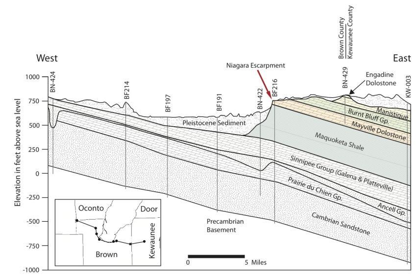
3 Duck Creek Quarries Village of Howard (Brown County) Deep Quarry extended to top of St. Peter Quarries were active between 1827 and Photo Courtesy of Pictometry International Corp. November 18, 2006

4
")
5 Luczaj (2011) Luczaj (2011) Luczaj (in press)
 Water levels slowly declined again until 2006-2007 when 8 communities surrounding Green Bay switched to surface water Rapid recovery (>150 feet) Recovery is ongoing!")
6 GENERAL WATER LEVEL HISTORY IN THE NORTHEAST GMA Predevelopment water levels exceeded ground surface by ~ feet Water levels declined until 1957 when Green Bay switched to surface water Rapid recovery (up to 200 feet) Water levels slowly declined again until when 8 communities surrounding Green Bay switched to surface water Rapid recovery (>150 feet) Recovery is ongoing! Flowing Artesian Well in De Pere (1890) Courtesy of the Neville Museum


7 (Maas, 2010) Left: Flowing artesian well in the Village of Howard Right: Northeast GMA and municipalities that switched to surface water
8 Elevation (feet) above sea level DEEP AQUIFER WATER LEVELS at BN-76 Mouth of the Fox River in Green Bay 1957 Switch by Green Bay 2006/2007 Switch by 8 Green Bay Area Communities

9 Maas (2010) Groundwater withdrawals decreased from 16.4 Mgd to 4.2 Mgd when the Central Brown County Water Authority switched to Lake Michigan water via a 60 mile long pipeline in
10 REGIONAL POTENTIOMETRIC SURFACE (DEEP AQUIFER) From Maas (2010)

11 Photo courtesy of Steve Dutch HISTORICAL PHOTOGRAPHS October 26, 2003

12 July 2005 Photo courtesy of Marianne Pigeon

13 October 7, 2008 Bushes Road

14 June 5, 2010 Bushes Flooded Road Note the SCUBA Divers!

15 June 25, 2011 Bushes Flooded Road Photo by John Luczaj

16 September 2, 2011 No More Bushes Flooded Road Photo by John Luczaj

17 May 20, 2006 View looking Northeast Photo courtesy of Steve Dutch

18 Photo by John Luczaj September 2, 2011 View looking Northeast

19 Water Levels have been measured directly since June 2009 by various methods tied to elevation surveys.
20 Quarry Water Level Elevation (Feet) EARLY: THE RATE OF RISE OF THE QUARRY S WATER LEVEL INCREASED BY 70% Ashwaubenon pumps off June 2006 Howard pumps off July 2007
21 Quarry Water Level Elevation (Feet) Downward gradient Upward gradient PUMPING CESSATION AFFECTED THE RATE OF WATER LEVEL RISE IN THE QUARRY Howard #3 well began flowing in January 2009, steady since 11/09 Green arrows indicate direction of hydraulic gradient in the quarry floor before and after the regional switch to surface water. (estimated)
22 Quarry Water Level Elevation (Feet) LATER: THE RATE OF RISE SLOWED DUE TO EXCHANGE WITH THE GLACIAL AQUIFER Estimated 2012 Potentiometric Surface Quarry Water Levels Exceeded Bedrock in June 2011
23 Quarry Water Level Elevation (Feet) RECENTLY: QUARRY WATER LEVELS MIMIC DEEP AQUIFER SEASONALITY 585# Estimated January 2014 Eleva- on#of#ou3all#(579.5#feet)# Potentiometric Surface BN076#Water#Levels#(Mouth#of#Fox#River)# 580# "Quarry#Water#Level#Eleva- on#(feet)"# 575# 570# 565# Quarry#water#level#oscilla- on#mimics## deep#aquifer#oscilla- on,#but#is#damped## and#slightly#lagged.# 560# 555# 550# 545#
 Duck Creek Quarry Deep Aquifer Potentiometric Surface is >> 583.")
24 WHAT IS THE POTENTIOMETRIC SURFACE NEAR DCQ? Village of Howard Well #3 Potentiometric Surface >> 592 feet (flowing well) Duck Creek Quarry Deep Aquifer Potentiometric Surface is >> feet BN-076 (Pulliam Plant) Potentiometric Surface feet on Image courtesy of Brown County Planning & Land Services
25 IMPLICATIONS It appears that a hydrologic connection exists with the deep aquifer, the potentiometric surface > land surface. The Village of Howard installed an outfall to Lancaster Creek in Fall 2011, preventing flooding of land surface. During May 2013, a visual estimate of flow depth and velocity suggested a discharge rate of 140,000 gpd! Because the deep aquifer recovery is continuing, the rate of discharge should increase in the future and occur over a longer part of the year.

26 Duck Creek Quarries Village of Howard (Brown County) Outfall Location Photo Courtesy of Pictometry International Corp. November 18, 2006

27 Photo by John Luczaj Outfall installed in Fall feet

28 Photo by John Luczaj
 Photo by John")
29 This is the outfall s intake pipe during June 2013 (half full) Photo by John Luczaj

30 Outfall Discharge to Lancaster Creek in May 2013 Photo by John Luczaj

31 November 3, 2008 View looking Southeast CONCLUSIONS Quarry filling was driven (in part) by the recovery of the potentiometric surface in the Deep Aquifer System. This was an unintended consequence. In 2011, the rate of water level rise slowed due to: - flow into the glacial sediments above bedrock - diminished shallow aquifer contributions The water level in the quarry has now reached a quasiequilibrium with the aquifer and mimics the deep aquifer water levels (with a damped signal). The Quarry is (at times) the largest flowing artesian well in Wisconsin at ~140,000 gpd. This should increase in future.
 Village of Howard (Dave Fonder, Geoff Farr) GIS Assistance: Mike Stiefvater Gary Wauters (survey help) Photo by John Luczaj Green Bay Water Utility Core (199.")
32 ACKNOWLEDGEMENTS Barb Wavrunek and Bill Roderick (SCUBA divers) Historical Photographs: Steve Dutch, Marianne, Pigeon, Randy Phillips, Scott Janssen, Pictometry Corp. Brown County (Pat Ford and Jeff DuMez) Village of Howard (Dave Fonder, Geoff Farr) GIS Assistance: Mike Stiefvater Gary Wauters (survey help) Photo by John Luczaj Green Bay Water Utility Core (199.5 feet) St. Peter Sandstone 500 µm
Groundwater Occurrence & Movement: An Introductory Discussion with Application to Northeastern Illinois
 Groundwater Occurrence & Movement: An Introductory Discussion with Application to Northeastern Illinois H. Allen Wehrmann, P.E., Director Center for Groundwater Science Illinois State Water Survey April
Regional Regional Water Water Supply
 Regional Water Supply Plan for Southeastern Wisconsin Ozaukee County Water Summit October 14, 2011 #159281 Background A Cooperative Program SE Wisconsin Water Utilities Seven Southeastern Wisconsin Counties
Sub-Regional Water Supply and Treatment Analysis Defines Sustainable Water Supply Plan For Three Lower Fox River Watershed Communities
 Sub-Regional Water Supply and Treatment Analysis Defines Sustainable Water Supply Plan For Three Lower Fox River Watershed Communities Presented By: Jeffrey W. Freeman, P.E., CFM, LEED AP Engineering Enterprises,
WATER SUPPLY ISSUES IN SOUTHEASTERN WISCONSIN: TECHNICAL AND POLICY NEEDS AND CHALLENGES
 WATER SUPPLY ISSUES IN SOUTHEASTERN WISCONSIN: TECHNICAL AND POLICY NEEDS AND CHALLENGES Presentation for Conference STRADDLING THE DIVIDE WATER SUPPLY PLANNING IN THE LAKE MICHIGAN REGION February 15-16,
groundwater/surface-water interactions Evan Christianson, PG Barr Engineering Company
 groundwater/surface-water interactions Evan Christianson, PG Barr Engineering Company Discussion of. Groundwater/Surface-Water Interactions Groundwater Recharge Impacts from Pumping Potential effect on
PUBLIC POLICY FORUM February 22, 2005
 SOUTHEASTERN WISCONSIN WATER SUPPLY ISSUES AND REGIONAL WATER SUPPLY PLANNING PROGRAM OVERVIEW Presentation for PUBLIC POLICY FORUM February 22, 2005 SOUTHEASTERN WISCONSIN WATER SUPPLY ISSUES AND REGIONAL
Concurrent Session 129 The hydroecology of a Florida river and the potential ecological effects of human water use (Part 2 of 2)
") Concurrent Session 129 The hydroecology of a Florida river and the potential ecological effects of human water use (Part 2 of 2) Photograph: Dean Campbell Moderator: Ed Lowe, Ph. D. Director, Bureau of
Concurrent Session 129 The hydroecology of a Florida river and the potential ecological effects of human water use (Part 2 of 2) Photograph: Dean Campbell Moderator: Ed Lowe, Ph. D. Director, Bureau of
ITS GEOLOGY AND HYDROLOGY
 ITS GEOLOGY AND HYDROLOGY The Black River the Origin of its Name?? Likely the tannic-acid color derived from the forested and wetland areas in the Adirondack Mountains create the dark color of the water
GROUND-WATER LEVELS AND RIVER-AQUIFER INTERACTIONS IN THE UPPER ARKANSAS RIVER CORRIDOR IN SOUTHWEST KANSAS
 GROUND-WATER LEVELS AND RIVER-AQUIFER INTERACTIONS IN THE UPPER ARKANSAS RIVER CORRIDOR IN SOUTHWEST KANSAS Presentation for Upper Arkansas CREP Educational Meetings Donald Whittemore University of Kansas
The Emerging Network of Sandstone Monitoring Wells in Northeastern Illinois
 The Emerging Network of Sandstone Monitoring Wells in Northeastern Illinois Daniel R. Hadley, M.S Hydrogeologist Illinois State Water Survey Illinois Water Conference 2016 Outline Geology of the Sandstone
Glades Reservoir Environmental Impact Statement (EIS)
") Glades Reservoir Environmental Impact Statement (EIS) Permit Application #SAS-2007-00388 Public Scoping Meeting Proposed Operational Plan/Scenarios March 2012 Glades Reservoir Environmental Impact Statement
Glades Reservoir Environmental Impact Statement (EIS) Permit Application #SAS-2007-00388 Public Scoping Meeting Proposed Operational Plan/Scenarios March 2012 Glades Reservoir Environmental Impact Statement
Southeastern Wisconsin Regional Water Supply Planning Program Update. Focus on Alternative and Preliminary Recommended Plans
 Southeastern Wisconsin Regional Water Supply Planning Program Update Focus on Alternative and Preliminary Recommended Plans Waukesha County Public Informational Meeting January 20, 2009 #142063 Background
Groundwater Occurrence & Movement:
 Groundwater Occurrence & Movement: An Introductory Discussion with Application to East-Central Illinois East-Central Illinois Regional Water Supply Planning Committee July 27, 2007 Allen Wehrmann, P.E.,
The Ground Water Supply of Southeastern Wisconsin (Will there be enough for the future?)
") The Ground Water Supply of Southeastern Wisconsin (Will there be enough for the future?) Douglas Cherkauer Professor of Hydrogeology Department of Geosciences University of Wisconsin-Milwaukee Topics to
The Ground Water Supply of Southeastern Wisconsin (Will there be enough for the future?) Douglas Cherkauer Professor of Hydrogeology Department of Geosciences University of Wisconsin-Milwaukee Topics to
Appendix C: 2014 Monitoring Results and Interpretation
 Appendix C: 2014 Monitoring Results and Interpretation Quarterly monitoring of the pressure in artesian bores and water level in sub-artesian bores was undertaken in 2014 in accordance with the interim
State and Regional Water Supply Planning in Illinois
 State and Regional Water Supply Planning in Illinois Walt Kelly Illinois State Water Survey Prairie Research Institute University of Illinois at Urbana-Champaign Governor s Executive Order 2006-01 (re-)established
Wickes Manufacturing TCE Plume Site Mancelona, Michigan
 Wickes Manufacturing TCE Plume Site Mancelona, Michigan December 2017 What is TCE? Trichloroethylene (TCE) Common Industrial Solvent Known Human Carcinogen Federal and State Safe Drinking Water of 5 µg/l
The Springs and. Aquifer System of Florida. Debra Segal, M.S. Volunteer for the Howard T. Odum Florida Springs Institute. Rock Springs, Orange County
 The Springs and Rock Springs, Orange County Aquifer System of Florida Debra Segal, M.S. Volunteer for the Howard T. Odum Florida Springs Institute Who Has Visited a Spring in Florida? Photos by John Moran
Rick Henderson, Field Operations Supervisor DEQ Office of Oil, Gas, and Minerals
 Rick Henderson, Field Operations Supervisor DEQ Office of Oil, Gas, and Minerals 1 Contamination Conservation Uses Remediation Protection Groundwater Protection DEQ Supervisor of Wells Part 615 Oil and
Property of Presenter
 LakeCounty Department of Public Works WATER SUPPLY RESOURCES IN LAKE COUNTY County Green Presentation May 17, 2012 LakeCounty The Lake County Public Works Department was originally formed in 1964 to provide
The Corning Primary Aquifer -One of 18. NYSDEC Primary Aquifers in New York
 The Corning Primary Aquifer -One of 18 NYSDEC Primary Aquifers in New York NYSDEC Primary and Principal Aquifers PRIMARY AQUIFERS (18) Highly productive aquifers presently being utilized by major municipal
Irrigation modeling in Prairie Ronde Township, Kalamazoo County. SW Michigan Water Resources Council meeting May 15, 2012
 Irrigation modeling in Prairie Ronde Township, Kalamazoo County SW Michigan Water Resources Council meeting May 15, 2012 Development of a Groundwater Flow Model INFLOWS Areal recharge from precipitation
SILVER SPRINGS/RIVER POLLUTION REDUCTION PROJECT IMPROVING THE WATER QUALITY OF THE SILVER SPRINGS ECOSYSTEM
 SILVER SPRINGS/RIVER POLLUTION REDUCTION PROJECT IMPROVING THE WATER QUALITY OF THE SILVER SPRINGS ECOSYSTEM Jonathan Steflik, PE JEA (Formerly Black & Veatch) Bruce Phillips, PE PLS, Tom Young, PE City
APPENDIX 5: SAMPLE MODEL RESULTS
 APPENDIX 5: SAMPLE MODEL RESULTS A. Evaluation of Groundwater Sustainability in the Ramsey Area B. Evaluation of Groundwater Sustainability in the Woodbury Area C. Evaluation of Future Drawdown Conditions
Overview of the Draft 2010 Water Supply Assessment Report
 Overview of the Draft 2010 Water Supply Assessment Report Elements of the Water Supply Assessment SRWMD 2010 Water Supply Assessment Statutory Requirements Water Use Demand Projections Assessment of Current
GROUNDWATER AND GENEVA LAKE
 GROUNDWATER AND GENEVA LAKE INTRODUCTION For years it was assumed that groundwater was a significant source of water to Geneva Lake. Local folklore once contended that the water in Geneva Lake came all
Southeastern Wisconsin Regional Water Supply Planning Program Update. Focus on Alternative and Preliminary Recommended Plans
 Southeastern Wisconsin Regional Water Supply Planning Program Update Focus on Alternative and Preliminary Recommended Plans Milwaukee County Public Informational Meetings January 12, 13, & 14, 2009 #141727
GROUNDWATER DISCHARGE
 GROUNDWATER DISCHARGE C O N N E C T I O N F A C T S H E E T S E R I E S D I S C H A R G E : The movement of groundwater from the subsurface to the surface P E R M E A B I L I T Y : The ability of a material
HYDROGEOLOGY OF THE HUMBOLDT RIVER BASIN, IMPACTS OF OPEN-PIT MINE DEWATERING AND PIT LAKE FORMATION
 HYDROGEOLOGY OF THE HUMBOLDT RIVER BASIN, IMPACTS OF OPEN-PIT MINE DEWATERING AND PIT LAKE FORMATION June, 2015 Tom Myers, Ph.D., Hydrologic Consultant, Reno NV tom_myers@charter.net Prepared for: Progressive
Flood Preparedness Planning & Construction. Marc Lucca, P.E. Dave Hughes, P.E.
 Flood Preparedness Planning & Construction Marc Lucca, P.E. Dave Hughes, P.E. Aqua Pennsylvania, Inc. Serves 430,000 customers (~1.3 million people) in Pennsylvania Southeastern Pennsylvania Division 5
Water Demand and Supply Outlook for Greater Chicago Area
 Southern Illinois University Carbondale OpenSIUC 2009 Conference Proceedings 7-2009 Water Demand and Supply Outlook for Greater Chicago Area Ben Dziegielewski Southern Illinois University Carbondale Follow
Groundwater in Bayfield County. Madeline Gotkowitz Hydrogeologist April 23, 2015
 Groundwater in Bayfield County Madeline Gotowitz Hydrogeologist April 23, 2015 Groundwater in Bayfield County Groundwater basics Hydrogeology across Wisconsin Hydrogeology in Bayfield County Mapping groundwater
Unmanaged Aquifer Recharge: Revisiting Sustainable Yield in Northeast Illinois
 Unmanaged Aquifer Recharge: Revisiting Sustainable Yield in Northeast Illinois Hydrostratigraphy of Northern Illinois Devin Mannix NGWA Groundwater Summit December 5, 2017 Source of Community Water Supplies
STRAWMAN OUTLINE March 21, 2008 ISWS/ISGS REPORT ON THE OPPORTUNITIES AND CHALLENGES OF MEETING WATER DEMAND IN NORTH-EAST ILLINOIS
 STRAWMAN OUTLINE March 21, 2008 ISWS/ISGS REPORT ON THE OPPORTUNITIES AND CHALLENGES OF MEETING WATER DEMAND IN NORTH-EAST ILLINOIS REPORT TO BE DELIVERED TO THE RWSPG BY SEPTEMBER 30, 2008 Table of Contents
WATER LEVEL CHANGES IN THE UNCONFINED AQUIFER OF THE SAN LUIS VALLEY,
 WATER LEVEL CHANGES IN THE UNCONFINED AQUIFER OF THE SAN LUIS VALLEY, 1980-1995 By Isobel R. McGowan Shepherd Miller, Inc. 2460 W. 26th Ave., Suite 430-C Denver, CO 80211 and Dan Plazak Consulting Hydrogeologist
Characterizing Groundwater and Surface- Water Interactions in Selected Northeast Twin Cities Lakes
 Characterizing Groundwater and Surface- Water Interactions in Selected Northeast Twin Cities Lakes Chapter A: Statistical Analysis and Field Study Chapter B: Groundwater-Flow Simulation Perry M. Jones,
Northern Arizona Hydrogeology
 Northern Arizona Hydrogeology Some basics Coconino Plateau Hydrogeology Flagstaff and Coconino Plateau Water Resources Well development, City of Flagstaff Effluent discharge to the Rio de Flag from Wildcat
Screening Simulations for Sediment Diversions: AdH/SEDLIB
 Screening Simulations for Sediment Diversions: AdH/SEDLIB Gary L Brown Engineer Research and Development Center USACE 10/27/15 US Army Corps of Engineers Chronic Stresses on Coastal Wetlands in Louisiana
CHAPTER 13 OUTLINE The Hydrologic Cycle and Groundwater. Hydrologic cycle. Hydrologic cycle cont.
 CHAPTER 13 OUTLINE The Hydrologic Cycle and Groundwater Does not contain complete lecture notes. To be used to help organize lecture notes and home/test studies. Hydrologic cycle The hydrologic cycle is
Context for Central Sands Water Use Trends and Impacts
 Context for Central Sands Water Use Trends and Impacts Wisconsin Food, Land, and Water meeting Wisconsin Rapids, WI November 10, 2016 Kenneth R. Bradbury Wisconsin Geological and Natural History Survey,
Cape Fear River Water Supply Evaluation
 Cape Fear River Water Supply Evaluation March 30, 2016 Division of Water Resources Cape Fear River WaterSupply Evaluation Todays goal: Review the Draft Cape Fear River Water Supply Evaluation Review the
The Undiluted Cost of Energy and Water: From Rainfall to Outfall. Greg Harrington Professor and Associate Chair
 The Undiluted Cost of Energy and Water: From Rainfall to Outfall Greg Harrington Professor and Associate Chair Acknowledgments Graduate students Todd Elliott Irene Xagoraraki Ben Zeier Joshua Bohnert Mike
Groundwater Levels and Pumpage in the East St. Louis Area, Illinois,
 Circular 112 STATE OF ILLINOIS DEPARTMENT OF REGISTRATION AND EDUCATION Groundwater Levels and Pumpage in the East St. Louis Area, Illinois, 1967-1971 by W. H. BAKER, JR. ILLINOIS STATE WATER SURVEY URBANA
Song Lake Water Budget
 Song Lake Water Budget Song Lake is located in northern Cortland County. It is a relatively small lake, with a surface area of about 115 acres, and an average depth of about 14 feet. Its maximum depth
General Groundwater Concepts
 General Groundwater Concepts Hydrologic Cycle All water on the surface of the earth and underground are part of the hydrologic cycle (Figure 1), driven by natural processes that constantly transform water
Midwest Technology Assistance Center Groundwater Resource Assessment for Small Communities
 Midwest Technology Assistance Center Groundwater Resource Assessment for Small Communities Groundwater Availability At St. Rose PWD, Illinois (Clinton County) Project Overview This project is an outgrowth
Groundwater in Anne Arundel County, Maryland
 Groundwater in Anne Arundel County, Maryland Presented to Fort George G. Meade Restoration Advisory Board March 15, 2012 David W. Bolton Maryland Geological Survey Physiographic Provinces and Aquifer Types
City of Winter Haven Water Sustainability Program. Mike Britt, P.E., Natural Resources Division
 Florida Stormwater Association EXCELLENCE AWARD for STORMWATER PROGRAMS and PROJECTS NOMINATION FORM I. Nomination Information Nomination Category (please check only one box): Program (Department/Division)
Minutes Saltwater Intrusion Steering Committee Meeting March 4, 2011
 Minutes Saltwater Intrusion Steering Committee Meeting March 4, 2011 Attending: David Baize, Brian Baker, Richard Cyr, Billy Edwards, Kelly Ferda, Chris Foldesi Bill Garbett, Chuck Gorman, Rusty Hildebrand,
VARIANCE REQUEST FOR EXPANDED WATER USE FROM EXISTING WELL IN A STAY MANAGEMENT AREA OF THE LOWER PLATTE NORTH NRD (LPNNRD)
") VARIANCE REQUEST FOR EXPANDED WATER USE FROM EXISTING WELL IN A STAY MANAGEMENT AREA OF THE LOWER PLATTE NORTH NRD (LPNNRD) Updated Form: August 2012 NRD USE ONLY Date Received Paid: Cash or Check Initial
VARIANCE REQUEST FOR EXPANDED WATER USE FROM EXISTING WELL IN A STAY MANAGEMENT AREA OF THE LOWER PLATTE NORTH NRD (LPNNRD) Updated Form: August 2012 NRD USE ONLY Date Received Paid: Cash or Check Initial
global distribution of water!
 groundwater! hydrologic cycle! 2 global distribution of water! Source Volume Percent Ocean 97.2000 Glaciers and other ice 2.1500 Ground Water 0.6100 Lakes fresh 0.0090 saline 0.0080 Soil Moisture 0.0050
Vermillion River Headwaters Groundwater Recharge Area Inventory and Protection Plan
 Vermillion River Headwaters Groundwater Recharge Area Inventory and Protection Plan A project funded through a Metro Environmental Partnership grant from the Metropolitan Council with technical analysis
ALABAMA S FUTURE WITHOUT SUSTAINABLE WATER RESOURCES? NOT ON OUR WATCH. Marlon Cook
 ALABAMA S FUTURE WITHOUT SUSTAINABLE WATER RESOURCES? NOT ON OUR WATCH Marlon Cook Geological Survey of Alabama Groundwater Assessment Program Sustainable Water Resources Sustainable Yield: The water extraction
HYDROLOGIC FACTORS AFFECTING SINKHOLE DEVELOPMENT IN A WELL FIELD IN THE KARST DOUGHERTY PLAIN, SOUTHWEST OF ALBANY, GEORGIA
 HYDROLOGIC FACTORS AFFECTING SINKHOLE DEVELOPMENT IN A WELL FIELD IN THE KARST DOUGHERTY PLAIN, SOUTHWEST OF ALBANY, GEORGIA Debbie Warner Gordon AUTHOR: Hydrologist, U.S. Geological Survey, Georgia Water
Groundwater. Chapter 10 11/22/2011. I. Importance of groundwater
 Groundwater Chapter 10 I. Importance of groundwater A. Groundwater is water found in the pores of soil and sediment, plus narrow fractures in bedrock B. Where is fresh water - 2 % of all water is fresh
MEMORANDUM. RAI Responses Related to East Lake Road Wellfield Drawdown Analysis, WUP No SDI Project No. PCF-180.
 SDI Environmental Services, Inc. 13911 N. Dale Mabry Hwy. Suite 201, Tampa, FL 33618; (813) 961-1935 MEMORANDUM TO: FROM: SUBJECT: Dave Slonena, P.G., Pinellas County Cathleen Beaudoin Jonas RAI Responses
Using Your Computer for Water Withdrawal Planning and Groundwater Mapping
 Michigan s Water Withdrawal Assessment Tool An Overview Distinguished Senior Research Specialist Michigan State University Dept. of Geography And Institute of Water Research 1 / 29 Act 451 of 1994 (Natural
Kane County Water Resources Investigations: Simulation of Groundwater Flow in Kane County and Northeastern Illinois
 Kane County Water Resources Investigations: Simulation of Groundwater Flow in Kane County and Northeastern Illinois Scott C. Meyer, P.G. George S. Roadcap, Ph.D., P.G. Yu-Feng Lin, Ph.D. Douglas D. Walker,
Amount of Water Available Annually: 21,000 acre-feet per year (af/yr) upon project completion
 upon project completion") DRAFT Name of Project: Expanded Carrizo Project Duration of Project: 50 years. Construction completed by 2026. Amount of Water Available Annually: 21,000 acre-feet per year (af/yr) upon project completion
DRAFT Name of Project: Expanded Carrizo Project Duration of Project: 50 years. Construction completed by 2026. Amount of Water Available Annually: 21,000 acre-feet per year (af/yr) upon project completion
Water for All, Now and Into the Future: Water Quantity in Wisconsin. A report by the Sierra Club-John Muir Chapter
 Water for All, Now and Into the Future: Water Quantity in Wisconsin A report by the Sierra Club-John Muir Chapter Table of Contents Background The Importance of Water Quantity Water Use in Wisconsin Excessive
COON CREEK WATERSHED DISTRICT PERMIT REVIEW Mississippi Dr Coon Rapids, MN SQ FT Residence on 0.64 Acre Lot
 17-082 Van Sloun Residence, Page 1 of 5 COON CREEK WATERSHED DISTRICT PERMIT REVIEW MEETING DATE: May 8, 2017 AGENDA NUMBER: 17 FILE NUMBER: 17-082 ITEM: Van Sloun Residence RECOMMENDATION: Approve with
HYDRAULIC CONNECTIVITY (HC) ENGINEERING & HYDRAULICS PERSPECTIVES
 ENGINEERING & HYDRAULICS PERSPECTIVES") HYDRAULIC CONNECTIVITY (HC) ENGINEERING & HYDRAULICS PERSPECTIVES Presented at the UMRR HREP Team Meeting September 28, 2016 Jon Hendrickson Regional Technical Specialist, Eco-Hydraulics & WQ USACE, Mississippi
HYDRAULIC CONNECTIVITY (HC) ENGINEERING & HYDRAULICS PERSPECTIVES Presented at the UMRR HREP Team Meeting September 28, 2016 Jon Hendrickson Regional Technical Specialist, Eco-Hydraulics & WQ USACE, Mississippi
Daniel R. Hadley, PG and Daniel B. Abrams, PhD
 Revisiting one of the largest aquifer tests in history: Implications for fault zone hydrogeology and the declining groundwater supply in Northeastern Illinois Daniel R. Hadley, PG and Daniel B. Abrams,
Understanding Florida s Karst Results & Lessons Learned from the Woodville Karst Plain Research
 Understanding Florida s Karst Results & Lessons Learned from the Woodville Karst Plain Research Todd Kincaid, Ph.D. GeoHydros, LLC GeoHydros, LLC / 27 Keystone Ave, Reno, NV 89503 (775) 337-8803 / www.geohydros.com
Geotechnical, Hydrological and Environmental Assessment
 Geotechnical, Hydrological and Environmental Assessment Presented by Moustafa Gouda, P.E., D. GE, F.ACSE Director of Geotechnical & Environmental Engineering Services Maser Consulting P.A. Planning Board
Suzy Valentine, P.E. Pecos River Commission April 2014
 Suzy Valentine, P.E. Pecos River Commission April 2014 Historical context Background History Update Camels crossing a West Texas stream - From a painting by an unknown soldier who may have been with the
Water Resource Management for Shale Energy Development
 Water Resource Management for Shale Energy Development Presented by Dave Yoxtheimer, P.G. February 19, 2014 Bakken Shale Energy: A Global Play Well Site in Operation U.S. Natural Gas Production is Increasing
Viruses in Madison s Deep Wells: The Unexpected Effect of Heavy Precipitation
 Viruses in Madison s Deep Wells: The Unexpected Effect of Heavy Precipitation Mark A. Borchardt, Susan K. Spencer Marshfield Clinic Research Foundation Kenneth R. Bradbury, Madeline Gotkowitz Wisconsin
The Sustainability of Floods Pond
 The Sustainability of Floods Pond Bangor Water District s Public Water Supply Presented By: Rick Pershken Bangor Water District Overview Brief BWD History Watershed Characteristics Lake Characteristics
APPENDIX A. Hydraulic Investigations: Cascade Mall at Burlington
 APPENDIX A m SUMMARY REPORT FOR E.I.S. Hydraulic Investigations: Cascade Mall at Burlington July 12, 1982 John E. Norman, P.E. 14779 Northeast 32nd, #A201 Bellevue, WA 98007 (206) 882-1767 92 General A
In support of an alternative water supply
 FWRJ Stormwater Harvesting for Alternative Water Supply in Volusia County Lena Rivera, Lee P. Wiseman, Scott Mays, and George Recktenwald In support of an alternative water supply plan for Volusia County
Phillip N. Albertson INTRODUCTION
 ESTABLISHMET OF A GROUDWATER AD SURFACE-WATER MOITORIG ETWORK TO ASSESS THE POTETIAL EFFECTS OF GROUDWATER DEVELOPMET I A IGEOUS AD METAMORPHIC ROCK AQUIFER, AD PRELIMIARY DATA,, GEORGIA, 03-04 Phillip.
Desalination Intake Approaches: Open Ocean Intake vs Subsurface. Monterey Bay Water Works Association
 Desalination Intake Approaches: Open Ocean Intake vs Subsurface Monterey Bay Water Works Association 16 October 2008 Todd Reynolds, PE Michael Maley, PE, PG, CHg Presentation Outline Introduction to Desalination
SOUTHEAST FLORIDA S RESILIENT WATER RESOURCES INCLUDING A CASE STUDY FOR THE CITY OF POMPANO BEACH
 SOUTHEAST FLORIDA S RESILIENT WATER RESOURCES INCLUDING A CASE STUDY FOR THE CITY OF POMPANO BEACH SOUTHEAST FLORIDA S WATER INFRASTRUCTURE IS VULNERABLE TO CLIMATE CHANGE THE WATER INFRASTRUCTURE IN FLORIDA
STORMWATER HARVESTING FOR ALTERNATIVE WATER SUPPLY IN VOLUSIA COUNTY, FLORIDA
 STORMWATER HARVESTING FOR ALTERNATIVE WATER SUPPLY IN VOLUSIA COUNTY, FLORIDA Lena Rivera, P.E., D.WRE (CDM); Lee P. Wiseman, P.E., BCEE (CDM); Scott Mays, P.E. (Volusia County); and George Recktenwald
Rehoboth Beach Effluent Disposal Study. Evaluation of Wastewater Discharge Alternatives. Center for the Inland Bays STAC Meeting January 13, 2006
 Rehoboth Beach Effluent Disposal Study Evaluation of Wastewater Discharge Alternatives Center for the Inland Bays STAC Meeting January 13, 2006 1 Agenda Background Objectives/Goals Land Search Discharge
Water-Level Decline and Pumpage in Deep Wells in the Chicago Region,
 SWS/CIR-125/77 Circular 125 STATE OF ILLINOIS DEPARTMENT OF REGISTRATION AND EDUCATION Water-Level Decline and Pumpage in Deep Wells in the Chicago Region, 1971-1975 by R. T. SASMAN, C. R. BENSON, J. S.
Scott Valley Siskiyou County, California: Voluntary Private Well Water Level Monitoring Program Spring 2006 January 2016
 Scott Valley Siskiyou County, California: Voluntary Private Well Water Level Monitoring Program Spring 2006 January 2016 (Data collected monthly except January 2011) University of California Davis 2016
Taunton River Watershed Study Presentation - part 1 ( June 13, 2007 Public Meeting)
") Bridgewater State University Virtual Commons - Bridgewater State University Public Meetings Taunton River Watershed Project 2007 Taunton River Watershed Study Presentation - part 1 ( June 13, 2007 Public
Bridgewater State University Virtual Commons - Bridgewater State University Public Meetings Taunton River Watershed Project 2007 Taunton River Watershed Study Presentation - part 1 ( June 13, 2007 Public
Wisconsin Wastewater Operators Association. Protecting Our Water Resources: The Future Bill Hafs - NEW Water 10/2014
 Wisconsin Wastewater Operators Association Protecting Our Water Resources: The Future Bill Hafs - NEW Water 10/2014 The Fox River Contributes 1/3 of All Nutrients to Lake Michigan APRIL 15, 2011 Photo
Recharge Lake/Wetland: Generalized Monitoring Strategy
 General Hydrologic Characteristics of Recharge Lakes & Wetlands The primary sources of water for recharge lakes and wetlands are direct precipitation and surface runoff. The lake stage of a recharge lake
AQUIFER STORAGE AND RECOVERY EVALUATION REPORT
 AQUIFER STORAGE AND RECOVERY EVALUATION REPORT Prepared for: CLALLAM COUNTY 228 East 4 th Street, Port Angeles, WA 98362 Prepared by: 12100 NE 195 th Street, Suite 200, Bothell, WA 99011 July 2003 TABLE
From My Backyard to Our Bay It s the 911 for the Chesapeake Bay
 From My Backyard to Our Bay Reporting Problems on Our Bay, Rivers, and Streams We can all be the eyes and ears of our local waterways. Maryland has established the Chesapeake Bay Safety and Environmental
Water Availability Study Safe Yield Analysis. Lori A. Burkert, P.G
 Water Availability Study Safe Yield Analysis Lori A. Burkert, P.G. lburkert@entecheng.com 610-373-6667 Inflow vs Outflow What is Safe Yield? Maintainable yield of water from a surface or groundwater source
Background Information on the. Peace River Basin
 Background Information on the Peace River Basin Resource Conservation & Development Department August 24 Background Physiography The Peace River drainage basin occupies large parts of Polk, Hardee, DeSoto,
San Mateo Plain Groundwater Basin Assessment Stakeholder Workshop #8 17 APRIL 2018
 San Mateo Plain Groundwater Basin Assessment Stakeholder Workshop #8 17 APRIL 2018 PRESENTATION OVERVIEW Introductions Project Overview Summary of Analysis Supporting Model Development Model Development
Leading Creek Conservancy District Water Treatment Plant
 Leading Creek Conservancy District Water Treatment Plant General Information County: Meigs Counties Served: Vinton, Meigs, Gallia Type of System: Public: 6119: X Private: Year Established: 1969 Year of
City of Loveland Water System
 General Information County: Clermont Counties Served: Clermont Type of System: Public: X 6119: Private: Year Established: N/A Year of Upgrades: N/A EPA District: Southwest Watershed: N/A Source: Surface
SOUTHERN WATER USE CAUTION AREA REVIEW
 COMPONENT Water Supply Mission Components The Southern Water Use Caution Area (SWUCA) was designated in 1992 to address declines in aquifer levels occurring throughout the groundwater basin. Due to growing
Water-Level Trends and Pumpage in the Cambrian and Ordovician Aquifers in the Chicago Region,
 ISWS/CIR-166/86 OFFICE COPY Circular 166 STATE OF ILLINOIS DEPARTMENT OF ENERGY AND NATURAL RESOURCES Water-Level Trends and Pumpage in the Cambrian and Ordovician Aquifers in the Chicago Region, 1980-1985
Montana Ground-Water Assessment Statewide Monitoring Well Network
 Montana Ground-Water Assessment Statewide Monitoring Well Network Montana Ground-Water Assessment Water-level Monitoring and Drought: January March 2004 Tom Patton - Montana Bureau of Mines and Geology
4B.6 Desalination 4B Description of Option. Desalination of Lake Granbury Water for Johnson County Regional Plan.
 4B.6 4B.6.1 Description of Options Water demands in Johnson County are increasing at a very significant rate, while the existing supply from the Surface Water and Treatment System (SWATS) water treatment
Flow-Through Lake/Wetland: Generalized Monitoring Strategy
 General Hydrologic Characteristics of Flow-Through Lakes & Wetlands Flow-through lakes are surface expressions of the water table and are in direct hydraulic connection with the water-table aquifer. They
Sustainability and the Mahomet Aquifer WMRC Seminar Series on Sustainability January 16, 2008
 Sustainability and the Mahomet Aquifer WMRC Seminar Series on Sustainability January 16, 2008 Allen Wehrmann, P.E., P.H.(GW), D.WRE, Director Center for Groundwater Science, Illinois State Water Survey
Long-Range Hydrology Study
 Long-Range Hydrology Study Northshore Mining Company Final Report November 2008 4700 West 77 th Street Minneapolis, MN 55435-4803 Phone: (952) 832-2600 Fax: (952) 832-2601 Long-Range Hydrology Study: Final
Cost of Importing Deep Sandstone Water to Eliminate Groundwater Deficits in Northeastern Illinois
 ISWS-74-CIR120 Circular 120 STATE OF ILLINOIS DEPARTMENT OF REGISTRATION AND EDUCATION Cost of Importing Deep Sandstone Water to Eliminate Groundwater Deficits in Northeastern Illinois by D. W. BEAVER
NATURAL FEATURES, LAND SUITABILITY FOR DEVELOPMENT AND DEVELOPMENT CONCERNS
 East Central Wayne County Comprehensive Plan - Natural Features, Land Suitability Page 170 NATURAL FEATURES, LAND SUITABILITY FOR DEVELOPMENT AND DEVELOPMENT CONCERNS Introduction The residents of East
Water Conservation Planning: How a Systems Approach to Irrigation Promotes Sustainable Water Use
 Water Conservation Planning: How a Systems Approach to Irrigation Promotes Sustainable Water Use Michael E. Sullivan and Walter M. Delp Natural Resources Conservation Service Little Rock, Arkansas michael.sullivan@ar.usda.gov
CCR RULE 40CFR LOCATION RESTRICTIONS CRITERIA CERTIFICATION REPORT ASH DISPOSAL FACILITY COMANCHE STATION PUEBLO, COLORADO
 CCR RULE 40CFR 257.60 64 LOCATION RESTRICTIONS CRITERIA CERTIFICATION REPORT ASH DISPOSAL FACILITY COMANCHE STATION PUEBLO, COLORADO Prepared For: Public Service Company of Colorado (PSCo) Prepared by:
Hydrologic Responses to Pumping in the Upper Arkansas Basin and Effects of the Conservation Reserve Enhancement Program
 Hydrologic Responses to Pumping in the Upper Arkansas Basin and Effects of the Conservation Reserve Enhancement Program Prepared for Hearings of the Kansas Legislature Senate Natural Resources Committee