NORTH I-75 MASTER PLAN Summary Report
|
|
|
- Loraine Neal
- 6 years ago
- Views:
Transcription
1

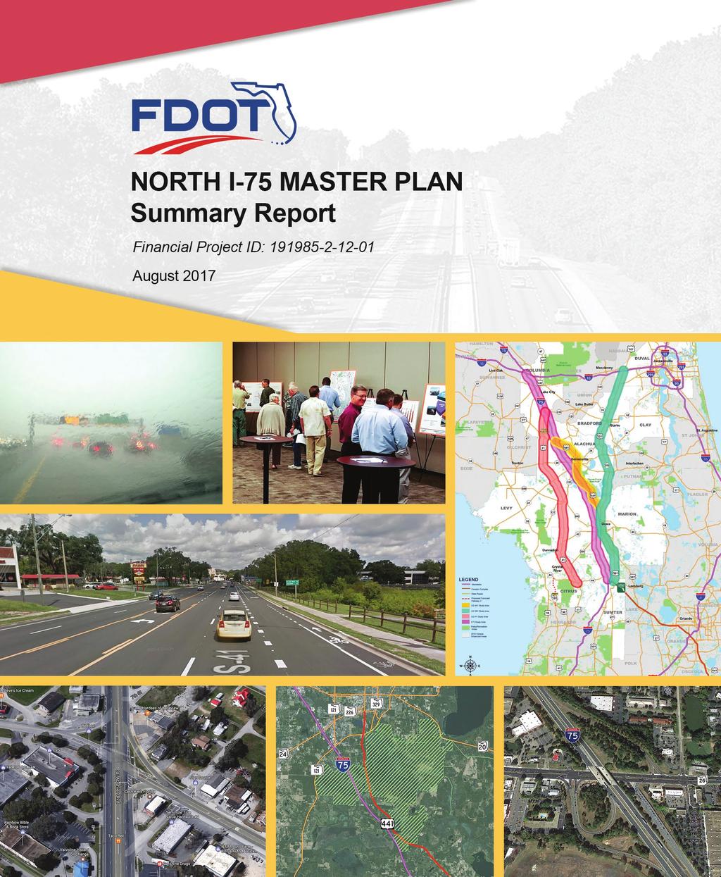
2 NORTH I-75 MASTER PLAN Summary Report Interstate 75 (SR 93) From the Florida s Turnpike Interchange to the I-10 Interchange Alachua, Bradford, Clay, Citrus, Columbia, Duval, Levy, Marion, and Sumter Counties, Florida Financial Project ID: June 2017 Updated August 2017
3 TABLE OF CONTENTS 1 EXECUTIVE SUMMARY PROJECT BACKGROUND & PURPOSE Background I-75 Relief Task Force Recommendations STUDY AREA CORRIDORS Study Area STUDY METHODOLOGY & PUBLIC INVOLVEMENT EXISTING AND FUTURE I-75 TRANSPORTATION Recurring and Non-Recurring Congestion Recurring Congestion Non-Recurring Congestion Roadway Geometry I-75 Existing/Future Traffic and Level of Service EXISTING AND FUTURE PARALLEL CORRIDORS Existing and Future Traffic and Level of Service on US 41, US 441, and US STUDY CORRIDOR CONSTRAINTS Social Constraints Natural Constraints Cultural Constraints I-75 CAPACITY IMPROVEMENT OPTIONS I-75 Short-Term Improvements I-75 Ultimate Improvements Rail Feasibility Study SUMMARY AND CONCLUSION Next Steps... 16
4 1 EXECUTIVE SUMMARY Interstate 75 (I-75) is part of the Strategic Intermodal System (SIS) and a major interstate highway supporting tourism, economic development, emergency management, and mobility of people and goods. The I-75 corridor from Florida s Turnpike to I-10 exhibits unique characteristics in that its traffic congestion occurs due to both recurring congestion (traffic bottlenecks) and non-recurring congestion (incidents, seasonal and special events, and weather). The combination of recurring and non-recurring congestion is contributing to unsatisfactory traffic operations witnessed in both the existing and future conditions on I-75. Improvements are needed to the I-75 corridor to accommodate additional projected growth in freight, visitor, and local commuter traffic and to enhance public safety and emergency evacuation. Alternative parallel corridors (US 41, US 441, and US 301) would require significant improvements in urban areas to serve as reliever routes to I-75. These improvements would have significant impacts to the social, cultural, physical, and natural environment and would require changes to local government Comprehensive Plans. A series of short-term improvements to enhance safety, improve operations, and extend the life of the I-75 corridor should be evaluated and implemented within the next 2-5 years. Some examples of short-term improvements include signal coordination, fiber interconnection, Road Ranger s service patrol, and enhanced regional transportation management center operations. Given the importance of I-75 to freight, tourism, mobility of people and goods, and emergency evacuation in the state of Florida, the Florida Department of Transportation (FDOT) should immediately begin planning studies to determine long-term improvements such as addition of General Use Lanes or Express Lanes. However, the widening of I-75 alone does not address the issue of non-recurring congestion and the long-term corridor travel demand. This Master Plan focused only on existing facilities and determined these existing facilities (I- 75, US 41, US 441, and US 301) cannot accommodate the recurring and non-recurring congestion. Capacity improvements to these corridors will have significant social, cultural, physical, and natural environment impacts. It is FDOT s mission and goal to evaluate the state s long-term mobility needs and maintain acceptable operations and safety standards. New multimodal and multiuse corridors were recommendations of the I-75 Relief Task Force and should be evaluated in other future studies. Page 1
5 2 PROJECT BACKGROUND & PURPOSE 2.1 Background In October 2015, FDOT Secretary Jim Boxold established the I-75 Relief Task Force for the purpose of providing consensus recommendations on maximizing existing and developing new highcapacity transportation corridors to serve the Tampa Bay to Northeast Florida study area, with initial emphasis on the area along and to the west of I-75. The Task Force included 21 members representing state agencies, local governments, regional planning councils, environmental organizations, businesses, economic development interests, and the public. 2.2 I-75 Relief Task Force Recommendations The Task Force focused on mobility needs along I-75 in six counties (Alachua, Citrus, Hernando, Levy, Marion, and Sumter). The Task Force met seven times at various locations between December 2015 and August 2016 and recommended a range of options. These recommendations include: 1. Optimize existing transportation corridors; 2. Evaluate potential enhancements to, or transformation of, existing transportation corridors; and 3. Evaluate potential areas of opportunity for new multimodal, multipurpose corridors after evaluation of enhancements to I-75 and other I-75 connector roads, and determination of need. To better evaluate the need for I-75 improvements, the Task Force recommendations included evaluation of potential capacity and connectivity enhancements on major north-south corridors parallel to I-75, including the US 41 and US 301 corridors, to analyze their ability to provide traffic relief to I-75. Based on the Task Force Recommendations, the North I-75 Master Plan study was initiated to evaluate I-75 and the parallel corridors as a system and determine their ability to accommodate the future congestion. This Master Plan focused only on existing facilities of I-75, US 41, US 441, and US 301. A new corridor evaluation was outside the scope of this study. It is FDOT s mission and goal to evaluate the state s long-term mobility needs to maintain acceptable operational and safety standards. New multimodal and multiuse corridors were recommendations of the I-75 Relief Task Force and should be evaluated in future studies. Page 2

6 The flow chart below shows the origination of this Master Plan and the next steps in the overall Transportation Planning Process. The North I-75 Master Plan Study area and methodology are presented in the next sections. Page 3

7 3 STUDY AREA CORRIDORS 3.1 Study Area The North I-75 Master Plan study area encompasses nine counties: Alachua, Bradford, Clay, Citrus, Columbia, Duval, Levy, Marion, and Sumter. In addition to the I-75 corridor, which spans from Florida s Turnpike in Sumter County to the I-10 interchange in Columbia County, the study also evaluates three major north-south corridors per the recommendations of the I-75 Relief Task Force. The Task Force initially focused on a six-county study area but it was later expanded to nine counties in this Master Plan to include I-75 and the adjacent parallel corridors. The parallel corridors are US 41, which is located to the west of I-75, and US 441 and US 301, which are located to the east of I-75. The corridor limits are: US 41 from SR 44 in Citrus County to the I-75/US 41 interchange in Columbia County; US 441 from the City of Belleview in Marion County to the I-75/US 441 interchange in Alachua County. US 441 was not recommended by the Relief Task Force but was added to this Master Plan as it runs parallel to I-75 and can serve as a potential alternate route; and US 301 from the Florida s Turnpike/US 301 interchange in Sumter County to the I-10/US 301 interchange in Duval County. The parallel corridor limits were determined based on feasible diversion locations available from I-75 to the parallel corridors. The limits were also presented to Planning staff of the Counties. A map illustrating the study corridors is shown in Figure 1 on the following page. Page 4


8 Figure 1 Study Corridors Page 5
9 4 STUDY METHODOLOGY & PUBLIC INVOLVEMENT The study methodology was designed to address the I-75 Relief Task Force recommendations to immediately optimize existing transportation corridors; and to evaluate potential enhancements to, or transformation of, existing transportation corridors. For the I-75 corridor, short-term and long-term improvements were evaluated to address capacity needs, improve traffic operations, and enhance safety. For the US 41, US 441, and US 301 corridors, capacity improvements were evaluated at major bottlenecks to determine if these corridors could function as relief corridors to I-75. Traffic forecasts for all four corridors (I-75, US 41, US 441, and US 301) were developed by the Florida s Turnpike Enterprise (FTE) using the I-75 Relief Study Model (RSM). The I-75 RSM was developed for this Study and based on latest socio economic data obtained from the local Metropolitan Planning Organizations (MPOs). Roadway segments, where the projected 2040 traffic Level of Service (LOS) exceeded FDOT standards, were evaluated for potential widening to address capacity needs through year The evaluation of the corridors included an analysis of potential impacts to the natural, social, cultural, and physical environment. Project costs covering all phases including Design, Right-of-Way (ROW), and Construction were estimated. Finally, the consistency of potential improvements with appropriate comprehensive plans was considered. Extensive public outreach was performed to identify stakeholders, develop strategies to inform and engage stakeholders, and to obtain feedback on the potential improvements. Local agency staff meetings were held with planning and engineering staff representing counties and cities within the study area. In addition, presentations were made to the Gainesville Metropolitan Transportation Planning Organization (MTPO), Ocala/Marion Transportation Planning Organization (TPO), Lake-Sumter Metropolitan Planning Organization (MPO), Hernando/Citrus MPO, and Columbia County Board of County Commissioners. Finally, three public open houses were held in Citrus County, Marion County, and Alachua County to obtain input on the study results. The location, date, and times of the open houses were ed to stakeholders, advertised in four local newspapers, published in the Florida Administrative Register, and placed in the Florida Department of Transportation Public Notices Website. Details of the project s public involvement efforts are documented under a separate report, North I-75 Master Plan Public Involvement Plan. Page 6
10 5 EXISTING AND FUTURE I-75 TRANSPORTATION Vehicular traffic and congestion occurs on roadways when LOS failures occur leading to bottlenecks. The I-75 Corridor is a unique corridor because its LOS failures occur due to both recurring and non-recurring congestion. The traffic spikes during holidays, special events, and frequent lane closures make up the majority of LOS failures. The LOS failures analyzed occur presently due primarily to non-recurring congestion and it is anticipated that LOS failures will also occur in the next 10 to 12 years due to recurring congestion. 5.1 Recurring and Non-Recurring Congestion Recurring Congestion Recurring congestion is caused by increased traffic volumes and bottlenecks created during the peak hour commute as residents travel to work in the morning and return home in the evening. Bottlenecks cause about 20 percent of the congestion on I Non-Recurring Congestion Non-recurring congestion accounts for about 80 percent of the total congestion on I-75 (as shown in Figure 2 below) and significantly affects driving conditions. There are four major factors that contribute to non-recurring congestion: 1. Special Events and Seasonal Traffic: Sporting events such as football games, spring break, summer, and holidays such as Labor Day, Thanksgiving, and Christmas account for approximately 30 percent of the congestion on I-75; 2. Incidents: Lane closing traffic incidents which cause significant congestion issues account for approximately 21 percent of the congestion on I-75. On average, more than 500 incidents a year cause all lanes to be closed on I-75 within the study area, once every 9 days; 3. Work Zones: Construction and maintenance work zones account for approximately 14 percent of the congestion on I-75; and 4. Weather: Rain was identified as the leading weather-related driving hazard and accounts for 15 percent of the congestion on I-75. Page 7


11 Figure 2 illustrates how I-75 is affected by recurring and non-recurring congestion. Figure 2 Congestion Effects on I Roadway Geometry The I-75 corridor is a six-lane divided limited access freeway from Florida s Turnpike in Sumter County to I-10 in Columbia County. The posted speed limit is 70 miles per hour (mph) and there are no sidewalks or bicycle lanes located along the corridor. A typical section of I-75 near US 41 in Columbia County is shown below in Figure 3. Figure 3 I-75 Typical Section in Columbia County 5.3 I-75 Existing/Future Traffic and Level of Service Traffic analysis of I-75 shows failing LOS on segments of I-75 occurring before the year 2040 in or near urban areas like the Cities of Gainesville and Ocala. I-75 near the City of Ocala begins to fail around year 2030 while I-75 near the City of Gainesville begins to fail around year 2035 due solely to recurring congestion. However, when factoring in non-recurring congestion, the I-75 corridor begins to fail as early as In fact, non-recurring congestion alone is currently causing I-75 to operate at LOS F 40 percent of the year. Page 8

12 Table 1 below illustrates the existing and future traffic and LOS. Table 1: I-75 Existing and Future Traffic and LOS From To 2015 AADT 2040 AADT LOS Target 2015 LOS 2040 LOS Fall Below LOS Target City of Ocala SR 200 SR 40 80, ,500 D C F Yes SR 40 US 27 80, ,400 D C F Yes US 27 49th Street 71, ,000 D C E Yes City of Gainesville SR 121 SR 24 67, ,100 D B E Yes SR 24 SR 26 79, ,000 D C E Yes 6 EXISTING AND FUTURE PARALLEL CORRIDORS The US 41 corridor is primarily a rural 2-lane undivided highway. The segment from SR 44 to West Main Street within the City of Inverness is classified as a 4-lane divided arterial segment. The speed limit varies from 35 to 65 mph. There are also sidewalks and bicycle lanes at various locations along the corridor that accommodate pedestrians and bicyclists. A typical 2-lane section of US 41 near Raleigh Road in Alachua County is shown below in Figure 4. Figure 4 US 41 Typical Section The US 441 corridor is primarily a 4-lane divided arterial from the US 301/US 441 split to I-75. The corridor narrows to a 4-lane undivided arterial at a single location in Marion County from Avenue H to Avenue B within downtown Ocala. The speed limit along the corridor varies from 35 to 65 mph. Sidewalks and bicycle lanes are located primarily within the urban city limits of Ocala and Page 9


13 Gainesville. A typical section of US 441 located just south of SR 24A in Gainesville is shown below in Figure 5. Figure 5 US 441 Typical Section The US 301 corridor is primarily a 4-lane divided arterial from Florida s Turnpike to I-10 except for two areas: South of Belleview, from CR 42 to north of SE 145th Street, where the corridor narrows to a 2-lane arterial, and within the City of Ocala, from SE 1st Avenue to NW 2nd Street, where the corridor expands to a 7-lane arterial. The speed limit varies from 35 to 65 mph. Sidewalks and bicycle lanes are mainly located in the urban city limits of Ocala. The 7-lane US 301 typical section near CR 464 in Ocala is shown below in Figure 6. Figure 6 US 301 Typical Section 6.1 Existing and Future Traffic and Level of Service on US 41, US 441, and US 301 Traffic analysis of US 41, US 441, and US 301 shows failing LOS in all the urban areas (Gainesville, Ocala, Inverness, and Williston). It is important to note the US 41, US 441, and US 301 corridors Page 10
14 are failing due to local traffic and do not have the capacity to accommodate any traffic diverted from I-75. Tables 2, 3, and 4 below show the existing and future traffic LOS along US 41, US 441, and US 301, respectively. Table 2: US 41 Existing and Future Traffic and LOS From To 2014 AADT 2040 AADT LOS Standard 2014 LOS 2040 LOS Fall Below LOS Target City of Inverness SR 44 W Main Street 37,400 65,200 D F F Yes W Main Street E Mimosa Lane 13,900 28,000 D D F Yes City of Williston SR 121 7th Avenue 9,000 18,800 C C E Yes 7th Avenue SR 500 9,000 18,800 C C E Yes SR 500 SR ,300 29,100 C C E Yes Table 3: US 441 Existing and Future Traffic and LOS From To 2014 AADT 2040 AADT LOS Target 2014 LOS 2040 LOS Fall Below LOS Target City of Gainesville SR 331/Williston Road SR ,000 23,200 D C C No SR 226 SR 24/Archer Road 32,000 45,100 D D F Yes SR 24/Archer Road SR 26/University Avenue 32,100 44,200 D D F Yes SR 26/University Avenue SR 12/N 23rd Avenue 31,700 44,400 D D F Yes SR 12/N 23rd Avenue SR ,400 35,100 D D F Yes SR 222 SR 20 17,100 21,400 D C C No SR 20 SR ,400 32,300 D C C No From Table 4: US 301 Existing and Future Traffic and LOS To 2014 AADT City of Ocala 2040 AADT LOS Standard 2014 LOS 2040 LOS Fall Below LOS Target SE 100th Street CR 464A 26,225 59,350 C C E Yes CR 464A SE 31st Street 26,700 49,700 C C E Yes SE 31st Street CR ,500 62,800 C C E Yes CR 464 SR 40 34,300 70,800 C C F Yes SR 40 US 27 26,800 56,850 C C F Yes US 27 NE 20th Street 28,700 46,800 C C E Yes The LOS analysis results show that to address the future traffic demand, the existing parallel corridors would need to be widened. US 41 through the City of Williston is projected to be at LOS Page 11
15 F by US 441 through the City of Gainesville is projected to be at LOS F by US 301 has been identified as a potential reliever route to I-75; however, several segments of US 301 are expected to fail by year US 301 through the City of Ocala is projected to be failing with a LOS F by There are social, cultural, and physical constraints along the corridors that present significant challenges to any capacity improvements. 7 STUDY CORRIDOR CONSTRAINTS 7.1 Social Constraints The Alachua County and the City of Gainesville Comprehensive Plans restrict the number of lanes on US 441 to four lanes. Along the US 301 corridor, the Marion County Comprehensive Plan restricts widening or new construction to roadways outside their Urban Growth Boundary. Potential widening of the parallel corridors, by adding one lane in each direction, through the urban areas would be challenging. The existing parallel corridors traverse multiple local communities and are characteristic of constrained ROW areas with multiple homes, businesses, and major community services such as the University of Florida within Gainesville. For example, widening the US 41 corridor through the City of Inverness would impact 87 parcels, one of which is residential and 86 that are commercial. Similarly, widening US 441 through the City of Gainesville would impact 199 parcels, 36 of which are residential and 163 that are commercial. These parcels include the University of Florida Campus, which is located along the US 441 corridor. Additionally, there is heavy pedestrian traffic on crosswalks near the university facilities and any widening would create safety issues. Widening of the US 301 corridor through the City of Ocala would impact 192 parcels, 6 of which are residential and 186 are commercial. Widening improvements along US 41, through the Cities of Williston, High Springs, Dunnellon, and Inverness, would impact businesses adjacent to limited ROW. For example, the existing ROW including the existing roadway through the City of Williston and High Springs is approximately 60 feet. Improving the University Avenue/US 441 intersection would either impact the University of Florida Campus or the Holiday Inn Hotel. In addition to ROW constraints, both the Alachua County and City of Gainesville s Comprehensive Plans state that all roadways (with the exception of I-75) should be limited to four travel lanes. Page 12
16 At the intersection of SR 40 and US 301, widening improvements would impact several businesses as well as the Clerk of Court Annex. In addition to ROW constraints, Marion County staff have stated that widening should not be considered. 7.2 Natural Constraints Wetlands, conservation areas, floodplains, and the Paynes Prairie greenways and trails system exist within the study area. As part of the study, wetland impacts were quantified. Approximate wetland impacts would be 14 acres along US 41; 8 acres along US 441; and 14 acres along US 301. Approximate impacts to conservation lands would be 16 acres along US 41; 2 acres along US 441; and 1/2 acre along US 301. Approximate floodplain impacts would be 70 acres along US 41; 102 acres along US 441; and 188 acres along US 301. No threatened or endangered species were observed along any of the alternative study corridors. Future studies will require additional listed species surveys to completely identify constraints. There were specific environmental constraints addressed in the study that would impose challenges on the widening of I-75 and all of the alternate study corridors. The widening of US 41 could potentially impact Cooter Pond Park. Along I-75, US 441, and US 301, the widening could impact the Florida Greenways and Trails System, the historic Santo State Recreation Area, and the Santos Trailhead and Campground. 7.3 Cultural Constraints In addition to social and natural impacts, there are also cultural sites and contamination sites adjacent to the parallel study corridors. Along the US 41 corridor within the City of Inverness, 3 historical buildings (Citrus County Courthouse, Masonic Temple of Citrus, and Bank of Inverness) and 47 contamination sites were identified. Along the US 441 corridor within the City of Gainesville, 4 historical buildings (PK Yonge Old Laboratory and Mallory, Reid, and Yulee Halls) and 29 contamination sites were identified. Along the US 301 corridor within the City of Ocala and the City of Belleview, 3 historical buildings (Belleview City Hall, Migrant House, and Belleview-Santos Elementary School) and 148 contamination sites were identified. Page 13

17 8 I-75 CAPACITY IMPROVEMENT OPTIONS 8.1 I-75 Short-Term Improvements As part of this study, short-term improvements were developed to address traffic congestion concerns along I-75. These short-term improvements would help enhance safety, improve operations, and extend the life of the system before the need for additional lanes on I-75. Some of the key short-term improvements being considered include providing: Road Rangers Service Patrol Dynamic Message Signs Fiber Interconnection between Major Cities Signal Coordination on Arterials Enhanced Regional Transportation Management Center Operations 8.2 I-75 Ultimate Improvements In addition to short-term improvements, this study also considered ultimate (long-term improvement) alternatives for I-75. The ultimate alternatives include the addition of general use lanes and/or express lanes. Truck only lanes were not found to be feasible based on the preliminary analysis and were not evaluated further in this study. An illustration of the General Use Lanes Alternative is shown below in Figure 7 and an illustration of the Express Lanes Alternative is shown in Figure 8. Figure 7 - General Use Lanes Alternative Page 14

18 Figure 8 - Express Lanes Alternative 8.3 Rail Feasibility Study The I-75 Task Force recommendations included providing more choices for long-distance travel, including analyzing the feasibility of enhanced or new passenger rail services. FDOT has initiated a rail feasibility study to analyze the need for additional passenger service from Tampa to Jacksonville. As part of the I-75 North Master Plan, the potential for enhanced or new intercity passenger rail between Tampa Bay and Jacksonville is being studied, including an analysis of existing and historical rail corridors. Preliminary results indicate the projected ridership for enhanced or new service through the year 2040 would be similar to the existing ridership levels on the Amtrak Tampa to Jacksonville service via Orlando. Based on the anticipated ridership levels, new intercity passenger rail service between Tampa to Jacksonville is not anticipated to be costfeasible or result in any substantial diversion of auto traffic from I SUMMARY AND CONCLUSION The North I-75 Master Plan has evaluated recommendations from the I-75 Relief Task Force and concluded the following: I-75 is a unique corridor that experiences substantial increases in traffic during holidays, special events, and frequent closures due to incidents or weather. LOS failures occur presently due to non-recurring congestion and LOS failures are also anticipated in the next 10 to 12 years due to recurring congestion. Short-term and long-term capacity improvements are needed to the I-75 corridor to accommodate additional projected growth in freight, visitor, and local commuter traffic and to enhance public safety and emergency evacuation. Page 15
19 Three parallel corridors, US 41, US 441, and US 301 would not serve as efficient diversion routes. These corridors would require significant improvements and substantial community impacts within the urban areas if they are to serve as alternative routes to I-75. These improvements would result in significant social, cultural, and natural impacts and would require changes to local comprehensive plans. I-75 widening will also have impacts to the natural and physical environment. Widening of I- 75 does not address the issue of non-recurring congestion. Weather related congestion, incidents, and holiday/seasonal traffic affect the entire I-75 corridor. Currently, non-recurring congestion is responsible for failing conditions on I-75 for about 40 percent of the time in a year. 9.1 Next Steps 1. FDOT Districts 2 and 5, along with Central Office, are also considering several projects that would implement short-term improvements along I-75 before ultimate improvements are constructed. 2. The next step after this Master Plan is to initiate the next project phases for the critical segments of I-75 followed by Design and Construction phases as funding becomes available. FDOT Districts 2 and 5 have initiated a planning study for evaluating improvements along I- 75. The limits of this study are from Wildwood in District 5 to I-10 in District Additionally, FDOT has initiated a rail feasibility study to analyze the need for additional passenger service from Tampa to Jacksonville. The ongoing study will document potential intercity passenger rail connections for further study as travel demand for rail increases. 4. This Master Plan focused only on existing facilities and determined the existing facilities (I-75, US 41, US 441, and US 301) cannot accommodate the recurring and non-recurring congestion. Capacity improvements to these corridors will have significant social, cultural, and natural impacts. It s FDOT s mission and goal to evaluate the state s long-term mobility needs to maintain acceptable operational and safety standards. New multimodal and multiuse corridors were recommendations of the I-75 Relief Task Force and should be further evaluated in future studies. Page 16
Working with Transportation Concurrency Exception Areas
 Working with Transportation Concurrency Exception Areas September 2006 Presented by the Florida Department of Transportation Working with Transportation Concurrency Exception Areas Volume 1, September
Appendix D: Functional Classification Criteria and Characteristics, and MnDOT Access Guidance
 APPENDICES Appendix D: Functional Classification Criteria and Characteristics, and MnDOT Access Guidance D.1 Functional classification identifies the role a highway or street plays in the transportation
MDX Contract #: RFP MDX Work Program #: ETDM #: 11501
 SR 874/Don Shula Expressway Ramp Connector Project Development & Environment (PD&E) Study PUBLIC HEARING December 8, 2011 MDX Contract #: RFP-09-04 MDX Work Program #: 87410.011 ETDM #: 11501 1 This Public
SR 417 Extension. June 2003 INTRODUCTION AND HISTORY PROJECT SCOPE AND PURPOSE STUDY OBJECTIVE STUDY PHASES
 Planning Feasibility Study June 2003 INTRODUCTION AND HISTORY The SR 417 Extension Study was a yearlong effort undertaken by Florida s Turnpike Enterprise to investigate the feasibility of a new toll road
Project Initiation Form
 Meeting Date: The Project Initiation Form should be completed in conjunction with the Level 2 Screening Form. Process Leads and/or Planners should complete the Project Initiation Form to document coordination
US 27 Transportation Alternatives Study
 US 27 Transportation Alternatives Study Prepared for: Florida Department of Transportation Systems Planning Office October 2012 Technical Memorandum: Alternative Options and Policy Implications Prepared
FLORIDA DEPARTMENT OF TRANSPORTATION Planning and Environmental Management Office INTERCHANGE MODIFICATION REPORT
 FLORIDA DEPARTMENT OF TRANSPORTATION Planning and Environmental Management Office INTERCHANGE MODIFICATION REPORT District 2 1109 South Marion Avenue Lake City, FL 32025-5874 INTERSTATE 10 (SR 8) / SR
CITY OF JACKSONVILLE 2030 MOBILITY PLAN STUDY UPDATE GOALS, OBJECTIVES, AND PERFORMANCE MEASURES PREPARED FOR: CITY OF JACKSONVILLE
 CITY OF JACKSONVILLE 2030 MOBILITY PLAN STUDY UPDATE GOALS, OBJECTIVES, AND PERFORMANCE MEASURES 3.20.2017 PREPARED FOR: CITY OF JACKSONVILLE 55 Railroad Row White River Junction, VT 05001 802.295.4999
HCM 6th Edition Planning and Preliminary Engineering Applications Guide (PPEAG) to the HCM Bringing Back-of-the-Envelope Back.
 to the HCM Bringing Back-of-the-Envelope Back.") HCM 6th Edition Planning and Preliminary Engineering Applications Guide (PPEAG) to the HCM Bringing Back-of-the-Envelope Back April, 2017 Potential Use of the HCM in Planning The HCM is commonly used to
HCM 6th Edition Planning and Preliminary Engineering Applications Guide (PPEAG) to the HCM Bringing Back-of-the-Envelope Back April, 2017 Potential Use of the HCM in Planning The HCM is commonly used to
The Policies section will also provide guidance and short range policies in order to accomplish the goals and objectives.
 4 Goals & Objectives INTRODUCTION The 2015-2040 MTP preserves and promotes the quality of life and economic prosperity of the MAB by providing a transportation system consistent with the regional goals.
SR 29 Project Development & Environment Study. Presentation to SR 29 Stakeholders Advisory Committee. January 23, 2014
 SR 29 Project Development & Environment Study Presentation to SR 29 Stakeholders Advisory Committee January 23, 2014 Purpose and Need Enhancing Economic Competitiveness Improving Emergency Evacuation Capabilities
REGIONAL MULTIMODAL TRANSPORTATION PLAN FOR NORTHEAST FLORIDA CREATING REGIONAL CONNECTIONS
 REGIONAL MULTIMODAL TRANSPORTATION PLAN FOR NORTHEAST FLORIDA CREATING REGIONAL CONNECTIONS Contents Introduction... 1 Summary... 1 History... 2 Planning Process... 4 Background... 4 Goals, Objectives
KAW CONNECTS EXECUTIVE SUMMARY
 Executive Summary Page E-1 Introduction KAW CONNECTS EXECUTIVE SUMMARY The Kansas Department of Transportation (KDOT) and the Kansas Turnpike Authority (KTA) have both recognized the need to plan for the
Intelligent Transportation Systems Master Plan
 Space Coast Transportation Planning Organization Intelligent Transportation Systems Master Plan April 15, 2014 Version 1.0 Prepared for: Space Coast Transportation Planning Organization 2725 Judge Fran
Congestion Management Process 2013 Update
 OVERVIEW OF THE DALLAS-FORT WORTH CONGESTION MANAGEMENT PROCESS Traffic Congestion In The Dallas-Fort Worth Region With the Dallas-Fort Worth (DFW) urban area as its center, the North Central Texas region
Mobility and System Reliability Goal
 Mobility and System Reliability Goal Provide surface transportation infrastructure and services that will advance the efficient and reliable movement of people and goods throughout the state. Background:
South Boston. Transportation Plan. Transportation Planning Division. Virginia Department of Transportation
 2020 Transportation Plan Developed by the Transportation Planning Division of the Virginia Department of Transportation in cooperation with the U.S. Department of Transportation, Federal Highway Administration
2030 Transportation Policy Plan SUMMARY PRESENTATION. Land Use Advisory Committee November 15, 2012
 2030 Transportation Policy Plan SUMMARY PRESENTATION Land Use Advisory Committee November 15, 2012 Today s Topics Transportation Policy Plan (TPP) Requirements and Background Current TPP Policies, Issues
Chapter 3 - Goals, Objectives, & Strategies
 Chapter 3 - This chapter presents goals, objectives, and strategies that have been developed as part of the Richmond Area MPO 2026 Long-Range Transportation Plan (LRTP) update. Strategies have been developed
1RUWKZHVW#:LFKLWD 0DMRU#,QYHVWPHQW#6WXG\
 1RUWKZHVW#:LFKLWD 0DMRU#,QYHVWPHQW#6WXG\ Executive Summary 3UHSDUHGýIRUã 3UHSDUHGýE\ã.DQVDVý'HSDUWPHQWýRI 7UDQVSRUWDWLRQ,QýDVVRFLDWLRQýZLWKã (DUWKý7HFKý,QFï EXECUTIVE SUMMARY Introduction This Northwest
1.1 Purpose of the Project
 Chapter 1 Purpose and Need for East Link Project 1.1 Purpose of the Project The purpose of the East Link Project is to expand the Sound Transit Link light rail system from Seattle to Mercer Island, Bellevue
Project Evaluation Criteria
 Project Evaluation Criteria Goals and Objectives were developed to guide Envision 35 Long Range Transportation Plan (LRTP) Update. These guiding principles were based on the requirements included in the
MONITORING IMPLEMENTATION AND PERFORMANCE
 12 MONITORING IMPLEMENTATION AND PERFORMANCE The FAST Act continues the legislation authorized under MAP-21, which created a data-driven, performance-based multimodal program to address the many challenges
AMPO Annual Conference Session: Performance (Part 1) October 18, 2017 Savannah, GA
 October 18, 2017 Savannah, GA") AMPO Annual Conference Session: Performance (Part 1) October 18, 2017 Savannah, GA Introduction: North Jersey Transportation Planning Authority NJTPA Congestion Management Process Study Goals Analysis
AMPO Annual Conference Session: Performance (Part 1) October 18, 2017 Savannah, GA Introduction: North Jersey Transportation Planning Authority NJTPA Congestion Management Process Study Goals Analysis
3. STATION SPACING AND SITING GUIDELINES
 3. STATION SPACING AND SITING GUIDELINES The station spacing and siting guidelines are summarized in Table 3-1. Table 3-1 also includes benchmark information for local transit service and express bus as
3.0 REVIEW OF PREVIOUS STUDIES
 3.0 REVIEW OF PREVIOUS STUDIES This section of the highlights the significant features from previous plans and studies that could impact the development of the I-20 East Transit Initiative. Much of the
III. Regional TSM&O Overview from the 2040 Regional Transportation Plan (Jessica Josselyn, Kittelson & Associates, Inc.)
") Regional Transportation Technical Advisory Committee (RTTAC) Transportation System Management & Operations (TSM&O) Subcommittee Meeting Agenda June 23, 2015 1:30 PM FDOT District Four Headquarters Auditorium
Regional Transportation Technical Advisory Committee (RTTAC) Transportation System Management & Operations (TSM&O) Subcommittee Meeting Agenda June 23, 2015 1:30 PM FDOT District Four Headquarters Auditorium
HB2 Implementation Policy Guide
 report HB2 Implementation Policy Guide prepared for Commonwealth Transportation Board date August 1, 2015 6.0 Appendix A: Safety Measures Table 6.1 Safety Factor Measures Summary ID Measure Name Weight
Chapter 6: Regional Transportation
 Chapter 6: Regional Transportation Continued growth and development throughout the region magnifies the significance of connections to surrounding counties as economic and social interactions continue
Progress Report on the Implementation of the Strategic Intermodal System (SIS)
") Progress Report on the Implementation of the Strategic Intermodal System (SIS) Supplement to the Review of the Department of Transportation Tentative Work Program FY 2006/07 through 2010/11 Supplement
Progress Report on the Implementation of the Strategic Intermodal System (SIS) Supplement to the Review of the Department of Transportation Tentative Work Program FY 2006/07 through 2010/11 Supplement
Inland Port Cargo Complex
 Inland Port Cargo Complex Regional Approach for Ports A statewide improvement Connects five plus seaports Promotes connectivity utilizing existing transportation network Improves rail efficiencies Relocates
2 Purpose and Need. 2.1 Study Area. I-81 Corridor Improvement Study Tier 1 Draft Environmental Impact Statement
 2 Purpose and Need 2.1 Study Area Interstate 81 (I-81) is relied upon for local and regional travel and interstate travel in the eastern United States. It extends 855 miles from Tennessee to New York at
Pinellas County Metropolitan Planning Organization 2035 Long Range Transportation Plan Environmental Resource Evaluation Methodology
 Pinellas County Metropolitan Planning Organization 2035 Long Range Transportation Plan Environmental Resource Evaluation Methodology The Pinellas County Metropolitan Planning Organization s 2035 Long Range
Final Recommendations Identification of Improvements, Strategies, and Solutions
 Identification of Improvements, Strategies, and Solutions Prepared by: December 2015 TABLE OF CONTENTS 1. Introduction... 1 1 2. Freight Policy Recommendations... 2 1 3. Freight Infrastructure Recommendations...
APPENDIX H: TRAVEL DEMAND MODEL VALIDATION AND ANALYSIS
 APPENDIX H: TRAVEL DEMAND MODEL VALIDATION AND ANALYSIS Travel demand models (TDM) simulate current travel conditions and forecast future travel patterns and conditions based on planned system improvements
TSM&O Consortium Meeting
 TSM&O Consortium Meeting MEETING AGENDA D5 Urban Office 133 S. Semoran Blvd. Orlando, FL Lake Apopka B Conference Room April 7, 2016; 10:00 AM-12:00 PM 1) INTRODUCTIONS AND BUSINESS PROCESS DIMENSION OVERVIEW
Exclusive Facilities for Trucks in Florida: An Investigation of the Potential for Reserved Truck Lanes and Truckways on the State Highway System
 Exclusive Facilities for Trucks in Florida: An Investigation of the Potential for Reserved Truck Lanes and Truckways on the State Highway System Stephen L. Reich, Janet L. Davis, Anthony J. Ferraro, and
Osceola County Long Range Transit Plan. Prepared for. Prepared by
 TABLE OF CONTENTS title PAGE Prepared for Prepared by TABLE OF CONTENTS 4.2.5. US 441/Orange Blossom Trail/US 17-92... 23 4.2.6. Lake Toho Parkway (Proposed)... 23 4.2.7. Southport Connector/SR 417 Extension
CRTPA Regional Mobility Plan Attachment 1 Agenda Item 4E Page 1 of 11
 CRTPA Regional Mobility Plan Attachment 1 Page 1 of 11 INTRODUCTION Everyone wants to have the ability to move around the city, county, region, country and world in the way that they see fit, when they
PINELLAS COUNTY MOBILITY PLAN SUMMARY REPORT
 PINELLAS COUNTY MOBILITY PLAN SUMMARY REPORT In September, 2013, the Pinellas County Mobility Plan Report was approved by the Metropolitan Planning Organization (MPO). This action endorsed a countywide
September Public Meetings. Developing a Blueprint for the Corridor
 September Public Meetings Developing a Blueprint for the Corridor Study Background Study initiated by the Commonwealth Transportation Board (CTB) and administered by VDOT in association with VDRPT. Addresses
Currituck County Moyock Mega-Site Market Feasibility Study March 28, 2016
 Currituck County Moyock Mega-Site Market Feasibility Study March 28, 2016 Presentation Outline Project Background Demographic and Economic Data Review Competitive Market Analysis Feasibility Assessment
VISION. 4. Vision. 31 Page
 VISION 4. Vision The 2035 LRTP, branded as Transformation, is the Broward MPO s plan for change. Economic vitality for the region, a better environment, and enhanced quality of life are envisioned. This
Northwest State Route 138 Corridor Improvement Project
 Northwest State Route 138 Corridor Improvement Project Los Angeles County, CA DISTRICT 7- LA- 138 (PM 0.0/36.8); DISTRICT 7- LA- 05 (PM 79.5/83.1); DISTRICT 7- LA- 14 (PM 73.4/74.4) 265100/ 0700001816
The Folded Interchange: An Unconventional Design for the Reconstruction of Cloverleaf Interchanges
 The Folded Interchange: An Unconventional Design for the Reconstruction of Cloverleaf Interchanges I. ABSTRACT Keith A. Riniker, PE, PTOE This paper presents the Folded Interchange design and compares
High-Speed Rail - Chicago to St. Louis Alton Regional Multimodal Transportation Center Project
 High-Speed Rail - Chicago to St. Louis Alton Regional Multimodal May 2012 Draft Report: Alternatives Screening Version 1.0 1.0 Introduction This document outlines the alternatives screening process used
Long Bridge Project. Environmental Impact Statement (EIS) Revised Purpose and Need
 Revised Purpose and Need") Environmental Impact Statement (EIS) Revised Purpose and Need June 23, 2017 1.0 What is the Proposed Action? The consists of potential improvements to the Long Bridge and related railroad infrastructure
Environmental Impact Statement (EIS) Revised Purpose and Need June 23, 2017 1.0 What is the Proposed Action? The consists of potential improvements to the Long Bridge and related railroad infrastructure
Chapter 8. Transportation Element
 Chapter 8. Transportation Element Introduction/Overview Element Requirements Transportation is a key issue and priority in Longview. State highways, local roads, transit, railroads, and the port are lifelines
GUIDING PRINCIPLES MEMORANDUM
 M E T R O P O L I TAN TRA NS P O RTATI O N PLAN GUIDING PRINCIPLES MEMORANDUM El Paso Metropolitan Planning Organization INTRODUCTION The guiding principles for development of the El Paso MPO s Destino
Chapter 4: Transportation and Land Use
 Chapter 4: Transportation and Land Use Transportation and land use together make possible the wide range of destination opportunities in the region. Transportation provides the connections, and, in turn,
ATTACHMENT A. Detailed Study Scope. I-66 (Inside) Multi-modal Study Scope
 Multi-modal Study Scope") ATTACHMENT A Detailed Study Scope I-66 (Inside) Multi-modal Study Scope EXECUTIVE SUMMARY The Virginia Department of Transportation (VDOT) seeks consultant assistance in identifying and evaluating a range
ATTACHMENT A Detailed Study Scope I-66 (Inside) Multi-modal Study Scope EXECUTIVE SUMMARY The Virginia Department of Transportation (VDOT) seeks consultant assistance in identifying and evaluating a range
Funding for this guidebook was provided through the Genesee Transportation Council s Unified Planning Work Program
 Acknowledgments Funding for this guidebook was provided through the Genesee Transportation Council s 1999-2000 Unified Planning Work Program Steve Gleason Director, Genesee Transportation Council Paul
This page intentionally left blank.
 EXECUTIVE SUMMARY This page intentionally left blank. SATOMORROW MULTIMODAL TRANSPORTATION PLAN EXECUTIVE SUMMARY Introduction The City of San Antonio is anticipated to experience tremendous growth resulting
Background Study Goals and Objectives
 Professional Services CONSULTANT Contract Advertisement Number 19614 FM # 437949-1-22-01 City of Hialeah Freight Mobility Implementation Plan Scope of Services Background Florida s Freight Mobility and
Subarea Mobility Enhancements. 5.1 Transit and Pedestrian Improvements
 Section Five Section 5: Subarea Mobility Enhancements 5.1 Transit and Pedestrian Improvements From the outset of the master planning process, one of the primary goals was to integrate transit and pedestrian-oriented
TRANSPORTATION TRANSPORTATION 9-1
 TRANSPORTATION Community Vision 2028 Because we place such high value on our natural surroundings, we responsibly plan for, manage, and mitigate the impacts of growth on those surroundings. Kezziah Watkins
Transit Service Guidelines
 G R E AT E R VA N CO U V E R T R A N S P O RTAT I O N A U T H O R I T Y Transit Service Guidelines PUBLIC SUMMARY REPORT JUNE 2004 Greater Vancouver Transportation Authority TRANSIT SERVICE GUIDELINES
FOR INTERSTATE 81 AND ROUTE 37 INTERCHANGE FREDERICK COUNTY, VIRGINIA MILEPOST 310
 INTERCHANGE MODIFICATION REPORT FOR INTERSTATE 81 AND ROUTE 37 INTERCHANGE FREDERICK COUNTY, VIRGINIA MILEPOST 310 PREPARED BY: VIRGINIA DEPARTMENT OF TRANSPORTATION STAUNTON DISTRICT DECEMBER 13, 2006
WELCOME IL 47. Community Advisory Group Meeting #5 Waubonsee Community College Wednesday, May 31, 2017
 WELCOME IL 47 Community Advisory Group Meeting #5 Waubonsee Community College Wednesday, May 31, 2017 MEETING PURPOSE MEETING AGENDA 1. Welcome/Introduction 2. Review Previous Public Involvement 3. Process/Schedule
APPENDIX A: SHORT-TERM PROJECT DEPLOYMENTS
 APPENDIX A: SHORT-TERM PROJECT DEPLOYMENTS Page 1 of 15 ST-01: I-95 ITS DEPLOYMENT (DE STATE LINE TO AIRPORT) PROJECT DESCRIPTION AND SCOPE: Project will address gaps in ITS device coverage on I-95 from
Blacklands Corridor Feasibility Study
 Blacklands Corridor Feasibility Study Public Meeting May 13, 2014 The Atrium at the Granville Arts Center 300 N. Fifth Street, Garland, Texas 1 Overview Welcome and Public Involvement Efforts Amanda Wilson
THE PROJECT. Executive Summary. City of Industry. City of Diamond Bar. 57/60 Confluence.
 THE PROJECT A freeway segment ranked 6th worst in the Nation, with levels of congestion, pollution and accidents that are simply unacceptable and which have Statewide and National implications. Executive
Functional Classification Comprehensive Guide. Prepared by
 Functional Classification Comprehensive Guide Prepared by June 6, 2014 INTRODUCTION PURPOSE OF DOCUMENT The intent of this document is to provide a comprehensive guide to Virginia Department of Transportation
ITEM 11 - Information January 21, Briefing on Project Submissions for the 2015 CLRP
 ITEM 11 - Information January 21, 2015 Briefing on Project Submissions for the 2015 CLRP Staff Recommendation: Issues: Background: Receive briefing on the major projects submitted for the 2015 CLRP by
Chapter 2: Alternatives
 Chapter 2: Alternatives Introduction An Environmental Impact Statement (EIS) is a procedural document. In other words, the environmental planning process follows a logical sequence of development. Subsequent
Woodburn Interchange Project Transportation Technical Report
 Final Report Woodburn Interchange Project Transportation Technical Report Prepared for Oregon Department of Transportation April 212 Prepared by DKS Associates Contents Methodologies... 4 Volume Development...
LAND USE POLICIES BY COMMUNITY DESIGNATION
 137 2040 138 Land Use Policies by Community Designation As discussed earlier in Thrive MSP 2040, the Council assigns a community designation to each city and township. This designation indicates the overall
PLAN 2040 Regional Transportation Plan Update. Final Recommendations. Transportation and Air Quality Committee March 13, 2014
 PLAN 2040 Regional Transportation Plan Update Final Recommendations Transportation and Air Quality Committee March 13, 2014 TIP/RTP Update Milestones Official public comment period closed February 21 Final
Niagara Region Transportation Master Plan Niagara-Hamilton Trade Corridor Technical Paper
 Niagara-Hamilton Trade Corridor Technical Paper 1. Purpose In the report to Council on the Regional Council Strategic Priorities Implementation Plan, pursuing Provincial commitment for the Niagara to Greater
Florida Department of Transportation Daniels Parkway Fort Myers, FL 33913
 RICK SCOTT GOVERNOR Florida Department of Transportation 10041 Daniels Parkway Fort Myers, FL 33913 ANANTH PRASAD, P.E. SECRETARY Mr. Ray Eubanks Plan Processing Administrator Department of Economic Opportunity
Congestion Management Process Update
 report Congestion Management Process Update prepared for Houston-Galveston Area Council prepared by Cambridge Systematics, Inc. 10415 Morado Circle, Building II, Suite 340 Austin, TX 78759 with Alliance
Cartersville-Bartow County Metropolitan Planning Organization. Long-Range Regional Transportation Plan Project Evaluation Process
 Cartersville-Bartow County Metropolitan Planning Organization Long-Range Regional Transportation Plan Project Evaluation Process Joint Policy Committee & Transportation Coordinating Committee Meeting September
SPACE COAST TRANSPORTATION PLANNING ORGANIZATION
 SPACE COAST TRANSPORTATION PLANNING ORGANIZATION DRAFT AUGUST 2015 This page intentionally left blank SPACE COAST TRANSPORTATION PLANNING ORGANIZATION DRAFT AUGUST 2015 prepared by: This page intentionally
Tier 1 Recommendations October 30, 2017
 Tier 1 Recommendations October 30, 2017 Page Left Intentionally Blank Bristol District B.2 B.9 Need Tier 1 District Needs Need Description Within the Bristol MPO, the I-81 interchanges in Abingdon have
NW La Center Road/I-5 Interchange Improvement Project (MP 16.80)
") FINAL DRAFT - NW La Center Road/I-5 Interchange Improvement Project (MP 16.80) La Center, Washington February 2015 FINAL DRAFT - NW La Center Road/I-5 Interchange Improvement Project (MP 16.80) La Center,
FINAL DRAFT - NW La Center Road/I-5 Interchange Improvement Project (MP 16.80) La Center, Washington February 2015 FINAL DRAFT - NW La Center Road/I-5 Interchange Improvement Project (MP 16.80) La Center,
APPENDIX B. Public Works and Development Engineering Services Division Guidelines for Traffic Impact Studies
 APPENDIX B Public Works and Development Engineering Services Division Guidelines for Traffic Impact Studies Revised December 7, 2010 via Resolution # 100991 Reformatted March 18, 2011 TABLE OF CONTENTS
I-10 Master Plan Escambia and Santa Rosa Counties TPO Meetings. Tier II June 11 th & 13 th, 2012
 I-10 Master Plan Escambia and Santa Rosa Counties TPO Meetings Tier II June 11 th & 13 th, 2012 Agenda Introduction & Background Study Area Purpose & Need Project Status Tier Methodology & Tier I Evaluation
AREAWIDE BRIDGE REPLACEMENT AND REHABILITATION
 CECIL COUNTY 2018 TRANSPORTATION IMPROVEMENT PROGRAM AREAWIDE BRIDGE REPLACEMENT AND REHABILITATION DESCRIPTION: On-going program to provide major upgrades to state owned bridges that are structurally
Technical Memorandum MULTIMODAL NEEDS. Prepared for: Oklahoma Department of Transportation. Prepared by:
 Technical Memorandum MULTIMODAL NEEDS Prepared for: Oklahoma Department of Transportation Prepared by: May 2015 Technical Memorandum The Technical Memos were written to document early research for the
TRANSPORTATION IMPACT STUDIES
 January 28, 2009 POLICIES AND PROCEDURES FOR TRANSPORTATION IMPACT STUDIES Related to Highway Occupancy Permits Pennsylvania Department of Transportation Bureau of Highway Safety and Traffic Engineering
Mega Projects at WSDOT
 Mega Projects at WSDOT Managing multiple projects in major urban corridors LINEA LAIRD, WSDOT ASSISTANT SECRETARY ENGINEERING & OPERATIONS Presentation to Oregon State Legislature Congestion Work Group
Florida Department of TRANSPORTATION Florida Transportation Plan (FTP) and Strategic Intermodal System (SIS) Strategic Plan Updates
 and Strategic Intermodal System (SIS) Strategic Plan Updates") Florida Department of TRANSPORTATION Florida Transportation Plan (FTP) and Strategic Intermodal System (SIS) Strategic Plan Updates Jim Wood Director, Office of Policy Planning Overview The FTP and the
Florida Department of TRANSPORTATION Florida Transportation Plan (FTP) and Strategic Intermodal System (SIS) Strategic Plan Updates Jim Wood Director, Office of Policy Planning Overview The FTP and the
Concept, Feasibility & Mobility Studies. Southport Connector Expressway
 Concept, Feasibility & Mobility Studies Southport Connector Expressway Project Background FDOT Alternative Corridor Evaluation (ACE) Study Advanced Notification Package distributed September 2012 ETDM
Project Overview. A Collaborative Effort
 Project Overview A Collaborative Effort DRPT and FRA are working closely with CSX, which owns and operates the corridor, as well as with passenger operators Amtrak and Virginia Railway Express (VRE), the
CORRIDOR ALTERNATIVES EVALUATION SUMMARY REPORT
 CORRIDOR ALTERNATIVES EVALUATION SUMMARY REPORT GULF COAST PARKWAY PD&E STUDY from US 98 to US 231 with a connection to US 98 in Springfield Gulf County and Bay County, Florida FINANCIAL PROJECT ID NUMBER:
Florida Transportation Plan Glossary of Terms and Acronyms
 Updated - 07/13/2015 A Florida Transportation Plan Glossary of Terms and Acronyms Accessibility (a dimension of mobility) - Conceptually the ease in engaging in activities; ability to reach desired destinations,
Transportation Glossary of Terms and Acronyms
 Transportation Glossary of Terms and Acronyms August 2013 INTRODUCTION Transportation terms and acronyms can be confusing. The Office of Policy Planning has compiled a Transportation Glossary (the Glossary)
Chapter 4: Developing the Recommendations
 Virginia s continued investment in its transportation system is vital to the safe and efficient movement of people and goods and to the entire Commonwealth s economic wellbeing. Every element of Virginia
ES-1. Central Florida Freight Corridor (US 27/SR 60) Multimodal Mobility Enhancement Improvements. Project Name
 Multimodal Mobility Enhancement Improvements. Project Name") Project Name Central Florida Freight Corridor (US 27/SR 60) Multimodal Mobility Enhancement Improvements Was a FASTLANE application for this project submitted previously? No If yes, what was the name of
Project Name Central Florida Freight Corridor (US 27/SR 60) Multimodal Mobility Enhancement Improvements Was a FASTLANE application for this project submitted previously? No If yes, what was the name of
Strategic Intermodal System
 Strategic Intermodal System Strategic Plan Status Report Florida Transportation Commission December 9 2003 1 Today s Presentation Update on SITAC Activities Strategic Plan Development Progress Public Workshop
CORRIDOR ALTERNATIVES EVALUATION SUMMARY REPORT
 CORRIDOR ALTERNATIVES EVALUATION SUMMARY REPORT GULF COAST PARKWAY PD&E STUDY from US 98 to US 231 with a connection to US 98 in Springfield Gulf County and Bay County, Florida FINANCIAL PROJECT ID NUMBER:
6.0 Indirect Effects and Cumulative Impacts
 6.0 Effects and Impacts 6.1 Introduction This chapter of the Draft EIS addresses potential indirect and cumulative impacts of the Bottineau Transitway project. effects are those that are caused by the
Preparing for the Future in Troup County, Georgia
 Preparing for the Future in Troup County, Georgia Assessment Report 2008 Van Pool Transportation Assessment PREPARING FOR THE FUTURE IN TROUP COUNTY, GEORGIA Transportation Assessment Produced for Troup
NATMEC June 30, 2014 Anita Vandervalk, PE, PMP
 NATMEC June 30, 2014 Anita Vandervalk, PE, PMP Agenda 1. Florida s MPM Program 2. Research Efforts and Progress 3. Source Book 4. Transitioning to Real Time Data 5. Next Steps Importance of Mobility Providing
SADIQ A. PIRANI, P.Eng.
 SADIQ A. PIRANI, P.Eng. Phone: 647-406-8590 (Cell) Email: sapirani@yahoo.com OVERVIEW OF QUALIFICATION Professional Engineer with over 12 years of work experience in: Traffic engineering/operations and
Congestion Management System
 Congestion Management System Revised in 2006 to include the First Coast MPO s NEW Congestion Management Process...we must embrace new solutions if we are going to make any meaningful progress in reducing
UPDATE OF FDOT STATE PARK & RIDE LOT PROGRAM PLANNING MANUAL. Chapters 3, 4, and 6
 UPDATE OF FDOT STATE PARK & RIDE LOT PROGRAM PLANNING MANUAL Chapters 3, 4, and 6 Principal Investigators: Xuehao Chu Laurel Land Ram Pendyala Center for Urban Transportation Research University of South
INTERACTIVE HIGHWAY SAFETY DESIGN MODEL (IHSDM)
") INTERACTIVE HIGHWAY SAFETY DESIGN MODEL (IHSDM) TSITE 2016 Winter Meeting Nashville, TN February 25, 2016 AGENDA Project History IHSDM: Background & Overview IHSDM: Interstate 24 Model IHSDM: Interstate
INTERACTIVE HIGHWAY SAFETY DESIGN MODEL (IHSDM) TSITE 2016 Winter Meeting Nashville, TN February 25, 2016 AGENDA Project History IHSDM: Background & Overview IHSDM: Interstate 24 Model IHSDM: Interstate
Envisioning the Future: A History of Regional Planning Initiatives, Studies, and Plans
 Express Commuter Transit Travel Demand Management Regional Vanpool Program Regional Transportation Planning Piedmont Triad Regional Model Training and Education Convening and Cooperation Envisioning the
KNOXVILLE REGIONAL TRANSIT CORRIDOR STUDY
 KNOXVILLE REGIONAL TRANSIT CORRIDOR STUDY April 2013 Alignments Alignments Magnolia Ave Northeast corridor Knoxville Transit Center Hall of Fame Dr Magnolia Ave Prosser Rd. Corridor contains commercial,